Be advised that the NPS has issued alerts for this park.
Illinois Memorial Closed for Restoration
The memorial itself is closed for restoration starting on September 16, 2025. The parking area is partially closed. Parking spaces are open to allow access to Tour Stop 2/Shirley House. Tour Stop 3/3rd Louisiana Redan is open. The Tour Road is open.
North Union Avenue and Grant Circle Closed for Repairs
North Union Avenue and Grant Circle are closed to vehicular and pedestrian traffic for repairs. Entering these construction areas is prohibited. This work is to repair severe weather damage in 2020. The remainder of the park and tour road are open.
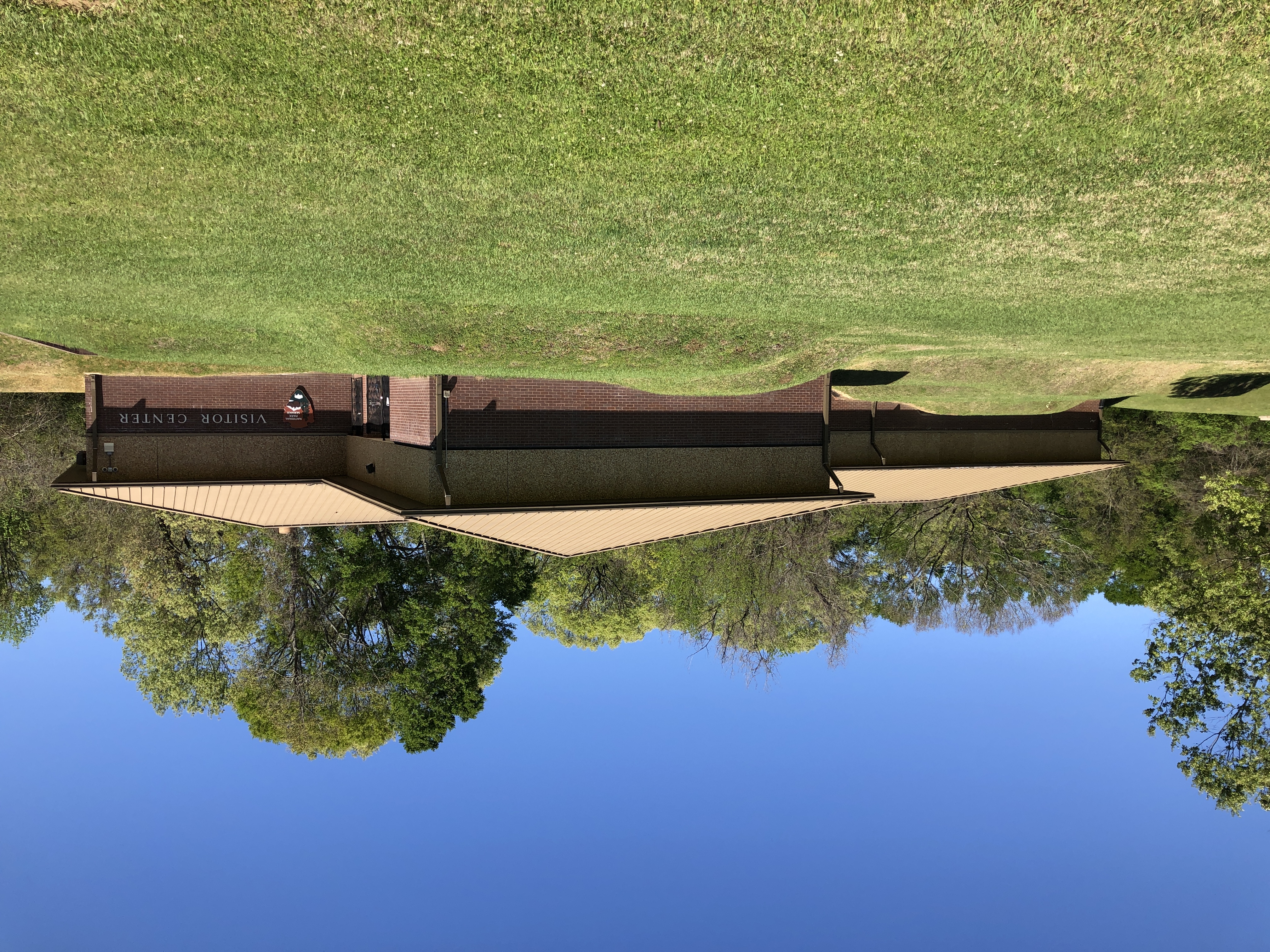
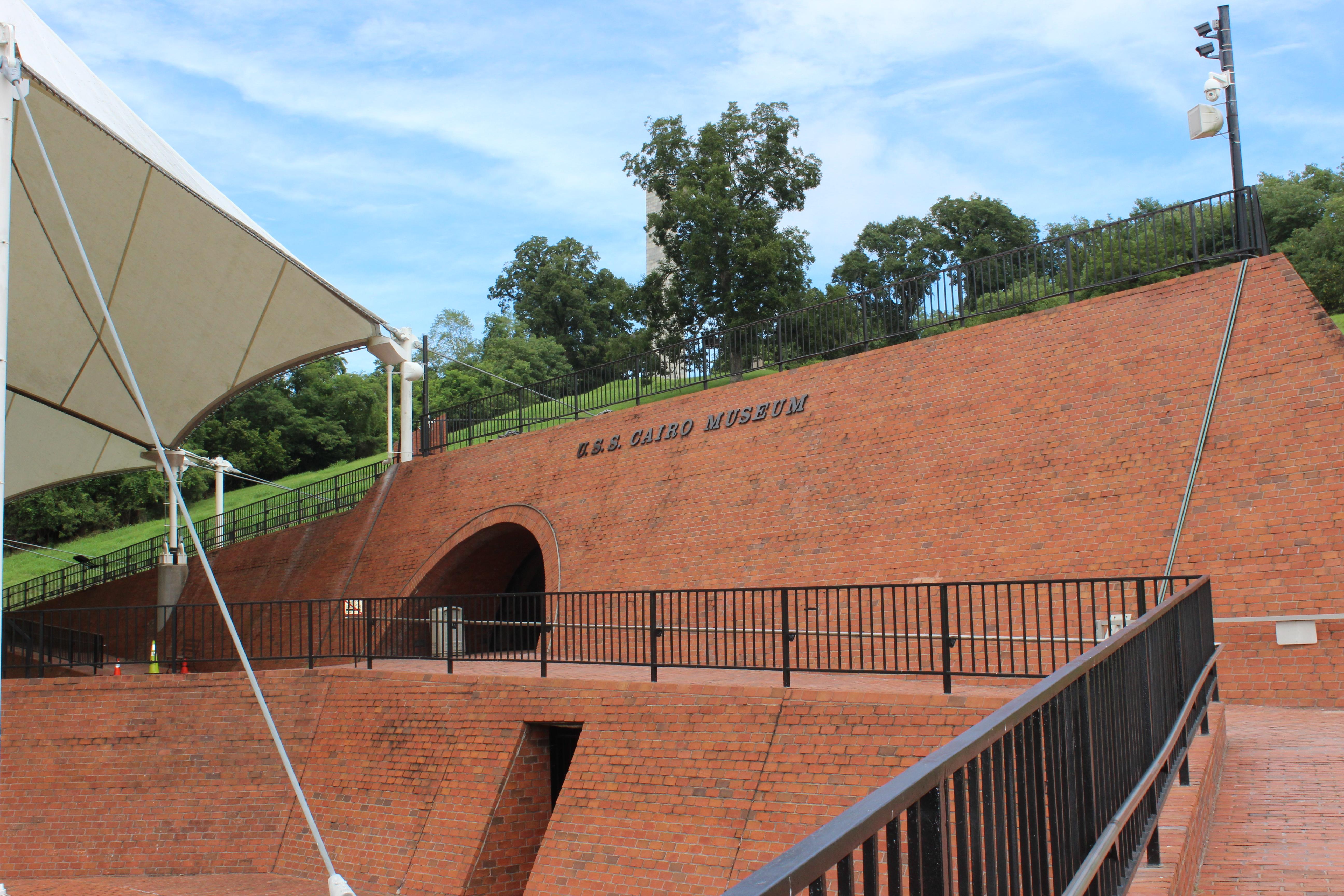
Adjustments to USS Cairo Museum and Visitor Center Days of Operation
Starting October 2, 2024, the USS Cairo Museum will be open 7 days a week and the Visitor Center will be open Wednesday-Sunday. The park grounds, fee booth, Visitor Center restrooms, and tour road will remain open seven days a week.
National Cemetery Closed to Vehicles; Open to Pedestrians
Due to weather related incidents, Vicksburg National Cemetery is closed to vehicular traffic, however it is open to pedestrians. Visitor can park in the adjacent USS Cairo parking lot and walk into the cemetery.
Louisiana Circle Closed
Louisiana Circle is closed to vehicles and pedestrians due to slope instability. Navy Circle is open and also provides views of the Mississippi River.
To Confederate President Jefferson Davis, Vicksburg was the "nailhead that holds the South's two halves together." President Abraham Lincoln remarked "Vicksburg is the key" to victory, and could be the north's lifeline into the south. As the fede...
This pass admits the driver and all passengers in a private, non-commercial vehicle to the park.
Entrance - Motorcycle
$15.00
Good for 7 days
You are purchasing a digital site pass that is valid only for weekly entrance fees at Vicksburg National Military Park. The park requires all visitors to pay an entrance fee except children under 16 years of age. The pass covers entry for one motorcycle and passenger.
Entrance - Per Person
$10.00
Good for 7 days
You are purchasing a digital site pass that is valid only for weekly entrance fees at Vicksburg National Military Park. The park requires all visitors to pay an entrance fee except children under 16 years of age. The pass covers entry for one pedestrian or cyclist.
There are 47 steps leading up to the temple floor, symbolizing the 47 days of the Siege of Vicksburg. The inscription on the exterior of the dome references President Abraham Lincoln’s second inaugural address, in which he stated, “With Malice Toward None, With Charity for All.” Followed by that are words from Grant’s 1868 speech at the Republican National Convention, “Let Us Have Peace.” Around the temple’s interior, 60 bronze tablets bear the names of the 36,325 soldiers from the State of Illinois who served in the Vicksburg Campaign.
Continue driving to the current road closure on Grant Avenue and park your vehicle. The Massachusetts Memorial is visible only by walking to Grant's Circle, the location of Ulysses S. Grant's field headquarters tents during the siege of Vicksburg.
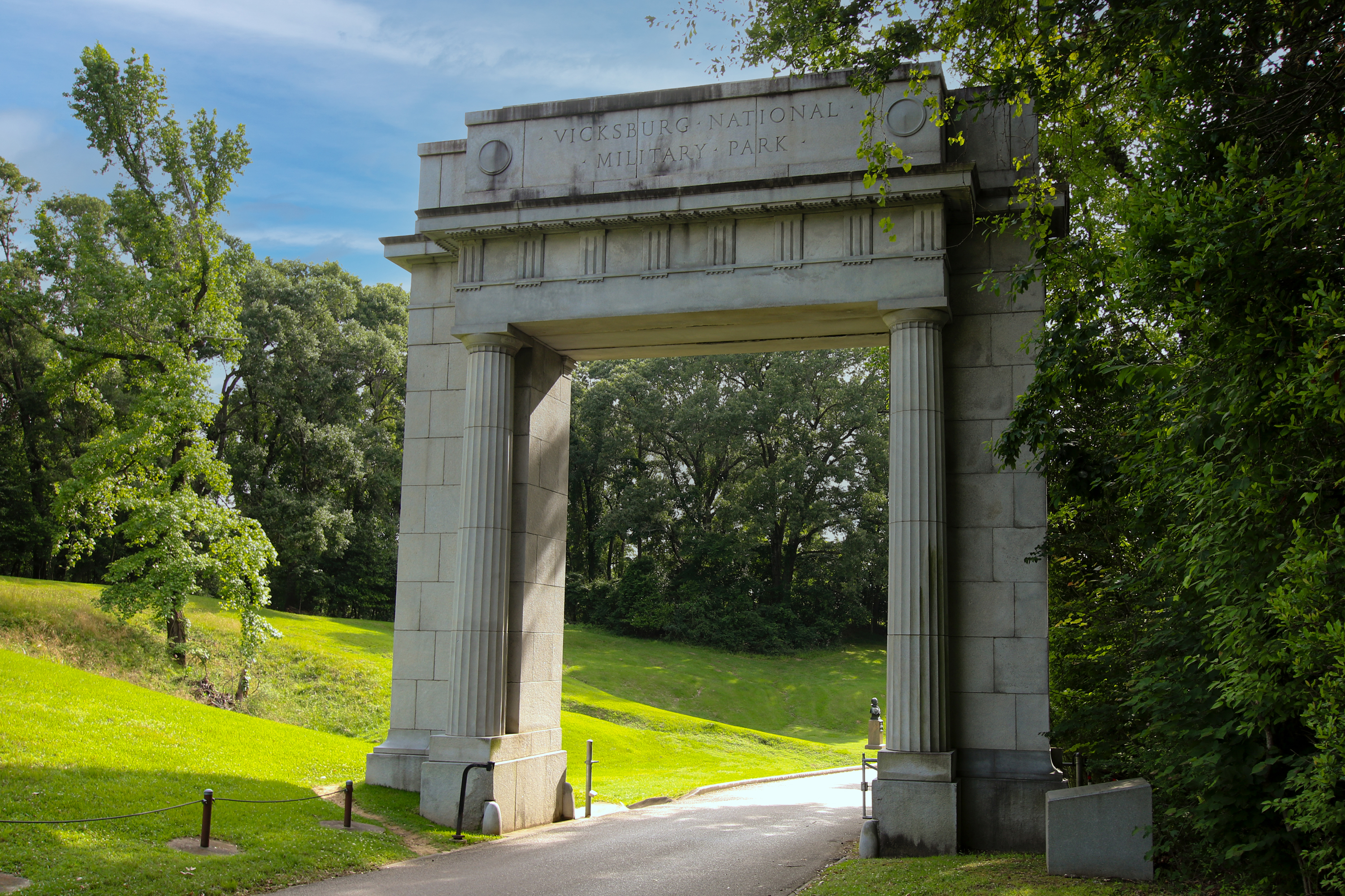
Memorial Arch Perhaps one of the grandest entrances into a National Park, the 1920 Memorial Arch welcomes visitors almost as a portal to the past. Built with funds leftover from the park’s 1917 Peace Jubilee – a reunion of both Union and Confederate veterans – granite monument is a symbol of reconciliation and reunification of the country and its people in the decades following the Civil War. Expressed within its design are architectural elements synonymous with the American Renaissance, providing an excellent orientation to many of the artworks we will discuss today. Exemplifying simplicity are the two Doric order columns. The simplest of the three orders, Doric columns are the only style column you will see within the park. Carved in the granite are structural details such as triglyphs and guttae. These carvings offer no actual structural support but are meant to be indicative of actual architectural elements, rather than just for design purposes. Designed by Charles L. Lawhon, the Memorial Arch used to stand over Clay Street, the main thoroughfare at your right, until 1967 when expansion of that roadway required its relocation to its current site.
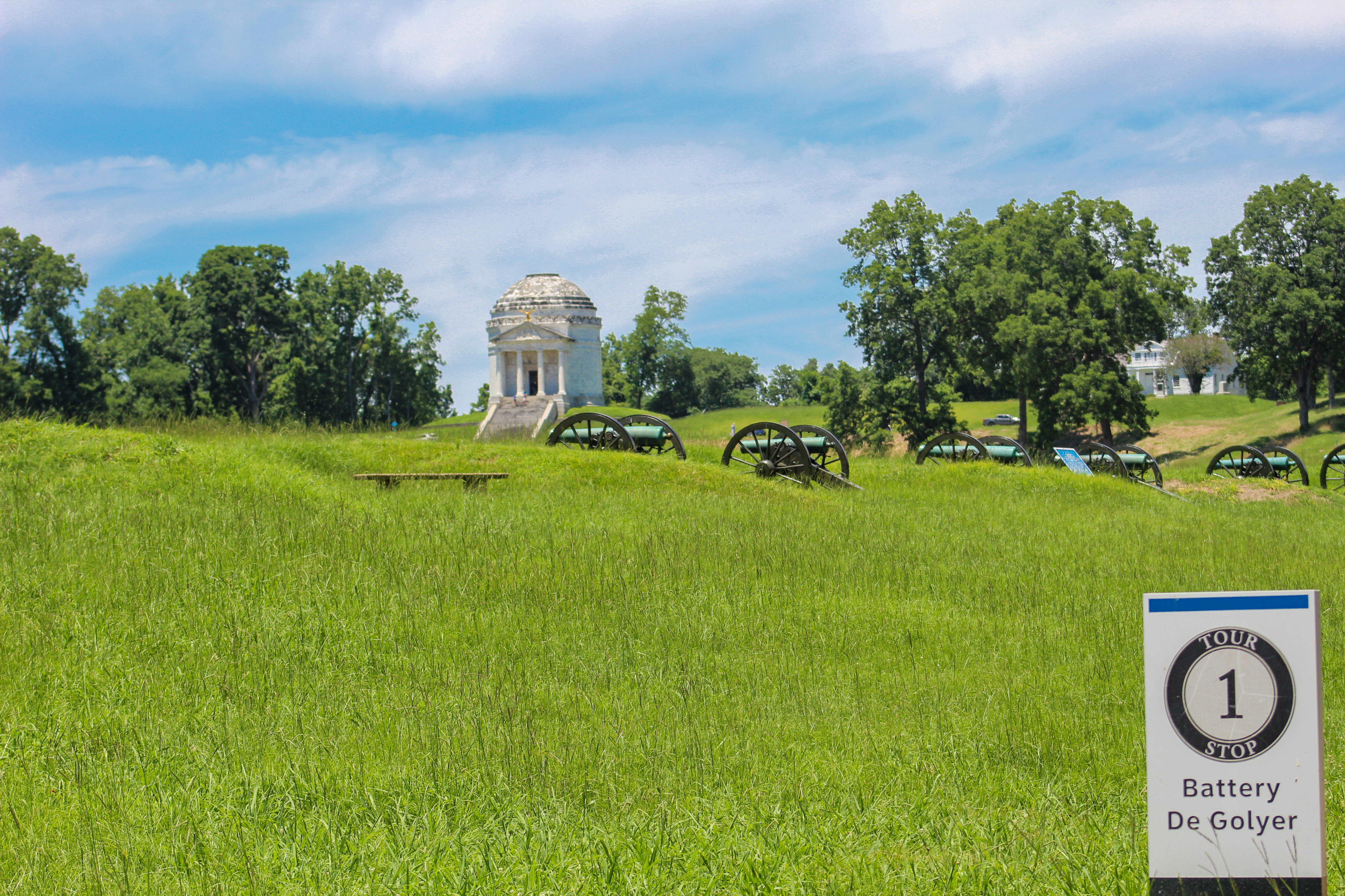
12 aged Civil War era cannons stand along a narrow ridge facing west towards the Confederate's fortifications. Each cannon sits in its own earthen enclosure with the rear open to view the gun. To the left of the cannons is a tall, white granite monument placed by the State of Michigan in honor of men who fought and died during the campaign and siege of Vicksburg.
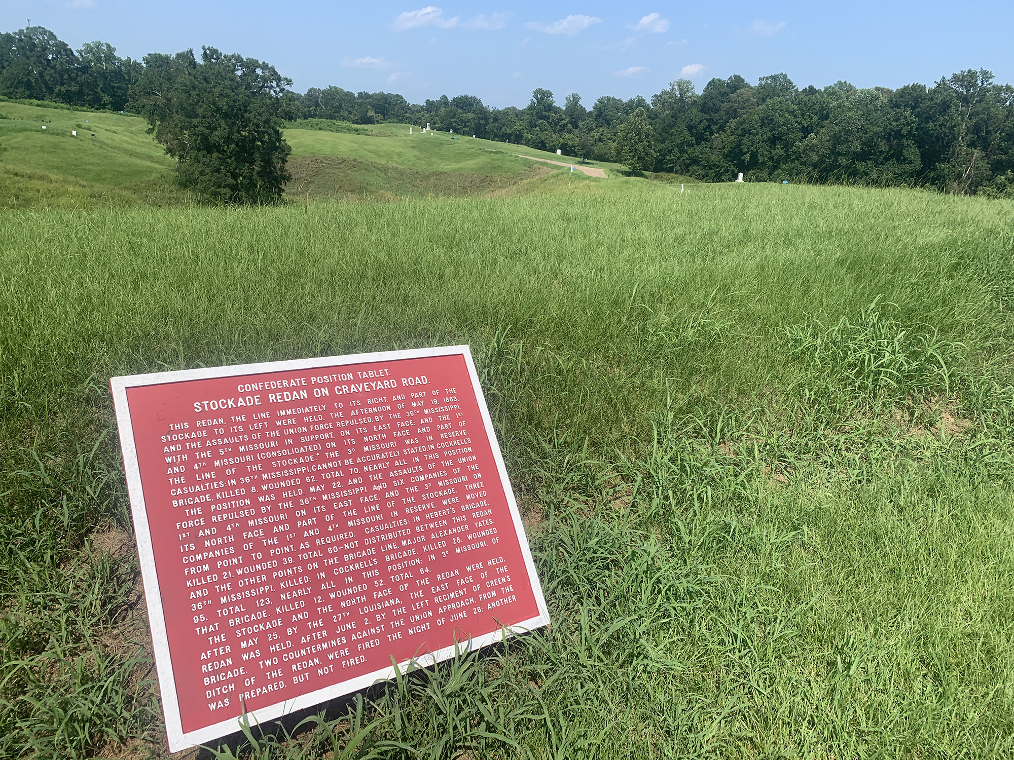
A tall triangular fortification sitting along the south side of the Graveyard Road. A shallow trench with monuments and markers in and around it. On the north side of the Graveyard Road the terrain drops down in a deep ravine.
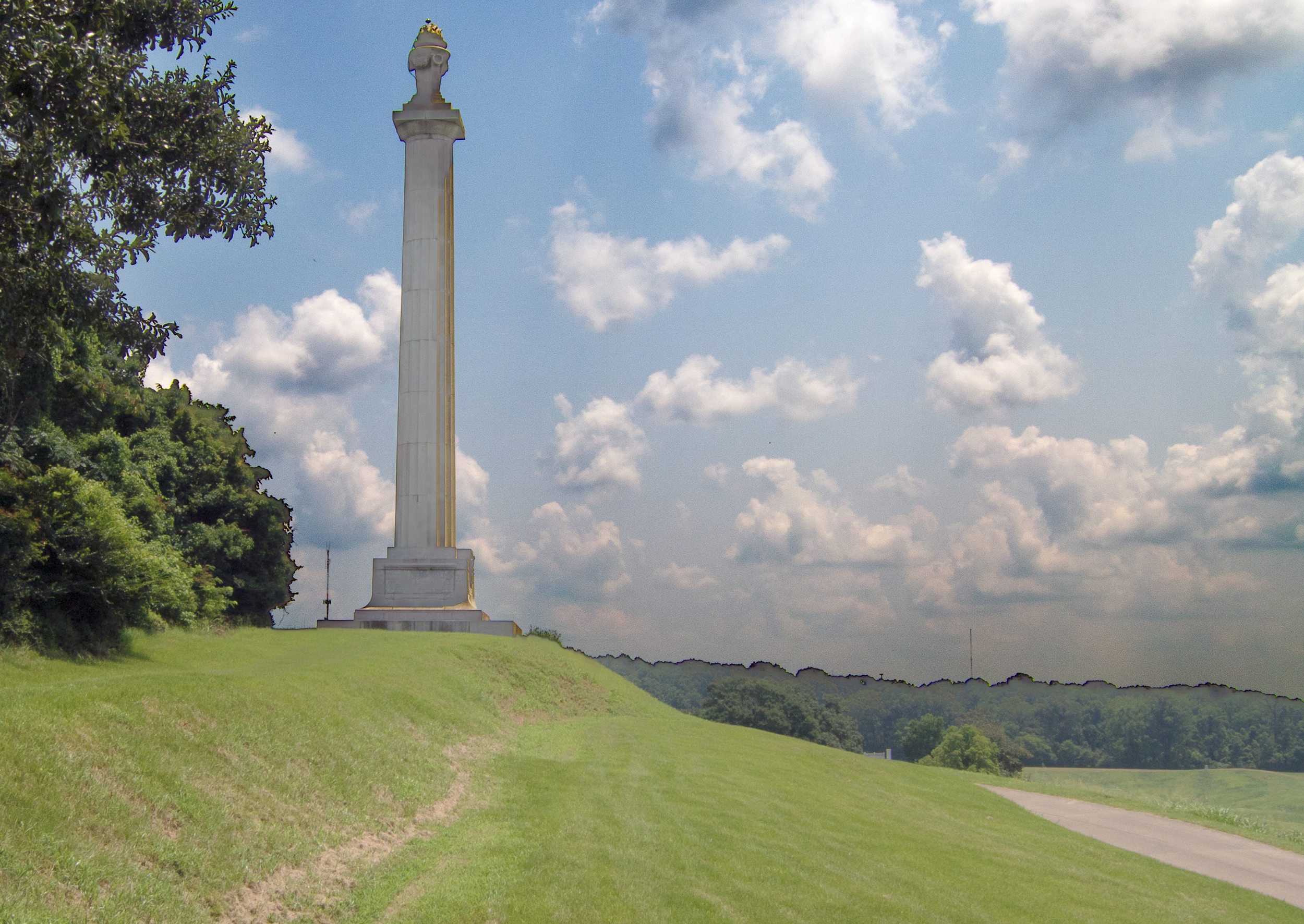
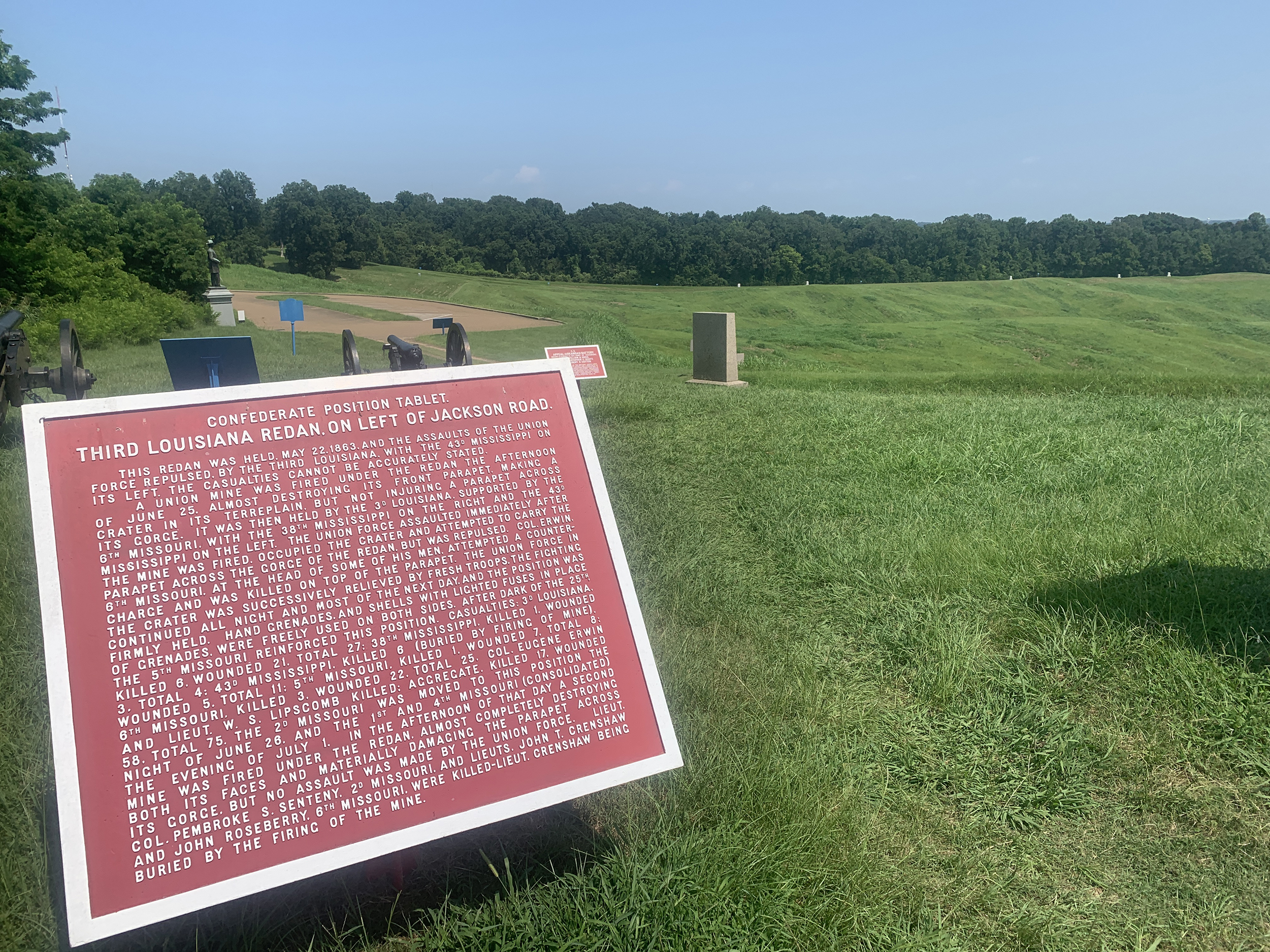
A tall, rectangular ridge with blue and red markers describing the battle's events on both sides of the hill. Civil War era cannon stand on top of the ridge with a bamboo forest on the right side and a tall column monument on left where the ridge slops downward.
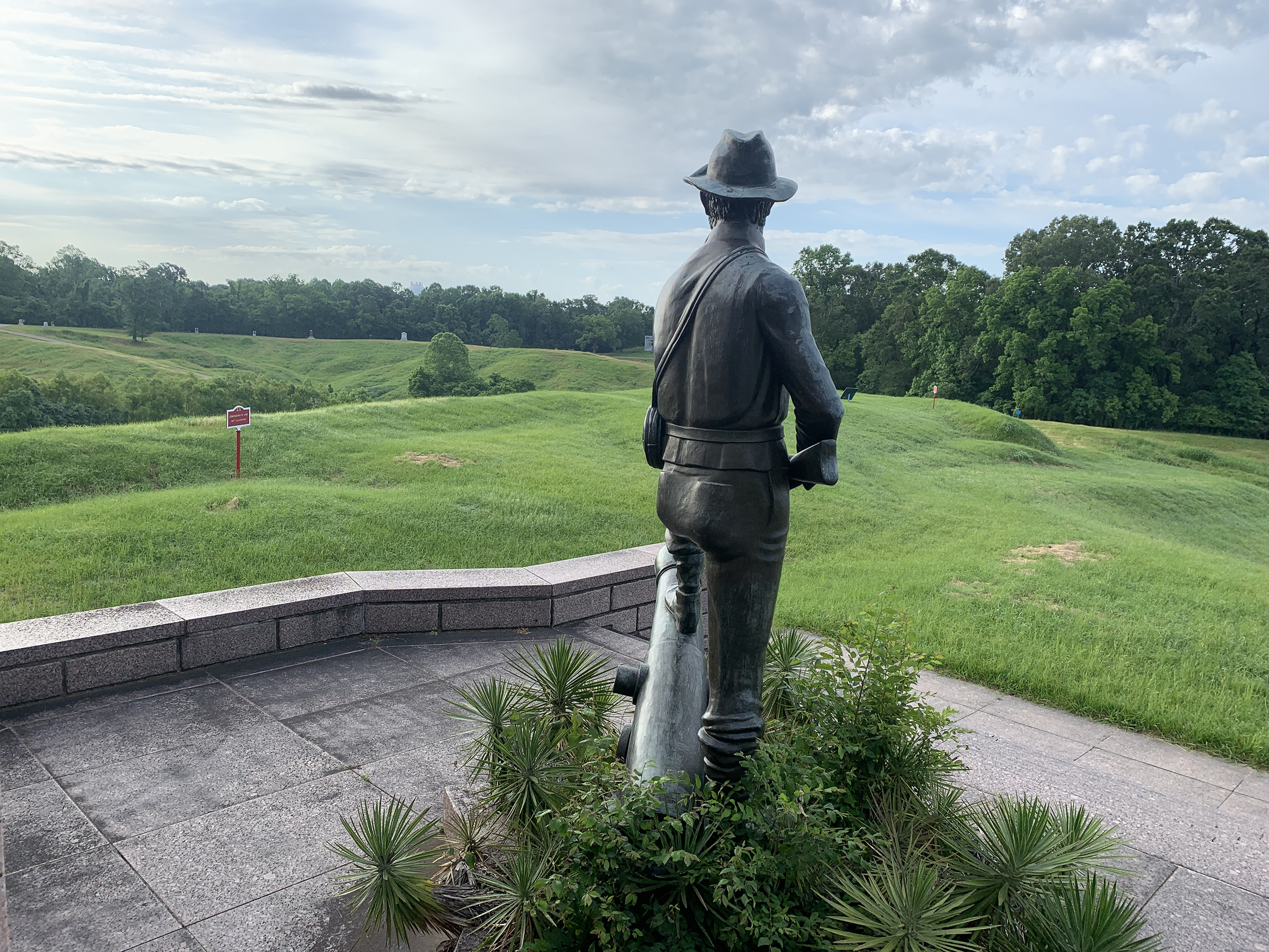
A parking lot with oak trees leads visitors to their left side towards a standing statue of Confederate President Jefferson Davis. To the statue's left is a magnolia tree and beyond that two Civil War era cannons looking down an S-turn in the park tour road.
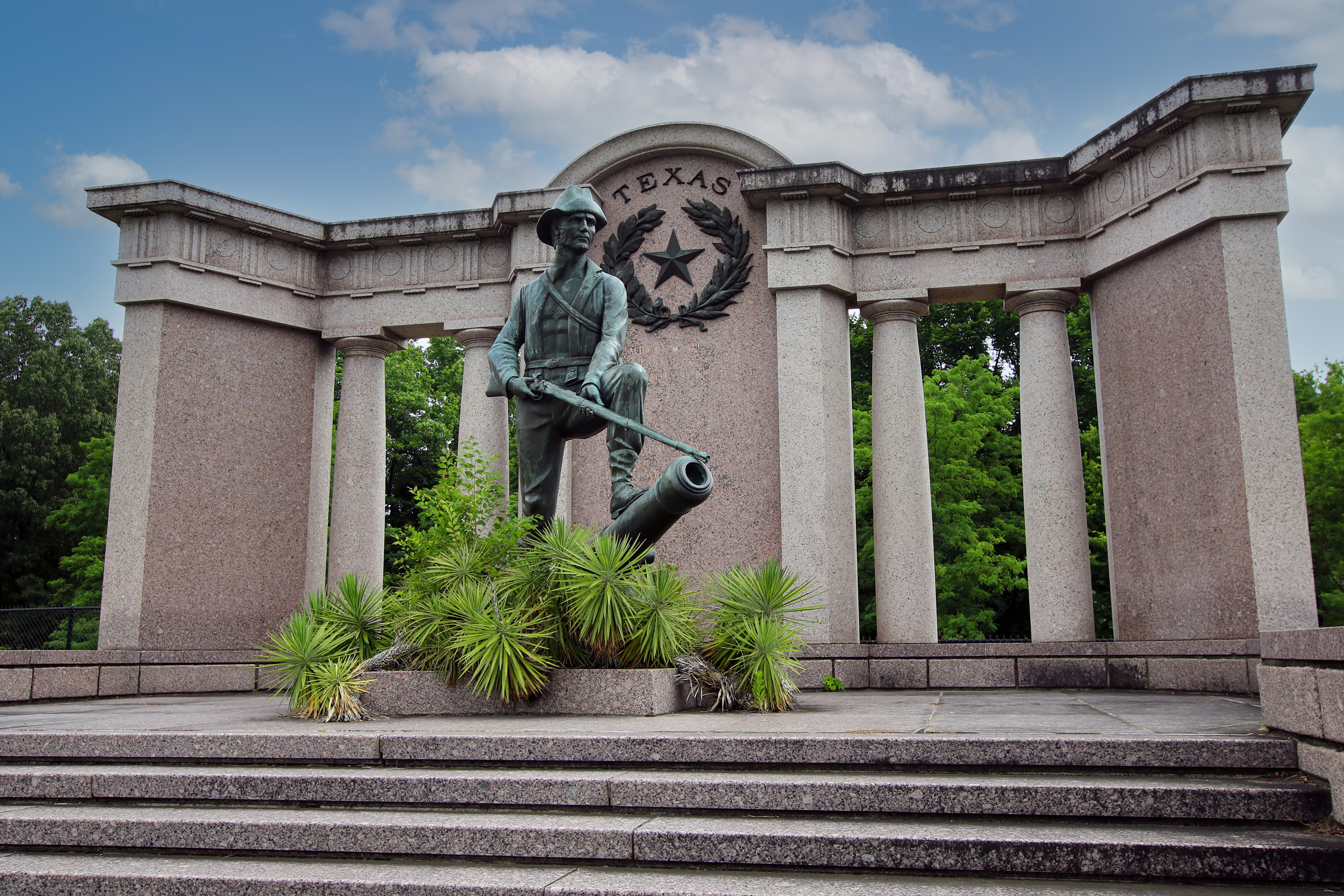
A parking lot with a walkway leading up to the Texas Monument. On the right of the monument is the forward trenches of the Railroad Redoubt with red markers noting the different positions of Confederate forces during the siege of Vicksburg. A Civil War era cannon is in position inside the fort.
A parking lot leads to a rear grassy entrance into a tall earthen fort. Recreated zigzagging trenches in front of the fort demonstrates how the Union army approached the Confederate forts.
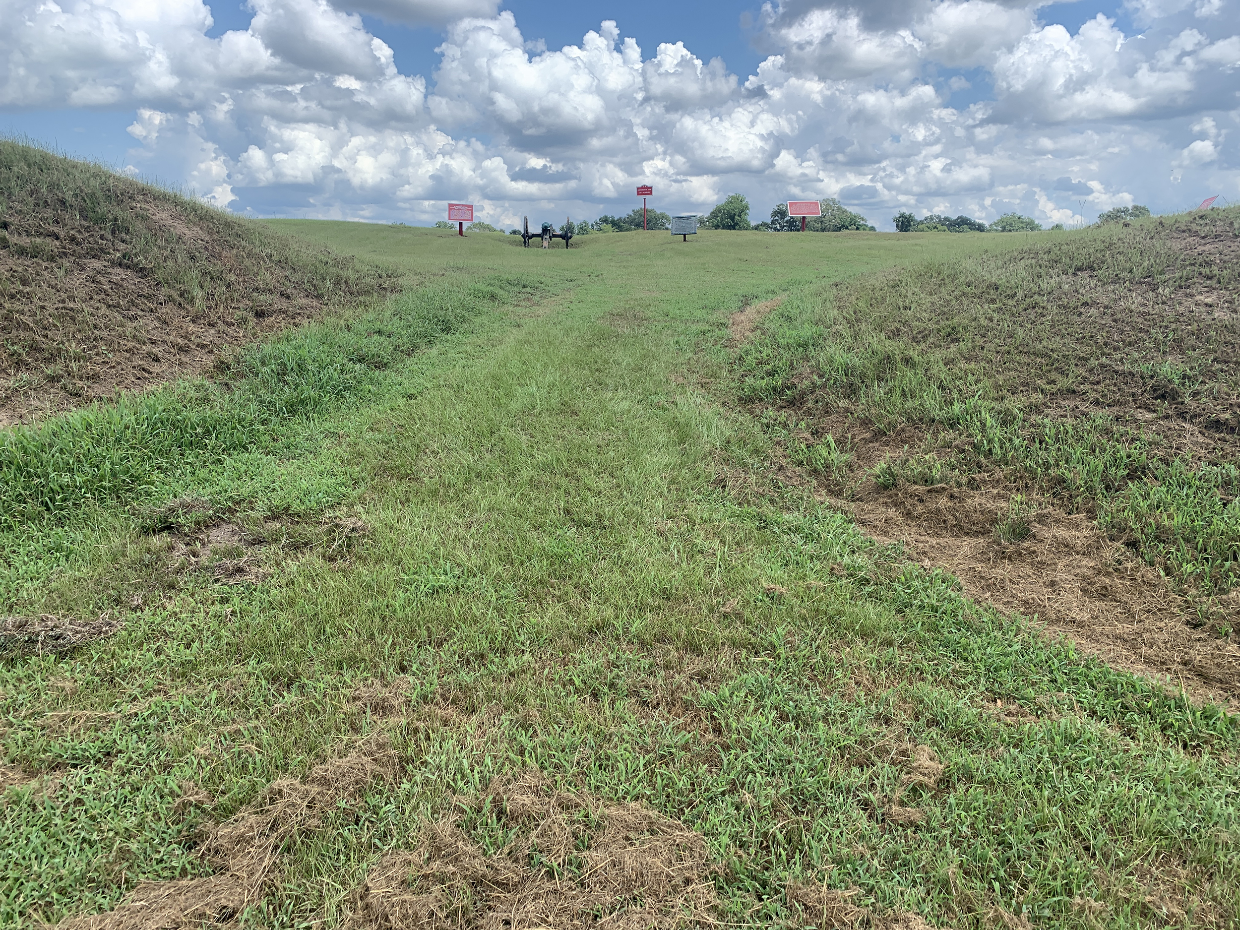
A parking lot allows visitors to pull into and overlook the ravine between the Union and Confederate positions. The ground slopes downward into a small watershed and stream run north to south at the bottom of the ravine. The ground then gently rises up to the Confederate lines and a square earthen fortification called "Fort Garrott" which was at Tour Stop #14.
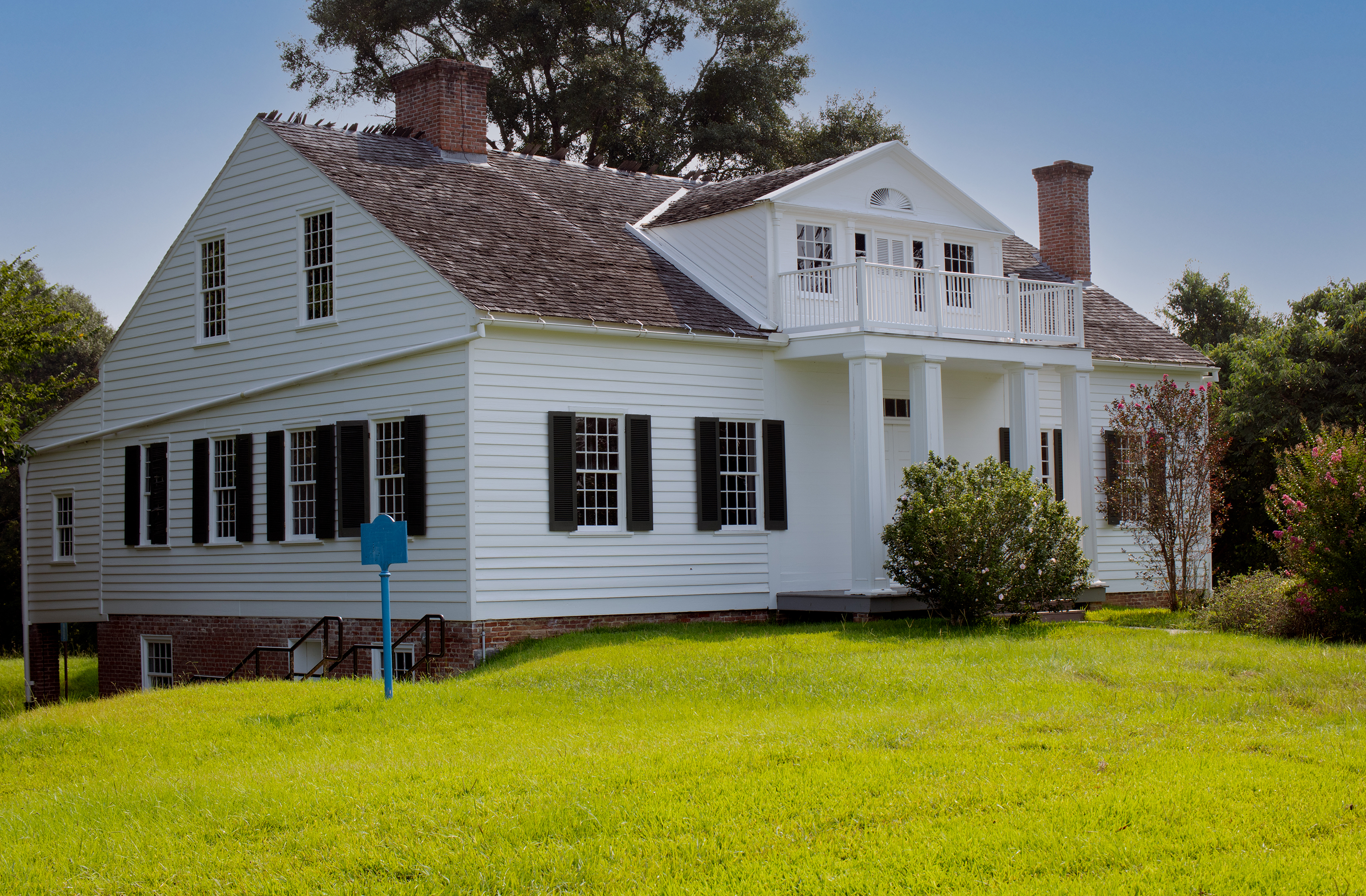
A white house with black shutters and cedar shake roof on a hill. A long staircase leads visitors up to the front of the white house with informational wayside exhibit and audio description QR code.
A tall hill cut in half by a dirt road bed with monuments and artillery pieces placed on top. Red signage denotes Confederate unit locations while blue signs mark Union unit and siege operation locations. Bas relief portraits and statues of prominent officers are also located here.
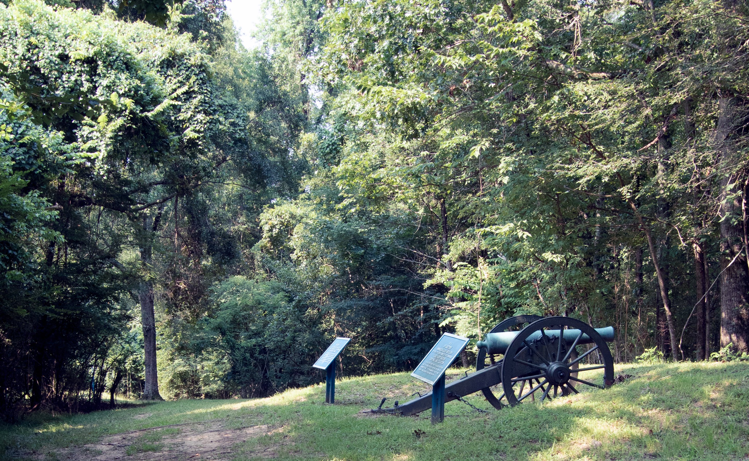
A long ridge with thin grass with shady canopy from the trees is where Civil War cannons and signage are standing. Nearby are monuments placed by the State of Wisconsin.
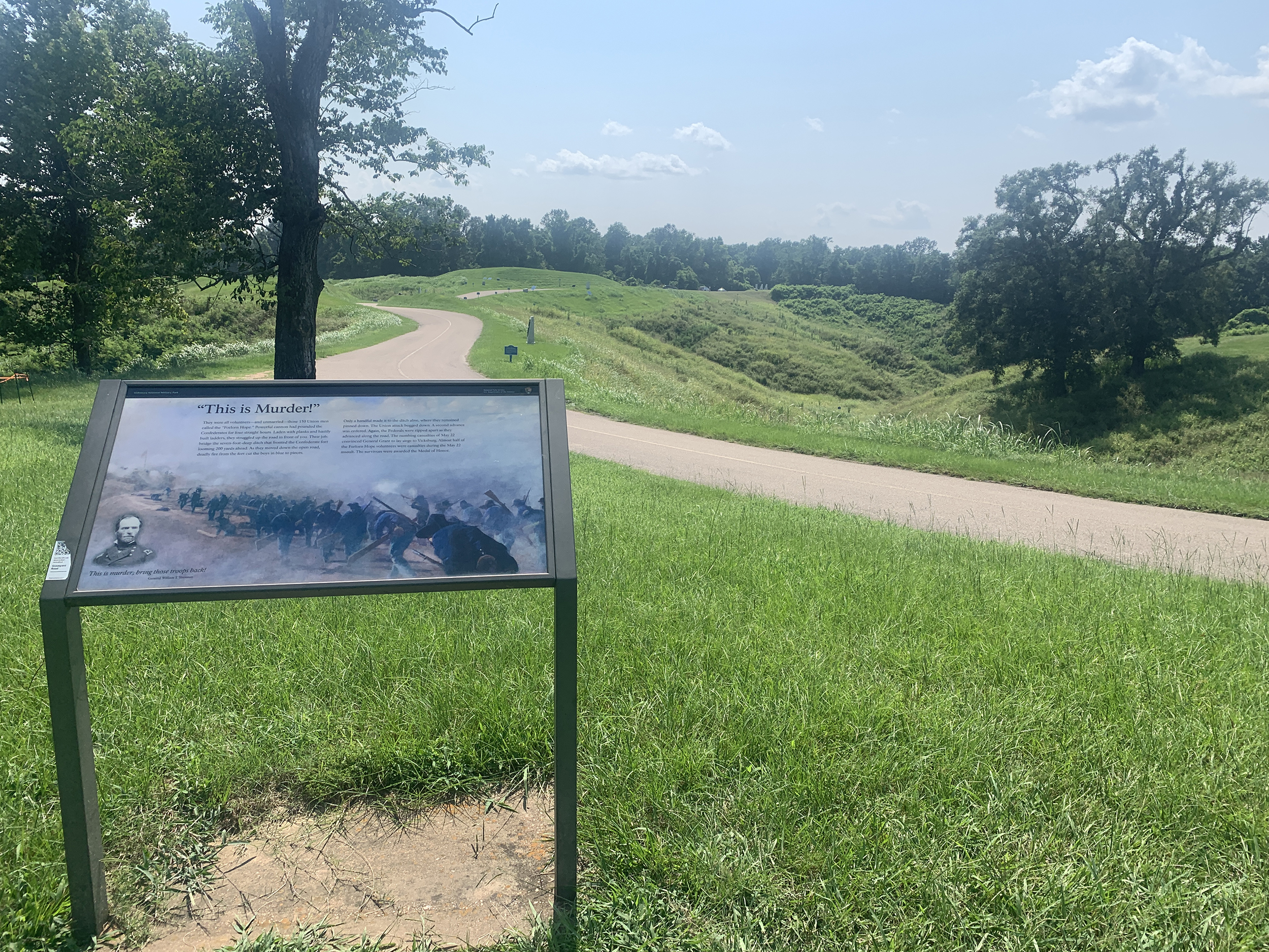
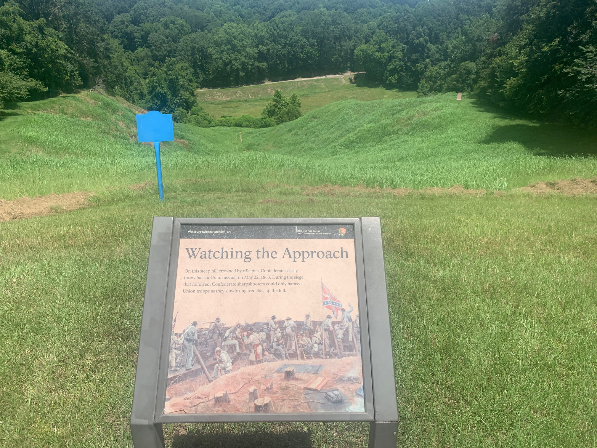
A high hill with an interpretive standing exhibit describing the attacks on the Stockade Redan stands on the south side of the Graveyard Road. The road meanders heading west from the Union starting position where you are located to the Stockade Redan on the Confederate lines. The first half of the southside of the road is heavily wooded while the northern right side of the road drops in elevation significantly with very broken ravines. Closer to the Confederate lines and Stockade Redan, the ground elevates back upward to the road itself.
A high hill along Confederate Avenue that abruptly falls sloping towards the Union position. At the bottom of the hill is a tunnel which the Union army dug as they engineered their approach up the hill towards the Confederate defenses.
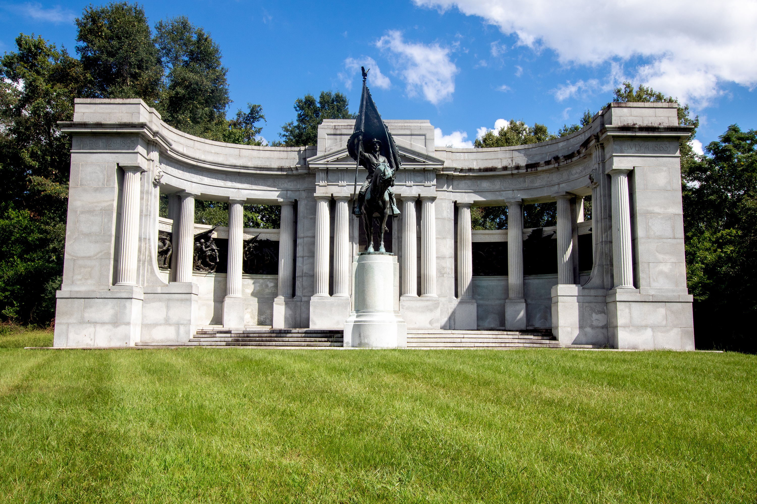
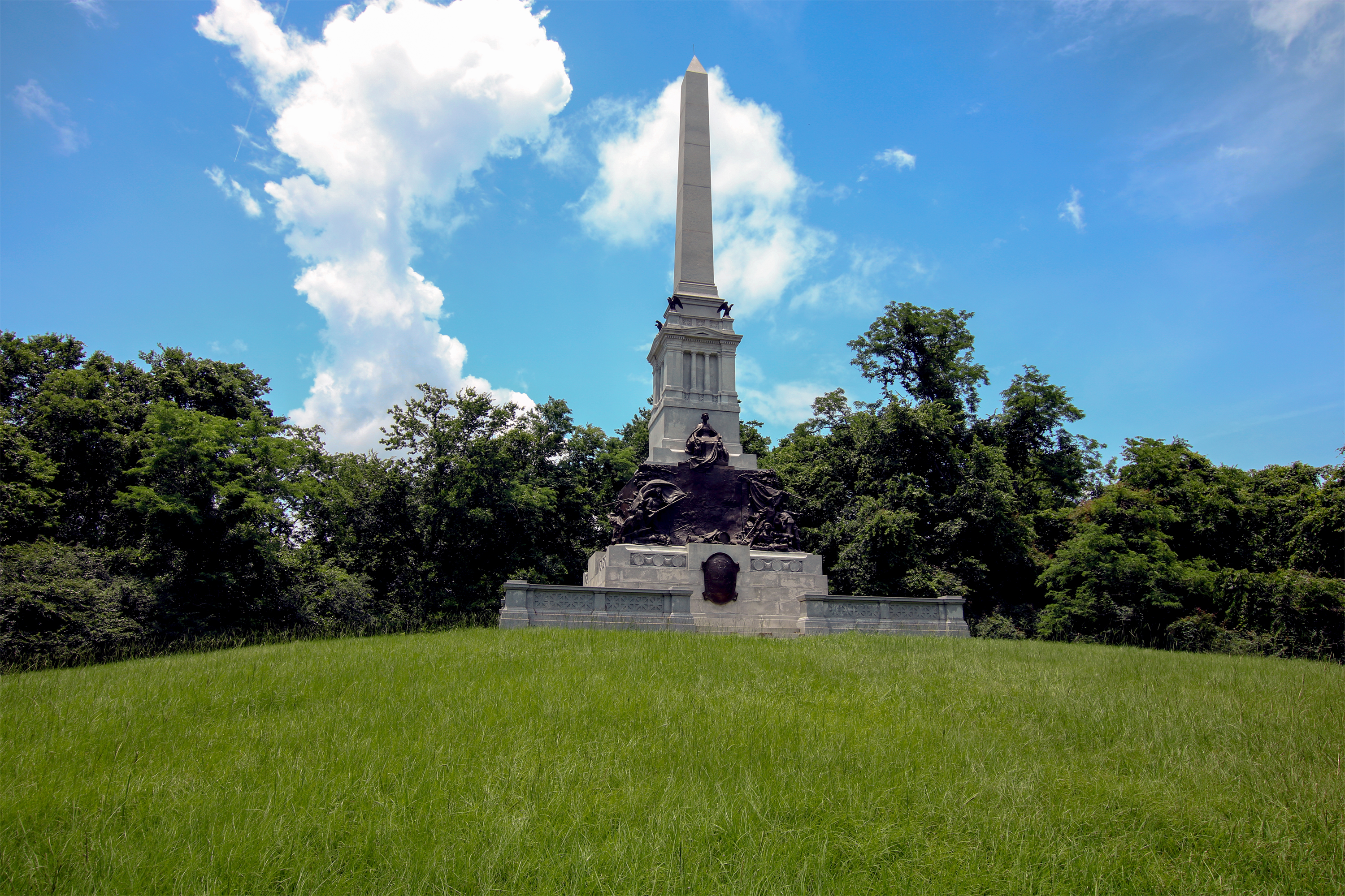
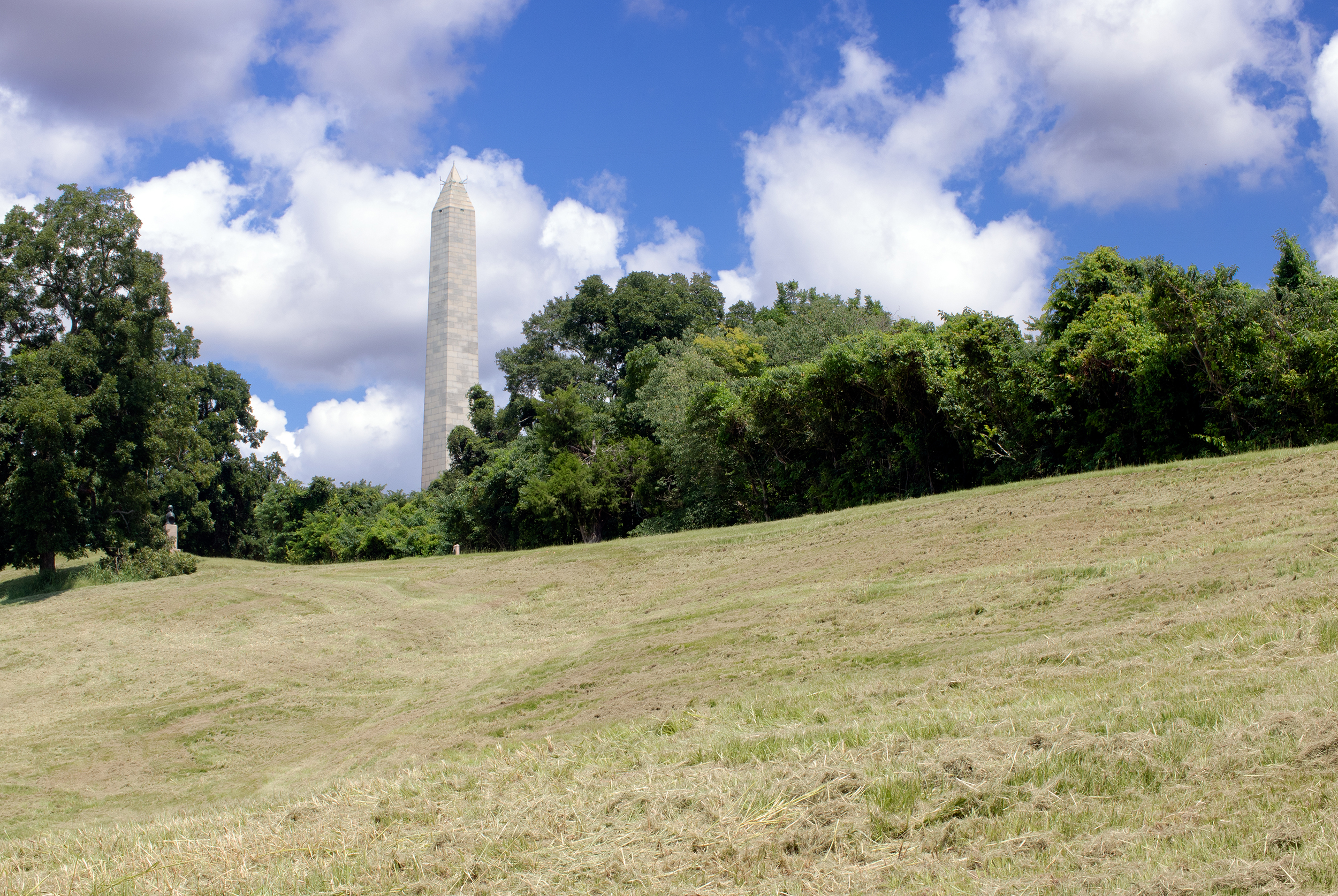
A small parking lot on the right hand side of Union Avenue allows visitors to stop and cross the park tour road to see the 202-feet tall obelisk monument. The obelisk has four tall bronze statues on pedestals for the four Union naval commanders involved in the Vicksburg campaign. Behind the monument are trees with smaller granite regimental monuments, Civil War-era cannons, and blue markers indicating troop positions.
An black painted, golden trimmed gate leads visitors onto a one-mile circular road and around 116 acres of manicured grounds containing military headstones for over 17,000 Union veterans of campaign, siege, and occupation of Vicksburg, Mississippi. The land is staggered with the graves on the plateaus.
A tall grassy berm with stairway lead up to the top. A wide view shows broken terrain leading down to a busy north-south business road leading away from the downtown part of Vicksburg. Beyond the road lies the diversionary canal flowing along the road. From the west side, you can see the low lands of Louisiana. A lumber yard and saw mill can be seen and heard to the northwest of Vicksburg from the hill.
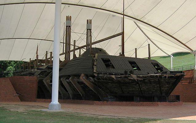
The USS Cairo was the first of seven "city class" ironclads commissioned by the United States War Department in January 1862 after it became clear that the age of wooden warships was coming to a close. It is one of only three Civil War-era gunboats that still exist.
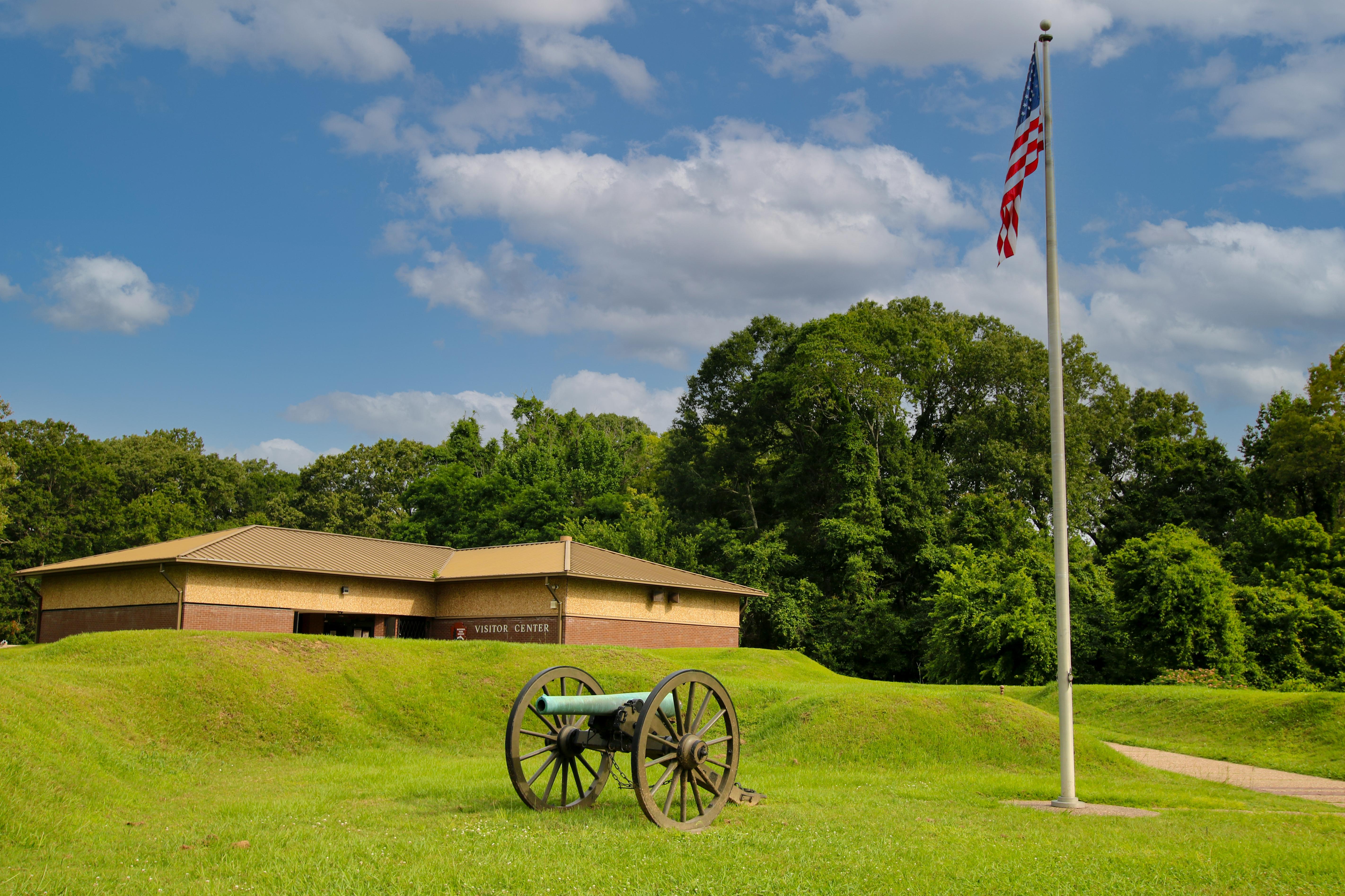
Visitor Center and museum to the USS Cairo. Exhibits include a film, artifacts from the USS Cairo, models, and the actual USS Cairo that visitors can walk on.
Inside the Visitor Center, Park Rangers are ready to answer your questions and assist with your orientation to park areas. To help ensure that their visit is safe and enjoyable, large groups or tours should check in with the ranger at the desk when they arrive. Interpretive media including exhibits and park film are located inside the Visitor Center.
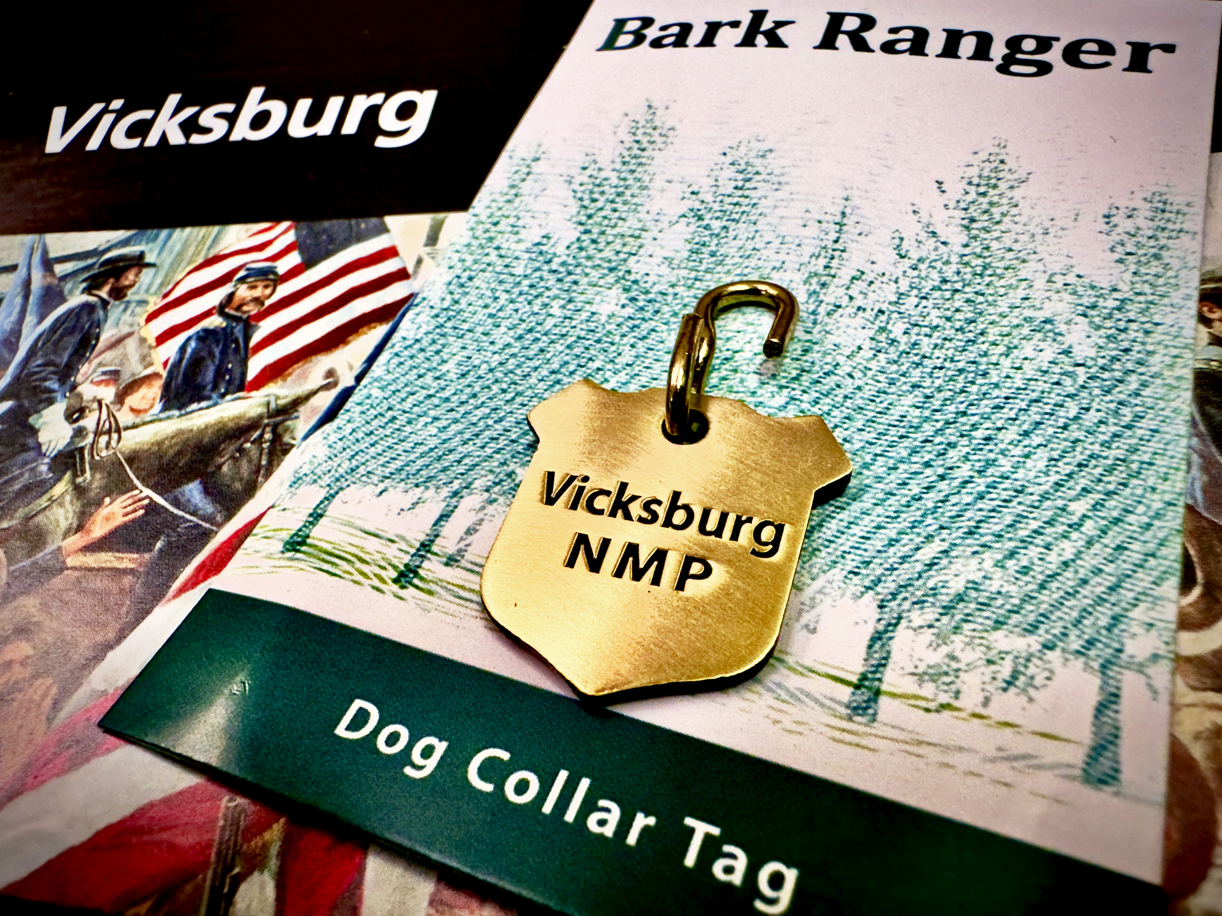
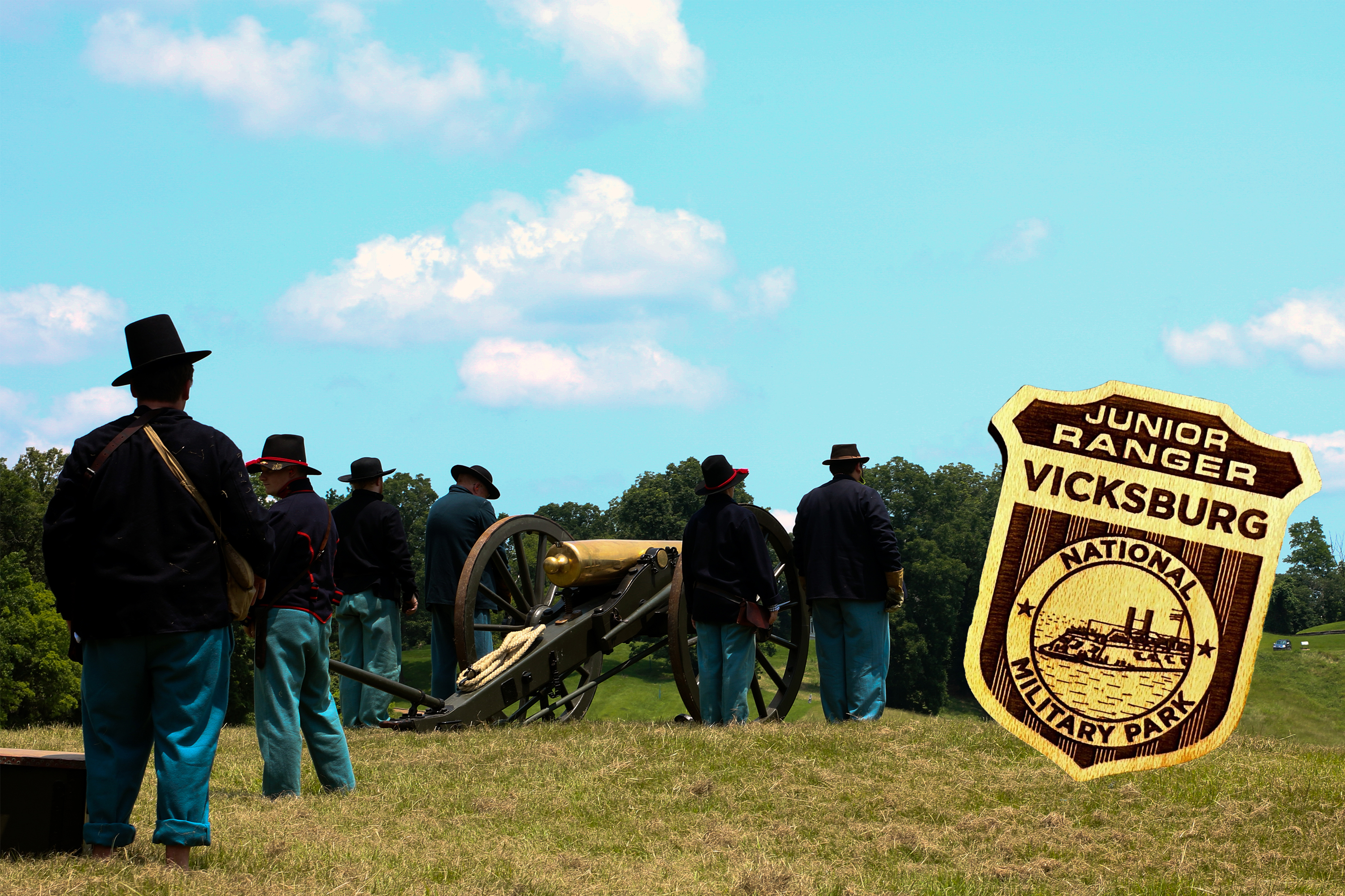
Become a Junior Ranger at Vicksburg National Military Park
This program is designed for children making a visit to Vicksburg National Military Park. Children can explore the park and learn about Vicksburg through activities of varying difficulty. The Junior Ranger Program is available upon request at the Visitor Center.
Watch Vicksburg National Military Park's Orientation Film
This orientation film plays every half hour at the park's visitor center.
Tours
Count: 2
Art In The Park Self-Guided Tour
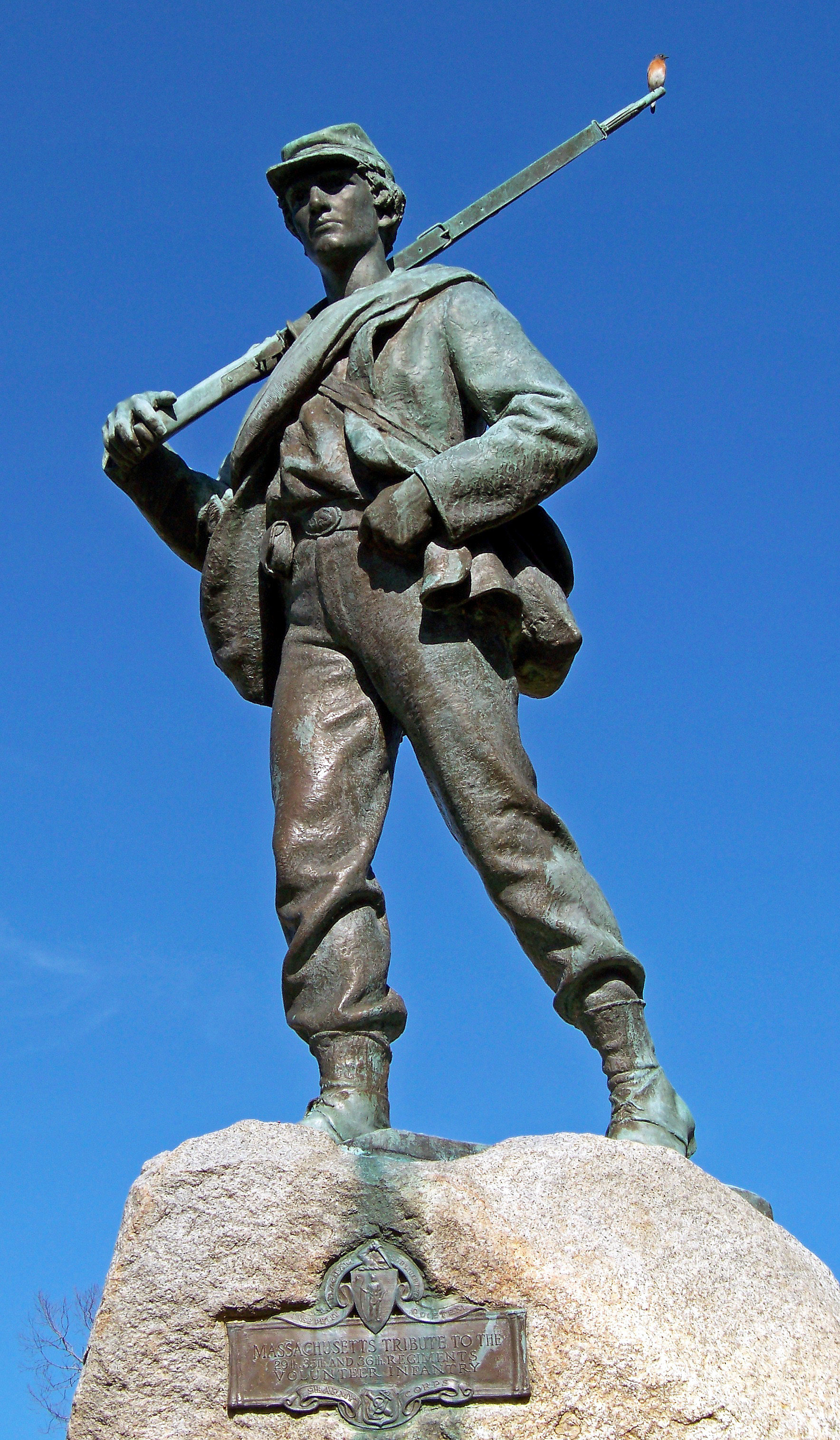
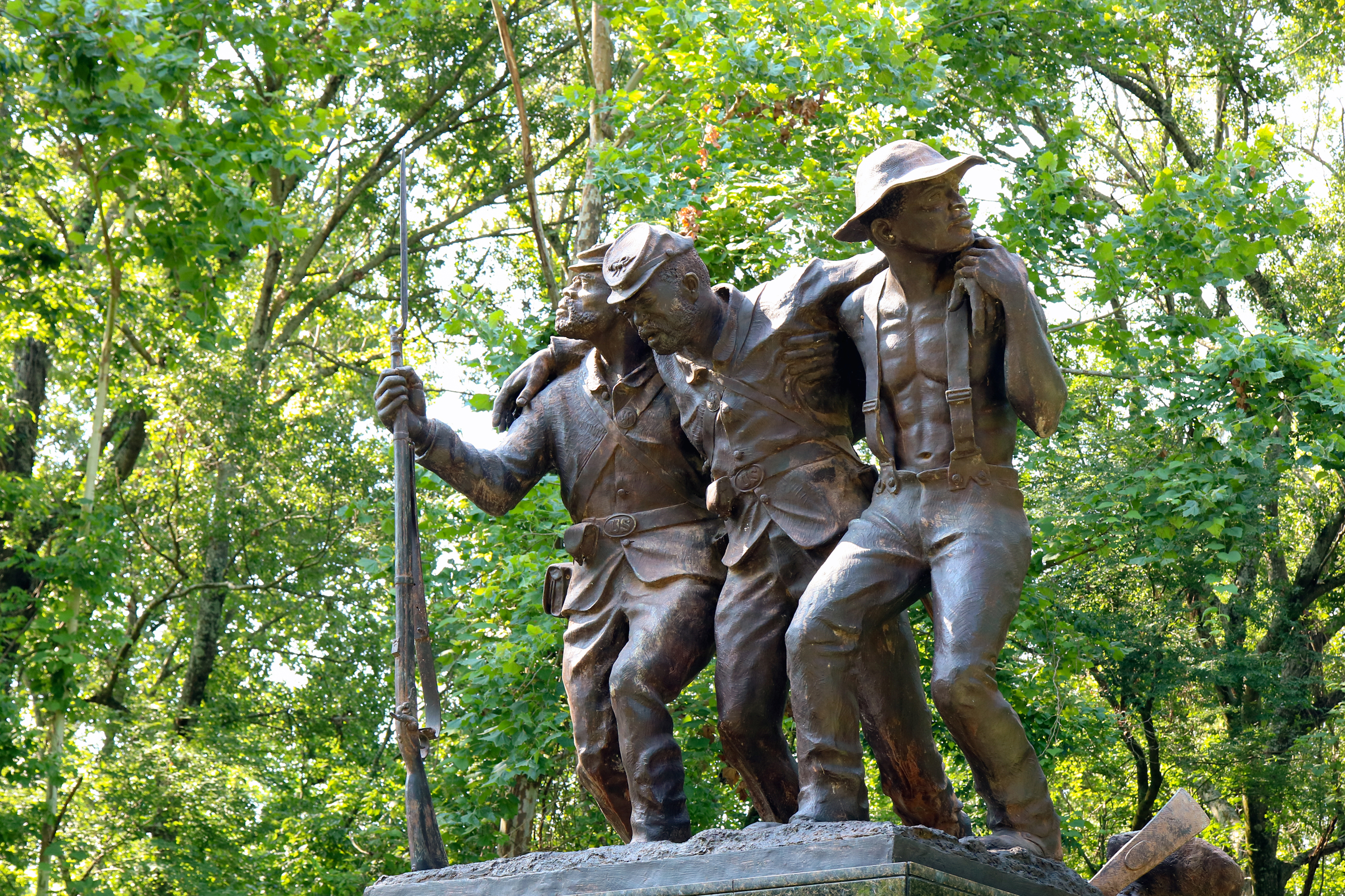
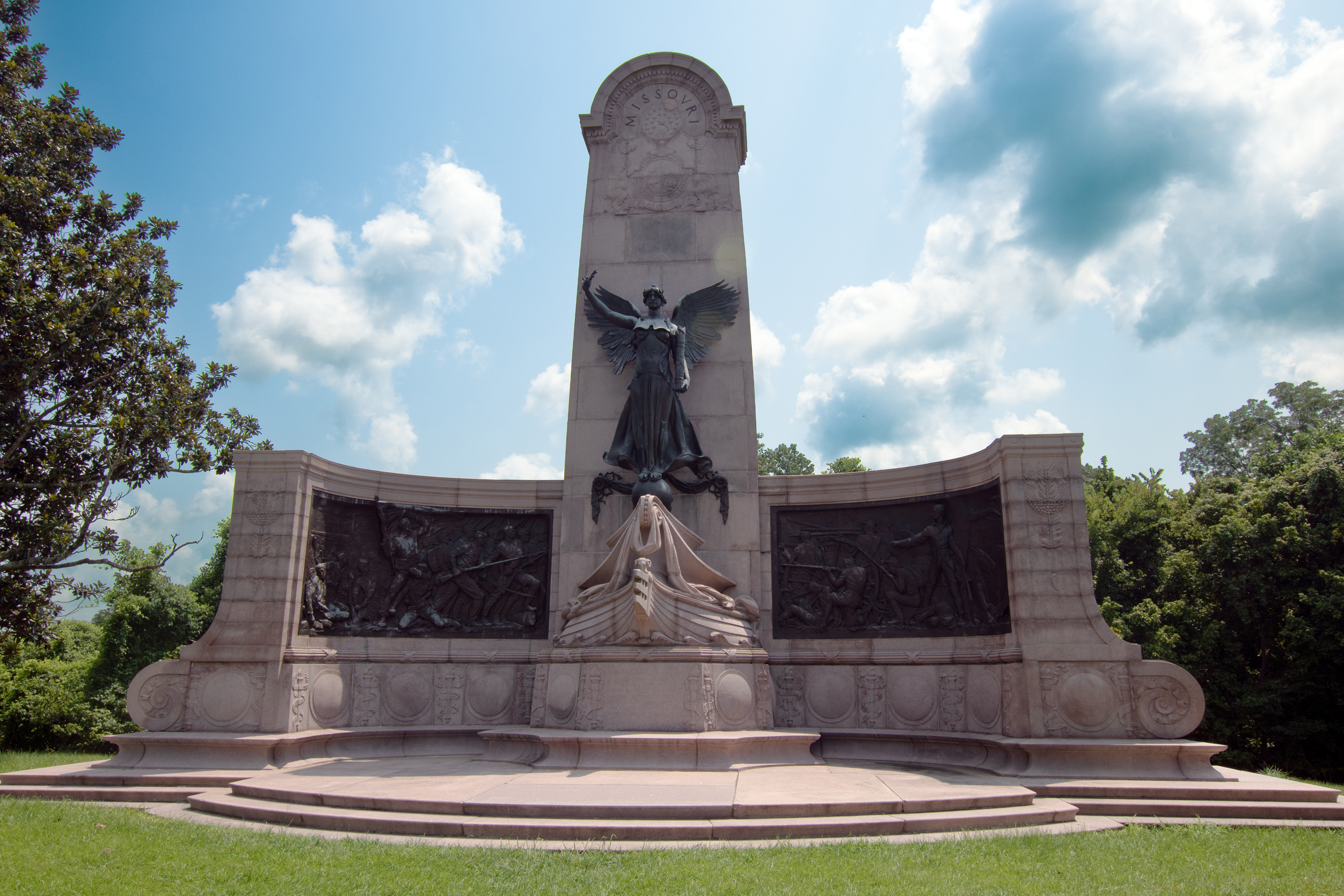
Soon after Vicksburg National Military Park was established in 1899, the nation's leading architects and sculptors were commissioned to honor the soldiers and sailors that fought throughout the Vicksburg campaign. Beginning in 1903, the work of commemoration has continued and today more than 1,400 monuments, tablets, and markers dot the landscape offering mute testimony to the courage and sacrifice of blue and gray alike.
Self-Guided Park Tour
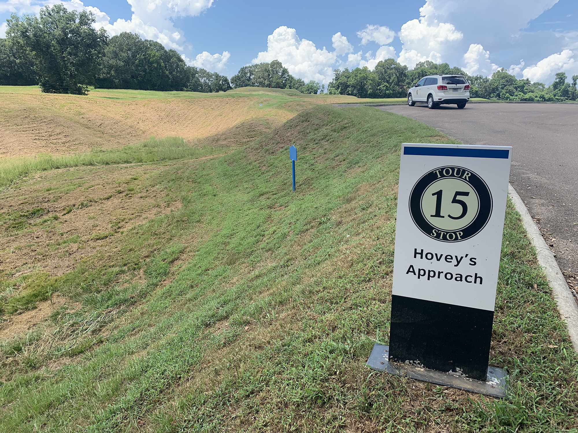
We suggest you begin the 16-mile tour at the visitor center, where the new interactive campaign map, exhibits, and a 20-minute film explain the campaign and siege of Vicksburg. The numbered stops on this tour are keyed to the map on the back of the park brochure. During the tour, visitors will notice either red or blue metal markers placed by the War Department as the first interpretation of the park. Blue markers pertain to Union lines or emplacements. Red markers pertain to Confederate forces.