“Of the happiness I have enjoyed in our private friendship. The remembrance of which will be one of the most pleasing Circumstances of my life.”– Comte de Rochambeau on his relationship with George Washington
Hike through history on the Crossing Trail in Prince William Forest Park! Follow one of the old roads used by Native Americans and early settlers as well as Revolutionary War troops lead by George Washington and the Comte de Rochambeau as they crossed through this area on their way to Yorktown.
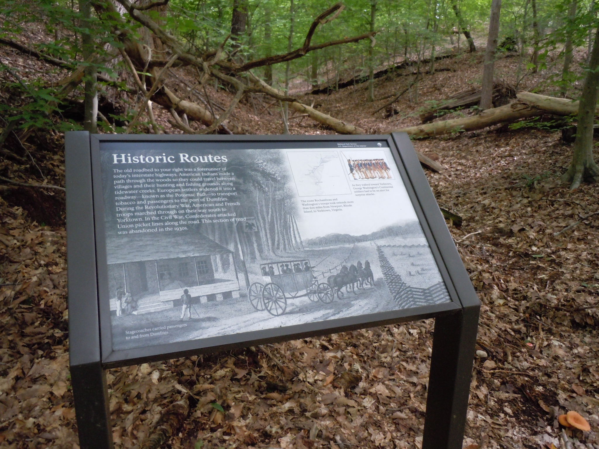
At a bend in the trail is a shaded sign in the forest which is located on an old road that looks like a straight shallow valley between two hills on either side. The sign has a black bar at the top with the words "National Park Service, U.S. Department of the Interior" and an NPS arrowhead symbol on the black bar in the upper right corner. Most of the sign consists of a large black and white print image underlying all the sign text of a house with a porch and sign out front beside a dirt road on which a 4 horse drawn stagecoach is traveling between fences on the edges of the road. A caption of this large background image reads, "Stagecoaches carried passengers to and from Dumfries." The sign itself is titled "Historic Routes" and a paragraph in the upper left under the title reads, "The old roadbed to your right was a forerunner of today's interstate highways. American Indians made a path through the woods so they could travel between villages and their hunting and fishing grounds along tidewater creeks. European settlers widened it into a roadway - known as the Potomac Path - to transport tobacco and passengers to the port of Dumfries. During the Revolutionary War, American and French troops marched through on their way south to Yorktown. In the Civil War, Confederates attacked Union picket lines along the road. This section of road was abandoned in the 1930s." To the right of that paragraph on the sign in the upper center is a square sparsely detailed map of the Washington-Rochambeau Trail route from Virginia to Rhode Island with NPS sites along the route highlighted. The map is captioned, "The route Rochambeau and Washington's troops took extends more than 600 miles from Newport, Rhode Island, to Yorktown, Virginia." To the right of the map image on the sign in the upper right corner is another small image of 13 Revolutionary War soldiers standing in a line wearing tricornered hats, blue jackets, and white pants. A caption of this image reads, "As they walked toward Yorktown, George Washington's Continental soldiers had to be on alert for surprise attacks."
The Crossing Trail is a .5-mile loop trail with the option of connecting to the Birch Bluff Trail.
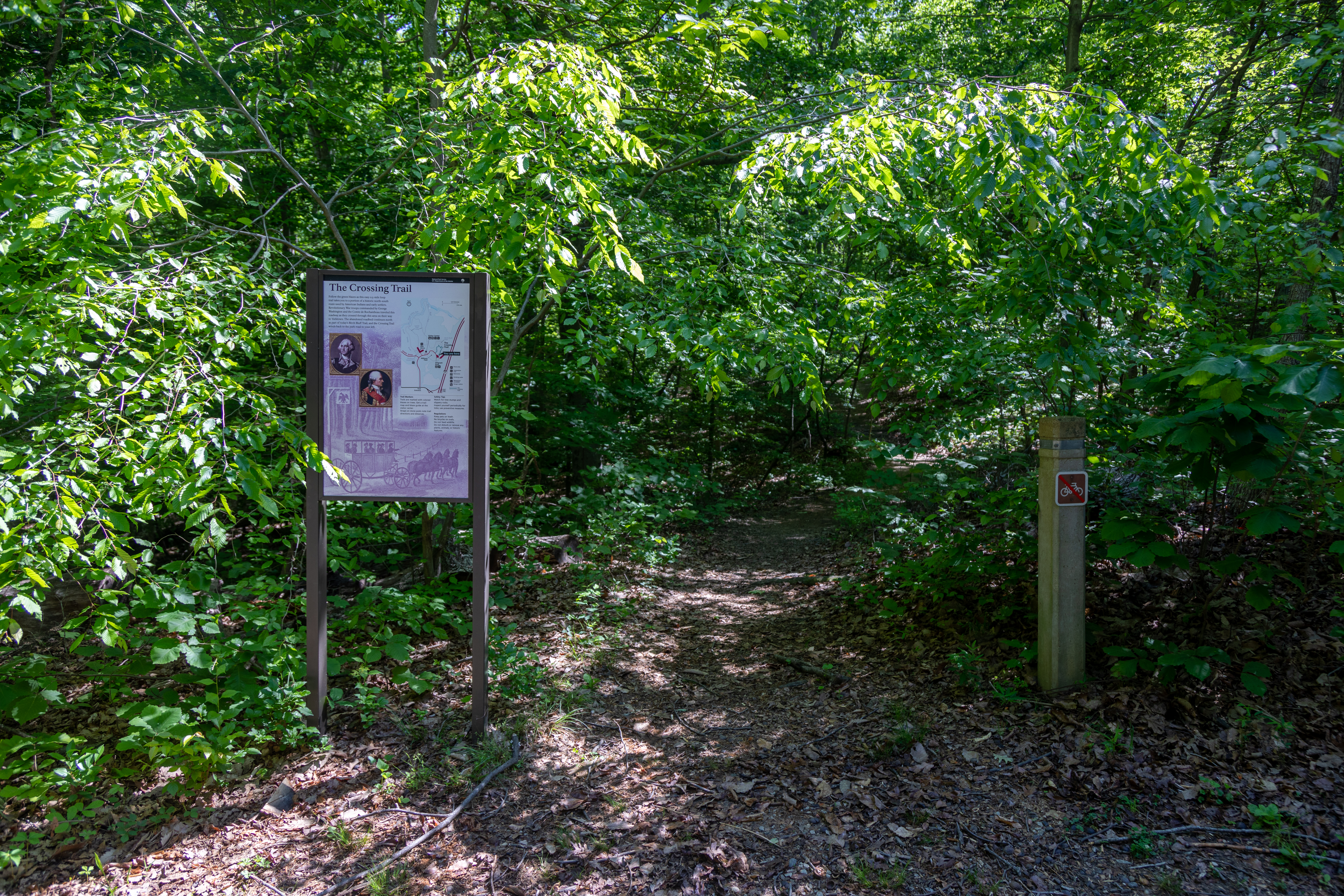
This trailhead is marked by a green blaze on a tree and a wayside panel sign. The park entrance road is to the left of the trailhead and there is parking right next to the trailhead, about 10 feet away near the Telegraph Picnic Area. The wayside panel sign is titled "The Crossing Trail" and a drawing of a stagecoach with 7 passengers pulled by 4 horses on a dirt road through a forest takes up most of the background of the sign. A paragraph below the title in the upper left corner of the sign reads, "Follow the green blazes as this easy 0.5 mile loop trail takes you along a portion of the historic north-south route used by American Indians and early settlers. Revolutionary War troops commanded by George Washington and the Comte de Rochambeau traveled this roadway as they crossed through this area on their way to Yorktown. The abandoned roadbed continues north as part of today’s Birch Bluff Trail, and the Crossing Trail winds back to the park road to your left." Beside this paragraph in the upper right corner of the sign is a map of the park with the Crossing Trail highlighted in green showing it is close to the Visitor Center and Telegraph Road picnic area. Underneath the map on the sign are 3 short informational paragraphs. The first reads, "Trail Markers: Trails are marked with colored blazes on trees. Get a trail map and blaze guide at the visitor center. Straps on stone posts not trail directions and distances." The second paragraph reads, "Safety Tips: Watch for tree stumps and slippery rocks. Inspect yourself periodically for ticks; use preventative measures." The third paragraph reads, "Regulations: No bicycles on trails. Keep pets on leash. Do not feed wildlife. Do no disturb or remove an plants, animals, or historic features." To the left of these paragraphs on the sign are two copies of portraits outlined in gold. The black and white portrait on the left is captioned "General George Washington" and depicts a man in a high collared dress jacket with white curled hair looking to the right. The color portrait to the right is captioned "Comte de Rochambeau" and depicts a side profile of a man with white curled hair wearing a high collared dress jacket with a red sash.
The curved, five-part layout of the Thomas Stone House, along with its casual symmetry and mixed architectural styles truly make it a visual showcase.
Three stone structures stand next to each other. A large stone house with white pillars in the middle, another smaller stone house to it's right-hand side, and a smaller white stone structure connected to the middle house. They are surrounded by a large green field.
Tour Woodlawn Manor and Pope-Leighey House in the George Washington Memorial Parkway Corridor. View the vast differences in architecture from the early 1800’s to 1900’s in a unique juxtaposition along Route 1.
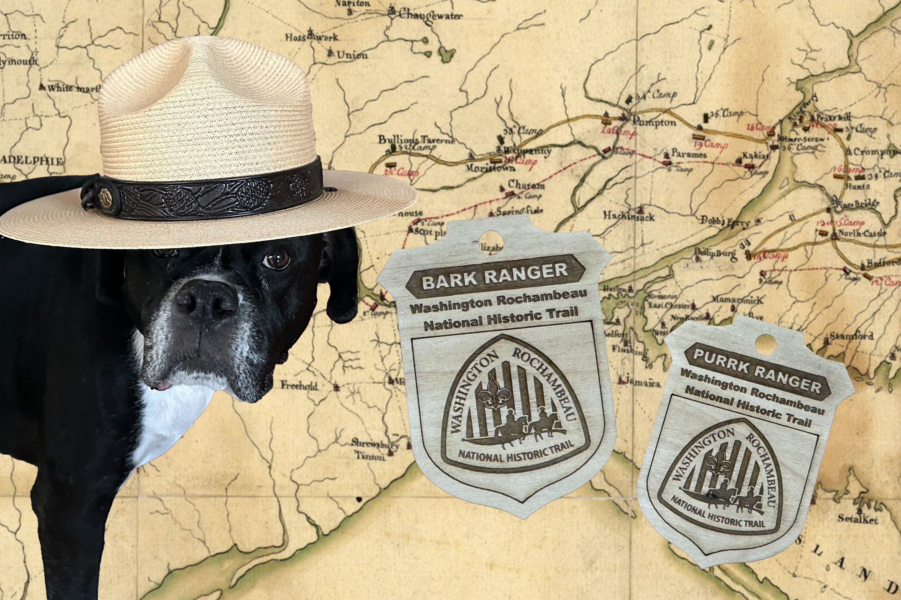
Become a B.A.R.K. Ranger!
Become a B.A.R.K and P.U.R.R.K Ranger at Washington-Rochambeau Revolutionary Routes National Historic Trai.
Multi-Park Loop
Park your car and stretch your legs! Visit four different National Parks in Washington, DC and begin logging miles on seven different National Historic or National Scenic trails!