Be advised that the NPS has issued alerts for this park.
Fire Restrictions Are In Effect Throughout Zion National Park
Fire Restrictions are in effect throughout Zion National Park; Campfires are prohibited in Watchman Campground.
Weeping Rock Shuttle Bus Stop, Parking Area, and Trail Closed
Due to rockfall, the area near Weeping Rock is temporarily closed. Park scientists and maintenance staff are monitoring the area.
Toxic Cyanobacteria in the Virgin River and the streams of Zion National Park
Do not submerge your head in or filter drinking water from still or moving water.
Angels Landing Pilot Permit Program
Everyone who hikes Angels Landing needs to have a permit. Learn why you need a permit and how to get one. This requirement does not affect entering the park or riding the park shuttle (when it is running).
Please park legally and responsibly in Zion National Park and the Town of Springdale
Zion has limited parking space. Park only in designated stalls. Vehicles parked outside of designated stalls are subject to citation and may be towed. Once all designated parking stalls in Zion are full, visitors should park in Springdale.
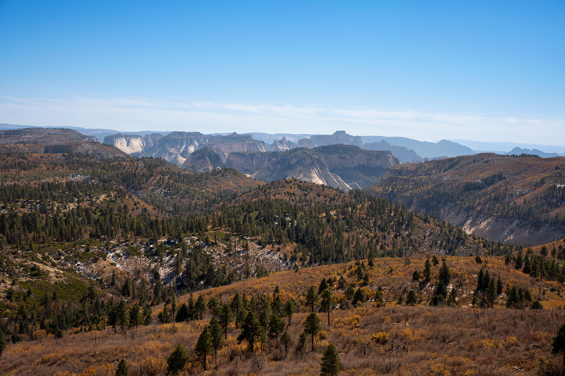
Follow the paths where people have walked for thousands of years. Gaze up at massive sandstone cliffs of cream, pink, and red that soar into a brilliant blue sky. Experience the tall, stretching walls of a narrow slot canyon. Zion’s unique array ...
Admits private, non-commercial vehicle (15 passenger capacity or less) and all occupants to Zion National Park. Valid for 1-7 days.
Entrance - Motorcycle
$30.00
Admits one, non-commercial motorcycle to Zion National Park. Valid for 1-7 days.
Entrance - Snowmobile
$20.00
Admits one individual with no car to Zion National Park. Typically used for bicyclists, hikers and pedestrians. Youth 15 and under are admitted free. Valid for 1-7 days.
Entrance - Per Person
$20.00
Admits one individual with no car to Zion National Park. Typically used for bicyclists, hikers and pedestrians. Youth 15 and under are admitted free. Valid for 1-7 days.
Entrance - Non-commercial Groups
$20.00
$20 per person. Non-commercial vehicles with a capacity of 16 or greater. Fees will not exceed the commercial fee for the same-sized vehicle. Youth 15 and under are free. Individuals or families with any valid Annual or Lifetime pass may use their pass for entry at the per person rate. Pass and photo ID must be present upon entry.
Commercial Entrance - Van
$70.00
A commercial tour is defined as consisting of one or more persons traveling on an itinerary that has been packaged, priced, or sold for leisure or recreational purposes by an organization that realizes financial gain through the provision of the service. The entry fees of commercial tours are based upon the total capacity of vehicles that can carry seven or more passengers regardless of the actual number of passengers.
Commercial Entrance - Mini-bus
$80.00
A commercial tour is defined as consisting of one or more persons traveling on an itinerary that has been packaged, priced, or sold for leisure or recreational purposes by an organization that realizes financial gain through the provision of the service. The entry fees of commercial tours are based upon the total capacity of vehicles that can carry seven or more passengers regardless of the actual number of passengers.
Commercial Entrance - Motor Coach
$190.00
A commercial tour is defined as consisting of one or more persons traveling on an itinerary that has been packaged, priced, or sold for leisure or recreational purposes by an organization that realizes financial gain through the provision of the service. The entry fees of commercial tours are based upon the total capacity of vehicles that can carry seven or more passengers regardless of the actual number of passengers.
Commercial Entrance - Per Person
$20.00
A commercial tour is defined as one or more persons traveling on an itinerary that has been packaged, priced, or sold for leisure or recreational purposes by an organization that realizes financial gain through the provision of the service. Vehicles with commercial tours of 1-6 people (not including guide) pay $35 per vehicle + $20 per person with a total fee not to exceed $70.
Passengers can use valid weekly, annual, lifetime, or appreciation passes.
Lava Point Campground is typically open May through September, as weather allows. Situated at 7890 feet above sea level, it is off the Kolob Terrace Road, 25 miles (45 minutes) north of the town of Virgin. It takes approximately 1 hour 20 minutes to drive to the campground from the South Entrance of Zion Canyon.
This campground is typically open May through September, as weather allows. Situated at 7890 feet above sea level, it is off the Kolob Terrace Road, 25 miles (45 minutes) north of the town of Virgin. It takes approximately one hour and 20 minutes to drive to the campground from the South Entrance of Zion Canyon. There are 6 primitive campsites available for reservations. The campground has pit toilets and trash cans, but no water. Vehicles longer than 19 feet are not permitted on the Kolob Terrace Road.
Reservations for campsites at South Campground may be made two weeks prior to your arrival date online at www.recreation.gov or by calling 877-444-6777. Reservations are needed since the campground is full nearly every night during the reservation season.
South Campground is located ½ mile from the South Entrance. South Campground has three flat sites, but no accessible facilities such as restrooms or trails. Campers staying in South Campground can travel .3 miles to the Watchman Campground to utilize accessible restrooms if necessary.
Reservations for campsites at Watchman Campground may be made six months prior to your arrival date online at www.recreation.gov or by calling 877-444-6777. Reservations are strongly suggested since the campground is full nearly every night during the reservation season.
Watchman Campground is located ¼ mile from the South Entrance. Watchman Campground has seven standard accessible sites and two accessible group sites, all of which have easy access to accessible restrooms. The road access route to the Visitor Center and Shuttle Stop has grades of up to 5% for 30-foot stretches. An alternate concrete and asphalt-paved pathway adjacent to the amphitheater through the river entrance plaza has slopes of up to 18% for 5’ stretches and slopes up to 8% for 39 foot stretches with some uneven surfaces. A beach access route near site B56 allows visitors using mobility devices to get close to the Virgin River, however flooding has created a step at the end of the concrete pathway. The amphitheater has accessible seating located on the top row.
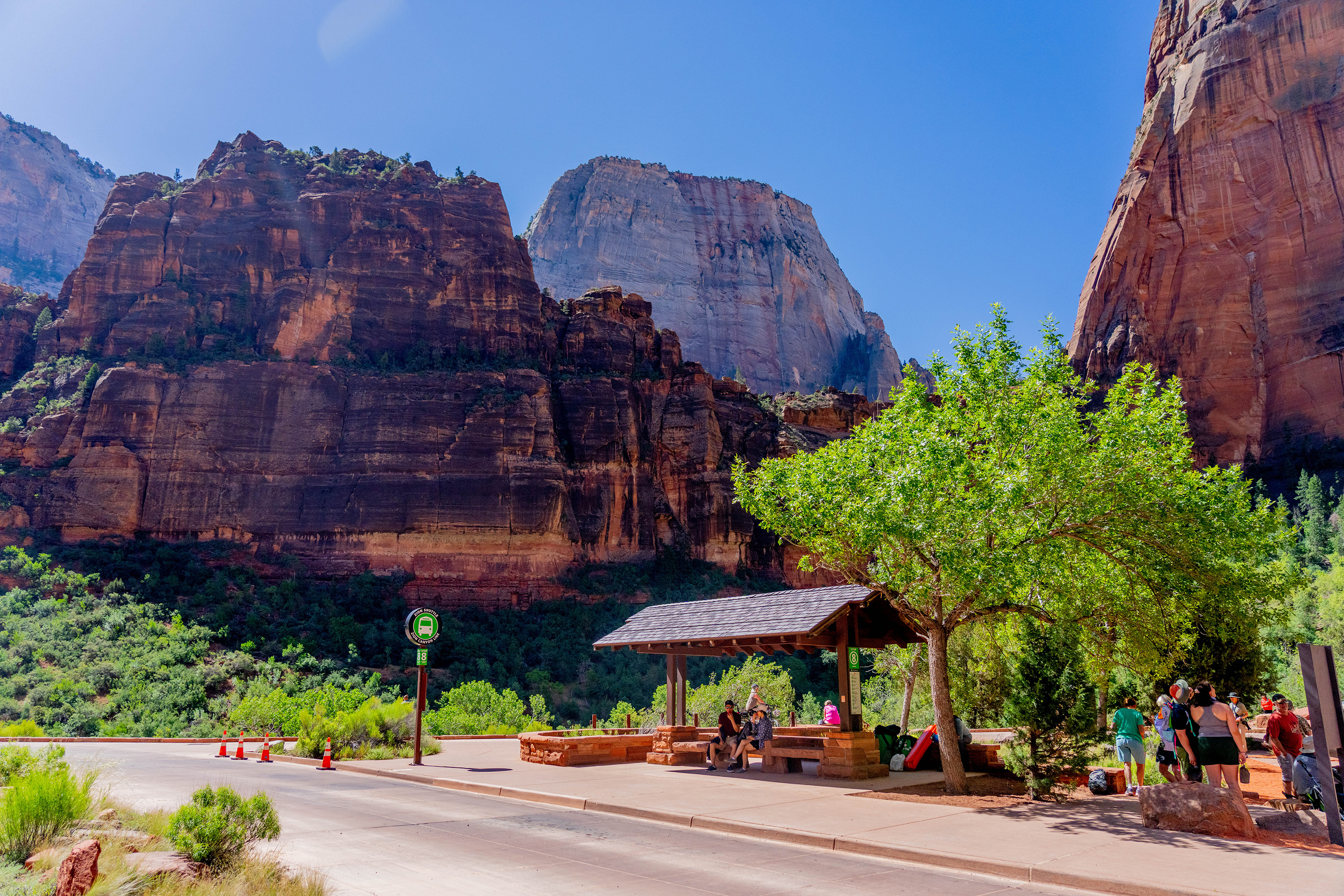
A paved shuttle stop area above a large, sweeping bend in the Virgin River. The sandy riverbanks are dotted with trees and grasses. Surrounding the entire area are large, red, vertical sandstone cliffs, including the northern face of Angels Landing.
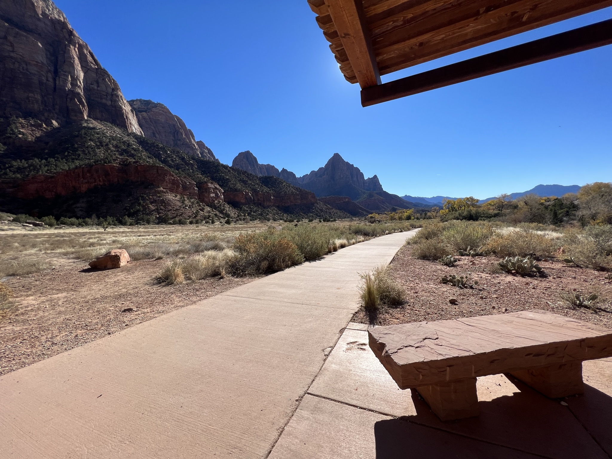
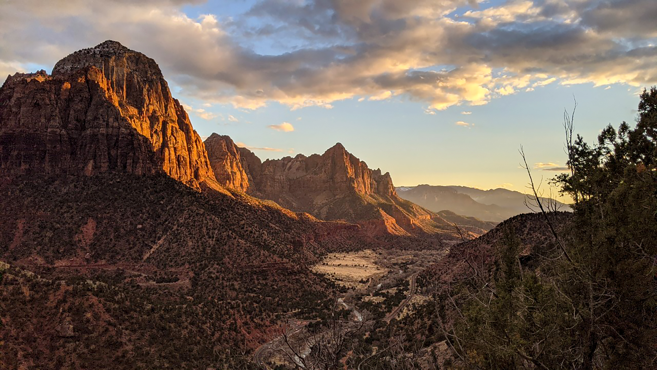
Canyon Junction is a fork in the road, where the Zion Canyon Scenic Drive splits off from the Zion-Mt. Carmel Highway. Here, you are on a flat, paved road that extends past you up around a bend and further into the canyon. Zion-Mt. Carmel Highway is separated from this road by a white and red traffic gate barring unauthorized vehicles from entering. To the south is a wide-open landscape view of the triangular Watchman formation sitting at the southern end of the canyon. To the north, the road curves around a red, sandy hill dotted with foliage, following the path of the Virgin River to the west of the road.
This shuttle stop is on the shoulder of a flat, paved road running parallel to the Virgin River on the west side of the road. Further west of the road are four tall mountain peaks, in the shape of jagged triangles. These are the Patriarchs and Mount Moroni. The east side of the road slopes upward towards vertical sandstone canyon walls in shades of orange, red, and cream. Trees, low shrubs, and a variety of grasses dot the landscape.
The Mormon Pioneer National Heritage Area preserves the natural, historical, and cultural heritage legacies and contributions of Mormon settlement in the West. The heritage area accomplishes this through community-led efforts to connect with the past by telling the Mormon pioneer story.
This heritage area landscape is distinguished by its rugged terrain, diverse rock features and geology, and unique small communities connected along Highway 89. There is a variety of geological and geographical features, such as rocky terrain, red cliffs, forests, and rivers.The Colorado River (including its tributaries), wind, and rain have physically shaped this region, which helped to create its canyons, arches, and gullies. Also of interest are Native American sites and cliff drawings, highlighting the years before settlement of Mormon Pioneers.
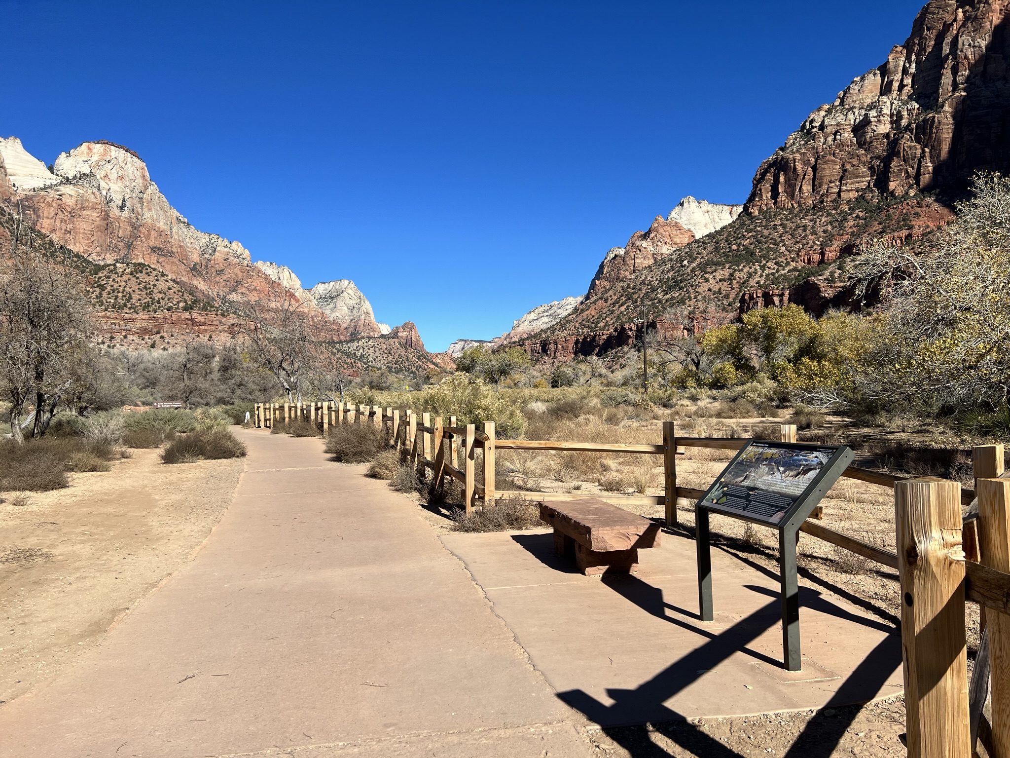
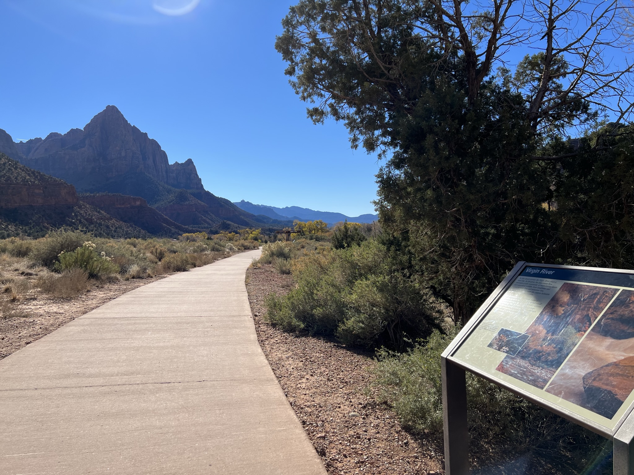
You are standing on a wide concrete path that follows the Virgin River. The side of the path facing the river is lined with a wooden, split-rail fence. The other side is open to the sandy shrubland of the South Campground. To the south, the path continues towards the Zion Canyon Visitor Center. To the north, the path continues towards Canyon Junction. Just off the path along the split-rail fence is a long sandstone bench and a hip-height metal wayside sign. A picture spans the top half of the sign showing three buck deer with large antlers grazing near a clear, slow-moving river surrounded by yellow-leaved cottonwood trees and dormant grasses and shrubs. A title in the top left corner reads, “A Living Canyon.” In the lower right corner of the picture, a paragraph reads, “Stop for a moment. What do you see, hear, and smell? Where water is abundant, plants and animals thrive. The Virgin River and the vegetation in the riparian zone along it provide habitat for many species. Away from the river the temperature increases and the humidity drops. But life is tenacious and adapts. As you stroll the Pa’rus trail consider life with—or without—water.” The bottom left corner of the sign shows a Prickly Pear Cactus (scientific name Opuntia phaecantha) with dark-green spiked flat pads and three bright-yellow blooms. “The sharp spines of a cactus are believed to have evolved from leaves and serve a dual purpose – protecting the cactus from hungry critters and limiting water loss with reduced surface area.” Next to the cactus is a light-green, rounded Fremont Cottonwood leaf (scientific name Populus fremontii.) The caption reads, “On a hot summer day, the cottonwood’s branches create shade and cooler temperatures. These native trees thrive where there is water and are found lining the river. They offer shelter and food to many animals and help stabilize riverbanks.” At the center of the page, a 2-inch-long Virgin Spinedace fish with shiny scales is shown (scientific name Lepidomeda mollispinins). The caption reads, “This medium-sized silvery minnow was once found throughout the Virgin River. Due to habitat fragmentation, introduction of non-native species, and water demands, it is now found only in protected areas like Zion National Park. One of four native fish in the park, it is well adapted to the changing river temperatures and flood prone and sediment-laden rivers of Zion.” The bottom right corner of the sign has a 4-inch-long mottled brown lizard with a blue belly standing up on its hind legs. Its long toes grip a reddish sandstone rock and its long, narrow tail hangs down. Its front feet are against a taller sandstone rock. It is identified as a Plateau Lizard (scientific name Sceloporus tristichus). The caption reads, “Reptiles are ectotherms (or cold-blooded) and need to soak up the sun to warm their bodies so they can scurry away from predators and after prey. Much of their hydration is obtained from the insects and spiders they consume which allows them to live away from water sources.”
You are standing on a wide, concrete path connected to a wooden shade structure with sandstone benches underneath. To the south, the path continues through desert shrubs towards the Zion Canyon Visitor Center. The sandstone Watchman formation is this way as well. To the north, the path continues to follow the Virgin River towards Canyon Junction. Also underneath the shade structure is an angled metal sign. You are standing in front of red sandstone cliffs. An image of the same cliffs fills the entire sign. At the top right, the sign is titled, “Changing Landscapes.” Under the title, text reads, “Where you are standing was once a tidal flat at the edge of an ocean, a massive arid desert, and a river system where dinosaurs roamed. A lot can change in 200 million years, and the sedimentary rock layers tell those stories. The presence and absence of water has shaped Zion through geologic time.” An illustration on the left shows five rock layers with dashed blue lines connecting to the background image to show where each layer can be found on the cliffs around you. The youngest top layer is shown in yellow and labeled “Temple Cap Formation.” The rock in this layer was created 175-170 million years ago and is at the top of the highest peaks in Zion Canyon. Next down on the graphic is “Navajo Sandstone” represented by cream, pink, and brown sections within the layer, which was created 185-180 million years ago. An inset picture shows large hills of tan sand with the caption, “Desert sand dunes formed the Navajo Sandstone Layer.” This layer forms the sheer multi-colored cliffs seen in the background image. Below the "Navajo Sandstone” layer is the ”Kayenta Formation”. This layer was deposited 195-185 million years ago, when dinosaurs lived here. Footprints of prehistoric creatures are illustrated within this brown layer on the graphic. The blue dashed line links this formation to the section of junipers below the vertical Navajo Sandstone cliffs. “Springdale Sandstone” is a subpart of the Kayenta Formation and makes up the smaller cliffs below the vegetated slopes of the Kayenta Formation. The Moenave Formation is the fourth section from the top and is represented by a rust-colored layer. It was created 210-195 million years ago and has dinosaur footprints and a fish skeleton in the graphic to represent the prehistoric animals that lived here. A photograph to the left side of the graphic spanning the Kayenta and Moenave layers shows a river system and floodplain. The picture is inset with an image of a person’s hand next to a three-toed grey fossilized footprint that is twice as large as the hand. The caption below says this type of landscape provided habitat for dinosaurs in the Kayenta and Moenave layers. Additional portions of the graphic are faded out to show that some layers in Zion are not visible in the cliffs around you. Older layers below the Moenave layer are not yet exposed in the main part of Zion Canyon, and younger layers above the Temple Cap Formation have already eroded completely from the Main Canyon. A quote by Heraclitus sits in the corner of the sign and reads, “Change is the only constant in time.”
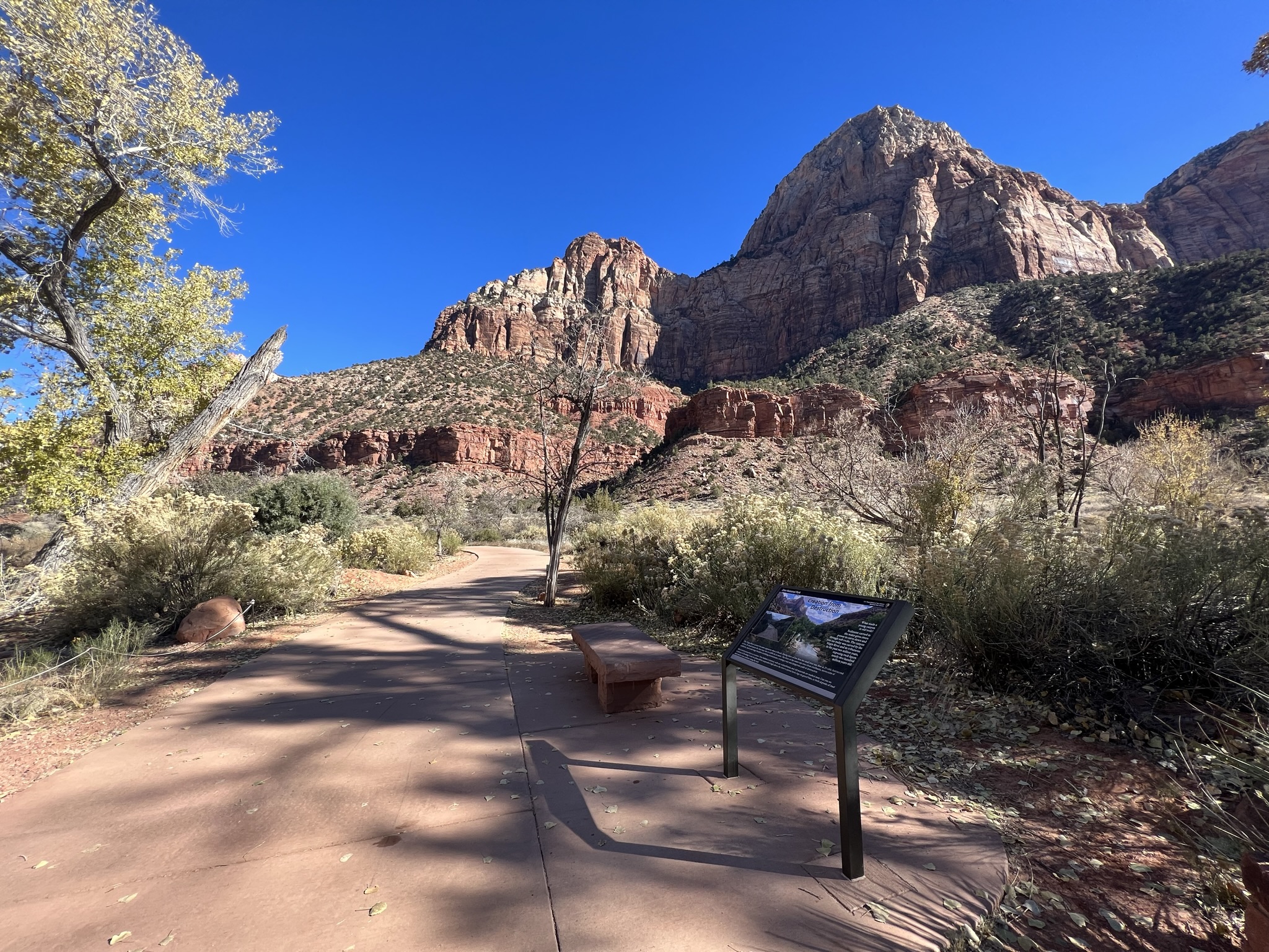
You are standing on a wide, concrete path right next to a bridge over the Virgin River. The path crosses over the bridge towards the Zion Canyon Visitor Center to the south. To the north, the path continues to travel through shrubland, with cottonwood trees lining the river. The large, sandstone Bridge Mountain is on the opposite side of the path. Connected to the path is a concrete pad with a wide sandstone bench and an angled metal sign. At the top center of the sign a title reads, “Creation from Destruction” A photograph covers the sign. The red cliffs of Zion tower over the green foliage of the canyon below. A bright-blue sky filled with fluffy clouds is above. In the foreground is the Virgin River with still blue water. A tall cottonwood tree stands about 15 feet from the river’s edge up a slight slope. In this picture, the river is running at 128 cubic feet per second. A smaller picture to the left shows the same view, but the sky is dark with storm clouds looming behind the cliffs. A muddy and turbulent Virgin River flows right up to the base of same cottonwood tree, showing how wide the river’s path becomes when the river flows at 3,970 cubic feet per second. Text on the sign’s right side reads, “What made a young canyon in old rock? Sediment carried in the water gives rivers power to carve down and through soft rocks. The canyon you see today was carved by the Virgin River and its tributaries in the past 2 million years, exposing rock layers nearly 200 million years old.” At the bottom of the sign, the text reads, “The Virgin River’s power becomes apparent when it floods. During times of low flow, the small river may flow at 25 cubic feet/second or less. In flood season the river may rise to 4,000 cubic feet/second or more. The force of the water rips trees from riverbanks, moves tons of sediment, and sends huge boulders tumbling downstream, creating a vast and dangerous path of destruction. But in destruction there is creation. New habitat is formed, soils are redistributed, and old materials are washed away. Can you see evidence of flooding? Look for plant debris suspended high above the river’s current level, logs on gravel bars, or fresh deposits of mud and sand as you continue along the trail.”
You are standing on a wide, concrete path that follows the Virgin River winds through desert sand and shrubs. To the south, the path extends towards the South Campground and Zion Canyon Visitor Center. In the distance, the large, triangular sandstone formation known as the Watchman is visible. To the north, the path continues through desert shrubs to Canyon Junction. Connected to the path where you are standing is a wooden shade structure standing over a wide sandstone bench and an angled wayside sign. An historic black-and-white photo takes up two-thirds of the right side of the sign. In the picture, the cliffs of Zion tower above three small, rustic wooden structures and a wagon. A larger light-colored building can be seen in the background. Cursive handwriting at the bottom of the image identifies it as the Crawford Homestead looking south. A title at the top right of the image reads, “Footprints in Time.” Underneath the image, text says, “Humans have survived and adapted in the Zion area for over 15,000 years. The waters of the Virgin River have provided sustenance for different cultures through time under the towering red rock cliffs. Though the people have changed, the landscape and the nourishing water remain constant.” The left third of the sign has a vertical timeline. At the top is a picture of two rough-edged white stone arrowheads lying on red sand. The image is labeled “Archaic People: 13,000 Before Common Era to 0 Common Era. The Archaic people were hunter-gatherers who left behind spear points, knives and other stone tools.” Next in the timeline is a picture of an 8-foot-square sandstone structure without a roof nestled in an alcove on a cliff. It is labeled, “Ancestral Puebloan and Fremont Peoples: 1 Common Era to 1150 Common Era. These people were cultivators who built permanent communities with homes and granaries.” At the center of the timeline is a black-and-white picture of a large gathering of Southern Paiute adults and children kneeling and standing around an open patch of ground. One person is gesturing as if telling a story to the group. The timeline reads, “Southern Paiute: 1150 Common Era to present. The Southern Paiute people were farmers, hunters and gatherers who shared traditions through dances and storytelling. Today, they combine old ways with new and maintain connection to their native homeland.” The fourth picture in the timeline is a black –and-white picture of two horse-drawn wagons with large wooden-spoked wheels carrying corn stalks. Men, women, and children are gathered around and on the wagons. The caption reads, “Euro-Americans Settlers: 1860 to 1909. Mormon pioneers came west in search of sanctuary and built settlements near water. Remnants of irrigation ditches are still visible.” At the bottom of the timeline, a brightly colorized historic photo shows a dirt road with large sandstone masonry monuments on either side. The monument on the left side of the road is about 5 feet high while the monument on the right is twice as large with a “Zion National Park” sign hanging from a horizontal log pole near the top. In the background, towering red-and-white sandstone cliffs are set against a blue sky with fluffy white clouds. It is identified as the South Entrance to Zion and represents the timeline from 1909 to the present. The area was designated as “Mukuntuweap National Monument in 1909 then Zion National Park in 1919. Each visitor writes their own story of Zion.”
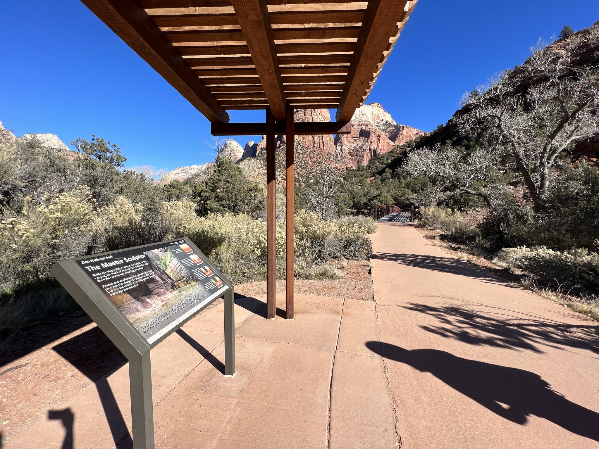
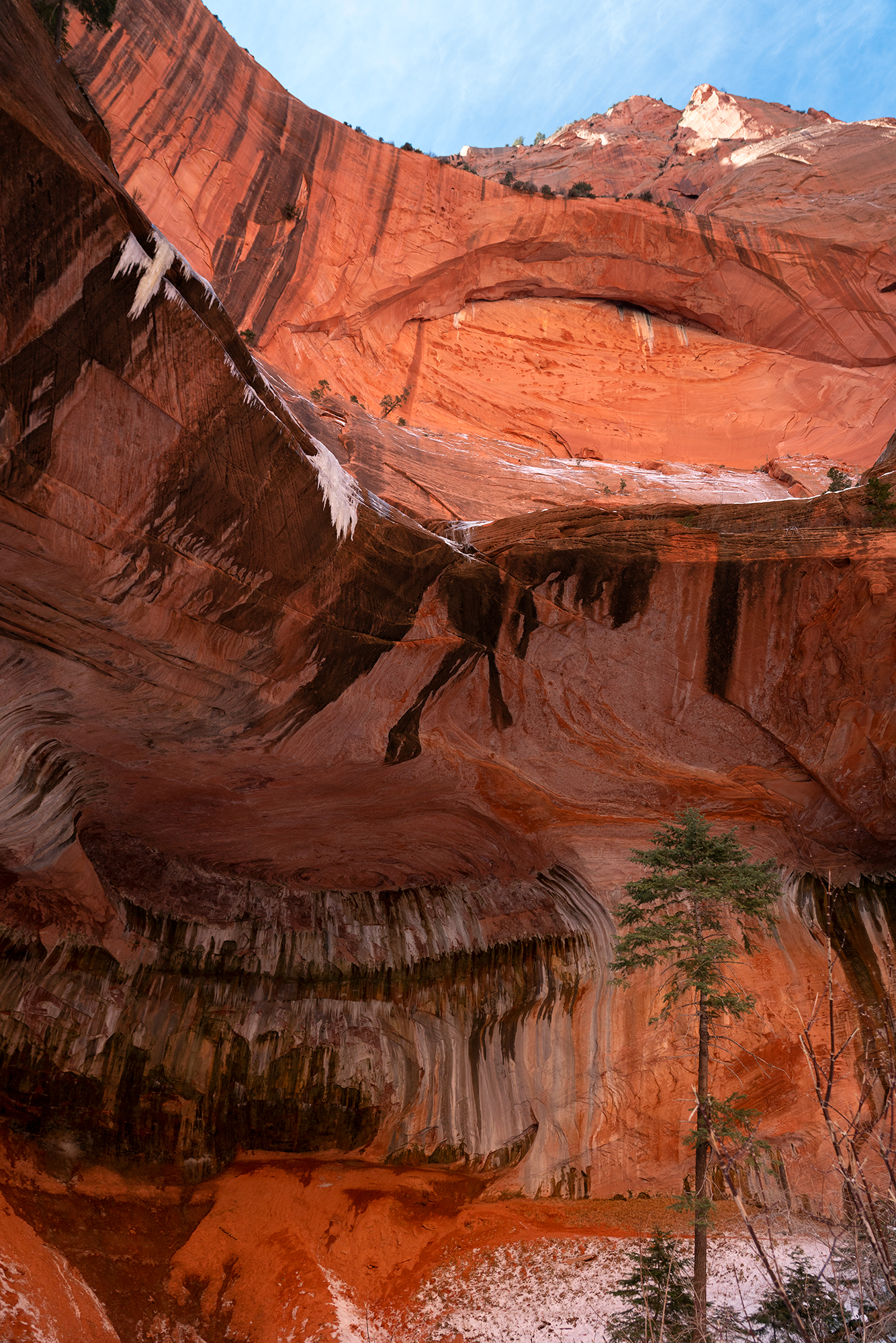
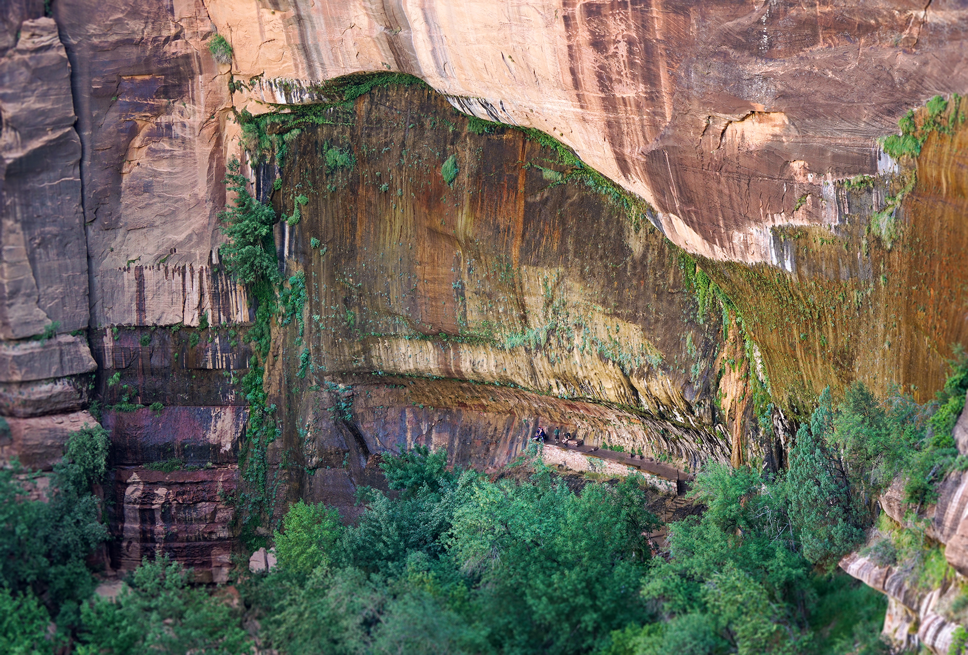
You are standing on a wide concrete path surrounded by shrub brush and junipers. To the south, the path extends towards the Zion Canyon Visitor Center. To the north, the path continues towards Canyon Junction. Connected to the path is a wooden shade structure, that covers an angled metal sign. A photograph taken within a narrow canyon spans the sign. The canyon’s smooth sandstone walls extend up and out of the picture. A peaceful Virgin River covers the canyon floor. A title in the top left corner reads, “The Master Sculptor.” Underneath the title, text says, “While the Virgin River carved the depth of the canyon, the work of rain and ice helped sculpt the wide canyon surrounding you now. Erosion and weather are natural geologic processes that shape the surface of the earth. Can you see evidence of their power in the landscape around you?” At the bottom of the sign, a quote from Henry David Thoreau reads, “The finest workers of stone are not copper or steel tools, but the gentle touches of air and water working at their leisure with a liberal allowance of time.” Four graphics on the sign’s right side depict the four stages of how canyons are created by layers of sediment slowly being carved down by the river and widened by freeze-thaw cycles and gravity. The top graphic shows red, cream, and pink layers of sediment with remnants of dinosaur bones and seashells representing the layers found in Zion Canyon. It is captioned, “Sediment layers are deposited over millions of years.” The second graphic shows the same layers but with an inverted-triangular section in the middle removed. A blue line across the bottom of the new canyon represents the Virgin River, which is implied to have eroded away the layers of sediment. The canyon walls are rugged, showing how various layers erode differently. A caption reads, “The Virgin River and its tributaries carve the depth of the canyon. Mudstone and siltstone erode more readily than sandstone.” The third graphic shows the eroded layers like the second graphic above, but with snow and rain droplets falling into small cracks in the top layer and freezing. The caption reads, “Zion only receives about 16” of rain annually, but that is enough to seep into cracks in rock layers. Winter freeze and thaw cycles cause the cracks to expand.” The bottom graphic shows the effects of this ice wedging. The jagged outcroppings shown in previous graphics have now fallen into the canyon below and the canyon walls are smoother. It is captioned, “Gravity causes the undercut rocks to fall from the steep cliffs; additional sediment is washed away.”
The shuttle stop at the Temple of Sinawava sits on a looped road surrounded by tall sandstone walls. The Virgin River flows right next to the southern half of the road, its sandy banks dotted with river rocks, cottonwood trees, and shrubs. North of the road is a large concrete patio area covered with a slatted-wood shade structure with benches underneath. Behind this structure is a small sandstone building for the restrooms. To the left of this building is a concrete path that extends north. This is the Riverside Walk trail.
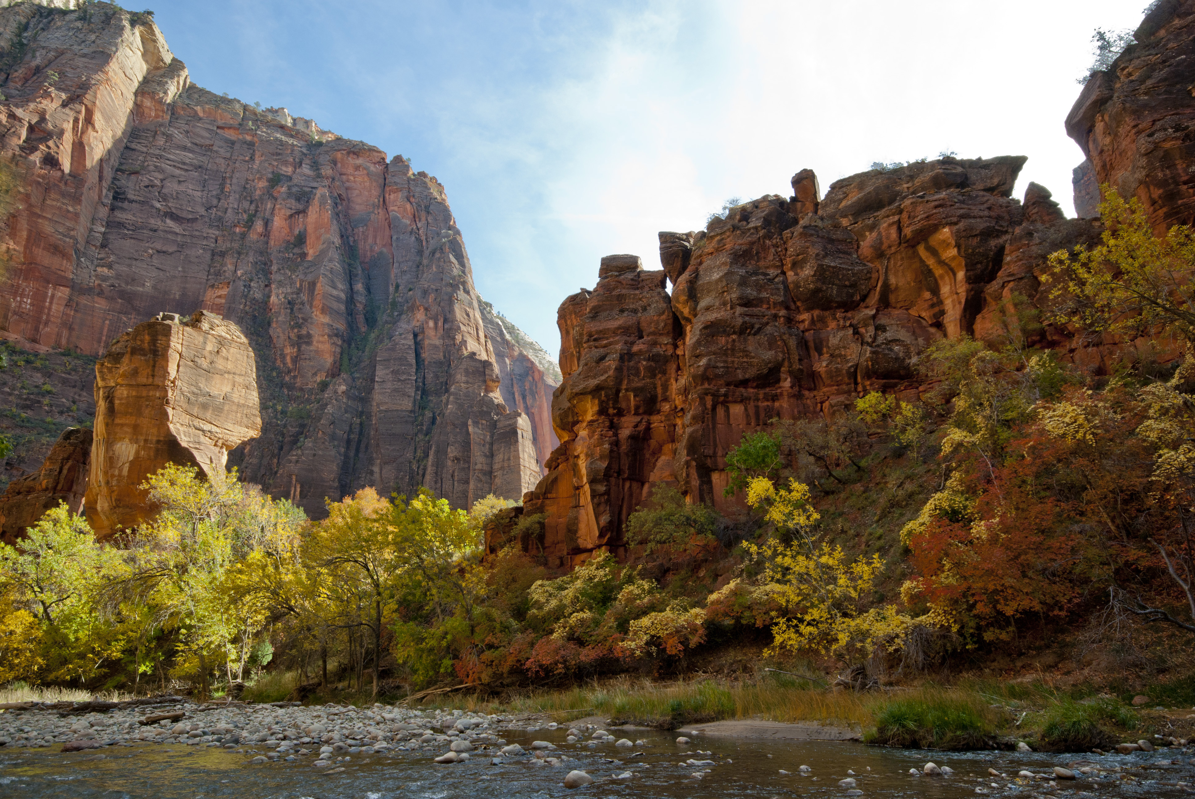
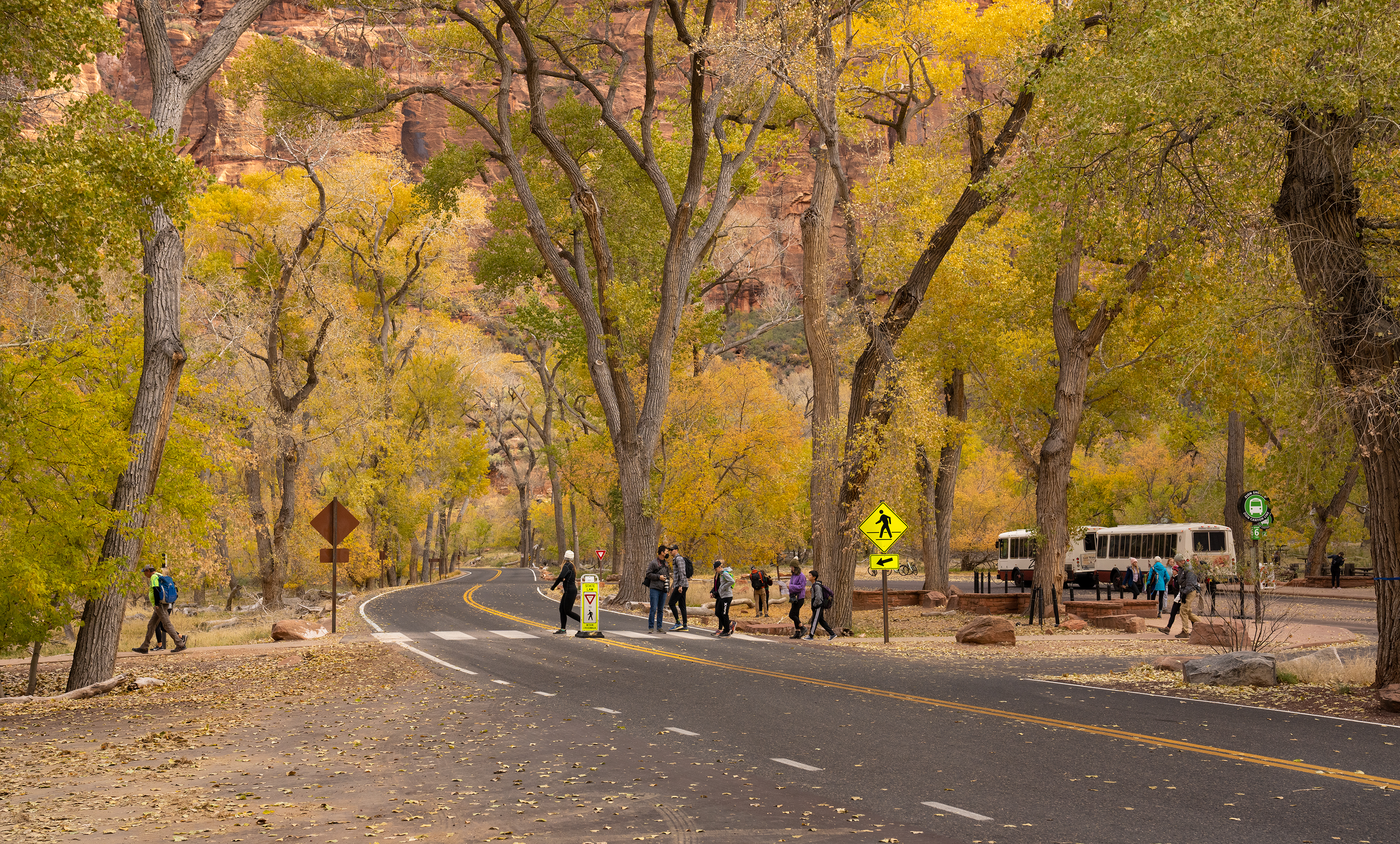
Nestled in a grove of tall cottonwood trees in the shuttle stop pullout for The Grotto. Picnic tables and benches are scattered through the stand of trees, connected by gravel paths with low ropes around their perimeter. On the southern end of the picnic area are two sandstone buildings connected by a concrete path. The first building is larger and is the new restroom facility. The second building is a smaller, historic building that used to be the restroom here. Further south is a gravel parking area fenced in by a split-rail wooden fence, which ends at a third sandstone building. This third building is known as The Grotto House, where artists-in-residence stay during their time at Zion. In the past, this building was the park’s first museum. On the opposite side of the road is a concrete path leading to a bridge that crosses the Virgin River. This is the trailhead for the West Rim and Kayenta trails.
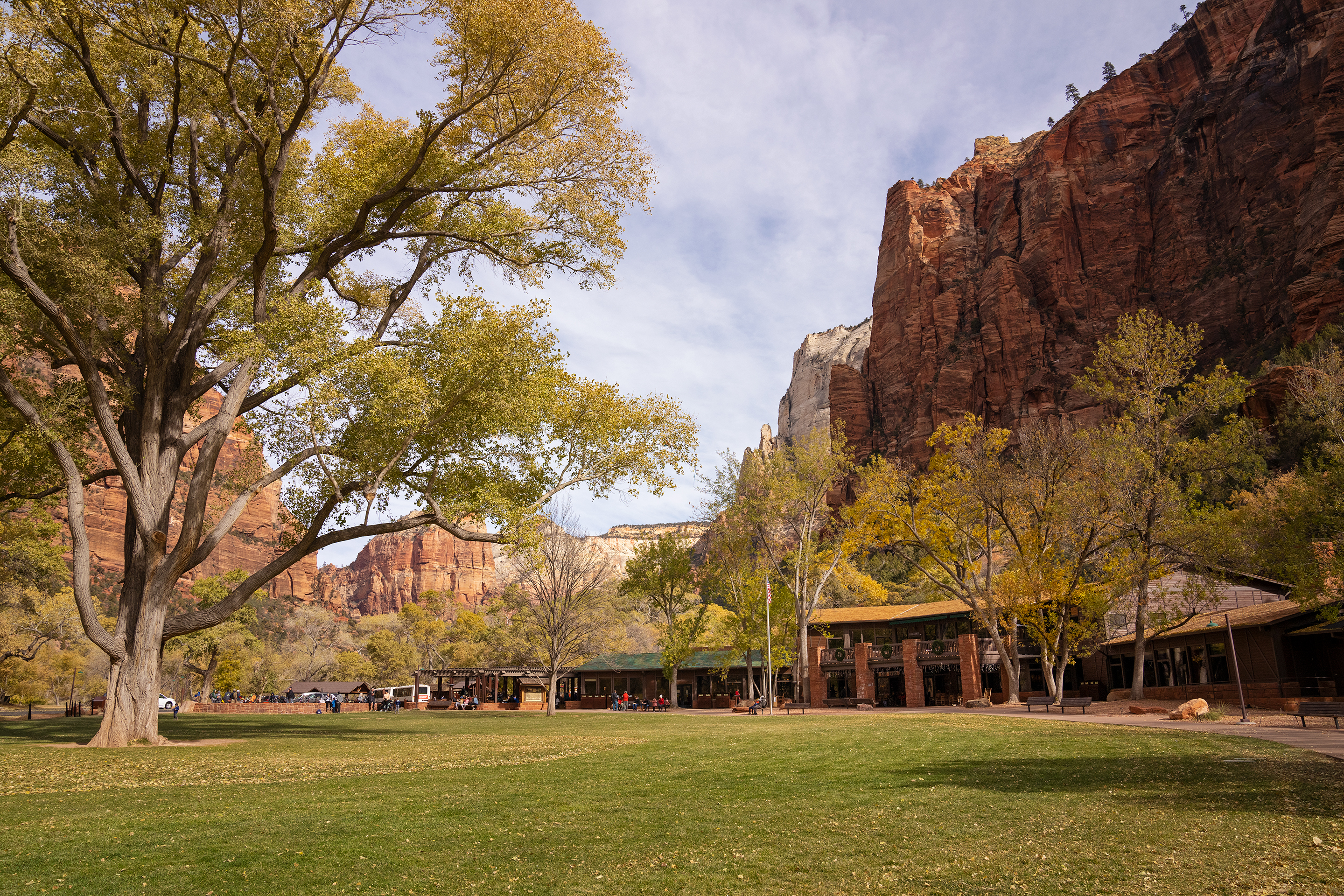
The Zion Lodge is located in the heart of Zion Canyon and offers unparalleled views of the towering sandstone cliffs. The Zion Lodge provides the only lodging with a variety of accommodations and is also the only place inside Zion to eat with an onsite restaurant.
The Lodge is located in the bottom of Zion Canyon, near the steep canyon walls that extend high above. A two story wood and stone structure with large square stone columns out front sheltering a patio with rocking chairs. The Lodge has a large lawn with a giant cottonwood tree in the middle that casts cooling shade in summer, making it a comfortable spot to relax. To the south, several other similar structures are built to house the hotel rooms and smaller rustic cabins.
The Weeping Rock shuttle stop sits alongside the flat, paved road just after a curve in its path. The area is surrounded by shrubs, grasses, and trees on either side of the road. On the northeast side of the road, a concrete sidewalk turns toward the Weeping Rock trailhead. On the west side of the road is a low sandstone wall that separates the shuttle stop area from the grassy landscape behind it. A small dirt social trail leaves from this area and leads towards the Virgin River, which is in the distance.
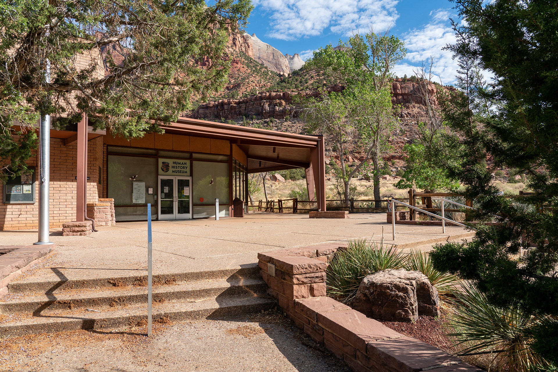
Indoor exhibits focus in the human history of Zion National Park. A 22-minute orientation film highlights the dramatic landscapes of the park and examines the history of the canyon. Rotating art exhibits feature regional artists. Visit the bookstore for maps, book, and gifts. There are dramatic views of the Towers of the Virgin and Bridge Mountain outside.
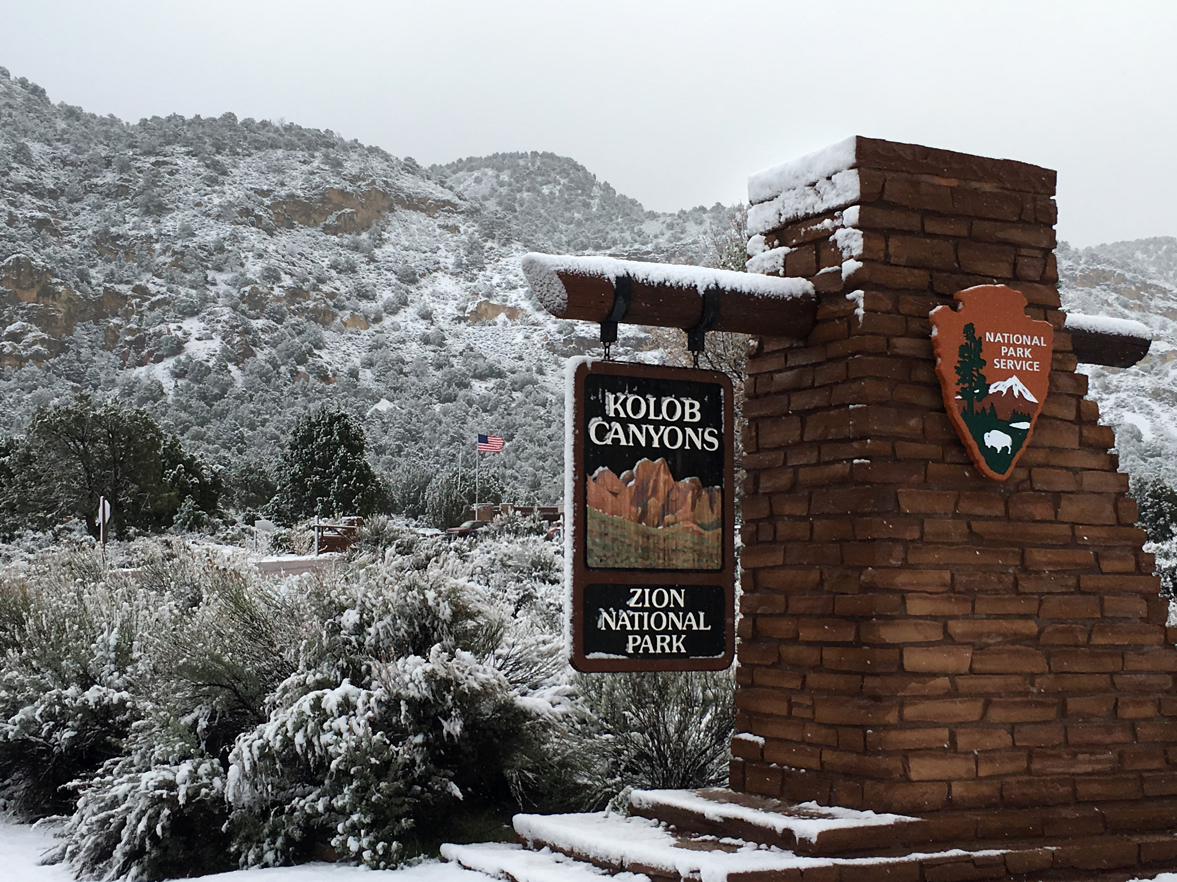
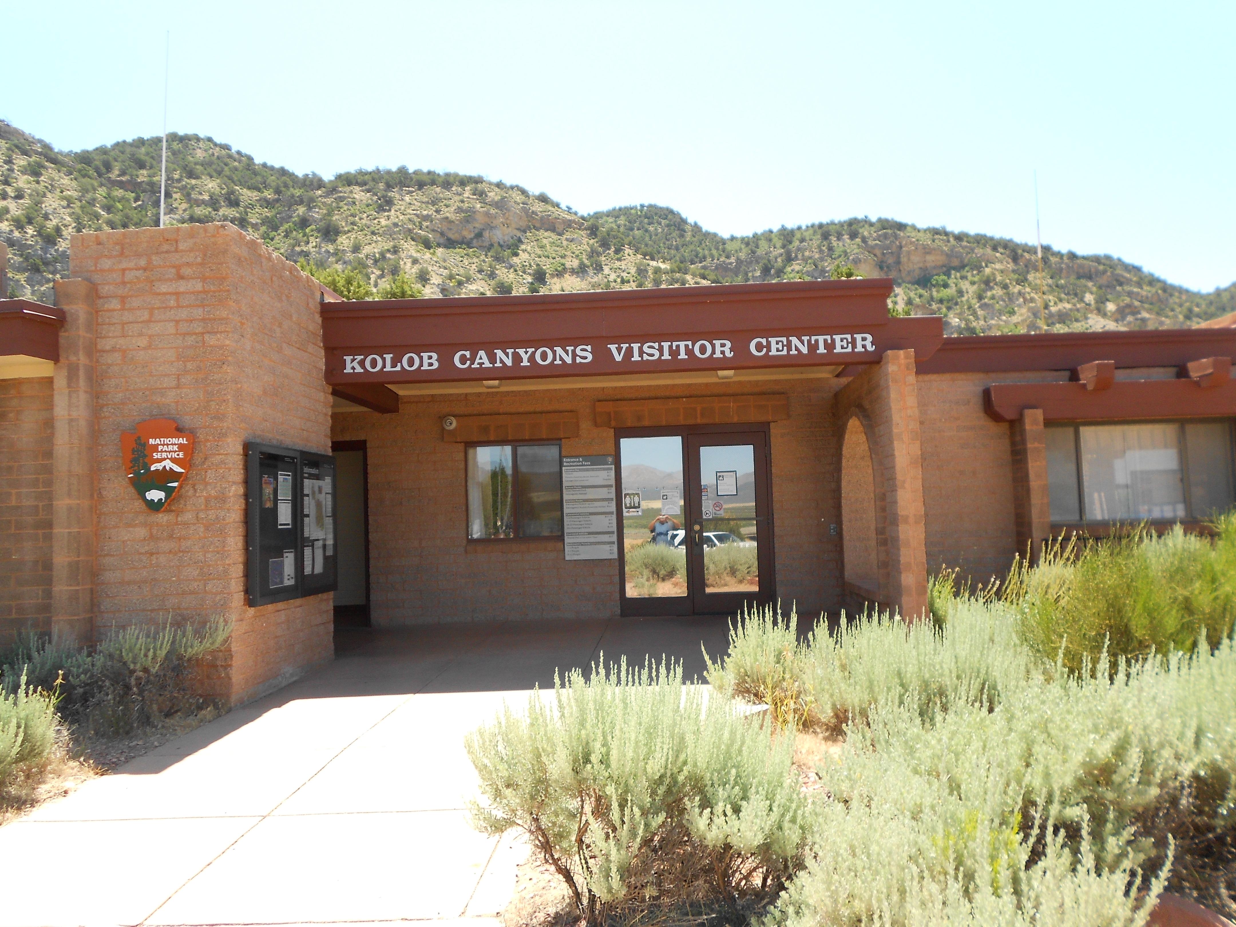
Closed daily from 12pm-1pm This is the entry point to the Kolob Canyons area of the park. It is located 45 miles north of Springdale and 17 miles south of Cedar City at Exit 40 on Interstate 15. Park rangers are available to answer questions. Exhibits explore the geology, vegetation, and wildlife of this unique landscape.
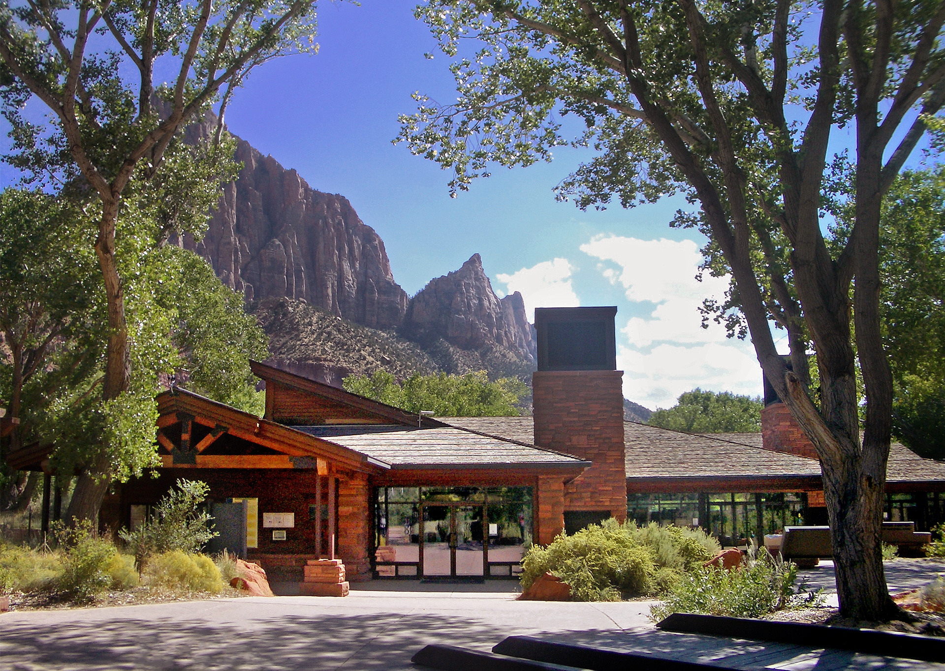
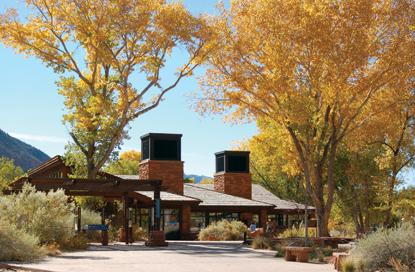
Located near the South Entrance of the park, the Zion Canyon Visitor Center is an excellent place to begin your exploration of Zion Canyon. Park rangers and outdoor exhibits will help you plan your visit and make the most of your time. Inquire at the Zion Canyon Wilderness Desk about permits for backpacking, canyoneering, and other trips into the wilderness. Visit the bookstore for maps, books, and gifts.
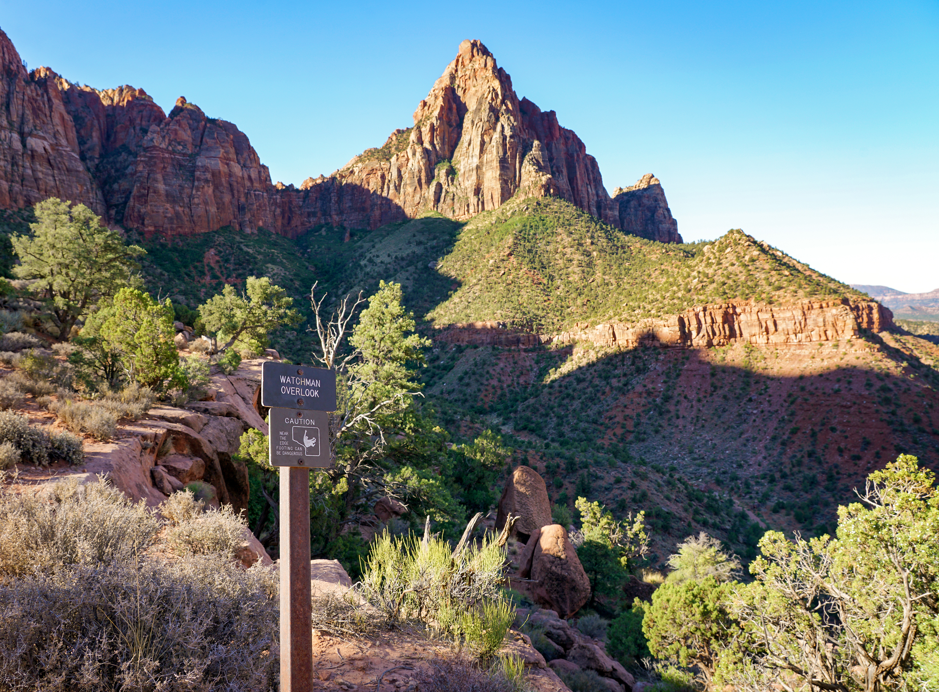
The Watchman trail is out-and-back. From the relatively flat beginning section of trail by the river, this unpaved trail climbs to a magnificent viewpoint of the Watchman, Temples and Towers, lower Zion Canyon, and the Town of Springdale. The terrain is sandy, rocky, and uneven, with several moderate drop-offs.
West Rim to Scout Lookout
The strenuous West Rim Trail ascends ~1,000 ft (305 m) to Scout Lookout, high above the canyon floor. Hikers cross the Virgin River and then ascend a series of steep switchbacks along the canyon wall. The trail flattens out as it enters Refrigerator Canyon, offering relief from the heat and elevation gain of the previous segment, but resumes the climb shortly afterward at Walter’s Wiggles: a series of 21 switchbacks that leads hikers to Scout Lookout.
Timber Creek Overlook
Follows a ridge to views of Timber Creek, Kolob Terrace, and the Pine Valley Mountains.
Taylor Creek Trail
Kolob Canyons hike. Follows the Middle Fork of Taylor Creek past two homestead cabins to Double Arch Alcove. Group size limit on Wilderness trails is 12 people.
Sand Bench
The Sand Bench Trail travels atop the remains of an ancient rockfall. This trail leads hikers along the Virgin River and then ascends a landslide that dammed the Virgin River 8,000 years ago and created a lake that extended to Angels Landing. This trail is a commercial horse trail from March to October, and it receives little shade in the hot, summer sun. Winter travel is possible, but watch for patches of ice.
Riverside Walk
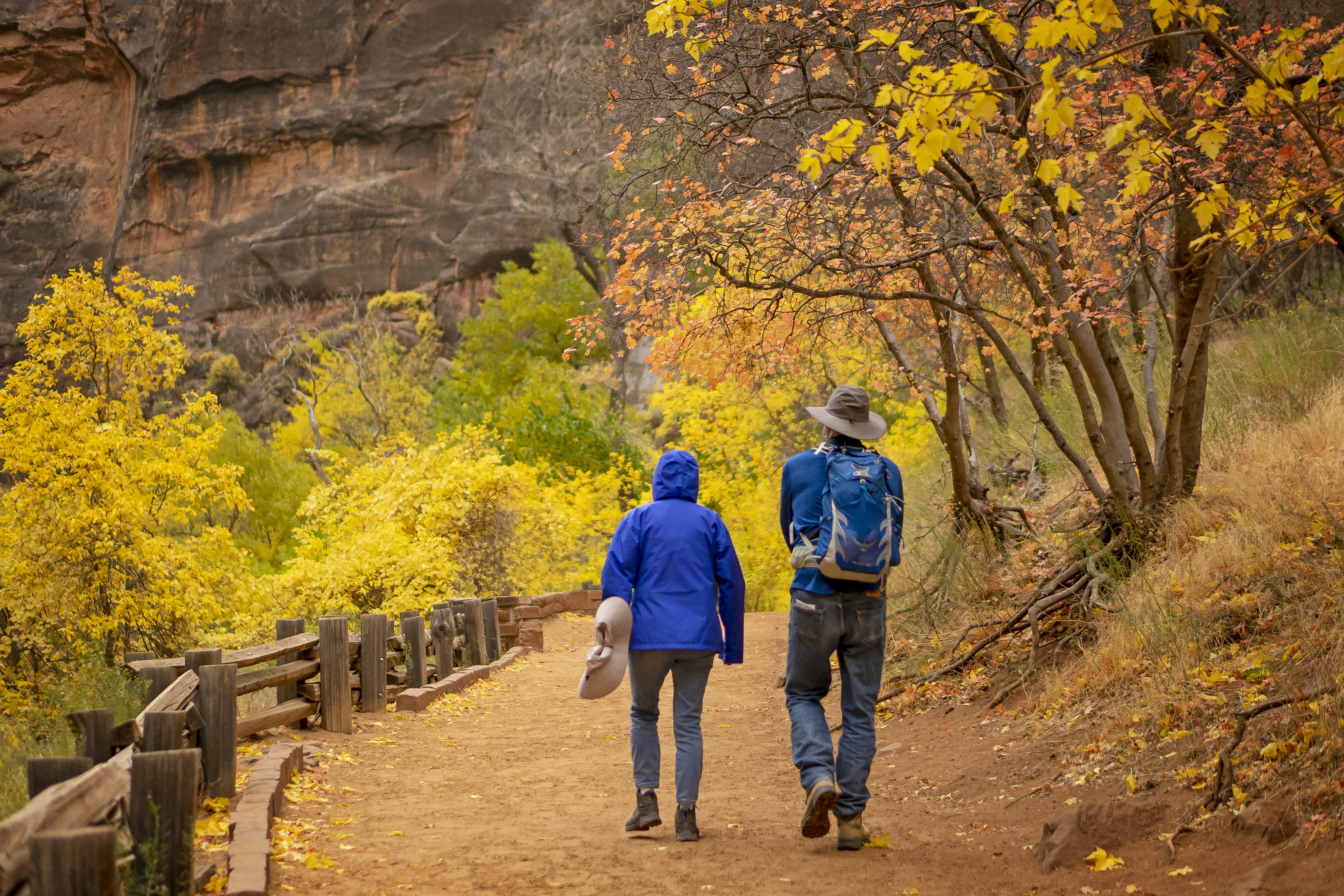
The Riverside Walk is a relatively flat and paved trail in the northern end of Zion Canyon. This easy trail follows the Virgin River as the sheer sandstone walls narrow in around you. The Riverside Walk is mostly flat through the first half-mile, although paving is irregular in some sections and minor drop-offs are present.
Middle Emerald Pools Trail
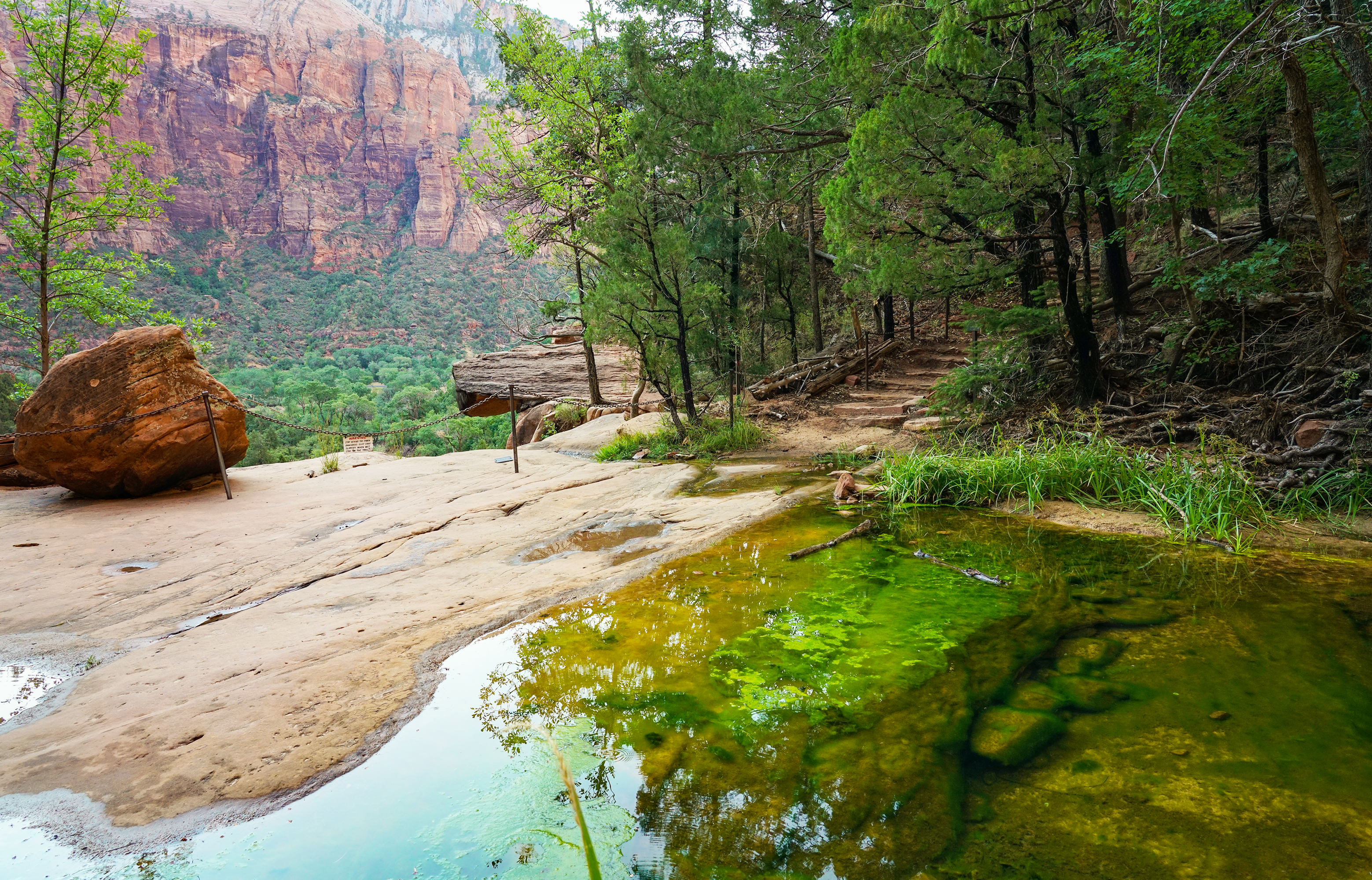
Middle Emerald Pools Trail is a moderate hike along an unpaved sandstone ledge above the Lower Emerald Pool Trail. The initial ascent is quite steep, bringing you to expansive views of main Zion Canyon below. Further along the trail, tucked into the red sandstone of the mountain, enjoy the shade and flora of pinyon-juniper woodlands. The trail then descends to emerald-colored pools of water above the small ephemeral waterfalls of Lower Emerald Pool Trail.
Upper Emerald Pools Trail
Upper Emerald Pools Trail is a moderate, 1 mile (1.6 km) trail that can be accessed via the Kayenta Trail, Lower Emerald Pools Trail, or Middle Emerald Pools Trail. Climb up stone steps to a sandy path that leads through pinyon-juniper woodlands to the base of towering canyon walls which boast majestic, seasonal waterfalls. The trail ends at the sandy shore of Upper Emerald Pool. No swimming.
Lower Emerald Pool Trail
Lower Emerald Pool trail is a rough, paved trail that leads through pinyon-juniper woodland to the Lower Emerald Pool and ephemeral waterfalls.The pools are fragile and an essential water source for wildlife. Do not go into the water. Connects to the other Emerald Pools trails and the Kayenta Trail. Avoid cliff edges. Swimming is not permitted. Restrooms and water filling stations are available at the Zion Lodge.
Kayenta Trail
The moderate, 2.0 mi (3.2 km) Kayenta Trail follows the Virgin River before ascending to the Lower and Upper Emerald Pool Trails. Provides panoramic views of Zion Canyon along the way. Long drop-offs are present along this trail. You can either return on the same trail, or make a loop using one of the Emerald Pools trails. Water and restrooms are available at The Grotto.
Grotto Trail
The trail connects the Zion Lodge to the Grotto and is near the road most of the way. This trail is a great place to view wildlife. Restrooms are available at both the Lodge and the Grotto. When the shuttle is not in operation and the parking is full at the Grotto, this trail is a lovely alternate way to reach the Grotto.
Pa'rus Trail
Pa’rus is Paiute for “bubbling water.” The Pa’rus Trail follows the Virgin River and has some of the best views of the Watchman. The paved trail connects the Zion Canyon Visitor Center and Canyon Junction. It is accessible for wheelchairs, pets on leashes, and bicycles. Trailside exhibits cover a variety of subjects, including plant and animal life along the river, geology, and human history.
Canyon Overlook
Long drop-offs, mostly fenced. Rocky and uneven trail ends at a viewpoint for Pine Creek Canyon and lower Zion Canyon. To enter or exit the parking area just east of the tunnel, you must turn right. Parking is extremely limited, be prepared to try multiple times. Pit toilets are available in the parking area.
Stargazing in Zion
Zion is a great place to connect with the night sky, whether you are an avid astrophotographer or this will be your first view of the Milky Way. As an International Dark Sky Park, Zion protects our incredible dark skies for present and future generations by not degrading the night with artificial light. This means that after sunset, the park is very dark. Be prepared!
Angels Landing
On and after April 1, 2022 hikers continuing to Angels Landing from Scout Lookout are required to have a permit, obtained on recreation.gov.
La Verkin Creek Trail to Kolob Arch
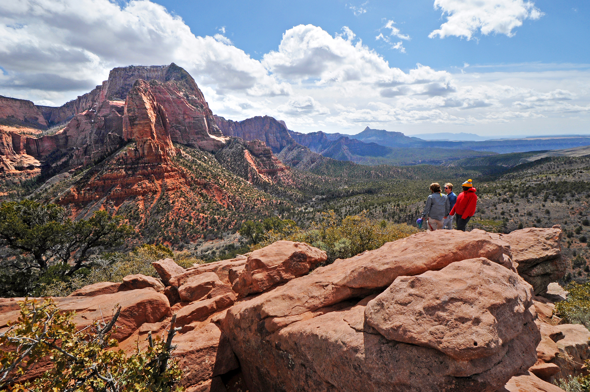
The La Verkin Creek Trail to the Kolob Arch allows hikers outstanding opportunities for solitude in a primitive area of Zion Wilderness. The trail begins at Lee Pass with stunning views of the Kolob Canyons as it crosses Timber Creek and continues to descend toward La Verkin Creek. After seven miles a spur trail leads hikers to a viewpoint where they can see the Kolob Arch.
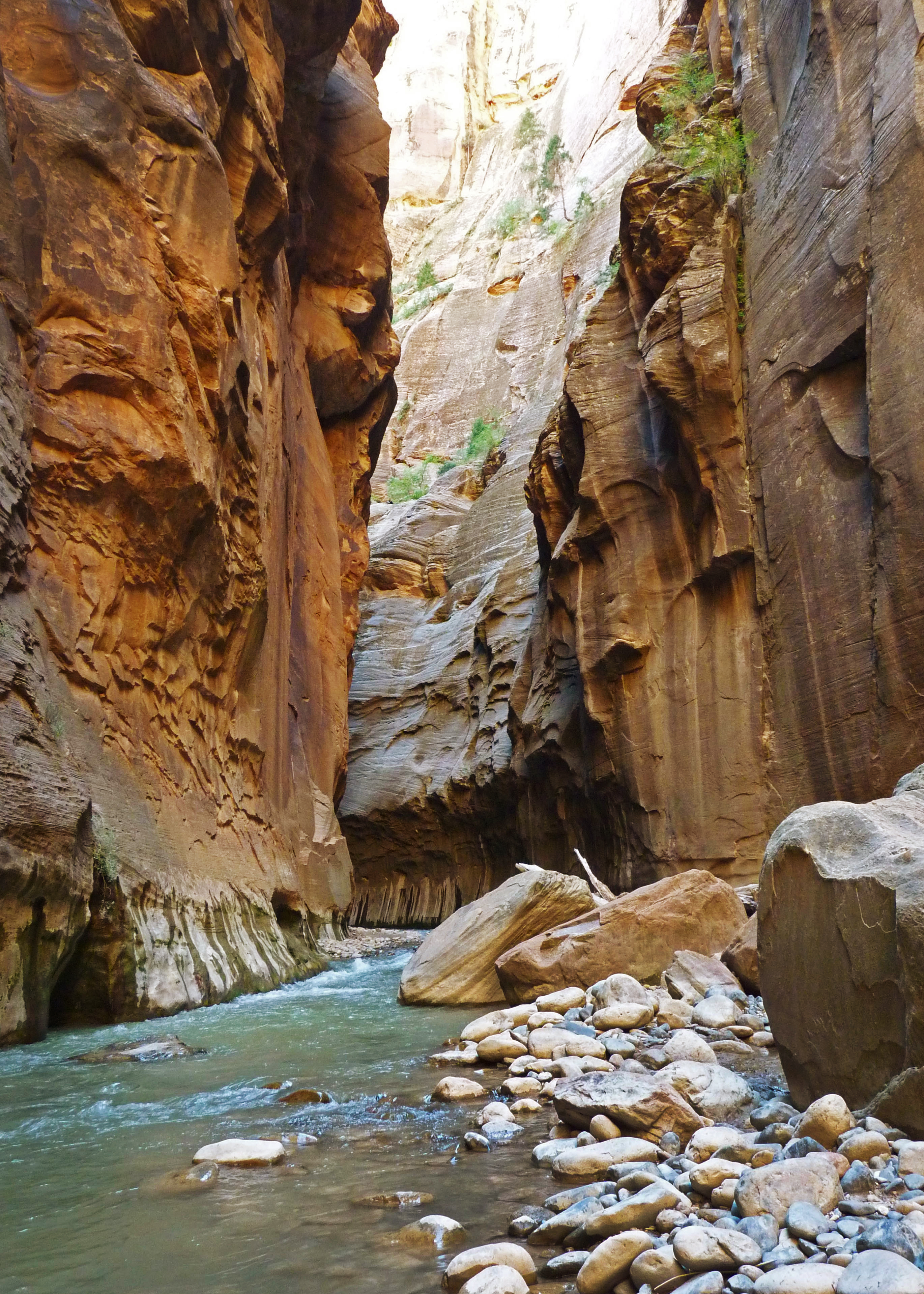
The Narrows
The Narrows is a strenuous hike that follows the Virgin River through a narrow slot canyon. After 1 mile (0.6 km) on the easy, paved Riverside Walk, head down a set of stairs and into the river. The rest of your hike will take place in the Virgin River, where the flow rate can change day by day and the streambed is rocky with unstable footing. Flash flooding and hypothermia are constant dangers.
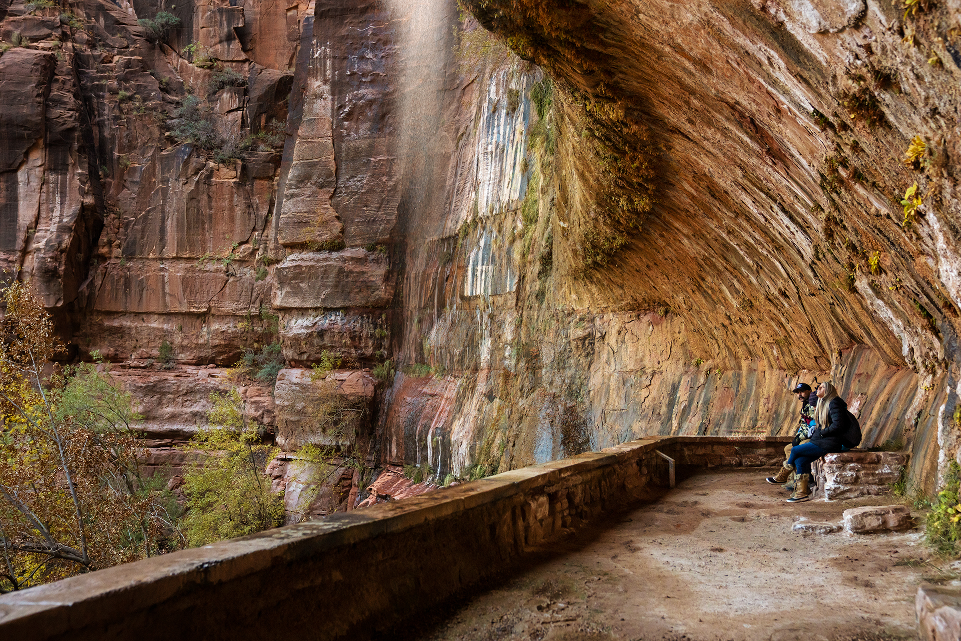
Weeping Rock
Short but steep! From the parking area, you'll cross the bridge and head to the left onto a paved trail to Weeping Rock. Along the way, look for small trailside exhibits and watch for minor drop-offs. The trail ends at a set of steps leading you to a rock alcove with dripping springs.
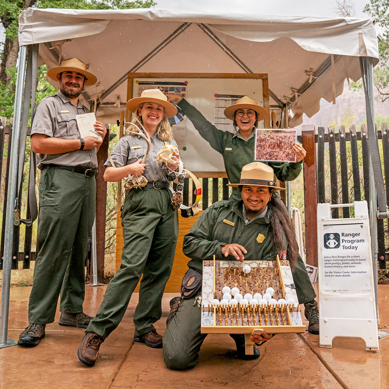
Zion Ranger-led Activities
Join a park ranger to learn about what makes Zion National Park such a special place! We have a variety of ranger-led activities throughout the year, and you can check the schedule on our Events Calendar. Topics range from geology and wildlife to art and human history, and everything inbetween. All ranger-led programs are free.
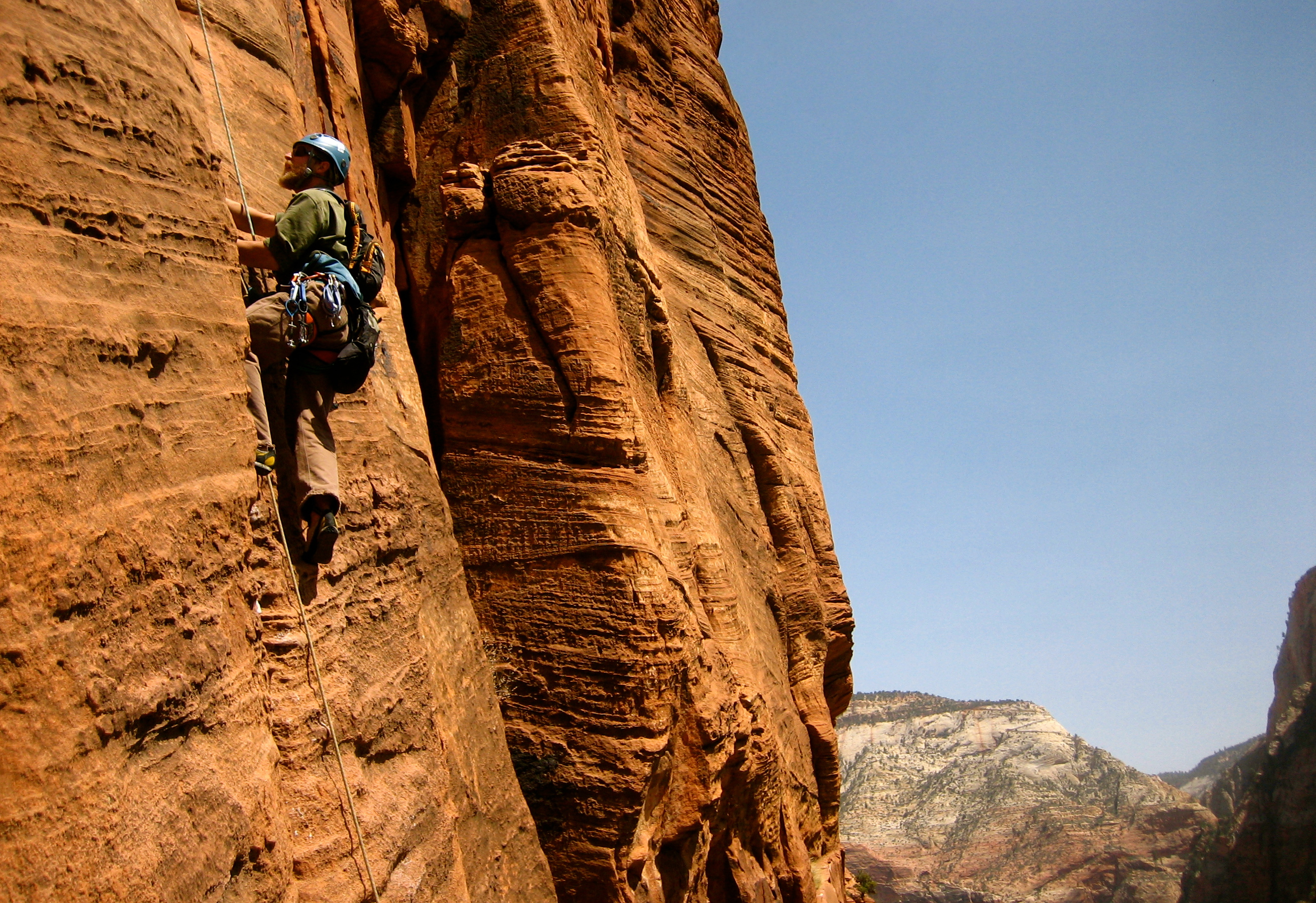
Climbing in Zion
Zion National Park's 2,000-foot sandstone cliffs are world renowned for their big wall climbs and adventurous nature. Most routes in the park are not recommended for inexperienced climbers due to difficulty and the soft nature of the rock. While areas outside of the park offer abundant sport climbing and top roping possibilities, this is rare in the park, with bolted routes often having sparse protection.
Tours
Count: 1
Pa'rus Self-Guided Walk
Follow the path of the Virgin River to learn about how its waters have shaped Zion Canyon. This paved trail travels 1.25 mi (2 km) along the Virgin River from the Zion Canyon Visitor Center to Canyon Junction. Restrooms and water are available at the Visitor Center and Museum.