Want to live on the edge? Visit a place recreated each day by ocean wind and waves. Life on Assateague Island has adapted to an existence on the move. Explore sandy beaches, salt marshes, maritime forests and coastal bays. Rest, relax, recreate a...
Reservations are not accepted due to changing weather conditions.
The Green Run backcountry campsite is in the Maryland district and is located at GPS coordinates 38.0799523; -75. 2135101. It is accessible by land and by canoe or kayak. To hike on land, it is 10.5 miles south of the North Ocean Beach parking lot and 15 miles from the Toms Cove Visitor Center. A white sign at kilometer 29.2 with a brown camping icon, hiking icon and an arrow directing you to the west through the dune crossing. Continue south on the trail behind the dune. The first dirt access road to the west leads to Green Run. To access by canoe or kayak it is a 9 mile paddle south from Old Ferry Landing. As you approach by water you will see posts with orange reflective tape on them marking the route. The campsite is in an open clearing within the pine forest area with light pine cover, providing some shade and wind protection. Biting insects are likely. Each site is delineated by a 50 foot radius around a fire ring. Each site has a picnic table, fire ring and lantern hangers. Green Run can accommodate up to 3 groups or 15 people. There is a vault toilet available for shared use by all groups. There is no fresh water available. There are views of the Chincoteague Bay and salt marsh.
Reservations are not accepted due to changing weather conditions.
The Little Levels backcountry campsite is in the Maryland district and is the most northern oceanside back country campsite and is located at GPS coordinates 38.04778; -75.23417. It is 4 miles south of the North Beach parking lot and 21 miles from the Toms Cove Visitor Center parking lot. It is accessible by hiking over sandy, uneven terrain. If hiking from the Toms Cove parking lot, a 7.5 mile gravel road is an alternative option to part of the hike on the sand. A white sign at kilometer 20.3 with a brown camping icon, hiking icon and an arrow direct you to the campsite behind the dunes. Camping is permitted within the boundaries and the site area will be sandy. This campsite is primarily a dune area with no wind protection or shade. Camping on or destroying a dune structure is prohibited. Little Levels can accommodate up to 5 groups or 25 people. There is a picnic table and a vault toilet available for use by all groups. There is no fresh water available. There are views of the Atlantic Ocean to the east and of maritime forest to the west.
Reservations are not accepted due to changing weather conditions.
The Pine Tree backcountry campsite is in the Maryland district and is the second most northern bayside back country campsite and is located at GPS coordinates 38.1432381; -75.1883865. It is accessible by land and by canoe or kayak. To hike on land, it is 6 miles south of the North Ocean Beach parking lot and 19.5 miles from the Toms Cove Visitor Center. A white sign at kilometer 21.8 with a brown camping icon, hiking icon and an arrow directing you to the west where a dirt access road leads to Pine Tree. To access by canoe or kayak it is a 5 mile paddle south from Old Ferry Landing. As you approach you will see posts with orange reflective tape on them marking the route. The campsite is in the pine forest area with shade, wind protection and some privacy. Biting insects are likely. Each site is delineated by a 50 foot radius around a fire ring. Each site has a picnic table, fire ring and lantern hangers. Pine Tree can accommodate up to 5 groups or 25 people. There is a vault toilet available for shared use by all groups. There is no fresh water available. There are views of the Chincoteague Bay and salt marsh.
Reservations are not accepted due to changing weather conditions
The Pope backcountry campsite is in the Maryland district and is the most southern bayside back country campsite and is located at GPS coordinates 38. 04778; -75. 23417. It is accessible by land and by canoe or kayak. To hike on land, it is 12 miles south of the North Ocean Beach parking lot and 12.5 miles from the Toms Cove Visitor Center. A white sign at kilometer 33.1 with a brown camping icon, hiking icon and an arrow directing you to the west through the dune crossing and the dirt access road that leads to Pope Bay. To access by canoe or kayak it is a 13 mile paddle south from Old Ferry Landing. As you approach you will see posts with orange reflective tape on them marking the route. The campsite is in an open clearing within the pine forest area with light pine cover, providing some shade and wind protection. Biting insects are likely. Each site is delineated by a 50 foot radius around a fire ring. Each site has a picnic table, fire ring and lantern hangers. Pope Bay can accommodate up to 2 groups or 10 people. There is a vault toilet available for shared use by all groups. There is no fresh water available. There are views of the Chincoteague Bay and salt marsh.
Reservations are not accepted due to changing weather conditions.
The State Line backcountry campsite is in the Maryland district and is the most southern oceanside back country campsite and is located on the ocean side at GPS coordinates 38.04472; -75.23139. It is one mile north of the fence that delineates Maryland and Virginia. It is accessible by hiking over sandy, uneven terrain. It is a 12.5 mile hike from the North Beach parking lot and a 12 mile hike from the Toms Cove Visitor Center parking lot. If hiking from the Toms Cove parking lot, a 7.5 mile gravel road (Service Road) is an alternative option to part of the hike on the sand. A white sign at kilometer 33.3 with a brown camping icon, hiking icon and an arrow direct you to the campsite behind the dunes. Camping is permitted within the boundaries and areas may be sandy while other areas within the boundary may have vegetation. This campsite is primarily a dune area with no wind protection or shade. Camping on or destroying a dune structure is prohibited. State line can accommodate up to 5 groups or 25 people. There is a picnic table and a vault toilet available for use by all groups. There is no fresh water available. There are views of the Atlantic Ocean to the east and views of maritime forest to the west.
Reservations are not accepted due to changing weather conditions.
The Tingles Island backcountry campsite is in the Maryland district and is the most northern bayside back country campsite and is located at GPS coordinates 38.1777115; -75.1754318. It is accessible by land and by canoe or kayak. To hike on land, it is 3 miles south of the North Ocean Beach parking lot and 22.5 miles from the Toms Cove Visitor Center. A white sign at kilometer 17.4 with a brown camping icon, hiking icon and an arrow directing you to the west where a dirt access road leads to Tingles Island. To access by canoe or kayak it is a 2 mile paddle south from Old Ferry Landing. As you approach by water you will see posts with orange reflective tape on them marking the route. The campsite is in the pine forest area with shade, wind protection and some privacy. Biting insects are likely. Each site is delineated by a 50 foot radius around a fire ring. Each site has a picnic table, fire ring and lantern hangers. Tingles Island can accommodate up to 5 groups or 25 people. There is a vault toilet available for shared use by all groups. There is no fresh water available. There are views of the Sinepuxent Bay and salt marsh.
National Park Service Reservation System Reservations are required from March 15 through November 15. Campsite reservations are available six months in advance. Be aware that nearly all reservations for weekends are filled the first day that they become available. Call the toll-free reservation line: 1-877-444-6777 (10:00 AM - 10:00 PM EST) or visit http://www.recreation.gov
Reservations are required from October 16 through April 14. Campsite reservations are available six months in advance. Be aware that nearly all reservations for weekends are filled the first day that they become available. Reserve online at Recreation.gov or by calling the toll-free reservation line: 1-877-444-6777. REMINDER: Horse Campers must bring their own horses.
National Park Service Reservation System Reservations are required from March 15 through November 15. Campsite reservations are available six months in advance. Be aware that nearly all reservations for weekends are filled the first day that they become available. Call the toll-free reservation line: 1-877-444-6777 (10:00 AM - 10:00 PM EST) or visit http://www.recreation.gov
The Loop 1 drive-in campground area is located on the oceanside and is just south of the Group Area Campground. To enter Loop 1, it is the third left-hand turn off of Oceanside Campground Drive. The loop is also a one-way road, however it travels south to north. Campsites have a paved parking area at each campsite. The paved parking area is painted with the campsite number. When you enter the loop, site 1 will be on your right and the sites numbers will increase on your left- and right-hand sides as you progress north on the loop. There are a total of 19 sites on Loop 1. Each site has a paved spot that is surrounded by beach and sandy dune habitat. Each site has a fire ring with a grill and a picnic table with locking storage for a cooler. A public vault toilet is located on the west side of the loop between site 8 and site 10. There are two wooden boardwalks that extend out to the oceanfront beach. The first wooden boardwalk is located on the eastside of the loop between site 7 and site 9. The second wooden boardwalk is located on the eastside of the loop between site 15 and site 17. To exit Loop 1, turn left at the stop sign and re-enter Oceanside Campground Drive and head south to Bayberry Drive. The Loop 2 drive-in campground area is located on the oceanside and is just south of Loop 1. To enter Loop 2, it is the fifth left-hand turn off of Oceanside Campground Drive. The loop is also a one-way road, however it travels south to north. Campsites have a paved parking area at each campsite. The paved parking area is painted with the campsite number. When you enter the loop, site 20 will be on your right and the sites numbers will increase on your left- and right-hand sides as you progress north on the loop. There are a total of 13 sites on Loop 2. Each site has a paved spot that is surrounded by beach and sandy dune habitat. Each site has a fire ring with a grill and a picnic table with locking storage for a cooler. A public vault toilet is located on the west side of the loop between site 31 and site 33. There is one boardwalk that extends out to the oceanfront beach. The boardwalk is located on the eastside of the loop between site 30 and site 32. To exit Loop 2, turn left at the stop sign and renter Oceanside Campground Drive and head south to Bayberry Drive.
National Park Service Reservation System Reservations are required year-round for Group camping. Campsite reservations are available six months in advance. Be aware that nearly all reservations for weekends are filled the first day that they become available. Call the toll-free reservation line: 1-877-444-6777 (10:00 AM - 10:00 PM EST) or visit http://www.recreation.gov
The Group Area Campground is on the oceanside and is the most northern of all the campgrounds. It is the first campground you will encounter on your left as you exit Bayberry Drive and turn left onto Oceanside Campground Drive. Oceanside Campground Drive is a one-way road that travels north to south. There is a parking lot with a recycling container. A wooden boardwalk leads from the parking lot out to the group campsites. Campsites are sandy, tent-site only, and 100-200 feet from the parking lot. Each site has a picnic table and a fire ring with a grill and a picnic table with locking storage for a cooler. There are two restroom facilities on the southside of the boardwalk. There are five group sites available. Sites 1, 2 and 3 are located on the northside of the wooden boardwalk with site 1 being the northernmost. Sites 4 and 5 are located on the southside of the boardwalk with site 5 being the southernmost.
National Park Service Reservation System Reservations are required from March 15 through November 15. Campsite reservations are available six months in advance. Be aware that nearly all reservations for weekends are filled the first day that they become available. Call the toll-free reservation line: 1-877-444-6777 (10:00 AM - 10:00 PM EST) or visit http://www.recreation.gov
The Oceanside Walk-in Campground 1 area is located on the oceanside and is just south of Loop 2. To park for Walk-in Campground 1, park in the first parking lot to the south of Loop 2. The parking lot is located on the east side of Oceanside Drive. Campsites 42-65 are located in Walk-in Campground 1 and are 100 ft to 600 ft from the parking lot and are accessible by a wooden boardwalk. In the northern corner of the parking lot there is a recycling bin. On the northside of the parking lot and to the east of the recycling bin is the northern wooden boardwalk that leads to sites 42-54. Sites 42-50 will be on the north side of the boardwalk, and sites 51-54 will be on the southside of the boardwalk. A public vault toilet is located on the northwestern side of the boardwalk between site 42 and site 44. In the middle of the parking lot is another short wooden boardwalk that leads to sites 53-62. Sites 53-55 are located on the north side of the boardwalk, sites 56-57 are east off the end of the boardwalk, and sites 58-62 are located to the southeast and south of the boardwalk. A third wooden boardwalk on the southern end of the parking lot leads to sites 60-65. Sites 60-65 are located on the north side of the boardwalk. A vaulted toilet is located on the southwest side of the boardwalk before you approach any of the campsites. Each site is surrounded by beach and sandy dune habitat. Each site has a fire ring with a grill and a picnic table with locking storage for a cooler. The Oceanside Walk-in Campground 2 area is located on the oceanside and is just south of Oceanside Walk-in Campground 1. To park for Walk-in Campground 2, park in the first parking lot to the south of Oceanside Walk-in Campground 1 parking lot. The parking lot is located on the east side of Oceanside Drive. Campsites 66-85 are located in Walk-in Campground 2 and are 100 ft to 600 ft from the parking lot and are accessible by a wooden boardwalk. In the southern corner of the parking lot there is a recycling bin. On the eastside of the center of the parking lot is a wooden boardwalk that leads to sites 66-85. Sites 66 - 82 will be on the north side of the boardwalk, and sites 83 - 85 will be on the southside of the boardwalk. A public vault toilet is located on the southside of the boardwalk across from site 68. Each site is surrounded by beach and sandy dune habitat. Each site has a fire ring with a grill and a picnic table with locking storage for a cooler. The Oceanside Walk-in Campground 3 area is located on the oceanside and is just south of Oceanside Walk-in Campground 2. It is the southernmost walk-in campground. To park for Walk-in Campground 3, park in the first parking lot to the south of Oceanside Walk-in Campground 2 parking lot. The parking lot is located on the east side of Oceanside Drive. Campsites 86 - 104 are located in Walk-in Campground 2 and are 100 ft to 600 ft from the parking lot and are accessible by a wooden boardwalk. In the northern corner of the parking lot there is a recycling bin. On the eastside of the center of the parking lot is a wooden boardwalk that leads to sites 86 - 104. Sites 86 - 98 will be on the north side of the boardwalk, and sites 99 - 104 will be on the southside of the boardwalk. A public vault toilet is located on the southside of the boardwalk across from site 87. Each site is surrounded by beach and sandy dune habitat. Each site has a fire ring with a grill and a picnic table with locking storage for a cooler.
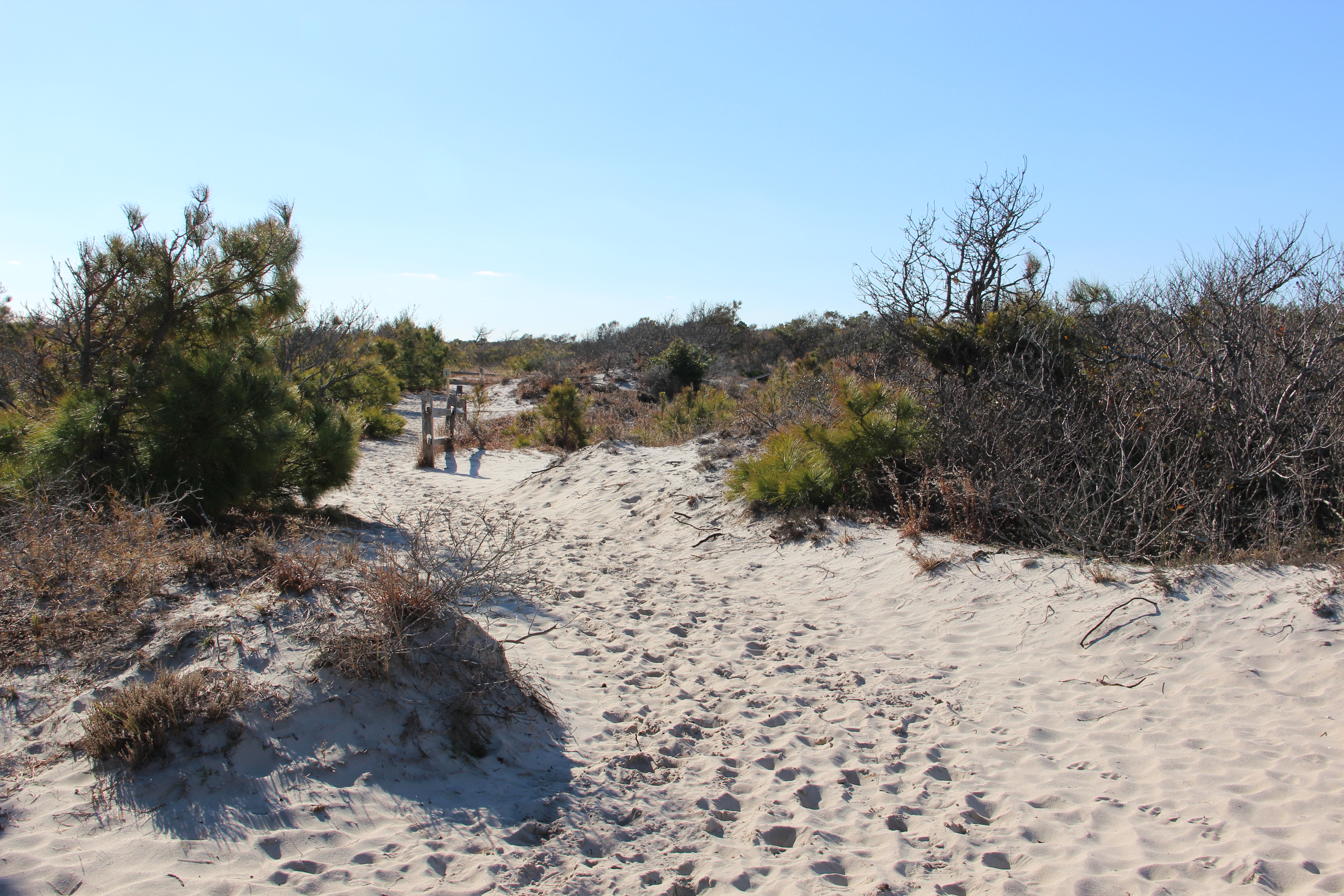
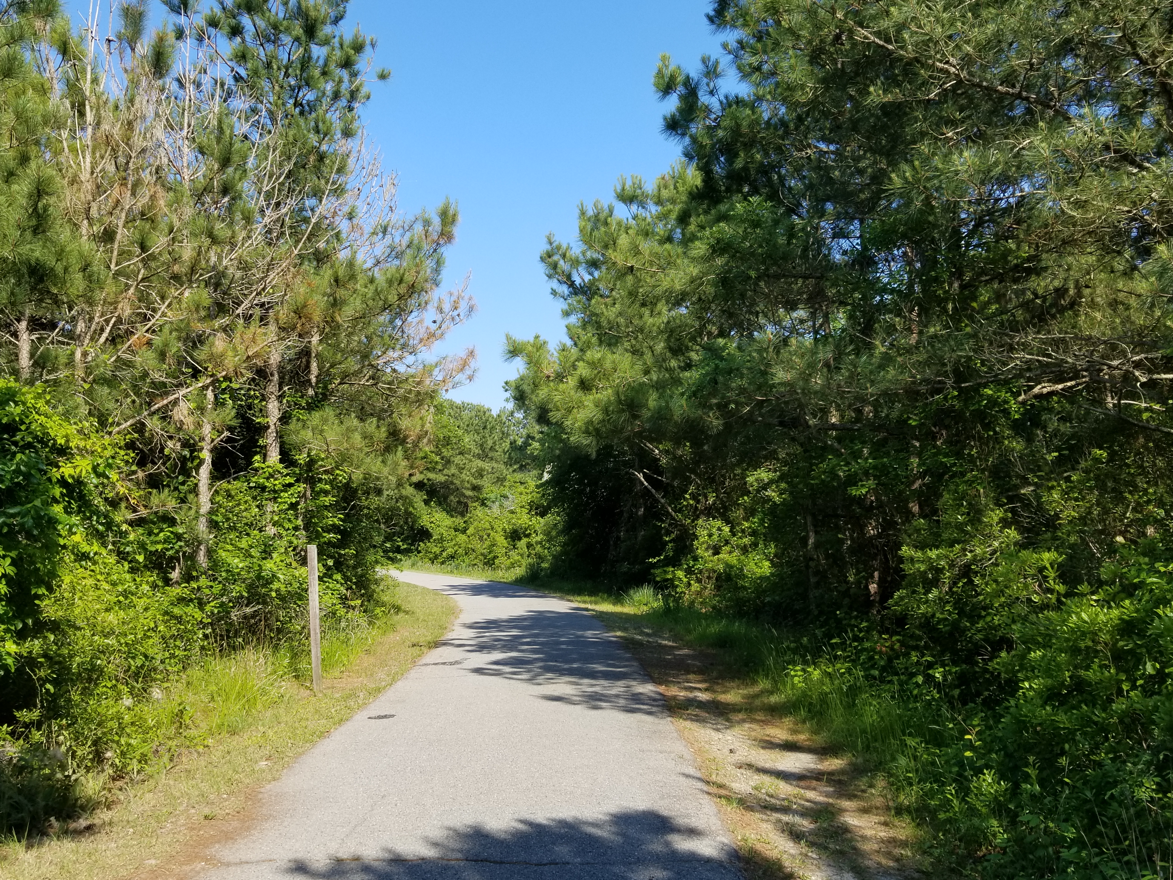
Stroll through Assateague's dunes and along the remnants of historical "Baltimore Boulevard". This 1/2 mile trail loop begins at South Beach parking lot.
The Life of the Dunes Trail begins at the south end of the South Beach parking lot. When facing the south in the parking lot, you will enter at the trailhead sign and immediately begin walking on sand that has a slight increasing grade. As you continue on the ¾ mile loop you will see dunes to your left and right that have become vegetated with beach grasses as well as stunted loblolly pines. Continuing south you will come upon uneven terrain that requires stepping up 1-3 feet (depending on area) on to old pavement. This pavement is no longer smooth and compact but has erosion causing dips and divots in the pavement. When viewing this pavement from the side, you can see how thick asphalt roads were laid in the 1960’s as this was a road intended to run the length of a new up and coming resort community on Assateague Island. A few hundred feet later as you begin walking westward, you will be required to step down from the pavement back onto sandy terrain. To your left and right, the dune heights are increasing as well as the variety of vegetation growing on them. You will approach an observation platform about halfway into the trail. You will have to walk up 5 wooden steps with wooden rails on both sides, walk around 15 feet on a flat wooden platform, and walk up 4 more wooden steps with rails on both sides. Now on top of the observation deck, there is a wooden bench you may sit on. From the observation deck, you can see the beach and ocean on the east horizon, the trail to your north, maritime forest to your west and the Over-Sand Vehicle beach to your south. Continuing west you will walk down 7 wooden steps with wooden railing on both sides onto the sandy trail below. The trail will turn northward back towards the South Beach parking lot. You with walk a couple hundred feet through a canopy of maritime forest before exiting through the vegetated dunes at the trail entrance.
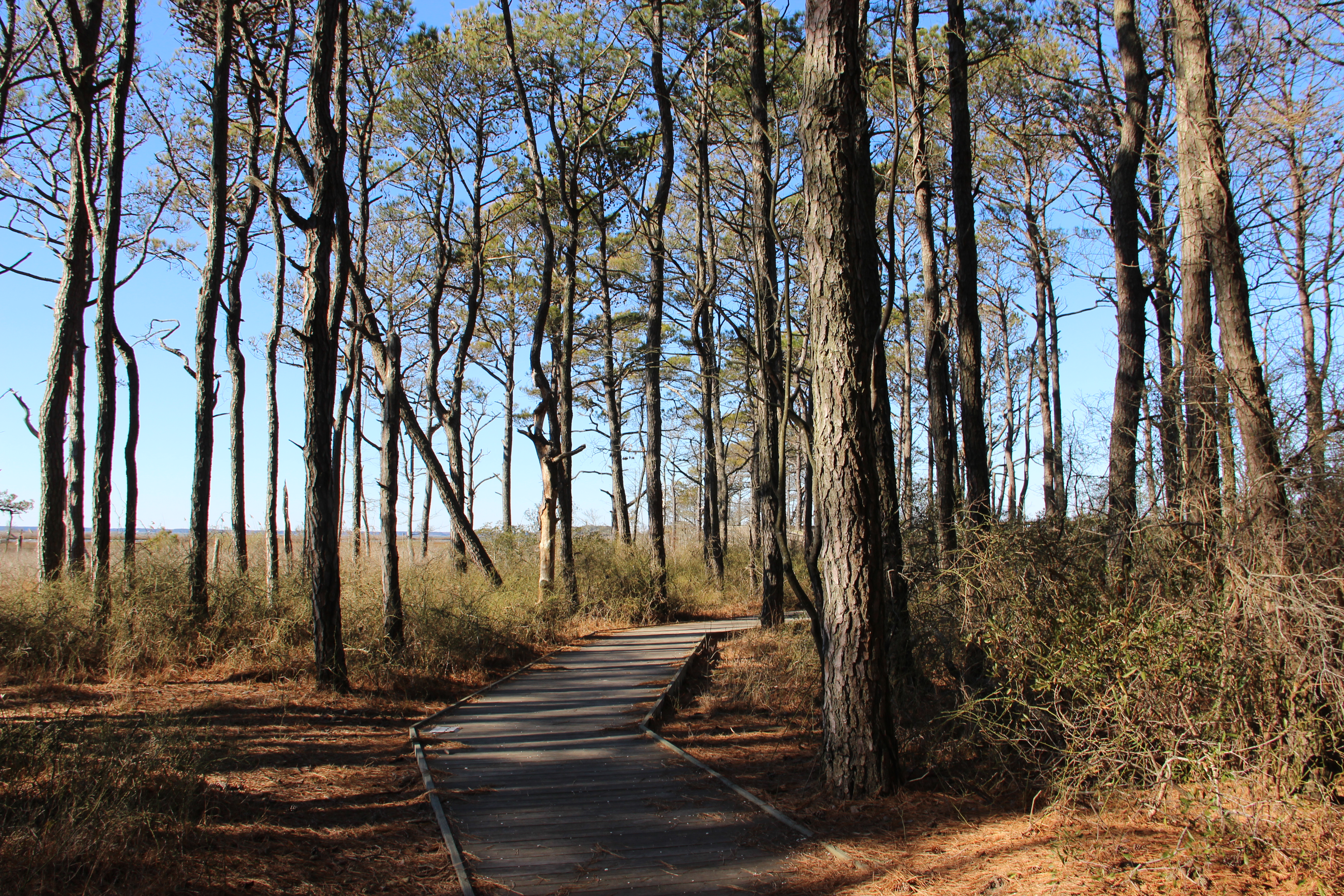
Walk along the boardwalk leading through Assateague's maritime forest while listening to the song birds. This 1/2 mile trail will emerge out of the forest to the marsh and overlook the Sinepuxent Bay and Old Ferry Landing.
The Life of the Forest trailhead is located on the westside of Bayberry Drive. A small paved parking lot is available at the trailhead. The trail is accessible for wheelchairs and those with limited mobility, however trail surfaces vary. At the beginning of the trail the surface is compact dirt with gravel and at times may be covered with pine needles. A couple hundred feet into the trail the surface changes to a wooden planked boardwalk. There is a gradual incline that leads to the raised portion of the boardwalk that leads between the marsh and the Sinepuxent Bay. There is a metal handrail on both sides of the boardwalk for the entire length. A variety of overlooks off the side of the main boardwalk are available for viewing the marsh, bay and forest habitats. For an additional description of scenery, please follow the OnCell self-guided tour that coordinates with numbered markers on the trail. For the OnCell tour, call 410-864-9128 or go to ASIS.ONCELL.COM.
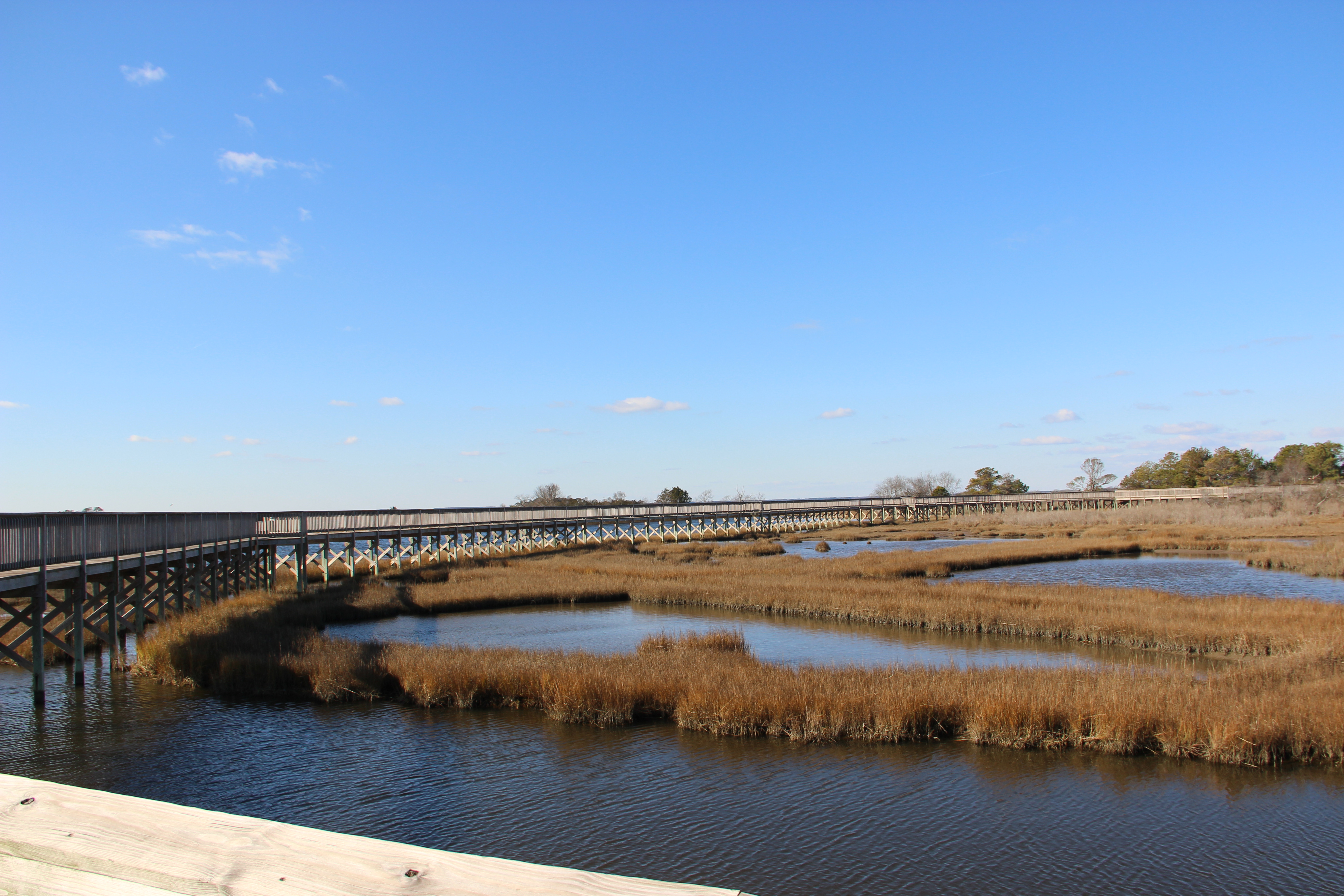
This 1/2 mile accessible trail is located off of Bayside Drive in the MD district of Assateague Island. The elevated wooden boardwalk provide spectacular views of the marsh, especially during a sunset stroll.
The small parking lot and entrance to the Life of the Marsh Trail is located on the southside of Bayside Drive. It is a short walk from the bayside campground loops. The entrance to the ½ mile loop is located on the east side of the parking lot and is a wooden boardwalk wide enough for wheelchair access. You begin you trip with a short walk through the shrub thicket habit and emerge to an open marsh area on your left and right. The boardwalk slopes upwards to lead you to the elevated boardwalk and observation deck overlooking the marsh grasses and waters of the Sinepuxent Bay. As you continue walking north on the boardwalk you will begin to descend back down the ramp to the shrub thicket habitat where you are led back to the parking lot. For an additional description of scenery, please follow the OnCell self-guided tour that coordinates with numbered markers on the trail. For the OnCell tour, call 410-864-9128 or go to ASIS.ONCELL. COM.
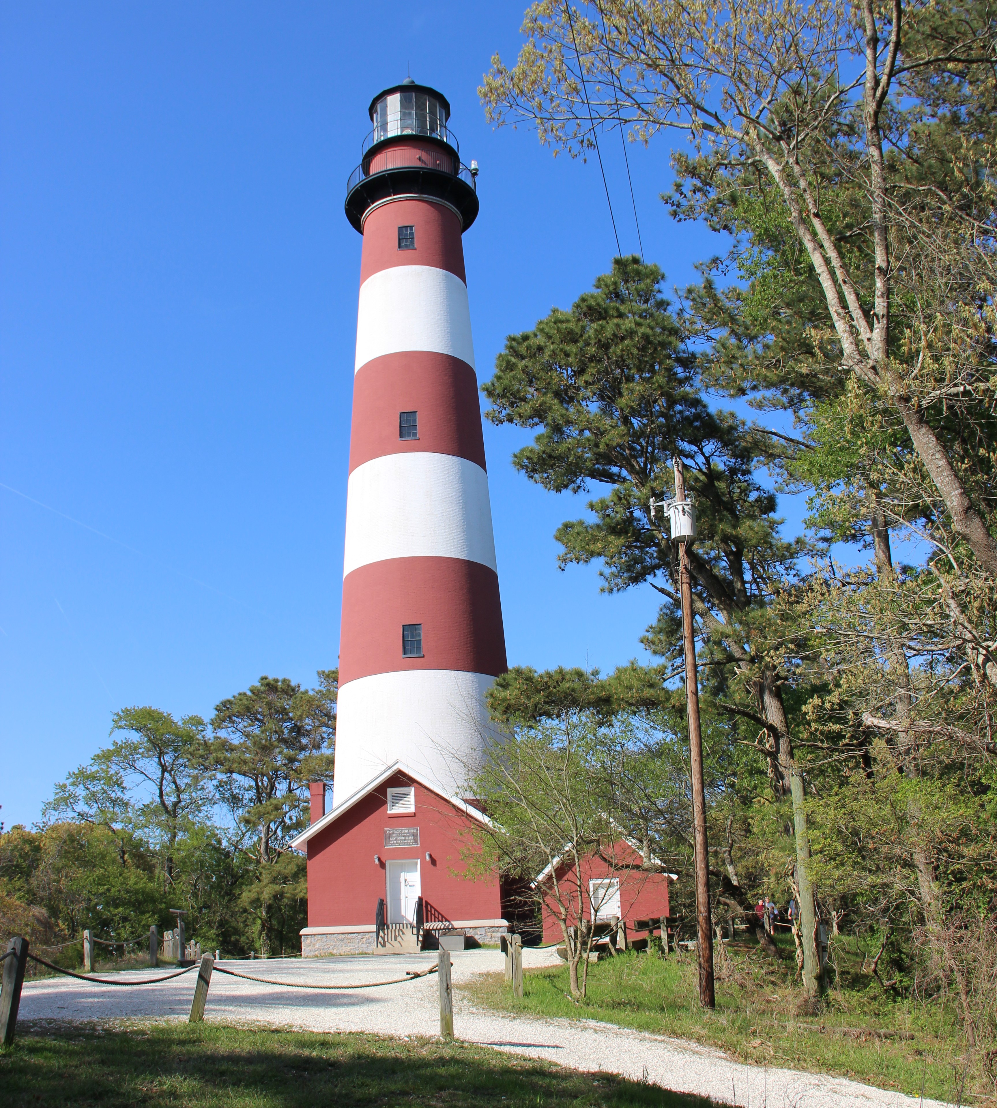
The unpaved ¼ mile round trip Lighthouse Trail winds through maritime forest leading up to the top of the 22 foot dune where the historic red and white striped Assateague Lighthouse and oil shed stands.
The Lighthouse Trail parking lot is located on the south side of Beach Road. The Lighthouse Trail is not an accessible trail, however there is an accessible entrance that provides a small parking lot at the top of the trail. The trailhead parking lot is comprised of natural shell and stone and is the first parking lot on the right after entering through the Chincoteague National Wildlife Refuge fee booths. A vaulted toilet is available by the east entrance to the trail. The trail is unpaved, uneven and is made up of several natural materials such as dirt, stone, pine needles, and shell. The trail is in the shape of a horseshoe. As you enter the trail, maritime forest will stand tall on both sides of you. Loblolly Pine trees, catbrier and poison ivy are just a few of the plants you will observe. The trail continues to wind around lone standing pines until leading you gradually up a 22 foot tall dune. At the midway point (1/8 mile) you arrive at the top of the dune in a clearing and are facing the 145 foot tall red and white striped historic Assateague Lighthouse and oil shed. As you continue along the trail, you re-enter the maritime forest and gradually descend the dune. You will likely hear the peeps and songs of songbirds rustling through the forest undergrowth. The trail continues to wind around stand-alone pine trees and between low-lying areas of freshwater pools. You will then return to the parking lot on the opposite side from where you entered.
The Swan Cove Trail, which branches off from the Wildlife Loop has become an increasingly popular trail out to the beach. Many people have referred to this area as the “bike beach”. This is a great trail to take out to catch the morning sunrise over the ocean. Please note, this area of the beach is not lifeguarded.
The Swan Cove Trail extends off the east side of the Wildlife Loop about 1 ½ miles in. Swan Cove Trail is a ½ mile (each way) paved accessible trail open to walking and bicycling. There is a sign at the trailhead and a wooden vertical piling restricting vehicle access. As you progress down the trail you will see shrub/ thicket habitat on your left and right side. You may see pollinators as well as a possibility of muskrat or otters. As you get closer to the beach the trail will slowly start to become a mix of pavement and windblown sand. Once you near the beach entrance you will need to travel over loose sand and up a slight inclined dune. This may be inaccessible for some people with walking disabilities. A vaulted toilet is available at the beach entrance.
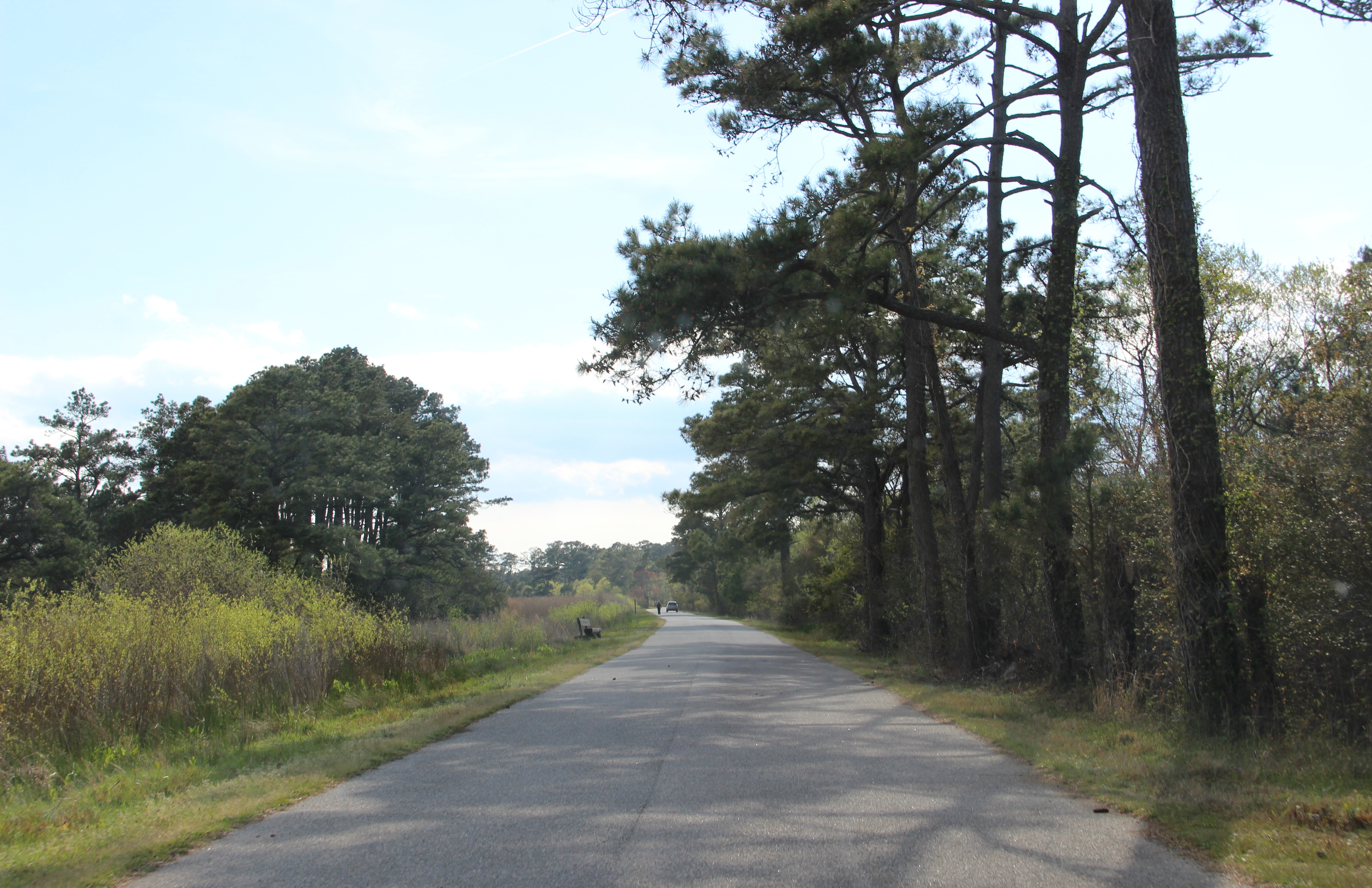
This paved 3.25 mile loop offers enjoyment and numerous opportunities to visitors. This trail provides excellent views of the marsh as well as a great example of how the U.S. Fish and Wildlife Service manages freshwater pools for migrating birds.
The parking lot to the Wildlife Loop is the first left-hand turn after entering through the Chincoteague National Wildlife Refuge. There are vaulted restrooms available in the paved parking lot before entering the trail. There is a set of auto-gates at the entrance to the Wildlife Loop. If it is before 3 pm, the arms to the gate will be down restricting vehicle access. Walkers and bicyclers are welcome to pass by the gate. This is a paved, accessible, 3.25 mile trail. When you enter the trail, veer to the right, and stay on the paved trail. The Wildlife Loop is one large circle of a trail, and you will be consistently turning slightly to your left. On your right you will see a small portion of maritime forest and on you left you will see freshwater marsh habitat. About a ¼ to a 1/3 of a mile into the trail, there will be a wooden bench made of large logs. Between this bench and the next bench if you look to the right at the stand of tall pine trees, you may be able to see the Bald Eagle’s nest. On the left side of the trail, you may see a shallow water pool in the winter full of waterfowl or a mudflat in the summer with wading birds. Freshwater pools on the Wildlife Loop are managed by the U.S. Fish and Wildlife Service for migratory birds. You may also see marsh grasses and non-native invasive Phragmites plants growing along the trail edge. In a couple hundred feet you will see the entrance to the Black Duck Trail to your right. Continuing around the Wildlife Loop you will notice freshwater pools or mudflats on each side of the trail with tall Phragmites plants growing. About 1 ½ miles into the trail you will see the entrance to the Swan Cove Trail on your right. This trail will lead to the Beach. Once you pass the entrance to the Swan Cove Trail you will enter a portion that winds through a shrub thicket and small maritime forest area. A couple hundred feet into this area you will see a small parking lot on your left with a vaulted toilet. There is also an accessible wooden boardwalk that leads out to an observation deck that overlooks the center of the Wildlife Loop. Here you may see woodland birds and Delmarva fox squirrels. When you exit the maritime forest, you progress down a long strait portion of the trail. To your left you will see the center of the Wildlife Loop filled with grasses and wet areas. To your right, there is a large pool of water likely boasting birds and snapping turtles. As you near the end of the strait roadway, you will see a gravel road to your right. This is the entrance to the 7.5 mile Service Road trail (not accessible) and northern OSV fishing access. Continuing around the trail to your left be mindful of two-way traffic. Vehicles may be present prior to 3 pm if they are accessing the northern OSV fishing zone. To your right you will see shrub thicket and maritime forest, and to your left you will see grasses, freshwater marsh area and cattail. In about a ½ mile, you will see an unpaved trail on the left that leads to an elevated observation deck that looks out over the center of the Wildlife Loop. This unpaved trail is also an entrance to the Marsh Trail (not accessible). In a half mile, you will pass the other entrance on your left to the marsh trail and notice a crossover to the parking lot on your right. If you continue a few hundred feet on the trail, you will return back to the entrance of the Wildlife Loop and the parking lot will be on your right.
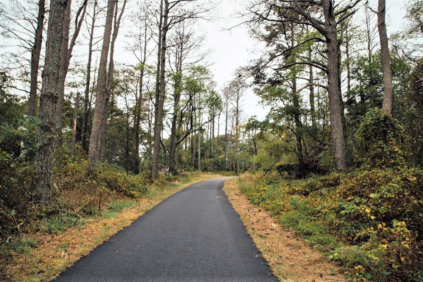
The Woodland Trail is a 1.6 mile paved accessible trail that winds through the loblolly pine forest. Stop on the north side of the trail at the Pony Overlook to try to catch a glimpse of the horses.
The Woodland Trail is a paved accessible 1.6 mile loop with little to no grade and is wheelchair accessible. When entering the trail there will be trees that have been downed and/or removed from both the left- and right-hand sides due to storms and damage from pine bark beetles. In about 50 yards, you will come to a split in the trail. A sign pointing to the left will say “Bivalve Trail” and a sign pointing to the right will say “Pony Overlook”. The Woodland Trail is a loop, so if you plan to do the whole trail you can go either way. Through the entire trail you will see tall stands of loblolly pines on both your left and right sides. Many trees may have vines growing up them and brush and shrubbery along the forest floor. Delmarva fox squirrels, rabbits and birds are also a common sight along the trail. The trail will be shady in many spots with some areas of sunshine peeking through the trees. Benches for sitting are available periodically along the trail. If you choose to take the path to your right to the Pony Overlook, it will be about ½ mile until you reach the overlook platform. As you walk through the maritime forest, you will see stands of loblolly pines, thistle, Catbrier and Devil’s Walking Stick. You may also see or hear the Delmarva fox squirrel or Sika Elk rustling in the brush and red headed woodpeckers. If you choose to take the path to the left, you will encounter the Bivalve Trail about ½ mile in on your left. When looking to your right, you may notice wooden boxes attached to some of the loblolly pine trees. These boxes are not birdhouses, but rather for the Delmarva fox squirrels. On your left and right, you will see pine trees, thistle, Virginia creeper and cat briar. You will likely hear songbirds as well the pecking of woodpeckers.
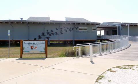
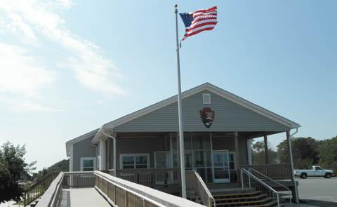
The Assateague Island Visitor Center is located in the Maryland District of Assateague Island before the Verrazzano Bridge entrance into the park. The Assateague Island Visitor Center is open daily from 9 am - 4 pm.
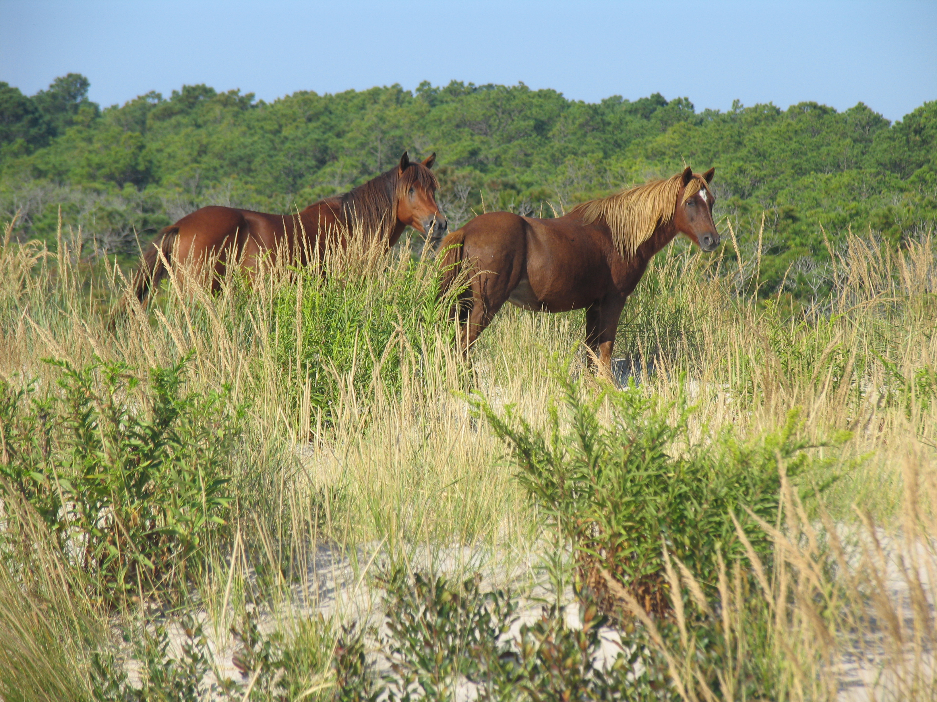
View the wild horses of Assateague Island National Seashore. The wild horses are free roaming and spend time in the various habitats on the island. While they graze in the marshes and find freshwater in the forest, you may even see them out on the beach with you! Remember to observe the horses from no less than 40 feet away because they are wild and will bite and kick.
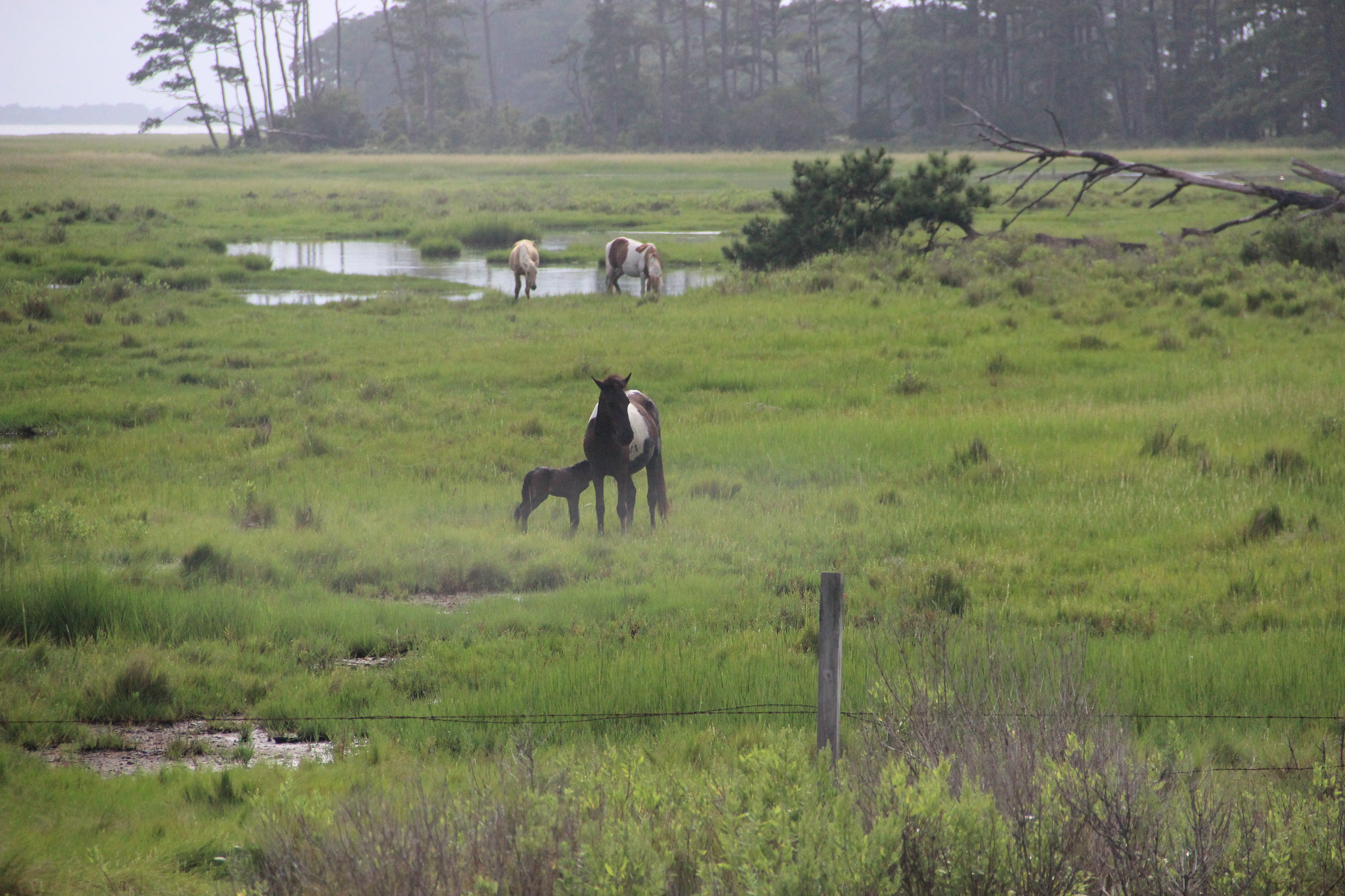
See the Wild Horses in the Virginia District
Assateague Island is well known for the famous wild horses who call the island home. In the Virginia district, the wild horses are commonly referred to as “Chincoteague Ponies”. Unlike the Maryland district where the horses are free to roam, the Chincoteague Ponies are fenced off the road and trails in two separate large management areas of the refuge resulting in a northern herd and a southern herd. Horses may be visible by foot, bike or car.
Surf Fishing on Assateague
Grab your fishing pole and get comfortable on the beach! Surf fishing is an activity that is not only fun and relaxing, but also has the potential of producing your dinner for the night! Spring, summer and fall are the recommended times of the year to fish.
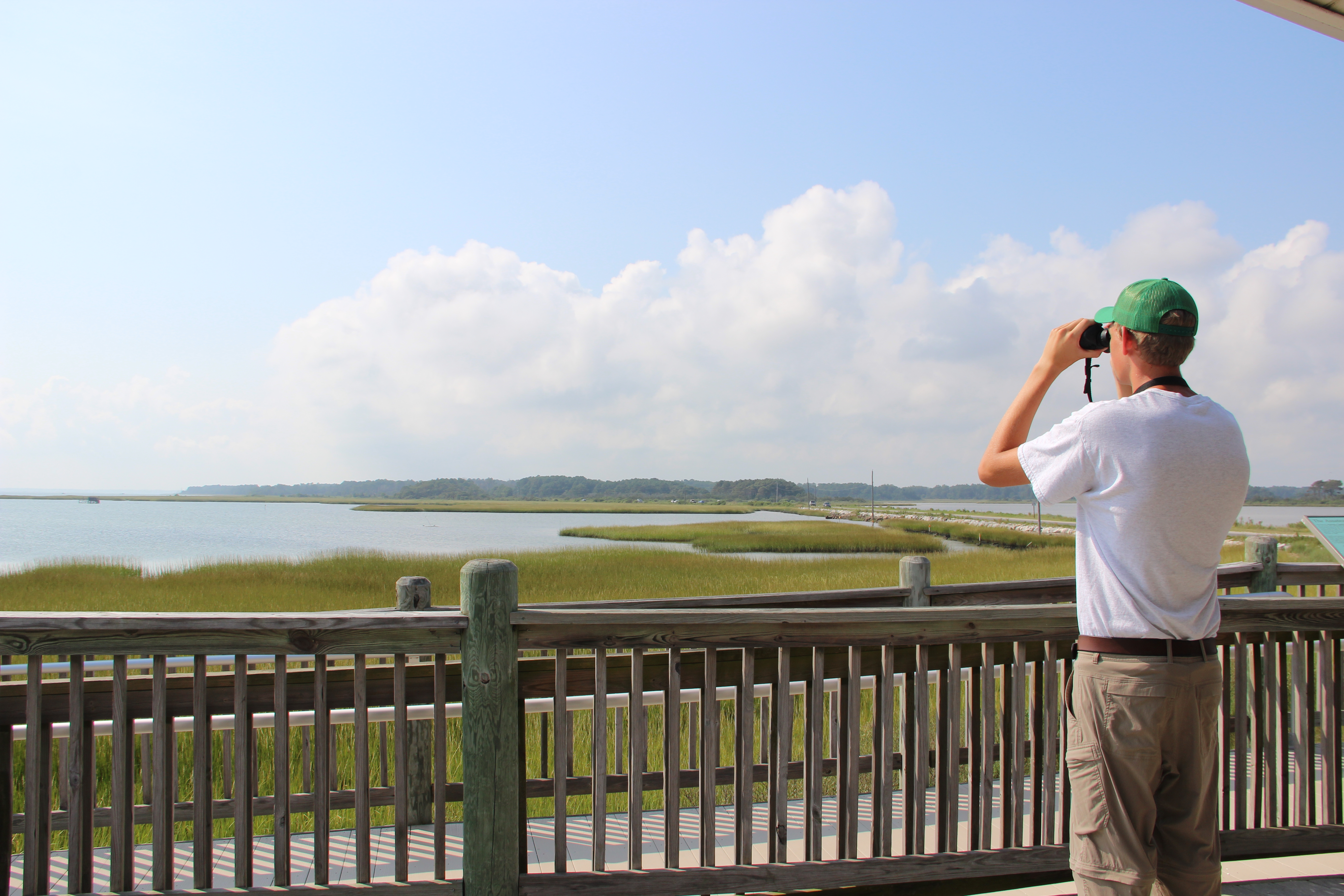
Bird at Toms Cove
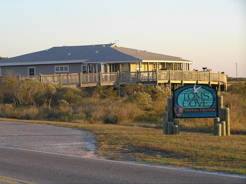
The Virginia district of Assateague Island lies within the Atlantic Flyway, providing excellent birding opportunities year-round. No matter what time of year you visit, a great spot to start your birding adventure is on the deck of Toms Cove Visitor Center.
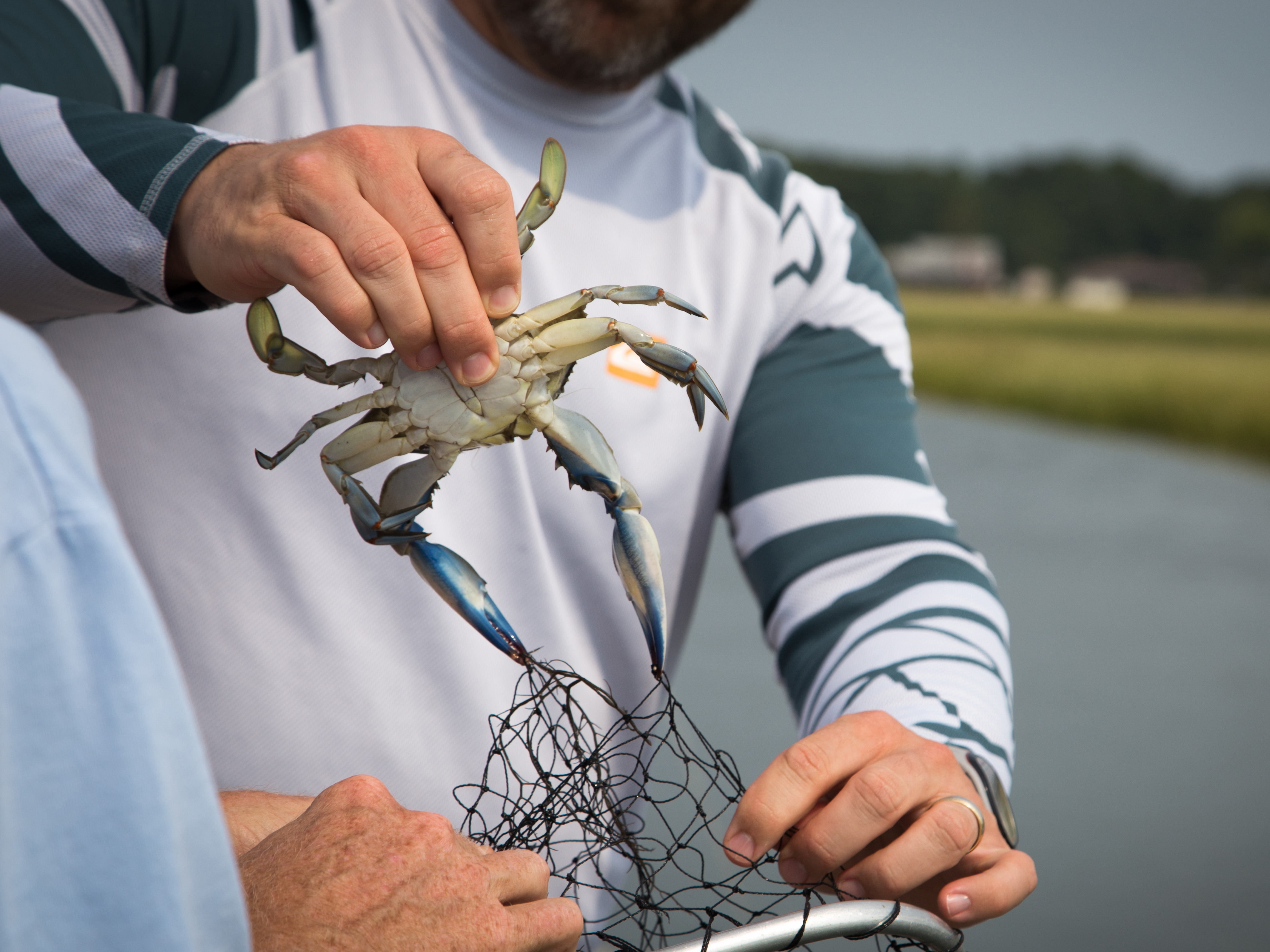
Crabbing at Assateague Island
Who doesn’t love to eat a blue crab? After all, the literal translation of this Latin name (Callinectes sapidus) is the beautiful (calli) swimmer (nectes) that is savory (sapidus). Crabbing is a great activity for the entire family regardless of age.