Be advised that the NPS has issued alerts for this park.
Road Closures
River Road East is open from the eastern end to the Glenn Spring Road junction. Glenn Spring Road is open. The paved road between Castolon and Santa Elena Canyon (Park Route 16) is open, but there is mud and water on the road in some locations. River Road is closed west of the Glenn Springs Road junction. Old Ore Road, Hot Springs Road, and Black Gap Road are all closed. Unpaved roads require 4-wheel drive. Your safety is your responsibility, be prepared to self-rescue.
Pardon Our Dust: Chisos Basin Improvement Projects to Begin May 1, 2026
Work on two large construction projects in the Chisos Basin will begin in May 2026 and continue for approximately two years. Major disruptions in visitor access to the Chisos Basin are expected during this time. Big Bend National Park will remain OPEN.
Panther Junction Gas Station Store Closed
Panther Junction Gas Station Store is closed for a remodel, but gas is still available.
Big Bend is a NO DRONE Zone
The use of drones is prohibited in Big Bend National Park. Thank you for preserving the peace and tranquility of Big Bend.
Bringing a Pet to Big Bend?
Bringing your pet to Big Bend National Park will limit some of your park explorations and opportunities. Pets are not allowed on park trails, in the backcountry, or on the river. Pets are allowed only where vehicles can go. Pets may not be left unattended
There is a place in Far West Texas where night skies are dark as coal and rivers carve temple-like canyons in ancient limestone. Here, at the end of the road, hundreds of bird species take refuge in a solitary mountain range surrounded by weather...
Admits one private, non-commercial vehicle (15 passenger capacity or less); valid for 7 days.
Entrance - Motorcycle
$25.00
Admits one non-commercial motorcycle; valid for 7 days.
Entrance - Per Person
$15.00
Admits one individual. Typically used for bicyclists and pedestrians; valid for 7 days.
Commercial Entrance - Motor Coach
$200.00
Companies conducting business in the park are required to obtain a commercial use authorization. The only exception is companies travelling in a 26-person capacity or greater vehicle; such vehicles are charged a flat fee of $200 (commercial use authorization not required).
Entrance - Non-commercial Groups
$30.00
Organized groups such as Scouts, clubs, etc. that do not qualify for an academic fee waiver are charged as follows:
$30 per non-commercial vehicle with a capacity of 15 or less.
$15 per person traveling in a non-commercial vehicle with a capacity of 16 or more. Fees will not exceed the commercial rate for the same sized vehicle. Youth 15 and younger are free. Individuals or families with a valid annual or lifetime pass may use their pass for themselves and up to 3 others.
Commercial Entrance - Mini-bus
$100.00
This fee is valid for seven consecutive days. A commercial use authorization is required.
https://www.nps.gov/bibe/learn/management/cua.htm
Commercial Entrance - Sedan
$25.00
These fees are charged only to commercial organizations, such as tour companies. This fee is determined by the seating capacity of the vehicle. For sedan with 1 to 6 seats, the fee is $30 + $15 per client.
This fee is valid for seven consecutive days. A commercial use authorization is required.
Reservations are required. No first-come, first-serve camping. The Chisos Basin Campground is open year-round. -- 2/3 of campsites are reservable up to 6 months in advance. -- 1/3 of campsites are reservable up to 14 days in advance. Reservations for Chisos Basin Campground are made at: https://www.recreation.gov/camping/campgrounds/234038
The Chisos Basin Campground is nestled in an open woodland within a scenic mountain basin. Campers enjoy spectacular views of Casa Grande and Emory Peak. Sunset through the nearby "Window" is a Big Bend highlight. Some of the park's most popular trails begin nearby. RESERVATIONS REQUIRED. Trailers over 20 feet and RV's over 24 feet are not recommended due to the narrow, winding road to the Basin and small campsites.
Campground is open year round. Plan Ahead: there are no first come, first served campsites Reservations required. All campsites are reservation only, up to 14 days in advance. Campground is operated at a reduced capacity during the heat of summer (May 1- October 31) Reservations for Cottonwood Campground are made at: https://www.recreation.gov/camping/campgrounds/234078
Cottonwood Campground is a quiet oasis in the western corner of Big Bend National Park. Reservations are required. Conveniently located between the Castolon Historic District, the scenic Santa Elena Canyon and the tail end of the Ross Maxwell Scenic Drive, this small, 22-site campground is one of the least-known and quiet campgrounds in the park. There is one group campsite and 21 individual sites. This is a remote campground in a remote park. It is dry camping, no hook-ups, and no generators are permitted.
Please plan ahead. Reservations are required for this campground. There are no first come, first served campsites. This campground is open year-round, but only a limited number of campsites are available in the summer months due to the extreme heat (110+ degrees). May 1 - October 31, 2021: 17 campsites reservable 6 months in advance and 7 sites reservable up to 14 days in advance. November through April: 60 sites reservable up to 6 months in advance and 33 sites reservable up to 14 days in advance Reservations for Rio Grande Village Campground are made at: https://www.recreation.gov/camping/campgrounds/234035
Set in a grove of cottonwoods and acacia trees, the Rio Grande Village Campground is located near the Rio Grande. Paved roads connect each campsite, and grassy areas separate each site. Flush toilets, running water, picnic tables, grills, and some overhead shelters. Dump station nearby. Campers enjoy birdwatching, hiking, exploring. A camp store with showers and a park visitor center are nearby.
Please Plan Ahead: Reservations are required. You MUST call 855.765.1324 to prearrange camping at this facility.
Open, paved lot with grassy, tree-lined edges. Adjacent to the Rio Grande Village camp store. This campground, operated by Aramark, has the only full hook-ups in the park. 25-site RV park (full hook-ups—water, electrical, and 3-inch sewer connection). All sites are back-in only. Tents are NOT permitted. Operated by the park's concessioner, Aramark. Periodically, a few sites may not be available for a 38' or longer RVs due to the size of the parking lot and orientation of the spaces.
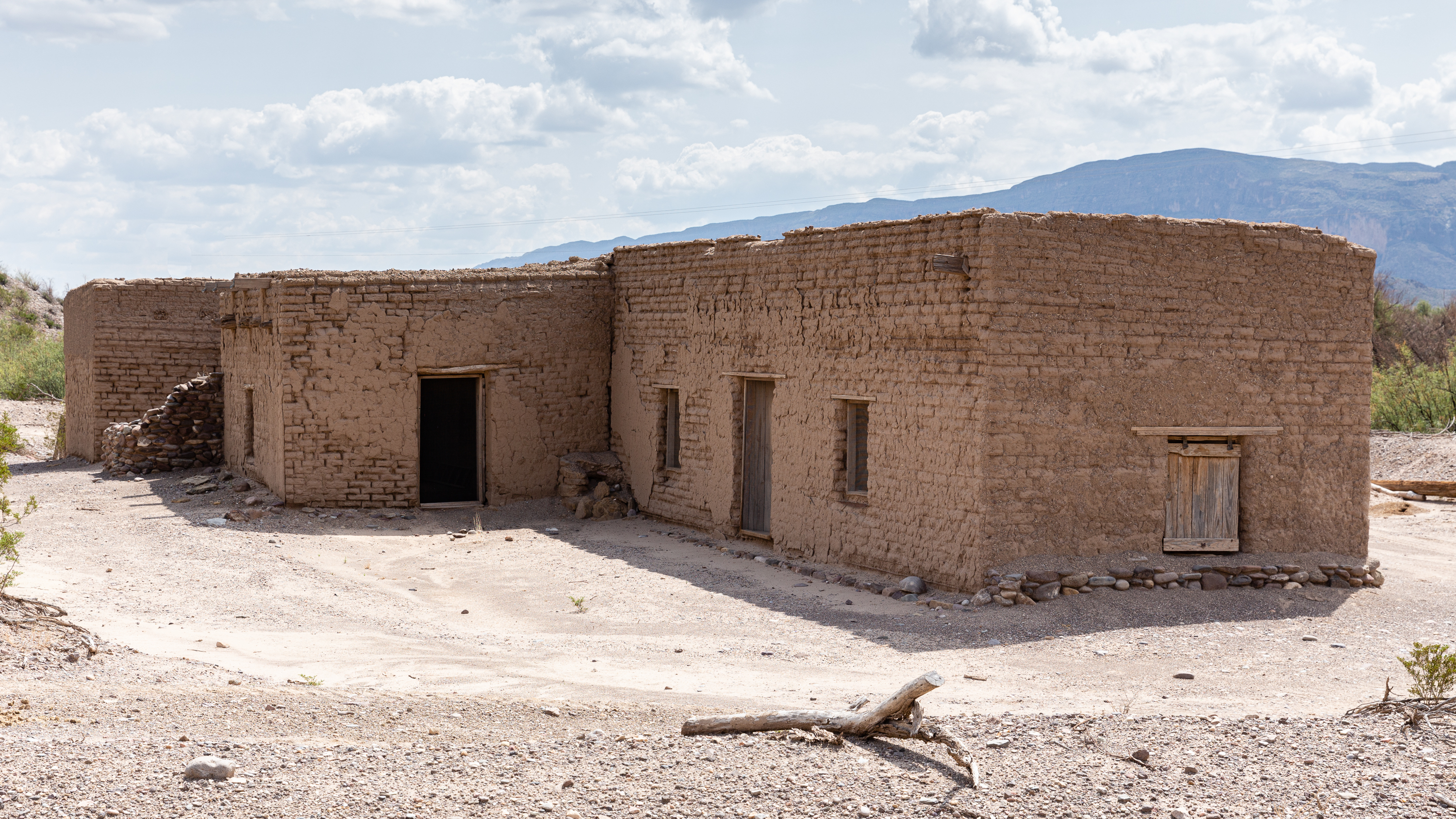
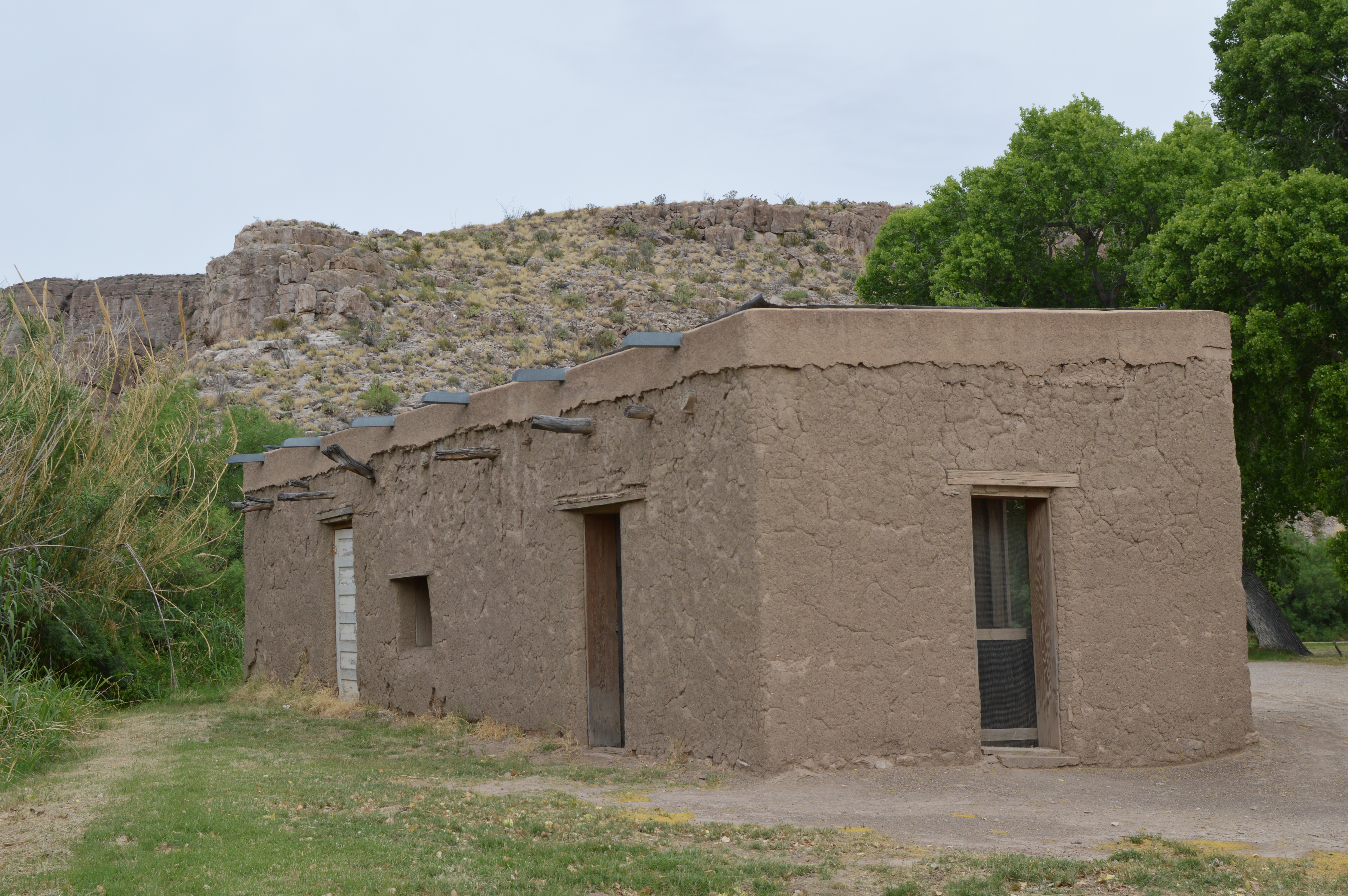
The Alvino house is the oldest intact adobe structure in Big Bend National Park, and represents the everyday life of the many families who lived and farmed along the Rio Grande. The Alvino House affords a close look at a recently repaired and stabilized adobe structure.
A large one-story adobe house with a flat roof sits in a low area near the paved road. Other historic buildings of adobe and wood dating from the 1920s are nearby, as well as a temporary building housing a concession store. The surrounding desert vegetation includes creosotebush, cacti, ocotillo, and mesquite trees.
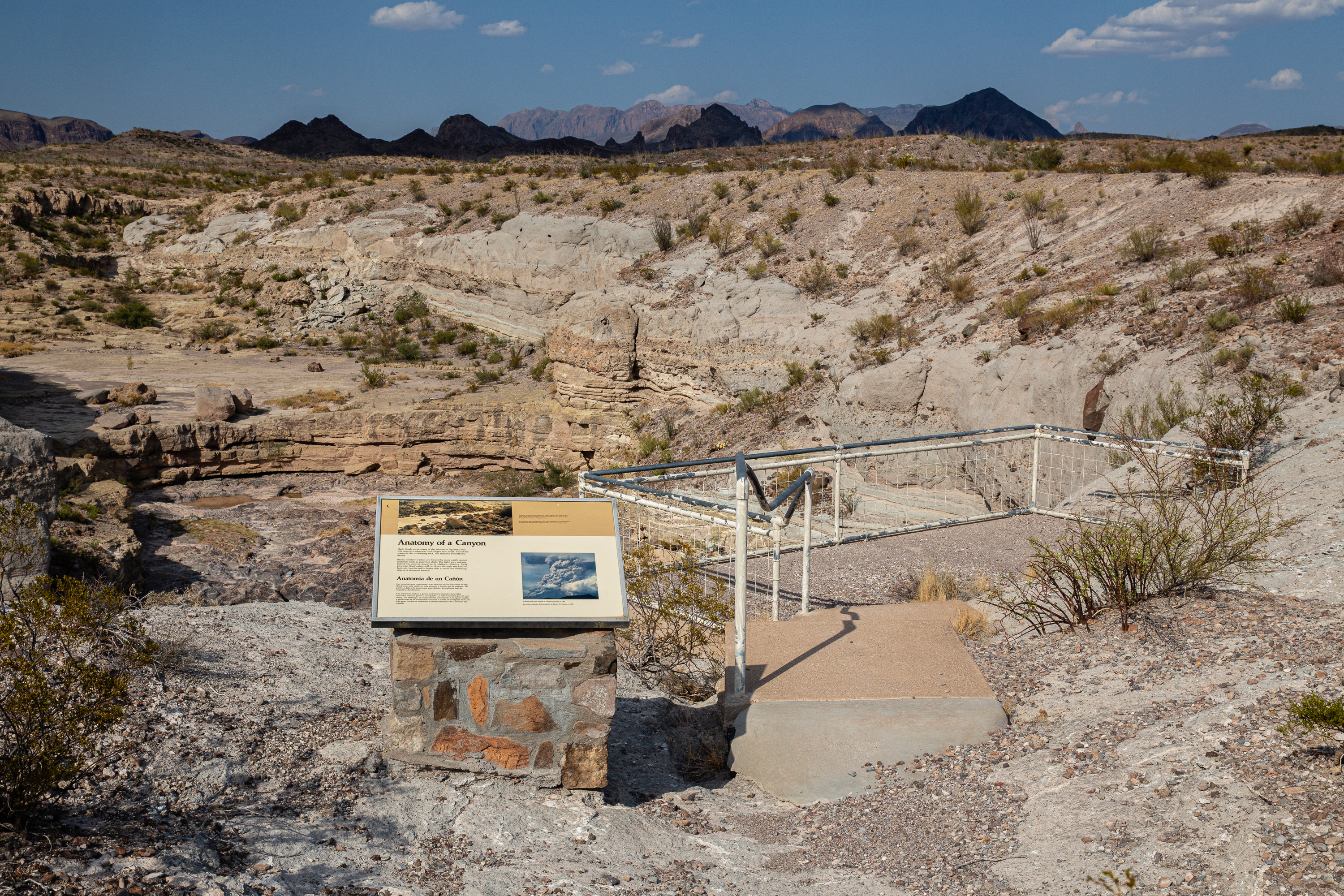
A short walk along the rim of Tuff Canyon takes you to three viewing platforms, as well as an exhibit panel that explains how the canyon was formed.
An exhibit near the western viewing platform reads: "Anatomy of a Canyon. Flash floods carve many of the washes in Big Bend, but this canyon is narrower and deeper than most. Part of the reason is the underlying rock, the anatomy beneath the desert. Broad, shallow washes are framed by more easily eroded materials such as gravel or shale. The light gray volcanic tuff of this canyon, however, is relatively cohesive. Swift, powerful floodwaters will cut down through any kind of bedrock, but the tuff is better able to resist the widening effects of sideward erosion." To the right of the exhibit panel is a fenced viewing platform on the rim of the canyon. Down below are dramatic ledges of dark basalt and a sheer wall of lighter tuff deposits. Water has eroded deep channels through the basalt layers.
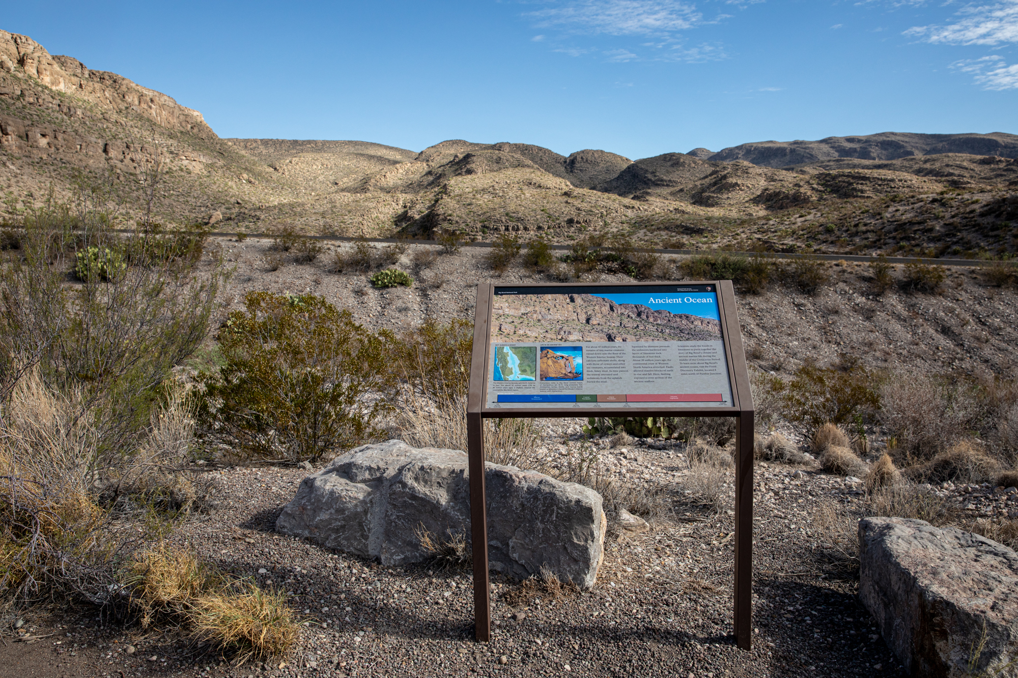
An exhibit talking about the ancient marine life that created the limestone mountains found in the eastern part of Big Bend.
A metal sign stands at the edge of dirt pullout, looking out over a view of the trees the line the Rio Grande and the mountains that dominate the skyline. The text on the exhibit sign reads: "For about 47 million years, the remains of tiny marine creatures rained down onto the floor of the Western Interior Seaway. Their calcium carbonate shells, along with those of oysters and other sea creatures, accumulated into thick, limey mud. As time passed, the seaway retreated and sediments from the uplands buried the mud. Squeezed by immense pressure, the sediments hardened into layers of limestone rock thousands of feet thick. About 20 million years ago, the continental crust of Western North America stretched. Faults allowed massive blocks of earth to rise and fall. Here, faulting exposed a cross section of the ancient seafloor. Scientists study the fossils in limestone to piece together the story of Big Bend's climate and ancient marine life during the middle of the Cretaceous Period. To learn more about Big Bend's ancient oceans, visit the Fossil Discovery Exhibit, located 8 miles north of Panther Junction."
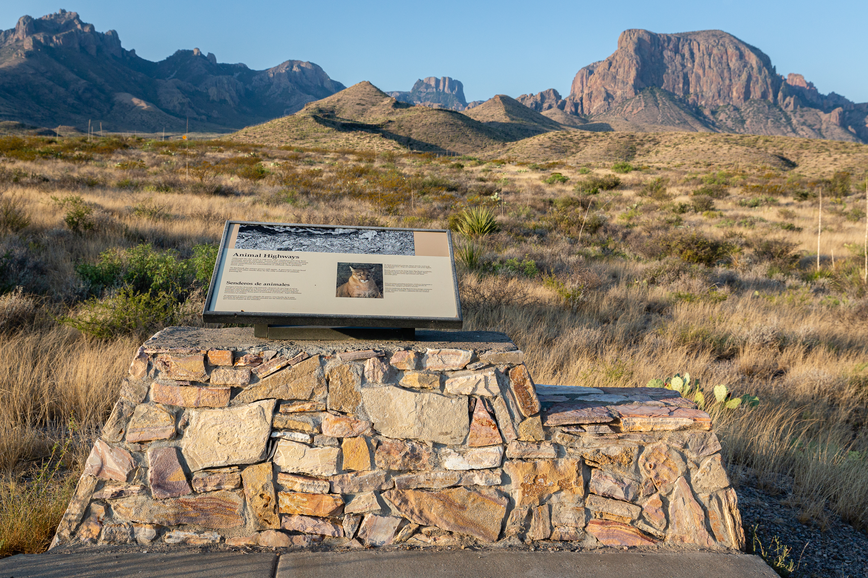
Although the dry wash is still now, after sundown you may hear rustlings, growls, and cries. Arroyos are animal highways between mountain and desert habitats, providing pockets of moisture and dense underbrush for concealment or ambush. Here predator meets prey.
This wayside exhibit is accessed from a wide, paved pullout that is large enough to accommodate several cars. A wheelchair accessible sidewalk with a curb cut leads to an information panel that is mounted on a stonework base. Behind the panel are views of several peaks of jagged rock that make up the Chisos Mountains. The exhibit shows a photo of a mountain lion and a drawing of the wildlife that might travel through the arroyo at night. The drawing shows a deer, a peccary, a lizard, a snake, a bobcat, a cottontail, and a mountain lion. Text from Sign: "Although the dry wash is still now, after sundown you may hear rustlings, growls, and cries. Arroyos are animal highways between mountain and desert habitats, providing pockets of moisture and dense underbrush for concealment or ambush. Here predator meets prey. At daybreak the arroyo grows still again. A peccary’s cloven hoof prints and other tracks may be the only evidence of animals passing by. To observe nocturnal activity, drive slowly and look for shining eyes. Stop at a pullout, cut your lights, and listen. Rarely seen even by long-time Big Bend residents, mountain lions are most active at night. Deer, skunks, and peccaries (javelinas) are their favorite prey."
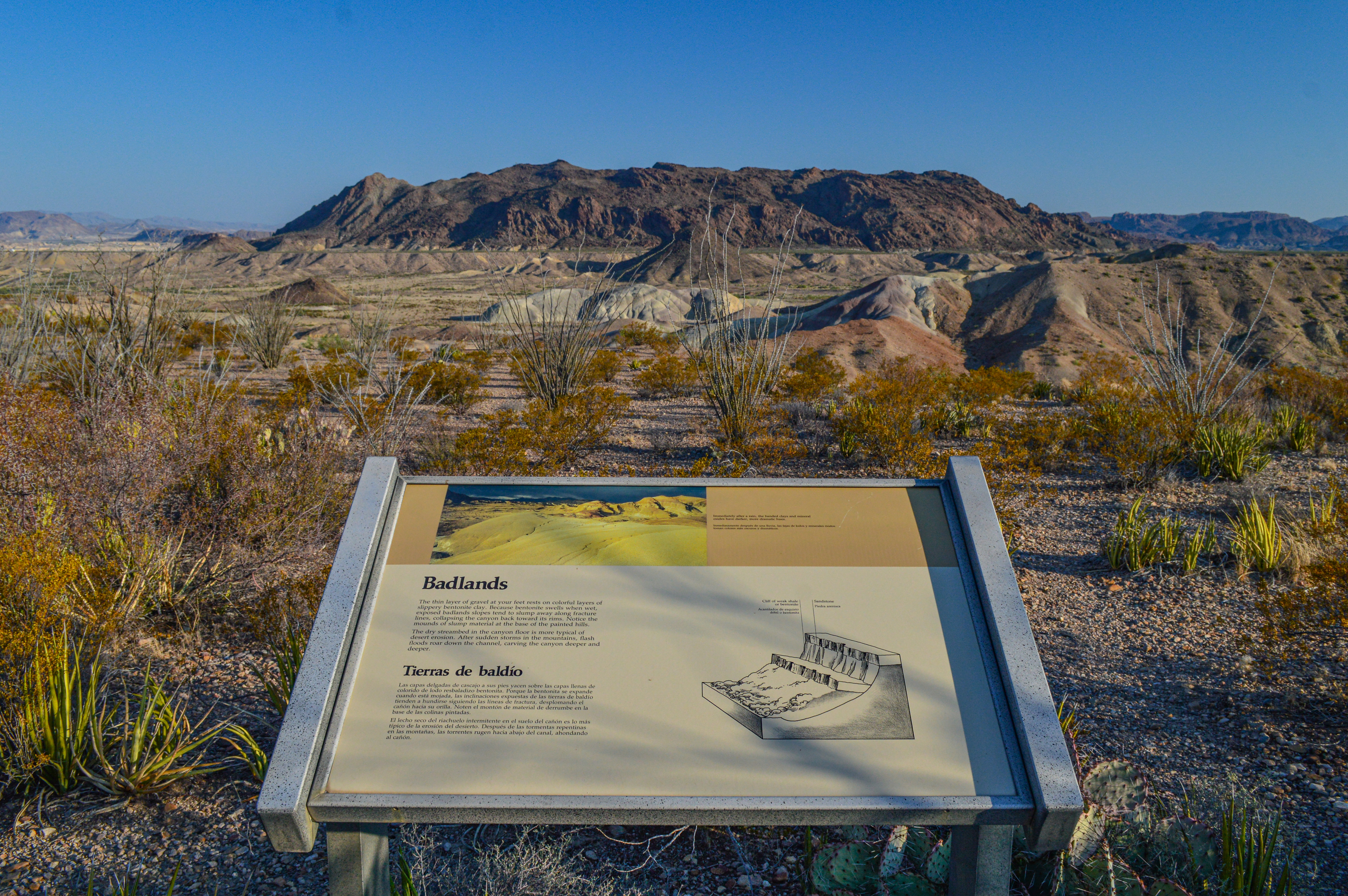
This exhibit describes the erosive forces needed to create the colorful clay hills that dominate the landscape on the western end of Big Bend National Park. These sediments were deposited 65-70 million years, at a time when the environment in Big Bend was much different.
Immediately in front of the metal panel on flat ground are typical Chihuahuan Desert plants such as lechuguilla, ocotillo, and creosotebush. Looking into the wide drainage below the wayside, one sees cream-colored clay hills with bands of yellow, orange, purple, red, and white. Beyond the drainage is the imposing bulk of Maverick Mountain. Text for the Badlands Wayside: The thin layer of gravel at your feet rests on colorful layers of slippery bentonite clay. Because bentonite swells when wet, exposed badlands slopes tend to slump away along fracture lines, collapsing the canyon back toward its rims. Notice the mounds of slump material at the base of the painted hills. The dry streambed in the canyon floor is more typical of desert erosion. After sudden storms in the mountains, flash floods roar down the channel, carving the canyon deeper and deeper. Immediately after a rain, the banded clays and mineral oxides have darker, more dramatic hues.
A strenuous, 5.5 mile one-way hike from the Homer Wilson Ranch headquarters up into the Chisos Mountains. The hike takes you along the rocky Blue Creek wash, through an open grassland, and up into the pinyon pine woodland of the Chisos Mountains. The trail ends at the junction with the Laguna Meadow Trail.
The Blue Creek Trail starts in a sandy, rocky wash, passes through red rock cliffs and climbs through open grasslands and mountain woodlands before ending at the Laguna Meadows Trail in the Chisos Mountains.
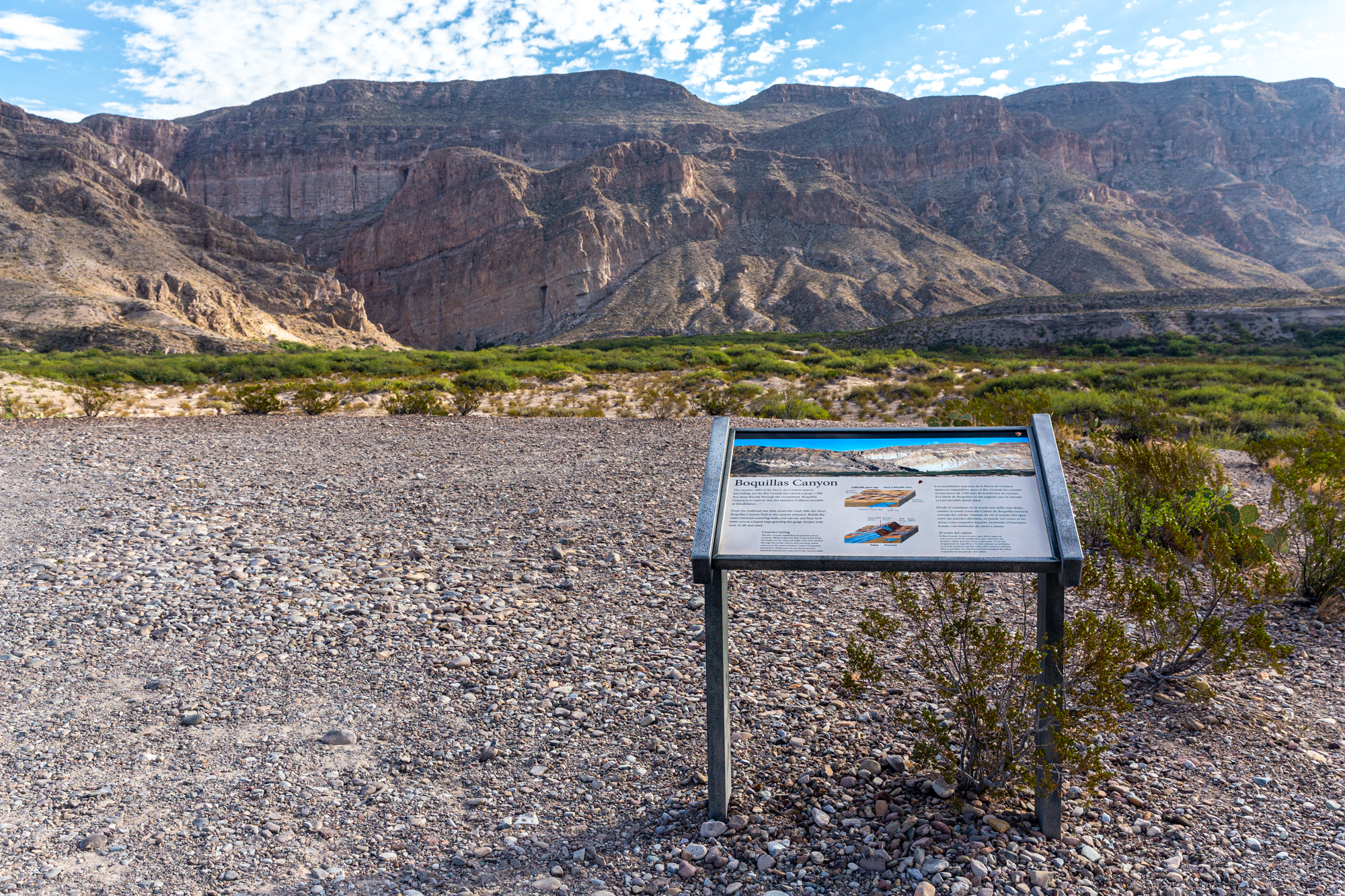
An exhibit that discusses the formation of Boquillas Canyon by the Rio Grande.
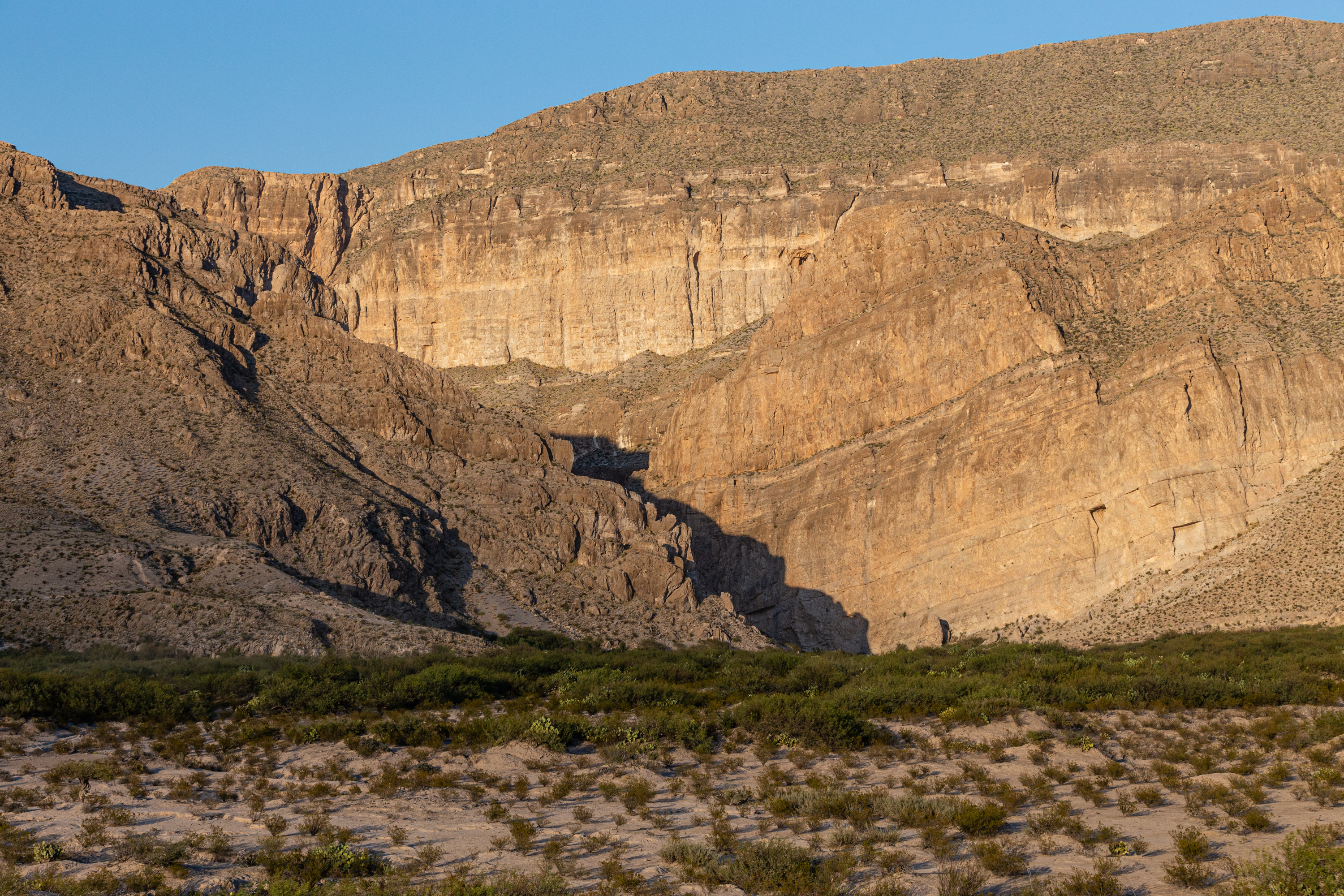
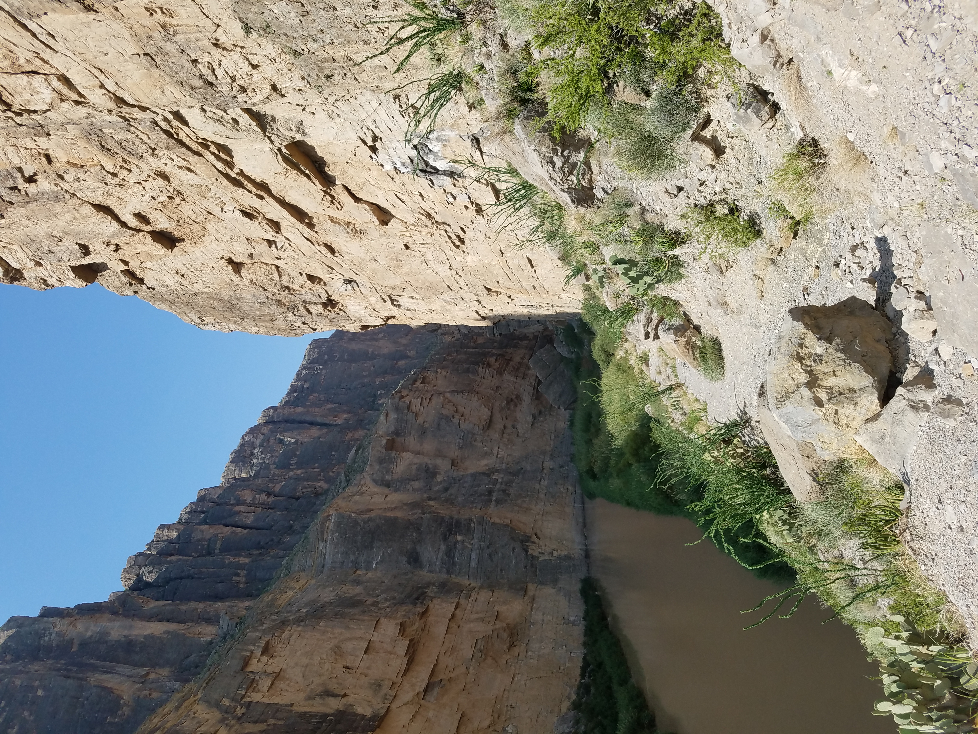
A plastic sign rests on a metal support near the edge of a bluff. The view from the sign to the north is of massive limestone walls with a river running along the base. Green vegetation lines the banks of the river, a stark contrast to the brown and sparsely vegetated desert hills surrounding the river. The text on the exhibit reads: "The massive cliffs of the Sierra del Carmen appear unyielding, yet the Rio Grande has carved a gorge 1,300 feet deep directly through the escarpment. Boquillas Canyon is so narrow that the entrance is almost invisible at this distance. From the trailhead one mile down the road, hike the short Boquillas Canyon Trail to the canyon entrance. Beside the water, between towering walls, you can see and hear how water acts as a liquid rasp, grinding the gorge deeper with tons of silt and sand. The Rio Grande established its present course on basin-filled sediments that covered the rocks and faults we see exposed today. The river eroded through the surface layers and cut steep-sided canyons in the more resistant Lower Cretaceous limestones. Today you can see those ancient limestone formations exposed in the canyon walls."
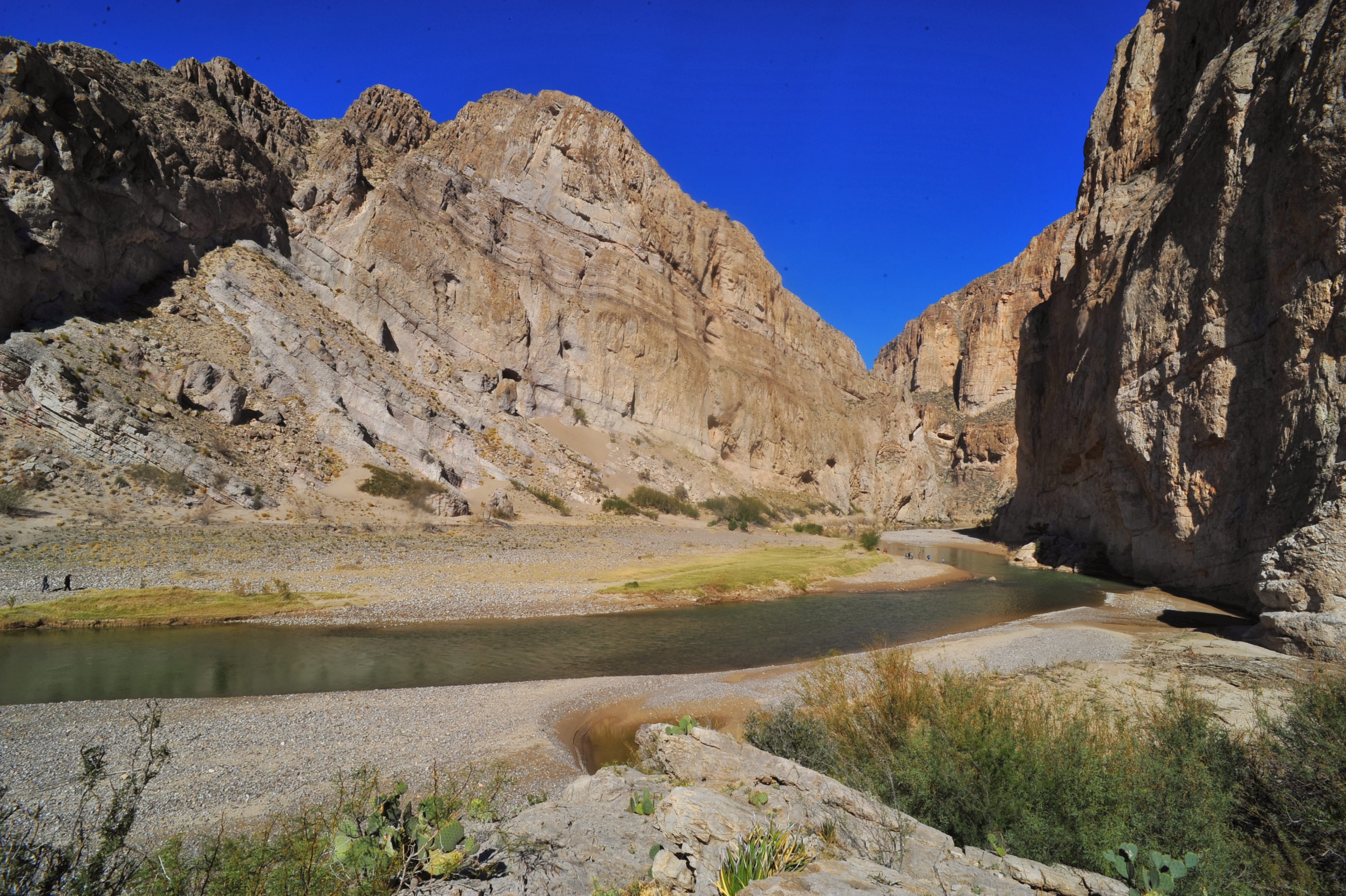
The Boquillas Canyon Trail is a great way to enjoy one of the three major canyons located in Big Bend National Park. This trail is 1.5 miles (2.4 km) round trip and parallels the Rio Grande for a short distance where it first enters Boquillas Canyon.
The trailhead for the Boquillas Canyon Trail is located near the Rio Grande. The tall escarpment directly ahead is the Sierra del Carmen. The canyon walls are about 1200 feet high and are comprised of gray limestone. The trail climbs a small hill, and near the top of the steps are a number of holes in the rock that ancient people used for grinding food. The trail proceeds down the hill and then parallels the river. The trail is composed of sand and river cobbles. Willows and other riparian plants line the river. Listen for the song of the canyon wren and other birds, as well as the lapping of water on the riverbank .
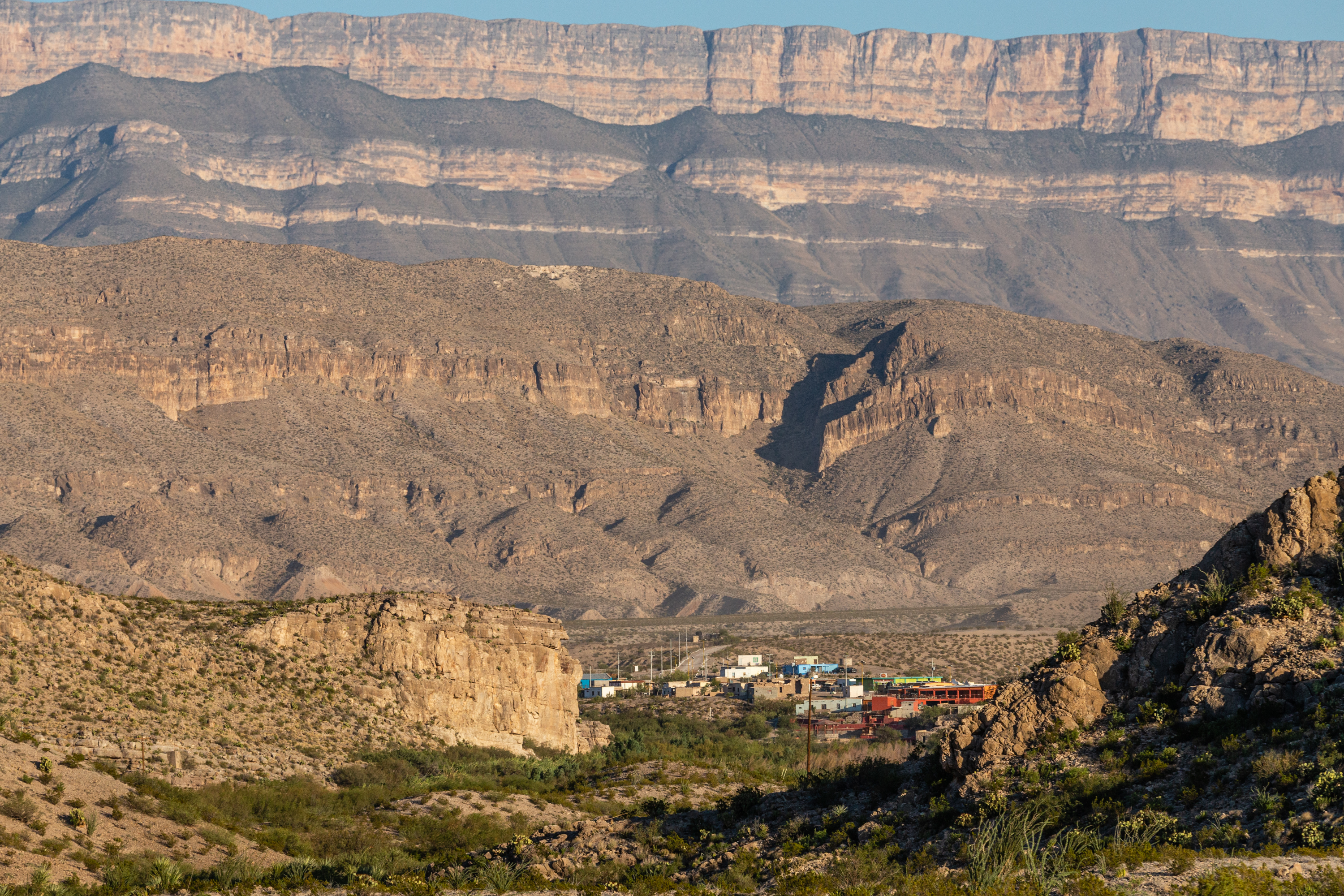
The Boquillas Overlook provides a view of the village of Boquillas, Mexico just across the Rio Grande. It is also a great place for photographs of the Sierra del Carmen and Boquillas Canyon.
At the Boquillas overlook is a great vista of the village of Boquillas and the Sierra del Carmens in Mexico. Below you, the Rio Grande flows on its journey to the Gulf of Mexico. Also visible from the overlook is the entrance to Boquillas Canyon. There are a number of common Chihuahuan desert plants around you, including creosote bush, lechuguilla, yucca and many different species of cactus.
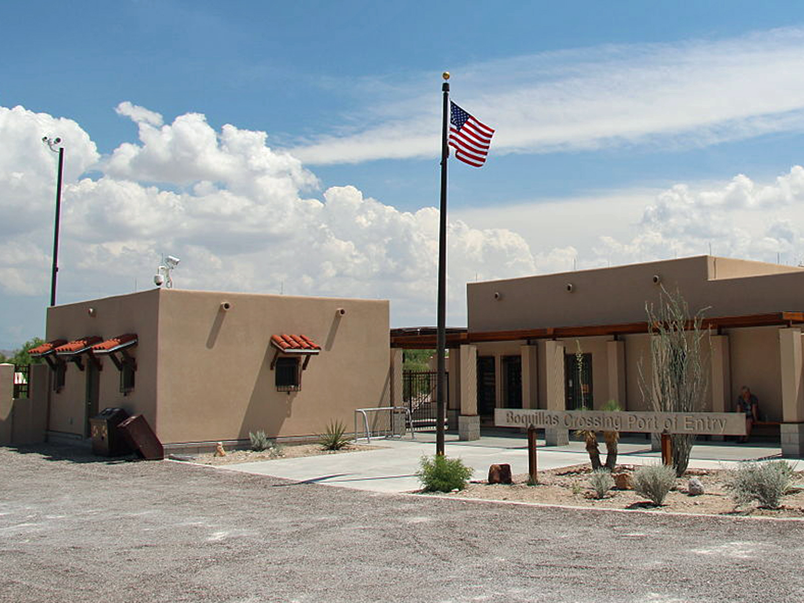
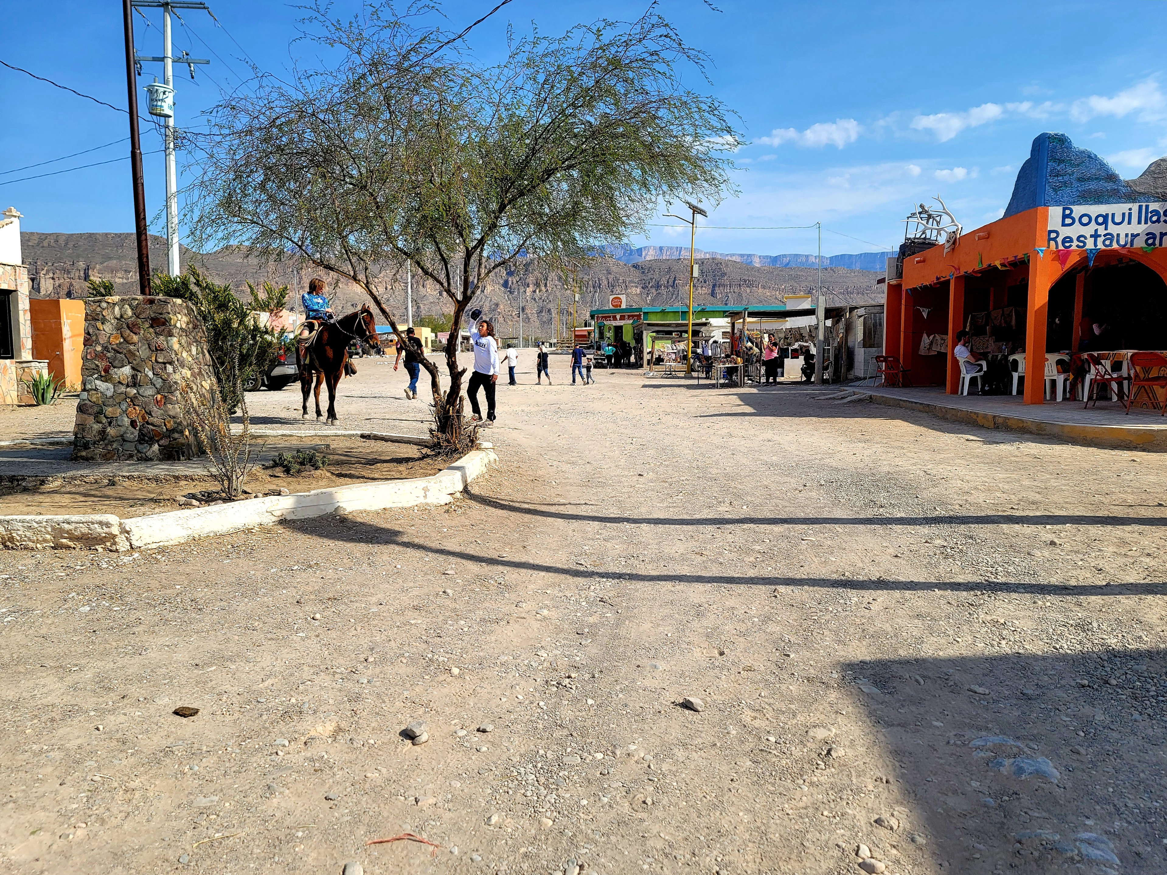
Visiting the Mexican village of Boquillas through the park's Boquillas Crossing Port of Entry is an option for visitors possessing a valid passport.
The Boquillas Port of Entry facility is a large building with kiosks that scan travelers' passports when entering the United States from Mexico. It is located next to the Rio Grande, and the Sierra del Carmen in Mexico are a prominent visual feature. Park rangers are available to help with questions or to assist with U.S. Customs procedures when returning from Mexico.
Boquillas, Mexico had its modern beginnings as a mining town in the last decade of the 19th century. You can visit the village through the Boquillas Crossing Port of Entry.
Boquillas is a small village in Coahuila Mexico. Many families live in the village and depend mostly on their self generated tourism businesses. In the late 19th and early 20th centuries, the villagers work for and in support of the mining operation at the Puerto Rico mine. The mine closed during World War 1, but several families remained in the village. There is also an Immigration office and a military outpost located in and near the village. From the village to the next large town is over 100 miles to the south.
The Burro Spring Trail is a 2.4-mile hike through the desert to an overlook where you can see Burro Spring in the valley below. Tall cottonwoods and a palm tree (a remnant of early 20th-century ranching) mark the place where water flows to the surface.
At the trailhead is a sign that reads: "Burro Spring Trail. The Burro Spring Trail leads across the desert to a bluff overlooking a small spring. Large trees and thick vegetation provide evidence of water near or at the surface, and speak to the power of how water can change a landscape. The volcanic geology in this area includes numerous dikes, which force groundwater upward to the surface, creating life-giving desert springs. Desert wildlife seek out water sources such as this. Watch for tracks, scat, and other signs of animals, such as coyote, fox, deer, javelina, jackrabbits and other desert dwellers. Remember to help protect the desert and wildlife by packing out your trash, burying human waste more than 200 yards away, and maintaining a safe distance from animals." The gravel trail passes through creosote and prickly-pear scrub on its way towards a valley separating two red-rock mountains.
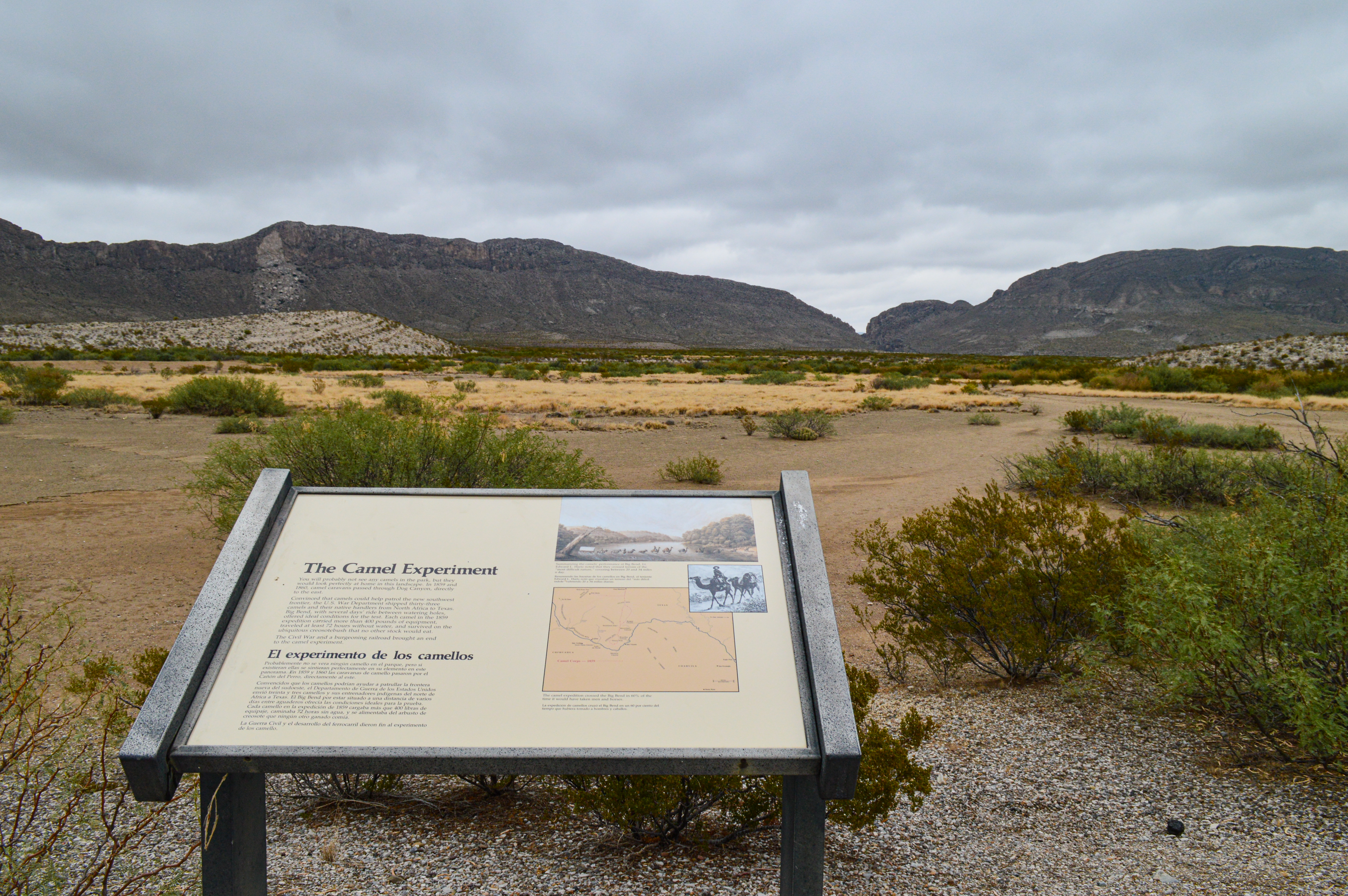
Learn about the story of the camel corps experiment and the two expeditions that traversed Big Bend country in 1859 and 1860.
This exhibit is located next to a pullout on the road between Persimmon Gap and Panther Junction. From the wayside one is looking directly east across a flat, sparsely vegetated desert landscape to a line of mountains roughly 2 miles away. The mountains are split by a canyon, and evidence of a rockfall in 1987 is highlighted on the cliff face to the left. The section of cliff where the rockfall occurred revealed the white color of the limestone rock, and can be seen on clear days from Panther Junction, 24 miles to the south. Text on the wayside: You will probably not see any camels in the park, but they would look perfectly at home in this landscape. In 1859 and 1860, camel caravans passed through Dog Canyon, directly to the east. Convinced that camels could help patrol the new southwest frontier, the U.S. War Department shipped thirty-three camels and their native handlers from North Africa to Texas. Big Bend, with several days' ride between watering holes, offered ideal conditions for the test. Each camel in the 1859 expedition carried more than 400 pounds of equipment, traveled at least 72 hours without water, and survived on the ubiquitous creosotebush that no other stock would eat. The Civil War and a burgeoning railroad brought an end to the camel experiment. Summarizing the camels' performance at Big Bend, Lt. Edward L. Hartz noted that they crossed terrain of the "most difficult nature", covering between 20 and 34 miles a day, and in 60% of the time it would have taken men and horses.
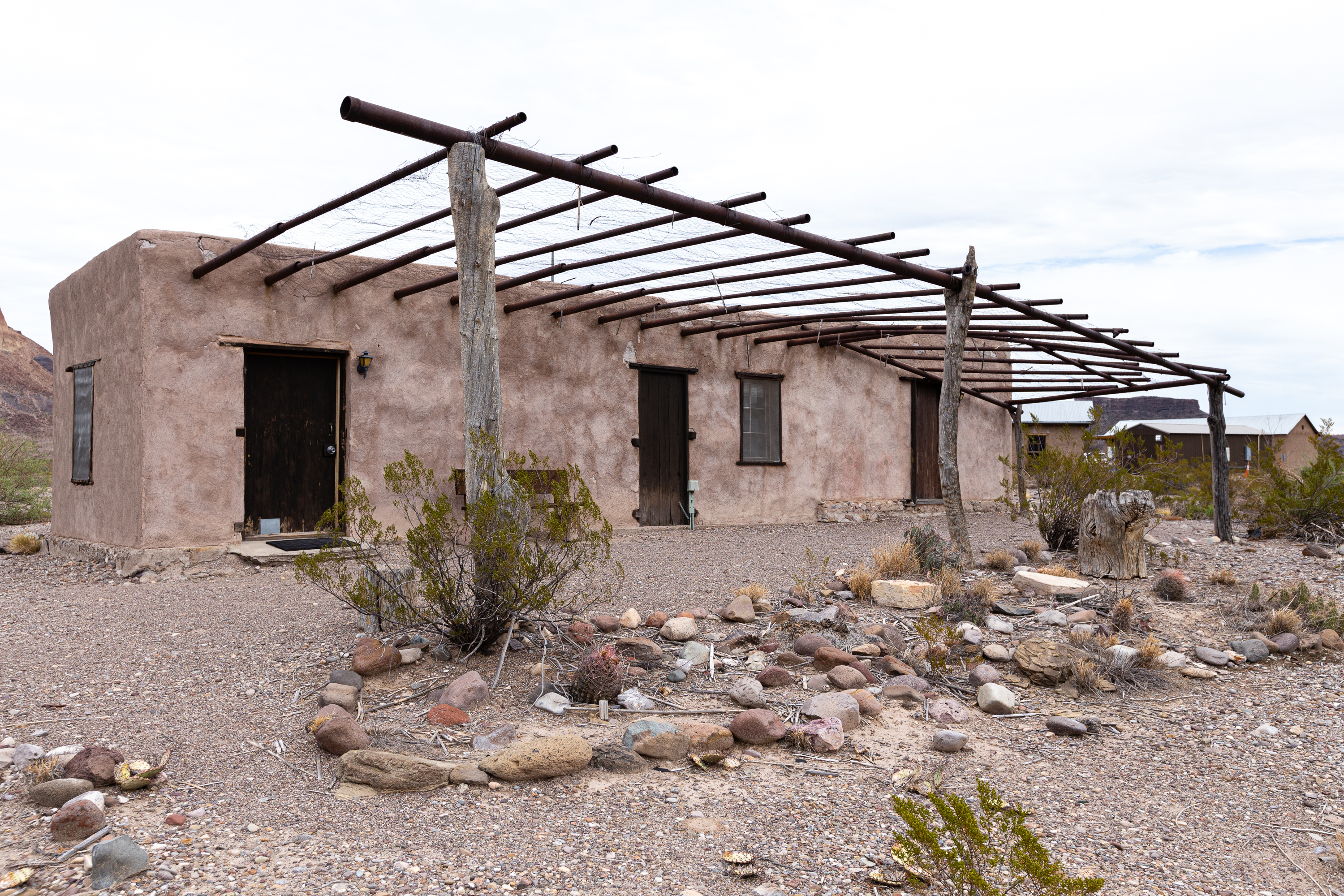
The collection of buildings at Castolon is a remnant of Big Bend’s pioneer and military history, where the cultures of Mexico and the United States met. Explore Castolon’s past through the historical buildings and exhibits.
A series of wooden and adobe buildings and machinery sit above Ross Maxwell Road. Facilities include a concession store, restroom, temporary Visitor Center, and Ranger Station. Exhibit panels at key buildings explain historical and culturally significant information about the district, along with a bulletin board and map sharing information on facilities and activities available in the area. Text on the Exhibit Panel welcoming Visitors to the Castolon Historic District: "Welcome to Castolon. Nearby Attractions: Tuff Canyon 2 miles North From several scenic overlooks, look down into a canyon made of volcanic ash. Dorgan-Sublett Trail 5 miles West Explore the ruins of historic stone and adobe houses from the ranching and farming era. Easy 1 mile, round-trip. Santa Elena Canyon Overlook 7 miles West A roadside overlook and picnic spot offers spectacular views of the mouth of Santa Elena Canyon. Santa Elena Canyon Trail 8 miles West Walk along the edge of the Rio Grande between towering limestone cliffs. Easy, 1.6 miles round-trip. Old Maverick Road 8 miles West Get off the beaten path and explore this 13-mile gravel road. Suitable for high clearance vehicles, and often 4x4 required."
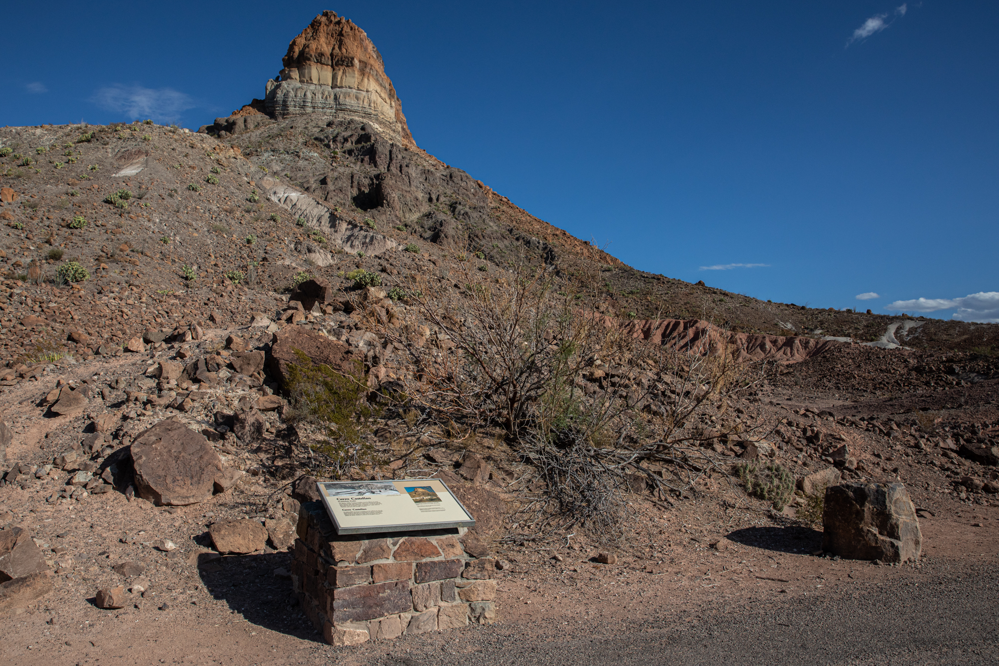
Learn how millions of years of volcanic events created the striking Cerro Castellan.
The exhibit panel sits on top of a stonework platform. On the top right is a black and white image of a recent ashflow deposit at Mount St. Helens, Washington. The text below the image reads: "Cerro Castellan (Castolon Peak). The layers visible in Cerro Castellan reveal millions of years of volcanic events. Stacked in this tower are several lava flows and volcanic tuffs (ash deposits), with layers of gravel and clay from periods of erosion between eruptions. As you continue on the drive, look for further signs of volcanism--pale beds of volcanic ash and dark basaltic boulders." To the right of the black and white images is a color image of Cerro Castellan with the different volcanic layers marked. Below the image is text: "Many of Big Bend's dramatic landmarks have molten origins. Though the Mule Ears Peaks, Cerro Castellan, and Chisos Mountains appear isolated from one another, they are closely related. Cerro Castellan's cap rock is the same lava that formed the Chisos' South Rim. Ash layers older than Cerro Castellan's can also be found at Tuff Canyon.
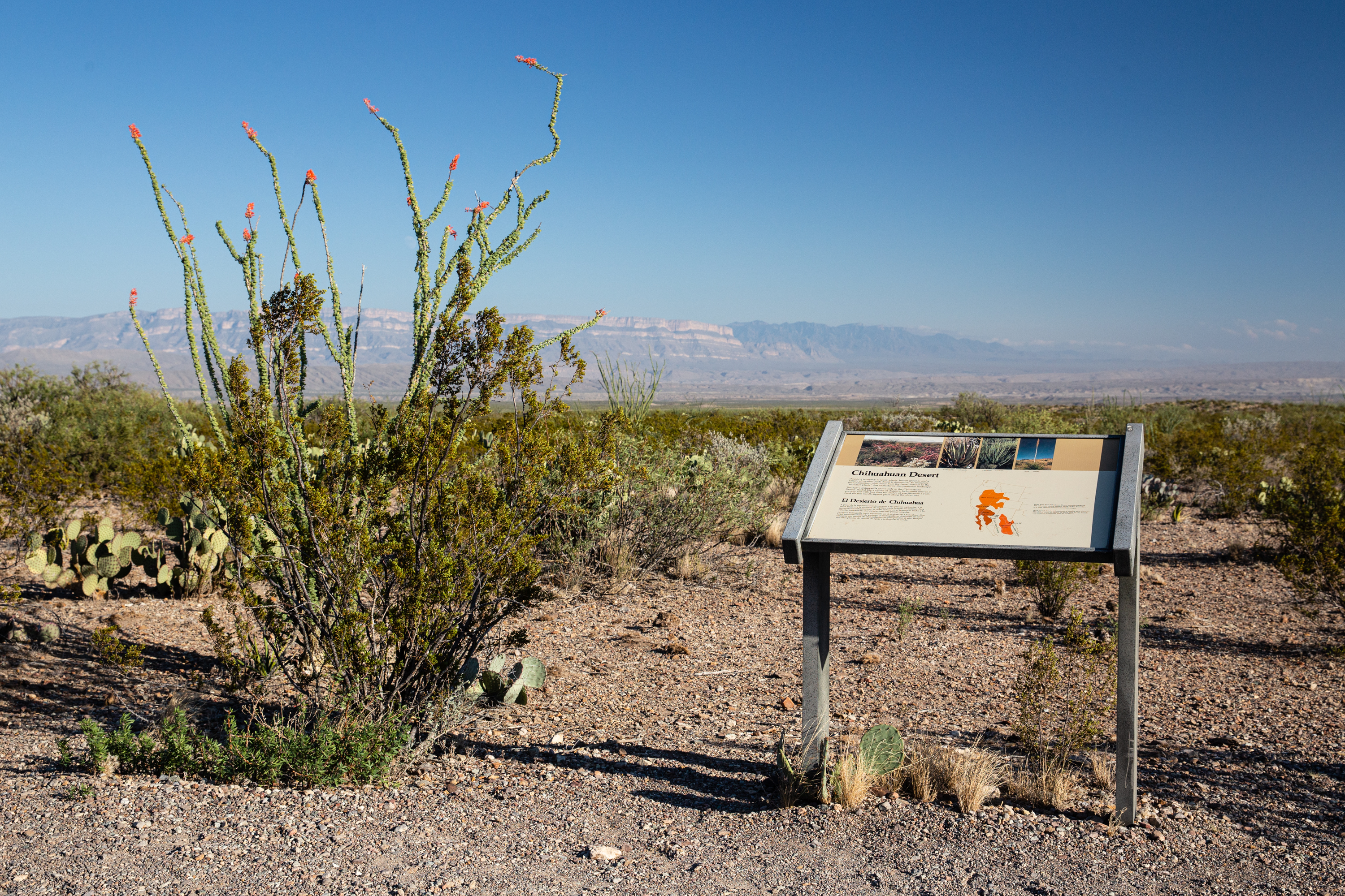
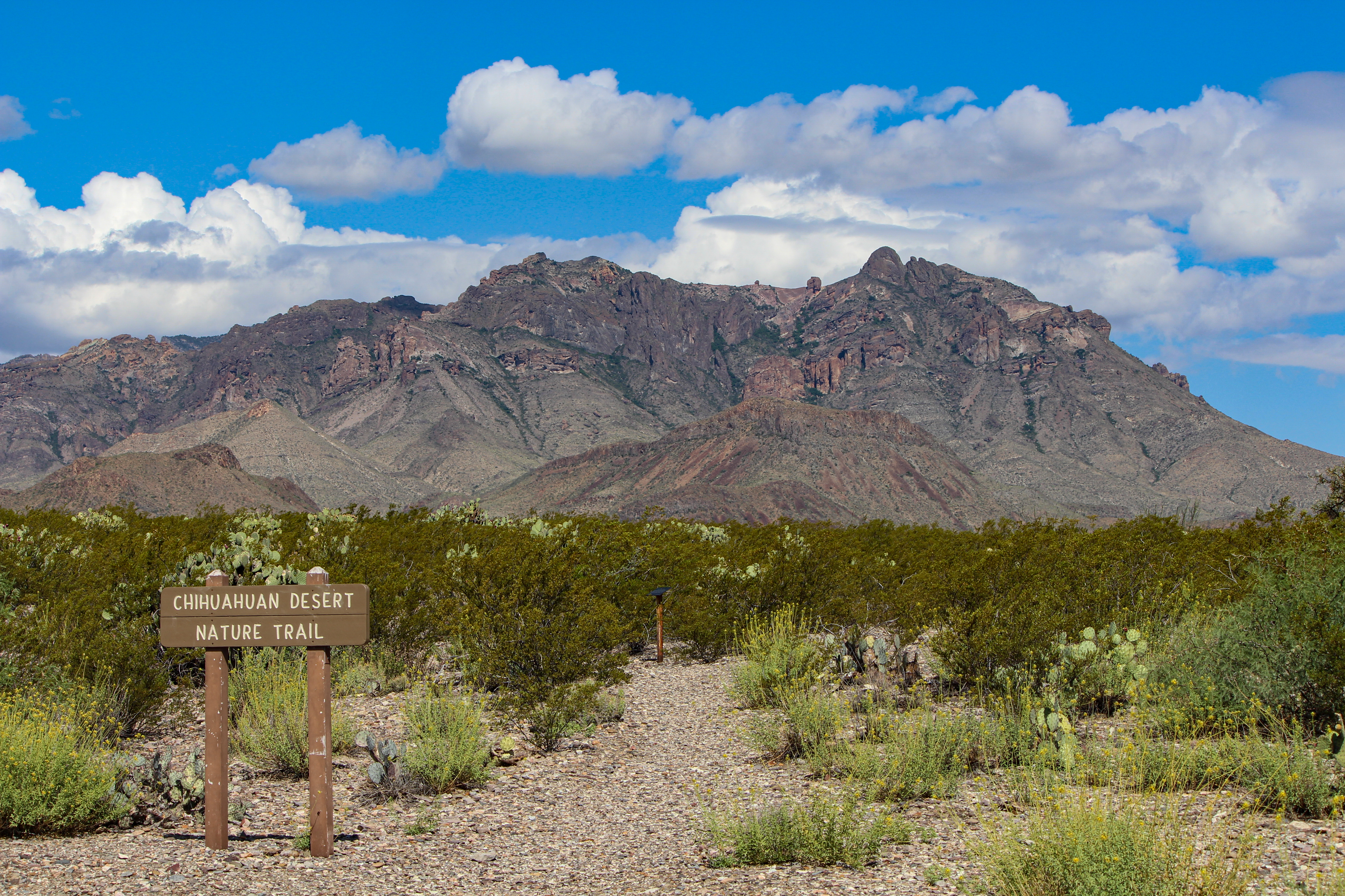
This exhibit introduces the Chihuahuan Desert, exploring what makes it unique from other deserts in North America.
Facing the sign, you are looking towards the southeast, towards Mexico. The high line of cliffs in the distance is the Sierra del Carmen, extending from the park into Mexico. Between where you are standing and the cliffs is low desert, some of the hottest areas in the park during the summer. Widely spaced desert plants, including creosotebush, cacti, and low shrubs dominate the surrounding landscape. This is a great location from which to watch a sunset. The setting sun illuminates the Sierra del Carmen, turning the limestone rock pink, orange, and purple. The text on the sign reads: "Despite a tendency to spiny plants, barren ground, and a variety of reptiles, each desert is distinctive. To recognize the Chihuahuan, shift focus from the broad horizon to the "indicator plants" that characterize this particular landscape. The agave lechuguilla grows only in the Chihuahuan Desert. Bladed like a cluster of daggers, lechuguilla thrives in gravelly soil with less than ten inches of precipitation a year. Look for this needle-tipped plant along the short trail.
This short 0.5 mile (0.8 km) trail winds through vegetation typical of the Chihuahuan Desert. Spaced out around the trail are metal signs that discuss the plants and animals found in the park, and point out remnants of the early ranching era of Big Bend .
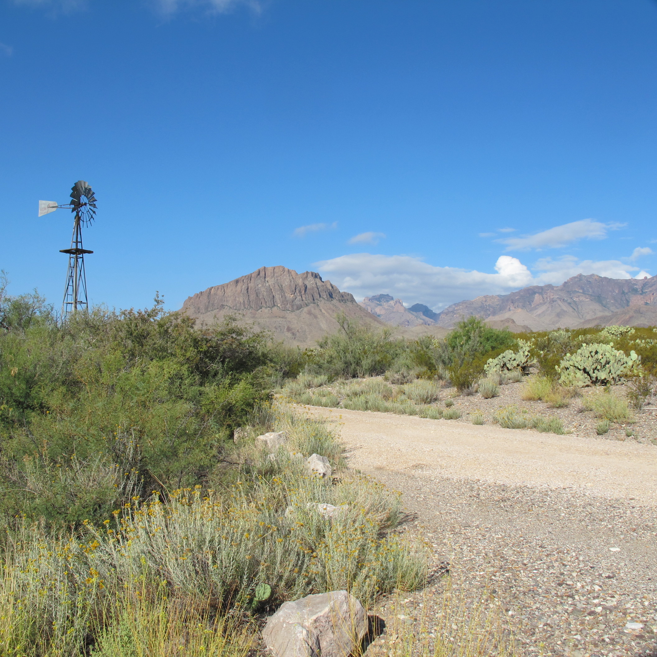
The view from the trailhead sign is to west, towards the Chisos Mountains, which tower over the surrounding desert. The surrounding desert vegetation is typical of lower elevations in the park, and includes cacti, creosotebush, ocotillo, cholla, and leatherstem. To the east is the windmill, picnic area, and trees that make up the oasis of Dugout Wells.
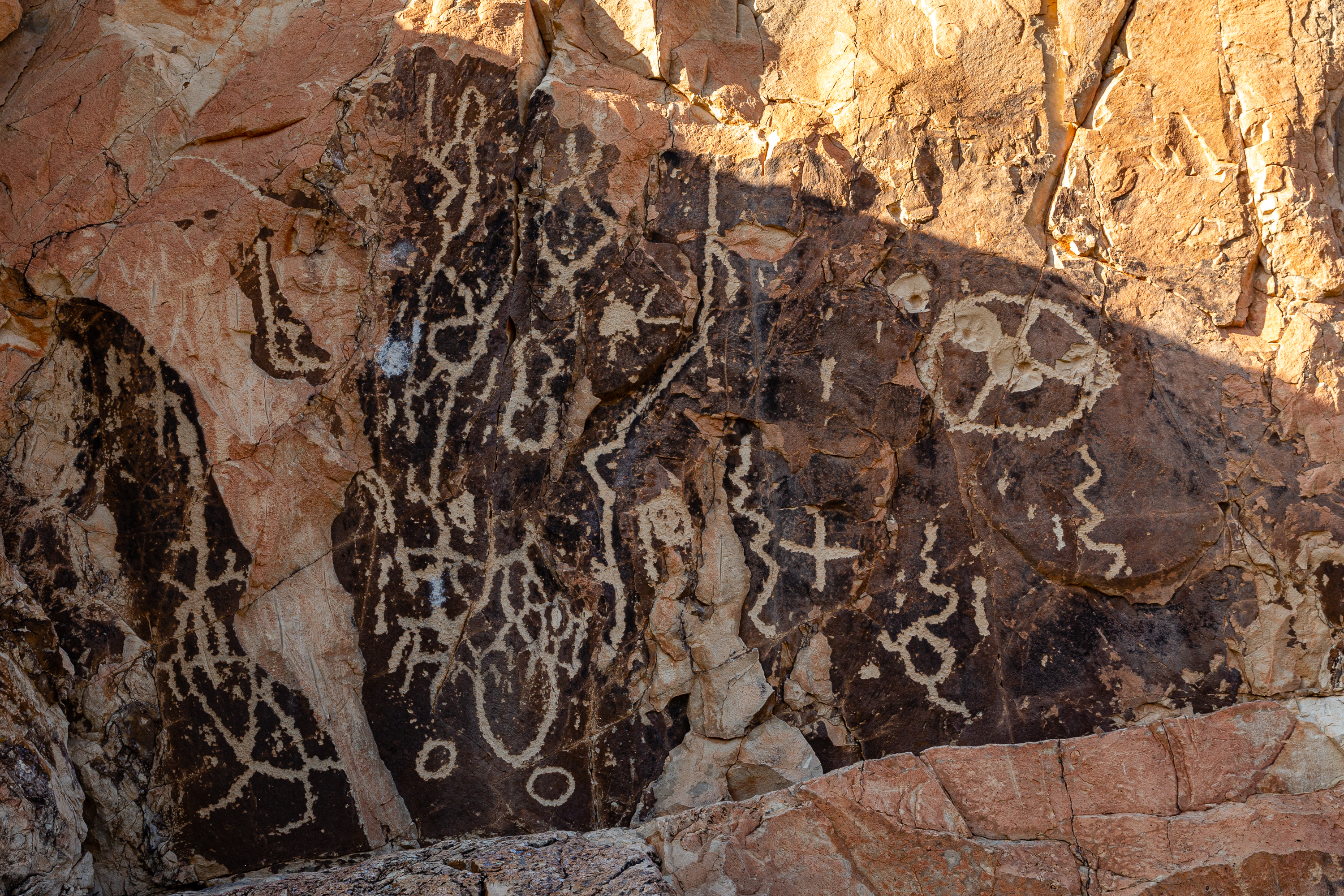
A moderate 4.8-mile roundtrip hike to a volcanic dike featuring prehistoric rock art and remnants of early 20th-century ranching.
The trailhead sign reads: "The Chimneys Trail is a moderate hike to a series of prominent volcanic dike formations. These pillars or "chimneys" of rock have been an important landmark over the centuries. The base of the southernmost chimney is marked with pictographs (painted images) and petroglyphs (images carved into the rock) estimated to be from the Archaic and Late prehistoric periods. Remember, do not touch rock art as skin oils can damage them. The area also contains pieces of fence posts and barbed wire, remnants from the ranching period of the park. Beyond the Chimneys, the trail continues for a longer hiking option. The Old Maverick Road is at the end of the trail, 7.5 miles away (one way distance). Continue down this trail, which passes near Pena Spring and Pena Mountain, for these additional desert vistas." Beyond the sign, the dirt and gravel trail wanders through a creosote grassland. In the far distance, the stone wall of the chimneys can be seen. Ever further, on the horizon is Santa Elena Canyon.
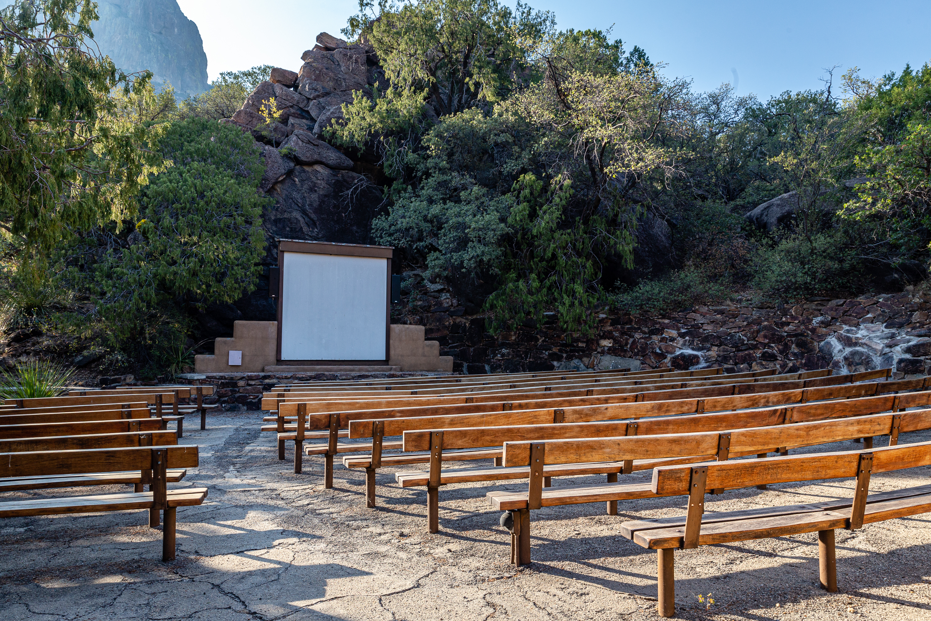
Join a ranger for an evening campground program at this outdoor amphitheater set among the juniper trees and red rock hillsides.
This outdoor amphitheater features a paved seating area with many rows of long, wooden benches. The seating area is surrounded by junipers and a tall rock wall. The tall, white screen is set in front of a red rock hillside. Casa Grande, a tall, square mountain, is in view. From the large parking lot, two short trails lead to the amphitheater. One is gravel and one is paved and wheelchair accessible.
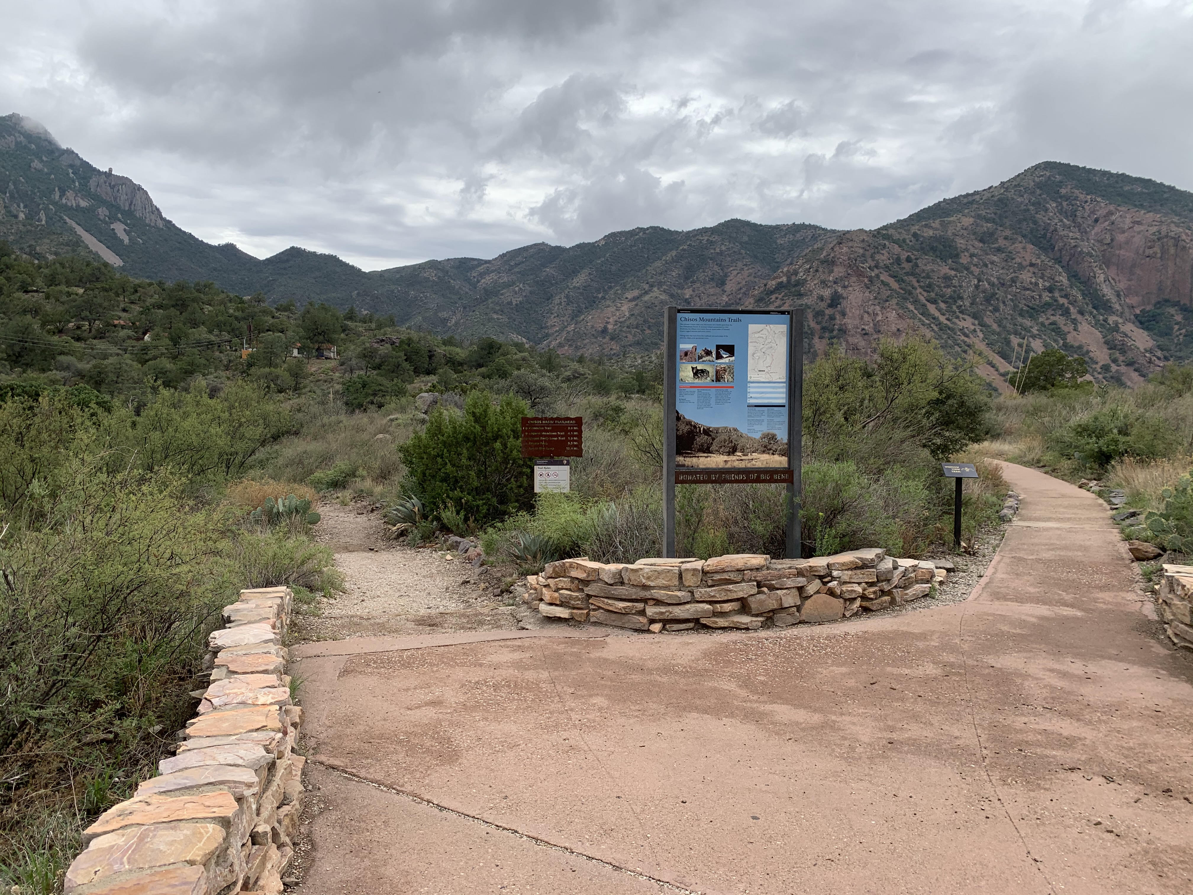
Trails to Boot Canyon, Emory Peak, and the South Rim offer good views of the park and take you into a world far removed from the desert below.
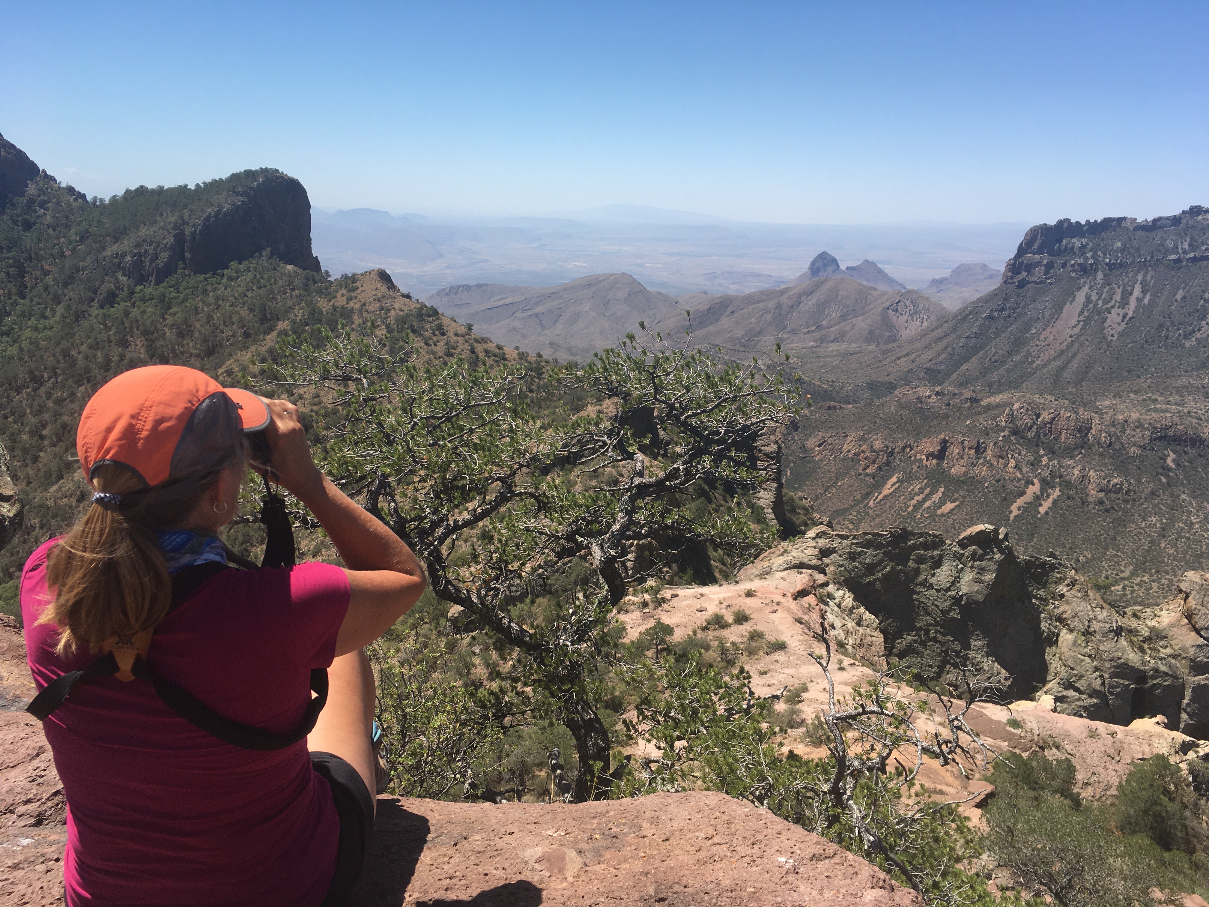
Text on Chisos Mountains Trails sign: "The volcanic Chisos (chee-sos) Mountains are a world apart from the low Chihuahuan Desert. A mountain island surrounded by a hot desert sea, the Chisos cover more than 40 square miles of forested slopes, rugged canyons, and rocky spires. Hiking trails that leave from this trailhead can reach many of the canyons, ridges, and spectacular views. Safety Precautions: Carry Water There is no water along these trails. Always carry and drink plenty (1 gallon per person per day). Be Prepared Take good footwear, sunscreen, a hat, and a map. Bear and Mountain Lion Country Both live here, but are secretive and rarely seen. Know what to do in the event of a sighting. Do not approach the animal. If it appears aggressive, hold your ground, wave your arms, shout, throw stones, and scare it away. Report all sightings to a park ranger. NEVER RUN. Understand Your Limits You are at high elevation. Pick a trail that suits your abilities. Do not push your party any harder or faster than its weakest member can handle comfortably. When you get tired, rest or turn back. Remember that you are here to enjoy yourself. Destinations: The South Rim A rocky palisade of cliffs perched high above the desert floor. Great for an all-day hike or overnight backpack. Twelve miles round-trip. Elevation gain of 2,000 feet. Emory Peak via Pinnacles Trail A 9-mile, round-trip hike reaches the highest point in Big Bend National Park. Elevation gain of 2,500 feet. Window View An easy .25-mile loop with great views of the Window. Boot Canyon Search for rare birds as you hike through a moist wooded canyon with some of Big Bend’s tallest trees. Ten miles round-trip. Elevation gain of 1,600 feet. The Window Hike down into beautiful wooded canyon to the top of a high pouroff. From here: 5.6 miles round-trip; 980-foot descent. From campground: 4.4 miles round-trip; 500-foot descent." Photos: South Rim, Emory Peak, Mexican Jay (Aphelocoma ultramarima), Black Bear (Ursus americanus), and Mountain Lion (Felix concolor) Photo: A grassy mountain meadow with large Juniper trees surrounded by a rocky canyon wall. Map: A topographic map showing the Chisos Mountains Trails. Diagram: shows the mileage and elevation change of the Chisos Mountains Trails
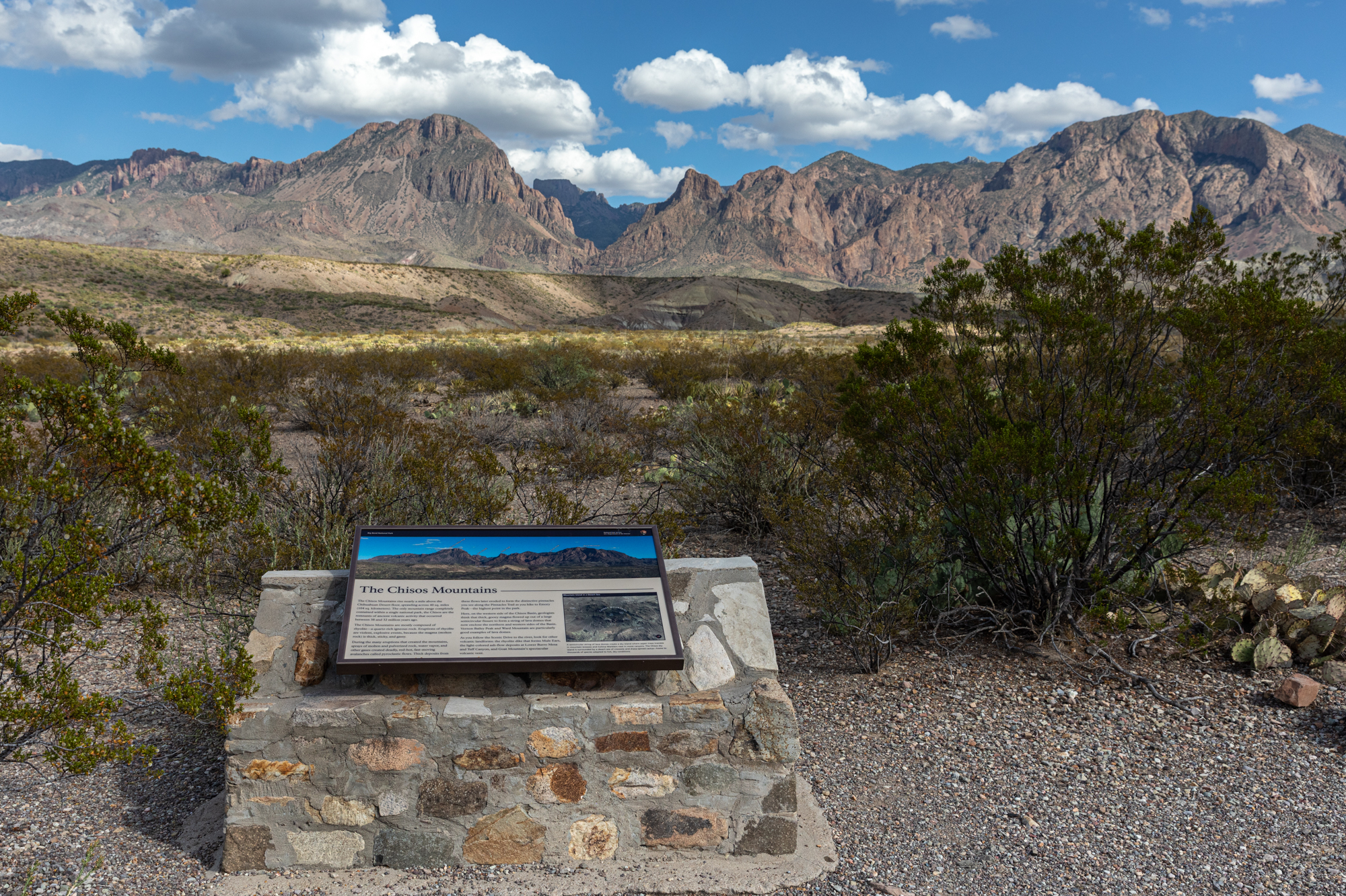
The Chisos Mountains rise from the desert floor. Learn the names of the peaks and how these mountains were formed.
A 3x2 foot interpretive panel sits on a stone base. The panel features an aerial map of the Chisos Mountains, with labels showing the names of prominent peaks. The mountains rise above the creosote and cactus-covered desert floor. Midway between the exhibit and the mountains is a line of eroded hills revealing purple and white stratified deposits. The exhibit reads: "The Chisos Mountains rise nearly a mile above the Chihuahuan Desert floor, sprawling across 40 square miles (104 square kilometers). The only mountain range completely contained within a national park, the Chisos are the remnants of ancient volcanic activity that occurred between 38 to 32 million years ago. The Chisos Mountains are mostly composed of rhyolite - a quartz-rick igneous rock. Eruptions of rhyolite are violent, explosive events, because the magma (molten rock) is thick, sticky, and gassy. During the many eruptions that created the mountains, sprays of molten and pulverized rock, water vapor, and other gases created deadly, red-hot, fast-moving, avalanches called pyroclastic flows. Thick deposits from these flows later eroded to form the distinctive pinnacles you see along the Pinnacles Trail as you hike to Emory Peak - the highest point in the park. Here, on the western side of the Chisos Basin, geologists think that thick, gooey magma flowed up out of a large semicircular fissure to form a string of lava domes that now enclose the northern and western sides of the Basin. Vernon Bailey Peak and Ward Mountain are particularly good examples of lava domes. As you follow the Scenic Drive to the river, look for other volcanic landforms: the rhyolite dike that forms Mule Ears, the light-colored ash-flow deposits at Lower Burro Mesa and Tuff Canyon, and Goat Mountain's spectacular volcanic vent. A square inset in the panel showing the Chisos Mountains from the air states: "A semicircular string of lava domes create a sky island where aspen trees tremble in mountain breezes and Colima Warblers nest in moist canyons. The Chisos sky island is surrounded by a desert sea of creosote and sharp-spined cactus - home to thousands of species adapted to hot, dry conditions."
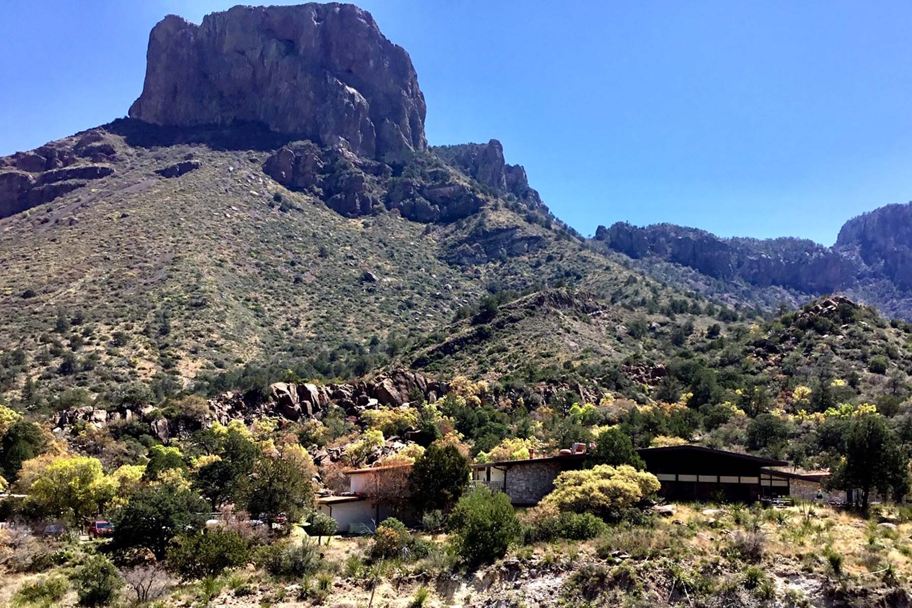
The Chisos Mountains Lodge, located in the Chisos Basin, includes 72 rooms, a gift shop, dining room, and camp store.
The Chisos Mountains Lodge is comprised of several separate buildings. The main building features an indoor lobby area with a reservation desk, gift shop, and dining room. The dining room has large, tall windows on one side that face west toward a gap in the mountains known as the Window. From the lobby area, you can walk through a set of glass doors to an outdoor patio with metal chairs and tables. The lodge rooms are in 3 different buildings that surround one central parking lot. There are also five white-colored stone cottages located on the hillside behind the other buildings. The Basin Store is a small camper store with drinks, snacks, souvenirs, and camping gear.
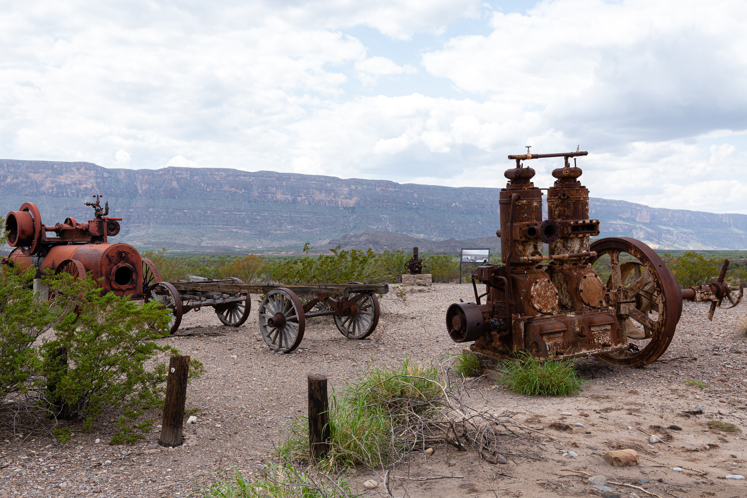
The collection of buildings at Castolon is a remnant of Big Bend’s pioneer and military history, where the cultures of Mexico and the United States met. Explore Castolon’s past through the historical buildings and exhibits.
A steam engine and several pieces of large metal machinery used for pumping water to crops and cotton ginning are on display. Around the exhibit are several adobe and wooden Castolon Historic District buildings, most from the 1920s. Text on the Exhibit Panel Cotton Boom in Castolon: "Before the 1920s, no one along this part of the Rio Grande had ever planted cotton. In 1922, businessman Wayne Cartledge began to sow that high-dollar commercial crop in these river-bottom fields. Cartledge also introduced steam and gas-powered irrigation pumps that boosted his harvests. After 1923, he increased the value of his cotton by “ginning” it before he sold it- that is, by mechanically separating the tiny seeds from the fibers. By 1942, mounting costs and falling prices ended La Harmonia’s cotton venture. Only the machines you see here today are left to remind us of this foray into large-scale farming." Spanish translation on sign: Bonanza algodonera Antes de la década de los 1920 nadie jamás cultivaba el algodón en este sector del río Bravo del Norte. En 1922 el empresario Wayne Cartledge empezó a sembrar este provechoso cultivo comercial en sus campos aluviales. También Cartledge introdujo bombas de riego con poder de vapor o gasolina para aumentar su producción. Después del año de 1923, La Harmonía agrandaba el vapor de su algodón por su desmotarlo antes de venderlo- es decir separar mecánicamente las semillas minúsculas de los copos fibrosos. Peso de gastos crecientes y precios disminuidos se acabó su aventura de algodón en 1942. Hoy sólo la maquinaria que se ve aquí nos recuerda de esta aventura en la agrícola de gran escala.
This is the first of nineteen stops along the self-guided Dagger Flat Driving Tour. This location explores the Chihuahuan Desert, which is the second largest desert in North America.
Standing at this marker, one is looking primarily towards the east, at the bulk of the Dead Horse Mountains. Between this stop and the mountains lies a flat expanse of desert, composed primarily of creosotebush, lechuguilla, yucca and cholla. For the most part, the ground is exposed to the sun and rocky, with lots of space between the plants. Here and there a dead yucca or lechuguilla stalk remains standing high above the plant.
The tenth stop on the Dagger Flat Driving Tour, relating information about the soaptree yucca, which can live to be 250-300 years old.
This soaptree yucca sits between two low hills, dominating the skyline with its tall, dead stalk. This type of yucca is distinguished from other yuccas by its narrow leaves with white margins. They resemble bunchgrass when young, gradually developing several heads on trunk-like stems with age.
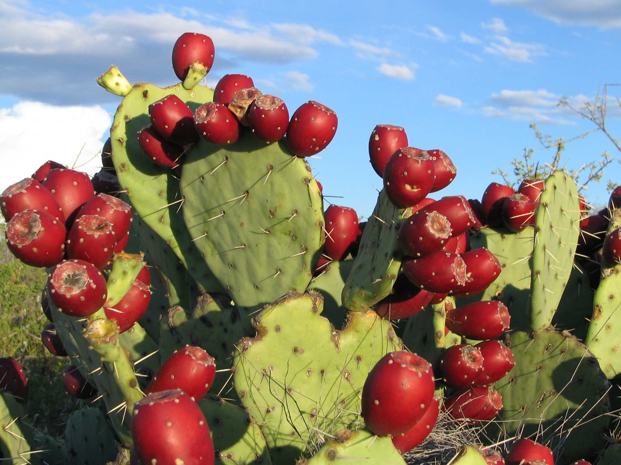
The eleventh stop on the Dagger Flat Driving Tour, discussing the 9 species of prickly pear cactus found in Big Bend.
Prickly pear are identified by their wide, flat, branching pads, and are often called nopal cactus or paddle cactus. Most varieties have a combination of detachable spines and tufts of barbed bristles. The variety observed next to this stop is known as a blind prickly pear because it doesn't have the long spines. Their large, red fruit make them stand out and are desired by both animals and humans. Have you ever tasted prickly pear jelly or had a prickly pear margarita?
The twelfth stop on the Dagger Flat Driving Tour, which talks about the formation of the Deadhorse Mountains.
From this location one has a great view of the Deadhorse Mountains. Unlike the some mountains in the park, such as the Chisos Mountains, the Deadhorse seem to gracefully and gradually rise above the desert. Instead of looking jagged and rough, they appear smooth and rounded - cut by many canyons. This is due to the fact that they are composed of limestone, instead of the harder igneous rocks that make up other mountains in this area.
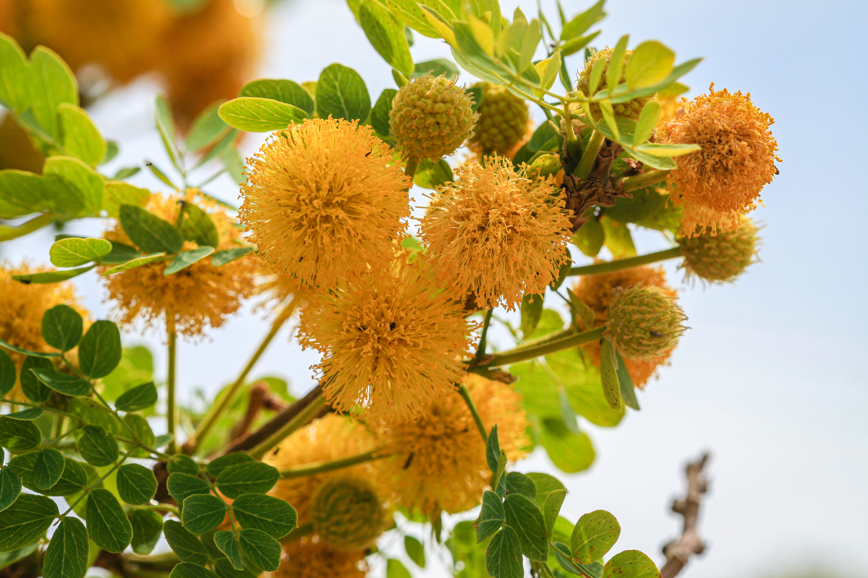
The thirteenth stop on the Dagger Flat Driving Tour, talking about the littleleaf leadtree with its distinctive pods.
This small, slender tree is multi-trunked and typically reaches heights of 12-15 feet. Light-green foliage grows on brittle stems and the bark is flaky and cinnamon-colored. During the spring and summer, especially after periods of rain, it will produce showy balls of yellow-orange color that have a sweet smell.
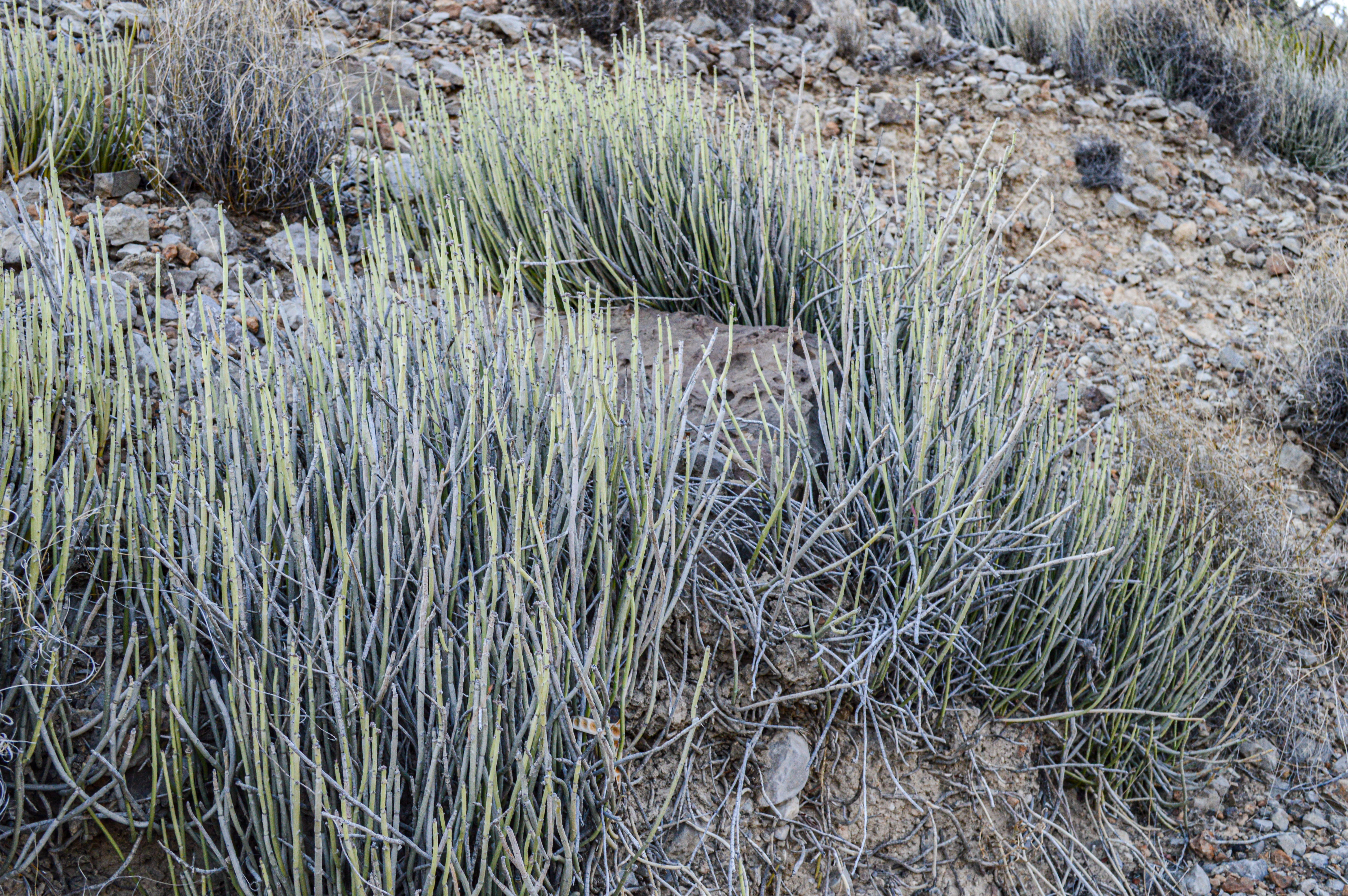
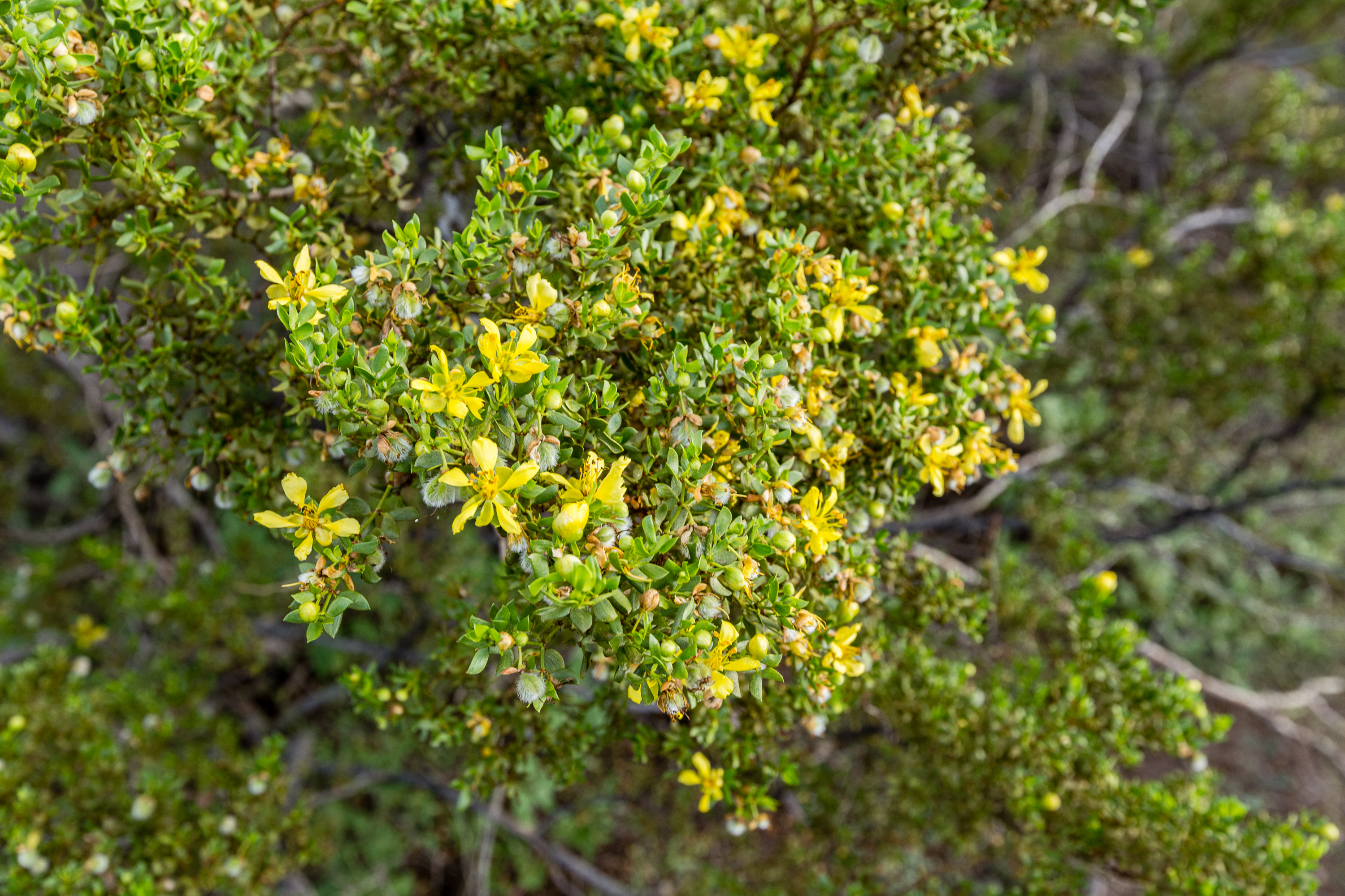
The fourteenth stop on the Dagger Flat Driving Tour, exploring the plant known as candelilla, which has been used to make products including chewing gum, car wax, and shoe polish.
The nearby hillside is covered with low-growing perennial candelilla plants. They may seem like only stems, but they can have tiny, narrow leaves which are only present on the new growth. Like the leaves, the tiny, white flowers (deep pink at the base) are inconspicuous and grow near the tips of the stems.
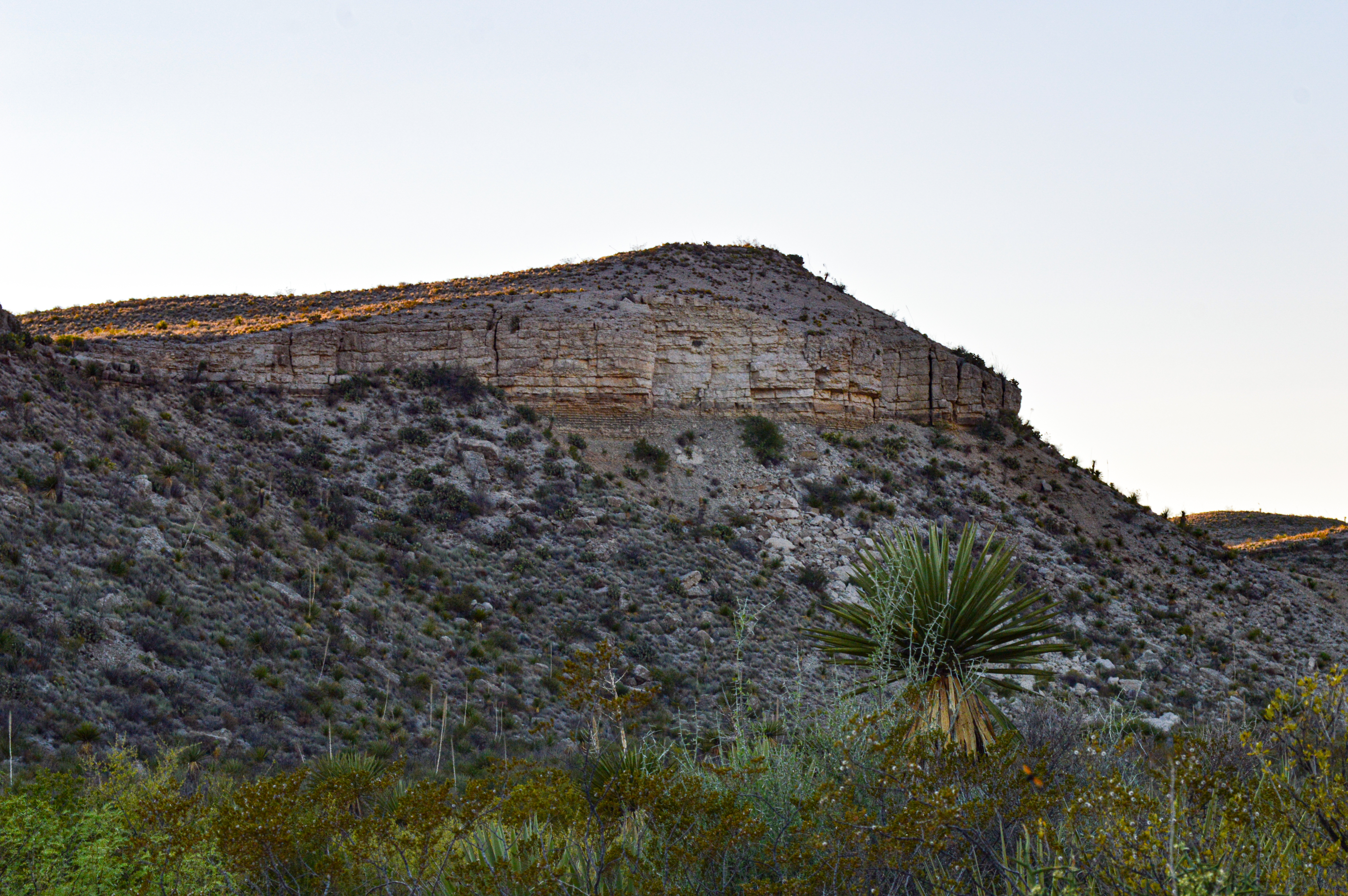
The fifteenth stop on the Dagger Flat Driving Tour, discussing the geologic contact between two sedimentary formations - Del Rio clay and Buda limestone.
The hard Buda limestone presents as a vertical cliff face, cream-colored and filled with seams. The softer mudstone below it forms a slope and is partially covered by rockfall from the limestone, as well as shrubs, yucca, and creosotebush. The evening light is hitting the limestone rock, giving it a soft orange-colored hue.
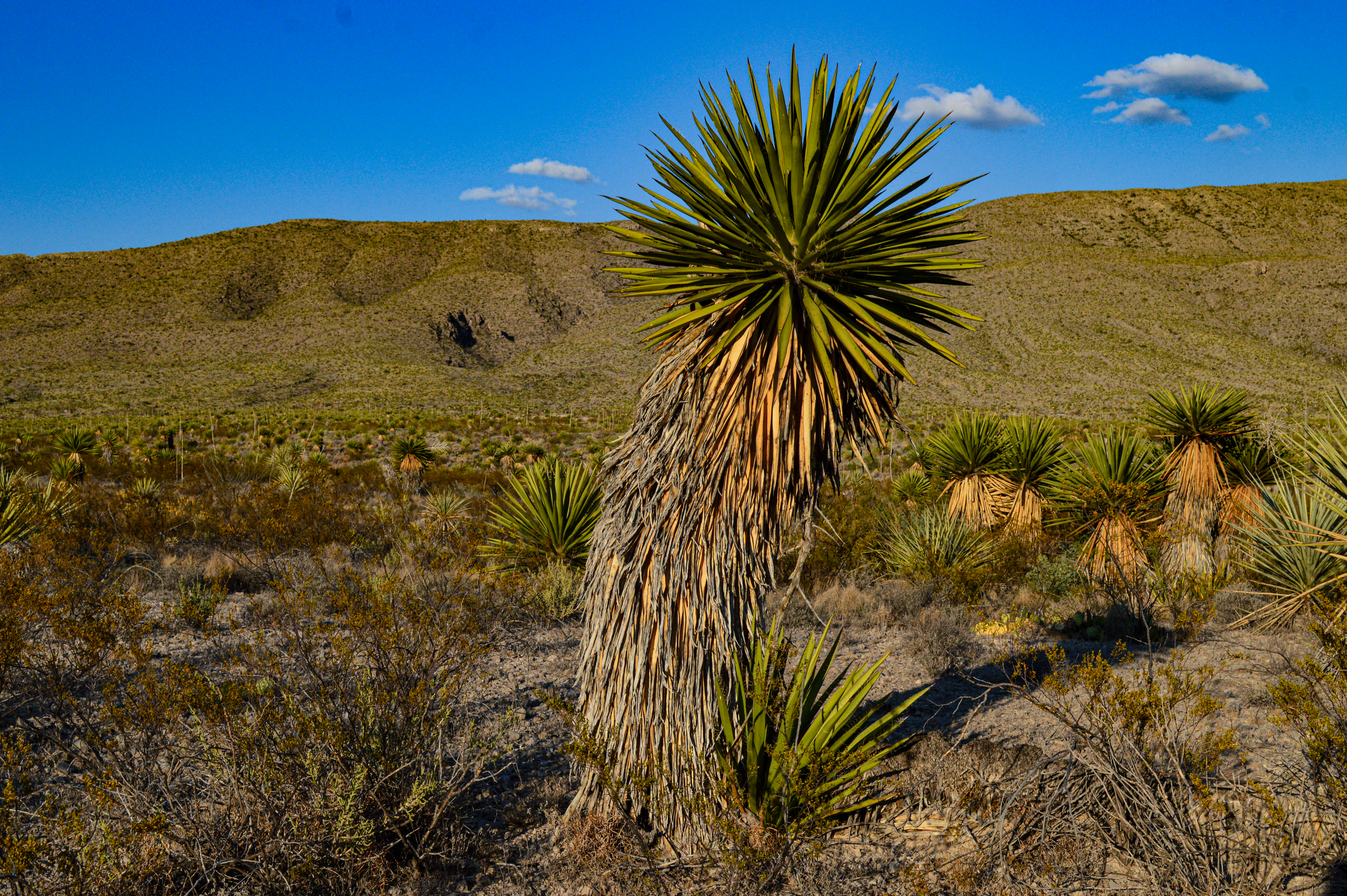
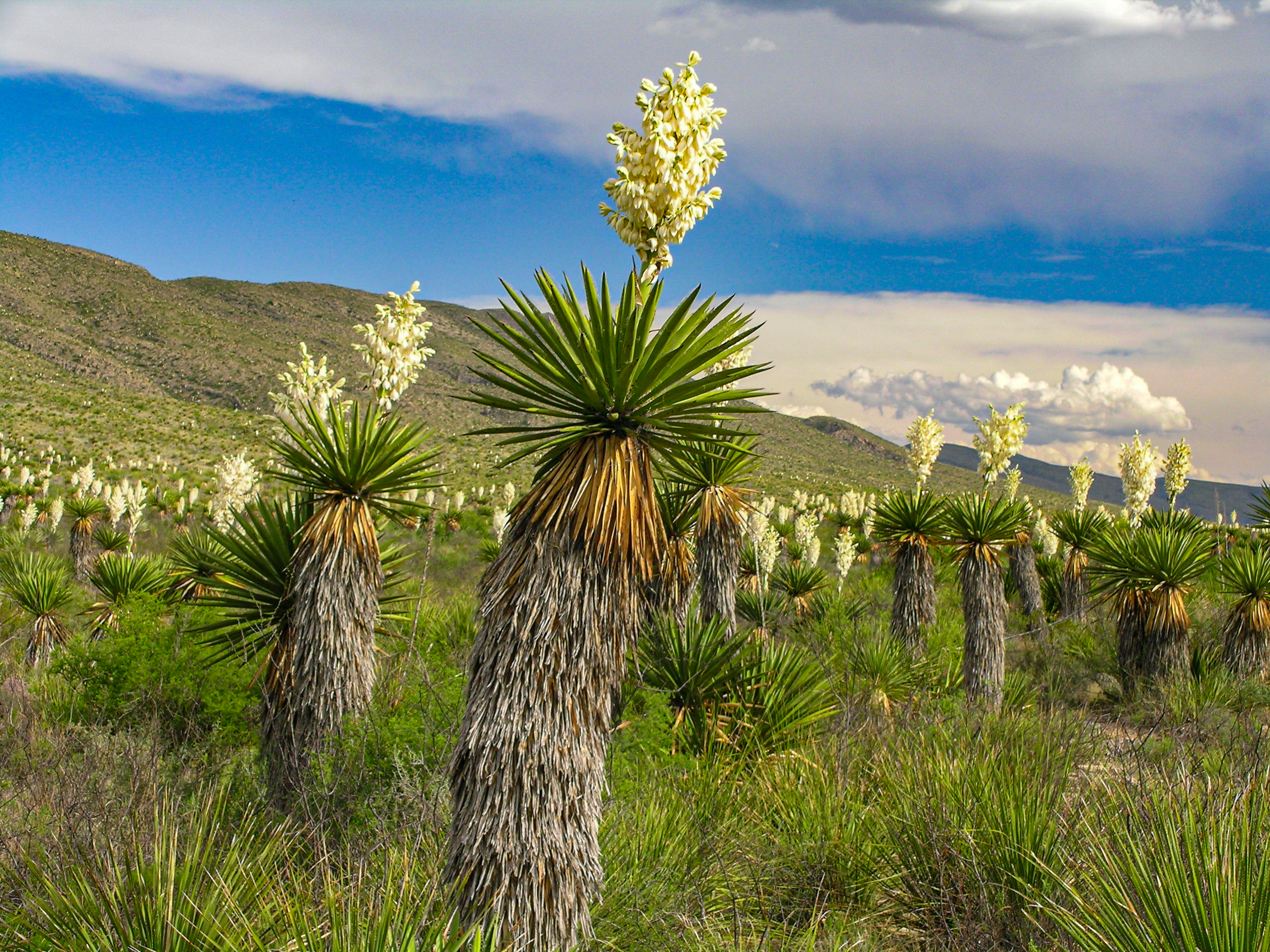
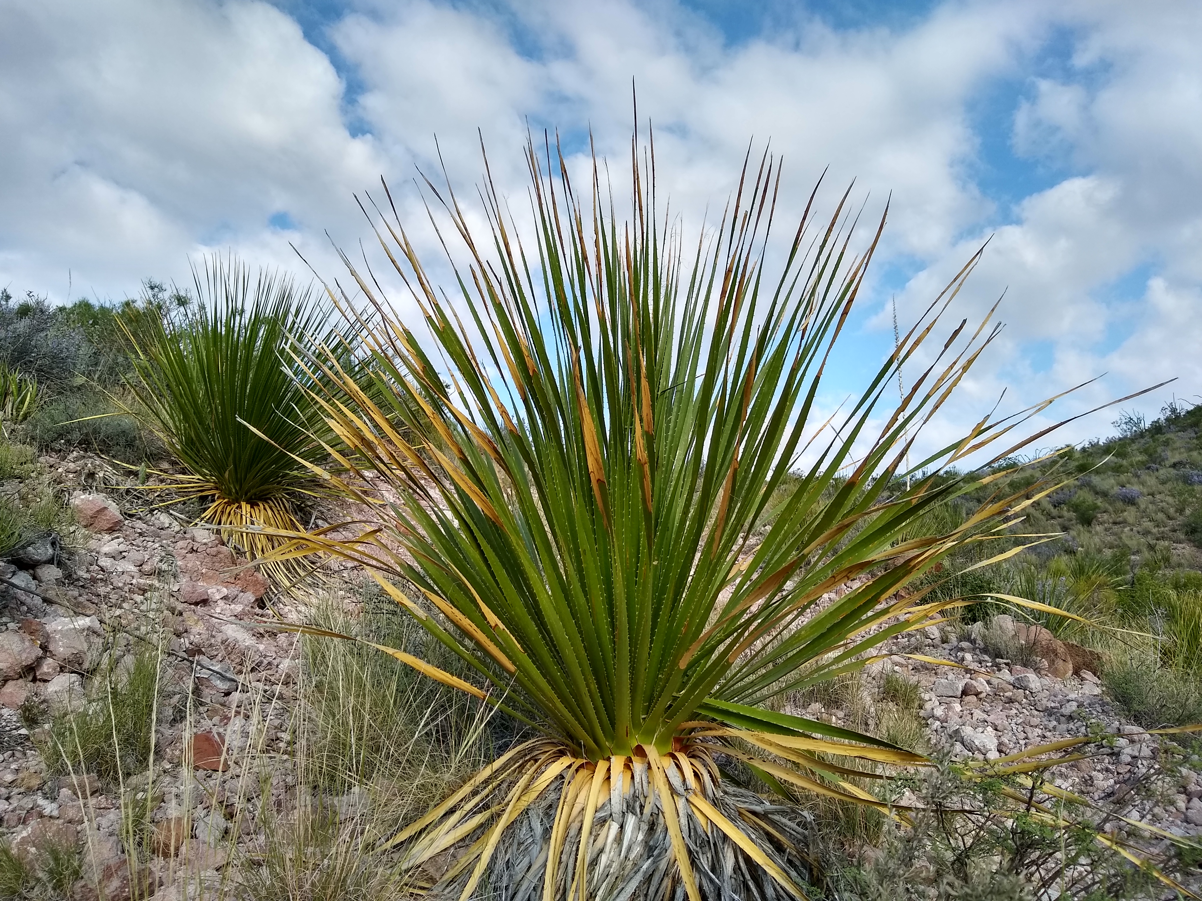
The sixteenth stop on the Dagger Flat Driving Tour, exploring the giant dagger yucca, which resides primarily in the Deadhorse Mountains.
In this valley, the dagger yucca cover the lower slopes and flats, sometimes standing alone and sometimes in small groups. The larger dagger yucca are impressive in their height and girth, while the younger yucca are harder to tell apart from the torrey yucca. Their wide, and long bayonetlike leaves distinguish them from the torrey, soaptree, and Thompson yuccas.
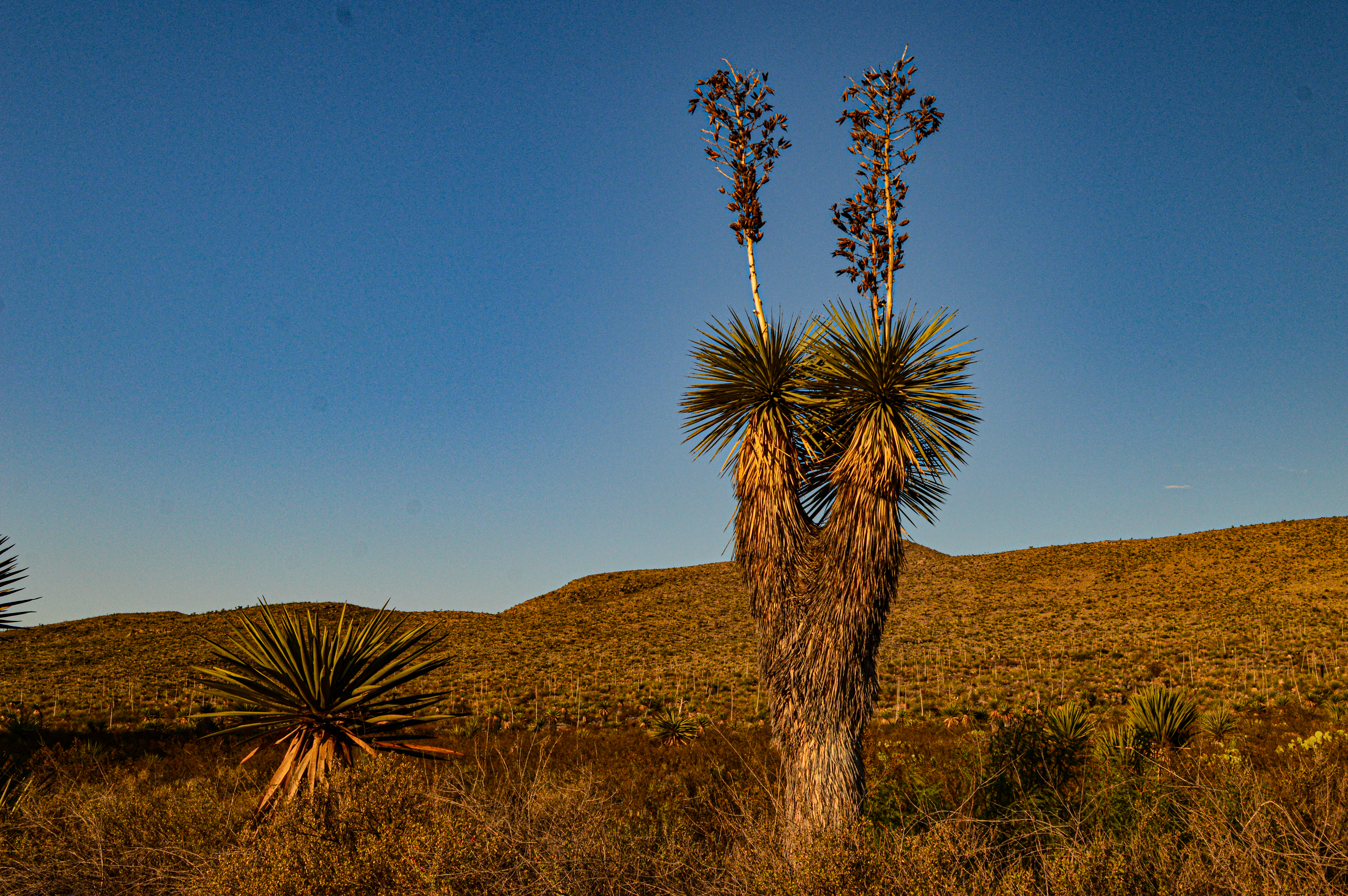
The seventeenth stop on the Dagger Flat Driving Tour, exploring the Thompson yucca, also known as the beaked yucca.
The Thompson yucca is very similar in appearance to the soaptree yucca. The identifying feature is the color of the margins of the leaves. The Thompson yucca has slightly toothed yellow margins, while the soaptree yucca has white margins. This yucca grow 6-12 feet high and typically have a neater, less unkempt look about their brown hanging leaves than other yucca.
The eighteenth stop on the Dagger Flat Driving Tour, exploring the honey mesquite, a member of the lequme family.
They honey mesquite found along this road are not as large as some mesquite seen elsewhere in the park. They can grow up to 30 feet in height and the crown spreads a distance equal or more to the height. The twigs are armed with sharp thorns up to 2 inches long, especially on young plants. They produce a long, yellowish-brown pod, somewhat flattened and with slight constrictions between the seeds.
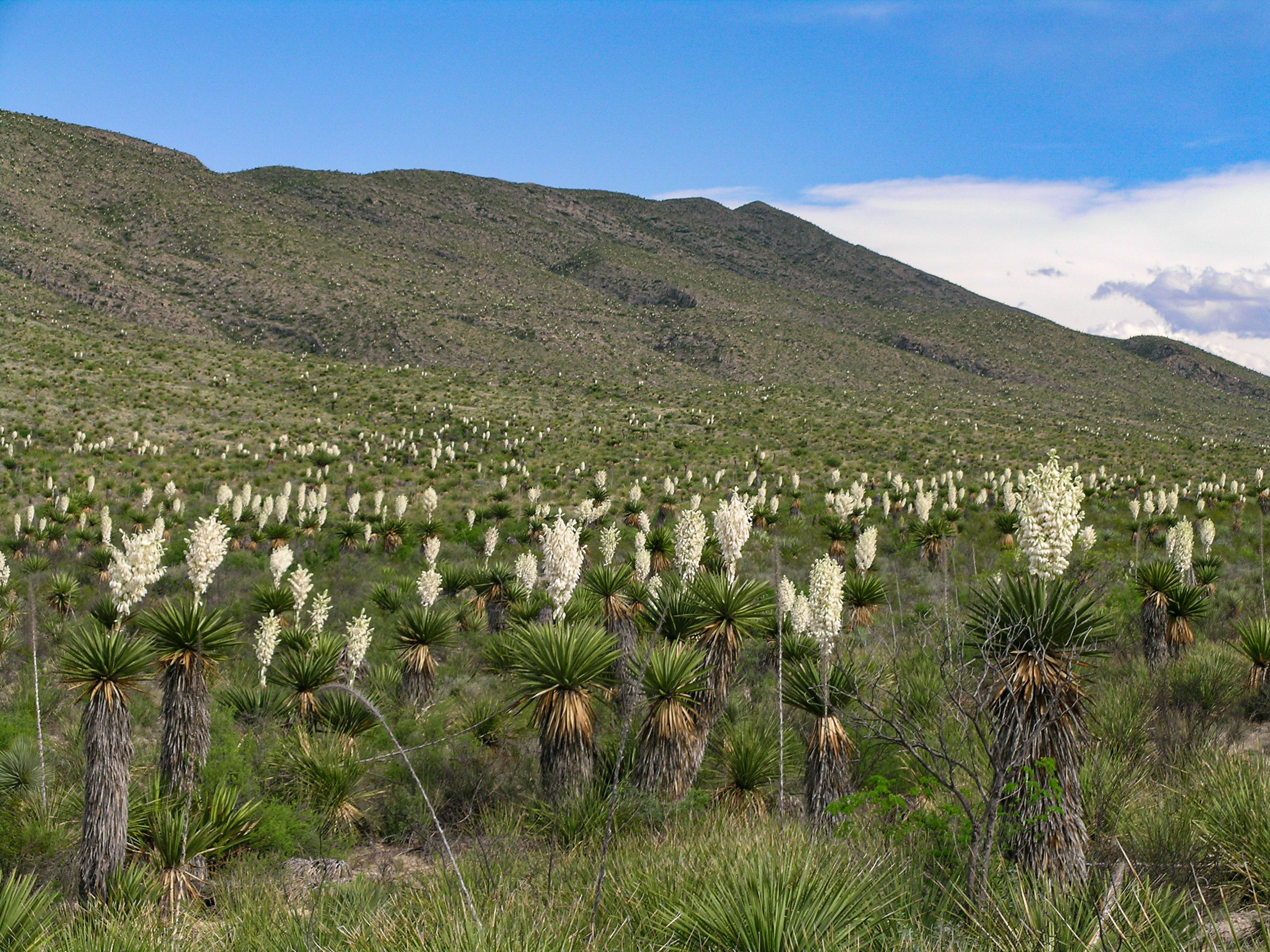
The last stop (also the end of the road) on the Dagger Flat Driving Tour. This is the best location from which to view the largest number of giant dagger yucca. They typically bloom sometime in April-June.
The road ends in a long, low valley covered with giant dagger yucca. When they bloom in late spring (which doesn't happen every year), they valley appears to be covered in flames of white. This sheltered valley, far removed from the paved road or any other structures, relates a quiet, calm atmosphere. Turn off your vehicle, get out, stand quietly, and just listen. Have you ever experienced true silence like this?
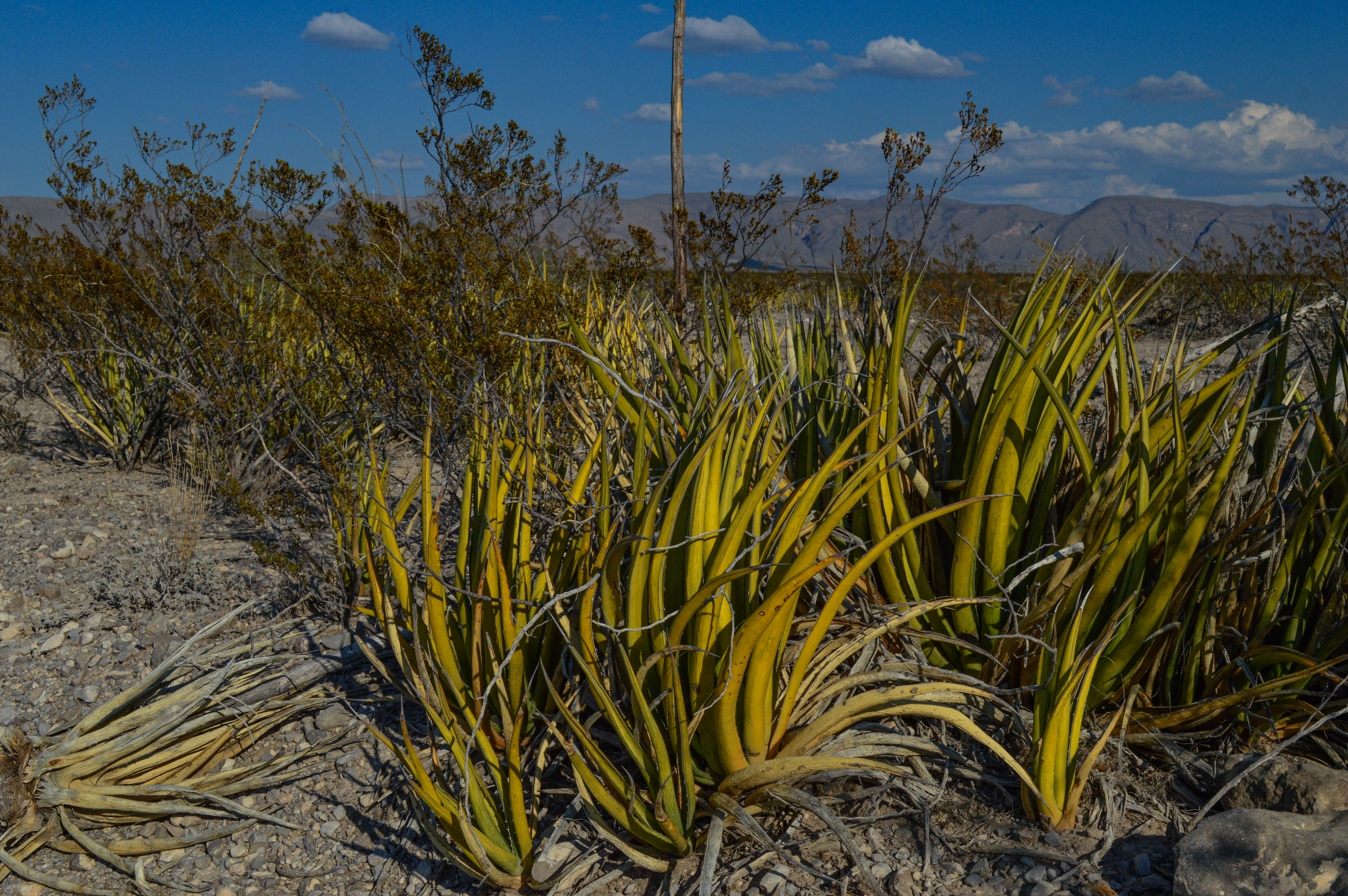
The second stop on the Dagger Flat Driving Tour, describing the lechuguilla, which is the "indicator plant" for the Chihuahuan Desert.
The point of focus is the lechuguilla plant, which grows very well on limestone soils and can be found in abundance on the east side of the park. Lechuguilla, like most agaves, is an evergreen rosette: the well-armed leaves are arranged in spiral ranks around a thick, shortened stem. The plant is well armed by spines at the tips of the leaves, which can be very painful if you are unlucky enough to come in contact with one.
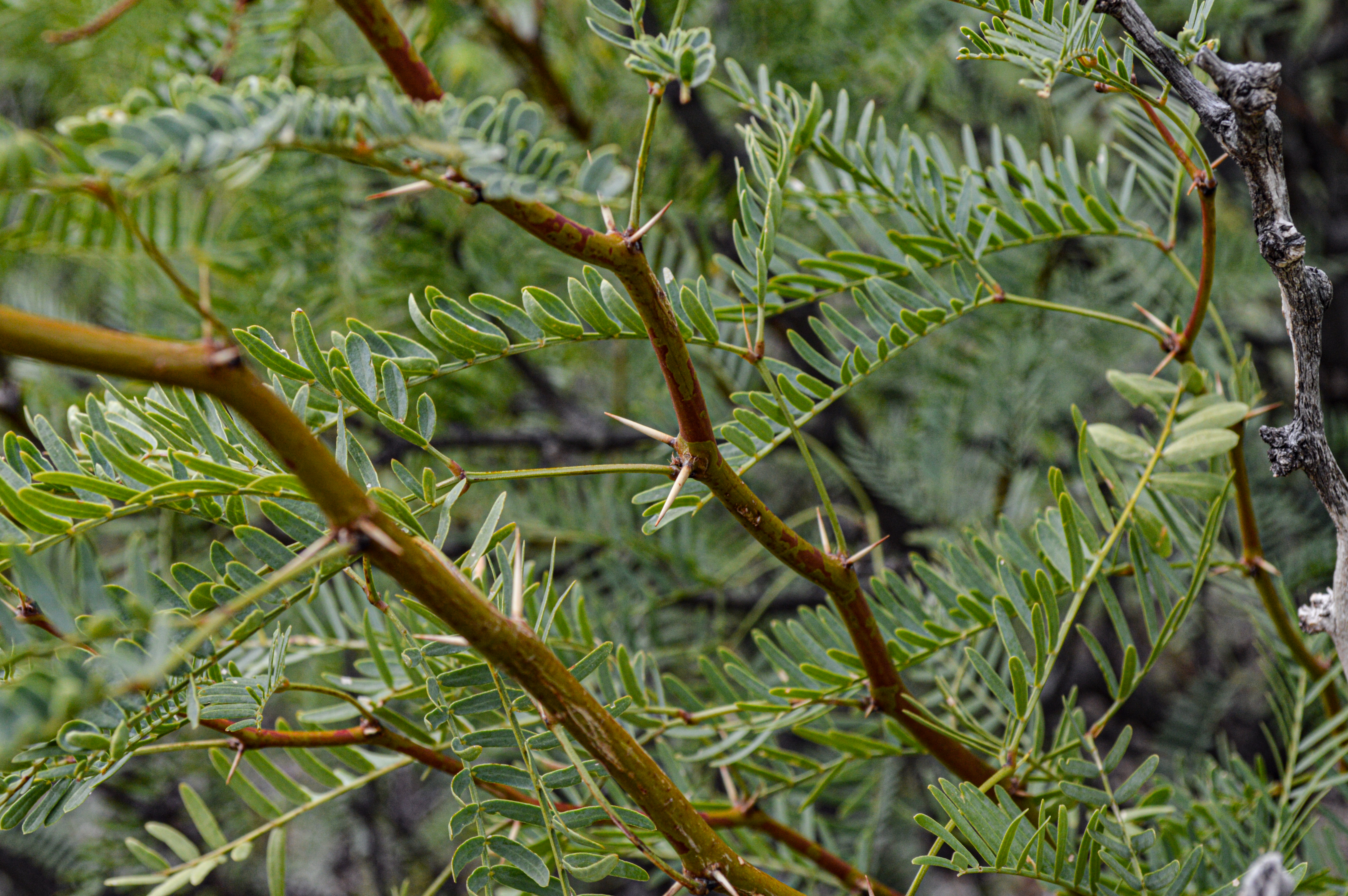
The third stop on the Dagger Flat Driving Tour, exploring the creosotebush, one of the most successful of desert plants.
The plant of focus at this stop is found at all elevations along the Dagger Flat Road, especially in the first half of the drive. The creosotebush is a medium-to-large evergreen shrub that has numerous flexible stems projecting at an angle from its base. It has small, pointed, yellow-green leaves and one inch-wide yellow flowers that bloom from February - August. After the creosotebush blooms the flower turns into a small white fuzzy fruit capsule that has 5 seeds. Due to a toxin produced in its roots, this bush rarely has other plants crowded around it.
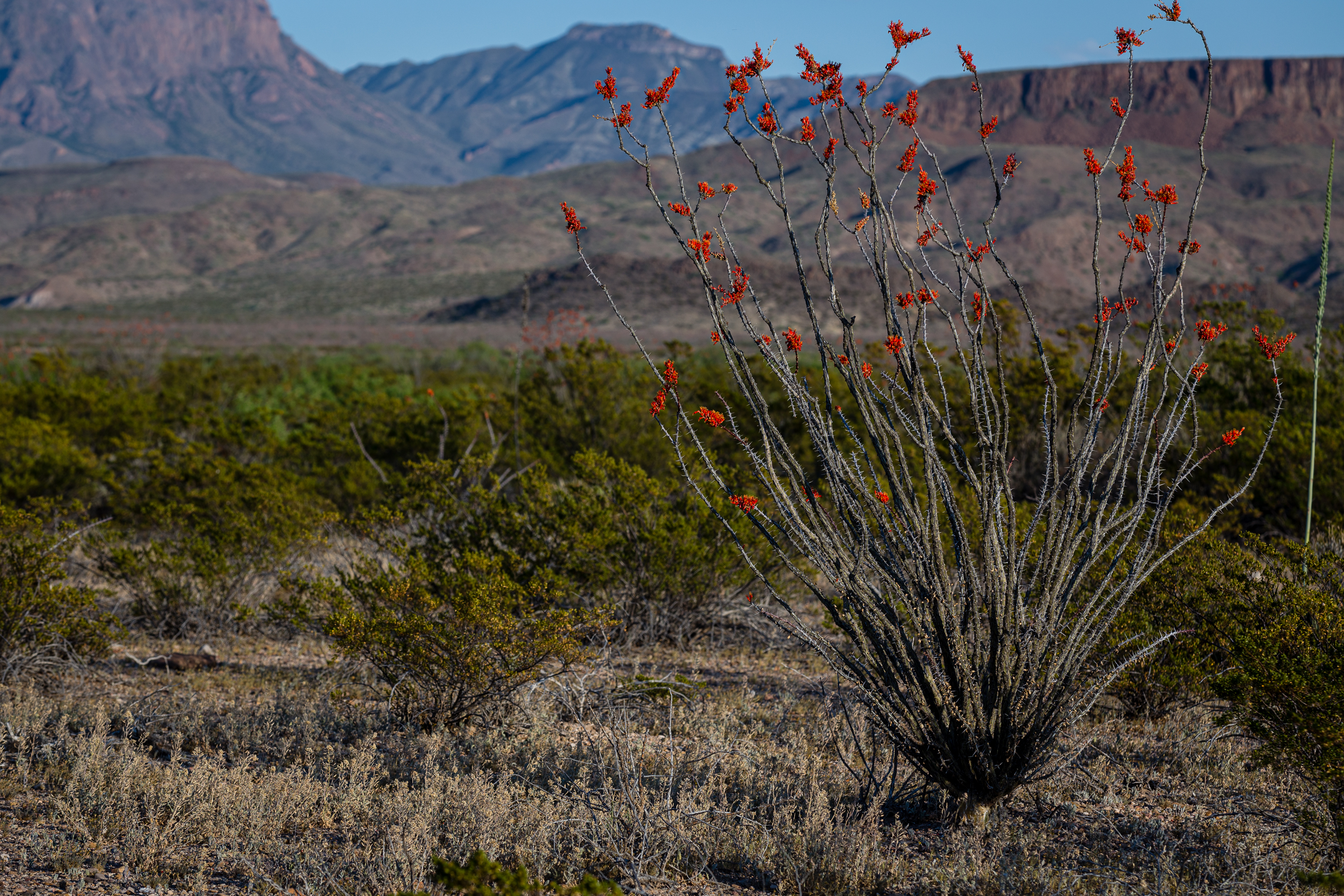
The fourth stop on the Dagger Flat Driving Tour, highlighting the ocotillo, one of the most recognizable plants in Big Bend.
The plant pointed out here - the ocotillo - is one of the easiest plants to identify in the desert. They are a tall plant with long cane-like unbranched spiny stems that grow from a short trunk. The stems have short, blunt thorns that don't stick out beyond the leaves. Small 2-inch leaves will grow from the stems when there is enough moisture. Dense clusters of red tubular flowers grow from the end of the stems from March through June. They can reach heights of up to 20 feet!
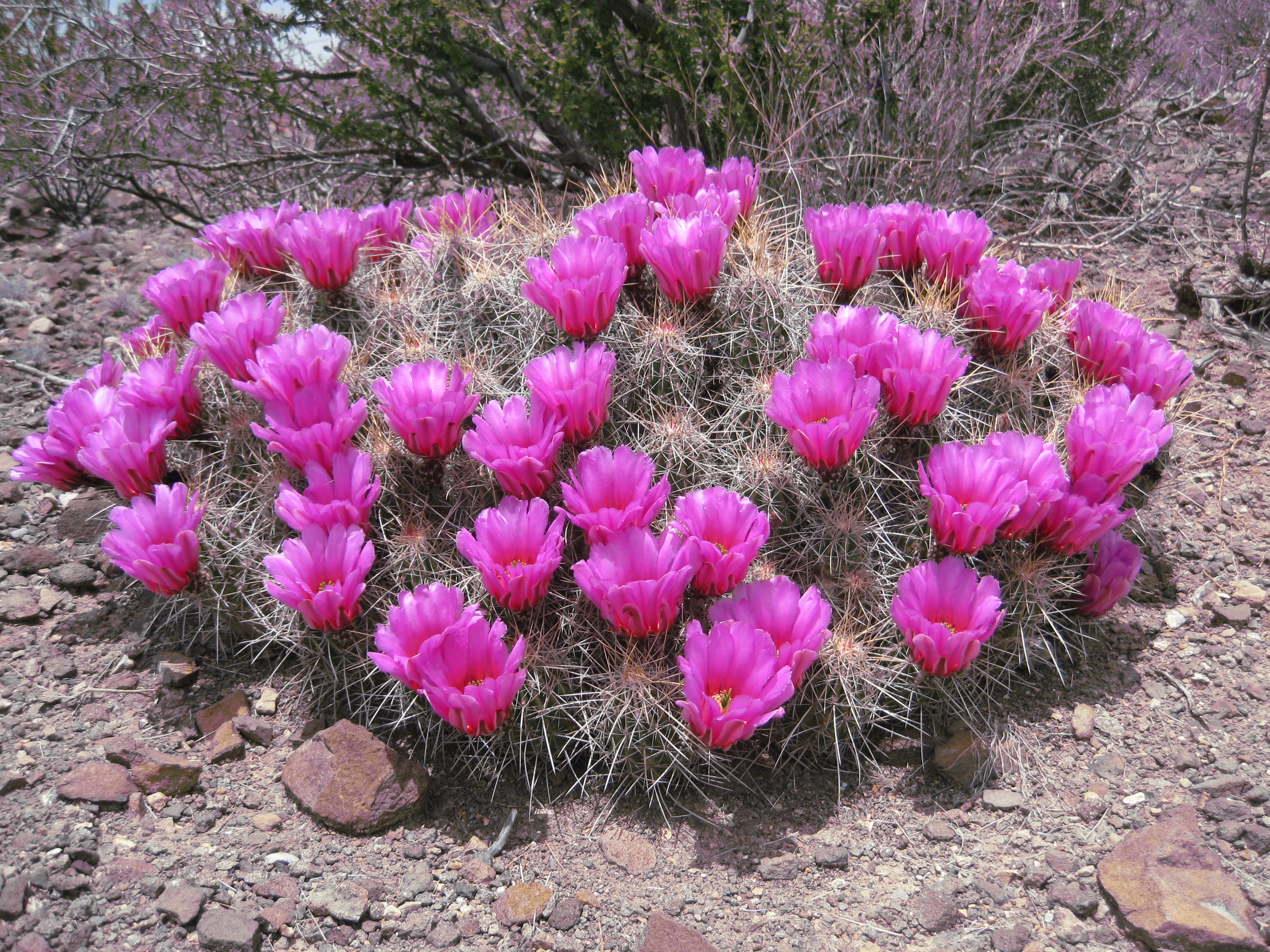
The fifth stop on the Dagger Flat Driving Tour, exploring the beautiful strawberry pitaya cactus.
For most of the year, the strawberry pitaya blends in with the rock and soil surrounding it. They are fairly low to the ground, covered in many large gray spines. But once they bloom, their bright pink flowers immediately catch the eye and you realize how many their are along this road. The flowers are dark red at the base, fading to light pink at the tips. They occasionally cluster, forming large, compact clumps that are often 2-3 feet across and nearly as high.
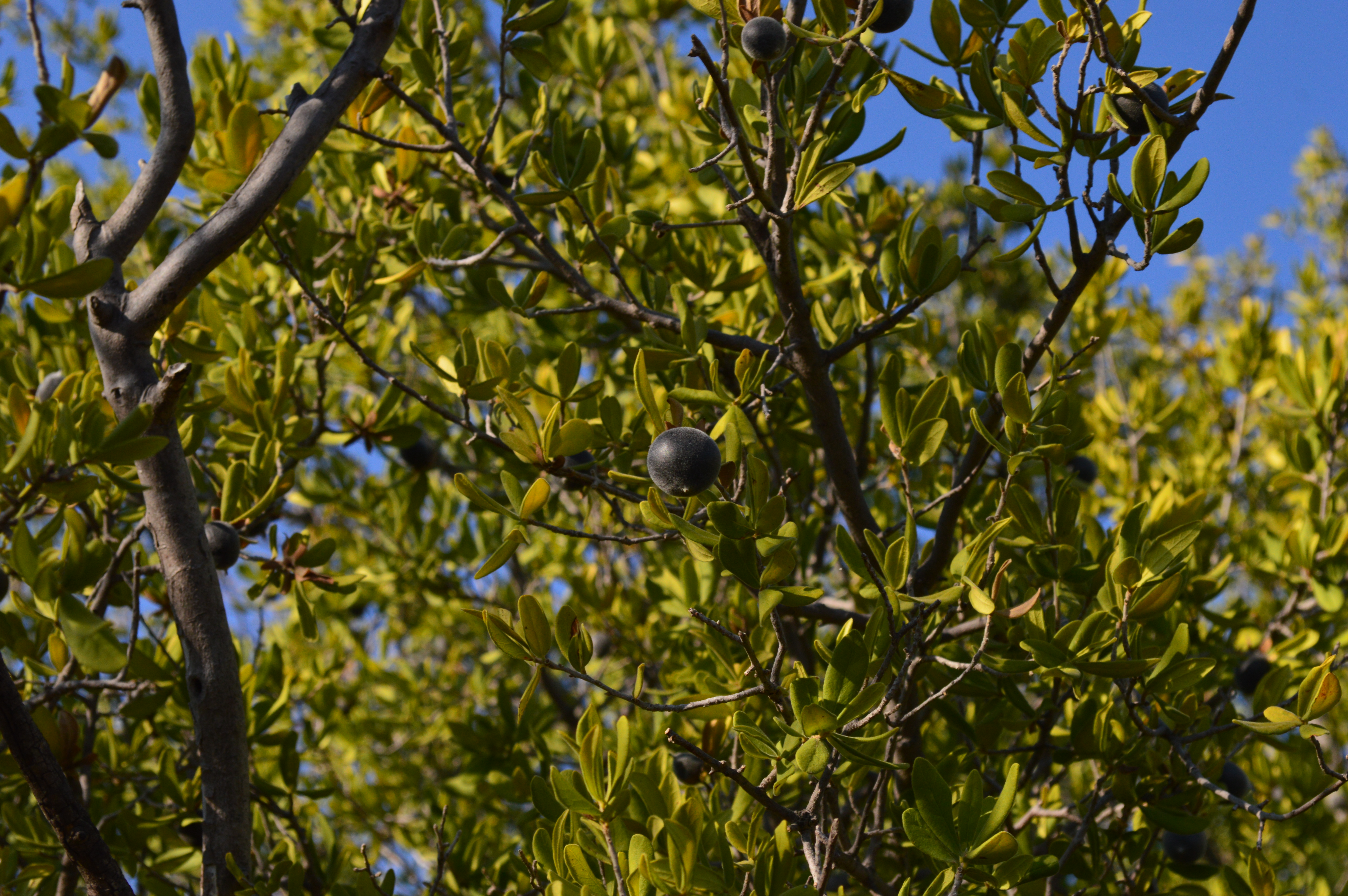
The sixth stop on the Dagger Flat Driving Tour, describing the Texas persimmon tree, found all along the wash in this location.
This marker is located by a small wash that contains numerous persimmon trees. The Texas persimmon could either be described as a large shrub or a small tree, growing from 15 to 20 feet tall. In late summer and fall they are covered in fruit and are very popular with wildlife. It is notable that at this elevation on Dagger Flat road they are only found in the washes. Towards the end of this road, they are more numerous as the elevation is higher.
The seventh stop on the Dagger Flat Driving Tour, describing the torrey yucca, the most common yucca in Big Bend.
Torrey yucca are scattered all along Dagger Flat Road, as well as throughout the park. They vary in height from 3-15 feet, and the trunk typically has a single stem. The flower head may extend up to 2 feet on the upper portion of the stem. The flowers are bell-shaped, 2-3 inches long, creamy-white, and waxy. The leaves are 2-4 feet long, straight and rigid, ending in a sharp spine 1-2 inches long. This species was named for John Torrey (1796-1873), who designated this yucca as a new variety in 1859.
The eighth stop on the Dagger Flat Driving Tour explores the sotol plant, now more prominent as the road has climbed 400 in elevation.
The view and surroundings are beginning to change from flat desert to low mountains, and a good portion of the road is now loose sand. This gain in elevation introduces a new plant, sotol, which is sometimes confused with yucca. The base of the sotol is a crowded cluster of ribbon-like leaves, 1-3 feet long. They have spiny teeth along the margins that curve backwards toward the base. The sotol produces an unbranched flower stalk 5-10 feet tall, with dense clusters of small white flowers on the upper third of the stalk.
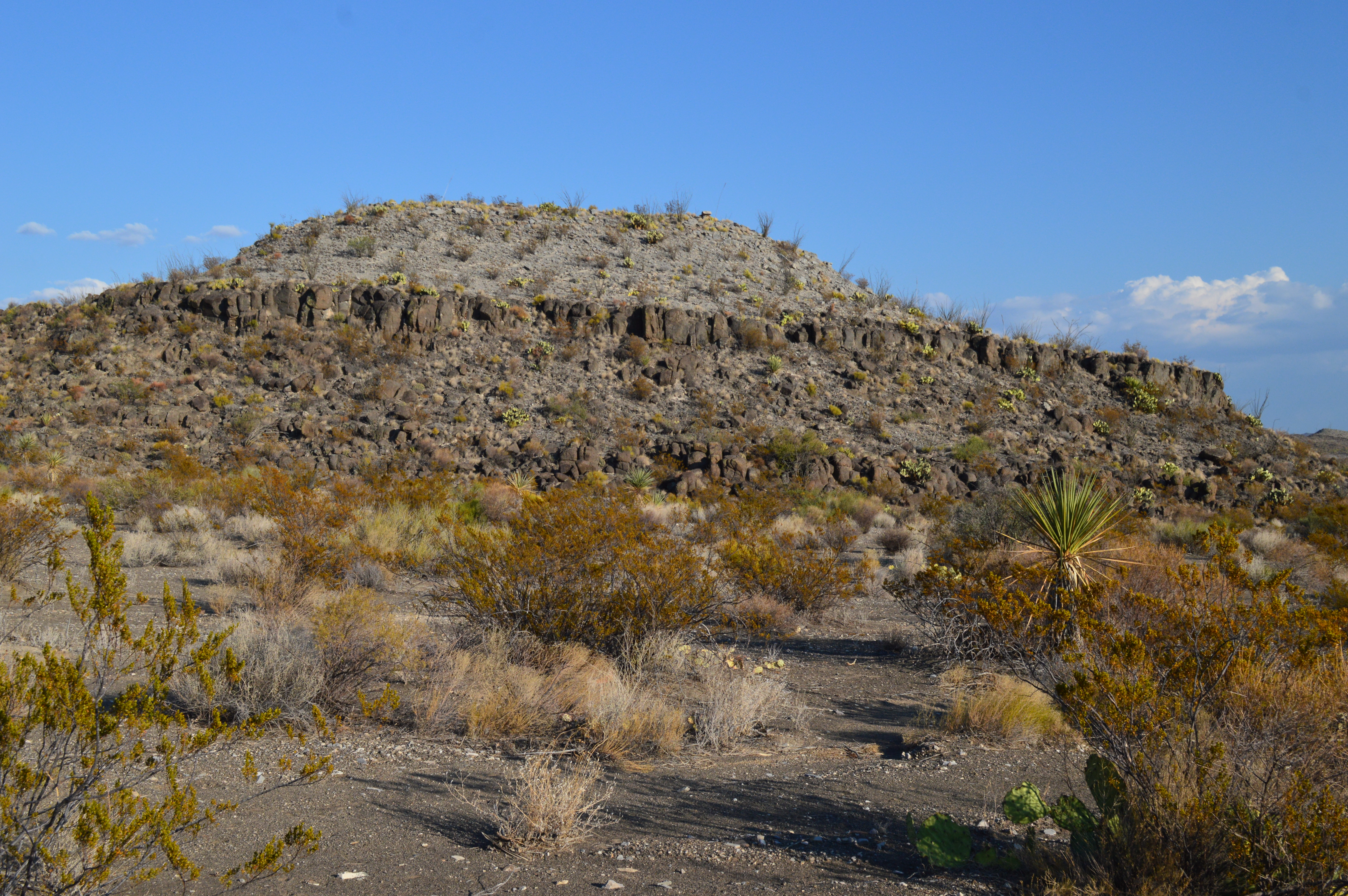
The ninth stop on the Dagger Flat Driving Tour, discussing the volcanic event that produced this hill.
The hill being discussed is composed of volcanic rock, rising up from the surrounding lowlands like a dark cap atop a lighter-colored cake. The higher Deadhorse Mountains rise up behind this low hill and see smooth by comparison.
A 14-mile round-trip drive down a dirt road - high clearance necessary - to view a unique forest of giant dagger yuccas. Along the way one can view plants, and possibly animals, common to the Chihuahuan desert.
This dirt road begins in the lower desert found along the drive between Panther Junction and Persimmon Gap. The first 2 miles of the drive are on an improved dirt road suitable for any vehicle, but the remaining 6 miles could be challenging in a vehicle with low clearance. The vegetation along the first half of this drive is typical of lower elevations, with creosotebush, lechuguilla, cacti, ocotillo, and cholla. As the road gains elevation, different plants such as persimmon tree, littleleaf leadtree, mesquite, and yuccas become more prominent. The drive ends in an enclosed valley that hosts thousands of giant dagger yucca. These yucca can be over 12 feet tall and in the spring their enormous white blooms decorate the hills like flaming candlesticks.
In the early part of the 20th century, hardy homesteaders constructed dwellings and an elaborate network of irrigation ditches for farming near this location beside the Rio Grande.
Text on the Daniels Ranch sign: "From the parking lot you are surrounded by Cottonwood trees, willows and other riverside foliage. Under these trees are some picnic tables and a restroom. There is also a one story adobe building which was part of the farm operation. The building is about 20 feet by 40 feet and has a flat roof. Just 100 yards to the west, tall cliffs follow the course of the river toward the hot springs. These cliffs are made up of ancient limestone and are about 200 feet high on both sides of the river. These cliffs comprise what is called Hot Spring Canyon, which is about three miles in length. The area around Daniels Ranch is rich with wildlife, especially birds."
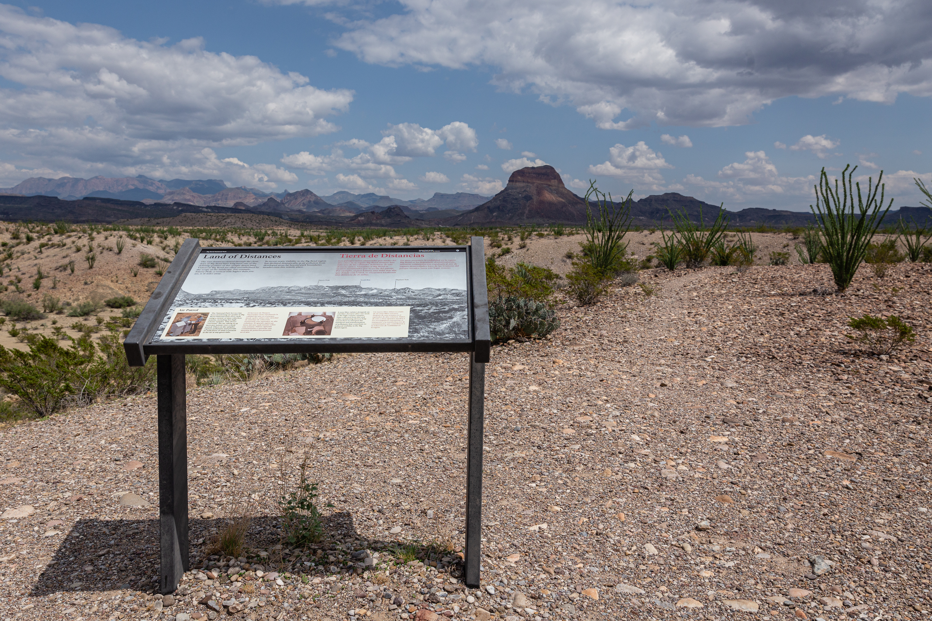
Visitors to Big Bend are often overwhelmed by the scope of the landscape. At this overlook one can spot well-known features of the Chisos mountains such as Emory Peak, the south rim, and Elephant Tusk.
Well-known features of the Chisos Mountains such as Emory Peak, the South Rim, and Elephant Tusk are just ahead of the exhibit panel opposite from the parking area and Ross Maxwell Scenic Drive. The surrounding terrain is dominated by Chihuahuan Desert plants such as cacti, creosote bushes and Mesquite trees.
A rugged, strenuous 10 mile trail through the desert. The Dodson Trail crosses the southern Chisos Mountains foothills, resulting in large elevation gains and losses throughout the hike.
The Dodson Trail starts near the Homer Wilson Ranch line camp and crosses nearly 10 miles of desert scrub before ending at Juniper Canyon on the east side of the Chisos Mountains.
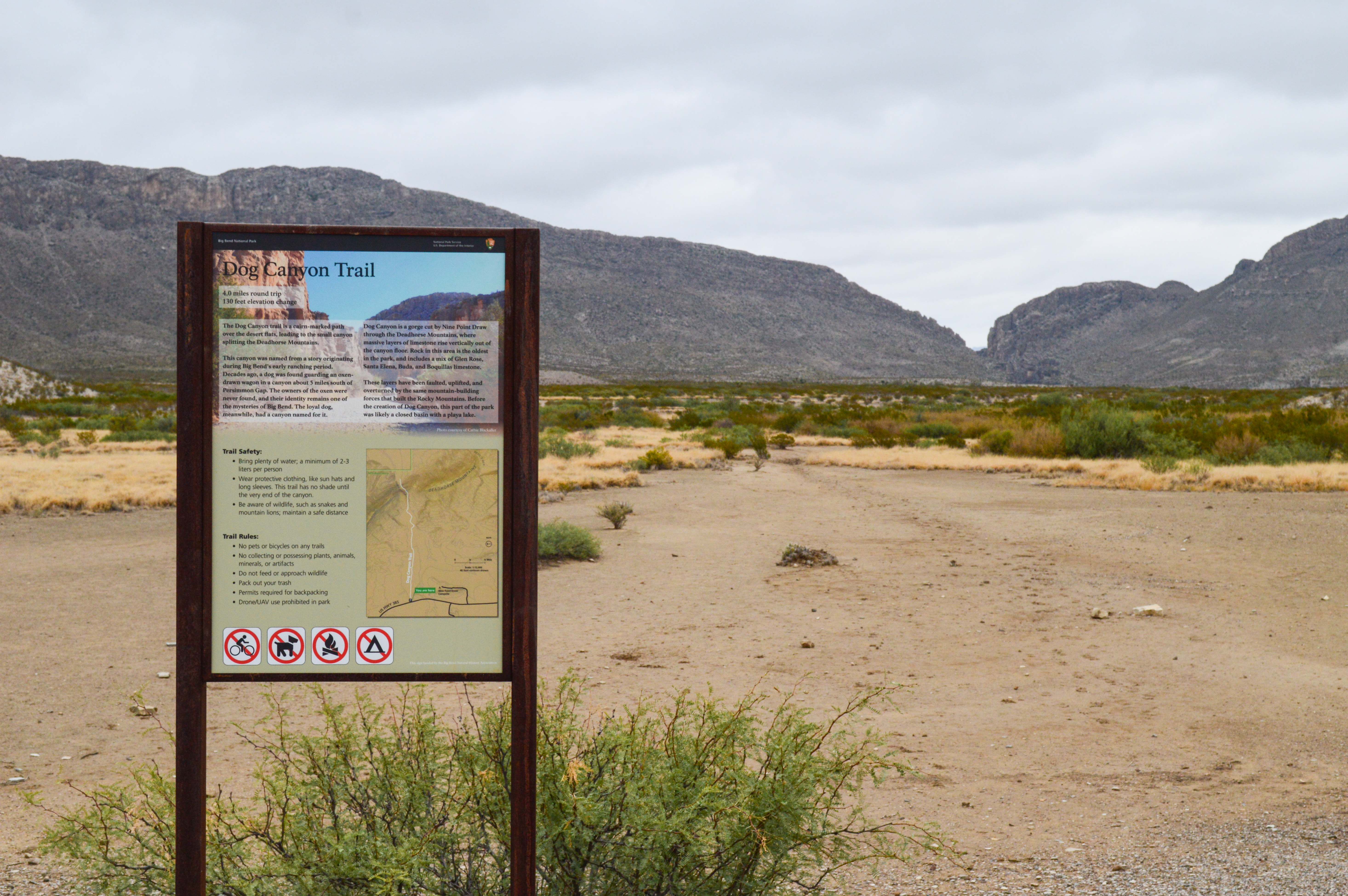
The Dog Canyon trail is a relatively flat 4-mile round-trip hike across open desert to a canyon that splits the Deadhorse Mountains. At the far end of the canyon one can see that the horizontal rock strata have been folded vertically by the geological forces that formed the mountain ridge the canyon traverses.
The Dog Canyon trailhead is located next to a pullout on the road between Persimmon Gap and Panther Junction. From the parking lot one is looking directly east across a flat, sparsely vegetated desert landscape to a line of mountains roughly 2 miles away. The mountains are split by a canyon, and evidence of a rockfall in 1987 is highlighted on the cliff face to the left. The section of cliff where the rockfall occurred revealed the white color of the limestone rock, and can be seen on clear days from Panther Junction, 24 miles to the south. Text on the Dog Canyon Trailhead sign: "The Dog Canyon trail is a cairn-marked path over the desert flats, leading to a small canyon splitting the Deadhorse Mountains. This canyon was named from a story originating during Big Bend's early ranching period. Decades ago, a dog was found guarding an oxen-drawn wagon in a canyon about 5 miles south of Persimmon Gap. The owners of the oxen were never found, and their identity remains one of the mysteries of Big Bend. The loyal dog, meanwhile, had a canyon named for it. Dog Canyon is a gorge cut by Nine Point Draw through the Deadhorse Mountains, where massive layers of limestone rise vertically out of the canyon floor. Rock in this area is the oldest in the park, and includes a mix of Glen Rose, Santa Elena, Buda and Boquillas limestone. These layers have been faulted, uplifted, and overturned by the same mountain-building forces that built the Rocky Mountains. Before the creation of Dog Canyon, this part of the park was likely a closed basin with a playa lake." Trail Safety: "Bring plenty of water; a minimum of 2-3 liters per person Wear protective clothing, like sun hats and long sleeves. This trail has no shade until the very end of the canyon. Be aware of wildlife, such as snakes and mountain lions; maintain a safe distance." Trail rules: "No pets or bicycles on any trails No collecting or possessing of plants, animals, minerals, or artifacts Do not feed or approach wildlife Pack out your trash Permits required for backpacking Drone or UAV use prohibited in park"
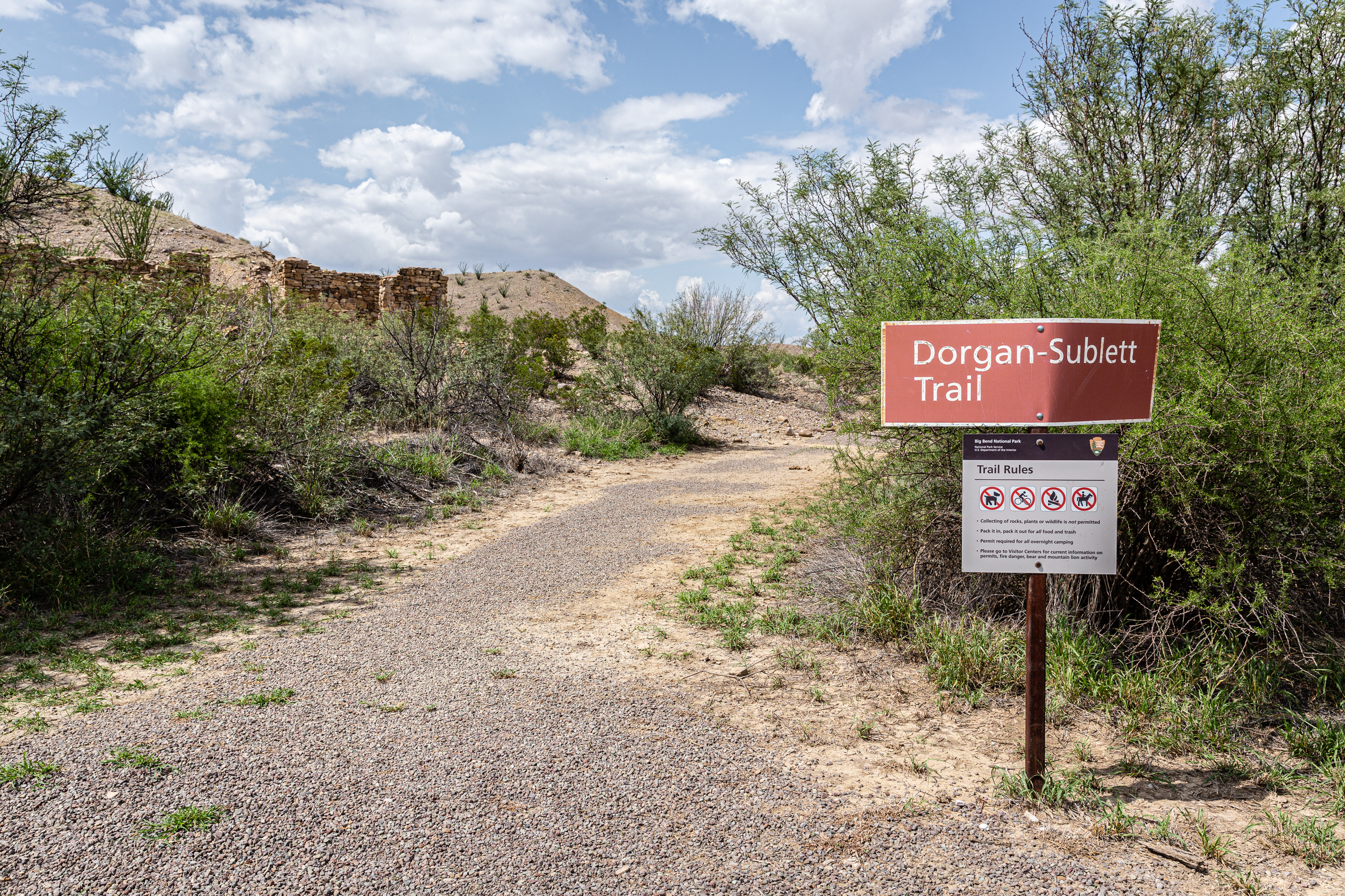
In the 1930s architect Alvert Dorgan and his wife Avis Ann bought land near Sublett’s farm. Later he built an impressive adobe home on top of the mesa using his expertise as an architect to design this atypical hose with a petrified wood fireplace.
The remnants of adobe walls and a petrified wood chimney sit atop a mesa. In the distance, landmarks including the Chisos Mountains, Emory Peak, and Mule Ears are visible to the north and east; Santa Elena Canyon is to the southwest. At the bottom of the mesa, grasses, cacti, and mesquite trees compose the majority of the vegetation. Text on the Exhibit Panel Dorgan House: "This decaying, but still very impressive, structure was once the home of Albert W. Dorgan, a business associate of James Sublett. Together they bought 640 acres and developed an extensive irrigated farming project along the floodplain below. In the 1930s , Dorgan and his wife, Avis Ann, built this adobe home on the mesa, with large windows at the front and a double fireplace that opened into the central living area. The Dorgans vacated their Big Bend property in 1938. In 1941 they leased to the property to A.F. Robinson, who opened the “Mexitex Resort”, hoping to benefit from the new national park. The resort failed, and Dorgan sold his holdings for inclusion in Big Bend National Park." Spanish Translation: La casa de Dorgan: Esta casa desumrrada-todavía muy impresionante- era el hogar de Albert W. Dorgan, socio comercial de James Sublett. Juntos compraron 259 hectáreas y desarrollaron un extensivo proyecto de agrícola con riego a lo largo del terreno aluvial abajo. En la década de 1930, Dorgan y su esposa, Avis Ann, construyeron esta casa de adobe en la mesa, con ventanas grandes en el frente y una chimenea doble que se daba a la gran sala central. Los Dorgans desocuparon su propiedad en Big Bend en 1938 y en 1941 la alquilaron a A.F. Robinson, quien abrió el hotel “Mexitex Resort”, con la esperanza de beneficiarse del parque nacional cual pronto se establecería ahí. El negocio fracasó y Dorgan vendió sus propiedades para su inclusíon en el Parque Nacional Big Bend.
The Dorgan Sublett Trail is an easy one-mile roundtrip walk that leads to the remains of four structures that were part of the “Grand Canyon” farms operation in the early 1900s.
At the parking area is a sign describes the Dorgan Sublett Trail. The surrounding landscape is dotted with plants such as cacti, creosote bushes, and mesquite trees. Further along the trail a stone structure and exhibit signs explain the history of the farming in this area. Continuing on, another stone building is visible along the dirt trail as you rise into higher terrain at the top of the hill. The wide dirt trail continues east through grasses and desert scrub to a small grove of mesquites with a shaded bench, then proceeds to the second structure. At the top of the hill, the trail forks. To the right, a cement slab marks the location of the Sublett house (this area is especially fragile, please stay on the trail). The left fork leads to the Dorgan house, where a fireplace and part of the walls are still standing.
Dugout Wells was once known by homesteaders as the "Cultural Center of the Big Bend". A visit today reveals an oasis of trees, a working windmill, picnic tables, and a short 0.5 mile (0.8 km) walk along the Chihuahuan Desert Nature Trail.
Text on exhibit at Dugout Wells: "Tall cottonwoods in the desert are a sure indicator of running water. Here, moisture seeps from a bed of gravel in the Chisos Mountains' east flank. Around 1900, a settler dug out a spring to pool the seepage, and later improved the flow with a windmill. As you enter the grove of trees you will experience an instant change in climate. Look and listen for signs of wildlife attracted to the greater variety of plants. The relatively dense vegetation makes this oasis an excellent site for birdwatching."
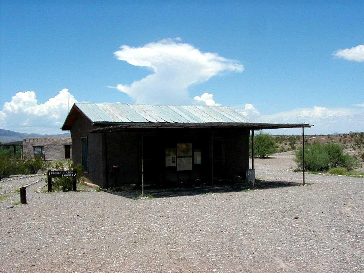
Located in the Castolon Historic District, the Castolon Visitor Center is open daily during the winter months. River use permits are issued during normal business hours, and entrance fees can be paid at the Castolon Visitor Center. The Castolon Visitor Center has a Big Bend Natural History Association bookstore and nearby restrooms. The visitor center is located in the historic Garlick House, immediately behind the Magdalena House Exhibits. Stop by to meet a ranger and plan your adventure.
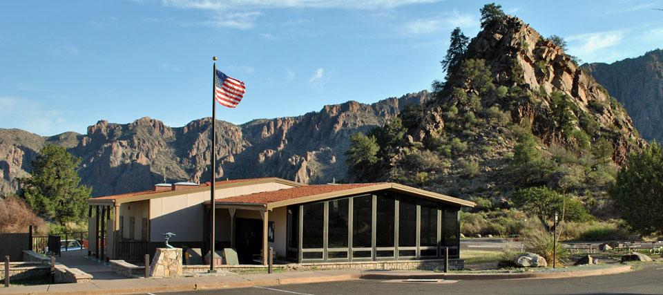
The Chisos Basin Visitor Center includes interactive exhibits on plants, animals, and birds found in the Chisos Mountains. Backcountry and river use permits are issued during normal business hours, and entrance fees can be paid at the visitor center. A Big Bend Natural History Association bookstore and restrooms are located at the visitor center. A water faucet is available on the east side of the building for filling personal water containers
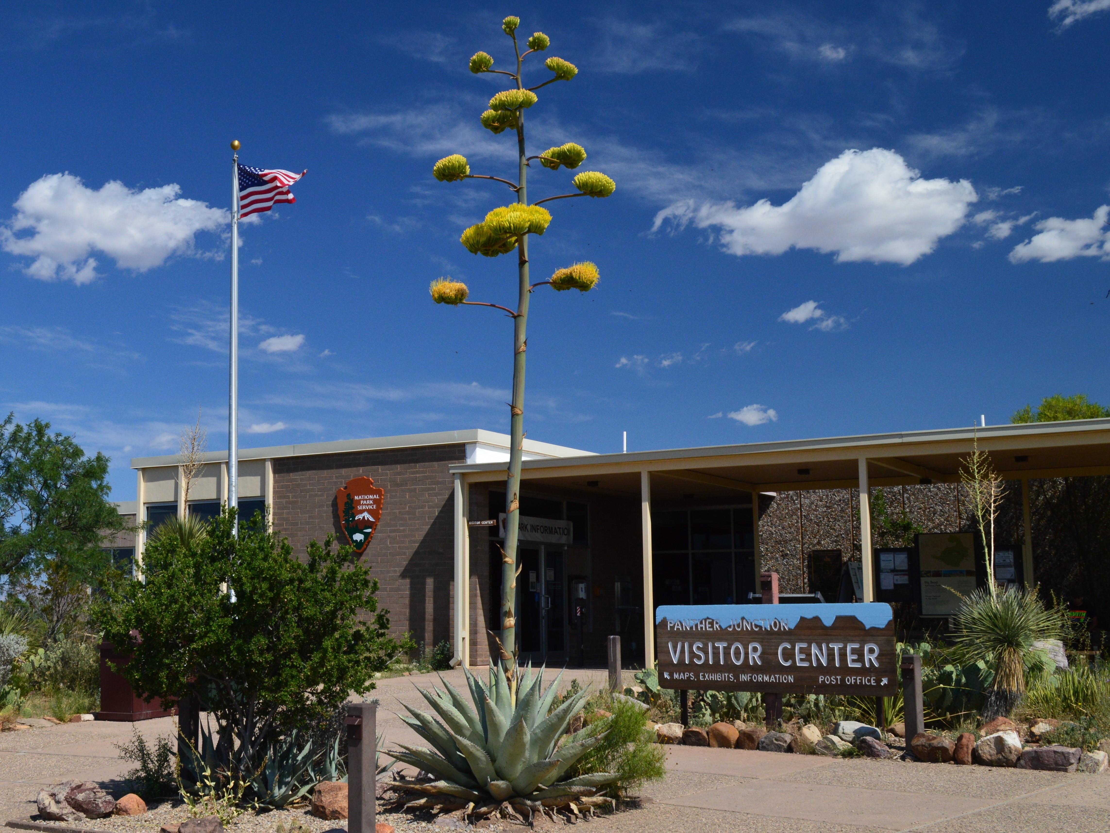
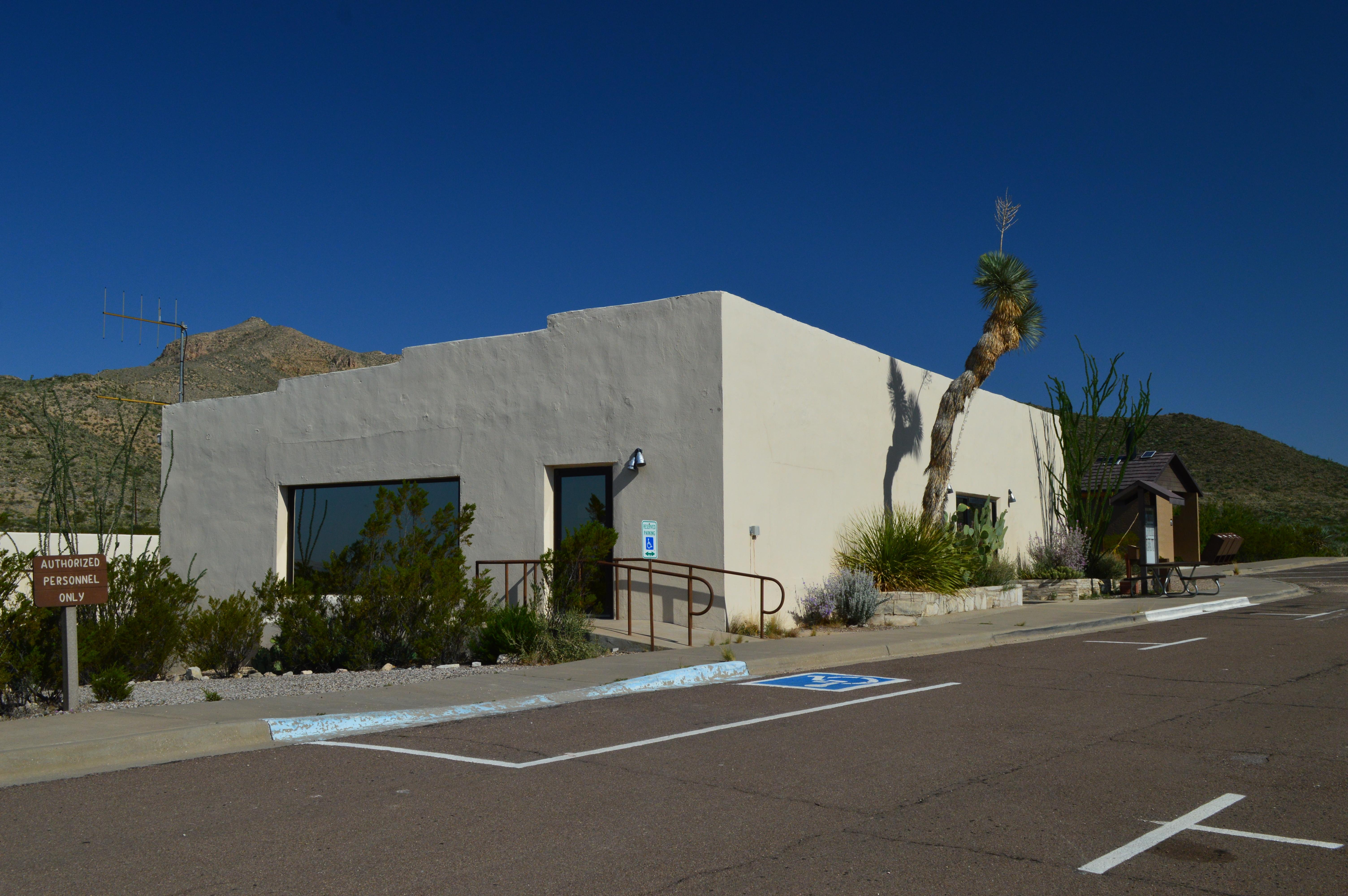
Panther Junction Visitor Center is the best place to begin your visit. Backcountry & river use permits are issued here. Entrance fees can be paid here. Exhibits provide an overview of geology & natural and cultural histories of the park. The visitor center also has a theater with a park orientation movie shown upon request.The visitor center complex includes a Big Bend Natural History Association bookstore, U.S. Post Office, and restrooms. A water faucet is available for filling personal water containers
Persimmon Gap Visitor Center is located in a low pass between the Santiago Mountains at the northern entrance of the park. This pass has been a travel corridor for centuries for people entering and exiting the lower Big Bend country. The visitor center offers park orientation and information. The visitor center has exhibits, bookstore, and restrooms. Entrance fees can be paid at the Persimmon Gap Visitor Center.
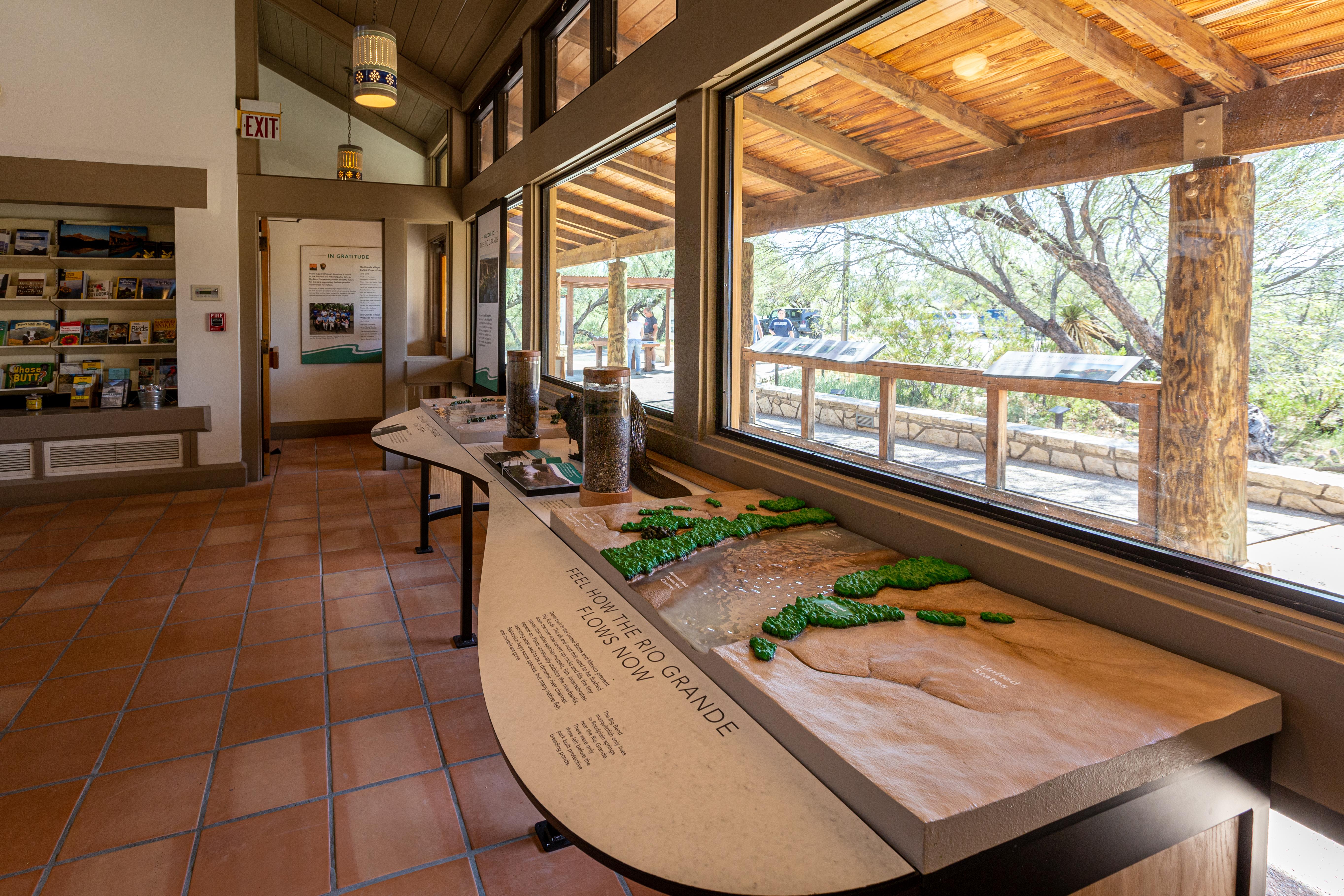
The Rio Grande Village Visitor Center is located 0.25 miles north of the Rio Grande Village developed area. New exhibits focus on the Rio Grande (how it has changed over time, how the NPS works with our Mexican counterparts to protect and care for it, and the rich assemblage of species that it supports). An outdoor ramada showcases a large raised-relief map of the area, and life-sized bronze sculptures showcase some of the area's special wildlife. River use permits are issued during normal business hours.
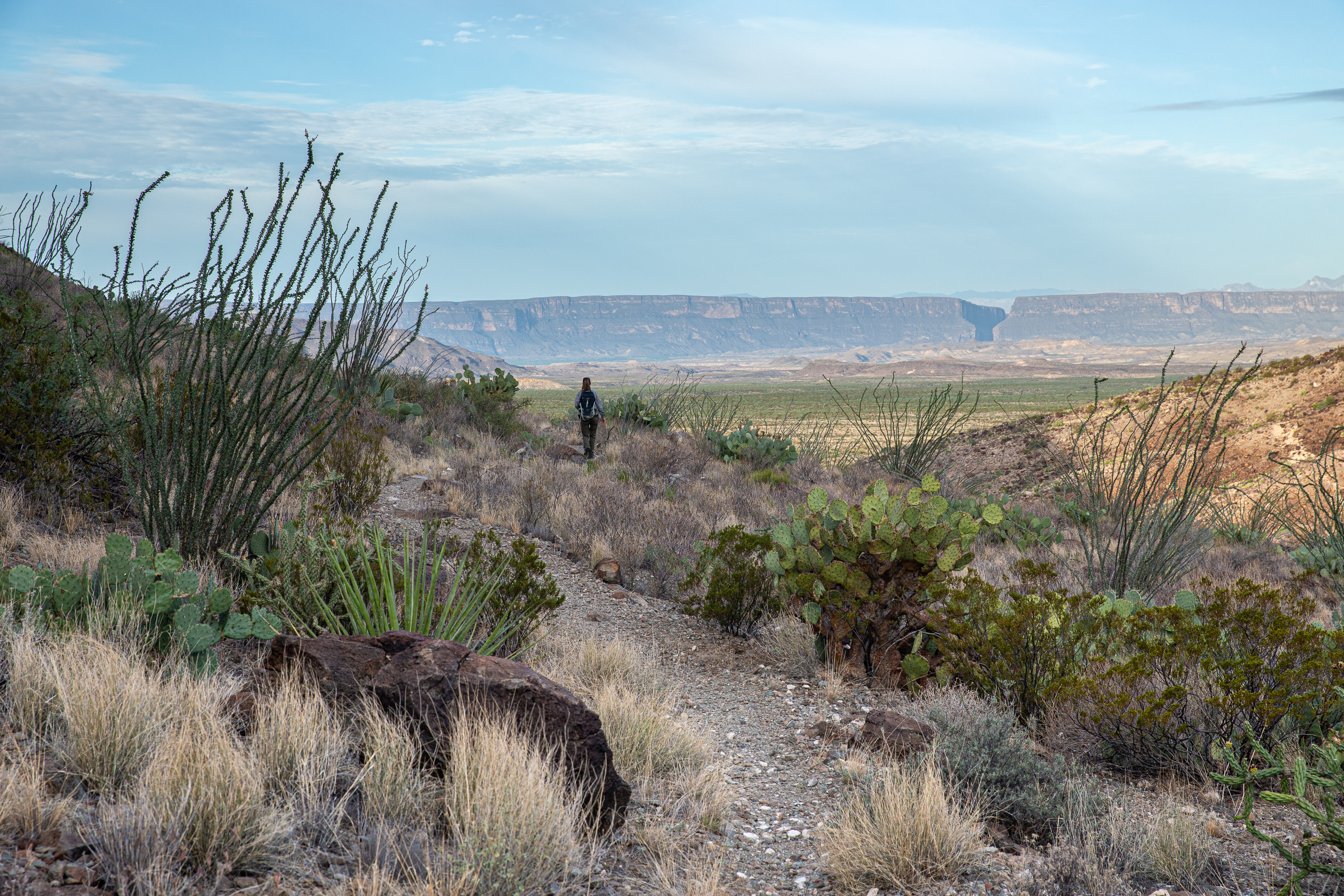
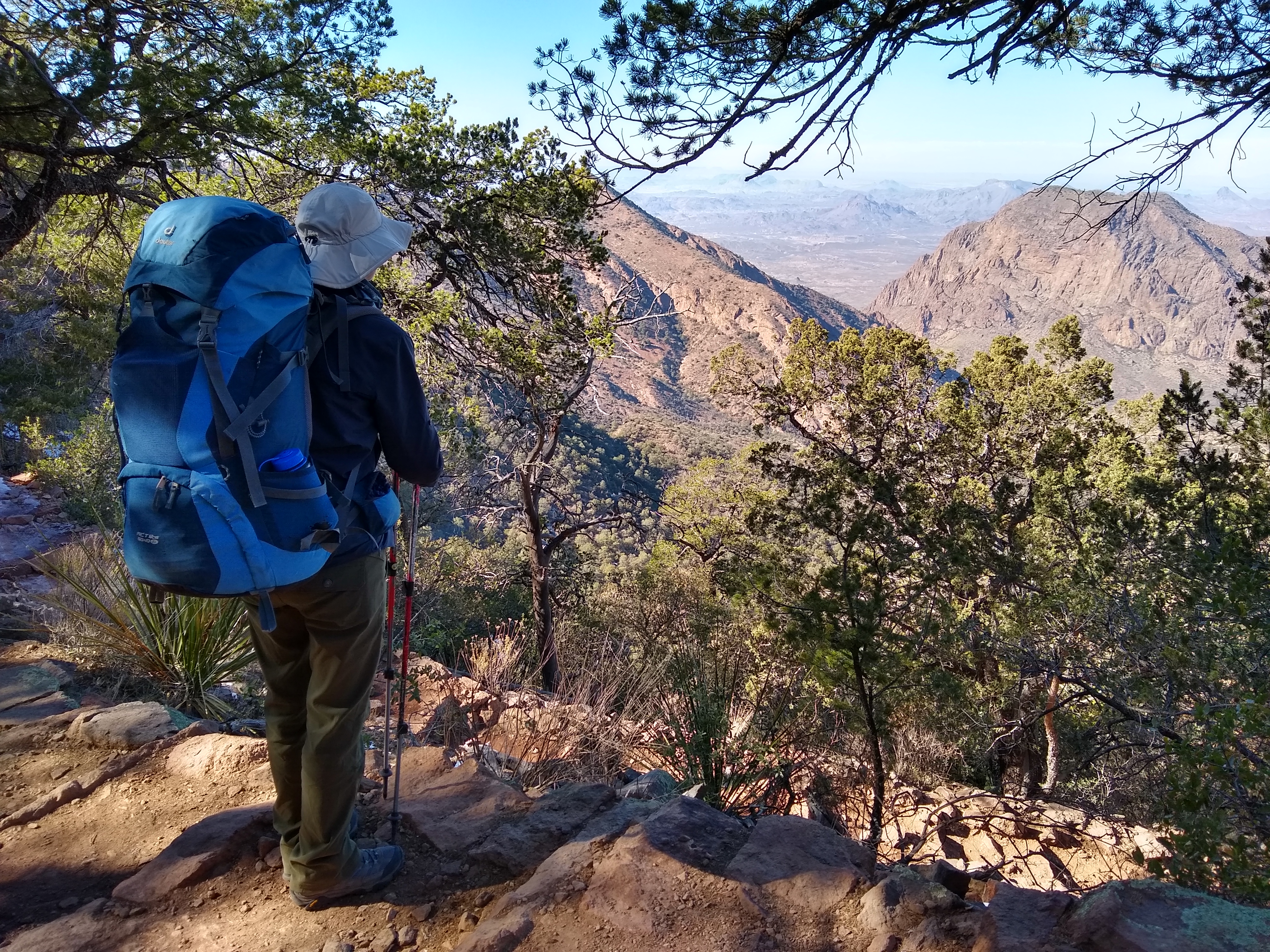
Big Bend National Park is a backpacker's paradise. For those who come prepared, there are hundreds of miles of trails, and vast expanses to explore.
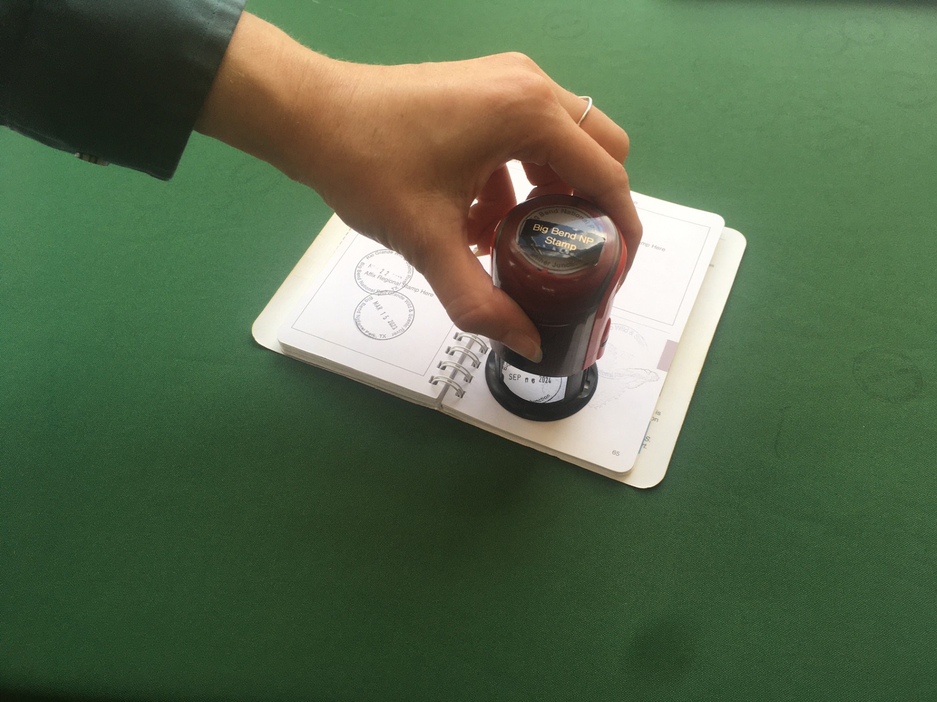
Get a Big Bend Passport Stamp
Are you a "Passport to Your National Parks" cancellation collector? Big Bend National Park has a cancellation stamp to commemorate your visit in your passport book.
Big Bend Junior Rangers
Big Bend National Park invites young visitors to become official Junior Rangers.
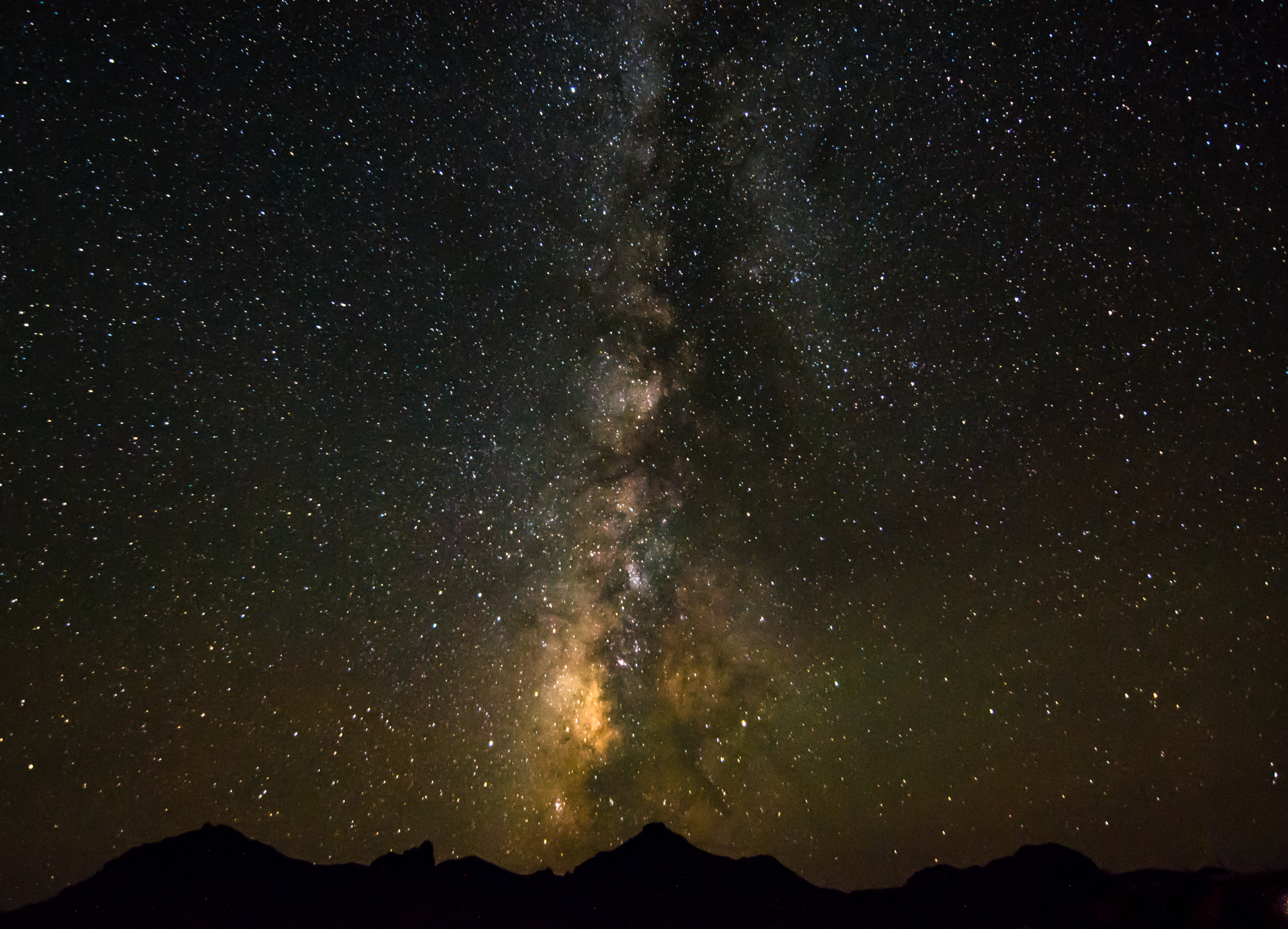
View the Night Sky
Far away from most city lights, Big Bend National Park preserves pristine darkness. Take this chance to stargaze, and experience the half of the park that many of us miss - nighttime.
List of Hiking Trails in Big Bend
Hiking trails
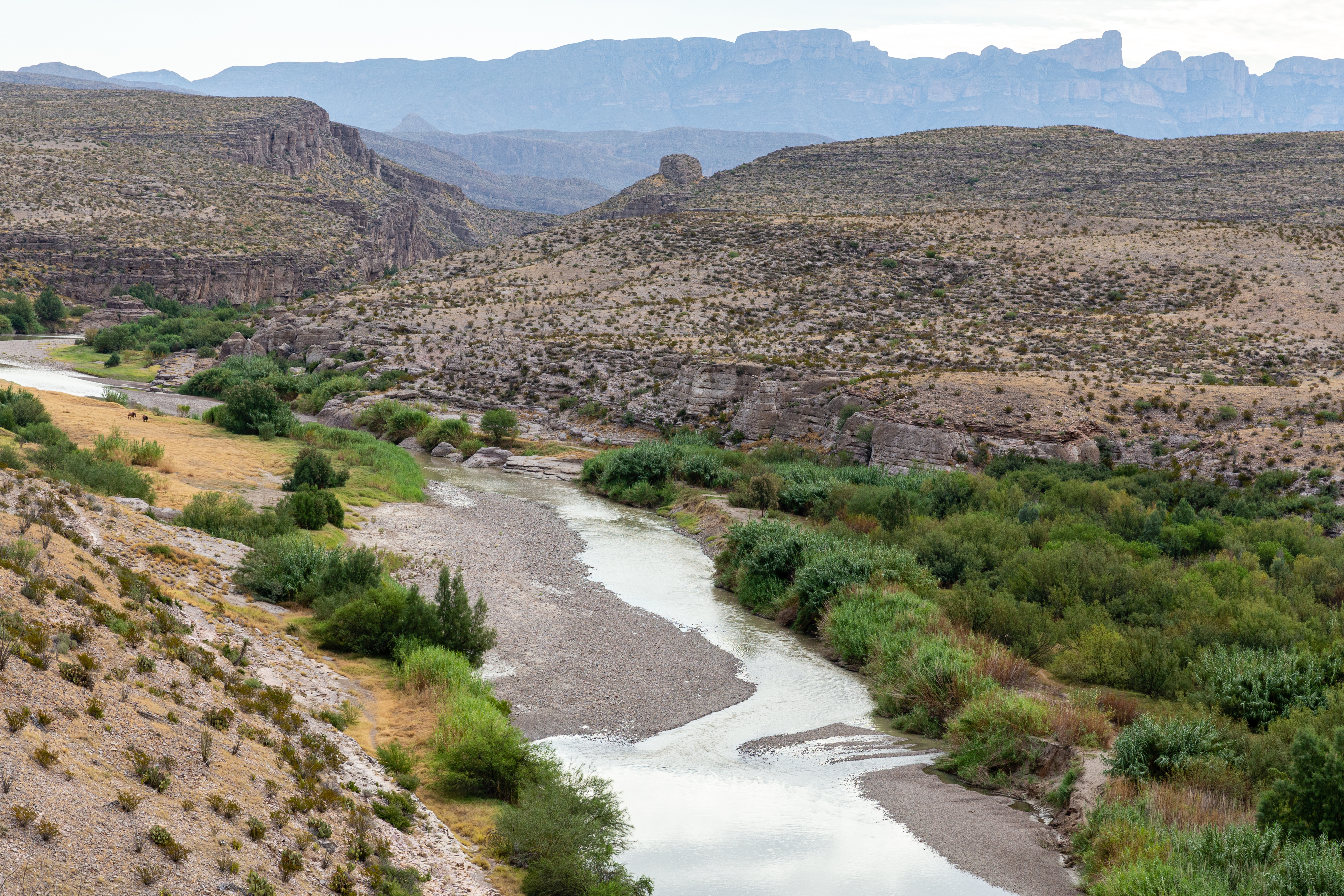
See the Rio Grande
The Rio Grande is accessible from a number of places in Big Bend National Park, and a variety of hiking trails provide even further opportunities to get up close and personal with our watery border with Mexico.
Hike the Lost Mine Trail
The Lost Mine Trail climbs to the side of Lost Mine Peak, offering spectacular views of Juniper Canyon and the Northeast Rim of the Chisos.
Hike Into Santa Elena Canyon
The trail begins at the end of the Ross Maxwell Scenic Drive to Santa Elena Canyon, and is one of the prettiest short trails in the park. The trail crosses Terlingua Creek, takes you to the river’s edge inside the canyon and continues farther winding among large boulders until it ends abruptly where the canyon wall meets the river.
Visit Boquillas, Mexico
Visiting the small village of Boquillas, Mexico through the park's Boquillas Crossing Port of Entry is an option for visitors possessing a valid passport.
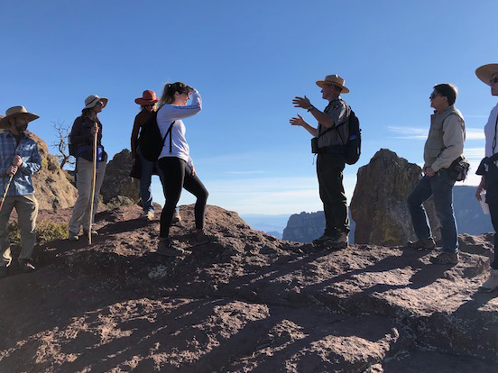
Join A Ranger
Join a Park ranger for a guided hike, talk, or evening program. Discover the amazing stories behind the scenery of Big Bend.
Become a Big Bend Expert
The bookstore carries a large variety of educational books, videos, park information, and high quality souvenirs to help you learn more about the park and its resources or just help you remember your trip to Big Bend.
Birdwatch at Rio Grande Village Nature Trail
Rio Grande Village is consistently one of the best places to find a large number of birds in Big Bend National Park. The principal area to search is the Nature Trail, located in the southeastern corner of the campground.
Birdwatch at Cottonwood Campground
Situated near the Rio Grande, under the shade of numerous large cottonwood trees, Cottonwood Campground is a great place to look for birds and other wildlife.
Primitive Roadside Campsites
Off the Beaten Path! If you have a rugged vehicle, and wish to get away from it all...Big Bend offers a number of primitive campsites located along rough, remote, backcountry roads.
Find The Perfect Sunrise & Sunset
Where is the best place to see the sunrise or sunset? Truly, the answer is anywhere in the park! With huge horizons and dramatic scenery, it is spectacular wherever you are.
Enjoy Sunset at Rio Grande Village
Photography can be a rewarding experience for visitors. One of the best places is the Nature Trail at Rio Grande Village
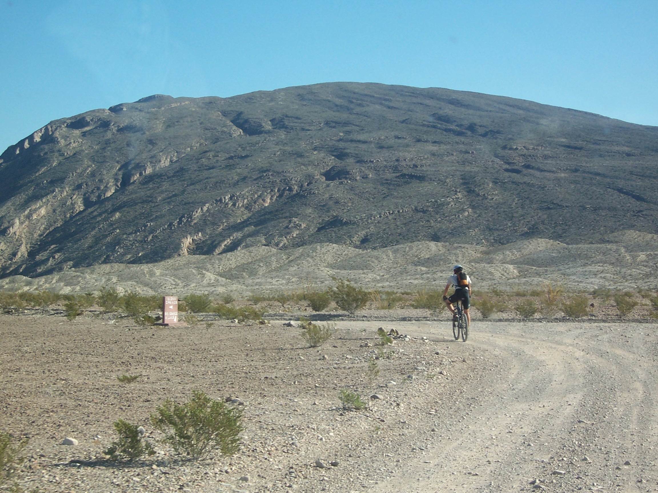
Bike Big Bend
Lightly traveled roads and varied terrain make Big Bend a premier bicycling location.
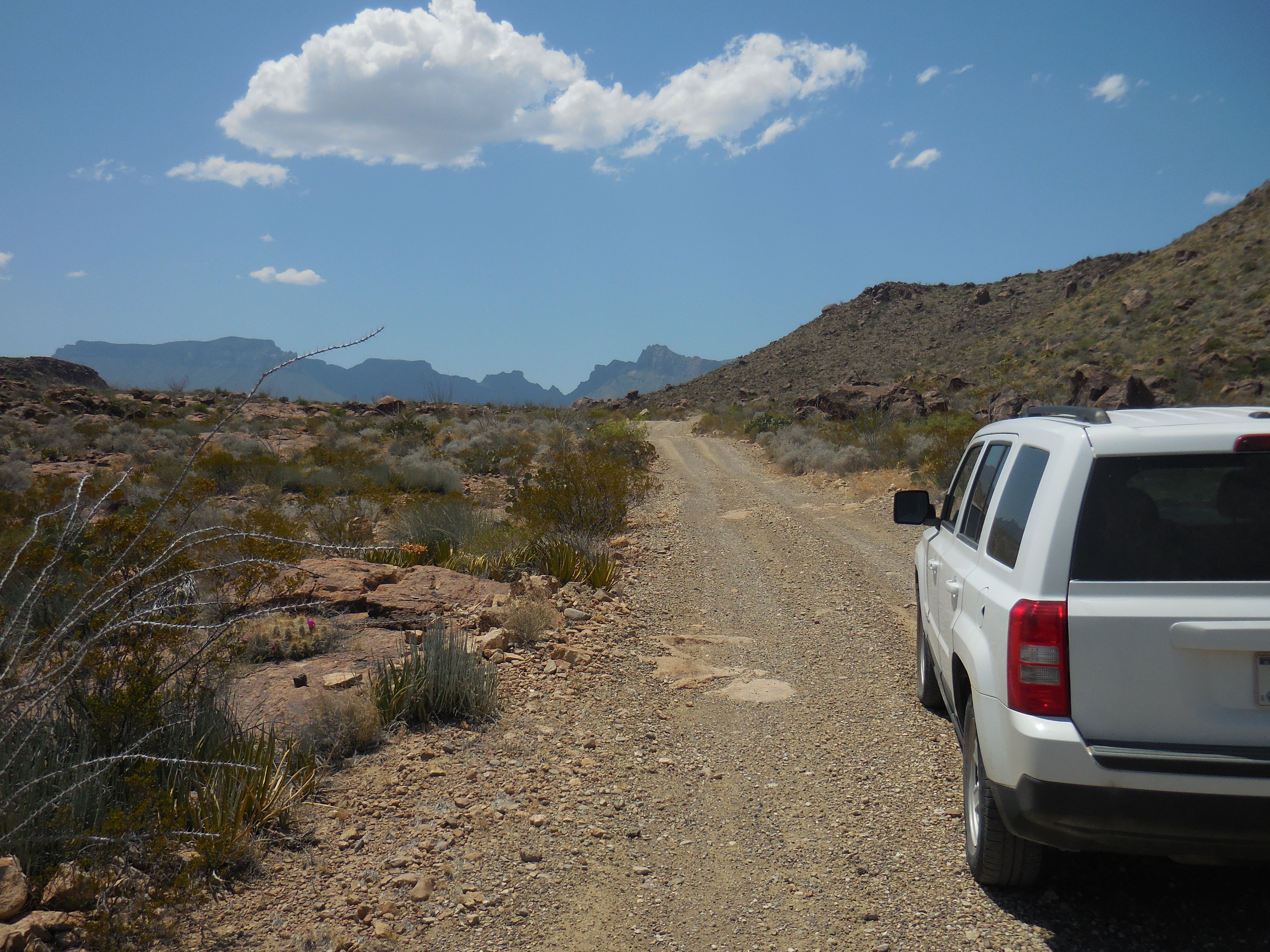
Explore Backcountry Roads
If you have a high-clearance, four wheel drive vehicle, Big Bend's primitive dirt roads provide many opportunities to get off the beaten path and explore the remote corners of this park.
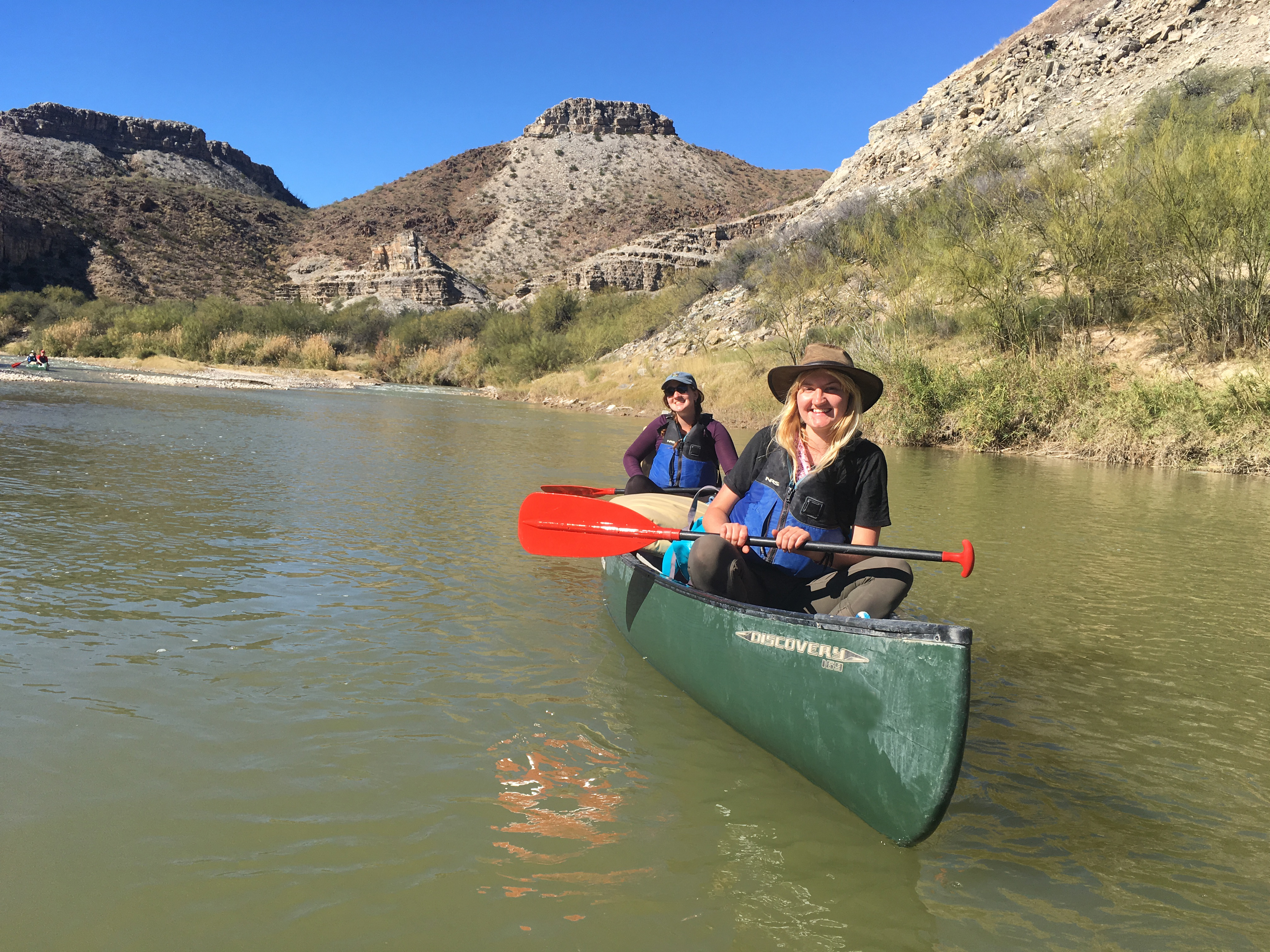
Float the Rio Grande
Take a Big Bend float trip on the Rio Grande. Experience the beauty of one of Big Bend's spectacular limestone canyons.
Tours
Count: 10
Driving Tour from Castolon to Santa Elena Canyon
The Castolon Historic District represents the largest and most complete example of human history in Big Bend, from Paleo-Indians to pioneers, to the establishment of the national park. Castolon’s history includes famed tales of bandits, soldiers, farmers, and ranchers, in a place where the cultures of Mexico and the United States meet. This tour will help you explore Castolon’s past through an eight-mile (one-way) driving tour from Castolon to Santa Elena Canyon.
Driving Tour from Persimmon Gap to Panther Junction
Welcome to Big Bend National Park! This driving tour covers the next 26 miles between Persimmon Gap and the Panther Junction Visitor Center. Begin this self-guided tour at the Persimmon Gap Visitor Center and follow along with the corresponding mile markers as you make your way south. Please remember that the park speed limit is 45 mph. The lower speed limit gives you a chance to enjoy the scenery, and also gives the wildlife a chance to get off of the road.
Driving Tour of Dagger Flat Road
This is a 14-mile roundtrip drive on an improved dirt road. Nineteen numbered signposts along the drive identify plants of the Chihuahuan Desert and reveal interesting facts about each one. At the road's end you will find the unique forest of the Giant Dagger Yuccas. The road has some sandy and rocky areas that may present challenges, especially after a rain, so a high clearance vehicle is recommended. Please treat the desert gently; driving off the road is destructive and prohibited by law.
Driving Tour of Ross Maxwell Scenic Drive
Ross Maxwell Scenic Drive highlights the geologic splendor of Big Bend by offering 30 miles of overlooks, informative exhibits, and trailheads. Highlights include Sotol Vista, Mule Ears Overlook, and Santa Elena Canyon. In addition, exhibits and trails at locations such as Sam Nail Ranch, Homer Wilson Ranch, and Castolon provide insight into the lives of Big Bend's early pioneers. This drive begins at the turnoff located 13 miles east of Maverick Entrance Station, or 13 miles west of Panther Junction.
Geology Exhibits Driving Tour
This driving tour was created to showcase park exhibits that discuss Big Bend's geology. These geology exhibits are found along the five paved roads in the park. The first 2 exhibits are located on the road between Persimmon Gap and Panther Junction (PJ). The next 3 exhibits are on the road between PJ and Boquillas Canyon. One exhibit is on the Window View Trail in the Chisos Basin. The next 8 are found along Ross Maxwell Scenic Drive. The last 2 are on the road between Ross Maxwell and Maverick Entrance.
Historic Castolon Walking Tour
The Castolon Historic District represents the largest and most complete example of human history in Big Bend, from Paleo-Indians to pioneers, to the establishment of the national park. Castolon’s history includes famed tales of bandits, soldiers, farmers, and ranchers, in a place where the cultures of Mexico and the United States meet. This short walking tour will help you explore Castolon’s past.
Hot Springs Historic Area Walking Tour
This trail provides opportunities to explore the remains of the historic Langford Hot Springs Resort.
Lost Mine Trail Walking Tour
The Lost Mine Trail rises 1,100 feet over 2.4 miles (4.8 miles roundtrip) and takes about three hours to complete, so be sure to bring plenty of water and snacks. If your time and energy are limited, consider hiking only the first mile to a scenic overlook near Stop #10. From the very first step, the Lost Mine Trail leads hikers into a different world, a woodland-grassland ecosystem with great scenic views. Follow this guide to learn more about the plants and animals of the Chisos Mountains.
Rio Grande Village Nature Trail Walking Tour
We often think of the desert as being a dry place, but if you look closely, you will find that water is truly the desert's "architect". The presence or absence of water affects the variety of plants and animals living here, and the ways in which humans have been able to use this area over time. As you walk the nature trail, let this tour be your guide, but also use your own observational skills to search for adaptations that plants and animals have evolved to survive in the Chihuahuan Desert.
Window Trail Walking Tour
Depending on which trailhead you start from, the Window Trail descends either 600 feet or 1,000 feet in elevation to the lowest point in the Chisos Basin. The roundtrip distance is either 4 miles or 5.5 miles. Few other trails in Big Bend National Park showcase as much diversity of habitat and scenery in such a short distance. Follow this guide to learn more about the animals, plants, and geology of the Chisos Mountains.