Be advised that the NPS has issued alerts for this park.
Possible Hazards in Open Sections
Parkway areas open after Hurricane Helene may have limited services. Visitors should exercise caution when hiking in or near open areas of the park. Hazards on trails such as landslides, tree debris, and washed-out sections or bridges are possible.
LiveMap Not Updated
Due to system issues, the LiveMap is not accurate and does not reflect opening from Milepost 355.3 at the Ridge Junction Overlook near NC 128 to Milepost 382 in Asheville, NC.
Ongoing Road Projects and Helene Recovery
Parkway areas closed for ongoing road maintenance, construction, and Helene recovery projects.
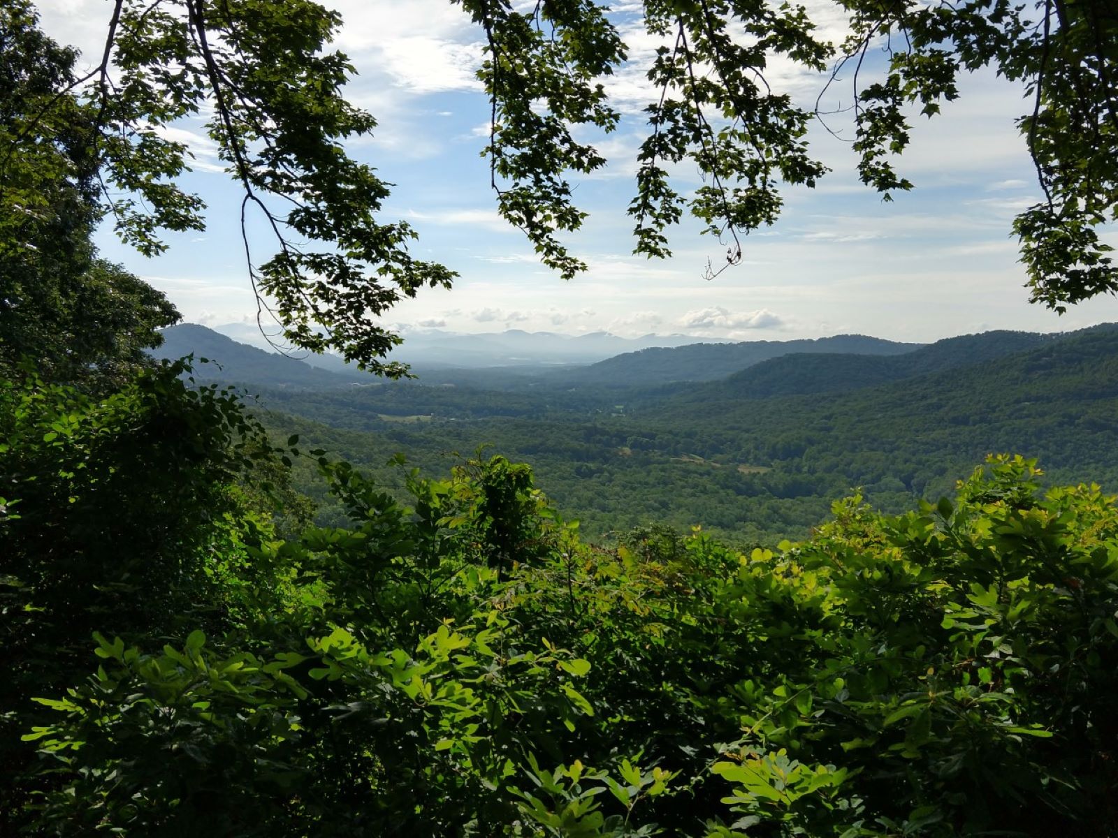
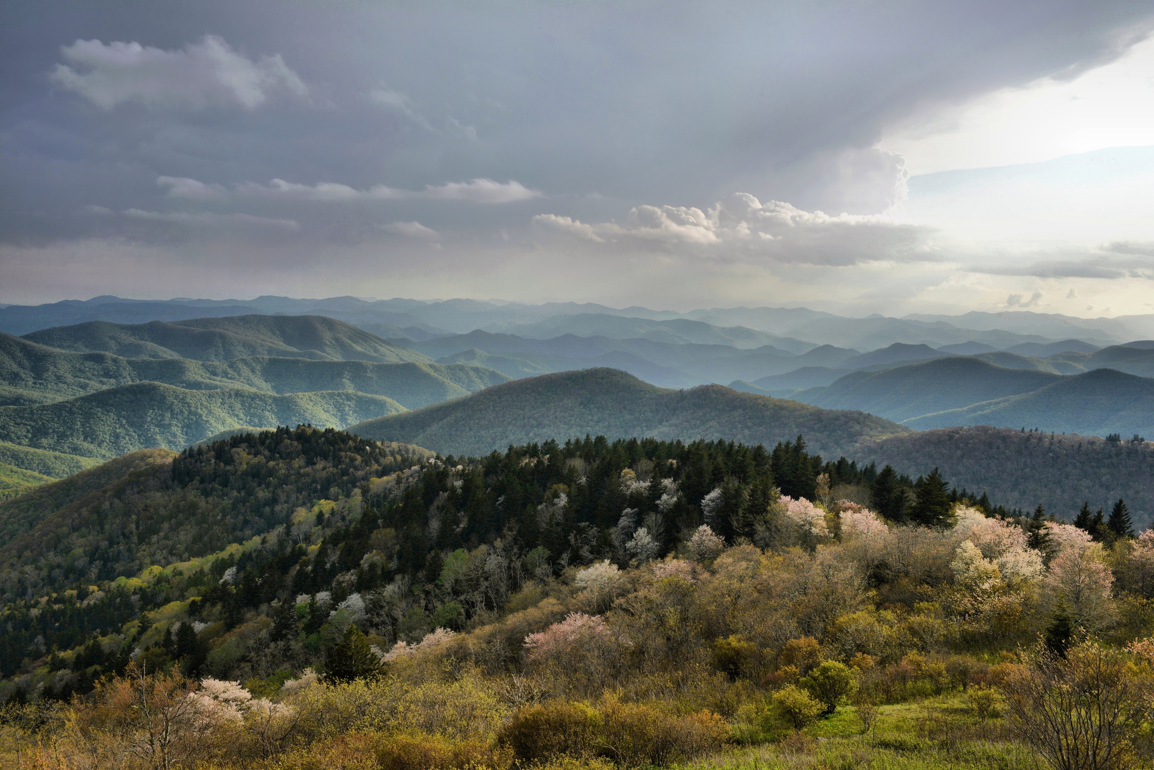
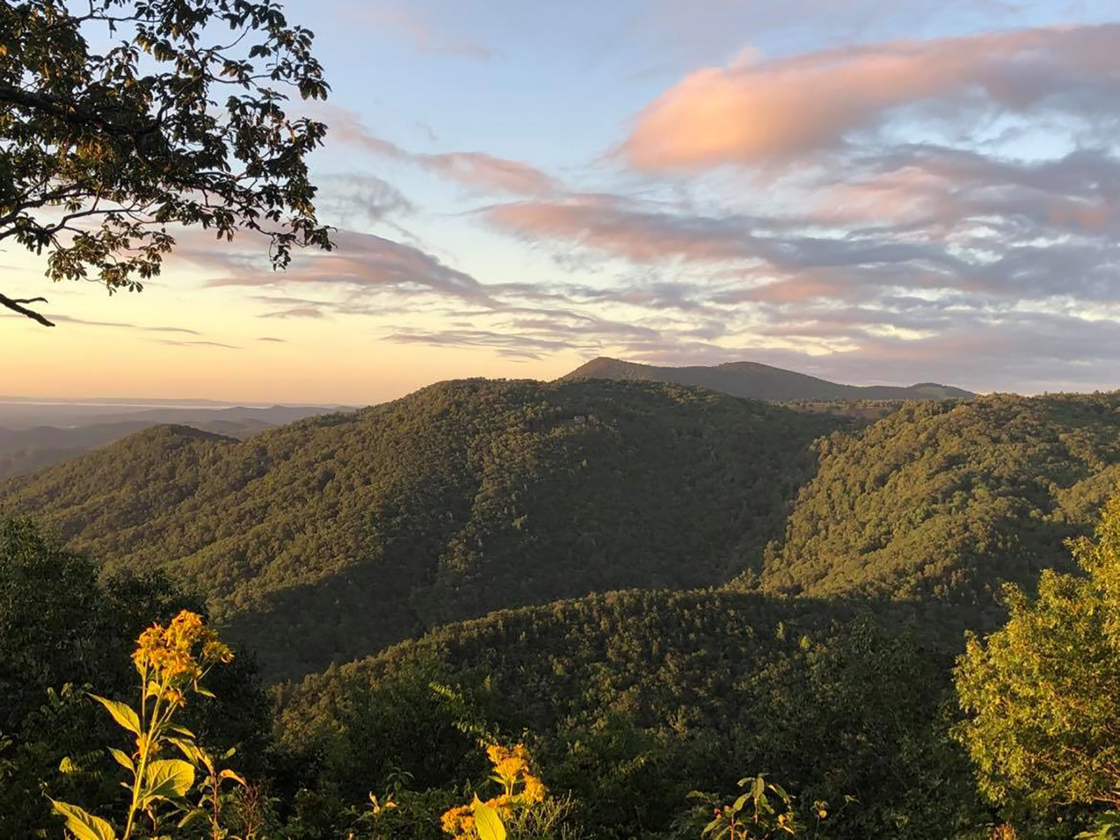
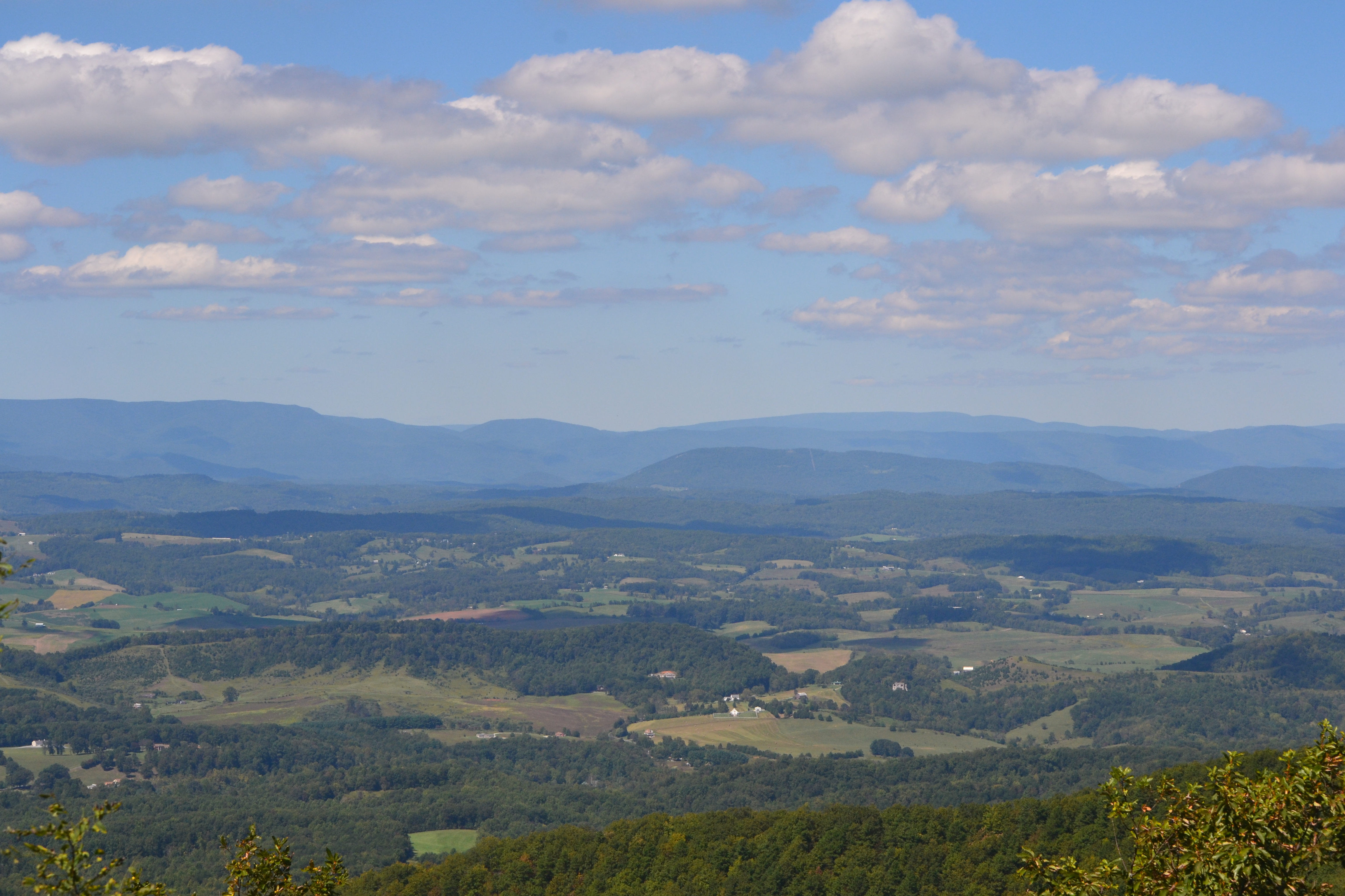
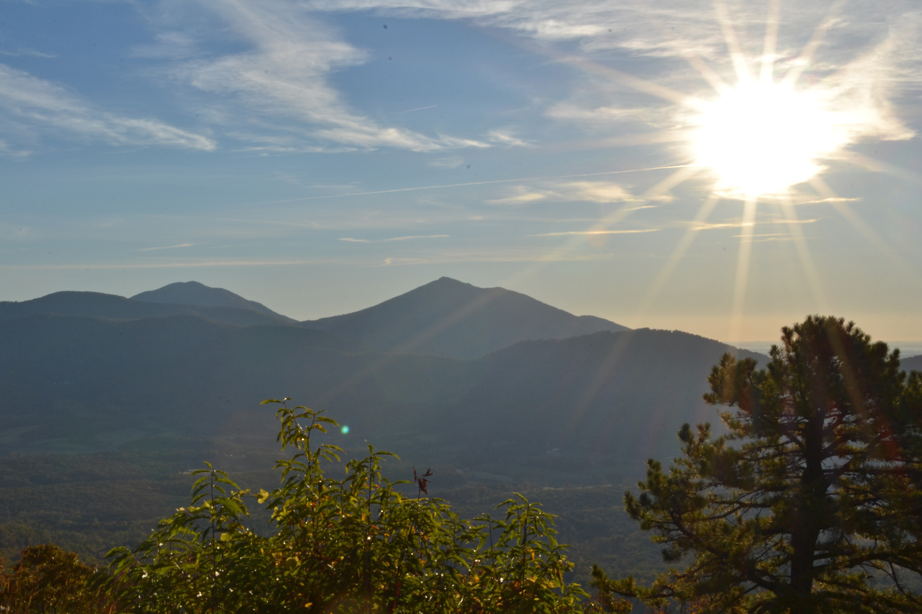
A Blue Ridge Parkway experience is unlike any other: a slow-paced and relaxing drive revealing stunning long-range vistas and close-up views of the rugged mountains and pastoral landscapes of the Appalachian Highlands. The Parkway meanders for 46...
Campsites are available on a first-come, first-served basis. In addition, advance reservations can be made for some campsites up to six months in advance by visiting www.recreation.gov or by calling (877) 444-6777.
Due to impacts for Hurricane Helene, Crabtree Falls Campground will be closed to all camping in 2025.
Campsites are available on a first-come, first-served basis. In addition, advance reservations can be made for some campsites up to six months in advance by visiting www.recreation.gov or by calling (877) 444-6777.
Campsites are available on a first-come, first-served basis. In addition, advance reservations can be made for some campsites up to six months in advance by visiting www.recreation.gov or by calling (877) 444-6777.
Campsites are available on a first-come, first-served basis. In addition, advance reservations can be made for some campsites up to six months in advance by visiting www.recreation.gov or by calling (877/) 444-6777.
Due to impacts for Hurricane Helene Linville Falls campground will be closed to all camping in 2025.
Campsites are available on a first-come, first-served basis. In addition, advance reservations can be made for some campsites up to six months in advance by visiting www.recreation.gov or by calling (877) 444-6777.
Campsites are available on a first-come, first-served basis. In addition, advance reservations can be made for some campsites up to six months in advance by visiting www.recreation.gov or by calling (877) 444-6777.
Campsites are available on a first-come, first-served basis. In addition, advance reservations can be made up to six months in advance by visiting www.recreation.gov or by calling (877) 444-6777.
Campsites are available on a first-come, first-served basis. In addition, advance reservations can be made for some campsites up to six months in advance by visiting www.recreation.gov or by calling (877) 444-6777.
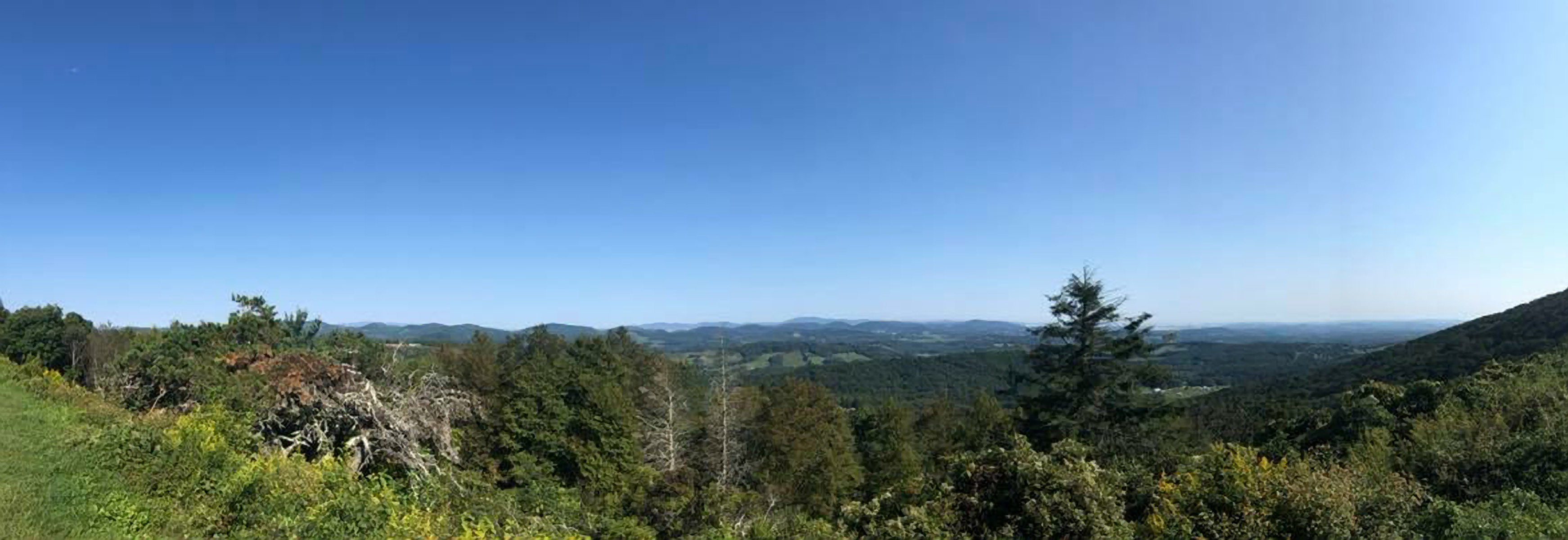
Air Bellows Overlook is known as the Crest of the Blue Ridge, as it offers a panoramic view of the surrounding North Carolina and Virginia countryside.
A large, semi-circular, paved pull through is separated from the roadway be a grassy median. A sidewalk runs on the side of the parking area. The terrain beyond the sidewalk slopes down to wood. Below the overlook, a wide valley filled with farms and fields stretches to distant blue mountains. These mountains vary in size and span as far as the eye can see.
The overlook was named for the series of peaked mountains that resemble an alligator's back.
The paved parking lot can hold approximately 15 cars. To the left of the lot is a trail map and the path leading to the Bluff Mountain trail and overlook. To the right is a small observation deck that offers a view of an elongated outcrop of rock that resembles an alligator. There is a wayside here. The Predators- Until recently predatory birds and mammals, those which preyed on other animals or were in conflict with humans were termed “varmints” and killed on sight. Fortunately, modern ecology proves the vital interdependency of all wild plants and animals. Today hawks and owls, black bears, bobcats, foxes and snakes continue to roam parklands like this and help preserve the delicate balance of nature.
Located between Milepost 355 and 370 along the Blue Ridge Parkway, the Asheville Watershed is where Asheville gets it water. It has the capacity to produce and deliver 43 million gallons of water to city residents per day. The North Fork Reservoir, one of two artificial lakes within the watershed, is visible from several overlooks along the Parkway.
The Asheville Watershed is located along the east side Blue Ridge Parkway from Milepost 355 to 370, an area roughly between Mount Mitchell and Craggy Gardens. The watershed is a large, bowl-shaped forested area where all the water funnels down to a body of water. The North Fork Reservoir, an artificial lake created in 1955 to supply the growing city with drinking water, sits at the bottom of the valley near Black Mountain.
This spot offers views down into the Basin Cove community, named after the cove was devastated by the 1916 flood; Caudill Cabin is a lone reminder of the community.
This parking area is a paved pull-through without any parking lines. There is a sidewalk along the view side of the overlook. A sign reads Basin Cove Overlook, Elevation 3312'. Tall and wide juniper trees branch across the view, their trunks resting right at the sidewalk. In the distance one can make out a deep valley lined by rounded mountain peaks.
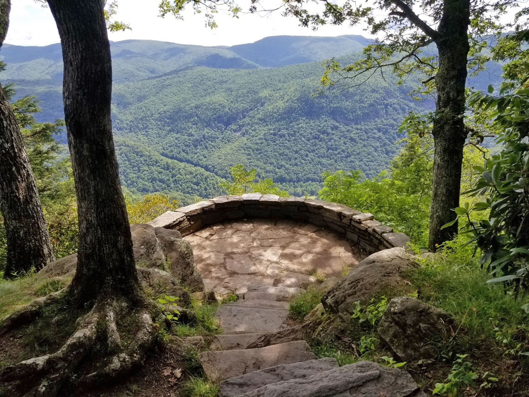
A short trail offering superb mountain views in multiple directions, including of the iconic Grandfather Mountain.
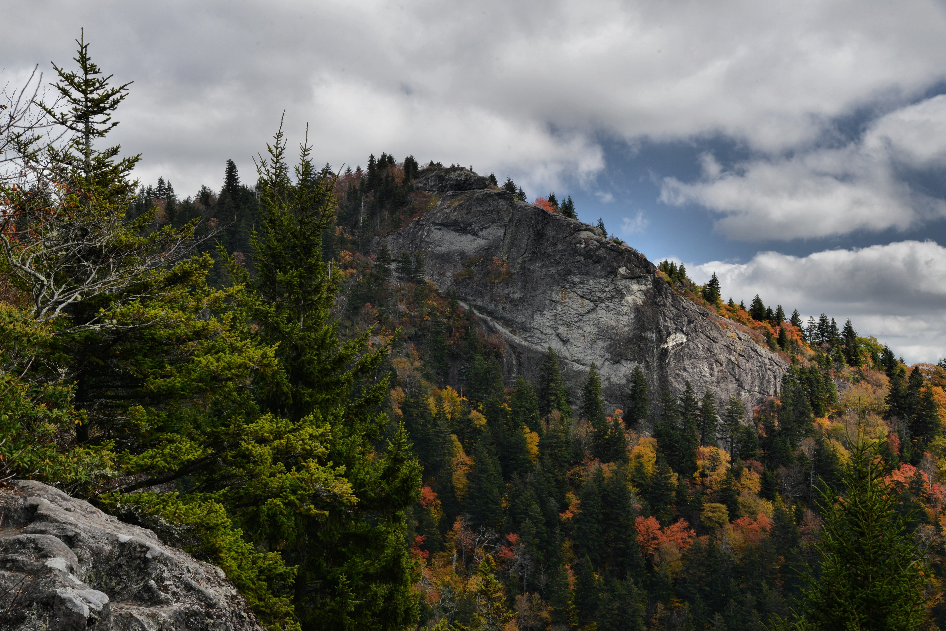
The Beacon Heights Trail is a short hike through the forest on a rocky and root-covered trail culminating at two magnificent quartzite outcroppings. As you approach the crest of the trail, a bench will mark a fork in the trail. As you emerge from the forest canopy on either side, the outcroppings offer far reaching, beautiful views of the layers of mountains to the east of the Blue Ridge. These include Table Rock and Hawksbill Mountains to the south. There are also views of Grandfather Mountain.
Beaver Dam Gap Overlook is one of the less frequented spots to stop and relax on the Parkway. Place a blanket in the grass for your picnic spread. It’s a great place to take a moment and slow down. The Mountains-to-Sea Trail can be accessed at this overlook.
Large, level asphalt parking area with one step up over a rock curb to a level asphalt sidewalk Trails lead into the woods at opposite ends of the sidewalk. An oval shaped, flat grass area separates the parking lot from the Parkway. Rolling hills and mountains are in the distance beyond the Parkway.
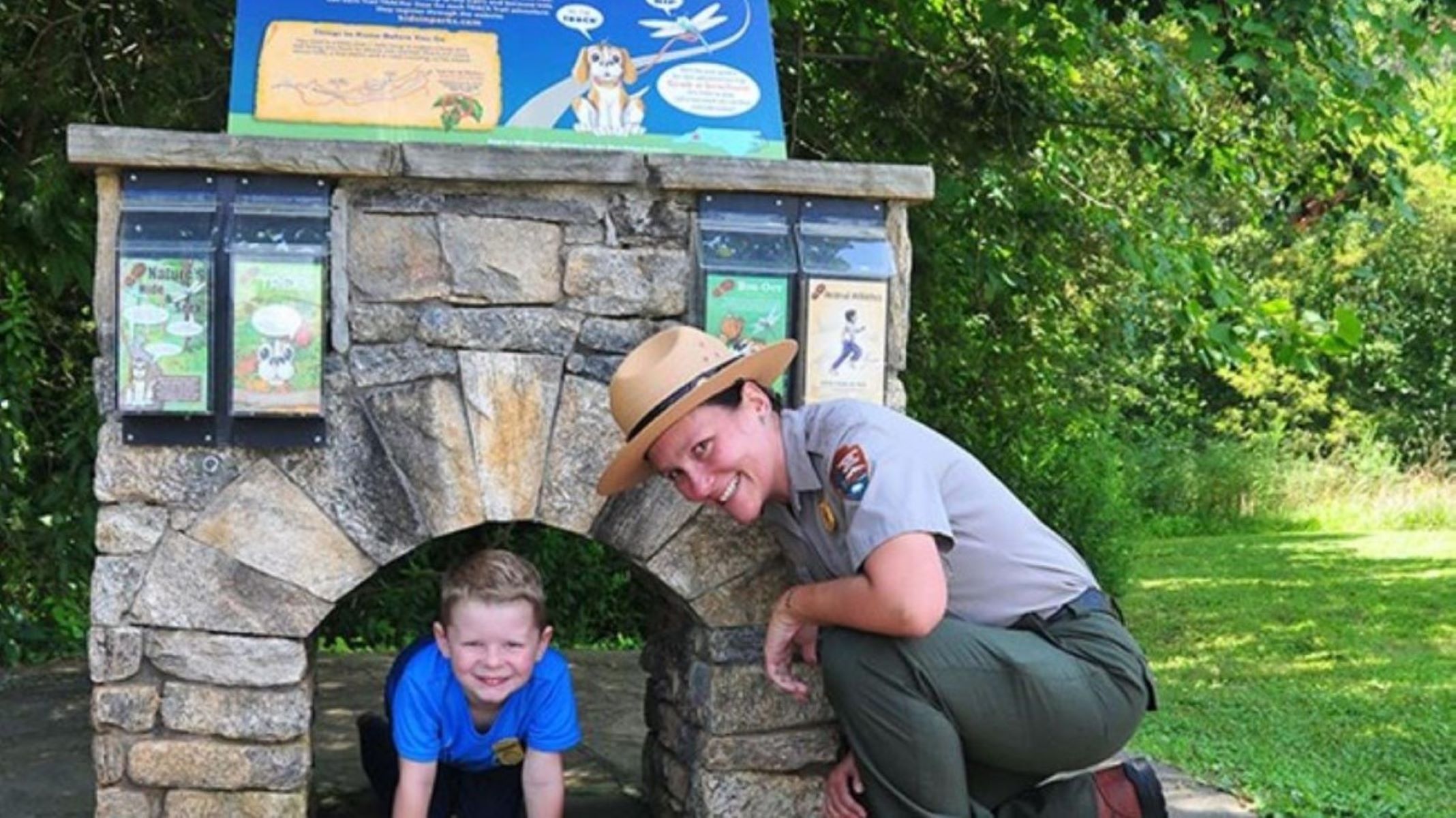
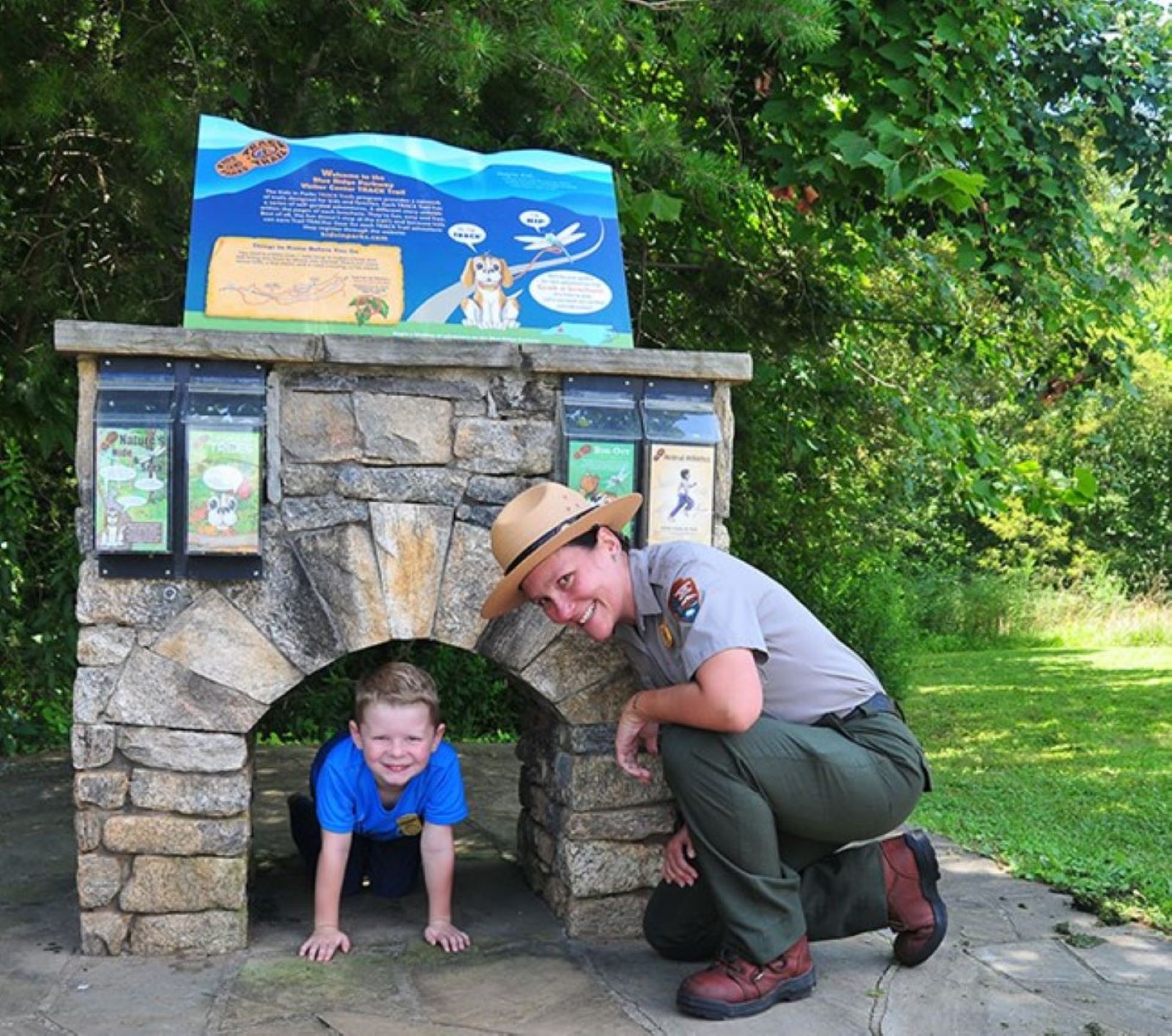
The TRACK Trail at the Blue Ridge Parkway Visitor Center is a pleasant 1.3-mile loop hike through a mixed deciduous forest.
Trailhead is located at the bottom of the large visitor center parking lot against the woods. A stone monument with a replica of a Parkway tunnel marks the start of the trail.
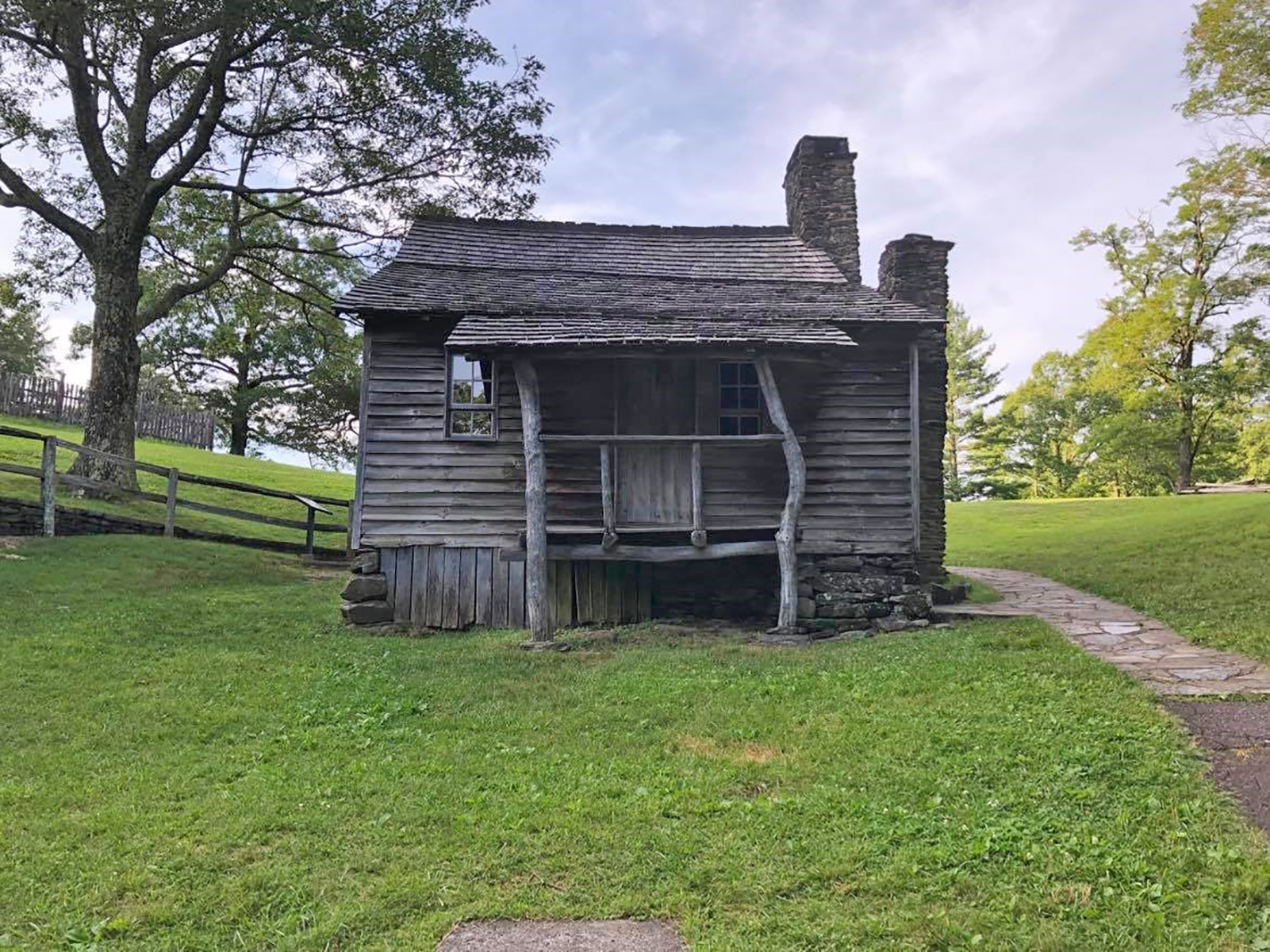
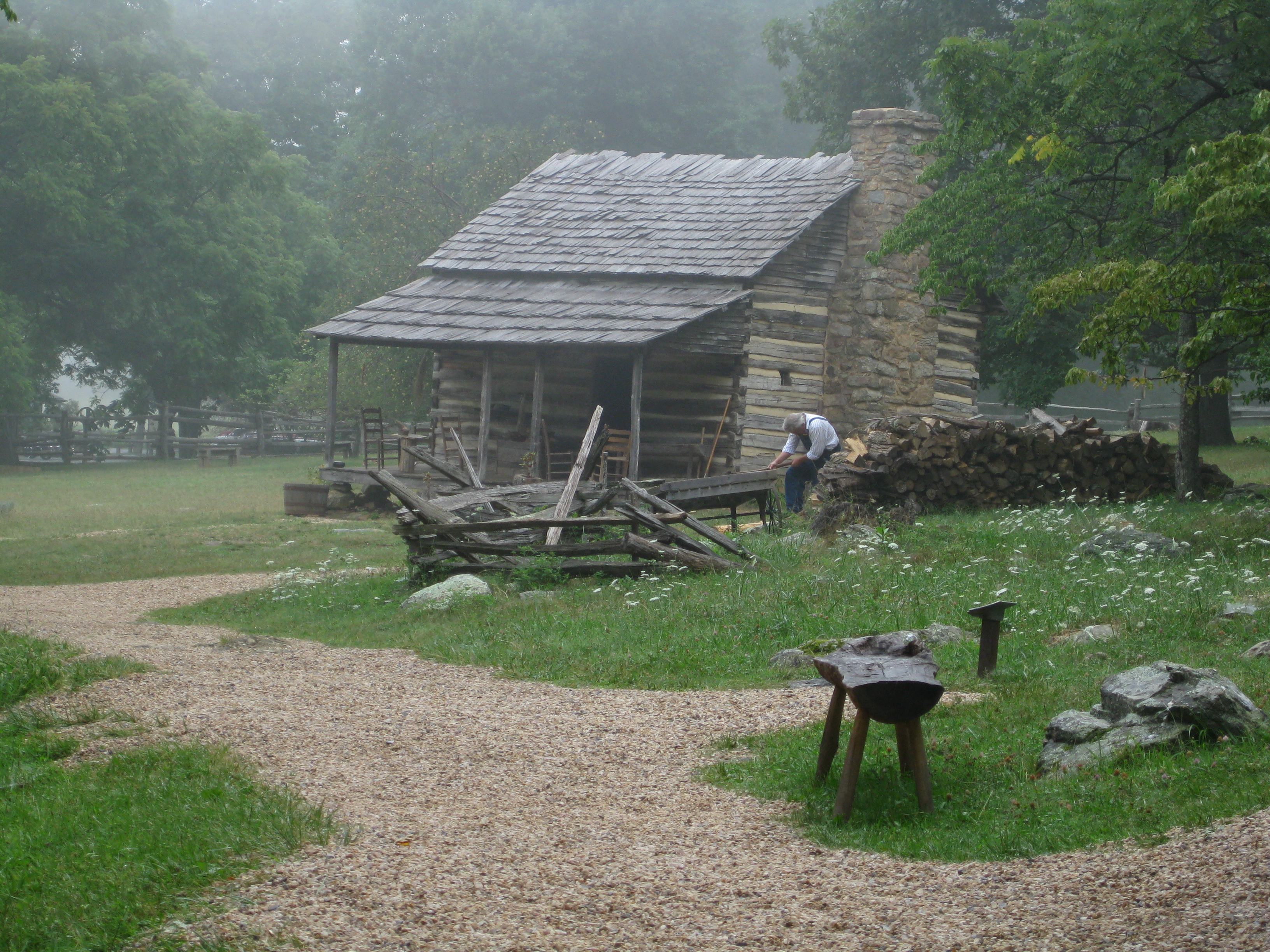
For nearly sixty years, Martin and Caroline Brinegar lived on this 125-acre farm leading lives based on hard work, self-sufficiency, and an abiding religious faith. Descendants of their three children often come here to visit the homeplace.
The path leading to the cabin is to the left of the small, paved parking lot. The downhill walk leads past several waysides illustrating the many aspects of Martin and Caroline Brinegar’s life. An interpretive garden, cultivated by volunteers each season, illustrates the many items Caroline would have used in her daily life. When approaching the cabin, the windowless backside comes into view first to the left are 3 picnic tables. The cabin itself is made of wooden planks, grayed with age and a faded cedar shake roof. There is a stone chimney on the left side. The granary and root cellar are located to the right of the cabin as you first approach. The spring house is at the end of the pathway. The front of the cabin is perfectly framed by the many trees and bushes on the property as well as the small wooden porch whose roof is supported by two long, round and crooked logs.
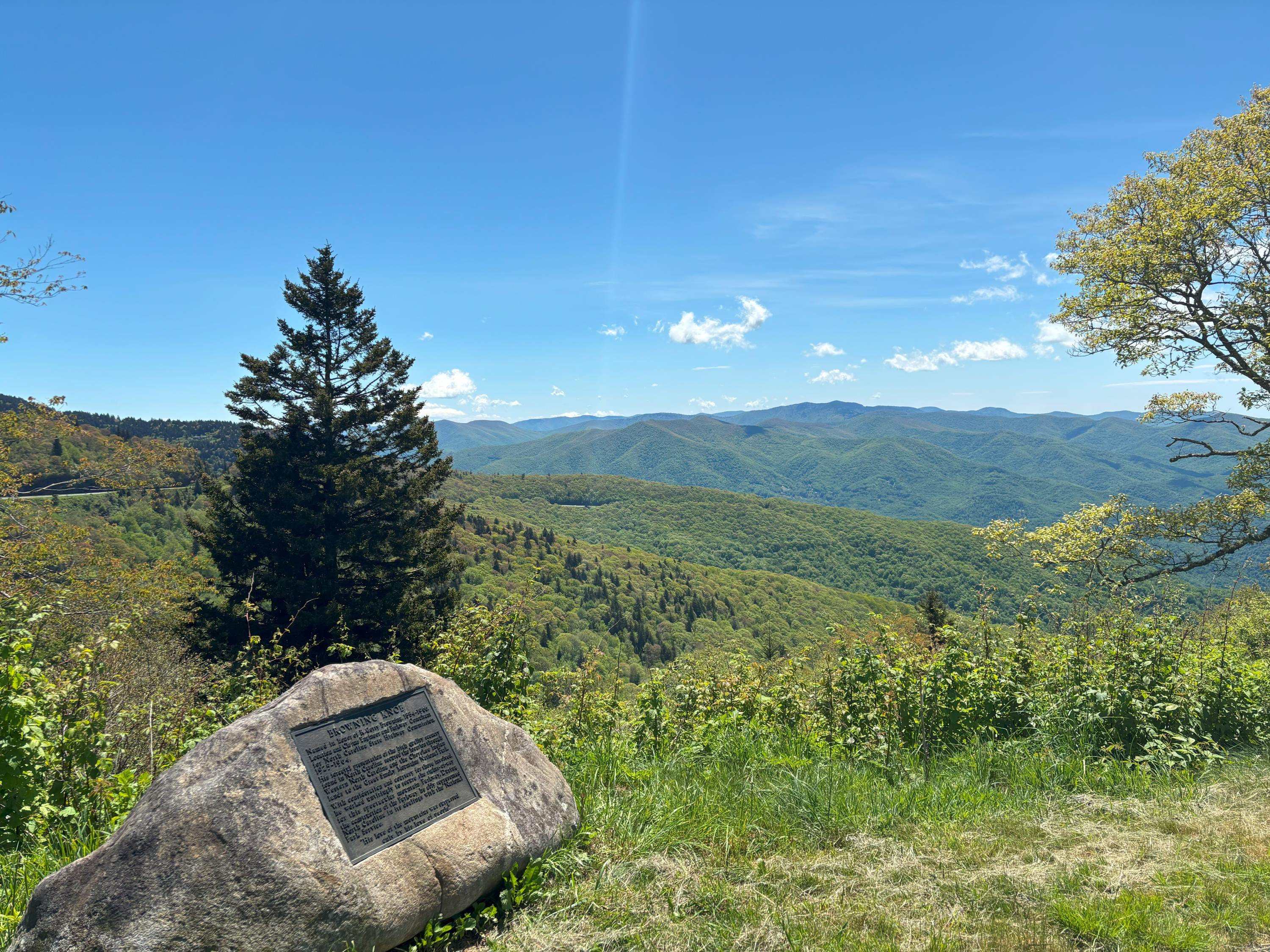
Browning Knob Overlook is on the entry road to the Waterrock Knob Visitor Center at milepost 451.2. The overlook was named in honor of R. Getty Browning. He was the Federal Parkway Engineer and the Senior Locating and Claim Engineer for the Blue Ridge Parkway. It was his work that guided the initial exploration and design of the parkway. The overlook is at an elevation of 5770 feet looking towards Browning Knob which is 6260 feet of elevation.
This area is a high elevation overlook. There is a small parking area that can fit several vehicles. You are able to take in the views from your car or walk several feet to the boulder that has the commemorative plaque about R. Getty Browning and Browning Knob on it. On a clear day you are able to see several miles into the distance and see multiple rows of mountains ranges. Many of those mountain ranges have a blue hue which gives the Blue Ridge Mountains their name.
Scenery, hiking, and history—the Buck Spring area has it all!
A paved semi-circle, with a single row of lined parking spaces. A slightly raised sidewalk borders them on one long edge with a sign near the center-right of the sidewalk. The sign reads “Buck Springs Gap Overlook, elevation 4980 feet." Behind the sign, the ground slopes sharply downwards, opening up to the valley and a line of mountains beyond. Turning 180 degrees away from the sign, there is a grassy median across from the row of parking. Behind the median is a paved road, which slopes downhill to the left, and continues level to the right. There is another, much longer single line of parking on the other side of this road, again with a raised sidewalk following the long edge. Trees come up from the slope behind the sidewalk. Towering above the trees is Mount Pisgah, a radio tower perched at its summit.
Once the site of a hunting lodge built by George Vanderbilt. Come see why this was the perfect summer escape!
A relatively flat, grassy area crossed on one side by a hiking trail. A gravel semi-circle on one end has three wooden benches, and it opens up along the edge to the valley below. Facing the grassy area is an informational sign with some history of the Buck Spring Lodge. Following the hiking trail to the left of the sign, there is a post with the number “23” carved into it. To the left of the trail is a short set of steps leading steeply down into an open, rectangular hole. The hole is lined with old stone walls. Going back to the sign, facing across the grassy clearing, there is a gap in the trees. Crossing the grass to the gap, a short walk downhill emerges into a second open area. This courtyard-like space has a single wooden bench, and extends back to the Buck Spring Gap Overlook parking area. The uphill side of the courtyard is lined with old stone walls, and has two, uneven sets of stairs. They lead upwards, into only the woods.
There’s more than one way to hike the Buck Spring Trail! This trailhead is sneakily tucked into a corner of the Pisgah Inn parking lot.
Standing with your back to the trailhead, the rooms of the Pisgah Inn extend from behind you and to the left. The building continues away from your left, ending in a second building which contain offices. Beyond the offices, surrounded by shrubs and trees, is a third building for the restaurant. A small, one-way traffic circle is in front of the offices and restaurant. Still standing with your back to the trailhead, a large, oval parking lot extends in front of you and to the left, with the long sides following parallel to the inn. There is a grassy median with several trees and street lights. The vehicle spaces surround the edges of both the lot and the median, providing staff, guests, and visitors with four rows to park. Ahead of you and slightly to your right, at the far edge of the lot, directional arrows point the flow of traffic to the Camp Store. A few wooden picnic tables sit in the grass next to the restrooms, which are accessed outside of the one room building. Turning 180°, the trailhead begins as a set of steps. At knee height to your left is a wooden post. It has a carved “MST” above a circle, and a carved silhouette of a person walking with a hiking staff. On your right is a broad, upright, wooden framed map board, with a protective covering. Across the top it reads “Mount Pisgah Trail System”. Below the lettering is a basic, line map of the trails in the area. Near the center-right, about a foot under the word “Trail”, there is a curved arrow with the phrase “You Are Here”.
Bull Creek Valley is a scenic overlook north of Asheville that gets less traffic than other areas. Stop by on your way to Craggy Gardens for a nice taste of the mountains!
This overlook is an asphalt, pull-through overlook with a grassy median. A rock curbing steps up to a level sidewall offering a southwestern view into Bull Creek Valley. On the southern end of the overlook a grassy path goes down several yards to a picnic table and a trash bin.
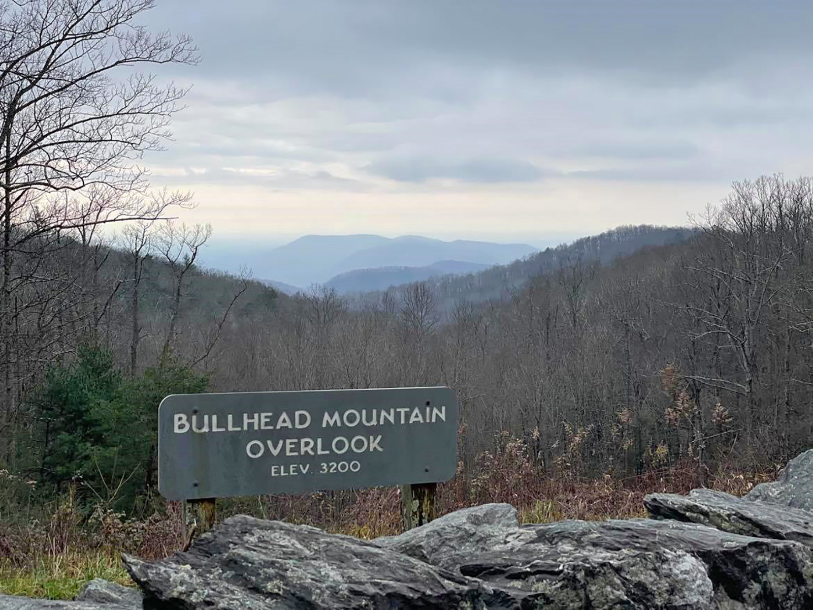
Sitting at 3,200 feet, Bullhead Mountain overlook offers a picturesque view of Bullhead Mountain, Devils Garden, and the Green Mountains.
This small, paved pull-off parallels the roadway. It has a sidewalk and low, rough stone wall. Beyond the wall, the terrain drops gradually into a forest, with mountain peaks and valleys marching into the distance. An sign near the rock wall indicates that the overlook is 3,200 feet in elevation. Across the roadway, a sloping, rock outcrop sits below the forest tree line.
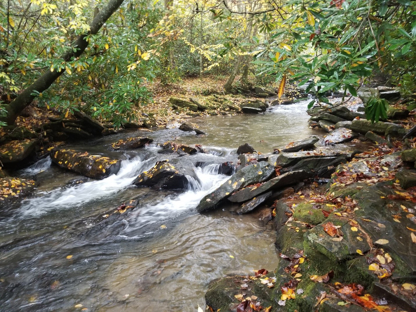
Camp Creek Overlooks provides access to a small creek that makes for beautiful scenes and great fishing.
A paved pull over spot surrounded by towering trees and thick shrubs conceals a narrow, steep dirt path to the right of the overlook sign that descends from the parking area through tickets of rhododendron to a creek below. Sections of the creek are broken up by large rocks with water rushing and churning around them, as the creek flows under the shading branches that hang out over the banks
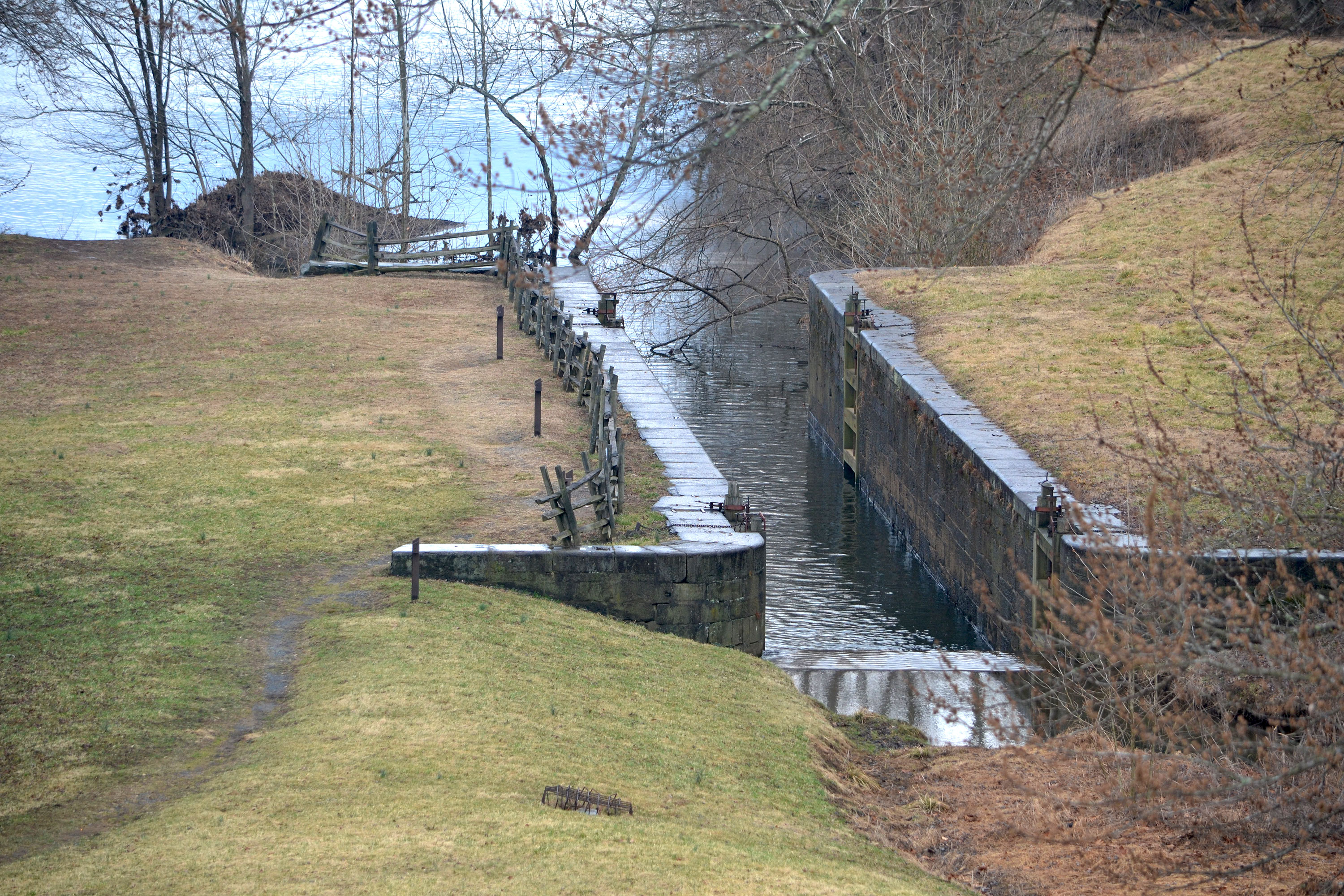
The James River and Kanawha Canal stretched 196 miles from Richmond to Buchanan, Virginia during the 1800s. It provided a vital water transportation link between the Great Valley and international markets. The Parkway currently preserves several remnants of the old canal to see and explore.
The canal trail makes a small loop through an infrequently mowed meadow on the tall river banks of the James River just downstream from the highway overpass bridge that towers above the area. The foot path hangs directly underneath the motor road and is 28 feet above the normal water level. The loop trail is tear drop shaped as it comes off the stairwell, heads away from the river, downstream to the lock, and along the riverbank heading upstream back to the bridge. Tall sycamore and maple trees line the wide river banks. Lock 7 is about 100 feet long by 15 feet wide and about 21 feet deep providing 13 feet of lift built of polished rectangular stones some 4 feet long and 2 feet tall. Nearby Battery Creek has been rerouted to flow through the lock and into the James River.
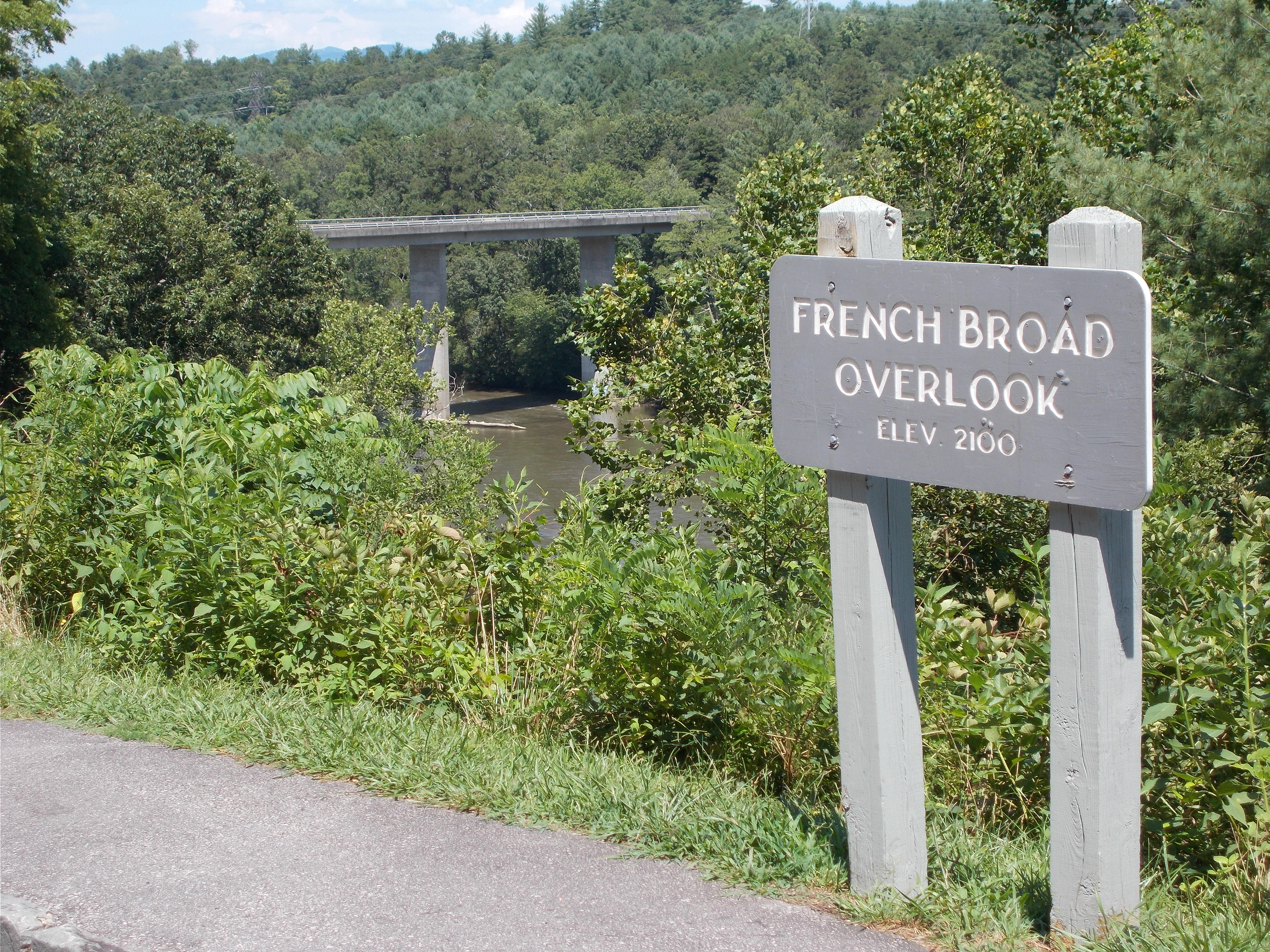
A window to the French Broad river valley and the expansive mountains beyond. Take a moment to pull over, step out into the serenity of nature and let the rush of life go.
This is an asphalt, pull-through overlook with a grassy median. A rock curbing steps up to a level sidewalk. A small, flat grassy area is adjacent to shoulder height shrubs near the edge of a drop off. A small shrubbery window has been cut out to allow a view into the valley with mountains in the distance.
Chestoa View offers a short, pleasant stop to picnic, rest, and take a short walk to see gorgeous views of Table Rock and Grandfather Mountain.
Chestoa View is an overlook located about 4 miles south of Linville Falls along the Blue Ridge Parkway. After turning off the parkway, a small paved parking lot is visible. It is nestled within a thick forest, obscuring the more distant views but providing an excellent example of the diverse plant life that exists in this region. Large oaks and thickets of mountain laurel help to provide shade over the parking area. It also contains a small collection of picnic tables and trash cans for visitors to use. A paved path leads down to a fork; to the left, the path turns into a set of stone steps that proceed further down 32 steps to a stone balcony situated on the eastern side of Humpback Mountain. The view looks out over North Cove, thickly covered in a variety of trees with Highway 221 barely visible as it makes its way through the bottom. Accessible from this highway, the privately-owned Linville Caverns reach deep into the western side of the cove. Looking across the other side of the cove, the western side of the Linville Gorge rises level with your eyeline. Beyond that and rising even more prominently from the eastern side of the gorge is Table Rock. Its distinct sharp cliff faces jut suddenly out of and above the otherwise gently sloping ridge. These lands are contained within the Pisgah National Forest and have trails of their own that are accessible off the Parkway. Further to the left and off into the distance, the face of Grandfather Mountain peaks out, revealing the characteristic features from which its name is derived. This provides a glimpse into Grandfather Mountain’s geologic window. Here, the ancient layer of stone that rose up over the younger rock has eroded away enough to reveal the incredible geological history of this area. This can be further explored at Grandfather Mountain or the Museum of North Carolina Minerals. From the right fork, the paved path gives way to a dirt trail called Chestoa View Trail. This narrow loop is 0.6 miles long and brings the visitor further into the depths of the forest. Following along the slope of Humpback Mountain, the trail provides a clearer view of Table Rock than is available at the balcony. Wooden fences line some sections of the trail where it meanders alongside a steep drop, offering dramatic, but safe, views of the wooded areas below. A bench stands roughly halfway through the loop; take in a view of Table Rock while you rest. Due to the short distance and mild inclines, this trail is one of the easier trails to walk in the area, providing some beautiful scenery for relatively little effort.
This overlook is a short drive from Mount Pisgah, the Pisgah Inn, and Hwy 276. It provides views of the 6,000 foot Cold Mountain as well as the Shinning Rock Wilderness.
A large paved pull-through overlook on the west side of the Blue Ridge Parkway. There is a level paved sidewalk that runs the length of the overlook, with deciduous hardwood trees on either end. A grassy area separates the overlook from the Parkway.
A stunning overlook along the southern end of the Blue Ridge Parkway. Cowee Mountain Overlook provides 180 degree unobstructed views of the surrounding mountains. A don't miss stop along your drive!
This is a large paved pull-though on the east side of the Blue Ridge Parkway. There is a level paved sidewalk that runs the length of the overlook, with grassy areas on either side. Just beyond the sidewalk is a sudden drop hidden by low shrubs and grasses. Long range views of layered mountains highlight this stop. On the opposite side of the road sits a large rock face complete with shrubs and wildflowers.
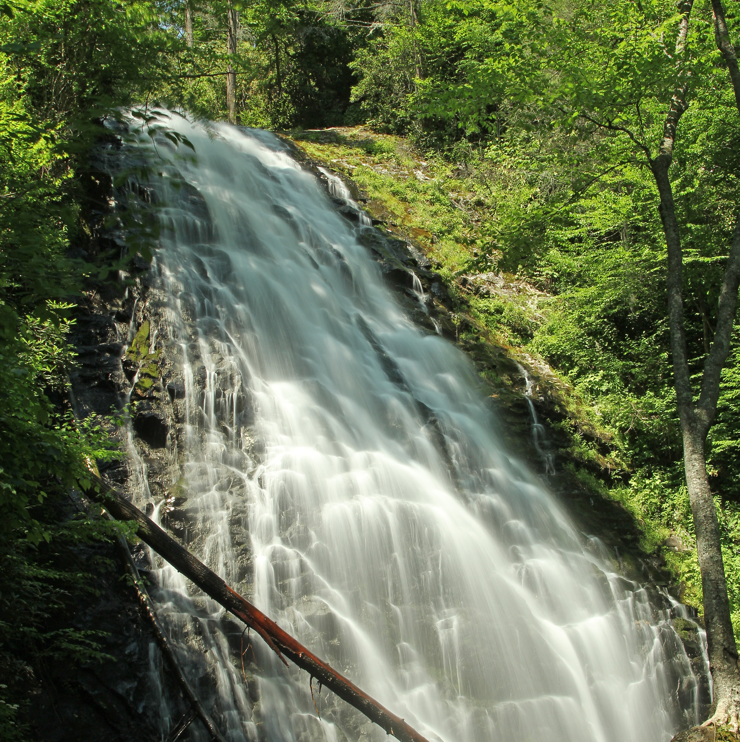
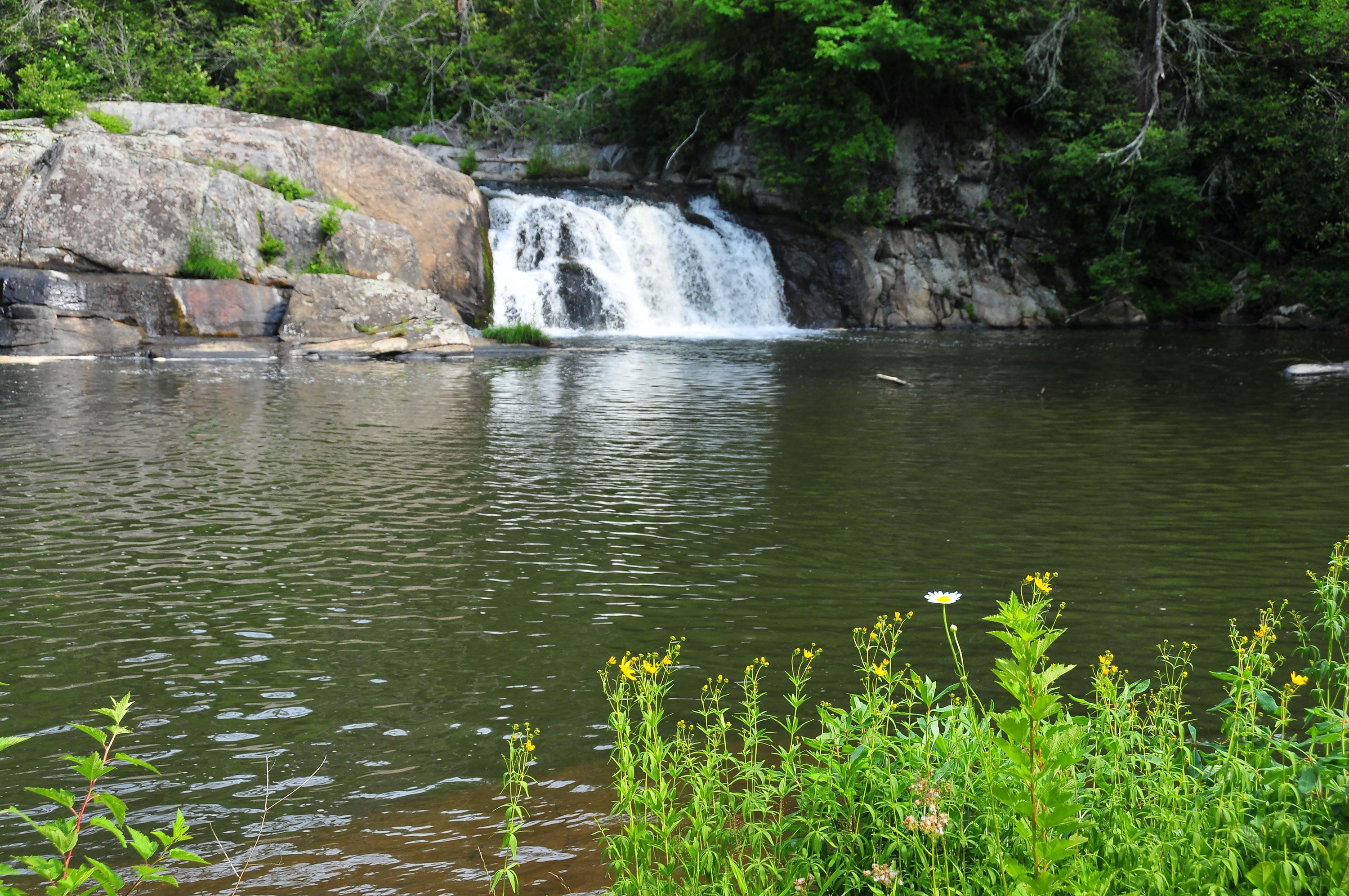
The tallest single waterfall on the Blue Ridge Parkway and beautiful open meadows attract visitors to Crabtree Falls Recreation Area, a rare open area before the parkway enters the Black, Craggy, Pisgah and Balsam mountain ranges. Take a leisurely stroll through the campground and open areas or a more strenuous 2.6-mile loop hike to view the waterfall and woodland habitat. At the base of the waterfall, ferns and wildflowers thrive in the mist.
Crabtree Falls Recreation Area is a series of open meadows, in contrast to the rugged terrain and forests all around. A thick hedge of rhododendrons is along the side of the entry road and main parking lot. A dense, wooded landscape surrounds the open meadows, with common trees including oaks, maples, hemlock, birch, fir, spruce, hickory, dogwood and pine. Forest wildflowers, like jack-in-the-pulpit, purple trillium and corn lily along the trails and in the wooded areas, bloom early in the summer. During July and August, the area is lined by beds of joe-pye weed and white snakeroot. A gas station, coffee shop and amphitheater are unopen and unoccupied, but are signs of previous development in the area.
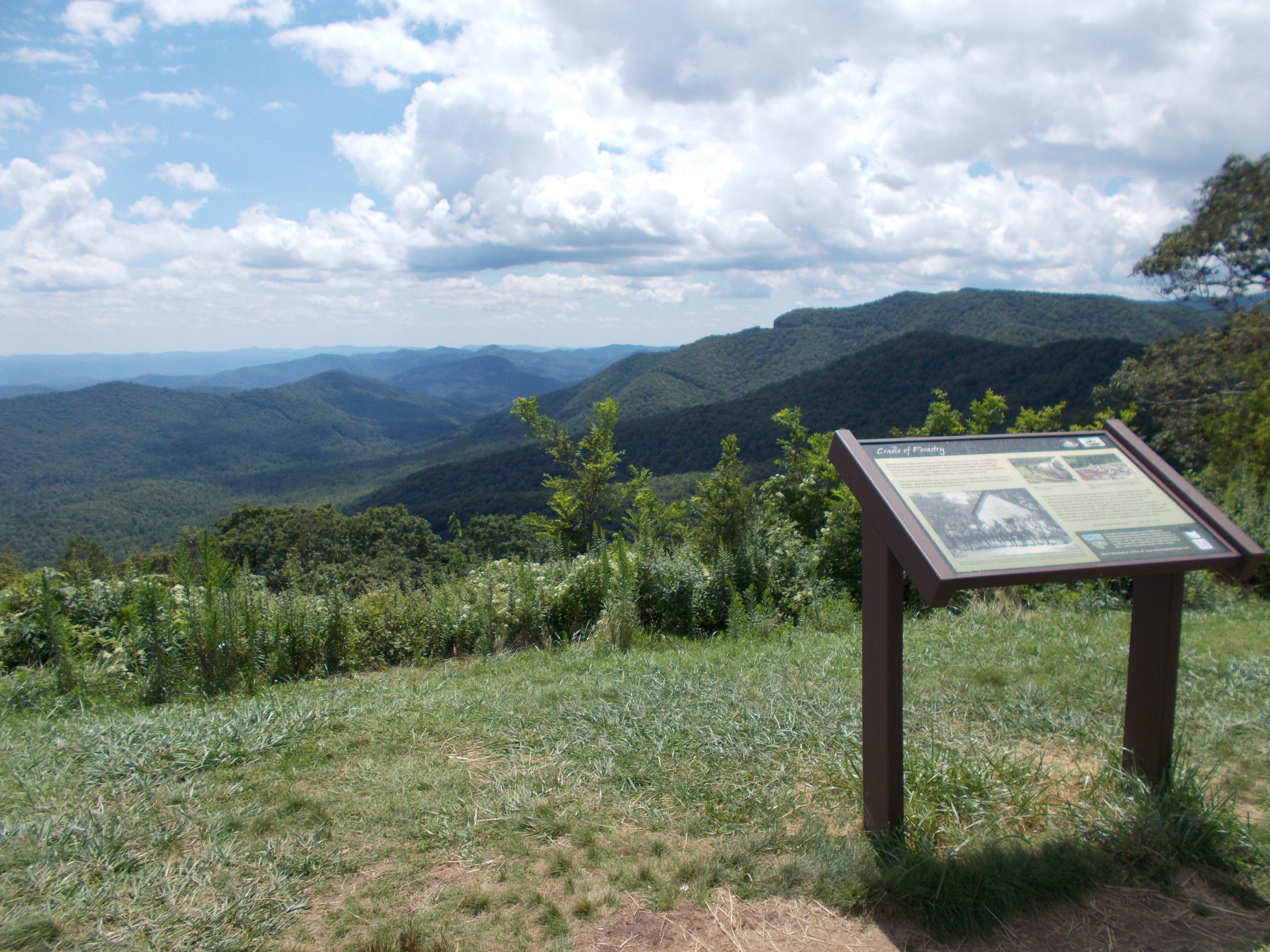
Cradle of Forestry Overlook has gorgeous eastern views from the Blue Ridge Parkway overlooking the Pisgah National Forest and the site of America's first forestry school.
Cradle of Forestry Overlook is an asphalt, pull-through overlook with a grassy median. A rock curb steps up to a level sidewalk that wraps around the edge of the overlook. A small grassy area is adjacent to shoulder height shrubs near the edge of a drop off. There are a few large trees towering up behind the shrubbery, but the view is mainly unobstructed. You can view the valley with mountains in the distance from multiple places along the sidewalk. On the left end of this overlook is a small, gray sign about waist height that reads “Cradle of Forestry Overlook, Elevation 4710’ “. On the right end is an interpretive sign about waist height that is titled “Cradle of Forestry, Pisgah National Forest” and describes the history of the area. The interpretive sign includes texts, pictures and a map.
Want to feel like you’re on top of the world? Craggy Gardens is over 3,000 feet higher than the surrounding valleys. Hikes, a picnic area, and visitor center make this the ideal place to spend the day.
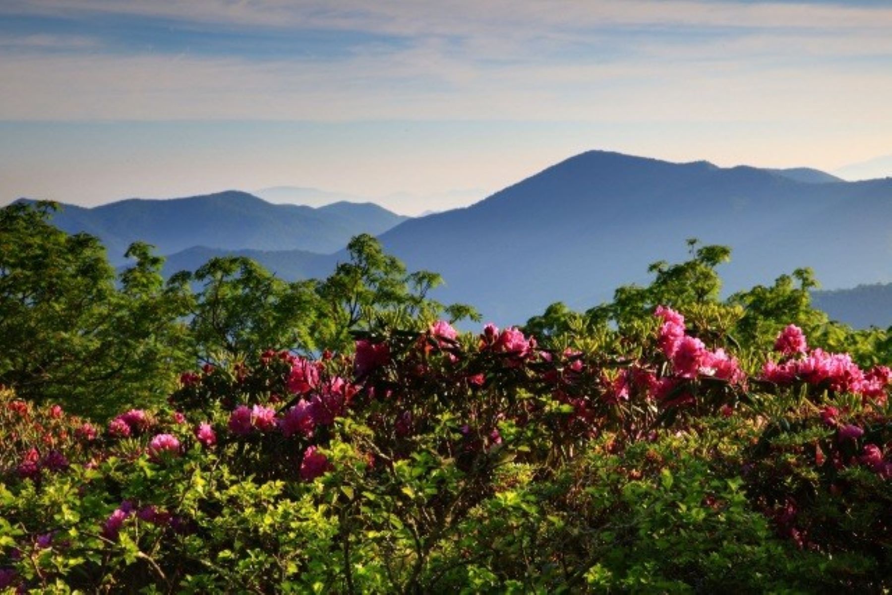
Craggy Gardens is a high elevation area that encompasses a three-mile section of the Blue Ridge Parkway. At 5,500 feet in elevation, there are long range, expansive views of the surrounding valleys and distant mountain ranges in all directions from various vantage points. Strong winds, fog, and harsh weather can be commonly encountered at Craggy Gardens. These extreme conditions cause the trees here to be smaller in size and stunted, twisted, and wind-swept in appearance. In addition to the high elevation deciduous trees, native rhododendron bushes and colorful wildflowers are common. When the rhododendron bloom in early to mid-June, their large purple and pink blossoms dominate the landscape.
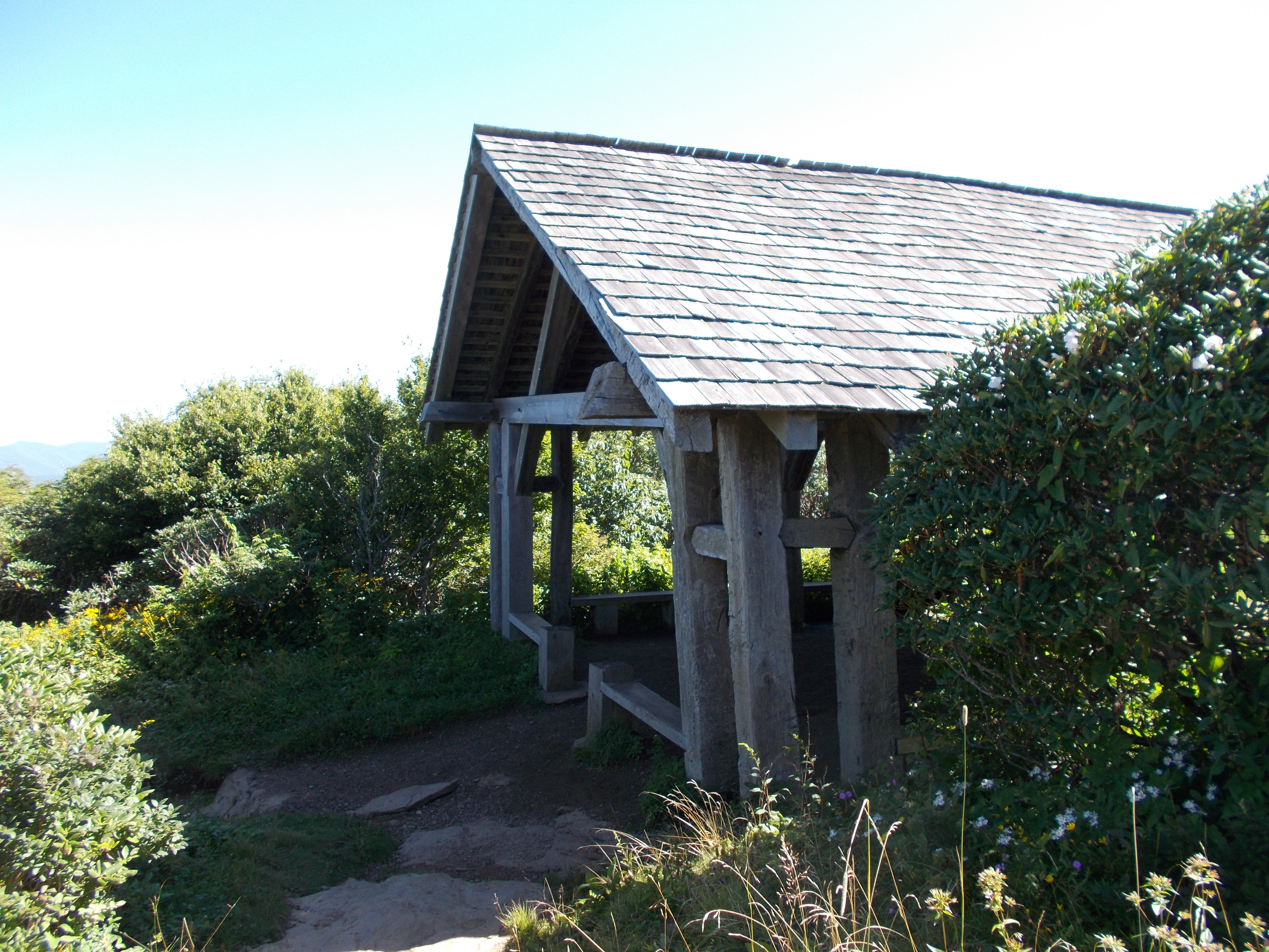
The Craggy Gardens Trail Shelter is a relaxing spot at the high point of the Craggy Gardens Trail with amazing views from the adjacent meadow bald and chances to see a wide array of blooming flowers from spring to late fall. The shelter is also a historic CCC structure that pre-dates the Parkway and stands as a reminder of our past.
The Craggy Gardens Trail Shelter is a historic structure located at the high point of the Craggy Gardens Trail. The large shelter is 24 feet wide and 60 feet long with open sides. It resembles a large barn with chestnut and oak posts supporting rafters, beams, and purlins carrying a shake roof. The trail shelter is a 0.3-mile moderate hike on a rocky dirt trail from the Craggy Gardens Visitor Center. The trail shelter is a 0.5-mile moderate hike on a rocky dirt trail from the Craggy Gardens Picnic Area.
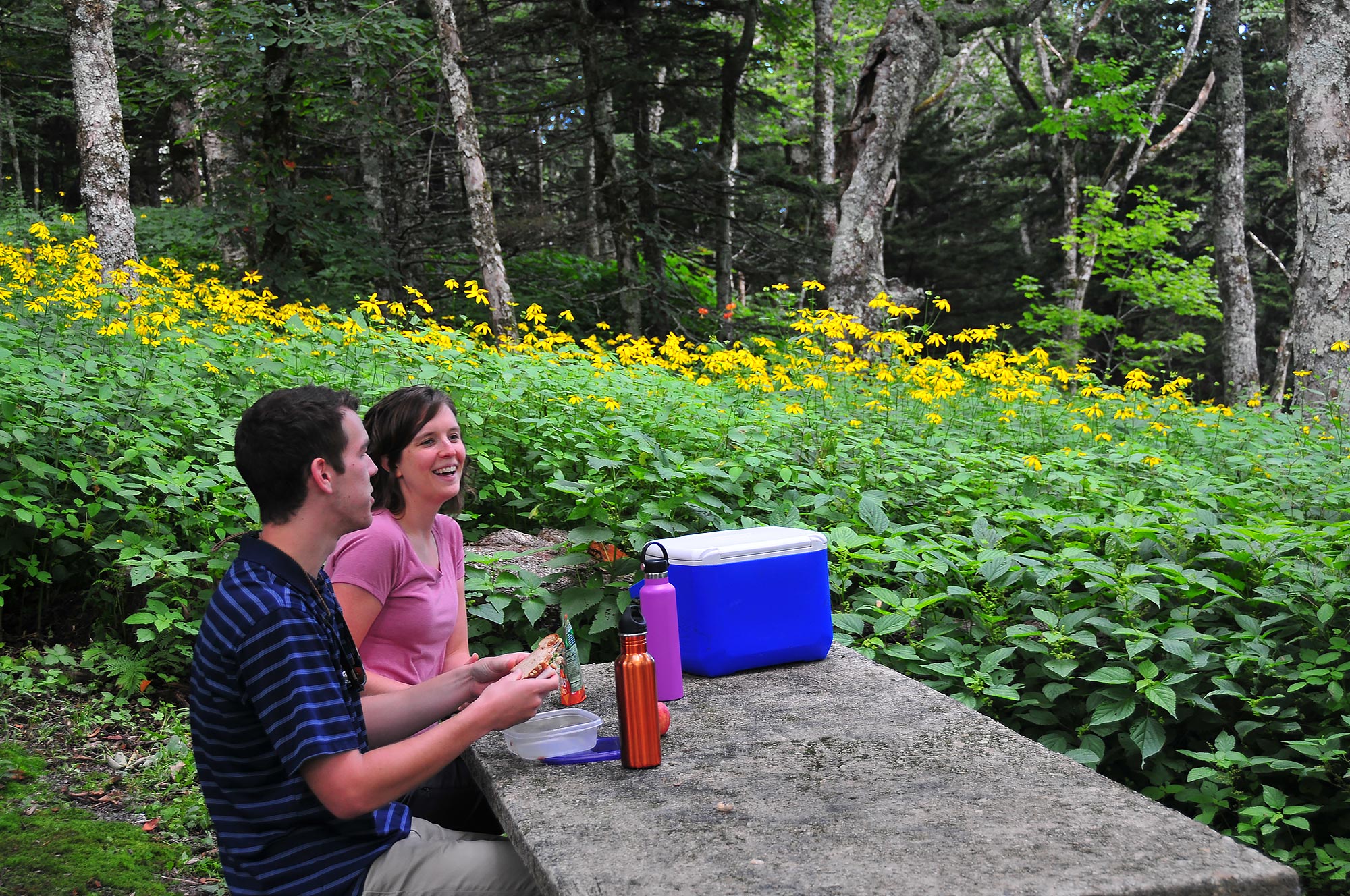
Craggy Gardens Picnic Area provides a summer retreat from the heat just a short drive from the Asheville area. At an elevation of 5,270 feet, temperatures are typically 10 – 15 degrees cooler than low lying areas nearby. Whether driving the Blue Ridge Parkway or getting away for the day, enjoying a picnic at this picnic area can round out a mountain pleasure trip.
A narrow, curving road leads up to the Craggy Gardens Picnic Area. Spring through fall the roadsides are dappled with color from wildflowers, rhododendrons, and ultimately autumn leaves. At the picnic area, the road opens into a large parking area surrounded by a hilltop picnic area. Tables are nestled into the woods beneath mature birch and buckeye trees. A grassy hillside is dotted with picnic tables out in the open, interspersed with rhododendrons. Throughout the picnic season, nature’s colors provide a backdrop for this pleasant Parkway getaway.
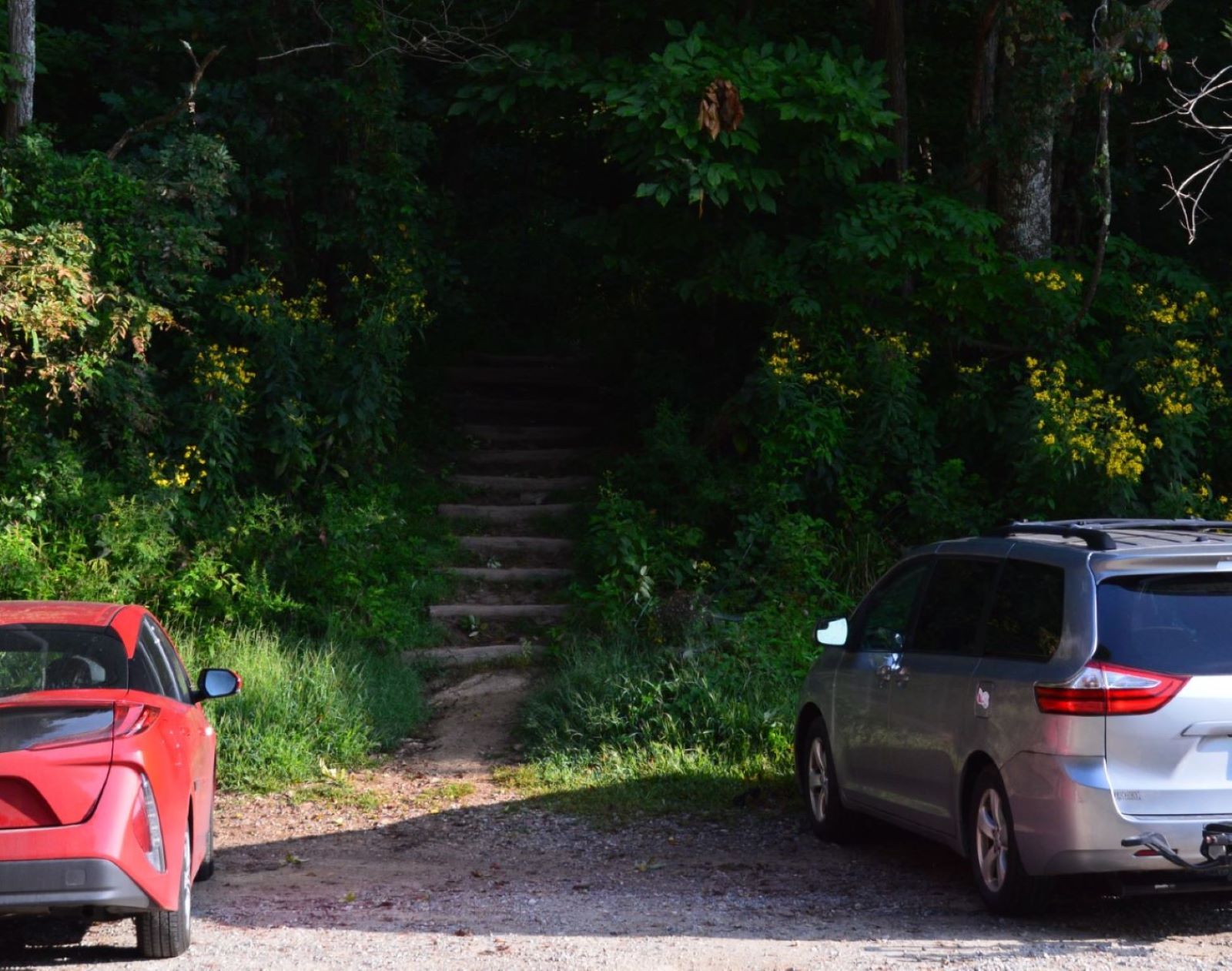
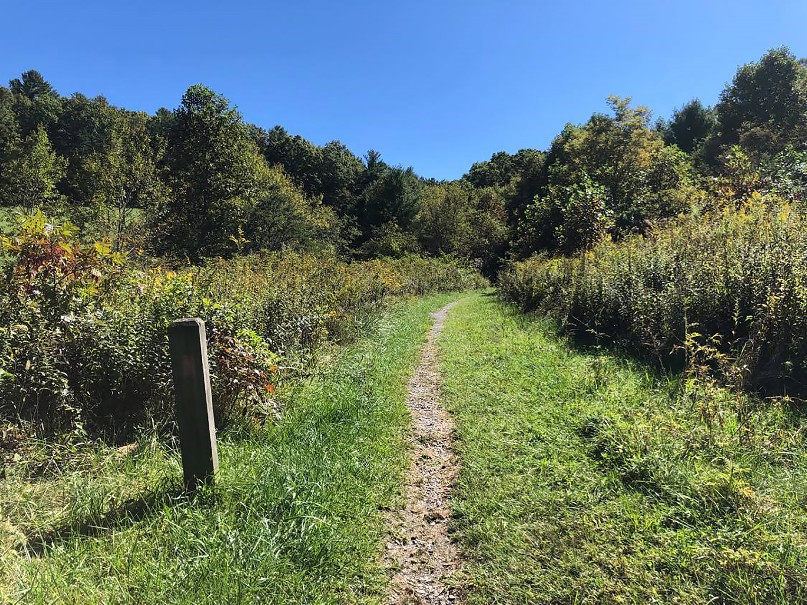
Craven Gap provides access to the Mountains-to-Sea Trail within 15 minutes of downtown Asheville. This well-maintained, moderate section of the trail is popular with both locals and visitors for its ease of access, abundant wildflowers, and fall colors.
Gravel parking area with wood and gravel steps leading to the trail north. A secondary road is adjacent to the gravel parking spaces. The Parkway is perpendicular to the secondary road and must be crossed to access the trail south. The trail is narrow and rocky. It undulates through a mid-elevation mixed forest. There are some small creek crossings as well as wooden and rock steps. Trail sides are steep drop offs or sheer rock walls at times. The forest canopy provides shade, except in winter
Watch for wildlife, or enjoy a picnic with a scenic view of the Catawba Valley.
The overlook consists on a long, paved parking area with a grassy island between the parkway and the parking area. The oak and maple trees in the island provide shade over the picnic tables that sit below. A wayside discussing groundhogs sits in the island on the north side of the parking area. The parking area is flanked on the east and west by thick mixed forests. A pair of maple trees rest immediately adjacent to the south side of the overlook, standing against the beautiful backdrop of Woods Mountain that features prominently in the distance. This mountain contains a section of the Mountains-to-Sea Trail that meanders its way through this area on its long stretch to the North Carolina coast. Silver Knob rises up just to the east of the mountain before tapering off into the valley below. This valley is heavily covered in trees, obscuring the small Armstrong Creek that runs along the bottom. At the easternmost point of the overlook’s view, Linville Mountain, contained within the Pisgah National Forest, gives way to the Catawba Valley where Lake James lies. On clear days, a faint glimpse of its blue waters may be visible.
Located at Milepost 422 along the Blue Ridge Parkway, Devils Courthouse offers a large parking area and unobstructed views of the prominent rock formation, which rises 5,720 feet above sea level. On a clear day, visitors can see four states from the top of the formation.
Large, paved parking area with several dozen parking spaces and a picnic area directly off the Blue Ridge Parkway. This parking area contains informational exhibits about peregrine falcons and forest restoration and a short, paved walkway that provides access to the Devils Courthouse Trailhead. Rising from the surrounding spruce forest, the formation is a rugged and exposed rock face that provides habitat for several rare species.
Devils Garden Overlook offers mountain views, as well as access to the Mountains-to-Sea trail.
The overlook has a paved, pull through drive with 12 parking spots and a sidewalk. The sidewalk is edged with grass and the terrain drops gently to the edge of a forest. Between the trees, the forested ridges of several mountains are prominent. Below these peaks lie valleys and lowlands. On the opposite side of the Parkway, a narrow dirt trail leading into the forest provides access to North Carolinas Mountains-to-Sea trail.
Doughton Park Picnic Area is one of the most beloved sites on the parkway. The expansive 56-site picnic area showcases how the parkway has changed over the years. Stop in for a picnic with all the amenities; grills, restrooms, tables, access to trails, and views.
The drive is lined by rock outcroppings, rhododendron, and mature trees. At the end of the loop the road opens to expansive meadows and views of distant mountain ranges. The old picnic tables are stacked stones, while weathered offer historic charm. The newer stables are smooth stone.
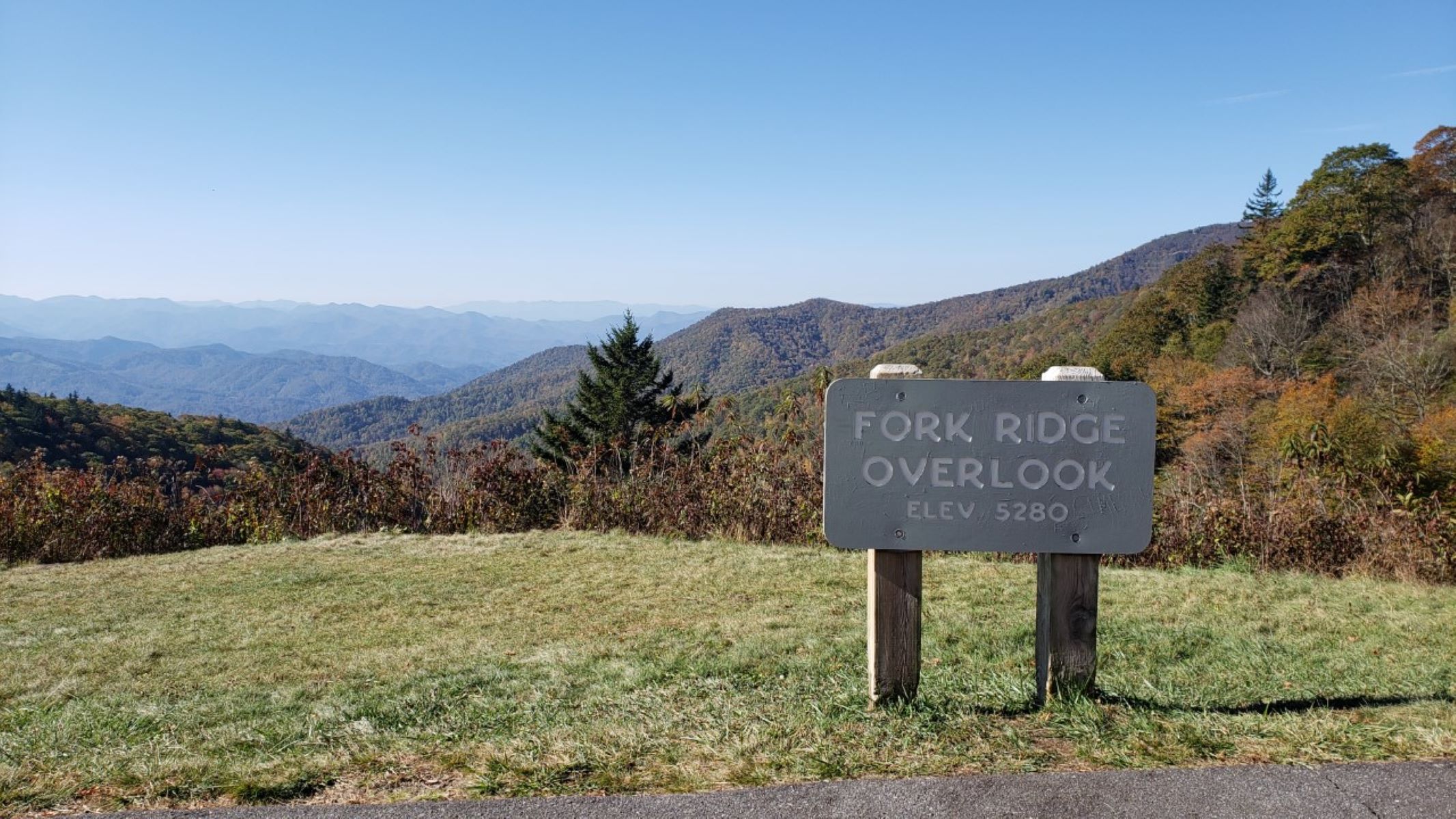
Located near the southern end of the Blue Ridge Parkway at Milepost 449, Fork Ridge Overlook is a paved pull-off that provides scenic views of the Plott Balsam Range and access to the Mountains-to-Sea Trail.
Paved pull-off with approximately two dozen parking spaces directly off the Blue Ridge Parkway. Across the street, the Mountains-to-Sea Trail travels approximately 5 miles to Waterrock Knob. The Plott Balsam Range can be seen from the overlook, as well as sweeping views into the valley below.
Fox Hunter’s Paradise is an overlook that has an interesting history and spectacular views!
A grassy median separates the overlook from the parkway road. The terrain slopes down from a low, wooden guardrail at the edge of the pavement. Low vegetation covers the slope in the center of the overlook, while trees stand at the edges on either side. In the valley below, there's a patchwork of fields and woods, while in the distance, mountains rise. To the right in the overlook, another road leads to the top of a hill, where there is more paved parking, as well as spaces for RVs. A small path leads to another slightly hidden overlook. This stone viewing point offers some of the same views as the lower overlook. The small 0.2-mile path is wheelchair accessible.
Looking for a place to start a hike or a bicycle ride? Well you are in luck! The French Broad Overlook offers that and much more.
A large paved overlook on the east side of the Blue Ridge Parkway. Stone curbing borders a level paved sidewalk. Beyond the sidewalk, grass and shrubs and then trees slop steeply downhill towards the French Broad River below. A sheer rock face borders the Parkway across the road from the overlook. Two informational signs provide area history and Parkway orientation.
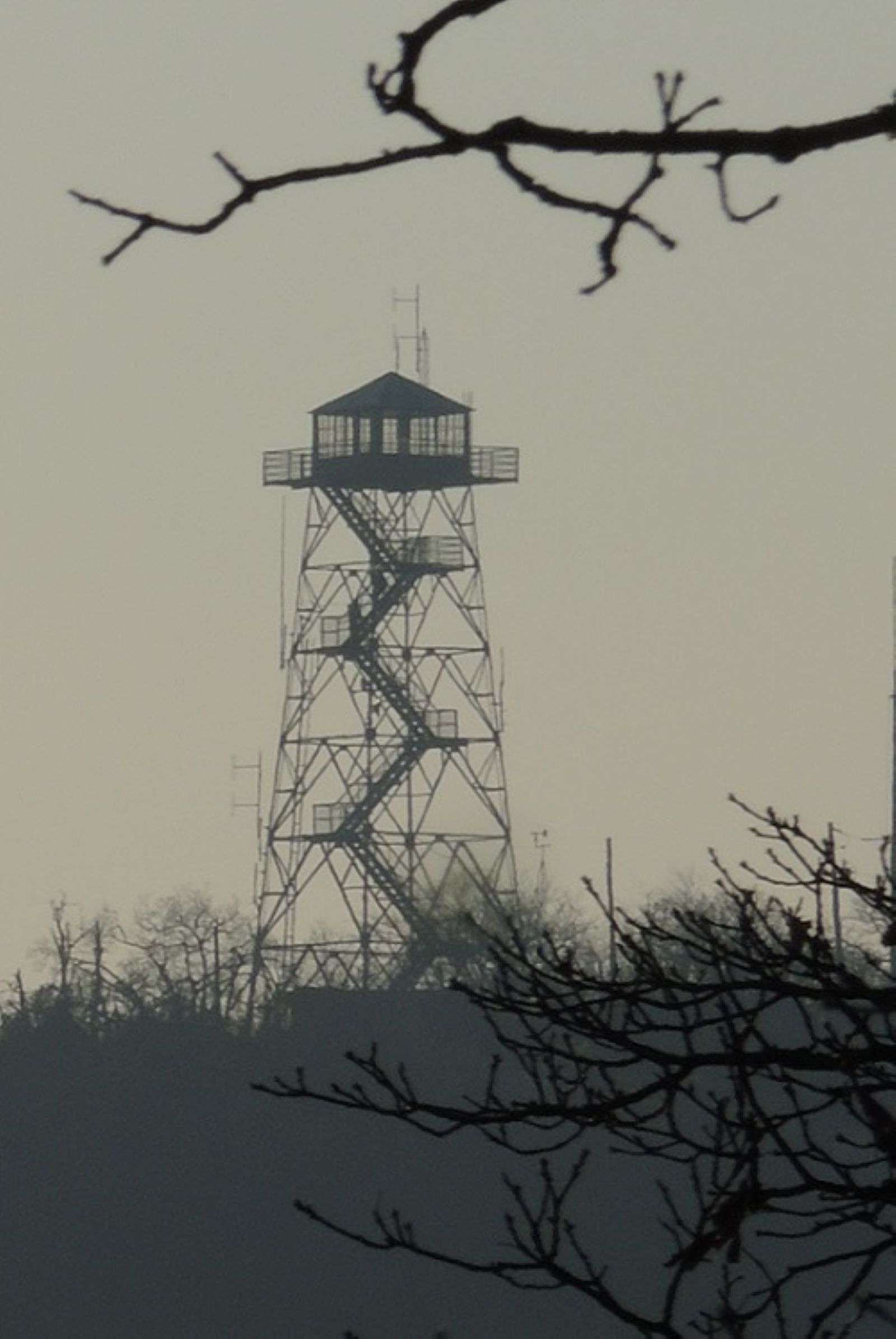
Located at Milepost 409 along the Blue Ridge Parkway, the historic Frying Pan Fire Tower is accessible via a 1.5-mile hike on a wide, gravel roadbed. Boasting expansive views of Cold Mountain, Pink Beds, and the Pisgah National Forest, this short but steep climb is popular with hikers of all ages.
Frying Pan Fire Tower is a 70-foot fire tower that dots the summit of Frying Pan Mountain and offers panoramic views of the surrounding mountains. Frying Pan Tower Trail is a wide, gravel roadbed surrounded by wildflowers and hardwoods, including groves of shrubby beaked hazelnut, hawthorn, azalea, and tall, shady red spruce.
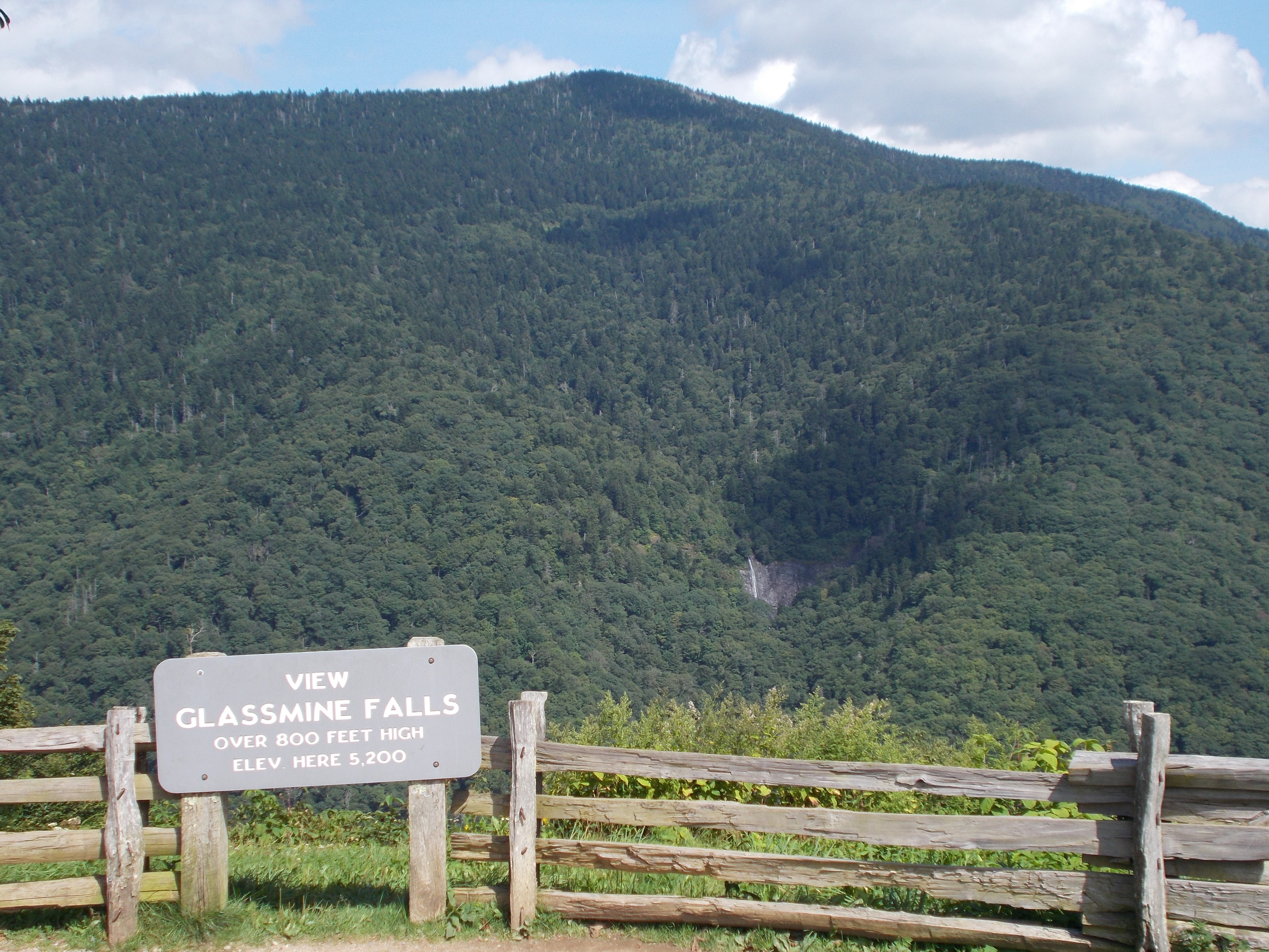
Glassmine Falls Overlook has it all—stunning Blue Ridge Parkway views, a waterfall, and interesting history. Be sure to make this overlook a stop on your Parkway journey!
A large, paved pull-through overlook on the east side of the Blue Ridge Parkway. A narrow grassy median separates the overlook from the Parkway. Rock curbing borders a paved sidewalk that looks out over the valley and the waterfall. Beyond the sidewalk is a small grass area, split rail fence, and then a steep drop off. A paved path at the north end of the overlook leads to a slightly higher viewing area. There are trailheads for the Mountains-to-Sea Trail at both ends of the overlook. High elevation deciduous forest is found throughout this area.
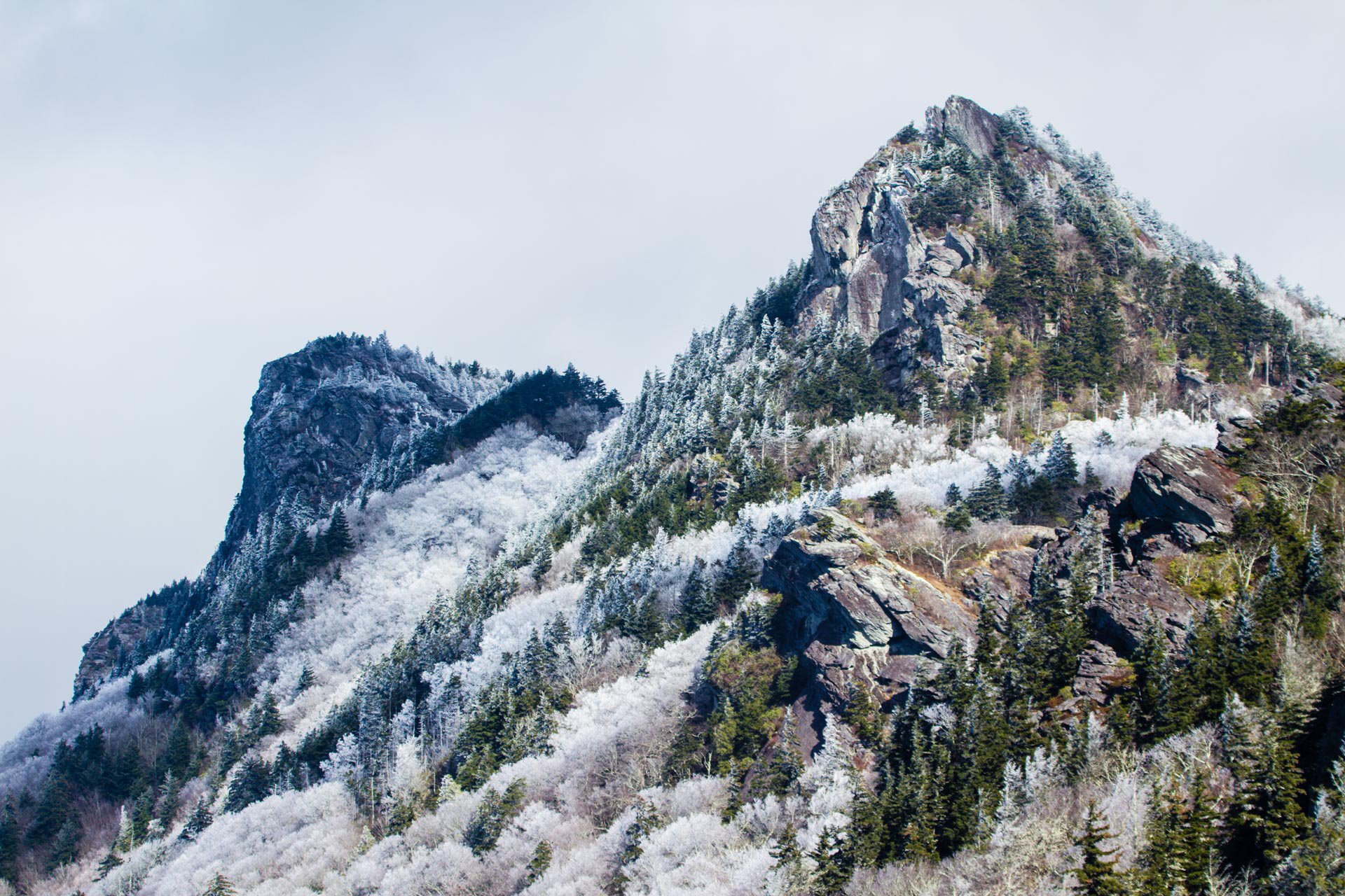
Grandfather Mountain View offers a spectacular vista of the southern end of iconic Grandfather Mountain.
This overlook is a paved side stop that runs parallel with the BR Parkway. Surrounded by dense forest, this overlook opens down a small grassy slope to feature a peep hole view, framed by trees, of Grandfather Mountain.
Granite Quarry Overlook offers views of the Blue Ridge area and Sauratown Mountain Range, as well as the Mount Airy Granite Quarry, the largest granite quarry in the world.
This paved, circular overlook offers a few parking spots for visitors wanting to stop stretch their legs. Grassy terrain drops down from the parking area to a forest border. These trees frame a view of distant blue mountains, as well as farmland and foothills below. A sign in the grassy median reads, “Granite Quarry Overlook, Elevation 3,015 feet.” In front of the parking spaces, an informational board reads, “Mt. Airy Granite: The white patch dimly visible in the distance is the Mt. Airy Granite Quarry. Largest of its type in the United States. From it came the piece of granite below typically feldspar and quartz with a sprinkling of black biotite mica. This granite is widely used in construction of mausoleums, statues, buildings, and bridges. United States Department of Interior, National Park Service.”
Enjoy the serenity of the Mountains-to-Sea Trail at this lesser visited location. The beauty of this section of the trail combined with the likelihood of peace and solitude make it a true “walk in the park”. Bring a picnic to enjoy at one of the overlooks.
Grassy Ridge Mine Overlook is a paved overlook on the east side of the Blue Ridge Parkway, located at 5,250 feet in elevation. A paved, level sidewalk with rock curbing lines the parking area. In the distance, layered, blue mountains stretch to the horizon. On the right side of the overlook there is a grassy area with a picnic table and trash can. Behind thee picnic table is access to the Mountains-to-Sea Trail.
Graveyard Fields is a hiking area that’s sure to please active, outdoor families and naturalists alike. You can enjoy spring wildflowers, find a place to cool down on a warm summer’s day, view beautiful fall colors, and visit two waterfalls. Plan to arrive early, it’s a popular location and can be very crowded.
Graveyard Fields is a picturesque high elevation valley with two scenic waterfalls. A parking overlook provides access to a loop trail. The paved parking lot curves off of the main road. On the right of the parking lot, a small stone building has vault toilets, which are open spring through fall. The parking area has a paved, level sidewalk on the side of the lot that is farthest from the roadway. The trailhead for the loop trail can be accessed from the parking area. The trail is steep and has numerous steps. The natural surface is uneven and is muddy for a large portion of the year. The trail winds through rhododendrons, mature trees, grassy areas, and stream corridors. The valley is surrounded by rolling mountains.
Do you have a big family? Well, at Graybeard Mountain Overlook you can see beautiful, expansive views of this “father” mountain and the seven “sister” peaks that descend from it.
A large, paved pull-through overlook on the east side of the Blue Ridge Parkway. A grassy median separates the overlook from the Parkway. Rock curbing borders a level sidewalk at the edge of the overlook. Beyond the sidewalk is a wooden, split rail fence and then a steep drop off. High elevation deciduous forest is found on both sides of the overlook and wooden posts mark access to the Mountains-to-Sea Trail.
Views of the Catawba River Valley, the southern end of Linville Gorge, and Lake James, plus waves of mountain ridges stretching to the horizon. What more could you want? The overlook provides access to USFS trails Snooks Nose and Green Knob.
This is a half-circle overlook with the center island of grass containing a white oak tree located on the southern corner. Waves of mountain ridges and valleys stretch to the east southeast and south southwest. Lake James and the southern end of the Linville Gorge are in the distance to the southeast. Snook’s Nose Trail (FS211) indicated by a yellow diamond blaze begins on the downhill side in center of the exterior natural area to the south of the overlook. Directly across the parkway the rocky face of the knob for which this overlook gets its name rises upward. The Green Knob Trail (FS182) has access 0.1 mile north from the northern overlook entrance. It is marked with a white diamond and carsonite sign designating the trail. The forested area is mixed hardwood with occasional pockets of rhododendrons and firs.
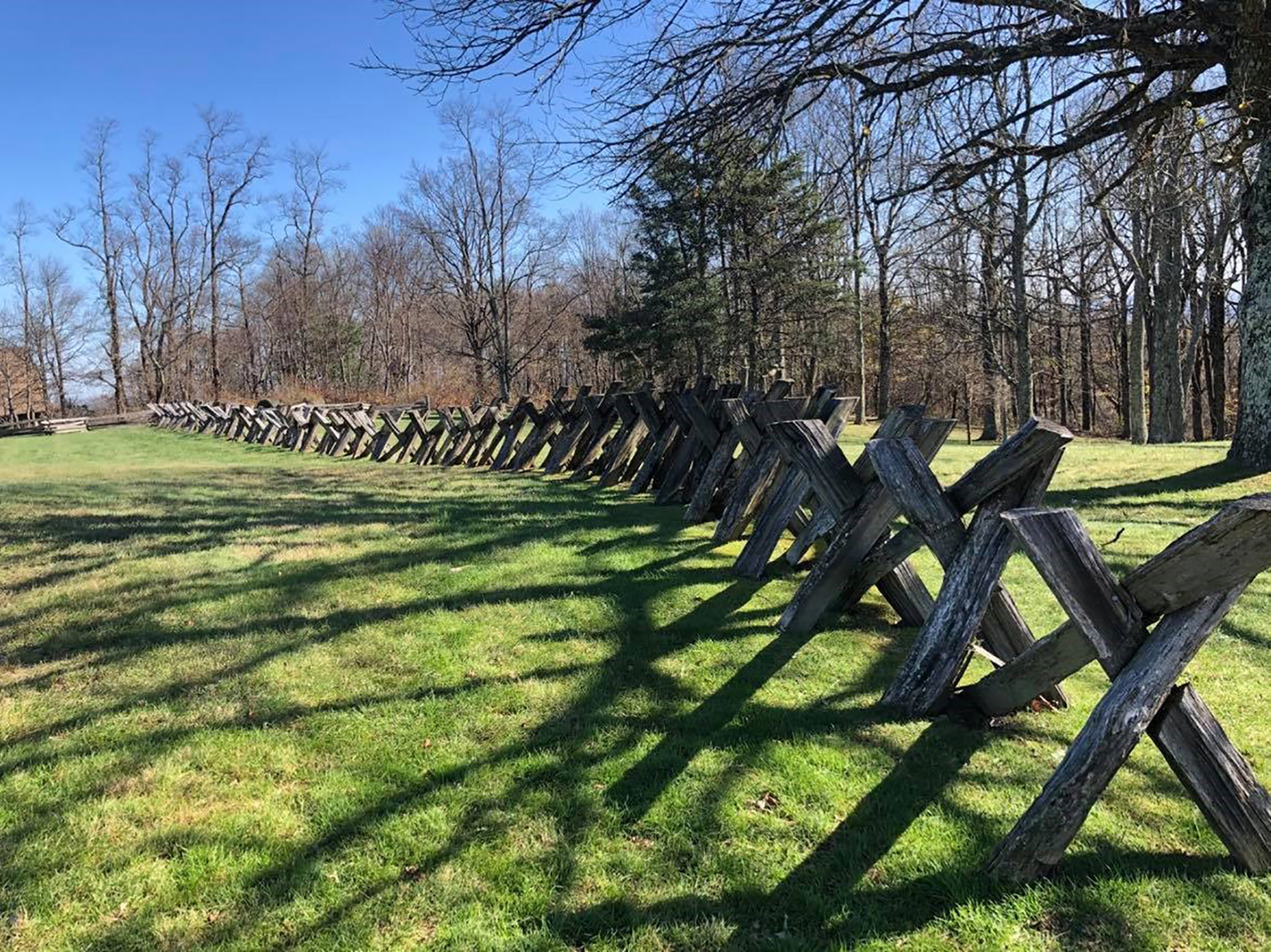
Good fences make good neighbors. You can learn all about the various styles of Appalachian log fences at the Groundhog Mountain Picnic Area. After your meal, climb the old, wooden tower for great views of the surrounding countryside. The shady picnic area has 28 tables, each with a grill.
The entrance to Groundhog Mountain is located on the left side of the road at MP 188.8 when heading South on the Parkway. The entrance curves to the contour of the mountain as you pull around the picnic area and into a loop style parking lot. Just past the picnic areas sits a small building housing the restroom facilities and a water fountain sits out front of this building. Parking is available on either side of the circle drive. Within the middle of this loop sits the historic Bowman-L cemetery maintained by the family. The historic observation tower sits at the top of the hill along with the displays on fencing styles in the Blue Ridge. A small walkway leads the way to the observation tower that stands 20 feet high. There are 17 steps to reach the top of the tower where you get a 360-degree view of the surrounding mountains and valleys. The hill is surrounded by different styles of fencing picket or paling rail, snake rail, buck rail, and post and rail fencing. A wayside exhibit onsite explains the differences.
Harvey’s Knob offers exceptional views to the Great Valley of Virginia far below. Overlooks with expansive views make excellent locations to view migrating birds and monarch butterflies in the fall.
The overlook is a large paved parking area in the shape of an “M” on the right from the southbound lane of the parkway. In the grassy median between the overlook and the parkway is a slope with a few small trees. The overlook sits slightly below the parkway and faces west over the Great Valley. During the summer months, the vista is composed of rich green, forest-covered mountains and farm fields and forests in the valley far below, which contrast with a deep blue sky on clear days. In autumn, the forests become a varied palette of red and yellows dotted with deep green pine trees, and the valley becomes more golden. In late fall and into winter, the thinning foliage reveals lichen-covered granite boulders under the canopy.
A beautiful view into the Haw Creek Valley and the mountains beyond. Pull over, let the stress of city life slip away and take a deep breath of mountain air.
This is a small asphalt pull in parking overlook with no median between the Parkway and the parking spaces. Rock curbing steps up to a level sidewalk. A small, flat grassy area is adjacent to shrubs near the edge of a drop off. Mature trees are growing downslope.
Hefner Gap offers a scenic view of Linville Mountain and Honeycutt Mountain to the east and north. It sits at the intersection of the Blue Ridge Parkway and the Overmountain Victory Trail, one of the roads used by the Overmountain men going from the west to the battle at Kings Mountain in 1780.
The east side of the overlook gives a view of a valley below with a long mountain ridge beyond. Woods surround the parking area on the other three sides, with the south (right) side including a small grove of apple trees. Also, to the south/right side of the parkway is a crossing of an old, unpaved road used in 1780 by men going to fight at the battle of Kings Mountain.
The Heintooga Spur Road off the Blue Ridge Parkway is lesser traveled scenic drive that enters into the Great Smoky Mountains National Park. Scenic overlooks, hiking trails, a campground, picnic area, and a unique historic marker are all highlights of the road. It is also a great place to look for elk.
Heintooga Spur Road is a paved, two lane road that is 9 miles long. The road winds up a mountain, gaining elevation as you go. About 5 feet on either side of the road are flat grassy areas that are regularly mowed. Adjacent to the grass begins thick Appalachian forests with tall trees and thick shrubbery. Along the way plenty of asphalt, pull-through overlooks open windows through the forest for a view. The overlooks have rock curbs that step up to level sidewalks allowing views of the valley and mountains in the distance.
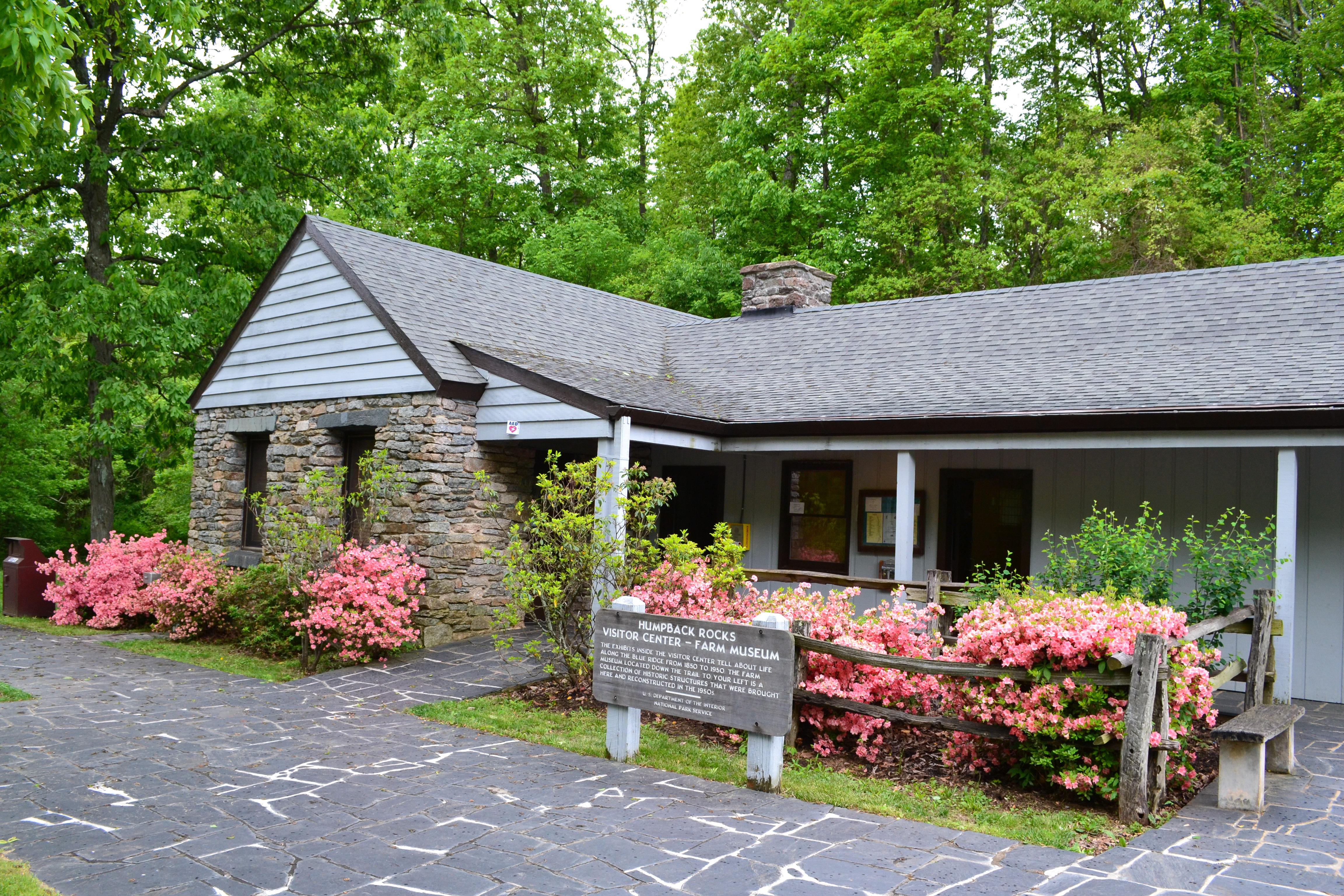
This farm has been preserved as it may have looked during the 1890s. Farm highlights include a demonstration garden, log home, chicken house, root cellar, barn, hog pen, spring house, and rail fencing surrounded by forest. National Parks, like the Blue Ridge Parkway, are one such gift we can care for, to pass on to the next generation to preserve unimpaired and enjoy for the benefit of the future generations
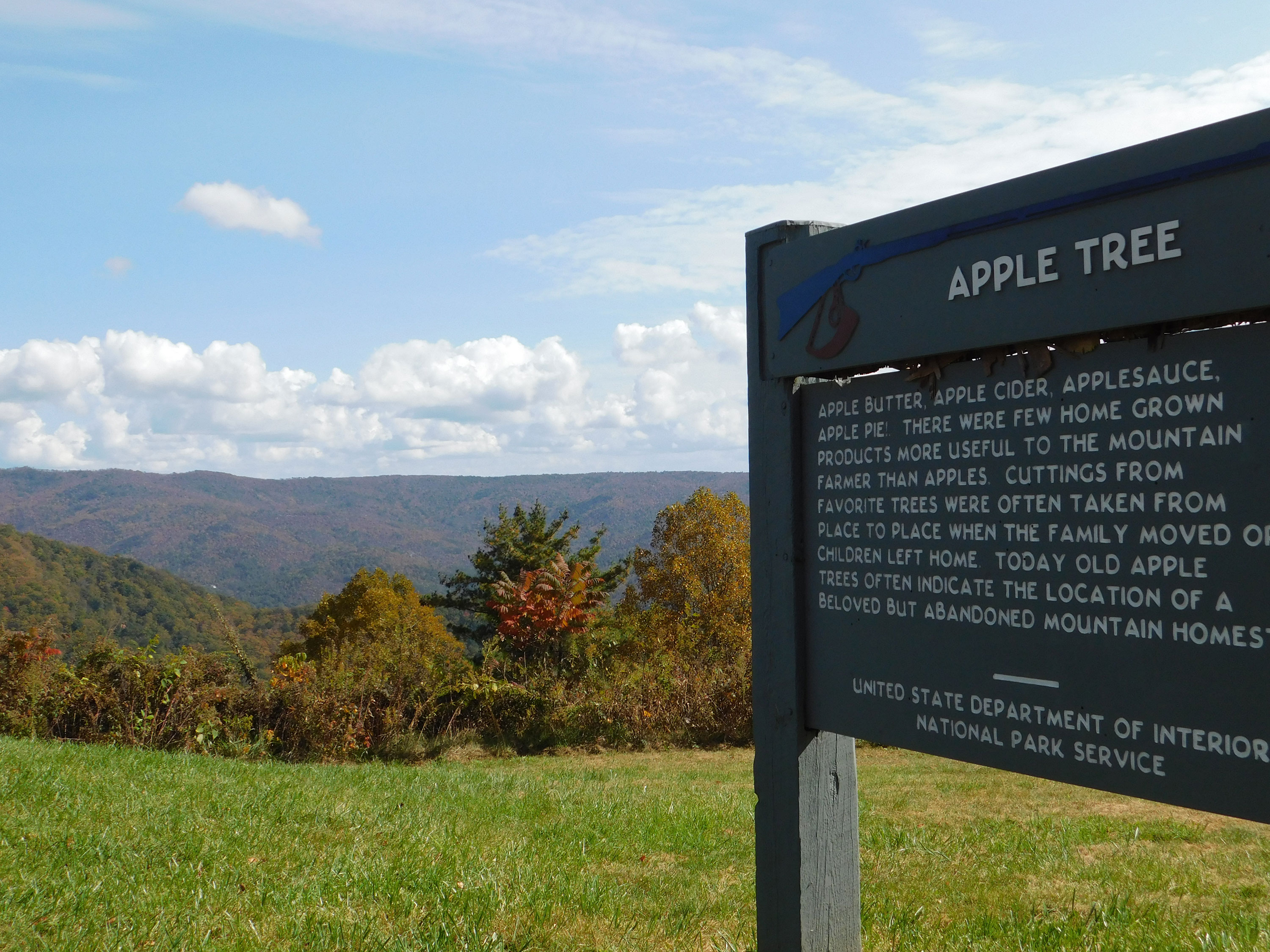
The farm grounds are a mix of open forest and fields surrounded by thick forests just below the Parkway motor road. Humpback Rocks Mountain Farm is a collection of log buildings constructed during the late 1800s. The farm consists of a small demonstration garden which grows various field and kitchen crops in the summer including: corn, beans, squash, cabbage, potatoes, tomatoes, okra, carrots, hot peppers. Just opposite the garden is the orchard comprised of 8 apple trees of various ages and sizes aligned along the hillside. The young trees are protected from browsing deer by woven wire metal fencing. The cabin measures roughly 19 by 17 feet with a main floor and loft. A 7 foot wide covered porch supported by 4 posts runs the entire length of the front of the cabin covering the main entry door. A large stone fireplace with a hearth is on the right side of the cabin from the main entry. The cabin logs have gray/brown, weathered, square sides with white daubing in between. The roof is covered with hand split shakes each about 12 to 16 inches wide and 2 to 3 feet long put down in several overlapping layers. The floor of the cabin is elevated some 18 to 24 inches on stone piled piers and is comprised of sawn board planks. The interior of the cabin is modestly furnished including a full sized rope bed, infant cradle, chest, bureau, dining table with bench and ladder back chairs, a wooden shelf with a lower cabinet, iron skillets/ovens, and a wide range of farm tools for gardening and woodworking. Behind and to the right of the cabin is the chicken house, roughly 8 feet wide and 10 feet deep, made of up stacked round logs with two openings: a main door (2 feet wide x 3 feet tall) and small “window” including a wooden ramp for the chickens to get in/out of the structure. This building also has a shake roof. Inside there are nest boxes, a feed trough, water bucket, and brood perches Finally, the spring house measures 9 feet wide by 10 feet long, constructed of round logs stacked with a shake roof, it covering a stone lined floor and spring box with water flowing through up to 8 inches deep. A small door roughly 3 feet wide by 4 feet deep with a swinging entry door.
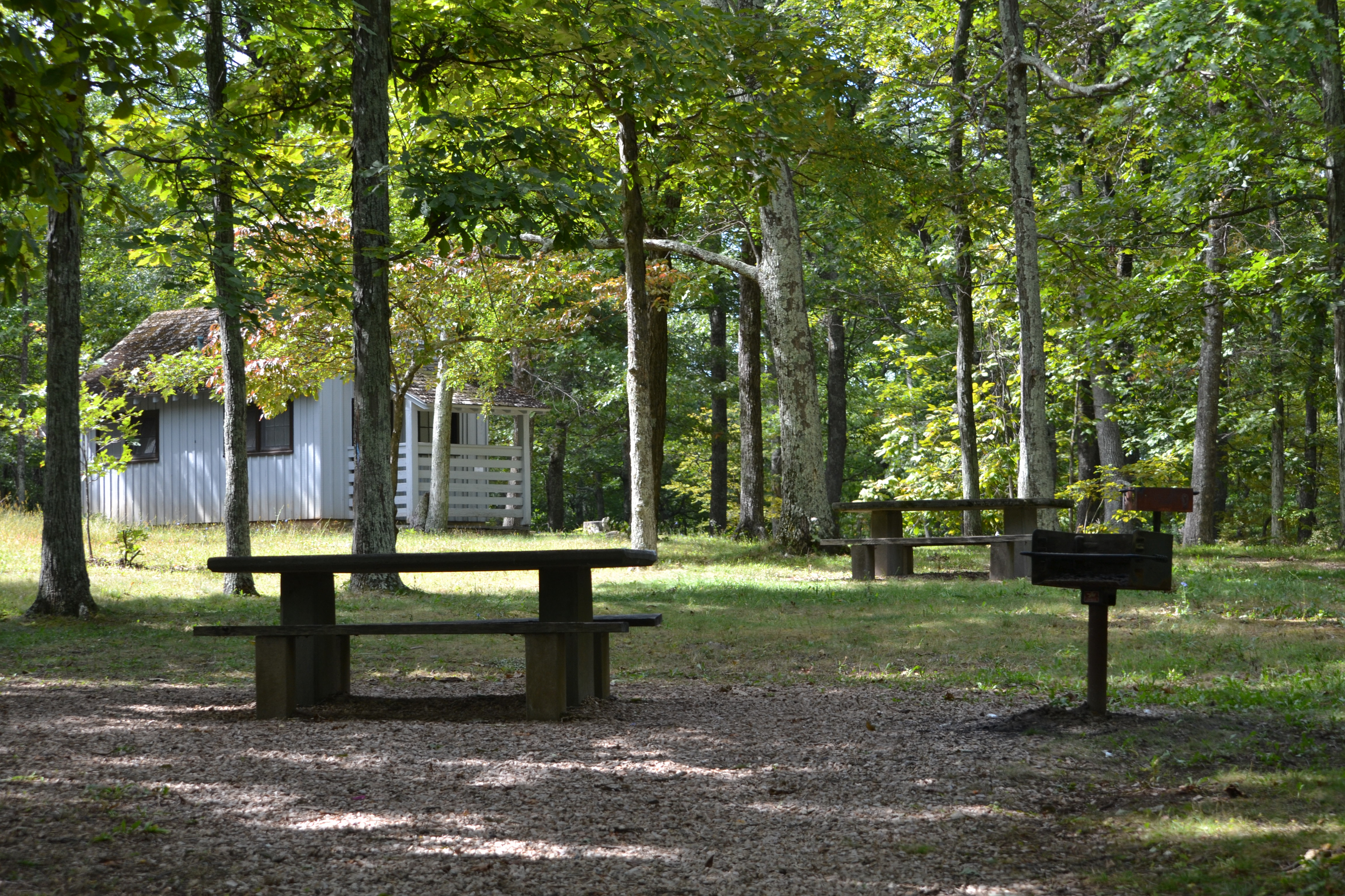
Refuel your body and mind with a quiet picnic at the Humpback Rocks Picnic Area.
The Humpback Rocks Picnic Area is a 0.5 mile, figure 8 shaped, upper and lower loop drive with a narrow one way paved road curving gently between an open canopy forest overhead and mix of mowed meadow and unmanaged forest underneath. Stone tables with wood topped benches with charcoal grills are scattered about with their own parking slips. Some tables are out in the open mowed meadow areas while other sites are tucked into shrubbery amongst the tall trees. Two gray, wooden sided, peak roofed, comfort stations with male and female sides, are provided with one each located in the upper and lower loops.
The short, strenuous climb to enjoy the view from the Humpback Rocks has drawn hikers for hundreds of years, across all seasons. There is much to see and do in the area beyond the hike to ‘the Rocks’ including access to the Appalachian National Scenic Trail, Glass Hollow Overlook, Old Howardsville Turnpike, Jack Albright Loop over Dobie Mountain, and true summit of Humpback Mountain. Along the way keep a sharp eye out for cultural resources and wildlife.
Humpback Gap Trailhead is a tear drop shaped parking area with paved parking for about 15 vehicles. The trailhead is located on the saddle between Humpback and Dobie mountains and is surrounded by forest on three sides with a maintained meadow lined by stone fence to the west. There is an exhibit about pioneer land clearing techniques (Deadin’) and bulletin board kiosk with trail map on the southern end of the parking lot. A stone picnic table sits between the Jack Albright Loop and Old Howardsville Turnpike connector trail.
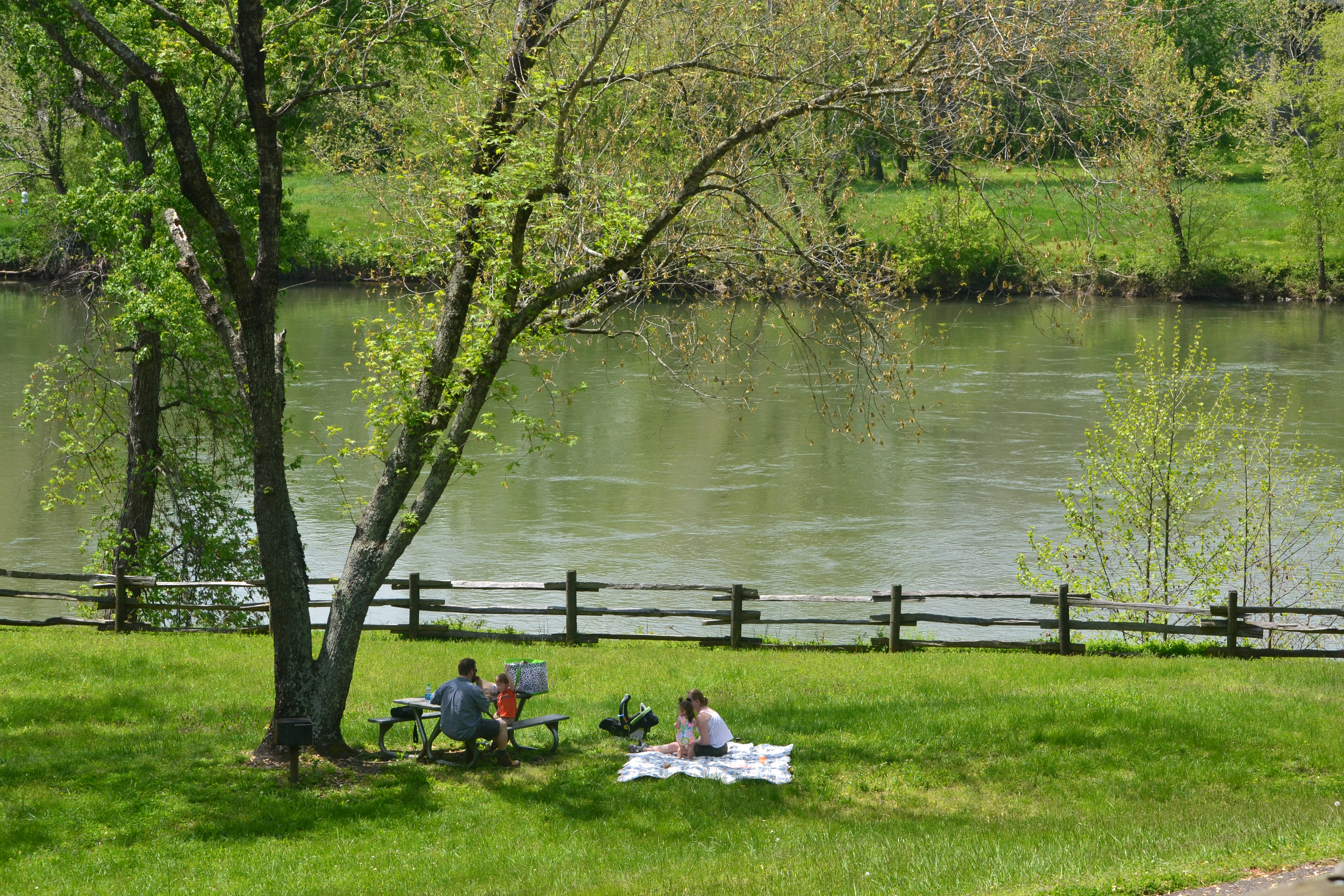
Travelers have used the James River for thousands of years from Native Americans up to modern motorists. Ponder the past and future of transportation over a good meal at the picnic area while watching the water pass by.
Located on a level forested river bank between two steep slopes along the calm river. Wooden picnic tables are scattered around the open mowed area ringed by dense forest and towering shade trees. Upstream the Parkway bridge spans about a quarter mile of river width with a scenic footbridge stacked under the motor road.
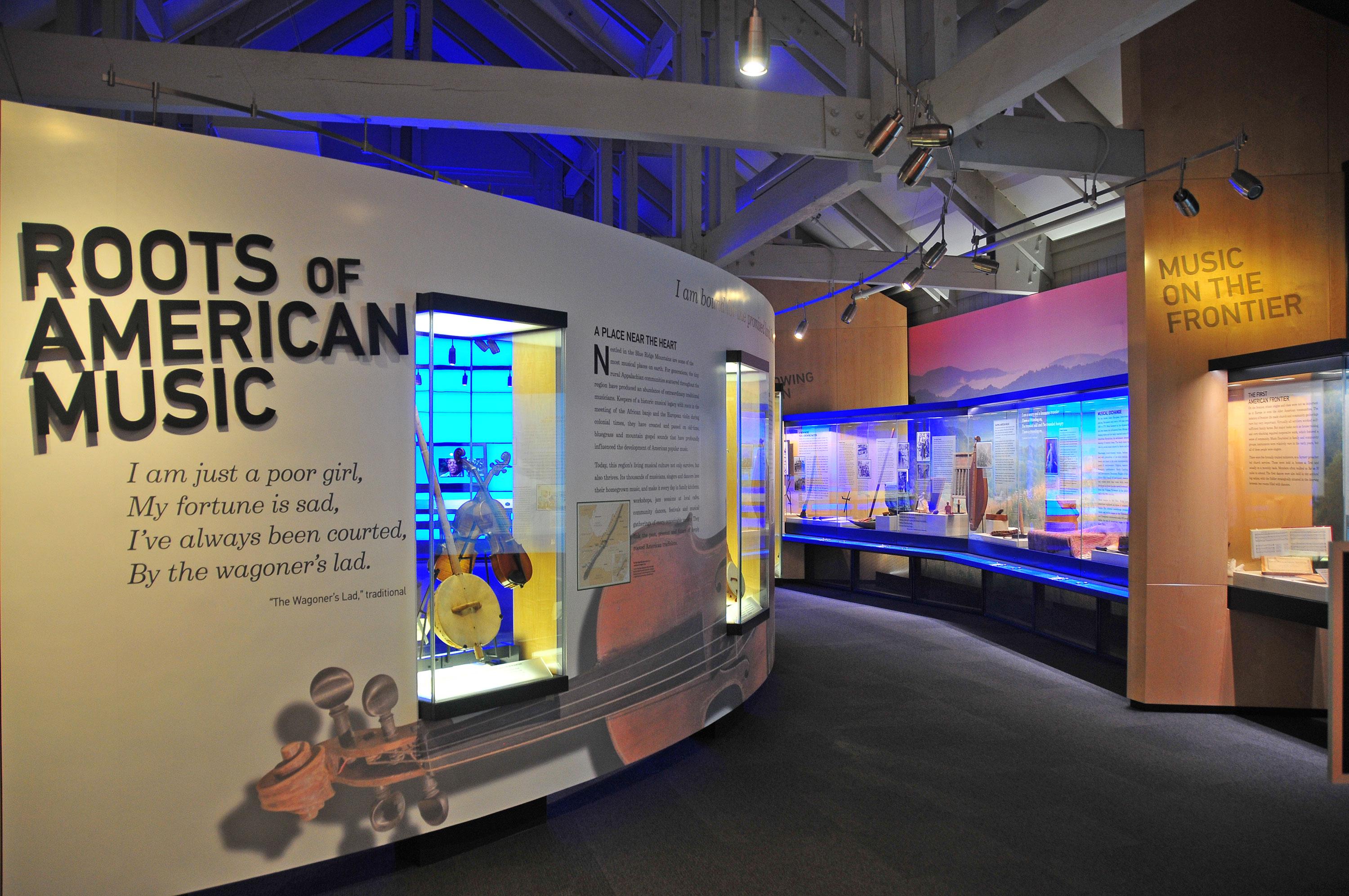
The Blue Ridge Music Center celebrates the music and musicians of the Blue Ridge. Established by the U.S. Congress in 1997, with support from The National Council for the Traditional Arts, the Music Center includes an outdoor amphitheater, an indoor theater, and exhibits highlighting the historical significance of the region’s music.
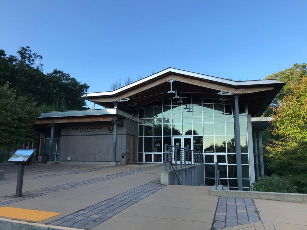
The visitor center features exhibits that showcase the natural and cultural history of the area, as well as the recreational opportunities offered by the region. You are able to watch the Parkway film at this location as well. Open year-round, the visitor center features National Park Service information desk, and America's National Parks store.
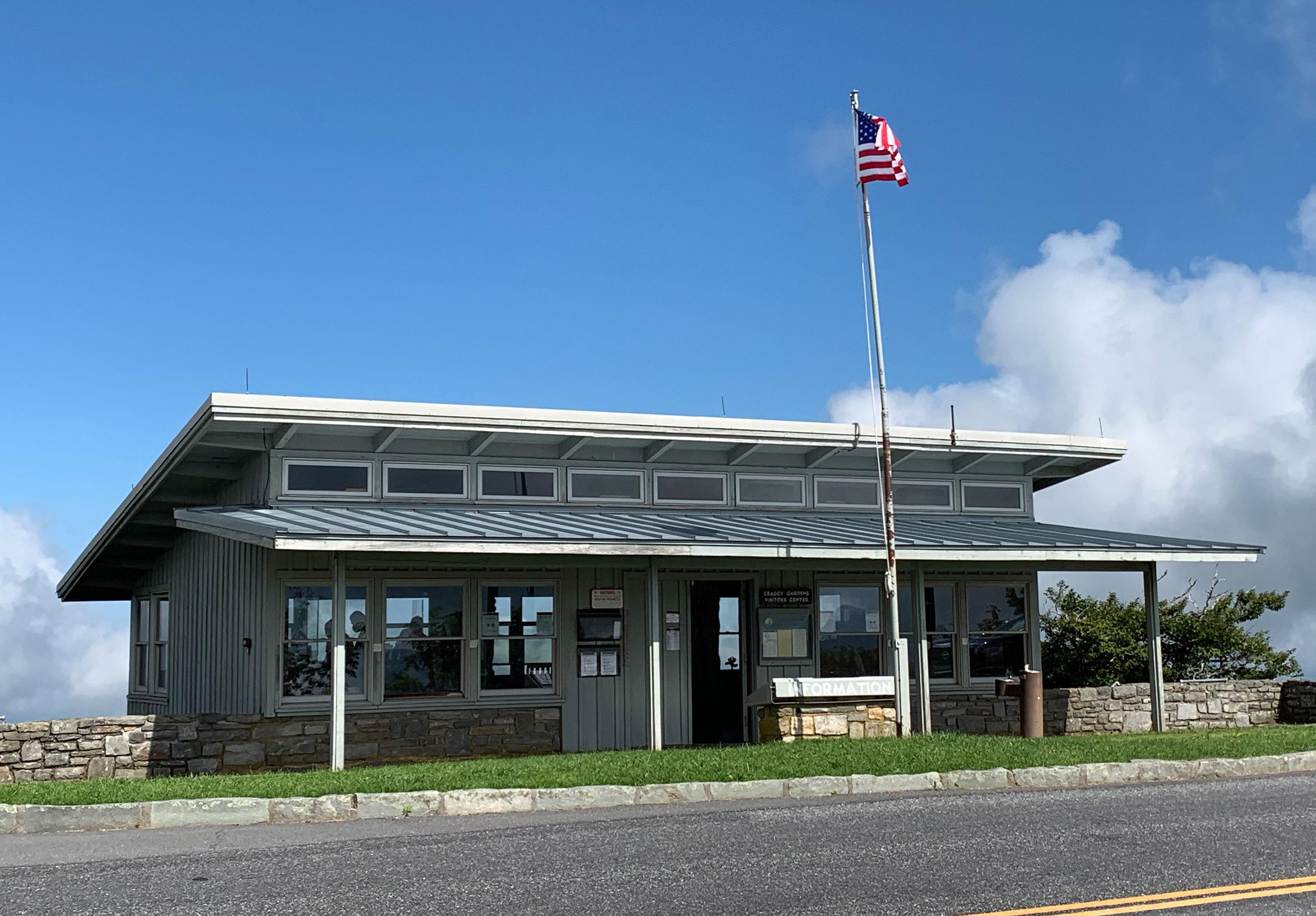
The small, historic visitor center and America's National Parks store is nestled in the gap between the rocky, Craggy Mountains. At over 5,000 feet elevation, harsh weather often invades these exposed ridges, resulting in the gnarled forests of beech, birch, and buckeye. These summits have been home to some of the most spectacular rhododendron displays along the Parkway corridor. For generations, visitors have headed up to the Craggies in mid to late June to view the pink and purple blooms.
Numerous hiking options are available in the Doughton Park area and nearby Brinegar Cabin offers insights into mountain living in the late 19th and early 20th centuries.
The Southern Highland Craft Guild hosts a large craft shop, craft demonstrators and upstairs galleries showcasing regional craftspeople. Within the Folk Art Center is also an America's National Parks store.
Travelers heading south from the northern end of the Parkway experience a scenic drive through an Appalachian hardwood forest with ridge top views of the Shenandoah Valley to the west and Rockfish Valley to the east. The rock outcroppings on the mountain and the relocated collection of 1890s farm buildings where settlers scratched out a living in the rocky soil makes Humpback Rocks perhaps the best representation of the varied combination of natural and cultural features anywhere along the Parkway corridor.
In September 2024, Hurricane Helene made landfall as a Category 4 hurricane in Florida and then stormed across multiples states in the Southeast. Along the Blue Ridge Parkway, the storm devastated the park and local areas with up to 30 inches of rain in localized areas and peak sustained winds of up to 60 miles per hour. The heavy rain and wind resulted in significant damage along the Parkway.
In September 2024, Hurricane Helene made landfall as a Category 4 hurricane in Florida and then stormed across multiples states in the Southeast. Along the Blue Ridge Parkway, the storm devastated the park and local areas with up to 30 inches of rain in localized areas and peak sustained winds of up to 60 miles per hour. The heavy rain and wind resulted in significant damage along the Parkway.
The James River visitor center is closed. The James River visitor center offers visitors the opportunity to learn about transportation history in central and southern Appalachia.
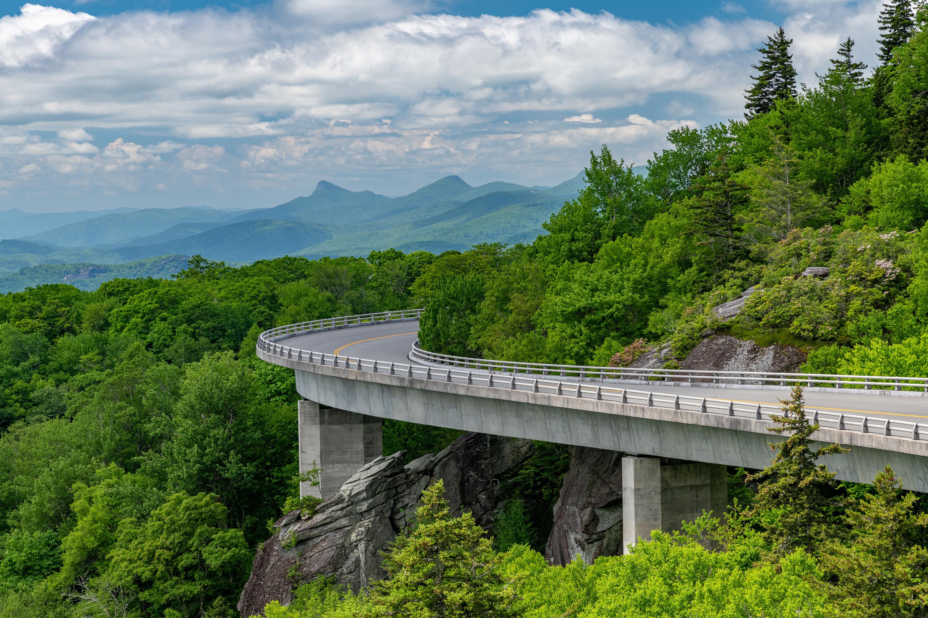
The rugged slopes of Grandfather Mountain proved a challenging task to engineers as they completed the last section of the Parkway here in 1987, 52 years after construction began. To protect the fragile and ecologically sensitive slopes of the mountain, Parkway planners designed the award-winning Linn Cove Viaduct, and the visitor center at MP 304 celebrates this achievement. The beautiful Tanawah Trail runs nearby. The visitor center is currently closed, but parking lot is open for trail access.
This facility was heavily impacted by Hurricane Helene and is closed for 2025. The Linville River flows from its headwaters high on the steep slopes of Grandfather Mountain and cascades through two falls as it begins a nearly 2,000-foot descent through this rugged and spectacularly beautiful gorge, carved out by the tall Linville Falls. Towering hemlocks, dense stands of rhododendron, and native wildflowers grow along the trails that begin at the visitor center and encircle the falls.
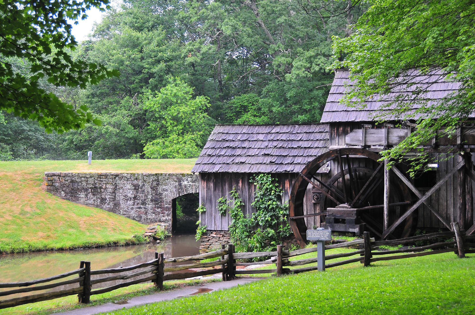
The sights and sounds of rural life in Appalachia resonate at Mabry Mill during the summer and fall. Ed Mabry built this mill, where he and his wife ground corn, sawed lumber, and operated a blacksmith shed for their neighbors for three decades. It was a community gathering place for the folks who called Meadows of Dan home in the early twentieth century.
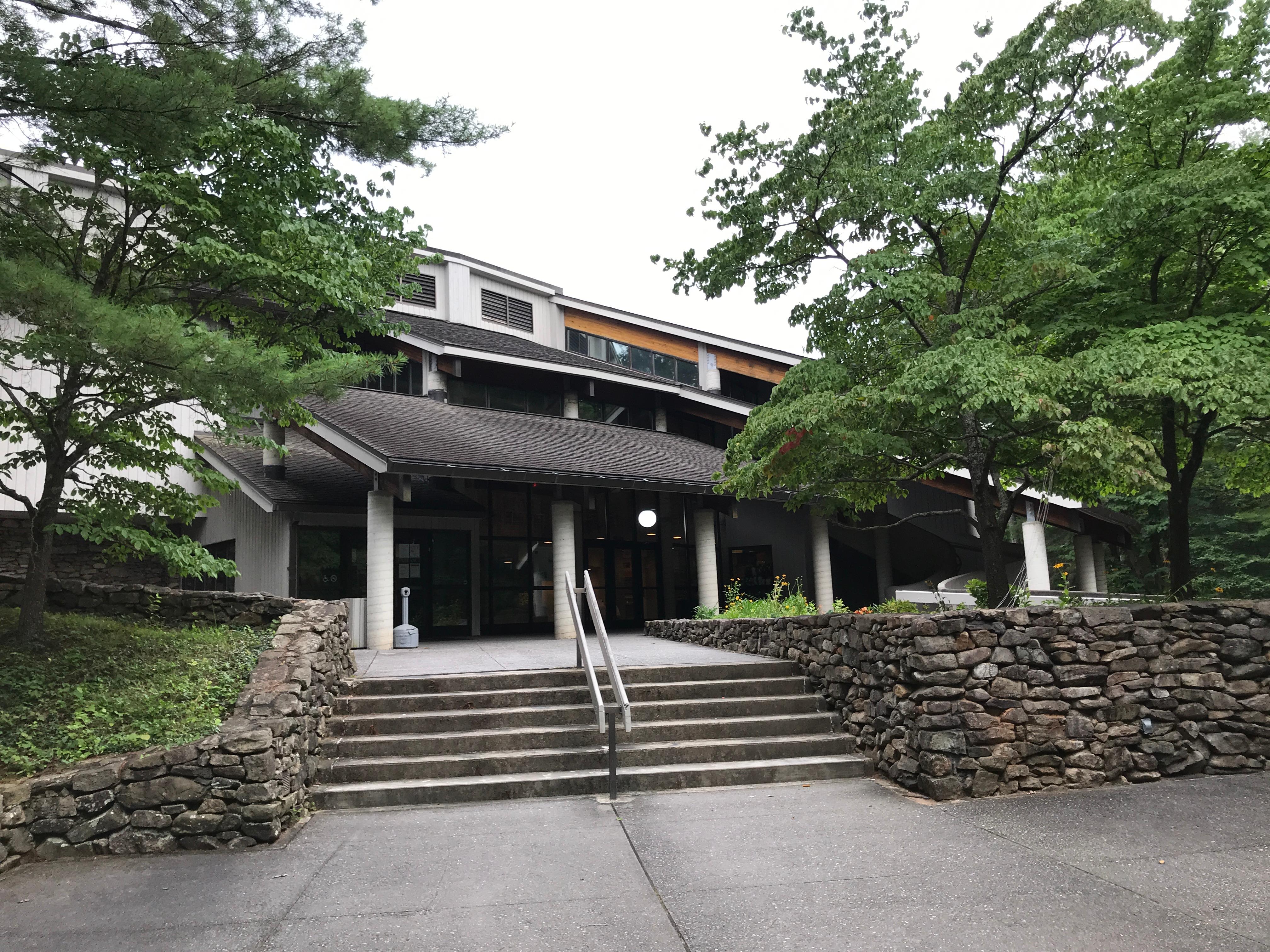
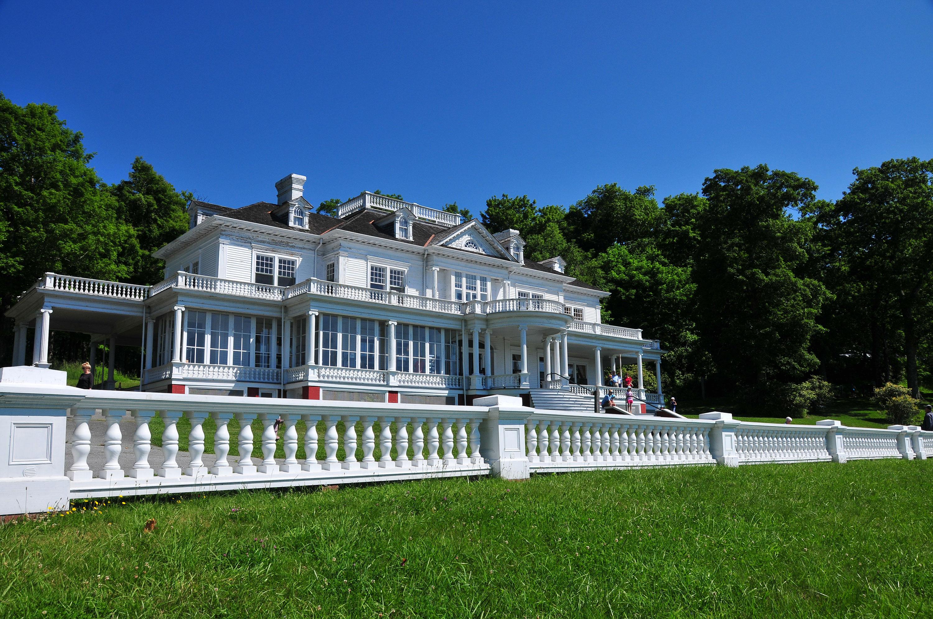
Moses Cone Manor House and Visitor Center (Milepost 294)
This visitor center information desk, America's National Parks store and Southern Highland Craft Guild craft shop share a grand, historic estate house. The visitor information desk is open from May through October. The America's National Parks store and the Southern Highland Craft Guild craft shop is open from early April through November. The estate grounds have 25 miles of carriage roads for strolling, small lakes and other historic structures.
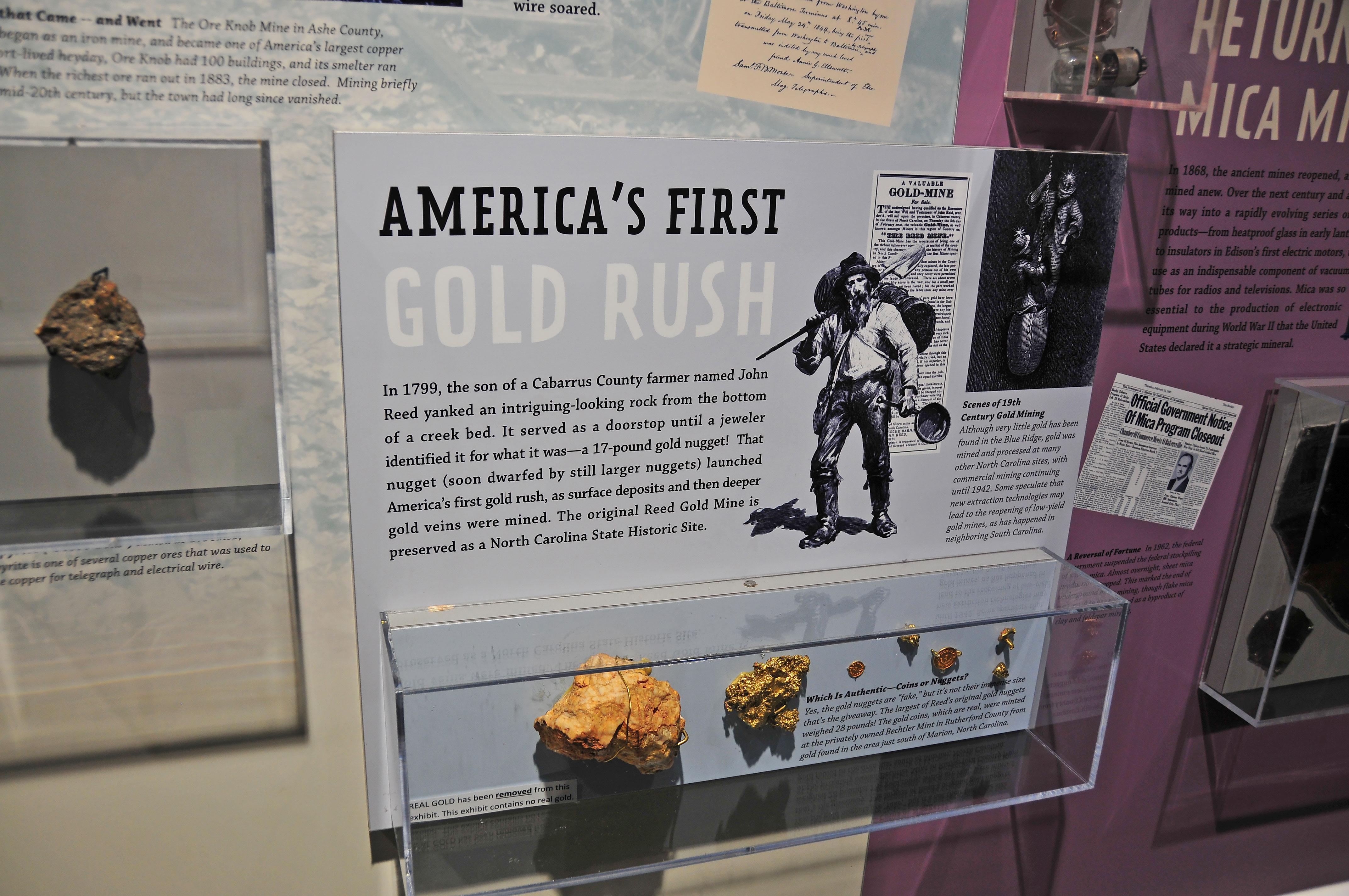
The Museum of North Carolina Minerals highlights the rich mineral resources & the mining heritage of this portion of the Blue Ridge. The museum has interactive & experiential exhibits for children & adults. This area, called Gillespie Gap, was also significant in the American Revolution, where frontiersmen from the mountains known as the "Overmountain Men" crossed the Blue Ridge on their way to the Battle of Kings Mountain.
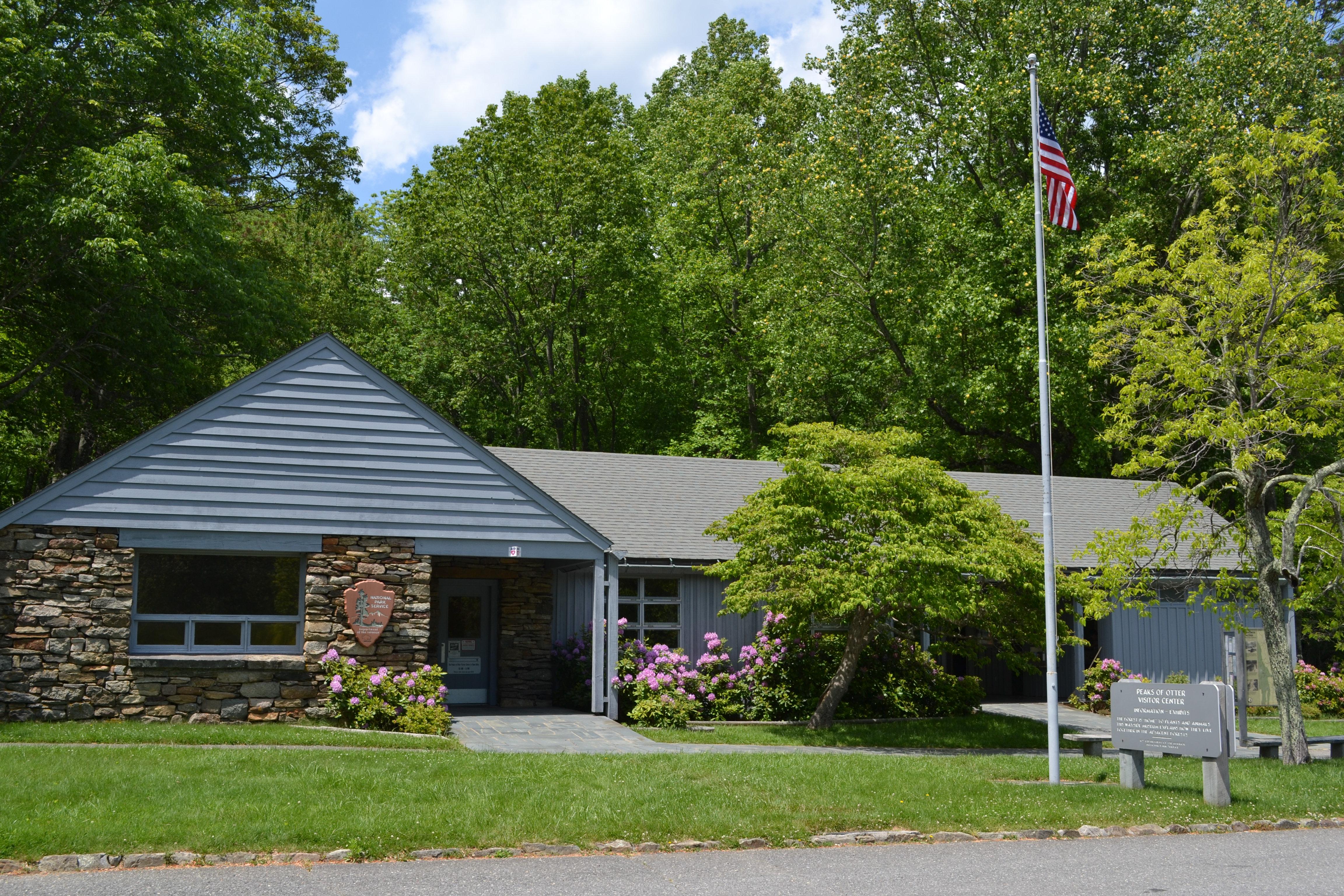
Visitors of the Peaks of Otter gain a sense of both the history of community and tourism in the Blue Ridge Mountains. The long history of visiting the mountains for health and relaxation is told in the visitor center. An extensive trail system is available with the hike to Sharp Top being a long-standing tradition. Dining and lodging are available, along with fishing in Abbott Lake, camping, and picnicking.
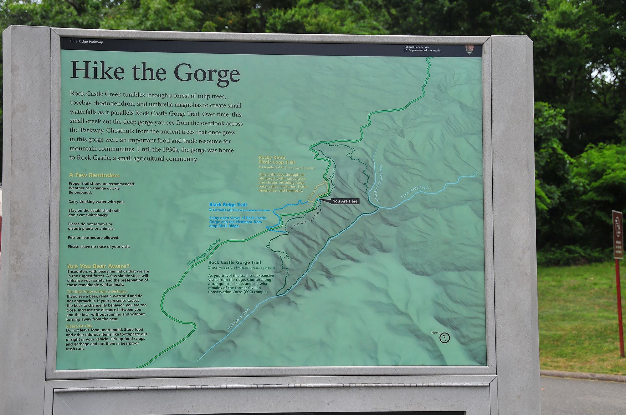
The Rocky Knob area offers a visitor center, campground, and 15 miles of hiking trails, including the Rock Castle Gorge National Recreation Trail. Picturesque Mabry Mill is located just a few miles south of Rocky Knob.
Waterrock Knob is our highest elevation visitor center on the Parkway. Known for its beautiful long-range views of several major mountain chains in the Appalachians, Waterrock Knob is uniquely suited for viewing sunrises and sunsets. The small visitor center introduces visitors to the area's rugged terrain and tremendous scenic resources, including the Great Smoky Mountains that are visible from here.
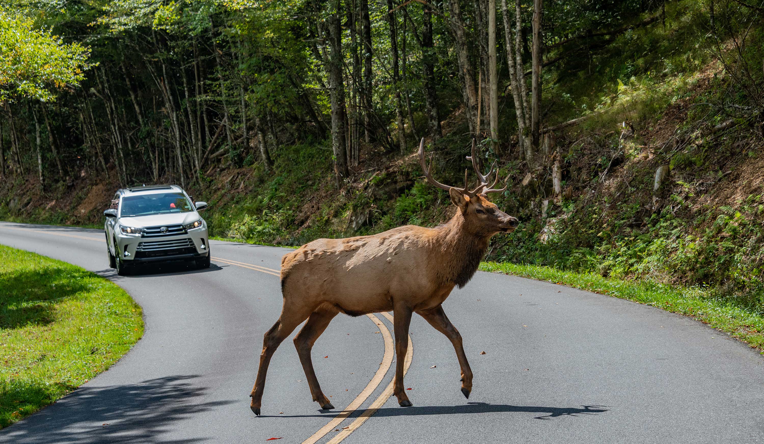
Heintooga Ridge Road on the southern end of the Blue Ridge Parkway is a good place to spot elk.
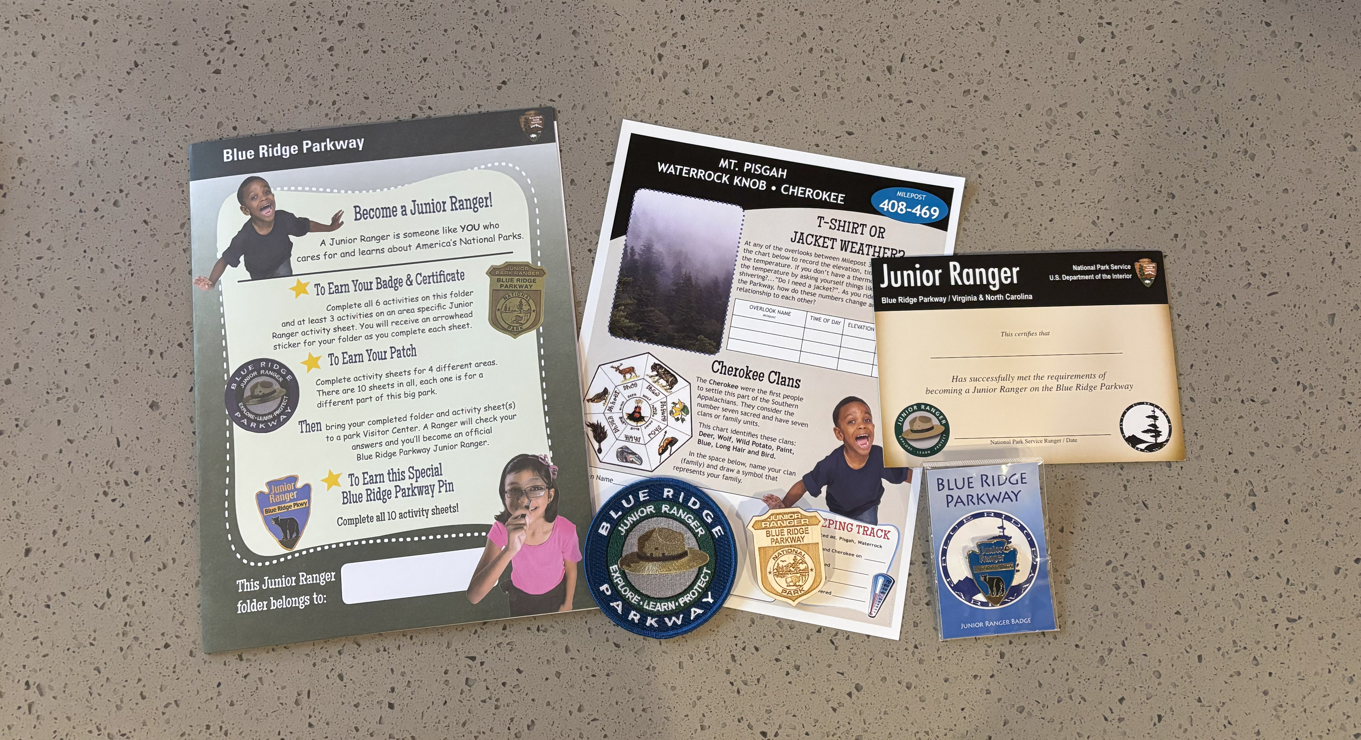
Become a Blue Ridge Parkway Junior Ranger
Becoming a Blue Ridge Parkway Junior Ranger is exciting and rewarding! Pick up your Junior Ranger Folder and instructions at any park visitor center. Then travel the parkway to get site-specific activity sheets along your journey.
Stargaze at Waterrock Knob
Stargazing on the Blue Ridge Parkway can be an amazing experience. Waterrock Knob at Milepost 451.2 is a great place to enjoy the calm quiet of the night and contemplate the universe as you gaze at the starry sky that surrounds you.
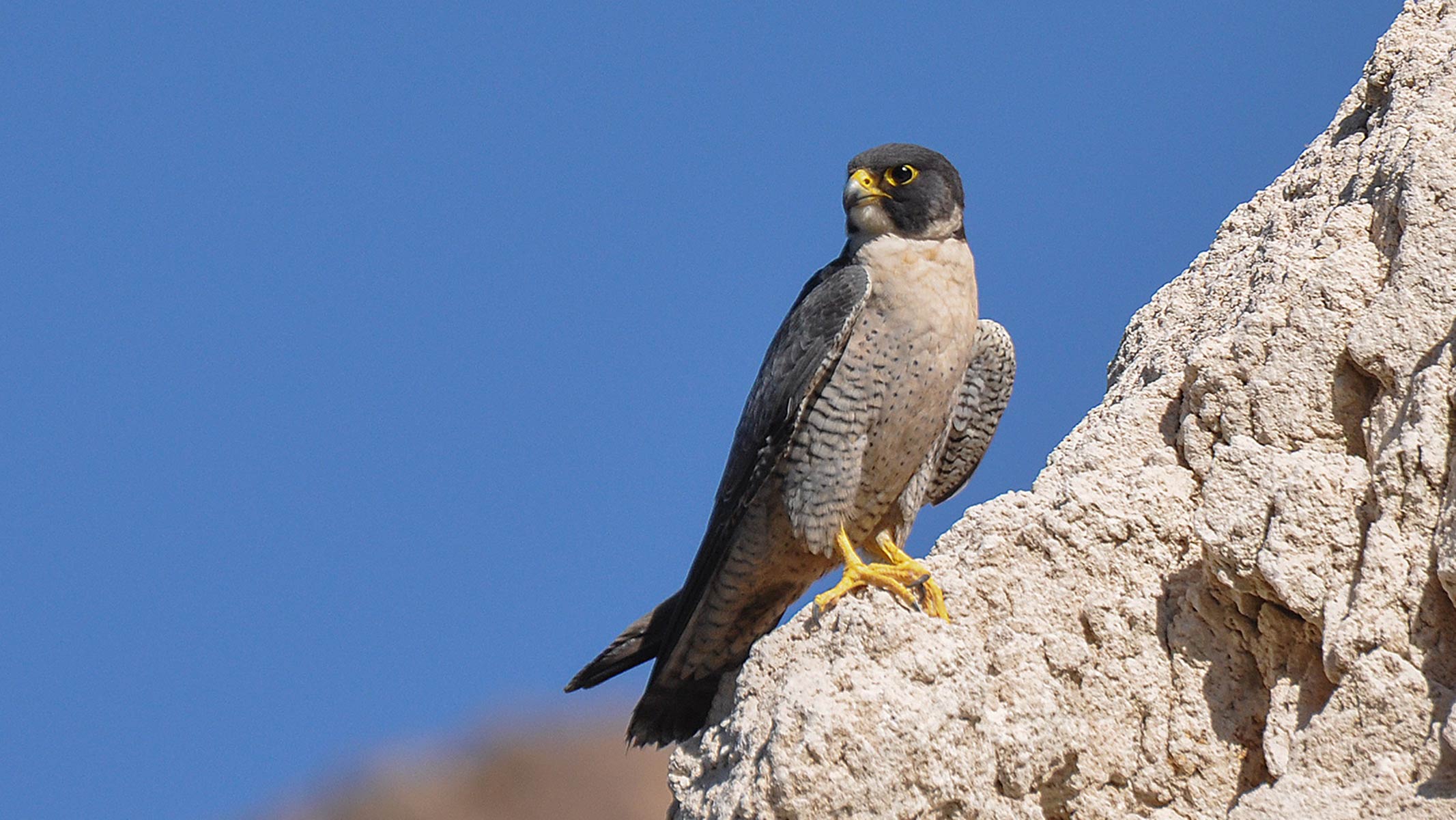
Watch Peregrine Falcons at Devils Courthouse
Peregrine falcon, once near extinction, now can be viewed in the skies over the Blue Ridge Parkway.
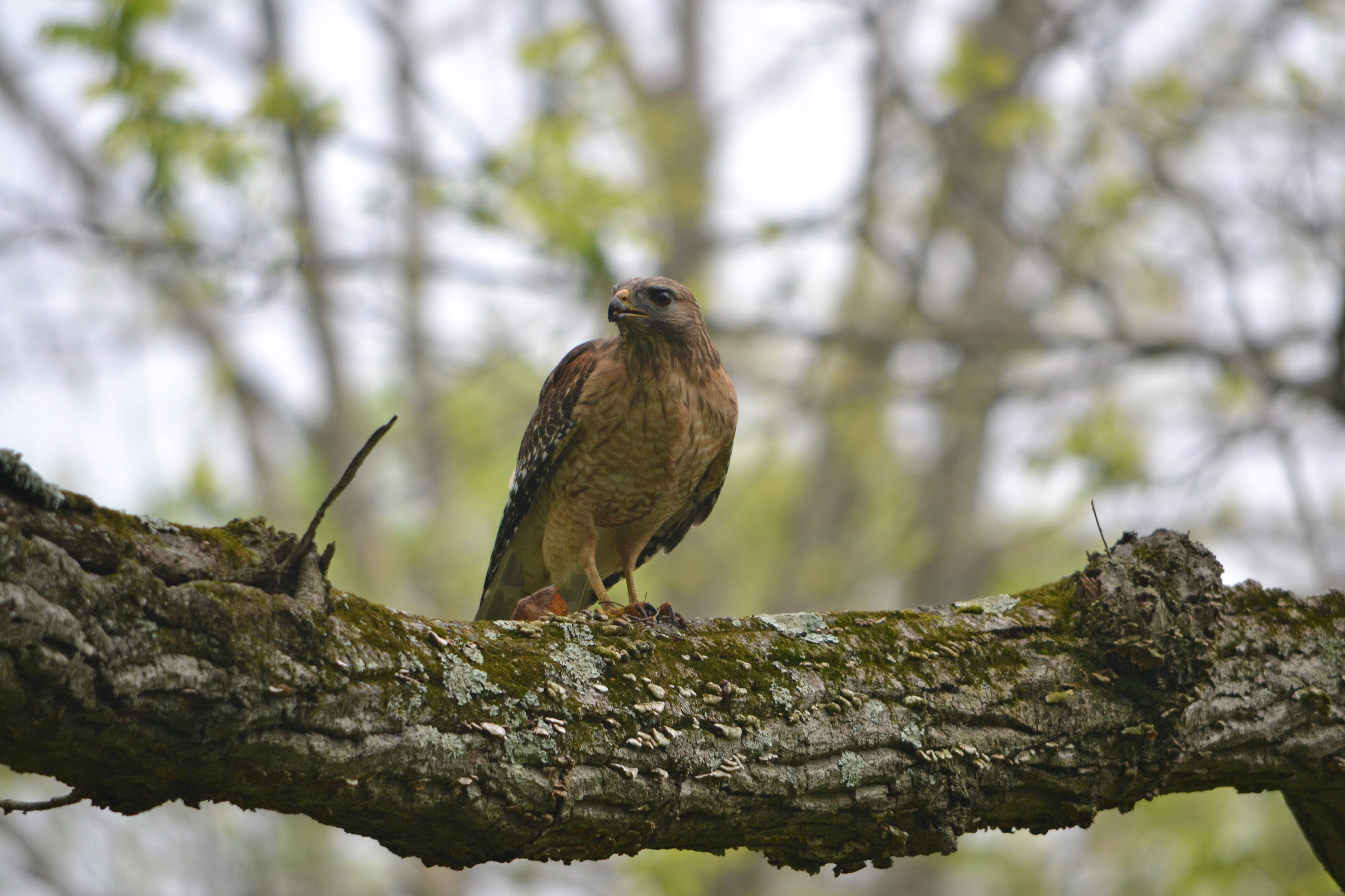
Watch for Hawks at the Mills River Overlook
The raptors are coming! And they’ve got the “kettle” on!
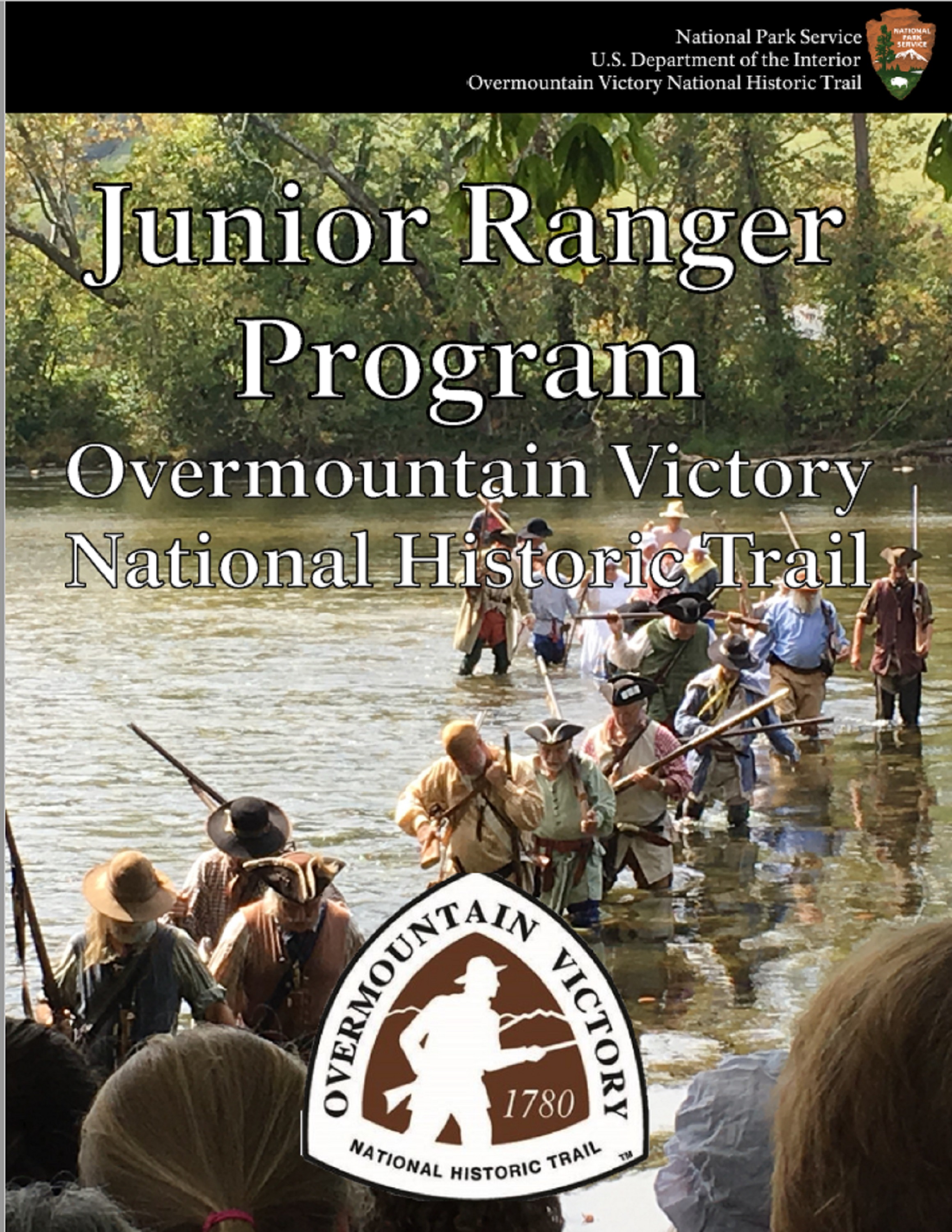
OVVI Junior Ranger
Overmountain Victory National Historic Trail Junior Ranger booklet and directions.
Hawk Watch at Harveys Knob
Every autumn, thousands of raptors ride the thermal updrafts of the Blue Ridge Mountains on their way to wintering grounds. You can watch the graceful flights of these soaring birds from Harveys Knob Overlook.
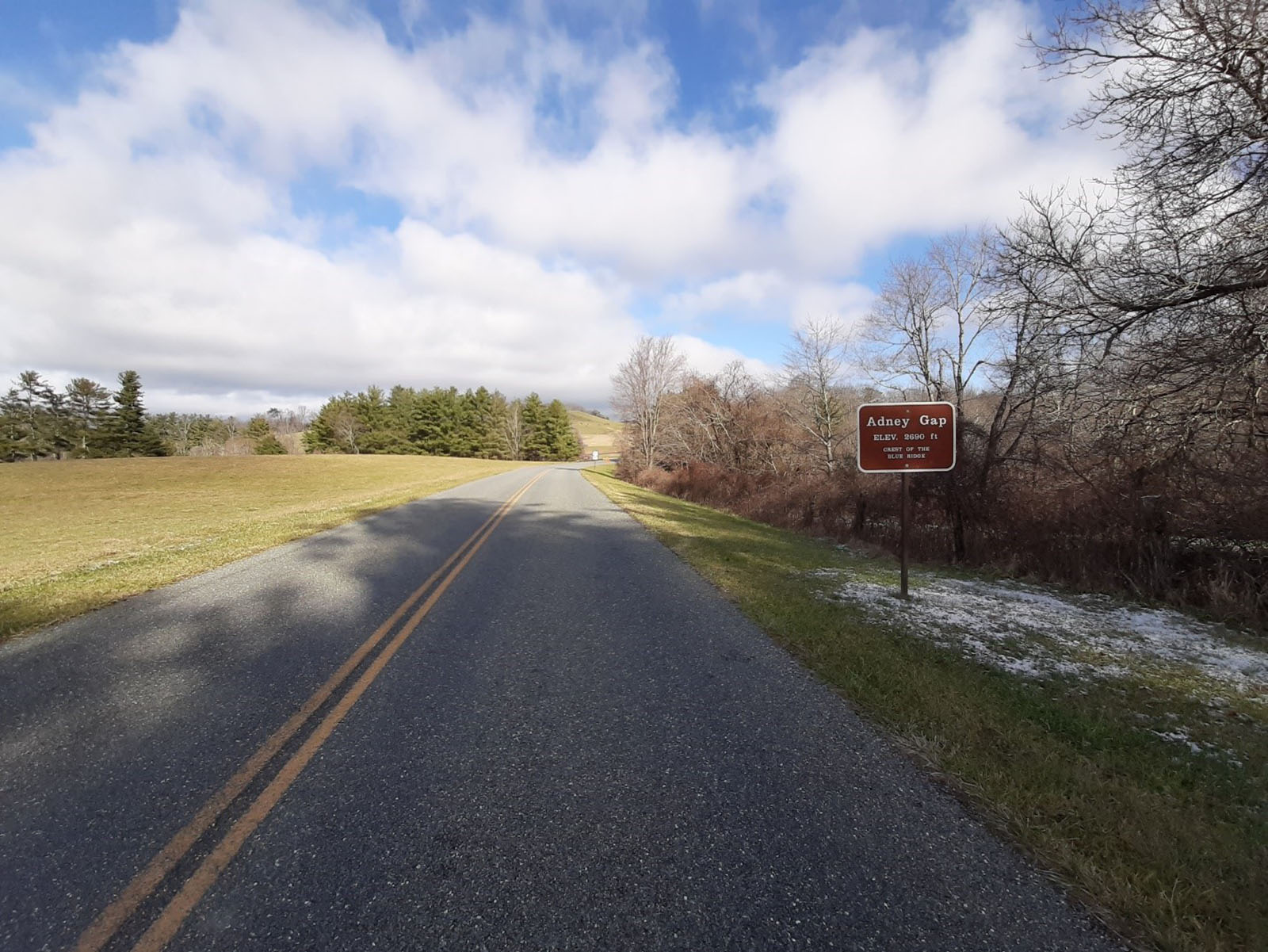
Visit Adney Gap
Take a scenic drive through Adney Gap around milepost 136 and experience one of the many mountain gaps that provided an important early tool in traversing the surrounding hills and mountains.
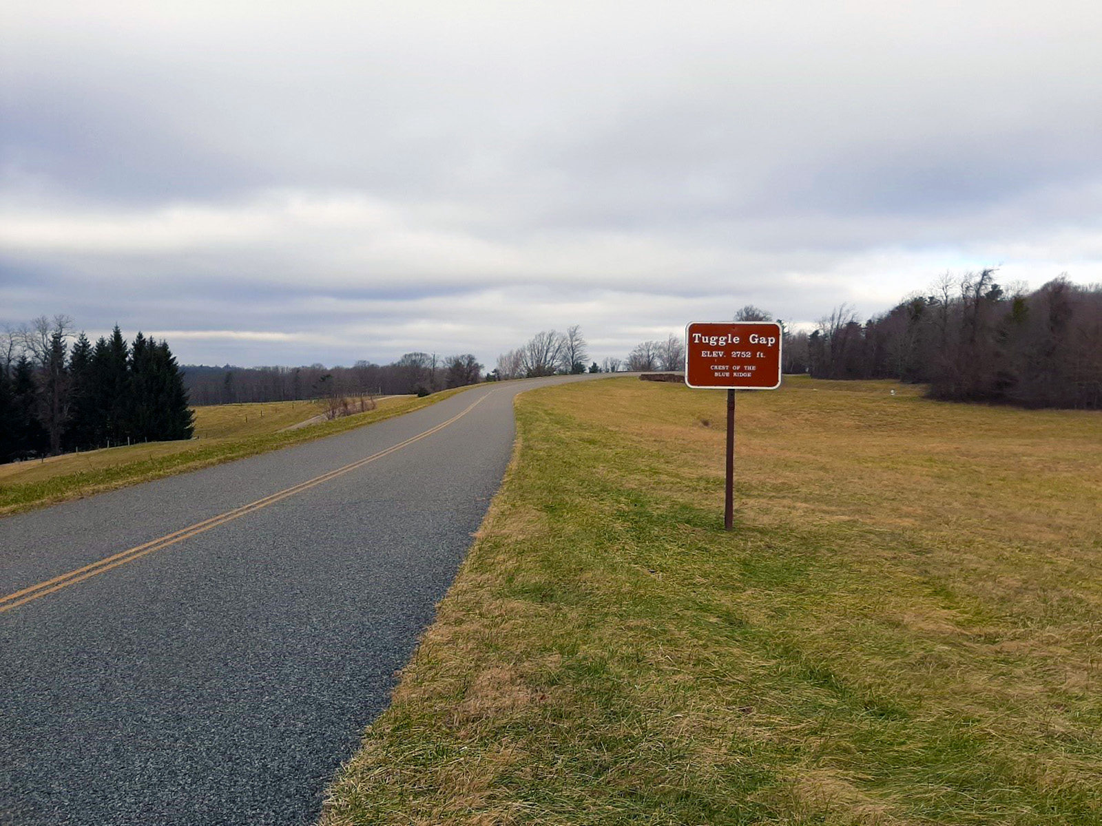
Visit Tuggle Gap
Take a scenic drive through Tuggle Gap to experience one of the gaps which provided early travelers passage through the mountains.
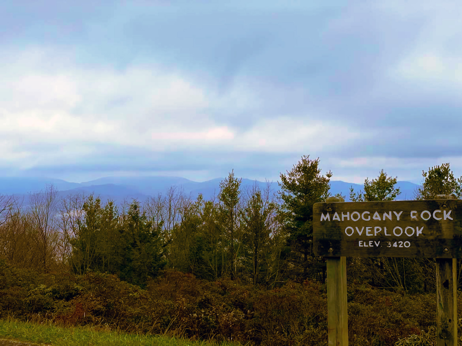
Mahogany Rock Overlook
Visit the Mahogany Rock Overlook for soaring views of Buck Mountain, Doughton Mountain, and Cheek Mountain among others. In the fall visitors are treated to spectacular views of migrating raptors.
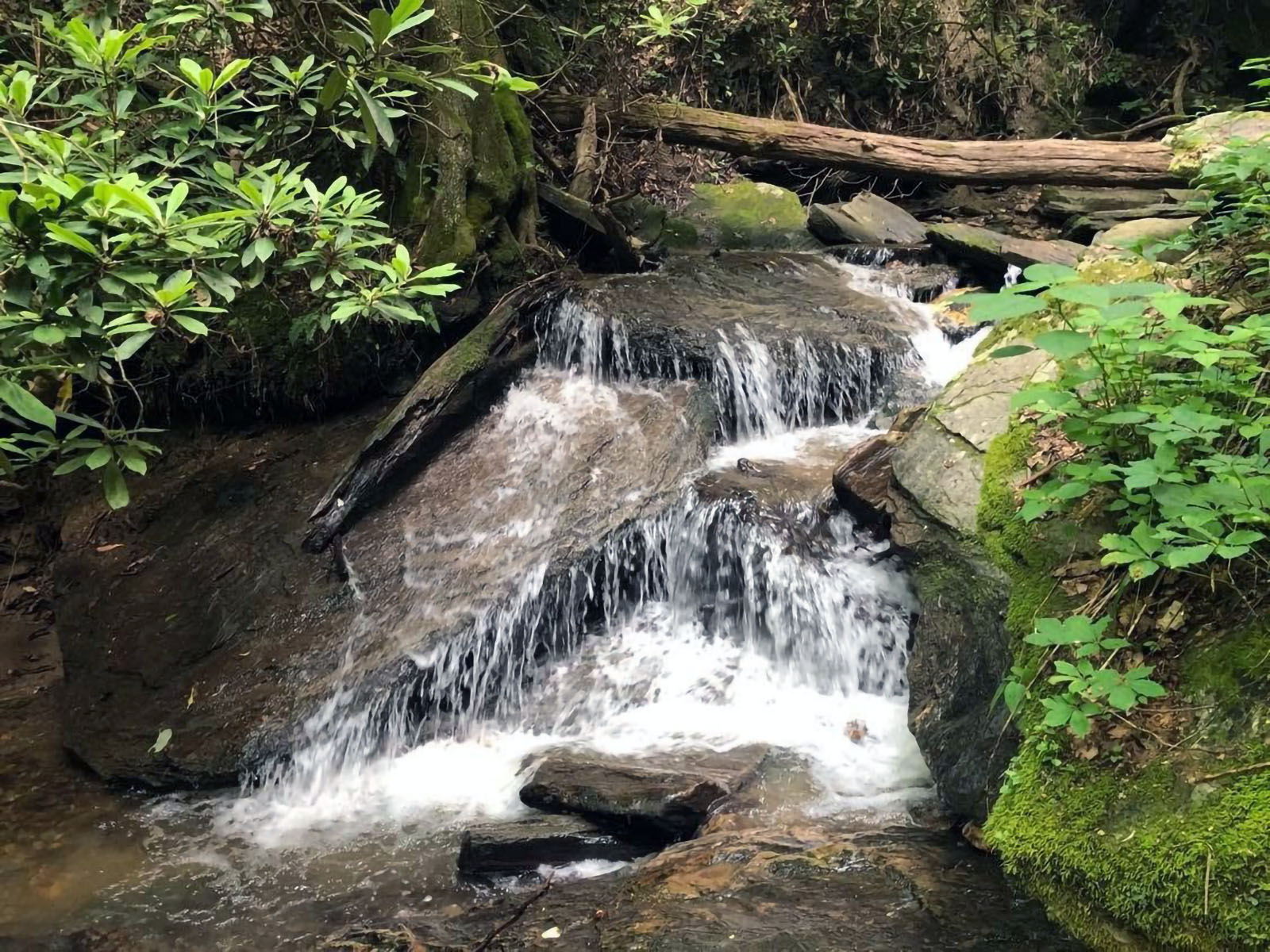
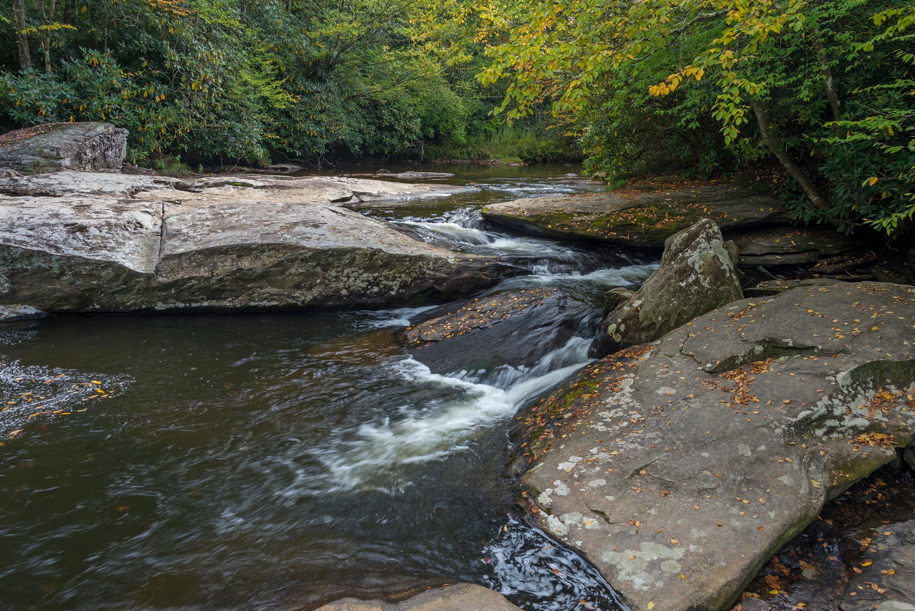
Hike the Gully Creek Trail Loop
While this hike is challenging, the trek is very rewarding for the seasoned hiker. The small cascades are pure magic!
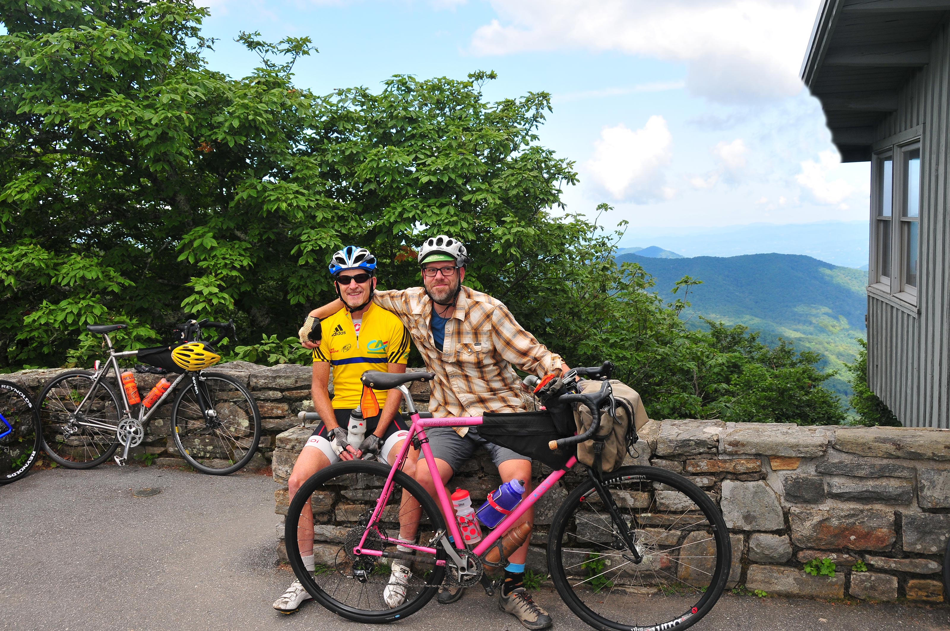
Bicycle the Blue Ridge Parkway
The Blue Ridge Parkway offers 469 miles of picturesque road cycling though the Virginia and North Carolina mountains.
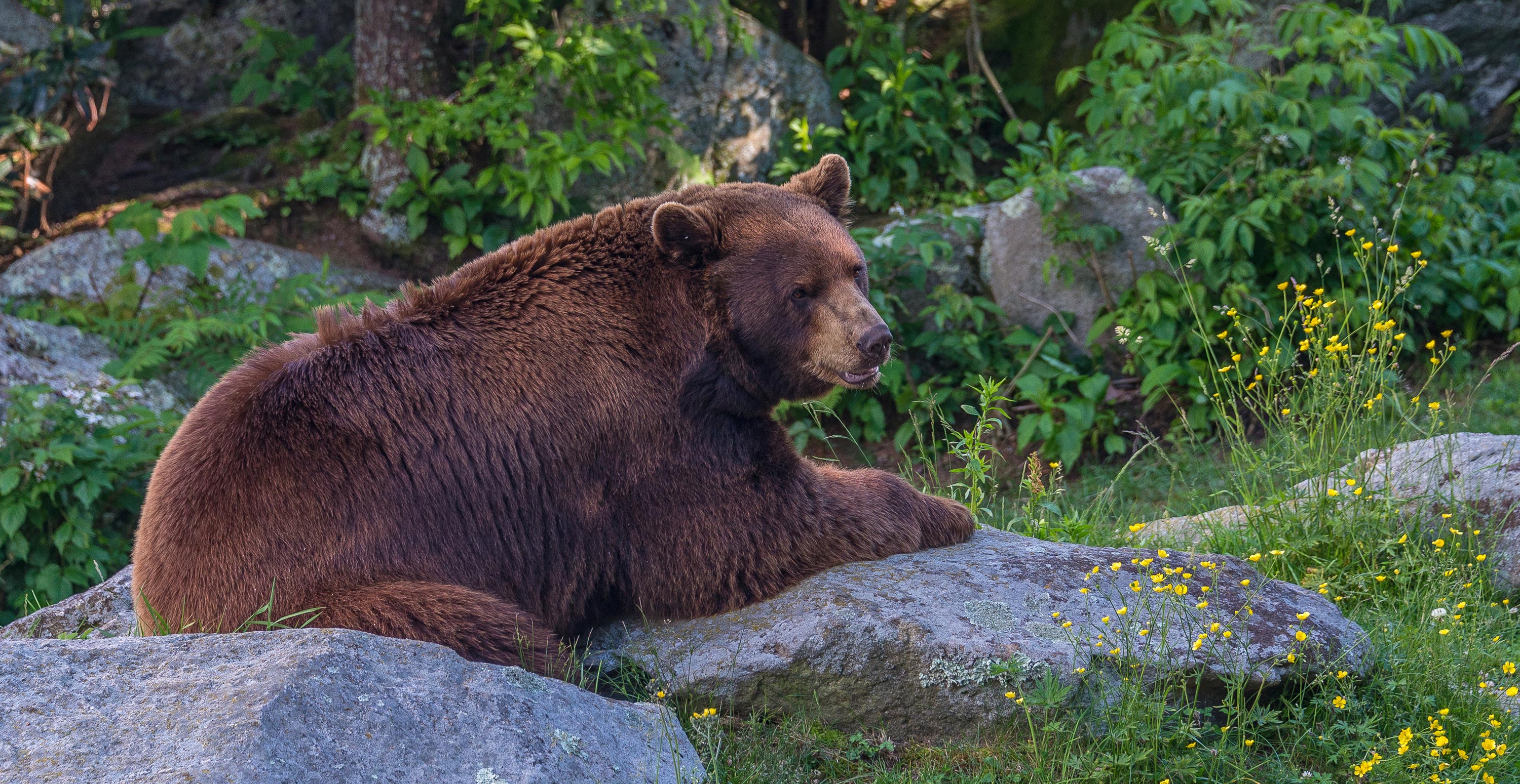
Save A Bear's Life
Your actions while visiting the parkway can have a direct and lasting impact on a black bear. Discover how YOU can save a bear's life!
Go Fishing in the Mountains
A mountaintop park may seem an unlikely place to fish, but just the opposite is true. The parkway protects over 100 miles of streams, many of them small, spring-fed watercourses that rise along the spine of the Blue Ridge. In addition, there are13 artificial lakes along the parkway.
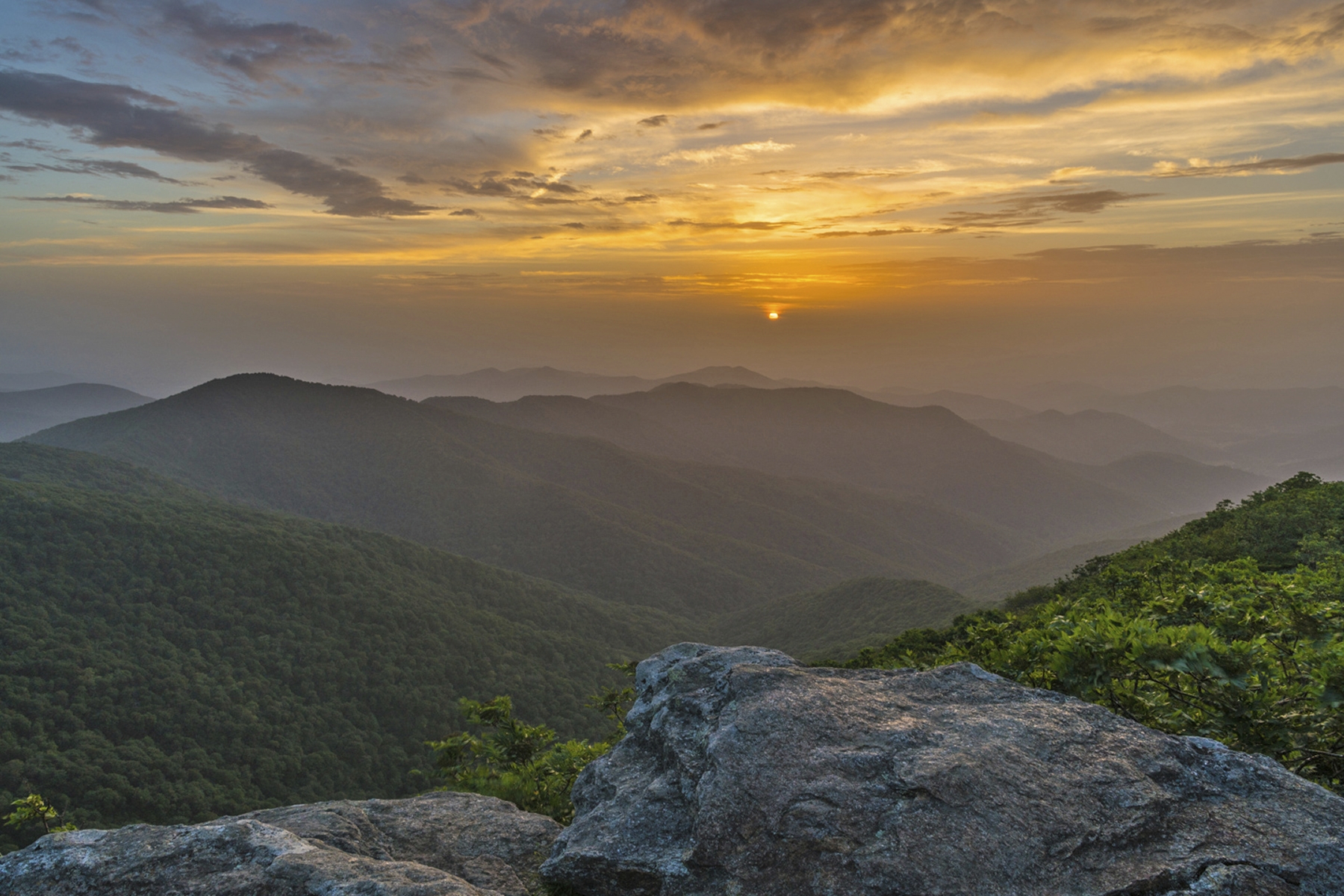
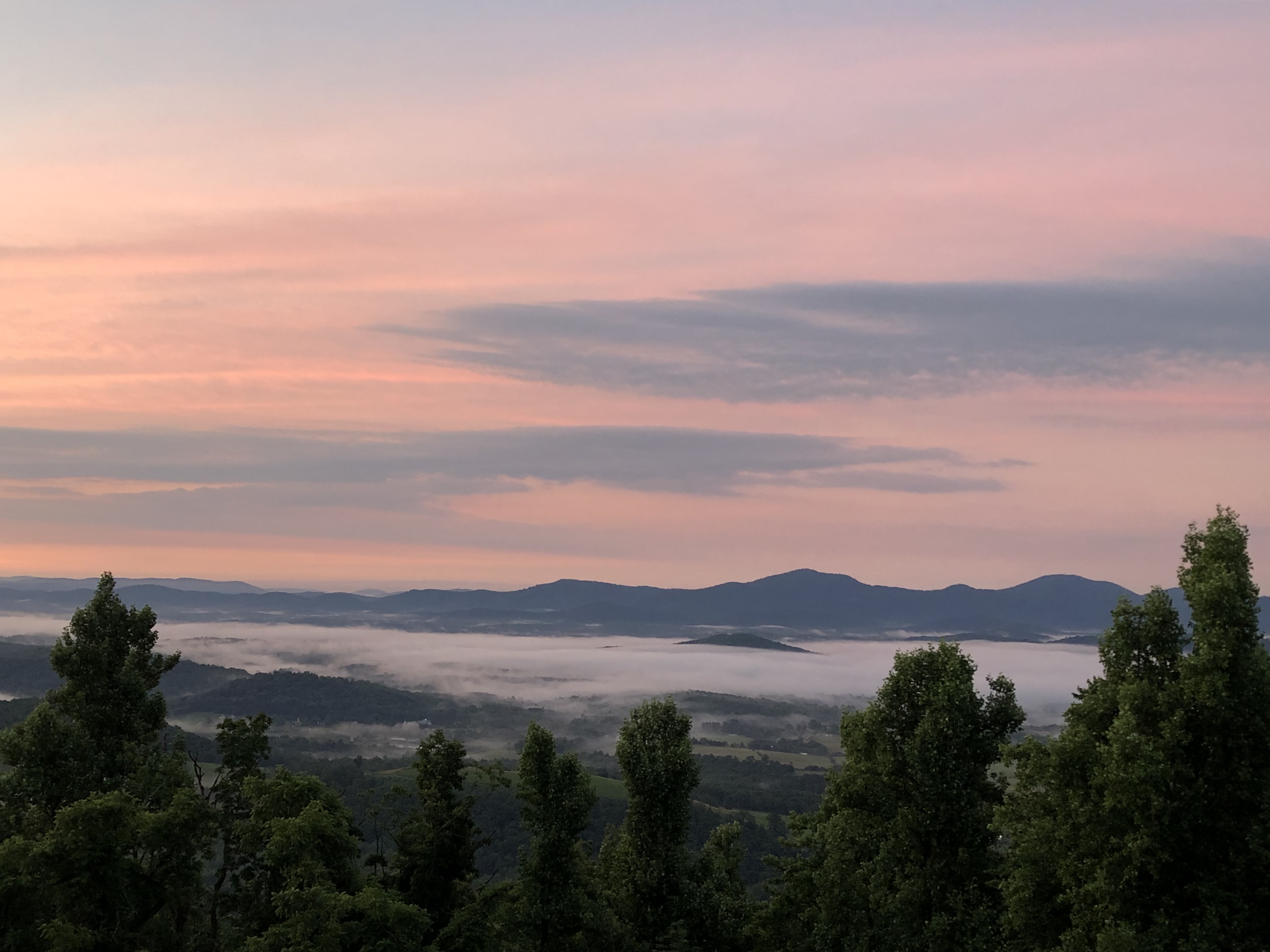
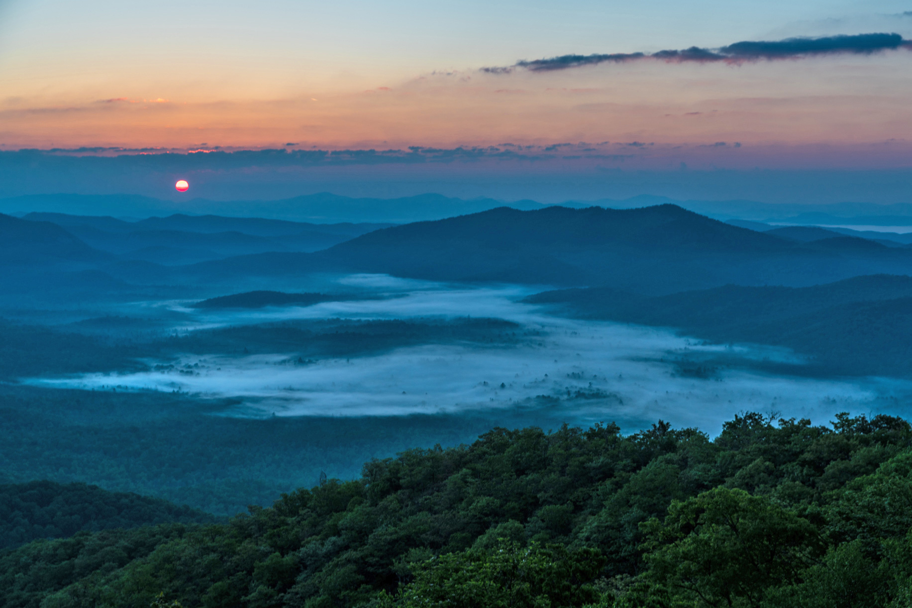
Enjoy Sunrise at the Afton Overlook
The Afton Overlook provides an excellent introduction to the Blue Ridge Parkway. The view is spectacular at any time, but the colorful skies produced at sunrise can be truly breathtaking. And remember: No two sunrises are the same. So if you can, plan a few return visits to this unique overlook.
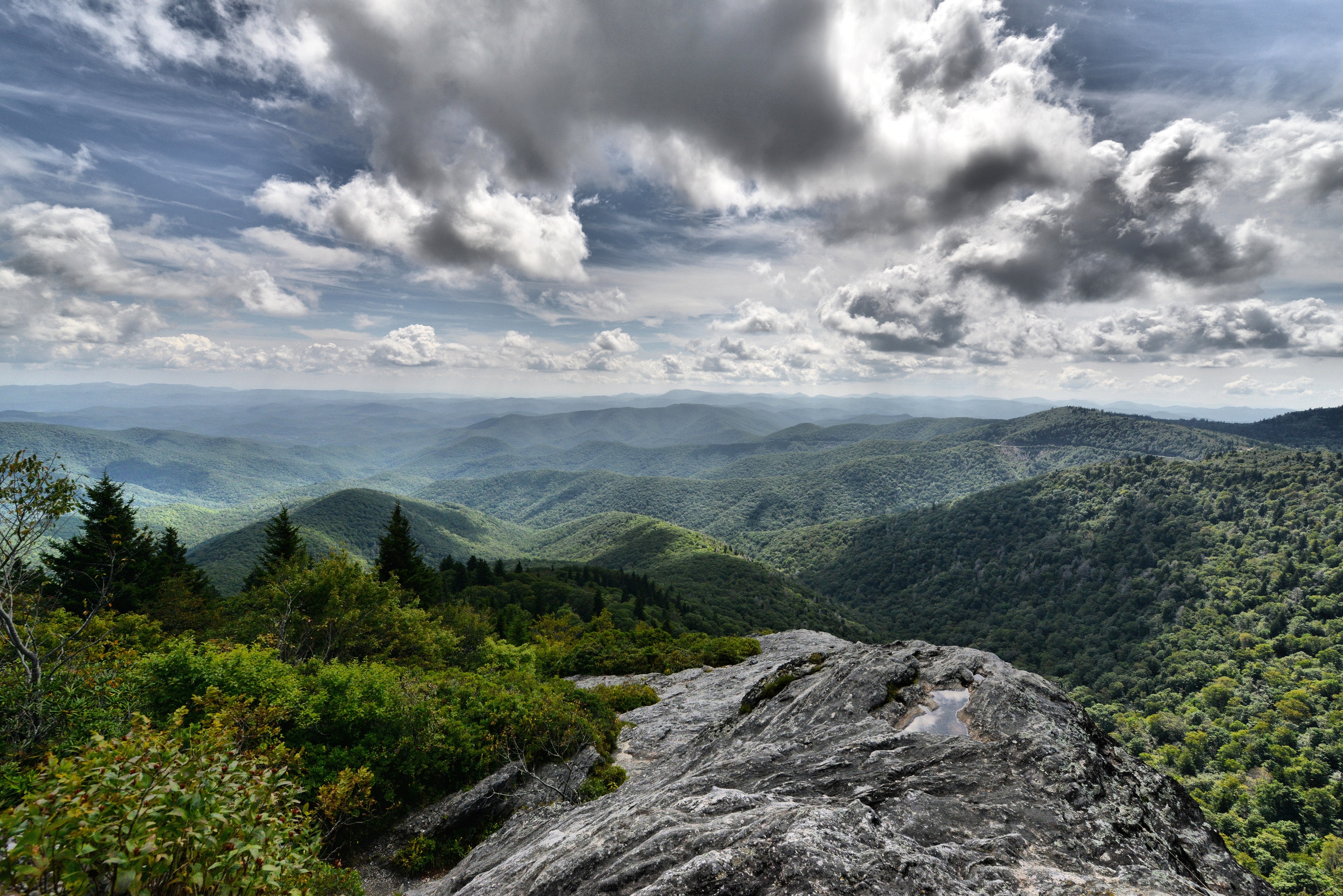
Hike the Devils Courthouse Trail
Make the steep 0.5 mile climb to the top of Devils Courthouse for one of the most fantastic views on the Blue Ridge Parkway. Enjoy breath-taking, panoramic views of the surrounding mountains and the valley below from one of the most unique vantage points on the Parkway.
See the Rhododendrons Bloom at Craggy Gardens
Colorful rhododendron blossoms put on a show each summer along the Blue Ridge Parkway and one of the best places to see these high-elevation flowers is at Craggy Gardens.
Look for Migrating Monarch Butterflies
Among the fall wildflowers, and drifting on invisible wind currents high above you, look for the jewel tones of monarch butterflies as the insects pass through the parkway's high elevations on their seasonal migration.
Hike the Blue Ridge Parkway Visitor Center Loop Trail
The Blue Ridge Parkway Visitor Center Loop Trail is a short, easy hike that is popular with all ages. Locals and visitors alike enjoy this leg stretcher trail and its close proximity to Asheville.
Hike the High Meadow Trail at the Blue Ridge Music Center
A hike on the family-friendly High Meadows Trail leads up and down rolling grassy meadows and through a mix of deciduous and evergreen forests. Pick up some Kids In Park TRACK Trail brochures at the trailhead to add adventure to your kid's hike. The trail provides a quiet retreat with limited interaction with other visitors, regardless of the season.
Hike the Roanoke River Trail
The ideal hike for someone who likes water, bridges, woods—and doesn’t feel like committing an entire afternoon to a hike. Roanoke River Trail is an an easy trail that covers less than a mile. It makes a perfect leg stretcher hike as you pass through Roanoke.
Watch the Sunrise at Pine Tree Overlook
There are many places to view a sunrise along the Blue Ridge Parkway, but the sun rising over the Peaks of Otter at Pine Tree Overlook is a stand out favorite on the northern end of the parkway.
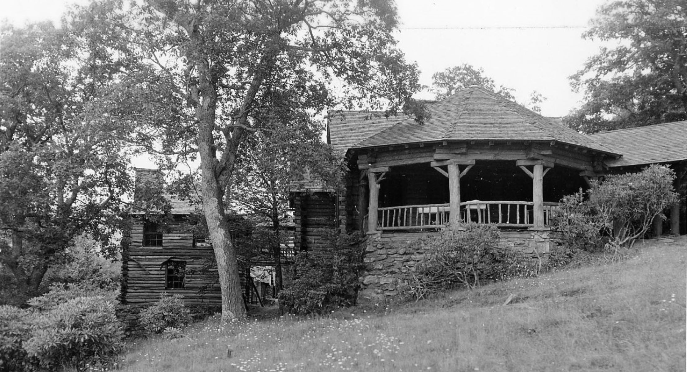
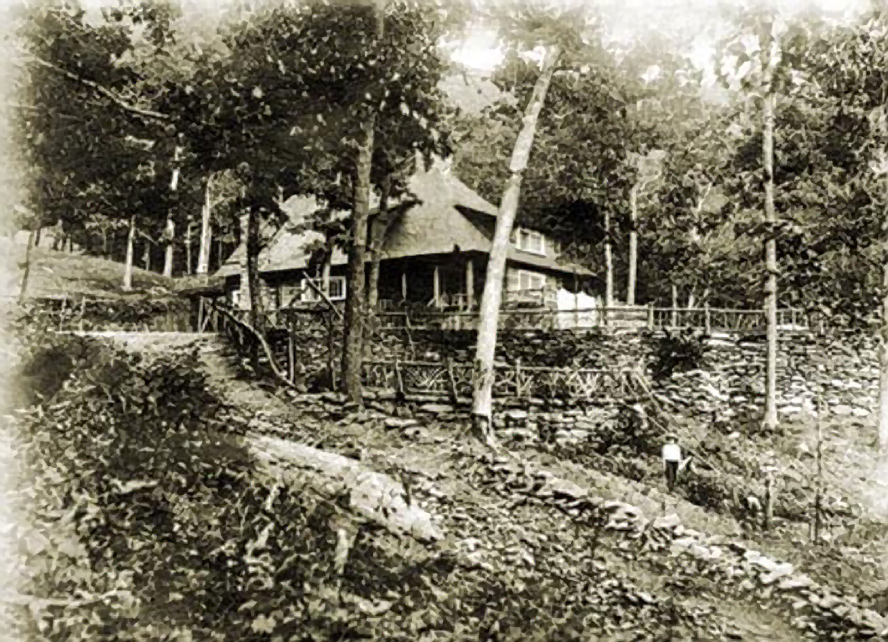
Hike to Rattlesnake Lodge
Step back in time with a hike to historic Rattlesnake Lodge. This enjoyable hike through shaded woodlands is close to Asheville and takes you to the remains of an early1900’s mountain retreat.
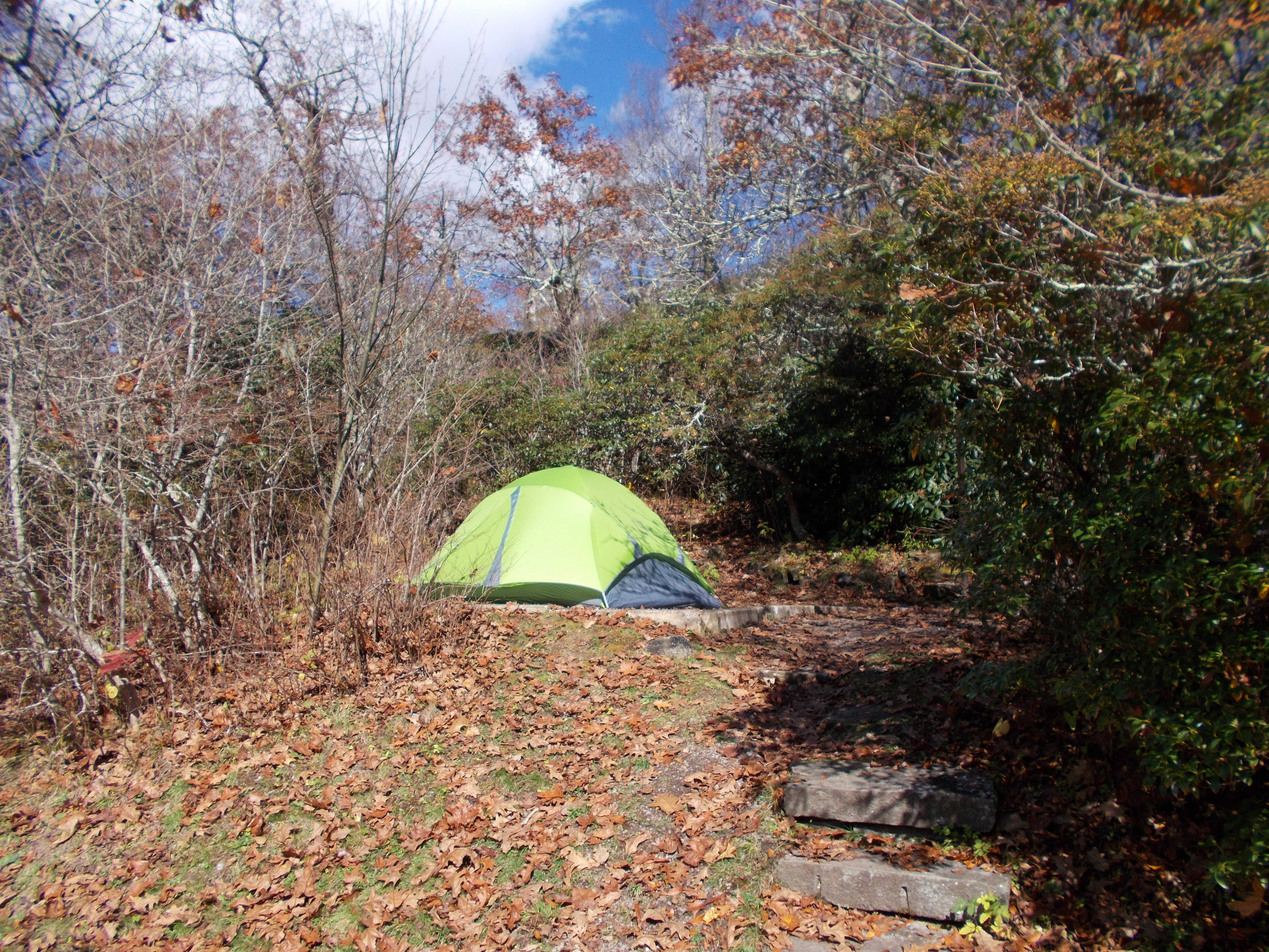
Spend the Night in the Mount Pisgah Campground
The Mount Pisgah Campground is a cool, high elevation retreat in the summer's heat. This peaceful and relaxing spot is the perfect place to stay and explore the southern end of the Blue Ridge Parkway.
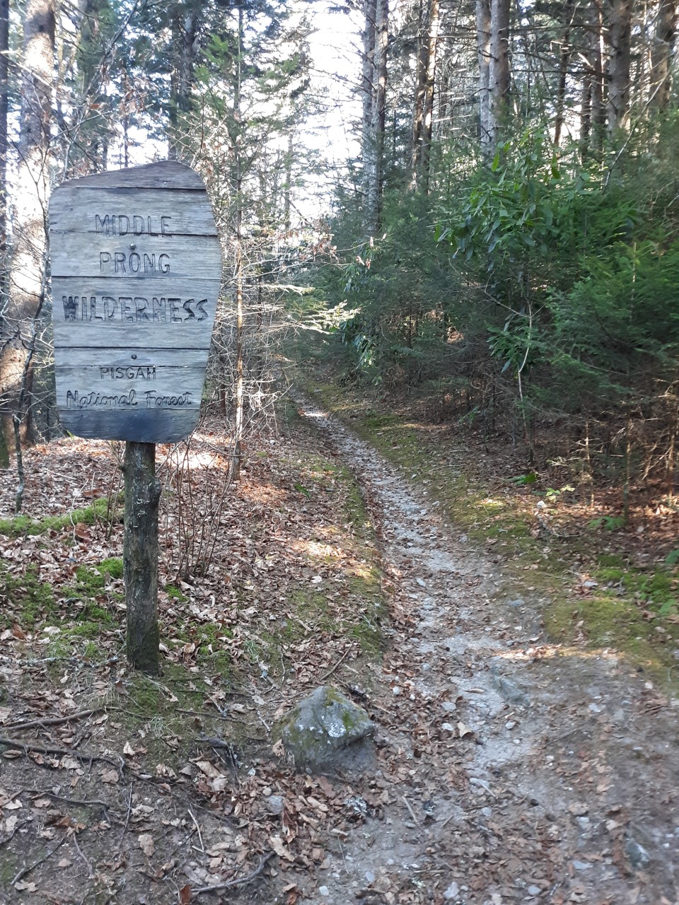
Explore the Middle Prong Wilderness
Want to take a walk on the wild side? Try a hike in the Middle Prong Wilderness! Adjacent to the Blue Ridge Parkway, this wilderness area protects a beautiful forest and has ample opportunities for solitude.
Watch the Sunrise from Pounding Mill Overlook
Sunrise on the Blue Ridge Parkway can be an amazing, once-in-a-lifetime experience. Pounding Mill Overlook at Milepost 413 is a great place to welcome the dawn of a new day and appreciate the natural beauty of this special place.