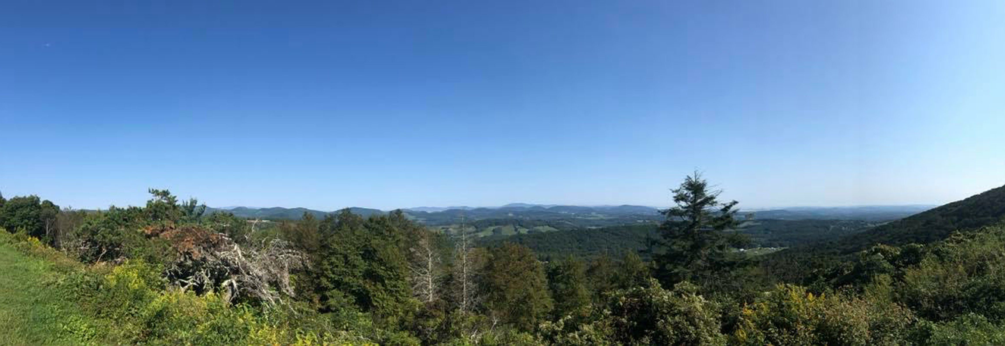
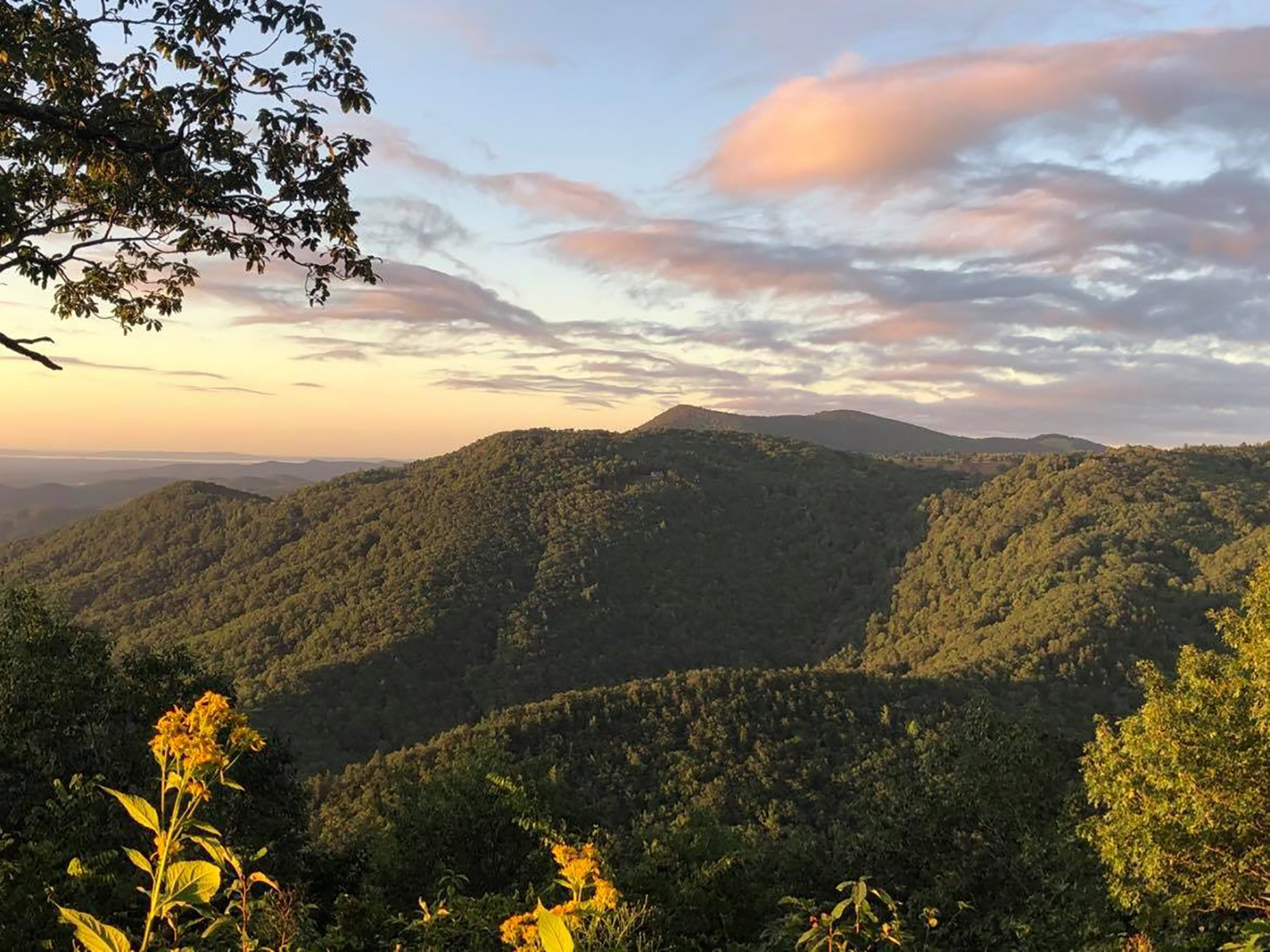
Air Bellows Overlook is known as the Crest of the Blue Ridge, as it offers a panoramic view of the surrounding North Carolina and Virginia countryside.
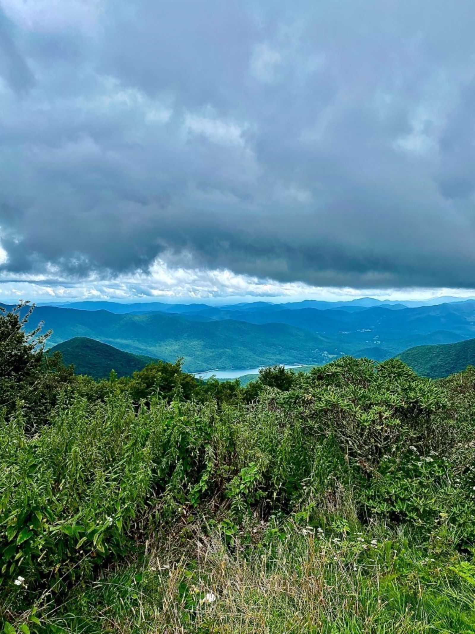
Located between Milepost 355 and 370 along the Blue Ridge Parkway, the Asheville Watershed is where Asheville gets it water. It has the capacity to produce and deliver 43 million gallons of water to city residents per day. The North Fork Reservoir, one of two artificial lakes within the watershed, is visible from several overlooks along the Parkway.
This spot offers views down into the Basin Cove community, named after the cove was devastated by the 1916 flood; Caudill Cabin is a lone reminder of the community.
Beaver Dam Gap Overlook is one of the less frequented spots to stop and relax on the Parkway. Place a blanket in the grass for your picnic spread. It’s a great place to take a moment and slow down. The Mountains-to-Sea Trail can be accessed at this overlook.
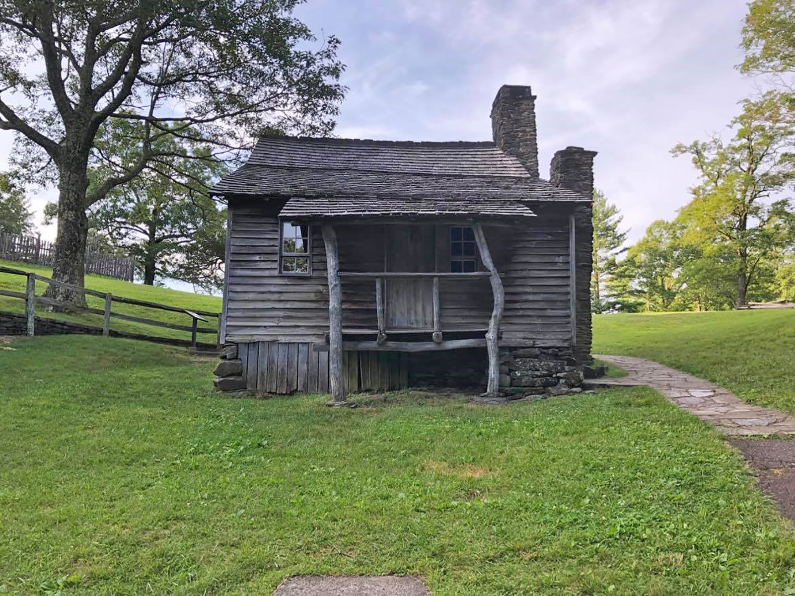
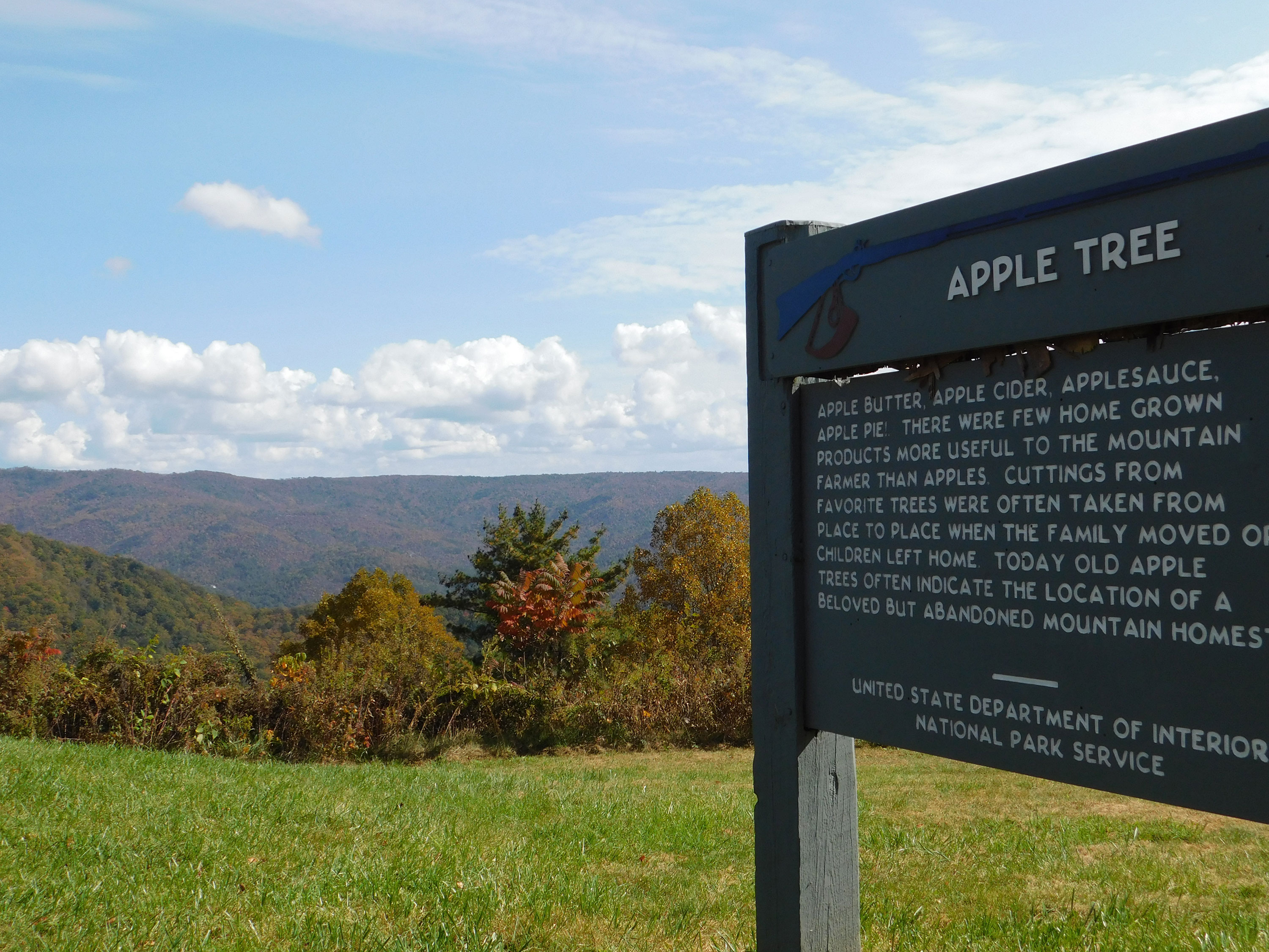
For nearly sixty years, Martin and Caroline Brinegar lived on this 125-acre farm leading lives based on hard work, self-sufficiency, and an abiding religious faith. Descendants of their three children often come here to visit the homeplace.
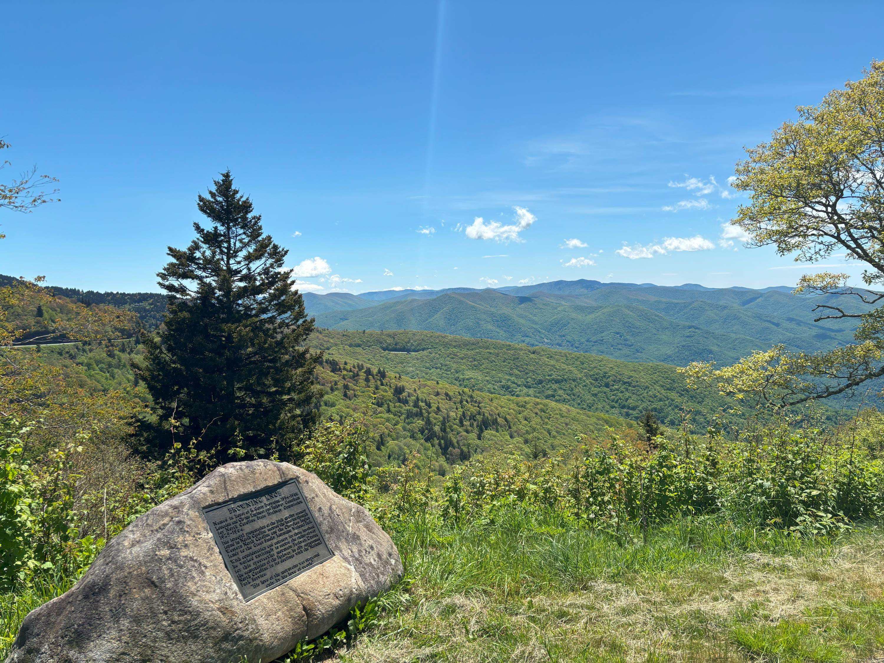
Browning Knob Overlook is on the entry road to the Waterrock Knob Visitor Center at milepost 451.2. The overlook was named in honor of R. Getty Browning. He was the Federal Parkway Engineer and the Senior Locating and Claim Engineer for the Blue Ridge Parkway. It was his work that guided the initial exploration and design of the parkway. The overlook is at an elevation of 5770 feet looking towards Browning Knob which is 6260 feet of elevation.
Bull Creek Valley is a scenic overlook north of Asheville that gets less traffic than other areas. Stop by on your way to Craggy Gardens for a nice taste of the mountains!
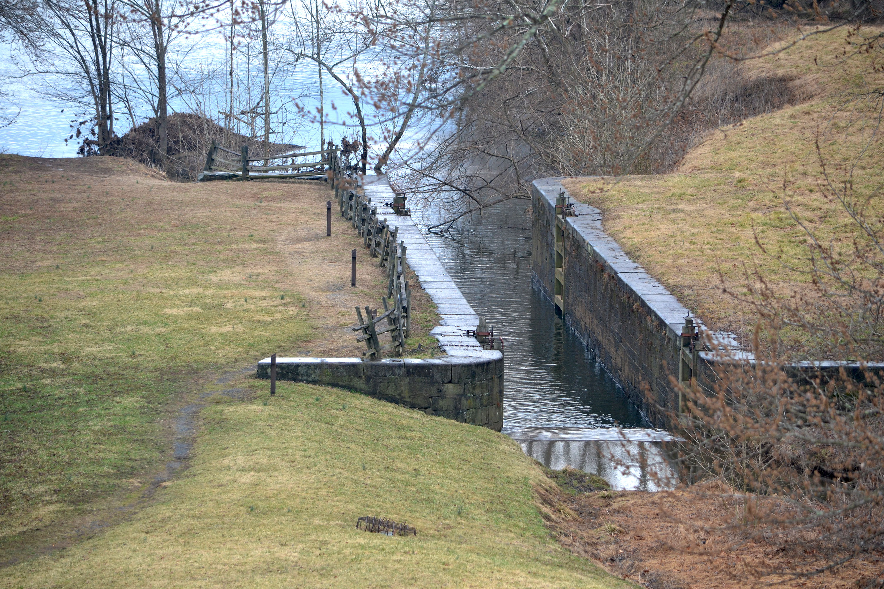
The James River and Kanawha Canal stretched 196 miles from Richmond to Buchanan, Virginia during the 1800s. It provided a vital water transportation link between the Great Valley and international markets. The Parkway currently preserves several remnants of the old canal to see and explore.
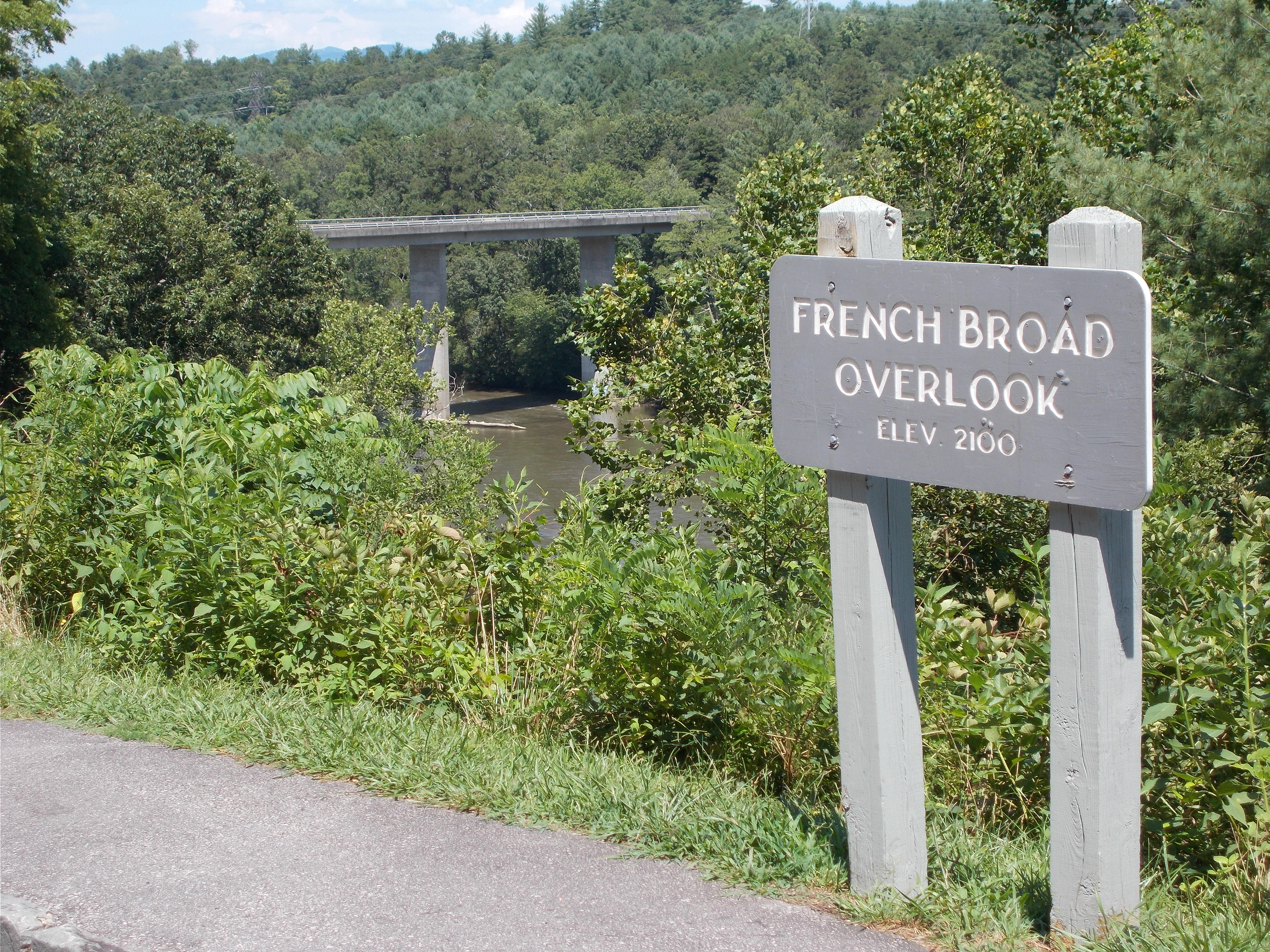
A window to the French Broad river valley and the expansive mountains beyond. Take a moment to pull over, step out into the serenity of nature and let the rush of life go.
This overlook is a short drive from Mount Pisgah, the Pisgah Inn, and Hwy 276. It provides views of the 6,000 foot Cold Mountain as well as the Shinning Rock Wilderness.
A stunning overlook along the southern end of the Blue Ridge Parkway. Cowee Mountain Overlook provides 180 degree unobstructed views of the surrounding mountains. A don't miss stop along your drive!
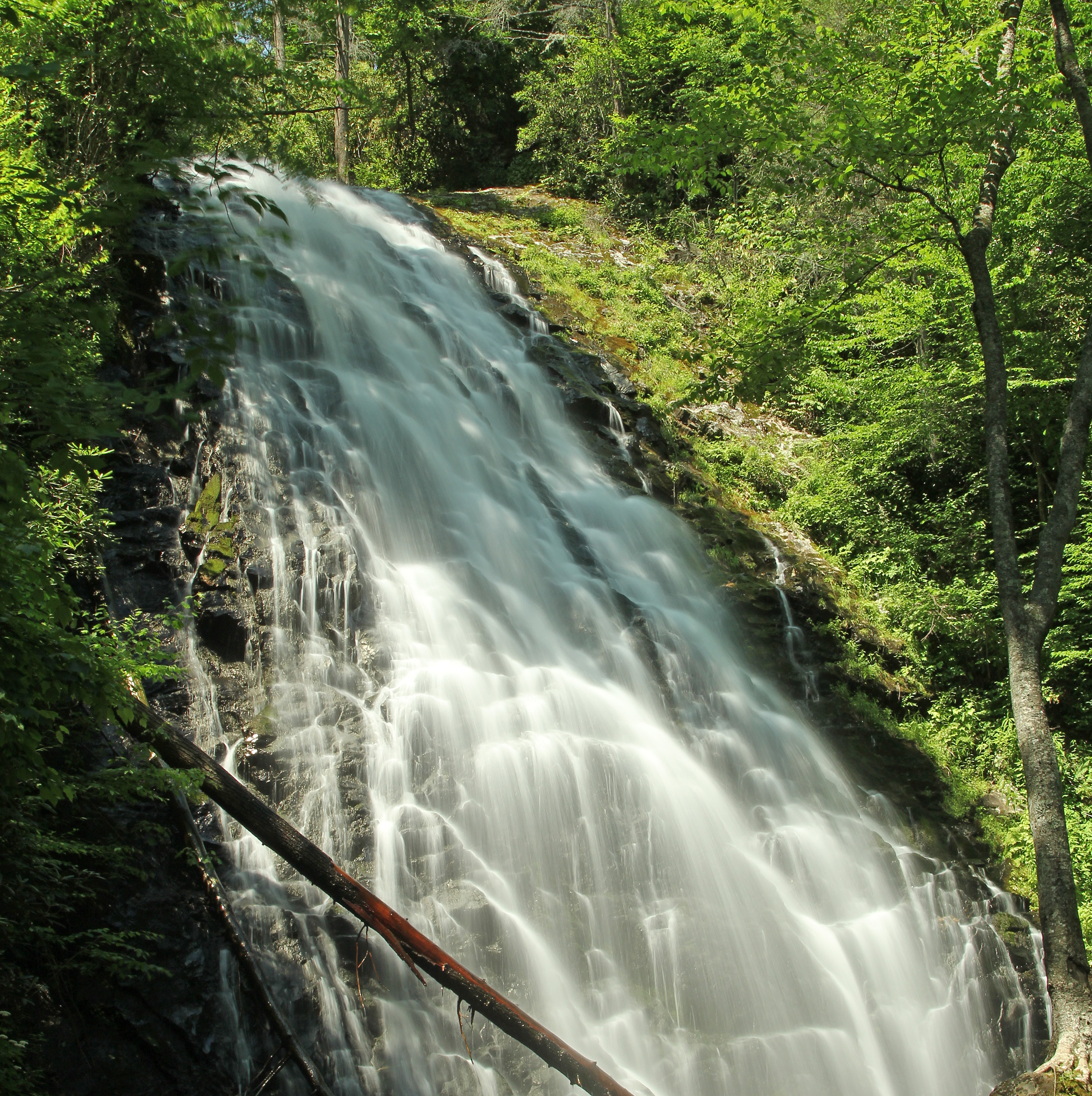
The tallest single waterfall on the Blue Ridge Parkway and beautiful open meadows attract visitors to Crabtree Falls Recreation Area, a rare open area before the parkway enters the Black, Craggy, Pisgah and Balsam mountain ranges. Take a leisurely stroll through the campground and open areas or a more strenuous 2.6-mile loop hike to view the waterfall and woodland habitat. At the base of the waterfall, ferns and wildflowers thrive in the mist.
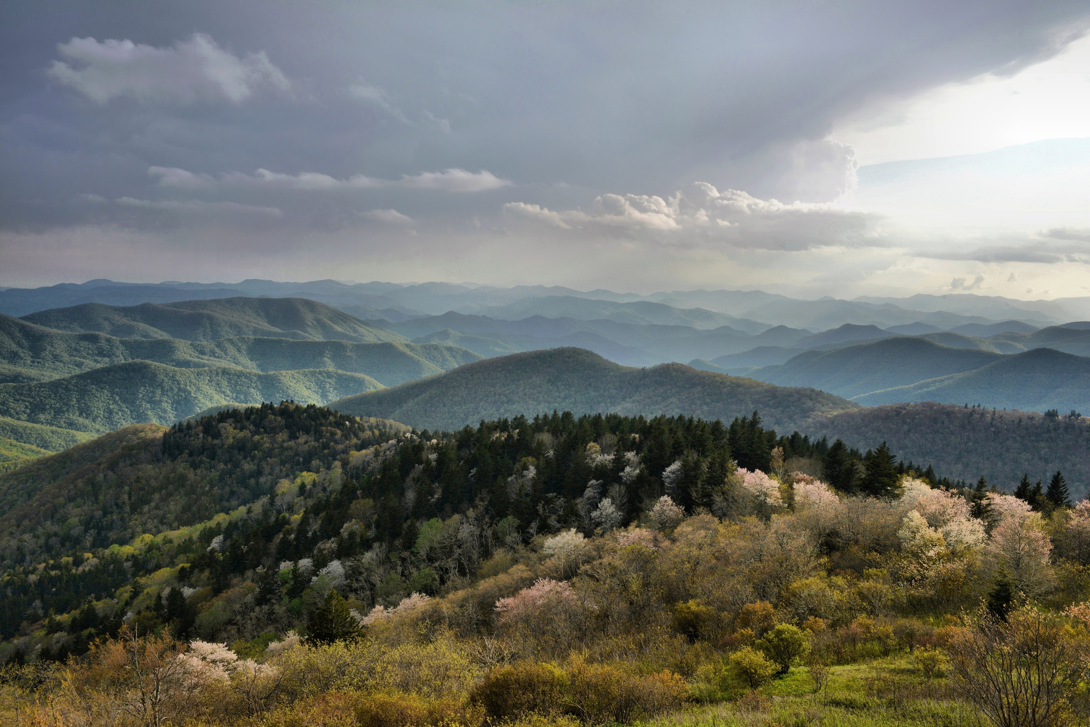
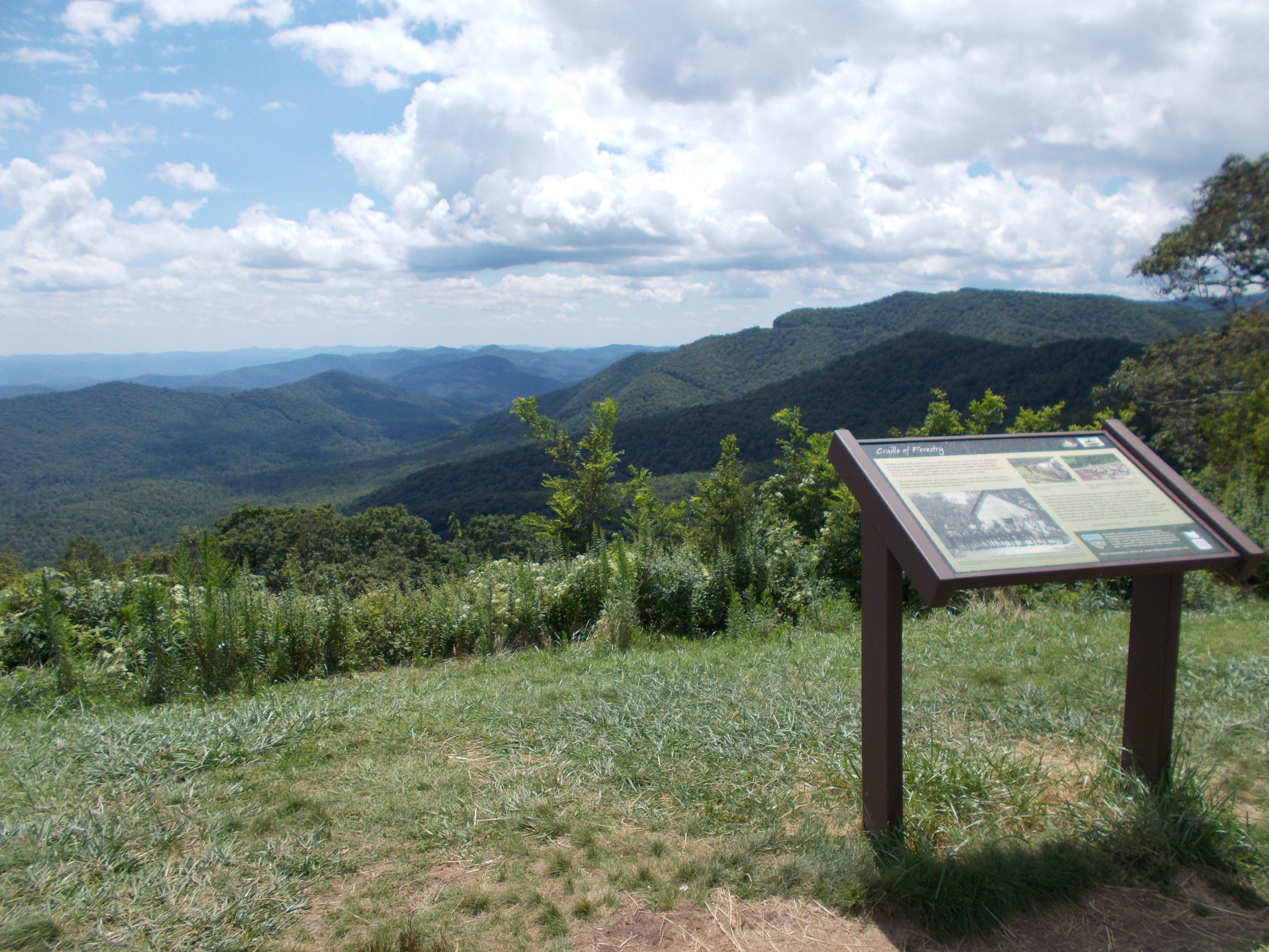
Cradle of Forestry Overlook has gorgeous eastern views from the Blue Ridge Parkway overlooking the Pisgah National Forest and the site of America's first forestry school.
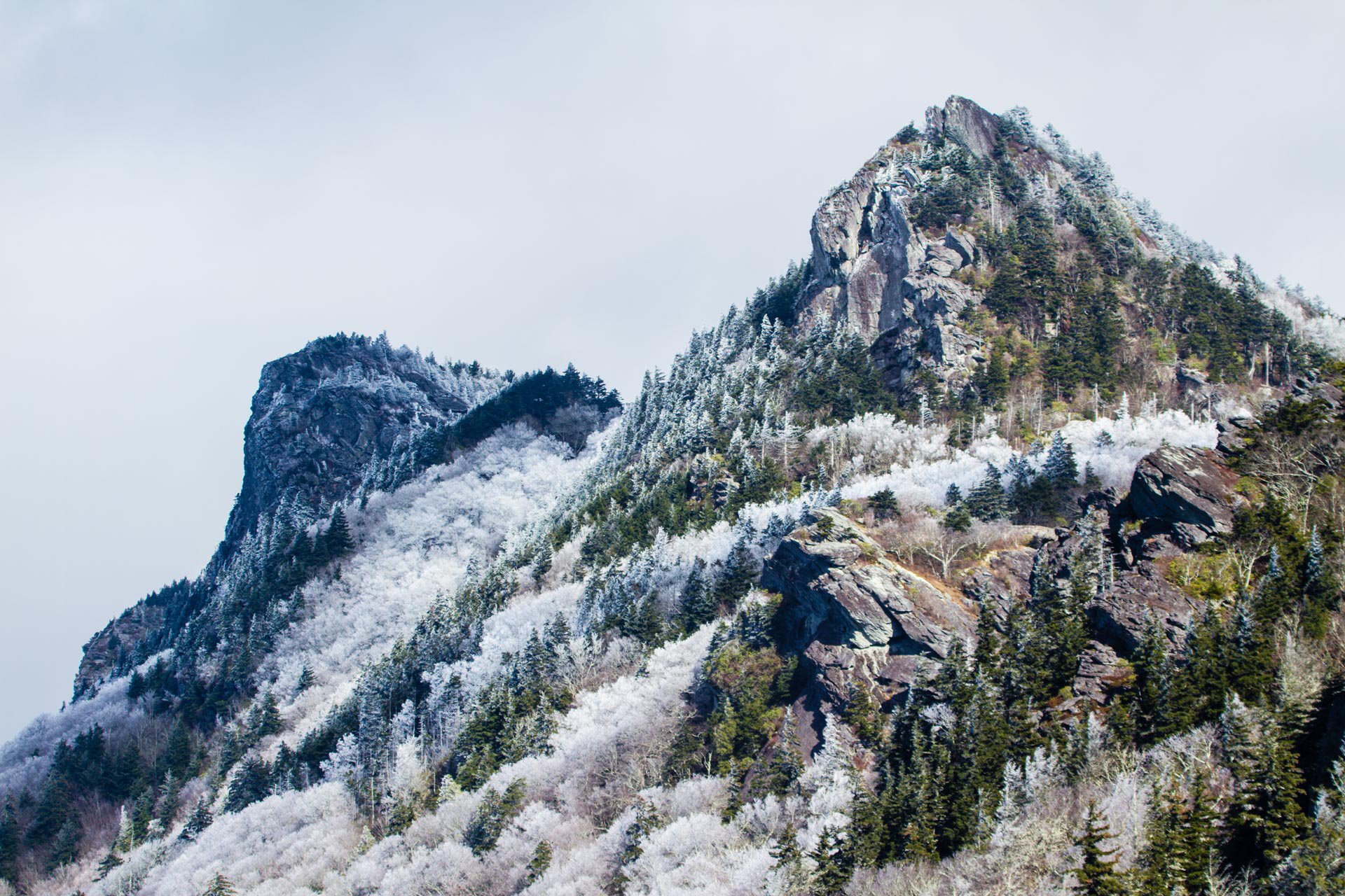
Want to feel like you’re on top of the world? Craggy Gardens is over 3,000 feet higher than the surrounding valleys. Hikes, a picnic area, and visitor center make this the ideal place to spend the day.
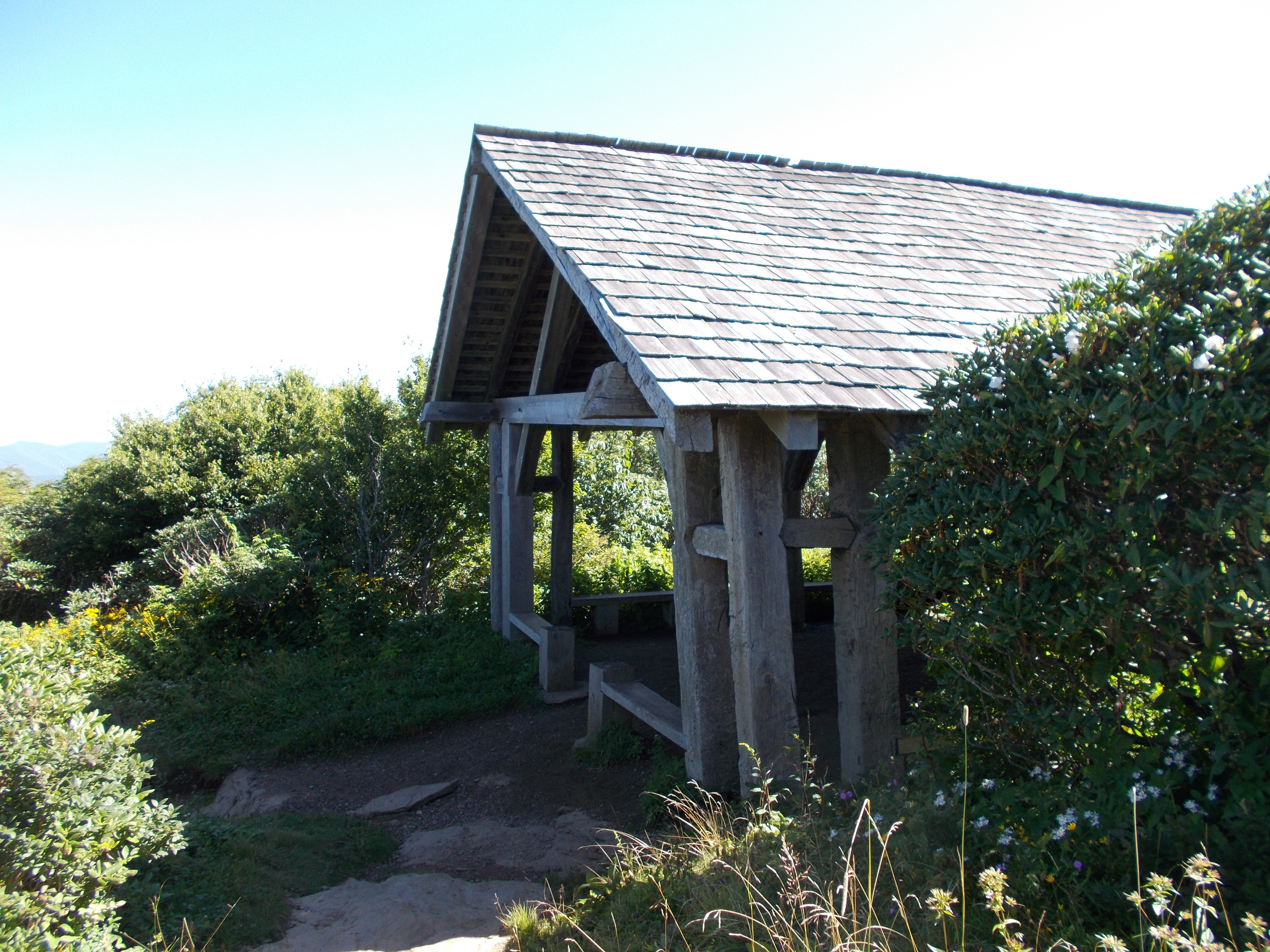
The Craggy Gardens Trail Shelter is a relaxing spot at the high point of the Craggy Gardens Trail with amazing views from the adjacent meadow bald and chances to see a wide array of blooming flowers from spring to late fall. The shelter is also a historic CCC structure that pre-dates the Parkway and stands as a reminder of our past.
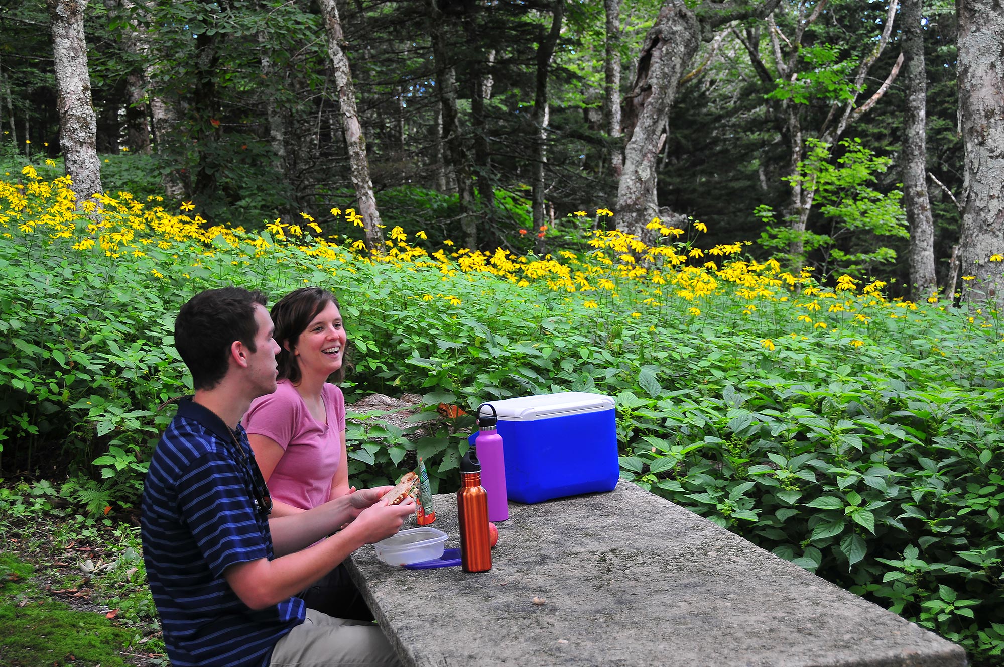
Craggy Gardens Picnic Area provides a summer retreat from the heat just a short drive from the Asheville area. At an elevation of 5,270 feet, temperatures are typically 10 – 15 degrees cooler than low lying areas nearby. Whether driving the Blue Ridge Parkway or getting away for the day, enjoying a picnic at this picnic area can round out a mountain pleasure trip.
Craven Gap provides access to the Mountains-to-Sea Trail within 15 minutes of downtown Asheville. This well-maintained, moderate section of the trail is popular with both locals and visitors for its ease of access, abundant wildflowers, and fall colors.
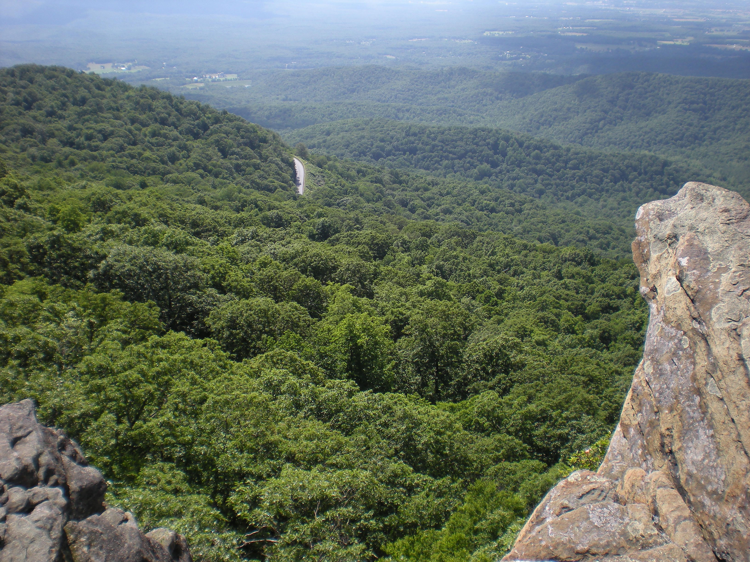
Located at Milepost 422 along the Blue Ridge Parkway, Devils Courthouse offers a large parking area and unobstructed views of the prominent rock formation, which rises 5,720 feet above sea level. On a clear day, visitors can see four states from the top of the formation.
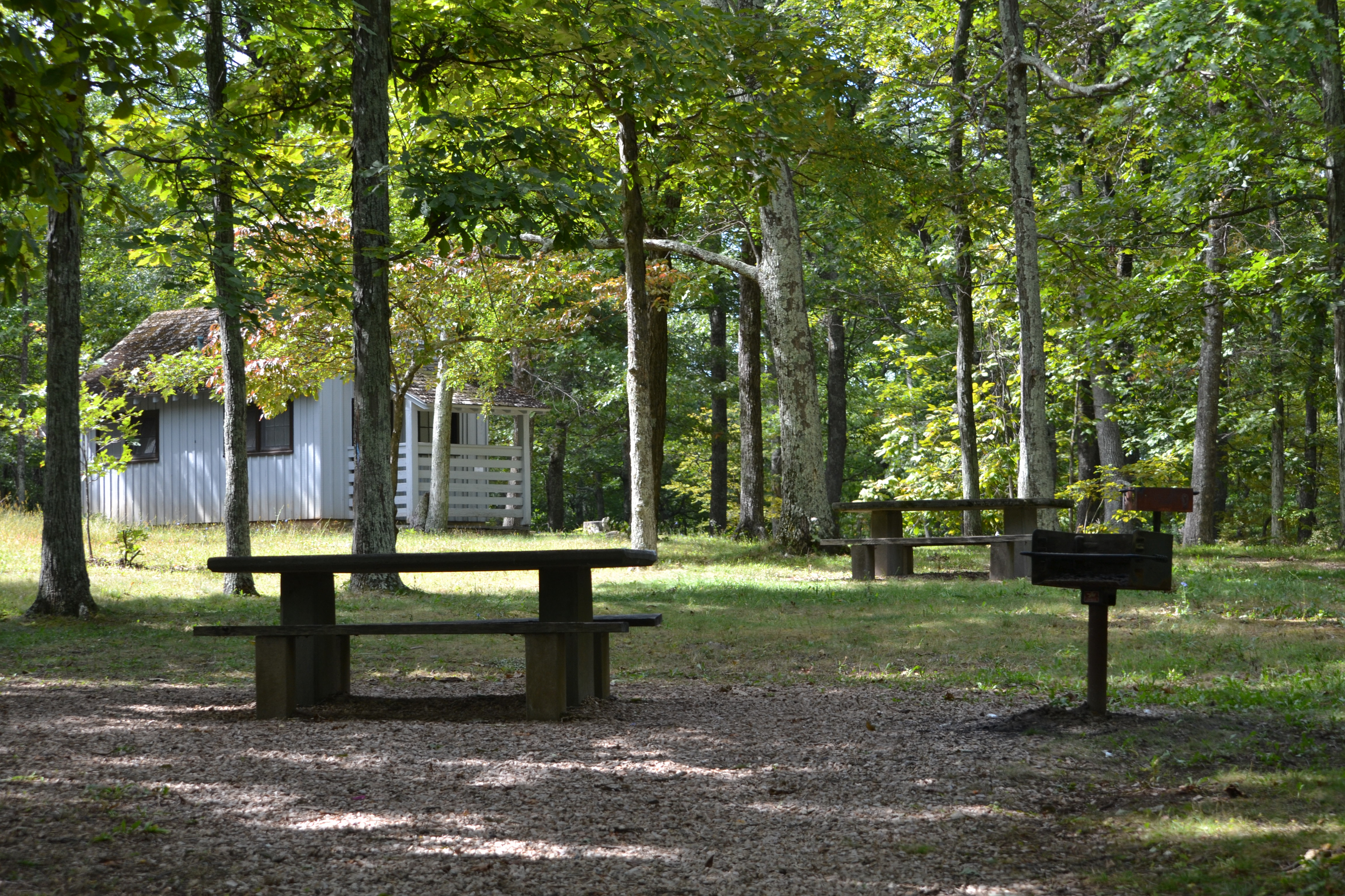
Doughton Park Picnic Area is one of the most beloved sites on the parkway. The expansive 56-site picnic area showcases how the parkway has changed over the years. Stop in for a picnic with all the amenities; grills, restrooms, tables, access to trails, and views.
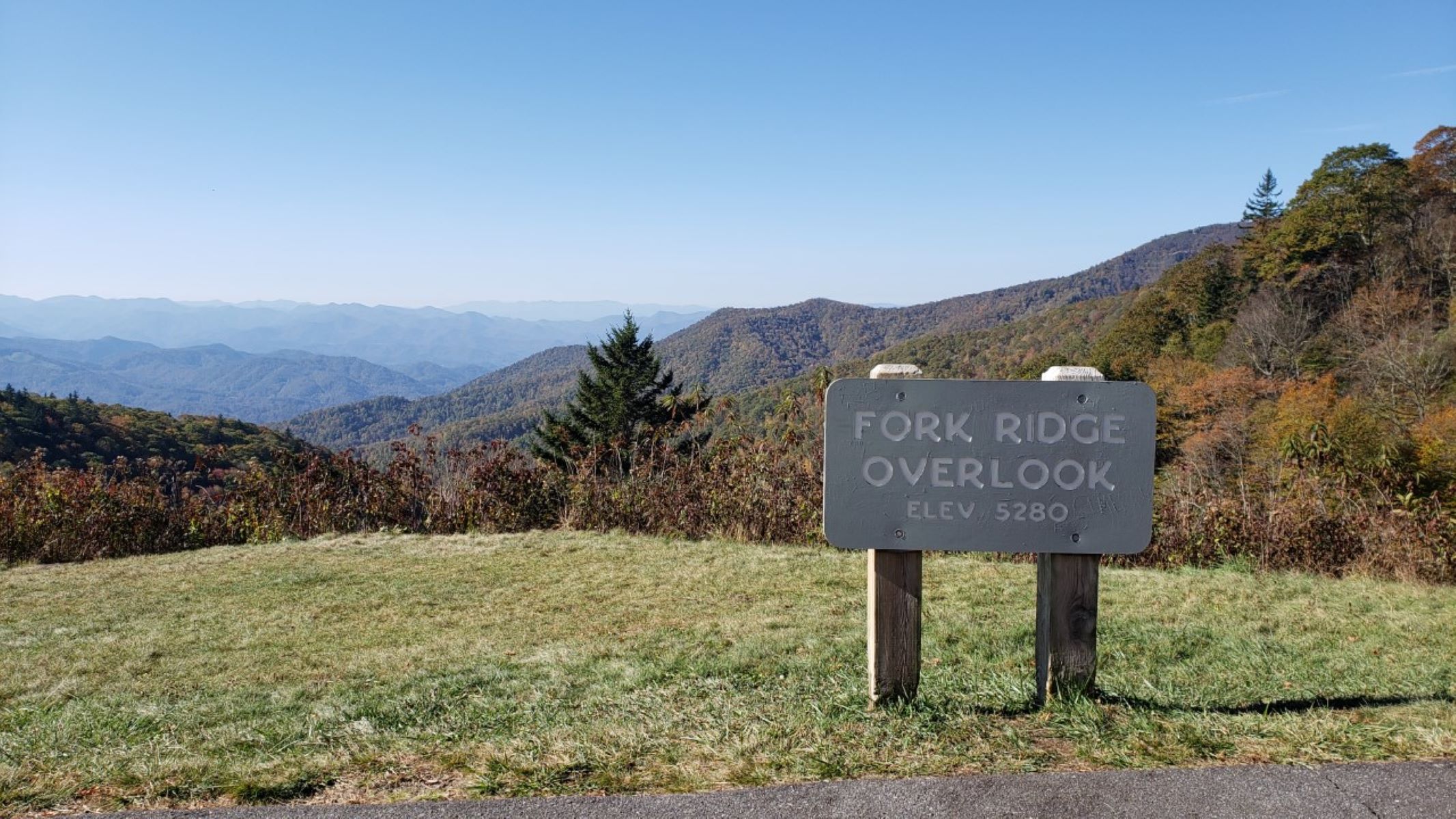
Located near the southern end of the Blue Ridge Parkway at Milepost 449, Fork Ridge Overlook is a paved pull-off that provides scenic views of the Plott Balsam Range and access to the Mountains-to-Sea Trail.
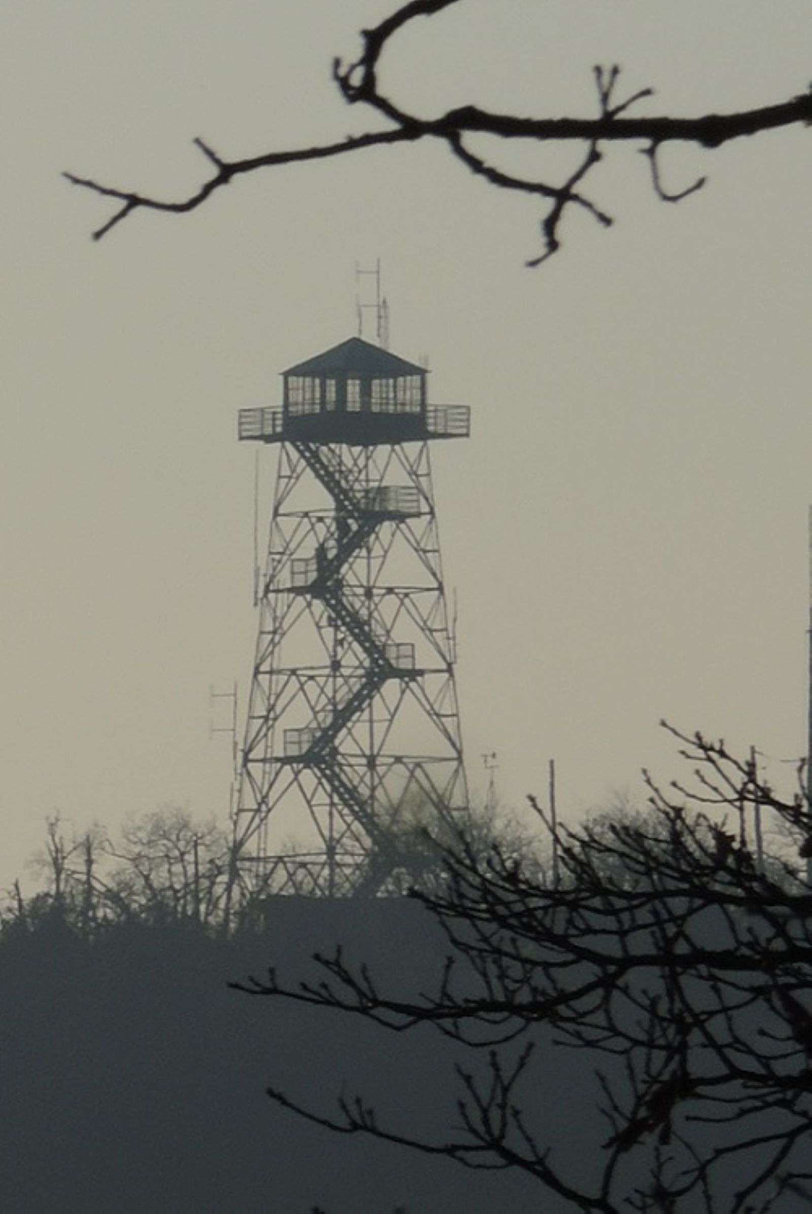
Located at Milepost 409 along the Blue Ridge Parkway, the historic Frying Pan Fire Tower is accessible via a 1.5-mile hike on a wide, gravel roadbed. Boasting expansive views of Cold Mountain, Pink Beds, and the Pisgah National Forest, this short but steep climb is popular with hikers of all ages.
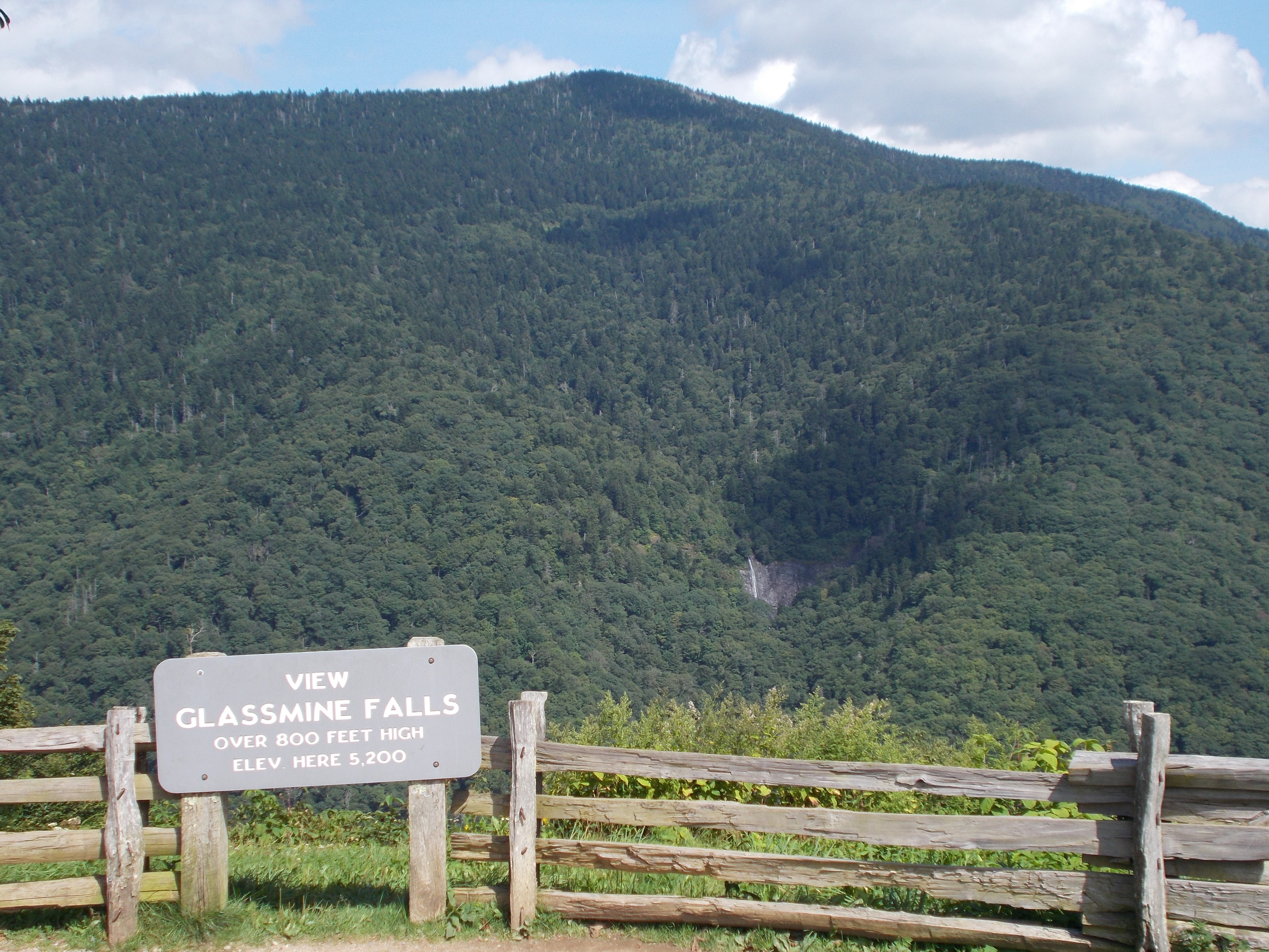
Glassmine Falls Overlook has it all—stunning Blue Ridge Parkway views, a waterfall, and interesting history. Be sure to make this overlook a stop on your Parkway journey!
Granite Quarry Overlook offers views of the Blue Ridge area and Sauratown Mountain Range, as well as the Mount Airy Granite Quarry, the largest granite quarry in the world.
Enjoy the serenity of the Mountains-to-Sea Trail at this lesser visited location. The beauty of this section of the trail combined with the likelihood of peace and solitude make it a true “walk in the park”. Bring a picnic to enjoy at one of the overlooks.
Graveyard Fields is a hiking area that’s sure to please active, outdoor families and naturalists alike. You can enjoy spring wildflowers, find a place to cool down on a warm summer’s day, view beautiful fall colors, and visit two waterfalls. Plan to arrive early, it’s a popular location and can be very crowded.
Do you have a big family? Well, at Graybeard Mountain Overlook you can see beautiful, expansive views of this “father” mountain and the seven “sister” peaks that descend from it.
Views of the Catawba River Valley, the southern end of Linville Gorge, and Lake James, plus waves of mountain ridges stretching to the horizon. What more could you want? The overlook provides access to USFS trails Snooks Nose and Green Knob.
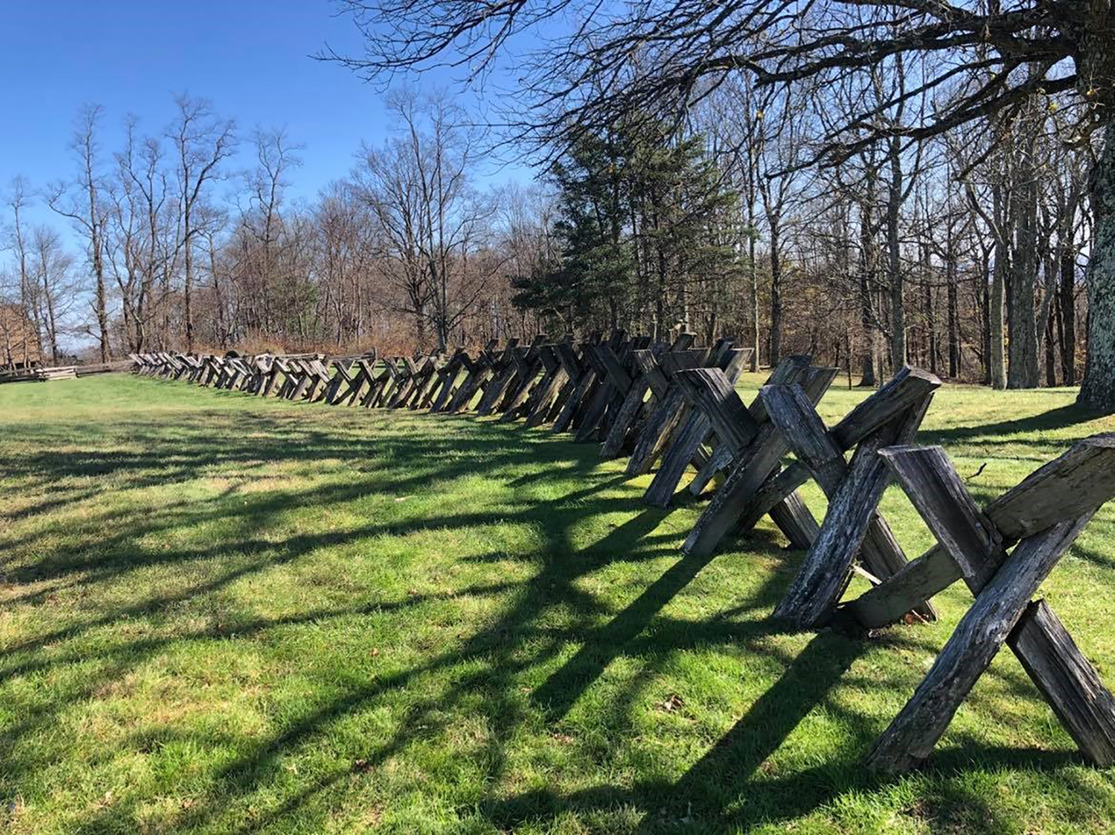
Good fences make good neighbors. You can learn all about the various styles of Appalachian log fences at the Groundhog Mountain Picnic Area. After your meal, climb the old, wooden tower for great views of the surrounding countryside. The shady picnic area has 28 tables, each with a grill.
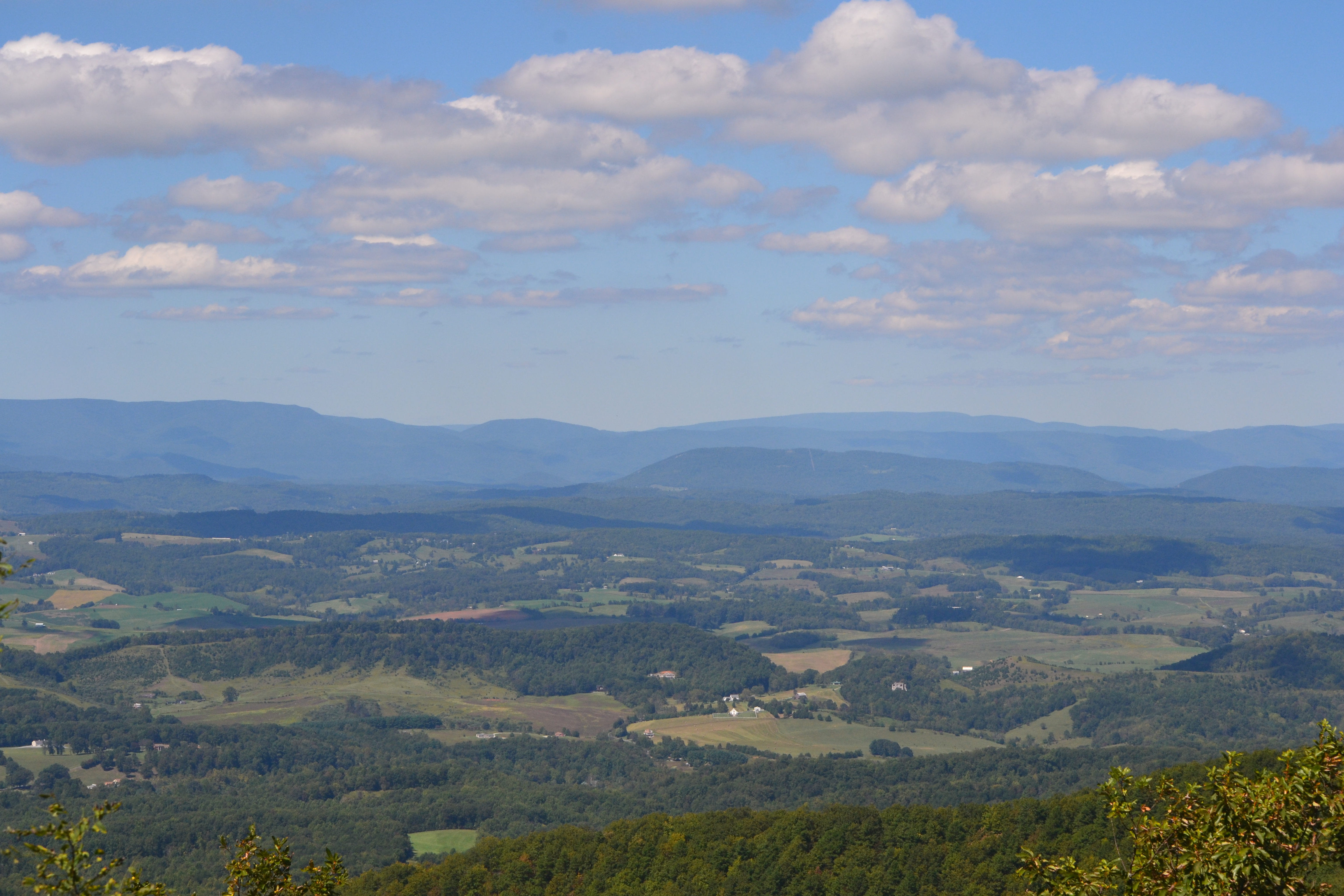
Harvey’s Knob offers exceptional views to the Great Valley of Virginia far below. Overlooks with expansive views make excellent locations to view migrating birds and monarch butterflies in the fall.
A beautiful view into the Haw Creek Valley and the mountains beyond. Pull over, let the stress of city life slip away and take a deep breath of mountain air.
Hefner Gap offers a scenic view of Linville Mountain and Honeycutt Mountain to the east and north. It sits at the intersection of the Blue Ridge Parkway and the Overmountain Victory Trail, one of the roads used by the Overmountain men going from the west to the battle at Kings Mountain in 1780.
The Heintooga Spur Road off the Blue Ridge Parkway is lesser traveled scenic drive that enters into the Great Smoky Mountains National Park. Scenic overlooks, hiking trails, a campground, picnic area, and a unique historic marker are all highlights of the road. It is also a great place to look for elk.
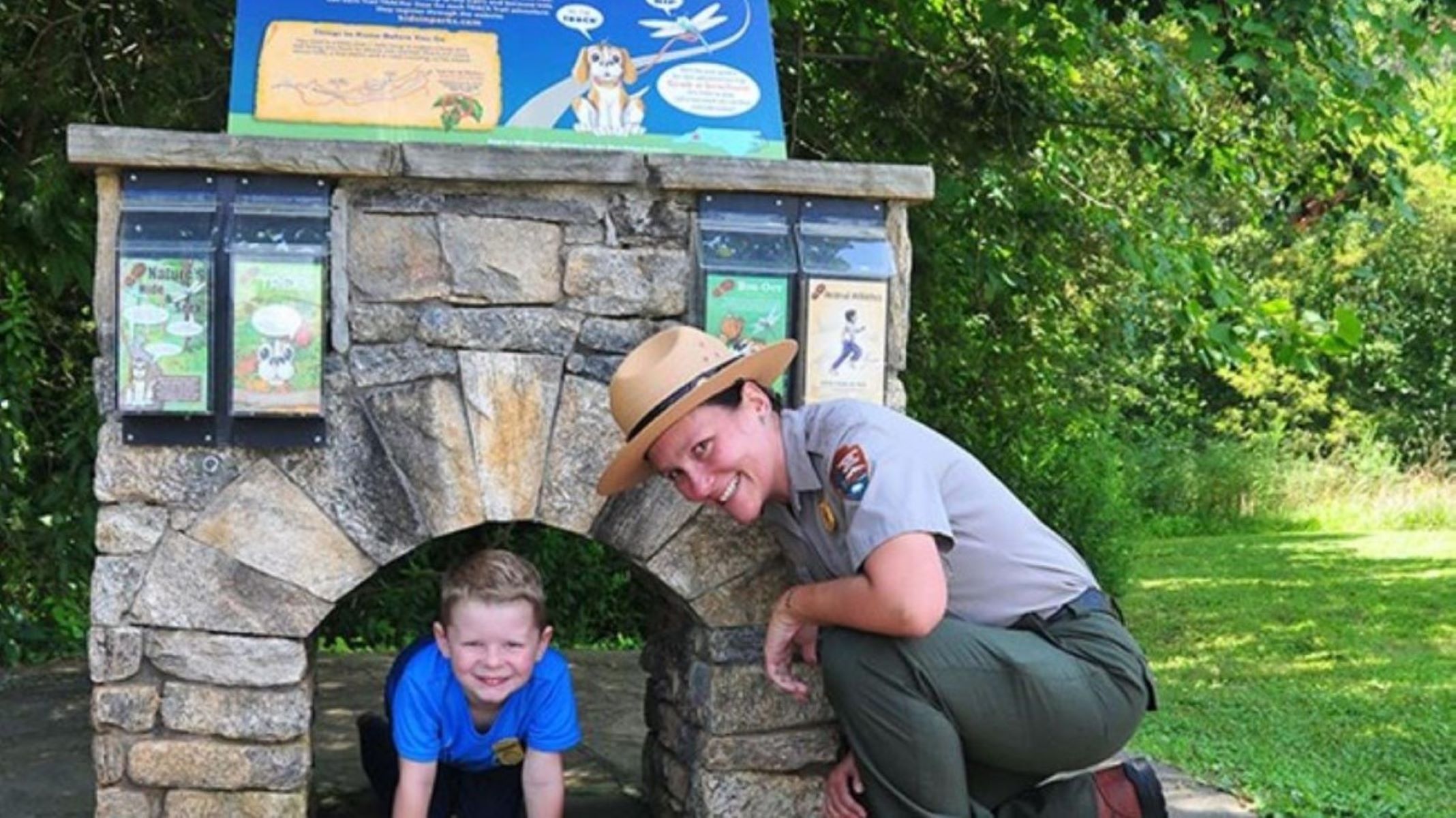
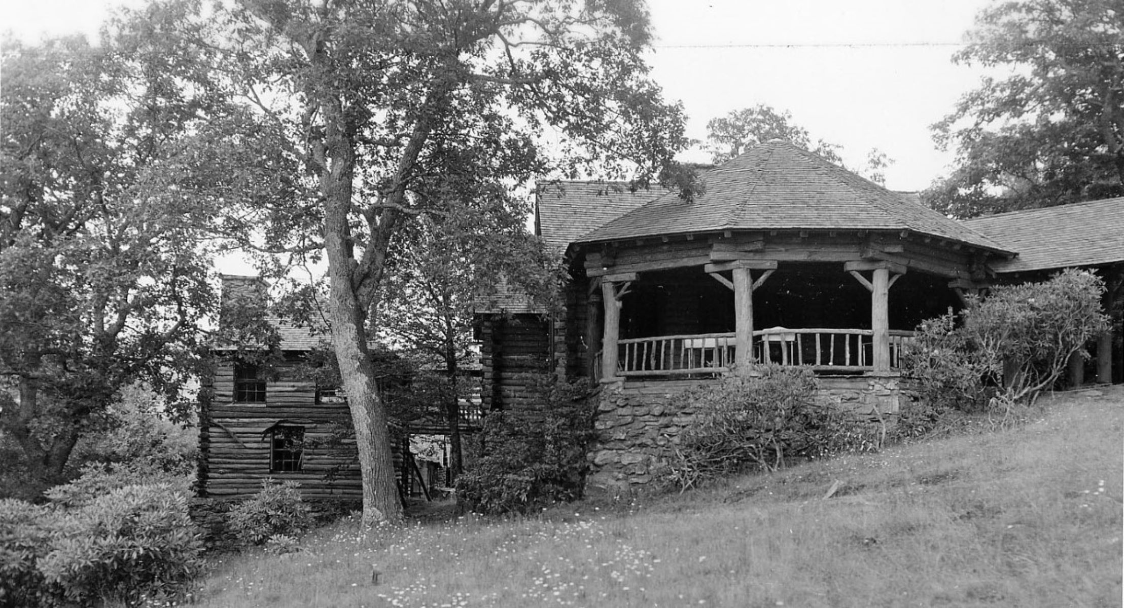
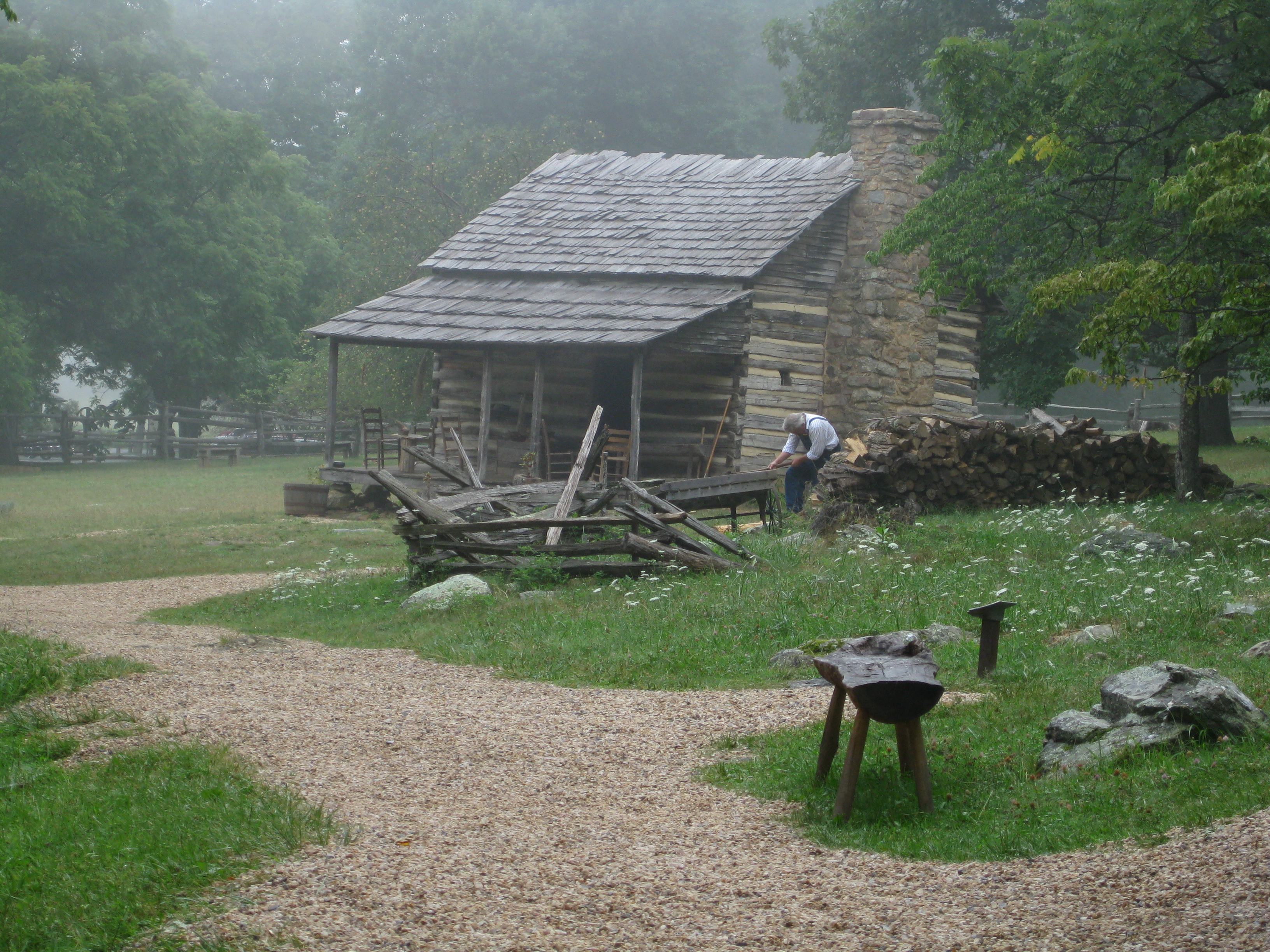
This farm has been preserved as it may have looked during the 1890s. Farm highlights include a demonstration garden, log home, chicken house, root cellar, barn, hog pen, spring house, and rail fencing surrounded by forest. National Parks, like the Blue Ridge Parkway, are one such gift we can care for, to pass on to the next generation to preserve unimpaired and enjoy for the benefit of the future generations
The short, strenuous climb to enjoy the view from the Humpback Rocks has drawn hikers for hundreds of years, across all seasons. There is much to see and do in the area beyond the hike to ‘the Rocks’ including access to the Appalachian National Scenic Trail, Glass Hollow Overlook, Old Howardsville Turnpike, Jack Albright Loop over Dobie Mountain, and true summit of Humpback Mountain. Along the way keep a sharp eye out for cultural resources and wildlife.
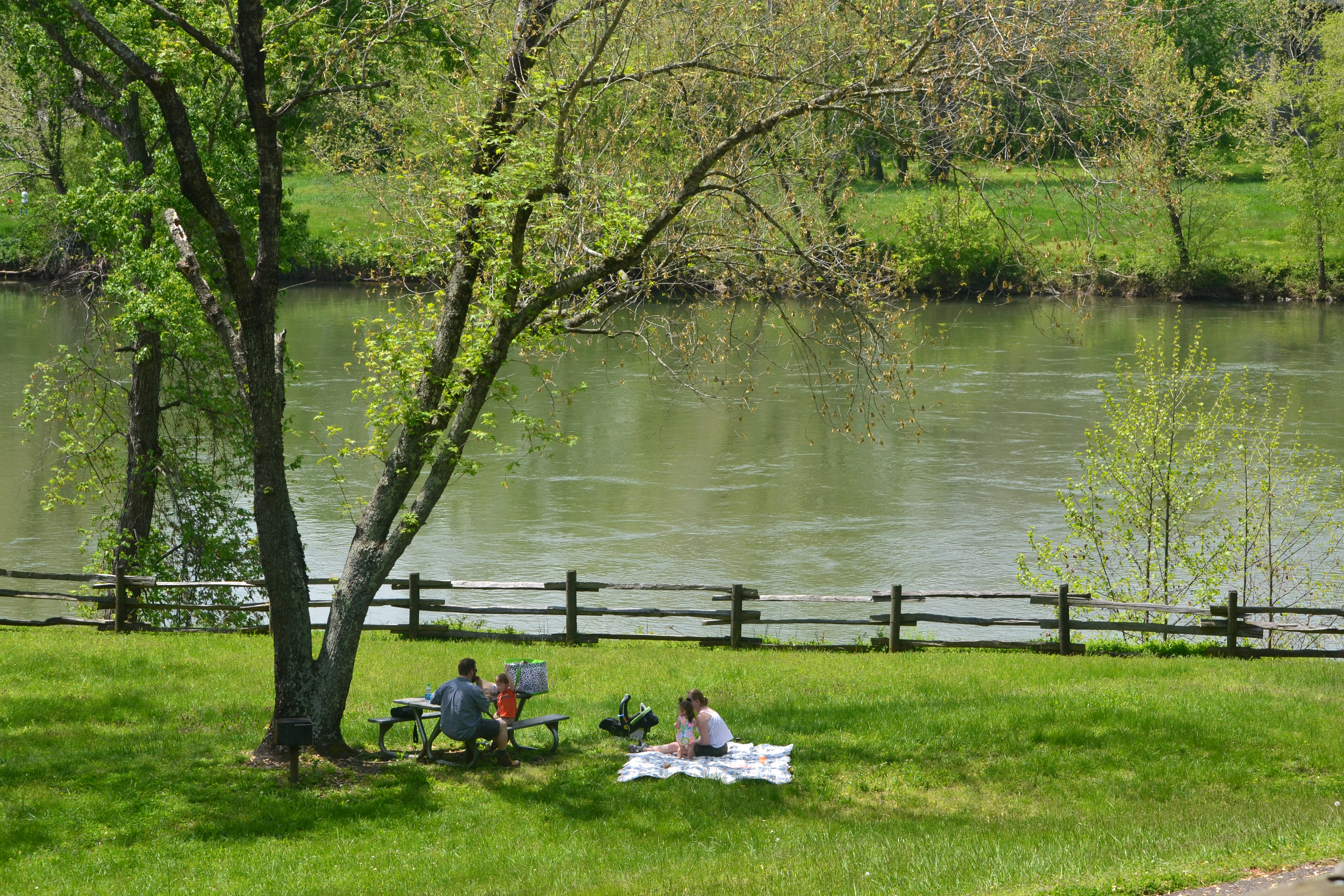
Travelers have used the James River for thousands of years from Native Americans up to modern motorists. Ponder the past and future of transportation over a good meal at the picnic area while watching the water pass by.