On June 14, 2009, a lightning strike started the Bridge Fire that burned 3,947 acres in Bryce Canyon National Park and Dixie National Forest. Years of fire suppression had created a crowded, diseased, and less diverse forest. As the fire, a natural agent in the ecosystem, moved through this area, the forest was reborn. After the fire, nutrients were recycled back into the soil, sunlight reached the ground, and a variety of species returned.
In 1933, during the Great Depression, President Franklin D. Roosevelt established the Civilian Conservation Corps (CCC) providing employment for young, unmarried men. From 1934–41, at Bryce Canyon National Park the CCC planted trees and shrubs, built and improved roads and trails, developed campgrounds, paved parking lots, and provided insect control. At Rainbow Point, they built the overlook structure and the Under-the-Rim Trail.
At Agua Canyon two prominent hoodoos command attention. On the left, is the taller of the two towers, "The Hunter." To the right is a hoodoo commonly referred to as the "Rabbit" or alternatively the "Backpacker."
Trail Closed due to Rockslide This trail descends 1.6 miles (4.0 km) to its junction with the Under the Rim Trail approximately 1,000 feet (305 m) below.
Here, the Agua Canyon Connecting Trail descends to the rugged 22.9-mile (36.9 km) Under-the-Rim backcountry trail, which travels north to Bryce Point and south to Rainbow Point. Day hikers can enjoy an out-and-back hike with views of Agua Canyon and the Paria Valley beyond.
Bryce Canyon is known for its stunning views and vistas. On a clear day from this point you can see Navajo Mountain, 80 miles (129 km) away, and the San Francisco Peaks, 150 miles (241 km) south. Good air quality, one of the park’s most precious resources, makes these views possible. It is also essential for visitor and employee health and the well-being of the natural environment.
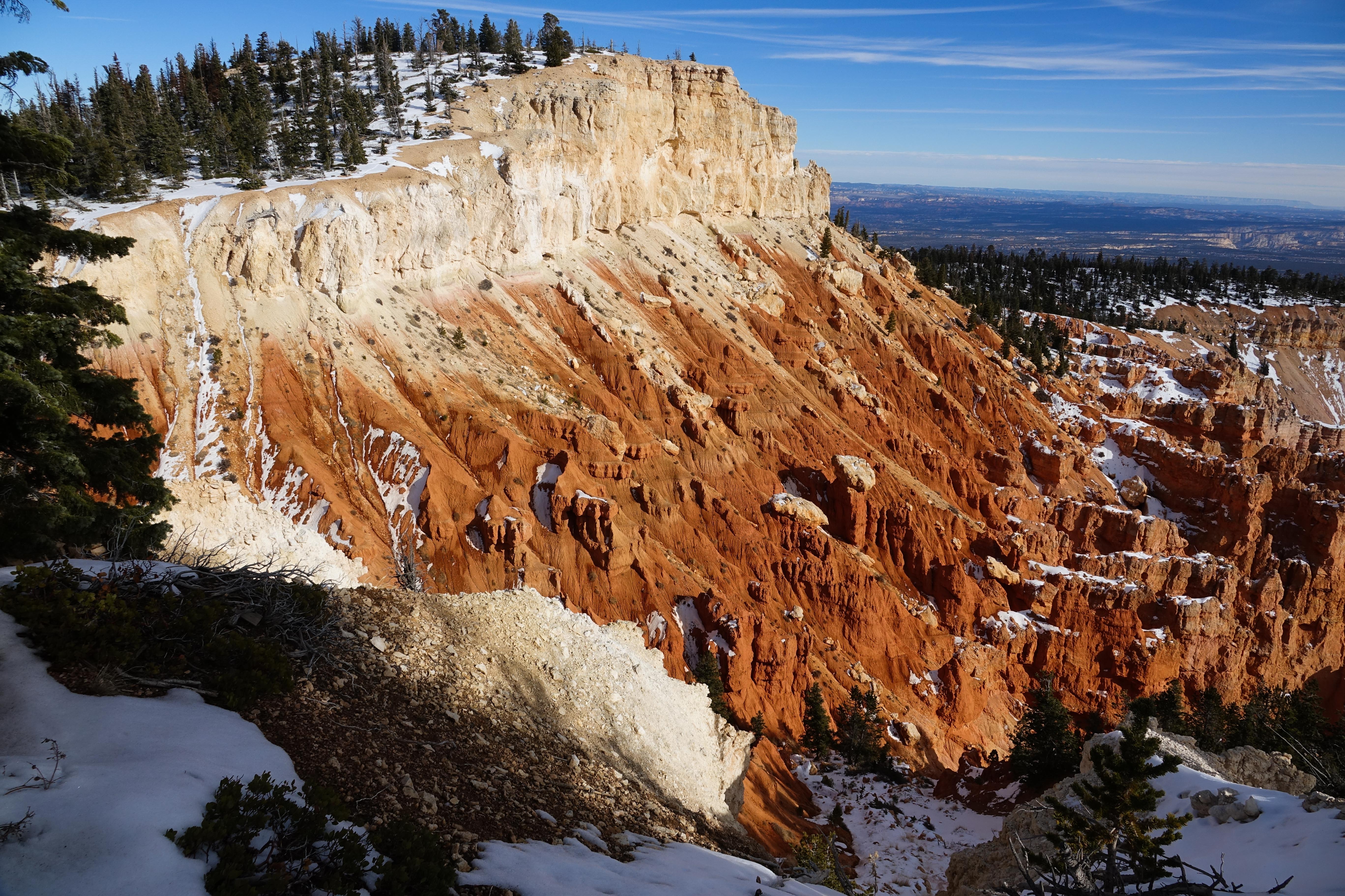
Colorful Layers Pure limestone is white, but here, iron deposits have oxidized, or rusted, producing the yellows, oranges, reds, and browns. Oxidized manganese creates the pale blue and purple hues. Changing weather and light also affect the canyon’s colors. Bryce Canyon is ever-changing. About 50 million years ago (mya), a large freshwater lake began filling the low basin of southern Utah. Over millions of years, rivers and streams gradually filled this lake.
Gilbert Stanley Underwood, the master architect hired by Union Pacific Railroad, helped pioneer the National Park Service rustic style. Here at Bryce and at many other western national parks, his artistry, vision, and utilization of local timber and stone created structures that nestled harmoniously into the natural landscape.
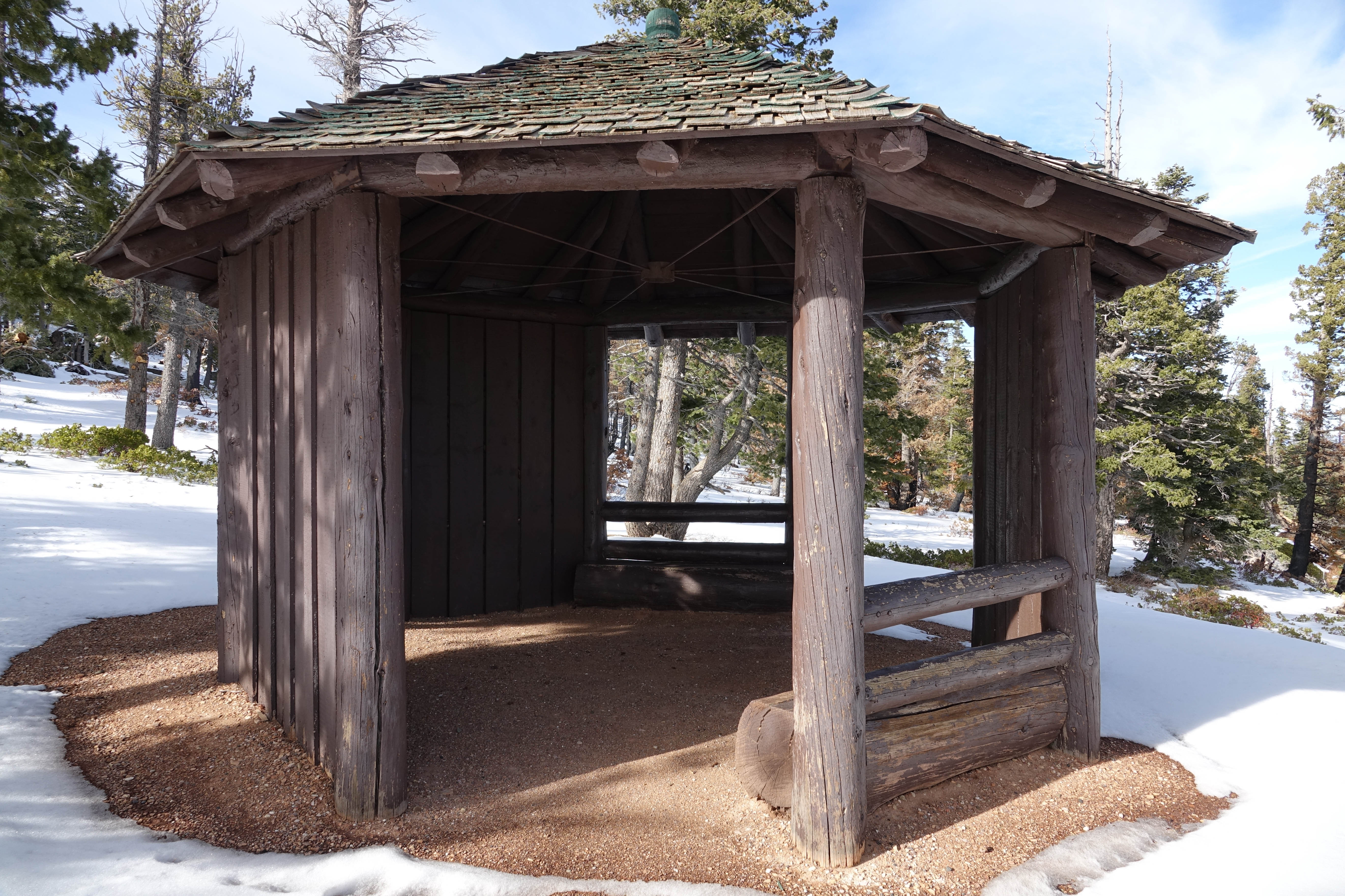
A small octagon shaped log shelter built by the park in the 1980s after the Bristlecone Loop was completed. At this point in the trail you might recognize smaller bristlecone pines nearby. Look for densely bunched needles travelling in a bushy arrangement up the branch. Needles will be in bundles of 5. Two quotations by Henry David Thoreau are framed on the interior wall of the shelter. The first: Silence alone is worth being heard, then "I need solitude. I have come forth to
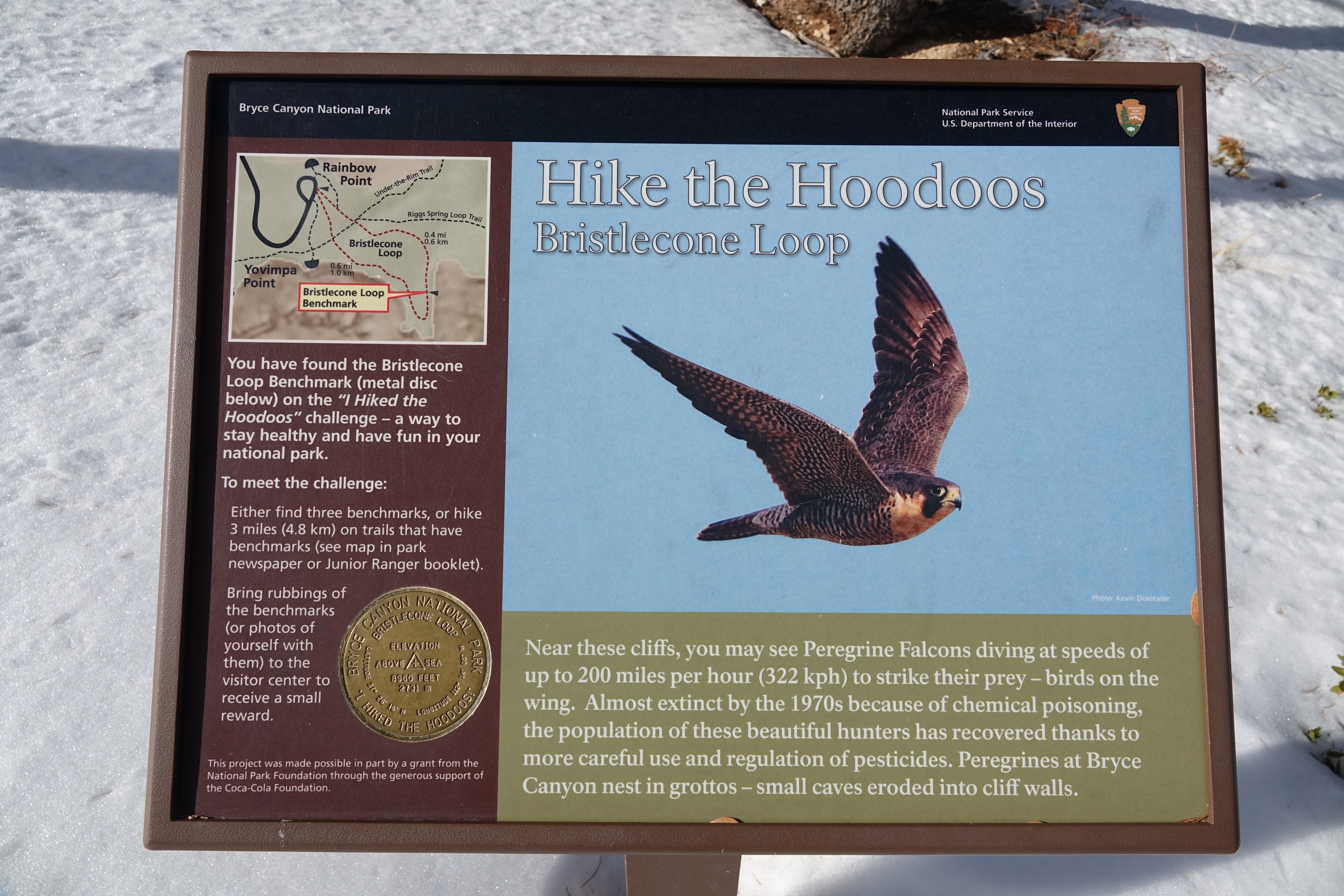
Hike the Hoodoos Hiking is great exercise and Bryce Canyon's "I Hiked the Hoodoos!" program is not just hiking, it's also a scavenger hunt with a special reward!
A short path through fir and pine leads to the easy 1.0 mi/1.6 km Bristlecone Loop, as well as the 8.8 mile (14.2 km) backcountry Riggs Spring Loop and 23 mile (37 km) Under-the-Rim Trail. Though the Bristlecone Loop trail only climbs 200 feet (61 m) and is rated as Easy, be sure to carry water, wear ankle-supporting footwear, and postpone your hike if lightning is expected.The Bristlecone Loop reaches elevations over 9,100 feet (2778 m). Here you will pass by bristlecone pin
A short path through fir and pine leads to the easy 1.0 mi/1.6 km Bristlecone Loop, as well as the 8.8 mile (14.2 km) backcountry Riggs Spring Loop and 23 mi/37 km Under-the-Rim Trail.
This trail takes you through a forest of white fir, Douglas-fir, limber pine, and ponderosa pine. Bristlecone pines—some over 1,000 years old—grow at the trail's southern end where hikers enjoy grand views to the south. Small mammals and a variety of birds, including woodpeckers, nuthatches, and peregrine falcons might be spotted. In winter months, this trail may be impassable due to deep snow.
This trail takes you through a forest of white fir, Douglas-fir, limber pine, and ponderosa pine. Bristlecone pines—some over 1,000 years old—grow at the trail's southern end where hikers enjoy grand views to the south. Small mammals and a variety of birds, including woodpeckers, nuthatches, and peregrine falcons might be spotted. In winter months, this trail may be impassable due to deep snow.
This trail takes you through a forest of white fir, Douglas-fir, limber pine, and ponderosa pine. Bristlecone pines—some over 1,000 years old—grow at the trail's southern end where hikers enjoy grand views to the south. Small mammals and a variety of birds, including woodpeckers, nuthatches, and peregrine falcons might be spotted. In winter months, this trail may be impassable due to deep snow.
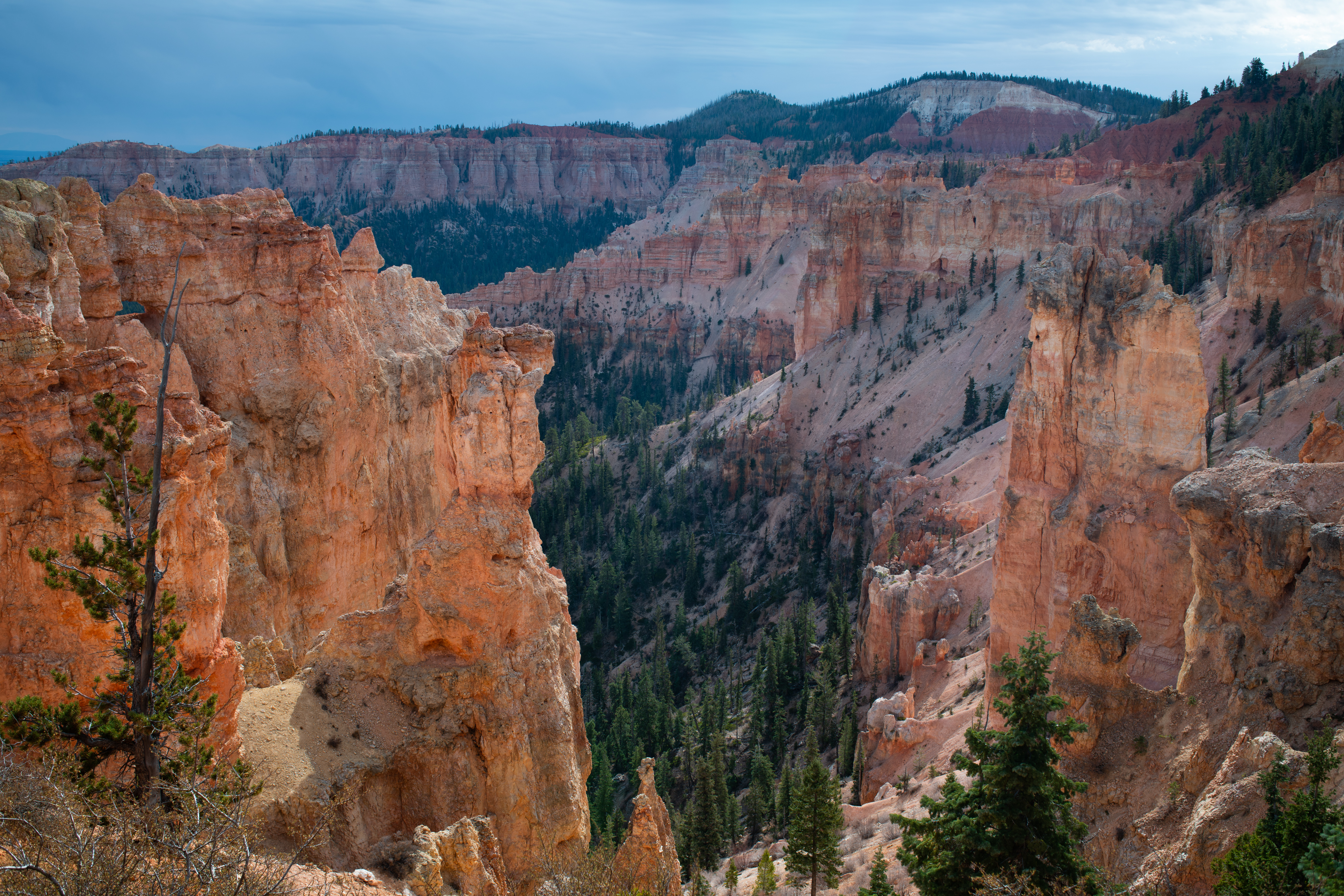
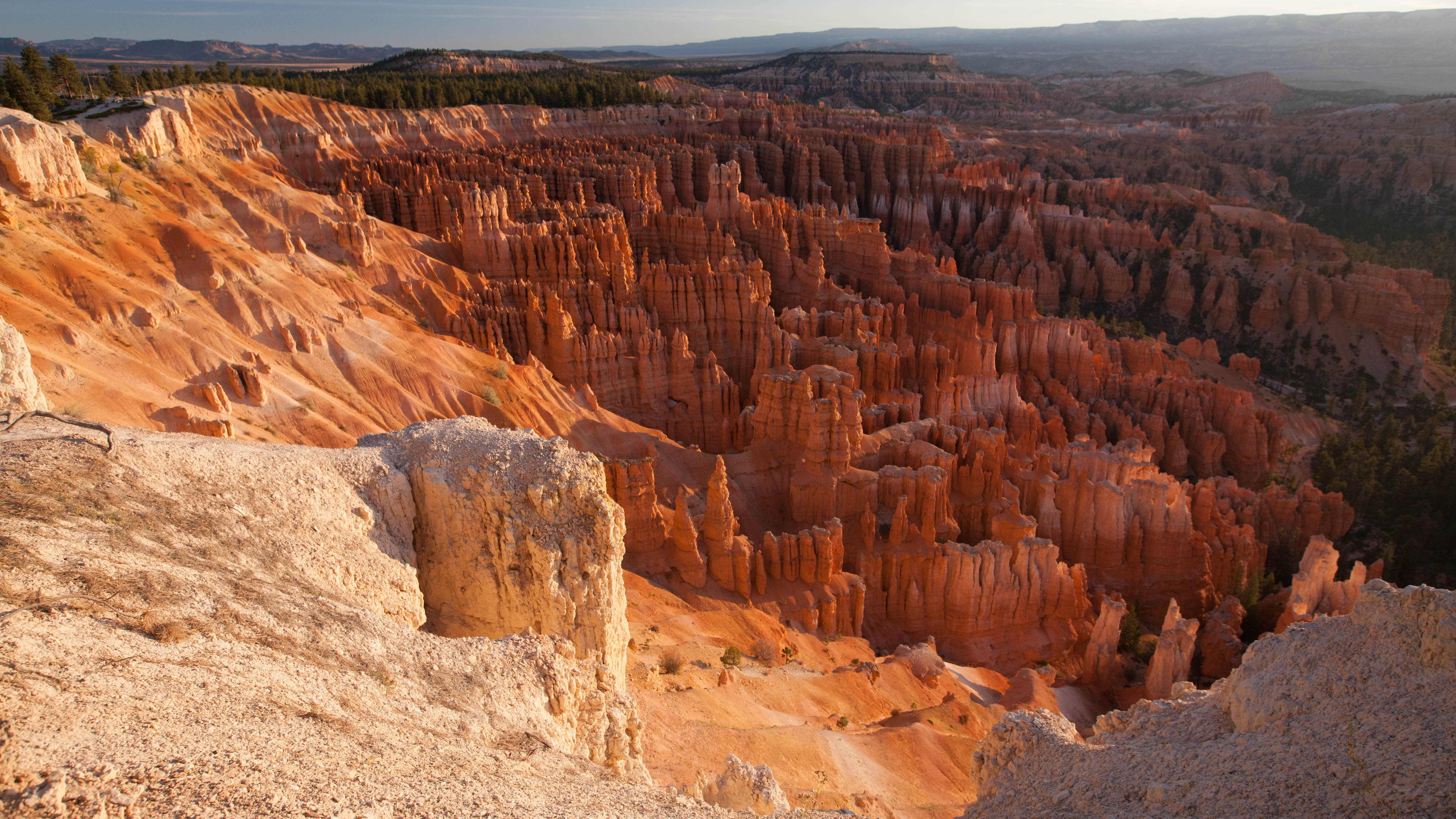
Bryce Canyon is not truly a canyon, but a series of bowl-shaped amphitheaters. For thousands of years, seasonal erosion created gullies in the edge of the Paunsaugunt Plateau, while rain, ice, and snow carved and sculpted the landscape into this extraordinary maze of hoodoos. The Bryce Amphitheater, before you, is constantly changing, chiseled by drainages that gather into Bryce Creek. The breathtaking views can extend nearly 100 miles (161 km) along the eastern horizon.
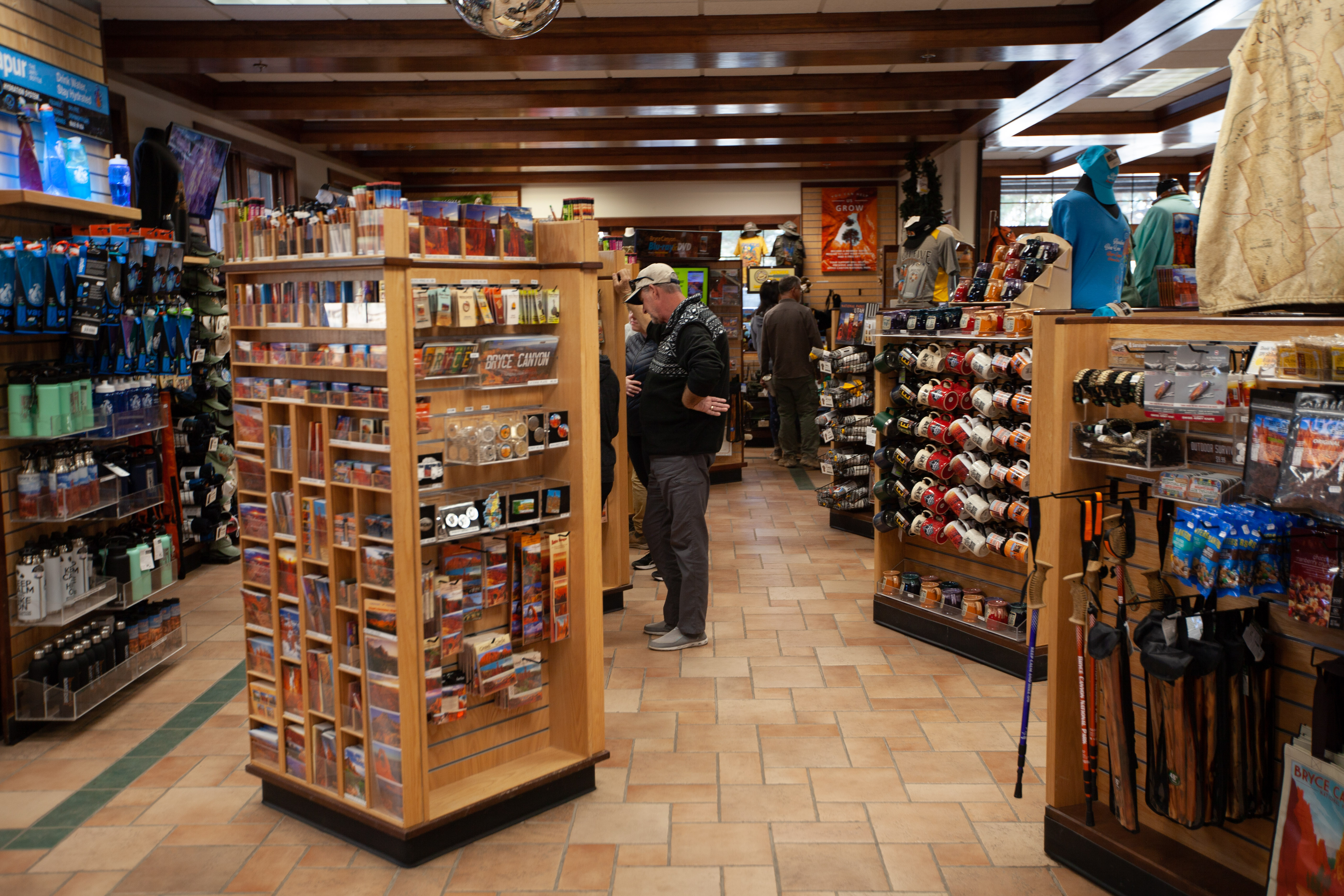
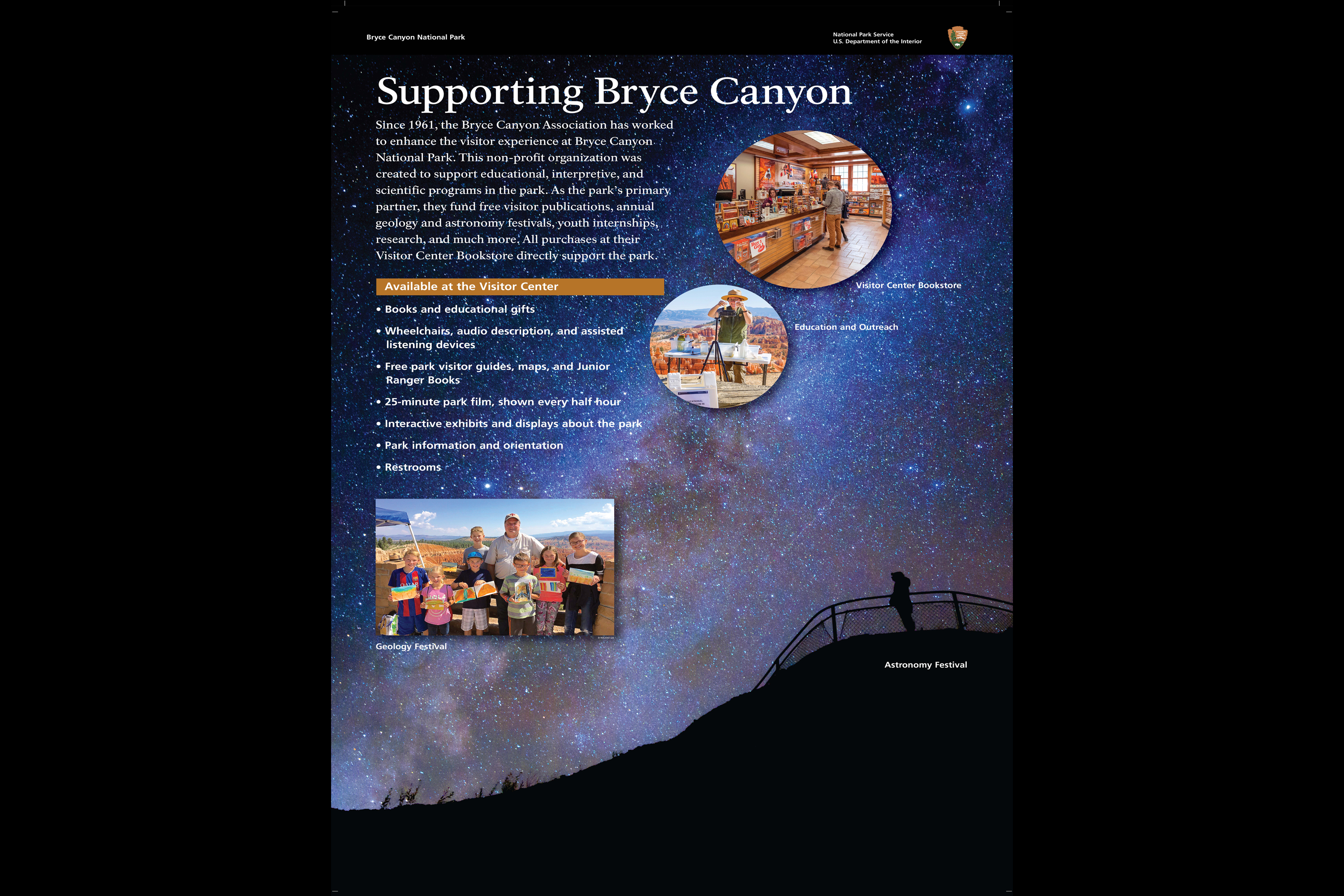
Bryce Canyon Natural History Association (BCNHA) is a 501(c)(3) non-profit organization and the official nonprofit partner of Bryce Canyon National Park and Dixie National Forest, operating retail shops and visitor centers within the park, and surrounding national forest lands. Since 1961, BCNHA has provided over nine million dollars in support.
Since 1961, the Bryce Canyon Association has worked to enhance the visitor experience at Bryce Canyon National Park. This non-profit organization was created to support educational, interpretive, and scientific programs in the park. As the park’s primary partner, they fund free visitor publications, annual geology and astronomy festivals, youth internships, wildlife research, and much more. Your purchase directly supports the park.
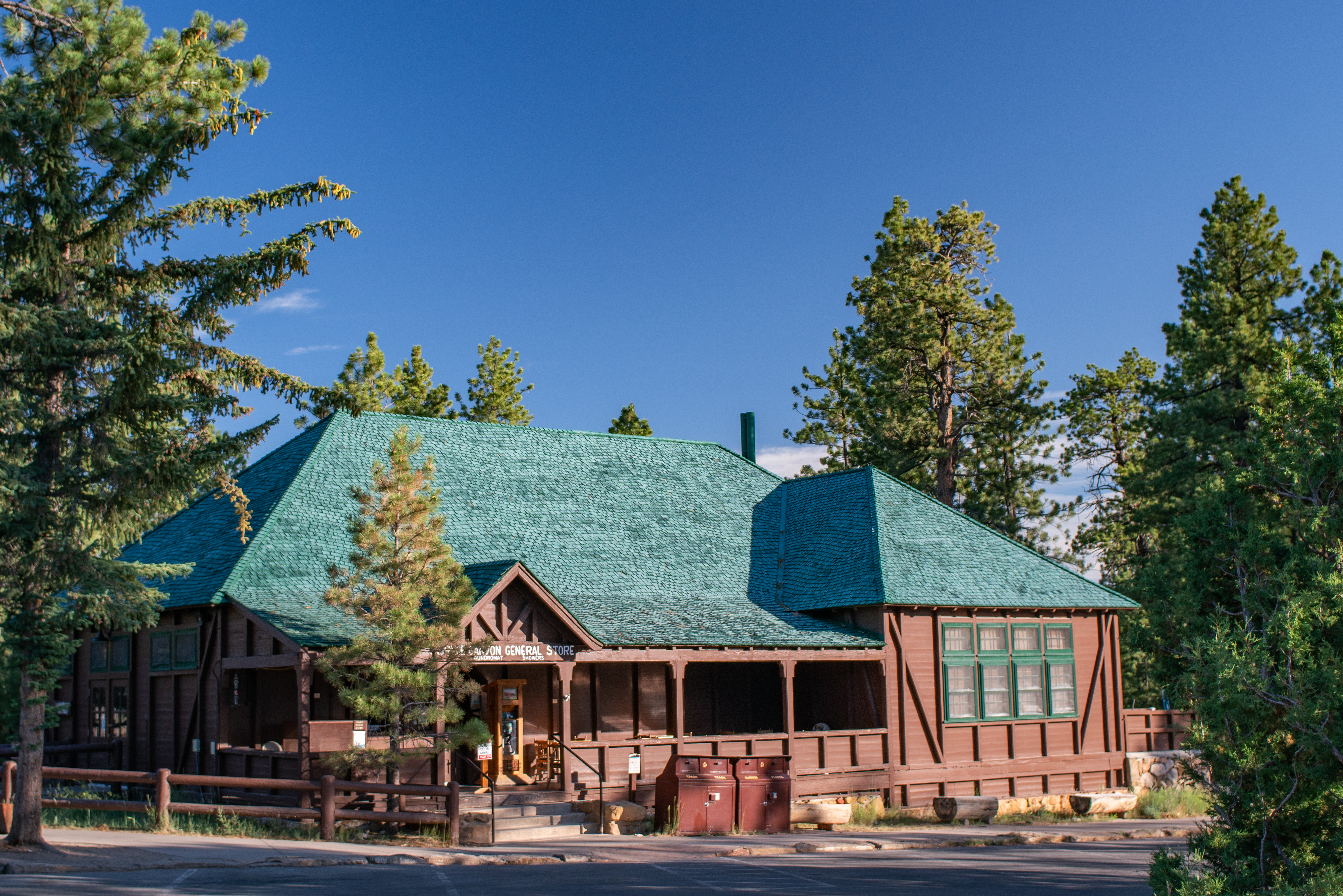
The General Store is located near Sunrise Point and North Campground. It serves "grab-and-go" hot and cold foods such as pizza, soup, ice cream, and sandwiches. Beverages such as soda, water, beer, and coffee are also available. Visitors can also find restrooms, showers, camping supplies including firewood, and souveniers. The General Store is typically closed between January and March.
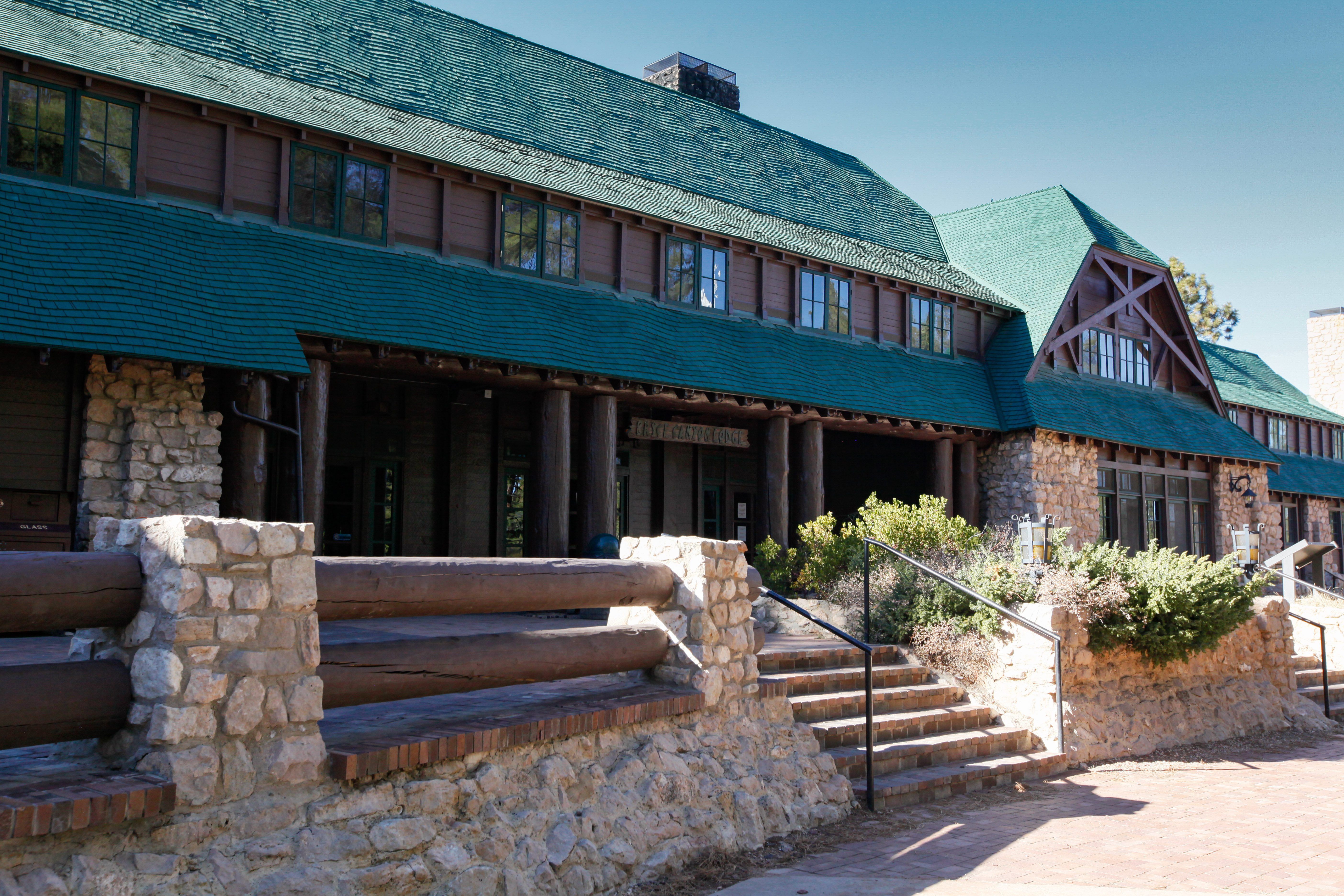
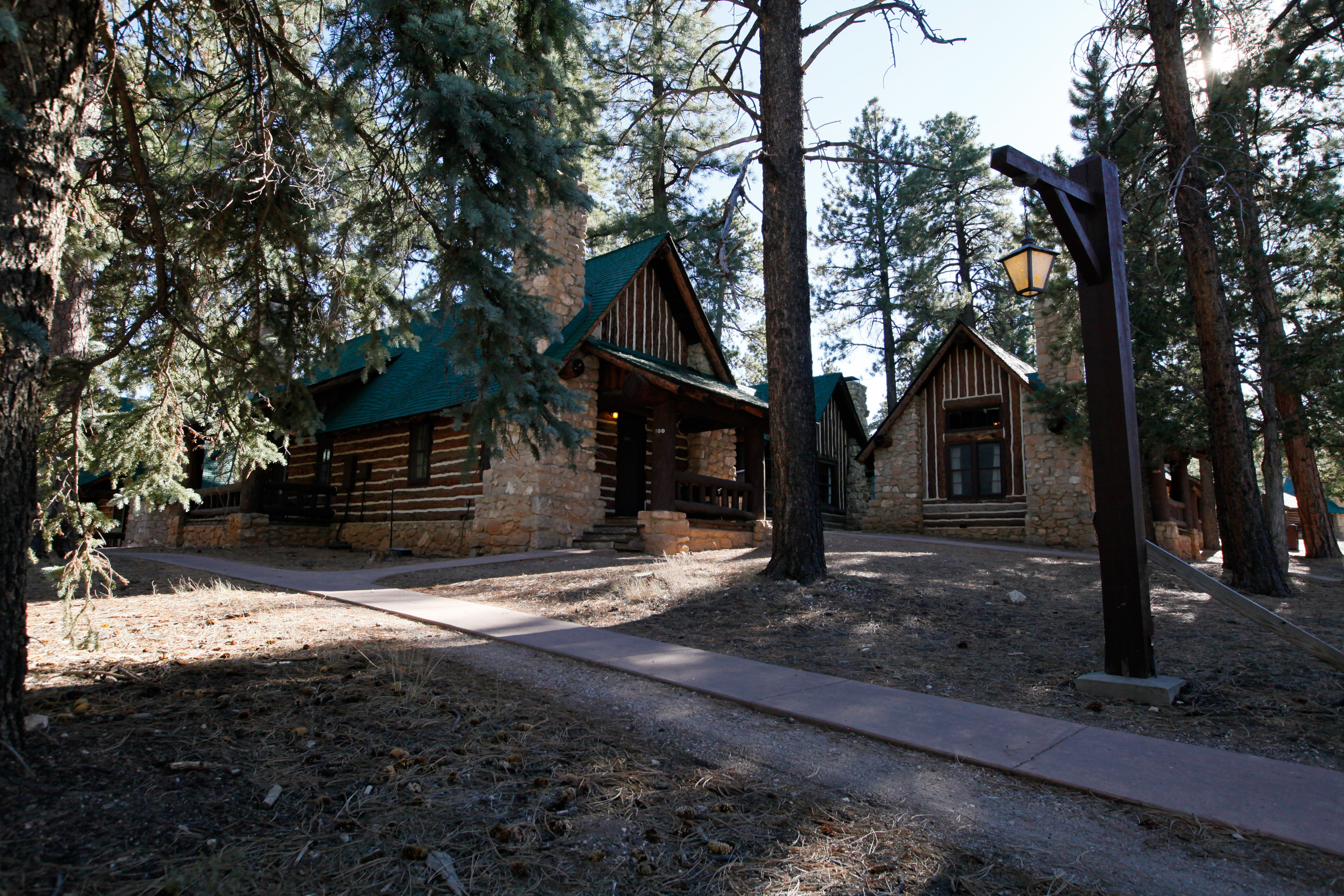
The Lodge at Bryce Canyon is one of the park's most iconic historic structures. The Lodge and its surrounding motel structures are located a short walk from the park's iconic Bryce Amphitheater, and offer 114 rooms including lodge suites, motel rooms, and cabins.
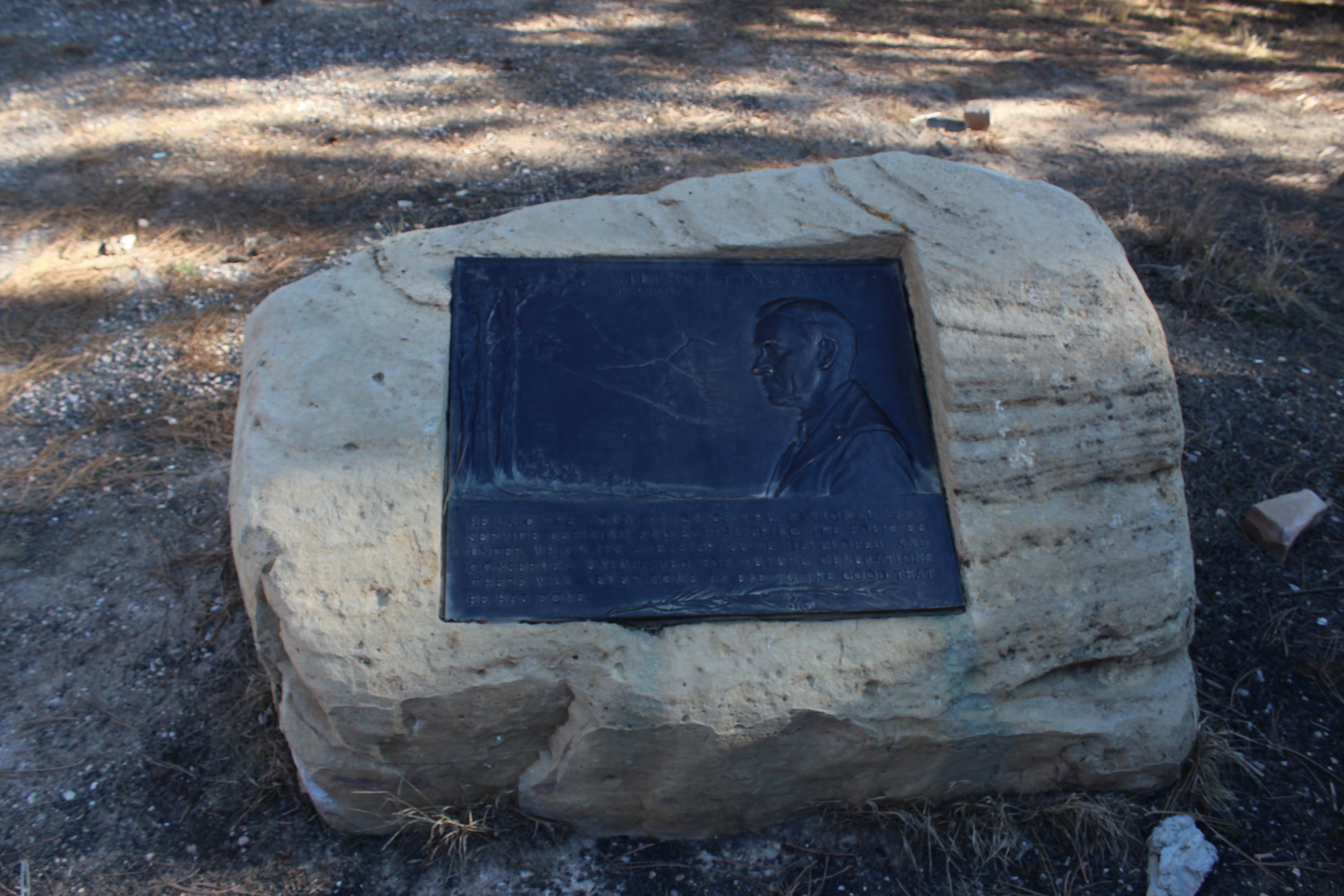
Embedded in a boulder beside the Visitor Center flagpole is a bronze plaque dedicated to Stephen Tyng Mather, known both as a successful businessman and avid conservationist whose vigorous efforts to build public and political support for the parks helped persuade Congress to create the National Park Service (NPS) in 1916.
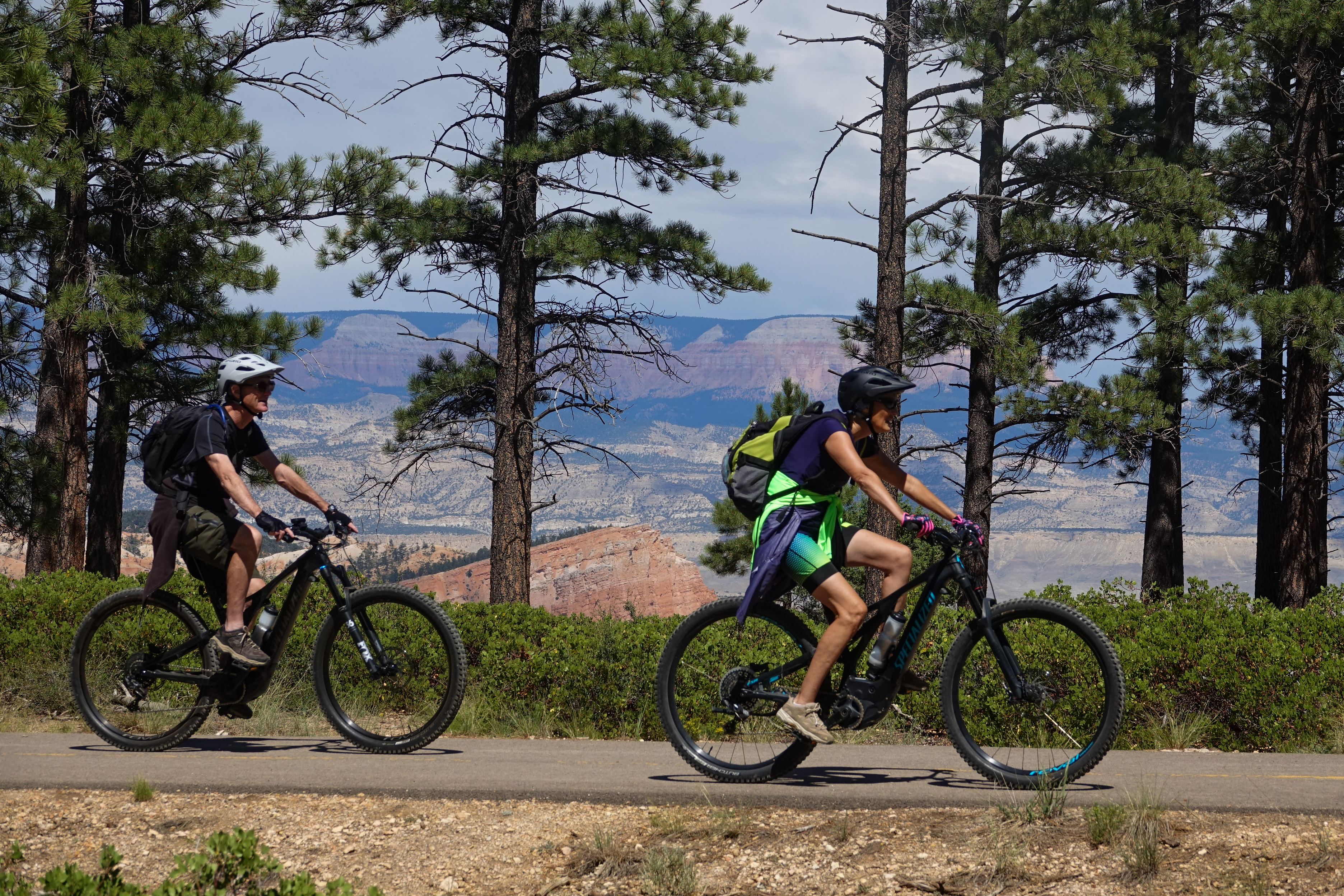
This path provides passage from Bryce Canyon city through Dixie National Forest into Bryce Canyon National Park. Hike, bike, walk or wheel all 5 miles to Inspiration Point, or stop at the shuttle stops and other amenities along the way.
Look up! The same sunlight sustaining life all around you is also powering the visitor center. With its dry climate, high elevation, and mild average temperatures, Bryce Canyon’s Visitor Center checks all the boxes, making it an exceptional place to take advantage of solar energy. The solar array was funded by a Department of Energy grant and installed in 2015.
Canyons are formed by rivers, but the colorful scene before you wasn't created by one. Bryce "Canyon" is, instead, a series of bowl-shaped drainages called "amphitheaters" that only contain water when rain or snow fall into them. As this water drains east joining the Paria River, the plateau rim erodes away with it. This process causes the park's many amphitheaters to enlarge at a rate of one to four feet every century.
Here at Bryce, the elevation ranges from 9,100 feet (2,778 m) at Rainbow Point to 6,600 feet (2,012 m) at the canyon bottoms. The accompanying wide range of temperatures and precipitation creates three distinctive climatic or life zones—Mixed Conifer (highest elevation), Ponderosa Pine (mid-elevation), and Pinyon/Juniper (lowest elevation).
Perhaps the most iconic of all the Bryce Amphitheater's four major viewpoints, Bryce Point provides a soaring view of the park's most popular area. The view and the park share the same namesake, Ebenezer Bryce, who settled in the Paria Valley in 1870. Bryce was a shipbuilder who journeyed west with Brigham Young and the Mormon pioneers to assist in the construction of buildings essential to community life throughout the new land. Bryce lived here for only five years, but in t
Starting in the 1920s, the Union Pacific Railroad and their subsidiary, the Utah Parks Company, played a key role in the development and popularization of Bryce Canyon and many other western national parks. They provided first-class train and bus transportation, lodging, and tours. Between 1923 and 1929 they built the Bryce Canyon Lodge, along with 15 deluxe and 67 standard cabins in the National Park Service rustic style.
No reservations are required to enter Bryce Canyon, but whether you arrive by car, shuttle bus, bicycle, or on foot, park entrance fees will apply. These park entrance fees help support improvement projects and staff to improve your visitor experience. Digital Passes provide a flexible way to pay your entrance fee, support Bryce Canyon, and get you into the park faster.
The park's General Store, designed by Gilbert Stanley Underwood, was the Utah Parks Company's last major improvement in the National Park Service rustic style. Built in 1932, it was known as Bryce Inn and served as the nucleus of more than 25 concessions buildings and cabins known as Camp Center.
The colorful Claron Formation was formed 50 to 60 million years ago in a system of lakes that stretched across central Utah. Separated into an upper white member and lower pink member, both are composed primarily of limestone mixed with varying amounts of silt and clay. Intermittent layers of mudstone and sandstone were deposited as the lake levels rose or fell and rivers flowed across the basin.
The Rim Trail This is the northern end of the 5.5 mile (8.9 km) Rim Trail that begins in the south at Bryce Point. Fairyland Loop The Fairyland Loop is a strenuous 8 mile (12.9 km) loop.
Follow this trail and discover nature’s fairyland of rock castles, cliffs, and spires. It begins with spectacular views from the rim, then continues down into the amphitheater, past fragile, towering hoodoos and cathedral walls. Changes in light create a mesmerizing, colorful palette at every turn. Look for the spur trail to Tower Bridge. Some of the named features along this loop are Boat Mesa, Sinking Ship, and Chinese Wall.
The shuttle does not provide service to Fairyland Point. Fairyland Point is the northernmost viewpoint along the rim of the Paunsagunt Plateau within the park. The hoodoos (irregularly eroded rock spires) that fill Fairyland Canyon are younger than those further to the south in the main Bryce Amphitheater.
From here the Rim Trail continues another 2.5 miles (4.0 km) north to Fairyland Point offering views of Boat Mesa and distant features beyond. At Fairyland Point hikers can descend below the rim to complete the strenuous 8.0-mile (12.9 km) Fairyland Loop hike. Those looking for a more moderate hike below the rim will enjoy the southern end of the loop, known as the Tower Bridge Trail. This 3.0-mile (2.4 km) out-and-back hike leads to the Tower
Farview Point is appropriately named. Navajo Mountain, 90 miles away on the border of Utah and Arizona, can be seen on all but the worst days. To the east, beyond the Table Cliff plateau, you may be able to see the more pointed peaks of the Henry Mountains, 84 miles away.
Three entrance stations staffed at various times by rangers collect fees, sell passes, and provide free publications. These stations are located one mile inside the park, beside the Visitor Center.
On August 25 and September 6, 2018, lightning strikes ignited two separate fires that merged, creating the Lonely/Riggs Fire. Over 2,000 acres in Bryce Canyon and Dixie National Forest burned. Thanks to a proactive forest management program, the park had dedicated years to thinning and pile-burning overcrowded, diseased, and dead trees in this area. The fuel reduction project allowed wildland fire crews to set a controlled "back-burn" fire along this trail.
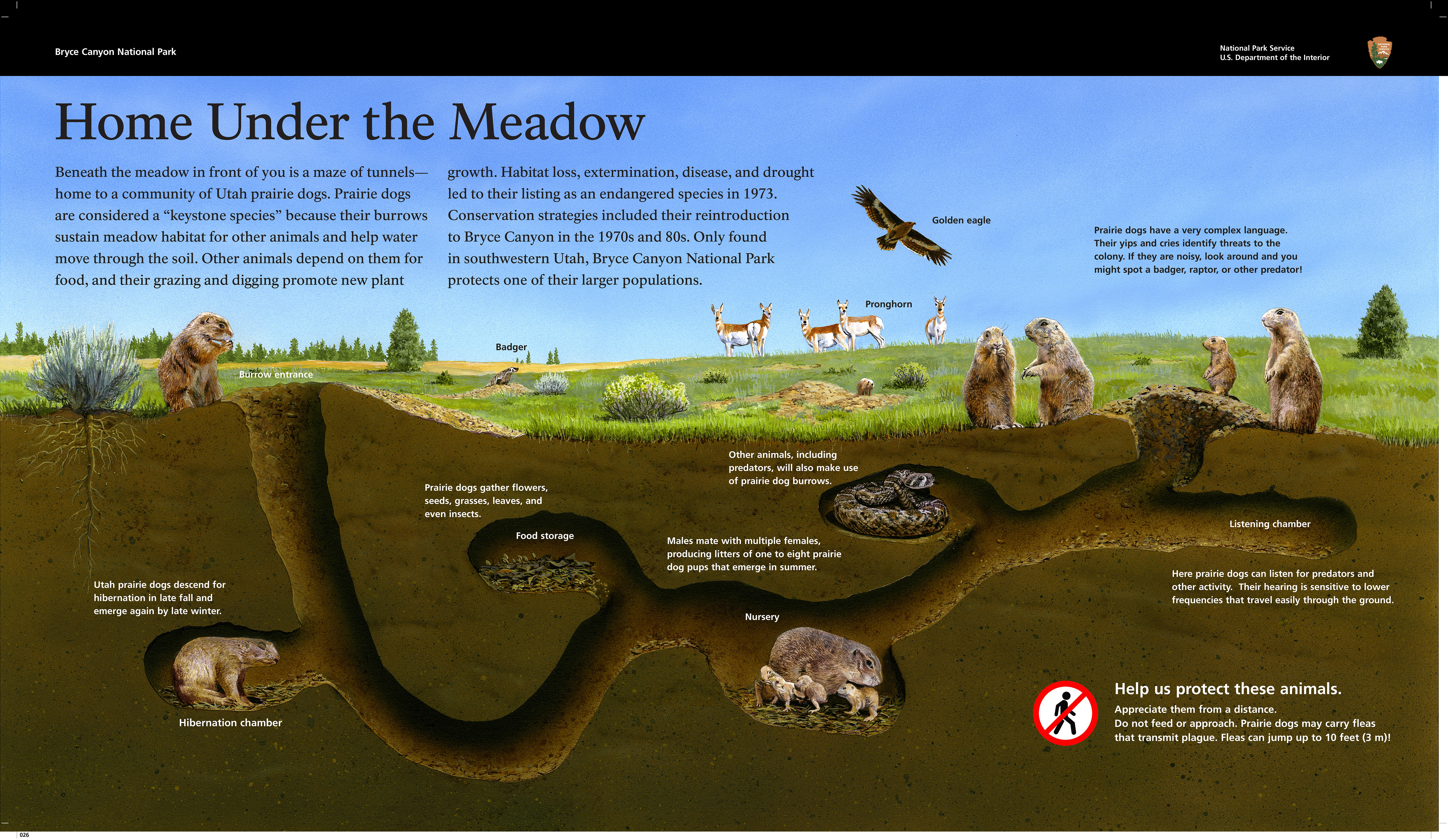
The California condor, with a nearly ten-foot wingspan, is the largest land bird in North America. Its range once stretched across the west, south to Baja California, and north to British Columbia. By 1940, this magnificent bird was on the verge of extinction from poaching, DDT contamination, habitat destruction, and lead poisoning from consuming carrion containing lead bullets. Captive breeding programs have helped stabilize the population.
Look into the forest. It is more than just trees; it is a woodland community of animals, plants, and insects that thrives when the ecosystem is balanced. Over one hundred years of fire suppression changed the balance, composition, density, and health of the forest, increasing the chance of severe wildfires, disease spread, and insect infestation. Trees in a dark or over-crowded forest are smaller, weaker, and more susceptible to disease and parasites.
The High Plateau Institute is a field institute operated by the park in cooperation with its non-profit partner, the Bryce Canyon Association. The institute aims to provide an opportunity for field courses and research for this high plateau region of which the park is but a part.
Between 1925 and 1929, the Bryce Canyon Lodge, 15 deluxe, and 67 standard cabins were built in the National Park Service rustic style. In 1987, the lodge and deluxe cabin area became a historic district and a National Historic Landmark.
Along with Bryce Point, Inspiration Point provides a birds-eye view of the world's largest collection of rock spires called "hoodoos" found within the Bryce Amphitheater.
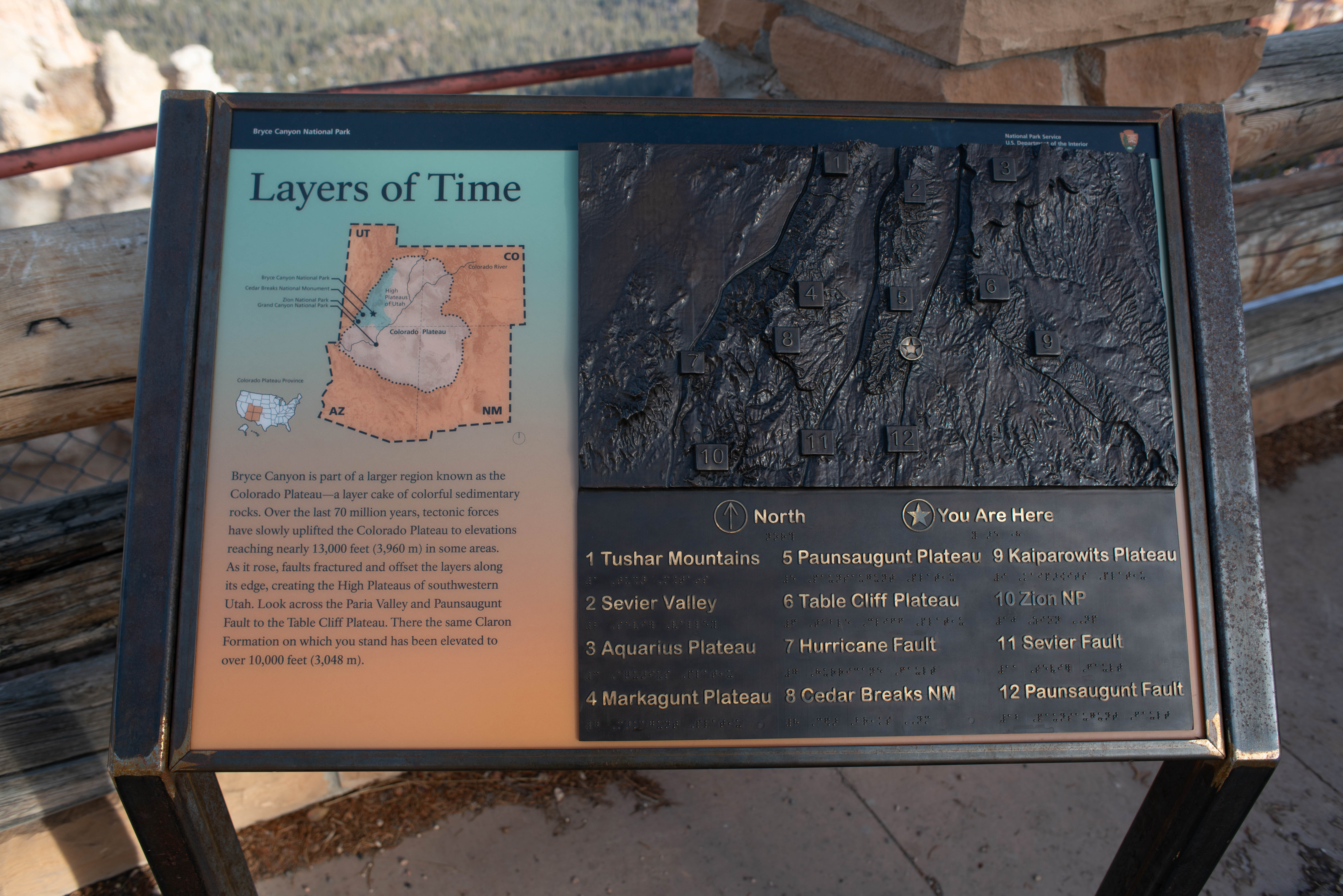
Bryce Canyon is part of a larger region known as the Colorado Plateau--a layer cake of colorful sedimentary rocks. Over the last twenty million years, tectonic forces have slowly uplifted the Colorado Plateau to elevations reaching nearly 13,000 feet (3,960 m) in some areas. As it rose, faults fractured and offset the layers along its edge, creating the High Plateaus of southwestern Utah.