Be advised that the NPS has issued alerts for this park.
Buffalo Point Restaurant Closed
The Buffalo Point Restaurant has been closed for the remainder of the 2025 season due to unforeseen structural repairs.
Steel Creek Ranger Station Closed
The Steel Creek Ranger Station is closed. Please call Tyler Bend Visitor Center at 870-439-2502 for information about the park's Upper District.
South Woolum Road Closed, Alternate Route Available
In the interest of safety, the South Woolum Road has been closed. The Woolum launch and campground remain open.
Spring Creek Landing Closed to Vehicle-Assisted Launches
The Spring Creek Landing has been closed to vehicle-assisted launches. Watercraft may still be put in and take out at this point, but must be hand carried to and from the parking area. This is to ensure the safety of visitors and avoid continued erosion.
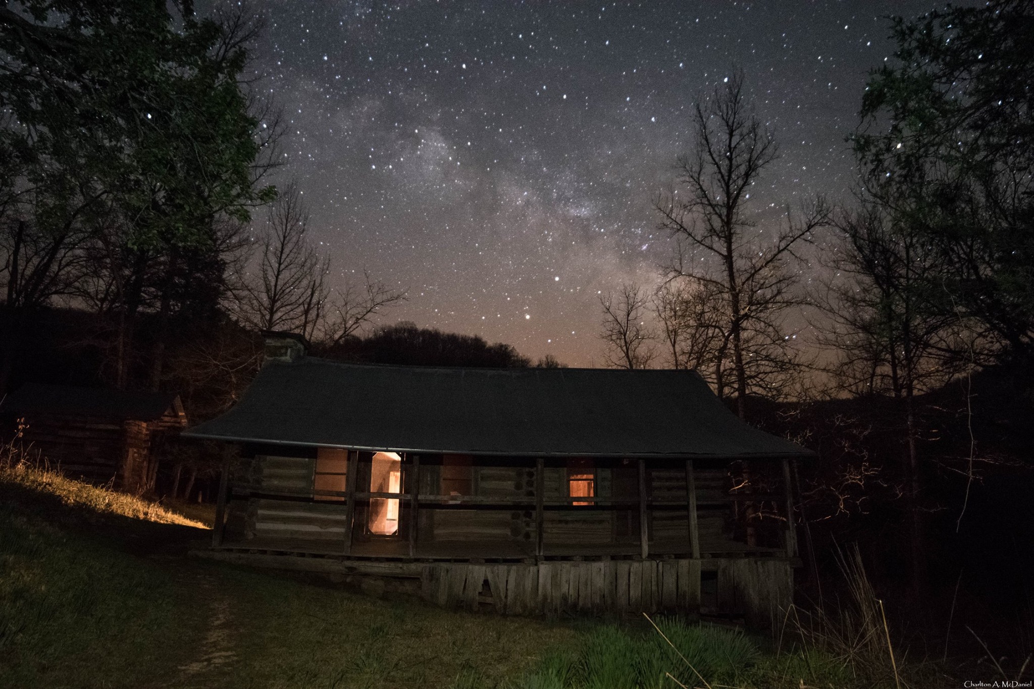
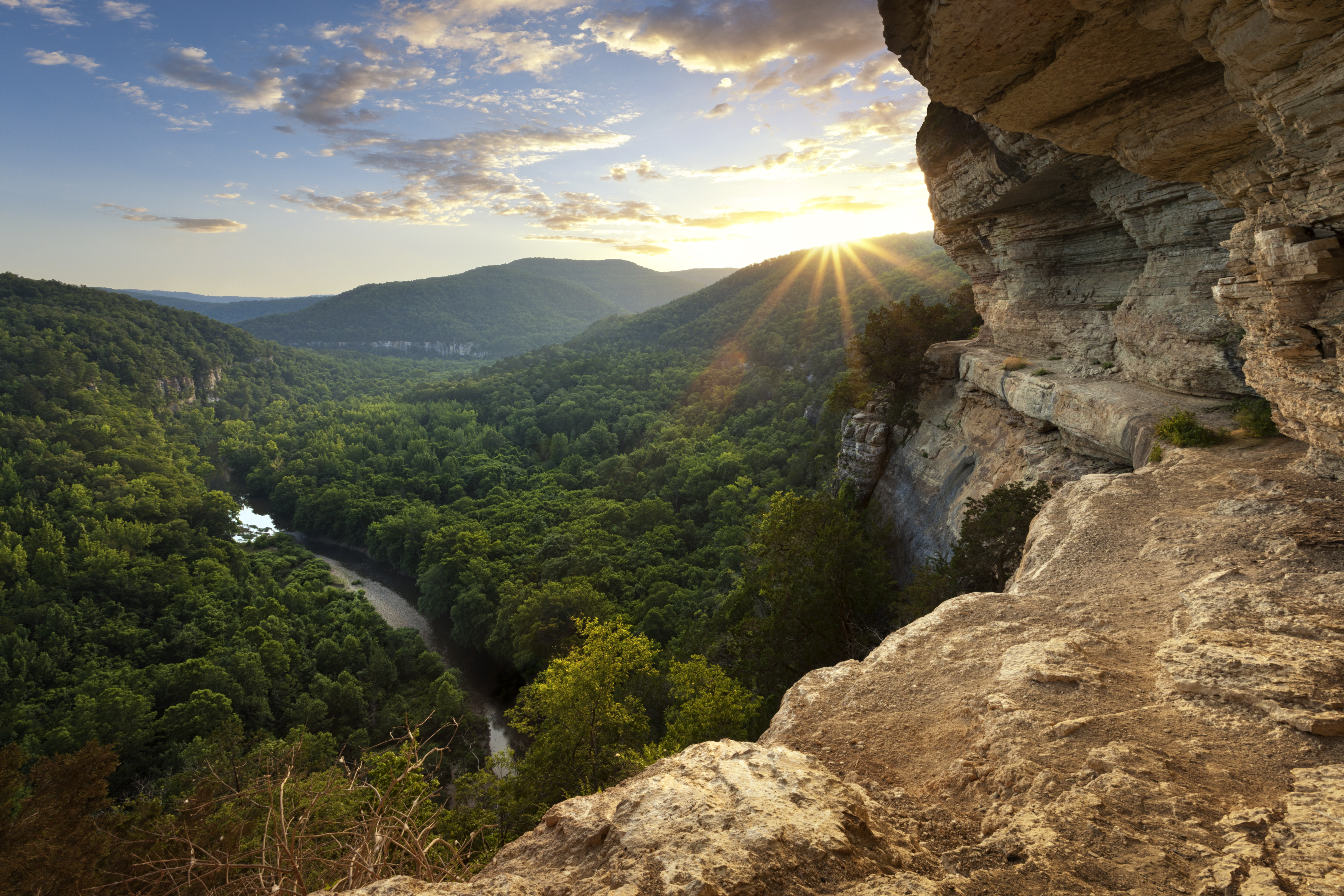
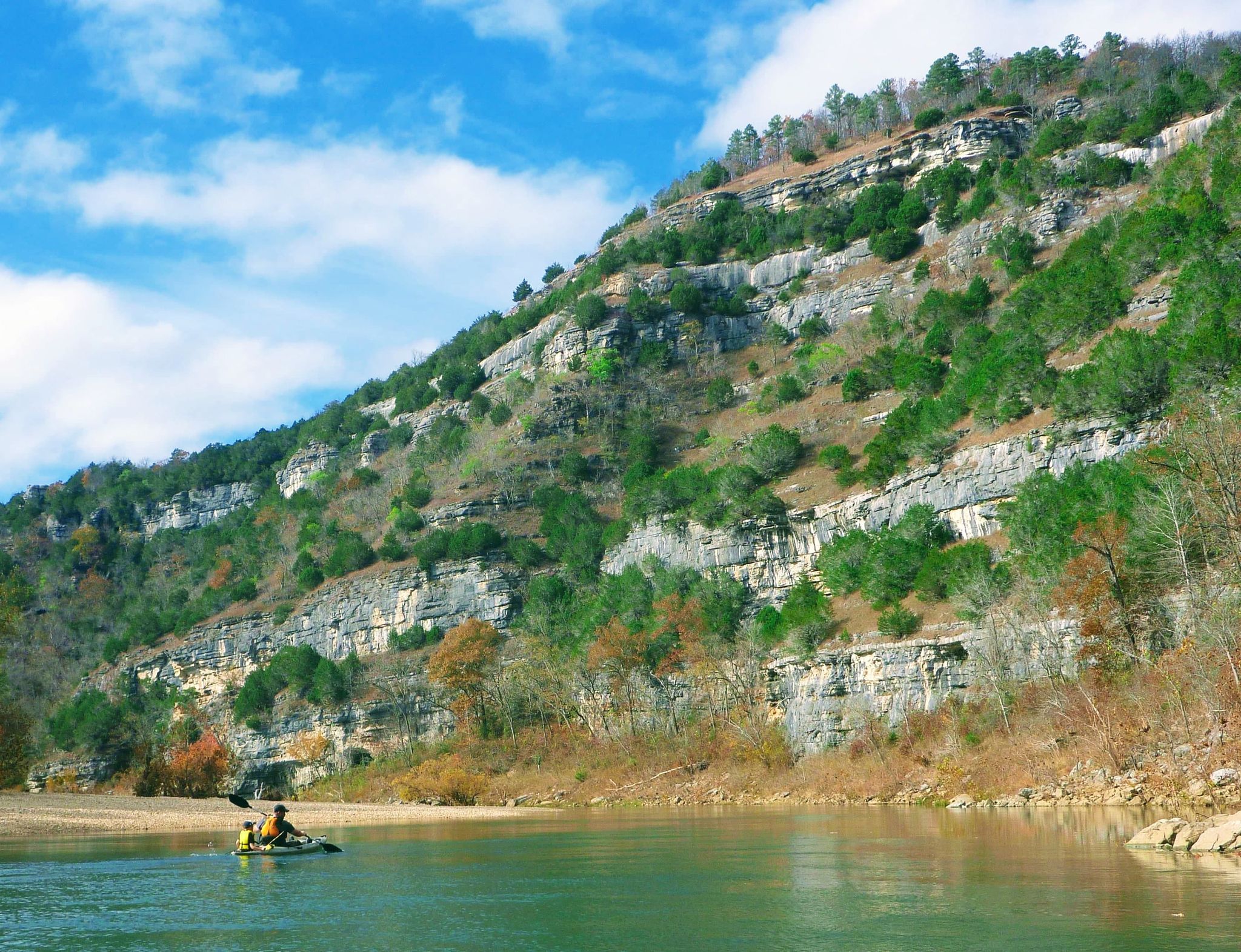
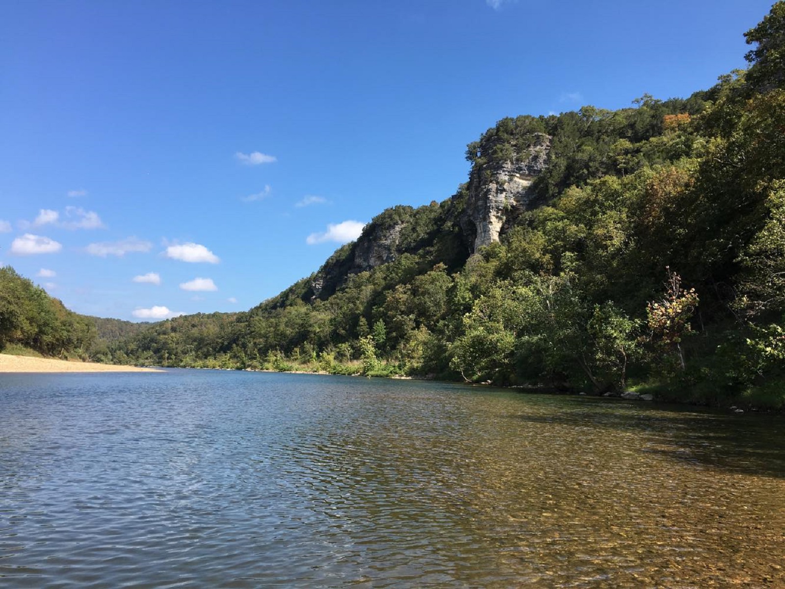
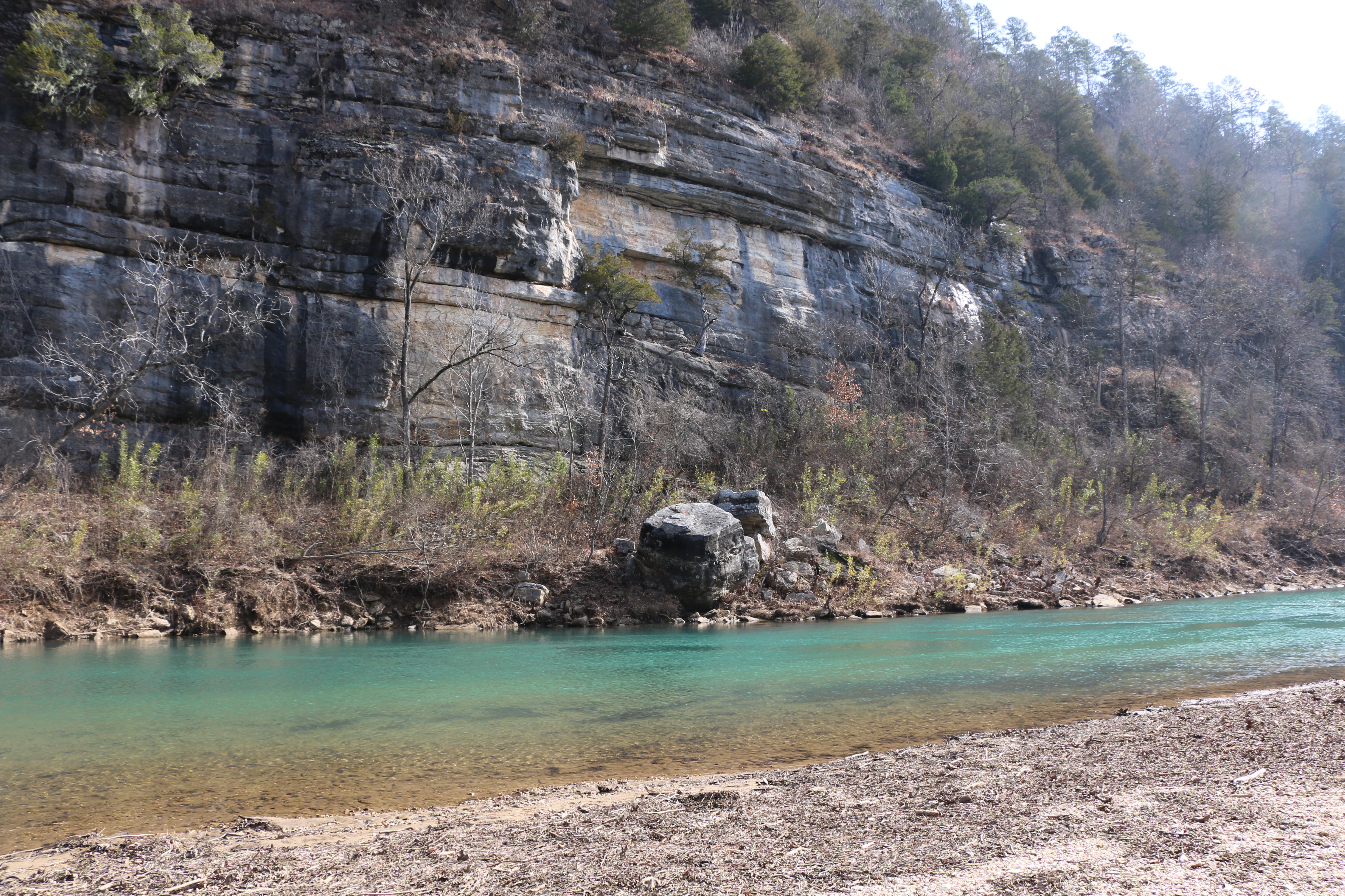
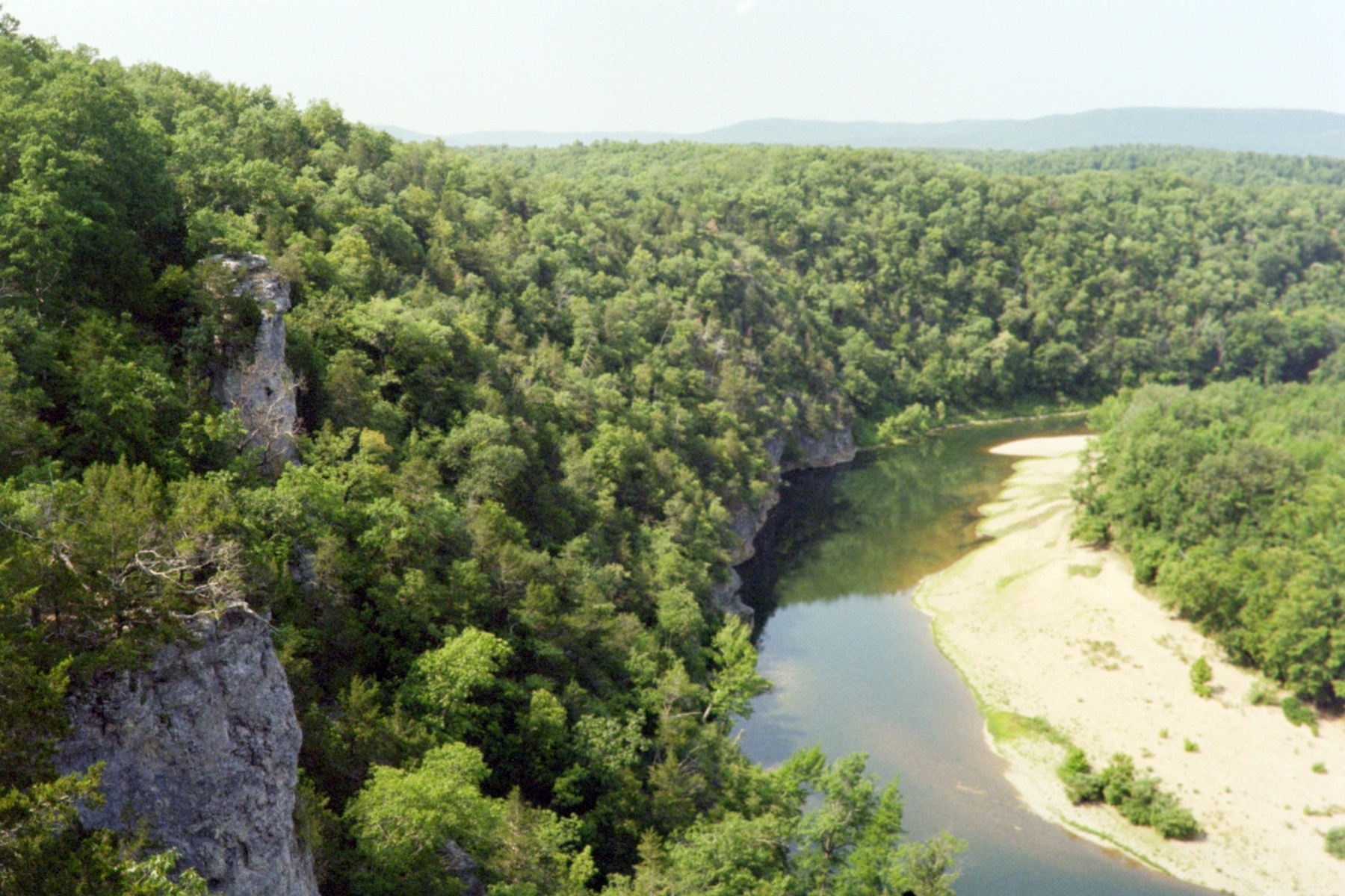
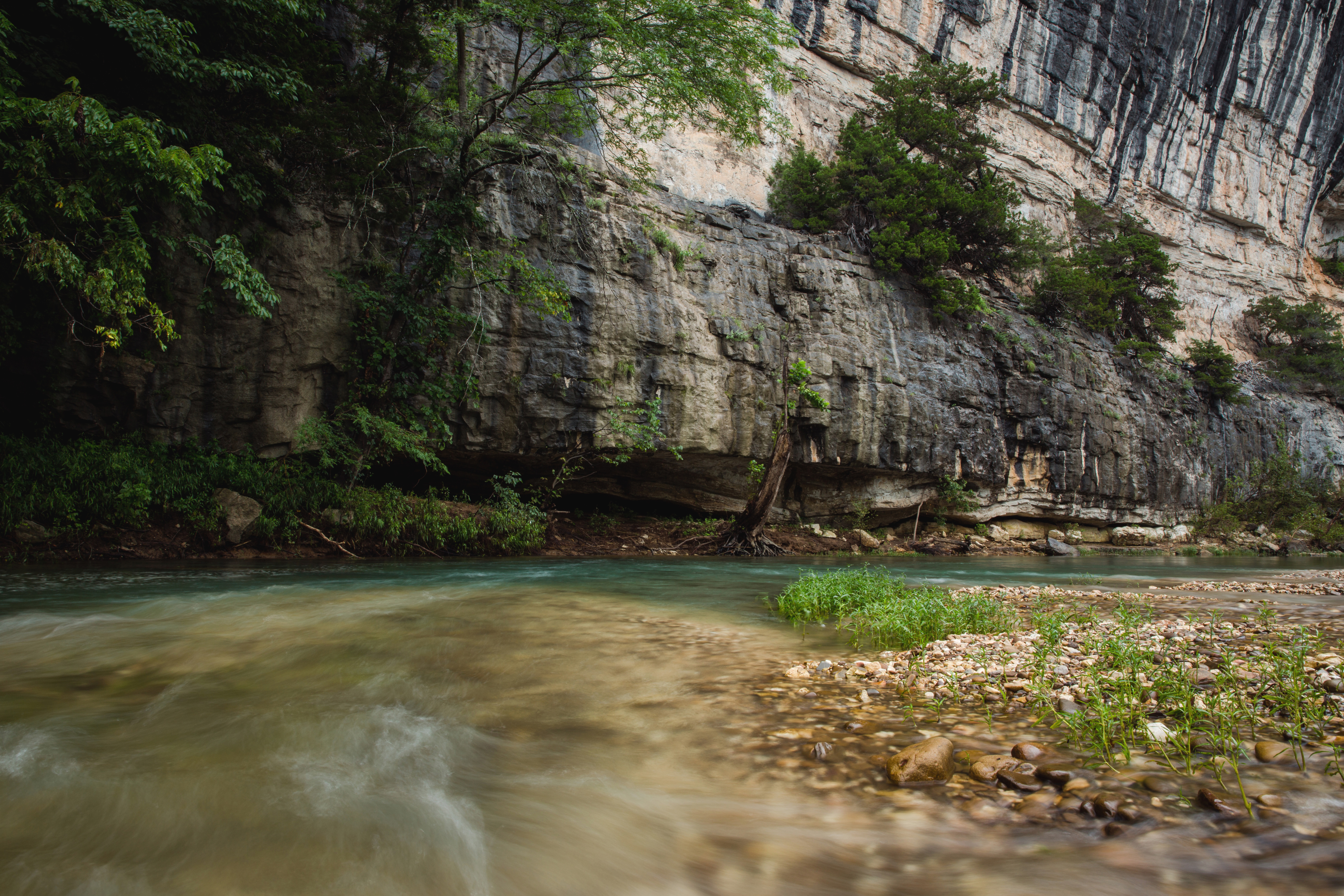
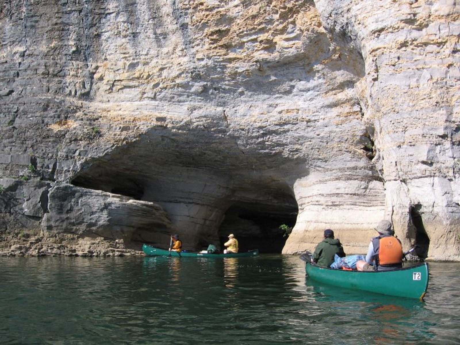
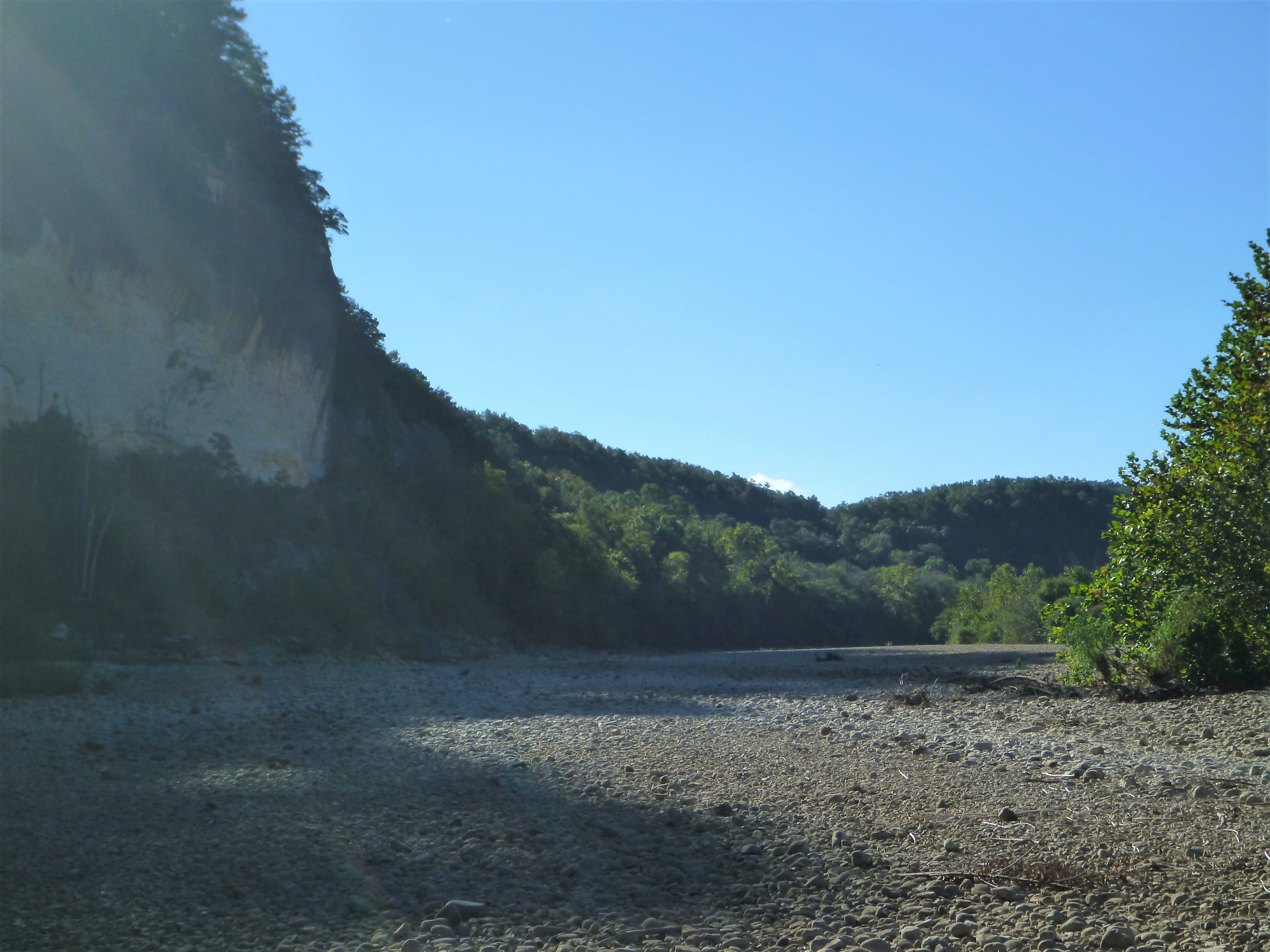
Established in 1972, Buffalo National River flows freely for 135 miles and is one of the few remaining undammed rivers in the lower 48 states. Once you arrive, prepare to journey from running rapids to quiet pools while surrounded by massive bluf...
Please contact www.recreation.gov or call them at 1-877-444-6777 to reserve a site.
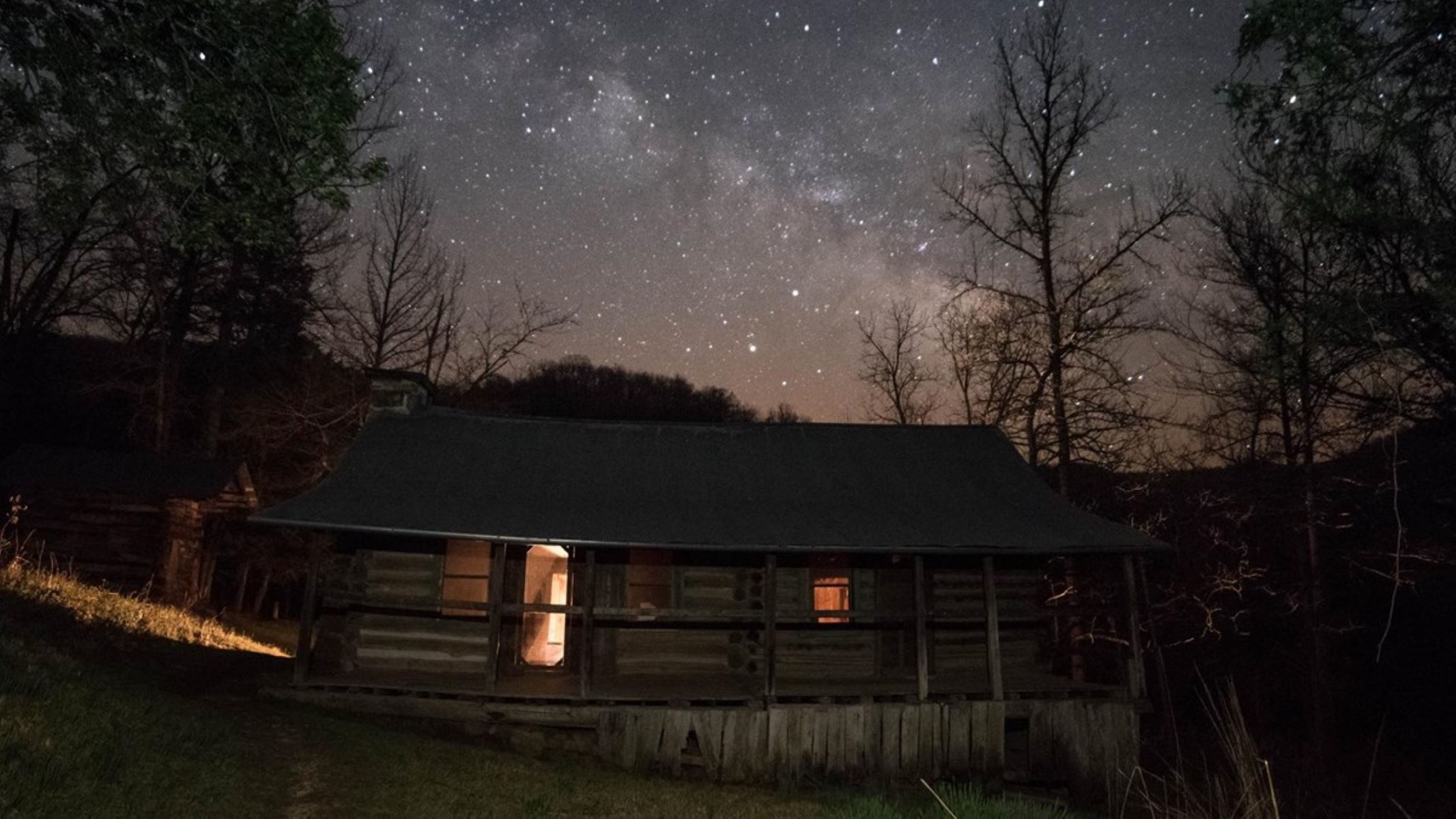
The approach to Buffalo Point Campground is about 3 miles off of Highway 14 on Highway 268. A large wooden sign with at carved Bison on it announces the entrance to the Buffalo Point area. The Buffalo Point Ranger station is on the right a few yards beyond the sign. The road continues straight to cabins, trailheads, and a restaurant. The road turns right just past the ranger station, going steeply downhill through a wooded area to reach the campground. Turns for group sites are on the right and for campground loops on the left. The road ends at a picnic area with restrooms at the top of the river bank.
The approach to Carver campground is a gravel drive off Highway 123 to a gravel parking lot. There are wooden posts at the edge of the lot where the grassy campground area begins. Sites are scattered throughout the grassy area, each with a fire ring and picnic table. The vault toilet, water spigot, and bulletin board are at the right end of the campground near the river access point.
Group sites 2, 3, and 4 are reservable by calling the Tyler Bend Visitor Center at 870-439-2502. Group sites 1 and 5 are first come, first serve. Each group site is permitted to have up to 25 people per site, tent camping only. All drive in and walk in sites are first come, first serve. Drive in and tent only sites are limited to 6 people per site.
Erbie campground is about 5 1/2 miles on a gravel road off of Highway 7 about 3 miles north of Jasper, AR. The road winds through woodlands including at least one hairpin curve. The road straightens out into the valley. The turn into the campground is on the right. Straight ahead takes you to the historic Parker Hickman farmstead. When you turn into the campground the road to the right goes to parking and river access point. To the left is the campground with large groups sites in the field on the right. Past the group sites are individual campsites amongst the trees.
All sites are first come, first serve. Please pay with cash or check at the fee station after selecting a site.
Kyles Landing campground is about 3 miles down a rough, steep gravel road off of Highway 74 about 5 miles west of Jasper, AR. The campground road makes a loop around a grassy open space with campsites disbursed around and inside the loop. Parking areas are along the road. The restroom is straight ahead as you drive into the campground. As you follow the loop to the right another loop circles to the river access and parking area. At the opposite end of the campground loop is another parking area and trailhead for the Buffalo River Trail and Old River Trail.
Ozark campground is 1 1/2 miles along a gravel road off Highway 7 about 3 miles north of Jasper, AR. The road travels through woodland with a clearing for the campground at the end. The road circles around a center open field. The river access is at the far end with campsites to the left as you enter the campground. Restrooms and picnic pavilion are in the grassy field near the road.
Rush Campground is about 5 1/2 miles off of Highway 14 on Marion County Road 6035. The road is paved for about 4 miles until it enters the park where it becomes gravel. You drive through the remains of the Rush historic district, several wooden buildings on the right, the interpretive trail with parking lot on the left, and the stone walls of the store as you drive around a curve. Another mile further the road forks. Straight ahead takes you to the river access. Bear right, cross the concrete low water bridge and pull into the parking area. Wooden posts separate parking from the grassy campsite area. Vault toilet and water spigot are to the right with campsites arranged around the open area.
The approach to Spring Creek campground is a 3 mile gravel road through woodlands and fields. At the end of the road you enter a shady clearing with campsites around the woodline and a vault toilet in the center. Access to the river is straight across the clearing down a gravel path.
Tent sites 1-13 and horse sites 27-32 are available for reservation at www.recreation.gov or by calling 1-877-444-6777. Reservations can be made 5 days to 6 months in advance. Reservations are only accepted for the time frame between March 15 and November 14. All other tent and horse sites are available on a first come, first served basis.
Steel Creek campground is about 1 mile off Highway 74 13 miles west of Jasper, AR or 2 miles east of Ponca, AR. The road is paved, steep in places with several sharp curves through woodlands before flattening out in the open river valley. The road becomes gravel. Straight ahead across open grassy fields are tall rock cliffs. The road to the right takes you through the fields to the horse campground and the ranger station. The road to the left takes you along a wooded hillside on your left and the field with cliffs beyond to the tent campground. The road widens to include parking with wooden posts to separate it from the field and campsites. Campsites are scattered throughout the field with each one having a fire ring and picnic table.
The pavilion and group sites can be reserved up to a year in advance at recreation.gov or by calling 1-877-444-6777. Individual drive-in sites (2 - 13) and walk-in tent sites (A - E) are available for reservation 5 days to 6 months in advance. All other sites are first come, first served and payment for these sites must be made with cash or check at the self-pay station in the campground.
Tyler Bend Campground is about 2.5 miles off Highway 65 on the park road. The turn into the drive-in and walk-in campsites is the first road on the right past the visitor center. The group sites are the second road to the right. The approach to the drive-in sites is slightly downhill with the restrooms on the left, the amphitheater on the right. At the bottom of the hill the drive-in sites are a left turn and the road loops around for access to all 28 sites. Sites are arranged on both sides of the loop road and include wooded and open field sites. The approach to the walk-in sites is straight ahead from the bottom of the hill. The road makes a loop with parking and campsites on the outside and a wooded inner circle.
No reservations. This is an open field with no designated sites. If you find a spot to put a tent/RV, you have a campsite.
Access to Woolum is on a paved/gravel road off of Highway 65 at St. Joe, AR. The first 4 miles is paved two lane road with the last 3 miles being graded gravel road. Entering Woolum there is a bulletin board, vault toilet, and roadway to the river straight ahead. The road turns to the left, hay fields are on the left and mowed grass area for camping on the right. Camping is not permitted in hay fields. Two more vault toilets are at locations along the roadway.
James A. Villines, born in 1854, grew up to be a fur trapper known as “Beaver Jim”. He married Sarah Arbaugh and built this homestead in 1882. The cabin and a variety of outbuildings remain, built by Beaver Jim or added or changed by succeeding owners.
In front of us is a one story wooden cabin with a metal roof and gutter. The front of the cabin has a porch running the length of the building. The front has three windows with green frames, and two doors. On the left side is a stone chimney. The back of the house has a small addition. Beyond the farmhouse is a wooden smokehouse, a concrete root cellar and a concrete privy. As the loop continues we will pass a wooden chicken coup, a wooden corn crib and wooden barn.
Throughout history, the waters of the Buffalo River Valley have supported agriculture, industry, and community. Boxley Grist Mill used the power of moving water to grind corn into meal and wheat into a flour, a service that was hard to come by in the rural Ozarks in the later 19th century.
Three small, one story brick cabins are on the right. Each cabin has one small window facing us. As you move counter-clockwise there is an old wooden barn with a metal roof behind a fence. In the distance beyond the wooden gate is the mill. A three story wooden building, approximately 30 by 35 feet with a sheet metal roof. Attached is a small addition. There are two windows on the first two floors of the longer side of the building. On the left side is a small porch.
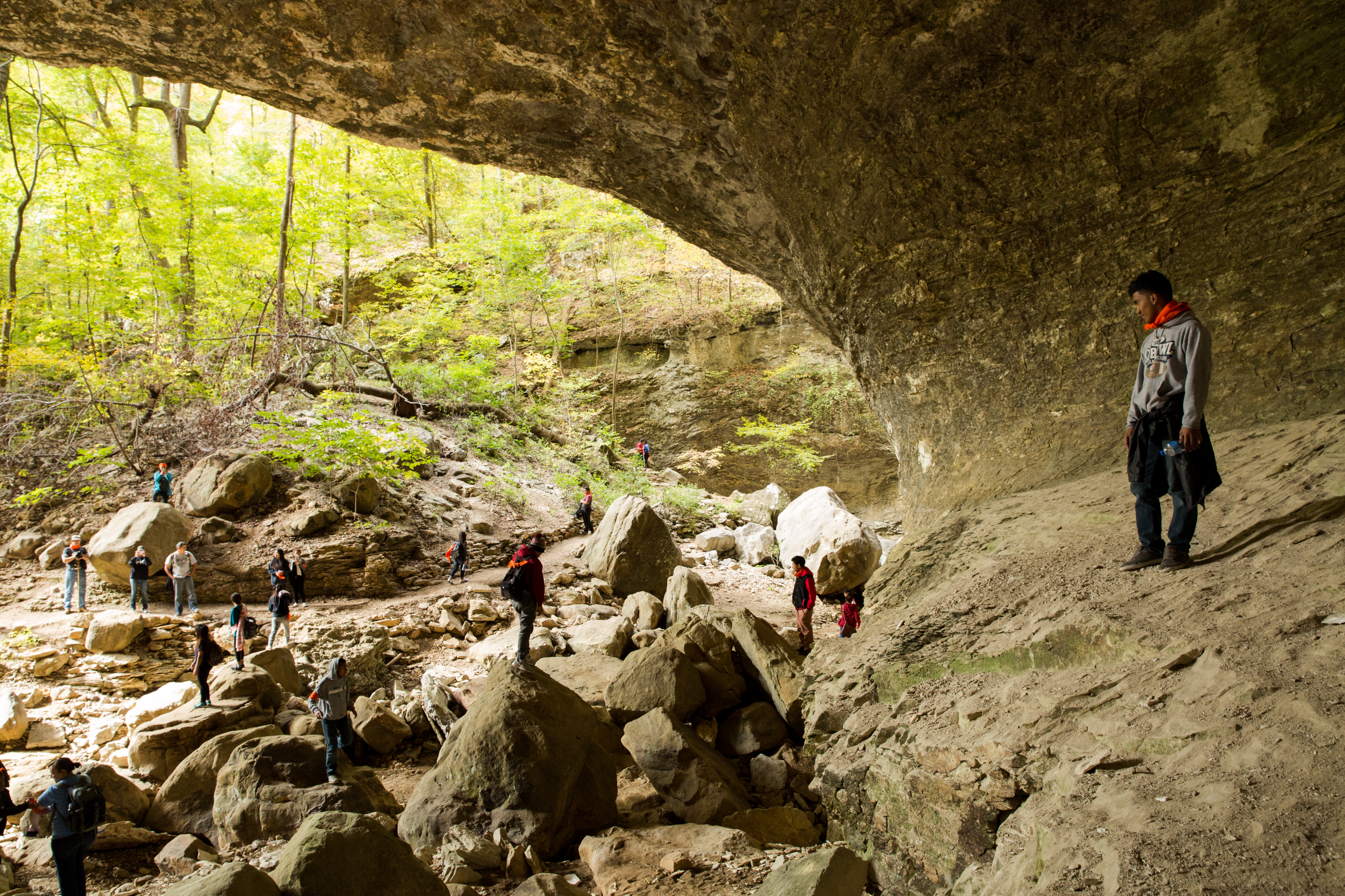
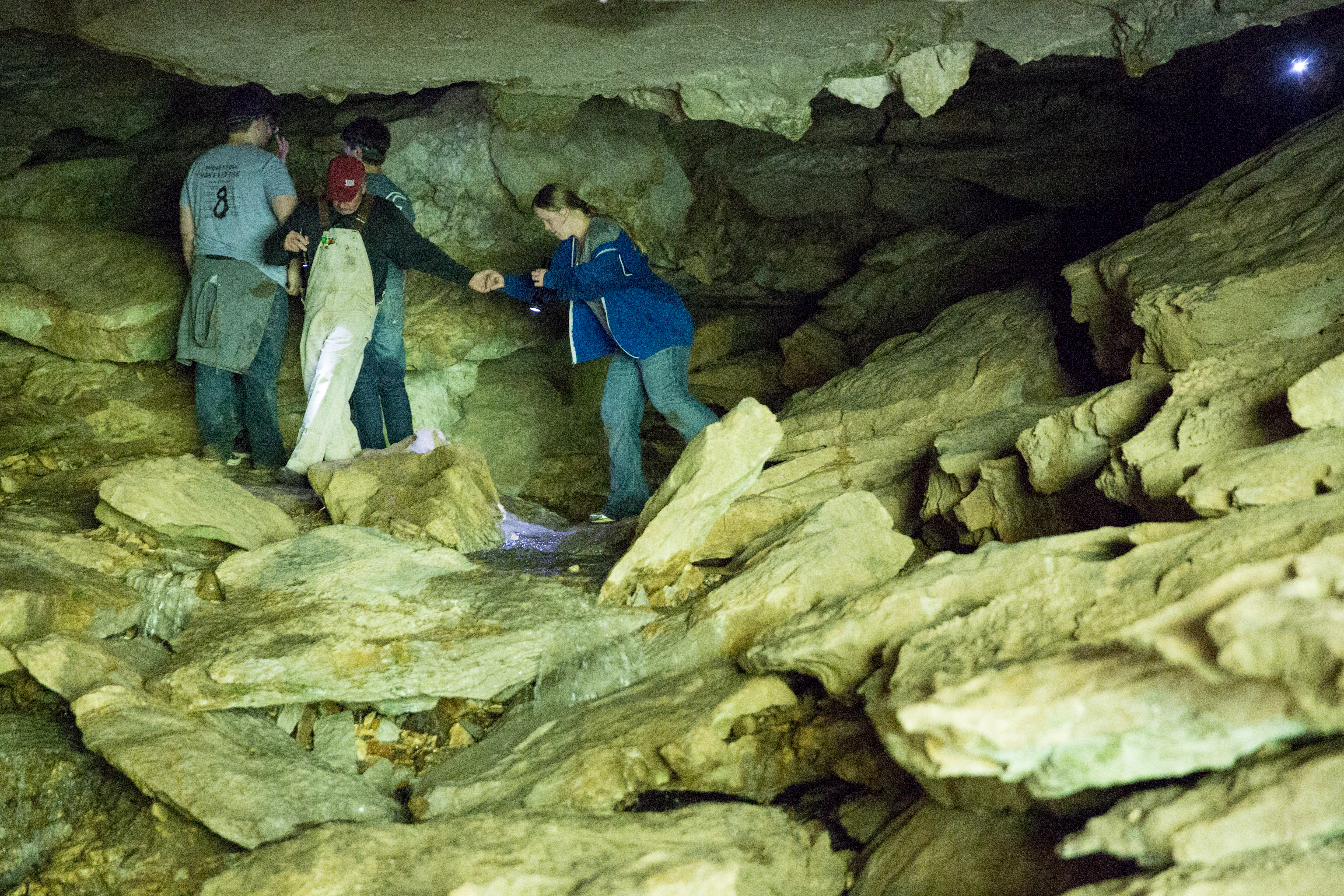
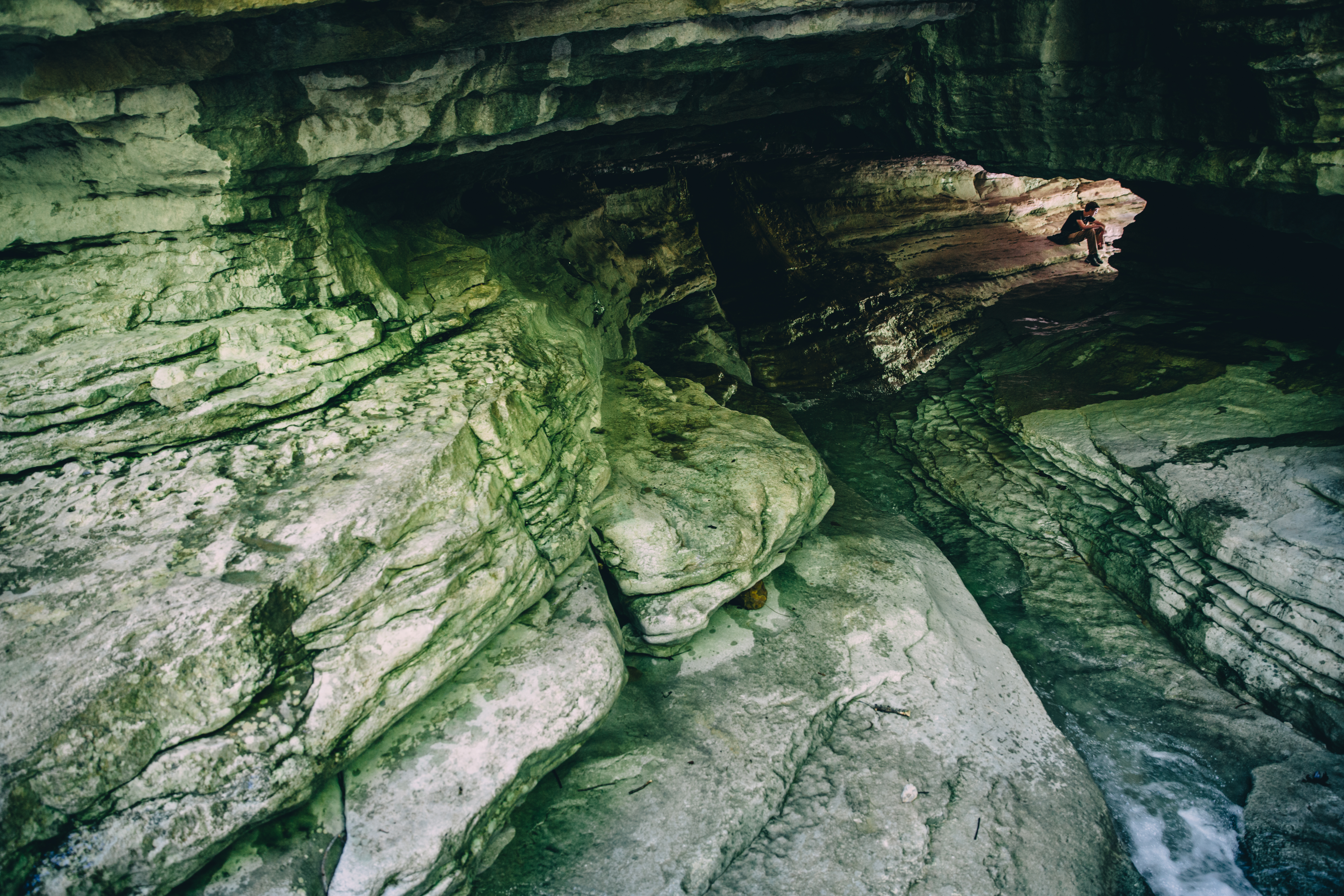
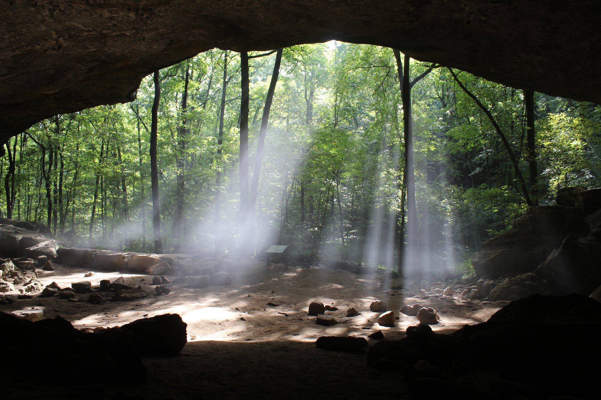
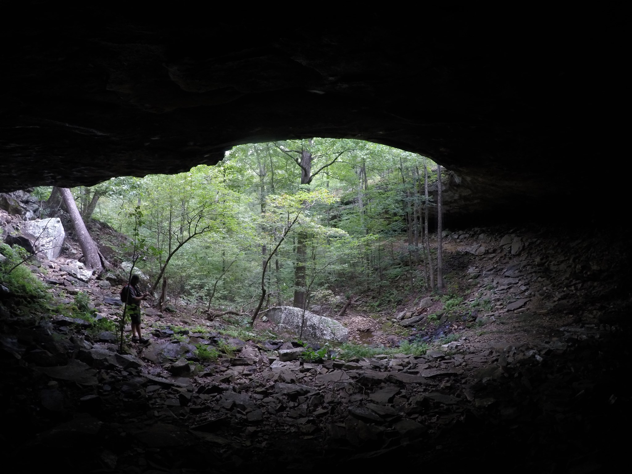
Cob Cave is a bluff shelter located on the Lost Valley Trail in the Upper District of Buffalo National River. This bluff shelter is approximately 50 feet high, 150 feet deep, and 260 feet long from end to end. The shelter was formed by Clark Creek undercutting and eroding away a soft, soluble layer of rock, leaving a hard upper rock layer as the bluff shelter's ceiling. Based on archeological evidence, we know that this shelter was used by Native Americans 2,000 years ago.
An enormous natural bluff shelter opens up at the base of a towering stone cliff. The shelter is approximately 50 feet tall, 150 feet deep, and 260 feed long from end to end, and a shallow creek flows among large boulders from the left to right end. Overhead, the bluff shelter's ceiling is relatively flat, and the bluff above it is around 200 feet tall. We stand on the Lost Valley Trail, which continues upstream to Eden Falls beyond the left end of the bluff shelter.
A short easy walk to an early 20th century homestead.
The remnants of the Collier Homestead include a cabin, small shed, cistern and one outbuilding. The gravel parking area is about 1 mile from Highway 65 on the Tyler Bend entrance road. The walking path to the cabin is about 4 feet wide, mostly grass covered with woods on the left and field on the right. Several walnut trees are scattered in front of the fenced yard of the cabin. The picket fence is grey weathered boards with an opening directly in front of the cabin. A small log shed and large oak are at the left. The cabin is straight ahead about 30 feet. The left half of the cabin is hand-hewn logs and the door leads into the main room. A stone fireplace is in the center of the right side wall and a window opening is in the center of the left side wall. The ceiling is low and made of dark wood planks. The right half of the cabin has some rough sawn boards forming the porch. The opening for this side of the cabin is the porch with a door into another room on the left. An opening at the left of this doorway leads into a small room with shelves and a rough cupboard. The stone chimney structure dominates the center of this small room.
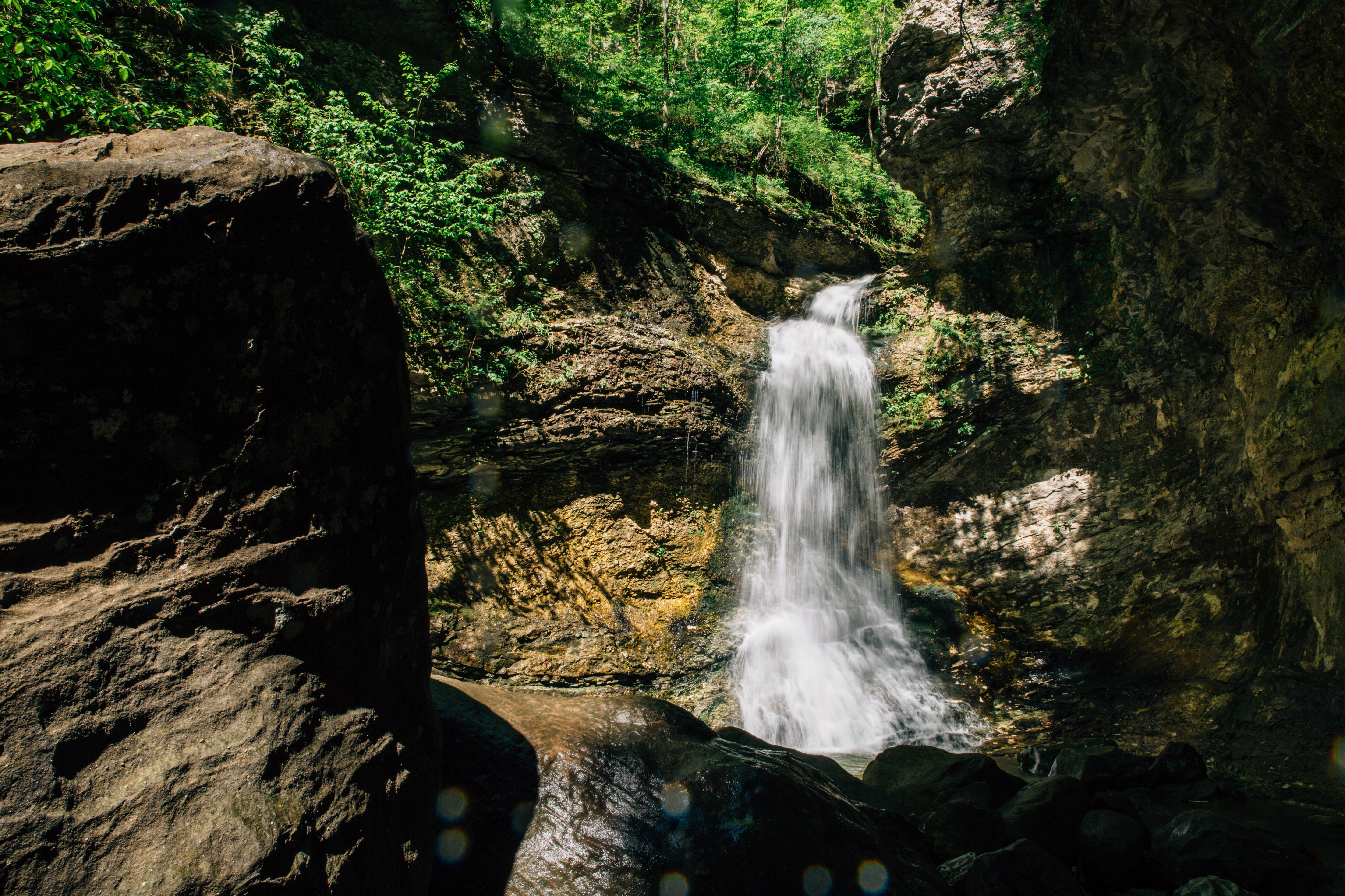
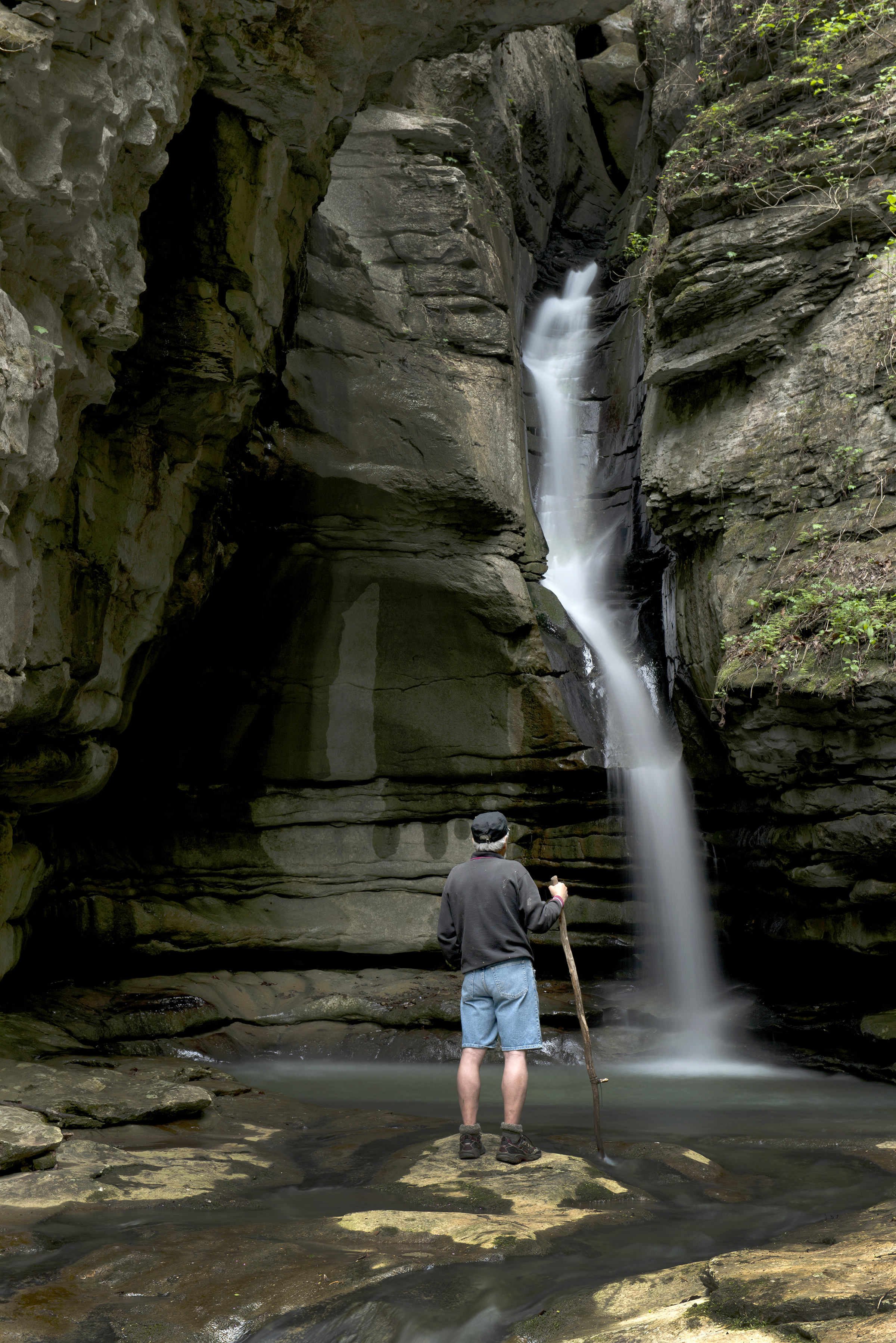
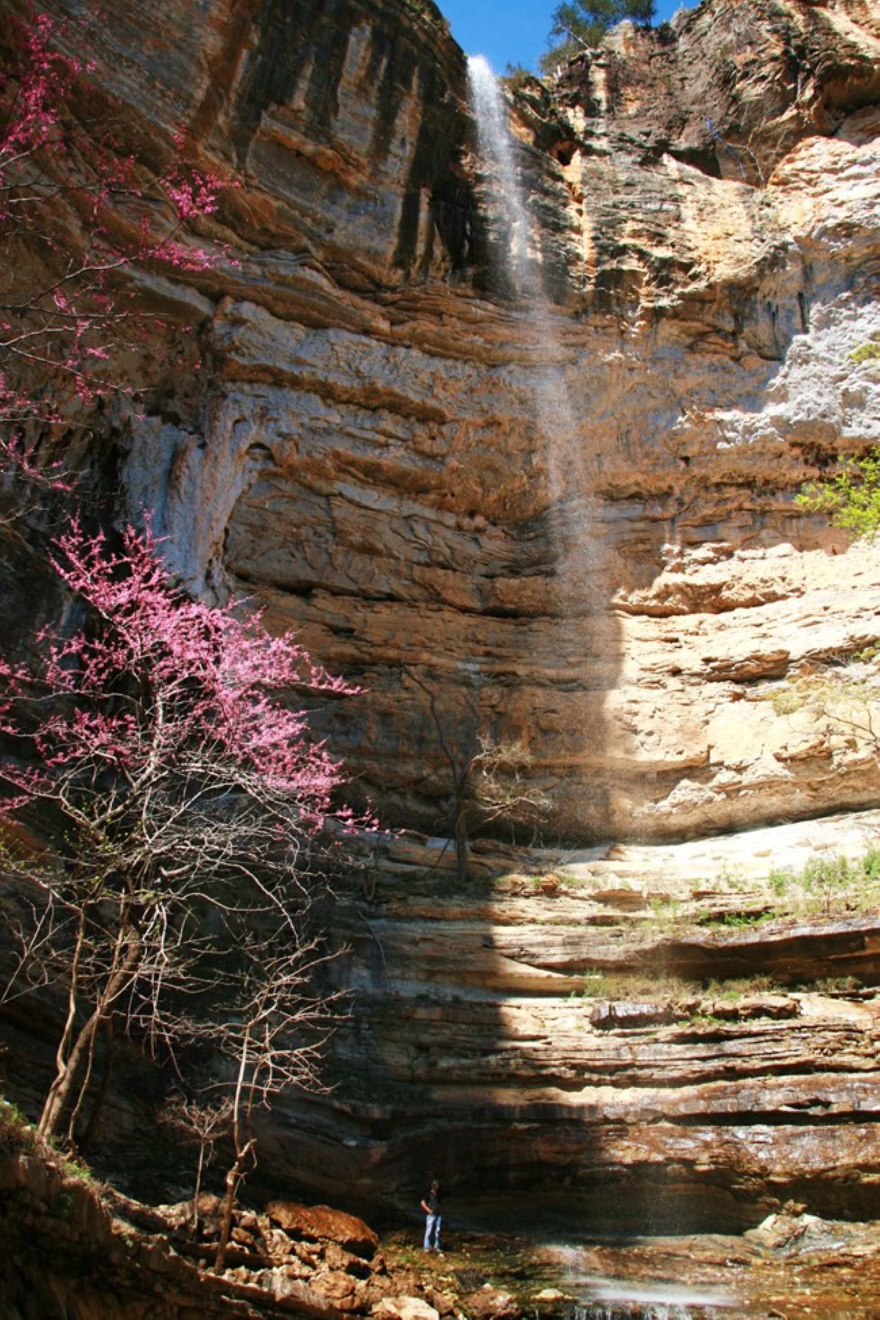
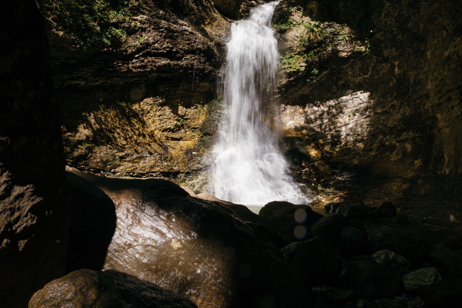
Eden Falls is a 53-foot-tall waterfall on the Lost Valley Trail in the Upper District of Buffalo National River. The spectacle of Lost Valley, Eden Falls cascades out of a cave opening in the hillside and then tumbles into the box canyon, forming Clark Creek.
We stand on a dirt path among enormous boulders at the base of a beautiful waterfall: Eden Falls. Above our heads, the 53-foot-tall waterfall tumbles over a narrow, horseshoe-shaped rock ledge formed where the box canyon's walls come together. The water free-falls for about 35 feet and then hits a rocky slope and cascades the rest of the way down into a bright blue pool strewn with large rocks. High above the waterfall on a steep hillside, there is a large cave opening: Eden Falls Cave. The water that forms Eden Falls spills out of that cave and cascades down in a series of tiers before it tumbles over the edge right in front of us.
Eden Falls Cave is a geologic feature located at the end of the Lost Valley Trail in the Upper District of Buffalo National River. A significant portion of Clark Creek flows out of this cave and enters Lost Valley by way of Eden Falls.
We stand on a path on a narrow, rocky ledge with a major vertical drop on our right side. A steep hillside juts upward on the left side of the trail. In front of us is a cave opening, approximately 8 feet tall by 30 feet wide. Water rushes out of the cave and tumbles toward the bottom of the box canyon on our right.
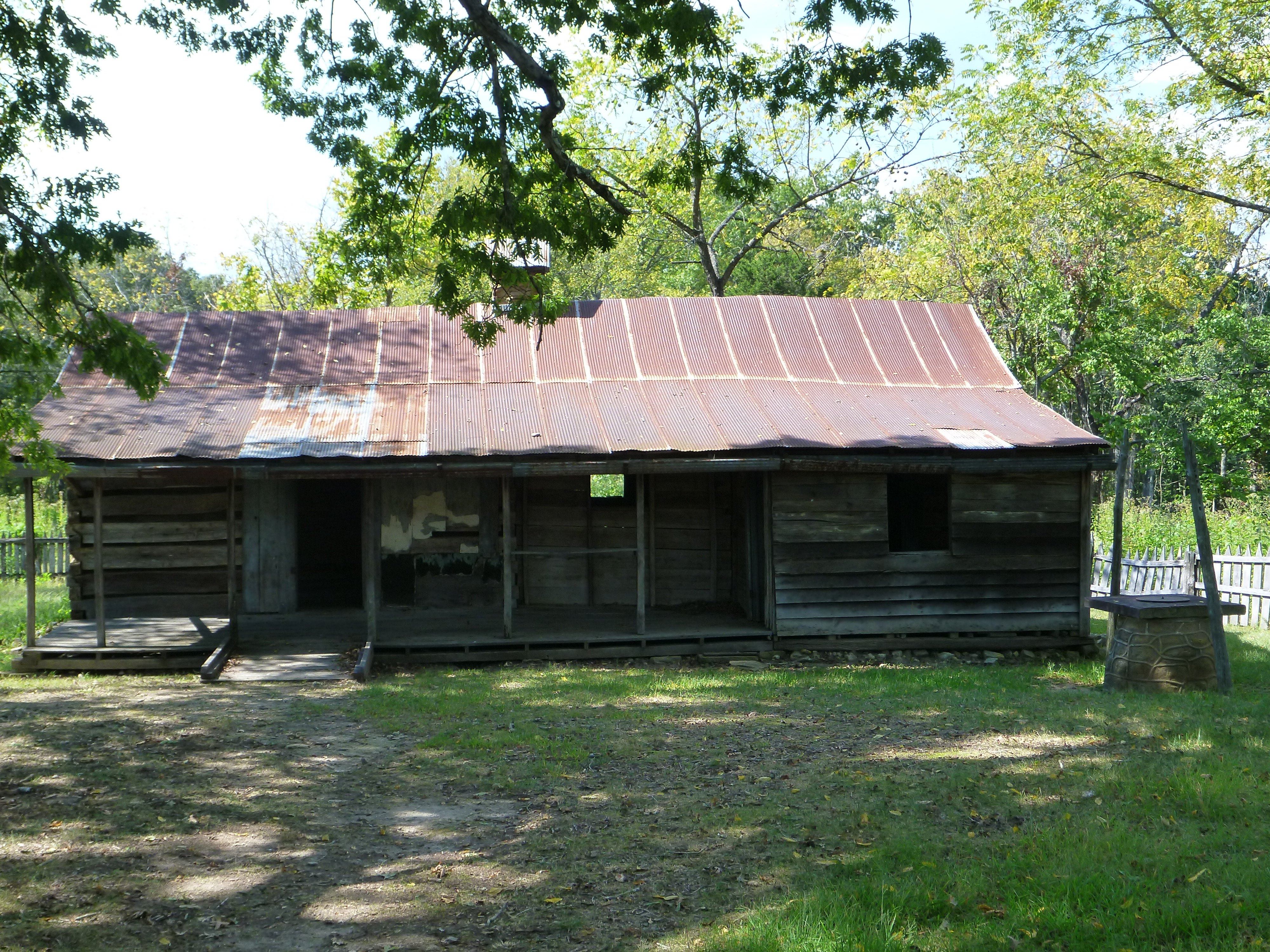
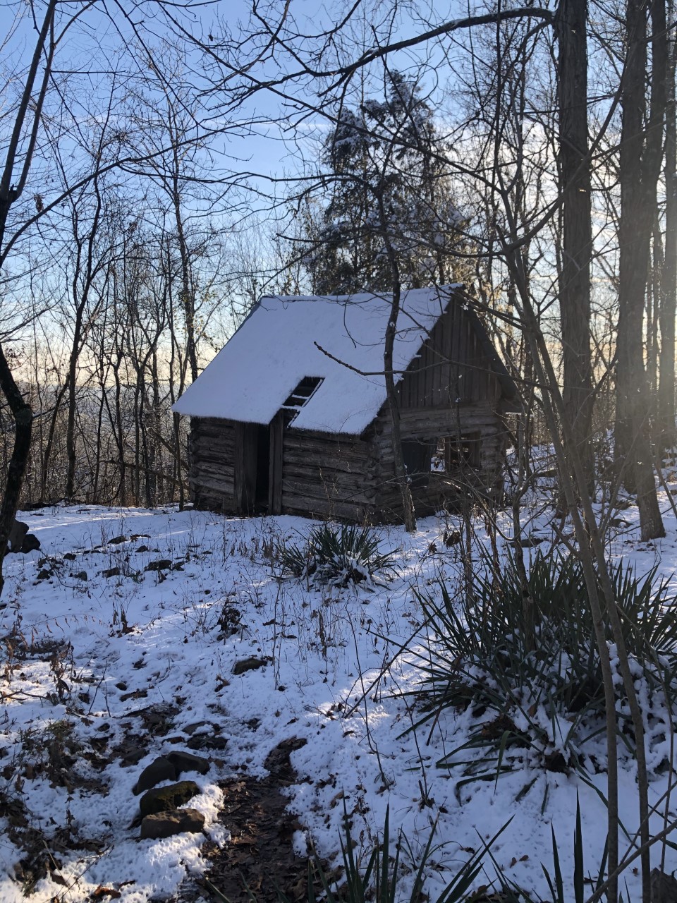
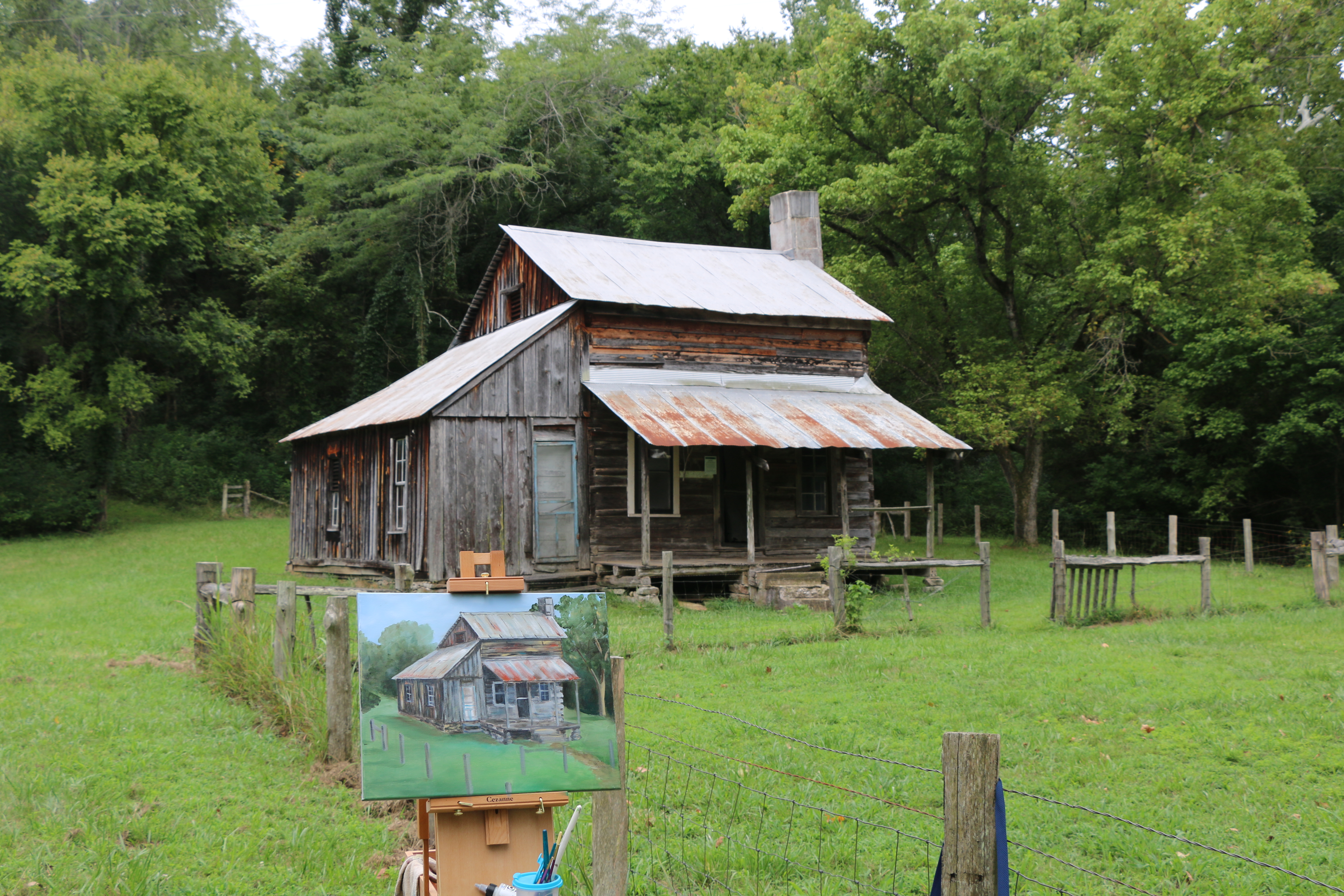
Frank Henderson and his wife Eva, later to be known as the famous “Granny Henderson” cleared the land and constructed the cabin themselves in the early 1900s in what is now the Ponca Wilderness.
A two story wooden cabin, with a metal roof and a front porch. On the side of the house are two open windows. The front porch has the door and another window.
The Natural Bridge is a geologic landmark on the Lost Valley Trail. At this location, Clark Creek flows through a natural limestone tunnel approximately 50 feet long and 6 feet tall. The creek then cascades 8 feet down into a wide, shallow pool beneath the Natural Bridge.
On our left and behind us are numerous house-sized boulders. In front of us, an 8-foot-tall waterfall cascades out of a natural tunnel of reddish-purple limestone and into a wide, shallow pool in front of us. Light is visible at the opposite end of this 50-foot-long tunnel of rock, and water flows all the way through from one side to the other. The limestone here is blocky and shows hundreds of horizontal fractures. The water trickles out of the wide, shallow pool and down Clark Creek behind us.
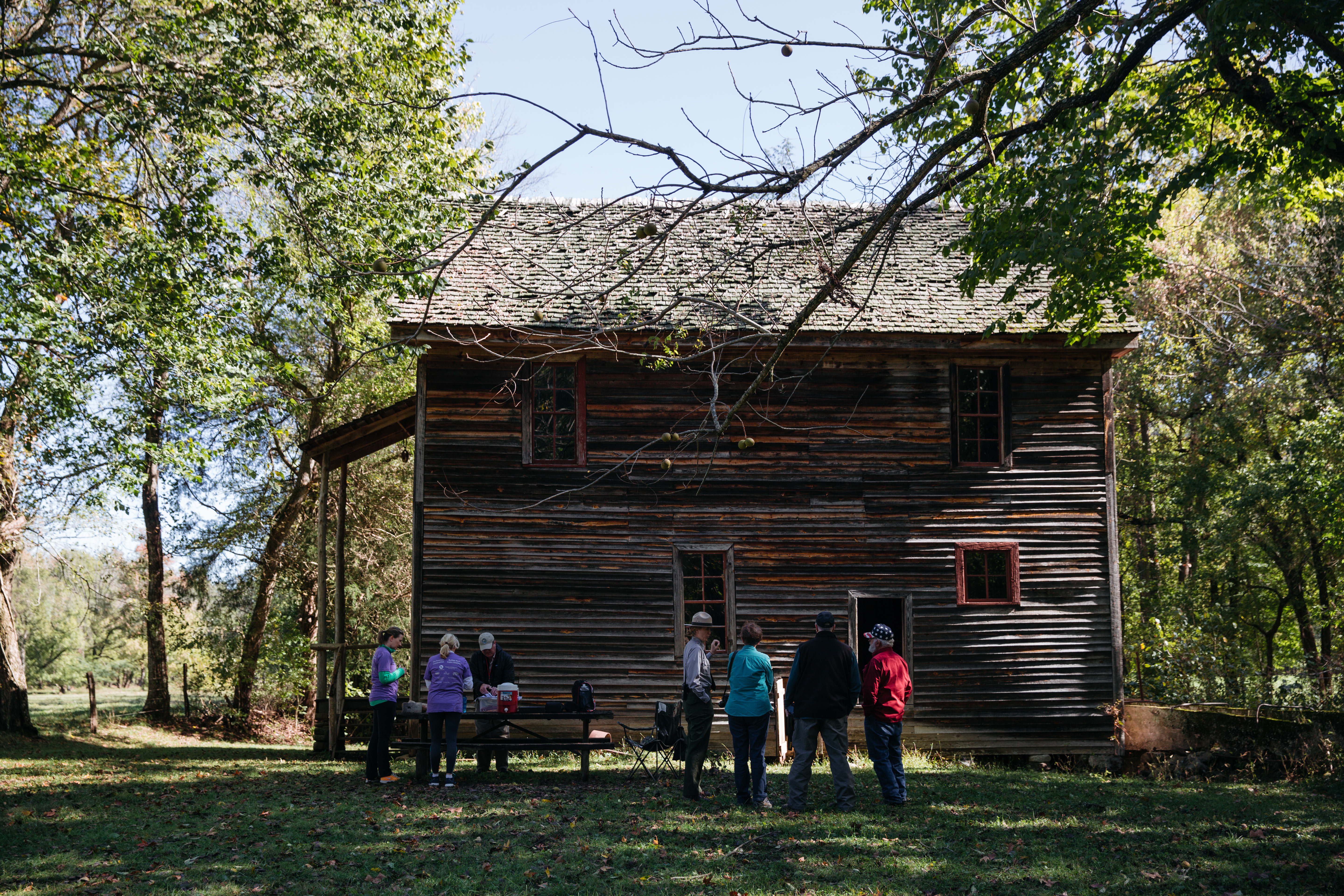
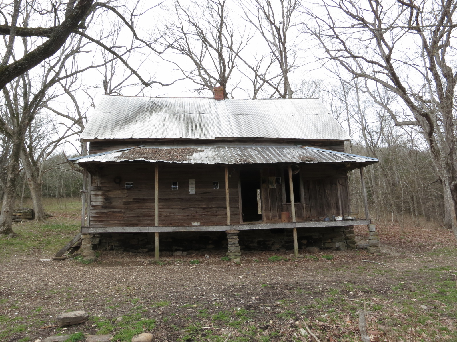
The Parker-Hickman Farmstead, located near Erbie Campground in the Upper District of Buffalo National River, preserves a significant cultural landscape in the Ozarks. The cedar log cabin dates back to the 1840s, making it the oldest structure in the park. The farmstead reflects traditional architecture, evolving agricultural practices, and economic development in the Ozarks, having been occupied continuously for nearly 130 years.
In front of us and behind a wooden gate stands a two-story log home with a steep pitched tin roof, a covered front porch, and a large sandstone chimney on the right side. The home is surrounded by small, fenced-in fields bordered by hardwood forest. Behind the home and beneath a tree is a wooden shed. A small spring flows from the hillside to our right, crossing a gravel drive that leads up the hill into the woods. As we continue turning to our right, there are several other wooden outbuildings scattered around the property, including two large log barns, a corncrib, a smokehouse, and a privy.
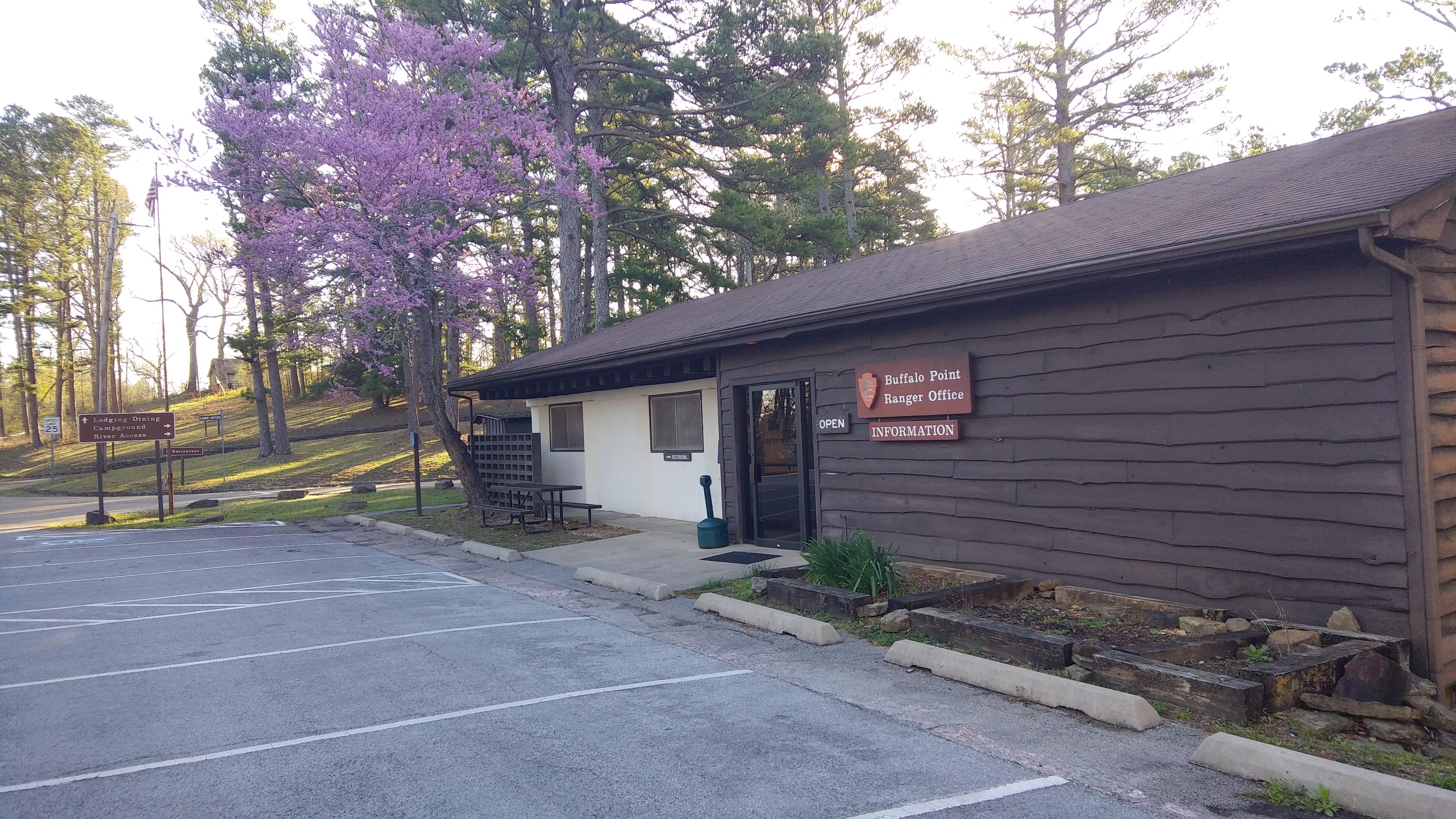
The Buffalo Point Visitor Contact Station is located about 3 miles off of Highway 14, 14 miles south of Yellville. Signs on Highway 14 indicate the turn for Buffalo Point.
Steel Creek Ranger Station is open in the summer on an intermittent basis as rangers are available. The Steel Creek Ranger Station is located in the Valley Y Ranch Historic Area of Steel Creek Campground. Please call before you visit to ensure that staff will be available to assist you: 870-861-2570.
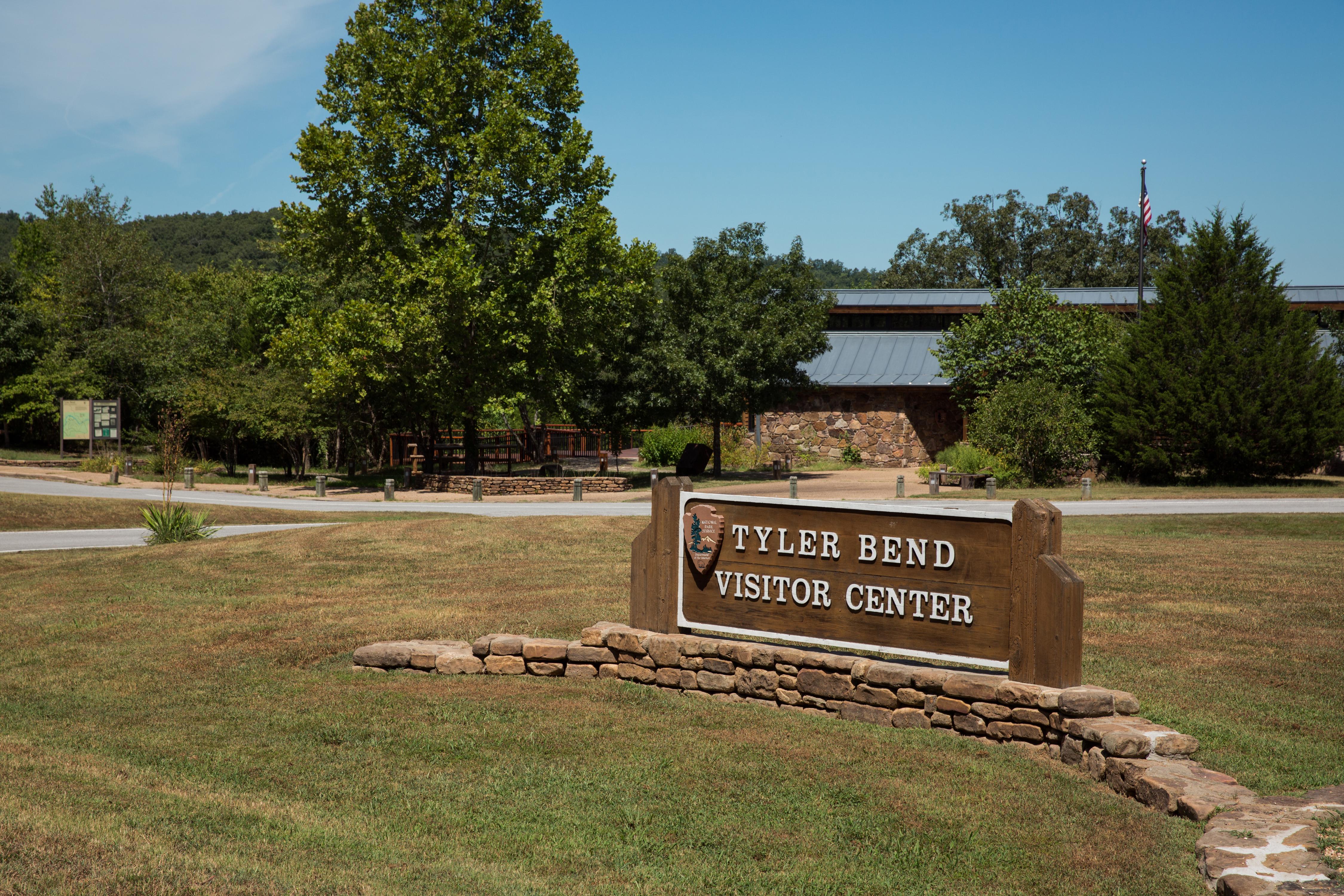
The Tyler Bend Visitor Center is located about 2 1/2 miles off of Highway 65 between St. Joe and Marshall, Arkansas. Here visitors can get park orientation information, stamp passport books, see the park film, and shop at the park bookstore.
This reach is about 12 miles which makes it one of the less crowded sections of the river.
Paddle Kyles Landing to Erbie
Downstream from the hustle and bustle of Kyles Landing, one can find solitude among this comparatively quiet, 5.7-mile stretch of river snaking through the Ponca Wilderness. Paddlers will cruise through adrenaline-inducing shoals, tranquil pools, and haystack waves on this section with fascinating sandstone formations adorning the banks.
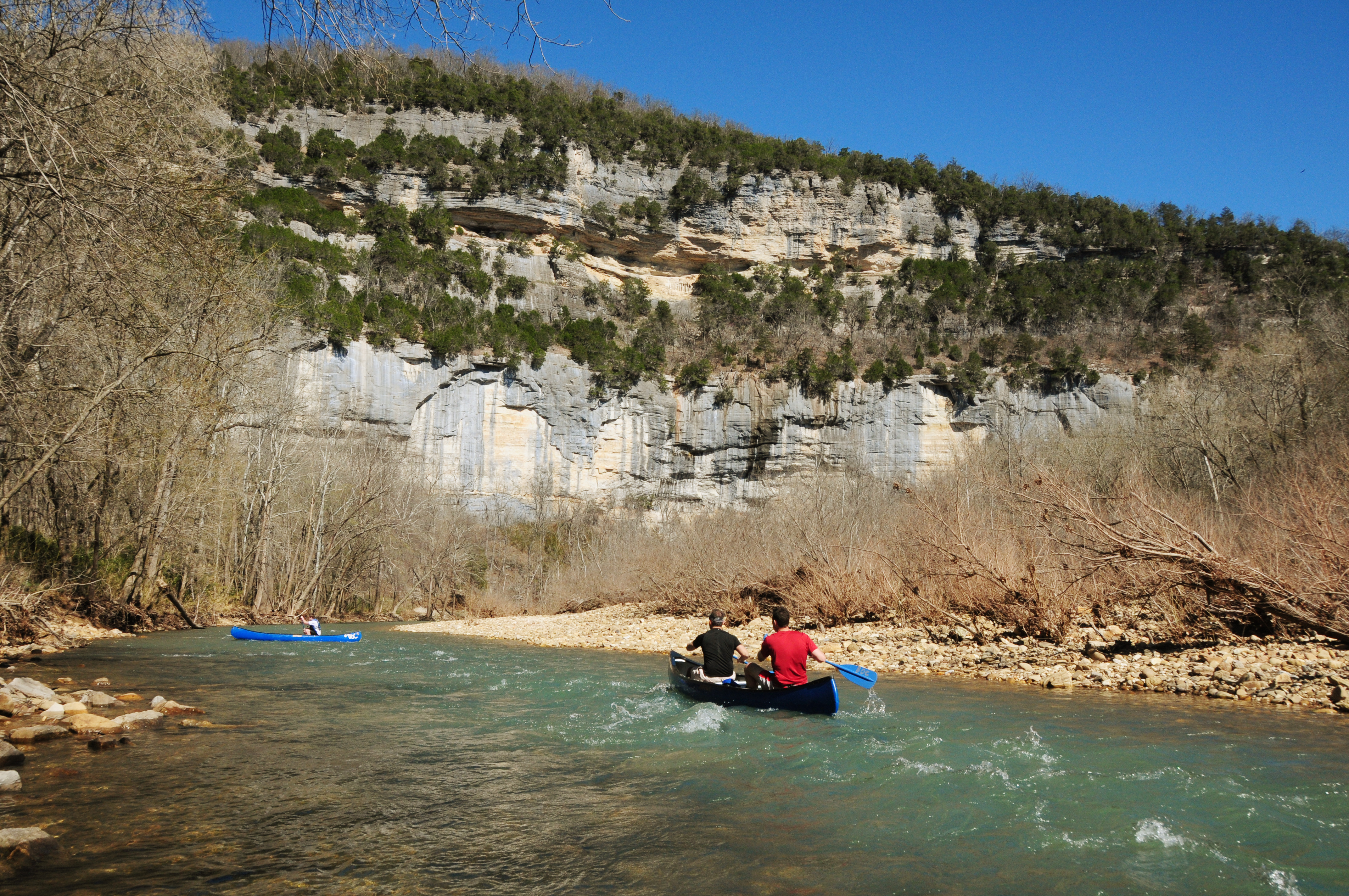
Paddle Steel Creek to Kyles Landing
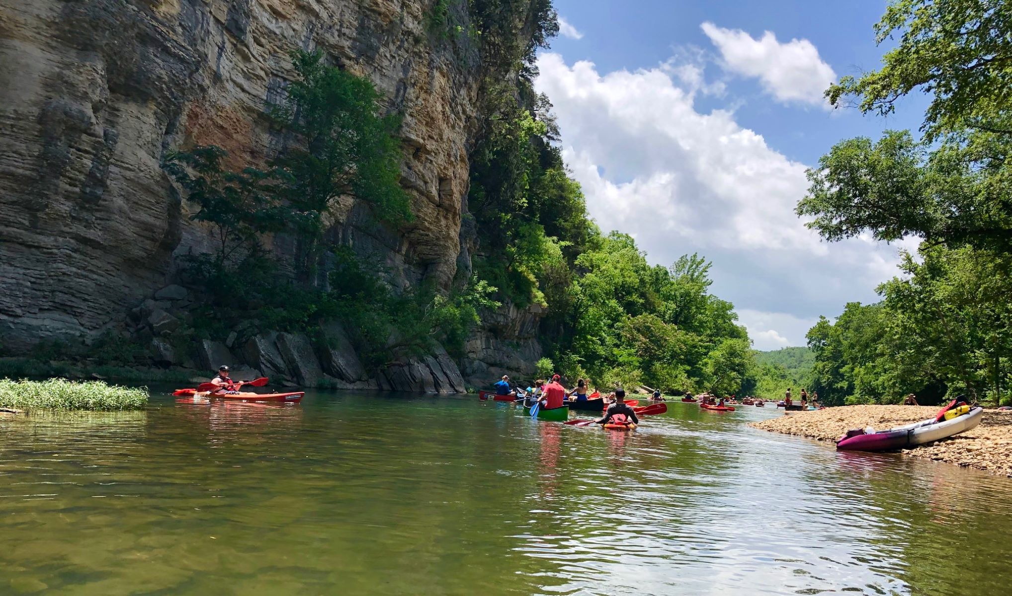
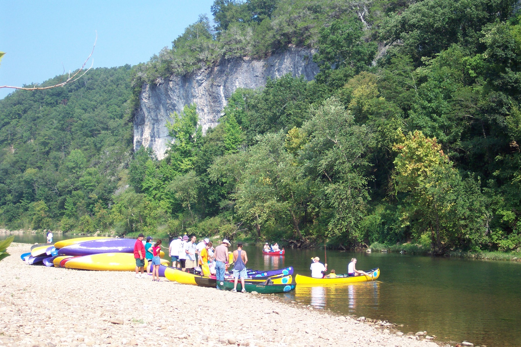
Hands-down the most beloved and popular section of the upper river, the 8-mile section from Steel Creek to Kyles Landing meanders through the heart of the Ponca Wilderness past towering bluffs, hidden side canyons, and relics of early settlement. Alternating between tumbling rapids and long, cerulean pools, paddlers will delight in the variety of pace and challenge.
Hike the Cecil Cove Loop
This 7-mile loop winds through the wooded valley following Cecil Creek. The trail crosses Cecil Creek 5 times in the first 2 miles, so it may not be passable during rainy season due to high water. The Cecil Cove Loop passes old home sites, historic cemeteries, and provides beautiful scenic views during leaf-off. CAUTION: Starting in 2021 the Cecil Cove Trail experienced and continues to experience landslides. Proceed on the trail at your own risk and use extreme caution.
Hike the Rush Mine Level Trail and Morning Star Interpretive Loop
This .25 mile to 1.5 mile trail offers beautiful views of Rush Valley and gives hikers an understanding of the historic, mining, landscape. In the 1880s, zinc ore was discovered in the hills and claims were staked out along Rush Valley and neighboring Clabber Creek. Eventually, a community of homes and businesses developed along Rush Creek and endured until the 1960s. Come and explore this unique history as you hike Rush Mountain.
Hike the Beaver Jim Villines Homestead Trail
This short interpretive loop begins at the Ponca Access of the Buffalo River near the intersection of Hwy. 43 and 74. Walk across the low-water bridge (when passable) and follow signs up the hill. This easy trail passes the old homestead and farm buildings of "Beaver" Jim Villines, an early fur trapper and trader in Boxley Valley.
Hike to Big Bluff
The Centerpoint Trail is a strenuous hike that traverses the Ponca Wilderness, winding down an old wagon road descending nearly 1,300 ft. to the Buffalo River. The "Goat Trail" spurs off of Centerpoint and leads to iconic Big Bluff, which offers outstanding panoramic views of the Buffalo River and the rugged Ozark Mountains that surround it.
Hike to Hemmed-in Hollow
The picturesque Hemmed-in Hollow Falls cascades nearly 210 feet over rugged Ozark bluffs, making it the highest waterfall between the Rockies and the Appalachians. This waterfall only flows after a considerable amount of rain, so please be mindful of recent precipitation before you attempt this difficult hike. The Hemmed-in Hollow Trail is an extremely steep and strenuous trail that will humble even the most experienced hiker.
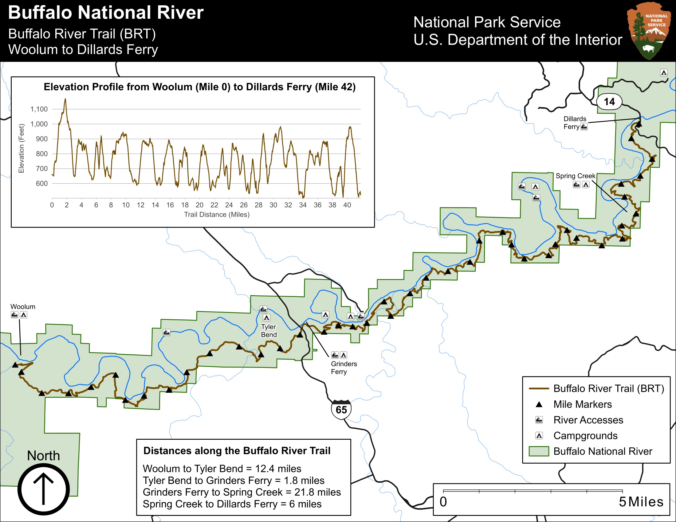
Hike the Buffalo River Trail - Woolum to Dillards Ferry
A long and difficult hike, the Buffalo River Trail between Woolum and Dillards Ferry stretches a majority of the middle district of Buffalo National River.
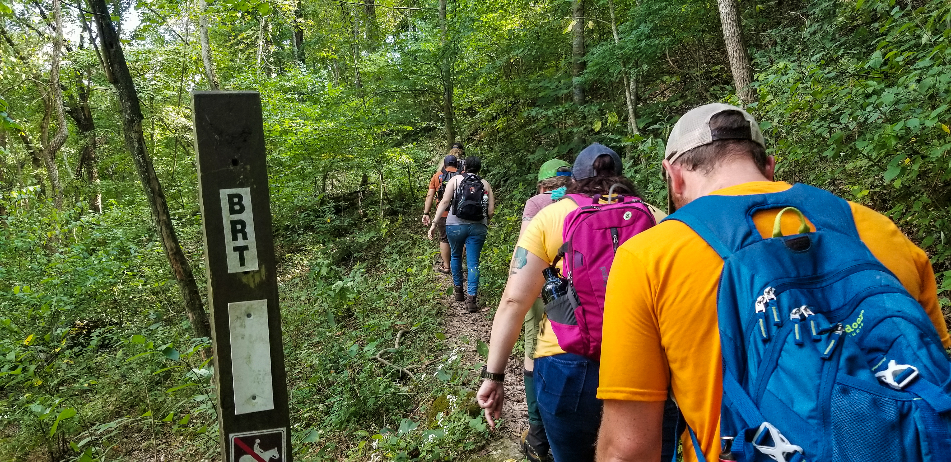
Hike the Buffalo River Trail - Boxley to Pruitt
The Buffalo River Trail (BRT) winds along the bluffs and ridgelines on the south side of the river, traversing the Ponca Wilderness past scenic overlooks, old home sites, and cascading creeks. This portion of the BRT is 37 miles long and is a popular thru-hiking destination for backpackers. Day hikers can access the BRT in several locations for shorter out-and-back or point-to-point hikes.
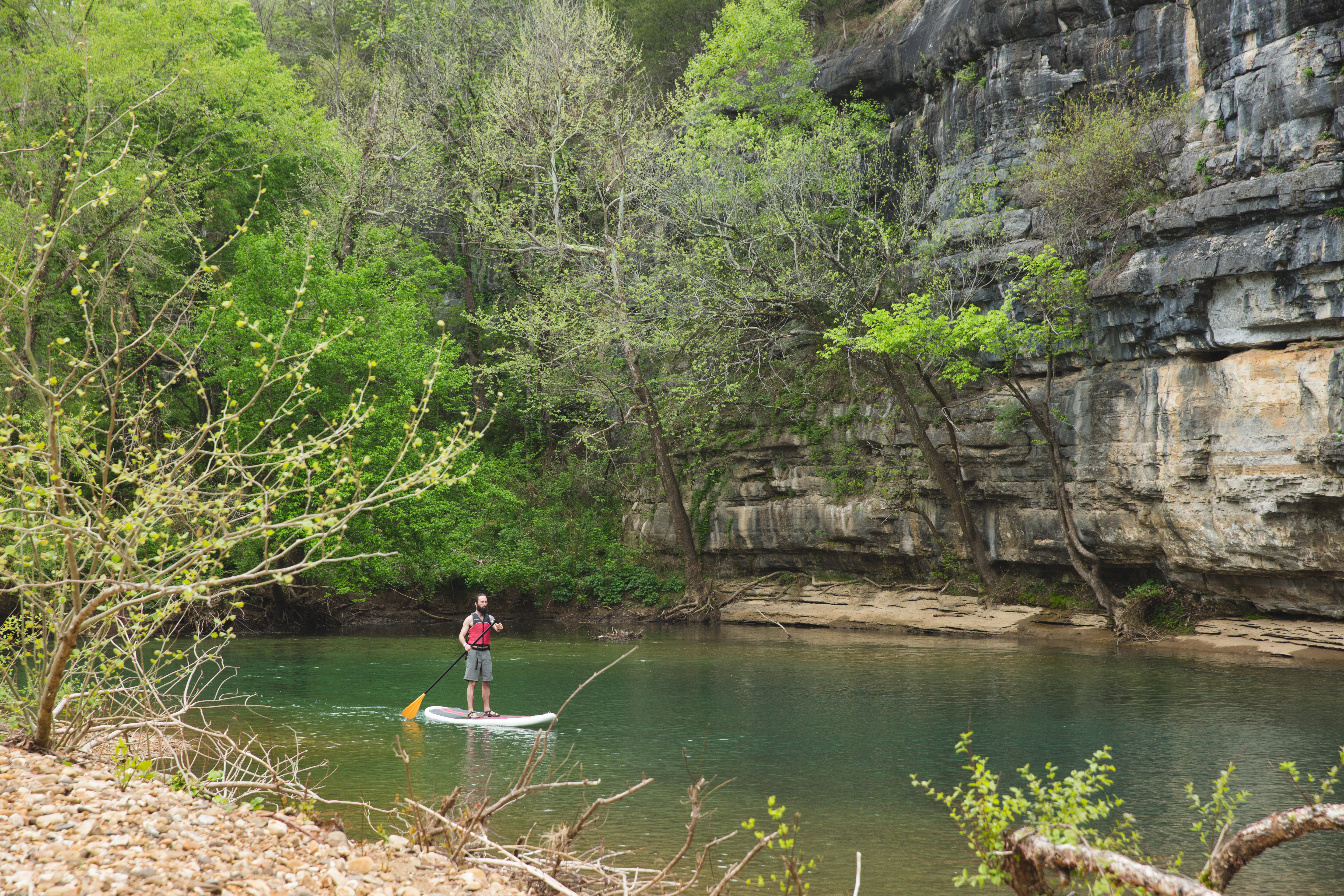
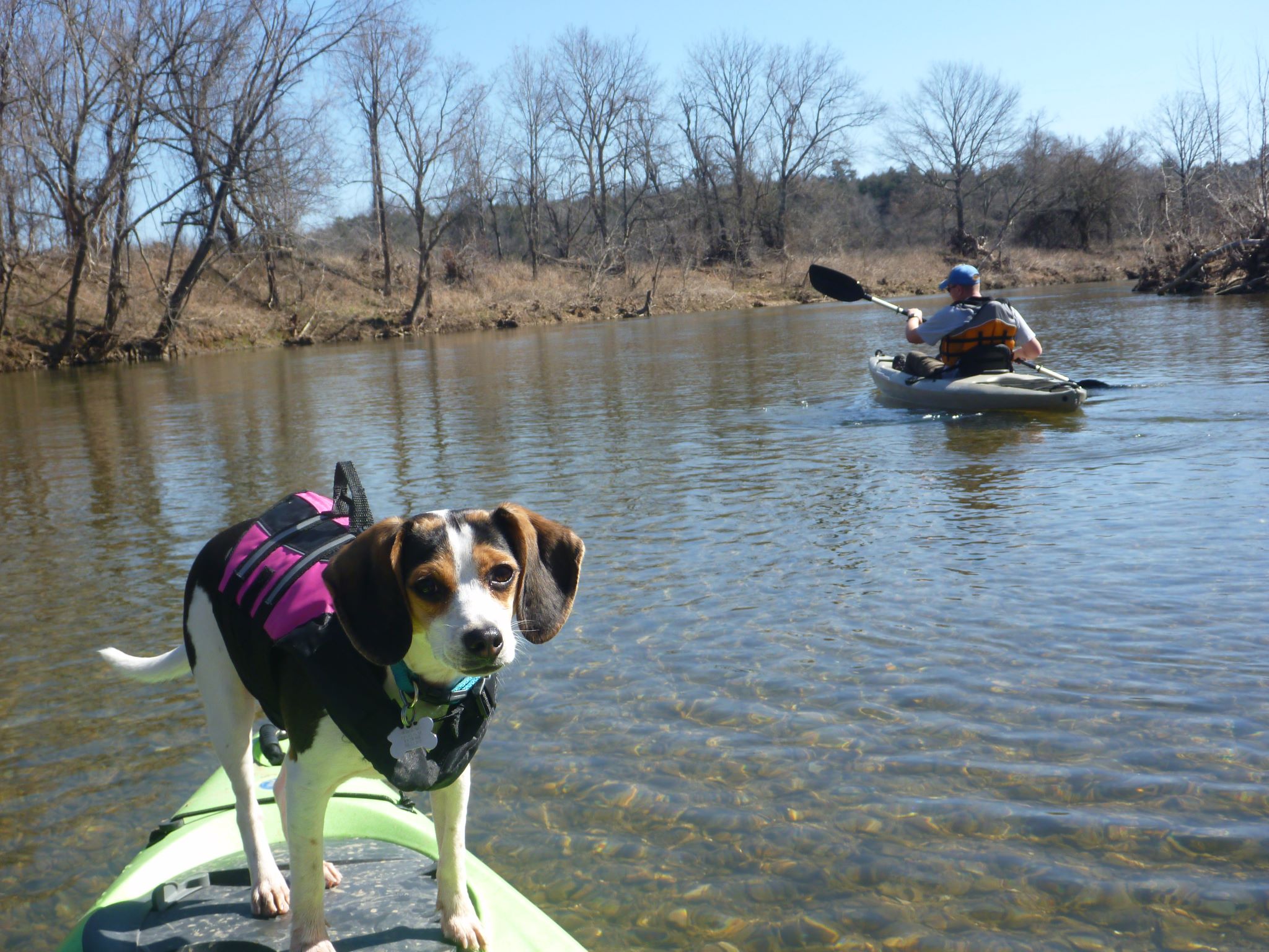
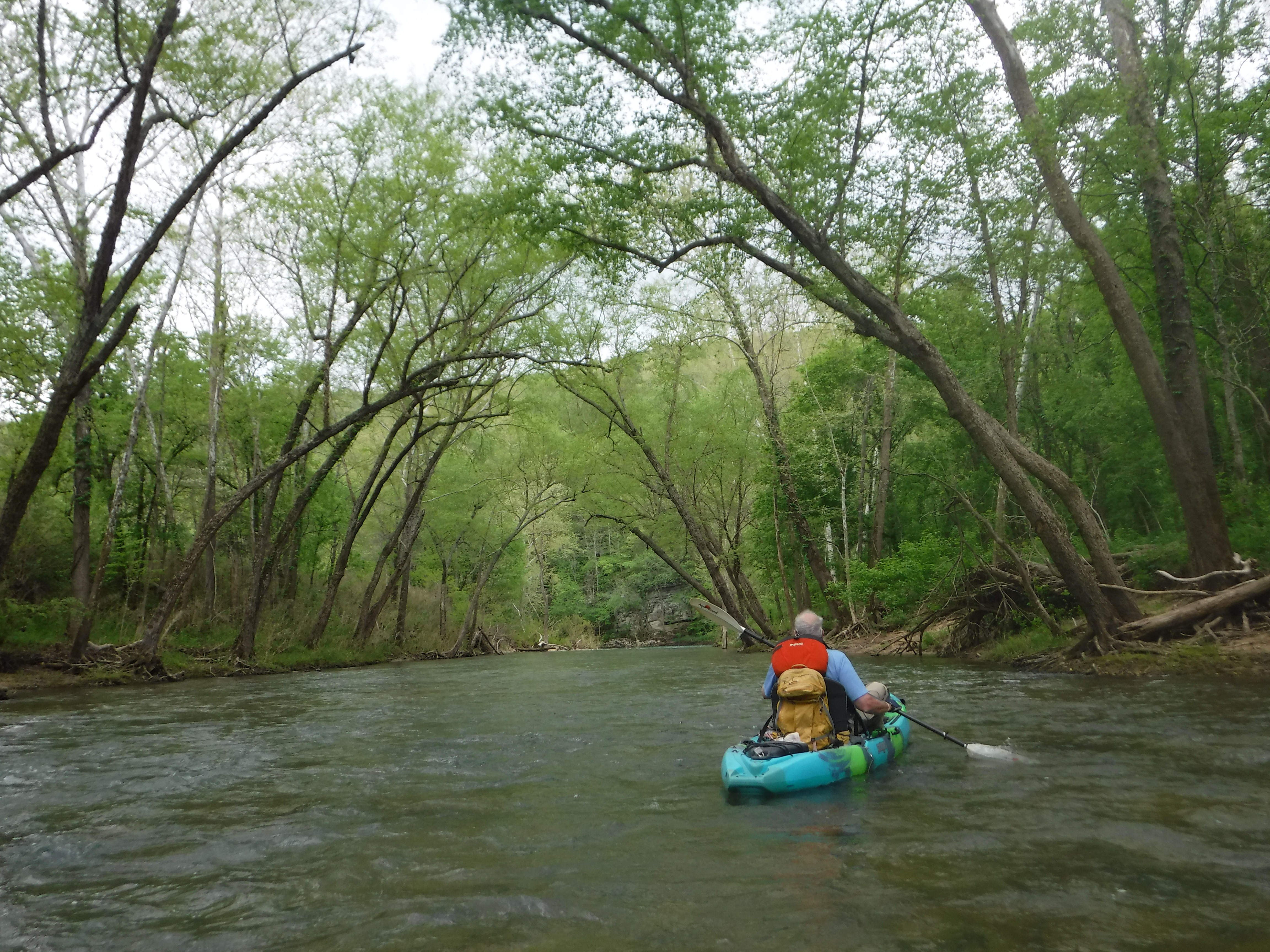
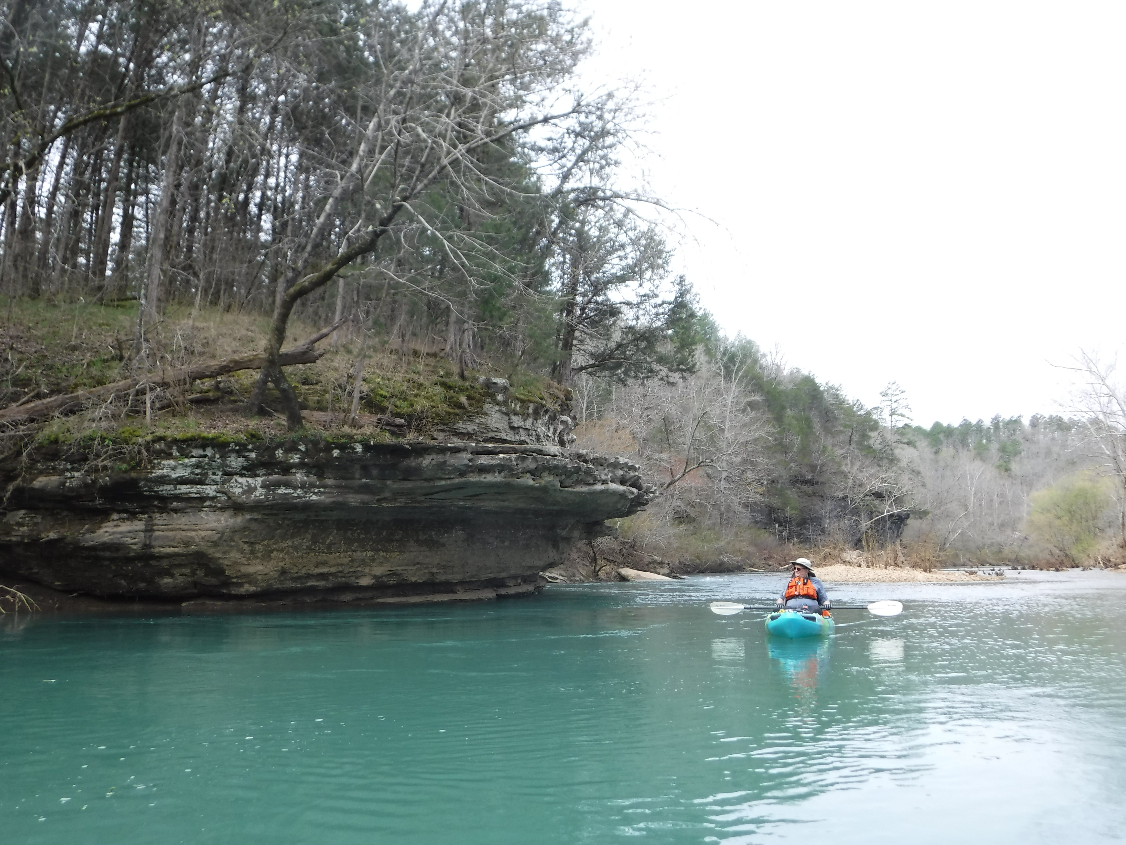
Paddle Buffalo National River with Your Pet
Paddling with your pet can be an enjoyable activity at Buffalo National River. Here are some trip suggestions along with helpful tips to make your time at the river a safe and pleasant experience. Share the river with your four-legged buddy!
Hike the Lost Valley Trail
The Lost Valley Trail is an easy to moderate hike through a box canyon sculpted by Clark Creek. At 2.4 miles round-trip, this trail features caves, waterfalls, a Native American bluff shelter, and breathtaking groves of American beech trees.
Hike the Indian Rockhouse Trail
A hike on the Indian Rockhouse reveals geologic formations commonly found on a limestone landscape and gives hikers an opportunity to explore locations where ancient peoples sought shelter.
Hike the Buffalo Point Campground Trails
The Buffalo Point Campground Trails give campers, day hikers, and leashed dogs a chance to stretch their legs between the campground and the historic cabin area at Buffalo Point. Hike through a mix of a pine and oak trees, a cedar glade, and past a sinkhole as you explore. Wildflowers dot the trail system throughout the spring and summer. Finally, the view from the Overlook Trail is one that you do not want to miss!
Paddling North Maumee to Spring Creek
This typically quiet and calm piece of river takes you past Maumee Bluff and Schoolhouse Ridge before approaching Spring Creek itself, Spring Creek Bluff, and the Spring Creek access point and primitive campground. This 4.7-mile stretch of river has a decent shuttle trip of approximately 45 minutes (20 miles).
Paddling Spring Creek to Dillards Ferry
This friendly, 4.6-mile paddle is great for folks that want to get a good feel for the river, but don't want to be out all day. You will paddle by Jackpot, Kimball, and Stairstep Bluffs as you make your way towards Water Creek, a great place to park the boat and get out and explore. This river trip ends at Dillards Ferry, the Highway 14 bridge.
Paddling Dillards Ferry to Buffalo Point
The float between Dillard's Ferry and Buffalo Point is a short trip for those that have a very limited amount of time. The highlight of the trip is floating by Skull Rock. Be aware that there is not a road on the gravel bar at Buffalo Point so all vessels will need to be carried up the gravel bar to the parking lot. Shuttle time between Dillard's Ferry and Buffalo Point is 12 minutes (5.5 miles).
Paddling Dillards Ferry to Rush Landing
This 9-mile paddling trip offers some great fishing holes between Buffalo Point and Rush, where the pools get long and the current typically slows in the summer time. You have the option at stopping at Buffalo Point, which is 1.5 miles from Dillards Ferry to admire Painted Bluff and Ludlow Bluff further downstream, which is actually the tallest bluff on the river (sorry, Big Bluff).
Paddling Rush Landing to the White River
This 30-mile paddling trip cuts through the Lower Wilderness Area to the mouth of Buffalo National River. This is a stretch of river that a majority of visitors never see. As you paddle through the Lower Wilderness you will be greeted by Woodcock Bluff, Sheep Jump Bluff, and Elephant Head Rock. You can also park your boat at the mouth of Big Creek and hike a 1/4 mile to the Cold Spring Schoolhouse, a historic Works Progress Administration structure, from the 1930s.
Hike Shine Eye to Gilbert
Trail is along the bluffs of the river from Hwy 65 to Gilbert.
Paddle Boxley to Ponca
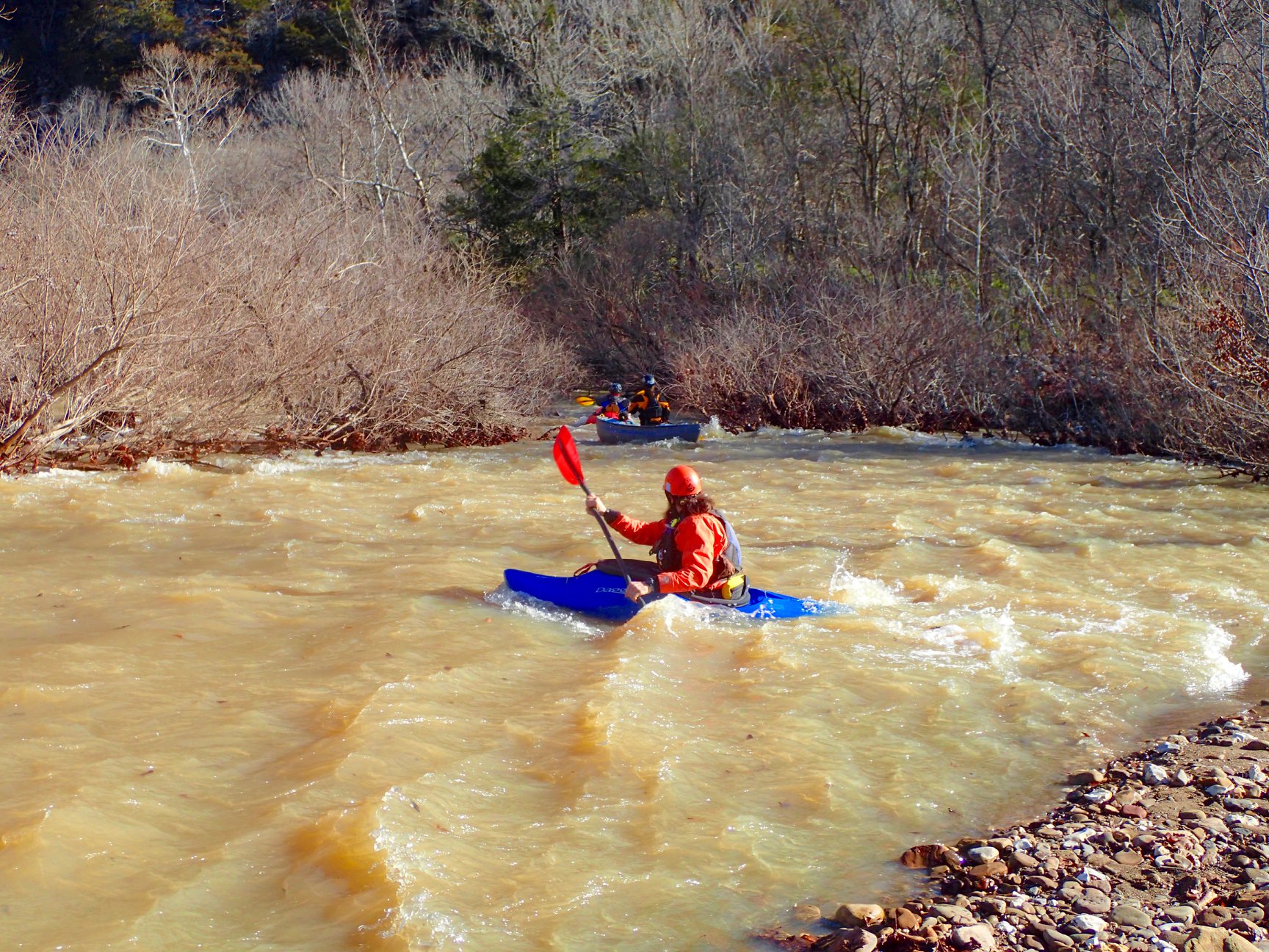
The most technical section of Buffalo National River, Boxley to Ponca is recommended only for highly-experienced whitewater paddlers. Water levels on this section tend to rise and fall rapidly, so paddlers must have a solid understanding of reading river gauges to properly time their float.
Paddle Hasty to Carver
Anglers love the 4-mile trip between Hasty and Carver for its countless fishing holes and perfect smallmouth habitat.
Paddle Ozark to Pruitt
A short but delightful float of about 2.1 miles, Ozark to Pruitt is a fun run with several long pools connected by bouncy riffles. The swimming hole at Ozark can get crowded on hot days, so paddlers putting in here should be especially careful when swimmers are present.
Paddle Pruitt to Hasty
The 7 mile float from Pruitt to Hasty is a popular alternative when conditions upriver are too low for paddling. This section flows past geologic curiosities, shaded swimming holes, and cool, dripping springs as the river veers southward in its journey.
Paddle Erbie to Ozark
A serene, 5.4-mile stretch of the Buffalo River winds between Erbie and Ozark and offers excellent opportunities for solitude and wildlife watching.
Hike the Old Railroad Trail
The Old Raildroad Trail follows the river east from Gilbert along the former route of the Missouri and North Arkansas Railroad.
Hike the Buffalo River Trail - Woolum to Tyler Bend
The Buffalo River Trail follows along the south side of the river from Woolum to Tyler Bend for a little more than 11 miles.
Hike Tyler Bend Trails
Hikers can plan loops of varying lengths to suit their time and ability.
Paddle Ponca to Steel Creek
This short section offers an introduction to the Upper Buffalo’s striking scenery and challenging whitewater. The highlight of the trip is paddling beneath Roark Bluff, one of the most iconic blufflines along the entire Buffalo River.
Paddling Tyler Bend to Grinder's Ferry
Easy, flat water for 1 mile reach of the river.
Paddling Carver to Mt. Hersey
Unassuming in its beauty and variety, the float from Carver to Mt. Hersey demonstrates the transition from upper to middle river landscapes.
Paddling Mt. Hersey to Woolum
This reach provides numerous bluffs, shoals and pools along the way.
Paddling Grinder's Ferry to Gilbert
Either Tyler Bend to Gilbert or Grinder's Ferry to Gilbert can be a pleasant, easy float with plenty of sand/gravel bars to rest and have a picnic. Numerous deep pools provide options for swimming. Weekdays are quiet and peaceful. Weekends are busy and noisy with lots of floaters enjoying the river.
Paddling Baker Ford to Tyler Bend
The Baker Ford to Tyler Bend reach is usually an easy, short paddle.
Hike to Hideout Hollow
The Hideout Hollow Trail leads to a rock shelter that was once inhabited by a group of World War I draft dodgers called The Slacker Gang. The Slacker Gang was made up of 9 young men from the Cecil Cove area who refused to join the army and decided to go into hiding in the wilderness. The 9 young men remained in hiding for months before surrendering to the draft in 1918.
Paddling Woolum to Baker Ford
Several bluffs along this reach (Margaret White, Whisenant, Buzzard Roost and Peter Cave) are more than 200 feet high.