No Wood or Charcoal Fires Allowed - Stage 2 Fire Restrictions in Effect
All fires are prohibited. Only petroleum or propane-fueled stoves or grills are allowed in backcountry campsites, campgrounds, and picnic areas. Fireworks are never allowed. Smoke only inside vehicles or in developed areas over 3 feet from flammables.
Grand View Point Closed for Construction Weekdays July 28 through September
Grand View Point Overlook, Grand View Point Trail, and 0.3 mi (0.5 km) of park road is closed Monday to Thursday. The closure applies to all uses, including vehicles, tour buses, motorcycles, bikes, & hikers.
Expect Long Lines at Island in the Sky Entrance
Between March and November, particularly on busy holiday weekends, you may experience long lines at the entrance road. Parking lots at popular trailheads and viewpoints will fill early. Pack your patience and arrive early to avoid crowds.
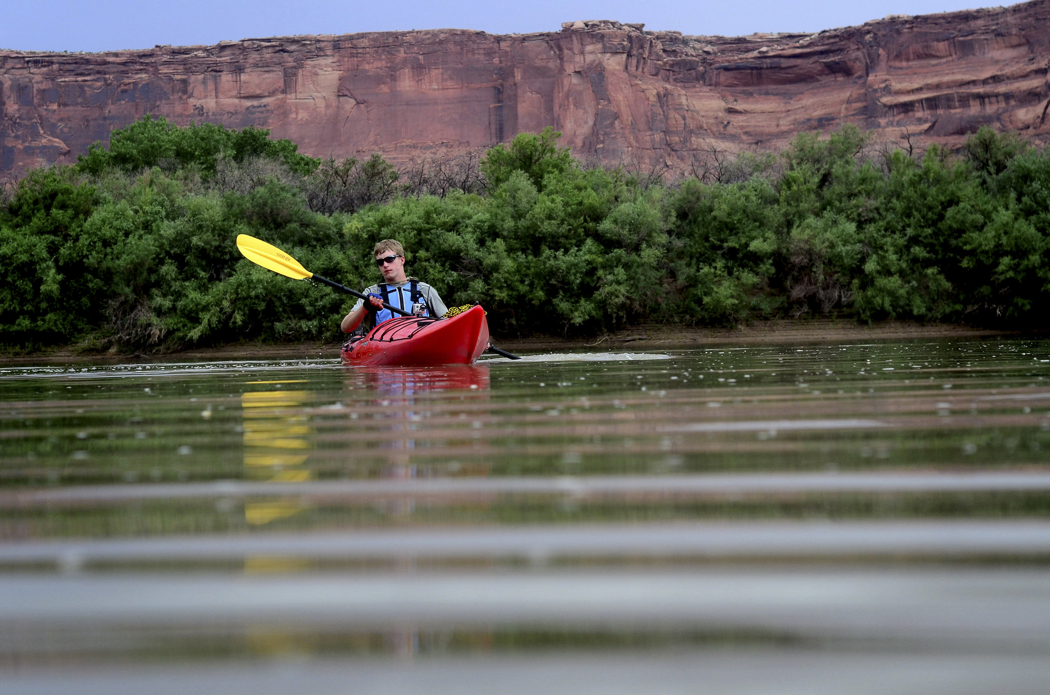
Difficult Conditions Complicate Cataract Canyon Takeouts
Hite Ramp is closed. The North Wash take-out is a primitive, unimproved dirt take-out. You will not be able to back a trailer down the dirt slope. Recent washouts have further deteriorated conditions.
| Title | Canyonlands |
| Park Code | cany |
| Description | Canyonlands invites you to explore a wilderness of countless canyons and fantastically formed buttes carved by the Colorado River and its tributaries. Rivers divide the park into four districts: Island in the Sky, The Needles, The Maze, and the r... |
| Location | |
| Contact | |
| Activities |
|
| Entrance fees |
Entrance - Private Vehicle
$30.00
Admits one private, non-commercial vehicle (15 passenger capacity or less) and all its occupants.
Entrance - Motorcycle
$25.00
Admits a private, non-commercial motorcycle and its riders.
Entrance - Per Person
$15.00
Admits one individual with no car. Typically used for bicyclists, hikers, and pedestrians. Youth 15 and under are admitted free.
|
| Campgrounds | Count: 3
Island in the Sky (Willow Flat) Campground
The Needles Campground
The Needles District Group Campsites
|
| Places | Count: 50
Alcove Spring TrailAfter descending 1,400 ft (4276 m) past a large alcove, the trail meanders in a wide canyon to the base of the notable Moses and Zeus towers. 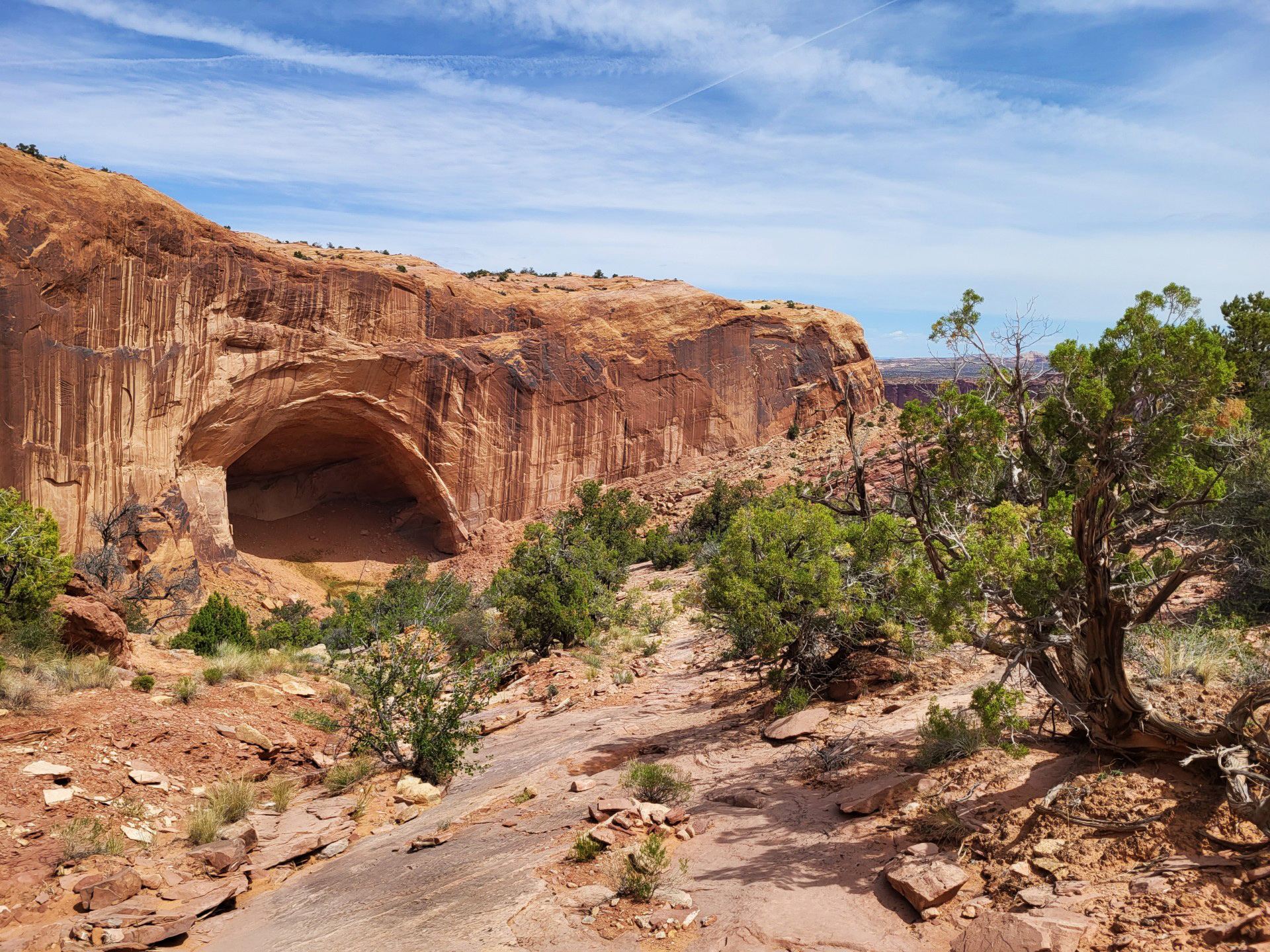
Aztec Butte TrailThis trail climbs two sandstone buttes to outstanding views and stone granaries built by Indigenous people centuries ago. 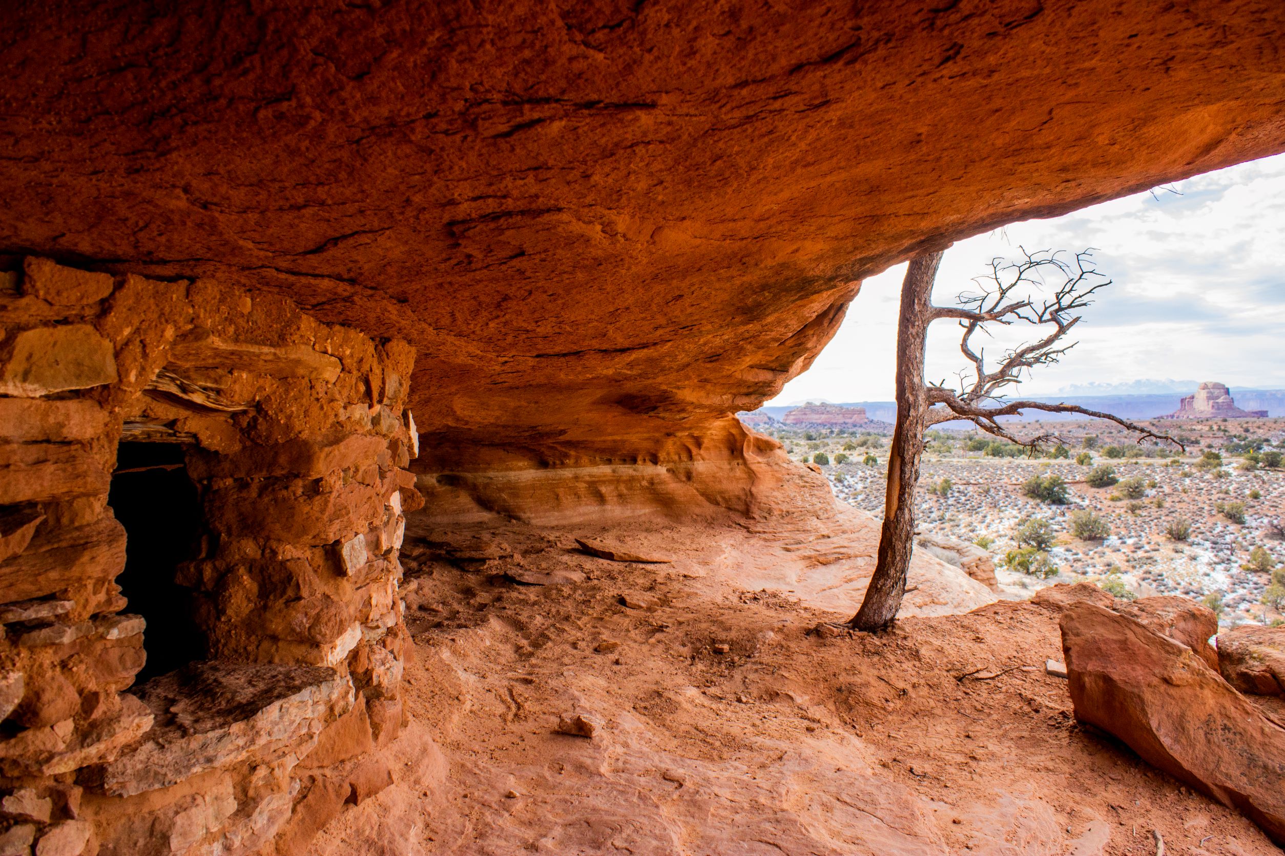
Aztec Butte: The Value of Storage
Big Spring Canyon Overlook and TrailheadBig Spring rests at the end of the Needles Park Road. From the overlook, unique rock spires and multi-colored sandstone benches line the bend in the canyon. The presence of the spring allows trees and plants to flourish in the spring and summer months. 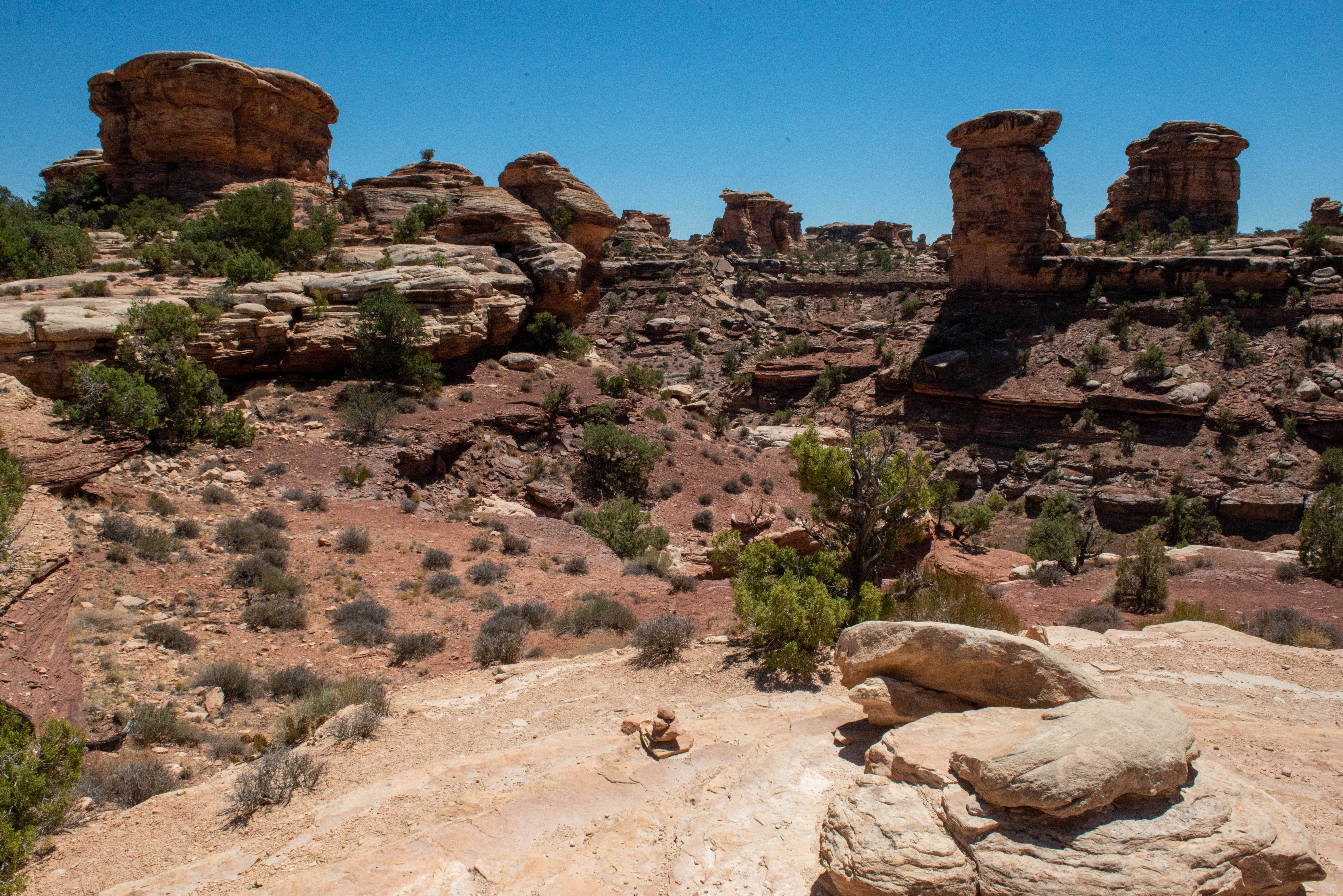
Big Spring Canyon Overlook: Protecting Wilderness
Big Spring Canyon to Elephant Canyon Loop TrailThis loop features extended hiking on slickrock benches and mesa tops overlooking canyons. Excellent views of sheer cliff walls and other rock formations. Must climb two ladders. 
Big Spring Canyon to Wooden Shoe Canyon Loop TrailA great introduction to the landscape of The Needles, this route connects two canyons for a loop across varied terrain. 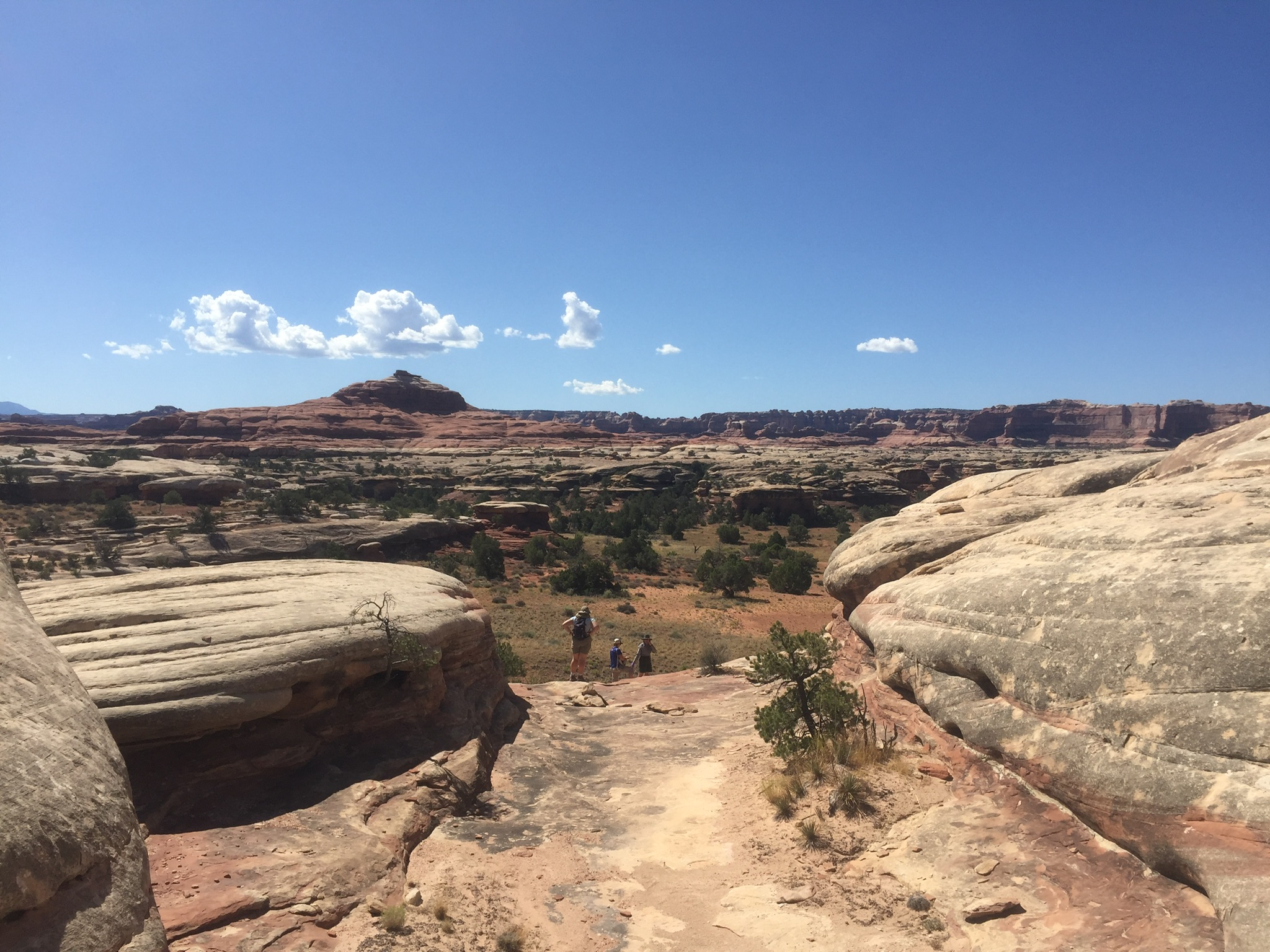
Buck Canyon OverlookFrom a paved overlook at 6,240 feet (1,902 m) in elevation, enjoy sweeping vistas to the west and across the Colorado River canyon. 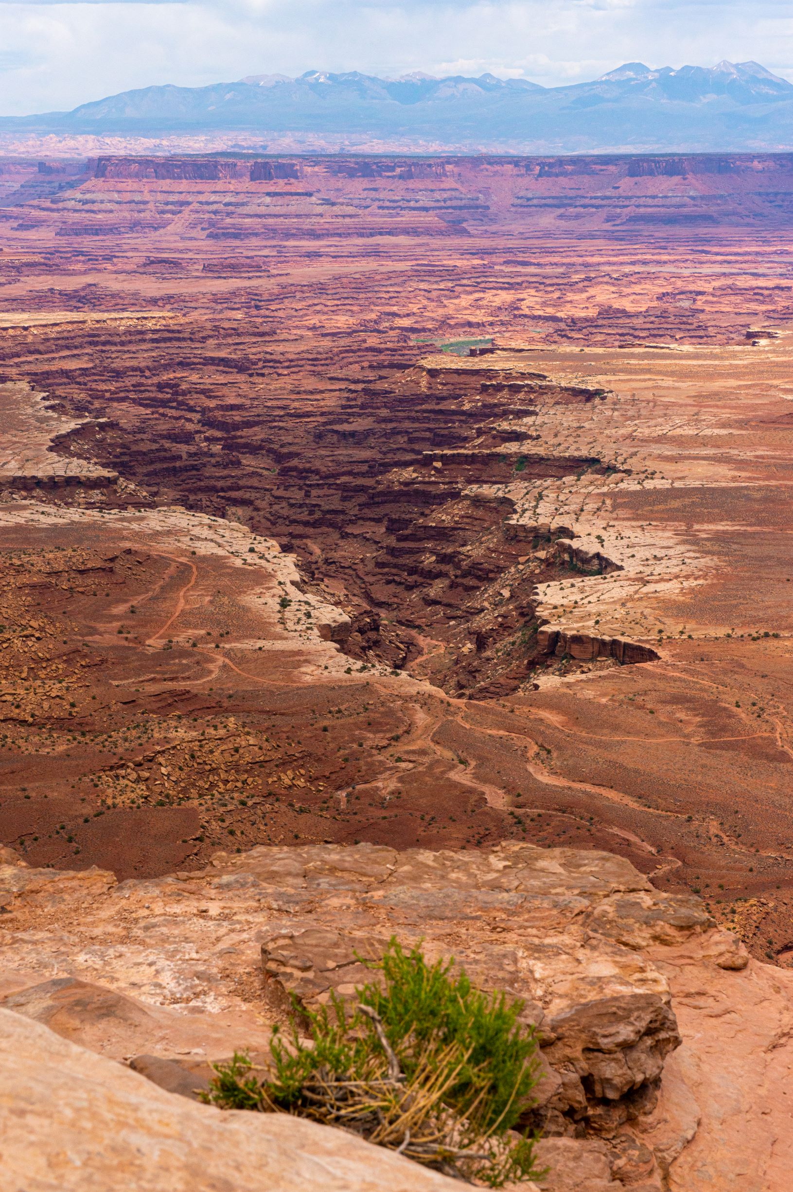
Buck Canyon: Tracks in the Canyon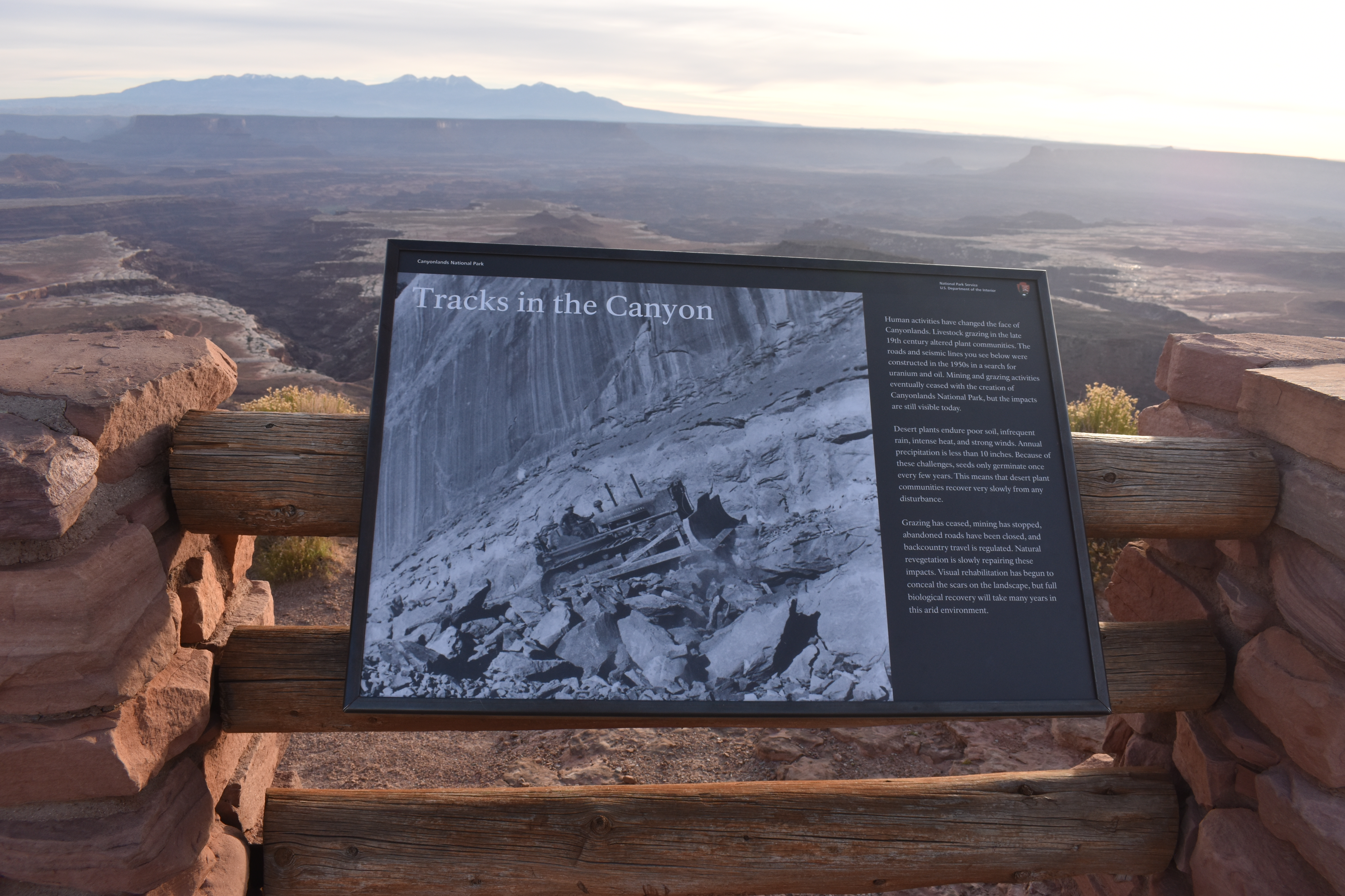
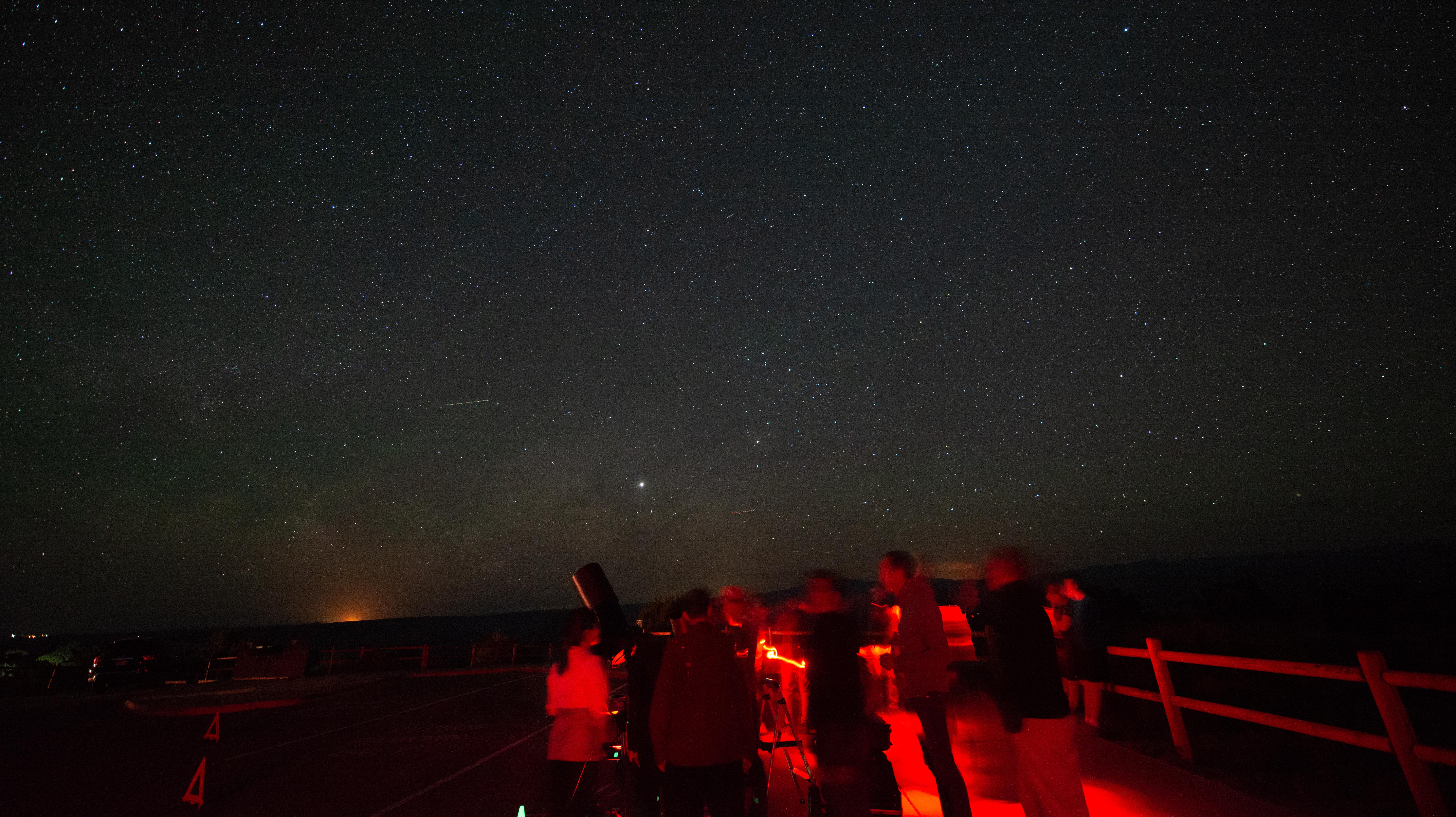
Campground Amphitheatre: Discover the Night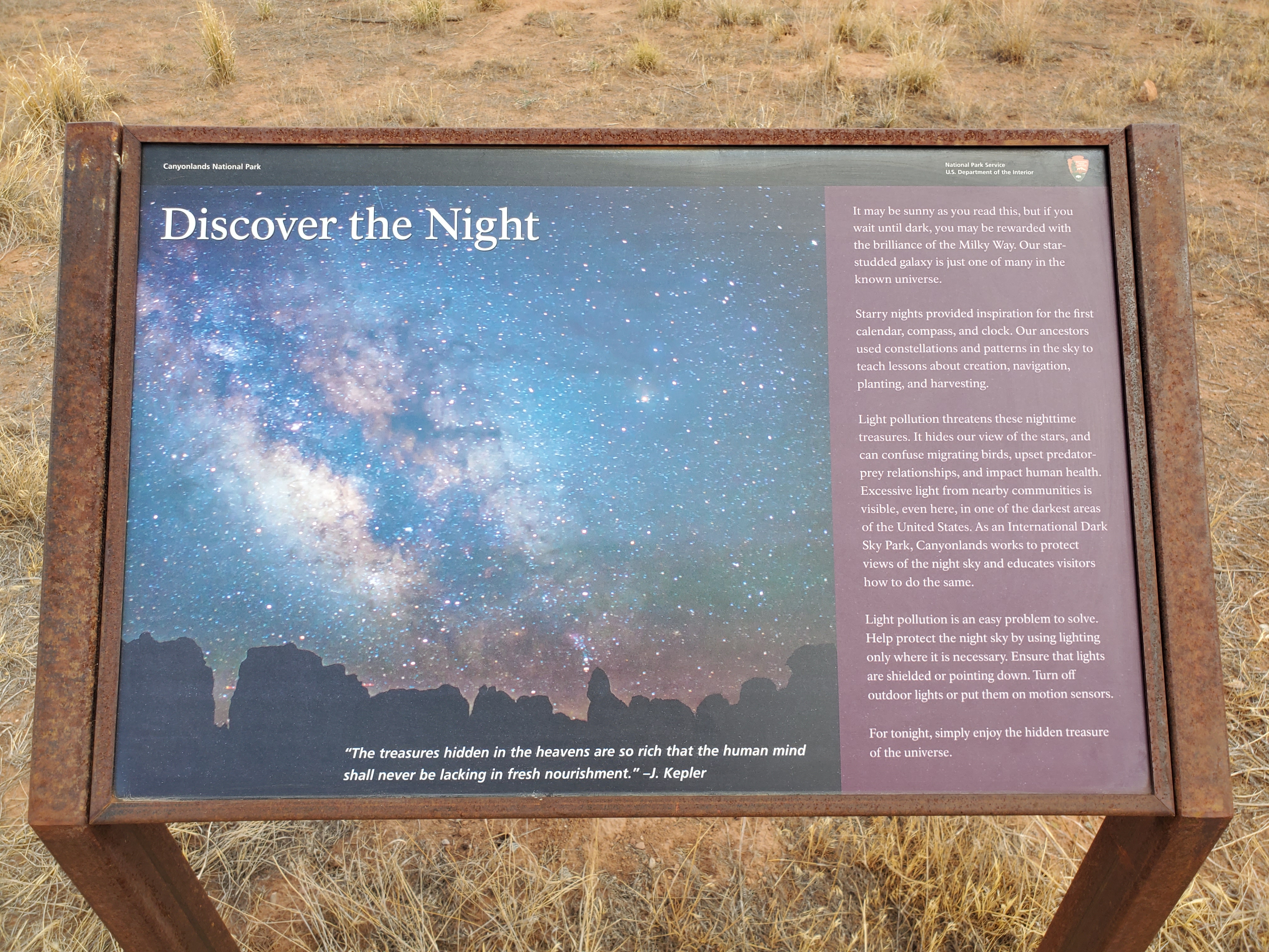
Candlestick Tower OverlookFrom this small roadside pullout, you can see sweeping views of Canyonlands and several prominent rock features, once of which, resembles a group of candlesticks. 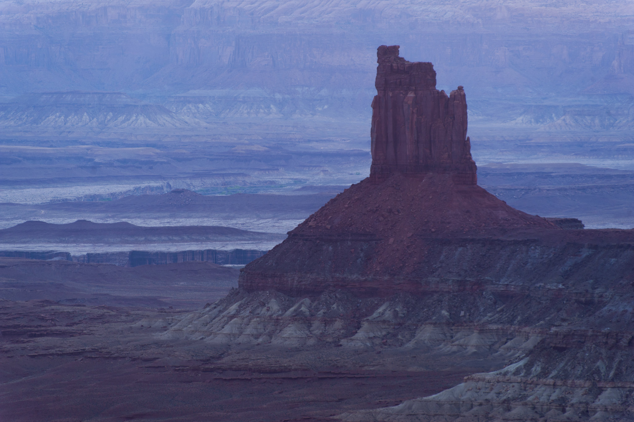
Canyonlands' Cave Spring TrailWater is scarce in this desert. From this trailhead, hike a short, 0.6-mile (1 km) loop leading to a historic cowboy camp and prehistoric rock markings, all made possible by a small but essential natural spring. 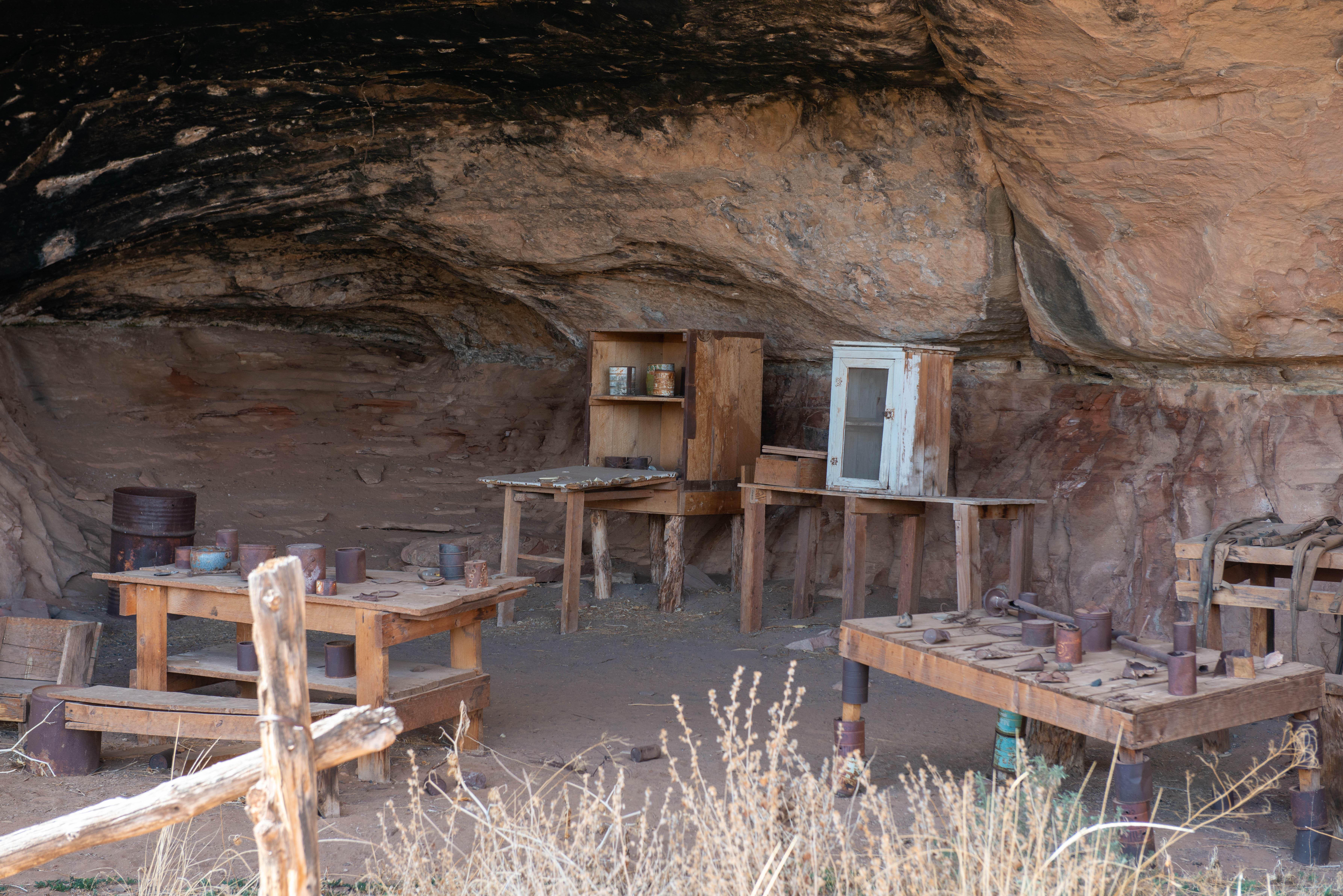
Cave Spring: Water to Live By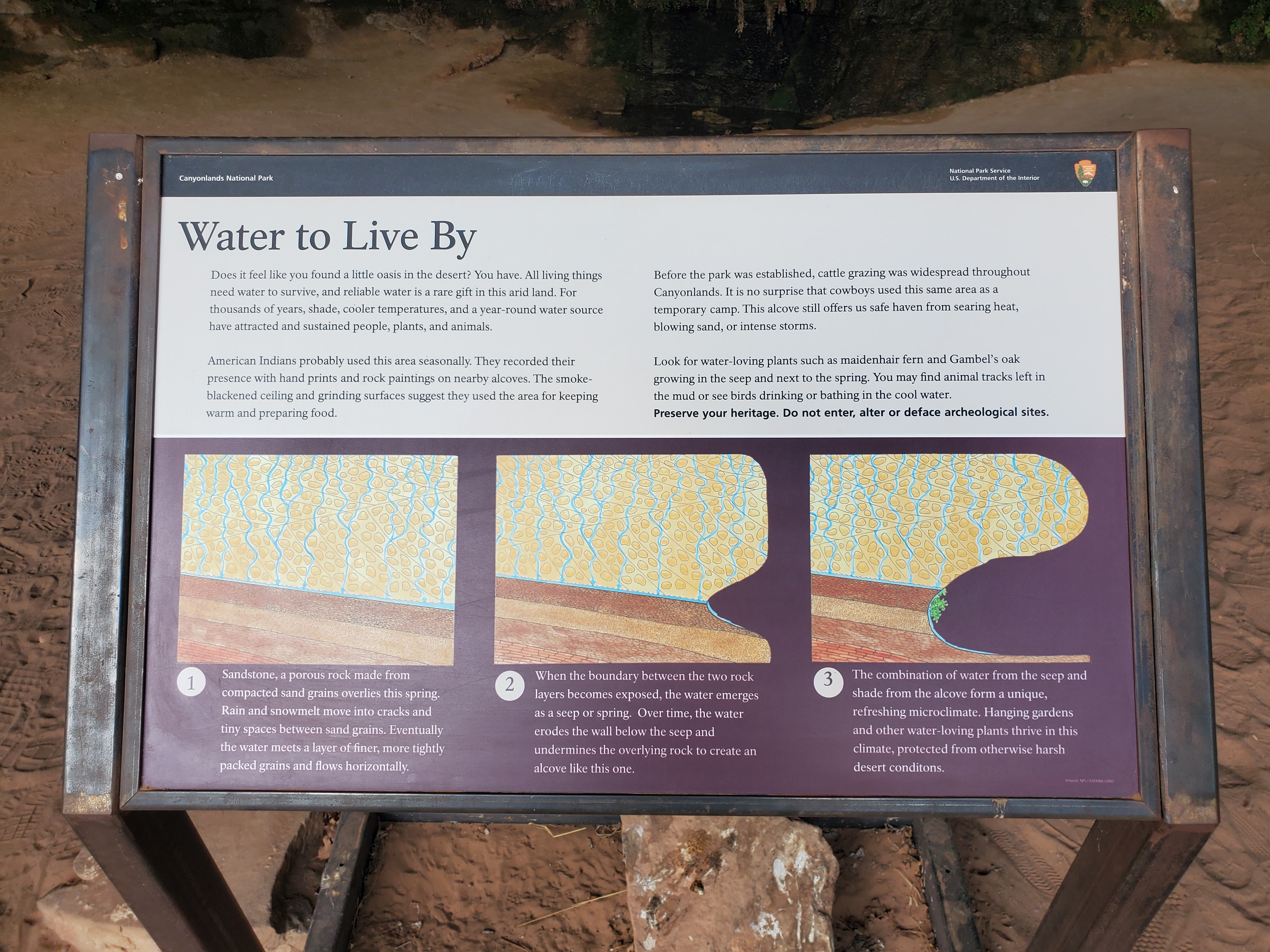
Chesler Park Loop and Joint TrailThis trail provides many great panoramas of the Needles formations. The Joint Trail winds through deep, narrow fractures in the rock. 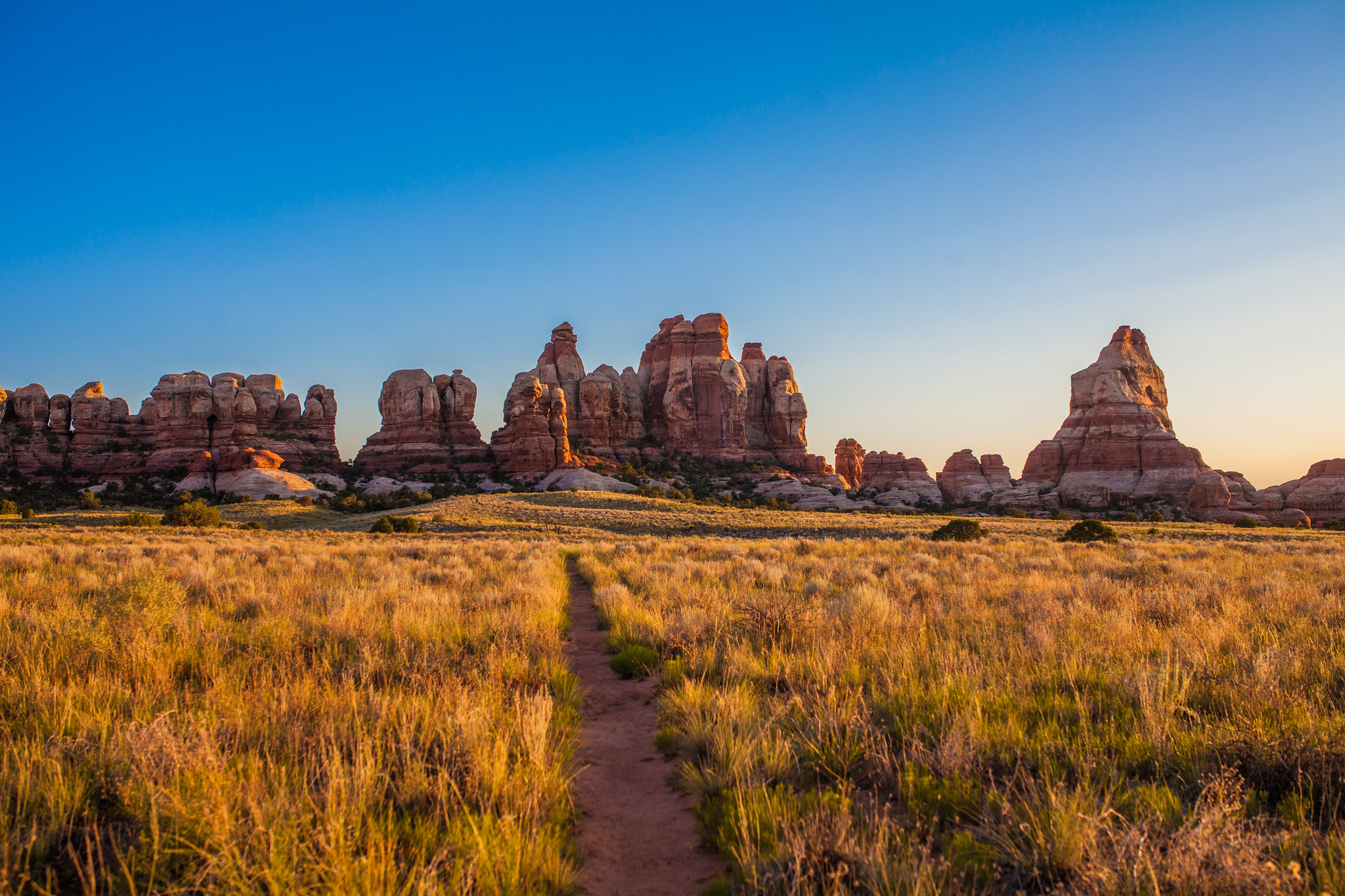
Chesler Park Viewpoint TrailThis popular trail leads to a pass overlooking a scenic expanse of desert grasses and shrubs surrounded by sandstone spires. 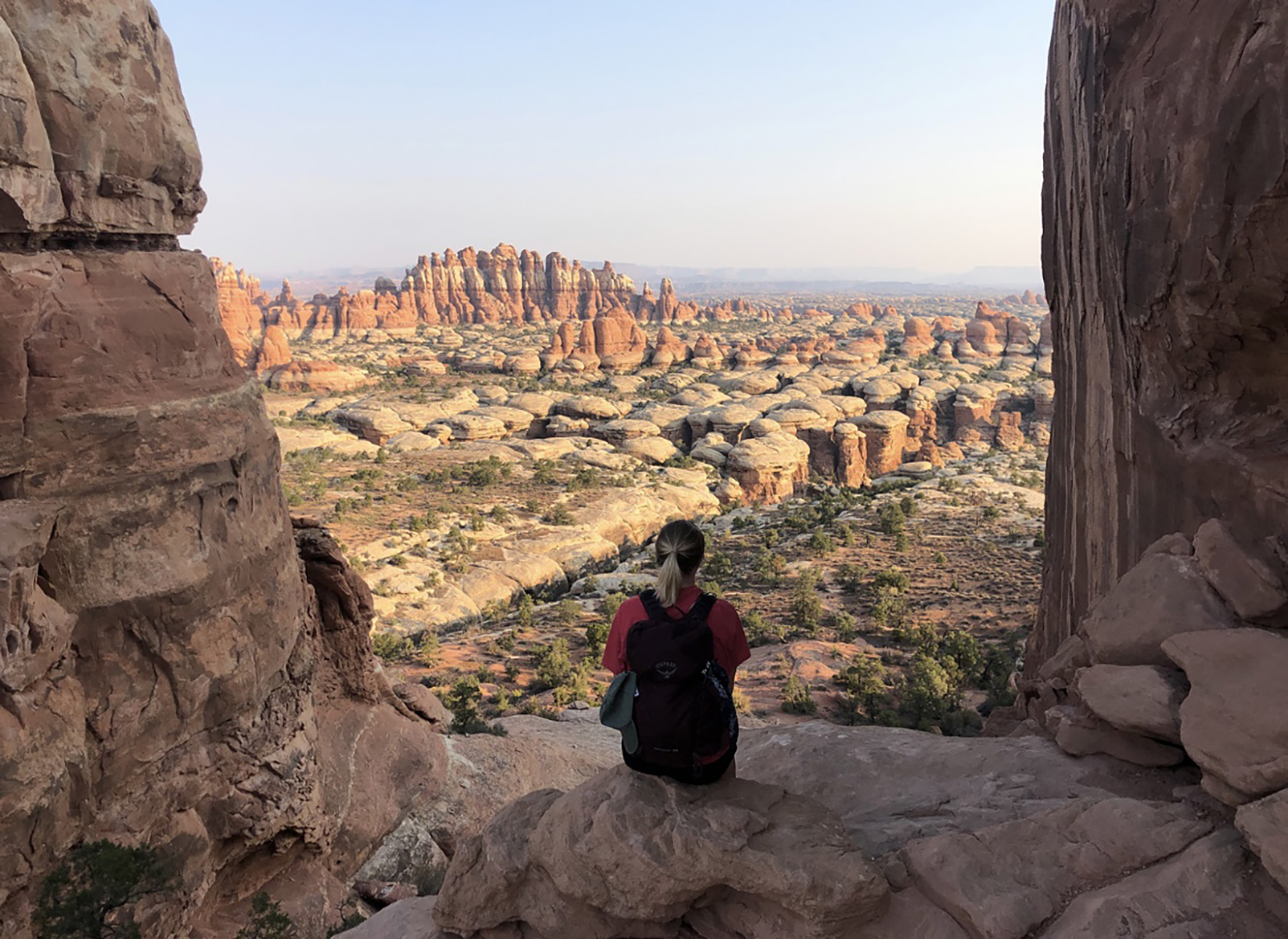
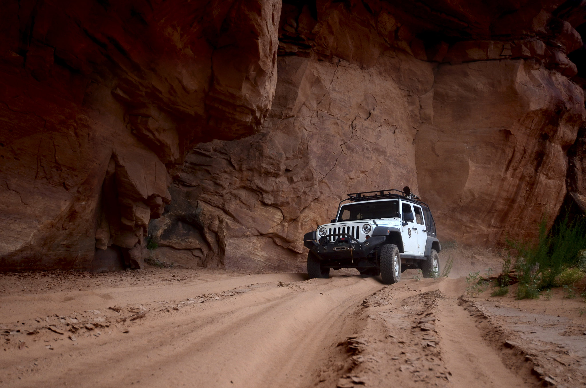
Colorado River OverlookThis overlook is 7 miles down a rugged, unpaved road. You must have a high-clearance, four-wheel-drive vehicle or mountain bike. No permit required; no camping allowed. 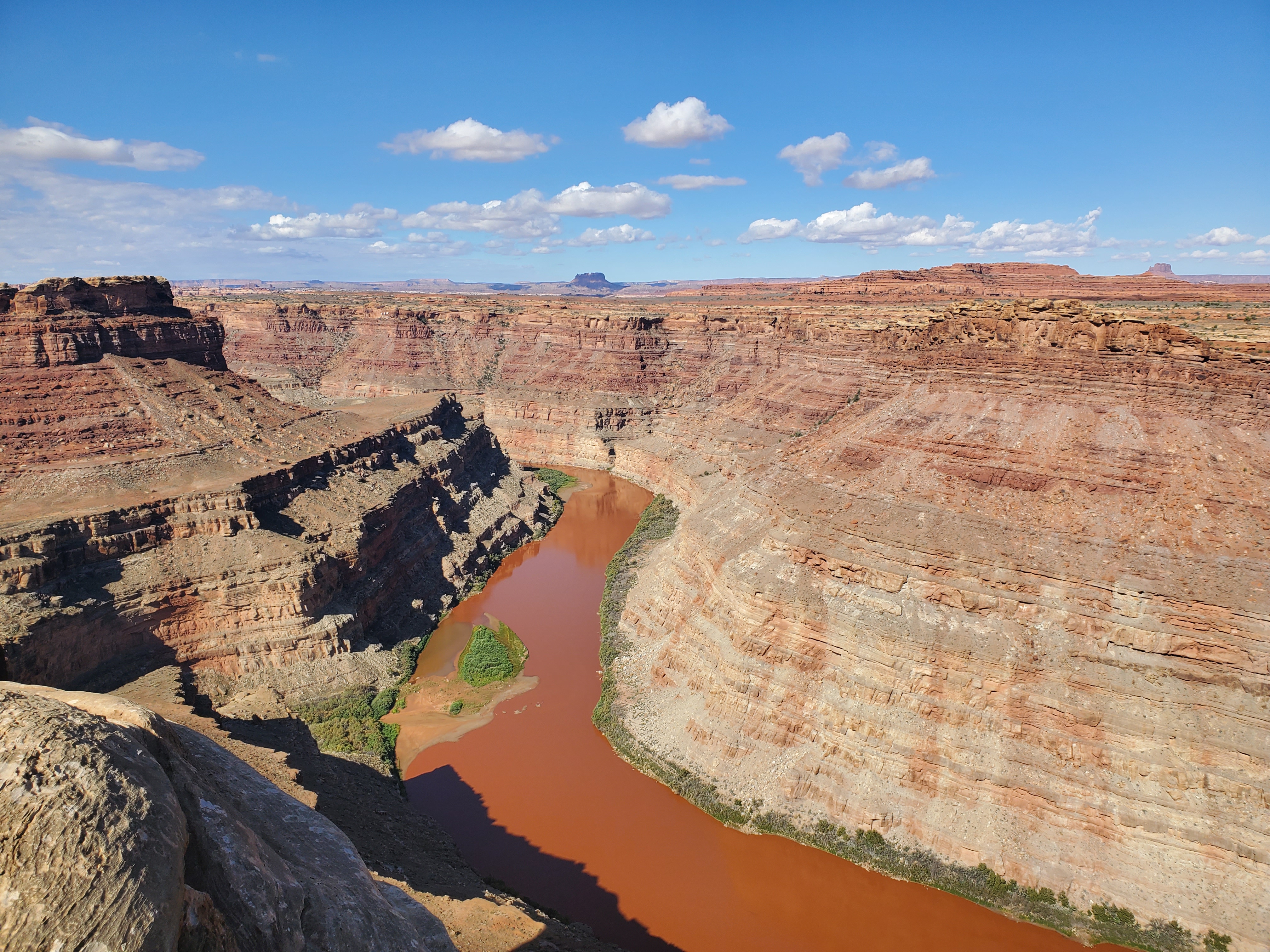
Confluence Overlook TrailUnlike other Needles hikes, this trail traverses dry, open country along the northern edge of the geologic faults that shaped the Needles. The trail ends at a cliff overlooking the junction of the Green and Colorado rivers 1,000 ft (304 m) below. 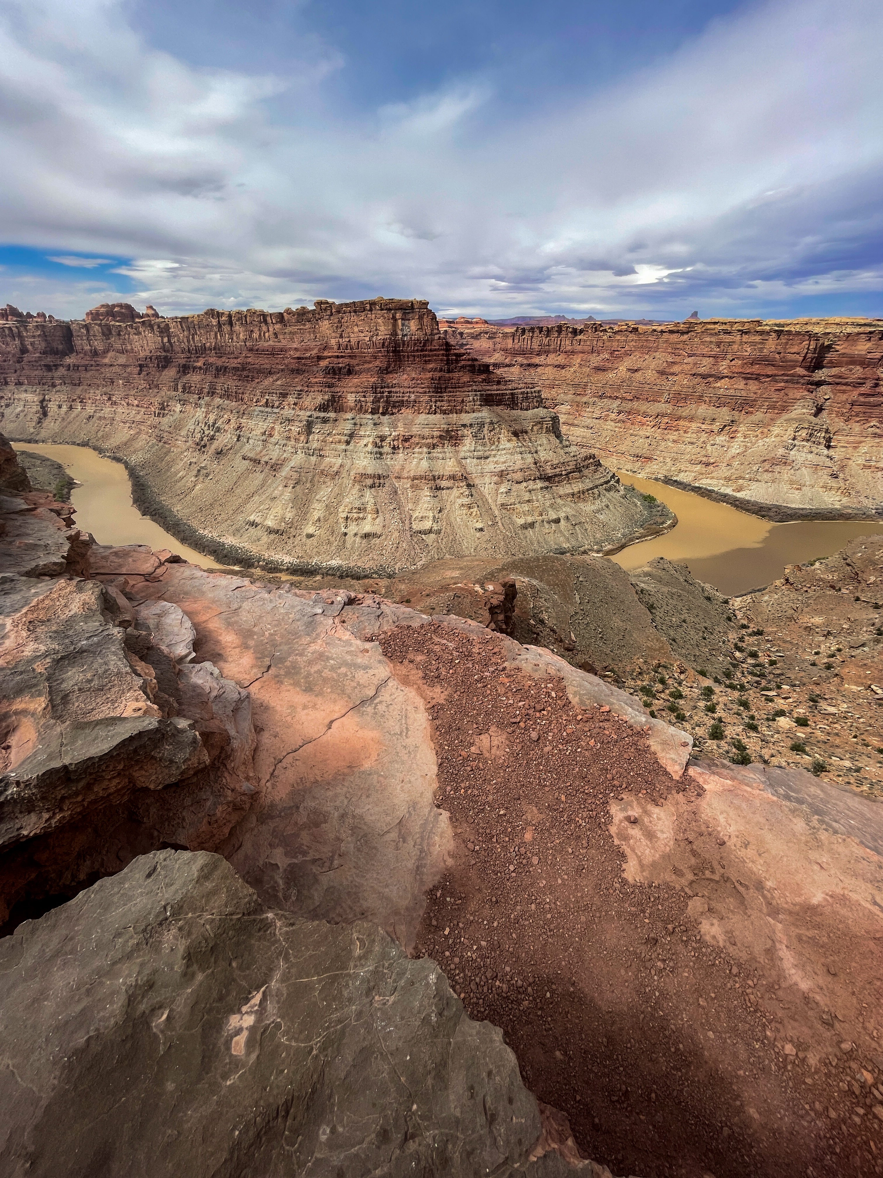
Druid Arch TrailThis trail offers one of the most spectacular views in The Needles. It follows the first part of the Chesler Park trail, then branches off to travel along the bottom of Elephant Canyon through deep sand and loose rock. The last 1.25 mile at the upper end is steep with one ladder and some scrambling. 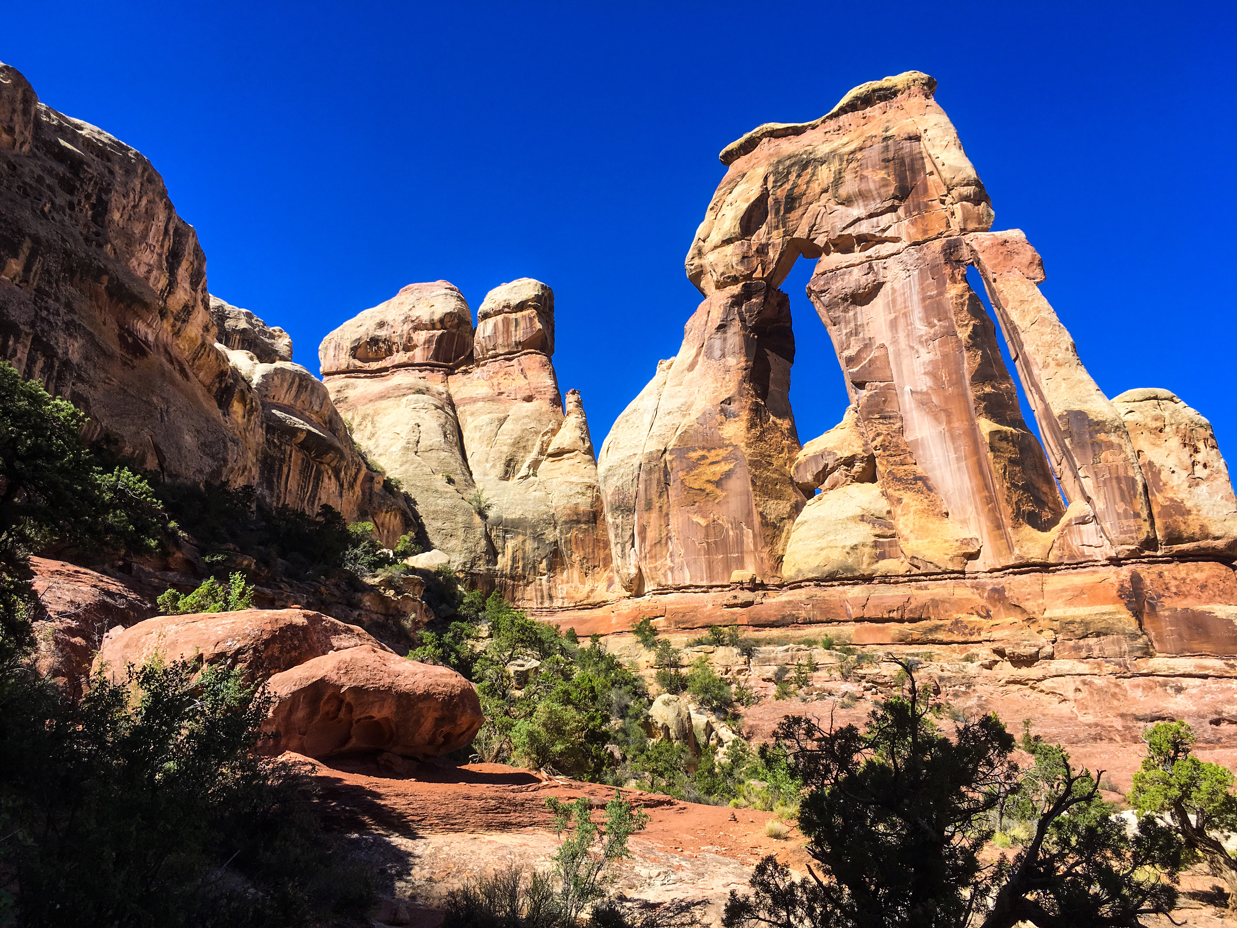
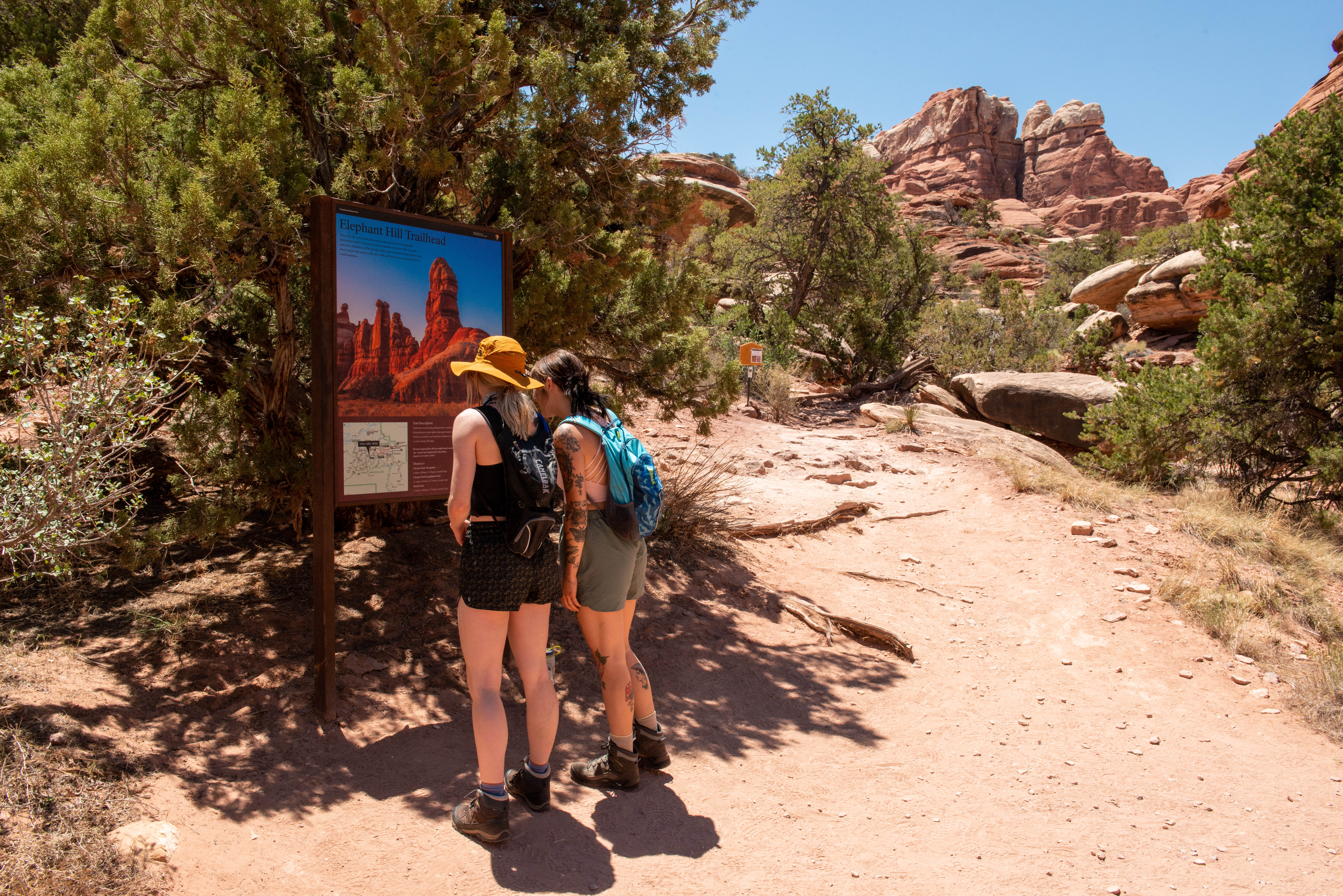
Elephant Hill Access Road: The Needles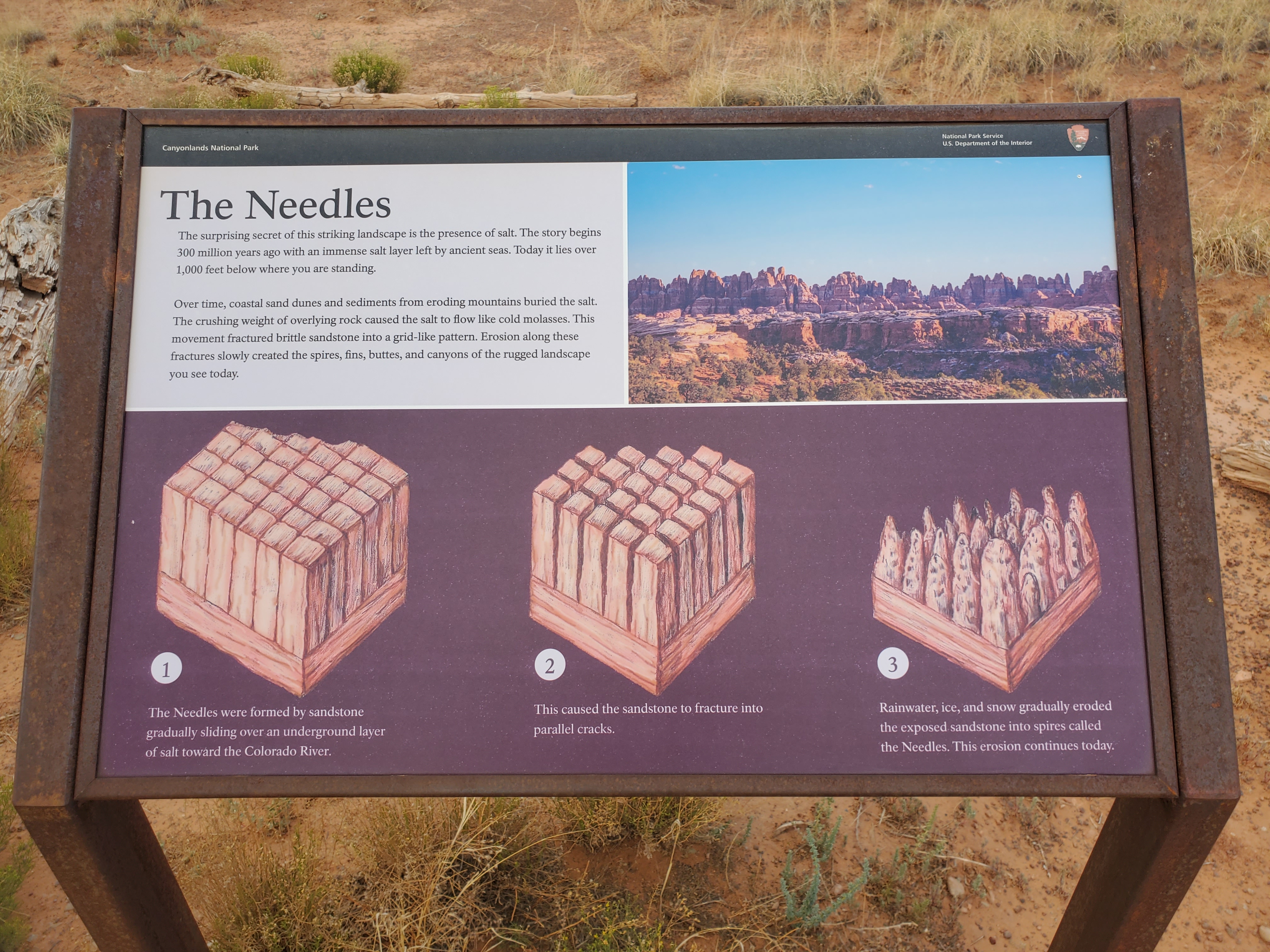
Fort Bottom TrailFort Bottom Ruin is an ancient stone structure overlooking the Green River, built by Indigenous inhabitants of the Canyonlands area centuries ago. It is only reachable from the 4WD White Rim Road (permit required). 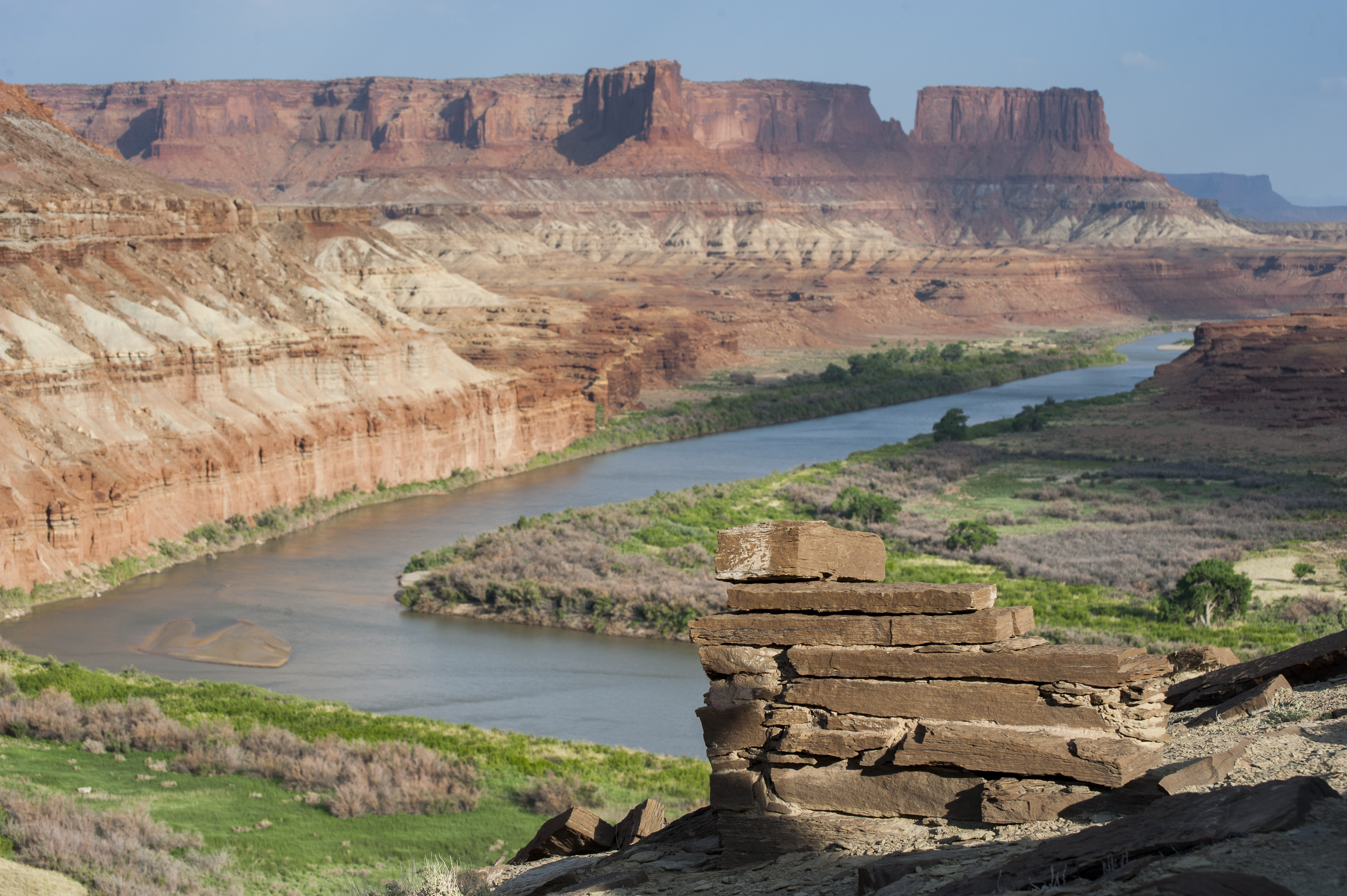
Gooseberry TrailThe steepest trail in this district of Canyonlands, Gooseberry descends over a thousand feet of scree slopes and switchbacks across sheer cliffs. 
Gooseneck Overlook TrailThis short walk from the 4WD White Rim Road (permit required) ends abruptly at an overlook of a meandering gooseneck bend in the Colorado River. 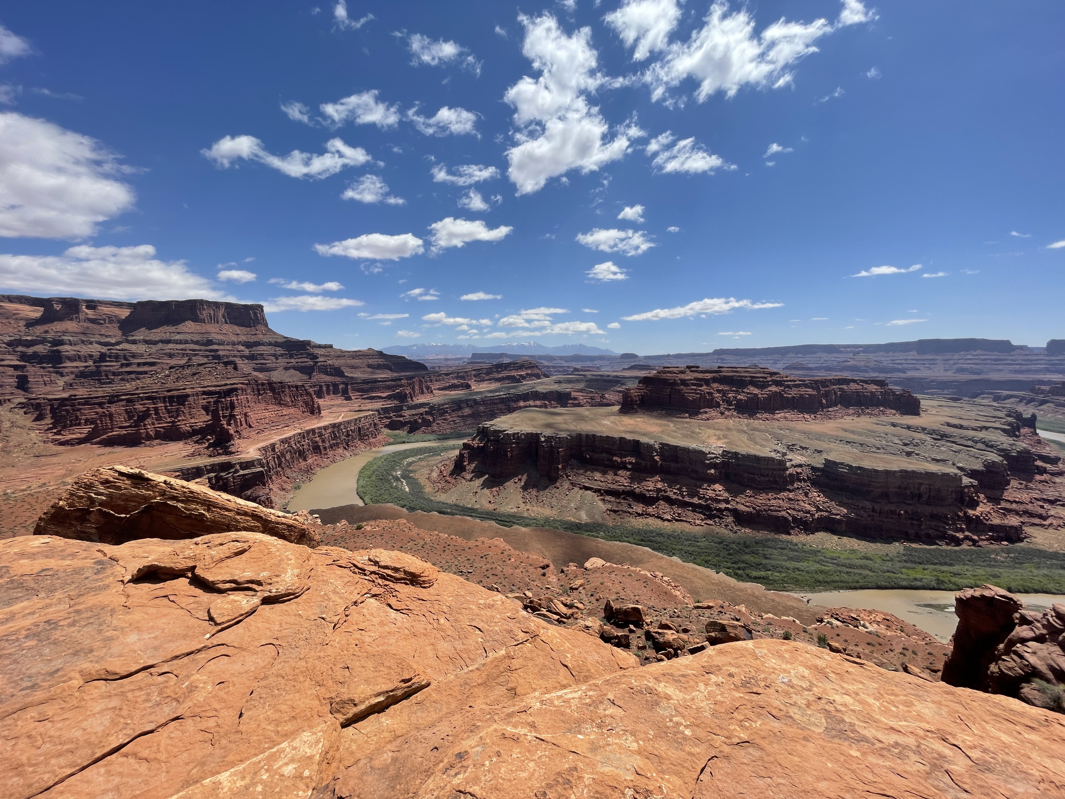
Grand View Point Overlook and TrailGrand View Point offers a spectacular view of the Canyonlands area. From this panoramic viewpoint at 6,080 feet elevation, you can see distant mountains, canyons, basins, and the four-wheel-drive White Rim Road far below. A short trail leads to even more views. 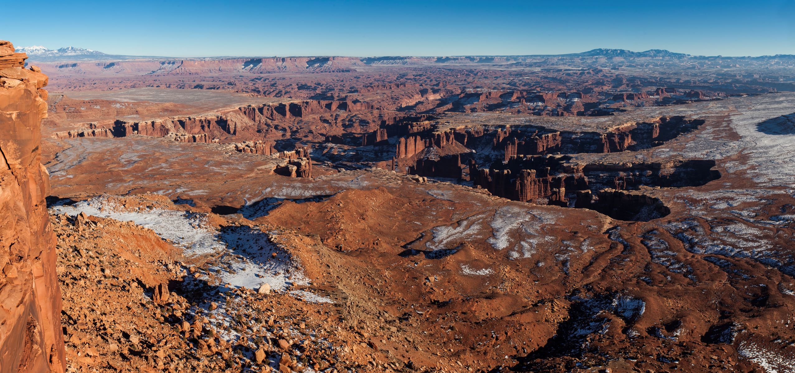
Grand View Point: Carving the Canyons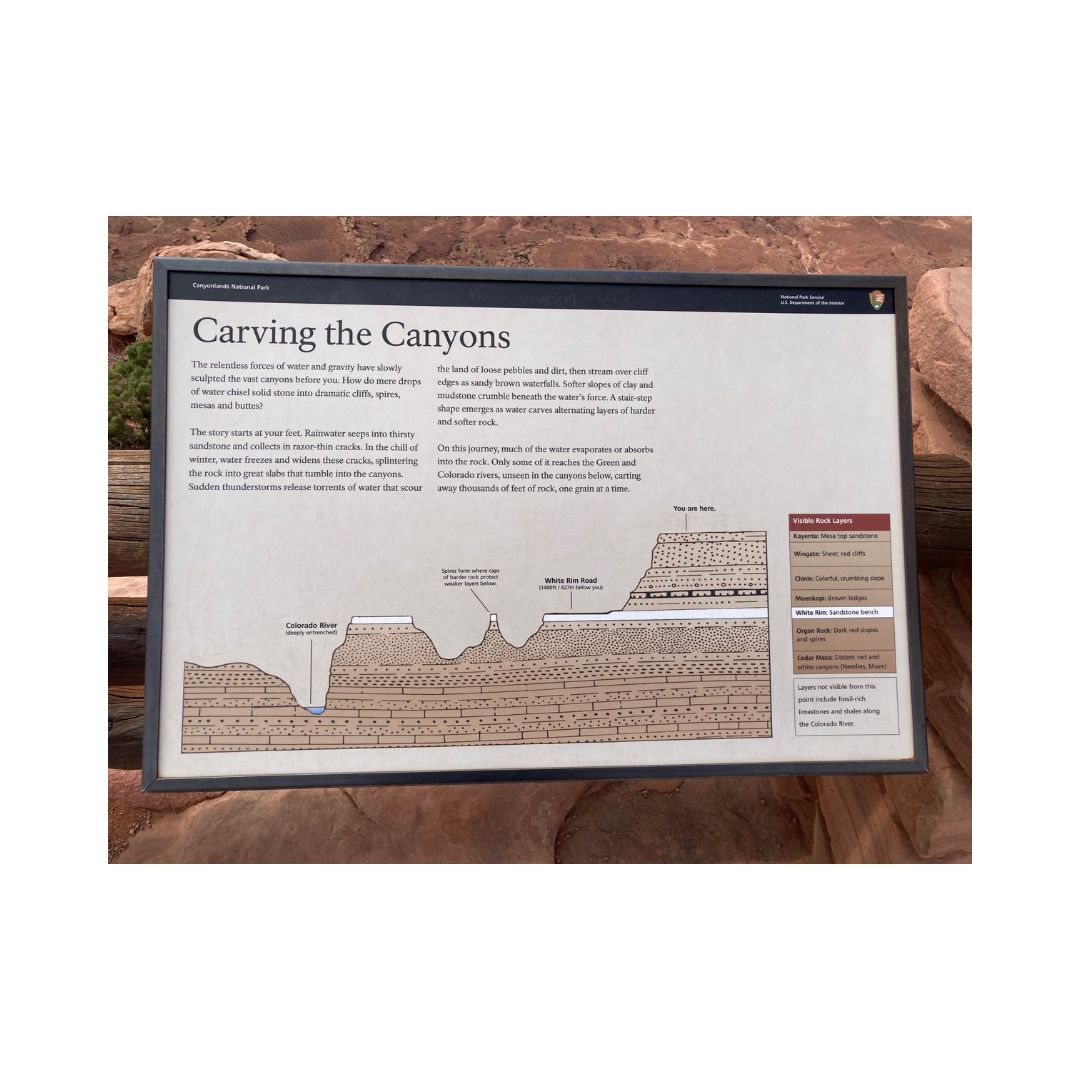
Grand View Point: Grand View Point Overlook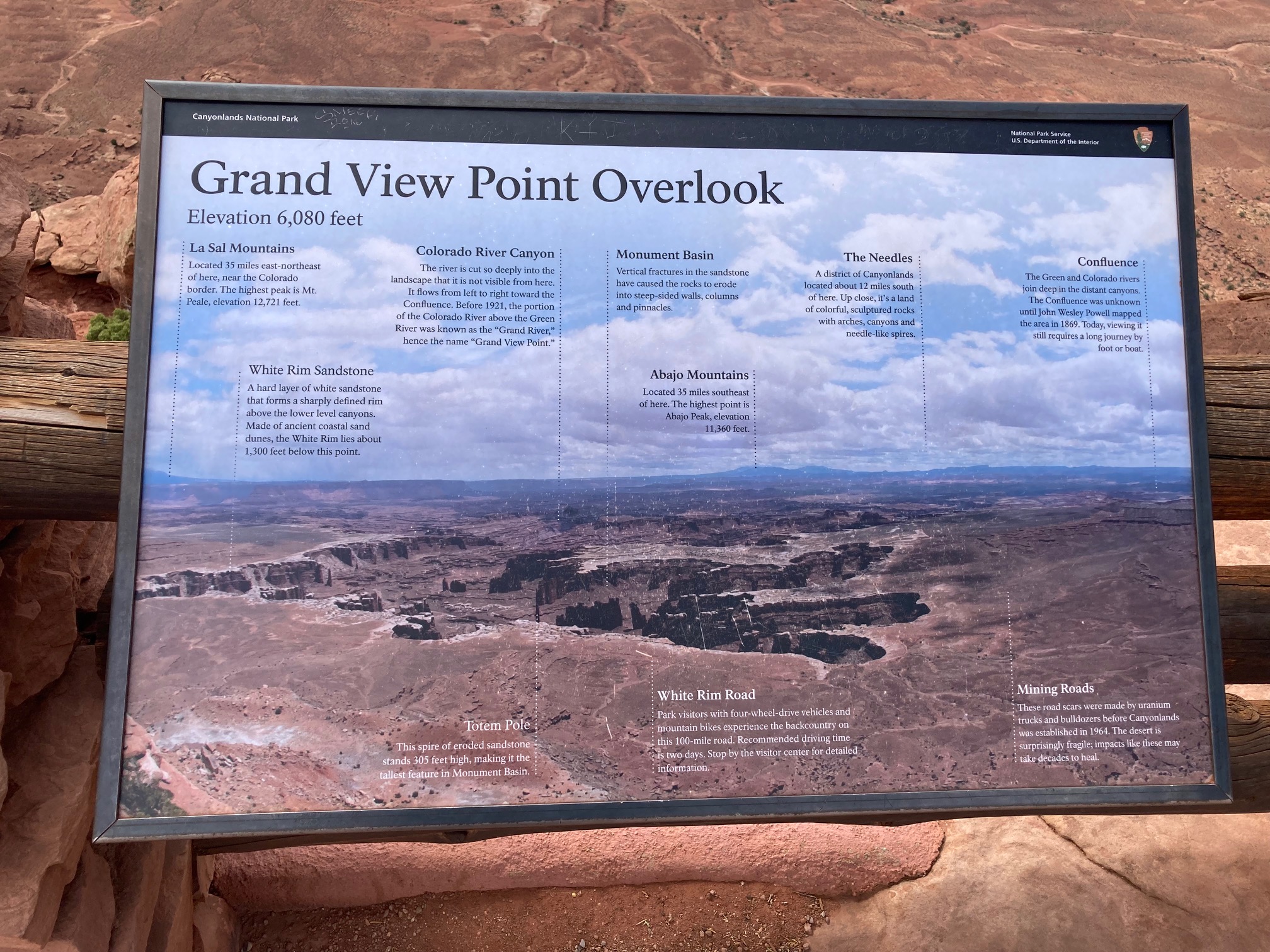
Green River OverlookBest mesa-top view of the Green River far below. Can be lovely for sunset. 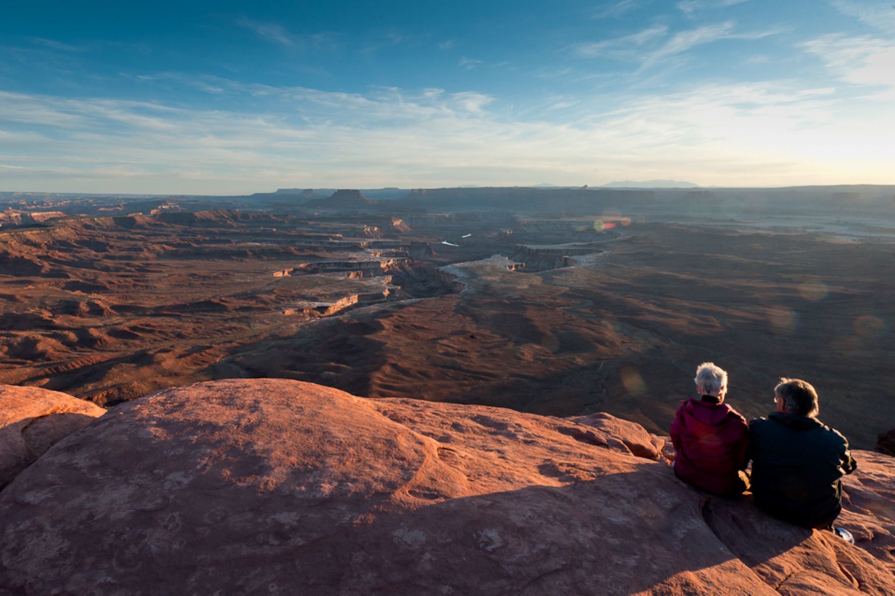
Green River Overlook: Green River Overlook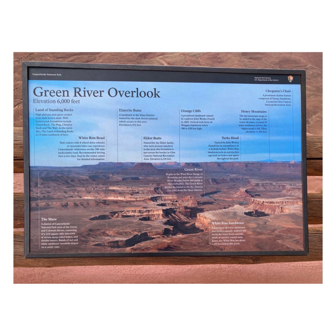
Green River Overlook: What Shall We Find?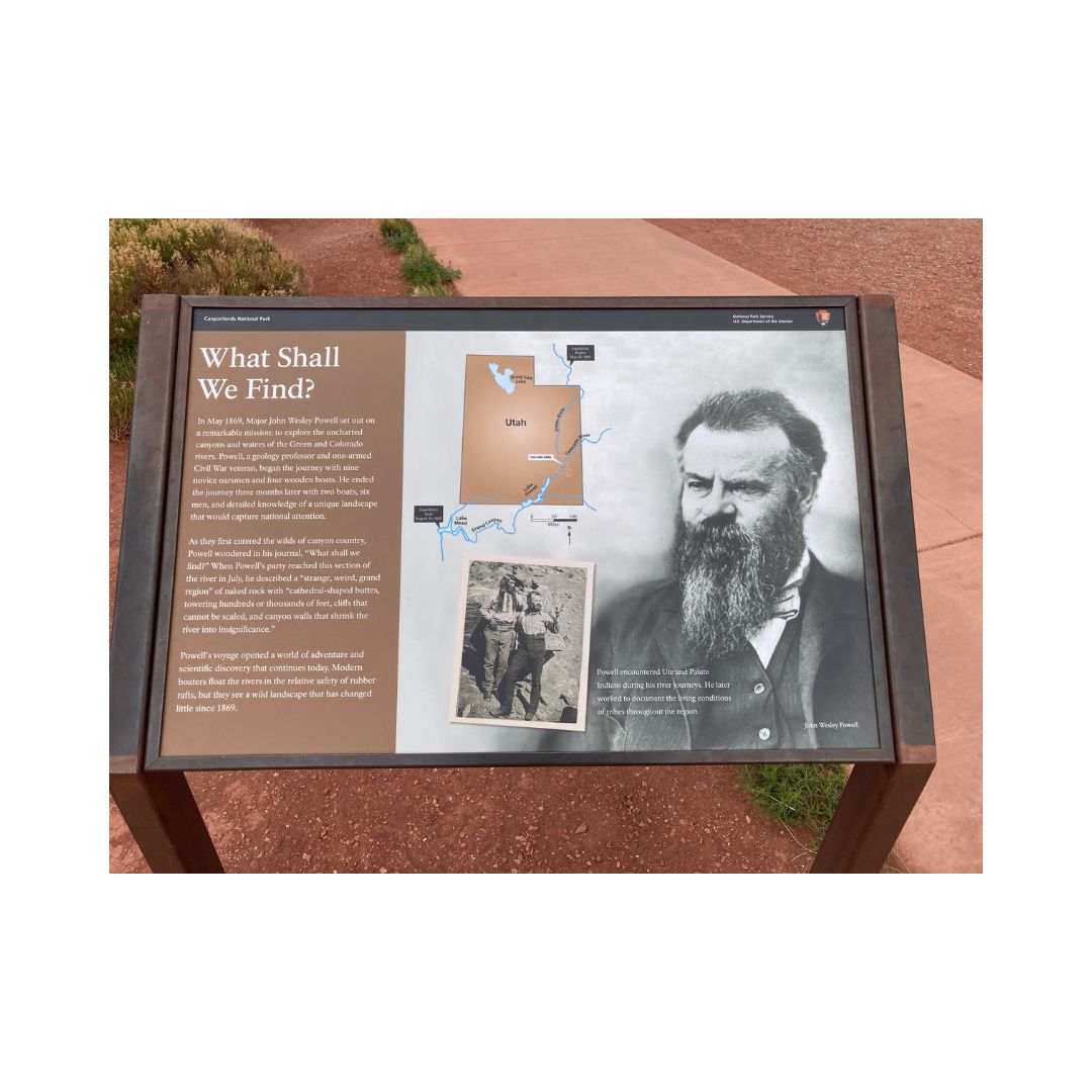
Horseshoe CanyonHorseshoe Canyon contains some of the most significant pictographs in North America. The Great Gallery, the best-known panel in Horseshoe Canyon, includes well-preserved, life-sized figures with intricate designs. Other impressive sights include spring wildflowers, sheer sandstone walls, and mature cottonwood groves along the intermittent stream in the canyon bottom. Horseshoe Canyon was added to Canyonlands National Park in 1971. 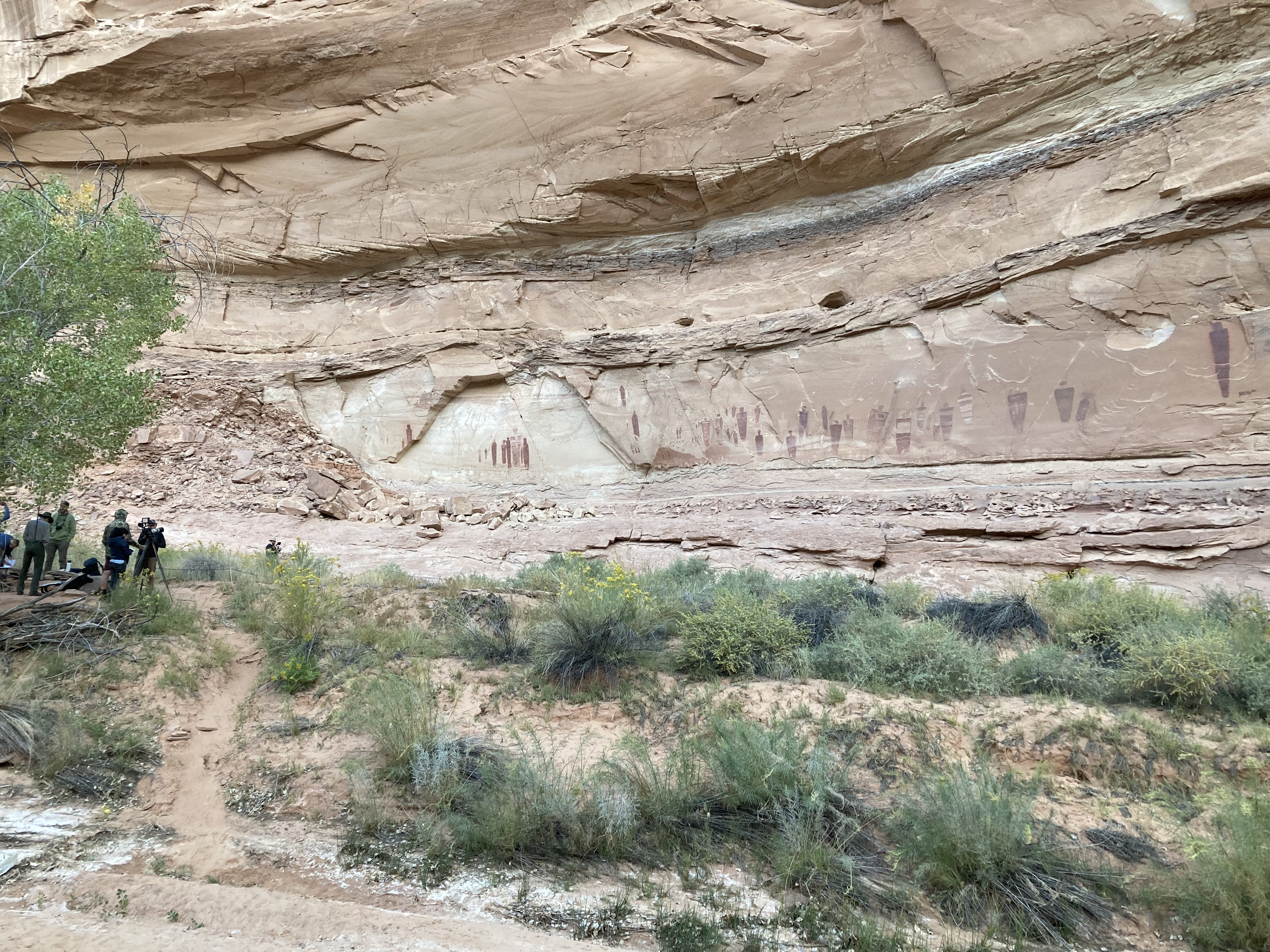
Island in the Sky Entrance StationIsland in the Sky Visitor Center: There's Something in the Air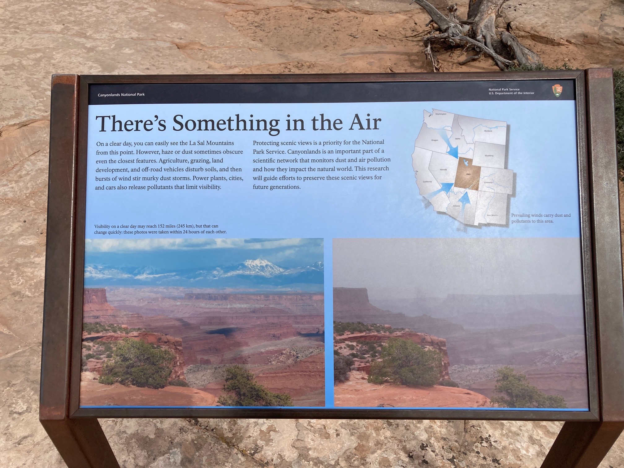
Lathrop TrailThe Lathrop Trail crosses a wide grassland on the mesa top, enjoys views of Colorado River, then descends into the canyon below. For a moderate trail option, hikers often turn around at the canyon rim. Continuing down to the White Rim Road means a strenuous hike back out. 
Mesa Arch TrailShort hike to a natural stone arch perched at the mesa's edge, framing views of La Sal Mountains and the canyon below. 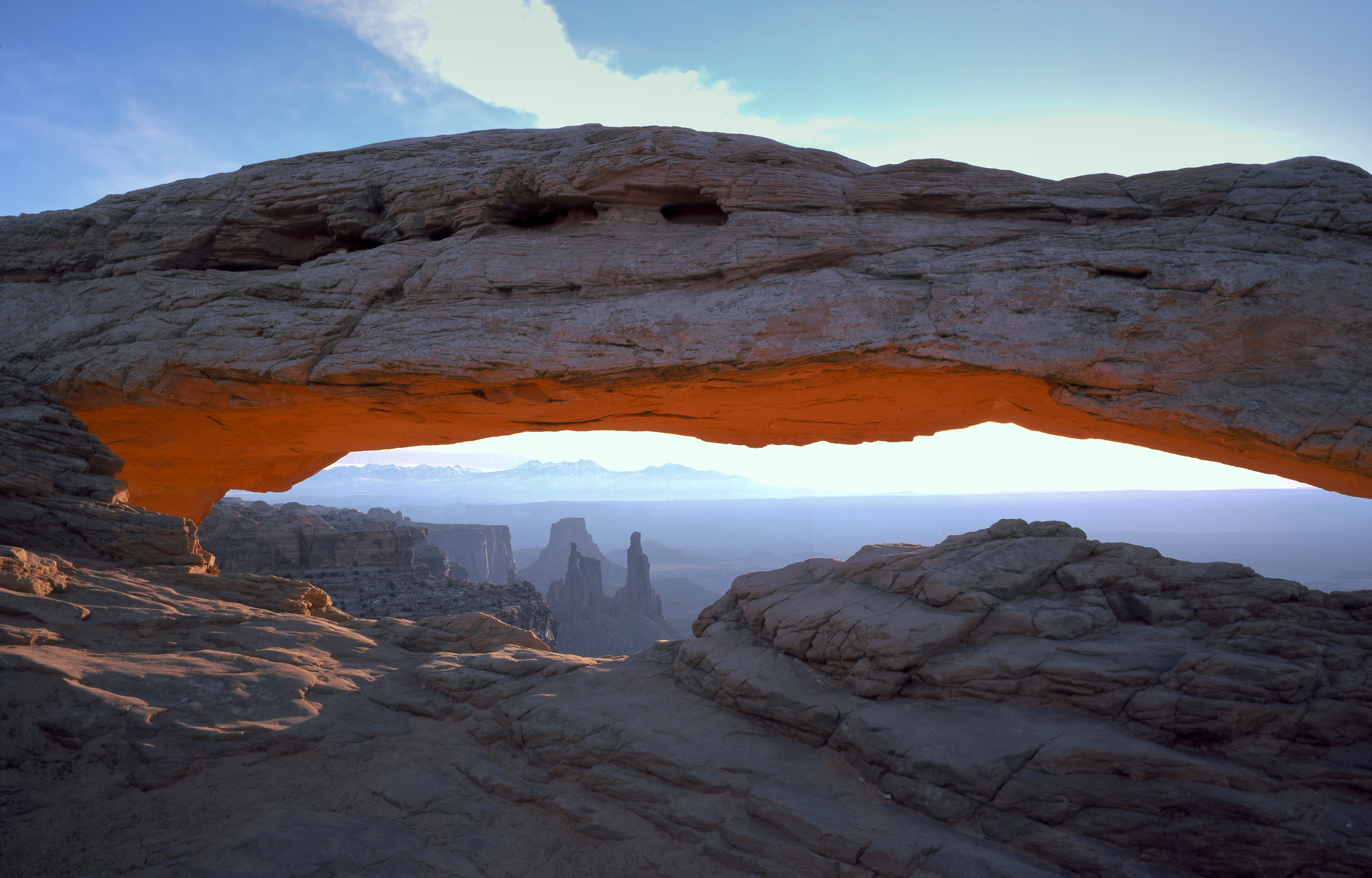
Mesa Arch: Keeping it Together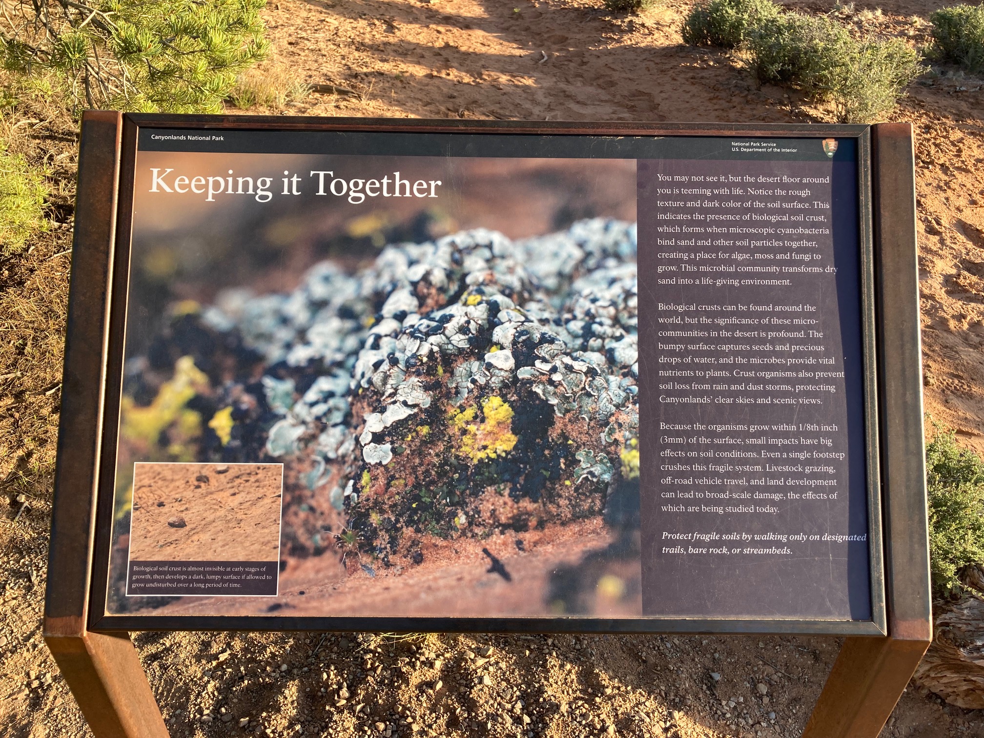
Mormon Pioneer National Heritage AreaThe Mormon Pioneer National Heritage Area preserves the natural, historical, and cultural heritage legacies and contributions of Mormon settlement in the West. The heritage area accomplishes this through community-led efforts to connect with the past by telling the Mormon pioneer story. 
Moses and Zeus Towers TrailMoses and Zeus are two prominent towers overlooking Taylor Canyon. This trail leads to their base. Reaching this trail requires a hike down Alcove Spring Trail (11.2 mi/18.3 km roundtrip) or a permit to drive the 4WD White Rim Road. 
Murphy Loop TrailA great full-day hike with 1,400 feet (440 m) elevation change, the Murphy Loop Trail offers outstanding views from atop the Murphy Hogback and White Rim Road. 
Murphy Point TrailThis mostly level hike leads past a historic corral on the mesa top. The trail ends with panoramic views of Candlestick Tower, the Green River, and the White Rim Road. 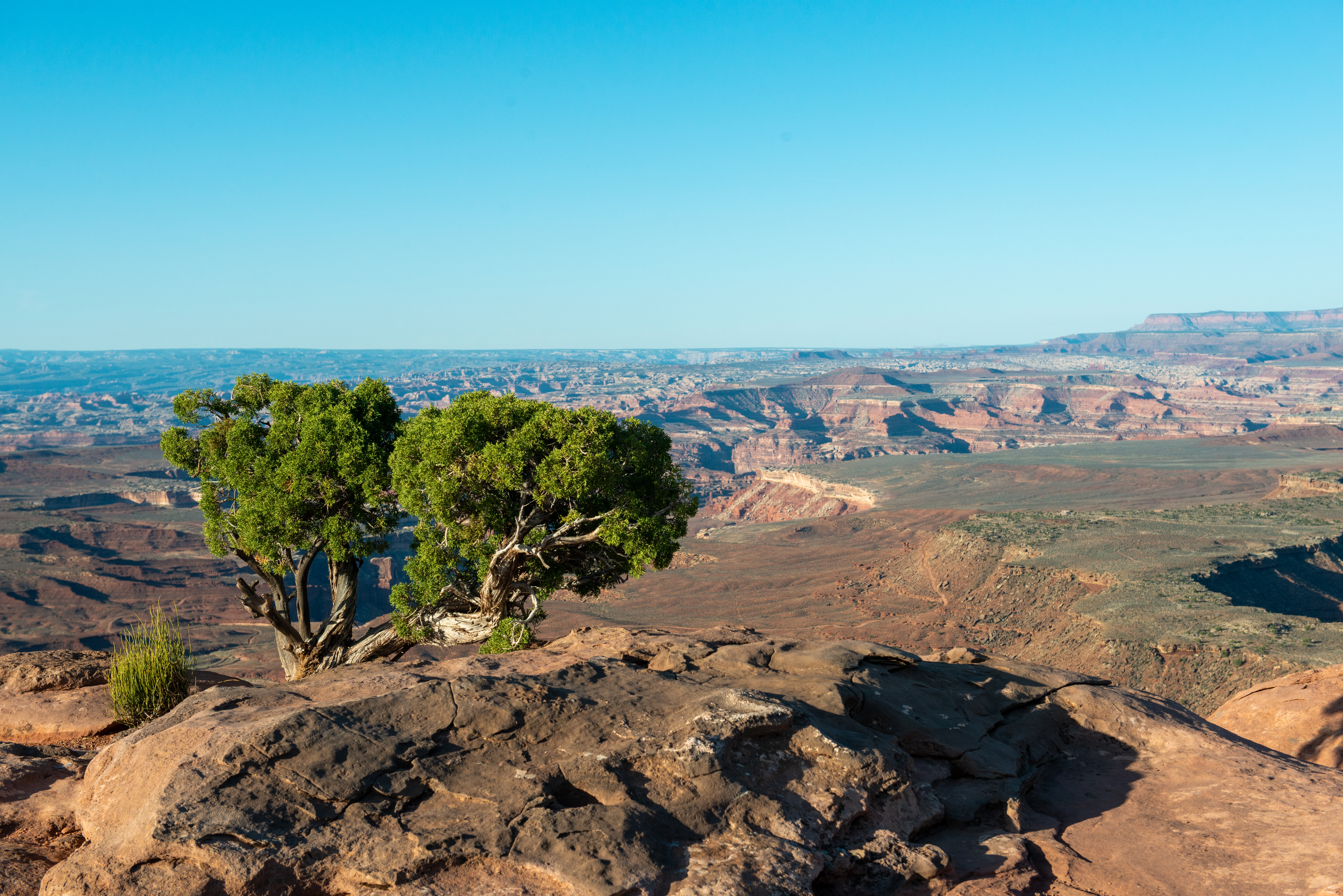
Neck Spring TrailA walk back in time, this loop trail passes historic ranching features and two springs where cowboys watered cattle. 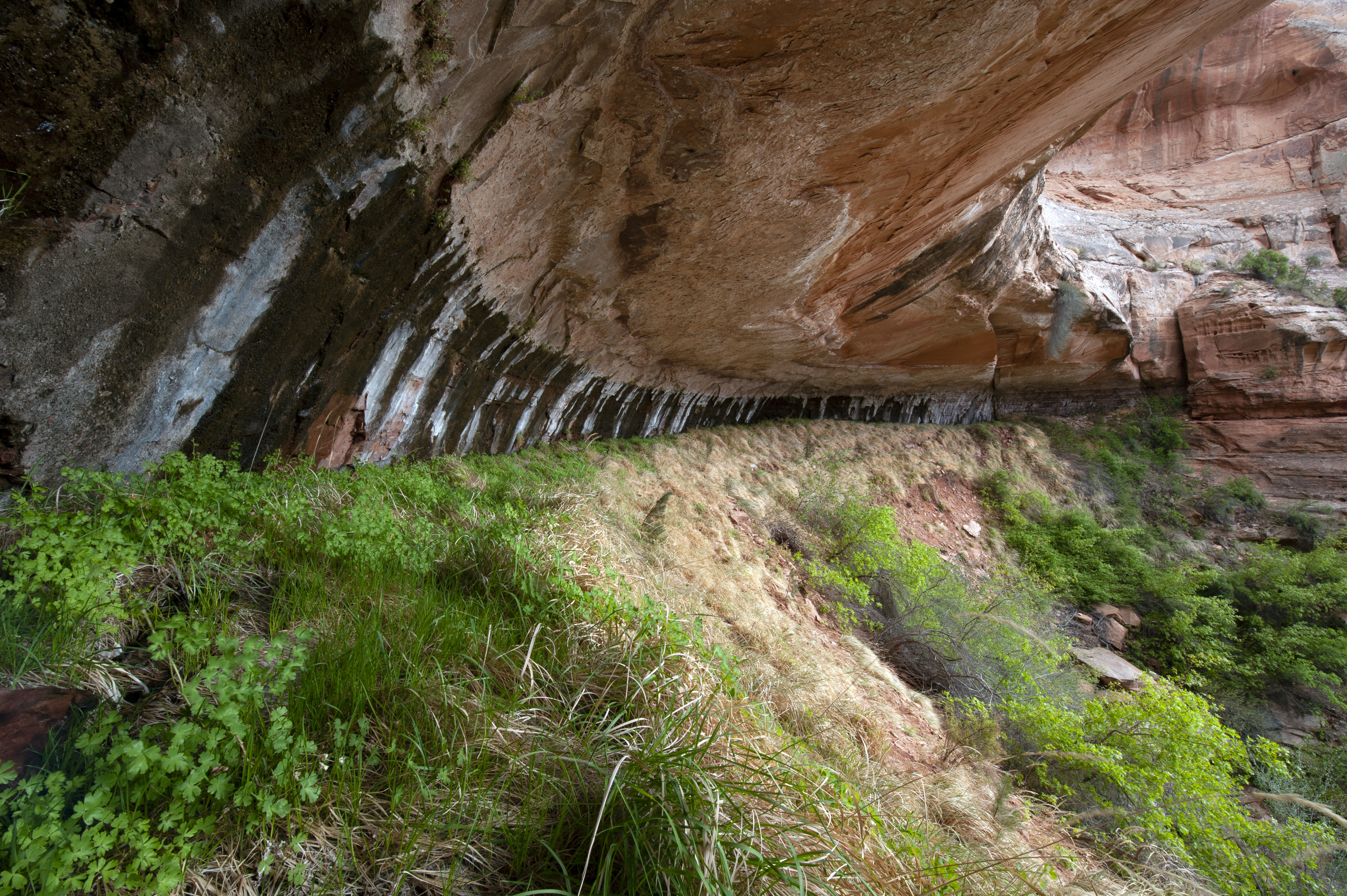
Orange Cliffs OverlookEnjoy panoramic views across the canyon of the Green River to the dazzling sandstone cliffs of the aptly named Orange Cliffs unit of Glen Canyon Recreation Area. 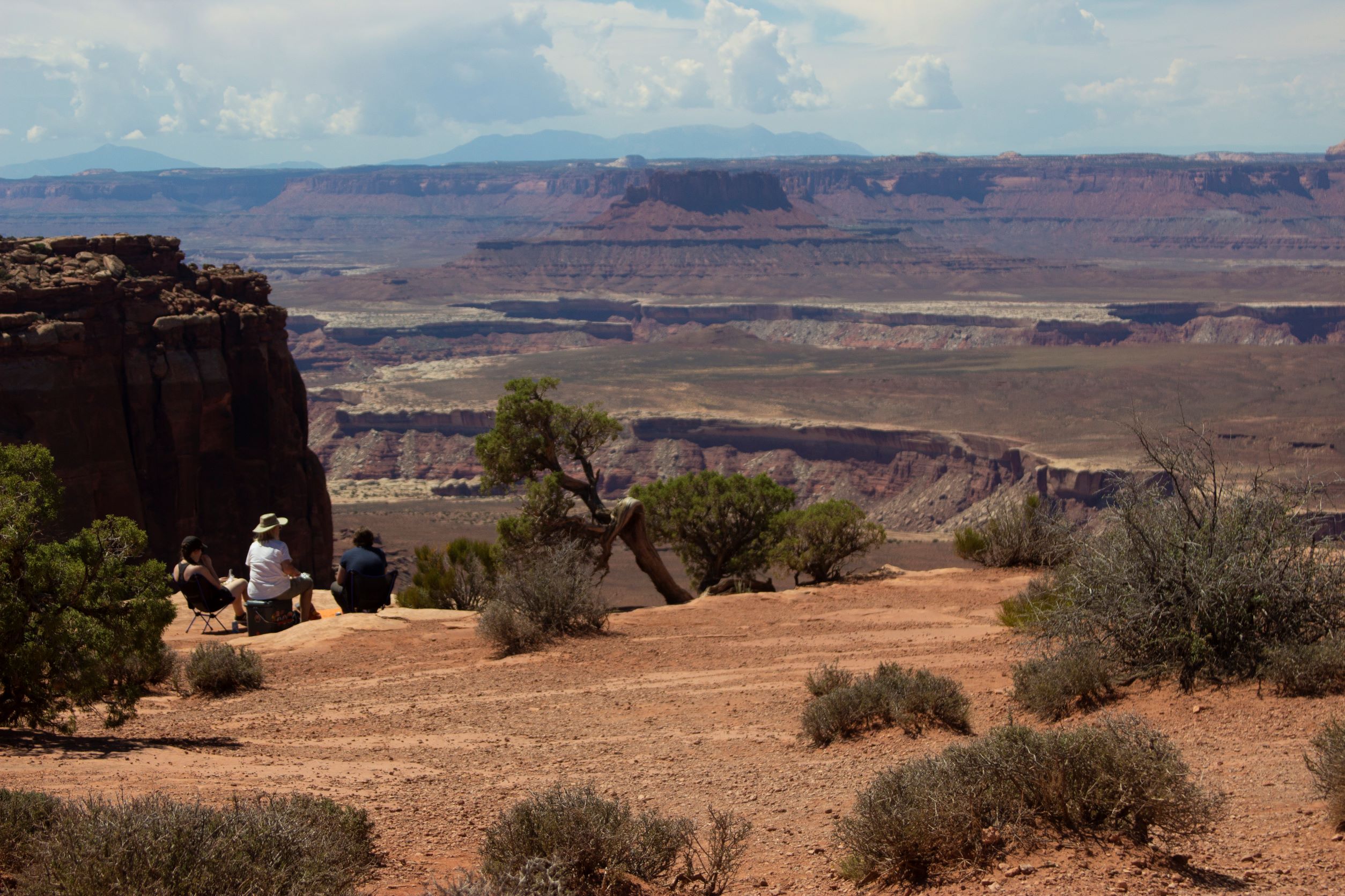
Orange Cliffs Overlook: Protecting Wilderness
Peekaboo TrailSteep slopes and nearby cliff edges make this a challenging route. Two ladders must be climbed. 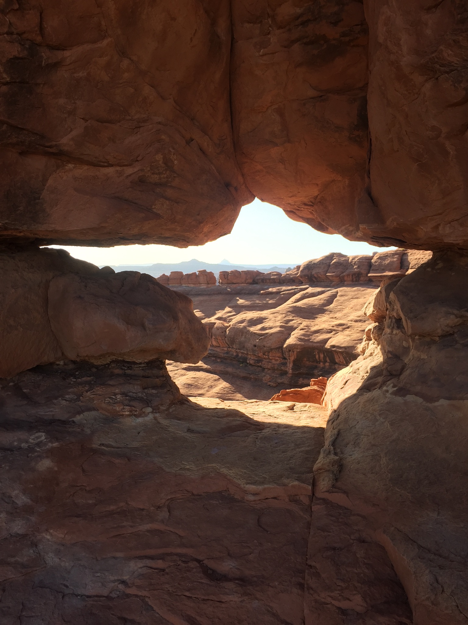
Pets in CanyonlandsPets and owners have a special bond, but a national park is not always the best place for pets. Canyonlands National Park is a designated natural area, and its purpose is to preserve and protect the park's natural environment, cultural resources, wildlife, and scenic beauty. 
Pothole Point TrailThis short loop trail (0.6 mi/1 km) crosses sandstone dimpled with pockets called potholes, which may be filled with surprising aquatic life. 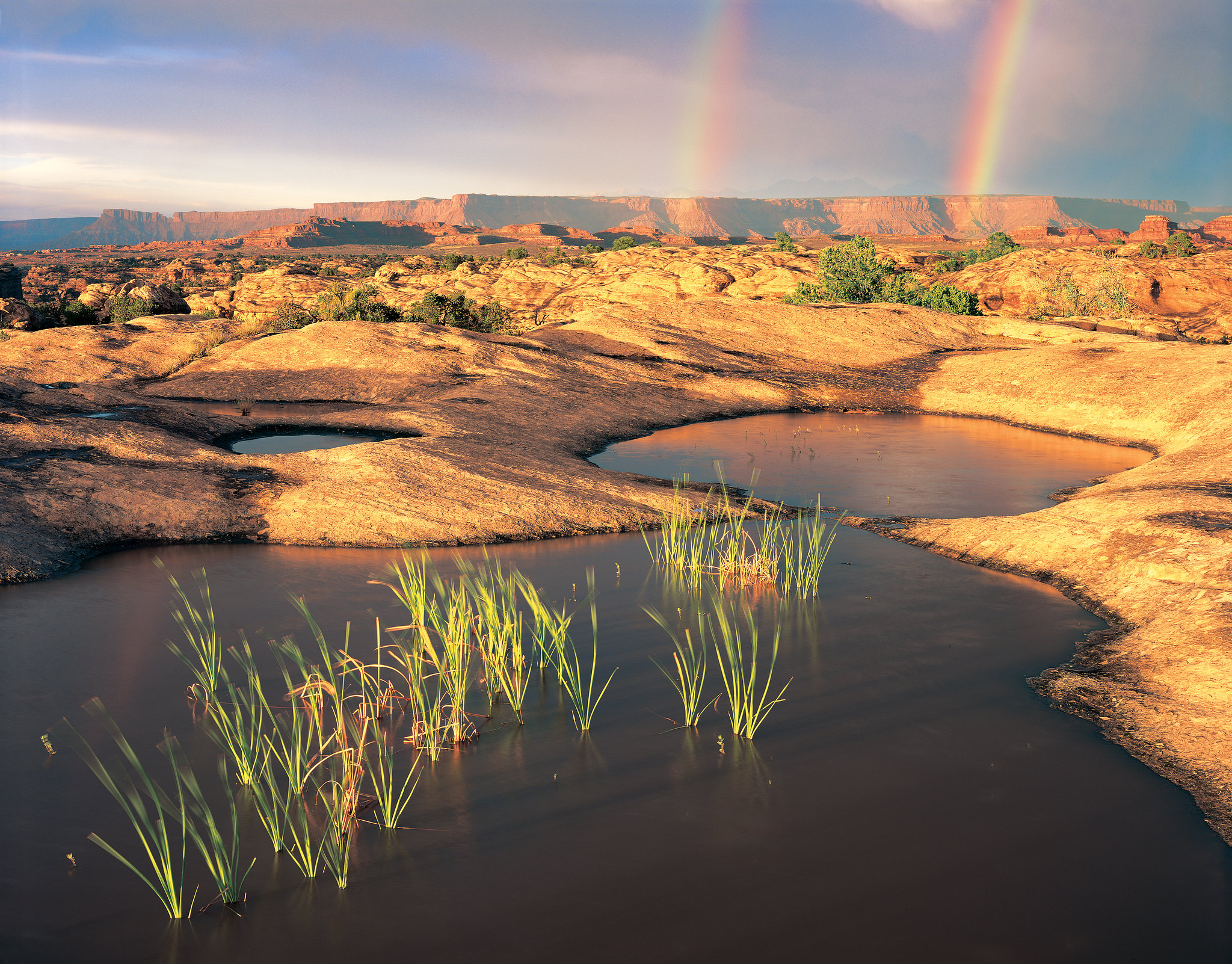
Scenic Drive Picnic Area: Life in the Balance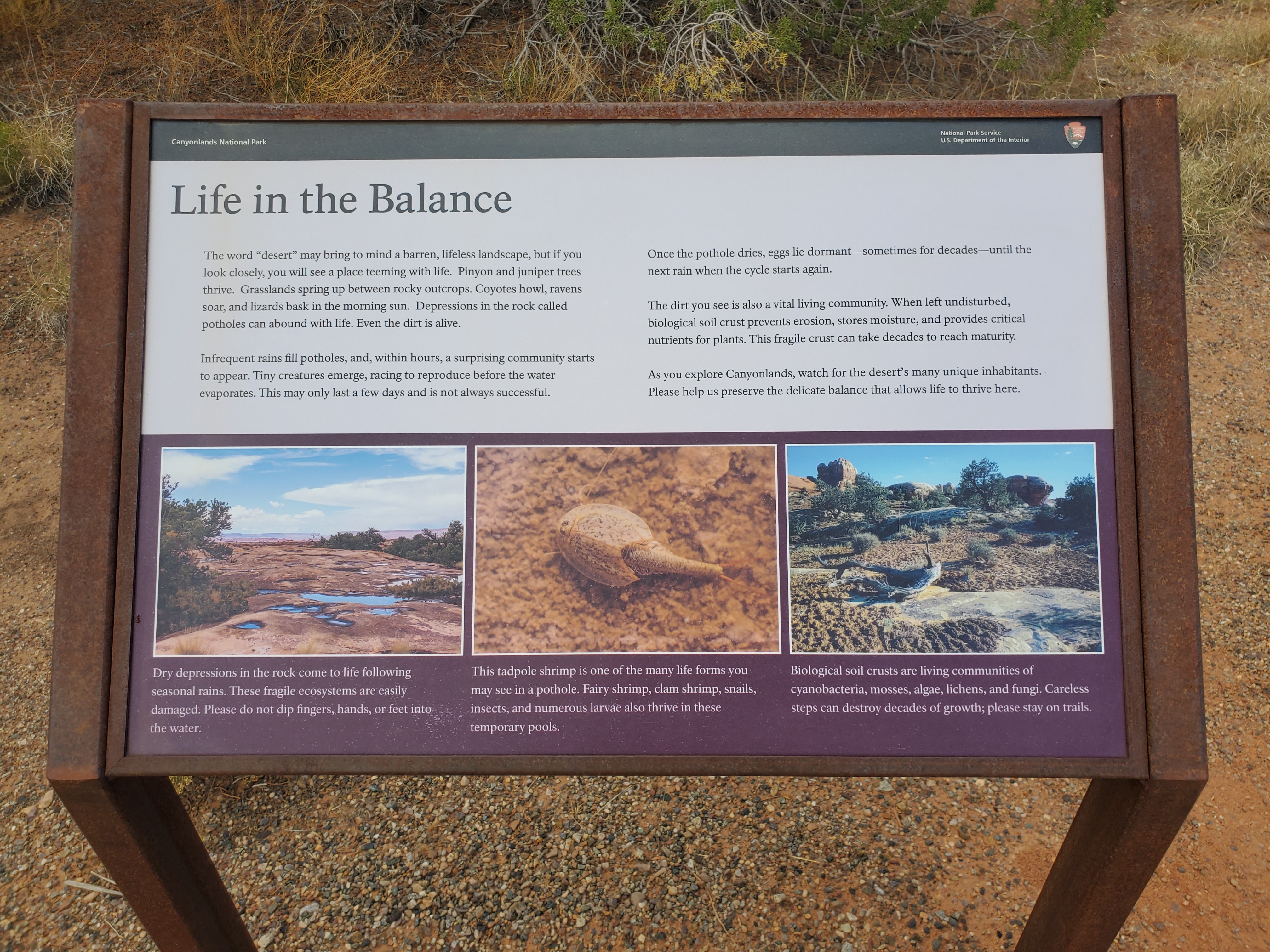
Shafer Canyon Overlook: Anatomy of a Canyon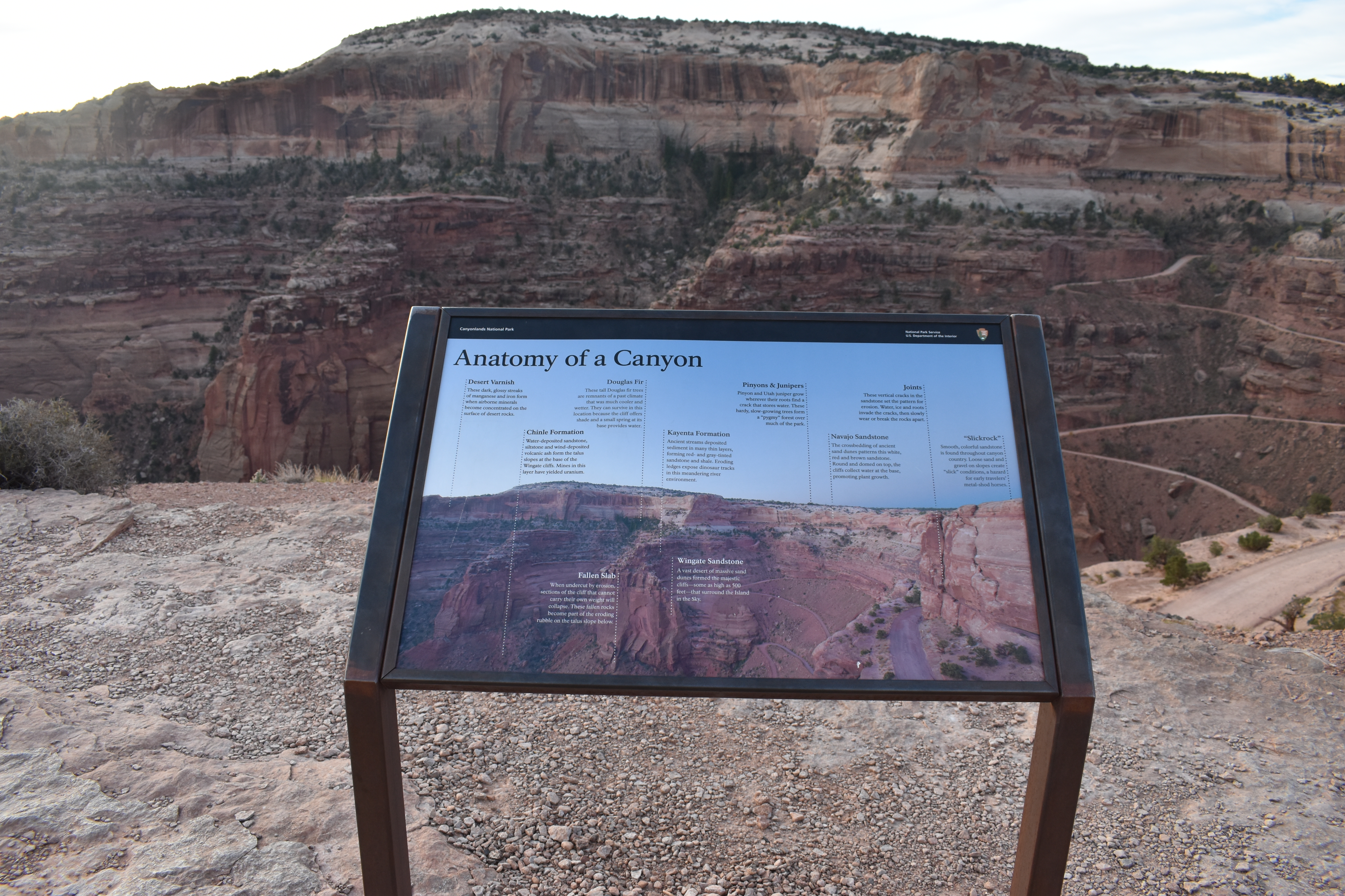
Shafer Canyon Overlook: Dropping into the Canyons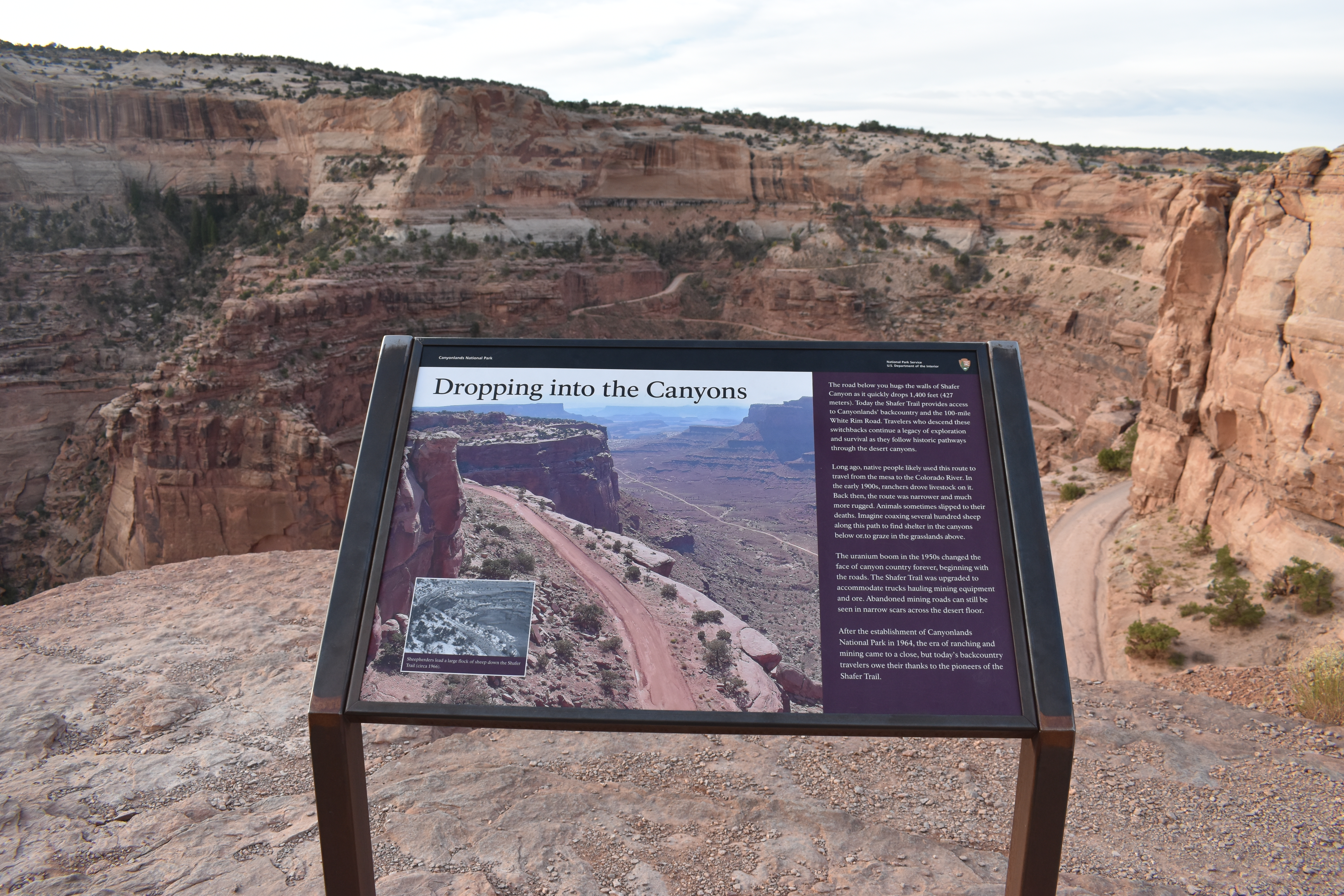
Shafer Trail ViewpointThe Shafer Trail Viewpoint at Island in the Sky provides an incredible view of this iconic road that descends 1,500 feet (457 m) down colorful sandstone walls to the canyon basin. 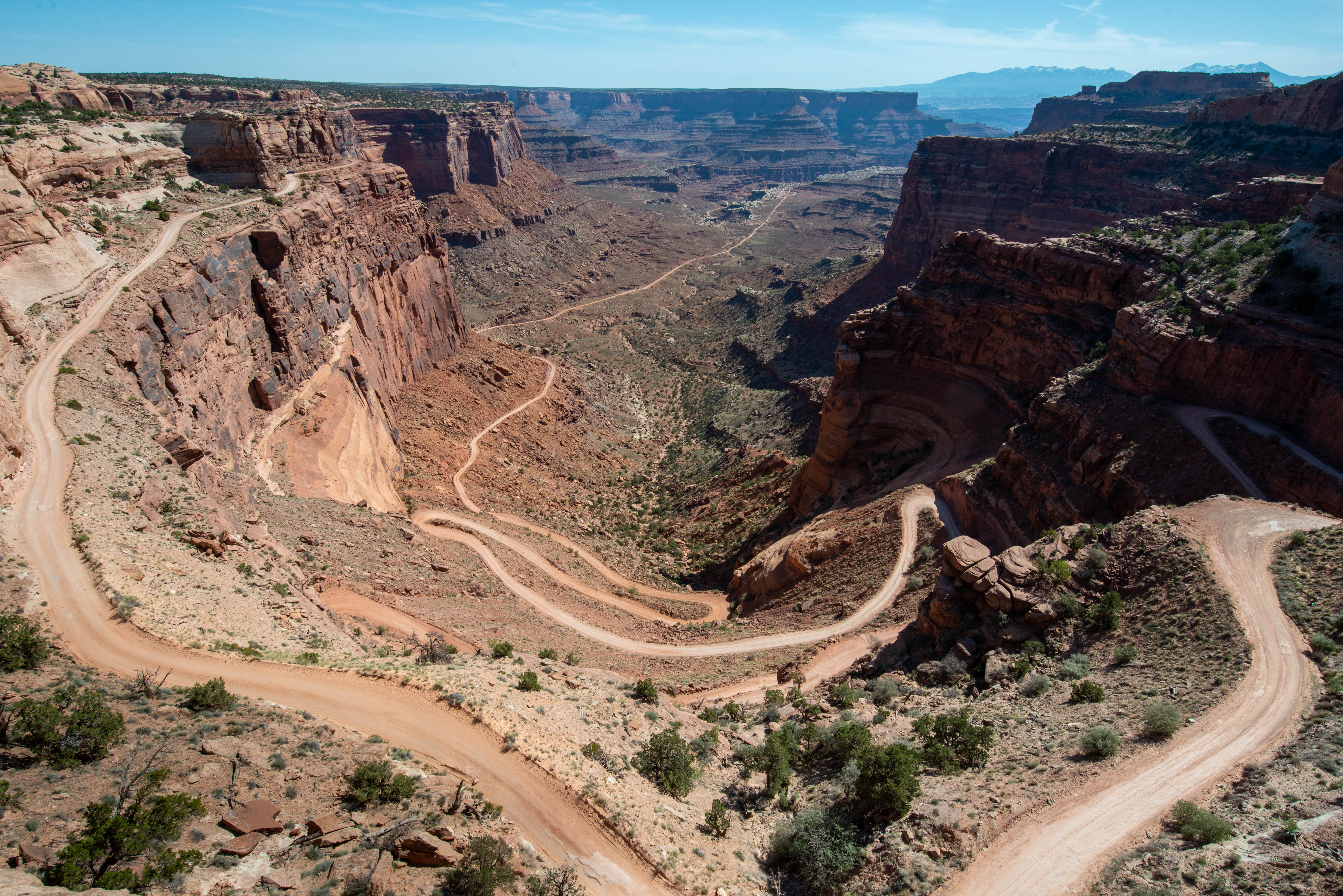
Slickrock TrailThis trail features expansive 360-degree views into Big Spring Canyon and Little Spring Canyon, with the La Sal Mountains and Abajo Mountains in the background. Geology guide available at trailhead. 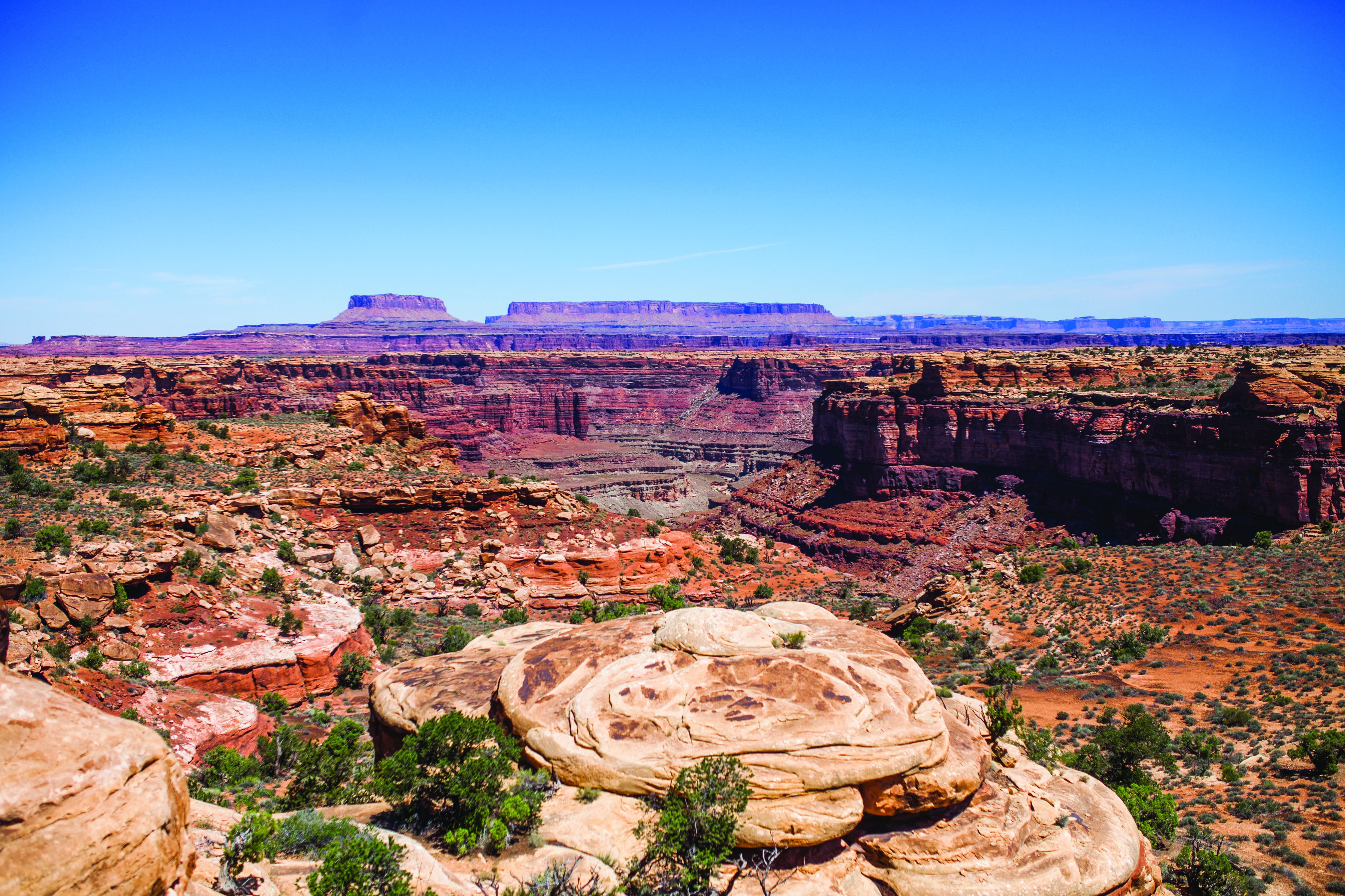
Slickrock: Big Spring Canyon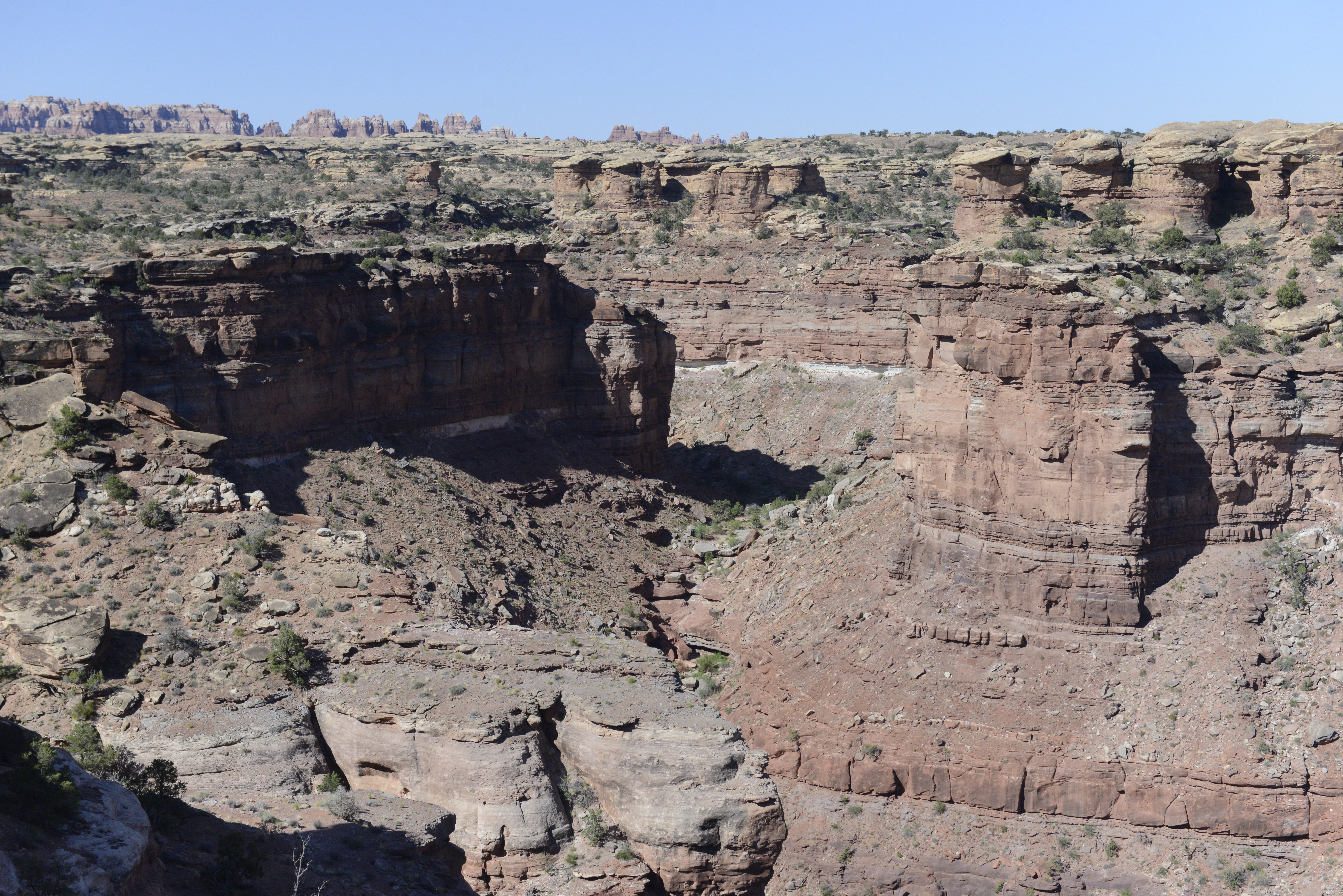
|
| Visitor Centers | Count: 4
Canyonlands Backcountry Office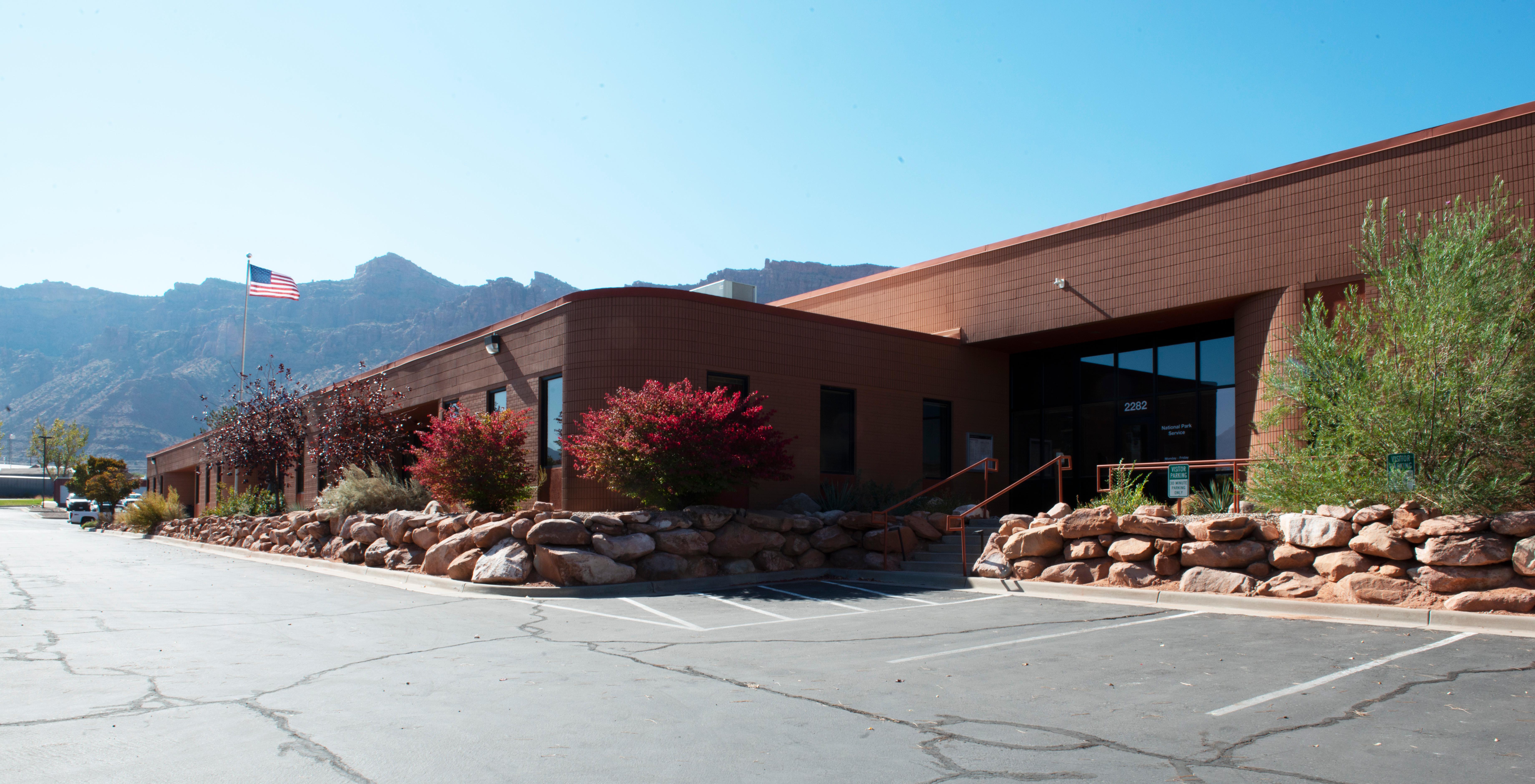
Hans Flat Ranger Station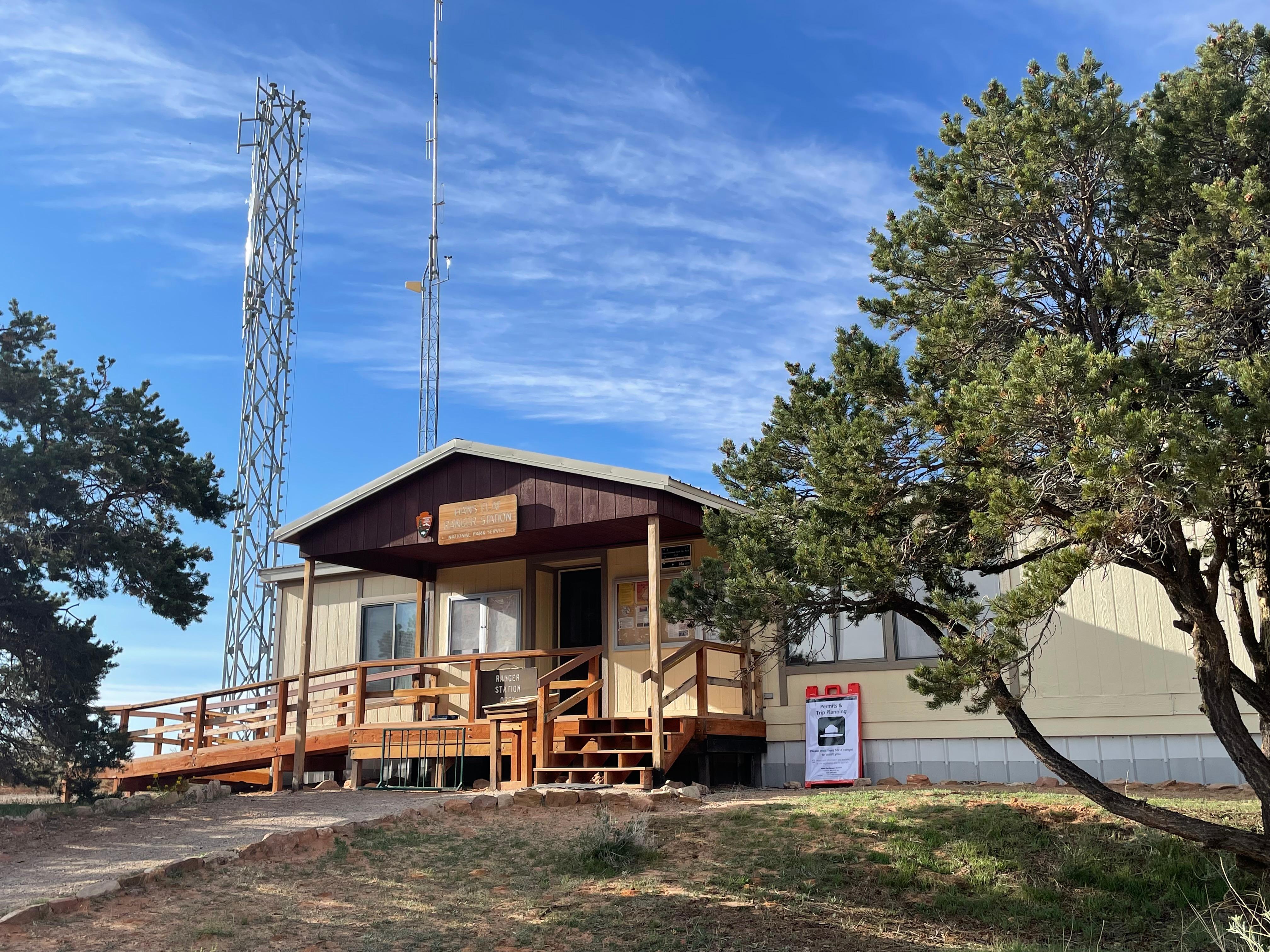
Island in the Sky Visitor Center
The Needles Visitor Center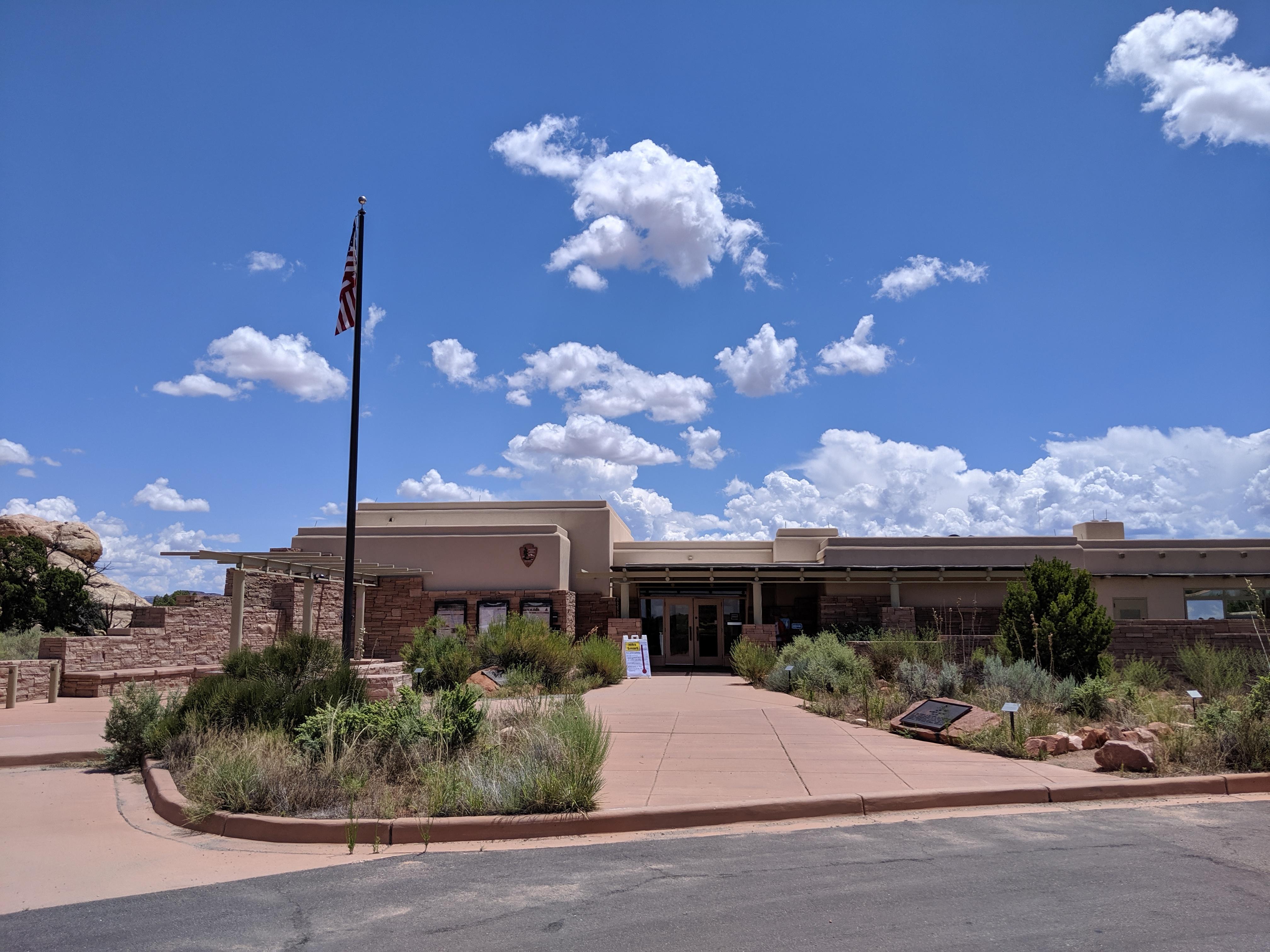
|
| Things to do | Count: 8

|
| Tours |
Count: 5
2 Hours in Island in the SkyWant to make the most out of your 2 hours in the park? Visit Grand View Point and Green River Overlook, and hike the 0.5-mile-loop nature trail to Mesa Arch. 2 Hours in The NeedlesLooking to make the most of two hours in the park? Start at the Needles Visitor Center to watch the park orientation film and grab a map from one of our friendly rangers. Hike one or two of the short interpretive trails, like Stone Storehouse or Pothole Point, stop by Wooden Shoe Arch Overlook, then drive to Big Spring Canyon Overlook to enjoy the view. 4 Hours in the NeedlesWant to make the most of four hours in the park, but not sure if you want to commit to a backcountry hike? The Needles District offers beautiful front country opportunities that allow for an excellent experience! Start at the Needles Visitor Center to watch the park orientation film, then explore the park's four front country hikes and beautiful overlooks for a truly memorable visit. (Note: Vehicles longer than 21ft in length are not permitted on the Cave Spring or Elephant Hill Access Roads) Explore Human HistoryDive into Canyonlands history with visits to historic mining camps, archeological sites and museum exhibits. This tour includes stops in the Needles and Island in the Sky districts, with a bonus stop at Horseshoe Canyon in the Maze District. You can visit a few stops in one afternoon, or complete the full tour in several days. Remember, archeological sites are fragile, irreplaceable resources. Never touch rock markings, leave all artifacts where you find them, and watch your step to avoid damage to sites. Slickrock Guided HikeLearn about the geology of Canyonlands National Park on this self-guided moderate hike. Here visitors will find four designated viewpoints that offer impressive views of Big Spring Canyon, Little Spring Canyon, and the surrounding landscape. This moderate trail is 2.4 mi (3.9 km) roundtrip and takes an average of 1.5 hours to complete. All viewpoints on this trail are unprotected - Use extreme caution around canyon edges. |
| Articles |
|