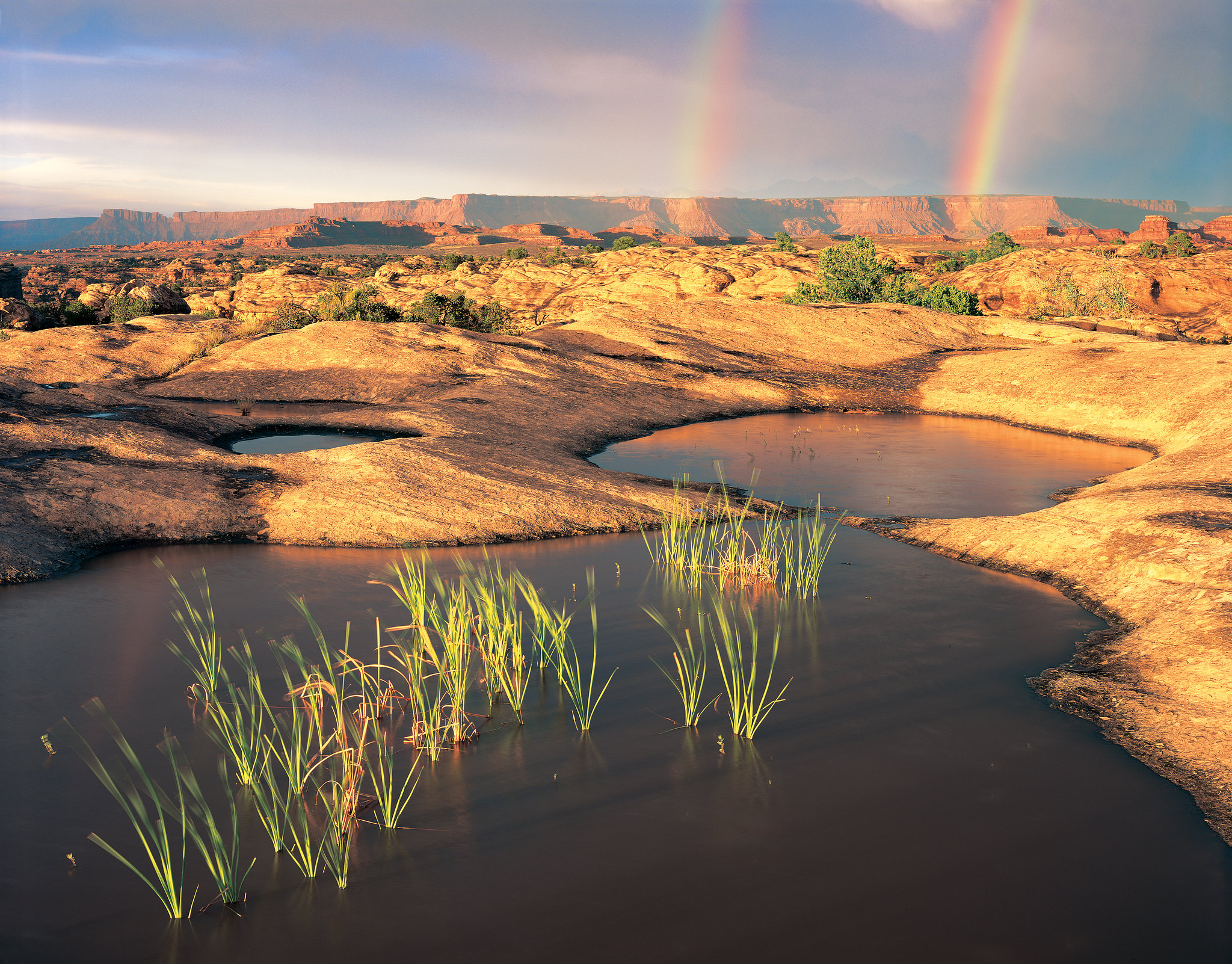
Big Spring rests at the end of the Needles Park Road. From the overlook, unique rock spires and multi-colored sandstone benches line the bend in the canyon. The presence of the spring allows trees and plants to flourish in the spring and summer months.
This loop features extended hiking on slickrock benches and mesa tops overlooking canyons. Excellent views of sheer cliff walls and other rock formations. Must climb two ladders.
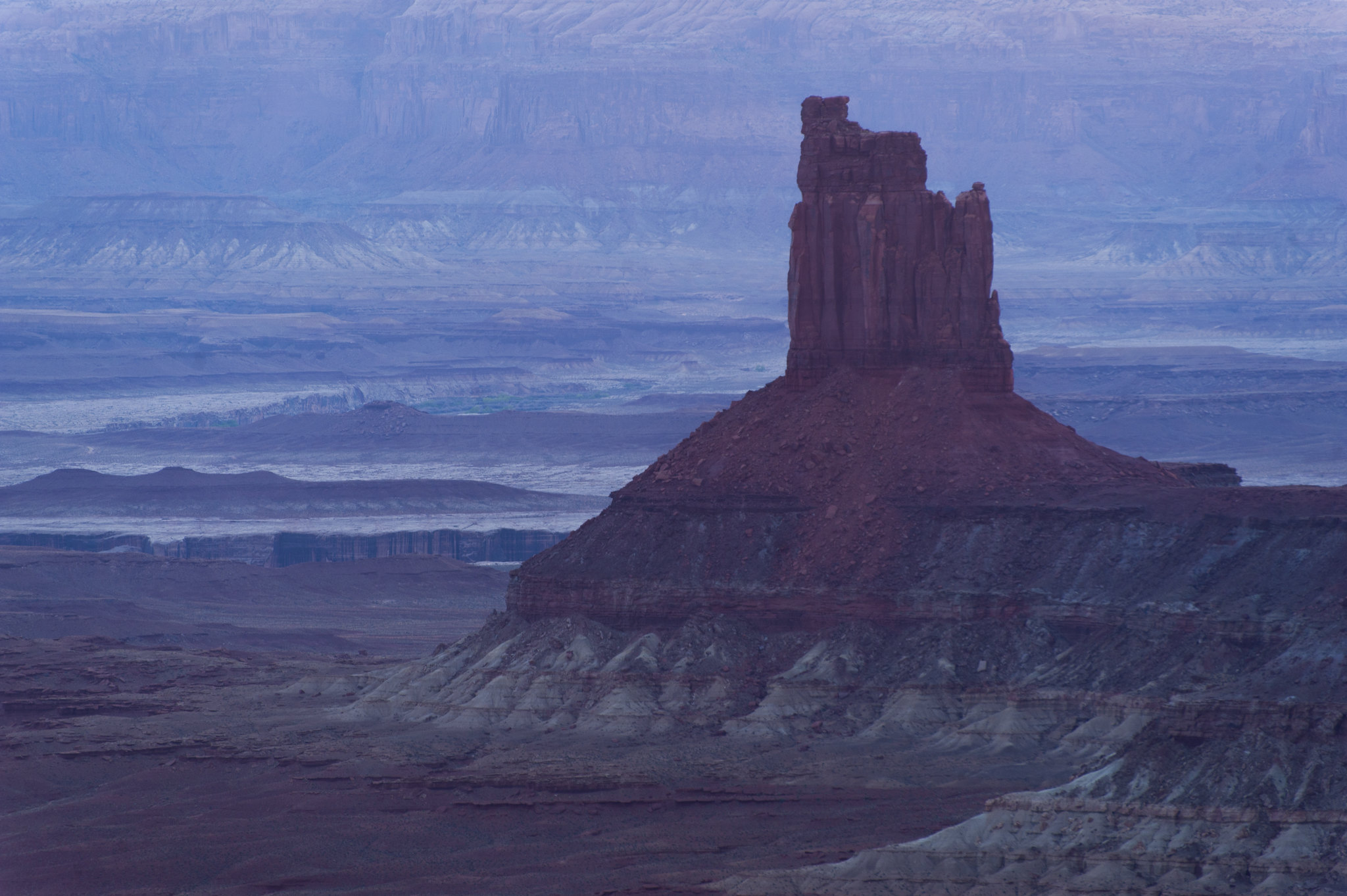
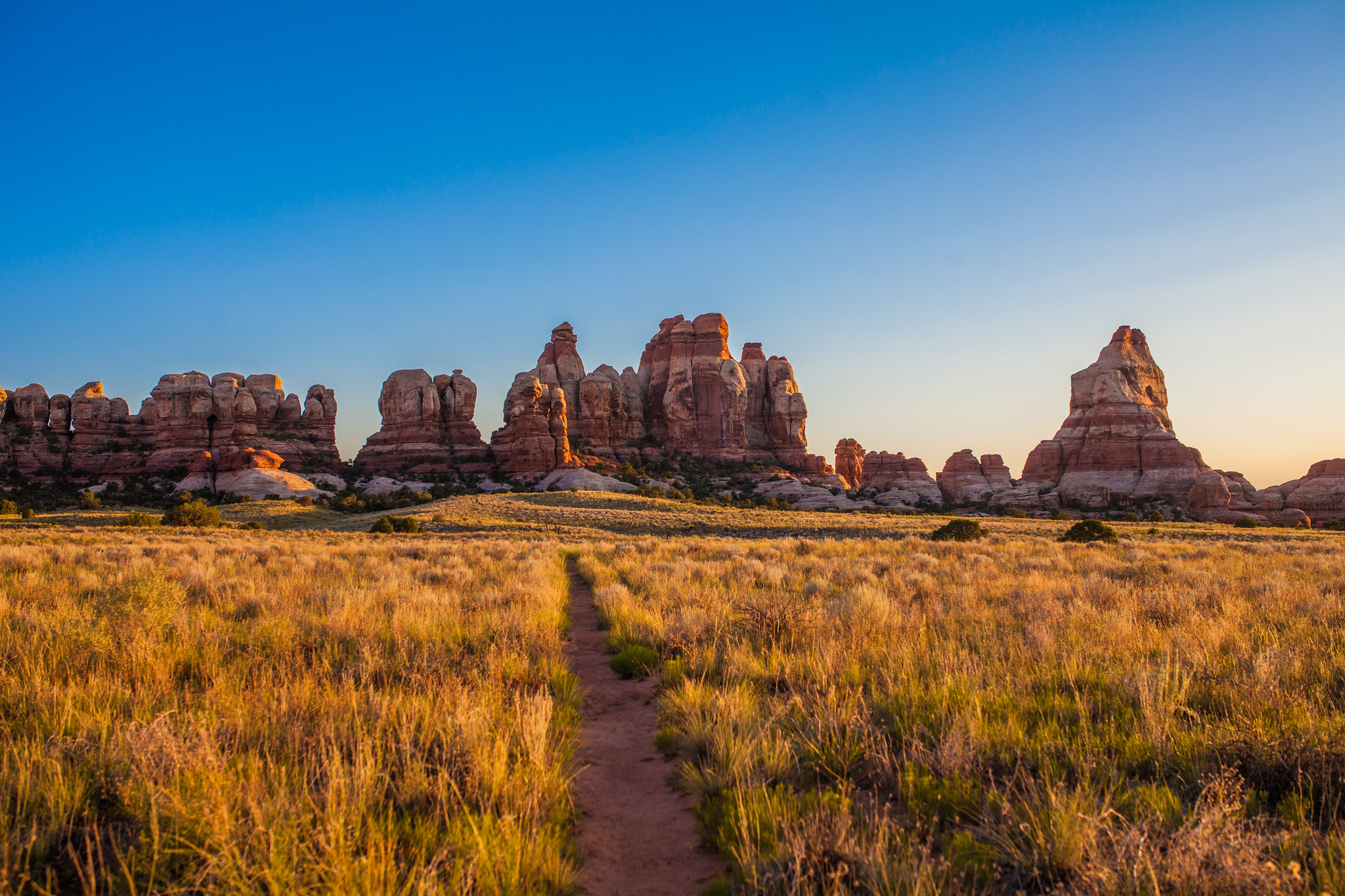
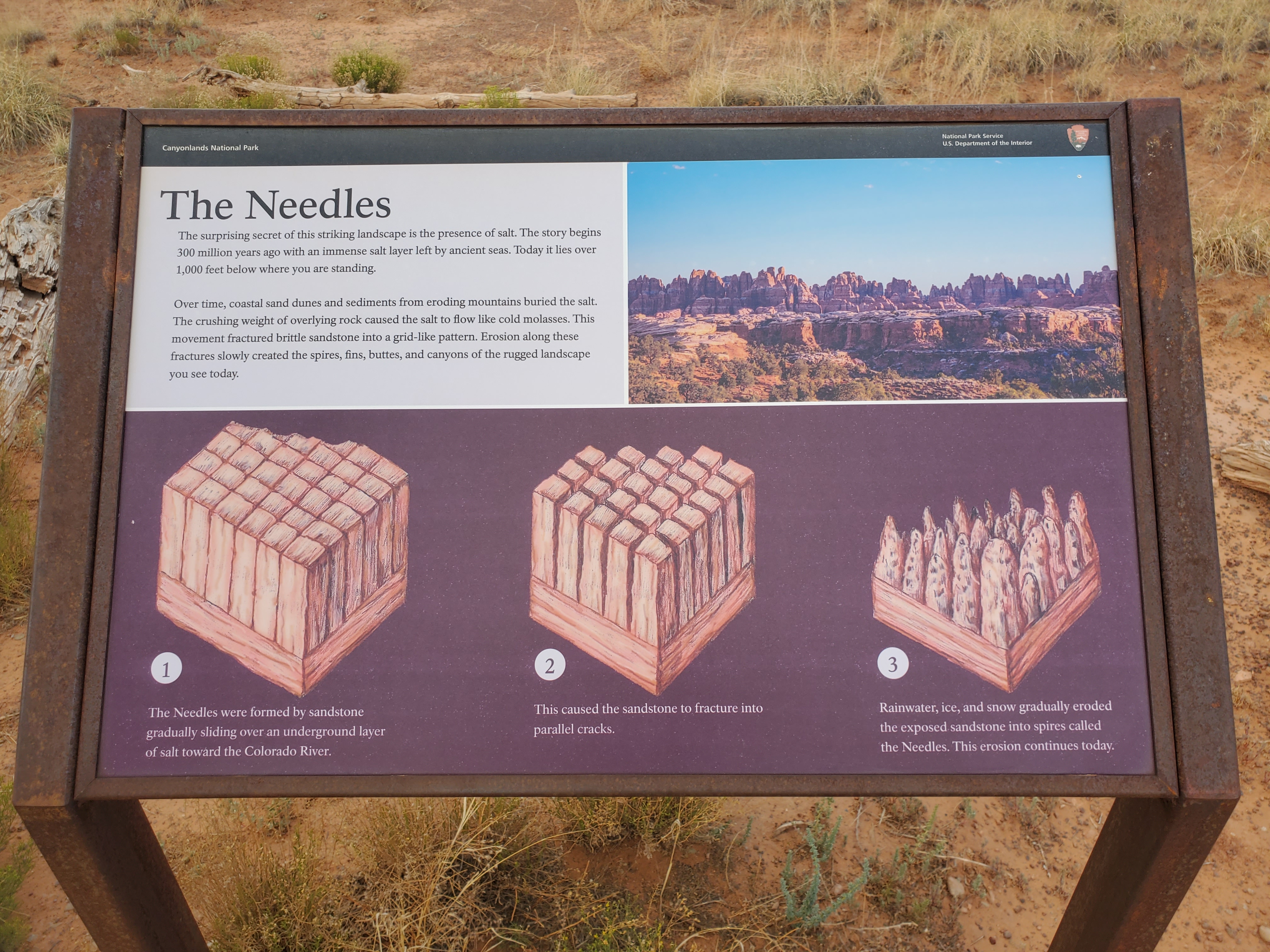
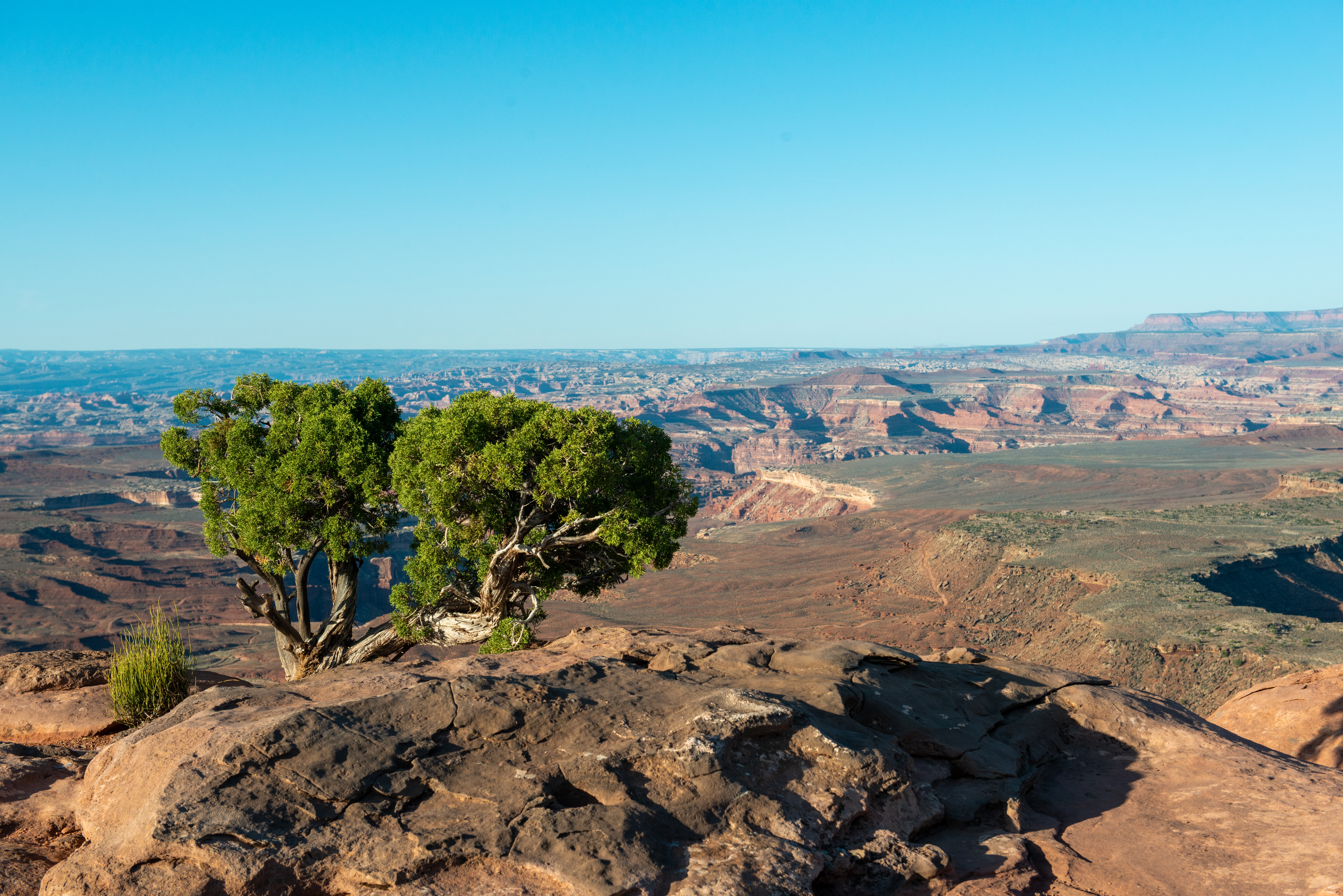
From this small roadside pullout, you can see sweeping views of Canyonlands and several prominent rock features, once of which, resembles a group of candlesticks.
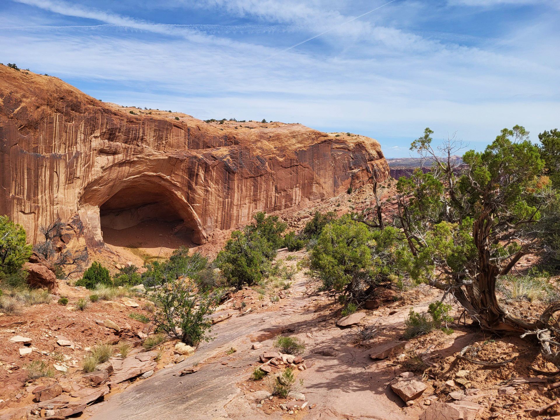
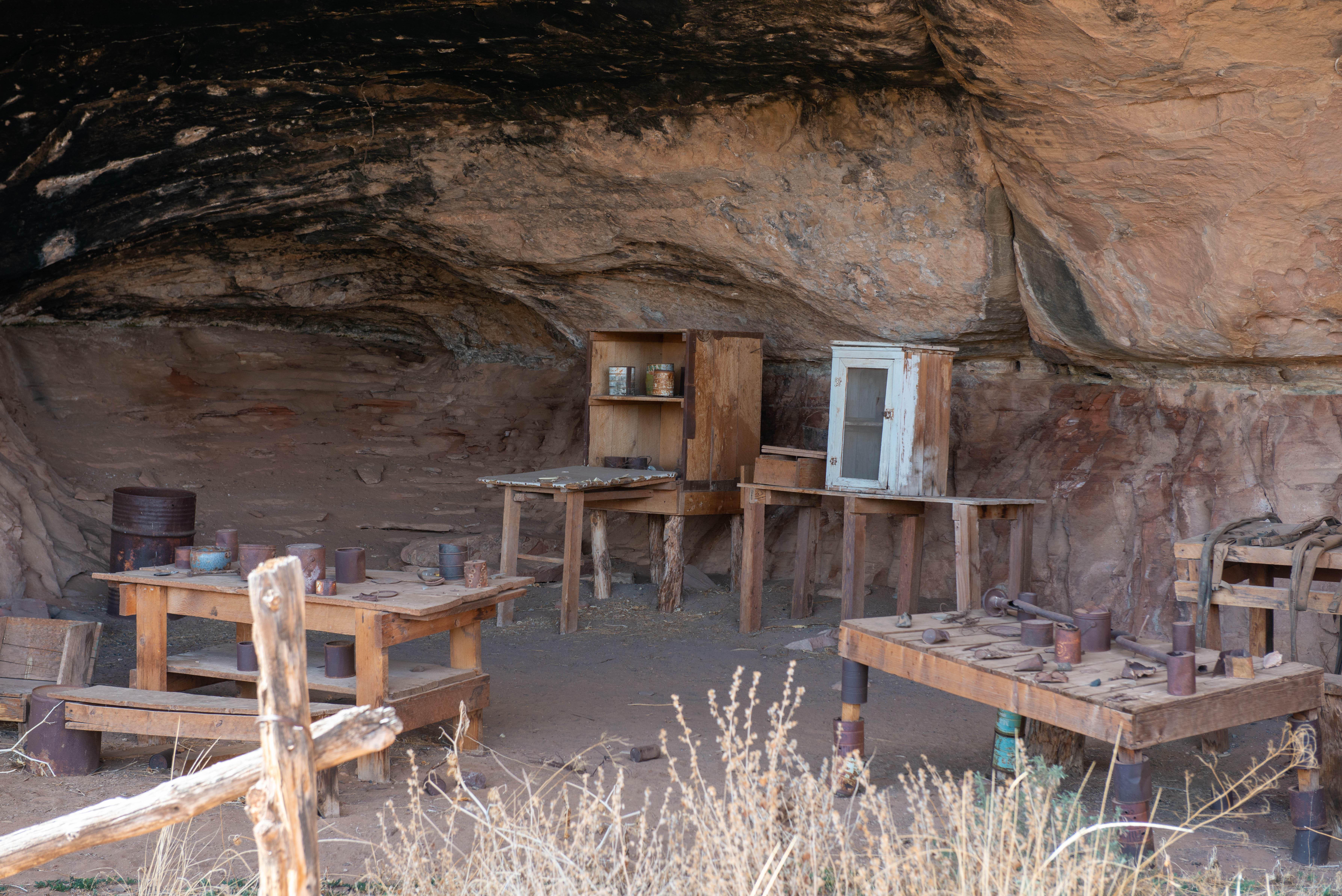
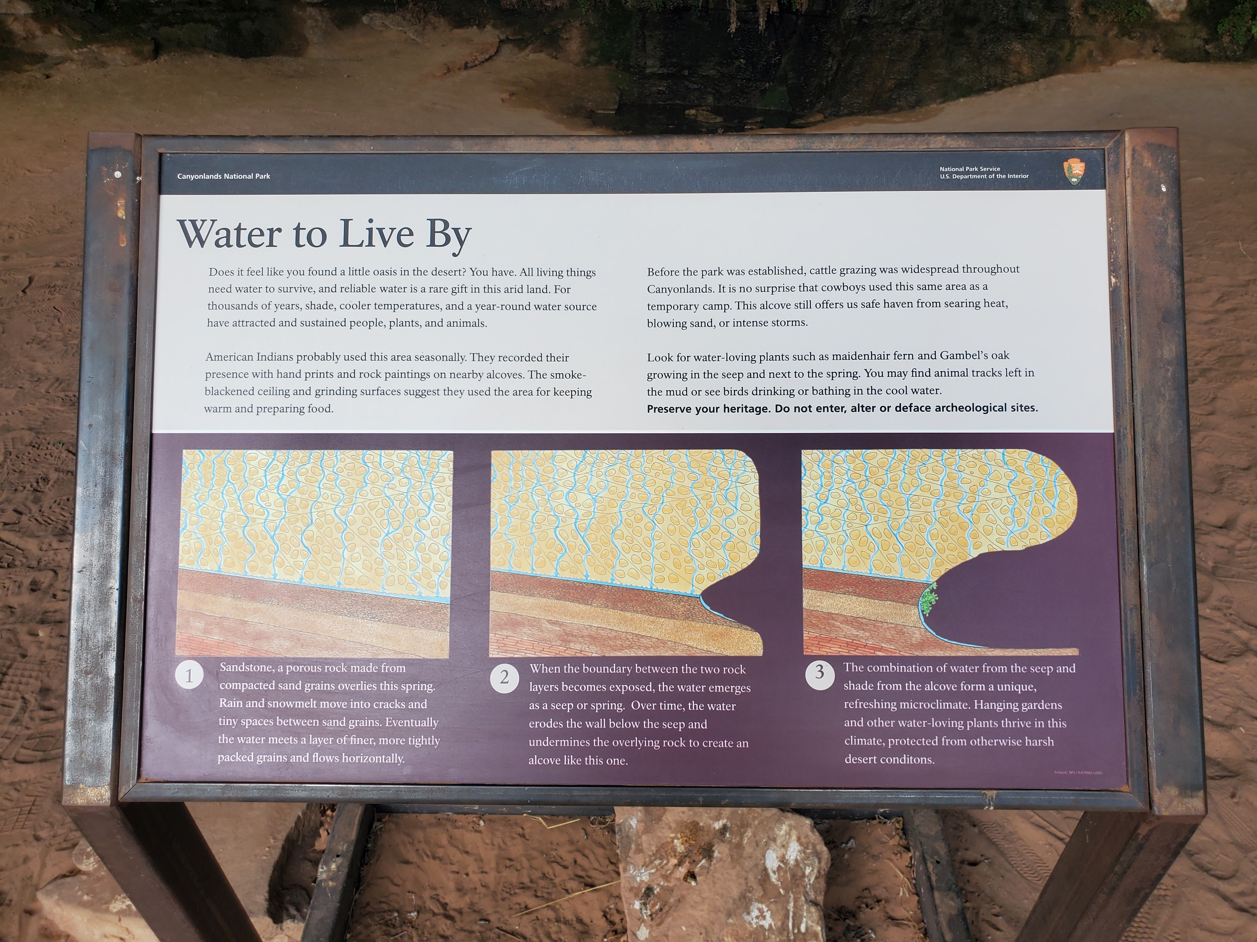
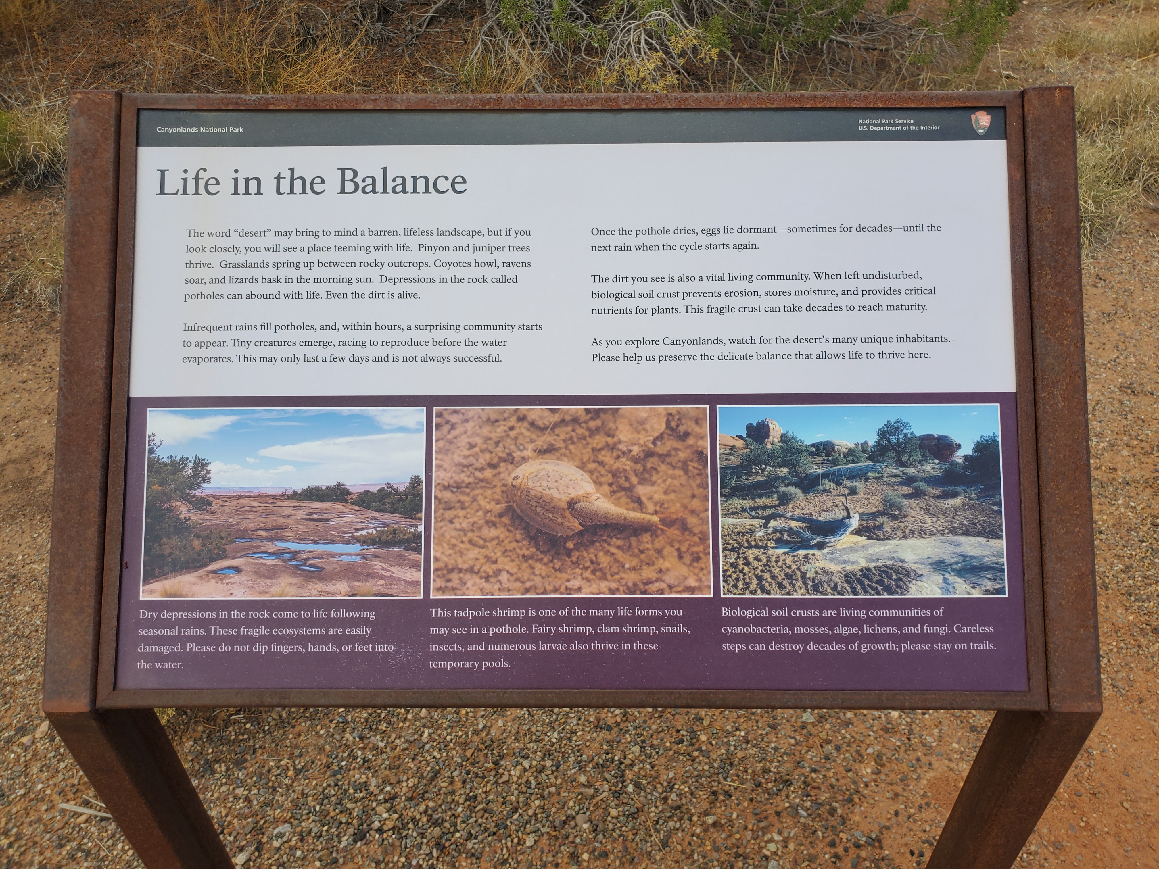
Water is scarce in this desert. From this trailhead, hike a short, 0.6-mile (1 km) loop leading to a historic cowboy camp and prehistoric rock markings, all made possible by a small but essential natural spring.
This overlook is 7 miles down a rugged, unpaved road. You must have a high-clearance, four-wheel-drive vehicle or mountain bike. No permit required; no camping allowed.
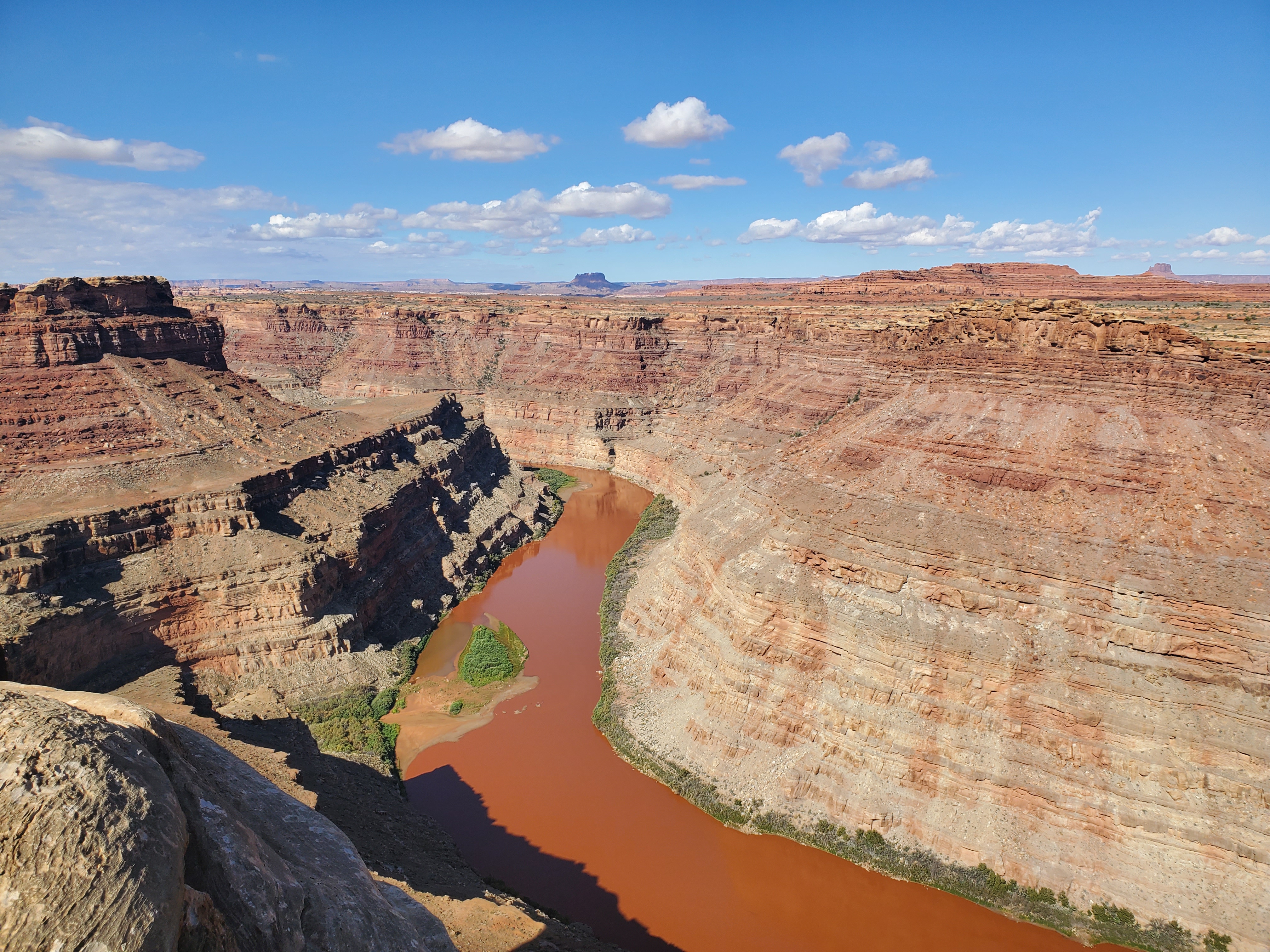
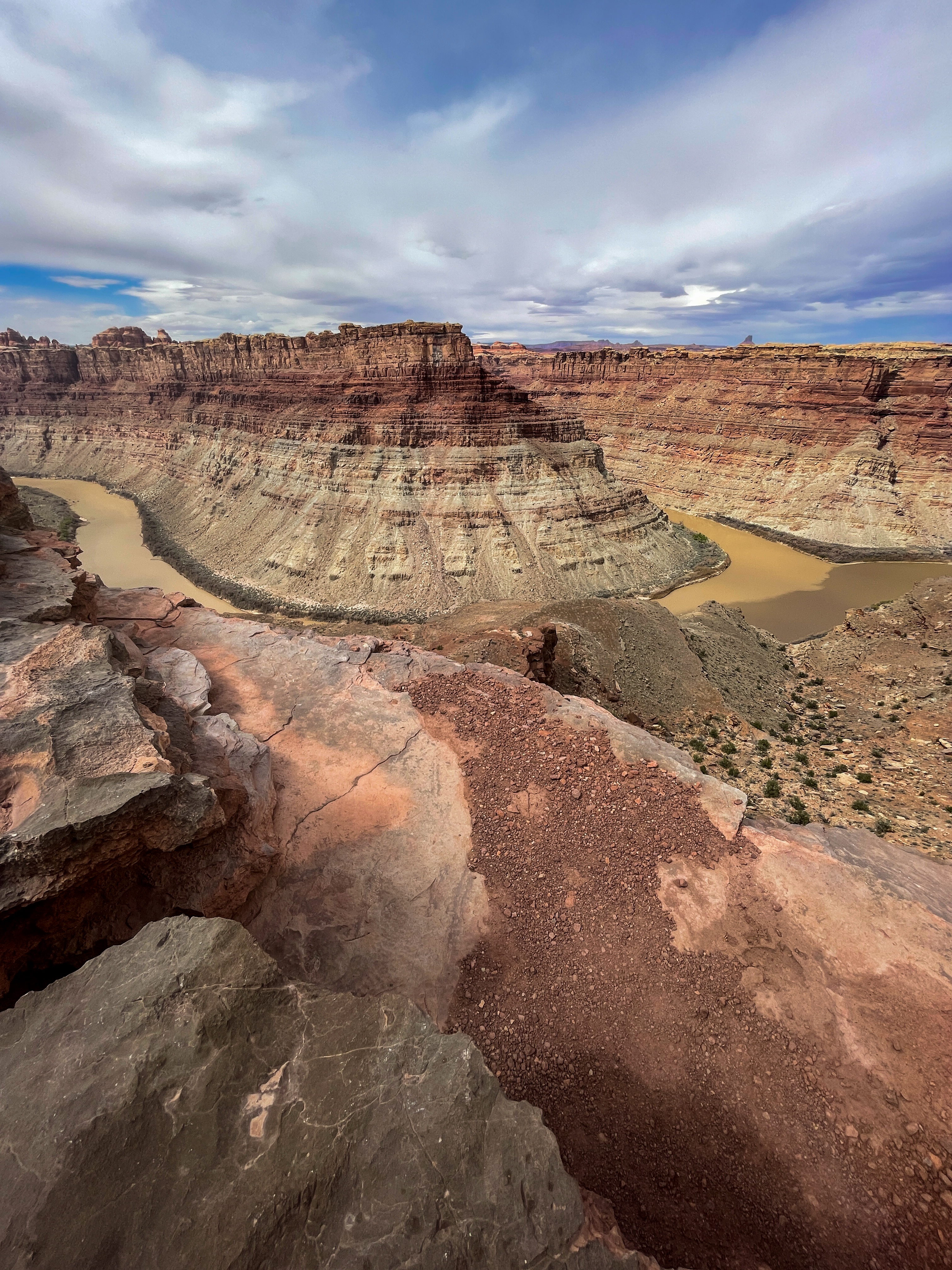
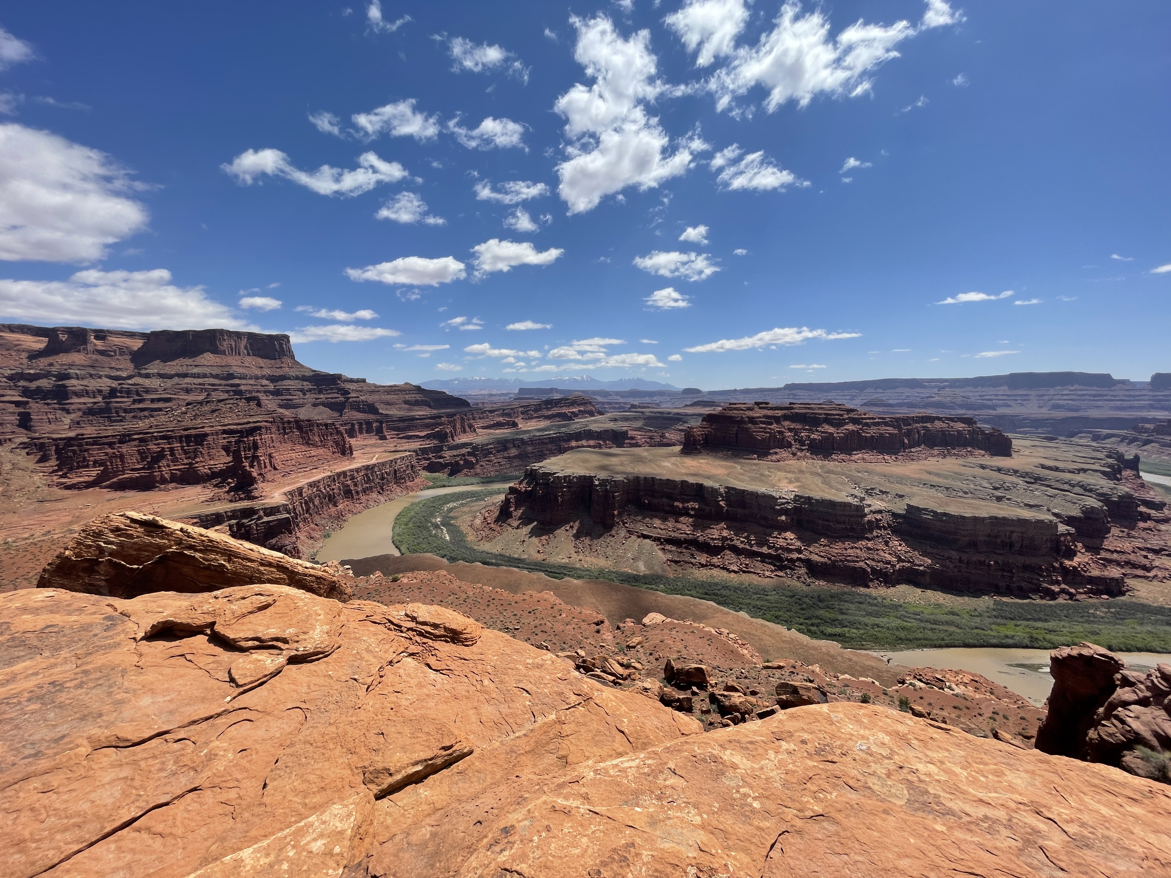
Unlike other Needles hikes, this trail traverses dry, open country along the northern edge of the geologic faults that shaped the Needles. The trail ends at a cliff overlooking the junction of the Green and Colorado rivers 1,000 ft (304 m) below.
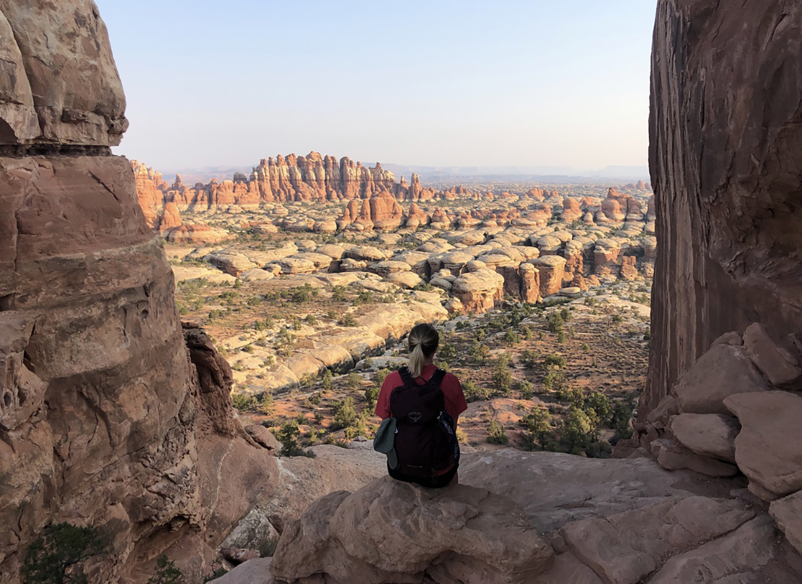
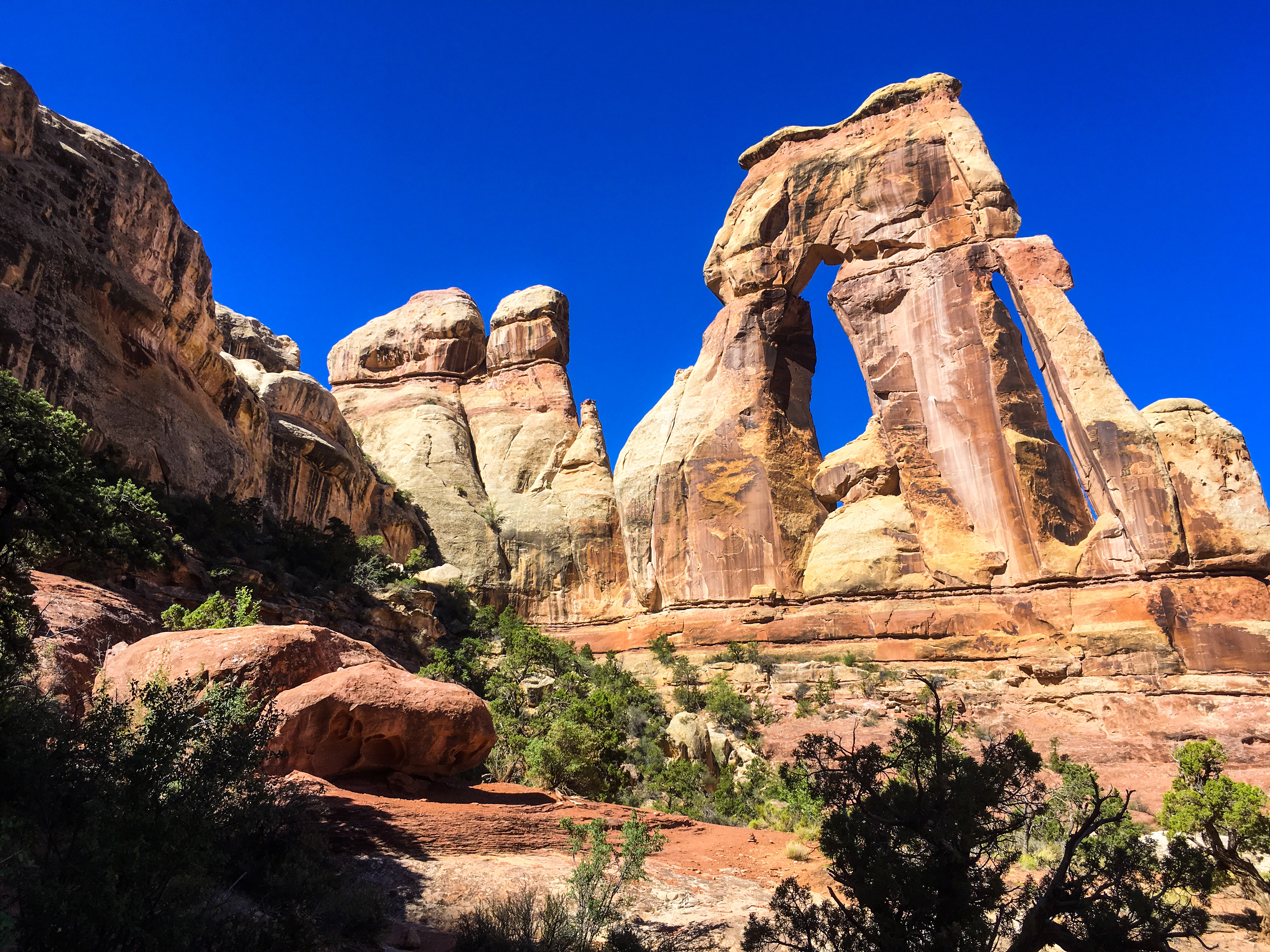
This trail offers one of the most spectacular views in The Needles. It follows the first part of the Chesler Park trail, then branches off to travel along the bottom of Elephant Canyon through deep sand and loose rock. The last 1.25 mile at the upper end is steep with one ladder and some scrambling.
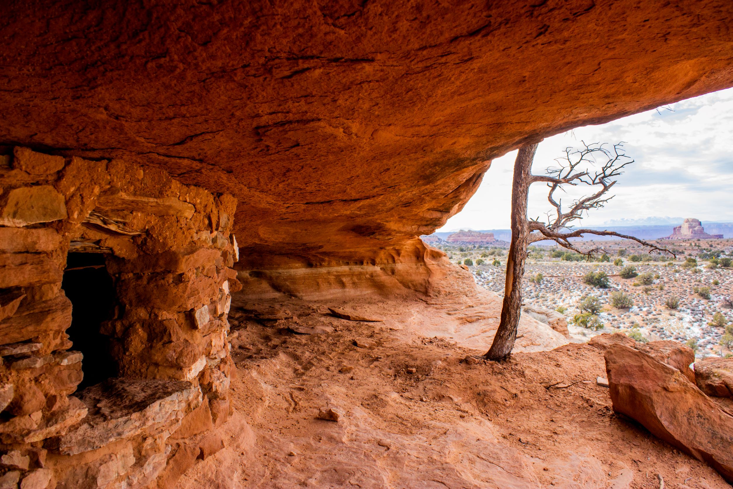
Fort Bottom Ruin is an ancient stone structure overlooking the Green River, built by Indigenous inhabitants of the Canyonlands area centuries ago. It is only reachable from the 4WD White Rim Road (permit required).
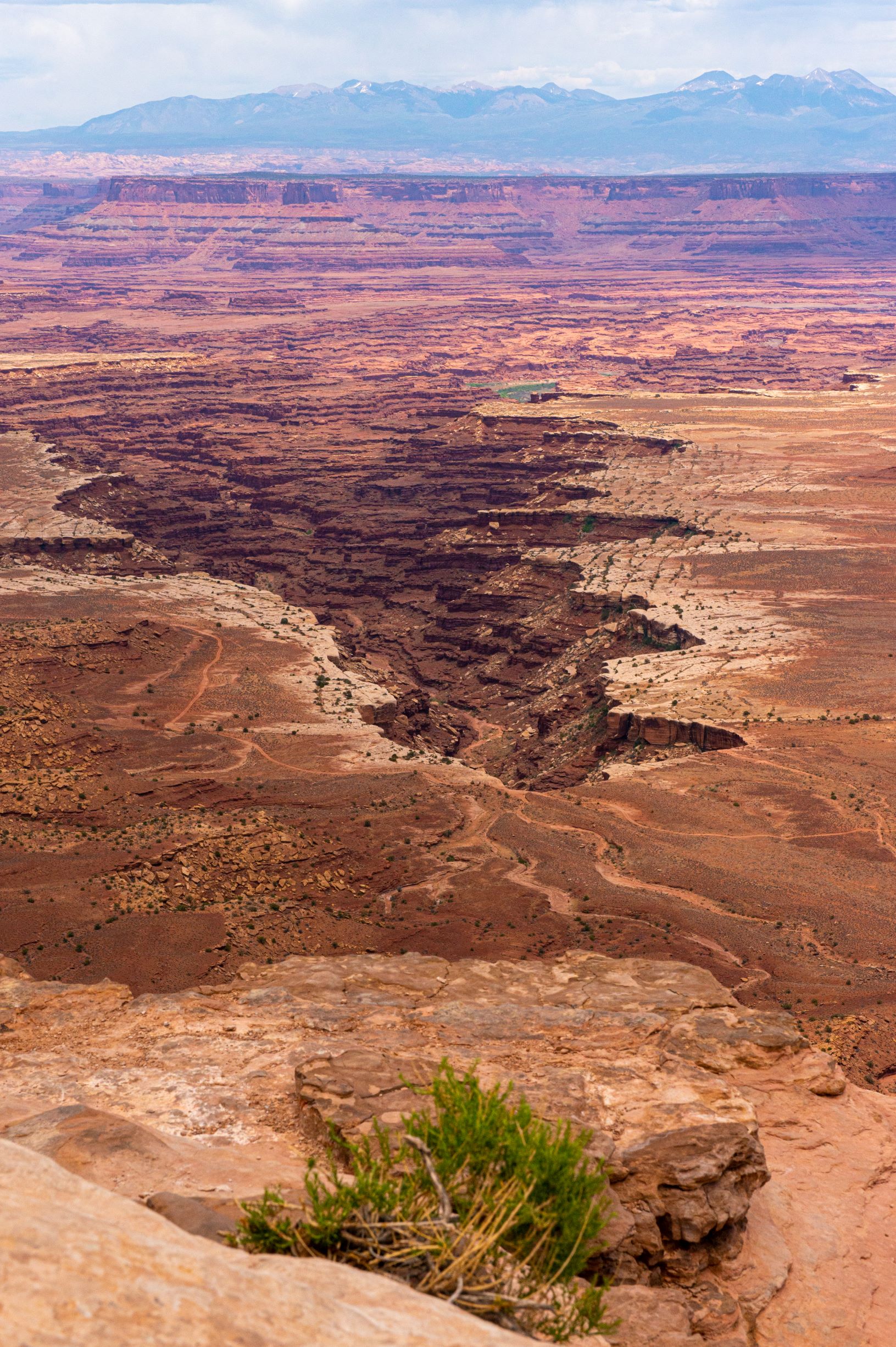
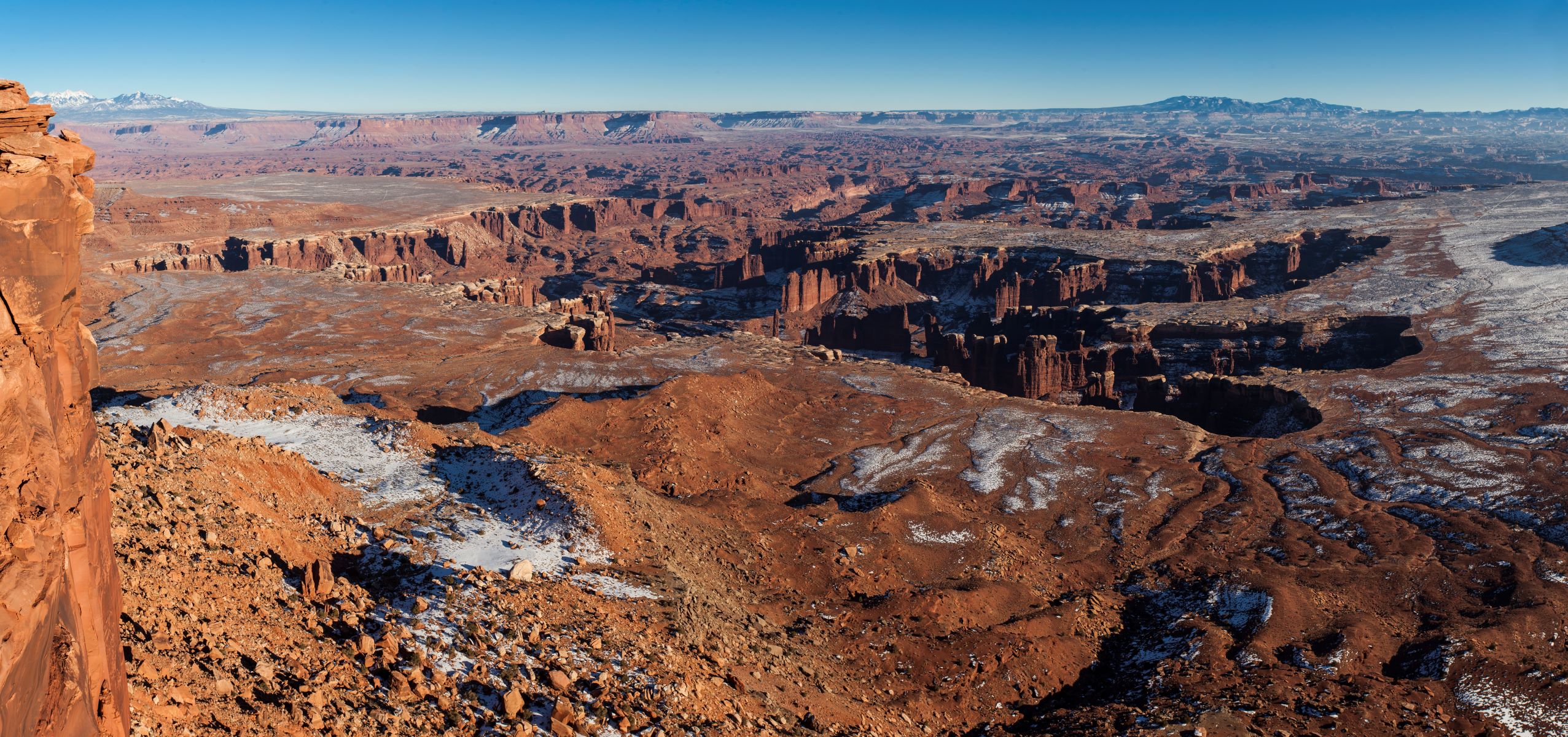
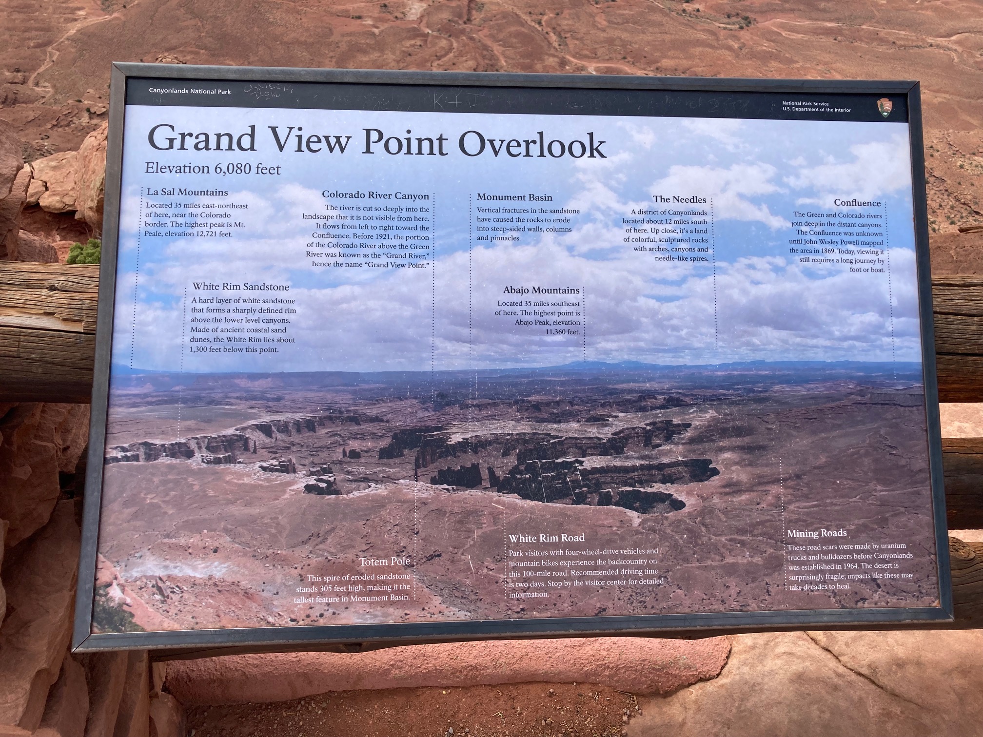
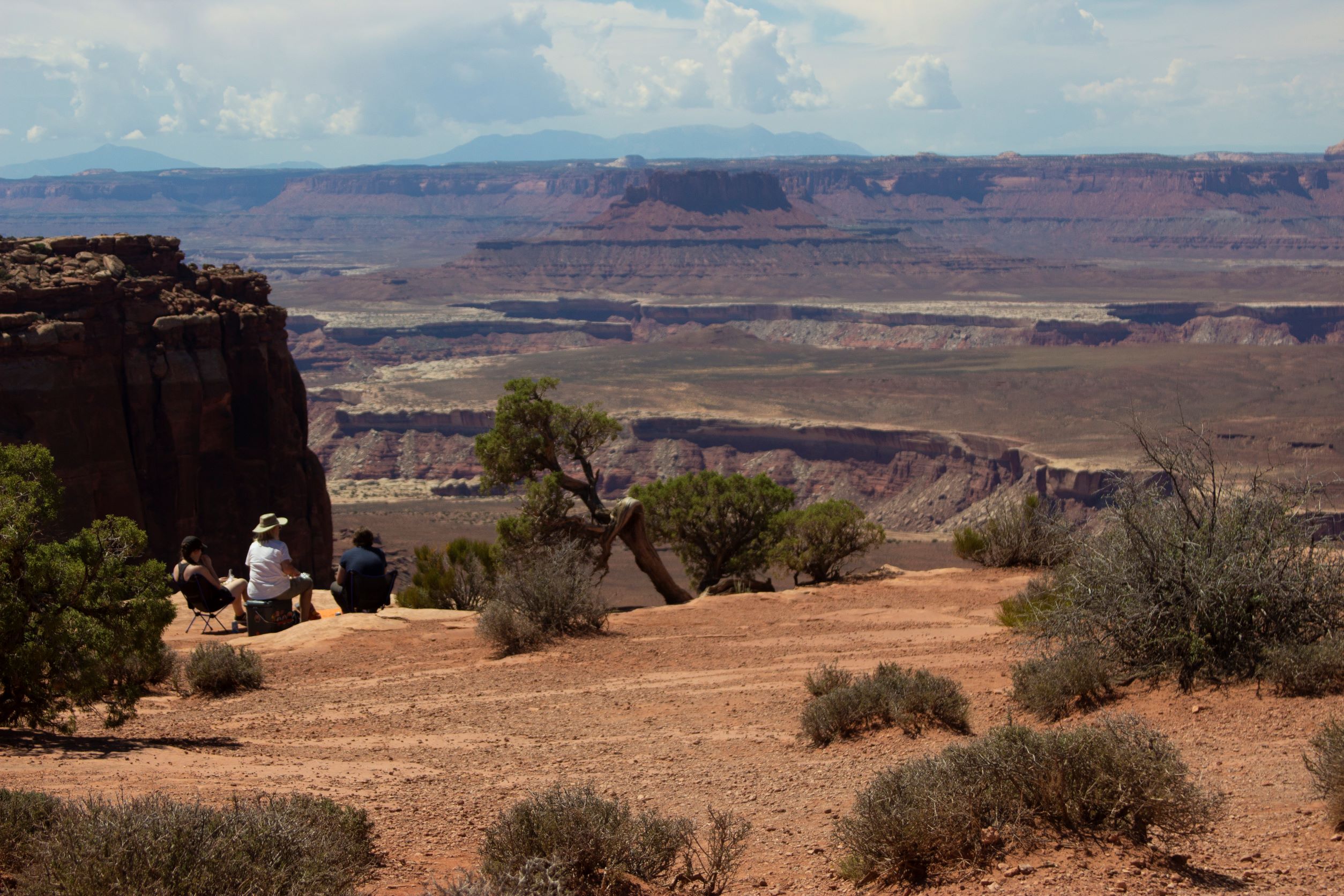
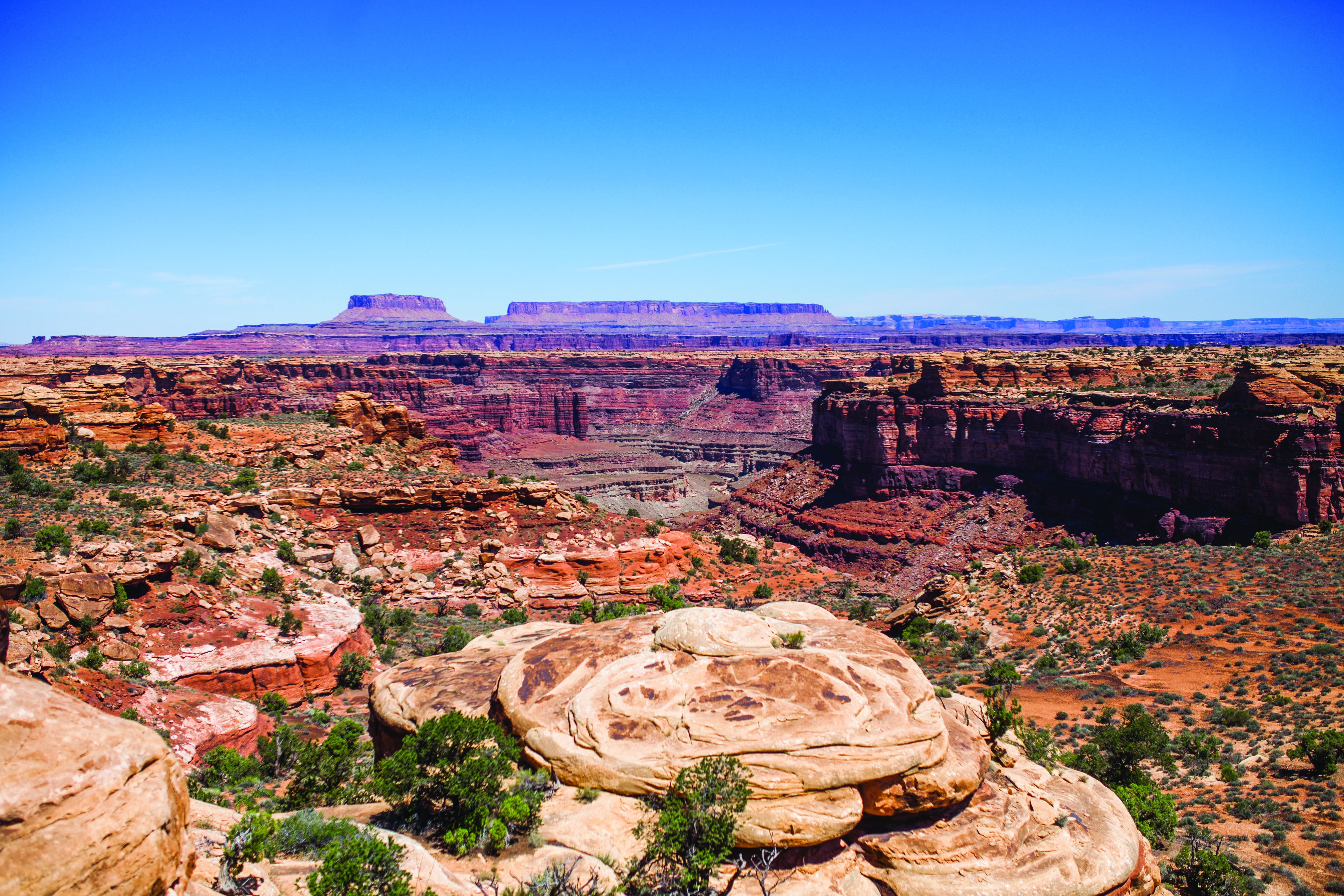
Grand View Point offers a spectacular view of the Canyonlands area. From this panoramic viewpoint at 6,080 feet elevation, you can see distant mountains, canyons, basins, and the four-wheel-drive White Rim Road far below. A short trail leads to even more views.
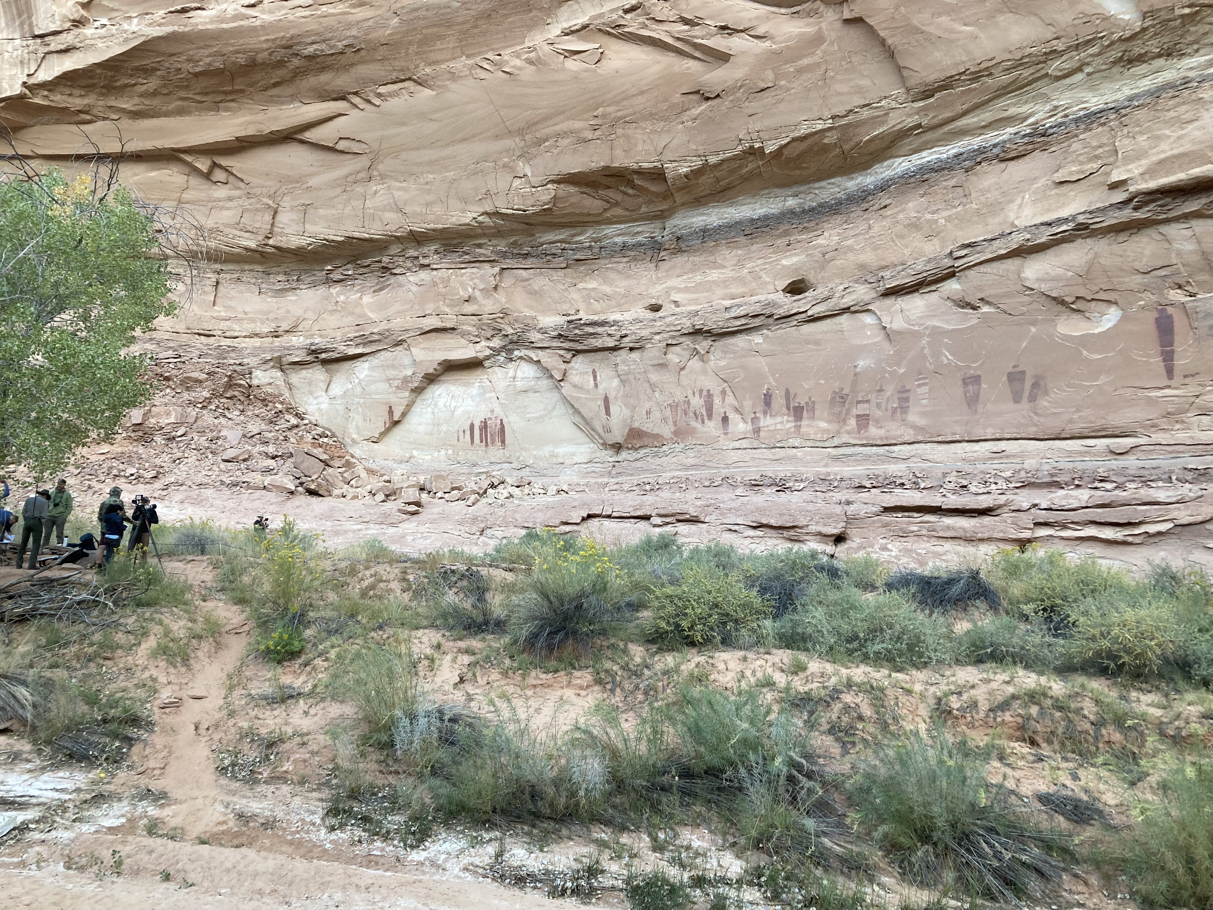
Horseshoe Canyon contains some of the most significant pictographs in North America. The Great Gallery, the best-known panel in Horseshoe Canyon, includes well-preserved, life-sized figures with intricate designs. Other impressive sights include spring wildflowers, sheer sandstone walls, and mature cottonwood groves along the intermittent stream in the canyon bottom. Horseshoe Canyon was added to Canyonlands National Park in 1971.
The Lathrop Trail crosses a wide grassland on the mesa top, enjoys views of Colorado River, then descends into the canyon below. For a moderate trail option, hikers often turn around at the canyon rim. Continuing down to the White Rim Road means a strenuous hike back out.
The Mormon Pioneer National Heritage Area preserves the natural, historical, and cultural heritage legacies and contributions of Mormon settlement in the West. The heritage area accomplishes this through community-led efforts to connect with the past by telling the Mormon pioneer story.
Moses and Zeus are two prominent towers overlooking Taylor Canyon. This trail leads to their base. Reaching this trail requires a hike down Alcove Spring Trail (11.2 mi/18.3 km roundtrip) or a permit to drive the 4WD White Rim Road.
A great full-day hike with 1,400 feet (440 m) elevation change, the Murphy Loop Trail offers outstanding views from atop the Murphy Hogback and White Rim Road.
This mostly level hike leads past a historic corral on the mesa top. The trail ends with panoramic views of Candlestick Tower, the Green River, and the White Rim Road.
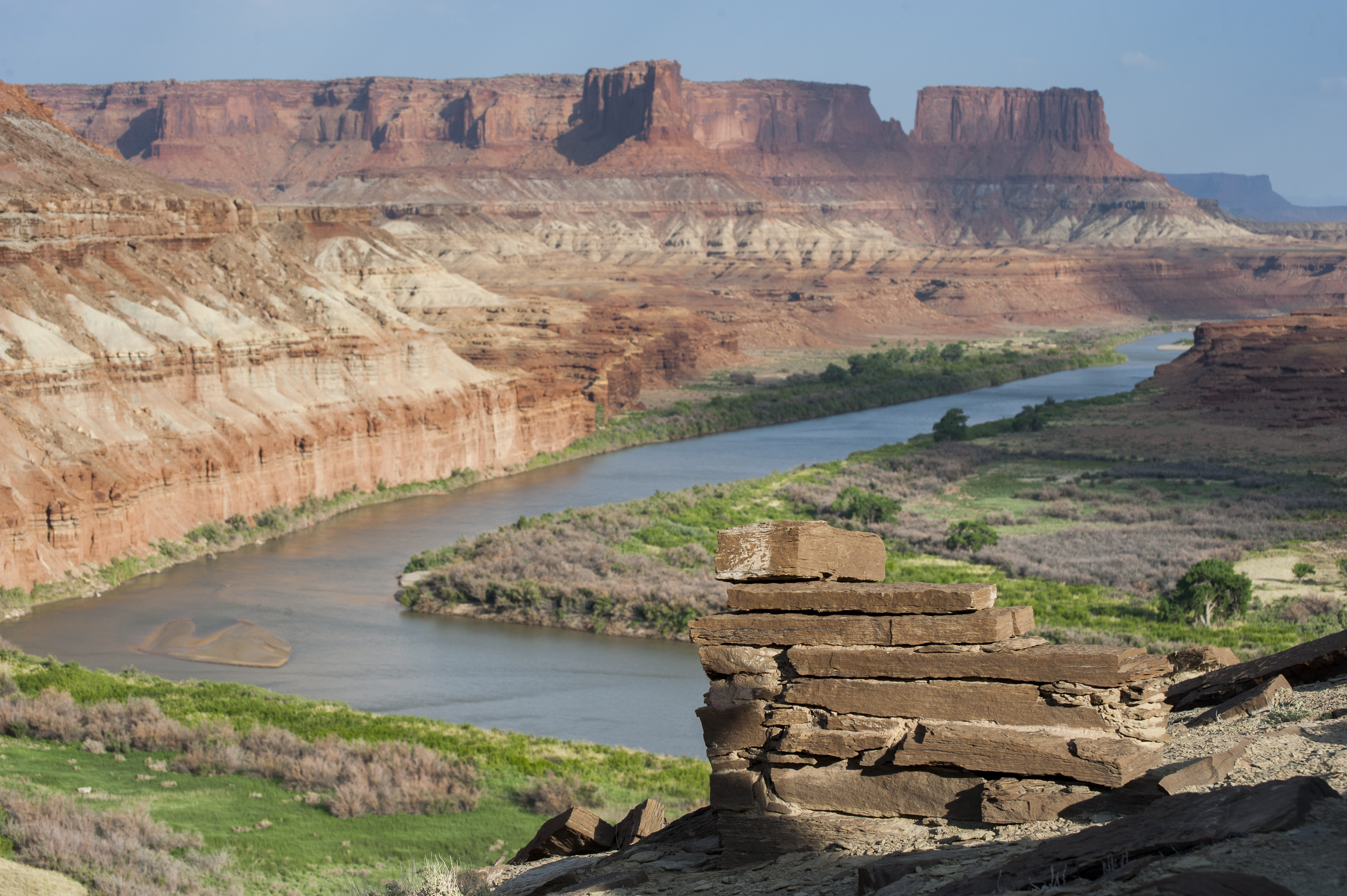
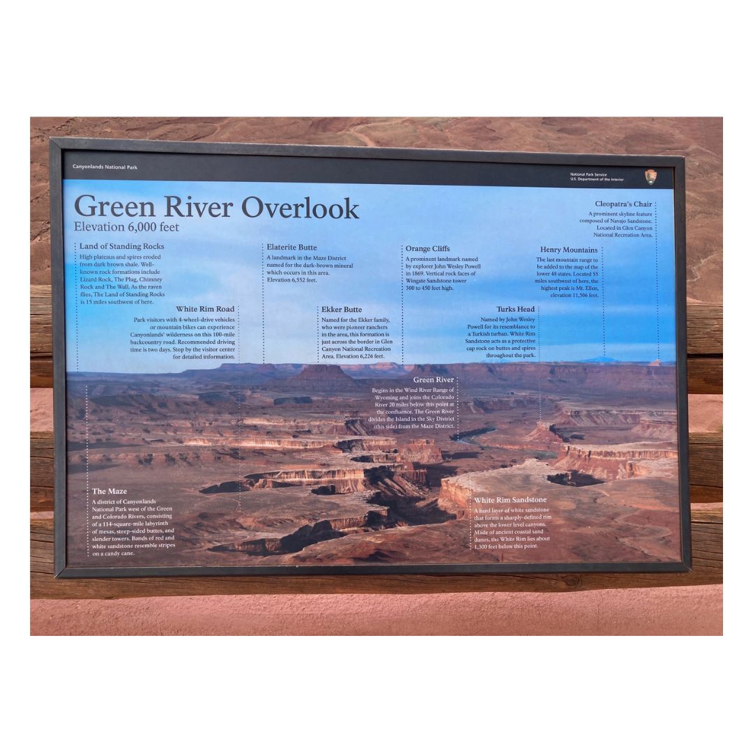
Enjoy panoramic views across the canyon of the Green River to the dazzling sandstone cliffs of the aptly named Orange Cliffs unit of Glen Canyon Recreation Area.
Pets and owners have a special bond, but a national park is not always the best place for pets. Canyonlands National Park is a designated natural area, and its purpose is to preserve and protect the park's natural environment, cultural resources, wildlife, and scenic beauty.
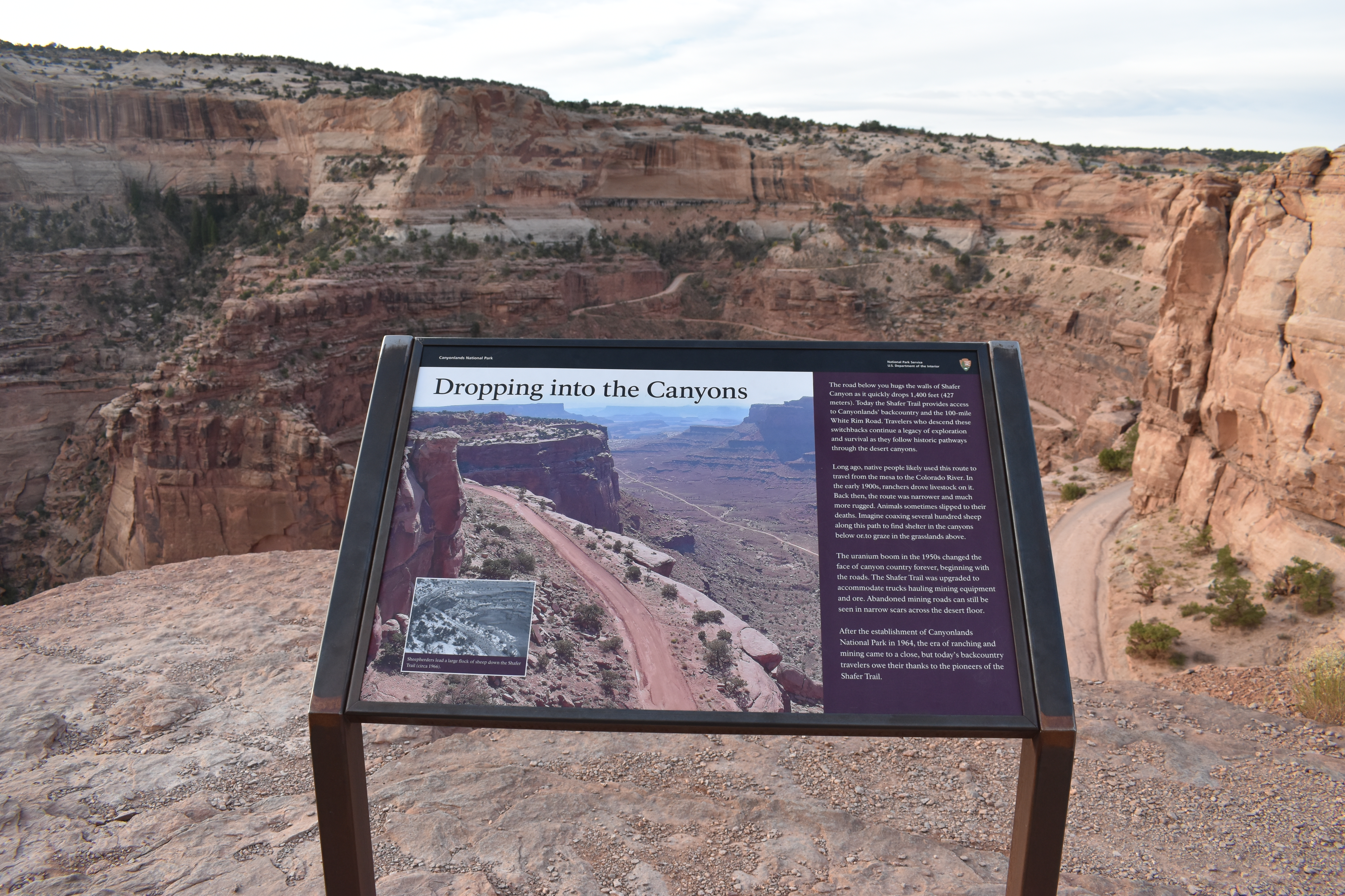
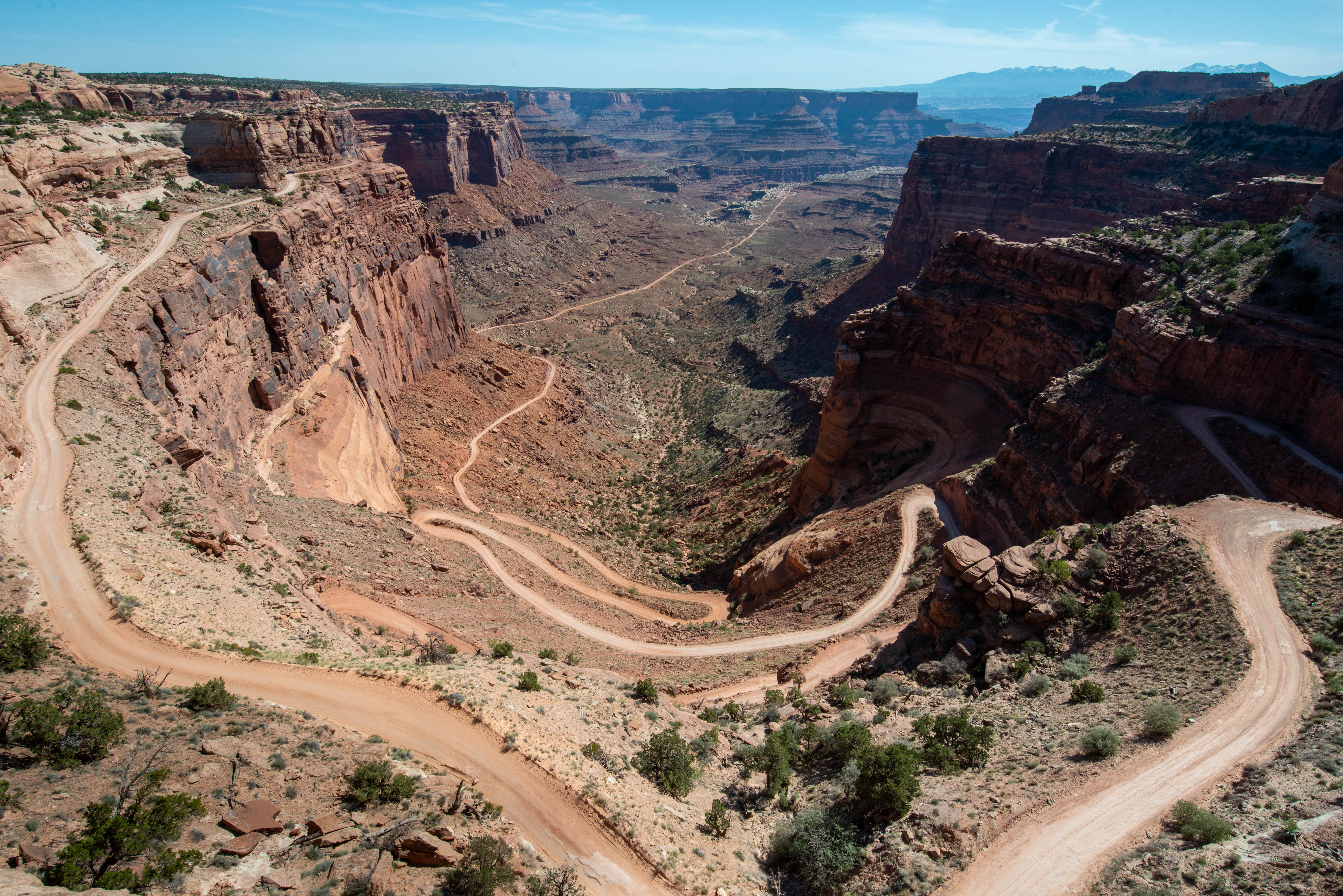
The Shafer Trail Viewpoint at Island in the Sky provides an incredible view of this iconic road that descends 1,500 feet (457 m) down colorful sandstone walls to the canyon basin.
This trail features expansive 360-degree views into Big Spring Canyon and Little Spring Canyon, with the La Sal Mountains and Abajo Mountains in the background. Geology guide available at trailhead.