Be advised that the NPS has issued alerts for this park.
Temporary Closure on Santa Rosa Island
The beaches and dunes of China Camp and Cluster Point, and area in-between, are temporarily closed to all visitor access for the protection of sensitive resources. Travel is allowed on marked paths.
Santa Barbara Island Dock Closed; Landings Restricted to Adjacent Rocky Ledge
Santa Barbara Island is open to public access, but landings are restricted to the rocky ledge adjacent to the dock. The dock is closed and is not expected to be repaired in the near future due to the severe winter storm damage.
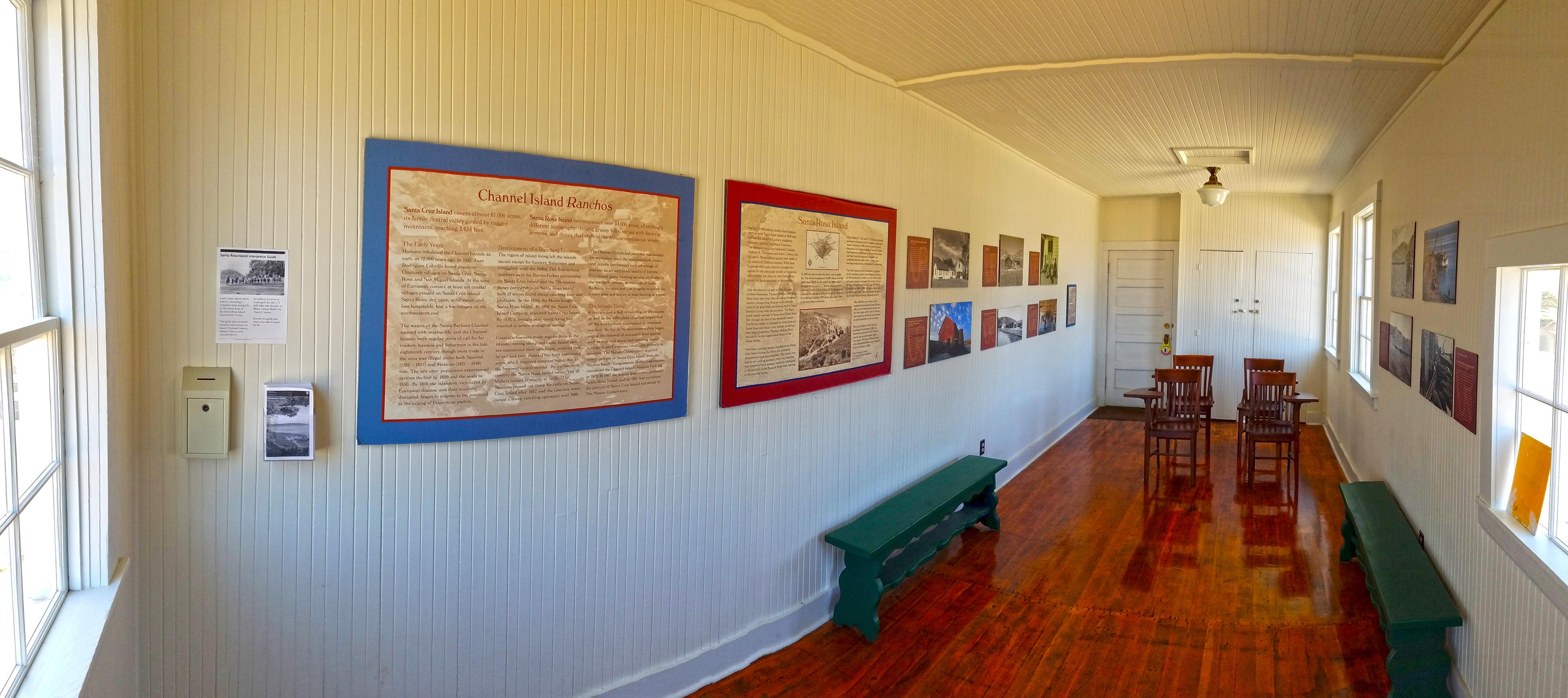
Channel Islands National Park encompasses five remarkable islands and their ocean environment, preserving and protecting a wealth of natural and cultural resources. Isolation over thousands of years has created unique animals, plants, and archeol...
Advanced camping reservations are required for all of the park's campgrounds. There are no entrance fees to visit the park. However, a reservation fee of $15.00 is charged for camping on the islands. For six of the sites, this fee covers up to four people. For one of the sites, it covers up to six people. Reservations can be made by calling (877) 444-6777 or through http://www.recreation.gov/
This campground is set amongst the native plants on the south side of the island. There are 7 sites that are marked by railroad ties. A table and picnic table are located at each site. A bathroom sits near the entrance to the campground.
Advanced camping reservations are required for all of the park's campgrounds. There are no entrance fees to visit the park. However, a reservation fee of $15.00 per site-per night is charged for camping on the islands. For Santa Miguel Island, this fee covers up to four people. Reservations can be made by calling (877) 444-6777 or through http://www.recreation.gov/.
A narrow trail, flanked by dry grasses and giant yellow coreopsis plants with thick branches topped with tufts of feathery green leaves and yellow, daisy-like flowers in springtime, and a shaggy, brittle, brown mop of dead leaves in the drier seasons, leads to the San Miguel campground. Perched on a plateau, the campground offers incredible views of the ocean to the north and, in good weather, of Santa Rosa to the northeast. If you are standing at campground, Cuyler Harbor Beach is a mile to the north, by trail. The ranger station is about half a mile away to the southwest. The Lester Ranch site is about halfway along that trail. To the west, in the distance, is Green Mountain. At the campground, there are nine, slatted wooden U-shaped fences or windbreaks that stand about five feet tall. A metal storage box on legs is positioned in a corner of each windbreak. A wooden and metal picnic table is adjacent to each campsite. A wooden restroom building is at the south end of the campsite. It is about 5 feet by 6 feet, with a shingled roof, a lockable door, and a single pit toilet inside. The sign on the door shows symbols for a man and a woman. On the exterior, attached to one side, is a low box with a hinged lid. On another side of the building is a bulletin board with updateable information posted behind glass. On the fourth side of the building is a panel of regulations titled “San Miguel Island Campground” with its own, separate audio description.
Advanced camping reservations are required for all of the park's campgrounds. There are no entrance fees to visit the park. However, a reservation fee of $15.00 per site-per night is charged for camping on the islands. For Santa Barbara Island, this fee covers up to four people.Reservations can be made by calling (877) 444-6777 or through http://www.recreation.gov/.
A trail from the Santa Barbara Visitor Center leads out onto a flat area perched on a plateau, overlooking the ocean. This campground is in a field with a mix of grass, scrub brush and coreopsis, which looks like a stunted tree. In the spring and early summer, the grass is green, the shrub brushes are generally grey-green in color, and the thick branches of the coreopsis are topped with tufts of feathery bright green leaves and yellow daisy-like flowers. In late summer and fall, the grass is brown, the brush looks brown and brittle, and the branches of the coreopsis are brown with shaggy dark brown tufts at the tips. A dirt and gravel trail through the camping area connects ten sites, each with a picnic table and a metal food storage box. If you stand at the edge of the campsite at the cliff facing the ocean, the Landing Cove is visible in the distance to the left or north, cut into the base of a steep cliff.
Advanced camping reservations are required for all of the park's campgrounds. There are no entrance fees to visit the park. However, a reservation fee of $15.00 per site-per night is charged for camping on the islands. For the Santa Cruz Island Del Norte Backcountry Campground, this fee covers up to four people. Reservations can be made by calling (877) 444-6777 or through http://www.recreation.gov/.
This small campground contains 4 sites that are nestled within oak trees and grasslands. They sit up on a ridge that provides sweeping coastal views of the island and ocean.
Advanced camping reservations are required for all of the park's campgrounds. There are no entrance fees to visit the park. However, a reservation fee of $15.00 per site-per night is charged for camping on the islands.
There are two campgrounds that provide family and group camping, the lower campground is about a half mile from the pier. Continuing on the road for an additional half mile is the upper campground. Both areas are flat and have shade provided by large eucalyptus trees, picnic tables and food boxes.
Advanced camping reservations are required for all camping in the park. There are no entrance fees to visit the park. However, a reservation fee of $10.00 per site-per night is charged for backcounrty beach camping on Santa Rosa Island. This fee covers up to four people. Reservations can be made by calling (877) 444-6777 or through http://www.recreation.gov/.
Dispersed backcountry camping in the parks wilderness along beaches.
Advanced camping reservations are required for all of the park's campgrounds. There are no entrance fees to visit the park. However, a reservation fee of $15.00 per site-per night is charged for camping on the islands. For Santa Rosa Island, this fee covers up to five people. Reservations can be made by calling (877) 444-6777 or through http://www.recreation.gov/.
You are standing in the campground, near the wide mouth of a canyon. The campground is in a field of grass, nestled between two hills dotted with scrubby shrubs. At the southern edge of the campground is a creek that runs at the base of the canyon. A distant view of the ocean can be seen beyond the mouth of the canyon. At the lowest part of the campground, if you are facing up-canyon, the restroom building is on your right. A short cement sidewalk leads up toward this single-story wooden building with a gabled, or simple peaked, roof. The roof has two solar panels on the roof. One is a solar hot water panel—a grey metal box, about one foot high, with two pipes attached, one with a spigot. The other is a photovoltaic panel, only about 2 inches high. The building has reddish brown, horizontal, wood plank siding. A shallow porch, with railings, wraps around two sides of the building, covered by a roof overhand, supported by posts and beams. You can access the porch two ways. On the building’s left side is a handicapped accessible ramp. The front side of the building has stairs with railings and five risers. On the ground next to the stairs is a metal box with two thick brushes that face inward. On the front side, the porch has a bulletin board on the wall, flanked by doors for two unisex restrooms. On the side of the porch is a large deep sink, with an adjacent wide wooden counter with a backboard, that overhangs and slants down toward the sink. From the restroom location, you can see fifteen shelters—three-sided wooden structures with grey shingled roofs. Each structure is shaped like a hexagon that has been cut in half, open on the side that faces the ocean. Each wall surface of the exterior of these shelters has a solid sheet of tan-colored siding. The interior walls are unfinished open frame construction. Mounted to one interior side wall is a metal box, about one foot high by two feet wide by one foot deep. Metal pegs and hooks on the walls are used to hang clothing and gear. A translucent fiberglass panel at the top of the back wall provides some natural light. Each shelter site has a picnic table located in or near the shelter. Tents are pitched in or near the shelters as well. The shelter sites are about 40 feet apart from each other. At the edge of the campground, on the downhill side, is a water station. This is a two and a half foot tall wooden post, with a pipe running up it to a faucet on top. Surrounding it on the ground is a wooden frame filled with rocks. The post has a water faucet, a small metal box screwed into its side. A wooden plaque with a sign that reads, Please help protect our wildlife. Please do not rinse dishes, brush teeth, or use soap at the water faucets. Please wash dishes at the large sink next to bathroom. Thank you.
Stop 3: Signal Peak Tour Throughout your hike today, you may discover tiny fragments of broken shells glittering in the soil or piles of shells falling out from the cliff edge. How did these shells get there? It must be the ocean at work-or is it?Archeologists identify these sites as "middens," debris piles containing remnants of past societies-the Tongva, the Chumash, and their ancestors.
You are standing at the center point of a large open grassy plateau, at a Y-shaped point in the trail system, where three trails converge. It is marked with an upright 4-inch by 4-inch post about 3 feet high. From this point, two trails run almost parallel toward Signal Peak, a rounded hill in the distance, to the southwest. After a while, one trail veers southeast toward the Sea Lion Rookery and Cat Canyon at the southern end of the island. The third trail runs north toward the campground, Visitor Center, and Landing Cove.<br /><br />All of these narrow trails are slightly depressed into the sandy soil, creating groove in the landscape that is a foot or two wide, and several inches deep. The ground is blanketed with dried gray grass and small broken twigs. In patches, on either side of the trail, are grasses, crystalline ice plant, saltbush, and coastal sagebrush. A few coreopsis dot the landscape. These have thick branches topped with tufts of green leaves and yellow daisy-like flowers in springtime, and a shaggy brittle, brown mop of dead leaves and blooms in late summer and early fall. <br /><br />To the west, in the distance, you can see the ocean. <br />
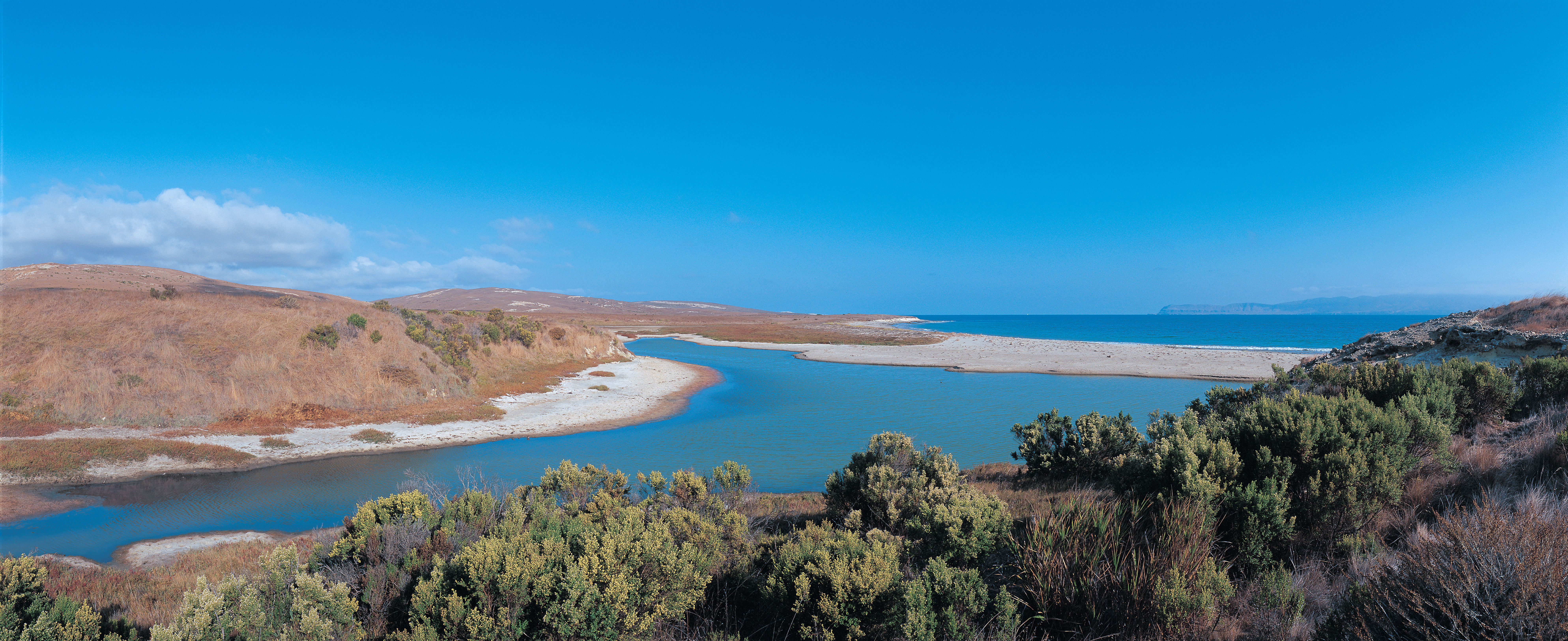
Just north of East Point is Abalone Rocks Marsh, the second largest wetland on the northern islands (Prisoners Harbor wetland on Santa Cruz is the largest).
You are on a sandy trail that crosses a broad valley, where the creek curves toward the coastline, then widens out to form a large marsh-Abalone Rocks marsh-and a lagoon, a wider body of water. A thin strip of sand usually separates the lagoon from the ocean, except when higher river water levels carve a channel through the sand, allowing the water to flow all the way into the ocean. <br /><br />During breeding season, small tan birds, with white heads and black collars, may sometimes be found, nesting on the sandy beach.<br /><br />The valley is grassy near the shoreline, but this grass is dried and brown for most of the year. The back of the valley is dominated by the scrubby green baccharis plant, also known as coyote brush, making it green year-round. Some cattails, with tall thin green leaves, and brown cylindrical spikes shaped like broom handles, are growing at the edge of the river channel. <br /><br />The hills on either side of the river valley are grassy with a variety of scrubby shrubs.<br /><br />The trail cuts back inland, into the canyon, where it crosses the creek at a higher location before returning to the shoreline. <br />
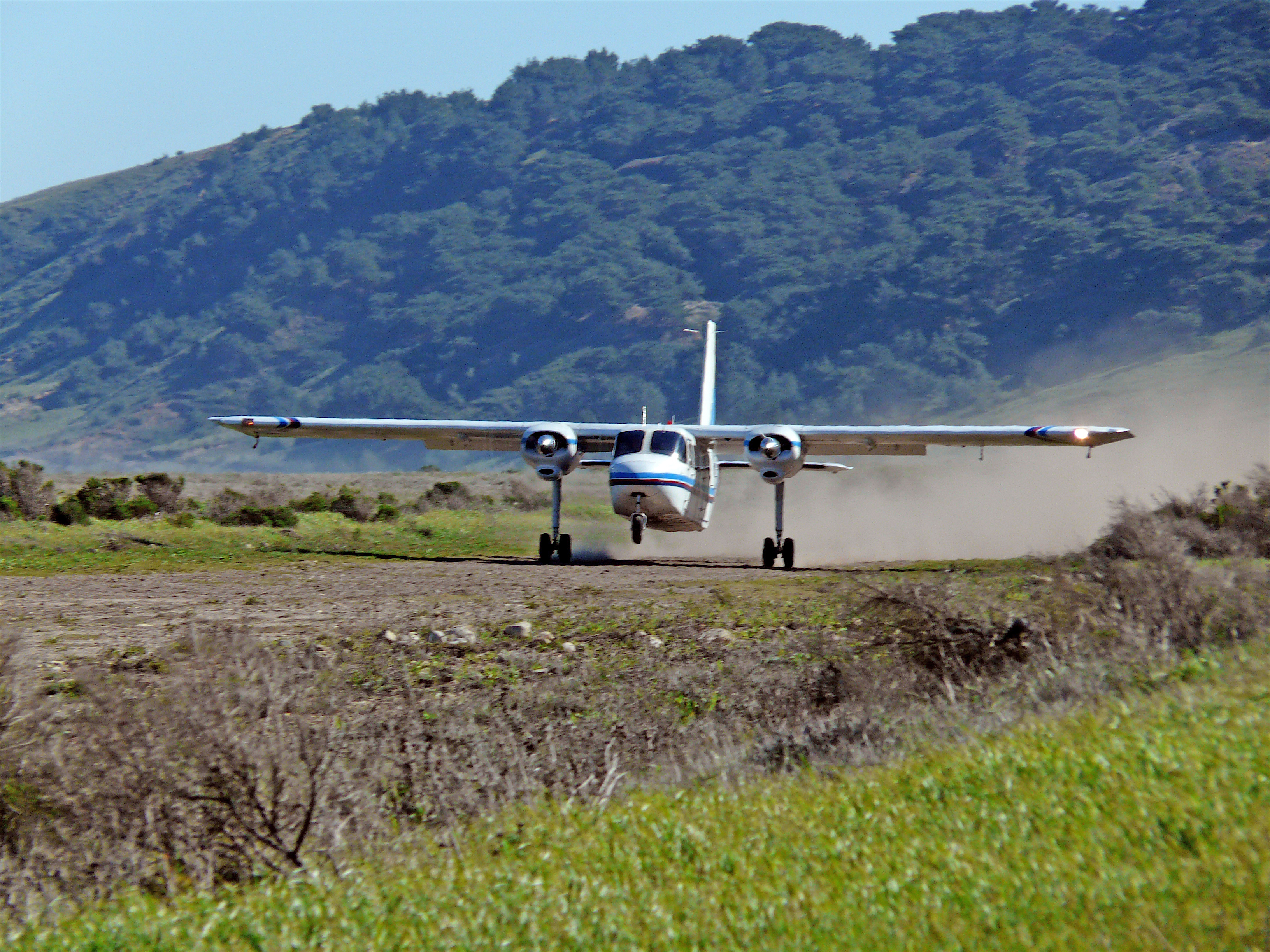
In a flyer's eyes, Santa Rosa Island is blessed with a number of suitable flat areas for landing small planes, but the owners restricted flights and landings throughout their tenure. The Vails and others started flying over to the island in the 1930s, landing on a section of hay field southeast of the ranch house, which eventually developed into the "official" landing strip on the island.
The air strip is located southeast of the ranch complex, on a large flat grassy plateau that lies above the shoreline of Bechers Bay. The dirt airplane landing strip is about 90 feet wide by half a mile long. Near the middle of the strip is an orange windsock on a metal post. It is a narrow cone of light windproof material, about 4 feet long, with a metal ring circling the one-foot wide opening. It is mounted sideways, like a flag, and it pivots on the top of the post, so that the wide part is always facing into the wind, and the tail is always pointing in the direction the wind is blowing. <br /><br />To the east is a view of the ocean. To the south are rolling hills, with dark green, Torrey pine-covered slopes in the foreground, and sandier slopes in the distance. To the west is the Water Canyon campground.<br />
Since Anacapa is a cliff island, access to top is only at the Landing Cove on East Anacapa. Visitors must climb from the boat up a steel-rung ladder to a dock. Once ashore, visitors must climb 157 stairs to the top of the island.
LANDING DOCK <br />The landing dock is a three-tiered structure built into the rocky cliff face. The tiers are connected by 157 concrete and metal steps; first tier, the Lower Landing Dock, next the Middle Landing Platform and last the Upper Landing. The middle and upper tiers contain exhibits. <br /><br />The next three paragraphs describe each tier. <br />THE LOWER LANDING DOCK<br />The Lower Landing Dock is a sturdy, narrow, platform made of wooden planks built into the cliff. The dock is enclosed by a wooden fence rail. Two steel-rung ladders run down the side of the dock into the water. A series of concrete stairs set into the cliff take you to the middle Landing Platform where a metal, industrial style stairway zig zags up to the upper landing.<br /><br />THE MIDDLE LANDING PLATFORM<br />The Middle Landing Platform is a narrow concrete slab built into the cliff. It is surrounded by thick pipe railing and enclosed with metal fencing. Three panels mark this location; the Welcome to Anacapa Island panel and an illustration of Kelp Forests panel are mounted side by side on a white seawall. A panel that describes Marine Protected Areas is on the fence rail that overlooks rugged cliffs, the Lower Landing dock and the waters of Landing Cove below. Listen for seabirds roosting on the cliff face, the sound of waves crashing on the rocks and in the sea caves below and the fog signal of the lighthouse. <br /><br />THE UPPER LANDING<br />The Upper Landing is a wide concrete slab in the rock face. It is surrounded by thick pipe railing, enclosed with metal fencing along the cliff edge. A long metal crane and crane operator building sit on the slab. A panel that explains sea bird habitat is mounted to the railing that faces the rocky cliffs of Landing Cove, Arch rock, and the Anacapa lighthouse in the distance. Benches and picnic tables are provided. The trailhead begins to the west of the slab where the concrete surface changes to compacted soil.<br /><br />CRANE OPERATOR BUILDING AND CRANE <br />A small crane building sits on the concrete slab of the upper landing. This house like structure with a wood-shingled gable roof, horizontal white board siding and garage door, butts against a rocky ledge. Three sides of the building are wrapped with large bay-style windows each with green trim and grilling. A long, black, metal crane called a derrick hoist, hangs overhead, spanning the length of the concrete slab. The crane sits on a platform to the left of the crane building. Above the building, a tripod of pipes and several thick cables anchored to the slab hold the crane in place. <br /><br />MIDDLE LANDING EXHIBIT PANELS AND LANDSCAPE<br />You are on the Middle Landing Platform, a narrow concrete slab built into the cliff and surrounded by thick pipe railing, enclosed with metal fencing.<br /><br />Three panel exhibits mark this location; the Welcome panel and an illustration of Kelp Forests are mounted side by side on a white seawall. A panel that describes Marine Protected Areas is on the fence rail that overlooks rugged cliffs, the lower landing dock and the waters of Landing Cove below. Listen for seabirds roosting on the cliff face, the sound of waves crashing on the rocks and in the sea caves below and the fog signal of the lighthouse. <br />
The Anacapa Island Webcam provides incredible views of the park's iconic symbol Arch Rock, seabird rookeries, and the historic lighthouse, as well as the ocean life and sea conditions at the landing cove and nearby waters.
'anyapax is the Chumash word for Anacapa. It means mean 'mirage' or 'illusion' and refers to the atmospheric phenomena that occasionally distorts the appearance of the island when viewed from the mainland. Almost five miles long, these islets (appropriately named East, Middle, and West Anacapa Islands) have a total land area of about one square mile (700 acres). Waves have eroded the volcanic island, creating towering sea cliffs, sea caves, and natural bridges.
Aerial view of long skinny island at sunset surrounded by blue gray ocean.
This one-mile, round trip hike from the visitor center offers wildflowers in season and great coastal views of Arch Point. This arch on the northeast shore of the island is a 130 ft tall and was created by wave erosion of fault weakened rock.
You are standing at the tip of a rounded plateau, near the edge of a steep drop off, at the end of the extension trail to Arch Point. The ocean lies far below. A large sea rock rising out of the ocean just off the shore. Near us, deep canyons cut into the hillside, widening as they approach the sea. In the distance is a taller rounded hill. Beyond it, a low curve of land stretches out into the sea. That is Arch Point, although the rock arch for which it is named is not visible from here. At your feet, the soil has small dark pebbles and broken shells. Dried low grasses and crystalline ice plant cover the hill. The ice plant is a low succulent, with small red rosettes and tiny white flowers-a starburst of white thin petals with pale yellow centers. Nearby is a white metal structure, about 6 feet high, with a triangular frame on three spayed legs. Attached to it are a white metal box and a solar panel-a flat dark glass panel with a grid of light-colored lines. Sticking up from the frame on short rods are two white objects that look like a stack of upside down bowls. On another short rod is what looks like a single upside down aluminum bowl with a knob on top. An antenna sticks upward from the top of the frame. At the very top is a rotating torpedo-shaped object with a propeller at the tip. It swivels to face into the wind. Nearby, mounted in a cement base, is an 18-foot-high section of a dark wooden telephone pole, about one foot in diameter. A small disk sits on top of the pole, with a black cable running down the side of the pole and to a rounded white box near a solar panel, both sitting on the concrete base. Sticking out of the pole, on alternating sides, every two feet, are 8-inch wide metal rods.A few feet away are four cement piers under a twisted, bent, rusted metal frame.Nearby, three large black plastic cylinders, with spigots on top, sit side by side. Behind them is a pile of black hoses.
Incredible sunsets, coastal views, and wildflowers in season are the reward for the one-mile, round-trip hike to Arch Point. Distance: 1 mile (round trip from visitor center) Difficulty: Moderate
You are standing at the tip of a rounded plateau, near the edge of a steep drop off, at the end of the extension trail to Arch Point. The ocean lies far below. A large sea rock rising out of the ocean just off the shore. Near us, deep canyons cut into the hillside, widening as they approach the sea. In the distance is a taller rounded hill. Beyond it, a low curve of land stretches out into the sea. That is Arch Point, although the rock arch for which it is named is not visible from here. At your feet, the soil has small dark pebbles and broken shells. Dried low grasses and crystalline ice plant cover the hill. The ice plant is a low succulent, with small red rosettes and tiny white flowers—a starburst of white thin petals with pale yellow centers. Nearby is a white metal structure, about 6 feet high, with a triangular frame on three spayed legs. Attached to it are a white metal box and a solar panel—a flat dark glass panel with a grid of light-colored lines. Sticking up from the frame on short rods are two white objects that look like a stack of upside down bowls. On another short rod is what looks like a single upside down aluminum bowl with a knob on top. An antenna sticks upward from the top of the frame. At the very top is a rotating torpedo-shaped object with a propeller at the tip. It swivels to face into the wind. Nearby, mounted in a cement base, is an 18-foot-high section of a dark wooden telephone pole, about one foot in diameter. A small disk sits on top of the pole, with a black cable running down the side of the pole and to a rounded white box near a solar panel, both sitting on the concrete base. Sticking out of the pole, on alternating sides, every two feet, are 8-inch wide metal rods. A few feet away are four cement piers under a twisted, bent, rusted metal frame. Nearby, three large black plastic cylinders, with spigots on top, sit side by side. Behind them is a pile of black hoses.
pasawapʰ hoti is the Chumash word for Arch Rock. It means 'house of the cormorant.' Arch Rock was also known as ’aɬwaštimot̓o. Waves have eroded the volcanic island, creating towering sea cliffs, sea caves, and natural bridges, including forty-foot-high Arch Rock-a symbol of Anacapa and Channel Islands National Park.
Steep dark volcanic rock has been eroded into a 40-foot-high arch that is surrounded by water. Behind it lies steep cliffs that give rise to a long narrow island with a lighthouse on top.
Primitive, dispersed backcountry beach camping is available in the Norththwest Quadrant (Sandy Point to Carrington Point) from September 16 through December 31.
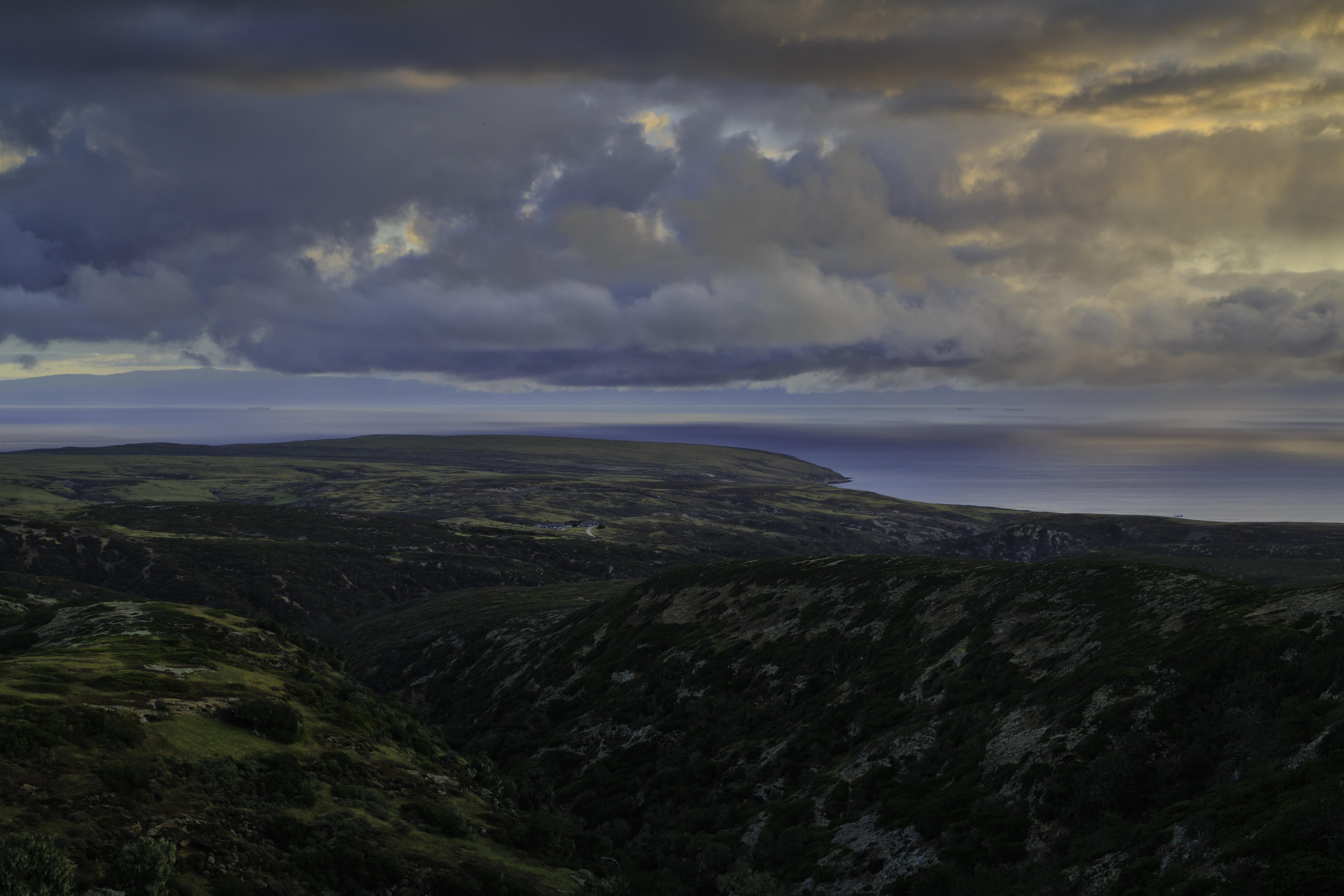
Low coastal mountains and terraces covered in dry grass leading to white sand pocket beaches and ocean with kelp on the surface.
Primitive, dispersed backcountry beach camping is available in the Southeast Quadrant (East Point to South Point) from August 15 through December 31. Learn more at:
Low coastal mountains and terraces covered in dry grass leading to white sand pocket beaches and ocean with kelp on the surface.
Primitive, dispersed backcountry beach camping is available in the Southwest Quadrant (South Point to Sandy Point) from September 16 through December 31.
Low coastal mountains and terraces covered in dry grass leading to white sand beaches with dunes and ocean with kelp on the surface.
This program helps children discover and protect the wonders of the islands. Ask for a free junior ranger booklet at the visitor center or boat/plane concessionaire offices or on the islands from park staff.
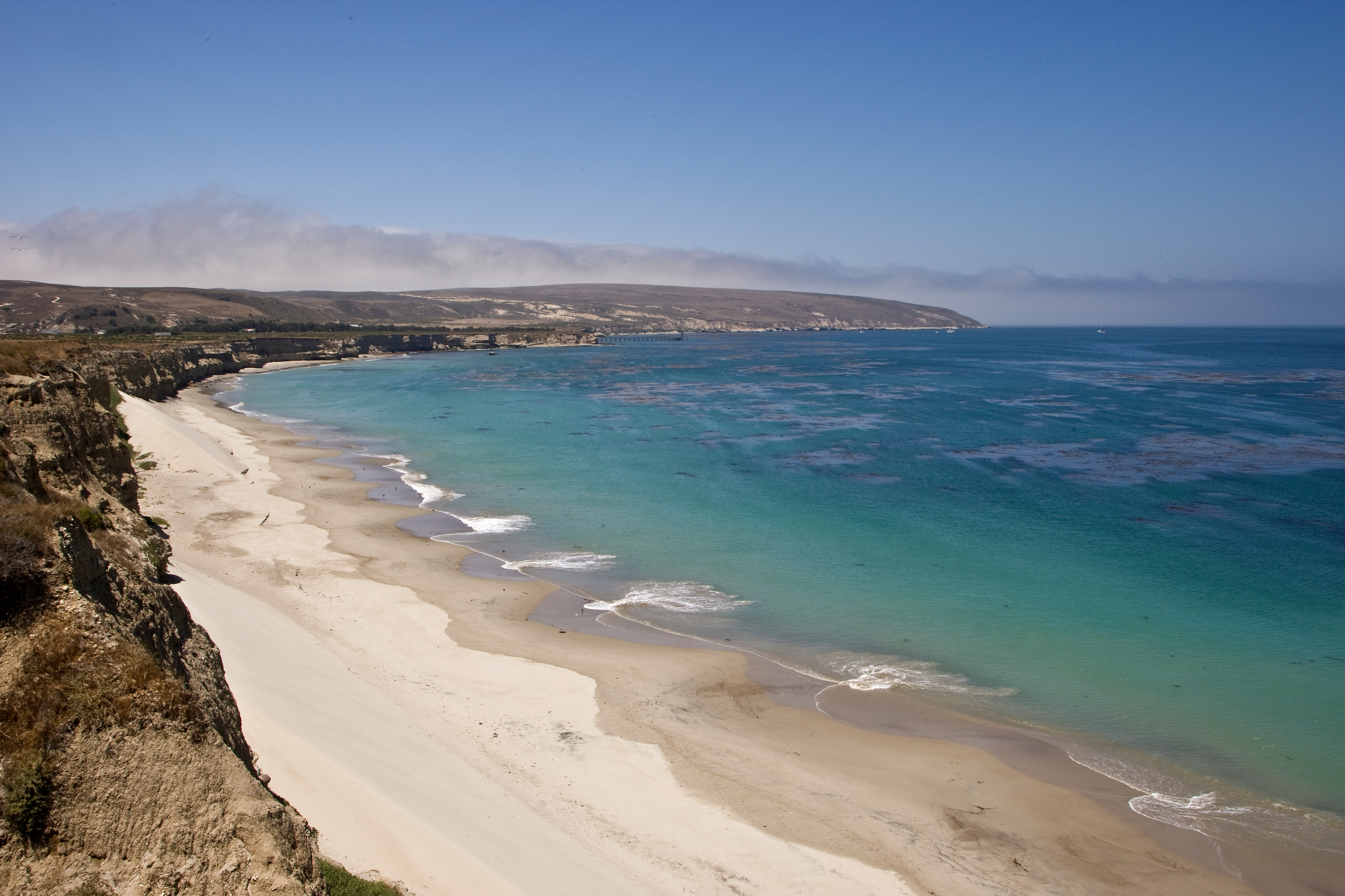
Becher's Bay is the main port of entry to Santa Rosa Island. The bay provides some protection from the strong northwest winds. The bay contains a pier and beautiful, wind-swept, white-sand beach.
The edges of the bay are bordered by cliffs dropping down to the ocean to the east, with a view of Santa Cruz island in clear weather. Turning toward the south is a sandy cove that curves toward a distant Skunk Point in the southeast. Rolling, grassy hills with a stand of Santa Rosa Island Torrey pines are visible to the south. A long wooden fence and eucalyptus trees come into view as you turn to the west. And, finally, through the branches of the trees, the fences and buildings of the ranch complex can be seen to the northwest.
A flat walk along coastal bluffs with great views. Connects with the coastal road near the airstrip with access to Water Canyon Campground, Water Canyon Beach, and other destinations. Be aware of planes as the airstrip is active. Distance: 2 miles (round trip from pier to airstrip junction) Difficulty: Easy
a coastal trail along low ocean terrace that provides views of the a bay with white sand beach and low rolling hills.
Boat visitors must climb from the boat up a steel-rung ladder to a pier at Becher's Bay on Santa Rosa Island. When the pier is closed, landings are via skiff onto the beach. For nearly 150 years, Santa Rosa Island owners maintained a pier to accommodate shipping cattle, sheep, and supplies. The first pier on Santa Rosa Island was constructed in June 1859, presumably at Bechers Bay near or at the present site of the pier.
You have stepped off the boat, onto the lower landing platform of the dock at the east end of a very long pier, that runs east to west. You are standing on metal decking with sturdy railings. The decking runs along two sides of the larger platform above you. Supporting the entire structure are metal beams and thick round posts that look like telephone poles, which extend down into the ocean below. Around the waterline and below, barnacles and mussels cling, in dense clusters, to those posts. The ocean waters extend out in every direction.<br /><br />A tall metal staircase with twelve risers leads up to the platform above. The upper dock platform is about 100 feet by 70 feet. Five-foot high wooden railings run along the perimeter of the pier and dock platform and pier. Below the dock railing, at each corner, is a light beacon, under a clear bell-shaped cap. <br /><br />If you are standing at the top of the risers on the platform, to your left, attached to top of a post are two large outdoor lights. Just past the lights, mounted to the railing, is a heavy plastic yellow container that is rectangular with a rounded top. The lettering on it reads,<br /><br />Life Ring.<br /><br />Straight ahead, on the opposite side of the dock, is a park orientation panel, mounted to the railing. <br /><br />To the right of that panel, and running parallel to the railing, are two low wooden risers with yellow stripes painted on the sides. Matching yellow L-shapes are painted on the pier about 10 feet away from the risers' corners, seemingly outlining a rectangular area on the dock.<br /><br />The ocean end of the dock extends out farther on the left side, by about 20 feet. Near the middle of that side of the dock is a metal cabinet, covered with green canvas. Three shapes stick up on the top, also covered in canvas. Nearby is a large yellow plastic barrel with square shapes that curve out on the sides. <br /><br />In the far right corner of the ocean end of the dock is an upright metal cylinder, about five-feet wide by eight-feet tall. At the top of the cylinder is a giant metal hinge that supports a long steel "arm," ending with two thick parallel metal plates, just a few inches apart, creating a slot, like that between prongs of tongs or a clamp. The plates hang down lower than the arm about one foot. On top of the arm are three thin metal bands, each curved into an upright loop that is connected to the sides of the arm. Lettering on the side of the steel "arm" reads,<br /><br />Hydro Pro.<br /><br />The wooden plank pier, that connects the dock to the island, is 650 feet long and 20 feet wide. At the land end of the pier, on either side, is a steep sandy-colored rocky ridge with eroded gullies and a sandy beach below. The cliff surface varies from top to bottom. Embedded in the top area are random clumps of cobble-sized stones. On the lower part of the cliff are layers of horizontal ridges, like the wavy edge of a stack of pancakes.<br /><br />On the south side, 18 wooden steps with railings lead downward. At the bottom step, there is a ladder, that you can climb down to reach the sandy beach. <br /><br />On the north side is an information panel. <br /><br />At the end of the pier, a dirt road continues upward, cutting through the cliff to the top of the plateau.<br />
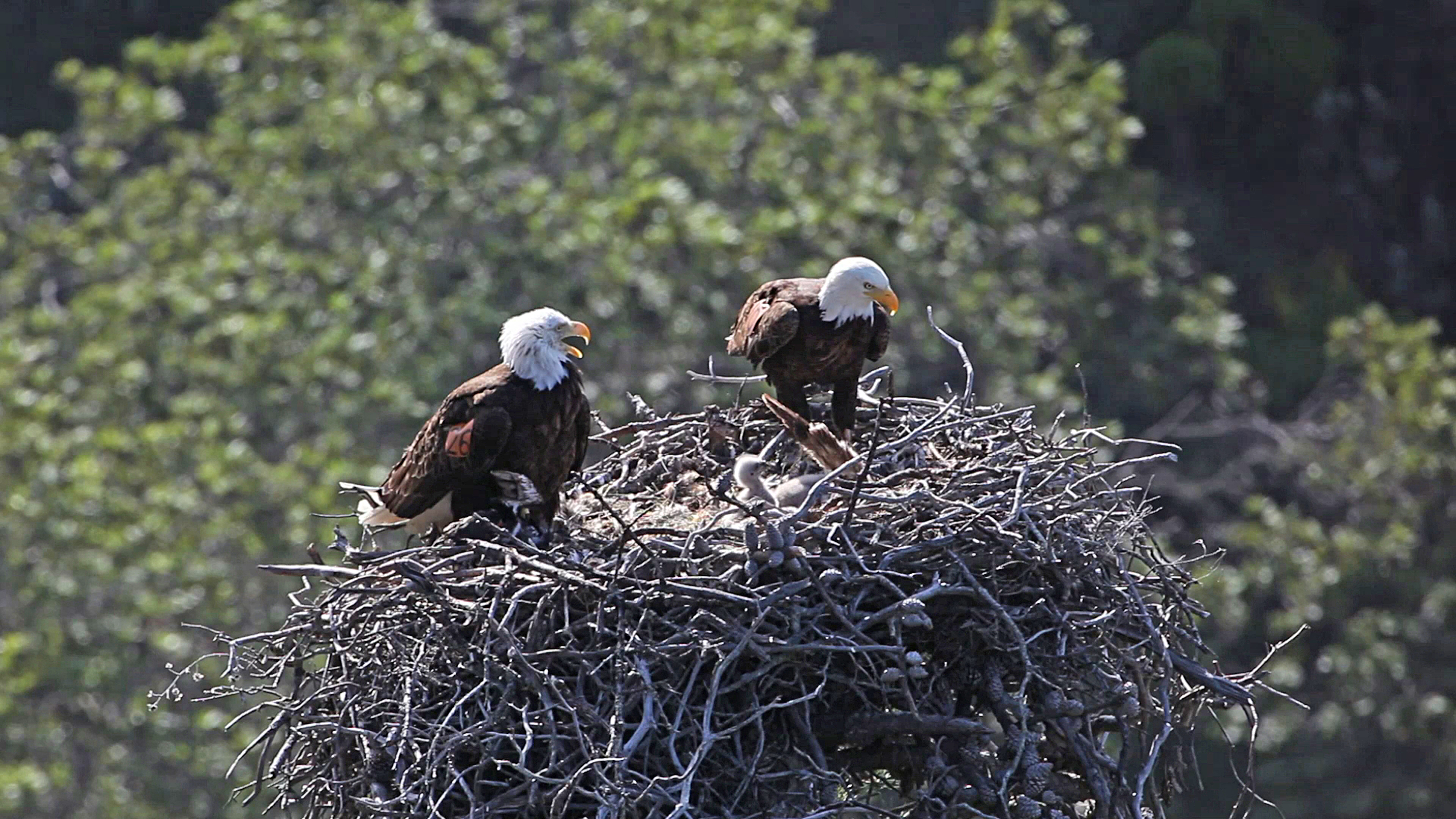
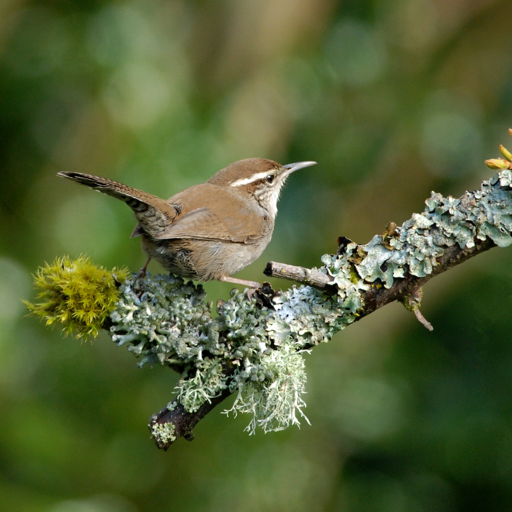
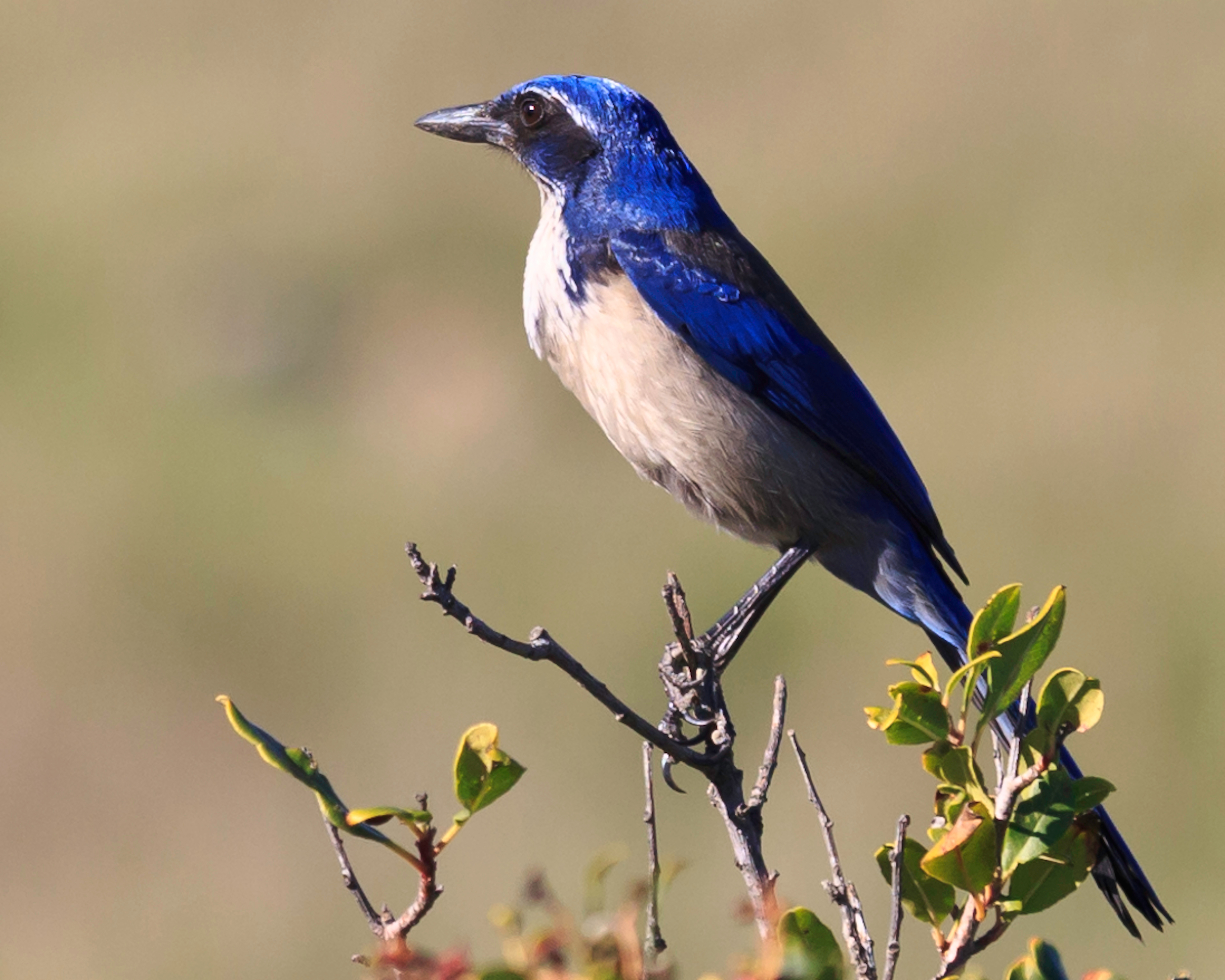
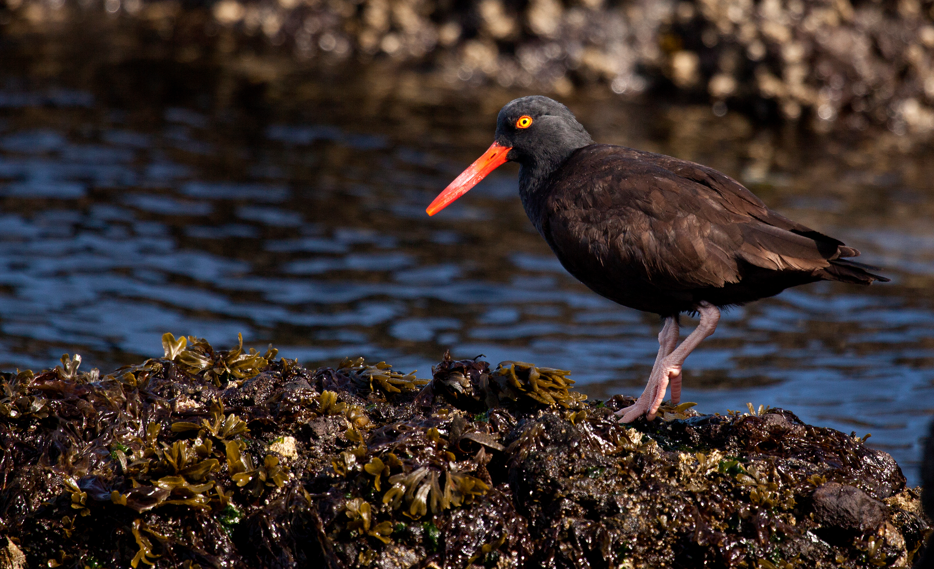
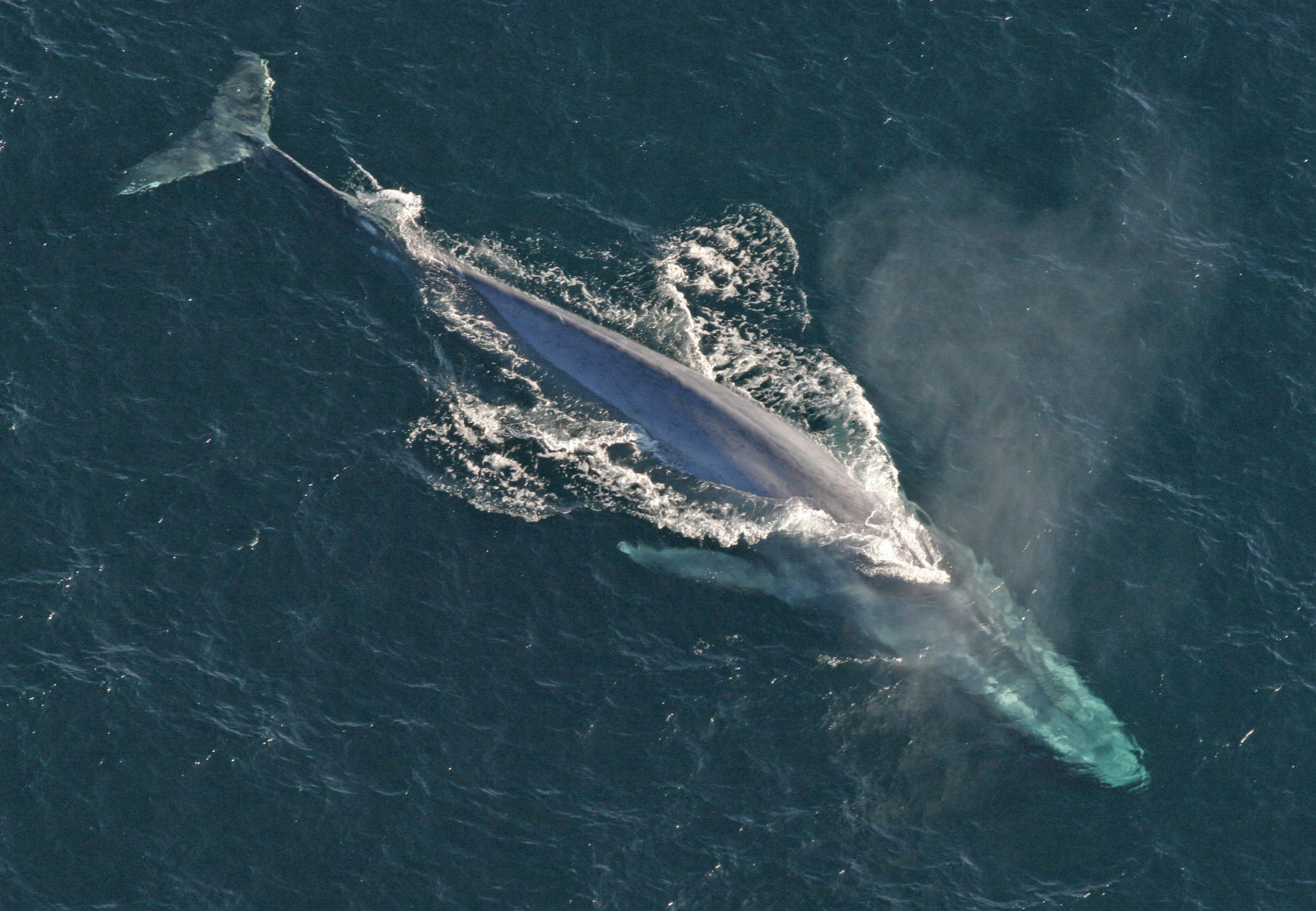
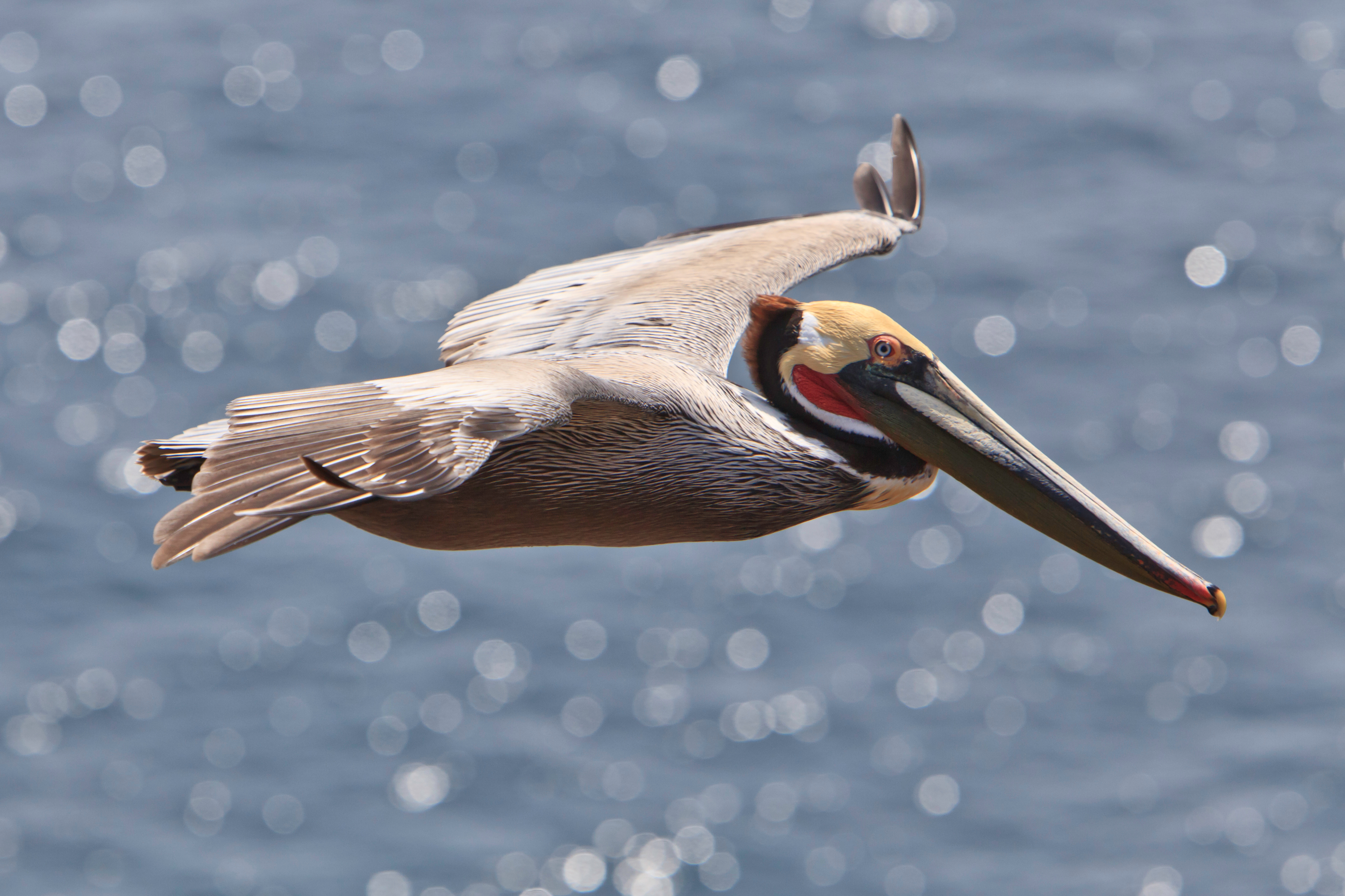
The Channel Islands support a rich variety of birds, distinct in many ways from the birds of the adjacent mainland. The islands offer protected habitat in an increasingly disturbed southern California environment.
The highest peak (1298 feet) on the northeast side of the island provides stunning views to visitors willing to make the strenuous 8-mile rountrip hike.
You are standing at the top of highest point on the north eastern end of the island, Black Mountain. It has a magnificent view in all directions in good weather. To the northeast is Bechers Bay. In the east are Skunk Point and Santa Cruz Island. To the south is Soledad Peak. In the west is San Miguel Island. To the northwest is Lobo Canyon, forming a "V" shape in a distant hillside. In the north is Carrington Point. <br /><br />Poking up, near the edge of this summit, just a hundred feet away, one can see the tops of oaks in the cloud forest island oak grove. At your feet, the soil is rocky with small pebbles. Grass with tiny white flowers grows on the top of the mountain, with a few small patches of scrubby shrubs. <br /><br />There are three structures here. <br /><br />A tall metal pole structure, with a triangular base frame about 6 feet high, on three spayed legs. Two cylindrical white cannisters are mounted on the frame. Sticking up on short rod is a white object that looks like a stack of upside down bowls. On one corner of the frame, a tall rod sticks up about four feet. On another corner, a rod sticks out horizontally from the structure, with a small cap at the end. A vertical 20-foot tall pole sticks up from the center of the frame. At the very top is a rotating torpedo-shaped object with a propeller at the tip. It swivels to face into the wind. On one side is a metal box and two solar panels-flat dark glass panels with grids of light-colored lines. Cables run between the top of the structure and several of these boxes, devices, and solar panels.<br /><br />Flanking the tall triangular framed structure are four poles about 6 feet high and four inches in diameter. One pole has a saucer-shaped satellite dish mounted on it. At its center is a rod that sticks out with a circular metal piece at the end.<br /><br />Nearby is a freestanding solar panel array, mounted on an angle on a metal frame that has two poles extending up in back. Two black cables run from the back of the panel to a latched bin, below the panel, with a large rock on the lid. A thicker black cable runs, from that bin, back up to clamps at the tops of each of the poles on the back of the frame. One cable ends with what looks like an old tv antennae, or a two-sided comb-a metal rod with a row of smaller perpendicular rods sticking out on either side. The other cable sticks straight up, with a rounded metal top like a mushroom cap, about 3 inches in diameter.<br /><br />You are standing in the cloud forest island oak grove, on a slope near the top of Black Mountain. You are under the canopies of several island oak trees, their long, dark, twisting branches overlapping, and ending in clusters of small oval green leaves. It is often foggy here near the summit. When skies are clear, the open form of the branches makes a lacey pattern against the blue sky, and the sun casts a mottled pattern of shadows and light on the ground. <br /><br />The trunks and branches of the oaks are thickly covered with lichen and moss in shades ranging from yellow and pale green to dark olive green. Some growths are as tiny as powdered sugar on the branches. Others are taller, looking like spinach or curly kale, feathery dill weed, and soft curly hair or fur. <br /><br />The ground is thickly covered with fallen dry leaves, small twigs and patches of grass. When it is foggy, water condensation on these branches, leaves, mosses, and lichen will drip down on you, even if it isn't raining outside the oak grove.<br /><br />
A long, steep climb that rewards visitors with oak woodlands and great views (weather permitting) of Santa Rosa, San Miguel, Santa Cruz, and the mainland. Visitors may make this a loop hike by including the Cherry Canyon trail and Telephone and Soledad roads. Distance: 8 miles (round trip from pier) Difficulty: Strenuous
You are standing at the top of highest point on the north eastern end of the island, Black Mountain. It has a magnificent view in all directions in good weather. To the northeast is Bechers Bay. In the east are Skunk Point and Santa Cruz Island. To the south is Soledad Peak. In the west is San Miguel Island. To the northwest is Lobo Canyon, forming a “V” shape in a distant hillside. In the north is Carrington Point. Poking up, near the edge of this summit, just a hundred feet away, one can see the tops of oaks in the cloud forest island oak grove. At your feet, the soil is rocky with small pebbles. Grass with tiny white flowers grows on the top of the mountain, with a few small patches of scrubby shrubs. There are three structures here. A tall metal pole structure, with a triangular base frame about 6 feet high, on three spayed legs. Two cylindrical white cannisters are mounted on the frame. Sticking up on short rod is a white object that looks like a stack of upside down bowls. On one corner of the frame, a tall rod sticks up about four feet. On another corner, a rod sticks out horizontally from the structure, with a small cap at the end. A vertical 20-foot tall pole sticks up from the center of the frame. At the very top is a rotating torpedo-shaped object with a propeller at the tip. It swivels to face into the wind. On one side is a metal box and two solar panels—flat dark glass panels with grids of light-colored lines. Cables run between the top of the structure and several of these boxes, devices, and solar panels. Flanking the tall triangular framed structure are four poles about 6 feet high and four inches in diameter. One pole has a saucer-shaped satellite dish mounted on it. At its center is a rod that sticks out with a circular metal piece at the end. Nearby is a freestanding solar panel array, mounted on an angle on a metal frame that has two poles extending up in back. Two black cables run from the back of the panel to a latched bin, below the panel, with a large rock on the lid. A thicker black cable runs, from that bin, back up to clamps at the tops of each of the poles on the back of the frame. One cable ends with what looks like an old tv antennae, or a two-sided comb—a metal rod with a row of smaller perpendicular rods sticking out on either side. The other cable sticks straight up, with a rounded metal top like a mushroom cap, about 3 inches in diameter. You are standing in the cloud forest island oak grove, on a slope near the top of Black Mountain. You are under the canopies of several island oak trees, their long, dark, twisting branches overlapping, and ending in clusters of small oval green leaves. It is often foggy here near the summit. When skies are clear, the open form of the branches makes a lacey pattern against the blue sky, and the sun casts a mottled pattern of shadows and light on the ground. The trunks and branches of the oaks are thickly covered with lichen and moss in shades ranging from yellow and pale green to dark olive green. Some growths are as tiny as powdered sugar on the branches. Others are taller, looking like spinach or curly kale, feathery dill weed, and soft curly hair or fur. The ground is thickly covered with fallen dry leaves, small twigs and patches of grass. When it is foggy, water condensation on these branches, leaves, mosses, and lichen will drip down on you, even if it isn’t raining outside the oak grove.
Archeological excavations around and within this building revealed artifacts and materials that suggested that this may have been the location of the"forge" or blacksmith shop shown on an 1892 map.
The Blacksmith ShopThe Blacksmith shed contains artifacts and exhibits. It is a short walk down the road from the pier. Restrooms and the Orientation exhibit area are nearby. The one room shed measures 10 feet by fifteen feet. A 6-foot extension wall to the left of the building creates an open-air porch with a steeply pitched shake roof. Two door openings provide access. The walls are of two different styles, flat horizontal boards and board and batten. The interior floor is dirt. The open doorway, one small square window, and cracks between the wall boards let sunlight into the space.The interior and porch area exhibits are described in the next section starting with the interior exhibit panels and artifacts. As you enter the shop, a large piece of free standing equipment is in the left corner of the room, a vise with drill press. The metal column comes up from a base at the floor and holds the circular drill table at waist height. The column continues up to the chuck and spindle where a capstan wheel adjusts the height of the drill. A plaque on the base of the vice reads: Press and ViseThe blacksmith shop was a machine shop as well as a forge. This press which dates back to the Caire era (1880-1932) was used for drilling and threading pipes.An exhibit panel on the back wall behind the vice displays a black and white photograph of the exterior of the blacksmith shop. Text reads: The Blacksmith Shop The blacksmith shop was a hot, noisy, sweaty place, but it played a key role at Scorpion Ranch.An isolated ranch needed to be self-sufficient - a blacksmith shop made this possible. The blacksmith was kept busy making or repairing Scorpion's tools and gear. Everything with metal parts passed through the smithy - on a given day the blacksmith might shoe horses, repair wagon wheels, sharpen plows and make oar locks.Continuing around the room to the right, hanging from the walls and on display are a variety of implements, chains, farm tools, building supplies, horseshoes, an anvil and another drill press in the forge area behind a waist high exhibit shelf that runs the length of the room and divides the forge area from the entryway. The shelf sits on top of a wall of ornamental ironwork crafted out of blacksmith tools welded together in an artful style. The exhibit area from left to right has a series of six tools mounted to a panel and labeled by letter. They are meant to be touched. a.Shovel b. Pokerc.Tongsd.Pritchele.Forepunchf.Iron BarText reads:A Day at the ForgeBasic blacksmithing didn't require much - only a hot fire, simple tools and brute strength. "Forging" is changing the shape of a piece of metal by heating and hammering it.It's a very physical process. Although the Scorpion blacksmith shop was probably operated by one person, an assistant "striker" may have added his blows when vigorous hammering wasneeded. Leg vises anchored to the floor gave the blacksmith extra support when hammering.Three line drawings illustrate a portable forge, an anvil and a grindstoneText reads:portable forge- Not all blacksmithing at Scorpion took place in the shop. This portable hand forge and leg vise were taken out into the field, probably for shoeing horses.anvilAn anvil is the iron block on which the blacksmith works metal. To keep it steady, this anvil was mounted on a sturdy log embedded in the dirt floorgrindstoneThe blacksmith held a tool against the stone to sharpen it. Foot pedals madeit easier to keep the stone turning.The next exhibit along the shelf describes how to make a horseshoe in 12 steps.1. Build a fire in the forge. Use blacksmithing coal, (a soft coal, free from impurities).When packed down around the fi re, it changes to coke, a lightweight material that burns with a clean, intense flame.2. Use the shovel and poker to adjust the fire.3. Use your left hand to work the bellows or crank the blower to addoxygen to the fire so it burns hotter.4. Stick the iron bar into the forge to heat.5. Heat the section you'll be working onto a bright-red heat, almost but not quite white hot.6. Using the tongs, draw the iron bar out of the fire and turn to the anvil.7. Pick up a small hammer.8. Using the round face of the hammer, bend the iron bars over the anvil.9. Once the horseshoe is the right shape, start the nailholes using a forepunch. The shape of the punch should exactly match the head of the nail.10. Hammer a stamp into the hole to make a space for the shank of the nail.11. Sharpen the pritchel on the grindstone. To complete the hole, hammer a pritchel into the hole. A little piece will drop out.12. Lay the shoe flat on the anvil and hammer all around to level.Text continues: The island needed a gang of blacksmithsThe Scorpion smith was in good company - there were once six blacksmith shops on the island. Blacksmiths at the satellite ranches, or outranches, dealt with day to day objects, while hinges, ornamental ironwork and railings were made at the main ranch blacksmith shop.The last exhibit panel is to
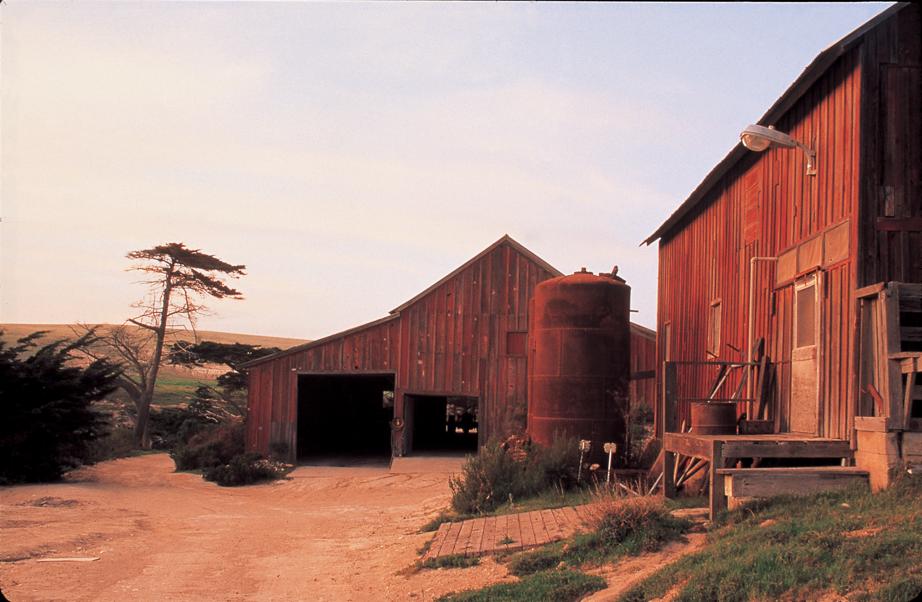
This building has been called the blacksmith shop, freezer barn, generator barn, and a barn-utility building. It was probably constructed in the early 1870s and housed the original blacksmith shop and other workshops and utility areas.
The blacksmith shop is a two-story rectangular wooden building with a gabled, or simple peaked, roof, covered with corrugated metal, running the length of the building. The rectangular foundation of the building is rock and cement. The building's vertical board and batten siding is dark red with white trim.<br /><br />The long front, or eastern, side of the building, forms part of a large corral, with corral fencing connecting to both ends of the building. Along that wall there are two framed window openings: one under the roof eve, shuttered with wood planks; and another below it, to one side, with a metal screen over it. At the ground level are three framed doorways, with wooden gates that are open at the top. In front of the wall is an upright open metal frame or equipment of some kind, about 2 feet wide by four feet high. Also, on top of a five foot tall wooden platform, a metal cylinder is laying on its side. The cylinder is about 3 feet in diameter, and at least 5 feet tall. Nearby, twisted branches are heaped in a tall pile. A 6 foot high fence of vertical wooden planks extends out from the northeast corner of this barn wall, in line with the wall. The 4 foot high corral fence connects to this taller fence.<br /><br />At the south side of building, the corral fence connects directly to the building, near the center of the wall. A small framed window opening, a few feet above ground level, has a metal screen. Along the fence, adjacent to the building is another metal cylinder, laying on side, as well as a rusted yellow tractor. A deep wooden shelf is attached to the fence, mounted on cylindrical telephone poles that stick up through the shelf.<br /><br />A dirt road runs around the back, or west, side of the building. Wooden planks have been buried into the ground, creating a wooden ramp that leads up to an 8 foot by 4 foot platform with no railings, that is attached to the building, like a loading dock. Concrete and wooden stairs lead up to the platform on one side. At the back of the platform is a red door are two wooden doors: one red with two z-shaped plank braces, and one white with a screen window on top. Above these are three casement style window openings, framed with white trim, and shuttered with red wood planks. Penetrating one of these shutters is a grey metal pipe, that curves down from the building into the ground. The stone foundation of the building is reinforced by concrete wedges, shaped like small pyramids, positioned about every 4 feet, perpendicular to the wall. Toward the northern side of this wall are two small framed windows. One has a single panes of glass; the other has six panes of glass, separated by thin wooden mullions. Just outside these windows are two rusty cylindrical boilers about 12 feet tall by 5 feet in diameter. The outer surface of the boiler is made of curved rectangular metal sections, connected with lines of rounded bolts at the seams. Sticking up from the top of the container are small rods, caps, and valves. At the base of each boiler is an oval shaped opening. The opening on the right boiler has thick latch that hooks over a rod across it and a thick chain that is attached about six feet above it. The boilers are sitting on round foundations made of rock and cement.<br /><br />The north side of the building has a window with six panes of glass. Next to it is two-step platform that leads to a wooden door. The door is made of four vertical planks of wood, with Z-shaped plank bracing on the interior of the door. <br />
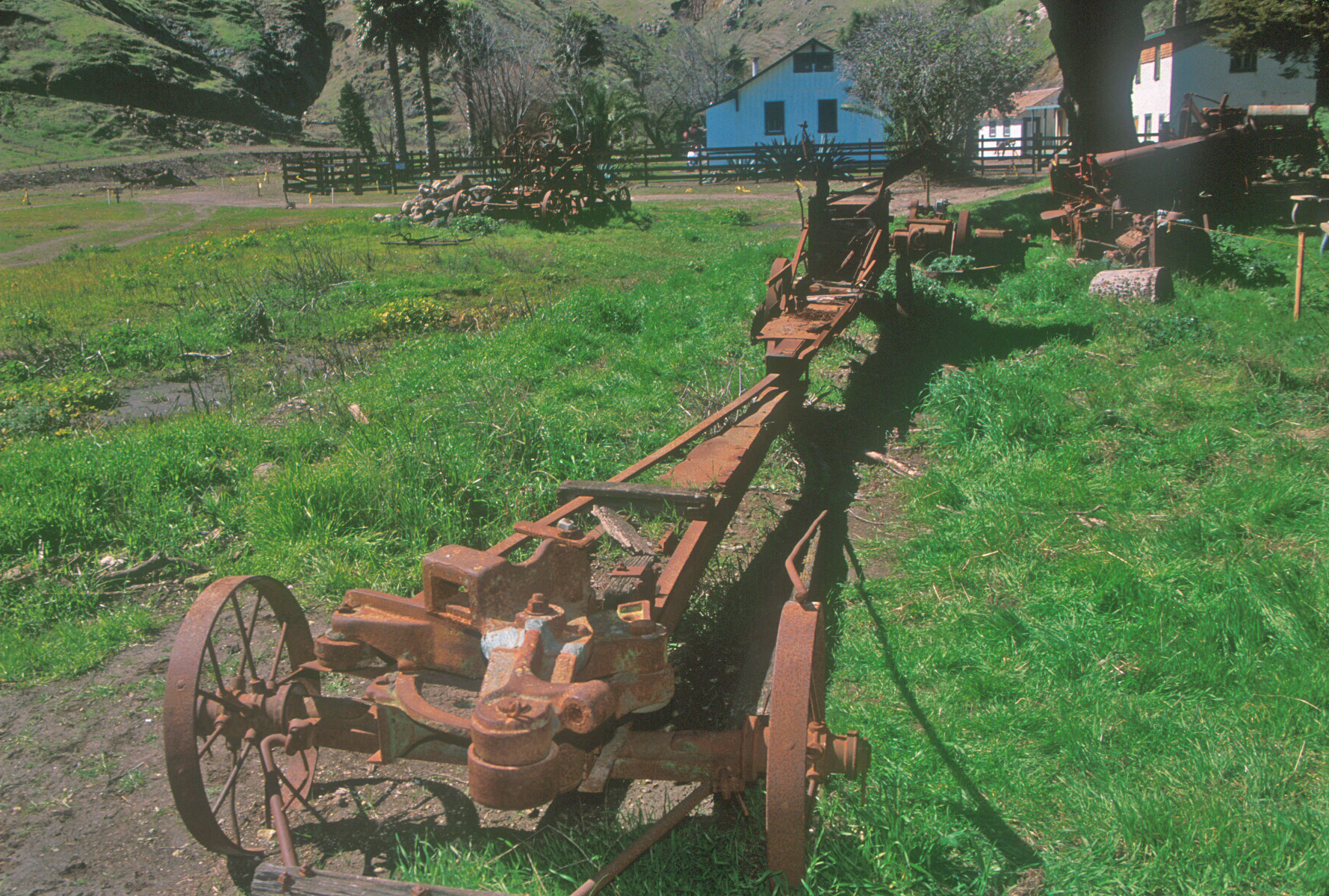
Hay balers were first built in the 1850s. Except for the efforts of a few individuals, hay presses were given little attention for another two decades. Even then the development of hay presses came very slowly. The early balers such as this Buffalo were primarily designed for the needs of small farmers, requiring small capital outlay, besides the advantage of being a one or two-man operation. These balers were horse-powered. After a few hours of experience, a horse would wal
This very simple looking two wheeled cart was pulled by a horse. On the back of the flat cart is a large metal box that would compress the loose hay that was gathered into bales.
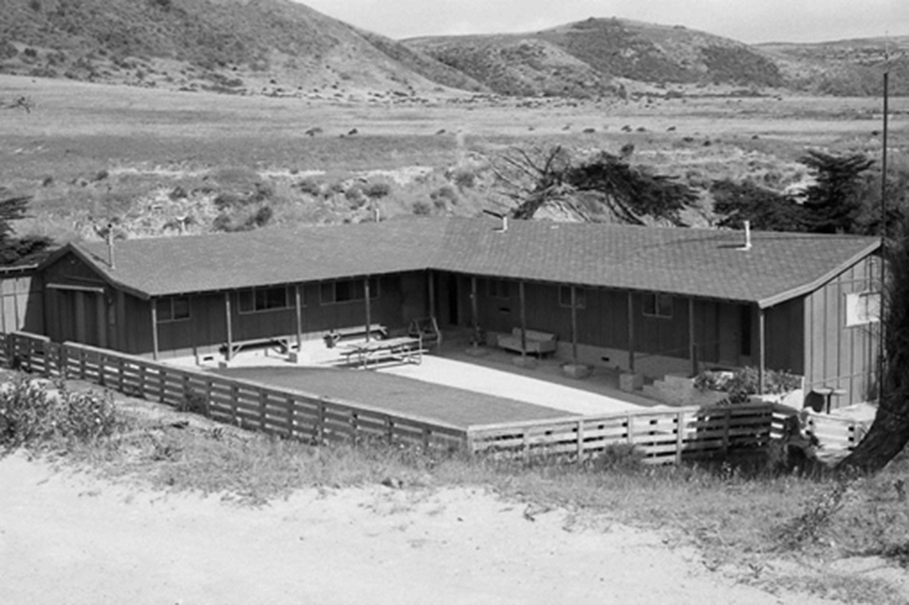
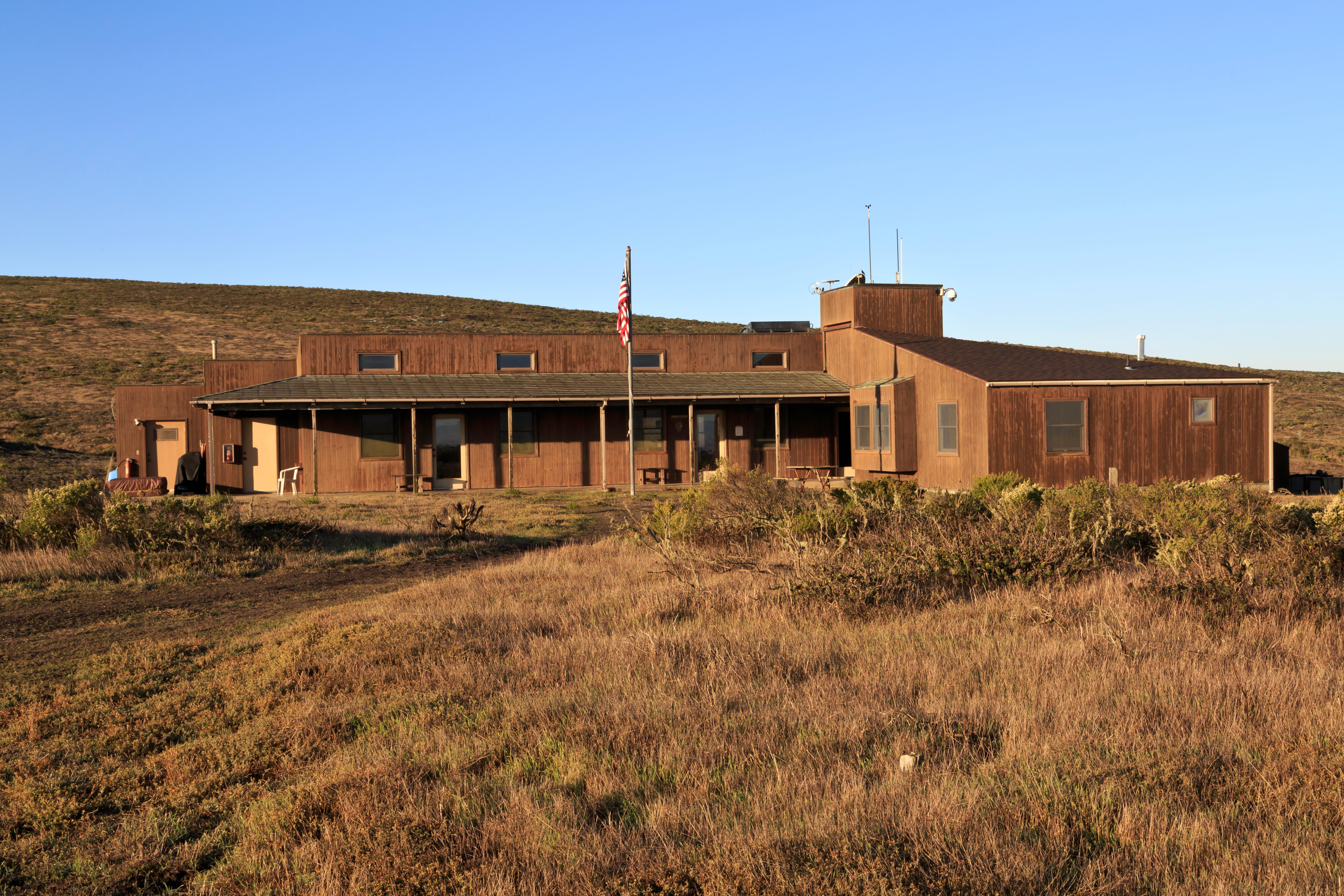
The current bunkhouse was built in 1970 after the original bunkhouse burned to the ground in 1969. The original bunkhouse, actually a complex of three buildings-the foreman's residence, the bunkhouse, and the cookhouse-had been built either by Alpheus Thompson in 1855 or by the More family around 1870.It was described by Edward Vail in 1901 as a "large two-story ranch house" and was used by Vail & Vickers to house the foreman and the crew's dining room. Men slept in a long, o
The bunkhouse building is about 20 feet below a dirt road, down a sloped hillside covered with iceplant. This succulent has long thick fleshy leaves, shaped like little fingers, that stick up to about 6 inches from the ground. One can walk down to the house via a set of stairs set into the iceplant, with railings; or drive down a sandy driveway. The building is a gray, single story, ranch-style, "L" shaped house, with one line of the "L" pointing east; the other pointing south. The road is on the south side of the building. The bunkhouse has board and batten siding, on a concrete brick foundation, and a gabled, or simple peaked, roof, covered with composite shingles. On the inside of the "L", the roof extends out toward the central courtyard, creating covered walkways along the walls. That portion of the roof is supported by wooden posts, rising out of into concrete brick bases, sitting on poured concrete walkways, about 6 feet wide.<br /><br />Each wall has three windows facing the courtyard. Two wooden benches sit below some of the windows. There are three doors on the southernmost end of the building, with a slatted vent above them, near the eaves, and a plaque that has the National Park Arrowhead Logo and reads,<br /><br />Santa Rosa Island<br />Research Station<br />A California State University Channel Islands Undergraduate Research Campus<br />Channel Islands Nation Park<br /><br />In the corner of the "L" of the building are two more doors, up one step. Near the easternmost end of the building, up three steps, is another door, with a thin vertical window beside it, and a raised planter bed below. On the walls facing the courtyard are a long, coiled hose and a fire extinguisher. Three long picnic tables are arranged in a single row in the courtyard. Another picnic table sits at the eastern end of the building, covered with a green canvas awning.<br /><br />A sturdy wooden fence with horizontal rails runs around the courtyard area and picnic tables, with a plaque at each gate, that reads:<br /><br />At the eastern end of the fence is a large eucalyptus tree with a gnarled trunk, tilting eastward at a steep angle. At the base of the tree is a cleared area for parking, beside it is the steep, sandy driveway that leads up the road. <br />
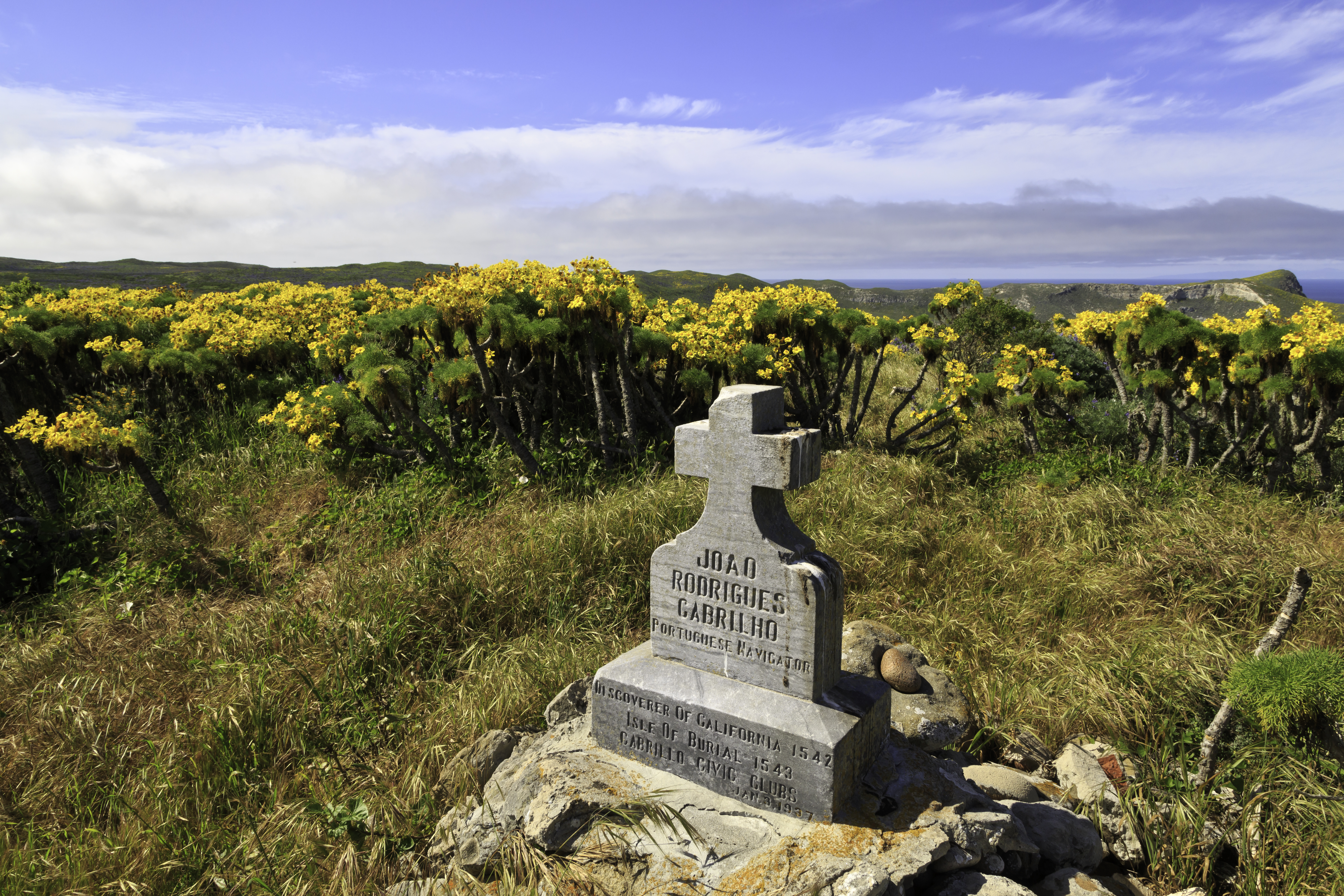
The Cabrillo Civic Clubs erected a monument in the form of a pile of stones and prehistoric stone artifacts topped by an inscribed granite cross on a knoll near the old shearing sheds in 1937.
If you are standing in front of the Cabrillo Monument, you are facing north, on a plateau above the ocean. <br /><br />Cabrillo Monument is a monument, shaped like a gravestone, with a cross on top. It sits on a three-foot pile of stones. On the front, the monument bears the inscription, <br /><br />Juan Rodriguez Cabrillo.<br />Portuguese Navigator.<br />Discoverer of California, 1542.<br />Isle of Burial, 1543.<br />Carrillo Civic Clubs, Jan 3 1937.<br /><br />The monument sits in a small clearing surrounded by giant coreopsis, with a thick, bare trunk, is topped by a spray of yellow, daisy-like flowers, and feathery green leaves, shaped like fluffy ostrich feathers, in the spring. During drier seasons, the plant appears dead, as the top withers into a shaggy, brittle, brown mop of dried leaves. <br /><br />Beyond the monument is a view of Cuyler Harbor. Prince Island is seen in the distance. To your right is the campground. Behind you is a trail to the Lester Ranch Site and the ranger station. <br />
In 1542, Juan Rodriguez Cabrillo became the first European to explore the Channel Islands. A monument honoring him was erected above Cuyler Harbor in 1937. Distance: 2 miles (round trip from Cuyler Harbor) Difficulty: Strenuous (due to short, steep climb to top of island)
If you are standing in front of the Cabrillo Monument, you are facing north, on a plateau above the ocean. Cabrillo Monument is a monument, shaped like a gravestone, with a cross on top. It sits on a three-foot pile of stones. On the front, the monument bears the inscription, Juan Rodriguez Cabrillo. Portuguese Navigator. Discoverer of California, 1542. Isle of Burial, 1543. Carrillo Civic Clubs, Jan 3 1937. The monument sits in a small clearing surrounded by giant coreopsis, with a thick, bare trunk, is topped by a spray of yellow, daisy-like flowers, and feathery green leaves, shaped like fluffy ostrich feathers, in the spring. During drier seasons, the plant appears dead, as the top withers into a shaggy, brittle, brown mop of dried leaves. Beyond the monument is a view of Cuyler Harbor. Prince Island is seen in the distance. To your right is the campground. Behind you is a trail to the Lester Ranch Site and the ranger station.
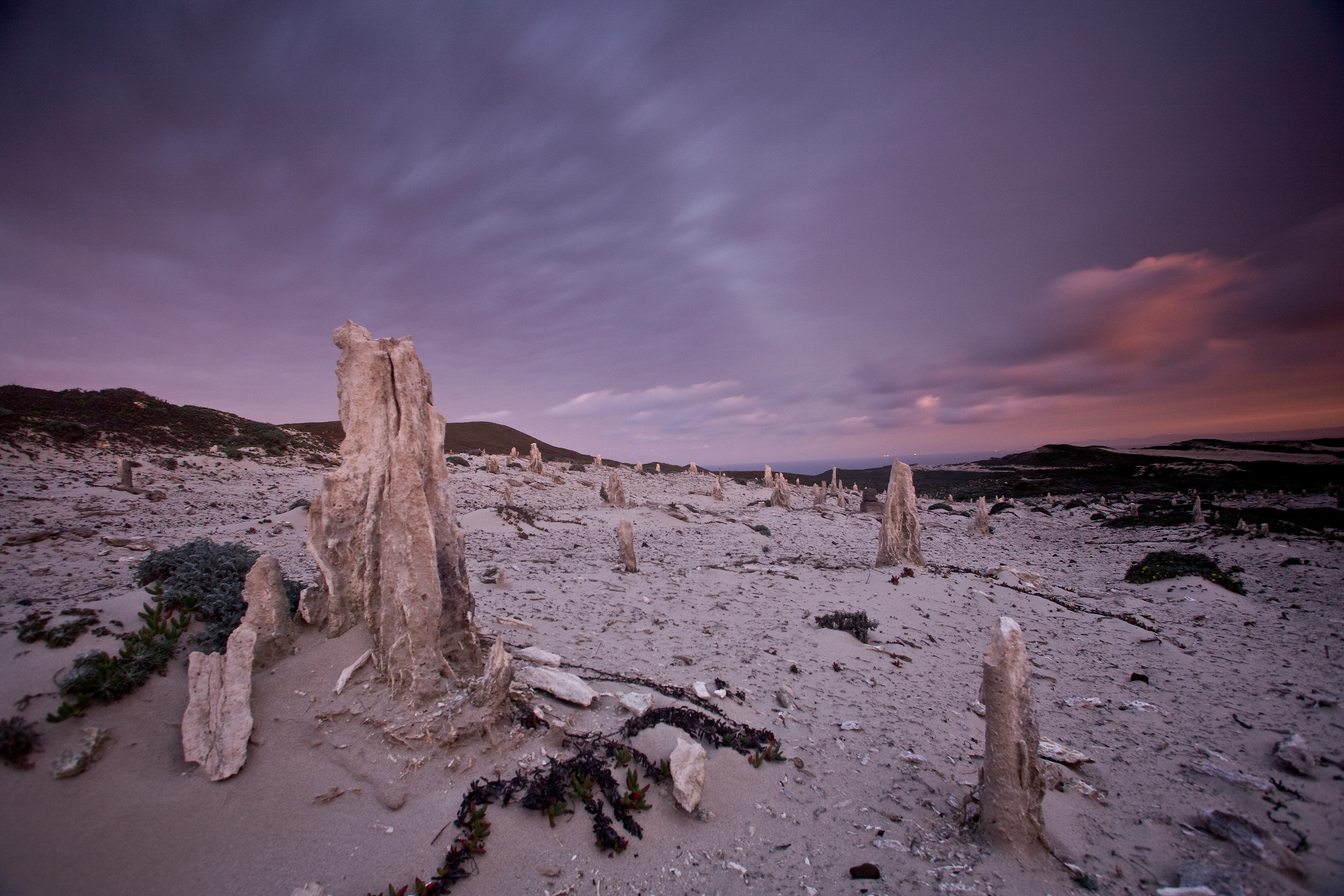
Due to unexploded ordnance, visitors must be accompanied by a ranger to this location. Entering this area without a ranger is a violation of federal law. The San Miguel Island's isolation has helped to preserve one of the island's most interesting features-the caliche forest, calcified casts of ancient vegetation that have been exposed in several areas by the eroding sand. This ancient fossilized vegetation is comprised of roots and trunks of a variety of plants, including po
If you are standing with your hands on the wooden railing near the edge of the Caliche Forest, you are facing northwest. On a clear day, the white-colored Caliche Forest stretches out in front of you, extending into the distance. Everywhere else are low scrubby shrubs. San Miguel Hill is visible to the right and slightly behind you. To your left is Green Mountain.<br /><br />The Caliche Forest is made up of what appear to be tree stumps similar in shape to stalagmites in a limestone cave. These pillars are the color of bleached bones. They range from a few inches to about one foot wide at the base, and are narrower at the top. The pillars rise up out of a white sandy plain that is scattered with very sparse low vegetation. <br /><br />If the day is very foggy, the caliche forest may not be visible at all.<br />
The caliche forest is a naturally occurring geologic feature consisting of prehistoric vegetation that has calcified, forming a "fossilized" landscape. Distance: 5 miles (round trip from Cuyler Harbor) Difficulty: Strenuous
If you are standing with your hands on the wooden railing near the edge of the Caliche Forest, you are facing northwest. On a clear day, the white-colored Caliche Forest stretches out in front of you, extending into the distance. Everywhere else are low scrubby shrubs. San Miguel Hill is visible to the right and slightly behind you. To your left is Green Mountain. The Caliche Forest is made up of what appear to be tree stumps similar in shape to stalagmites in a limestone cave. These pillars are the color of bleached bones. They range from a few inches to about one foot wide at the base, and are narrower at the top. The pillars rise up out of a white sandy plain that is scattered with very sparse low vegetation. If the day is very foggy, the caliche forest may not be visible at all.
Due to unexploded ordnance, visitors must be accompanied by a ranger to this location. Entering this area without a ranger is a violation of federal law. Seals and sea lions can be seen from several viewpoints on San Miguel Island that can be reached on ranger-guided hikes. Northern elephant seals can even be seen on the beach at Cuyler Harbor where visitors land on the island. however, the most famous and diverse pinniped viewing location on San Miguel Island is Point Bennet
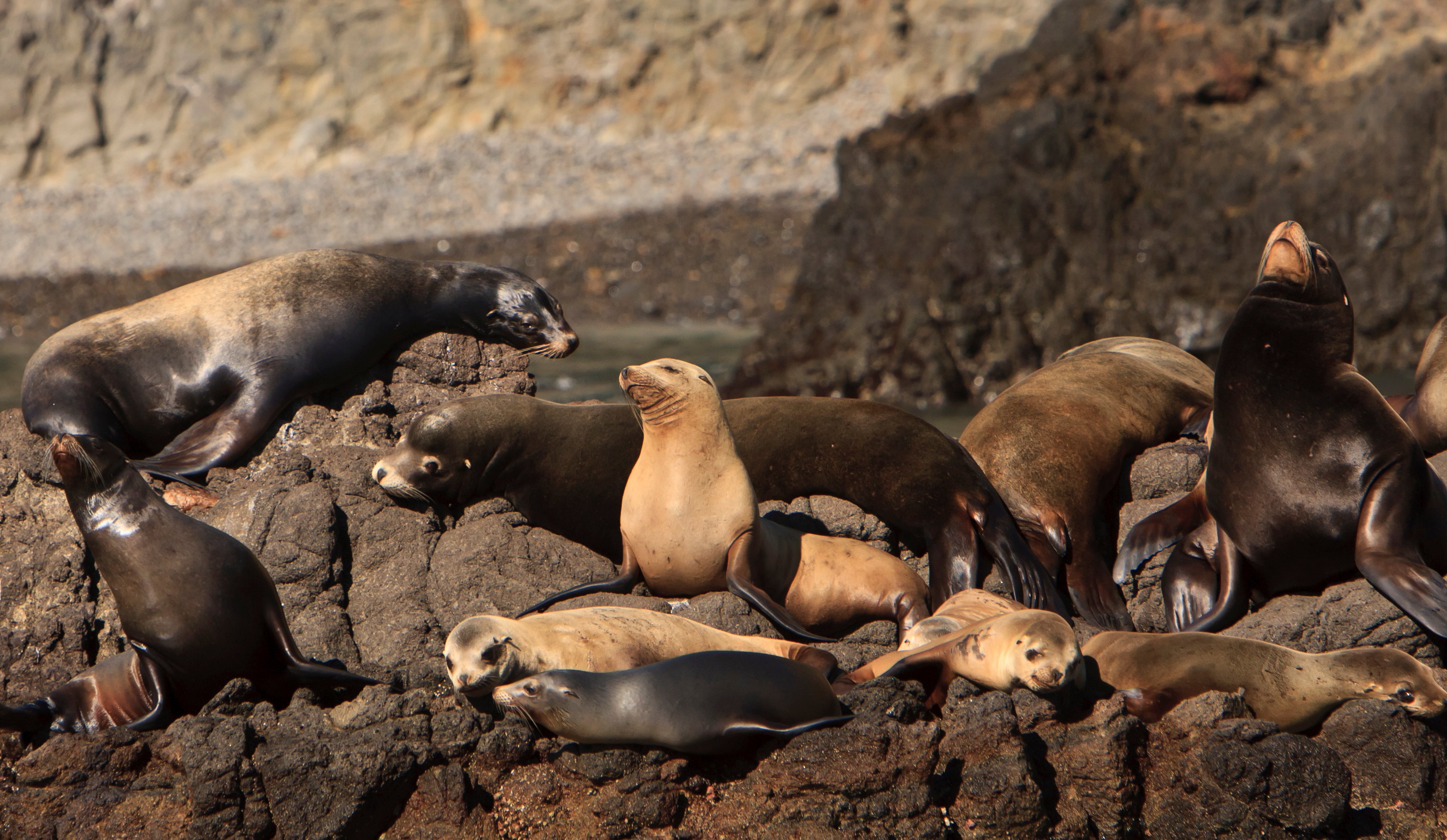
Cardwell Point offers a magnificent view of two stretches of beach. If you are standing on Cardwell Point facing right to the southeast side, there is a sandy cove, several hundred yards away. The beach is dotted with clusters of pinnipeds-slug-shaped sea mammals. On the northeast side, to your left, is the second stretch of beach with a rocky reef. Santa Rosa Island is offshore, in the distance.<br /><br />Cardwell Point is covered with green grass and patches of a low red succulent with light pink flowers. To the northwest, from your bird's eye view you can see lobster traps out in the water, and a large reef just beyond the shore. Along the northwest shore and about a half mile away to the southwest are beaches that often bustle with activity. Depending on the time of year, the beaches may be filled with dozens and sometimes hundreds of pinnipeds, including California sea lions, northern elephant seals, and northern fur seals. These torpedo-shaped sea mammals have flippers, and heads shaped like a dog's, but with tiny or invisible ears. More pinnipeds swim just off shore-hunting or "body-surfing" the waves. The whole scene is accompanied by a chorus of their varied calls-from bellows and bleats to snorts, barks, and creaks. <br /><br />Adult male elephant seals are the largest animals on the beach. These brown animals have short, bulbous snouts, are about 12 feet long, and can weigh as much as 5,000 pounds. They often rest, almost motionless, on the beach, but during the breeding season the males battle one another for females. Known as "bulls", the male elephant seals make snorting sounds while slamming their massive bodies together and gouging each other with their short, carrot-shaped tusks, until their necks are red with blood. The females, which are about 10 feet long, and weigh up to 1,800 pounds. When born, the babies, called pups, are 3 to 4 feet long, and weigh only about 70 pounds, or 1.5 % the size of the bull elephant seals. <br /><br />The California sea lions have large front and back flippers, and are more agile on land than other pinnipeds; roaming up to a mile inland. The mature males are dark brown, about 7 feet long, and weigh up to 1,000 pounds. Males have a bellowing bark, that sounds like "Aarh!." <br />Females are golden brown, about 6 feet long, and weigh about 200 pounds. Pups are dark brown and about 16 pounds at birth, but their coats become golden brown after about 5 months. <br /><br />Females will fight other females to defend their pups. In order for females and their pups to find one another, the pups call out in a bleating, "Baah" sound, like that of a baby lamb. Their mothers call back in a creaking, "Ahh" sound. <br /><br />The older pups wander farther from their mothers, with many cavorting together in groups in a sandy lagoon a hundred yards back from the shoreline. <br /><br /><br />Northern fur seals have very large front and back flippers and tiny ears. Males are grey to black, and between 300 - 600 pounds. They declare their territories with a bellowing sound, almost like a cow's "moo", and vigorously defend their turf by chasing away intruders. Females are light brown on the back with a reddish brown chest, with a light patch. They weigh about 100 pounds. <br />
The hike to Cardwell Point includes spectacular views of Santa Rosa Island and a seal and sea lion rookery. Distance: 6 miles (round trip from Cuyler Harbor) Difficulty: Strenuous
Cardwell Point offers a magnificent view of two stretches of beach. If you are standing on Cardwell Point facing right to the southeast side, there is a sandy cove, several hundred yards away. The beach is dotted with clusters of pinnipeds—slug-shaped sea mammals. On the northeast side, to your left, is the second stretch of beach with a rocky reef. Santa Rosa Island is offshore, in the distance. Cardwell Point is covered with green grass and patches of a low red succulent with light pink flowers. To the northwest, from your bird’s eye view you can see lobster traps out in the water, and a large reef just beyond the shore. Along the northwest shore and about a half mile away to the southwest are beaches that often bustle with activity. Depending on the time of year, the beaches may be filled with dozens and sometimes hundreds of pinnipeds, including California sea lions, northern elephant seals, and northern fur seals. These torpedo-shaped sea mammals have flippers, and heads shaped like a dog’s, but with tiny or invisible ears. More pinnipeds swim just off shore—hunting or “body-surfing” the waves. The whole scene is accompanied by a chorus of their varied calls—from bellows and bleats to snorts, barks, and creaks. Adult male elephant seals are the largest animals on the beach. These brown animals have short, bulbous snouts, are about 12 feet long, and can weigh as much as 5,000 pounds. They often rest, almost motionless, on the beach, but during the breeding season the males battle one another for females. Known as “bulls”, the male elephant seals make snorting sounds while slamming their massive bodies together and gouging each other with their short, carrot-shaped tusks, until their necks are red with blood. The females, which are about 10 feet long, and weigh up to 1,800 pounds. When born, the babies, called pups, are 3 to 4 feet long, and weigh only about 70 pounds, or 1.5 % the size of the bull elephant seals. The California sea lions have large front and back flippers, and are more agile on land than other pinnipeds; roaming up to a mile inland. The mature males are dark brown, about 7 feet long, and weigh up to 1,000 pounds. Males have a bellowing bark, that sounds like “Aarh!.” Females are golden brown, about 6 feet long, and weigh about 200 pounds. Pups are dark brown and about 16 pounds at birth, but their coats become golden brown after about 5 months. Females will fight other females to defend their pups. In order for females and their pups to find one another, the pups call out in a bleating, “Baah” sound, like that of a baby lamb. Their mothers call back in a creaking, “Ahh” sound. The older pups wander farther from their mothers, with many cavorting together in groups in a sandy lagoon a hundred yards back from the shoreline. Northern fur seals have very large front and back flippers and tiny ears. Males are grey to black, and between 300 – 600 pounds. They declare their territories with a bellowing sound, almost like a cow’s “moo”, and vigorously defend their turf by chasing away intruders. Females are light brown on the back with a reddish brown chest, with a light patch. They weigh about 100 pounds.
Carrington Point is home to seals and sea lions, an ocean blowhole, a sea arch, the endangered soft-leaved island paintbrush, and unmatched coastal views. Soft-leaved Island Paintbrush Out on the bluffs and sand dunes above Carrington Point grows the endemic soft-leaved island paintbrush, Castilleja mollis. Although once found on San Miguel, today this rare plant species is only found on Santa Rosa Island and exists in just two locations.The island paintbrush must grow beneat
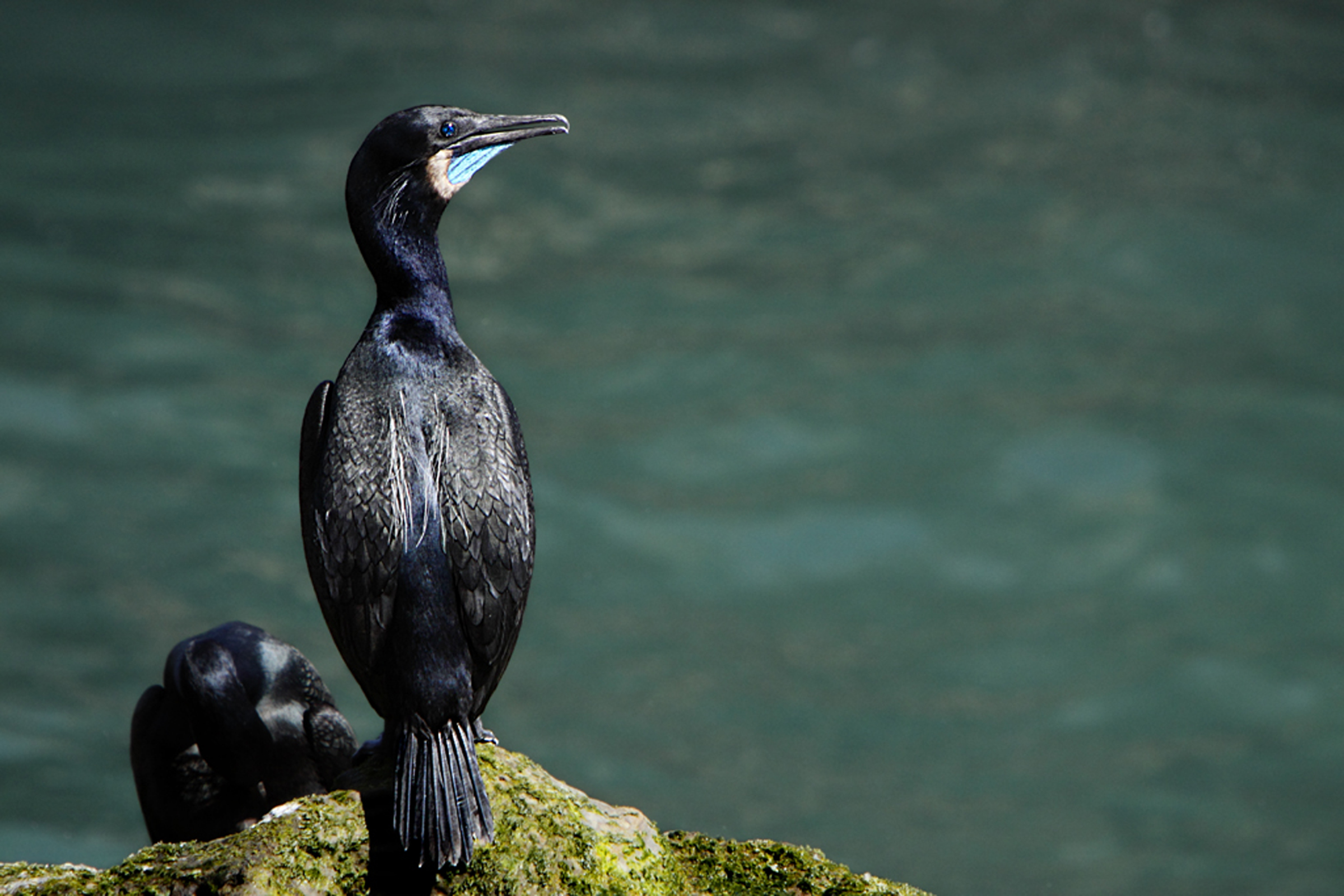
You are standing on steep hillside that slopes down, northeast, to Carrington Point-a thin sandy point, with rocky edges at the shoreline. This sandy point is often covered with seals and sea lions. They are furry, tan, and torpedo-shaped sea mammals, with flippers and dog-like heads. The males have a loud, bellowing bark, that sounds like "Aarh!."<br /><br />Here one can also often find many sea gulls, and colonies of cormorants, shiny black duck-like birds, with webbed feet, long necks, and an orange spot on their cheeks.<br /><br />The ocean wraps around this point, providing an almost 300 degree ocean view. The hillside is mostly covered with iceplant, which has thick, rubbery, finger shaped leaves and bright purple flowers, shaped like a flat starburst. Patches or drop-off ridges in the hillside reveal a sandy soil, littered with half-buried, broken shells. Some of these are pieces of abalone shells, which are saucer shaped, with a row of small holes along one side, and a pearlescent interior with a rainbow of colors in shiny, pale, pastel shades. <br /><br />Periodically, when a big wave hits the shore, a spout of foamy white water shoots high into the air through a small hole in the rocky shore, a little west of the point.<br /><br />Further west, several hundred yards away, is a sea arch-a tunnel through a rocky outcrop that reveals a glimpse of the ocean on the other side.<br /><br />The soft-leaved island paintbrush plant is coated with woolly, tangled fine hairs that give it a gray-green tint. It has several spreading stems that stick up from the ground to about 14 inches in height. Fleshy green leaves, about an inch long and oval, cover the stems. <br /><br />In season, clusters of pale yellow flowers with stiff yellow stamens grow at the tips of each stem. Budding flowers, in the top center of each stem, have petals that are yellow on the top, but transition to a pinkish hue at the bottom, where they connect to the stem. <br /><br />
The windswept Carrington Point is home to seals and sea lions, an ocean blowhole, a sea arch, the endangered soft-leaved island paintbrush, and unmatched coastal views Distance: 8 miles (round trip from pier) Difficulty: Strenuous
You are standing on steep hillside that slopes down, northeast, to Carrington Point—a thin sandy point, with rocky edges at the shoreline. This sandy point is often covered with seals and sea lions. They are furry, tan, and torpedo-shaped sea mammals, with flippers and dog-like heads. The males have a loud, bellowing bark, that sounds like “Aarh!.” Here one can also often find many sea gulls, and colonies of cormorants, shiny black duck-like birds, with webbed feet, long necks, and an orange spot on their cheeks. The ocean wraps around this point, providing an almost 300 degree ocean view. The hillside is mostly covered with iceplant, which has thick, rubbery, finger shaped leaves and bright purple flowers, shaped like a flat starburst. Patches or drop-off ridges in the hillside reveal a sandy soil, littered with half-buried, broken shells. Some of these are pieces of abalone shells, which are saucer shaped, with a row of small holes along one side, and a pearlescent interior with a rainbow of colors in shiny, pale, pastel shades. Periodically, when a big wave hits the shore, a spout of foamy white water shoots high into the air through a small hole in the rocky shore, a little west of the point. Further west, several hundred yards away, is a sea arch—a tunnel through a rocky outcrop that reveals a glimpse of the ocean on the other side. The soft-leaved island paintbrush plant is coated with woolly, tangled fine hairs that give it a gray-green tint. It has several spreading stems that stick up from the ground to about 14 inches in height. Fleshy green leaves, about an inch long and oval, cover the stems. In season, clusters of pale yellow flowers with stiff yellow stamens grow at the tips of each stem. Budding flowers, in the top center of each stem, have petals that are yellow on the top, but transition to a pinkish hue at the bottom, where they connect to the stem.
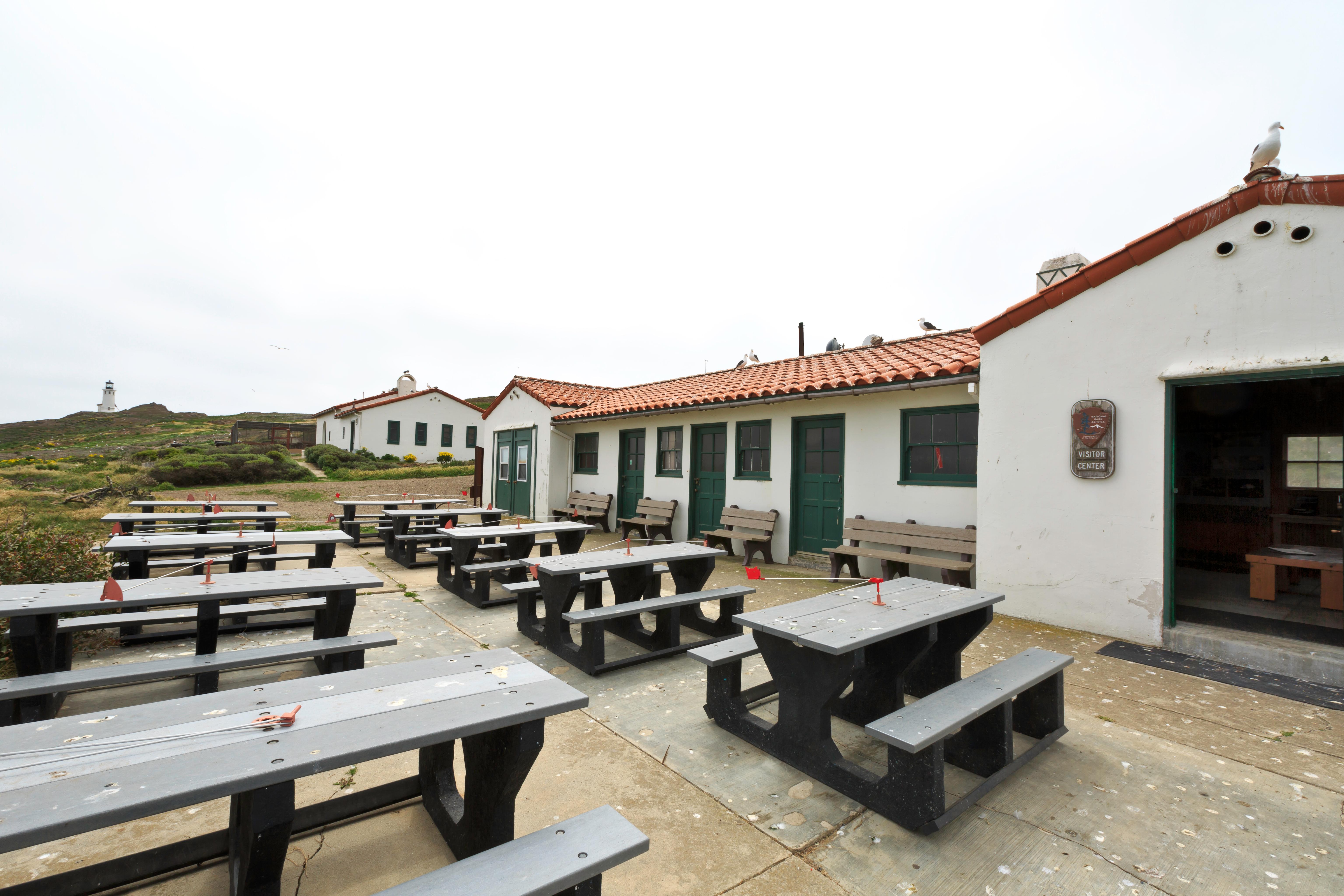
The Robert J. Lagomarsino Visitor Center at Channel Islands National Park features a bookstore, a display of marine aquatic life, and exhibits featuring the unique character of each park island. Visitors also will enjoy the 25-minute park movie, “A Treasure in the Sea,” shown throughout the day in the auditorium (closed-caption film available upon request). The fully accessible visitor center is open 8:30 am until 5 pm daily. The visitor center is closed on Thanksgiving and December 25th.
The small Outdoors Santa Barbara Visitor Center not only has one of the best views of Santa Barbara, but also offers visitors information about Channel Islands National Park, Channel Islands National Marine Sanctuary, Santa Barbara Maritime Museum, and the City of Santa Barbara. Open 10:30 am until 4:30 pm daily. The visitor center is closed on Thanksgiving Day, December 25, January 1, and the first Friday in August for Fiesta.
Once the historic Coast Guard general services building (workshop and garage), this Mission Revival style building now serves as a small visitor center that features include displays on the natural and cultural resources of the island and the original lead-crystal Fresnel lens from the Anacapa Lighthouse.
There are two possible routes for this tour. Both routes begin at the visitor center. You may take the lower trail located in front of the buildings, which leads to Cathedral Cove. Or you may take the upper trail located behind the buildings, which leads to Pinniped Point. Both routes cover the same information. For variety, we recommend you take the opposite route back.
Mainland Visitor Center: Native Plant Garden Tour—Guide to Island Chumash Plant Usage
The Native Plant Garden includes some of the important plants used by the island Chumash. Each trail station includes a brief discussion of these plants and the uses made of them by the Chumash. Stations along the trail are marked by numbered tiles and decorated with a brown Chumash symbol.
Mainland Visitor Center: Native Plant Garden Tour—Guide to Island Plant Adaptations
A fascinating variety of plants can be found in California’s Channel Islands National Park. The distance and isolation of the islands from the mainland has allowed plants and animals to develop into unique island forms. Trail stops describing these unique plants and adaptations are marked by numbered posts and decorated with a leaf shape.
San Miguel Island: Self-Guided Tour
This tour provides 5 interpretive stops along the 1.5 mile hike (one-way) to the ranger station. Due to unexploded ordnance, you may only hike on your own to Cuyler Harbor beach, Nidever Canyon, Cabrillo monument, Lester ranch site and the ranger station. Visitors are required to stay on the designated island trail system. No off-trail hiking is permitted. Entering other areas without a ranger is a violation of federal law.
Santa Barbara Island: Arch Point Self-Guided Tour
This tour provides 7 interpretive stops along the 4 mile loop to Arch Point including a stop at Elephant Seal Cove.
Santa Barbara Island: Signal Peak Self-Guided Tour
This tour provides 7 interpretive stops along the 3 mile loop to Signal Peak including a stop at the Seal Lion Rookery.
Santa Cruz Island: Cavern Point Self-Guided Tour
This tour includes six interpretive stops along the one-mile walk from Scorpion Beach to Cavern Point.
Santa Cruz Island: Prisoners Harbor Self-Guided Tour
The tour provides five interpretive stops along the short one-mile loop walk from Prisoners Beach to the Navy Road Overlook. For information on other areas throughout Prisoners Harbor please click on those individual sites.
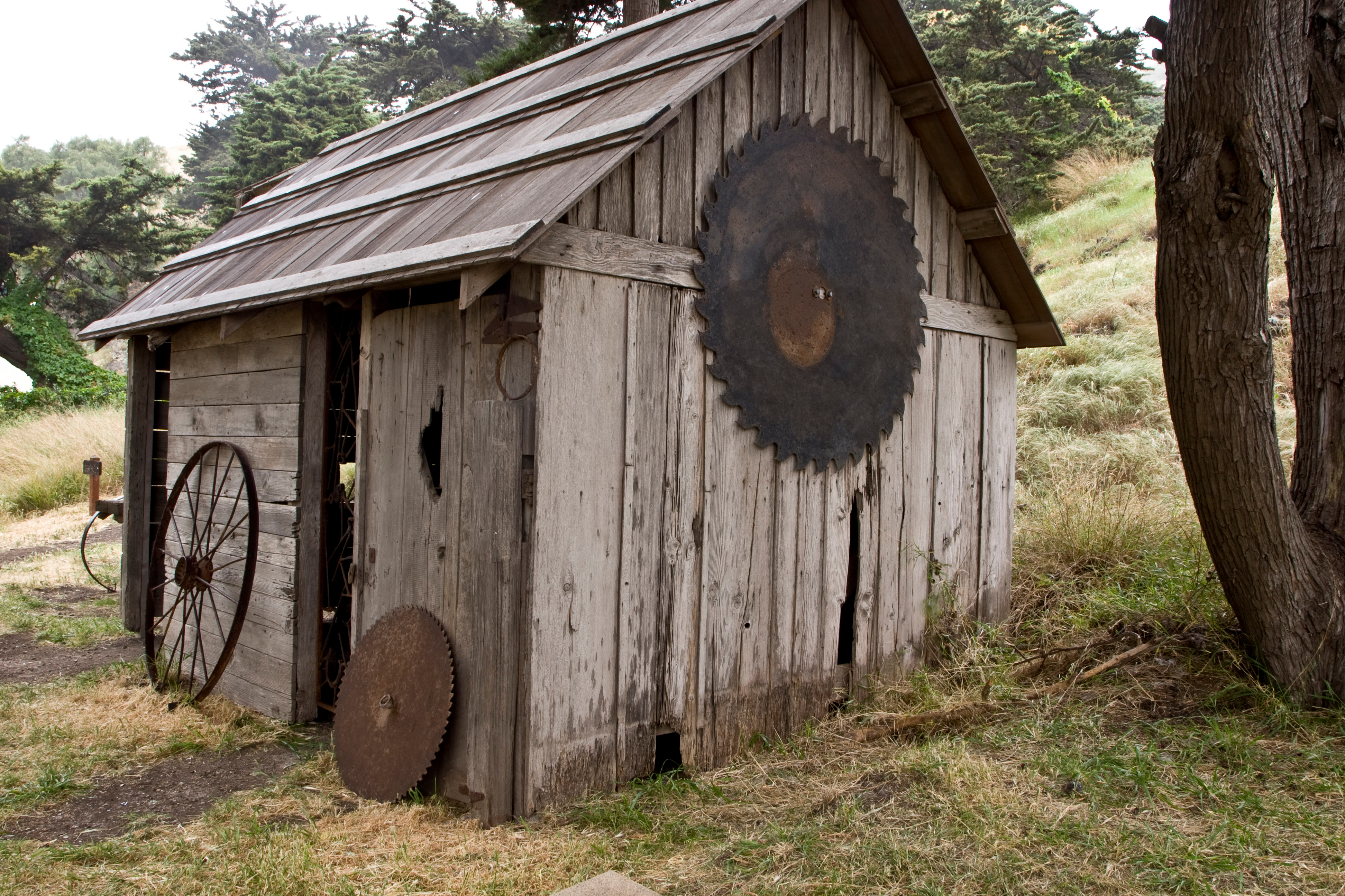
Santa Cruz Island: Scorpion Ranch Farm Implements Self-Guided Tour
Learn about the variety of historic farm implements around Scorpion Ranch.
Santa Rosa Island: Cherry Canyon Self-Guided Tour
This tour provides eight interpretive stops along the 1.75-mile walk from the pier to Water Canyon Beach via Cherry Canyon. Before you leave the ranch area, make sure to visit the ranch exhibit in the schoolhouse.