Be advised that the NPS has issued alerts for this park.
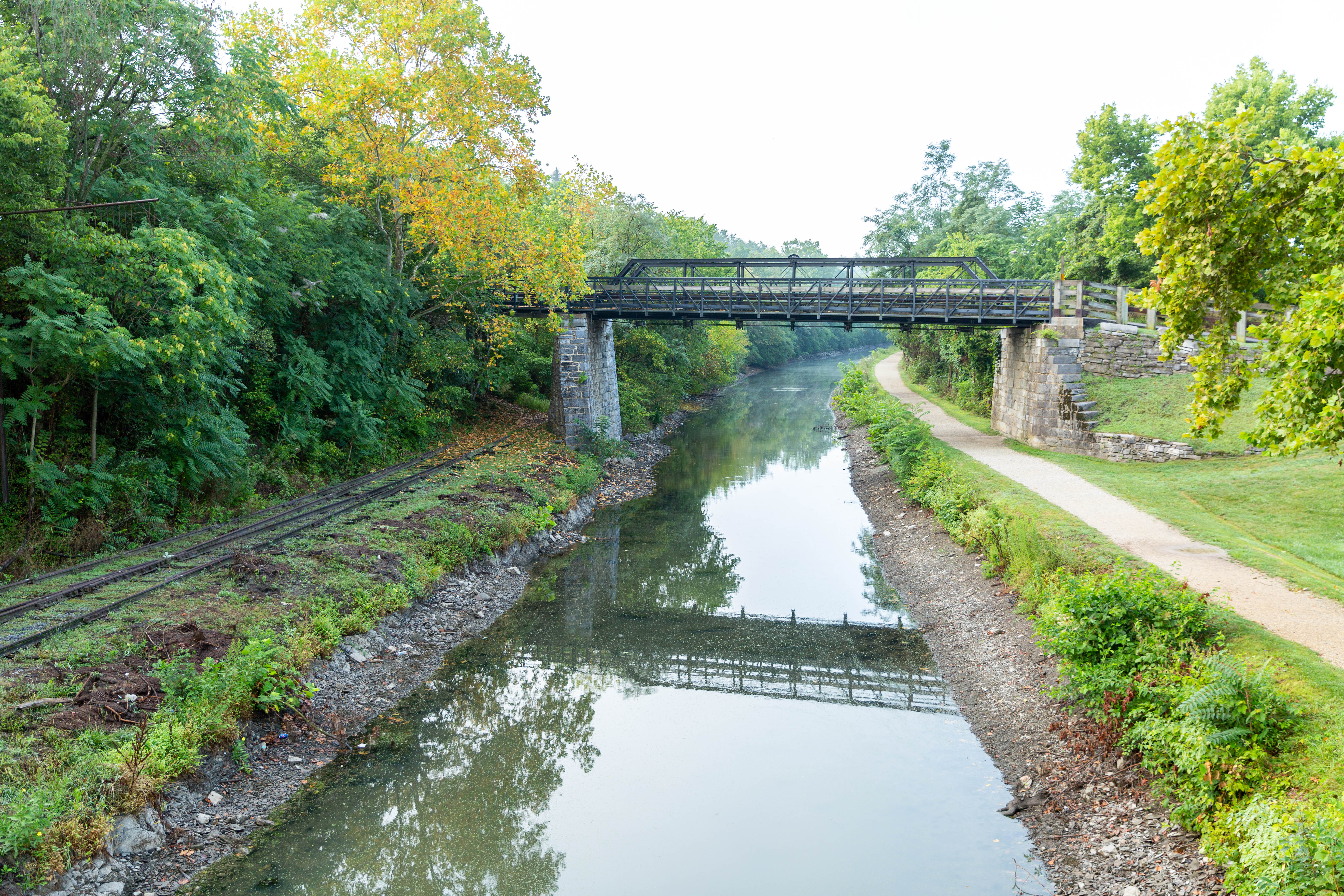
Byron Bridge Access from C&O Canal to Harpers Ferry
Beginning Sept. 22, the stairway between the Byron Bridge and C&O Canal will close for approximately 2 weeks. A shuttle will run between C&O Canal Lock 34 and Harpers Ferry NHP Visitor Center during this time.
Hiking in Gold Mine Tract
Visitors are restricted to the designated trails within the Gold Mine Tract in the Great Falls area. This location is generally defined as that area bordered by MacArthur Boulevard and Berma Road and depicted on the Great Falls Maryland Hiking Map.
Closures: Detours; Towpath; Points of Interest
Multiple items are closed due to hazardous conditions or maintenance. See below for more details.
Preserving America's early transportation history, the C&O Canal began as a dream of passage to Western wealth. Operating for nearly 100 years the canal was a lifeline for communities along the Potomac River as coal, lumber, and agricultural prod...
Pass is for one private, non-commercial vehicle — passenger cars, pickup trucks, RVs and vans — and is valid at the Great Falls area of the Chesapeake and Ohio Canal National Historical Park on the Maryland side of the Potomac River and Great Falls Park on the Virginia side of the Potomac River.
Entrance - Motorcycle
$15.00
Pass is for one motorcycle and is valid at the Great Falls area of the Chesapeake and Ohio Canal National Historical Park on the Maryland side of the Potomac River and at Great Falls Park on the Virginia side of the Potomac River.
Entrance - Per Person
$10.00
Pass is for one person 16 years of age or older — entering on foot or by bicycle — and is valid at the Great Falls area of the Chesapeake and Ohio Canal National Historical Park on the Maryland side of the Potomac River and at Great Falls Park on the Virginia side of the Potomac River.
Entrance - Non-commercial Groups
$100.00
Includes church groups, college/school groups, scouts, service organizations, military, etc...
Vehicles with passenger capacity of fewer than 16 persons, $20 for the vehicle.
Vehicles with a passenger capacity of 16 or more persons, $10 per person age 16 and over.
Removal of seats from a vehicle does not then qualify for the lower rate. Age and pass exemptions apply.
The total fee charged for an Organized Non-Commercial Group will not exceed the $100 fee per vehicle.
Commercial Entrance - Motor Coach
$100.00
The commercial pass is valid for date of purchase plus six days at the Great Falls area of the Chesapeake and Ohio Canal National Historical Park on the Maryland side of the Potomac River. Please note that fees are based on vehicle capacity and not actual occupants.
Commercial Entrance - Van
$40.00
The commercial pass is valid for date of purchase plus six days at the Great Falls area of the Chesapeake and Ohio Canal National Historical Park on the Maryland side of the Potomac River. Please note that fees are based on vehicle capacity and not actual occupants.
Commercial Entrance - Mini-bus
$40.00
The commercial pass is valid for date of purchase plus six days at the Great Falls area of the Chesapeake and Ohio Canal National Historical Park on the Maryland side of the Potomac River. Please note that fees are based on vehicle capacity and not actual occupants.
Commercial Entrance - Sedan
$25.00
The commercial pass is valid for date of purchase plus six days at the Great Falls area of the Chesapeake and Ohio Canal National Historical Park on the Maryland side of the Potomac River. Please note that fees are based on vehicle capacity and not actual occupants.
April 15 - November 15 (Peak Season): $20/night; November 16 - April 14 (Non-Peak Season): $10/night
[61 Words] Crossing a wooden boardwalk from the roadside to the towpath Antietam Creek Campground stretches to the North and South in about equal parts along the gravel towpath. There are 15 campsite, each about 50 feet by 65 feet with a picnic bench, fireplace, and charcoal grill. About halfway in the campground is one latrine with two stalls and two porta pottys.
(73 words) The nearest parking lot to Bald Eagle Island Campsite is at Lock 29. From the parking lot, take the path past Lockhouse 29, over the lock to the towpath. Take a left onto the towpath, though the gate and head downriver .5 miles. On your right is the large, rolling, lightly wooded grassy camping area between the Potomac River and the C&O towpath. On the far side of the canal are train tracks.
(125 words) The nearest parking lots to Horseshoe Bend Hiker-Biker Campsite are at Taylors Landing or Dam 4. The campsite is located between them. The road to the parking lot for Taylors Landing crosses a bridge over the canal. The towpath is just after the bridge. Coming from the parking lot, you would turn left (or upriver) onto the towpath, following it for 1.8 miles. It can also be accessed from the Dam 4 parking by crossing over the canal on a guard gate, then following the towpath to the left (downriver) for 1.7 miles. A sign on the towpath is at the head of a short, dirt trail, which leads to the small, secluded, wooded, rolling camping area between the Potomac River and the C&O towpath.
(62 words) The nearest parking is at Cohill Station canoe/kayak access point off Deneen Road. There is a small wooden bridge over the canal to the towpath. Turn right onto the towpath and head upriver for about 3 miles. Cacapon Junction Hiker-Biker campsite is a large, flat, lightly wooded area. The water pump is located is the center of the campground. End of description.
(84 words) The nearest parking to Calico Rocks Hiker-Biker Campsite is at the C&O Canal parking lot at Point of Rocks. On the western edge of the parking lot is a gate, and the towpath is just behind the gate. Turn right onto the towpath and head downriver, passing beneath Canal Road, the entrance to the parking lot. Traveling a total of .6 miles, you’ll see on your right is a large, flat, lightly wooded grassy camping area between the Potomac River and the C&O towpath.
(90 words) The nearest parking to Chisel Branch Hiker-Biker Campsite is the Edward's Ferry parking area. From the parking lot head back up the road toward the towpath, passing between lockhouse 25 and Ruin of Jarboe's Store. Once you reach the towpath, turn right (east) onto the towpath, traveling for .3 miles to the campsite on your right. The water pump is in the center of the campground on the edge of the towpath. The campground is large, flat and lightly wooded. It sits between the towpath and the Potomac River.
Individual Sites: April 15 - November 15 (Peak Season): $20/night; November 16 - April 14 (Non-Peak Season): $10/night Group Site: April 15 - November 15 (Peak Season): $40/night; November 16 - April 14 (Non-Peak Season): $20/night
(102 words) The nearest parking to Horsepen Branch Hiker-Biker Campsite is the Sycamore Landing parking area. From the parking lot head toward a towpath access trail at the mid point of the southern edge of the lot. Once on the access trail it is 100 feet to the towpath. Turn left, East, onto the towpath, traveling for 1.1 miles to the campsite on your right. You will pass a water pump about 50 feet before the access trail for the campsite breaks off to the right. The campground is large, flat and lightly wooded. It sits between the towpath and the Potomac River.
(83 words) The nearest parking lot to Horseshoe Bend Hiker-Biker Campsite is at Taylors Landing. The road to the parking lot crosses a bridge over the canal. The towpath is just after the bridge. Coming from the parking lot, you would turn right (or downriver) onto the towpath, following it for 1.7 miles. The trail to the campsite is near the water pump and descends slightly to the small, narrow, flat, grassy camping area between the Potomac River and the C&O towpath. End of description.
(80 words) The nearest parking lots to Huckleberry Hill Campsite are either Harpers Ferry or Dargan Bend. The campsite is located between them. From Harpers Ferry you cross the Potomac River to the C&O Canal towpath. The campsite is located 2.1 miles upriver. From Dargan Bend Boat Ramp, the campsite is located 2.0 miles downriver on the towpath. A medium sized, narrow, grassy camping area between the Potomac River and the C&O towpath. There is a steep drop off to the river.
(55 words) The nearest parking to Indian Flats Hiker-Biker Campsite is a the Monocacy Aqueduct. From the parking lot, walk toward the Aqueduct and towpath. Turn right at the towpath, heading upriver on the Aqueduct. In .3 miles on your left is a medium sized, wooded, rolling camping area between the Potomac River and the C&O towpath.
(65 words) The nearest parking is at the Fifteenmile Creek Drive-in campsite. The towpath is on the northern edge of the parking lot. Turn right and head downriver on the towpath for about 1.7 miles. The Indigo Neck Hiker-Biker Campsite is a small, flat, narrow, lightly wooded site. It is bordered by the Potomac River and the towpath. Lock 57 is adjacent to it. End of description.
[123 Words] Looking South at Iron’s Mountain campsite to the left of the towpath is Lock 73 and to the right of the towpath is a sign reading Iron’s Mountain Hiker-Biker Campsite. The sign also conveys the adjacent campsites pointing to the left towards Pickmen’s Ferry and to the right Evitts Creek. 30 feet south of the sign is a porta potty which is on the right side of the towpath. The campsite is located on the right side of the towpath downhill a short way. The campsite is grassy and hilly with a picnic table, firepit, and charcoal grill, it is also about 75 feet long and 40 feet wide reaching down to the Potomac River. This campsite has easy access to the river.
[148 Words] Arriving at Jordan Junction Hiker Biker Campsite from the East, to the left of the towpath is a porta potty and to the right of the towpath about 25 feet down is a water hand-pump. Even further, about 120 feet on the right side of the towpath is the campsite name plate reading Jordan Junction Hiker Biker Campsite, an arrow pointing to the left with associated text reading Cumberland Valley, and an arrow pointing to the right with associated text reading North Mountain. The campsite is about 4,200 square feet that stretches along side the left of the towpath. Central back of the campsite is a dirt clearing with a table bench and a fireplace. The rest of the campsite is grassy with lots of overhanging branches. The Potomac River is 10 feet to the left of the campsite but is barely visible through the foliage.
(86 words) The nearest parking lot to Killiansburg Cave Hiker-Biker Campsite is at Snyders Landing. The road to the parking lot crosses a bridge over the canal. The towpath is just after the bridge. Coming from the parking lot, you would turn right (or downriver) onto the towpath, following it for 1.4 miles. The trail to the campsite is near the chemical toilet and descends slightly to the campsite, which is a medium-sized, rolling, narrow, lightly wooded grassy camping area between the Potomac River and the C&O towpath.
(91 words) The nearest parking is at Cohill Station canoe/kayak access point off Dennen Road. There is a small wooden bridge over the canal to the towpath. Turn left onto the towpath and head downriver a little less than a mile. Just before you arrive at the Leopards Mill campsite, you’ll pass lock 53 on your left. The camping area is medium sized, flat, and narrow. The Potomac river is on one side of the campsite, and the towpath on the other. The water pump is on the downriver side. End of description
[72 Words] Arriving from the Southeast a gravel trail splits from the towpath trail to the left. To the right of the trail a brown sign reads Licking Creek Campsite. Also on the right is a green porta-potty 5 feet down the trail. The trail goes slightly downhill for 25 feet connecting to a 200 square foot grassy clearing. Centered in this clearing is a fireplace, a circular gravel patch and a charcoal grill.
(109 words) The closest parking is at Hancock, either at the boat ramp or at the pedestrian bridge about a quarter of a mile downriver. Once on the towpath head downriver. On your way to the campsite, you’ll pass Tonoloway Creek Aqueduct (MM 122.96), lock 52 (MM 122.89), the Bowles House (MM 122.85), and lock 51 (MM 122.59) before arriving at Little Pool Hiker-Biker Campsite (MM 120.6) on your right. It is a large, flat, lightly wooded grassy camping area between the Potomac River and the towpath, Little Pool is on the other side of the towpath. The water pump is on the downriver side of the campground. End of description.
(70 words) The nearest parking to Marble Quarry Hiker-Biker Campsite is at White’s Ferry. On the other side of White’s Ferry Road from the parking lot is a dirt path leading the towpath. It is next an old bridge that crosses the canal. Turn left (heading upriver) onto the towpath for 2.7 miles. On your left is the large, flat, grassy camping area, located between the Potomac River and the C&O towpath.
Individual Sites: April 15 - November 15 (Peak Season): $20/night; November 16 - April 14 (Non-Peak Season): $10/night Group Sites: April 15 - November 15 (Peak Season): $40/night; November 16 - April 14 (Non-Peak Season): $20/night
[145 Words] Facing the McCoy Ferry Campgrounds from the entrance after passing through the tunnel. The road is paved and leads to a mid-sized parking lot with small bathrooms to the right. To the right of the road there are recreational grounds containing five pairs of bench tables, and charcoal grills evenly spaced. Between the rec grounds and the road, is a foot high brown wooden rail. About hundred feet down the road a gravel trail splits off and leads to the camping grounds. The trail is about 350 feet long containing on either side thirteen 400 square foot campsites. Each campsite contains a bench table, fireplace, and charcoal grill. The trail loops back on itself at the end. The campground has a lot of overhanging branches providing lots of shaded area, and the Potomac River while blocked by bushes is only 50 feet from the grounds.
[164 Words] Arriving at North Mountain Hiker Biker Campsite from the West, closest to you on the right of the towpath is a porta potty. To the left of the porta potty is a brown sign that says, North Mountain Hiker Biker Campsite. Also, on the sign an arrow pointing to the left with the text that reads Jordan Junction and under that an arrow pointing to the right with the text that reads Licking Creek. To the left of the sign starts a 30-foot path going downhill paralleling the towpath. The drop between the towpath and the campsite path is about 10 feet. The campsite is about 300 square feet with two levels of elevation change. On the upper level is a water hand pump to the right. On the lower level is a clearing with a charcoal grill, bench with tabletop, and a fireplace all closely placed to each other. To the North is the Potomac River, it is slightly viewable through the foliage.
(61 words) The nearest parking is at Oldtown at lock 70. The towpath can be accessed by a bridge over the lock, then turn right (upriver). About a quarter mile upriver is lock 71. The Pigmans Ferry Hiker-Biker Campsite a medium sized, flat, grassy area. The water pump is next to the towpath on the upriver side of the campsite. End of description.
(86 words) The nearest parking is at Oldtown at lock 70. The towpath can be accessed by a bridge over the lock, then turn left (downriver). The canal is watered at this point and is popular for fishing. The Potomac Forks Hiker-Biker campsite is about 2 miles downriver. Lock 69 (Twiggs Lock) at Mile Marker 166.44 is on your left. The Potomac Forks Hiker-Biker Campsite is adjacent to Lock 68 (Crabtree’s Lock). Lockhouse 68 is next to the campsite. The campsite is small, flat, and grassy. End of description.
Individual Site: April 15 - November 15 (Peak Season): $20/night; November 16 - April 14 (Non-Peak Season): $10/night Group Site: April 15 - November 15 (Peak Season): $40/night; November 16 - April 14 (Non-Peak Season): $20/night
[121 Words] Entering the Campground from the road there is a sign saying Spring Gap (mile 173) and beside the sign is a water pump. In front of the sign the road splits into a right and left direction. Going to the left is where all the campsites are located. There are 14 campsites each about 30 feet by 30 feet with a charcoal grill, firepit, and parking spot for a car. The campsites outline the road that runs pass through the campground. On the right side is a parking lot with two public restrooms, a grassy area with 5 picnic tables and a charcoal grill. Next to the parking lot on the left is a boat ramp leading to the Potomac River.
(72 words) The nearest parking is at the Town Creek Aqueduct parking. There is a small dirt trail leading from the parking lot to the towpath. To the right is the Town Creek Aqueduct. The Town Creek Hiker-Biker Campsite can be found by going to the left, or downriver for about .23 miles. It is a medium sized, flat, grassy, lightly wooded campsite. The water pump is on the downriver side. End of description.
(88 words) The nearest parking to Turtle Run Hiker-Biker Campsite is at White’s Ferry. On the other side of White’s Ferry Road from the parking lot is a dirt path leading the towpath. It is next an old bridge that crosses the canal. Turn right onto the towpath and travel for 1.1 miles to the campsite. It is medium sized with a rolling, lightly wooded grassy camping area between the Potomac River and the C&O towpath. The water pump is next to the towpath, near the center of the campground.
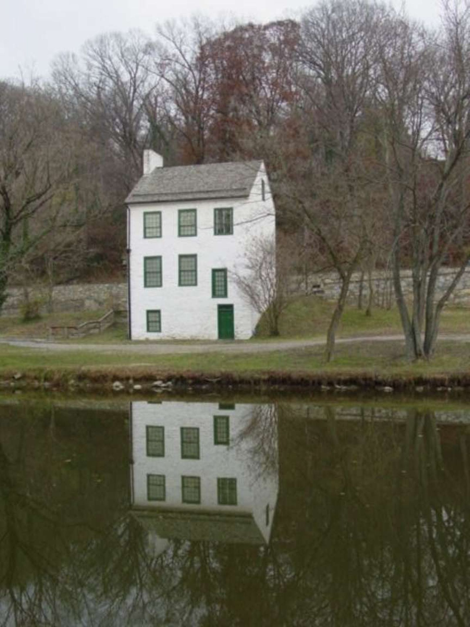
Abner Cloud had this house built in the year 1801. If you look up, on the chimney, you can see the initials "A.C." and the date 1801. Abner Cloud lived here with his family until he died in 1812. His widow lived another 40 years.
(646 words)<br />The Abner Cloud House is located on the C&O Canal in Washington, DC, east of Fletchers Boat House.<br />From the intersection of Canal and Reservoir Roads, NW travel north on Canal Road about one hundred fifty feet, then turn onto the far-left lane side road, to the left of a three-foot tall stone dividing wall. The three-story white Abner Cloud House will be on your left. <br />Follow the gravel path to the left around the corner of the house, where a parking lot runs along the house and about one hundred yards to the south.<br />The three-story white stone house has green painted doors and windows. At the building's west side from the parking lot, a door is on the bottom right and one window on the left. The second story features three windows, with the far-right window smaller and about two-feet lower. The third floor three windows are all the same size.<br />Two three-story trees sit on the right, south side of the building. To the left, north side gravel steps with a wood railing lead up to the side road that runs along the front of the house at an incline.<br />At the front side the road runs along the second-floor level of the building. Here a green door sits on the left side, with two windows to the right. Three windows line the top third floor. A chimney runs up the north side of the house. A small eight-foot tall tree stands to the left of the door.<br />Two small windows sit at the top on the north side of the house, and one small window on the top third level of the south side.<br />A brown metal sign hangs at the third-floor level on the house's east side. Written in white letters it reads:<br />Chesapeake & Ohio Canal National Historic Park<br />Abner Cloud House<br />Fletchers Boat House<br />Boats, Canoes, Bicycles<br />United States <br />Department of the Interior<br />National Park Service<br />On the south side of the house, left of the door, is a two by three-foot wayside. The black and white sign is titled in the top left corner: <br />Abner Cloud House<br />Text below describes the history of the Abner Cloud House:<br />This house witnessed the building of the C&O Canal. Abner Cloud, a miller who had come here from Pennsylvania, built the house in 1801. Cloud's mill was about 200 yards upstream. The basement of the house was used by Cloud to store grain and flour, and the family lived in the upper floors. Restoration was completed in 1976, with much assistance from the Colonial Dames of America, Chapter III. The top two floors are now their headquarters.<br />The full background of the sign is an active scene of a three-story white house sitting alongside a canal. A canal boat passes on the right, two people canoe from the left, and three more people float by on a boat at the canal's far end. Next to them on the path is a donkey-drawn carriage being followed by a dog. A man on a horse walks in front of them, amongst three women in dresses. Other women and girls in dresses with a dog watch from the close side of the canal. Text at the top center reads:<br />This painting of the C&O Canal depicts the Abner Cloud House as a bustling place of commerce and tourism during the mid to late 1800s.<br />In the upper right corner is an image of a man sitting at the front end of a long, thin canal boat floating from right to left. A second man is back in the far end of the boat. Text to the left of them reads: [LINK 3]<br />George Washington's Patowmack Canal, completed in 1802, provided Cloud access to Georgetown markets. Long, narrow boats, called sharpers, transported his flour, entering the Potomac River just upstream from here, near Little Falls.<br />END OF DESCRIPTION<br />
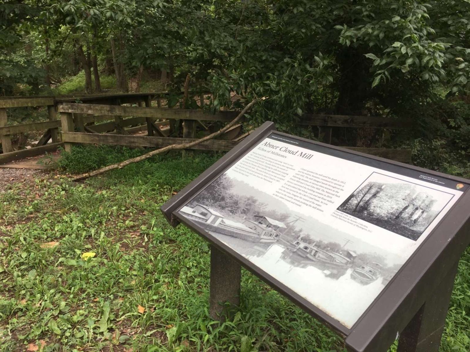
Abner Cloud used the basement of his house to store grain and flour that came from his mill.
(506 words)<br />The Abner Cloud Mill is located west of the Abner Cloud House on the C&O Canal in Washington, DC. <br />From the intersection of Canal and Reservoir Roads, NW travel north on Canal Road about one hundred fifty feet, then turn onto the far-left lane side road, to the left of a three-foot tall stone dividing wall. You will pass the three-story white Abner Cloud House on your left. <br />Continue straight over a ten-foot-long bridge and stone tunnel to your right. The gravel road will turn left and descend as you go into a tunnel after about two hundred feet. This portion of the road is poorly deteriorated. <br />Upon exiting the one-hundred-foot tunnel, you will reach an open gravel space about sixty feet long. To the right, in the northwest corner is a two by three-foot wayside. The white sign is titled in the top left corner and reads:<br />Abner Cloud Mill<br />Echos of Milestones<br />Text beneath describes activity that occurred at the mill:<br />Baking bread, frying cornbread and eating "stick to your ribs" oatmeal, all have one thing in common: their ingredients started out at a grist mill. Decades before the sounds of lockhorns and mule hooves clopping by, mills were popping up along the Potomac River and the early Patowmack Canal that skirted Little Falls. The area in front of you was occupied by the grist mill, built and operated by Abner Cloud in 1801. Water supplied to this mill came from the Patowmack Company Skirting Canal.<br />Cloud operated the mill until his death in 1812, and his widow, Suzanne, continued to operate it until 1852. The mill changed hands throughout the following decades, at various times known as the Frizzle Mill and Cloud-Edes Mill. The National Park Service uncovered the building remains in 2010. It is speculated that wheat, corn, and oat flour milled here was carried by the C&O Canal boats. As you view the ruins, imagine the sound of the water wheel on the nearby stream pushing the mill stones as they clatter round and round.<br />The sign features a black and white picture in the upper right corner of the ruins of a two-story stone building. Three sets of window or door openings are on the first floor and three window openings line the 2nd floor front. Two more openings are on the first and second floor levels on the side of the building, which stands amongst a dead tree and brush. Text below reads:<br />Cloud Mill ruins, ca. 1914.<br />Photograph from the Rambler Collection, <br />Courtesy Historical Society of Washington, DC.<br />The bottom half of the sign shows a black and white photograph of four canal boats sitting in line in still water on a canal. <br />Six feet to the left of the sign is a thirty-foot wooden bridge with handrails on both sides. The bridge carries over a rushing canal that feeds into the Potomac River. Stone blocks line the inner south wall of the canal and three steel beams span the stream on the north side of the bridge.<br />END OF DESCRIPTION<br />
(193 words) Antietam Aqueduct is located along the towpath in Sharpsburg, Maryland. It is 140 feet long with a three-arch construction. The top of the aqueduct has a water way for canal boats and a towpath for mules. The waterway of the aqueduct is about 15 feet wide and its bottom is about four feet lower than the towpath. To get to the aqueduct start from the Antietam Creek Parking Lot. From the parking lot head towards the wooden pedestrian bridge that passes over a small creek to the towpath. The bridge is at the midway point of the western edge of the lot. The bridge has wooden railings on both sides. Walk across the bridge and turn left onto the towpath. Follow the towpath for three tenths of a mile to reach the aqueduct. Here the towpath narrows to about three feet. On your left is a drop of about five feet to the bottom of the canal waterway. There is no barrier between the towpath and the drop. On your right you can see the Antietam creek flowing into the Potomac River. There is a metal rail between the towpath and the river.
The Appalachian Forest National Heritage Area (AFNHA) works to conserve, enhance, interpret, and promote a regional network of forest heritage resources in the central Appalachian Highlands. Designated a National Heritage Area in 2019, AFNHA covers sixteen counties in West Virginia and two counties in western Maryland.
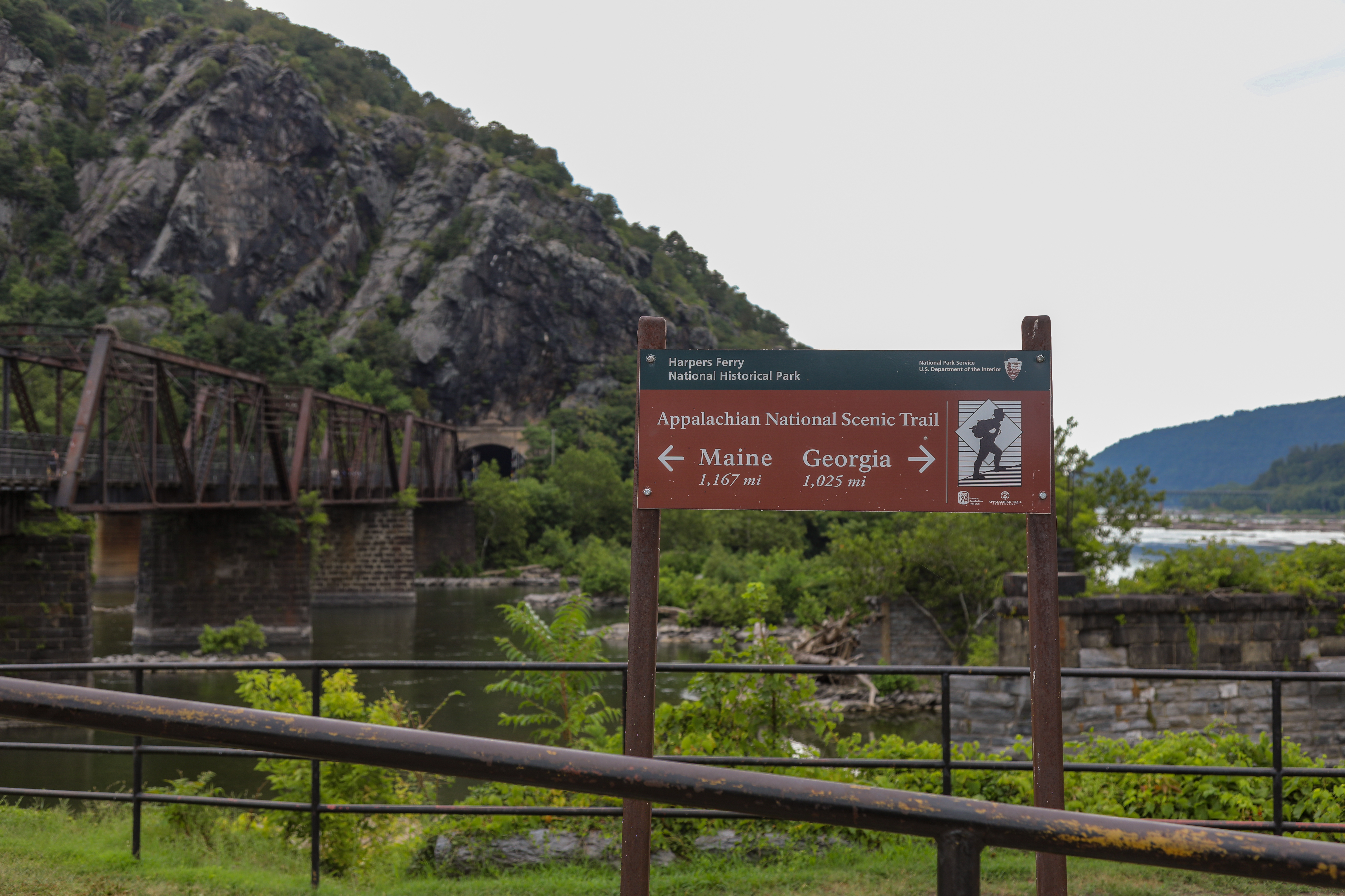
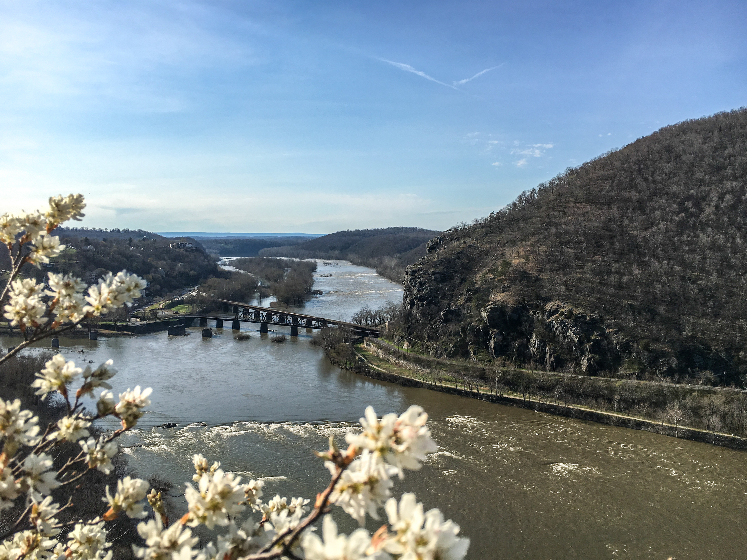
One of the most well-known hikes in the United States, this trail runs through Harpers Ferry and visitors can hike a portion of it! This sign at The Point can help direct guests and get them started on this famous trail.
Brown sign giving arrow directions toward Maine and Georgia for the Appalachian National Scenic Trail. In the background, a railroad bridge over a muddy river leading to a rocky cliff face dotted sparsely with trees.
(130 words) The Billy Goat Trail Section A Trailhead is located along the towpath in Potomac, MD. From the Great Falls Tavern Visitor Center parking lot, follow the sidewalks to the visitor center, passing the concessions building on your right and the public restrooms building on your left. At the visitor center building, turn right, walk about 25 feet and cross the wooden pedestrian bridge over Lock 20. Turn left and walk one half of a mile on the towpath. Past lock 17, and just before the stop gate covered bridge, the trailhead is on the right. Bulletin boards with trail information or located on the left side of the trailhead, and a post engraved with the words ‘Billy Goat Trail Section A’ marks the start of the trail. End of Description.
(100 words) The fee booth is located at the end of MacArthur Boulevard, known as the Entrance Road. A small white building, with a sliding glass window on its right side. Two driving lanes, for park entrance, are to the right of the fee booth building, and one driving lane is to its left, for the park exit. At the booth, each driving lane has vehicle arms crossing the lane, which raise once the entrance fee has been paid. The lane directly to the right of the booth is for small vehicles, while the right most lane is for authorized vehicles only.
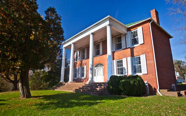
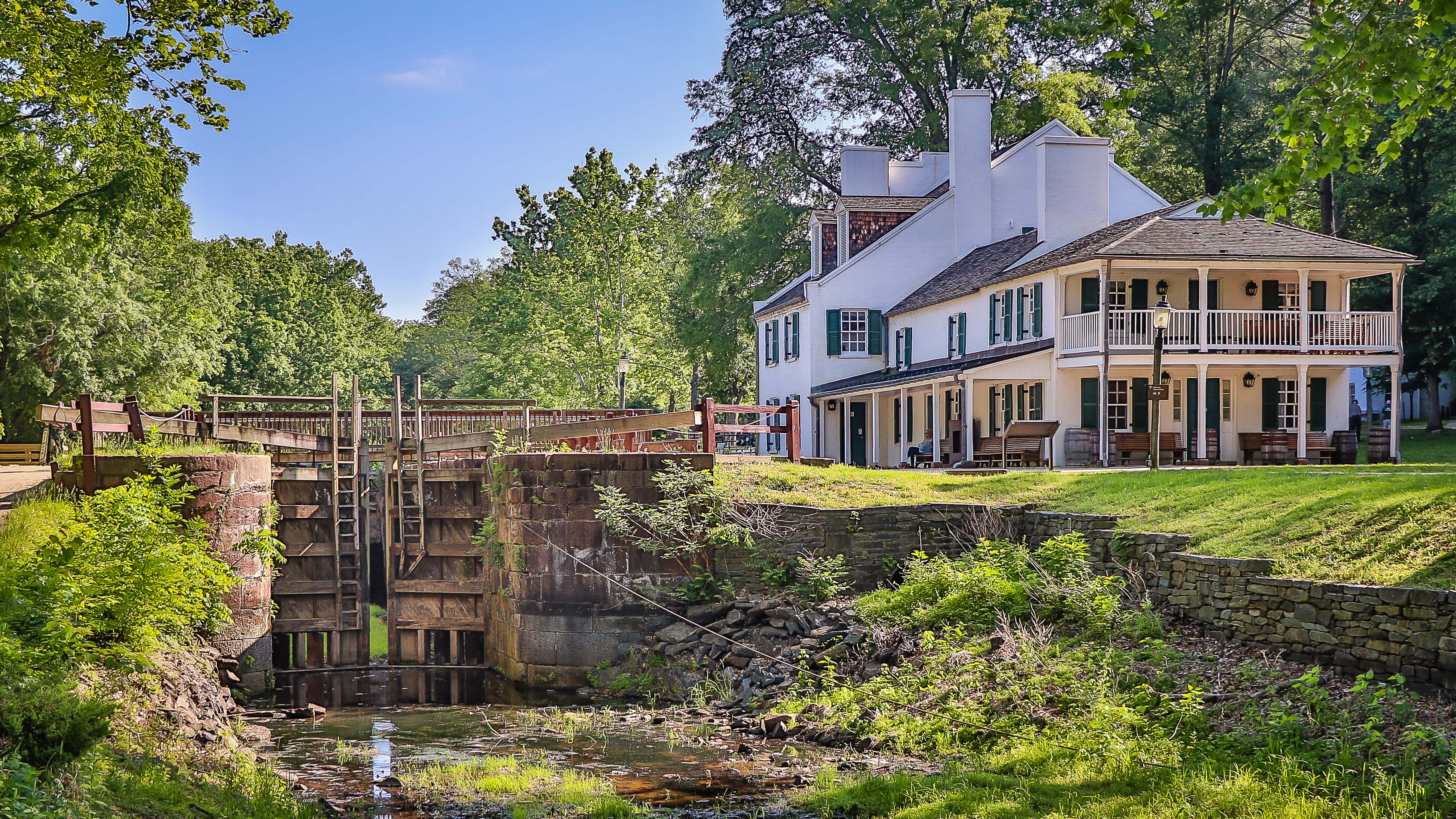
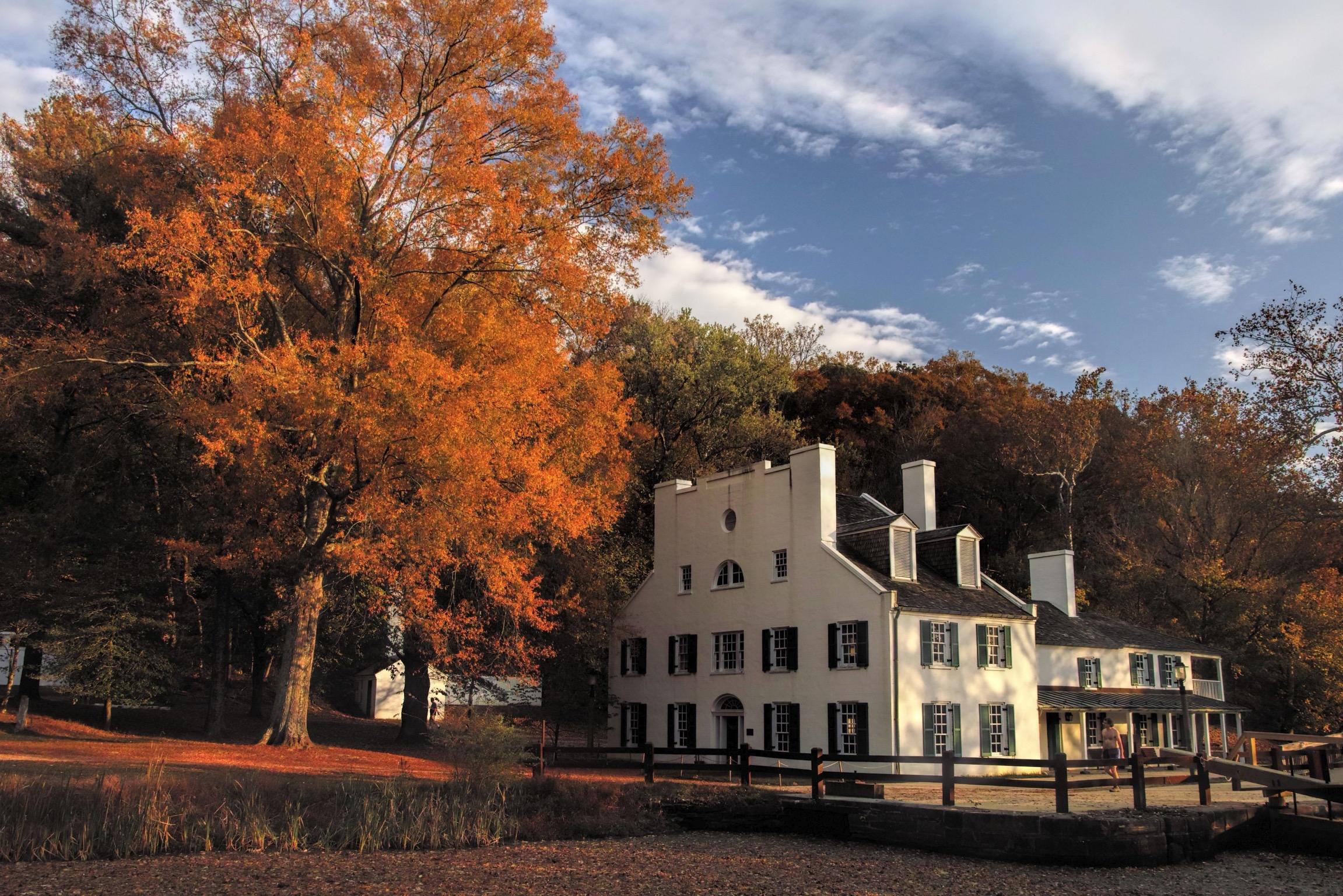
Located in Sharpsburg, Maryland, with a view toward Shepherdstown, West Virginia, Ferry Hill has stood for two centuries above the Potomac River and the Chesapeake & Ohio Canal, participating in and watching history pass by. Ferry Hill is best known as the home of Henry Kyd Douglas, Confederate Officer and author of his Civil War personal account, "I Rode With Stonewall."
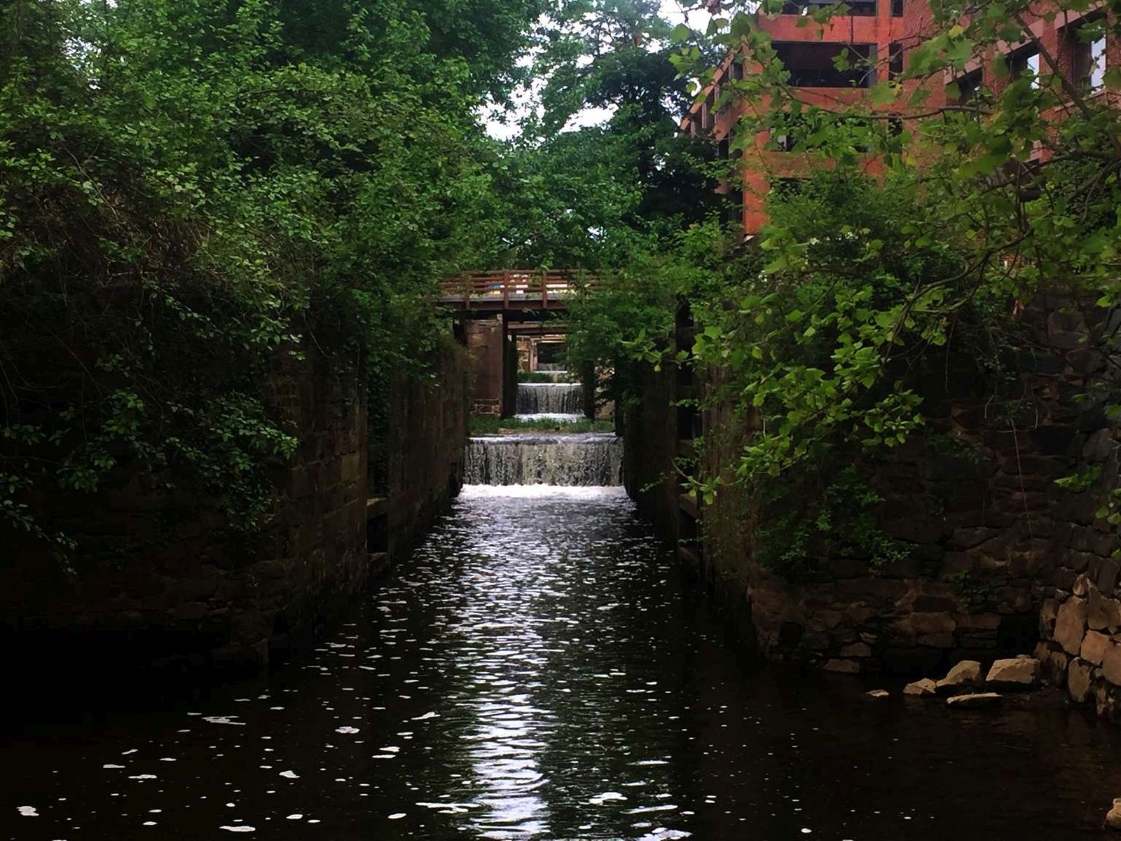
To alleviate traffic congestion on the C&O Canal, the Incline Plane allowed coal boats to be transported down to the Potomac River by means of a system of caissons, pulleys, steel cables and counterweights. After an accident in 1877 in which three men were killed, the caissons were drained of water before the boats descended. In 1878, 1,918 trips were recorded on the Incline Plane. Also in that year, a model of the Incline Plane was exhibited at the World's Fair in Paris. Aft
(445 words)<br />The C&O Canal Inclined plane is located along the C&O Canal towpath in Washington, D.C. From canal Mile 2, travel north on the towpath about four hundred fifty yards. A wayside and bench will be on the left side of the towpath.<br />The two by three-foot wayside sits three feet off the towpath at the southwest corner of a ten by ten-foot slate plaza. A six-foot long wood bench is set on the north side of the space. Just beyond the sign, to the south six-foot wide gravel and wood steps that leads down to the Crescent Trail pedestrian path below. A few feet north beyond the bench about six black granite blocks lay partially buried alongside the towpath.<br />The yellow sign is titled across a black border on the top that reads: "Georgetown Incline Plane." Text below describes the creation of the Georgetown incline plane:<br />Here, in 1876, an engineering marvel was built. The largest incline plane in the world and the first built in the United States, carried canal boats to and from the Potomac River. The incline plane was used to help clear heavy boat traffic in Georgetown; canal boats often log-jammed while waiting to unload. Boats left the canal through a lock and entered the incline plane's large water filled car; the water from the car was drained as two stone-filled, counter-balancing cars, moving in the opposite direction, lowered the boat 480 feet to the river, and on to its Georgetown port.<br />To the right is a black and white image showing canal boats lined up along the right, A border to the left divides a road on the left. Text below reads:<br />The incline plane helped move boats to Georgetown docks faster.<br />The bottom two thirds of the sign show a color drawing of a ramp with a canal boat to the left and an arrow indicating its movement to the right. At the right side, two rows of four boxes are moving up the ramp to the left. A canal runs across the top of the image from left to right. A point indicates that you are standing at the intersection of the ramp and the canal. In the top left, a second canal boat waits to enter the ramp. At the bottom right, the ramp leads back down into a river.<br />A faded black and white photograph to the right shows a view looking up from the lower end of a ramp. Two boxes are lined up in a row on the ramp. Text to the left reads:<br />The incline plane was one of the structures selected to represent American engineering achievements at the Paris Exposition of 1878.<br />END OF DESCRIPTION<br />
Inlet lock 1 is where water is diverted from the Potomac River into the five miles of the Georgetown section of the C&O Canal. Eight dams at various points along the canal allowed water to flow into the eight sections. If one of the eight sections were damaged, the canal company could close just one section to affect repairs - they did not have to shut down the whole canal!
(654 words)<br />The C&O Canal Inlet Lock is located on the west side of Canal Road, NW Washington, DC about eight-tens of a mile north of Chain Bridge Road.<br />A gravel parking lot, about sixty-feet wide and one hundred-feet long is set immediately off Canal Road and is bordered by gravel at its east entry side.<br />Two portable bathrooms sit at the northeast end of the lot, on the right as you enter from Canal Road, about twenty feet from the roadside.<br />At the west end of the parking lot a twenty-foot long, six-foot wide wood bridge with railings on both sides carries over Canal Lock 5. Along the west side of Lock 5, a cement-paved area, fifty feet to the north and south, runs eighty feet to the west where it connects to the Inlet Canal that runs parallel to Lock 5. The area rises about four feet along its northern end.<br />From the Lock 5 bridge west side, a second wood bridge about eighty feet across the gravel path, with railings on both sides, carries about forty feet over the Inlet Canal and connects to the south end of the C&O Canal towpath. Water from the inlet canal flows underneath the bridge and connects to water from Lock 5.<br />At the west end of the bridge, to the right, sits a two by three-foot wayside. The faded sign is titled across a block border in white lettering to read:<br />Inlet Locks<br />Text along a yellow border below reads:<br />Eight dams and one steam pump were built along the river to funnel water into the canal in times of drought of low water, usually during the height of summer; river levels dropped dramatically. The canal could not get enough water from the river and the boat traffic would stop. This caused a loss of revenue for the canal company and the loss of a living for boat captains.<br />To the right is a faded and scratched color image of a man in a tan jacket and hat facing to the right. Text to his left reads:<br />As a young man, George Washington surveyed the Potomac River and discovered its riches. Part of the Patowmack Canal, which he championed, ran from here to the Abner Cloud House at mile 3.1.<br />Dam 1, a Little Falls, diverted water to this inlet lock, watering the canal from Lock 5 to Georgetown.<br />A faded image further right appears to be a map of a canal. A sign reading "You Are Here" indicates your location to the left.<br />Three-fourths of the sign below are a color image of a river flowing over a wide dam, a strip of land and towpath to the right, and further right a canal with water flowing top to bottom. An inlet lock is identified just north of the dam along the strip of land. Below is a mule crossover bridge with bridge wall lining the river's edge. Mules walk up the towpath from the south.<br />Text in the top left corner reads:<br />Inlet Lock<br />Dams and inlet locks were the engineering devices used to provide water for the canal.<br />A trail to the left of the sign runs north about one hundred fifty feet to the Inlet Lock. A small brown sign set to the right of the trail reads "Inlet Lock." Two wood doors, angled inward slightly, block the lock's lower south end. Cement walls about six feet long are on either side. A wood railing sits atop the gate.<br />Along the west side of the lock, six four-foot wide cement steps lead up to the top of the lock and an eight-foot high cement wall lines the left side of the steps. A metal fence runs along the lock's east side. The trail continues around to the backside of the lock, where canal water flows in from the north. The lock doors are angled out slightly toward the north at this end.<br />END OF DESCRIPTION<br />
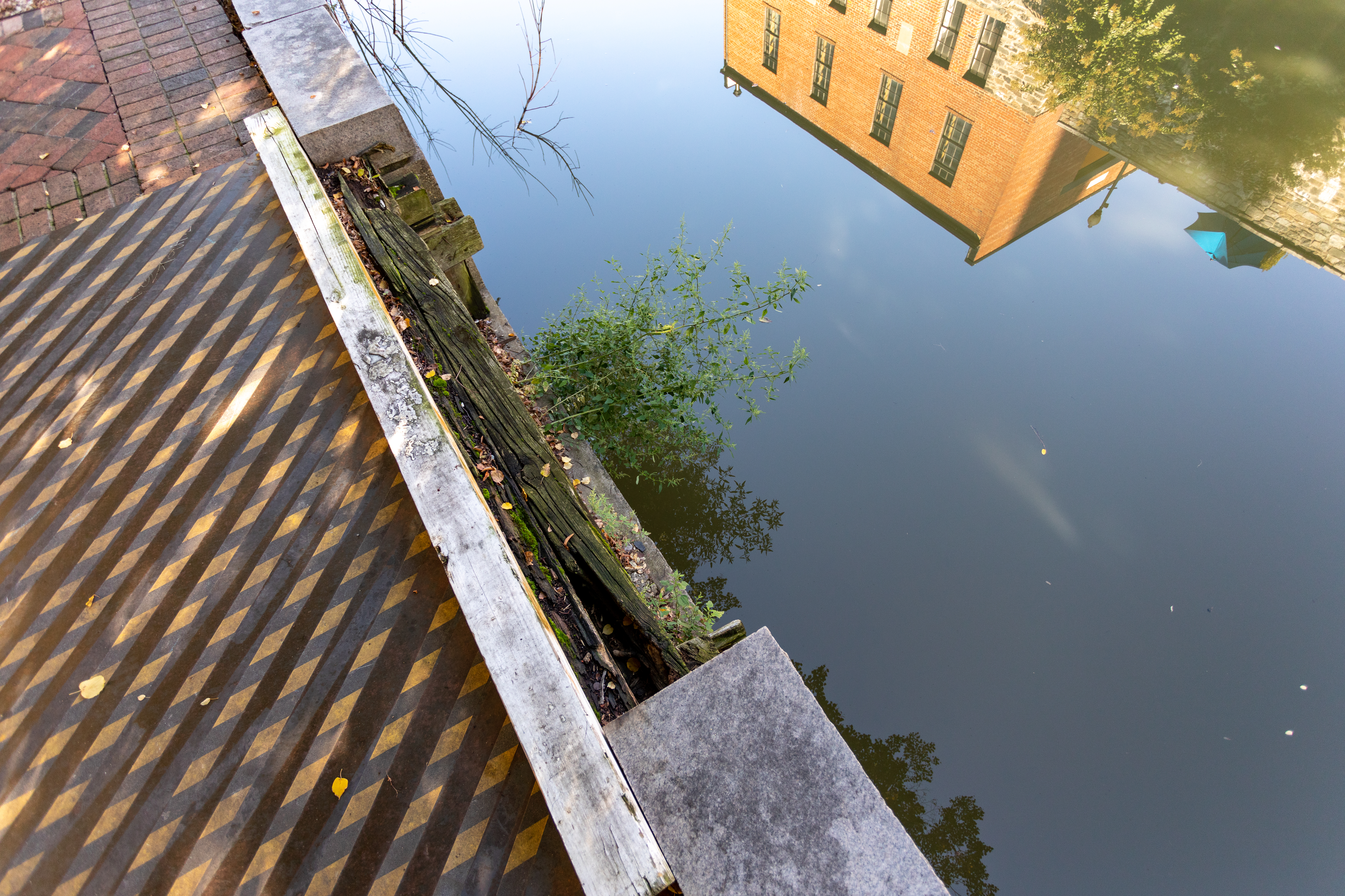
This is one of series of intakes that provided water to help power the mills in this area including a flour and a paper mill. Providing water to the mills was another form of income for the canal company. At least one intake was in used until the 1960's.
(193 words)<br />The C&O Canal Intake is located along the south edge of the C&O Canal just west of 33rd street, NW in the Georgetown neighborhood of Washington, DC.<br />From the intersection of 33rd street and the C&O Canal, travel seventy feet west along the south side of the canal. A cement slab about six-inches wide and six feet long sits in the towpath. In front of it, at the canal edge is a deteriorating wood board, about three feet wide and five feet long.<br />When viewed from the opposite side of the canal, a square opening in the stone wall of the canal is visible underneath the wood board, which extends down to the water's edge. <br />To access the north side of the canal, travel three hundred fifty feet to the east, through the brick plaza of Fish Market Square. A staircase at the northeast end leads up to a pedestrian bridge which carries over the canal. On the opposite side, stairs on the right will lead down to the towpath. Once there, proceed west to the right four hundred feet and you will be across from the Canal Intake on the south side.<br />END OF DESCRIPTION<br />
This is one of series of intakes that provided water to help power the mills in this area including a flour and a paper mill. <br /><br />Thees are ruins of two dual intakes for the Wilkins Rogers Milling Company water intake ruins are located on river (Fishmarket Square) side of the canal. When operational, each intake consisted of two intake openings stacked directly on top of each other. They supplied the former mill to the south with surplus canal water from 1839 to 1960. <br />
(155 words)<br />From the intersection of K street and Potomac street, NW travel three hundred feet north on Potomac street. The road curves to the right at this point and becomes Grace street. Six brick pillars are lined along the north sidewalk curve as it follows the bend of the road. Proceed north into the plaza area. The C&O Canal Intake is set along the edge of the C&O Canal at the northwest corner of the plaza.<br />A black metal railing guards the space, which is a three-foot wide, six-foot long deteriorating wood board set into the brick plaza floor at the canal's edge. A rectangular opening underneath is visible from the opposite side of the canal. <br />A staircase at the northeast side of the plaza will take you over the canal. Follow the staircase on the right down to access the towpath on the north side. From here the underside of the Canal Intake is visible.<br />END OF DESCRIPTION<br />
The very first lock on the C&O Canal. Locks are like elevators and allow boats to move up in elevation. By closing and opening the lock gates in the right order, one can fill or empty the lock chamber. This will raise or lower the boat.Seventy-three more locks over the next 183 miles lead into Cumberland, Maryland in the Allegheny Mountains. Today, visitors can still travel the towpath, tracing the same route as mules and canal boats more than 100 years ago.From the shore of
(262 words)<br />C&O Canal Lock 1 is the southernmost and easternmost lock in the Chesapeake and Ohio canal system. It is located in downtown Washington, DC in the Georgetown area, east of 29th street, NW, south of M street and Pennsylvania avenue, and north of K street. <br />From the intersection of M and 29th streets, travel south on 29th street four hundred feet. Turn left onto the brick walkway and proceed about two hundred feet.<br />A one foot long brown sign with white lettering is set in the grass lawn about four feet off the brick walkway to the right that reads: "Lock 1"<br />Twenty feet to the south is the C&O Canal. Water passes through the twenty-five-foot-wide canal from west to east and empties into Rock Creek about two hundred yards to the west.<br />The wood remains of the lock are set along the canal edge, including a twenty-five-foot-long wood beam that runs parallel to the canal. A wood gate resembling a ladder sits on the face of the brick canal on its opposite side. The canal is about fifteen feet deep and shallow water flows slowly at the bottom. Ivy has overtaken much of the lock on the opposite side and hangs over the canal edge.<br />The grass lawn is about twenty-five feet wide and slopes down about five feet from the brick walkway above. A one-foot border of stone blocks lines the grass lawn edge as it meets the canal. The lawn spans about one hundred yards, from Rock Creek Parkway on the west end to 29th street to the east.<br />END OF DESCRIPTION<br />
(96 words) Lock 10 is located along the towpath in Cabin John, MD. It can be accessed from a small parking lot off of the Clara Barton Parkway. From the Lock 10 parking lot, follow the paved road down the hill approximately 100 feet and arrive at the lock. A vehicle access bridge crosses the lock, with railings along both sides. The dirt towpath is across the lock bridge, with east being to the left and west being to the right. The Lock 10 lockhouse sits just to the left, or east, of the lock. End of Description.
(88 words) Lock 11 is located along the towpath in Cabin John, MD. It can be accessed from a small parking lot at Lock 10 and walking the towpath. From the Lock 10 parking lot, follow the paved road down the hill approximately 100 feet and cross the bridge across lock 10. Turn right and walk 2/10ths of a mile on the towpath. The lock sits in the ground parallel to the towpath. Two stone walls create the lock chamber. The chamber is approximately 90 feet long. End of Description.
(88 words) Lock 12 is located along the towpath in Cabin John, MD. It can be accessed from a small parking lot at Lock 10 and walking the towpath. From the Lock 10 parking lot, follow the paved road down the hill approximately 100 feet and cross the bridge across lock 10. Turn right and walk one half of a mile on the towpath. The lock sits in the ground parallel to the towpath. Two stone walls create the lock chamber. The chamber is approximately 90 feet long. End of Description.
(88 words) Lock 13 is located along the towpath in Cabin John, MD. It can be accessed from a small parking lot at Lock 10 and walking the towpath. From the Lock 10 parking lot, follow the paved road down the hill approximately 100 feet and cross the bridge across lock 10. Turn right and walk 6/10ths of a mile on the towpath. The lock sits in the ground parallel to the towpath. Two stone walls create the lock chamber. The chamber is approximately 90 feet long. End of Description.
(88 words) Lock 14 is located along the towpath in Cabin John, MD. It can be accessed from a small parking lot at Lock 10 and walking the towpath. From the Lock 10 parking lot, follow the paved road down the hill approximately 100 feet and cross the bridge across lock 10. Turn right and walk 7/10ths of a mile on the towpath. The lock sits in the ground parallel to the towpath. Two stone walls create the lock chamber. The chamber is approximately 90 feet long. End of Description.
(99 words) Lock 15 is located along the towpath in Potomac, MD. From the Great Falls Tavern Visitor Center parking lot, follow the sidewalks to the visitor center, passing the concessions building on your right and the public restrooms building on your left. At the visitor center building, turn right, walk about 25 feet and cross the wooden pedestrian bridge over Lock 20. Turn left and walk 8/10ths of a mile on the towpath. The lock sits in the ground parallel to the towpath. Two stone walls create the lock chamber. The chamber is approximately 90 feet long. End of Description.
(99 words) Lock 16 is located along the towpath in Potomac, MD. From the Great Falls Tavern Visitor Center parking lot, follow the sidewalks to the visitor center, passing the concessions building on your right and the public restrooms building on your left. At the visitor center building, turn right, walk about 25 feet and cross the wooden pedestrian bridge over Lock 20. Turn left and walk 6/10ths of a mile on the towpath. The lock sits in the ground parallel to the towpath. Two stone walls create the lock chamber. The chamber is approximately 90 feet long. End of Description.
(122 words) Lock 17 is located along the towpath in Potomac, MD. From the Great Falls Tavern Visitor Center parking lot, follow the sidewalks to the visitor center, passing the concessions building on your right and the public restrooms building on your left. At the visitor center building, turn right, walk about 25 feet and cross the wooden pedestrian bridge over Lock 20. Turn left and walk one half of a mile on the towpath. After passing a large pool of water in the canal, approximately 300 feet long and 100 feet wide, arrive at lock 17. The lock sits in the ground parallel to the towpath. Two stone walls create the lock chamber. The chamber is approximately 90 feet long. End of Description.
(117 words) Lock 18 is located along the towpath in Potomac, MD. From the Great Falls Tavern Visitor Center parking lot, follow the sidewalks to the visitor center, passing the concessions building on your right and the public restrooms building on your left. At the visitor center building, turn right, walk about 25 feet and cross the wooden pedestrian bridge over Lock 20. Turn left and walk 3/10 of a mile on the towpath. The lock sits in the ground parallel to the towpath. Two stone walls create the lock chamber, which is filled with water. The chamber is approximately 90 feet long. Stone ruins of an old lockhouse remain across the canal from the towpath. End of Description.
(119 words) Lock 19 is located along the towpath in Potomac, MD. From the Great Falls Tavern Visitor Center parking lot, follow the sidewalks to the visitor center, passing the concessions building on your right and the public restrooms building on your left. At the visitor center building, turn right, walk about 25 feet and cross the wooden pedestrian bridge across Lock 20. Turn left and walk 1/10 of a mile. The lock sits in the ground parallel to the towpath. A now-permanent wooden vehicle bridge perpendicularly crosses the lock. Two stone walls create the lock chamber, which is filled with water. The chamber is approximately 90 feet long. The upstream and downstream lock doors have been restored. End of Description.
Can you find the words "TE AMO" ("I love you" in Latin and Spanish) on the capstones of Lock 2? They were chiseled by an unknown mason for an unknown reason. Chances are, he was unable to finish the inscription - witness the letters PA in the lower left hand corner. What was the rest of that word to be? The rest of the inscription? Do you wonder what he intended to say?If you look down into the lock chamber, you can still see the original timber foundation from construction
(318 words)<br />C&O Canal Lock 2 is located in downtown Washington, DC in the Georgetown neighborhood, west of 29th street, NW, east of 30th street, south of H Street Main street, and north of K street. <br />From the intersection of M street and 29th street, proceed south on 29th street about two hundred seventy feet. Turn right onto the brick walkway and proceed eighty feet. Set in the ground about ten feet off the walkway on the left, to the south, is a one-foot wide brown sign that reads in white lettering: "Lock 2"<br />A brick office building is on the north side of the walkway at this location. To the south, a strip of grass runs about one hundred feet west and fifteen feet south to a one-foot stone border that lines the canal edge. As you face the canal to the south a forty-foot oak tree is ten feet to the left, along canal's edge. Another twenty feet to the left a 29th street bridge goes over the canal.<br />Still facing the canal, about forty feet to the right are two twenty-foot long wood lock beams set above both sides of the canal, connected to wood frames that line the canal walls. The beams are angled upward from west to east above the canal edge. Water in the canal drops from this point about five feet down as it flows from right to left.<br />Further to the right, about twenty wood beams, six feet long each, lay across the canal floor in tall grass, about two feet apart. This is the dry dock. The walkway and canal rise to the west, as they approach a bridge over the canal on 30th street. The canal widens about four feet from east to west after the lock. The walls of the canal arch inward again and narrow about four feet at the bridge underpass to the west under 30th street.<br /> END OF DESCRIPTION<br />
(115 words) Lock 20 is located in Potomac, MD, sitting beside the Great Falls Tavern Visitor Center. From the Visitor Center parking lot, follow the sidewalks to the visitor center, passing the concessions building on your right and the public restrooms building on your left. At the visitor center building, turn right, walk about 25 feet and arrive at the lock. Two stone walls create the lock chamber, which is filled with water. The chamber is about 12 feet deep and 91 feet long. The upstream and downstream lock doors have been restored and are functional. A wooden pedestrian bridge crosses the 15-foot span of the lock. Across the bridge is the towpath. End of Description.
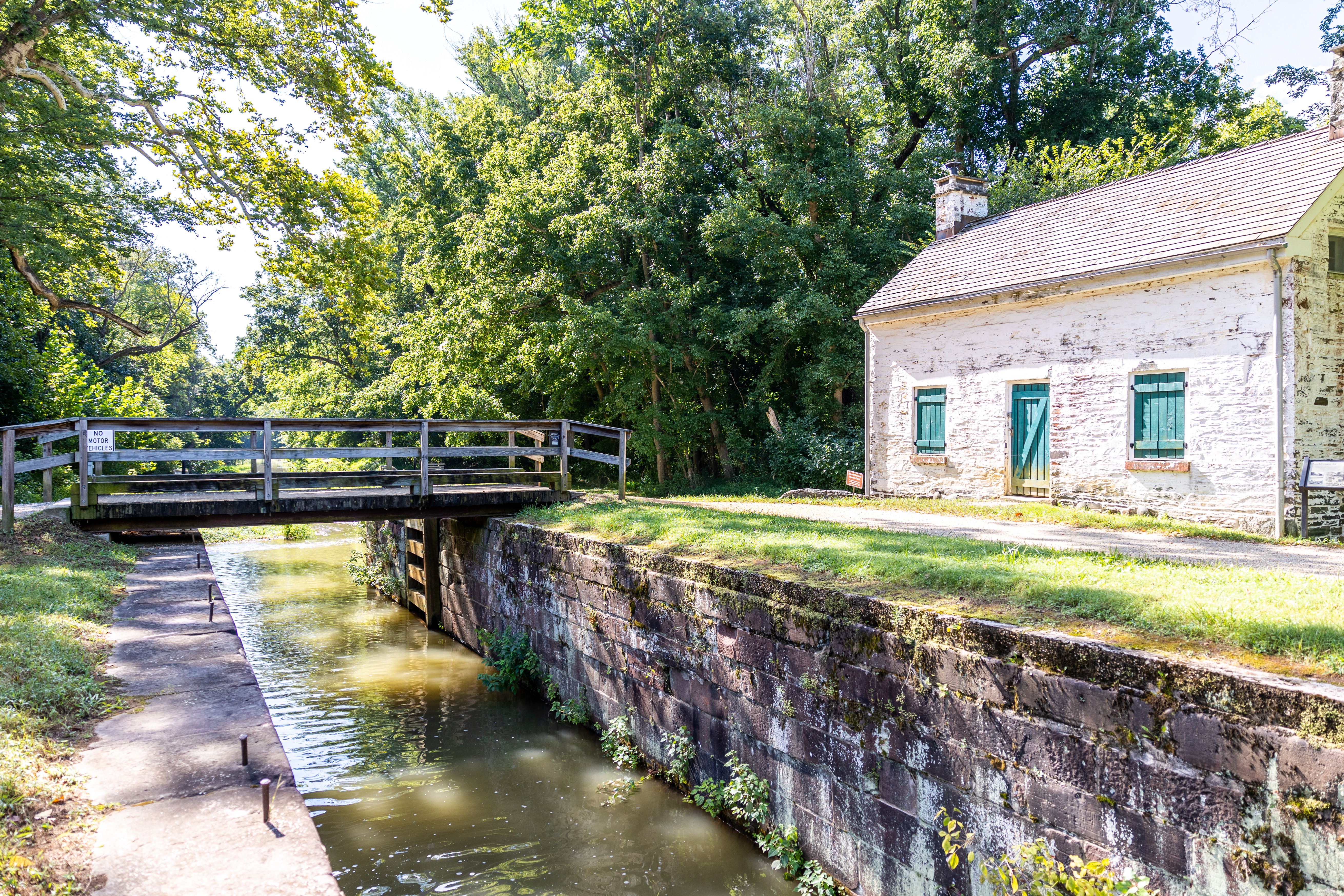
(85 words) Lock 21 is located along the towpath near Potomac, MD. It can be accessed from a small parking lot located at the end of Swains Lock Road. At the far end of the parking lot, the lockhouse is on the left and the lock itself is approximately 50 feet ahead. A vehicle access bridge crosses the lock, with railings along both sides. The dirt towpath is across the lock bridge, with south being to the left and north being to the right. End of Description.
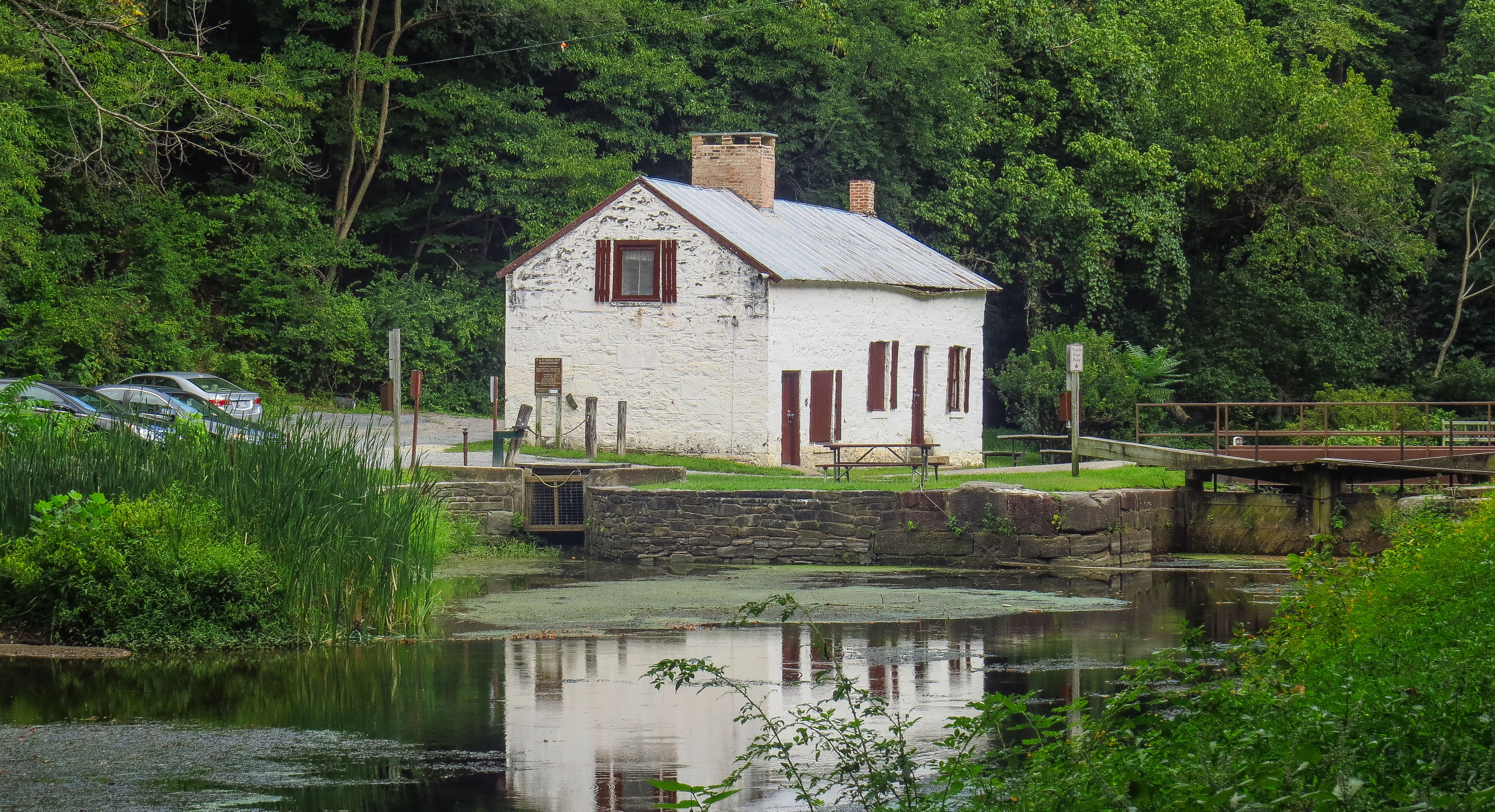
(148 words) Lock 22 is located along the towpath near Potomac, MD. It can be accessed from a large parking lot located at the end of Pennyfield Lock Road. At the far end of the ¼ mile long parking lot, follow the dirt road beyond the brown swinging gates. Continue for approximately 500 feet. A white fence is along the left side of the road. Dirt road turn to the right and immediately crosses a small bridge over water. Road then turns to the left and continues another 100 feet. The road then turns to the right and arrives at the lock. A wooden footbridge crosses the lock, with railings along both sides. The dirt towpath is across the lock bridge, with south being to the left and north being to the right. On the direct opposite side of the towpath from the footbridge is the lockhouse. End of Description.
(90 words) Lock 23 is located along the towpath near Potomac, MD. It can be accessed from a small parking lot located at the end of Violettes Lock Road. The lock sits next to the dirt parking lot. A vehicle access bridge crosses the lock, with railings along both sides. The dirt towpath is across the lock bridge, with south being to the left and north being to the right. Taking the towpath to the left, approximately 20 feet ahead, you will cross another bridge over Inlet Lock #2. End of Description.
(92 words) Lock 24 is located along the towpath near Potomac, MD. It can be accessed from a small parking lot located at the end of Rileys Lock Road. The lock sits next to the dirt parking lot, slightly uphill, just past the lockhouse. A pedestrian access bridge crosses the lock, with railings along both sides. The dirt towpath is across the lock bridge, with south being to the left and north being to the right. Taking the towpath to the right, approximately 20 feet ahead is the Seneca Creek Aqueduct. End of Description.
(85 words) Lock 25 is located on Edwards Ferry Road in Poolesville, Maryland. From the parking lot, walk about 100 feet back along Edwards Ferry Road. As you walk, you will pass the ruins of Jarboe’s Store on your right and lockhouse 25 on your left. Walk until you reach the wooden bridge that takes you over the lock. There are wooden railings on both sides. Below the bridge, two brick walls make up the sides of the lock. The lock entrance and exit gates are missing.
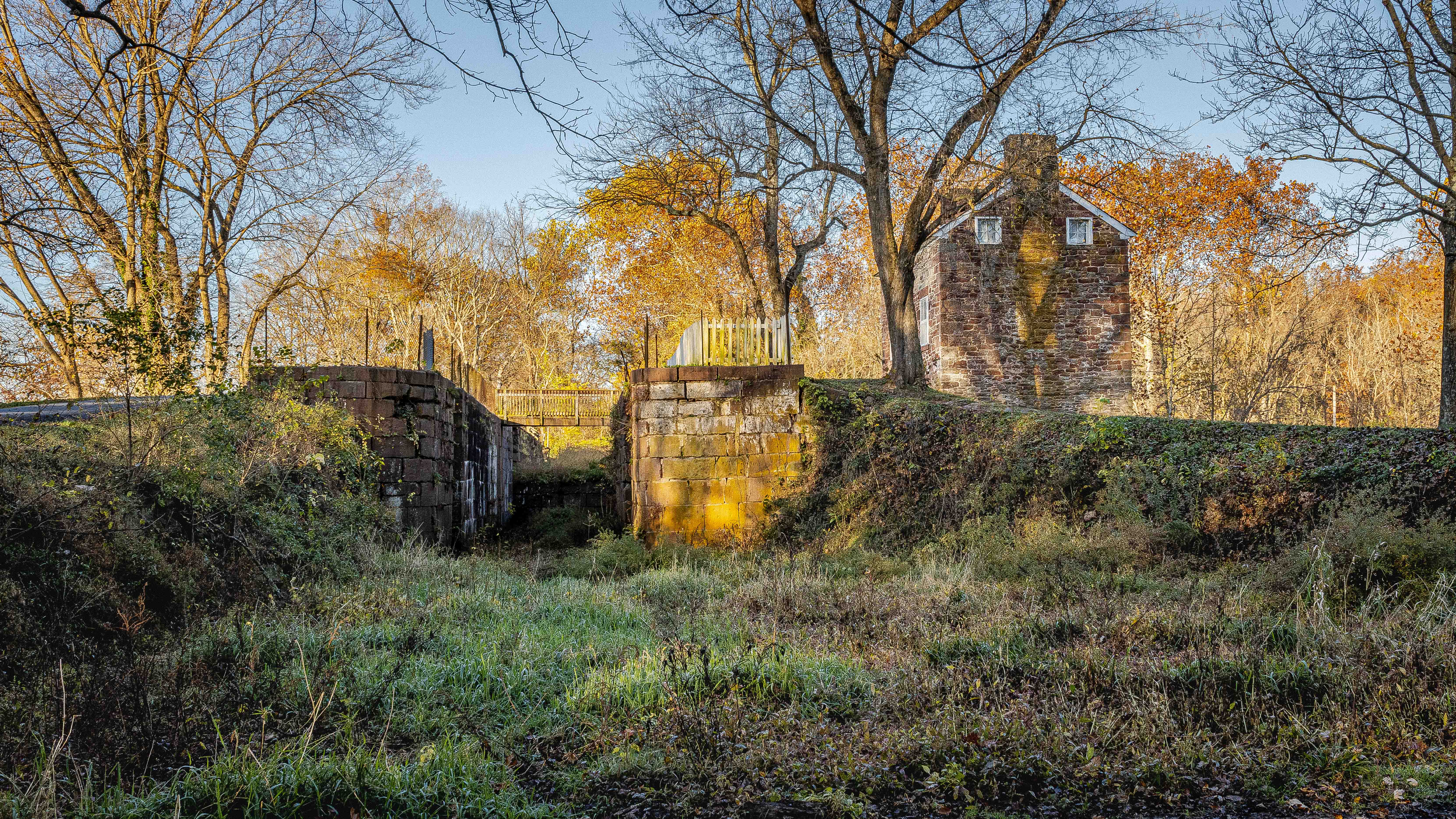
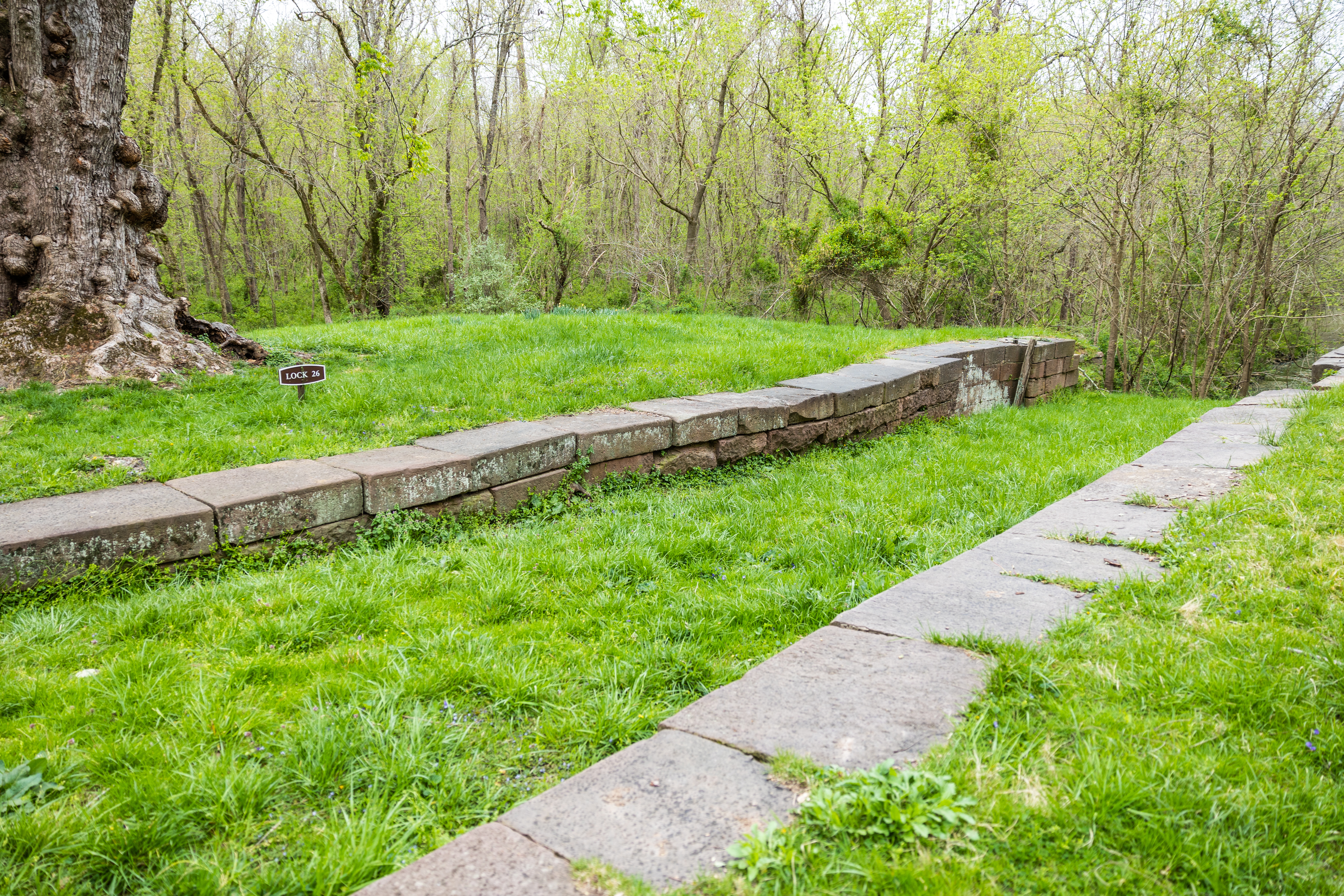
(49 words) Lock 26 is located along the towpath in Dickerson, Maryland. Looking down, you see the top of the stone blocks that make up the sides of the lock. Soil has filled in the space between the locks. Approximately 20 feet in the distance is the foundation of lockhouse 26.
(86 words) Lock 27 is located along the towpath in Dickerson, Maryland. From the Monocacy Aqueduct parking lot, head south along the towpath. After seven tenths of a mile the lock with appear on the left. The lock sits in the ground parallel to the towpath. Two stone walls create the lock chamber, which is filled with water. The lock’s upstream and downstream gates are missing. Across from the lock, on the other side of the towpath, is lockhouse 27. It is about 10 feet from the towpath.
(105 words) Lock 28 is located along the towpath in Jefferson, Maryland. From the Point of Rocks parking lot, head Northwest along the towpath. After eight tenths of a mile the lock with appear on the right. The lock sits in the ground parallel to the towpath. A wooden pedestrian bridge crosses the lock at the halfway point. The lock itself has two stone walls that create a lock chamber. The chamber is about 12 feet deep. The lock’s upstream and downstream gates are missing. Across from the lock, on the other side of the towpath, is lockhouse 28. It is about 10 feet from the towpath.
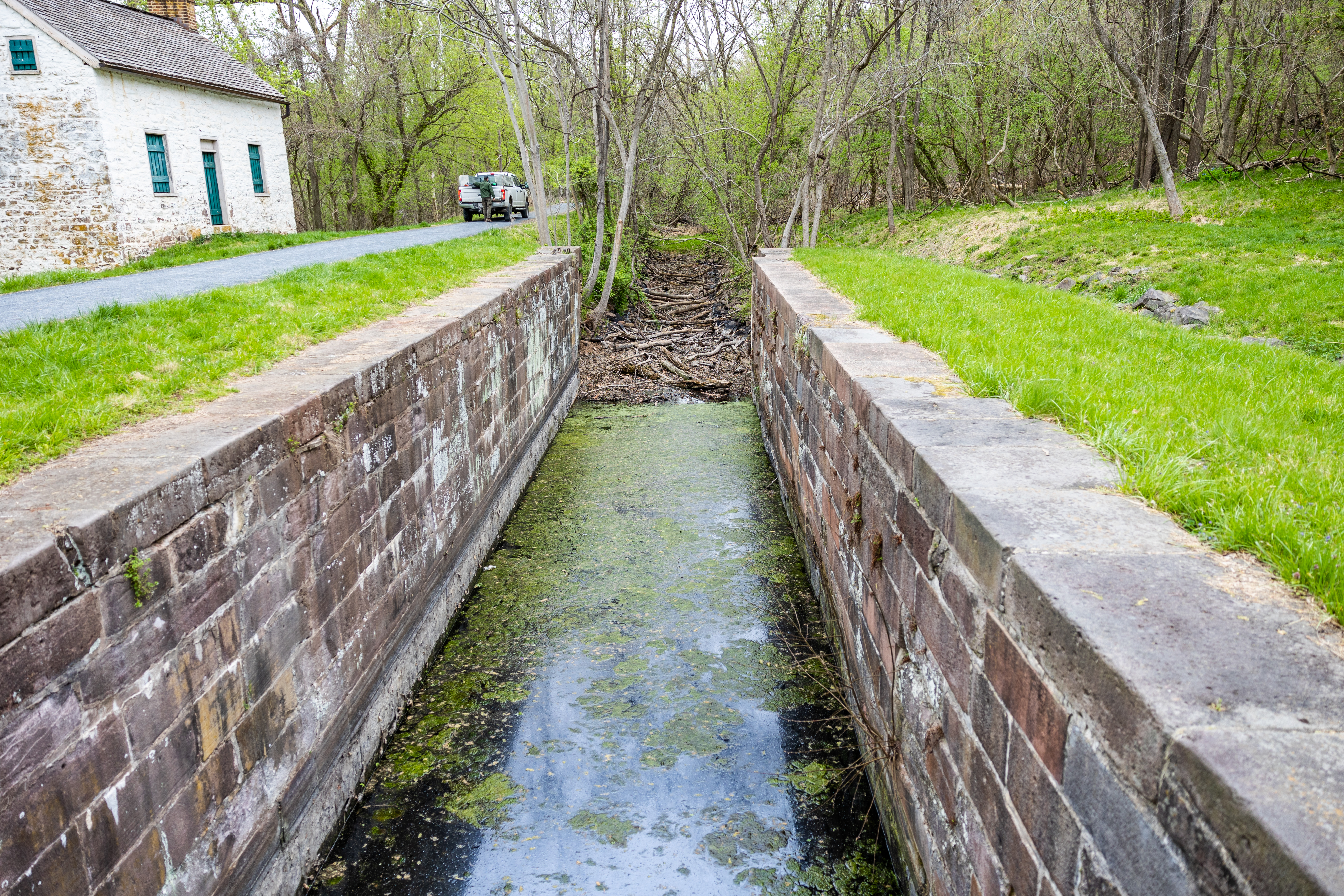
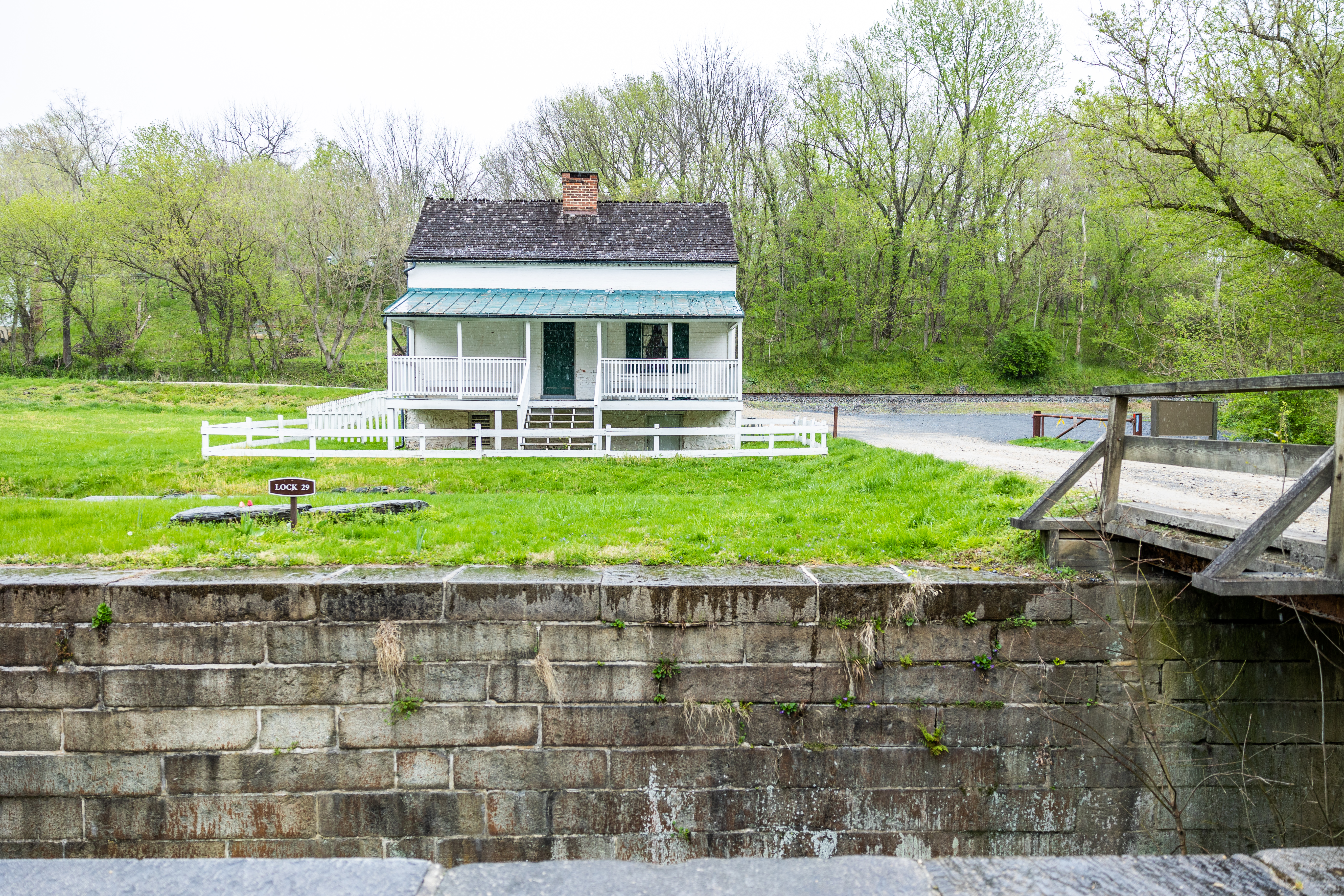
(82 words) Lock 29 is located along the towpath in Jefferson, Maryland. From the Lock 29 (Lander) parking lot, head Northwest from the parking lot to reach the road. On the road, head Southwest about 80 feet, or until you reach the wooden bridge. The pedestrian bridge crosses the middle of the lock and has two wooden railings. The lock has two stone walls that create a lock chamber. The chamber is about 12 feet deep. The lock’s upstream and downstream gates are missing.
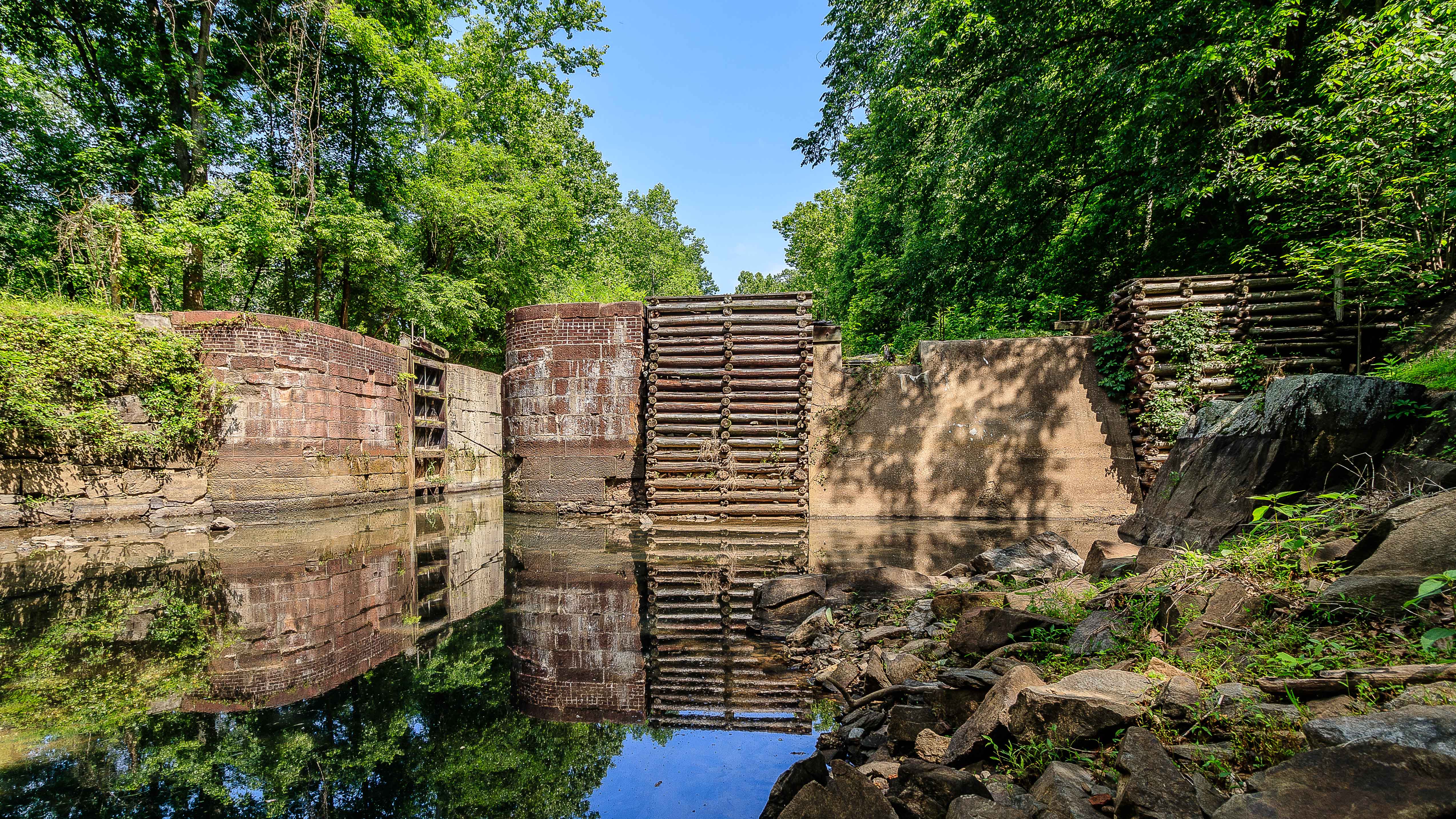
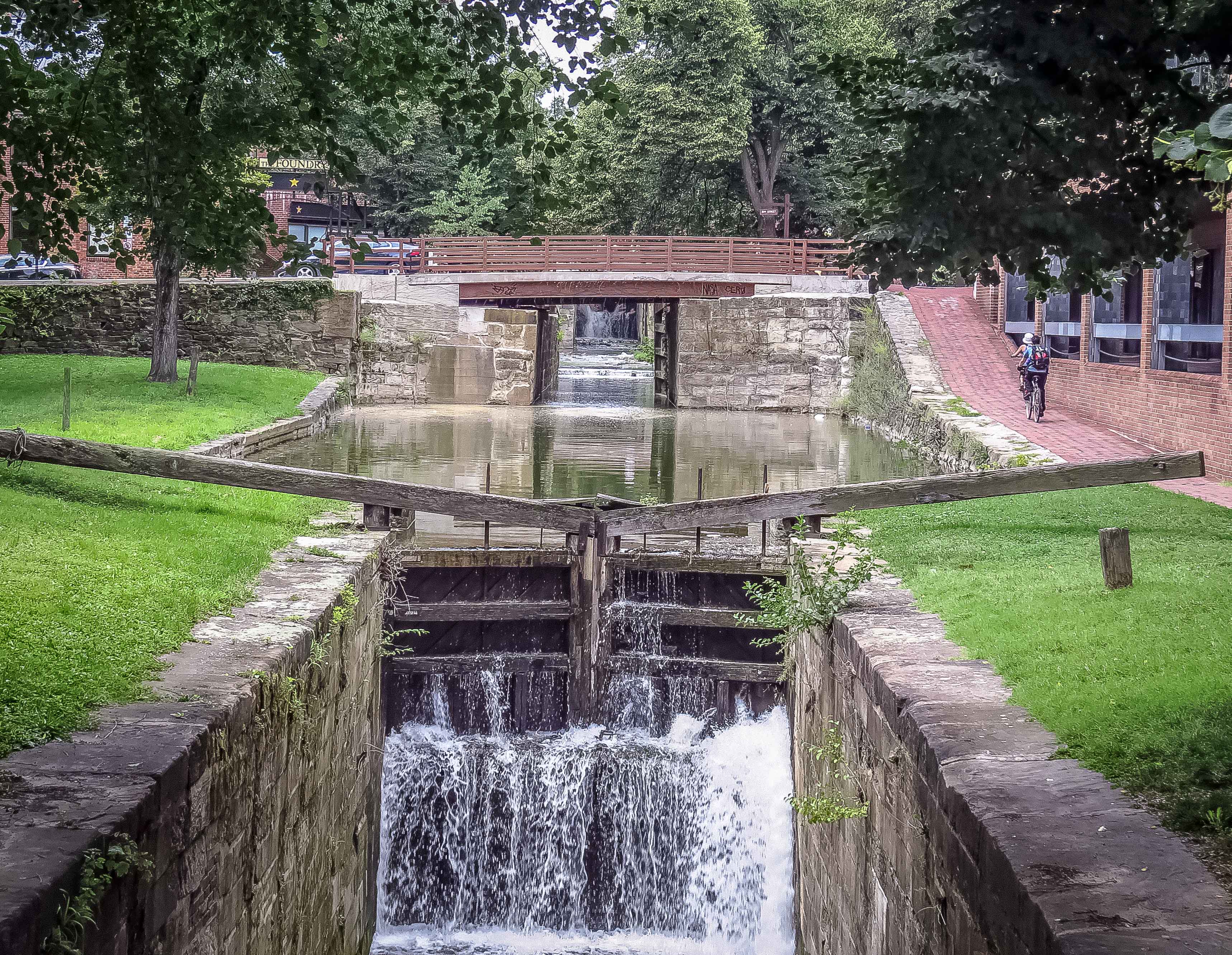
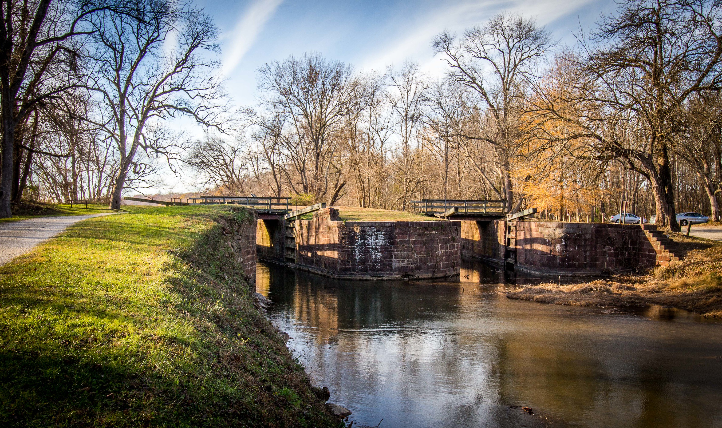
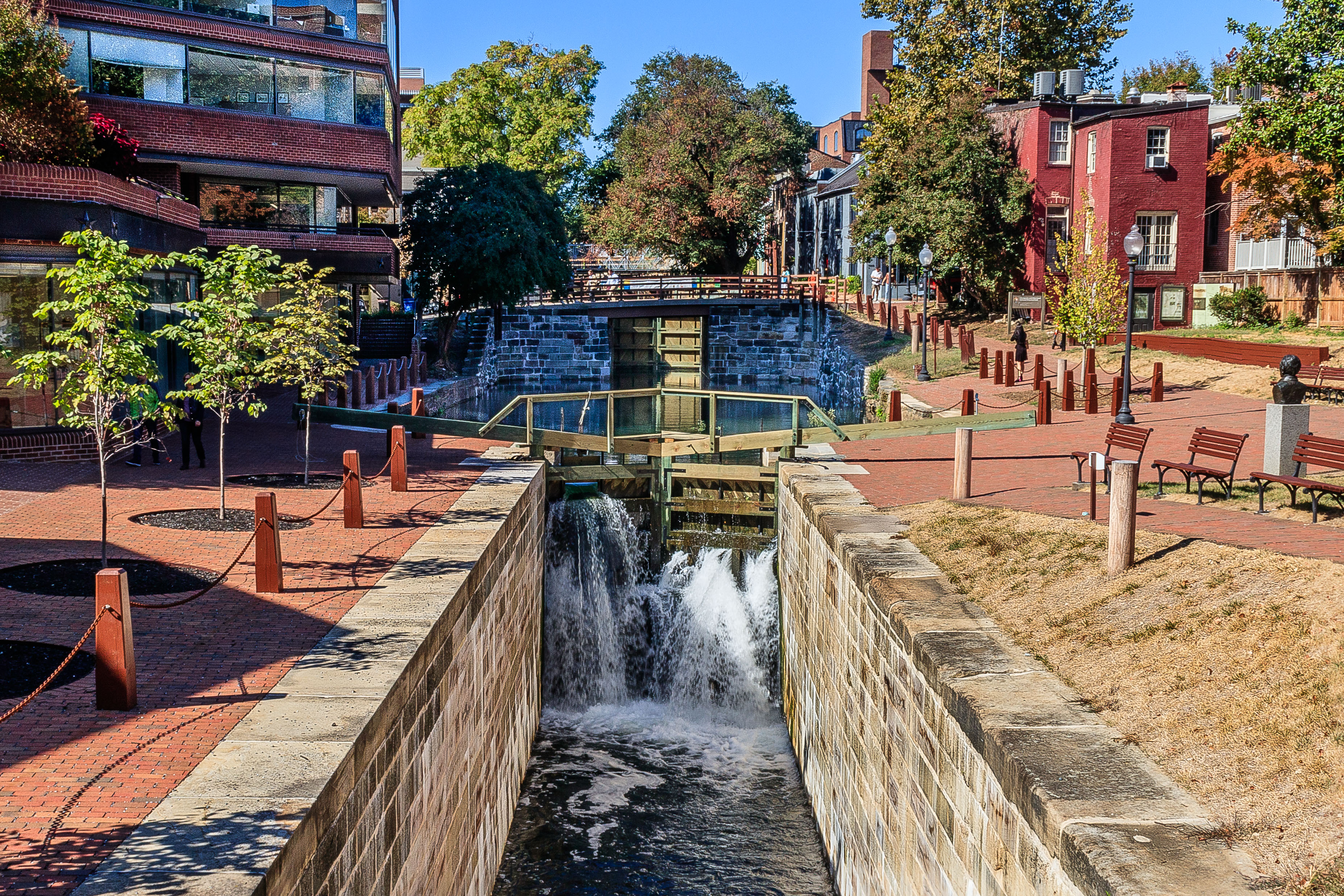
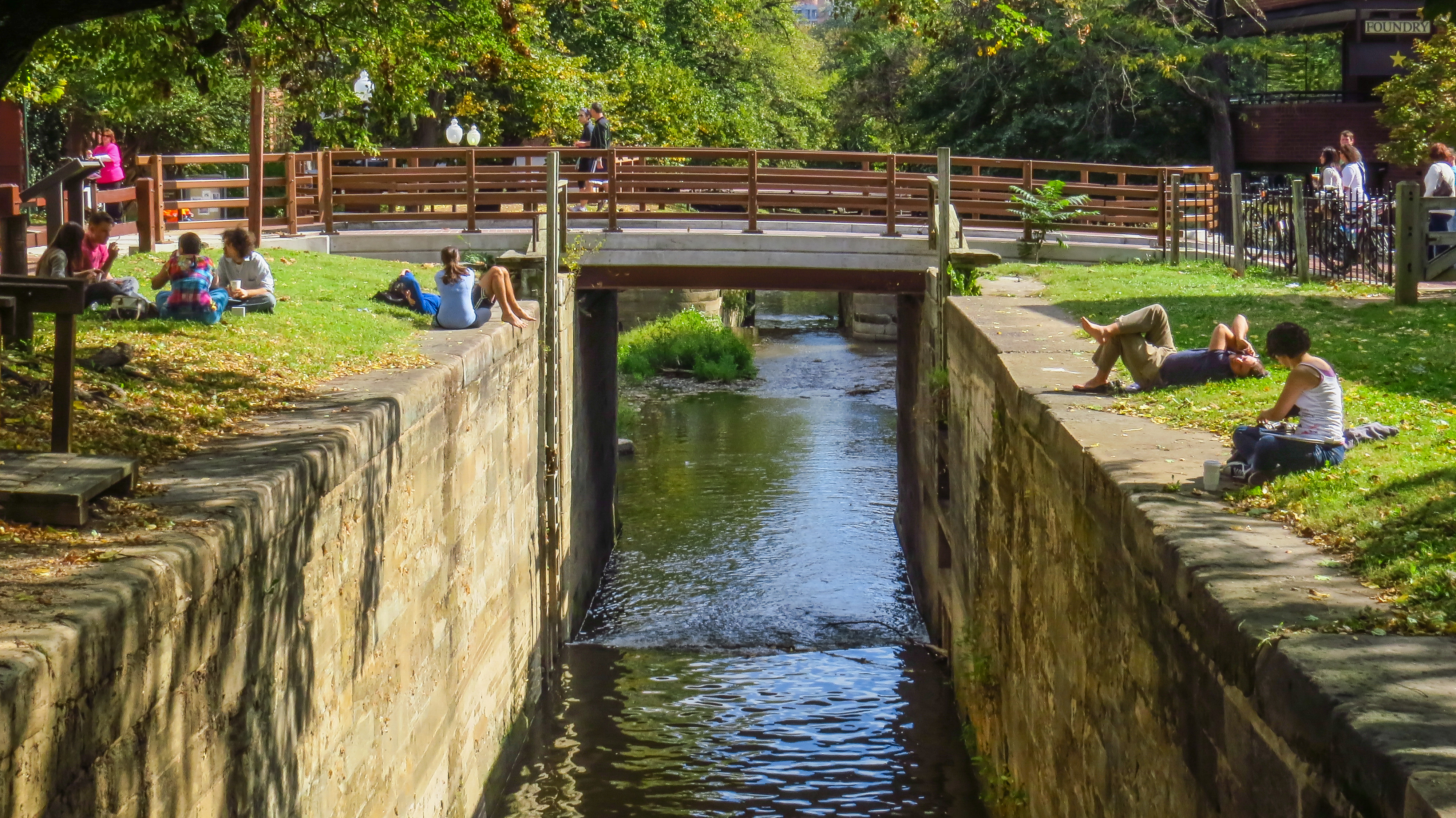
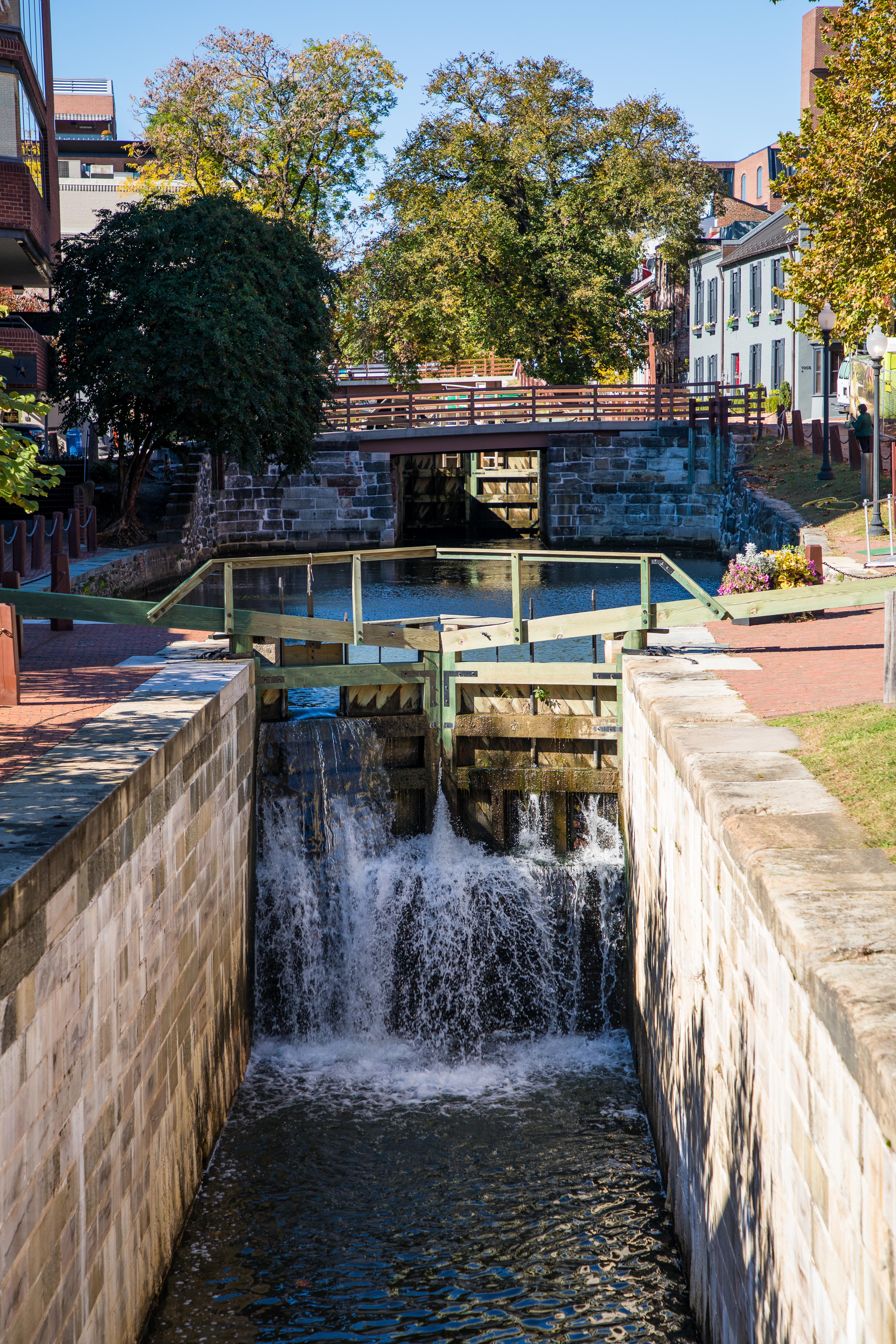
Like all the lift locks on the canal, canal boats could be raised for an upstream journey or lowered for a downstream journey by opening and closing the lock doors in the correct sequence. Lift Lock 3 was restored in 2016-2019. The lock was fully disassembled, the original wood foundation removed and replaced with a re-enforced concrete foundation, and the lock rebuilt using as much of the original stone as possible.
(426 words)<br />C&O Canal Lock 3 is located in downtown Washington, DC in the Georgetown neighborhood, west of 30th street, NW, east of Thomas Jefferson street, south of M street, and north of K street. <br />From the intersection of M and 30th streets, travel south on 30th street about three hundred seventy feet. Turn right and proceed along the brick walkway about one hundred twenty feet. Lock 3 will be on your left.<br />Lock 3 has been restored and the twenty-five-foot wood beams, gates, components, and stone blocks that line the canal walls all appear new. Two sets of wood lock gates sit about ninety feet apart from each other in the canal. Water cascades down about four feet from the upstream western gate and passes through the downstream eastern gate and under the 30th street bridge.<br />The south side brick plaza of Lock 3 features a two-foot high wood bench that spans about sixty feet along the walkway. Five six-foot tall young trees are set in the plaza along the canal on this side.<br />The north side is situated with four wood benches set about ten feet back from the canal's edge. In front of them is a one-foot wide brown sign that reads: "Lock 3." Behind the benches is a small patch of grass, about twenty by ten feet. A water fountain is at the east end of the lawn. Set at the western end is a bronze bust statue. <br />The bust is about three feet tall and depicts Justice William O. Douglas in open collared dress shirt. It rests on a four-foot-tall, two square foot granite pedestal. Etched on the pedestal front face is written:<br />In Recognition of Justice William O. Douglas for his Contributions Toward the Establishment of the Chesapeake and Ohio Canal National Historic Park<br />National Park Service <br />May 17, 1977<br />At the north east corner of 30th street and the canal walkway sits a one square foot bronze plaque with cement base atop a brick platform. An inscription on the plaque reads:<br />Georgetown Historic District<br />Has Been Designated a Registered National Historic Landmark<br />Under the Provisions of the Historic Sites Act of August 21, 1935 This Site Possesses Exceptional Value in Commemorating and Illustrating the History of the United States<br />U.S. Department of the Interior<br />National Park Service<br />1967<br />Towards the west end of the lock, the canal widens about four feet on either side. The walkway rises slightly at an incline towards the west end and a bridge carrying over Thomas Jefferson street, where another wood gate sits underneath the bridge.<br />END OF DESCRIPTION<br />
(68 words) Lock 30 is located on the towpath in Brunswick, Maryland. From the Brunswick parking lot, head East along the towpath. After one tenth of a mile the lock with appear on the left. The lock sits in the ground parallel to the towpath. It has two stone walls that create a lock chamber. The chamber is about 12 feet deep. The lock’s upstream and downstream gates are missing.
(84 words) Lock 31 is located on the towpath in Knoxville, Maryland. From lock 32, head Northeast along the towpath. After two point two miles, the lock with appear on the left. The lock is about five feet from the towpath and runs parallel to it. The two lock walls are made of stone blocks. The walls create the lock chamber which is about ten feet deep. The upstream and downstream entrance gates are missing. On the opposite side of the towpath is the Potomac river.
(97 words) Lock 32 is located on the towpath in Knoxville, Maryland. From the Harpers Ferry access point turn right (Southeast) onto the towpath. After a half a mile, the ruins of the lock will appear on the left. The lock is about three feet from the towpath and runs parallel to it. The furthest lock wall is still standing, while the closest wall has started to fall apart. The walls are made of stone blocks. The two walls make a chamber that is about 5 feet deep. On the opposite side of the towpath is the Potomac River.
(103 words) Lock 33 is located on the towpath in Knoxville, Maryland. From the Harpers Ferry access point turn left, or Northwest, onto the towpath. After 350 feet, the lock will appear on the right. The lock is about five feet from the towpath and runs parallel to it. The lock walls are made of stone blocks. The two walls make a chamber that is about twelve feet deep. The upstream and downstream entrance gates are missing. Behind the lock, beyond an additional stone wall and a road, are the remains of lockhouse 33. On the opposite side of the towpath is the Potomac River.
(177) Lock 34 is located on the towpath in Knoxville, Maryland. Turn left onto Harpers Ferry Road from the Maryland Heights Trail parking lot. Walk 280 feet and then turn right onto a stone staircase. The staircase has a stone wall on one side and a metal railing on the other. At the bottom of the staircase, turn left onto a wooden bridge that spans the canal. The bridge has wooden railings and ends in a staircase. Once down the staircase you are on the towpath. Turn right, or Northwest, onto the towpath. After half a mile the lock will appear on the right. The lock is about five feet from the towpath and runs parallel to it. The lock walls are made of stone blocks. The two walls create the lock chamber that is about ten feet deep. The upstream and downstream entrance gates are missing. Past the lock about 90 feet is a water pump. Water availability is dependent on conditions and time of year. On the opposite side of the towpath is the Potomac River.
(212 words) Lock 35 is located on the towpath in Knoxville, Maryland. From the Maryland Heights Trail parking lot turn left onto Harpers Ferry Road. Walk 280 feet and then turn right onto a stone staircase. The staircase has a stone wall on one side and a metal railing on the other. At the bottom of the staircase turn left onto a wooden bridge that spans the canal. The bridge has wooden railings and ends in a staircase. Once down the staircase you are on the towpath. Turn right, or Northwest, onto the towpath. After 1.2 miles the lock will appear on the right. At a half a mile you will have passed lock 34 and a water pump. Water availability dependent on conditions and time of year. From lock 34 walk another seven tenths of a mile and lock 35 will be on the right. The lock is about thirty feet from the towpath and runs parallel to it. The space between the towpath and lock has many trees and a small creek. The lock walls are made of stone blocks. The two walls create the lock chamber that is about ten feet deep. The upstream and downstream entrance gates are missing. On the opposite side of the towpath is the Potomac river.
(103 words) Lock 36 is located on the towpath in Knoxville, Maryland. From Lock 35 head West along the towpath. Follow it as it curves southwest for a short distance and eventually curves northwest again. After two tenths of a mile the lock will appear on the right. The lock is about thirty feet from the towpath and runs parallel to it. The lock walls are made of stone blocks. The two walls create the lock chamber that is about ten feet deep. The upstream and downstream entrance gates are missing. On the opposite side of the towpath, in the distance, is the Potomac River.
(132 words) Lock 37 is located on the towpath in Sharpsburg, Maryland. From the Mountain Lock Recreation Area Parking lot head to a small access trail on the south side of the lot. Walk about 40 feet on the access trail, then turn left onto the towpath. After two tenths of a mile the lock will appear on the left. The lock is about two feet from the towpath and runs parallel to it. The lock walls are made of stone blocks. The two walls create the lock chamber that is about ten feet deep. The upstream and downstream entrance gates are missing. Near the Northeastern end of the lock, a wooden bridge spans the lock and gives pedestrians access to the lockhouse. On the opposite side of the towpath is the Potomac River.
(136) Lock 38 is located on the towpath in Shepherdstown, Maryland. From the Lock 38 (Shepherdstown) parking lot head to a small access trail on the west side of the lot. Turn slightly left onto a gravel path. Walk about 12 feet along the gravel access path, until you come to a wooden bridge. The bridge spans the lock and has wooden railings on both sides. The lock walls are made of stone blocks. The two walls create the lock chamber that is about ten feet deep. The upstream and downstream entrance gates are missing. Cross over the bridge and walk about five feet on a gravel trail to reach the towpath. The lock is about two feet from the towpath and runs parallel to it. On the opposite side of the towpath is the Potomac River.
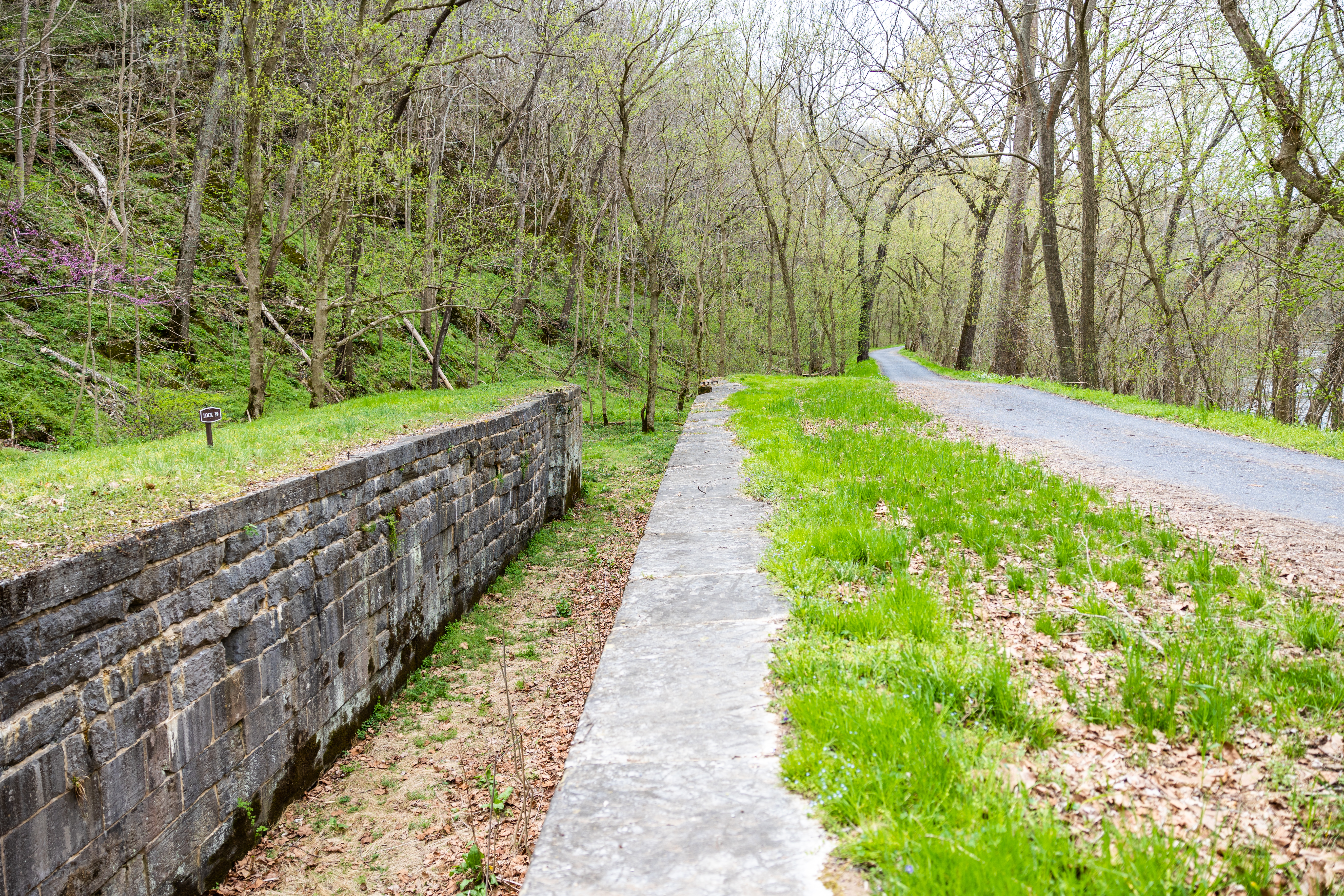
(97 words) Lock 39 is located on the towpath in Sharpsburg, Maryland. From Lock 38 head Northwest along the towpath. Follow it as it curves and begins to head East. After one point two miles the lock will appear on the right. The lock is about five feet from the towpath and runs parallel to it. The lock walls are made of stone blocks. The two walls create the lock chamber that is about ten feet deep. The upstream and downstream entrance gates are missing. On the opposite side of the towpath, in the distance, is the Potomac river.
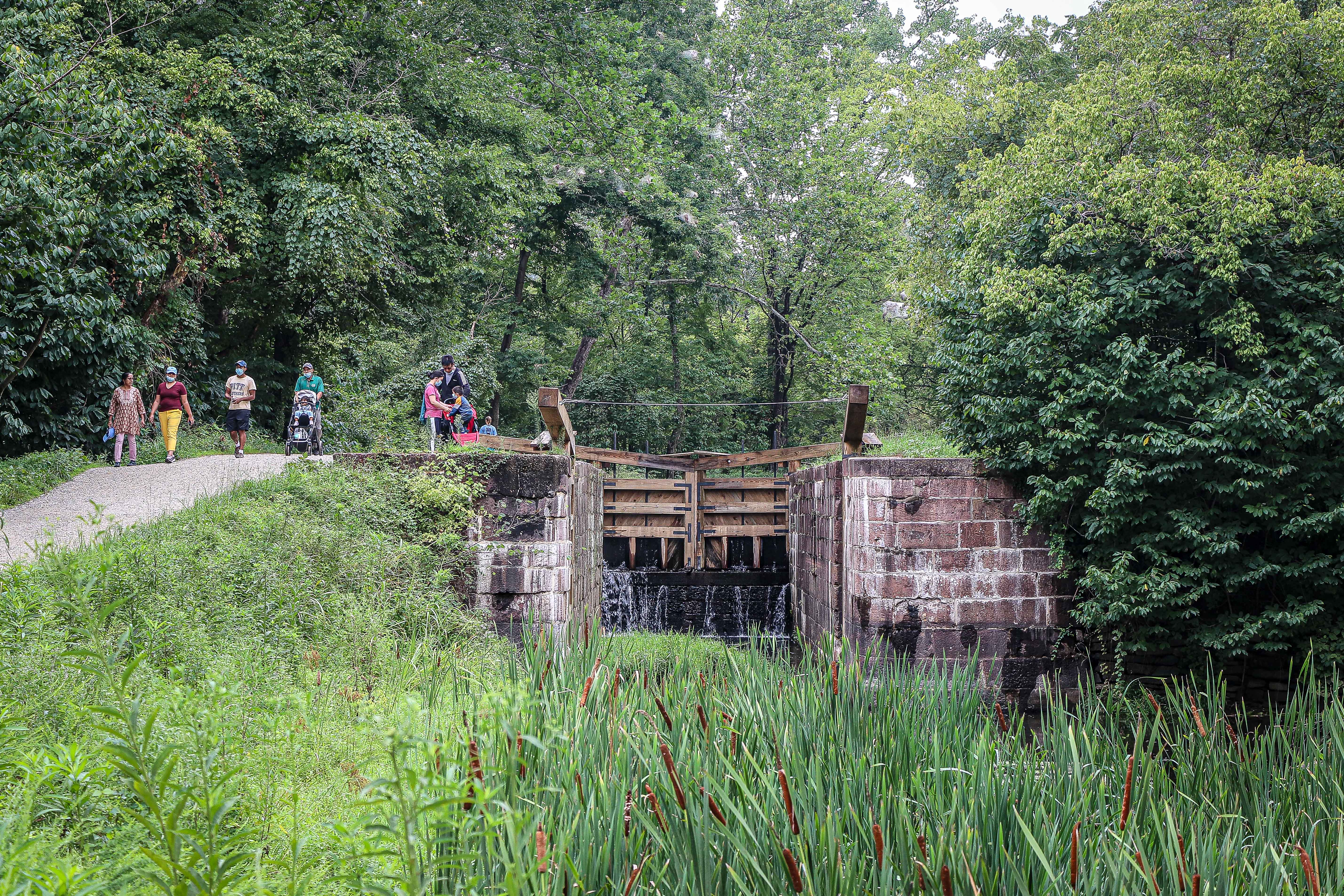
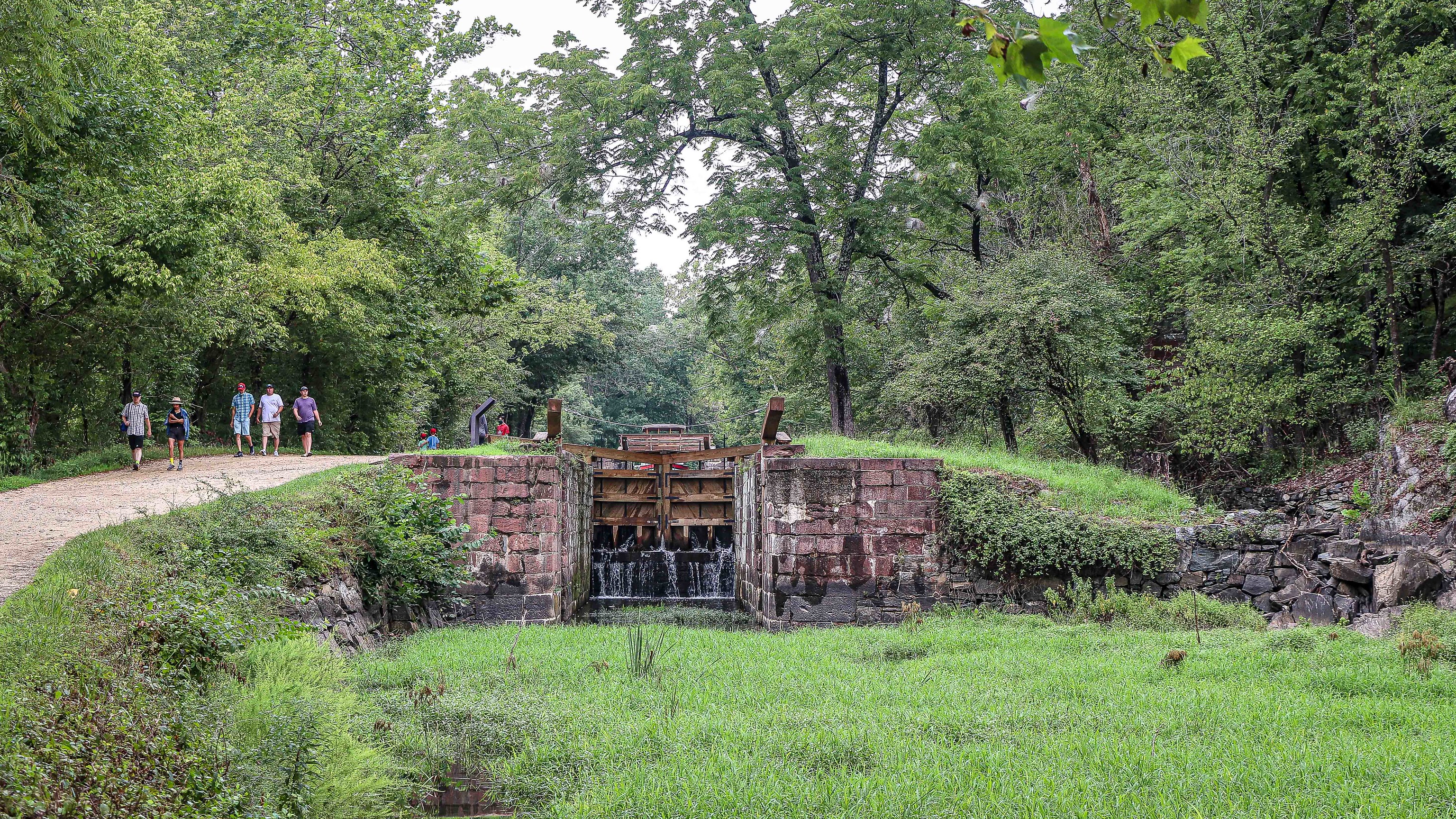
Along the 184.5 miles of the canal are 74 lift locks. These locks were put into place to help boats overcome the 605-foot elevation change between Georgetown and Cumberland. The C&O Canal is like a staircase, canal boats traveled along the flat sections and used the locks to take a “step up or down” about eight feet. The locks typically had hand-operated miter gates that were simple and followed Leonardo da Vinci’s original 1485 design.
(1012 words)C&O Canal Lock 4 is located in downtown Washington, DC in the Georgetown neighborhood, east of 31st street, NW, west of Thomas Jefferson street, south of M street, and north of K street.From the intersection of M and Thomas Jefferson streets, travel south four hundred forty feet on Thomas Jefferson street. Turn right along the brick walkway about seventy feet and Lock 4 will be on your left.A red wood railing runs along the edge of the walkway. Just beyond is a one-foot wide brown sign that reads: "Lock 4." A three by four-foot wayside sign sits two feet left along the rail. The sign is titled in the top right corner: "At All Hours." A subtitle in read below reads:It shall be their duty, at all hours, by night as well as by day, to pass all boats and floats presenting themselves at their locks.Charles Mercer, President, C&O Canal CompanyText below describes the operation of the canal lock operators and system:At All HoursIt shall be their duty, at all hours, by night as well as by day, to pass all boats and floats presenting themselves at their locks.Charles Mercer, President, C&O Canal CompanyEvery time his boat passed through a lock, a boat captain put his life and livelihood in the hands of the locktender. The wooden lock gates were a delicate balance between safety and efficiency. They had to be light enough to allow one man to move them, yet strong enough to hold back 140,000 gallons of water. A skilled locktender could judge and adjust the flow of water in or out of the lock to minimize the risk to boat and lock.Locktenders were responsible for the safe operation and maintenance of liftlocks. Neglect or carelessness could mean disaster. In exchange for a small monthly salary, an acre of land and a house, locktenders heeded the horn blast of boatmen even at 2 a.m. or on Sunday. After all, time was money.A black and white picture below shows a canal boat sitting at a lock. A man holds ropes connected to the boat from the towpath on the right. A woman stands behind him further along the towpath.Along the right side of the sign are three drawings with green backgrounds showing a boat as it passes through the blue water of a canal and lock. The top of the column states: How A Lock WorksLift locks raised and lowered boats to overcome changes in elevation.The top image shows a boat entering a lock. The upstream gate is open. Text below reads:A boat heading downstream enters the lock. Mules are unhitched and the locktender closes the upstream gates.The image below shows the upstream gate closed. The boat seems to be sitting lower in the canal. Text reads:The locktender opens the downstream paddles. Water flows out and the boat is lowered.In the bottom image, the boat is leaving the lock area, and continuing down the canal. Text reads:With water levels equal, the locktender opens the downstream gates. The mules are hitched and the boat moves on.The wayside stands between the upstream and downstream lock gates. To the right about twenty feet an oak tree sits along the canal edge. Just beyond it is a wood walkway, about ten feet long, that leads from the brick walkway to the canal's edge. Wood rails line the sides and the space is chained off at the walkway. A six-inch wide cobblestone border lines the walkway edge. Six feet to the right along the path and before a second oak tree is another wayside, titled:Creating a National ParkAn image above shows about ten people walking along a path A man in white hat and shirt is in the center. Text in the top right corner reads:Douglas, in the white shirt, and his companions hiked over 20 miles a day. Few hikers could maintain Douglas's pace.Text below reads:Creating a National ParkIt is a refuge, a place of retreat, a long stretch of quiet and peace at the Capital's back door...William O. DouglasLook around you. The park you stand in exists because people cared. In January 1954, William O. Douglas of the Supreme Court of the United States responded to a Washington Post editorial recommending that the C&O Canal be turned into a parkway. Writing in support of preserving the canal as a national park, Douglas wrote, "It is a sanctuary for everyone who loves woods - a sanctuary that would be utterly destroyed by a fine two lane highway." He invited the editors and other reporters to join him on a hike of the entire canal to enjoy its beauty and better understand his point. Merlo Pusey, who wrote the editorial, and his editor Robert Estabrook accepted the challenge. On March 22, 1954, the hike began near Cumberland. Douglas and his companions invited authorities on the natural and cultural history of the Potomac River and the C&O Canal to join them. The hikers learned about the canal and enjoyed the scenery. After the hike, Estabrook wrote an editorial in the Post supporting setting the canal aside as a national park. The walk, and the news stories it generated, motivated hundreds to fight to save the canal.
(101 words) Lock 40 is located on the towpath in Sharpsburg, Maryland. From the Taylors Landing parking lot head Southeast along the towpath. Follow it as it curves and begins to head West. After one and a half miles the lock will appear on the left. The lock is about five feet from the towpath and runs parallel to it. The lock walls are made of stone blocks. The two walls create the lock chamber that is about ten feet deep. The upstream and downstream entrance gates are missing. On the opposite side of the towpath, in the distance, is the Potomac River.
(176 words) Lock 41 is located on the towpath in Williamsport, Maryland. From the McMahon's Mill parking lot head to the Southwestern corner of the lot. There are two gravel trails that begin from the corner of the parking lot. Follow the left most access trail for 280 feet to reach the towpath. While on the access trail you will pass McMahon’s Mill and use a small wooden bridge to go over a small creek. The bridge does not have any railings. Turn right, or northwest, onto the towpath. After eight tenths of a mile the lock will appear on the right. The lock is about three feet from the towpath and runs parallel to it. The lock walls are made of stone blocks, the tops of which are completely covered in grass. The two walls create the lock chamber that is about ten feet deep. Metal rods stick out from the ground on the bottom of the lock. The upstream and downstream entrance gates are missing. On the opposite side of the towpath is the Potomac River.
(85 words) Lock 42 is located on the towpath in Williamsport, Maryland. From Lock 41 head Southwest along the towpath. After one tenth of a mile the lock will appear on the right. The lock is about two feet from the towpath and runs parallel to it. The lock walls are made of stone blocks. The two walls create the lock chamber that is about ten feet deep. The upstream and downstream entrance gates are missing. On the opposite side of the towpath is the Potomac river.
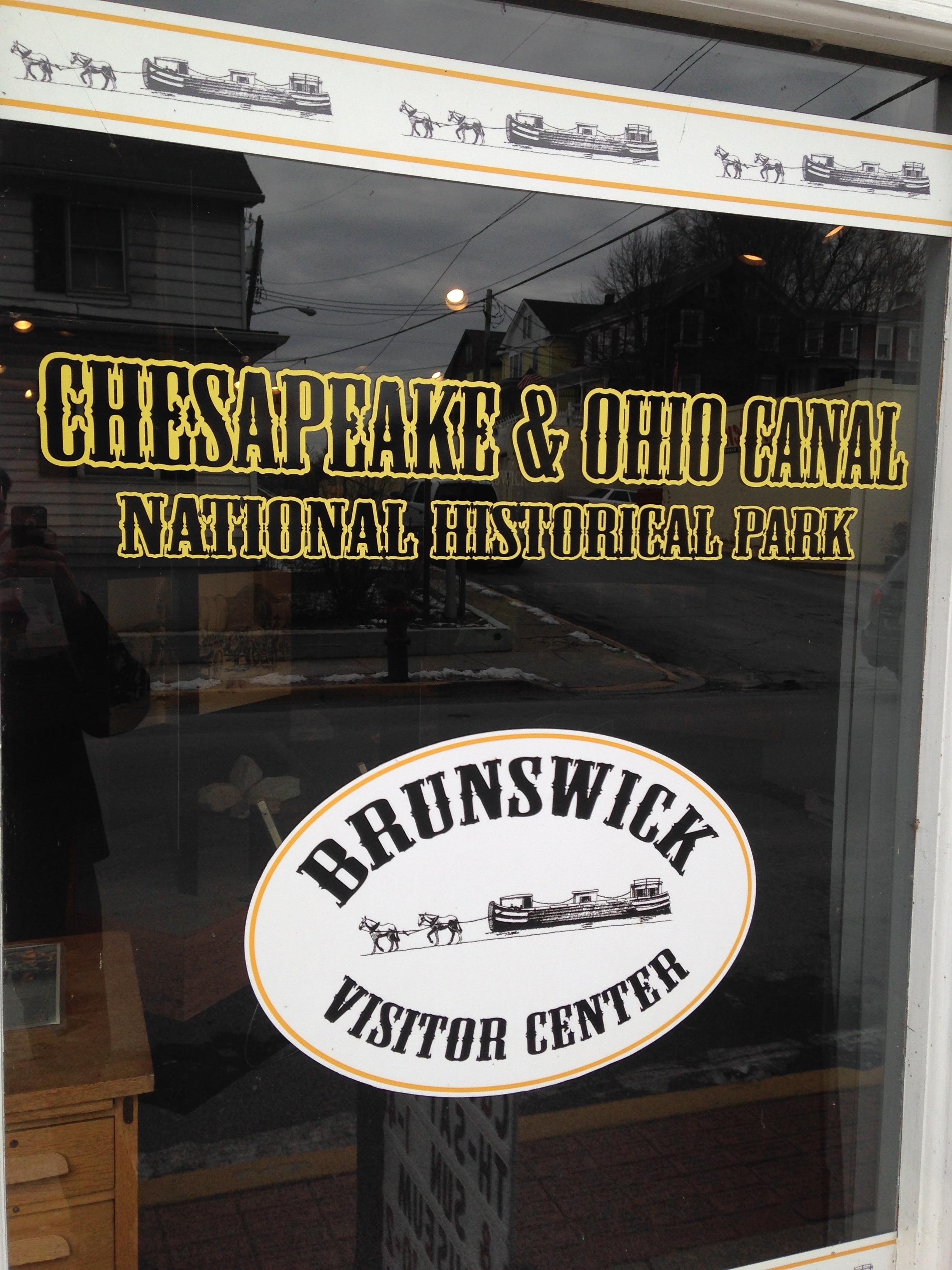
The Brunswick Visitor Center is located just off the C&O Canal towpath at mile 55 in Frederick County, MD. The visitor center shares a building with the Brunswick Heritage Museum. For over a century Brunswick has been a railroad town. This once bustling company town is now a quiet place since the decline of the railroads. The remains of the rail yard are still visible from the canal towpath.
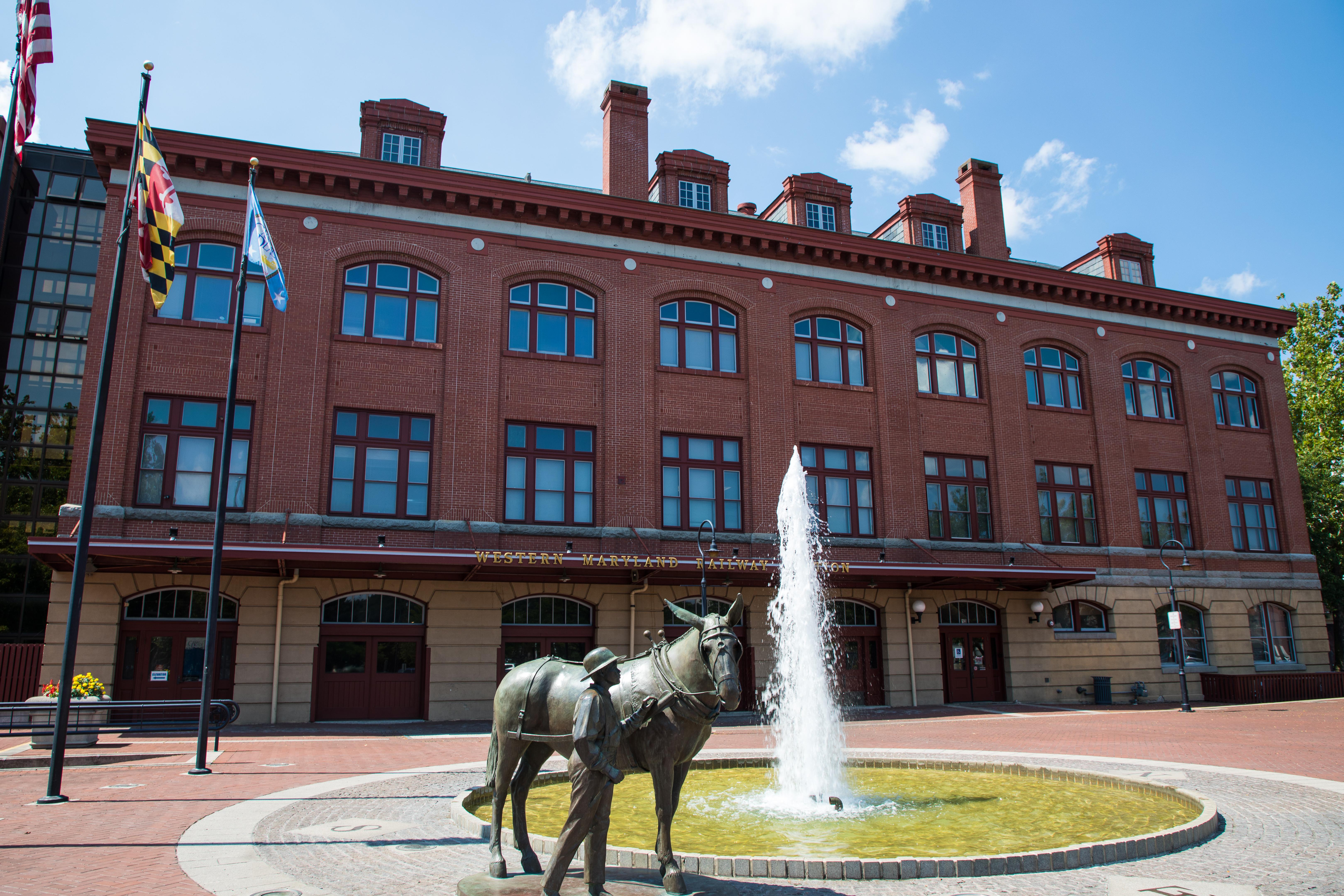
The Cumberland Terminus Visitor Center is located at mile 184.5 along the C&O Canal towpath in Allegany County, MD. Located in the Western Maryland Railway station, the visitor center features a spacious exhibit area full of interactive displays about the history of the C&O Canal and Cumberland. Pass through a model of the Paw Paw Tunnel and step back into the hey day of the canal. Awaiting you is a life size section of a canal boat. View exhibits on the canal's construction, cargo, mules, locks, and crew.
The Georgetown Visitor Center is located at mile 0.4 along the C&O Canal towpath in Washington, DC. Information about the National Park Service in Georgetown can be found at the Old Stone House (Rock Creek Park), located at 3051 M Street NW, Washington, DC 20007.
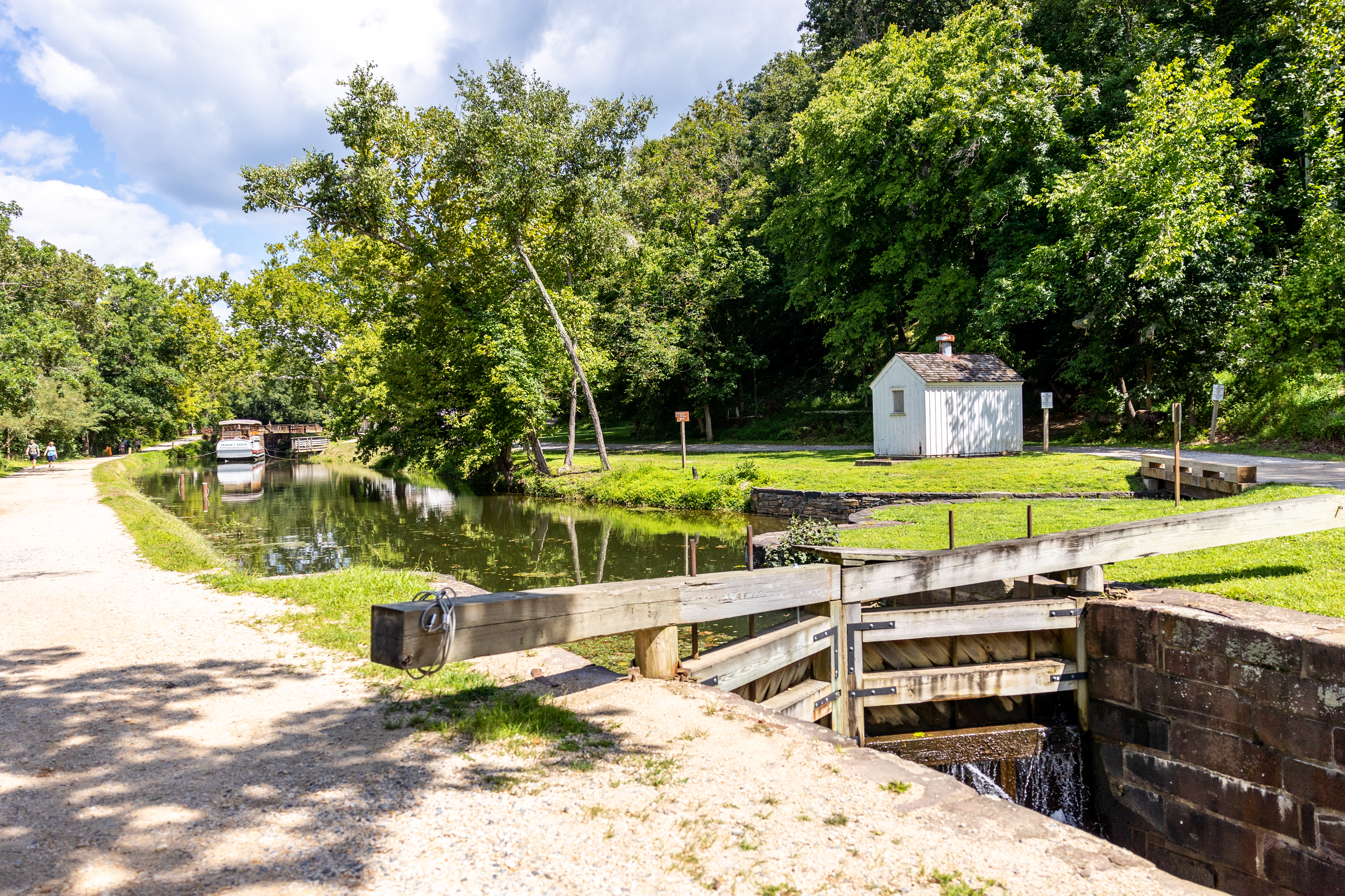
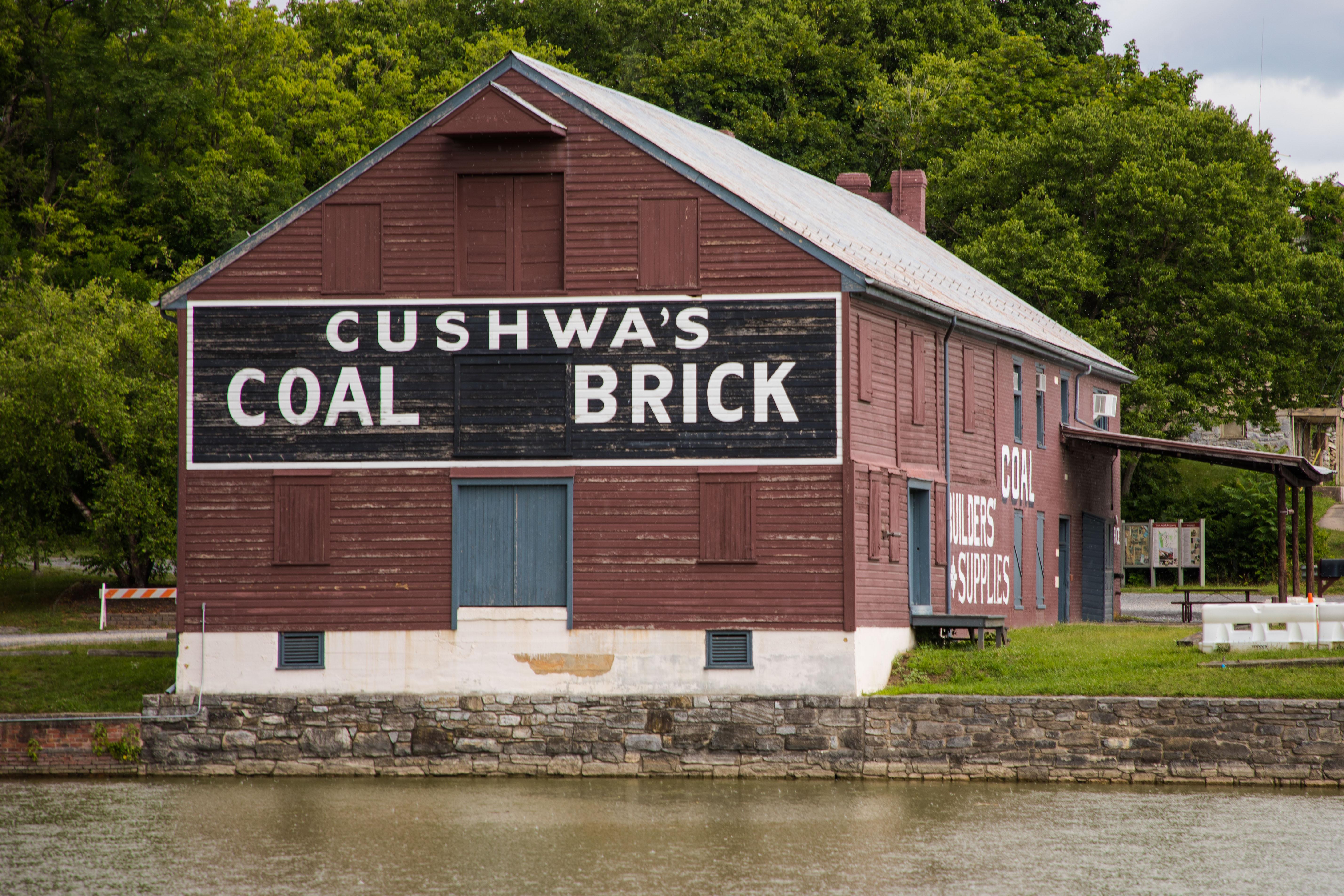
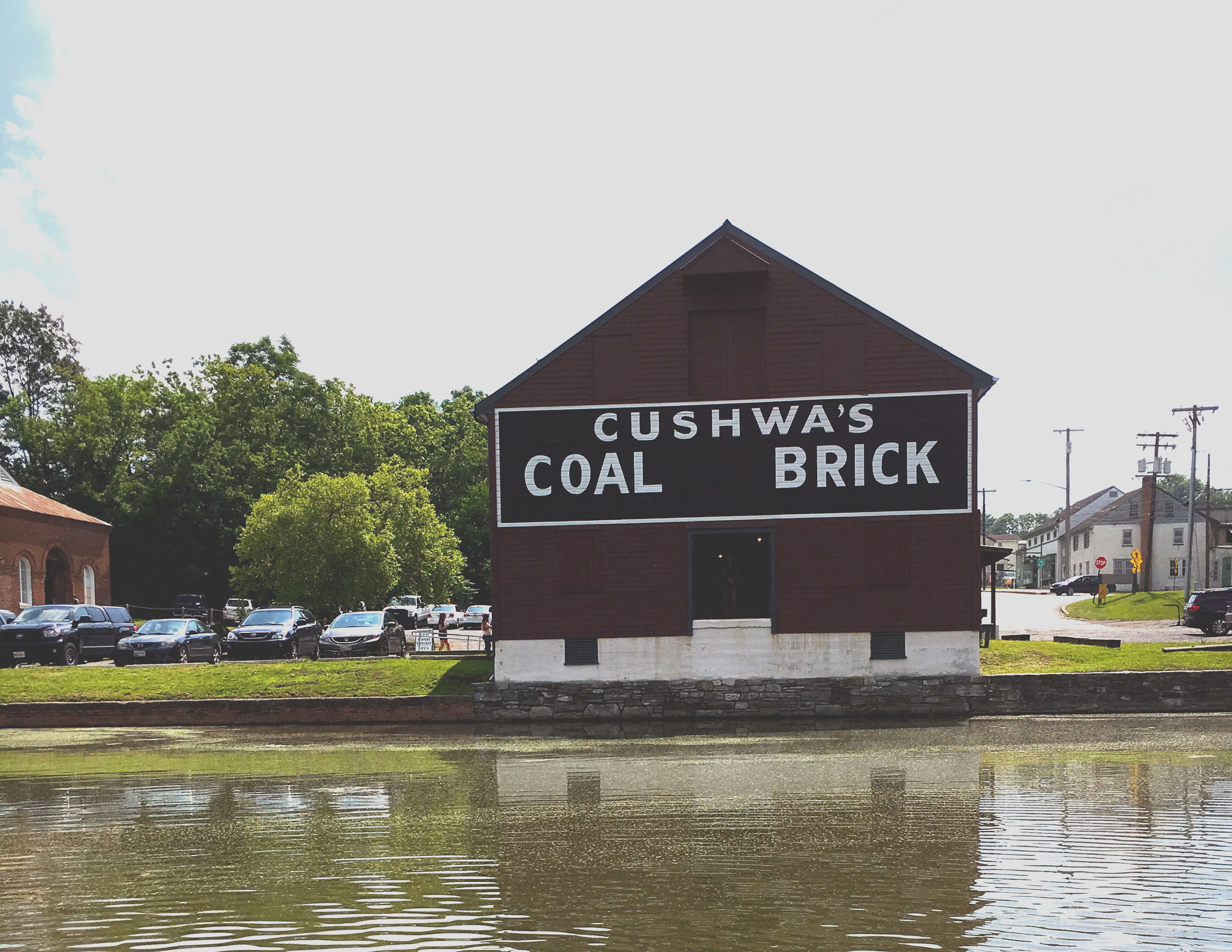
The Cushwa Basin Visitor Center in Williamsport is located at mile 99.8 along the C&O Canal towpath in Washington County, MD. Situated at the confluence of the Conococheague Creek and the Potomac River, Williamsport was first settled in 1740. A half-mile rewatered section of canal leads through the turning basin, under the only railroad lift bridge on the canal, and continues to Lockhouse 44 and the adjacent lock. The Conocheague Aqueduct is located across from the turning basin.
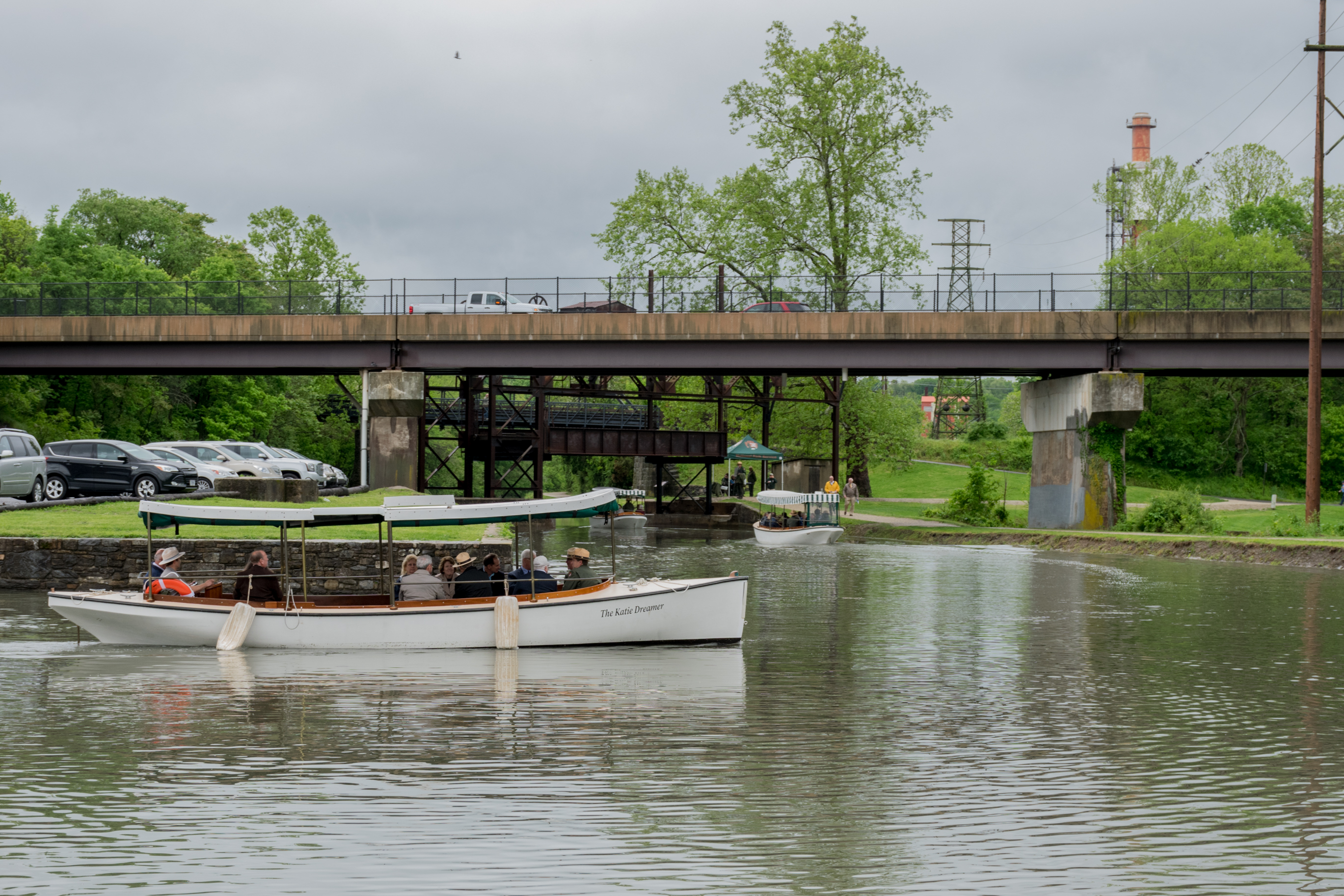
Today, visitors can enjoy life on the canal during a free replica canal launch boat program at Williamsport. During the late 19th and early 20th century, 30-foot battery and steam powered launch boats traveled the canal for leisure and business.
Wildlife Watching - Oldtown C&O Canal
Head down the C&O Canal NHP towpath in Oldtown, Maryland into a rare ecosystem mirroring that of the West. Spot a variety of wildlife and dragonfly species in this secluded hotspot.
Hike Along the Towpath Through the Paw Paw Tunnel
Walk through the 3,118-foot Paw Paw Tunnel, a significant engineering feature along Mile 155 of the C&O Canal towpath.
Bike the C&O Canal Towpath
By bicycle or on foot, try a short day trip or travel the entire 184.5-mile length of the Chesapeake and Ohio Canal Towpath.
Explore the C&O Canal Williamsport Visitors Center
Visit the Williamsport Visitor Center at Cushwa Basin for information about the Canal and the surrounding area, sites including an aqueduct, rail lift-bridge, lockhouse, and operable locks.
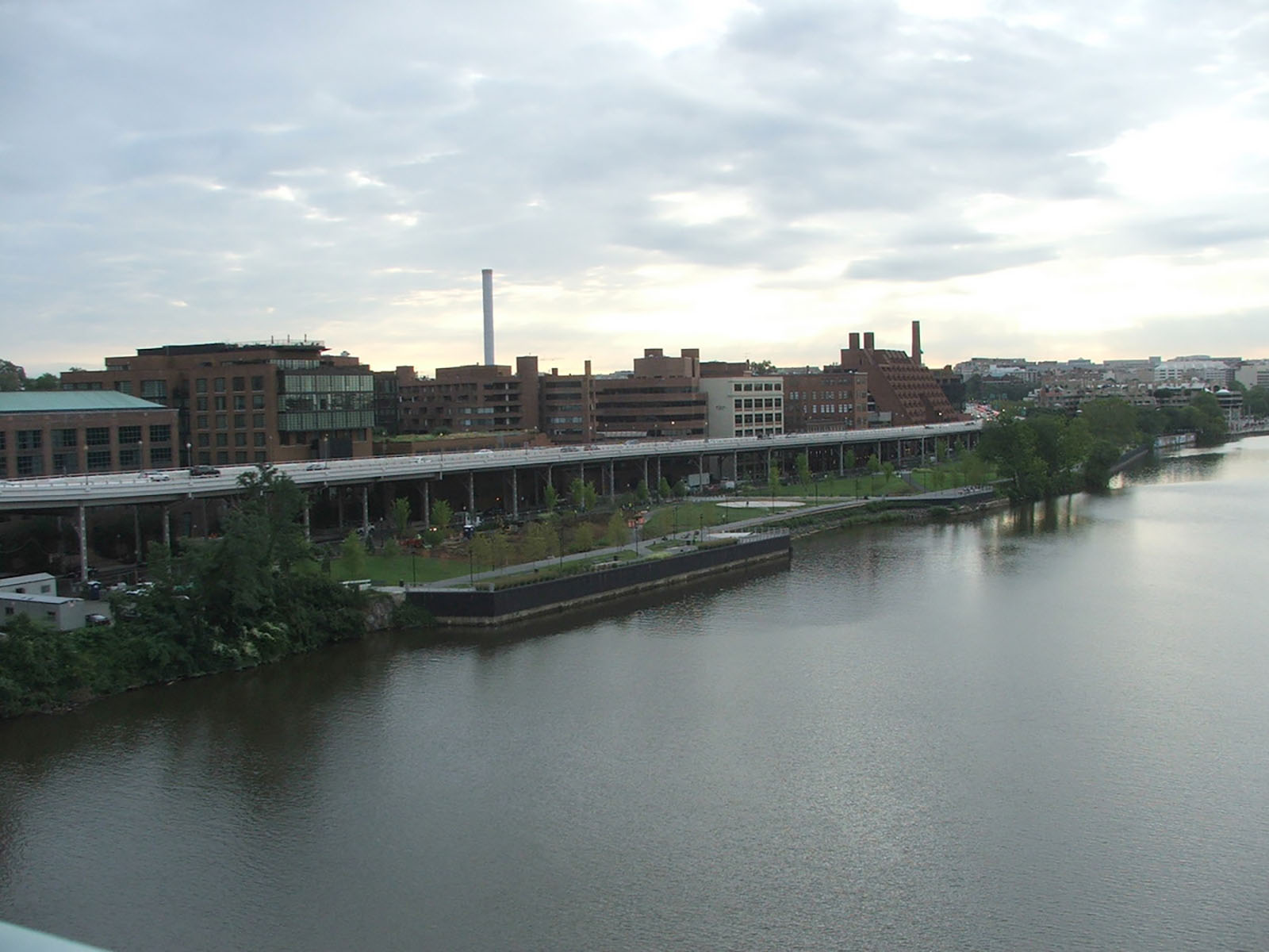
Explore the Georgetown Waterfront
Explore the Georgetown Waterfront and imagine the changes the space has gone through.
Bicycle from Williamsport to Harpers Ferry
Want to explore history and enjoy a day bicycling? This is the route for you. Enjoy a leisurely 40-mile bike ride, or choose to hike and or paddle the length instead, spending the night camping or staying in paid accommodations. Historic treasures await you in Williamsport, Shepherdstown, and Harpers Ferry along the way.
Multi-Park Loop
Park your car and stretch your legs! Visit four different National Parks in Washington, DC and begin logging miles on seven different National Historic or National Scenic trails!
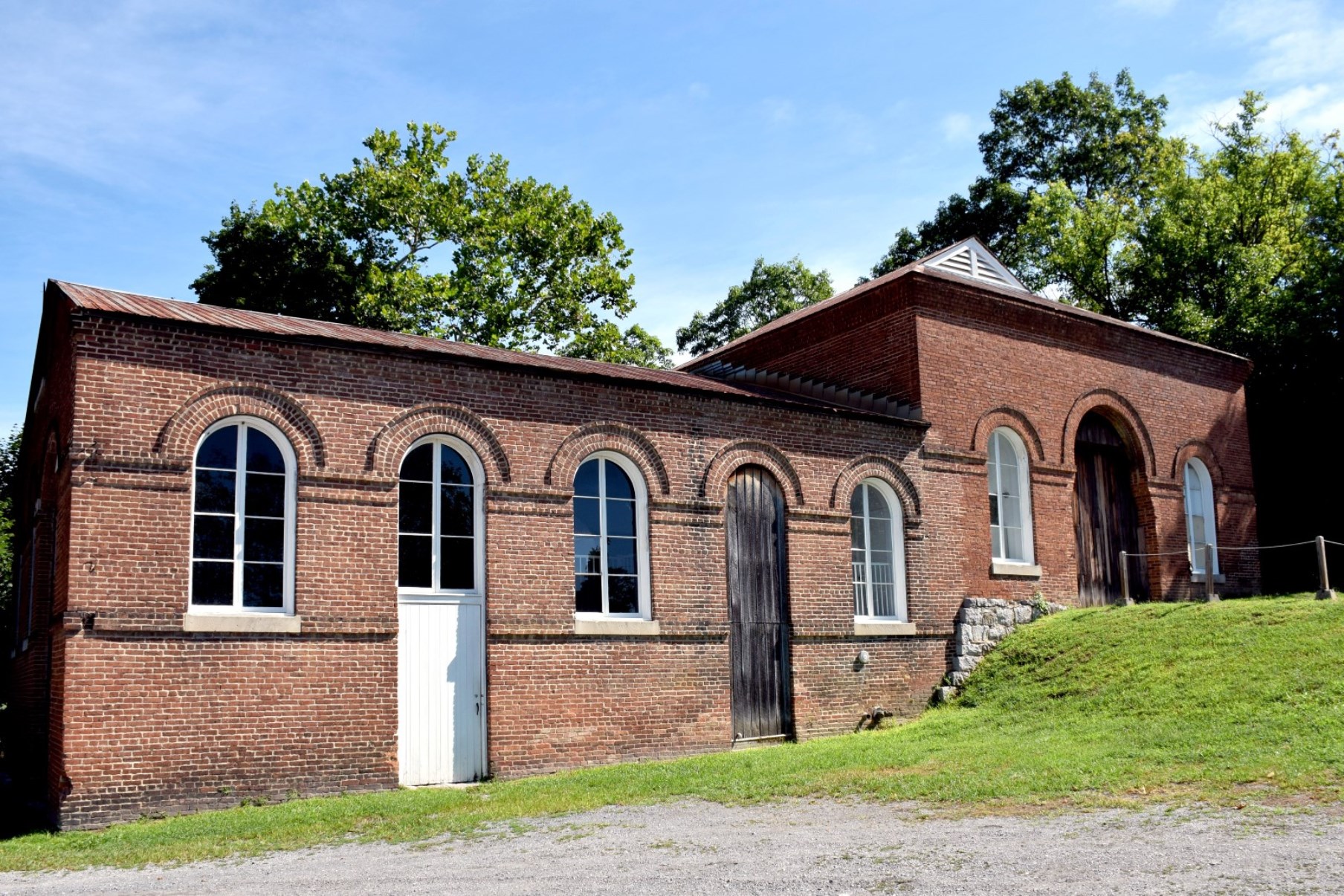
Explore the Trolley Barn at Cushwa Basin
The trolley barn is located across the parking lot from the Cushwa Building. In 1896, the first trolley line in Washington County, Maryland was built running from Williamsport to Hagerstown. The water supply from the Conococheague Creek made this location ideal for a steam-powered generating station. Today, the trolley barn contains historic photos, historic toys, children's costumes, a scale model of a canal boat’s mule stable, and dioramas.
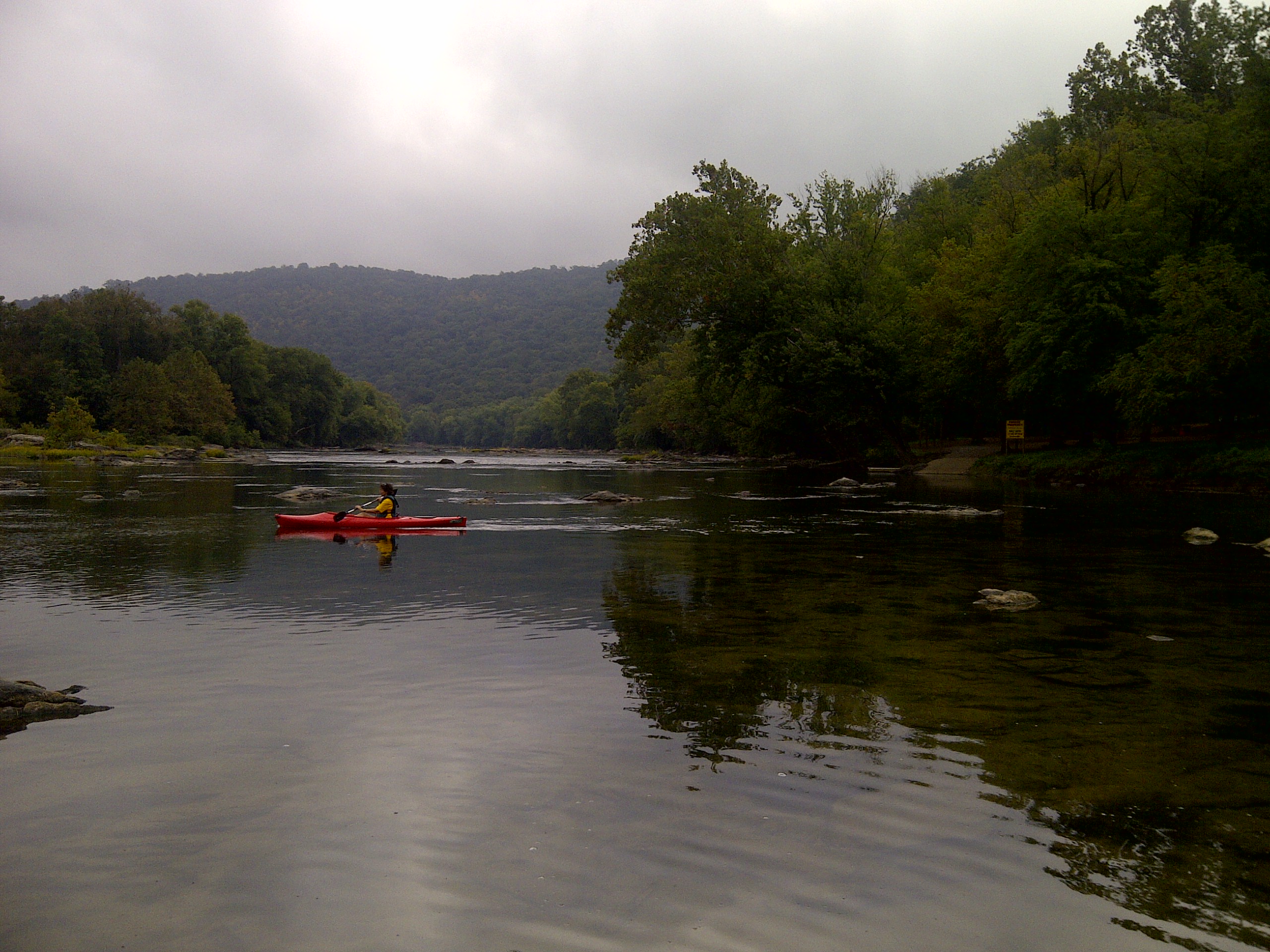
Paddle the Middle Potomac
Paddle from Potoma (sic) Wayside, at the confluence of the Shenandoah and Potomac rivers, or another launch site and take out at Algonkian Regional Park or Riverbend Park (both Virginia side). Camp at sites along the C & O Canal Towpath, reserve a night in a historic lockhouse (river left upstream of Point of Rocks), reserve a cabin at Algonkian Regional Park (two-night minimum) or find a B & B or hotel. This trip can be combined with hiking and bicycling.
Tours
Count: 1
Williamsport Canal Features
Williamsport, once a thriving and bustling canal town, transported tons of coal up and down the canal from Cumberland, MD to Washington, DC. Take a walk and imagine dozens of boats, workers, and mules moving commerce. Williamsport, MD is at mile 99.8 out of 184.5 miles of towpath. Here you will find unique features of the canal system and other infrastructure that arose with westward expansion and industrialization.