April 15 - November 15 (Peak Season): $20/night; November 16 - April 14 (Non-Peak Season): $10/night
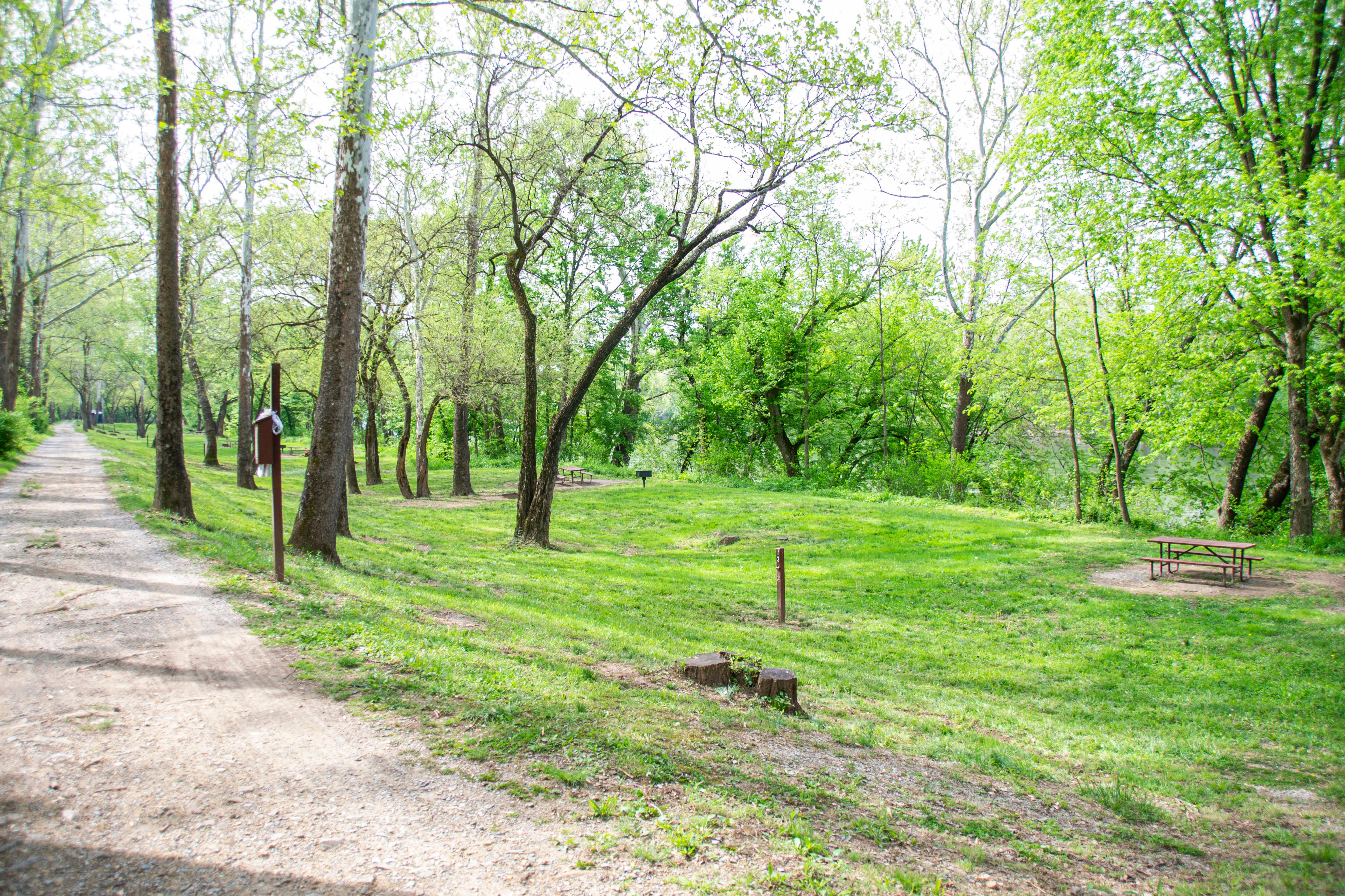
[61 Words] Crossing a wooden boardwalk from the roadside to the towpath Antietam Creek Campground stretches to the North and South in about equal parts along the gravel towpath. There are 15 campsite, each about 50 feet by 65 feet with a picnic bench, fireplace, and charcoal grill. About halfway in the campground is one latrine with two stalls and two porta pottys.
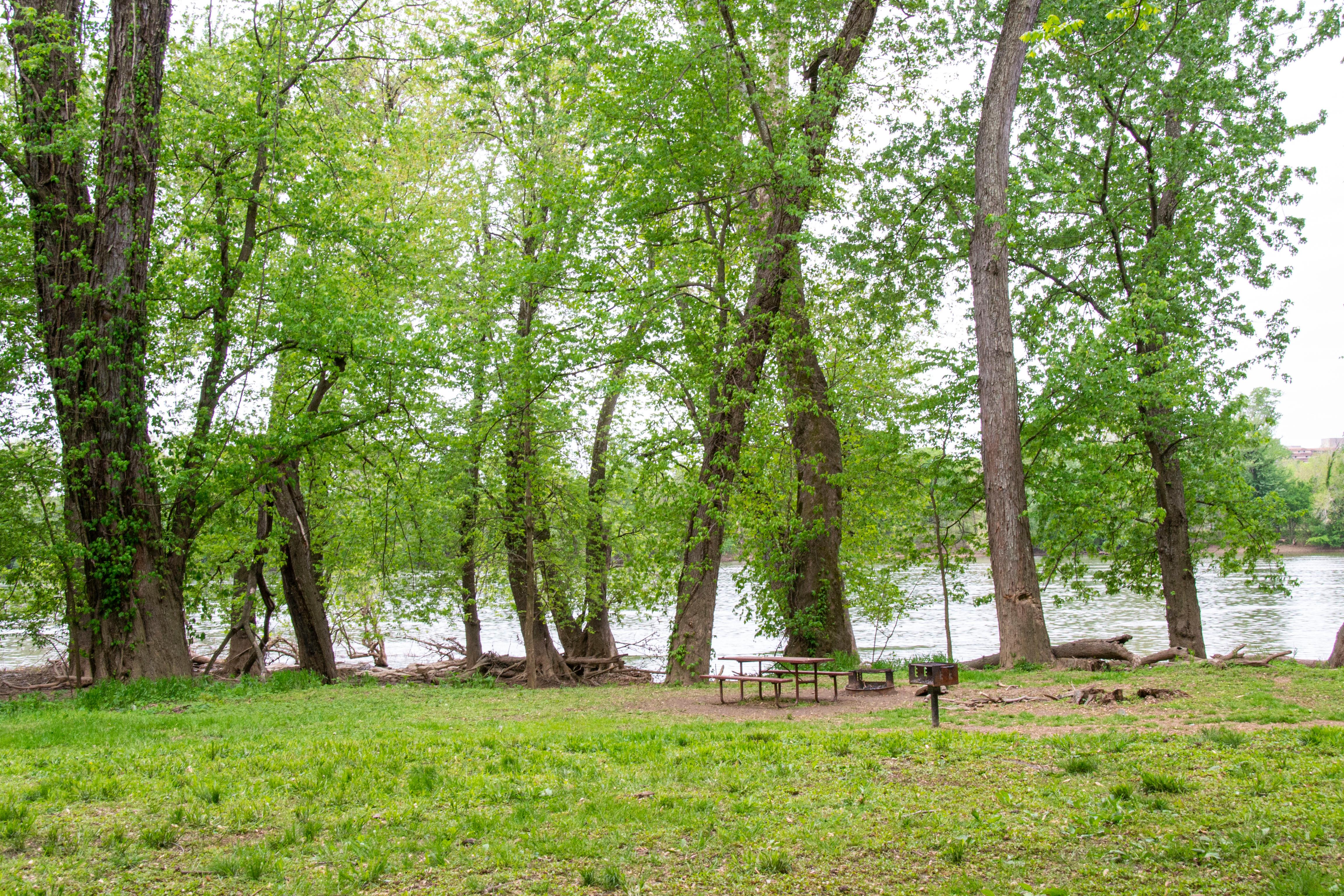
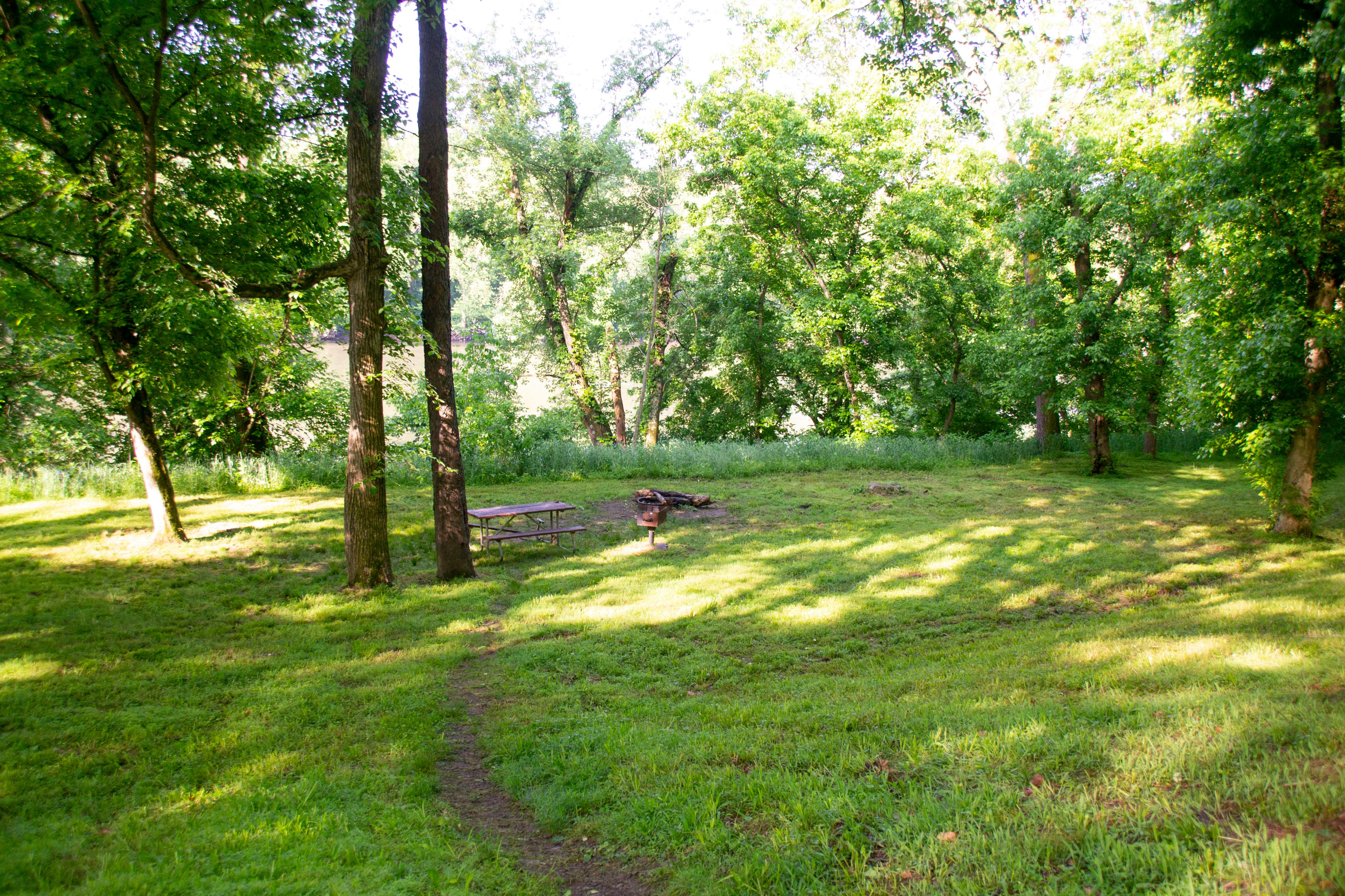
(73 words) The nearest parking lot to Bald Eagle Island Campsite is at Lock 29. From the parking lot, take the path past Lockhouse 29, over the lock to the towpath. Take a left onto the towpath, though the gate and head downriver .5 miles. On your right is the large, rolling, lightly wooded grassy camping area between the Potomac River and the C&O towpath. On the far side of the canal are train tracks.
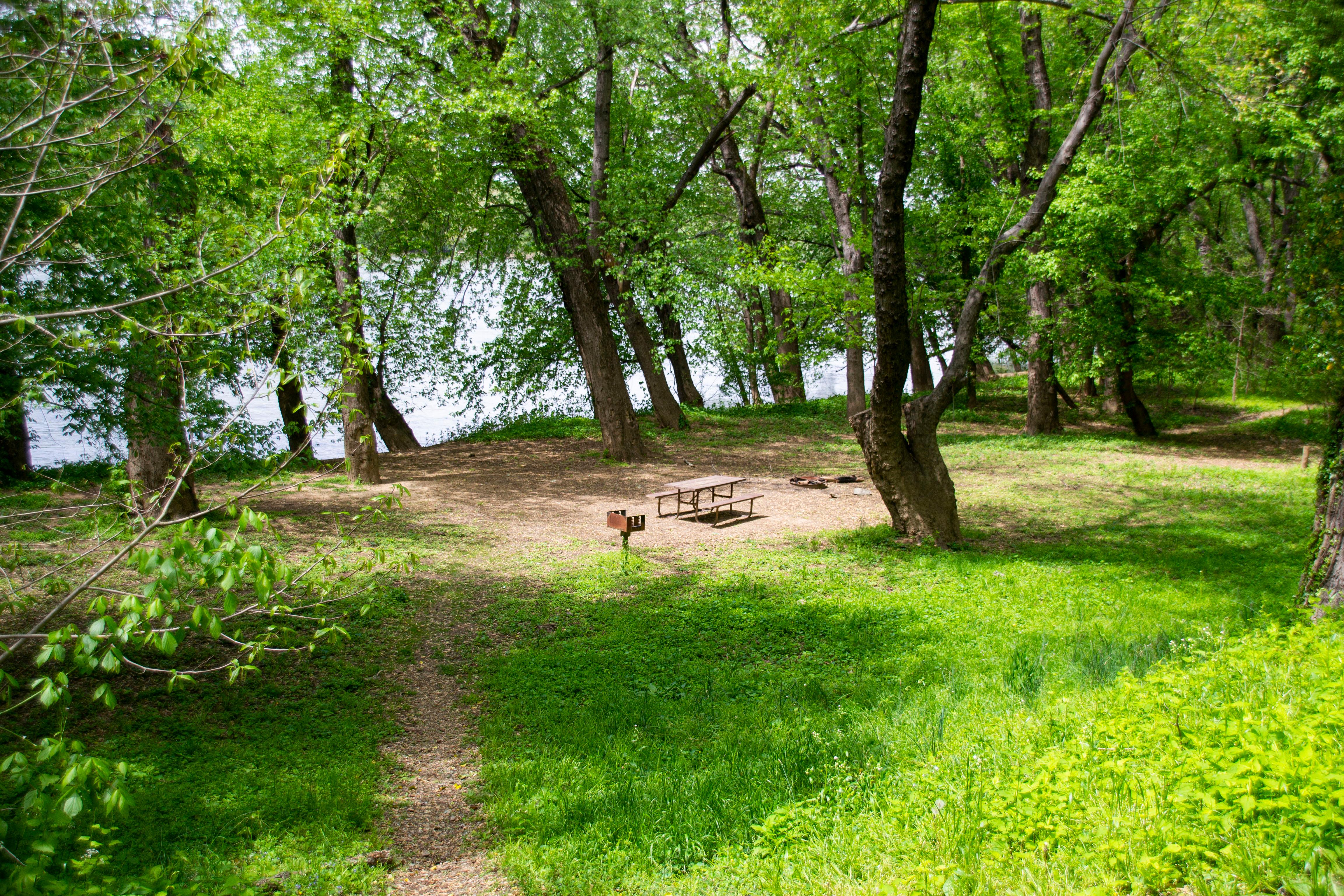
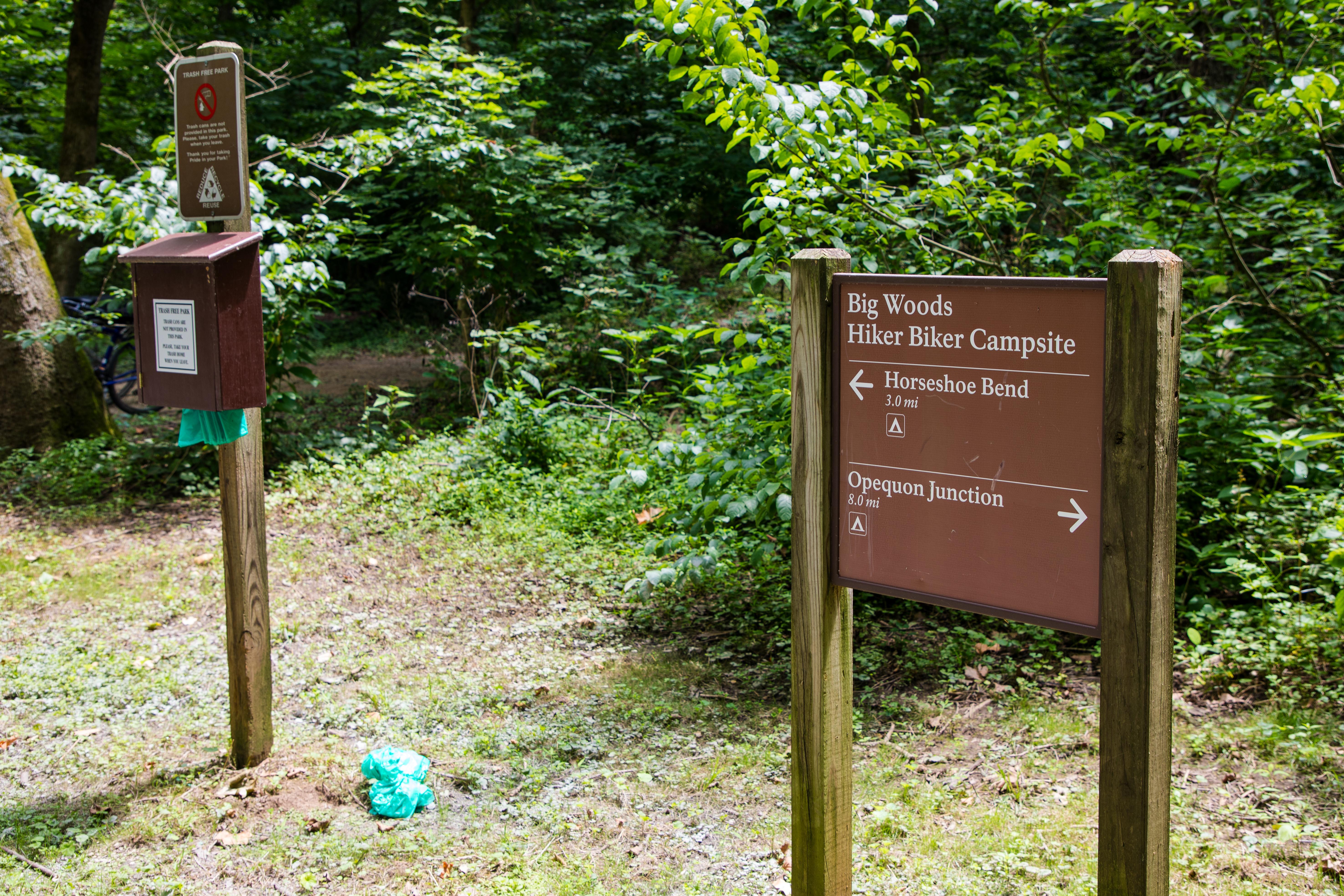
(125 words) The nearest parking lots to Horseshoe Bend Hiker-Biker Campsite are at Taylors Landing or Dam 4. The campsite is located between them. The road to the parking lot for Taylors Landing crosses a bridge over the canal. The towpath is just after the bridge. Coming from the parking lot, you would turn left (or upriver) onto the towpath, following it for 1.8 miles. It can also be accessed from the Dam 4 parking by crossing over the canal on a guard gate, then following the towpath to the left (downriver) for 1.7 miles. A sign on the towpath is at the head of a short, dirt trail, which leads to the small, secluded, wooded, rolling camping area between the Potomac River and the C&O towpath.
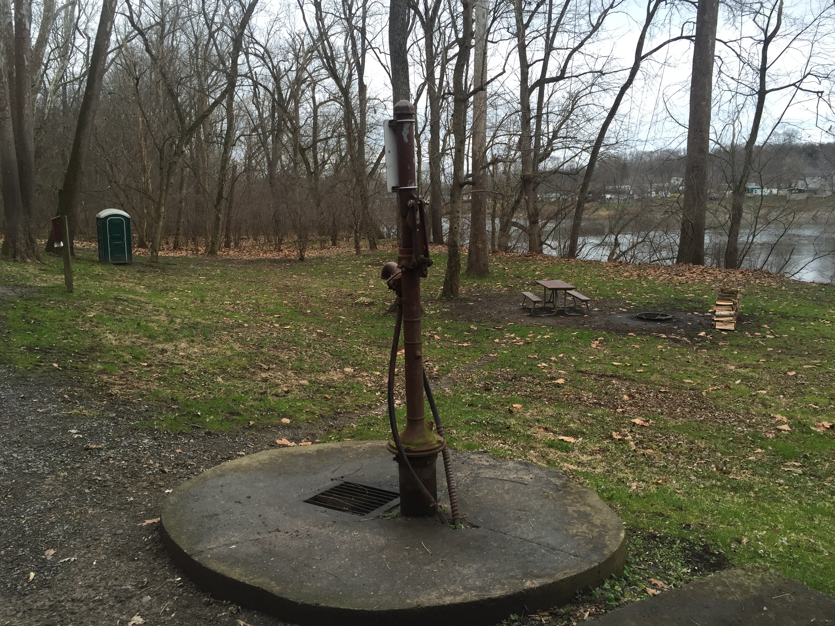
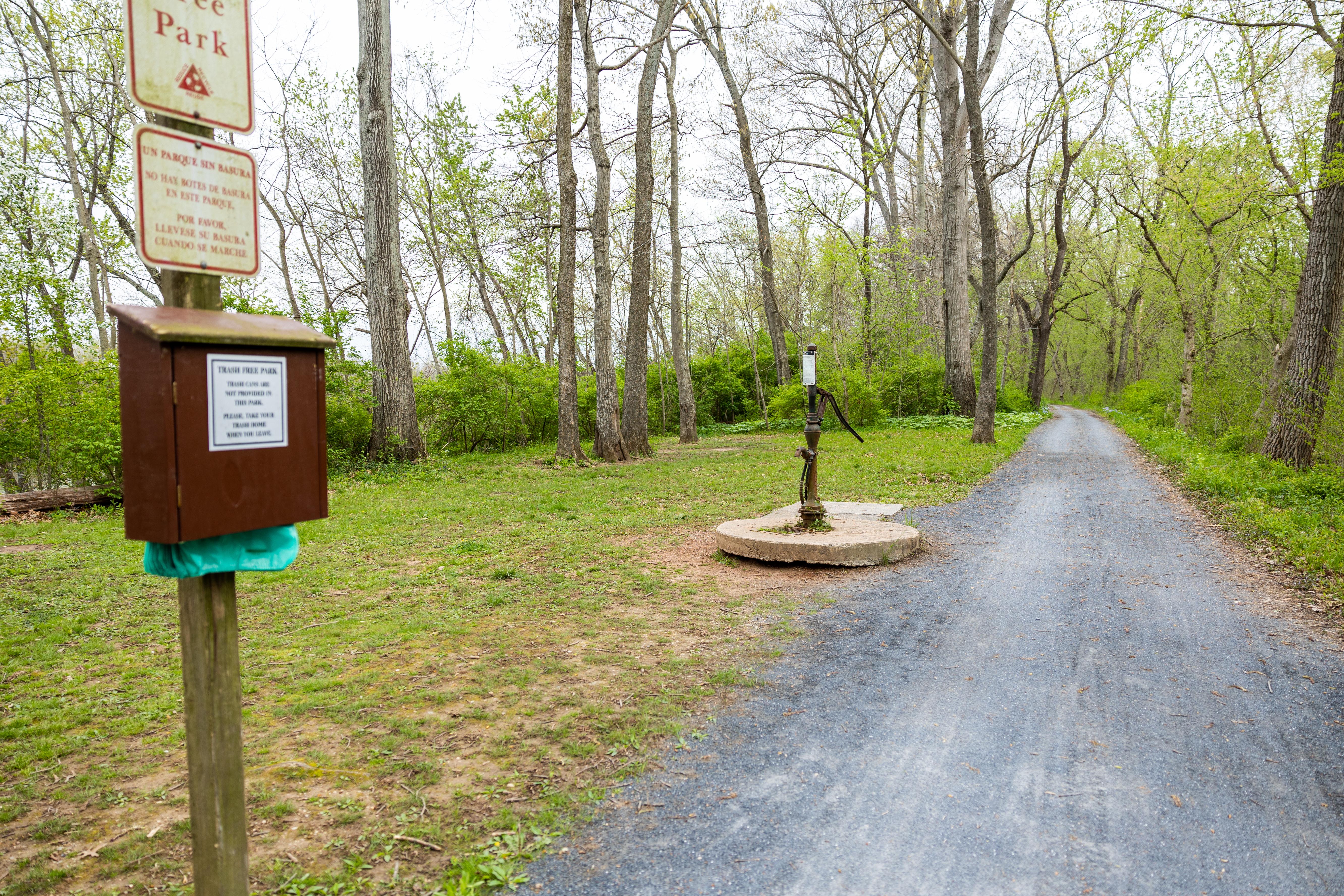
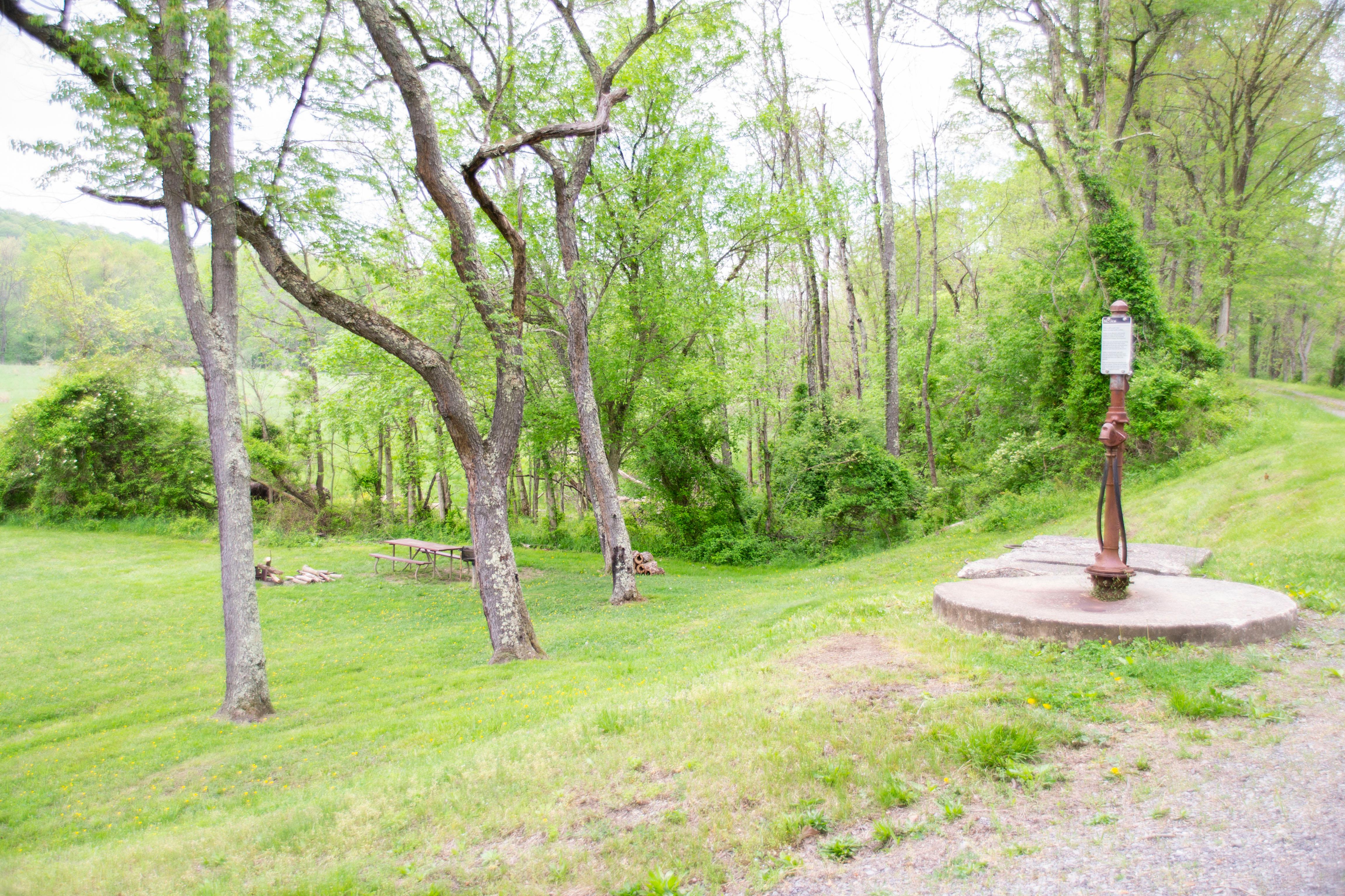
(62 words) The nearest parking is at Cohill Station canoe/kayak access point off Deneen Road. There is a small wooden bridge over the canal to the towpath. Turn right onto the towpath and head upriver for about 3 miles. Cacapon Junction Hiker-Biker campsite is a large, flat, lightly wooded area. The water pump is located is the center of the campground. End of description.
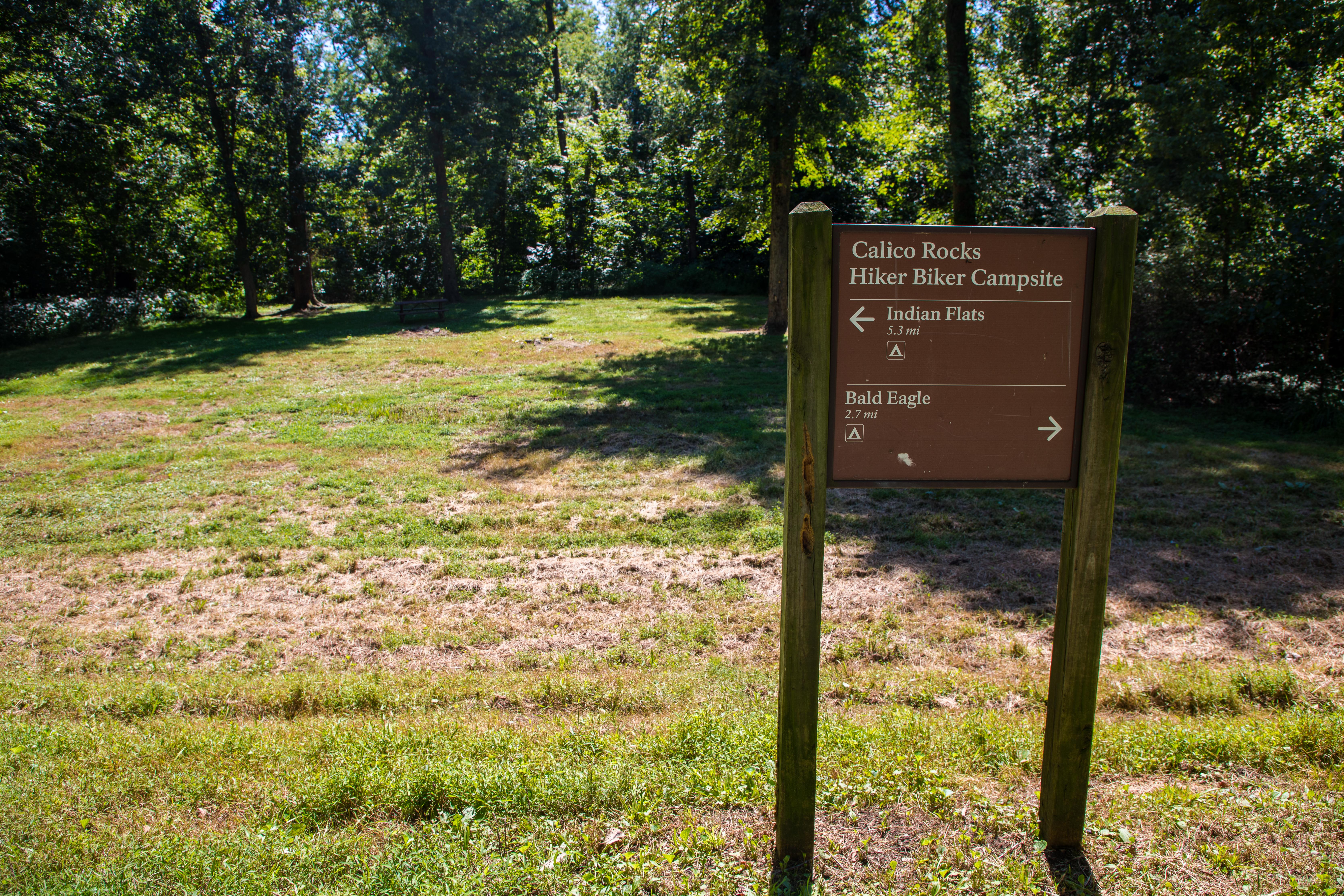
(84 words) The nearest parking to Calico Rocks Hiker-Biker Campsite is at the C&O Canal parking lot at Point of Rocks. On the western edge of the parking lot is a gate, and the towpath is just behind the gate. Turn right onto the towpath and head downriver, passing beneath Canal Road, the entrance to the parking lot. Traveling a total of .6 miles, you’ll see on your right is a large, flat, lightly wooded grassy camping area between the Potomac River and the C&O towpath.
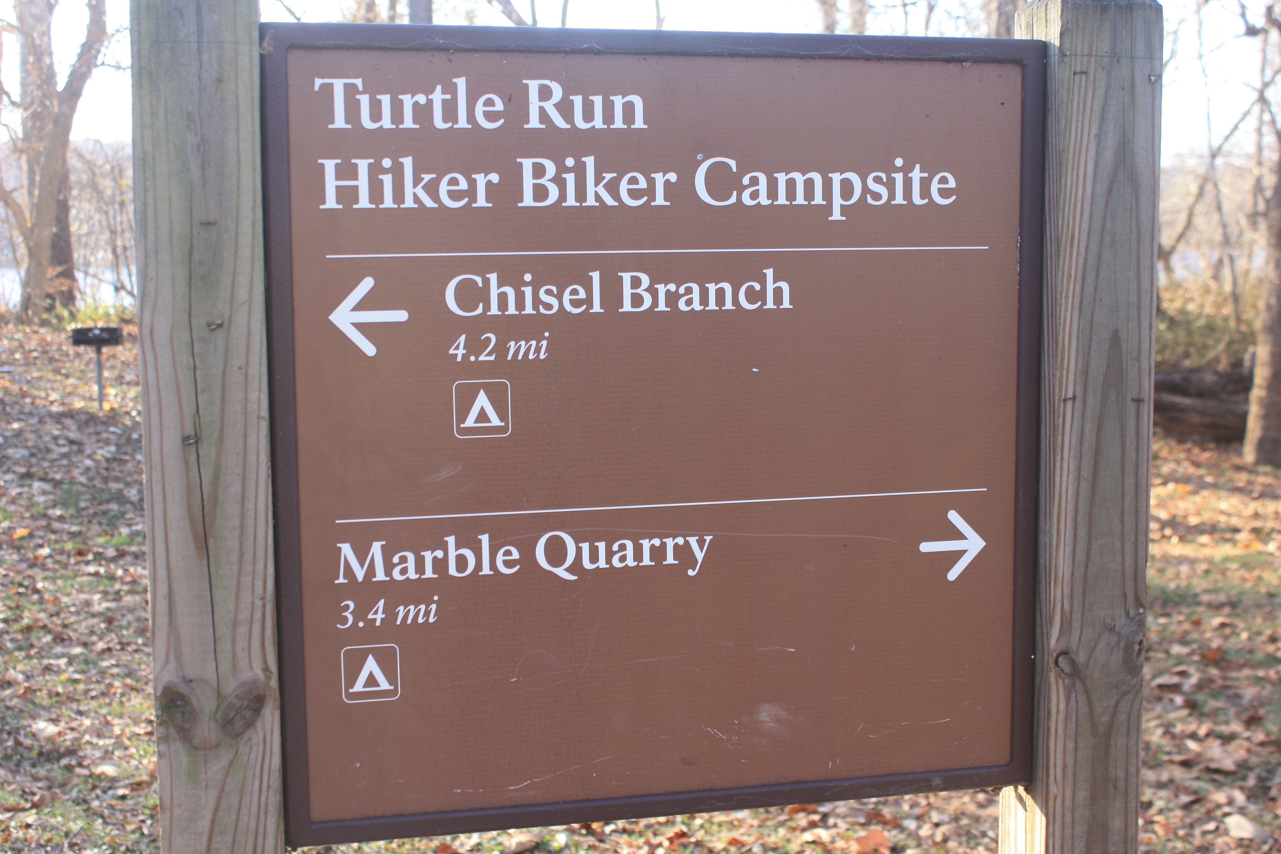
(90 words) The nearest parking to Chisel Branch Hiker-Biker Campsite is the Edward's Ferry parking area. From the parking lot head back up the road toward the towpath, passing between lockhouse 25 and Ruin of Jarboe's Store. Once you reach the towpath, turn right (east) onto the towpath, traveling for .3 miles to the campsite on your right. The water pump is in the center of the campground on the edge of the towpath. The campground is large, flat and lightly wooded. It sits between the towpath and the Potomac River.
Individual Sites: April 15 - November 15 (Peak Season): $20/night; November 16 - April 14 (Non-Peak Season): $10/night Group Site: April 15 - November 15 (Peak Season): $40/night; November 16 - April 14 (Non-Peak Season): $20/night
(102 words) The nearest parking to Horsepen Branch Hiker-Biker Campsite is the Sycamore Landing parking area. From the parking lot head toward a towpath access trail at the mid point of the southern edge of the lot. Once on the access trail it is 100 feet to the towpath. Turn left, East, onto the towpath, traveling for 1.1 miles to the campsite on your right. You will pass a water pump about 50 feet before the access trail for the campsite breaks off to the right. The campground is large, flat and lightly wooded. It sits between the towpath and the Potomac River.
(83 words) The nearest parking lot to Horseshoe Bend Hiker-Biker Campsite is at Taylors Landing. The road to the parking lot crosses a bridge over the canal. The towpath is just after the bridge. Coming from the parking lot, you would turn right (or downriver) onto the towpath, following it for 1.7 miles. The trail to the campsite is near the water pump and descends slightly to the small, narrow, flat, grassy camping area between the Potomac River and the C&O towpath. End of description.
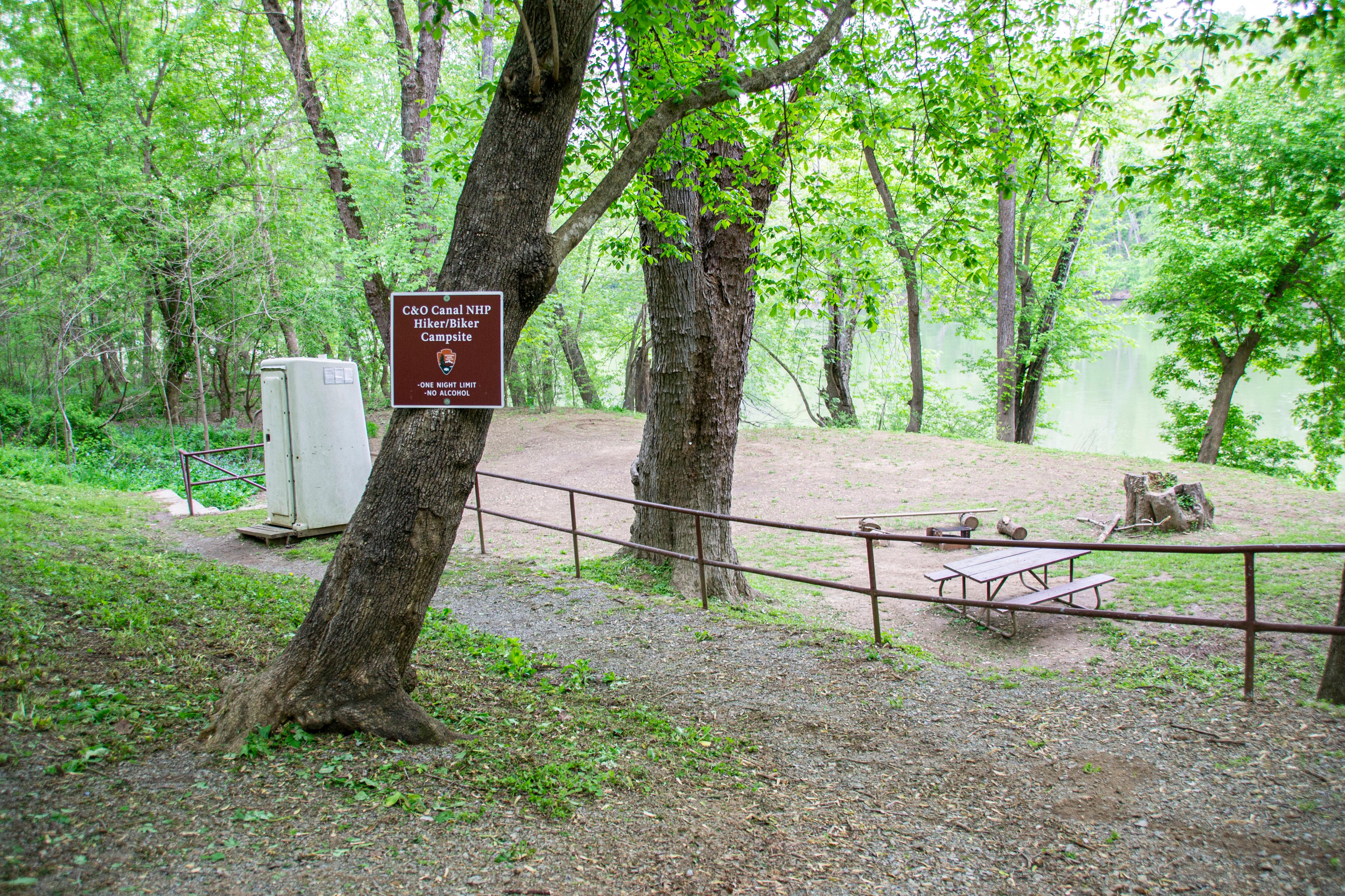
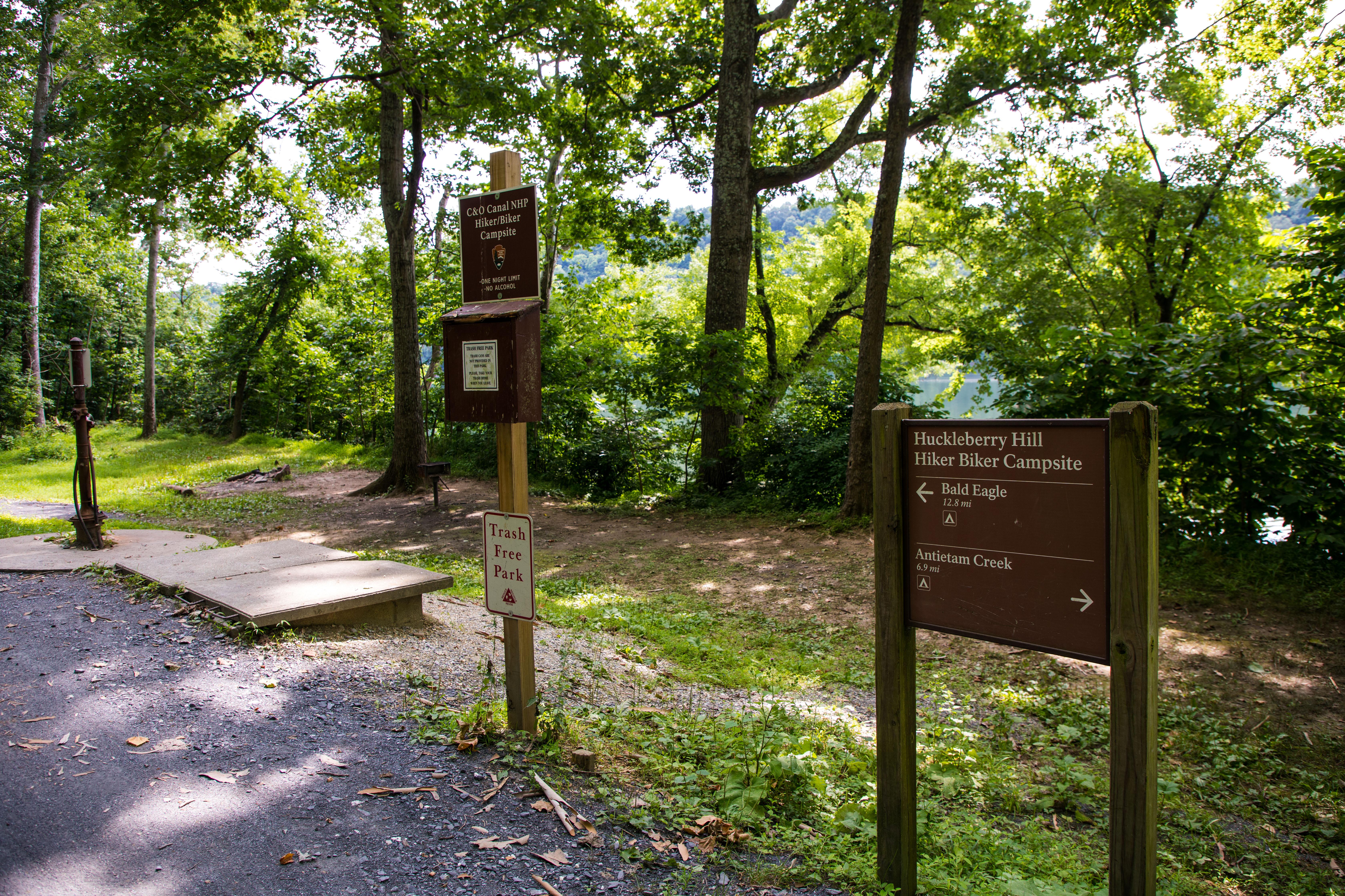
(80 words) The nearest parking lots to Huckleberry Hill Campsite are either Harpers Ferry or Dargan Bend. The campsite is located between them. From Harpers Ferry you cross the Potomac River to the C&O Canal towpath. The campsite is located 2.1 miles upriver. From Dargan Bend Boat Ramp, the campsite is located 2.0 miles downriver on the towpath. A medium sized, narrow, grassy camping area between the Potomac River and the C&O towpath. There is a steep drop off to the river.
(55 words) The nearest parking to Indian Flats Hiker-Biker Campsite is a the Monocacy Aqueduct. From the parking lot, walk toward the Aqueduct and towpath. Turn right at the towpath, heading upriver on the Aqueduct. In .3 miles on your left is a medium sized, wooded, rolling camping area between the Potomac River and the C&O towpath.
(65 words) The nearest parking is at the Fifteenmile Creek Drive-in campsite. The towpath is on the northern edge of the parking lot. Turn right and head downriver on the towpath for about 1.7 miles. The Indigo Neck Hiker-Biker Campsite is a small, flat, narrow, lightly wooded site. It is bordered by the Potomac River and the towpath. Lock 57 is adjacent to it. End of description.
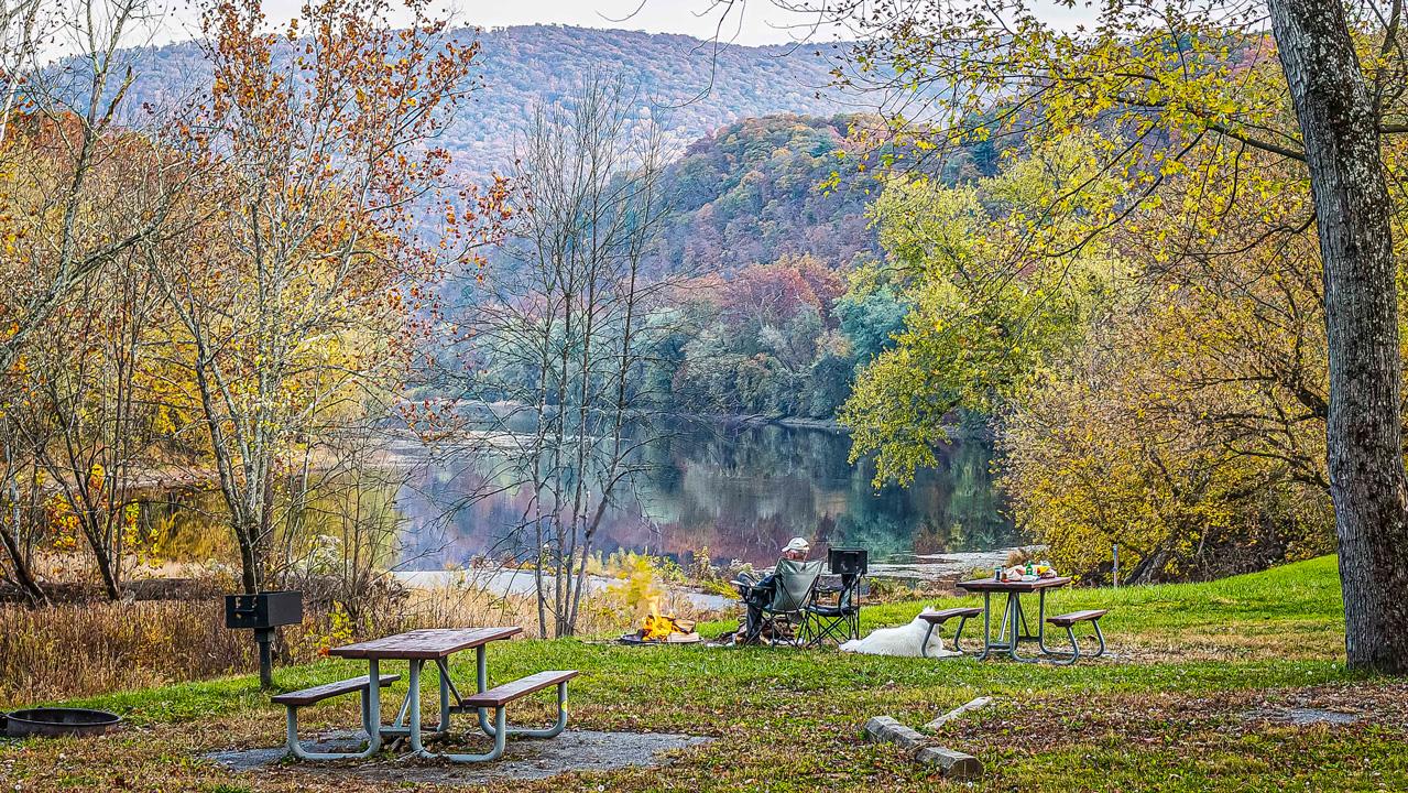
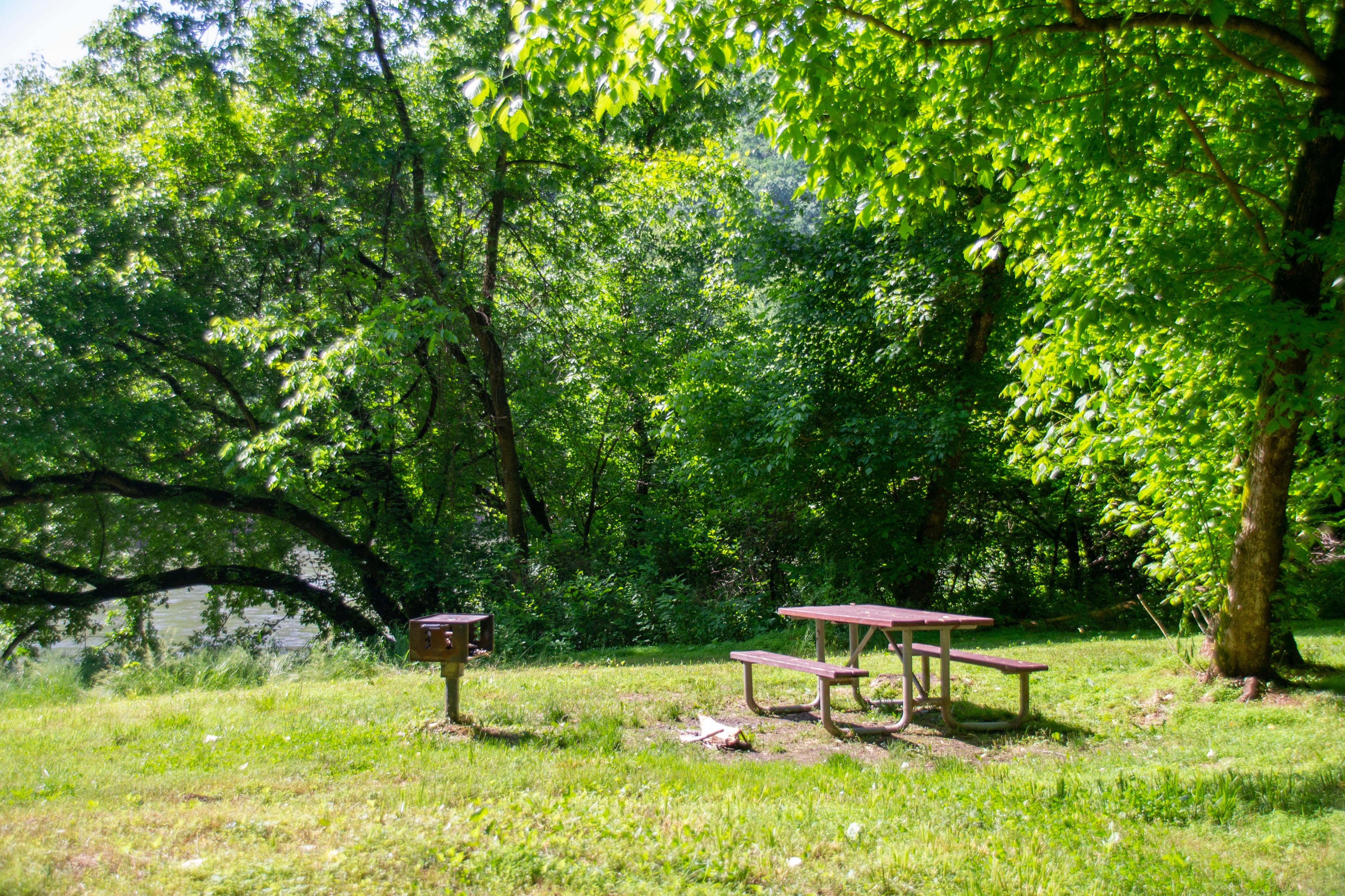
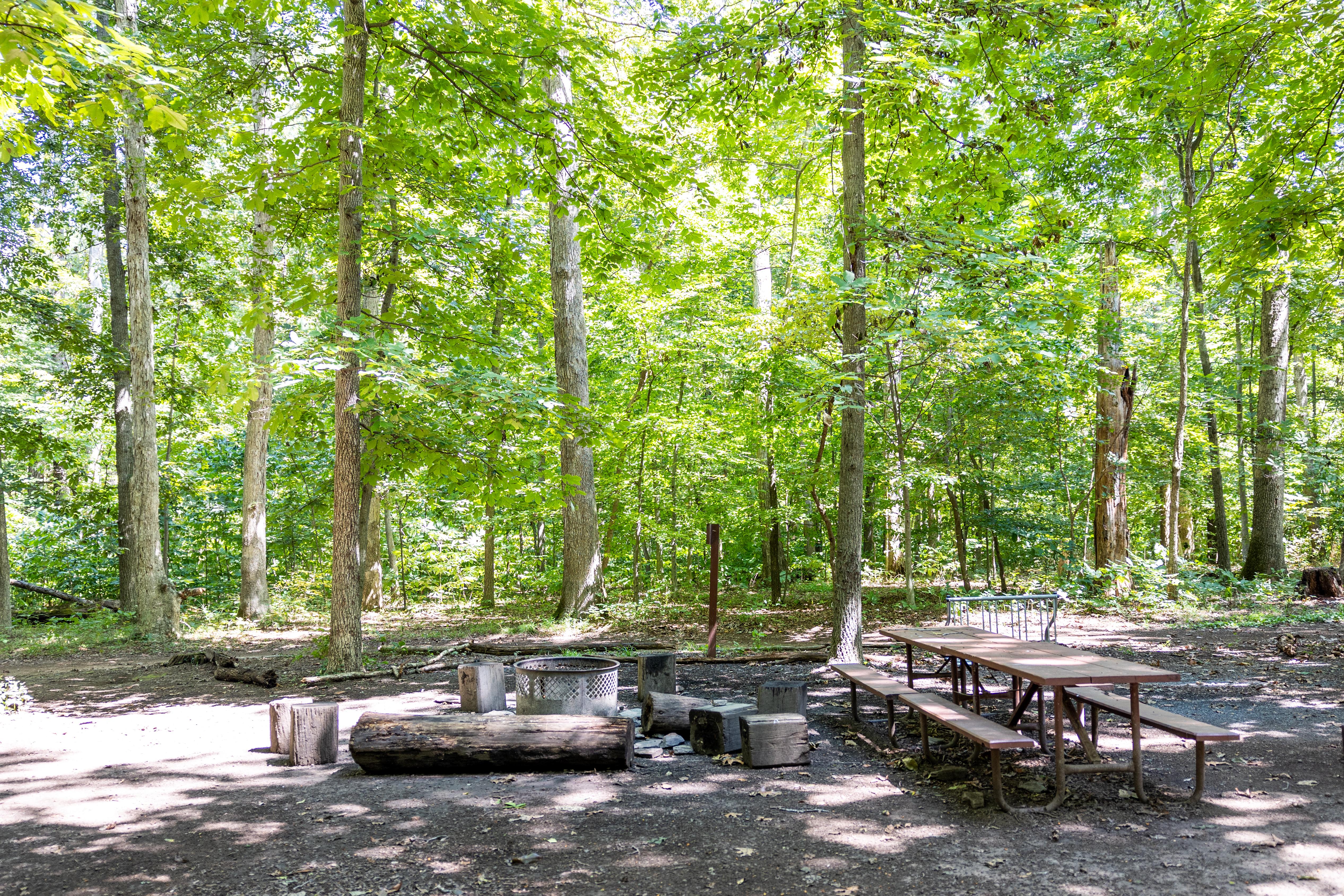
[123 Words] Looking South at Iron’s Mountain campsite to the left of the towpath is Lock 73 and to the right of the towpath is a sign reading Iron’s Mountain Hiker-Biker Campsite. The sign also conveys the adjacent campsites pointing to the left towards Pickmen’s Ferry and to the right Evitts Creek. 30 feet south of the sign is a porta potty which is on the right side of the towpath. The campsite is located on the right side of the towpath downhill a short way. The campsite is grassy and hilly with a picnic table, firepit, and charcoal grill, it is also about 75 feet long and 40 feet wide reaching down to the Potomac River. This campsite has easy access to the river.
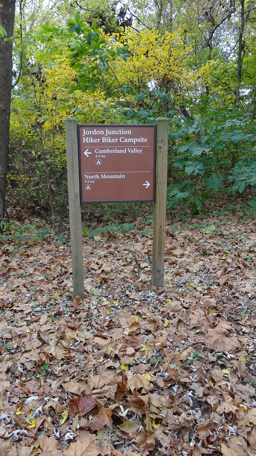
[148 Words] Arriving at Jordan Junction Hiker Biker Campsite from the East, to the left of the towpath is a porta potty and to the right of the towpath about 25 feet down is a water hand-pump. Even further, about 120 feet on the right side of the towpath is the campsite name plate reading Jordan Junction Hiker Biker Campsite, an arrow pointing to the left with associated text reading Cumberland Valley, and an arrow pointing to the right with associated text reading North Mountain. The campsite is about 4,200 square feet that stretches along side the left of the towpath. Central back of the campsite is a dirt clearing with a table bench and a fireplace. The rest of the campsite is grassy with lots of overhanging branches. The Potomac River is 10 feet to the left of the campsite but is barely visible through the foliage.
(86 words) The nearest parking lot to Killiansburg Cave Hiker-Biker Campsite is at Snyders Landing. The road to the parking lot crosses a bridge over the canal. The towpath is just after the bridge. Coming from the parking lot, you would turn right (or downriver) onto the towpath, following it for 1.4 miles. The trail to the campsite is near the chemical toilet and descends slightly to the campsite, which is a medium-sized, rolling, narrow, lightly wooded grassy camping area between the Potomac River and the C&O towpath.
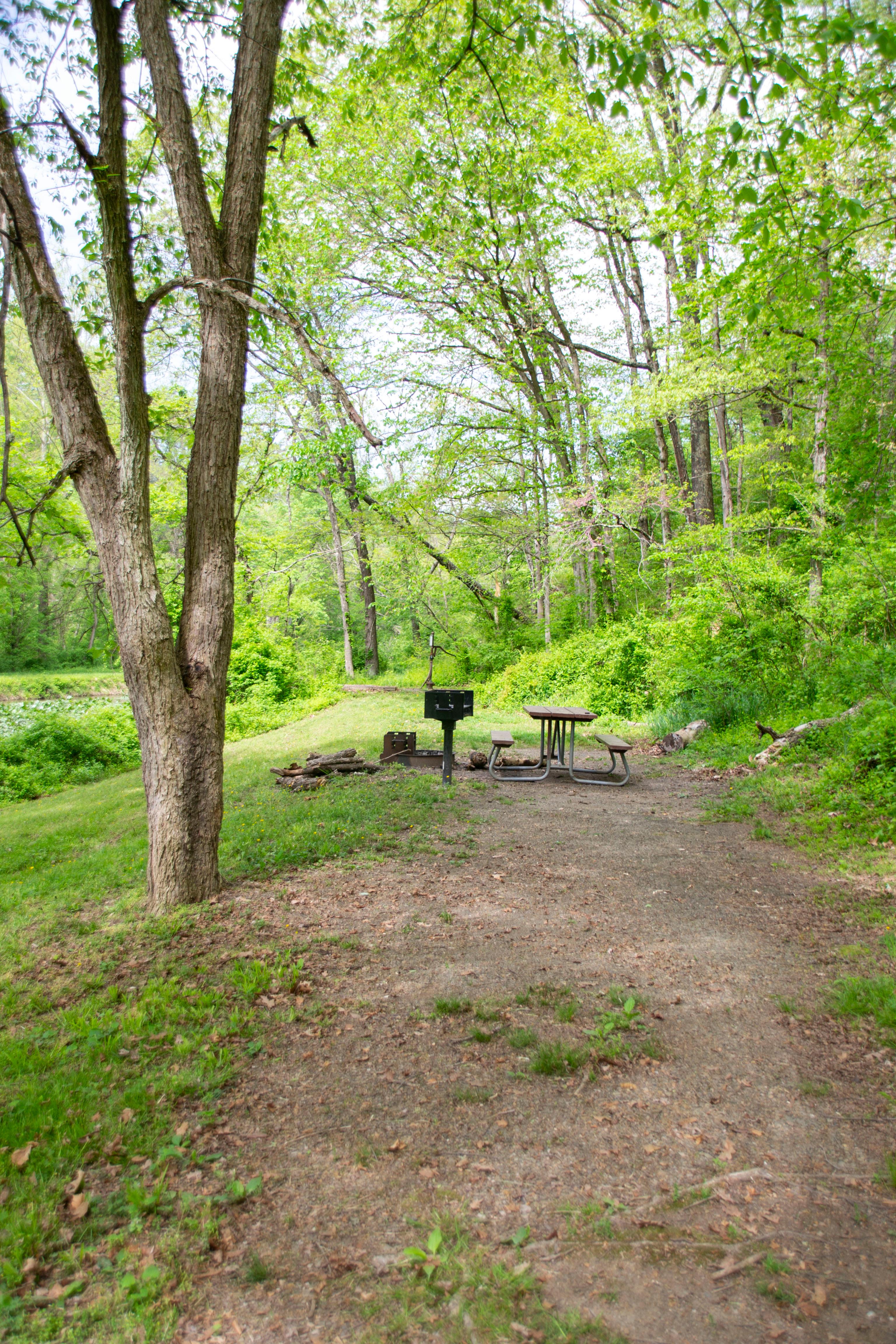
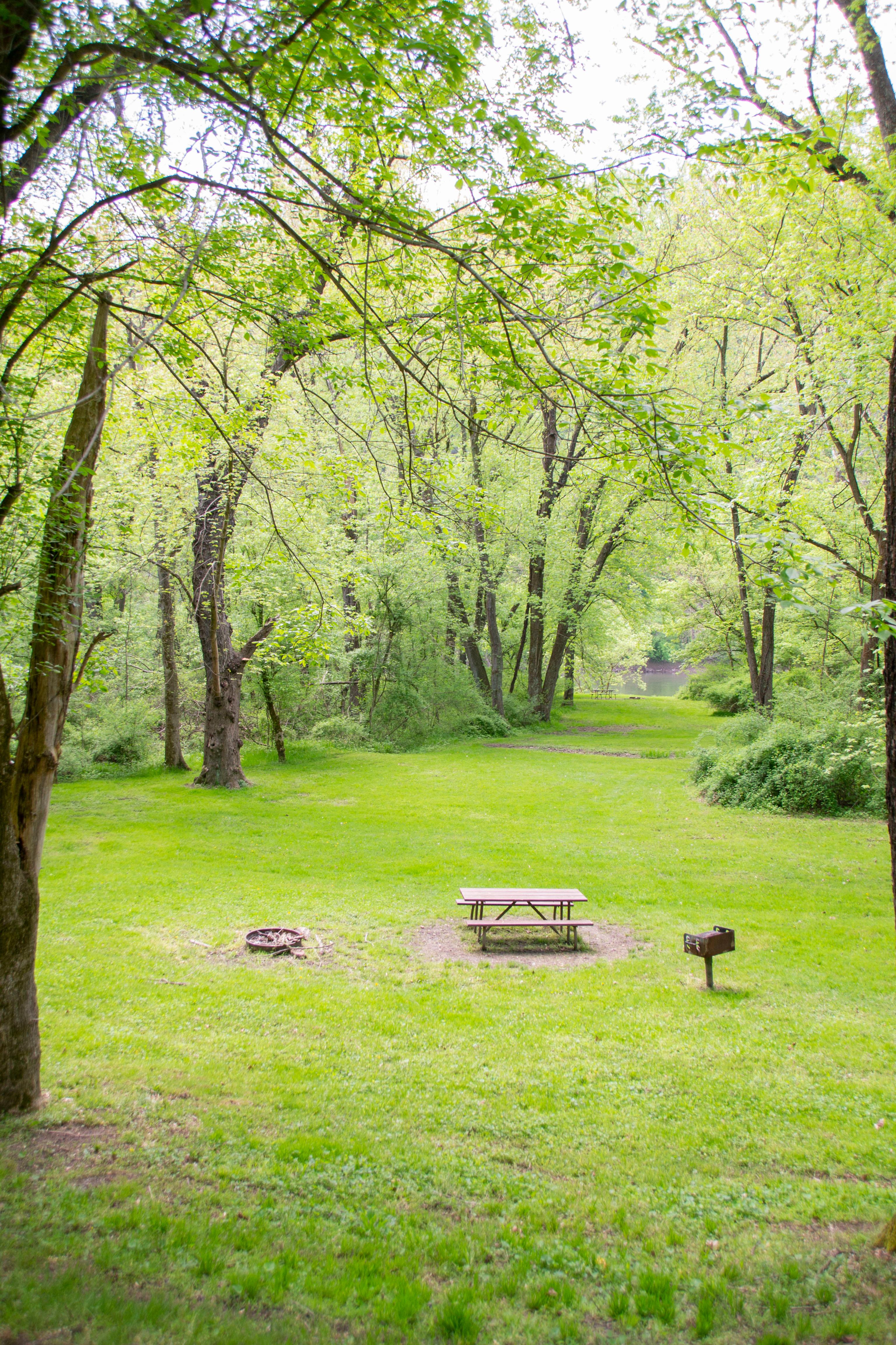
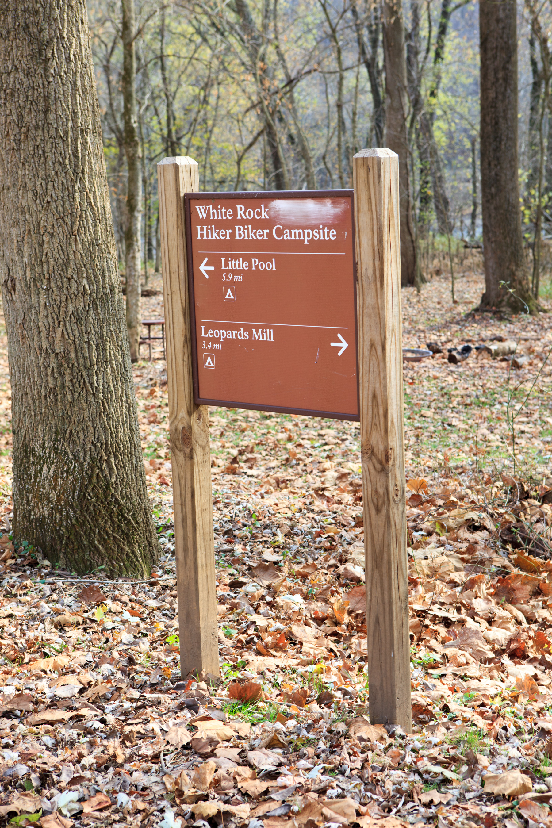
(91 words) The nearest parking is at Cohill Station canoe/kayak access point off Dennen Road. There is a small wooden bridge over the canal to the towpath. Turn left onto the towpath and head downriver a little less than a mile. Just before you arrive at the Leopards Mill campsite, you’ll pass lock 53 on your left. The camping area is medium sized, flat, and narrow. The Potomac river is on one side of the campsite, and the towpath on the other. The water pump is on the downriver side. End of description
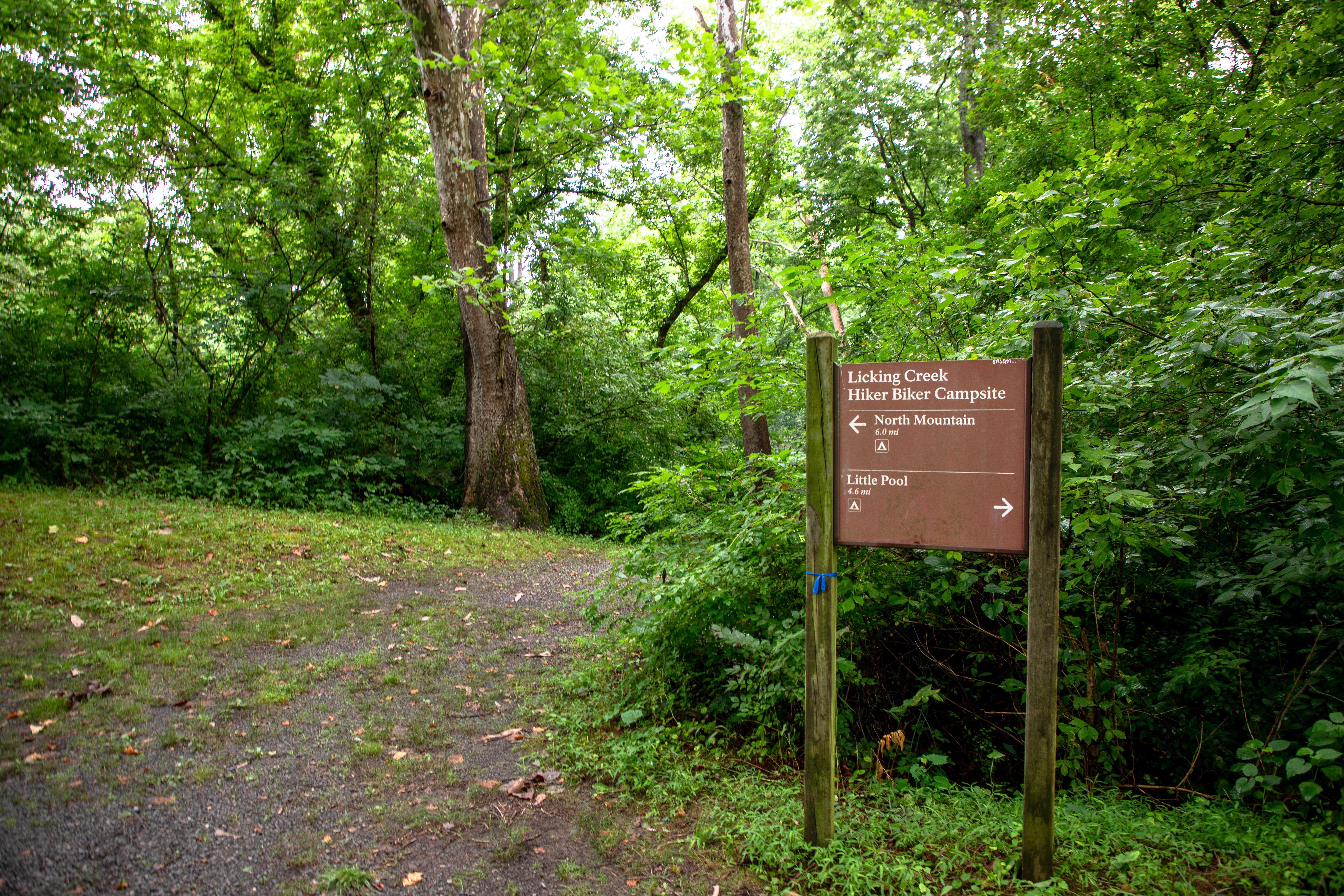
[72 Words] Arriving from the Southeast a gravel trail splits from the towpath trail to the left. To the right of the trail a brown sign reads Licking Creek Campsite. Also on the right is a green porta-potty 5 feet down the trail. The trail goes slightly downhill for 25 feet connecting to a 200 square foot grassy clearing. Centered in this clearing is a fireplace, a circular gravel patch and a charcoal grill.
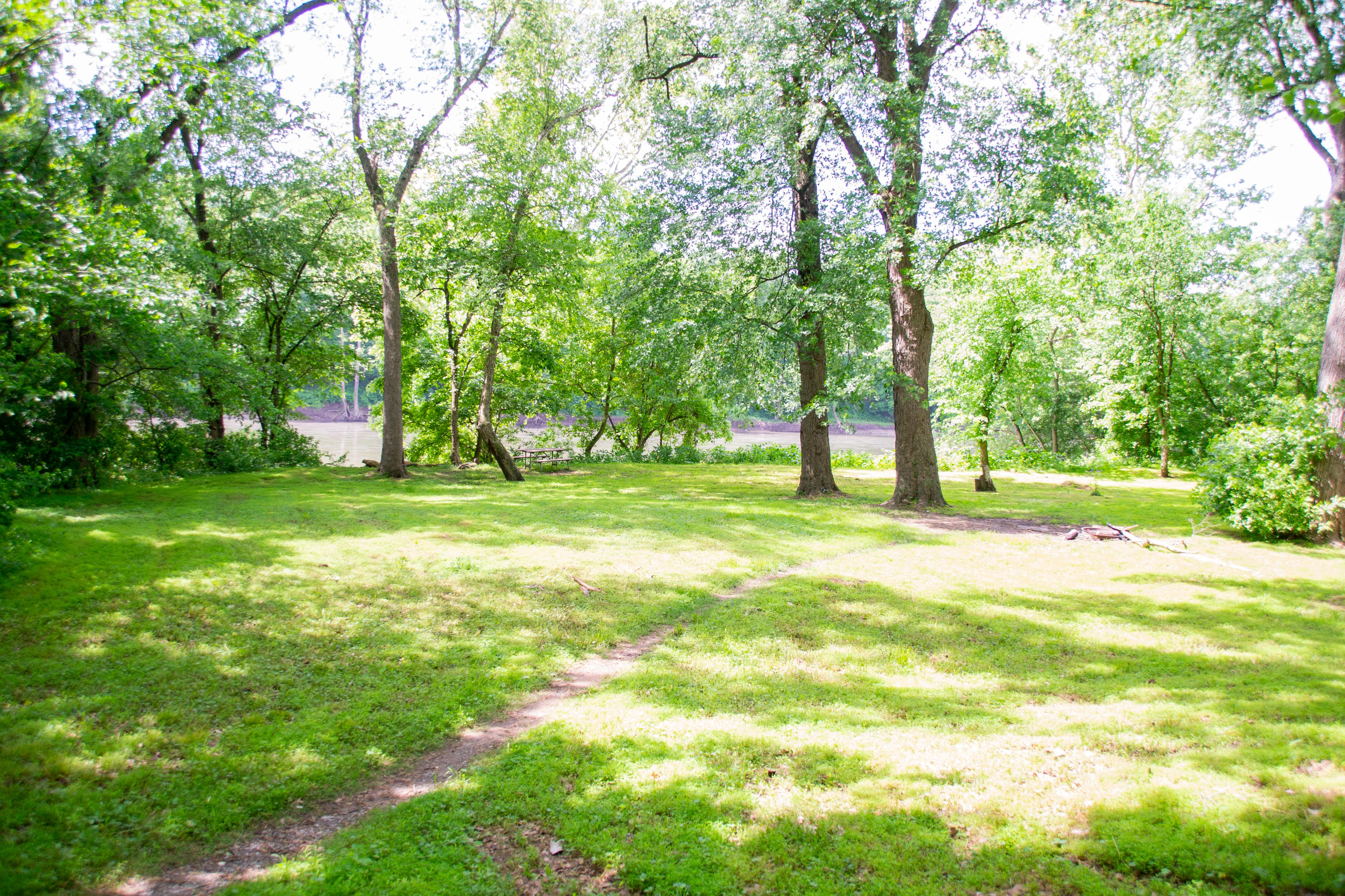
(109 words) The closest parking is at Hancock, either at the boat ramp or at the pedestrian bridge about a quarter of a mile downriver. Once on the towpath head downriver. On your way to the campsite, you’ll pass Tonoloway Creek Aqueduct (MM 122.96), lock 52 (MM 122.89), the Bowles House (MM 122.85), and lock 51 (MM 122.59) before arriving at Little Pool Hiker-Biker Campsite (MM 120.6) on your right. It is a large, flat, lightly wooded grassy camping area between the Potomac River and the towpath, Little Pool is on the other side of the towpath. The water pump is on the downriver side of the campground. End of description.
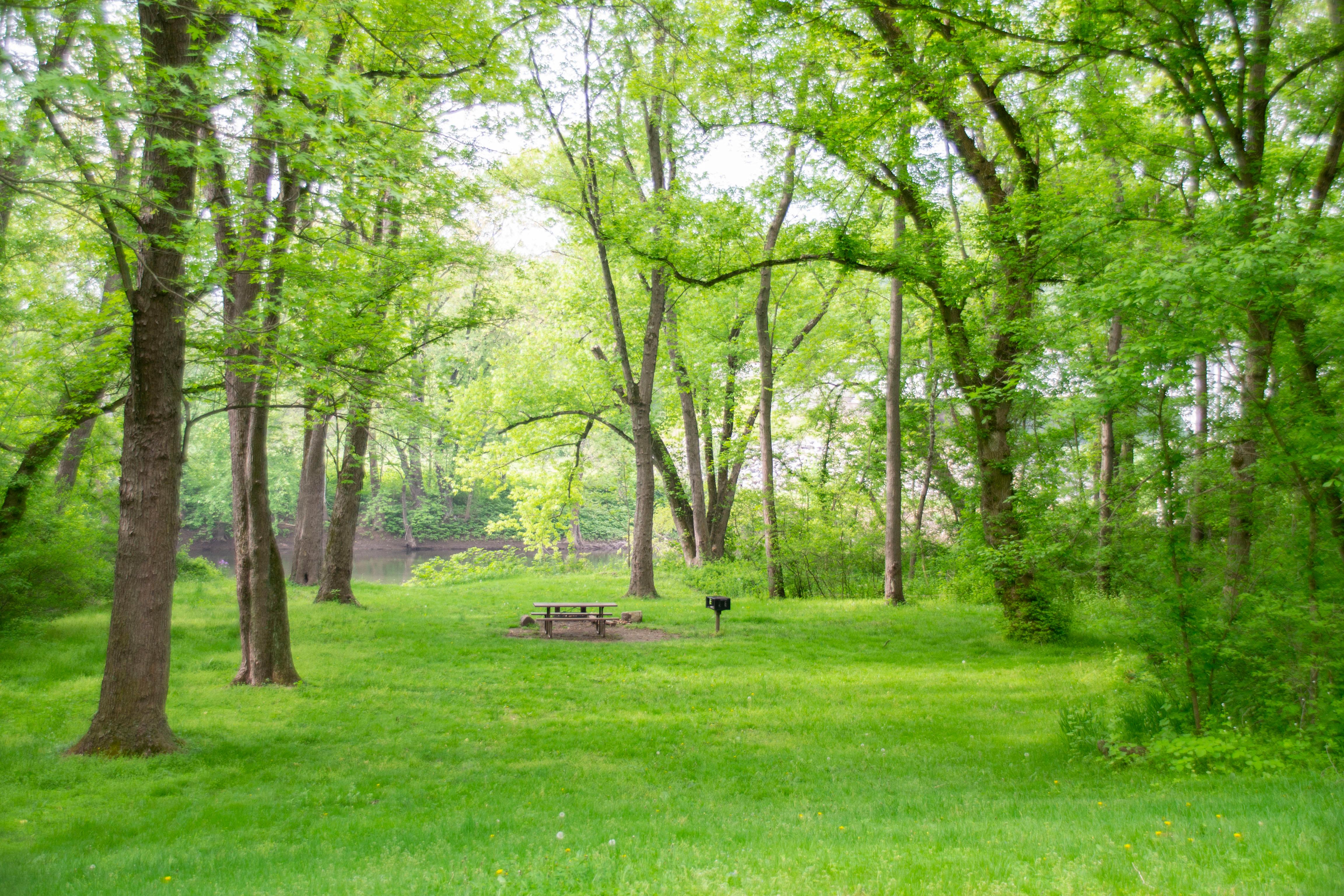
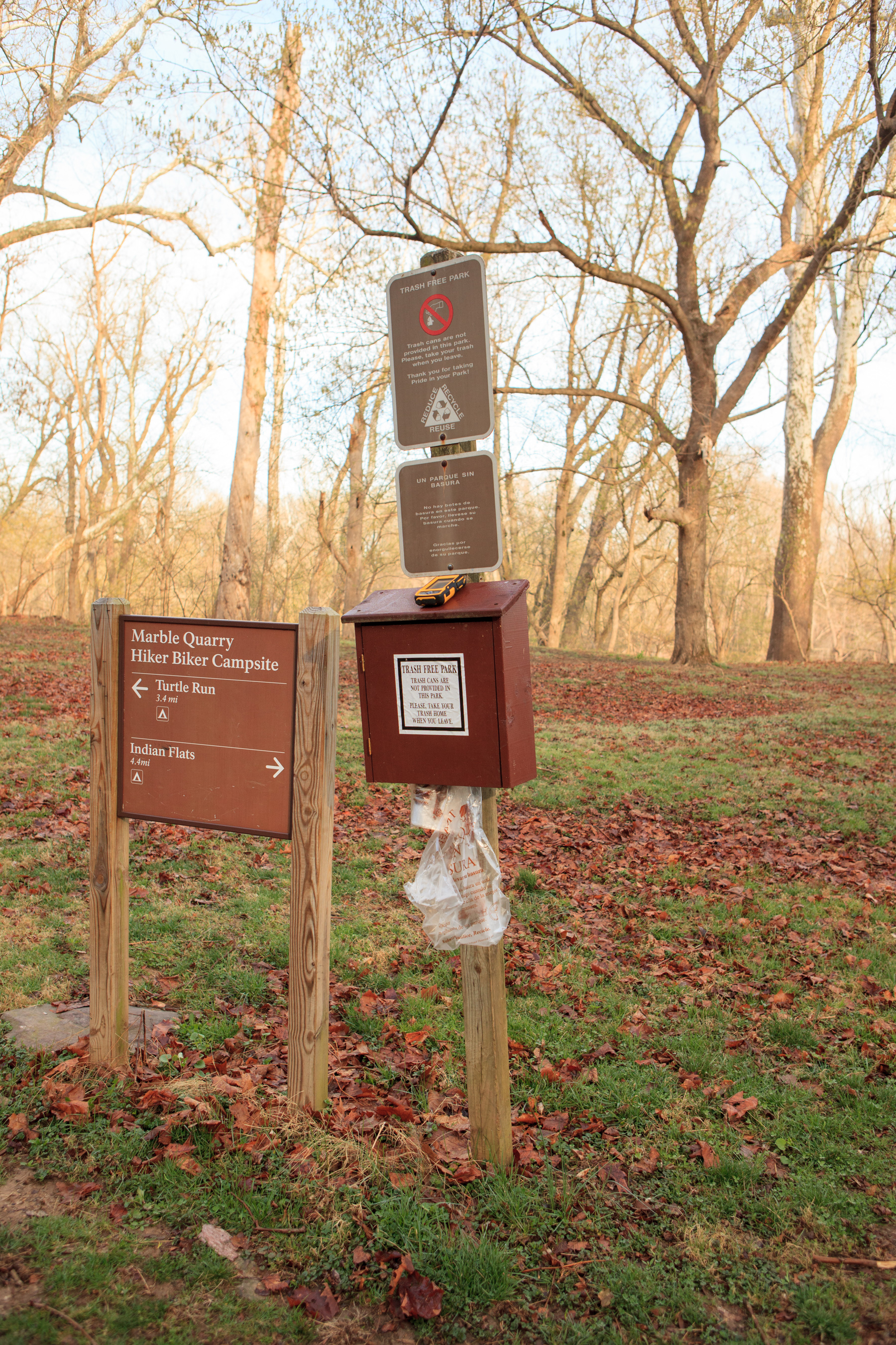
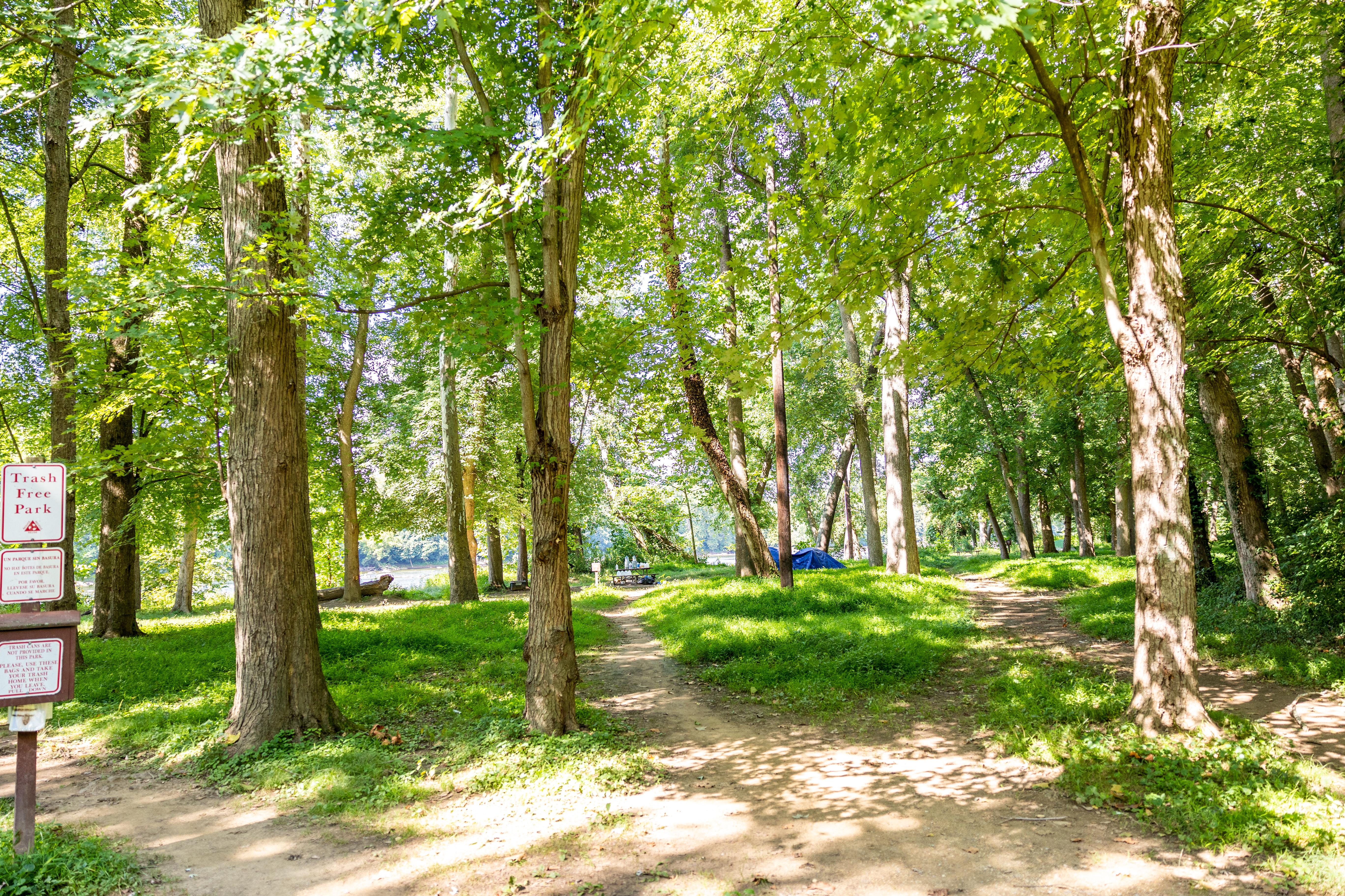
(70 words) The nearest parking to Marble Quarry Hiker-Biker Campsite is at White’s Ferry. On the other side of White’s Ferry Road from the parking lot is a dirt path leading the towpath. It is next an old bridge that crosses the canal. Turn left (heading upriver) onto the towpath for 2.7 miles. On your left is the large, flat, grassy camping area, located between the Potomac River and the C&O towpath.
Individual Sites: April 15 - November 15 (Peak Season): $20/night; November 16 - April 14 (Non-Peak Season): $10/night Group Sites: April 15 - November 15 (Peak Season): $40/night; November 16 - April 14 (Non-Peak Season): $20/night
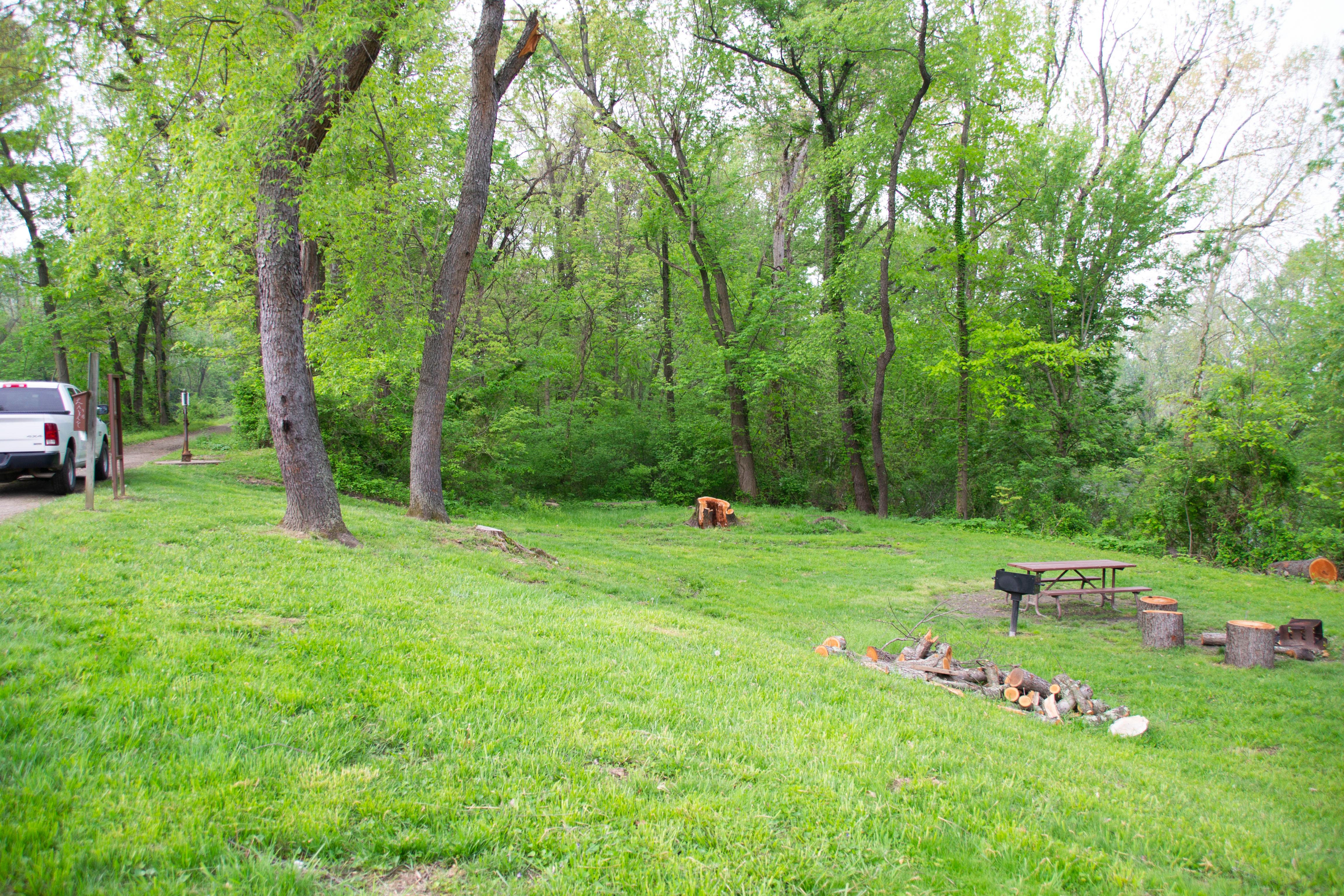
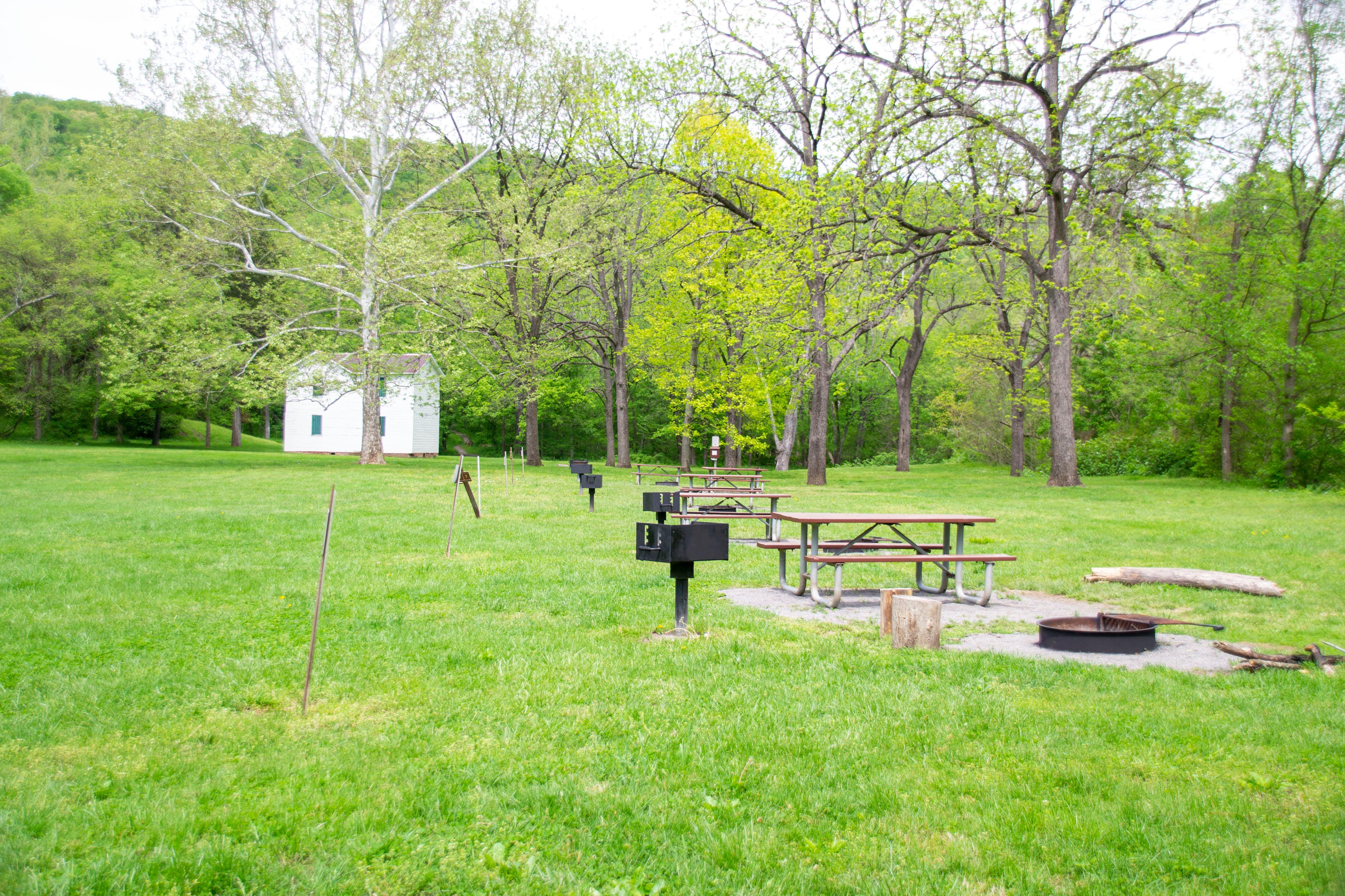
[145 Words] Facing the McCoy Ferry Campgrounds from the entrance after passing through the tunnel. The road is paved and leads to a mid-sized parking lot with small bathrooms to the right. To the right of the road there are recreational grounds containing five pairs of bench tables, and charcoal grills evenly spaced. Between the rec grounds and the road, is a foot high brown wooden rail. About hundred feet down the road a gravel trail splits off and leads to the camping grounds. The trail is about 350 feet long containing on either side thirteen 400 square foot campsites. Each campsite contains a bench table, fireplace, and charcoal grill. The trail loops back on itself at the end. The campground has a lot of overhanging branches providing lots of shaded area, and the Potomac River while blocked by bushes is only 50 feet from the grounds.
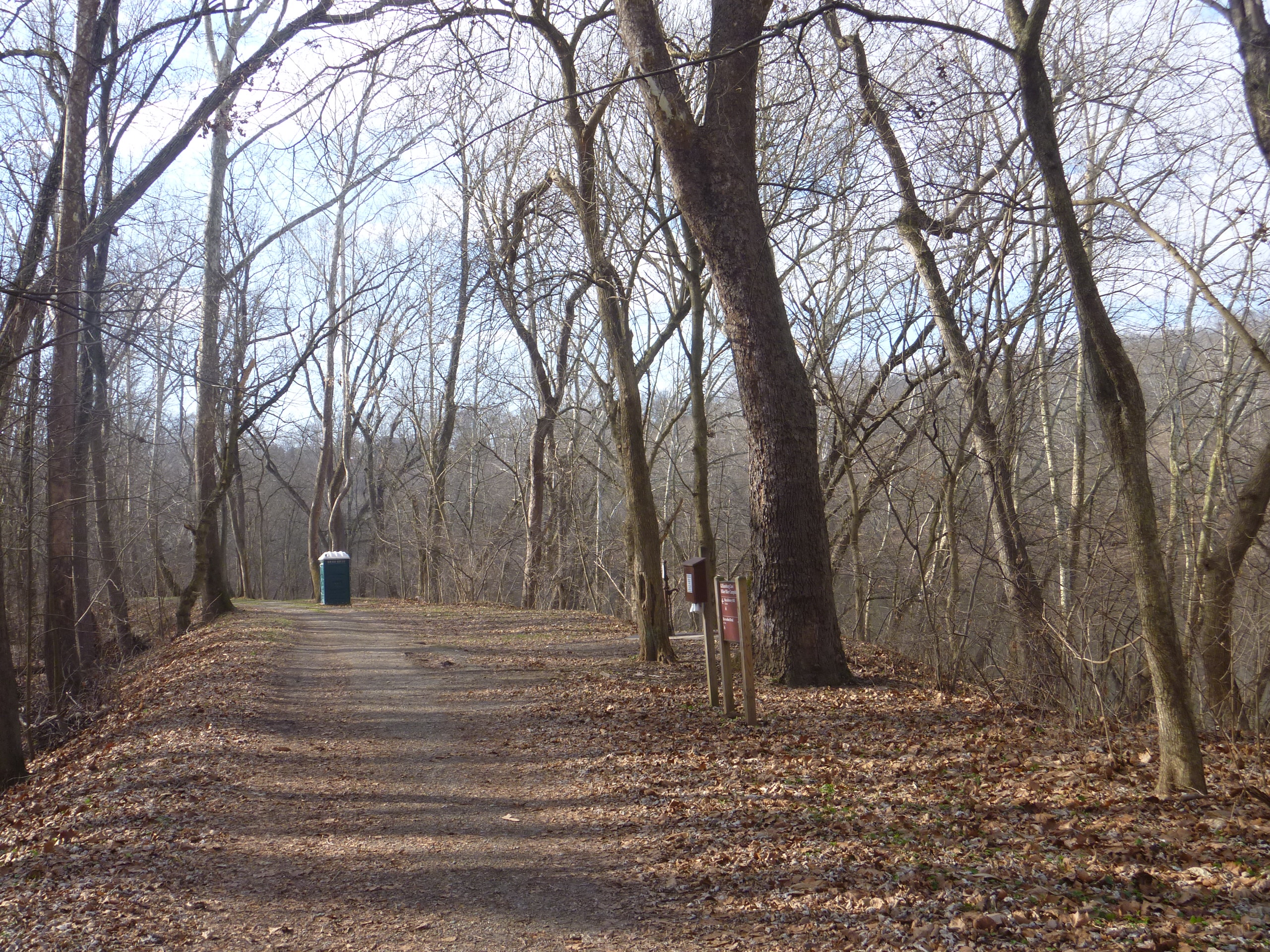
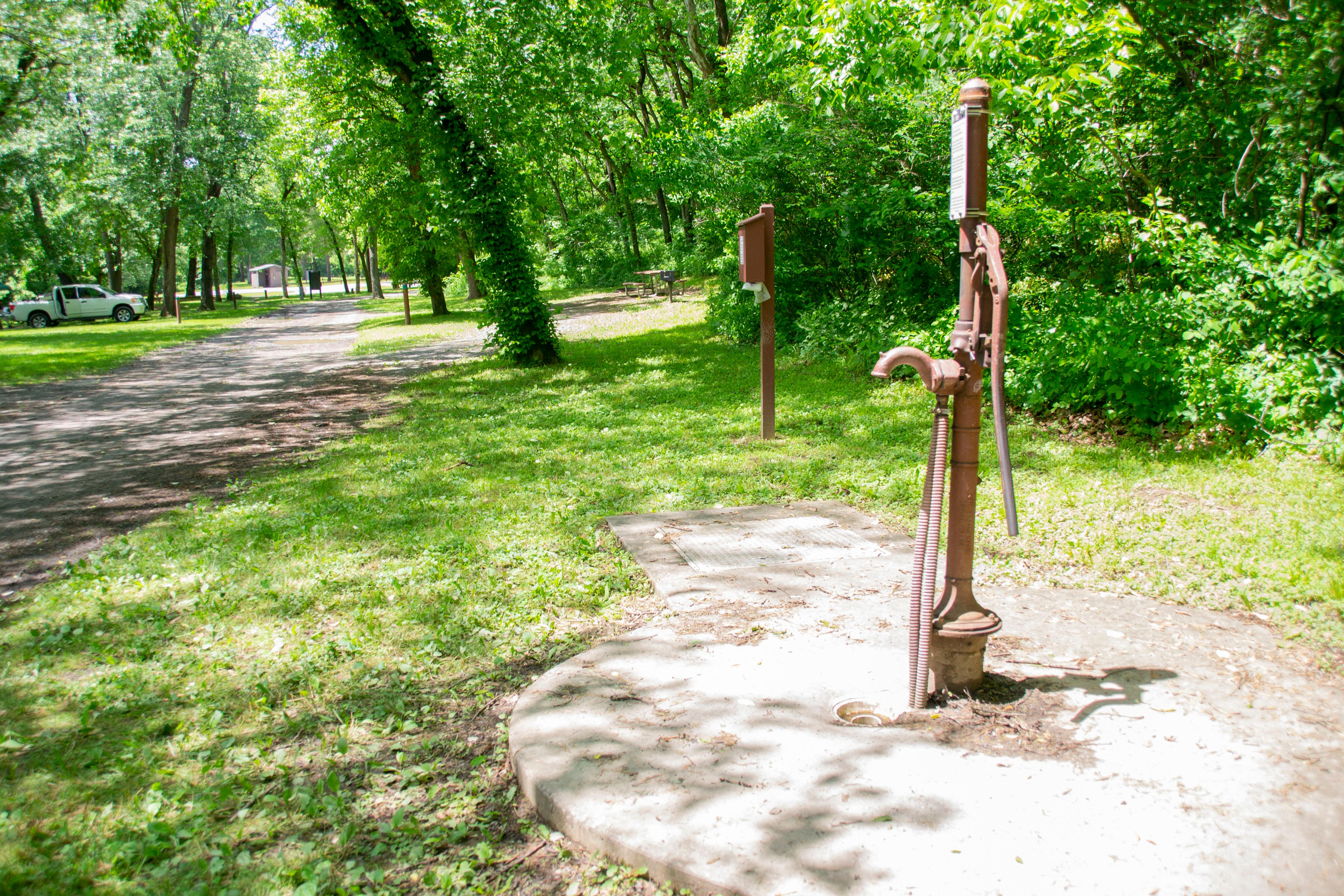
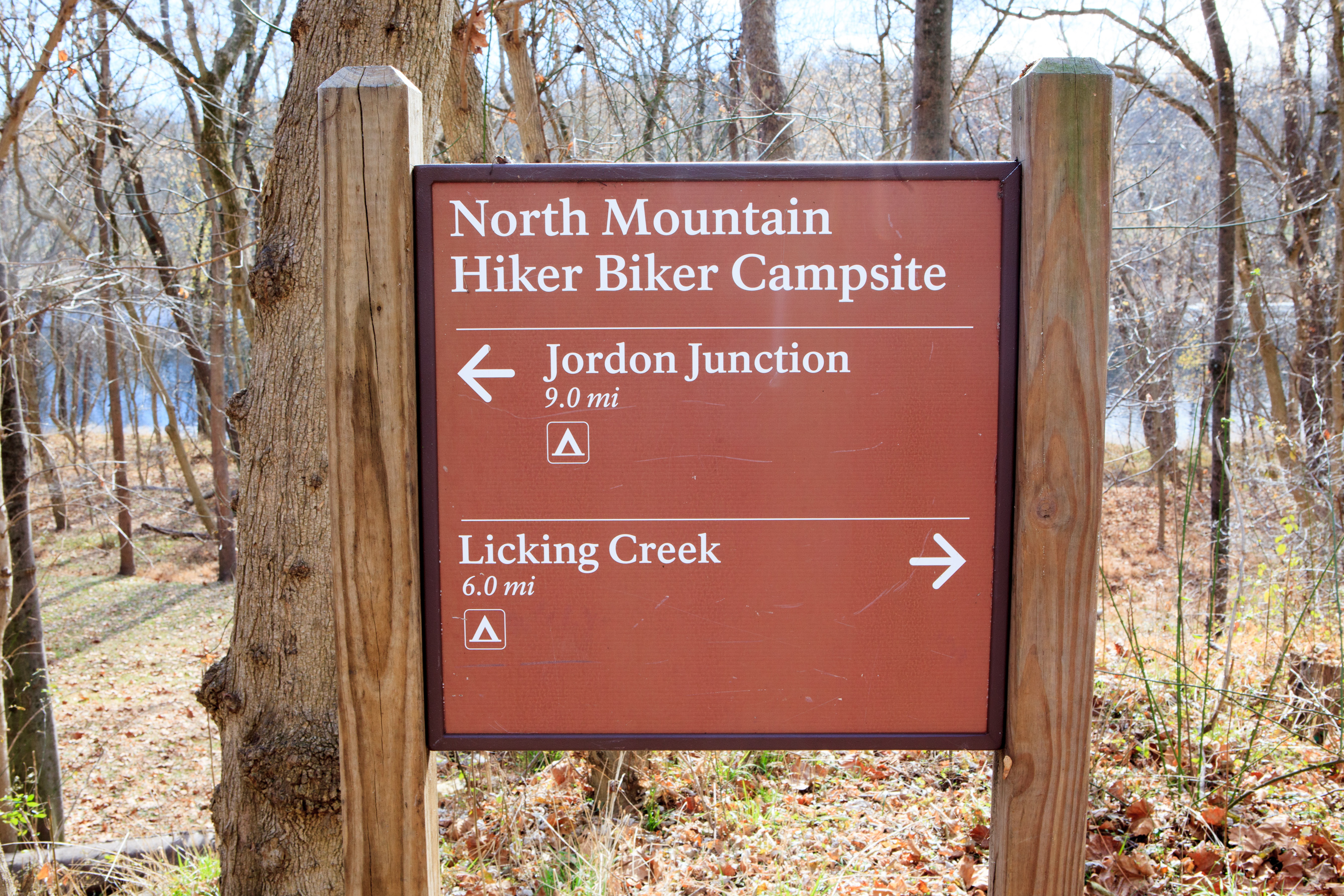
[164 Words] Arriving at North Mountain Hiker Biker Campsite from the West, closest to you on the right of the towpath is a porta potty. To the left of the porta potty is a brown sign that says, North Mountain Hiker Biker Campsite. Also, on the sign an arrow pointing to the left with the text that reads Jordan Junction and under that an arrow pointing to the right with the text that reads Licking Creek. To the left of the sign starts a 30-foot path going downhill paralleling the towpath. The drop between the towpath and the campsite path is about 10 feet. The campsite is about 300 square feet with two levels of elevation change. On the upper level is a water hand pump to the right. On the lower level is a clearing with a charcoal grill, bench with tabletop, and a fireplace all closely placed to each other. To the North is the Potomac River, it is slightly viewable through the foliage.
(61 words) The nearest parking is at Oldtown at lock 70. The towpath can be accessed by a bridge over the lock, then turn right (upriver). About a quarter mile upriver is lock 71. The Pigmans Ferry Hiker-Biker Campsite a medium sized, flat, grassy area. The water pump is next to the towpath on the upriver side of the campsite. End of description.
(86 words) The nearest parking is at Oldtown at lock 70. The towpath can be accessed by a bridge over the lock, then turn left (downriver). The canal is watered at this point and is popular for fishing. The Potomac Forks Hiker-Biker campsite is about 2 miles downriver. Lock 69 (Twiggs Lock) at Mile Marker 166.44 is on your left. The Potomac Forks Hiker-Biker Campsite is adjacent to Lock 68 (Crabtree’s Lock). Lockhouse 68 is next to the campsite. The campsite is small, flat, and grassy. End of description.
Individual Site: April 15 - November 15 (Peak Season): $20/night; November 16 - April 14 (Non-Peak Season): $10/night Group Site: April 15 - November 15 (Peak Season): $40/night; November 16 - April 14 (Non-Peak Season): $20/night
[121 Words] Entering the Campground from the road there is a sign saying Spring Gap (mile 173) and beside the sign is a water pump. In front of the sign the road splits into a right and left direction. Going to the left is where all the campsites are located. There are 14 campsites each about 30 feet by 30 feet with a charcoal grill, firepit, and parking spot for a car. The campsites outline the road that runs pass through the campground. On the right side is a parking lot with two public restrooms, a grassy area with 5 picnic tables and a charcoal grill. Next to the parking lot on the left is a boat ramp leading to the Potomac River.
(72 words) The nearest parking is at the Town Creek Aqueduct parking. There is a small dirt trail leading from the parking lot to the towpath. To the right is the Town Creek Aqueduct. The Town Creek Hiker-Biker Campsite can be found by going to the left, or downriver for about .23 miles. It is a medium sized, flat, grassy, lightly wooded campsite. The water pump is on the downriver side. End of description.
(88 words) The nearest parking to Turtle Run Hiker-Biker Campsite is at White’s Ferry. On the other side of White’s Ferry Road from the parking lot is a dirt path leading the towpath. It is next an old bridge that crosses the canal. Turn right onto the towpath and travel for 1.1 miles to the campsite. It is medium sized with a rolling, lightly wooded grassy camping area between the Potomac River and the C&O towpath. The water pump is next to the towpath, near the center of the campground.