Be advised that the NPS has issued alerts for this park.
Fire Restrictions in Effect
To ensure public safety and to provide the highest degree of protection to park resources, fire restrictions are in effect until further notice.
Roads May Be Icy - Please Use Caution!
Even though the sun is shining, the open roads in the park may still have icy patches, especially in the mornings and evenings when the temperatures drop. Please drive with caution.
Crater Lake inspires awe. Native Americans witnessed its formation 7,700 years ago, when a violent eruption triggered the collapse of a tall peak. Scientists marvel at its purity—fed by rain and snow, it’s the deepest lake in the USA and one of t...
This is the summer entrance fee and is charged from mid-May through the end of October. Admits one private, non-commercial vehicle (15-passenger capacity or less) and all occupants. Good for 7 days.
Entrance - Private Vehicle
$20.00
This is the winter entrance fee. Admits one private, non-commercial vehicle (15-passenger capacity or less) and all occupants. Good for 7 days.
Entrance - Motorcycle
$25.00
Admits one or two passengers on a private, non-commercial motorcycle. Good for 7 days. Summer rate from mid-May to October 31st.
Entrance - Motorcycle
$15.00
Admits one or two passengers on a private, non-commercial motorcycle. Good for 7 days. Winter rate from 11/1 through mid-May.
Entrance - Per Person
$15.00
Admits one individual with no motor vehicle (bicyclist, hiker, pedestrian). Youth 15 and under are admitted free of charge. Good for 7 days.
Entrance - Snowmobile
$15.00
Admits one individual on a snowmobile for travel on snow covered North Entrance Road closed to regular vehicle traffic. Youth 15 and under are admitted free of charge. Good for 7 days.
Commercial Entrance - Sedan
$25.00
Fees for commercial vehicles are based on the capacity of the vehicle, not the number of passengers on board. In addition to the $25 per vehicle there is also a $15 per passenger charge.
Commercial Entrance - Van
$75.00
Fees for commercial vehicles are based on the capacity of the vehicle, not the number of passengers on board.
Commercial Entrance - Mini-bus
$100.00
Fees for commercial vehicles are based on the capacity of the vehicle, not the number of passengers on board.
Commercial Entrance - Motor Coach
$200.00
Fees for commercial vehicles are based on the capacity of the vehicle, not the number of passengers on board.
Lost Creek Campground has 16 sites for tents only. Registration is self-serve on the day of arrival. No advance registration is available. Payment can be made by check or exact cash. Credit cards are not accepted. Senior and Access pass holders are eligible for a 50% discount. The only means of knowing site availability is upon arrival at the campground. The campground typically fills up, so arrive early to secure a site.
NOTE: This campground does not have running water. You must bring enough water for everyone in your party. Water is available at Steel Visitor Center or Mazama Village. Drive three miles south along Pinnacles Road from East Rim Drive. Turn right after the brown metal directional sign announcing the campground. You have arrived at the entrance. Welcoming you is a brown wood sign with the words Lost Creek Campground carved into the panel and painted white. It hangs from a beam leveraged by five round, multi-sized posts that create the sign’s base. Beneath towering lodge pole pines and Shasta Red Firs are grassy meadows with 16 tent sites distributed in an inner and outer circle. An Information bulletin board and pay kiosk is straight ahead. The bulletin board contains information on how to select a site, pay, rules, regulations and any current concerns regarding the campground. From the kiosk, go left towards site #1 and continue as the road winds around to site #4. If your go right, you will by-pass sites 1 through 4, and turn right in front of site 5. Lost Creek runs behind sites 2 thru 5. Wildflowers highlight the area during summer and fall colors resume their brilliance as the weather cools. Between sites 4 and 5 is Greyback Road, the former East Rim Drive. There is a locked metal gate swung across the road to prohibit vehicle traffic. This road is now considered a trail for hikers, bicyclists, and pet walking. Across from sites 4 and 5 is a native stone and wood structure. This restroom is closed due to water rights legislation which does not give the National Park Service senior rights to use of the water in Lost Creek and its reservoir. Instead, there are portable toilets, several which are accessible, stationed alongside the building. Beyond the closed restroom, the road continues in a circular fashion with access to sites 6 to 16. The road and all campsite parking are covered with small crushed gravel-like rock. Tent areas are mostly dirt and natural debris with some crushed rock. All sites are generally level with room to park two vehicles. Each site has one picnic table; bases are white and formed from concrete; tops are made of heavy planks of wood. Most are in the sun with a possibility of shade at times throughout the day. Each site also has one bear-proof, metal food storage locker. The park is home to many animals, including black bears. All of your food, garbage, cooking equipment, storage containers (e.g. ice chests), and toiletries (soaps, toothpaste, etc.) must be kept in your vehicle or in the bear-resistant locker provided at your campsite. There are tree stumps and logs throughout the meadow and around campsites. Many dead trees stand along and beyond the creek. There are trash and recycling containers in several locations in the campground. The creek is closed to fishing to save and protect native bull trout. Since the campground is alongside Pinnacles Road it is not quiet during the day due to cars traveling to and from Pinnacles Overlook. After sunset when vehicle traffic comes to a halt and sunshine shifts to a starlit sky, and again when quiet hours begin at 10 pm, giving way to the sounds of Lost Creek and the wind, that the campground is quiet.
From the opening date (dependent on snow removal), all accessible sites are first come first serve through June 30. From July through September, all sites are available by reservation only, online (reservation button below). If no tent sites are available, tent campers may reserve an RV site at the posted fee for that site. Parking areas at tent sites cannot accommodate RVs, so RV campers may not rent tent sites. For complete details use the reservation button to go rec.gov or go to the ExplorUS website at https://explorecraterlake.com/stay-at-crater-lake/mazama-campground/.
Turn right after Annie Creek Entrance Station, onto the main road to Mazama Campground. Stay straight driving past the right turn for the Mazama Village Store. 214 sites are organized on the left-hand side of the road into seven loops lettered A to G, each with a sign identifying the loop location. Travel throughout each loop is one-way in a clockwise direction. At the front of each site is a wooden post with the site number. The sites are dispersed through a forest of lodgepole pines, mountain hemlocks, Shasta red firs, and subalpine firs. Douglas squirrels, gray jays, and Steller’s jays are commonly seen and heard. Each site contains a brown wooden picnic table, a bear-resistant food locker, and a fire ring with a grill. A paved or gravel parking area is provided for cars or an RV. Trash and recycling receptacles are dispersed throughout each loop. The first left turn from the main campground road goes to A-loop with 15 sites including one accessible site, A10. A restroom with running water and flush toilets is near A13, with women on one end of the building and men on the other. A fresh-water spigot is across from the restroom. The second left turn from the main campground road goes to B-loop which has 16 sites including two accessible sites, B1 and B6. There are two restrooms (as previously described) behind sites B5 and B10, and two fresh-water spigots near the restrooms. A right turn at the intersection of loop B goes to the Mazama Village Store, gas pumps, and Annie Creek Restaurant and Gift Shop. The next left is C-loop with 26 sites, two restrooms, and fresh-water spigots at C6 and C19. Directly across from the start of C-loop is the dump station access. Turn right off the main campground road, then take an immediate left to access the dump station. Loop through the dump station area to get back to the main campground road. C-loop is followed by D-loop with 35 sites, one restroom near site D6, and multiple fresh-water spigots throughout the loop. A path between sites D20 and D21 leads to the campground amphitheater. E-loop is the largest loop in the campground with 55 sites, which accommodate tent campers only. There are two restrooms near sites E20 and E47, and multiple fresh-water spigots throughout the loop. Between sites E19 and E21 is a short, gravel access road to the campground amphitheater for park rangers and emergency vehicles, and for visitors walking to or dropping-off. F Loop has 29 sites, and two are accessible, F17 and F21. There is a restroom across from sites F1 and F2, and a restroom with an accessible shower between sites F18 and F22. Multiple fresh-water spigots are located throughout the loop. The end of the main campground road circles through G-loop. This loop has 37 sites with a restroom at the beginning of the loop and multiple fresh-water spigots throughout the loop. From July through early September, rangers present evening programs in the amphitheater, located between D & E loops. There is no parking, including accessible parking, at the amphitheater. Visitors must walk to or be dropped off. Drop-off drivers may use the gravel access road between sites E19 and E21 but cannot park there without the ranger’s permission due to limited space. Unlit walking paths from D & E loop which lead to the front of the outdoor amphitheater are soft soil, not a packed surface. In the amphitheater, lights are on the ground next to the 22 rows of wooden bench seats in three sections from left to right, with wide aisles. Benches face a stage and large movie screen protected within a white structure. There is no designated space for wheelchairs. On the left-hand side of the seating area is a large rock campfire pit, used at the ranger’s discretion. Rangers wear microphones and will try to accommodate any accessible requests brought to their attention. Annie Creek flows through a canyon behind the campground loops and can be heard from several campsites. Annie Creek Trail cuts behind loops C through G with access from the amphitheater or site C11. It is a steep, narrow, dirt path that descends into the canyon following alongside the creek before returning up steep switchbacks.
Cascading water is heard rising up through the tree-covered canyon. Glimpses of the waterfalls can be seen down through the forest. This is the second of three picnic areas on south Hwy 62.
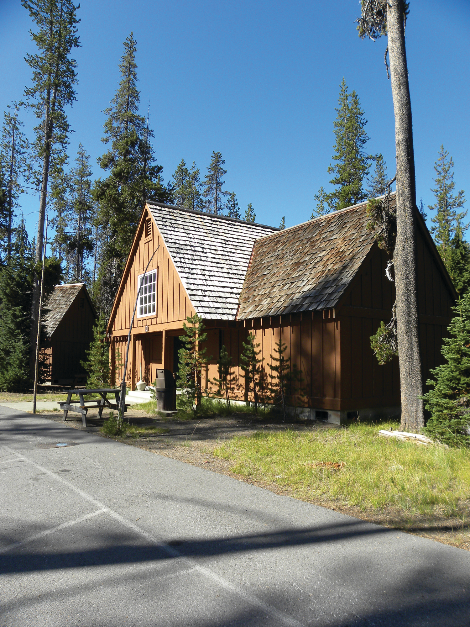
The Cabins at Mazama Village are nestled in an old growth forest of lodgepole pines. The rustic-style exterior opens into a casual interior design offering comfort and serenity, free of phones and TVs. At 6000 feet, air conditioning is not available but there is plenty of fresh mountain air! Ten cabins each with four private accommodations featuring two queen beds with a private bath and shower. Two accessible accommodations offer one queen bed and private bath.
Getting to Mazama Cabins can be a little confusing. From Hwy 62, just past the Annie Creek Entrance Station, turn right towards Mazama Campground and right again into Mazama Village. Drive through the big parking lot and past Mazama Village Store on your left, take the first right which leads to the cabins. The road is divided into two loops. The first loop contains cabins A through E and the second loop contains cabins F through J. A paved footpath connects the two loops between Cabin D and Cabin G. The rustic exterior of each cabin blends with the natural forest setting, and the structures generally appear the same. They are a single-story horizontal design with a high peaked roof. Forward facing is another peak covering a cement porch and the entry to four rooms. The entire structure is painted brown and the peaks are protected by wood shingles. Large, sliding barn-doors are closed during winter to protect the porch from snow drifts, but remain open all summer. From the road, a cement walk and two steps up lead to the porch. The accessible cabin has a ramp to the porch. Once the snow melts, picnic tables are placed out front. White lines in front of the cabins designate parking spaces. On the porch, each room has a designated number. The rooms all have a casual inn-like appearance with one bright colored wall that the bed skirt and scarf, a pillow and curtains compliment. Two queen beds, or one queen bed in an accessible room, have multiple pillows and white linens. The remaining room accommodations are similar to standard hotel including: lamps, tables, luggage and hanging clothes rack, and rustic style chairs. Each room has a single window that opens to the natural sounds of the forest. In addition to a sleeping and lounging area, there is a bathroom with sink, toilet, and shower with fresh white towels. Exiting either loop returns to Mazama Village, Annie Creek Restaurant and Gift, the Mazama Village Store and gas station. Typically, every night a different evening program is offered by a park ranger at the amphitheater located between loops D and E.
A wildflower meadow with an abundant array of flowers and pollinators is encircled by a .041 mile trail, multiple springs, a diverse forest, and a towering 2000 foot ridge.
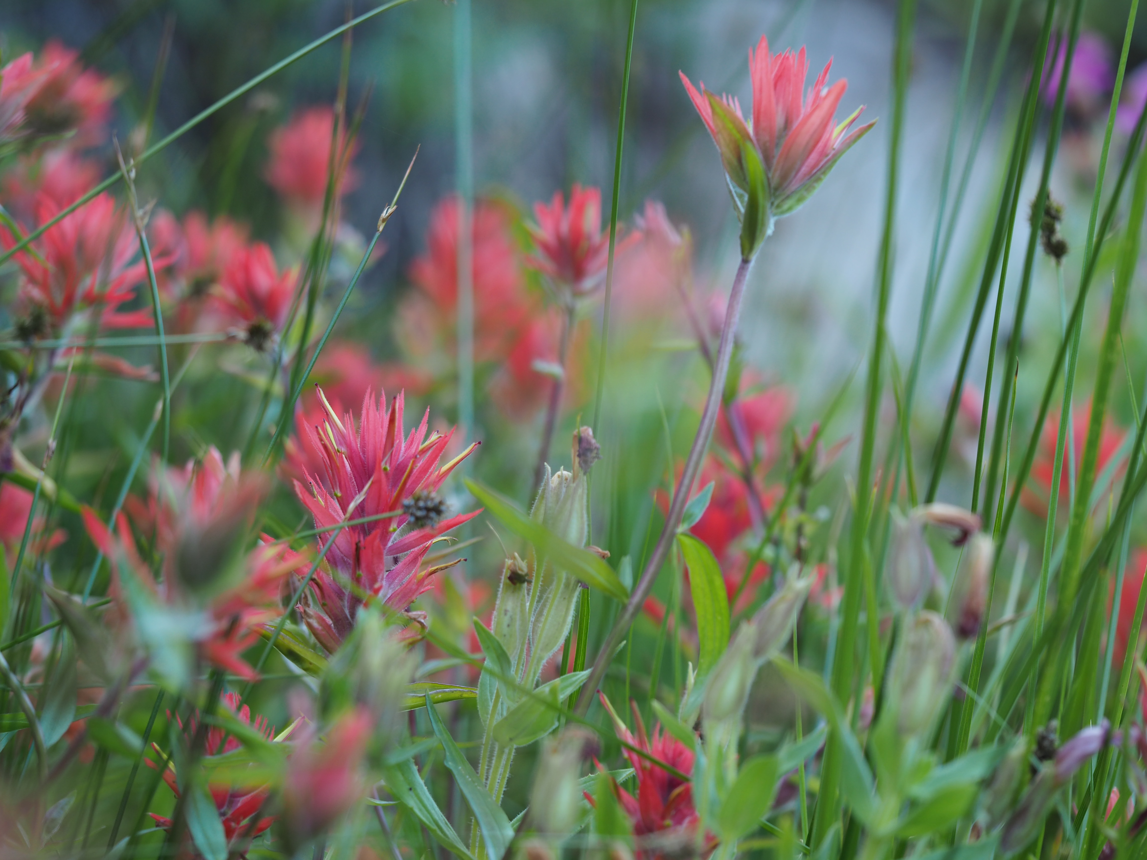
The official parking area and trailhead is located 0.25 mile east of Park Headquarters on East Rim Drive. Walking counterclockwise, the trail begins by crossing a bridge over a stream and winds under a canopy of conifer trees. It soon shifts from a shady dirt path to uneven steppingstones. Early season, the stones may be covered in water flowing down from springs along a 2000-foot towering ridge. Grasses give way to mosses and flowering shrubs, and ultimately both sides of the trail become colorful eruptions of wildflowers. The trail takes a few gentle turns with upward stone steps that guide the visitor through knee and waist high plants which bloom in a succession from late spring to early fall. While lingering snow melts, tiny yellow violets, yellow buttercups, and pinkish spreading phlox (Phlox diffusa) bloom just above the soil. Purple shooting stars (Dodecathean alpinum) unfurl from slender stems and American bistorts (Polygonum bistortoides) flash white florets. Different species bloom as summer brings the warmth of drier, hotter days. Two of the most prolific wildflowers are the boldly pink Lewis' monkeyflower (Mimmulus lewsii) and the pink to orange paintbrush (Castillejaspp). Other favorites are the white bog orchids such as (Platanthera dilatata var. leucostachys), blue stickweed (Hackelia micrantha), deep purple Columbia monkshood (Aconitum columbianum) pink Pacific bleeding heart (Dicentra formosa), and a variety of aster species that are mostly yellow and pastel purple. Even when the seed heads and dried flowers remain, pollinators and their predators are seen and heard throughout the meadow and along the trail. Leaving the meadow area along its western edge, the trail passes a pumice hillside where white-pollen-skyrocket (Ipomopsis aggregata ssp. formosissima) a gorgeous, tubular, orange flower grows. As the meadow is now behind you, and you cross streams via two bridges, once again a forest canopy of mountain hemlock (Tsuga mertensiana), Shasta red fir (Abies magnifica), and lodgepole pine (Pinus contorta),) creates an evergreen backdrop for the meadow and the trail as you follow it back to your car.
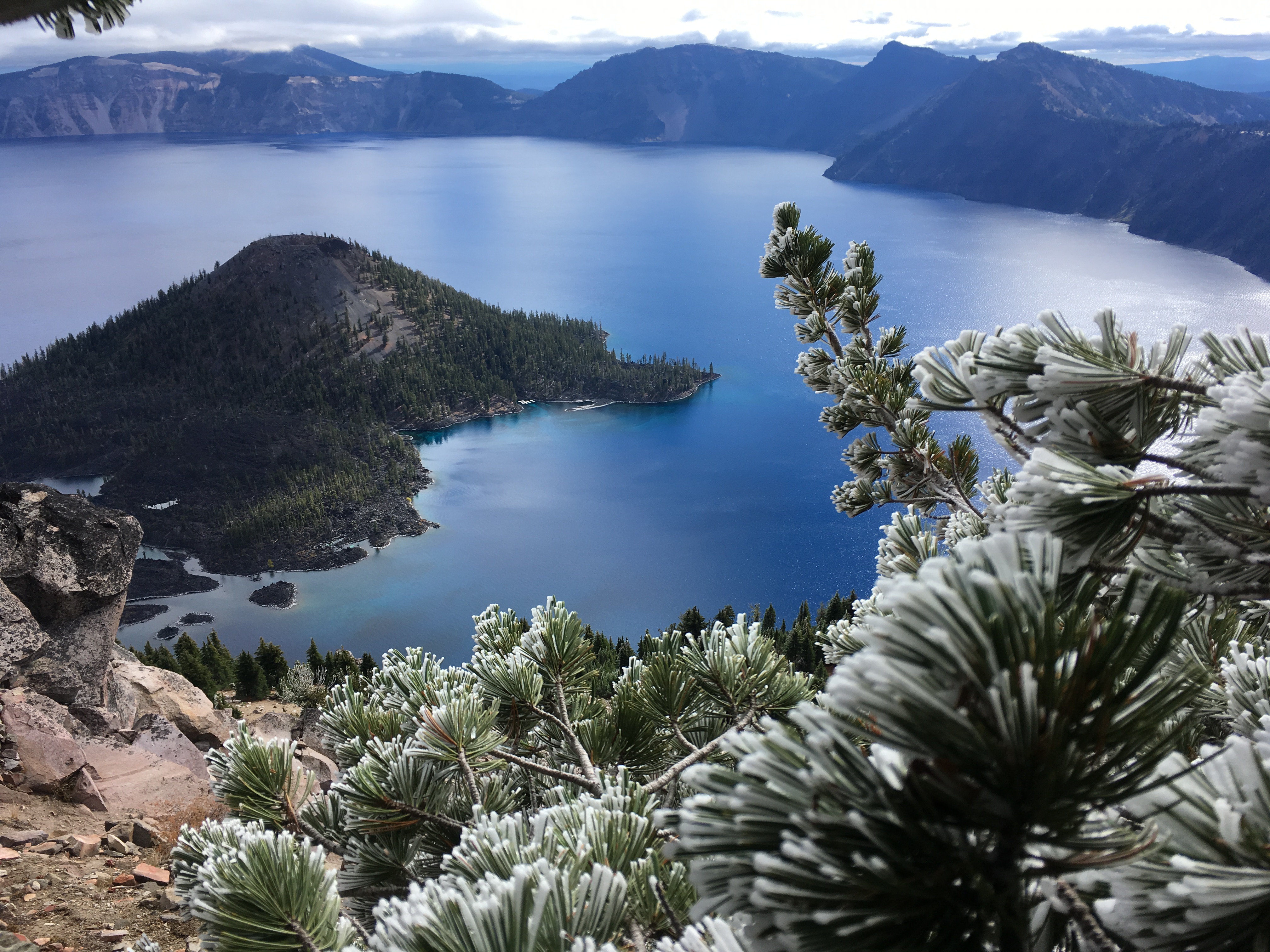
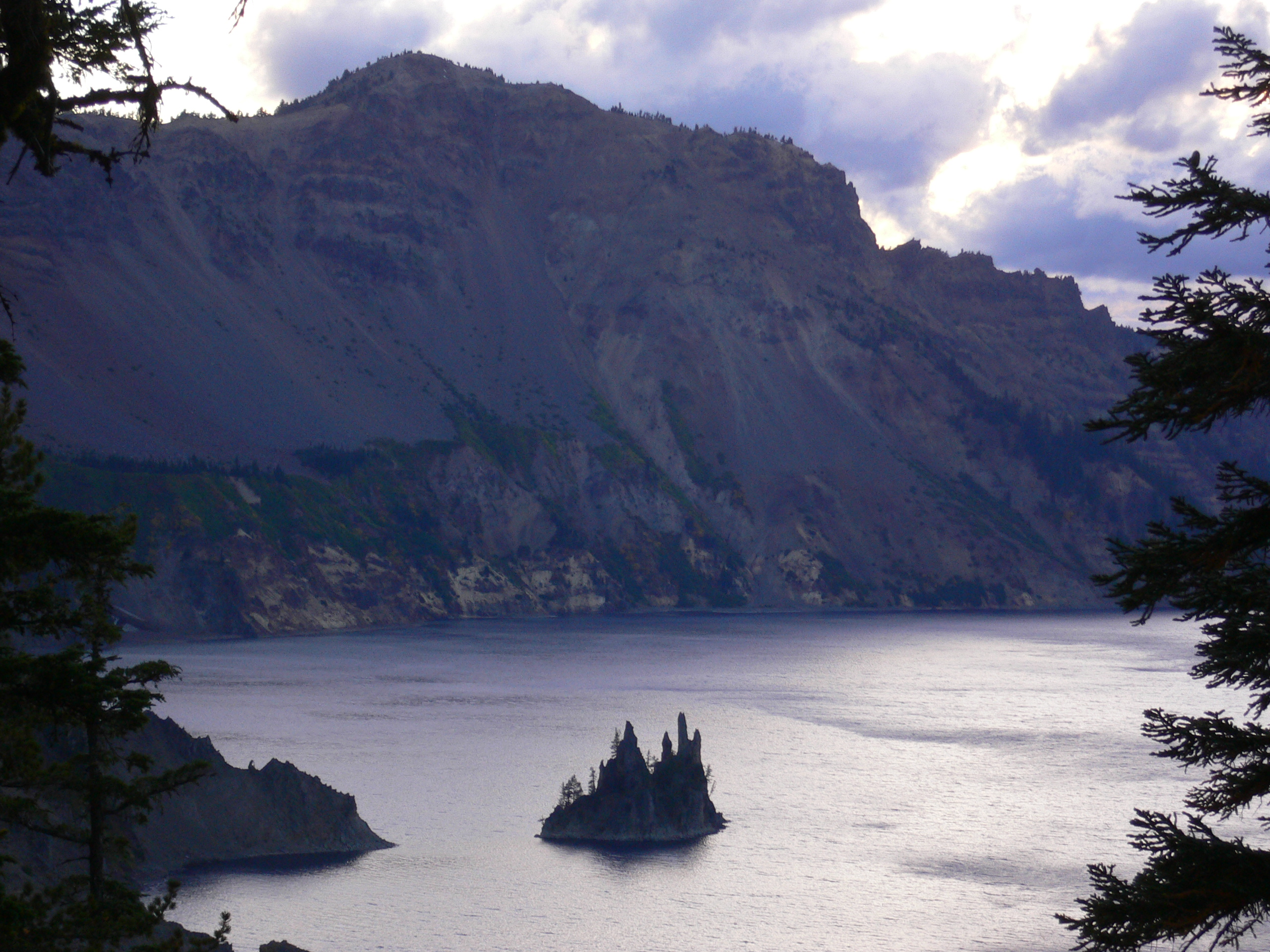
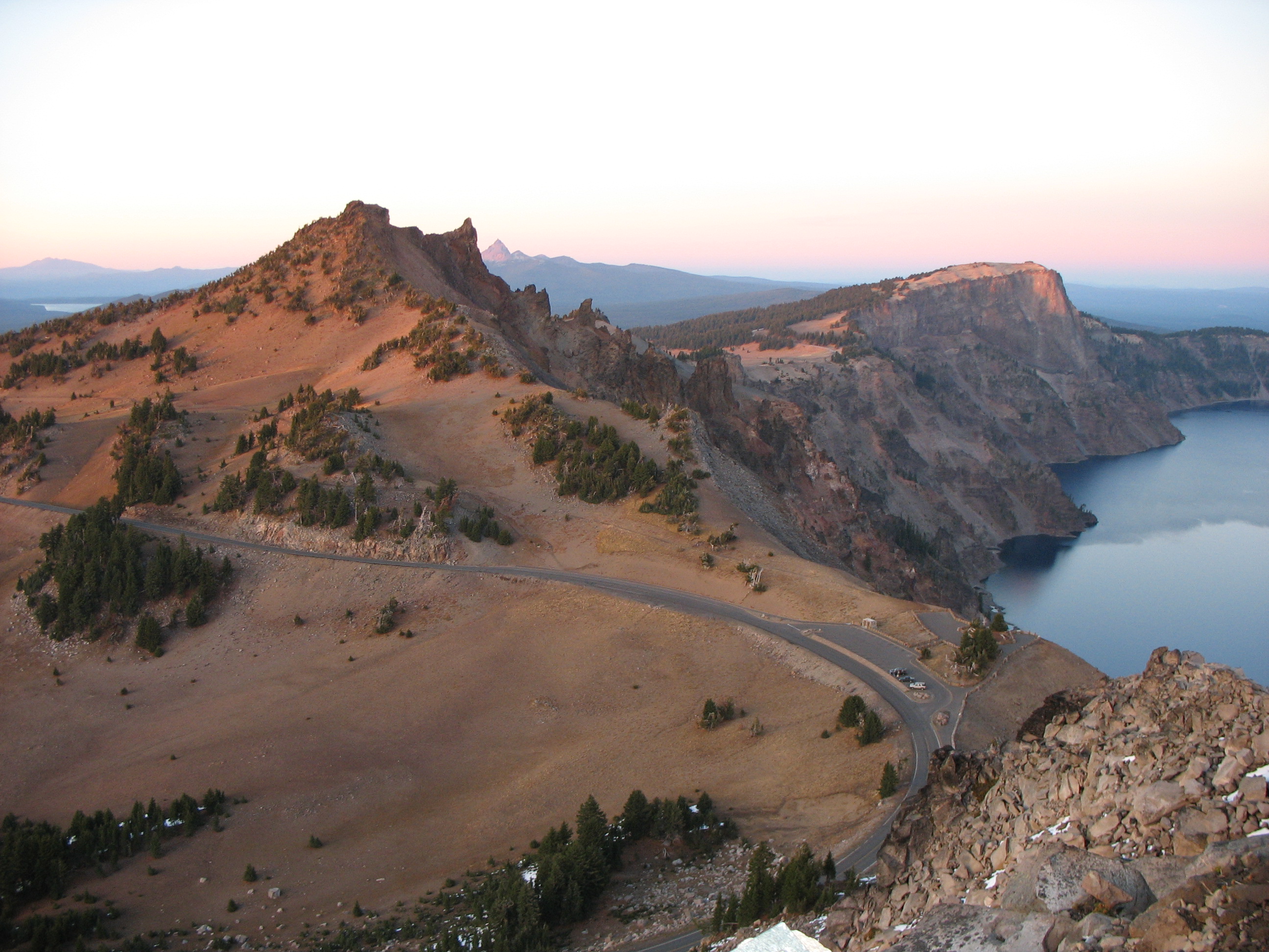
The final eruption and collapse of Mount Mazama over 7,700 years ago created a deep caldera (crater). No river or other turbulence disturbs the collection of rain and snow for six miles across the deepest lake in the United States. Its average clarity at 103 feet deep is unsurpassed and the penetrating light waves reflect a deep blue color that is seen nowhere else.
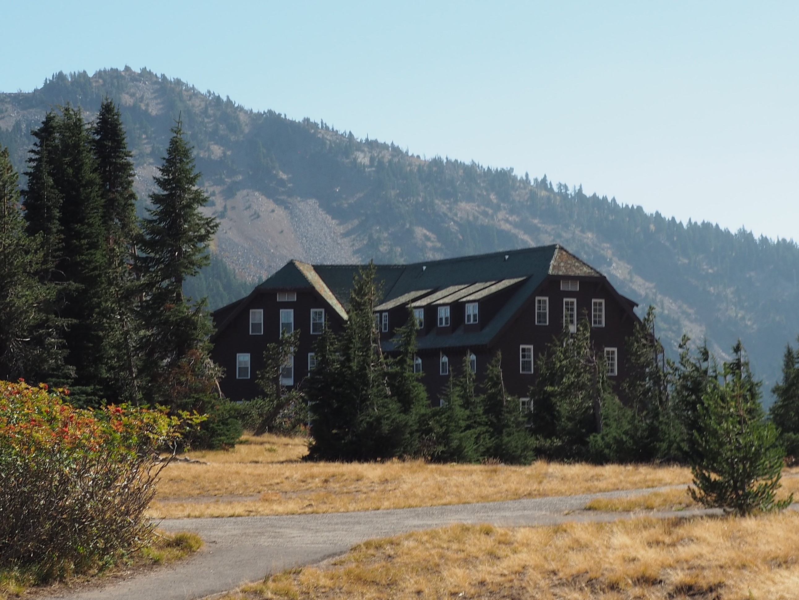
The historic Crater Lake Lodge overlooks the deepest lake in the United States and the most pristine in the world. Open mid-May to early October with 71 rooms including accessible accommodations. Stay warm indoors near the large native stone fireplace, or sit in a rocking chair along the outdoor patio and watch the sun rise across Crater Lake. The dining room is offers three meals a day. Reservations are recommended for lodging and dining. Ranger programs are presented daily.
Crater Lake Lodge was re-constructed and opened to the public in 1995. The exterior has a native stone façade on the lower level, red brick defines the upper three stories. Towering chimneys sculpted by stonemasons, wood shingles, and dormers highlight the roof. Along the exterior walls white framed single windows identify the location of 71 guest rooms. The building lacks symmetry in shape but has its own character with three sections, the center and largest hosts the front entry. A wide stairway, seven steps with handrails, complements the entry of Crater Lake Lodge. An accessible ramp from the right meets the steps at the front doors. Wood double doors open into a small enclosed foyer, with a second set of doors opening into the registration lobby. The floor is waxed and polished Douglas fir planks. A solid wood front desk, just inside the lobby has an accessible counter to the left. The room’s rustic charm is highlighted by the first of three native stone fireplaces, structural columns disguised by Ponderosa pine bark, and a wall built from round, bark-covered ponderosa-pine logs stacked horizontally from the floor to the ceiling. A double size opening in the stacked logs gives entry to the Great Hall. A wide, open, stairway on the right approaches an upper level. Rustic charm continues throughout the Great Hall with Ponderosa pine columns, a floor to ceiling fireplace covered in a mosaic of volcanic stones and comfy Mission-style lounge chairs, sofas, and tables. The Great Hall invites people to gather for a daily ranger program, to warm by the fire, read, play board games, or engage in conversations. Across from the fireplace is a long wall featuring large windows giving way to an expansive view of the lake. Double doors along the windowed-wall open to the back porch revealing why the lodge was built in this location along the caldera rim overlooking the lake. The breathtaking view of Crater Lake from the porch, lined with wicker rocking chairs, is a major attraction of the lodge. Guests and park visitors rock for hours even though it is often cold and windy. During summer, wait staff rove the outdoor porch taking orders for drinks and food. A paved ramp with handrails exits to the right. At its landing to the right is access to the front of the lodge, to the left is the historic Rim Village Promenade lined by an historic stone parapet that is a guide through the village. Back inside at the far end of the Great Room, there is a coffee bar and a hostess podium, behind which are doors to the dining room. Dark wood tables set with formal china surround massive ponderosa pine-beams. The walls are grey lava rocks with Ponderosa pine framed windows. This room, hosts the third large stone fireplace with a landscape painting of Crater Lake adorning the mantle. The dining room is open for breakfast and dinner. Returning to the main lobby through the Great Room, to the left of the front desk is a slight up-ramp with handrails on both sides in the direction of public accessible restrooms. Also there is an exhibit about the lodge’s original construction, and historic images of early park visitors. Beyond the exhibit, through an open door are two elevators to the upper and basement levels of the lodge. Accessible rooms are located on the first floor past the elevators down a long hallway. This section of the hotel is referred to as the Annex Wing. The lodge has eight accessible rooms in this wing. All of these rooms have showers with bars, an accessible sink, as well as an accessible toilet. There is one room with two queen beds and the remaining seven rooms feature one queen bed. These rooms are decorated in a mix of modern southwestern and mission furnishings, painted walls and rustic wallpaper. Standard rooms throughout the lodge are decorated in a similar motif. At the end of the Annex Wing through another hallway, is a staircase leading to the other floors, and an exit from the lodge onto a concrete sidewalk facing Rim Village. Crater Lake Lodge is in Rim Village, seven miles north of Hwy 62, and ten miles south of Hwy 183 via West Rim Drive. The road through Rim Village is narrow with two-way traffic, and a 15 mile-per-hour speed limit. Front-in parking aligns most of the right and left sides of the road until it ends in a loop in front of Crater Lake Lodge. Temporary parking in front of the lodge has a flattened curb allowing wheelchairs and luggage access onto the sidewalk. Accessible front-in parking spaces are ahead on the right.
The mission of Crater Lake Natural History Association (CLNHA) is to be an active partner with the National Park Service to inspire public understanding and foster preservation of natural and cultural resources at Crater Lake National Park. CLNHA is a 501 (c) (3) tax-exempt organization 93-0519716 with memberships, an online shop, and 2 park stores where they sell park and education related items, and provide information, enhancing the visitors experience in the park.
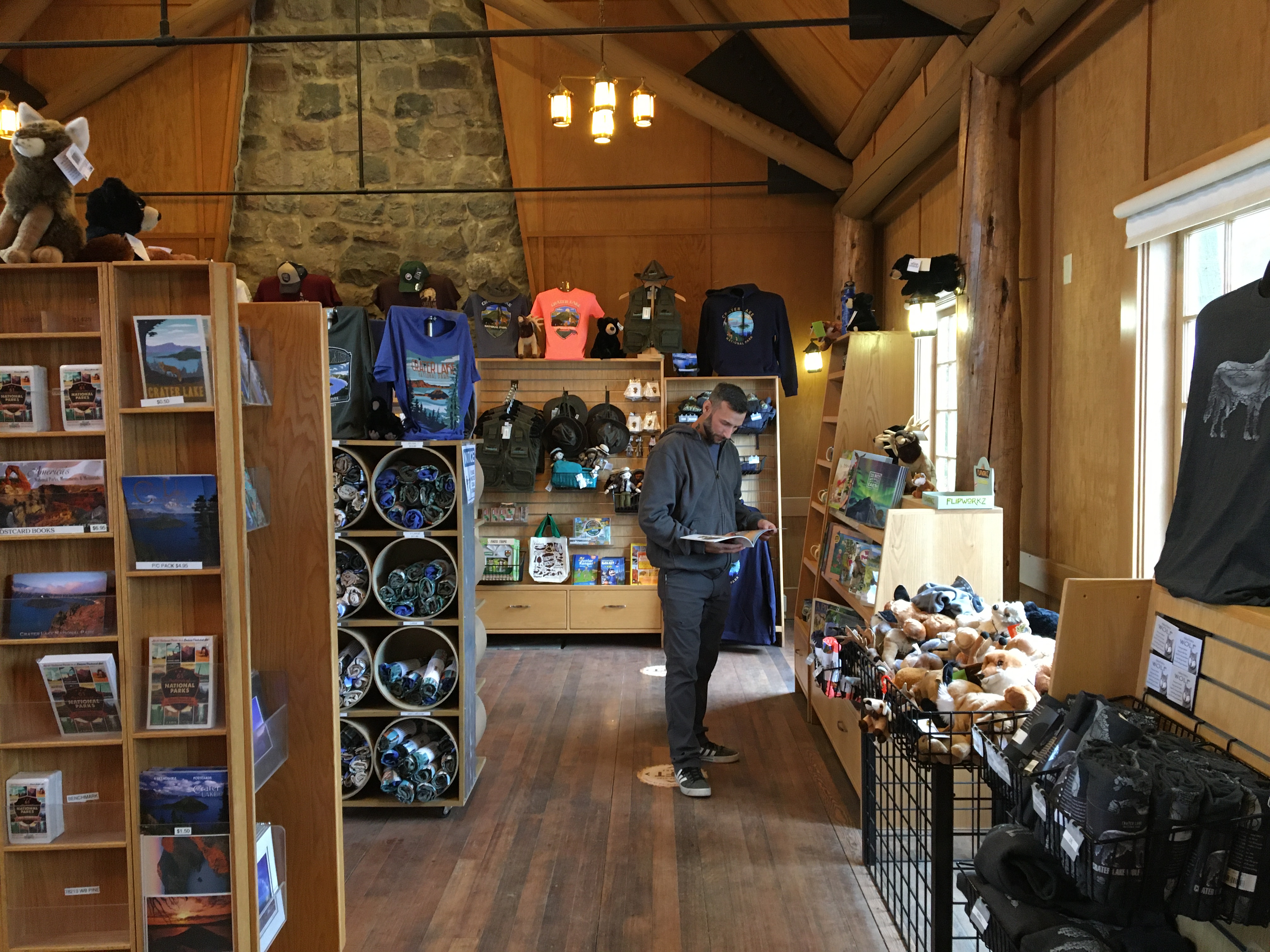
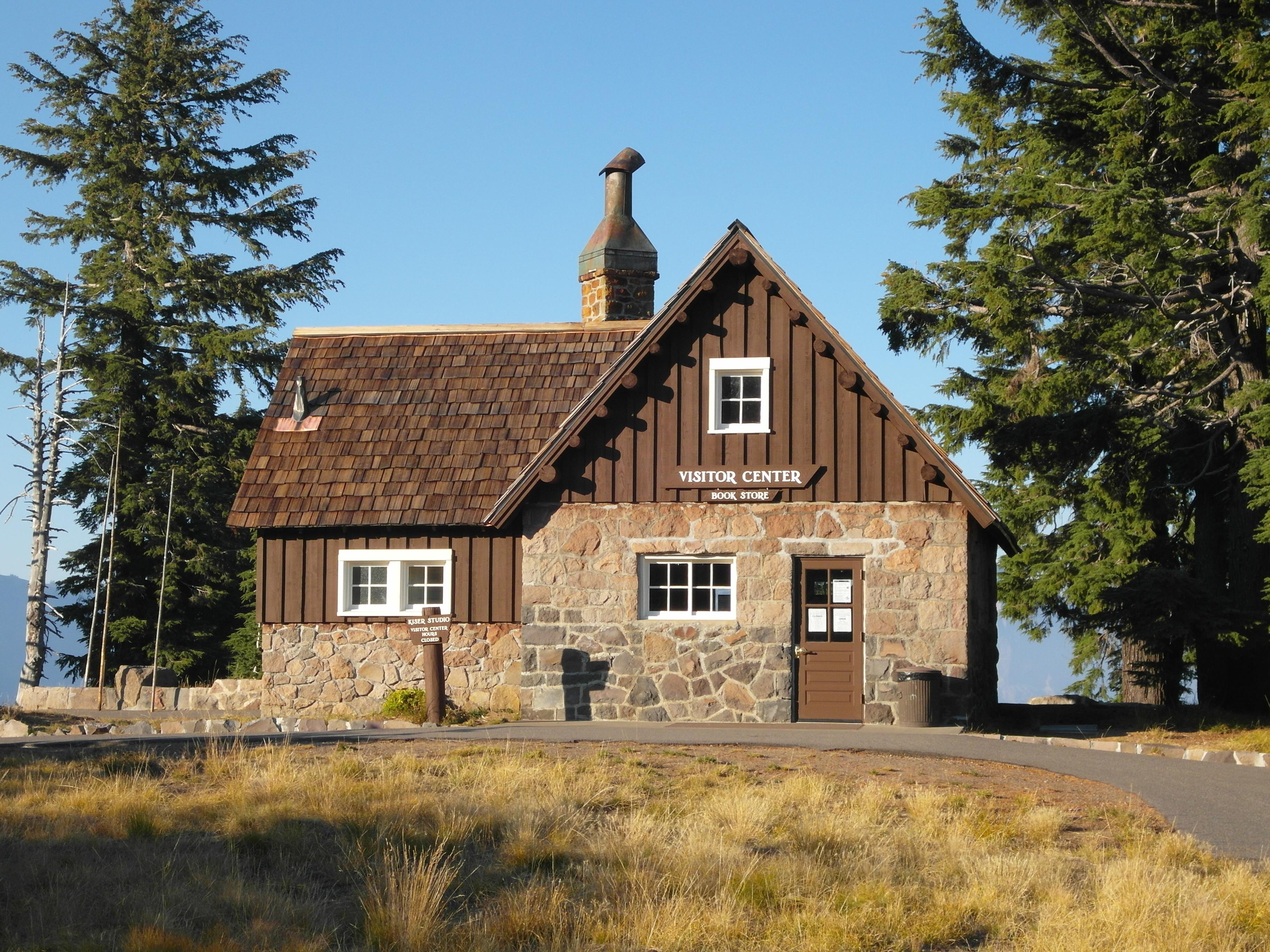
The park store, operated by the Crater Lake Natural History Association is located in the historic park headquarters area in Steel Visitor Center. The American flag flies on a pole in front of the building. Entry into the building is across a native stone walkway in the front during summer but through a snow tunnel on the right side of the building during winter. Once inside the doors, the park store is located behind a double paned door. Inside you will find a variety of books, gifts, Junior Ranger and educational items for sale. An audio described video is shown upon request. The space is small so the the only exhibit is a tactile relief map. There are a few comfy chairs for those who need them but usually during summer the room is too crowded to linger. Park store personnel and a ranger are available to answer your questions about the park.
Goodbye Picnic Area is perfect for a picnic and resting in the shade, but also consider it for birding and boosting your tree identification skilIs. It rests beneath a forest composed of a variety of mature tree species including Shasta red fir, lodgepole pine, and mountain hemlock. With no trail access and mostly unseen but heard, Goodbye Creek splits the two sections of this picnic area physically and audibly.
Goodbye Picnic Area has two sections which are on the west side of Munson Valley Road between the Annie Spring Entrance Station and park headquarters. Both sections have safe entry from the north or the south. The sections are separated by a canyon through which Goodbye Creek flows. This audio description identifies the area with the most amenities. It is a left turn for lake-bound traffic (or right turn for south bounders after crossing the bridge). There are four angled parking places and room for a bus or RV to park. This location also has two picnic tables—one with wheelchair access—within a circle drive, a public vault toilet, and trash and recycling receptacles. Goodbye Picnic Area, including the picnic tables, rest beneath a forest composed of a variety of mature tree species including Shasta red fir, lodgepole pine, and mountain hemlock. The towering trees harbor calls of many birds including the red breasted nuthatch, woodpeckers, and pine siskins, and the antics of Douglas squirrels are never far away. There is not much tree undergrowth surrounding the picnic tables as it has all been stunted by foot traffic but beyond the bareness is a healthy undergrowth of shrubs and young trees. Mostly inaccessible to the eyes but very audible to the ears is Goodbye Creek which flows in a shallow canyon between the two picnic areas. The creek is relatively quiet after spring and early summer snow melt.
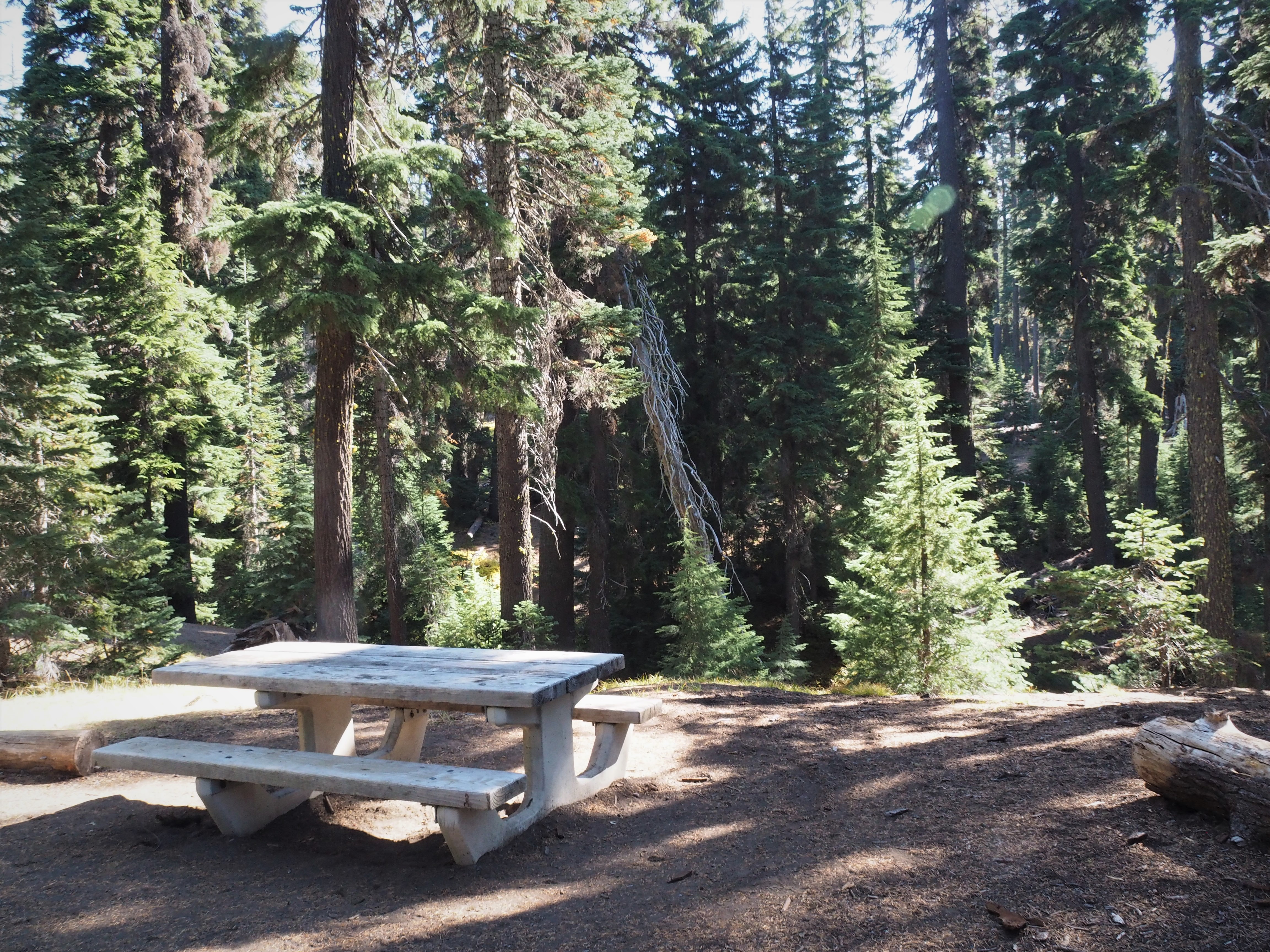
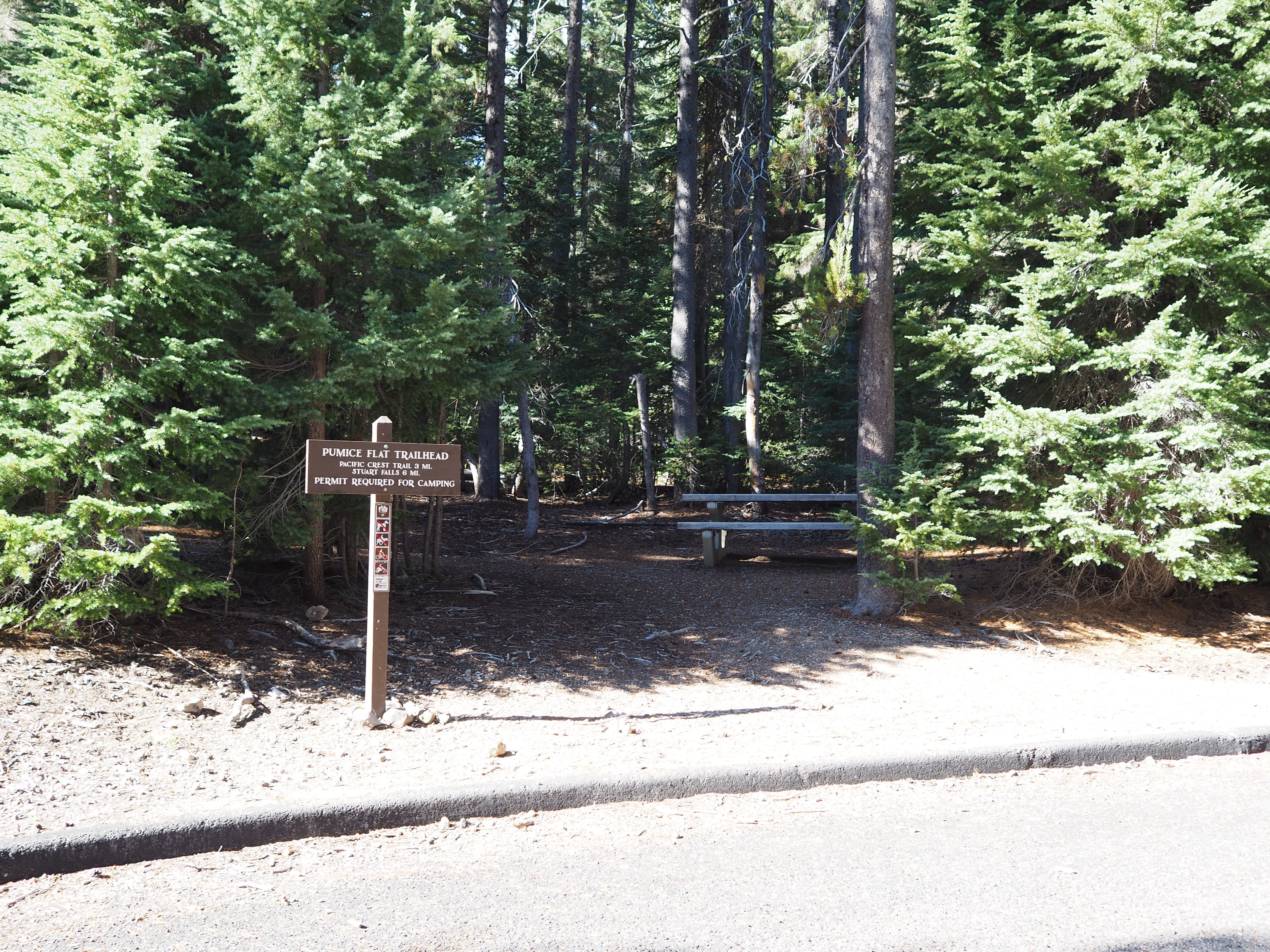
Picnic tables and the Pumice Flats Trailhead are set among an old growth forest of lodgepole pine trees along a semi-circle drive. As the name suggests, lodgepole pines grow tall and straight, reaching 100 feet in height.
A sign on south Hwy 62 announces the Lodgepole Picnic Area is 500 feet ahead on the right. An old growth forest of lodgepole pines welcomes you. These are trees that are recognized for their height, up to 100 feet, and straightness, not girth as one might expect in an old growth forest. A trailhead for the Pumice Flats Trail, and two picnic tables are located beneath the trees on the left.
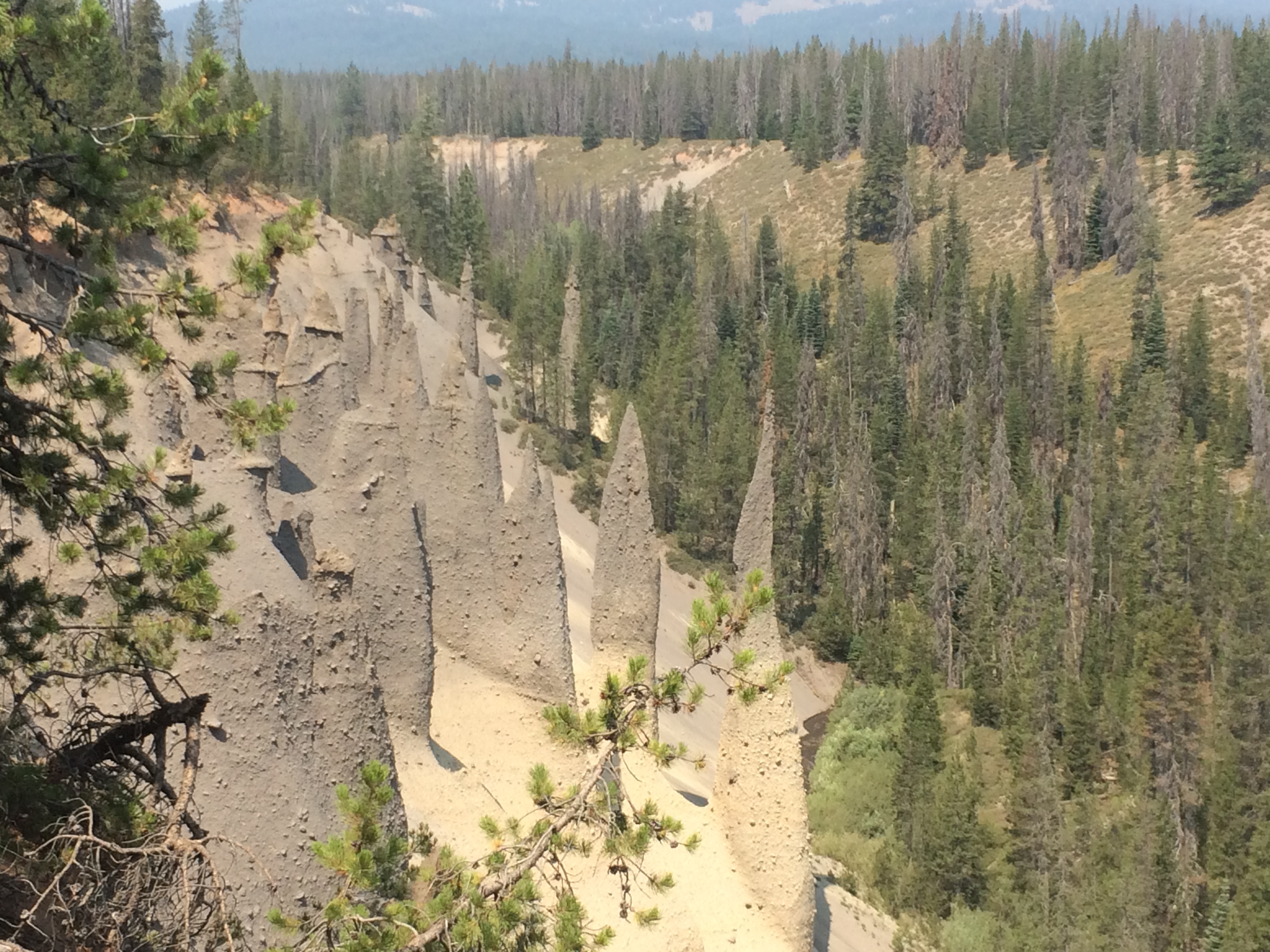
The pinnacles developed when pyroclastic flows filled valleys and the gases escaped through vents which hardened and were later exposed through erosion.
Pinnacles Trail is at the end of a 6 mile road from the Phantom Ship Overlook and East Rim Drive. Parking is a rustic, forested circular gravel drive. A large vertical sign announces the trailhead. The trail has 10 ft (3 m) of elevation gain and is accessible to all-terrain wheelchairs. There are multiple vantage points to stop for views of the spired pinnacles. These appeared after a stream reestablished its valley and removed lighter and less-resistant vocanic material, leaving many prominent pinnacles along the canyon walls. Vies also reach across the deep canyon and tree tops. To
Ponderosa Picnic Area, is at the southernmost tip of the park, a region referred to as the panhandle, and is the park’s lowest elevation at 4400 feet. With less snow and warmer temperatures wildflowers are first seen here. Ponderosa pines are the dominant tree species in a dense forest that includes sugar pines, Douglas-firs, and white firs. Hidden by the tree canopy are warblers, vireos, kinglets, western tanagers, chickadees and woodpeckers.
From the south boundary on Hwy 62 after the Ponderosa Picnic Area sign, turn right to enter the picnic area. Within the picnic area, the road is two lanes, one each direction. The road widens on the right before an accessible vault toilet which is next to a short, accessible ramp leading to an information and map kiosk. Past the kiosk on the left is a long paved unmarked parking area with two sets of curbside, brown trash and recycling receptacles. There are picnic tables in the forest behind the trash receptacles. The second table on the left has space for a wheelchair but the 6” curb prohibits access. Two additional tables are on the right (canyon side). The echo of Annie Creek is heard flowing through the steep canyon on the left. A range of bird calls from warblers and kinglets to tanagers and flickers, filter down from the tall tree canopy. These native sounds compete with the occasional vehicle noise on Hwy 62. The forest is a dense growth of Ponderosa and sugar pines, Douglas and white firs, and other species which expand throughout the picnic area and across highway 62. Ponderosa pines are the dominant tree species, identified by deeply furrowed yellow to reddish bark. Up close, the bark looks like jigsaw puzzle pieces. The needles average 5 to 7 inches in length and are in bundles of three. The cones have a sharp prickly point on each scale and are often sappy. The undergrowth represents new tree growth, blossoming shrubs, and wildflowers depending on the time of year. A parade of color begins in early summer with Skyrocket, Paintbrush, lupine, wild strawberry and sweet-smelling snow brush. The Douglas squirrel is the primary mammal of this area but due to the abundance of food and shelter other small and large mammals may appear.
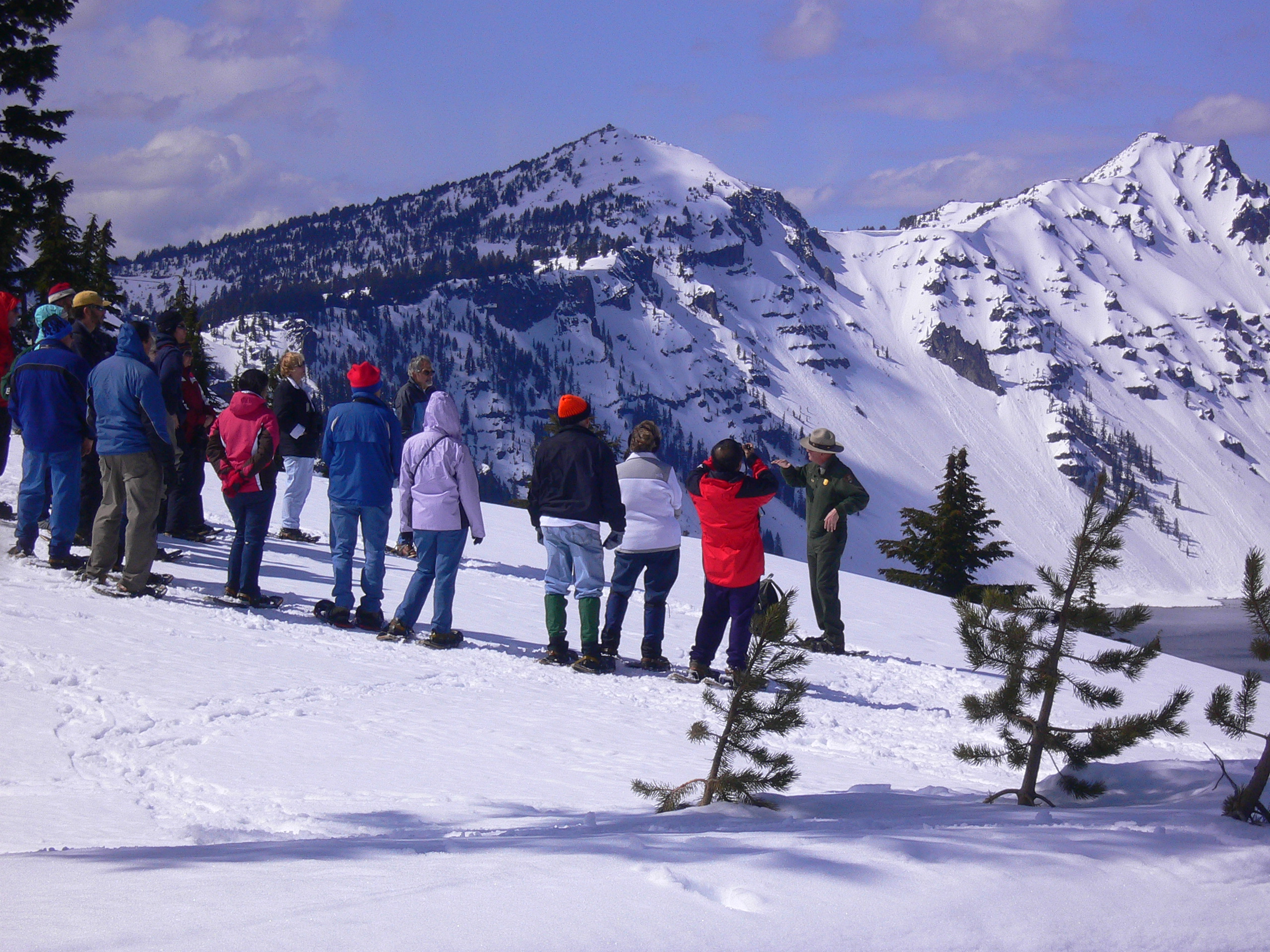
Overlooking Crater Lake, Rim Village is a high-elevation, winter wonderland of snow-covered meadows beneath towering conifers. Snowshoe, sled, ski, photograph the scenery, drink hot cocoa, play in the snow, or visit the gift shop are ways to enjoy the park. Average winter snowfall is 42 feet. Plan ahead, know the weather forecast, check the webcams, carry tire chains, wear boots and layers of clothes. Don't forget to stay hydrated.
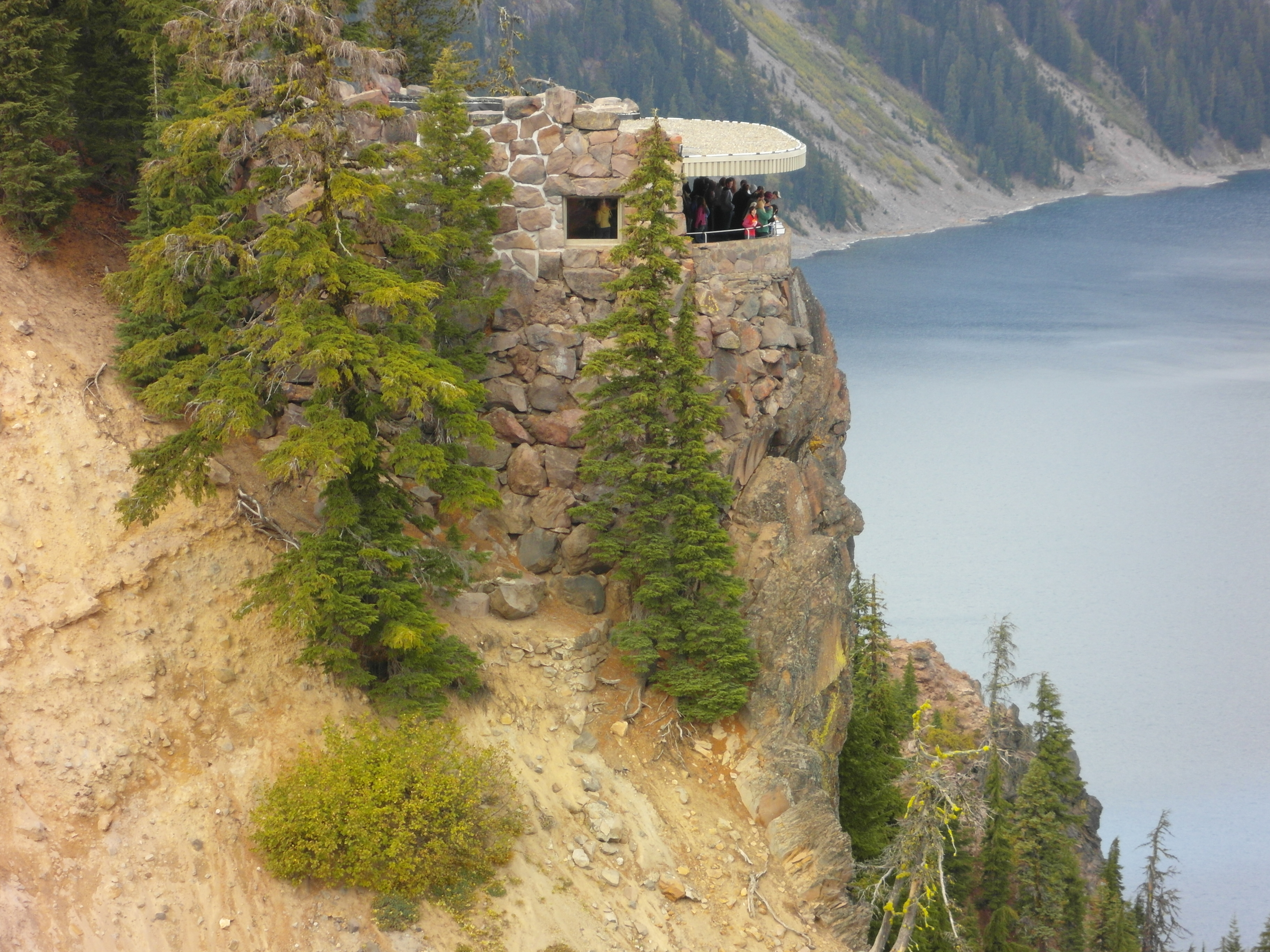
Sinnott Memorial is the most popular viewpoint in the park. Designed as a “trailside" museum with an expansive, unobstructed lake view and science-related exhibits, It is an opportunity to simultaneously learn about the geology of Mount Mazama and the creation of Crater Lake while experiencing the blue, its beauty, and the silence. Allow time to explore the exhibits, attend a daily ranger program, and contemplate.
The steps and sloped walkway down to the Sinnott Memorial begin along the Rim Village Prominade behind Kizer Studio which currently serves as Rim Visitor Center. At the top of 18 steps on the right-hand side, there is a small replica of Crater Lake carved into stone. Beyond the 18 native stone steps, there are no handrails, and due to the rugged and steep historical design of the declining path, there are no ramps for wheelchairs. Descending the stone-parapet lined path, on the right are small conifer trees and green shrubs, and on the left, beyond the parapet the caldera wall drops to the water’s edge. Near the end of the path, are 14 additional steps down to a platform and set of French doors, which are often propped open during hours of operation but otherwise need to be pulled towards you. Through the double doors, at 700-feet above the lake, is a 40-foot wide semi-circle balcony overlooking an unobstructed-panoramic view of the caldera, lake, and many geologic features. Set into the stone parapet which defines the outer boundary of the balcony are a series of information panels about Mount Mazama which allow visitors to simultaneously witness the lake’s beauty and connect it the explosive volcanic history. In the center of the balcony there is a tactile relief model of the lake and surrounding area that visitors use to orientate themselves and listen to ranger talks (which upon request can be given or repeated at the top of the steps). Also in balcony are two round structural support columns, a wooden bench backed up to the wall, a dedication plaque, and a second set of french doors which open to the museum. The doors pull open and directly ahead is a television monitor approximately four feet off the ground. With the push of a button a film about the catastrophic story of Mount Mazama begins. Around the room are displays with literature describing influential scientists and their lake research, an exhibit discussing the indigenous connections to Crater Lake, exhibits illustrating the amount of pumice and ashfall that occurred locally from the eruption that formed Crater Lake, and a collage of pictures and quotations describing the lake's beauty.
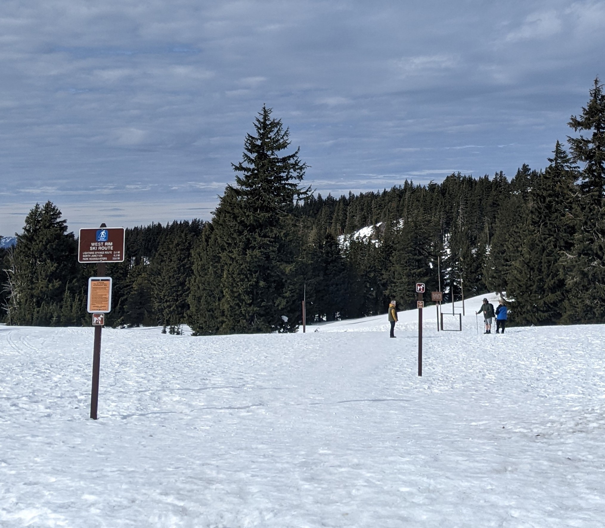
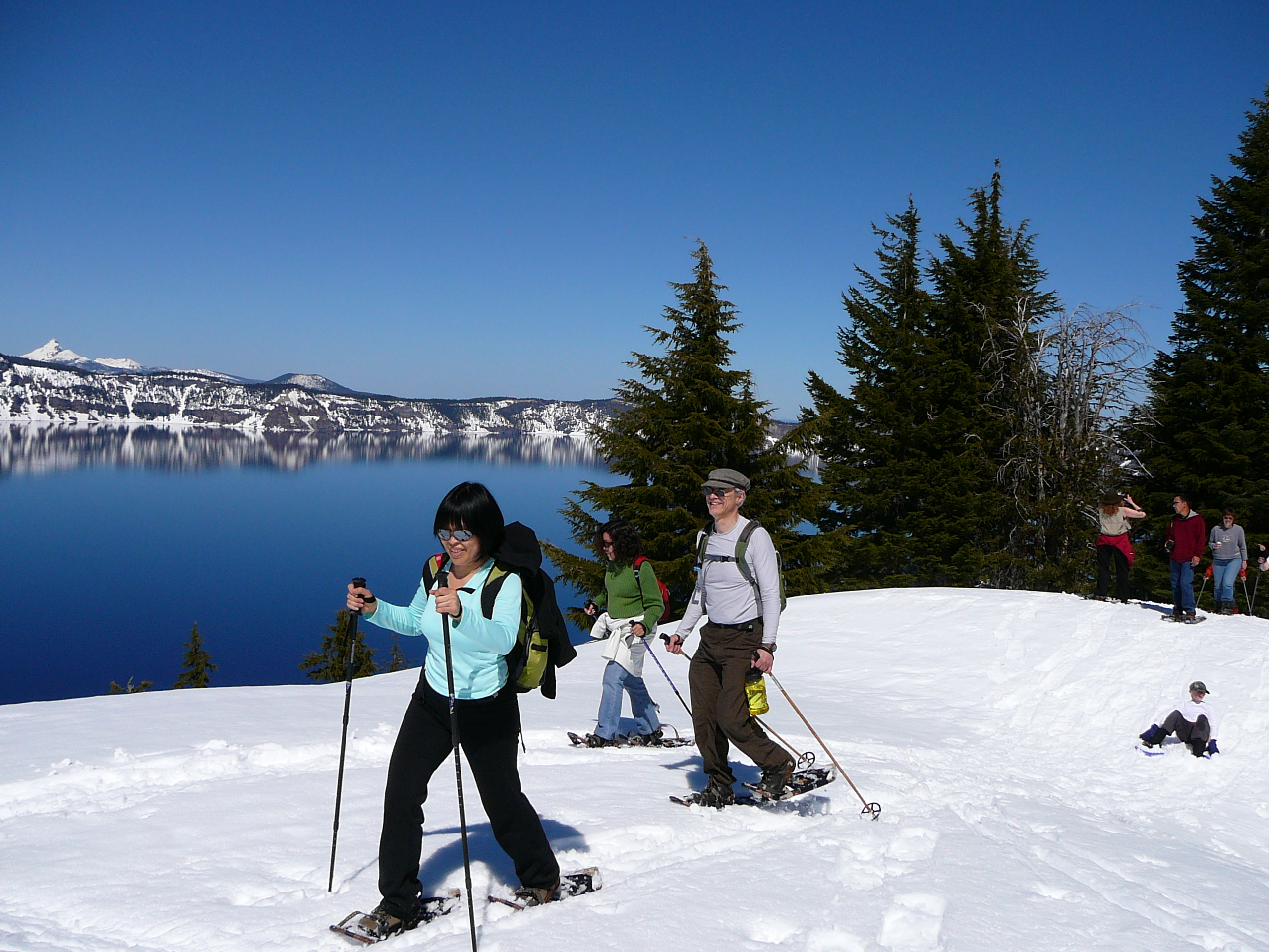
Every year on November 1, West Rim Drive closes to vehicle traffic and transitions into the most popular ski and snowshoe route in Crater Lake National Park. The asphalt surface disappears under many feet of snow with only the contours of the road as a guide. West Rim Route offers spectacular views of Crater Lake, Wizard Island. and the dramatic scenery created by the visible peaks and valleys of the Cascade mountains.
West Rim Route begins from a snow ramp across from the Rim Village restrooms. This ramp is often icy due to snow melting by day and freezing overnight. The ramp is necessary because there may be up-to ten feet of snow to climb to reach the route. Once on top of the snow bank there is an expansive view of Crater Lake to the right, and the route continues past two, two story Rim Village historic buildings on the left. About 100 yards along this snow bank the contours of West Rim Drive, now a winter recreation route, create a snow covered path through meadows and forests paralleling the caldera rim. The first destination and turn-around point for many skiers and snowshoers is Discovery Point 1.2 mi. (1.9 km) from the starting ramp. Here, they can enjoy a panoramic view of Crater Lake and the caldera which is six miles across and thirty miles in circumference. It typically has patches of snow stacked on protruding boulders and the limbs of conifer trees drooping from snowpack.
Views of the lake are prominent and accessible from Rim Visitor Center. It is located at the historic Kiser Studio in Rim Village. Outdoor exhibits at the near-by Sinnott Memorial Overlook are open when the ice melts from the walkway in June until mid-October. Get your passport stamp when the visitor center is open. Rim Visitor Center is usually open seven days a week in summer.
Steel Information Center has reopened after a major structural renovation to stabilize the building against seismic and excessive snow load forces. The historic integrity of this former ranger dormitory, now known as the Steel Information Center, remains while accessibility and safety have been increased for all visitors and staff. The building received get new electric wiring, IT cabling, plumbing, heating, and an updated interior building layout.
Snowshoeing is a popular activity during the long winter at Crater Lake National Park.
Biking at Crater Lake
Each year, increasing numbers of cyclists come to Crater Lake National Park to ride around the lake on the physically demanding, 33 mile (53 km) Rim Drive. Steep hills at high elevation may encourage even the most fit riders to pause at many of the road's thirty overlooks and pull-outs. The payoff however is spectacular scenery, viewed at a pace that few visitors choose to take enough time for.
Scenic Rim Drive
The historic Rim Drive includes 33-miles (53-km) of lake views, panoramic vistas, forests and meadows. The contours of the road were designed to compliment the natural landscape, and disappear from view as you look across the lake from any point.