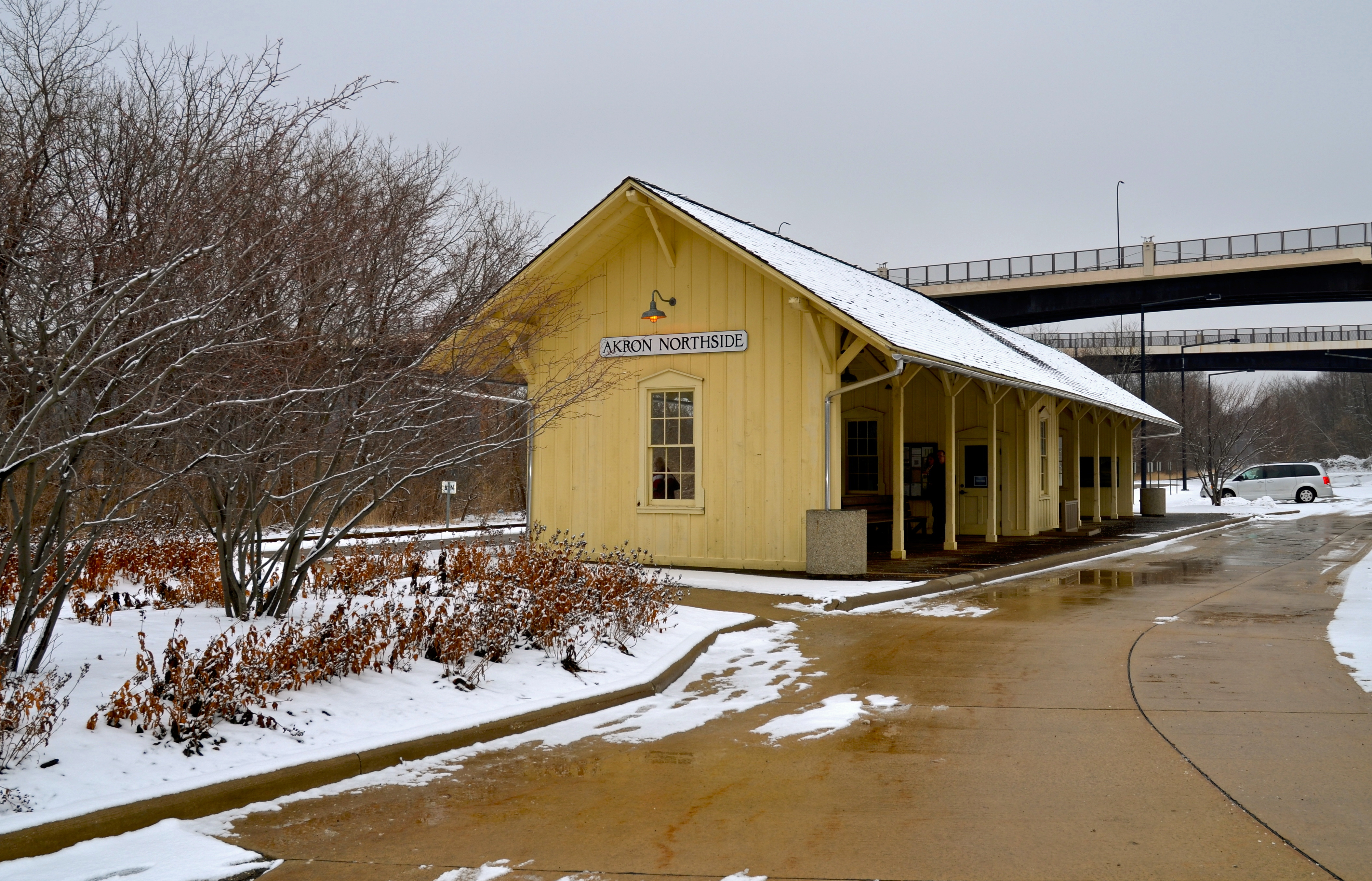
Passengers in the Akron area can catch Cuyahoga Valley Scenic Railroad at Akron Northside Station. The station has ample parking and is a primary starting point for train excursions and events into the national park. The station is on a bus line and within walking distance of shopping, dining, and the Towpath Trail.
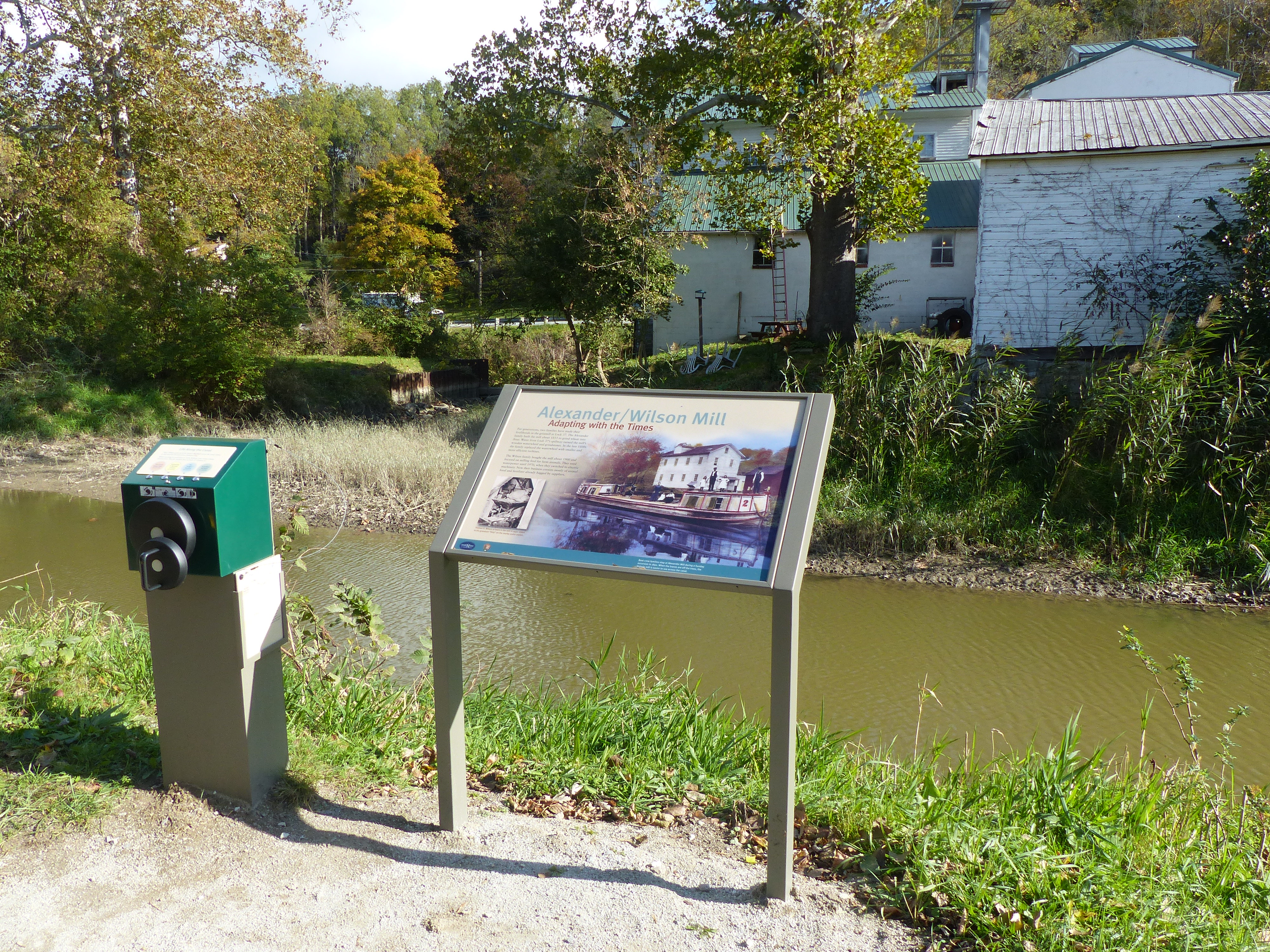
Across the canal is a historic mill. Up until 1970, it used waterpower to grind grain. The mill has been operated by two different families through several generations. It is now a feed store with pre-bagged grain.
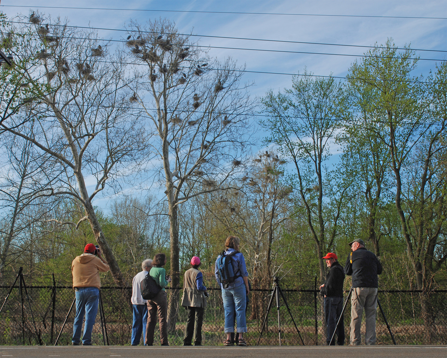
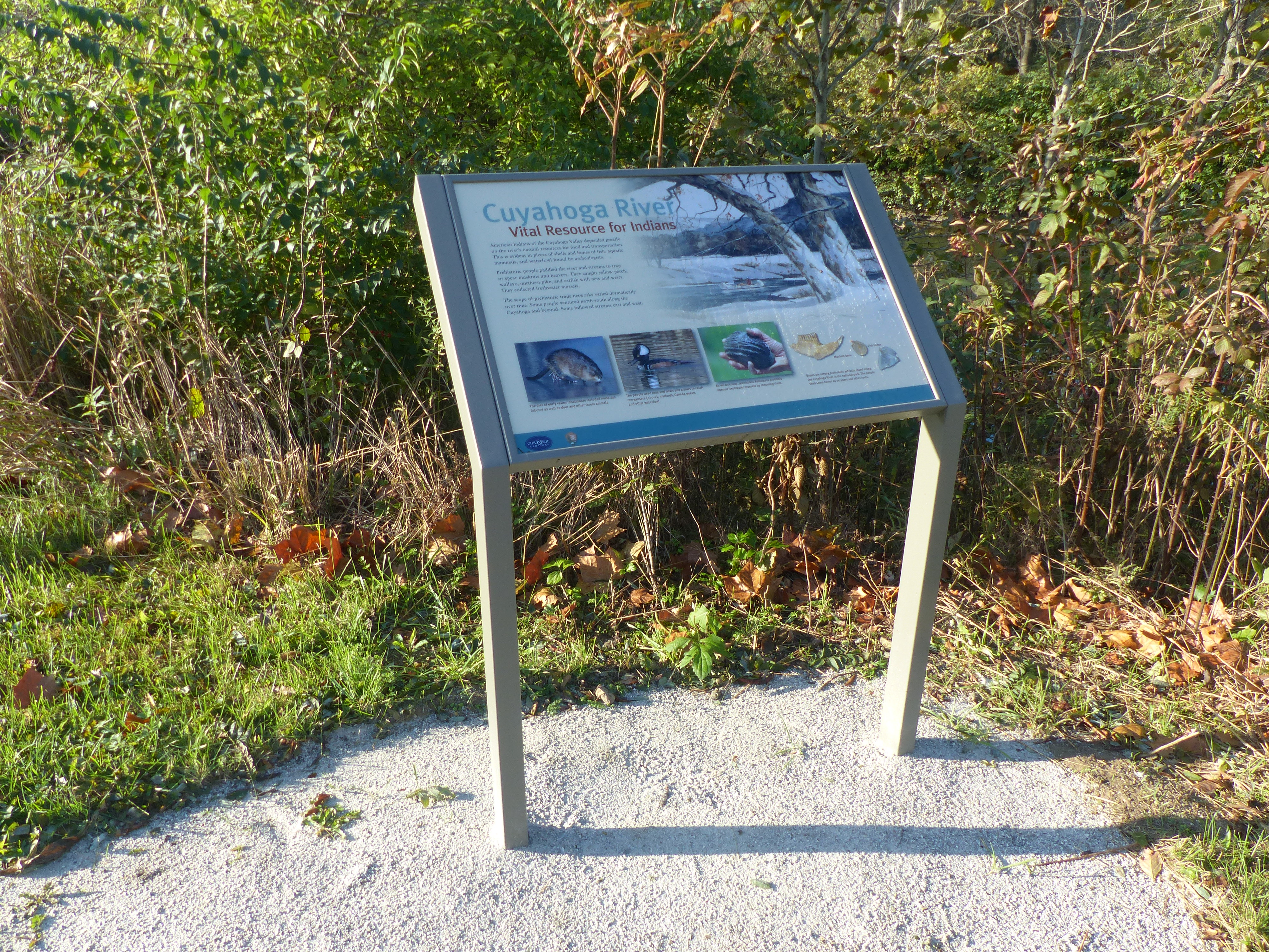
The Bath Road Heronry is a pull off along Bath Road, with exhibit panels telling about these prehistoric birds. Unique in that you can see and hear these birds without ever leaving the car!
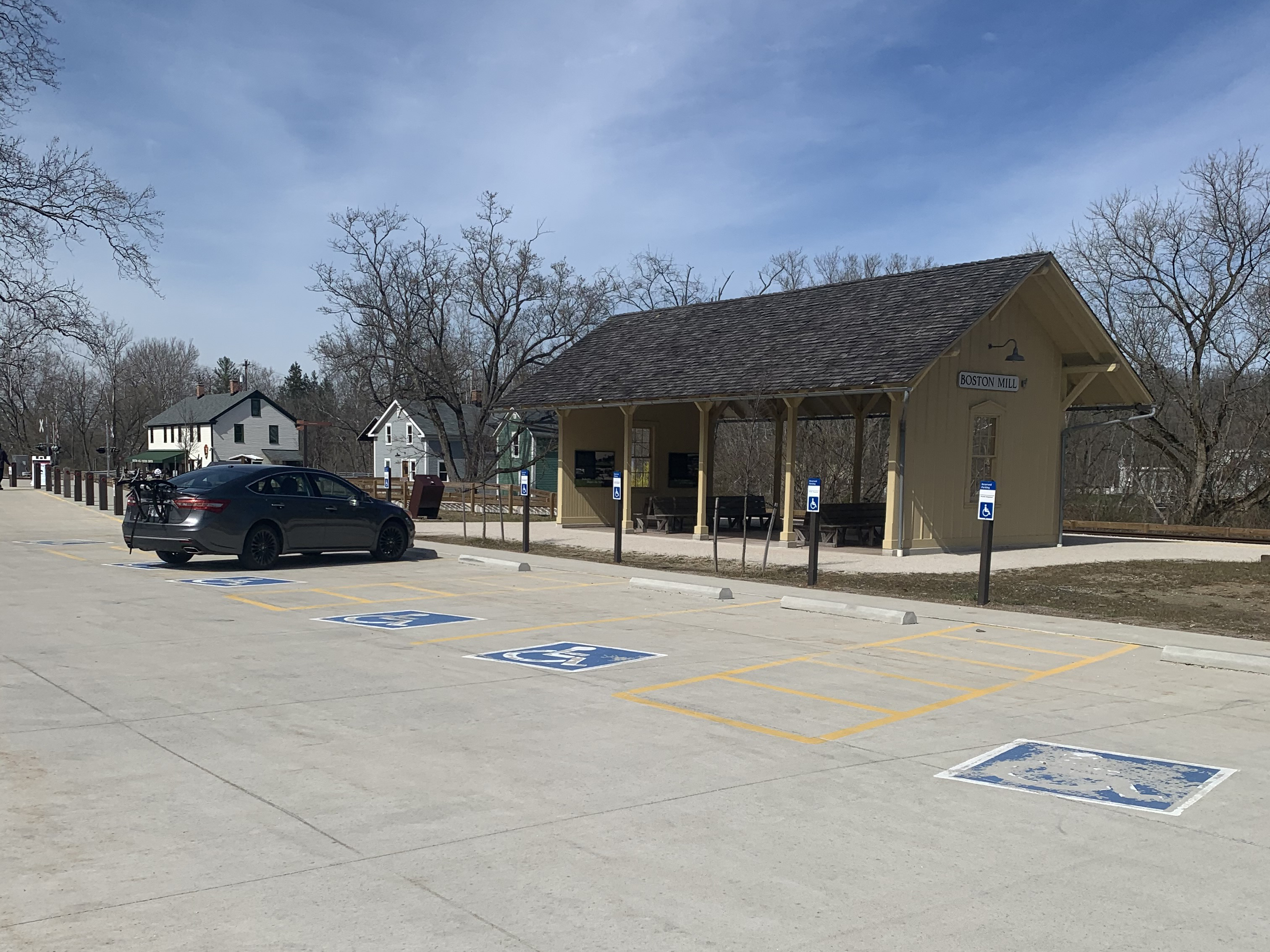
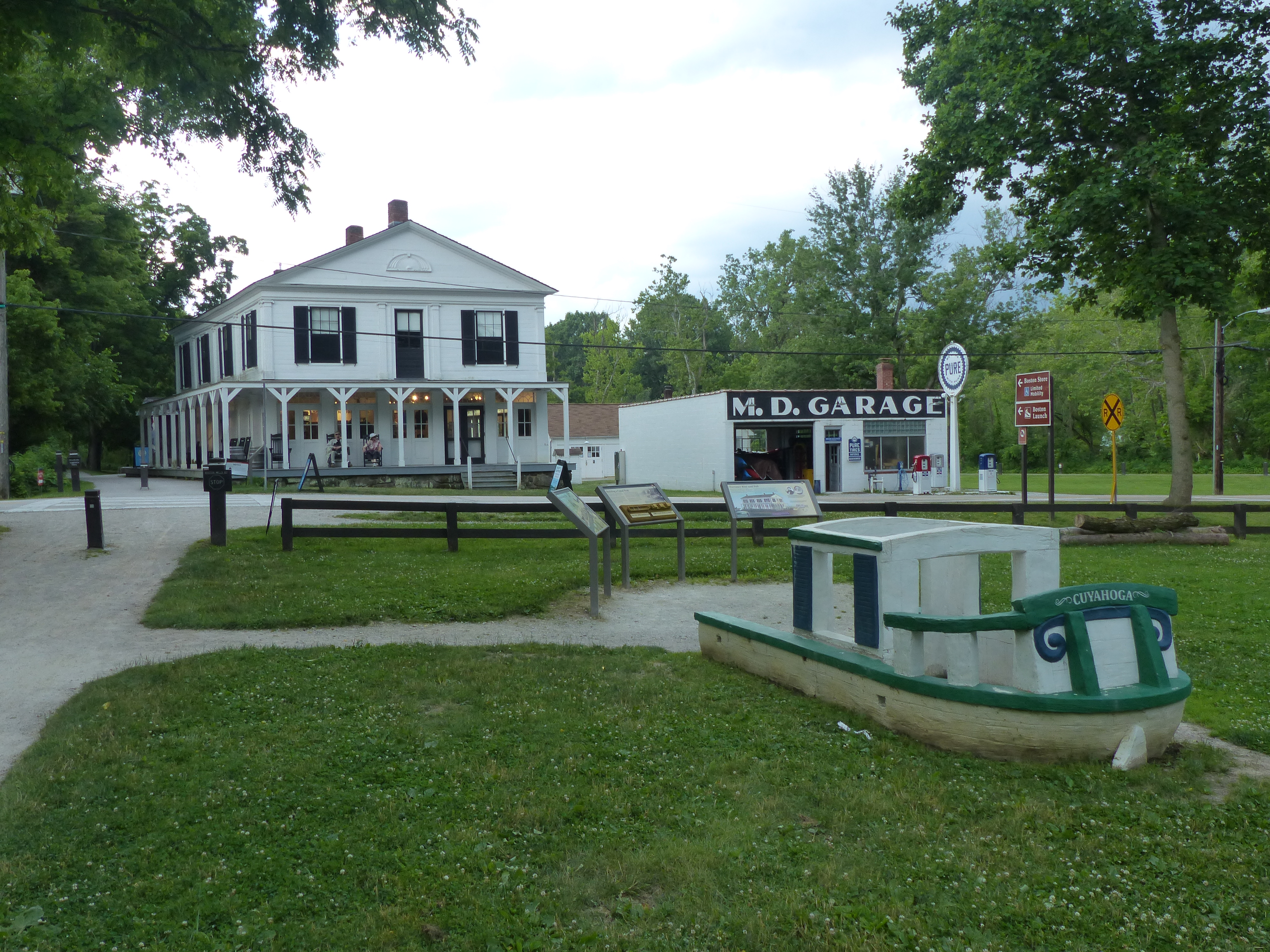
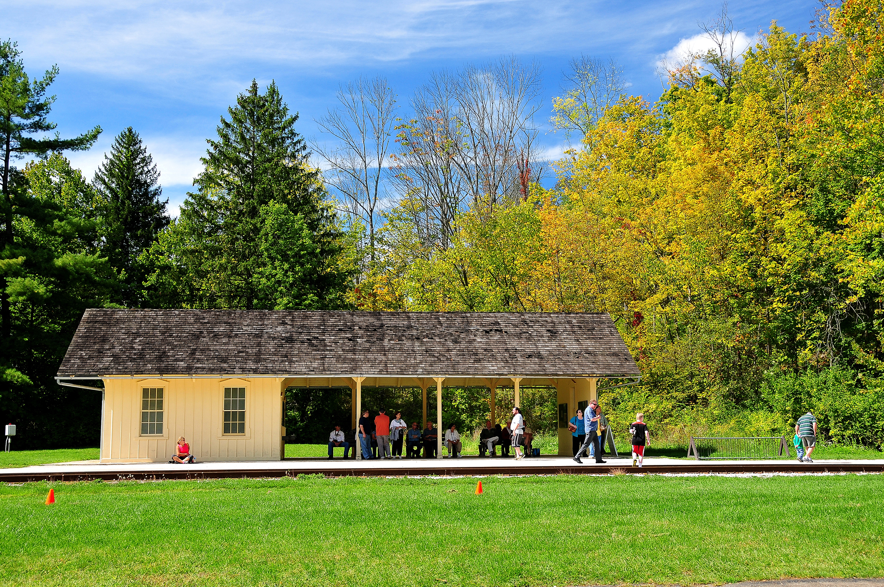
Boston Mill Station is a Cuyahoga Valley Scenic Railroad flag stop. Passengers can get off the train to visit Boston Mill Visitor Center, the pedestrian friendly village of Boston, and nearby trails. Bicyclists, runners, hikers, and paddlers can access the train’s one-way shuttle service to create a trail-train adventure.
The far corner of the main parking lot for Happy Days Lodge provides access to Boston Run Trail. This 3.1-mile loop explores the woods and ravines along a headwater stream of the Cuyahoga River.
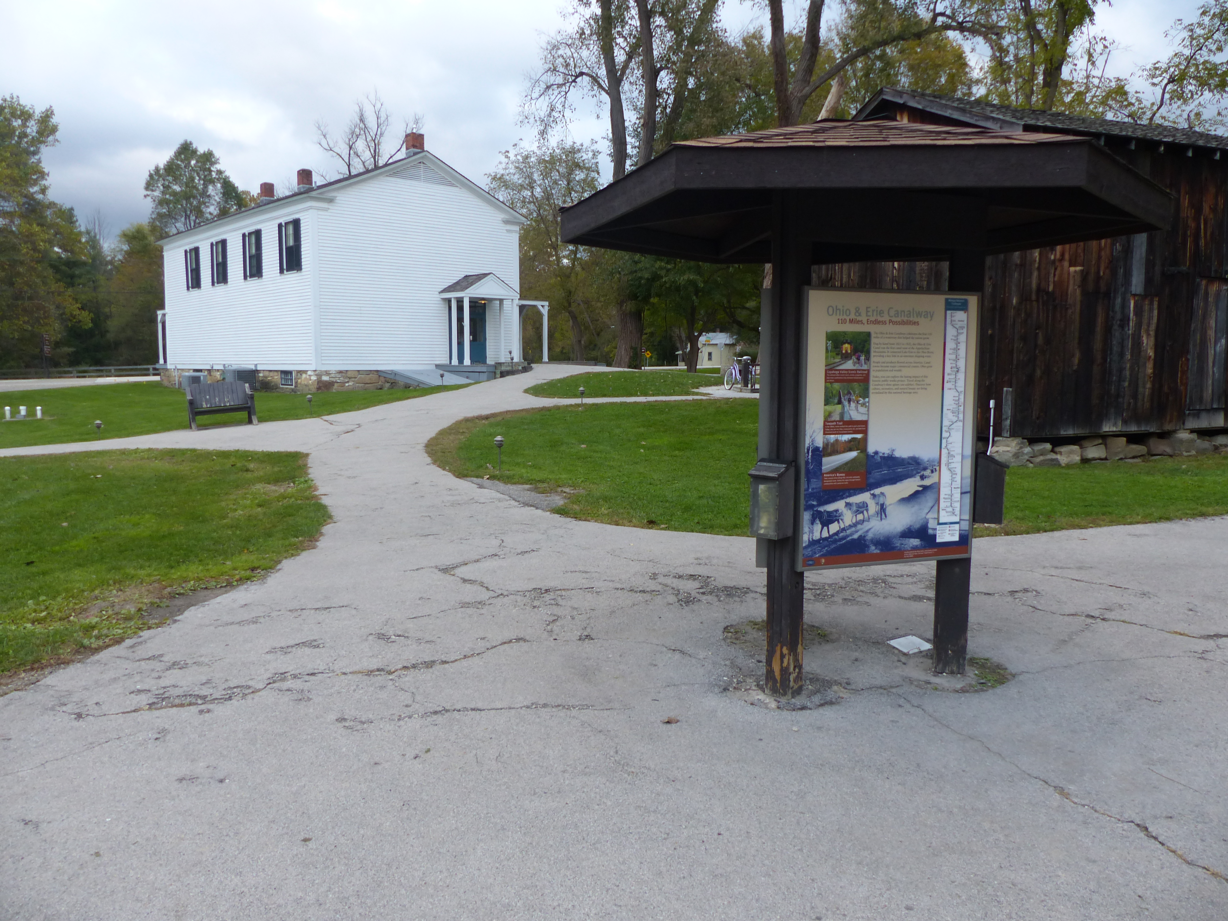
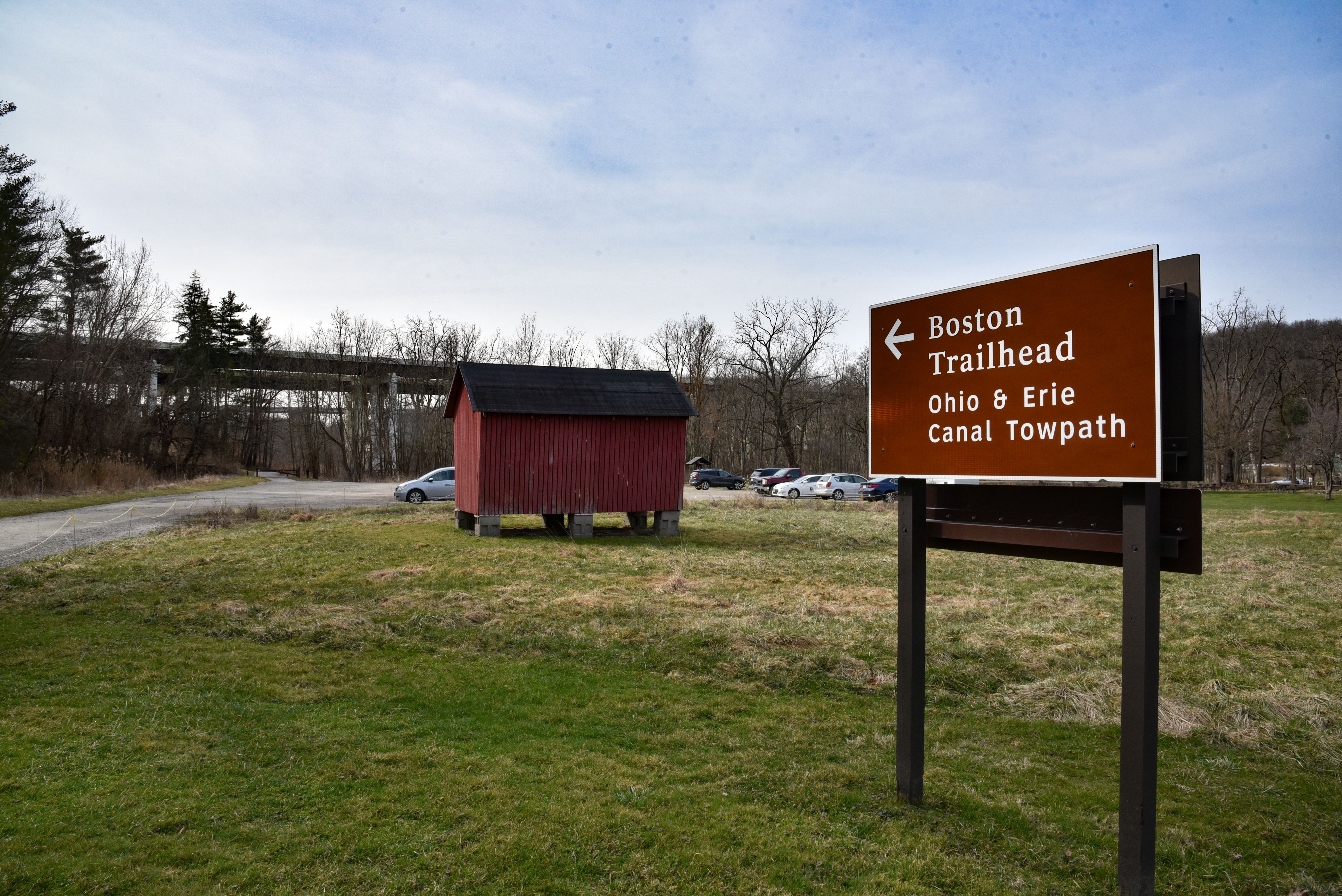
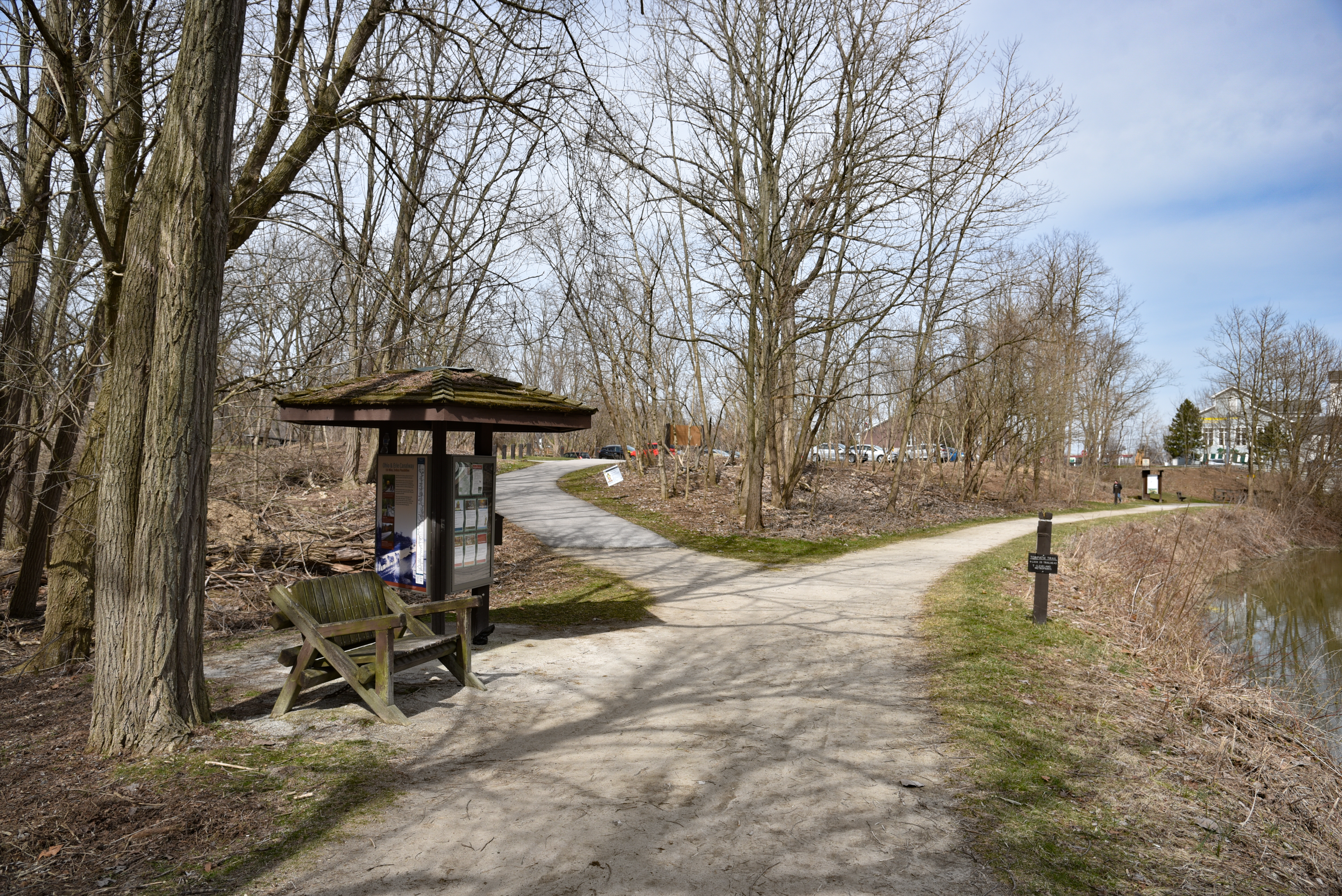
The Village of Boston grew up alongside a canal on the east side of the Cuyahoga River and a railroad on the west side of the river. Boston Store Trailhead provides limited mobility parking on the east side. Use it to access the Ohio & Erie Canal Towpath Trail and refreshments at Boston Store. This small trailhead does not accommodate over-sized vehicles.
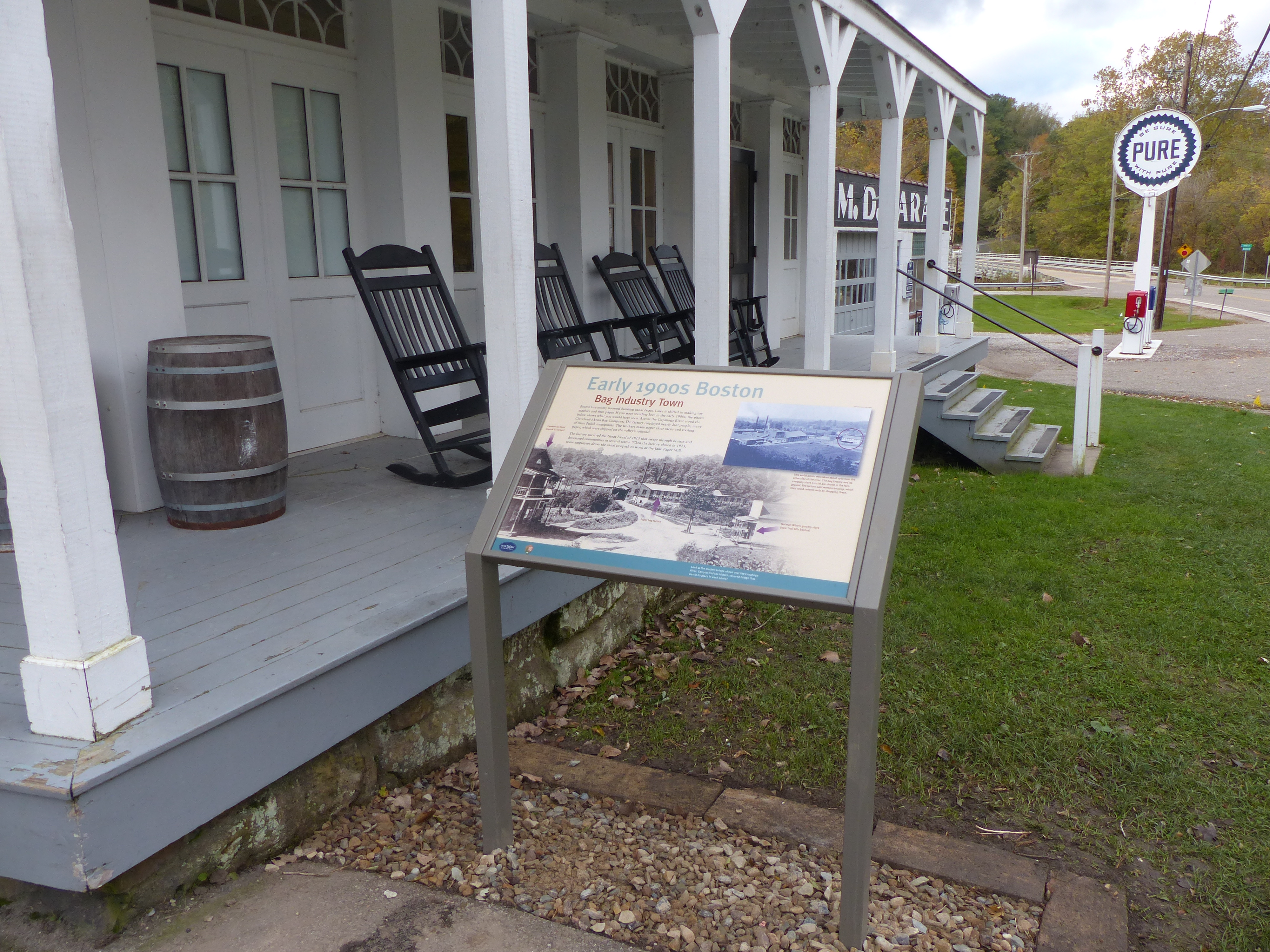
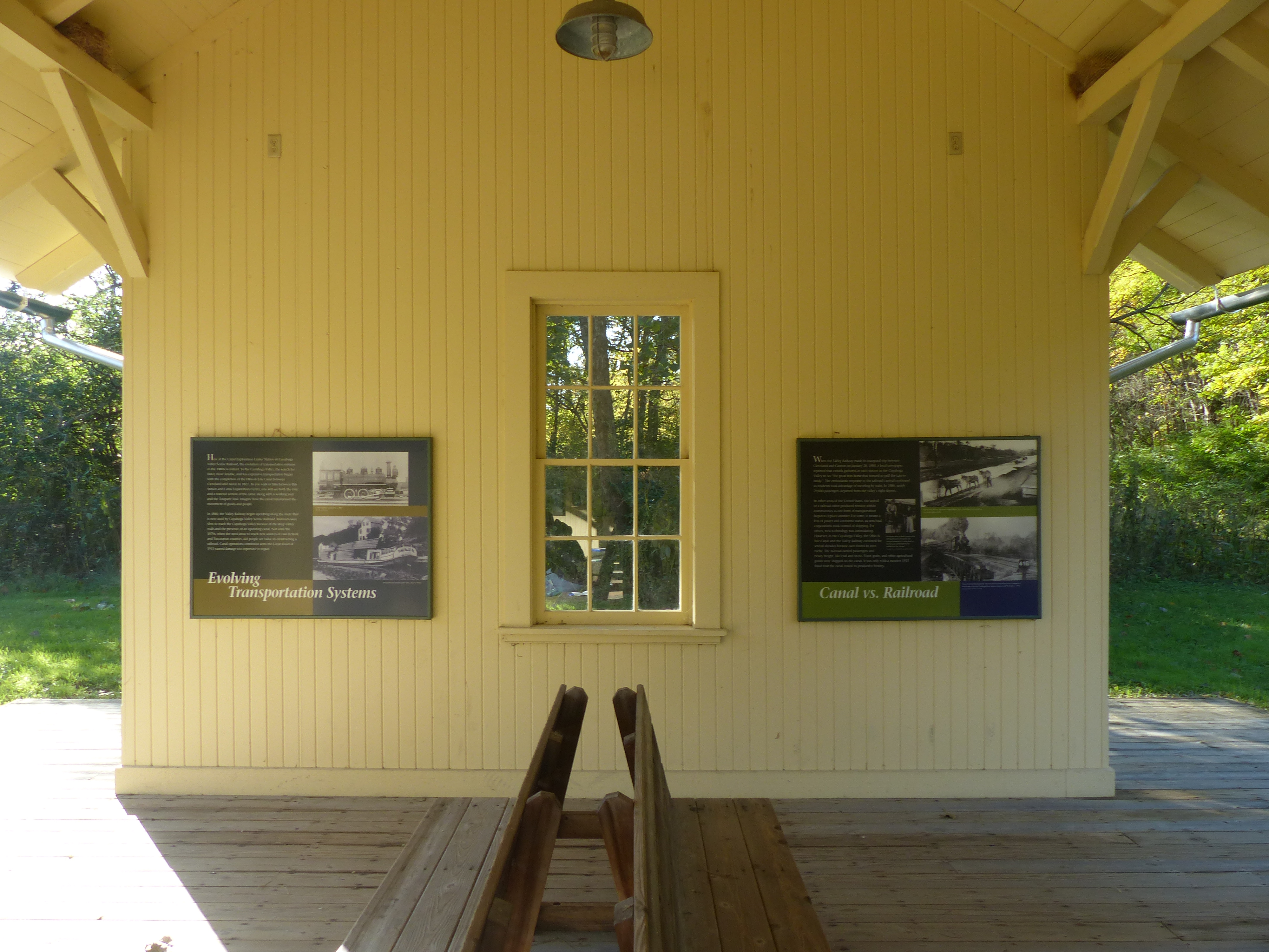
Boston boomed with the arrival of the Ohio & Erie Canal in 1827. It boomed again when a paper mill, the Cleveland Akron Bag Company, opened in 1902. This exhibit shows an early 1900s view of Boston Mills Road when the bag company dominated the town.
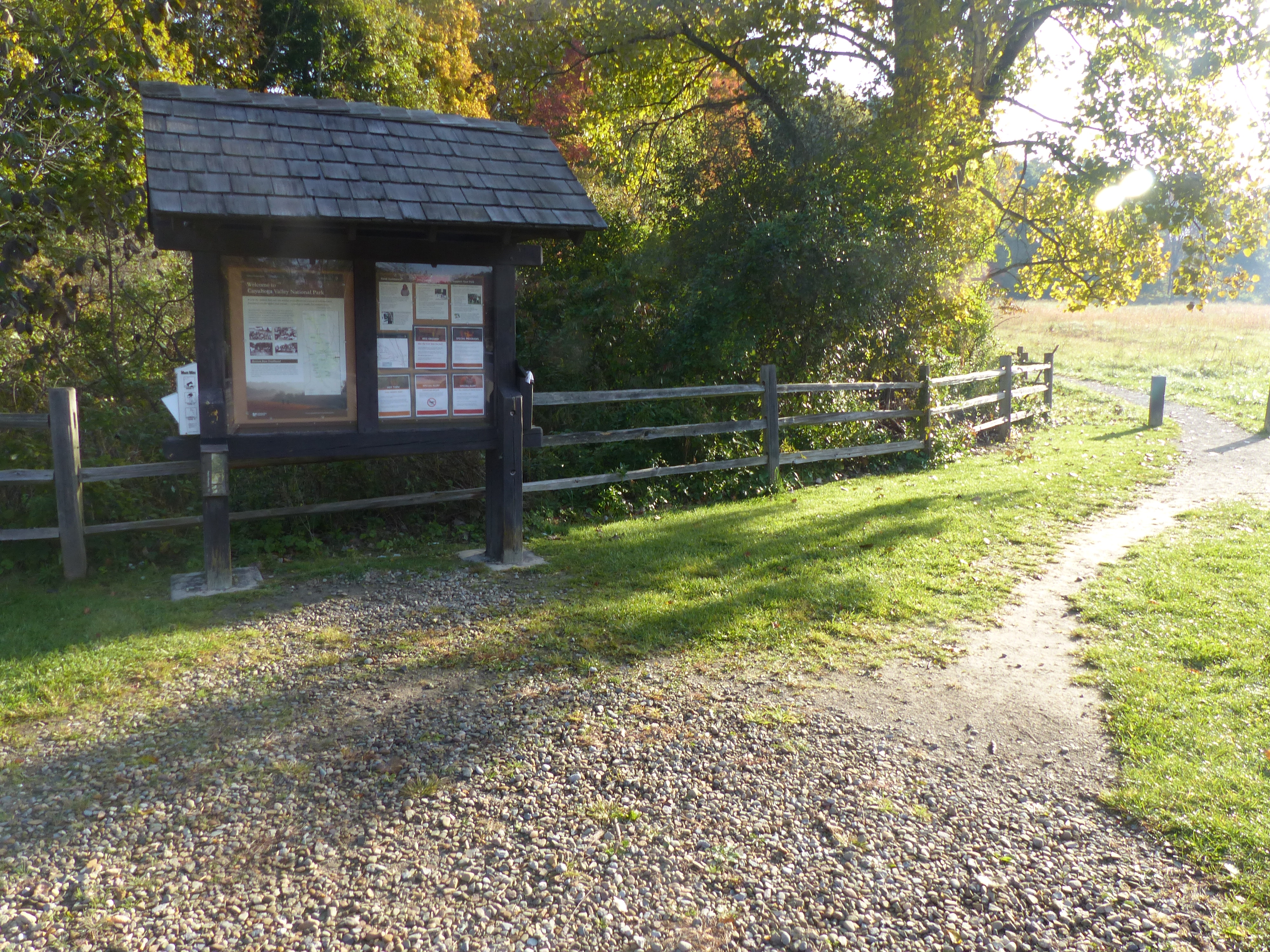
The Village of Boston is a crossroads for hikers, cyclists, runners, paddlers, and horse riders. Boston Trailhead provides parking for the Ohio & Erie Canal Towpath, Valley, and Buckeye trails. Paddlers may park their vehicles at the trailhead after unloading equipment at the Cuyahoga River Water Trail drop-off. Horse trailers are permitted. However, the parking lot was not designed to accommodate them, and it can be a challenge to navigate.
Explore how Boston boomed during the canal era at this outdoor interpretive display. Boston’s success came in part from its role in boat building. Exhibits feature Boston’s boatyards, the basics of canal boat building, and other canal era businesses. A play structure provides a hands-on canal boat experience.
Passengers using Cuyahoga Valley Scenic Railroad’s shuttle service for bicyclists, runners, and hikers can get on and off the train at Botzum Station. This station is located near the southern edge of Cuyahoga Valley National Park adjacent to the Towpath Trail. Botzum Trailhead offers ample parking nearby.
Botzum Trailhead is a large parking lot and the southernmost access to the Towpath Trail in Cuyahoga Valley National Park. Named for a prominent settler, Botzum was part of a string of communities that grew up along the canal and railroad. This section of the towpath attracts exercise enthusiasts. It is 2.5 miles north to Beaver Marsh to view wildlife. Head south through a commercial district. The towpath intersects Cascade Valley and Sand Run metro parks in 2.5 miles.
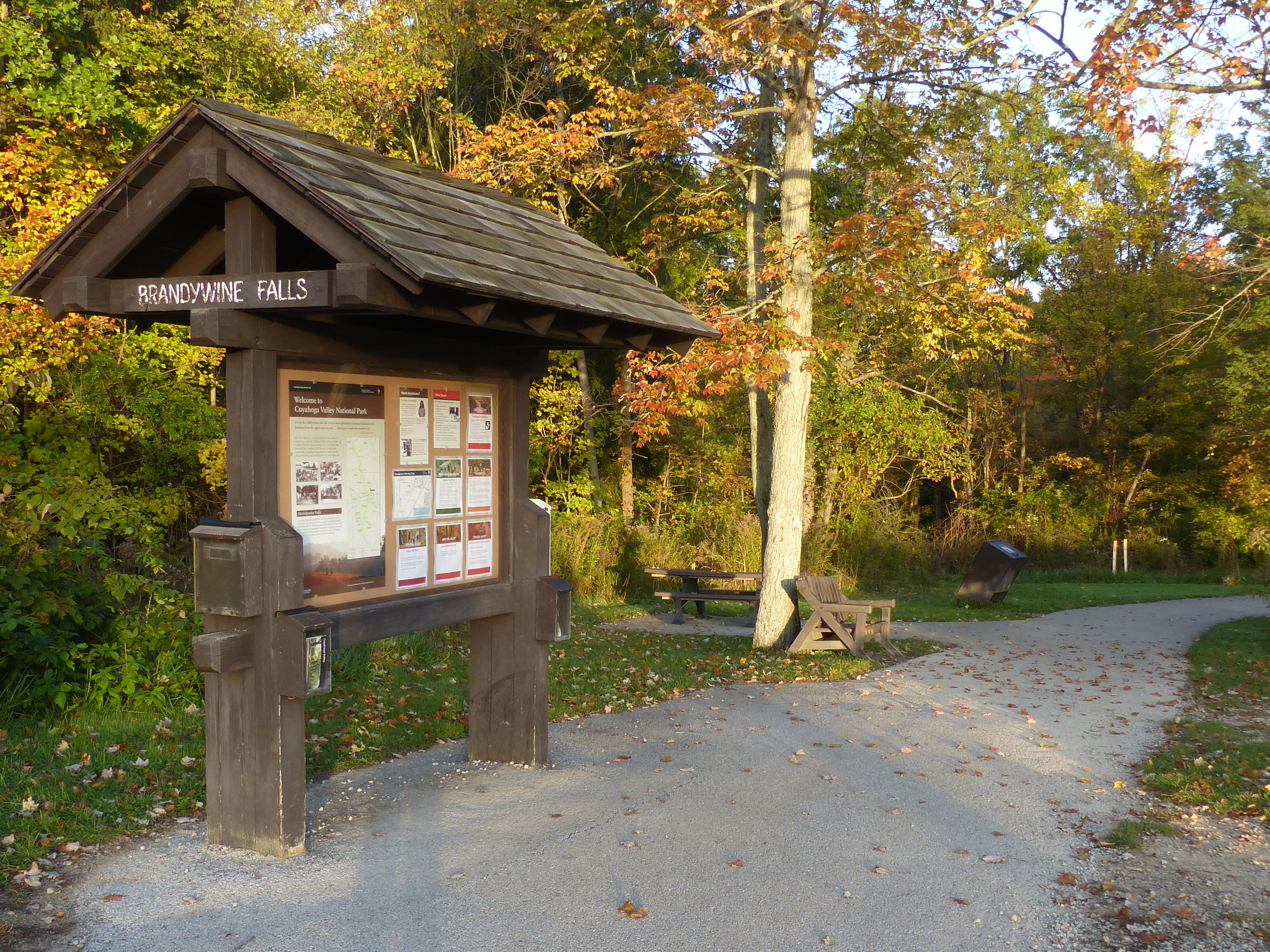
Explore the power and beauty of the 60-foot Brandywine Falls from this location. Extend your visit by walking the 1.4-mile Brandywine Gorge Loop or 1.5-mile Stanford Trail. The trailhead also provides access to Summit Metro Parks’ Bike & Hike Trail.
Brecksville Station is a flag stop for Cuyahoga Valley Scenic Railroad. It is located at Station Road Bridge Trailhead, which offers ample parking. Passengers can get on and off the train as part of combination trail-train adventure. The train provides a one-way shuttle service for bicyclists, runners, hikers, and paddlers using the Towpath, Buckeye, or Cuyahoga River Water trails.
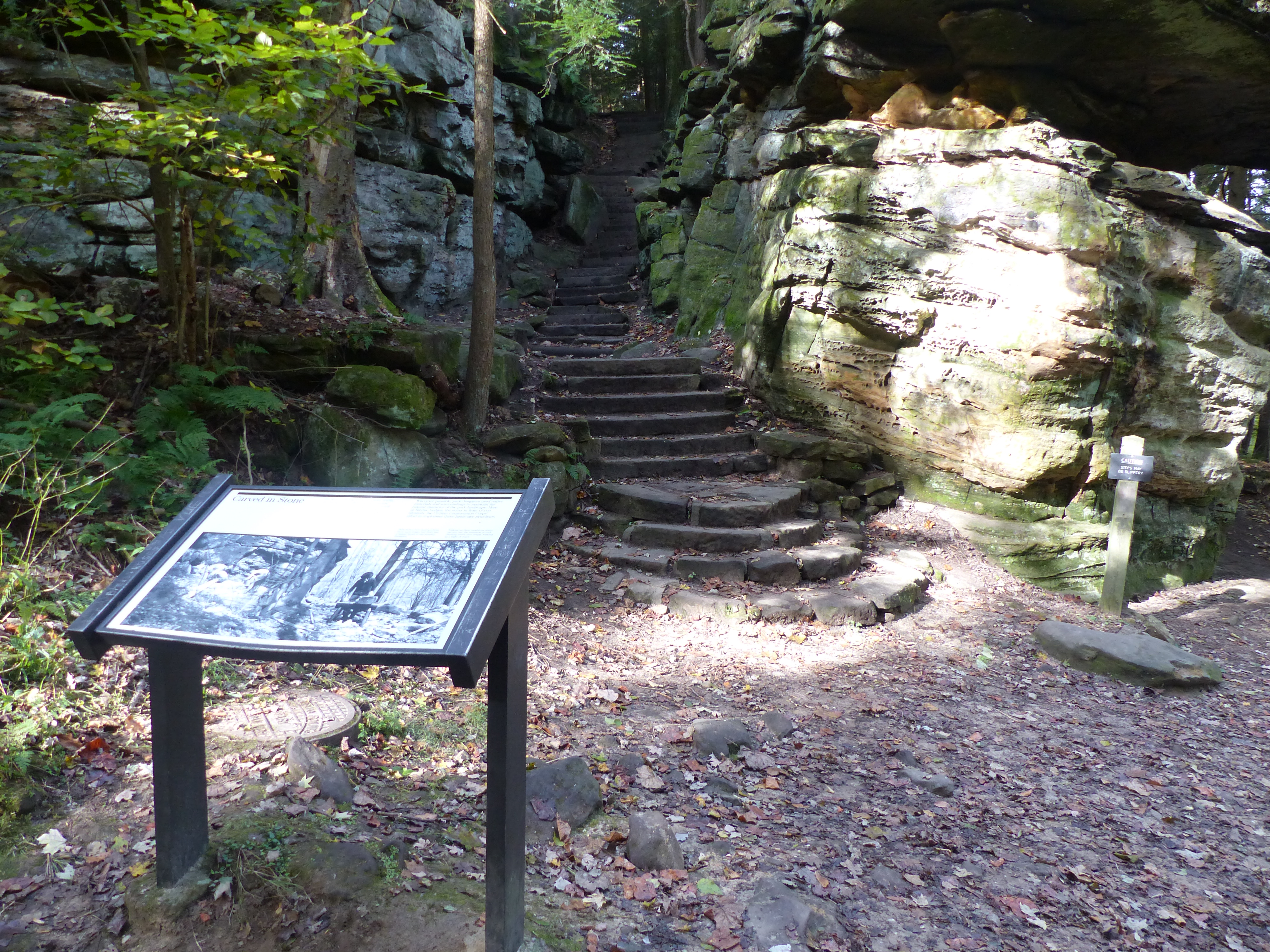
These stairs blend well into the Ledges rock. The National Park Service has long credited the Civilian Conservation Corps (CCC) as their builder. The CCC famously used local resources in ways that fit in the landscape. New evidence suggests stairs existed prior to the CCC. The Plain Dealer published an article about the Ledges in 1906 with a photo of very similar stairs. Mr. Thompson owned a nearby farm. Future research might answer whether he built the original stairs.
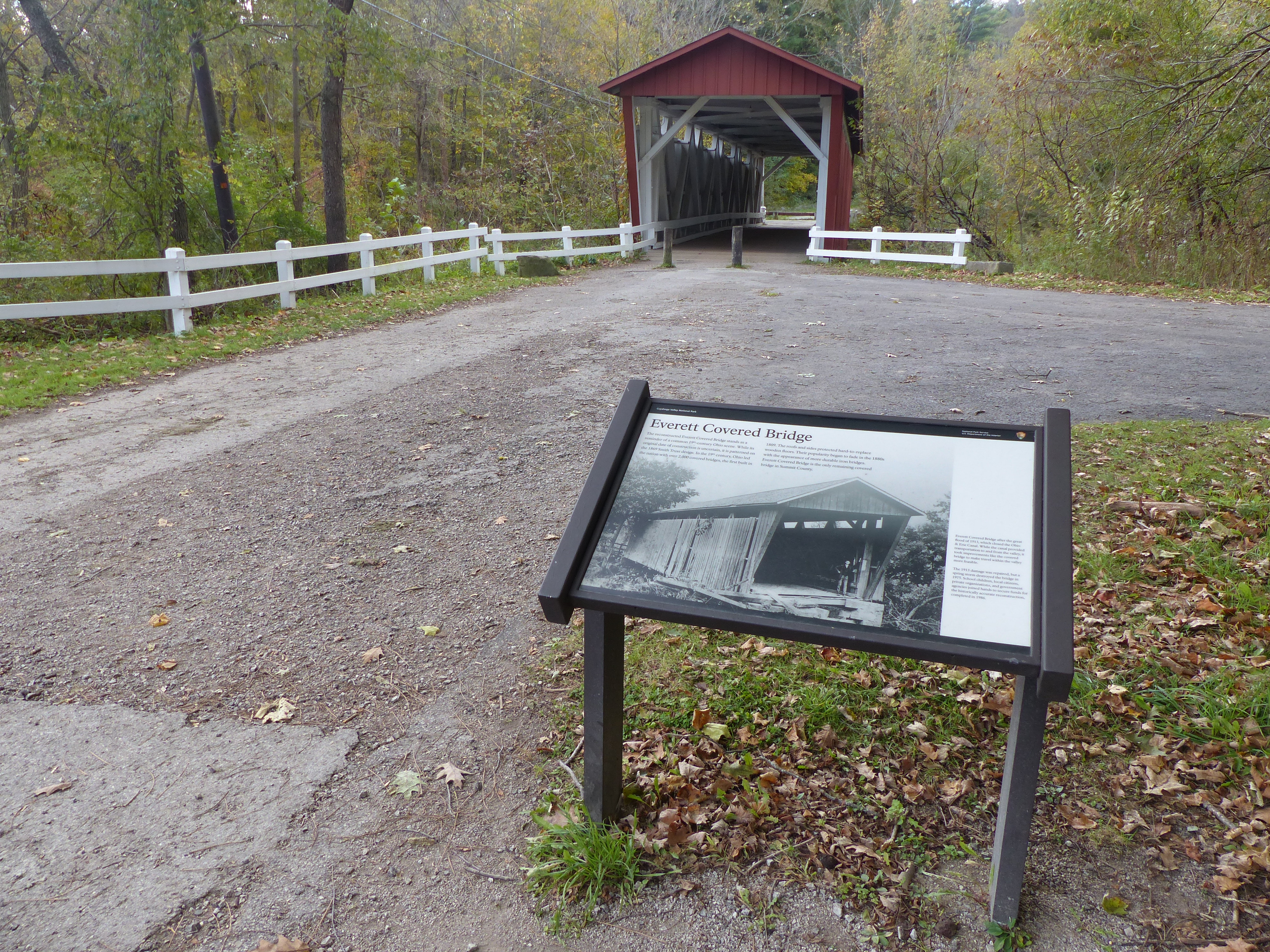
An exhibit here tells the story of once common covered bridges. The Everett Covered Bridge is the last covered bridge remaining in Summit County. Through the years, covered bridges were replaced by iron bridges, much like horses were replaced by iron machines.
For almost a century, the original Everett Covered Bridge provided safe crossing over Furnace Run. Today’s bridge was reconstructed after a 1975 flood. The trailhead provides access to the bridge and nearby trails. The 5.6-mile Riding Run Trail is open to pedestrians and horses. The 1.9-mile Furnace Run Trail is a walking trail popular for viewing spring wildflowers.
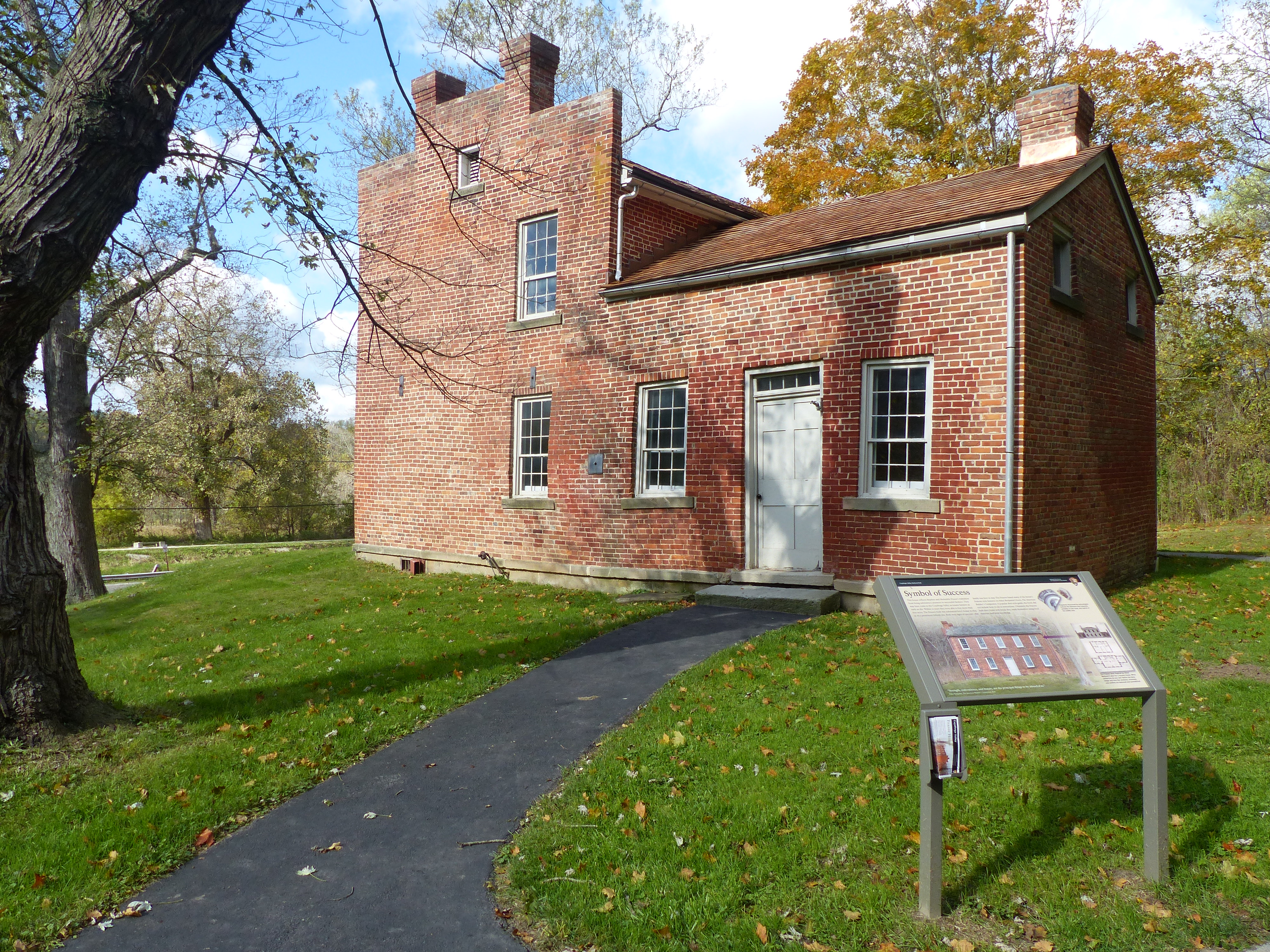
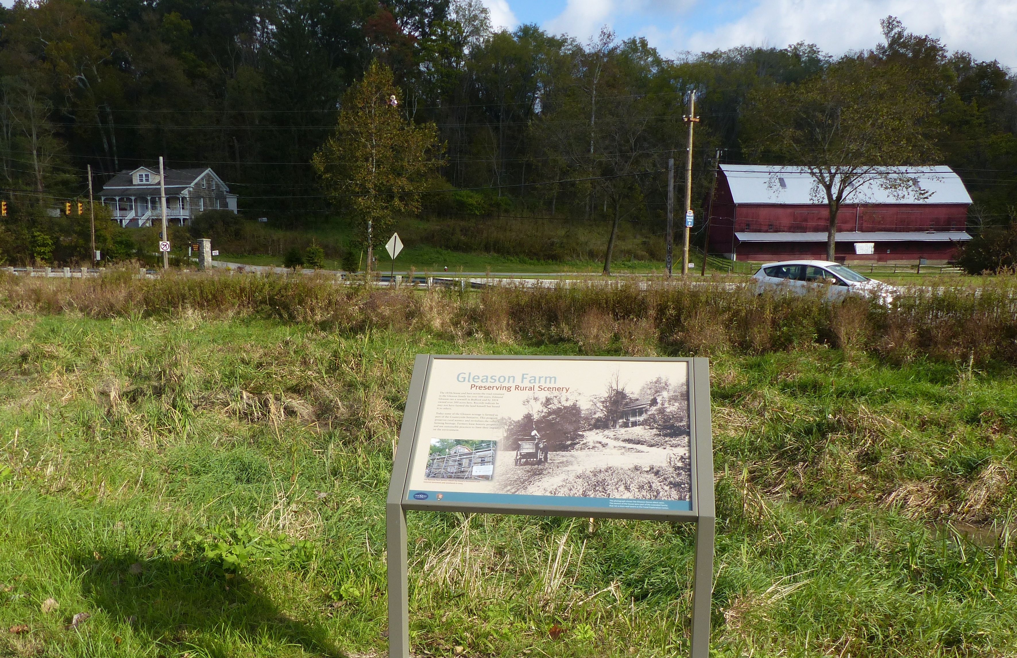
From the Towpath Trail, gaze across the canal to the Frazee House, built with handmade bricks in 1825-27. It still dominates the landscape, much as it did during the canal era.
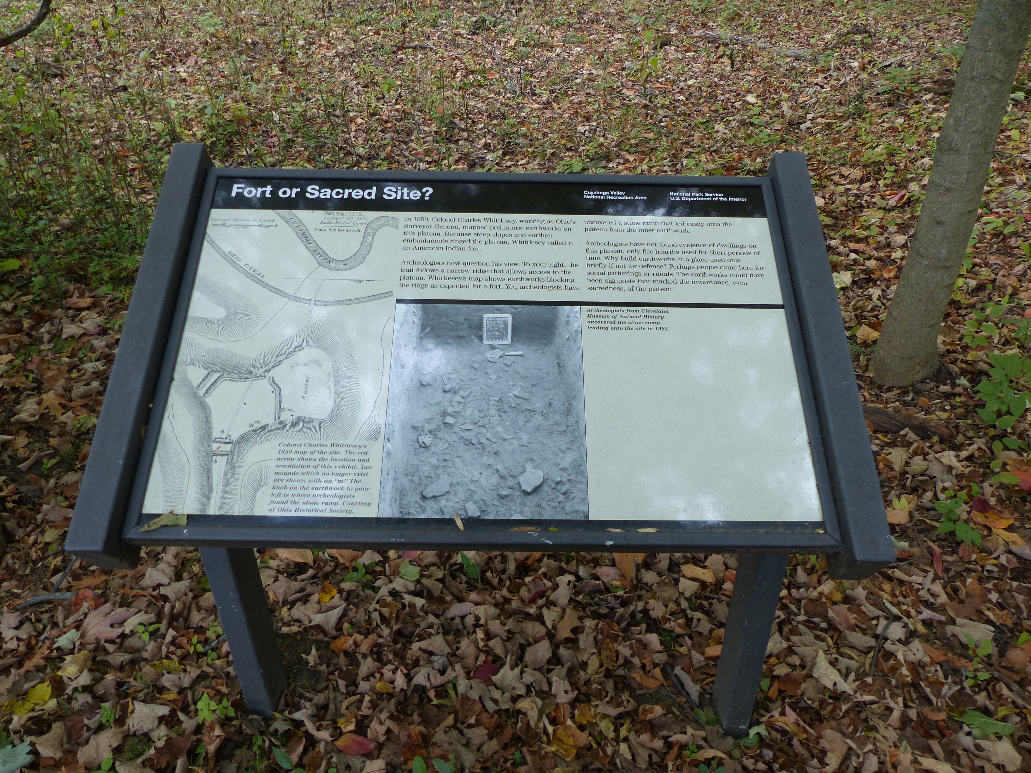
The earthworks near this site were initially considered a fort, but archeologists now consider them to be more of a ceremonial site. Exhibits explain the history of the archeology here and why the purpose has been reconsidered. The area is accessible via the Old Carriage/Bike and Hike Connector Trail, with the Bike and Hike Trail uphill from the connector and the Towpath Trail downhill in the valley from this location.
Native Americans have left their marks on the land for thousands of years. Explore the earthworks of the Whittlesey Culture along the Old Carriage Trail, here a part of the Bike & Hike Access Trail. Travel up out of the valley, following signs to access the Bike & Hike Trail, or travel downhill to the Towpath Trail.
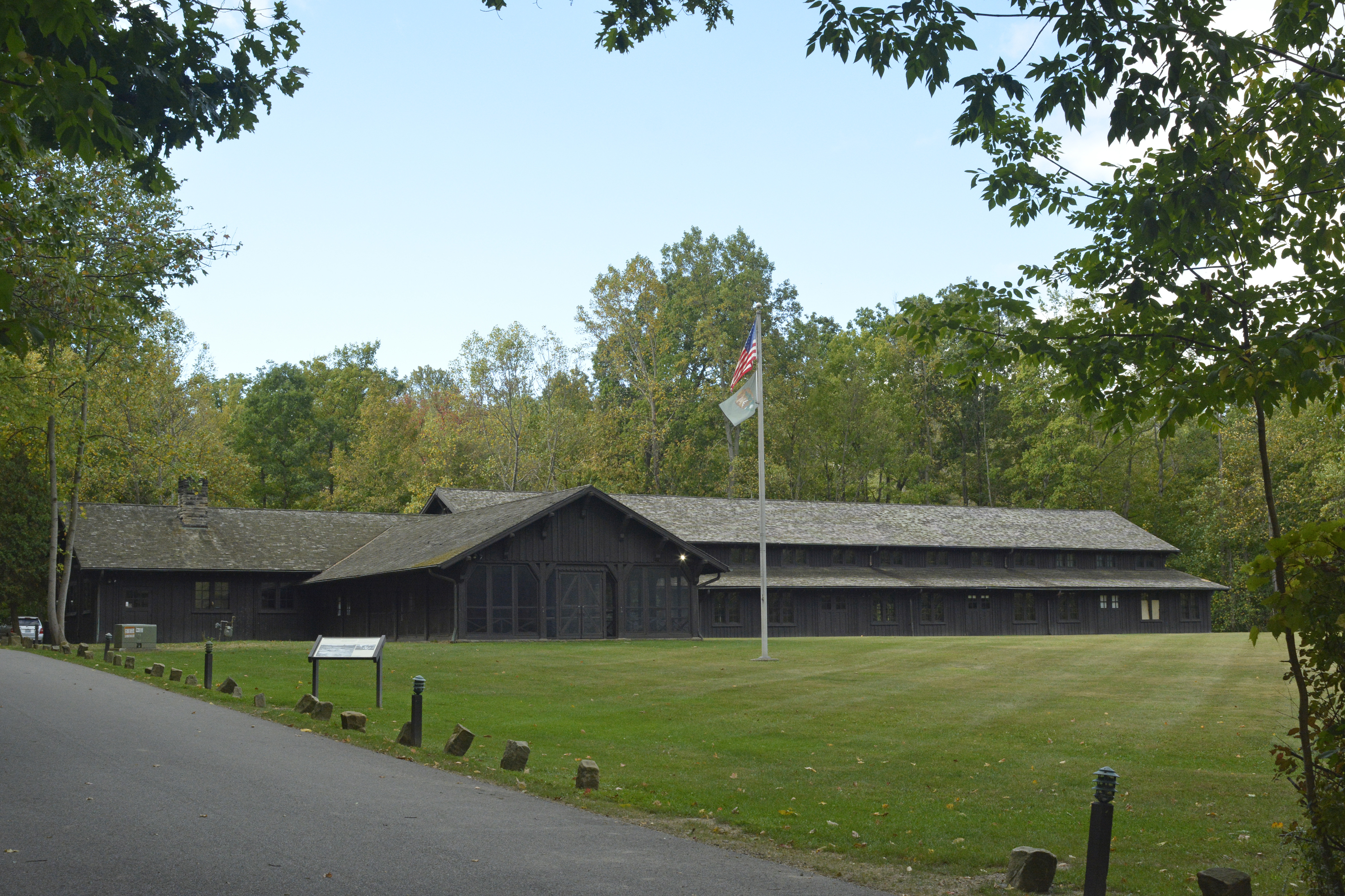
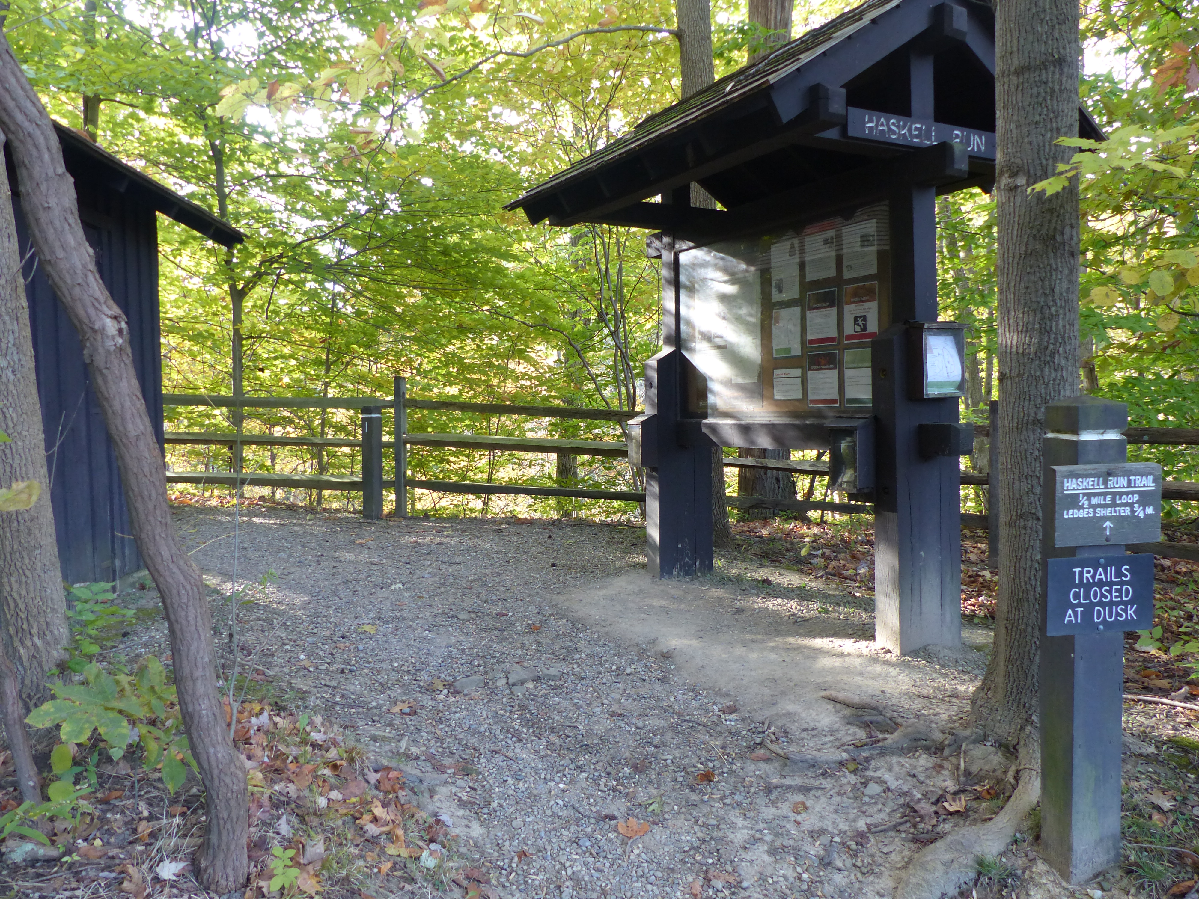
A large sign marks the path to Happy Days Lodge. The Civilian Conservation Corps built Happy Days Lodge during the Great Depression in the 1930s. It was part of their effort to develop park amenities for Virginia Kendall Park, now part of Cuyahoga Valley National Park. Haskell Run Trail starts behind Happy Days Lodge and connects to additional Virginia Kendall Park trails.
The men of the Civilian Conservation Corps built Happy Days Lodge during the difficult years of the Great Depression. They used manual labor and local materials, including Berea Sandstone and wormy American chestnut. For years, it served as a camp for children from the City of Akron. Today, it is a rental facility and program space managed by the Conservancy for Cuyahoga Valley National Park.
The Haskell Run Trail is a ½-mile loop trail that explores a creek that feeds the Cuyahoga River. The creek’s deep, wooded ravine attracts abundant birdlife. Visit in April and May to enjoy spring wildflowers. The trail also connects Happy Days Lodge with the Ledges area.
The Horseshoe Pond area was once part of the historic Bishop Farm. By the second half of the 1900s, the Bishops were planting and selling Christmas trees. Take the Tree Farm Trail to see how nature is reclaiming these old fields.
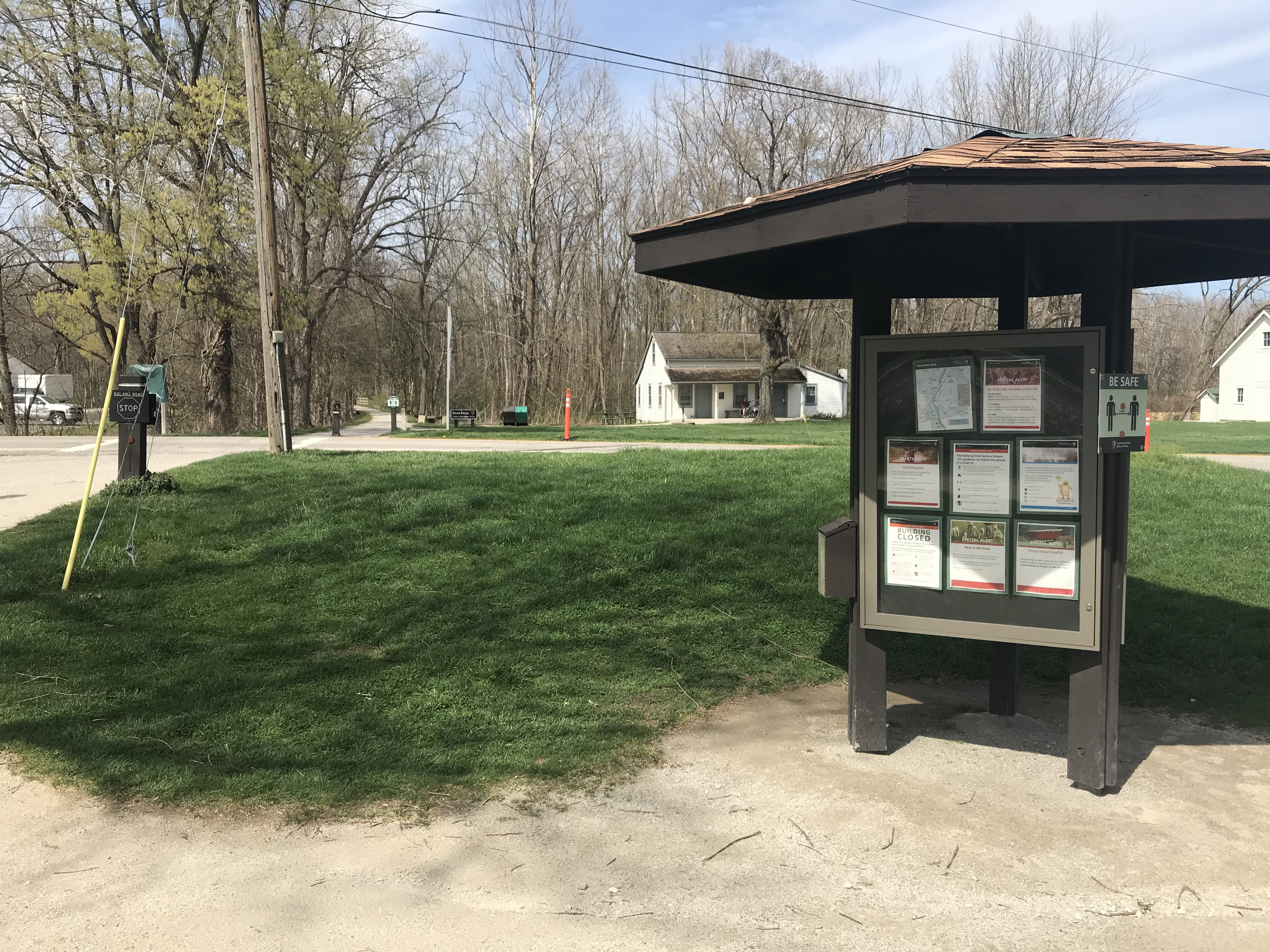
Hunt House is in the Village of Everett, a type of rural crossroads community that was once common across America. Family-friendly exhibits at Hunt House explore village life and the lives of wild plants and animals. From Hunt House continue a quarter mile north to Lock 27 for another peek into the crossroads community. Beaver Marsh, popular for wildlife watching, is three-quarters of a mile south.
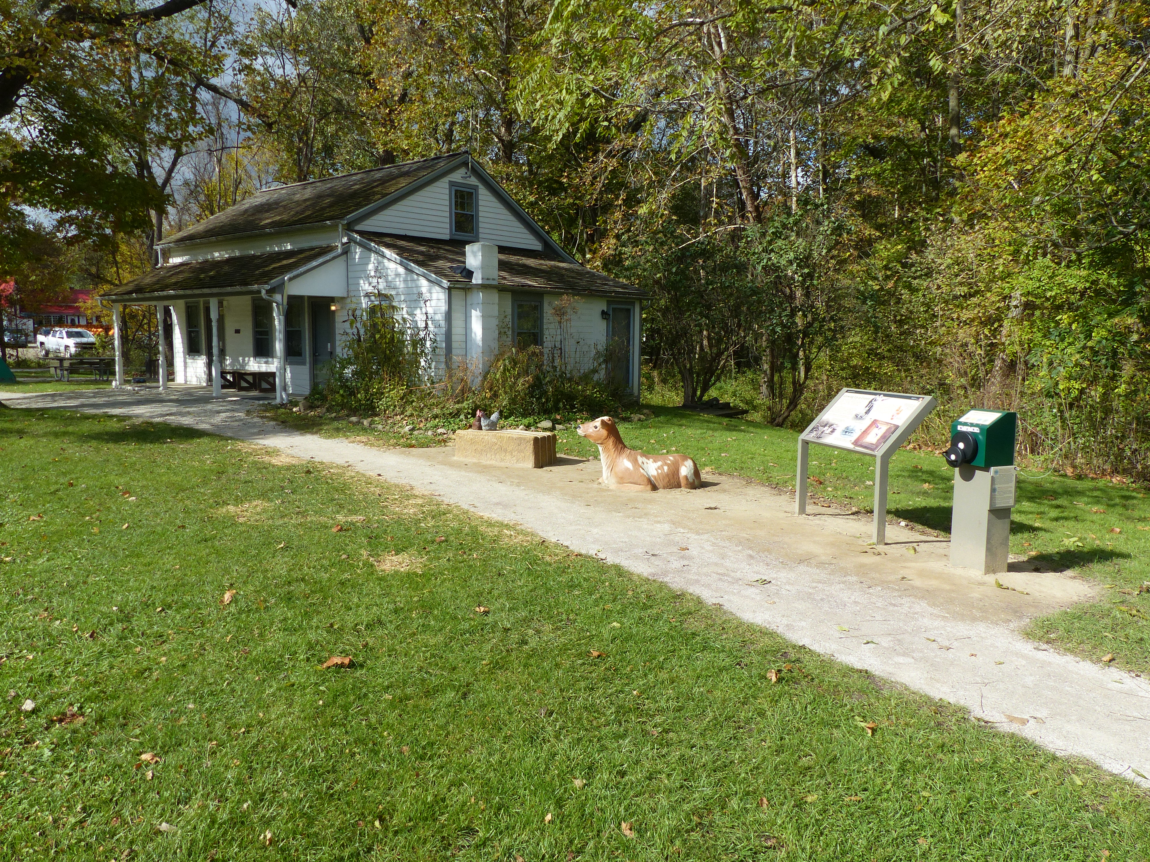
“Growing Up in Everett” exhibits explore farm life in the 1920s and 1930s through the eyes of Helen Fiedler Toth. Listen to her stories, flip through her photo album, and play with her calf and chickens.
Cuyahoga Valley Scenic Railroad passengers can get on and off the train at Indigo Lake Station. Connector trails lead west to Hale Farm & Village and east to the Towpath Trail. The railroad coordinates a shuttle ride to Hale Farm & Village with select train excursions. Nearby parking is limited.
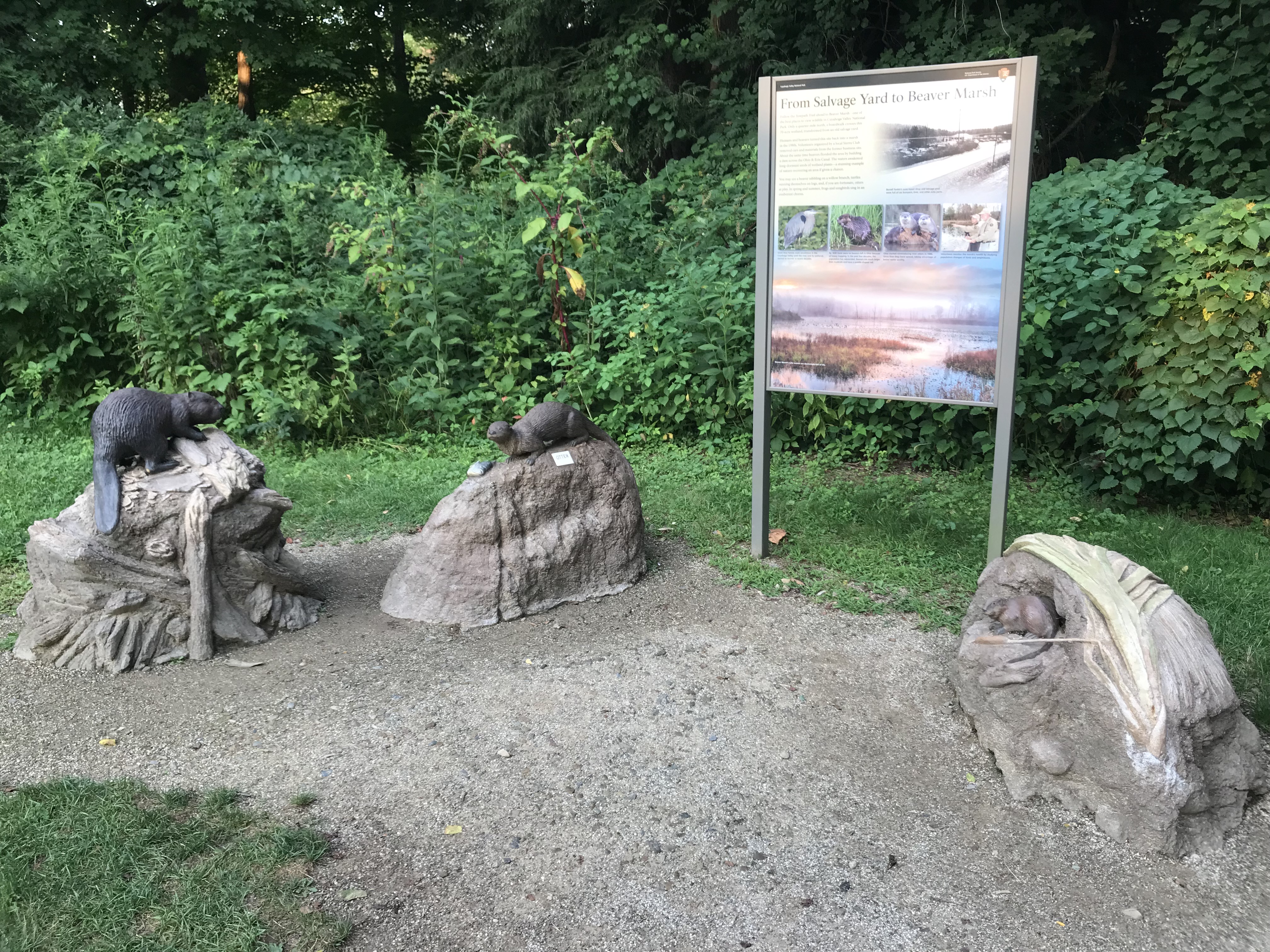
An exhibit cluster shares the remarkable story of nature’s recovery at Beaver Marsh, located a quarter mile to the north. Beavers and humans transformed a former auto salvage yard into a 70-acre wetland in the 1980s. Hands-on beaver, river otter, and muskrat sculptures introduce three mammals that depend on the marsh for their survival.
This trailhead is popular for accessing the Beaver Marsh, located a half mile to the north on the Towpath Trail. The story of the Beaver Marsh has many chapters: a dairy farm, an auto salvage yard, and now a popular spot for viewing the wildlife, plants, and scenery of a recovering marshland.
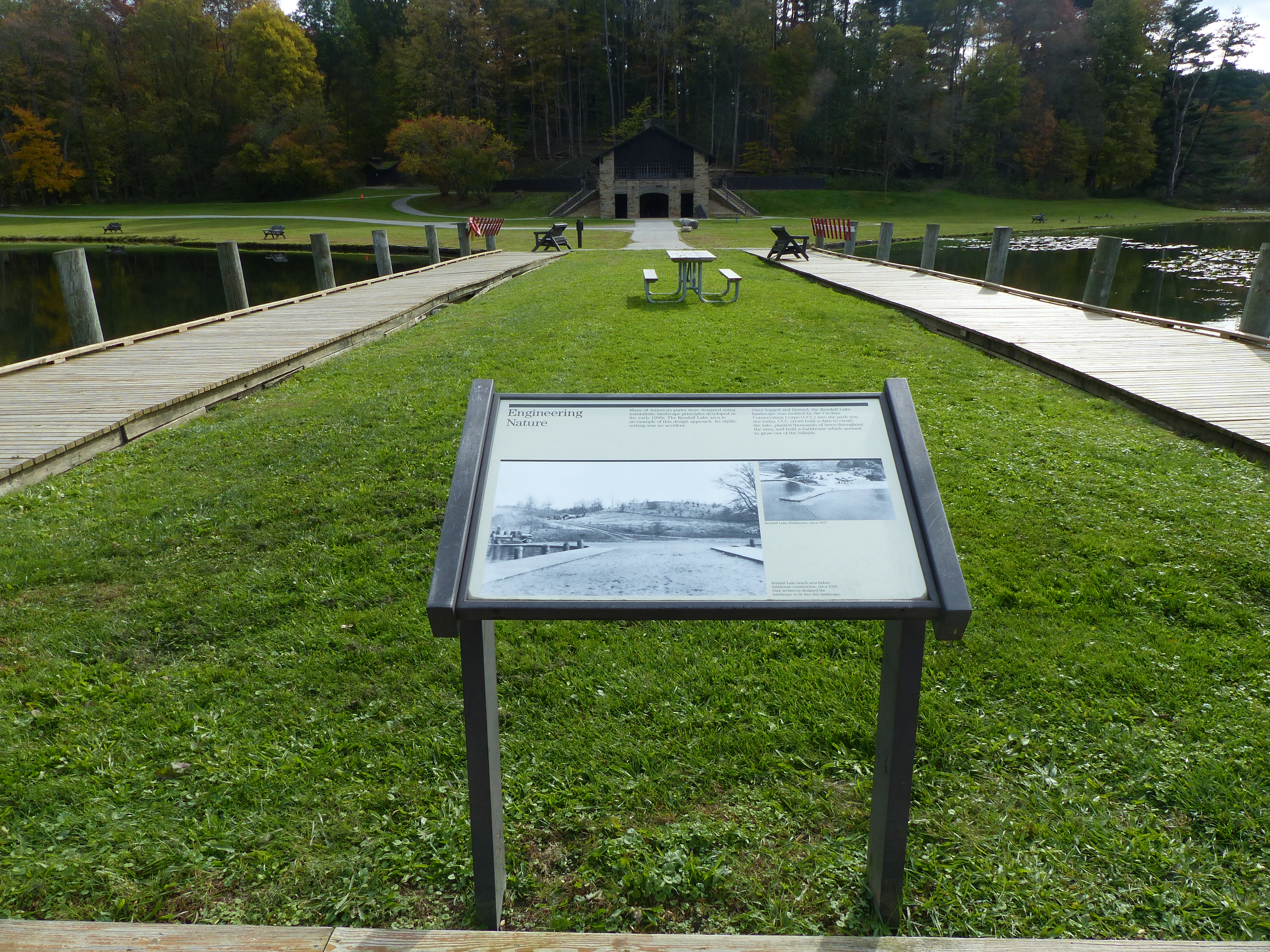
The Kendall Lake Pier was built by the Civilian Conservation Corps and originally served as a swimming pier. Today it serves as a fishing pier, a photography point, and a place to relax and enjoy nature.
The Kendall Lake is one of the many amenities the Civilian Conservation Corps built in the Virginia Kendall Park. A one-mile trail loops around Kendall Lake. The Cross Country and Salt Run trails can also be accessed from this location.
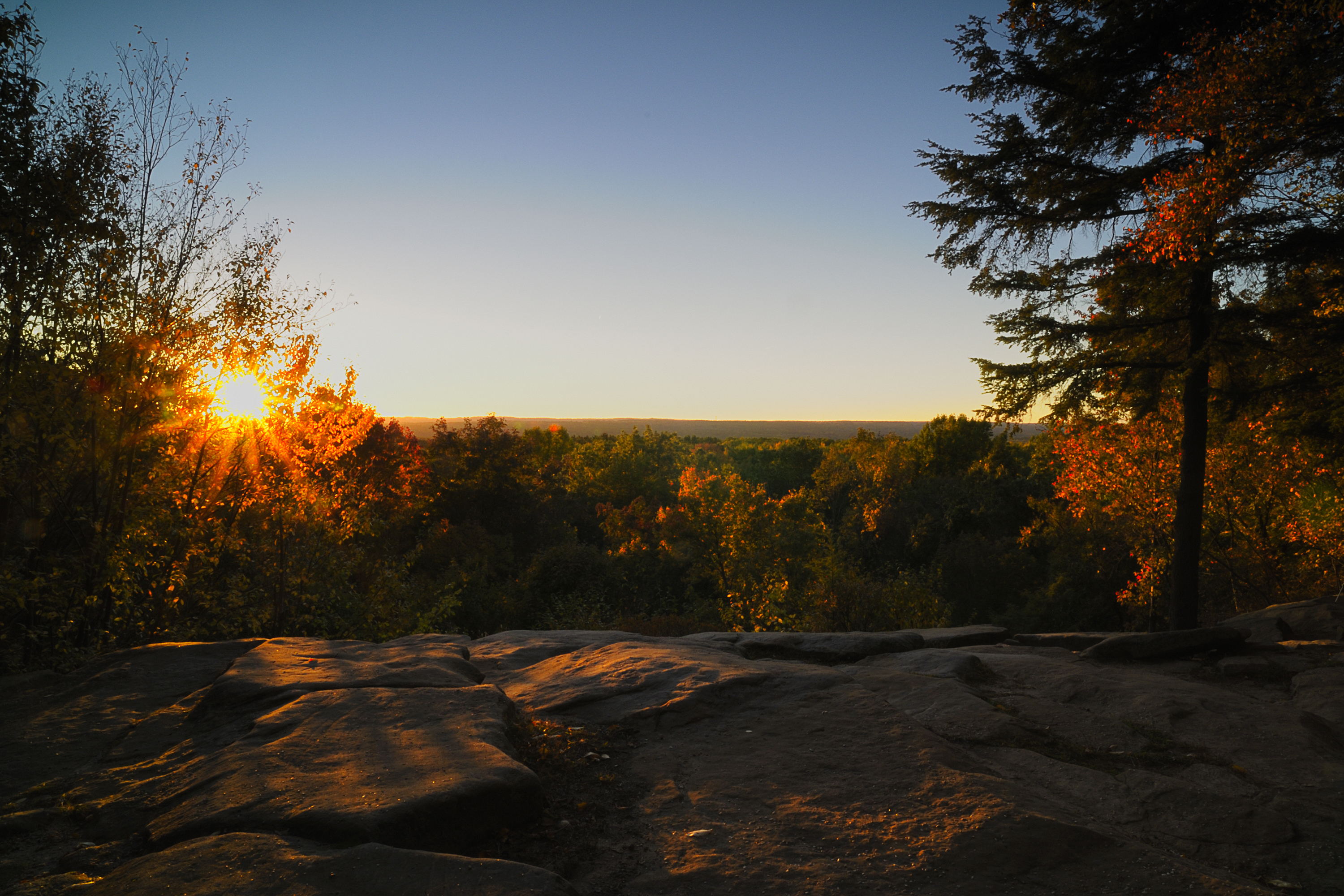
The Ledges Overlook provides an expansive view of the Cuyahoga Valley. From here, visitors can appreciate how the park protects a large tract of natural open space between the cities of Akron and Cleveland. The scenery is stunning in any season.
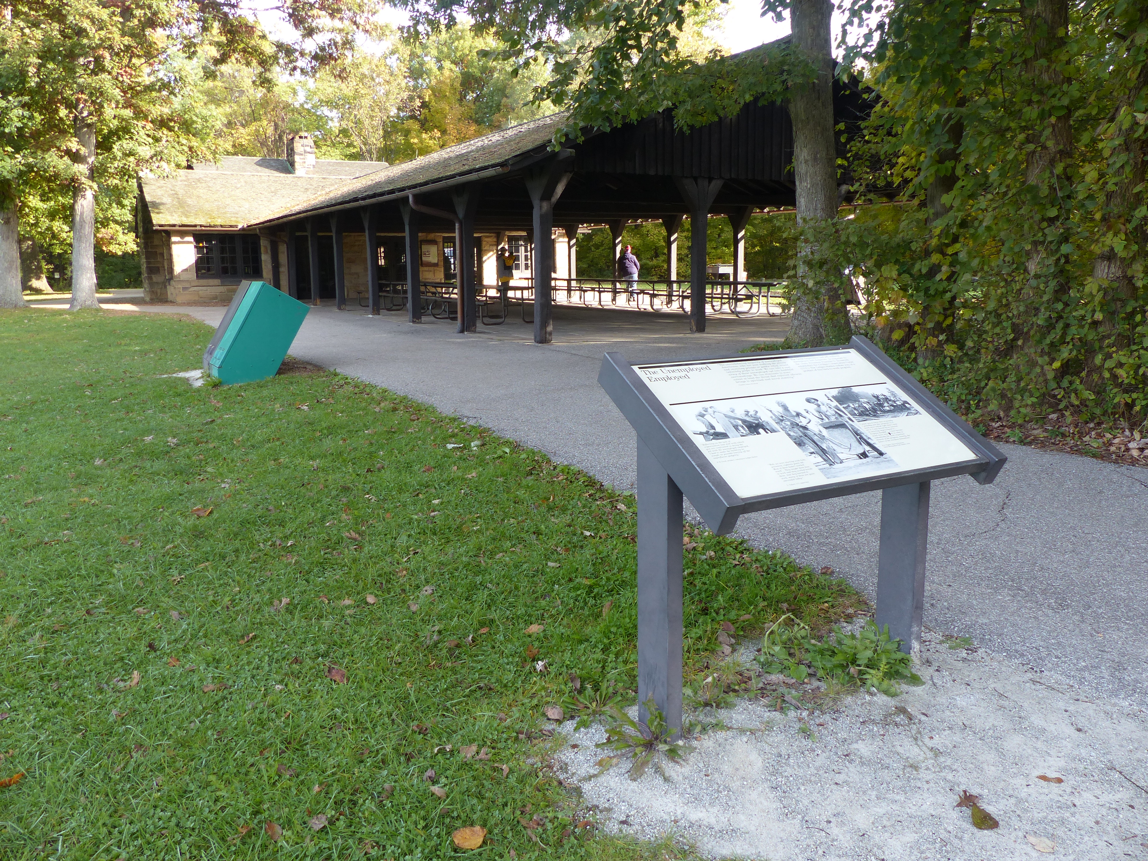
The Ledges Shelter is the largest Civilian Conservation Corps shelter in Cuyahoga Valley National Park. Groups and families with up to 75 people may reserve it for a fee.
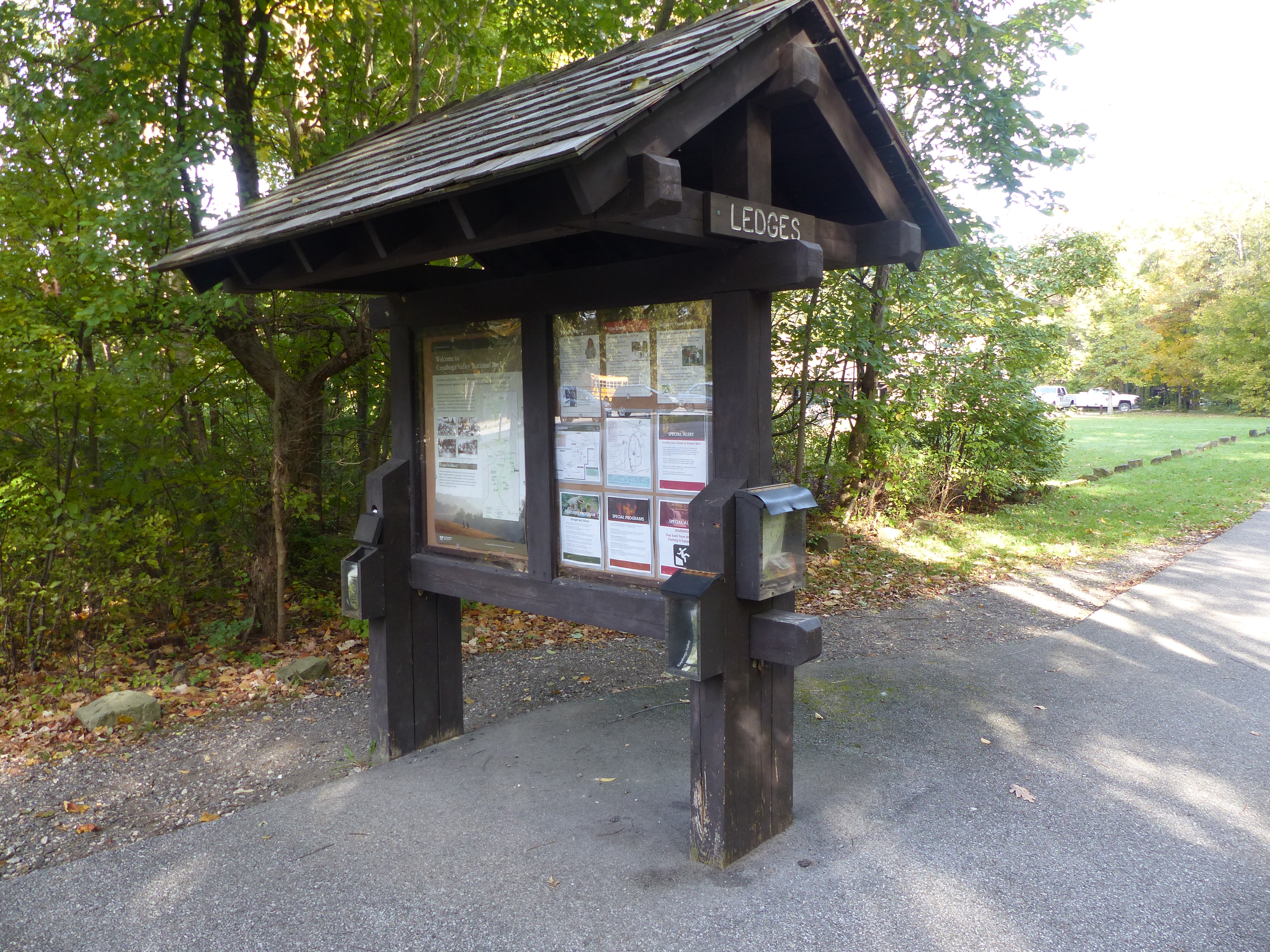
The striking rock cliffs of the Ledges are a primary feature of Virginia Kendall Park, developed in the 1930s. Use this trailhead to access a 1.8-mile trail that circles the Ledges, a rentable shelter, a giant grassy playfield, and many wooded picnic sites.
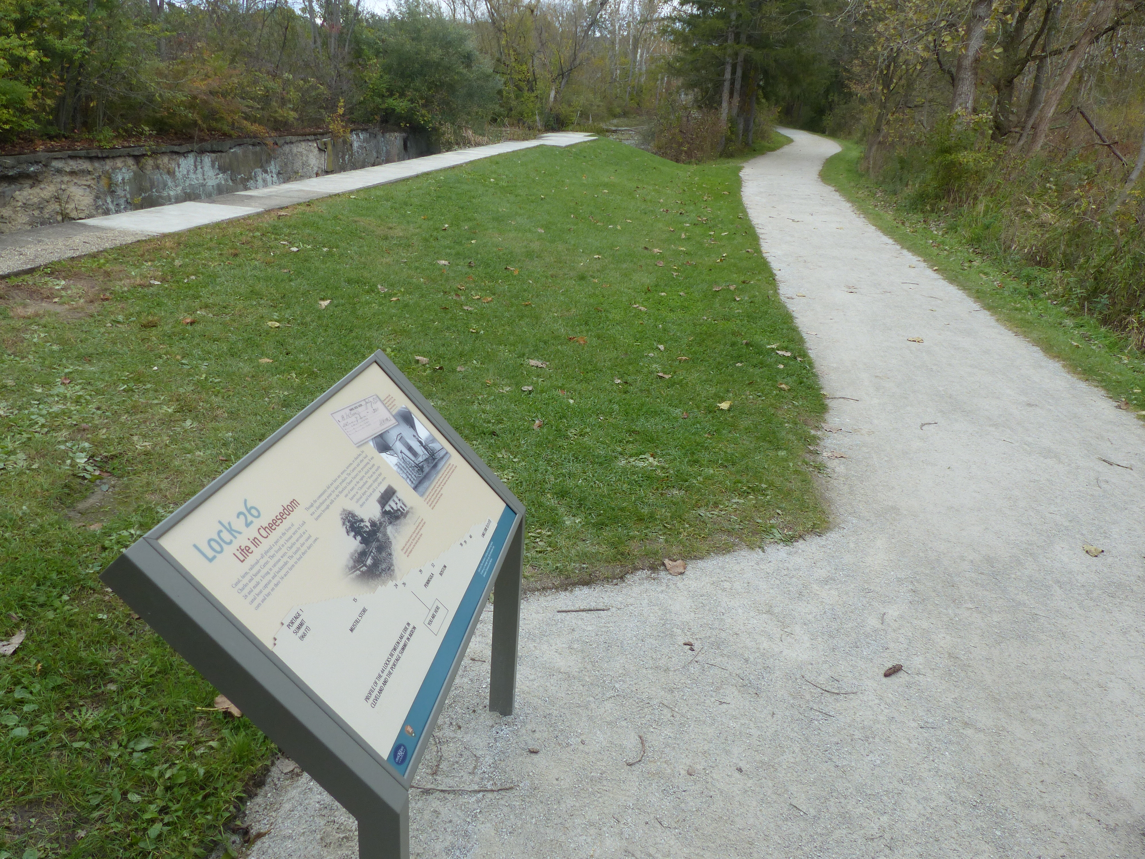
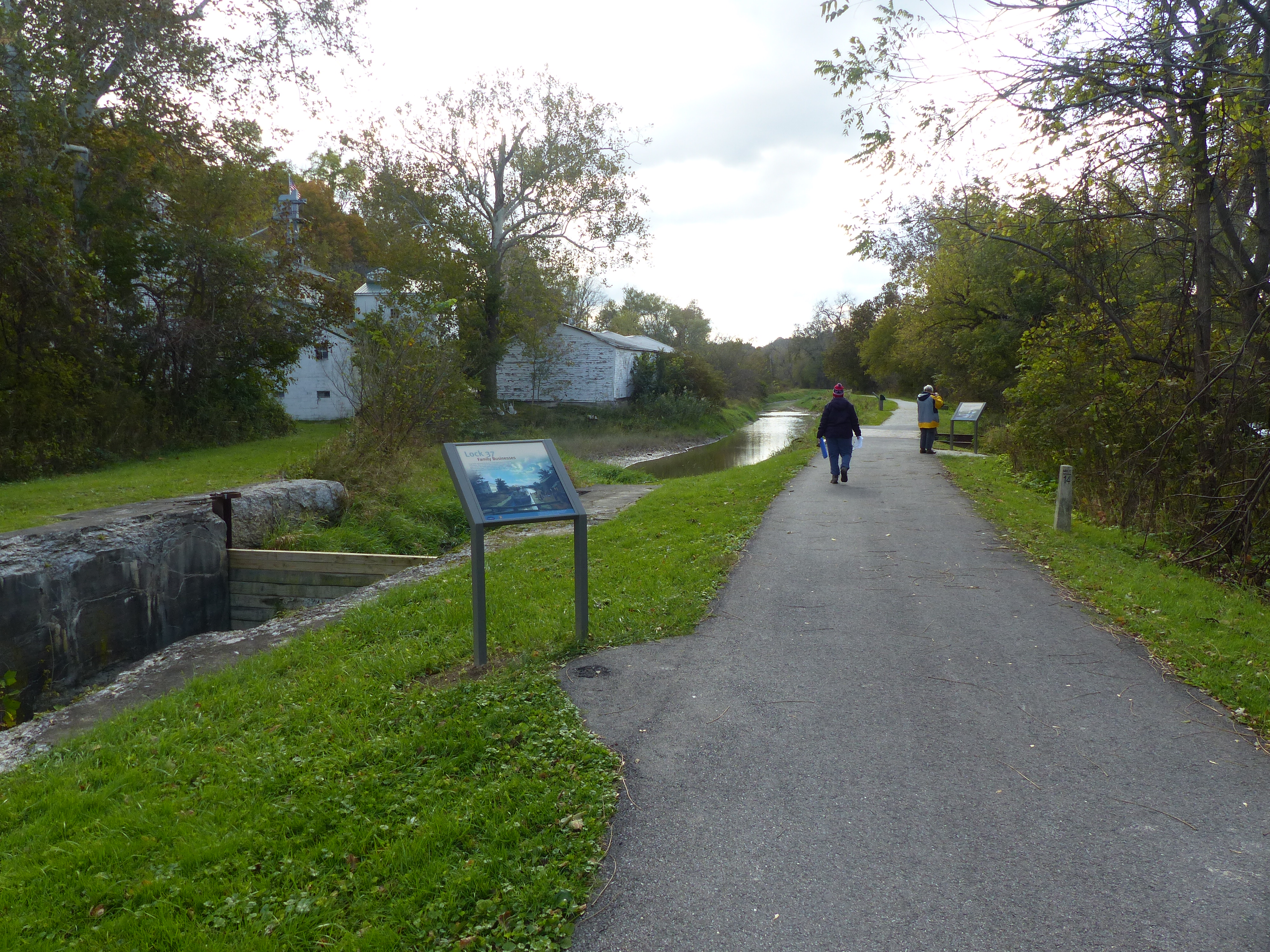
Lock 26 was one of 44 locks that let canal boats step up from Lake Erie to the 968-foot-high Portage Summit in Akron. The Carter family lived nearby and had a dairy farm in addition to working on the Ohio & Erie Canal. Here in the Cuyahoga Valley, dairy farming was common, and the area became known as “cheesedom.” An exhibit at Lock 26 explores the Carter family story and local cheesemaking.
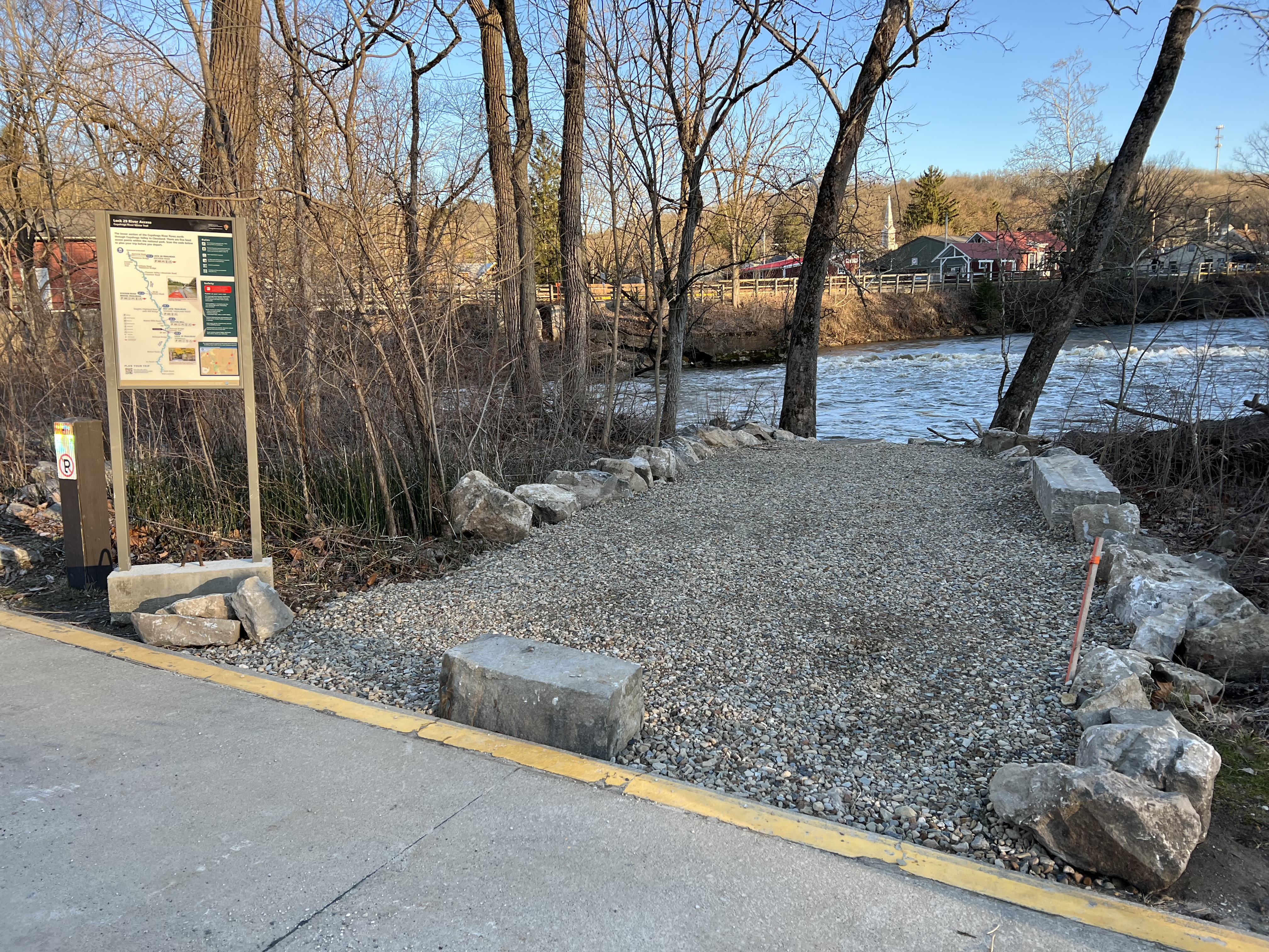
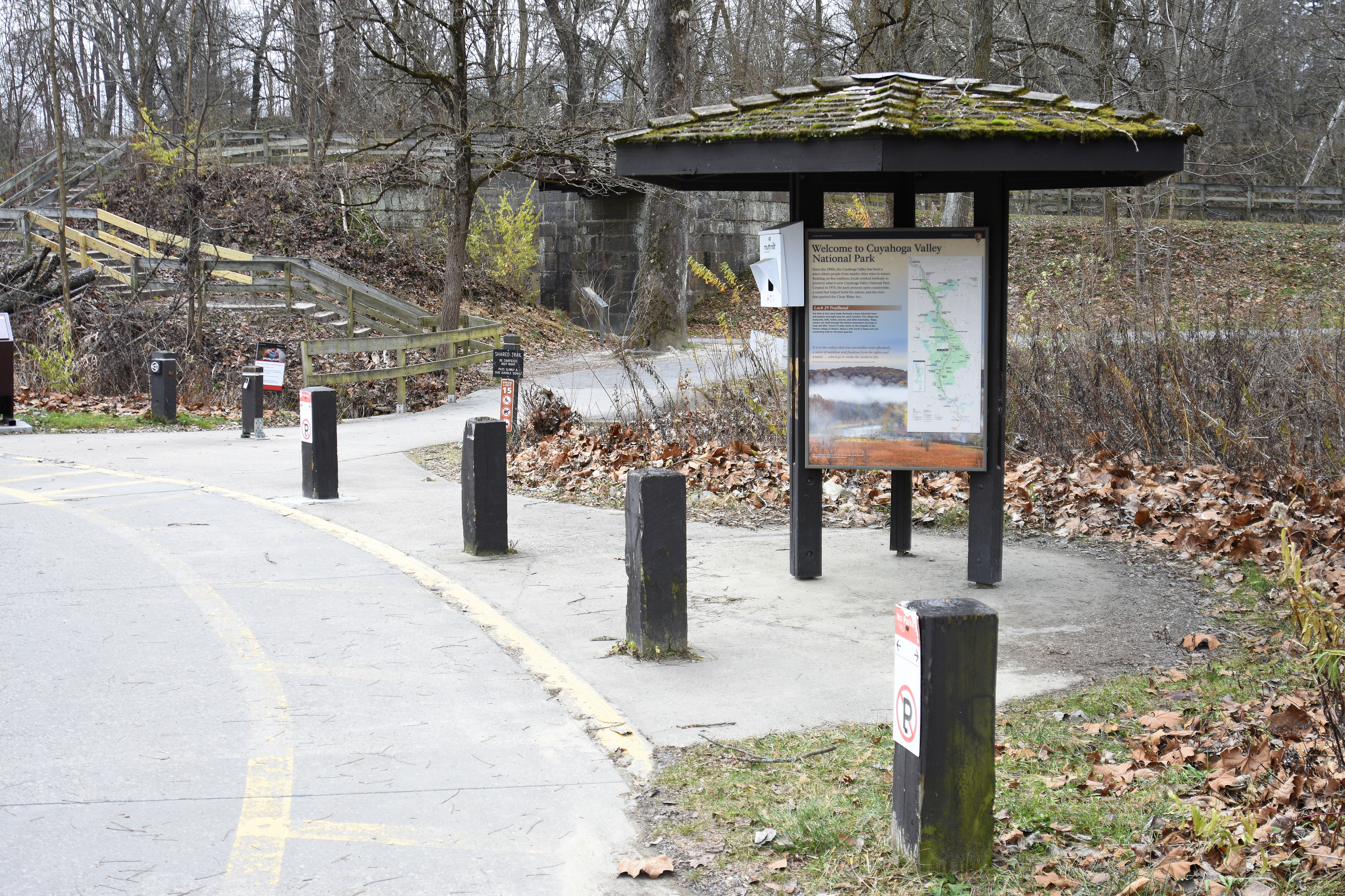
The Ohio & Erie Canal made Peninsula a busy industrial town and popular overnight stop for canal travelers. Today visitors can stroll through the historic downtown, shop, and dine. Lock 29 Trailhead is a popular, often crowded access point for the village, Towpath Trail, Cuyahoga Valley Scenic Railroad, and Cuyahoga River Water Trail. On the towpath, travel 2.3 miles north to the village of Boston. About a mile south is Deep Lock and connecting trails to old stone quarries.
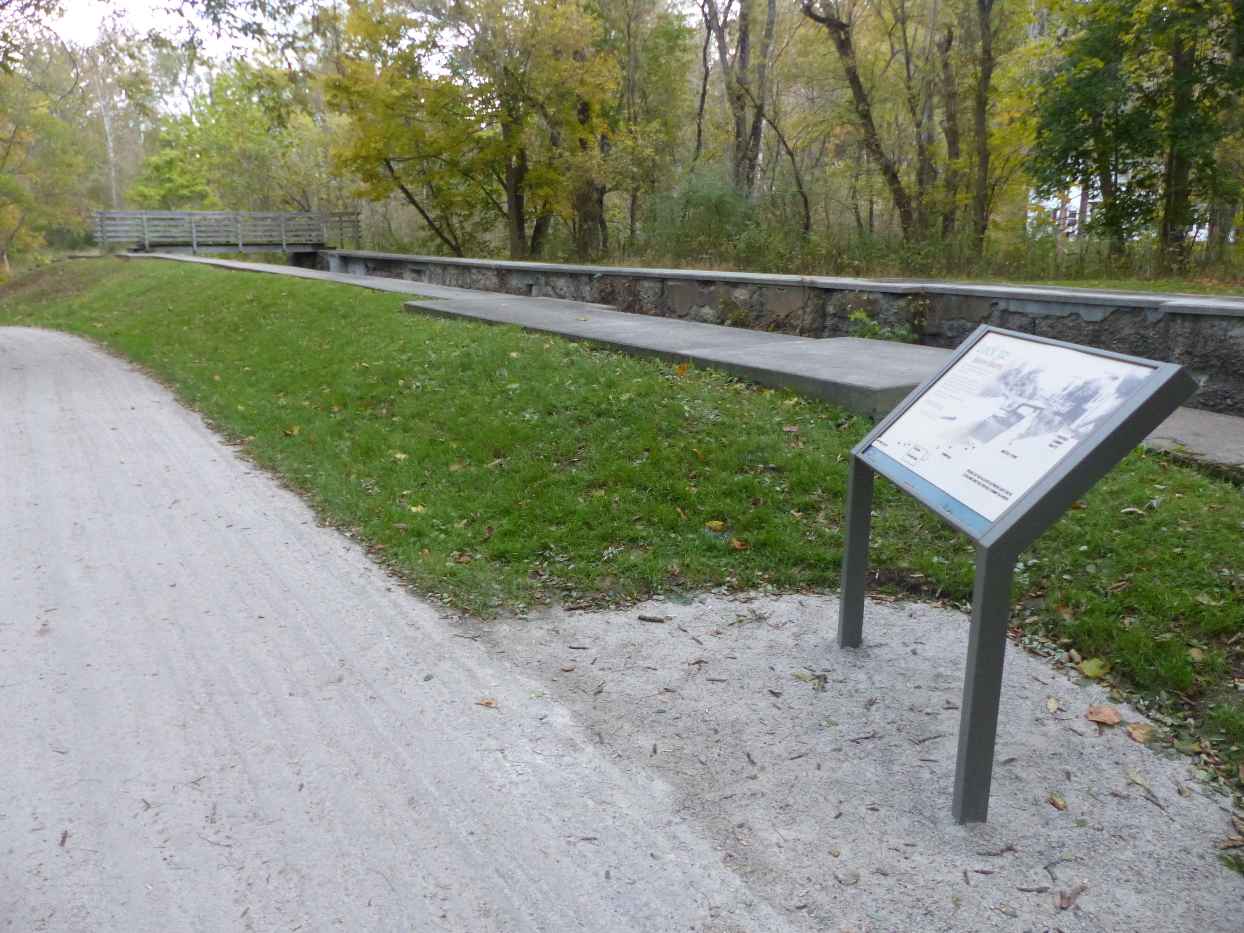
Lock 32 was one of 44 locks on the Ohio & Erie Canal between Lake Erie in Cleveland and the Portage Summit in Akron. Historically, McBride’s Grocery served canallers at Lock 32.
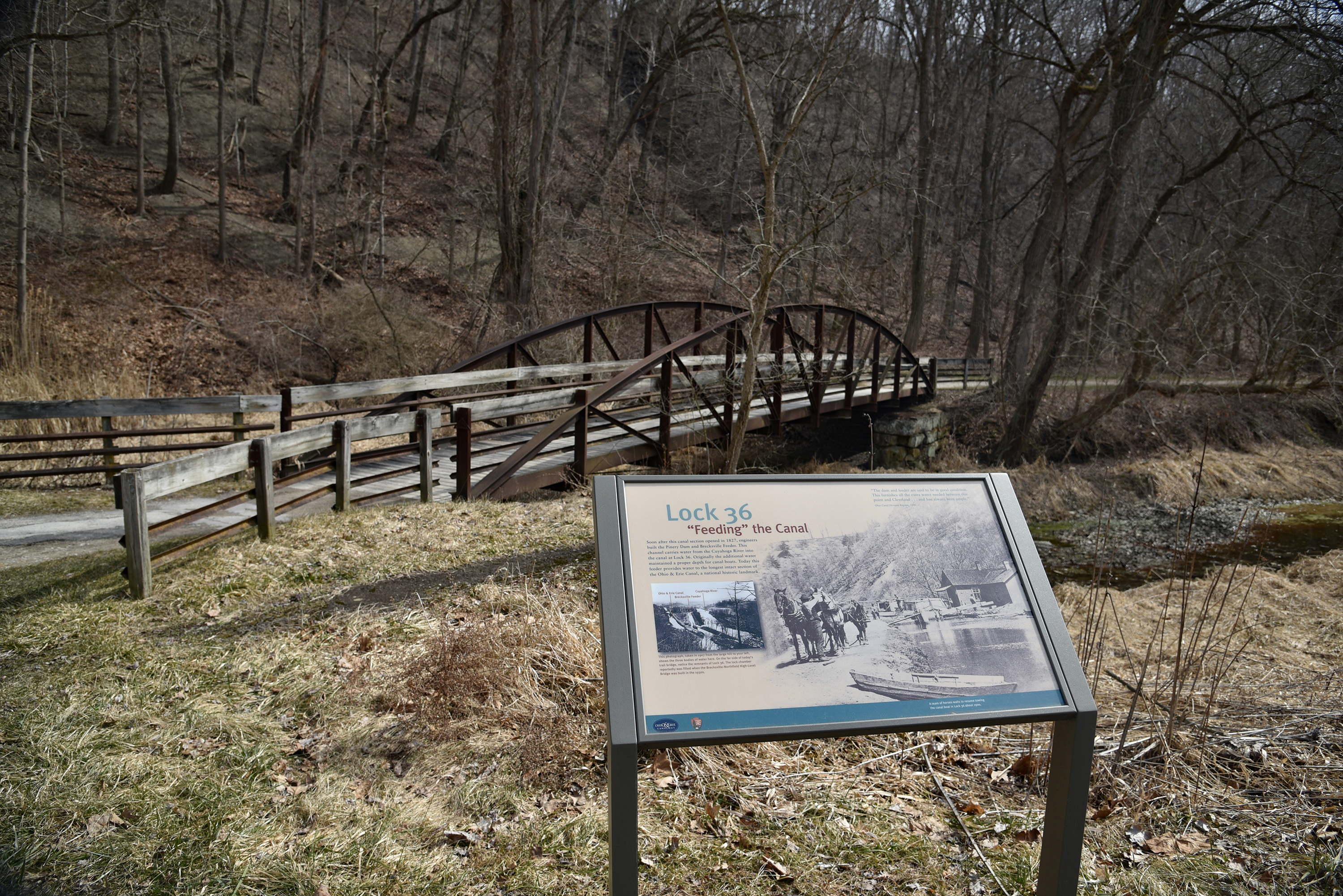
By the remains of Lock 36, visitors can explore the Pinery Feeder which still “feeds” water from the Cuyahoga River into this section of the Ohio & Erie Canal.
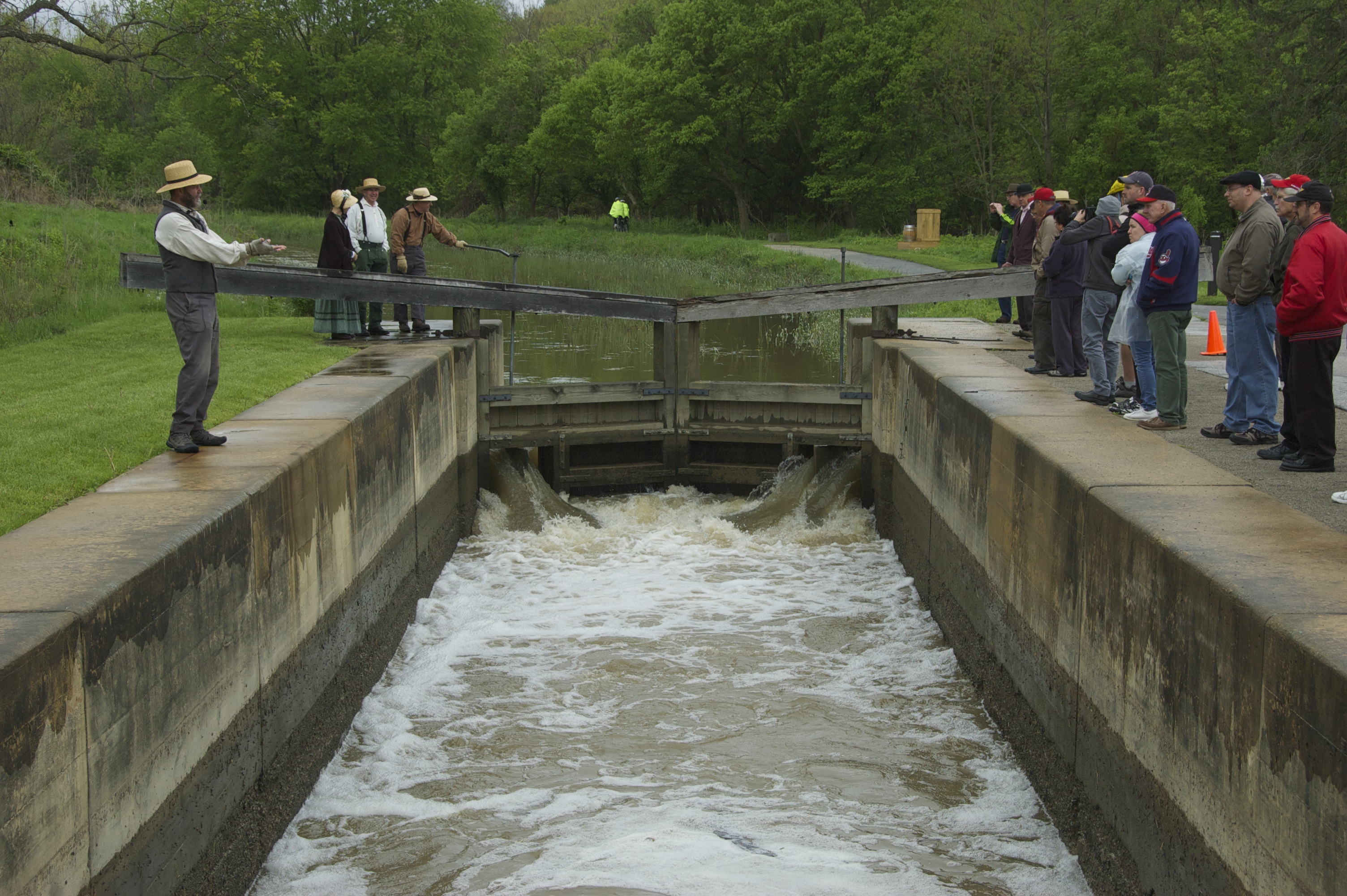
What is a canal lock? Stop here to learn about the mechanics of these boat elevators. If you are lucky to have water in the canal on a summer weekend, you might see volunteers demonstrating how Lock 38 works.
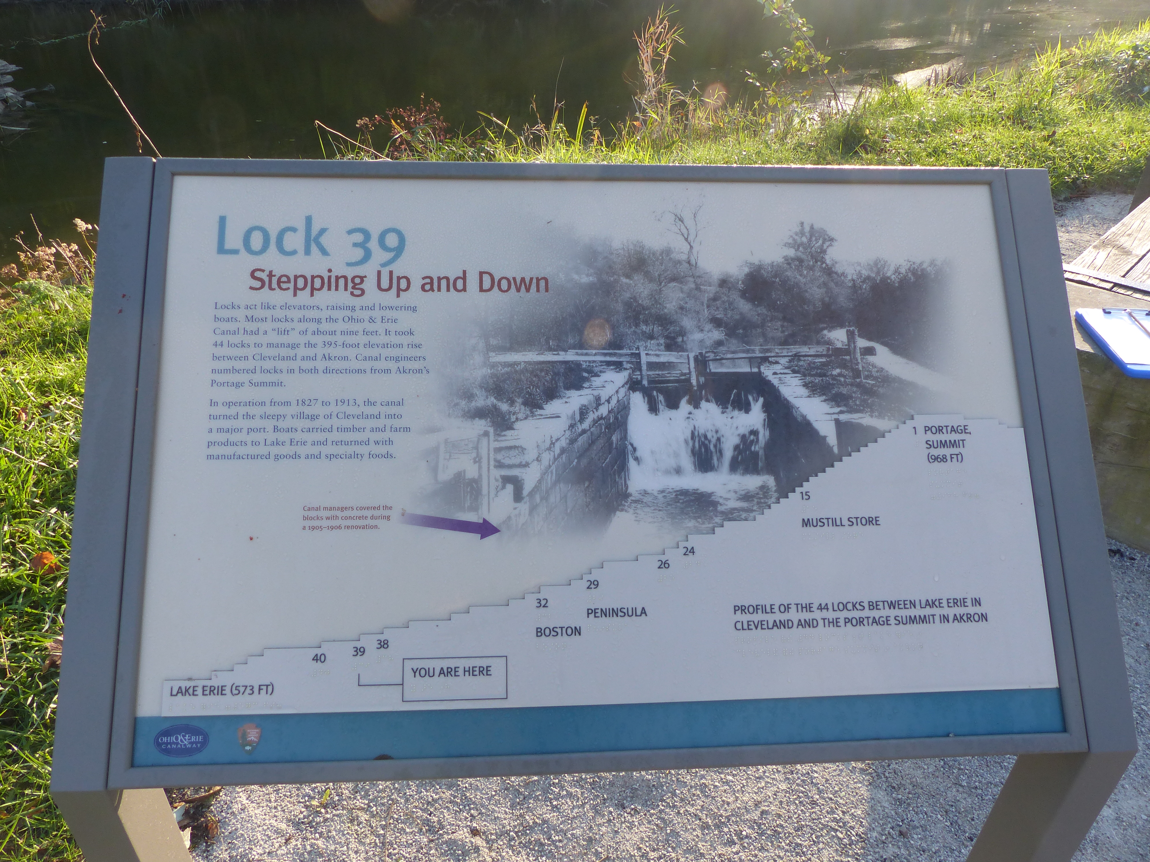
Lock 39 is the northernmost lock in Cuyahoga Valley National Park. It is one of many canal remnants you can see as you walk, ride, or run along the Towpath Trail.
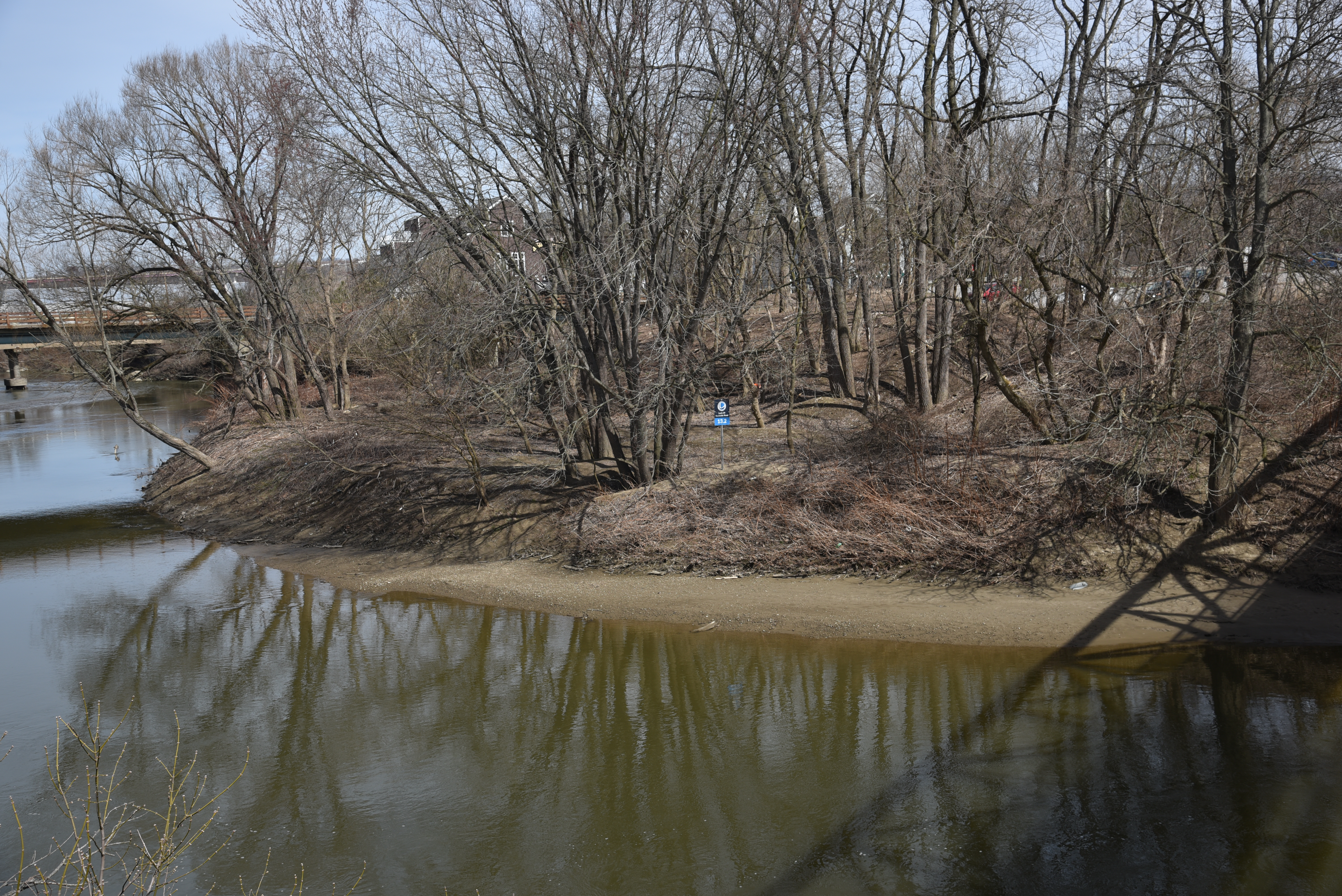
Access the river from the Lock 39 Trailhead in Independence. This site allows access for a long paddle, nearly 12 miles, into Cleveland. Rockside Station and food are nearby.
This is the northernmost trailhead within Cuyahoga Valley. From here, visitors can explore the Towpath Trail south into the national park or north into Cleveland Metroparks. Across the parking lot is an access point for the Cuyahoga River Water Trail and a pedestrian bridge to Rockside Station.