Temporary Closure of Fort Mason Bay Street Lot Starting September 29, 2025
Bay Street Parking Lot at upper Fort Mason will close to vehicles on September 29. Lot will be closed Fall 2025 through Fall 2026. Lot will be fenced and used as a staging area for utilities project occurring at Fort Mason. Do not park in lot after midnight on September 28, 2025. Vehicles will be towed at owner's expense.
Temporary Closure of Fort Mason Restrooms Until October 17, 2025
Great Meadow restrooms will be closed for renovation. Portable restrooms are available on site. Additional restrooms are available near East Beach and Presidio Tunnel Tops. See map link below to see restroom locations.
EV Chargers at Fort Mason Bay Street Lot Offline Week of September 22, 2025
EV Chargers at Fort Mason Bay Street Lot will be offline during the week of September 22. Chargers are being relocated due to Bay Street Parking Lot closure.
China Beach Parking Lot Closed for City-Managed Project Through October 3, 2025
San Francisco Public Utilities Commission has closed Sea Cliff Ave and the China Beach parking lot for sewer system upgrades. Pedestrian access will be kept open but visitors to the beach will not be able to park in the lot. See link below for details.
Avoid Contact with Marine Mammals Due to Increase in Leptospirosis Infections
Leptospirosis is currently seeing an uptick in California. Disease can spread to dogs and people. Keep dogs on leash in areas with beached marine mammals and carcasses. Report sick/stranded animals to The Marine Mammal Center at 415-289-7325.
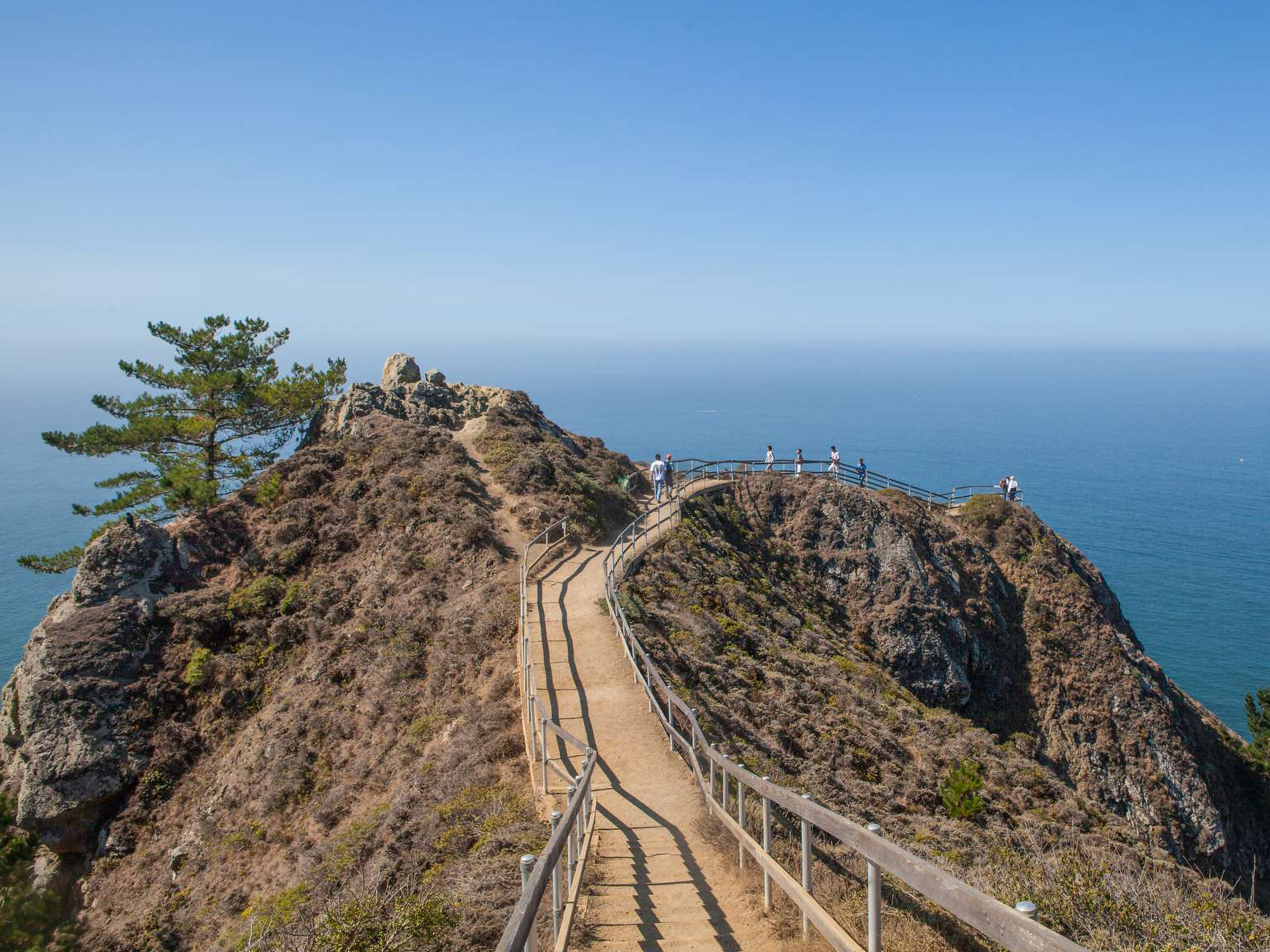
Temporary Closure at Hawk Hill for Phase 3 of Site Improvement Project
Portions of hilltop will be closed while workers rehabilitate the Battery Commander Station and improve site conditions. Work is expected to be completed in December 2025. See project webpage for map and more info. Orange area on map shows closed area.
Auto-Theft Warning - Only Bring What You Need to the Park
You can prevent vehicle break-ins in parking lots and scenic overlooks. Before leaving your car for even a short period of time: 1) Remove all valuables, 2) Lock your doors. 3) Take your cell phones and electronics with you. Read article for more details.
Presidio Trust Managed Trails Closed to Dogs During Coyote Pupping Season April to October 2025
To reduce the potential for coyote/dog conflict, the Presidio Trust proactively closes large sections of the Park Trail and the Bay Area Ridge Trail to dog walking during pupping season. See link below for 'Coyotes in the Presidio' webpage for more info.
| Title | Golden Gate |
| Park Code | goga |
| Description | Experience a park so rich it supports 19 distinct ecosystems with over 2,000 plant and animal species. Go for a hike, enjoy a vista, have a picnic or learn about the centuries of overlapping history from California’s indigenous cultures, Spanish ... |
| Location | |
| Contact | |
| Activities |
|
| Entrance fees |
|
| Campgrounds | Count: 5
Bicentennial Campground
Hawk Campground
Haypress Campground
Kirby Cove Campground
Rob Hill Campground |
| Places | Count: 50
"Black Point": A Civilian Neighborhood on Military LandIn the 1850s, private citizens constructed homes on the east side of the street, facing the water; after 1865, the army constructed the west side buildings. Although the military reserved Point San Jose for its purposes, the army had not assigned any soldiers or constructed any buildings. This scenic and underutilized piece of property, known to locals as "Black Point" because of the bluff's dark laurel trees, offered refuge from the rapidly growing city. 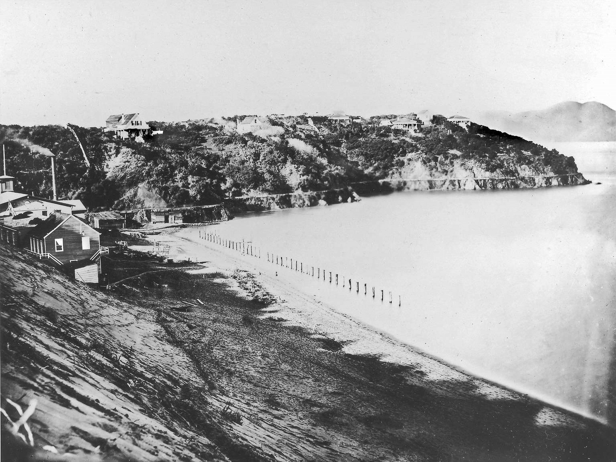
1 - Exploring the Coast...and BeyondKIOSK DESCRIPTION: This kiosk has 2 panels side by side. VIEW FROM WAYSIDE: Facing south west, you can see the path that cuts through a grassy field leading to three wayside panels 70 feet away. Also visible is the top portion of a rounded concrete structure poking out of the ground just before the waysides. In front and to the left of you are three picnic tables 30, 75 and 110 feet away, respectively. 
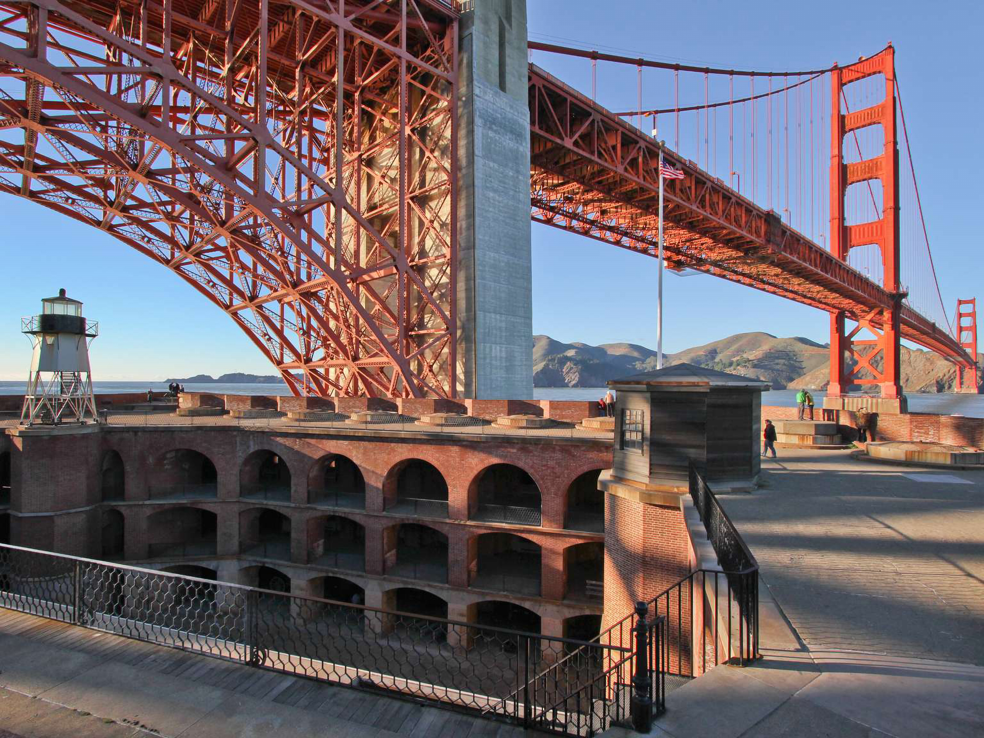
1 - HeadquartersWelcome to the audio described tour of Fort Mason's waysides. Each stop on this tour describes one of the 12 waysides or kiosks within Fort Mason, Golden Gate National Recreation Area. Each stop will begin with an orientation to where you are in the park and a description of the view from the wayside. Directions to the next wayside will be detailed at the end of every stop. 
1 - Introduction: Lands End LookoutWelcome to the Lands End Lookout, perched here on the edge of the Pacific Ocean, at the western boundary of San Francisco. Let's begin by stepping to a quieter part of this space. Stand with your back to the desk and walk carefully forward about six steps until you find a similar counter.
1 - Restoring Habitat - Muir Beach ADWAYSIDE TITLE: Restoring Habitat VIEW FROM WAYSIDE: Standing in front of the kiosk facing south, away from the parking lot, a row of brown recycling and trash bins is to your left. Directly behind you is a 3-D topographic model of Muir Beach and the surrounding area, and, on the edge of the parking lot, a bathroom building.
1 - Sustainability at Golden GateWAYSIDE PANEL TITLE: Sustainability at Golden Gate PANEL DESCRIPTION: The wayside is located on the south eastern corner of the Crissy Field Center and faces north towards the bay. 
1 - USSGS Bay Studies10 - Family Housing10 - Marsh DynamicsWAYSIDE PANEL TITLE: Marsh Dynamics
10 - San Francisco's Seaside PlaygroundWAYSIDE TITLE: San Francisco's Seaside Playground: Going to the Cliff. TEXT: They made their way across the endless sand dunes on foot, on horseback, in horse-drawn buggies and steam trains.
10 - World's FairWAYSIDE TITLE: San Francisco Hosts the 1915 World's Fair! PANEL LOCATION: The wayside faces west and is in the northern portion of the Great Meadow Loop Trail. It is just to the side of the large asphalt path. Exercise caution with passing bikes. 
11 - "Sand" FranciscoWAYSIDE PANEL TITLE: "Sand" Francisco PANEL DESCRIPTION: Graphic panel set in metal frame. The wayside faces north, on the northern side of the trail.
11 - Alcatraz Gardens11 - Great MeadowWAYSIDE TITLE: The Great Meadow PANEL LOCATION: The wayside faces north and is placed on a brick platform extending into the Great Meadow from the asphalt trail of the Great Meadow Loop. Accessible restrooms are further down the trail on the righthand side. 
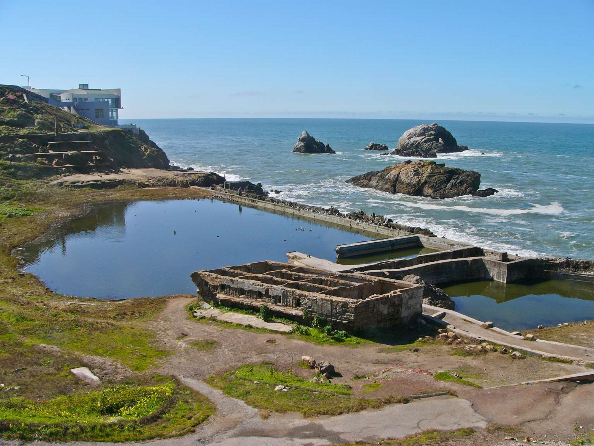
11 - Tactile Site MapLands End Lookout Visitor Center has a three-dimensional cast concrete tactile map of the area from Lands End Point to Sutro Heights. The model has tactile letters and braille along its surface, as well as raised features representing roads and trails. The model also has a compass rose in alignment with its geographical surroundings. 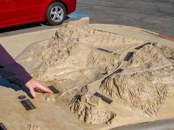
12 - Phillip BurtonWAYSIDE TITLE: Phillip Burton PANEL LOCATION: The wayside faces west along the asphalt path of the Great Meadow Loop Trail. Accessible restrooms are back in the opposite, on your lefthand side. VIEW FROM WAYSIDE: The wayside is on the eastern portion of the Great Meadow and is placed so that the Phillip Burton Statue is directly before you, framed by the Golden Gate Statue in the distance. The statue is encircled by gray bricks and is accessible by an additional walking path 
12 - The Last Word in AirfieldsWAYSIDE PANEL TITLE: The Last Word in Airfields PANEL DESCRIPTION: The wayside faces south, on the south side of the trail at the edge of Crissy Field.
12 - Water Tower13 - Aviation's Adventuring YearsWAYSIDE PANEL TITLE: Aviation's Adventuring Years PANEL DESCRIPTION: The wayside faces south, on the southern side of the trail.
13 - EndThe audio described tour ends here at the original wayside near the headquarters building. Thank you for visiting your National Park! If you have any further questions, you can approach the headquarters building to speak with a ranger. 
13 - Rose Garden14 - Braving Wind and WavesWAYSIDE PANEL TITLE: Braving Wind and Waves PANEL DESCRIPTION: The wayside faces north, on the northern side of the trail.
14 - The Morgue15 - Officers' Row15 - The Pacific for its StageWAYSIDE PANEL TITLE: The Pacific for its Stage PANEL DESCRIPTION: The wayside faces north east, northern side of the trail.
16 - Shaping the BayWAYSIDE PANEL TITLE: Shaping the Bay PANEL DESCRIPTION: The wayside faces north, on the northern side of the trail.
16 - Warden's House17 - Enjoying Crissy FieldPANEL DESCRIPTION: Located on the western side of the Warming Hut, the kiosk is a four-sided metal structure with three interpretive panels.
17 - Staff Housing18 - Military Parade Ground18 - Setting a Deadly Obstacle CourseWAYSIDE PANEL TITLE: Setting a Deadly Obstacle Course PANEL DESCRIPTION: The wayside is left of the Crissy Field kiosk and faces west.
19 - Indian Occupation19 - Protecting WildlifePANEL DESCRIPTION: Situated at the western edge of Crissy Field is a four-sided metal kiosk with 3 wayside panels.
1906 Earthquake CottagesRestored earthquake cottages used in the relief efforts of the 1906 Earthquake in San Francisco. 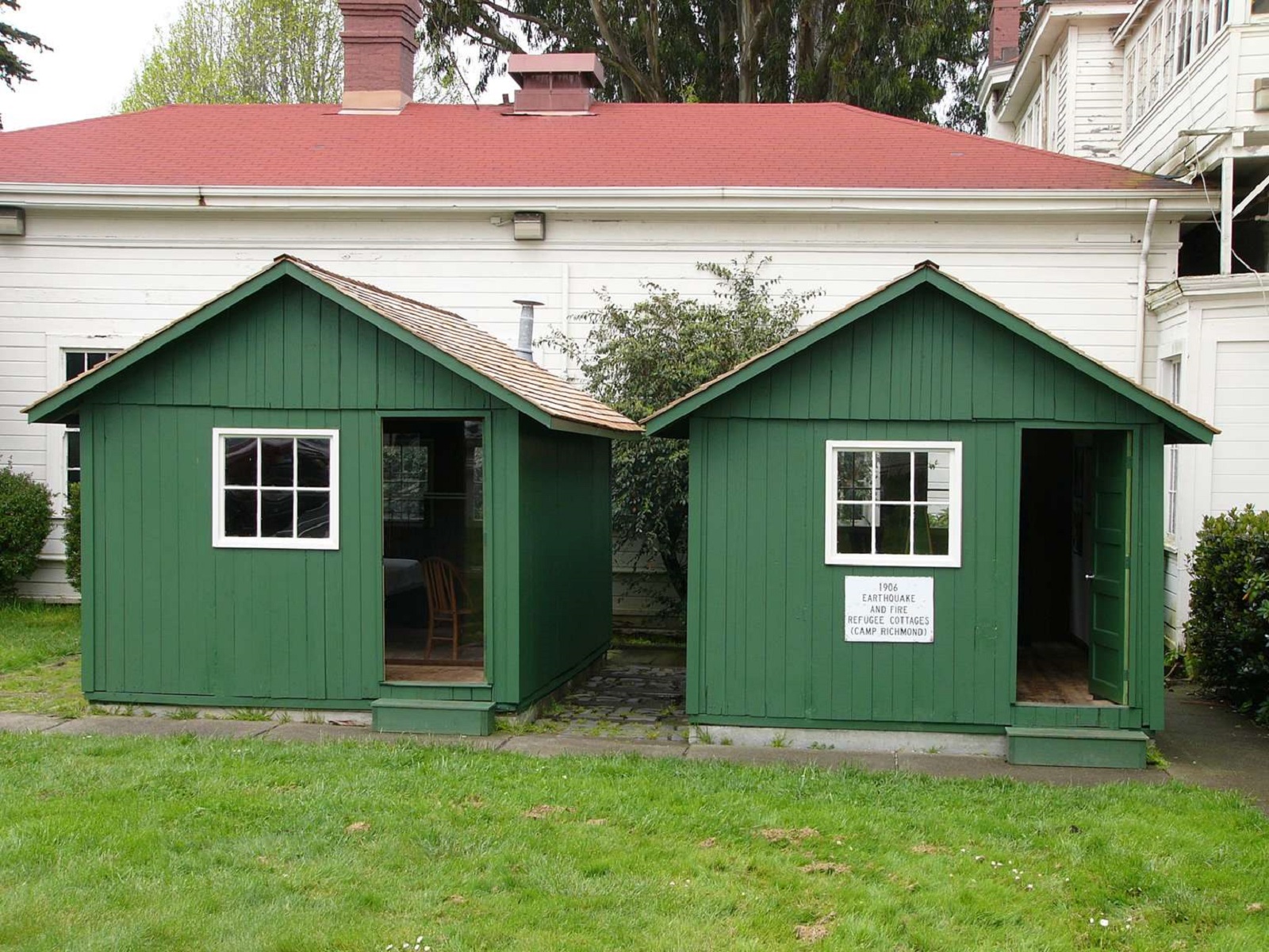
2 - Exploring Fort MasonKIOSK LOCATION: The kiosk is a four-sided metal structure with interpretive panels. It is located east of building 201, at the intersection of Macarthur Avenue and Franklin Street. It is close to Fort Mason's flagpole. 
2 - Guard Tower2 - Plants of Lands EndWAYSIDE PANEL TITLE: Plants of Lands End: What Grows Here? Putting Down Roots. DESCRIPTION OF IMAGE: A large color photo of a shoulder of hillside covered with white wild flowers and green grasses. The hillside drops down to white waves lapping a rocky shore. The sky above is streaked with clouds.
2 - Reduce, Reuse, RecycleWAYSIDE PANEL TITLE: Reduce, Reuse, Recycle PANEL DESCRIPTION: The wayside faces east in front of the Crissy Field Center.
2 - Redwood Creek Watershed Tactile ModelMuir Beach Overlook has a three-dimensional cast-bronze tactile map of the Redwood Creek Watershed. The model has tactile letters and braille along its surface, as well as raised features representing roads and trails. Additionally, the model contains a compass rose in alignment with its geographical surroundings. On top of that, it's a working hydrological model of a watershed.
20 - Daring Pilots, Youthful HeroesWAYSIDE PANEL TITLE: Daring Pilots, Youthful Heroes PANEL DESCRIPTION: The panel faces north, on the northern side of the trail.
20 - How Will the San Francisco Waterfront Look in 2100?21 - A Tidal-Marsh ExtravaganzaWAYSIDE PANEL TITLE: A Tidal-Marsh Extravaganza PANEL DESCRIPTION: The wayside faces north on the northern side of the trail.
21 - Alcatraz Lighthouse22 - A Wasteland TransformedWAYSIDE PANEL TITLE: A Wasteland Transformed PANEL DESCRIPTION: The wayside faces north on the northern side of the trail.
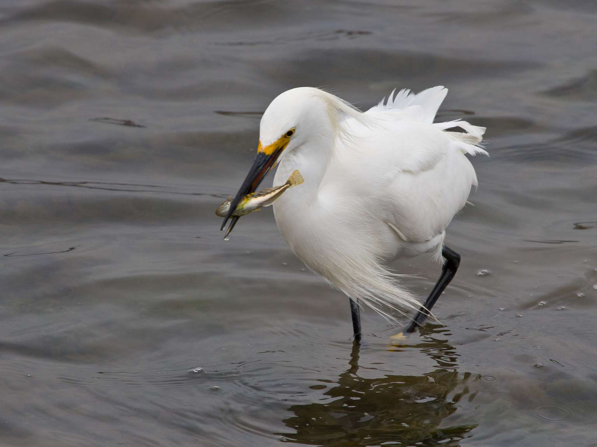
22 - City Skyline23 - New Homes From Old24 - Snowy Egrets and Herons25 - West Side Gardens26 - First Escape Attempt27 - Seabirds |
| Visitor Centers | Count: 4
Golden Gate Bridge Welcome Center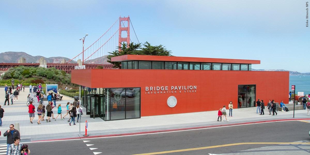
Lands End Lookout Visitor Center
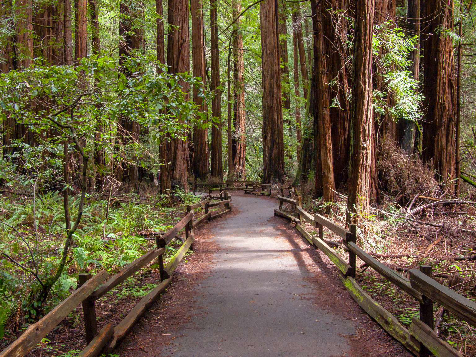
Muir Woods National Monument Visitor Center
William Penn Mott Jr. Presidio Visitor Center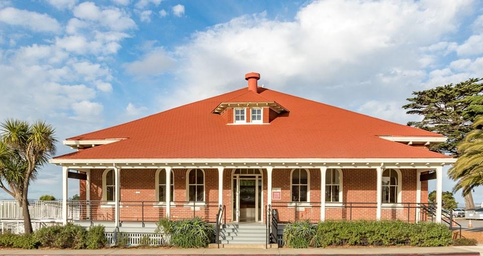
|
| Things to do | Count: 23


|
| Tours |
Count: 14
Alcatraz: Prisoners at WorkLearn about prison labor over the centuries at Alcatraz and contemplate the effectiveness of making incarcerated people work for punishment or rehabilitation as they do their time. The tour is 0.25 miles (0.4 km) one way with an elevation gain of 50 feet (16 m). First and Last Stop: Philippines War TourHear first hand accounts and news reports from the period, giving you a flavor of what it was like to be here during the busiest time in the Presidio’s history… as soldiers made their first and last stops here while on their way to and from war in the Philippines. This audio tour will reveal the many ways in which the soldiers and the citizens of San Francisco interacted, forever changing the face of the Presidio and the city. Fort Baker Tour: Batteries & ButterfliesTake a tour exploring Fort Baker’s long history, its natural features and its modern role. Fort Mason: A Reflection of San FranciscoThis one mile walking tour reflects upon the role this 19th Century Army Post played in San Francisco history as well as the formation of Golden Gate National Recreation Area. We recommend visiting the sites in order, but you're welcome to visit them in any order you like. There are also interpretative waysides that provide you with additional information. Please be advised that most of the Fort Mason buildings and residences are currently occupied; visits to their interiors are not allowed. Fort Point: Guardian of the GateLearn about Fort Point's service to the nation. Its powerful guns, massive walls, and determined soldiers stood vigilant and served as a deterrent to any would be aggressor. Goldsworthy in the Presidio - Self Guided Art Hike"Have you ever wondered about the wooden sculptures throughout the Presidio? Andy Goldsworthy is a site-specific artist who created these sculptures using materials found in the Presidio. The idea is to invite viewers to experience the familiar in a new way. These sculptures are designed to change and ultimately “return to the earth.” Goldsworthy says the pieces are meant to serve not just as objects, but as layers, adding on to the long history of the site. Lands End: A History of RecreationOver the centuries, San Franciscans and visitors from all over have traveled to this panoramic display of peninsular delight. This tour will take you on a 1.5 mile loop from the Visitor Center, through Sutro Heights down to Ocean Beach, around the Cliff House to the ruins of Sutro Baths and back up to the USS SF Memorial and Visitor Center parking lot. Along the way, you'll learn about the people and places that have contributed to the character of Lands End as a place of fun and recreation, even today. Life on the Edge: Point Bonita TourStep back in time and learn the Point Bonita story on this audio tour. Point Bonita is an area where powerful environmental forces have profoundly affected human history. Mori Point: A Seaside LandscapeTake a short walk to the cliffs overlooking the Pacific Ocean, and get ready for great whale watching. Along the way, enjoy restored California red-legged frog pond habitat and views of the coast and surrounding hillsides. Presidio Bronze Cannon TourDiscover some hidden history! Explore the bronze cannon that now decorate this park. Learn about the creation of the Spanish Presidio and the American expansion during and after the Spanish American War. Investigate old technology through the description and locations of various emblems and markings found on these intricate weapons. Examine and question their necessity by understanding why and how they are here. Presidio: Batteries to BluffsThis walking tour starts in the Langdon Court parking lot. It's an approximately 1.5 mile loop with varied elevation that will take you along a beautiful scenic trail highlighting historical and natural points of interest. Watch your footing along the cliff and be mindful of poison oak. There are no bathrooms or water stations along the trail. Red Power on AlcatrazAlcatraz Island lies within Ramaytush Ohlone territory. There is no evidence (scientific or oral tradition) regarding Ohlone use of the island. In 1969, a group of Native American students, who later known as “Indians of All Tribes,” came to occupy the island in a political protest. These students fought for inclusion into the educational system that denied them their cultural existence. On this tour, learn the story of the 19-month Indian occupation of Alcatraz Island. The tour is 0.5 mi (0.8km) one way. Rodeo LagoonThe Rodeo Lagoon tour takes you on a 1.6 mile loop from the Marin Headlands Visitor Center around Rodeo Lagoon to Rodeo Beach, through Fort Cronkhite and back around to the Visitor Center. Along the way learn about endangered native plant and animal species, beach geology and some Headlands history. Seven PrisonsThis thirty-minute walking tour takes you to the sites of six different prisons on Alcatraz Island and connects their stories with our criminal justice system today, the “seventh prison.” While we explore the different sites, ask yourselves about the purpose of incarcerating people in these prisons. Did these prisons serve their purpose, and do our prisons today? |
| Articles |
|