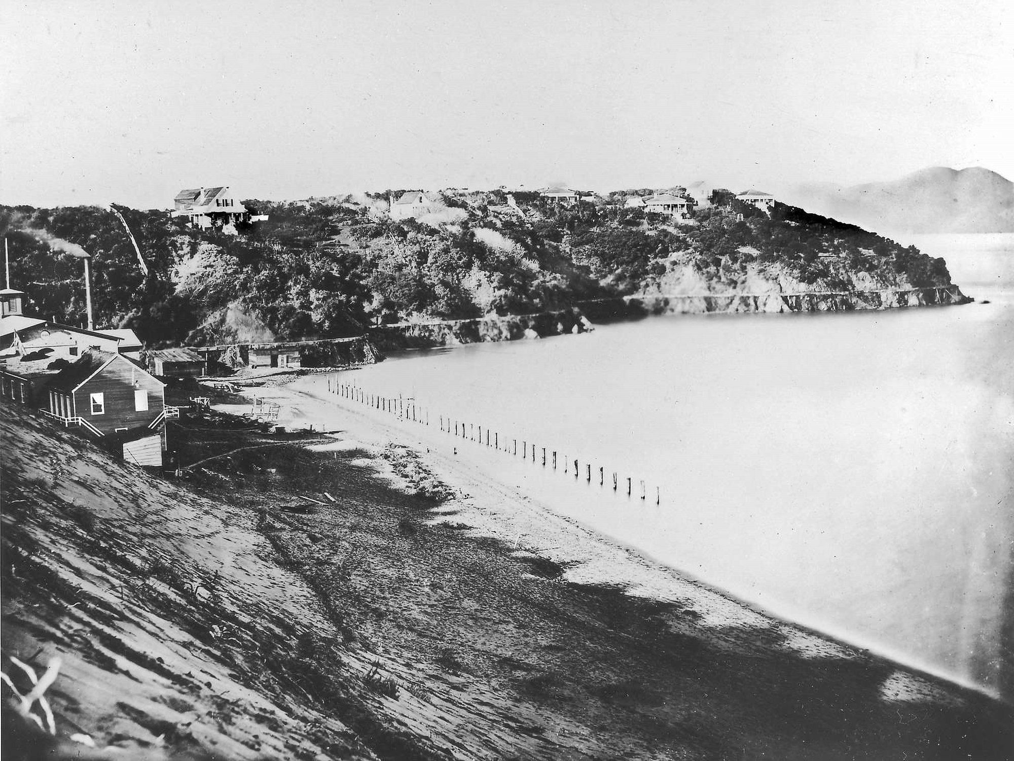
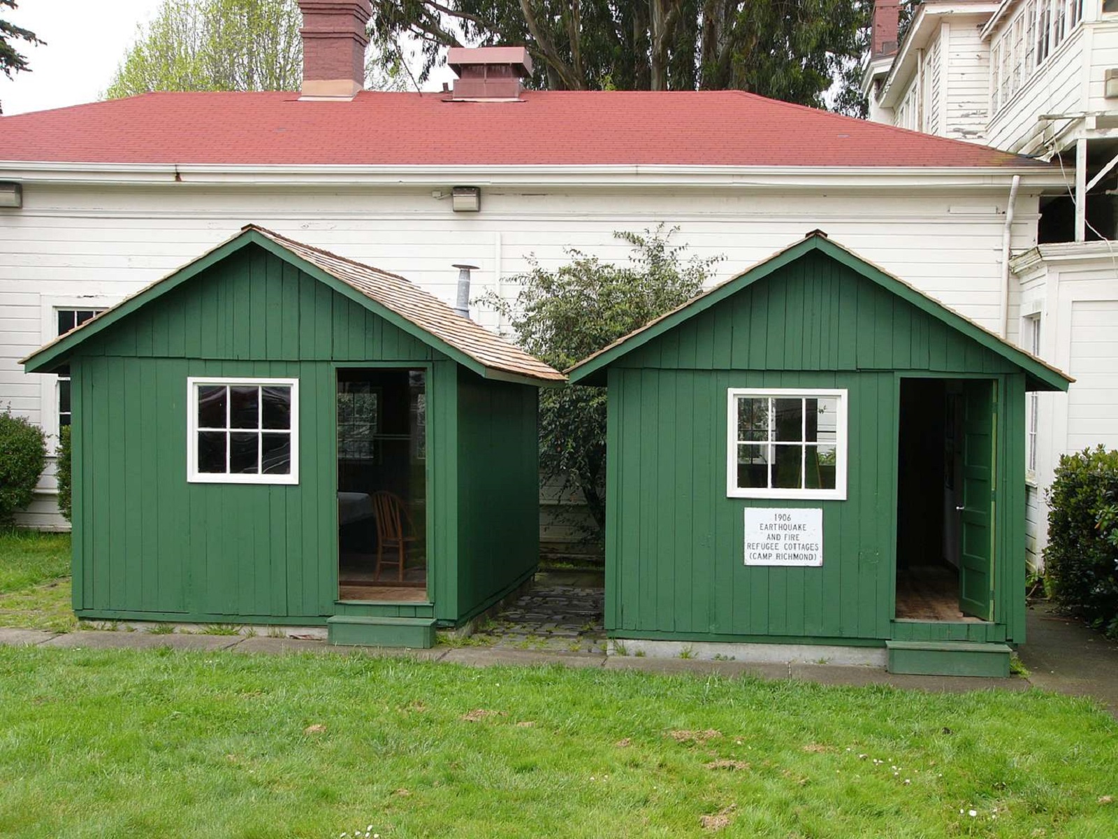
In the 1850s, private citizens constructed homes on the east side of the street, facing the water; after 1865, the army constructed the west side buildings. Although the military reserved Point San Jose for its purposes, the army had not assigned any soldiers or constructed any buildings. This scenic and underutilized piece of property, known to locals as "Black Point" because of the bluff's dark laurel trees, offered refuge from the rapidly growing city.
KIOSK DESCRIPTION: This kiosk has 2 panels side by side. VIEW FROM WAYSIDE: Facing south west, you can see the path that cuts through a grassy field leading to three wayside panels 70 feet away. Also visible is the top portion of a rounded concrete structure poking out of the ground just before the waysides. In front and to the left of you are three picnic tables 30, 75 and 110 feet away, respectively.
Welcome to the audio described tour of Fort Mason's waysides. Each stop on this tour describes one of the 12 waysides or kiosks within Fort Mason, Golden Gate National Recreation Area. Each stop will begin with an orientation to where you are in the park and a description of the view from the wayside. Directions to the next wayside will be detailed at the end of every stop.
Welcome to the Lands End Lookout, perched here on the edge of the Pacific Ocean, at the western boundary of San Francisco. Let's begin by stepping to a quieter part of this space. Stand with your back to the desk and walk carefully forward about six steps until you find a similar counter.
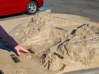
WAYSIDE TITLE: Restoring Habitat VIEW FROM WAYSIDE: Standing in front of the kiosk facing south, away from the parking lot, a row of brown recycling and trash bins is to your left. Directly behind you is a 3-D topographic model of Muir Beach and the surrounding area, and, on the edge of the parking lot, a bathroom building.
WAYSIDE PANEL TITLE: Sustainability at Golden Gate PANEL DESCRIPTION: The wayside is located on the south eastern corner of the Crissy Field Center and faces north towards the bay.
WAYSIDE TITLE: San Francisco's Seaside Playground: Going to the Cliff. TEXT: They made their way across the endless sand dunes on foot, on horseback, in horse-drawn buggies and steam trains.
WAYSIDE TITLE: San Francisco Hosts the 1915 World's Fair! PANEL LOCATION: The wayside faces west and is in the northern portion of the Great Meadow Loop Trail. It is just to the side of the large asphalt path. Exercise caution with passing bikes.
WAYSIDE TITLE: The Great Meadow PANEL LOCATION: The wayside faces north and is placed on a brick platform extending into the Great Meadow from the asphalt trail of the Great Meadow Loop. Accessible restrooms are further down the trail on the righthand side.
Lands End Lookout Visitor Center has a three-dimensional cast concrete tactile map of the area from Lands End Point to Sutro Heights. The model has tactile letters and braille along its surface, as well as raised features representing roads and trails. The model also has a compass rose in alignment with its geographical surroundings.
WAYSIDE TITLE: Phillip Burton PANEL LOCATION: The wayside faces west along the asphalt path of the Great Meadow Loop Trail. Accessible restrooms are back in the opposite, on your lefthand side. VIEW FROM WAYSIDE: The wayside is on the eastern portion of the Great Meadow and is placed so that the Phillip Burton Statue is directly before you, framed by the Golden Gate Statue in the distance. The statue is encircled by gray bricks and is accessible by an additional walking path
WAYSIDE PANEL TITLE: The Last Word in Airfields PANEL DESCRIPTION: The wayside faces south, on the south side of the trail at the edge of Crissy Field.
The audio described tour ends here at the original wayside near the headquarters building. Thank you for visiting your National Park! If you have any further questions, you can approach the headquarters building to speak with a ranger.
KIOSK LOCATION: The kiosk is a four-sided metal structure with interpretive panels. It is located east of building 201, at the intersection of Macarthur Avenue and Franklin Street. It is close to Fort Mason's flagpole.
WAYSIDE PANEL TITLE: Plants of Lands End: What Grows Here? Putting Down Roots. DESCRIPTION OF IMAGE: A large color photo of a shoulder of hillside covered with white wild flowers and green grasses. The hillside drops down to white waves lapping a rocky shore. The sky above is streaked with clouds.
Muir Beach Overlook has a three-dimensional cast-bronze tactile map of the Redwood Creek Watershed. The model has tactile letters and braille along its surface, as well as raised features representing roads and trails. Additionally, the model contains a compass rose in alignment with its geographical surroundings. On top of that, it's a working hydrological model of a watershed.