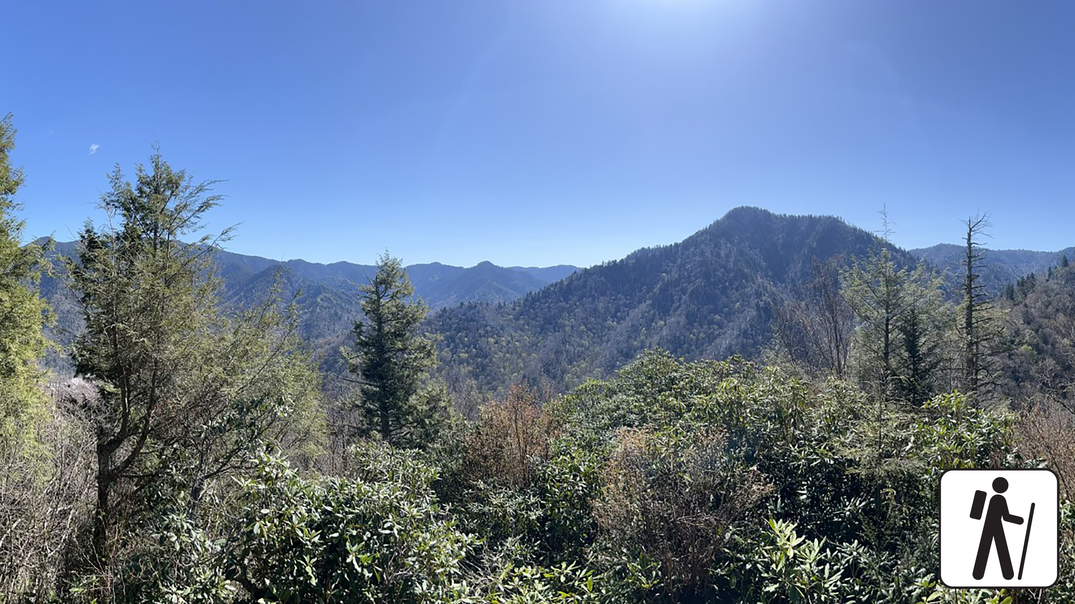
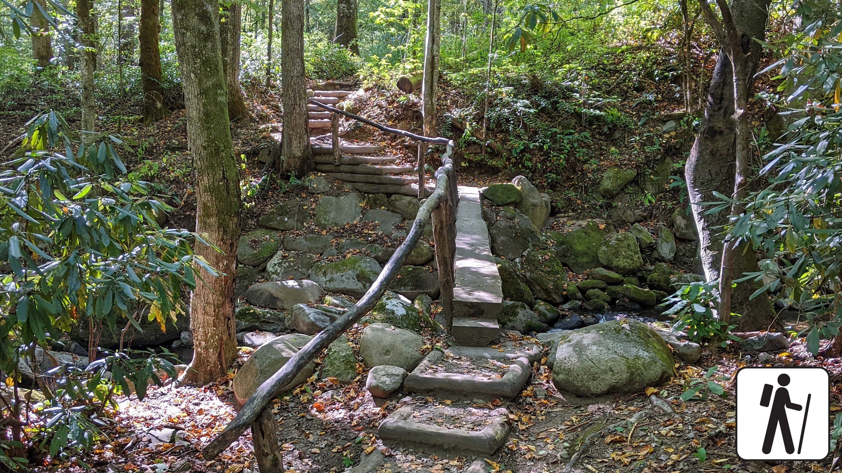
Hike 3.5 miles (5.6 km) roundtrip on this popular but challenging trail to enjoy views of surrounding mountains and the Chimney Tops pinnacles. This trail is steep and rocky at times, and includes bridges, stairs, and some lingering signs of 2016 wildfires.
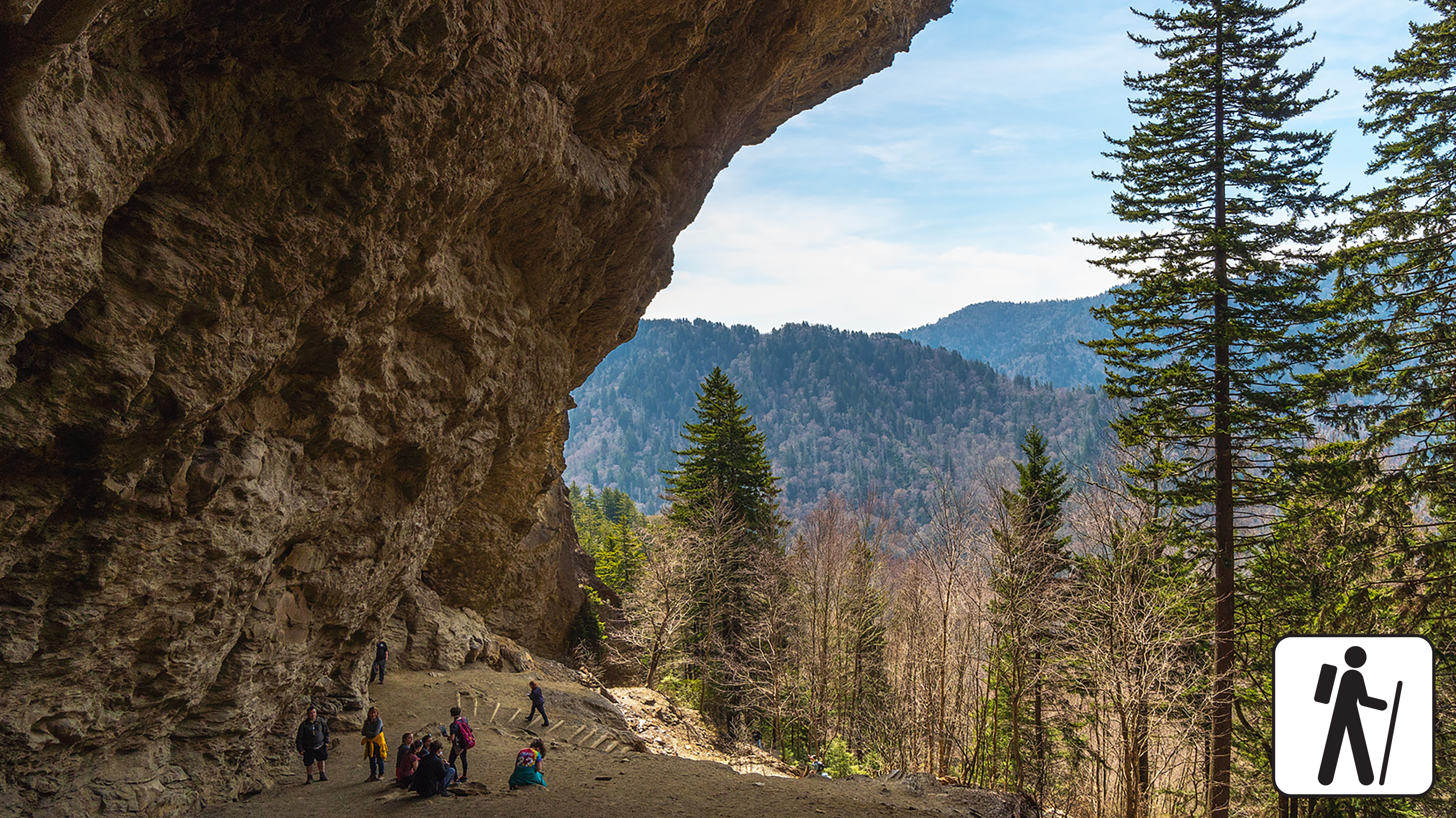
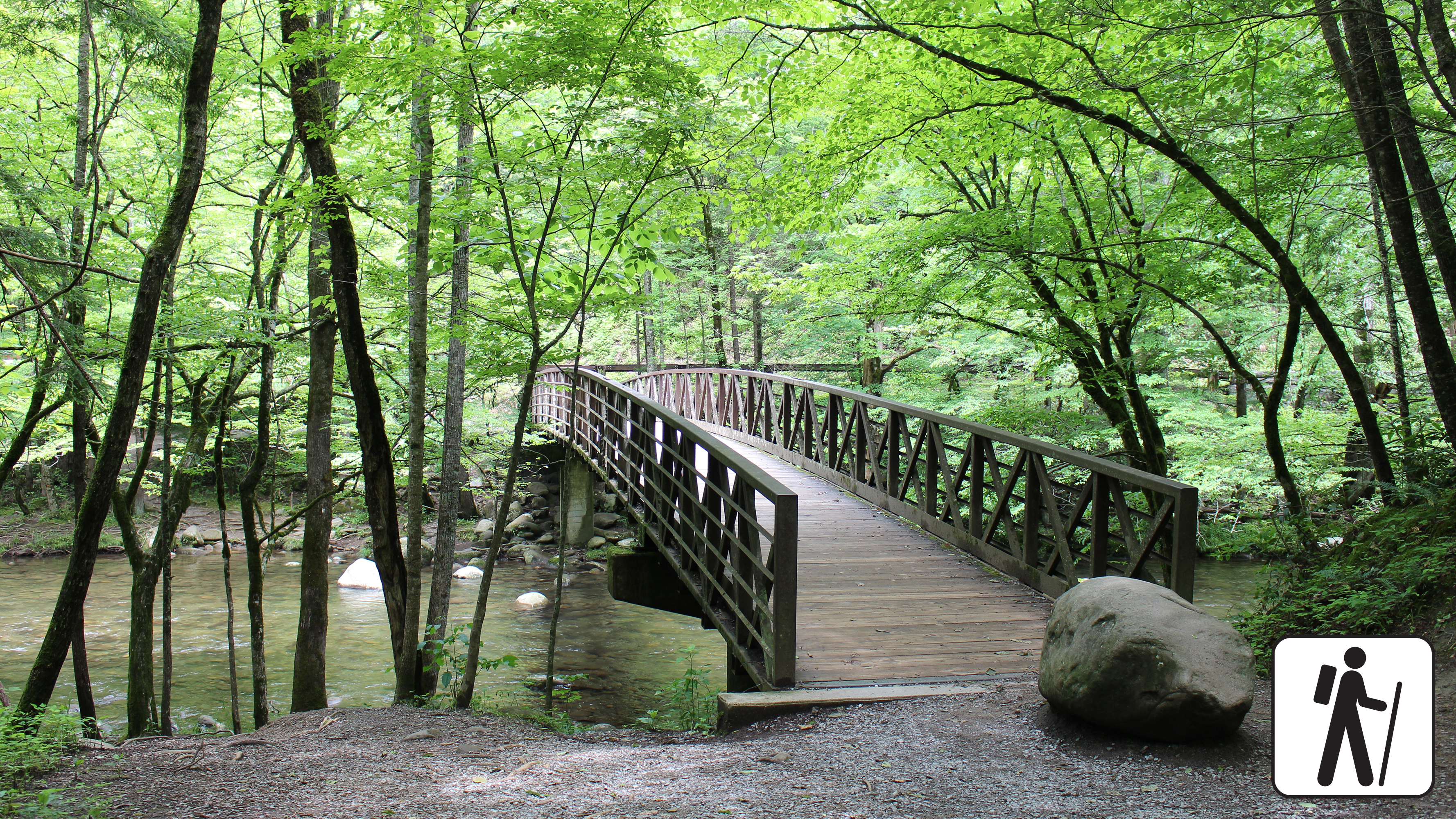
Hike 4.6 miles (7.4 km) roundtrip to see the Alum Cave Bluffs and stroll through Arch Rock on this popular hike on Alum Cave Trail. The trail crosses two mountain streams via footbridges before it climbs through sections of old-growth forest.
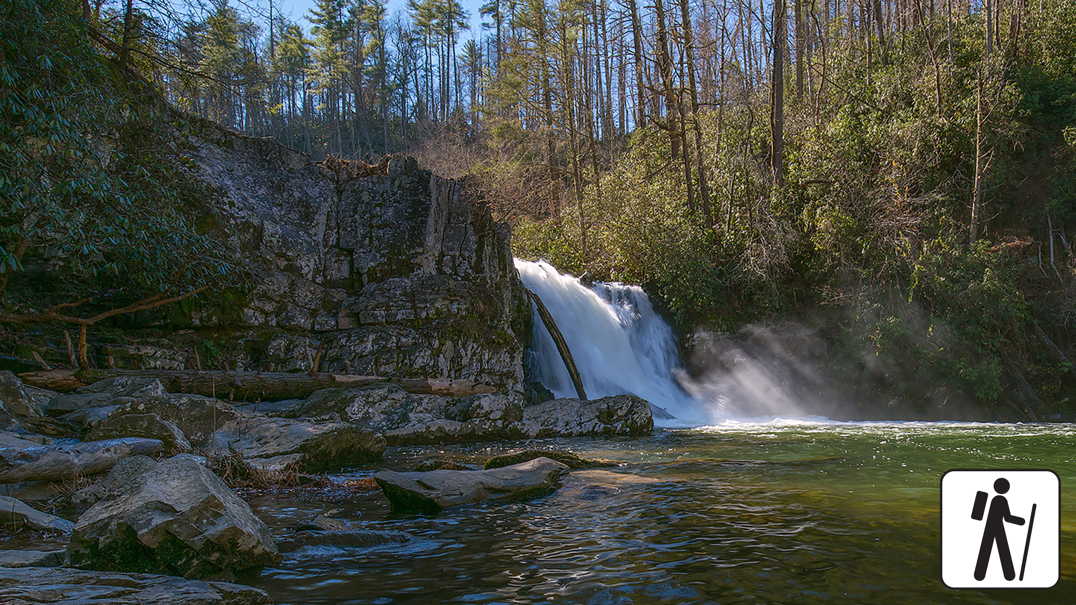
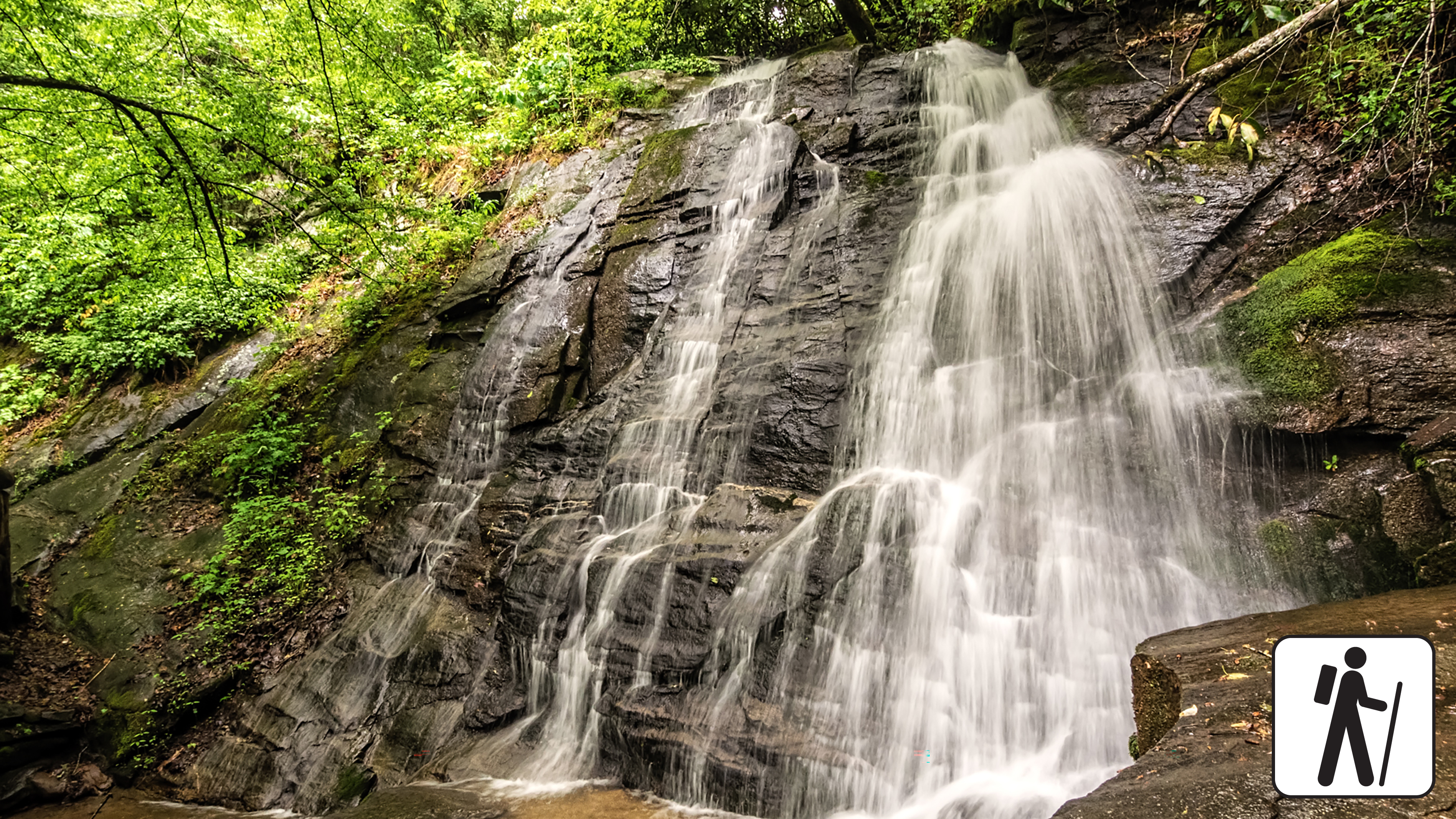
Walk 5 miles (8 km) roundtrip through rhododendron, hemlock, and pine-oak forest to a 25-foot (7.6-m) waterfall and scenic pool. Swimming in the pool is not recommended due to slippery rocks and a dangerous undertow.
Hike 2.6 miles (4.2 km) roundtrip through a mixed hardwood forest to an 80-foot (24-m) waterfall. Enjoy a few views of the mountain landscape before arriving at the waterfall. PLEASE NOTE: Laurel Falls Trail is expected to close starting in mid-December for 18 months.
See three waterfalls on a loop around the Deep Creek area. Hike 2.4 miles (3.9 km) on several short trail segments to reach Juney Whank Falls, Indian Creek Falls, and Tom Branch Falls.
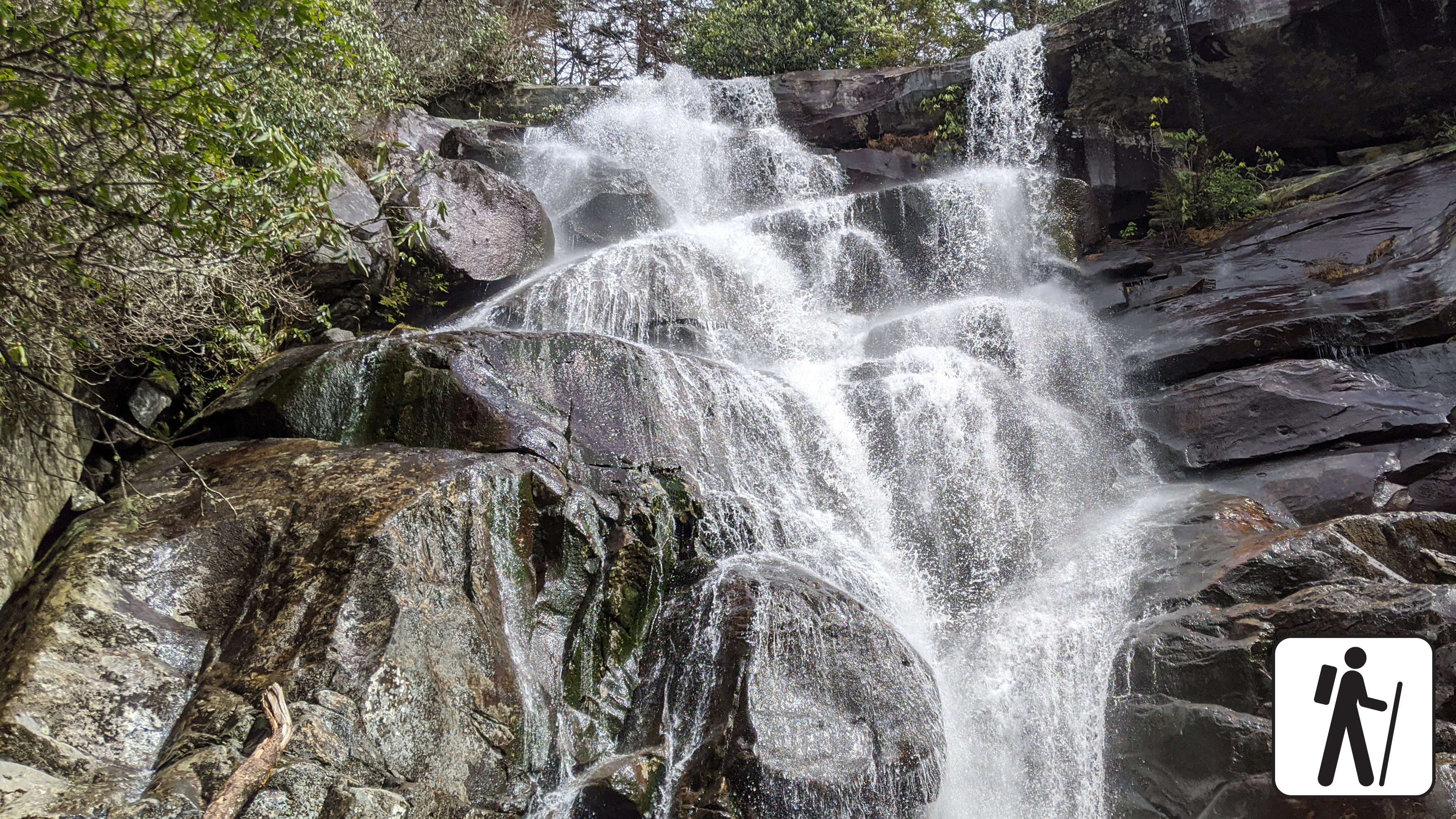
Hike 5.6 miles (9 km) roundtrip through varied forest to a popular waterfall named for the misty rainbow that often appears at its base. This trail is well-traveled and maintained, but the climb to the falls is relatively steep.
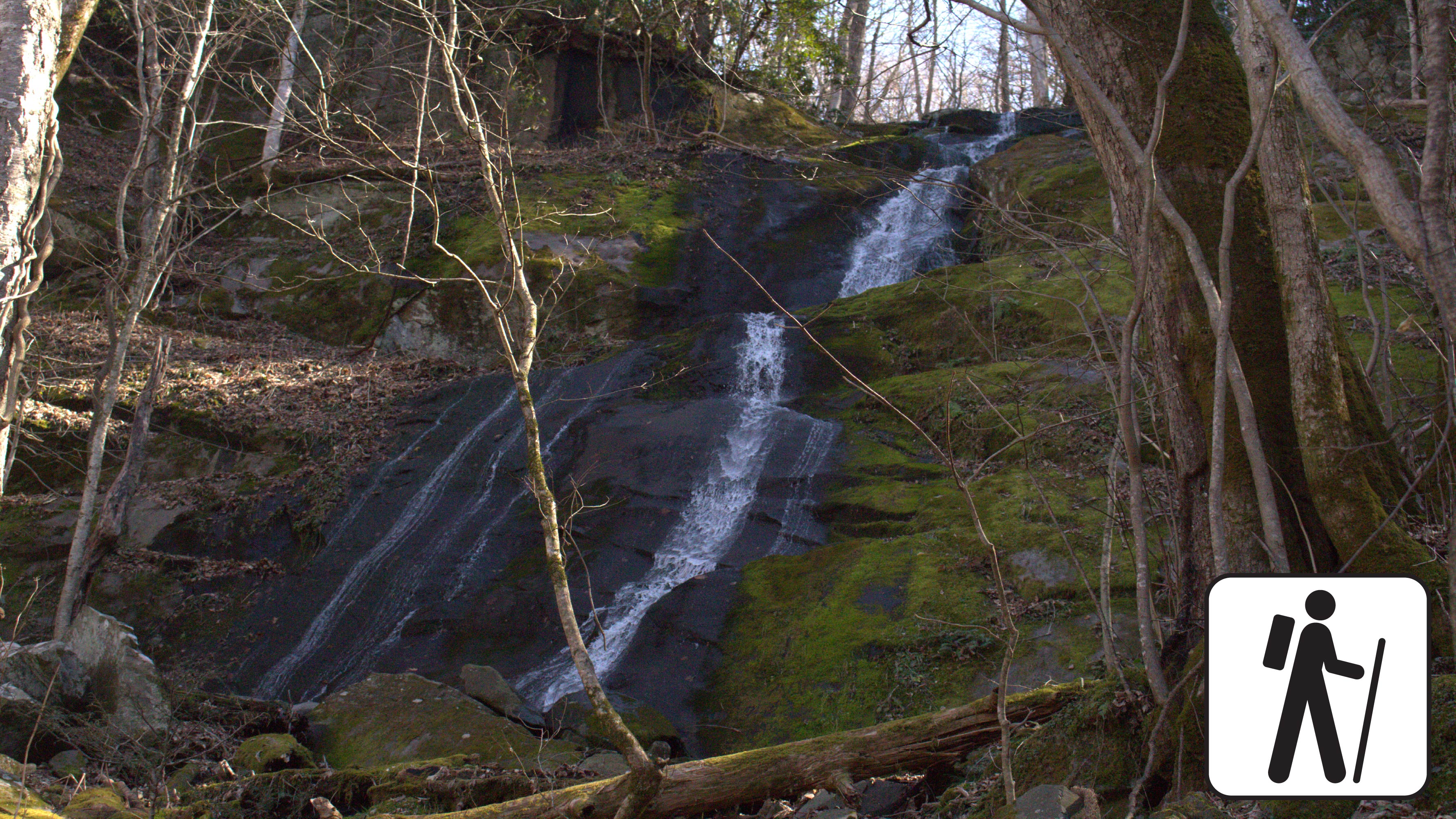
Go on a woodland stroll following an old railroad bed along a mountain stream, 1.4 miles (2.3 km) roundtrip, to a dramatic cascade. The trail is mostly wide and flat and gently ascends through rhododendron and some cliff-like rock outcroppings.
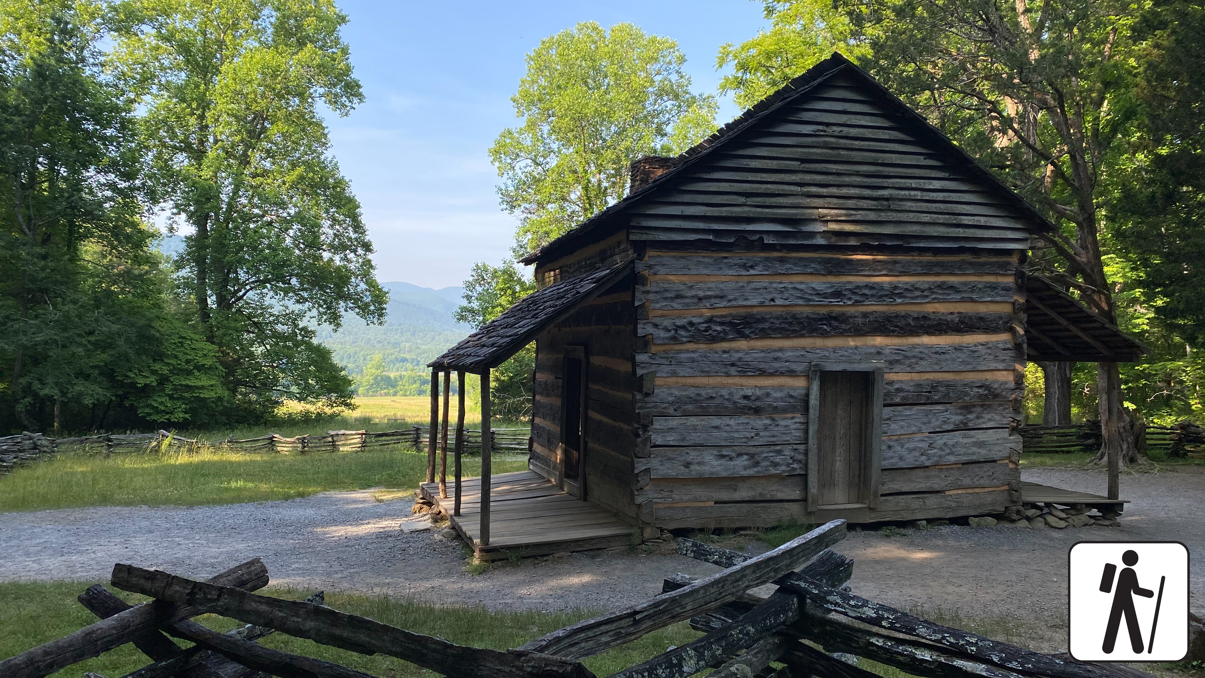
Explore the scenery of Cades Cove and the historic John Oliver Cabin and homesite with a short path—0.3 miles (0.5 km) roundtrip—suitable for wheelchairs and strollers. The trail gives way to level, packed gravel once it reaches the complex of log structures.
Enjoy a riverside stroll approximately 4 miles (6.4 km) roundtrip through a cove hardwood forest along one of the only dog- and bike-friendly trails in the park. This trail includes sections of sidewalks and roadsides as well as graded dirt path.
One of five routes to Mount Le Conte, the Bullhead Trail offers consistent views. The strenuous hike is 13.6 miles (21.9 km) roundtrip. Near the beginning, visitors will see rocky cliffs and climb the Bullhead, a heath-covered bald that may resemble a bull's head from a distance.
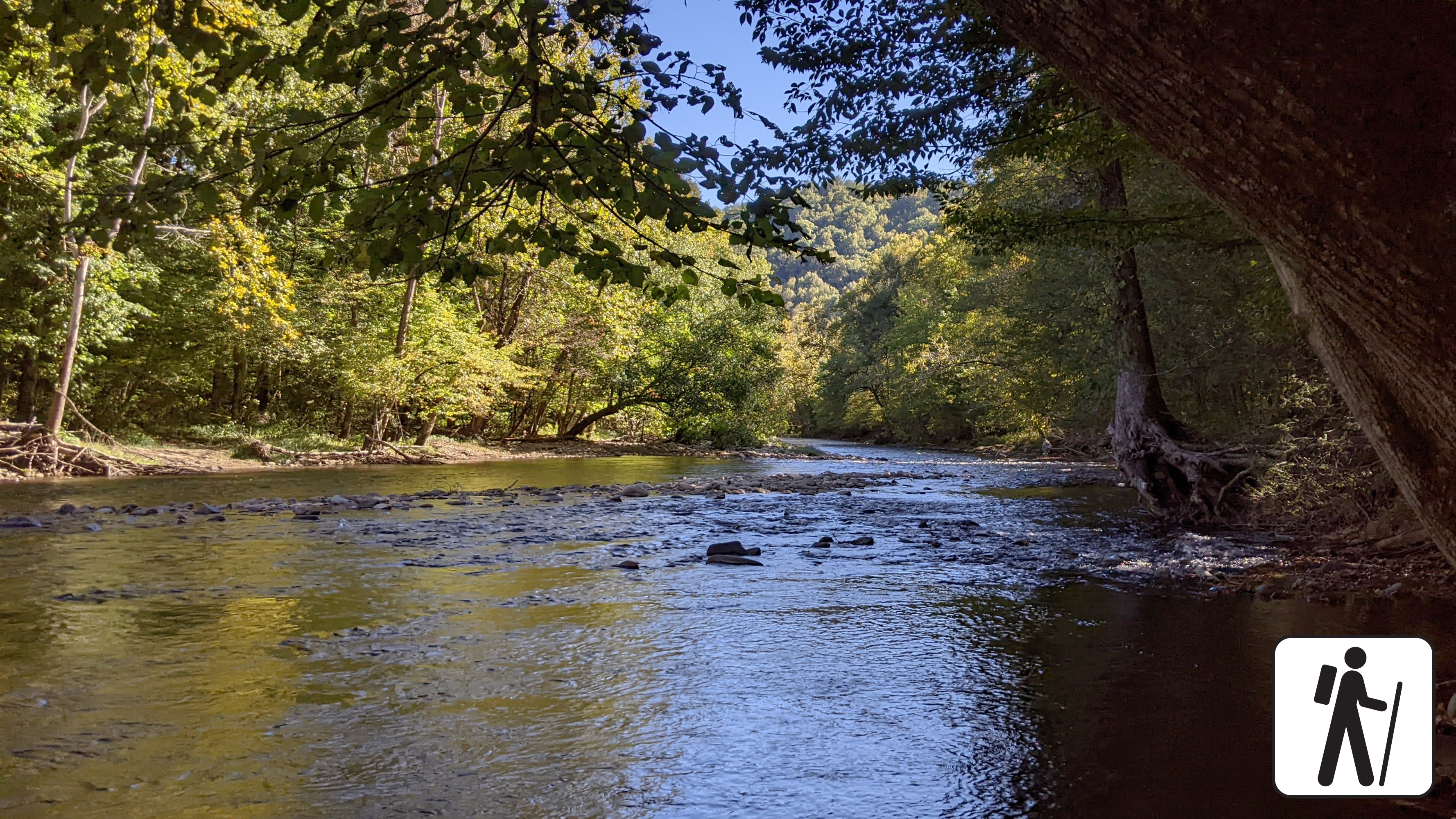
Enjoy a riverside stroll approximately 3 miles (4.8 km) roundtrip on one of the only pet- and bike-friendly trails in the park. This popular trail is relatively flat, wide, and graveled and follows the Oconaluftee River through elk habitat and hardwood forest.
Porters Creek is a peaceful trail that is filled with history and natural wonders, hike as far as you'd like to explore. If you are up for about a 4-mile roundtrip hike you can visit the beautiful Fern Branch Falls.
1-3 Hours
Hike 8 miles (12.9 km) roundtrip on this popular but relatively challenging trail through cove hardwood forest to see the tallest waterfall in the park. The trail begins on an old roadbed but becomes narrower and rockier crossing multiple footlog bridges and streams as it ascends.
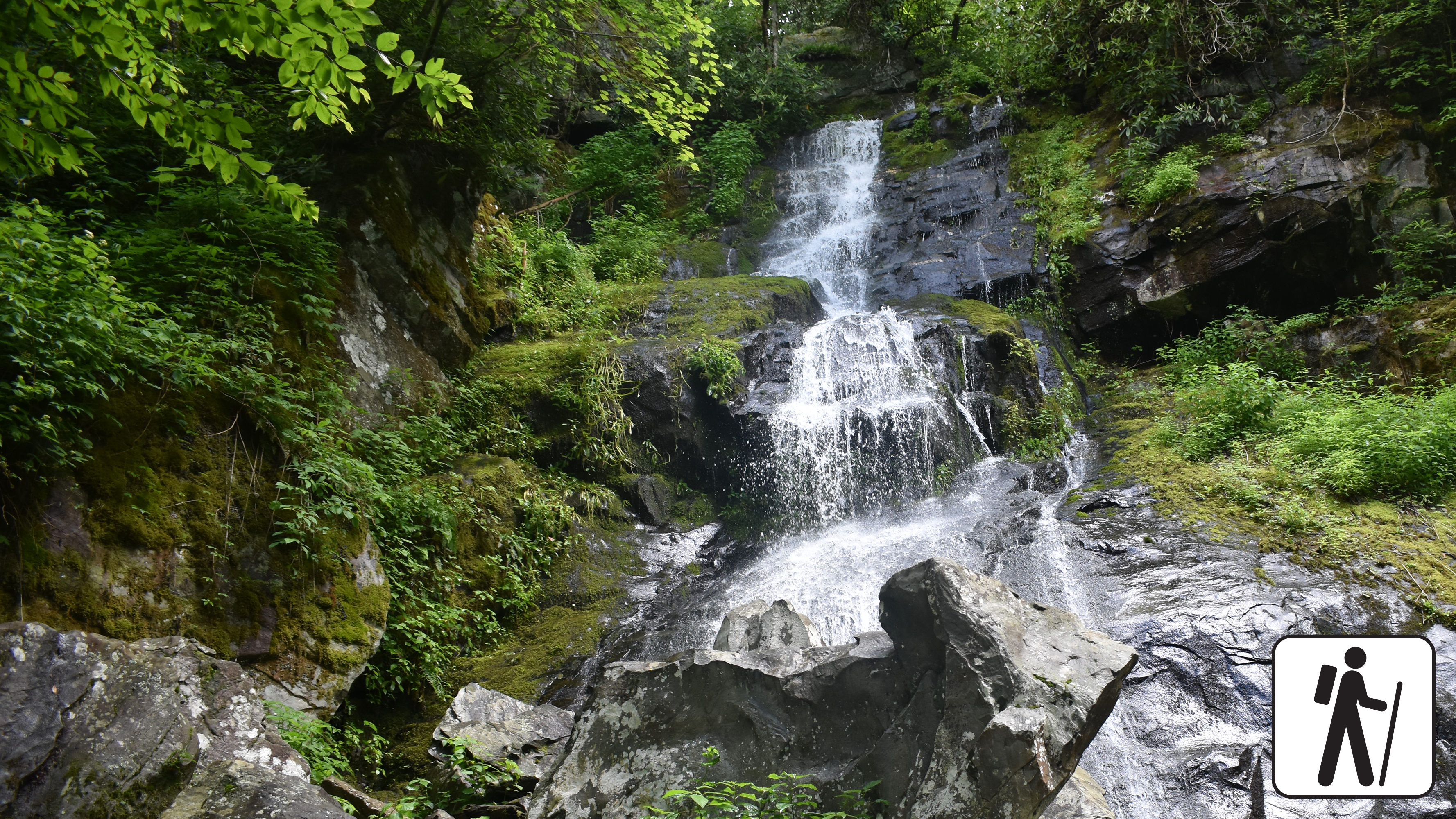
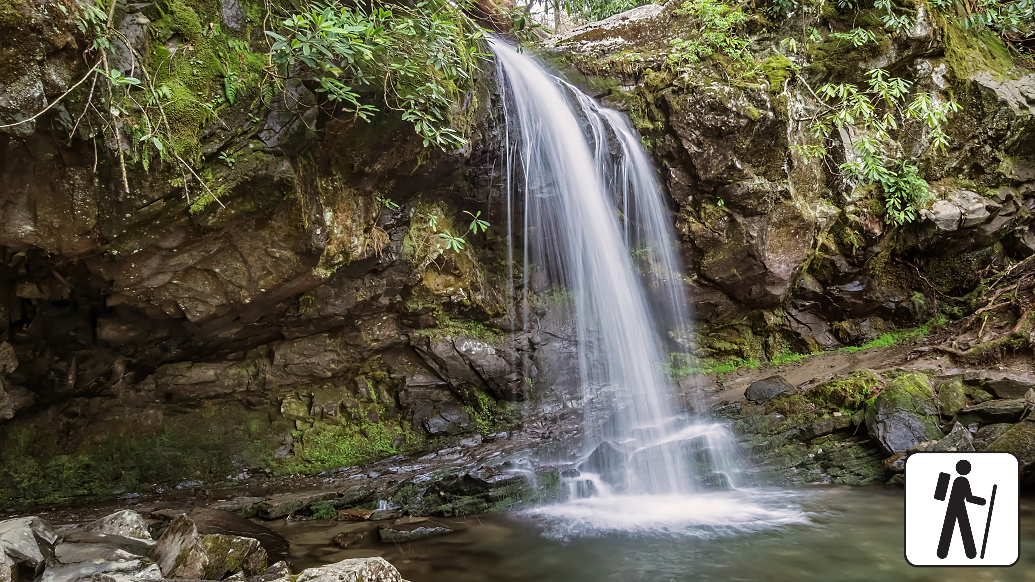
Hike 1.2 miles (1.9 km) roundtrip along a wide gravel roadbed that follows a mountain stream to a cascade surrounded by moss-covered rocks and mixed hardwood forest.
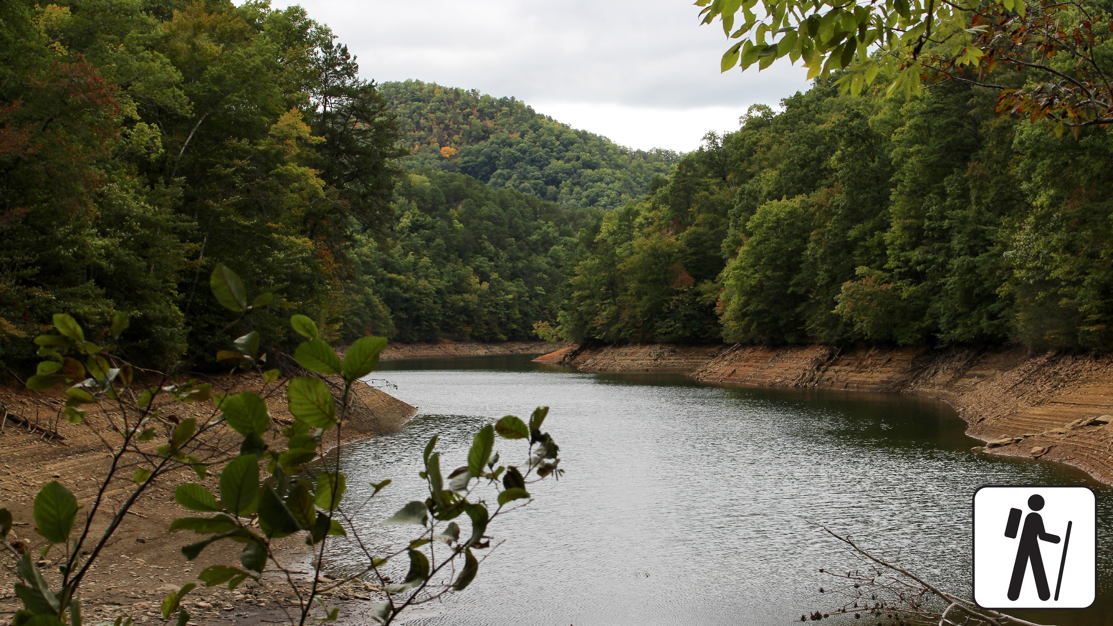
Hike 4 miles (6.4 km) on Lakeshore and Goldmine Loop trails through a hardwood forest filled with signs of old homesites and farms. This trail is moderate but includes some rocky areas and shallow stream crossings.
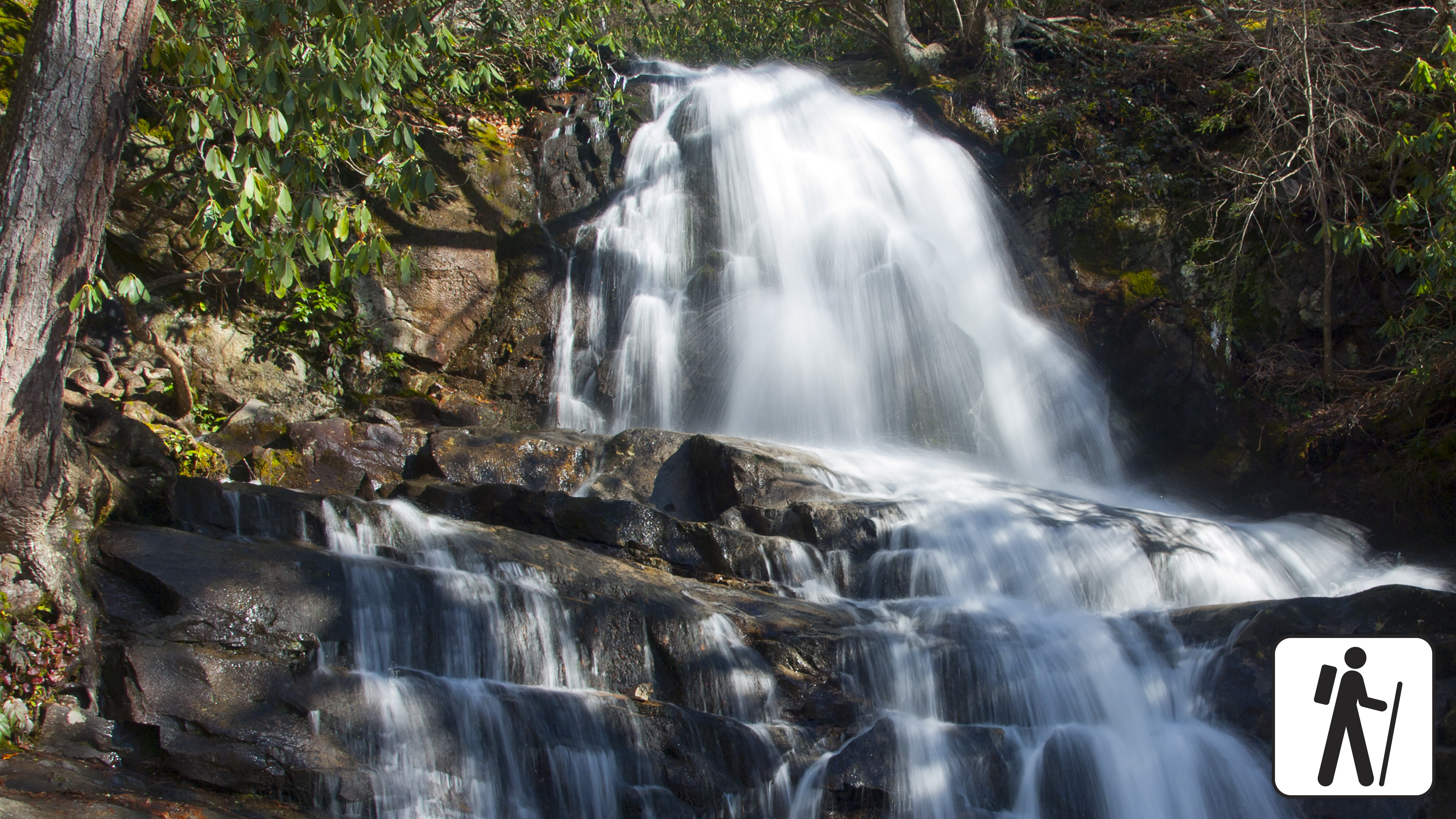
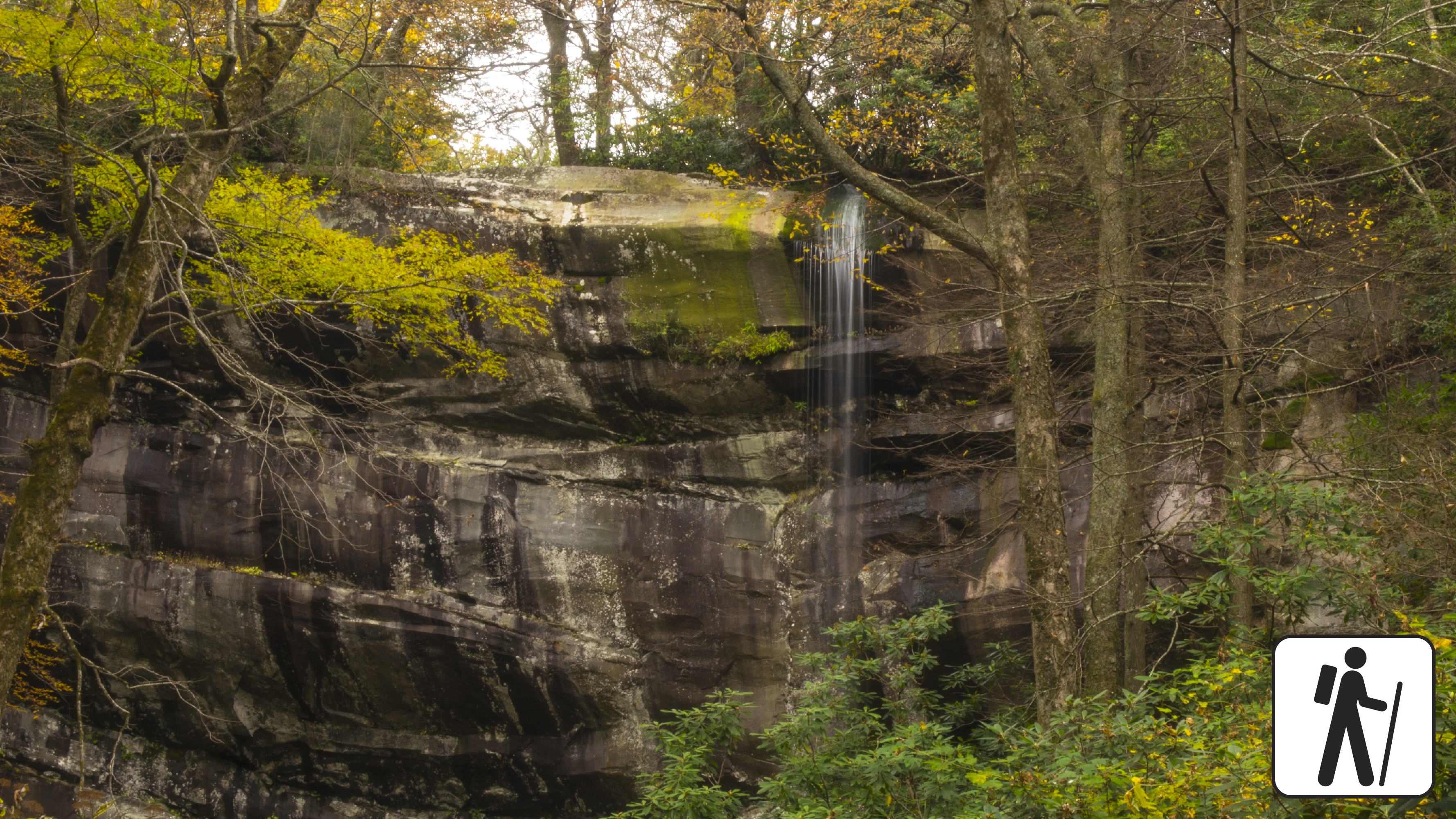
Hike 4.3 miles (6.9 km) roundtrip through a hardwood forest with hemlock and rhododendron to a popular 90-foot (27-m) waterfall. This trail includes some steep sections and switchbacks.
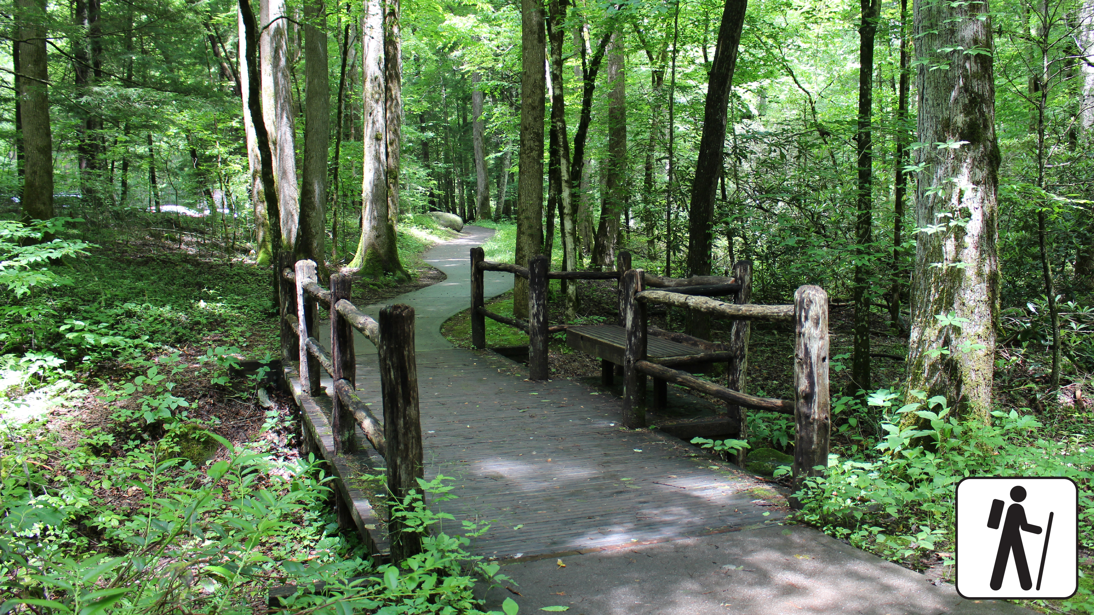
Wander through a cove hardwood forest with streamside views, rock walls, and historic stone chimneys on this half-mile (0.8 km) loop along a paved, flat trail. The trailhead is adjacent to a small parking area with several accessible spaces along Newfound Gap Rd (US 441) near Sugarlands Visitor Center.
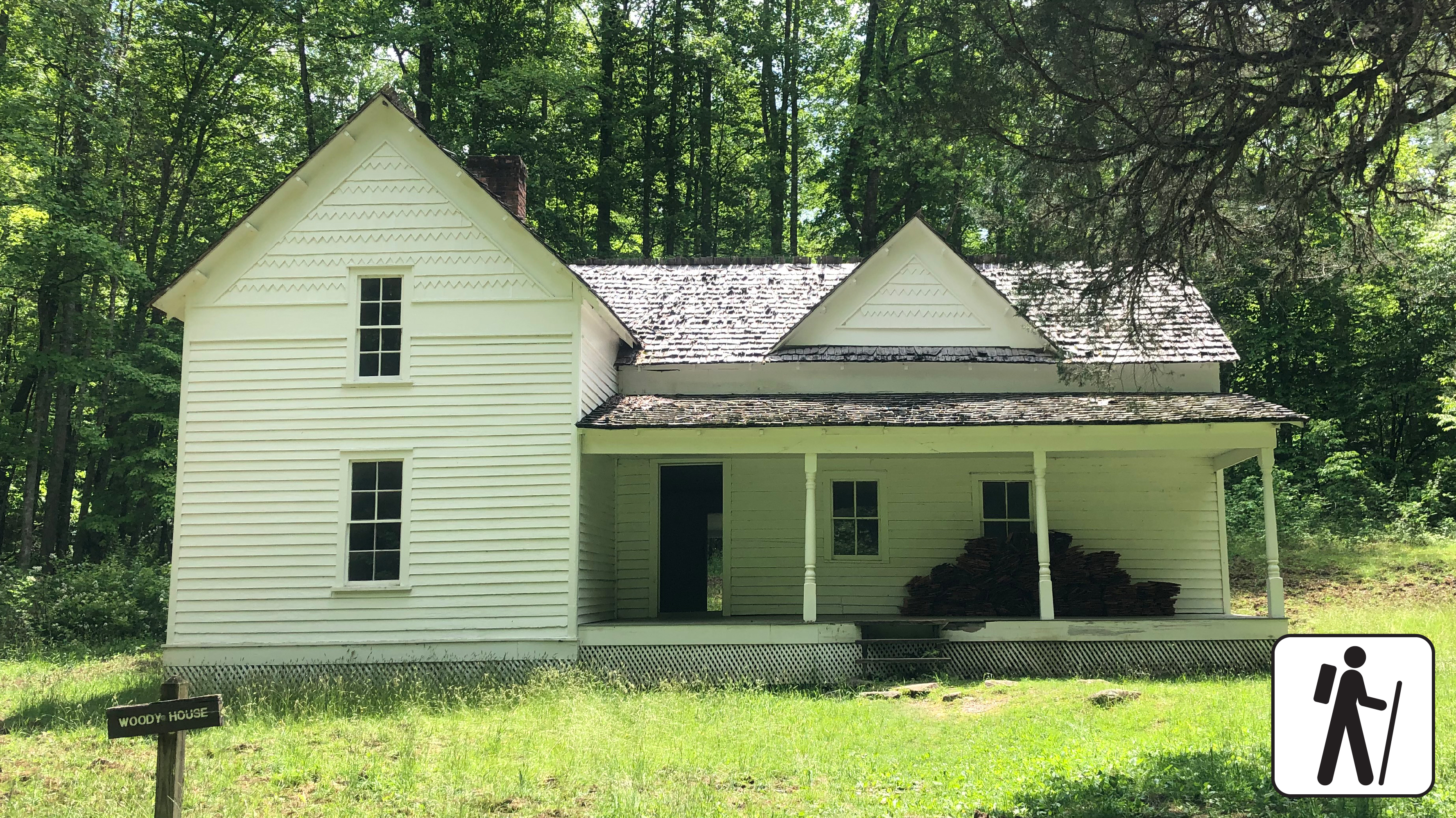
Walk 2 miles (3.2 km) roundtrip through a hardwood forest on a wide, well-graded path following a mountain stream to reach the historic Steve Woody Place, which was once the center of a sprawling homestead with several outbuildings.

One of five routes to Mount Le Conte, Trillium Gap Trail to Mount Le Conte is 13 miles (20.9 km) roundtrip and rewards hikers with mountain views, diverse forest, and a waterfall. Near the summit, the best views are at Cliff Top and Myrtle Point, both marked with signs.

Hike 13 miles (21 km) roundtrip on one of five routes to Mount Le Conte that includes a waterfall, rocky ascents, and forest views. Lush forests line the trail and hikers will intersect the Bullhead Trail, Alum Cave Trail, and Trillium Gap Trail before reaching the summit.

The longest of the five routes to Mount Le Conte, this strenuous hike—16.2 miles (26.1 km) roundtrip—offers a variety of views and includes part of the Appalachian Trail. Charlies Bunion, a rocky outcrop, is a short but rewarding detour.

Hike 10 miles (16.1 km) roundtrip on Alum Cave Trail as it climbs steadily through dense forest to Alum Cave Bluffs and on to the summit of Mount LeConte. This popular but strenuous hike includes stairs, bridges, and some steep and rocky sections of trail.
Hike 5.4 miles (8.7 km) on a pleasant and shady loop connecting three trails with streamside views, historic structures, and prolific spring wildflower displays. Trail conditions vary from paved road and graveled path to narrower and rockier sections with minor stream crossings.
Hike 2.6 miles (4.2 km) roundtrip on Trillium Gap Trail as it crosses multiple streams and sections of old-growth forest to reach a unique waterfall you can walk behind. This trail is well-traveled but prone to muddy and slippery conditions.
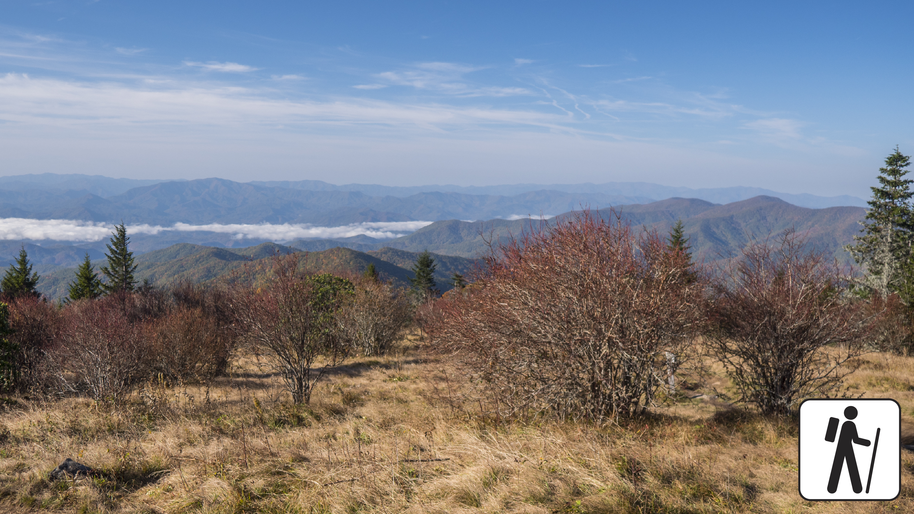
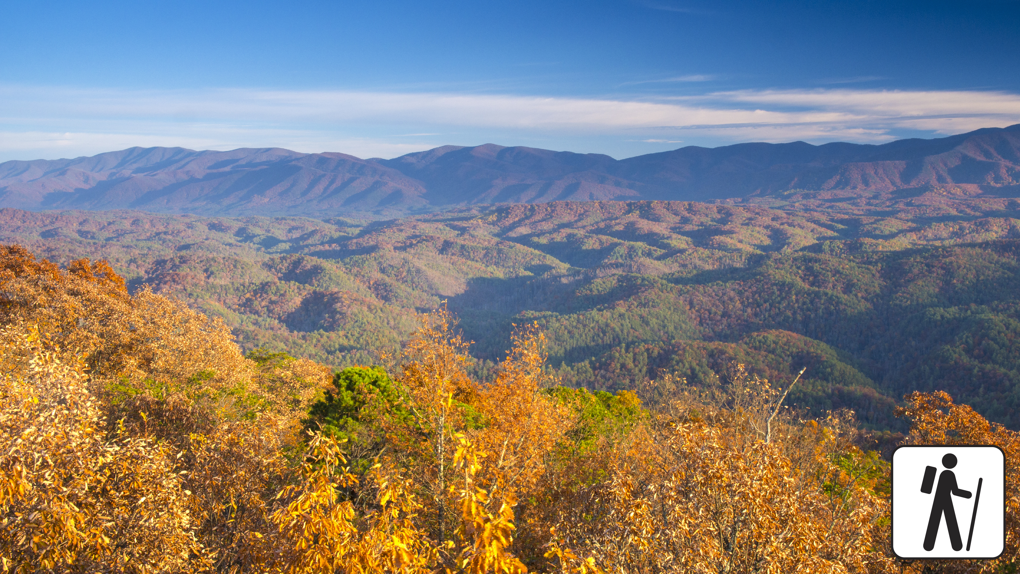
Hike 3.6 miles (5.8 km) roundtrip descending through high-elevation, spruce-fir forest to a popular grassy bald known for its flowering azaleas in summer and views of the surrounding mountains. The return hike to the trailhead involves a relatively strenuous climb.
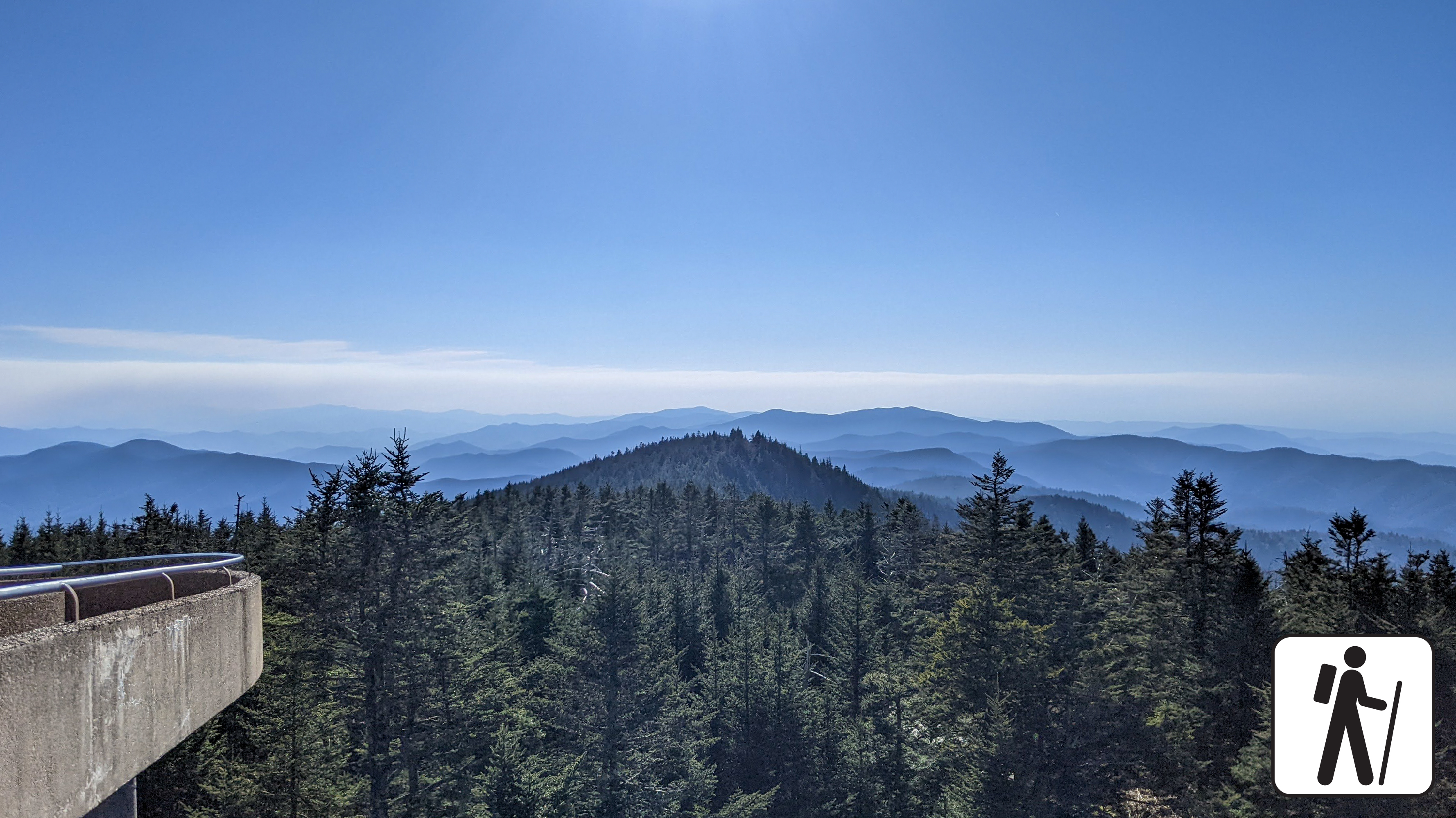
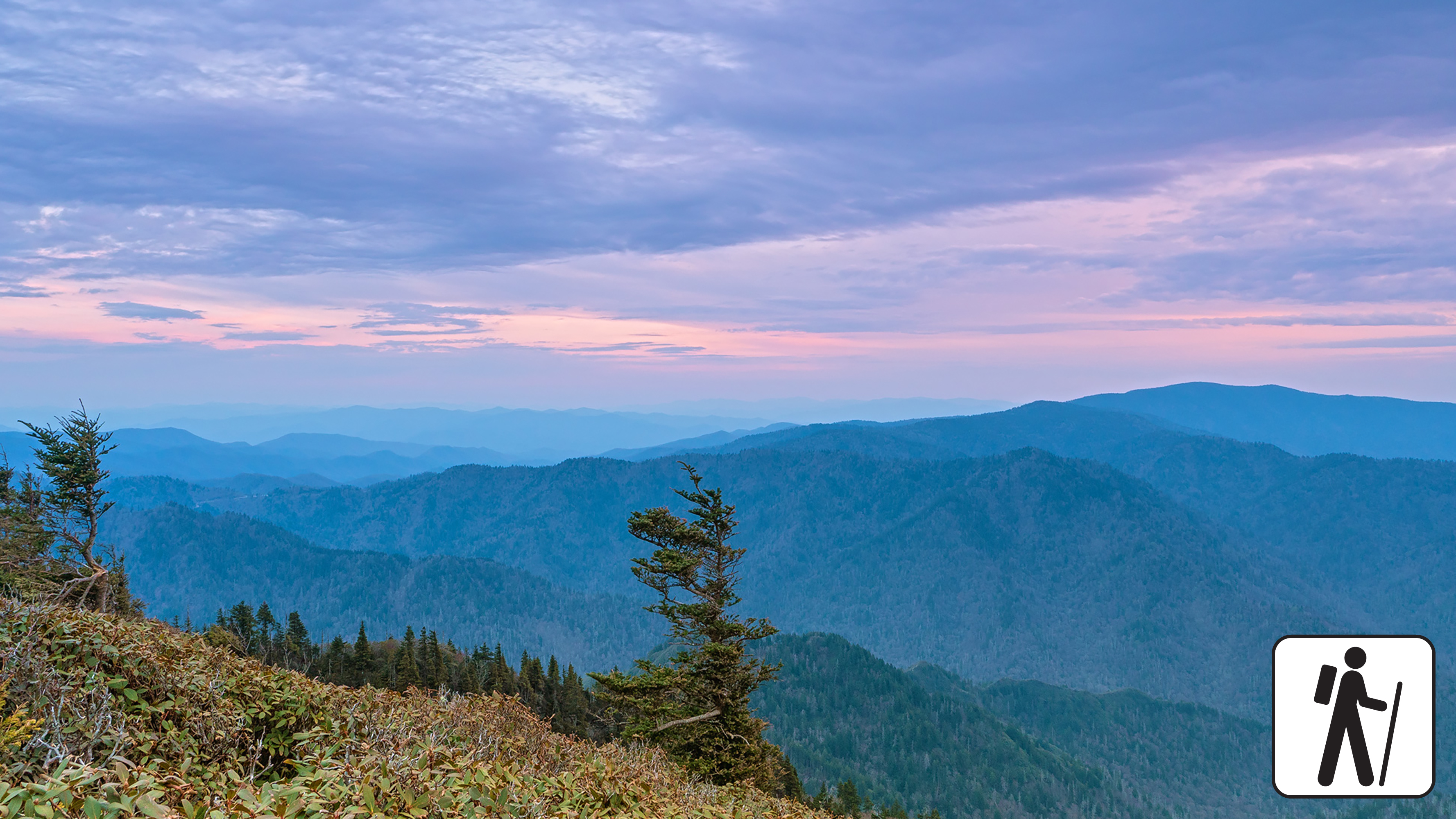
Walk one mile (1.6 km) roundtrip from the Kuwohi (formerly Clingmans Dome) parking area along a steep paved path to an iconic and popular observation tower with panoramic views from the highest peak in the Smokies.
Hike 5.6 miles (9 km) roundtrip on a trail that climbs steadily through mixed hardwood forest to a ridgetop where American chestnut trees were once abundant. Fall leaf color and plentiful spring wildflowers remain a draw on this trail.
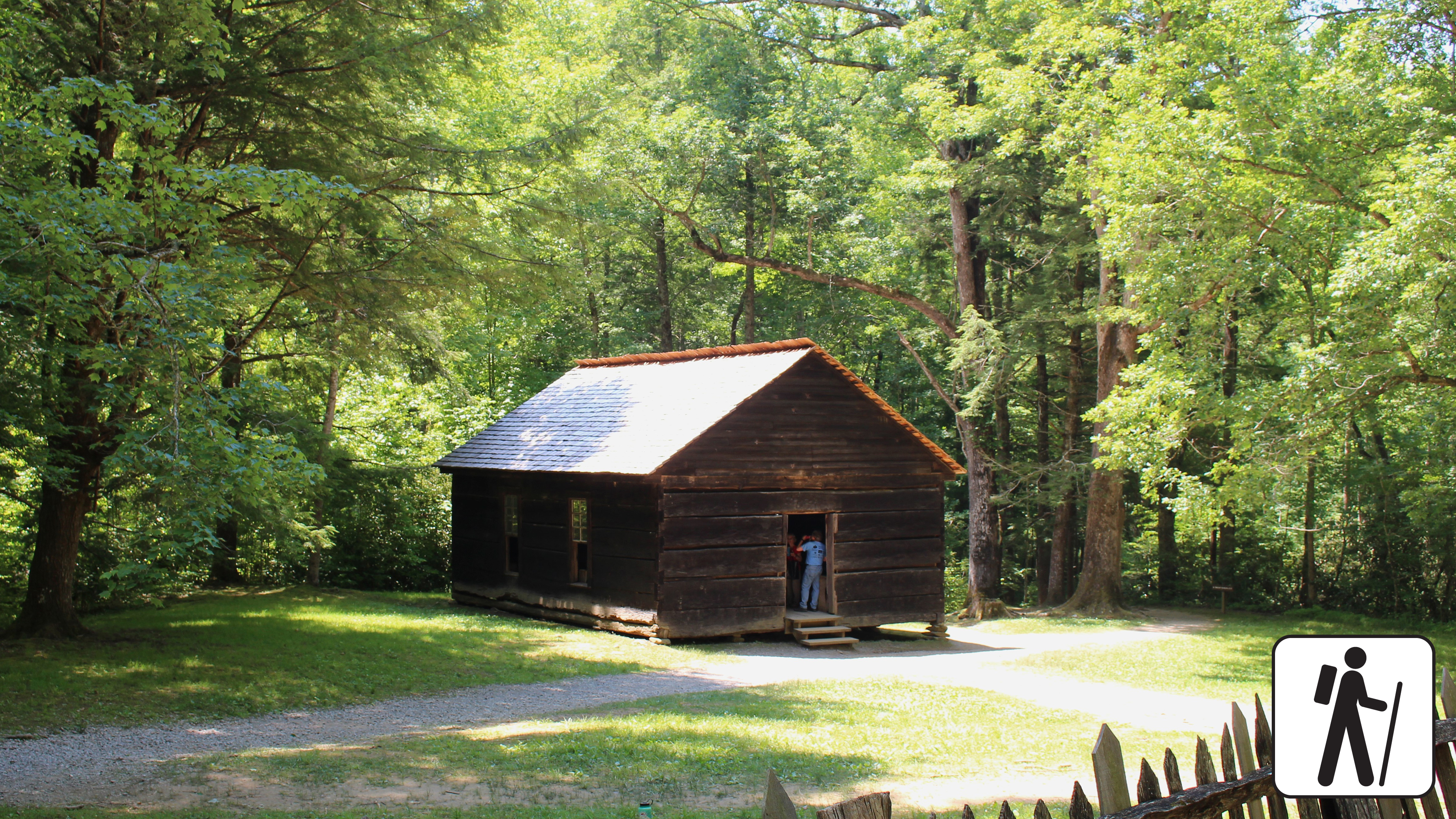
Hike 3.4 miles (5.5 km) roundtrip from Metcalf Bottoms Picnic Area through hardwood forest to see remnants of stonework, the historic one-room Little Greenbrier School, and the preserved homesite of the Walker family. This trail includes sections of well-packed dirt path and wide gravel roadbed.
Follow the flow of mountain streams 4 miles (6.4 km) roundtrip through hardwood forest and across several log footbridges to the remains of a CCC camp and the Kephart Shelter.
Walk along a short, paved trail 0.8 miles (1.3 km) through the forest to an observation tower with panoramic views of the Smokies and Blount County, Tennessee. This trail includes some mild to moderate inclines.
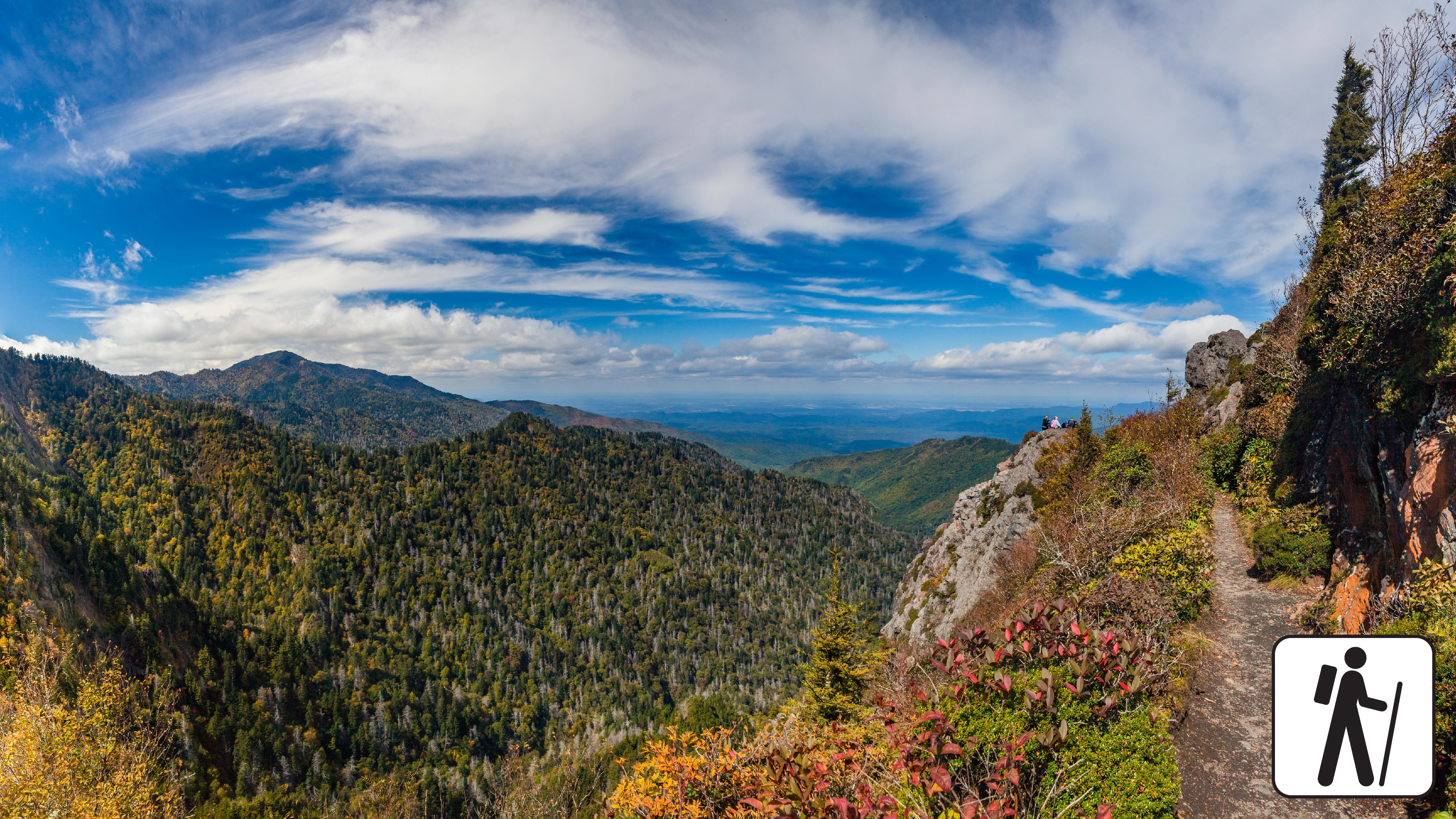
Hike a popular section of the Appalachian Trail for 8 miles (12.9 km) roundtrip through spruce-fir forest to enjoy panoramic views and a unique rocky outcrop surrounded by exposed cliffs.
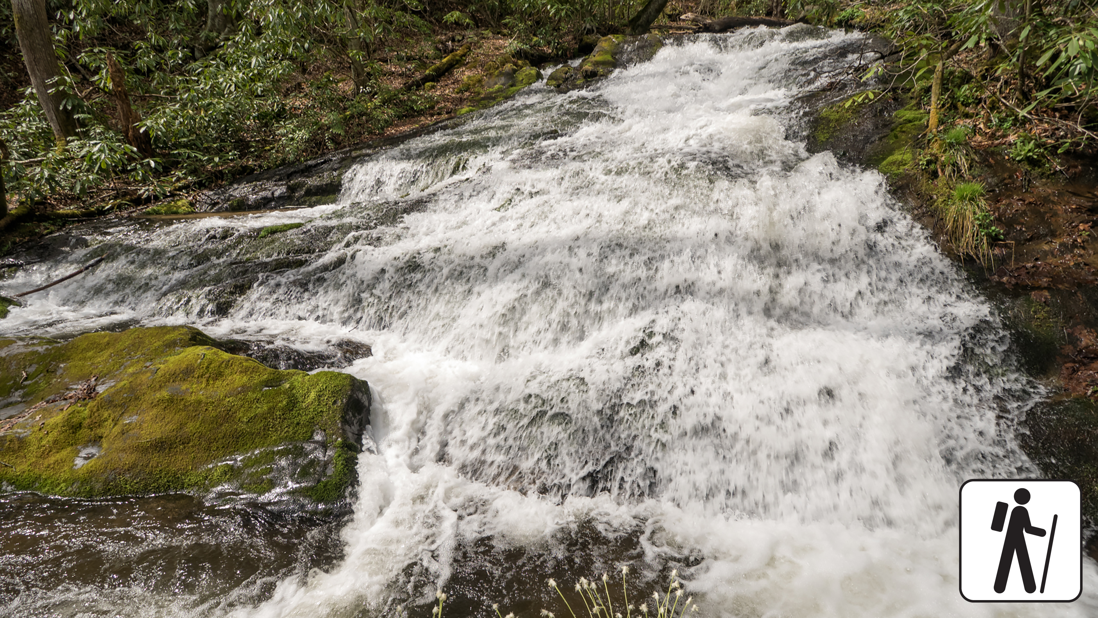
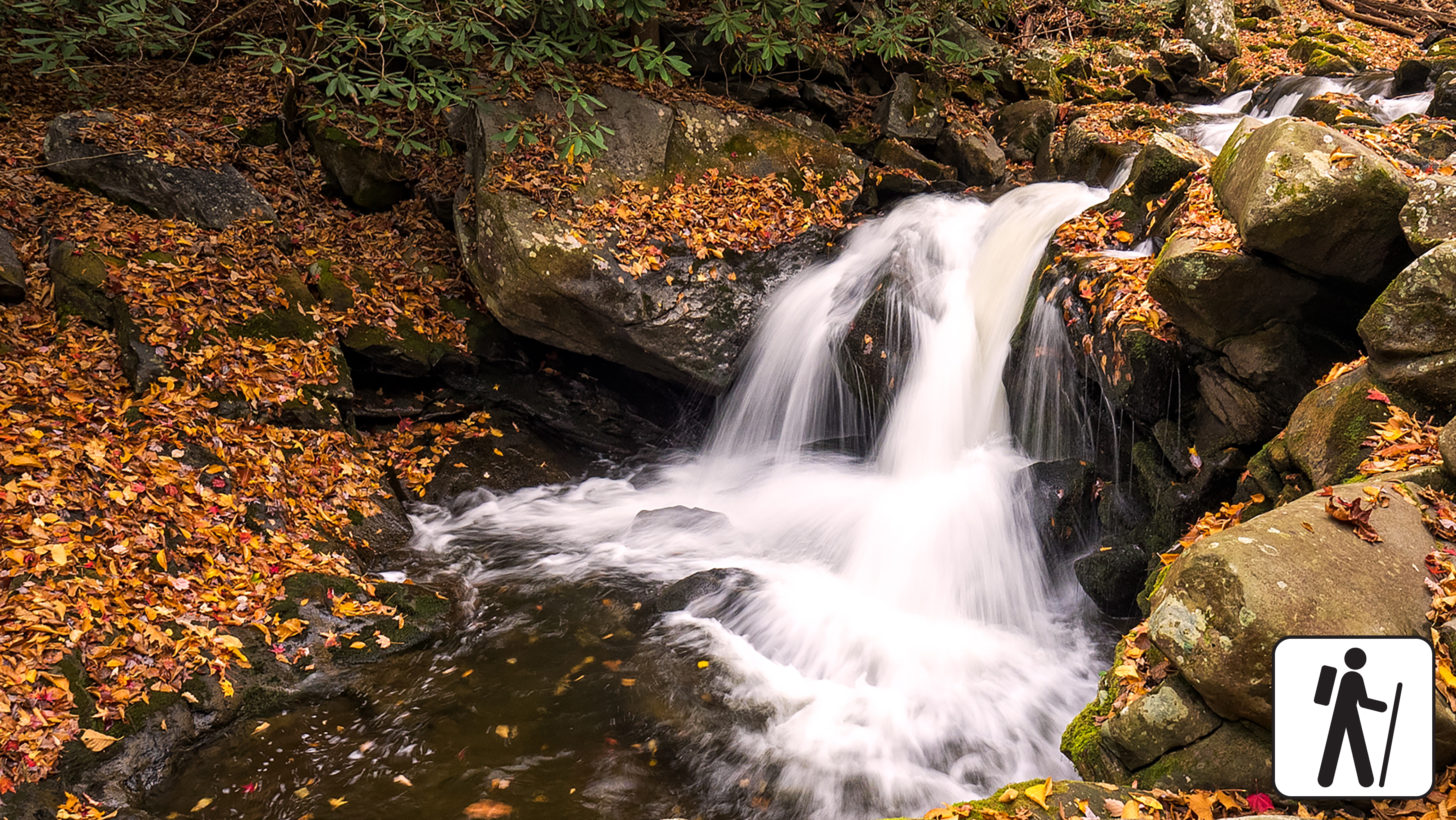
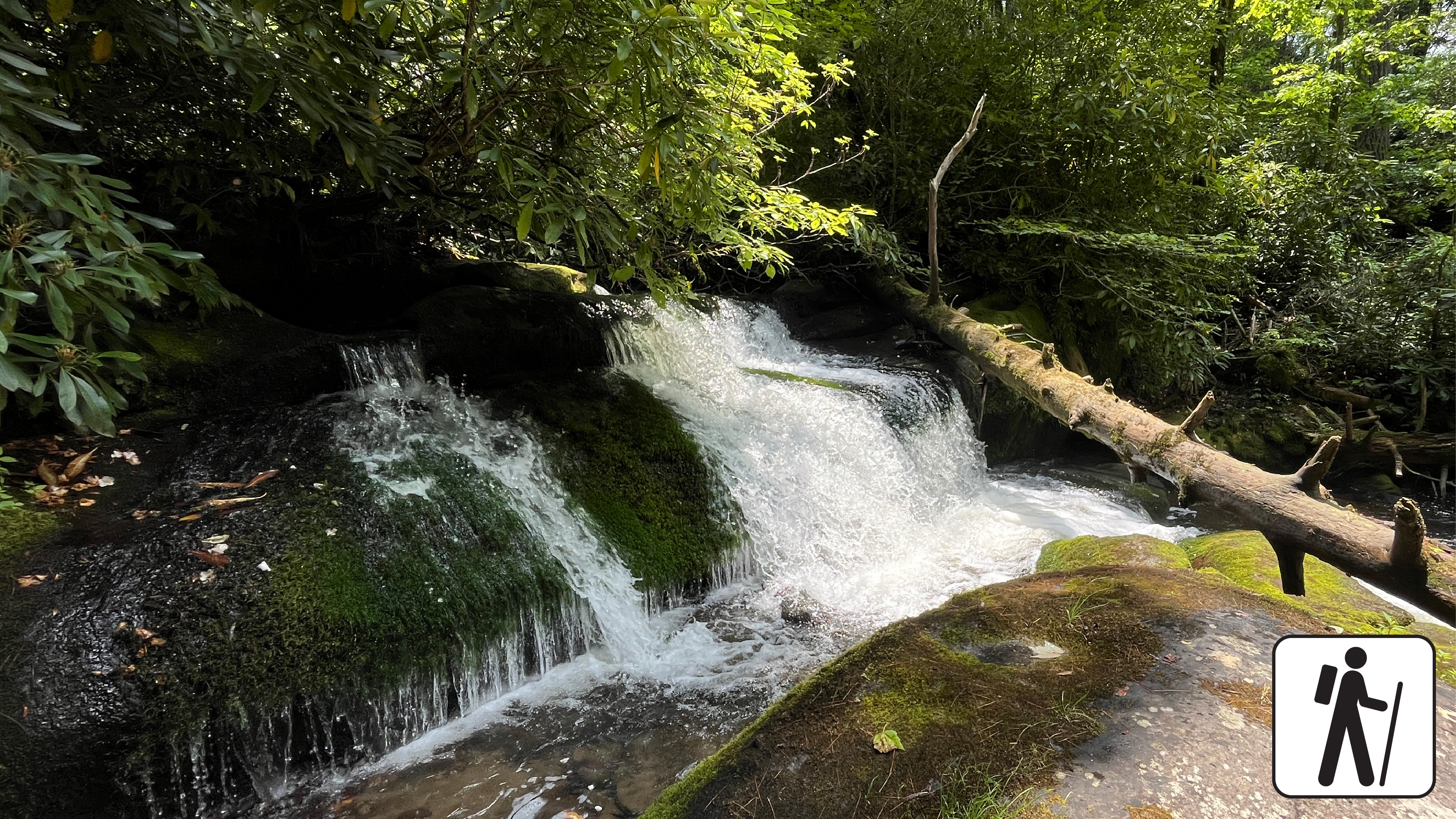
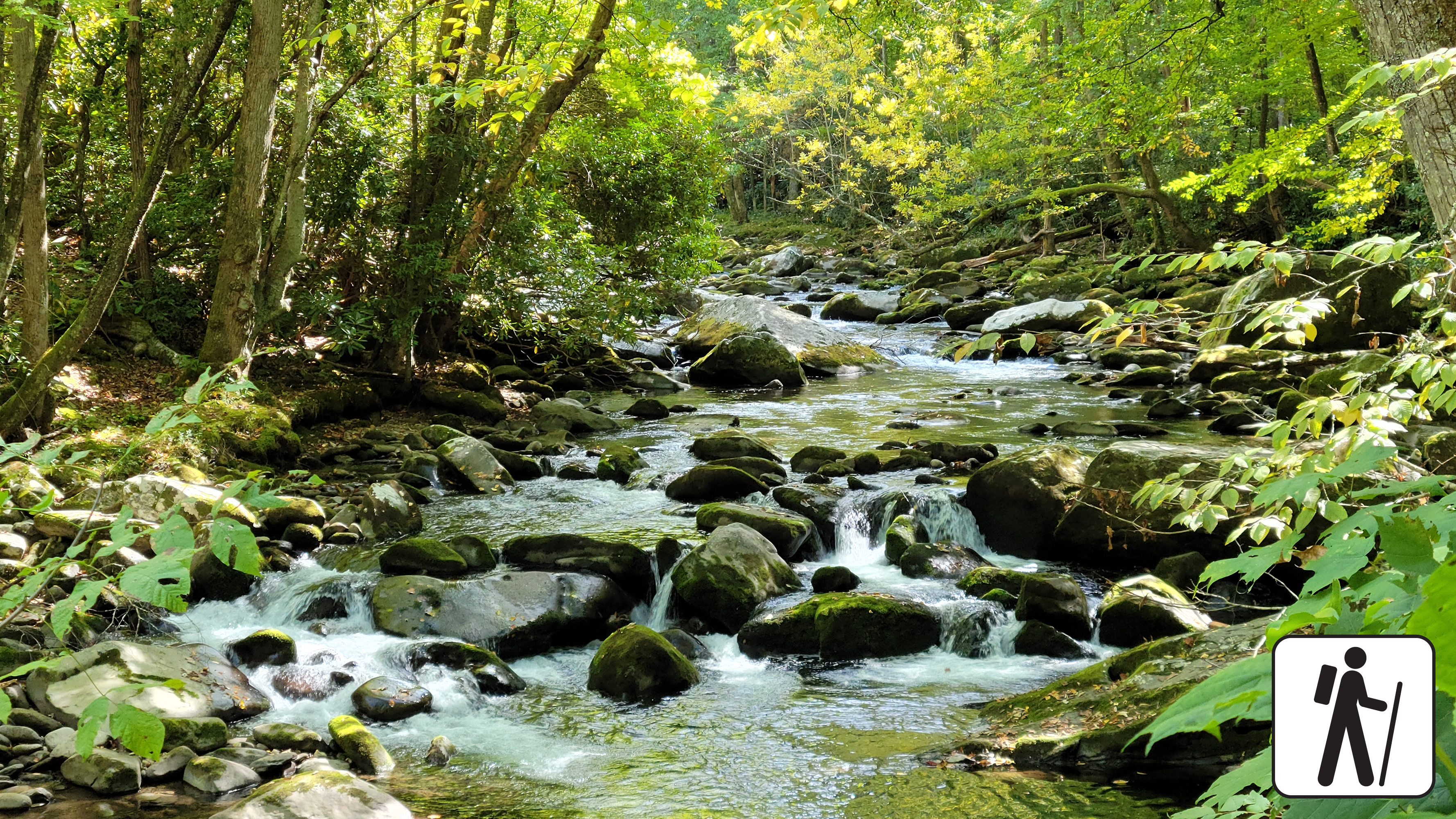
Hike 3.6 miles (5.8 km) roundtrip through hardwood forest following the path of mountain streams to a peaceful cascade. This trail is wide, well-graded, and regularly used by both hikers and horse riders.