Be advised that the NPS has issued alerts for this park.
Fort Pickens Campground Restroom B/D loop Closure
The park is remodeling the interior of three restroom structures located within the Fort Pickens Campground beginning with loop B/D. To minimize disruption to campers, only one restroom facility will be closed at a time throughout the renovation. All other restrooms located in Loops A, C, and E will remain open for campers with reservations during this time.
Fort Barrancas
Fort Barrancas is open 9 am–4 pm on the fourth Friday of each month, with last entry to Fort Barrancas at 3:30 pm.
Opal Beach Pavilion Restroom Operating Hours
The new temporary operating hours for Opal Beach Complex Restrooms: Monday through Thursday, only pavilion A, B2, and E restrooms will be open. On Friday, Saturday, and Sunday, all pavilion restrooms except C will be open.
Road workers on Park Road in Davis Bayou
Phase II of the Davis Bayou Bicycle and Pedestrian Path and road resurfacing project has begun. Visitors may encounter minor traffic delays and flaggers on Park Road.
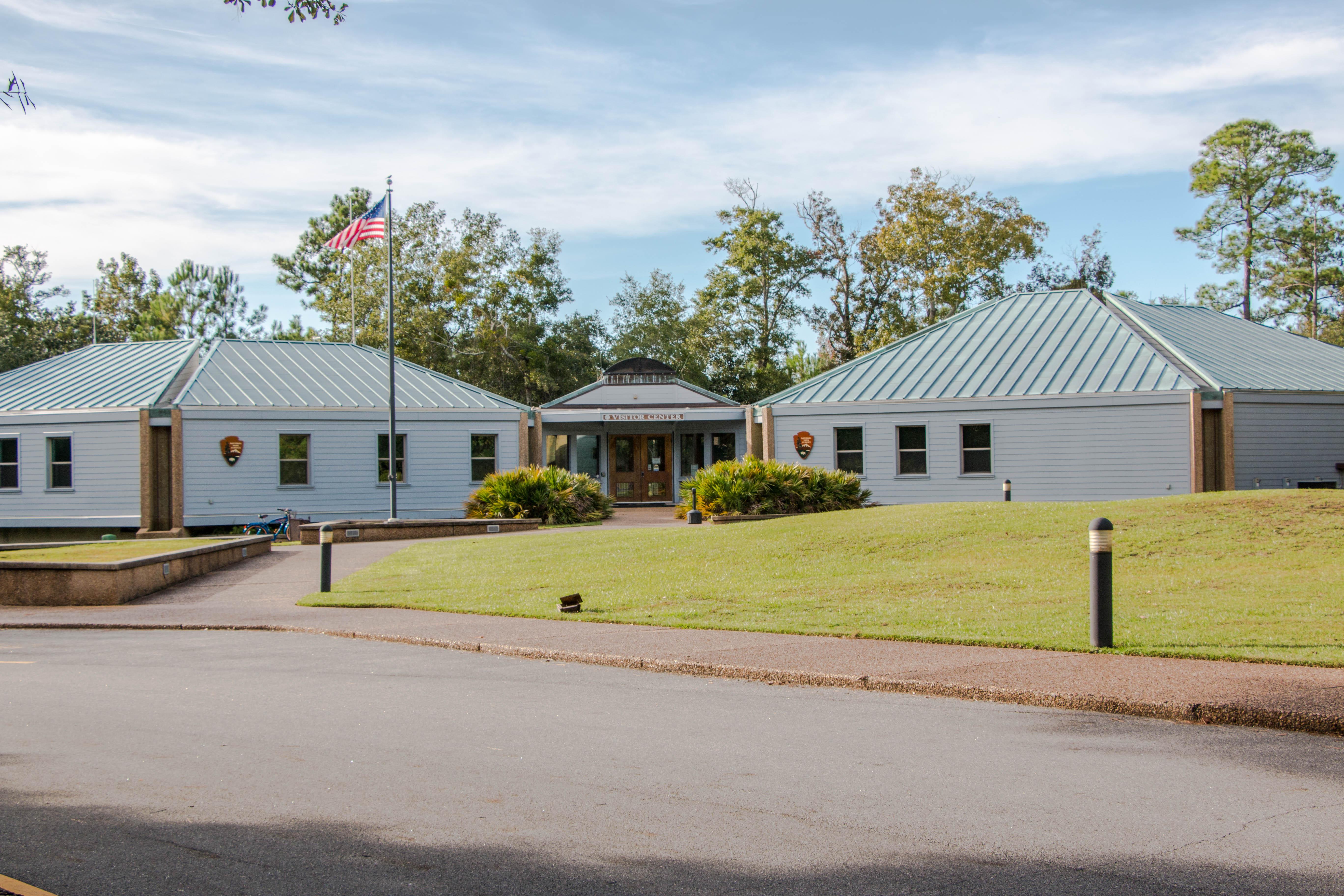
Davis Bayou Visitor Center
The William M. Colmer visitor center will be open Wednesday through Sunday from 9 a.m. to 4 p.m.
Flooding in Fort Massachusetts
Fort Massachusetts has been experiencing periodic flooding due to recent rain storms, causing park staff to close the fort for periods of time until the water recedes. Park staff will assess fort conditions daily and open the fort when conditions allow.
U.S. Navy Blue Angels Practices
On Tuesdays and Wednesdays from April to October, parking lots at Fort Pickens Area fill early. Vehicles parked in non-designated spots are subject to citation and towing. When lots are full, the area will close to incoming traffic. Plan ahead.
No Dogs on Beach
Dogs and pets are not allowed on any of the beaches in Gulf Islands National Seashore. Visit the pet rules page for information.
Rip Current Status
Review rip current status prior to visiting the park.
Fee Stations Credit Card Only
Fee Stations are only accepting credit cards for the purchase of passes. Visitors can also purchase digital passes in advance at www.recreation.gov/sitepass/74285
Millions of visitors are drawn to the Gulf of America for Gulf Islands National Seashore's emerald coast waters, magnificent white beaches, fertile marshes and historical landscapes. Come explore with us today!
The area is available for groups with a minimum of ten and a maximum of forty people, and allows tent camping only, For groups between 10-25 people fee is $20 per night; 26 - 40 people is $30 per night. Persons camping in the group area are limited to the restroom facilities located at pavilion #5. Parking is limited. Access to trails and small boat launch.
Group site is for a minimum of 10 and a maximum of 40 occupants. Campground is limited to soft-side on-the-ground tents only. Generators, trailers, pickup campers, RVs or any type of camping equipment not allowed. Persons camping in the group area are limited to the facilities in the group area only. For groups between 10-25 people, fee is $20 per night; 26-40 people, the fee is $30.
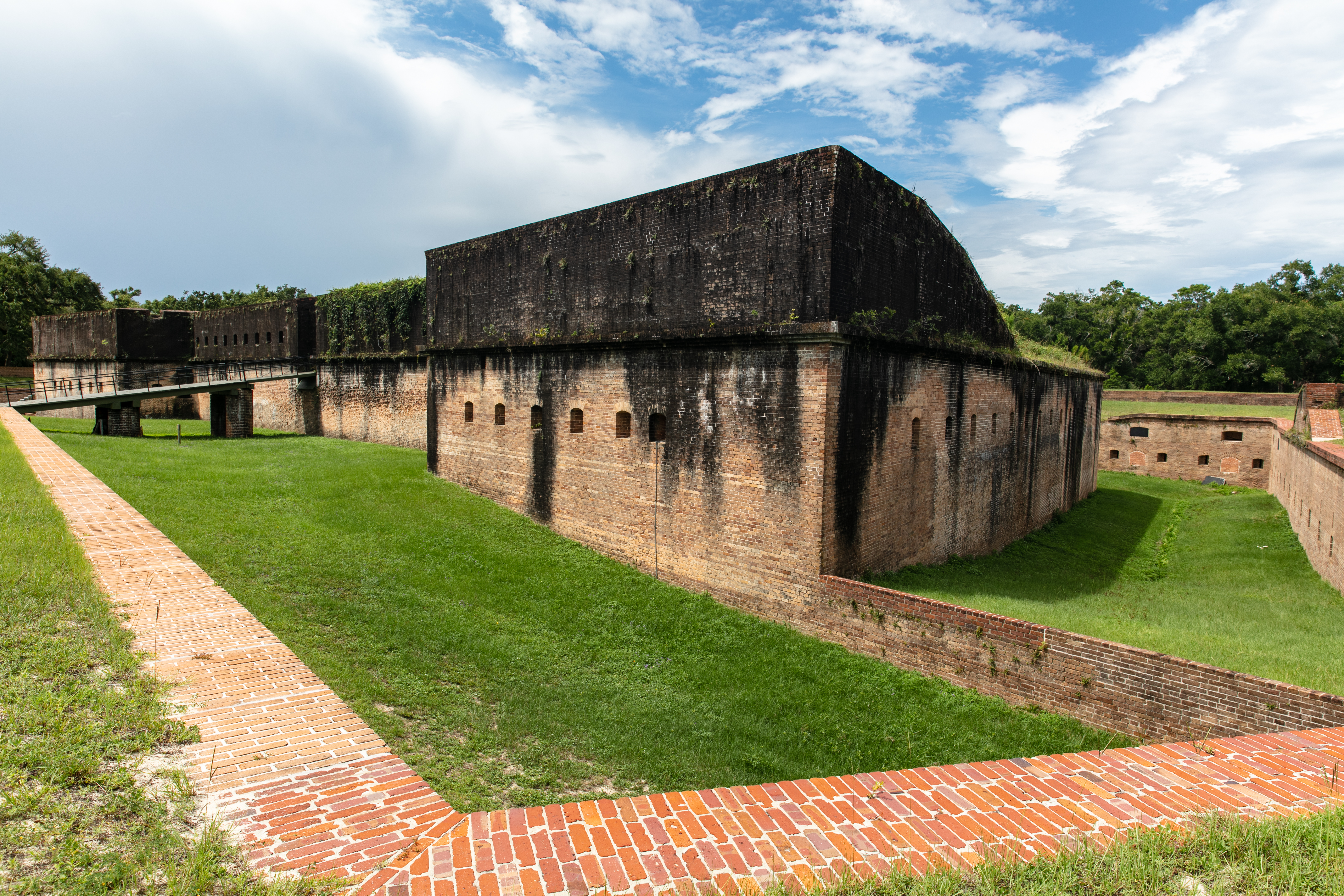
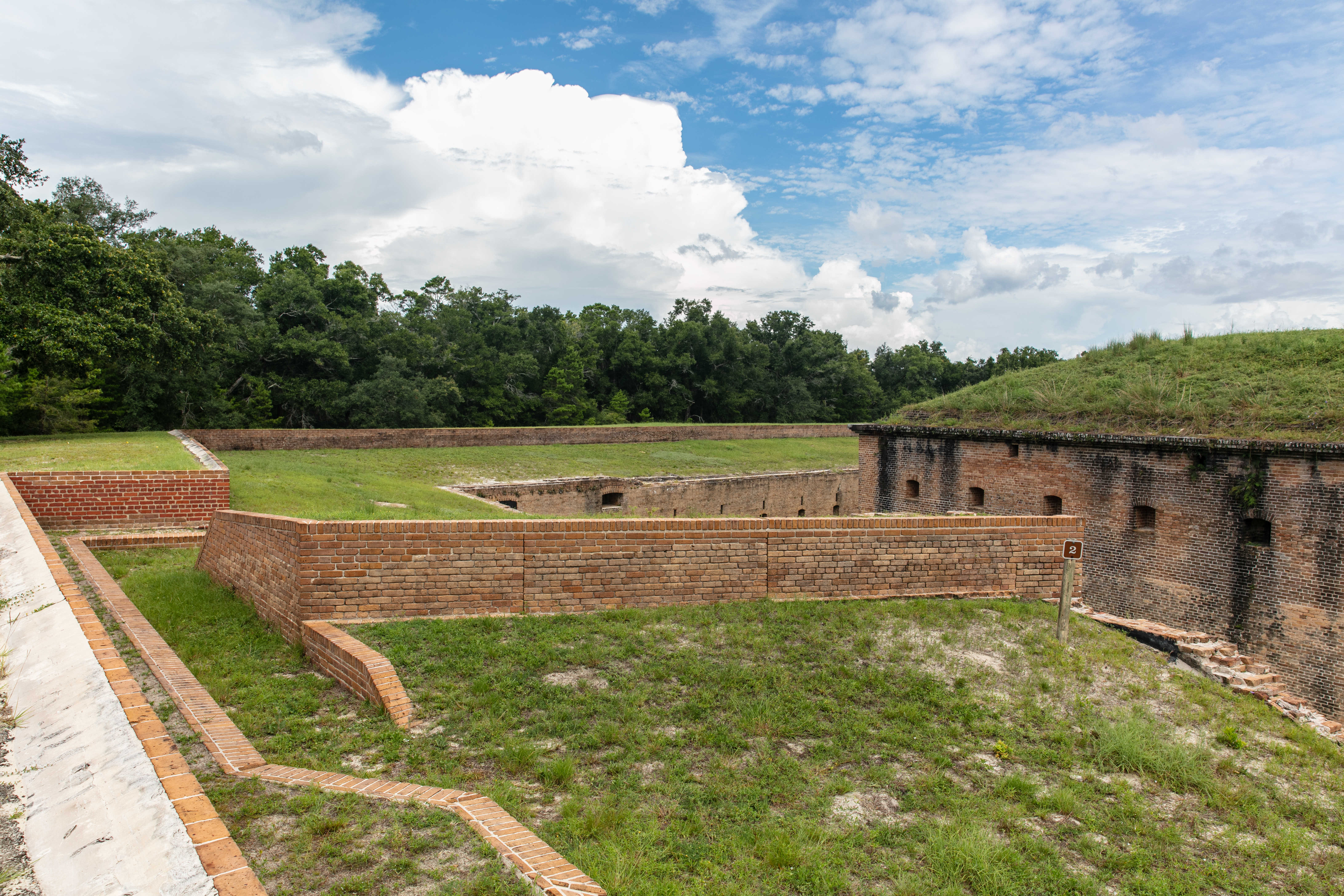
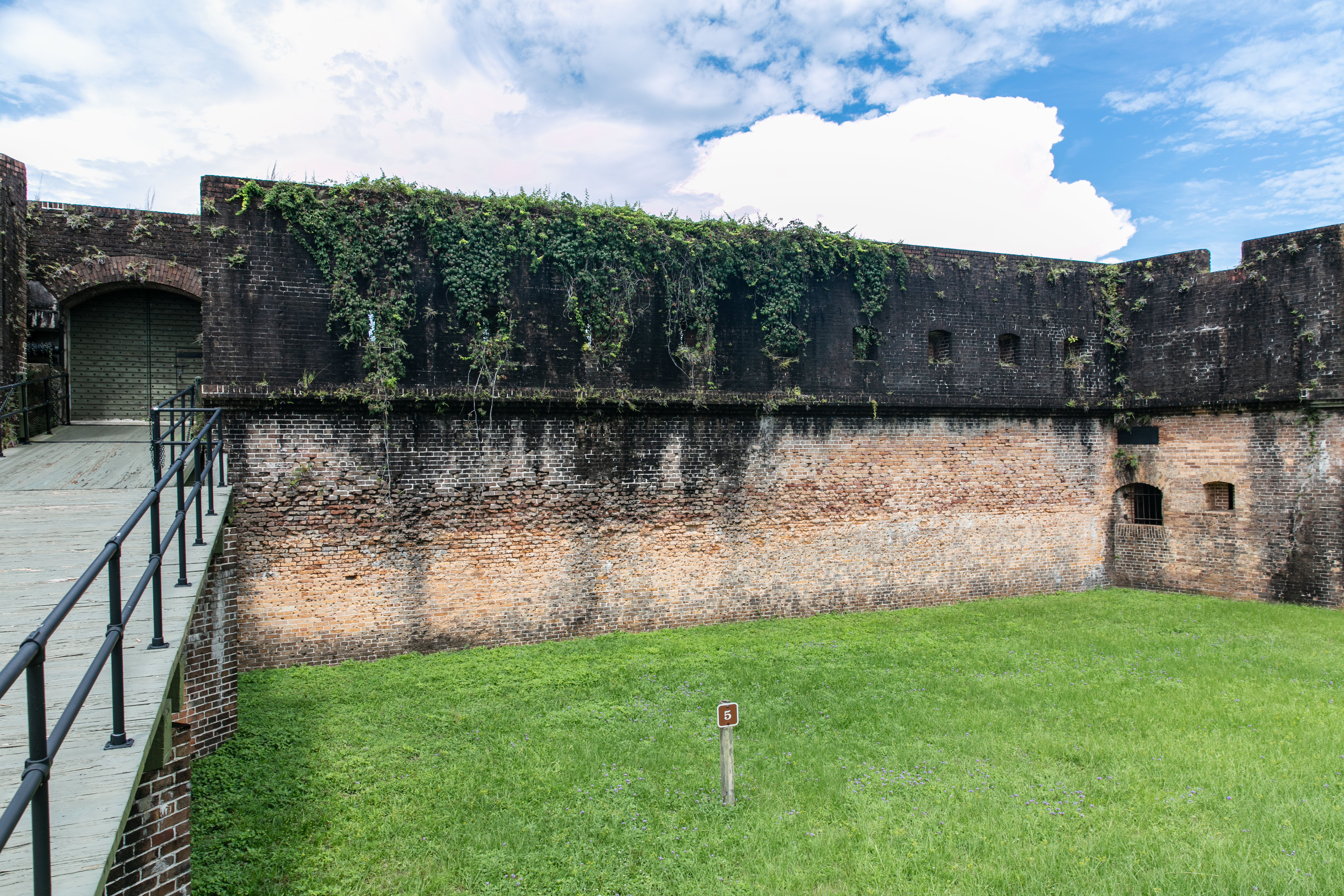
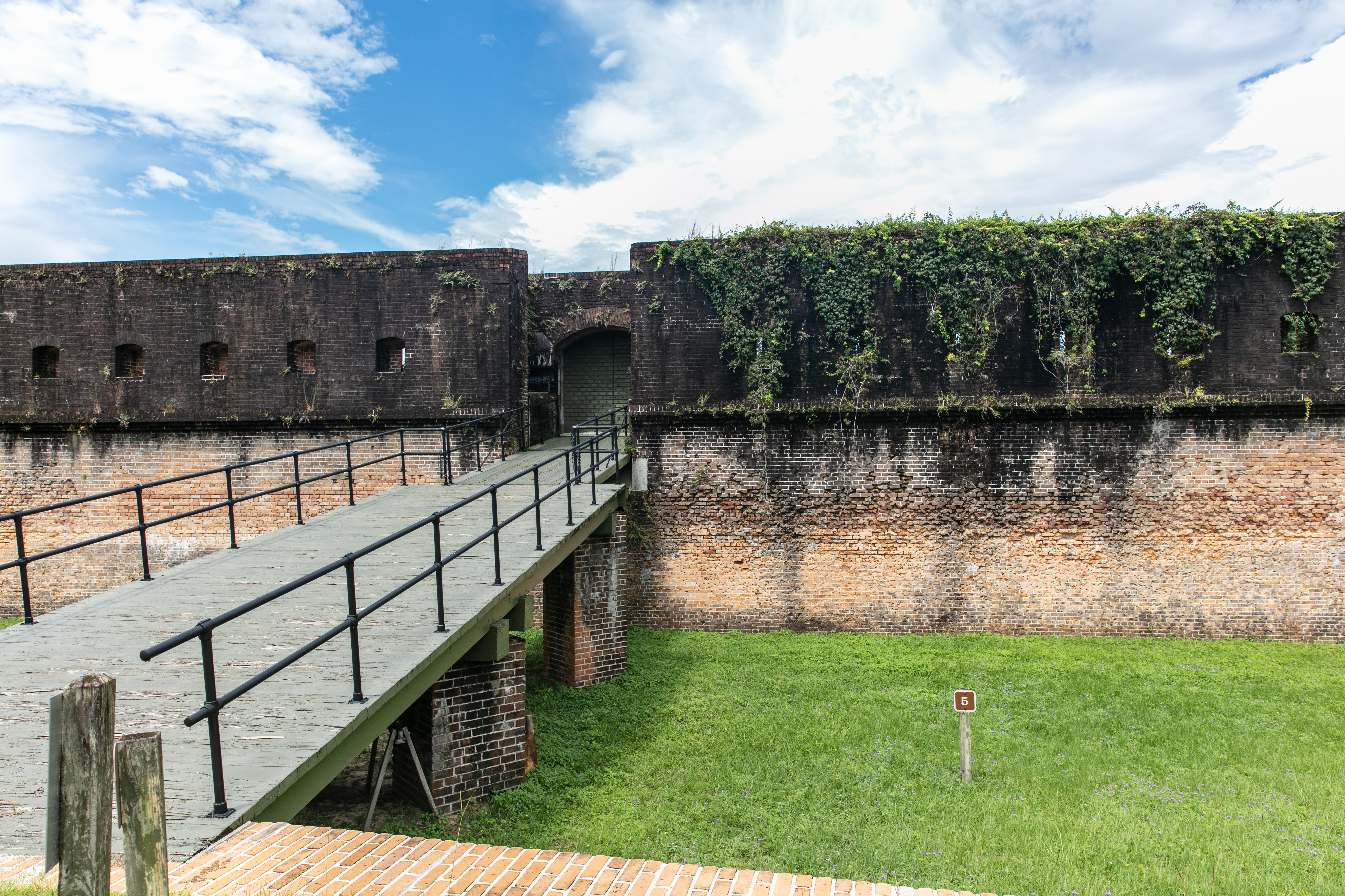
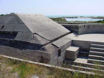
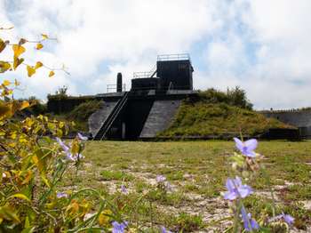
The Advanced Redoubt was built between 1845 and 1870 as a part of the Fort Barrancas network to protect the Pensacola Navy Yard. While the primary mission of Barrancas was to guard the harbor entrance, the redoubt's mission was to defend the north side of the peninsula from a land attack. The redoubt was the only Third System fort that did not defend the coast. View the exhibits on the south side of the redoubt and then walk along the Trench Trail-or drive-to Fort Barrancas
Fort Barrancas Advanced Redoubt. 133 words.Here at the north east corner of the small paved parking lot is a dirt path that leads 250 feet up a gentle slope to the south wall of the fort. The fort is surrounded by grassy lawns with scattered live oak trees. A short distance to the right is a road. Near the end of the path along the outer wall of the fort are a couple of benches.From this location only the very top of the fort's main wall can be seen with its mound of earth or berm on top. The parking lot stretches out to the left. Over your right shoulder 25 yards away on the far side of the entrance drive is the entrance to the Trench Trail through the woods.End of Description.
Learn how the external structures of Advanced Redoubt provided additional defense.
A brick wall on top of a grassy hill lies in front of you, while a more open grassy plain and parking lot lies to the right. The main fort structure lies to the left and behind you.
Learn about the deadly dry ditch of Advanced Redoubt.
Ahead of you lies a grassy plain that leads to a brick wall, where two large openings for cannon have been sealed off. To your left is a staircase used to climb up to the glacis. To the right of you lies another grassy plain that leads to the rest of the fort walls and drawbridge. Behind you is more grass and a tall wall.
Ahead of you lies a brick wall covered in small dents and pits from target practice. To the left lies a drawbridge, and to the right and behind lie more grassy plains and brick wall.
<h3> Taking the Fort</h3><br /><br />This fort could only be taken by means of a siege, or a military operation to surround and defeat an enemy. Weeks of trenching could bring cannon up to point-blank range to pound the walls with solid shot. Debris from the collapsing walls might fill the moat and give access to the fort's interior. A siege took a tremendous amount of time, equipment, and casualties. It might be broken at any time if reinforcements arrived at Advanced Redoubt.
75 words<br />From this perspective at the northeast corner of the moat, the moat's depth, breadth, and length are visible in two directions. The drop from here to the moat is a sheer face roughly ten feet high. The moat is flat and grassy at the bottom. The redoubt structure stands roughly twenty feet distant within the moat. Its face is sheer brick, slightly higher than this vantage point. Rows of embrasures extend along the fortification's walls.<br />End of description.
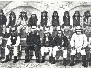
In 1886 the US Army exiled over 400 Apaches from the Southwest to Florida and sent most of them to Fort Marion in St. Augustine. Several Pensacola citizens, however, petitioned the government to imprison Geronimo, a medicine man and warrior, and 15 other Apache men at Fort Pickens instead, separating them from their families. Prisoners worked seven-hour days clearing overgrown weeds, planting grass, and stacking cannonballs. The families were reunited at Fort Pickens in 1887.
415 words<br />Along the dirt path near the south wall of the fort there is a slanted graphic facing the vegetation-covered mound banked against the short wall on this end of the fort. On either side the path curves around the mound towards the corners of the fort. <br /><br />As you face the panel, to your right is the south wall of the fort lined on the inside by a series of rounded arched enclosures. <br /><br />On the other side is a vegetation-covered mound that is banked against the front side of Battery Pensacola located in the middle of the fort ground.<br /><br /><br />Apache Prisoners.<br /><br />In the lower left corner of the panel is a photograph of two rows of American Indians seated on the steep gravel bank next to a set of railroad tracks, wheels and the lower edge of railcars visible behind them. They are mostly men all with long black hair. Many wear wide-brimmed hats. Others have cloth tied around their heads. The caption reads, <br /><br />"The US Army transported Geronimo (foreground, third from right) and other Apaches by train to Florida from what is now New Mexico and Arizona."<br /><br />Text at upper left reads, <br /><br />"In 1886 the US Army exiled over 400 Apaches from the Southwest to Florida and sent most of them to Fort Marion in St. Augustine. Several Pensacola citizens, however, petitioned the government to imprison Geronimo, a medicine man and warrior, and 15 other Apache men at Fort Pickens instead, separating them from their families. Prisoners worked seven-hour days clearing overgrown weeds, planting grass, and stacking cannonballs. The families were reunited at Fort Pickens in 1887. One year later all of the imprisoned Apaches were moved to Mobile because of a yellow fever scare and later to Fort Sill in Oklahoma Territory."<br /><br />At the right is a photograph of Geronimo. He poses half kneeling, right knee on the ground, with his left elbow braced on his other knee at he holds a rifle in front of him. His black hair is parted in the middle and falls to his shoulders. At top a quote from him reads, <br /><br />"I was born on the prairies where the wind blew free and there was nothing to break the light of the sun. I was born where there were no enclosures."<br /><br />The caption below reads, <br /><br />"After being captured, Geronimo never saw his homeland again. He died and was buried in 1909 at Fort Sill, Oklahoma. He remains a fascinating-and controversial-figure in American history."<br /><br />End of Description.
Gun crews performed a carefully choreographed ballet every time they loaded and fired an artillery piece. One slip-up in the teamwork could cause serious injuries or death. Crews practiced aiming at a target, opening the breech, loading and ramming the projectile into the barrel, inserting the primer charge, and firing-all in 30 seconds. After drilling again and again, the soldiers were given a little time to relax, occasionally even to go crabbing or fishing along the beach.<br />
246 words. <br /><br />The top of this panel has a photograph showing a group of seven men on either side of a long metal rod that they are pushing into the rear of a artillery gun. The caption reads, <br /><br />"A gun crew rams a 500- to 600-pound shell into the breech of a 10-inch disappearing rifle about 1930."<br /><br />Across the bottom of the panel is a photograph of a long artillery gun pointed to the right over a high concrete wall. Six men in uniform lie head to toe on top of the barrel while another five men stand on the metal platform and mounting carriage underneath. The caption reads, <br /><br />"Artillerymen pose on one of the 10-inch rifles in 1911."<br /><br />Text on the left side of the panel reads, <br /><br />"Gun crews performed a carefully choreographed ballet every time they loaded and fired an artillery piece. One slip-up in the teamwork could cause serious injuries or death. Crews practiced aiming at a target, opening the breech, loading and ramming the projectile into the barrel, inserting the primer charge, and firing-all in 30 seconds. After drilling again and again, the soldiers were given a little time to relax, occasionally even to go crabbing or fishing along the beach."<br /><br />To the right of the text is a small map showing the end of the island with Fort Pickens. Your location here at Batteries Cullum and Sevier just west of the Fort is marked.<br /><br />End of Description.
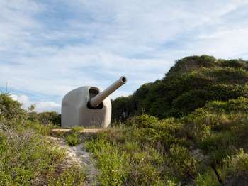
Battery 234 and its twin, Battery 233 on Perdido Key, were designed to house 6-inch guns with curved shields from four to six inches thick cast-steel. The shields provided protection against machine gun and light artillery fire. Although the batteries received their shields and barbette carriages in 1946, the 6-inch guns were never received. The guns, shields, and barbette carriages present today were placed there in 1976 through the cooperation of the Smithsonian Institution
With in the walls of Fort Pickens, Battery Pensacola is a two-story battery mounted two 12-inch disappearing rifles that could fire a 1,070 pound shell approximately 8 miles.
<a href="https://www.nps.gov/articles/battery-cooper.htm">Battery Cooper</a> was named for Lieutenant George Cooper who was killed in action at Mavitac, Philippine Islands, in 1900. Battery Cooper mounted two 6-inch guns on disappearing carriages. During World War I, the guns were removed for use on railway mounts in France. The Smithsonian Institution provided the current gun in 1976, one of two remaining 6-inch disappearing guns in the country.
Battery Cooper over looks the Gulf of America near Langdon Beach. The current cannon at Battery Cooper is an Alvin Jeffries disappearing rifle (B-4A). It is camouflaged by and earthen bunker making the white cannon invisible looking at it from the waters of the Gulf of Mexico or Langdon Beach.
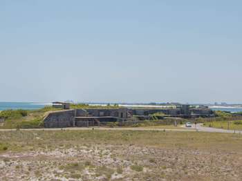
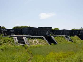
Originally built as one battery near historic Fort Pickens, Battery Cullum was built in 1896 to 1898 as one four-gun 10-inch batteries to defend the Gulf of Mexico. In 1916, the battery was divided for better fire control, the west end becoming Battery Sevier.
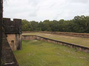
Originally built as one battery near historic Fort Pickens, Battery Cullum was built in 1896 to 1898 as one four-gun 10-inch batteries to defend the Gulf of Mexico. In 1916, the battery was divided for better fire control, the west end becoming Battery Sevier. These batteries stretch alongside the park road forming a long jumble of blocky concrete structures with flat roofs. Most of the structures are one to two-stories high, with an occasional taller covered observation platform looking away from the road out south over the Gulf of Mexico. Sets of concrete steps or metal stairs provide access to the upper levels. Today the batteries are surrounded by a chain link fence closing it off to all public access due to the unsafe conditions presented by the deteriorating structure. End of Description.
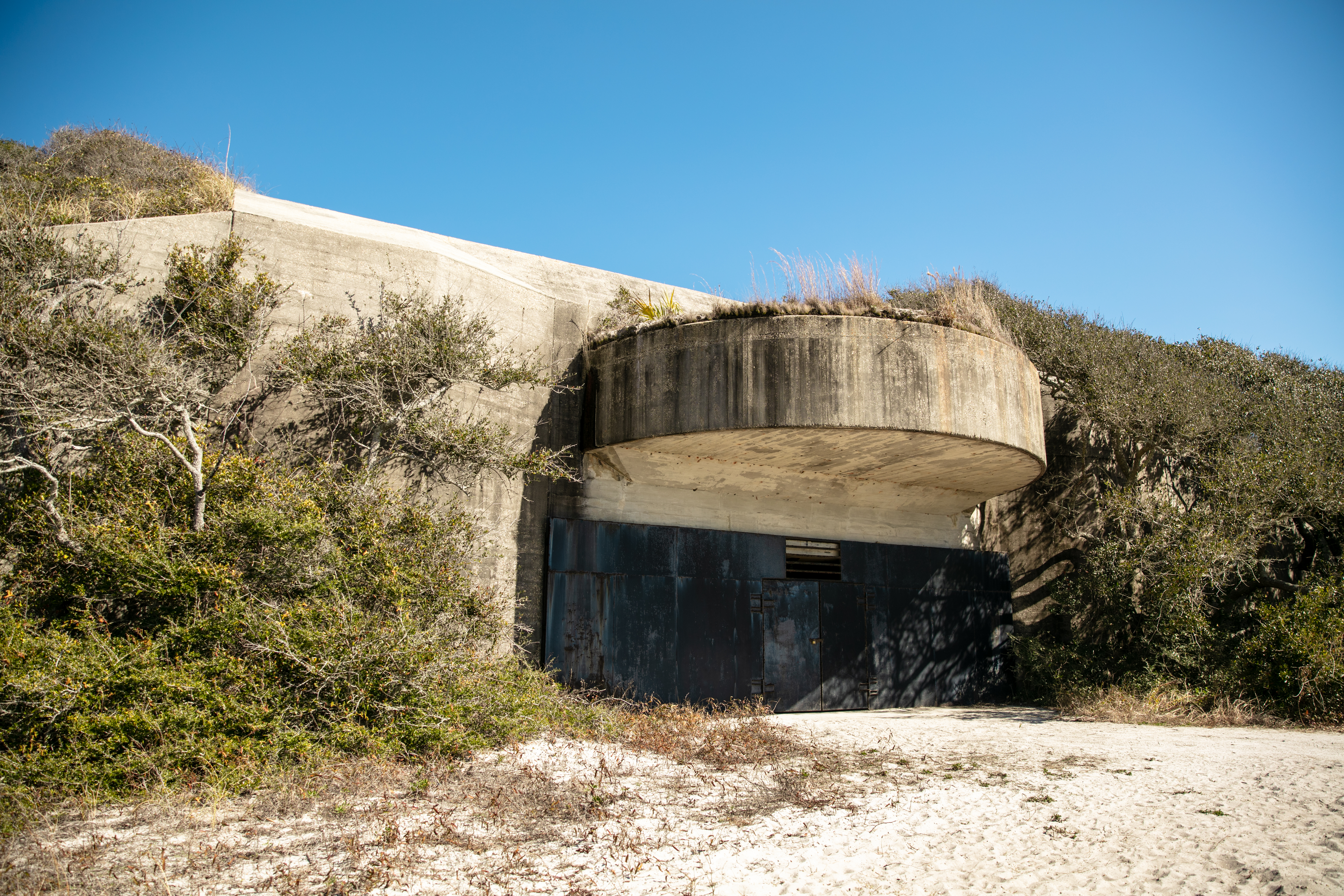
Hidden beneath this vegetation is Battery Langdon, is Fort Pickens' most powerful gun emplacement. Its role to camouflage two 12-inch guns capable of projecting 17 miles out to sea in 1923.
Battery Langdon is a low, massive concrete structure half hidden by sand berms and thick vegetation along its sides. From the side of the road where there is a small parking lot, the battery looks like a small brush-covered hill. At the left end of the parking area there is a sandy path leading to an entrance which is closed by a metal wall. Projecting over the doors there is a semicircular ledge. From the top of the battery, the view of Gulf of Mexico is in the horizon.
<a href="https://www.nps.gov/articles/battery-payne.htm">Battery Payne</a> was named for US Army 1st Lieutenant Matthew M. Payne of Virginia who served in both the War of 1812 and US-Mexican War (1846-1848). Constructed in 1904, Battery Payne had a similar mission as Battery Trueman.
Battery Payne. 176 words. From the sandy path leading to this battery it looks like a grass-covered sandy hill with a flat top where a small concrete rectangular structure sticks up. Steps with iron railings lead up to a landing. From here one set of steps leads down to a tunnel through the side of the hill to the lower level of the battery, while another set climbs to the top. From the top you can look down into the battery where there is a square concrete block building with a peaked roof. On the side nearest the steps a wide staircase leads up from the floor of the battery alongside the building to a semicircular platform just below the top of the surrounding wall. There are no guard rails on the top.The view across the blockhouse looks over the inlet to Pensacola Bay to the flat sands of Perdido Key on the far side. The open waters of the gulf lie to the left and the calmer waters of the bay to the right.End of Description.
Battery Pensacola, located in the center of Fort Pickens, illustrates the evolution of coastal defenses from brick and stone fortifications to modern reinforced concrete. Completed in 1899, Battery Pensacola mounted two 12-inch rifles on disappearing carriages capable of firing 1,070-pound shells approximately eight miles. The battery was declared surplus in 1933. Its guns were removed in 1934 and its carriages sold for scrap in 1942.
With in the walls of Fort Pickens, Battery Pensacola is a two-story battery mounted two 12-inch disappearing rifles that could fire a 1,070 pound shell approximately 8 miles.
<a href="https://www.nps.gov/articles/battery-trueman.htm">Battery Trueman</a> was named for Major Alexander Trueman of Maryland who died of wounds received in action in 1792. Built in 1905 on the western end of the island north of the harbor entrance, the battery mounted two 3-inch rapid-fire guns designed to defend the bay entrance against fast torpedo boats and minesweepers.
Battery Trueman. 127 words. From the road the battery looks like a small, flat-topped, grass-covered hill. Thirteen steps with a landing in the middle lead to the top of the hill. From here you can see that the battery is formed by a 15-foot high concrete walled enclosure surrounded by mounds of sandy soil. Looking down into the battery you see a square central blocky structure with three doors along the walkway at the rear. On either side are raised semicircular platforms where the guns would have been mounted. Those platforms face to the west across the entrance to Pensacola Bay.From the landing on the steps there is a short tunnel going through the side of the hill providing access to the interior of the battery.End of Description.
<a href="https://www.nps.gov/articles/battery-van-swearingen.htm">Battery Van Swearingen</a> was named for Captain Joseph Van Swearingen who was killed in action against the Seminoles at the battle of Okee-cho-bee. The threat of war with Spain prompted the immediate construction of this battery in 1898. Two 4.7-inch guns were mounted on pedestal carriages. By 1917 the guns were obsolete and dismounted. In 1922 the battery was given a new mission to serve as a Range Finder Station for the 3-inch rapid-fire batteries.
Battery Van Swearingen. 161 words. The battery is a rectangle enclosed on three sides by 15-foot-high concrete walls which are covered by sandy berms, now covered with vegetation. The concrete is painted black, now faded and peeling in places to reveal the pale gray of the concrete underneath. Your current location is on the long open side at the back of the battery. The enclosed front faces south to overlook the waters of the gulf. Square blocky rooms at are each front corner and in the center. On either side of the central structure are platforms for the artillery guns. A sandy berm with a concrete pad on top extends down the length of the battery. It is reached by a set of stairs near each end and provides access to the level of the gun platforms. Openings at either end of the berm and in the center provide access to the lower level of the rooms along the front wall. End of Description.
<a href="https://www.nps.gov/articles/battery-worth.htm">Battery Worth</a> was named in honor of Brevet Major General William J. Worth who fought with distinction in the War of 1812 and US-Mexican War (1846-1848). Completed in 1899, Battery Worth housed eight 12-inch mortars in two gun pits. Four of the mortars were active until 1942. That year, the two-story tower was added, and the battery became essential for Army-Navy defense, becoming the Harbor Entrance Control Post and the Harbor Defense Command Post.
Battery Worth. 121 words.This battery is made of blackened concrete. There is a rectangular building in the center, which is half buried by sand mounds around its sides. In front, concrete slopes frame a metal doorway. The slope on the left has a narrow set of stairs which lead to smaller blocky structures on its top.On either side and slightly behind the central structure are enclosed areas with walls about 15 feet high and surround by sand berms, now covered with vegetation. These areas are reached by wide openings on either side of the central building. Beyond the right opening is another set of stairs leading to a partially enclosed platform on top of the berm on that side.End of Description.
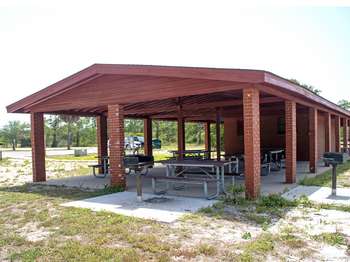
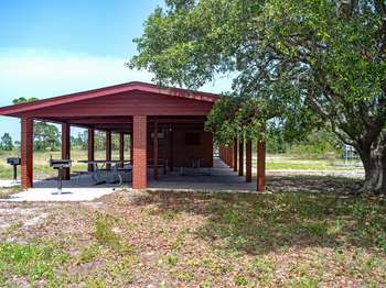
This pavilion has ample parking, restrooms, charcoal grills, and beach showers as well as easy access to sound-side beaches for swimming and wading. This pavilion is first-come, first-served.<br /><br />Park in designated spaces only. Camping or overnight parking in this area is not permitted. <a href="https://www.nps.gov/guis/planyourvisit/pets.htm">Pets</a> on leash are allowed in this area, but may not be taken down to the beach.
Located on the sound side of the Fort Pickens Area, this pavilion has ample parking, restrooms, charcoal grills, and beach showers. It is a few steps away from the sound-side beaches great for swimming and wading. This pavilion is first-come, first-served. Park in designated spaces only. Camping or overnight parking in this area is not permitted. Pets on leash are allowed in the picnic area, but not on the beach.
This picnic spot on the sound side of the Fort Pickens Area, features several picnic tables under shade trees. The Florida National Scenic Trail, Battery Worth, and picnic pavilions with restrooms and drinking water are nearby.
Battery Worth Picnic Area. 175 words. This is a long, low covered pavilion with rows of picnic tables at each end and a small building in the center with an office and restrooms. The building is made of red brick as are the square columns supporting the brown shingled roof. Several grills are located around the sides. The large parking lot lies in front of the building and paths on the far side lead to the water's edge on the bayside of the island. If you stand with your back to the parking lot, there is a trail head to the right with a sign reading "William Bartram Trail." It reads: "William Bartram Trail, traced 1773-1777. In 1775 William Bartram described Pensacola's natural harbor sage and large enough to shelter all of the Navies of Europe. Erected by Ivy Garden Club of District One in cooperation with Florida Federation of Garden Clubs, Inc. and National Park Service, Department of Interior." A few yards down the trail is a seating area, backless benches arranged in curving rows facing a backboard painted white. End of Description.
This pavilion has ample parking, restrooms, charcoal grills, and beach showers as well as easy access to sound-side beaches for swimming and wading. This pavilion may be reserved by visiting our <a href="https://www.nps.gov/guis/planyourvisit/permits.htm">website</a> , please make reservations at least two weeks in advance.<br /><br />Park in designated spaces only. Camping or overnight parking in this area is not permitted. <a href="https://www.nps.gov/guis/planyourvisit/pets.htm">Pets</a> on leash are allowed in this area, but may not be taken down to the beach.
This pavilion located on the sound side of the Fort Pickens Area, has ample parking, restrooms, charcoal grills, and beach showers. It also provides quick access to sound-side beaches great for swimming and wading.
This beach access point is located on the Gulf-side of Fort Pickens, Florida. The boardwalk leads away from the parking area through patchy dune grasses to provide access to Langdon Beach. This beach is great for activities such as swimming, wildlife viewing, fishing, beach-combing and more. Limited parking is available across the street at the Tram Stop 2 lot.
A boardwalk leads away from the parking area through patchy dune grasses. The beach is not visible from this location, but a low dune about 100 yards distant suggests its presence. A number of safety signs flank the entrance to the boardwalk.One sign announces no lifeguard on duty.A sign beneath it instructs swimmers to avoid rip currents. If a swimmer is caught in a rip current, the sign advises the swimmer to swim crossways to the current, parallel to the shore.Two larger interpretive and orientation panels provide in-depth narrative.Interpretive panel: Life on a Barrier Island.Text at the top of this slanted graphic panel reads, "As you cross this barrier island, notice differences in elevation and how the vegetation and wildlife change. Between the gulf and sound, the island consists of four major habitats: beach, dunes, woodlands, and salt marshes. Some animals, like raccoons and foxes, may be seen in more than one habitat. Stay on Path. Constantly reshaped by waves, currents, winds, and sands, these barrier island habitats are extremely fragile."Across the middle of the panel is a row of four photographs showing the different habitats. Beginning at the left, the first shows a white sandy beach, one small tuft of sea oats in the foreground and dark blue water visible in the back ground. The caption reads, "Waves and prevailing winds build the beach, providing nesting sites for sea turtles and shorebirds, which feed on crabs and clams."The next picture shows low rolling sand dunes with scattered grasses and a few shrubs. The caption reads, "Sea oats take root, helping to form and stabilize primary dunes. Rainwater collects in swales, providing moisture for wildflowers. Here you may see beach mice, red-winged blackbirds, and butterflies."The third picture shows higher dunes with lots of vegetation and some small trees. The caption reads, "Shrubs and trees colonize old, secondary dunes, creating woodlands. Look for hawks, woodpeckers, buntings, snakes, and salamanders."The last picture shows a view across flat ground covered with thick grasses and with scattered tall tree trunks. The caption reads, "Salt marshes form in the brackish waters on the island's north side, attracting herons, kingfishers, and clapper rails."Across the bottom of the panel are six photographs showing various animals to be found on the island. Beginning at the left the first shows two ghost crabs with pale bodies and back eyes. The next shows a green darner insect clinging to a reed. It has long narrow transparent wings and a very long thin tail colored turquoise-blue with black specks. The next picture shows a beach mouse, a small rodent nestled in a shallow hole in the sand. It is brown with a white face and throat.The fourth picture shows a green tree frog perched on a leaf. It is bright green with white and black stripes down its side. Next is a belted kingfisher. The long-billed bird sits on a small branch. Its head with its crest is gray as is its back. It has a white band around its throat and brown and rust-colored marking on its breast. The last picture shows a racoon with its gray body and black mask around its eyes. It stands half submerged amid grasses at water's edge.Orientation panel: Beach Safety.This panel is 2 feet wide and three feet tall and has text in both English and Spanish. Text at the top reads, "In just a few minutes a wonderful day at the beach can turn into a disaster. Stay alert for sudden storms and marine life that could sting or bite. Watch your children. In emergencies, dial 911."At the bottom is a photograph with labels showing the smooth water of a rip current as it flows away from shore between two sandbars covered by white frothy waves. On the far side arrows point sideways in both directions with a label reading "Swim to the side." Text below the picture reads, "Rip Currents Kill. Rip currents commonly form after storms. If you are caught in a rip current, stay calm. Do not try to swim against the current. Swim right or left to escape the flow."Down the left side of the panel are specific warnings, each with a small photograph as illustration. Text reads, "Avoid overexposure to the sun, especially between 10 am and 2 pm. Use sunscreen, sunglasses, hats, and long sleeves to protect skin. Drink plenty of water to help prevent dehydration." (Picture of the sun.)"Thunderstorms develop quickly. If swimming or fishing, get out of the water immediately and seek shelter." (Picture of lightning.)"Jellyfish and sea nettles can inflict painful stings. To reduce pain apply vinegar and do not touch." (Picture of a jellyfish.)"Sharks are present in park waters. Do not swim at dawn, dusk, or night. Avoid schools of fish." (Picture of a shark.)"Be aware of stingrays. Shuffle your feet while wading. Avoid grass beds and murky water. Soak puncture wounds in hot water." (Picture of a stingray.)
Beach conditions: 850-932-7873Emergencies: 911This beach access point is located on the Gulf-side and provides access for swimming, wading, fishing, beach-combing and more. There is very limited parking at this access point, do not park in the campground. There are no restrooms, beach showers, or water fountains at this access point.The Dune Nature Trail begins at this beach access point. Please stay off of the dunes and out of shorebird enclosures. Camping and overnight park
A boardwalk leads away from the parking area through patchy dune grasses. The beach is not visible from this location, but a low dune about 100 yards distant suggests its presence. A number of safety signs flank the entrance to the boardwalk.One sign announces no lifeguard on duty.A sign beneath it instructs swimmers to avoid rip currents. If a swimmer is caught in a rip current, the sign advises the swimmer to swim crossways to the current, parallel to the shore.Two larger interpretive and orientation panels provide in-depth narrative.Interpretive panel: Life on a Barrier Island.Text at the top of this slanted graphic panel reads, "As you cross this barrier island, notice differences in elevation and how the vegetation and wildlife change. Between the gulf and sound, the island consists of four major habitats: beach, dunes, woodlands, and salt marshes. Some animals, like raccoons and foxes, may be seen in more than one habitat. Stay on Path. Constantly reshaped by waves, currents, winds, and sands, these barrier island habitats are extremely fragile."Across the middle of the panel is a row of four photographs showing the different habitats. Beginning at the left, the first shows a white sandy beach, one small tuft of sea oats in the foreground and dark blue water visible in the back ground. The caption reads, "Waves and prevailing winds build the beach, providing nesting sites for sea turtles and shorebirds, which feed on crabs and clams."The next picture shows low rolling sand dunes with scattered grasses and a few shrubs. The caption reads, "Sea oats take root, helping to form and stabilize primary dunes. Rainwater collects in swales, providing moisture for wildflowers. Here you may see beach mice, red-winged blackbirds, and butterflies."The third picture shows higher dunes with lots of vegetation and some small trees. The caption reads, "Shrubs and trees colonize old, secondary dunes, creating woodlands. Look for hawks, woodpeckers, buntings, snakes, and salamanders."The last picture shows a view across flat ground covered with thick grasses and with scattered tall tree trunks. The caption reads, "Salt marshes form in the brackish waters on the island's north side, attracting herons, kingfishers, and clapper rails."Across the bottom of the panel are six photographs showing various animals to be found on the island. Beginning at the left the first shows two ghost crabs with pale bodies and back eyes. The next shows a green darner insect clinging to a reed. It has long narrow transparent wings and a very long thin tail colored turquoise-blue with black specks. The next picture shows a beach mouse, a small rodent nestled in a shallow hole in the sand. It is brown with a white face and throat.The fourth picture shows a green tree frog perched on a leaf. It is bright green with white and black stripes down its side. Next is a belted kingfisher. The long-billed bird sits on a small branch. Its head with its crest is gray as is its back. It has a white band around its throat and brown and rust-colored marking on its breast. The last picture shows a racoon with its gray body and black mask around its eyes. It stands half submerged amid grasses at water's edge.Orientation panel: Beach Safety.This panel is 2 feet wide and three feet tall and has text in both English and Spanish. Text at the top reads, "In just a few minutes a wonderful day at the beach can turn into a disaster. Stay alert for sudden storms and marine life that could sting or bite. Watch your children. In emergencies, dial 911."At the bottom is a photograph with labels showing the smooth water of a rip current as it flows away from shore between two sandbars covered by white frothy waves. On the far side arrows point sideways in both directions with a label reading "Swim to the side." Text below the picture reads, "Rip Currents Kill. Rip currents commonly form after storms. If you are caught in a rip current, stay calm. Do not try to swim against the current. Swim right or left to escape the flow."Down the left side of the panel are specific warnings, each with a small photograph as illustration. Text reads, "Avoid overexposure to the sun, especially between 10 am and 2 pm. Use sunscreen, sunglasses, hats, and long sleeves to protect skin. Drink plenty of water to help prevent dehydration." (Picture of the sun.)"Thunderstorms develop quickly. If swimming or fishing, get out of the water immediately and seek shelter." (Picture of lightning.)"Jellyfish and sea nettles can inflict painful stings. To reduce pain apply vinegar and do not touch." (Picture of a jellyfish.)"Sharks are present in park waters. Do not swim at dawn, dusk, or night. Avoid schools of fish." (Picture of a shark.)"Be aware of stingrays. Shuffle your feet while wading. Avoid grass beds and murky water. Soak puncture wounds in hot water." (Picture of a stingray.)
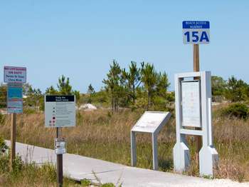
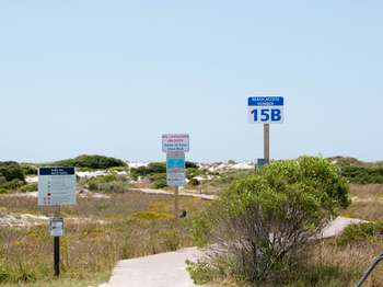
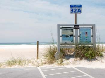
The second beach access on the Gulf-side you come across after entering the Fort Pickens Area in Florida. This area consists of the westernmost eight miles of Santa Rosa Island. This beach is great for activities such as swimming, wildlife viewing, fishing, beach-combing and more. Limited parking is available at this access point vehicles only, no RVs or campers. Please stay off of the dunes and out of shorebird enclosures.
The second beach access on the Gulf-side you come across after entering the Fort Pickens Area in Florida. This area consists of the westernmost eight miles of Santa Rosa Island. This beach is great for activities such as swimming, wildlife viewing, fishing, beach-combing and more. Limited parking is available at this access point vehicles only, no RVs or campers. Please stay off of the dunes and out of shorebird enclosures.
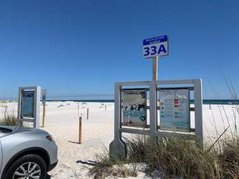
The first beach access on the Gulf-side you come across after entering the Fort Pickens Area in Florida. This area consists of the westernmost eight miles of Santa Rosa Island. This beach is great for activities such as swimming, wildlife viewing, fishing, beach-combing and more. Limited parking is available at this access point vehicles only, no RVs or campers. Please stay off of the dunes and out of shorebird enclosures.
The first beach access on the Gulf-side you come across after entering the Fort Pickens Area in Florida. This area consists of the westernmost eight miles of Santa Rosa Island. This beach is great for activities such as swimming, wildlife viewing, fishing, beach-combing and more. Limited parking is available at this access point vehicles only, no RVs or campers. Please stay off of the dunes and out of shorebird enclosures.
Beach conditions: 850-932-7873Emergencies: 911This beach access point is located on the Gulf-side and provides access for swimming, wading, fishing, beach-combing and more. Park in designated spaces only, roadside parking is not permitted. There are no restrooms, beach showers, or water fountains at this access point.Please stay off of the dunes and out of shorebird enclosures. Camping and overnight parking is not permitted. Pets, glass, and driving are not permitted on beach
876 wordsOnly a stretch of bare white sand lies between the parking area and the beach. A few short lengths of post and rope direct the approach to the beach. A wood structure at the edge of the parking lot contains two interpretive panels. Interpretive panel: Share the Shore.This panel is 2 feet wide and three feet tall. Across the top of the panel is a photograph of the shoreline of a beach, sand on the right and water on the left. Several people of all ages sit and stand near a low rocky point of land farther up the beach. Across the bottom of the panel is a photograph of a green sea turtle with its large shell moving across the sand towards the water in the background.Text at the top of the panel reads, "While you are here, keep in mind that you are sharing the shore with birds, turtles, and small mammals. Some of them are threatened or endangered species. Do not disturb the animals or their nests, burrows, eggs, or young. Stay out of protected areas. Use boardwalks to protect fragile dunes and habitats. Wildlife can choke on or become entangled in litter, so please carry out what you carry in and remove any debris you find on the beach."Below the text is a row of three smaller photographs. At left, the first one shows a black skimmer, a seabird with black back and white belly standing at the water's edge. It has a long orange and black bill and orange legs. The middle picture shows a ghost crab perched on the sand, all white except for its button-like black eyes. The third picture shows a Perdido Key beach mouse, a tiny brown rodent with a white face sitting in a sandy depression underneath grasses.Below the photographs more text reads, "A Wildlife Habitat. Least terns, snowy plovers, and black skimmers make nests in the sand. Stay out of protected areas. Kemp's Ridley, loggerhead, green, and leatherback sea turtles crawl ashore and lay eggs in the sand. About 60 days later the hatchlings emerge and make their way to the sea. Biologists and trained volunteers mark nests of endangered and/or threatened sea turtles to monitor and protect nests from predators. The Perdido Key beach mouse is nocturnal and feeds on seeds of sea oats and beach grass. This small mouse is threatened with extinction because of diminishing coastal habitat. The National Park Service provides boardwalks for beach access and to protect the dunes. Untrampled, plants thrive and stabilize the dunes."To the right of the text is a small photograph showing a sea turtle tangled in a net. The caption reads, "Marine Debris Kills. Many animals including birds and turtles die when they become entangled in nets and fishing lines or ingest plastic trash."Orientation panel: Beach Safety.This panel is 2 feet wide and three feet tall and has text in both English and Spanish. Text at the top reads, "In just a few minutes a wonderful day at the beach can turn into a disaster. Stay alert for sudden storms and marine life that could sting or bite. Watch your children. In emergencies, dial 911."At the bottom is a photograph with labels showing the smooth water of a rip current as it flows away from shore between two sandbars covered by white frothy waves. On the far side arrows point sideways in both directions with a label reading "Swim to the side." Text below the picture reads, "Rip Currents Kill. Rip currents commonly form after storms. If you are caught in a rip current, stay calm. Do not try to swim against the current. Swim right or left to escape the flow."Down the left side of the panel are specific warnings, each with a small photograph as illustration. Text reads, "Avoid overexposure to the sun, especially between 10 am and 2 pm. Use sunscreen, sunglasses, hats, and long sleeves to protect skin. Drink plenty of water to help prevent dehydration." (Picture of the sun.)"Thunderstorms develop quickly. If swimming or fishing, get out of the water immediately and seek shelter." (Picture of lightning.)"Jellyfish and sea nettles can inflict painful stings. To reduce pain apply vinegar and do not touch." (Picture of a jellyfish.)"Sharks are present in park waters. Do not swim at dawn, dusk, or night. Avoid schools of fish." (Picture of a shark.)"Be aware of stingrays. Shuffle your feet while wading. Avoid grass beds and murky water. Soak puncture wounds in hot water." (Picture of a stingray.)Down the right side of the panel are images of the various flags that may be posted on the beach along with their meanings. At top are two red flags, one with the silhouette of a swimmer with a line drawn through it. The label reads, "Two Flags Mean Water Closed to Public Highly dangerous surf and/or strong currents."Next is a single red flag which means "High Hazard. High surf and/or strong currents."Next is a yellow flag which means "Medium Hazard. Moderate surf and/or currents."Next is a green flag which means "Low Hazard. Calm conditions, exercise caution.At bottom is a purple flag which means "Dangerous Marine Life. Stinging organisms or sharks."End of Desc
Beach conditions: 850-932-7873<br />Emergencies: 911<br /><br />This beach access point is located on the Gulf-side and provides access for swimming, wading, fishing, beach-combing and more. Park in designated spaces only, roadside parking is not permitted. There are no restrooms, beach showers, or water fountains at this access point.<br /><br />Please stay off of the dunes and out of shorebird enclosures. Camping and overnight parking is not permitted. Pets, glass, and driving are not permitted on beach.<br /><br /> <b>Marine Debris Kills</b> Many animals including birds and turtles die when they become entangled in nets and fishing lines or ingest plastic trash.<br /><br /> <b>Rip Currents Kill</b> Rip currents commonly form after storms. If you are caught in a rip current, stay calm. Do not try to swim against the current. Swim right or left to escape the flow.<br /><br /> <b>Beach Safety</b> In just a few minutes a wonderful day at the beach can turn into a disaster. Visit our <a href="https://www.nps.gov/guis/planyourvisit/safety.htm">Safety web page</a> for more information.<br /><br /> <a href="https://myescambia.com/pensacola-beach/pensacola-beach-lifeguards"> <b>Beach Safety Flags</b> </a> <br />Two Red Flags: Water Closed to Public Highly dangerous surf and/or strong currents. <br />Single Red Flag: High Hazard. High surf and/or strong currents. <br />Yellow Flag: Medium Hazard. Moderate surf and/or currents. <br />Green Flag: Low Hazard. Calm conditions, exercise caution.<br />Purple Flag: Dangerous Marine Life. Stinging organisms or sharks.
1037 words<br />Bare white sand covers the distance between the parking area and the beach. Some posts and ropes define a wide path to the beach. Some tufts of sea grasses dot the edge of the parking area and some dunes in the distance. Three interpretive panels stand in wood frames at the edge of the parking lot.<br /><br />Interpretive panel: Santa Rosa Area.<br /><br />This panel is 2 feet wide and three feet tall. Across the top is a photograph of low white sand dunes with tufts of dune grass. The bottom of the panel has a map of the section of Santa Rosa Island that includes the park. Symbols mark the locations of parking and of the facilities at Opal Beach near the middle of the park's section. Text at upper left reads, <br /><br />"This section of Gulf Islands National Seashore encompasses a day-use area of Santa Rosa Island. Here you may enjoy wildlife and other natural features of this coastal peninsula. Hike on the Florida National Scenic Trail or bike on the multi-use trail. Swim, fish, and do some beachcombing. Facilities at Opal Beach are basic: picnic shelter, restrooms, and outdoor showers. Avoid walking on the fragile sand dunes and remain outside of nesting area closures."<br /><br />Interpretive panel: Share the Shore.<br /><br />This panel is 2 feet wide and three feet tall. Across the top of the panel is a photograph of the shoreline of a beach, sand on the right and water on the left. Several people of all ages sit and stand near a low rocky point of land farther up the beach. <br /><br />Across the bottom of the panel is a photograph of a green sea turtle with its large shell moving across the sand towards the water in the background.<br /><br />Text at the top of the panel reads, <br /><br />"While you are here, keep in mind that you are sharing the shore with birds, turtles, and small mammals. Some of them are threatened or endangered species. Do not disturb the animals or their nests, burrows, eggs, or young. Stay out of protected areas. Use boardwalks to protect fragile dunes and habitats. Wildlife can choke on or become entangled in litter, so please carry out what you carry in and remove any debris you find on the beach."<br /><br />Below the text is a row of three smaller photographs. At left, the first one shows a black skimmer, a seabird with black back and white belly standing at the water's edge. It has a long orange and black bill and orange legs. The middle picture shows a ghost crab perched on the sand, all white except for its button-like black eyes. The third picture shows a Perdido Key beach mouse, a tiny brown rodent with a white face sitting in a sandy depression underneath grasses.<br /><br />Below the photographs more text reads, <br /><br />"A Wildlife Habitat. Least terns, snowy plovers, and black skimmers make nests in the sand. Stay out of protected areas. Kemp's Ridley, loggerhead, green, and leatherback sea turtles crawl ashore and lay eggs in the sand. About 60 days later the hatchlings emerge and make their way to the sea. Biologists and trained volunteers mark nests of endangered and/or threatened sea turtles to monitor and protect nests from predators. The Perdido Key beach mouse is nocturnal and feeds on seeds of sea oats and beach grass. This small mouse is threatened with extinction because of diminishing coastal habitat. The National Park Service provides boardwalks for beach access and to protect the dunes. Untrampled, plants thrive and stabilize the dunes."<br /><br />To the right of the text is a small photograph showing a sea turtle tangled in a net. The caption reads, <br /><br />"Marine Debris Kills. Many animals including birds and turtles die when they become entangled in nets and fishing lines or ingest plastic trash."<br /><br />Orientation panel: Beach Safety.<br /><br />This panel is 2 feet wide and three feet tall and has text in both English and Spanish. Text at the top reads, <br /><br />"In just a few minutes a wonderful day at the beach can turn into a disaster. Stay alert for sudden storms and marine life that could sting or bite. Watch your children. In emergencies, dial 911."<br /><br />At the bottom is a photograph with labels showing the smooth water of a rip current as it flows away from shore between two sandbars covered by white frothy waves. On the far side arrows point sideways in both directions with a label reading "Swim to the side." Text below the picture reads, <br /><br />"Rip Currents Kill. Rip currents commonly form after storms. If you are caught in a rip current, stay calm. Do not try to swim against the current. Swim right or left to escape the flow."<br /><br />Down the left side of the panel are specific warnings, each with a small photograph as illustration. Text reads, <br /><br />"Avoid overexposure to the sun, especially between 10 am and 2 pm. Use sunscreen, sunglasses, hats, and long sleeves to protect skin. Drink plenty of water to help prevent dehydration." (Picture of the sun.)<br /><br />"Thunderstorms develop quickly. If swimming or fishing, get out of the water immediately and seek shelter." (Picture of lightning.)<br /><br />"Jellyfish and sea nettles can inflict painful stings. To reduce pain apply vinegar and do not touch." (Picture of a jellyfish.)<br /><br />"Sharks are present in park waters. Do not swim at dawn, dusk, or night. Avoid schools of fish." (Picture of a shark.)<br /><br />"Be aware of stingrays. Shuffle your feet while wading. Avoid grass beds and murky water. Soak puncture wounds in hot water." (Picture of a stingray.)<br /><br />Down the right side of the panel are images of the various flags that may be posted on the beach along with their meanings. At top are two red flags, one with the silhouette of a swimmer with a line drawn through it. The label reads, <br /><br />"Two Flags Mean Water Closed to Public Highly dangerous surf and/or strong currents."<br /><br />Next is a single red flag which means "High Hazard. High surf and/or strong currents."<br /><br />Next is a yellow flag which means "Medium Hazard. Moderate surf and/or currents."<br /><br />Next is a green flag which means "Low Hazard. Calm conditions, exercise caution.<br /><br />At bottom is a purple flag which means "Dangerous Marine Life. Stinging organisms or sharks."<br /><br />End of Description.<br />
Beach conditions: 850-932-7873Emergencies: 911This beach access point is located on the Gulf-side and provides access for swimming, wading, fishing, beach-combing and more. Park in designated spaces only, roadside parking is not permitted. There are no restrooms, beach showers, or water fountains at this access point.Please stay off of the dunes and out of shorebird enclosures. Camping and overnight parking is not permitted. Pets, glass, and driving are not permitted on beach
1037 wordsBare white sand covers the distance between the parking area and the beach. Some posts and ropes define a wide path to the beach. Some tufts of sea grasses dot the edge of the parking area and some dunes in the distance. Three interpretive panels stand in wood frames at the edge of the parking lot.Interpretive panel: Santa Rosa Area.This panel is 2 feet wide and three feet tall. Across the top is a photograph of low white sand dunes with tufts of dune grass. The bottom of the panel has a map of the section of Santa Rosa Island that includes the park. Symbols mark the locations of parking and of the facilities at Opal Beach near the middle of the park's section. Text at upper left reads, "This section of Gulf Islands National Seashore encompasses a day-use area of Santa Rosa Island. Here you may enjoy wildlife and other natural features of this coastal peninsula. Hike on the Florida National Scenic Trail or bike on the multi-use trail. Swim, fish, and do some beachcombing. Facilities at Opal Beach are basic: picnic shelter, restrooms, and outdoor showers. Avoid walking on the fragile sand dunes and remain outside of nesting area closures."Interpretive panel: Share the Shore.This panel is 2 feet wide and three feet tall. Across the top of the panel is a photograph of the shoreline of a beach, sand on the right and water on the left. Several people of all ages sit and stand near a low rocky point of land farther up the beach. Across the bottom of the panel is a photograph of a green sea turtle with its large shell moving across the sand towards the water in the background.Text at the top of the panel reads, "While you are here, keep in mind that you are sharing the shore with birds, turtles, and small mammals. Some of them are threatened or endangered species. Do not disturb the animals or their nests, burrows, eggs, or young. Stay out of protected areas. Use boardwalks to protect fragile dunes and habitats. Wildlife can choke on or become entangled in litter, so please carry out what you carry in and remove any debris you find on the beach."Below the text is a row of three smaller photographs. At left, the first one shows a black skimmer, a seabird with black back and white belly standing at the water's edge. It has a long orange and black bill and orange legs. The middle picture shows a ghost crab perched on the sand, all white except for its button-like black eyes. The third picture shows a Perdido Key beach mouse, a tiny brown rodent with a white face sitting in a sandy depression underneath grasses.Below the photographs more text reads, "A Wildlife Habitat. Least terns, snowy plovers, and black skimmers make nests in the sand. Stay out of protected areas. Kemp's Ridley, loggerhead, green, and leatherback sea turtles crawl ashore and lay eggs in the sand. About 60 days later the hatchlings emerge and make their way to the sea. Biologists and trained volunteers mark nests of endangered and/or threatened sea turtles to monitor and protect nests from predators. The Perdido Key beach mouse is nocturnal and feeds on seeds of sea oats and beach grass. This small mouse is threatened with extinction because of diminishing coastal habitat. The National Park Service provides boardwalks for beach access and to protect the dunes. Untrampled, plants thrive and stabilize the dunes."To the right of the text is a small photograph showing a sea turtle tangled in a net. The caption reads, "Marine Debris Kills. Many animals including birds and turtles die when they become entangled in nets and fishing lines or ingest plastic trash."Orientation panel: Beach Safety.This panel is 2 feet wide and three feet tall and has text in both English and Spanish. Text at the top reads, "In just a few minutes a wonderful day at the beach can turn into a disaster. Stay alert for sudden storms and marine life that could sting or bite. Watch your children. In emergencies, dial 911."At the bottom is a photograph with labels showing the smooth water of a rip current as it flows away from shore between two sandbars covered by white frothy waves. On the far side arrows point sideways in both directions with a label reading "Swim to the side." Text below the picture reads, "Rip Currents Kill. Rip currents commonly form after storms. If you are caught in a rip current, stay calm. Do not try to swim against the current. Swim right or left to escape the flow."Down the left side of the panel are specific warnings, each with a small photograph as illustration. Text reads, "Avoid overexposure to the sun, especially between 10 am and 2 pm. Use sunscreen, sunglasses, hats, and long sleeves to protect skin. Drink plenty of water to help prevent dehydration." (Picture of the sun.)"Thunderstorms develop quickly. If swimming or fishing, get out of the water immediately and seek shelter." (Picture of lightning.)"Jellyfish and sea nettles can inflict painful stings. To reduce pain apply vinegar and do not touch." (Picture of a jellyfish.)"Sharks are p
This building was new when this photo was taken around 1900. These wooden buildings were built between 1900 and 1910 to support the Coast Artillery Corps whose job was coastal defense. This building was used at different times as a guardhouse with quarters for three sergeants, a mess and kitchen, and lastly as an administration building for the 13th Coast Artillery in 1945.<br /><br />The U.S. military used this end of Santa Rosa Island for over 100 years. Fort Pickens, the first of four forts built to protect Pensacola Bay, has an unusual history. Union forces still held the fort during the Civil War in the 1860s even though Florida was a Confederate state. Because artillery technology changed, the U.S. Army later made big changes to Fort Pickens and built reinforced concrete batteries on the island starting in 1894.
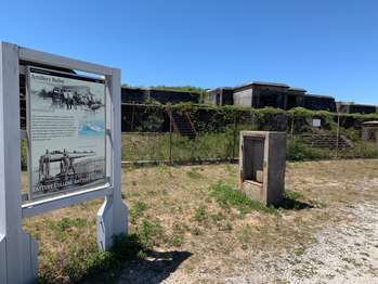
Two panels:<br />From the Fort to these Wooden Buildings. 267 words. <br />Fort Pickens Area. 306 words. <br /><br />From the Fort to these Wooden Buildings. 267 words. <br /><br />The background of this panel has a black and white photograph of an elevated view with this building near the middle. The picture is taken from the rear of the building, identified as Building 5, where a short wing extends back from the center of the building. To the left is a two-story "U"-shaped building labeled "Barracks." Other smaller buildings are to the right. The caption reads,<br /><br />"This building was new when this photo was taken around 1900. These wooden buildings were built between 1900 and 1910 to support the Coast Artillery Corps whose job was coastal defense. This building was used at different times as a guardhouse with quarters for three sergeants, a mess and kitchen, and lastly as an administration building for the 13th Coast Artillery in 1945."<br /><br />At bottom left is a small photograph showing rows of tents shaped like cones with the walls of the main fort visible in the background. The caption reads, <br /><br />"Sibley tents line the railroad track just to the west of Fort Pickens."<br /><br />Text at the top of the panel reads, <br /><br />"The U.S. military used this end of Santa Rosa Island for over 100 years. Fort Pickens, the first of four forts built to protect Pensacola Bay, has an unusual history. Union forces still held the fort during the Civil War in the 1860s even though Florida was a Confederate state. Because artillery technology changed, the U.S. Army later made big changes to Fort Pickens and built reinforced concrete batteries on the island starting in 1894."<br /><br />Fort Pickens Area. 306 words. <br /><br />At the top of this panel is a photograph of the south wall of Fort Pickens. The view looks over a bank of yellow flowers in the foreground towards the Tower Bastion extending out from the wall with a large cannon sitting on top.<br /><br />At the bottom of the panel is a photograph of people fishing from the pier. It looks out over the turquoise waters to the square platform at the end of the pier where people lean against the railings, many with fishing rods in their hands.<br /><br />Text at the left side of the panel reads, <br /><br />"The national seashore's Fort Pickens Area offers an idyllic setting to reflect on the past and enjoy recreational activities. Tour the fort and learn about its role as a Union stronghold during the Civil War in the 1860s, then tour a series of fortifications that protected Pensacola Bay from the 1890s to the 1940s. Swim, beachcomb, walk trails, or try your luck fishing."<br /><br />To the right of the text is a small map showing the area around Pensacola Bay. Along the gulf west of the entrance into the bay is Perdido Key Area with Rosamond Johnson Beach at its western end. Fort Pickens sits on the western end of Santa Rosa Key where the boundary of the National Seashore stretches back east almost to the bridge leading to Gulf Breeze. Just east of Gulf Breeze is the Naval Live Oaks Area. <br /><br />Just below is a larger map showing the Fort Pickens Area with more details. Fort Pickens Road extends down the center of the island then makes a loop around the island's end just west of Fort Pickens. Locations of the many batteries, campgrounds, parking areas, and other facilities are marked.<br /><br />A label reads, <br /><br />"For camping information call 850-934-2600."<br /><br />End of Description.
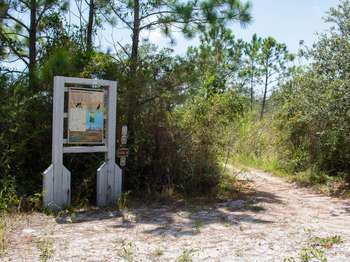
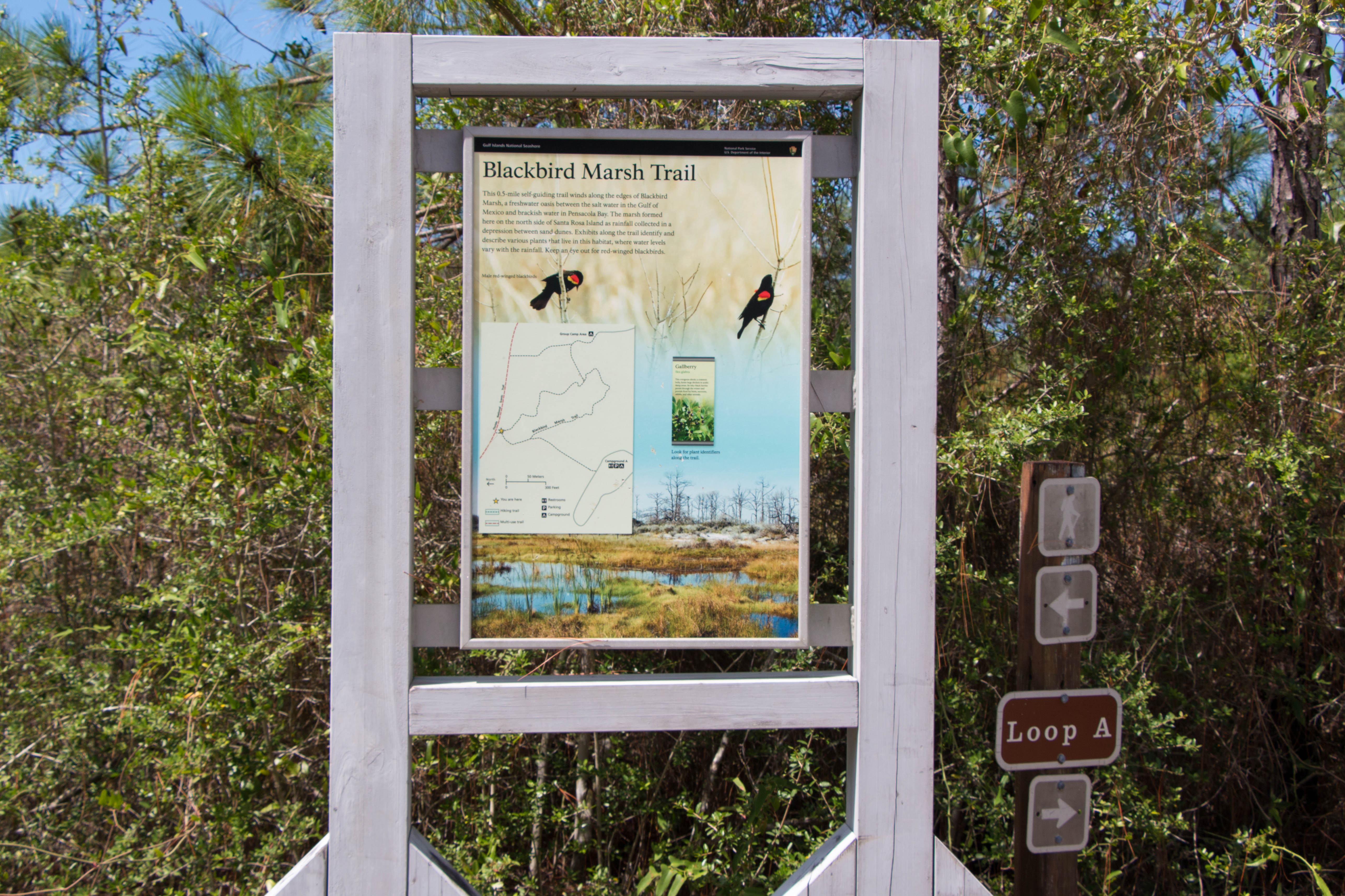
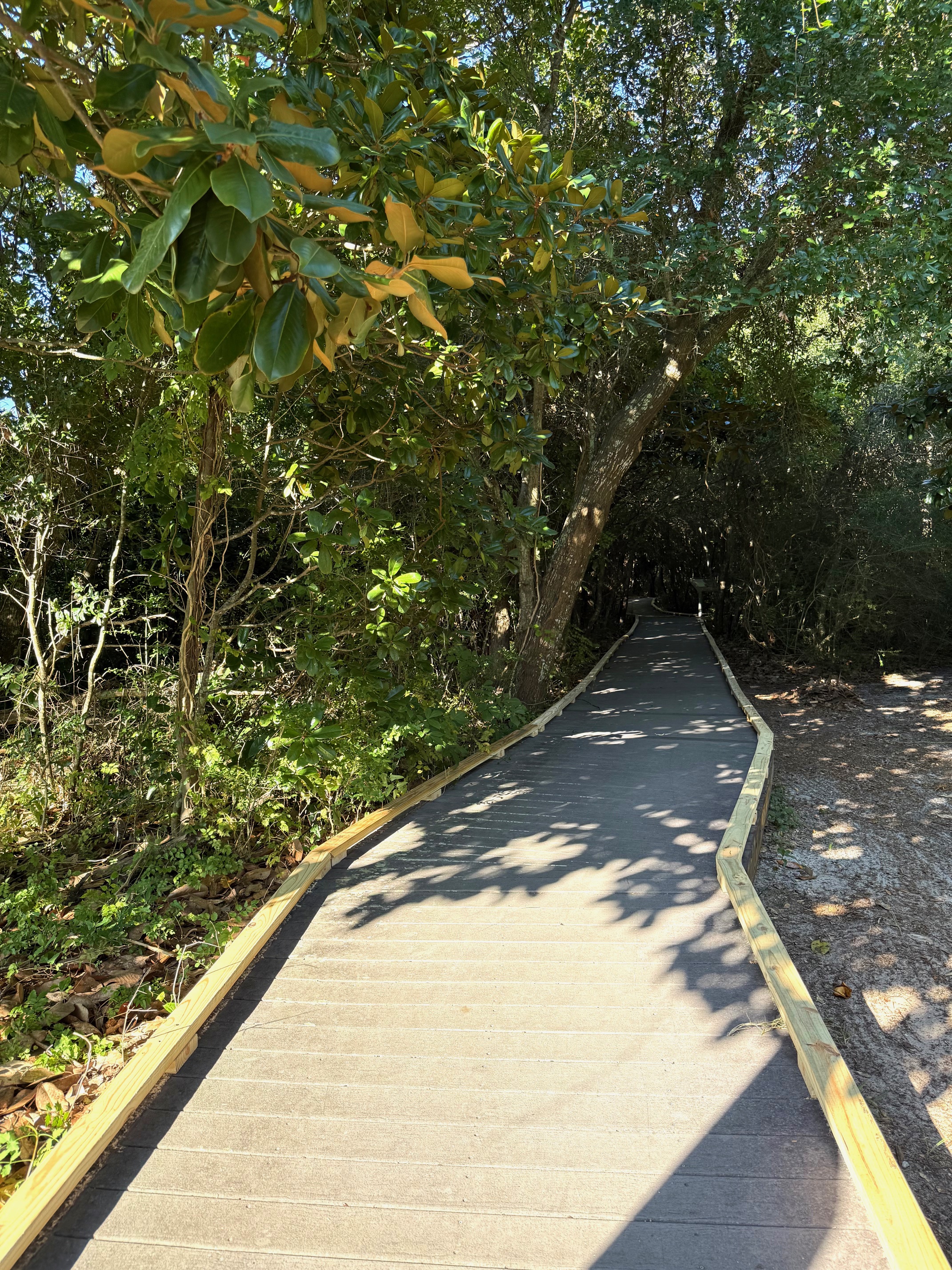
At this point, you can turn left or right to begin the 0.5-mile self-guiding trail winds along the edges of Blackbird Marsh. Exhibits along the trail identify and describe various plants that live in this habitat, are are listed in counterclockwise order in this app's self-guiding tour.
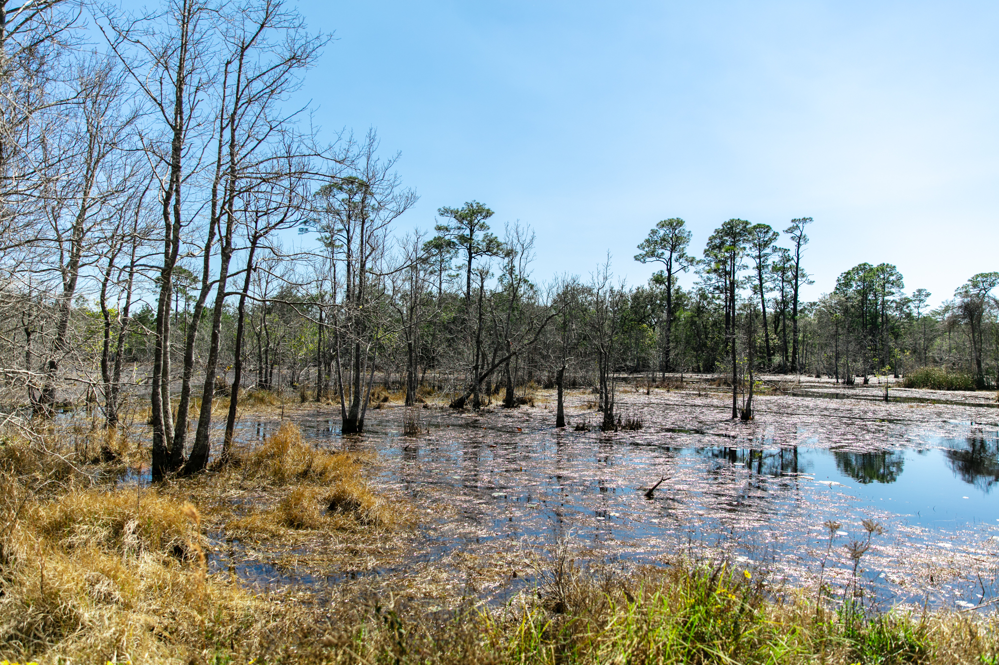
This is a trail intersection marked by a tall upright orientation sign and a short directional sign. The directional sign points left for a hiking trail and right for Loop A. The orientation sign is constructed in the park's vernacular weathered whitewashed 4-inch wood beam frame. Behind it is a view of the marsh with some scrub pine forest here and there.<br /><br />The orientation panel is entitled "Blackbird Marsh Trail" and contains a map of the trail, body text, background images, and an inset image. The background image consists of a closeup photo above blending into the sky of a panorama below. The closeup photo depicts two male red-winged blackbirds perched three body lengths apart on bare tree branches. The panorama depicts the marsh with standing water and grasses in the foreground, a low sand dune at its edge in the distance, and scrub pine forest behind the dune. The inset image depicts a sample plant identifier sign, in this case the gallberry. The caption instructs readers to look for plant identifiers along the trail.
At this point, you can turn left or right to begin the 0.5-mile self-guiding trail winds along the edges of Blackbird Marsh. Exhibits along the trail identify and describe various plants that live in this habitat, are are listed in counterclockwise order in this app's self-guiding tour.
This is a trail intersection marked by a tall upright orientation sign and a short directional sign. The directional sign points right for a hiking trail. The orientation sign is constructed in the park's vernacular weathered whitewashed 4-inch wood beam frame. Behind it is a view of the grassy marsh with a thick scrub forest lining its edge a few dozen yards distant.<br /><br />The orientation panel is entitled "Blackbird Marsh Trail" and contains a map of the trail, body text, background images, and an inset image. The background image consists of a closeup photo above blending into the sky of a panorama below. The closeup photo depicts two male red-winged blackbirds perched three body lengths apart on bare tree branches. The panorama depicts the marsh with standing water and grasses in the foreground, a low sand dune at its edge in the distance, and scrub pine forest behind the dune. The inset image depicts a sample plant identifier sign, in this case the gallberry. The caption instructs readers to look for plant identifiers along the trail.
Hike a 0.44 mile scenic loop that connects to Fort Pickens Campground Loop A and the Florida National Scenic Trail.
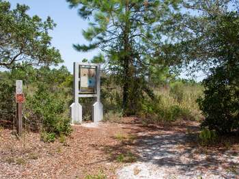
Blackbird Marsh Loop Trail. 109 words.From the side of the campground this broad smooth sandy path heads through low brush and cattails into scattered pines and live oaks beyond. At the start of the trail is a sign giving distances to Bayside Beach Access (0.3 miles), Campground Loop B-E (0.3 to 0.6 miles) and Fort Pickens via Florida National Scenic Trail (1.5 miles). Text reads, "This half mile loop trail connects with the Florida National Scenic Trail providing pedestrian access to the resources and facilities of the Fort Pickens area. Hiking, biking, and pets on leash permitted."To the left of the sign is a dog waste station. End of Description.
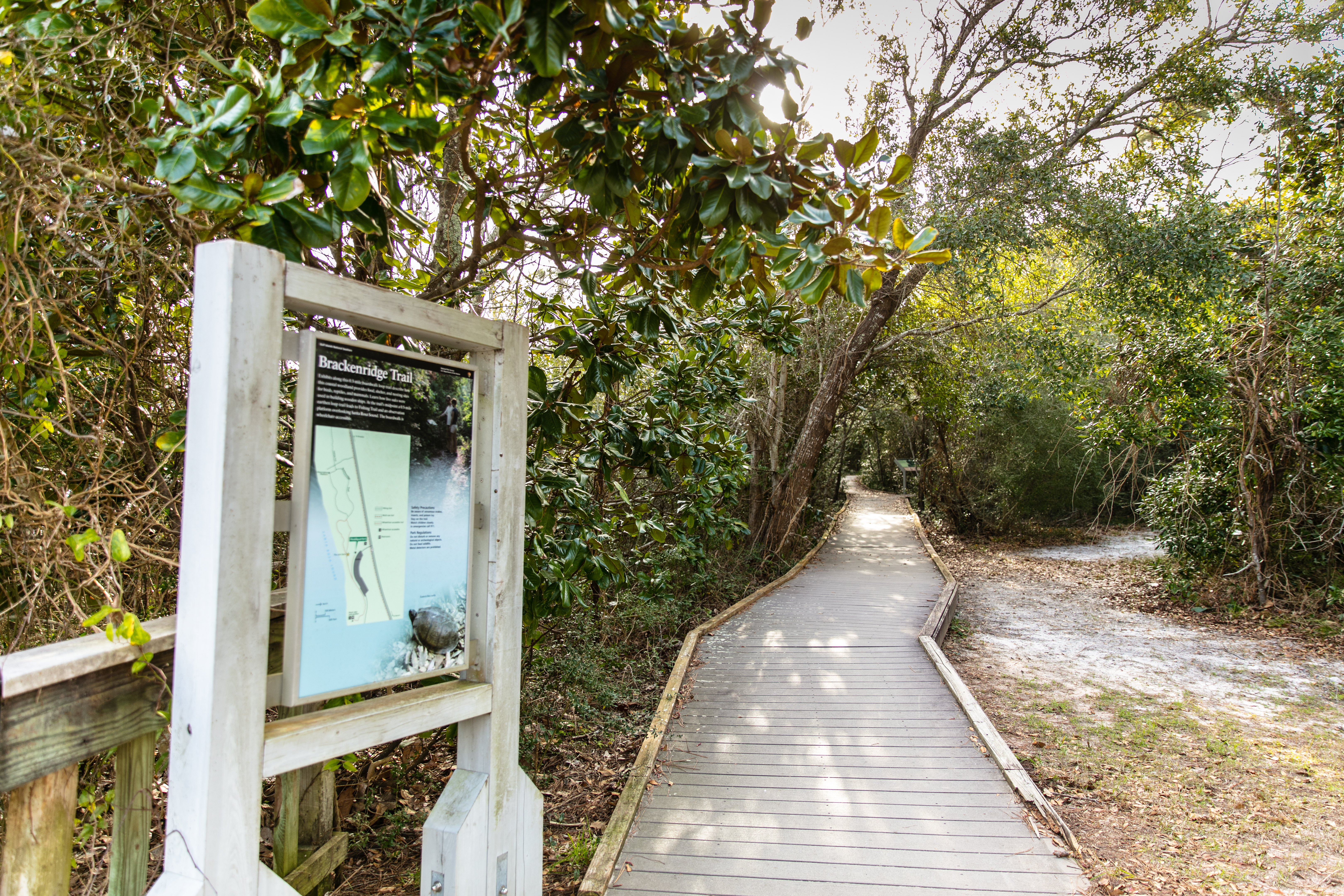
At this point, visitors can exit the fully accessible Brackenridge Accessible Trail and venture down to the waters of the Santa Rosa Sound.
The boardwalk trail makes a T intersection. The left point of the T leads down a short ramp onto the earthen trail. The Brackenridge Nature Trail is a 0.3-mile boardwalk loop trail located in the Naval Live Oaks Area. At this point, visitors can exit the fully accessible Brackenridge Accessible Trail and venture down to the coast of the Santa Rosa Sound. The shallow water of Santa Rosa Sound is a great place to swim, snorkel or kayak.
A fully accessible 0.3 mile boardwalk loop with interpretive exhibits. This boardwalk trail also provides access to the full Brackenridge Loop Trail (additional 0.5 mile) which is not fully accessible.
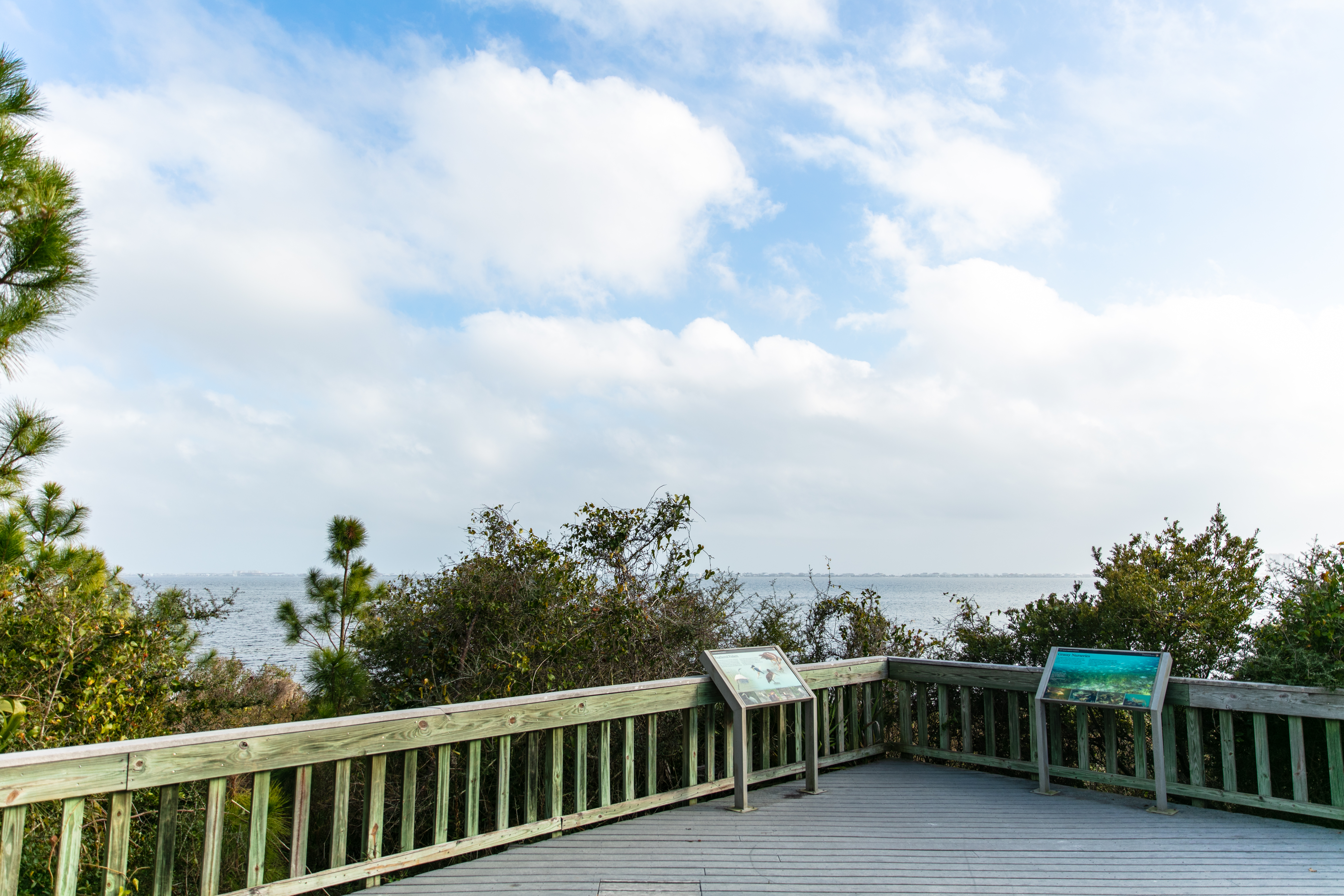
Located next to the Gulf Islands National Seashore Headquarters, is the entrance to the Brackenridge Accessible Trailhead. It begins in the park's Naval Live Oak Area, heads west 0.3 miles, and exits at the Santa Rosa Sound shoreline. This fully accessible trail leads to 30-foot-wide wooden deck and benches that overlooks the Santa Rosa Sound. This is a great place to photograph the sunset or view wildlife. The trailhead also provides access to the full Brackenridge Loop Trail (additional 0.5 mile) which is not fully accessible.
A scenic observation deck looking out towards the Santa Rosa Sound.
Located behind the Gulf Islands National Seashore Headquarters, is the entrance to the Brackenridge Loop Trail Observation Deck. The deck located in the park's Naval Live Oak Area, is a 30-feet-wide and encompasses benches and outdoor exhibits that overlook the Santa Rosa Sound. This is a great place to photograph the sunset or view wildlife. The trailhead also provides access to the full Brackenridge Loop Trail (additional 0.5 mile) which is not fully accessible.
Visitors can depart the fully accessible boardwalk trail and venture out onto the 0.5-mile Brackenridge Loop Trail (not fully accessible). This loop trail connects with the Fishing Trail and an observation point.
Visitors can depart the fully accessible Brackenridge Boardwalk Trail and venture onto the 0.5-mile Brackenridge Loop Trail. This trail is not fully accessible. It connects to the Fishing Trail and an Brackenridge observation deck.
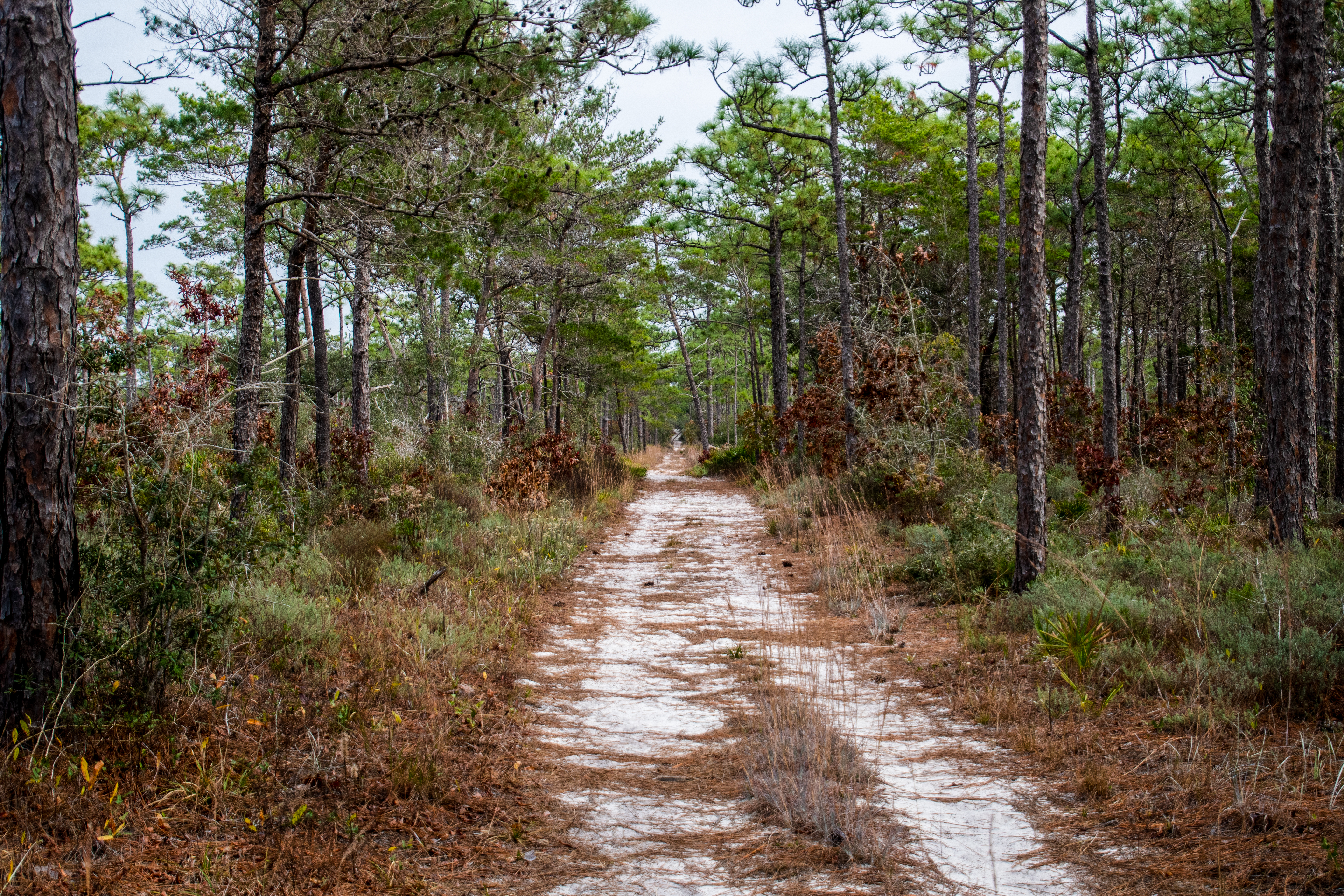
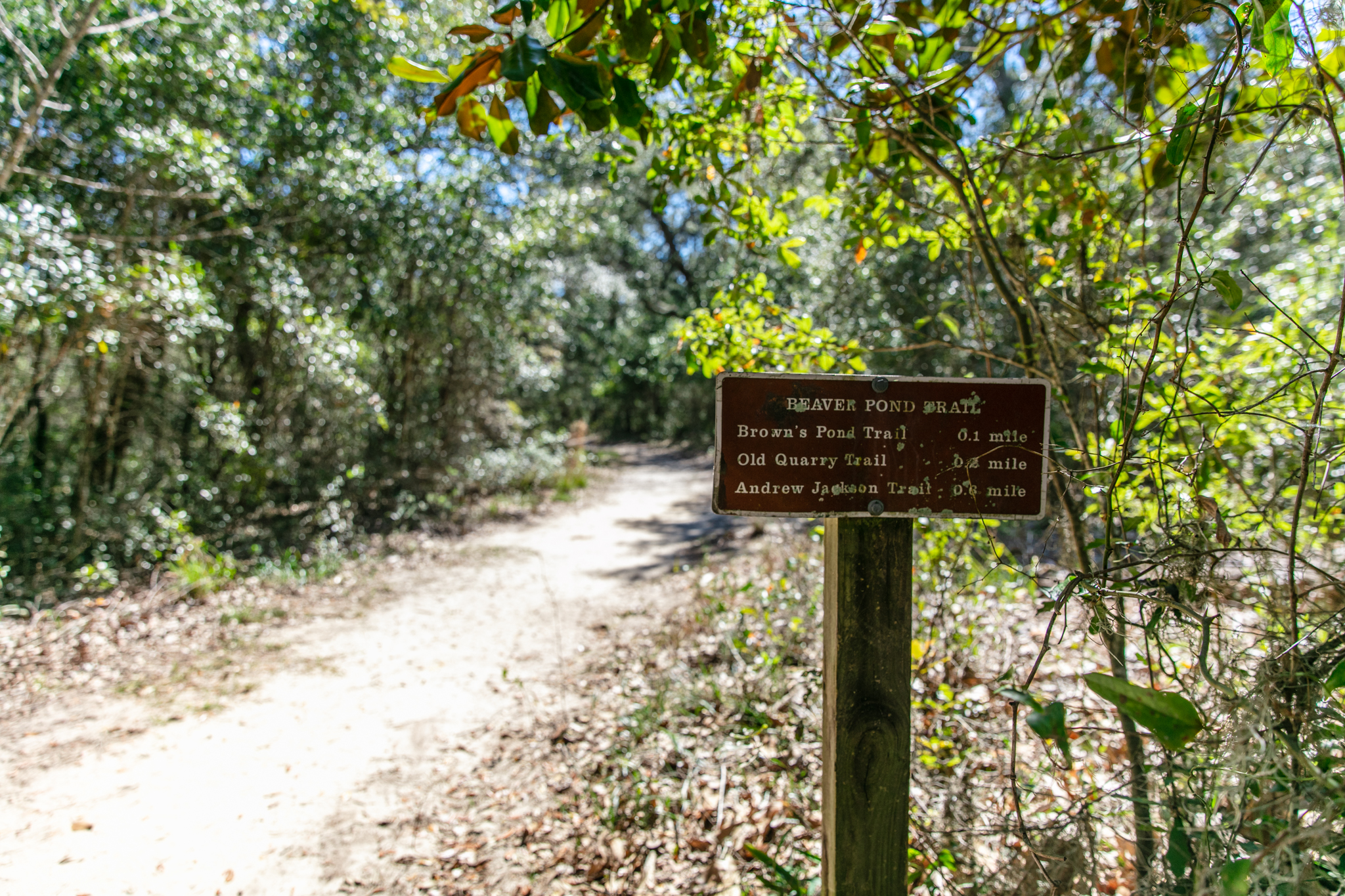
This 2 mile out-and-back trail is wide and sandy, which serves its purpose as a fire break for controlled burns. Look for Brown's Pond and wildlife near the trailhead.
A sandy trail leads into the forest, and a pond filled with trees and grasses can be seen to the left.
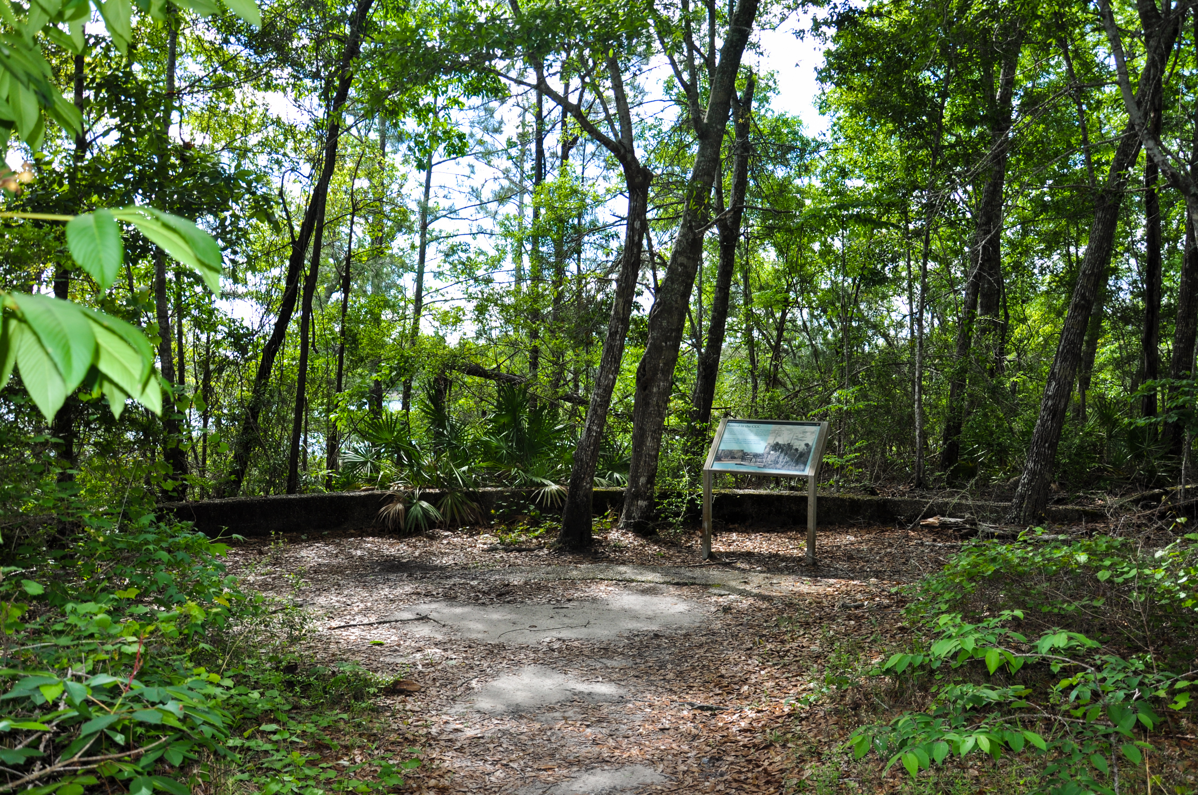
This ending point on the trail offers a view of the bayou just past the tree line that visitors can enjoy.
In front of you is the CCC outlook, originally put at the end of this trail to give visitors a view of the bayou. The outlook is a circular concrete platform that is raised a half foot off the ground. The platform is approximately 10m in circumference and has a small curb along the edge. This view of the bayou is now somewhat obscured by vegetation, as the Park Service values allowing nature to blossom as much as possible. However, the water can still be seen beyond the palmetto leaves and magnolia tree branches.
See one of the many microhabitats that exist in this forest while looking at this felled tree. While passing this trunk look closely and you can see several species of fungi, insects, and plants that call this trunk home.
Up ahead the trail thins to pass through the remnants of a Live Oak tree that had once fell across the trail. Rangers separated the pieces so you could walk through but the path has narrowed here due to the trunks and the extra foliage that has grown due to the nutrients the tree provides.
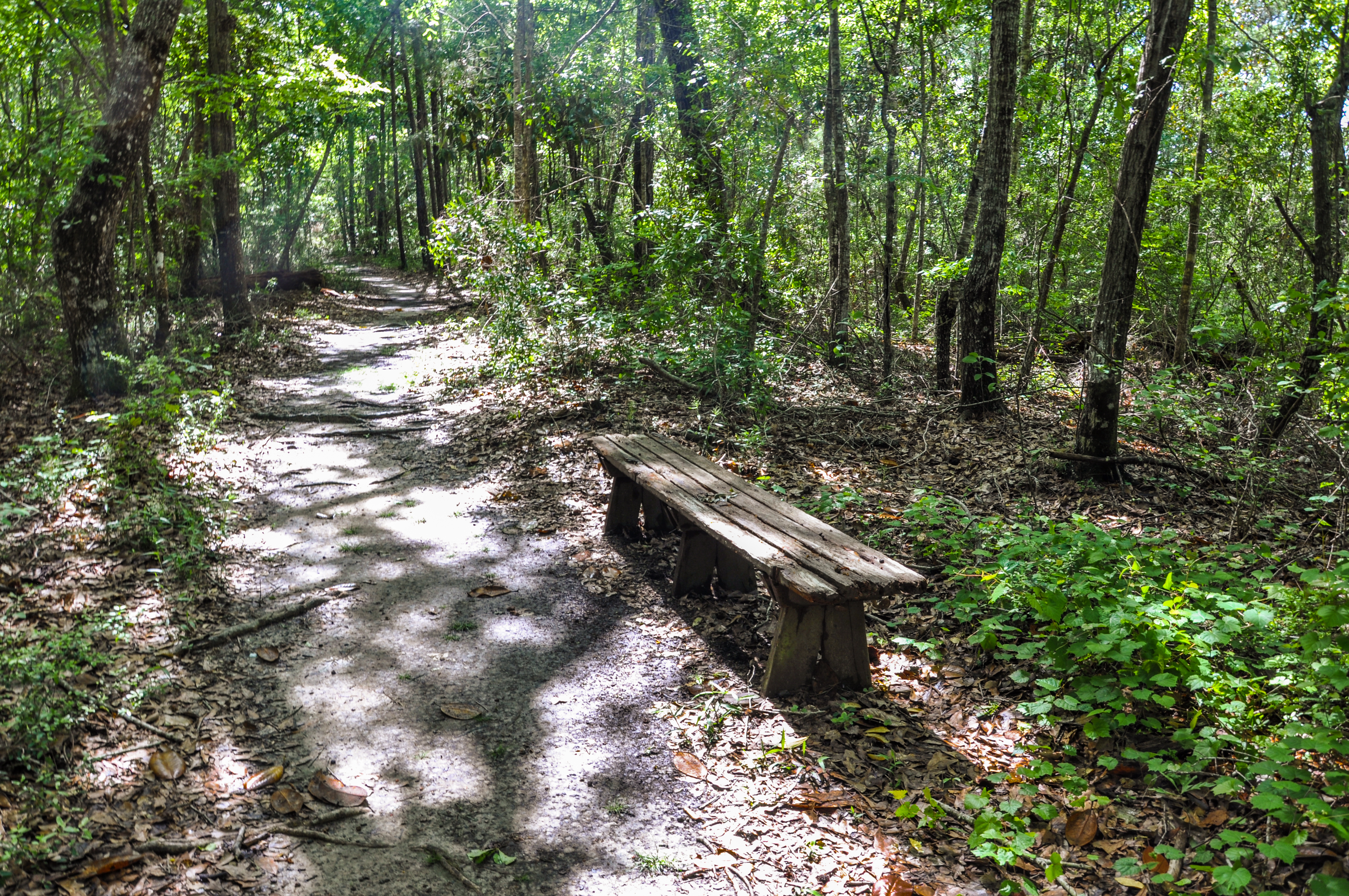
Take a break while of the CCC Spur trail and gaze at the surrounding wilderness.
To the right of the trail is a bench for visitors to take a break on. While relaxing you have the opportunity to see and hear plenty of wilderness. For example, the trees across from the bench seem to host several families of squirrels, which you can hear running around and playing.
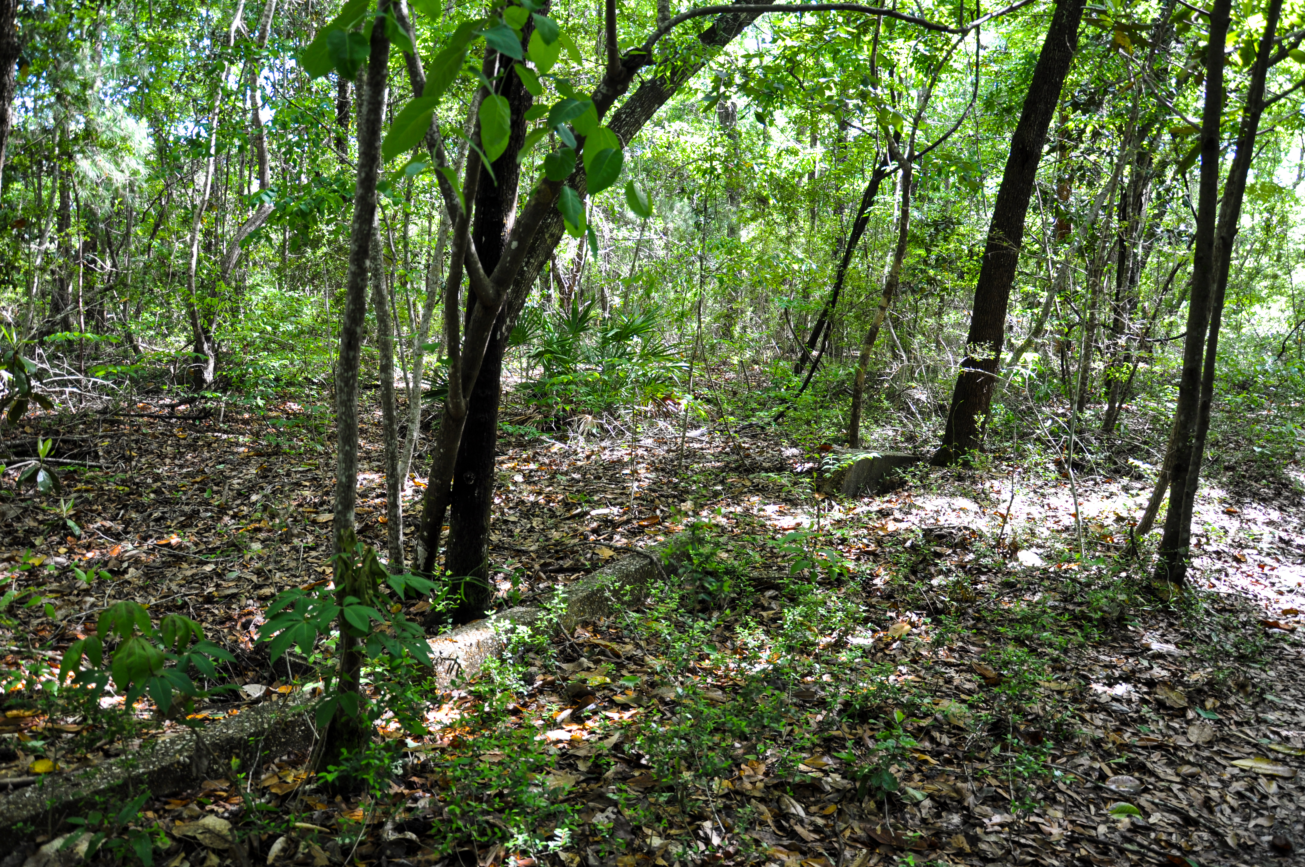
In this section, visitors can see some of the remnants of the CCC encampment that was here.
In front of you on either side of the trail is remnants of the road that lead to CCC encampment that was here. Once work was completed the road was ripped up and turned into a trail, however parts of the curb remain. To the left stands the most visible of the curb pieces, with what is thought to be an old drain set behind it. These curbs are made up of similar material that sidewalks are made of today.
On this section of trail, visitors can see more of the remnants from the CCC encampment that was here.
In the middle of the trail are two protruding concrete pieces connected like the corner of a square with the tip pointing towards the way you came. These pieces come approximately six inches out of the ground so watch your step. They are thought to be leftover framework from the Civilian Conservation Corp's time here.
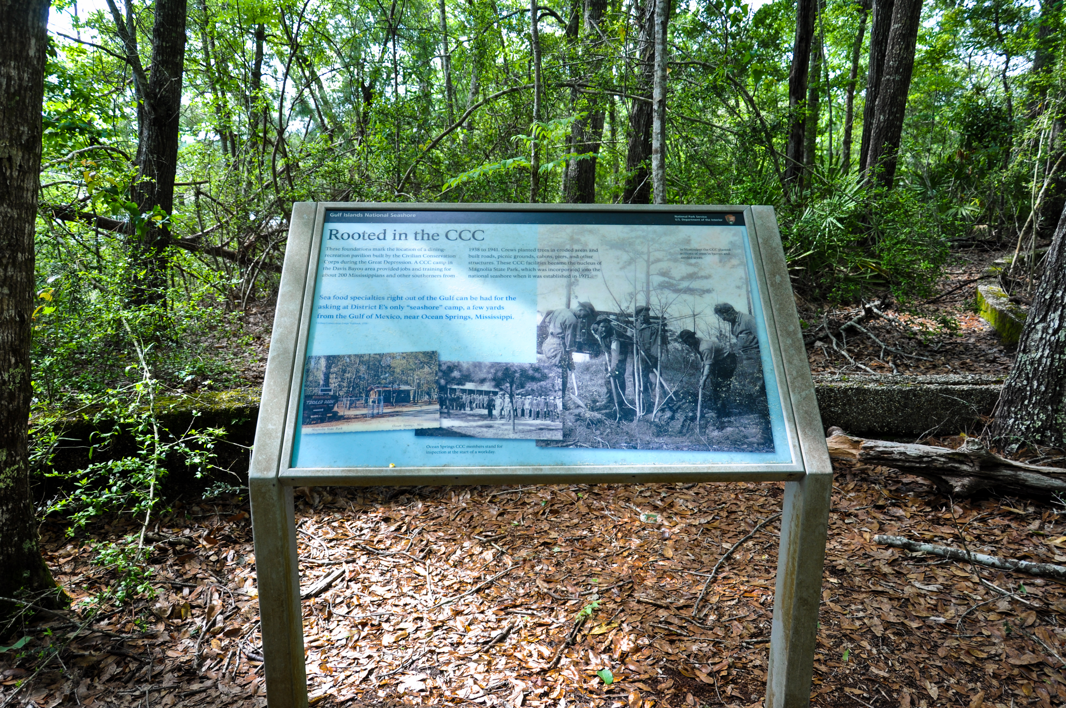
The last stop of CCC walking tour ends with an wayside that gives more information about the CCC members who were stationed here in Davis Bayou.
Located to the right of the outlook circle stands a wayward sign that gives more information about the Civilian Conservation Corps and the work they did here. The sign reads: “These foundations mark the location of a dining recreation pavilion built by the Civilian Conservation Corps during the Great Depression. A CCC Camp in the Davis Bayou area provided jobs and training for about 200 Mississippi residents and other Southerners from 1938 to 1941. Crews planted trees in eroded areas and built roads, picnic grounds, cabins, piers, and other structures. These CCC facilities became the nucleus of Magnolia State Park, which was incorporated into the national seashore when it was established in 1971. Seafood specialties right out of the golf can be had for the asking at District E’s only “seashore” camp, a few yards from the Gulf of Mexico, near Ocean Springs, Mississippi.” The sign also has three images. The leftmost image is of Magnolia State Park headquarters. The middle image is of Ocean Springs CCC members standing for inspection at the start of a workday. The right image is of five CCC members working together to plant a tree.
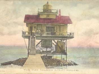
Cat Island is only accessible via private boat. If traveling in your private vessel consult navigational charts. To find an operator who can provide tours, fishing charters, or transportation, visit our <a href="https://www.nps.gov/guis/getinvolved/cua_holders.htm">Authorized Commercial Operators page</a> .<br /><br />Learn more about <a href="https://www.nps.gov/guis/planyourvisit/cat-island.htm">Cat Island online</a> .
Cat Island is a barrier island off the Gulf Coast of Mississippi and is only accessible via private boat. The island's name comes from French explorers who mistook raccoons for cats.
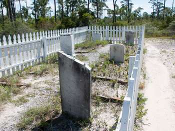
No one is buried here. These gravestones are from Chasefield Plantation Cemetery, originally located on land that is now part of Pensacola Naval Air Station. They were moved to this location in 1957. Chasefield Plantation was the home of Major William H. Chase, who supervised the construction of Ft. Pickens in the early 1800's. The gravestones read: SACRED to the memory of GEO. EDMUND CHASE Born 2nd May 1807. Died 28th March 1844.[broken] ...Susana GOLAY who departed this li
A white picket fence several paces from the parking lot forms a rectangle roughly three yards by ten yards. Inside the fence stand eight thin marble gravestones arranged in pairs. All are weathered. Three are broken, one all the way to the base. In some places bricks outline human-size rectangles behind the gravestones. The ground is a mix of gravel and sand with a a great number of weeds. A trodden path runs lengthwise along the center of the enclosure and a gate is at the right end.
Enjoy a walk on the CCC Spur Trail, a 0.2 mile long hiking trail that takes visitors through the woodlands surrounding the bayou.
CCC Trail Trailhead. 123 words.This short trail to the CCC overlook turns off of the main Davis Bayou gravel trail that follows the road through the park. A slightly arched wooden footbridge crosses a ditch at the side of the road. The bridge has wooden railings. At the far end, a few timber steps in the dirt path lead back to higher ground where the sandy trail heads off into the woods.The forest here is a mix of pines and deciduous trees with a mix of small shrubs and saw palmettos as the understory.A small sign at the entrance to the trail reads, "CCC Overlook. Pedestrian use only. 0.2 mile. Please! Pack out all trash. Keep your public lands clean."End of Description.
Starting in the mid 1500s the Pensacola area became a pawn in a European power struggle in the New World. Adventures from Spain, France, and Britain competed with each other to establish a foothold on the Gulf of Mexico. Spain established several settlements in the Pensacola area from 1559 to 1821. Except for brief French periods and one British colony, Spain claimed the Pensacola area until the United States acquired Florida in a treaty.
Colonial Power Struggle. 166 words. Four cannon are laid on blocks in a row, pointing to the west along the side of the park road, each cradled on concrete mounting blocks. As you face to the west, a small parking area lies along the road to the right. Across from the parking is a "T" shaped one-story wood-frame building. It is white with a green roof and a wide covered porch wrapping all the way around the building. To the east and west lie more buildings, smaller, but in a similar style. As you face to the east, a large cannon on top of the walls of Fort Pickens can be seen.The cannon are 12 feet long. The one at the north end, farthest to the left as you stand at the muzzles, has no markings. The other three each have a British royal insignia in their middle. This consists of a crown at the top with ornate initials below, a "G" and an "R."End of Description.
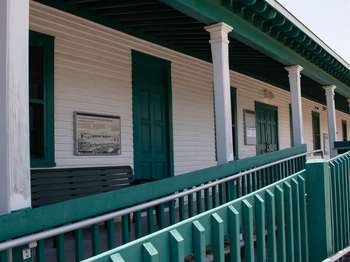
The Fort Barrancas Visitor Center tells the long history of European settlers attempts to secure the vital Pensacola Bay beginning in the late 1700s and through its deactivation in the mid-1900s.
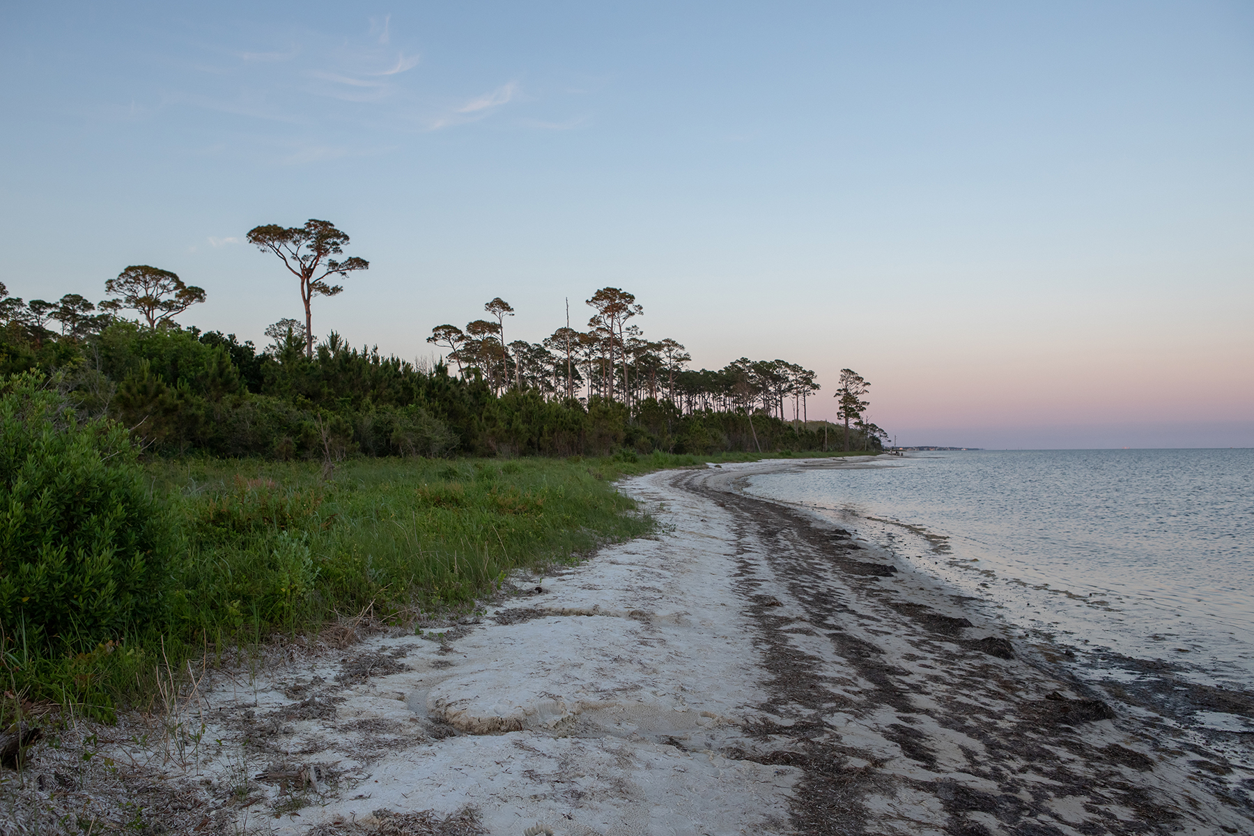
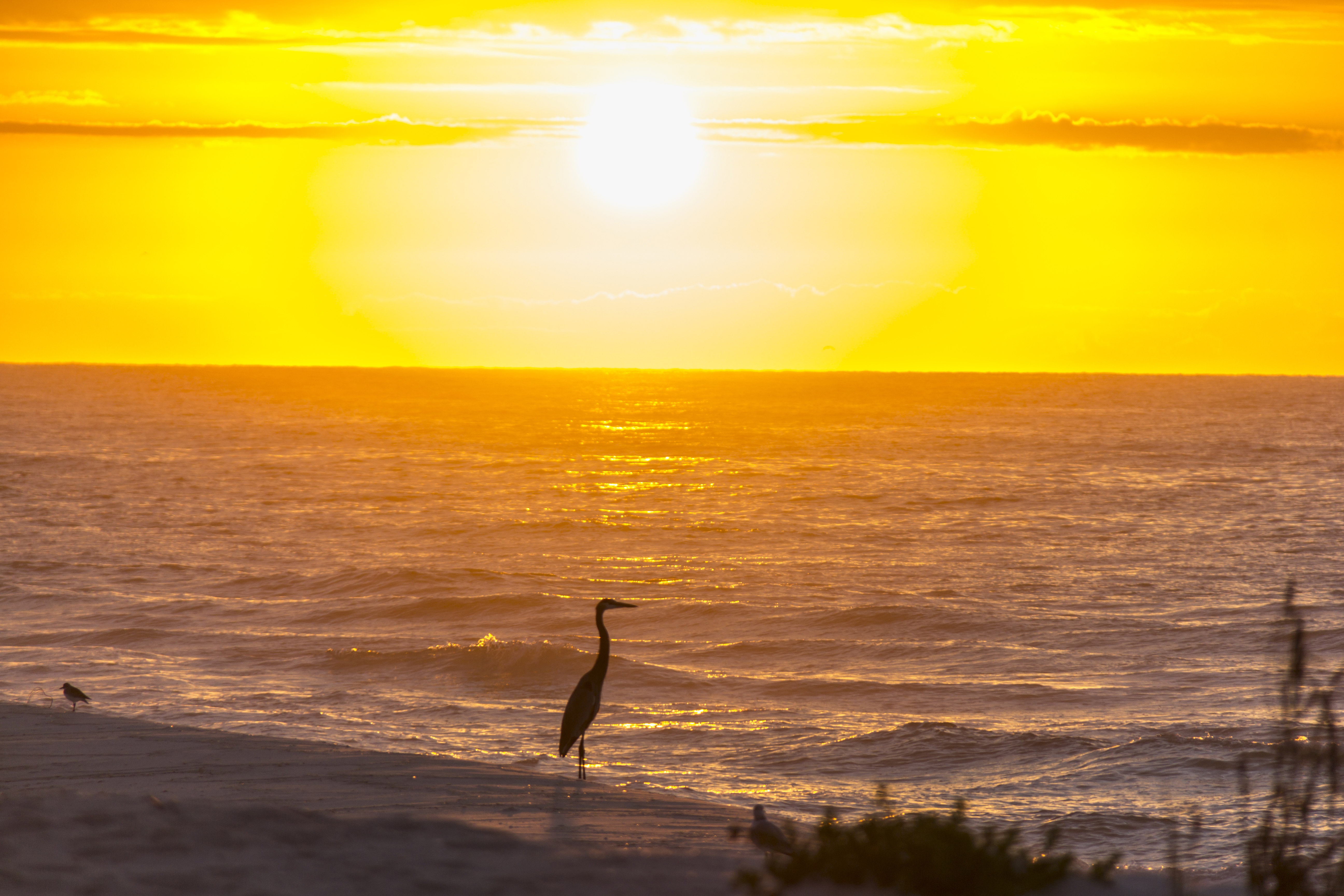
Forts, beaches, bayous, and batteries provide amazing views of both sunrise and sunset over the Gulf of Mexico.
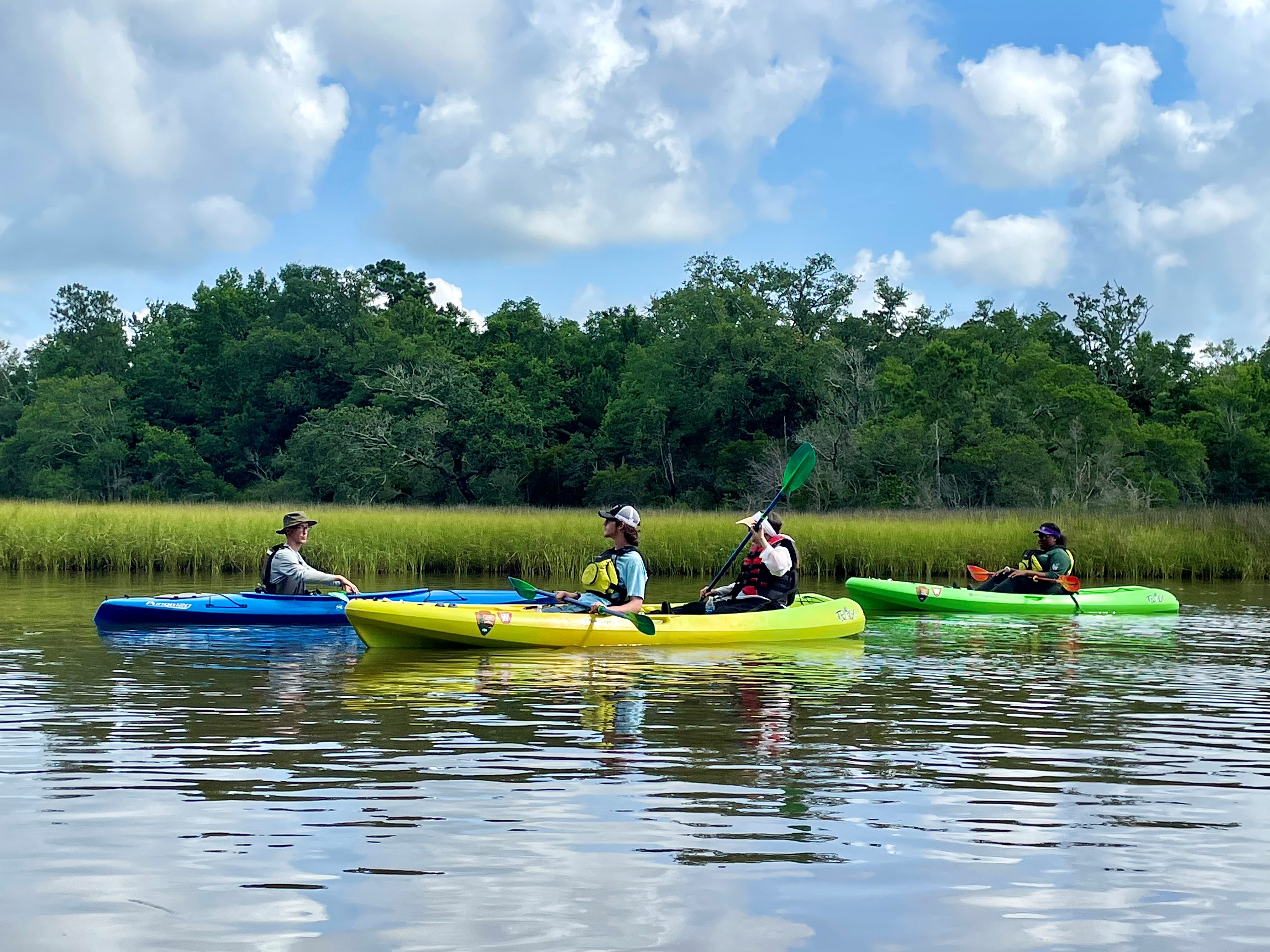
Paddling in Gulf Islands
Canoe, kayak, or paddleboard in the beautiful blue-green waters and calm bayous of Gulf Islands National Seashore.
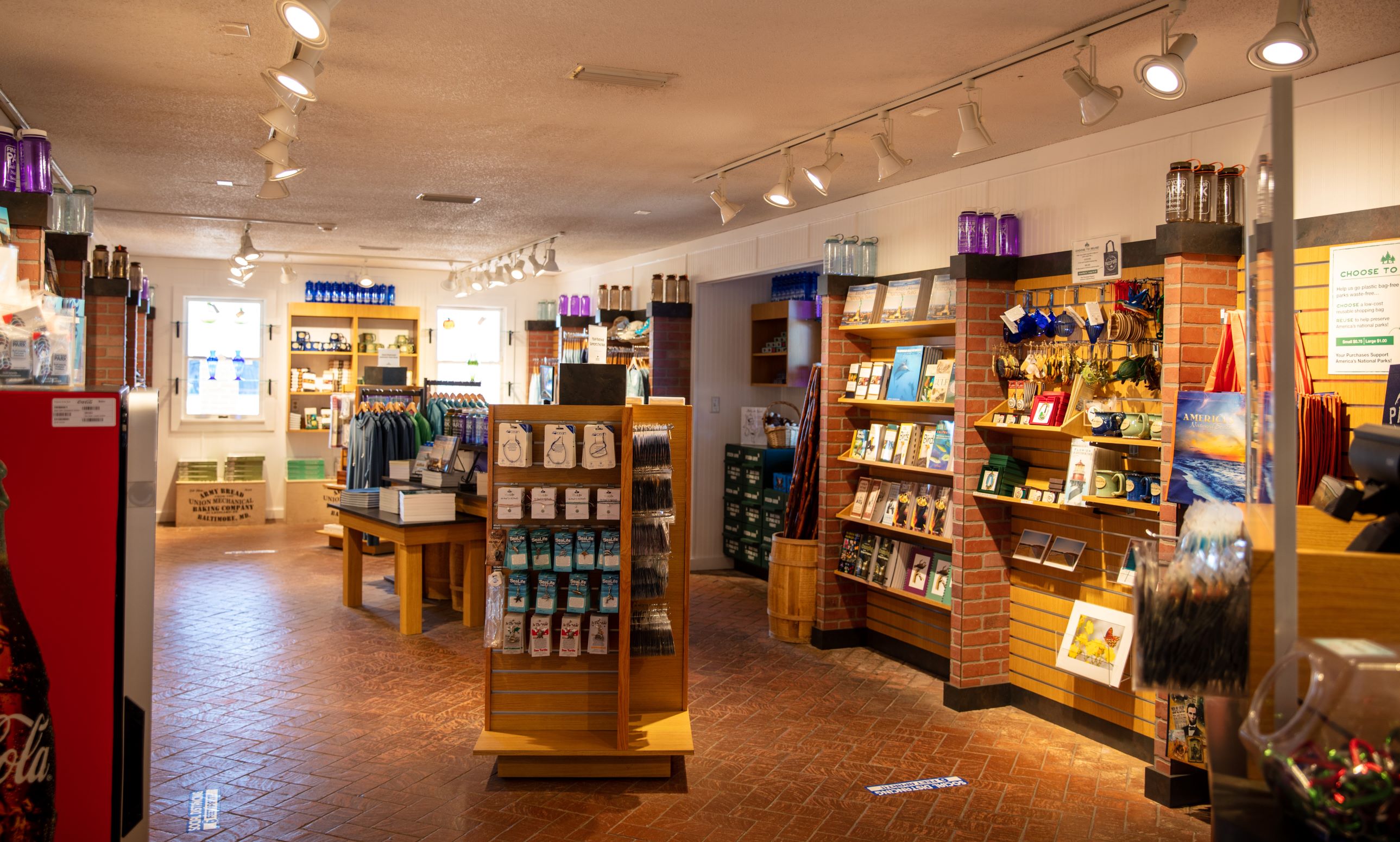
Visit the Gulf Islands Park Store
Purchase souvenirs and more pages for your passport at this bookstore located within historic Fort Pickens.
Get Your Passport Stamped at Gulf Islands
Collecting stamps, also known as cancellations, is a fun way to commemorate your visit to a new place. Learn where to get your passport stamped at Gulf Islands.
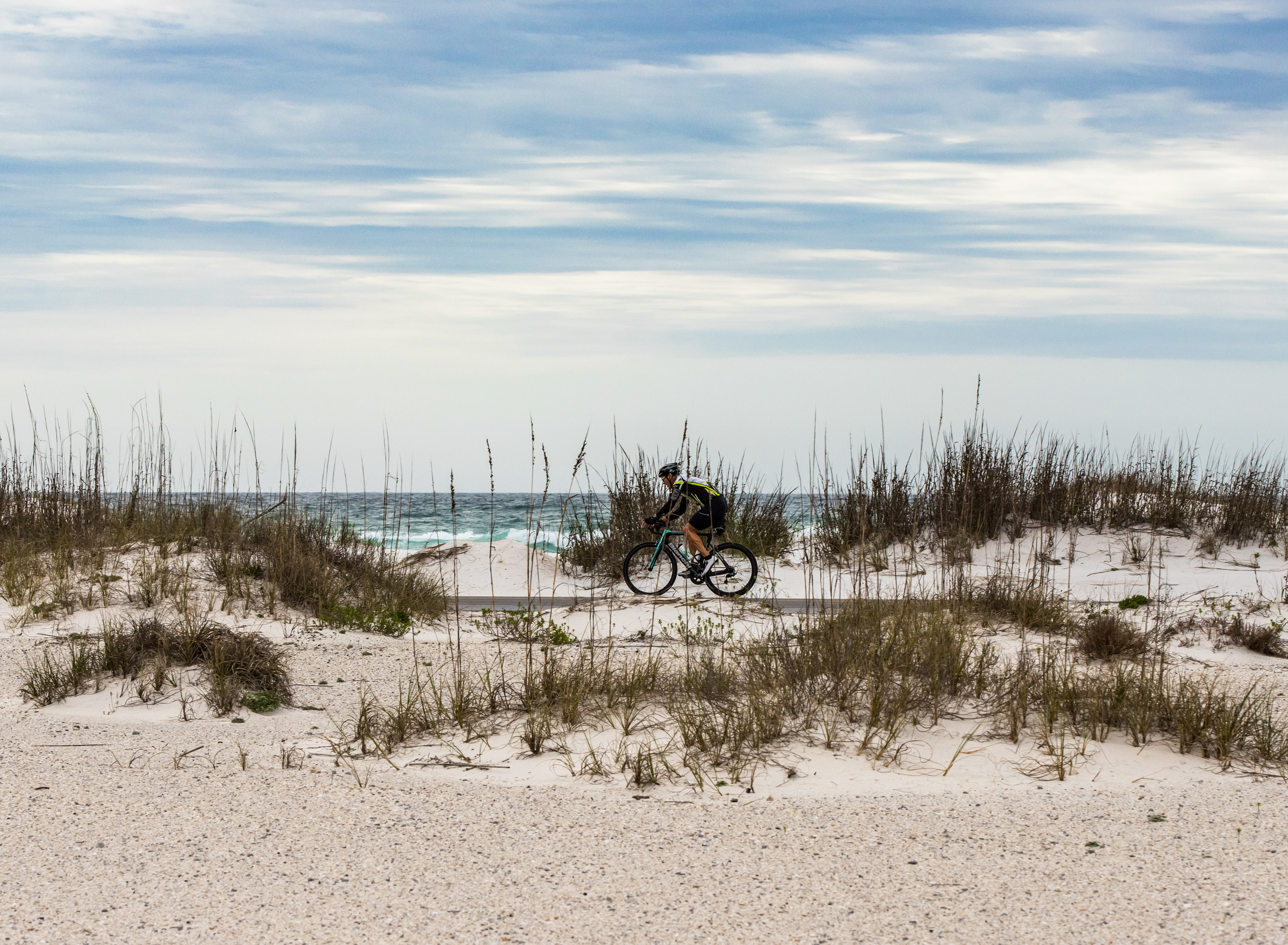
Ride your Bike at Gulf Islands
Ride your bicycle for miles up and down the scenic coastal roads of Gulf Islands.
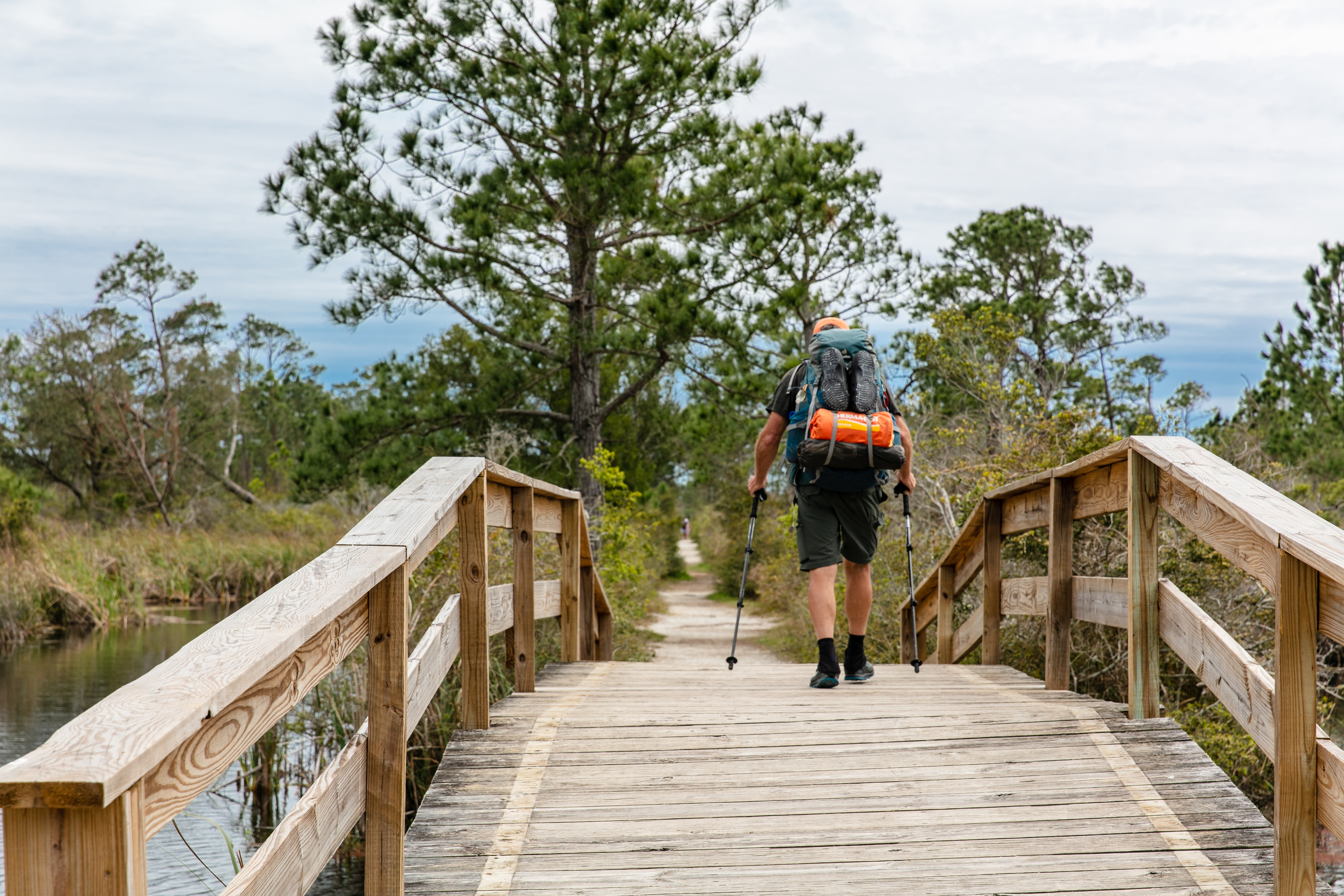
Florida National Scenic Trail
This 36-mile contiguous section of the Florida National Scenic Trail is the southernmost portion of trail. This moderately strenuous hike can be difficult to traverse at certain times of year. The trail can be under up to 3 to 4 feet of water in the rainy season. During the dry season, there can be little to no water along the trail.
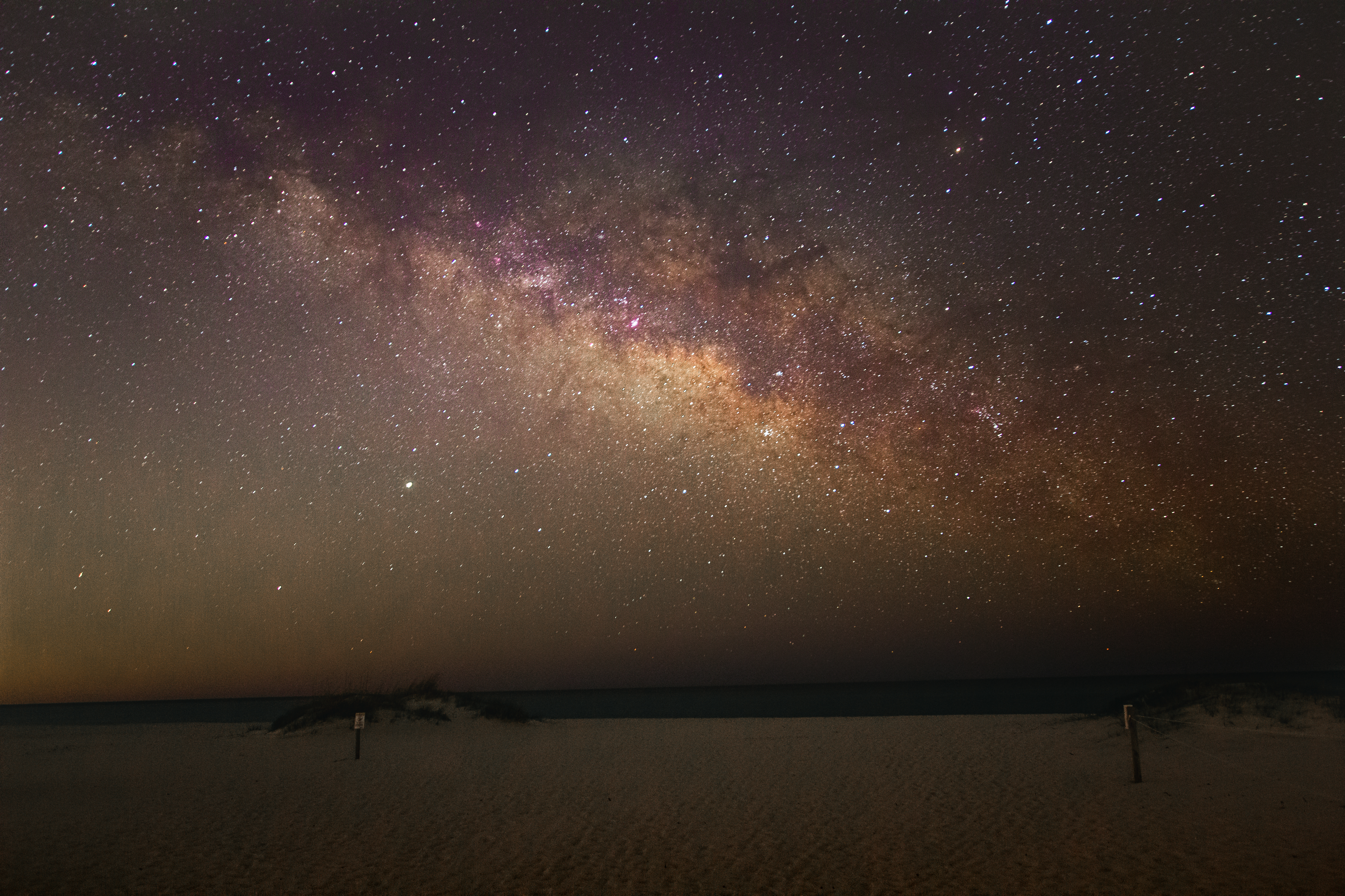
View the Night Sky at Gulf Islands
Come explore the dark side of Gulf Islands National Seashore!
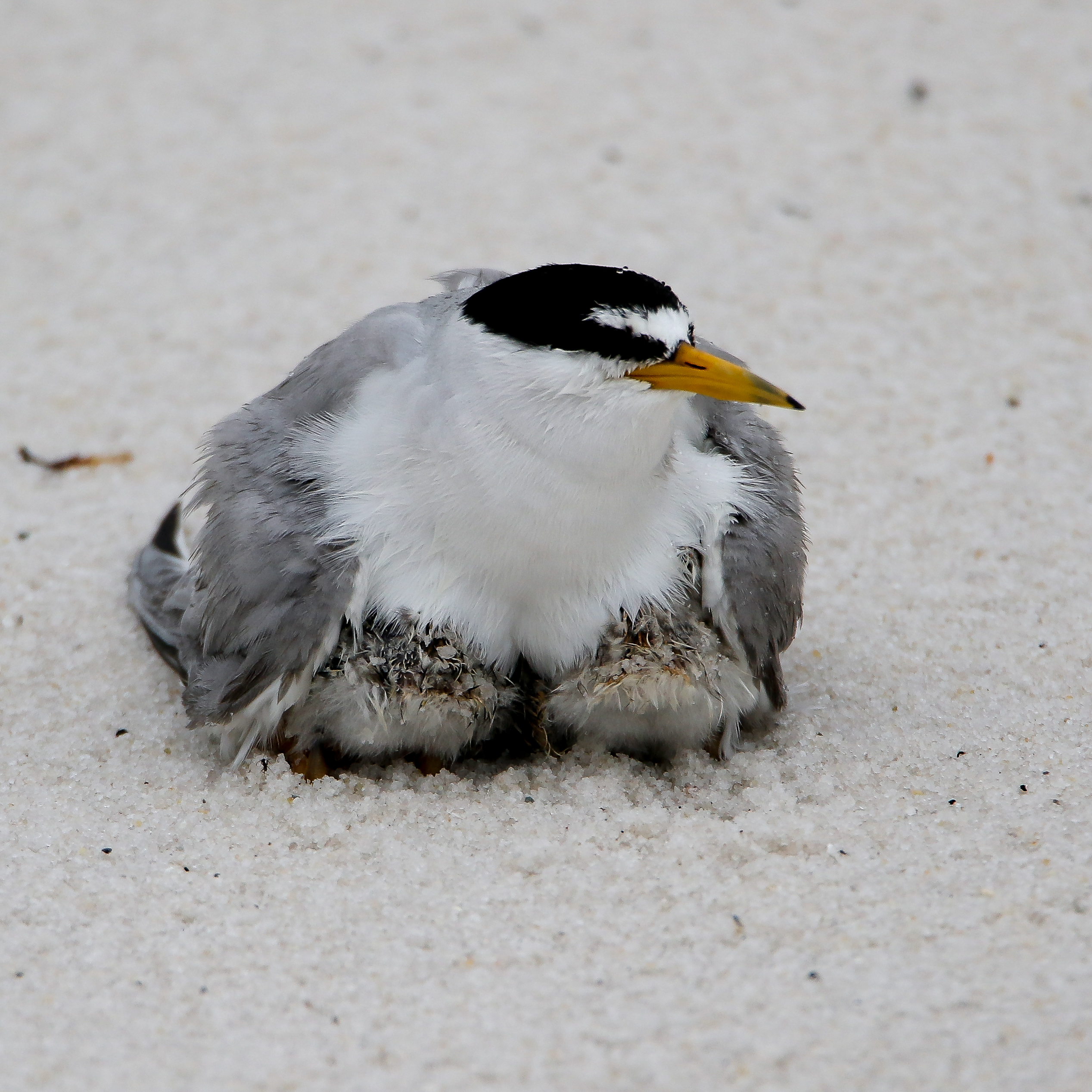
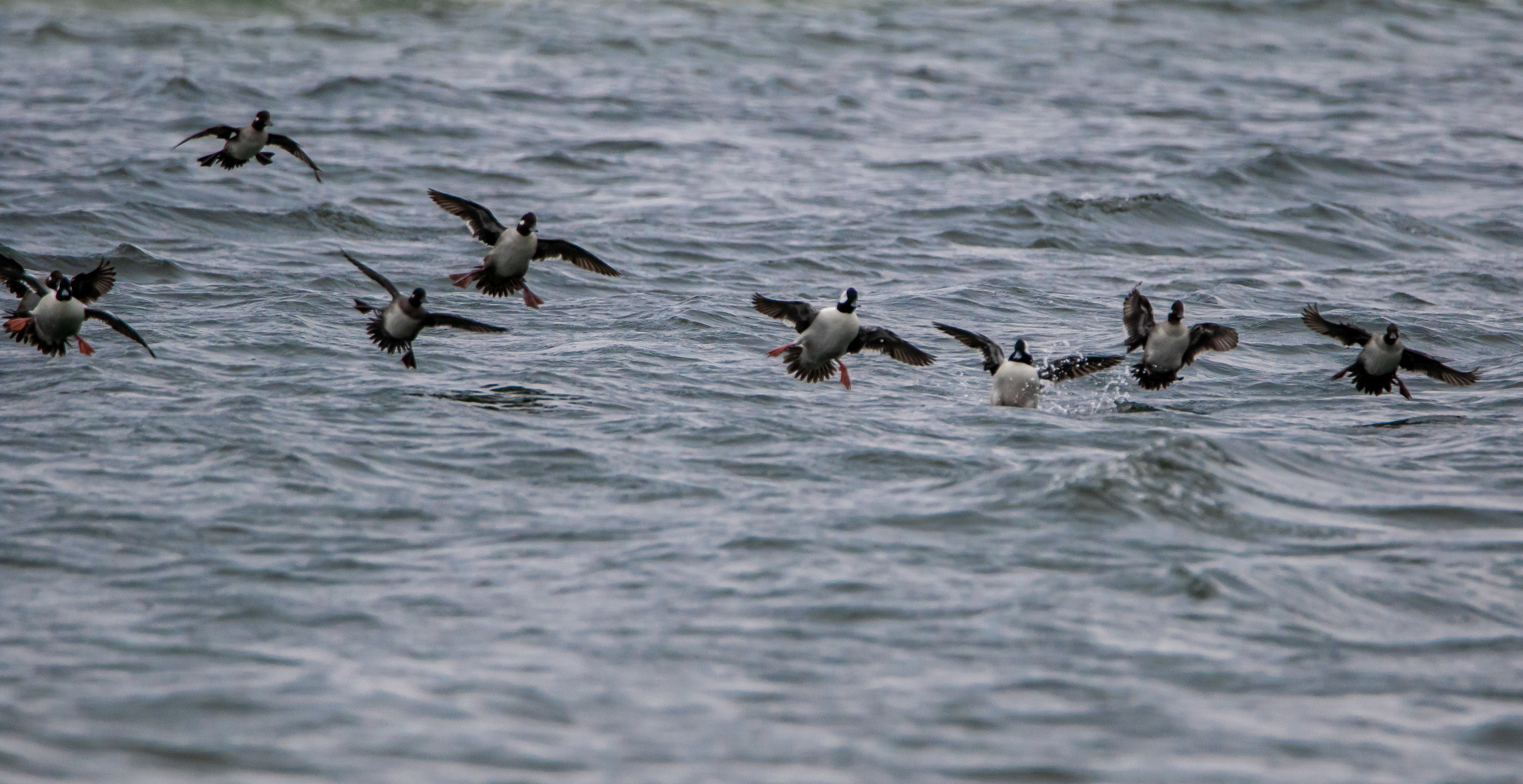
Birdwatching at Gulf Islands
More than 280 species of birds have been sighted in Gulf Islands National Seashore, which is featured on Florida and Mississippi birding trails. Whether you are a beginning birder or an avid ornithologist, you'll enjoy the abundant wildlife found at Gulf Islands.
Go Waterfowl Hunting
Learn about how and where to hunt for waterfowl at Gulf Islands.
Go for a Hike at Gulf Islands
Find trails in all sections of the park to explore.
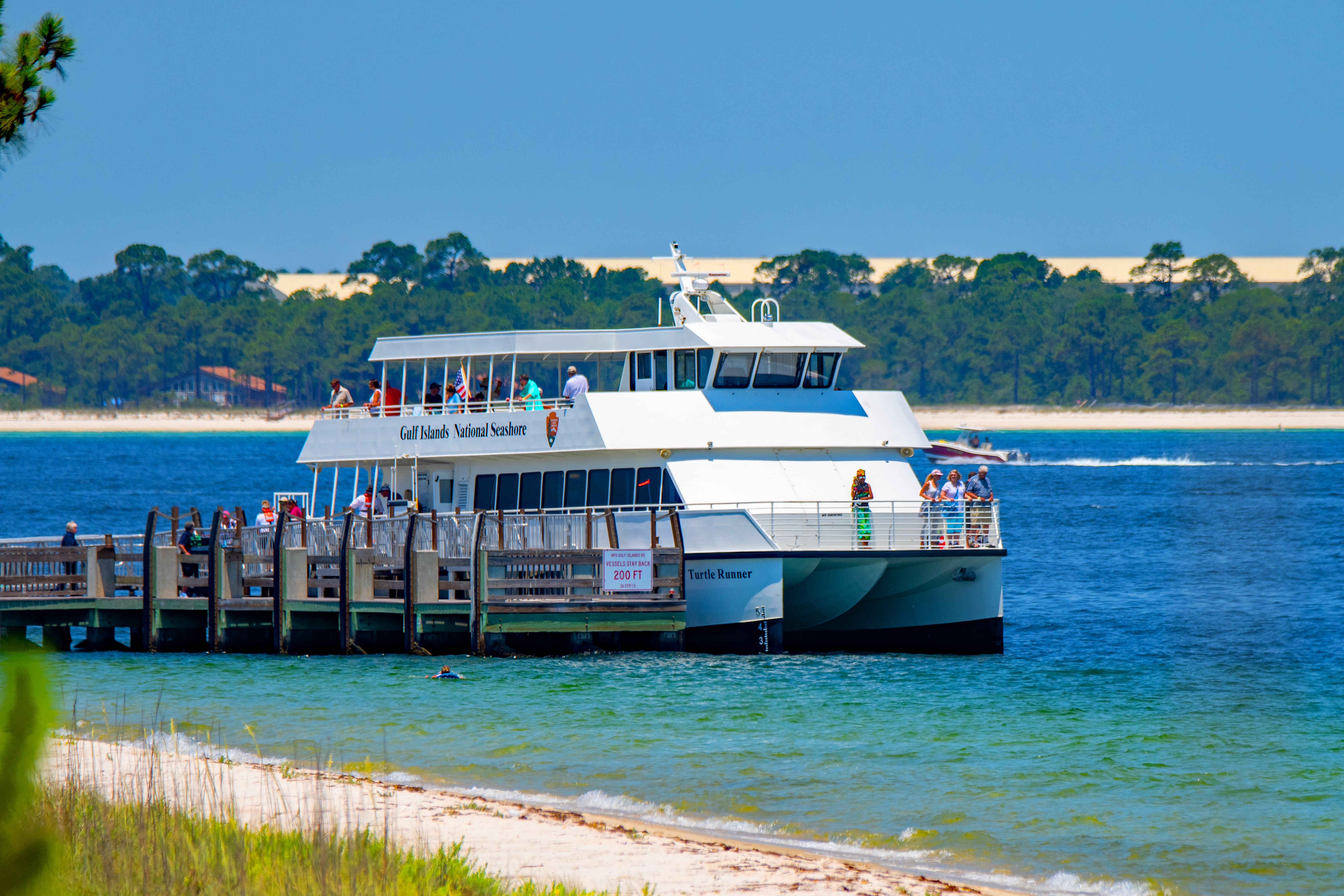
Ride the Ferry
Ride the to Pensacola Beach, Fort Pickens, or Ship Island.
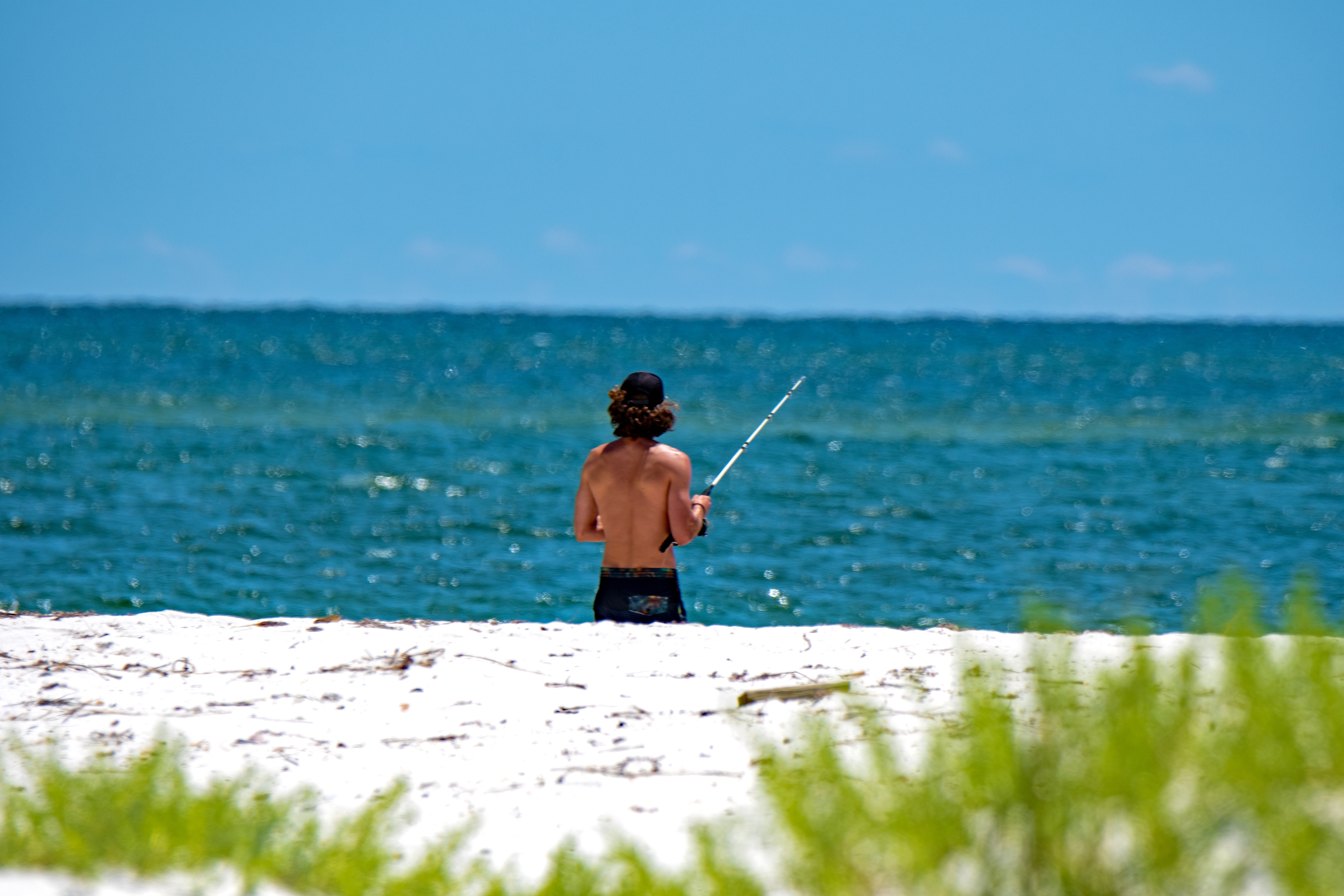
Fishing at Gulf Islands
Fishing is a great way to enjoy the waters of Gulf Islands National Seashore. Anglers may enjoy casting from shore, a pier, or off a boat. Learn more about what's in season, size and take limits, and what to catch.
Tours
Count: 8
Advanced Redoubt Walking Tour
The United States Army Corps of Engineers designed and built Advanced Redoubt between 1845-1870. With the construction of this fort, the United States established complete control of Pensacola Bay and ensured the safety of the Pensacola Navy Yard. Walk around the structure to learn about how this fort would have operated.
CCC Spur Trail Tour
The CCC Spur Trail is a 0.2 mile long hiking trail that takes visitors through the woodlands surrounding the bayou, ending at an outlook point that faces the water. The trail is named for the Civilian Conservation Corps who were responsible for creating this recreation area in 1938. While on this trail visitors can view the remnants of the CCC settlement while experiencing the biodiversity of Mississippi forest habits.
Davis Bayou Scenic Tour
Gulf Islands National Seashore in Mississippi is a great place to observe a variety of habitats, including many offshore. Davis Bayou is one of the unique areas in our park that allows visitors to experience the natural marsh and waterways without leaving land. Within Davis Bayou there are many overlooks that provide great views and picture opportunities. This guided tour takes you to some of the best spots in the park so you can enjoy these hidden gems.
Florida National Scenic Trail Tour
The Florida National Scenic Trail stretches about 1,400 miles from Gulf Islands National Seashore to Big Cypress National Preserve. The northernmost section of the trail, located within this park, begins at Fort Pickens and runs parallel to the coastline for 7 miles before exiting the park, then reentering in the Santa Rosa area for another 7 miles. The first few miles of trail provide opportunities to view wildlife, camp, and dip your toes in the ocean.
Fort Barrancas Walking Tour
As a Third System fort, Fort Barrancas belonged to one of the most advanced systems of seacoast defenses in the world. Built between 1839–1844, the fort helped defend Pensacola Bay and the Pensacola Navy Yard from foreign attack. While seen as a symbol of peace, the fort was born from a great injustice. Today Fort Barrancas stands as a monument to human ingenuity and a memorial to the victims and survivors of enslavement. Begin your visit at the Fort Barrancas Visitor Center before your tour.
Fort Massachusetts WalkingTour
Walk through history at Fort Massachusetts, located on the remote Ship Island. Take a ferry or personal vessel to the island about 12 miles offshore and step back in time to the Civil War era.
Fort Pickens Area Driving Tour
Learn about historical structures, stop by the beach, and walk through a Civil War era fort on your drive through the Fort Pickens area.
Fort Pickens Walking Tour
By 1825, legislation was passed to establish a navy yard and depot on the Pensacola Bay. Fortifications were needed to protect the new territory. Fort Pickens worked with Fort McRee on Perdido Key to guard the entrance to Pensacola Bay. Fort Barrancas and Advanced Redoubt guarded the Pensacola Navy Yard from land attacks. Fort Pickens joined the National Park Service's Gulf Islands National Seashore in 1971. Today the fort stands as a monument to military technology and as a memorial to past injustices