Be advised that the NPS has issued alerts for this park.
Seasonal Summer Closures and Fire Restrictions
As part of its seasonal operations, the park is implementing the routine summer closure of select campgrounds. Parkwide fire restrictions are in effect from June 15 until October 1. No open fires.
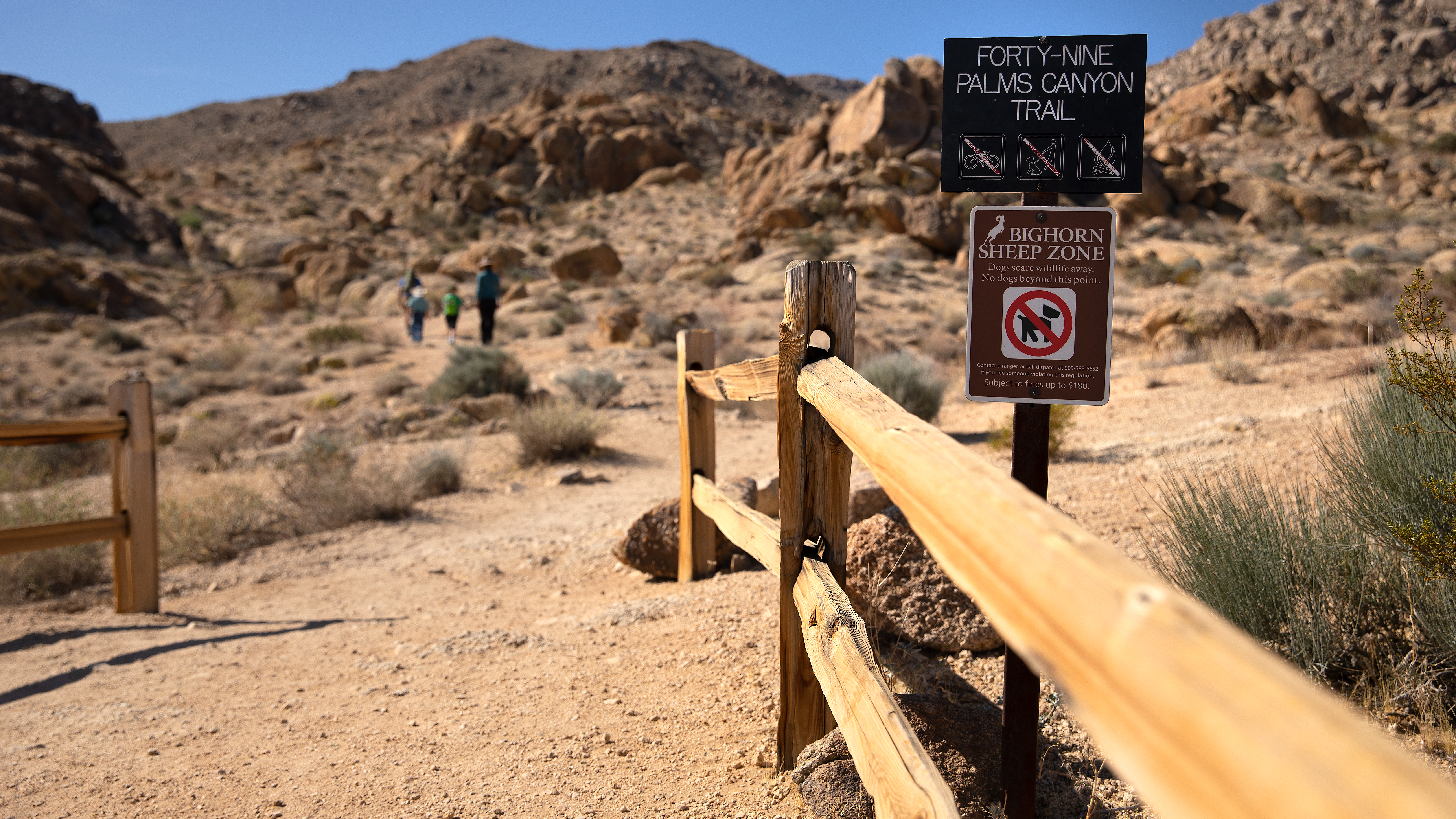
49 Palms Closed Due to Storm Damage
The trail will remain closed until November 7 while trail and road crews remove debris and ensure the trail is safe for visitor use
Oasis of Mara Trail Closed
Due to a heavy flooding event, the Oasis of Mara Trail is closure until further notice.
Inaccurate Third-Party Apps
Some third-party hiking apps are providing inaccurate trail and safety information to users. Please use the official NPS app for accurate information.
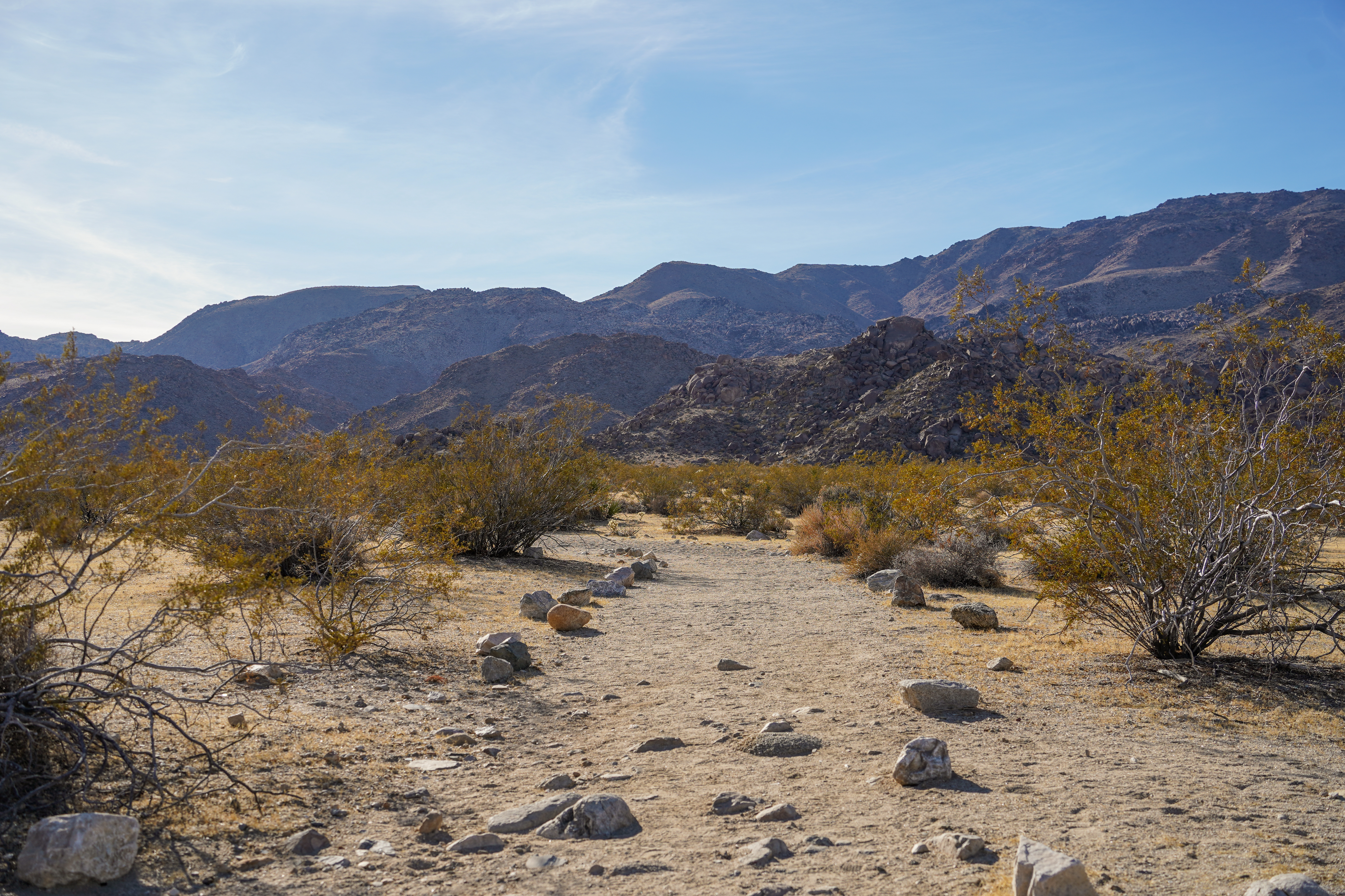
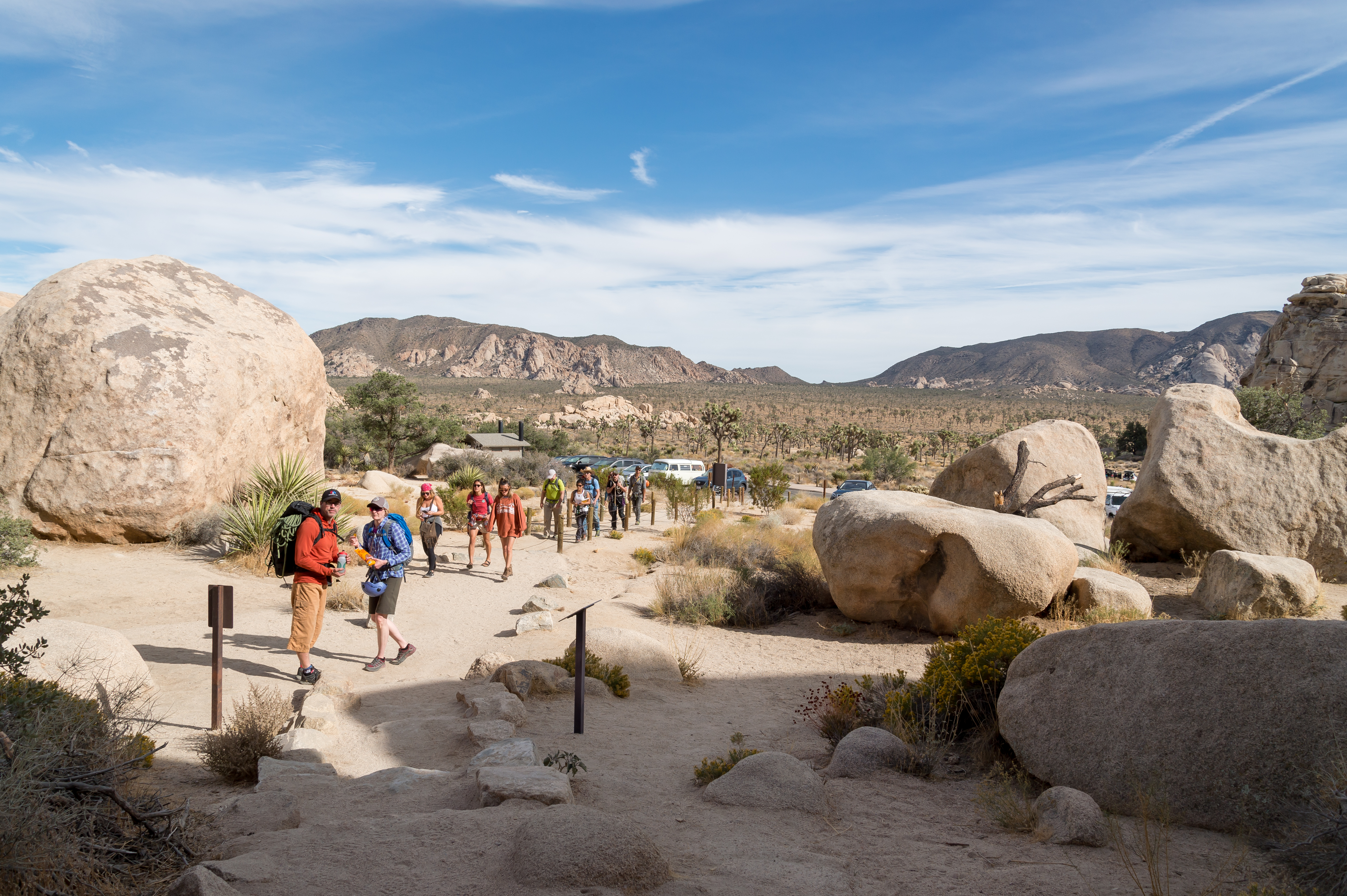
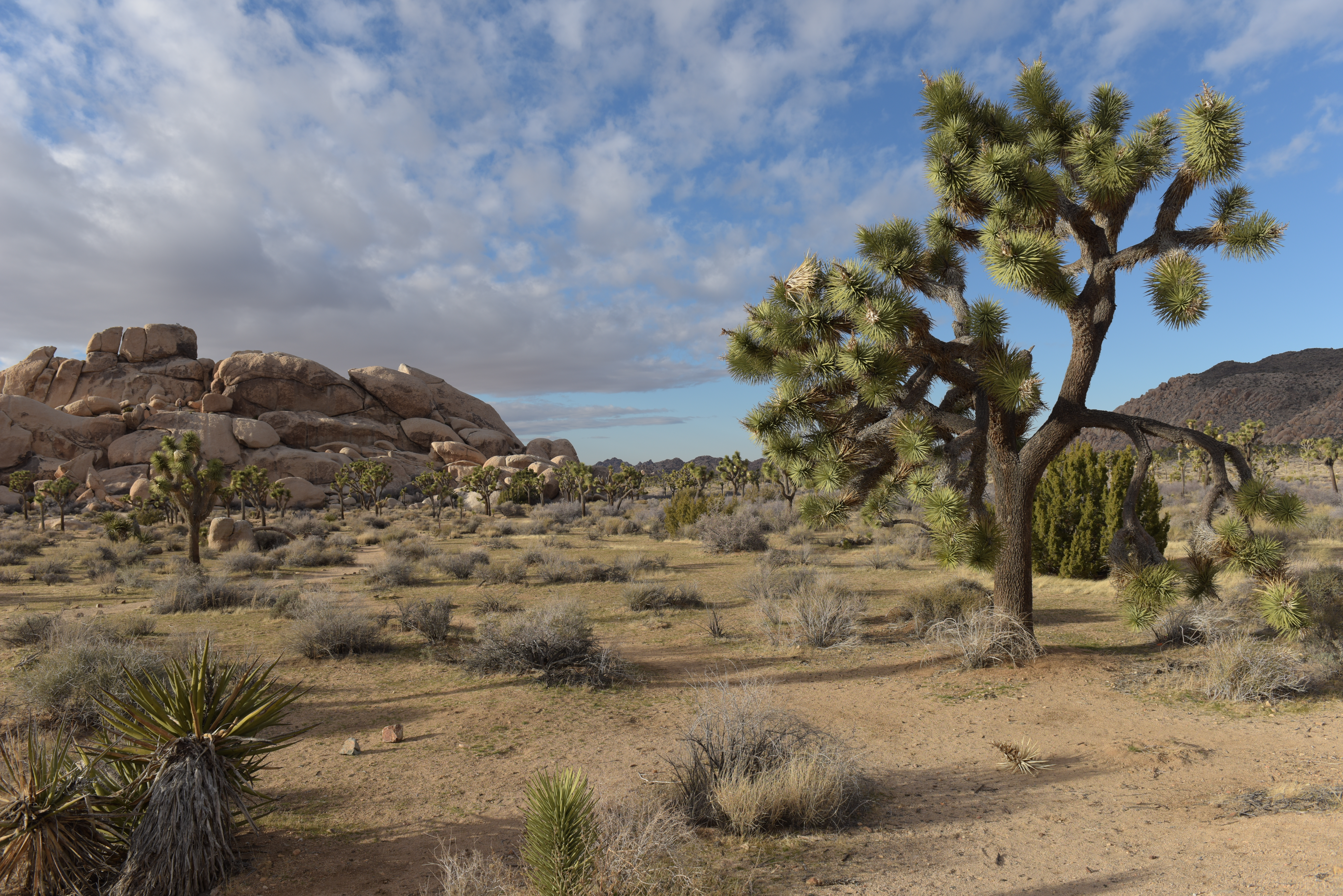
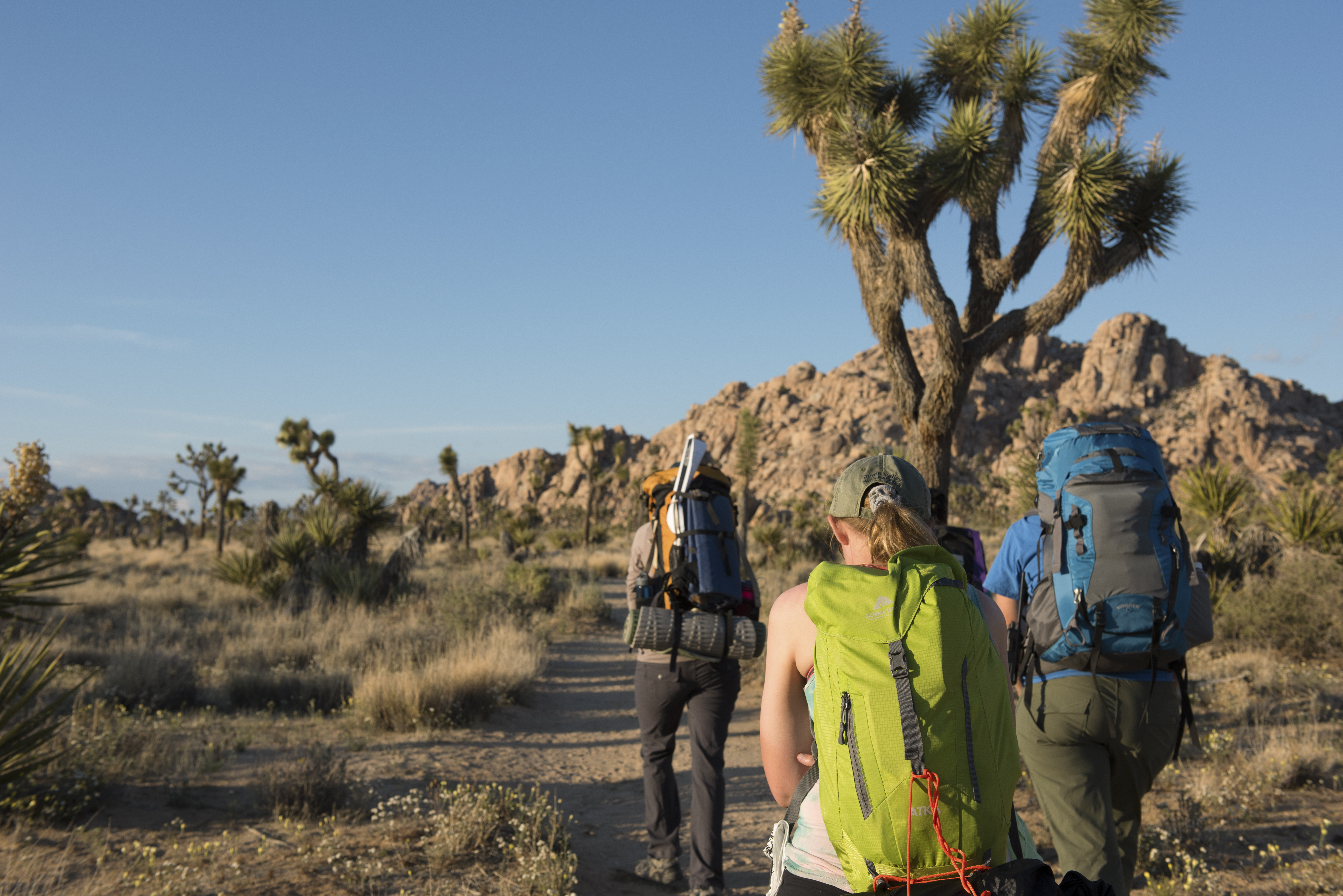
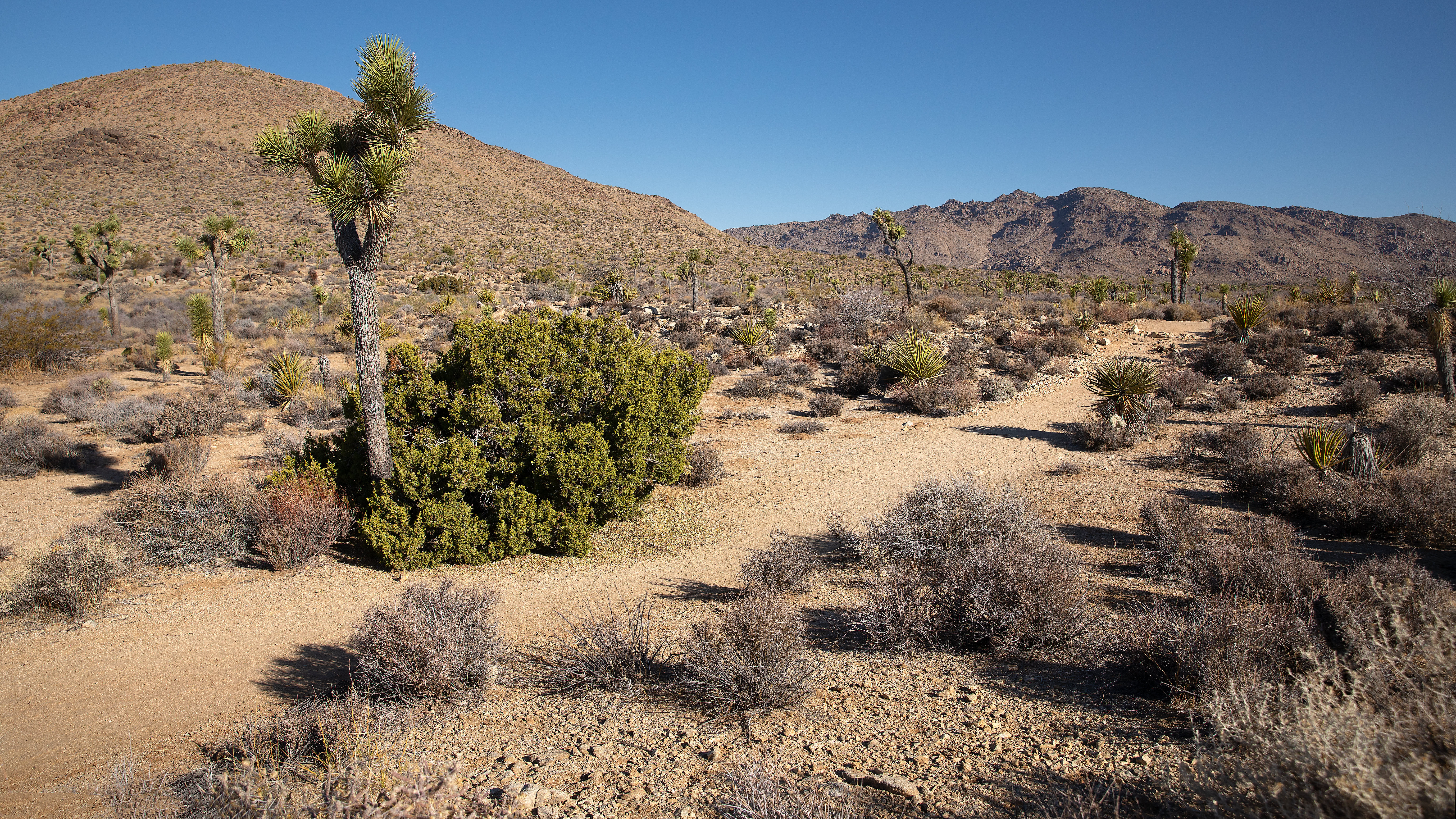
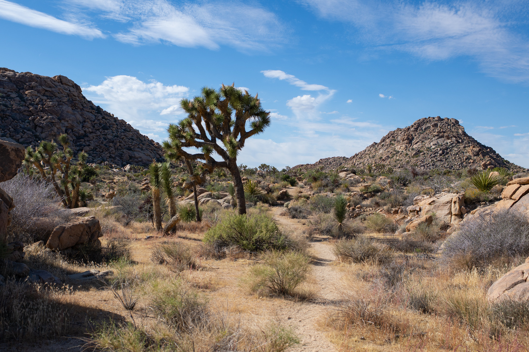
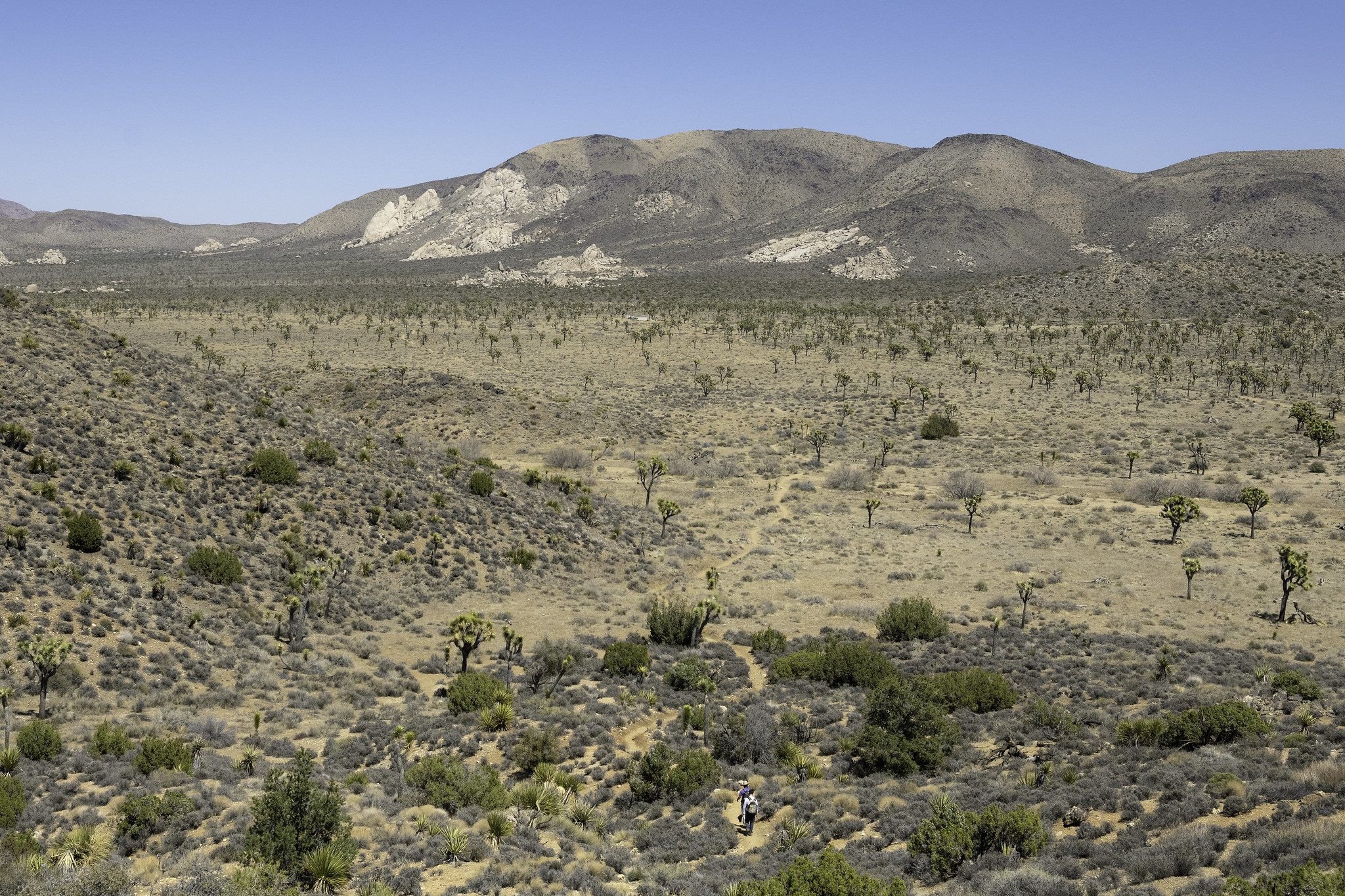
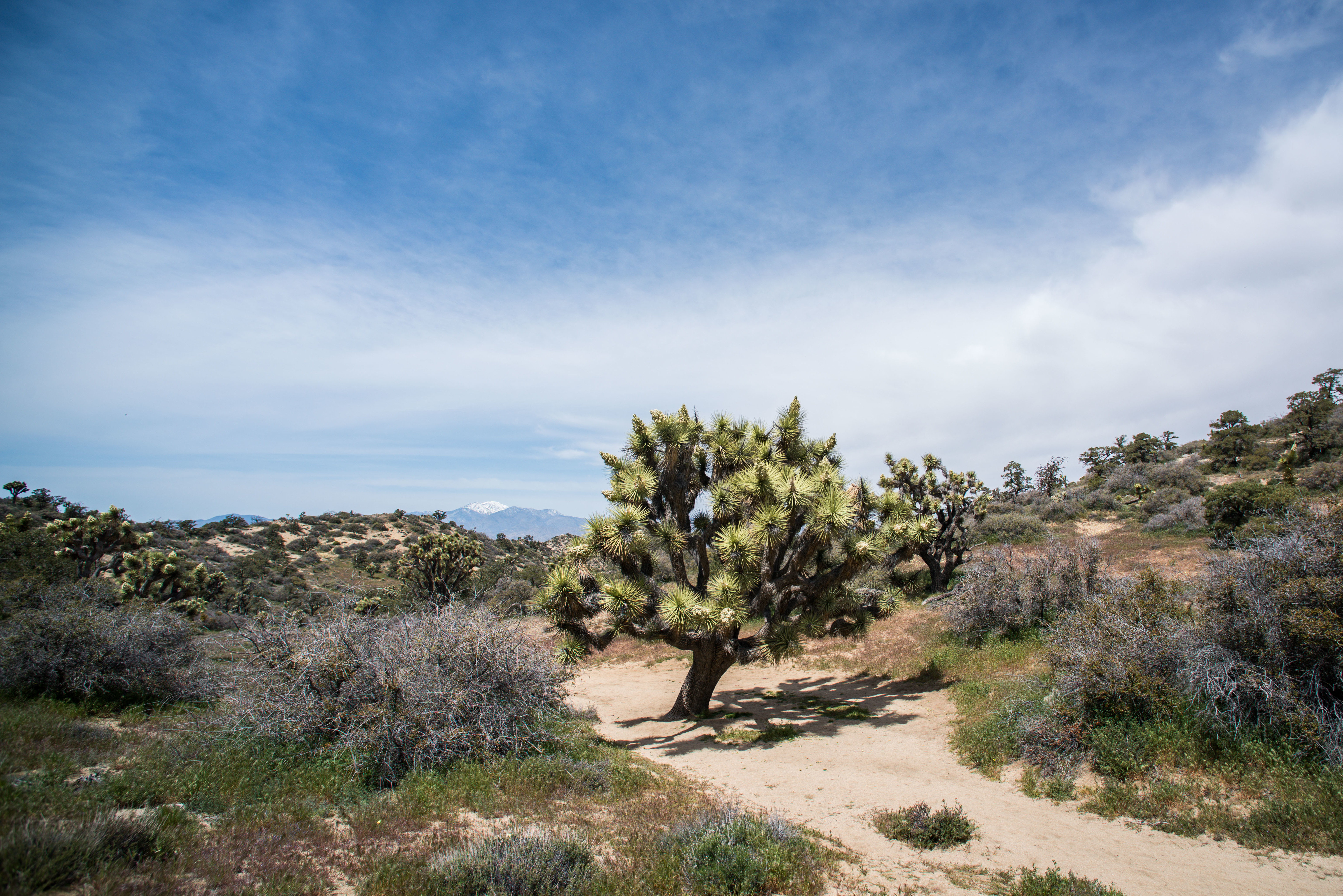
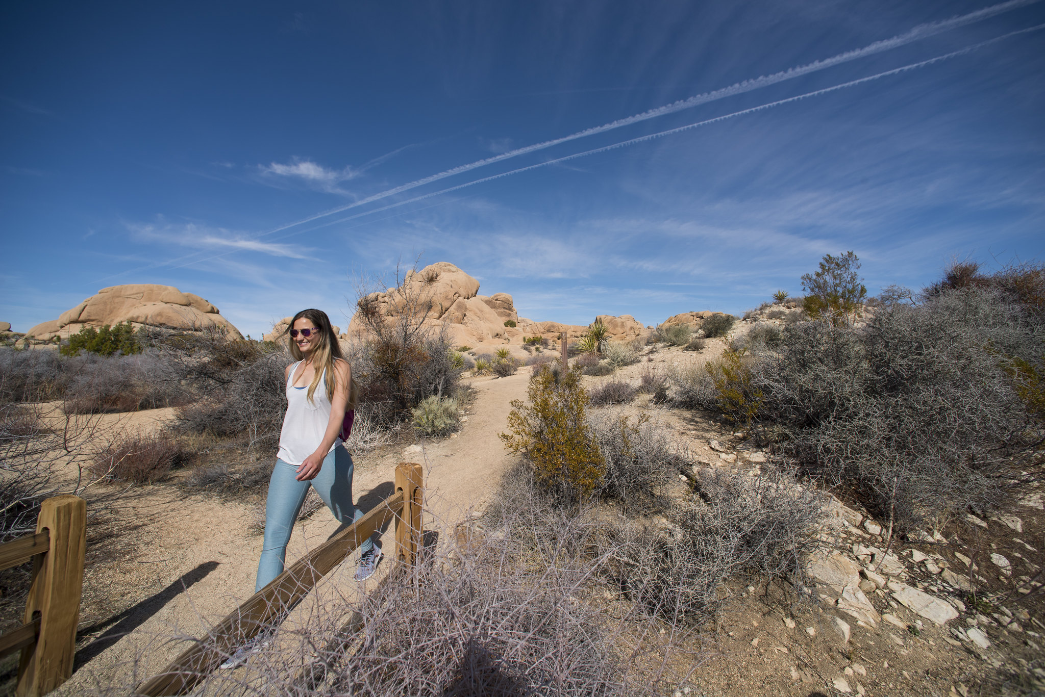
Two distinct desert ecosystems, the Mojave and the Colorado, come together in Joshua Tree National Park. A fascinating variety of plants and animals make their homes in a land sculpted by strong winds and occasional torrents of rain. Dark night s...
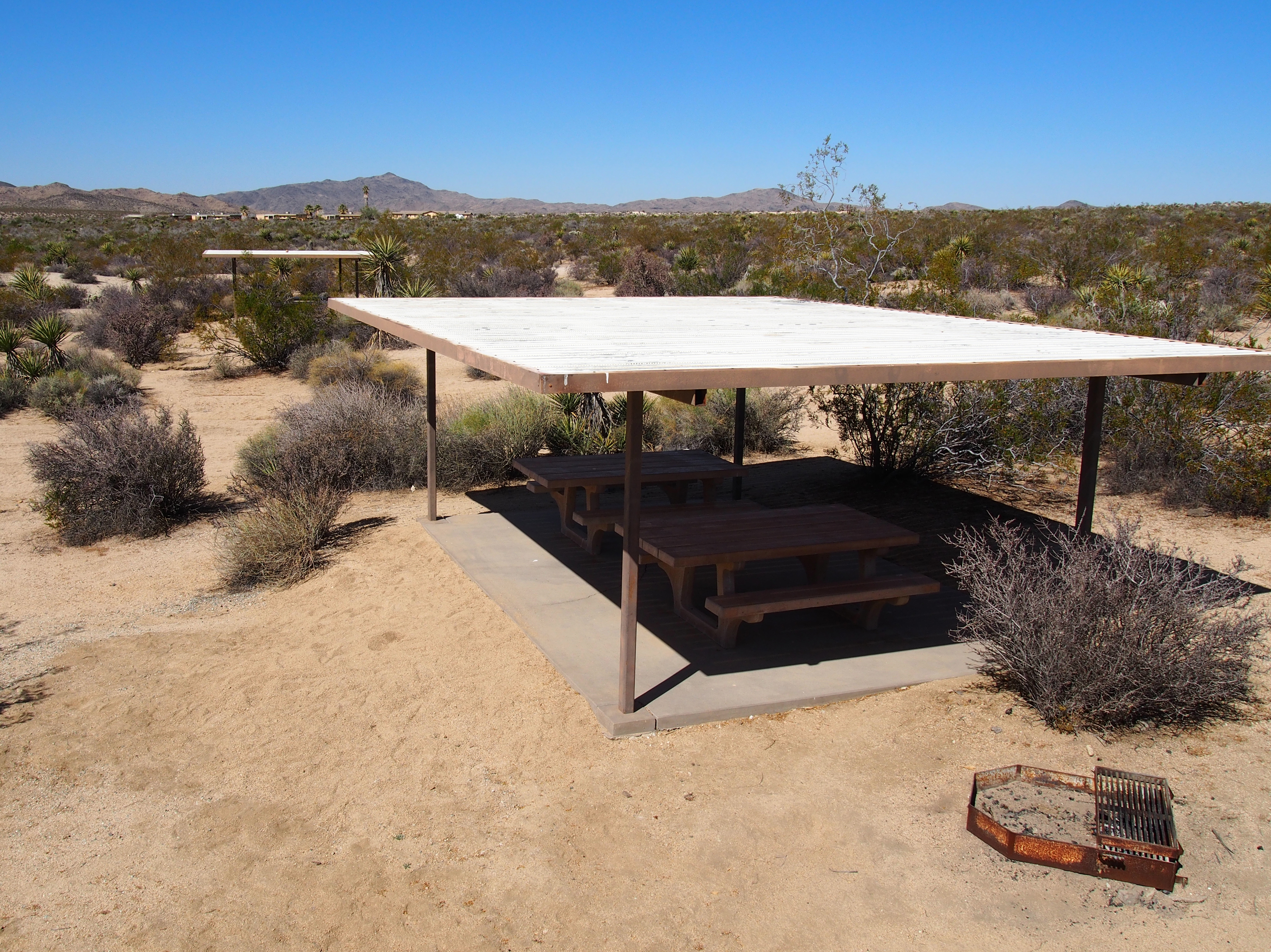
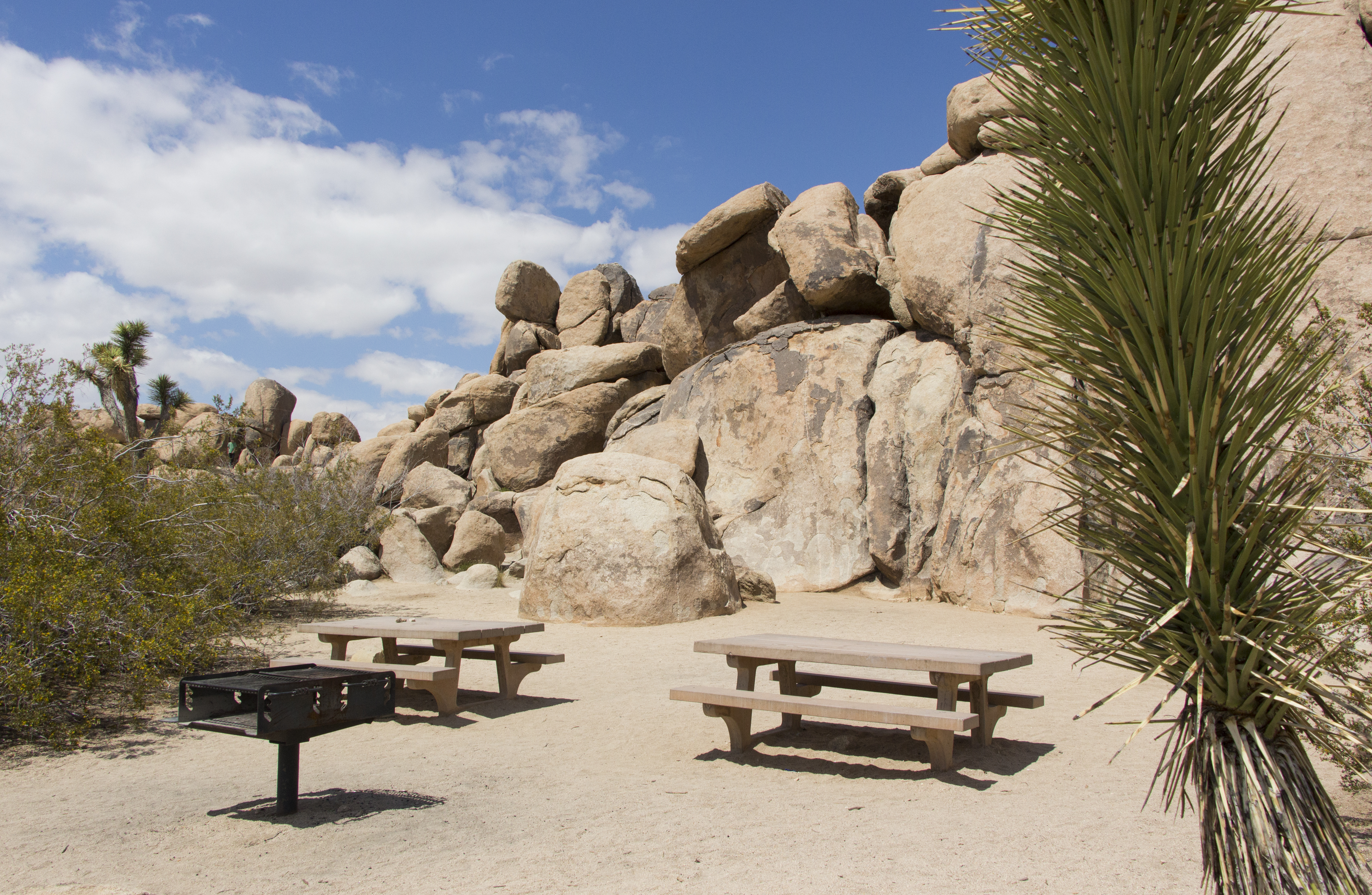
Belle Campground is a desert campground nestled among rock formations. The campground is made up of a single dirt road with a loop at the end with camping spots to accommodate tents and RVs. Each camping spot has a dirt parking area, picnic table, fire pit, and campsite marker. The ground is hard and rocky. Throughout the campground there are many Joshua trees, small trees, and shrubs. Scattered around the campground you can find trash and recycling cans as well as two bathrooms.
Reservations are required year-round and can be made up to six months in advance. Book a site at www.recreation.gov or by calling 877-444-6777.
The Black Rock Campground is a desert campground nestled among rocky mountains. The campground is made up of several loops with dirt roads and camping spots to accommodate tents and RVs. Each camping spot has a dirt parking area, picnic table, fire pit, and campsite marker. The ground is hard and rocky. Throughout the campground there are many Joshua trees, small trees, and shrubs. Scattered around the campground you can find trash and recycling cans, bathrooms, and several trailheads. In the center of the campground is the Black Rock Nature Center, a yellow one story building with a parking area where people can view exhibits and learn about the park.
Reservations are required year-round and can be made up to six months in advance. Book a site at www.recreation.gov or by calling 877-444-6777.
Cottonwood Campground is a desert campground in a large open area with mountains in the distance. The campground is made up of a main paved road going past three group campsites followed by two loops with regular camping spots to accommodate tents and RVs. Each camping spot has a paved parking area, picnic table, fire pit, and campsite marker. The ground is hard and rocky. Throughout the campground there are many many shrubs and a few scattered small trees. Scattered around the campground you can find trash and recycling cans, bathrooms, and a couple of trailheads.
Hidden Valley Campground is first-come, first-served year round.
Hidden Valley Campground is a desert campground nestled among rocky outcrops and large boulders. The campground is made up of a mix of paved and dirt roads making a couple of small loops with camping spots to accommodate tents and RVs. Each camping spot has a dirt parking area, picnic table, fire pit, and campsite marker. The ground is hard and rocky. Throughout the campground there are many Joshua trees, small trees, and shrubs. Scattered around the campground you can find trash and recycling cans, bathrooms, and a couple of trailheads
Reservations are required year-round and can be made up to six months in advance. Book a site at www.recreation.gov or by calling 877-444-6777.
Indian Cove Campground is a desert campground nestled among rocky outcrops and mountains. The campground is made up of a mix of paved and dirt roads making several loops with camping spots to accommodate tents and RVs. Each camping spot has a dirt parking area, picnic table, fire pit, and campsite marker. The ground is hard and rocky. Throughout the campground there are many Joshua trees, small trees, and shrubs. Scattered around the campground you can find trash and recycling cans, bathrooms, and a couple of trailheads.
Reservations are required year-round and can be made up to six months in advance. Book a site at www.recreation.gov or by calling 877-444-6777.
Jumbo Rocks Campground is a desert campground nestled among large rock formations. The campground is made up of paved roads with several loops with camping spots to accommodate tents and RVs. Each camping spot has a parking area, picnic table, fire pit, and campsite marker. The ground is hard and rocky. Throughout the campground there are many Joshua trees, small trees, and shrubs. Scattered around the campground you can find trash and recycling cans, bathrooms, and a couple of trailheads.
Reservations are required year-round and can be made up to six months in advance. Book a site at www.recreation.gov or by calling 877-444-6777.
Ryan Campground is a desert campground nestled among rocky outcrops and mountains. The campground is has a dirt road with a main loop for regular camping spots to accommodate tents and RVs as well as a small side loop for horse campsites. Each camping spot has a dirt parking area, picnic table, fire pit, and campsite marker. The ground is hard and rocky. Throughout the campground there are many Joshua trees, small trees, and shrubs. Scattered around the campground you can find trash and recycling cans, bathrooms, and a couple of trailheads.
Reservations are required year-round and can be made up to six months in advance. Book a site at www.recreation.gov or by calling 877-444-6777. Sites can accommodate 10-60 people.
Sheep Pass Campground is a desert campground nestled among rocky outcrops and mountains. The campground is a paved and dirt road with a loop for containing six large group camping spots to accommodate tents. Each camping spot has a dirt parking area, picnic table, fire pit, and campsite marker. The ground is hard and rocky. Throughout the campground there are many Joshua trees, small trees, and shrubs. Scattered around the campground you can find trash and recycling cans, bathrooms, and a couple of trailheads.
White Tank Campground is first-come, first-served throughout the year.
White Tank Campground is a desert campground nestled among rocky outcrops and large boulders. The campground is made up of a main dirt road with two small loops and a small side road with camping spots to accommodate tents and RVs. Each camping spot has a dirt parking area, picnic table, fire pit, and campsite marker. The ground is hard and rocky. Throughout the campground there are many Joshua trees, small trees, and shrubs. Scattered around the campground you can find trash and recycling cans as well as two bathrooms. In the middle of the campground there is a parking area and a trailhead.
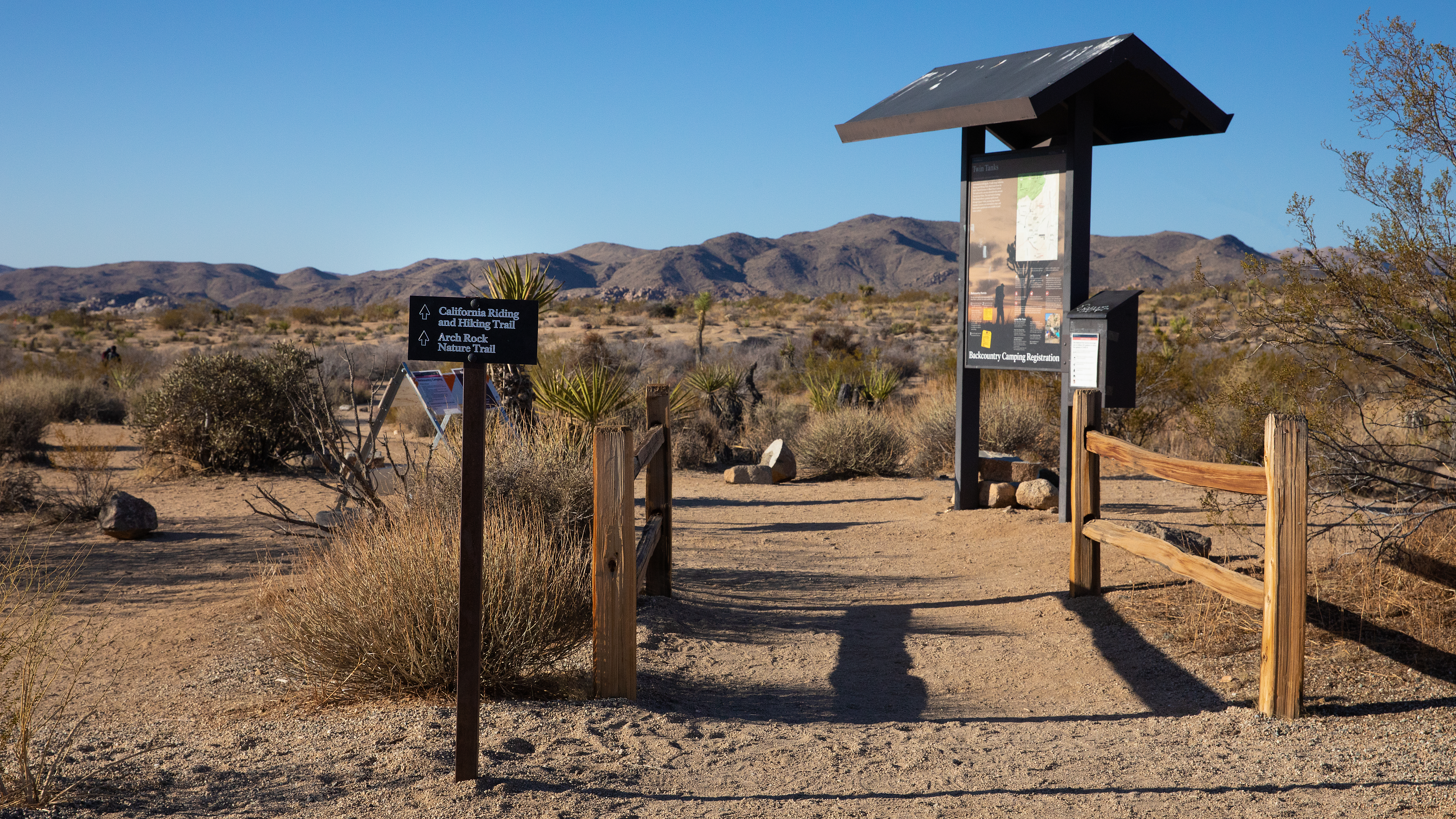
Arch Rock Nature Trailhead and the Twin Tanks Wilderness Backpacking Board.
The Twin Tanks and Arch Rock Nature Trail Trailhead is located in a wide desert valley. The trail is a dirt path that starts from the south end of a paved parking lot on the west side of Pinto Basin Road. Next to the trailhead is a wilderness backpacking board with information, an area map, and self registration box for backpacking. The area contains scattered Joshua trees, small trees, and shrubs. Rocky mountains are in the distance in every direction.
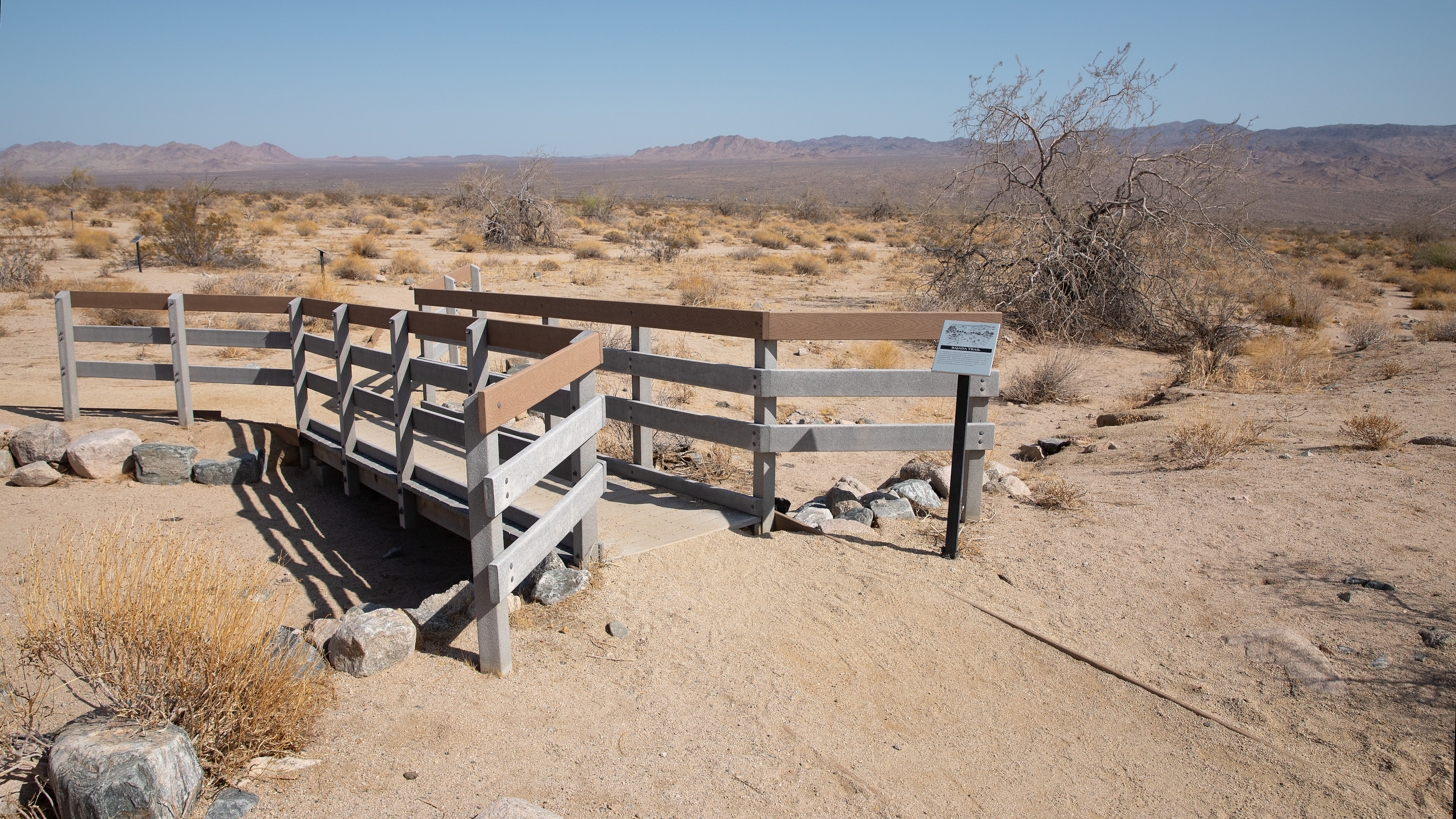
Bajada Nature Trail is located in a wide desert valley with mountains in the distance in every direction. On the east side of the road there is a paved loop parking lot with a paved sidewalk with a bulletin board with an interpretive display. Near the bulletin board a dirt and gravel trail heads off to the east. There are scattered small trees and shrubs throughout the area.
The Barker Damn Nature Trail Trailhead provides quick access to Barker Dam on a 1.1 mile hike.
The Barker Dam Nature Trail Trailhead is located in an open area with mountains to the southeast and rock formations to the northwest. There is a large paved parking lot with a dirt trail to the north and pit toilets near the trailhead. The area contains many Joshua trees, small trees, and shrubs.
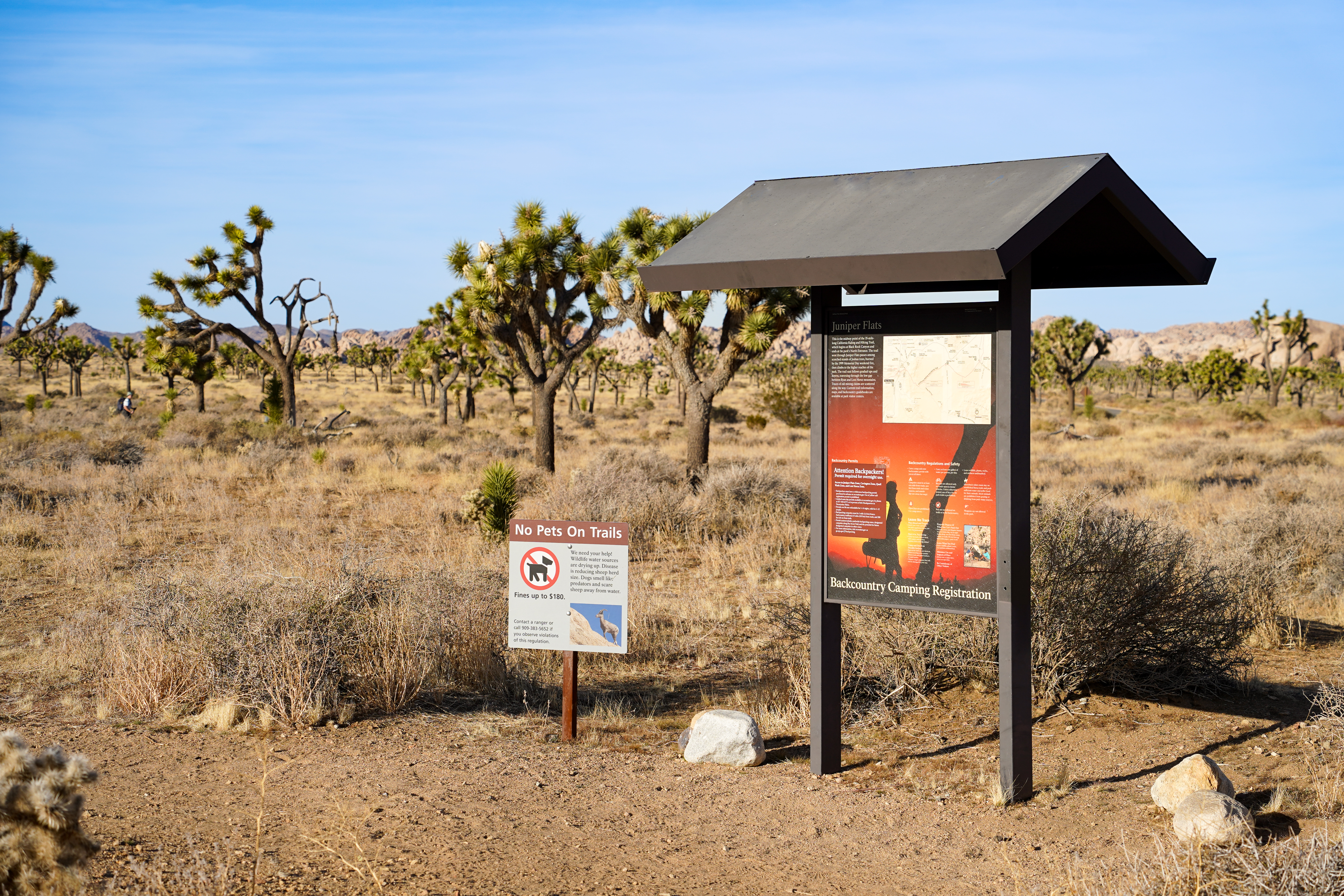
A dirt parking lot sits behind a fence post. A roofed backcountry trailhead reads "Juniper Flats" and provides information about the surrounding area. The dirt path leads away from the trailhead into a landscape with desert shrubs, grasses, and many Joshua trees. There are rocky mountains in the distance.
Learn about Bighorn Sheep at this stop on the audio tour.
The Barker Dam Nature Trail Trailhead is located in an open area with mountains to the southeast and rock formations to the northwest. There is a large, paved parking lot with a dirt trail to the north and pit toilets near the trailhead. The area contains many Joshua trees, small trees, and shrubs.
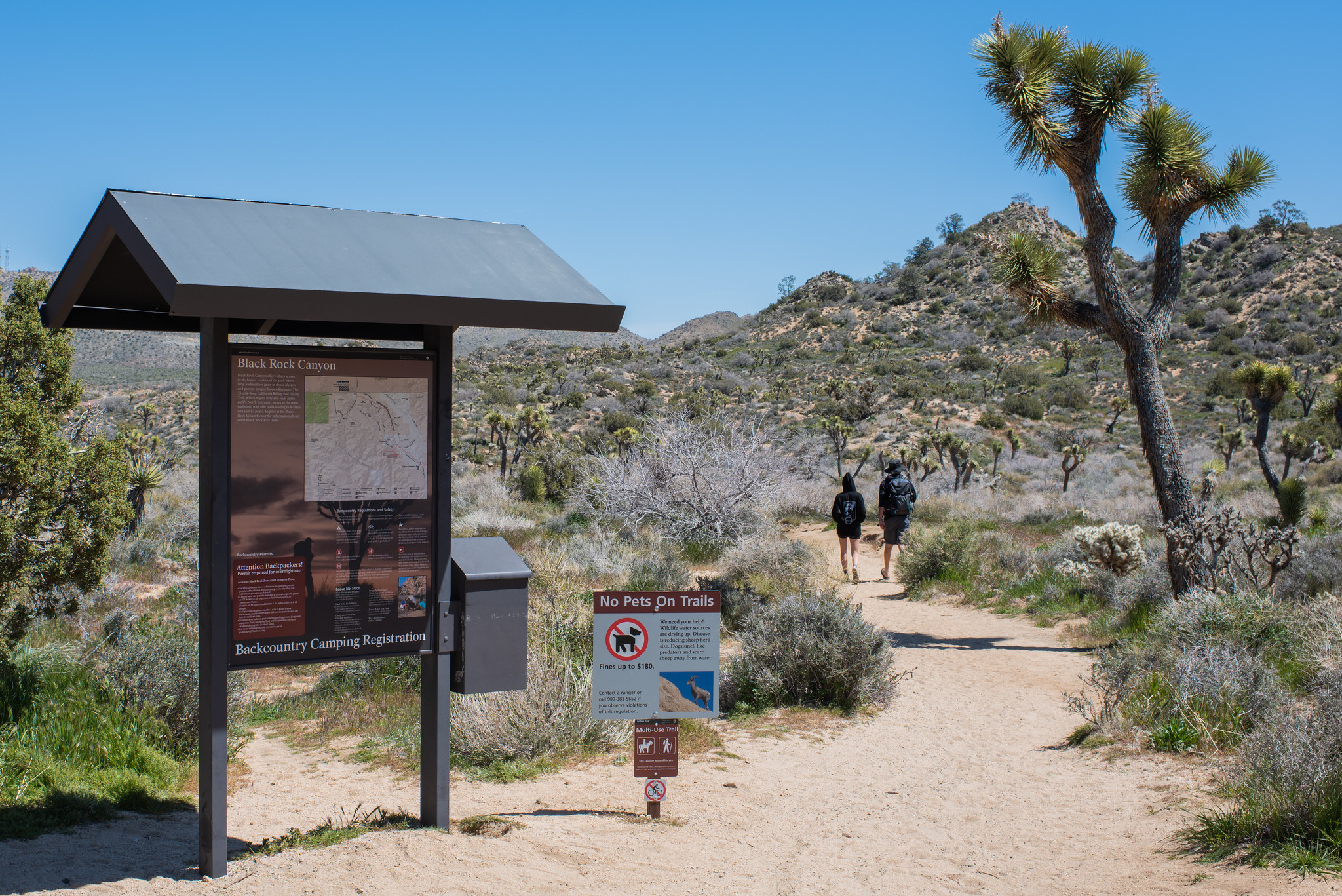
The trailhead for many hiking trails in the Black Rock area of Joshua Tree National Park.
A large sign with a small roof reads "Black Rock Canyon" and has a map of the area. Next to it is a "No Pets on Trail" sign. A dirt path leads away from the trailhead. Joshua trees, juniper bushes, yuccas, and other desert shrubs cover the landscape. Hills are visible in the distance.
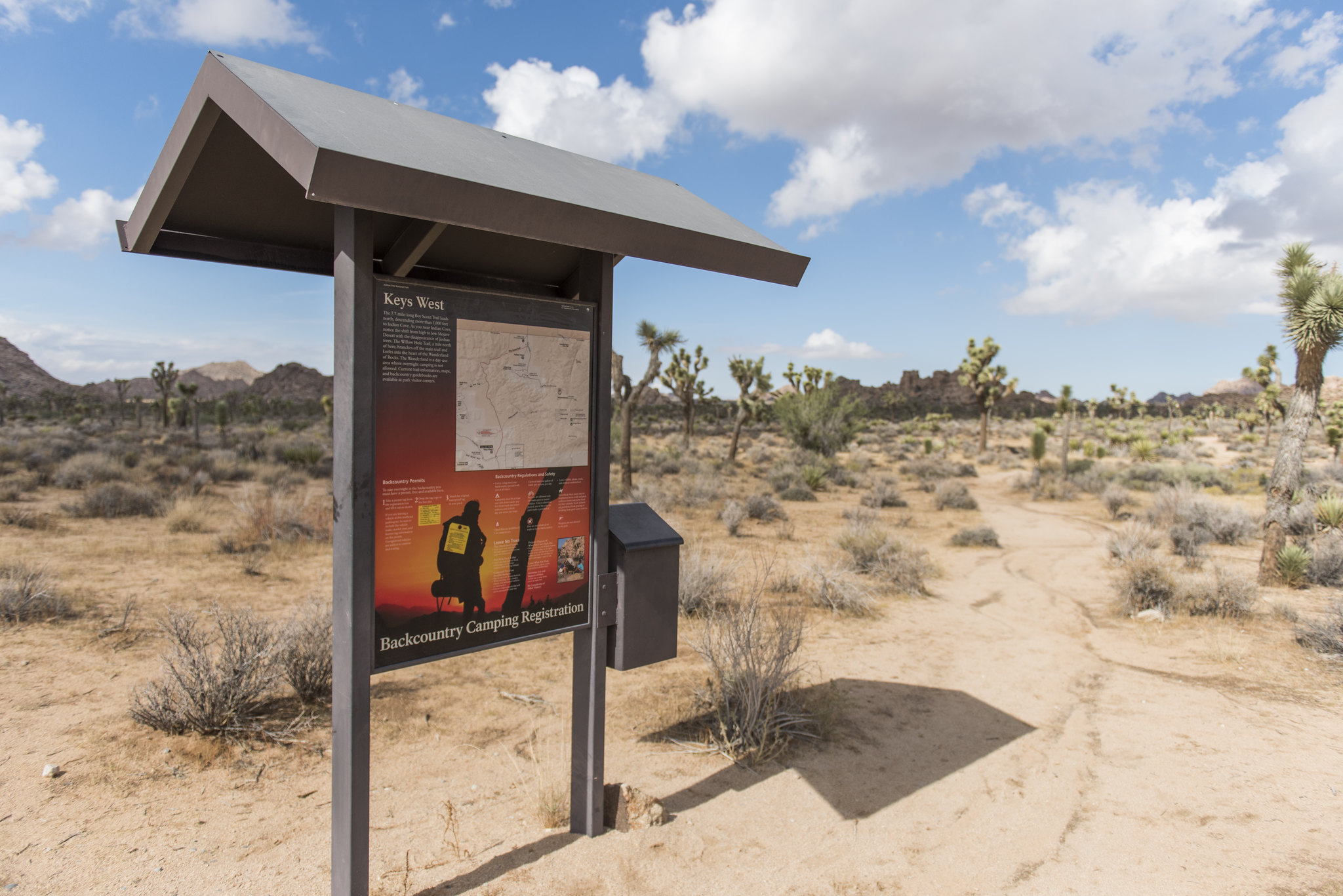
The Upper Boy Scout Trail begins at the Keys West Backpacking Board. This board is located in a wide valley along Park Boulevard. The parking area is a dirt parking lot with a pit toilet and trash cans. In the northwest corner is a trailhead with a backpacking board with info on backpacking and self registration. The area has scattered Joshua trees, small trees and shrubs. In the distance are rocky mountains.
There is a large sign with a small roof that reads "Black Rock Canyon" and provides a map and information of the area. Next to it, is a "No Pets on Trails" sign. The dirt path leads away from the right of the signs. There are Joshua trees, juniper bushes, yuccas, and other desert shrubs lining the trail and covering the landscape. There are hills that fills the background.
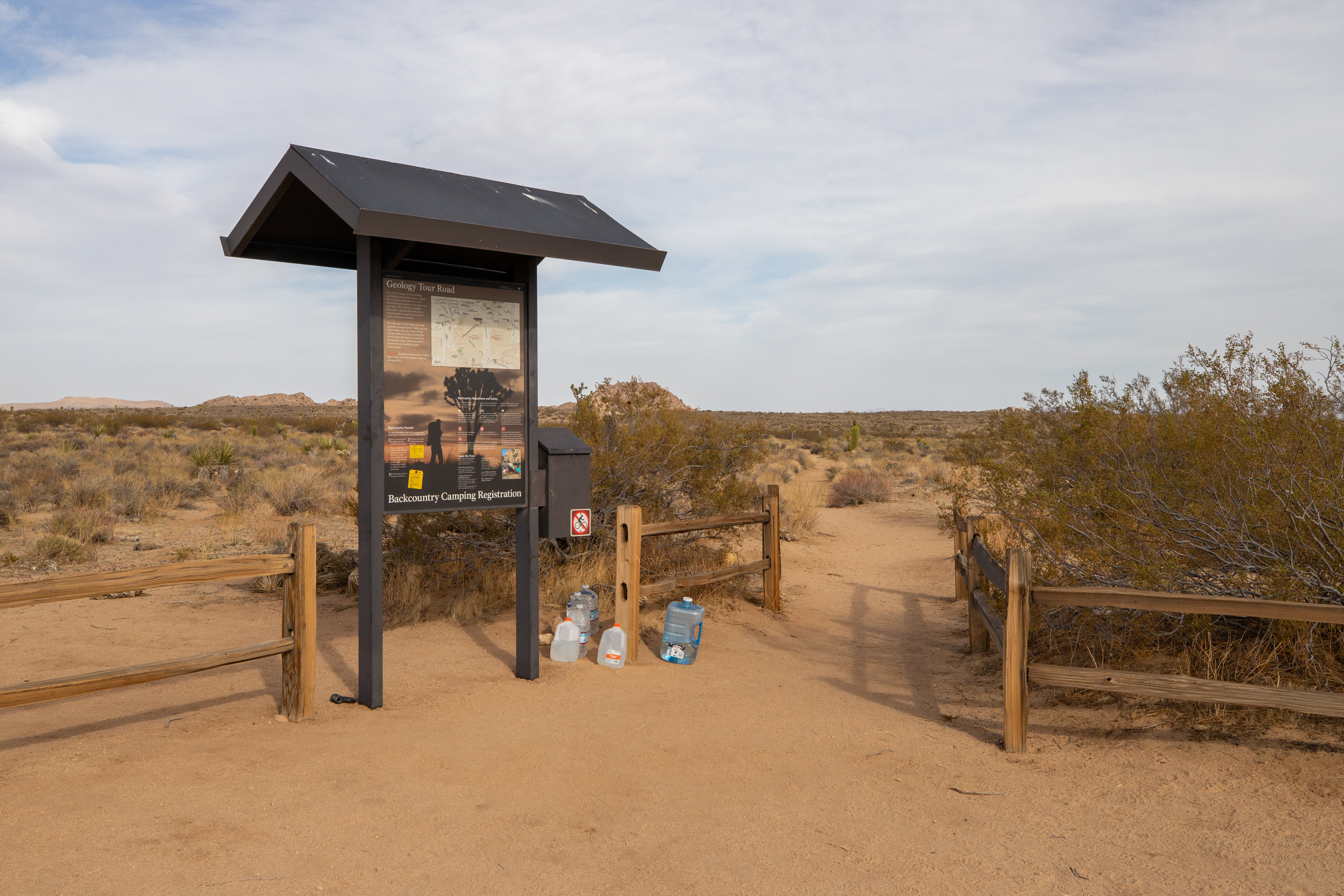
A small dirt pullout located on the east side of the dirt Geology Tour Road. There is enough space for approximately four to five vehicles at this pullout. A backcountry board with backpacking rules and safety information is located at the start of the trailhead. The trailhead also has a short wooden fence. The surrounding area is scattered with desert plants including Joshua trees, creosote bush, and Mojave yuccas.
A large sign with a small roof reads "Black Rock Canyon" and has a map of the area. Next to it is a "No Pets on Trail" sign. A dirt path leads away from the trailhead. Joshua trees, juniper bushes, yuccas, and other desert shrubs cover the landscape. Hills are visible in the distance.
Cap Rock is a popular centrally located rock formation.
Cap Rock is a large domed rock formation with a lower section extending to the north. The rock formation has many large cracks in it with large boulders and shrubs on top of it. To the south of Cap Rock is a picnic area with several picnic trees and grills in an open dirt area next to a paved parking lot. The Cap Rock Nature Trail, a dirt and gravel trail, is located on the east side of the parking lot and heads southeast through additional rock formations. The whole area is in a wide open plain filled with Joshua trees, small trees, and shrubs with rocky mountains in the distance.
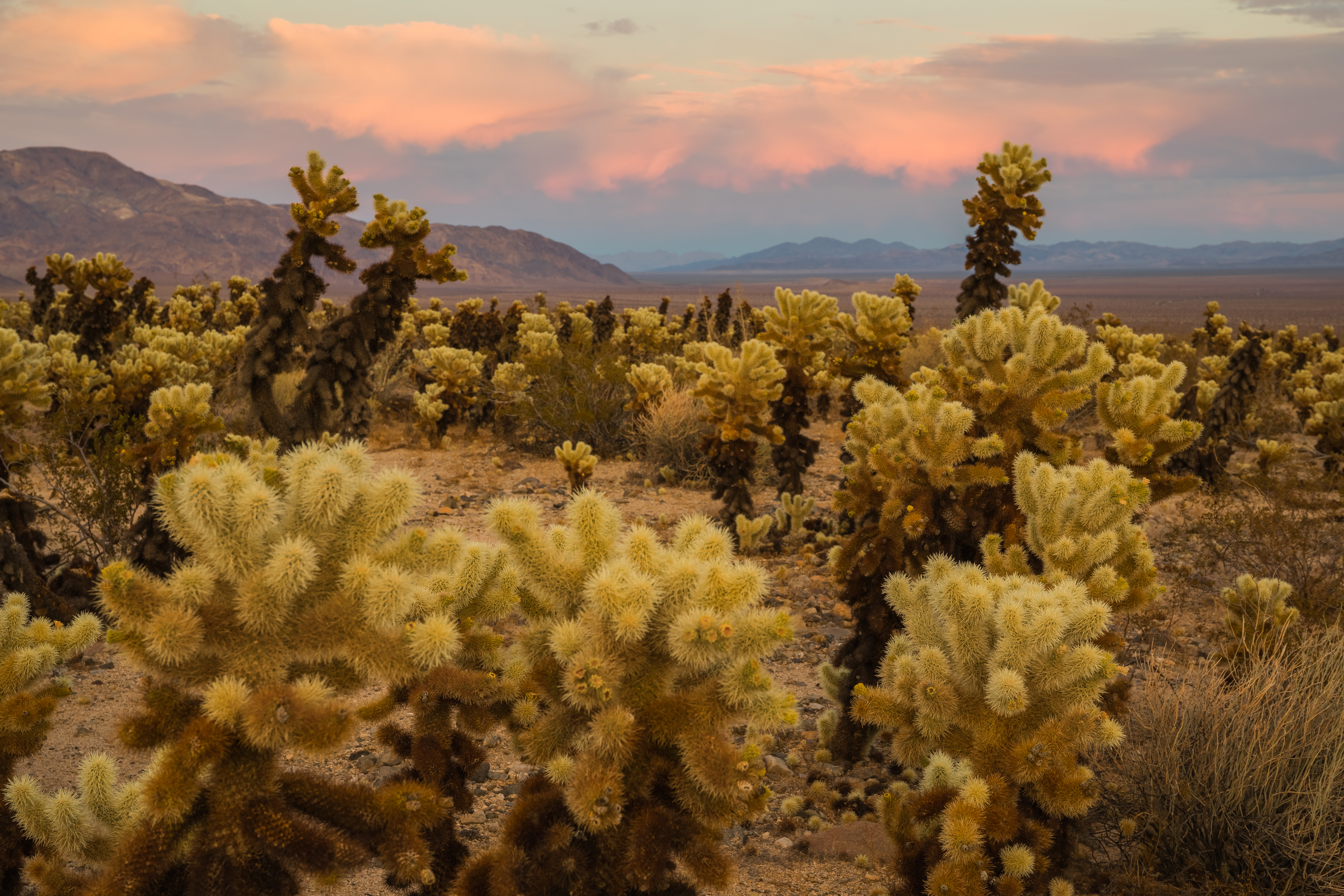
Enjoy scenic views of mountains and a large number of cholla growing along Pinto Basin Road.
The Cholla Cactus Garden is located in a wide basin with mountains on the horizon. The area is filled with Cholla Cacti that grow a couple of feet tall, branch in many places, and are covered in spines that can glow at sunrise and sunset. Next to the road there is a paved parking area with a paved sidewalk and a wooden fence between the sidewalk and the Cholla. On the western end of the parking lot there is a trailhead for a dirt and gravel trail that loops through the Cholla.
Contact Mine Trailhead is located in a dirt parking lot off the Park Boulevard. It is in a valley, surrounded by rocky mountains in every direction. An informational billboard stands at the edge of the parking lot next to the dirt hiking path. The path begins lined with rocks and surrounded by large and small shrubs, along with other desert plants. Large rock formations are also scattered around the landscape.
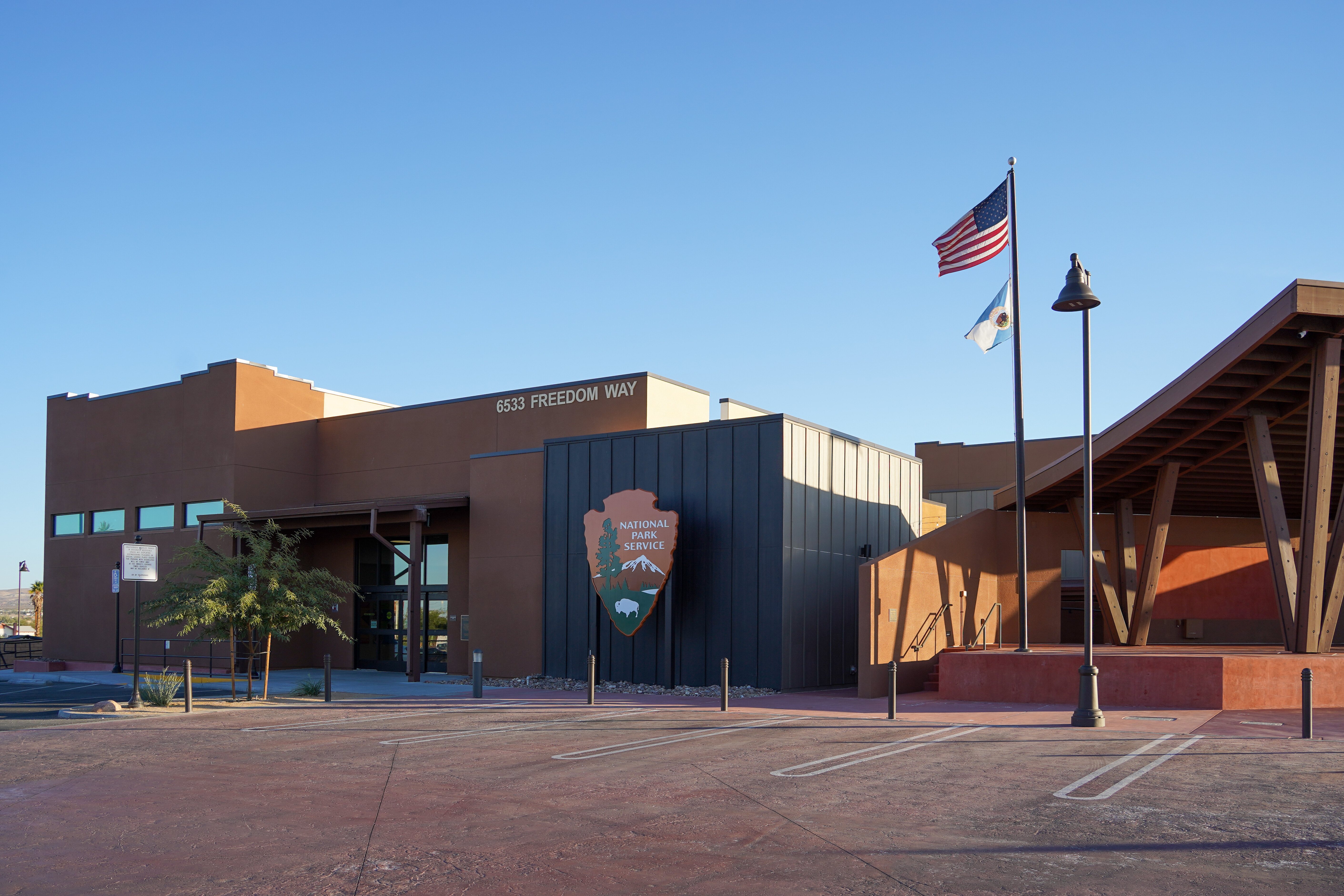
Joshua Tree National Park Visitor Center in Twentynine Palms, California
The Joshua Tree National Park Visitor Center is located south of highway 62, by about half a block on Freedom Way. The building is surrounded by parking spaces and walkways on all sides. The visitor center is in the middle of the town of Twentynine Palms. There are other buildings in sight as well as sparse desert vegetation. To the south the mountains in the north boundary of Joshua Tree National Park can be seen. The visitor center itself is a dark tan, single-story building. There is a flag pole and shade structure near the front of the building facing highway 62. The parking spaces on the northside of the building are the closest to the front door and there are a few handicap parking spaces. There is a sidewalk surrounding the building.
The cottonwood picnic area is located in a large open area with mountains in the distance. The picnic area has several covered picnic areas with picnic tables and grills. The picnic area is accessed from a paved parking lot on the side of the road with a paved path to a restroom located in the middle of the picnic area. The area is filled with scattered small trees and shrubs.
A lush desert oasis that also provides access to the Mastodon Peak Loop and Lost Palms Oasis Trail.
Cottonwood Spring is a lush desert oasis surrounded by rocky hills. The oasis is filled with many types of plants including fan palms, Joshua trees, other small trees, and shrubs. The oasis is located down a short dirt path from a paved parking lot with a paved sidewalk. Next to the trailhead is a backpacking board with information on backpacking as well as a box for self registration as well as an interpretive sign. The area around the parking lot is filled with scattered Joshua trees, short trees, and shrubs.
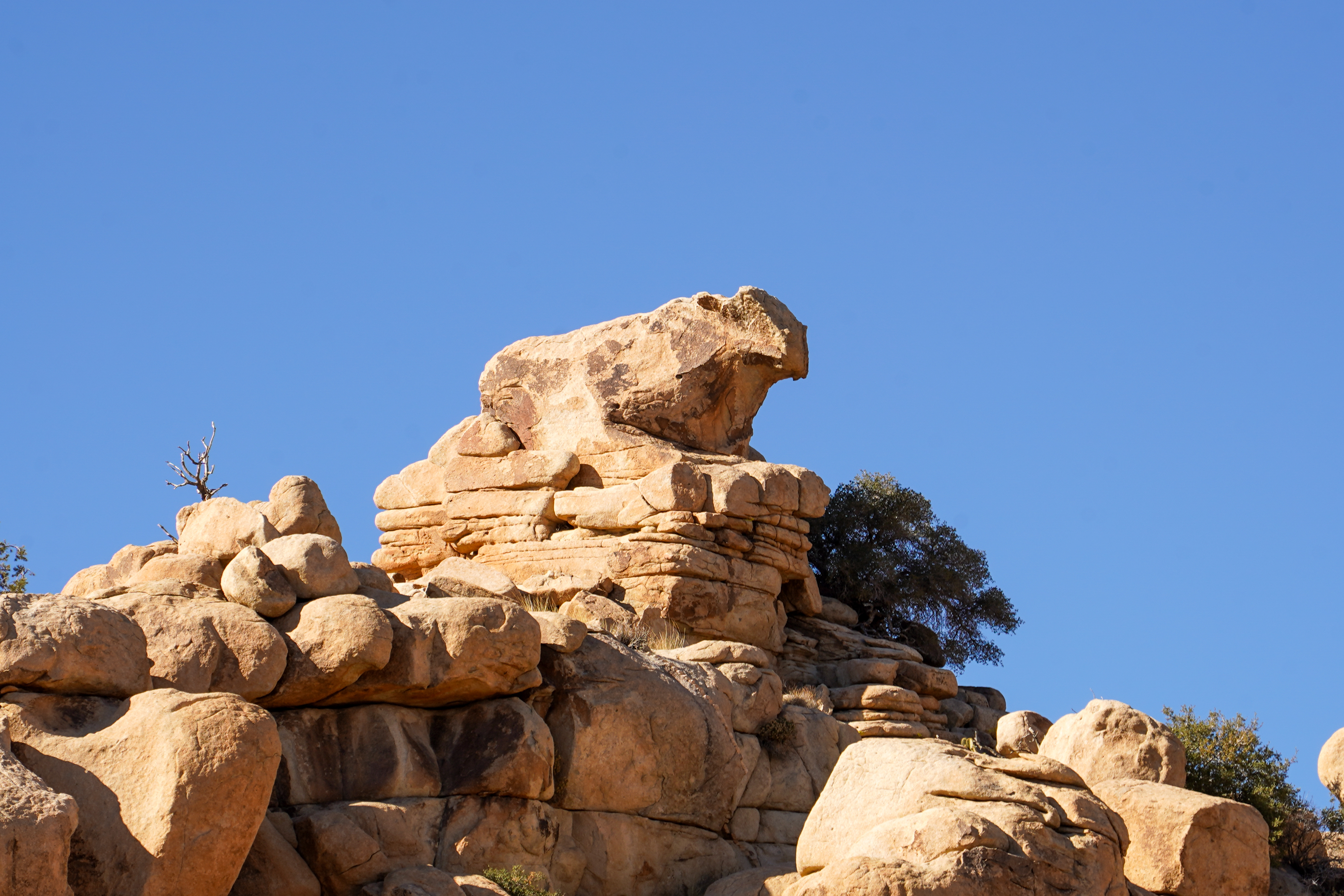
Atop a tall wall of tan granite rock to the west of the trail sits a boulder that is shaped like a cow. It overlooks the Hidden Valley Trail that leads through the collection of boulders. The landscape is filled with rock formations of all sizes and desert shrubs.
Cyclops Rock, a large granite rock formation popular with climbers.
Cyclops Rock is a large rock formation surrounded by large rocks of similar size. The large rock is surrounded by a landscape with scattered Joshua trees, shrubs, and grasses. Cyclops is located to the southeast side of Barker Dam Road with a pullout in front of it. There is a wooden fence and dirt paths around the area in front of the rock when looking at it from the road. On the other side of the road is a collection of additional rock formations and campsites.
Trailhead for Contact Mine Trail and Desert Tortoise stop for the audio tour.
Contact Mine Trailhead is located in a dirt parking lot off the Park Boulevard. It is in a valley, surrounded by rocky mountains in every direction. An informational billboard stands at the edge of the parking lot next to the dirt hiking path. The path begins lined with rocks and surrounded by large and small shrubs, along with other desert plants. Large rock formations are also scattered around the landscape.
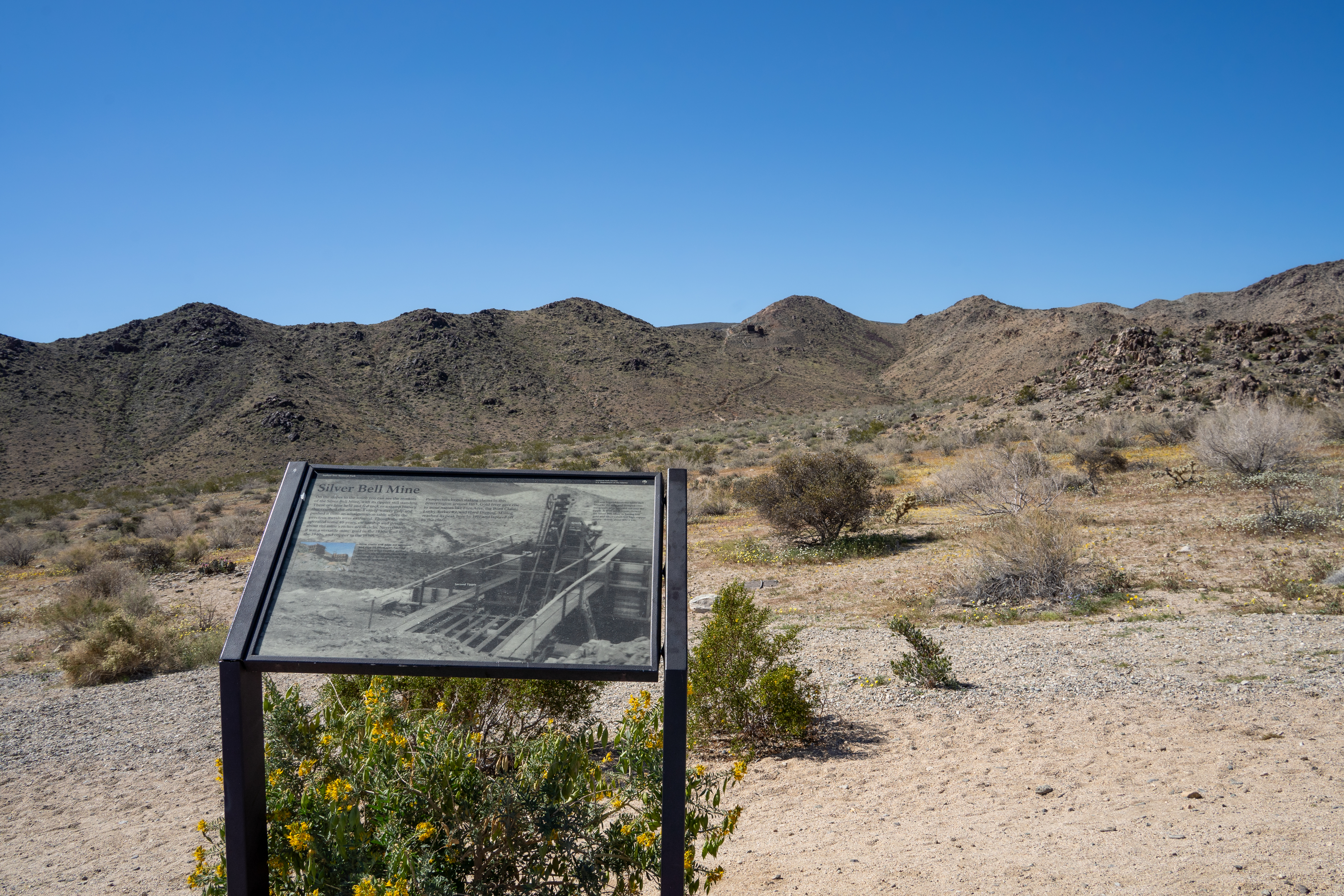
Silver Bell Mine Pullout is located on Pinto Basin Road.
A paved pullout is located on the western side of Pinto Basin Road. The area around the pullout is home to shrubs like creosote, bladderpod, and desert lavender. Rocky mountains are on both sides of the road. Near the top of the hills to the west are remnants of a mine. These remnants include a dirt-covered shelter and ore bins. The road decreases in elevation to the south.
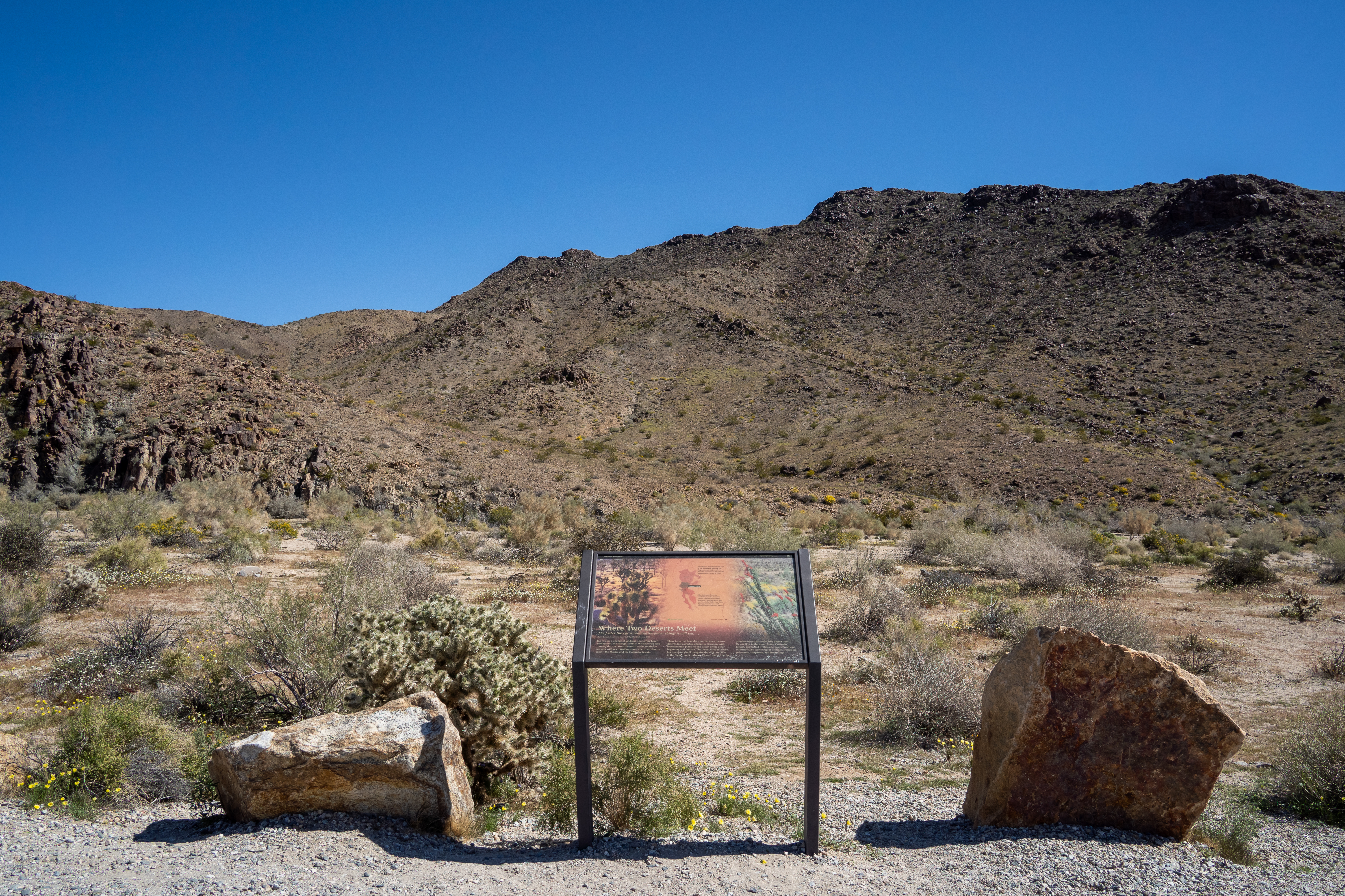
A paved road winds through a canyon with a pullout on the east side. The gravel pullout has a wayside that reads "Where Two Deserts Meet" with visuals of the surrounding desert landscape. Large rocks border the edge of the pullout. The surrounding land is dotted with creosote and other shrubs. There are washes that run close to parallel of the road and rocky landscape that gains elevation both east and west of the road.
Quail Springs Picnic Area is a picnic area along Park Boulevard when entering from the west entrance.
Quail Springs Picnic Area is located near Park Boulevard in a large open area. There are a number of picnic tables and grills nestled among Joshua Trees, small trees, and shrubs, right next to some large rock formations. The area is flat with large open dirt areas. Next to the paved parking area there are two pit toilets. Large, rocky mountains are on either side of the valley.
Silver Bell Mine Pullout is along Pinto Basin Road.
On the western side of Pinto Basin Road, there is a paved pullout. The surrounding area is home to various shrubs, such as creosote, bladderpod, and desert lavender. Rocky mountains are on both sides of the road, and the elevation gradually decreases towards the south. At the top of the hills towards the southwest are remnants of an old mine. These remnants include a dirt-covered shelter and dark-colored ore bins.
A small parking lot connected to Pinto Basin Road leads to the Turkey Flats area. There is an informational sign that provides details about the area next to the parking lot. The ground is a mix of compact and loose sand, with desert grasses, creosote bushes, and small desert shrubs. Turkey Flats is located in a basin between two mountain ranges to the East and West. The land slopes gradually towards a lower elevation in the southern direction and towards a higher elevation in the northern direction.
Located along a paved road are two dirt trails heading off from either side with a crosswalk in between. There are paved parking spots on each side of the road. There are large rock formations on both sides of the road surrounded by scattered Joshua trees, small trees, and shrubs.
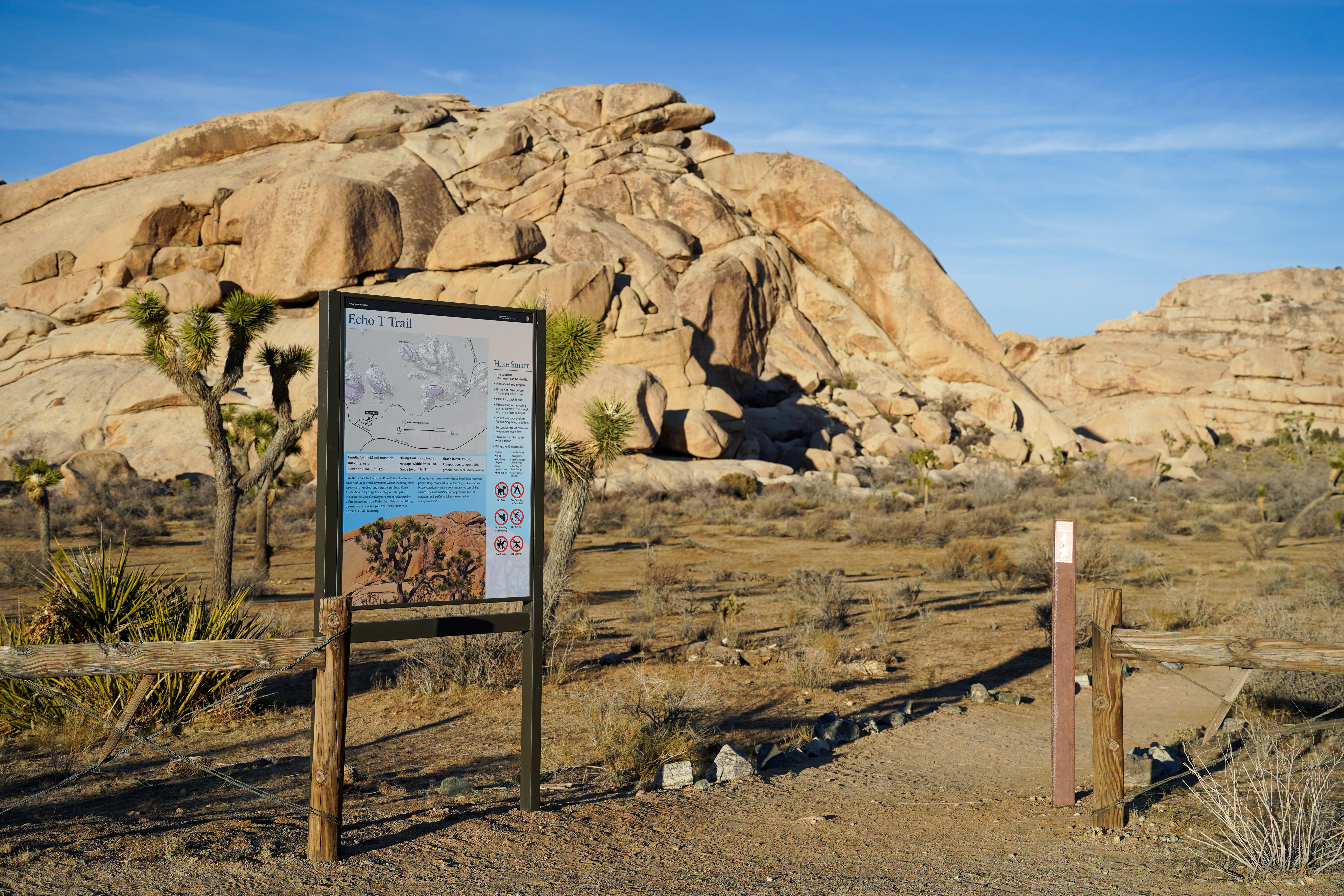
Hike the Echo T Trail and connect to the Barker Dam from this trailhead.
The Echo T Trailhead is located in a dirt parking area along Keys Ranch Road. In the northeast corner of the dirt parking area is a trailhead with a sign that reads Echo T Trail with information on the trail and Native American rock art. The area has scattered Joshua trees, small trees and shrubs. In the distance are large boulders.
The Hidden Valley Trailhead provides access to explore Hidden Valley.
The Hidden Valley Trailhead is located in a large valley with scattered rock formations, Joshua trees, small trees, and shrubs. The trailhead is on the northwest side of a large paved loop parking lot. The parking lot has regular parking spots on the outside and RV and bus spots on the inside with paved sidewalks on either side. The trail itself is a dirt and rock trail that leads between two large rock formations and has in interpretive sign on the area right next to the beginning. Near the trailhead there are pit toilets and trash cans.
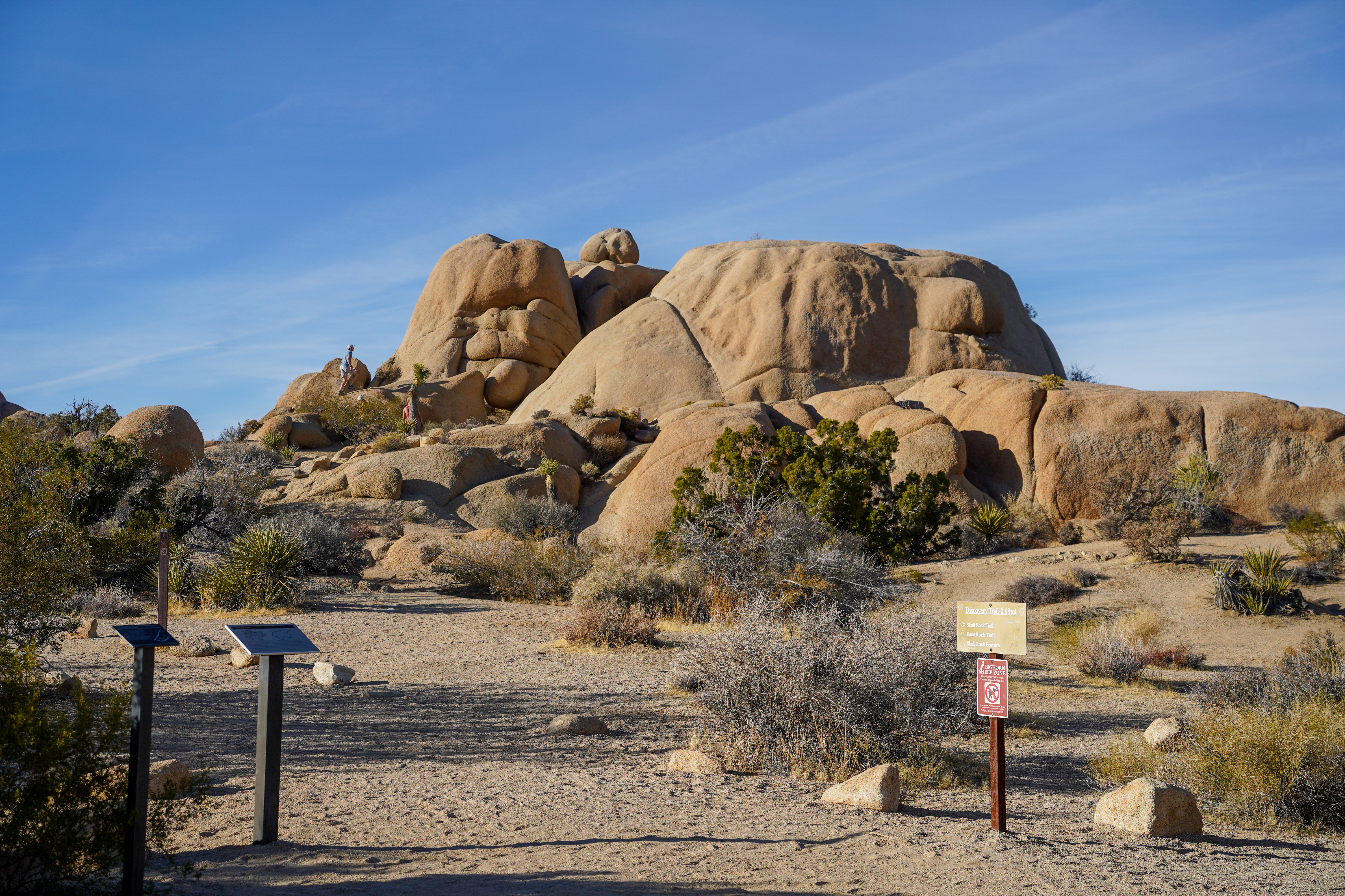
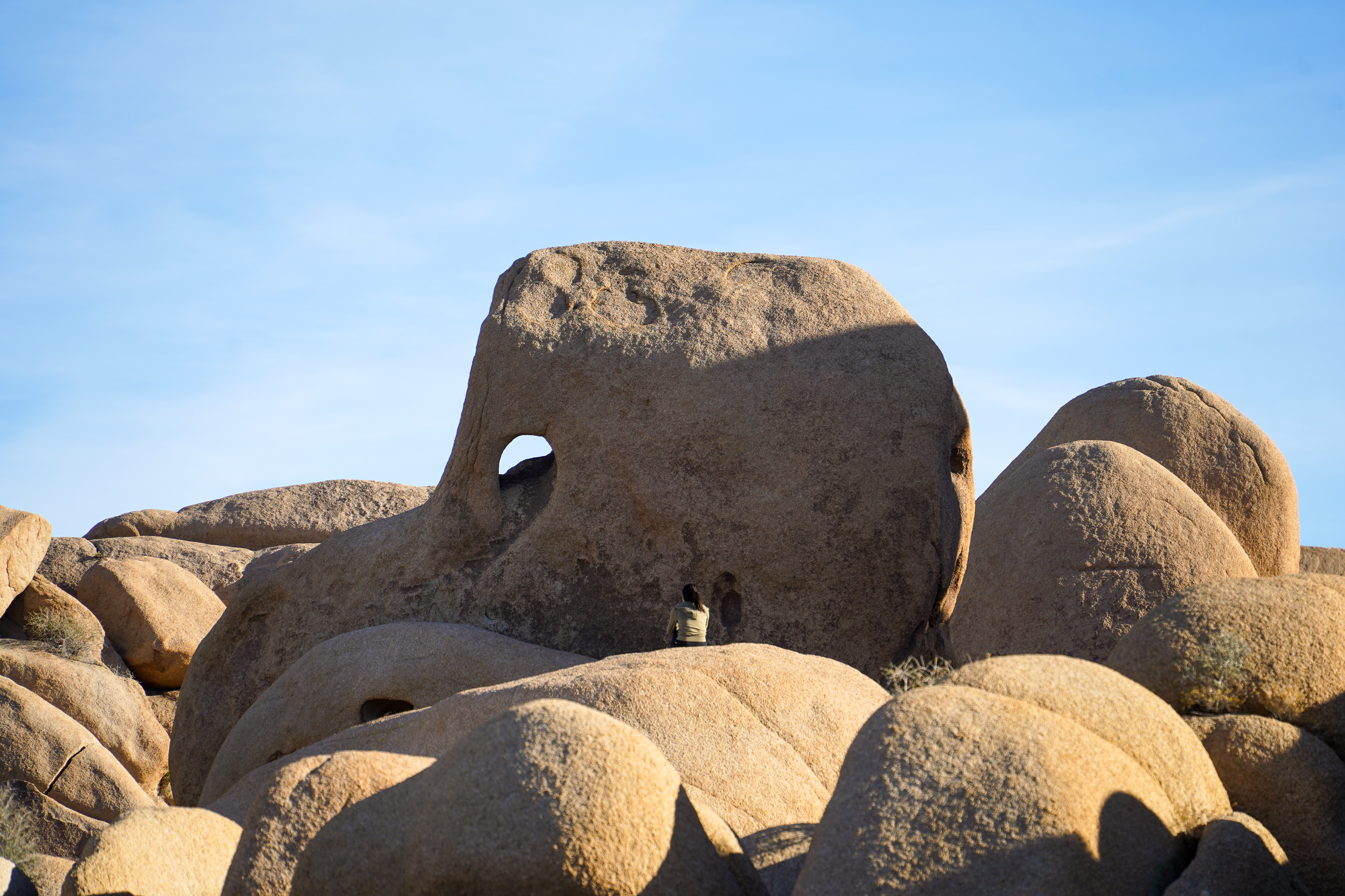
Elephant Rock, a granite rock formation shaped like an elephant. This rock formation can be seen from Park Boulevard in front of the Skull Rock and Discovery Trail Trailhead.
Along Park Boulevard there are pullouts on both sides of the road with parking spaces. There are also pedestrian crosswalks crossing the street. Facing the south side of Park Boulevard, the area is filled with rock formations and boulder piles with scattered small trees and shrubs between the rocks. A dirt path winds its way through various formations and boulders. Elephant Rock is a boulder sitting on top of the rock formation to the south of Skull Rock. There is a hole near the left side of this boulder resembling the space between an elephant's trunk and body. There is also a small curve near the bottom of the boulder resembling a separation between the elephant's front and back legs.
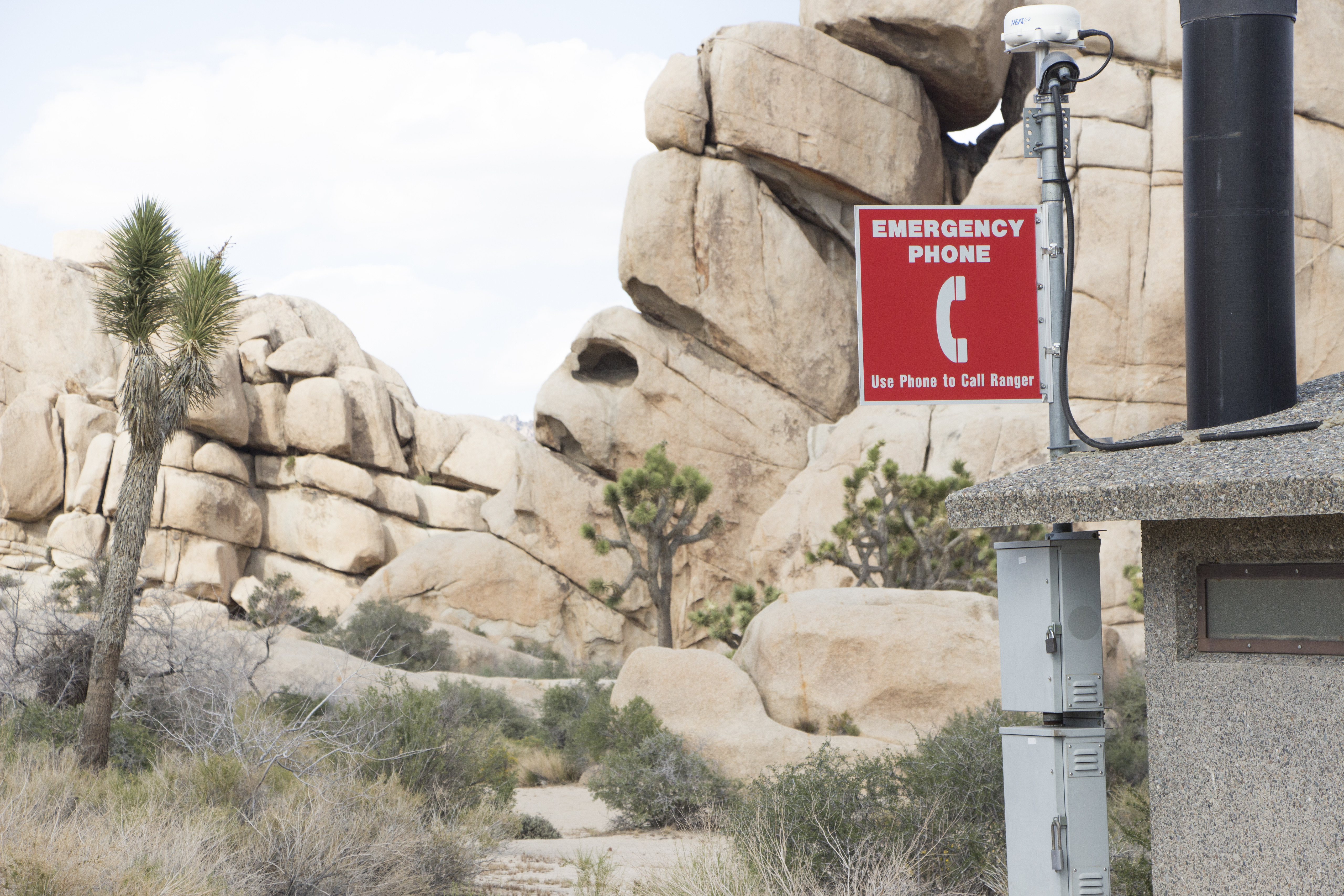
An emergency phone is available for requesting first aid and medical assistance.
A vault toilet restroom stands to the north of a paved parking lot surrounded by large rock formations. On the outside of the vault toilet building is a gray box with a red sign that reads "Emergency Phone".
The Hi-View Trailhead is a dirt trail nestled among rocky desert hills. The trail starts through a gap in a wooden split rail fence from a dirt parking lot. The area is filled with scattered Joshua trees, small trees, and shrubs with rocky hills and ridges in every direction.
There is a large sign with a small roof that reads "Black Rock Canyon" and provides a map and information of the area. Next to it, is a "No Pets on Trail" sign. The dirt path leads away from the right of the signs. There are Joshua trees, juniper bushes, yuccas, and other desert shrubs lining the trail and covering the landscape. There are hills that fills the background.
Face Rock, located off spur trail along the Split Rock Trail
Face Rock is a tall granite rock with a large hole resembling an eye, a section sticking out resembling a nose, and a curve resembling a mouth. Face Rock is located in an area filled with large rock formations and boulders with scattered small trees and shrubs between rocks. A dirt path winds its way through the rocks towards Face Rock.
A paved half circle parking lot connects to the main paved Pinto Basin Road. The parking lot is on the western side of the road. There is a roofed sign and a sandy trail leading away from the right of it. Surrounding the parking area and trail is a large flatter basin of gravel, sand, and compact dirt covered with shrubs, cacti, yuccas, and seasonal grasses. At the far edges of the basin, mountain ranges can be seen in all directions. The roofed sign has the title "Porcupine Wash" in white text. Below is a map of a trail and a paragraph that reads "Follow Porcupine Wash among the water-loving smoke trees, desert willows, and lavender bushes which attract a variety of desert life. Not far along the route, a side trail leads to the ruin of Ruby Lee Mill established in 1935. Near the end of the wash, an unmaintained trail climbs to Monument Mountain's summit, the highest peak in the Hexie Mountains at 4,834 feet." Below this paragraph and map the sign has backpacking rules and Leave No Trace Principles.
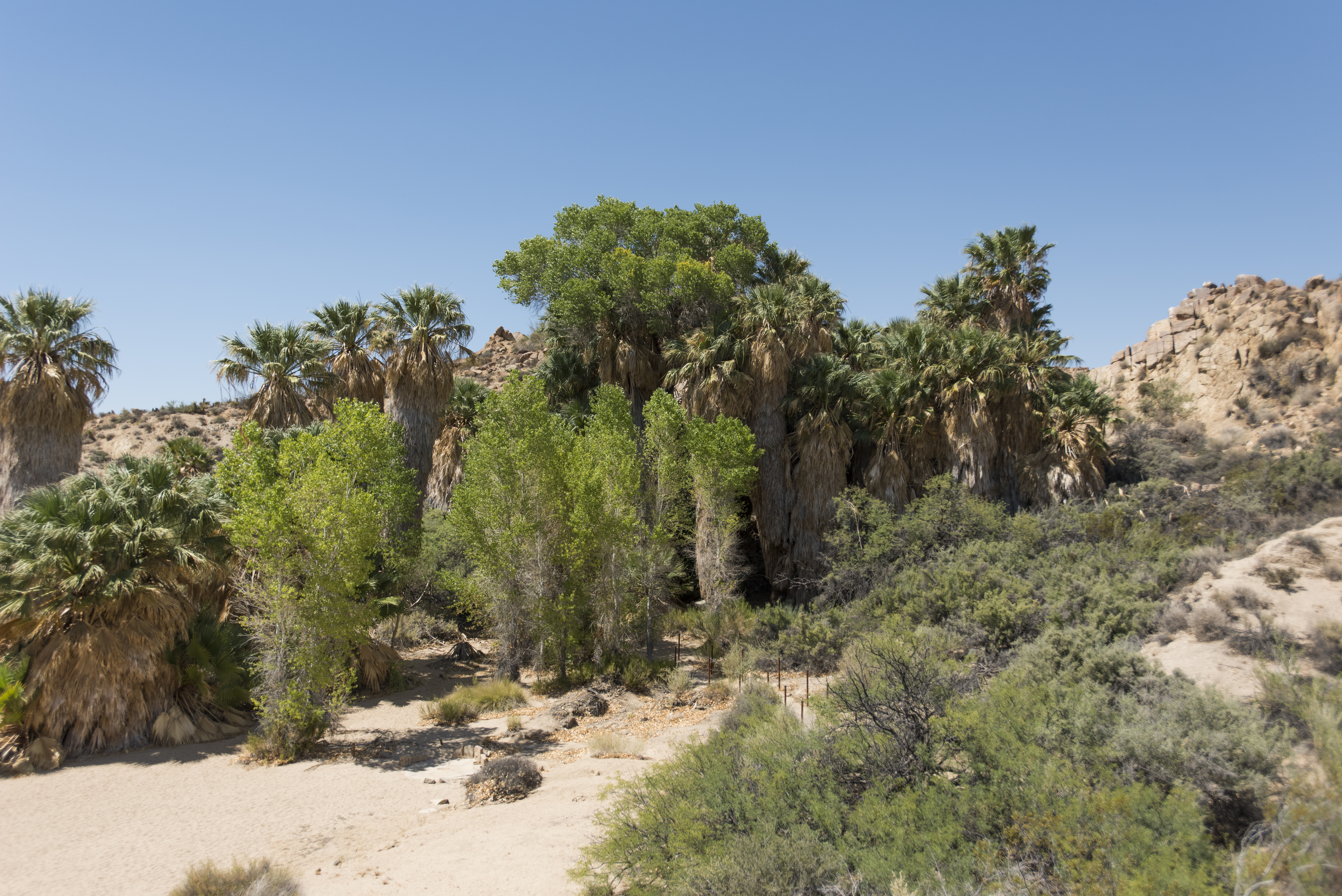
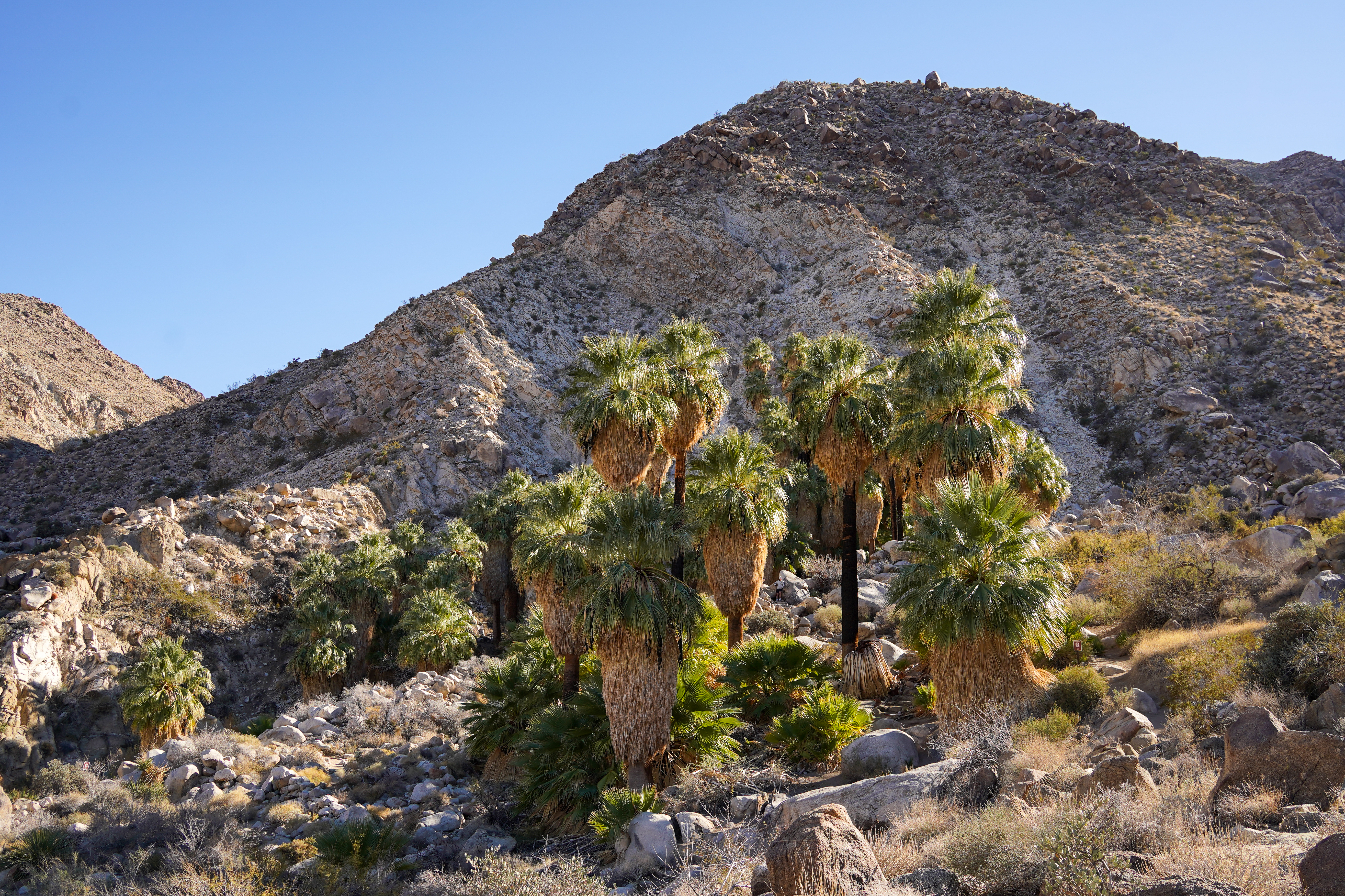
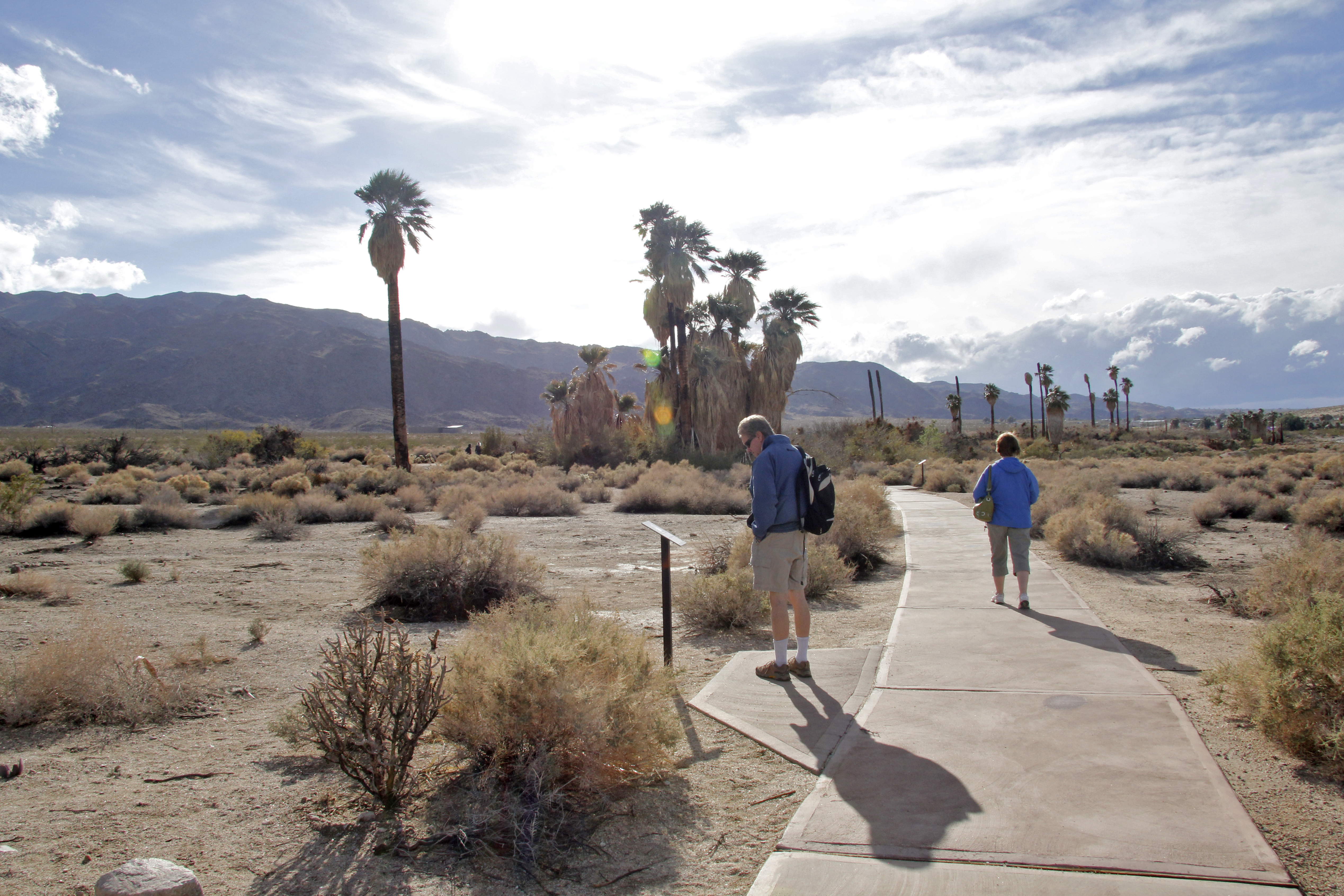
A desert oasis in the northern portions of Joshua Tree National Park.
Fortynine Palms Oasis is surrounded by a group of desert palms in a rocky canyon. Surrounding these palms are large boulders broken up by scattered small trees and shrubs. Rocky ridges tower over the oasis on three sides while to the north the canyon slopes down to the valley below. Sometimes there are pockets of water nearby the palm trees and other times the area is dry. There are often signs informing visitors of restoration and closed areas near the trail.
Forty-nine Palms Oasis Trailhead is located in rocky desert mountains. The area contains scattered rocks and shrubs. A dirt trail begins on the south side of the parking lot near two bulletin boards. Between the bulletin boards and parking area there is a pit toilet. The parking lot is a small paved loop with parking spots for cars and RVs.
Learn about Geology at Skull Rock during the audio tour.
Located along a paved road are two dirt trails heading off from either side with a crosswalk in between. There are paved parking spots on each side of the road. There are large rock formations on both sides of the road surrounded by scattered Joshua trees, small trees, and shrubs.
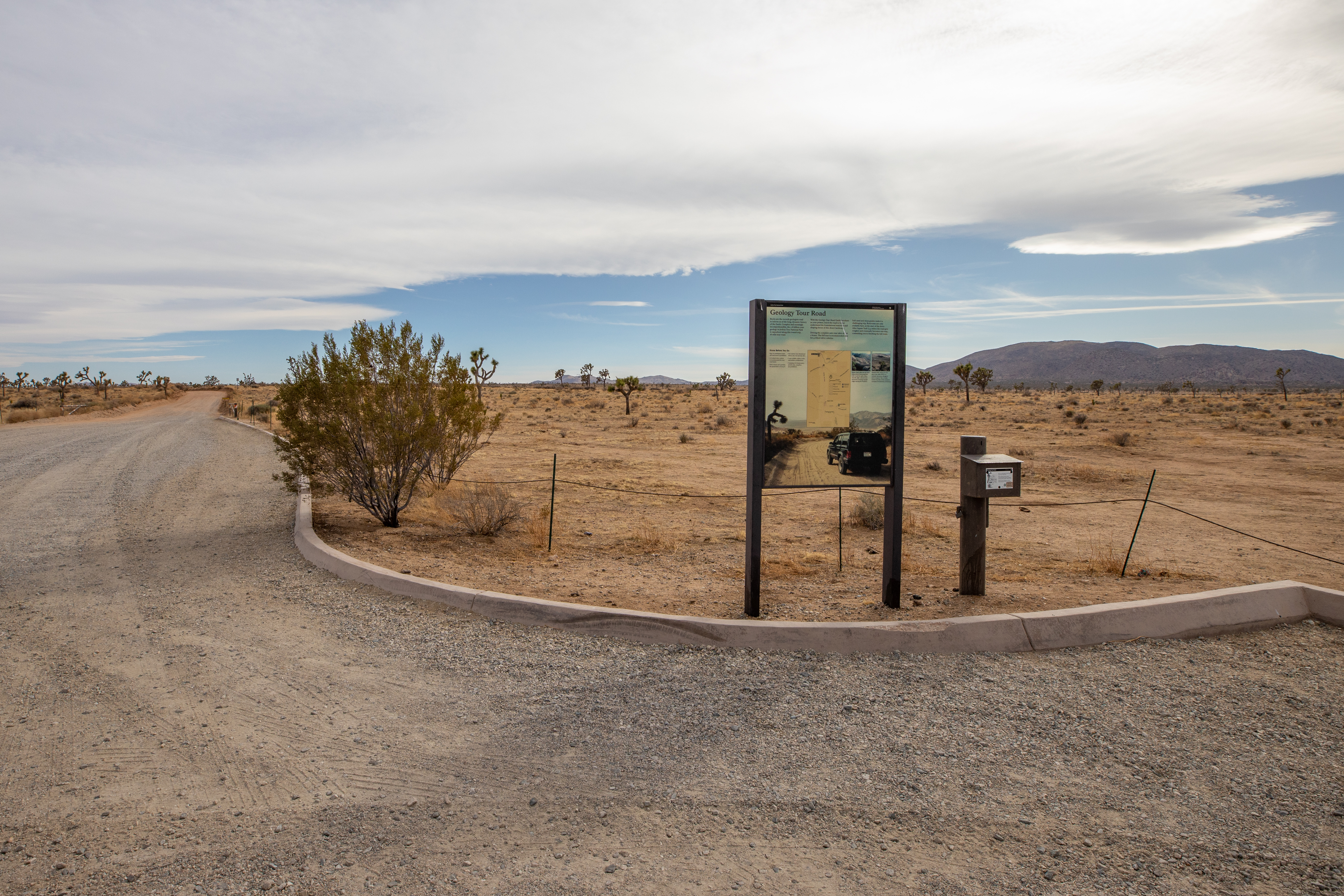
Geology Tour Road is an 18-mile motor tour leads through one of Joshua Tree National Park's most fascinating geological landscapes.
The Geology Tour Road intersects with Park Boulevard in an open expanse of desert. The area is lightly sprinkled with plants including Joshua trees, cactus, and creosote bush. Geology Tour Road is a dirt road and near the intersection is a small dirt parking area that some would consider to be a large pullout. There is an informational sign and a vault toilet.
Popular rock formations with views for walks, scrambling, and rock climbing.
Hall of Horrors is located in a large desert valley surrounded by rocky mountains. There is a paved loop parking lot with a paved sidewalk and pit toilet. Northwest of the parking area there are three large rock formations that can be accessed by dirt paths. The area is filled with scattered Joshua trees, small trees, and shrubs.
Heart rock is a large boulder naturally shaped to resemble a heart standing straight up. It is located in an area filled with boulders and scattered small shrubs and trees. In the distance there are rocky mountains.
Hemingway is located along the southwest side of Park Boulevard among many different rock formations. The parking lot is a paved loop with a paved sidewalk to a pit toilet. From the parking area there are several dirt paths that head off into the rock formations. In addition to the rock formations, the area is filled with scattered Joshua trees, small trees, and shrubs. Outdoor Exhibit: There is an outdoor exhibit with an image of a rock climber on light-colored granite rock. She is next to a crack holding onto lines and folds in the rock. The text on the wayside is described in the body text above. The small exhibit is one 2x3 foot panel and faces away from the parking lot towards the pillars of rock.
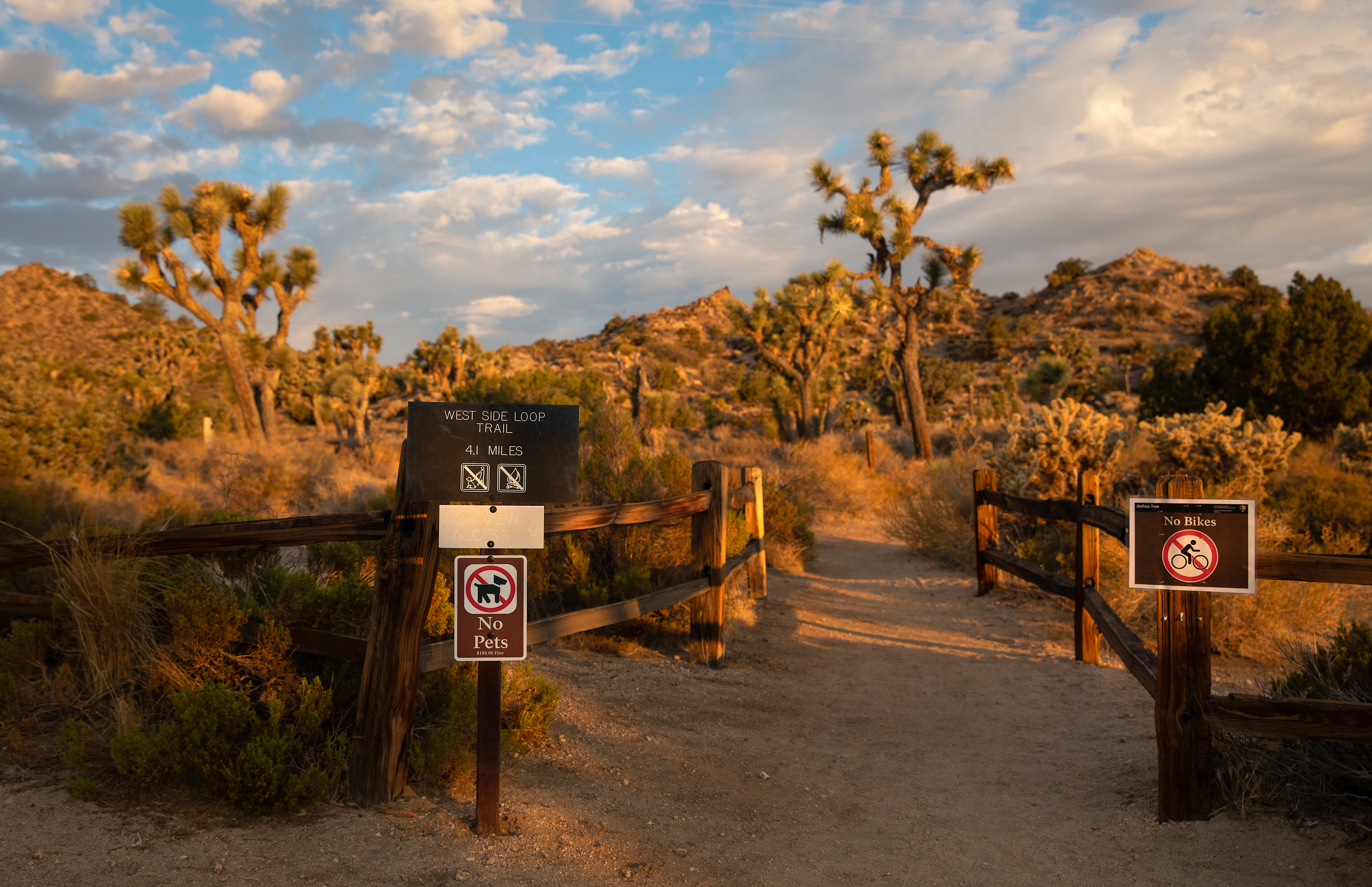
Trailhead for the Hi-View and West Side Loop Trails which meander through mountains and Joshua tree forests.
The Hi-View Trailhead is a dirt trail nestled among rocky desert hills. The trail starts through a gap in a wooden split rail fence from a dirt parking lot. The area is filled with scattered Joshua trees, small trees, and shrubs with rocky hills and ridges in every direction.
Hidden Valley Picnic Area is a large picnic area with picnic tables and grills among rock formations and Joshua Trees.
Hidden Valley Picnic Area is located in a large desert valley with many scattered rock formations. Among the rock formations there are many Joshua trees, small trees, and shrubs. There is a large loop parking area with picnic tables and grills in flat dirt areas scattered along the loop. Some parts of the parking lot have a paved sidewalk leading to pit toilets and the trash cans with nearby picnic tables and grills.
The Hidden Valley Trailhead provides access to explore Hidden Valley.
The Hidden Valley Trailhead is located in a large valley with scattered rock formations, Joshua trees, small trees, and shrubs. The trailhead is on the northwest side of a large paved loop parking lot. The parking lot has regular parking spots on the outside and RV and bus spots on the inside with paved sidewalks on either side. The trail itself is a dirt and rock trail that leads between two large rock formations and has in interpretive sign on the area right next to the beginning. Near the trailhead there are pit toilets and trash cans.
Trailhead for hiking to Ryan Ranch and the Homesteading stop on the audio tour.
Ryan Ranch Trailhead is in a desert valley bottom with rocky mountains in a every direction. A dirt trail heads south from a small parking area on the south side of Park Boulevard. The area is filled with scattered Joshua trees, small trees, and shrubs.
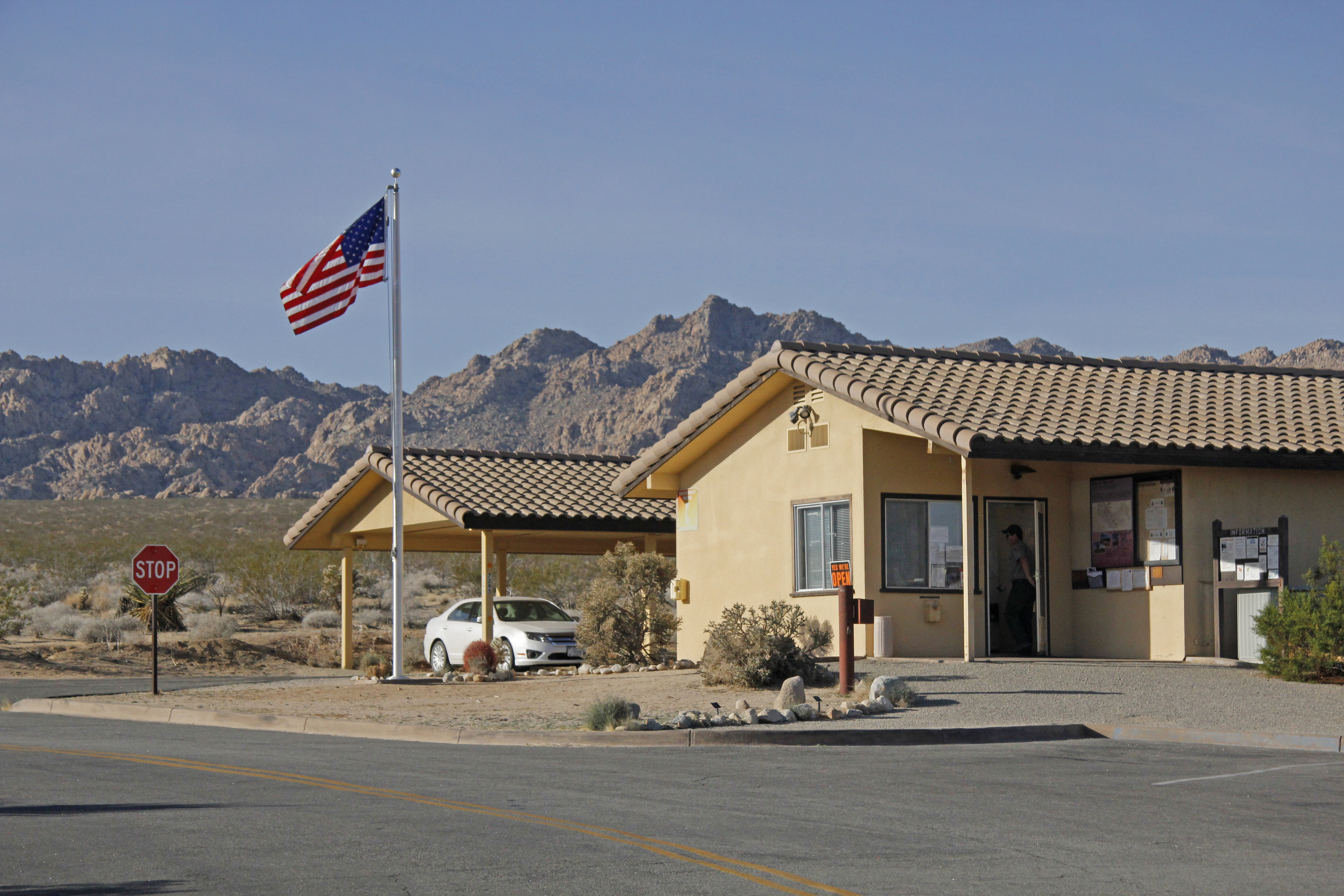
The Indian Cove Ranger Station provides information for the Indian Cove area.
The Indian Cover Ranger Station is a small one story tan building with a stucco roof. On the side of the building under a small awning there are a couple of bulletin boards with park information. Next to the building there is a water fountain and spigot next to a small parking lot and a couple of picnic tables. Beyond the picnic tables there are trash and recycling cans followed by a small brown building with two pit toilets at the far end of the parking lot. Behind the Ranger Station there is a second small parking lot for park vehicles as well as another small one story tan building with a stucco roof. The ranger station is located in a wide open area with scattered small trees and shrubs. Rocky mountains arch around the area in the east, south, and west while there is a large valley to the north. Upon entering the front door, there is one small room that is open to the public. A ranger or campground volunteer staffs a desk that faces the front door. Maps and flyers cover the walls.
Trailhead for an easy .6 mile hike with interpretive signs along the way.
The Indian Cove Nature Trail Trailhead is located on the edge of a large open area with rock formations on one side. A dirt and rock trail heads west from the parking area between a wooden split rail fence with a rocky ridge running east to west a little south of the trailhead. The area is filled with scattered boulders, small trees, and shrubs. The parking area is a dirt loop with boulders marking the edge of the parking area and a pit toilet on one side.
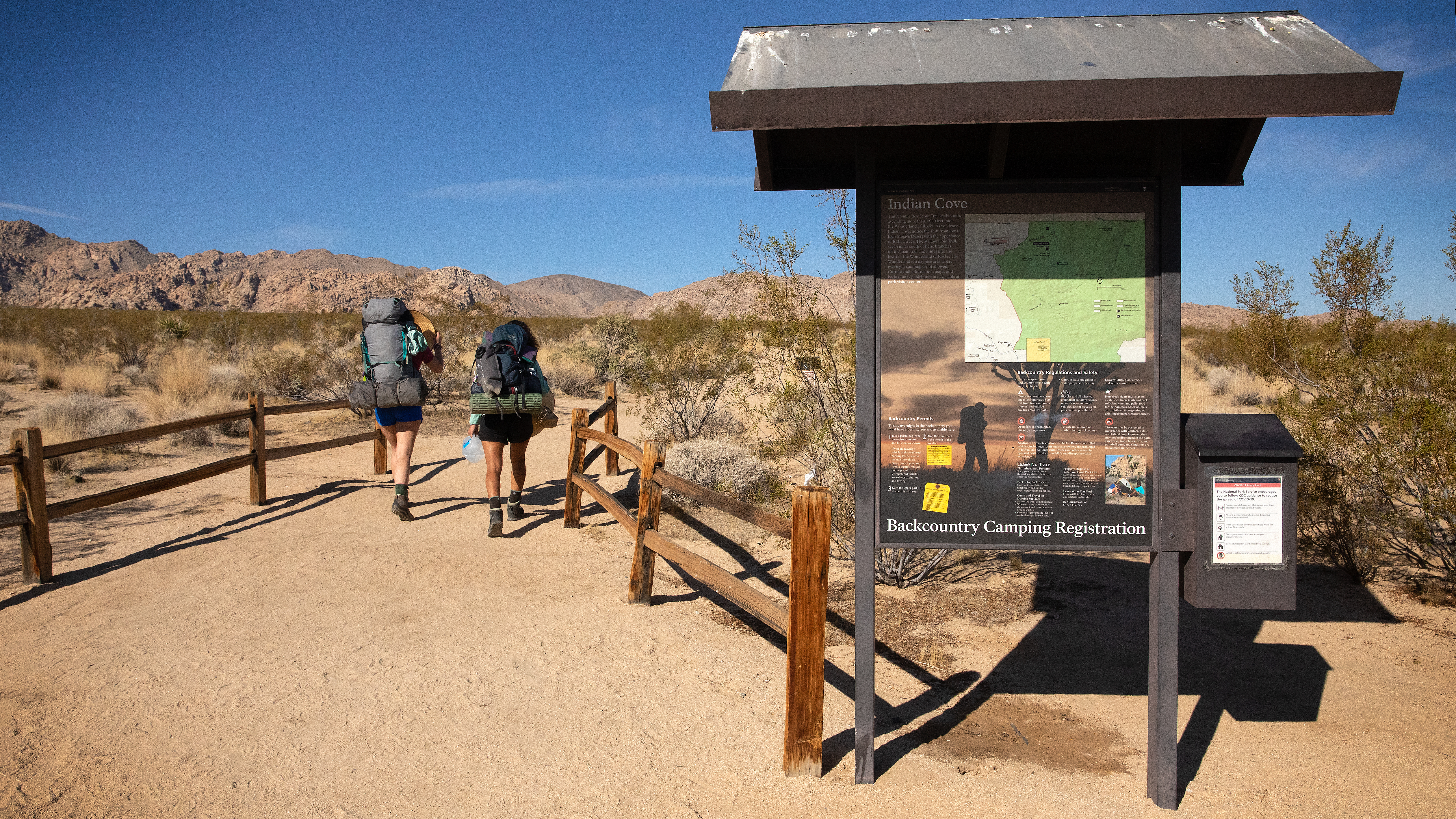
Backcountry board and trailhead for the north end of the Boy Scout Trail.
Indian Cove Wilderness Backcountry Board is located in a large open desert area. The board contains information on backpacking and hiking, displays an area map, has a box for backpackers to self register, and is located right next to a dirt trailhead. The area is filled with scattered shrubs. Next to the trailhead there is a dirt parking lot surrounded by large rocks. To the east, south, and west are rocky mountains, while the north has a large wide open valley.
A large rock formation with over 40 climbing routes.
A large rock formation with many cracks and flakes on the southwest edge of a paved parking lot. Surrounding this area are many other large rock boulders scattered throughout the landscape.
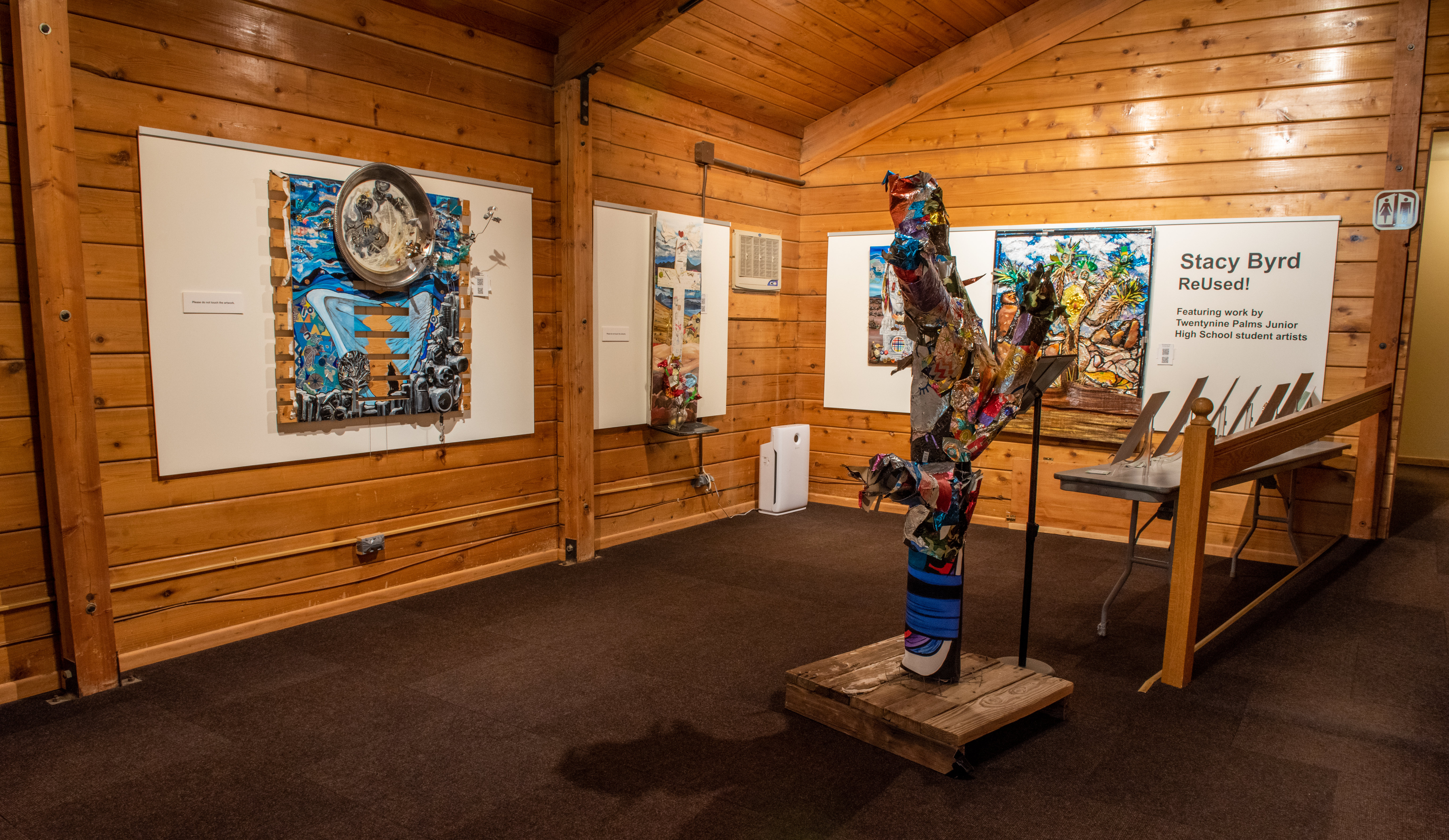
Located in the heart of the beautiful Black Rock Campground, the Nature Center offers a bookstore, art gallery, visitor resources, and a picnic area. Visitors can chat with a park ranger, shop at the bookstore, and observe exhibits in the art gallery. There is also a water-bottle filling station and a restroom with flush toilets. The Nature Center is open from 8:00-11:00am 12:00-4:00pm. It is closed from 11:00am - 12:00pm. Hours may vary depending on staff availability, especially in the summer.
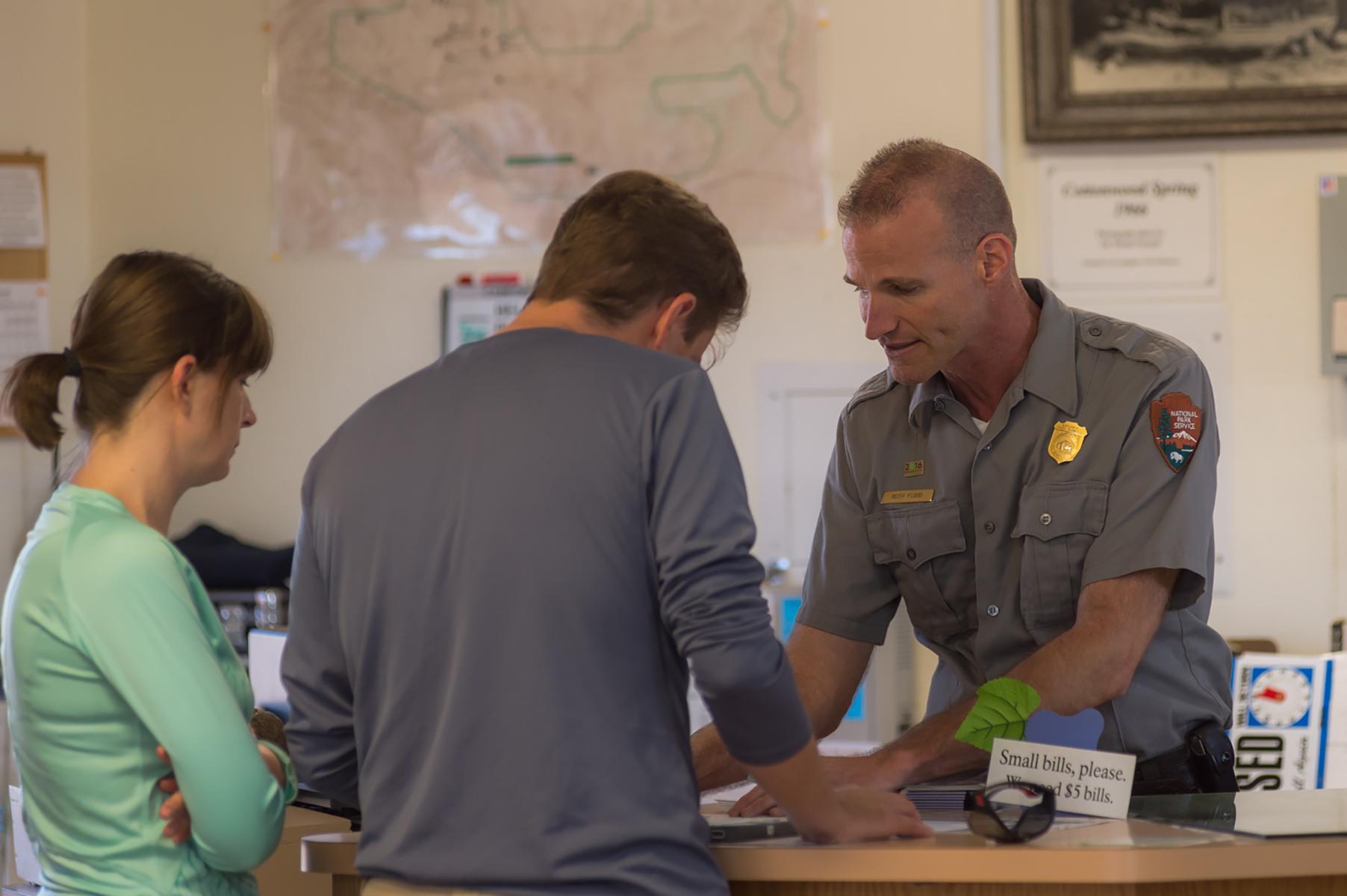
Located on Pinto Basin Road, approximately 7 miles north of Interstate 10 (exit 168), the Cottonwood Visitor Center is a convenient stop for those entering and exiting the park from the south. It has educational exhibits, a bookstore, visitor resources, and restroom facilities. You can grab a park map, buy an entrance pass, fill up your water bottle, and chat with a park ranger to get all your questions answered. The flush toilets are currently out of service.
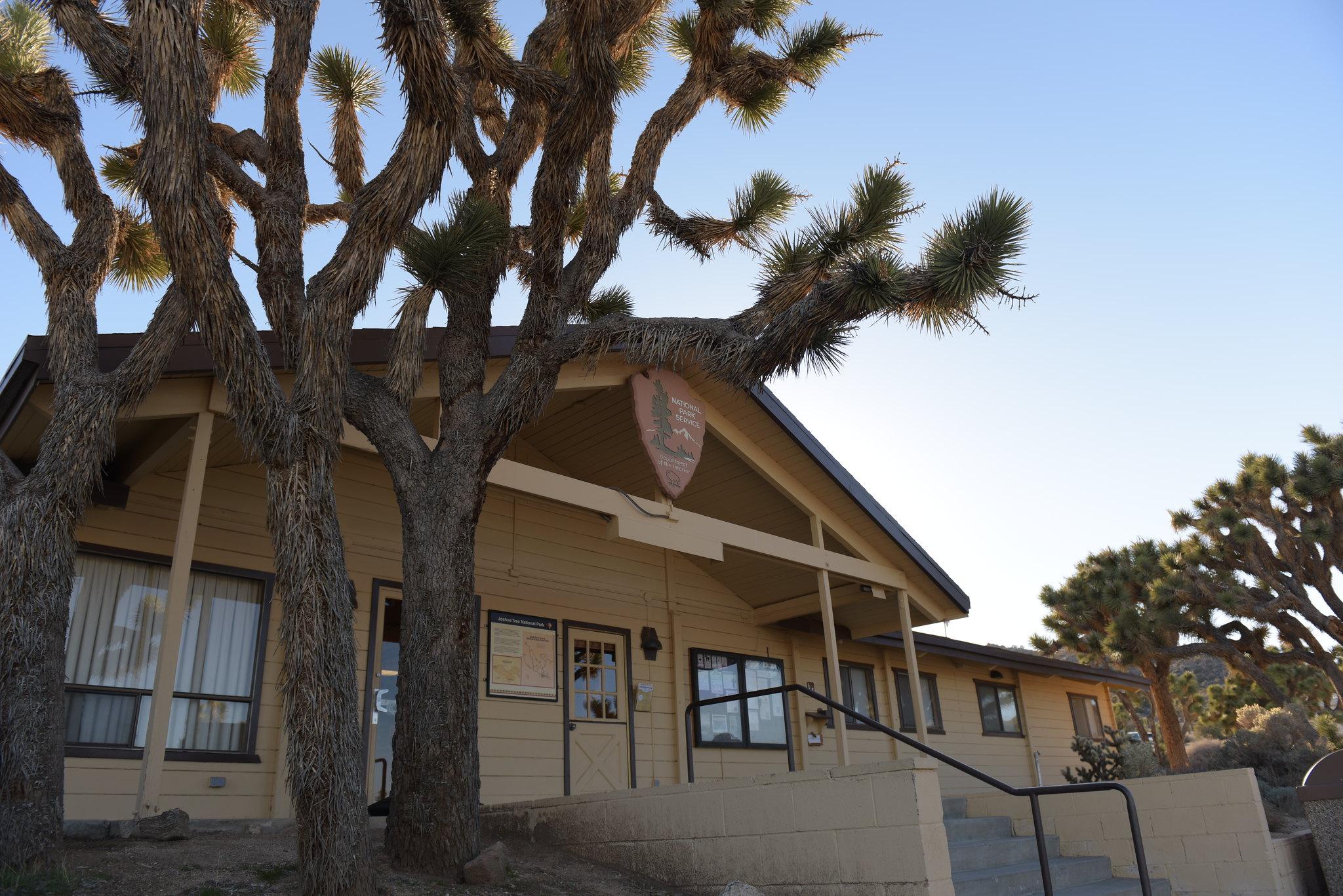
The Joshua Tree National Park Visitor Center is located in downtown Twentynine Palms and features educational exhibits, a bookstore and giftshop, and visitor information.
Located in downtown Joshua Tree just five miles from the West Entrance, the Joshua Tree Visitor Center offers educational exhibits, a bookstore, and visitor resources. Grab a park map, buy an entrance pass, and chat with a park ranger to get all your questions answered before heading into the park! The parking lot at the visitor center has 2 standard accessible spaces and 40 other spaces. The restrooms have grab bars available in all larger stalls intended for wheelchair users and running water.
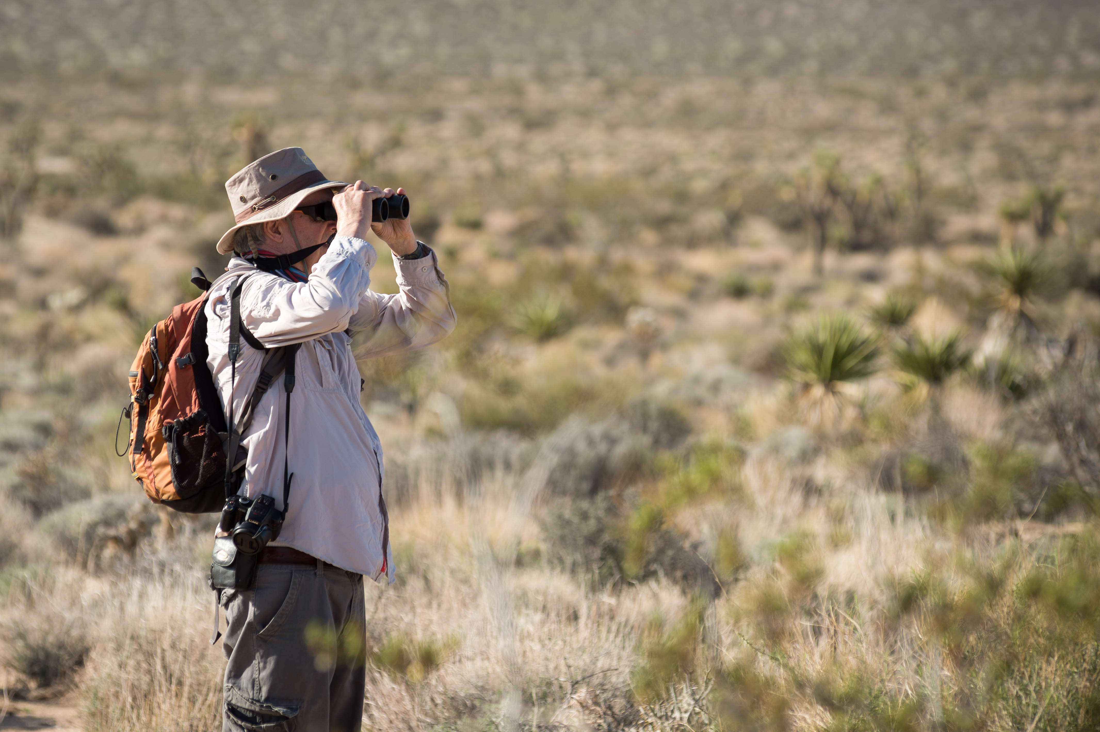
Joshua Tree National Park offers a wide range of birds for birders to discover.
Hike Boy Scout Trail
Explore the Wonderland of Rocks on the Boy Scout Trail.
Hike Cholla Cactus Garden
An easy quarter mile hike through a cholla patch along Pinto Basin Road.
Hike Fortynine Palms Oasis
A difficult three mile hike to a desert oasis.
Drive Park Boulevard
A scenic drive through Joshua Tree National Park.
Hike Barker Dam Trail
Enjoy an easy 1.1 mile hike on the Barker Dam Nature Trail.
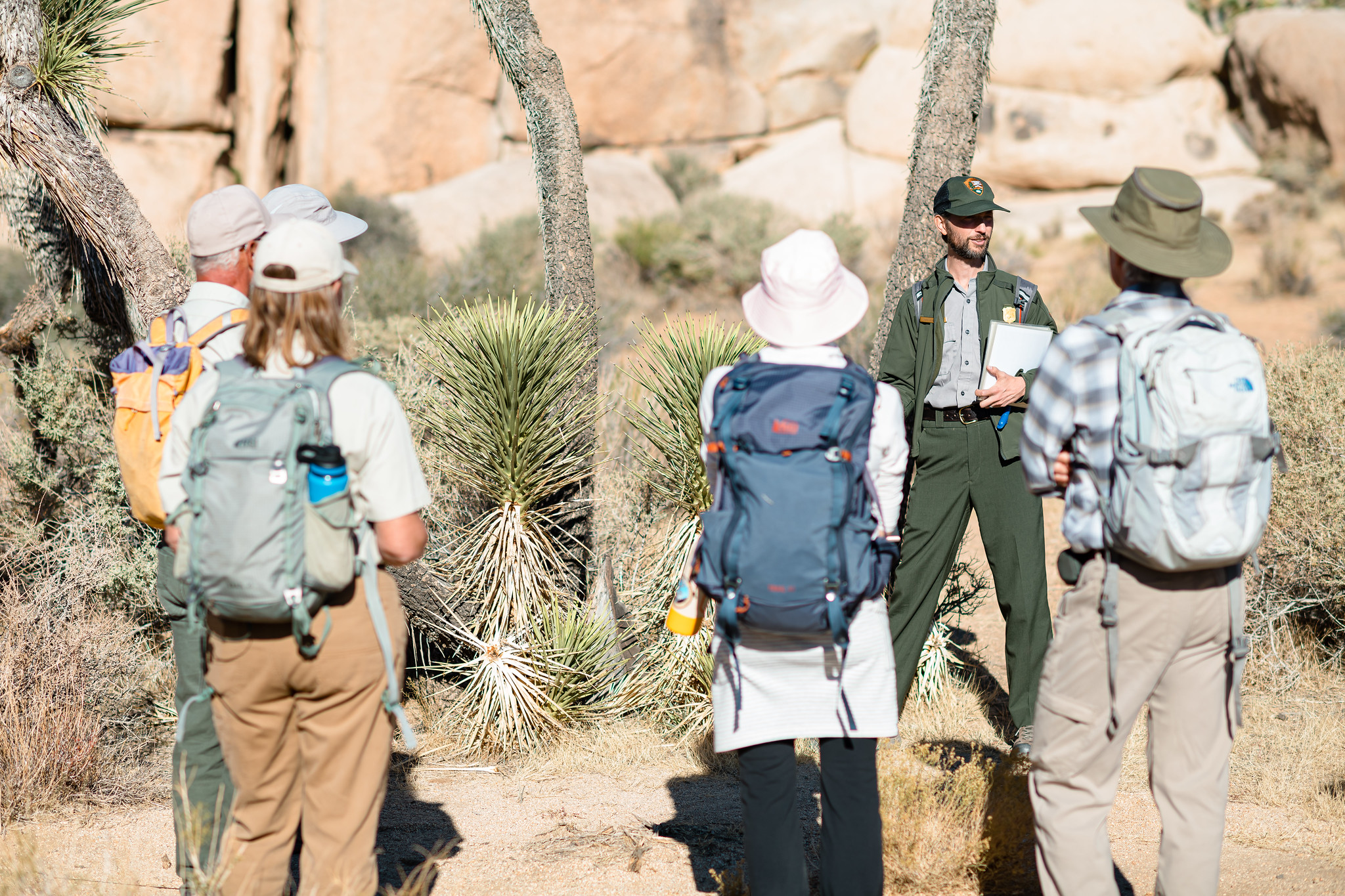
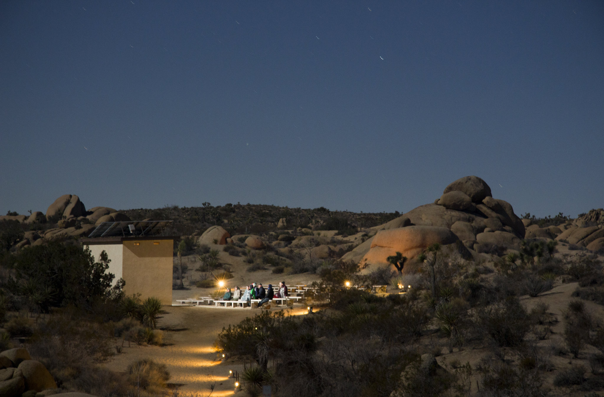
Attend an Evening Ranger Program
Attend an evening program at Joshua Tree National Park.
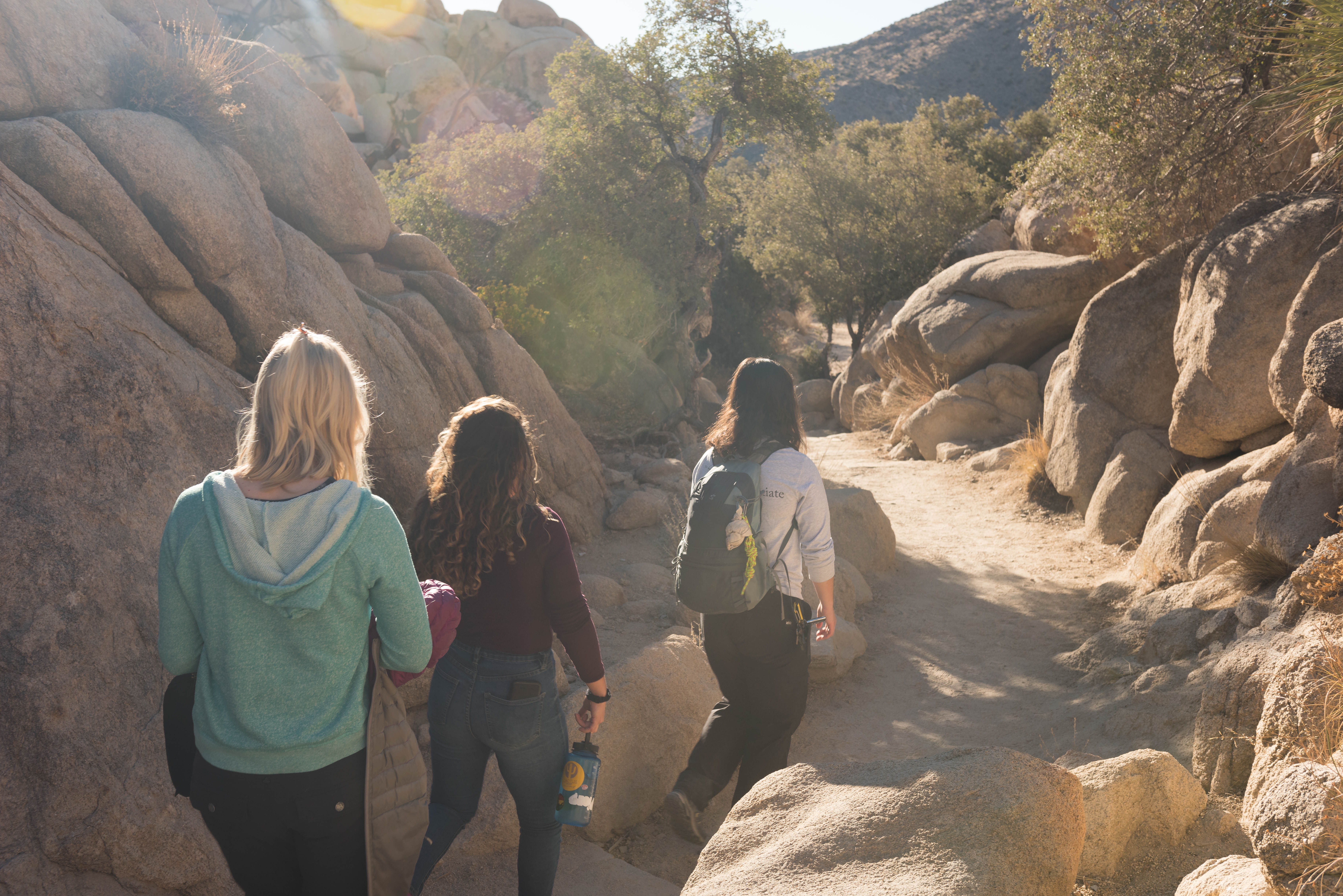
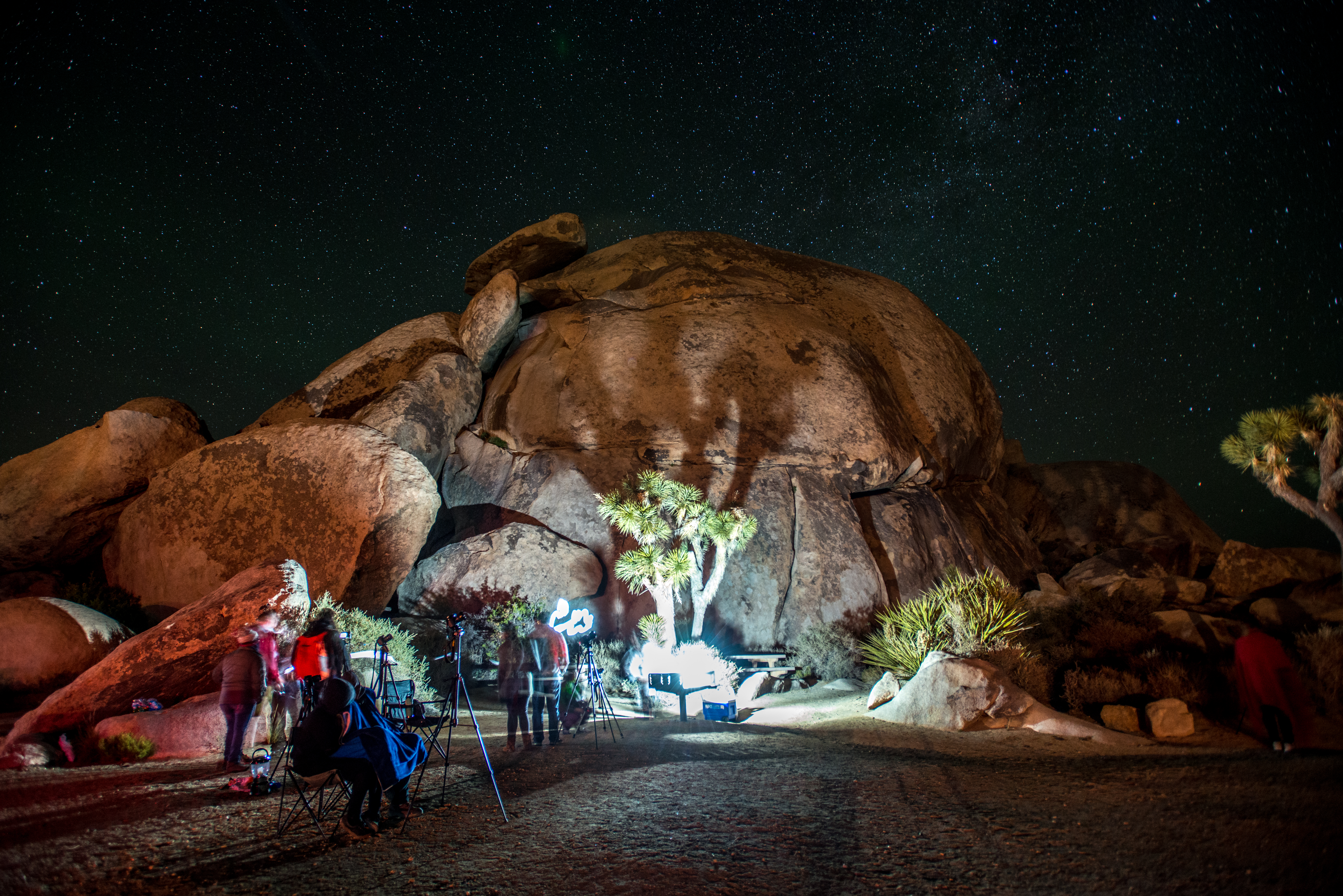
Stargazing at Joshua Tree
Enjoy Joshua Tree National Park's amazing night sky.
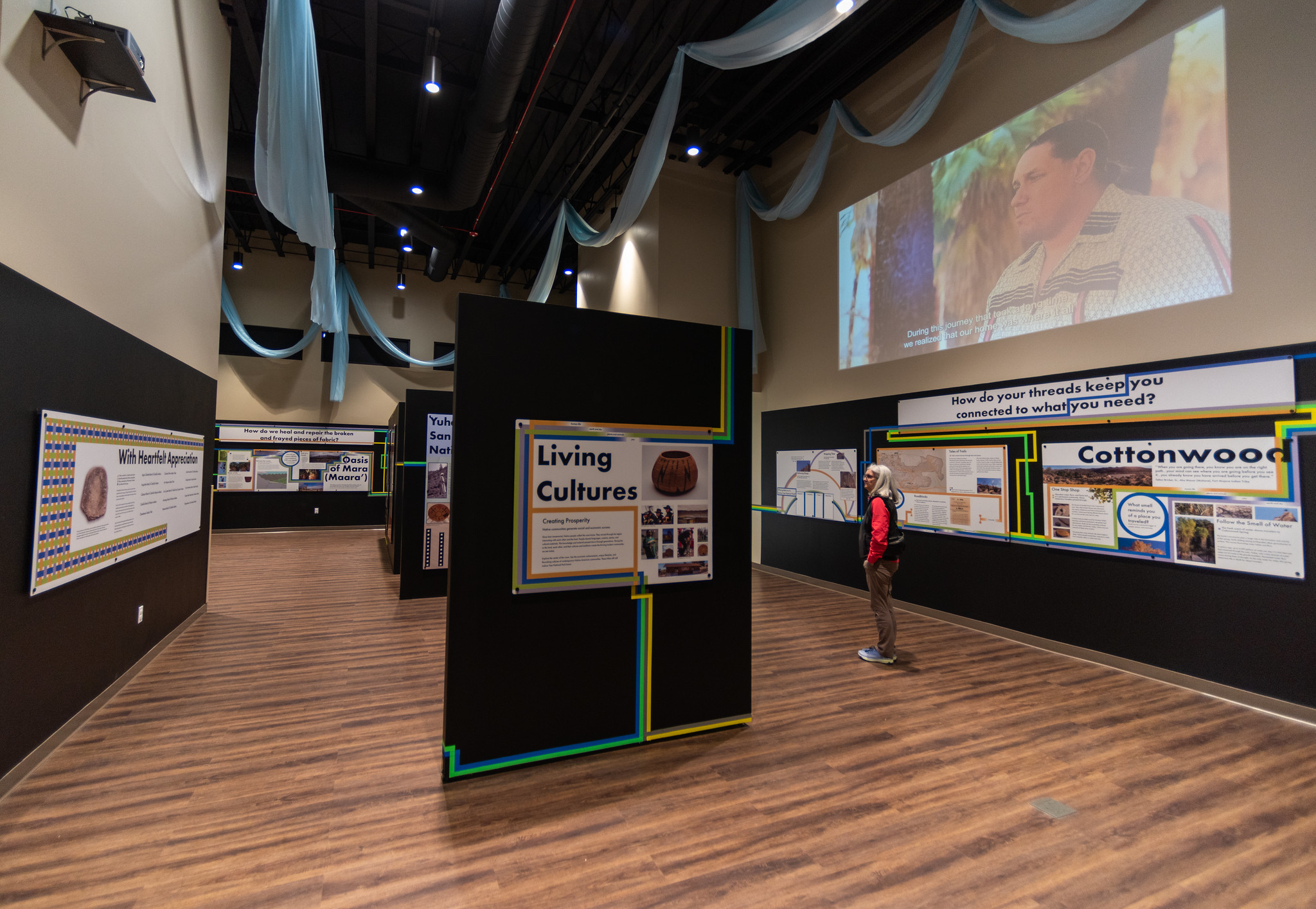
Visit the Universal Threads Exhibit
Visit the Universal Threads Exhibit and learn about the intertwining relationships between plants, animals, earth, sky, and human life.
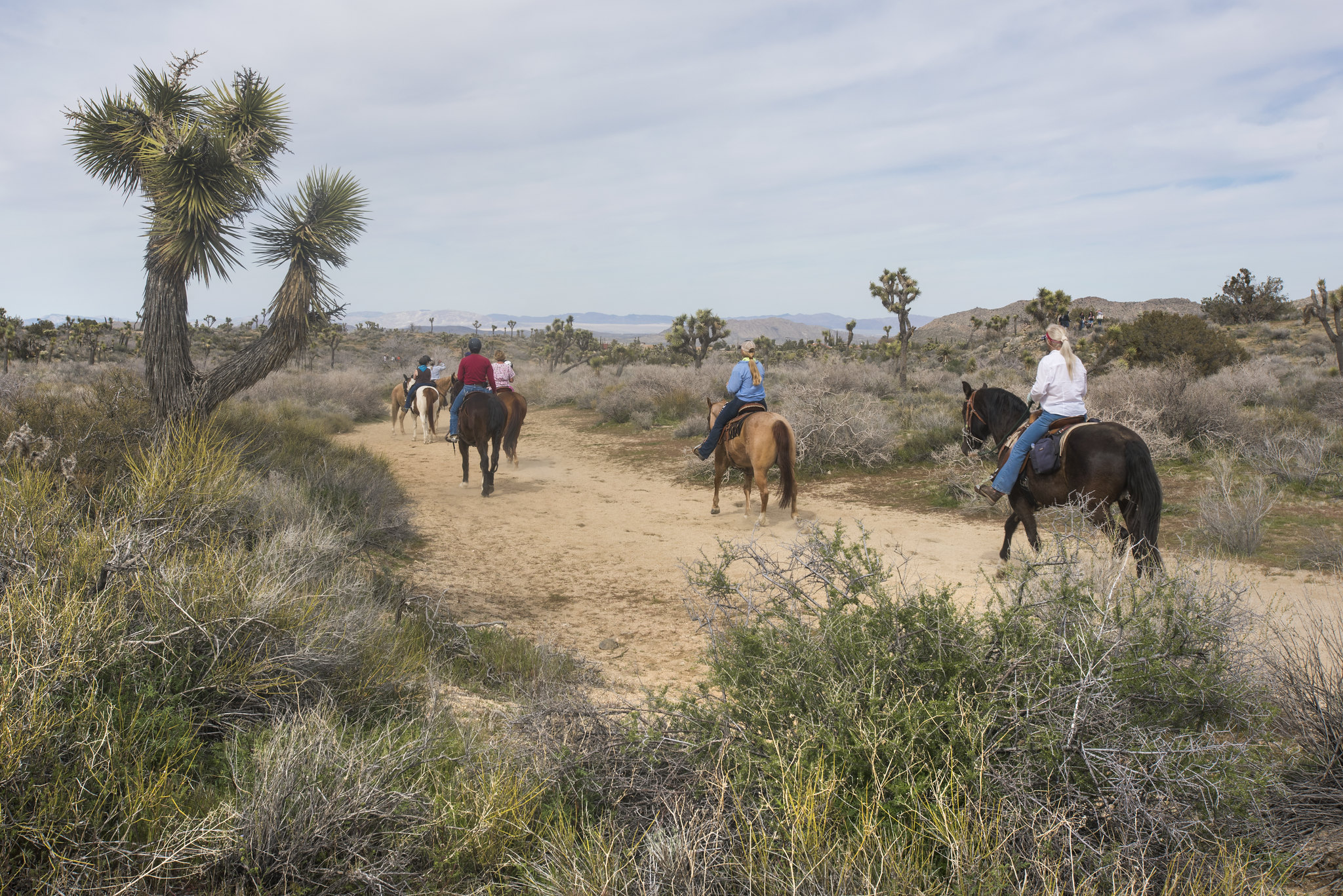
Horseback Riding in Joshua Tree National Park
Horseback riding designated trails in Joshua Tree National Park.
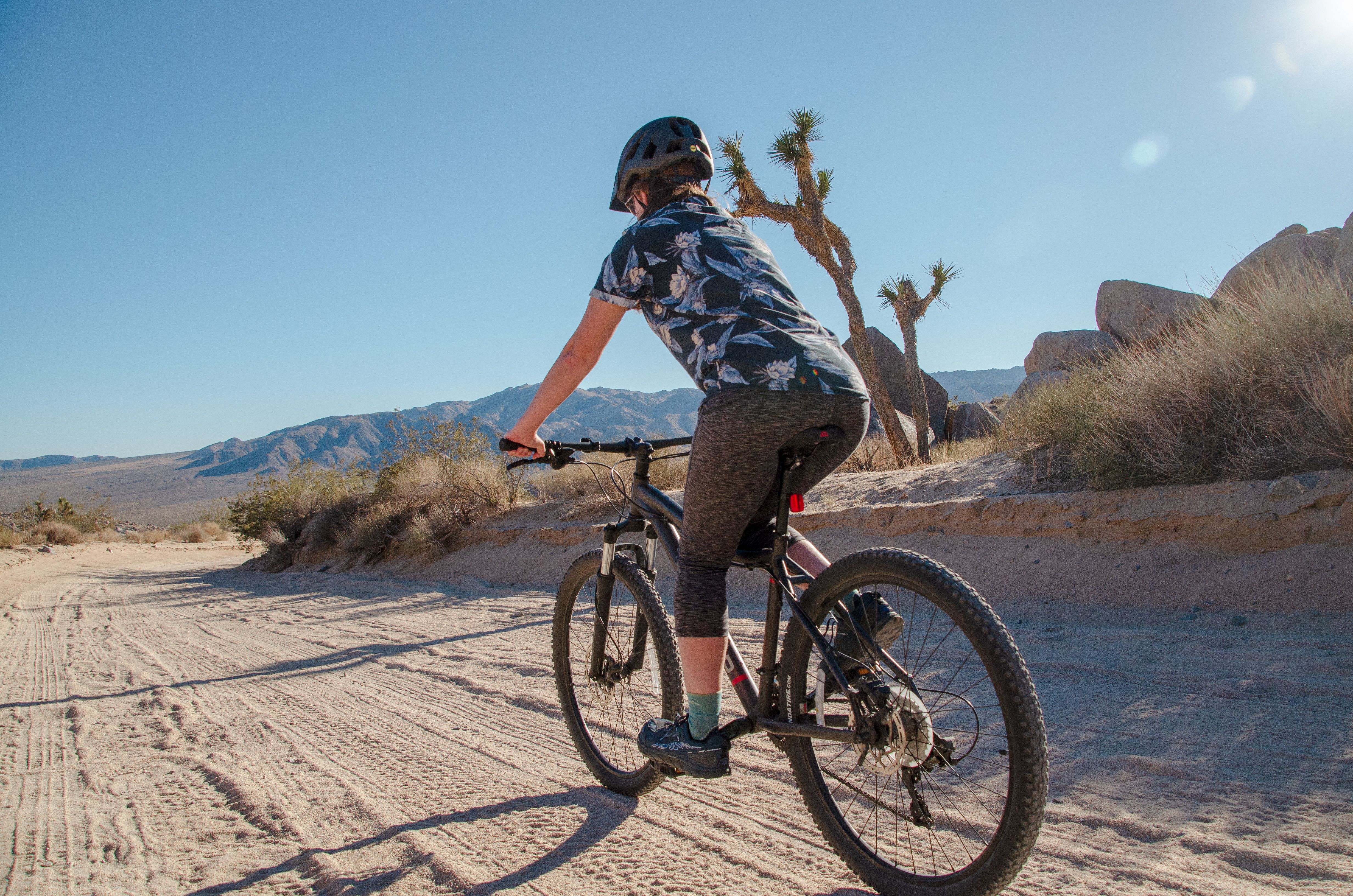
Biking in Joshua Tree National Park
Biking in Joshua Tree National Park
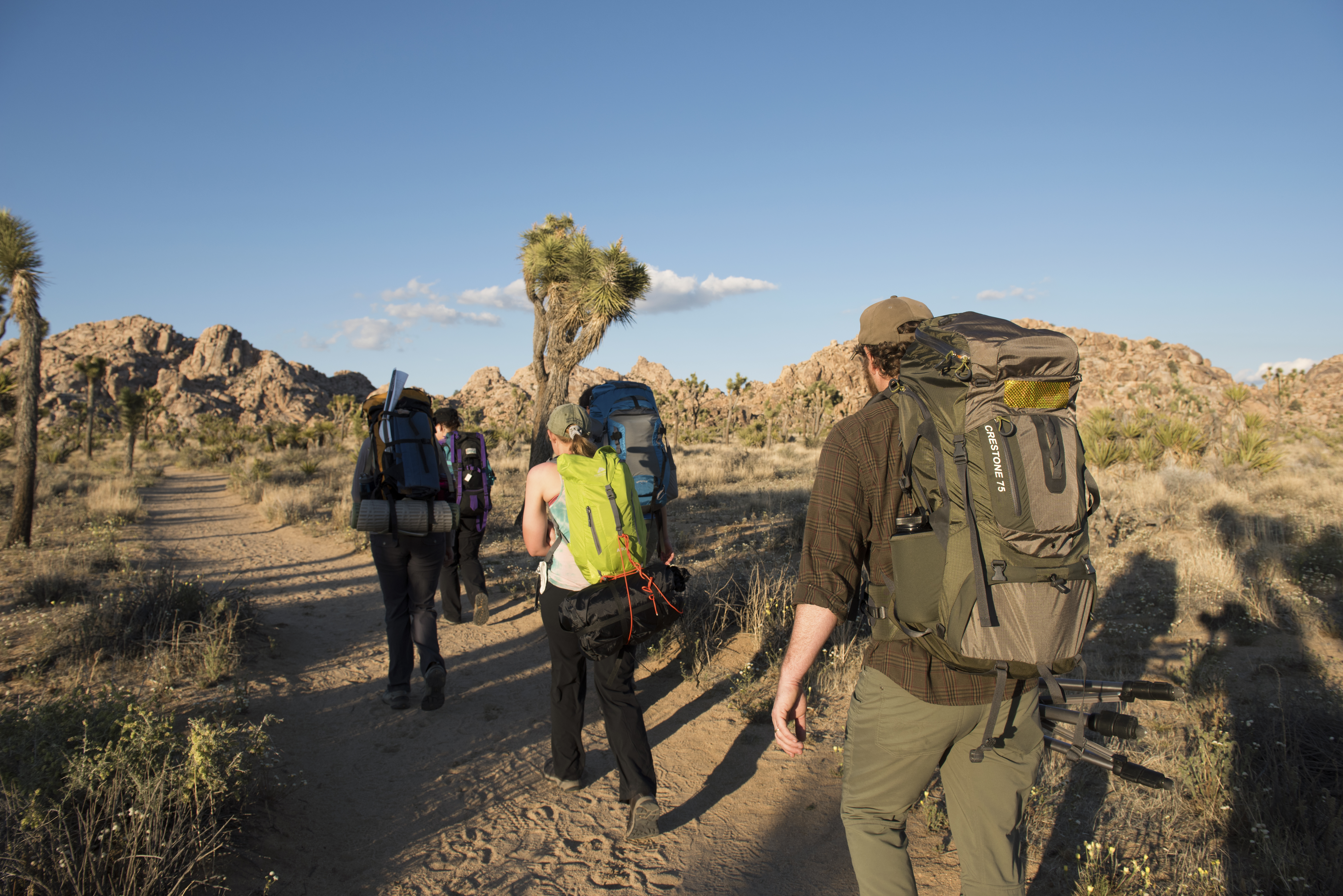
Eagle Mountains Zone Backpacking
Backpack through the Joshua Tree Wilderness in the Eagle Mountains Zone.
Black Rock Zone Backpacking
Backpack in the Black Rock Zone at Joshua Tree National Park. The Black Rock Zone features a wide variety of hiking trails through mountains, washes, ravines, and valleys.
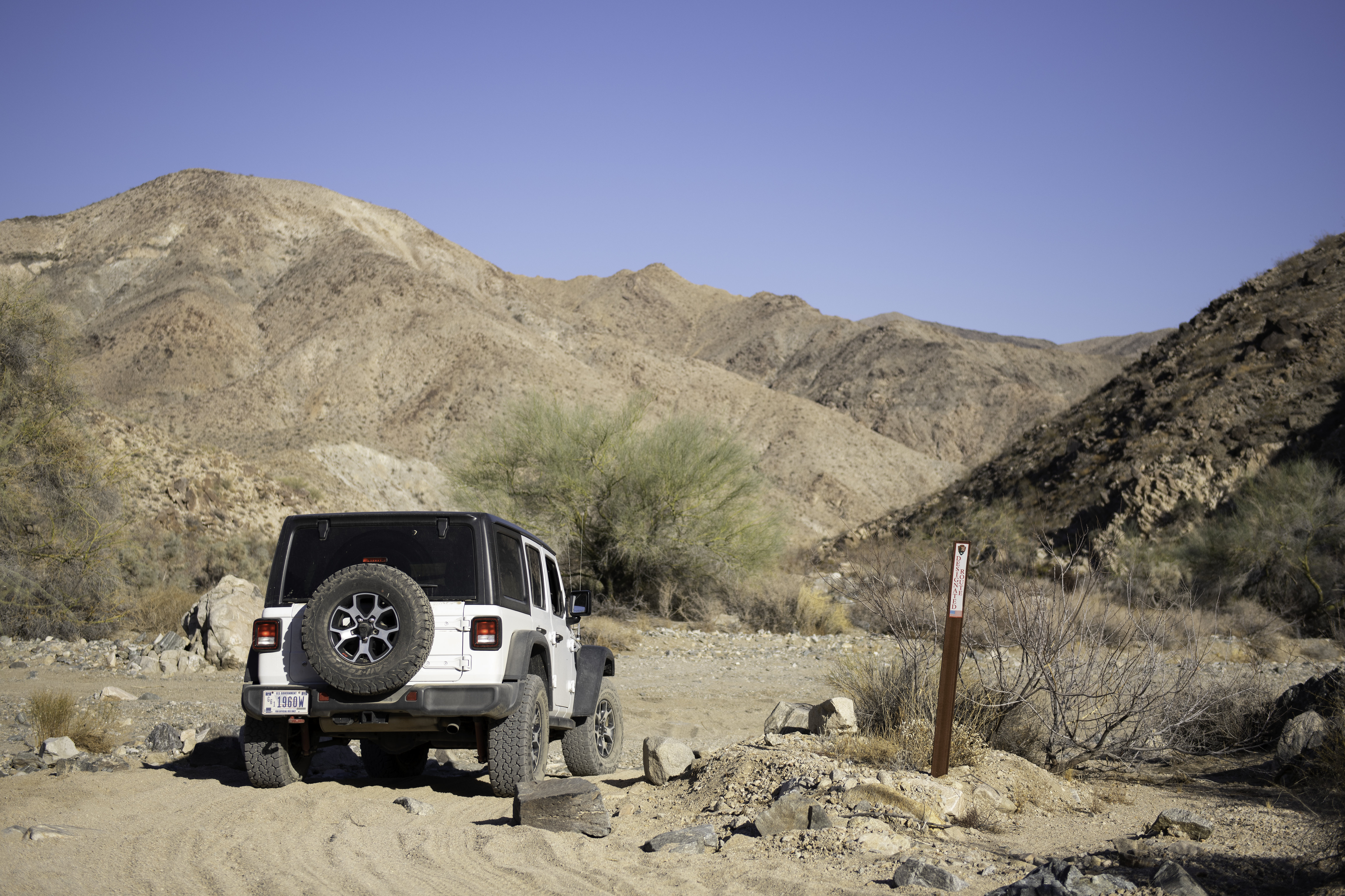
Drive 4x4 Roads
Joshua Tree offers many miles of backcountry dirt roads for four-wheel drive vehicles to explore.
Pine City Zone Backpacking
Backpack through the Joshua Tree wilderness in the Pine City Zone.
Boy Scout Trail Zone Backpacking
Experience Joshua Tree National Park's wilderness by backpacking along the Boy Scout Trail.
Maze Zone Backpacking
Backpack the Joshua Tree wilderness in the Maze Zone.
Juniper Flats Zone Backpacking
Backpack in the Juniper Flats Zone
Hike Indian Cove Trail
An easy .6 mile loop in Indian Cove.
Hike Hidden Valley Trail
Enjoy an easy one mile hike on Hidden Valley Trail.
Hike Hi-View Trail
A moderate 1.3-mile loop hike.
Hike Oasis of Mara
An easy half mile walk to a desert oasis.
Visit the Black Rock Art Gallery
Visit the Black Rock Art Gallery
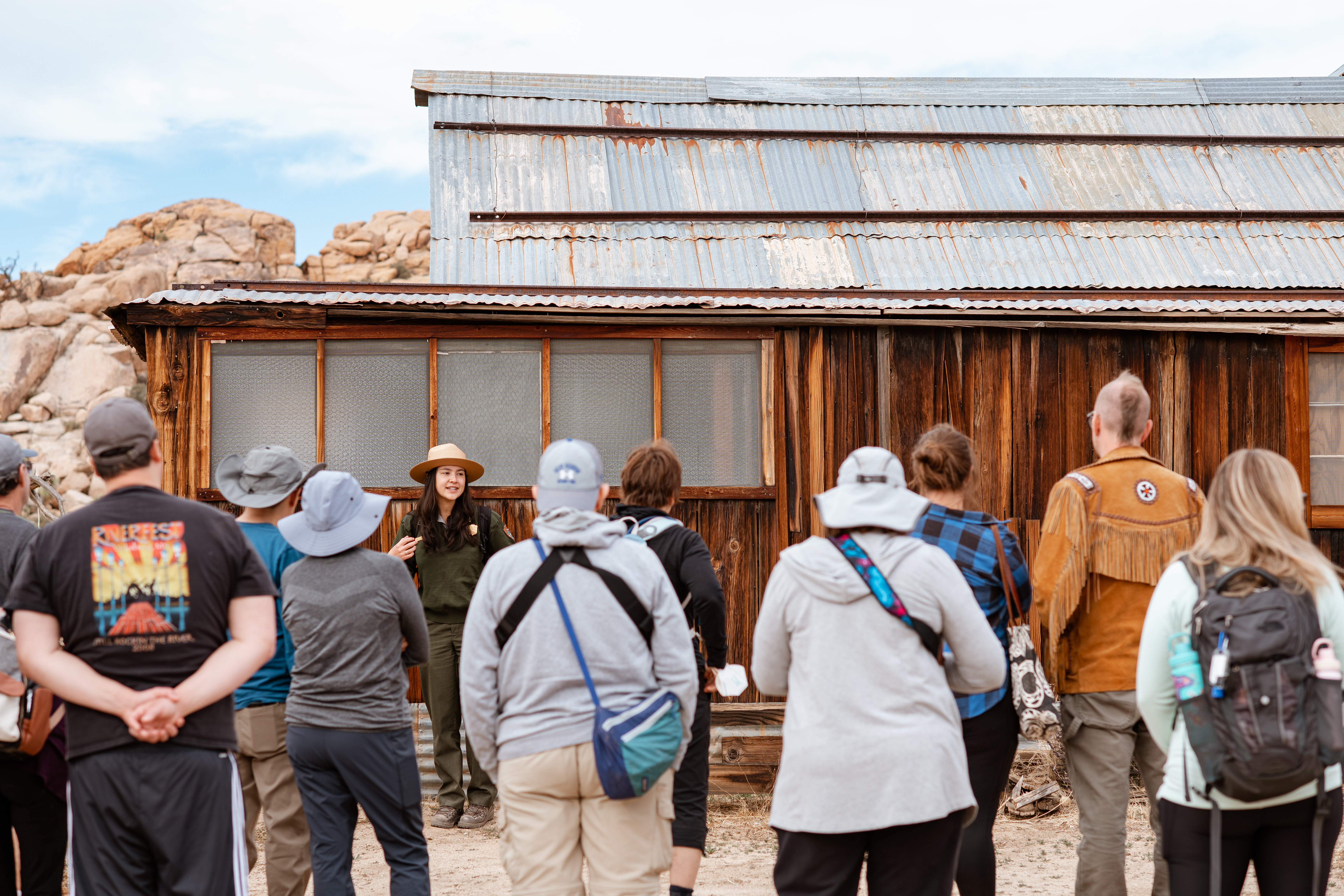
Attend a Keys Ranch Tour
Take a tour of Keys Ranch with a park ranger.
Hike Panorama Loop Trail
Hike up a sandy wash, then follow the ridgeline of the Little San Bernardino Mountains. Enjoy scenic views, dense Joshua tree forest, and pinyon-juniper woodland. This trail is 6.6 miles and has over a 1,000 feet of elevation gain.
Photographing Joshua Tree
Photography at Joshua Tree National Park.
Hike Minerva Hoyt Trail
Information on the Minerva Hoyt trail.
Hike Willow Hole
Enjoy a scenic hike into the Wonderland of Rocks.
Hike Contact Mine
Enjoy a secluded hike to a historic mining site.
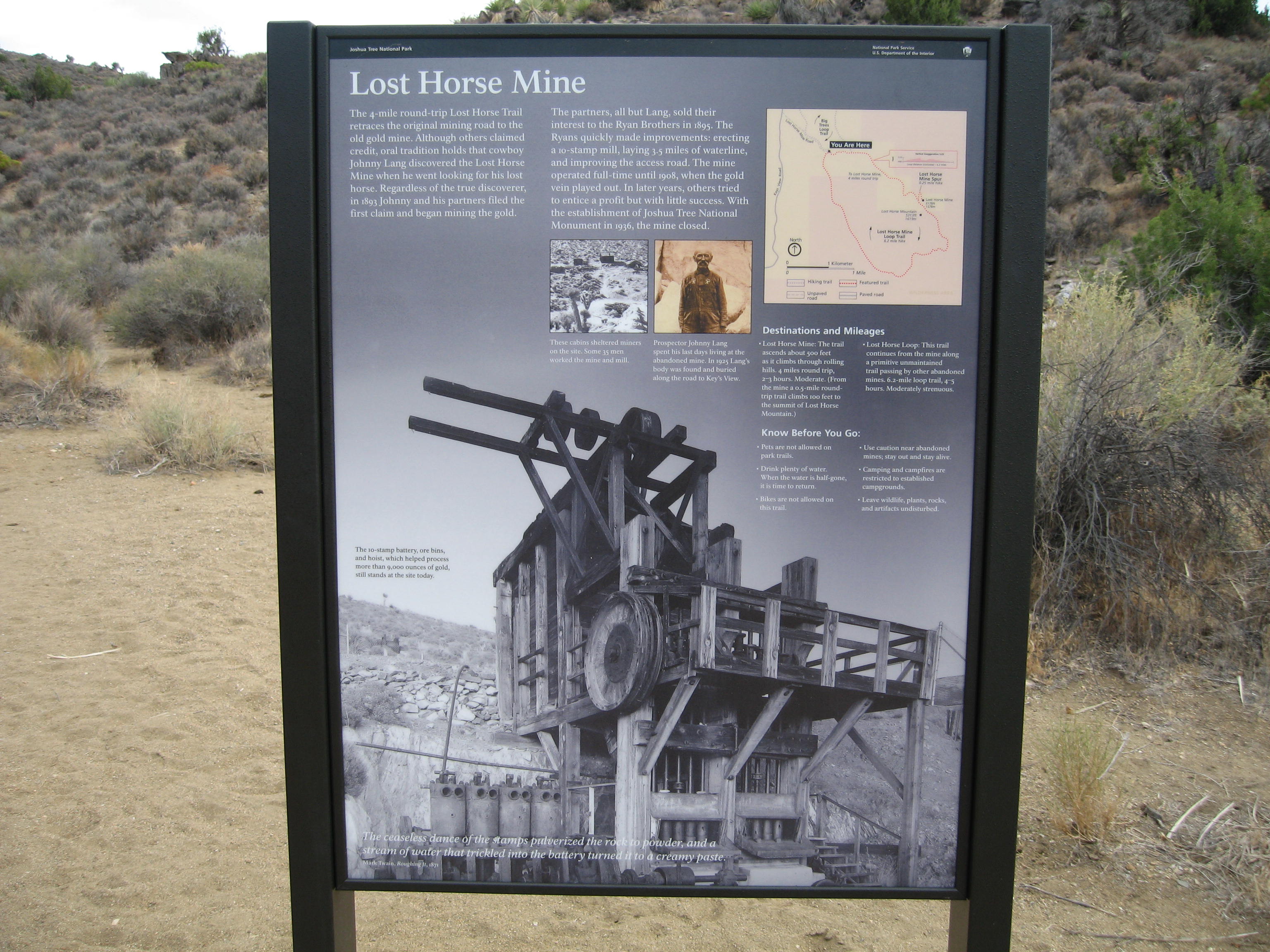
Hike Lost Horse Mine
Lost Horse Mine Trail
Hike West Side Loop
Enjoy a moderate loop hike in the Black Rock area
Hike Cottonwood Spring
A short, easy 0.1 mile walk to an oasis.
Hike Cap Rock
An easy .4-mile loop hike
Hike Bajada Trail
Enjoy this short, easy trail through the Colorado desert.
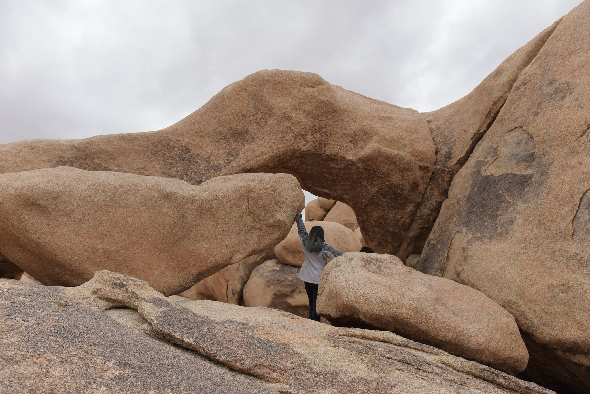
Hike Arch Rock
Hike the Arch Rock Trail, a lollipop trail through sandy and rocky terrain. A .6-mile trail leads to a .2-mile loop. The arch is located halfway along the loop. The full hike is 1.4 miles.
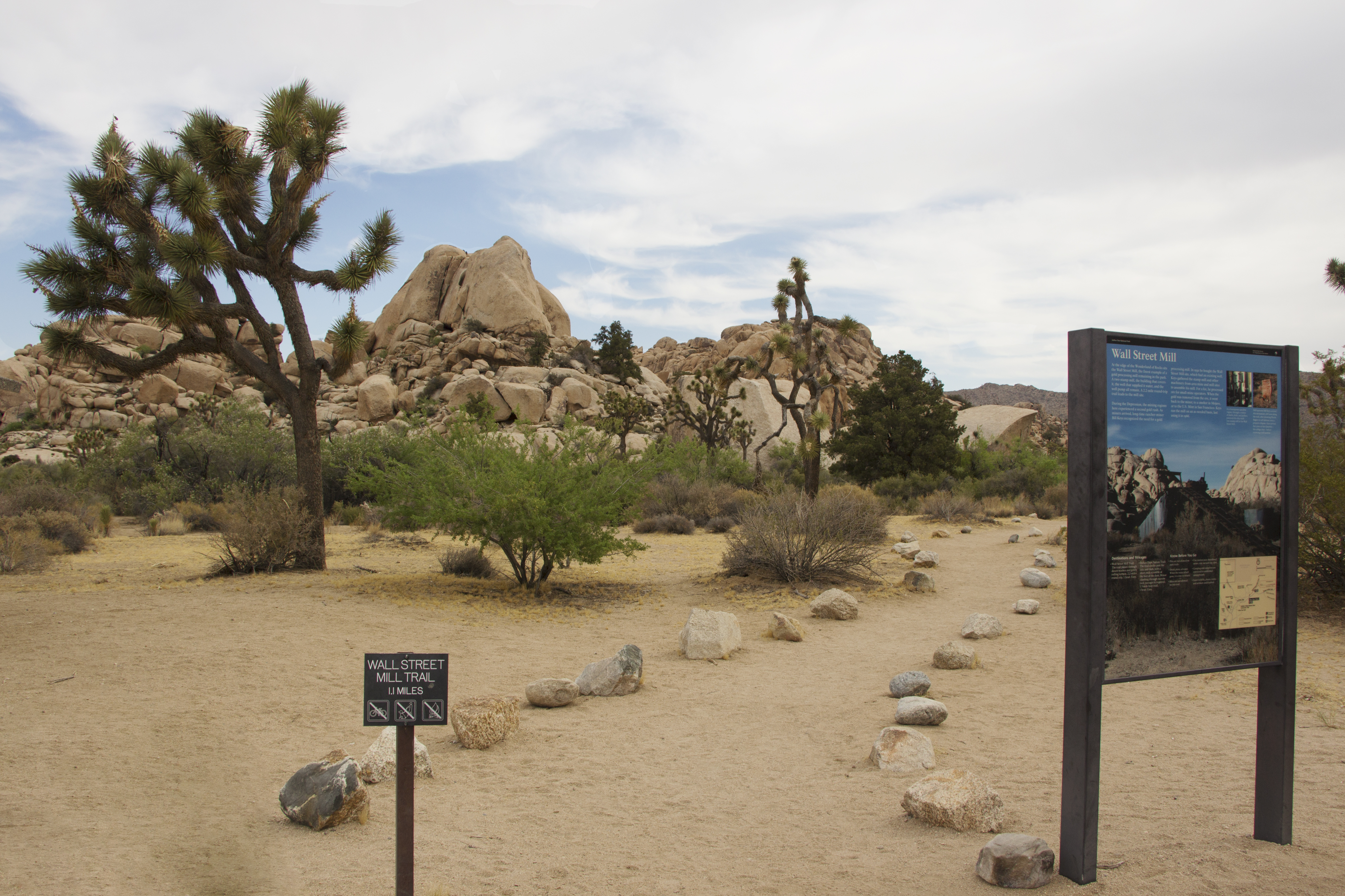
Hike Wall Street Mill
A moderate two mile out and back hike to an old mill site.
Hike Pine City Trail
A moderate four mile out and back hike.
Hike Mastodon Peak
A moderate three mile loop with 375 feet of elevation gain.
Hike Split Rock
Split Rock is a 2.5 mile loop trail with 150 feet of elevation gain and beautiful desert views.
Hike Ryan Mountain
A popular, steep, three mile out and back hike with wide panoramic views.
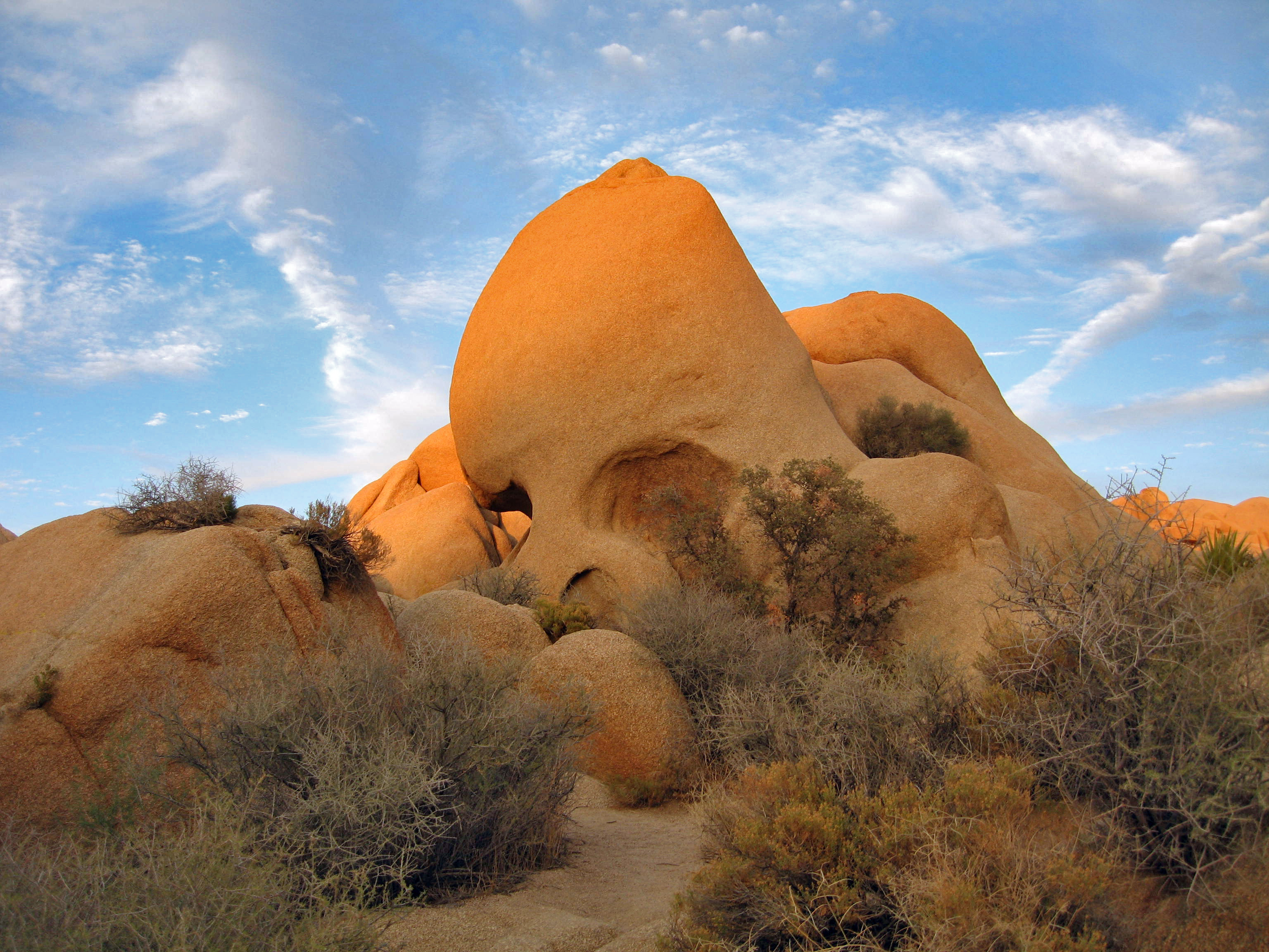
Hike Skull Rock
A relatively flat, 1.7-mile loop trail. Hike through the large, granite boulder fields around the Jumbo Rocks area, including one near Park Boulevard that closely resembles a Skull.
Hike Lost Palms Oasis
A difficult 7.5 mile hike to an oasis.
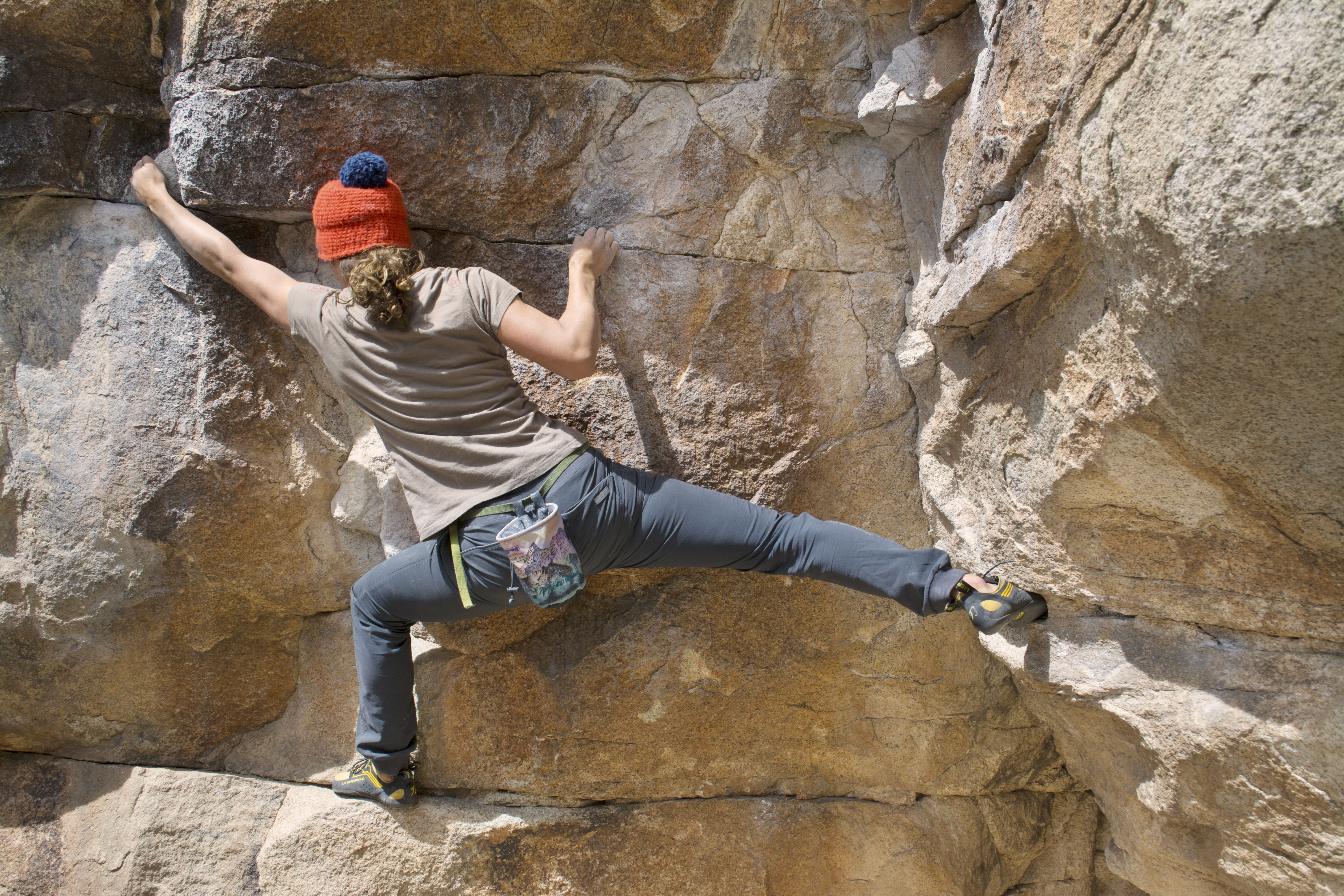
Bouldering Near Barker Dam
Barker Dam offers a wide range of popular bouldering problems.
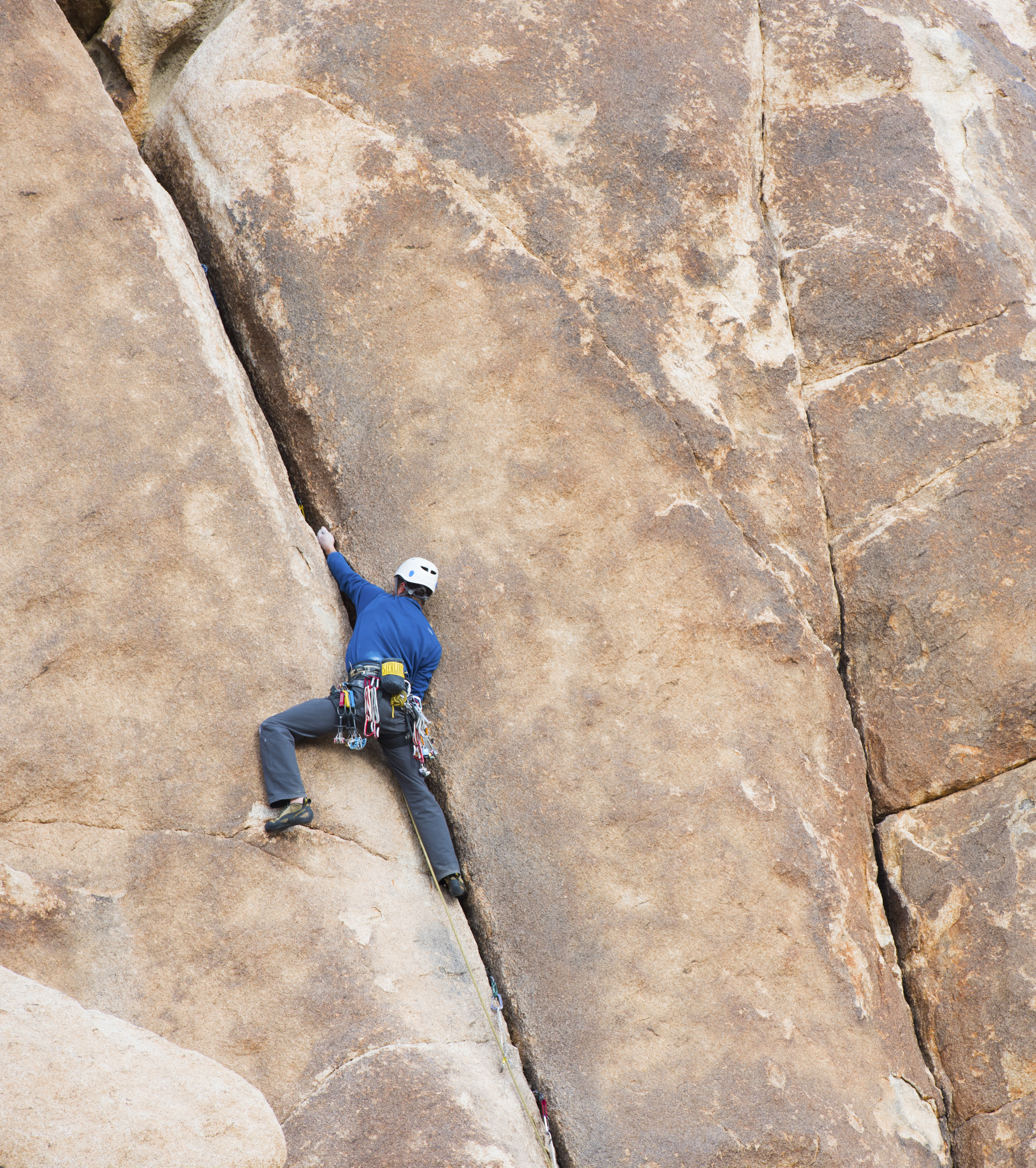
Rock Climbing in Indian Cove
Indian Cove offers a wide range of popular technical rock climbing routes.
Rock Climbing at Echo T
Echo T offers a wide range of popular technical rock climbing routes.
Rock Climbing at Hidden Valley Nature Trail
Hidden Valley offers a wide range of popular technical rock climbing routes.
Become a Joshua Tree Junior Ranger
Become a Junior Ranger at Joshua Tree National Park.
Tours
Count: 7
29 Palms to Joshua Tree Audio Tour
This audio tour starts at the Joshua Tree National Park Visitor Center in the town of Twentynine Palms and ends in Joshua Tree, California. This tour is designed to help visitors explore and learn about Joshua Tree National Park. Topics include wildlife, vegetation, deserts, geology, history, and more.
Cottonwood to Joshua Tree Audio Tour
This audio tour starts at the South Entrance near Cottonwood Spring and ends in the town of Joshua Tree, California. This tour is designed to help visitors explore and learn about Joshua Tree National Park. Topics include wildlife, vegetation, deserts, geology, history, and more.
Geology Tour Road
Learn about the geologic forces that shaped Joshua Tree National Park. This tour is on a rough dirt and gravel road so 4-wheel drive is recommended and high clearance in needed beyond Paac Kü̱vü̱hü̱’k, where the road splits into a one-way loop. Additional road and safety information is in stop one. There is no cell coverage in the park so you will need to save Joshua Tree National Park for offline use within the app prior to your arrival.
Hi-View Walking Tour
The High View Nature Trail is a 1.3 mile loop. Total elevation gain on this trail is 400 feet (122 meters). There are several steep sections with steps. Hiking this trail in a counterclockwise direction means the steepest sections will be on the descent.
Indian Cove Orientation Audio Tour (Beta)
This short tour orients campers and hikers around the Indian Cove Area. Reservations for Indian Cove can be made at recreation.gov.
Joshua Tree to 29 Palms Audio Tour
This audio tour starts at the Joshua Tree Visitor Center in the town of Joshua Tree and ends in Twentynine Palms, CA. This tour is designed to help visitors explore and learn about Joshua Tree National Park. Topics include wildlife, vegetation, deserts, geology, history, and more.
Joshua Tree to Cottonwood Audio Tour
This audio tour starts at the Joshua Tree Visitor Center in the town of Joshua Tree and ends at the South Entrance near the Cottonwood Area. This tour is designed to help visitors explore and learn about Joshua Tree National Park. Topics include wildlife, vegetation, deserts, geology, history, and more.