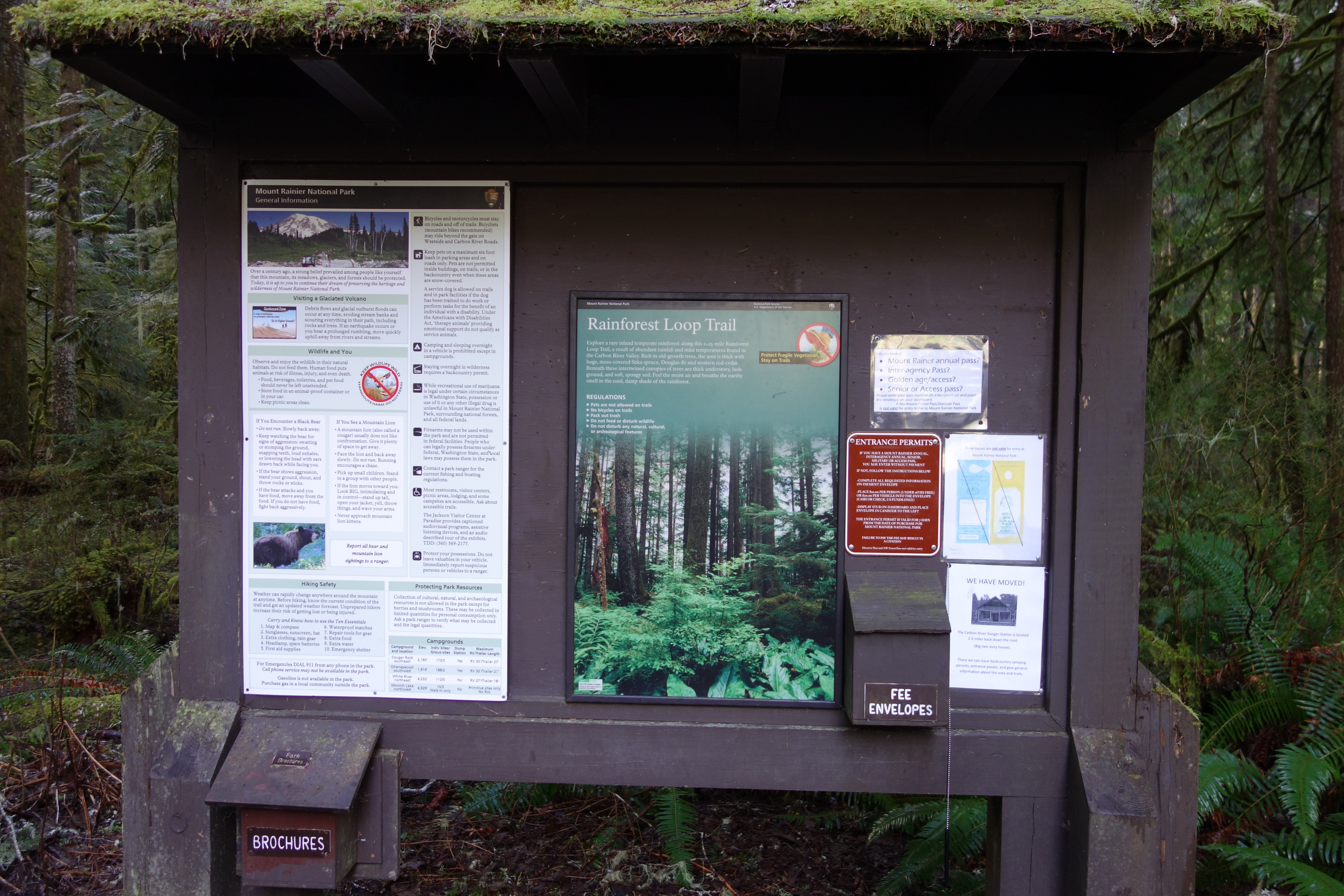
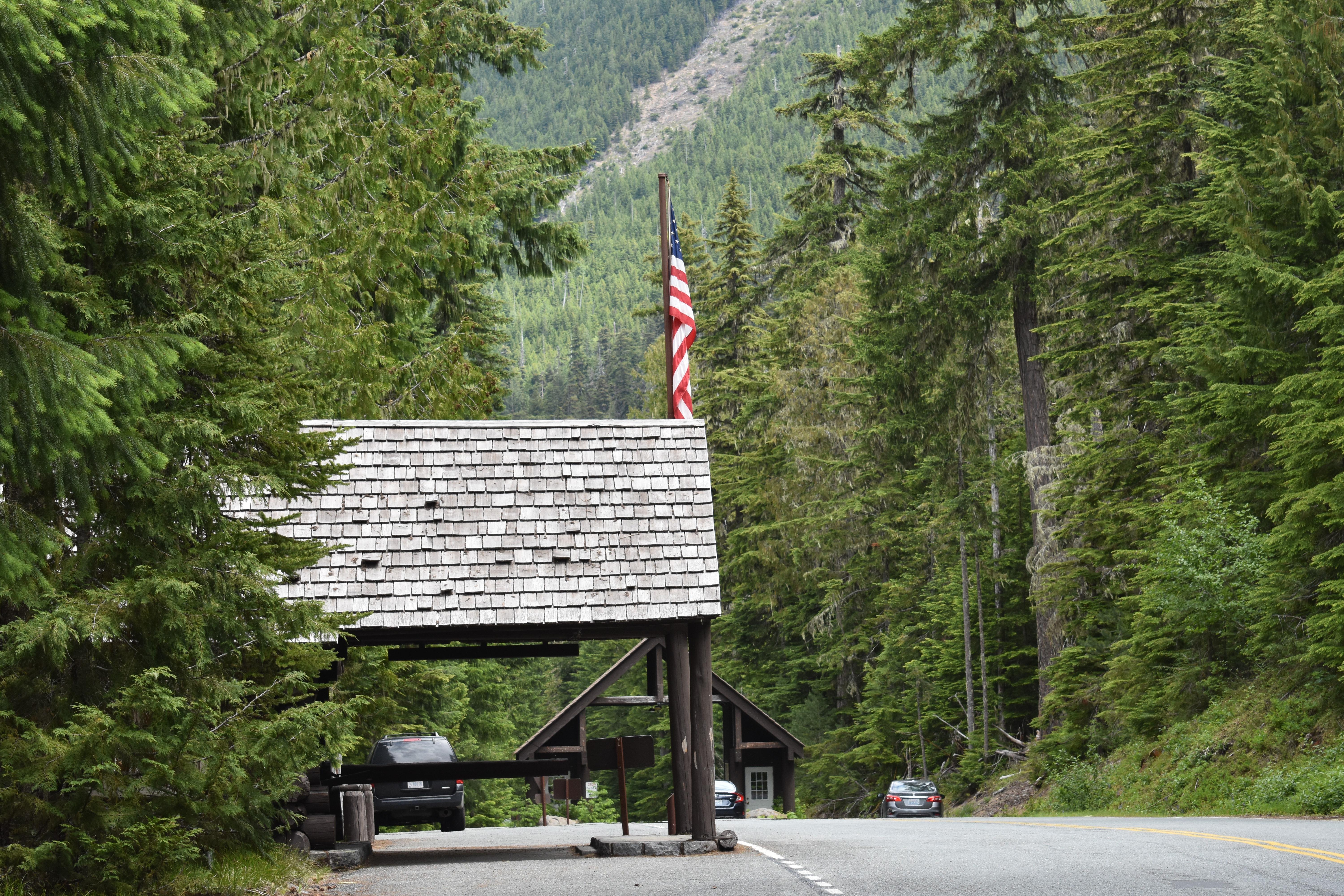
Be advised that the NPS has issued alerts for this park.
Trail Closures: Naches Peak Trail
Access is prohibited to Naches Peak Trail to protect public health and safety due to the vicinity of the Wildcat Fire burning outside of the park to the east. Shriner Peak Trail & trailheads on SR 123 between Cayuse Pass and Stevens Canyon Road have reopened as of 9/19/25.
Paradise Water Supply Out of Service
Water is currently not available at Paradise & Narada Falls due to issues caused by a recent heavy rain event affecting the water system. Port-a-potties available. The closest flush restrooms are at Cougar Rock picnic area & campground (9 miles southwest of Paradise approx. 20-minute drive) & Longmire (3 miles and 5 minutes further southwest). Limited prepared food and water available at the Paradise Inn. Thank you for your patience as the park works toward a resolution to this issue.
SR 123 is closed to all through traffic from Stevens Canyon Rd to Cayuse Pass in September 2025
Due to construction, SR 123 will be closed Sept 2 - 30 to all vehicles, pedestrians, & bicyclists from Stevens Canyon Road to Cayuse Pass / SR 410. Stevens Canyon Entrance remains open. Expect detours of 3-4 hours.
Timed Entry Reservations required on weekends/holidays for the Sunrise Corridor ONLY in 2025.
A timed entry reservation is required only for the Sunrise Corridor in the northeast corner of the park from 7 am to 5 pm on weekends & holidays from Sept 1 through end of the season (early- to mid-October).
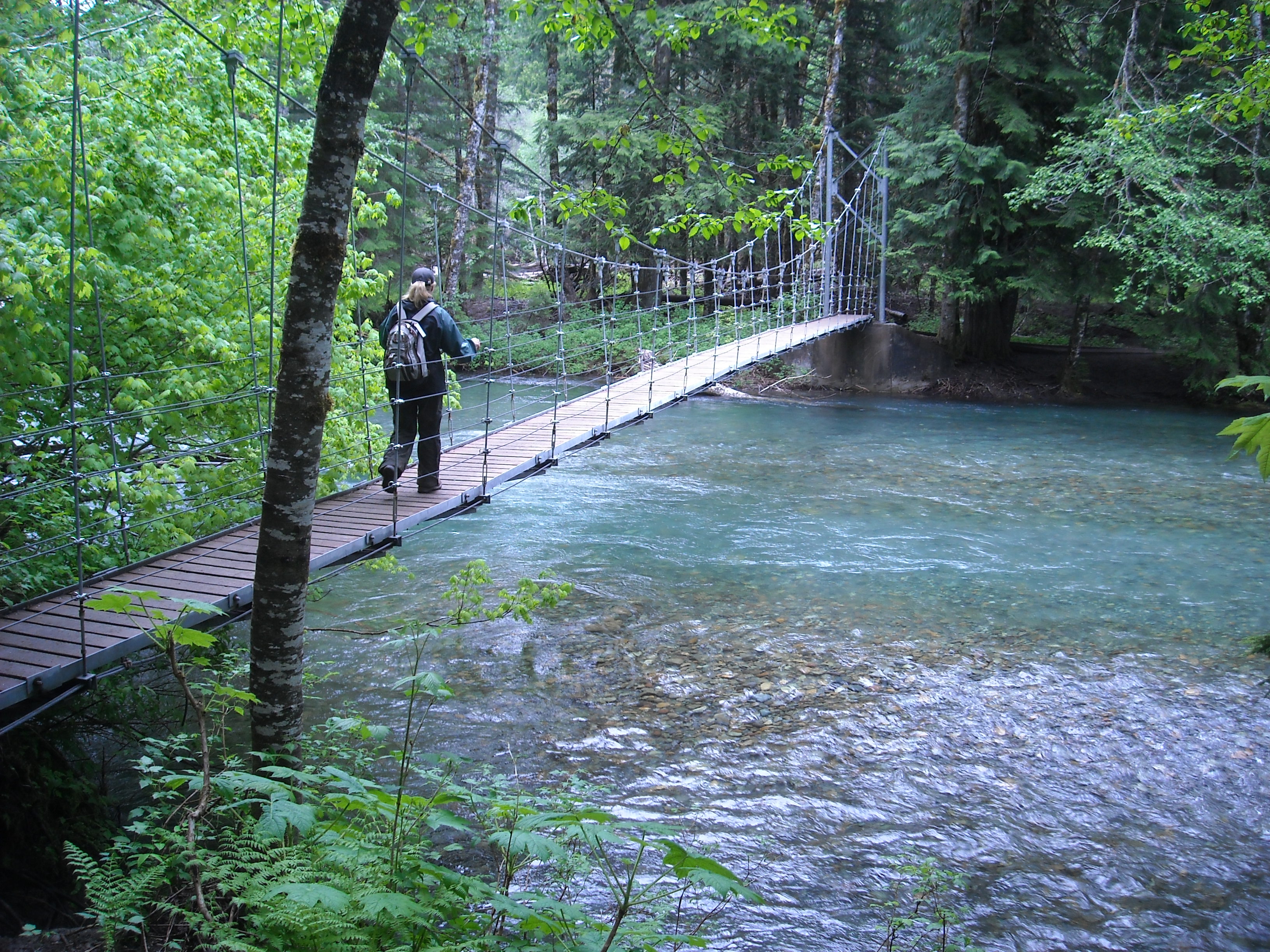
SR 165 Carbon River/Fairfax Bridge is closed: no access to Carbon River or Mowich Lake.
There is NO public access to Carbon River & Mowich Lake from SR 165. The bridge is closed to pedestrians, bicycles and vehicles and there is no alternate route.
Sunrise Service Road Closure
Effective July 14, 2025 until further notice, the eastern portion of the Sunrise Service Road (Sunrise area), access points at Wonderland Trail, Sunrise Parking Lot and Sunrise Picnic Area. Sunrise Road and Sunrise parking area both remain open.
Ohanapecosh Campground area closed for construction in 2025.
The entire Ohanapecosh Campground area is CLOSED for the duration of the construction project, including all campsites, visitor center, restrooms, picnic area, & Ohanapecosh river access.
Fire ban in effect June 10 until further notice.
All campfires and the ignition of wood, briquettes, or any fuel in fire pits, fire pans, and barbeque grills is prohibited. This ban is in place to reduce the risk of human-caused wildland fire.
Expect long lines at entrances on weekends.
Lengthy delays are likely at the southwest park entrance on SR706 on weekends. Check Google Maps for backup (represented by the orange/red line) at link below. Please do not block driveways or roads while in line outside the park.
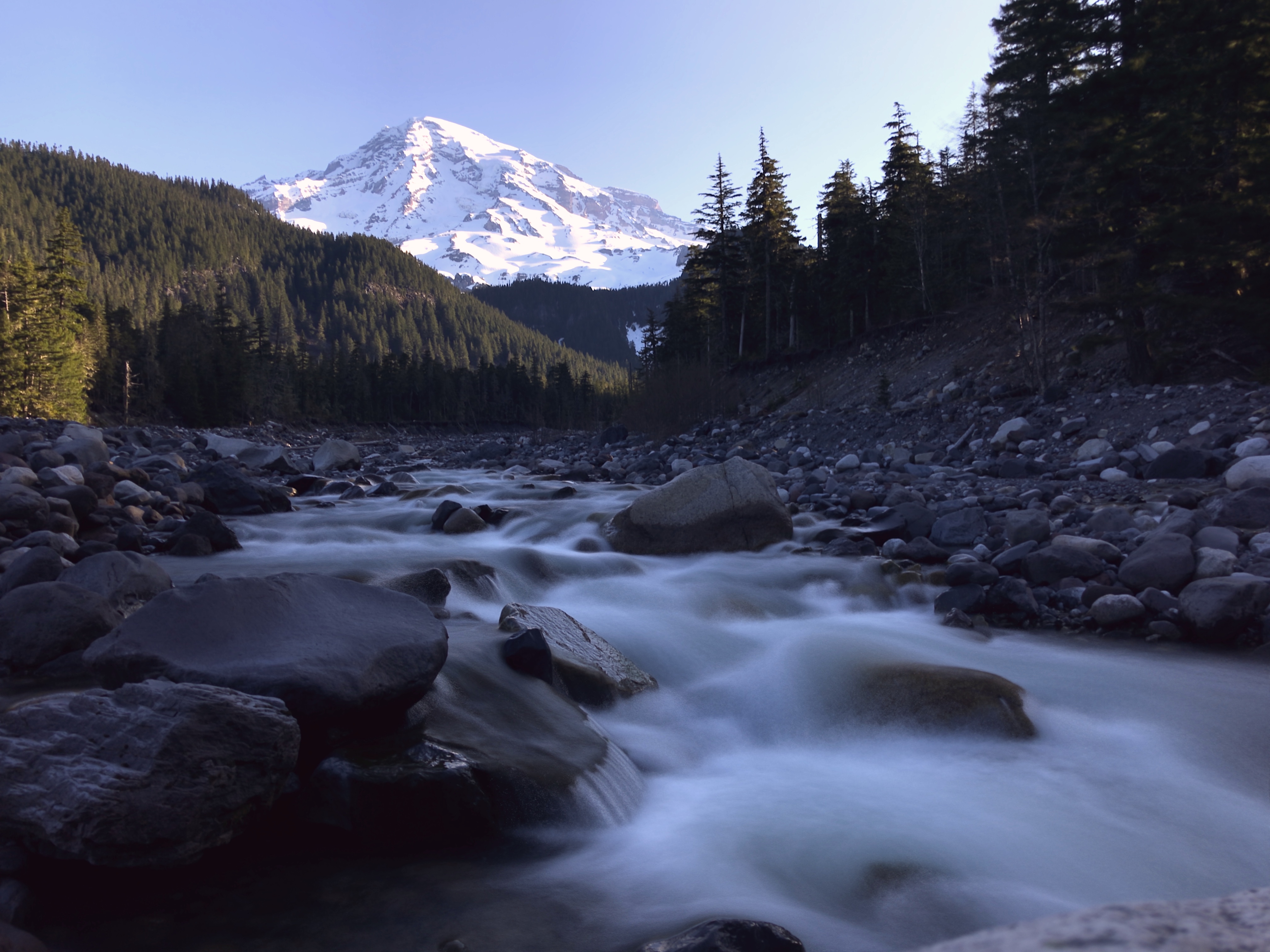
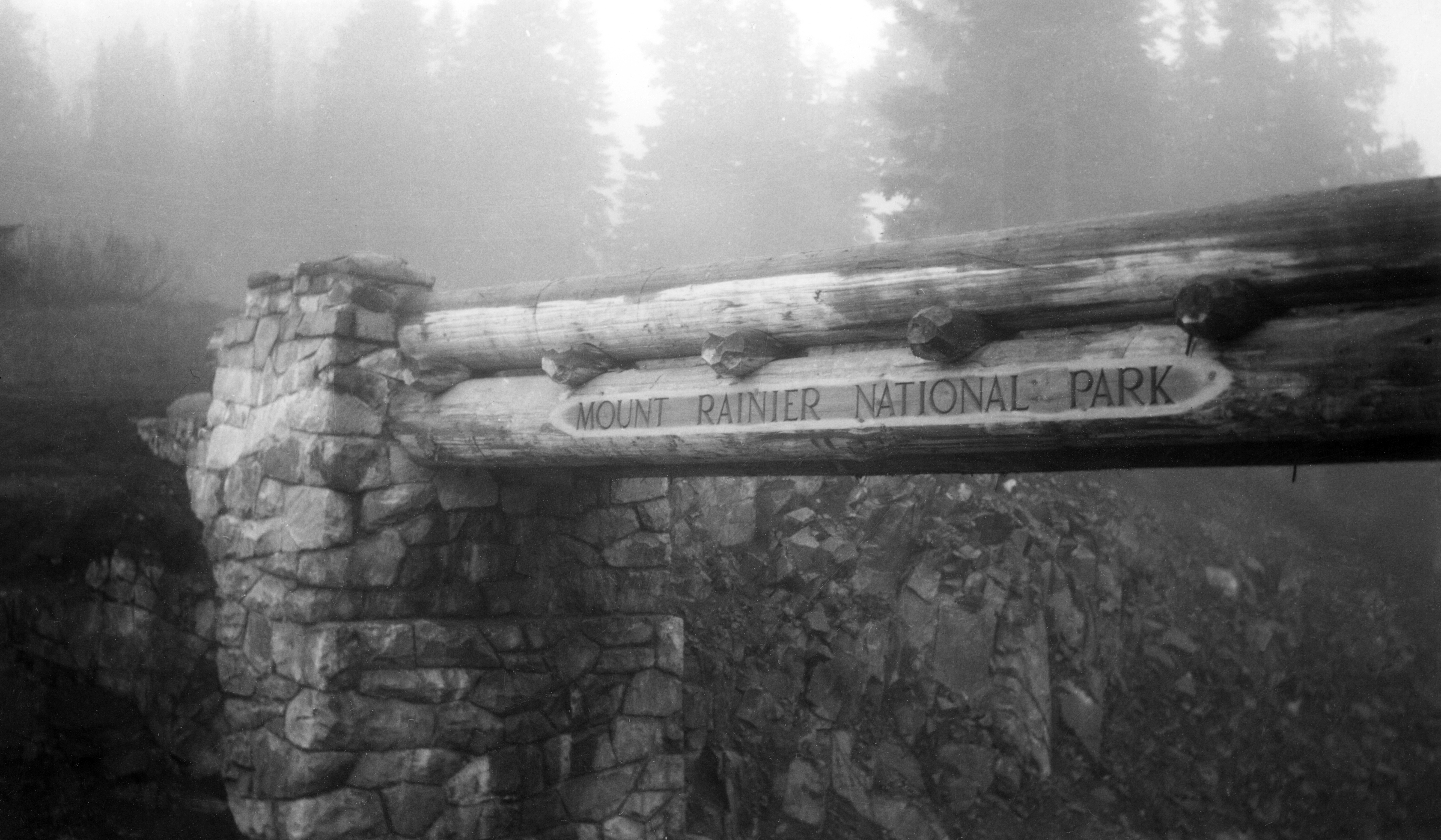
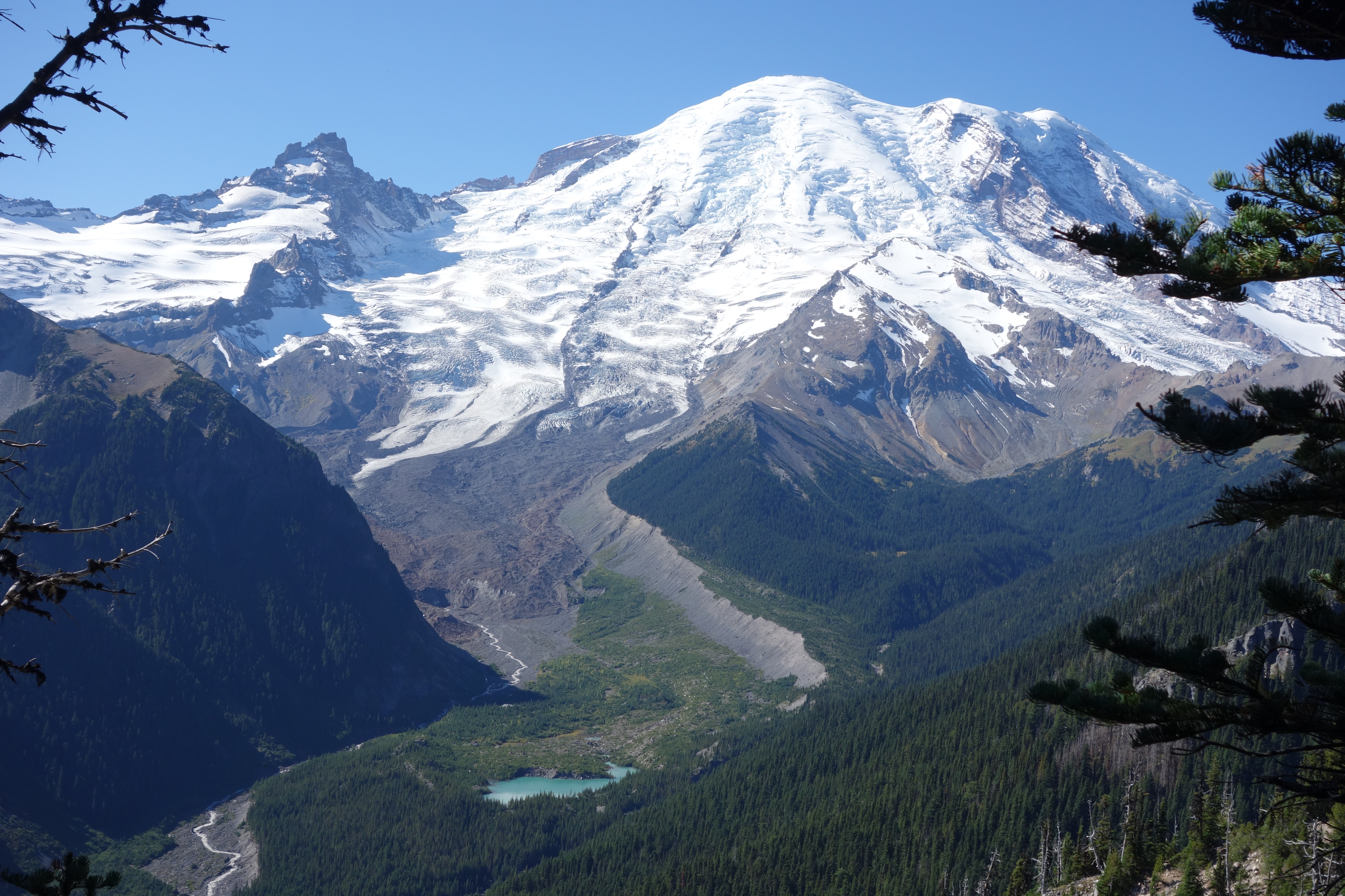
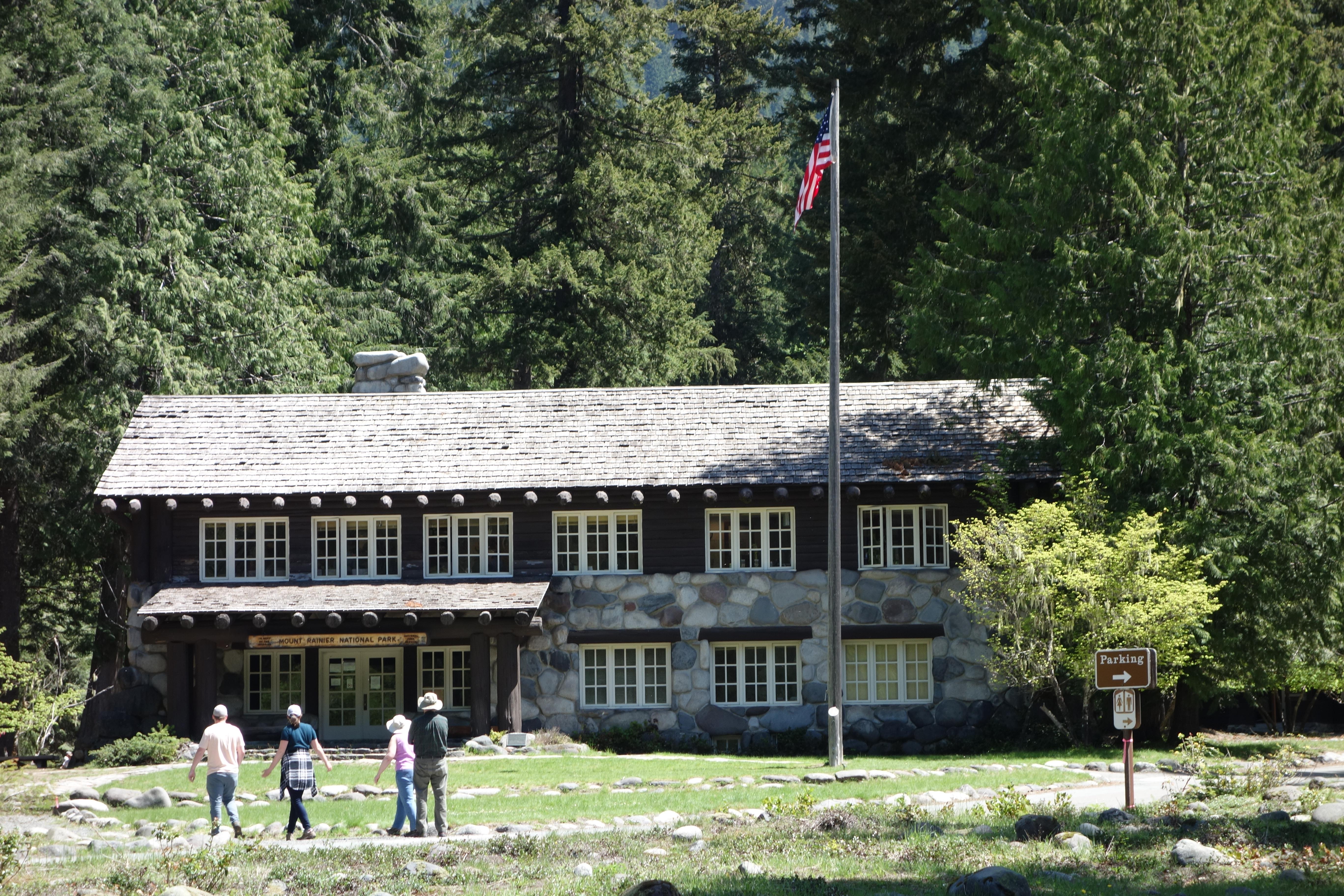
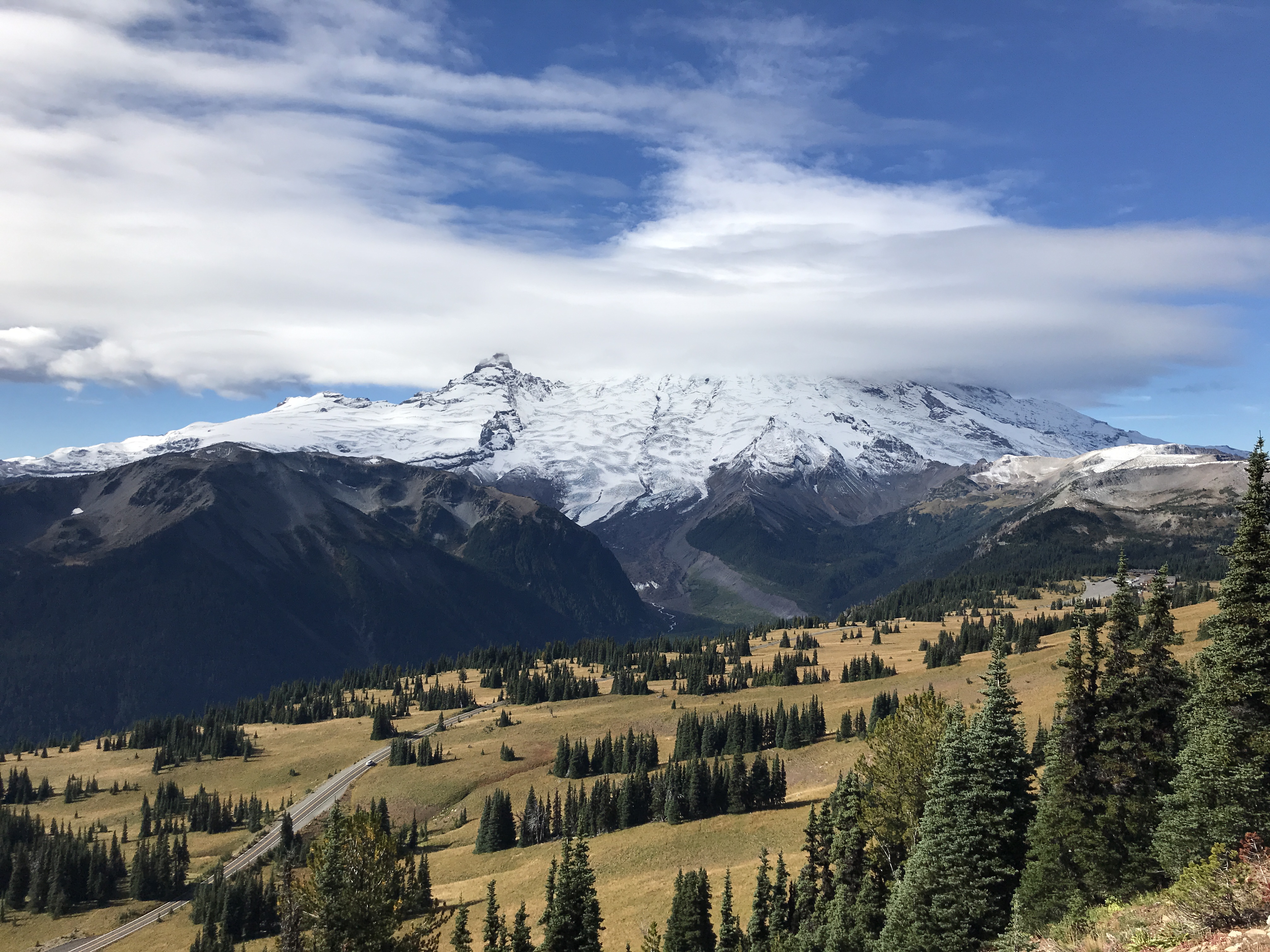
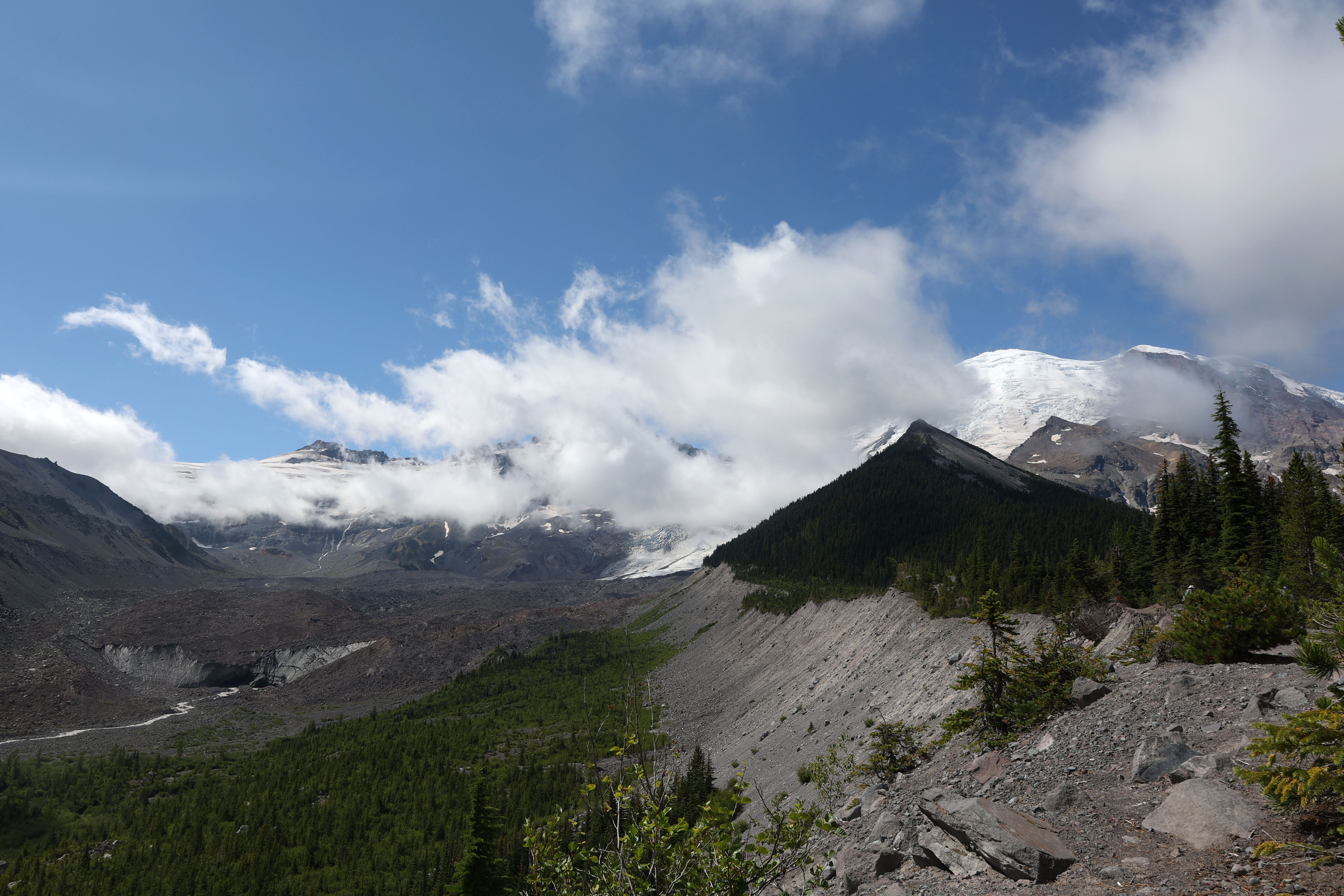
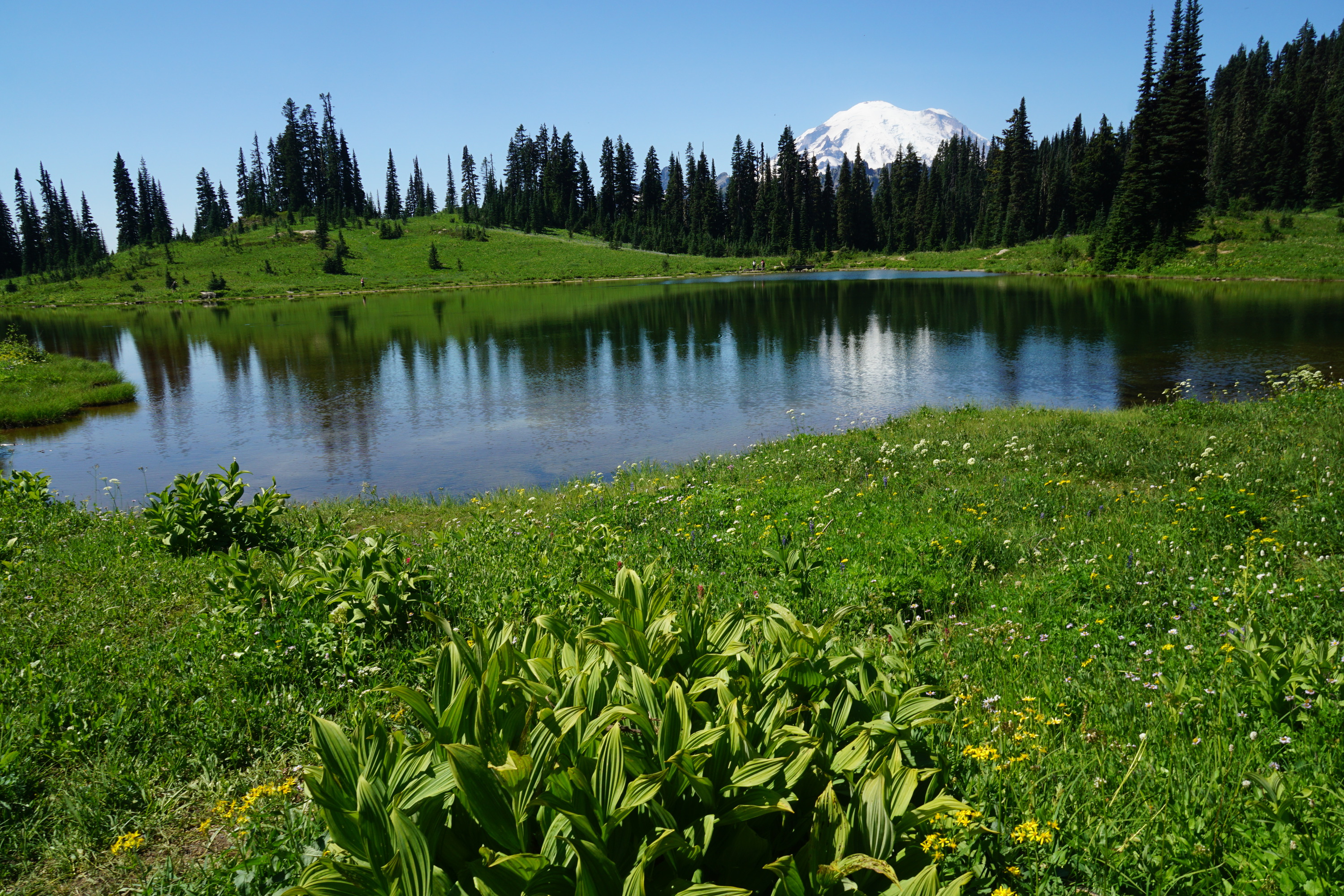
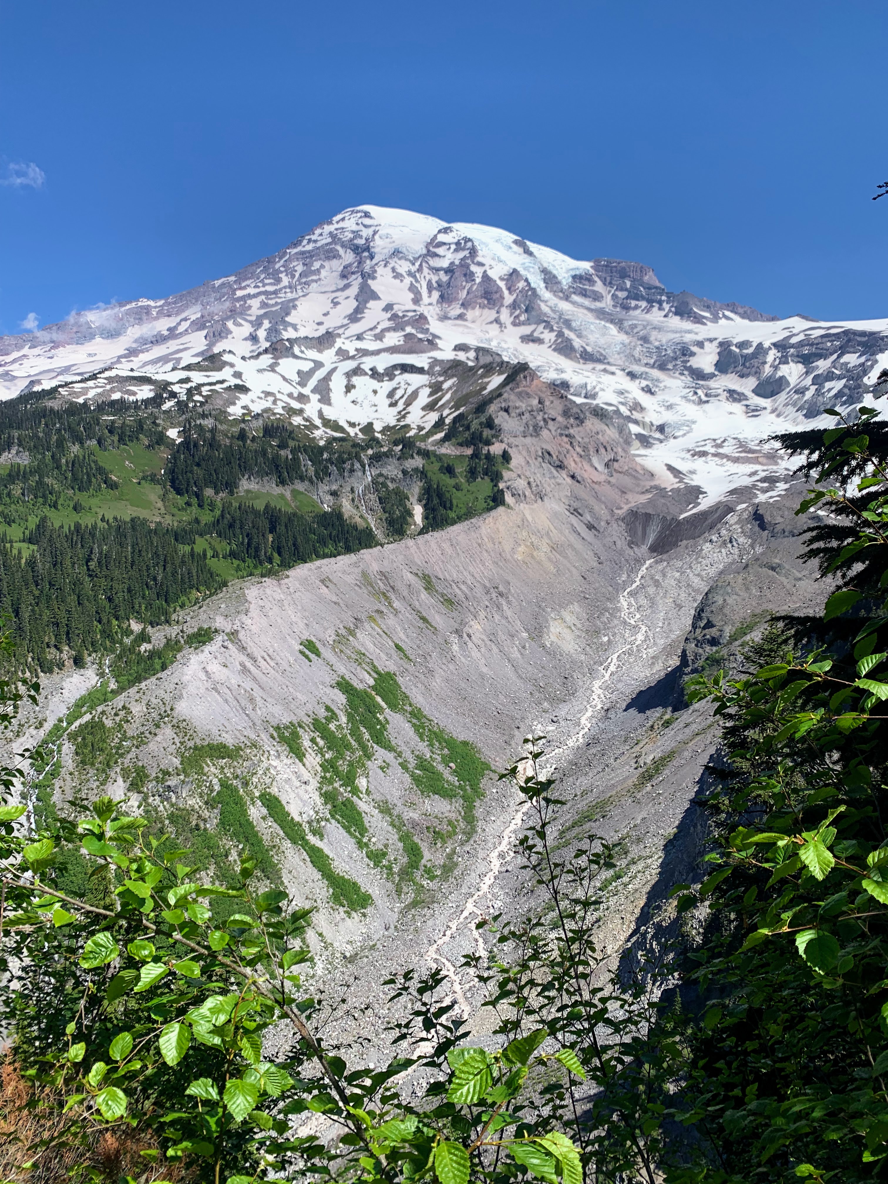
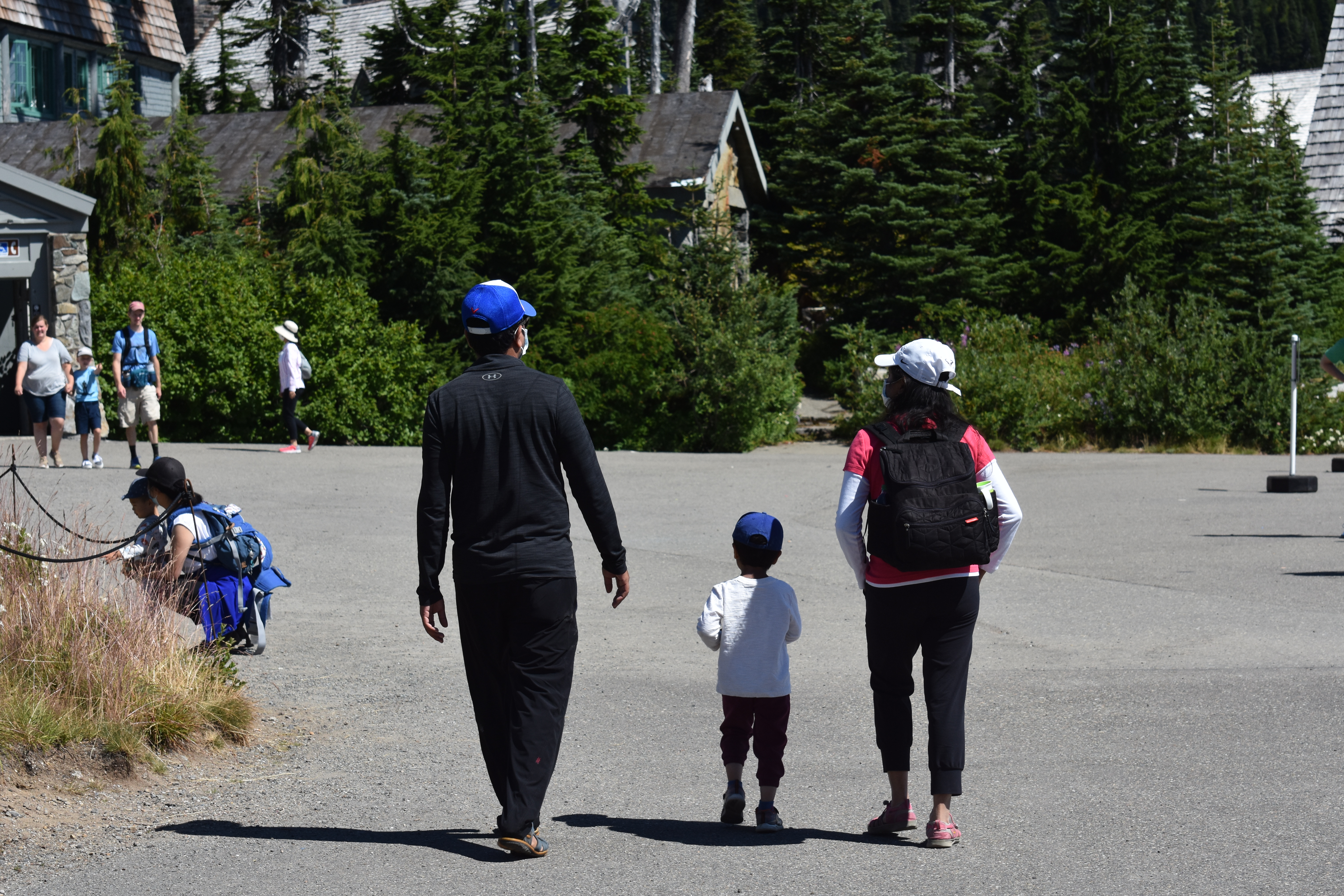
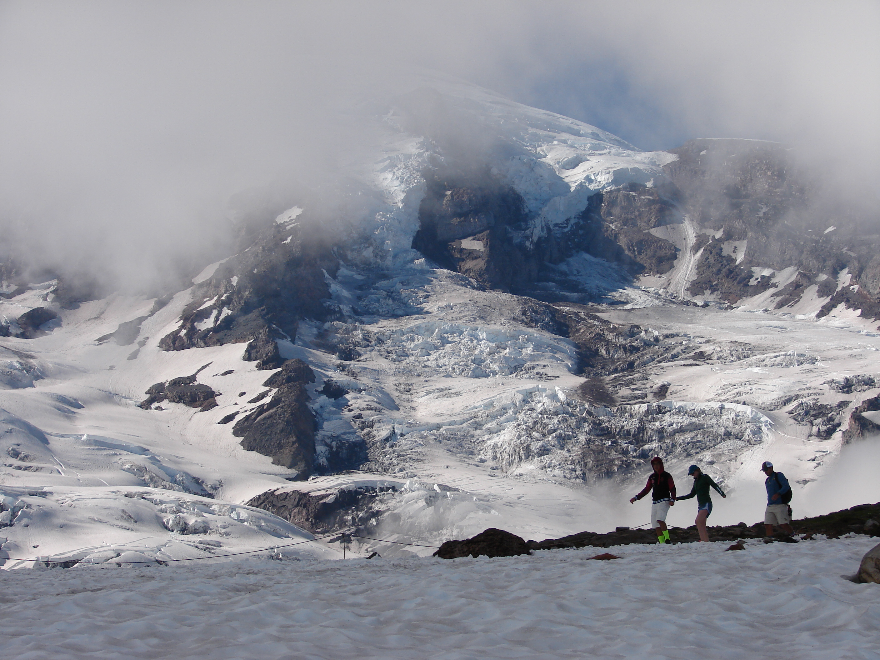
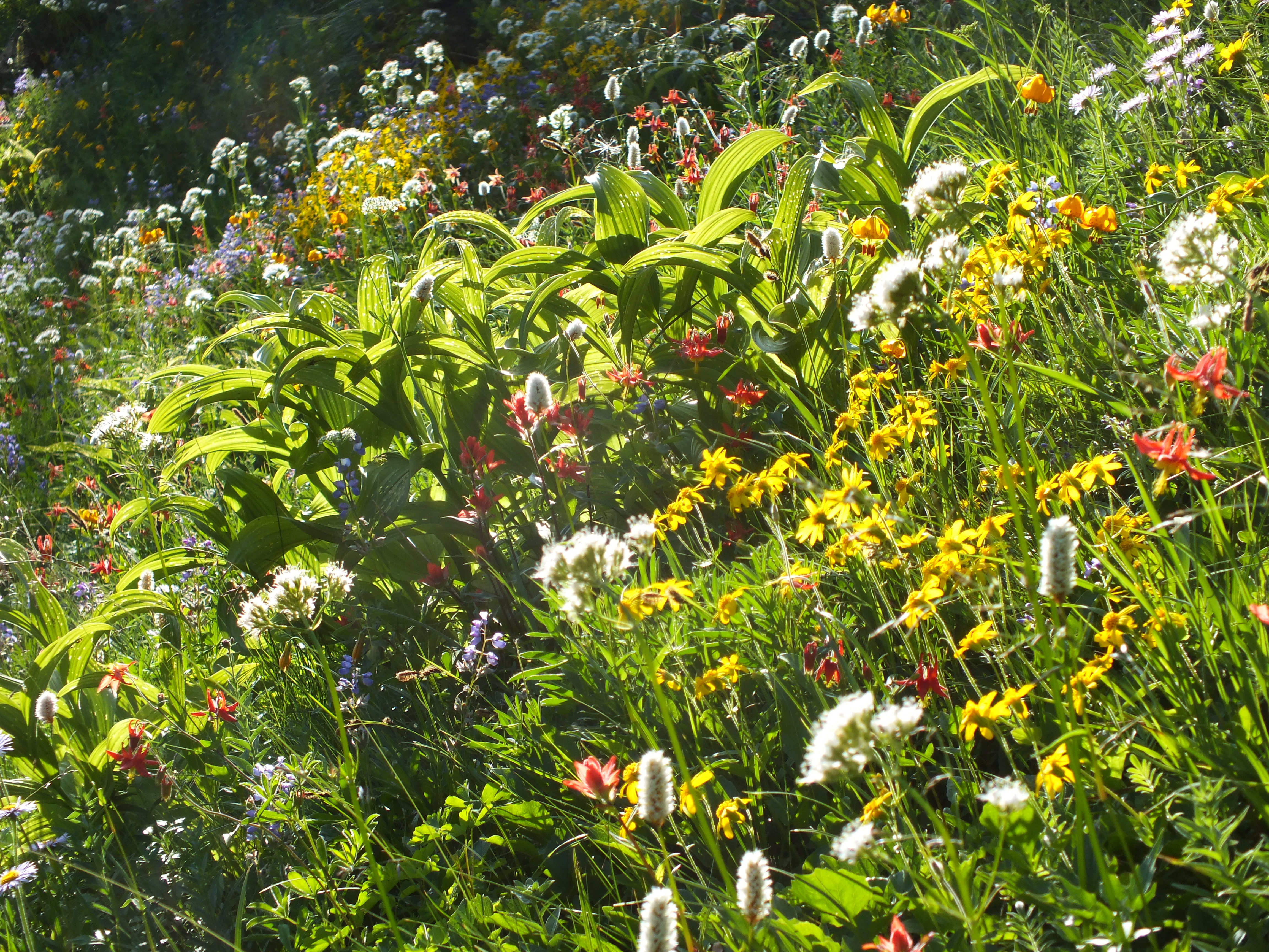
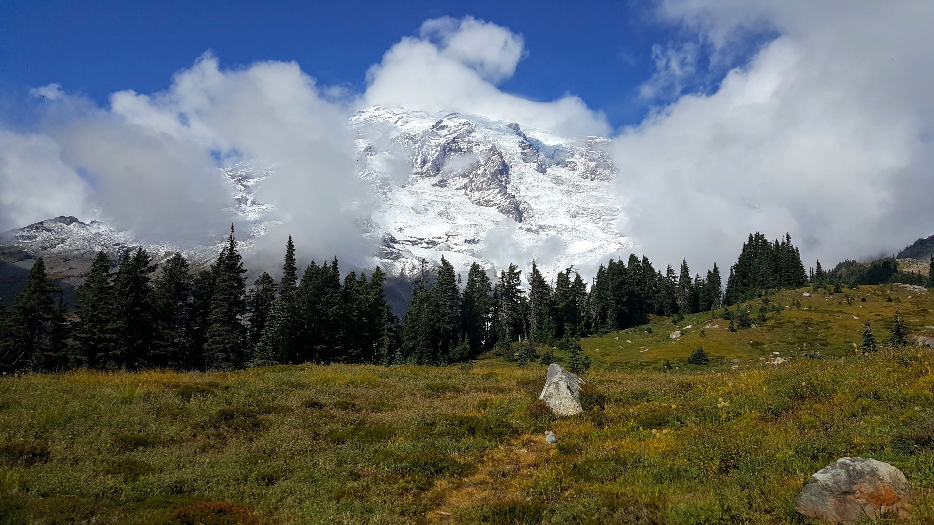
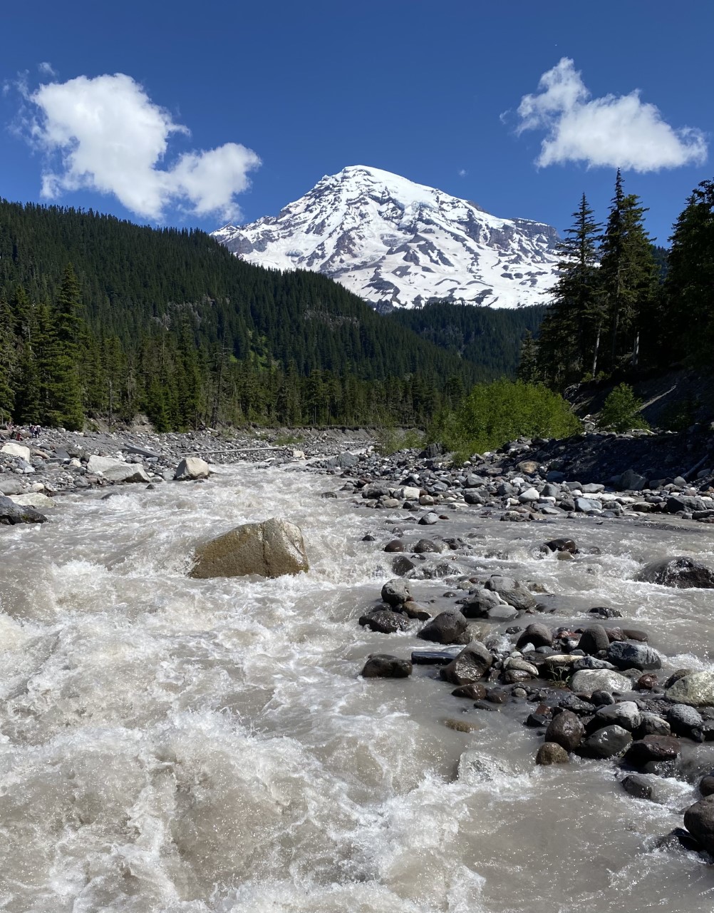
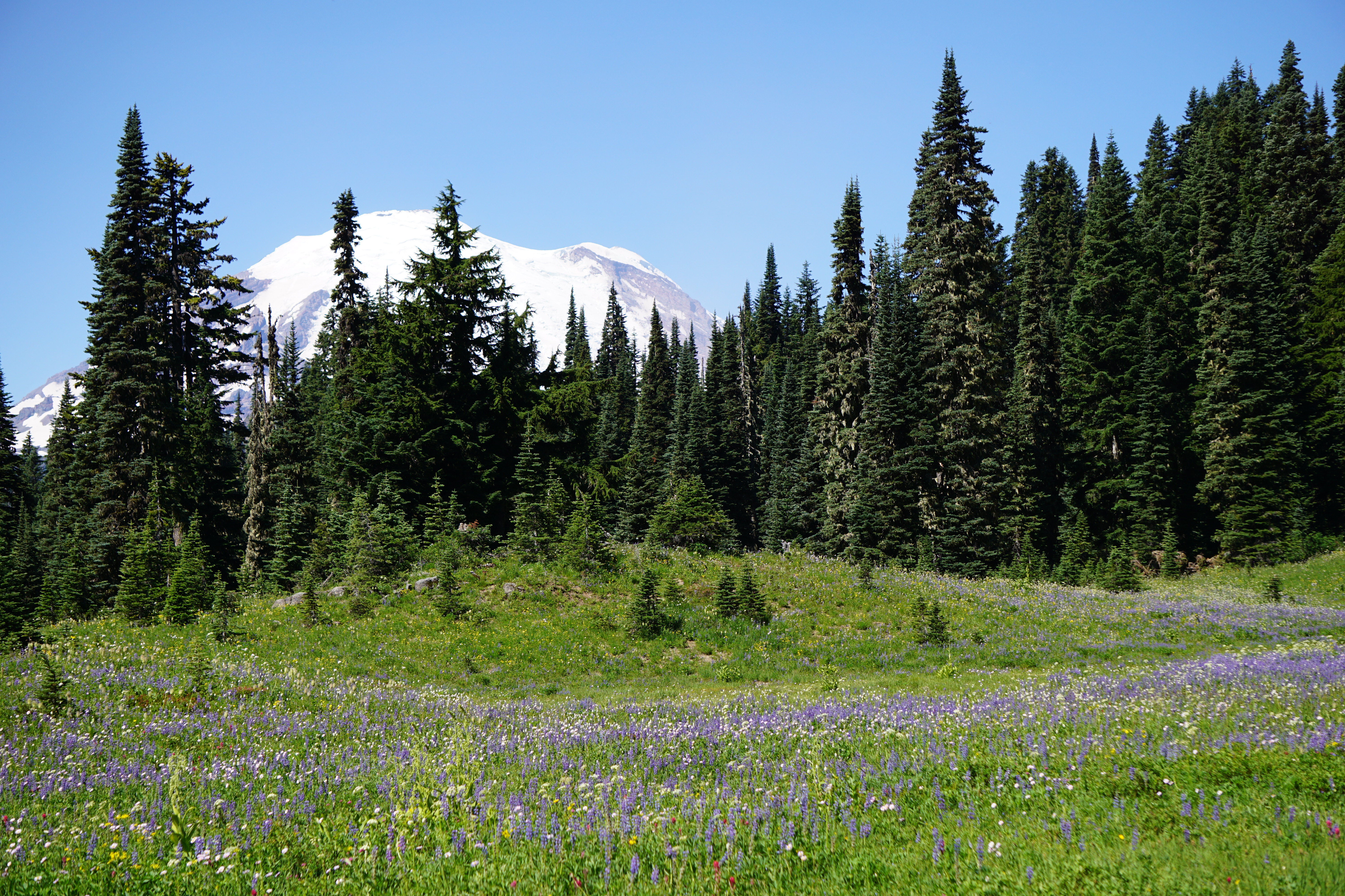
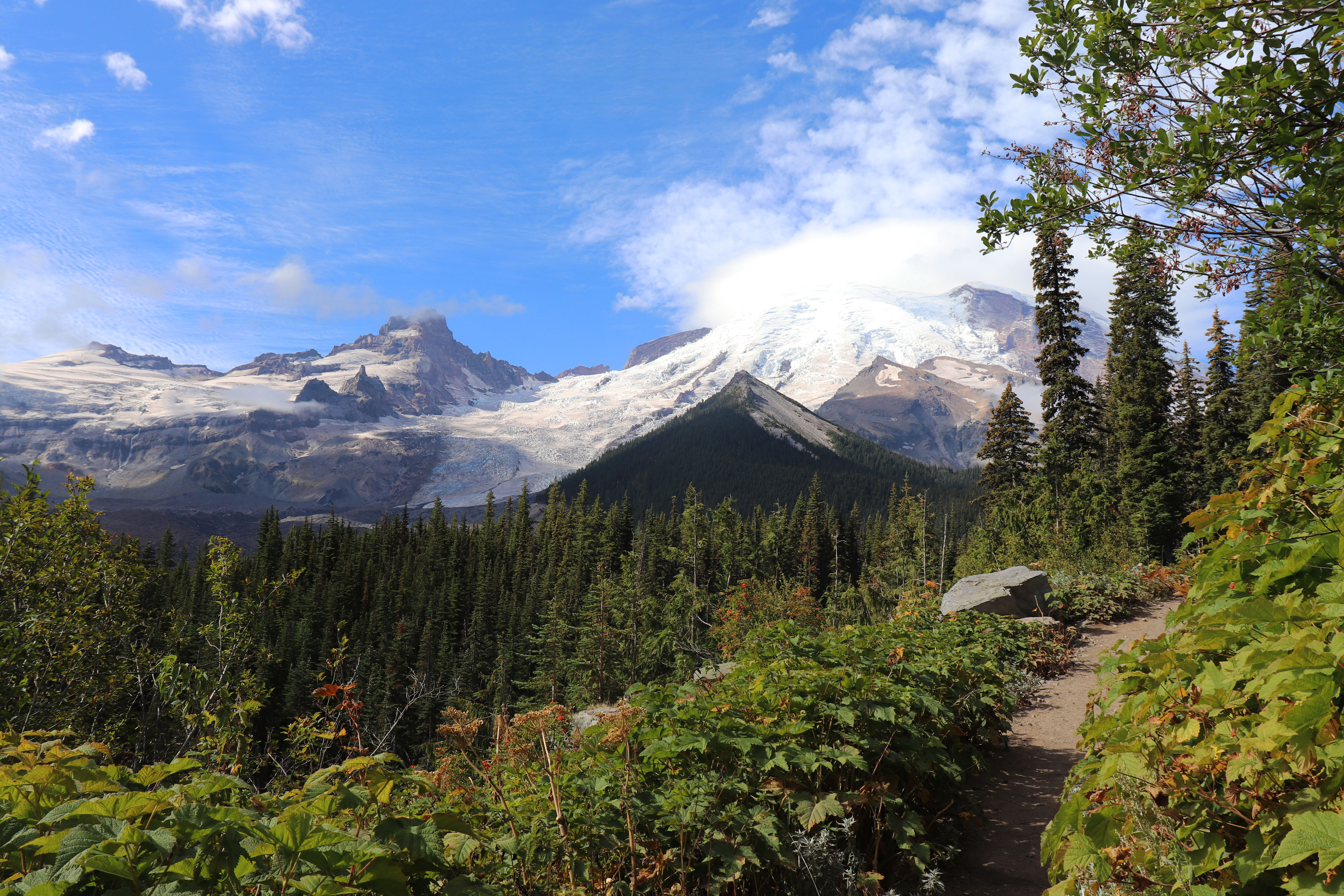
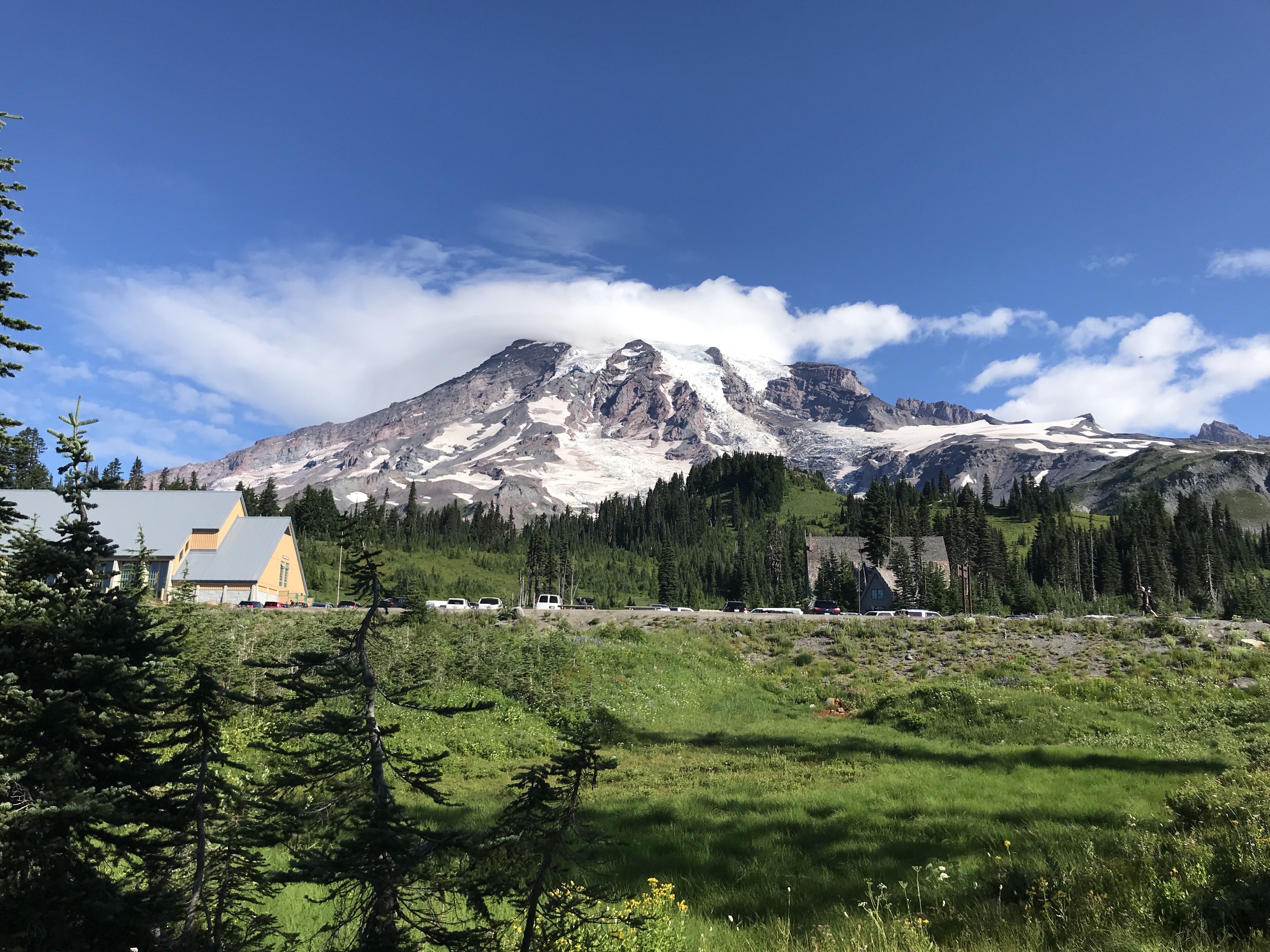
Ascending to 14,410 feet above sea level, Mount Rainier stands as an icon in the Washington landscape. An active volcano, Mount Rainier is the most glaciated peak in the contiguous U.S.A., spawning five major rivers. Subalpine wildflower meadows ...
Grants unlimited entry for one vehicle and passengers for seven consecutive days. Vehicle must be private, noncommercial, and with a seating capacity of 15 or less.
Entrance - Per Person
$15.00
Walk-up or single bicycle fee. Grants unlimited entry for seven consecutive days.
Entrance - Motorcycle
$25.00
Grants unlimited entry for one motorcycle and passenger for seven consecutive days.
Commercial Entrance - Sedan
$30.00
These fees are charged only to commercial organizations, such as tour companies. This fee is determined by the seating capacity of the vehicle. For sedan with 1 to 6 seats, the fee is $30 + $15 per client.
Commercial Entrance - Van
$75.00
These fees are charged only to commercial organizations, such as tour companies. This fee is determined by the seating capacity of the vehicle.
Commercial Entrance - Mini-bus
$100.00
These fees are charged only to commercial organizations, such as tour companies. This fee is determined by the seating capacity of the vehicle.
Commercial Entrance - Motor Coach
$200.00
These fees are charged only to commercial organizations, such as tour companies. This fee is determined by the seating capacity of the vehicle. NOTE: There are no current road restrictions for unmodified motor coaches of the standard length in the park. However, be aware that roads in the park are steep, narrow, and winding. In particular, it is recommended that RVs and vehicles with trailers longer than 25 feet LOA not travel up the Sunrise Road beyond the White River Campground intersection.
Timed Entry Reservation - Location
$2.00
A timed entry reservation is required only for the Sunrise Corridor in the northeast corner of the park from 7:00 am to 5:00 pm daily from July 11-Sept 1, 2025, then on weekends and holidays from Sept 2 through end of the season (typically mid-October).
Reservations can be made online or by telephone 1-877-444-6777. Cougar Rock campsites tend to open in mid to late May as weather allows. From opening until the end of June, all open sites are first-come, first-serve. Reservations are accepted up to 6 months in advance.
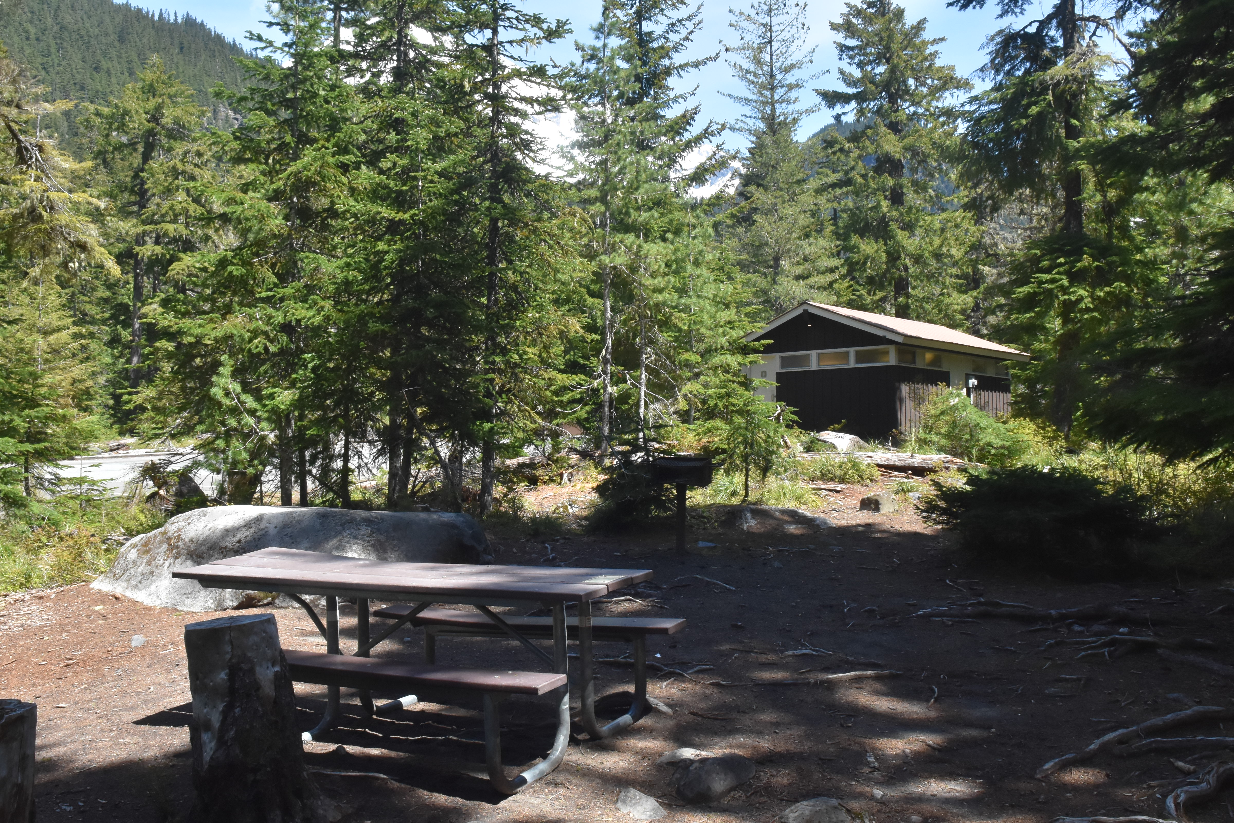
Cougar Rock Campground is located next to the Nisqually River above Longmire along the road to Paradise. The campground is set in a forest of evergreen trees. When you turn into the campground, the campground ranger station is to the right, with parking spots in front. To the left a small side loop provides access to the dump station. Past the ranger station the road continues into the campground loops. The campground has six campsite loops, labeled A through E. Loop A is the first loop to the right. Turnoffs for loops B-D continue in order on the right as you drive down the main road of the campground. A few individual campsites border the left side of the main road. After loop D, the main road curves to the right, with loop E branching off to the left before the main road terminates with loop F, which has 5 sets of parking areas for group camping. The campground amphitheater is located to the right of the main road between loops C and D. There are seven restrooms. One restroom is located between the middle of loop A and B, one is on either end of loop C, two are in between the main road and either end of loop D, one is between loop E and F, and finally one is on the left side of loop F. To access the Nisqually River from the campground, exit the campground via the main entrance and follow the road to the right to the Carter Fall trailhead. Or, a trail leading across the road starts from the main campground road where it starts to bend right after loop D.
Reservations can be made online or by telephone 1-877-444-6777. Ohanapecosh campsites tend to open in mid to late May as weather allows. From opening until the end of June, all open sites are first-come, first-serve. For summer dates June 23, 2016, through early September reservations can be made up to 6 months in advance. Reservations are highly recommended as this campground is very popular.
Ohanapecosh Campground is set in a narrow river valley surrounded by forested hillsides. Enter the campground off of State Route 123 and follow the road to the right (a turn off to the left leads to maintenance facilities and staff housing). The main campground road curves through the forest and reaches the visitor center on the right. The Ohanapecosh Visitor Center is a low building with an angled roof tucked among the trees. A small parking lot is in front of the building with a concrete walkway leading to the building's entrance, with restrooms located to the right of the door. In front of the visitor center parking area is an information kiosk with campground information and a place to register for a site. Across the road from the visitor center is Loop A. As you drive down the Loop A road, additional parking is to the left, with picnic tables and a restroom. From the visitor center continue on the main campground road. Loop B starts on the right, with additional day use parking and access to the Silver Falls Trail and the Hot Springs Nature Loop Trail. Loop C is on the left, with walk-in sites and an additional picnic area next to the Ohanapecosh River. Continuing past Loops B and C and the road crosses over the Ohanapecosh River on a concrete bridge. The river is bordered by forest and large rocks and is often a rich deep blue-green color. Past the bridge, there is additional parking along the road on the right with paved paths providing access to the campground amphitheater and the other end of the Silver Falls Trail. Loop D starts on the left. Past Loop D, the main road splits, with Loop F on the left, Loop E on the right. Continue straight to access Loop H on the right and finally Loop G at the end of the road, curving off to the left. Each loop has a restroom facility.
When open for the summer, all sites are first-come, first-serve. The campground does not take reservations.
White River Campground is located at the end of White River Road next to the White River. The campground is in the bottom of a deep canyon in a forest of mid elevation evergreen trees. White River Road ends at the campground with the campground ranger station to the right on arrival with information boards and parking just beyond. Past the ranger station the road continues into the campground loops. The campground has four campsite loops, labeled A through D. Loop A is the first loop to the right. Turnoffs for loops B and C continue in order on the right as you drive down the main road of the campground. A few individual campsites border the right side of the main road. The entrance to the picnic area is located directly across from the entrance to Loop C. From the main road, continue straight past Loop C to Loop D which circles to the left and returns back to the main campground road across from Loop C. Campsites on the right side of the road on the farthest side of Loop D are situated next to the White River. A historic patrol cabin that has exhibits inside on the early use of a system of patrol cabins and the history of the round-the-mountain Wonderland Trail is to the right as you enter Loop D. The small amphitheater is located to the right just passed the patrol cabin. There are five restrooms. One restroom is located on the left side of the loop in Loop A, one is on the right near the entrance of Loop B, one is between the picnic area and Loop D, an accessible restroom is between Loop B and Loop C, and one is on the left side of Loop D across from the amphitheater. The Wonderland Trail runs through the campground and can be accessed to the right of the patrol cabin to head uphill toward Sunrise and next to the restroom in the picnic area to head south. Glacier Basin Trail is accessed across the road from the amphitheater or from the right side of farthest end of Loop D. The picnic area runs parallel to the road with parking spots on either side of the short picnic area road, picnic tables are on the far side of the picnic area from the road, a restroom is located to the right of the picnic tables, and a trail to access the river is accessed from the left end of the picnic tables.
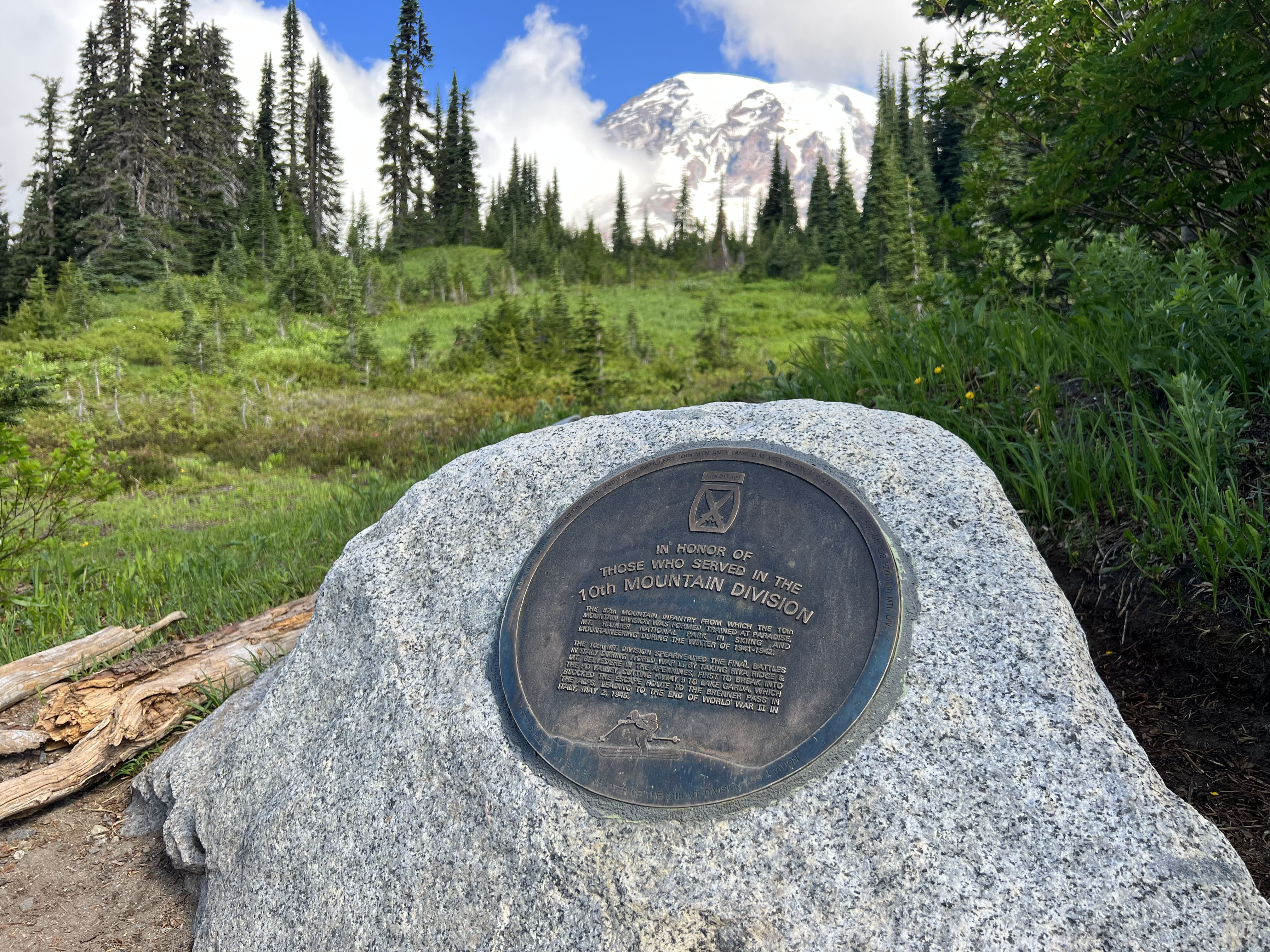
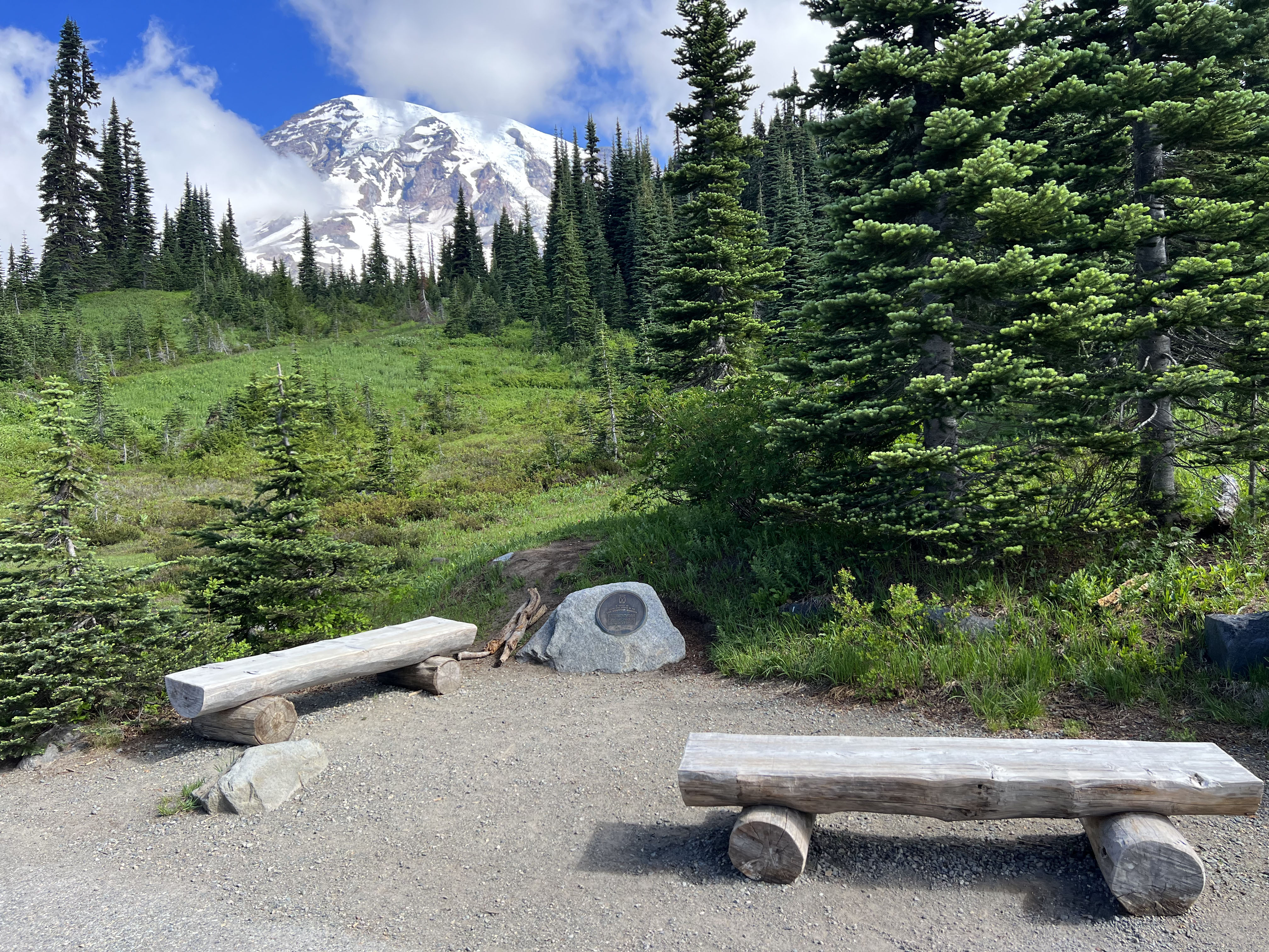
A bronze plaque honors the U.S. Army’s 10th Mountain Division which trained at Paradise during World War II.
The 10th Mountain Division Memorial features a circular bronze plaque on a large granite boulder that is surrounded by flat stone benches. It is located just off the trail at Paradise and there is a view of Mount Rainier, a glaciated mountain.
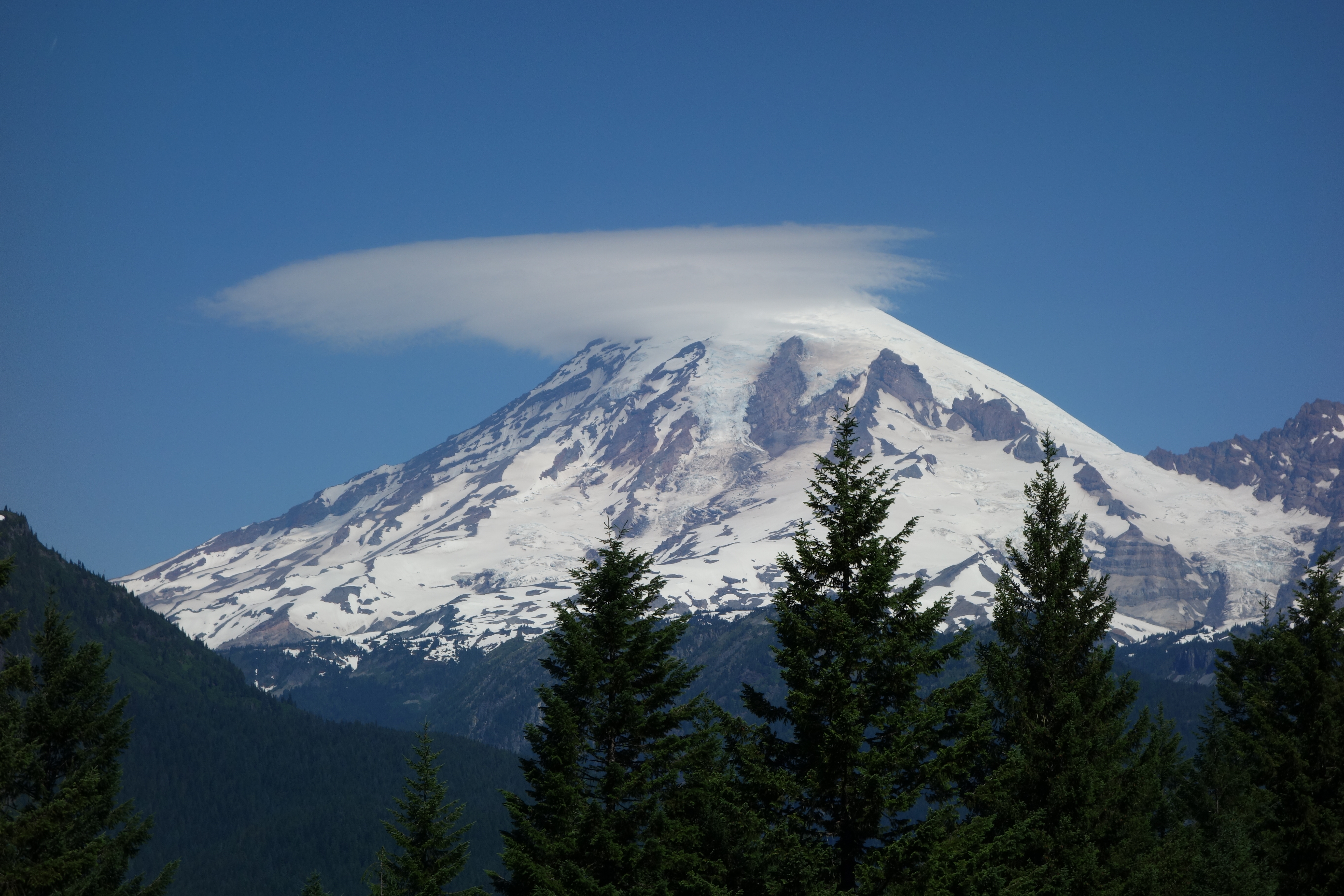
Pause at Backbone Ridge along Stevens Canyon Road for views of Mount Rainier and the Tatoosh Wilderness along the southern border of the park.
Stevens Canyon Road is a paved two-lane highway that bends in a large curve around the terminus of Backbone Ridge. The pullout is on the west side of the road and stretches approximately 500 feet long. The pullout is bordered by a sidewalk and a split-rail fence. Tall conifer trees have grown up to partially obscure the views of Mount Rainier and the surrounding mountain slopes.
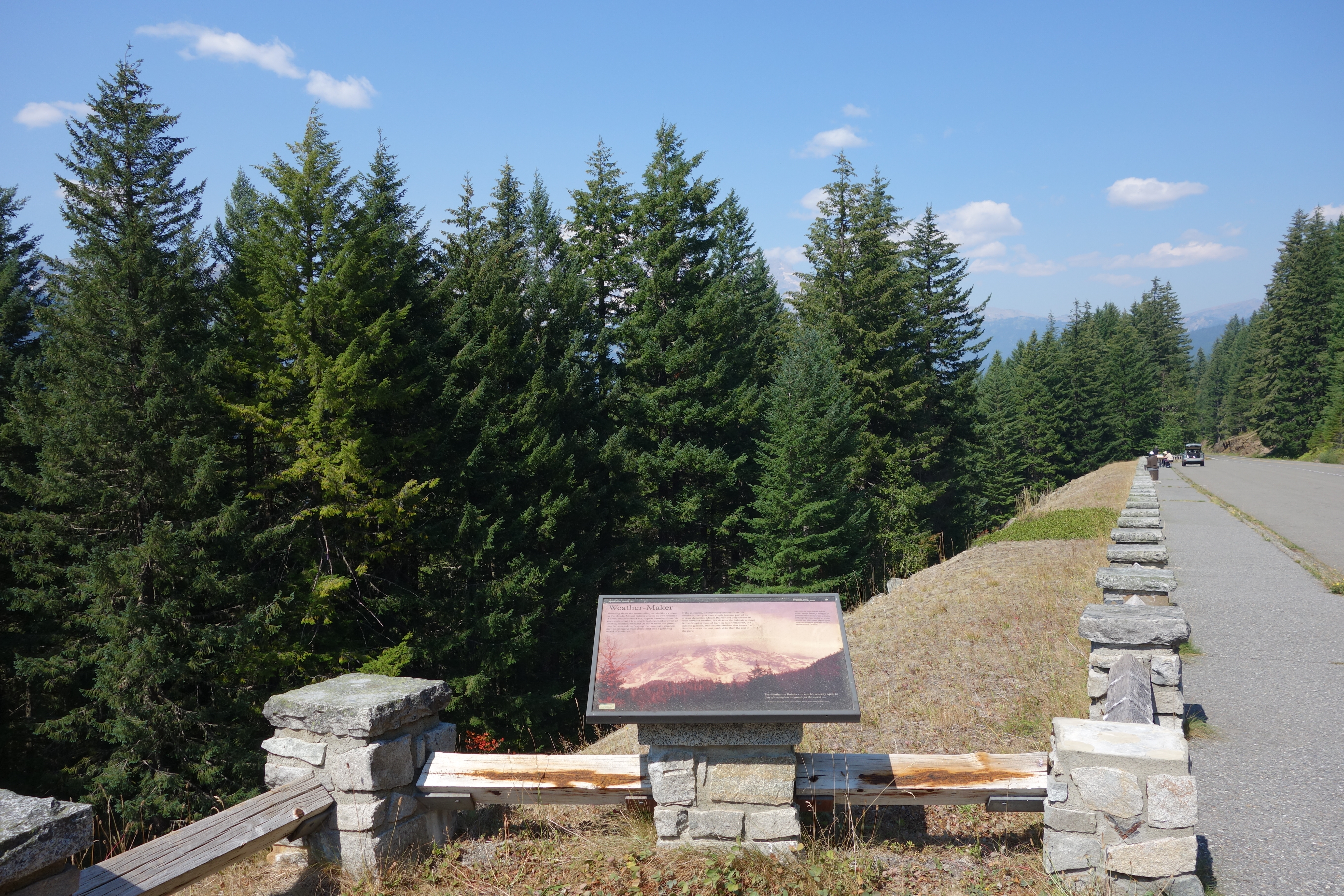
Backbone Ridge Wayside is located along Stevens Canyon Road with views of Mount Rainier.
Stevens Canyon Road is a paved two-lane highway that bends in a large curve around the terminus of Backbone Ridge. The pullout is on the west side of the road and stretches approximately 500 feet long. The pullout is bordered by a sidewalk and a split-rail fence embedded in square stone fence posts. Near the uphill side of the pullout, the fence indents into a square viewing area with the exhibit panel attached to one of the stone fence posts on the right side. Tall conifer trees have grown up to partially obscure the views of Mount Rainier and the surrounding mountain slopes. Exhibit Panel Description A single photo of a glaciated mountain peak rising above forested lower slopes fills the exhibit panel. The top of the mountain is wrapped in smooth lenticular clouds. The text forms a row across the top third of the panel. A quote in the bottom right corner of the panel reads: "The weather on Rainier can reach a severity equal to that of the highest mountain in the world... Jim Whittaker, former Rainier guide and first American to climb Mount Everest". A small box in the lower left corner of the panel reads "User Fee Project. Your Fee Dollars at Work. Entrance fees were used to produce this exhibit".
The Bench and Snow Lake Trail is a great hike for beginners, families with children, or those just looking for beautiful scenery.
The trailhead parking is a large, paved pullout on the south side of Stevens Canyon Road. The trailhead starts on the eastern edge of the parking. The trail is dirt, broken by log steps and rocks. Some of the log steps have been washed out in sections, created large, steep steps. Areas around the lakes can be rocky with unstable footing.
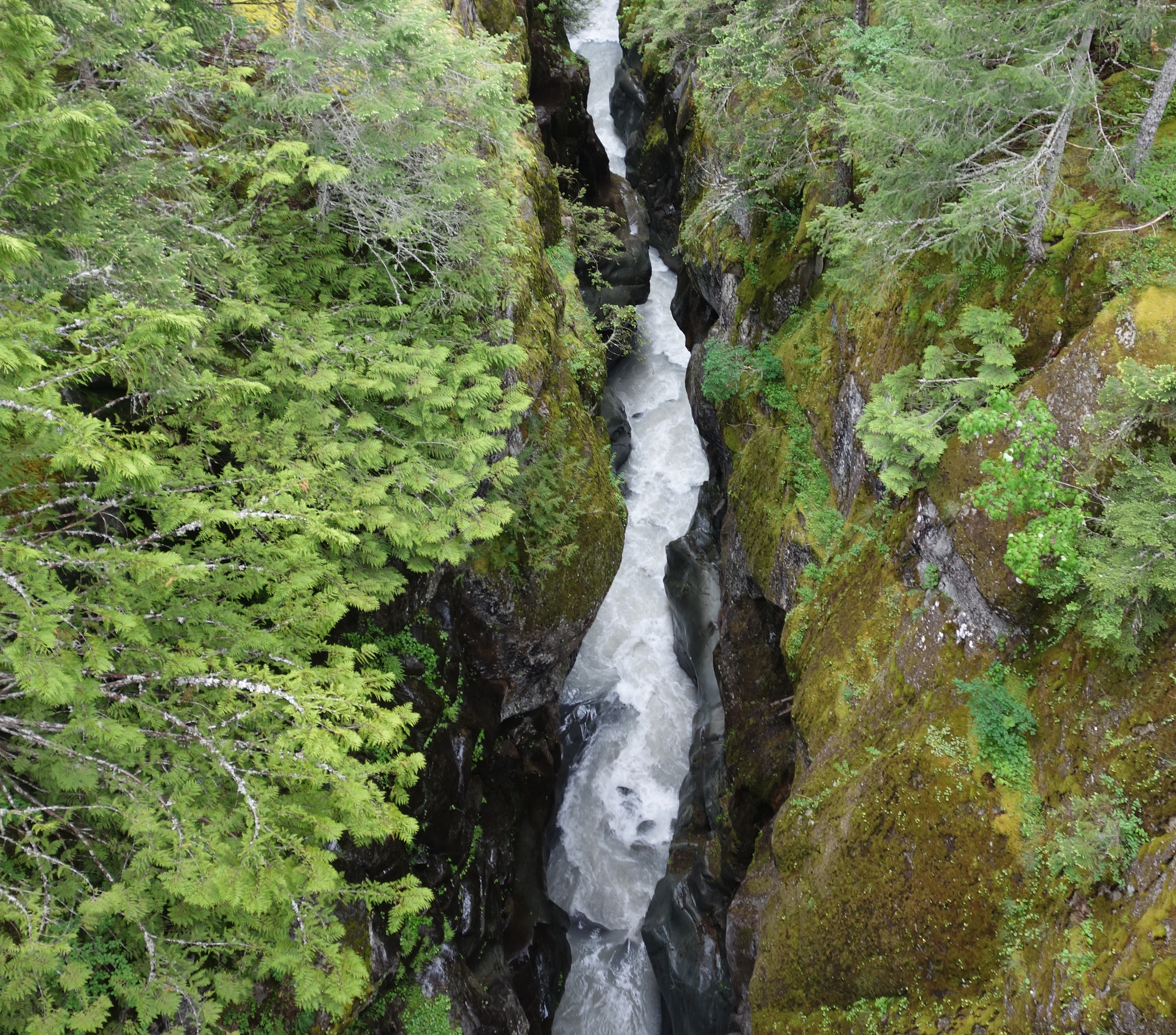
Box Canyon is an impressive slot canyon along Stevens Canyon Road carved by the Muddy Fork of the Cowlitz River. A popular stop when touring the park by vehicle, Box Canyon includes a comfort station and picnic area.
Box Canyon is located long a curve in Stevens Canyon Road, a narrow, two-lane road with no shoulders. Heading east, the road descends into forested elevations and passes through a rough-hewn tunnel with bare rock walls. Leaving the tunnel, the road crosses a bridge over a narrow slot canyon. The bridge is bordered by sidewalks, with stone curbs, and rock walls of rough-hewn granite. A trail starts from either end of the bridge on the north side of the road. East of the bridge, the parking area is a half-loop on the south side of the road. A short path on the eastern side of the parking lot leads to a comfort station, while on the western side of the parking, a path leads down a canyon overlook.
One of three exhibit panels at Box Canyon, this panel dives deep into the formation of this canyon.
Box Canyon is located along a curve in Stevens Canyon Road, a narrow, two-lane road with no shoulders. Heading east, the road descends into forested elevations and passes through a rough-hewn tunnel with bare rock walls. Leaving the tunnel, the road immediately crosses a bridge over a narrow slot canyon. The bridge is bordered by sidewalks, with stone curbs, and rock walls of rough-hewn granite. A trail starts from either end of the bridge on the north side of the road. East of the bridge, the parking area is a half-loop on the south side of the road. A short path on the eastern side of the parking lot leads to a comfort station, while on the western side of the parking, a path leads down a canyon overlook. The canyon overlook has two lobes and is surrounded by split rail fencing. The right side (western) lobe overlooks the canyon and bridge, with the Box Canyon: Canyon exhibit panel. The left side (eastern) lobe surrounds a section of bare bedrock with a covered wood information kiosk in the center, which no longer has exhibits installed in it. The Box Canyon: Glacier exhibit panel is free standing in front of the historic information kiosk. The Box Canyon: Forest exhibit panel is located on the fence past the information kiosk, overlooking the forested slope next to the canyon. Exhibit Panel Description The text is located on the left side of the panel against a solid green background, while a vertically-oriented photo of the deep river canyon fills the right side of the panel. An arched stone bridge crosses the top of the canyon, above steep walls of grey rock with patches of moss. A caption at the bottom of the photo reads: "Box Canyon from river level". A smaller photo, oriented below the text on the left side but slightly overlapping the right side photo, shows a view of the narrow canyon looking down from above. Its caption reads: "Box Canyon from the highway bridge." A small box in the lower left corner of the panel reads "User Fee Project. Your Fee Dollars at Work. Entrance fees were used to produce this exhibit".
One of three Box Canyon exhibit panels, this panel examines how plants can eventually grow on glacier-carved bedrock.
Box Canyon is located along a curve in Stevens Canyon Road, a narrow, two-lane road with no shoulders. Heading east, the road descends into forested elevations and passes through a rough-hewn tunnel with bare rock walls. Leaving the tunnel, the road immediately crosses a bridge over a narrow slot canyon. The bridge is bordered by sidewalks, with stone curbs, and rock walls of rough-hewn granite. A trail starts from either end of the bridge on the north side of the road. East of the bridge, the parking area is a half-loop on the south side of the road. A short path on the eastern side of the parking lot leads to a comfort station, while on the western side of the parking, a path leads down a canyon overlook. The canyon overlook has two lobes and is surrounded by split rail fencing. The right side (western) lobe overlooks the canyon and bridge, with the Box Canyon: Canyon exhibit panel. The left side (eastern) lobe surrounds a section of bare bedrock with a covered wood information kiosk in the center, which no longer has exhibits installed in it. The Box Canyon: Glacier exhibit panel is free standing in front of the historic information kiosk. The Box Canyon: Forest exhibit panel is located on the fence past the information kiosk, overlooking the forested slope next to the canyon. Exhibit Panel Description A single photo fills the exhibit panel. In the foreground is smooth rock covered in patches of moss and lichen that gives way to grass in the middle of the photo and eventually conifer trees at the top of the photo. The main text stretches across the top third of the panel against a green background, with the secondary text in the middle of the photo on the left side. On the right side are three smaller photos, overlapping each other slightly in a vertical stack. The top photo, labeled "Lichen" shows a close-up view of a rock with yellow-green and black patches of lichen growing on it. Below it is a photo labeled "Moss", showing thicker patches of green moss growing on the rock. At the bottom is a photo labeled "Flowers" showing a small plant with thin green leaves and numerous stems topped in small, five-petaled white flowers. A small box in the lower left corner of the panel reads "User Fee Project. Your Fee Dollars at Work. Entrance fees were used to produce this exhibit".
One of three exhibit panels at Box Canyon, this panel reveals how glaciers have left a lasting mark on the landscape.
Box Canyon is located along a curve in Stevens Canyon Road, a narrow, two-lane road with no shoulders. Heading east, the road descends into forested elevations and passes through a rough-hewn tunnel with bare rock walls. Leaving the tunnel, the road immediately crosses a bridge over a narrow slot canyon. The bridge is bordered by sidewalks, with stone curbs, and rock walls of rough-hewn granite. A trail starts from either end of the bridge on the north side of the road. East of the bridge, the parking area is a half-loop on the south side of the road. A short path on the eastern side of the parking lot leads to a comfort station, while on the western side of the parking, a path leads down a canyon overlook. The canyon overlook has two lobes and is surrounded by split rail fencing. The right side (western) lobe overlooks the canyon and bridge, with the Box Canyon: Canyon exhibit panel. The left side (eastern) lobe surrounds a section of bare bedrock with a covered wood information kiosk in the center, which no longer has exhibits installed in it. The Box Canyon: Glacier exhibit panel is free standing in front of the historic information kiosk. The Box Canyon: Forest exhibit panel is located on the fence past the information kiosk, overlooking the forested slope next to the canyon. Exhibit Panel Description A single photo of a glacier spilling down a mountain fills the exhibit panel. The glacier splits around a large outcrop built of layers of lava rock. The main text stretches across the top third of the photo. On the right side is a smaller photo showing a detail of a smooth rock surface covered with diagonal scratches. A caption reads: "Bedrock scratched and polished by glacial ice." A small box in the lower left corner of the panel reads "User Fee Project. Your Fee Dollars at Work. Entrance fees were used to produce this exhibit".
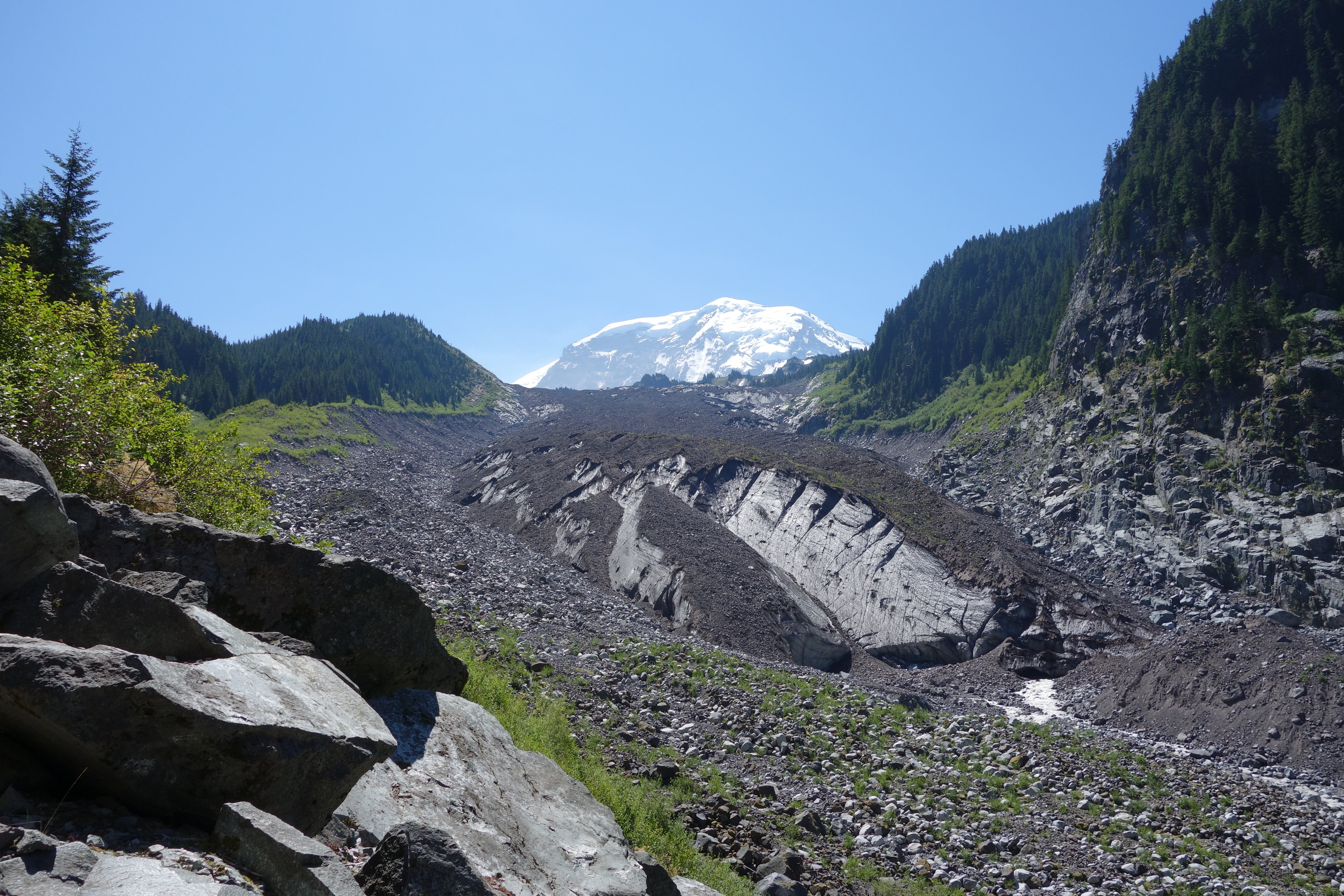
Located on the north side of Mount Rainier, the Carbon Glacier has the lowest terminus of any glacier in the contiguous United States.
The Carbon Glacier is located on the north side of the mountain and surrounded by steep valley walls. It terminates at 3,617 feet and the snout of the glacier is visible from the trail. The lower glacier is covered in rocky debris and the ice often looks dirty with sediment mixed into the ice. The Carbon River emerges from the glacier’s terminus.
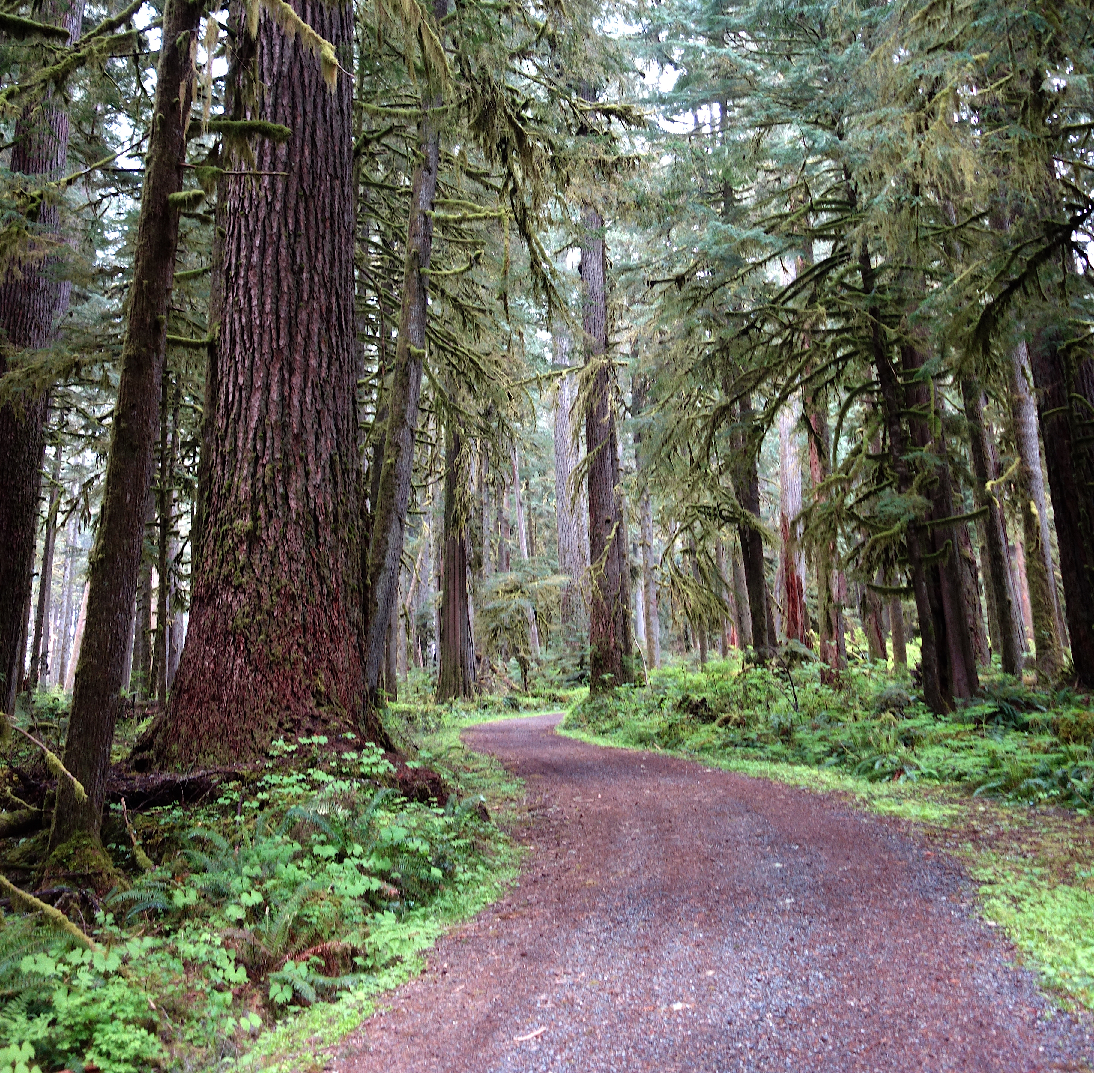
Located in the remote northwest corner of the park, Carbon River is home to temperate rainforest, Mount Rainier's lowest elevation glacier, and a dynamic river system. Hiking, bicycling, and camping opportunities abound.
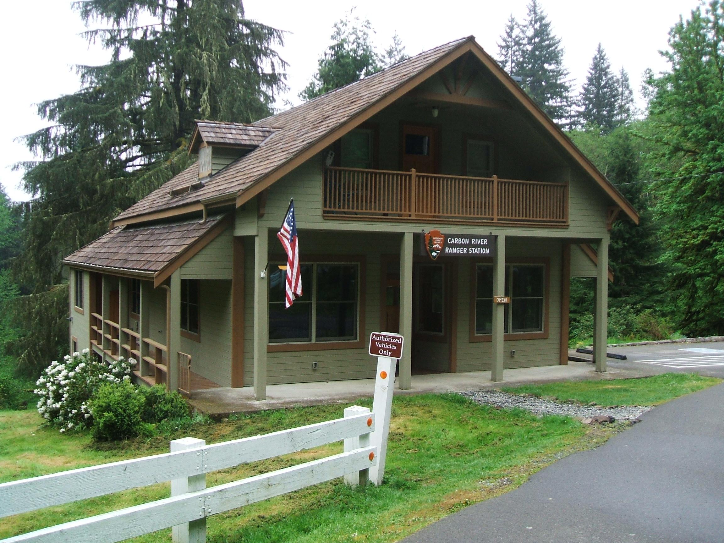
The Carbon River Ranger Station is a two story wooden building with a pitched roof. The outside is green with brown trim, with windows all along its walls. When you enter, a large desk sits at the far side of the wall. There are computers for rangers to work at, as well as informational material, like maps and brochures. To the right there are a few kiosks with iPads that provide interpretive information about the Carbon River area. From the Carbon River Ranger Station, continue along the two-lane road to the Carbon River Entrance. The road has been washed out before the entrance, requiring visitors to park along the edge of the road and hike into the main entrance area via a temporary trail. The temporary trail is on the right side of the former road, while the Carbon River flows along the road to the left. Be alert for drop offs and unstable ground along the edge of the river. At the entrance are several inaccessible parking spots. To the left of the road is an old ranger station now closed for use and separate restroom facilities still in use. To the right of the road are several picnic tables, in a grassy area surrounded by a low, split-rail fence, and an information kiosk. To the left of the kiosk is the start of the Carbon River Rainforest Trail. Or, you can continue hiking or bicycling straight along the road past the main entrance area to a metal gate and the start of the Carbon River Trail. There are paths to go around the gate on either side. Shortly after the gate, the road transitions from paved to gravel and dirt. Sections of the road may be washed out, have larger rocks, and fallen trees are common.
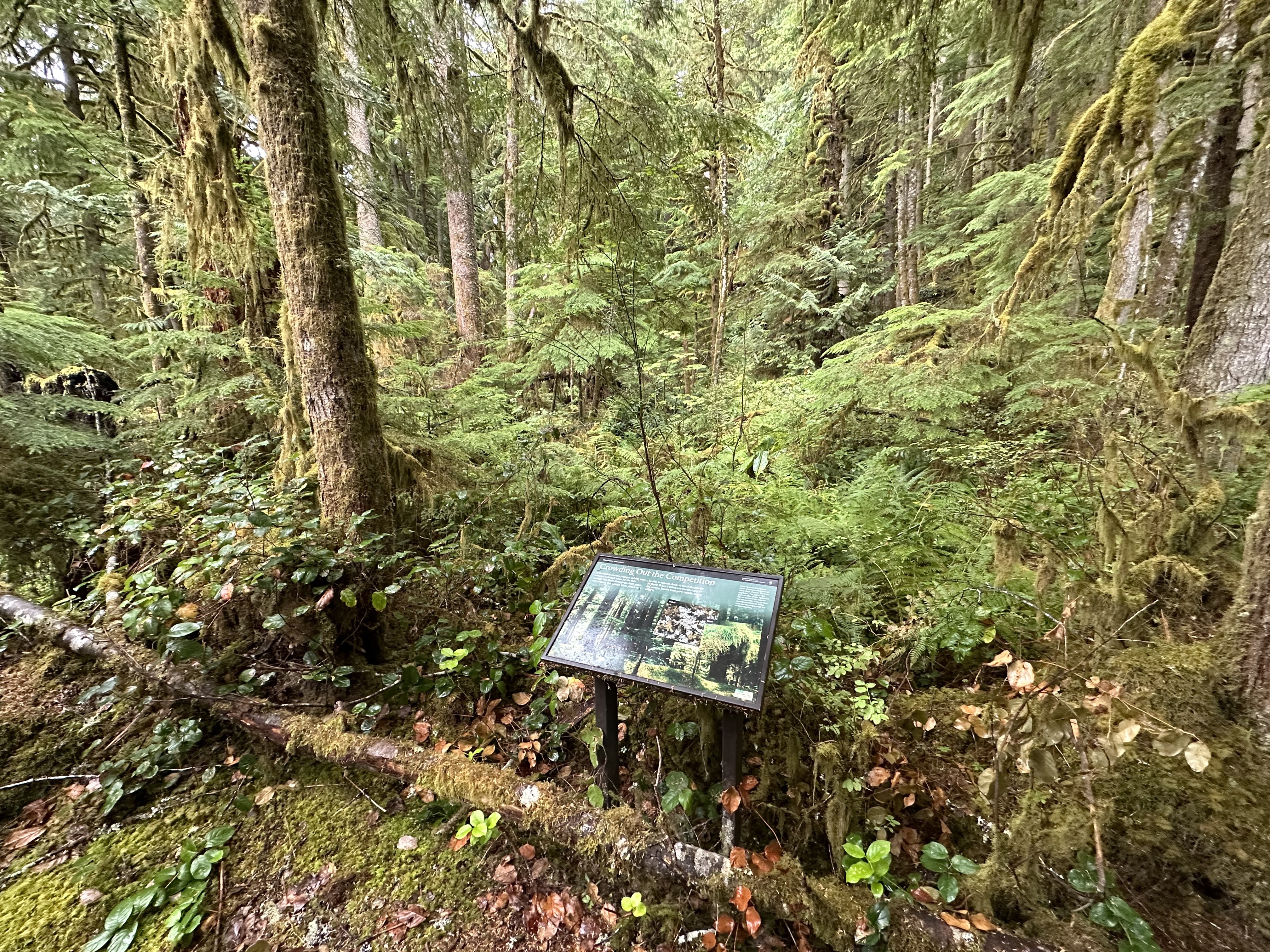
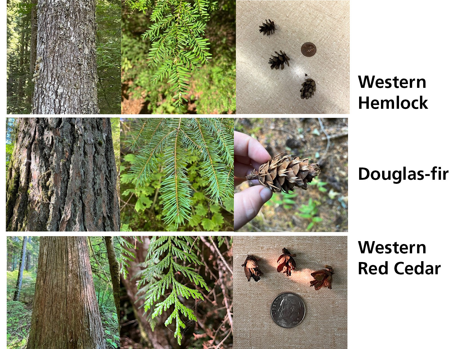
Common trees found in temperate rainforests include western red cedar and Douglas-fir.
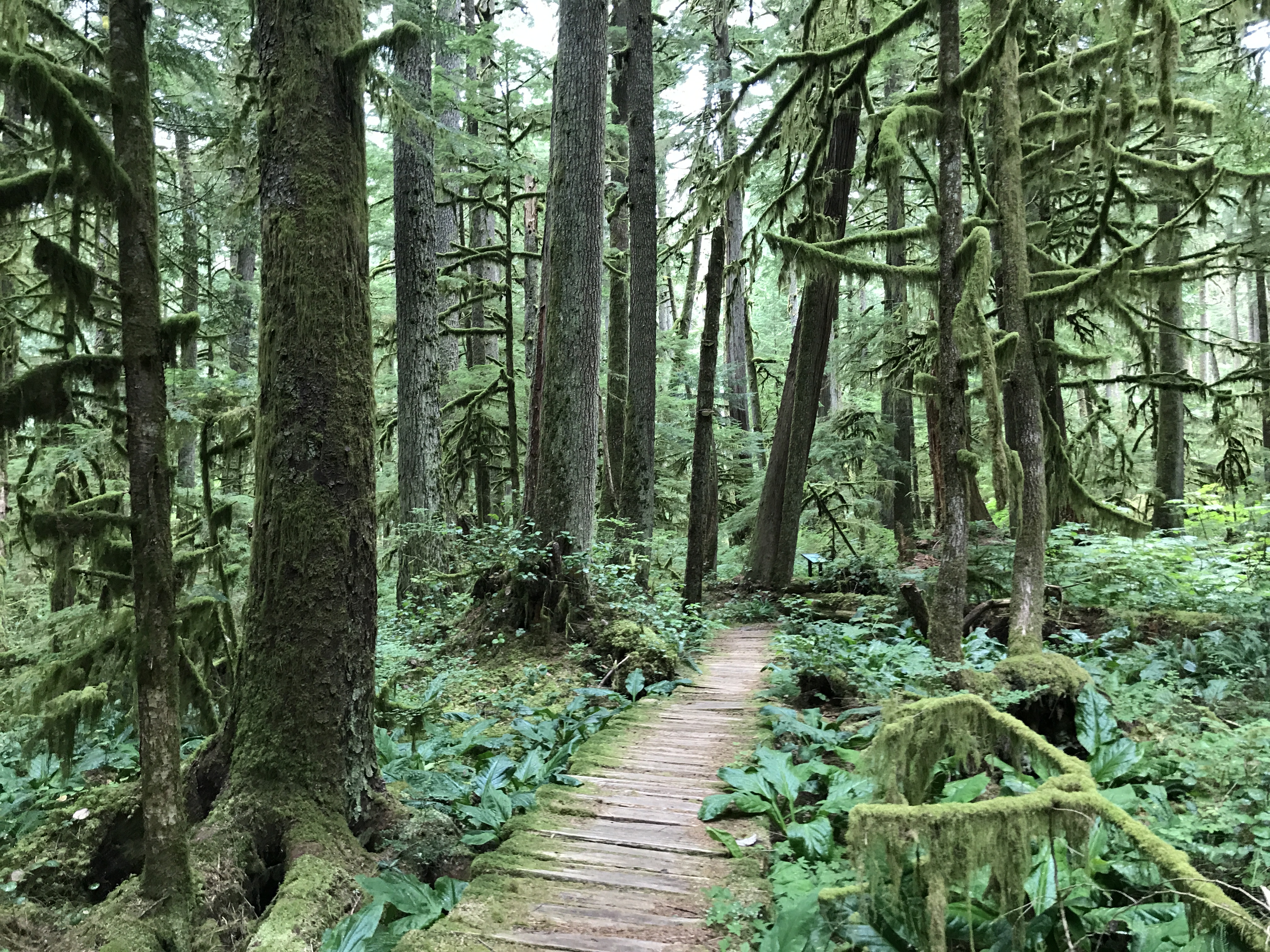
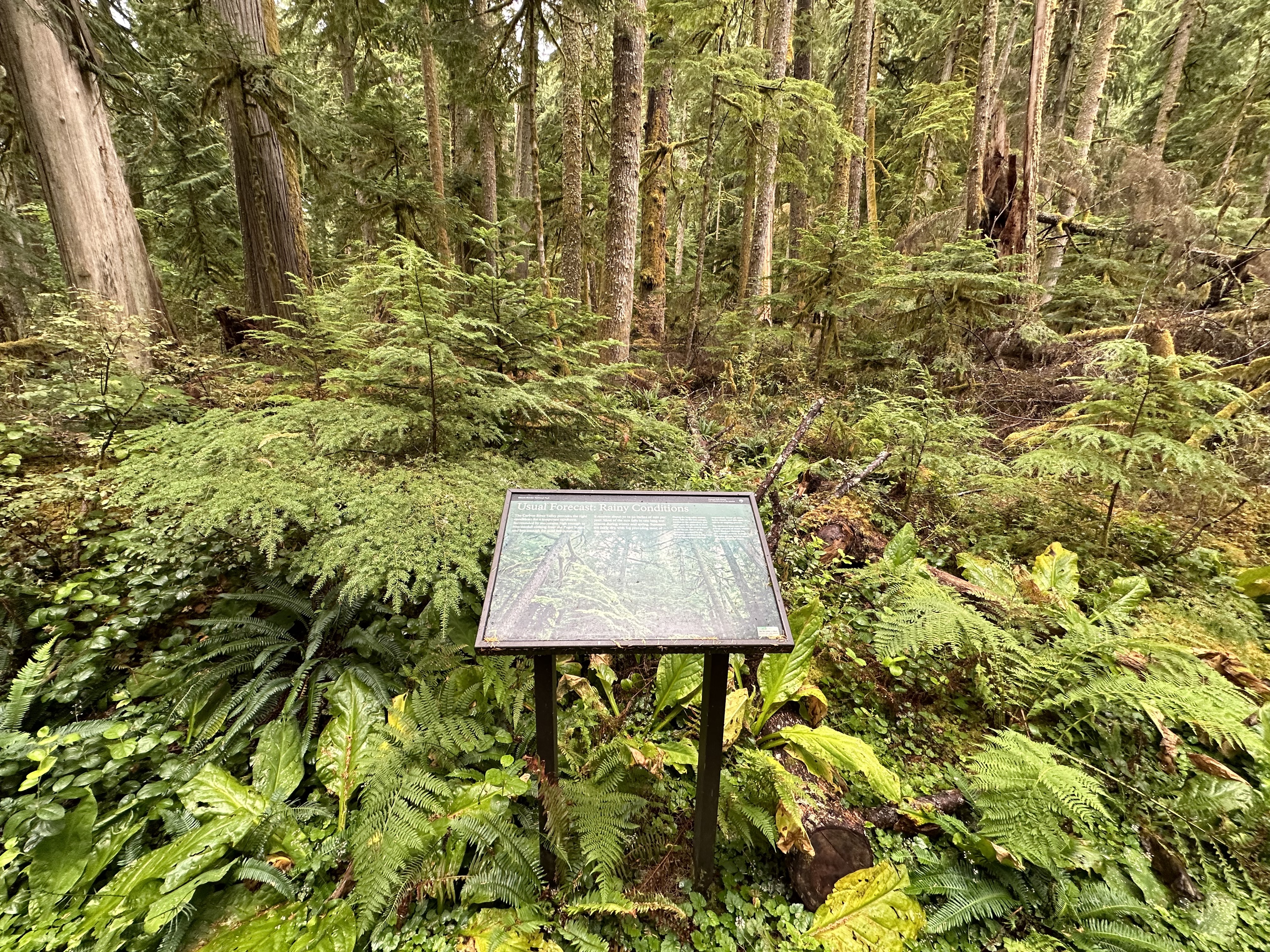
The Carbon River Rainforest Trail is located at the Carbon River Entrance. The road has been washed out before the entrance, requiring visitors to park along the edge of the road and hike into the main entrance area via a temporary trail. The temporary trail is on the right side of the former road, while the Carbon River flows along the road to the left. Be alert for drop offs and unstable ground along the edge of the river. At the entrance are several inaccessible parking spots. To the left of the road is an old ranger station now closed for use and separate restroom facilities still in use. To the right of the road are several picnic tables, in a grassy area surrounded by a low, split-rail fence, and an information kiosk. To the left of the kiosk is the start of the Carbon River Rainforest Trail. The Carbon River Rainforest Trail was originally a loop trail but the bridge on the far side of the loop was destroyed so the trail is split into two prongs. Exhibit panels are located along both halves of the trail. The trail is dirt with stretches of wood boardwalk. The boardwalk may be slippery, uneven, and in poor condition. The trail is surrounded by dense mossy temperate rainforest, numerous fallen trees, and thick vegetation, which can encroach on the trail. Fallen trees have also damaged and blocked some sections of the trail and destroyed some of the exhibit panels. Exhibit Panel Description The main text stretches across the top third of the exhibit panel against a solid green background. The bottom third of the panel features a row of three photos with detail views of different types of tree bark. In the middle, half overlapping the bark photos and the green background at the top of the panel, is a middle row of photos showing three types of conifer tree branches. Each tree branch photo has a caption at the top to match each set of branch and bark photos. On the left, the caption reads: "Sika spruce trees, usually found in foggy coastal areas, are not common in Mount Rainier National Park. They only occur here in the Cabon River Valley where it is cool and moist. Look for bluish-green, one-inch-long needles that encircle the twigs and scaly bark." The caption for the middle set of photos reads: "Pacific Northwest Native Americans used Western red-cedar for so many uses it was called the tree of life. It is readily identified by its shedding, reddish-brown bark, drooping branches, and flat, lacy sprays made up of tiny, scale-like leaves." The right-side caption reads: "Douglas-firs can live up to 1,000 years and are among the world's tallest trees. You can identify the Douglas-fir by its sharp, bottle brush-arranged needles, and deeply ridged bark." A small box in the lower right corner of the panel reads "User Fee Project. Your Fee Dollars at Work. Entrance fees were used to produce this exhibit".
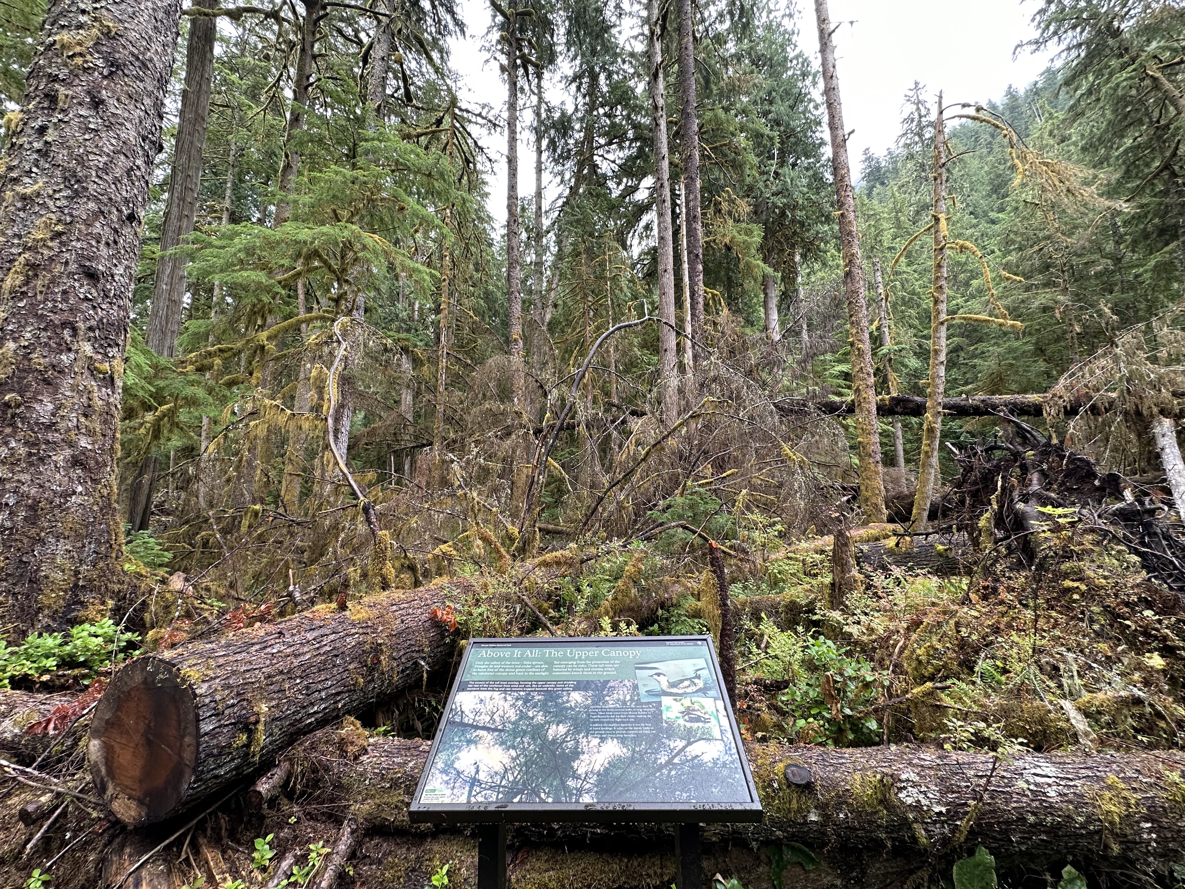
Look up! This exhibit panel highlights the complex canopy of the Carbon River temperate rainforest.
The Carbon River Rainforest Trail is located at the Carbon River Entrance. The road has been washed out before the entrance, requiring visitors to park along the edge of the road and hike into the main entrance area via a temporary trail. The temporary trail is on the right side of the former road, while the Carbon River flows along the road to the left. Be alert for drop offs and unstable ground along the edge of the river. At the entrance are several inaccessible parking spots. To the left of the road is an old ranger station now closed for use and separate restroom facilities still in use. To the right of the road are several picnic tables, in a grassy area surrounded by a low, split-rail fence, and an information kiosk. To the left of the kiosk is the start of the Carbon River Rainforest Trail. The Carbon River Rainforest Trail was originally a loop trail but the bridge on the far side of the loop was destroyed so the trail is split into two prongs. Exhibit panels are located along both halves of the trail. The trail is dirt with stretches of wood boardwalk. The boardwalk may be slippery, uneven, and in poor condition. The trail is surrounded by dense mossy temperate rainforest, numerous fallen trees, and thick vegetation, which can encroach on the trail. Fallen trees have also damaged and blocked some sections of the trail and destroyed some of the exhibit panels. Exhibit Panel Description The main text of the exhibit panel stretches across the top third of the panel against a solid green background. The bottom two thirds of the panel is filled with a photo of a forest canopy with interlocking tree branches against a pale sky. In the upper left corner of the photo against a black band, a caption reads: "The crowns of the tall trees overlap, forming the upper canopy and shielding the rest of the rainforest from wind and rain, like an umbrella. Some of the moisture from the fog and rain remains trapped beneath this green ceiling." On the right side of the exhibit panel, two smaller photos overlap each other and the background photo at slight angles. The top photo shows a small bird with a dark grey back and head with white on the cheeks, throat, and sides floating on still water. The second small photo, located beneath the first small photo, shows a similar bird nesting on a moss-covered tree branch. The secondary text is to the left of the small photos. A small box in the lower left corner of the panel reads "User Fee Project. Your Fee Dollars at Work. Entrance fees were used to produce this exhibit".
Temperate rainforests have a dense understory of plants.
The Carbon River Rainforest Trail is located at the Carbon River Entrance. The road has been washed out before the entrance, requiring visitors to park along the edge of the road and hike into the main entrance area via a temporary trail. The temporary trail is on the right side of the former road, while the Carbon River flows along the road to the left. Be alert for drop offs and unstable ground along the edge of the river. At the entrance are several inaccessible parking spots. To the left of the road is an old ranger station now closed for use and separate restroom facilities still in use. To the right of the road are several picnic tables, in a grassy area surrounded by a low, split-rail fence, and an information kiosk. To the left of the kiosk is the start of the Carbon River Rainforest Trail. The Carbon River Rainforest Trail was originally a loop trail but the bridge on the far side of the loop was destroyed so the trail is split into two prongs. Exhibit panels are located along both halves of the trail. The trail is dirt with stretches of wood boardwalk. The boardwalk may be slippery, uneven, and in poor condition. The trail is surrounded by dense mossy temperate rainforest, numerous fallen trees, and thick vegetation, which can encroach on the trail. Fallen trees have also damaged and blocked some sections of the trail and destroyed some of the exhibit panels. Exhibit Panel Description The main text stretches across the top third of the exhibit panel against a solid green background. The bottom two-thirds of the panel is divided between two photos. The photo on the left is of devil's club, a plant with large palmate leaves radiating around a cluster of small red berries at the top of the center stalk. A caption in a black bar at the top of the photo reads: "Devil's club can grow up to six feet tall in the low light of the understory. Its large, spiny, maple-shaped leaves collect light and moisture. Devil's club requires the boggy, saturated soils of this area to grow." The photo on the right is of skunk cabbage, a plant with a flower spike and large green leaves growing directly from a stream bed. The flower is sheltered by a modified leaf that forms a bright yellow hood around the flower spike. A caption in a black bar at the top of the photo reads: "Named for the strong odor it gives off in the spring, especially when flowering, skunk cabbage attracts many kinds of insects that help pollinate it. Skunk cabbage grows here because it needs large amounts of moisture and very wet soil." A small box in the lower right corner of the panel reads "User Fee Project. Your Fee Dollars at Work. Entrance fees were used to produce this exhibit".
This exhibit panel highlights a temperate rainforest's middle canopy.
The Carbon River Rainforest Trail is located at the Carbon River Entrance. The road has been washed out before the entrance, requiring visitors to park along the edge of the road and hike into the main entrance area via a temporary trail. The temporary trail is on the right side of the former road, while the Carbon River flows along the road to the left. Be alert for drop offs and unstable ground along the edge of the river. At the entrance are several inaccessible parking spots. To the left of the road is an old ranger station now closed for use and separate restroom facilities still in use. To the right of the road are several picnic tables, in a grassy area surrounded by a low, split-rail fence, and an information kiosk. To the left of the kiosk is the start of the Carbon River Rainforest Trail. The Carbon River Rainforest Trail was originally a loop trail but the bridge on the far side of the loop was destroyed so the trail is split into two prongs. Exhibit panels are located along both halves of the trail. The trail is dirt with stretches of wood boardwalk. The boardwalk may be slippery, uneven, and in poor condition. The trail is surrounded by dense mossy temperate rainforest, numerous fallen trees, and thick vegetation, which can encroach on the trail. Fallen trees have also damaged and blocked some sections of the trail and destroyed some of the exhibit panels. Exhibit Panel Description The main text stretches across the top third of the exhibit panel against a solid green background that fades into a large background photo filling the bottom two-thirds of the panel. The background photo shows a forest with young trees growing out of a moss-covered fallen log in patches of sunlight. On the right side of the exhibit panel, two smaller photos set at an angle slightly overlap. The one on the left shows a detail of pale green-grey nubbly growths and is labeled "lichen". The photo on the right, labeled "moss", shows a detail of bright green moss draping over a log. A small box in the lower right corner of the panel reads "User Fee Project. Your Fee Dollars at Work. Entrance fees were used to produce this exhibit".
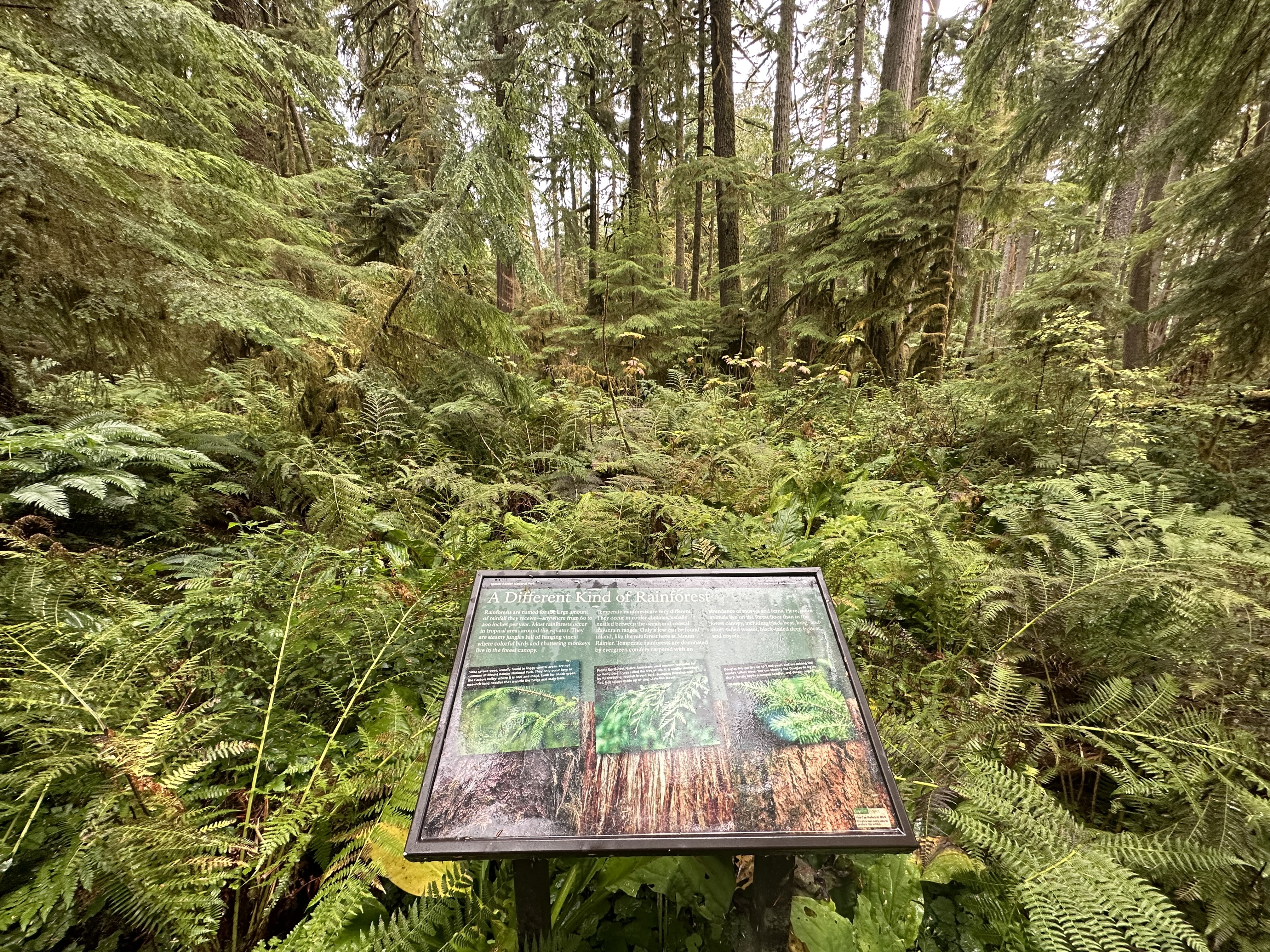
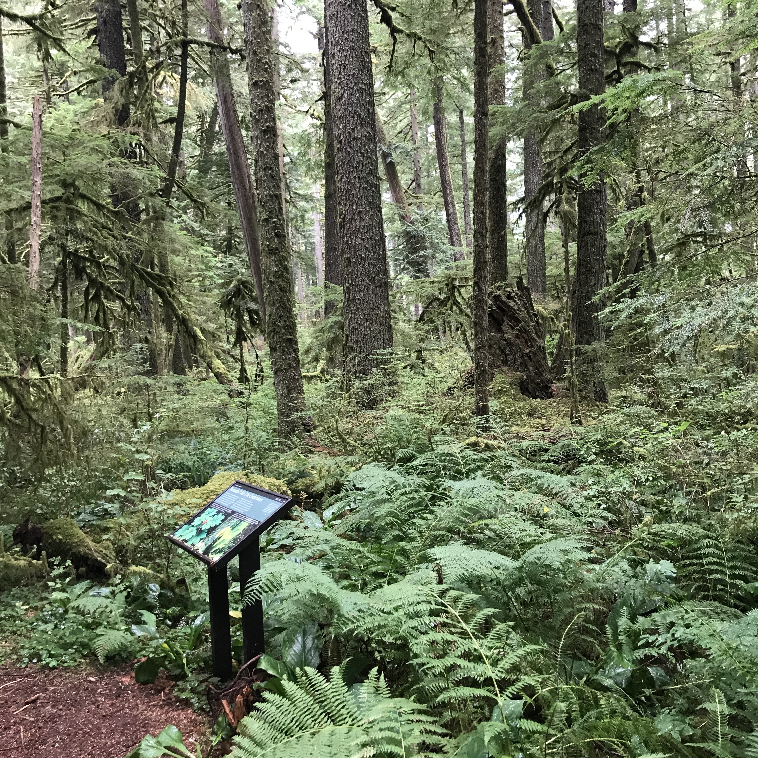
Learn about the lush temperate rainforest of the Carbon River area through a set of exhibit panels.
The Carbon River Rainforest Trail is located at the Carbon River Entrance. The road has been washed out before the entrance, requiring visitors to park along the edge of the road and hike into the main entrance area via a temporary trail. The temporary trail is on the right side of the former road, while the Carbon River flows along the road to the left. Be alert for drop offs and unstable ground along the edge of the river. At the entrance are several inaccessible parking spots. To the left of the road is an old ranger station now closed for use and separate restroom facilities still in use. To the right of the road are several picnic tables, in a grassy area surrounded by a low, split-rail fence, and an information kiosk. To the left of the kiosk is the start of the Carbon River Rainforest Trail. The Carbon River Rainforest Trail was originally a loop trail but the bridge on the far side of the loop was destroyed so the trail is split into two prongs. Exhibit panels are located along both halves of the trail. The trail is dirt with stretches of wood boardwalk. The boardwalk may be slippery, uneven, and in poor condition. The trail is surrounded by dense mossy temperate rainforest, numerous fallen trees, and thick vegetation, which can encroach on the trail. Fallen trees have also damaged and blocked some sections of the trail and destroyed some of the exhibit panels. Exhibit Panel Description The main text stretches across the top third of the exhibit panel against a solid green background. The bottom two-thirds of the panel is filled with a single photo of a moss-covered log in a forest. Arrows around the log diagram the movement of nutrients in the forest ecosystem. Two arrows, labeled "Carbon Dioxide" and "Sunlight" point down into the log, while an arrow labeled "Oxygen" points up out of the log. An arrow curves down and towards the right at the bottom of the log and is labelled "Decomposing Matter". An arrow labeled "Water and Nutrients" curves up from the bottom of the log. A caption in a black box on the left side of the photo reads: "Green again with dozens or even hundreds of new plants growing on their decaying trunks, fallen trees host new life. Called nurse logs, they add nutrients to the soil and create ideal places for seeds to sprout." A small box in the lower left corner of the panel reads "User Fee Project. Your Fee Dollars at Work. Entrance fees were used to produce this exhibit".
Explore Mount Rainier's temperate rainforest along the Carbon River Rainforest Trail.
The Carbon River Rainforest Trail is located at the Carbon River Entrance. The road has been washed out before the entrance, requiring visitors to park along the edge of the road and hike into the main entrance area via a temporary trail. The temporary trail is on the right side of the former road, while the Carbon River flows along the road to the left. Be alert for drop offs and unstable ground along the edge of the river. At the entrance are several inaccessible parking spots. To the left of the road is an old ranger station now closed for use and separate restroom facilities still in use. To the right of the road are several picnic tables, in a grassy area surrounded by a low, split-rail fence, and an information kiosk. To the left of the kiosk is the start of the Carbon River Rainforest Trail. The Carbon River Rainforest Trail was originally a loop trail but the bridge on the far side of the loop was destroyed so the trail is split into two prongs. Exhibit panels are located along both halves of the trail. The trail is dirt with stretches of wood boardwalk. The boardwalk may be slippery, uneven, and in poor condition. The trail is surrounded by dense mossy temperate rainforest, numerous fallen trees, and thick vegetation, which can encroach on the trail. Fallen trees have also damaged and blocked some sections of the trail and destroyed some of the exhibit panels. Exhibit Panel Description A single photo fills the exhibit panel, fading towards the top into a solid green background. The main text stretches across the top against the green background, with the secondary text positioned lower on the right side overlapping the photo. The photo shows a dense forest with tall, moss-covered trees. A small box in the lower right corner of the panel reads "User Fee Project. Your Fee Dollars at Work. Entrance fees were used to produce this exhibit".
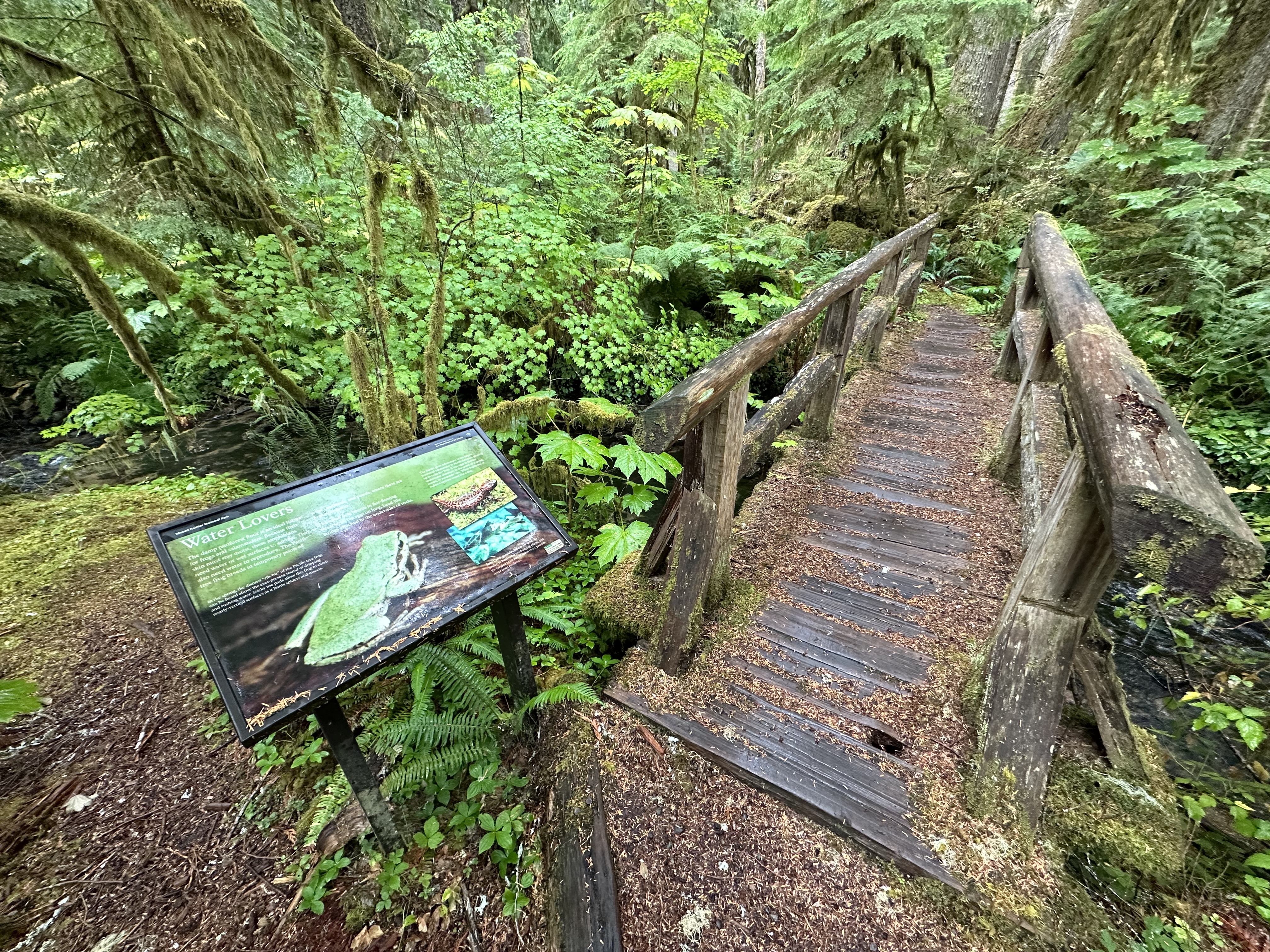
Temperate rainforests are also home to amphibians like frogs and salamanders.
The Carbon River Rainforest Trail is located at the Carbon River Entrance. The road has been washed out before the entrance, requiring visitors to park along the edge of the road and hike into the main entrance area via a temporary trail. The temporary trail is on the right side of the former road, while the Carbon River flows along the road to the left. Be alert for drop offs and unstable ground along the edge of the river. At the entrance are several inaccessible parking spots. To the left of the road is an old ranger station now closed for use and separate restroom facilities still in use. To the right of the road are several picnic tables, in a grassy area surrounded by a low, split-rail fence, and an information kiosk. To the left of the kiosk is the start of the Carbon River Rainforest Trail. The Carbon River Rainforest Trail was originally a loop trail but the bridge on the far side of the loop was destroyed so the trail is split into two prongs. Exhibit panels are located along both halves of the trail. The trail is dirt with stretches of wood boardwalk. The boardwalk may be slippery, uneven, and in poor condition. The trail is surrounded by dense mossy temperate rainforest, numerous fallen trees, and thick vegetation, which can encroach on the trail. Fallen trees have also damaged and blocked some sections of the trail and destroyed some of the exhibit panels. Exhibit Panel Description A photo of a small bright green frog perched on a wet log fills the entire frame of the exhibit panel, with the main text on the left side. On the right side of the panel, two smaller photos are stacked on top of each other, slightly overlapping at an angle. The top photo shows a large salamander covered in curvy dark brown spots on a patch of moss. The bottom photo is an underwater view of a yellow-speckled trout. The secondary text associated with salamanders is above the salamander photo, with the text about trout below that photo. A small box in the lower right corner of the panel reads "User Fee Project. Your Fee Dollars at Work. Entrance fees were used to produce this exhibit".
Start the Carbon River Rainforest Trail at the Carbon River Entrance.
The Carbon River Rainforest Trail is located at the Carbon River Entrance. The road has been washed out before the entrance, requiring visitors to park along the edge of the road and hike into the main entrance area via a temporary trail. The temporary trail is on the right side of the former road, while the Carbon River flows along the road to the left. Be alert for drop offs and unstable ground along the edge of the river. At the entrance are several inaccessible parking spots. To the left of the road is an old ranger station now closed for use and separate restroom facilities still in use. To the right of the road are several picnic tables, in a grassy area surrounded by a low, split-rail fence, and an information kiosk. To the left of the kiosk is the start of the Carbon River Rainforest Trail. Or, you can continue hiking or bicycling straight along the road past the main entrance area to a metal gate and the start of the Carbon River Trail. There are paths to go around the gate on either side. Shortly after the gate, the road transitions from paved to gravel and dirt. Sections of the road may be washed out, have larger rocks, and fallen trees are common. The Carbon River Rainforest Trail: Welcome Exhibit Panel is attached to the information kiosk next to the trailhead. Exhibit Panel Description This exhibit panel is oriented vertically, with the text at the top against a green background. The solid green background fades into a photo that fills the bottom two-thirds of the panel. The photo shows a dense forest of tall trees, with the ground covered in shrubs, ferns, and plants with large green leaves. In the upper right corner of the panel, a small circular graphic shows a drawing of a boot stepping on a wildflower crossed out by a red slash. Next to the graphic text reads: "Protect Fragile Vegetation Stay on Trails". A small box in the lower left corner of the panel reads "User Fee Project. Your Fee Dollars at Work. Entrance fees were used to produce this exhibit".
Carter Fall Trailhead provides access to the Wonderland Trail, the Nisqually River, and a moderate hike to view waterfalls.
The trailhead starts from the Paradise Road across from the Cougar Rock Campground. A large paved pullout on the east (uphill) side of the road provides parking, with a wayside exhibit panel in a metal frame on the north side of the pullout. The dirt trail descends steeply down log steps from the pullout down to the Nisqually riverbed, which is wide and rocky. The trail weaves around large rocks and boulders with sections of trail that are loose and sandy to cross the riverbed. The trail crosses the Nisqually River using a single log footbridge with a railing on one side only. Across the river, the trail climbs up the Paradise River valley through forest to reach an overlook with views of Carter Falls. The trail is dirt, broken by sections of rocks and rougher terrain.
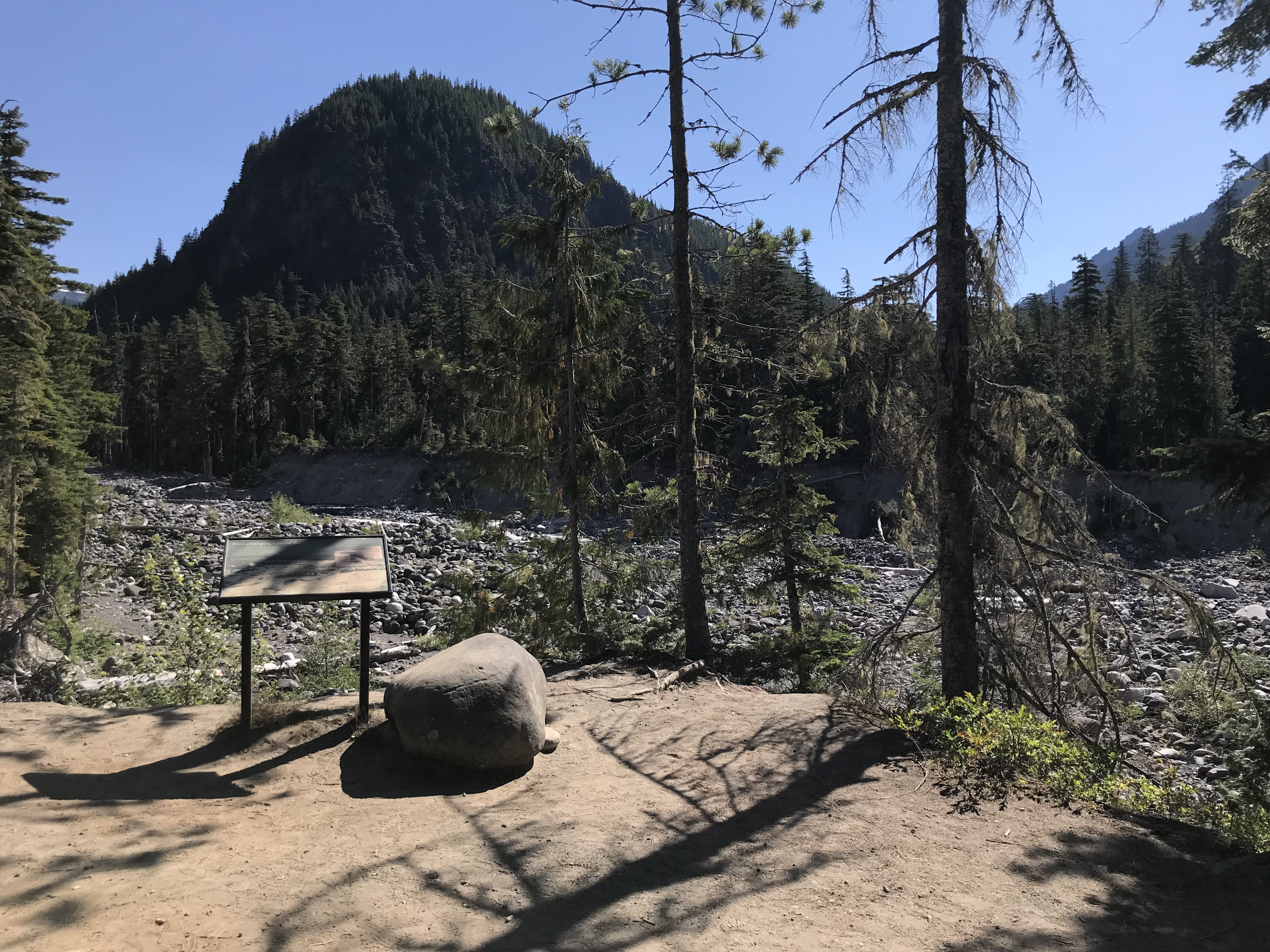
Carter Falls Trailhead provides access to the Nisqually River, a dynamic force of nature described in this exhibit panel.
The Carter Falls trailhead starts from the Paradise Road across from the Cougar Rock Campground. A large paved pullout on the east (uphill) side of the road provides parking, with a exhibit panel in a metal frame on the north side of the pullout. The dirt trail descends steeply down log steps from the pullout down to the Nisqually riverbed, which is wide and rocky. Exhibit Panel Description The main text stretches across the top third of the exhibit panel in a band with a green background. The bottom two-thirds of the panel is filled with a photo of a wide, muddy river rushing around rocky gravel beds. A caption in the upper left corner of the photo reads: "Glacial rivers deposit sediment on the floor of the streambed, creating high spots that divert water and cause the river to wind and "braid" across its bed." A second, smaller photo half overlaps the top green band and the lower main photo at a slight angle on the right of the panel. The smaller photo shows a close-up view of several large smooth rocks with milky-brown water rushing around them. A caption at the top of the smaller photo reads: "Fine particles scoured by the glacier, called "glacial flour", give the water its cloudy appearance in spring and summer." A small box in the lower right corner of the exhibit panel reads "User Fee Project. Your Fee Dollars at Work. Entrance fees were used to produce this exhibit".
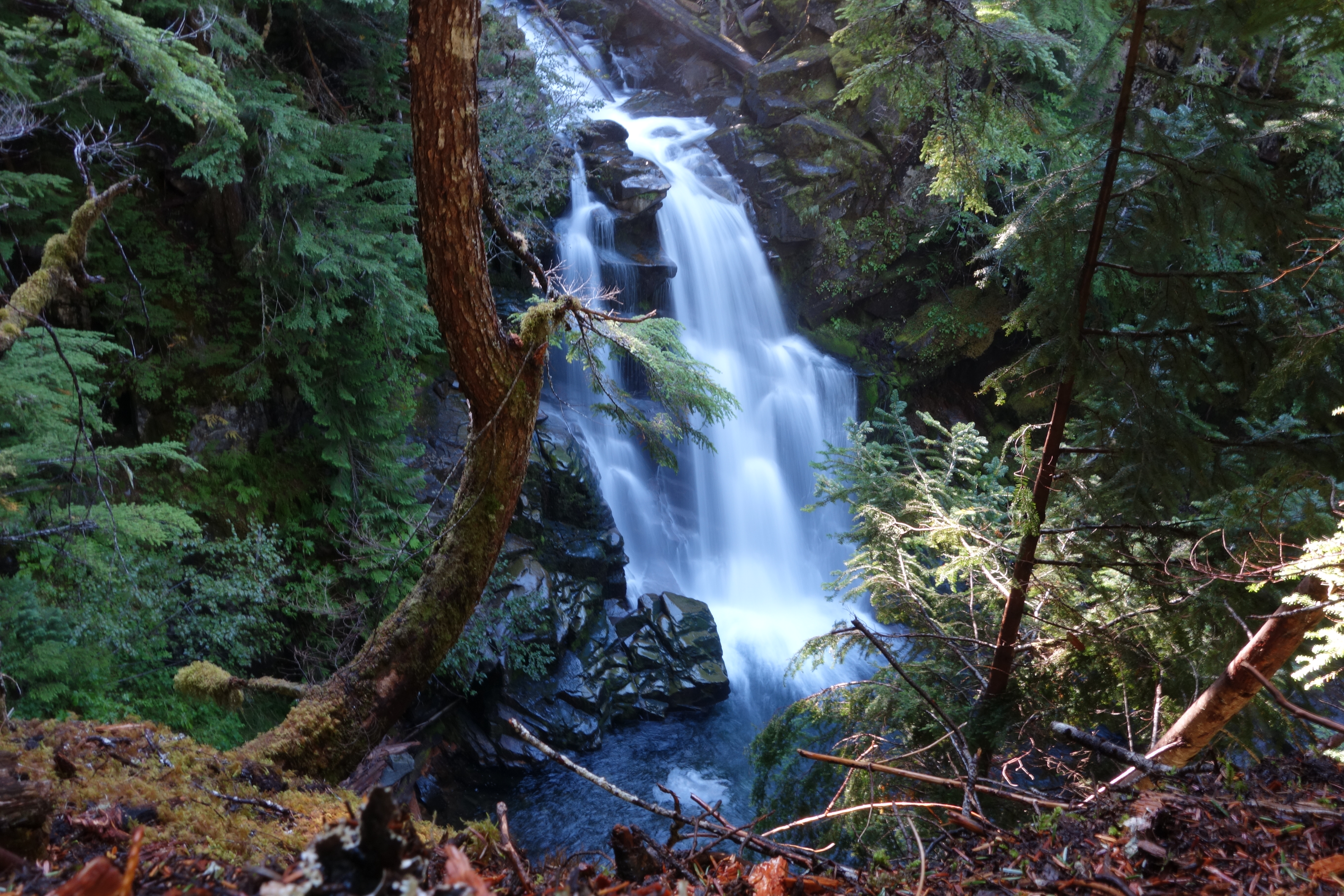
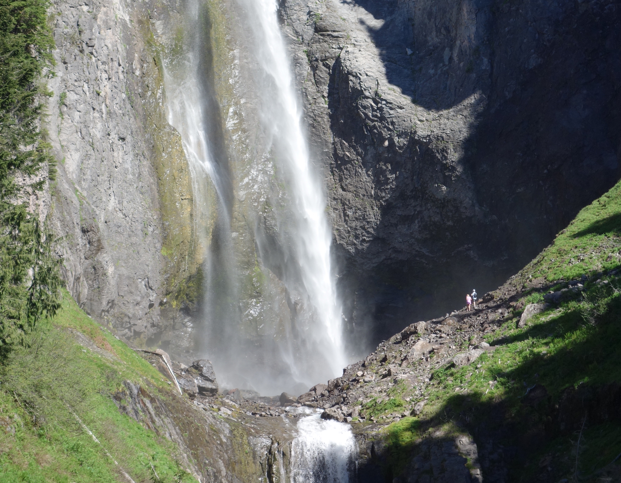
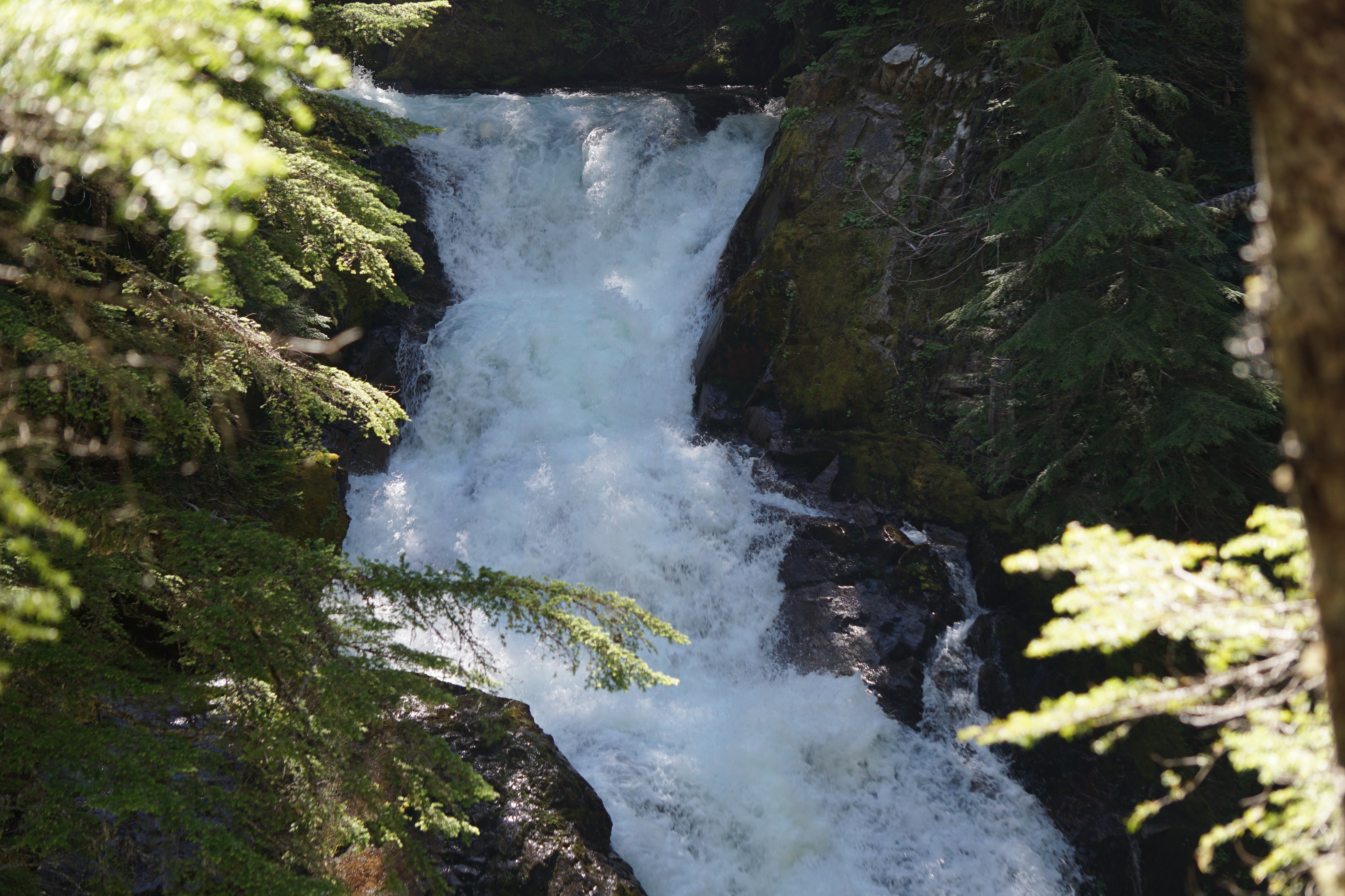
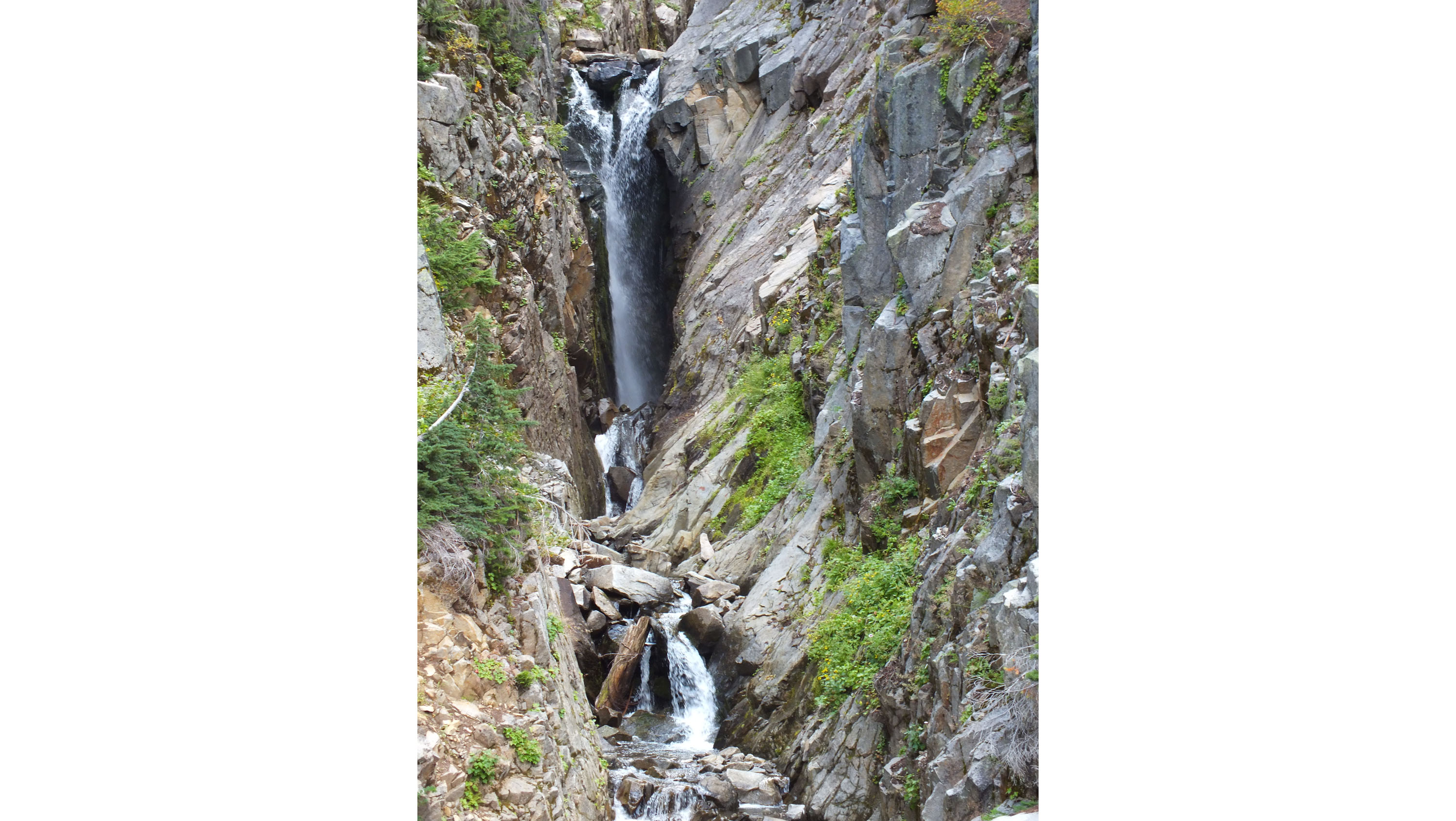
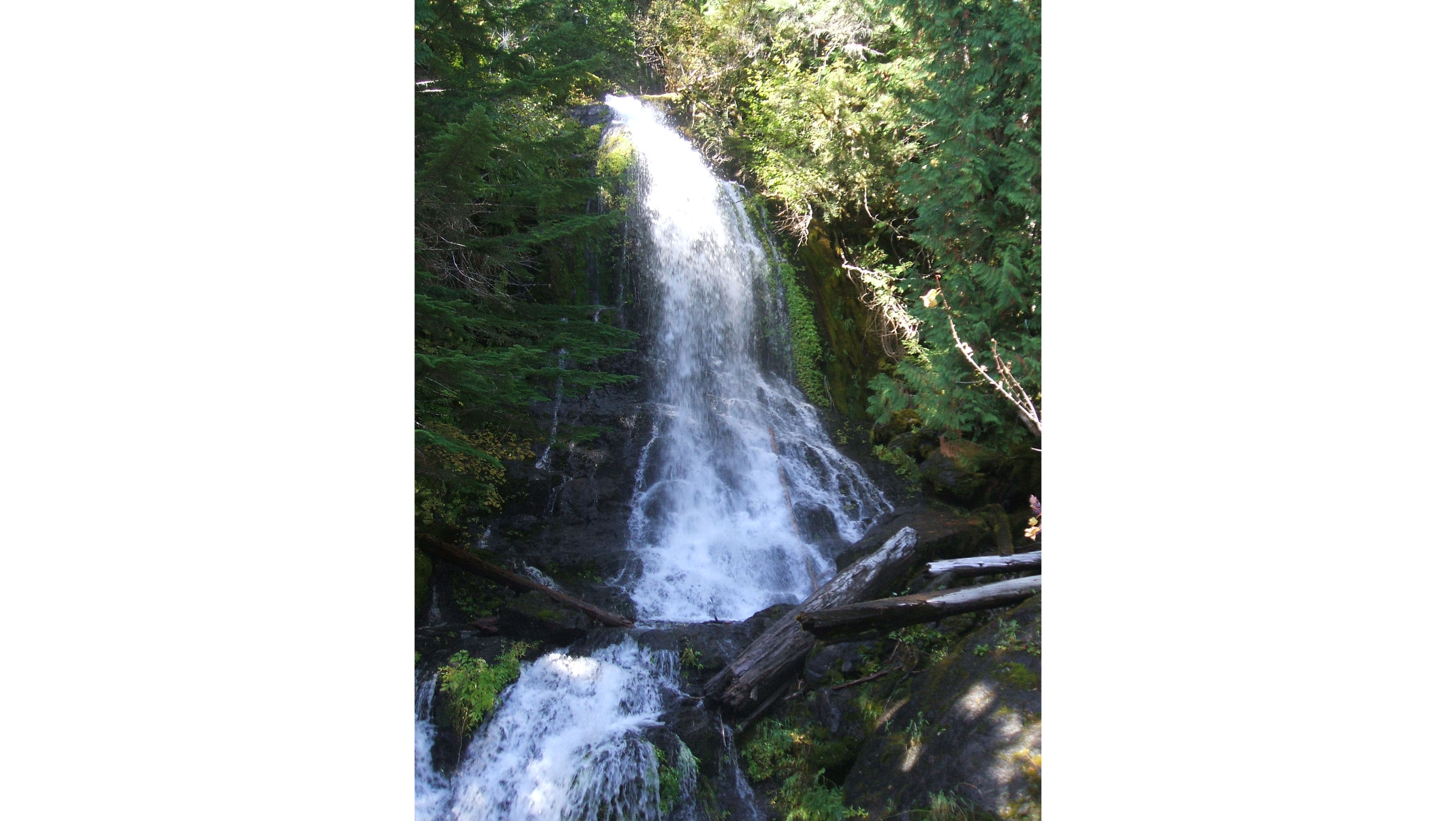
Chenuis Falls is a series of cascades over smooth bedrock ending in a beautiful pool.
Chenuis Falls is a series of cascades over smooth bedrock ending in a beautiful pool. The lower section of falls is 168 feet tall. Upper tiers of the falls are not visible from creek level.
Hike to a beautiful cascading waterfall in a less visited area of the park.
The Chenuis Falls Trailhead is located on the Carbon River Trail. The Carbon River Trail is former unpaved, unmaintained road that is closed to public vehicles. The trailhead is on the left side of the road. The road winds through an old-growth forest in the northwest corner of the park. At the trailhead, there is a sign saying "Chenuis Falls Trailhead" and a bike rack for cyclist to use for locking their bikes. The trailhead is located right next to the Carbon River, which can cut into the bank creating a crumbling edge.
Chenuis Falls Trail starts from the banks of the dynamic Carbon River. Learn more about this river system through this exhibit panel.
The Chenuis Falls Trailhead is located on the Carbon River Trail. The Carbon River Trail is former unpaved, unmaintained road that is closed to public vehicles. The trailhead is on the left side of the road. The road winds through an old-growth forest in the northwest corner of the park. At the trailhead, there is a sign saying "Chenuis Falls Trailhead" and a bike rack for cyclist to use for locking their bikes. The trailhead is located right next to the Carbon River, which can cut into the bank creating a crumbling edge. Wayside Panel Description A single photo of a wide, rocky river bed with a muddy river braiding around gravel bars fills the wayside panel. The wayside text forms a column in the left third of the panel. On the right towards the top of the panel, a second smaller photo overlaps the background photo. The smaller photo is an aerial view of a long, narrow glacier curving through a valley. A caption above the photo reads: "The source of the Carbon River is the meltwater that flows fromt the terminus of the Carbon Glacier. A small box in the lower right corner of the panel reads "User Fee Project. Your Fee Dollars at Work. Entrance fees were used to produce this exhibit".
The historic Chinook Entrance Arch spans the width of the Mather Memorial Parkway (SR 410). The impressive log and stone bridge supports the Pacific Crest Trail, near Tipsoo Lake on the eastern boundary of the park.
Tipsoo Lake is a small alpine lake set into a glacier-carved bowl surrounded by rocky mountain peaks. Subalpine meadows ring the lake, with patchy forest on the surrounding slopes. Traveling east along SR410, the main parking area for Tipsoo Lake forms a horseshoe shape on the left side of the highway. Continuing past the parking area, the highway climbs in a loop around the lake before passing under the Chinook Entrance Arch at Chinook Pass. The entrance arch is not a true arch, but a foot bridge built out of large cedar logs set into stone abutments on either side of the road. The entrance arch marks the park boundary and serves as a crossing for the Pacific Crest Trail which travels north-south along the mountain range. Additional parking is available along the north side of the highway within the park, with a small pull off halfway between the main parking area and the arch providing access to the south side of the lake. The main parking area has two pit toilets located in the center of the horseshoe shape with picnic tables and an information bulletin board located at the top of the horseshoe. The main trail starts next to the bulletin board but quickly splits into several trails weaving through the subalpine meadows around the lake. One trail skirts the edge of the lake. The Naches Peak Loop Trail climbs up the mountain slope to the north, connecting to the Pacific Crest Trail which crosses over the highway using the arch. Trails on the south side of the lake connect to the smaller pull off then cross the highway to reach a secondary smaller lake and the other end of the Naches Peak Loop Trail. Trails are often very narrow, with limited room to pass, and bordered by thick meadow vegetation. Small footbridges cross streams and marshy areas that feed into the lakes in several locations.
Christine Falls is a scenic waterfall framed by a historic bridge. It is located between Longmire and Paradise, along the road to Paradise.
Cruise along the winding Paradise Road 4.5 miles from Longmire, parking is available on either side of the bridge just 0.2 mile past Comet Falls trailhead. The upper level of the waterfall comes into view as you cross the gray, stone-faced Christine Falls bridge. Just past the bridge is the parking area where the path begins on the southside of the road, just at the edge of the stone wall. A short walk down a dirt path, with visible tree roots, leads to a unique, framed view of Christine Falls as the water cascades down below the bridge above.
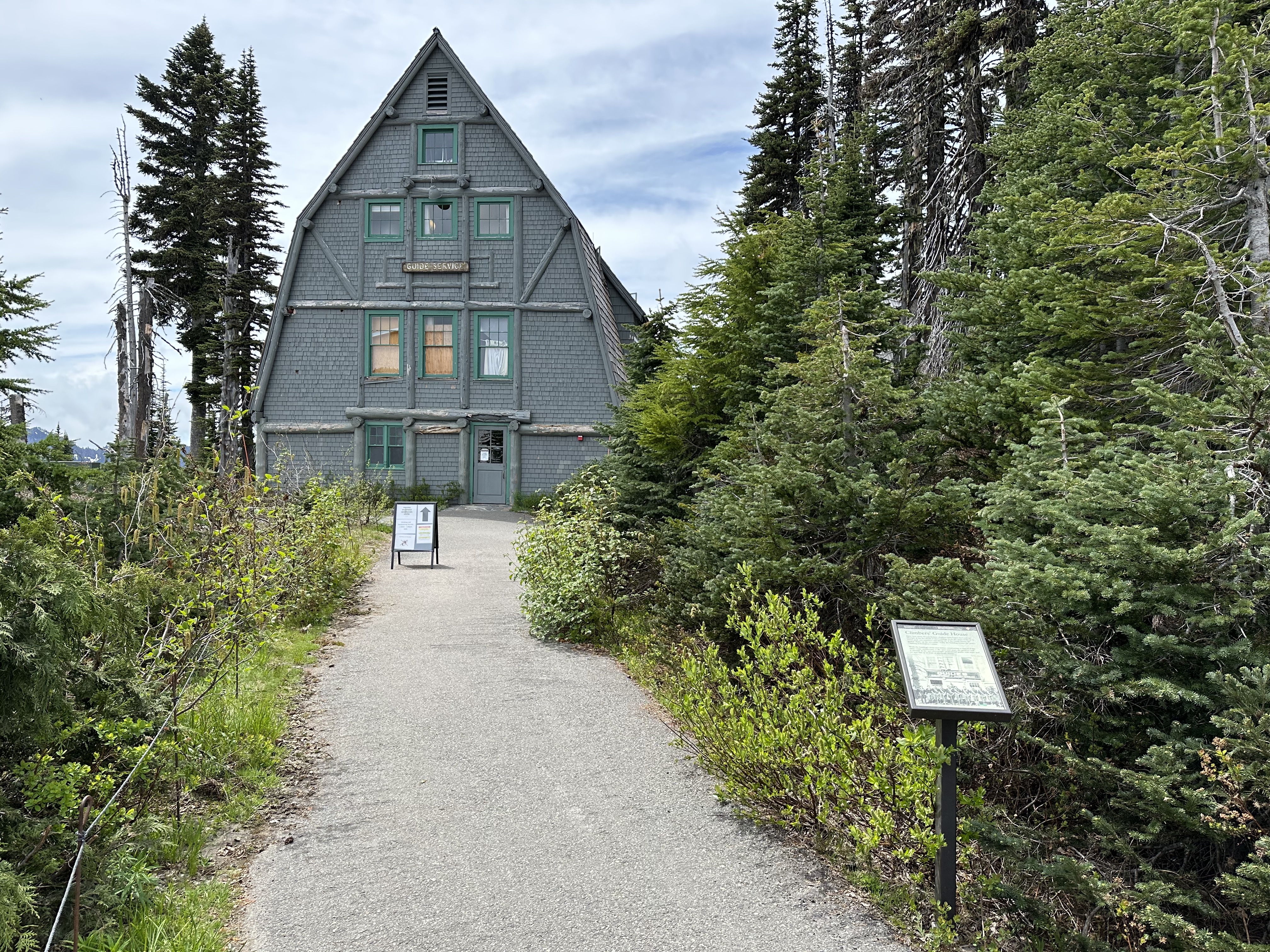
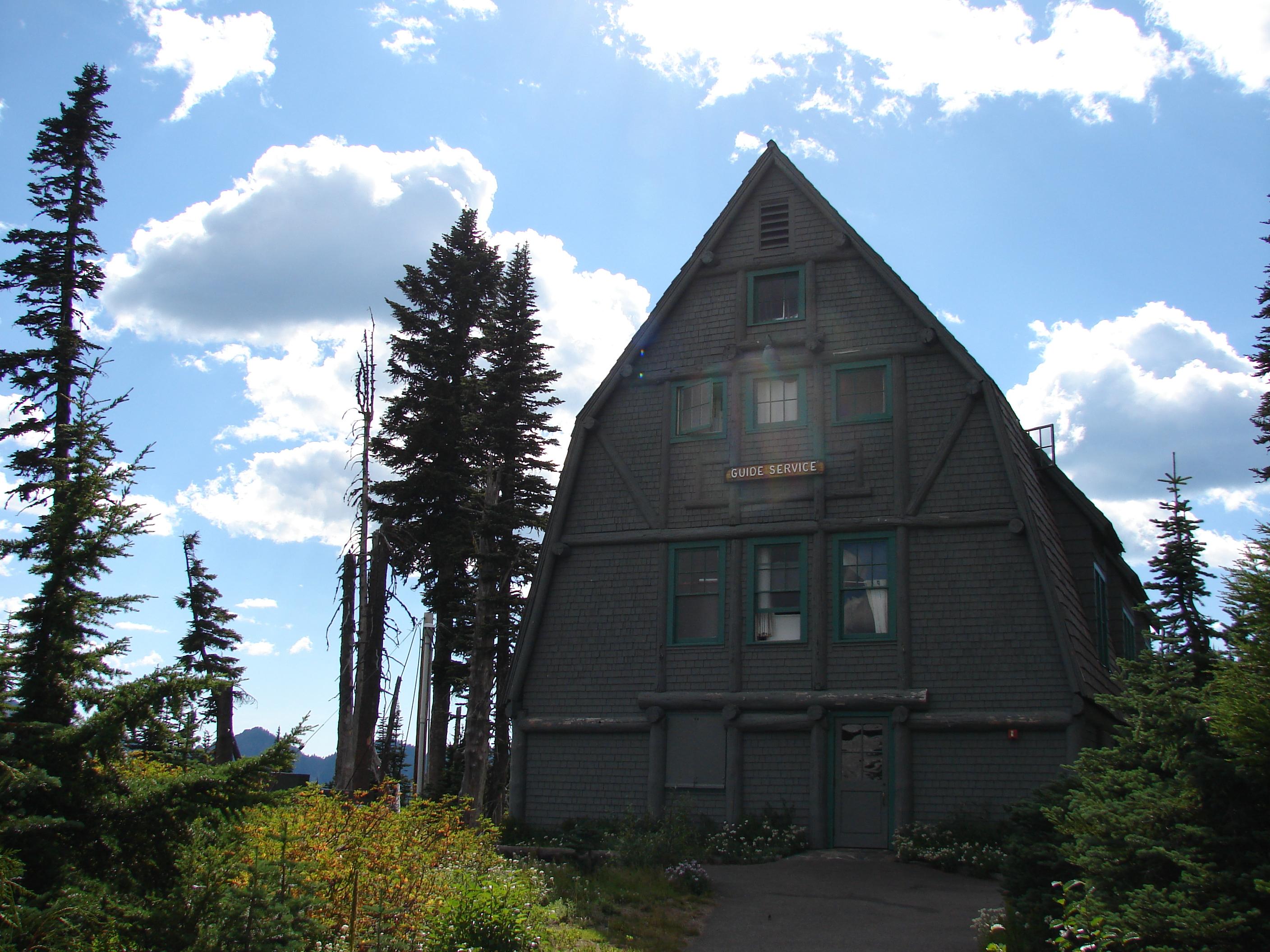
The Climbers' Guide House has been in use since the 1920s by generations of climbers at Mount Rainier.
The Climbers’ Guide House exhibit panel is a small vertical panel in a black metal frame next to the right side of a paved trail heading towards the Guide House building. The building is four stories tall but narrow, with a steeply angled roof that descends all the way to the ground and constructed of grey-painted weathered logs and wood shingles. The path is bordered by low shrubs, meadow plants, and patches of subalpine fir trees in summer. Exhibit Panel Description The text fills the top half of the exhibit panel against a grey background that crossfades into a black and white photo of the front of a wood building filling the lower half of the panel. The building has at least two stories with three large windows on the second story and a large window and a white door on the first story. A ladder from the second story is pulled up and tied against the building. Above the first story window and door is a large sign reading “Guides – Equipment – Auditorium”. Lined up in front of the building is a row of men, with one woman on the far left. All the men wear a matching outfit of pants tucked into tall boots, a dark shirt with sleeves rolled to the elbow, a handkerchief tied around the neck, and a coil of rope slung across the chest. Each holds an ice axe with the handle resting on the ground in front. The woman wears a similar dark shirt and handkerchief with a knee length skirt and does not have the rope or ice axe. A small box in the lower right corner of the exhibit panel reads "User Fee Project. Your Fee Dollars at Work. Entrance fees were used to produce this exhibit".
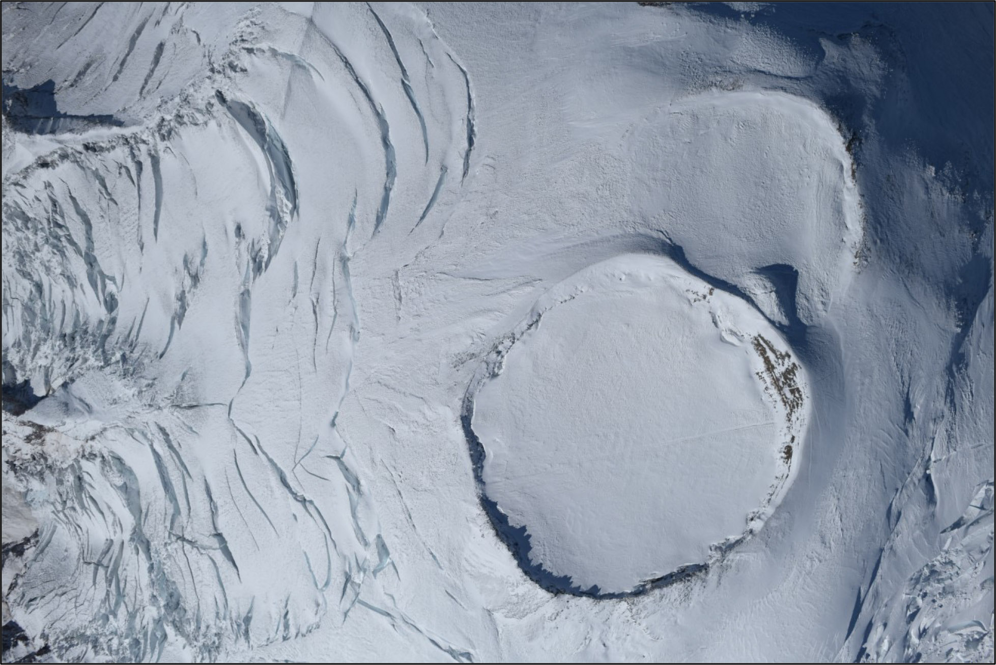
The Columbia Crest Glacier occupies the summit crater on Mount Rainier.
The Columbia Crest Glacier occupies the summit crater of Mount Rainier. It is a depression into which snow falls and is converted to ice. The crater tilts to the east and some ice and meltwater flows into the Cowlitz-Ingraham watershed. There are ice caves created by steam vents inside the summit crater.
Plunging 320 feet, Comet Falls is one of the highest waterfalls in the park and a popular destination for many hikers. Continue past Comet Falls to climb into the subalpine meadows of Van Trump Park.
The Comet Falls and Van Trump Park trail is steep and strenuous, with numerous sections of log steps and rocks. The trail is dirt, and often icy or snow-covered well into summer. There are sections of steep drop-offs, particularly around Comet Falls. The Comet Falls parking lot is a half-circle shaped, paved pullout on the left, or downhill, side of the road as you head towards Paradise. The trail starts from the right side of the pullout, with a trail information board next to the trailhead.
The Cougar Rock Picnic Area offers a quiet place to take a break and enjoy a meal in the forests of Mount Rainier National Park.
Eight and a half miles east of the Nisqually Entrance, the Paradise Road reaches an intersection for the Cougar Rock Campground and Picnic Area. Driving uphill, the campground is to the left and the picnic area is to the right. Once in the picnic area, the road is lined with parking spaces along the side and leads to a one-way turnaround loop. There is one restroom near the entrance of the picnic area on the right, and the other restroom is near the end loop. Both are off-white buildings with brown roofs and have separate multi-stall rooms for men and women. The road and parking lot is lined with a short wooden curb and paved sidewalk, which the splits off into a variety of unpaved dirt paths that lead to picnic tables. The entire area is surrounded by coniferous trees with obscured views of the glaciated top of Mount Rainier in the distance.
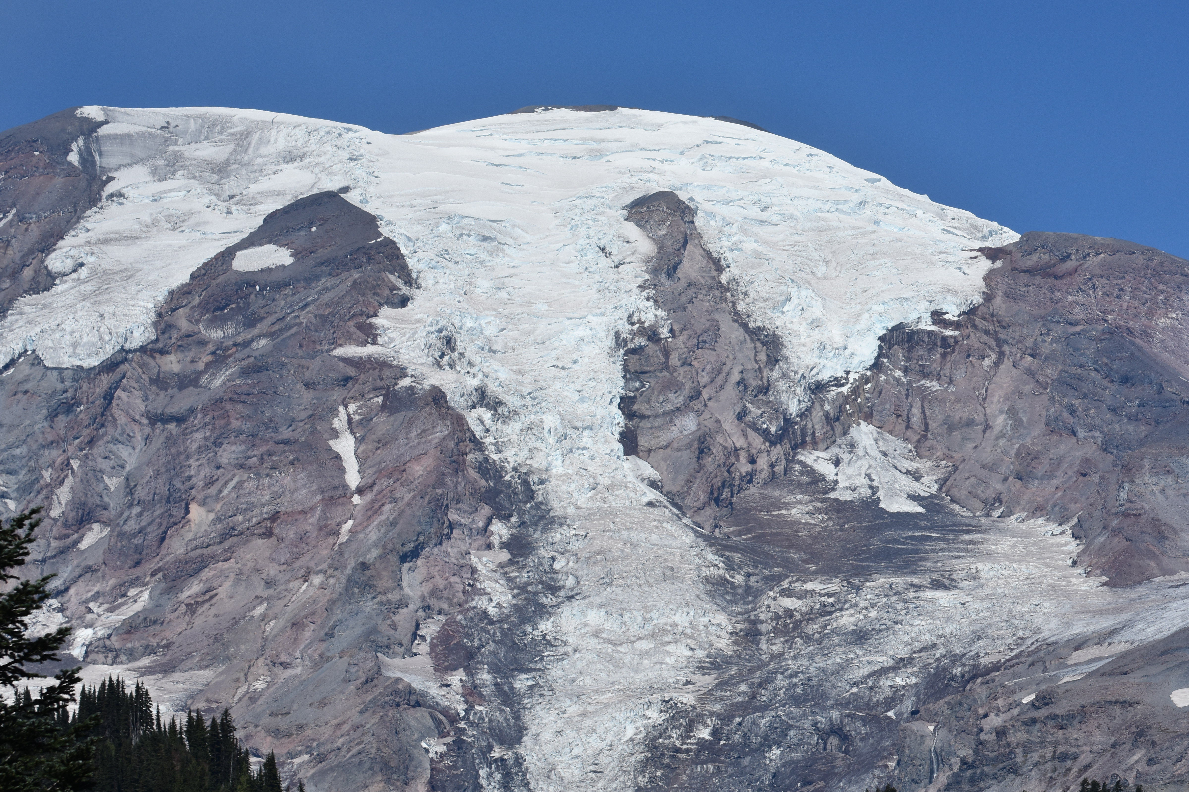
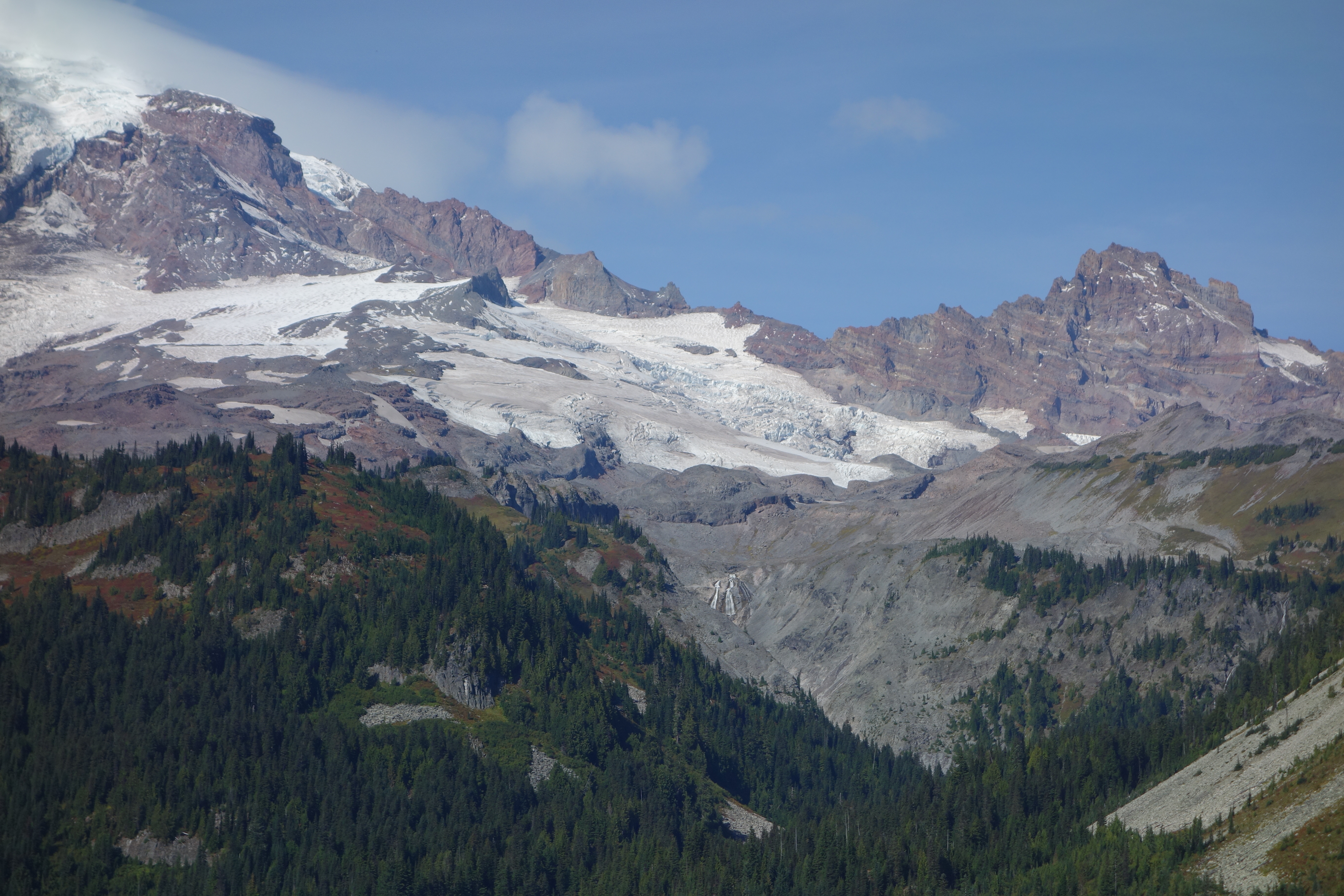
Cowlitz and Ingraham are two glaciers that share a common terminus on the southeast slope of Mount Rainier.
Cowlitz and Ingraham are two glaciers that share a common terminus on the southeast slope of Mount Rainier. Separated by a rocky ridge named Cathedral Rock, the two glaciers merge at the 6,700 foot (2,200 meter) elevation to create a single stream of ice that flows down into the Middle Fork Cowlitz River valley. Below the ridge, a ribbon of rocky debris called a medial moraine produces a dark streak in the middle of the glacier. Further down the glacier are a series of concentric debris-covered ridges called ogives.
Crystal Lakes Trailhead is located along SR410 in the northwest corner of Mount Rainier National Park. The trail climbs up into the Cascade Range to two subalpine lakes.
The Crystal Lakes Trailhead has two large dirt pullouts for parking on either side of SR410. The trail starts from the east side of the road, where there is a small trail sign. The trail crosses a small creek with a log footbridge, then begins switchbacks up the steep valley slope. The trail is dirt, broken by tree roots, steps, and rocks.
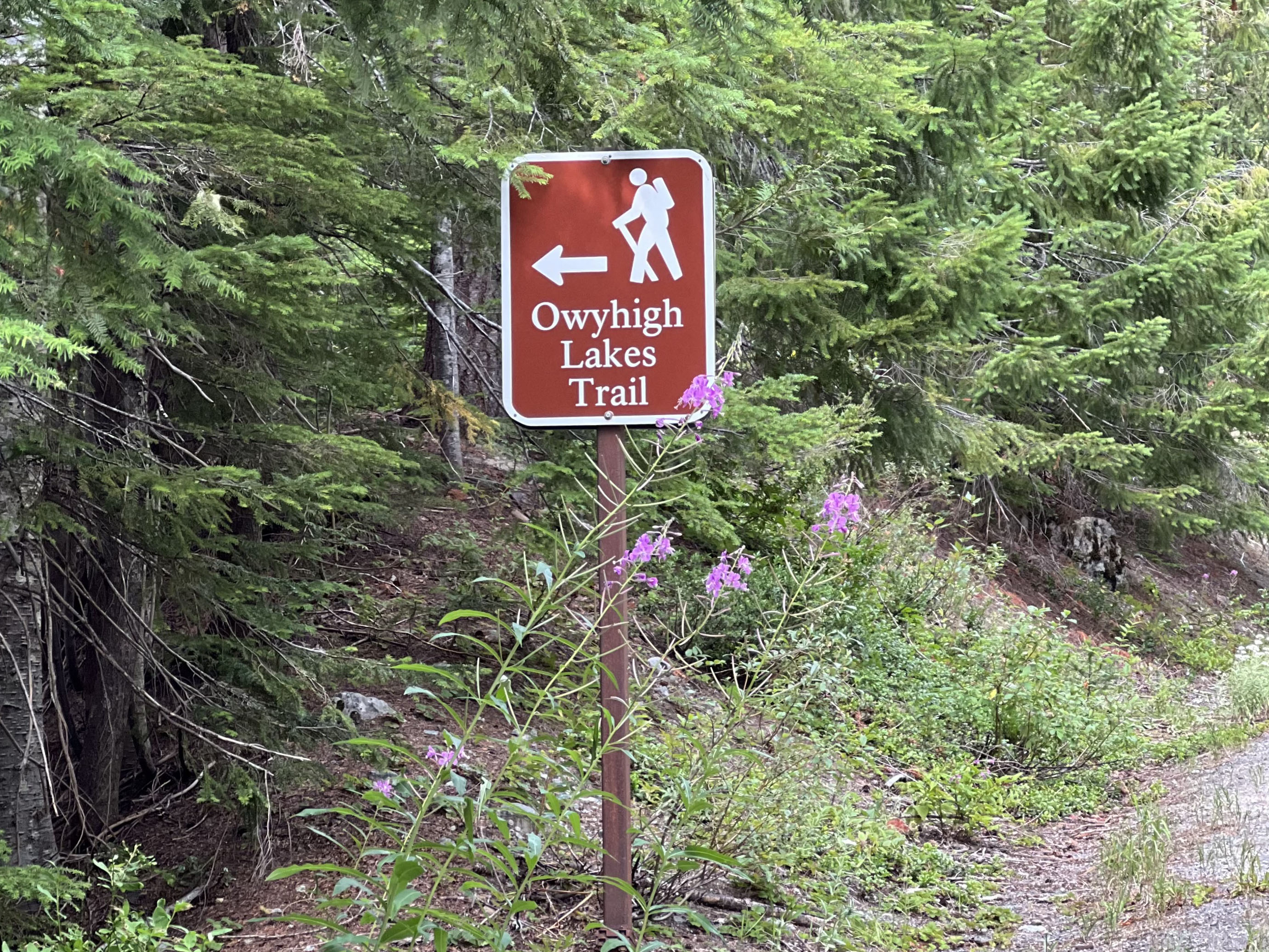
Connect to the Eastside Trail and Owyhigh Lakes Trail from SR 123 south of Cayuse Pass.
A small brown rectangular sign with a white silhouette of a hiker marks a trailhead and reads “Owyhigh Lakes Trail” with an arrow pointing to the left. It is located on the western side of a paved, two lane road ascending through a forest to a mountain pass. There is a small parking area 200 feet south on the east side of the road. The parking area is paved. There is limited space on the shoulder so visitors should walk carefully alongside the road to get to the trailhead.
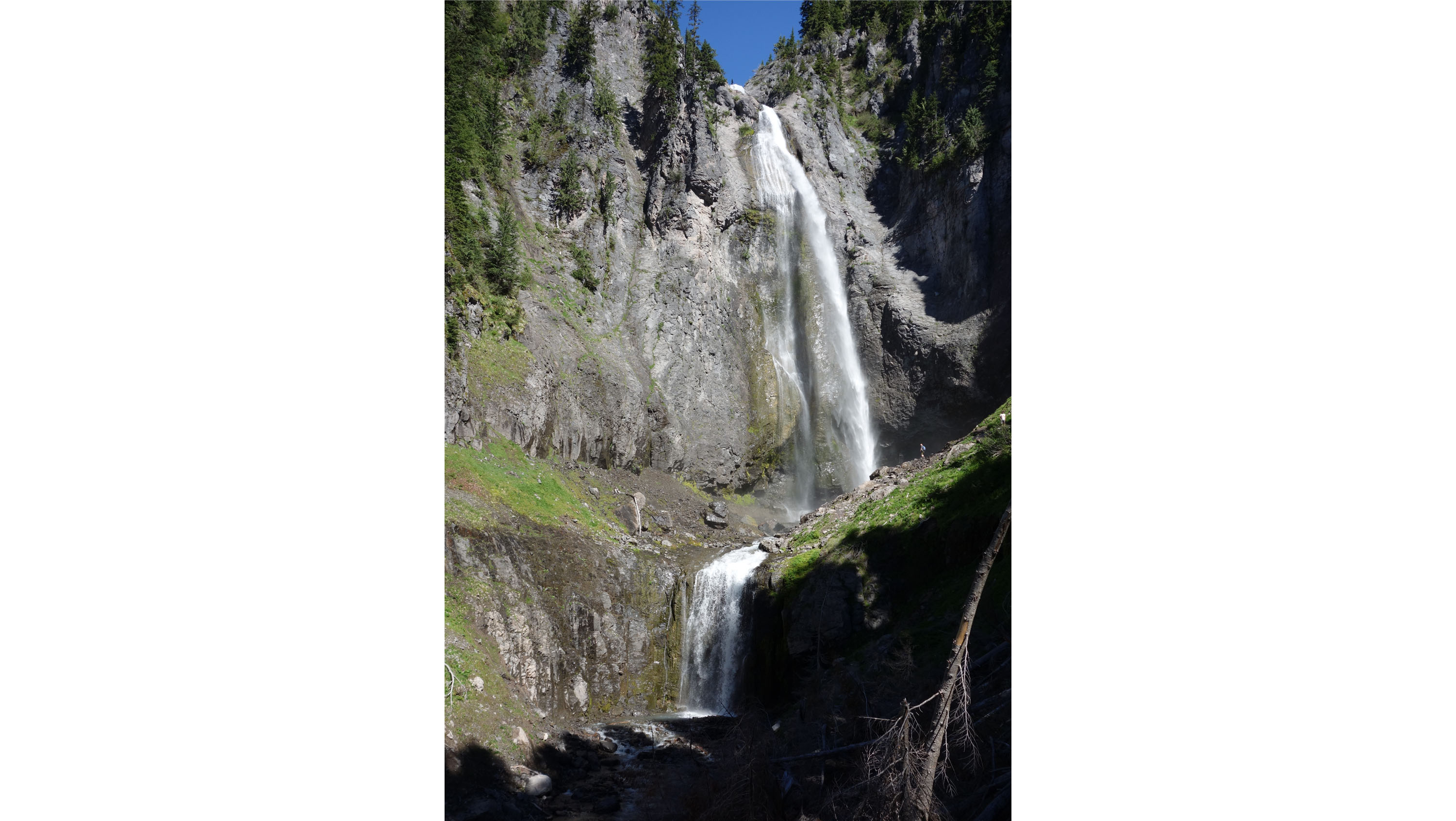
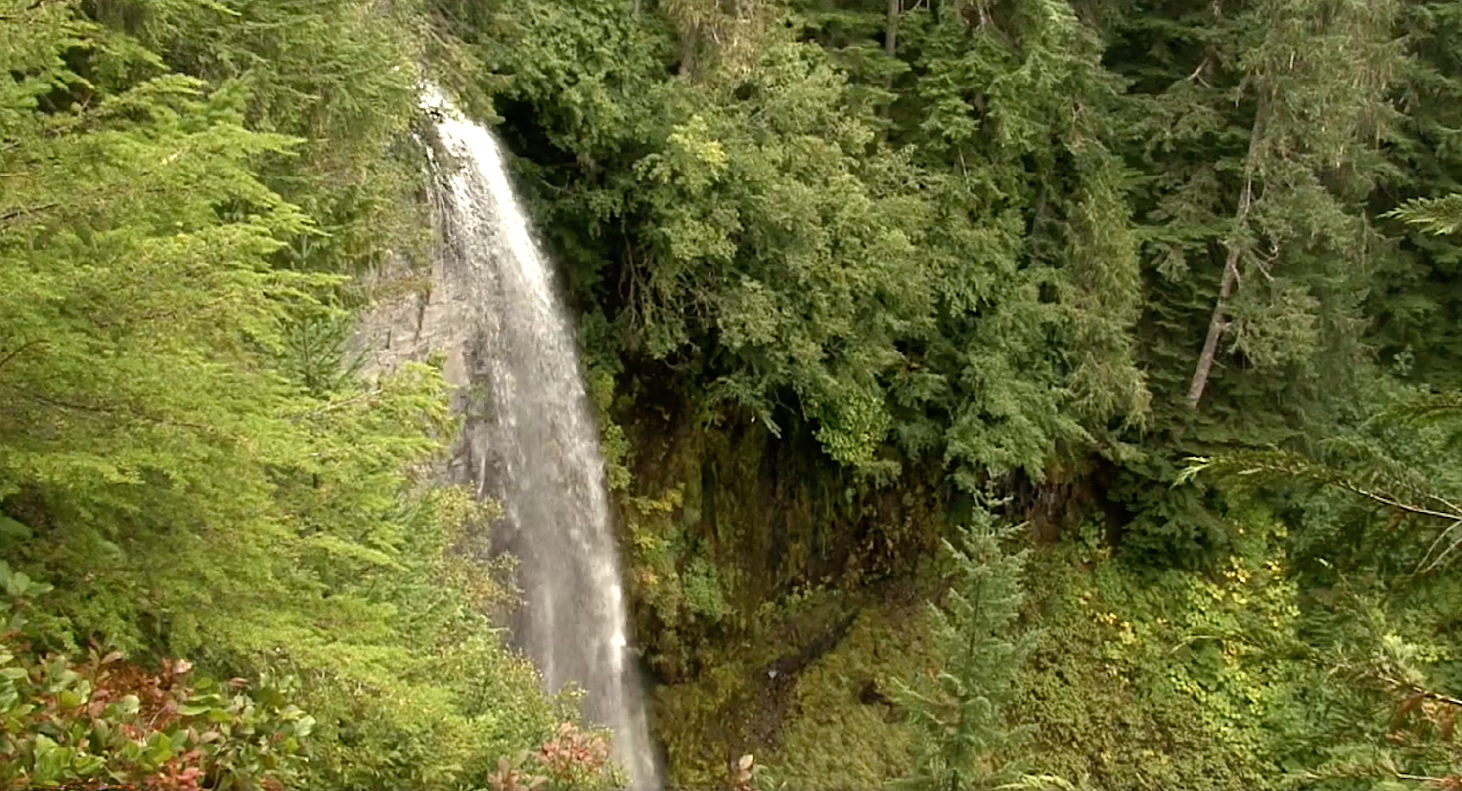
Hike or bike the Westside Road to this 140 foot waterfall along St. Andrews Creek.
Denman Falls has a freefall plunge of about 140 feet. St. Andrews Creek has two additional waterfalls, Larrupin and Ethania Falls, downstream of Denman Falls.
Climb through forest to a saddle in the Tatoosh Range with panoramic views of Mount Rainier and the surrounding landscape. Trailhead begins in Longmire.
The Eagle Peak trail is steep and strenuous, with numerous sections of log steps and rocks. The trail is dirt, and often icy or snow-covered well into summer. There are sections of steep drop-offs, particularly around Eagle Peak Saddle. The Eagle Peak parking lot is a half-circle shaped, dirt pullout on the right, or downhill, side of the road as you head away from the Longmire Suspension Bridge. The trail starts from the left side of the pullout, with a small sign next to the trailhead.
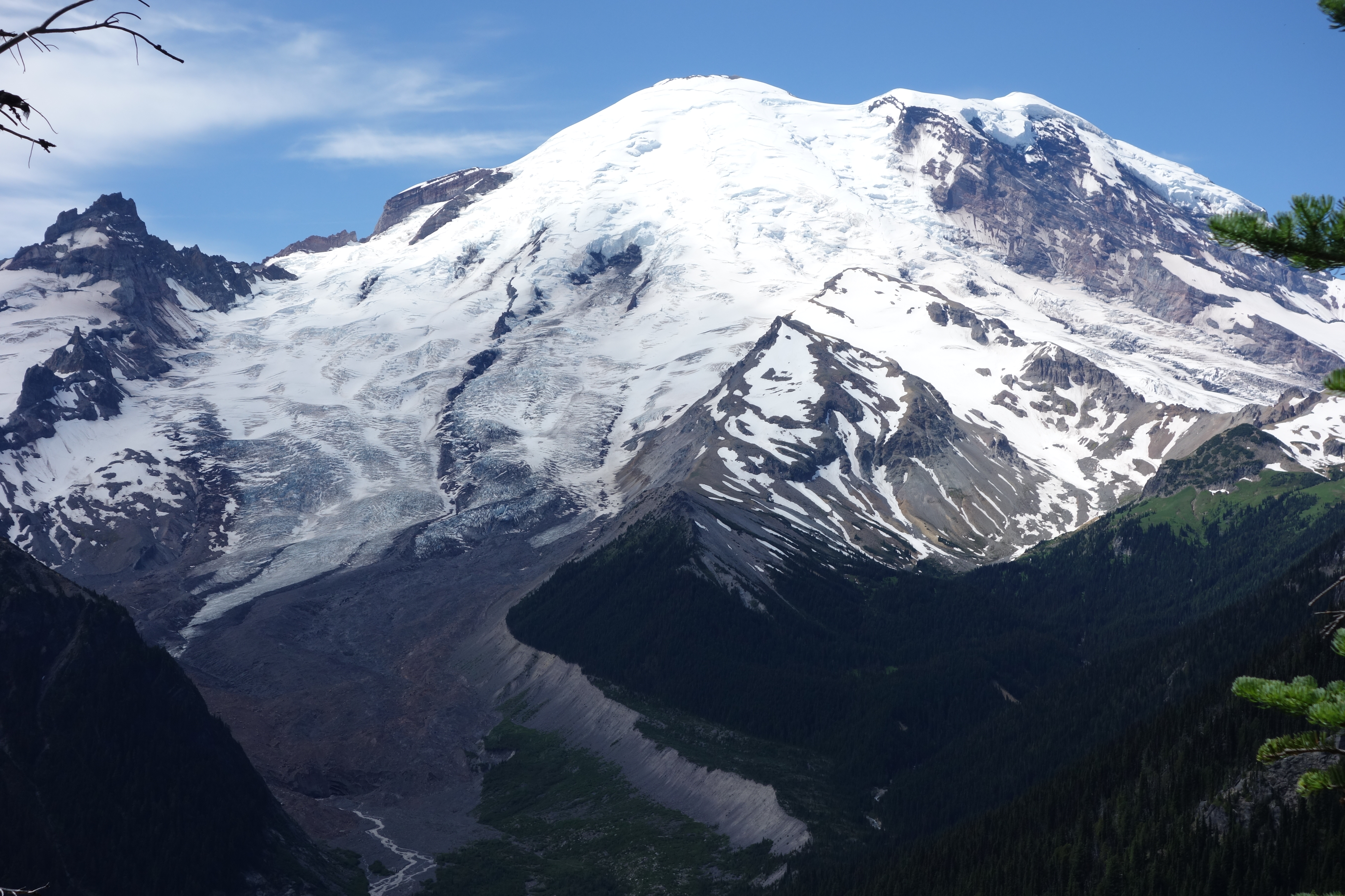
The Emmons Glacier has the largest area of any glacier in the contiguous United States.
The Emmons Glacier is located on the northeast side of Mount Rainier and covers a surface area of 4.2 miles, the largest of any glacier in the contiguous United States. It descends from the summit into the White River Valley. Much of its lower surface is covered with rock debris that originated from a December 1963 rock fall off Little Tahoma peak on the glacier's south flank.
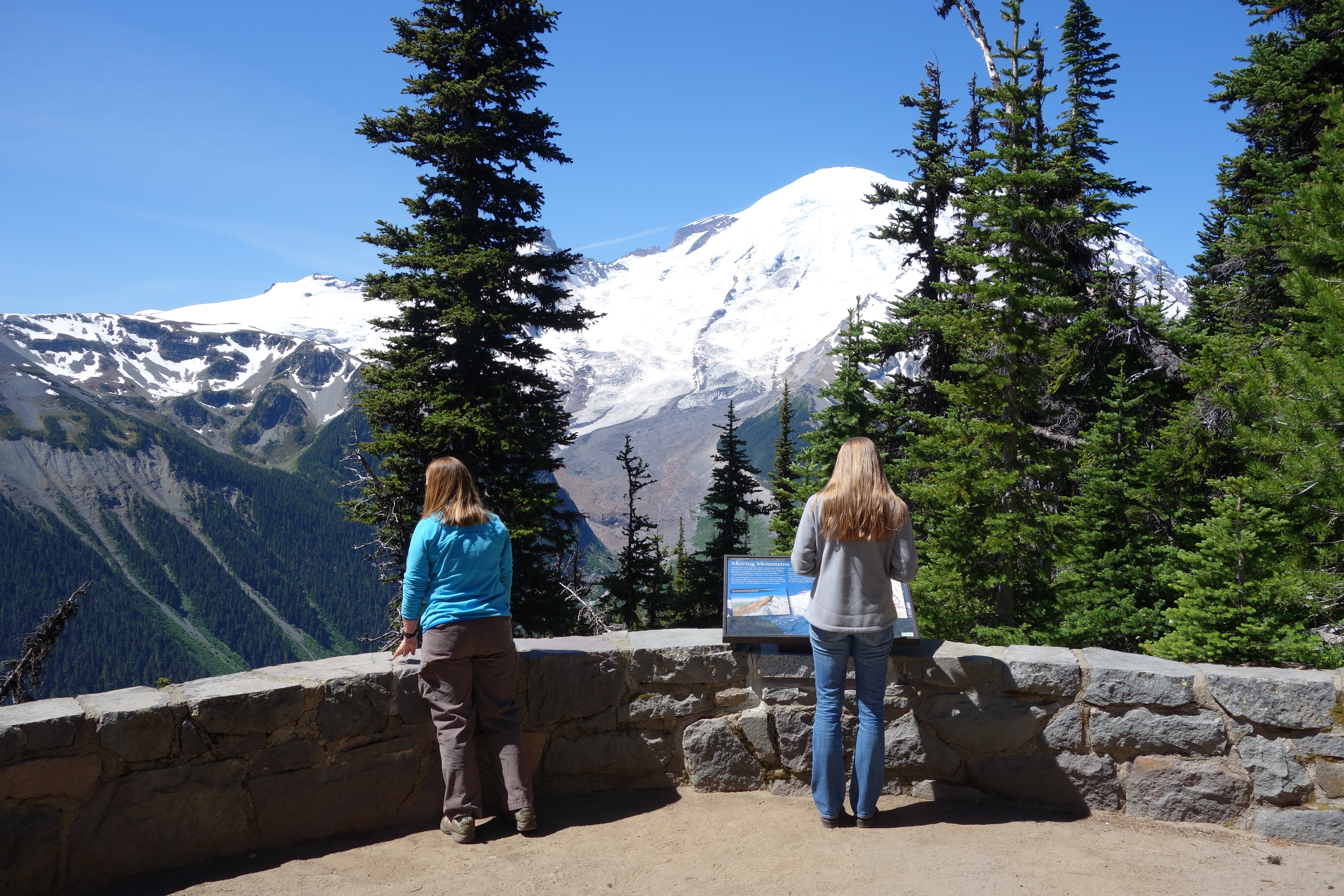
The first of two Emmons Vista Overlooks. View the whole northeast side of Mount Rainier, from the summit to the bottom of the White River Valley.
The first Emmons Vista Overlook perches on the edge of the Sunrise Ridge. It is reached by walking along a narrow dirt trail that descends south from the main parking lot before turning east and following the ridge line. The trail passes through patches of subalpine meadows and stands of subalpine fir trees. Stone steps on one side and a short trail on the other side lead down to the overlook from the main trail. A low rock wall frames a half-circle shaped overlook, with a metal-framed wayside panel attached to the wall on the southwest side facing a view of Mount Rainier. From the overlook view the Emmons Glacier carving down the side of the mountain into the deep White River valley.
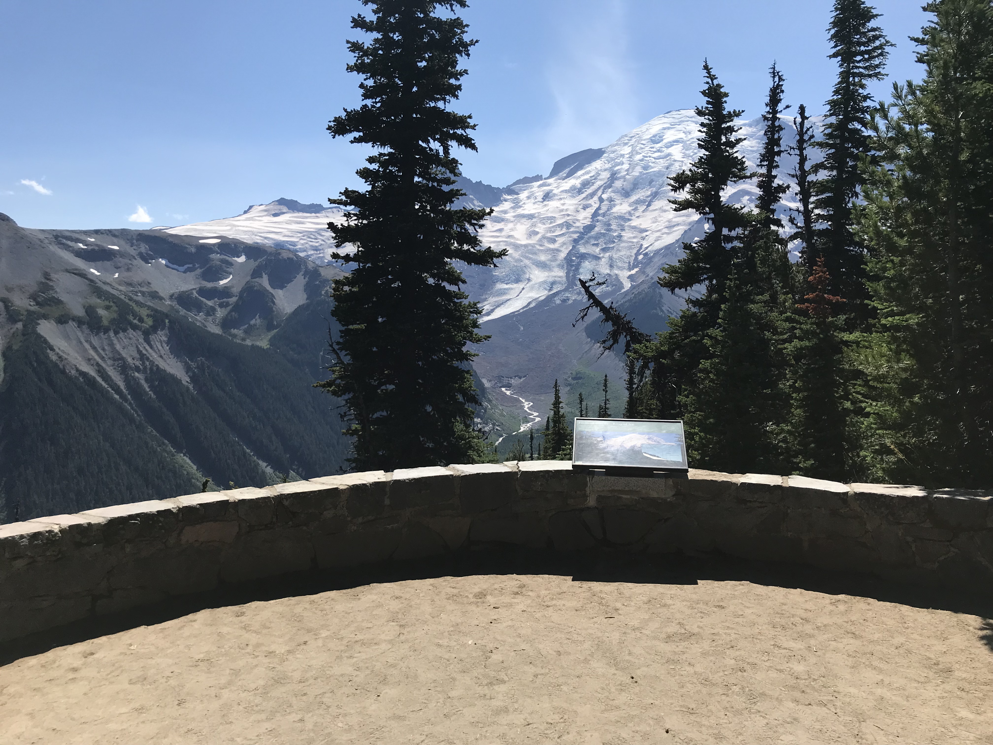
This exhibit panel explores the landscape of the Emmons Glacier.
The first Emmons Vista Overlook perches on the edge of the Sunrise Ridge. It is reached by walking along a narrow dirt trail that descends south from the main parking lot before turning east and following the ridge line. The trail passes through patches of subalpine meadows and stands of subalpine fir trees. Stone steps on one side and a short trail on the other side lead down to the overlook from the main trail. A low rock wall frames a half-circle shaped overlook, with a metal-framed exhibit panel attached to the wall on the southwest side facing a view of Mount Rainier. From the overlook view the Emmons Glacier carving down the side of the mountain into the deep White River valley. Exhibit Panel Description A single photo of Mount Rainier and the White River Valley fills the bottom two thirds of the exhibit panel, with the text stretching across the top third against a green background. From the summit, the Emmons Glacier descends the mountain, filling the whole width of the valley, before ending in a rock-covered terminus where a river emerges. A large bank of rubble on the right side of the valley is labeled "lateral moraine", while a hummock of debris downstream from the terminus is labeled "terminal moraine". A large rocky peak on the left flank of the mountain, above the Emmons Glacier, is labeled "Little Tahoma". A smaller image overlays the right side of the photo. It shows a side-profile graphic of a glacier on a mountain slope, with a dotted white line marking a point halfway down the glacier. The section above the dotted line (uphill side) is labeled "accumulation zone", while the section below the line (downhill side) is labeled "ablation (melting) zone". A lateral moraine, terminus, and terminal moraine are also labeled on the graphic. Text above the graphic reads: "Climate affects the health of glaciers. If the right conditions exist - a period of cooling and/or increased precipitation - glaciers will advance." A small box in the lower left corner of the panel reads "User Fee Project. Your Fee Dollars at Work. Entrance fees were used to produce this exhibit".
The second of two Emmons Vista Overlooks, providing additional views of Mount Rainier, the Emmons Glacier, and the White River Valley.
The second Emmons Vista Overlook perches on the edge of the Sunrise Ridge. It is reached by walking along a narrow dirt trail that descends south from the main parking lot before turning east and following the ridge line. The trail passes through patches of subalpine meadows and stands of subalpine fir trees. Continue past the first Emmons Vista Overlook to a short trail that leads to the second, smaller overlook. A low rock wall frames a square-shaped overlook, with a metal-framed wayside panel attached to the wall on the southwest side facing a view of Mount Rainier framed by fir trees. Opposite from the rock wall is a large bench created by large, weathered logs and covered by a narrow wood roof. From the overlook view the Emmons Glacier carving down the side of the mountain into the deep White River valley.
The second exhibit panel along the Emmons Vista Trail examines how the Osceola Mudflow dramatically reshaped the mountain and the surrounding region.
The second Emmons Vista Overlook perches on the edge of the Sunrise Ridge. It is reached by walking along a narrow dirt trail that descends south from the main parking lot before turning east and following the ridge line. The trail passes through patches of subalpine meadows and stands of subalpine fir trees. Continue past the first Emmons Vista Overlook to a short trail that leads to the second, smaller overlook. A low rock wall frames a square-shaped overlook, with a metal-framed exhibit panel attached to the wall on the southwest side facing a view of Mount Rainier framed by fir trees. Opposite from the rock wall is a large bench created by large, weathered logs and covered by a narrow wood roof. From the overlook view the Emmons Glacier carving down the side of the mountain into the deep White River valley. Exhibit Panel Description A single photo of Mount Rainier and the White River Valley fills the exhibit panel, with the text stretching across the top third of the photo. From the summit, the Emmons Glacier descends the mountain, filling the whole width of the valley. A small photo overlays the background photo on the left side under the main text, showing a graphic of the volcano summit. The summit and left side of the volcano in the graphic has collapsed into a mudflow. Text above the graphic reads: "This image illustrates how Mount Rainier would likely have appeared after the Osceola Mudflow." On the right side of the panel is a small map showing Mount Rainier and the surrounding region. A brown shape labeled "Osceola Mudflow area" covers an area that flows from the northeast side of the mountain, curving around the north side of the mountain to the west before spreading out around the towns of Enumclaw and Buckley before flowing through the towns of Puyallup, Sumner, Pacific, Auburn, and Kent to reach Puget Sound. Text under the map reads: "The Osceola Mudflow covered about 212 square miles of Puget Sound lowland, extending at least as far as the Seattle suburb of Kent and the Port of Tacoma." A small box in the lower right corner of the panel reads "User Fee Project. Your Fee Dollars at Work. Entrance fees were used to produce this exhibit".
The Emmons Vista Trailhead at Sunrise provides access to several trails, including the Emmons Vista Overlooks, Silver Forest Trail, and the Sunrise Rim Trail.
Standing at the trailhead with the Sunrise parking lot behind you, the gravel service road angles to the right towards Mount Rainier. The main trail heads downslope, cutting through a subalpine meadow interspersed with patches of conifer trees. The trail width varies, consisting of sections of uneven dirt trail occasionally broken by log steps. The Emmons Vista Overlooks have stone walls and stone steps, but also have narrow dirt trails to access them.
Hike along the White River Valley with views of Mount Rainier and the Emmons Glacier along the Glacier Basin Trail. Trailhead begins in the White River Campground.
The White River Campground parking area is on the left side of the road as you enter the campground. Walk along the paved campground road to reach the trailhead on the far end of D loop. A bulletin board with additional trail information is on the right side of the trailhead. The trail is dirt, often broken by log or rock steps and varying degrees of slope.
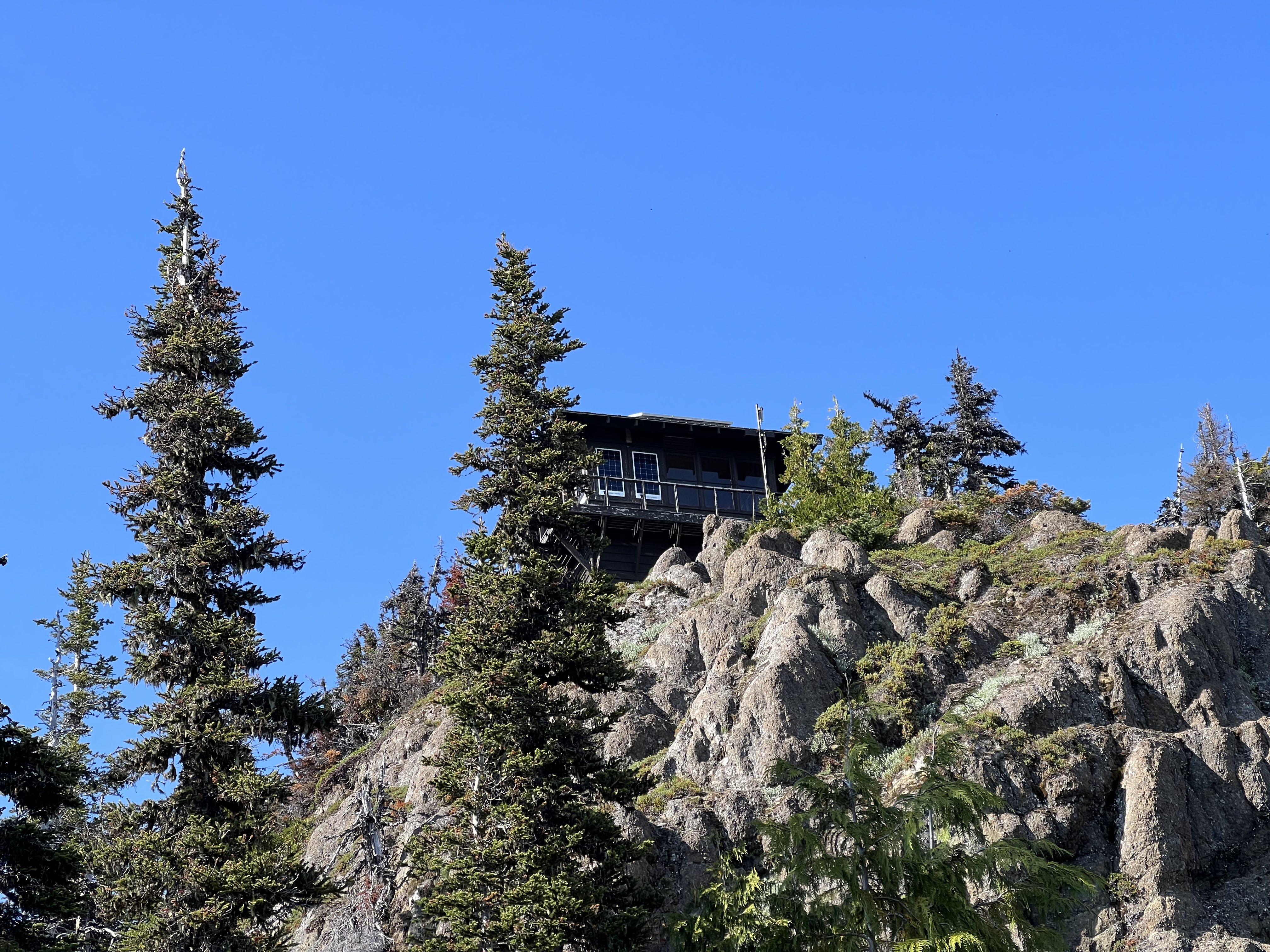
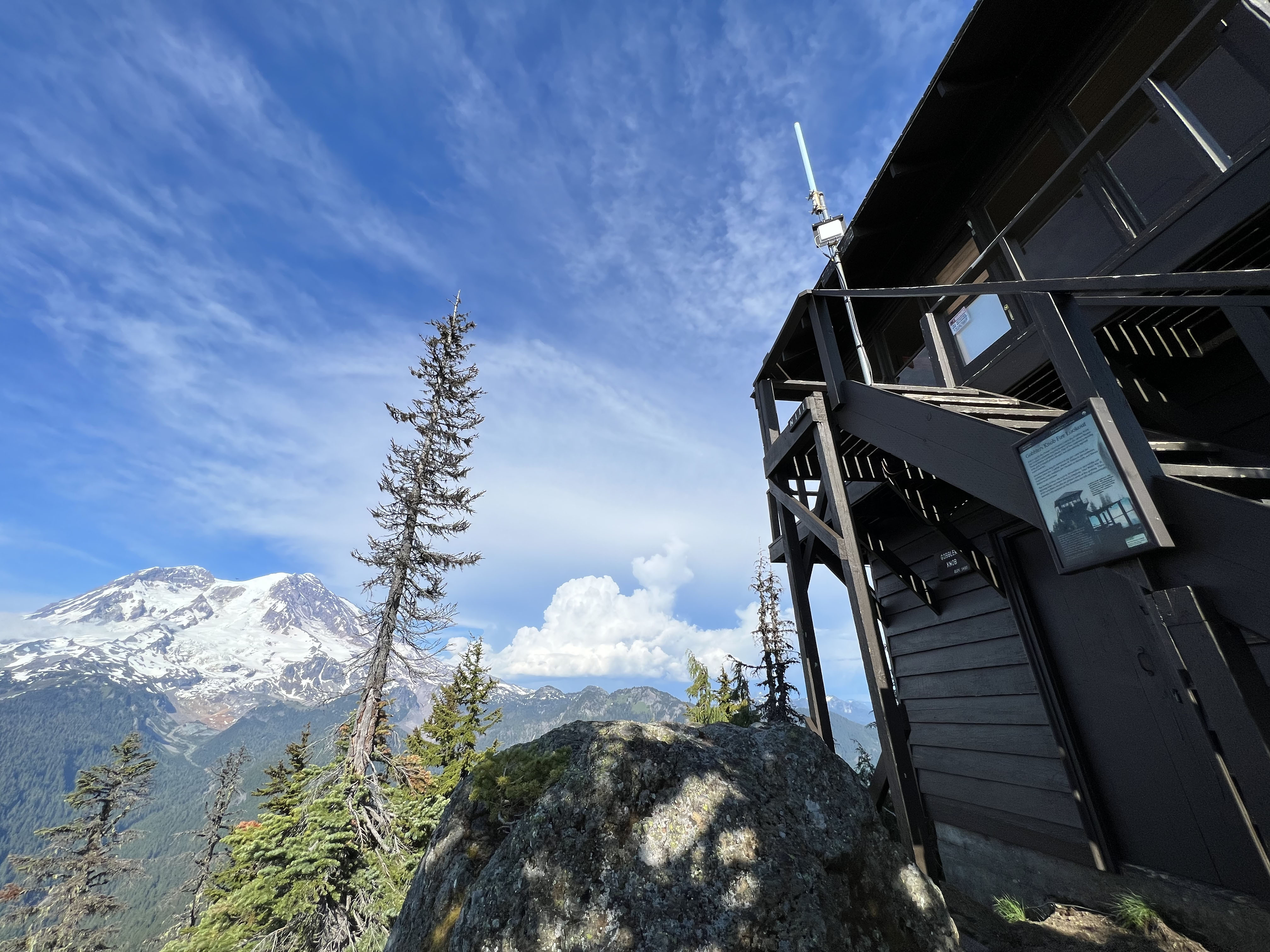
Gobblers Knob Fire Lookout, one of four historic fire lookouts in the park, sits on a rocky outcrop above Lake George near the Westside Road.
The Gobblers Knob Lookout is a two-story, dark brown wooden structure that features a 14 foot by 14 foot square room with attached roof and a set of stairs leading up to the catwalk, or wraparound porch. It is covered in large windows to offer a clear view of the surrounding mountains. It sits upon a rocky outcrop surrounded by trees and offers spectacular views of Mount Rainier and the Tahoma Glacier as well as the peaks of Mount St. Helens, Mount Hood, Mount Adams, and the Olympic Mountains. Visible through the glass inside the lookout in the middle of the room is an Osborn Fire Finder, a large 360 degree compass that allowed firefighters to pinpoint a lightning strike and determine the coordinates of a fire’s location. . It is elevated on a tall shelf in the center of the room. This device is surrounded by miscellaneous furniture and storage items.
Hike a less traveled trail and discover a cascading waterfall and a beautiful lake surrounded by tall trees.
The Green Lake Trailhead is located on the Carbon River Road. The Carbon River Road is an unpaved, unmaintained road that is closed to public vehicles. The trailhead is on the right side of the road. The road winds through an old-growth forest in the northwest corner of the park. At the trailhead, there is a sign saying "Green Lake Trailhead" and a bike rack for cyclist to lock their bikes to.
Explore the Grove of the Patriarchs and wander through trails boardwalks, bridges, and dirt paths while winding through centuries old trees.
The trailhead is located just off Stevens Canyon Road from 123. There is a small parking area for visitors. Restrooms are available here. The trail begins to the right of the restrooms, with a large trailhead sign. The trail itself is usually packed dirt with roots and rocks. The trail is wide in most areas. There is a suspension bridge across the Ohanapecosh River, leading to a loop trail on an island in the middle of the river. The trail from here is a mix of packed dirt and wooden boardwalks.
Located in the northwest corner of the park, the ranger station is staffed by rangers or volunteers. Building hours may vary so call ahead for hours 360-829-9639. When open, rangers and volunteers provide park information, wilderness camping, and climbing permits. Wilderness camping permits available by self-registration when closed.
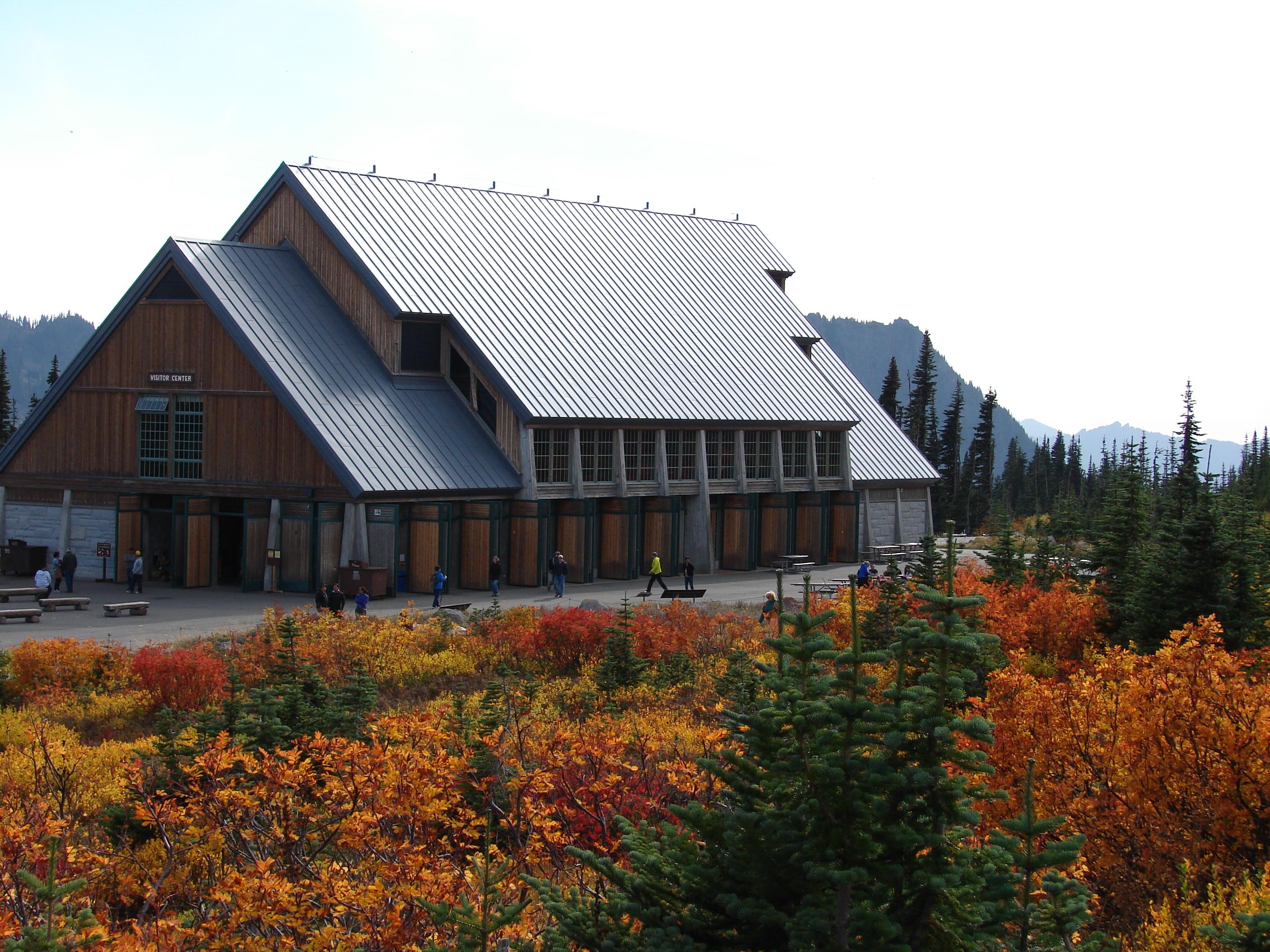
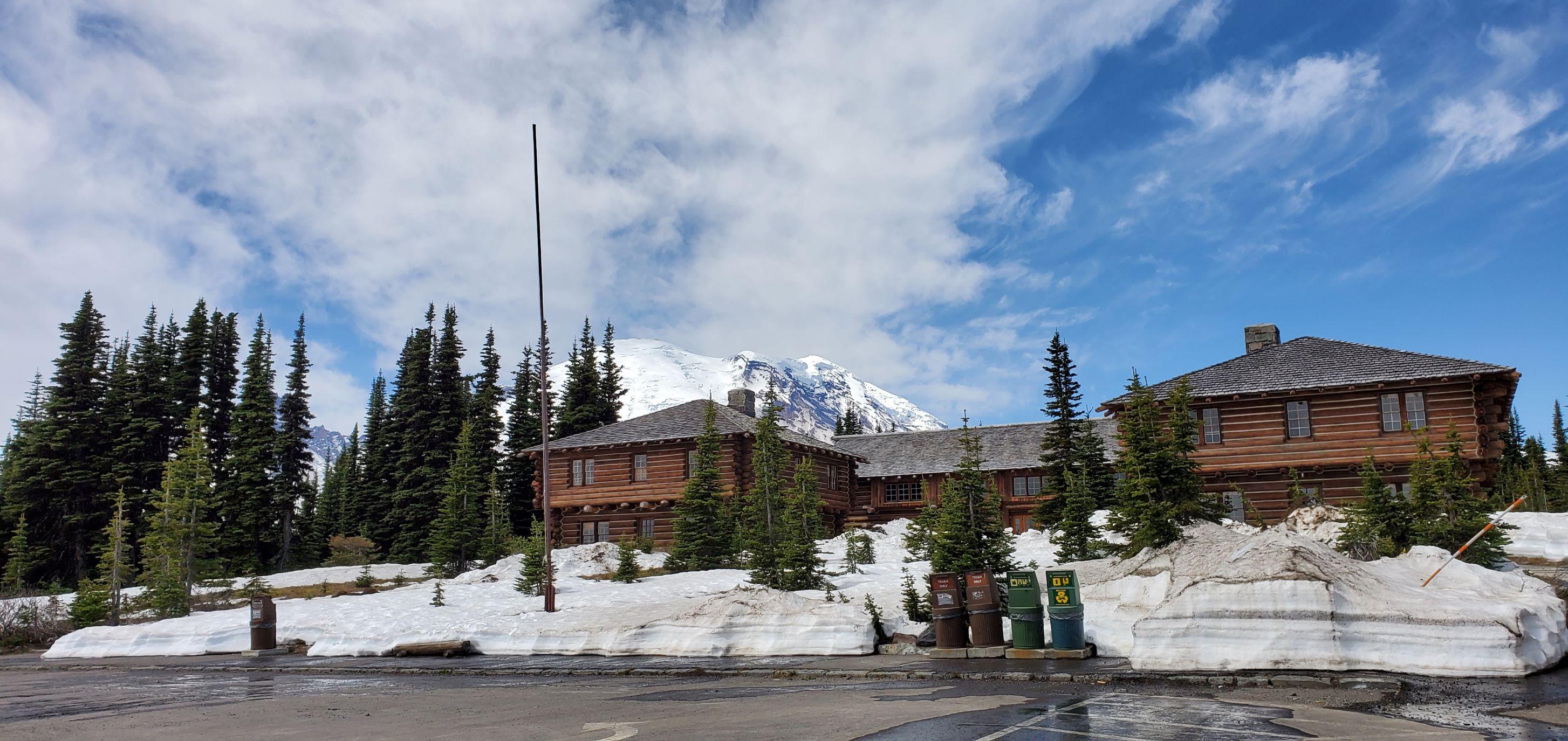
Located at Paradise, on the south side of Mount Rainier, the Jackson Visitor Center is open throughout the summer and with limited days and hours in the winter. Inside the visitor center are accessible restrooms, an information desk staffed by a ranger or volunteer, food services, gift shop, park movie, and exhibits about the plants, animals, and the volcano.
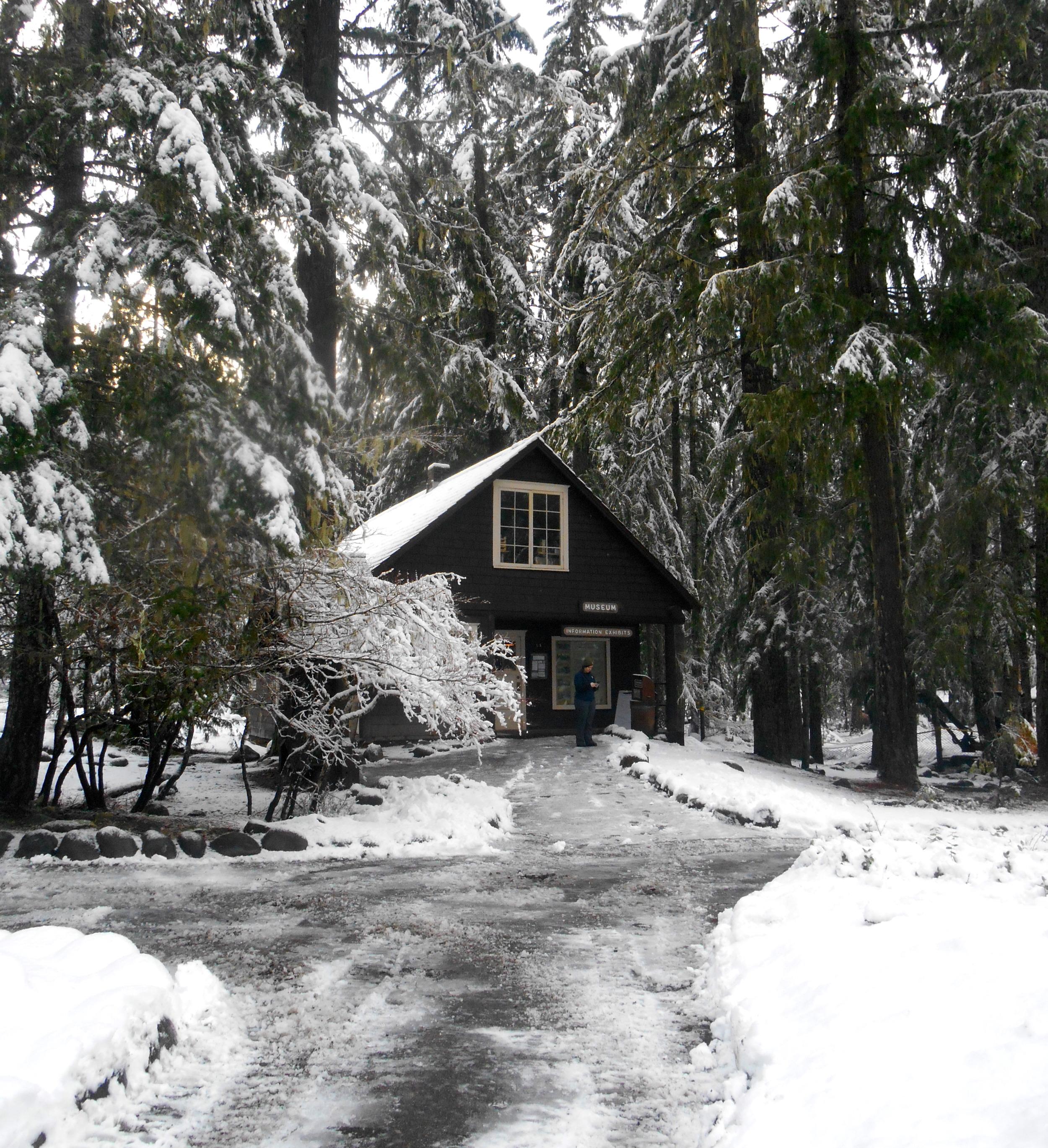
Located on the south side of Mount Rainier at 2,700 feet above sea level, the museum makes up part of the historic Longmire district. Once a ranger office, the building now houses historic exhibits about the park's natural and geological history, and animals. A ranger or volunteer staffs the museum to assist with park information and book and map sales.
Open during the summer, the Longmire Wilderness Information Center (WIC) is located in the lobby of the historic Longmire Administration Building, a picturesque example of National Park Service rustic architecture in Longmire. The WIC features a 3D model map of Mount Rainier National Park and has an information desk staffed by wilderness rangers. Rangers at the WIC assist with wilderness permits, trip planning, and providing maps and trail condition updates.
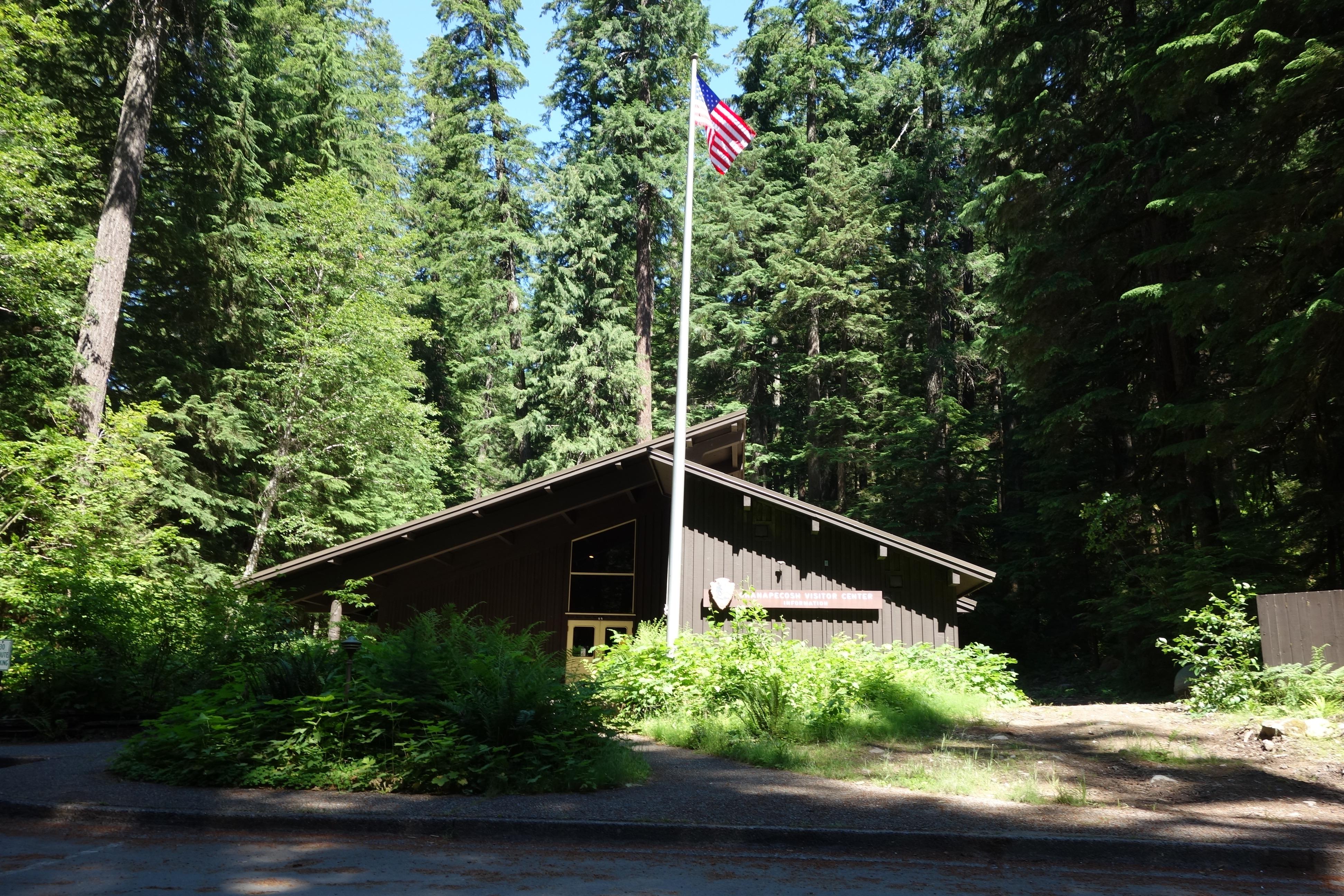
NOTE: The Ohanapecosh Visitor Center will be CLOSED for the summer of 2025 as part of the Ohanapecosh Campground rehabilitation project. This visitor center is located in the southeast corner of the park on State Route 123, 12 miles north of the town of Packwood. It is next to the Ohanapecosh Campground and near the trailhead for the Natural Hot Springs and Silver Falls. There are restrooms, exhibits, and a ranger or volunteer on duty to answer questions when it is open for the summer season.
Open during the summer, the Paradise Wilderness Information Center (WIC) is located in the main room of the historic Guide House. The WIC has an information desk staffed by wilderness rangers. Rangers at the WIC assist with wilderness permits, trip planning, and providing maps and trail condition updates.
Located on the northeast flank of Mount Rainier, this visitor center is at the end of the Sunrise Road, 15 miles after the turn off from State Route 410. Only open and accessible in summer, the Sunrise Visitor Center has exhibits, books and maps for sale, and rangers and volunteers on duty to answer questions. Restrooms, gift shop, and food services are located nearby during the summer season.
Open during the summer, the White River Wilderness Information Center (WIC) located at the Winter River Entrance. The WIC has an information desk staffed by wilderness rangers. Rangers at the WIC assist with wilderness permits, trip planning, and providing maps and trail condition updates.
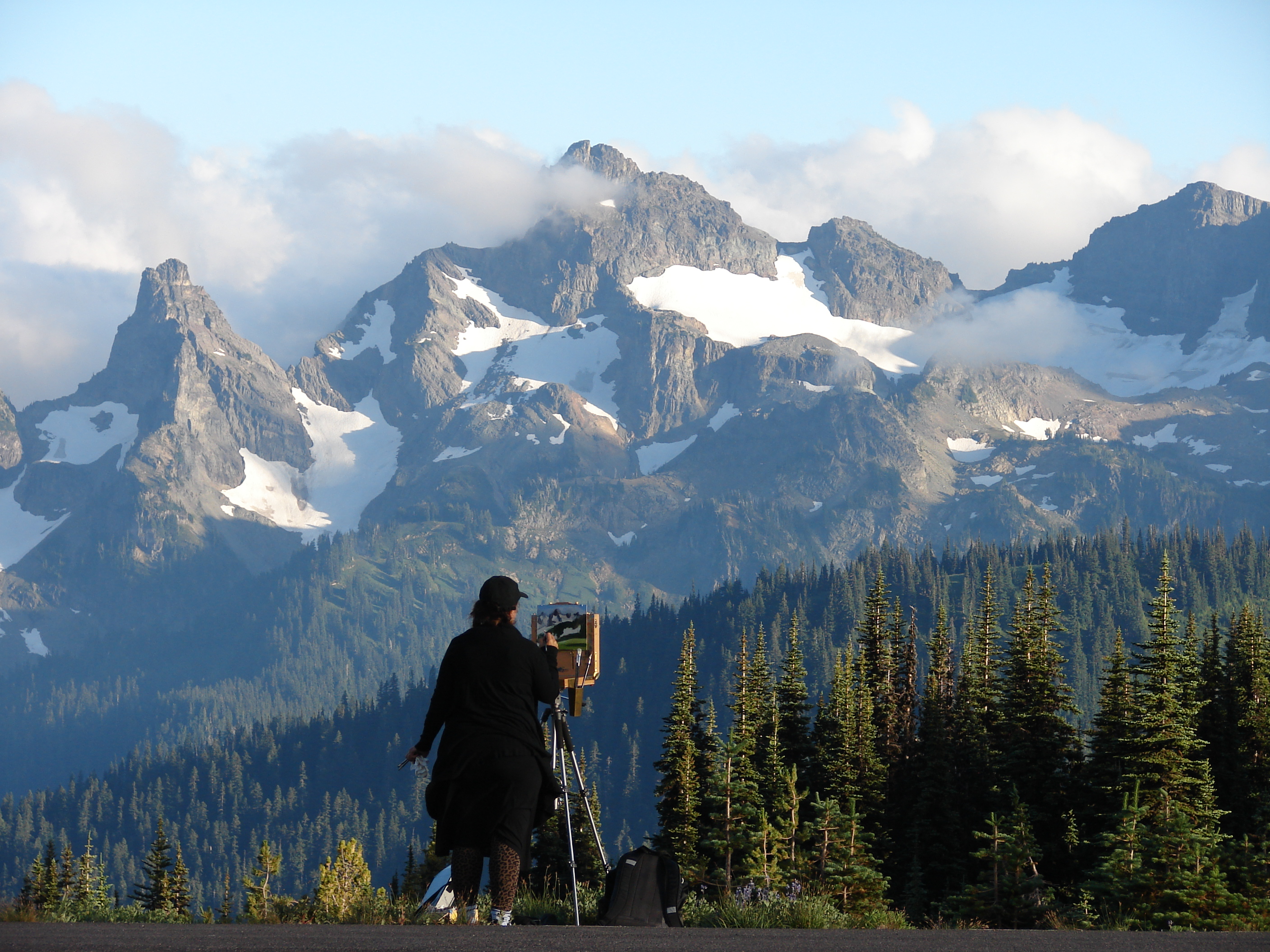
Try en plein air painting at Mount Rainier National Park
With just a little planning you can create art anywhere. Take time to really experience your favorite viewpoint by painting a picture in the park.
Full Moon Hikes at Mount Rainier
Trail options and safety tips when hiking under a full moon at Longmire, Paradise, and Box Canyon at Mount Rainier National Park.
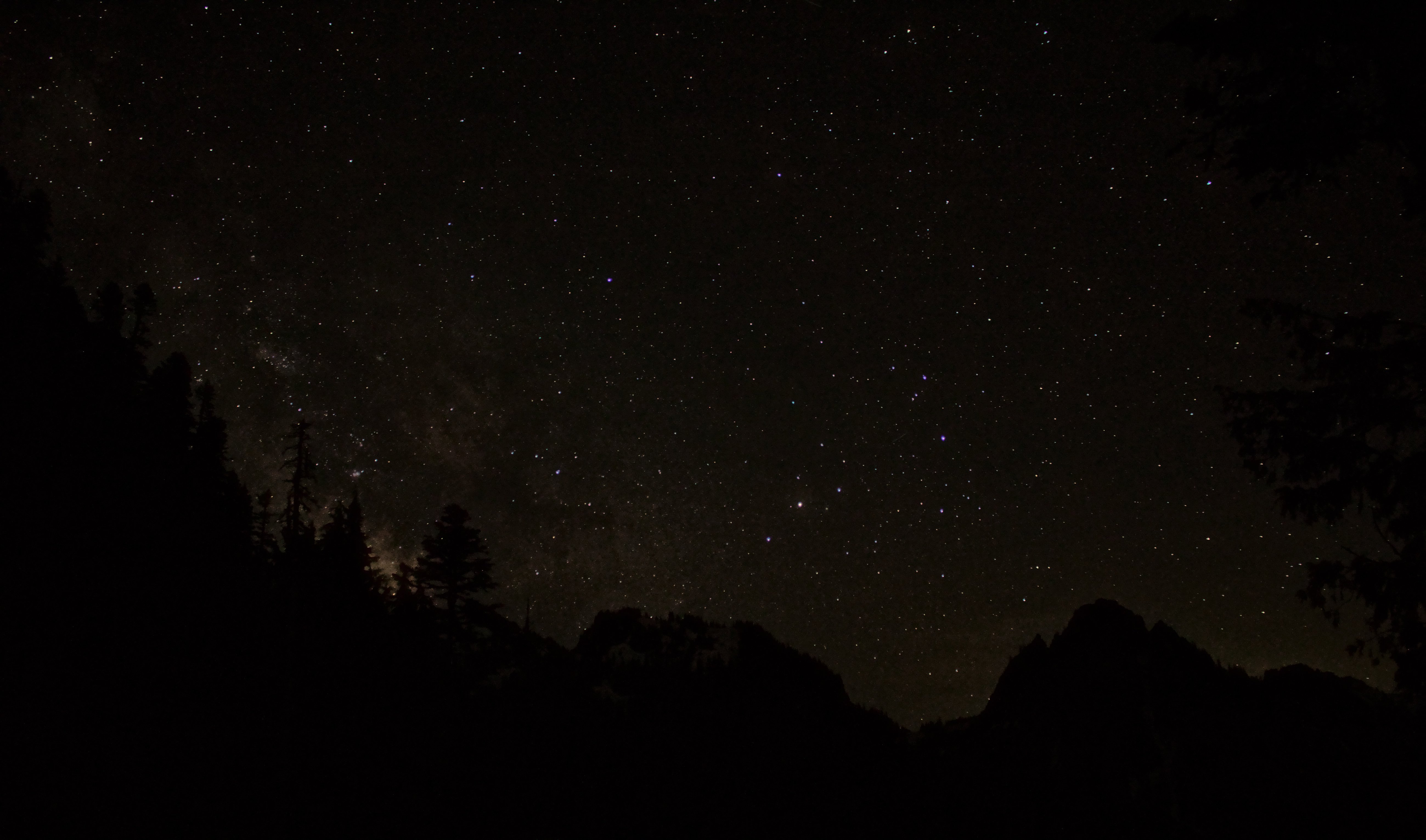
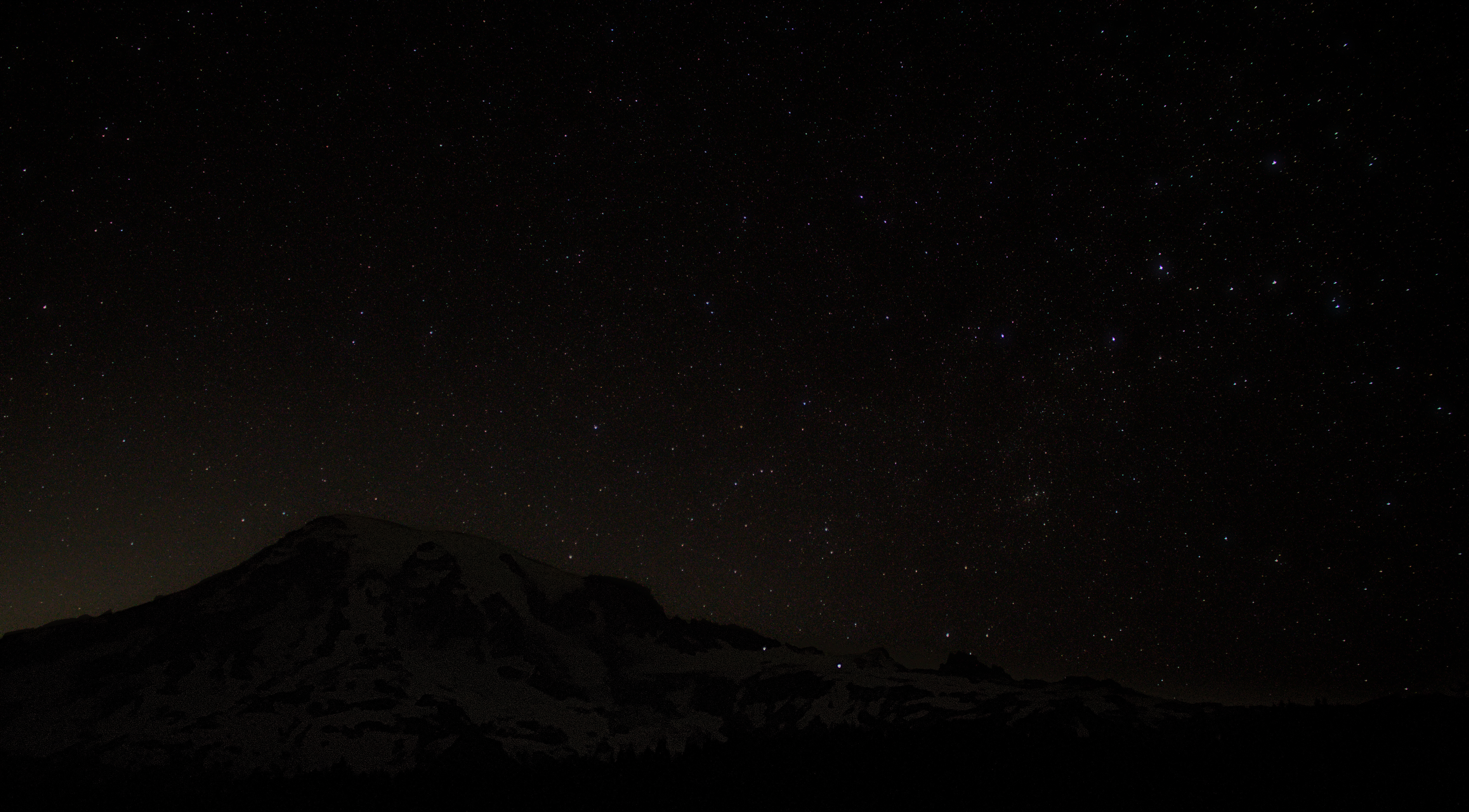
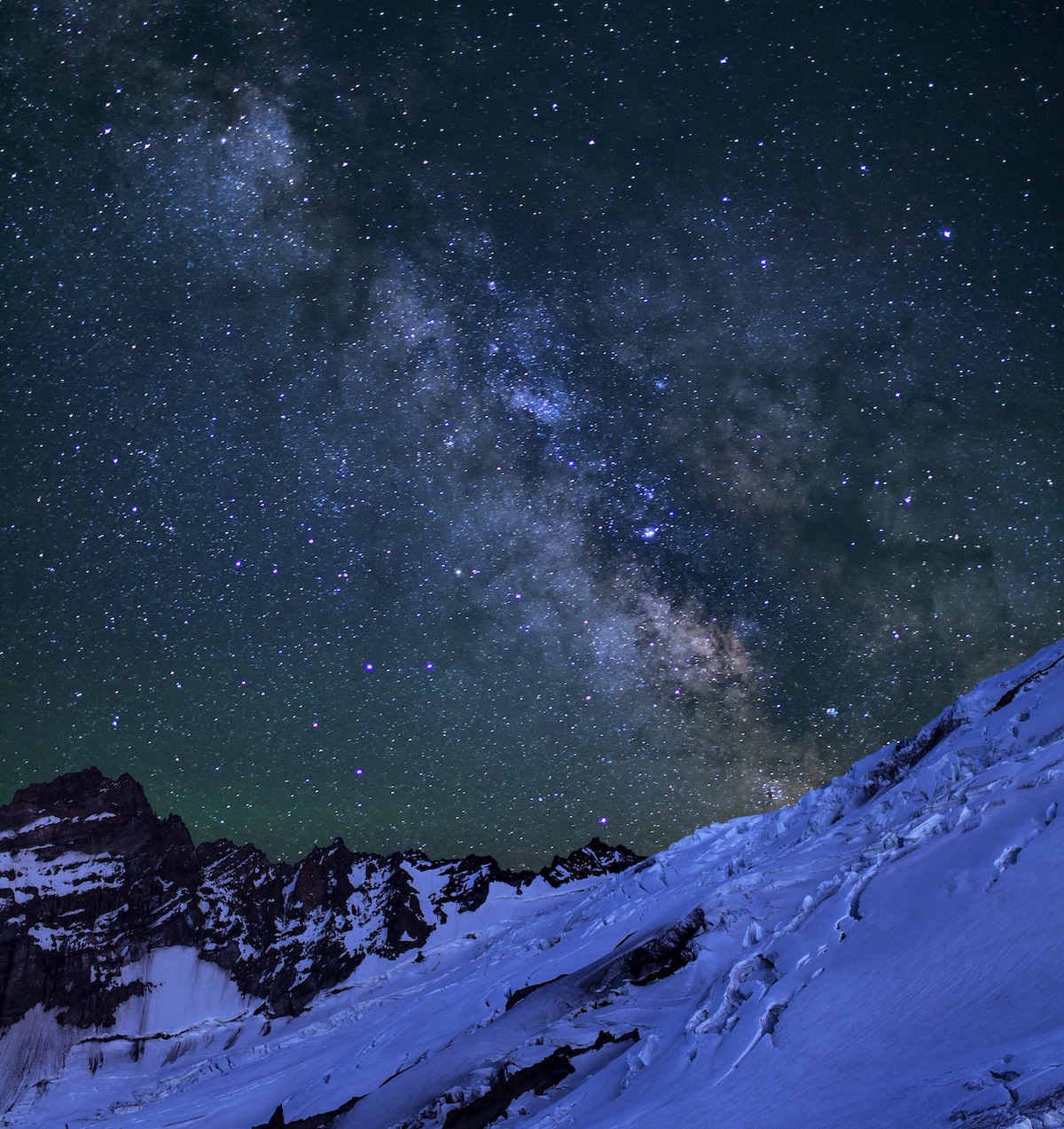
Stargazing in Paradise & Stevens Canyon
Learn how to safely star gaze in the Paradise and Stevens Canyon Road areas of Mount Rainier National Park.
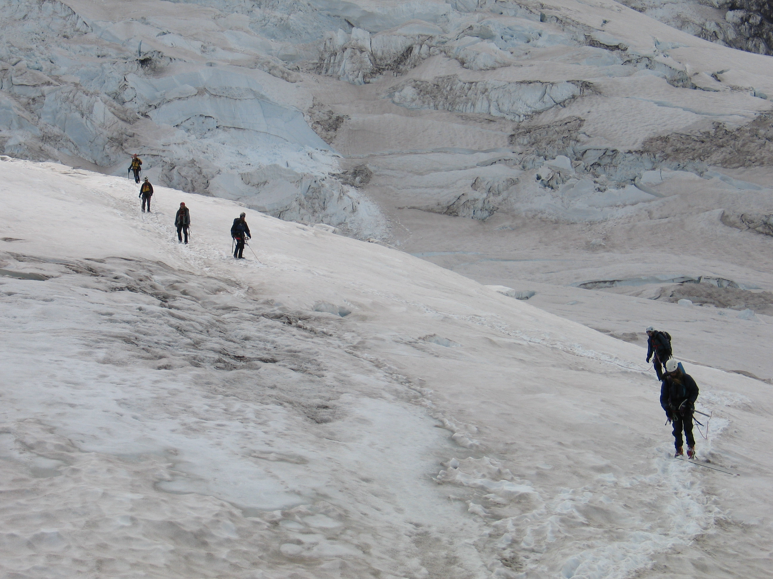
Climbing Mount Rainier
Mount Rainier, the most heavily glaciated peak in the contiguous United States, offers an exciting challenge to the mountaineer. Climbers must be in excellent physical condition and well prepared. Learn more about the requirements for climbing Mount Rainier.
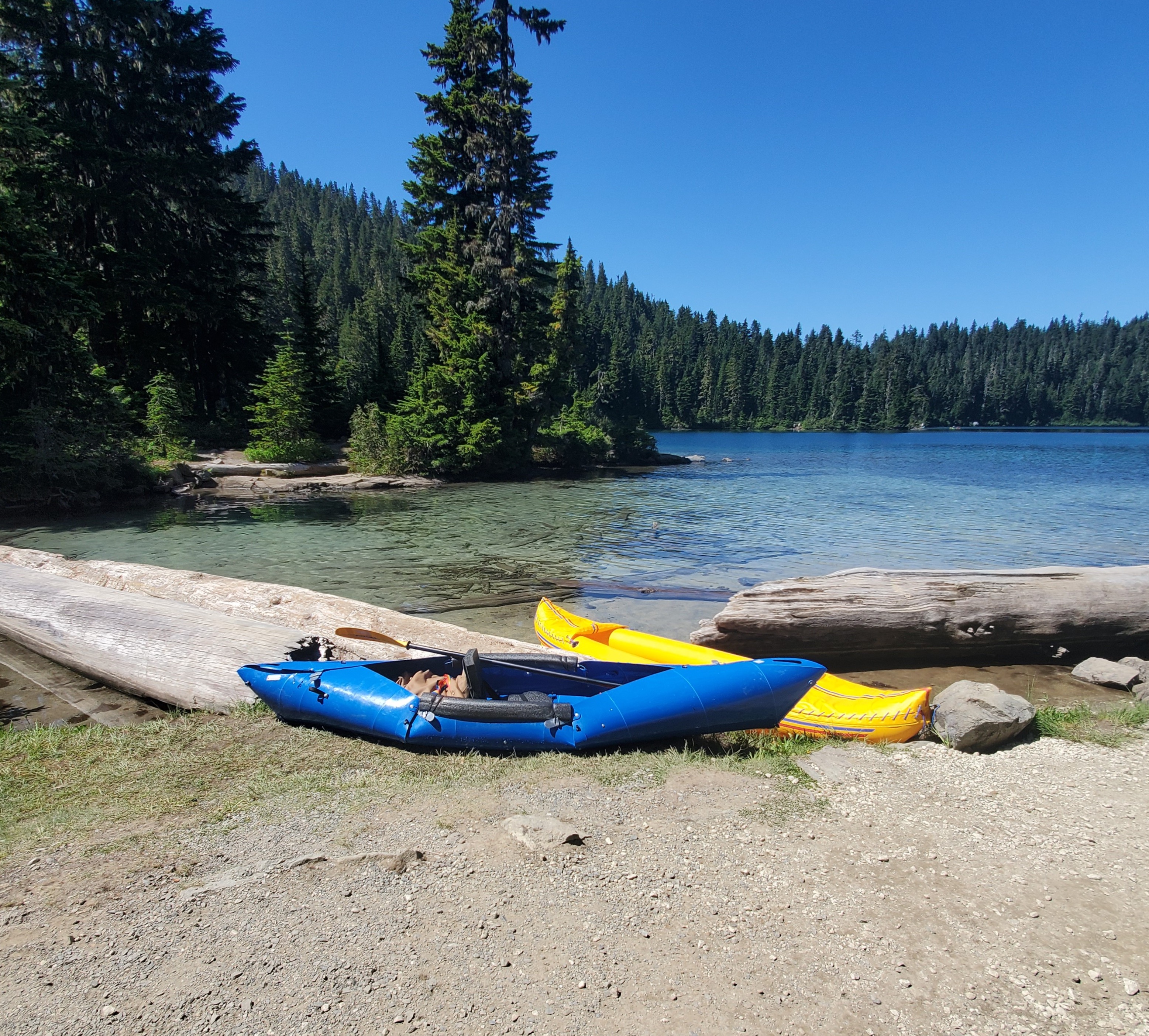
Paddle Sports at Mowich Lake
Paddle sports offer a unique opportunity to get out on the water and experience wilderness lakes that are scattered across Mount Rainier National Park. Mowich Lake is the largest lake in the park and is one of the easiest to access, though still challenging.
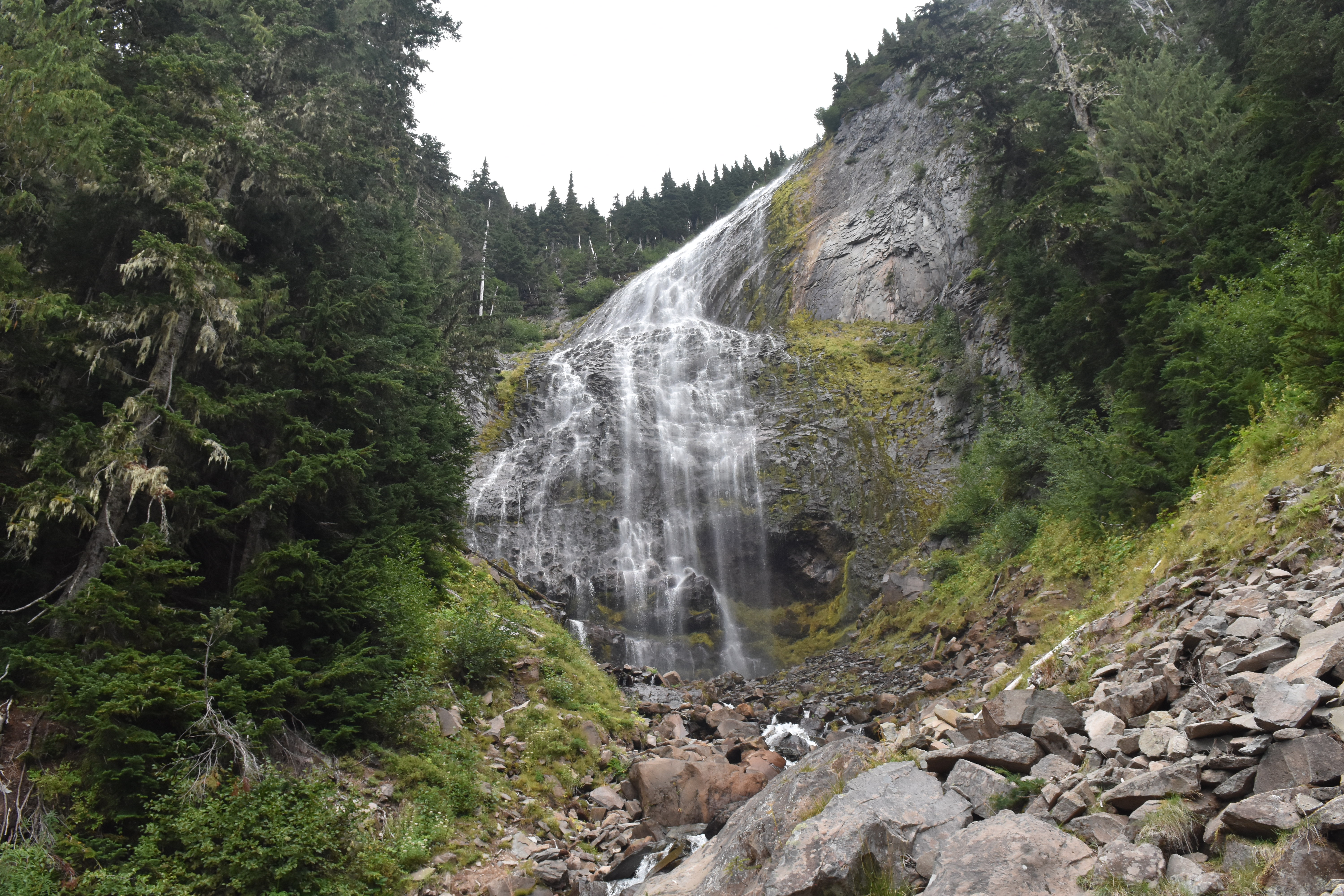
Hike to Spray Falls
Enjoy a short hike from Mowich Lake to a large cascading waterfall fed by a glacier.
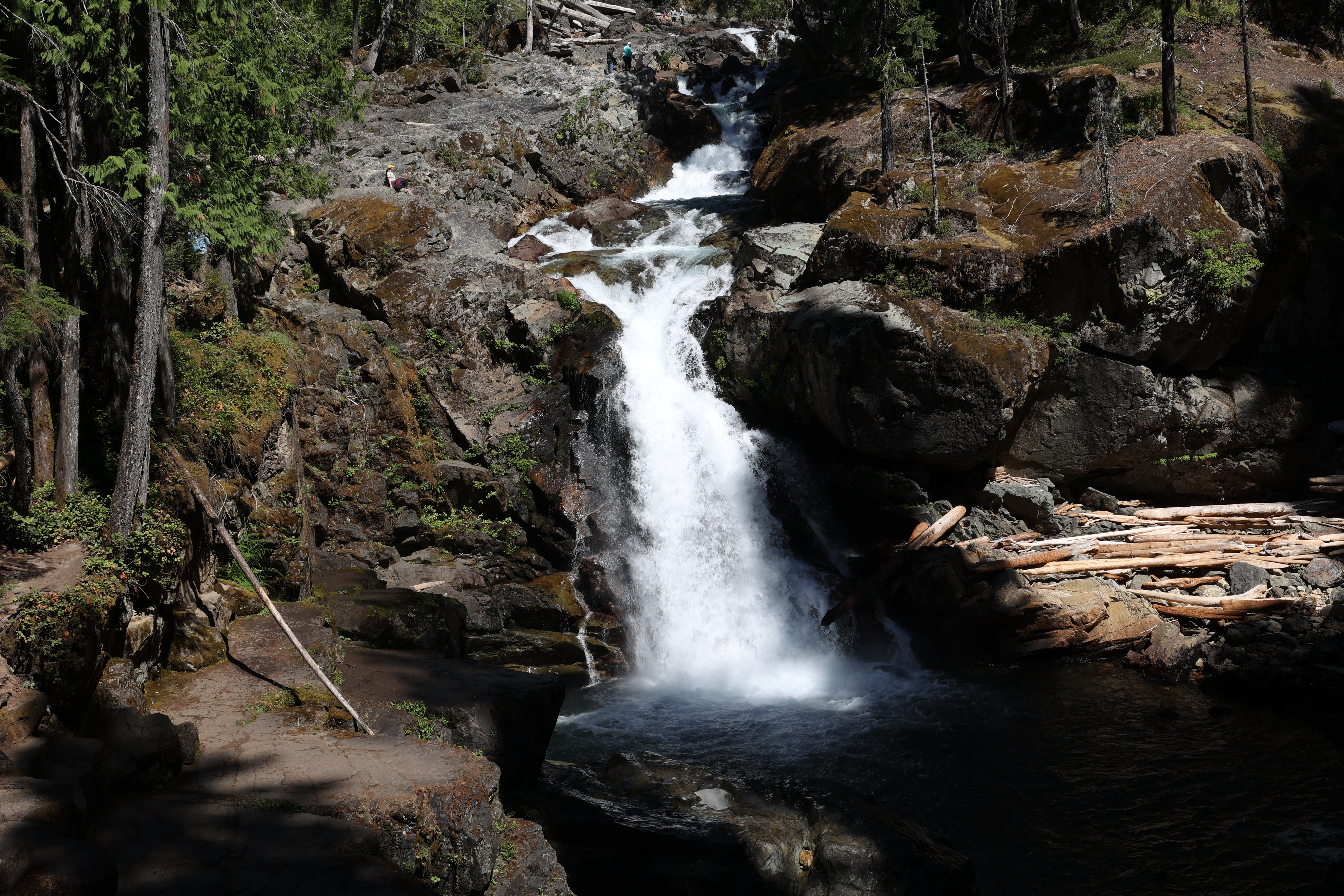
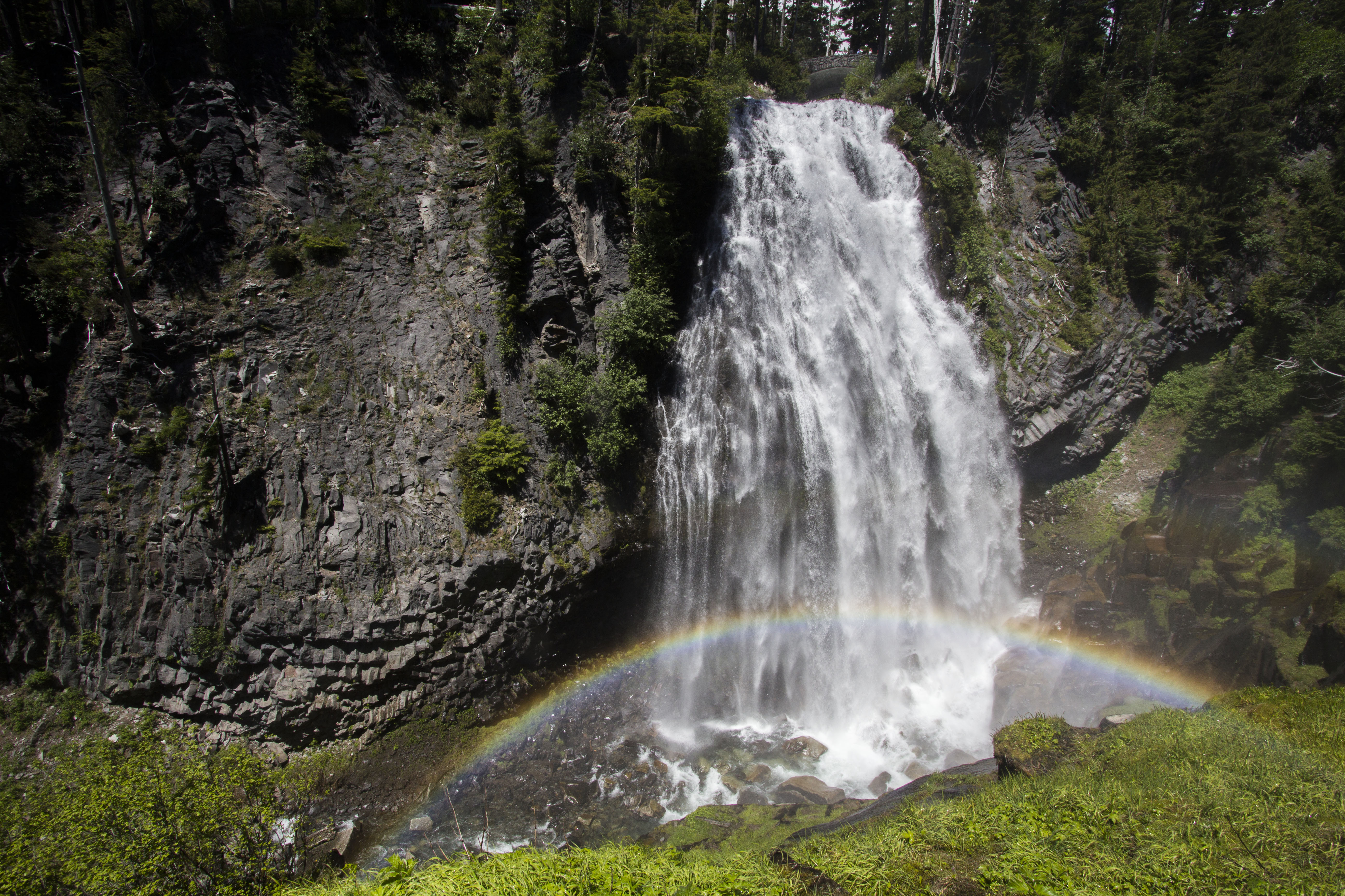
Hike to Silver Falls
Enjoy a moderate, family-friendly loop hike through the forest to a beautiful waterfall along the Ohanapecosh River.
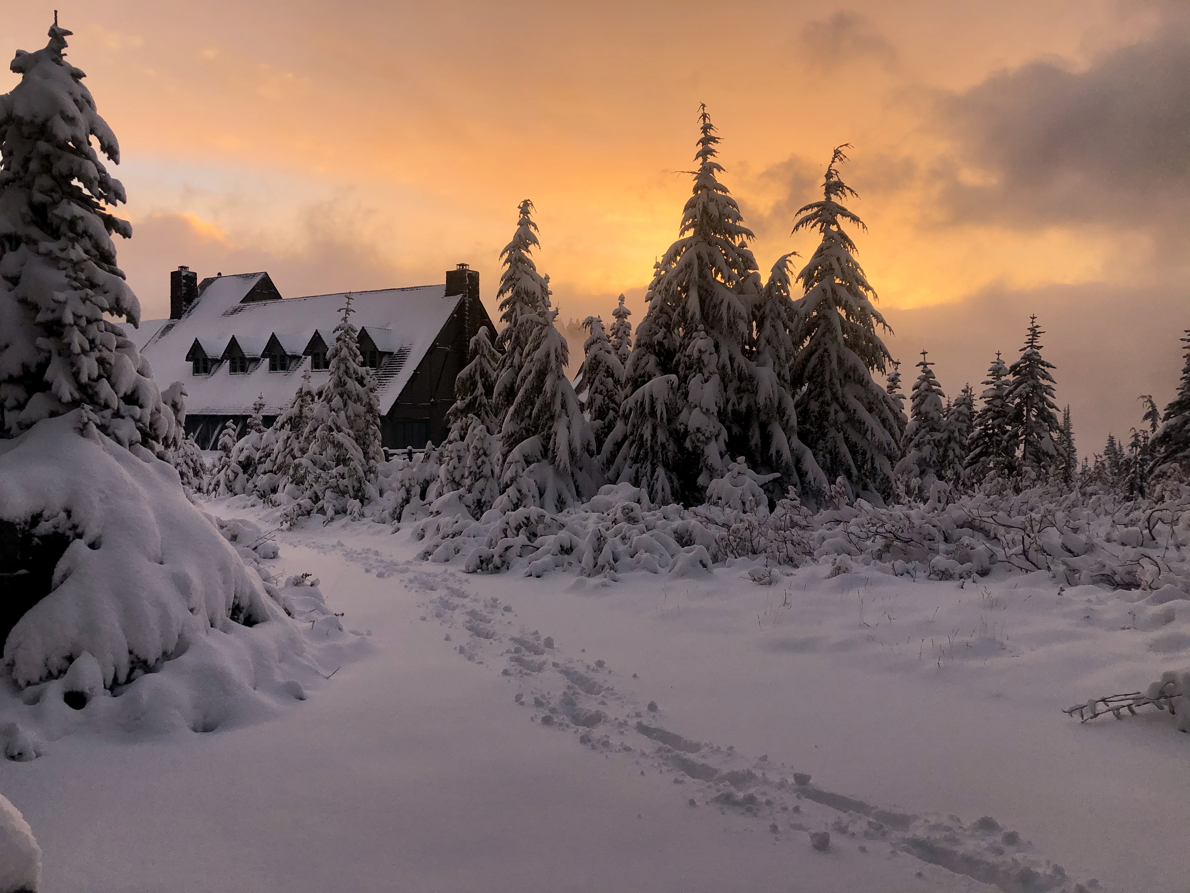
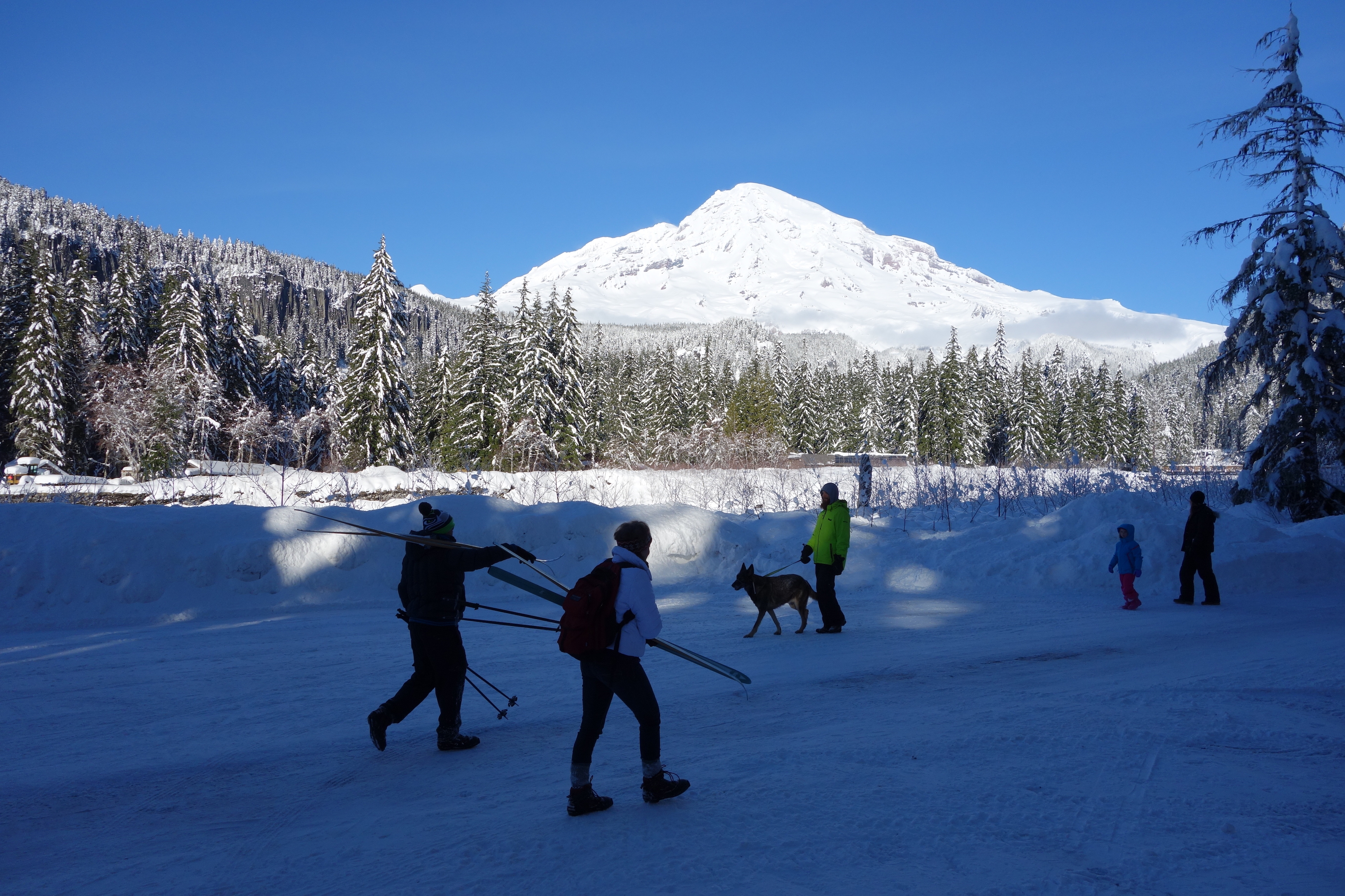
Enjoy a Winter Wonderland at Paradise
Winter brings into focus a frosty view of the mountain. An abundance of snow creates a winter recreation paradise, but also brings the challenges of icy, snowy roads. The road to Paradise is plowed, when possible, to allow access. Spend hours at Paradise or add a stop in Longmire to make a full day of winter fun.
Explore Waterfalls from Longmire to Paradise
This tour is a great opportunity to see four of Mount Rainier's stunning waterfalls between Longmire and Paradise without taking on any long or strenuous trails.
Hike to Shriner Peak Fire Lookout
Embark on a strenuous hike up to a historic fire lookout with adjacent backcountry camping sites and enjoy views of Mount Rainier and the surrounding valley.
Hike Rampart Ridge
This loop trail explores the forest around Longmire, with glimpses of Mount Rainier and the Nisqually River Valley.
Hike to Gobblers Knob Fire Lookout
Hike to the historic Gobblers Knob Fire Lookout perched on a rocky outcrop above Lake George.
Hike to Bench and Snow Lakes
Enjoy a short hike to picturesque Bench and Snow Lakes with views of Mount Rainier and the Tatoosh Range.
Hike to Burroughs Mountain
Hike the Burroughs Mountain Trail for outstanding mountain views and to visit the most accessible tundra in the Cascade Range.
Beginner's Guide to Snowshoeing
Mount Rainier National Park is a great place for beginner and experienced snowshoers to explore the winter landscape.
Day Hiking at Mount Rainier National Park
Looking for easy and enjoyable trails that the whole family can experience together? Consider the following trails in the Longmire, Paradise, Ohanapecosh, Sunrise, and Carbon River/Mowich areas of Mount Rainier National Park. These day hikes range from short strolls to longer trails through the wilderness.
Hike Emmons Moraine Trail
Enjoy a short hike from the White River Campground through the forest to a view of the Emmons Glacier and a beautiful turquoise lake colored by glacial silt.
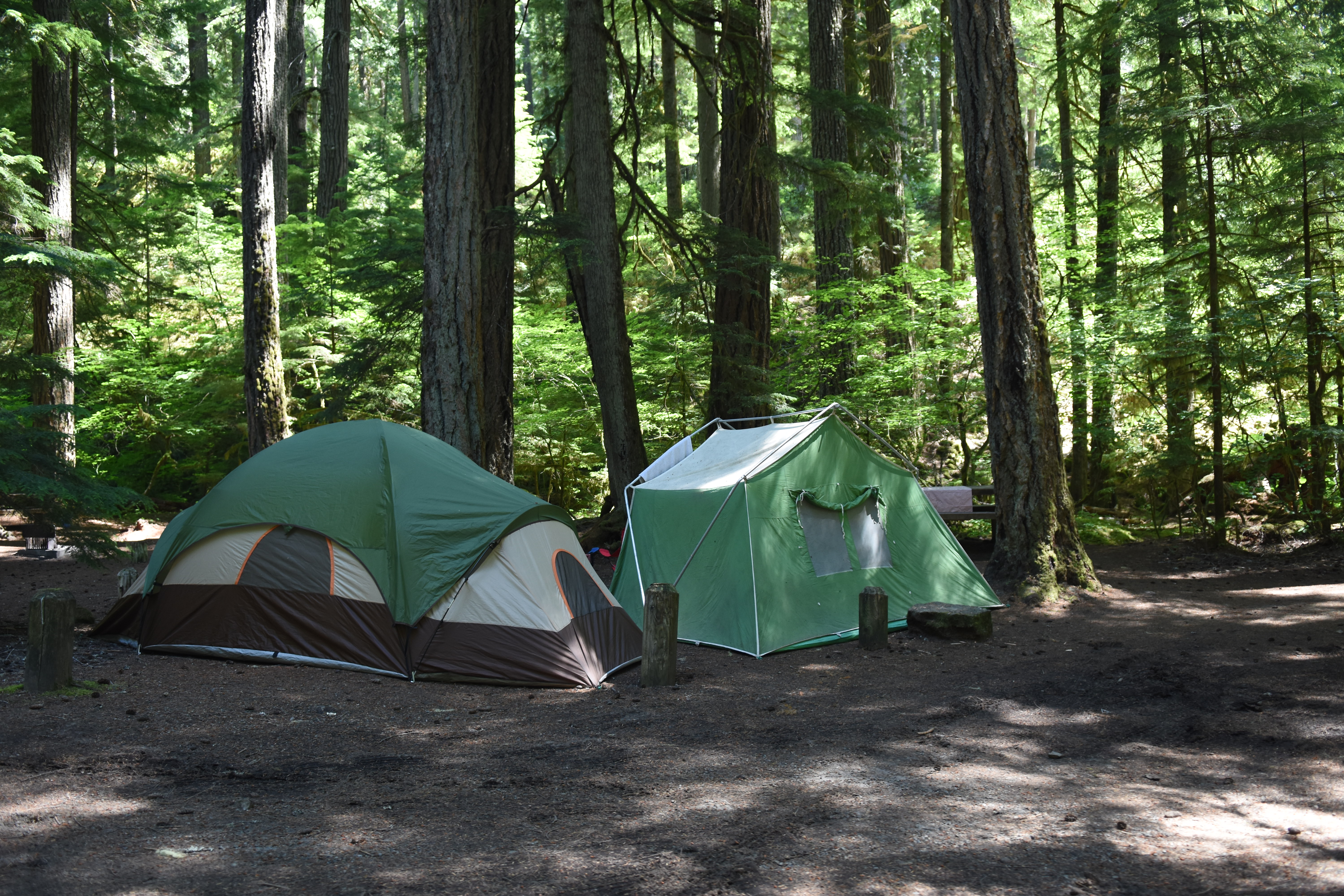
Camping at Mount Rainier
Enjoy an extended, relaxing visit to Mount Rainier in one of the park's campgrounds.
Explore Tipsoo Lake
Interested in exploring Tipsoo Lake but don't know what to do? This list should help you find the right activity.
Hike Nisqually Vista Trail
The easy Nisqually Vista trail offers stunning year-round views of Mount Rainier, the Nisqually Glacier, and the Tatoosh mountain range as well as seasonal delights, such as summer wildflowers and fall foliage.
Visit the 10th Mountain Division Memorial
Take a short walk up the Skyline Trail to visit the 10th Mountain Division Memorial which honors the U.S. Army Troops who trained at Paradise during World War II.
Star Gazing at Sunrise
Come explore the parks after dark! Star gazing is a great way to end a long day of hiking and exploring the park. The Sunrise area is a perfect spot for star gazing. There are several ways to view the stars at sunrise from staying in the parking lot to hiking on trails. There is something for everyone.
Longmire Historic District Walking Tour
At Mount Rainier, designers selected massive logs and glacial boulders as the building materials best suited for integrating new structures with their natural settings. This style of architecture, known as "National Park Service Rustic", can be seen throughout the Longmire District on this walking tour.
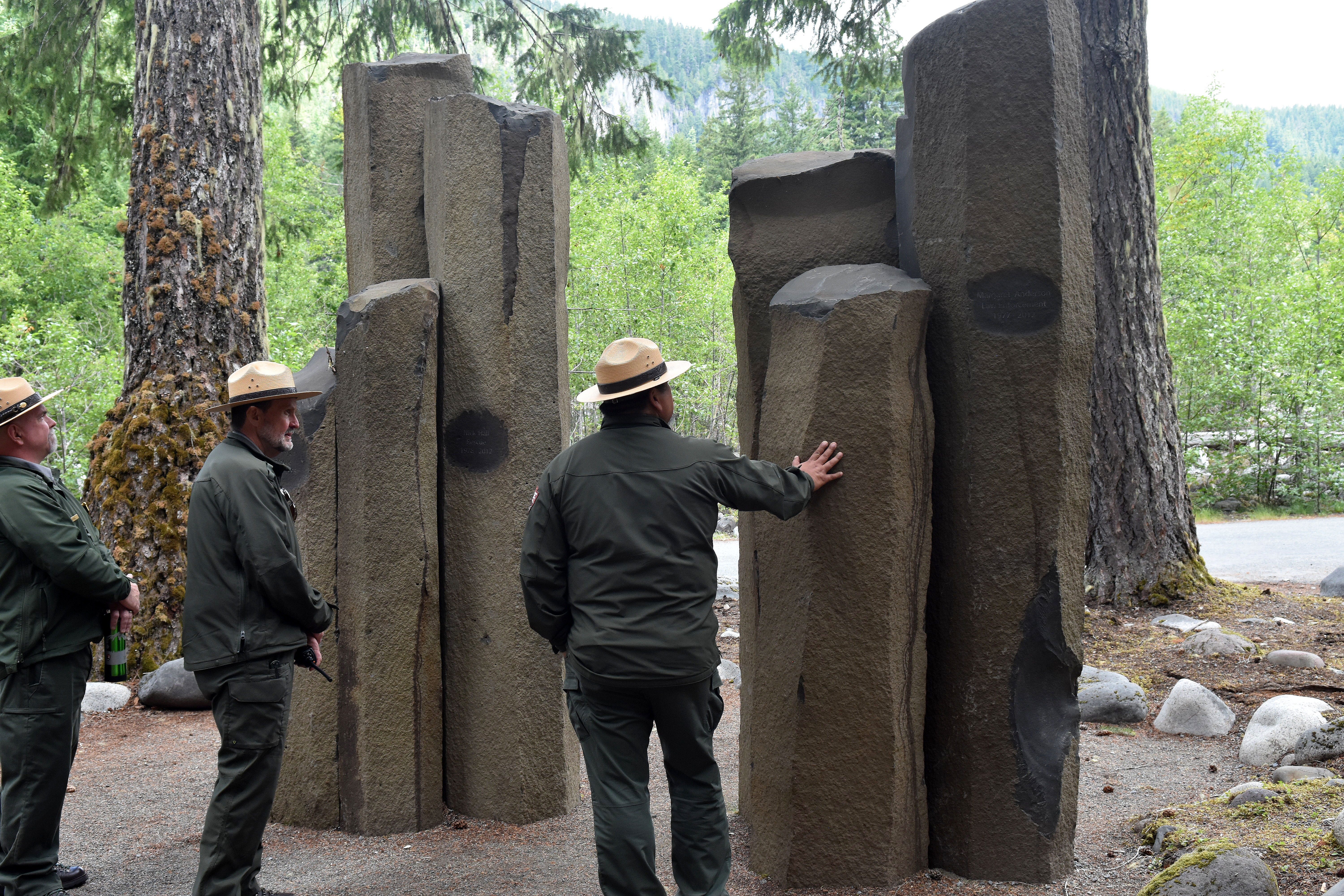
Visit the Valor Memorial at Longmire
Visit the Valor Memorial at Longmire to honor the Mount Rainier National Park Rangers who made the ultimate sacrifice.
Hike and Bike Westside Road in Mount Rainier
Hike or bike Westside Road through a dynamic landscape that is evidence of outburst floods that closed this portion of road to public vehicle traffic. Hike the trails that lead off this road lead to meadows, views of glaciers, and historic patrol cabins.
Explore Carbon River in the Winter
Discover Carbon River, in the beautiful northwest corner of Mount Rainier National Park, where you can hike, bike, or snowshoe during the winter.
Explore Longmire in Winter
Make a day of it by visiting in Longmire in winter. Hike or snowshoe through the forest with views of Mount Rainier and bubbling mineral springs. Explore the Longmire Historic District and warm up with a hot meal in the National Park Inn.
Tree Scavenger Hunt in the Ohanapecosh Campground
Go on an adventure and try to identify the three most commonly abundant trees that surround the entire Ohanapecosh area.
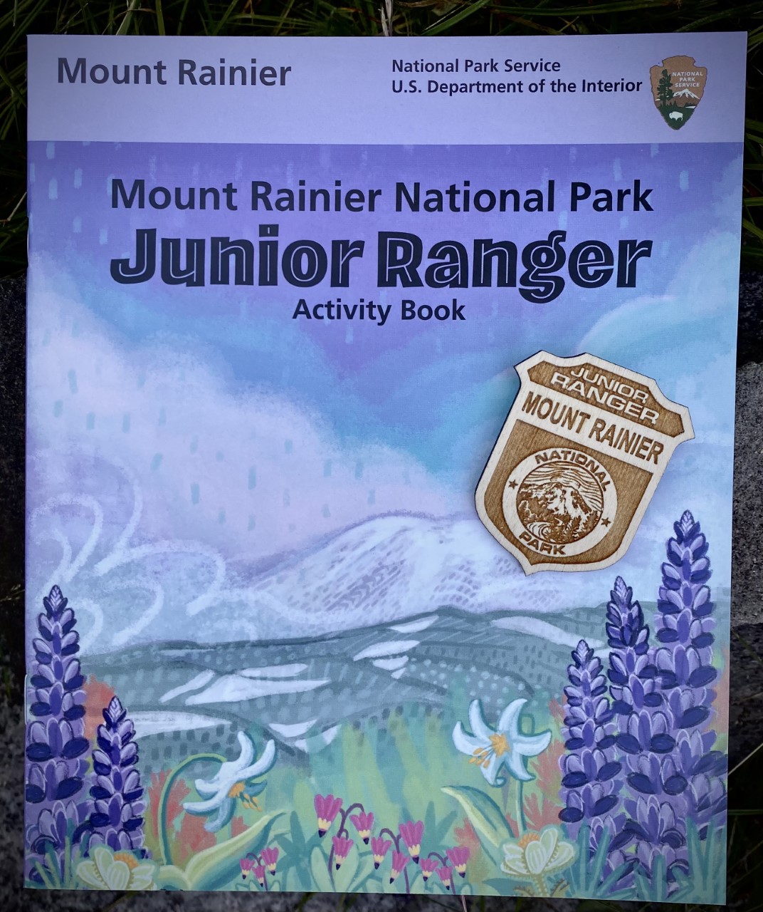
Complete a Mount Rainier Junior Ranger Booklet
Complete a Junior Ranger booklet and collect a Mount Rainier Junior Ranger badge. Learn more about the plants and animals of the park and how Mount Rainier was formed.
A Half-Day in Paradise
With just 4 hours, visitors can enjoy glacier views, blooming wildflowers, and rich cultural history at the most popular subalpine meadow in the park!
Kid-Friendly Hikes at Mount Rainier
Looking for kid friendly hikes to do while visiting Mount Rainier? This list should help you find the right hike for your group depending on where you are in the park.
Family-Friendly Paradise Activities
Whether you’re pushing a stroller or traveling with grandparents, Paradise offers activities the whole family can enjoy together.
Spring Recreation
Spring comes slowly to the mountain. While wildflowers bloom along city streets, the snow at Paradise may be higher than your head! Planning your spring trip to the mountain in advance is key to a safe and enjoyable visit.
Ohanapecosh Area Activities
Enjoy all that the Ohanapecosh area has to offer with these four activities.
Photograph Wildflowers in the Subalpine Meadows
Photographers of all skill levels can enjoy photographing the Mount Rainier wildflowers. Follow these simple tips and tricks to optimize your photoshoot in the park.
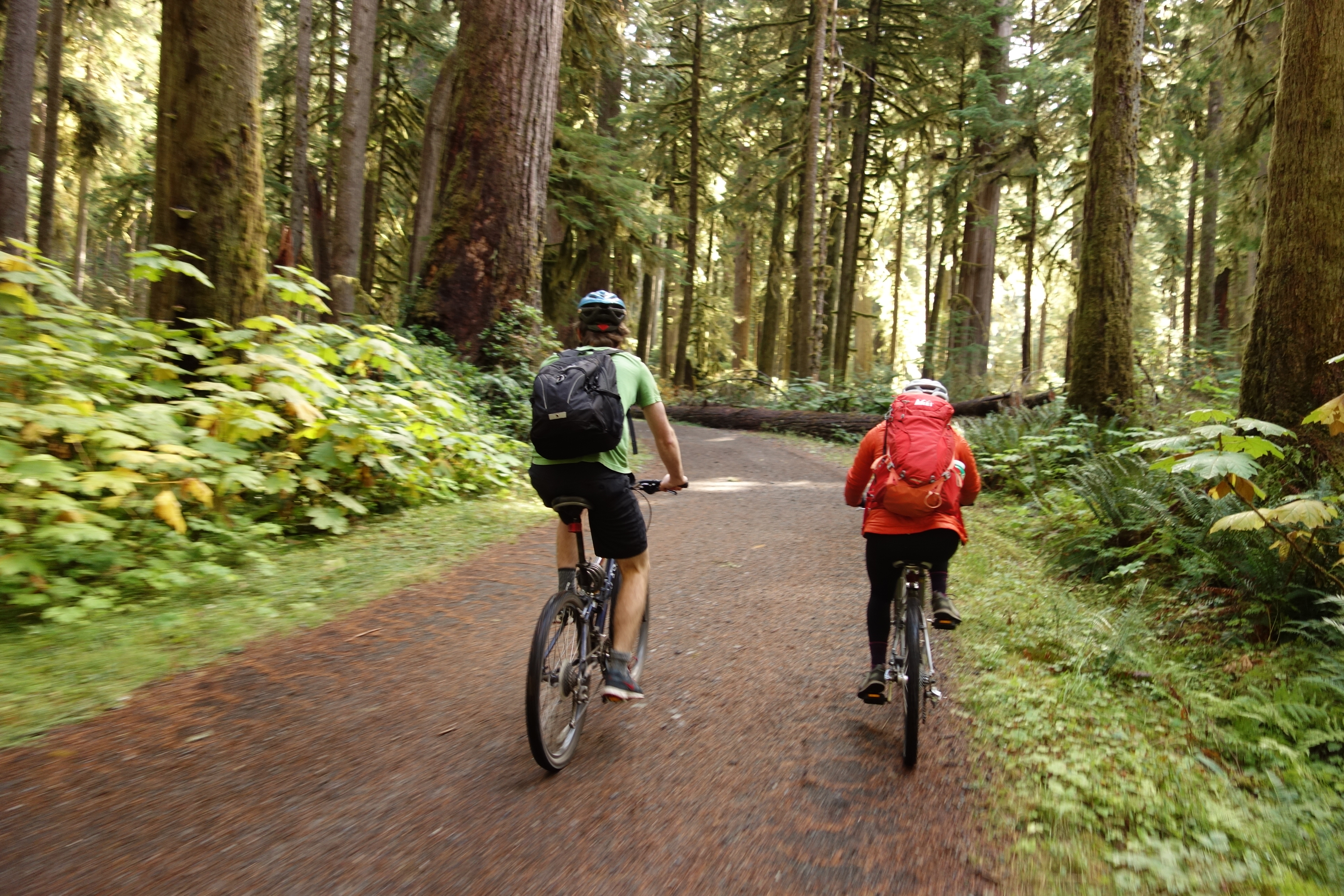
Bicycling at Mount Rainier National Park
Bicycling at Mount Rainier National Park is both scenic and challenging. Bicycles are allowed on park roads but they are not permitted on any hiking trails.
Wilderness Camping at Mount Rainier National Park
With 97% of the park designated wilderness, backpacking and wilderness camping is one of the best ways to experience Mount Rainier National Park.
Cloudy Day Activities at Mount Rainier
Everyone loves beautiful days when Mount Rainier is visible and the skies are blue! However, sometimes the weather does not cooperate. There is still so much to appreciate on days when the clouds roll in. Enjoy this list of park ranger favorites for days when the mountain isn’t out!
A Day In Sunrise
If you are looking for great views of Mount Rainier, stunning wildflower meadows, interesting history, or a chance to see wildlife, look no further than Sunrise! Use this guide to help plan your day in Sunrise and explore all this part of Mount Rainier National Park has to offer.
The Cougar Rock Campground Experience
If you are wondering exactly what you could do at Cougar Rock Campground aside from sleep, then we've got you covered. Here are some activities that you can do while staying at Cougar Rock Campground.
Discover Wildflowers
Mount Rainier is famous for its wildflowers, but blooming season is short and varies with elevation. Discover the best times to visit to view wildflowers.
Mount Rainier: Off the Beaten Path
Mount Rainier National Park is substantial in size, but congestion still occurs during peak season and during times of nice weather. Escaping the crowds completely can be a challenge, but there are ways to still plan a rewarding visit. This guide provides alternatives to popular locations like Paradise and Sunrise. However, the secret is out! Even relatively less popular areas can still be busy.
Road Trip Around the Mountain
Even if you never step foot outside your vehicle, a drive through Mount Rainier National Park can be a rewarding experience. This road trip experience follows the historic design of the park from Nisqually Entrance to Paradise and then connects to the east side and Sunrise.
A Day In Paradise
The Paradise area of Mount Rainier National Park has it all—history, hiking, wildflowers, and wildlife viewing opportunities, and more! Use this guide to help you decide what to do on your day in Paradise.
A Day In Longmire
Plan a day in Longmire, whether you are looking for mountain views, historic architecture, or hiking trails for all abilities.
Fishing at Mount Rainier National Park
Mount Rainier is not known for fishing, but many lakes were historically stocked with non-native fish. Anglers can play an important role in protecting native fish populations by following fishing regulations and reducing numbers of non-native fish.
Northeast Area: Remote Winter Recreation
Enjoy winter camping, snowshoeing, cross-country skiing, and snowmobiling in this less-visited area in the northeast of the park.
Tours
Count: 10
Glaciers of Mount Rainier
Mount Rainier is the most glaciated peak in the contiguous United States with 28 named glaciers, plus numerous unnamed snowfields. Learn more about the major glaciers in this virtual tour, starting in clockwise order around the mountain with Carbon Glacier in the north.
Historic Patrol Cabins and Shelters
Prior to 1920, there were very few shelters for backcountry rangers and hikers. In 1919-20, Superintendent Roger W. Toll reported the need for backcountry shelters to be placed ten to fifteen miles apart along the Wonderland Trail. Toll's system evolved into the construction of both patrol cabins and trail shelters under Superintendent O.A. Tomlinson's administration (1923-41).
Journey to Paradise
Enter the Nisqually Entrance in the southwest corner of Mount Rainier National Park and begin the journey to Paradise. Drive along a historic winding road through old-growth forest with glimpses of Mount Rainier. Stretch your legs by walking short nature trails and viewing waterfalls. Visit Longmire, the park’s first settlement, before concluding your tour in the subalpine meadows of the Paradise area. While Paradise is open year-round, in winter the road past Longmire closes nightly.
Longmire Historic District Walking Tour
This walking tour is an easy and approachable introduction to the historic structures of Mount Rainier National Park. At Mount Rainier, designers selected massive logs and glacial boulders as the building materials best suited for integrating new structures with their natural settings. Known as National Park Service Rustic architecture, this impressive architectural style contributes to the special sense-of-place quality which makes national parks a distinctive part of the American landscape.
Mount Rainier Waterfalls
This waterfall guide provides an overview of Mount Rainier's waterfalls that can be viewed from park roads or trails.
Nisqually Vista Nature Tour
Season: Summer The Nisqually Vista Nature Trail is open year-round and is a popular snowshoeing route in winter, but this self-guided tour is designed for the summer season when the trail is snow-free. In spring and fall, there may be patches of snow covering sections of trail. Please stay on trails, even if it means crossing snow, to avoid trampling delicate meadow plants. The Nisqually Vista Nature Trail provides an opportunity to learn about some of the forces that have shaped the Paradise landscape.
Paradise Historic District Walking Tour
Since the late 1890s Paradise has served as a base camp for people attracted to the spectacular wildflower meadows and high-mountain recreation. Built between 1916 and 1942, structures at Paradise were designed in an alpine rustic style. As you walk the area, investigate the buildings’ individual histories, from the Guide House to the Paradise Ranger Station. History here evokes a continuity of spirit.
Sunrise Geology Audio Tour
The road from White River to Sunrise is a journey through the geologic history of Mount Rainier. Volcanoes and glaciers have dramatically shaped the landscape. The first part of the tour is intended for listeners driving along the Sunrise Road. Once you reach Sunrise, the second part of the audio tour takes you on a short walk to view glaciers. White River and Sunrise are open during the summer season only, typically from July to mid-September.
Sunrise Nature Trail Walking Tour
Enjoy the sights and learn more about this landscape that has been shaped by volcanic activity. The meadows here are fragile, do your part by staying on the trail to protect these precious places. To begin this guided loop, start at the trailhead near the Sunrise parking lot, just east of the restrooms. Be prepared for an elevation gain of 300 feet along this trail. As a reminder, pets are not allowed on trails or in wilderness areas throughout Mount Rainier National Park.
Trail of the Shadows Walking Tour
The Trail of the Shadows is an easy, 0.7 mile-loop trail that weaves around the Longmire Meadow. Created by volcanic mineral springs, this unique low elevation meadow is home to a rich ecosystem of plants and animals and has a long history of human use. This tour follows a set of exhibit panels located along the trail travelling counterclockwise from the main trailhead, which is located across the street from the National Park Inn in Longmire.