Be advised that the NPS has issued alerts for this park.
Staircase and Surrounding Wilderness Areas Closed due to Bear Gulch Fire
For a full list of closed trails and campsites, visit our Fire Conditions and Updates page. For fire news releases and maps, visit the Bear Gulch Fire InciWeb page.
North Shore Quinault Road Open Effective 9/13/25
The North Shore Quinault Rd is now open to single lane traffic. Graves Creek and North Fork areas are now accessible. The South Shore Rd remains closed outside of park boundary. See alert.
South Shore Quinault Road Closed Outside of Park Boundary
South Shore Road – which is maintained by Jefferson County – is closed due to a major wash-out. The Graves Creek and North Fork Trailheads and Campgrounds can be reached via N Shore Rd.
Wildland Fire near Constance Pass Trail
On September 6, Olympic Interagency Fire crews discovered a lightning-caused fire start approximately 0.5 miles southeast of the Sunnybrook Wilderness Campsite in Olympic National Park. The fire – now named the Sunnybrook Meadow Fire - currently covers 1/10 of an acre in the Daniel J. Evans Wilderness. There are no closures or threats to public safety or infrastructure at this time.
Rialto Beach - Mora Road Repair Will Require Single-Lane Traffic, Up to 20-minute Delays
Starting on September 9, crews will stabilize and repair Mora Road - the road to Rialto Beach. The work will require single-lane traffic through the 0.25-mile work zone and may result in 20-minute delays.
Campfire Ban Begins August 1 in Olympic National Park and Olympic National Forest
Due to persistent hot and dry conditions, all campfires will be prohibited in Olympic National Park and Olympic National Forest starting at 12 a.m. on August 1. This applies to anything that produces ash, including charcoal grills.
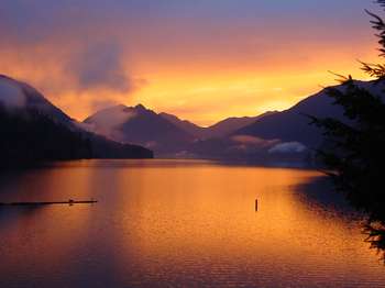
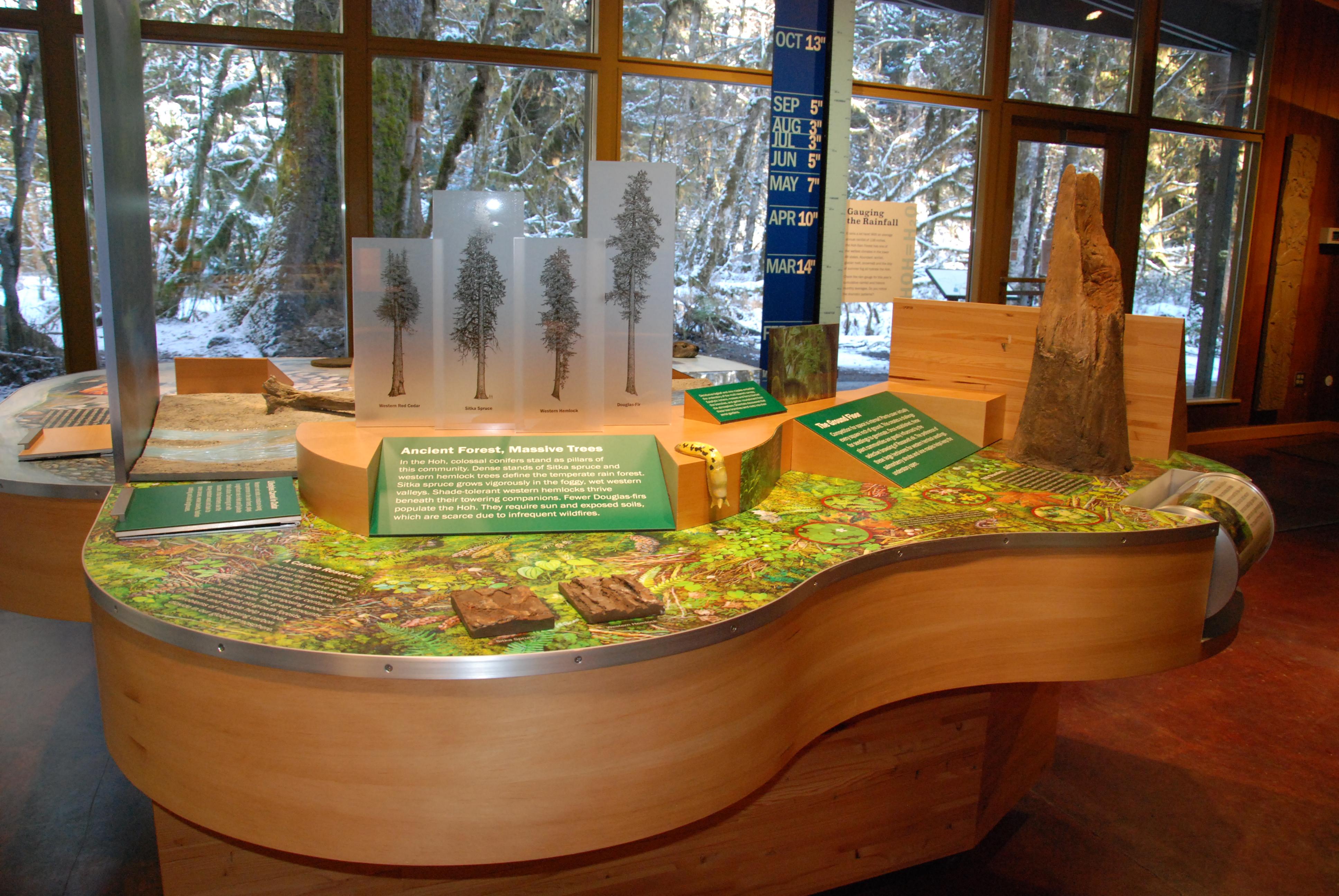
With its incredible range of precipitation and elevation, diversity is the hallmark of Olympic National Park. Encompassing nearly a million acres, the park protects a vast wilderness, thousands of years of human history, and several distinctly di...
Valid for seven consecutive days. Applies to private, non-commercial vehicles (15 passenger capacity or less). The pass covers all vehicle occupants.
Entrance - Motorcycle
$25.00
Valid for seven consecutive days. Fee admits one individual on a private, non-commercial motorcycle.
Entrance - Per Person
$15.00
Valid for seven consecutive days. This fee admits one person without a vehicle, including hikers, bicyclists, and pedestrians. Individuals fifteen years or younger are admitted free of charge.
Commercial Entrance - Van
$75.00
A commercial tour is defined as persons traveling on an itinerary that has been packaged, priced or sold for leisure recreational purposes by an organization that realizes financial gain through the provisions of the service.
Commercial Entrance - Mini-bus
$100.00
A commercial tour is defined as persons traveling on an itinerary that has been packaged, priced or sold for leisure recreational purposes by an organization that realizes financial gain through the provisions of the service.
Commercial Entrance - Motor Coach
$200.00
A commercial tour is defined as persons traveling on an itinerary that has been packaged, priced or sold for leisure recreational purposes by an organization that realizes financial gain through the provisions of the service.
Fairholme Campground Entrance. 30 seconds A square brown and white wooden sign at the entrance has a right pointing arrow and the text, Fairholm Campground. A brown metal sign reads, Welcome to Fairholme Campground. Fee $20 per night. 1. Select site and note number. 2. Register at bulletin board near restrooms. 3. Deposit fee in metal cannister. Camp Host B-40. Fairholme Walk-In Campsites. 30 seconds A network of trails lead to the campsites. Be advised. The trail surfaces and campsites are uneven in places and may rise and fall with the terrain. Many campsites are partially edged with logs. Each site has a picnic table, and some have metal fire grates. Bear boxes for food storage are placed throughout the campground as are water taps. The campsites are surrounded by towering old growth forest and patches of green ferns. Lakeside campsites overlook the clear, blue-green water of Lake Crescent and the forest covered mountains rising from the shore.
Graves Creek Campground. 1 minute A brown and white sign at the entrance to the campground reads: Graves Creek Campground. The road veers left where a second sign reads: Self Registration Campground. Fee $20 per night. Access pass $10. 1. Select and note site number. 2. Register and deposit fee at board. Campsites with picnic tables and in-ground fire pits are located along the campground road. The two brown rectangular restroom buildings within the campground are no longer in use and are padlocked. Open for use is an all gender, single stall, accessible restroom building with a vault toilet. Enter on the left front side beneath an open alcove. The door to the restroom is on the right. Food storage lockers and dumpsters are in front of the closed restroom building at the far end of the campground loop road.
Heart O’ The Hills Campground Entrance. 30 seconds At the entrance to the campground a brown wooden sign attached to short log posts has a left pointing arrow and white text that reads, Heart O’ the Hills Campground. Another brown sign reads: Welcome to Heart O’ the Hills Campground. Fee $20 per night. 1. Select site and note number. 2. Register at bulletin board near restrooms. 3. Deposit fee in metal container.
Online reservations accepted for peak season. All sites are first-come, first-served in off season. Check recreation.gov for current season dates.
Kalaloch Campground. 1 minute A brown wooden sign with white text reads: Welcome to Kalaloch Campground. A left pointing arrow indicates the direction for Loops A, B, and C and a right pointing arrow indicates the direction for Loops D, E, and F. Other text reads: Campsite occupants only 10 PM to 6 AM. RV dump station to the right. Accessible restrooms and water stations are located near each loop. A bulletin board has posted notices pertaining to pet regulations, Fireworks, in an emergency contact a ranger or dial 911, nearest services, cougars, campground, ranger programs, tides, beach regulations, tidepool life, fishing regulations, and coastal safety.
All campsites are reservable during the peak season online at www.recreation.gov up to 6 months in advance. Any unreserved or cancelled sites will be sold in the field at the Mora Ranger Station on a first-come, first-served basis. Campsites are first-come, first-served the rest of the year.
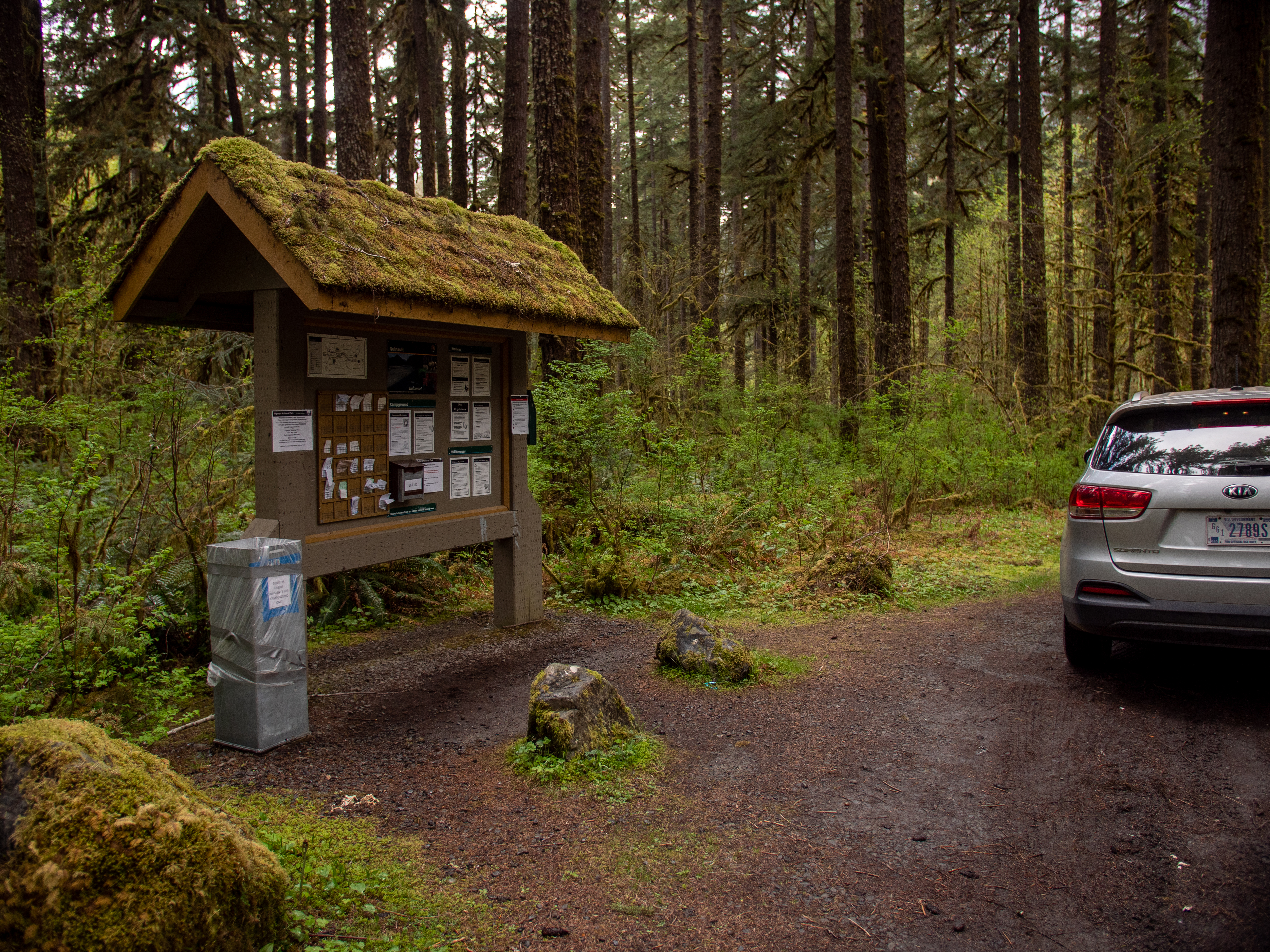
Mora Campground Registration Loop A & B. 2 minutes Along the loop road is a roof covered bulletin board kiosk on a concrete surface. In the center is a self-pay camping registration board, a vertical box with 54 square sections in six horizontal rows. Each square is numbered and corresponds to an individual campsite. Each row is covered by a hard, clear plastic strip with slots for dropping registration payment receipts into individual squares. To the left of the registration board is a brown box with a lid holding campground registration envelopes. A 3-foot-tall cannister for depositing payment envelopes stands in front of and to the left of the board. It has a slot at the top for slipping in the envelope. Posted to the left of the registration board is payment information and campground registration instructions, along with a site map of the campground. Above the board a notice reads, Firewood not available in campground. Purchase outside of park. To the right of the board are campground regulations and a tide chart. A recycle bin and garbage dumpsters are to the right of the kiosk on a gravel surface. To the left of the kiosk, a concrete sidewalk leads to a wide patio area with a white, rectangular restroom building with a blue metal roof. The women’s room is on the left short side of the building, and the men’s room is on the right front side of the building. Across the sidewalk from the women’s room is a square, 3-foot-tall stone water station. It’s two spigots face the restroom. A sign on top reads, no dishwashing. The sidewalk loops in front of the water station and leads back to the road. Be advised. The concrete sidewalk ends after about 20 feet, transitioning to gravel, then asphalt. In places along the asphalt section, cracks and frost heaves create an uneven surface.
North Fork Campground. 2 minutes At a junction in the road, a brown sign with a right pointing arrow reads: North Fork Campground. Down this dirt road on the right a second sign reads: Welcome to North Fork Campground. Fee $15 per night. 1. Select site. 2. Register at bulletin board. 3. Deposit fee in metal canister. 4. Place stub on dashboard. Further along a third sign reads: No garbage service. Please pack it out. Soon, on both sides of the road, numbered campsites begin. The road ends in a loop where more campsites ring the perimeter. In the center of the loop is an island with low growing plants, a large pine tree, a brown metal food storage locker, a bulletin board, and payment canister. The bulletin board is roof covered and has posted notices on both sides. The side facing the entrance road includes information about day hikes at Quinault; wildlife, food, and your safety; stock use; river crossings; pet regulations; firearms and weapons; and cougars in the area. On the opposite side is a box with a lid holding camping permits. Posted above are campground registration instructions and payment instructions. Other notices include campground and fishing regulations, nearest services, how to help preserve your park, and to contact a park ranger or dial 911 in an emergency. On the food storage locker behind the bulletin board a sign reads: Shared food storage for walk-in sites or campers with no vehicles. Place all food and scented items in locker anytime they are not in use. Please do not use for garbage. Thank you. Campsite surfaces are flat and mostly grass and dirt. Each site has a picnic table and in-ground metal fire pit. The sites are nestled in a forest of young and old pine trees. Fallen trees, covered with green moss, lay on a dense carpet of tall ferns and other low growing plants.
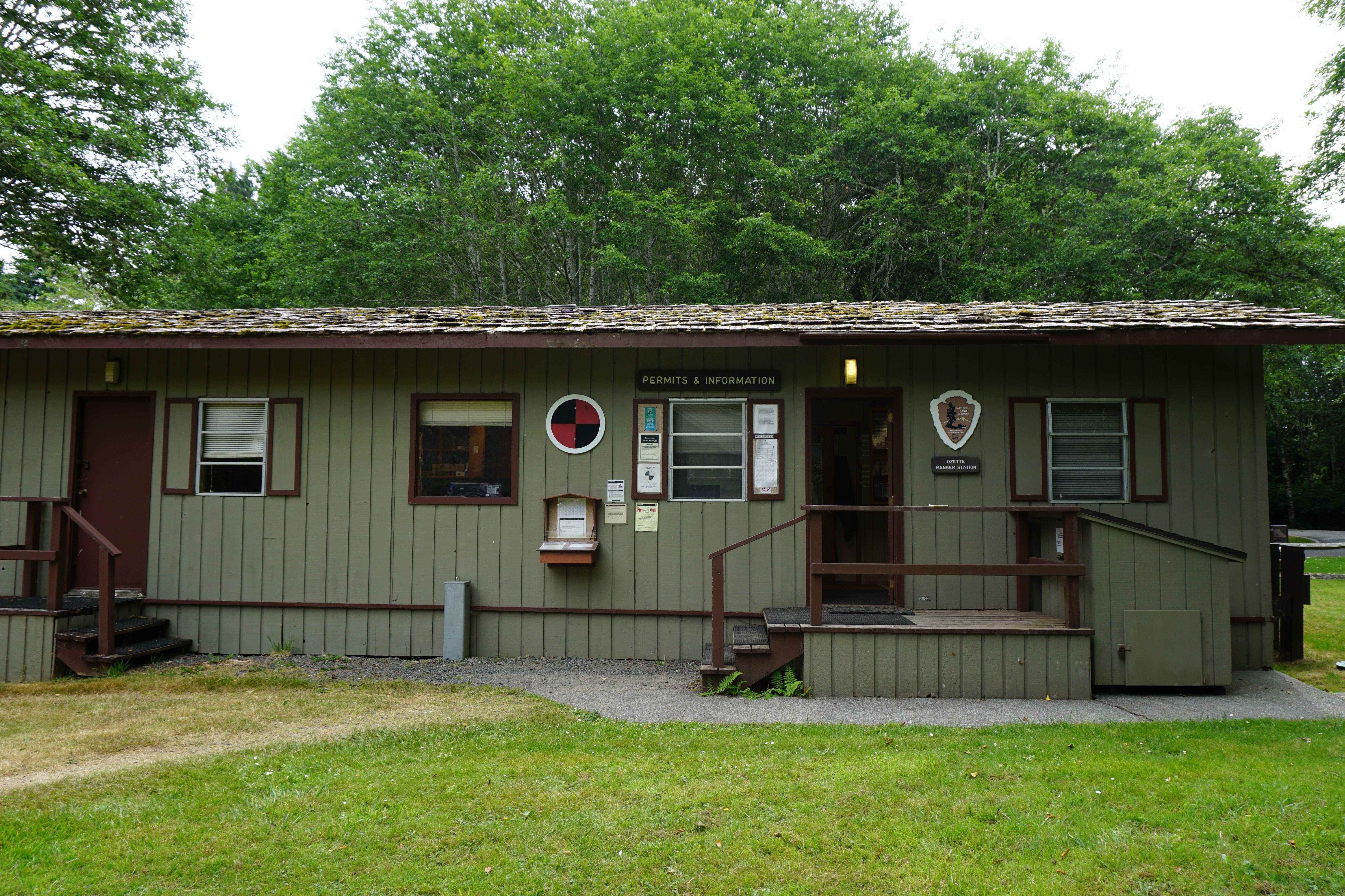
Ozette Campground / Registration. 1 minute At the entrance to the campground on the left a brown sign with white text reads: Campsite Limit. 2 vehicles 8 persons. Use numbered campsites. Below, a right pointing arrow with the text: One way. On the right side of the road is a roof covered bulletin board with a map of the area and information about campground registration and campground regulations; boating and pet regulations; marine debris; nearest services; in an emergency, contact a park ranger or dial 911; and bear and cougar awareness. Attached to the right leg of the bulletin board is a lidded box holding campground fee envelopes. A three-foot-tall metal cannister with an envelope slot at the top stands in front of the board. Additional information about fishing and preservation is posted on the back of the bulletin board. To the left of the bulletin board is a water spigot.
Queets Campground. 1 minute A brown and white sign at the entrance to the campground reads, Queets Campground. Elevation 275 feet. Another sign reads, 14-day camping limit. In a clearing with a grass and gravel surface is a brown accessible, all gender, single stall restroom building with a vault toilet. Enter on the right. Bulletin boards within the campground offer information about park regulations, bear awareness, and campground regulations. Posted notices state that harvesting of forest products is prohibited, fireworks are not permitted, and pets are not allowed on trails or in the backcountry. A sign provides the camping fee per night. Payment envelopes are in a box attached to the bulletin board frame, and a 3-foot-tall square metal box with a slot near the top stands in front of the bulletin board for depositing your payment. Individual campsites have a picnic table and an in-ground fire grate.
South Beach Campground. 30 seconds A long entrance road ends at an oval campground loop with a grassy center. The ocean is on the left. Midway around the loop on the right is a rectangular restroom building constructed of stone with a blue metal roof. The front of the building faces the ocean. The restroom doors are behind stone partitions on each short side of the building, the women’s room on the left and the men’s room on the right. A two-sided bulletin board with campground and personal safety information stands opposite the men’s room door where two trash dumpsters are also located. Lining the loop are campsites and picnic tables.
Reservable on recreation dot gov from July 5-August 31st, 2023. Reservations are available up to 14 days in advance, and may not be made for same day. If any sites are not reserved, they become available first come, first served the day of.
Staircase Campground. 1 minute At the entrance to the Staircase Campground is a large brown sign with white text that reads, Welcome to Staircase Campground. 1. Choose a vacant site to show occupancy. 2. Leave something at site to show occupancy. 3. Return here to registration board. 4. Pay fee as directed and place stub in registration board. 5. Set up camp. 6. Keep receipt stub as proof of payment. Another sign with an upward pointing arrow indicates the direction of travel to reach the campground and restrooms. Text on the sign reads, Two vehicles, eight persons per site, max. Park and camp on hardened sites. Pets allowed on leash. Within the campground are accessible restrooms and brown metal bins for recycling aluminum, only. Brown metal food storage lockers are available in the campground. A sign on the front of the box reads: Shared food storage for walk-in sites or campers with no vehicles. Place all food and scented items in the locker anytime they are not in use. Please do not use for garbage. Place garbage in dumpsters. Thank you. Campsites have a picnic tables and in-ground metal fire pits.
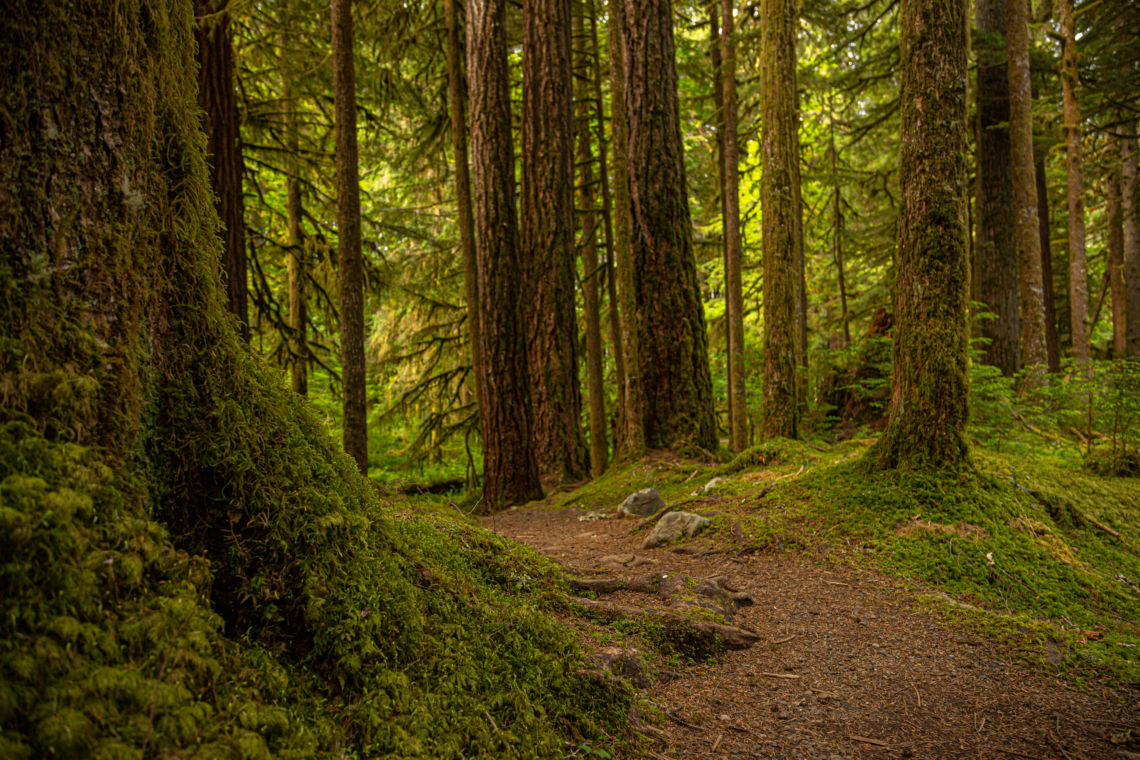
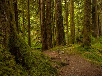
At just 0.6 miles (1 km), this lovely loop trail is a bit of peace just off the Sol Duc Hot Springs Road. Within moments, you are immersed in the deep green of classic Olympic Old Growth. The Olympic Peninsula lowlands, with their mild climate, deep soils and generous rainfall, grow giant trees. These old survivors record centuries of history in their massive trunks. When scientists use the term old growth, they are usually referring to Douglas-fir/western hemlock forests wi
Ancient Groves Trailhead. 25 seconds The narrow dirt trail begins at the parking area. Be advised, about 20 yards along the trail, a wooden foot bridge crosses a stream. The bridge may be slippery. At the bridge, the trail enters the forest.
At just 0.6 miles (1 km), this lovely loop trail is a bit of peace just off the Sol Duc Hot Springs Road. Within moments, you are immersed in the deep green of classic Olympic Old Growth. The Olympic Peninsula lowlands, with their mild climate, deep soils and generous rainfall, grow giant trees. These old survivors record centuries of history in their massive trunks. When scientists use the term old growth, they are usually referring to Douglas-fir/western hemlock forests wi
Ancient Groves Trailhead. 30 seconds The trail starts at the end of the parking area. Be advised, the beginning of the narrow dirt trail is rocky. It then parallels the road for about 30 yards before entering the forest. A brown wooden sign with white text reads, Ancient Groves Nature Trail.
This trail is a starting point for overnight backpacking trips. Visit nps.gov/olym/planyourvisit/wic.htm to plan a backpacking trip!
Aurora Ridge Trailhead. 35 seconds The trailhead is located at the parking area. Be advised, logs laid horizontally on the ground define the front edge of each parking space. At the trailhead, a brown and white wooden sign has the text, Aurora Ridge Trailhead, followed by points of interest along the trail with mileage to each from the trailhead. These read, Eagle Lake 6.0, Aurora Spring 12.5, and Lake Crescent 14.0 Here, the trail is narrow and passes through a dense understory of varied plant life, and a forest of towering trees draped with green moss.
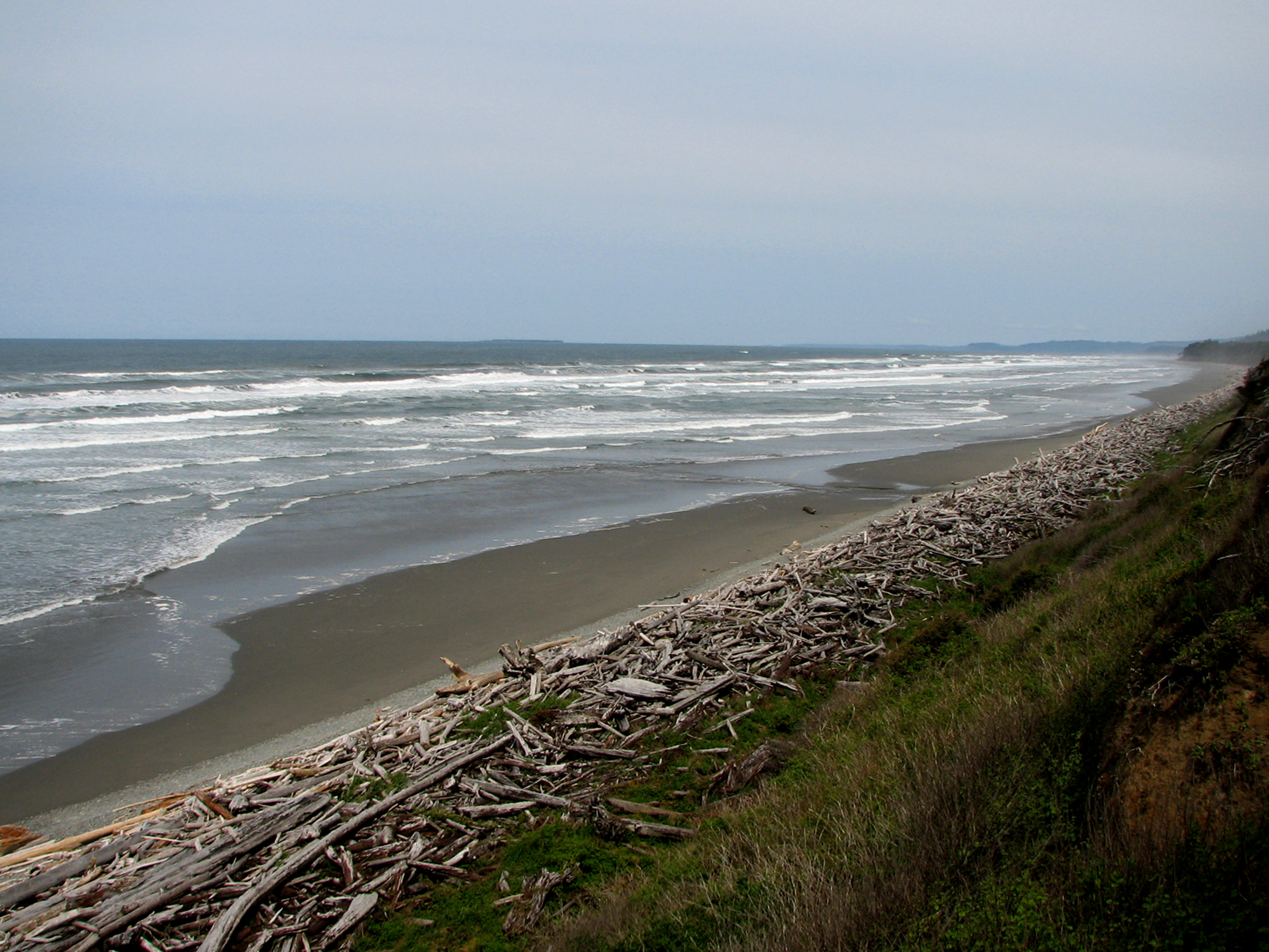
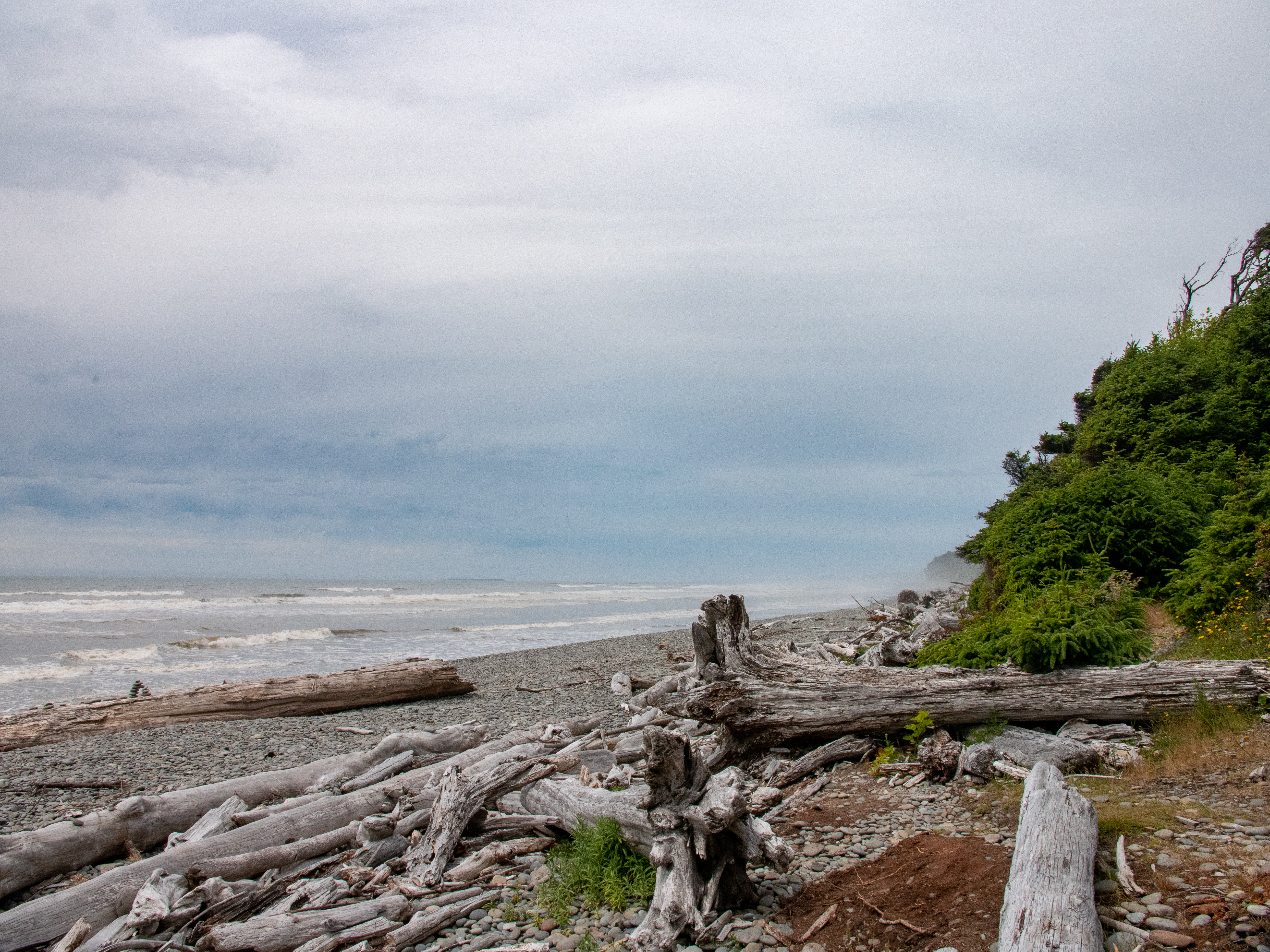
A trail through Sitka spruce trees, many of them with large, knobby burls, leads to this less-visited beach north of South Beach. The beach itself has countless massive drift-logs, weathered by their time at sea. Look for bald eagles nesting nearby!
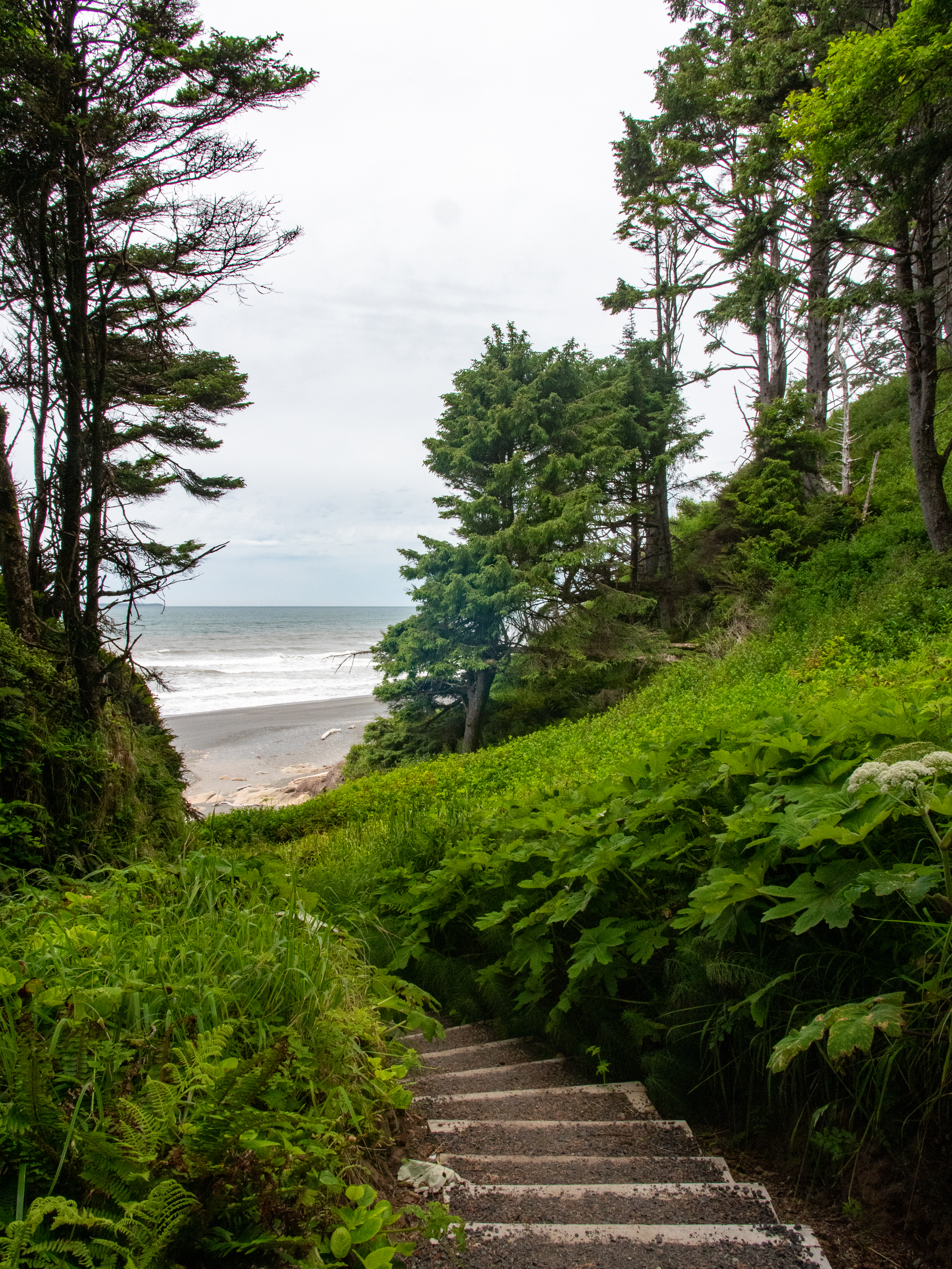
Beach 1 Trailhead. 1 minute The loose gravel trail winds through a forest of tall trees and ferns. A bulletin board up trail has posted notices stating the rules for beach fires, information about what to do in an emergency, contact a ranger or dial 911, pet regulations stating pets must be leashed at all times, and a map of the area. As the trail reaches the edge of the forest, it descends a gravelly slope of varying steepness. In places along the trail there are uneven stairs and wooden ties laid across the trail. Near the bottom, a wooden bridge crosses a creek. It does not have handrails, only short side bumpers. As the trail nears the beach, use caution as driftwood may be scattered on the trail and at the entrance to the beach.
Parking is VERY limited for Beach 2, so if spaces are full, choose another beach rather than parking unsafely along Highway 101. The short trail to this beach features distinctive "burls" on the spruce trees.
Beach 2 Trailhead. 1 minute Be advised. Parking for the trailhead is along the right shoulder of the two-lane road. The trailhead is across the road. On the trail side of the road a brown sign reads, Beach 2, and stands near a paved area that extends about 20-feet into the woods. A split rail fence lines the front edge and an opening in the forest provides a view of the ocean in the distance. To reach the trail from this overlook, move left along the side of the road. A guardrail is on the left. At the end of the guardrail the trailhead is on the left. A sign with a hiker icon and a left pointing arrow stands at the trail entrance. The dirt trail passes through a forest of tall trees. Low growing plants hug each side of the trail. The trail varies in width and in places the surface is uneven with protruding tree roots. Up the trail on the right is a roof covered bulletin board. Posted notices include beach, fish and shellfish regulations; pet regulations stating pets must be leashed at all times; and to contact a ranger or dial 911 in an emergency. As the trail enters the beach area, the surface transitions to a jumble of small, flat rocks. Driftwood may be scattered on the beach.
Parking is limited on the shoulder of Highway 101, but this charming beach is worth visiting when you can find a space and brave the steep trail.
Beach 3 Trailhead. 30 seconds Parking for this trailhead is parallel alongside the roadway. A brown and white sign reads, Beach 3. Another sign at the trailhead reads, Beach 3. Day Use Only. No Camping. Fireworks are prohibited. Attached to a metal sign are posted notices about beach regulations concerning camping, pets, resource preservation and beach fires; keeping pets leashed at all times; in an emergency contact a ranger or dial 911; and a map of the Kalaloch area.
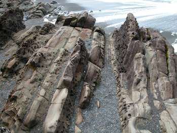
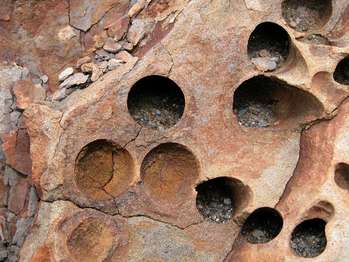
Beach 4. 30 seconds Rocky outcroppings of tilted layered sandstone dot the sand and gravelly beach. Sandstone colors range from red to yellow with smooth to pitted rock surface textures. Additional outcroppings span out into the ocean.
A short but rather steep trail through coastal forest leads to a lovely driftwood footbridge and Beach 4. A wonderful place to tidepool and look for seals, with particular treats for those interested in geology - Swiss cheese textured stone! The phenomenon is caused by piddock clams, which burrow into solid rock to protect themselves from the pounding surf.
Beach 4 Trailhead and Parking Area. 1 minute The oval parking lot loops around to the left where restrooms and the trailhead are located. Two accessible, single stall, all gender restrooms with vault toilets face the parking lot along a sidewalk. Enter on the right front side of each building beneath an open alcove. The door to the restroom is on the left. The trailhead is about 20 feet to the left of the restrooms where the sidewalk transitions to a gravel path and leads into the woods on the right. Several large boulders line the right side of the path. Where the boulders end is a white, roofed, wooden bulletin board where information is posted regarding Ranger Programs, Tides, Wildlife, and Marine Debris. Posted regulations pertain to Fireworks, the Beach, Pets, Fishing and Shellfish, Wood Gathering, Tidepool Life, and Beach Fires. To the left of the bulletin board is a brown wooden box with a lid on a post. Inside are trail guides. Two trash cans are located on the left side of the path.
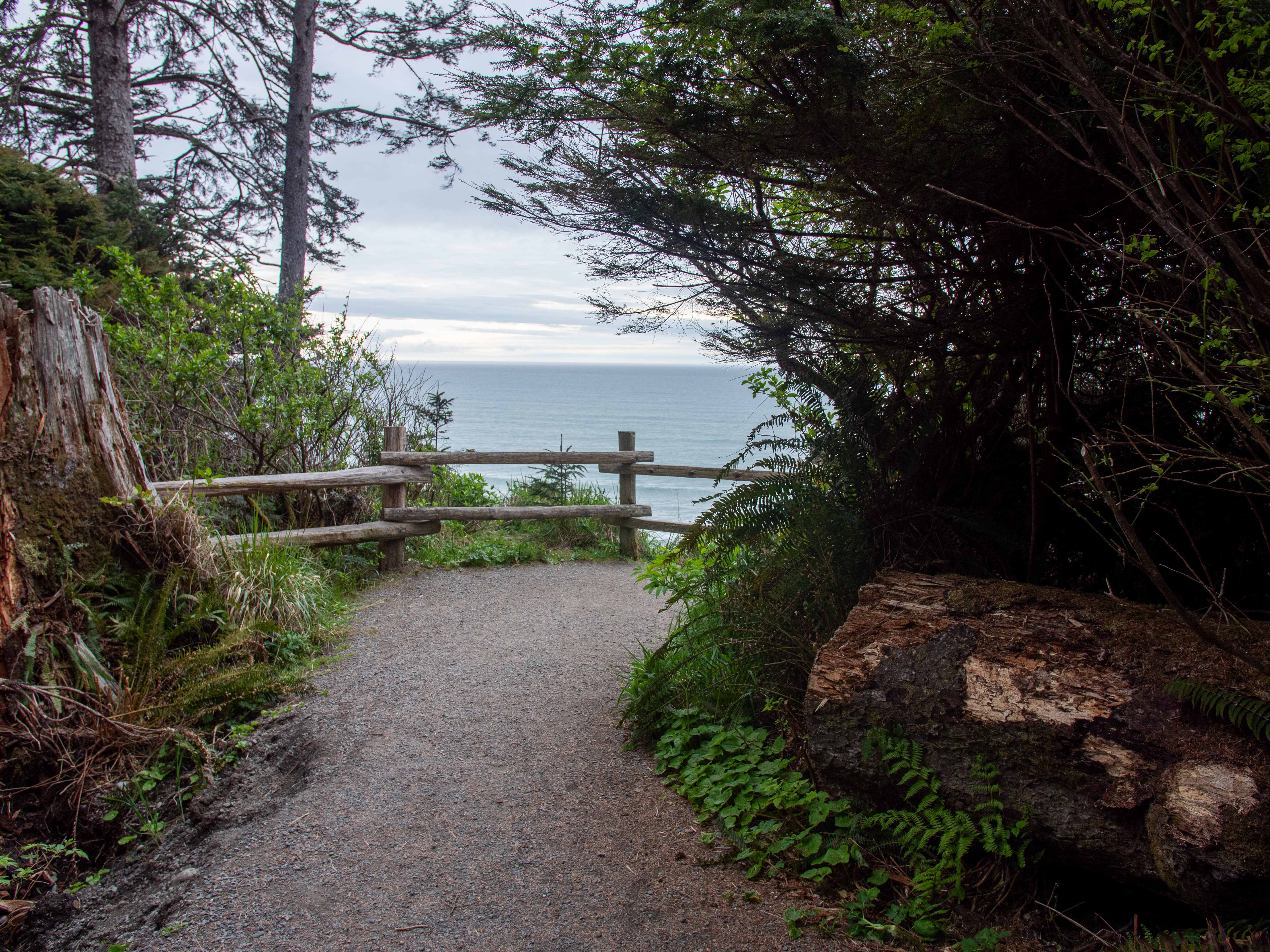
Beach 4 Overlook. 30 seconds A flat, gravel, plant-lined path branches off the main trail and leads to an open area high above the beach overlooking the wide expanse of ocean. A fence with two horizontal railings edges the perimeter of the overlook. Near shore to the right, large boulders jut out into the ocean. In the distance is a long flat land mass.
There is no trail at Beach 6, but it's perfect for a quick view of the Pacific. Pull off highway 101 to park safely at the overlook. Bring binoculars to look for sea otters and migrating whales!
Beach 6 Overlook. 25 seconds This narrow roadside pull-off overlooks the beach and ocean. A 2-foot-tall metal barrier edges most of the parking area, then at the far end, a three-foot-tall concrete barrier takes its place.
This wide, sandy beach is very popular! The so-called Tree of Life is a beloved photo subject, but it is NOT a safe place to hang your hammock or practice your parallel bars routine. The creek has slowly eroded the earth beneath the tree's roots, and we hope it can hang in there for a long time.
On the edge of the parking lot, a brown wooden sign on a post with a right pointing arrow reads, Beach Trail. Attached below are more signs that read: Pets must be on leash at all times. No bicycles. Fireworks prohibited. The gravel trail descends a slight hill to the beach. Shrubs line each side of the trail.
Big Cedar Tree. 1 minute The flat gravel trail with downward sloping sides leads to the remains of a large, ancient cedar tree. The right side of the tree has collapsed and lays on the ground adjacent to the right side of the trail exposing the decomposing, deeply grooved inner structure of the tree. A wooden fence encircles the base of the tree and a skirt of tangled, exposed roots. A large portion of the silver-grey trunk still stands, the top broken off into finger-like sections reaching skyward almost 180 feet. The tree is about 19-feet in diameter.
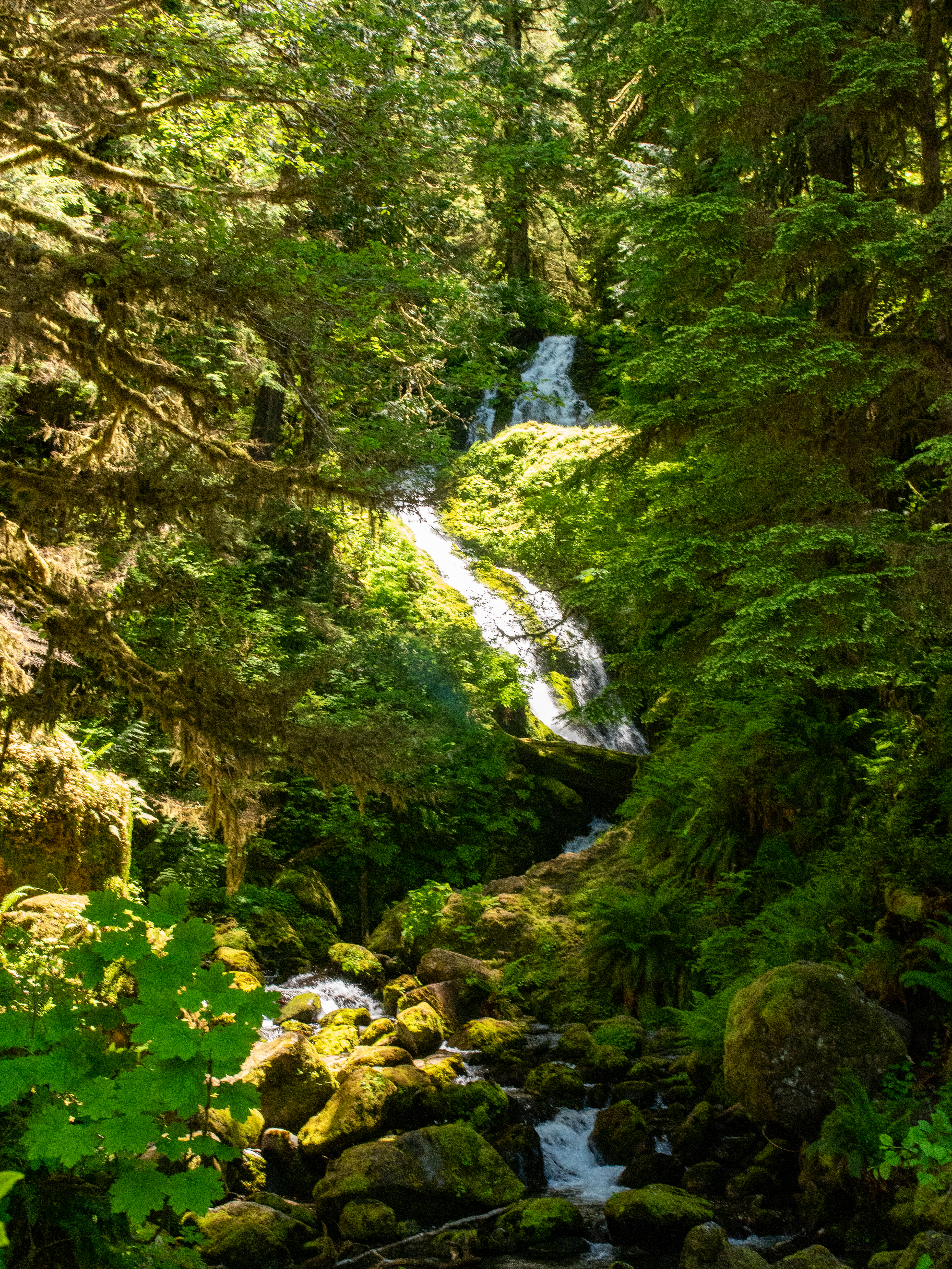
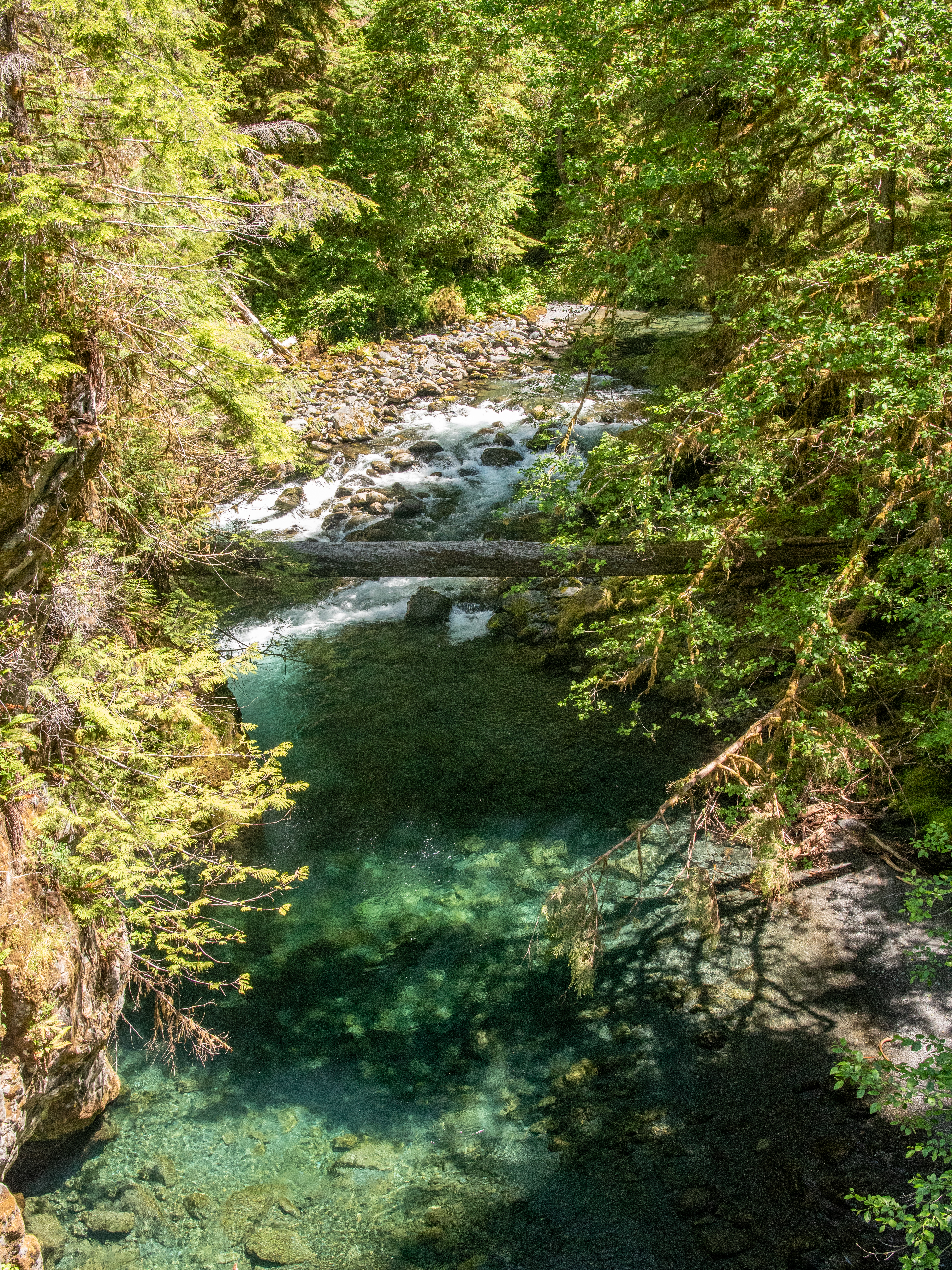
Bunch Falls. 45 seconds Here, along the Quinault South entrance road into the park, is a bridge with low concrete side curbs across a stream. On the upslope side of the stream is Bunch Falls. Set against a lush background of green pine forest, yellow-green mosses, and green ferns, is a zig-zagging ribbon of white water, cascading down a slope of moss-covered rocks, flowing beneath dead and decaying moss-covered trees, and pooling in small side basins. There are several ways to experience the falls: from the bridge roadway facing upslope and from rocky trails located at each end of the bridge.
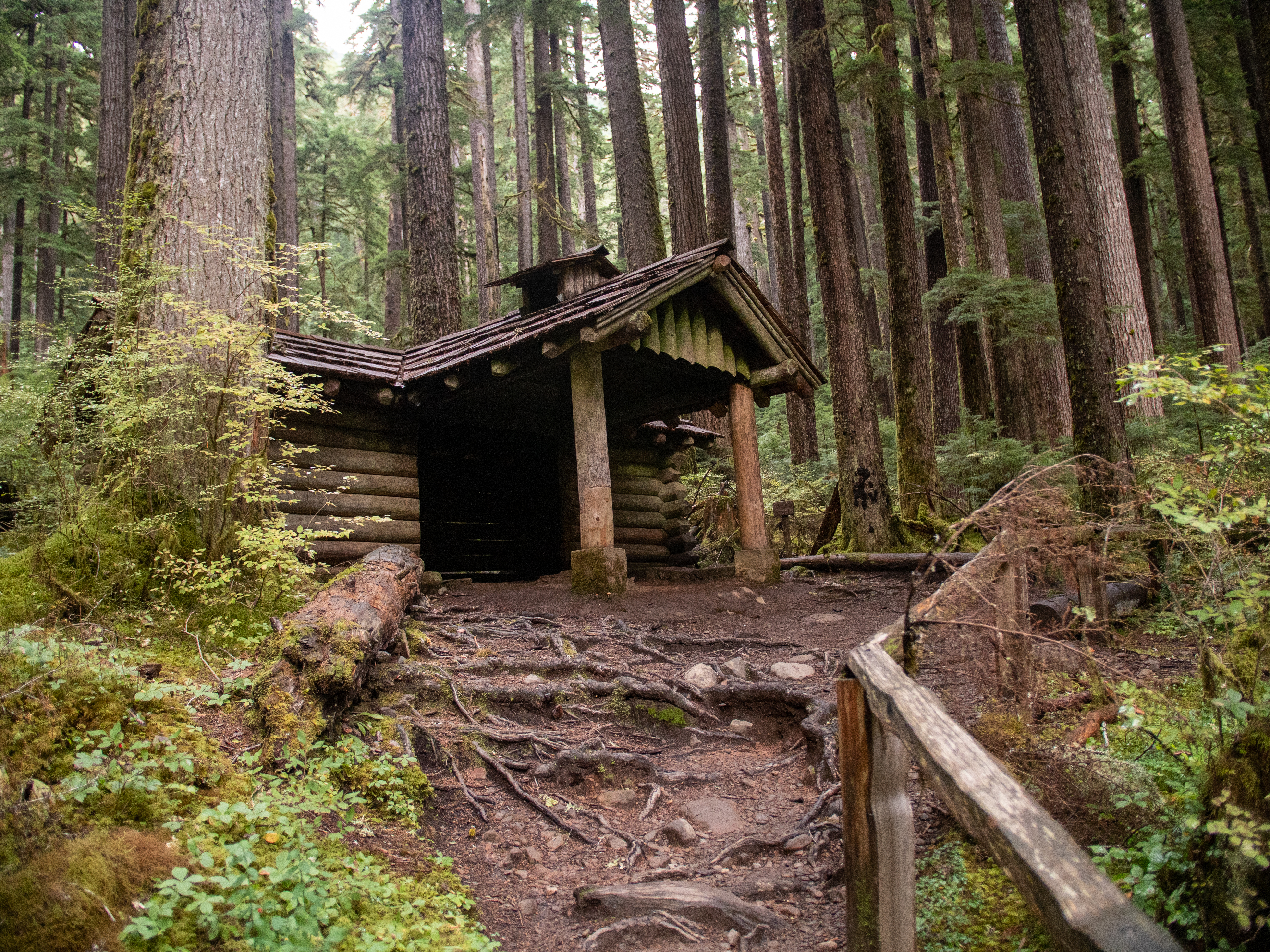
Canyon Creek Shelter. Overview. 2 minutes Along the trail to Sol Duc Falls, a wooden bridge with low side bumpers on the right and left, and no handrails, crosses a stream. The trail then continues to the shelter which is up a side trail on the left. Be advised: the trail to the shelter is uneven with exposed tree roots and rocks. A wooden handrail is on the right side of the trail. Once at the building the surface continues to be uneven. The shelter is a rectangular log cabin with wooden shingles. The logs are laid horizontally. In the center of the cabin is a wide-open entrance way with no door. An A-framed roof juts out at a ninety-degree angle to the main roof covering the entryway. This roof is supported at the front by a thick log atop a concrete base on the right and left. At the doorway, there are remnants of a concrete walkway that protrude out of the ground. Please use caution. You may enter the building which has an uneven dirt floor. A laminated, white paper sign posted to the front of the cabin provides the history of the building. Continue listening for the full text. 4 minutes. Welcome to the Canyon Creek Shelter. National Register of Historic Places. Please treat this important structure with respect. The shelter before you was built by Civilian Conservation Corps, or CCC, enrollees during the summer and fall of 1939, one year following the establishment of Olympic National Park. Replacing a US Forest Service shelter constructed earlier, the Canyon Creek shelter was built to enhance the safety of park visitors. As an early Olympic National Park hiker, imagine how happy you would have been to find the shelter after walking in the heavy rain wearing heavy cotton and wool clothing, and perhaps carrying a cumbersome wood, leather and canvas backpack. Since 1905, the lands comprising what is now Olympic National Park have been managed by two government agencies. Until the late 1930s, the United States Forest Service administered the area and developed a unified system of communications, ranger stations, shelters, fire lookouts and trails, primarily to facilitate fire suppression. By the time Olympic National Park was designated in 1938, a growing number of recreational hikers, hunters, and fishermen were traveling into the interior mountainous sections of the Olympic Peninsula. New structures were planned by the National Park Service not only to serve management needs, but also to enhance the visitors experience of the park. Olympic National Park managers looked to the Civilian Conservation Corps for assistance to fill in for the fledgling park’s limited personnel and funds. The Civilian Conservation Corps was born out of Franklin D. Roosevelt’s personal belief in the spiritual and physical values inherent in working in nature and his conviction that the conservation of natural resources was ultimately important for the continued health and prosperity of the nation. The CCC aimed at putting a huge army of unemployed men to work on conservation projects on forest and park lands throughout the country. A main CCC camp, established on the Elwha in 1933 under the US Forest Service, was transferred to the National Park Service in 1938. In 1939, a CCC side camp was set up at Eagle Guard Station on the Soleduck River. Workers from this camp developed a campground facility, constructed a parking area at the end of the road, and build the Canyon Creek shelter at Soleduck Falls. The canyon creek shelter is a significant example of the “Rustic Style” of architecture employed by the CCC under the direction of the National Park Service. A careful observer can identify this architectural type by noticing the use of local, natural materials applied in a manner that is sensitive to the surrounding environment. Following the design tenets and philosophy of Rustic Style, the shelter was carefully sited in the forest to have as little visual impact as possible. The intent was to have the new building appear to fit and harmonize with the landscape. The style and method of construction reveals an emphasis on aesthetics and enhancing a visitor’s experience in the wilderness. Alterations to the building over the years include new concrete foundation and replacement in-kind as materials have deteriorated. In 2003 a tree fell on the shelter and damaged the roof at the north wall. Preservation maintenance was completed in 2005 to repair the damage. Revegetation work, adjacent to the shelter, took place in the fall of 2007 to restore the native plant community and increase harmonization of the shelter with the natural environment. The historic Canyon Creek shelter continues to exhibit the qualities of its original Rustic design and method of construction as built by the Civilian Conservation Corps crews under the guidance of the National Park Service. We hope you will enjoy your visit and be a thoughtful steward of the area. Thank you for protecting the Canyon Creek shelter by sharing the structure with all who visit here. Not carving, writing or otherwise leaving a mark on any part of the structure. Not climbing on the structure. Returning to the trailhead to use the latrine. Not leaving any food or trash in the area. Staying on established trails within the designated day use area to ensure the success of the revegetation efforts. And please, no fires or overnight camping in or near the shelter. Campsites are located across and upper river of the Sol Duc Falls Bridge.
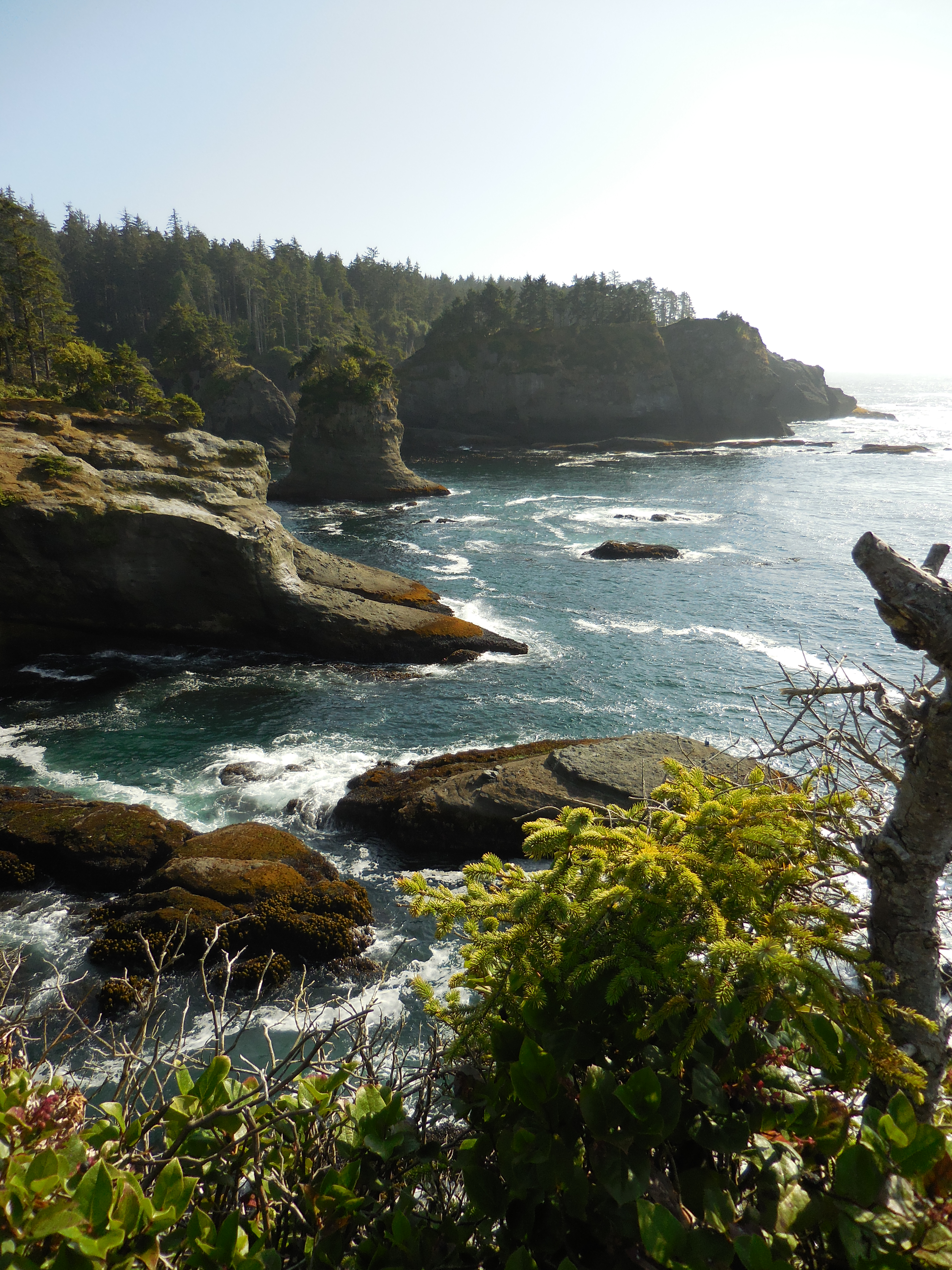
Located in the Makah Reservation, outside Olympic National Park near the town of Neah Bay. The short (¾ miles/1.2 km each way) trail leads through the forest to a viewing platform, perched on a cliff with a dramatic view overlooking the Pacific. Cape Flattery is the Northwest most point on the contiguous United States. To park at the trailhead, obtain a permit from the Makah Tribe. There is a restroom at the trailhead, and daytime parking for cars and RVs. Please pack out al
Cape Flattery Trailhead. Overview. 2 minutes On the right side of the gravel parking lot is a square, gray cinderblock restroom with two brown doors that face the lot. The women’s room is on the left. The men’s room is on the right. At the far end of the lot the trail enters a dense forest of tall trees. Across the trail stand two log posts to prevent access by vehicles. Up trail about 15 feet is a covered bulletin board, its frame constructed of logs. Posted material includes in-depth information about the Cape Flattery Trail, the National Marine Sanctuary, and Cape Flattery Lighthouse on Tatoosh Island. Continue listening for full text of the posted information. 7 minutes. On the bulletin board are four posters. From left to right they read, Welcome to the Makah Tribe’s Shi Shi Beach Trail. This trail is 2 miles long and requires moderate exertion. Beach access in Olympic National Park is by steep trail. For your safety and enjoyment, please respect our few rules. This area is Makah Wilderness, don’t remove any flowers or foliage and don’t harass wildlife or take any shells or shellfish. Stay on designated trails and walkways. The sea cliffs and unmarked trails are dangerous. Supervise children closely. Don’t build fires or camp overnight anywhere on the trail. Overnight campers must obtain a backcountry permit through Olympic National Park. Pack out what you pack in. Consult tide charts for the area to guard against high tide accidents. Areas beyond Shi Shi Beach are impassable at high tide. Report vandalism to Makah Tribal law enforcement. Generations of Makah people have used this area. If you are patient and respectful, its enduring beauty will enrich and teach you too. A graphic in the right bottom corner shows a red and black bird with outstretched wings standing on the back of a black whale. The next poster reads, Welcome to Olympic Coast National Marine Sanctuary. In July 1991, the Japanese fishing vessel, Tenyo Maru and the Chinese freighter, Tuo Hai collided in heavy fog northwest of Cape Flattery, Washington. The Tenyo Maru sank immediately, releasing 475,000 gallons of oil and fuel that killed thousands of seabirds. This education panel was funded by the Tenyo Maru Natural Resource Trustees as one of a number of restoration projects designed to educate the public and to restore natural resources injured by the oil spill. The Trustees include the US Department of the Interior, the National Oceanic and Atmospheric Administration, the Makah Indian Tribe, and the State of Washington. An underwater photograph shows sunlight penetrating through green-hued water with long ribbons of kelp. Text reads, The Kelp Forests. Swaying fronds of kelp for a critical new sure habitat. Each plant may reach 70 feet in length their leaf light blades fan out across the water, providing shade in hiding places for fish and invertebrates. Look closely for sea otters eating or resting among the dense canopy of kelp just offshore in Olympic coast national Marine sanctuary. A photograph shows many birds with black heads and backs and white chests standing on the top of a rock ledge. Text reads, Murres at Risk. Common murres, the black and white seabirds seen along the coast, are signs of a healthy marine ecosystem. Murres use their wings to fly underwater in pursuit of small fish. They breed on remote islands or inaccessible cliffs, where they are protected from most predators. The young leave the nest before they can actually fly, leaping recklessly into the ocean to be raised at sea by their fathers. Because they spend so much time at sea, common murres are especially vulnerable to oil spills. Changing ocean conditions, entanglement in fishing nets, and low flying aircraft have also harmed the Washington breeding population, which has declined significantly over the last few decades. A final photograph is an aerial view of a large ship on the ocean. Text reads, Safer Maritime Shipping. The Makah Tribe and Olympic Coast National Marine Sanctuary sit at the entrance to one of the busiest shipping lanes in the world. Over 13,000 vessels pass here each year, carrying large amounts of fuel oil. Collisions or groundings threaten wildlife, fish and shellfish, their habitats, historic and cultural sites and the scenic beauty of this area. Federal, tribal and state agencies and the shipping industry work together to prevent oil spills. Larger vessels observe and Area-To-Be-Avoided, a buffer zone designed to keep ships away from especially sensitive and dangerous areas near Cape Flattery. The third poster has a topographic map of the west coast of Washington State along the right edge. At the top is the Strait of Juan de Fuca and labels along the coast from north to south mark specific management areas. Text reads, nearby coastal waters are part of Olympic National Marine Sanctuary, a 3300 square mile protected area administered by the National Oceanic and Atmospheric Administration. This area was designated in 1994 in recognition of its rugged character, rich marine life and vulnerable nature. Together with this landowner and other state, federal and tribal organizations, Olympic Coast National Marine Sanctuary protects marine resource supports, important scientific research and promotes compatible use and enjoyment of these resources. To enjoy your visit fully, remember the following. Don’t get trapped by the tide. Coastal headlands, stream crossings and sandy beaches can be treacherous. The water is cold and currents are strong. Hypothermia can kill within minutes. Beach logs are unstable. Don’t build fires among driftlogs. Avoid beached marine mammals. Dead or sick animals can past disease to humans. Injured animals can bight. Solitary seal pups are not orphans. Report beached marine mammals to the nearest ranger station or call 360-457-6622. Do not harass wildlife. Feeding or disturbing wild animals is illegal. Leave historical and cultural objects alone. Historic shipwreck remains and Indian artifacts and petroglyphs are protected by state and federal laws. Fish and gather shellfish only in accordance with regulations. Enjoy your visit to Olympic Coast National Marine Sanctuary. The final poster includes a photograph of the Cape Flattery Lighthouse on Tatoosh Island as viewed from the ocean. The tall rocky face of the island is punctuated by dark cave-like voids. Short trees grow on top. The tall white lighthouse tower is topped by a glass domed room housing the lens. Below, a railed balcony encircles the tower. The lighthouse rises out of a white building with a red roof. Text reads, At the end of the Cape Flattery Trail, be sure to look out toward Tatoosh Island and find the Cape Flattery Lighthouse. Constructed in 1857 by the US federal government during a period of occupation that would last more than 100 years, the lighthouse was automated in 1976 and new possibilities now exist for this historic resource. Today, the Makah Tribe is working with the National Trust for Historic Preservation, who name the Lighthouse to their National Treasures Program to ensure it is restored as a beacon of maritime heritage. To learn more about the Lighthouse or Tatoosh Island, please visit the Makah Cultural and Research Center, located on the east side of Neah Bay, or visit Savingplaces.org/Cape Flattery.
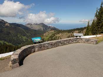
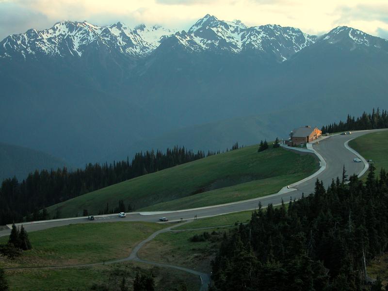
This half-mile (0.8 km), easy, paved trail has views of Port Angeles and the Strait of Juan de Fuca. While exploring the ridge please keep your distance from wildlife and stay on paved paths or snow to avoid damaging fragile meadows.
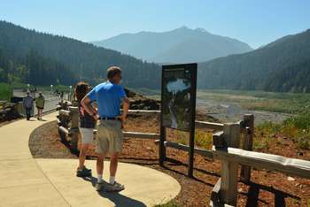
Cirque Rim Overlook. 3 minutes Along the curved two-foot-high stone wall are two three-foot-tall, angled metal wayside panels about 15-feet apart. Beginning with the wayside on the left, a color photograph of the tree filled valley and distant mountain landscape before you fills the panel. On the right side of the photo, a mountain ridge is on fire, whitish-gray smoke rising cloudlike into the sky. Inset on the left, a color photograph taken deep inside a mountain forest shows standing and downed trees fully engulfed in red and yellow flames. Text across the top reads: Fire and Rain. Fire in the Olympics. Even in a park drenched by over 12 feet of rain each year, summers are dry. When lightning strikes, small fires can spread. This creates a natural patchwork of burned and unburned meadows, forests and silver snags like those at Hurricane Ridge. In September 2003 lightening ignited a fire near Griff Peak, two-mile northwest of here. It was too dangerous for the firefighters to dig a fire line on the steep slopes, amid falling trees and rocks. Instead, crews used sprinklers, helicopter water drops and bare ridges to limit the fire’s spread. October rains had the final word, extinguishing embers that lingered in the 820-acre Griff Fire. As woodpeckers probe the drying trees, and nutrients released by the flames return to the soil, researchers will be watching. How many sun-loving tree seedlings sprout in new openings? Which wildflowers colonize the slopes? What changes can you observe from this fiery renewal? The wayside panel on the right has a color panoramic illustration of the valley, mountain, and water landscape before you with 16 features labeled. Text under the photograph reads: International Views. When weather permits, you can see the Strait of Juan de Fuca and Canada’s Vancouver Island, Victoria, and British Columbia Coast Range. The Strait and other waterways isolate the Olympic Peninsula. When clouds cover the lowlands, imagine the white layer as thick ice sheets that also isolated these mountains thousands of years ago. As a result, island-like Olympic National Park protects plants and animals found nowhere else in the world. The labeled features along mountain ridges from left to right are Hurricane Hill Trailhead; Hurricane Hill Trail; Hurricane Hill, 5,759 feet with Little River in the valley below; Unicorn Peak; Unicorn Horn; and Griff Peak. Then, the Strait of Juan de Fuca, Vancouver Island, Salt Spring Island, Port Angeles, Victoria, Haro Strait, San Juan Island (US), and British Columbia Coast Range in the background fill the right side of the photo.
Dickey Boat Ramp. 30 seconds A long, gravel road gently slopes down to the river. On the left side of the road is a tall, green wooden bulletin board with a sign attached to the top that reads, Dickey River. Posted on the board are fishing regulations and a sign describing the species of fish in the river. Posted information may change. Trees grow along both banks of the river.
No longer accessible to vehicles, the first part of this trail is a former road that begins a trek into the wilderness of the Olympic Mountains. If you plan to make this the start of an overnight backpacking trip, check in with the Wilderness Information Center https://www.nps.gov/olym/planyourvisit/wic.htm
Dosewallips Rd Trailhead. 30 seconds The road to the trailhead ends at a small circular parking area. At the top of the circle large rocks line the edge of the parking area with an opening where the trail begins. The trail surface varies from flat and gravelly to rocky and uneven, and where the trail crosses a stream, a wooden plank is used as a bridge. The trail passes through a forest of tall pines with branches covered in green moss. Tall ferns and moss cover the ground.
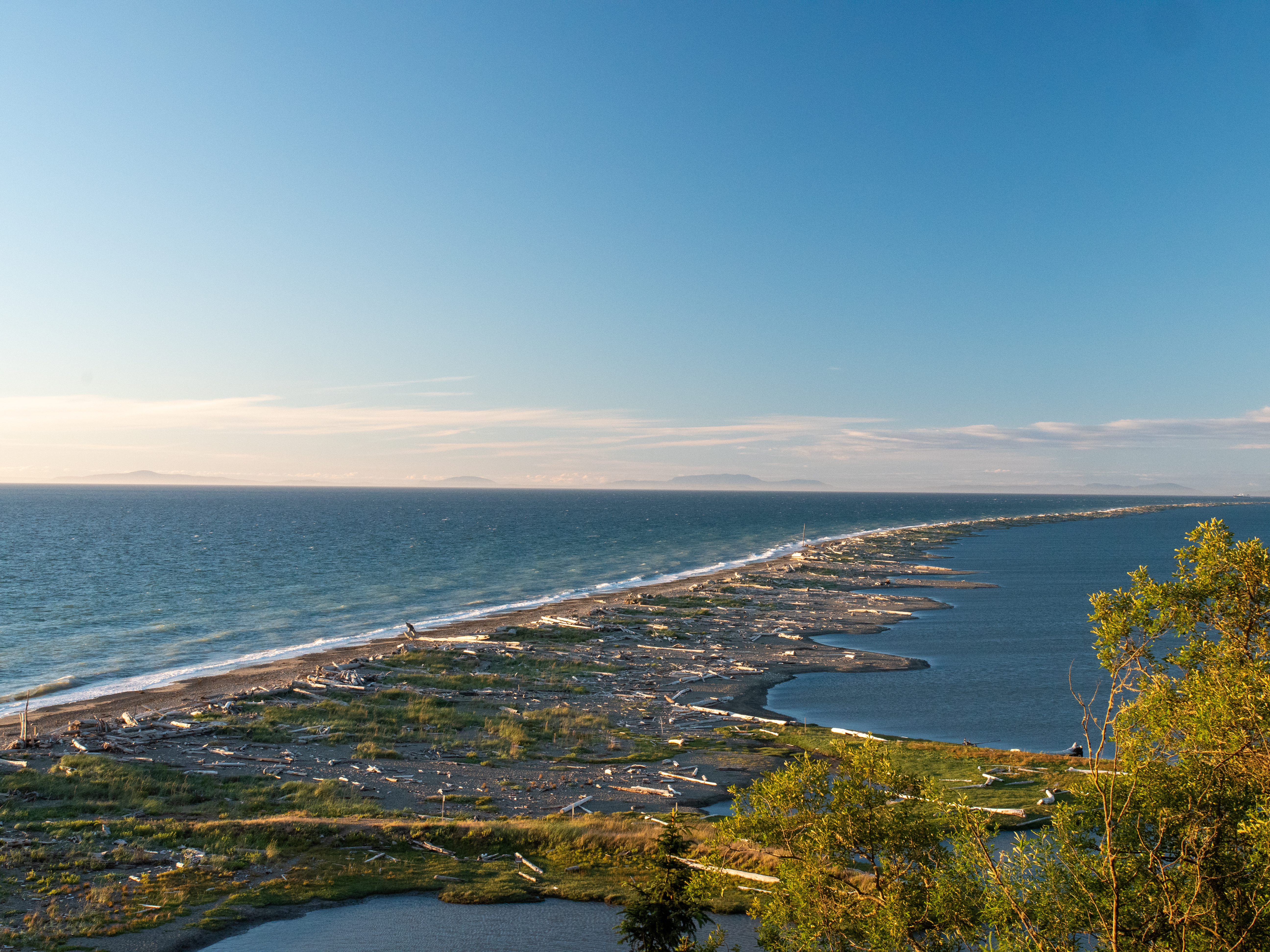
Located on the northern edge of the Olympic Peninsula, just outside of the town of Sequim, WA, Dungeness Spit offers a haven for wild birds and a historic lighthouse. While it is not a part of Olympic National Park, it is popular with locals and visitors alike for its hiking and bird-watching. From the refuge: "At Dungeness National Wildlife Refuge one of the world's longest natural sand spits softens the rough sea waves to form a tranquil bay, fertile tideflats, and beaches
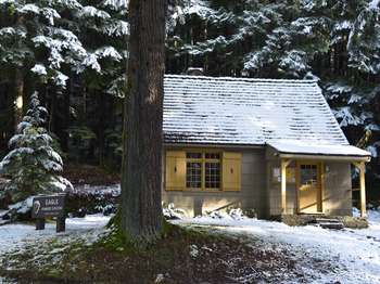
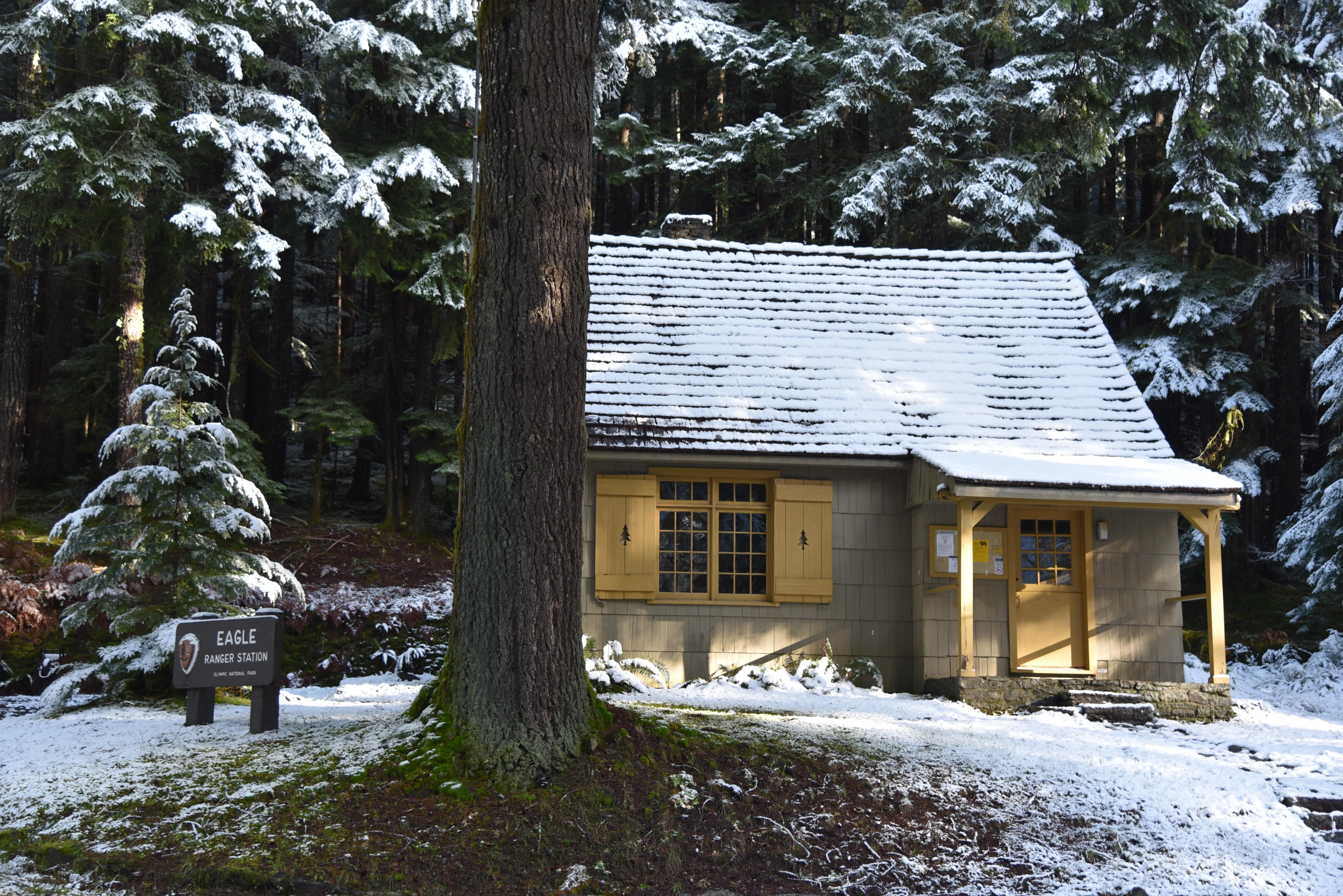
Eagle Ranger Station. 1 minute Sitting atop a slight, grassy rise, a brown sign with white letters reads, Eagle Ranger Station. Olympic National Park. The National Park Service arrowhead logo is attached to the sign on the left. A driveway leads to a parking area to the left of the sign. Behind the sign on the right facing the road is a square two-story grey-green shingled building with a brown A-shaped peaked shingled roof. On the front and sides of the building are yellow framed windows with yellow shutters. To the right of the window on the front is a covered porch and a yellow front door that opens on the first floor. The bottom half of the door is solid, the top half has four horizontal rows of three glass panes each. To the left of the door is a bulletin board with park information. An uneven stone walkway leads to the front door from the road beginning with six steps, then a span of stone walkway, then three more steps up to the porch. A flagpole stands to the right of the walkway. Behind the building is a dark dense forest of towering green pine trees.
This set of exhibits is a great place to learn about the history of the Elwha River, its importance to the Klallam people, and the process of dam removal and river restoration.
Elwha Lower Dam Interpretive Site. Overview. 1 minute A tall wooden lean-to shaped open-air building is located here atop a concrete pad accessed from the parking area by concrete sidewalks. The building houses 22 interpretive panels, 13 of which are part of a self-guided interpretive program. The panels are large, some vertical, some horizontal. At the top of each panel is a blue header band with the name of each panel in white text. In total, the panels include information about points of interest and trails in the area, the Elwha River and Estuary, the Elwha Bridge, Elwha Dam construction and deconstruction, Glines Dam construction and deconstruction, revegetation, people, fish, and restoration. A picnic table is located to the right of the building on a concrete pad. Use the link to continue listening for a description of each panel. 32 minutes
A short hike from the Elwha River Restoration Interpretive Center leads to the site of one of the former dams, where you can see just how much the river valley has changed in the ongoing restoration process. Depending on the time of year, foliage may make it difficult to see the site of the dam.
Elwha Dam Overlook Trailhead. 20 seconds At the end of the road is a gate with a Road Closed sign and a parking area. Beyond the gate, the road leads to the overlook.
Artistic and cultural exhibits at the heritage center explore the Elwha River restoration and Ä,Ì•ixÊ·ÃcÉ™n village artifacts. (The name of the village site, Ä,Ì•ixÊ·ÃcÉ™n, which means inner harbor.) The building is also used for trainings, gatherings, and tribal offices. Learn more here: elwha.org/departments/elwha-klallam-heritage-center/
Elwha Klallam Heritage Center. 3 minutes The tan concrete building has a tall, central section with an asymmetrical curved roof and two lower curved wings to each side, a bank of windows across the left wing and no windows across the right wing. The front door is in the center section and is flanked on each side by large windows. Above the door and windows, four evenly spaced thick logs jut straight out from the front wall each coming to rest atop a tall, square wooden vertical column anchored to the concrete patio in front of the building. The front cut of each log is adorned with a round, orange, metal face design, each having a different facial expression. Laid horizontally across the top of the logs are three horizontal timbers upon which sits a carved, wooden canoe painted in traditional black artistic designs. Attached to the front of the two center columns are tan colored animal designs carved from wood. On the right side of the patio is a red square wooden structure with a wide peaked roof that frames the Heritage Center sign attached in the center. The front edge of the roof is adorned with black half-moons. On the top horizonal framing board are the words, Strong People. The Heritage Center sign has a black background edged with two red lines. At the top, words in yellow read, Elwha Klallam. At the bottom, Heritage Center. In the center is a white, circular tribal seal outlined in black and red with three thick horizontal red lines on each side. The top lines have three half-moon designs, the second line, two half-moons, and the bottom line, one half-moon. Curving along the inside top of the seal are the words, Elwha Klallam Tribe, in black. In the center, a red, black, and white thunderbird design shows a bird with open wings, it’s head and large beak facing left, and yellow lightning bolts crisscrossed behind it. Below the bird on the left and the right facing each other are killer whales, designed in red, black and yellow. Along the bottom horizontal framing board is black text in the Elwha Klallam language.
Elwha Ranger Station. 1 minute This small grey building with a wooden shingled A-shaped peaked roof has two options for access. In front, a staircase with seven steps and handrails on each side lead to a covered porch and the front door. Two tall windows flank the front door. The porch has railings. On the right side of the building, an easy grade concrete ramp begins at the edge of the parking lot adjacent to the wheelchair accessible parking slot. The ramp leads to an access point on the right side of the building. In front of the building, a brown and white rectangular sign reads, Elwha Ranger Station, Olympic National Park. Attached to the left side of the sign is the National Park Service arrowhead logo. To the left of the building is a tall, covered bulletin board with changing park information.
Fee Station, Currently closed for road construction
Elwha River Entrance Station. 1 minute On the left side of the single lane road at the entrance to the parking area is a small brown building with windows on four sides and a sign in the front listing park fees. A paved path off the parking lot leads to two side-by-side restrooms. The one on the right facing the path is a wheelchair accessible, all gender, single stall restroom building with a vault toilet. The entrance door is on the right front of the building. The smaller all gender, single stall vault toilet restroom on the left is not wheelchair accessible. The door is on the left side. On the opposite side of the parking area from the restrooms is a bulletin board with information about trails in the area, stock use, trail etiquette, and backcountry safety. A notice provides information about the fishing closure for the Elwha River and all its tributaries and another notice states what to do in an emergency. Contact a ranger or dial 911.
For those looking for longer hikes, you can continue from the High Ridge trail out toward Klahanne Ridge and Mount Angeles, where you may connect to other trails, or simply turn back to Hurricane Ridge.
Explore Hurricane Ridge Trailhead Loop. 2 minutes A map of three trails on Hurricane Ridge fills the left side of this three-foot-tall, angled metal wayside panel. Trails are marked in individual colors as dashed or dotted lines. Dashes indicate a paved trail and dots indicate a dirt trail. The text, “You Are Here,” places your location at a trailhead for the Cirque Rim Trail. Text at the right reads: Explore Hurricane Ridge. Short nature trails invite you to explore the high, subalpine world. The paved Big Meadow and Cirque Rim trails have gentle grades with short steeper sections and are accessible with assistance. Please stay on designated trails to help preserve meadows. Text continues with an overview of each trail: Big Meadow Trail, blue dashes. This paved quarter mile trail crosses open meadows with views of the Olympic Mountains. Cirque Rim Trail, red dashes. This paved three-quarter mile trail winds along the ridge. An overlook offers views of Port Angeles, the Strait of Juan de Fuca, and Canada. High Ridge Trail, green dashes then green dots. This mostly unpaved, steep one-half mile loop climbs to an alpine setting. On clear days you can view both the Olympic and Cascade Mountains. A short spur trail to Sunrise Point adds views of Canada. On the left side of the trail is a five-foot-tall upright wooden frame with two informational panels. The panel on the left has an illustration of a person feeding a deer. Text reads: Keep Wildlife Wild. Human food spoils wild animals. They lose their desire for natural foods by becoming beggars and easy prey for car wheels and predators. No matter how appealing, all park animals are potentially dangerous. They may bite or scratch and can spread disease. Please don’t feed the animals. The panel on the right has an illustration of a hiking boot with deeps treads about to step on grass, wildflowers, a hidden mouse nest, and an adult mouse. Text reads: Meadow Damage. Your feet are a threat to meadows. Without realizing, people crush fragile plants and flatten nests and small creatures hidden in the grass. Help preserve the meadows. Please stay on maintained trails. Shortcuts leave lasting scars.
Fairholme Boat Launch. 30 seconds A brown and white sign at the launch reads, Swim at your own risk. Swimmers must stay inside roped area. A wide hard surface slopes downward to the gravel lake shore and the waters of Lake Crescent. Overlapping mountains covered with dense pine forests surround the lake in the near and far distance. To the right of the boat launch, a wooden and concrete pier, stretching out into the lake, has a railing on each side up until the last 10 feet. A swimming area to the right of the pier is defined by a string of floating, orange buoys.
A 0.8 mile (1.3 km) loop through old growth forest.
Fairholme Campground Loop Trailhead. 30 seconds A brown and white wooden sign on the right side of the trailhead reads, Fairholm Campground Trail, three-quarter mile loop. No pets, weapons, or vehicles. The path, here, is narrow and passes through a dense understory of tall green ferns and a forest of towering trees draped with green moss.
A 0.8 mile (1.3 km) loop through old growth forest.
Fairholme Campground Loop Trailhead. 30 seconds A brown and white wooden sign on the left side of the trailhead reads, Fairholm Campground Trail, three-quarter mile loop. No pets, weapons, or vehicles. The path, here, is narrow and passes through a dense understory of tall green ferns and a forest of towering trees draped with green moss.
Fairholme Campground RV Dump Station. 25 seconds A brown and white sign attached to a post at the dump station reads, RV Septic Dump Station. $10 per use. $5 with Interagency Senior or Access Pass. Not included in camping fee. Below the sign, a brown box with a lid is attached to the post. It holds payment envelopes. To the right of the sign is a free standing three-foot-high light green metal cannister with a slot at the top for inserting the envelope with your payment.
Fairholme Campground Registration Loop A. 2 minutes From the road, a paved path leads to the left short side of a rectangular restroom building where the women’s room entrance located. A paved path spanning the front of the building leads to the men’s room on the right short side of the building. The building sits on a slight hill. To reach an information area in front of the restroom, a stairway with five steps near the center of the building is available. The path from the road also leads to the lower level. Here, there is a water station and a roof-covered bulletin board with information about boating, fishing, and swimming on the front and campground information including the campground registration board on the back. The registration board is a vertical framed box divided into rows of individual square sections. Each square is numbered and corresponds to a campsite. Each row is covered by a hard, clear plastic strip with a slot for dropping one of two registration payment receipts into an individual square. Low and to the left of the board is a brown box with a lid holding campground registration envelopes. Standing in front of the board on the left is a 3-foot-tall cannister for depositing the envelope with payment. On the face of the cannister, at the top, is a slot for slipping in the envelope.
Fairholme Campground Registration Loop B. 2 minutes In the campground along the loop road several paths lead to a rectangular restroom building. The entrances are on the short sides of the building with the women’s room on the left and the men’s room on the right. In front of the restroom, across a path is a water station. About 15 feet to the right of the water station is a roof-covered two-sided bulletin board. On the front are two campground registration boards for both drive-in and walk-in camp sites. The boards are vertical framed boxes divided into rows of individual square sections. Each square is numbered and corresponds to a campsite. Each row is covered by a hard, clear plastic strip with a slot for dropping one of two registration payment receipts into an individual square. Attached to the left post of the kiosk is a brown box with a lid holding campground registration envelopes. Standing on the ground in front of the board on the left is a 3-foot-tall cannister for depositing the envelope with payment. On the face of the cannister, at the top, is a slot for slipping in the envelope. Posted on the right side of the bulletin board are campground and pet regulations, a campground map, and steps to take in an emergency. Contact a ranger or dial 911. Posted on the back side of the bulletin board is information about fishing and boating, swimming, cougars and bears, ranger programs, and a notice stating fireworks are prohibited.
Fairholm Campground Registration Loop C. 90 seconds Here, along the loop road is a roof-covered bulletin board with information about the campground and park. On the left is the campground registration board, a vertical framed box divided into rows of individual square sections. Each square is numbered and corresponds to a campsite. Each row is covered by a hard, clear plastic strip with a slot for dropping one of two registration payment receipts into an individual square. To the left of the board is a brown box with a lid holding campground registration envelopes. Standing in front of the board on the left is a 3-foot-tall cannister for depositing the envelope with payment. On the face of the cannister, at the top, is a slot for slipping in the envelope. Behind the bulletin board up a slight hill is a rectangular restroom building. A gravel path to the right of the bulletin board leads up the hill. Entrances are on the short sides of the building with the men’s room on the right and the women’s room on the left. About 30 feet to the left of the women’s room is a water station.
Open in summer for groceries and boat rentals. olympicnationalparks.com/things-to-do/shopping/fairholme-store/
Fairholme Store. 30 seconds This one-story white building with brown trim and a brown metal roof has an entrance ramp across its front leading from the parking lot to the front door. The ramp has a railing. A brown and white sign on the side of the building above two windows reads, Fairholme Store. Picnic tables are available in a flat grassy area on the side of the building. Inside are books and maps for sale, and staff to assist with canoe and kayak rentals. Food is also available for sale.
Fairholme Walk-In Campsites. 30 seconds A network of trails lead to the campsites. Be advised. The trail surfaces and campsites are uneven in places and may rise and fall with the terrain. Many campsites are partially edged with logs. Each site has a picnic table, and some have metal fire grates. Bear boxes for food storage are placed throughout the campground as are water taps. The campsites are surrounded by towering old growth forest and patches of green ferns. Lakeside campsites overlook the clear, blue-green water of Lake Crescent and the forest covered mountains rising from the shore.
La Push/First Beach is the home of the Quileute Nation. You can learn about the history of this area here: https://quileutenation.org/history/ While visiting the Quileute Nation, please observe proper ettiquette as follows (quoted from Quileute Nation website): "The Quileute Tribe is a Sovereign Nation which means they have their own government inside of the United States that consists of a Tribal Council. The Quileute Tribe makes decisions on how best to balance community a
Accessible via a 3.4 mile ( 5.5 km) hike on the road and bypass trail from the Madison Falls parking lot. Perched on what was once the spillway of the Glines Canyon Dam, visitors can enjoy expansive views of the wide valley that formerly held the Lake Mills reservoir. Lake Mills formed when the Glines Canyon Dam was built between 1925 and 1927, flooding an area known at the time as Smokey Bottom. The overlook also gives people the chance to look down and watch the Elwha's blu
Graves Creek Campground Registration. 1 minute Along the loop road is a roof covered bulletin board kiosk. Be advised. There are two large rocks on the ground in front of the kiosk. On the left side of the bulletin board is a self-pay camping registration board, a vertical box with 30 square sections in six horizontal rows. Each square is numbered and corresponds to an individual campsite. Across the bottom half of each square is screen wire behind which payment receipts are placed. Next to the right bottom corner of the registration board is a brown box with a lid holding campground registration envelopes. To the left of the kiosk stands a 3-foot-tall metal cannister for depositing payment envelopes through a slot at the top. Notices posted on the bulletin board include campground registration instructions, campground regulations, pet regulations, nearest services, a notice to contact a park ranger or dial 911 in an emergency, firearms and weapons regulations, wilderness regulations, and information about wildlife, food, and your safety.
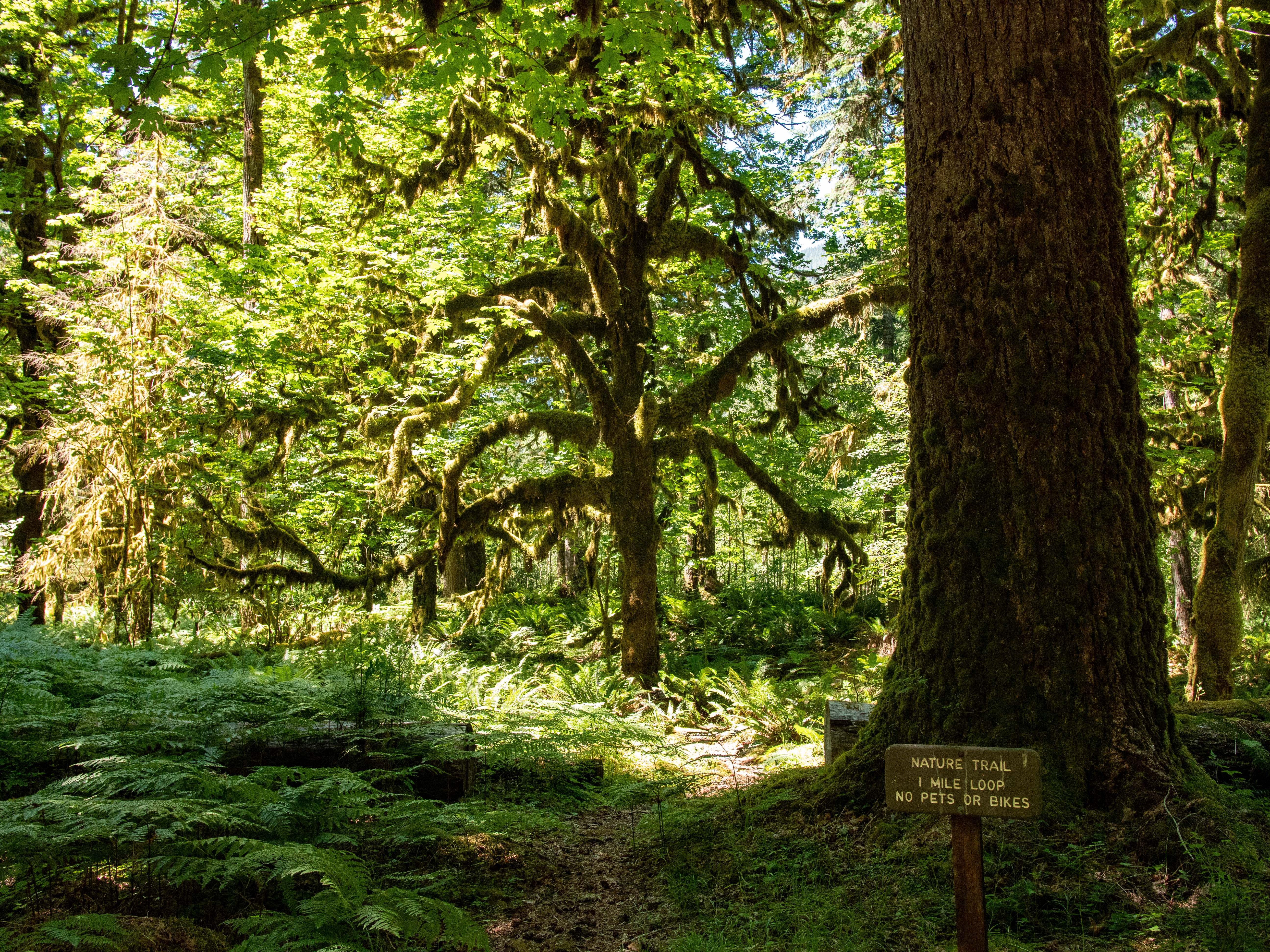
A one mile (1.6 km) loop through the rain forest. Find the trailhead across from the restrooms in the Graves Creek Campground.
Graves Creek Nature Trailhead Loop. 30 seconds A brown and white sign at the trailhead reads: Nature Trail. 1 mile loop. No pets or bikes. The trail varies in width and in places the surface is uneven with protruding rocks and tree roots. The trail passes through a lush forest where moss hangs like curtains from tree branches and grows in patches on tree trunks. Some tree branches are completely encased in moss. Tall, green ferns and yellow-green moss carpet the ground.
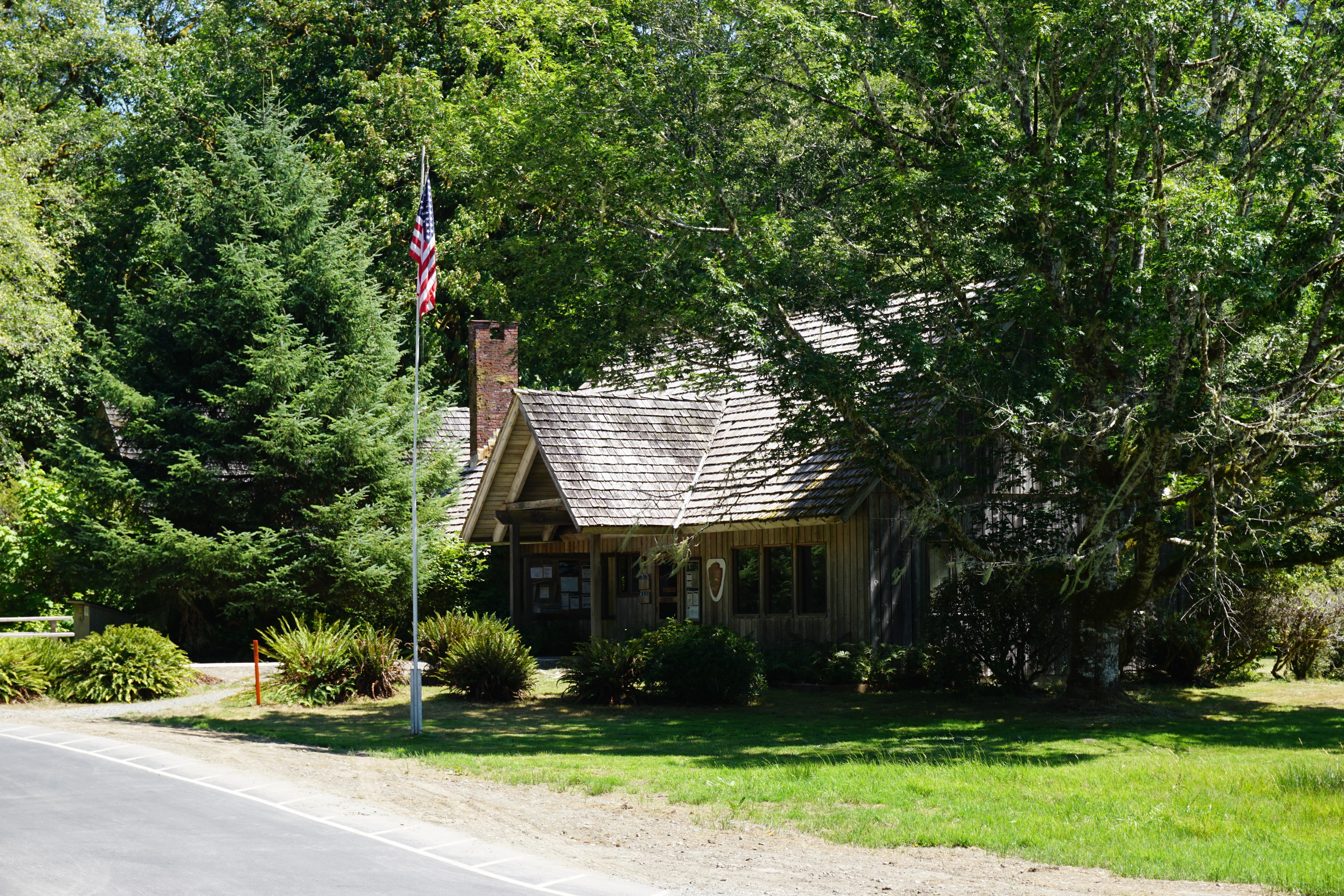
Graves Creek Ranger Station. 1 minute A brown wooden sign with white text that reads, Graves Creek Ranger Station, sits in front of a single-story building with a peaked brown shingle roof and brown wooden siding. A stone chimney rises above the building in the center of the roof. A small stone porch with two steps up is on the left side of the building under roof. Windows are trimmed in yellow. A tall, metal antenna structure about four times the height of the ranger station is to the right of the building. The open area around the station is dotted with clumps of large ferns and the forest behind the building is dense with tall pine trees, many with moss covered limbs.
Graves Creek Trailhead is a gateway to the Wilderness, where many backpackers begin their journeys (to make your own backcountry plans, contact the Wilderness Information Center nps.gov/olym/planyourvisit/wilderness.htm. For more information on Wilderness Information Center locations and hours, go to nps.gov/olymp/planyourvisit/wic.htm.) Shorter day trips on this trail will take you over a high bridge above Graves Creek, the first of many creeks the trail traverses through th
Graves Creek Trailhead. 1 minute On the left side of the gravel parking lot and facing the lot is an all gender, single stall, accessible restroom building with a vault toilet on a concrete pad. Enter on the right front side beneath an open alcove. The door to the restroom is on the left. At the far end of the parking lot is the trailhead. Here, large boulders have been placed across the trail entrance to only allow for pedestrian access. Beyond the boulders on the left side of the trail are two kiosks with four interpretive panels titled, Three Steps into Wilderness. On the right side of the trail is a roof covered bulletin board with posted information regarding Wilderness and fishing regulations, days hikes at Quinault, backcountry safety, Stock use in the Quinault Area, Pet Regulations, bear awareness, firearms and weapons, river crossings; and to contact a park ranger or dial 911 in an emergency. The gravel trail here is wide. Up trail is a wooden bridge with hand railings on each side. Across the bridge the trail becomes narrower. A sign on the right of trail reads: Pets, weapons, and vehicles are prohibited.
A steep, 2.8 mile (4.5 km) each way trail, with views of the Elwha River. Due to road washout, park at Madison Falls and take the road and bypass trail to get to the trailhead, about 1.8 miles (2.9 km) down the road. The trail starts behind the (currently non-operational) Elwha Ranger Station.
Griff Creek Trailhead. 40 seconds The trail begins as a narrow dirt path through a grassy meadow. A small brown and white sign on the right side of the trail has an upward pointing arrow and the words, Griff Creek Trail. Just before the meadow transitions to forest, weather station equipment is located in the tall grass on the left side of the trail.
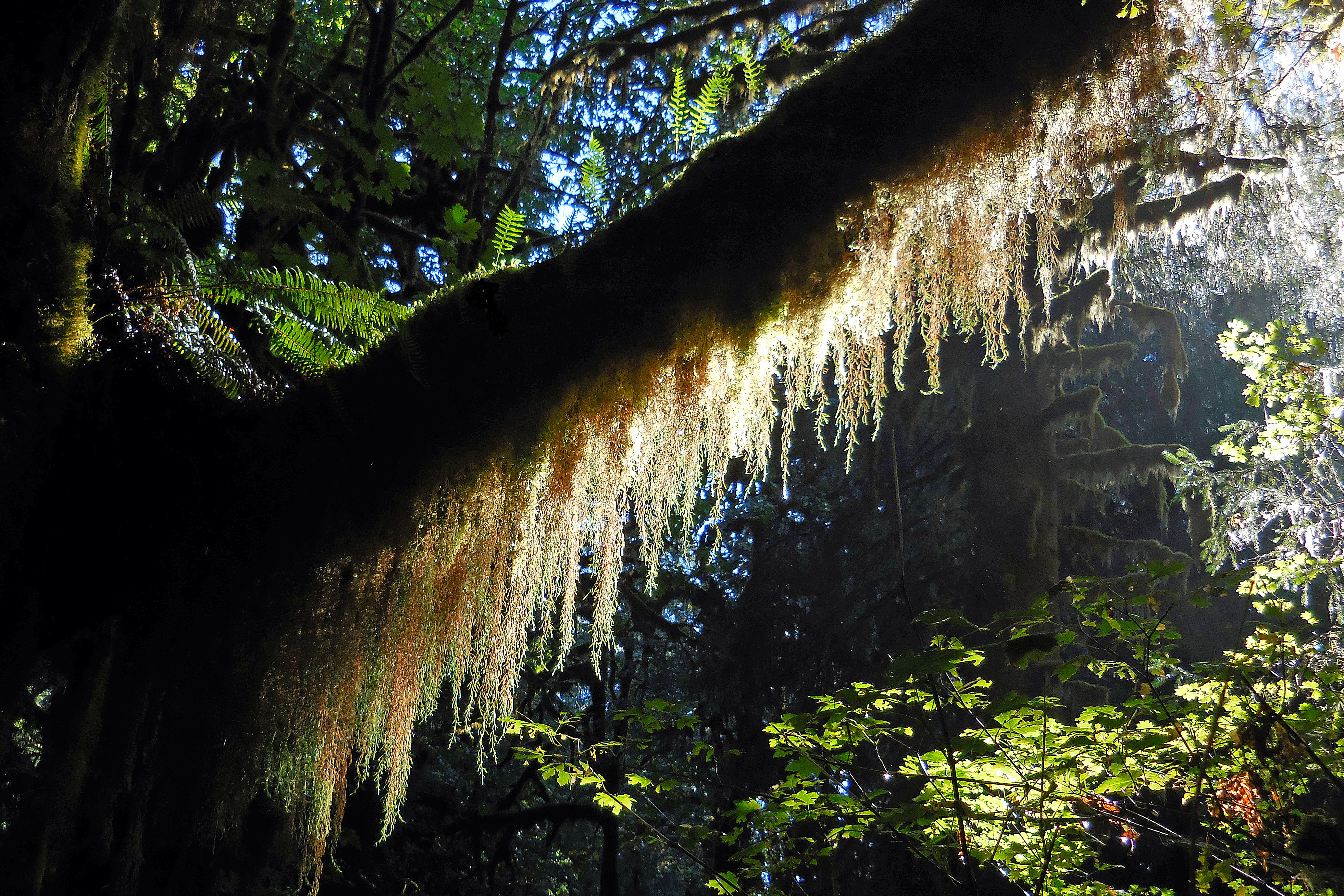
Hall of Mosses. 30 seconds Along the side of the trail stand trees with trunks covered in yellow-green moss and branches of hanging moss like tattered curtains. One tree is arched over top the trail from side to side. On the top of the arch, moss encased branches fan out. Timbers line each side of the trail under and just beyond the arching tree. The forest floor is lush with tall green ferns, mosses, and other low growing plants.
Located in the Hoh Rain Forest. The visitor center is open daily during the summer and intermittently during the winter. Educational exhibits and informational brochures available.
The Hurricane Ridge Visitor Center burned down on May 7, 2023. A Visitor Contact Station with information window is staffed daily in summer. Restrooms, water, information and maps are available. Guided walks and talks are offered during the summer.
Kalaloch Ranger Station is open intermittently during the summer and closed the rest of the year. Educational exhibits, informational brochures, a small sales area, and restrooms are available.
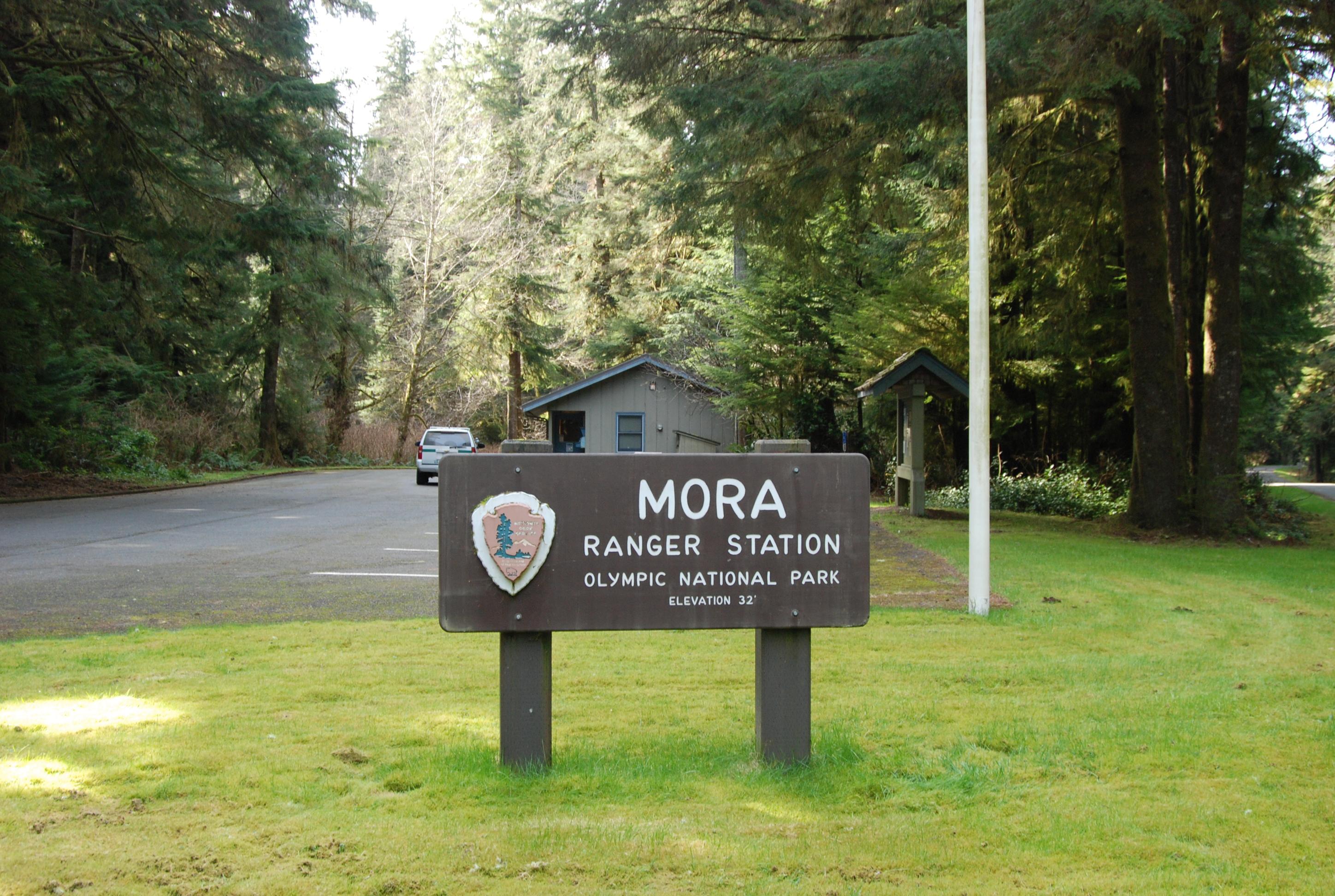
Small ranger station located two miles from Rialto Beach. Mora Campground nearby. Ranger Station is closed during winter. Open intermittently during the summer. Park maps and informational brochures available.
This is the main Visitor Center and Wilderness Information Center for Olympic National Park. Park staff are available daily at the visitor center, and by phone (360-565-3130) or email. Restrooms are available during the day.
CLOSED Quinault Rain Forest Ranger Station is open intermittently during the summer and closed during the rest of the year. Educational exhibits and informational brochures available.
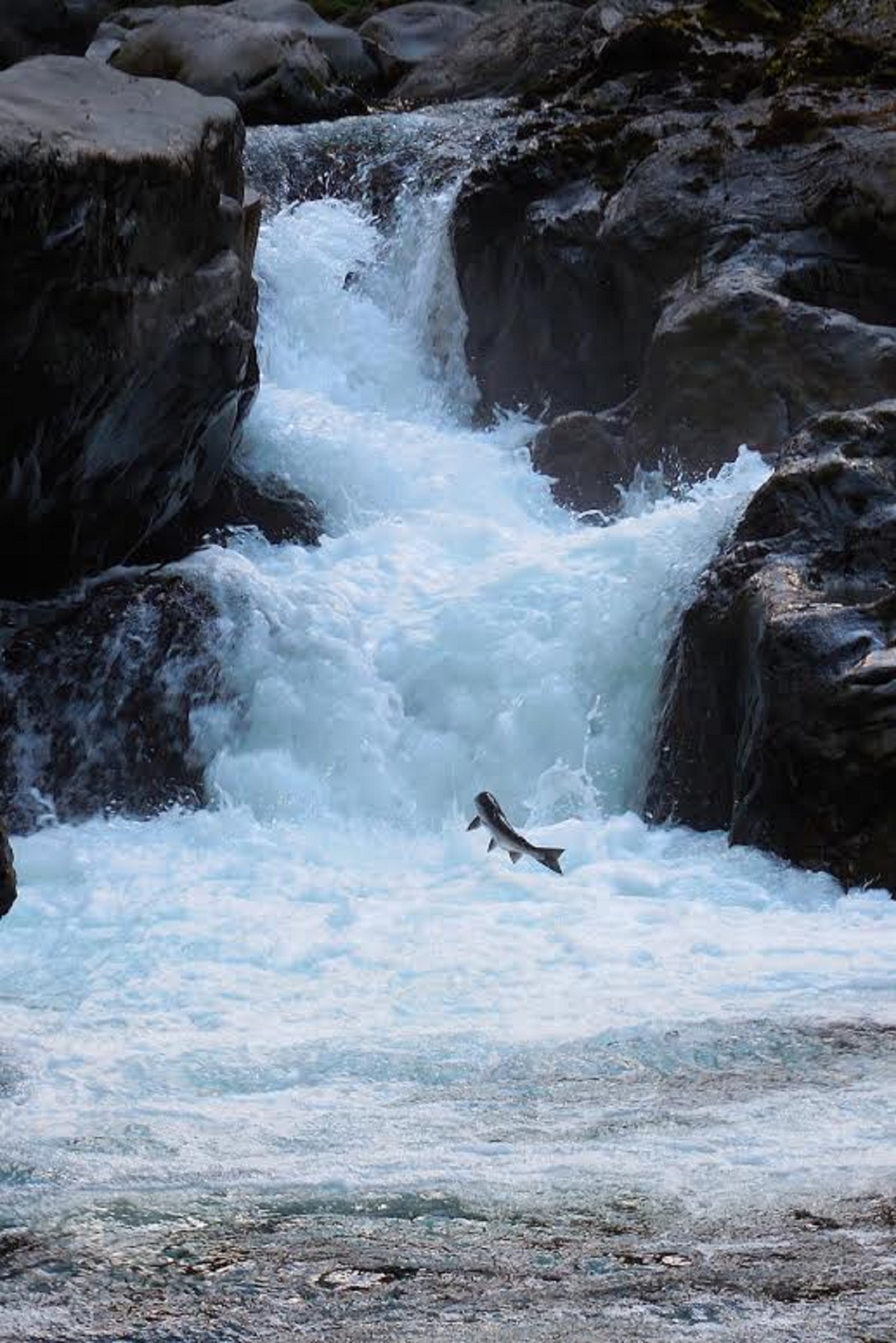
In the late summer and early fall, salmon can be seen leaping from Salmon Cascades on the Sol Duc River! Get a glimpse on a viewing platform located above the cascades.
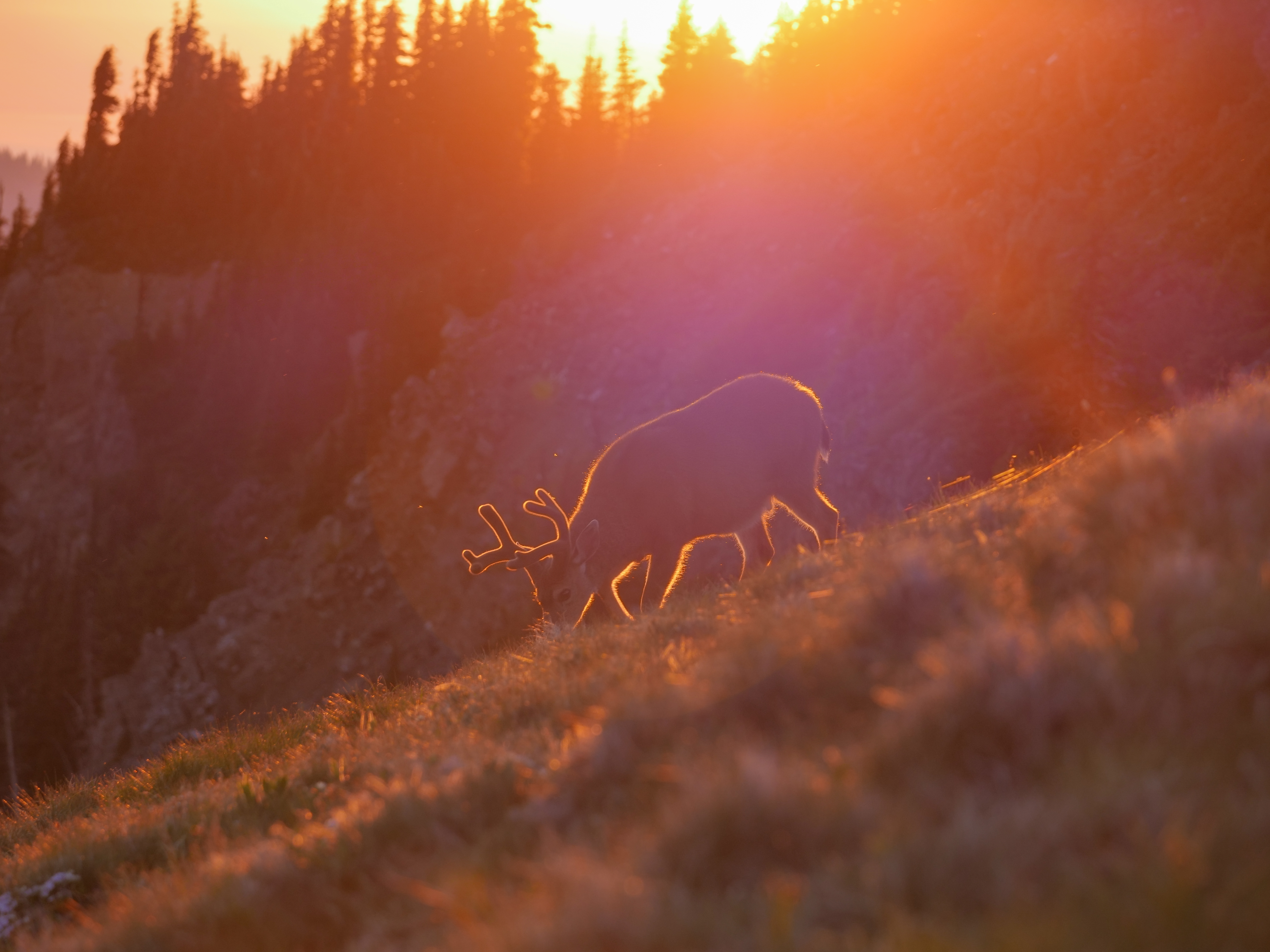
Observe Animals at Olympic National Park
In the park, we humans are privileged to be visitors to wild animals' home. We can treat their home with respect and care.
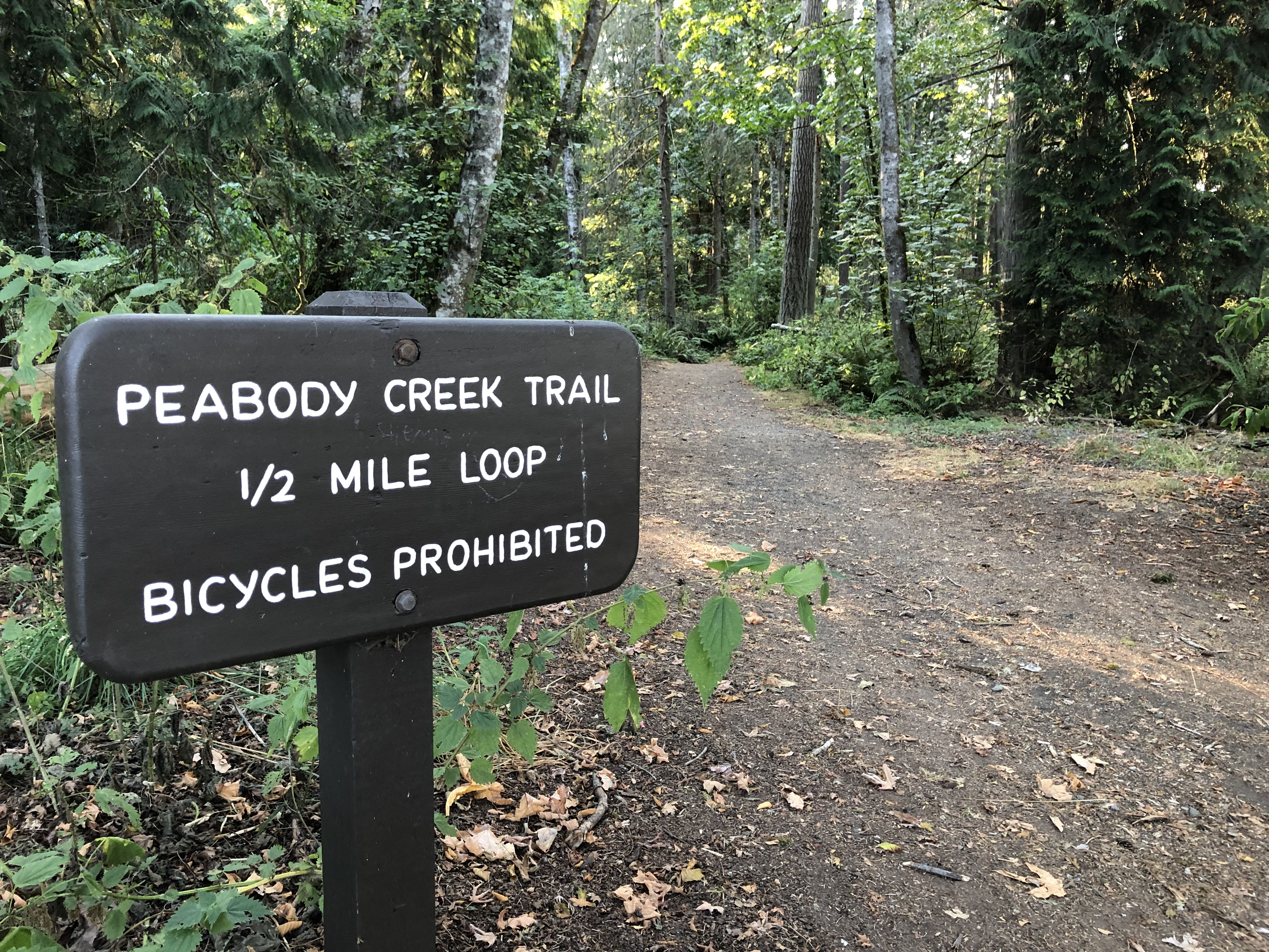
Take a Short Hike Near the Visitor Center
Near the Olympic National Park Visitor Center, two short loop hikes take visitors through peaceful, green lowland forests.
See Madison Falls
Madison Falls is a stunning 60-foot waterfall near the Elwha River. It's also one of the most accessible destinations at the park, making it a great stop for families and visitors of all abilities.
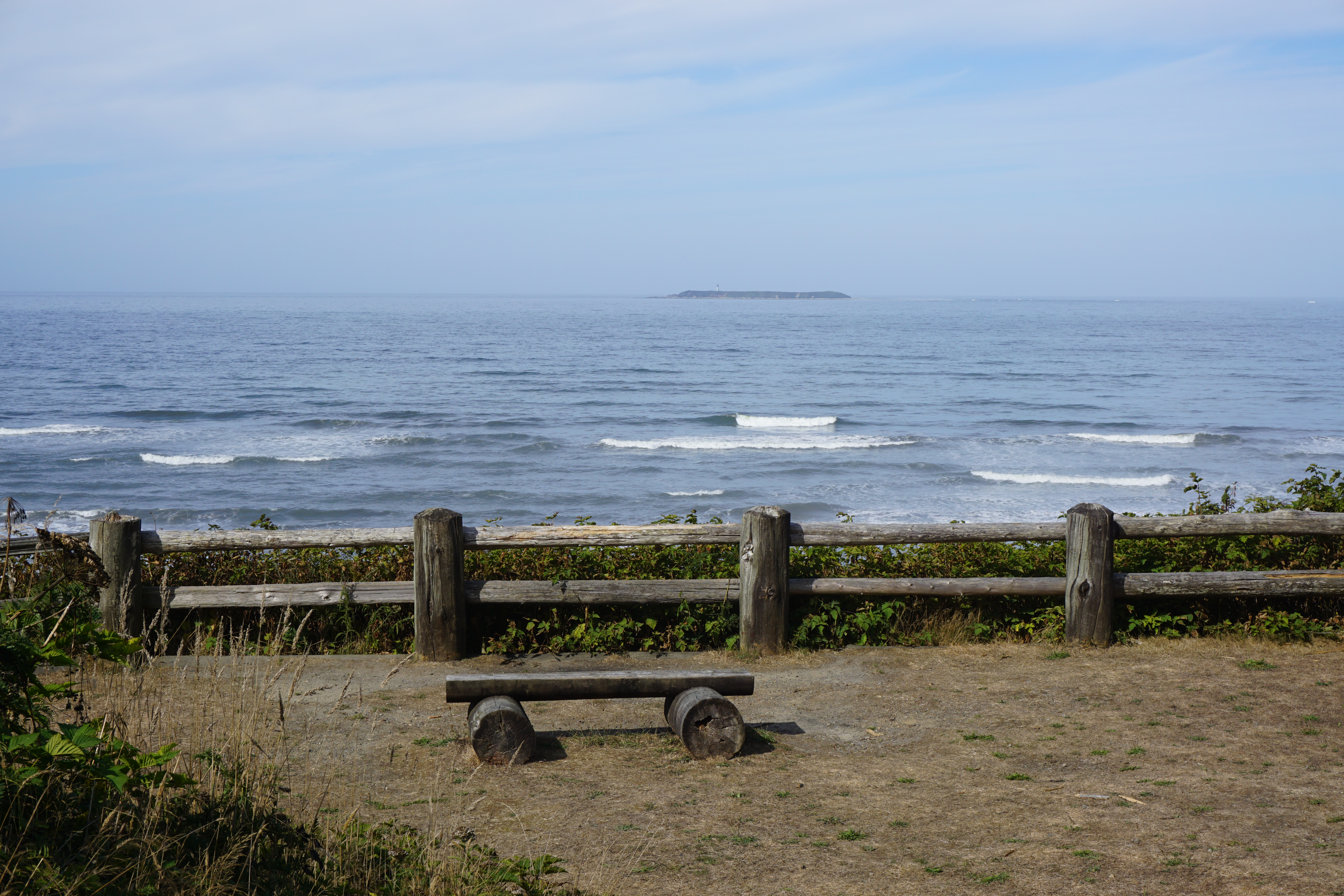
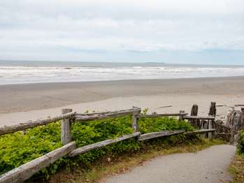
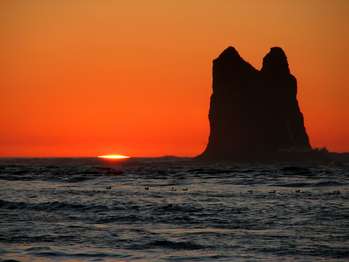
Go to the Beach
A trip to the Olympic Coast is sure to be memorable! Olympic National Park contains several beach areas along the coast, each with something to offer. Learn more about popular beaches and start planning your trip!
Walk the Moments in Time Trail
Take a peaceful stroll at Barnes Point on Lake Crescent on the Moments in Time Trail.
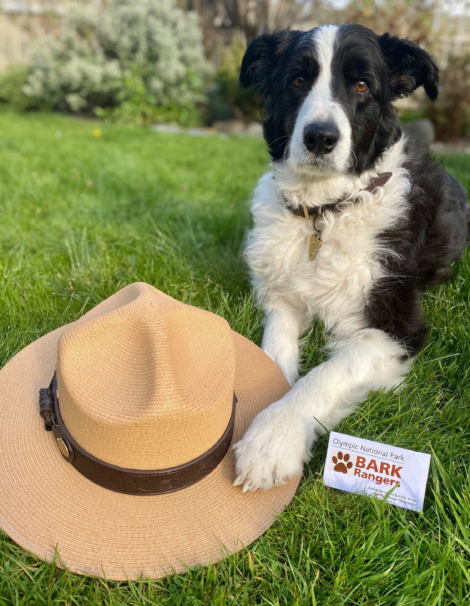
Take a Pet-Friendly Hike
Pets: they’re our faithful friends and loyal companions. But at Olympic National Park, they aren’t allowed everywhere! You can still have a great time at Olympic with pets, but be sure to read carefully and follow the rules so you know what to do and where to go.
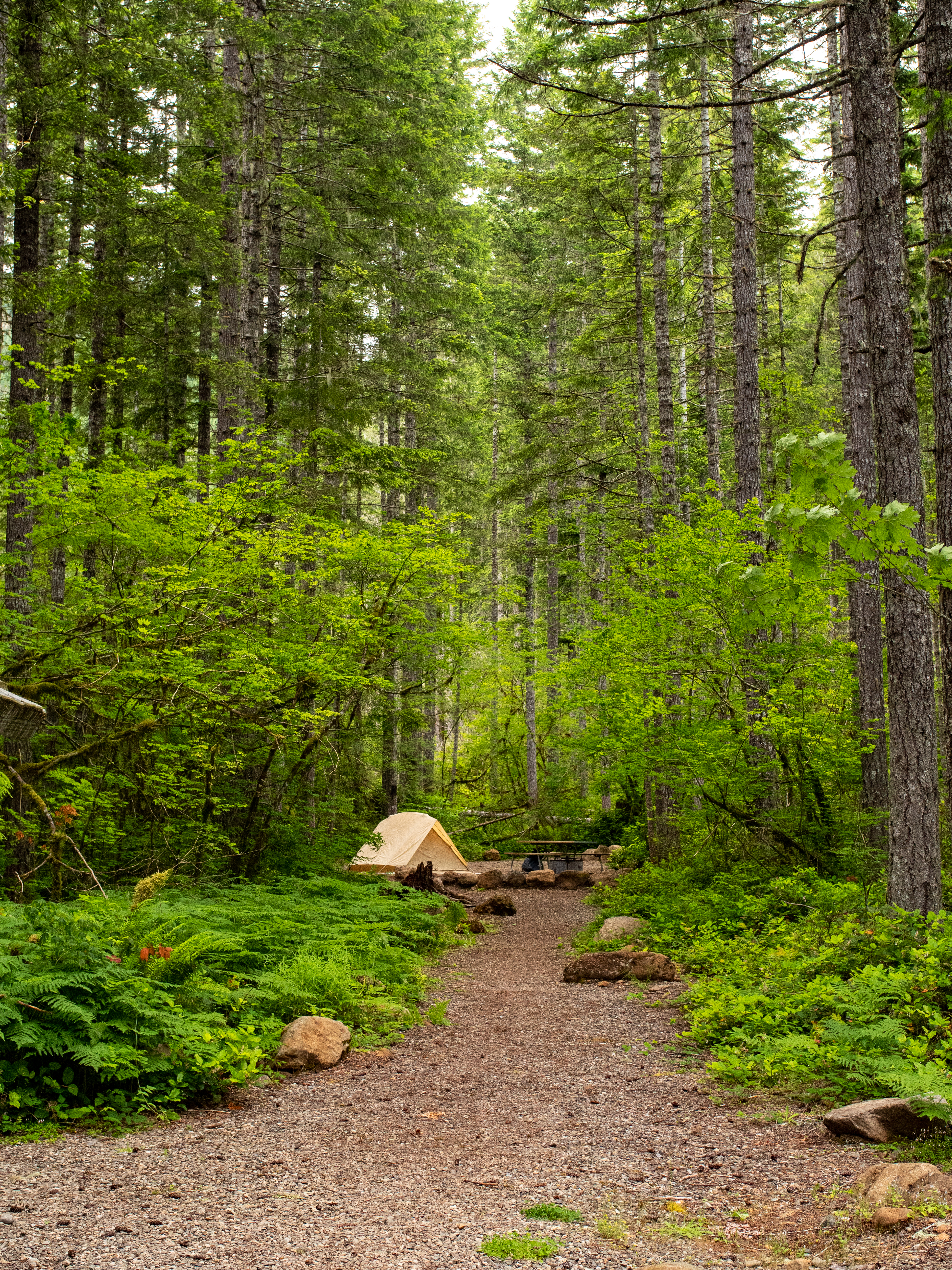
Backpack in Olympic National Park
While this app is a great tool for "front country" visits (places you can get to with a car, bike, or short hike), it's not meant to guide you through the back country. For that we have the Wilderness Information Center - WIC for short. The WIC rangers can talk through routes, gear, and trail conditions with you, and set you up with a permit.
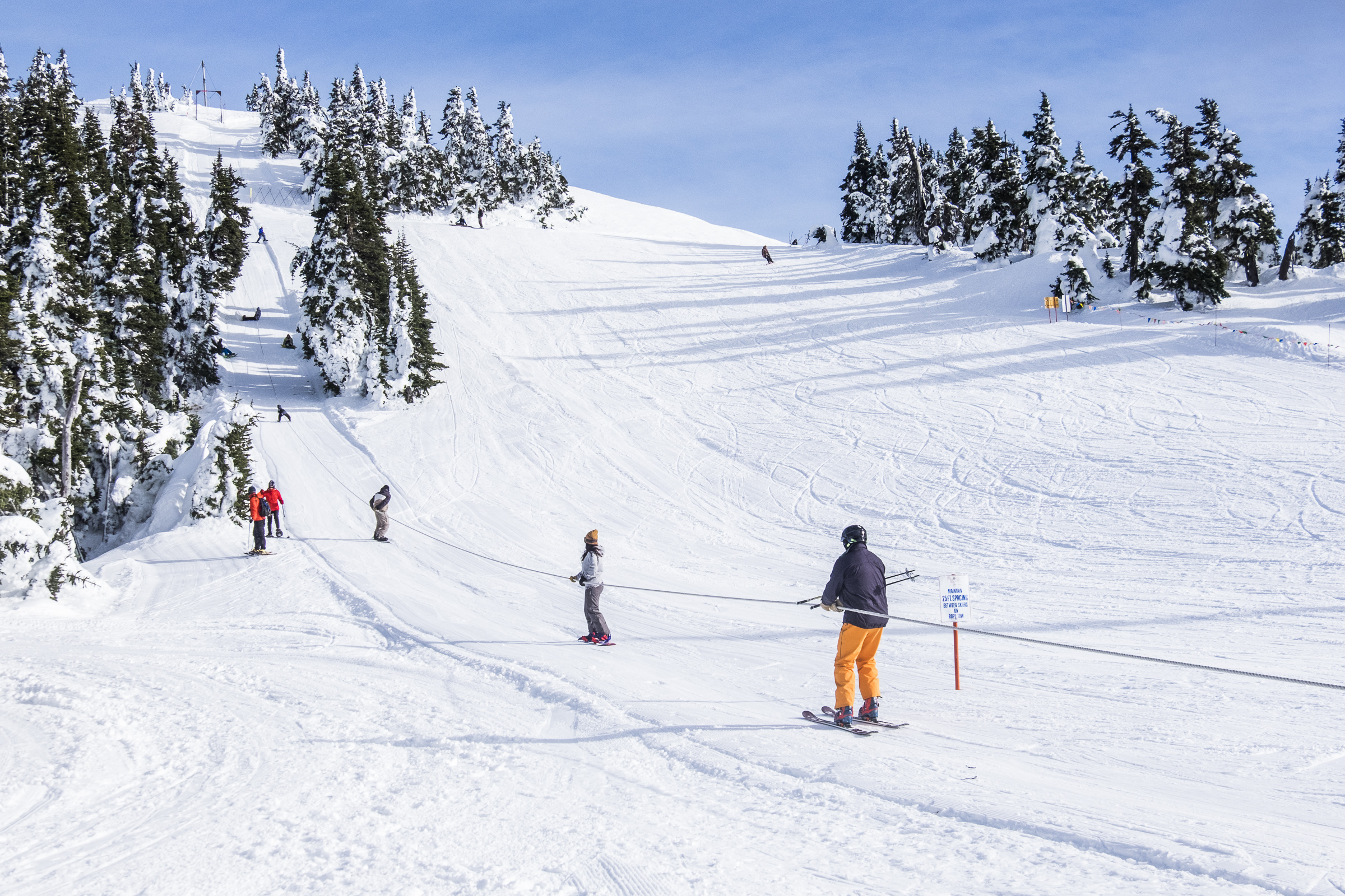
Play in the Snow in the Olympic Mountains
Hurricane Ridge provides opportunities for snowshoeing, cross-country and downhill skiing, snowboarding, tubing and more. Hurricane Ridge's winter season is generally mid-December through the end of March.
Tidepooling on the Olympic Coast
There are special places that allow you to see sea creatures up close without leaving the beach! Tidepools are home to fascinating creatures like sea stars, anemones, barnacles, nudibranchs, crabs, and more.
Tours
Count: 2
Gems of History and Culture in Western Washington
Did you know that western Washington is just as rich in history and culture as it is in natural beauty? These smaller sites are within a day's travel from Olympic, and each one has its own unique stories.
Trails with Accessibility Descriptions
These trails are some of the most popular in the park! Some meet the ADA criteria for fully accessible, and some do not. Knowing that people have all different kinds of needs and abilities, the following trails have been evaluated in detail, by and for people with disabilities. You know best what is accessible to you, so read on to find details about what the surface of the trail is like, its width, slope, what parking options are nearby, and detailed descriptions of each part of the trail and any f