Be advised that the NPS has issued alerts for this park.
Delays on Chapel Road
Expect wait times up to 30 minutes on Chapel Road due to road work.
Sand Point Road Closed Oct. 2 - 8
Sand Point Road will be temporarily closed to all vehicle and pedestrian traffic east of the Pictured Rocks National Lakeshore boundary from approximately Oct. 2 through Oct. 8, 2025, for a culvert replacement project. The closure may extend through Oct. 10 if additional time is needed to complete the work.
Munising Falls Trail Closed Until Further Notice
The Munising Falls Trail within Pictured Rocks National Lakeshore is closed until further notice. Approximately 75-feet of the paved trail was washed out April 28th from recent heavy rainfall and seasonal snow melt.
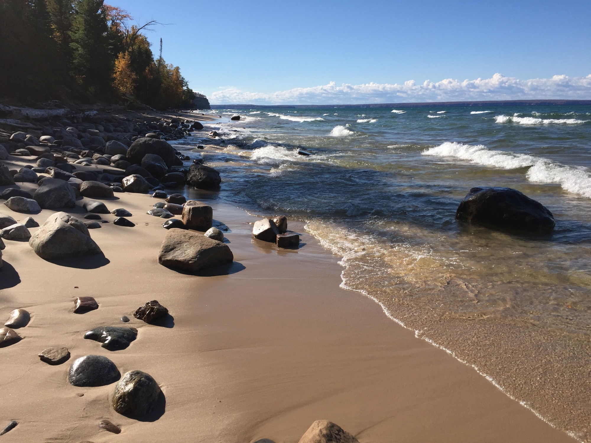
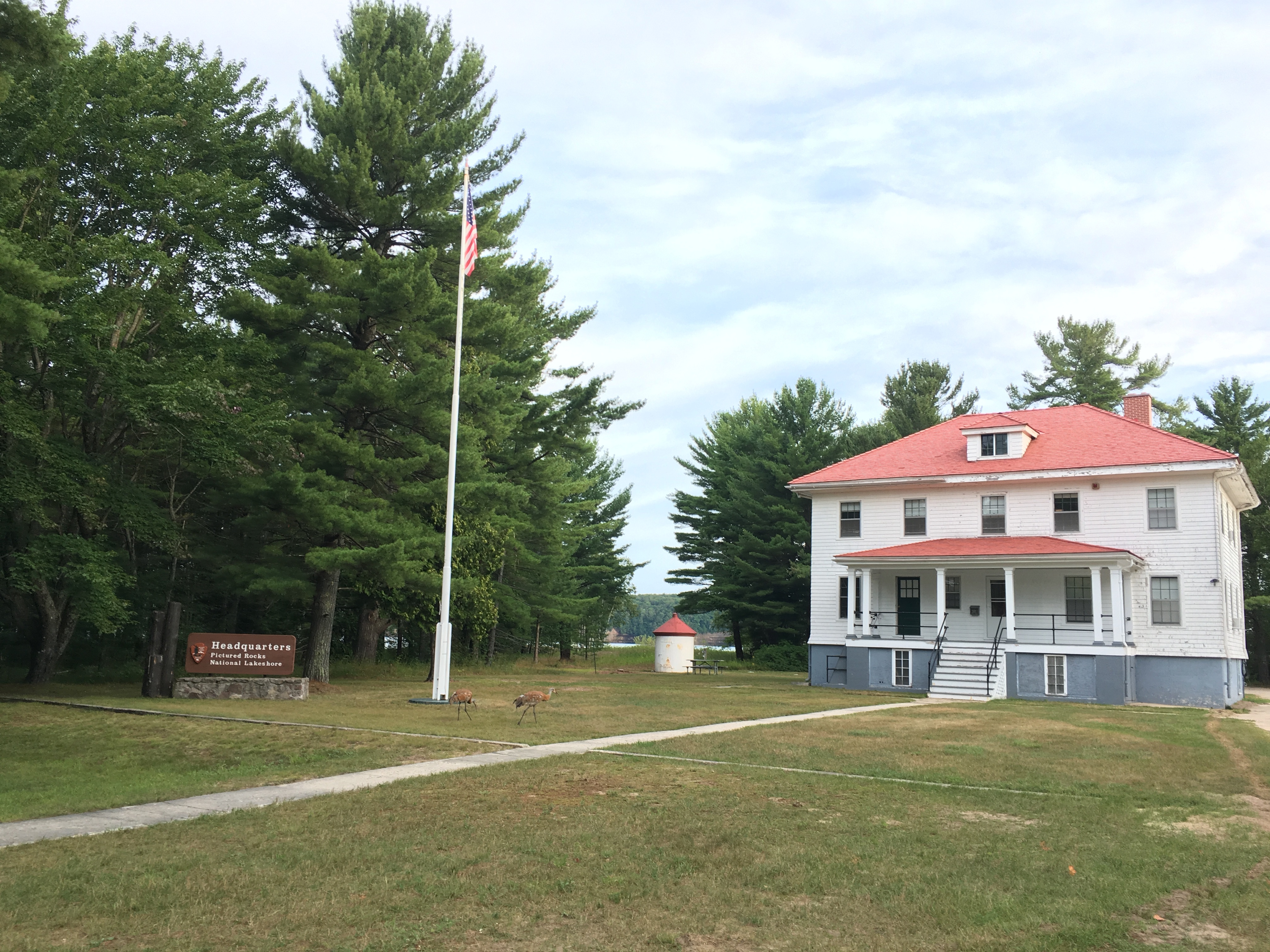
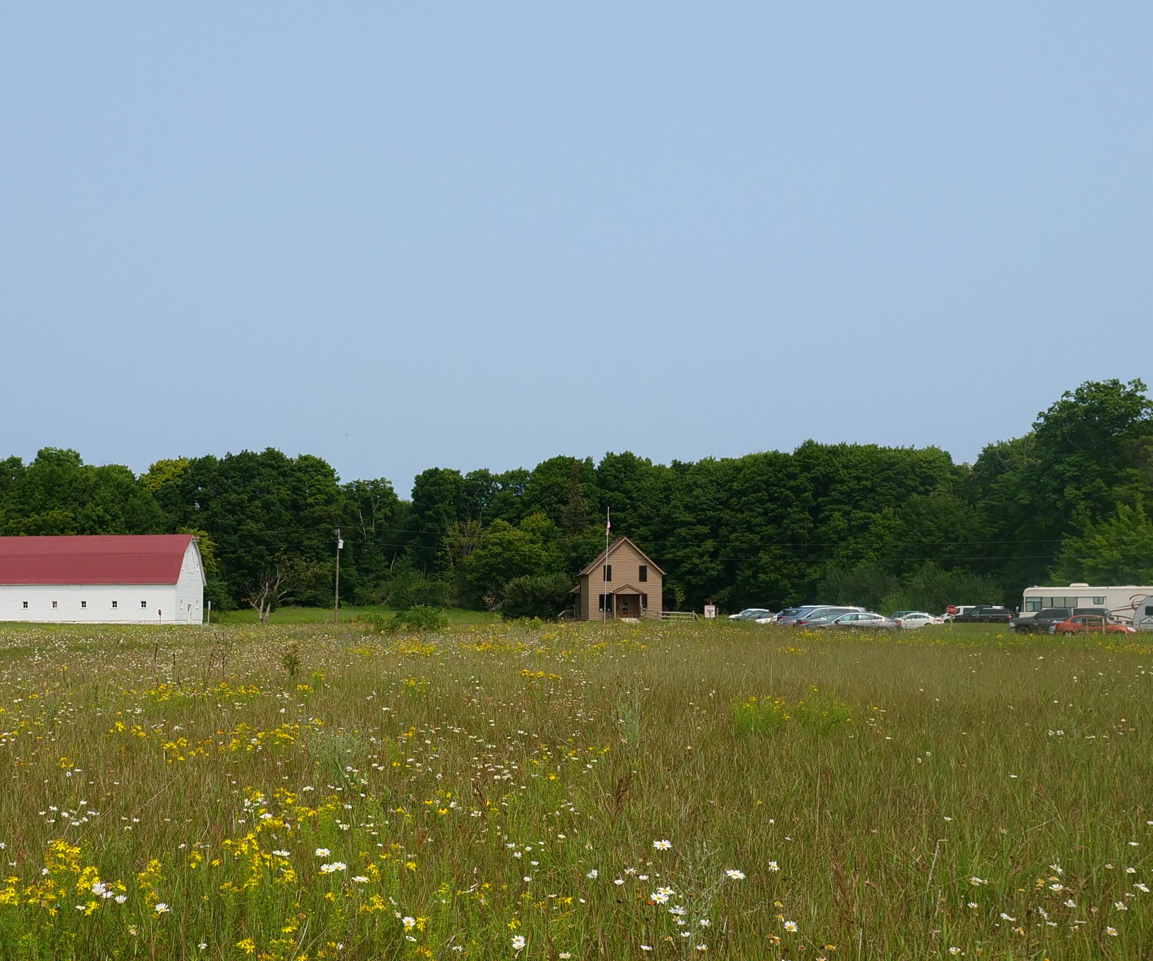
Sandstone cliffs, beaches, waterfalls, sand dunes, inland lakes, deep forest, and wild shoreline beckon you to visit Pictured Rocks National Lakeshore. The power of Lake Superior shapes the park's coastal features and affects every ecosystem, cre...
This pass admits the driver and all passengers in a private-use vehicle for seven consecutive days to all areas of Pictured Rocks National Lakeshore. This fee does not cover additional fees associated with activities such as camping or commercial tours.
Entrance - Motorcycle
$20.00
This pass admits a motorcyclist and passenger (if applicable) to all areas of Pictured Rocks National Lakeshore for 7 consecutive days. This fee does not cover additional fees associated with activities such as camping or commercial tours.
Entrance - Snowmobile
$15.00
This pass admits a snowmobile to all parts of Pictured Rocks National Lakeshore for 7 consecutive days. This fee does not cover additional fees associated with activities such as camping or commercial tours.
Entrance - Per Person
$15.00
This pass admits one walk-in, bicycle-in, or boat-in person to all parts of Pictured Rocks National Lakeshore. This fee does not cover additional fees associated with activities such as camping or commercial tours.
Commercial Entrance - Sedan
$25.00
This admits a commercial sedan to all areas of Pictured Rocks National Lakeshore. The flat rate for this pass is $25, plus an additional $5 per person age 16+. This fee does not cover additional fees associated with activities such as camping or commercial tours.
Commercial Entrance - Van
$40.00
This pass admits a commercial van with a capacity of 7-16 persons, regardless of capacity, to all parts of Pictured Rocks National Lakeshore. This fee does not cover additional fees associated with activities such as camping or commercial tours.
Commercial Entrance - Mini-bus
$40.00
This fee admits a commercial mini-bus to all parts of Pictured Rocks National Lakeshore. A mini-bus is defined as a vehicle with a 16-25 person capacity. The fee is charged regardless of occupancy of the vehicle. This fee does not cover additional fees associated with activities such as camping or commercial tours.
Commercial Entrance - Motor Coach
$100.00
This fee applies to commercial vehicles with a 26+ person vehicle capacity, regardless of occupancy. This fee does not cover additional fees associated with activities such as camping or commercial tours.
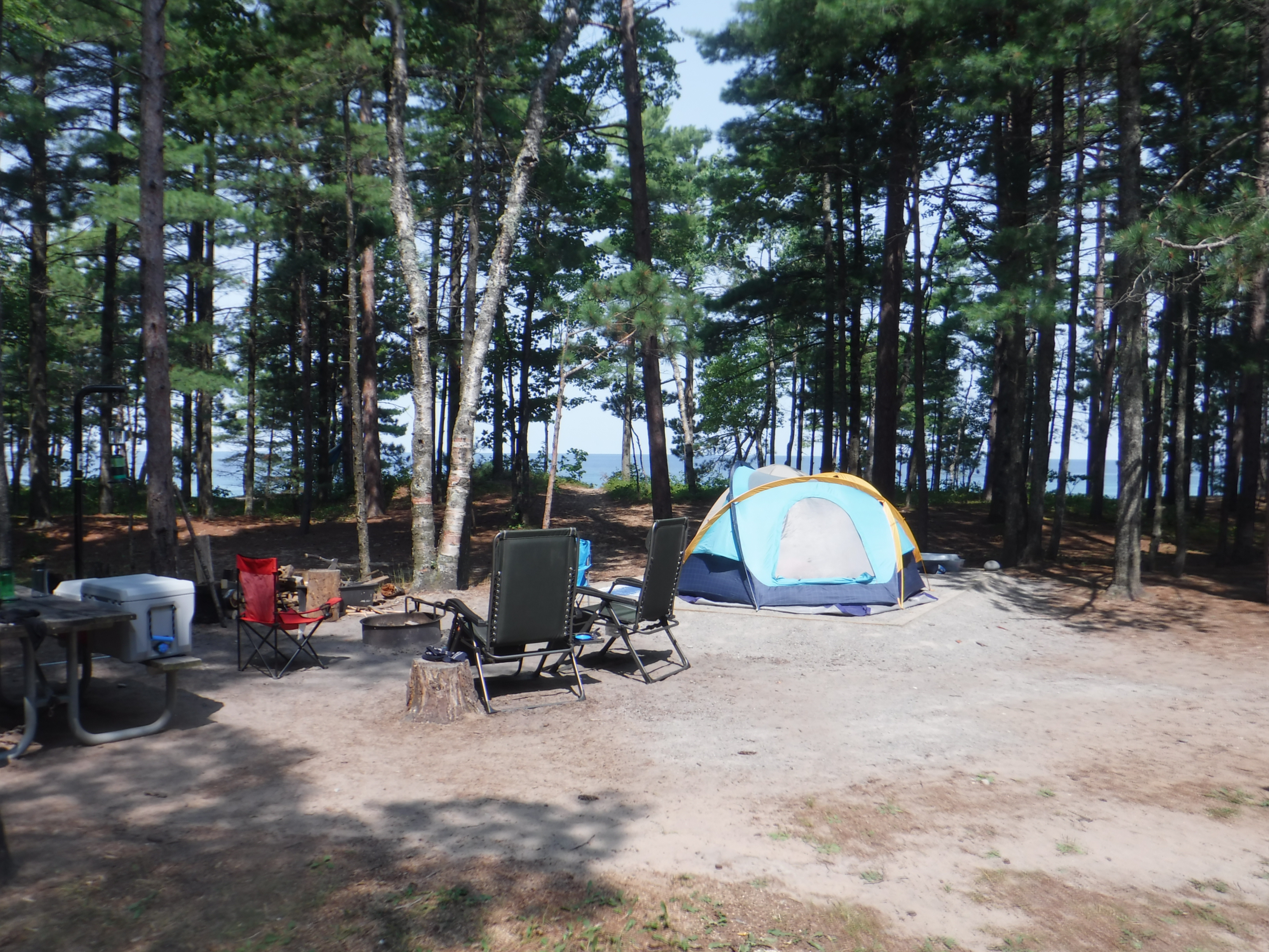
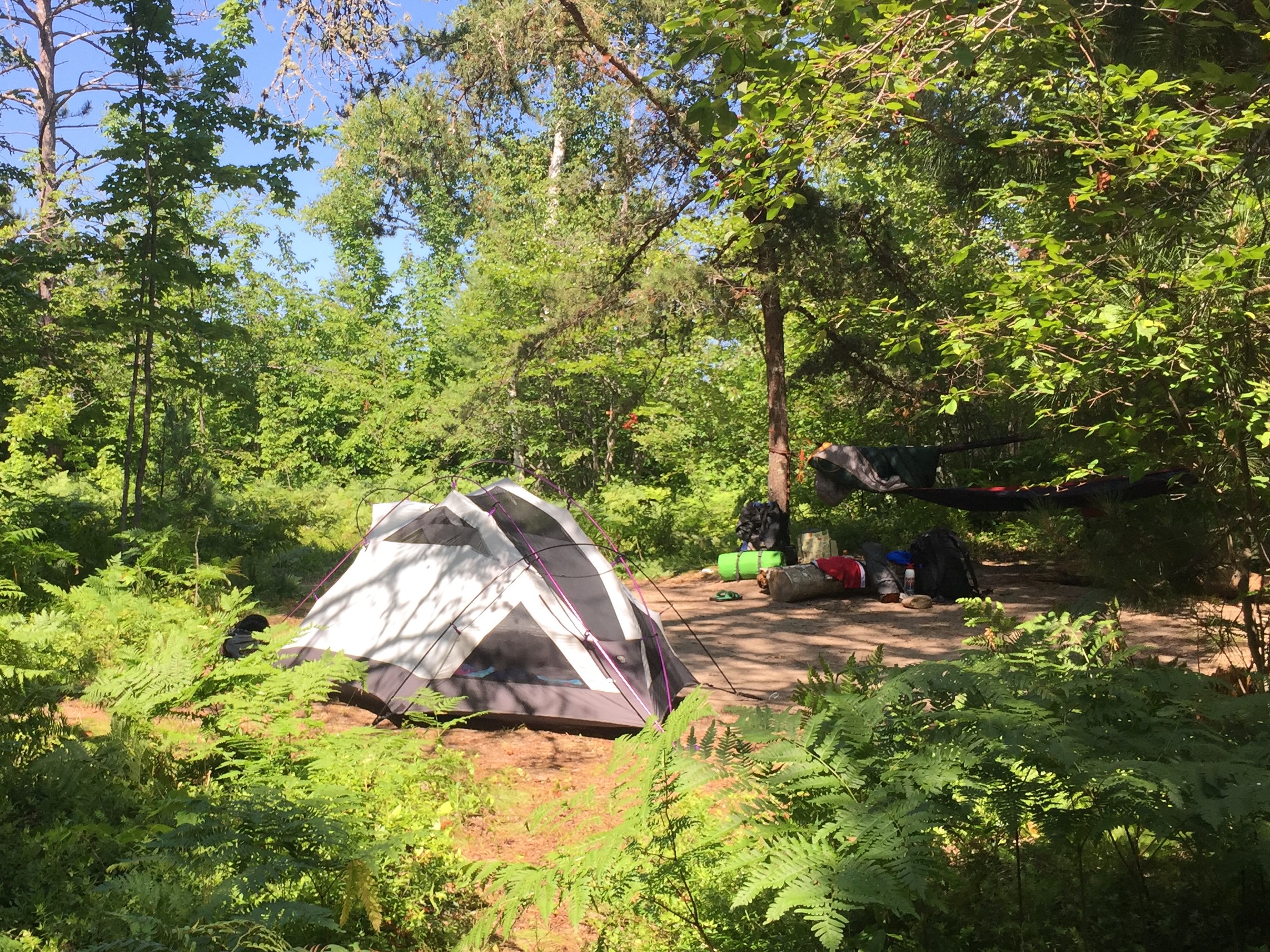
Overnight camping is permitted only in designated backcountry sites. These sites can only be reached by hiking or paddling (a few sites are accessible by boat). A backcountry camping permit is required for all overnight stays - year round. A permit is valid only for the dates, locations, and party size specified. Permits are not required for day hiking; however, day hikers must observe backcountry regulations.
Overnight camping is permitted only in designated backcountry sites. These sites can only be reached by hiking or paddling (a few sites are accessible by boats). A backcountry camping permit is required for all overnight stays - year round. A permit is valid only for the dates, locations, and party size specified. Permits are not required for day hiking; however, day hikers must observe backcountry regulations.
Overnight camping is permitted only in designated backcountry sites. These sites can only be reached by hiking or paddling (a few sites area accessible by boat). A backcountry camping permit is required for all overnight stays - year round. A permit is valid only for the dates, locations, and party size specified. Permits are not required for day hiking; however, day hikers must observe backcountry regulations.
Overnight camping is permitted only in designated backcountry sites. These sites can only be reached by hiking or paddling (a few sites are accessible by boat). A backcountry camping permit is required for all overnight stays - year round. A permit is valid only for the dates, locations, and party size specified. Permits are not required for day hiking; however, day hikers must observe backcountry regulations.
Overnight camping is permitted only in designated backcountry sites. These sites can only be reached by hiking or paddling (a few sites area accessible by boat). A backcountry camping permit is required for all overnight stays - year round. A permit is valid only for the dates, locations, and party size specified. Permits are not required for day hiking; however, day hikers must observe backcountry regulations.
Overnight camping is permitted only in designated backcountry sites. These sites can only be reached by hiking or paddling (a few sites are accessible by boat). A backcountry camping permit is required for all overnight stays - year round. A permit is valid only for the dates, locations, and party size specified. Permits are not required for day hiking; however, day hikers must observe backcountry regulations
Overnight camping is permitted only in designated backcountry sites. These sites can only be reached by hiking or paddling (a few sites area accessible by boat). A backcountry camping permit is required for all overnight stays - year round. A permit is valid only for the dates, locations, and party size specified. Permits are not required for day hiking; however, day hikers must observe backcountry regulations.
The key to a successful trip is careful planning and preparation. Please read the attached document thoroughly. When planning your itinerary, keep in mind the time of year, terrain, weather, and the physical condition of everyone in your party. You can only travel as fast as the slowest person in your group.
Overnight camping is permitted only in designated backcountry sites. These sites can only be reached by hiking or paddling (a few sites area accessible by boat). A backcountry camping permit is required for all overnight stays - year round. A permit is valid only for the dates, locations, and party size specified. Permits are not required for day hiking; however, day hikers must observe backcountry regulations.
All drive-in campgrounds require a reservation. To reserve a site, go to www.recreation.gov or call 1-877-444-6777. International callers: (606) 515-6777. Reservation line (TDD): (877) 833-6777 Wi-Fi is usually available at the Munising Falls Visitor Center (year round) and Grand Sable Visitor Center (summer only). Cell service usually can be picked up in Munising and Grand Marais.
All drive-in campgrounds require reservations. To reserve a site, go to www.recreation.gov or call 1-877-444-6777. International callers: (606) 515-6777. Reservation line (TDD): (877) 833-6777 Wi-Fi is available at the Munising Falls Visitor Center. Cell service usually can be picked up in Munising and Grand Marais.
The key to a successful trip is careful planning and preparation. Please read the attached document thoroughly. When planning your itinerary, keep in mind the time of year, terrain, weather, and the physical condition of everyone in your party. You can only travel as fast as the slowest person in your group.
Overnight camping is permitted only in designated backcountry sites. These sites can only be reached by hiking or paddling (a few sites area accessible by boat). A backcountry camping permit is required for all overnight stays - year round. A permit is valid only for the dates, locations, and party size specified. Permits are not required for day hiking; however, day hikers must observe backcountry regulations.
Overnight camping is permitted only in designated backcountry sites. These sites can only be reached by hiking or paddling (a few sites are accessible by boat). A backcountry camping permit is required for all overnight stays - year round. A permit is valid only for the dates, locations, and party size specified. Permits are not required for day hiking; however, day hikers must observe backcountry regulations.
Overnight camping is permitted only in designated backcountry sites. These sites can only be reached by hiking or paddling (a few sites area accessible by boat). A backcountry camping permit is required for all overnight stays - year round. A permit is valid only for the dates, locations, and party size specified. Permits are not required for day hiking; however, day hires must observe backcountry regulations.
Overnight camping is permitted only in designated backcountry sites. These sites can only be reached by hiking or paddling (a few sites are accessible by boat). A backcountry camping permit is required for all overnight stays - year round. A permit is valid only for the dates, locations, and party size specified. Permits are not required for day hiking; however, day hikers must observe backcountry regulations.
Overnight camping is permitted only in designated backcountry sites. These sites can only be reached by hiking or paddling (a few sites area accessible by boat). A backcountry camping permit is required for all overnight stays - year round. A permit is valid only for the dates, locations, and party size specified. Permits are not required for day hiking; however, day hikers must observe backcountry regulations.
Overnight camping is permitted only in designated backcountry sites. These sites can only be reached by hiking or paddling (a few sites area accessible by boat). A backcountry camping permit is required for all overnight stays - year round. A permit is valid only for the dates, locations, and party size specified. Permits are not required for day hiking; however, day hikers must observe backcountry regulations.
Overnight camping is permitted only in designated backcountry sites. These sites can only be reached by hiking or paddling (a few sites area accessible by boat). A backcountry camping permit is required for all overnight stays - year round. A permit is valid only for the dates, locations, and party size specified. Permits are not required for day hiking; however, day hikers must observe backcountry regulations.
The key to a successful trip is careful planning and preparation. Please read the attached document thoroughly. When planning your itinerary, keep in mind the time of year, terrain, weather, and the physical condition of everyone in your party. You can only travel as fast as the slowest person in your group.
Overnight camping is permitted only in designated backcountry sites. These sites can only be reached by hiking or paddling (a few sites area accessible by boat). A backcountry camping permit is required for all overnight stays - year round. A permit is valid only for the dates, locations, and party size specified. Permits are not required for day hiking; however, day hikers must observe backcountry regulations.
All drive-in campgrounds require a reservation. To reserve a site, go to www.recreation.gov or call 1-877-444-6777. International callers: (606) 515-6777. Reservation line (TDD): (877) 833-6777 Wi-Fi is usually available at the Munising Falls Visitor Center (year-round) & Grand Sable Visitor Center (summer only). Cell service usually can be picked up in Munising and Grand Marais.
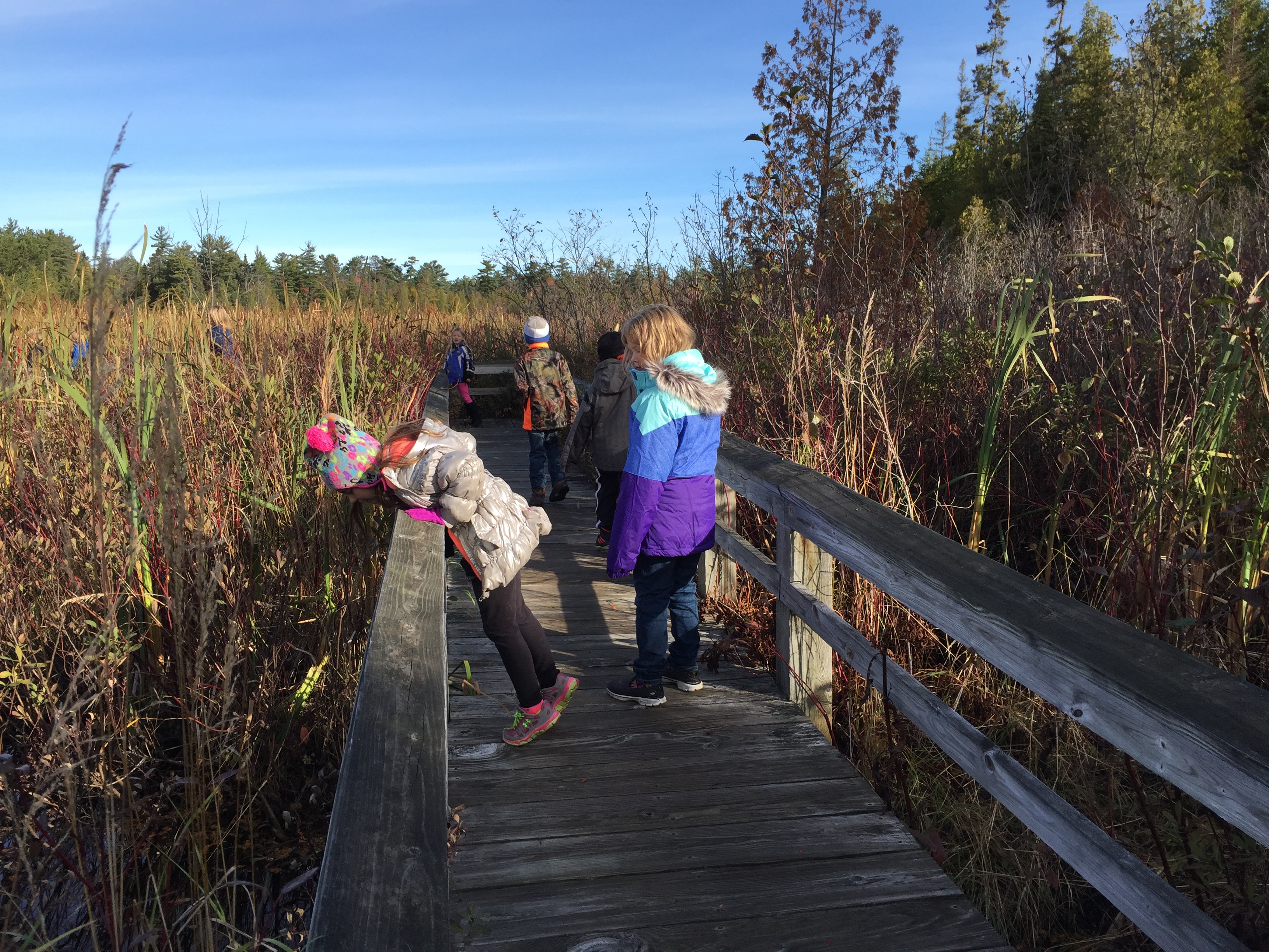
Description of the exhibit area: In this exhibit area, you are surrounded by open wetlands. Beside the trail, tall wetland plants such as cattails rise from the water. There are large ponds on either side of the trail and open water channels below the boardwalk. Description of the exhibit: The exhibit is angled and mounted to the boardwalk railing. The exhibit panel is 3 and a half feet wide by 2 feet deep. The exhibit is about the animals and plants living in a pond. The background image is a color illustration showing a pond scene above and below the water. Labels identify plants and animals. Above the water are emergent plants: spiky bur-reeds, giant water dock with its broad, pointed leaves; a swamp rose shrub with pink blossoms; and the cup-shaped white flowers and heart-shaped leaves of wild calla. On the water surface are other plants: spindly stems and yellow flowers of floating bladderwort; round floating leaves and starburst white flowers of sweet-scented water lily; elongated floating leaves and pink flower spikes of water smartweed. Below the water, rooted in the pond floor is whorled water-milfoil plant; its stalks rise to the surface and emerge bearing small white flowers. There are several animals above the water. In the left side of the pond scene, balanced on the water surface is a water strider insect. Its body is long and narrow. Its long legs splay outward, creating dimples on the surface. Next to the insect, a pied-billed grebe paddles; it is a brownish duck-like bird with a short, pointed bill and a short tail. Its feet, visible below the water, are not webbed like a duck’s—rather, they have flexible lobes that fan out from the sides of each toe. At upper right, an adult spatterdock darner dragonfly soars. Its huge eyes and long narrow body are bright blue with dark lines. Near the adult dragonfly, on a bent cattail, another dragonfly is emerging from its larval stage. The young dragonfly is curling back and outwards, pulling its light-green abdomen free from its exoskeleton to complete its emergence. Its brand-new wings are unfolding. Below the dragonflies, perched on a log above the water surface, a large green frog watches the scene with wide golden eyes. Its body is light green with dark green patterns. Below the water are more animals. At left, a blue-spotted salamander floats in mid-water. Its body is long and narrow, with light and dark green patterns. Pale, feather-like gill tufts fan out on either side of its head. To its right, a painted turtle swims. It has a somewhat flattened shell—dark green on top and paler underneath. Its legs and tail are long and sturdy; the webbed hind feet are pushing it toward the surface. Its blunt, narrow head, striped boldly with yellow and greenish-brown, is sticking out above the water. Below the turtle, two fivespine stickleback fish swim. They are dull green in color, slender with large, rounded fins on their backs, sides, and bellies. To the right of them, and below the adult frog, are four tadpoles, appearing to be half head and half tail with no limbs. They are dull green with translucent tails. Their eyes are large. Title and main text of the exhibit: A Frog’s Eye View Here at the pond, the water is deeper than in the surrounding wetland areas of Sand Point Marsh. With less terrestrial vegetation and more open water, the sunlight encourages aquatic plants to grow and a host of invertebrates, fish, and insects flourish here. Even the birds take advantage of this underwater smorgasbord. Take a moment and watch for movement: the glint of wings, shimmering ripples, a moving shadow underwater. This place teems with interconnected life. Subsection 1: Labels identify the following plants: Bur-reed Giant Water Dock Swamp Rose Wild Calla Floating Bladderwort Sweet-scented Waterlily Water Smartweed Whorled Water-milfoil Labels identify the following animals: Water Strider Pied-billed Grebe Spatterdock Darner, Adult & Larvae Green Frog Blue-spotted Salamander Painted Turtle Fivespine Stickleback Tadpole Subsection 2: At the bottom of the panel, a label shows the words for this habitat in English and Ojibwe. The text reads: Small Pond The Ojibwe word for Small Pond is “Waanzhibiiyaa.”
Description of the exhibit area: In this exhibit area, the boardwalk platform looks out over an open wetland. Small patches of water are visible among the dense water-loving vegetation. Behind you to the east is a band of denser, drier forest. Description of the exhibit: The exhibit is angled and mounted to the boardwalk platform by two base legs. The exhibit panel is 3 feet wide by 2 feet deep. The exhibit is about the natural sounds of the wetland. The background image is a photo of the wetland at dusk, going from dense grassy marsh at the bottom to a band of trees to open sky above. Set against that background are the main photos of three birds and two frogs. The birds are perched on a gray branch. The frogs are positioned on the wetland plants below. Each animal’s photo is accompanied by an outlined box with information about it—including its name in English and Ojibwe. Next to each animal is a round raised button that you can press to hear the song of that species. Title and main text of the exhibit: A Song with Purpose From before dawn to after dusk, wild voices rise all around the marsh. Each species communicates with its own repertoire of songs and calls. Some sing to attract mates while others call out to warn intruders to stay away. Whose songs do you hear today? Subsection 1: Red-winged Blackbird The leftmost species is the red-winged blackbird. The bird is perched looking up and to the left. It is a male bird, glossy black with a bright red and yellow crescent on the shoulder of its wing. Its eye is large and dark. Its beak is broad at its base and quite sharp. The text begins with the subtitle and reads: Red-winged Blackbird The Ojibwe word for Red-winged Blackbird is “Miskiwinigwii Asiginaak.” Perched among the cattails and rushes, these marsh-nesting birds are easy to identify and their bold “O-ka-Le-EE!!” call is unmistakable. Subsection 2: White-throated Sparrow Directly to the right of the blackbird and its song button is the white-throated sparrow. The compact, short-billed bird is perched and looking to the right. It has a long narrow tail, short wings, and pink feet with long claws. Its base color is creamy brown on the back and pale cream on the chest, with a pattern of black and russet spots and stripes on the back and wings. It has black stripes on its crown and behind its eyes, buff-colored stripes above its eyes, and a bright white throat. The text begins with the subtitle and reads: White-throated Sparrow The Ojibwe word for White-throated Sparrow is “Aanak.” These forest birds sing a series of sweet whistles, sometimes described as “Oh, sweet Canada, Canada, Canada.” Subsection 3: Common Yellowthroat Above and to the right of the sparrow and its song button is perched a male yellowthroat bird, looking to the right, with its slender black bill open in song. It is a small delicate bird with a bright yellow throat, belly, and under-tail. Its tail, wings, back, and the back of its head are greenish-gray. Black feathers mask its face from the bill to behind the eye. A cream-colored band crosses its forehead and curves down behind the black mask on either side. The text begins with the subtitle and reads: Common Yellowthroat From their wetland shrub habitat, these black-masked warblers sing a sharp “WICH-ety, WICH-ety, WICH-ety.” Subsection 4: Northern Spring Peeper Below the yellowthroat and its song button is the northern spring peeper frog. The animal is a delicate-looking frog, shown standing with its throat inflated in song. Its body has undertones of pale pink with grayish and brownish patterns. Its eyes are large and prominent. Its toes are short and slender. The text begins with the subtitle and reads: Northern Spring Peeper The Ojibwe word for Northern Spring Peeper is “Giziibwewed.” These tiny frogs call out a high-pitched “Peep! Peep! Peep!” The louder and faster the male frog peeps, the more likely he is to impress the females. Subsection 5: Northern Green Frog The final species is the northern green frog. You will find it and its song button at the very bottom center of the panel. The frog is crouched and looking up and to the left. Its body is compact and sturdy-looking, with a heavily-textured skin. From the shoulders back it is bronze-brown patterned with dark brown. Its head is metallic green patterned with dark brown. Its eyes are bronze colored with horizontal black pupils. The text begins with the subtitle and reads: Northern Green Frog The Ojibwe word for Northern Green Frog is “Nitaagabi Omakakii.” In spring mating season, these large frogs sing a low-pitched plunking song like a plucked banjo string “Clung!”
You are standing at the lower wooden overlook platform for Sable Falls. A large, cascading waterfall is rushing in front of you, surrounded by thick vegetation.
Description of the exhibit area: In this exhibit area, the boardwalk is surrounded by pines, spruces, and hardwood trees. To the east is a large swale pond. Below the boardwalk, reeds and other marsh vegetation slope to the near edge of the pond. Across the pond to the east, more pines, cedars, spruces, and hardwoods bristle up, interspersed with wetland. In the distance is a forested ridge. Behind you, the paved trail loops back to the beginning of the Sand Point Marsh Trail and the parking area. Description of the exhibit: The exhibit is angled and mounted to the boardwalk platform by two base legs. The exhibit panel is 3 and a half feet wide by 2 feet deep. The exhibit is about the natural functions of wetlands. The main image is a large color illustration of a slice of this landscape in cutaway view. It shows how the land rises from the sandy lake edge at lower left, through wrinkled topography of dunes, swales, and ponds, up to a steep bluff at upper right. Trees and wetland vegetation cover the land between the ponds. Most of the vegetation is colored green and gold, suggesting summer or early fall. On the top right side of the illustration, a cloud rains over the cliffs with small waterfalls flowing over the edge. On another section of the bluff, a white circle encloses an area illustrated as a winter view, with icicles hanging over the cliff and a snow cloud hovering above. Water flows from high ground to low ground across the landscape from the cliffs on the top right toward the shore on the bottom left, with waterfalls and streams leading from the cliffs to the wetlands and saturated grounds. The cutaway side of the landscape shows the groundwater line, level with the lake and emerging into some of the lowermost ponds. Arrows with captions point out and explain the movement and significance of water traveling from the rain and snow clouds down to the wetlands and eventually to Lake Superior. Title and main text of the exhibit: A Wetland at Work All around you, and deep below, water is moving toward Lake Superior. Groundwater percolates out from the porous sandstone into the wetlands. It pours from the bluff to the east, trickles through streams and beaver channels, pauses in ponds, and works its way slowly among sand grains below. By the time it reaches the lake, the water flows steady and clean. This is the quiet, essential work of the wetland: water storage, water filtration, and water renewal. Subsection 1: Precipitation The first caption points to the rain cloud. The text reads: Precipitation This region of Michigan receives 40 inches of rain and upwards of 220 inches of snow annually. Subsection 2: Run-off The second caption points to a stream pouring over the cliff. The text reads: Run-off Water enters the wetlands as run-off from springs and waterfalls coming off the bluff and from seasonal rainfall, snow, and ice melt. Subsection 3: Slow the Water The third caption points to wetland vegetation. The text reads: Slow the Water Trees, root mats, and other wetland vegetation slow the speed of run-off flood waters and distribute them more slowly over the floodplain. Subsection 4: Recharge Groundwater The fourth caption points to a small pond that is connected to the groundwater. The text reads: Recharge Groundwater Wetlands are especially important for recharging groundwater aquifers. At Sand Point, groundwater is close to the surface and very nearly the same level as the lake. Subsection 5: Natural Sponges The fifth caption points to wetland vegetation. The text reads: Natural Sponges Wetlands function as natural sponges that trap and slowly release surface water, rainwater, snowmelt, groundwater, and flood waters. Subsection 6: Filter Out Chemicals The sixth caption points to lower wetland vegetation. The text reads: Filter Out Chemicals As water slowly flows through the marsh, wetlands maintain water quality by filtering out chemical and organic materials which reduces the amount of sediment flowing into the lake. Subsection 7: Protect Shorelines The seventh caption points to vegetation just above the lake shore. The text reads: Protect Shorelines Vegetated wetlands along the shores of lakes and rivers protect against erosion caused by waves during floods and storms.
Description of the exhibit area: In this exhibit area, you are surrounded by wetlands, including open ponds, narrow open channels, and emergent vegetation such as cattails, rushes, wetland shrubs, and isolated trees. In the distance, the vegetation shifts to a thicker forest of conifers and hardwoods. To the north and east, the land rises to a tree-covered, sloping cliff. Description of the exhibit: The exhibit is angled and mounted to the boardwalk railing. The exhibit panel is 3 feet wide by 2 feet deep. The exhibit is about beavers. The main image is a color illustration of a beaver dam and lodge in a pond. In the distance, the pond transitions to drier wetlands with a conifer forest and a rising forested cliff behind. The bottom area of the illustration shows an underwater view. On the left, a beaver dam juts into the image. Above the water it looks like a pile of sticks. Below the water you can see mud plastered among the sticks. There is a tuft of reeds growing from the dam’s surface. On the right, the illustration shows an interior view of a beaver lodge. Above the water, the lodge is large and domed, built of heavy sticks on which the cut-marks of beaver teeth are visible. Under the dome, the lodge houses a large chamber. In the center of this chamber is a platform of sticks built up from the pond floor so that the upper surface is dry. The upper surface is covered with dry grass-like vegetation. Throughout the large illustration, there are several beavers in action. At left, a beaver swims underwater carrying a leafy branch. The animal is stocky and brown, with a dark paddle-like tail and large webbed hind feet. Its front paws are small. In the lodge are three more beavers. One is crawling from the water up onto the platform. Two others rest on the platform. One is a young beaver and smaller than the others. Four captions describe features of the beavers and their engineering. Title and main text of the exhibit: Aquatic Engineers Welcome to a world built by beavers! These large aquatic rodents shape water flow by building dams and runways, creating a network of ponds and channels. The engineered environment protects the beavers from predators and encourages the growth of the wetland plants they feed on. Subsection 1: The first caption points to the dam. The text reads: The sound of flowing water triggers a beaver’s urge to build a dam. Look for sticks and small tree trunks with gnaw marks. These indicate that beavers are close by. Subsection 2: The second caption points to the swimming beaver. The text reads: A beaver’s “construction tools” include sharp incisors, powerful jaws, nimble front paws, and a strong flat tail. Subsection 3: The third caption points to the above-water portion of the lodge. The text reads: Beavers build fortress-like lodges out of sticks and packed mud to protect and shelter their young, called kits. Subsection 4: The fourth caption points to the underwater entrance to the lodge. The text reads: Underwater entrances help keep out predators such as bears, wolves, coyotes, and owls. Subsection 5: On the far right, a label shows the name for beaver in English and Ojibwe. The text reads: Beaver The Ojibwe word for Beaver is “Amik.”
Located within Pictured Rocks National Lakeshore, this picturesque lighthouse stands on Au Sable Point on the south shore of Lake Superior, approximately 12 miles west of Grand Marais, Michigan.
Au Sable Light Station wayside. Located at the end of the Light Station Trail.
You are standing at the end of the Au Sable Light Station Trail, overlooking the Au Sable Light Station, which includes the lighthouse tower and all support buildings. From left to right, the buildings are as follows: The garage, a white building with a red roof and garage door; the head keeper's quarters, a two-story brick building with a red roof, green window frames, and a porch; the lighthouse tower, an 86-foot-tall white brick building with black accents on the windows and under the balcony; the assistant keeper's quarters, a two story brick building with a red roof, attached to the lighthouse tower; the fog signal building, a one-story brick building with a green door and a chimney; the boathouse, a one-story white wooden building with a red roof. Four additional support buildings are in this area as well, from closest to you to farthest: the head keeper's outhouse, a small brick building with a green door, two windows, and a red roof; the kerosene storage building, a round yellow building with a conical red roof; the whale oil storage building, a small, square brick building with a white door and red roof; and the assistant keeper's outhouse, nearly identical to the head keeper's outhouse. Main text on the wayside reads “Mariners have long feared traveling on Lake Superior, but there was no section of coast that was more fearsome than the stretch between Grand Island and Whitefish Point. A hidden sandstone reef and dense fogs created a dire need for a light station at this location. In 1874, the Au Sable Light Station began operations. From then until the light station was automated in 1958, a succession of civilian and Coast Guard keepers continually staffed the station, determined to “not let the light go out”. “ A callout with the comparison between the tower’s original Fresnel lens – a large, intricate lens with many rings of reflecting and refracting glass - and today’s LED marine beacon reads, “A third-order Fresnel lens produced the tower’s original light. The nearly-one-ton lens created a light that could be seen 17 miles away. The Fresnel lens was replaced by an automated light in 1958. Today, a solar-powered LED light sits on the tower railing – shining a light that can be seen 12 miles away. The original lens remains in the lens room of the tower.”
Those looking for solitude along a wild Lake Superior shoreline should hike out to the section of Twelvemile Beach that lies within the Beaver Basin Wilderness.
A 1½ mile trail to Lake Superior from the day-use parking area near the end of Little Beaver Lake Road gets you to the beach. Once at the shore, you can walk for miles in both directions. Heading west will take you to the Coves area where the cliffs start to rise.
Bridalveil Falls is viewed best from the water but can be seen at a distance from the lower Miners Castle overlook or from the west end of Miners Beach.
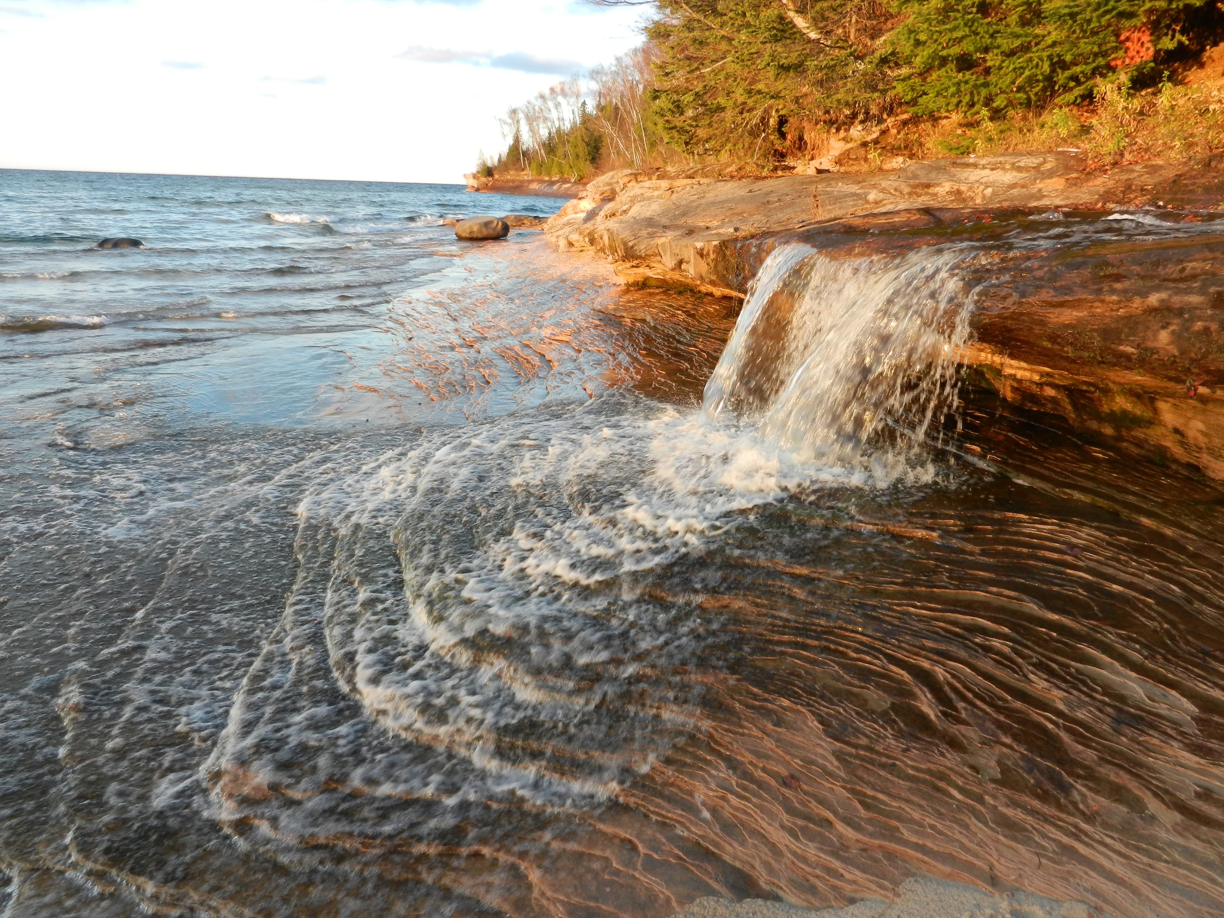
Bridalveil Falls flows vertically over a hard rock cap onto softer sandstone rock that slopes at a 45 degree angle. The water flows into Lake Superior.
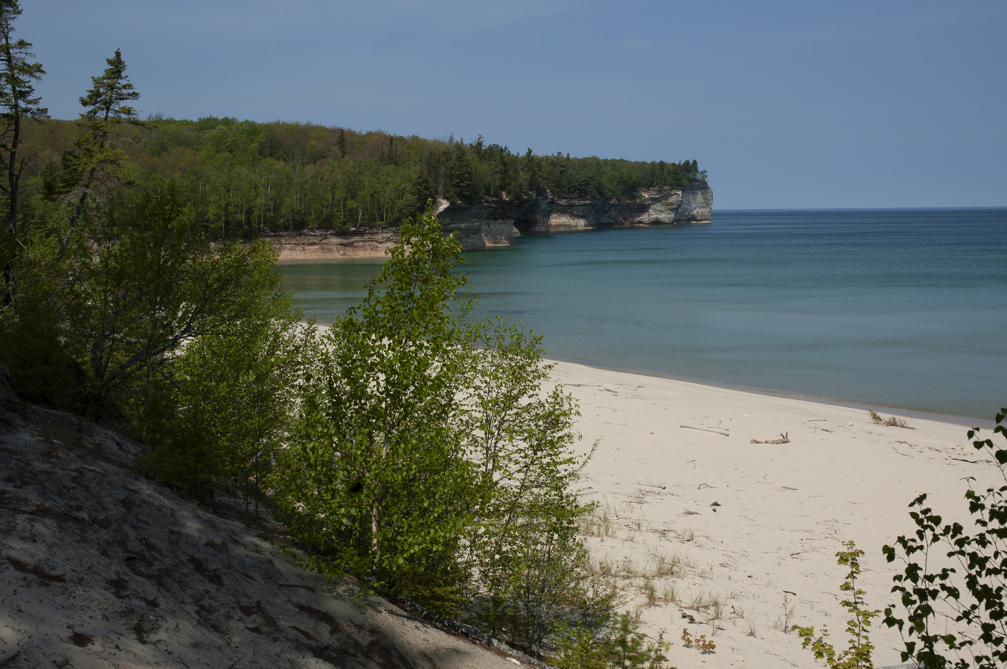
Drive about 15 miles east of Munising on Alger County Road H-58; turn left and drive 5 miles north on Chapel Road to the end. From the trailhead, hike 3 miles to Lake Superior to reach Chapel Rock and Beach.
The old Coast Guard boathouse at Sand Point contains a surf boat, surf cart, Lyle gun, and other lifesaving equipment exhibits. The boathouse is open during the summer months.
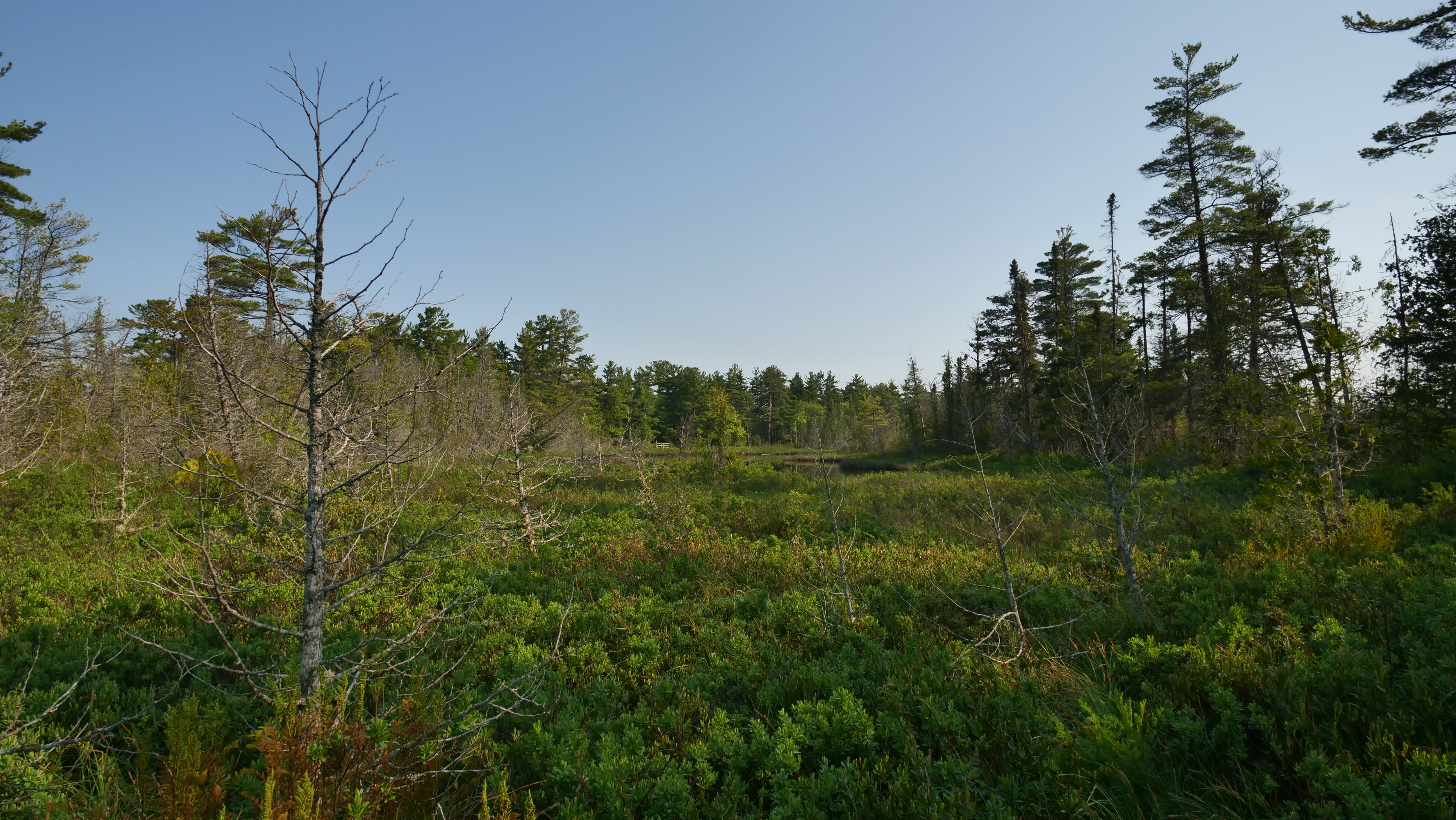
Description of the exhibit area: In this exhibit area, the boardwalk follows a dry forested rise between two wetland areas. Below the trail, vegetation transitions from dry-land understory plants to water-loving plants on either side. This viewing platform looks out through the trees at a broad open pond. Description of the exhibit: The exhibit is angled and mounted to the boardwalk railing. The exhibit panel is 3 feet wide by 2 feet deep. The exhibit is about types of wetlands. The background photo looks down into a pond. There are water lily leaves floating on the surface. Underwater, it is murky with mud and plant roots. There are four main images illustrating scenes from four different kinds of wetlands. From left to right, the illustrated wetland habitats are marsh, poor fen, bog, and conifer swamp. Below each illustration, text describes that wetland. Title and main text of the exhibit: Defined by Water The shape of the land and the flow of water at this location create a unique mixture of wetland habitats. Over thousands of years, as sand blew in from Lake Superior, a series of undulating dunes formed. The Ojibwe word for Lake Superior is Gichigami. The lower areas filled with water while higher areas stayed drier and eventually supported trees and shrubs. Marsh, poor fen, bog, and conifer swamp are all part of this wetland mosaic. The types of plants in each habitat are a good indicator of how much water is near or below the surface. As you walk the trail, see if you can identify the type of wetland you are passing through. Subsection 1: Marsh The first wetland illustration shows a marsh with an expanse of open water with floating plants and grass-like plants on either side. In the distance are an open shoreline and a forested ridge. Below the water surface you can see the stems and roots of the wetland plants. A cutaway at the bottom shows that the marsh water is a couple feet deep. The text begins with the subtitle and reads: Marsh Marshes are a type of wetland where open ponds are interwoven by floating plants and plants that take root along the bottom. Water lilies are a common sight. Marsh ponds are generally visible year-round, though they freeze in the winter months. Turtles and fish prefer this habitat. Subsection 2: Poor Fen The second illustration shows a poor fen with cattails, rushes, and other grass-like vegetation, along with shrubs and low plants, growing from patchy open water. In the distance a stretch of light green short vegetation suggests the habitat extends to the base of the forested cliffs in the distance. The cutaway shows that the water depth is shallower than a marsh. The text begins with the subtitle and reads: Poor Fen A poor fen wetland is less wet than a marsh. Surface water is visible seasonally as groundwater rises and falls. With less water, there are less nutrients. Thick stands of sweet gale, cattail, and sedge crowd these nutrient-poor wetlands. Subsection 3: Bog The third illustration shows bog with a green expanse of moss and other very short vegetation, interspersed with small open ponds, solitary evergreens, and a couple of shrubs. In the distance are forested cliffs. The cutaway shows very shallow water. The text begins with the subtitle and reads: Bog Bogs are enclosed depressions that fill with rainwater. They are generally too high to be refreshed with groundwater. Thick mats of sphagnum moss give the impression that the ground is dry, however, if you were to step into one, you may get wet up to your knees! Subsection 4: Conifer Swamp The fourth illustration shows a conifer swamp with an open forest of conifers, with an extremely dense shrubby understory. Water in the foreground holds aquatic plants. The cutaway shows that the water is even more shallow. The text begins with the subtitle and reads: Conifer Swamp From a distance, conifer swamps look like any other forest. But below the trees and shrubs, water flows over and through the saturated soil. Wildflowers such as blue flag iris and shrubs like Labrador tea decorate the lush understory creating a vibrant habitat for birds and small mammals.
Description of the exhibit area: In this exhibit area, the paved trail follows a low sandy ridge between wetlands. All around you are pine trees, interspersed with spruce and hardwoods such as birch and maple. The understory includes shrubs such as blueberry and Labrador tea. In the growing season, wildflowers and ferns carpet the ground. Description of the exhibit: The exhibit is angled and mounted in the ground by two base legs. The exhibit panel is 3 feet wide by 2 feet deep. The exhibit is about dune and swale topography. The main image is a color illustration showing an aerial view of this landscape. On the left is the sandy lakeshore. To the right, alternating bands of wetland and forest parallel the shore. At the bottom, a cutaway view shows the ground rise and fall a few feet with the wetlands in the low areas and the forest in the high areas. Title and main text of the exhibit: Dune and Swale Unique to the Great Lakes shorelines are dune and swale complexes. These are areas where long “waves” of sand have formed an undulating landscape radiating away from the lake’s edge. On the higher, drier ground, trees and shrubs grow. In the swales, where the ground is wetter and water stands in ponds, wetland plants thrive. If you look closely at the ground around you, you can see the rise and fall of the land. Subsection 1: Forming the Landscape Across the bottom of the illustration, a series of captions tell the story of how the dune and swale topography forms. The captions align with the dune and swale features from left to right. The text begins with the subtitle and reads: Forming the Landscape Currents, wind, and waves stack sand along the shore. Over time, as lake levels fall and the land rises (glacial rebound)—dunes and swales form. On the higher, drier ground upland plants take root—stabilizing the sand and preventing it from blowing away. The bottom of the swales are nearly the same level as the lake, and groundwater forms ponds. These wet areas form wetlands. On the older, inland dunes, the seasonal cycle of vegetation (leaves falling and decaying) begins to build a layer of soil. Water accumulates in the swales forming larger ponds. The ponds support wetland plants, fish, and other aquatic life. Over time, wetlands will fill in as the layers of sediment thicken and as groundwater levels drop with drier seasons.
You are about halfway up a sand dune after emerging from the wooded area behind you. If it is a sunny day, you will probably feel the sun on your face and it feels much warmer than before. The sand is a rich yellow-orange and there are dune grasses poking out of the dune all around you. You will soon crest this dune and overlook a broader dunescape, with pockets of evergreen forest surrounding you and a distant view of Lake Superior ahead of you. The wayside in front of you reads, "At the top of this slope, you will transition from the older dune forest into younger, more open dunes. In this dynamic environment, plants get a foothold in the sand one day and are buried by swirling sand the next. Notice where grasses have caught and stabilized sand grains, and where forests have hunkered down out of the wind. The trail ahead of you will take you up a slope and to a spectacular view of Lake Superior. Please stay on the trail to protect fragile dune plants. The scents of wild roses, pine, and balsam poplar fill the dunes on hot days. Hear the wind blowing through dune grasses and feel the texture of the sand. Many of the park’s rarest plants, like the threatened Pitcher’s thistle, grow in the dunes. The park works continually to protect sensitive plants by keeping invasive species out of dune habitats." The background is a photo of dune grasses blowing in the wind and there are separate photos of wild rose and Pitcher's thistle.
Description of the exhibit area: In this exhibit area, evergreen and deciduous branches and leaves shade the trail. To the north and west, the forest gives way to open wetland. Underneath the boardwalk, the ground appears fairly dry, with forest shrubs, grasses, and wildflowers. Description of the exhibit: The exhibit is angled and mounted to the boardwalk platform by two base legs. The exhibit panel is 3 and a half feet wide by 2 feet deep. The exhibit describes the forest habitat and helps you learn more about three of the surrounding tree species: black spruce, white cedar, and red pine. The background photo shows a forest interior, with dark trunks and branches among a thick understory of shrubs. In front of this background are three sections, one for each featured tree. From left to right, the trees are a black spruce, white cedar, and red pine. Each tree’s section includes a silhouette of the mature tree, a description of the tree’s characteristics, photos of its cones and bark, and the tree’s name in English and Ojibwe. On the right side of the panel, you’ll find tactile relief models of each tree’s branch and needle texture. The black spruce is at the top, white cedar is in the middle, and red pine is at the bottom. Each tactile relief model includes braille and raised letter labels of the tree. Title and main text of the exhibit: Get to Know the Trees This conifer grove marks a low, sandy dune ridge of dry soil among wetland swales. The tree trunks and branches form ladders, walkways, hiding places, and escape routes for small mammals like the red squirrel and American marten. The dense year-round foliage provides shelter from harsh weather. Learn what characteristics are unique to each species. Subsection 1: Black Spruce The first tree on the left is a black spruce. A photo of its cones shows that they are short, rounded, and pale gray, with rounded scales in a fish-scale pattern. The cones emerge in a cluster of three from a branch bearing short-stiff green needles. Another photo shows that its bark is patchy and grayish with irregular grooves, cracks, and furrows. The black spruce’s silhouette is slender and pointed, with relatively full branches all the way to the ground. A label indicates it grows from 30 to 60 feet tall. The text begins with the subtitle and reads: Black Spruce The Ojibwe word for Black Spruce is “Zesegaandag.” Black spruce needles are short with sharp tips. The green needles have a bluish hue. Black spruce cones are nearly round and about 1/2 to 1-1/4 inches long. The bark is gray to reddish brown with irregularly shaped, thin scales. Look for the tree’s conical shape ahead of you on the boardwalk. Subsection 2: White Cedar The second tree is white cedar. Its cones are in a cluster of about 12 small pale-brown cones emerging from fern-like branches with scaly green needles. Each cone consists of several large, lengthwise scales. Its bark looks pale gray and stringy with deep vertical fissures. The white cedar’s silhouette is conical. It has very dense foliage all the way to the ground. It grows from 40 to 70 feet tall. The text begins with the subtitle and reads: White Cedar The Ojibwe word for White Cedar is “Giizhik.” White cedar bark is gray and fibrous. It is easy to identify as you walk the trail. Cedar trees do not have needles like spruce and pine, instead the foliage is flatter and appears to have scales or look braided. The cones are small and fall apart easily. Subsection 3: Red Pine The third tree is red pine. The cone photo shows a large gray-brown cone emerging from a branch and surrounded by very long green needles. The cone is egg-shaped, with stout-looking rounded scales that are slightly spread apart toward the base. The bark photo shows mottled grayish-red bark with deep vertical fissures. The red pine’s silhouette is broad and rounded, relatively open, and fewer branches toward the base. It grows from 50 to 100 feet tall. The text begins with the subtitle and reads: Red Pine The Ojibwe word for Red Pine is “Wenda-zhingwaak.” Red pine needles grow in bundles of two and are four to six inches long. Their cones are egg shaped, roughly two inches long, and are hardier than the spruce and cedar cones. The bark looks like reddish-gray flaky plates.
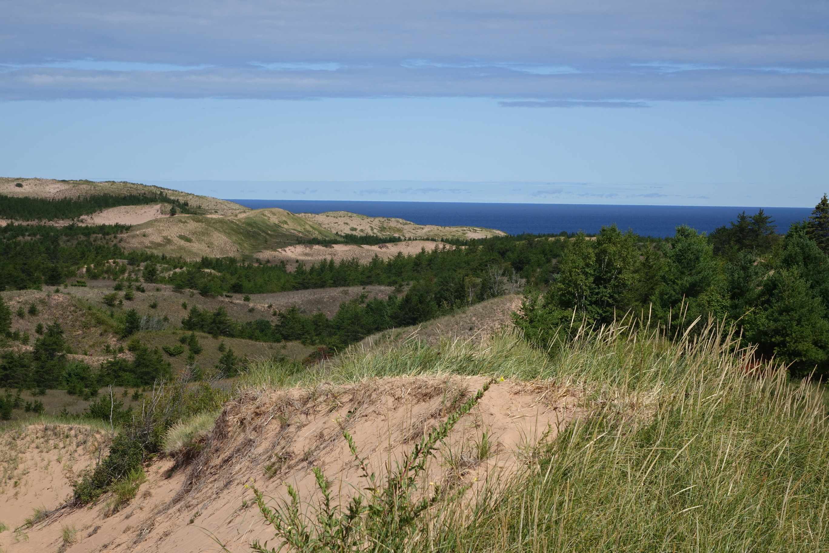
These enormous dunes left by glacial action are located at the eastern end of the park. Access via the 1/3 mile (one-way) Dune Trail beginning at the Sable Falls parking area, one mile west of Grand Marais along Alger County Road H-58. Be prepared to walk partly uphill in soft sand. Another access point with a steeper climb is from the small parking lot at the far eastern end of Grand Sable Lake on H-58.
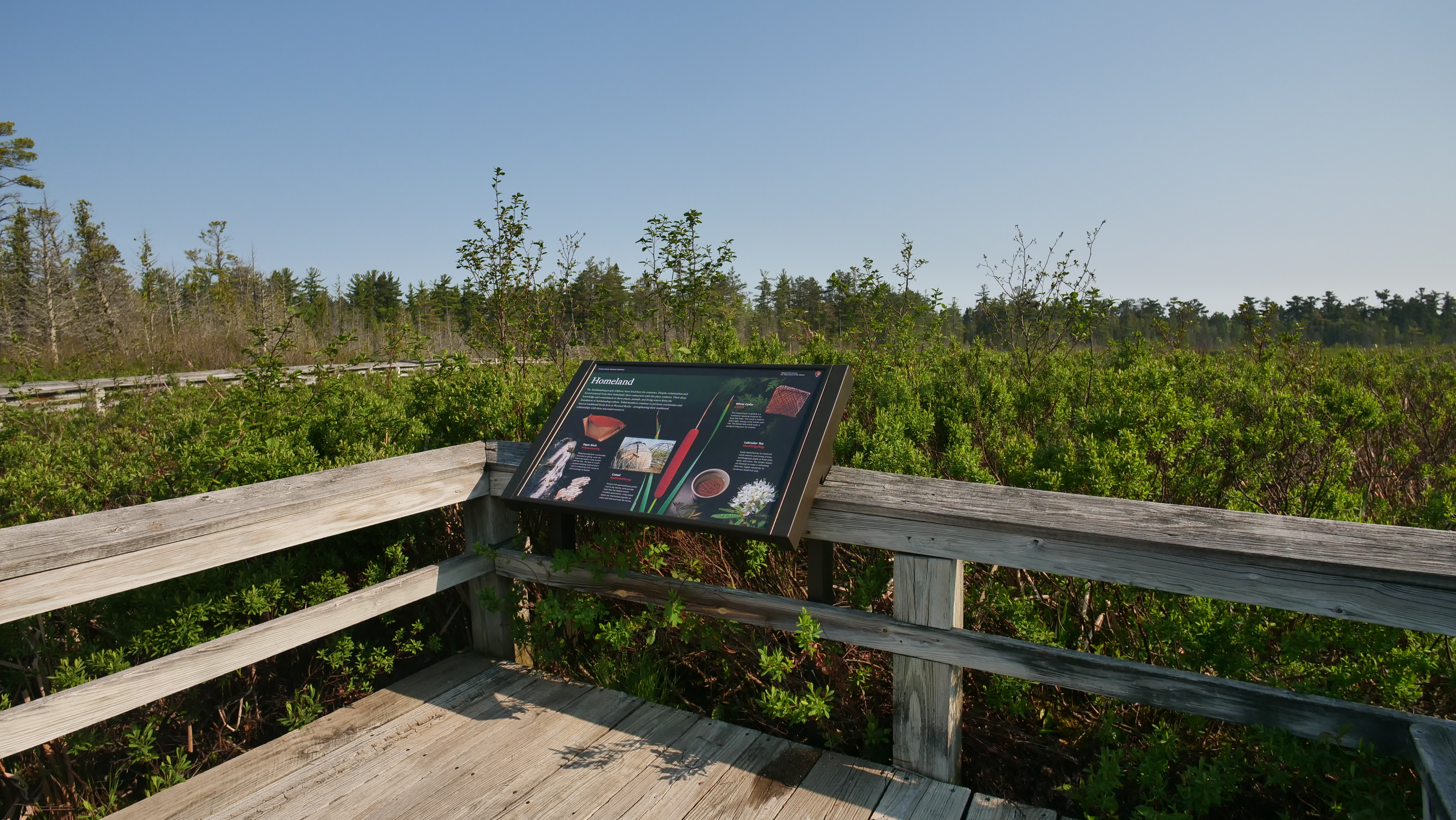
Description of the exhibit area: In this exhibit area, the boardwalk trail is surrounded by wetland shrubs such as dogwood and Labrador tea, emergent wetland plants such as cattail, and scattered evergreen and hardwood trees. The viewing platform looks out over an area of more open wetland. Description of the exhibit: The exhibit is angled and mounted to the boardwalk railing. The exhibit panel is 3 feet wide by 2 feet deep. The exhibit is about the indigenous Ojibwe people. Against a dark background, photos show four local plants that are important in Ojibwe culture, along with traditional uses for those plants. From left to right, the plants are paper birch, cattail, white cedar, and Labrador tea. Each featured plant has a caption about its uses. The plant names are identified in English and Ojibwe. Title and main text of the exhibit: Homeland The Anishinaabeg people or (Ojibwe) have lived here for centuries. Despite colonization and forced removal from their homeland, their connection with this place endures. Their deep knowledge and commitment to these plants, animals, and living waters form the foundation of Anishinaabeg culture. Tribal members continue to perform ceremonies and harvest traditional foods here at Pictured Rocks—strengthening their traditional relationships with these ancestral resources. Subsection 1: Paper Birch The leftmost plant is paper birch. A photo shows a section of a living birch trunk, splashed with sun and shadow in a forested setting. The trunk is a pale cream color with short, dark horizontal lines. Clumps of moss cling to it, and there is a tuft of leaves growing from one spot. To the right of that photo is a photo of a piece of birch bark, showing how it can be flattened. Its edges are irregular. Above these photos is a photo of a birch bark container. It is made from a single rectangular piece of bark. The ends are gathered and folded upward, forming a cup shape. The folded ends are stitched together with loops of pale fiber. The outside is white with horizontal lines. The inside is warm reddish brown. The text begins with the subtitle and reads: Paper Birch The Ojibwe word for Paper Birch is “Wiigwaasaatig.” Wiigwaasaatig bark is sustainably harvested in spring, when the sweet sap makes it easy to peel off the tree. The bark is a multi-purpose building material and is used in everything from canoes to wall coverings to baskets. Subsection 2: Cattail To the right of the birch is a large photo of the top of a cattail plant. Three long, pointed green leaves rise on either side of a seed stalk. The seed cluster is cigar-shaped and surrounds the central stalk. It is deep reddish-brown with a slightly rough surface. Next to the cattail plant, a photo shows a dome-shaped structure covered with layers of pale gray woven mats. Next to the covered structure is an uncovered one. It shows the framework of bent branches lashed together in in a half-dome shape. The text begins with the subtitle and reads: Cattail The Ojibwe word for Cattail is “Apakweshkway.” Protein-rich apakweshkway pollen and its big starchy roots provide food that has helped sustain countless generations. Long cattail leaves are interlocked together to make wall and roof mats for homes. Subsection 3: White Cedar To the right and above the cattail is a photo of cedar fronds. They are fern-like in shape, flattened, with tiny green overlapping scales. Next to the fronds is a photo of a flat rectangular woven pouch. The weave is diagonal, forming an intricate pattern of diamond shapes. Different shades of brown in the warp and weft strands give the pattern a distinctive visual texture. The text begins with the subtitle and reads: White Cedar The Ojibwe word for White Cedar is “Giizhik.” The fibrous bark of giizhik is a traditional weaving material for bags and mats. The wood is used to make light, strong canoe frames and ribs. The leaves and wood make a pungent fragrance for incense. Subsection 4: Labrador Tea Below the white cedar is a photo of a Labrador tea stalk. Narrow oblong leaves stick out on all sides of the stalk. The leaves are evergreen and curled under along their edges. A rounded cluster of about 12 flowers emerges from the top of the stalk. The flowers are white, with five petals, green centers, and long slender stamens. To the left of the plant stalk is a photo showing a ceramic cup from above. The cup is filled with pale golden tea, a cluster of brown Labrador tea leaves is steeping. Below the cup are scattered a handful of fresh leaves. A fuzzy orange underside is visible under their rolled edges. The text begins with the subtitle and reads: Labrador Tea The Ojibwe word for Labrador Tea is “Mashkiigobag.” Easily identified by its clustered white blooms and strong aroma, mashkiigobag smells of fresh pine, spice, and citrus. The tender leaves are brewed to make a refreshing herb tea, highly valued for its numerous medicinal uses.
Just past Twelvemile Beach Campground heading east on Alger County Road H-58 is a day-use parking lot with a short staircase to the beach. Stop here for a quick swim and stroll along the shore.
You are overlooking Grand Sable Lake, an inland lake surrounded by pine forests. This lake is approximately 1 square mile in area - there are shallowly rolling hills in the distance and large, rising sand dunes behind you.
This audio description script describes each wayside exhibit. It starts here and takes you around the loop in a counterclockwise direction. You are standing at the Marsh Trail trailhead. The trail is surrounded by towering evergreen trees. Lake Superior and Sand Point Beach are behind you. The trail in front of you is asphalt. In front of you, the first exhibit welcomes and orients you to the trail.
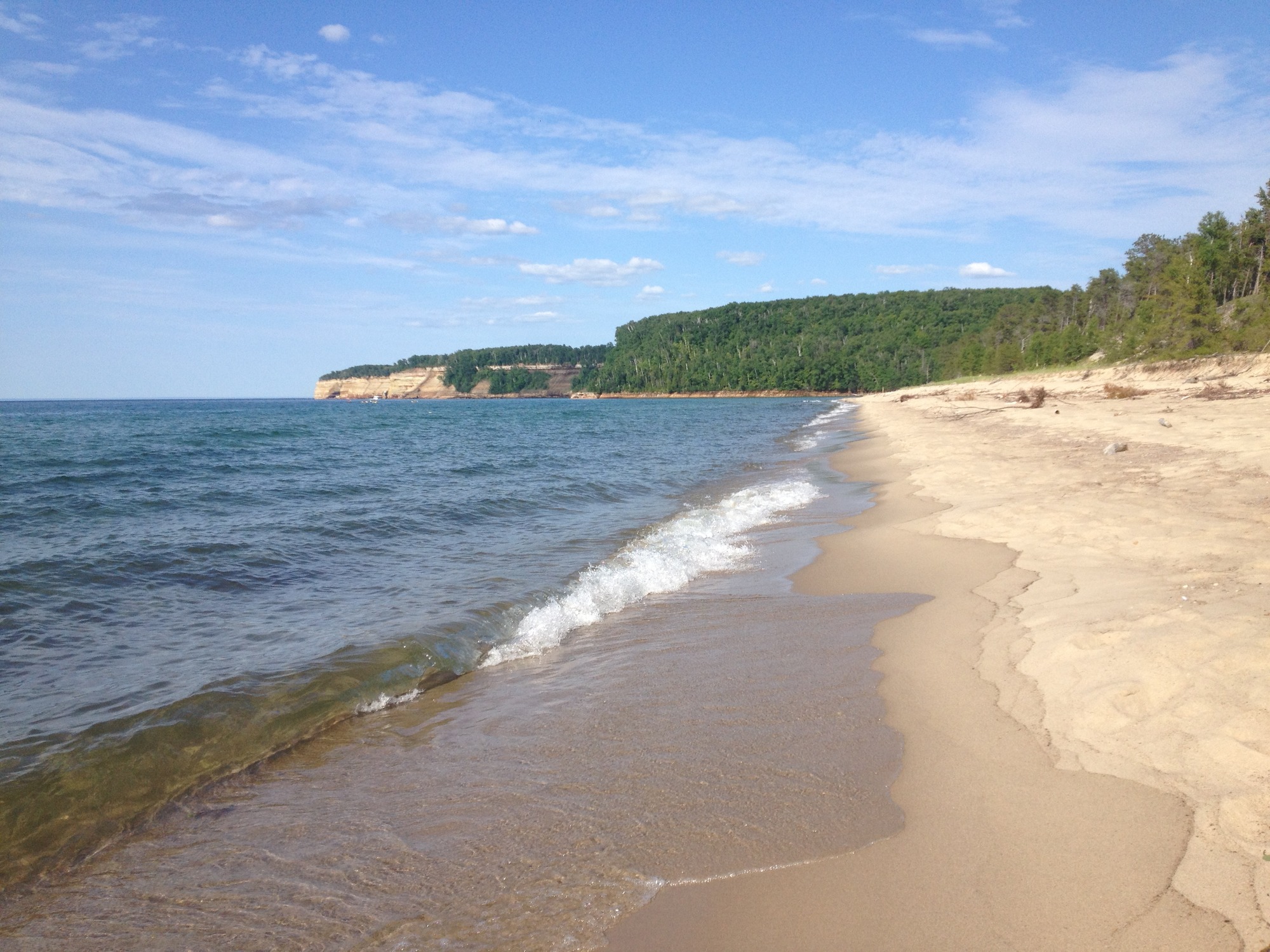
Miners Beach is a beautiful, nearly mile-long stretch of sand and some rocks with the main parking area at the west end (with access to Miners River) and a small parking area at the east end.
Standing on the viewing platform at the top of the main stairs, a sandy beach extends from the bottom of the stairs about 1/4 mile to the left (west) and 3/4 mile to the right (east). Lake Superior is beyond the beach, filling the view all the way to the horizon. To the east, the greyish tan 200-foot-tall sandstone cliffs begin at the far end of the beach and extend along the shore to the horizon. The cliffs have mostly bare slopes, and trees and other vegetation on top. A thin trickle of water down the slope of one of the nearest cliffs is Bridalveil Falls. This narrow waterfall, which leaves a white stain on the stone slope, is only seen from this beach and from the water. To the west, the tall, forested cliff of Miners Castle can be seen at the end of the beach, across from where the Miners River is flowing into Lake Superior.
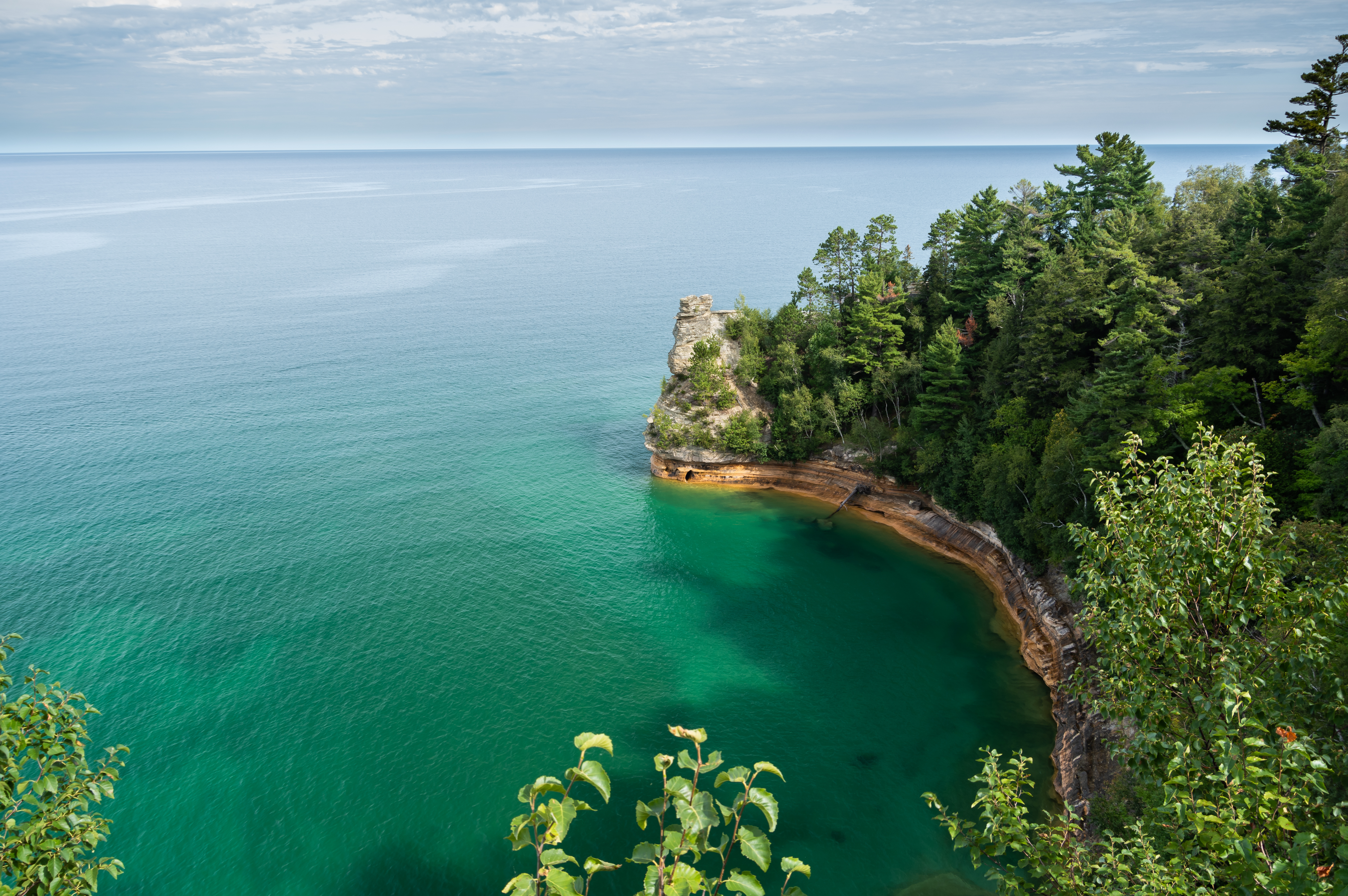
Miners Castle is one of the most famous landmarks along the Pictured Rocks shoreline, and is the only cliff area in the park accessible by vehicle.
The upper wooden platform at Miners Castle is located on top and at the edge of a 150-foot-tall sandstone cliffline above Lake Superior. The platform includes some clear windows in the walls so that children and shorter people can see the view. Standing at the railing, the wide blue expanse of Lake Superior stretches to the horizon. Below you, the cliffline to the right curves slightly, creating a bay. To the left in the distance about two miles over the water, is 13,000-acre Grand Island. All of the land seen in the distance is part of this large forested island. To the right across the small bay a few hundred yards away is Miners Castle itself, which is a prominent greyish stone structure sticking out vertically at the end of the curving cliff line. The structure is about 90 feet tall from the water level to the top cube-shaped turret. This structure once had two turrets and looked more like an actual castle, but one turret fell off the top in 2006. The opening to a cave at the bottom of the castle can be seen. If conditions are wavy enough, water pours out of the opening as each wave enters the cave from the other side.
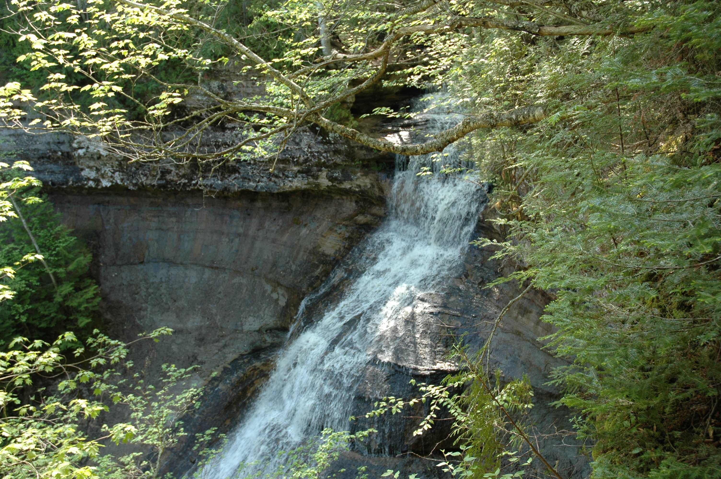
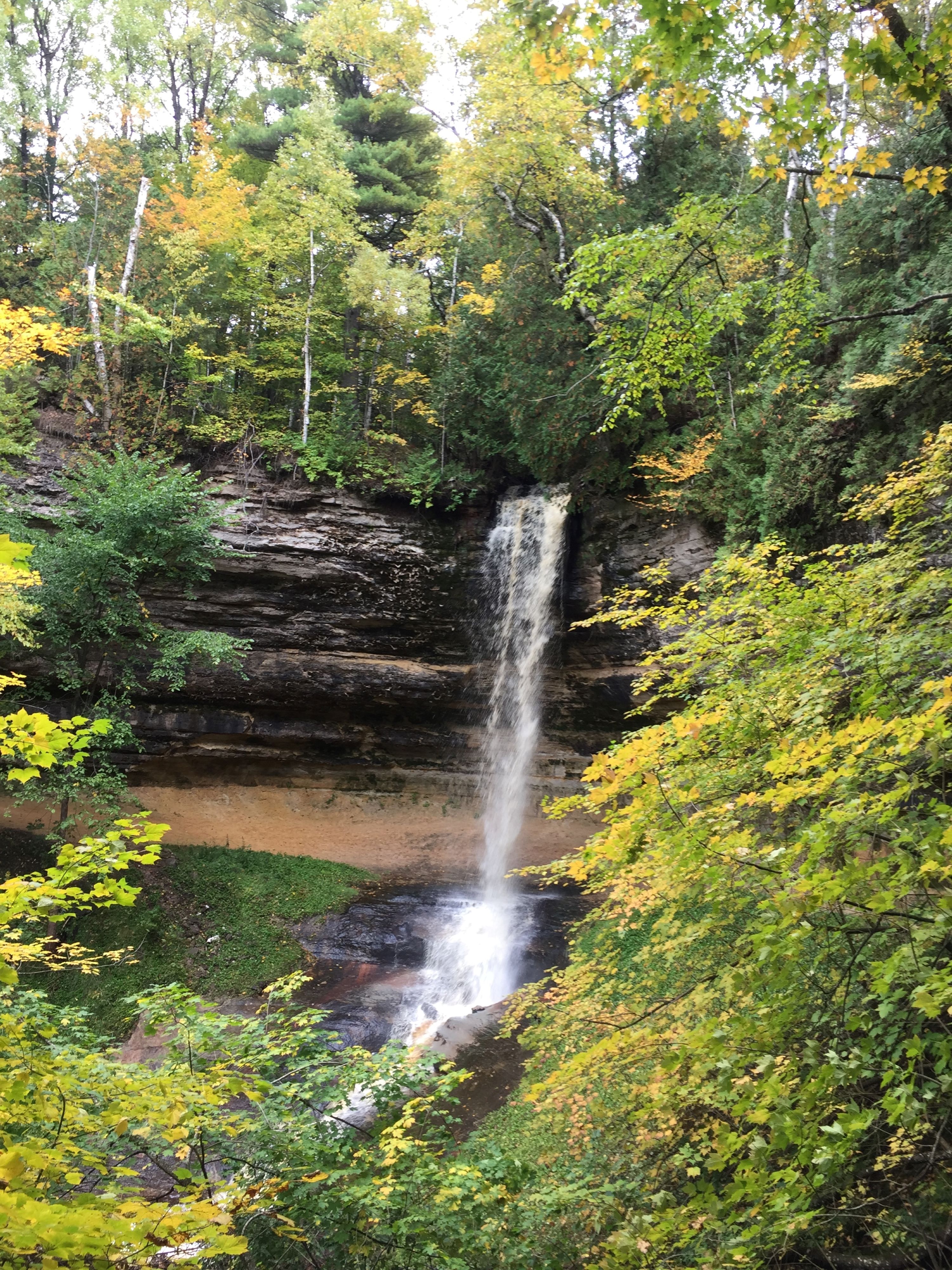
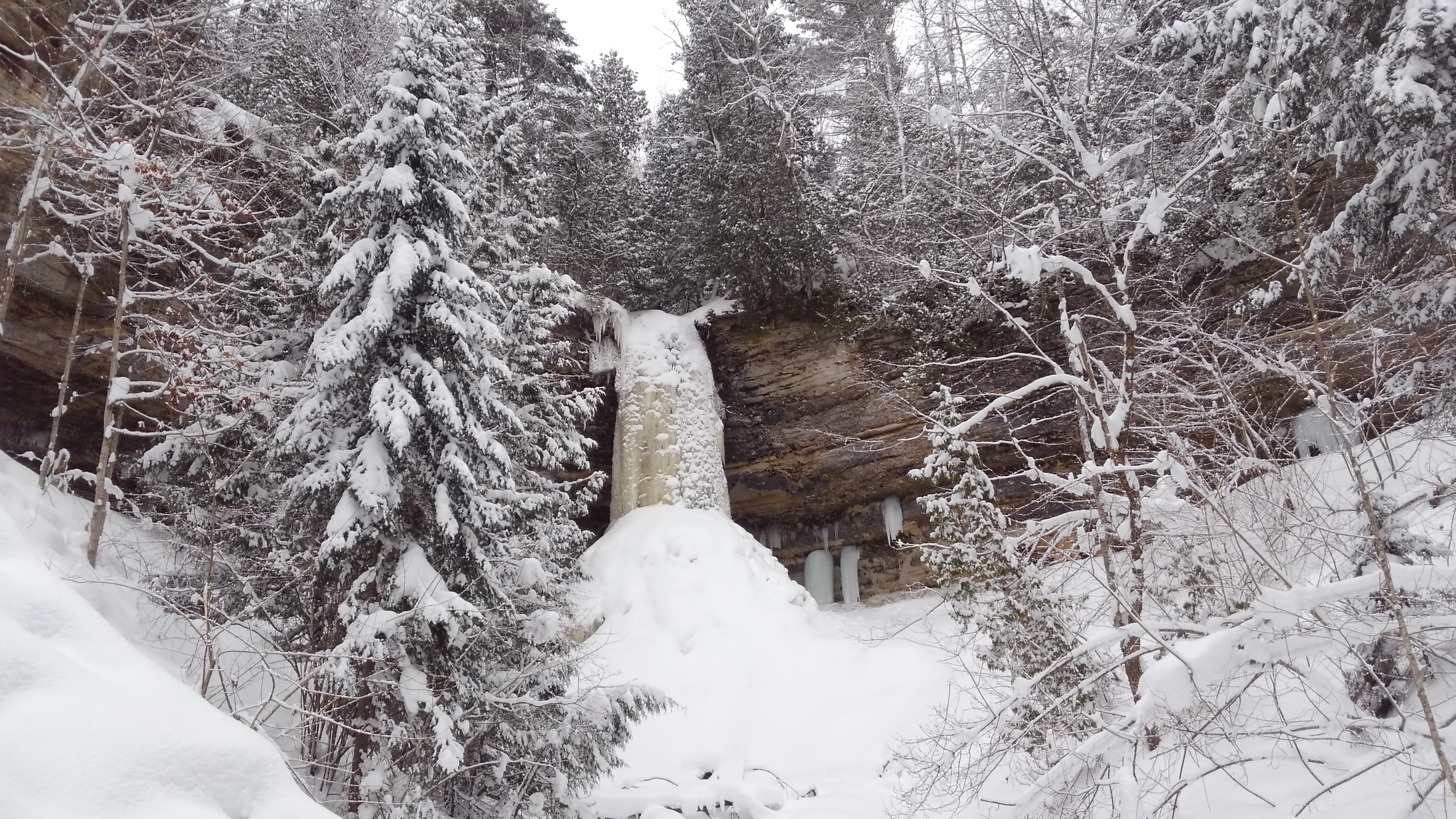
Walk the paved 800-foot trail up a cool shaded canyon along Munising Creek to the main falls viewing platform or climb the steps for a different view. This is a lovely waterfall in all seasons.
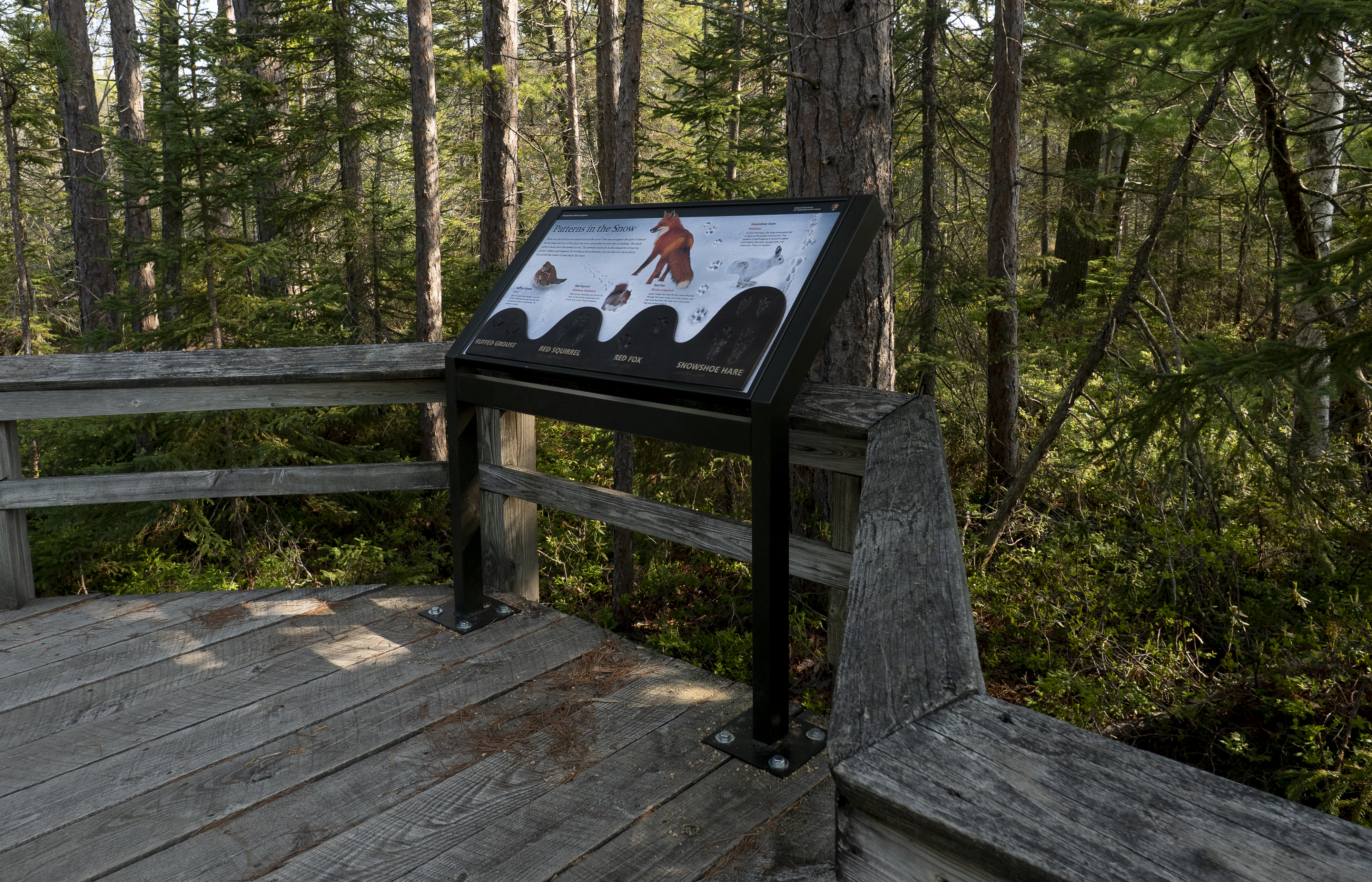
Description of the exhibit area: In this exhibit area, the boardwalk is on a higher, drier part of the forested land that borders between a forested rise to the west and an open wetland and pond to the east. The boardwalk is surrounded by a variety of evergreens and deciduous trees, with understory shrubs including Labrador tea and huckleberries. Description of the exhibit: The exhibit is angled and mounted to the boardwalk platform by two base legs. The exhibit panel is 3 and a half feet wide by 2 feet deep. The exhibit is about winter animal tracks. The main image is a photo of four animals and their tracks against smooth snow. From left to right, the animals are the ruffed grouse, red squirrel, red fox, and snowshoe hare. For each animal and its track line, there is a photo and caption about the animal that made the tracks, including the animal’s name in English and Ojibwe. Below each animal, you’ll find a tactile relief model of that animal’s track pattern. Title and main text of the exhibit: Patterns in the Snow What can you tell from an animal track in the snow? You may recognize the type of animal by the shape and size of the track, but every animal has its own way of walking. The track pattern shows how that animal moves. The animals below are in the categories of pacers, perfect walkers, and hoppers. By looking at these patterns, you can discover more about the animal that walked by and made that track. Subsection 1: Ruffed Grouse The leftmost track and photo are from a ruffed grouse. The tracks show the bird has three long front toes and one short hind toe. Its footsteps alternate right and left in a straight line. The bird’s claws dragged slightly in the snow as it walked, leaving long lines in between each step. The bird itself is at the end of the track line, its head turned left. It is chicken-like, with a plump body, short stiff tail, and short rounded wings tucked to its side. Its head is small, with a few stiff feathers standing up to form a crest. Its eye and its short, sharp beak are dark. Its feathers are warm rusty red with a pale breast, banded and speckled with black and white. The text begins with the subtitle and reads: Ruffed Grouse The Ojibwe word for Ruffed grouse is “Bine.” Grouse tracks often wander in and out of shrub thickets, showing how the bird wandered in search of tasty buds. The grouse is a pacer. Subsection 2: Red Squirrel To the right of the grouse is the track and photo of a red squirrel. Its tracks show that its paws look much like tiny human hands and feet. In each hop, the front and back feet land side by side, with the pair of back feet landing in front of the pair of front feet. The red squirrel at the end of the track is crouching and eating a berry. Its fluffy tail curves up over its back. Its body and tail are grayish-red and its belly is white. Its large dark eye is ringed with pale golden fur. Its ears are small and round. The text begins with the subtitle and reads: Red Squirrel The Ojibwe word for Red Squirrel is “Miskwaa Ajidamoo.” Red squirrels find safety and food in the trees, so their prints usually begin and end at tree trunks. They are hoppers. Subsection 3: Red Fox The next track to the right is from the red fox. Its rounded prints show a central pad and four toes with short claws. The track pattern is almost a straight line. The fox stands beside the tracks, its back to the viewer and looking to the left. Its luxuriant fur is rich auburn-red with accents of chestnut brown on the back and legs. Its cheeks, chin and chest, and the tip of its brushy tail, are white. Its ears are large and pointed, with black tips. Its muzzle is sharp, punctuated with a small black nose. Its amber eyes, ringed with black, gaze intently to the left. The text begins with the subtitle and reads: Red Fox The Ojibwe word for Red Fox is “Misko-wagoosh.” Small, nimble feet help the fox move efficiently through the snow. Foxes, and other canines, will step their hind feet into their front foot tracks. They are perfect walkers. Subsection 4: Snowshoe Hare The rightmost track is that of a snowshoe hare. Its prints in the snow are deep and rough-edged. They show how, with each hop, its huge, paired hind feet landed side by side and its smaller front feet landed offset from each other. To the left of the tracks a photo shows the animal hopping to the right. Its front feet are pushing off in the snow and the huge furry hind feet have swung forward past them to plant for the next stride. The hare is lean and strong-looking. Its fur is grizzled white. Its ears are tipped with black. Its eye is large and round. The text begins with the subtitle and reads: Snowshoe Hare The Ojibwe word for Snowshoe Hare is “Wabooz.” In hare trackways, the large hind prints fall in front of the smaller front prints. This pattern of leapfrogging is found in rabbits and rodents like mice, red squirrels, and chipmunks. They are hoppers.
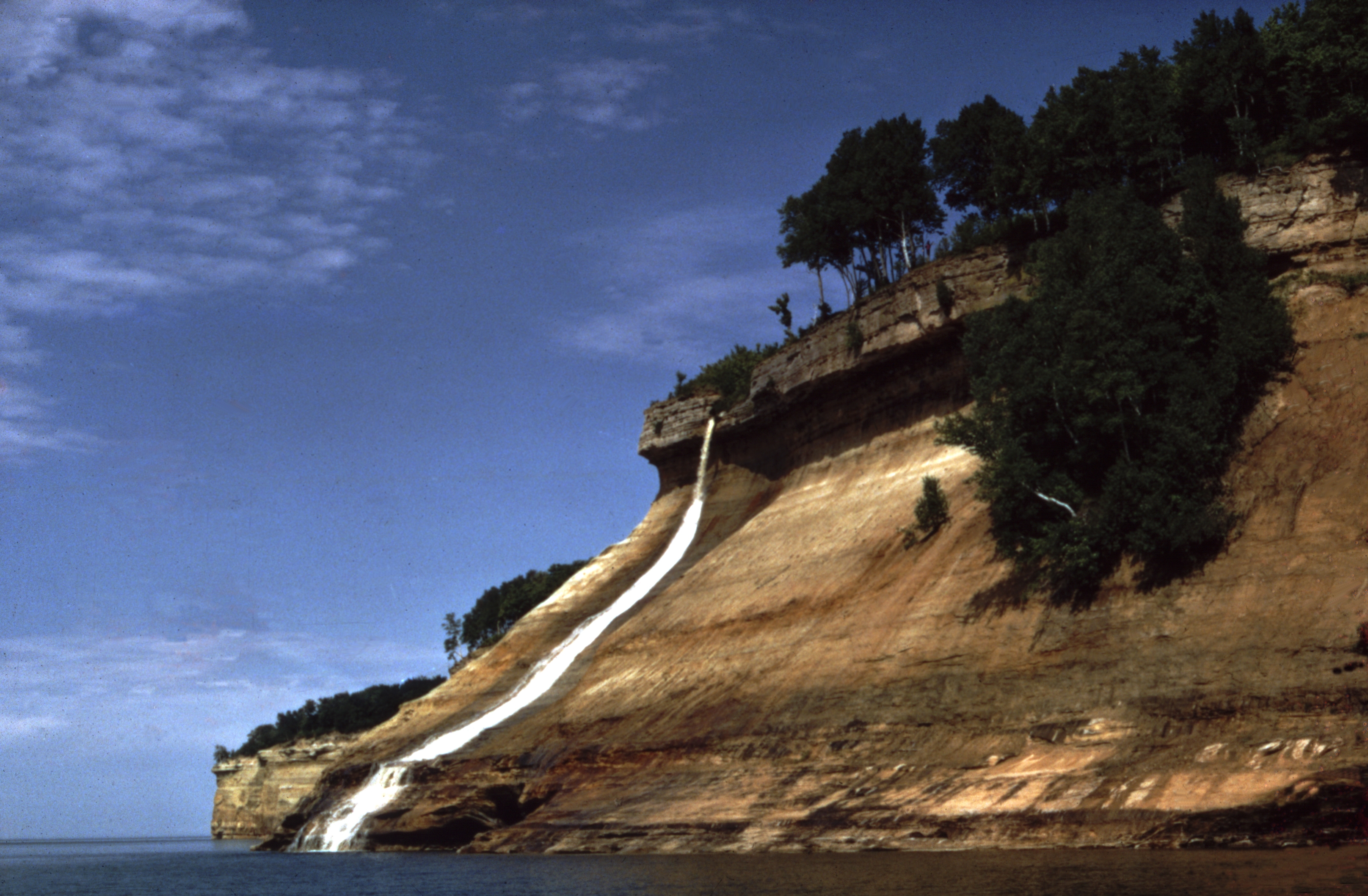
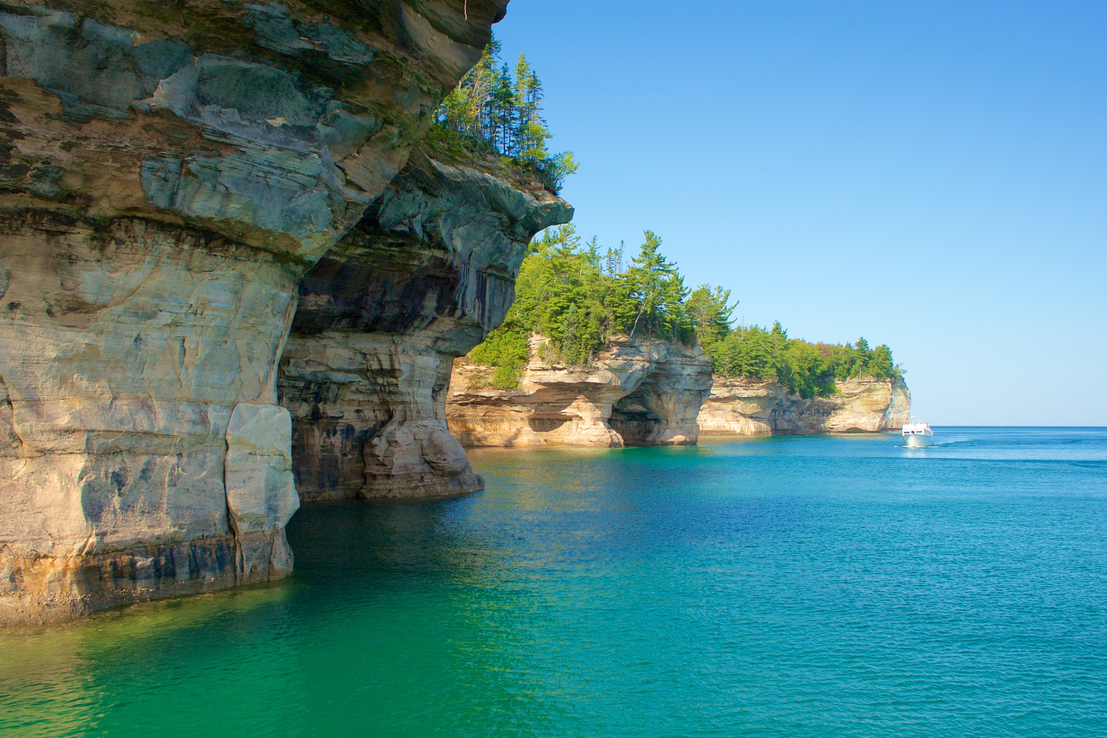
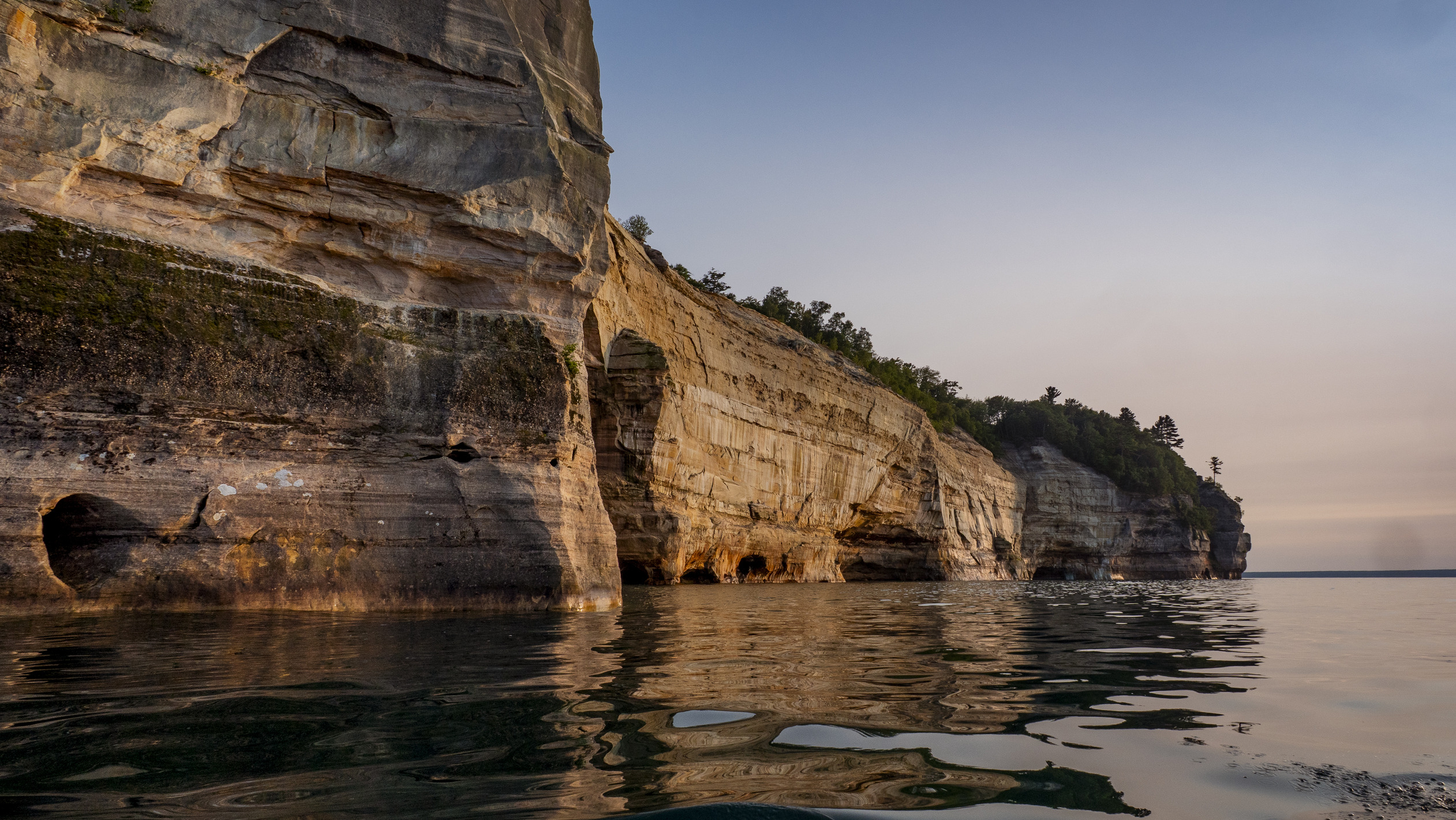
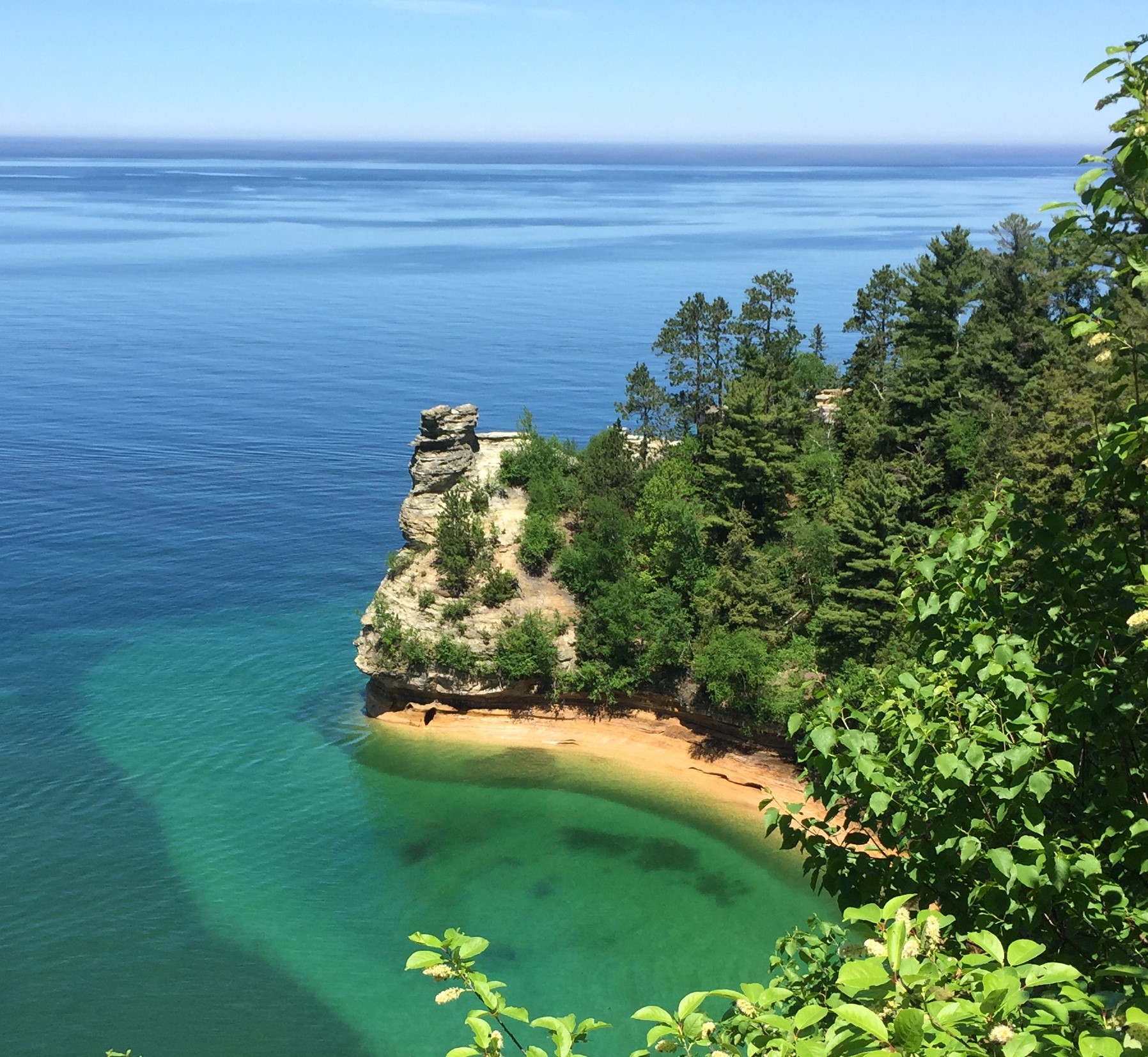
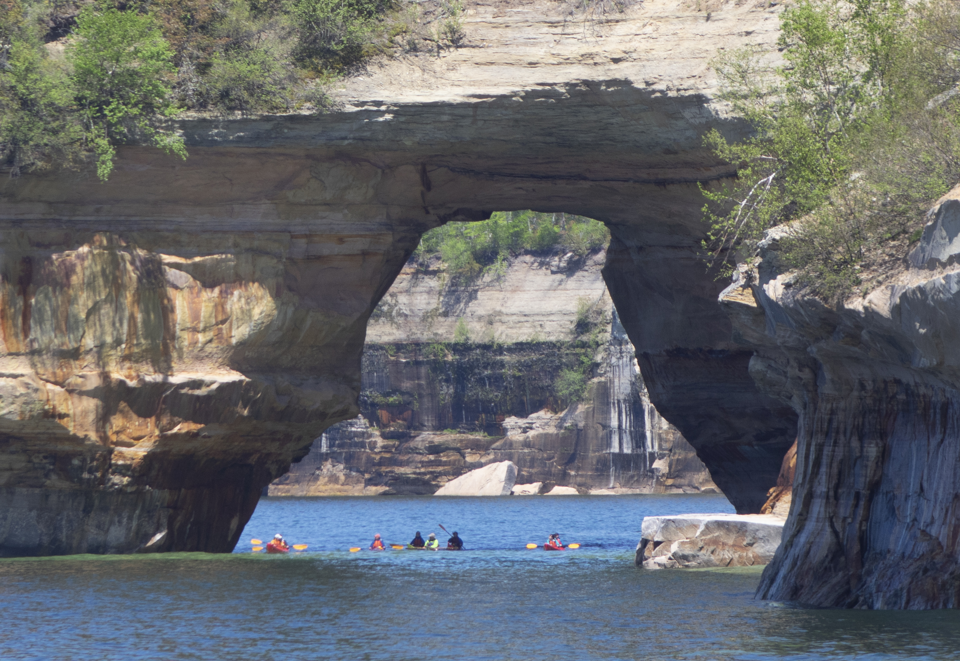
Colorful and bold, the Pictured Rocks cliffs tower 50 to 200 feet above Lake Superior. These sandstone cliffs stretch for about 15 miles along the lake from Sand Point on the west to just after Spray Falls on the east. The most colorful portion of the cliffs begins east of Miners Beach.
Colorful and bold, the Pictured Rocks cliffs tower 50 to 200 feet above Lake Superior. These sandstone cliffs stretch for about 15 miles along the lake from Sand Point on the west to just after Spray Falls on the east. The most colorful portion of the cliffs begins east of Miners Beach.
Pictured Rocks has three drive-in campgrounds open May 15 through Oct. 15. Two are along Lake Superior and the third is on a beautiful inland lake.
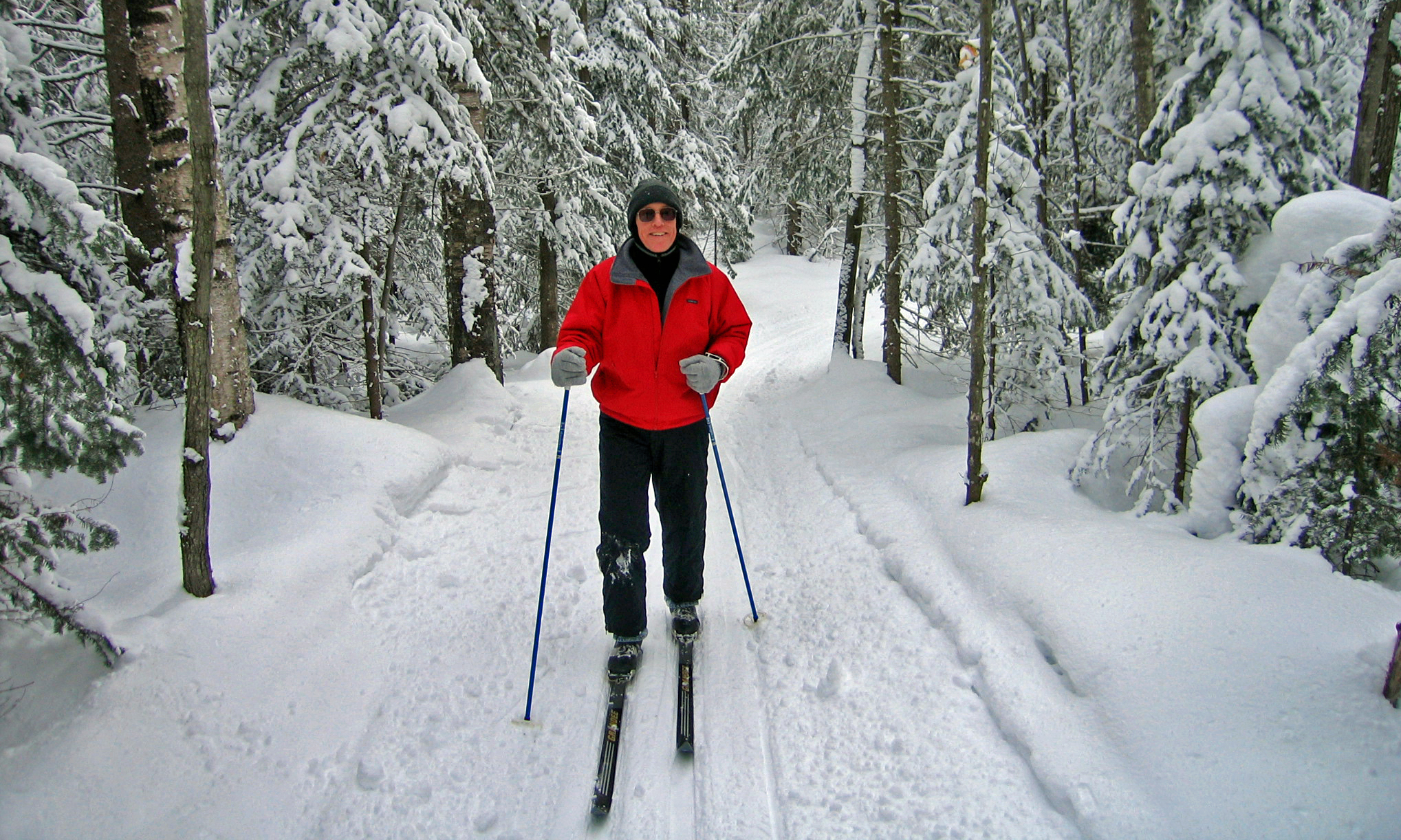
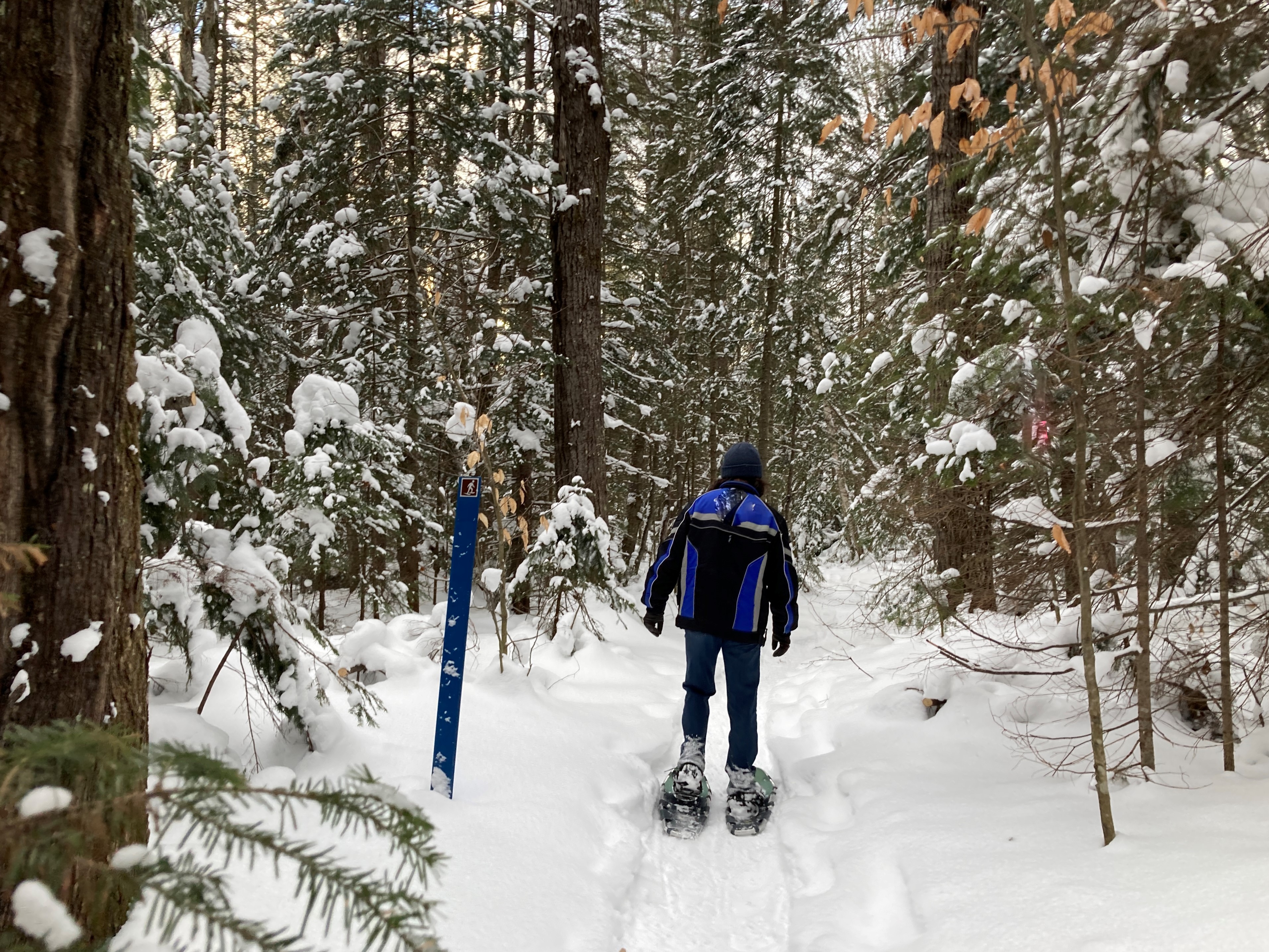
Snowshoeing at Pictured Rocks
Snowshoeing is a very popular winter sport at Pictured Rocks. There is one official trail, but almost the entire park is open for snowshoeing.
Walks and Hikes Over a Mile
Longer hikes and walks lead to stunning cliff views, remote beaches, the Beaver Basin Wilderness, Au Sable Lighthouse, and many other scenic areas.
Walks and Hikes of One Mile or Less
Pictured Rocks offers 100 miles of hiking and walking trails leading to waterfalls, beaches, forest wilderness, cultural sites, and breathtaking cliff-top views of Lake Superior. Here are some of the shorter trails.
Places To See in One Hour
You could easily spend half a day exploring any of these locations, but if you only have an hour to see some quick scenic sites, here are some options!
Kayak and Other Guided Tours
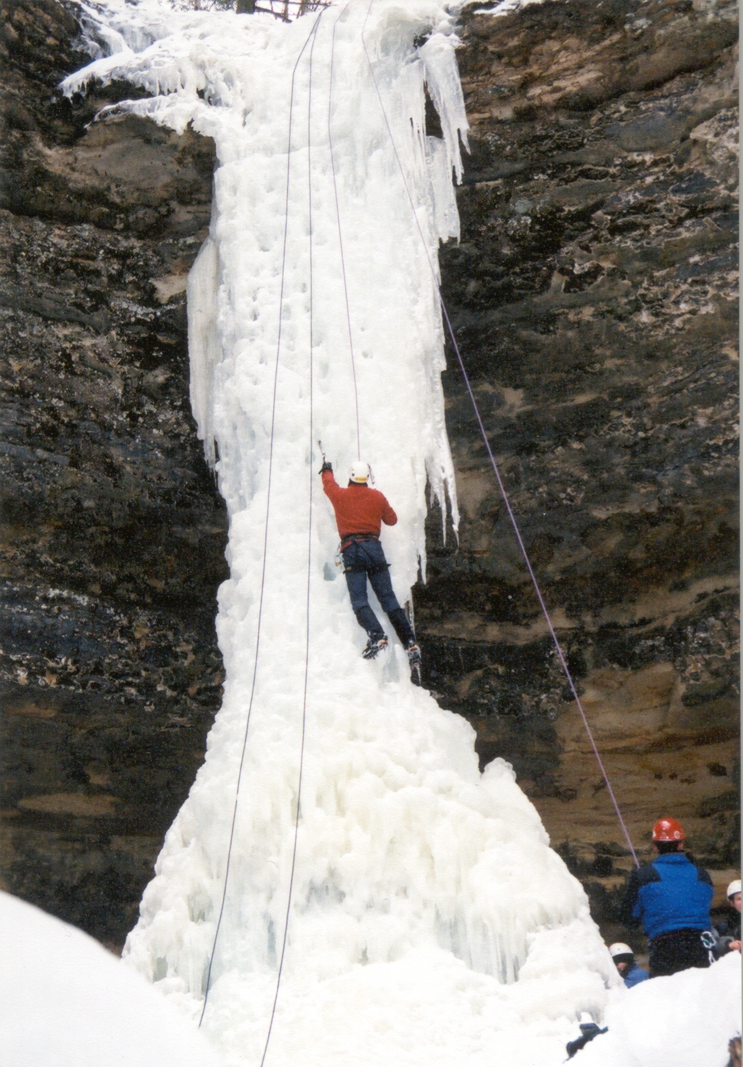
Several authorized companies offer guided kayak tours, ice climbing activities, and hiking/camping trips in the park.
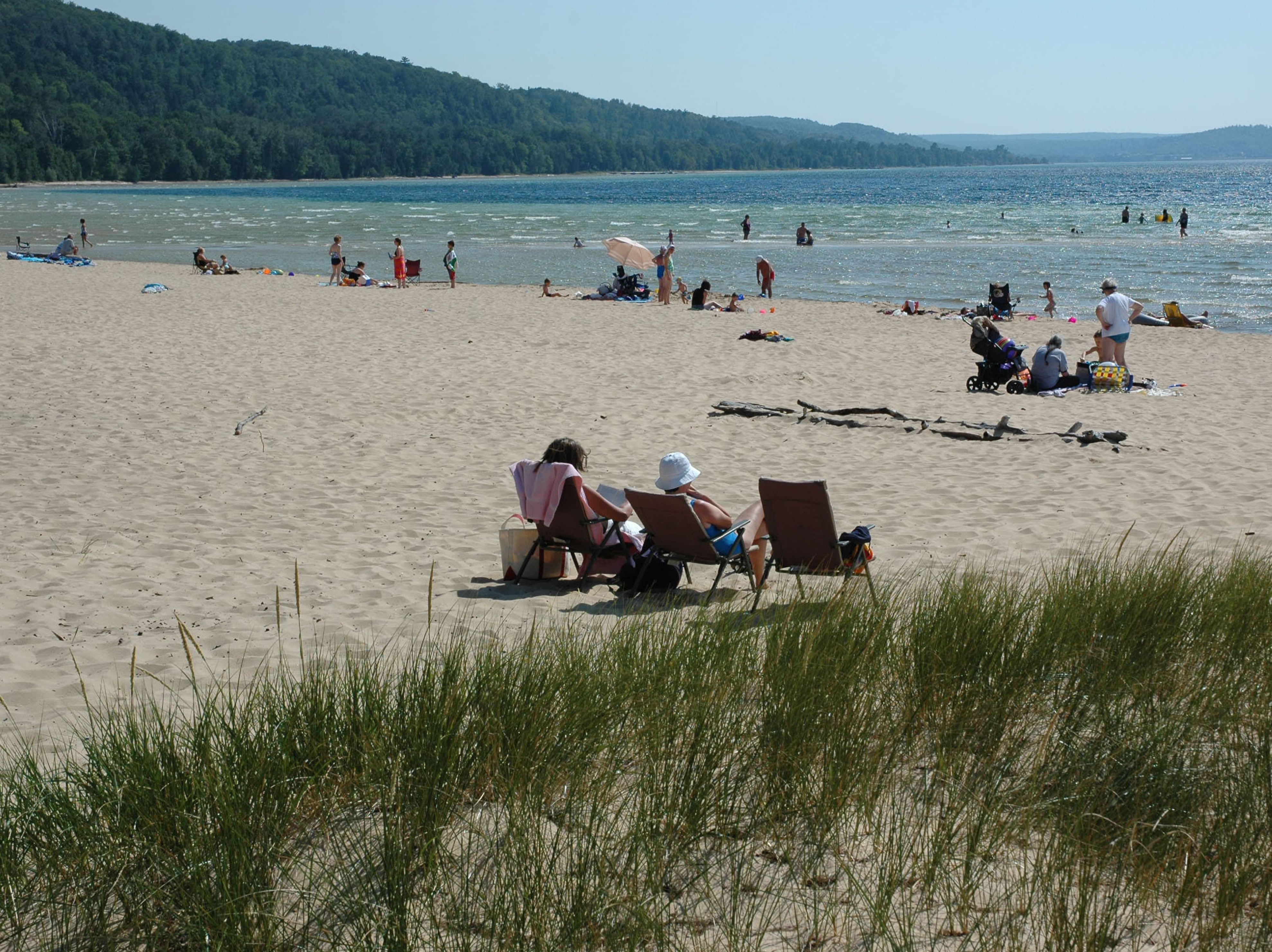
Swimming at Pictured Rocks
Pictured Rocks has several beautiful beach areas for swimming and wading in Lake Superior. Two of the park's inland lakes have sandy bottom areas suitable for swimming. There are no lifeguarded beaches.
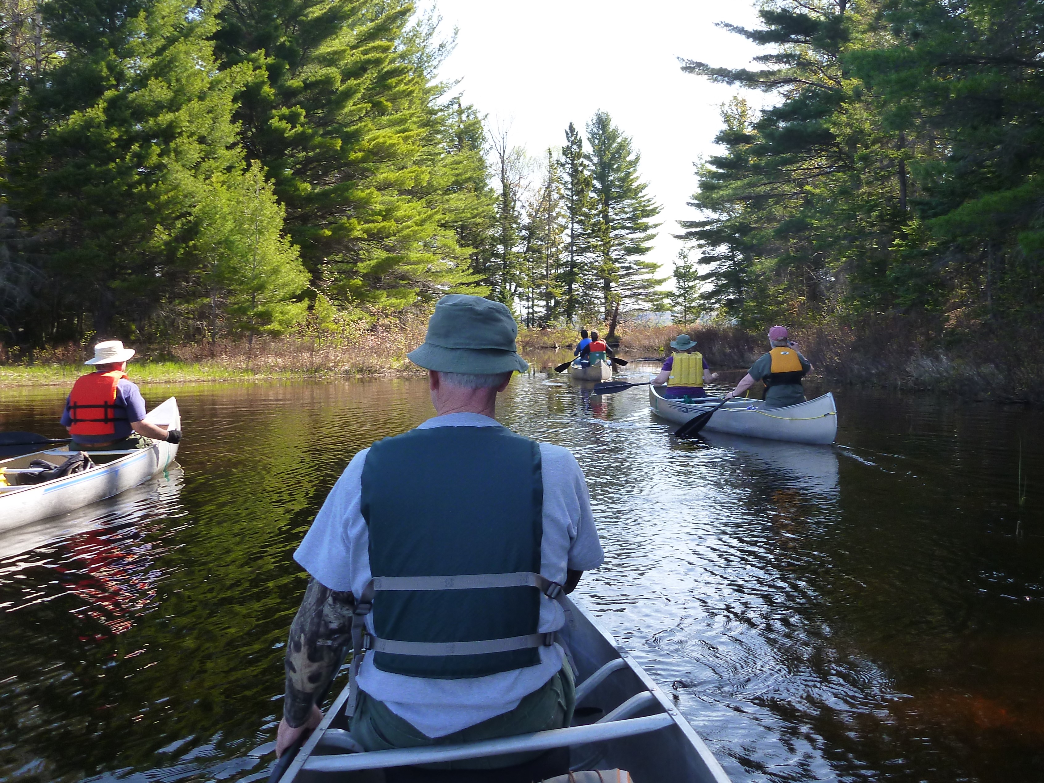
Non-Kayak Boating at Pictured Rocks
There's more to boating at Pictured Rocks than just kayaking! Bring your canoe, motorized boat, sailboat, or paddleboard to the park.
Kayaking and Kayak Safety
Thinking about kayaking at Pictured Rocks National Lakeshore? Make sure you have the right kind of boat and are aware of all safety issues!
Backcountry Camping at Pictured Rocks
Pictured Rocks offers a variety of backpacking opportunities for individuals and groups. Most backcountry campgrounds are along the North Country National Scenic Trail, and many are close to Lake Superior.
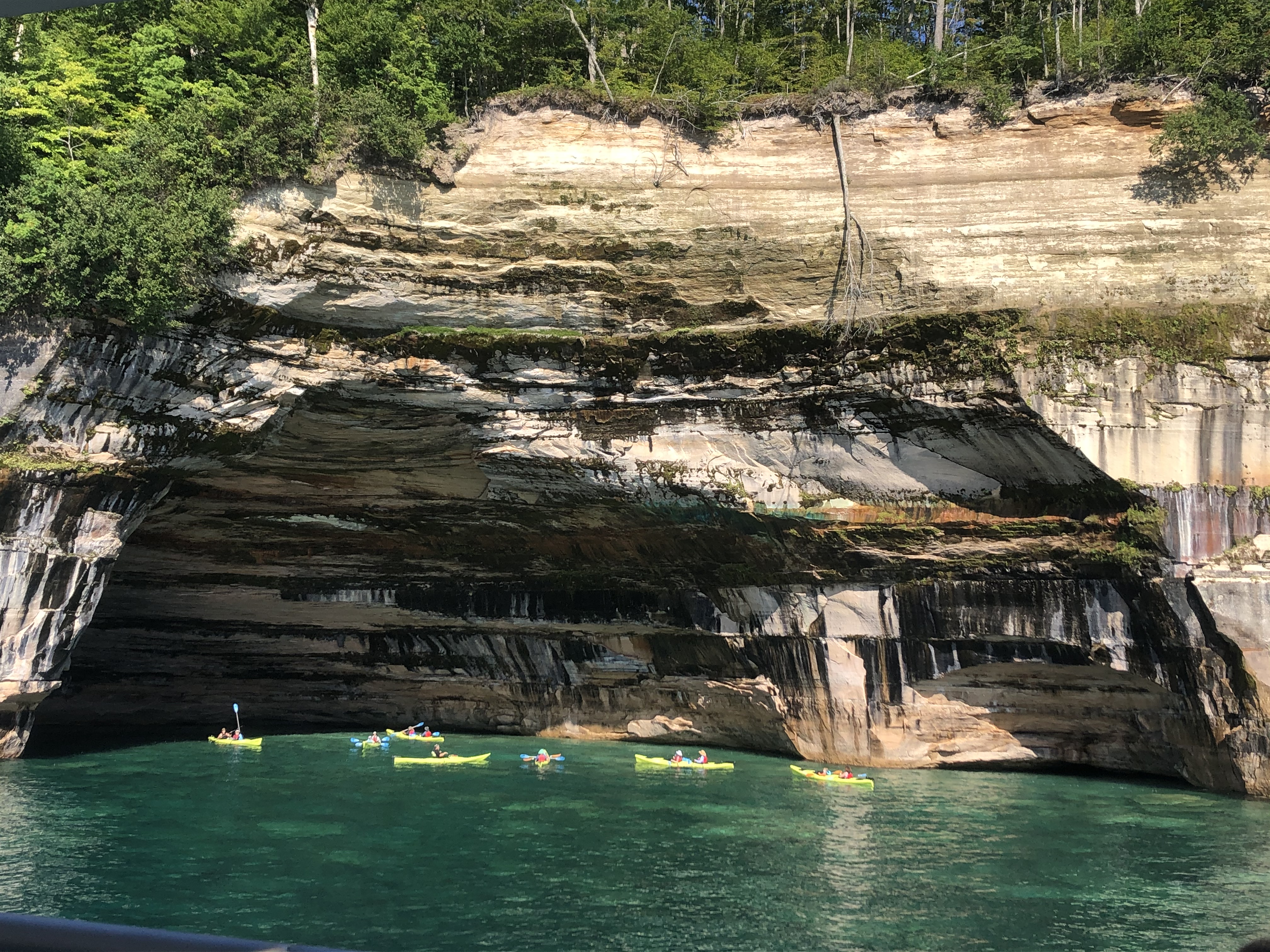
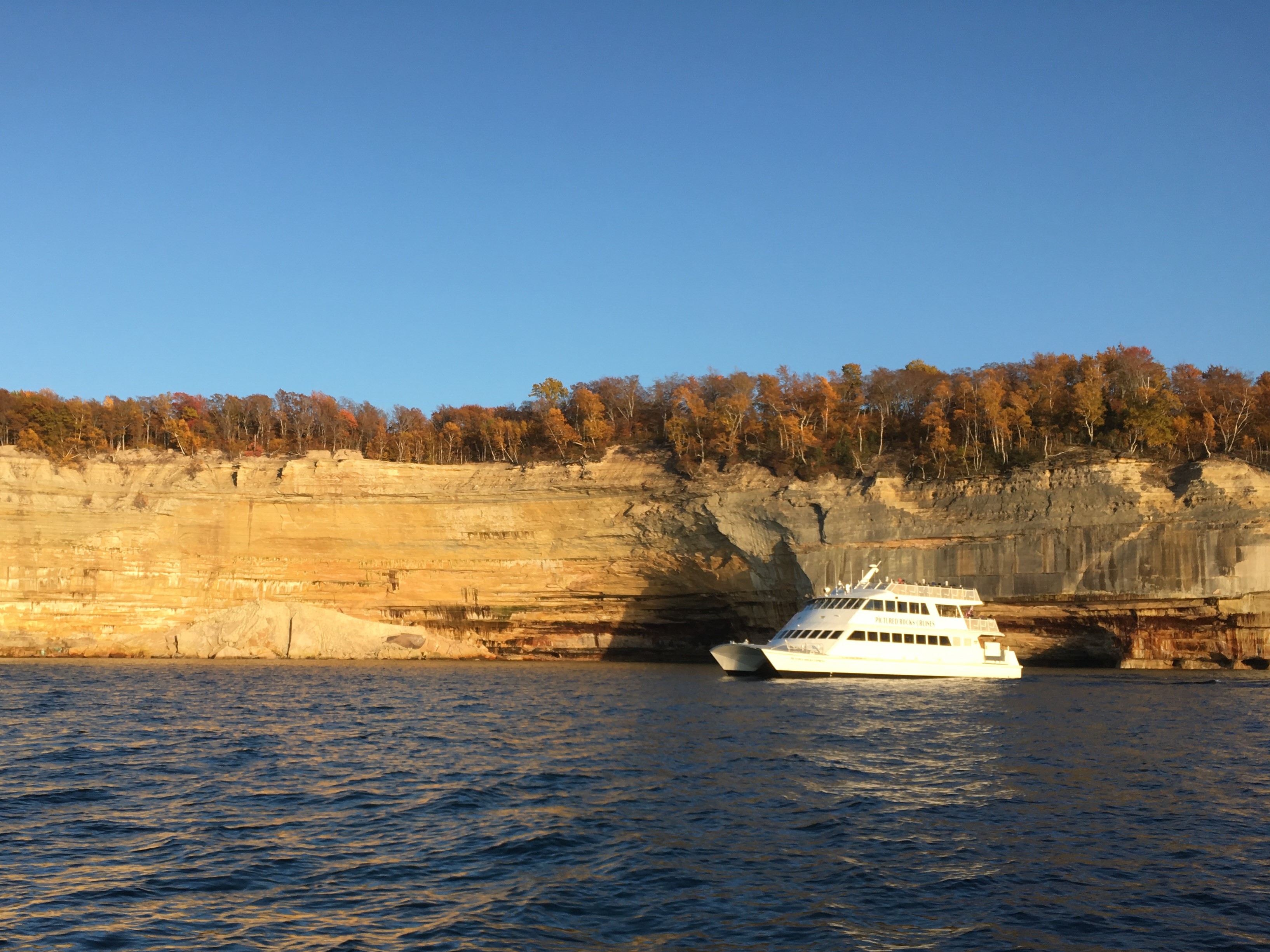
Pictured Rocks Cruises Boat Tour
Taking a narrated boat tour is the easiest way to view the colorful Pictured Rocks cliffs.
Tours
Count: 5
A Scenic Drive From West to East
A self-guided half day tour by vehicle that focuses mostly on driving from one end of the national lakeshore to the other, with some short walks to several of the park's most scenic sites and vistas. Tour duration depends on how long you spend at each spot - whether you are just getting a quick scenic view or taking time to do some additional exploring.
Exploring the Miners Area
The Miners area on the west side contains some of the park's most scenic and diverse sites: cliffs, beach, shoreline, forest, waterfall, river, panoramic views of Lake Superior, and the famous Miners Castle. The three main locations are a quick drive to each other, so you can enjoy the entire Miners area in just a couple of hours.
Interpretive Wayside Tour - Driving East to West
Waysides and audio descriptions for waysides in Pictured Rocks National Lakeshore, beginning in Grand Marais and heading towards Munising on County Road H-58.
Marsh Trail Interpretive Exhibits - Audio Described
Audio description of interpretive panels installed along the Sand Point Marsh Trail. If you have a screen reader on your device, it will read you extensive information about the appearance of the exhibit and landscape.
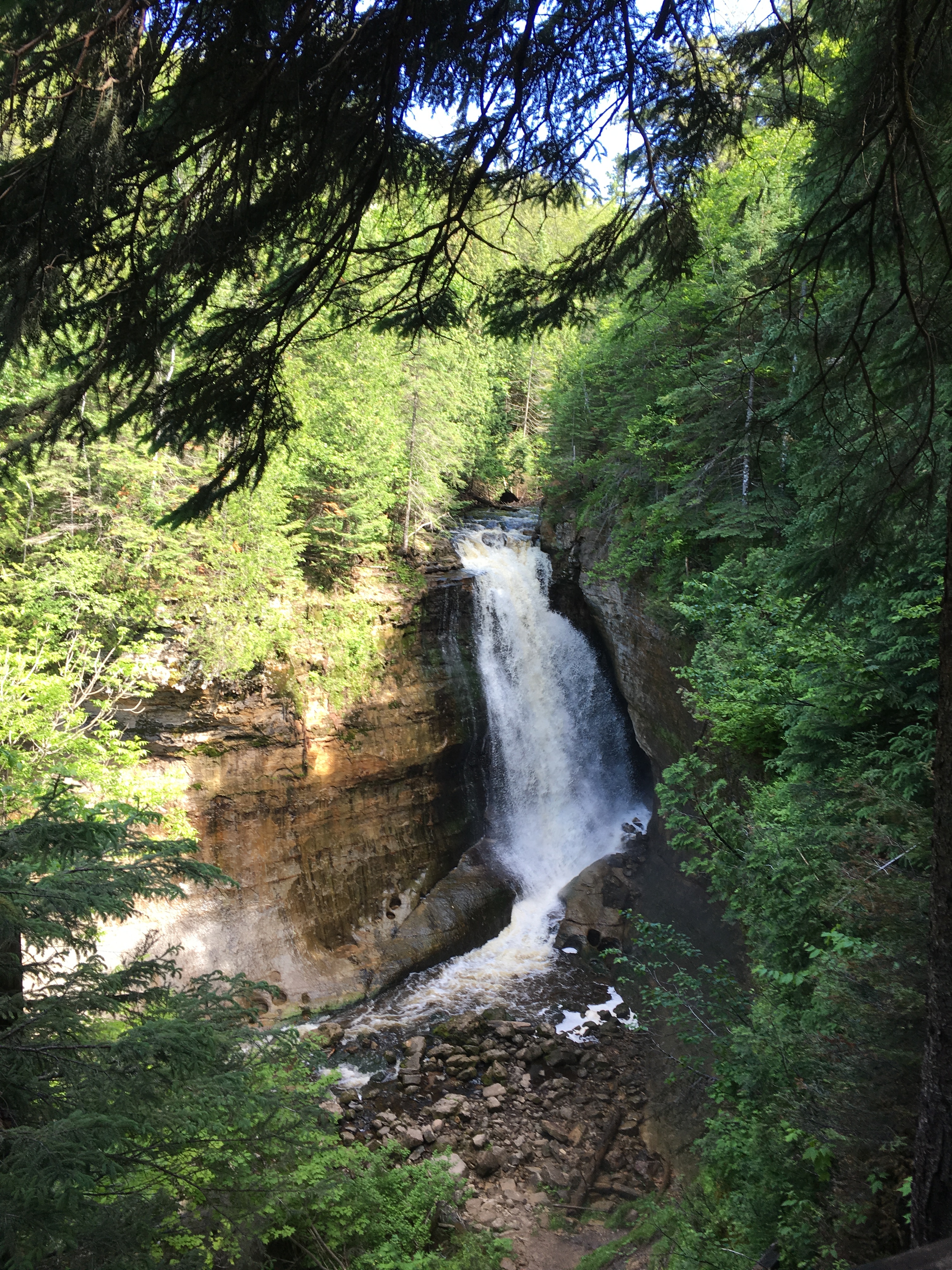
Waterfall Tour
Michigan's Upper Peninsula is famous for its many waterfalls - and the Pictured Rocks area has some of the most beautiful! This tour covers the easiest waterfalls within and nearby the park to access by vehicle. Walks to these waterfalls range in distance from just outside the parking area to 1.2 miles round trip. Driving from one end of the park to the other and back takes about 2.5 hours. Add another 1 - 2 hours to walk to and enjoy all six waterfalls.