Be advised that the NPS has issued alerts for this park.
Road Construction Impacting Road and Foot Traffic
Extensive Transmission Line work, including Helicopter Operations, in Olema Valley will impact vehicle traffic on Sir Francis Drake Blvd and pedestrians on Bolinas Ridge Trail. This work is anticipated to continue through the middle of October.
Multiple Seasonal Closures to Protect Wildlife Are Currently in Effect
Some beaches and other areas of the park are closed to all entry or to various activities (such as dog walking, kayaking, kite flying, or kiteboarding/kitesurfing) to better protect harbor seals, western snowy plovers & seabirds.
South Beach Restrooms Closed
The restrooms at South Beach are closed until further notice. The closest restrooms are at North Beach or Drakes Beach. Vault toilets are available at the Estero Trailhead, Chimney Rock, and Lighthouse parking lots.
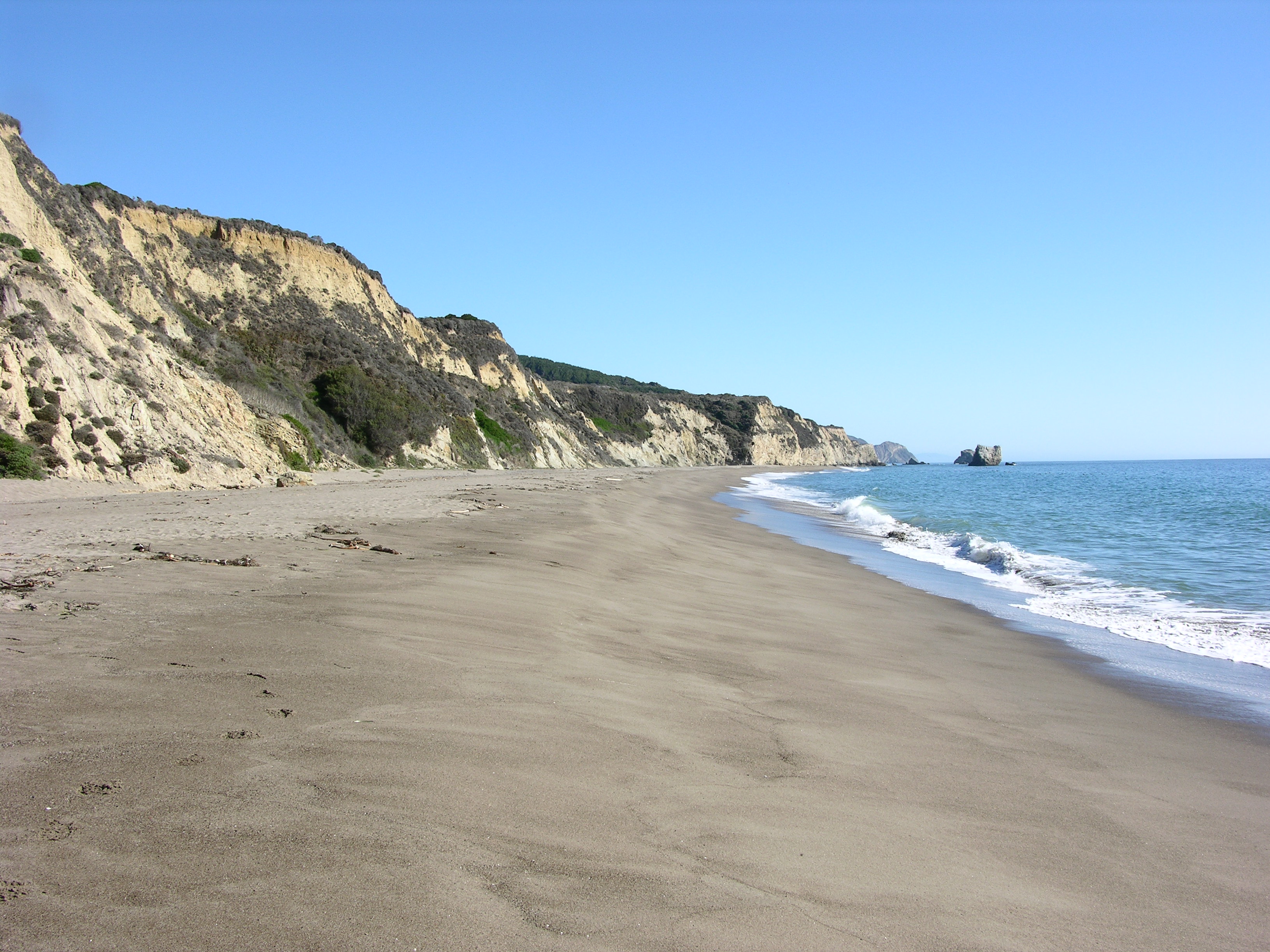
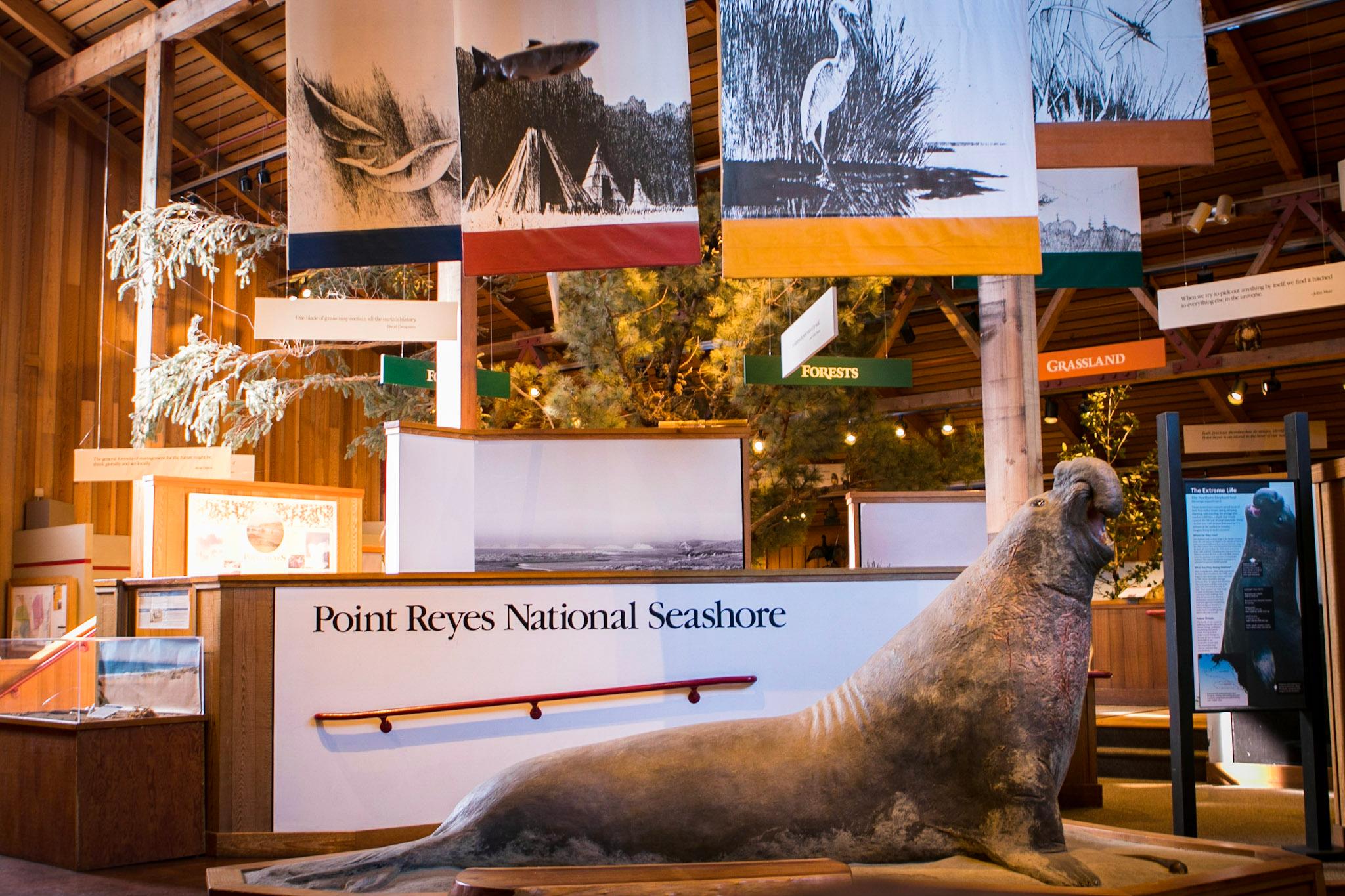
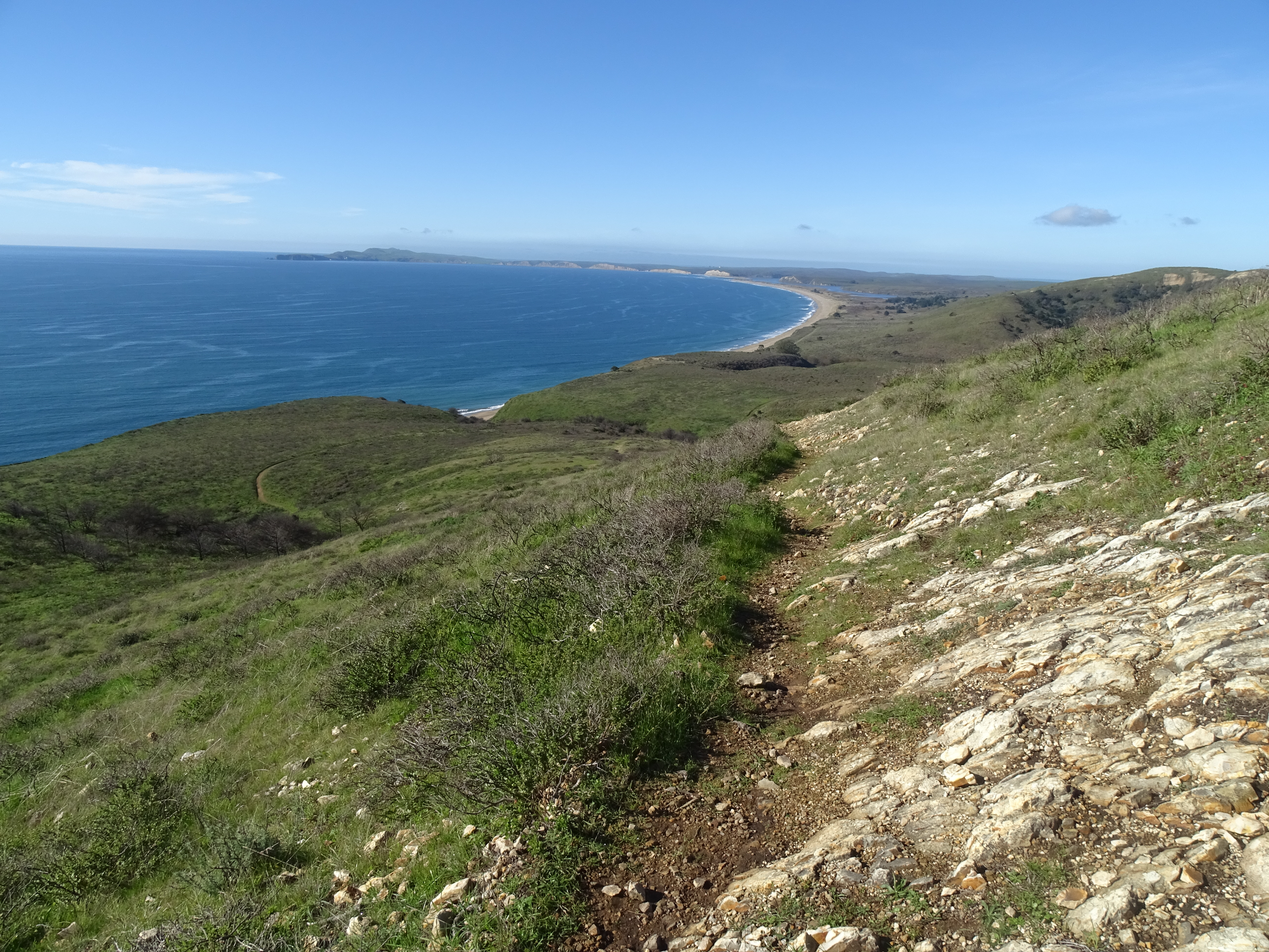
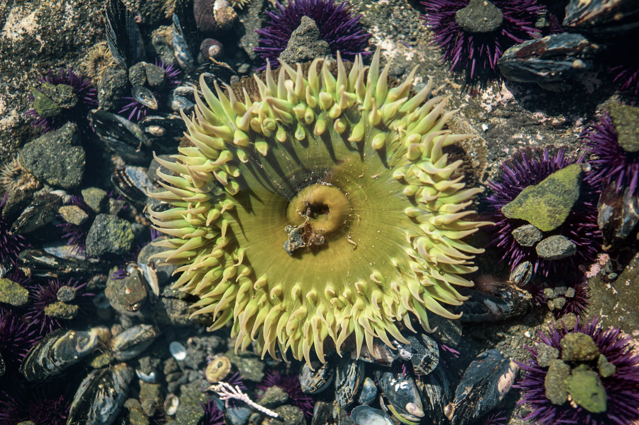
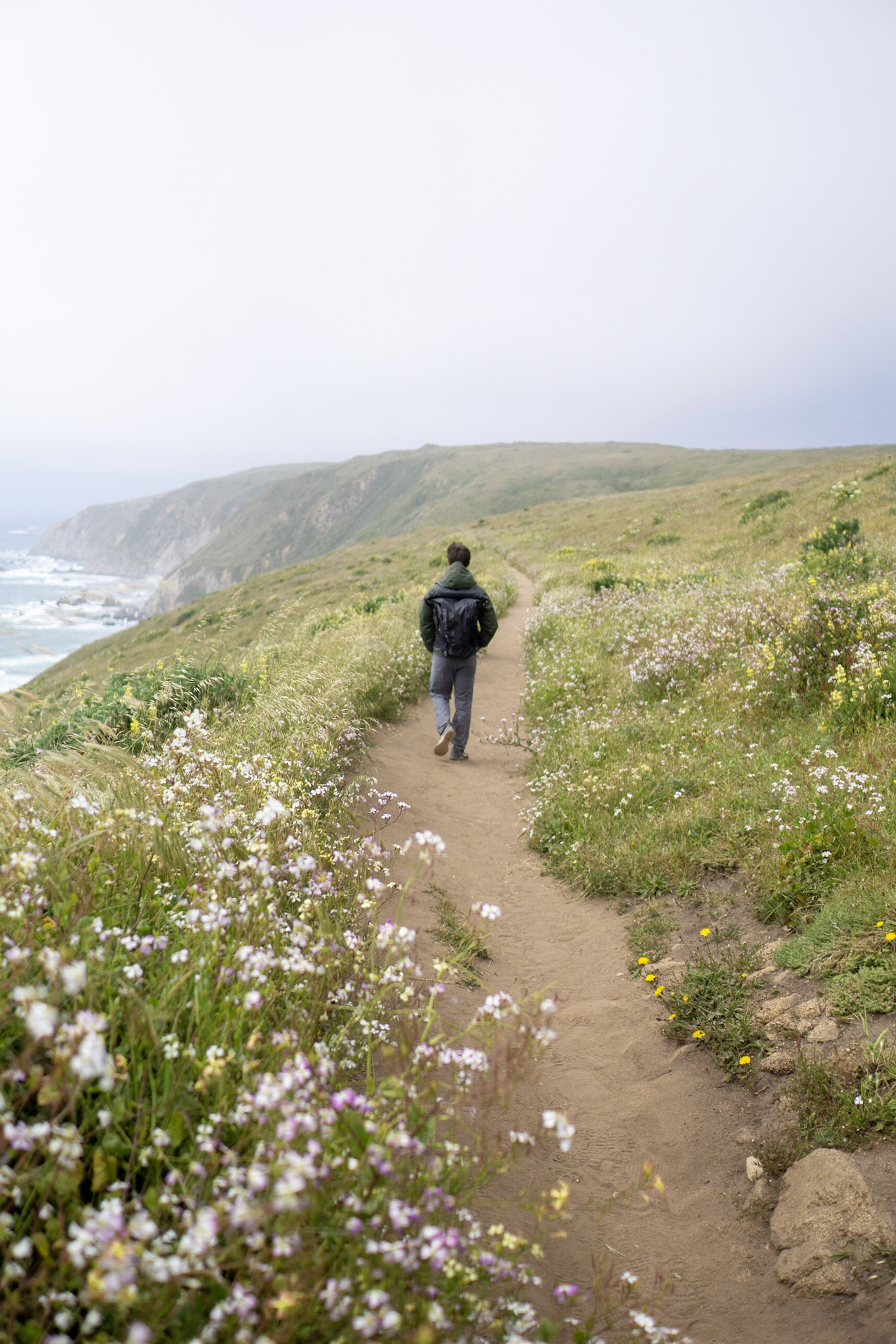
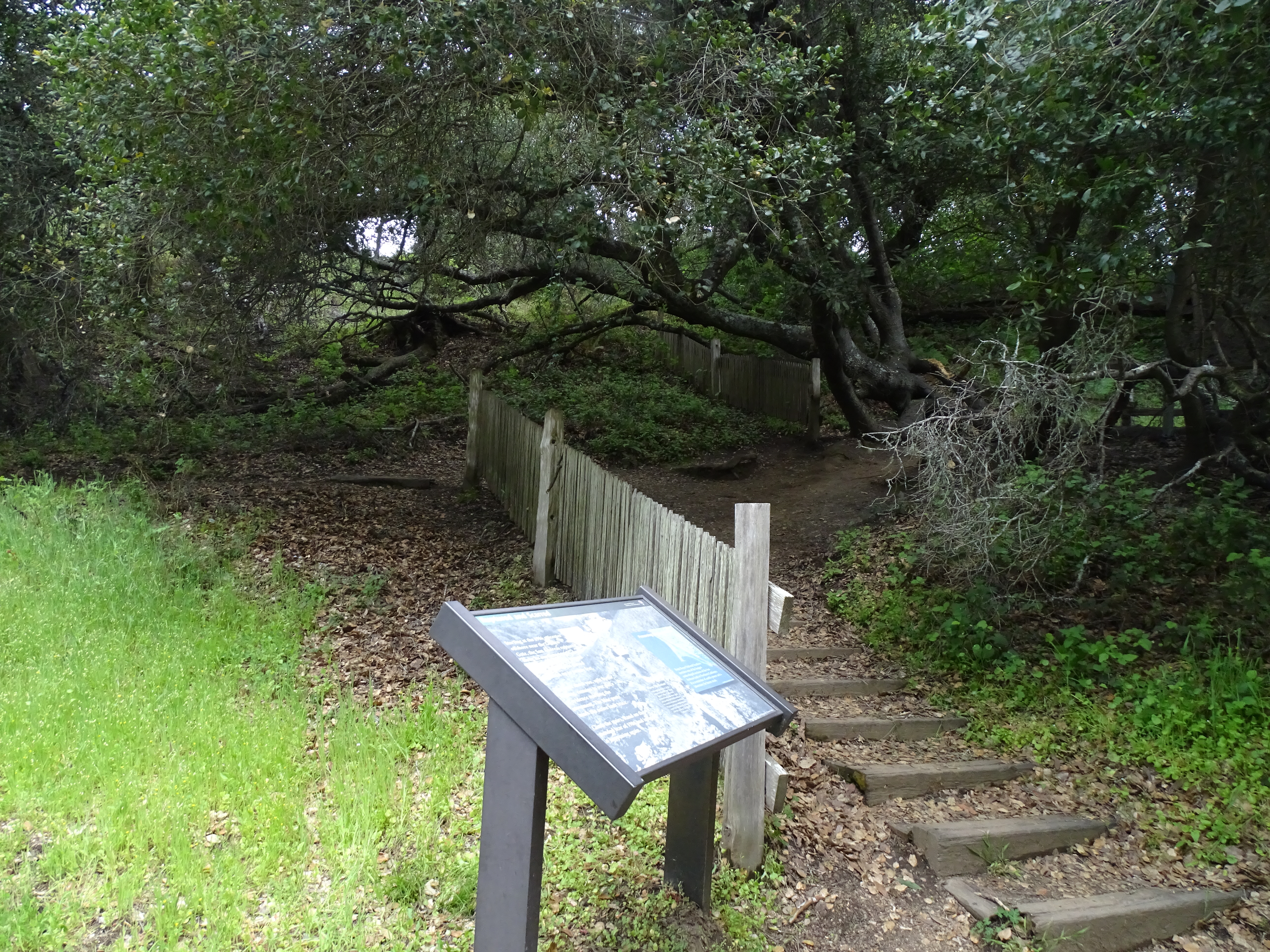
From its thunderous ocean breakers crashing against rocky headlands and expansive sand beaches to its open grasslands, brushy hillsides, and forested ridges, Point Reyes offers visitors over 1500 species of plants and animals to discover. Home to...
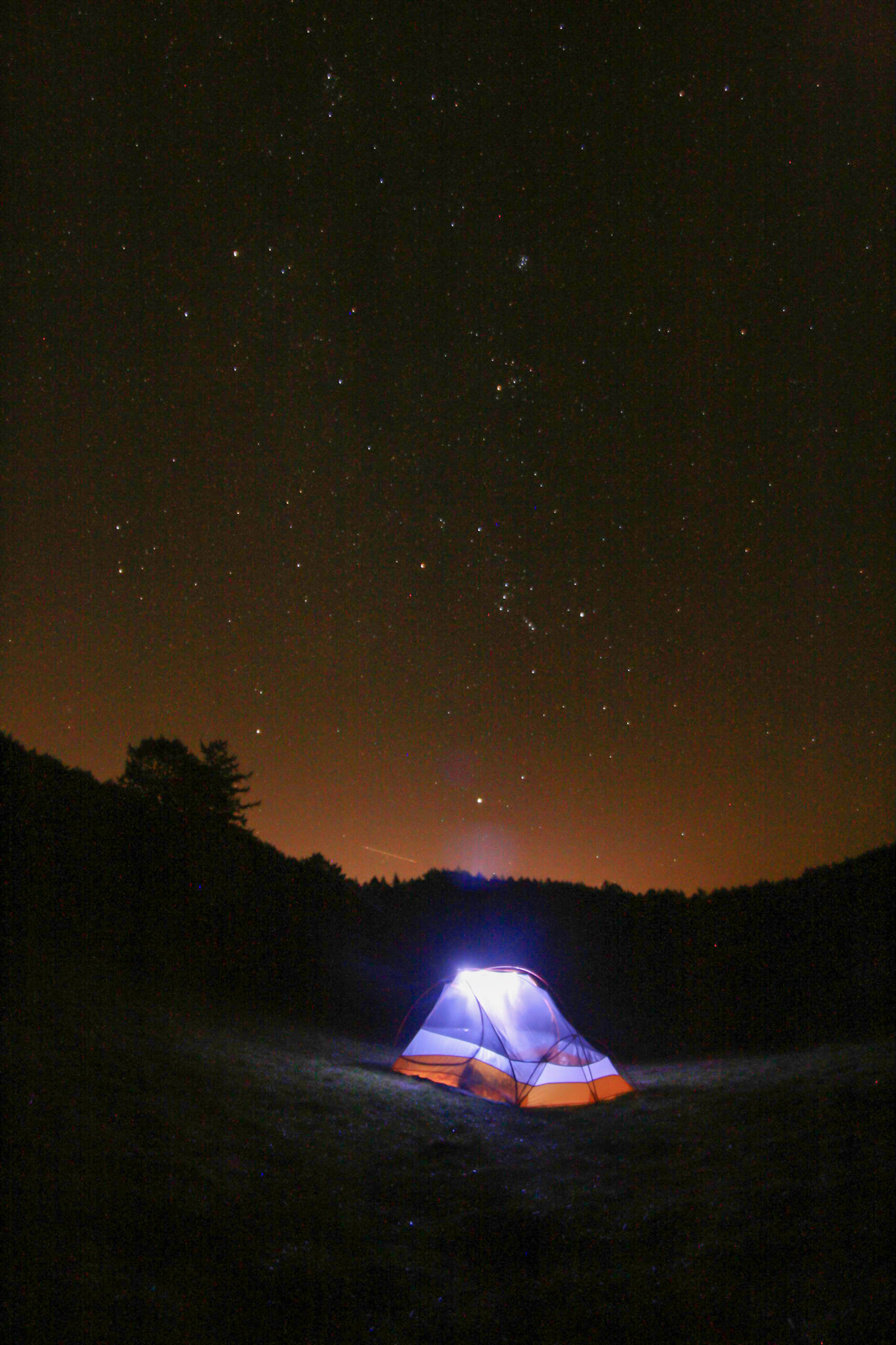
Camping is by permit only. Camping permits must be obtained before starting your trip. Visitors may make online reservations for a permit at this backcountry (i.e., hike-in) campground at Recreation.gov. Some permits/sites are available at 7 am three months to the day in advance and some are available at 7 am 14 days to the day in advance. Print your Recreation.gov confirmation email and be prepared to show it to park rangers on the trail and at your campsite. Print out additional copies of your confirmation email to place face up on the dashboard of each vehicle remaining overnight at park trailheads.
Coast Campground is nestled within a couple small coastal valleys located about 0.1 miles from the beach. One valley, through which a perennial stream flows, heads north. Uphill to the east of the stream, separated by dense coastal scrub, are campsites one through seven. A second grassy valley branches off of the first and heads east before bending to the north after about 500 feet. This second valley contains campsites eight through fourteen, along with a vault toilet building and two potable water faucets.
Camping is by permit only. Camping permits must be obtained before starting your trip. Visitors may make online reservations for a permit at this backcountry (i.e., hike-in) campground at Recreation.gov. Some permits/sites are available at 7 am three months to the day in advance and some are available at 7 am 14 days to the day in advance. Print your Recreation.gov confirmation email and be prepared to show it to park rangers on the trail and at your campsite. Print out additional copies of your confirmation email to place face up on the dashboard of each vehicle remaining overnight at park trailheads.
Glen Campground is located deep within a wooded valley. The entrance to the campground is at the northwest end of the campground off of the Glen Camp Loop Trail, which winds off to the northwest and to the southwest. As one enters the campground, a vault toilet and water faucet are located along the northern edge of a small meadow that fills much of the valley floor. Campsites one through four and nine through twelve are mostly located around the edge of the small meadow. Campsites five through eight are located off of a narrow path that leads uphill to the southeast.
Camping is by permit only. Camping permits must be obtained before starting your trip. Visitors may make online reservations for a permit at this backcountry (i.e., hike-in) campground at Recreation.gov. Some permits/sites are available at 7 am three months to the day in advance and some are available at 7 am 14 days to the day in advance. Print your Recreation.gov confirmation email and be prepared to show it to park rangers on the trail and at your campsite. Print out additional copies of your confirmation email to place face up on the dashboard of each vehicle remaining overnight at park trailheads.
Sky Campground is located on the western side of Mount Wittenberg at an elevation of 1025 feet. In clear weather, it has a sweeping view of Point Reyes, Drakes Bay, and the Pacific Ocean. As one arrives from the north to the entrance of the campground, a vault toilet is located to the east of the trail. Further to the south is a potable water faucet located a bit further away from the trail. From this area, a few paths lead to the twelve campsites to the west and northwest.
Camping is by permit only. Camping permits must be obtained before starting your trip. Visitors may make online reservations for a Tomales Bay boat-in camping permit at Recreation.gov. Boat-in camping permits/sites are available three months to the day in advance. Print your Recreation.gov confirmation email and be prepared to show it to park rangers while on the water or on the beach.
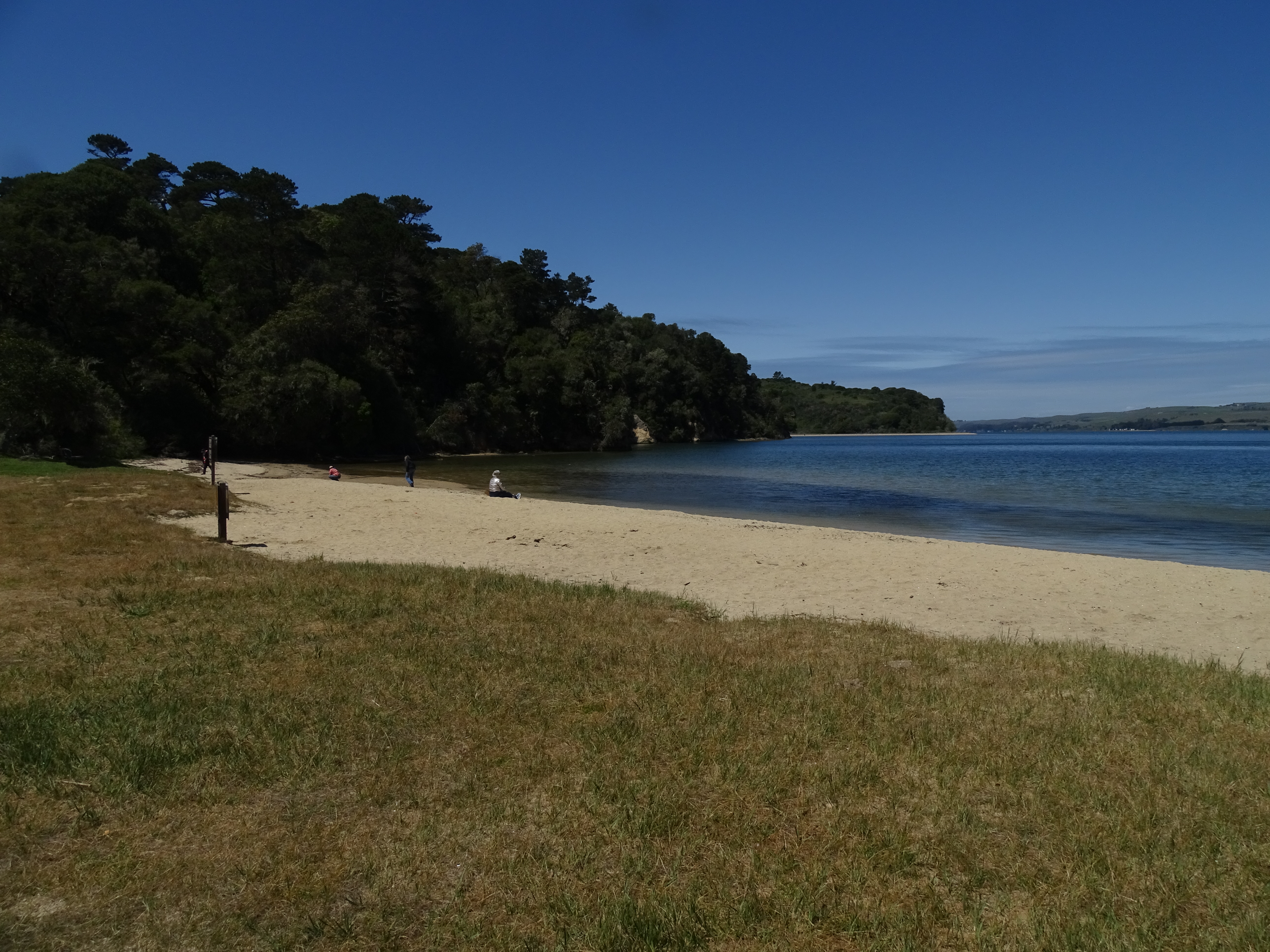
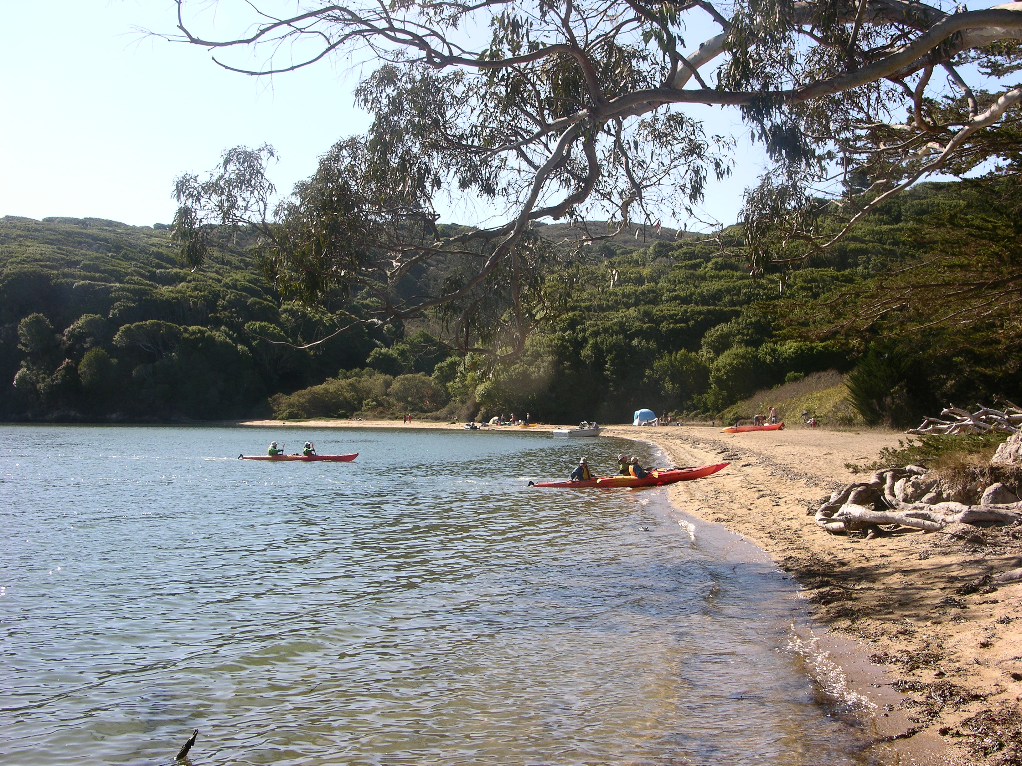
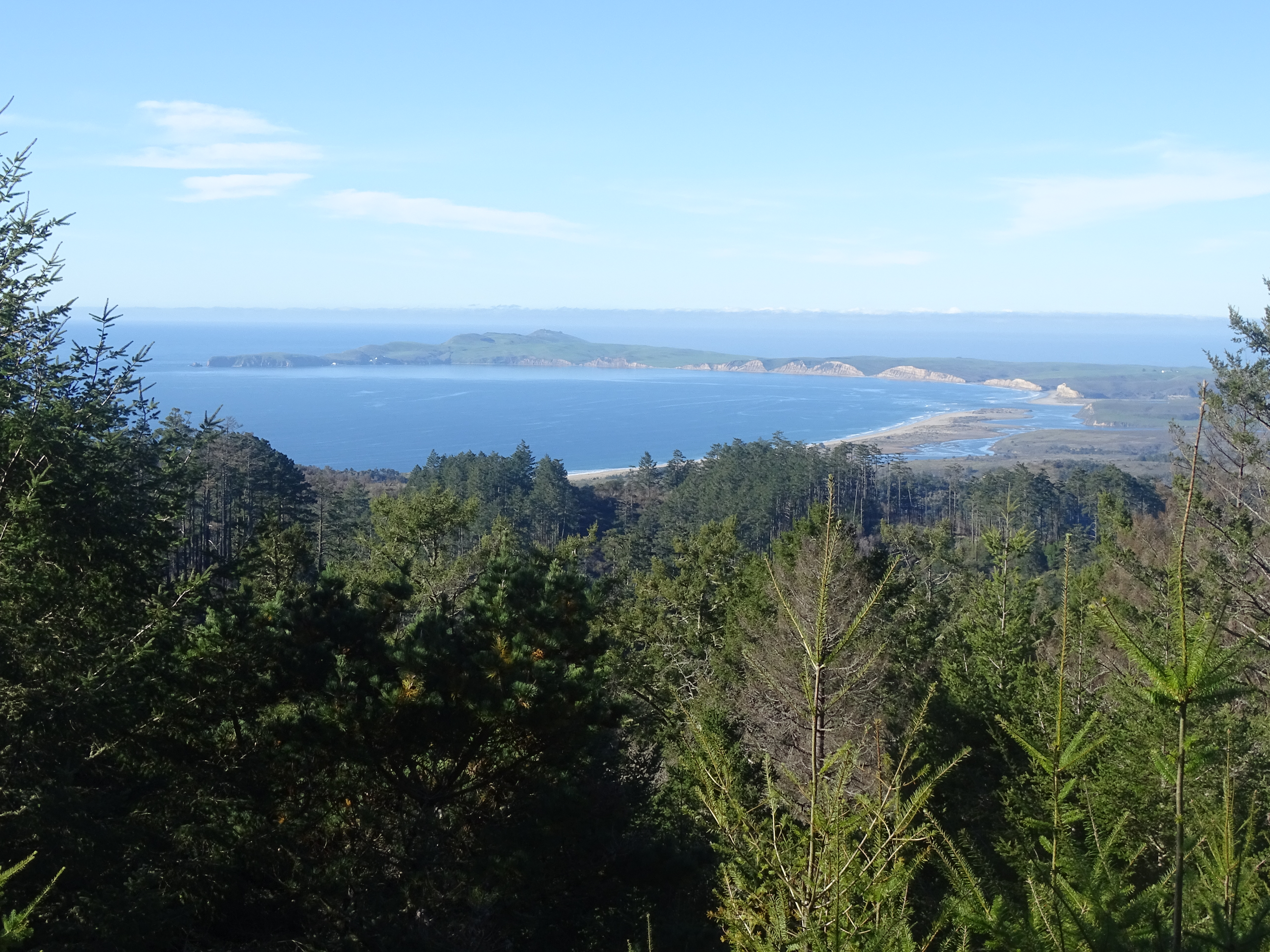
Tomales Bay is a one-mile-wide, 13-mile-long saltwater bay stretching from its mouth in the north-northwest to its head near Point Reyes Station in the south-southeast. The mainland is to the east and Inverness Ridge and Tomales Point rise to the west. Along the west side of the northern end of the bay are numerous beaches of various size on which camping is permitted.
Camping is by permit only. Camping permits must be obtained before starting your trip. Visitors may make online reservations for a permit at this backcountry (i.e., hike-in) campground at Recreation.gov. Some permits/sites are available at 7 am three months to the day in advance and some are available at 7 am 14 days to the day in advance. Print your Recreation.gov confirmation email and be prepared to show it to park rangers on the trail and at your campsite. Print out additional copies of your confirmation email to place face up on the dashboard of each vehicle remaining overnight at park trailheads.
Wildcat Campground is located in an open meadow on a bluff overlooking the ocean with a short walk to the beach. The Stewart Trail descends Inverness Ridge from the northeast and the Coast Trail descends to the campground from a short unnamed ridge to the south. A vault toilet and potable water faucet are located on the north side of Stewart Trail near where the trail enters the meadow. Three group sites are located along the south and east edge of the campground. Three regular sites are located close to the bluff top, and the remaining two sites are located near the center of the campground. The Pacific Ocean is located to the west.
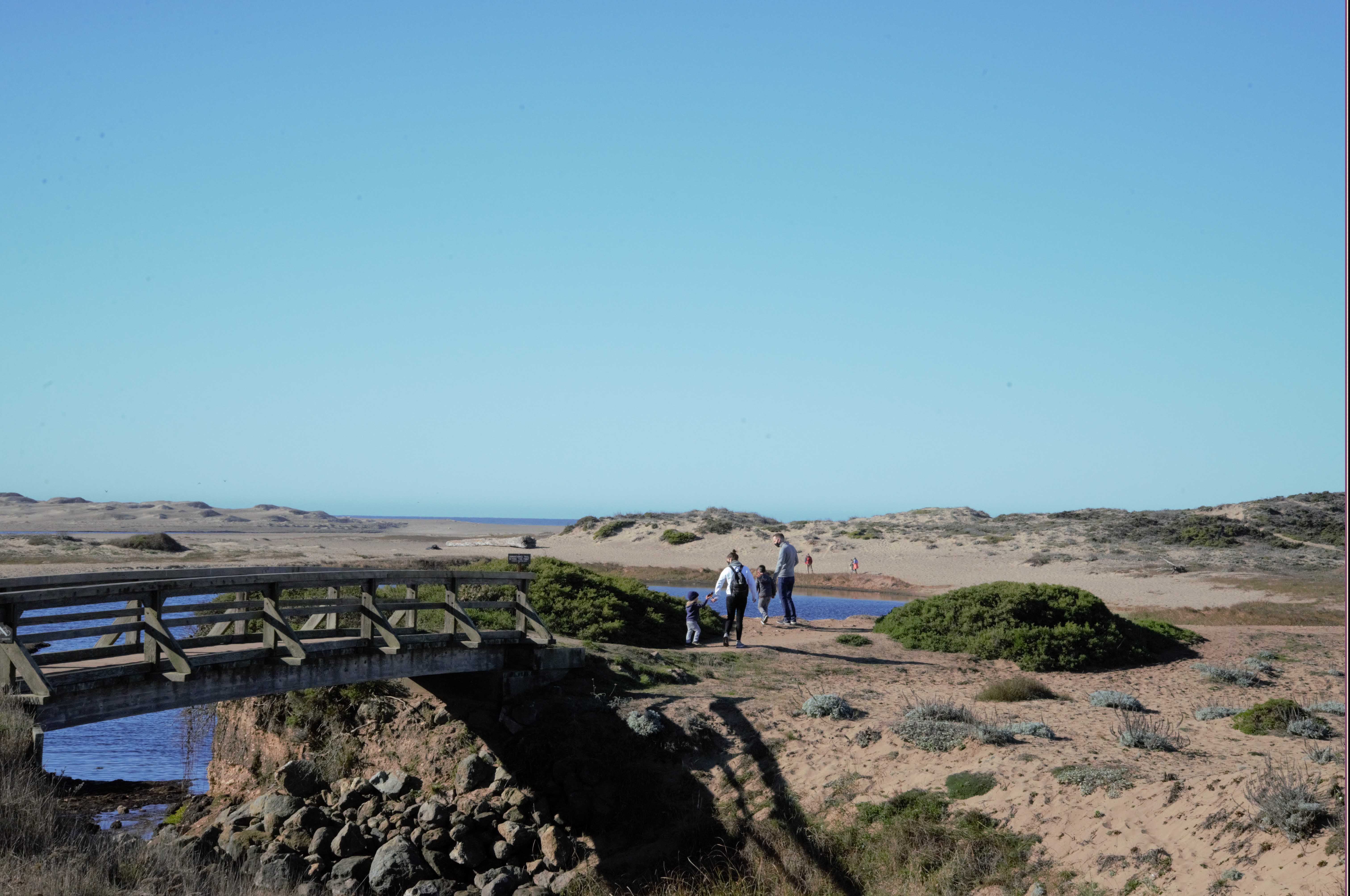
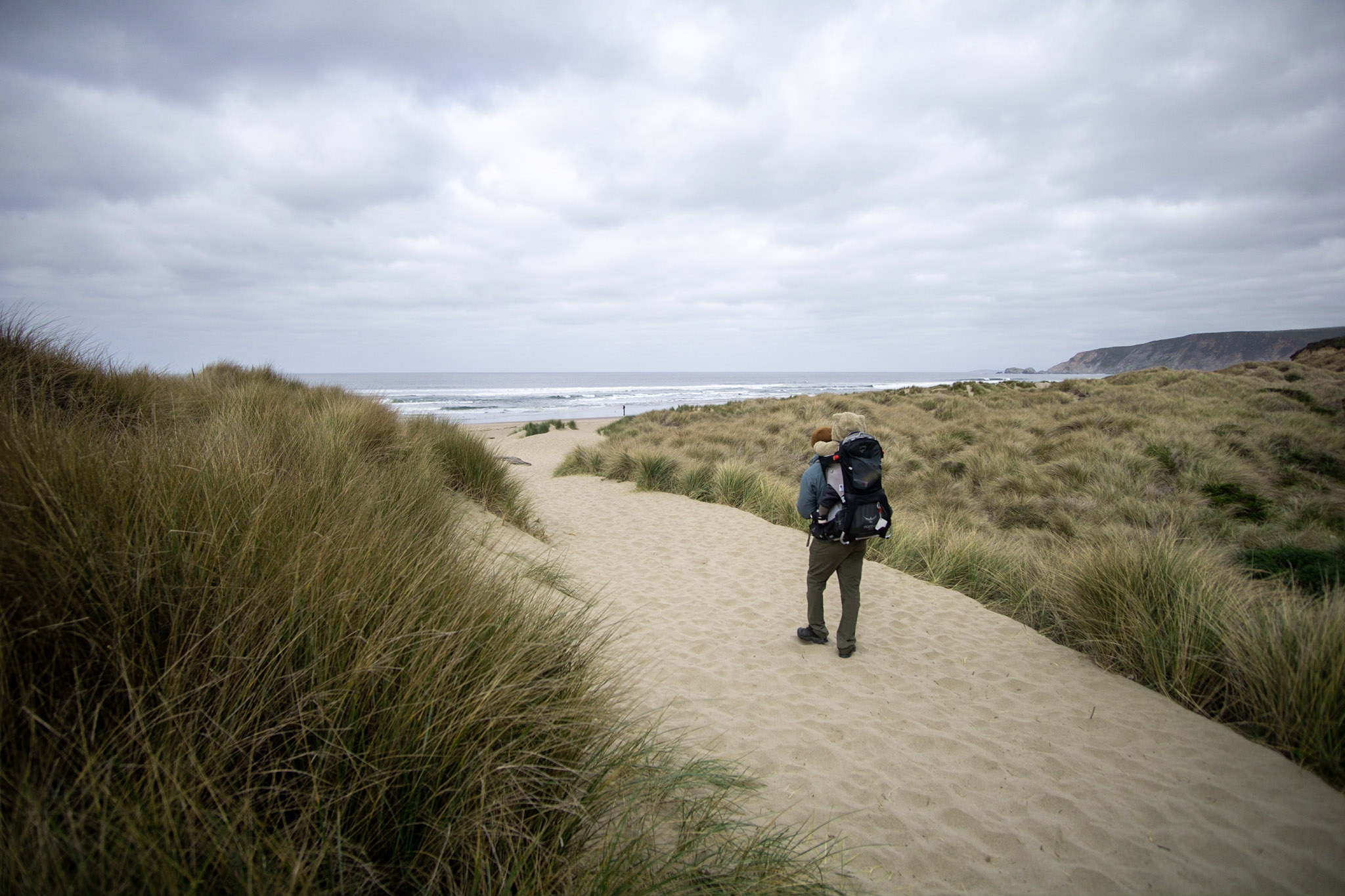
A 2.5-kilometer (1.5-mile) walk through coastal scrub, across a footbridge over a stream between two lagoons, and over sand dunes brings you to this ocean beach. The lagoons attract large numbers of migrating shorebirds in the fall, followed by the wintering ducks. Never turn your back to the ocean. Due to the frequently large surf, this is not a beach at which it is safe to play close to the water's edge, much less to go for a swim.
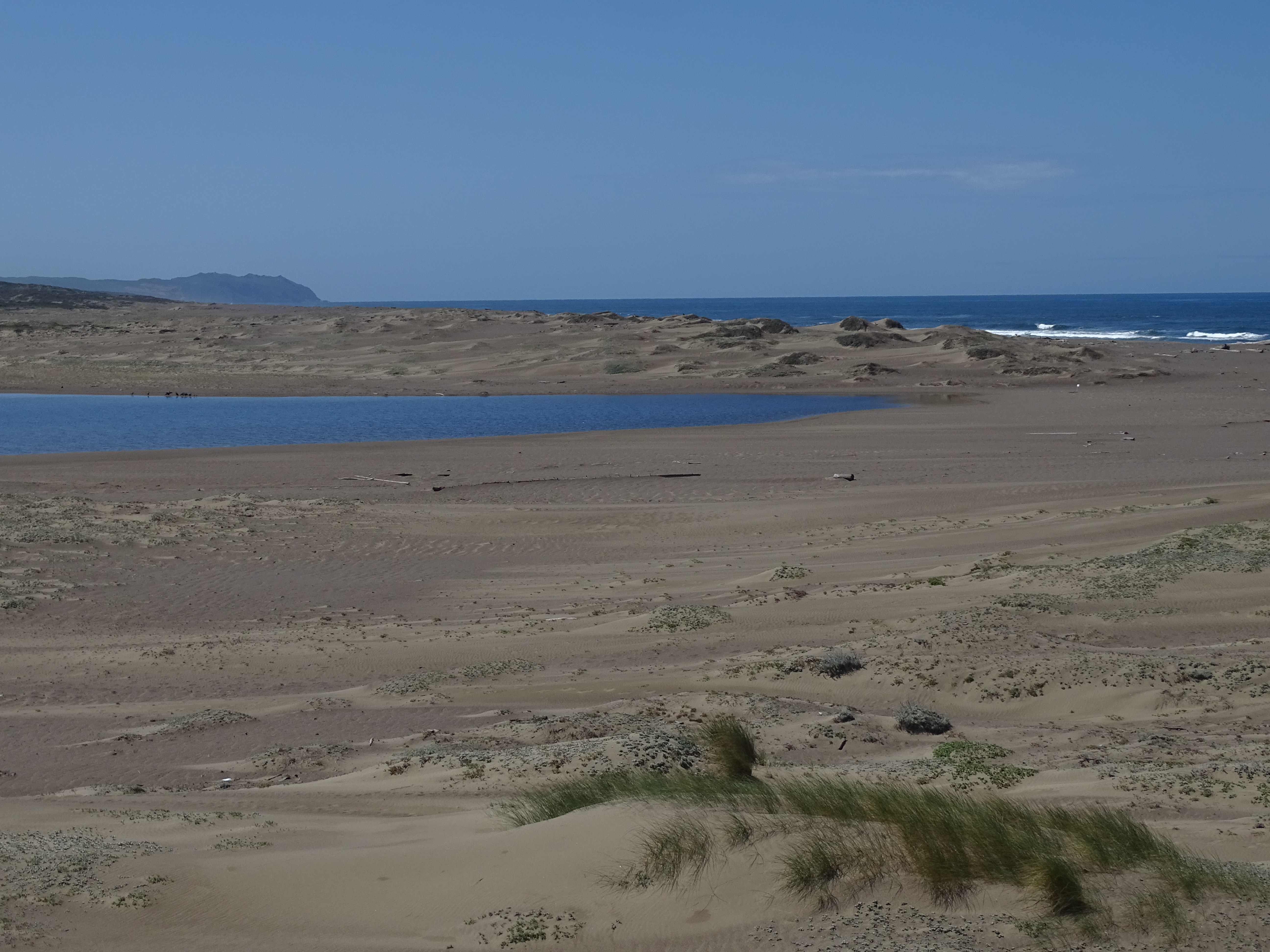
The Abbotts Lagoon Beach is the section of the 11-mile-long (17-kilometer-long) Point Reyes Beach near the west end of Abbotts Lagoon. To the west is the Pacific Ocean. The sandy and steep-sloped Point Reyes Beach stretches for about 2.5 miles (4 kilometers) to the north-northeast before giving way to the rugged shoreline of Tomales Point. To the south-southwest, the Point Reyes Beach stretches for about 9 miles (14.4 kilometers) before ending at the Point Reyes Headlands. Abbotts Lagoon is composed of three connected bodies of water that drain from the northeast. The largest and westernmost lagoon is closest to the ocean and separated from the ocean by a natural dam composed of sand that can vary in width from one season to the next. After some powerful storm events, ocean waves may flow into this lowest lagoon, or water from the lagoon may top the dam and flow into the ocean. The largest lagoon stretches to the southeast for about 4,700 feet (1425 meters) and gets up to about 1,700 feet (515 meters) wide. The middle lagoon is a few feet higher in elevation than the lowest lagoon and stretches to the northeast from the lowest lagoon's north-northeastern edge. A footbridge is located where these two lagoons meet, and, depending on the water level, there may be a very short waterfall as water flows from the middle to the lower lagoon. The middle lagoon is about 3,300 feet (1000 meters) long and up to about 920 feet (280 meters) wide. The upper lagoon lies to the northeast of the middle lagoon. It is the smallest lagoon and measures about 1,100 feet (335 meters) long and 450 feet (137 meters) wide. Sand dunes, some covered in sparse vegetation, surround the western end of Abbotts Lagoon. The dunes give way to coastal grasslands to the east, some of which have been converted to fences in pastureland. Wetland vegetation immediately surrounds the upper and middle lagoons. The Abbotts Lagoon Trail starts about 1.5 miles (2.4 kilometers) to the east at the Abbotts Lagoon Trailhead along Pierce Point Road. The trail passes through grassland along the south sides of the upper and middle lagoons before crossing the footbridge and passing along the northern sandy shore of the lower, westernmost lagoon.
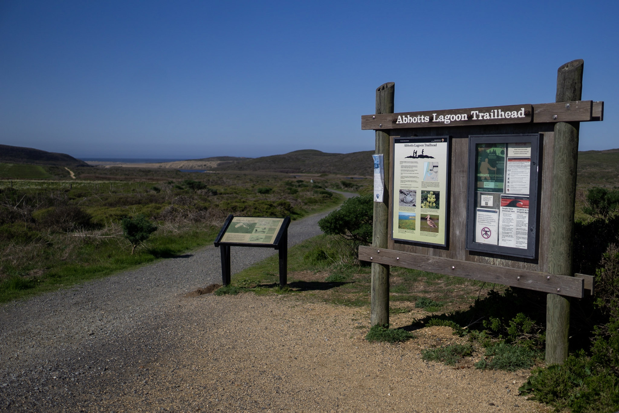
The Abbotts Lagoon Trail is known for fantastic birding opportunities (particularly in the fall and winter), and beautiful wildflowers in the spring. The Abbotts Lagoon Trailhead is located along Pierce Point Road approximately 20 minutes by car from the Bear Valley Visitor Center.
The Abbotts Lagoon Trailhead is at a dirt/gravel parking lot that can accommodate ~40 vehicles. A vault toilet building, a couple dumpsters, and recycle bins are on the east side of the parking lot. Fenced-in pastureland to the north, east, and south cover the lowlands in the immediate vicinity and hills and ridges in the distance. A trailhead information sign is located at the northwest end of the parking lot, adjacent to a dirt trail that heads to the west. Less than one mile (1.6 kilometer) to the west are three progressively larger lagoons surrounded by coastal scrub and sand dunes. The Pacific Ocean is 1.25 miles (2 kilometers) to the west.
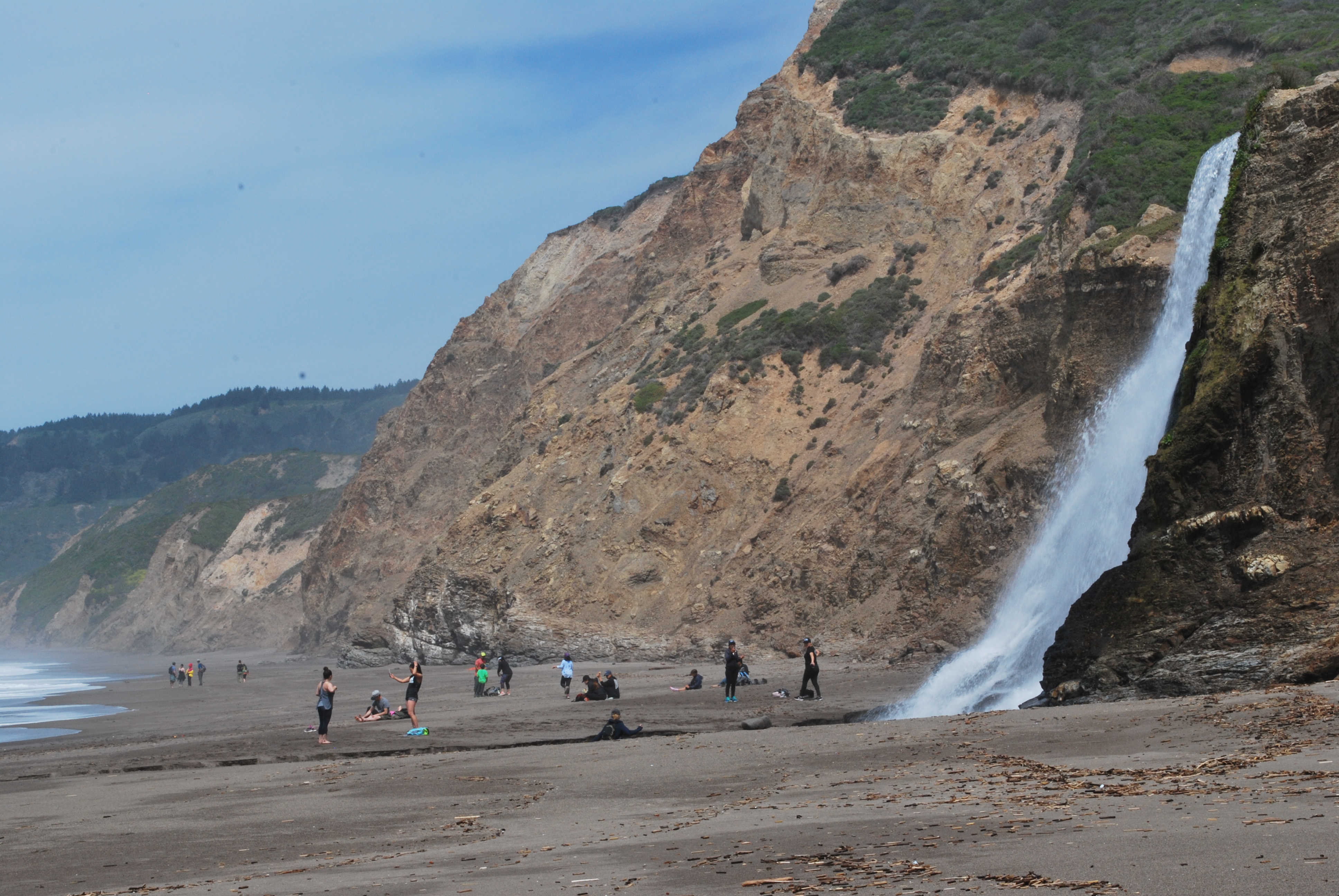
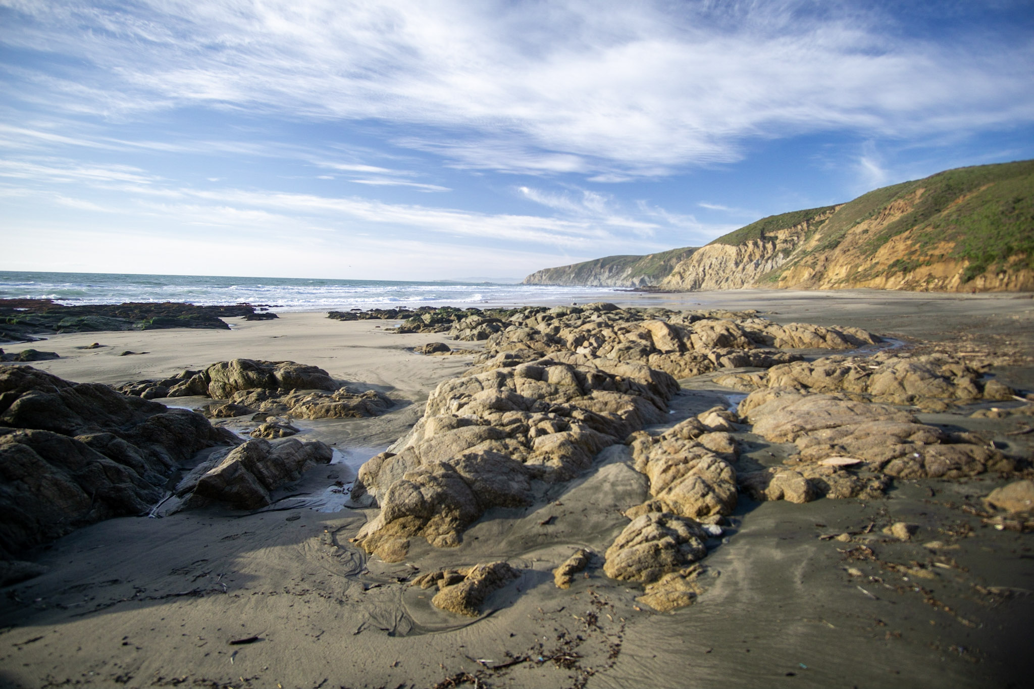
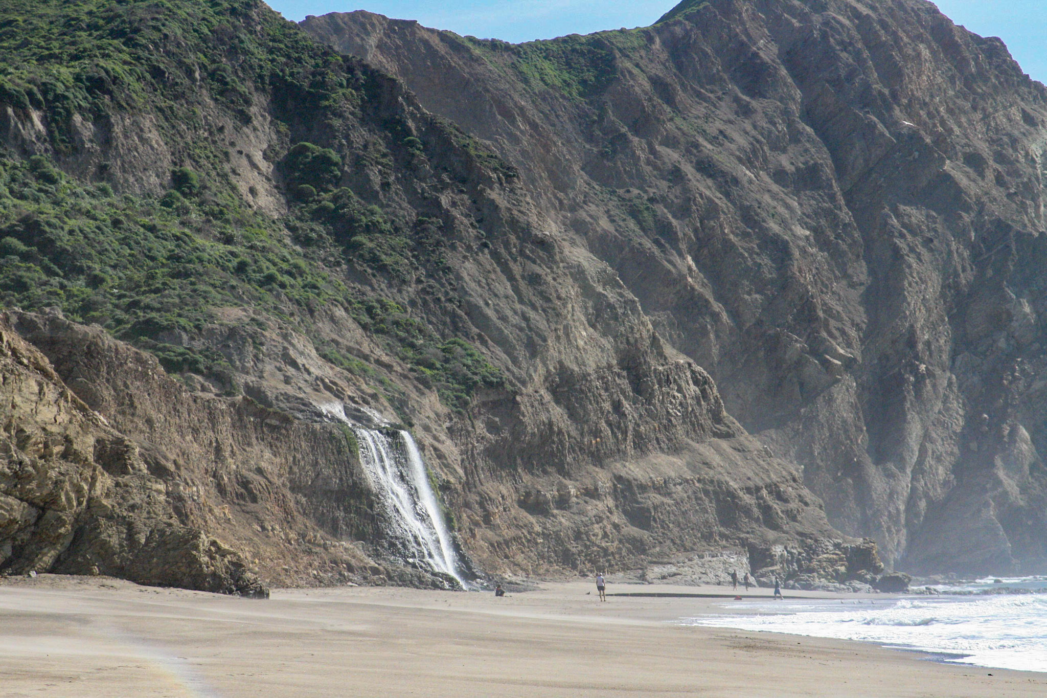
Alamere Falls is a beautiful waterfall deep within the Phillip Burton Wilderness. The falls are a dramatic sight as water cascades over a ~30 foot tall cliff onto the south end of Wildcat Beach. While no easy trek—a 13-mile (20 km) minimum round-trip hike is required—this spectacular spot is a popular—and a sometimes overcrowded—visitor draw. Take note: it is also the site of multiple search-and-rescue operations each year.
An approximately 20-foot-wide (6-meter-wide) waterfall cascades over an approximately 40-foot-tall (12-meter-tall) beige-colored bluff onto a sandy ocean beach. Green moss, algae, and small plants grow on the bluffs on either side of the falls. To the south of the falls, the bluffs become taller and the beach becomes more narrow and rocky. Sandy beach gives way to rocky intertidal habitat. A tall headlands about 2000 feet (610 meters) to the south jut out into the ocean, blocking the view of the coastline to the south. To the west, ocean waves wash ashore. To the north, the bluff-lined Wildcat Beach stretches 2.6 miles (4.2 kilometers) to Miller Point. Follow Wildcat Beach 1.1 miles (1.8 kilometers) to the north to return to Wildcat Campground, which is the only location along Wildcat Beach with a safe route to leave the beach.
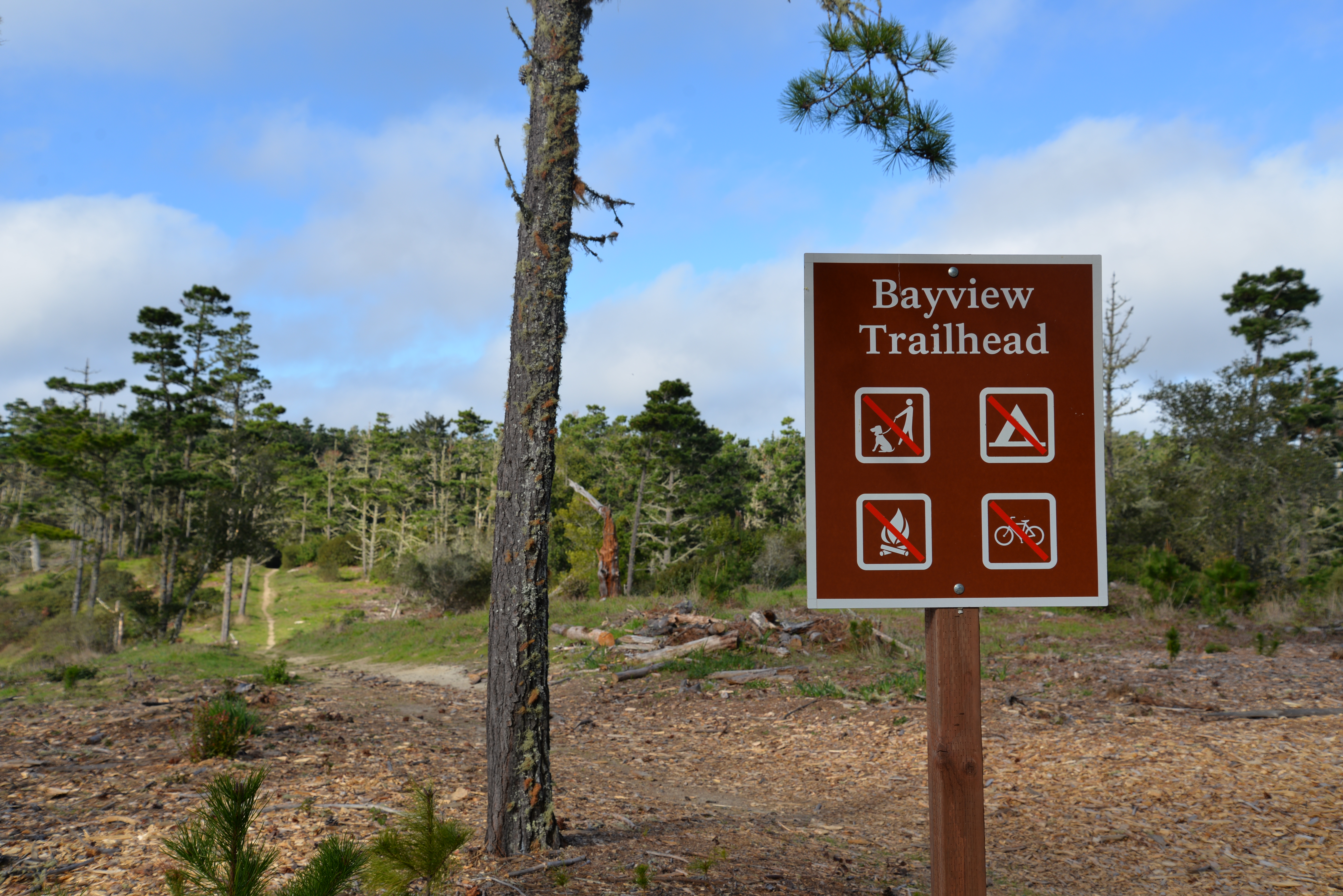
Multiple trail options begin at the Bayview Trailhead, leading either down to the coast, along the Inverness Ridge, or through the Phillip Burton Wilderness. The Vision Fire burned through this area in October 1995. The trailhead is located along Limantour Road, approximately 10 minutes by car from the Bear Valley Visitor Center.
The Bayview Trailhead is located at a small gravel parking lot with space for ~20 vehicles on the north side of a very windy paved two-lane road. It is at an elevation of approximately 780 feet (235 meters) near the crest of a forested ridge that runs from the northwest to the southeast. To the southwest, a triangular peninsula stretches 10 miles (16 kilometers) into the Pacific Ocean. A large sign in a wooden frame provides information about the Vision Fire that burned much of the surrounding landscape in October 1995. From the west end of the parking lot, the Inverness Ridge Trail—which is a single-lane dirt-gravel service road closed to visitor vehicular traffic—heads to the north along the ridge crest. A ten-foot-long metal gate blocks vehicular passage onto the Inverness Ridge Trail, but there is sufficient room on either side of the gate for pedestrians, bicyclists, and horse riders. The single-track Bayview Trail ascends from a wooded valley to west, enters the parking lot near its southwest corner, crosses the paved road, and then parallels the road along its south side as it winds to the east along the ridge crest. Trail signage near where the trails depart from the road or parking lot provide information about what uses (i.e., pet walking, camping, building fires, riding bicycles) are prohibited on which trails and the distances to other trails or points of interest.
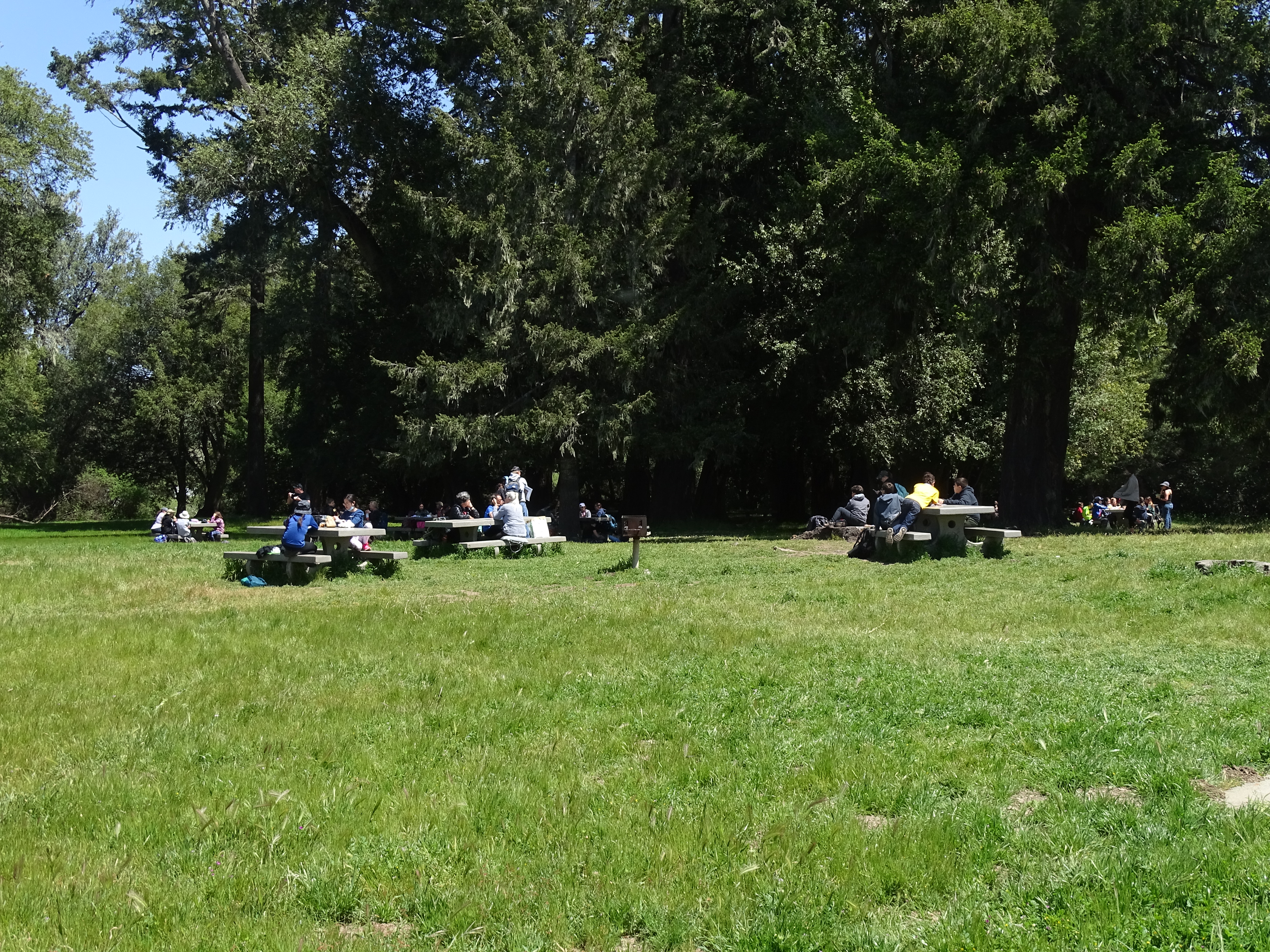
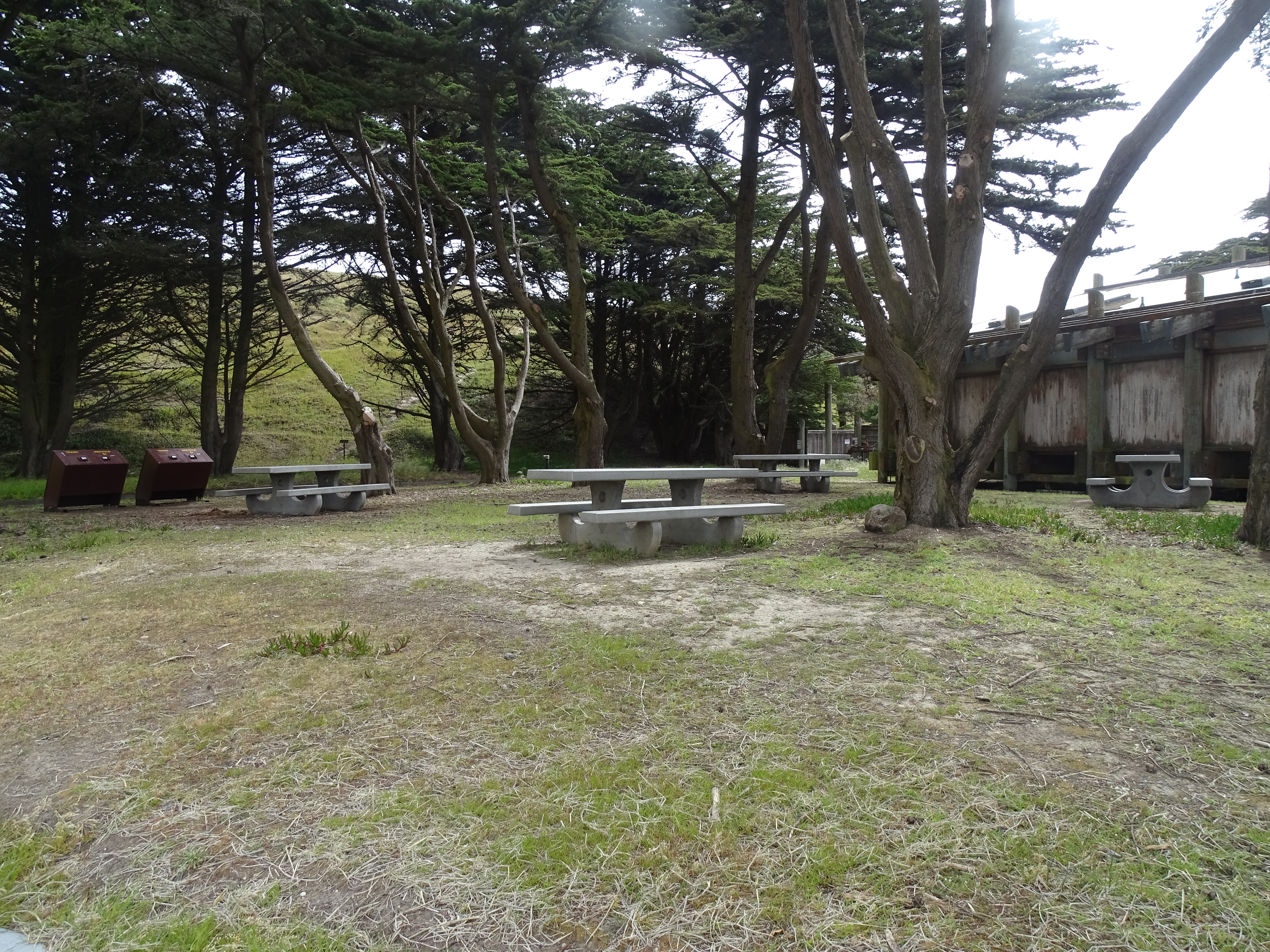
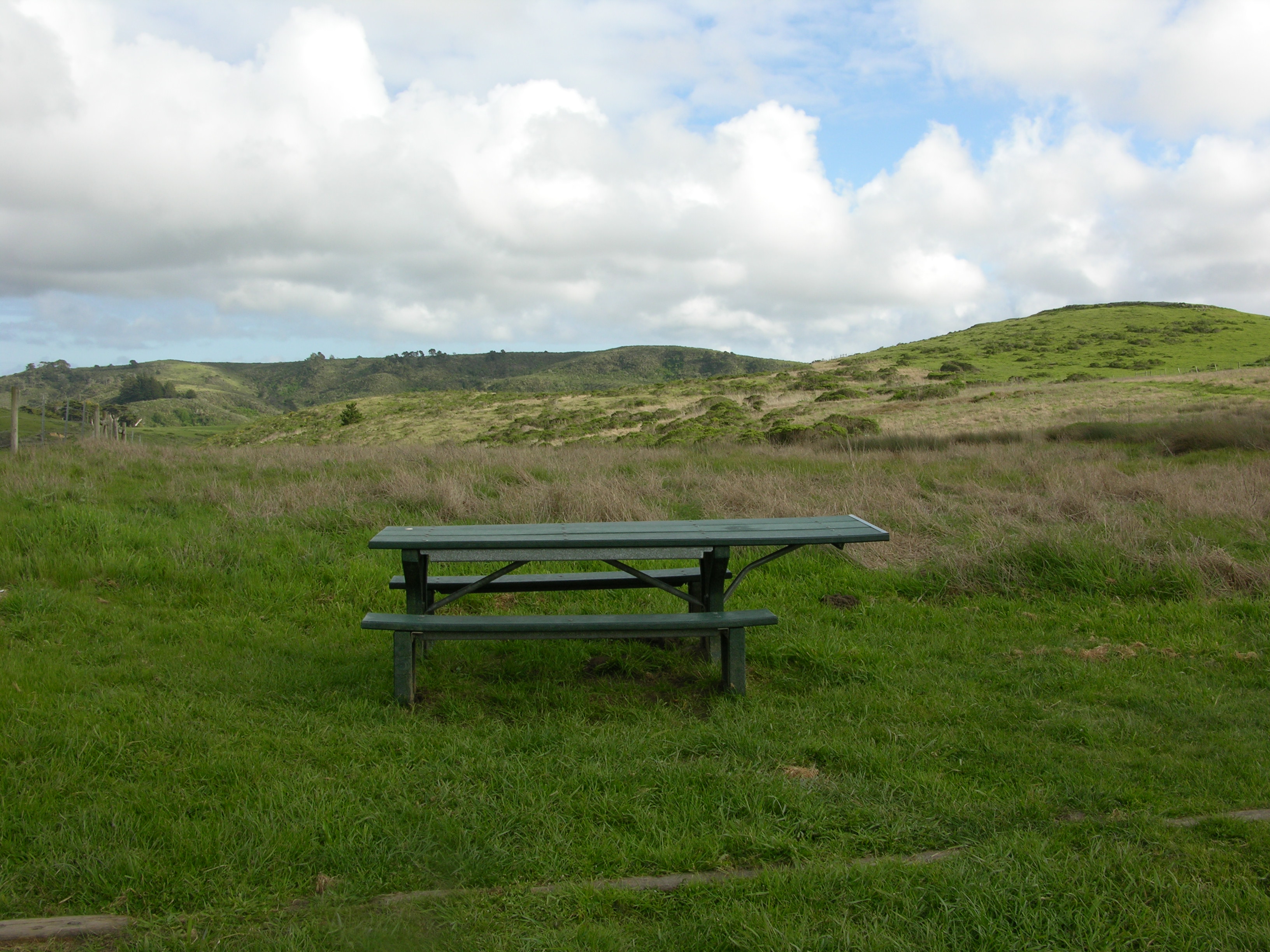
Point Reyes National Seashore's largest picnic area is located at Bear Valley, across the access road from the Bear Valley Visitor Center. Tall Douglas fir and California bay laurel trees provide shade at some of picnic tables.
Twenty-one picnic tables are scattered among and adjacent to a number of tall Douglas fir and California bay laurel trees. In the winter and spring, green grass covers the ground. In summer and fall, the annual grasses have largely died and turned brown. To the north and east, the woodlands thicken. To the south is a large gravel parking lot on the other side of a low split rail fence. At the northeast corner of the parking lot is a restroom building. To the west, across an access road and beyond a long, narrow parking lot is the Bear Valley Visitor Center. The visitor center looks like a large gray barn. Further west are fenced-in horse pastures, which give way to dense forests that rise up the slopes of a 1300-foot-high ridge.
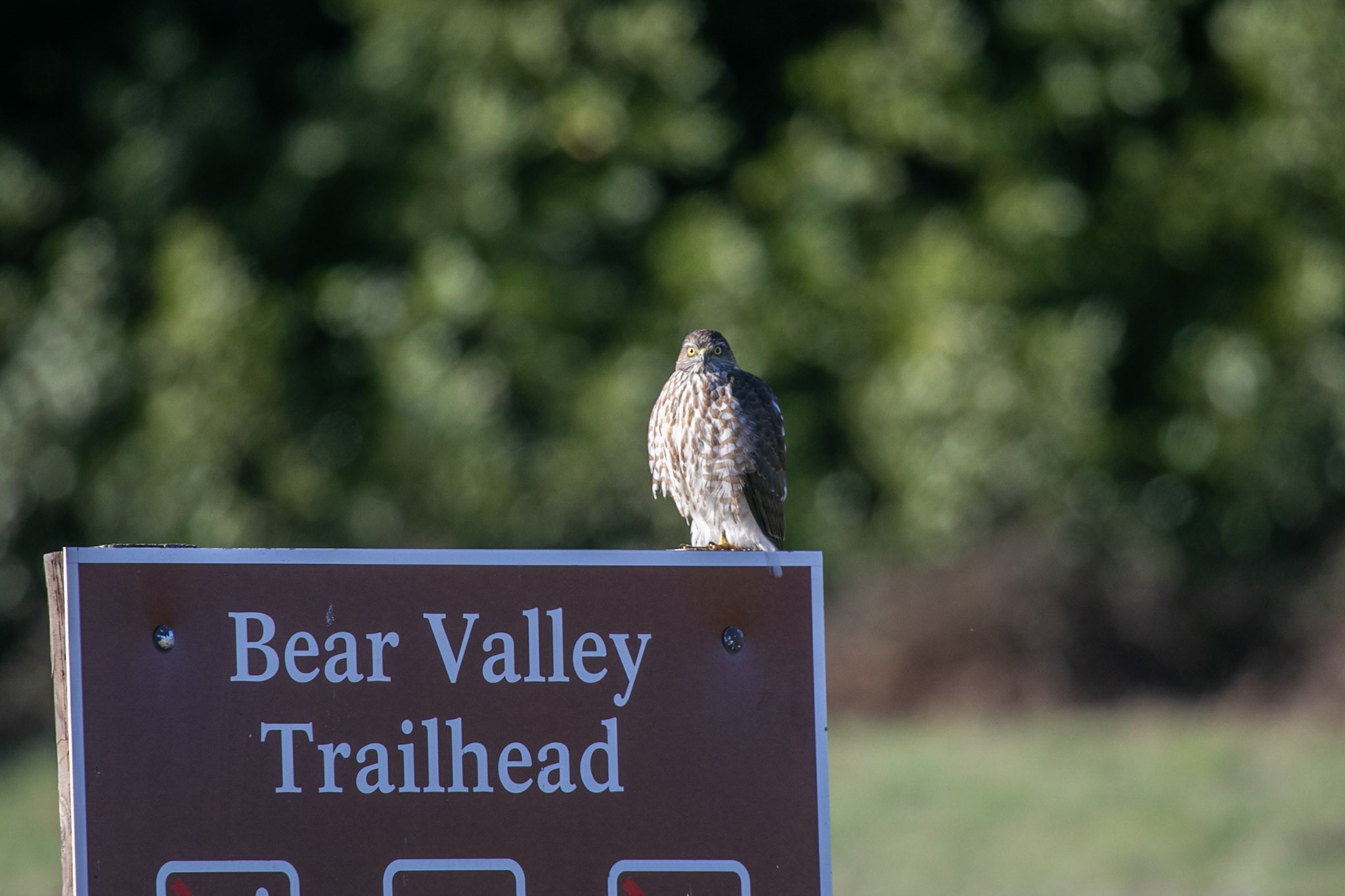
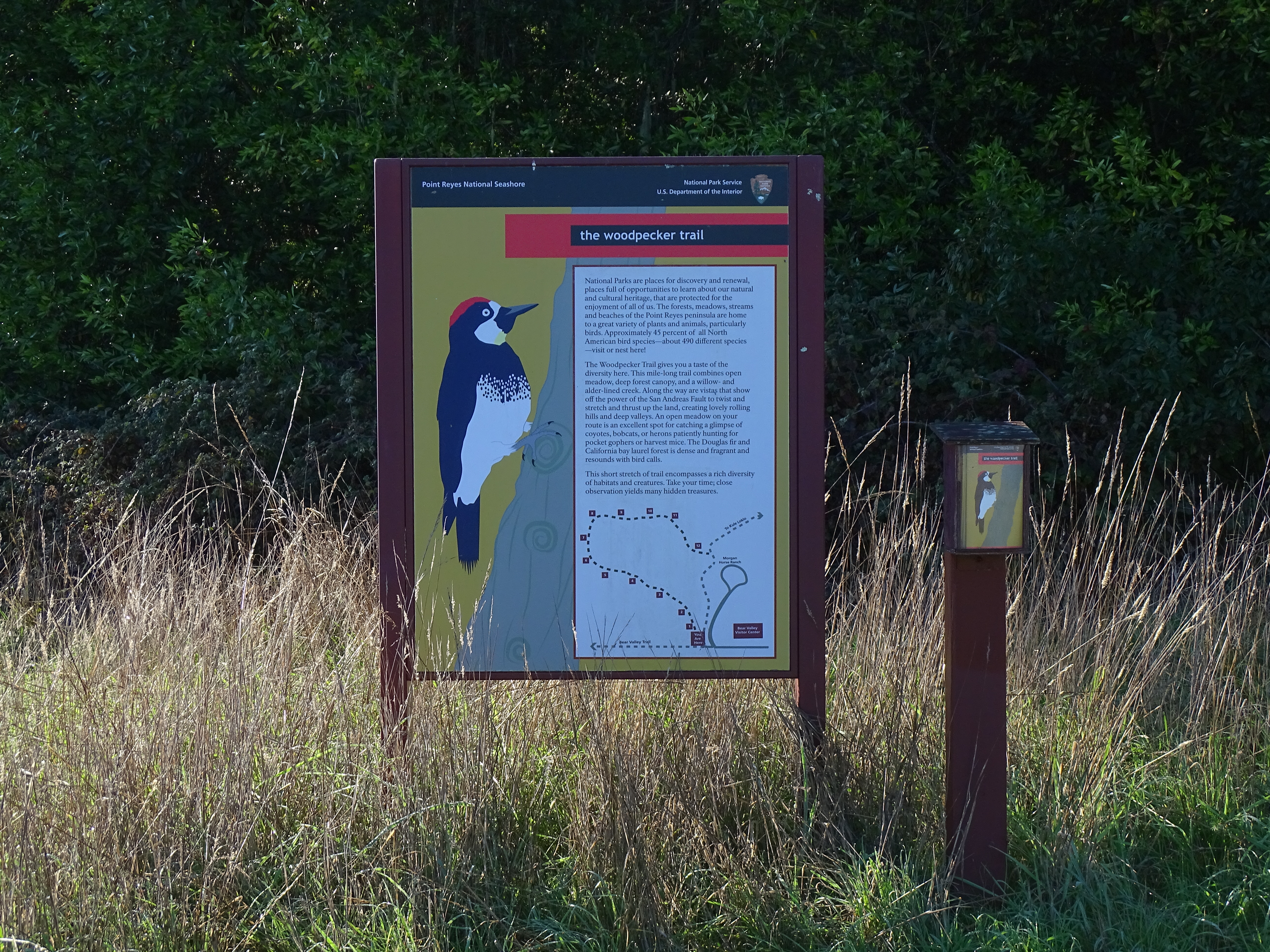
The Bear Valley Trailhead is a popular place to start a hiking or biking adventure in Point Reyes National Seashore. The Bear Valley, Rift Zone, Morgan, and Woodpecker trails all depart from the Bear Valley Trailhead and connect with many other trails, offering dozens of possible routes. Many of these routes pass through the Phillip Burton Wilderness. This trailhead is about an hour by car from San Francisco, the East Bay, and Santa Rosa, and about two hours from Sacramento.
The Bear Valley Trailhead is located in a large, grassy meadow on the floor of a moderate-sized valley that runs north-northwest to south-southeast between two ridges. The ridge to the west rises about 1000 feet (300 meters) above the valley floor and is covered by a dense, mostly-coniferous forest, the edge of which is about 800 feet (240 meters) to the west. The ridge to the east is about one mile (1.6 kilometers) away and rises about 400 feet (120 meters) above the valley floor and is mostly covered by cattle-grazed pasturelands. From the Bear Valley Trailhead, a paved, two-lane access road heads north, and a 12-foot-wide (3.7-meter-wide) gravel road/trail heads south. Immediately to the northeast of the Bear Valley Trailhead is a large gravel parking lot with room for about 210 passenger vehicles. At the northeast corner of this gravel parking lot is a moderate-sized restroom building, adjacent to a picnic area filled with tall fir trees. Immediately to the northeast of the trailhead is a smaller dirt and grass covered parking that can accommodate about 20 buses, RVs, and/or vehicles pulling trailers. Further to the north is a paved lot adjacent to a large, gray, barn-shaped visitor center surrounded by fenced pasture in which horses may be grazing. A single-lane paved driveway leads up a small hill to the west to a cluster of buildings and trees at the Morgan Horse Ranch. The Morgan Trail, a single-track path, follows along the south side of the driveway. About 225 feet (70 meters) to the southwest of the trailhead is a small copse of tall fir trees surrounded by meadow. The single-track Woodpecker Nature Trail heads southwest from the trailhead toward these trees. The aforementioned gravel road/trail that heads south is the Bear Valley Trail, which leads through the meadow for 1150 feet (350 meters) before entering a dense forest. The single-track Rift Zone Trail departs to the east through the tree-dotted meadow toward a tree-lined creek about 1500 feet (455 meters) away. There are two metal gates across the Bear Valley Trail, about 50 feet (16 meters) apart, to prevent unauthorized automobiles from driving onto the trail. There is space on the left side of the first gate for pedestrians, cyclists, and horses to pass around the gate. The second gate is left open when the trail is open. Adjacent to the first gate is a brown metal sign that reads: "Bear Valley Trailhead, permits and trail information available at the Visitor Center." There are three universal icons on the sign that indicate pets and fires are not allowed, but camping is permitted (with a reservation). There are metal receptacles for recycling and garbage near this sign. On the west side of the trail between the two gates is a large wood-framed map of the southern part of Point Reyes National Seashore and information about hiking. On the west side just north of the second gate is a large wooden bench. A small sign about twenty feet to the east of the second gate marks the beginning of the Rift Zone Trail. Split-rail wooden fences line the parking lot, surround the trailhead, and run along the south side of the Rift Zone Trail for about 120 feet (40 meters).
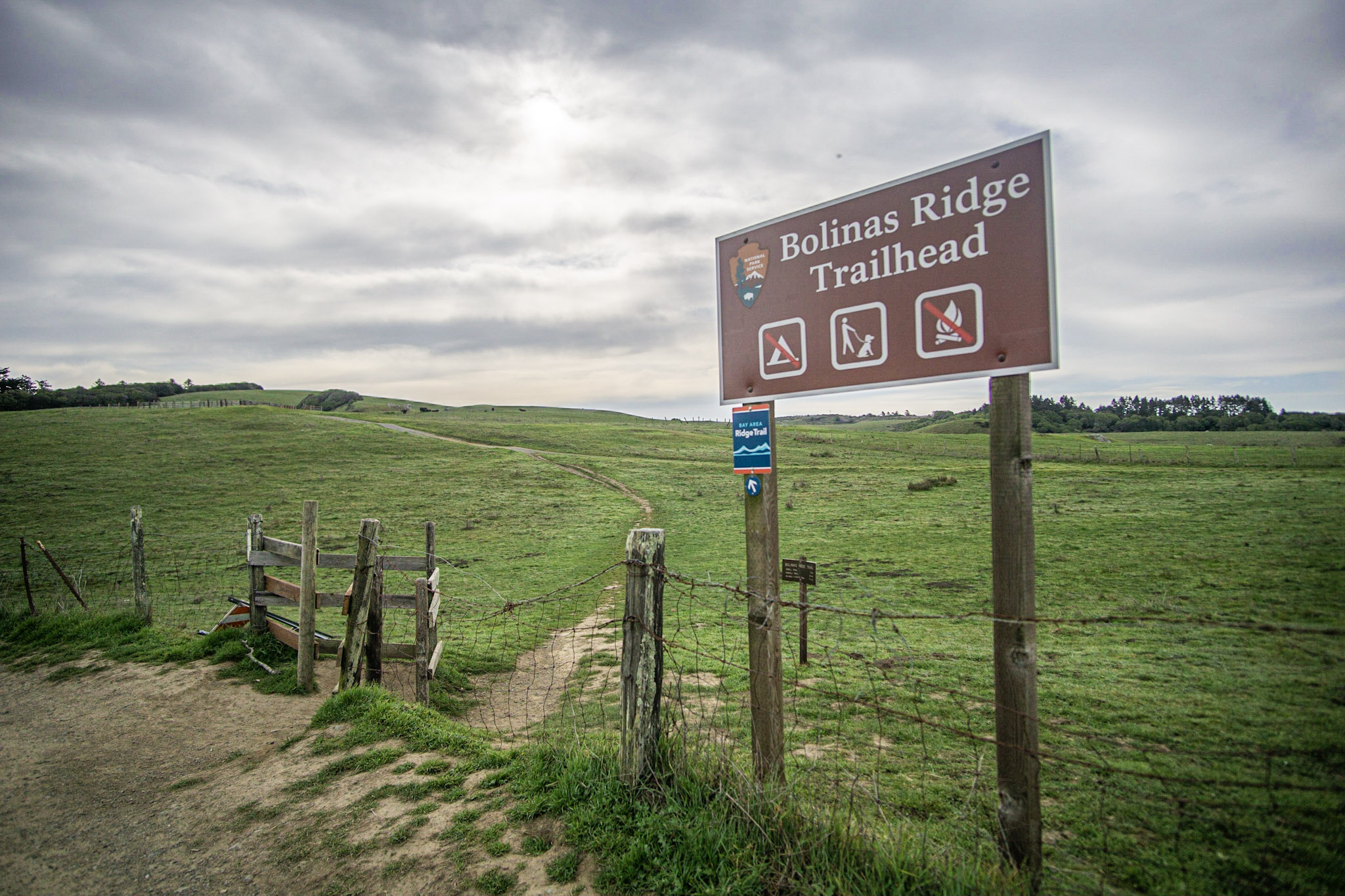
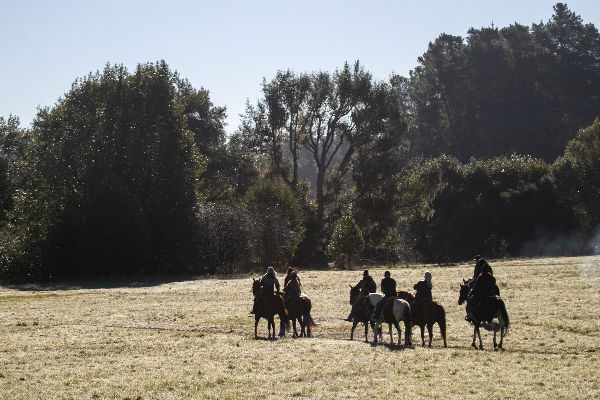
The Bolinas Ridge Trailhead is the northern end of the multi-use, dog-friendly 11-mile-long (17-km-long) Bolinas Ridge Trail. The Bolinas Ridge Trailhead parking lot is located along Sir Francis Drake Boulevard 1.1 miles (1.7 km) east of Olema and approximately 5 minutes by car from the Bear Valley Visitor Center.
Sir Francis Drake Boulevard, a two-lane highway, crests Bolinas Ridge at an elevation of approximately 365 feet. Bolinas Ridge runs north-northwest to south-southeast with Olema Valley and Inverness Ridge to the west, and Lagunitas Valley and ridges and hills to the east. At the ridge crest is the Bolinas Ridge Trailhead, with a wide trail ascending to the south through grasslands. At the trailhead, the shoulder on the south side of the road widens from about 300 feet (90 meters), providing space for about 15 vehicles to park. About 500 feet (150 meters) to the west of the trailhead, the shoulder on the north side of the road widens from about 200 feet (60 meters), providing space for about 10 vehicles to park. A fence made of wooden and steel posts and barbed wire lines the road. At the entrance of the trail there is a wooden fence that forms a two-foot-wide, L-shaped chute. There is a brown sign with the National Park Service arrowhead logo, and icons that indicate the following: no camping, dogs allowed, no fires.
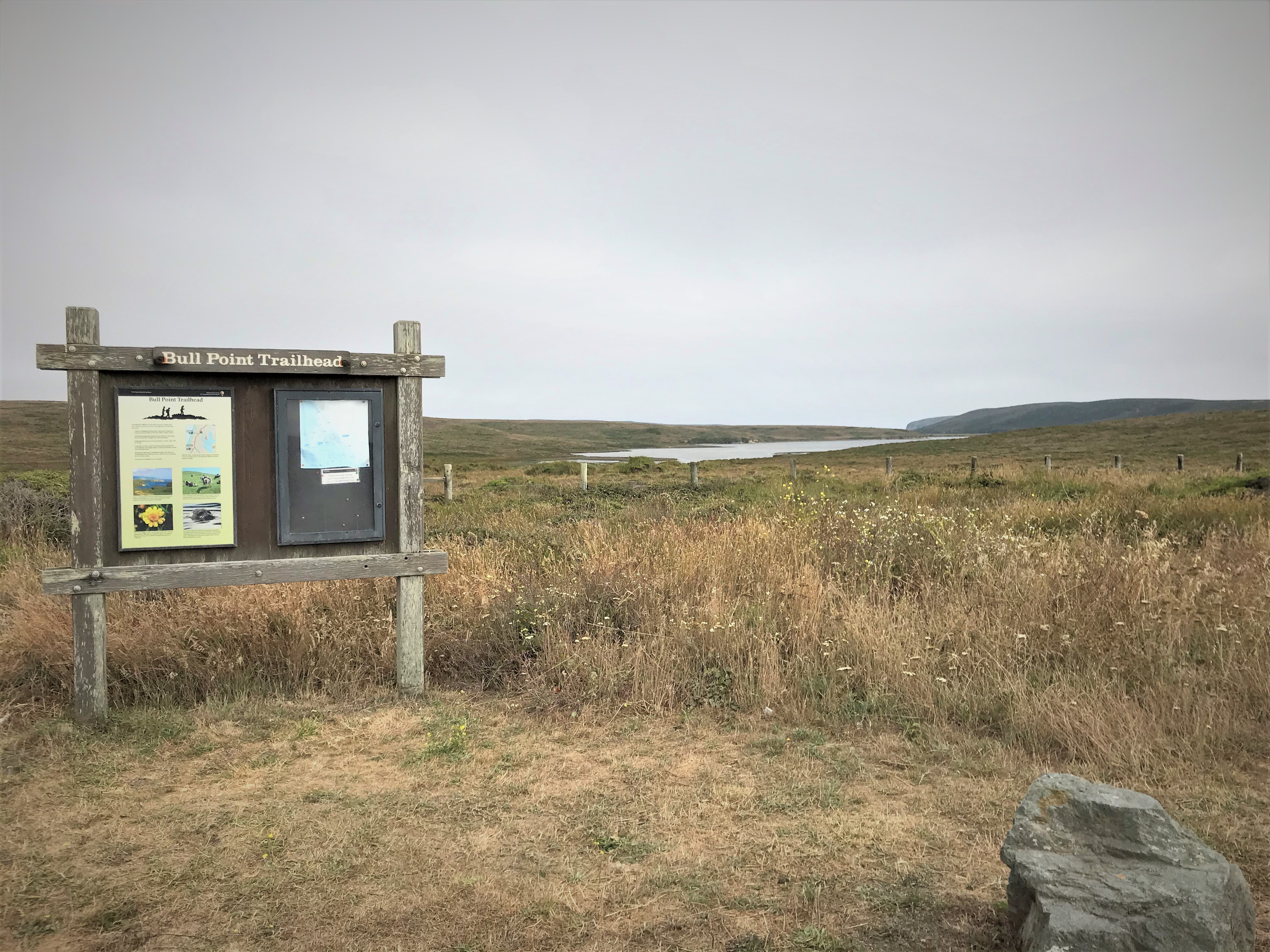
This trailhead offers access to a flat and easy 1.8-mile-long (2.9-km-long) trail that leads towards the picturesque edge of Drakes Estero, where many water birds can be seen. This is also a popular trail for those looking for uncommon native plants. The Bull Point Trailhead is located on the left side of Sir Francis Drake Boulevard as you drive towards North Beach, approximately 25 minutes by car from the Bear Valley Visitor Center.
A two-lane road travels from the northeast to the southwest along an increasingly narrow peninsula. Barbed wire fences line the road with cattle pastures on both sides. A small gravel parking lot with room for about ten vehicles is located on the east (left) side of the road. A narrow gate allows passage through a wooden fence to a dirt trail that leads through grassy pastures mixed with coastal scrub towards the mudflats of an estuary. Cows are often in the area and the cattle paths frequently merge with the hiking trail, making it difficult at times to know which is which. And the trail is typically muddy, especially as you approach the mudflats at the edge of the water.
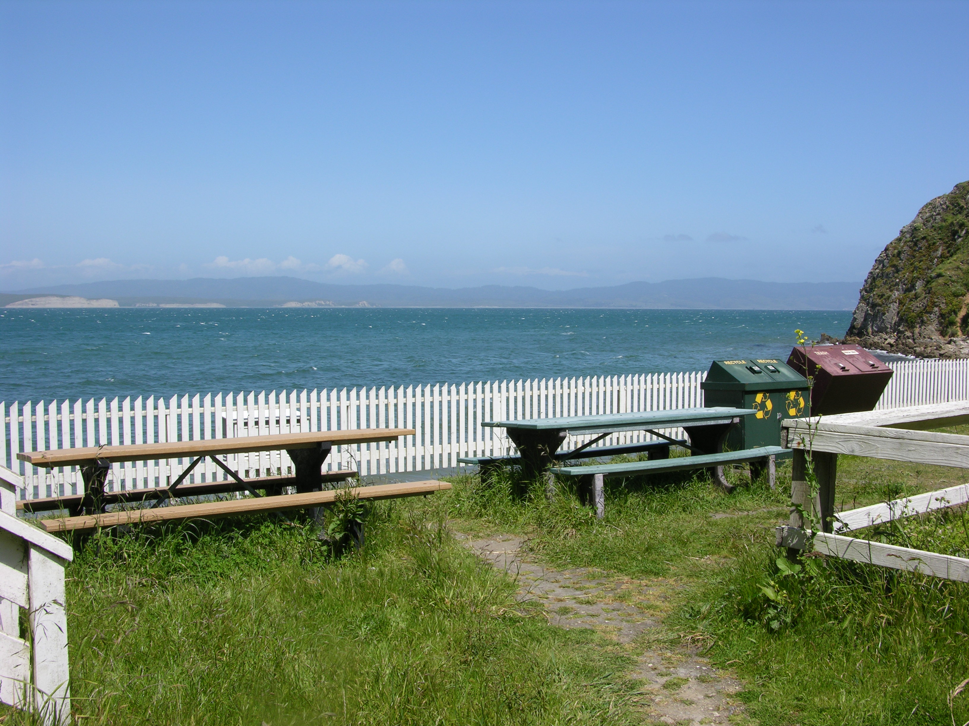
Two picnic table are located along the southeast side of the boathouse at the Historic Point Reyes Lifeboat Station at Chimney Rock. The Chimney Rock parking lot is approximately 45 minutes by car from the Bear Valley Visitor Center. The boathouse is approximately 10 minutes by foot from the parking lot.
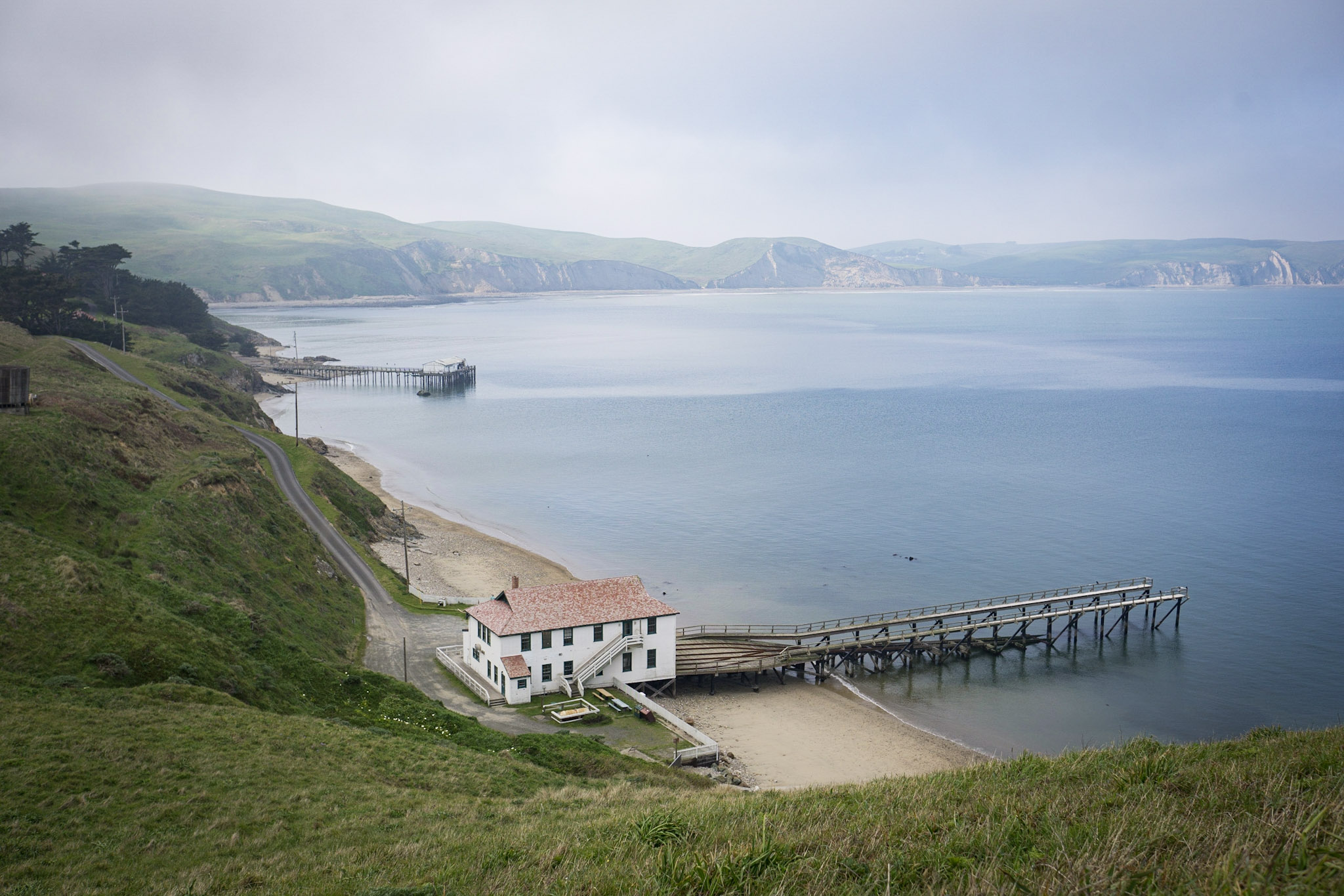
The historic lifeboat station's boat house is a two-story building measuring about 40 feet by 60 feet (12 meters by 18 meters). It is painted white with green trim on the windows, and a red gabled roof. One of the 40-foot-wide sides faces Drakes Bay to the north-northeast. Drakes Bay is a semicircular body of water stretching about 8 miles (13 kilometers) from west to east and about 2.5 miles (4 kilometers) from north to south, opening to the Pacific Ocean to the south. The northwest side of Drakes Bay is line by beige-colored bluffs that rise above sandy beaches. The boathouse is located near the southwest end of Drakes Bay along a narrow peninsula that stretches east from the west end of the much larger Point Reyes Peninsula. Immediately to the south of the lifeboat station and boathouse, grass covered hills rise steeply about 200 feet (60 meters) in elevation, before dropping abruptly into the ocean. A long wooden marine railway, designed to lower a lifeboat into the water, extends into the bay on wooden piers from the north-northeast-facing side of the boathouse. Next to the building is a small area for cars to park, and wooden railings painted white marking the parking area and deck of the building. A small beach edges Drakes Bay on both sides of the building. A one-lane-wide driveway leads steeply up and over a headland to the west-northwest toward a two-story-tall white house, a couple garages, and other out buildings associated with the Lifeboat Station. Coniferous trees surround the buildings, shielding them from wind. Two picnic tables and trash and recycling receptacles are located along the southeast side of the boathouse.
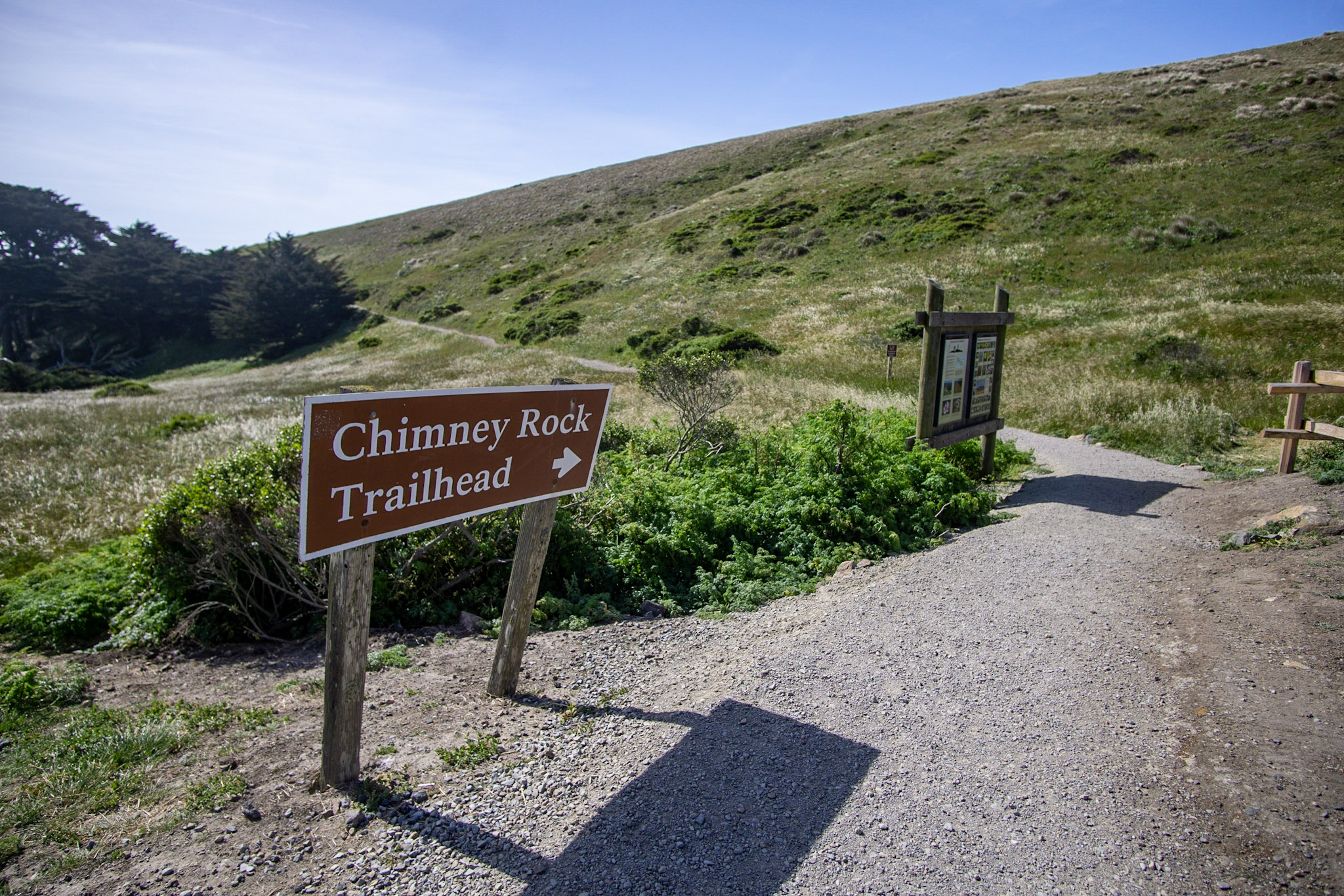
Park at the Chimney Rock Trailhead to hike the Chimney Rock Trail, walk to the Elephant Seal Overlook, or visit the historic Point Reyes Lifeboat Station. The Chimney Rock Trail offers panoramic views of Drakes Bay and the Pacific Ocean. The Chimney Rock Trailhead is located at the east end of Chimney Rock Road, approximately 45 minutes by car from the Bear Valley Visitor Center.
The Chimney Rock Trailhead is located near the eastern end of a small narrow peninsula, with a semicircular bay to the north and east and the Pacific Ocean to the south. The Point Reyes Headlands stretch about 3 miles (5 kilometers) to the west, rising to an elevation of about 600 feet (180 meters). To the north, pale-colored bluffs rise above the bay. To the east across the bay, a forested ridge runs northwest to southeast. A narrow paved road descends a grassy hill from the northwest to a small paved parking lot with space for 20 vehicles. Accessible parking spaces and a small wooden bus shelter are located on the south side of the parking lot. A vault toilet is located behind and to the south of the bus shelter. A single-track dirt trail departs the parking lot to the east of the bus shelter and leads south and east to the eastern end of the Chimney Rock Peninsula, about 1 mile (1.6 kilometers) to the east-southeast. Along the north side of the parking lot, the Chimney Rock Road continues downhill toward the bay before reaching a fork in the road 180 feet (55 meters) to the northeast. The left fork bends to the northwest before arcing sharply to the east. At the bend, a narrow dirt path heads northwest to the Elephant Seal Overlook. The right fork of the road leads east toward some trees, beyond which is the historic lifeboat station. Interpretive signs about the lifeboat station are located along the northeastern side of the parking lot.
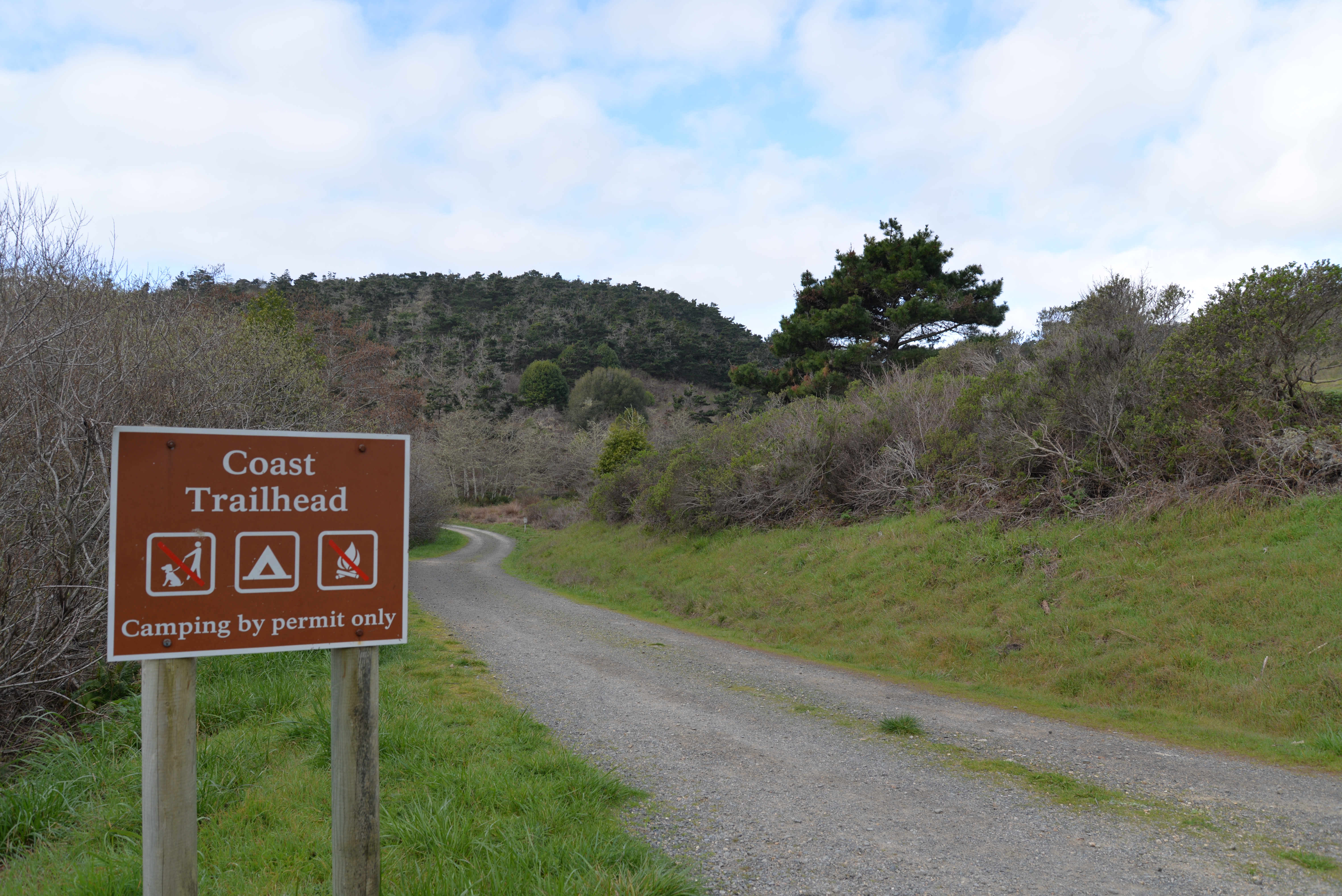
The Coast trailhead is a popular place to start an easy hike, bike, or horseback ride to the beach. It meanders through creek-side habitat before going by wetlands as you approach the ocean. The trailhead is located along Laguna Road, approximately 15 minutes by car from the Bear Valley Visitor Center.
The Coast Trailhead is located on the south side of a paved single-lane road that trends west to east through a small valley with hills immediately to the north, the southwest, and the southeast. A larger valley heads to the south, toward the ocean. The Coast Trail—which is a single-lane dirt-gravel service road closed to visitor vehicular traffic—heads south along the valley floor, paralleling an alder-lined creek. Across the paved road and to the northwest is an old, moderately-sized ranch house that now serves as the main building for Limantour Lodge. The lodge is perched just above the road on the side of the hill, with a narrow driveway leading up to it. For about 300 feet (90 meters) along the south side of the paved road, the dirt and grass-covered shoulder is wide enough to parallel park vehicles. The Coast Trail descends steeply descends from the elevated paved road. A ten-foot-long metal gate blocks vehicular passage onto the Coast Trail, but there is sufficient room on either side of the gate for pedestrians, bicyclists, and horse riders. On the east side of the trail is a brown metal National Park Service sign with white lettering that says "Coast Trailhead" and "Camping by permit only." There is an icon showing a tent, an icon showing that dogs are not allowed, and an icon showing that campfires are not allowed. There is a blue Tsunami Warning Zone sign and various other informational signs.
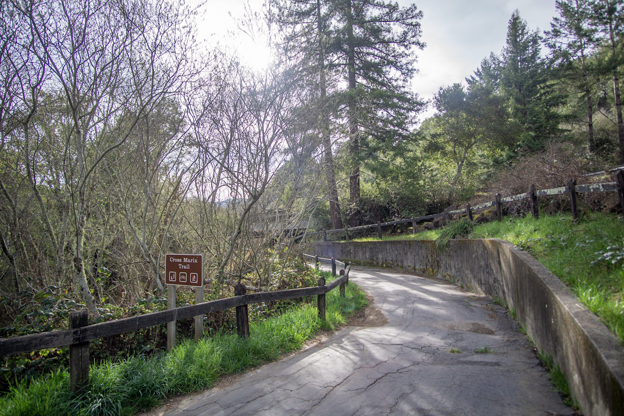
The Cross Marin Trailhead is at the northern end of the multi-use, dog-friendly 5.3-mile-long (8.5-km-long) Cross Marin Trail. The Cross Marin Trailhead is located at the northwest corner of the intersection of Sir Francis Drake Blvd. and Platform Bridge Rd., 1.8 miles (2.9 km) east of Olema. The Cross Marin Trail follows the historic North Pacific Coast Railroad right-of-way as it parallels Lagunitas Creek, resulting in a trail that has relatively little change in elevation.
Sir Francis Drake Boulevard, a two-lane highway, descends from the wooded Bolinas Ridge to the west-southwest, crosses a bridge over Lagunitas Creek and bends to the east-southeast as it begins to follow the creek. The medium-sized Lagunitas Creek winds from the southeast to the northwest between the forested Bolinas Ridge to the west and mostly grass/pasture-covered unnamed ridge to the east. Just east of the bridge, Sir Francis Drake Boulevard intersects with Platform Bridge Road, which follows Lagunitas Creek downstream toward the northwest. There are houses, barns, and other structures of a small cattle ranch on the northeast corner of the intersection of these roads, and additional houses and structures to the north on the west side of the creek. An older, smaller, decommissioned single-lane bridge with arches runs parallel to the current bridge about 150 feet (45 meters) to the north of the modern bridge. The old route of Sir Francis Drake Highway ran across this older bridge and an approximately 600-foot-long (180-meter-long) section of the old roadway parallels the current highway to the west of the bridge before intersecting with the current road as it heads uphill. Parking is available along the southside of the old roadway and along the west side of Platform Bridge Road. Along the old roadway just west of the older bridge, the Cross Marin Trail heads south and east, passing under the modern bridge as it parallels the alder-lined Lagunitas Creek.
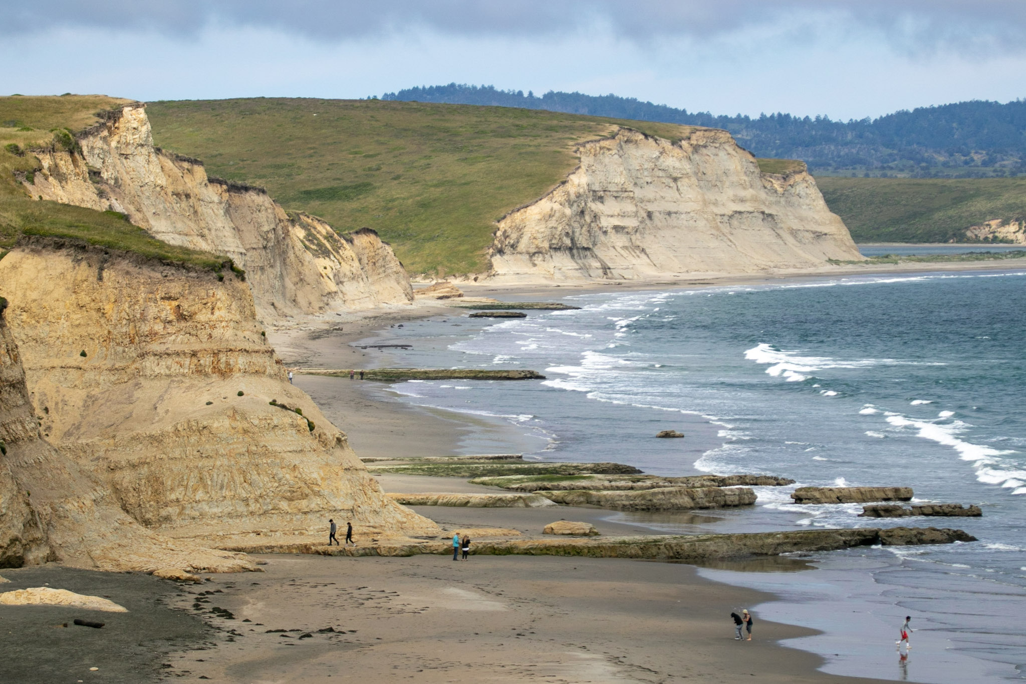
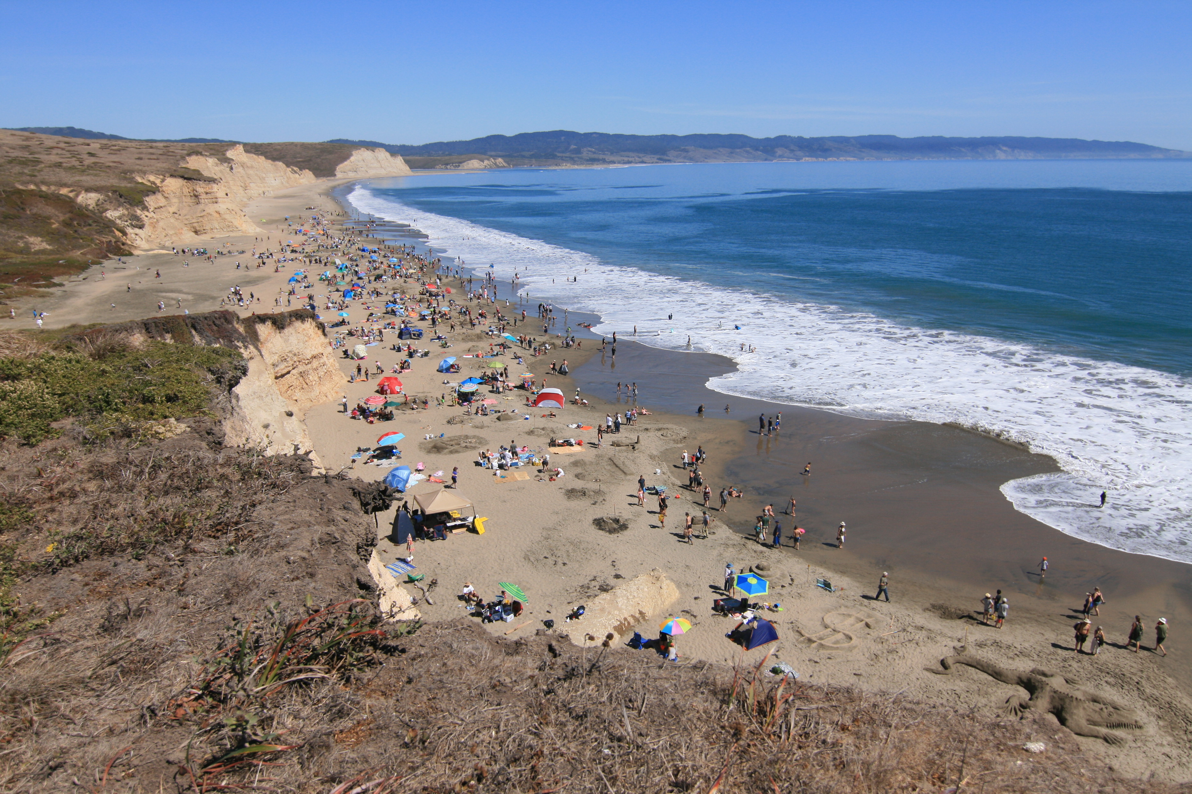
Drakes Beach is one of four beaches at Point Reyes National Seashore to which one can drive. A seasonally wide stretch of beach backed by dramatic white sandstone cliffs makes Drakes Beach a very popular place. A bookstore and a visitor center add to its appeal. The sands of the Drakes Bay cliffs were deposited in a shallow sea 10–13 million years ago, compacted, then uplifted. Erosion has revealed the striations of this story in the cliff faces.
Drakes Beach Road descends a steep hill to a large flat area at the mouth of what used to be a coastal stream and a tidal lagoon. A large parking lot opens up to the west at the south end of the road. A large one-story, elevated building made of wood is on the left at the southeast edge of the parking lot and contains a visitor center, bookstore, and restrooms. To both the east and west of the parking lot and visitor center complex, the land rises steeply to over 80 feet (25 meters) in height and then plateaus. Coastal grasslands and coastal scrub cover the land. To the south of the parking lot is a sandy beach, beyond which is Drakes Bay. Once on the beach, to the east and west, steep beige sandstone cliffs stretch for some distance in either direction, rising 80 feet (25 meters) or so from the sand. The shoreline to the west arcs to the south for about 2.5 miles (4 kilometers) to Chimney Rock, before breaking due west toward the Point Reyes Headlands. To the east, the shoreline gradually starts arcing to the south, stretching past Limantour Beach in the distance.
A seasonally wide stretch of beach backed by dramatic sandstone cliffs makes Drakes Beach a very popular place, especially among families. The majority of the picnic tables at Drakes Beach are located along the northern edge of the parking lot. A couple picnic tables are located between the beach and the Kenneth C. Patrick Visitor Center. Drakes Beach is approximately 30 minutes by car from the Bear Valley Visitor Center.
Drakes Beach Road descends a steep hill to a large flat area at the mouth of what used to be a coastal stream and a tidal lagoon. A large parking lot opens up to the west at the south end of the road. Spread along the northern end of the parking lot are seven picnic tables and six elevated charcoal grills. Ten-foot-tall willows grow along the northern edge of the picnic sites. A large one-story, elevated building made of wood is on the left at the southeast edge of the parking lot and contains a visitor center, bookstore, and restrooms. To both the east and west of the parking lot and visitor center complex, the land rises steeply to over 80 feet (25 meters) in height and then plateaus. Coastal grasslands and coastal scrub cover the land. To the south of the parking lot is a sandy beach, beyond which is Drakes Bay. On a concrete platform between the visitor center and the beach are two additional picnic tables. Once on the beach, to the east and west, steep beige sandstone cliffs stretch for some distance in either direction, rising 80 feet (25 meters) or so from the sand. The shoreline to the west arcs to the south for about 2.5 miles (4 kilometers) to Chimney Rock, before breaking due west toward the Point Reyes Headlands. To the east, the shoreline gradually starts arcing to the south, stretching past Limantour Beach in the distance.
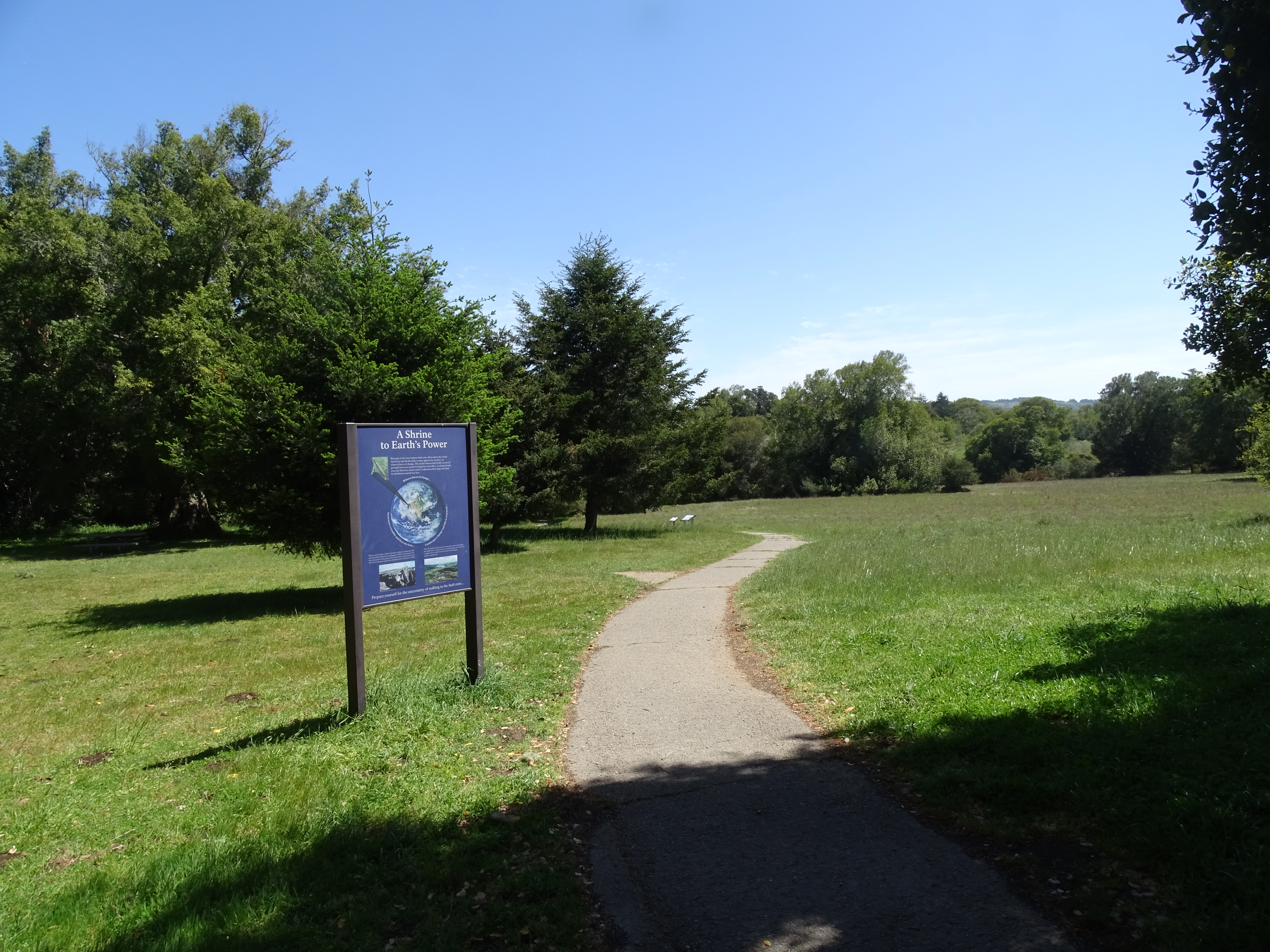
The Earthquake Trailhead is located at the northeast end of the Bear Valley Trailhead parking lot. The Earthquake Trail is a 0.6-mile-long (1-kilometer-long) nature trail with exhibits about the San Andreas Fault Zone and the 1906 San Francisco Earthquake.
The Earthquake Trailhead is located at the north end of a large, grassy meadow on the floor of a moderate-sized valley that runs north-northwest to south-southeast between two ridges. The ridge to the west rises about 1000 feet (300 meters) above the valley floor and is covered by a dense, mostly-coniferous forest, the edge of which is about 1100 feet (330 meters) to the west. The ridge to the east is about one mile (1.6 kilometers) away and rises about 400 feet (120 meters) above the valley floor and is mostly covered by cattle-grazed pasturelands. From the Earthquake Trailhead, a four-foot-wide (1.2-meter-wide) asphalt trail leads slightly downhill to the east. Immediately to the southwest of the Earthquake Trailhead is a large gravel parking lot with room for about 210 passenger vehicles. At the northeast corner of this gravel parking lot and just south of the Earthquake Trailhead is a moderate-sized restroom building. To the north of the trailhead is a picnic area filled with tall fir trees. A large, gray, barn-shaped visitor center surrounded by a fenced pasture in which horses may be grazing is located 360 feet (110 meters) to the west across an access road and paved parking lot.
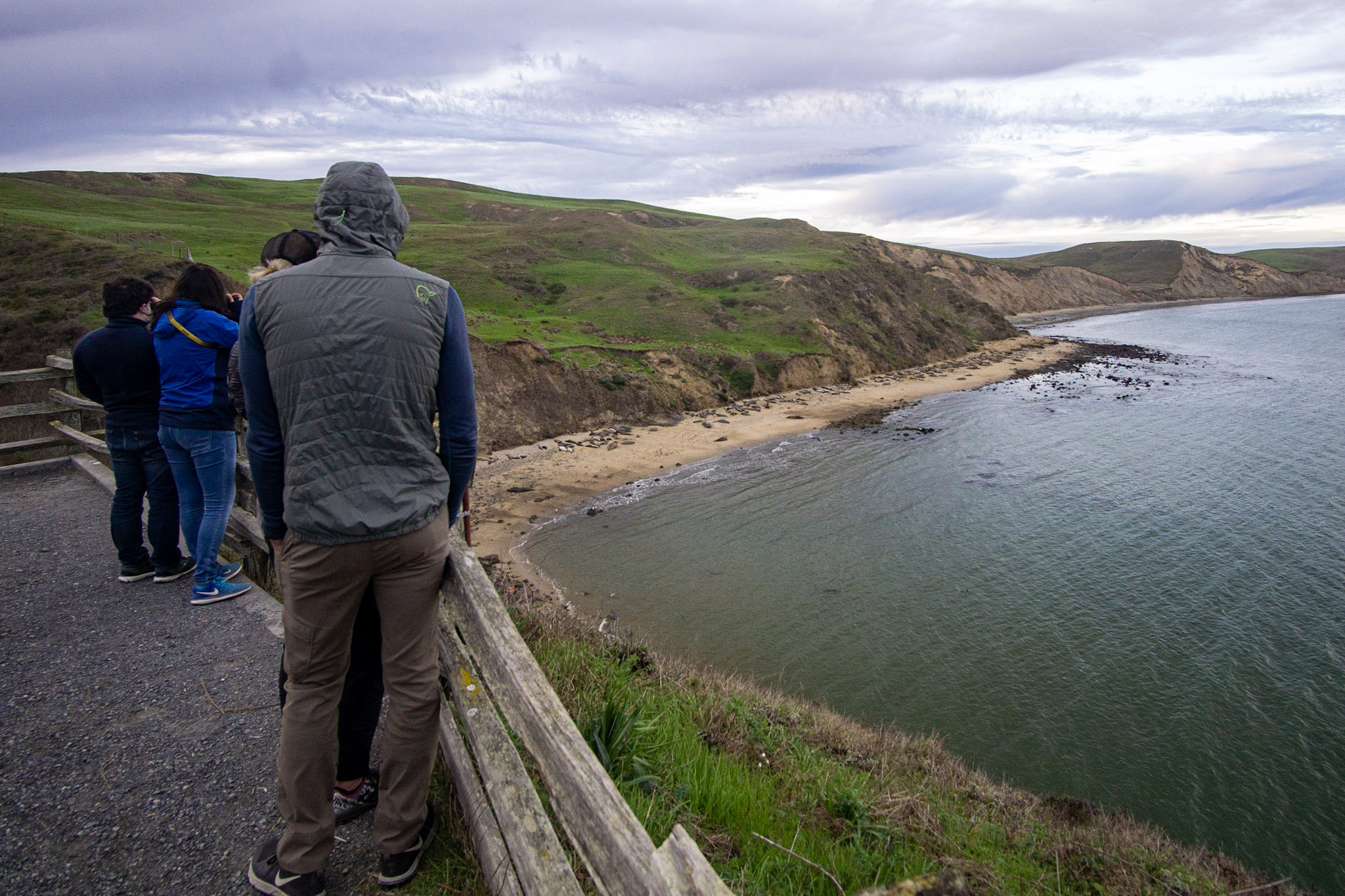
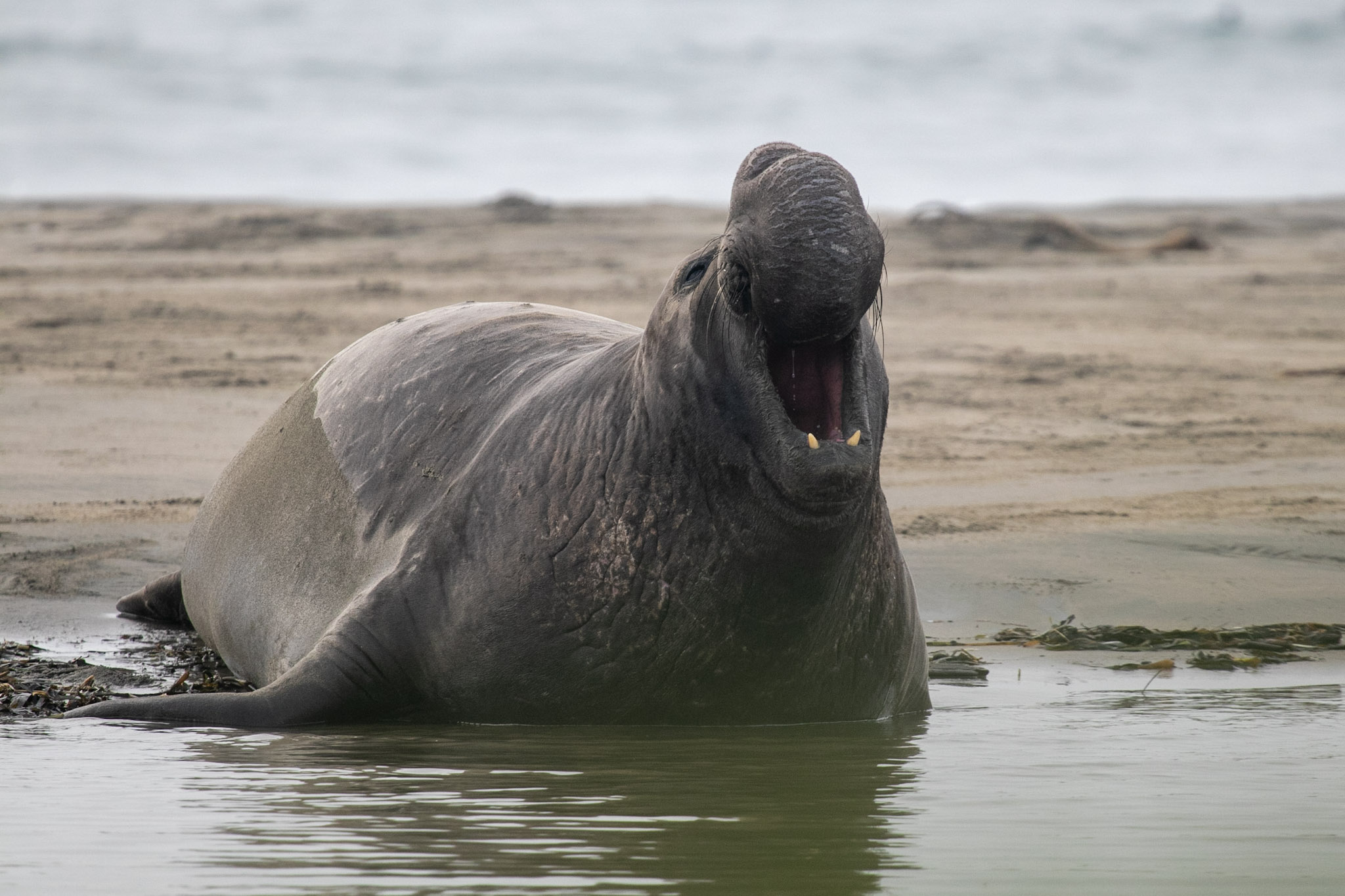
Perched above Drakes Bay, the elephant seal overlook at Chimney Rock provides excellent viewing opportunities to see breeding and pupping seals in the winter and spring and molting seals in the summer and fall.
A flat 0.3 mile dirt trail goes along a plant-covered hillside on the left, and a drop off to a sheltered curve of Drakes Bay on the right side, and ends at a fenced-in overlook. The view is of a cliff face curving to the right with a narrow stretch of sandy beach below. The curved coastline continues in the distance and land is visible from across the way.
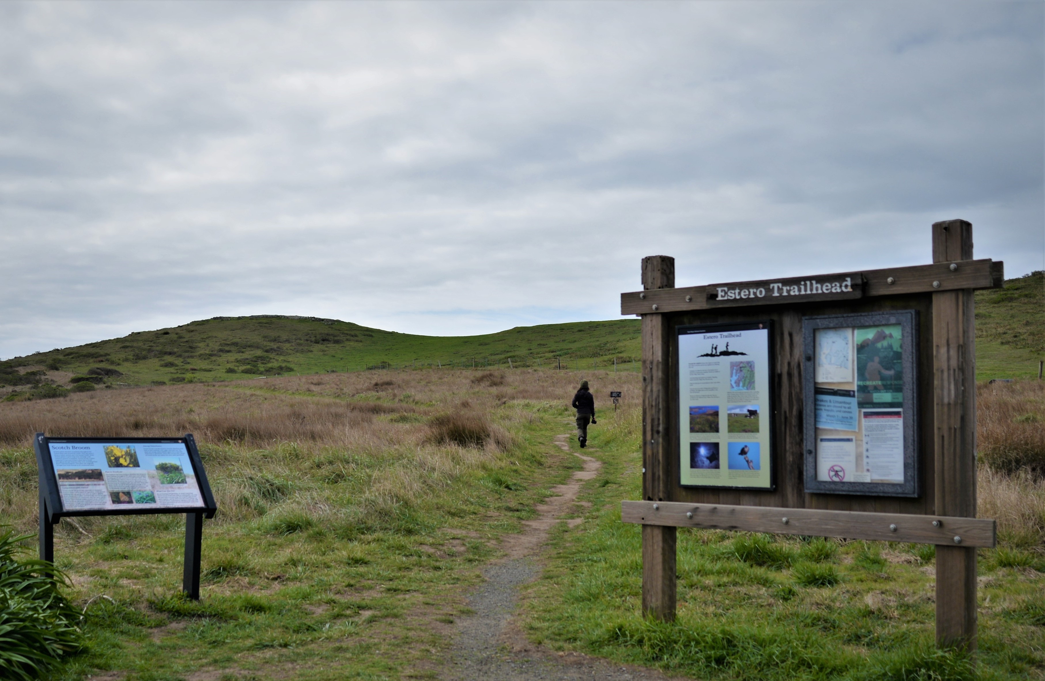
The Estero Trailhead is at the northwestern end of the Estero Trail, which leads hikers, bikers, and horse riders to other trails and locations with beautiful views of both Drakes and Limantour Esteros. The trailhead is located along Home Ranch Road, approximately 20 minutes by car from the Bear Valley Visitor Center.
The Estero Trail departs from the southwest corner of a small gravel parking lot, which is located along a narrow asphalt access road that arrives from the north. Coastal grasslands and some coastal scrublands covering rolling hills surround the parking lot. Further to the south, the road ends at a dairy ranch at the head of a shallow bay and marshland. Trailhead signage is located adjacent to the trailhead. A small outhouse with two vault toilets is located at the northwest corner of the parking lot. A picnic table is located along the parking lot's southern edge.
One picnic table is located along the south edge of the Point Reyes National Seashore's Estero Trailhead. The Estero Trailhead is approximately 20 minutes by car from the Bear Valley Visitor Center.
The Estero Trail departs from the southwest corner of a small gravel parking lot, which is located along a narrow asphalt access road that arrives from the north. Coastal grasslands and some coastal scrublands covering rolling hills surround the parking lot. Further to the south, the road ends at a dairy ranch at the head of a shallow bay and marshland. Trailhead signage is located adjacent to the trailhead. A small outhouse with two vault toilets is located at the northwest corner of the parking lot. A picnic table is located along the parking lot's southern edge.
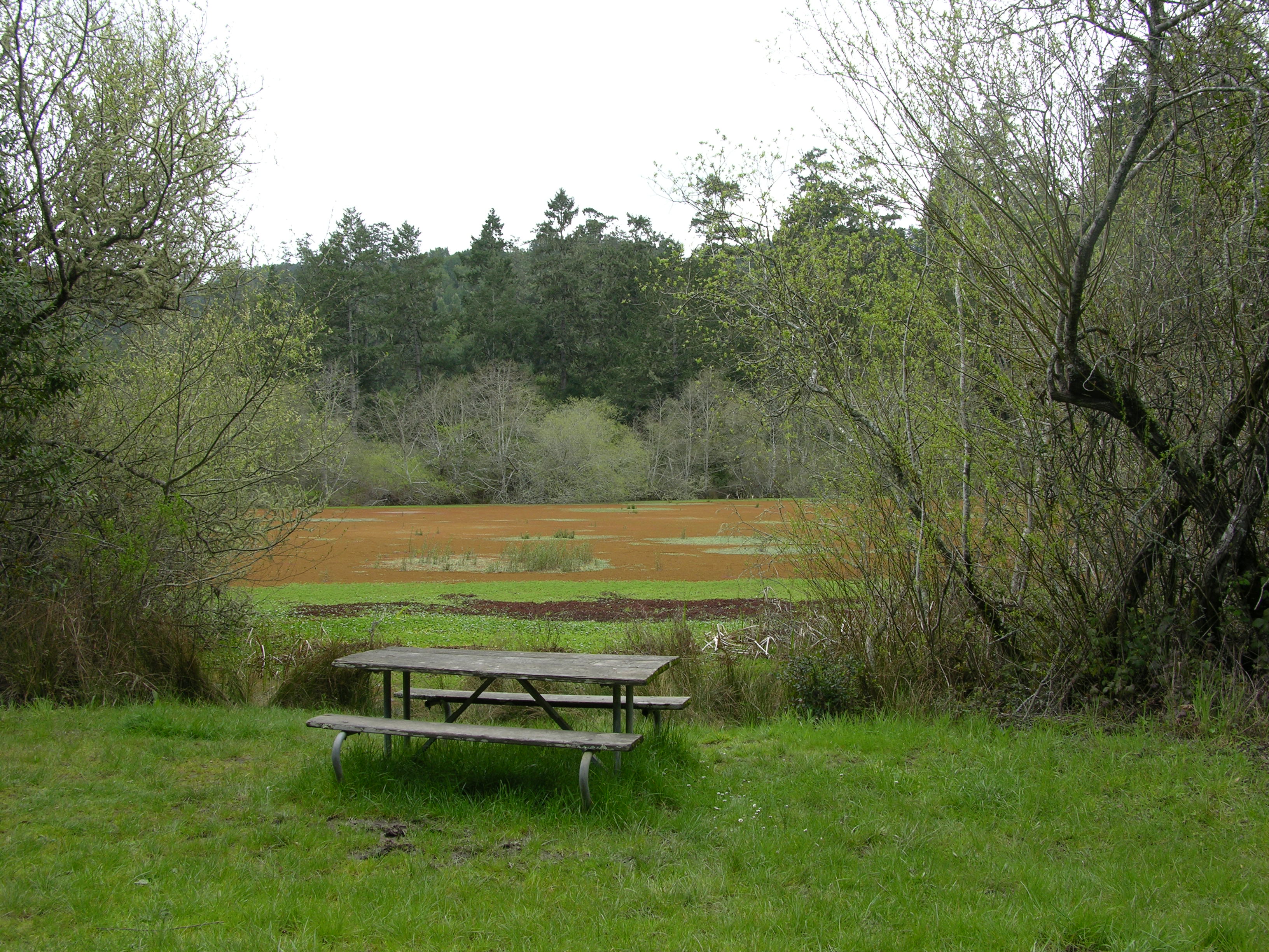
Six picnic tables are scattered along the eastern end of the Stewart Trail, some adjacent to an abandoned mill pond. The Five Brooks parking lot is approximately 10 minutes by car from the Bear Valley Visitor Center.
A 0.3-mile-long gravel road bends into the western edge of a medium-sized gravel parking lot. The parking lot is located in a valley floor and surrounded by trees. A forested ridge rises to the west. Horse stables and corrals are just west of the parking lot. The Five Brooks Trailhead is located along the northern edge of the parking lot, with a small outhouse with two vault toilets just west of the trailhead. Picnic tables are scattered here and there, mostly north of the parking lot, some adjacent to a shallow abandoned mill pond to the west of the Stewart Trail.
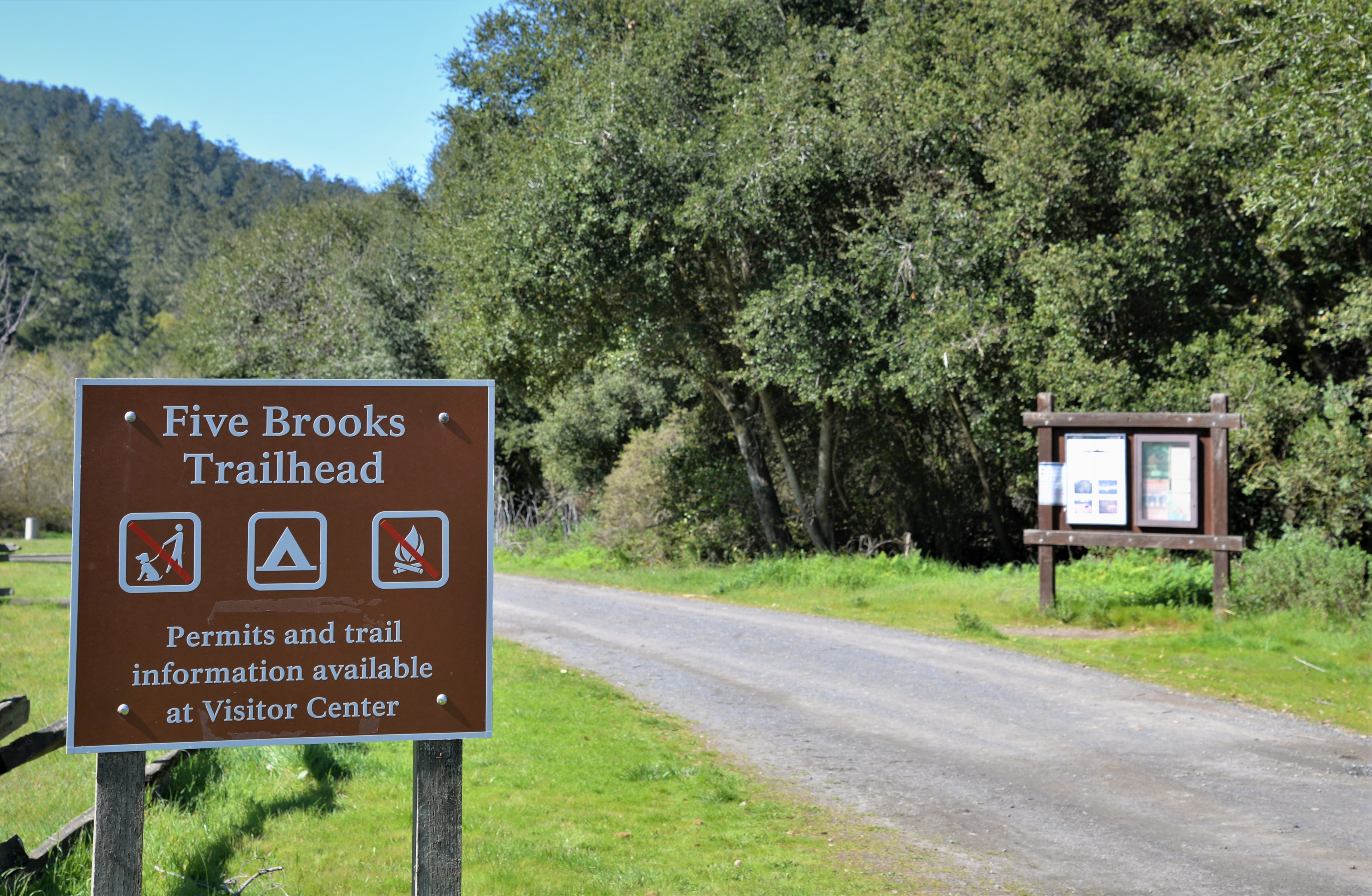
The Five Brooks Trailhead is a trailhead for the Stewart Trail, Olema Valley Trail, and Rift Zone Trail, and is adjacent to Five Brooks Ranch, a park concessioner that offers horse rides. It is located off of Highway 1 (aka Shoreline Highway) 4.4 miles (7 km) and approximately 10 minutes by car from the Bear Valley Visitor Center.
A 0.3-mile-long gravel road bends into the western edge of a medium-sized gravel parking lot. The parking lot is located in a valley floor and surrounded by trees. A forested ridge rises to the west. Horse stables and corrals are just west of the parking lot. The Five Brooks Trailhead is located along the northern edge of the parking lot, with a small outhouse with two vault toilets just west of the trailhead. Picnic tables are scattered here and there, mostly north of the parking lot.
Heart's Desire Beach is part of Tomales Bay State Park. It is a nice sheltered cove on Tomales Bay that is excellent for families with small children. The water of Tomales Bay tends to be a little warmer than the water at the ocean-facing beaches of Point Reyes National Seashore.
Heart's Desire Beach is a semicircular beach with coarse beige-colored sand that stretches for about 700 feet (210 meters) along Tomales Bay, which lies to the north. Tomales Bay is a narrow bay that measures about 1 mile (1.6 kilometers) wide and about 12 miles (19.3 kilometers) long. Tomales Bay's head is to the south-southeast, and its mouth is to the north-northwest. Across the bay to the east is a grass covered ridge with dozens of homes and buildings along the edge of the bay. A forested ridge rises to the west and south of Heart's Desire Beach. Immediately south of the sandy beach is a narrow strip of grass on which about a dozen wooden picnic tables are located. To the west is a small concrete restroom and shower building. To the southwest is a moderately sized parking lot with three accessible parking spaces. A flat concrete path leads from near these accessible parking spaces to a concrete slab on which a few wooden picnic tables and a couple charcoal grills are located.
The historic Point Reyes Lifeboat Station stands near the eastern tip of the Point Reyes Headlands, extending into the famed Drakes Bay.The first U.S. Life-saving Service station at Point Reyes was built in 1889 along the unprotected Point Reyes Beach to aid ships that were stranded or wrecked at sea. In 1927, the lifeboat station was moved to its current location on the more-protected shores of Drakes Bay.
The historic lifeboat station's boat house is a two-story building measuring about 40 feet by 60 feet (12 meters by 18 meters). It is painted white with green trim on the windows, and a red gabled roof. One of the 40-foot-wide sides faces Drakes Bay to the north-northeast. Drakes Bay is a semicircular body of water stretching about 8 miles (13 kilometers) from west to east and about 2.5 miles (4 kilometers) from north to south, opening to the Pacific Ocean to the south. The northwest side of Drakes Bay is line by beige-colored bluffs that rise above sandy beaches. The boathouse is located near the southwest end of Drakes Bay along a narrow peninsula that stretches east from the west end of the much larger Point Reyes Peninsula. Immediately to the south of the lifeboat station and boathouse, grass covered hills rise steeply about 200 feet (60 meters) in elevation, before dropping abruptly into the ocean. A long wooden marine railway, designed to lower a lifeboat into the water, extends into the bay on wooden piers from the north-northeast-facing side of the boathouse. Next to the building is a small area for cars to park, and wooden railings painted white marking the parking area and deck of the building. A small beach edges Drakes Bay on both sides of the building. A one-lane-wide driveway leads steeply up and over a headland to the west-northwest toward a two-story-tall white house, a couple garages, and other out buildings associated with the Lifeboat Station. Coniferous trees surround the buildings, shielding them from wind.
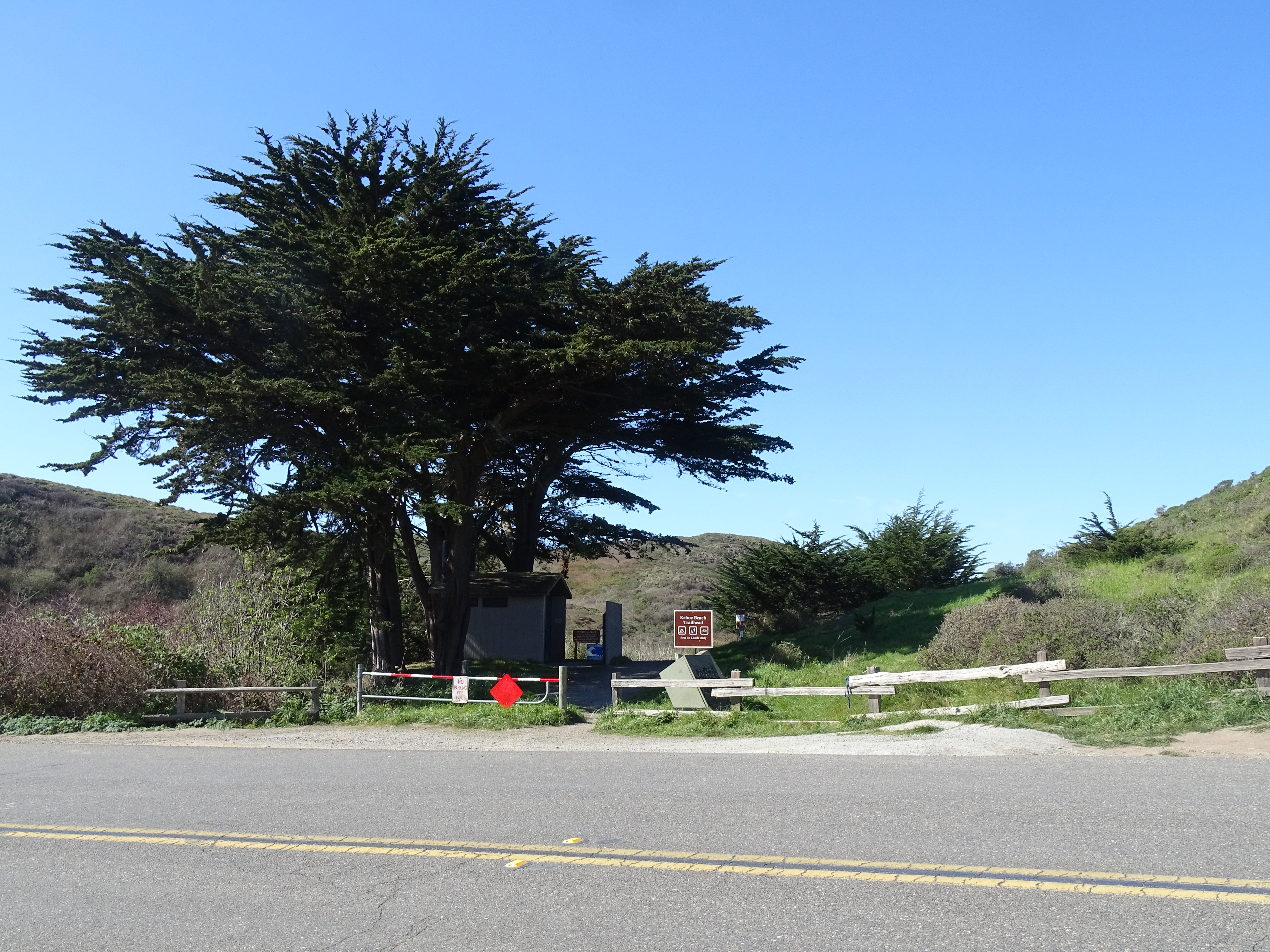
A 0.6-mile-long path alongside a marsh leads to dog/pet-friendly Kehoe Beach (pets must remain on leash at all times). To the south, the Point Reyes Beach stretches over 11 miles to the Point Reyes Headlands. To the north, one can get a close-up view of a dramatic juxtaposition of ancient rocks. Never turn your back to the ocean. Due to the frequently large surf, this is not a beach at which it is safe to play close to the water's edge, much less to go for a swim.
The Kehoe Beach Trailhead begins on the west side of Pierce Point Road. On the left side of the trail at the trailhead are two vault toilets. The flat, single track, dirt trail borders Kehoe Marsh, which is to the left. Shrubby evergreen coyote brush border the trail on both sides. After 0.6 miles, the trail turns to sand and ascends up and over a sand dune. A pet restriction sign announces that pets are not permitted to the left between Memorial Day and Labor Day. The Point Reyes Headlands rise from the horizon eleven miles to the south at the far end of a sandy beach which is usually subject to large, pounding surf. To the north, sand dunes transition to increasingly taller coastal bluffs and cliffs of the headlands of Tomales Point.
Park at the Kehoe Beach Trailhead to follow a short pet-friendly trail that leads to an ocean-side beach. The Kehoe Beach Trailhead is located along Pierce Point Road approximately 25 minutes by car from the Bear Valley Visitor Center.
The curvy Pierce Point Road generally runs south to north, passing through grass/pasturelands before descending into a small valley filled with wetlands on the east. Space for parking at the Kehoe Beach Trailhead consists of unpaved shoulders along the sides Pierce Point Road 5.6 miles (9 km) from its junction with Sir Francis Drake Boulevard. The shoulder has been cleared and widened for about 225 feet (~70 meters) on the east side of the road and for about 435 feet (132 meters) on the west side of the road. The Kehoe Beach Trailhead is on the west side of Pierce Point Road and the trail heads off to the west through coastal scrub with a marsh on its south side. On the left south (left) side of the trail at the trailhead are two vault toilets among some cypress trees.
A five-mile (eight-kilometer) trek from the Bear Valley trailhead brings hikers to a large eucalyptus at the site of a former ranch above this quiet, secluded beach. Visitors should not attempt to descend to this beach. Coastal erosion and significant landslides in 2023 and 2024 have made the Kelham Beach Trail impassible and unsafe to use.
Kelham Beach stretches from northwest to southwest along Drakes Bay for about 1 mile (1.6 kilometers). About eight miles (13 kilometers) to the west, the Point Reyes Headlands rise above Drakes Bay. At the north end of the beach, a medium-sized rocky headland reaches into Drakes Bay. Steep, beige-colored bluffs rise all along the length of the beach, limiting safe places to descend onto the beach to the small valley through which the Kelham Beach Trail descends. A guano-covered sea stack and the rubble of a natural bridge that collapsed in 2015 are at the south end of the beach. At high tides and during the winter and spring, the ocean waves may reach the base of the bluffs.
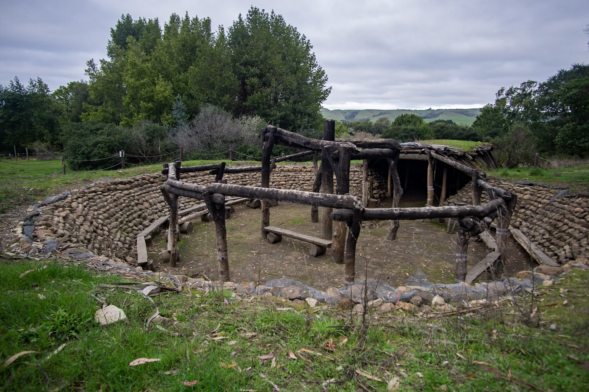
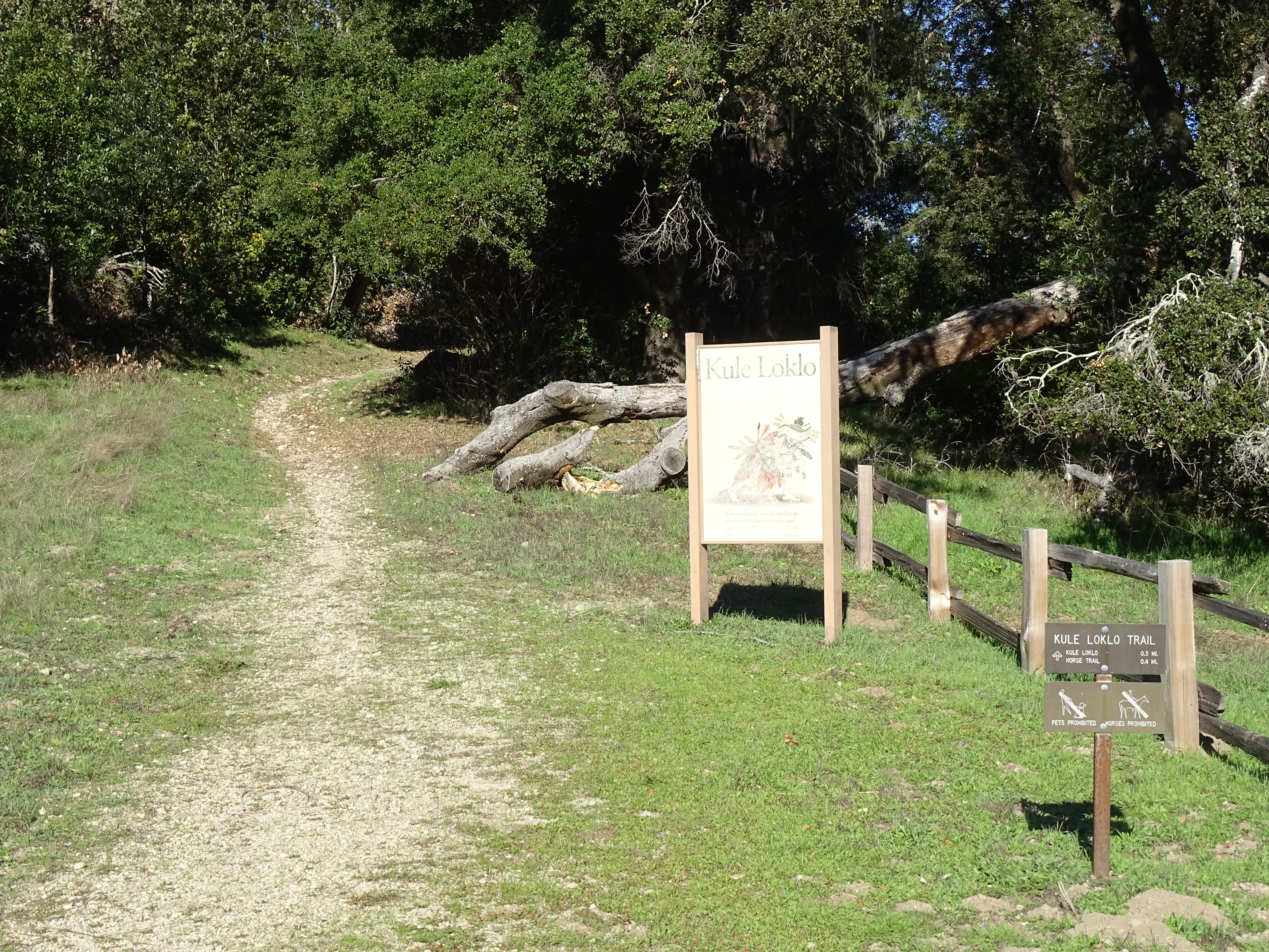
Kule Loklo, which means "Bear Valley" in the Coast Miwok language, is a replica Coast Miwok village. Learn how the original people of Point Reyes lived and how their descendants remain connected to Point Reyes today as you walk along the 0.4-mile-long (0.6-km-long) trail to Kule Loklo.
The site of Kule Loklo is in an open grassy field surrounded by Douglas fir to the west, eucalyptus trees to the south, and a grove of coast live oak to the north. The knuckled ridge of Black Mountain is 3 miles (5 kilometers) to the northeast. Several redwood structures are spaced through Kule Loklo. They vary from eight feet to 12 feet tall. The smaller structures are acorn granaries with two or three shelves inside. The larger ones are sleeping structures called kotchas. There is enough room to fit four to eight individuals, sleeping in a circle. A large grinding stone, with three depressions of varying depths for crushing acorns is at the north end of the village. Shade structures are made from willow cuttings. Six cuttings are planted in a rectangle. They are about 16 feet wide and 10 feet in length. The structure is about 12 feet tall. In the spring and summer, the willow branches leaf and provide shade. There are two underground structures in the village. The smaller is a sweat lodge. There is currently no access to this building. The larger is a ceremonial dance house, which currently lacks a roof. Large stones make the circular foundation of the dance house.
The Kule Loklo Trailhead is located at the north end of the Bear Valley Visitor Center's parking lot. The Kule Loklo Trail leads to a replica Coast Miwok Indian village.
The Kule Loklo Trailhead is located at the north end of long paved parking lot that stretches to the south. To the west of the parking lot is a large, gray, barn-shaped visitor center, which is surrounded by fenced pasture to the west and south in which horses may be grazing. Along the east side of the parking lot runs an access road. Beyond the access road are tall trees and picnic tables. Just north of the trailhead is a sign with the words “Kule Loklo” and an image of a male Coast Miwok Indian dressed in traditional ceremonial regalia performing a dance. The Kule Loklo Trail leads to the left of the sign into the woods.
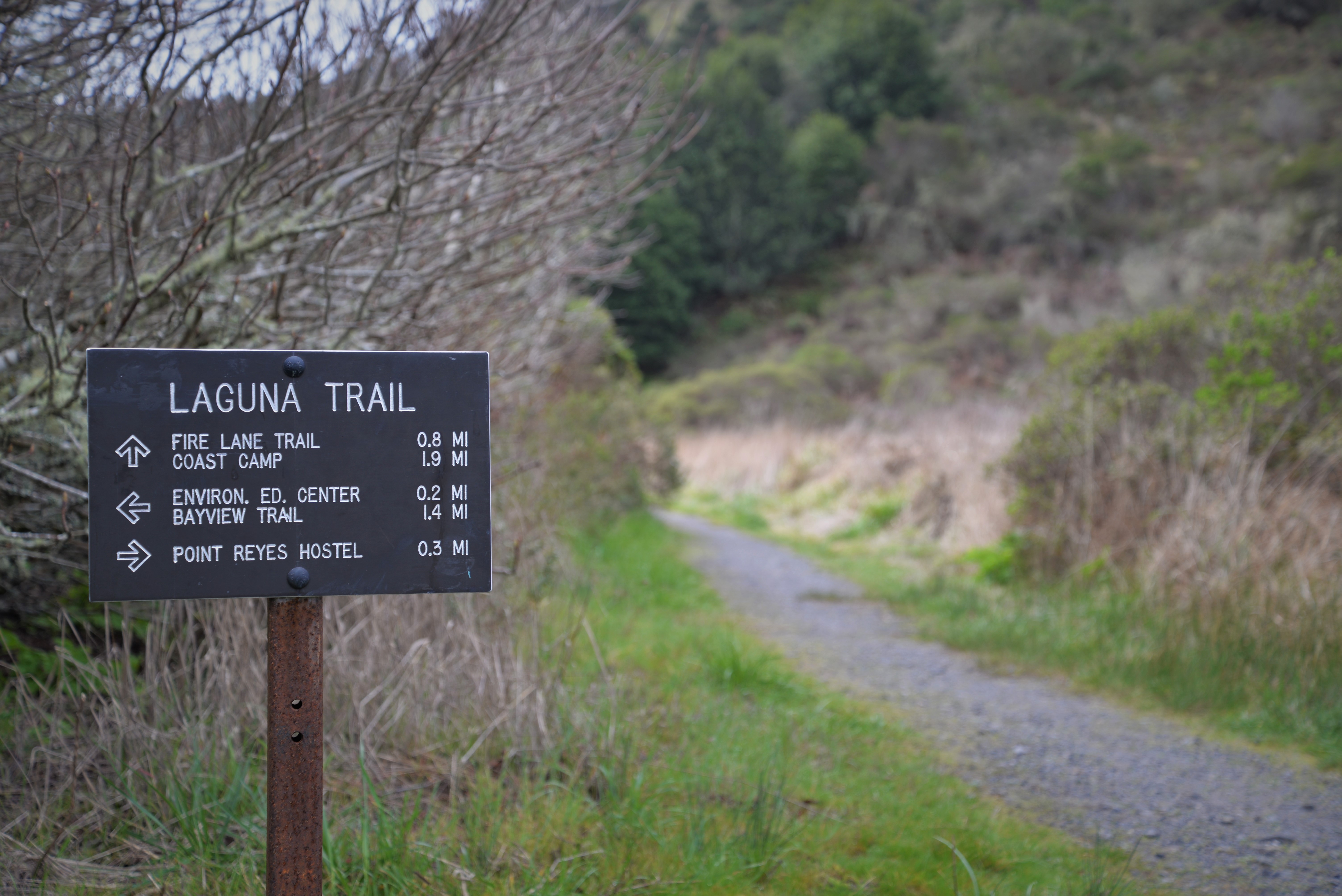
The most popular hikes from the Laguna Trailhead will take you down to the coast, but you can also connect to multiple trails that will climb through the forest towards Inverness Ridge. Many of the routes that depart from this trailhead are within the Phillip Burton Wilderness. The trailhead is located near the east end of Laguna Road, approximately 15 minutes by car from the Bear Valley Visitor Center.
The Laguna Trailhead is located at a small paved lot with space for 13 vehicles. The parking lot is surrounded by a split rail fence and alders and willows and shrub-covered hills. The entrance to the parking lot is to the north, connecting to the east end of Laguna Road via a small bridge across a small creek. A medium-sized brown sign for the Laguna Trail stands to the right of a dirt driveway that extends to the southeast toward to single-story houses. The path that leads to the Laguna Trail passes to the south of these houses. The northern leg of the Laguna Trail leads up a larger valley to the north; the southern leg, which leads to the Fire Lane Trail junction and Coast Campground, leads up a smaller valley to the southwest. On the right side of the trailhead is a brown metal sign that depicts that dogs are not allowed on this trail, and below it is a brown metal sign that depicts that bicycles are not allowed on this trail. On the left side at the junction of the access path and the Laguna Trail is a brown metal sign that has the names of area trails and distances to the junctions.
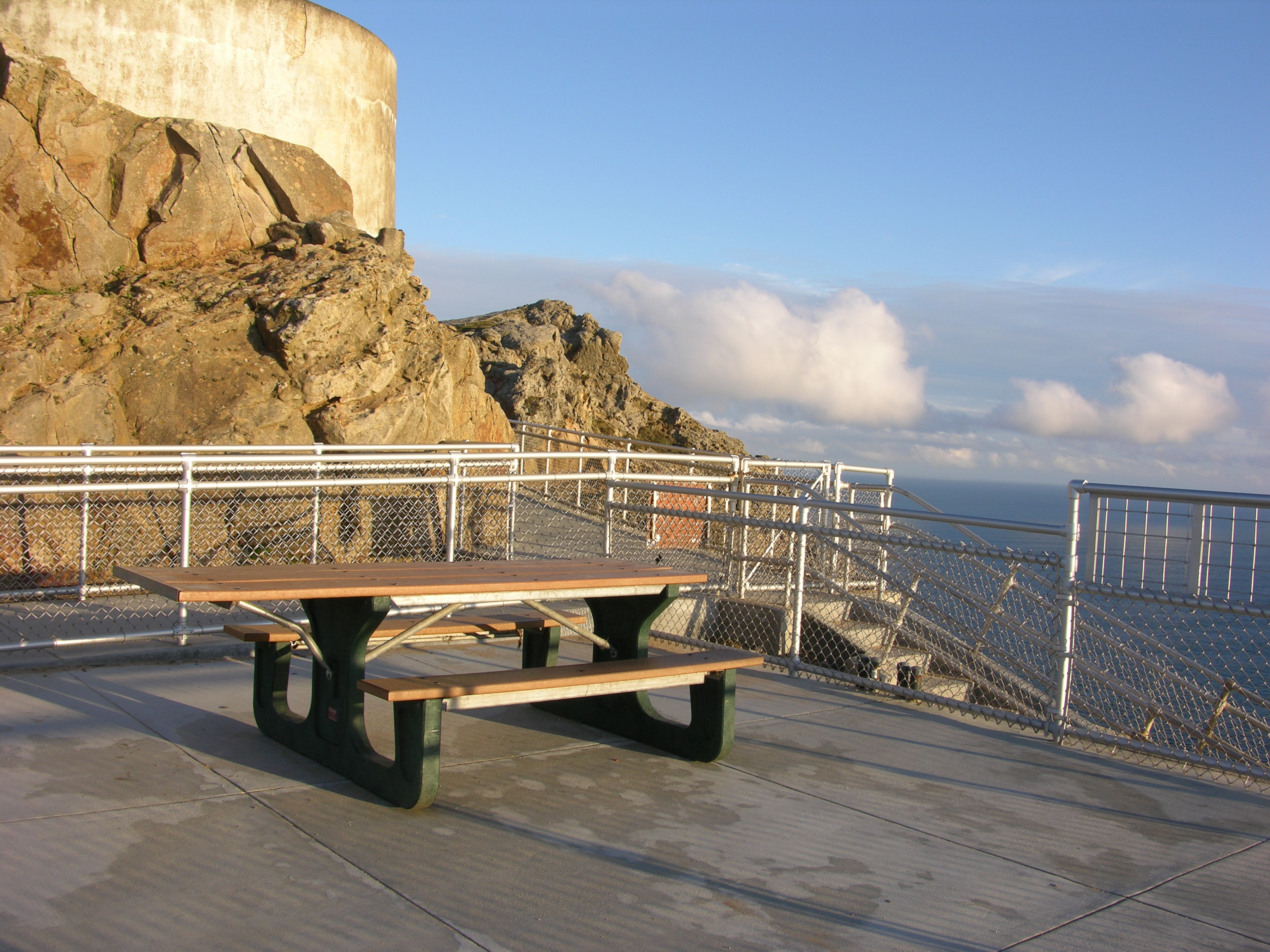
One picnic table is located at the Observation Deck above the Point Reyes Lighthouse. The Point Reyes Lighthouse visitors' parking lot is approximately 45 minutes by car from the Bear Valley Visitor Center. The Observation Deck is approximately 15 minutes by foot from the parking lot.
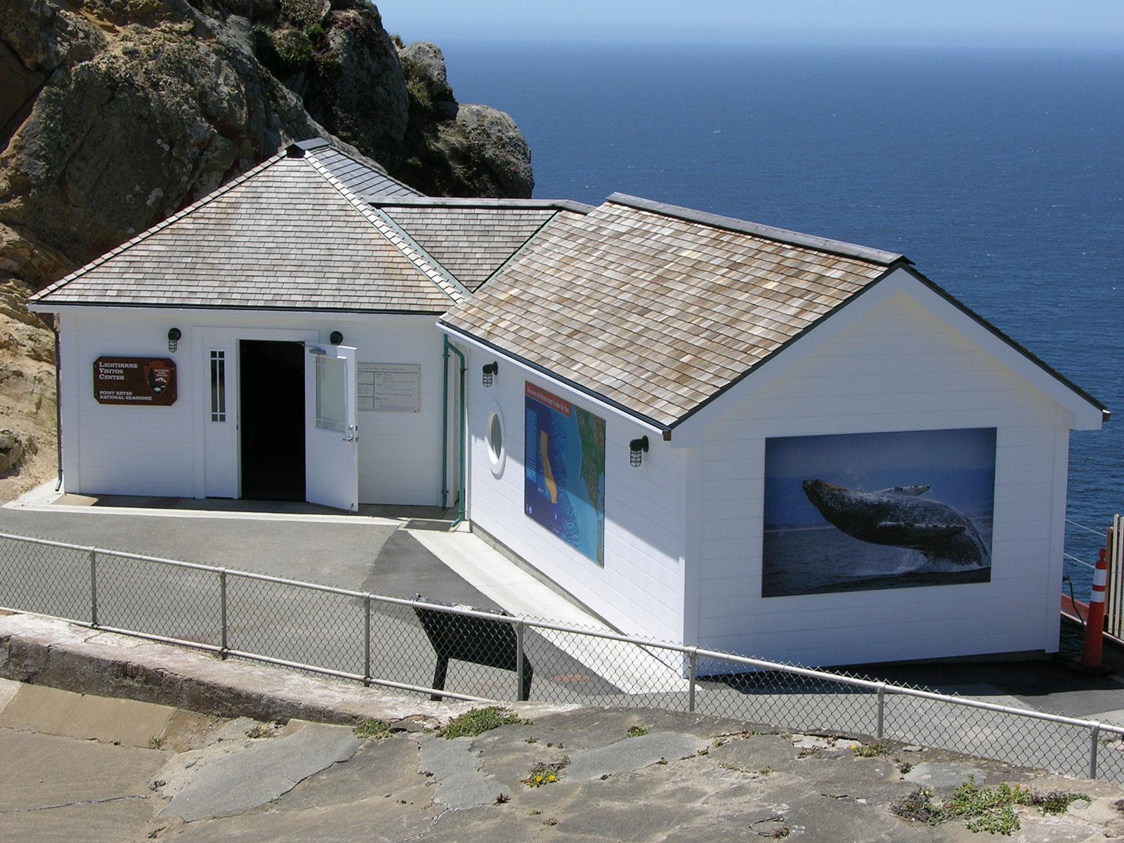
The Observation Deck above the Point Reyes Lighthouse is an approximately 25-foot by 25-foot (7.5 meter by 7.5 meter) concrete platform surrounded by a three-foot-high (0.9-meter-high) chainlink fence near the edge of a 500-foot-high (150-meter-high) rocky promontory that rises out of the Pacific Ocean. It is located at the top of a 3-foot-wide (0.9-meter-wide) concrete stairway that steeply descends 240 feet (73 meters) in elevation to the west along a narrow rocky ridge. At the base of the stairs is the three-story-tall Point Reyes Lighthouse, along with three rectangular building perched on the edge of a 270-foot-high (82-meter-high) cliff. Narrow pathways made of concrete connect these structures. Immediately to the east of the Observation Deck is a rock outcrop that rises about 30 feet (9 meters) above. Along the south edge of the rock outcrop is a narrow concrete path that leads east to the Lighthouse Visitor Center and beyond. Surrounding the human-made structures is largely windswept, mostly barren rock cliffs and steep slopes. Some areas are covered in sparse vegetation. The Pacific Ocean is 500 feet (150 meters) below the Observation Deck and surrounds the peninsula to the north-northeast, to the north, to the west, and to the south and southeast. A single picnic table made of plastic is located on the Observation Deck.
Limantour Beach is one of four beaches at Point Reyes National Seashore to which one can drive. Limantour Beach stretches for close to four miles from the west end of Limantour Spit east to Santa Maria Beach at its southeast end. Limantour Beach is a popular beach for a variety of low-impact beach activities, such as sunbathing, playing in the surf, birdwatching, viewing marine mammals, and walking pets (leashes are required at all times).
Limantour Beach is a three-mile-long (five-kilometer-long) sandy beach. To the west of the large gravel parking lot, the low-profile sand dunes of Limantour Spit separate Estero de Limantour to the north from Drakes Bay to the south. Limantour Spit is about two miles (3.2 kilometers) long but only about 500 feet (150 meters) wide. To the west of Limantour Spit, beige-colored bluffs start to rise from the edge of the bay as the shoreline arcs to the southwest toward Chimney Rock, which is 5 miles (8 kilometers) to the the southwest of Limantour Beach. To the southeast, the shoreline is backed by low dunes for a mile or so before giving way to increasingly taller coastal bluffs. To the north and east, the grass and scrub covered land rises to forested ridges.
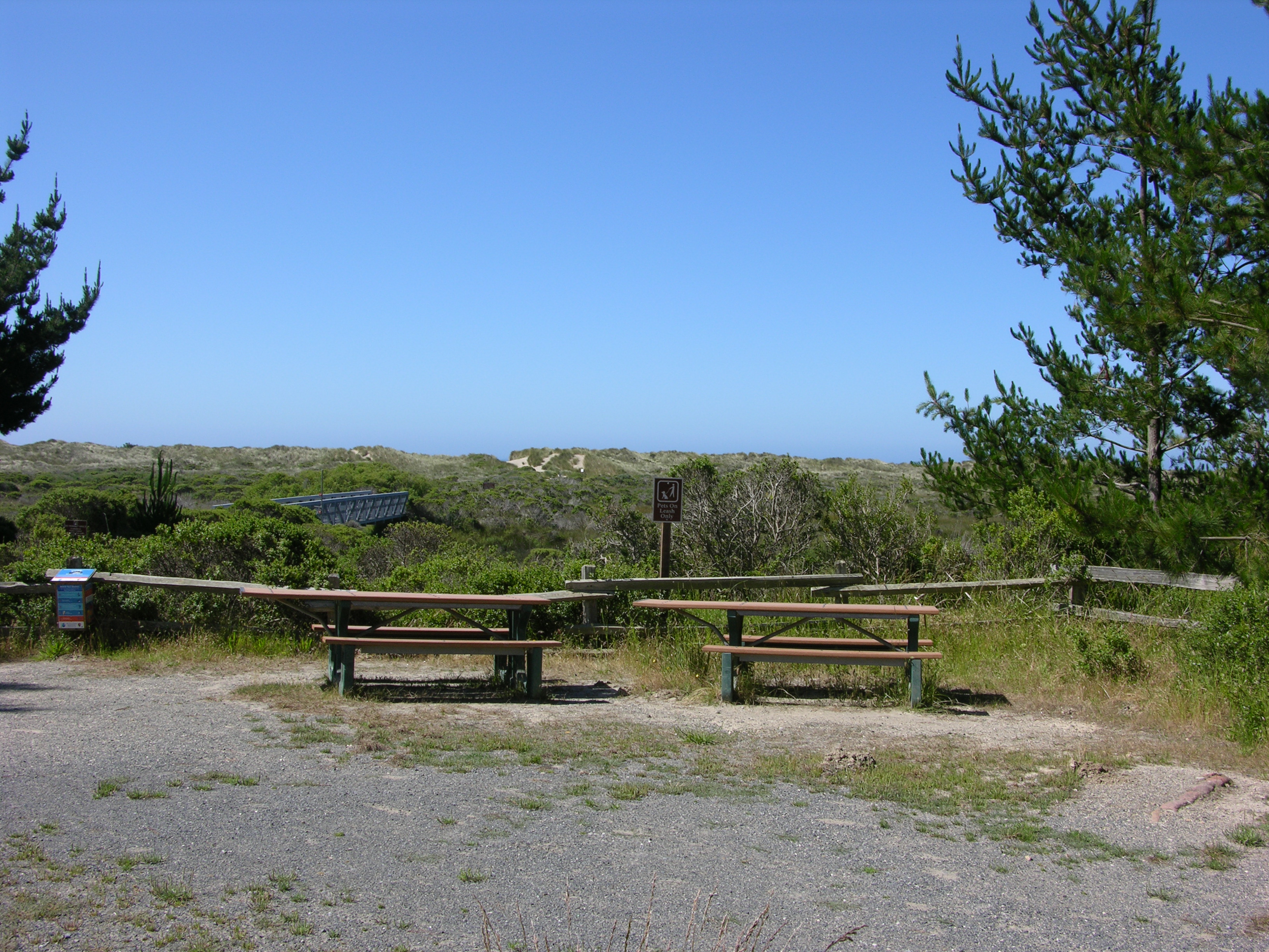
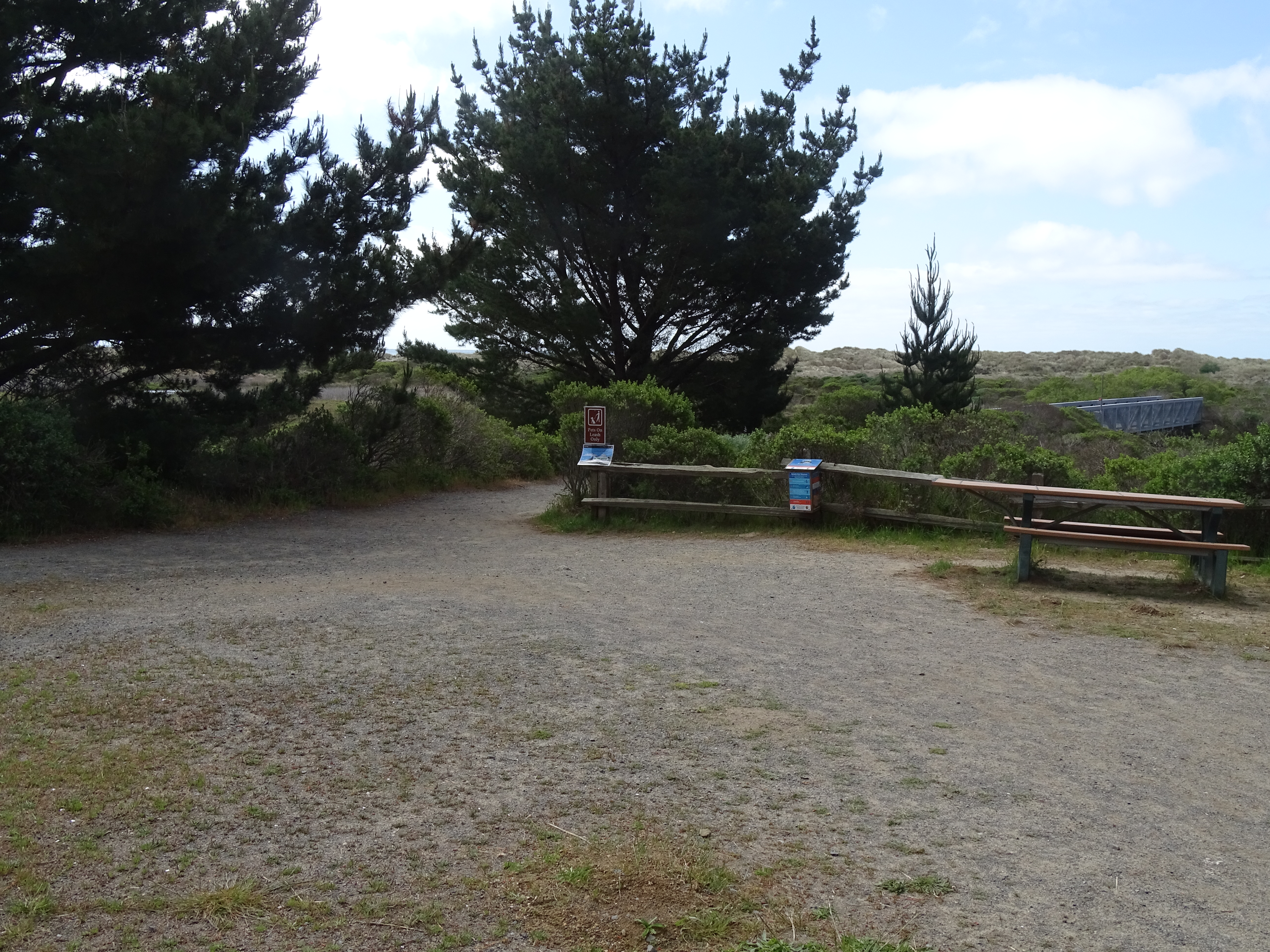
Two picnic tables are located just north of the foot bridge leading from the main Limantour Beach parking lot to the beach. The Limantour Beach parking lot is approximately 20 minutes by car from the Bear Valley Visitor Center.
Limantour Beach is a three-mile-long (five-kilometer-long) sandy beach. To the west of the large gravel parking lot, the low-profile sand dunes of Limantour Spit separate Estero de Limantour to the north from Drakes Bay to the south. Limantour Spit is about two miles (3.2 kilometers) long but only about 500 feet (150 meters) wide. To the west of Limantour Spit, beige-colored bluffs start to rise from the edge of the bay as the shoreline arcs to the southwest toward Chimney Rock, which is 5 miles (8 kilometers) to the the southwest of Limantour Beach. To the southeast, the shoreline is backed by low dunes for a mile or so before giving way to increasingly taller coastal bluffs. To the north and east, the grass and scrub covered land rises to forested ridges. The Limantour Beach Picnic Area is to the south of the large gravel parking lot. Moderately tall pine trees grow along the north and west side of the picnic area. Three vault toilet buildings are located along the northern edge of the trailhead area and two picnic tables are along the southern edge. A wide path leads south across a large footbridge that spans a drainage of the estuary that ebbs and flows along the south side of the trailhead area. This path leads to Limantour Beach and Limantour Spit Trail. In the southwest part of the picnic area is a small metal sign for the Muddy Hollow Trail. This six-foot-wide path leads a short distance through the trees to the west, skirting along the north and eastern edge of the estuary.
Leading west and then north from the Limantour Beach Trailhead, the Muddy Hollow Trail offers birders great opportunities to see a variety of water fowl and shorebirds in the Estero de Limantour and along Muddy Hollow Creek. The Muddy Hollow Trails is very flat and easy to walk. The trailhead is located at the west end of Limantour Road, approximately 20 minutes by car from the Bear Valley Visitor Center.
Limantour Beach is a three-mile-long (five-kilometer-long) sandy beach. To the west of the large gravel parking lot, the low-profile sand dunes of Limantour Spit separate Estero de Limantour to the north from Drakes Bay to the south. Limantour Spit is about two miles (3.2 kilometers) long but only about 500 feet (150 meters) wide. To the west of Limantour Spit, beige-colored bluffs start to rise from the edge of the bay as the shoreline arcs to the southwest toward Chimney Rock, which is 5 miles (8 kilometers) to the the southwest of Limantour Beach. To the southeast, the shoreline is backed by low dunes for a mile or so before giving way to increasingly taller coastal bluffs. To the north and east, the grass and scrub covered land rises to forested ridges. The Limantour Beach Trailhead is to the south of the large gravel parking lot. Moderately tall pine trees grow along the north and west side of the trailhead area. Three vault toilet buildings are located along the northern edge of the trailhead area and two picnic tables are along the southern edge. A wide path leads south across a large footbridge that spans a drainage of the estuary that ebbs and flows along the south side of the trailhead area. This path leads to Limantour Beach and Limantour Spit Trail. In the southwest part of the trailhead area is a small metal sign for the Muddy Hollow Trail. This six-foot-wide path leads a short distance through the trees to the west, skirting along the north and eastern edge of the estuary.
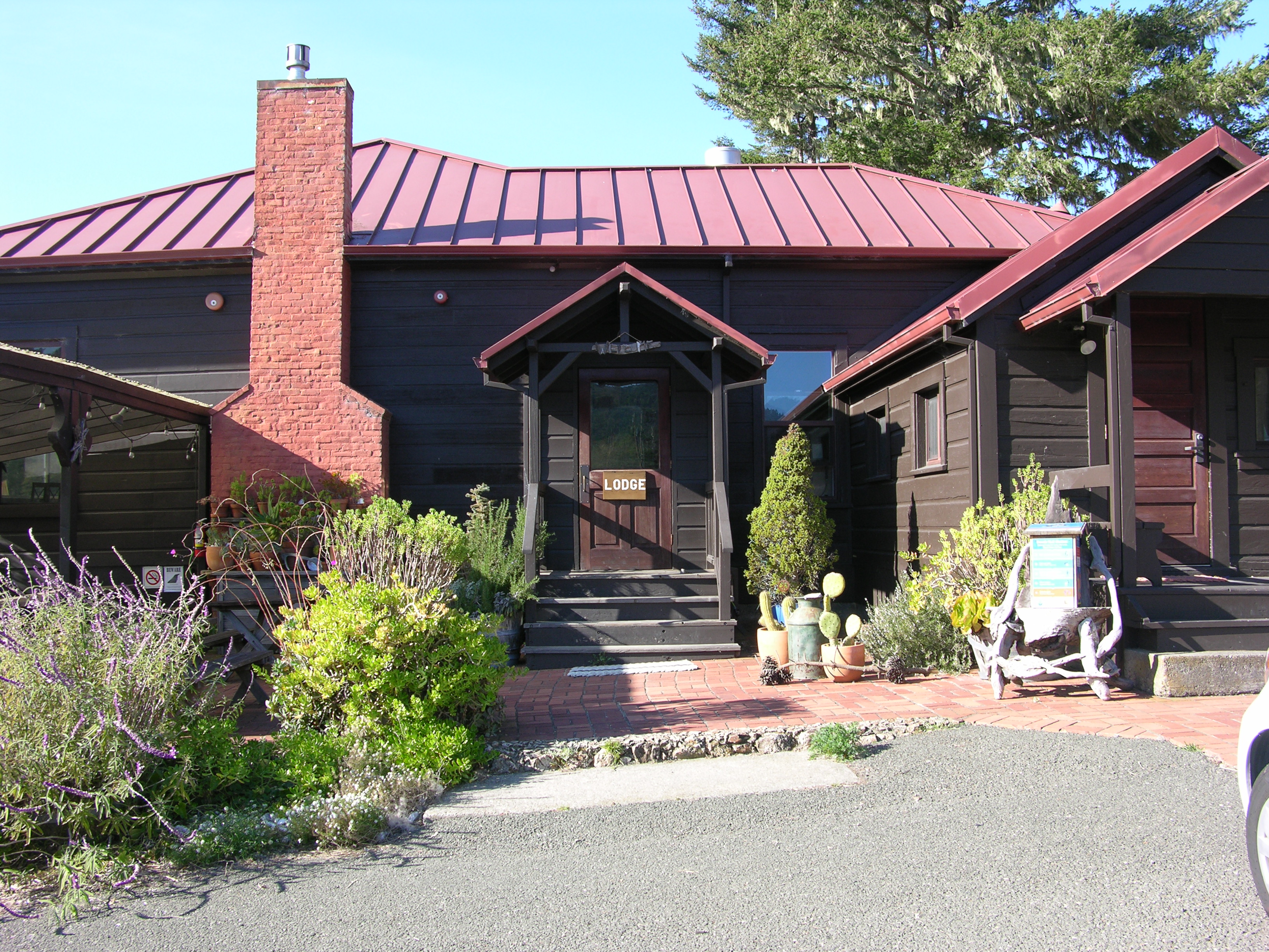
The only lodging within Point Reyes National Seashore is offered by Limantour Lodge. They offer dormitory style accommodations, as well as four private rooms. Please call 415-663-8811 for more information between 8 am and 7 pm.
Low on the slope of a hill, nestled just above the valley floor surrounded by coastal scrub, is a one-story, brown-sided, red-roofed building, which serves as the main lodge for the hostel. On the east side of the lodge is the main entrance, to the south of which is a covered picnic area with a barbecue grill. A parking lot separates the main lodge from two other buildings to the east. The Laguna Road passes west to east just south of the buildings and the Coast Trail heads toward the ocean to the south just across the road.
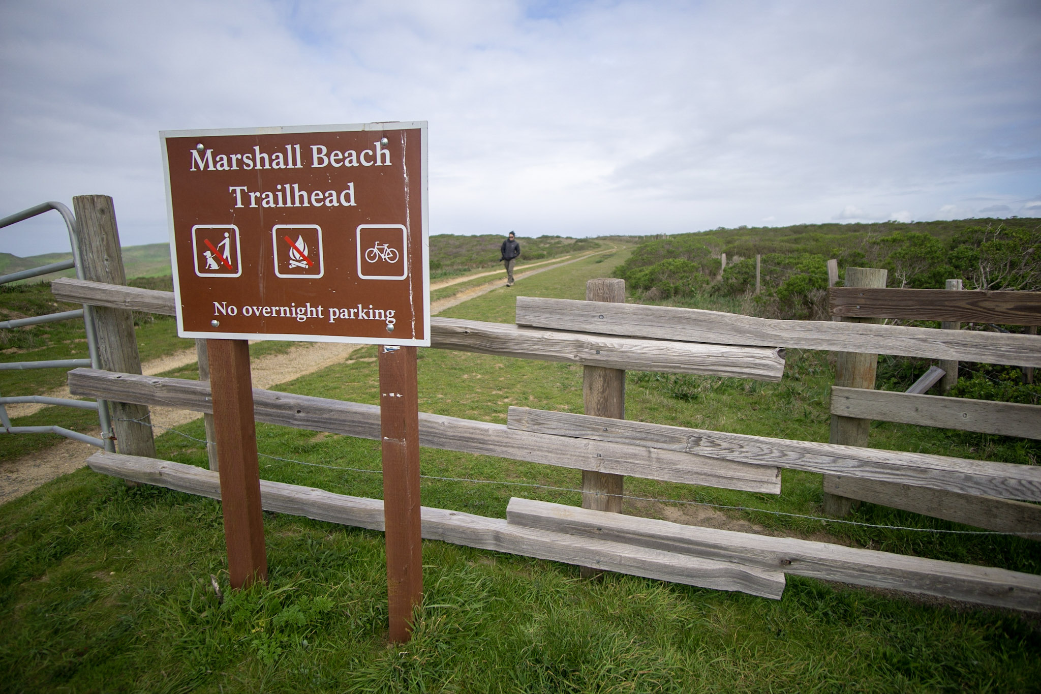
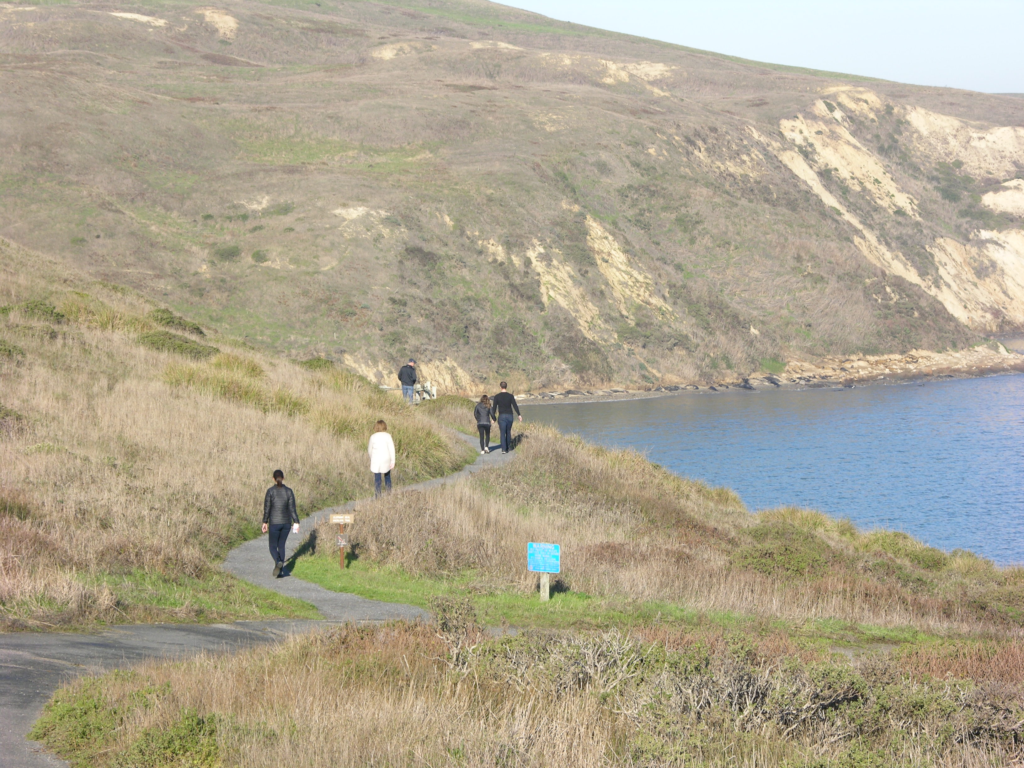
Marshall Beach is a 400-foot-long (366-meter-long) beach on the west side of Tomales Bay in the northern part of the national seashore. Most visitors to this beach arrive via water, i.e., by kayak, canoe, paddle board, small motorboat, etc. Visitors may also hike or ride their bicycles or horses to Marshall Beach via the 1.2-mile-long (1.9-kilometer-long) Marshall Beach Trail. The Marshall Beach Trailhead is reached by vehicle via L Ranch Road.
Marshall Beach is a 400-foot-long (366-meter-long) sandy beach on the west side of Tomales Bay in the northern part of Point Reyes National Seashore. Tomales Bay a narrow ocean inlet that is over 10 miles (16 kilometers) long and averages about one mile wide (1.6 kilometers), stretching from its mouth at the north-northwest end to its head toward the south-southeast. The east side of the bay is lined with many building (mostly residences) of the small community of Marshall. Rising above Marshall to the east is a pasture-covered ridge that runs parallel to the bay. A forested ridge parallels the bay on its west side, with trees descending to the water's edge along most of the western side of the bay. Along the west side of the southern end of the bay are the small communities of Inverness and Inverness Park. The northern end of the western side of the bay is lined with small bluffs and headlands which separate sandy beaches of varying lengths. Marshall Beach is located about halfway between the bay's head and mouth, due west from the community of Marshall. It stretches along the northern end of a small circular cove and is one of the bay's longer beaches.
The Marshall Beach Trailhead is located at the north end of the unpaved L Ranch Road, which branches off of Pierce Point Road. The Marshall Beach Trail traverses 1.2 miles (1.9 km) as it descends ~350 feet (~105 meters) in elevation to Marshall Beach on the shore of Tomales Bay. This trailhead is approximately 25 minutes by car from the Bear Valley Visitor Center.
The Marshall Beach Trailhead begins at a dirt parking lot surrounded by rolling hills covered with shrubs and cattle. Two miles to the west is the Pacific Ocean. Waves crash on the Great Beach. Less than a mile to the east is the long and narrow Tomales Bay. From the trailhead, the Marshall Beach Trail, which doubles as a narrow dirt ranch road, leads to the north. The trail follows the ridge crest for 0.6 miles before descending to the east towards the shore of Tomales Bay.
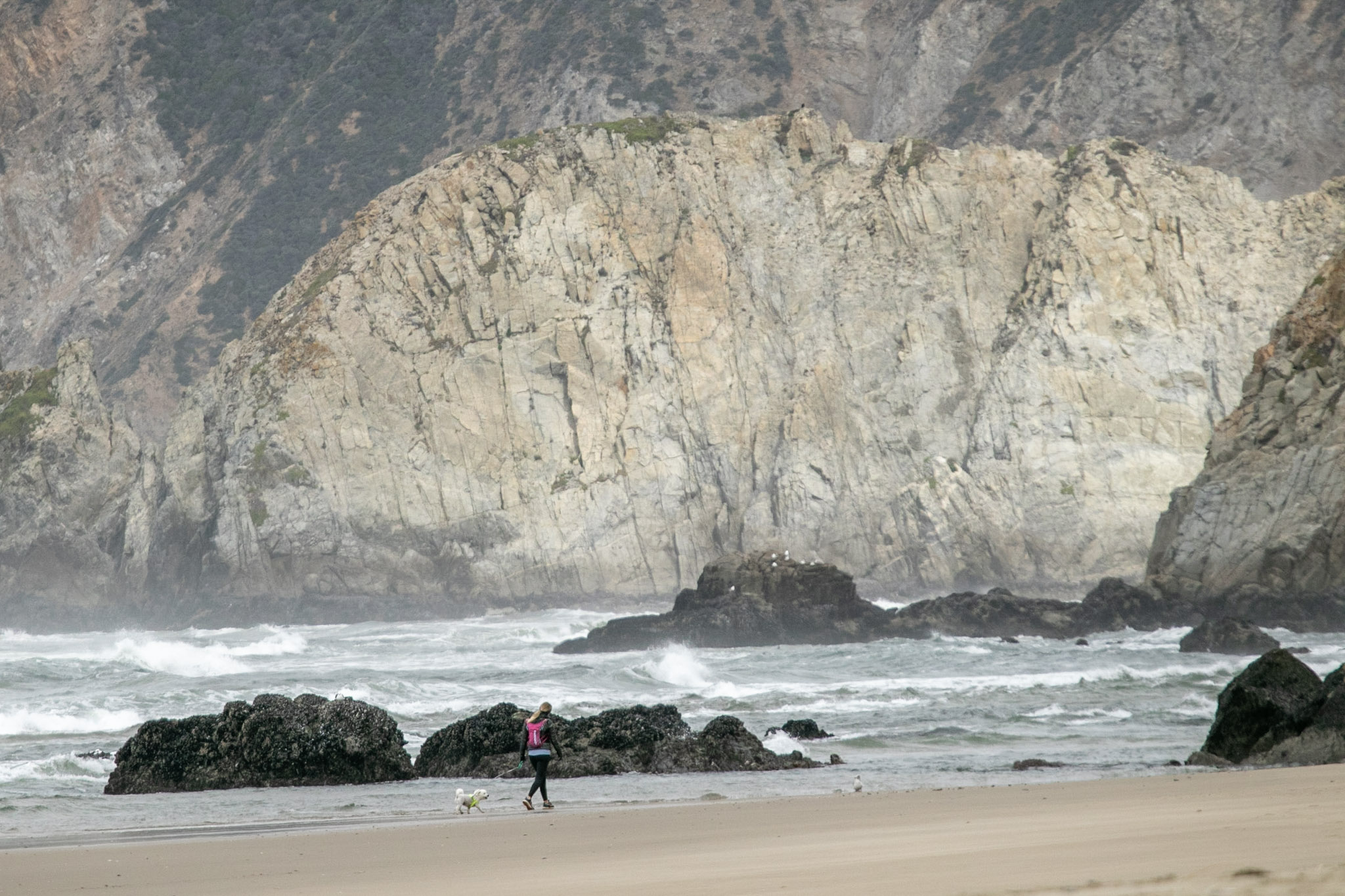
Wild and secluded, McClures Beach is a beautiful cove situated between two rocky headlands. Intense surf and interesting rock formations characterize the most northern ocean beach in Point Reyes. One may be tempted to venture through a gap at the south end to explore the adjacent beach, but use caution! Never turn your back to the ocean. Due to the frequently large surf, this is not a beach at which it is safe to play close to the water's edge, much less to go for a swim.
It's a short but moderately steep hike from the parking area. The single track path begins as sandy but becomes more slippery on decomposed granite until you reach the sandy beach. The path winds down a wide ravine bordered by McClures Creek. Small muddy elk trails ascend on the other side of the creek. The ravine opens up into a large semicircular sandy cove surrounded by steep cliffs. To the south is a large red rock formation. To the north are the towering beige-colored cliffs of Tomales Point stretching five miles to the northwest. Big waves are common and dangerous surf crashes onto the beach.
The McClures Beach Trailhead is located downhill and to the west of historic Pierce Ranch at the north end of Pierce Point Road. The McClures Beach Trail—which is mostly within the Phillip Burton Wilderness—offers a short, moderately steep hike down to an isolated and beautiful beach that is exposed to the rough Pacific Ocean surf. The trailhead parking lot approximately 35 minutes by car from the Bear Valley Visitor Center.
The McClures Beach Trailhead starts from the west end of a small, paved parking lot with room for approximately 25 vehicles. A six-foot-wide dirt path leads west and downhill into a small narrow valley toward the ocean, which is 0.4 miles (650 meters) away. To the east, a narrow two-lane road lead uphill toward some cypress trees adjacent to old ranch buildings. In the northeast corner of the parking lot is a beige-colored building housing two vault toilets. A split rail fence surrounds the parking lot. Recycling and garbage receptacles are located at the trailhead. The surrounding terrain is covered by grass and shrubs.
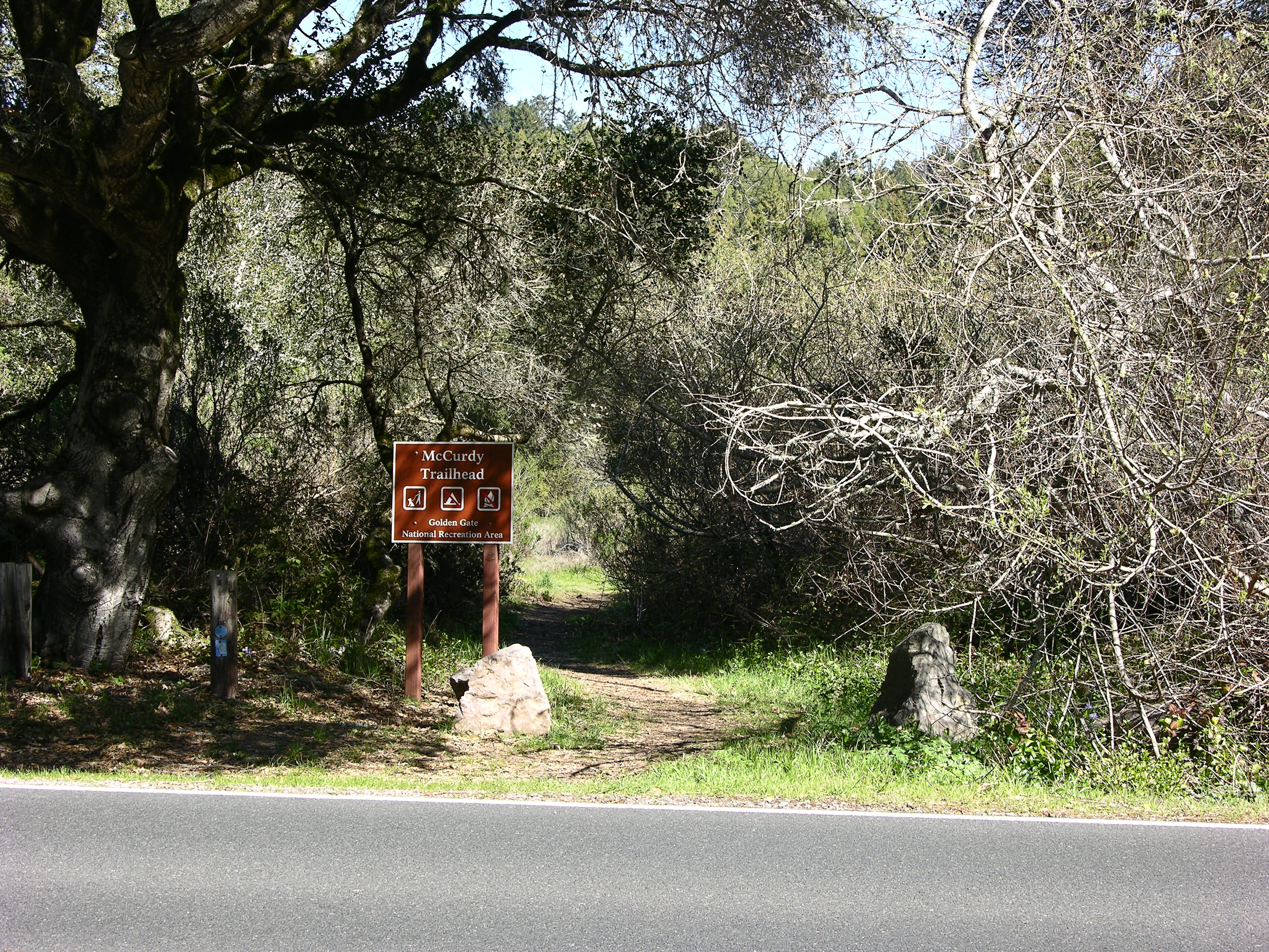
Park at the McCurdy Trailhead to hike a steep and overgrown old ranch/fire road that ascends 2 miles through chaparral and some woodlands to the Bolinas Ridge Trail. Pets, bicycles, and horses are permitted on the McCurdy Trail. The trailhead is located along Highway 1 (aka Shoreline Highway) 8.3 miles (13.3 km) south of Olema and approximately 20 minutes by car from the Bear Valley Visitor Center.
A sinuous two-lane paved highway runs northwest to southeast along the floor of a valley. The valley is bounded by a forested ridge to the west and a ridge to the east that is partially covered by trees and otherwise covered by chaparral. Along a tree-lined section of the highway, a section of the shoulder on its west side has been paved, large enough for three parked vehicles. A split-rail fence lines the paved parking area. A brown sign for the Olema Valley Trailhead stands adjacent to a gap in the fence that provides passage onto the trail that leads to the northwest. The Olema Valley Trailhead sign contains icons for no pets, no fires, but camping is allowed by permit only. On the east side of the highway are a number of short wooden posts and some moderate-sized boulders, along with a brown sign for the McCurdy Trailhead. The McCurdy Trailhead sign contains icons for no camping, no fires, but pets are allowed on leash. Further north on the west side of the highway is a large brown sign for Point Reyes National Seashore.
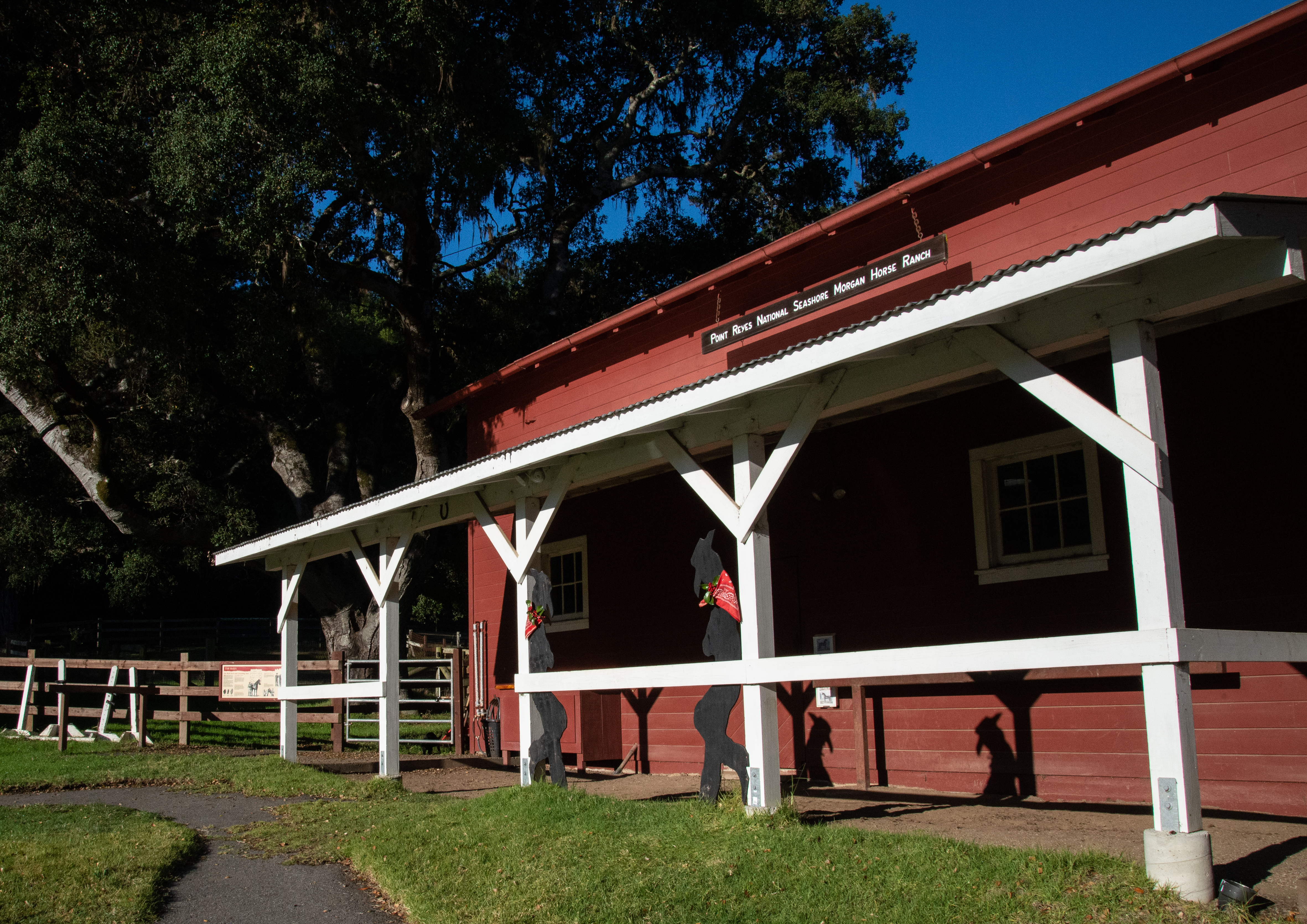
Meet Point Reyes National Seashore's Morgan horses and explore a historic ranch. This is a working ranch for horses used by National Park Rangers in wilderness areas and for backcountry patrols. It has trailside exhibits focusing on the characteristics, breeding, and history of the first American breed of horse. Self-guided exhibits, corrals, and demonstrations are a part of the ongoing interpretive program of the ranch. Allow 20–30 minutes to tour the Horse Ranch.
A paved maintenance road leads up to the Morgan Horse Ranch. Wooden fences run along both sides of this driveway. On the right, is a grassy pasture that slopes down towards the Bear Valley Visitor Center. The driveway continues past white office buildings with signs indicating this is the headquarters for the Point Reyes National Seashore Association. Shortly after, on the left there are two parking spaces with signs that indicate they are reserved for disabled persons. In front of these parking spots there is a singled-chain fence, just beyond which there is antique farming equipment resting in a field. From here, an arc of various sized buildings and structures is visible. They are described as follows, beginning from the left-most building and moving clockwise. First is a small one-story red shed building with open doorways on either side—a paved path runs through it. Inside, on either side of the path are tall panels describing the history of the Morgan Horse breed, as well as photos of Morgan Horses and National Park Service rangers. Directly to the right of this building, there is another one-story red wooden shed with a garage-like opening—visible inside is an assortment of historic blacksmithing equipment. When not in use, there is a metal grate pulled across this opening. To the right again, is a covered square arena. There are no walls, but there is a white wooden fence along its border, with tall wooden beams holding up a red roof. Hanging from the roof are two red, white and blue pleated fan flags. Inside the arena, the ground is made up of a deep sandy dirt, rutted with hoof prints. Approximately thirty-feet to the right is the main building of the Morgan Horse Ranch. The main building is a tall, two-story red barn, with white-trimmed windows. A wooden awning sticks out about 10 feet, covering a metal hitching rail and a dirt floor. Attached to the outside of the awning are two wooden, decorative cowboy silhouettes—giving the illusion that they are leaning against the white posts. Above the awning is a hanging wooden sign with engraved white letters reading: "Point Reyes National Seashore Morgan Horse Ranch." The barn door under this awning leads into one of two "rooms" inside this main building. It has a sink, and two wooden stalls. The stall doors are approximately five feet tall, and signs indicate that they were once used for pregnant mares and foals, or injured horses. They are currently empty. There are also saddle blankets on display, and two normal doors on either side of the room which are for staff use only. An open doorway on the far side leads to the second room. On either side of the doorway are framed photos with photos of each horse currently living at the ranch. In the next room, on each wall, tack and equipment for horse riding is displayed. There are leather bridles, rope halters, and various kinds of leather saddles. There are also "pack saddles" which have leather straps and wooden crossbars. Another open doorway leads down three wooden steps back to the paved driveway. Just across the driveway from this doorway is a another small red building with a white door, and a sign that reads "Office." In front of the office is a thick wooden log on its side, upon which embossed letters read: "The Point Reyes National Seashore Morgan Horse Farm." Elk antlers adorn each side of this sign. Following the paved driveway to the left, is a brownish-red wooden fence line. Behind the fence is a pasture with short grass, and various obstacles. Two wayside signs explain the color and physiology of Morgan Horses, as well as how each of these obstacles are used to train horses. The obstacles are: a bridge, an array of tires, a gate, two logs for jumping and an L-shaped frame on the ground. The fence line leads to a gate. This is the terminus of the area open to visitors. Horses may or may not be visible from this point.
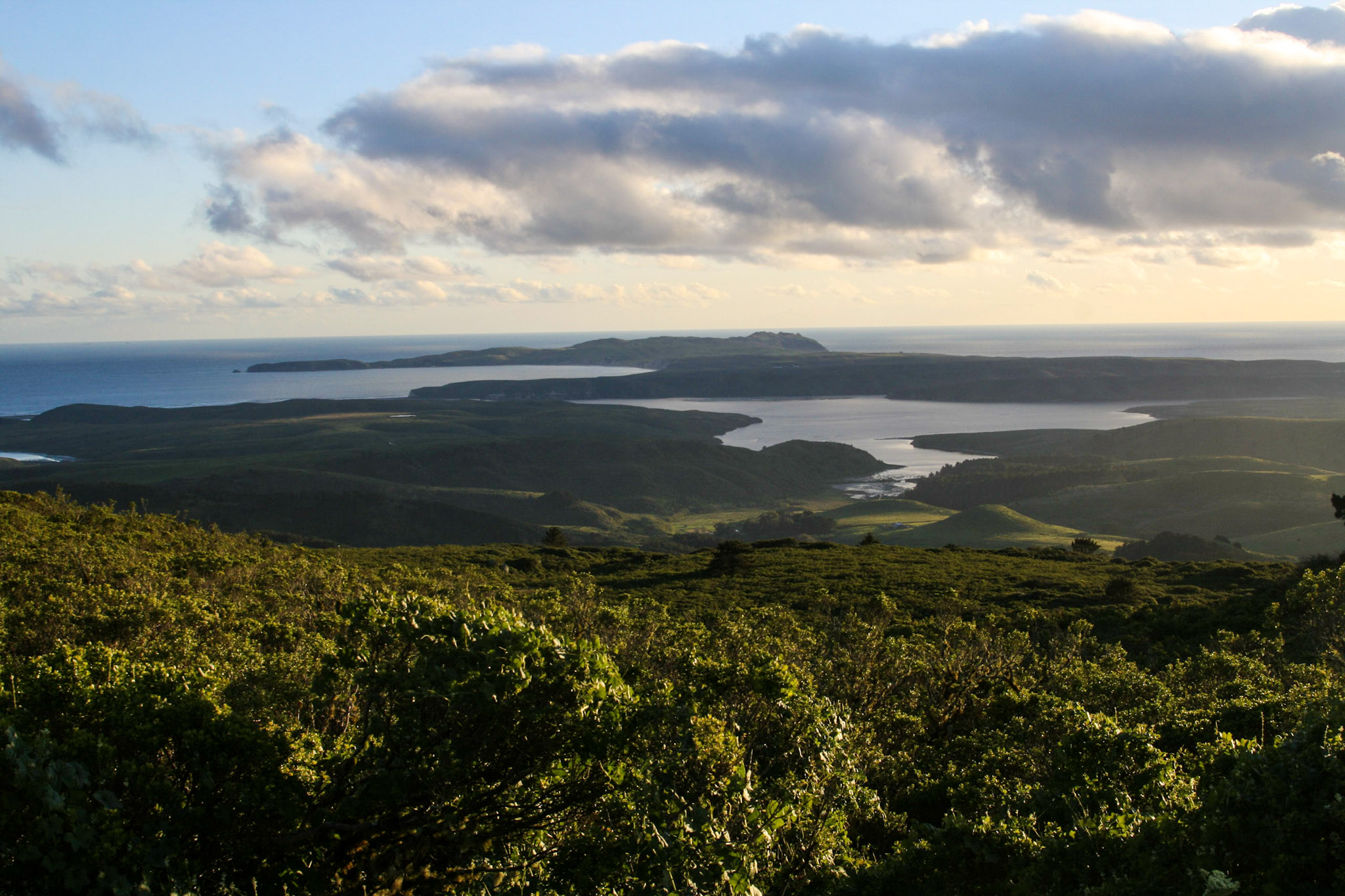
View much of the Point Reyes peninsula from Mount Vision (1,282 feet). Drive to the overlook on Mount Vision Road for stunning views of the seashore on clear days.
The overlook begins at a dirt parking lot on the side of the road. Bishop pine forest and coastal scrub surrounds the parking area. There is a bench and compass to the west. The view from the overlook spans to the Pacific Ocean. On the clearest days, the Farallon Islands are to the south west. The Point Reyes Headlands sticks out as a point to the pacific. To the north of the headlands is ten miles of beach straight to tomales Point. The fingers of Drakes Estero branch into rolling ranch land.
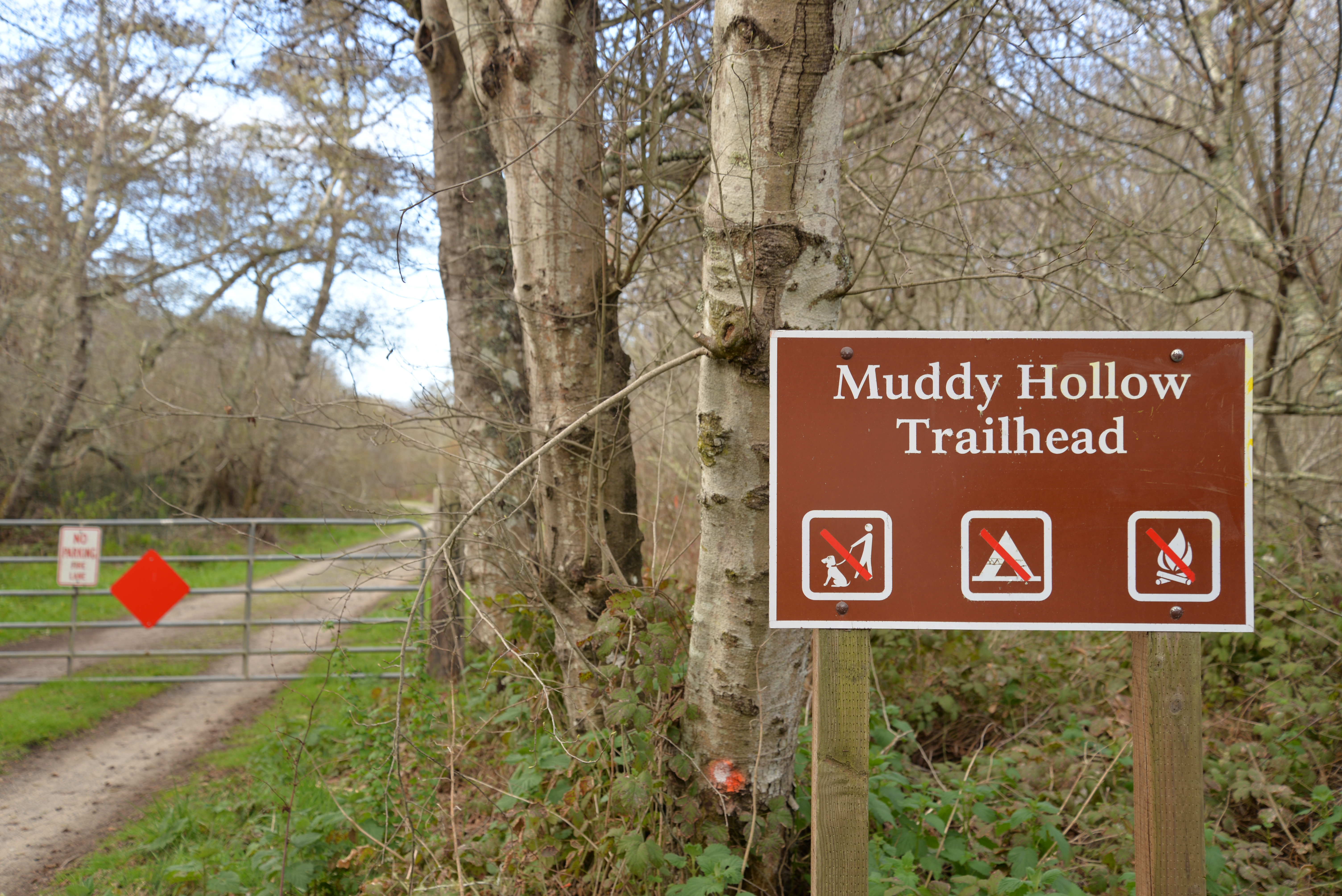
The Muddy Hollow Trailhead is the gateway to several often overlooked coastal hiking trails, from which you can enjoy ocean views and an occasional tule elk sighting! Many of the routes that depart from this trailhead are within the Phillip Burton Wilderness. The trailhead is located at the west end of Muddy Hollow Road, approximately 15 minutes by car from the Bear Valley Visitor Center.
The narrow, gravel Muddy Hollow Road descends a hill from the east. On the south (e.g., left) side at the end of the road is a small gravel parking lot that can accommodate approximately 15 vehicles. The parking lot is surrounded by willow and alder trees. In line with the Muddy Hollow Road, the Muddy Hollow Road Trail leads to the west through a large metal gate. From the south end of the parking lot, a wide gravel trail—the Muddy Hollow Trail—heads south. To the right of the trailhead is a brown metal National Park Service sign with white lettering that says Muddy Hollow Trailhead. The sign also has three icons indicating "No Dogs," "No Camping," and "No Fires" allowed. There is a metal gate at the start of the trailhead that has room for people and horses to get around on the left side. On the gate is a small white metal sign with the words “No Parking, Fire Lane.”
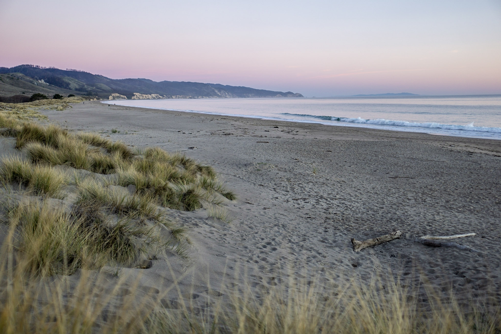
Point Reyes Beach North (aka North Beach) is one of four locations at Point Reyes National Seashore to which one can drive to the edge of a beach. Point Reyes Beach stretches over 11 miles from Kehoe Beach to the Point Reyes Headlands with North Beach located at the mid-point. Never turn your back to the ocean. Due to the frequently large surf, this is not a beach at which it is safe to play close to the water's edge, much less to go for a swim. Leashed pets are permitted.
The 0.6 mile road to North Beach meanders through sand dunes covered with beach grass and ice plant. On the right, a sign cautions "Warning dangerous Surf. Enter at your own Risk." The right side of the parking lot is bordered by a wooden split rail fence. The parking lot sits above the beach and one has to climb down the sand dunes to access beach level. At the far north end of the parking lot, there is a restroom. Miles of long, sandy, windswept and dune backed beach continues to the south and north. The Point Reyes Headlands rise at the horizon to the south. On clear days, the lighthouse is visible on the point. The sandy cliffsides of Tomales Point are visible to the North. Strong, powerful surf reins on Point Reyes Beach. Sneaker waves sometimes makes it’s way high up beyond the surf line.
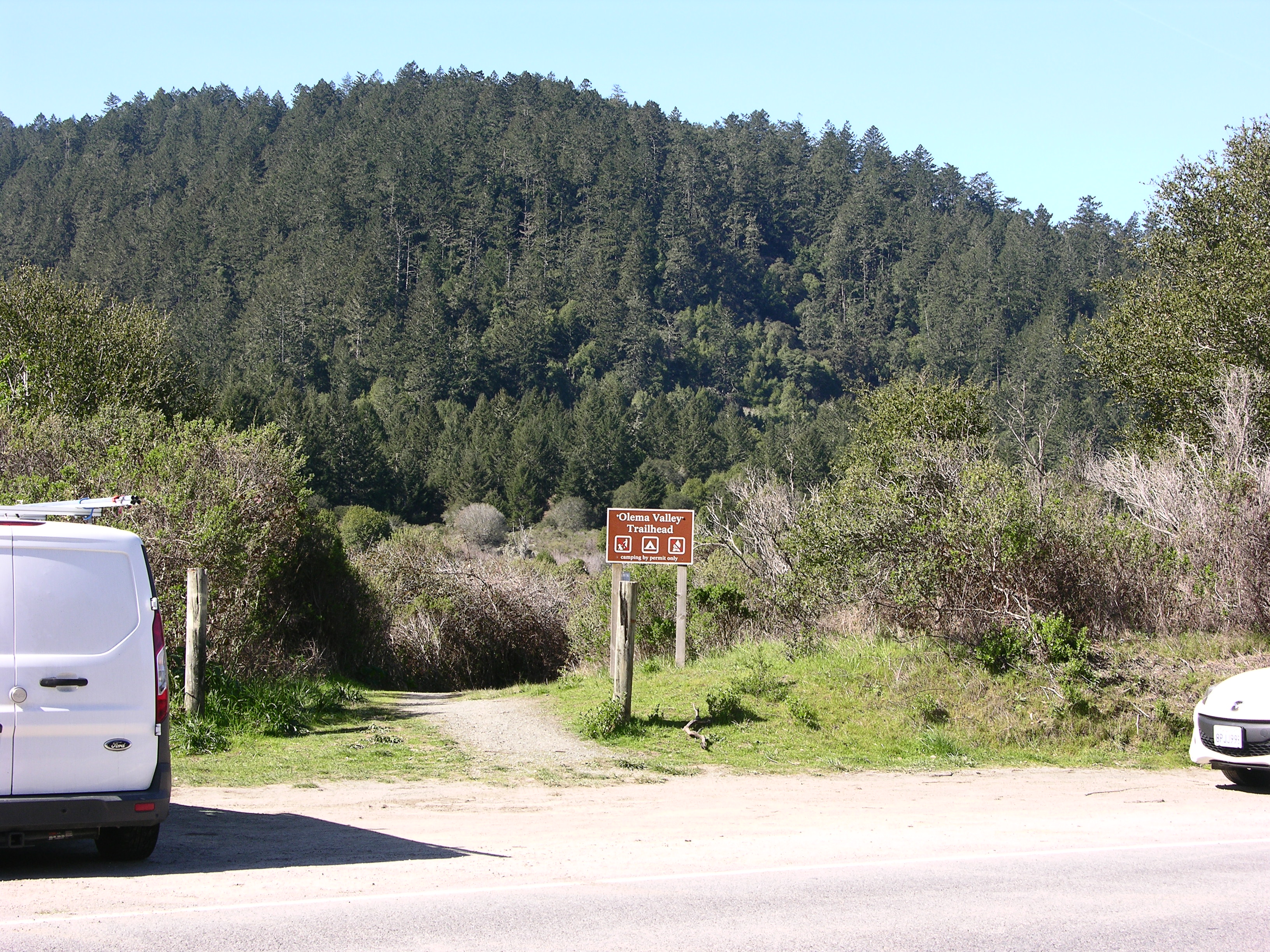
The Olema Valley (Hagmaier) Trailhead provides access to the middle section of the Olema Valley Trail, which connects to an extensive network of trails that pass through the Phillip Burton Wilderness. The trailhead is located along Highway 1 (aka Shoreline Highway) 6 miles (9.6 km) south of Olema and approximately 15 minutes by car from the Bear Valley Visitor Center.
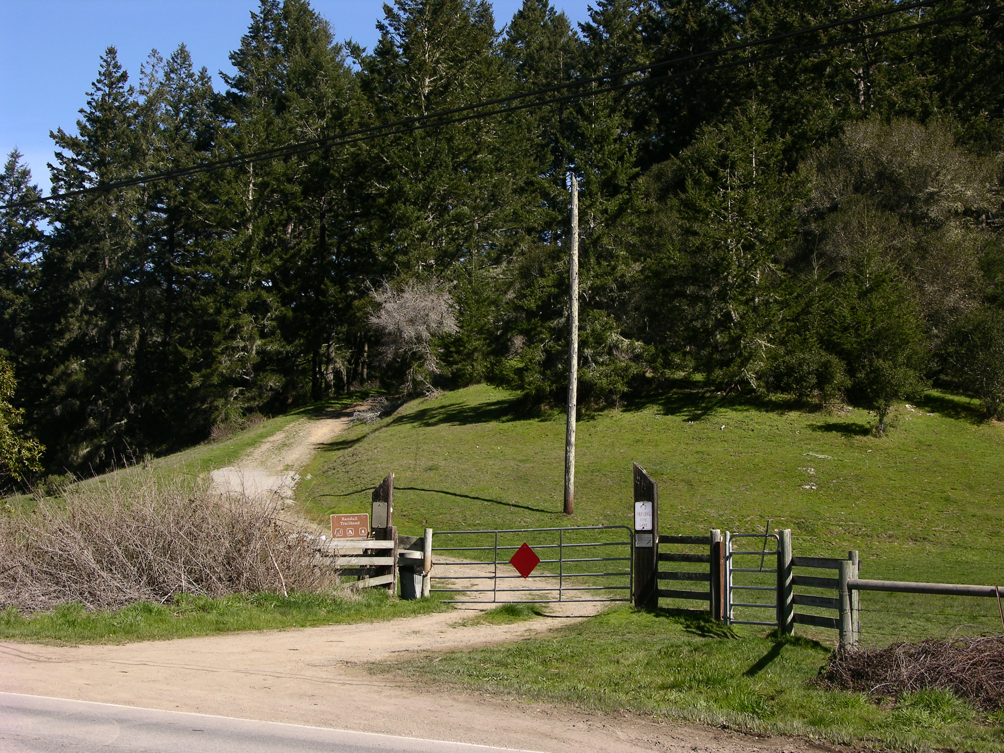
A sinuous two-lane paved highway runs northwest to southeast along the floor of a valley. The valley is bounded by a forested ridge to the west and a ridge to the east that is partially covered by trees and otherwise covered by cattle-grazed pasture lands. A barbed-wire fence line runs along the east side of the highway. An old dirt and gravel ranch road branches off of the highway and passes through a 10-foot-wide metal gate mounted between two large cylindrical posts whose tops have been cut diagonally. Beyond the gate is a brown sign for the “Randall Trailhead” with icons indicating pets are permitted on leash, no camping, and no fires. Trash and recycling receptacles are located close to the sign. The shoulders along this stretch of the highway are used for parking by hikers and are barren of vegetation. From the west side of the highway, a trail next to a sign for "Olema Valley Trailhead" leads through a dense thicket of willows.
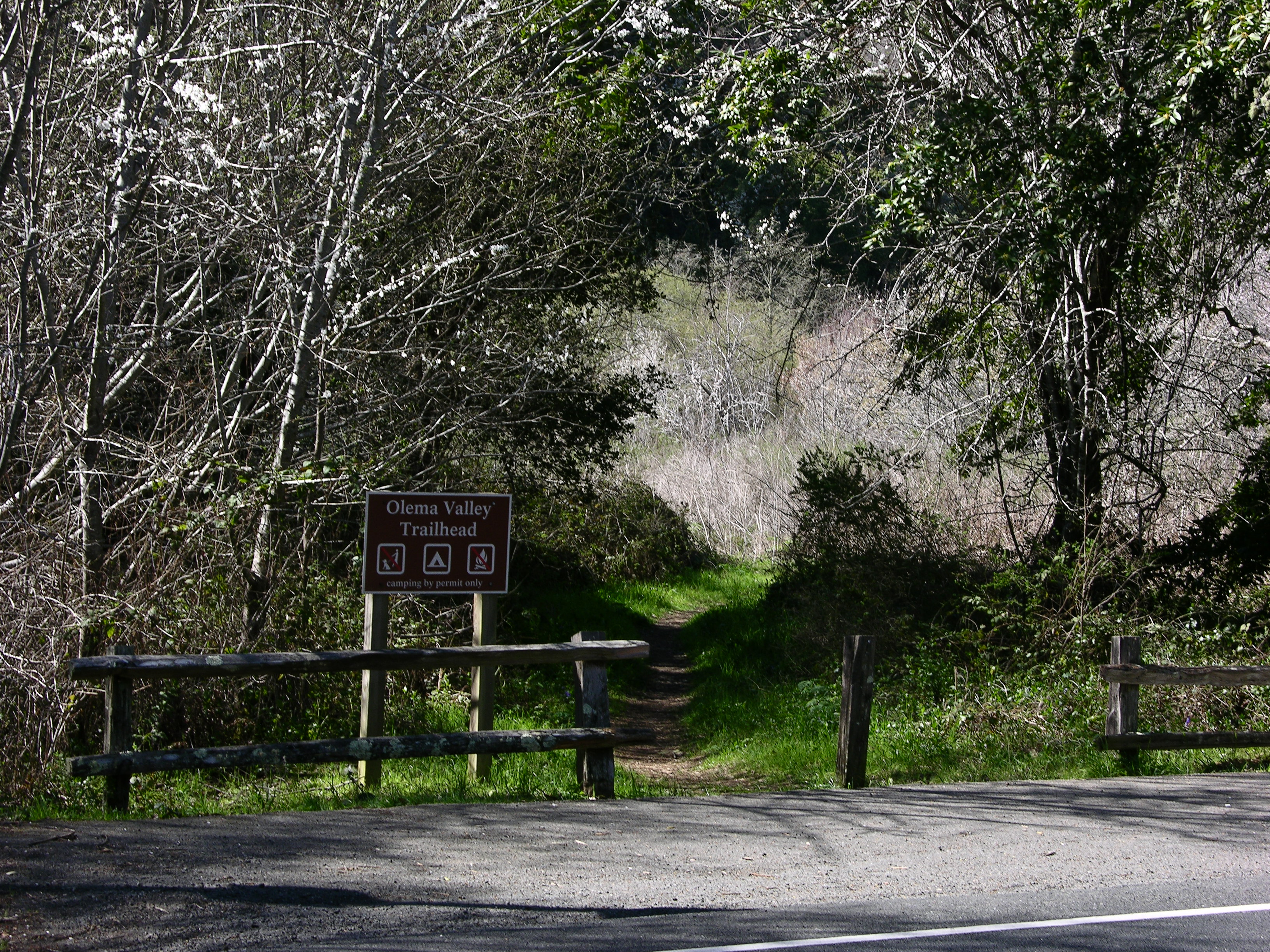
The Olema Valley (South) Trailhead provides access from the southern end of Olema Valley to an extensive network of trails that pass through the Phillip Burton Wilderness. The trailhead is located along Highway 1 (aka Shoreline Highway) 8.3 miles (13.3 km) south of Olema, approximately 20 minutes by car from the Bear Valley Visitor Center.
A sinuous two-lane paved highway runs northwest to southeast along the floor of a valley. The valley is bounded by a forested ridge to the west and a ridge to the east that is partially covered by trees and otherwise covered by chaparral. Along a tree-lined section of the highway, a section of the shoulder on its west side has been paved, large enough for three parked vehicles. A split-rail fence lines the paved parking area. A brown sign for the Olema Valley Trailhead stands adjacent to a gap in the fence that provides passage onto the trail that leads to the northwest. The Olema Valley Trailhead sign contains icons for no pets, no fires, but camping is allowed by permit only. On the east side of the highway are a number of short wooden posts and some moderate-sized boulders, along with a brown sign for the McCurdy Trailhead. The McCurdy Trailhead sign contains icons for no camping, no fires, but pets are allowed on leash. Further north on the west side of the highway is a large brown sign for Point Reyes National Seashore.
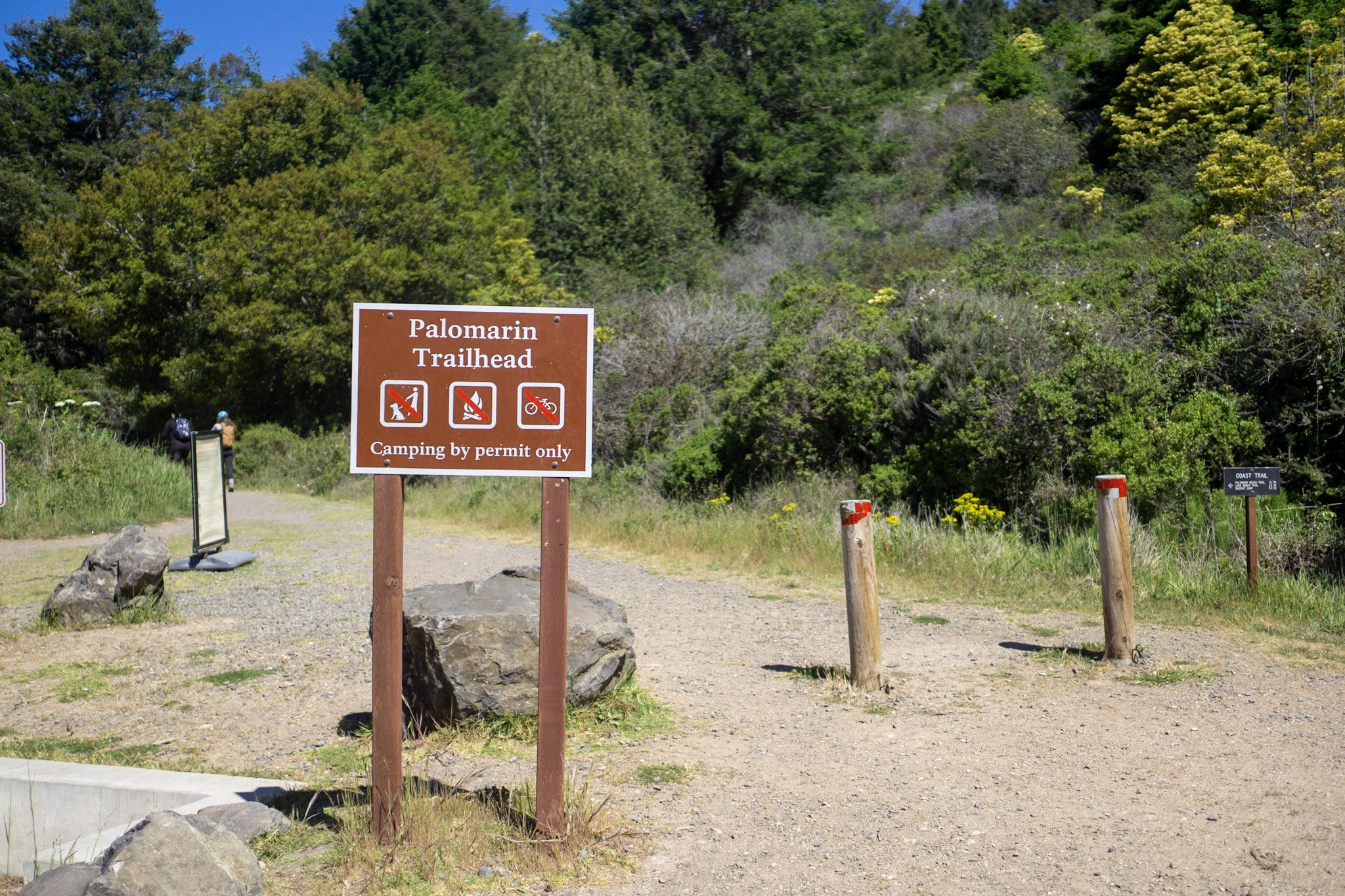
The Palomarin Trailhead is located at the southern end of Point Reyes National Seashore's extremely popular Coast Trail. It is located at the northwestern end of Mesa Road, approximately 5 miles (8 km) northwest of Bolinas and approximately 35 minutes by car from the Bear Valley Visitor Center.
The gravel Mesa Road enters a smallish gravel parking lot from the south. Two small outhouses with a total of four vault toilets are located along the eastern edge of the parking lot, along with garbage and recycling receptacles. The accessible set of toilets is in the southeast corner of the parking lot, adjacent to trailhead signage and the start of the Coast Trail, which heads north along the eastern edge of the parking lot. The parking lot is surrounded by twenty-foot or so tall trees and coastal scrub, with hills rising to the east and the ocean to the west.
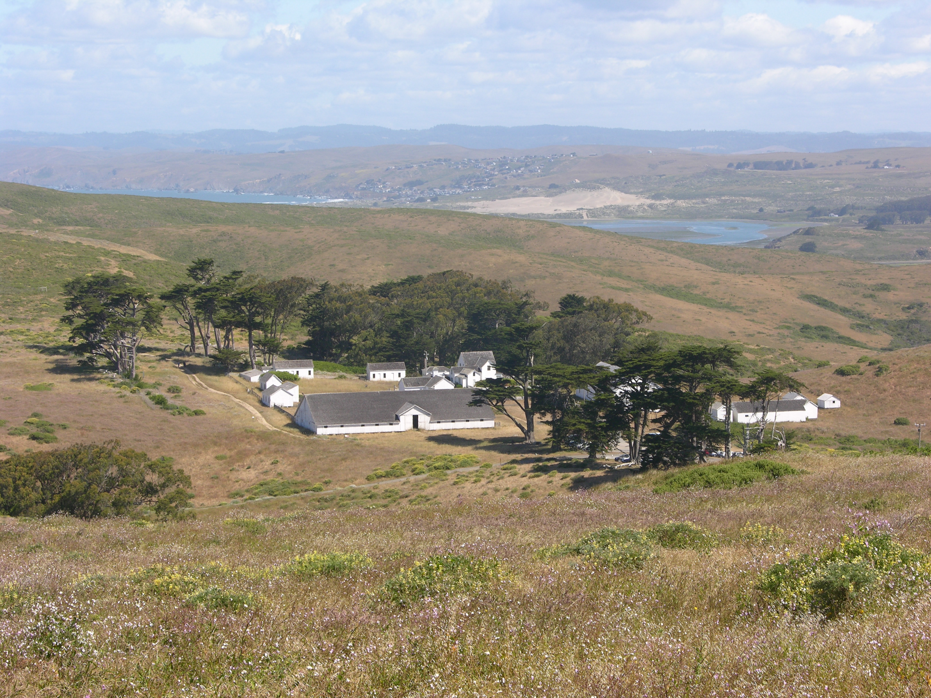
Pierce Ranch was the largest ranch in the Point Reyes Peninsula in the late 1800s. Ranch operations ceased in 1973, but it still stands as the best example of a west Marin dairy ranch from the 1800s. Visitors are welcome to walk along a short, self-guided path guides through the ranch complex and imagine what dairy farming was like at Point Reyes. Allow 20–30 minutes to tour the ranch and 70 minutes round trip to drive to and from the Bear Valley Visitor Center.
Pierce Ranch is on Tomales Point (aka Pierce Point), a narrow grass- and shrub-covered peninsula at the north end of the Point Reyes peninsula. Tomales Point is about 1.4 miles (2.2 kilometers) wide at Pierce Ranch and gets progressively narrower to the north-northeast. To the west is the Pacific Ocean; to the north is Bodega Bay; to the east is one-mile-wide Tomales Bay and grasslands/pasturelands covering the north end of Bolinas Ridge beyond the bay. A hill rises to the south of the Tomales Point Trailhead. Pierce Point Road, a windy two-lane road descends this hill and ends at the dirt parking area at the south end of the ranch. Just before the parking lot, a short, narrow paved road descends to the McClures Beach Trailhead parking lot. To the north of the trailhead parking lot are a complex of historic white ranch buildings and a dairy barn. To the west is a row of mature cypress trees that were planted to serve as a windbreak. There is also a pay phone booth and waste and recycling receptacles. A dirt trail leads west from the parking lot before turning north to pass along the west side of the historic white milking barn on its way to the north end of Tomales Point. Just before the southeast corner of the milking bar, a narrow path branches off of the Tomales Point Trail and passes to the east of the milking barn. Along this path that travels into the center of the ranch buildings are a number of interpretive wayside exhibits with information about some of the buildings and the ranch’s history. At the center of the ranch yard is the old dairy house. Around the perimeter of the ranch yard, starting from the milking barn along the south and moving clockwise are: a calf shed, a blacksmith shop, the west bunkhouse, and an open front shed along the west fence; a schoolhouse, the north bunk house, a wash room, and the main house along the north side of the yard; and a horse barn, a couple chicken houses, a wagon shed, and a small garage to the east. At the northeast corner of the milking barn is the new dairy building.
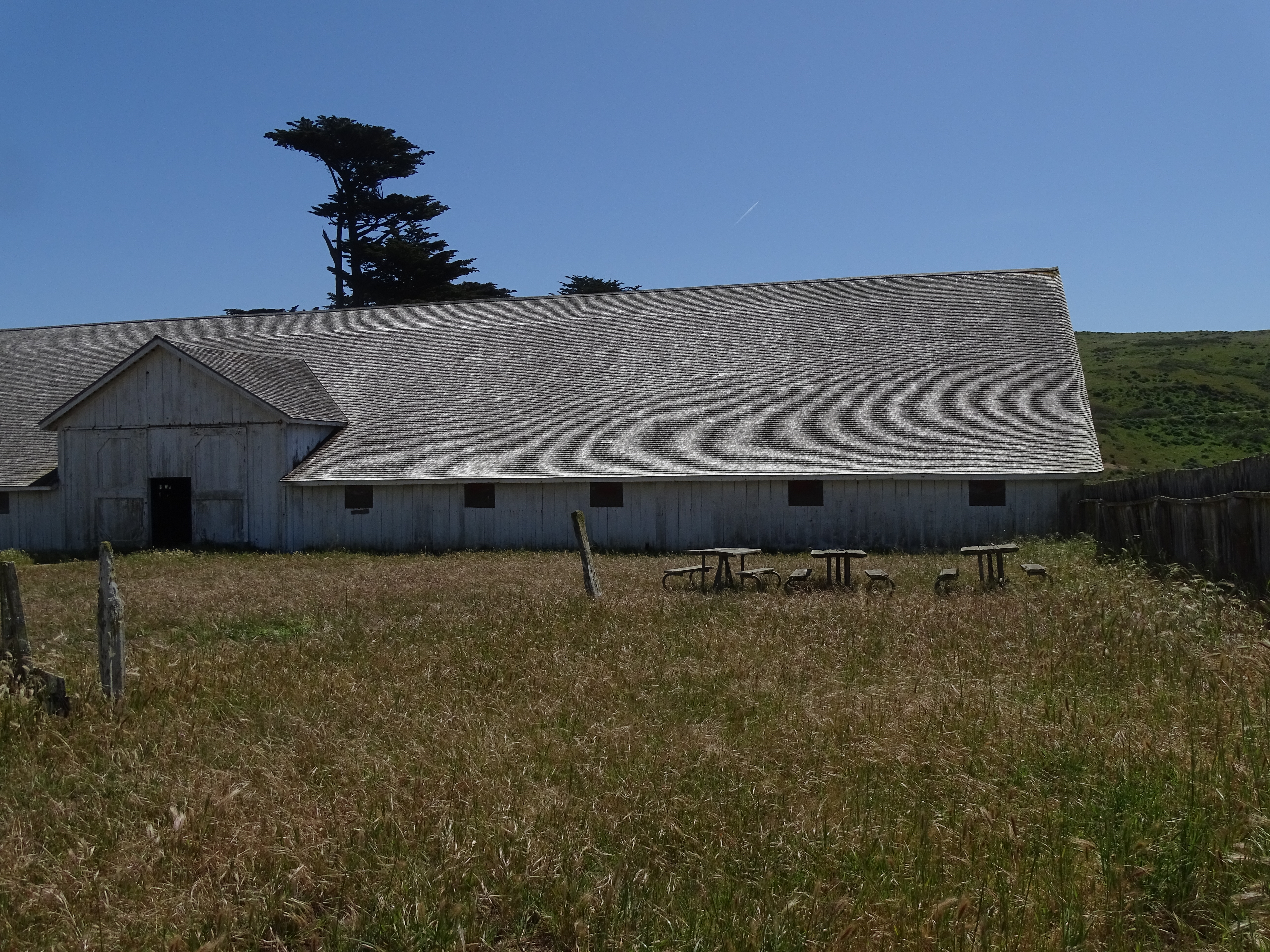
Four picnic tables are located adjacent to the milking barn at the historic Pierce Ranch within Point Reyes National Seashore. The Pierce Ranch is approximately 35 minutes by car from the Bear Valley Visitor Center.
Pierce Ranch is on Tomales Point (aka Pierce Point), a narrow grass- and shrub-covered peninsula at the north end of the Point Reyes peninsula. Tomales Point is about 1.4 miles (2.2 kilometers) wide at Pierce Ranch and gets progressively narrower to the north-northeast. To the west is the Pacific Ocean; to the north is Bodega Bay; to the east is one-mile-wide Tomales Bay and grasslands/pasturelands covering the north end of Bolinas Ridge beyond the bay. A hill rises to the south of the Tomales Point Trailhead. Pierce Point Road, a windy two-lane road descends this hill and ends at the dirt parking area at the south end of the ranch. Just before the parking lot, a short, narrow paved road descends to the McClures Beach Trailhead parking lot. To the north of the trailhead parking lot are a complex of historic white ranch buildings and a dairy barn. To the west is a row of mature cypress trees that were planted to serve as a windbreak. There is also a pay phone booth and waste and recycling receptacles. A dirt trail leads west from the parking lot before turning north to pass along the west side of the historic white milking barn on its way to the north end of Tomales Point. Just before the southeast corner of the milking bar, a narrow path branches off of the Tomales Point Trail and passes to the east of the milking barn. Along this path that travels into the center of the ranch buildings are a number of interpretive wayside exhibits with information about some of the buildings and the ranch’s history. At the center of the ranch yard is the old dairy house. Around the perimeter of the ranch yard, starting from the milking barn along the south and moving clockwise are: a calf shed, a blacksmith shop, the west bunkhouse, and an open front shed along the west fence; a schoolhouse, the north bunk house, a wash room, and the main house along the north side of the yard; and a horse barn, a couple chicken houses, a wagon shed, and a small garage to the east. At the northeast corner of the milking barn is the new dairy building. Three picnic tables are along the north side at the western end of the milking barn and one picnic table is on the east side of the milking barn.
The Point Reyes Hill Trailhead is located at the south end of the Mount Vision Road and the north end of the Inverness Ridge Trail. The Inverness Ridge Trail follows the ridge crest south to Limantour Road and intersects with the Bucklin, Drakes View, & Bayview trails, all of which lead into the Phillip Burton Wilderness. Mount Vision Road is a single-lane, two-way road with many sharp switchbacks; vehicles longer than 24 feet in length and/or pulling trailers are prohibited.
The Point Reyes Hill Trailhead is near the crest of a forested ridge. The asphalt-covered, single-lane Mount Vision Road winds along the ridge crest from the northwest and arrives at a dirt/gravel parking lot that can accommodate approximately 30 vehicles. The road passes along the southwest edge of the parking lot and continues toward the south. A chain gate at the south end of the parking lot blocks vehicle passage further along the road, but allows pedestrians to pass.
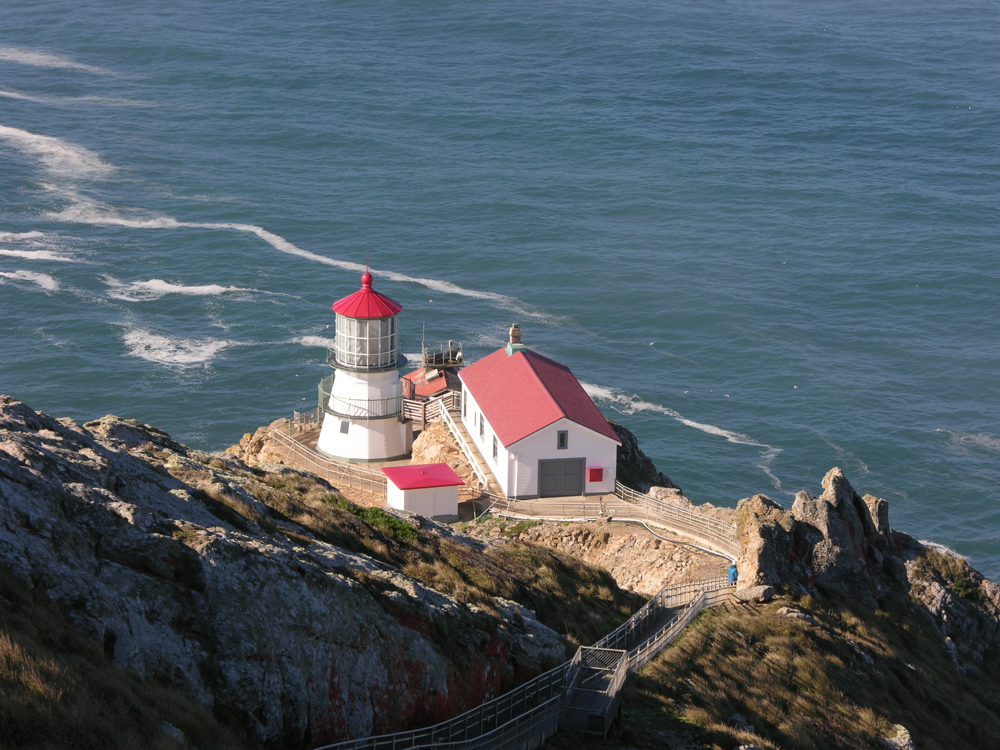
The Point Reyes Headlands jut 10 miles out to sea and pose a threat to ships traveling between San Francisco Bay and locations to the north. The historic Point Reyes Lighthouse was built in 1870 to warn mariners of this navigational hazard and served for 105 years. The Point Reyes Lighthouse was retired from service in 1975 shortly thereafter transferred from the the U.S. Coast Guard to the National Park Service for preservation.
The Point Reyes Lighthouse is a three-story-tall tower. The exterior of the lower two levels of the cast iron tower is painted white with green trim and the walls are angled inward by about 15 degrees. The top level is more cylindrical in shape and is composed of 48 window panes within 16 columns with white-painted metal frames. The lighthouse is capped by a red low-profile conical metal roof. Doors on the northeast side of both of the lower and the middle allow one to enter the tower. Forty feet (12 meters) to the west and about 20 feet (6 feet) below the historic lighthouse is the modern lighthouse. It is roughly square-shaped and is only one story tall, with a red gabled roof. On top of the roof is a small concrete platform on which sit photovoltaic panels. A three-foot-tall post rises from the platforms east end. A small cylindrical light sits atop the post and serves as the current visual aid to navigation. Thirty feet (9 meters) to the northeast of and ten feet (3 meters) above the historic tower is a larger rectangular building with a red gabled roof that houses fog signal equipment and an office. Sixty-five feet (20 meters) to the east of the historic tower is a smaller shed-like structure made out of concrete. Narrow pathways made of concrete connect these structures and lead east to the base of a 3-foot-wide (0.9-meter-wide) concrete stairway that steeply ascends 240 feet (73 meters) in elevation along a narrow rocky ridge. At the top of the stairway is a concrete observation deck. Surrounding the human-made structures is largely windswept, mostly barren rock cliffs and steep slopes. Some areas are covered in sparse vegetation. The Pacific Ocean is 270 feet (82 meters) below the historic lighthouse tower and surrounds the peninsula to the north-northeast, to the north, to the west, and to the south and southeast.
Park at the Randall Trailhead to hike a fairly steep old ranch/fire road that ascends 1.7 miles through Douglas fir and coast redwood forests to the Bolinas Ridge Trail. Pets, bicycles, and horses are permitted on the Randall Trail. The trailhead is located along Highway 1 (aka Shoreline Highway) 6 miles (9.6 km) south of Olema and approximately 15 minutes by car from the Bear Valley Visitor Center.
A sinuous two-lane paved highway runs northwest to southeast along the floor of a valley. The valley is bounded by a forested ridge to the west and a ridge to the east that is partially covered by trees and otherwise covered by cattle-grazed pasture lands. A barbed-wire fence line runs along the east side of the highway. An old dirt and gravel ranch road branches off of the highway and passes through a 10-foot-wide metal gate mounted between two large cylindrical posts whose tops have been cut diagonally. Beyond the gate is a brown sign for the “Randall Trailhead” with icons indicating pets are permitted on leash, no camping, and no fires. Trash and recycling receptacles are located close to the sign. The shoulders along this stretch of the highway are used for parking by hikers and are barren of vegetation. From the west side of the highway, a trail next to a sign for "Olema Valley Trailhead" leads through a dense thicket of willows.
The park's primary visitor center provides an orientation of the park's roads, trails, and human and natural history. The interior exhibit space provides a glimpse of the diverse ecosystems and cultural heritage of the park. Audio-visual programs, shown in the auditorium, are available upon request. Natural history books, cards, and posters are for sale in the bookstore. Beach fire permits may be obtained here.
Located at beautiful Drakes Beach, the Kenneth C. Patrick Visitor Center contains exhibits that focus on maritime exploration in the 1500s, marine fossils, and marine environments. A minke whale skeleton is suspended from the ceiling. Allow 20–30 minutes to view exhibits. Park- and ocean-themed books, guides, and postcards, and maps, along with coffee and packaged snacks are for sale in the PRNSA bookstore adjacent to the Kenneth C. Patrick Visitor Center.
The Lighthouse Visitor Center (LHVC) offers exhibits on the Point Reyes Lighthouse, marine life, & maritime history, as well as a small bookstore. The stairs down to the lighthouse are only open when the LHVC is open and wind speeds remain below 40 mph (64km/h). The Observation Deck at the top of the stairs is open daily from 6 am to ~11:45 pm and offers a great view on a clear day.
Travel from forest to tidepools on this ambitious hike. This trail includes beautiful forest and spectacular coastal hiking with sweeping ocean views, though much of this area was burned in the Woodward Fire that began as lightning strikes in August of 2020. This hike starts at the Bear Valley Trailhead, at the south end of the Bear Valley Parking Lot. Most of this hike's distance is within the Phillip Burton Wilderness.
Hike to Secret Beach and Skylight Cave
Skylight Cave is a sea cave with a collapsed ceiling at the north end of Secret Beach, which is located within the Phillip Burton Wilderness along the eastern shore of Drakes Bay. Even though Skylight Cave is only 2.5 miles (3.8 km) from the closest parking lot at Limantour Beach, it is usually only safe to visit at tides that measure -1 (negative one) foot or lower. The best thing you can do to guarantee a safe, fun visit to Secret Beach and Skylight Cave is to be prepared!
Bike the Bear Valley Trail to the Glen Trail Junction
This wide gravel trail through Douglas fir forest is great for a family cruise, a mellow ride, or the start of a multi-sport adventure! This trail begins at the Bear Valley Trailhead, at the south end of the Bear Valley Parking Lot.
Bike the Estero Trail
This trail through grassland and cattle pastures offers outstanding views of Drakes Estero and Estero de Limantour, and the opportunity to see the birds, bat rays, and leopard sharks that call these ecosystems home. Allow 25 minutes driving time from Bear Valley to the Estero Trailhead.
Bike to Wildcat Campground
Biking to Wildcat Campground is no easy feat—but a lot of work yields a lot of reward! Enjoy your lunch at sunny Wildcat Campground or spend some time at Wildcat Beach after you bike up and over one of the highest points of Inverness Ridge. This ride starts at the Five Brooks Trailhead. Allow 10 minutes drive time from Bear Valley to the Five Brooks.
Bike to Sky Campground
Ride your bike up a moderate incline along this multi-use trail through Douglas fir forest to Sky Campground, where you can enjoy a break with oceans views. Allow ten minutes driving time from Bear Valley to the Sky Trailhead, which is located along Limantour Road.
Hike to Alamere Falls
Alamere Falls is an incredible sight, as water cascades over a 40 foot cliff onto a beautiful sandy beach below. Getting there is no easy trek—a 13 mile minimum roundtrip hike is required, parking fills up early and you must time your visit to the falls with low tide. The best thing you can do to guarantee a safe, fun visit to the falls is to be prepared! Allow 10 minutes drive time from Bear Valley to the Five Brooks Trailhead and 35 minutes to the Palomarin Trailhead.
Hike to the Site of the Y Ranch
Meander along a creek through Douglas fir forest to arrive at a beautiful stretch of coastline deep within the Phillip Burton Wilderness. This trail begins at the Bear Valley Trailhead, at the south end of the Bear Valley Parking Lot.
Hike the Rift Zone Trail
Explore the floor of a valley that follows the San Andreas Fault, passing through meadows and woods between Bear Valley and Five Brooks. This hike can begin at either the Bear Valley Trailhead or the Five Brooks Trailhead. Allow about 10 minutes to drive from Bear Valley to Five Brooks.
Ride a Horse on the Rift Zone Trail
Ride your horse along the northern floor of a valley that follows the San Andreas Fault, passing through meadows and woods between Bear Valley and Five Brooks. This ride can begin at either the Bear Valley Trailhead or the Five Brooks Trailhead. Allow about 10 minutes to drive from Bear Valley to Five Brooks.
Hike to Miller Point
Meander along a creek through Douglas fir forest to arrive at a beautiful stretch of coastline deep within the Phillip Burton Wilderness. This trail begins at the Bear Valley Trailhead, at the south end of the Bear Valley Parking Lot.
Hike to Sculptured Beach
An easy to moderate walk on the beach or through coastal scrub and grassland offers some breath-taking ocean views and leads to a rocky shoreline where one can look for intertidal organisms when the tide is very low. Allow 15 to 20 minutes driving time from Bear Valley to the closest trailheads to Sculptured Beach.
Tidepooling at Point Reyes National Seashore
Only when waters recede at a low tide does the intertidal zone reveal its majesty to the careful explorer. This is a realm inhabited by magnificent creatures that look as if they came from another time and world. The best tidepools at Point Reyes are found at Sculptured Beach, near Coast Camp. Duxbury Reef near Agate Beach County Park in Bolinas, outside of park boundaries, is another good place to tidepool.
Whale Watching at Point Reyes National Seashore
Get closer to migrating whales than most other places on the California coast!
Walk the Woodpecker Nature Trail
The Woodpecker Nature Trail is a loop trail that explores the beautiful local forest and meadow ecosystems of Bear Valley. An interpretive trail guide describing some of the plants and animals you may see can be obtained at the trailhead or at the Bear Valley Visitor Center. This trail begins at the Bear Valley Trailhead, at the south end of the Bear Valley Parking Lot.
Hike the Laguna-Coast Loop
This moderate hike through coastal scrub and grasslands offers some breath-taking ocean views and a couple locations to descend to a beach. Allow 15 minutes driving time from Bear Valley to the Laguna Trailhead.
Fishing at Point Reyes
Fish on! Point Reyes National Seashore allows fishing as a means of providing for public enjoyment, and customary and traditional use, and regulates fishing to ensure that it is managed in a manner that avoids unacceptable impacts to park resources.
Kayak Drakes Estero and Estero de Limantour
Kayaking or canoeing Drakes Estero and Estero de Limantour offers an intimate marine wilderness experience unlike any other. Kayaking and canoeing is permitted in Drakes Estero and Estero de Limantour from July 1 through February 28; closed March 1 through June 30.
Backcountry Camping at Point Reyes National Seashore
Point Reyes National Seashore offers year-round backcountry camping along Drakes Bay and among the hills and valleys of the Phillip Burton Wilderness. Backcountry camping is allowed in one of four established campgrounds at Point Reyes National Seashore. The backcountry sites may only be accessed by hiking, riding bicycles, or riding a horse to the campgrounds. Backcountry camping permits are required and may be reserved online at Recreation.gov up to three months in advance.
Boat-in Camping at Point Reyes National Seashore
Point Reyes National Seashore offers year-round boat-in camping on the west shore of Tomales Bay. There is a fee and permit system for overnight camping within Point Reyes National Seashore. Reservations may be made online at Recreation.gov up to three months in advance.
Swimming at Point Reyes
What comes to mind when you think about the beach? Surf, sand, and swimming are a few words associated with a day at the beach. However, swimming is not recommended at most of the beaches in Point Reyes! Learn where to and where NOT to swim at Point Reyes.
Walk the Elephant Seal Overlook Trail
Follow the short Elephant Seal Overlook Trail to a viewpoint from which elephant seals are usually visible. Allow 45 minutes driving time from Bear Valley to the Chimney Rock Parking Lot.
Hike the Marshall Beach Trail
Marshall Beach is a 400-foot-long (366-meter-long) beach on the west side of Tomales Bay in the northern part of the national seashore that may be reached via the via the 1.2-mile-long (1.9-kilometer-long) Marshall Beach Trail. Allow 25 minutes driving time from Bear Valley to the Marshall Beach Trailhead.
Hike to Mount Wittenberg from Bear Valley
The hikes described on this page start at the Bear Valley Trailhead and feature steep 400 meter (1300 feet) climbs to Mount Wittenberg, the highest point on the Point Reyes Peninsula at 1407 feet (426 meters) in elevation. A few limited views of the ocean and Olema Valley may be enjoyed near the ridge crest. These routes pass through a dense mixed Douglas fir and oak forest and a few open meadows. These routes are also mostly within the Phillip Burton Wilderness.
Hike to Divide Meadow
Stroll through a forest of towering Douglas fir trees and along a shaded creek on this family-friendly hike to Divide Meadow. This hike begins at the Bear Valley Trailhead, at the south end of the Bear Valley Parking Lot.
Hike the Abbotts Lagoon Trail to the Ocean
Take an easy hike that will lead you past a unique coastal lagoon bordered by sand dunes to the Pacific Ocean. This hike offers great opportunities for viewing birds and wildflowers. Allow 20 to 25 minutes driving time from Bear Valley to the Abbotts Lagoon Trailhead.
Tule Elk Viewing At Point Reyes National Seashore
Locations and suggestions for spotting the herds of tule elk that call Point Reyes home.
Hike the Sky–Woodward Valley–Fire Lane Loop
Descend from forested Inverness ridge through coastal scrub to the coast. However, it's a steep return through the forest back to the trailhead. Most of this hike is within the Phillip Burton Wilderness and much of this area was burned in the Woodward Fire, which was ignited by lightning strikes in August of 2020. Allow ten minutes driving time from Bear Valley to the Sky Trailhead, which is located along Limantour Road.
Hike to Mount Wittenberg from the Sky Trailhead
This hike provides the easiest route to Mount Wittenberg, the highest point on the Point Reyes Peninsula at 1407 feet (426 meters) in elevation. Allow ten minutes driving time from Bear Valley to the Sky Trailhead, which is located along Limantour Road.
Hike to Bass Lake
Bass Lake is a great destination for a moderate day hike, or a beautiful pit stop on the way to Wildcat Beach. This hike is mostly within the Phillip Burton Wilderness. Please practice Leave No Trace principles. Allow 35 minutes driving time from Bear Valley to the Palomarin Trailhead.
Hike to Wildcat Beach
Wildcat Beach is a 2.9-mile-long (4.7-kilometer-long) beach deep within the Phillip Burton Wilderness in the southern part of Point Reyes National Seashore. Many routes may be followed that lead Wildcat Beach. Walk along coastal ocean bluffs, through forested valleys, or up and over Inverness Ridge to arrive at this spectacular beach. Allow 10 minutes drive time from Bear Valley to the Five Brooks Trailhead and 35 minutes to the Palomarin Trailhead.
Hike the Tomales Point Trail to Windy Gap
Take a short walk along the ridge crest of Tomales Point to a location from which tule elk are frequently seen. Allow 35 minutes driving time from Bear Valley to the Tomales Point Trailhead, located at the north end of Pierce Point Road.
Hike the Tomales Point Trail
Ramble along the crest of an open ridge that offers spectacular views of tule elk, Tomales Bay, and the Pacific Ocean. Allow 35 minutes driving time from Bear Valley to the Tomales Point Trailhead, located at the north end of Pierce Point Road.
Bike to Coast Campground
Ride your bike on this multi-use trail, through alder forests and grasslands, to beautiful coastal bluffs with ocean views. Allow 15 minutes driving time from Bear Valley to the Coast Trailhead.
Bike the Bolinas Ridge Trail
Enjoy open, grassy hillsides, redwood forests, decent climbs, and bumpy downhills on this multi-use trail. This trail begins at either at the Bolinas Ridge Trailhead along Sir Francis Drake Boulevard or at the trail's southern end at the Fairfax-Bolinas Road's junction with the West Ridgecrest Road. Allow about 5 minutes to drive from Bear Valley to the trail's northern trailhead. Allow about 30 minutes to drive from Bear Valley to the trail's southern trailhead.
Hike the Estero Trail to Home Bay
This trail through grassland and an abandoned Christmas tree farm to the head of Home Bay offers the opportunity to see the birds, bat rays, and leopard sharks that call these habitats home. Allow 25 minutes driving time from Bear Valley to the Estero Trailhead.
Birding at Point Reyes National Seashore
Point Reyes National Seashore offers some of the finest birding in the United States. About 54% of all North American bird species have been observed in Point Reyes National Seashore. Learn about where to look for birds and what kinds of birds you might find at the seashore.
Become a Point Reyes Junior Ranger!
Do you care about exploring, learning about, and protecting Point Reyes National Seashore? If so, become a Junior Ranger!
Hike the Rift Zone Trail to the Vedanta Society Retreat Access Road
Explore a section of the floor of a valley that follows the San Andreas Fault, passing through meadows and woods. This trail begins at the Bear Valley Trailhead, at the south end of the Bear Valley Parking Lot.
Horse Riding in Point Reyes National Seashore
Where to go and what to know before exploring Point Reyes from the saddle!
Walk the Kule Loklo Trail
A short path leads up to a replica of a Coast Miwok Indian village. Interpretive signs briefly describe Coast Miwok culture and history and the structures in the village. This trail begins at the north end of the Bear Valley parking lot.
Hike the McClures Beach Trail
A rugged trail descends moderately steeply down a ravine to the ocean. McClures Beach is contained within a beautiful cove backed by rocky cliffs, but watch out for tidal fluctuations and dangerous surf. Allow 35 minutes driving time from Bear Valley to the McClures Beach Trailhead, located at the end of the Pierce Point Road, below Pierce Point Ranch to the west.
Hike the Chimney Rock Trail
Enjoy spectacular views of Drakes Bay, the Pacific, and, in spring, wildflowers along this open coastal walk. From January through May, look for migratory whales from the point. Allow 45 minutes driving time from Bear Valley to the Chimney Rock Trailhead.
Hike the Abbotts Lagoon Trail to the Footbridge
Take an easy hike that will lead you to a unique coastal lagoon bordered by sand dunes that offers great opportunities for viewing birds and wildflowers. Allow 20 to 25 minutes driving time from Bear Valley to the Abbotts Lagoon Trailhead.
Hike the Kehoe Beach Trail
Follow this relatively flat trail from Pierce Point Road along the northern edge of Kehoe Marsh and out to Kehoe Beach. This beach is at the north end of the eleven-mile long Point Reyes Beach. Pets are permitted year-round on the Kehoe Beach Trail and on the beach to the north of the trail (e.g., to the right if you are facing the ocean). Pets must be on a six-foot or shorter leash at all times. Allow 25–30 minutes driving time from Bear Valley to the Kehoe Beach Trailhead.
Elephant Seal Viewing
Northern elephant seals make semi-annual visits to the beaches of Point Reyes—in winter for pupping and mating, and in spring and summer for molting. Find out where to observe them at Point Reyes National Seashore.
Walk the Cross Marin Trail
The up-to-10.6-miles- roundtrip Cross Marin Trail is a relatively flat, easy trail that follows the historic North Pacific Coast Railroad right-of-way paralleling Lagunitas Creek. Pets are permitted on the Cross Marin Trail and must be on a six-foot or shorter leash at all times. Allow about 5 minutes to drive from Bear Valley to the trail's northern trailhead.
Hike the Bolinas Ridge Trail
Admire redwood forests and expansive views of the Olema Valley on this dog-friendly, multi-use trail. This up-to-11-mile-long trail begins at either at the Bolinas Ridge Trailhead along Sir Francis Drake Boulevard or at the trail's southern end at the Fairfax-Bolinas Road's junction with the West Ridgecrest Rd. Allow about 5 minutes to drive from Bear Valley to the trail's northern trailhead. Allow about 30 minutes to drive from Bear Valley to the trail's southern trailhead.
Hike the Estero–Glenbrook–Muddy Hollow Road Loop
This loop hike passes through young woodlands, coastal scrub, and grassland within the Phillip Burton Wilderness. It offers views of Estero de Limantour and the possibility of seeing tule elk and other wildlife that call this area home. It is also a great hike for spring wildflowers. Allow 15 minutes driving time from Bear Valley to the Muddy Hollow Trailhead.
Walk the Earthquake Trail
Discover the geology of the San Andreas Fault on this paved loop nature trail. A fence that was constructed half way around the trail illustrates the 16 feet (3 meters) of displacement that occurred during the infamous 1906 earthquake. The Earthquake Trail begins and ends at the northeast corner of the Bear Valley Trailhead parking lot adjacent to the restrooms for the Bear Valley Picnic Area.
Tours
Count: 3
Become a Woodward Fire Trekker!
Help us monitor the recovery of Point Reyes National Seashore following 2020's Woodward Fire. Hike to one or all five monitoring sites across the park where you'll find signs instructing you on where to snap a photo. Once you email it to the listed address, you'll receive a message back with information about fire ecology and your photo included in a timelapse showing how the area has changed over time! Stop into the Bear Valley Visitor Center before heading out to pick up a trail map and plan your route.
Saving Lives at the Seashore
The treacherous currents and offshore rocks here have foundered many ships. In addition, Point Reyes is one of the windiest and foggiest places on the Pacific Coast. From shipwrecks to lighthouse and harrowing tales of heroism, discover the rich maritime history of the Point Reyes area on this tour. Internet and cell service are limited; downloading the app prior to your arrival is recommended.
Tomales Point
Visit Tomales Point to learn about the history of a dairy ranch that was established in the 1850s, to view tule elk, to relax at an isolated and beautiful beach, and/or to take a hike through the Phillip Burton Wilderness to the northern end of Point Reyes National Seashore.