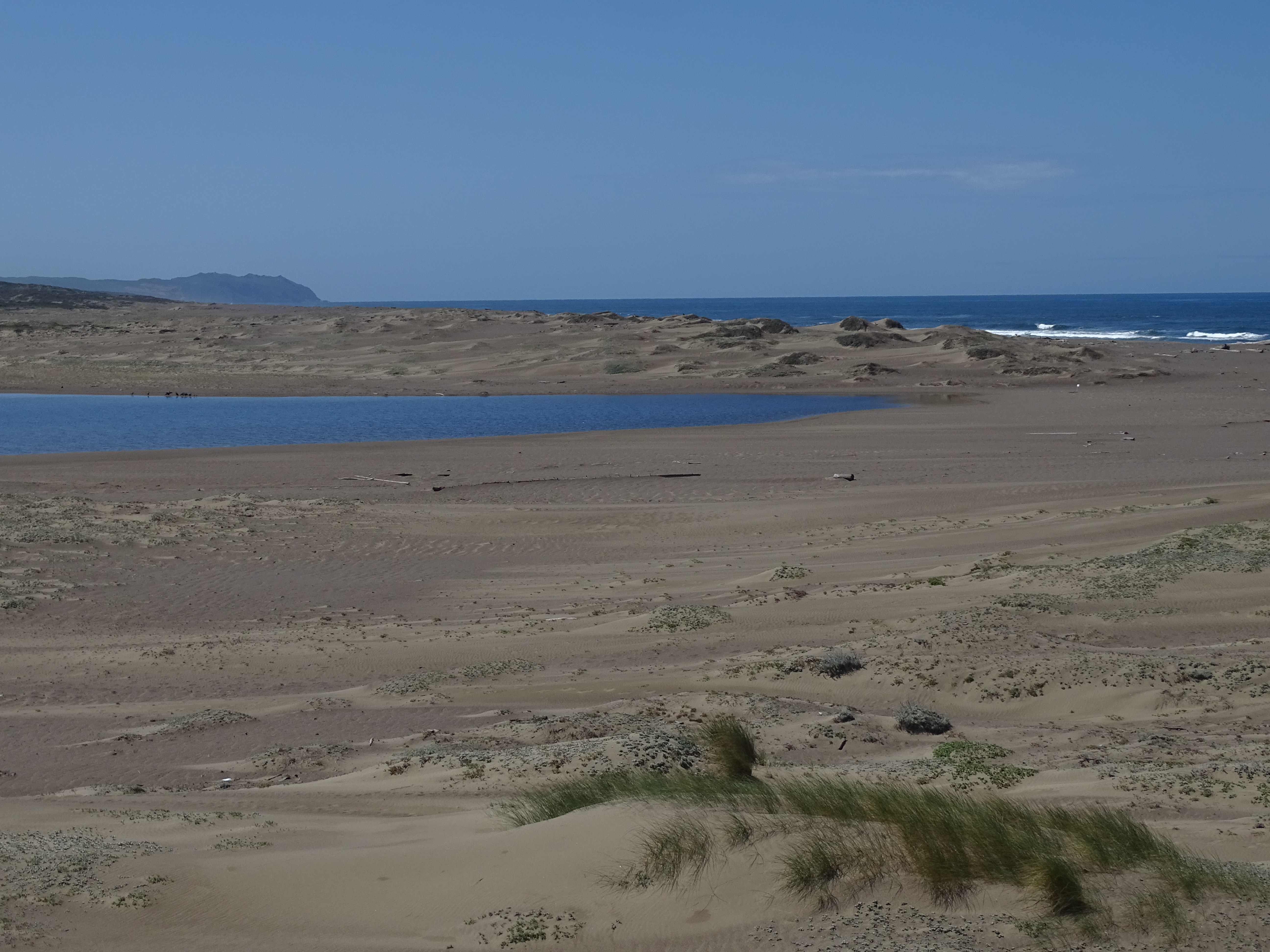
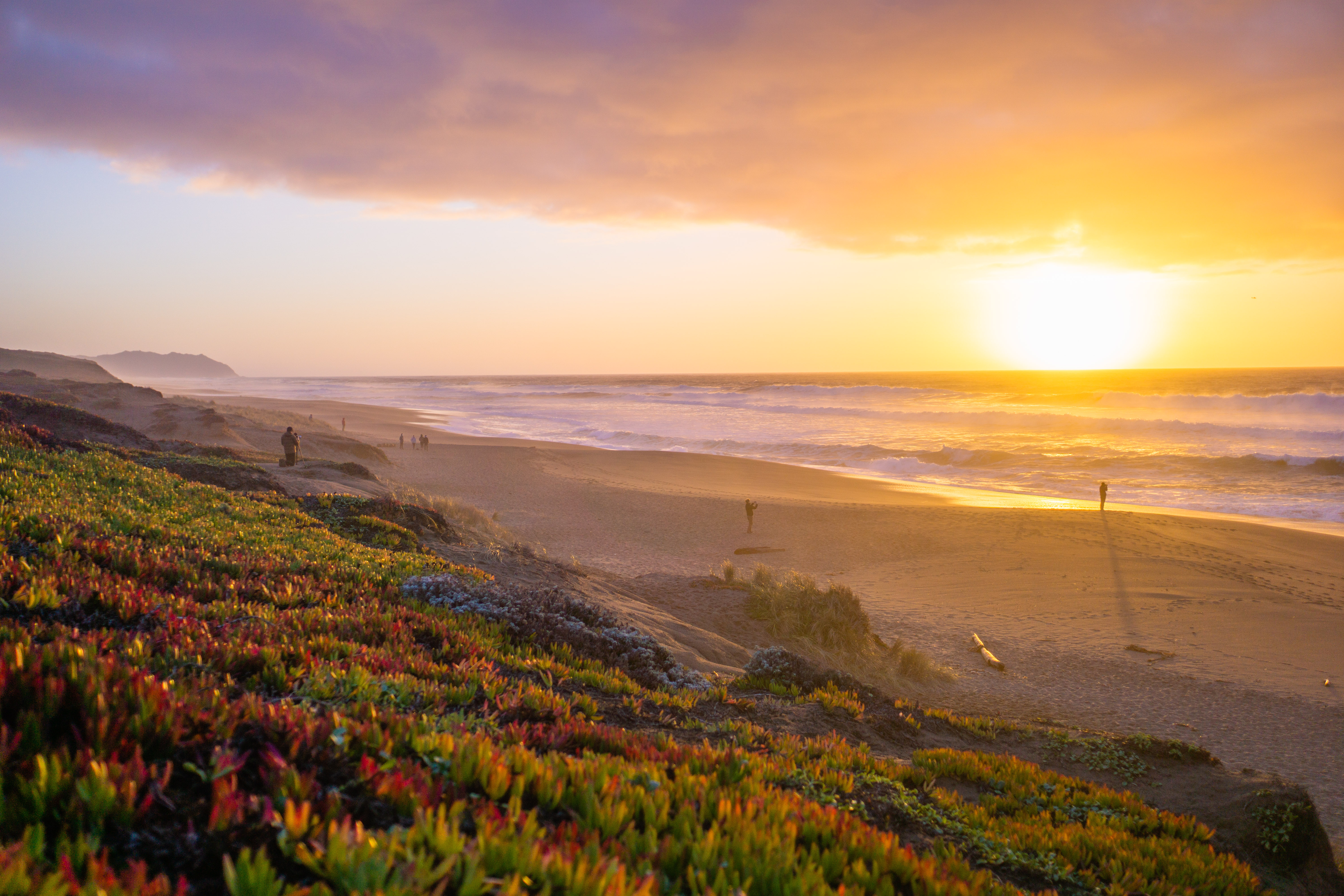
A 2.5-kilometer (1.5-mile) walk through coastal scrub, across a footbridge over a stream between two lagoons, and over sand dunes brings you to this ocean beach. The lagoons attract large numbers of migrating shorebirds in the fall, followed by the wintering ducks. Never turn your back to the ocean. Due to the frequently large surf, this is not a beach at which it is safe to play close to the water's edge, much less to go for a swim.
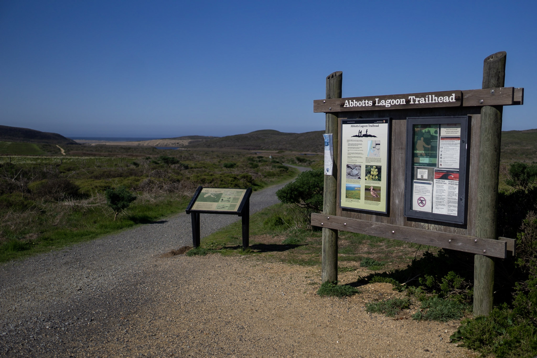
The Abbotts Lagoon Trail is known for fantastic birding opportunities (particularly in the fall and winter), and beautiful wildflowers in the spring. The Abbotts Lagoon Trailhead is located along Pierce Point Road approximately 20 minutes by car from the Bear Valley Visitor Center.
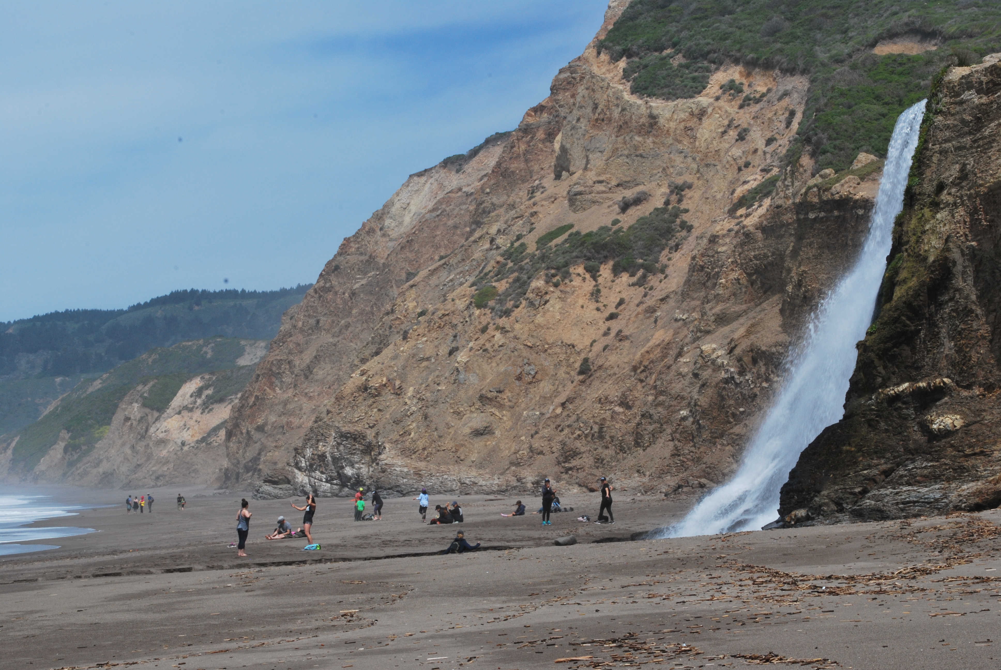
Alamere Falls is a beautiful waterfall deep within the Phillip Burton Wilderness. The falls are a dramatic sight as water cascades over a ~30 foot tall cliff onto the south end of Wildcat Beach. While no easy trek—a 13-mile (20 km) minimum round-trip hike is required—this spectacular spot is a popular—and a sometimes overcrowded—visitor draw. Take note: it is also the site of multiple search-and-rescue operations each year.
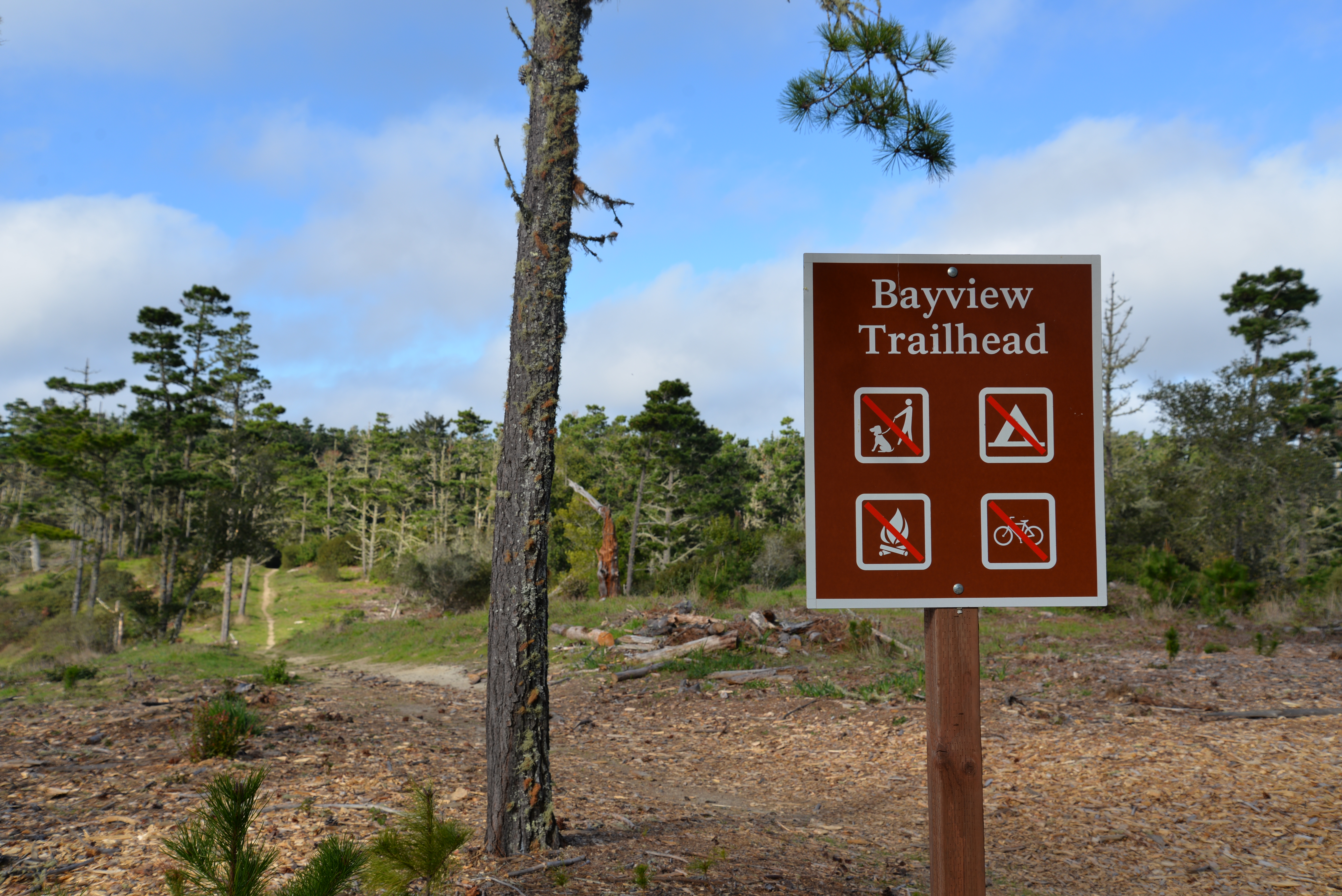
Multiple trail options begin at the Bayview Trailhead, leading either down to the coast, along the Inverness Ridge, or through the Phillip Burton Wilderness. The Vision Fire burned through this area in October 1995. The trailhead is located along Limantour Road, approximately 10 minutes by car from the Bear Valley Visitor Center.
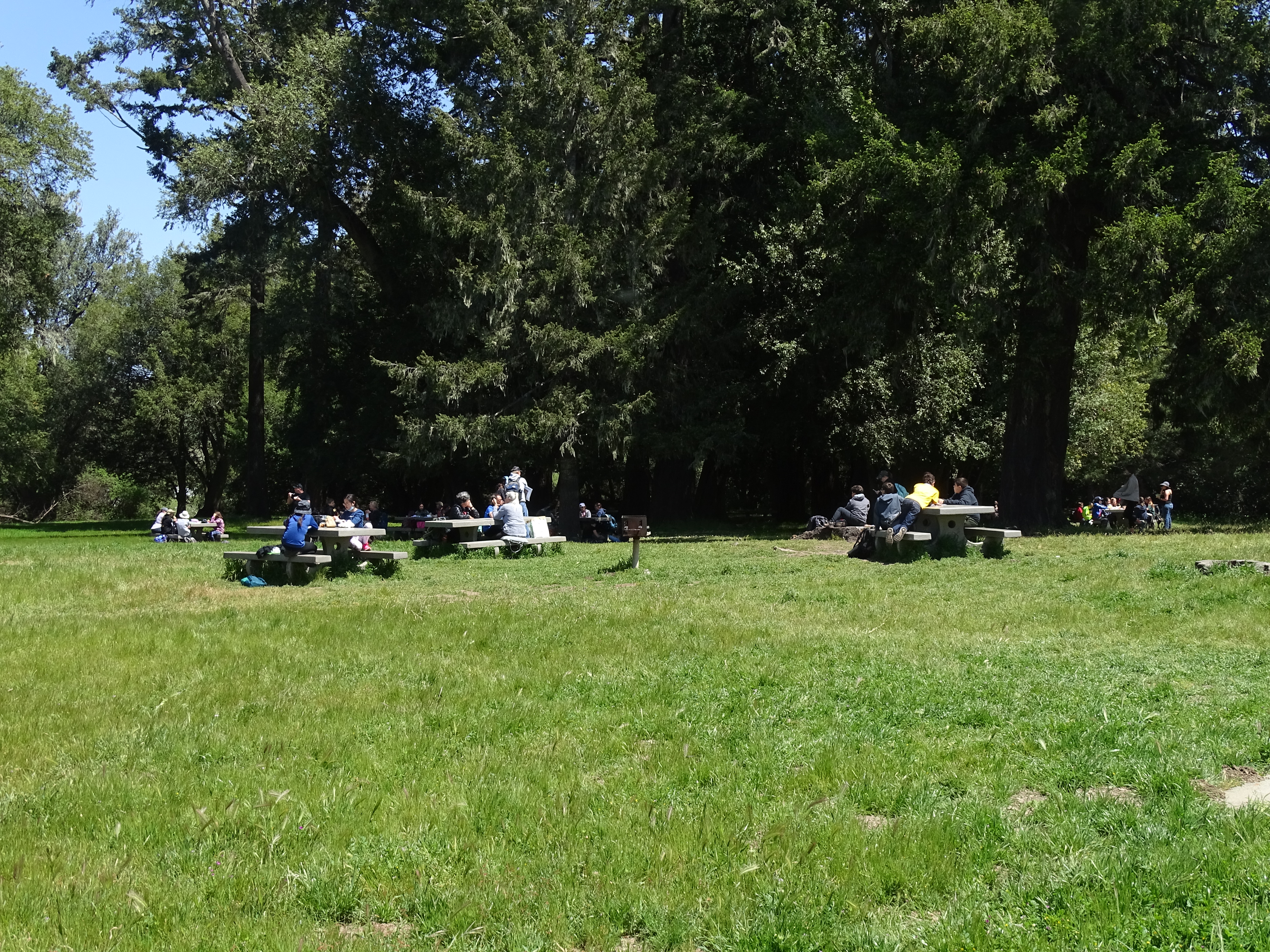
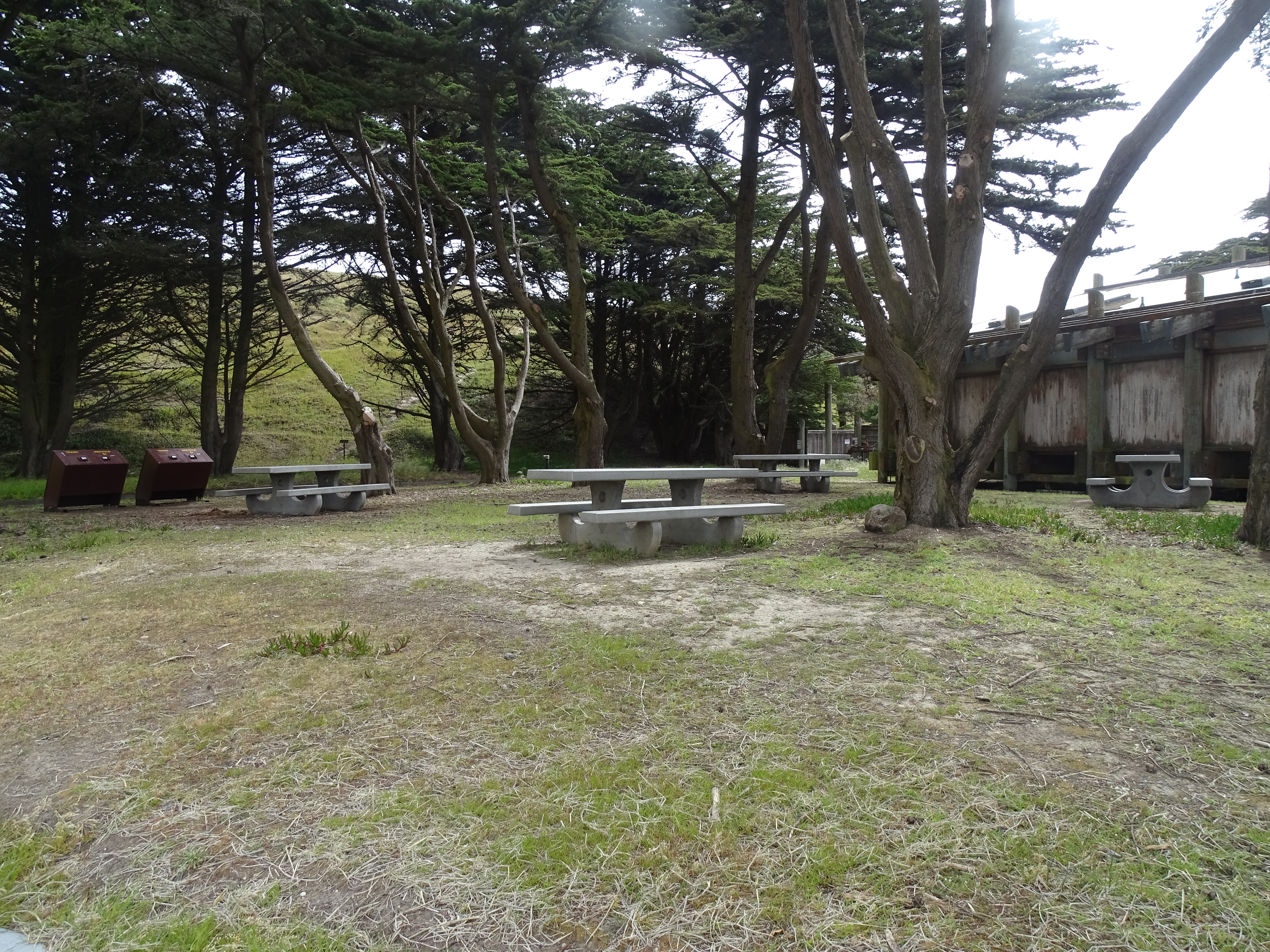
Point Reyes National Seashore's largest picnic area is located at Bear Valley, across the access road from the Bear Valley Visitor Center. Tall Douglas fir and California bay laurel trees provide shade at some of picnic tables.
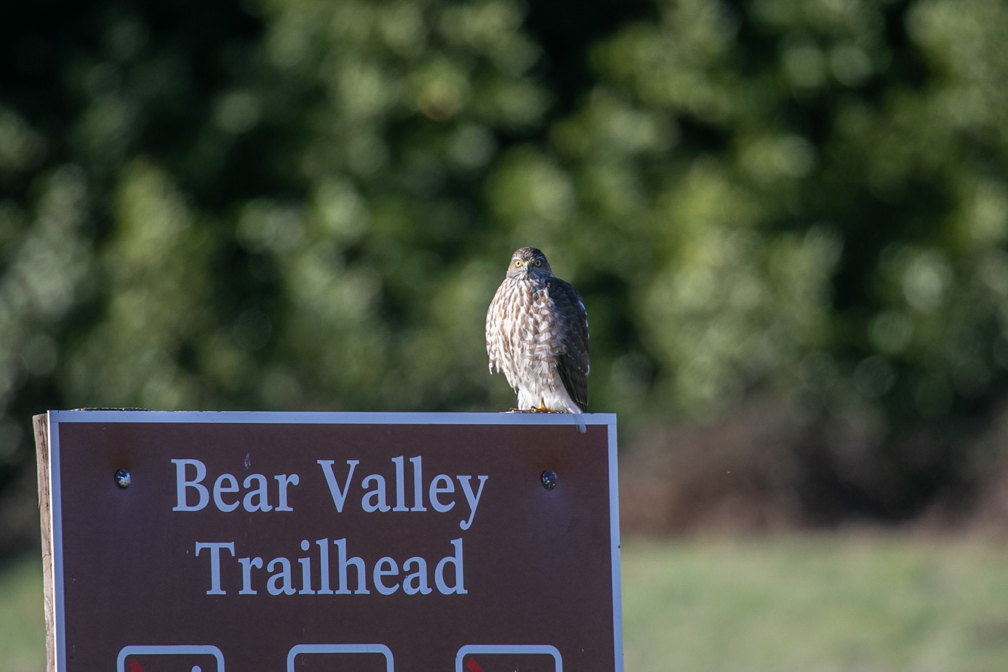
The Bear Valley Trailhead is a popular place to start a hiking or biking adventure in Point Reyes National Seashore. The Bear Valley, Rift Zone, Morgan, and Woodpecker trails all depart from the Bear Valley Trailhead and connect with many other trails, offering dozens of possible routes. Many of these routes pass through the Phillip Burton Wilderness. This trailhead is about an hour by car from San Francisco, the East Bay, and Santa Rosa, and about two hours from Sacramento.
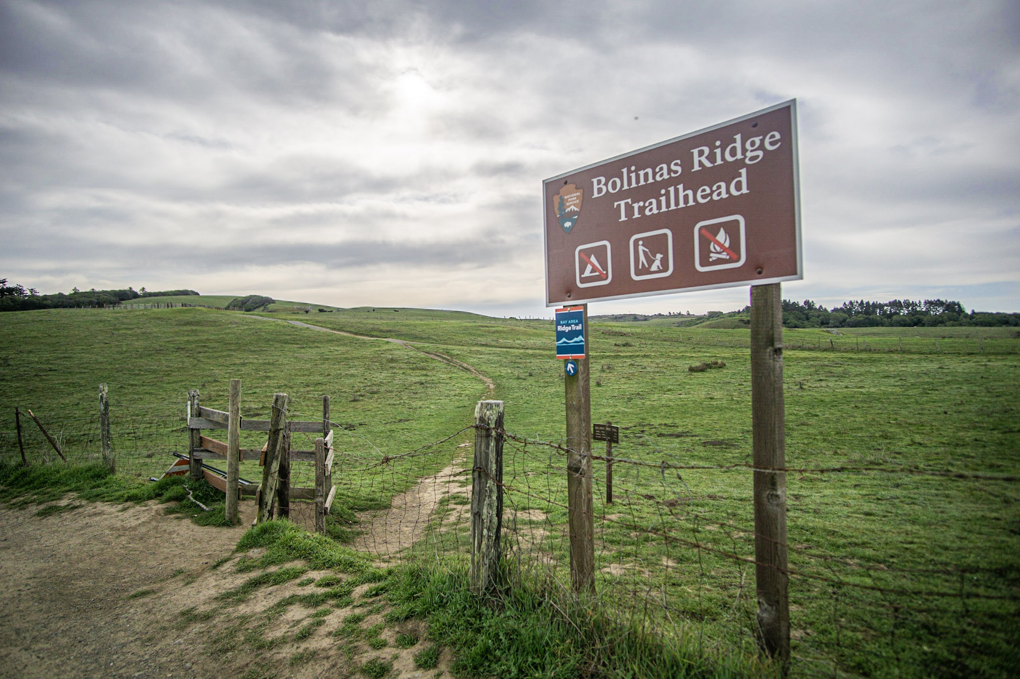
The Bolinas Ridge Trailhead is the northern end of the multi-use, dog-friendly 11-mile-long (17-km-long) Bolinas Ridge Trail. The Bolinas Ridge Trailhead parking lot is located along Sir Francis Drake Boulevard 1.1 miles (1.7 km) east of Olema and approximately 5 minutes by car from the Bear Valley Visitor Center.
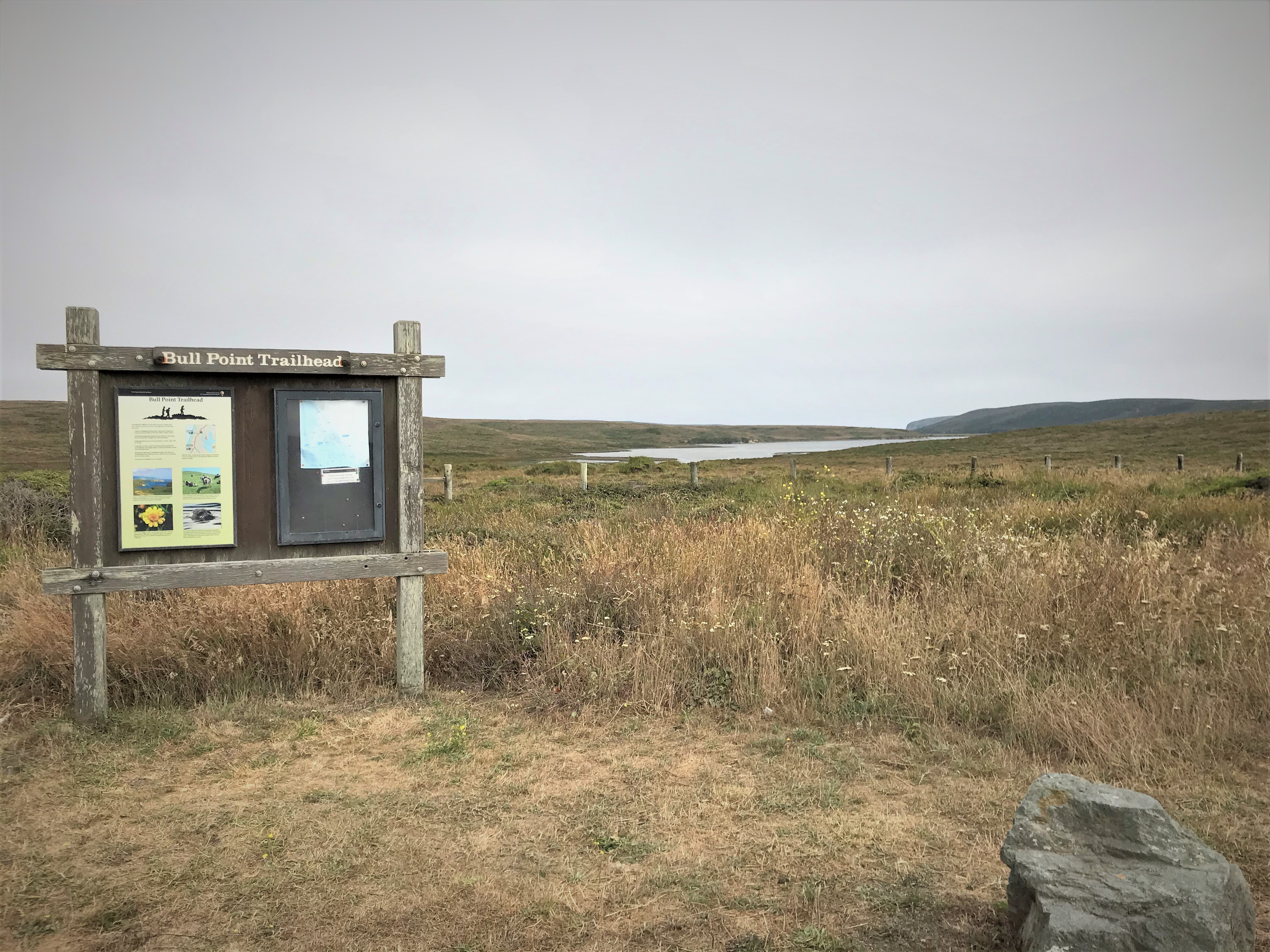
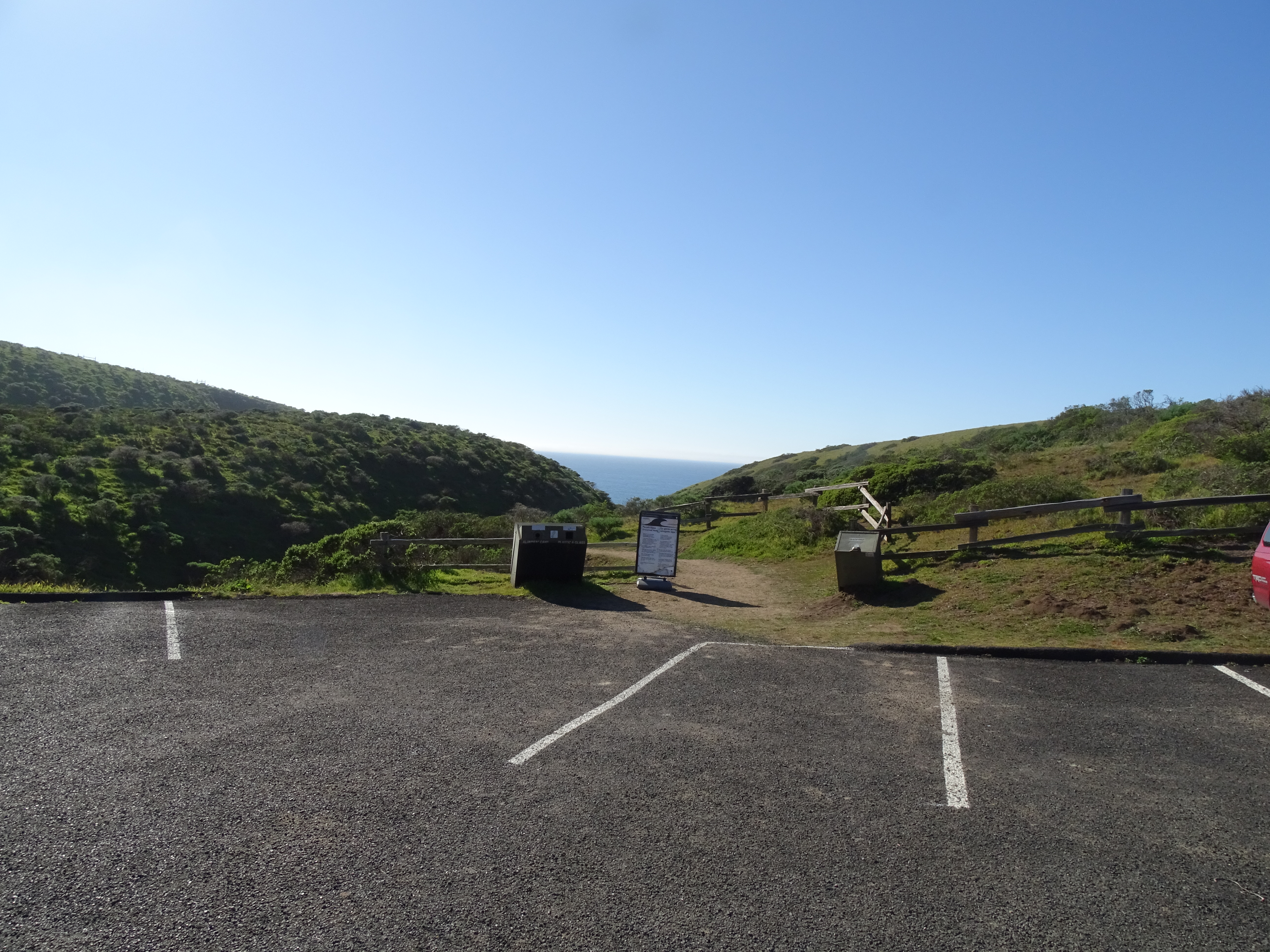
This trailhead offers access to a flat and easy 1.8-mile-long (2.9-km-long) trail that leads towards the picturesque edge of Drakes Estero, where many water birds can be seen. This is also a popular trail for those looking for uncommon native plants. The Bull Point Trailhead is located on the left side of Sir Francis Drake Boulevard as you drive towards North Beach, approximately 25 minutes by car from the Bear Valley Visitor Center.
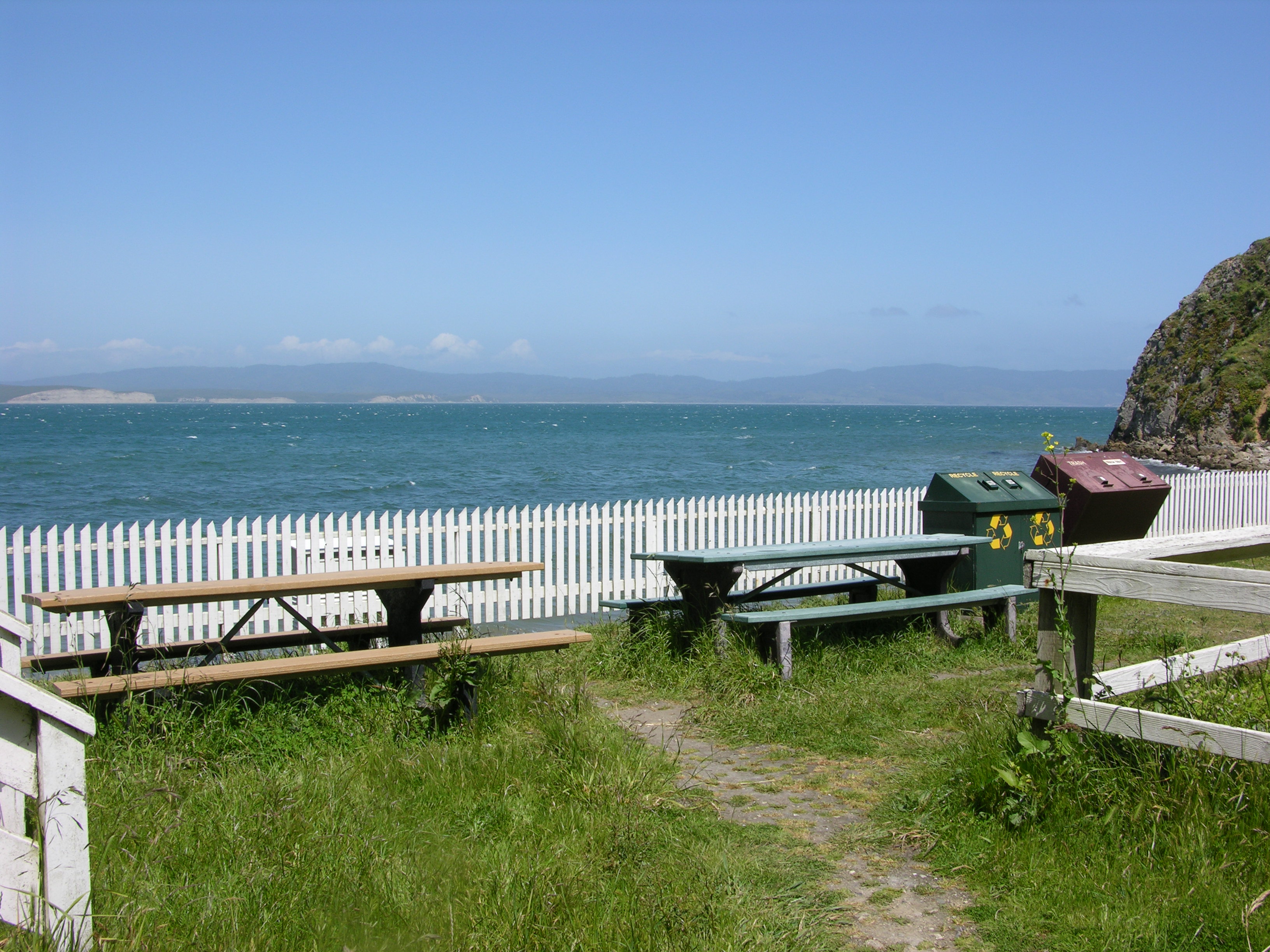
Two picnic table are located along the southeast side of the boathouse at the Historic Point Reyes Lifeboat Station at Chimney Rock. The Chimney Rock parking lot is approximately 45 minutes by car from the Bear Valley Visitor Center. The boathouse is approximately 10 minutes by foot from the parking lot.
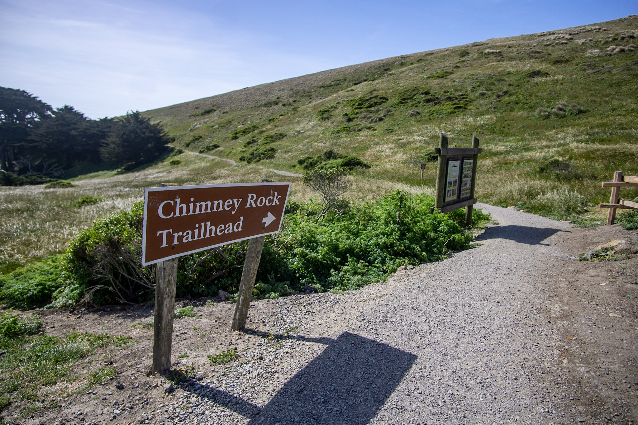
Park at the Chimney Rock Trailhead to hike the Chimney Rock Trail, walk to the Elephant Seal Overlook, or visit the historic Point Reyes Lifeboat Station. The Chimney Rock Trail offers panoramic views of Drakes Bay and the Pacific Ocean. The Chimney Rock Trailhead is located at the east end of Chimney Rock Road, approximately 45 minutes by car from the Bear Valley Visitor Center.
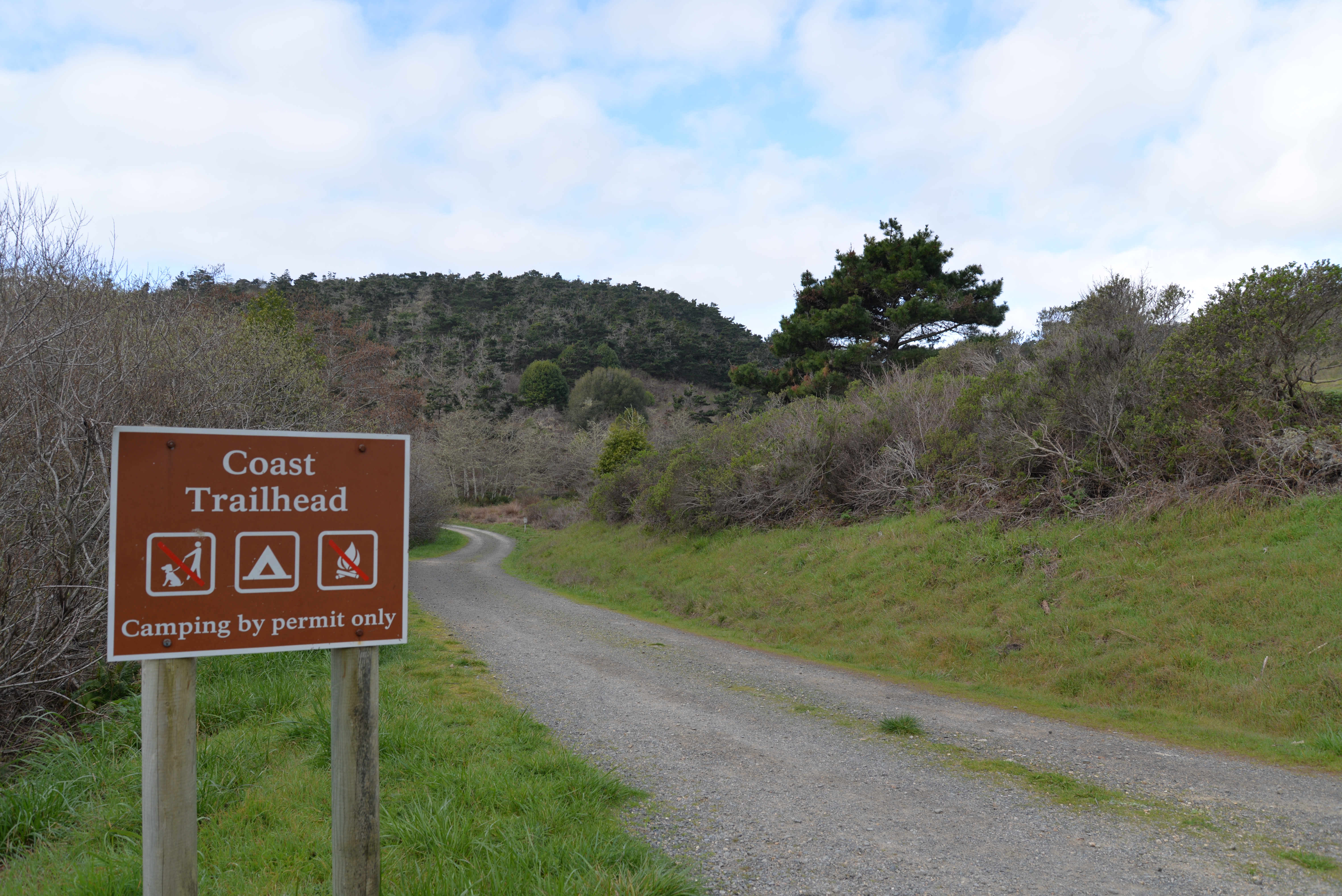
The Coast trailhead is a popular place to start an easy hike, bike, or horseback ride to the beach. It meanders through creek-side habitat before going by wetlands as you approach the ocean. The trailhead is located along Laguna Road, approximately 15 minutes by car from the Bear Valley Visitor Center.
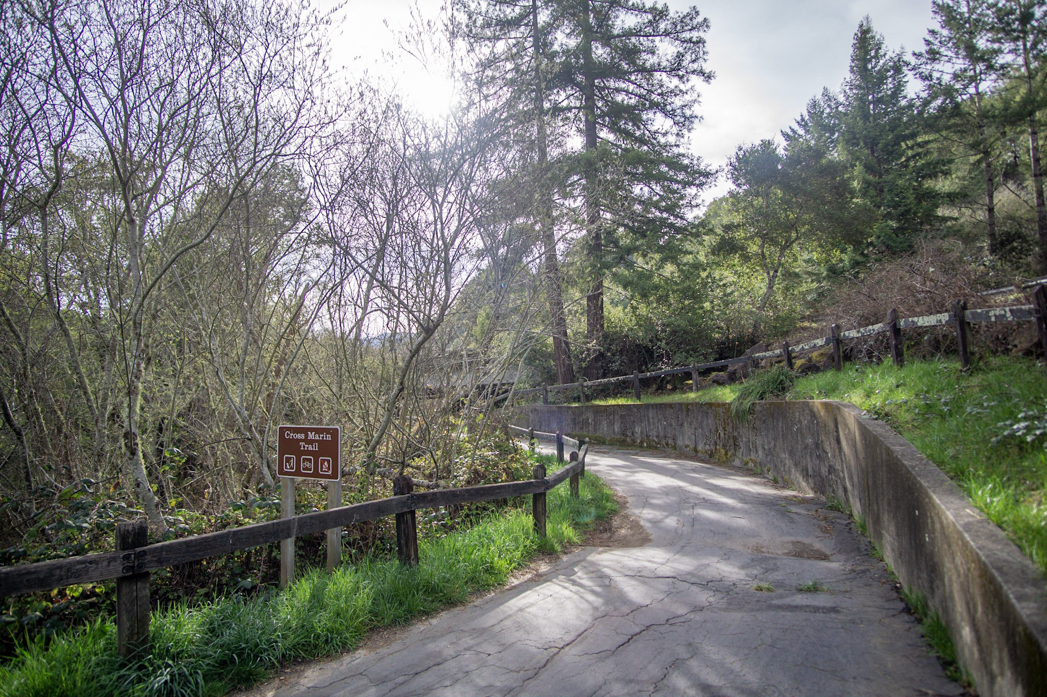
The Cross Marin Trailhead is at the northern end of the multi-use, dog-friendly 5.3-mile-long (8.5-km-long) Cross Marin Trail. The Cross Marin Trailhead is located at the northwest corner of the intersection of Sir Francis Drake Blvd. and Platform Bridge Rd., 1.8 miles (2.9 km) east of Olema. The Cross Marin Trail follows the historic North Pacific Coast Railroad right-of-way as it parallels Lagunitas Creek, resulting in a trail that has relatively little change in elevation.
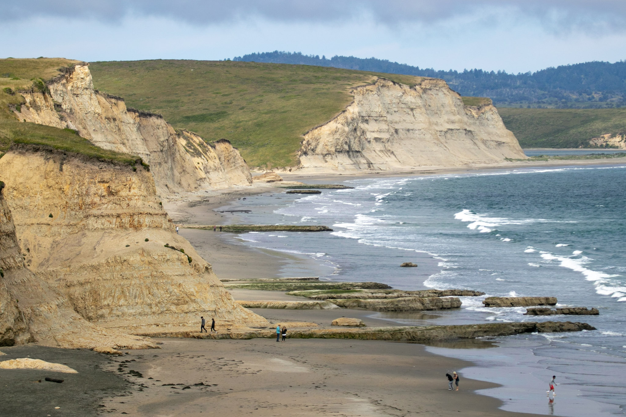
Drakes Beach is one of four beaches at Point Reyes National Seashore to which one can drive. A seasonally wide stretch of beach backed by dramatic white sandstone cliffs makes Drakes Beach a very popular place. A bookstore and a visitor center add to its appeal. The sands of the Drakes Bay cliffs were deposited in a shallow sea 10–13 million years ago, compacted, then uplifted. Erosion has revealed the striations of this story in the cliff faces.
A seasonally wide stretch of beach backed by dramatic sandstone cliffs makes Drakes Beach a very popular place, especially among families. The majority of the picnic tables at Drakes Beach are located along the northern edge of the parking lot. A couple picnic tables are located between the beach and the Kenneth C. Patrick Visitor Center. Drakes Beach is approximately 30 minutes by car from the Bear Valley Visitor Center.
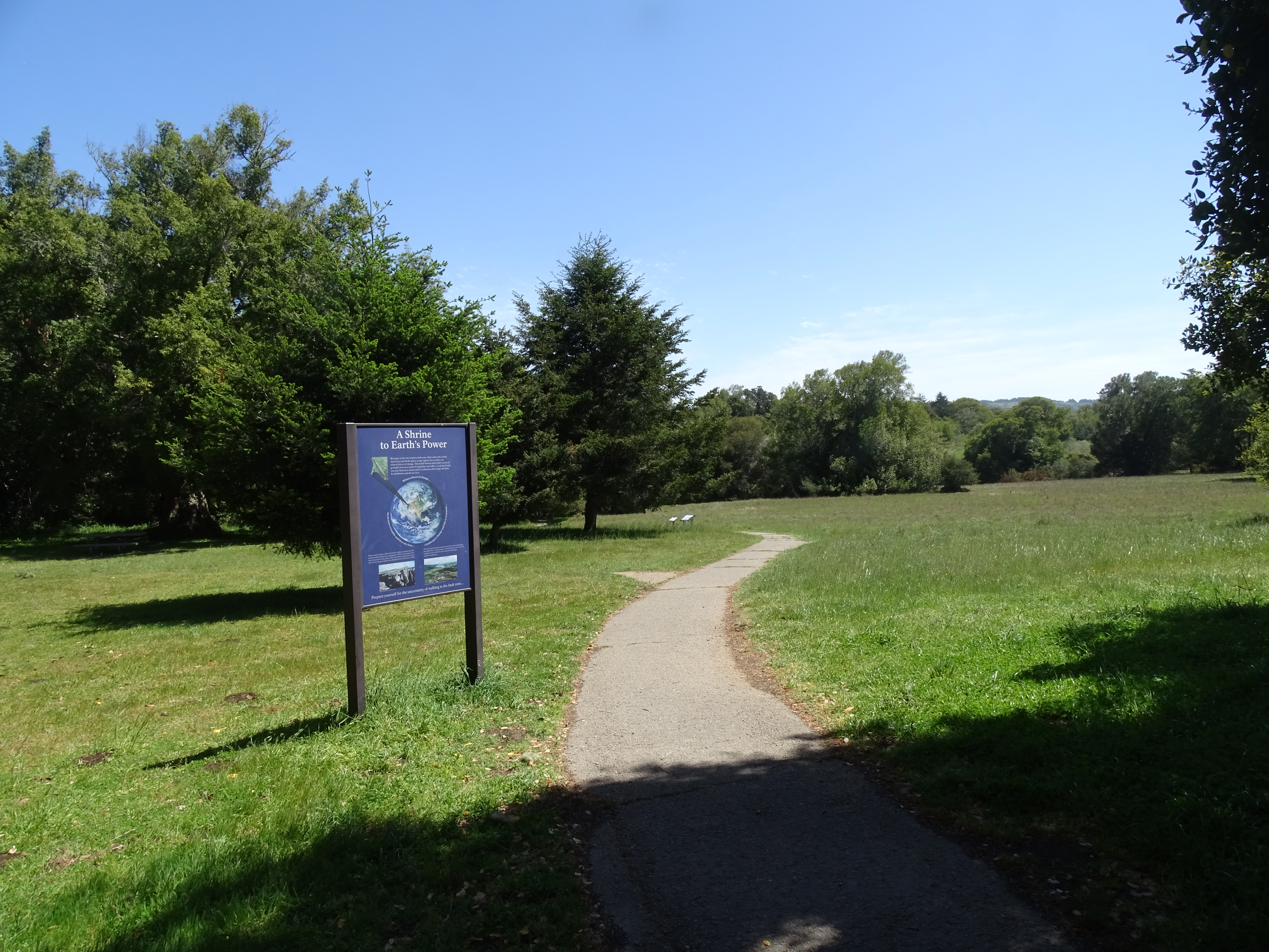
The Earthquake Trailhead is located at the northeast end of the Bear Valley Trailhead parking lot. The Earthquake Trail is a 0.6-mile-long (1-kilometer-long) nature trail with exhibits about the San Andreas Fault Zone and the 1906 San Francisco Earthquake.
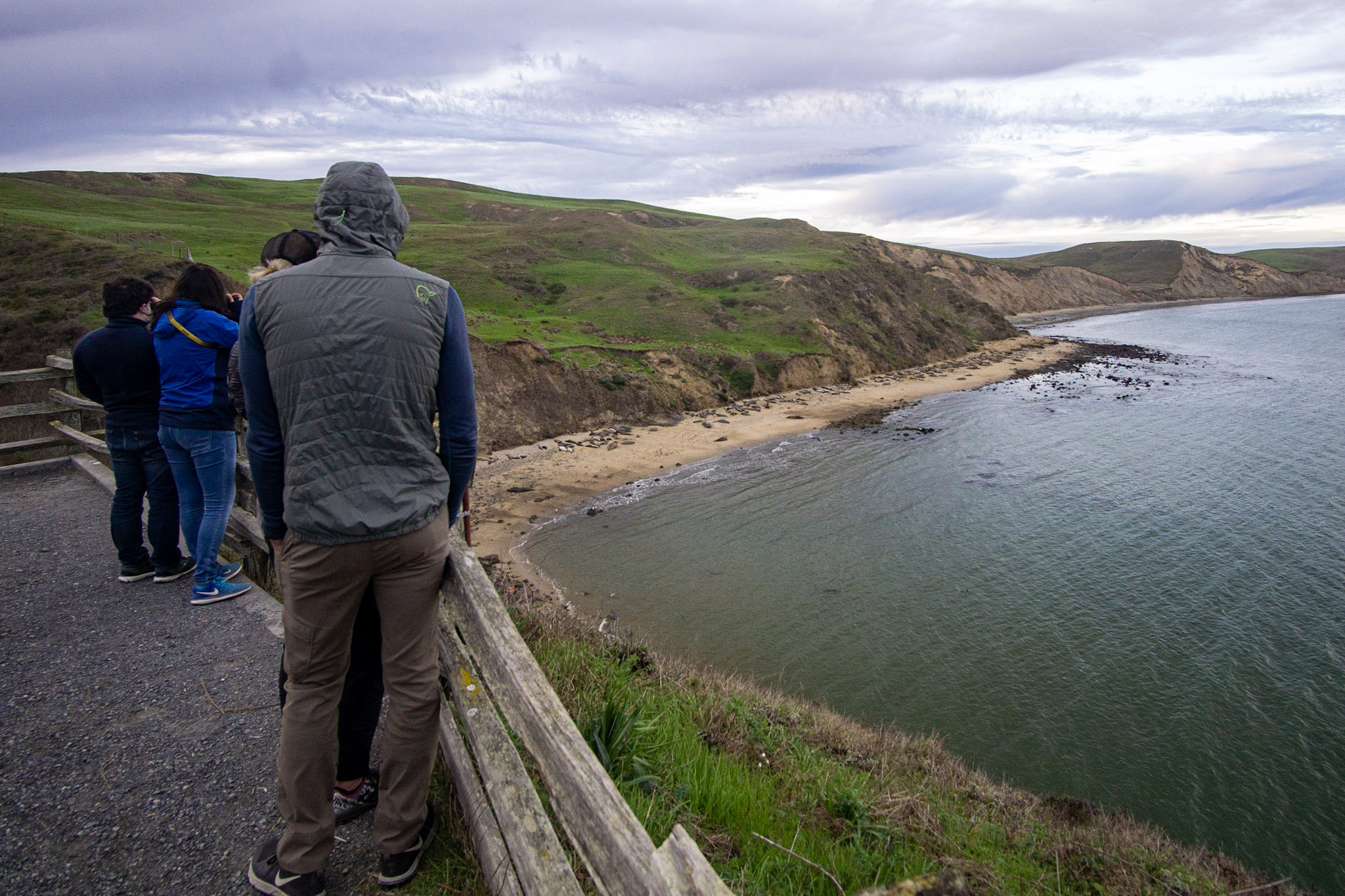
Perched above Drakes Bay, the elephant seal overlook at Chimney Rock provides excellent viewing opportunities to see breeding and pupping seals in the winter and spring and molting seals in the summer and fall.
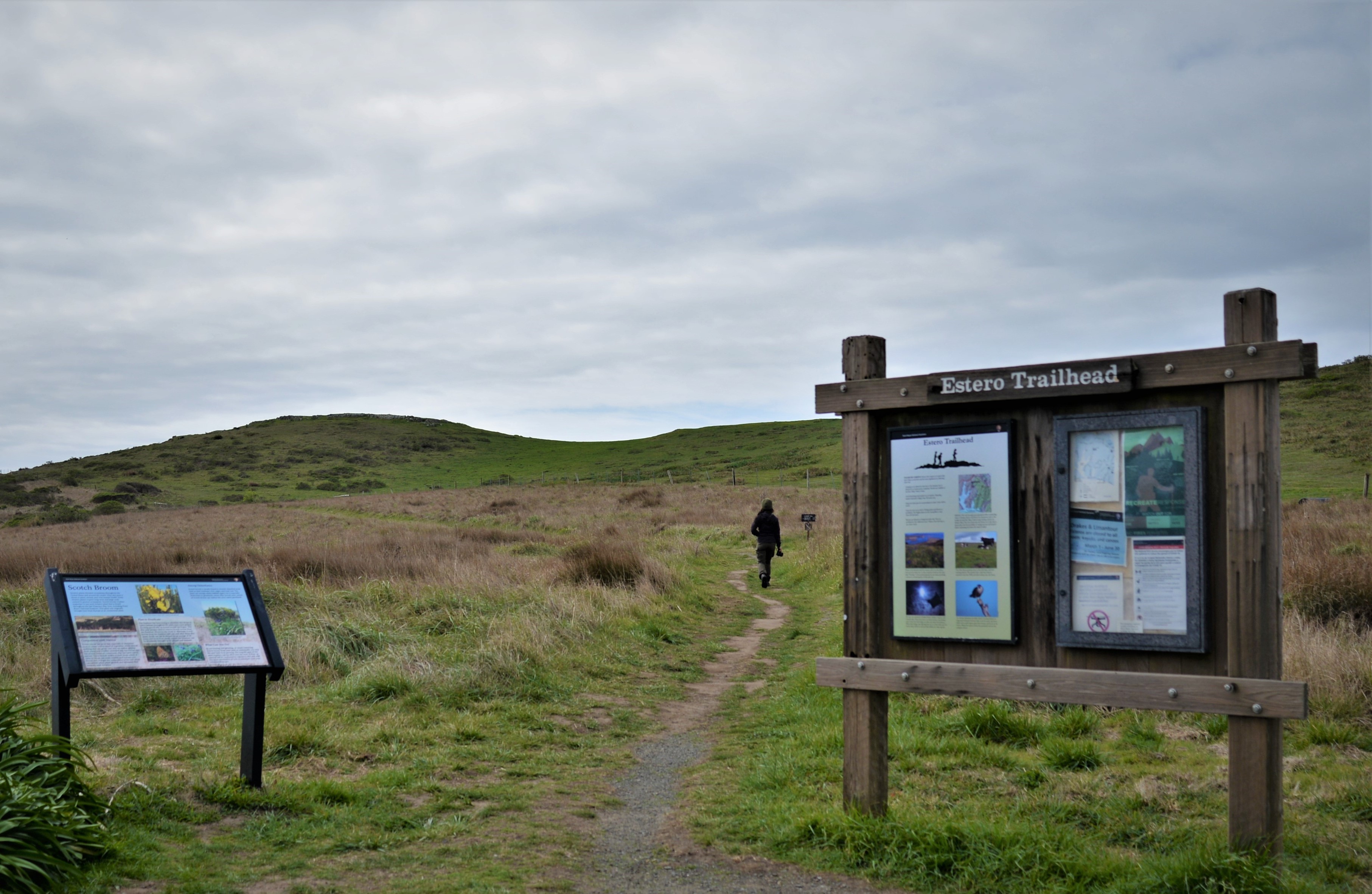
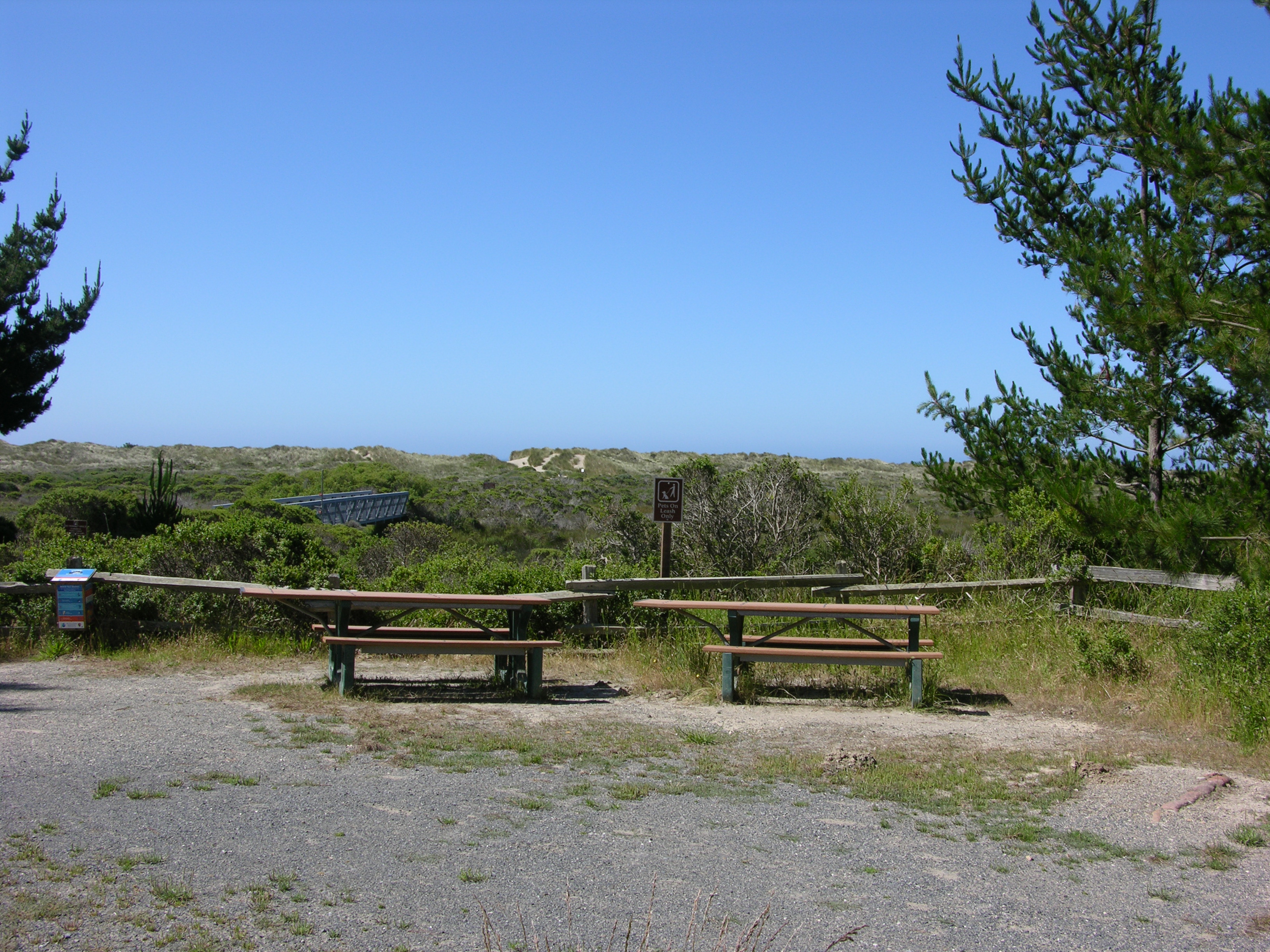
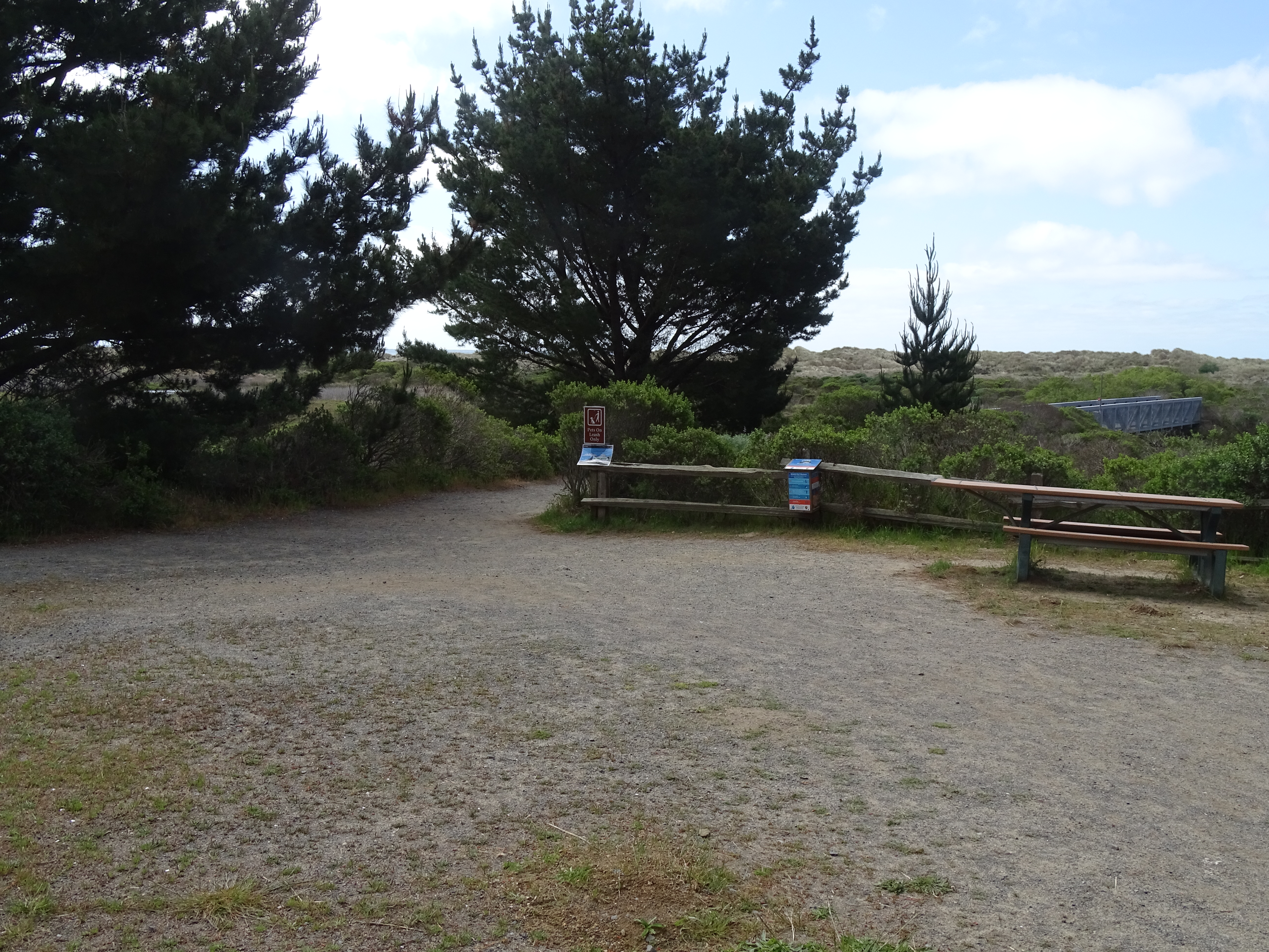
The Estero Trailhead is at the northwestern end of the Estero Trail, which leads hikers, bikers, and horse riders to other trails and locations with beautiful views of both Drakes and Limantour Esteros. The trailhead is located along Home Ranch Road, approximately 20 minutes by car from the Bear Valley Visitor Center.
One picnic table is located along the south edge of the Point Reyes National Seashore's Estero Trailhead. The Estero Trailhead is approximately 20 minutes by car from the Bear Valley Visitor Center.
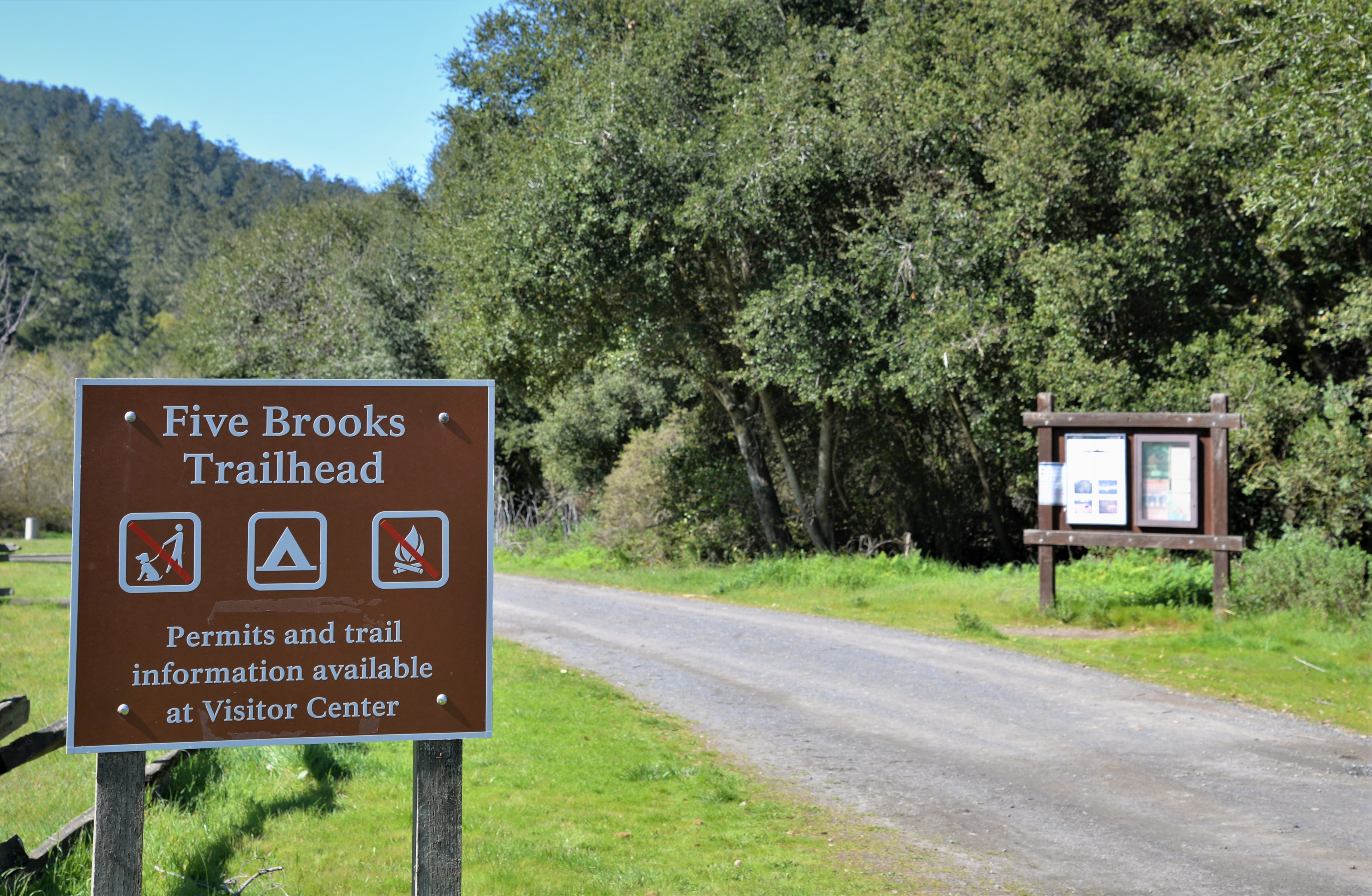
Six picnic tables are scattered along the eastern end of the Stewart Trail, some adjacent to an abandoned mill pond. The Five Brooks parking lot is approximately 10 minutes by car from the Bear Valley Visitor Center.
The Five Brooks Trailhead is a trailhead for the Stewart Trail, Olema Valley Trail, and Rift Zone Trail, and is adjacent to Five Brooks Ranch, a park concessioner that offers horse rides. It is located off of Highway 1 (aka Shoreline Highway) 4.4 miles (7 km) and approximately 10 minutes by car from the Bear Valley Visitor Center.
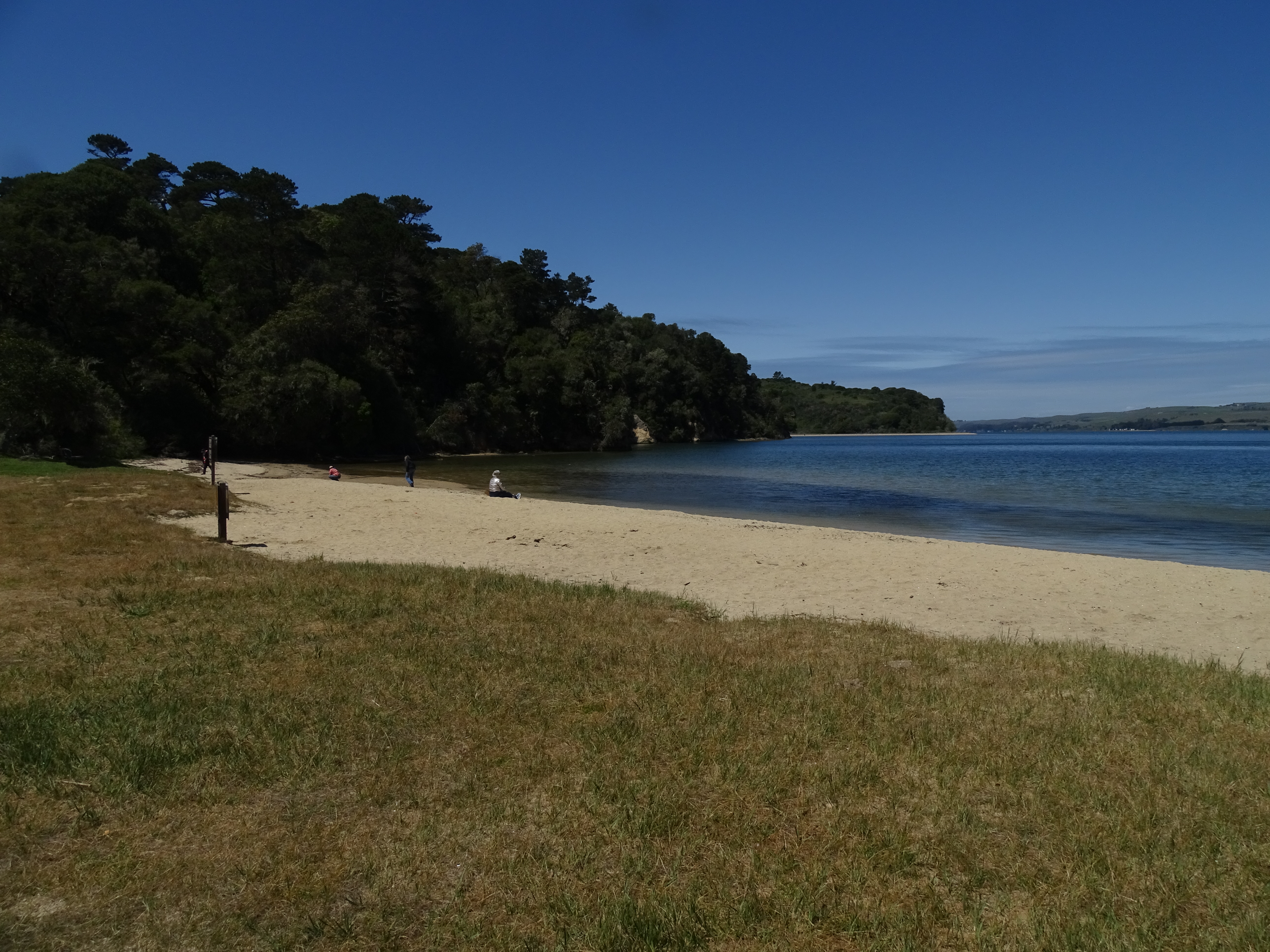
Heart's Desire Beach is part of Tomales Bay State Park. It is a nice sheltered cove on Tomales Bay that is excellent for families with small children. The water of Tomales Bay tends to be a little warmer than the water at the ocean-facing beaches of Point Reyes National Seashore.
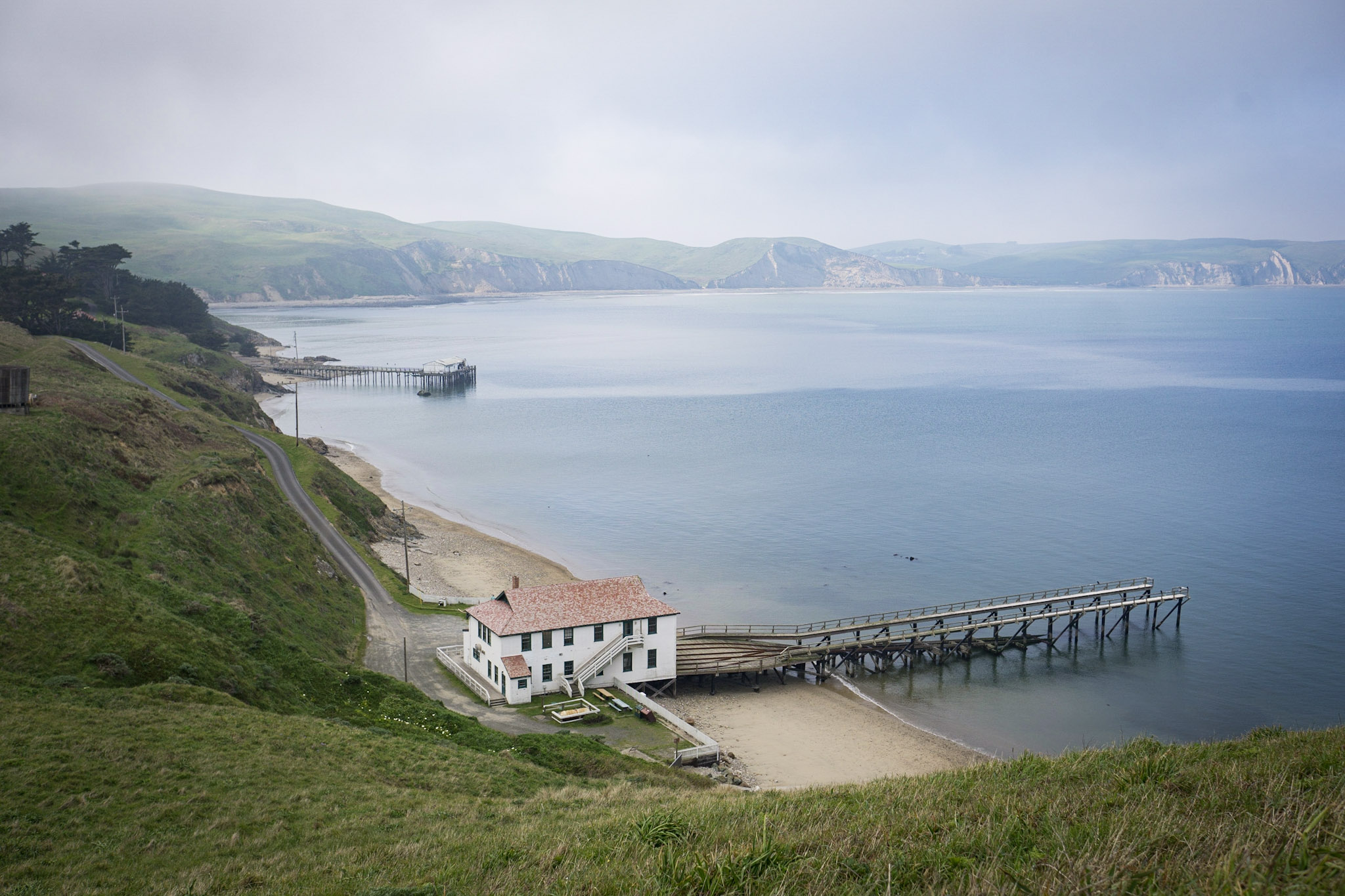
The historic Point Reyes Lifeboat Station stands near the eastern tip of the Point Reyes Headlands, extending into the famed Drakes Bay.The first U.S. Life-saving Service station at Point Reyes was built in 1889 along the unprotected Point Reyes Beach to aid ships that were stranded or wrecked at sea. In 1927, the lifeboat station was moved to its current location on the more-protected shores of Drakes Bay.
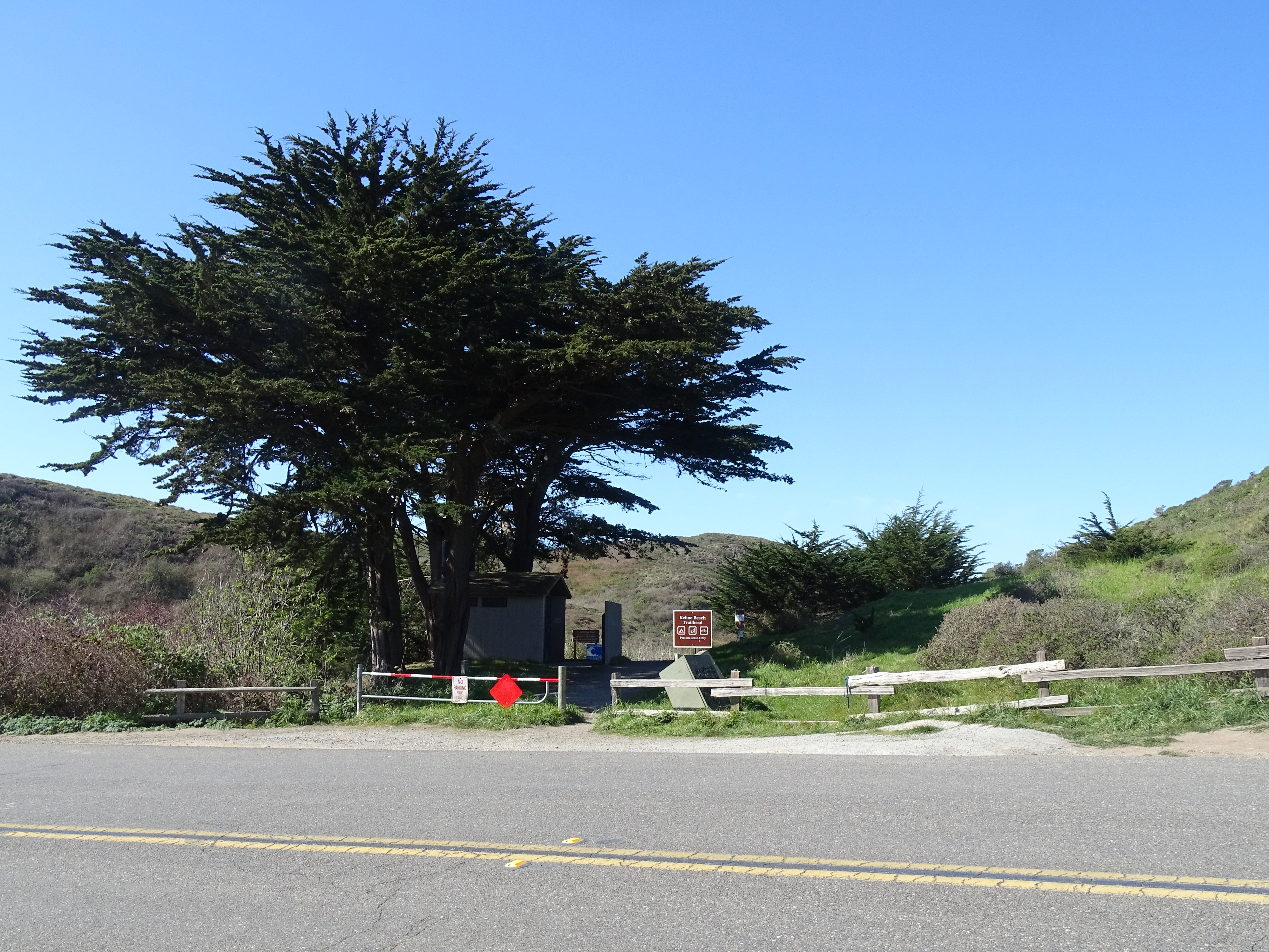
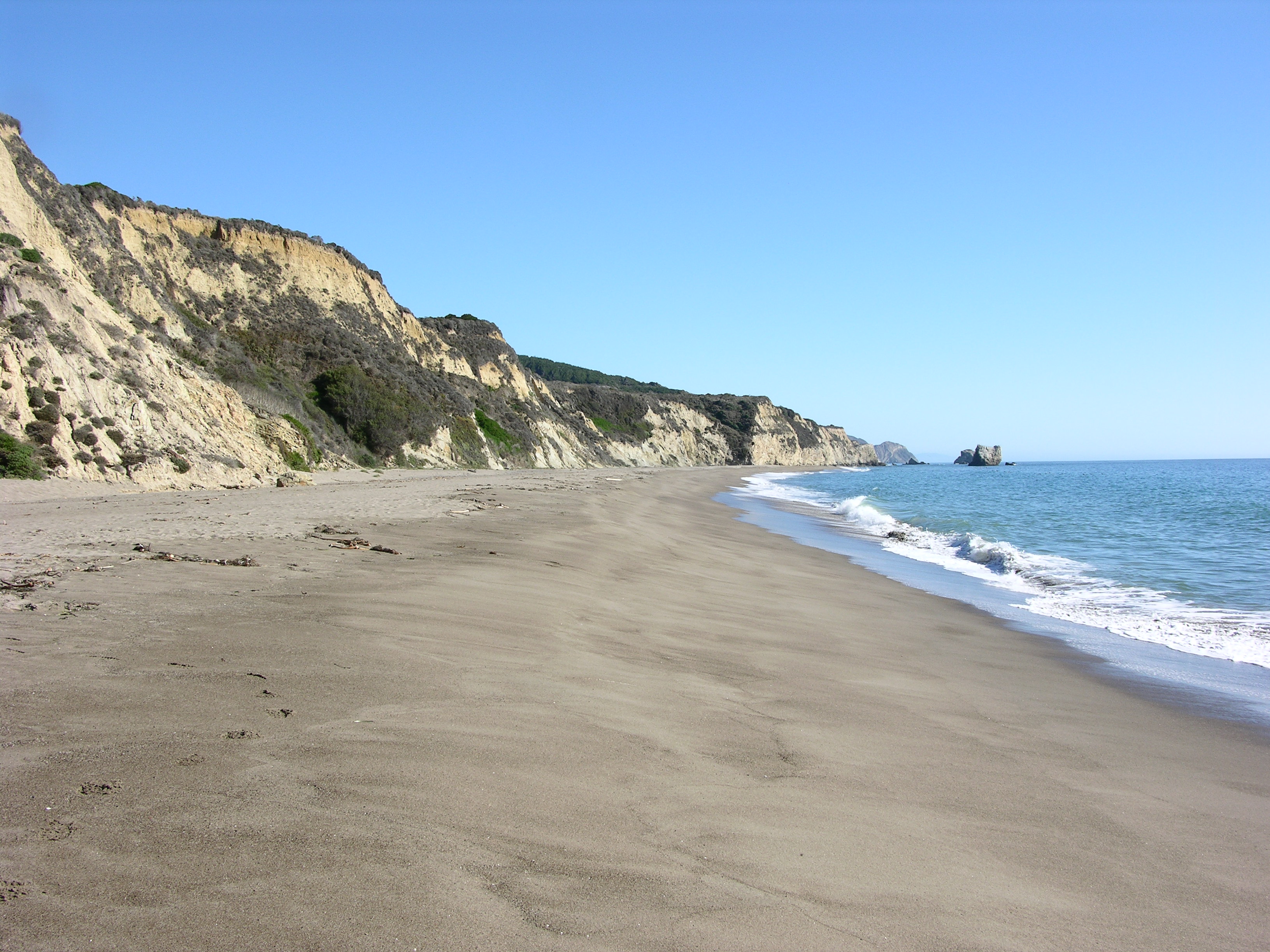
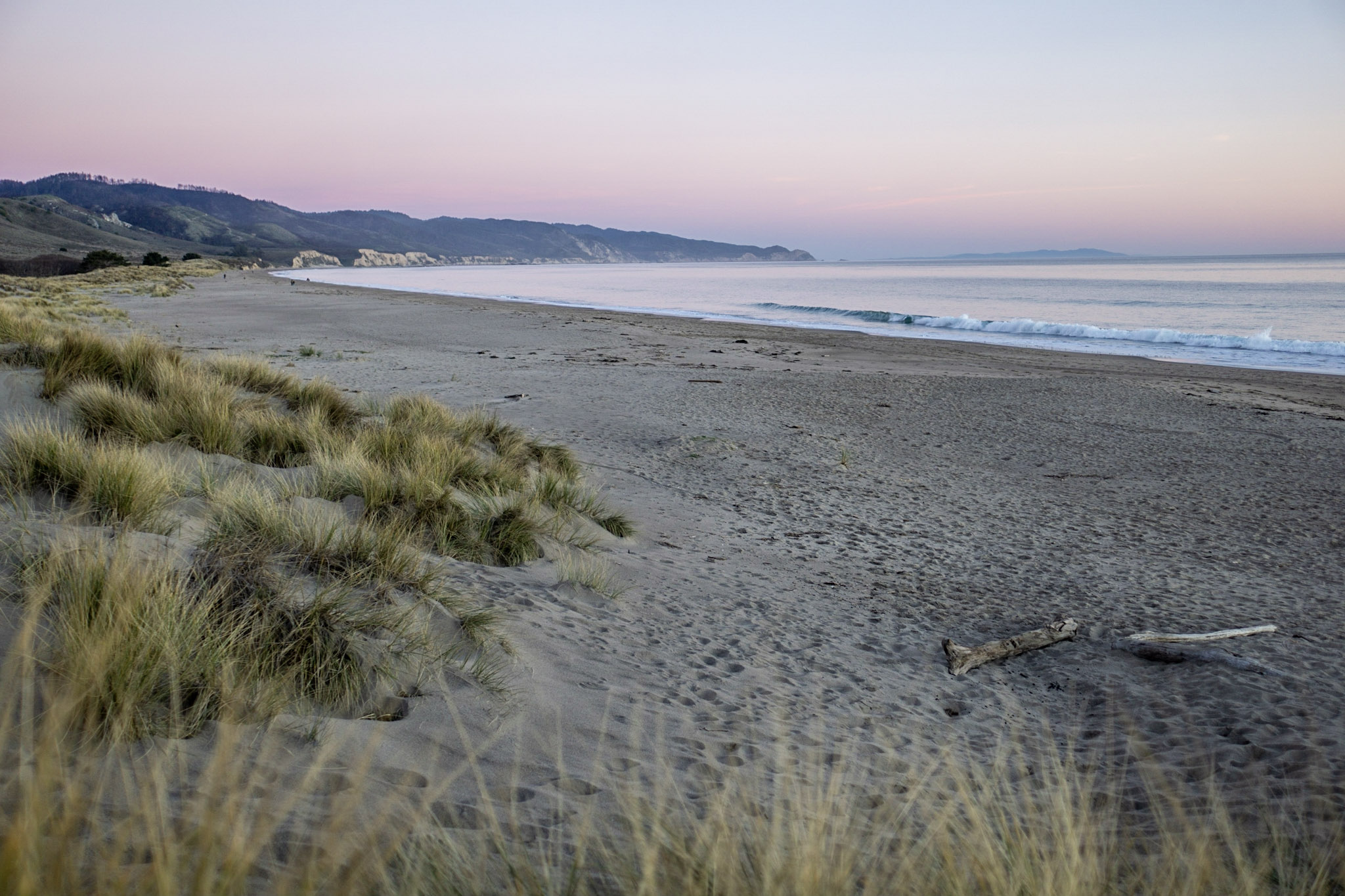
A 0.6-mile-long path alongside a marsh leads to dog/pet-friendly Kehoe Beach (pets must remain on leash at all times). To the south, the Point Reyes Beach stretches over 11 miles to the Point Reyes Headlands. To the north, one can get a close-up view of a dramatic juxtaposition of ancient rocks. Never turn your back to the ocean. Due to the frequently large surf, this is not a beach at which it is safe to play close to the water's edge, much less to go for a swim.
Park at the Kehoe Beach Trailhead to follow a short pet-friendly trail that leads to an ocean-side beach. The Kehoe Beach Trailhead is located along Pierce Point Road approximately 25 minutes by car from the Bear Valley Visitor Center.
A five-mile (eight-kilometer) trek from the Bear Valley trailhead brings hikers to a large eucalyptus at the site of a former ranch above this quiet, secluded beach. Visitors should not attempt to descend to this beach. Coastal erosion and significant landslides in 2023 and 2024 have made the Kelham Beach Trail impassible and unsafe to use.
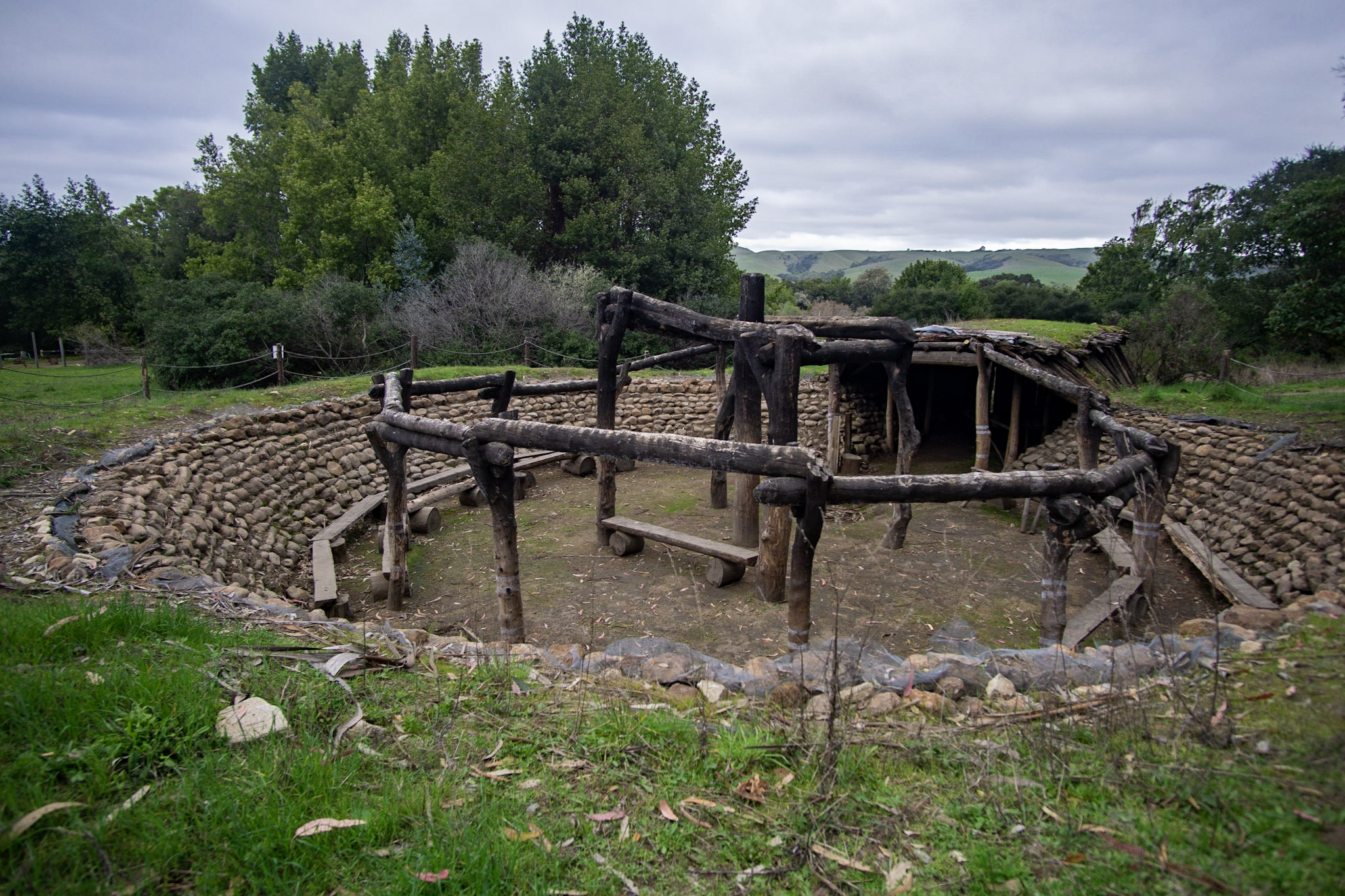
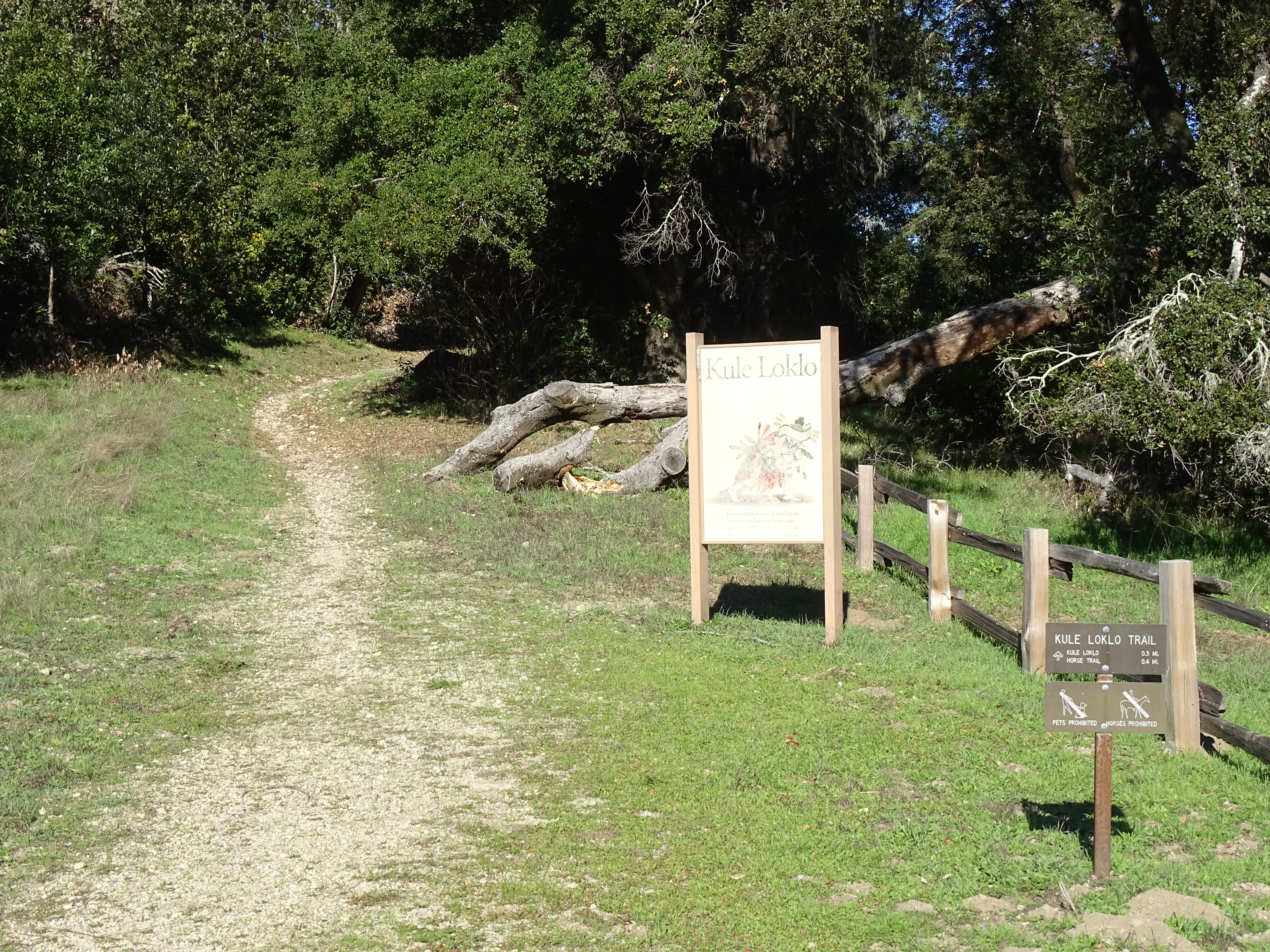
Kule Loklo, which means "Bear Valley" in the Coast Miwok language, is a replica Coast Miwok village. Learn how the original people of Point Reyes lived and how their descendants remain connected to Point Reyes today as you walk along the 0.4-mile-long (0.6-km-long) trail to Kule Loklo.
The Kule Loklo Trailhead is located at the north end of the Bear Valley Visitor Center's parking lot. The Kule Loklo Trail leads to a replica Coast Miwok Indian village.
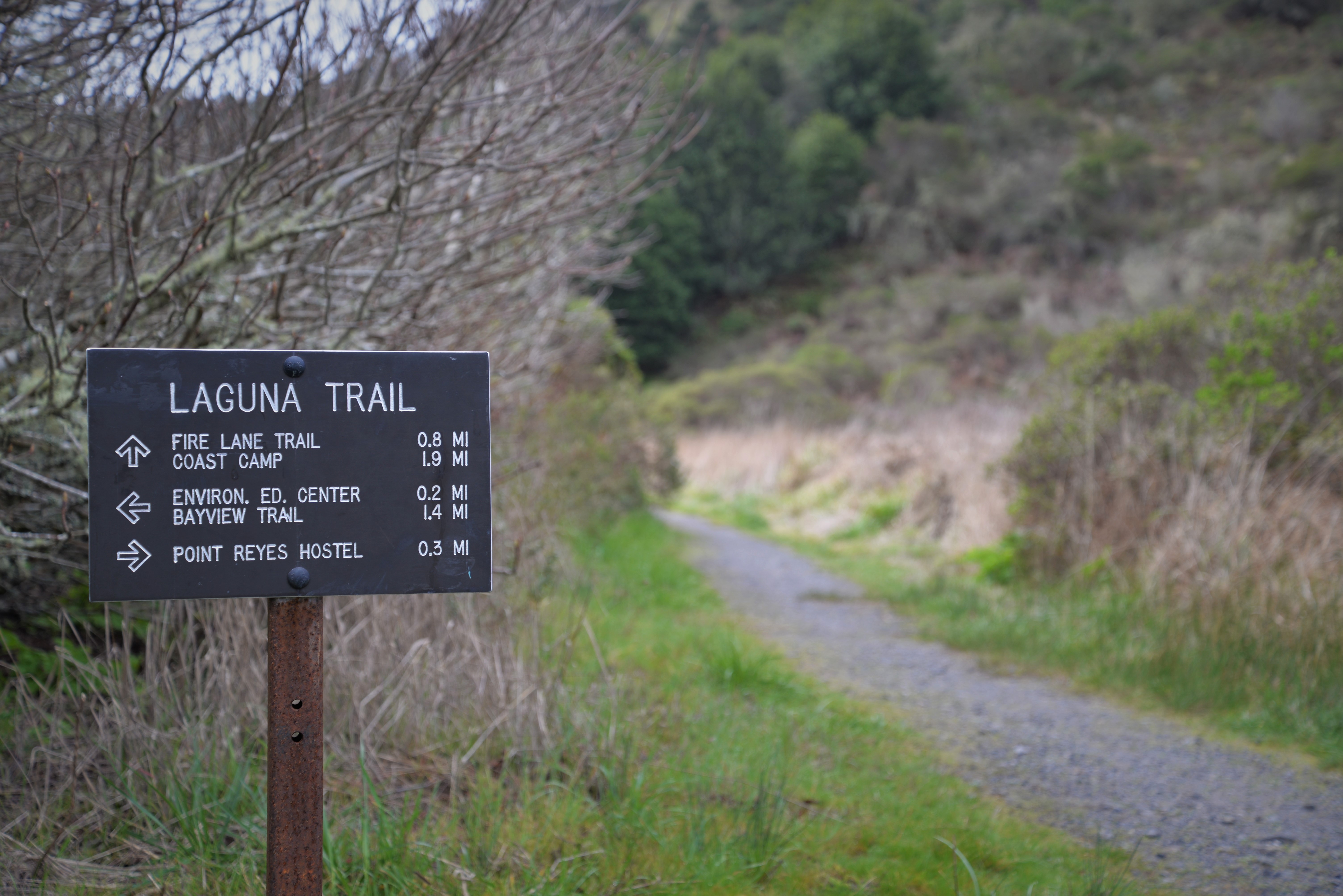
The most popular hikes from the Laguna Trailhead will take you down to the coast, but you can also connect to multiple trails that will climb through the forest towards Inverness Ridge. Many of the routes that depart from this trailhead are within the Phillip Burton Wilderness. The trailhead is located near the east end of Laguna Road, approximately 15 minutes by car from the Bear Valley Visitor Center.
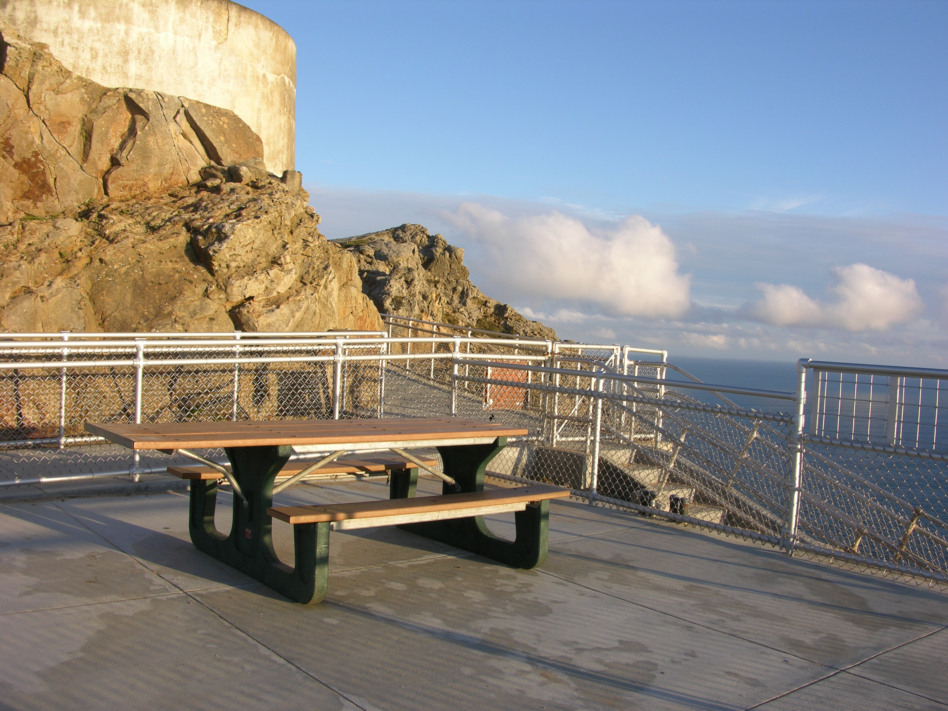
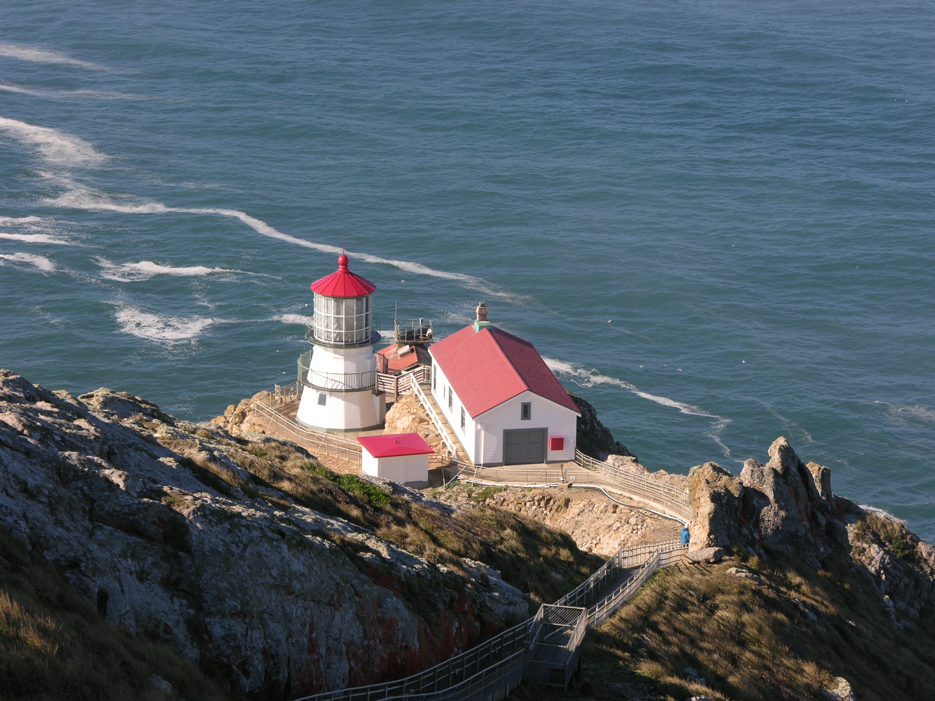
One picnic table is located at the Observation Deck above the Point Reyes Lighthouse. The Point Reyes Lighthouse visitors' parking lot is approximately 45 minutes by car from the Bear Valley Visitor Center. The Observation Deck is approximately 15 minutes by foot from the parking lot.
Limantour Beach is one of four beaches at Point Reyes National Seashore to which one can drive. Limantour Beach stretches for close to four miles from the west end of Limantour Spit east to Santa Maria Beach at its southeast end. Limantour Beach is a popular beach for a variety of low-impact beach activities, such as sunbathing, playing in the surf, birdwatching, viewing marine mammals, and walking pets (leashes are required at all times).
Two picnic tables are located just north of the foot bridge leading from the main Limantour Beach parking lot to the beach. The Limantour Beach parking lot is approximately 20 minutes by car from the Bear Valley Visitor Center.
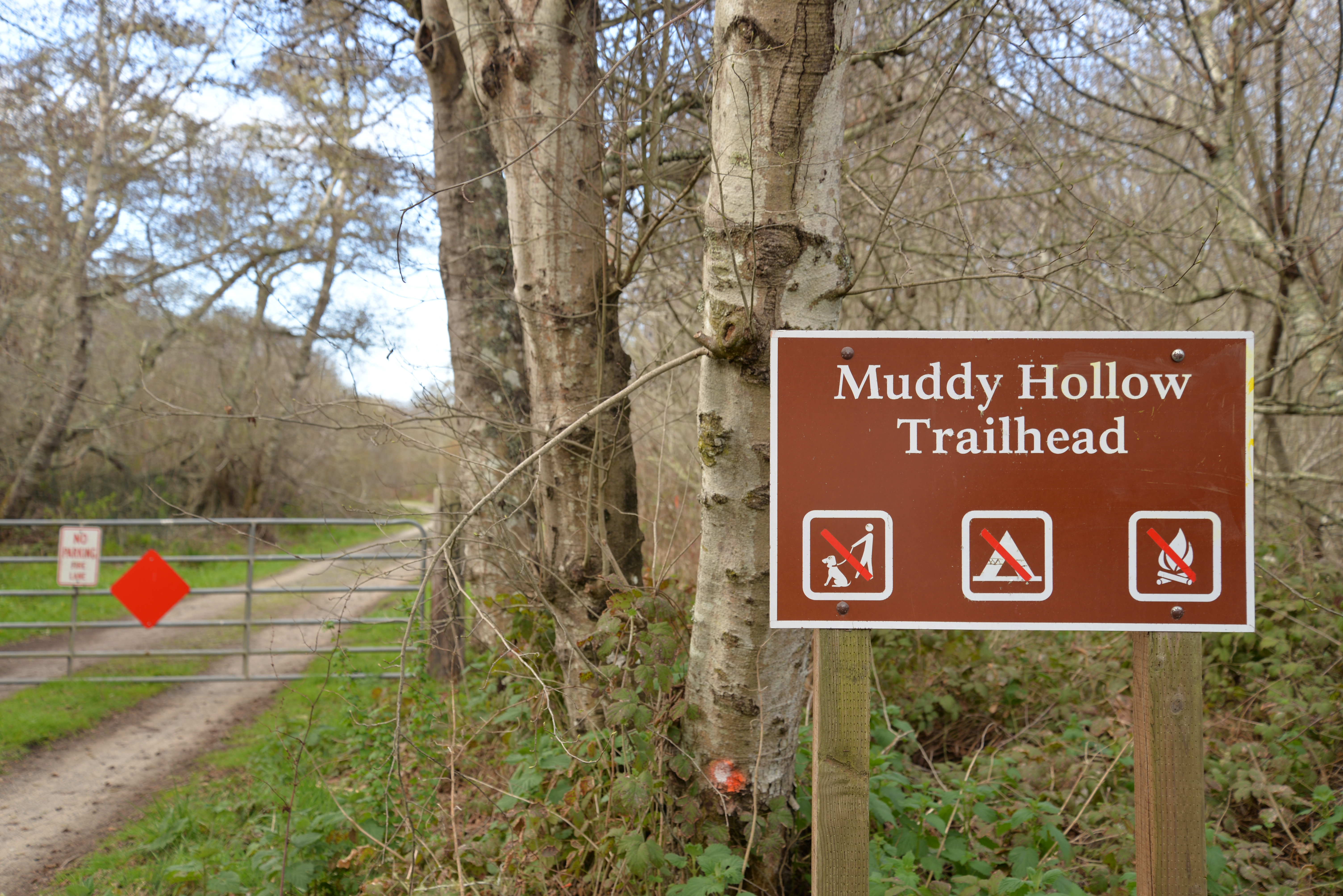
Leading west and then north from the Limantour Beach Trailhead, the Muddy Hollow Trail offers birders great opportunities to see a variety of water fowl and shorebirds in the Estero de Limantour and along Muddy Hollow Creek. The Muddy Hollow Trails is very flat and easy to walk. The trailhead is located at the west end of Limantour Road, approximately 20 minutes by car from the Bear Valley Visitor Center.
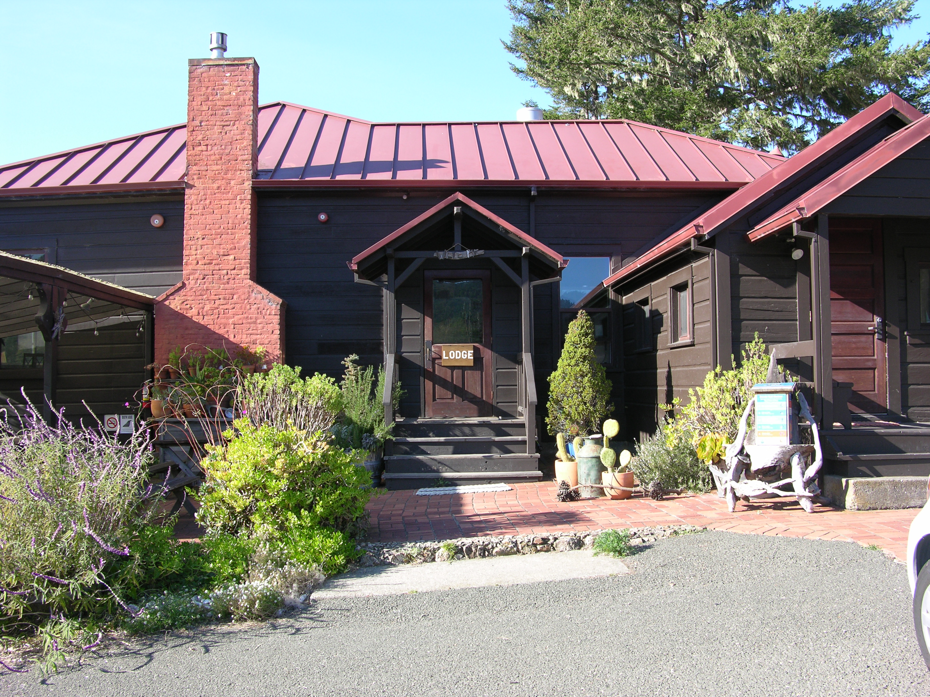
The only lodging within Point Reyes National Seashore is offered by Limantour Lodge. They offer dormitory style accommodations, as well as four private rooms. Please call 415-663-8811 for more information between 8 am and 7 pm.
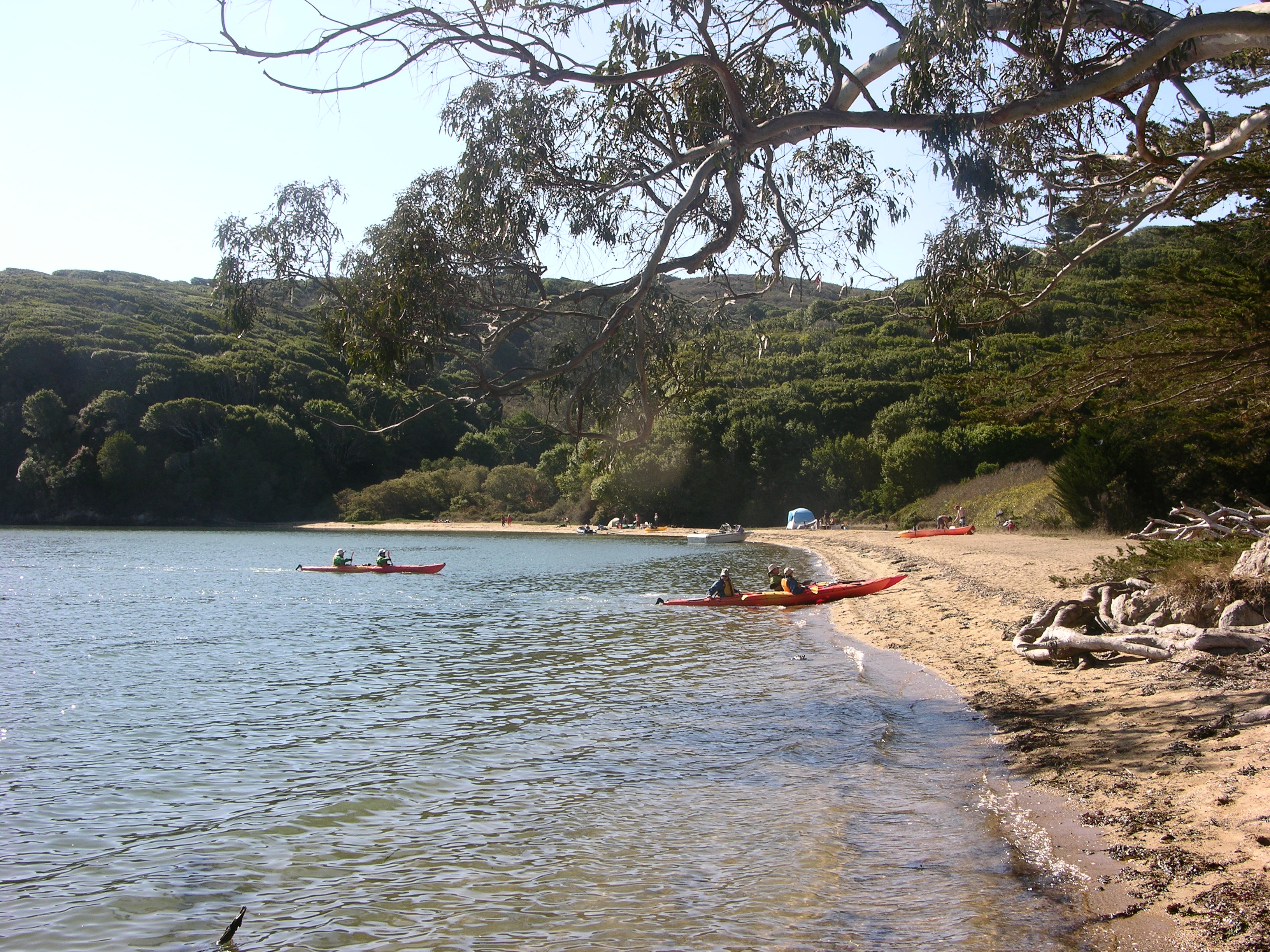
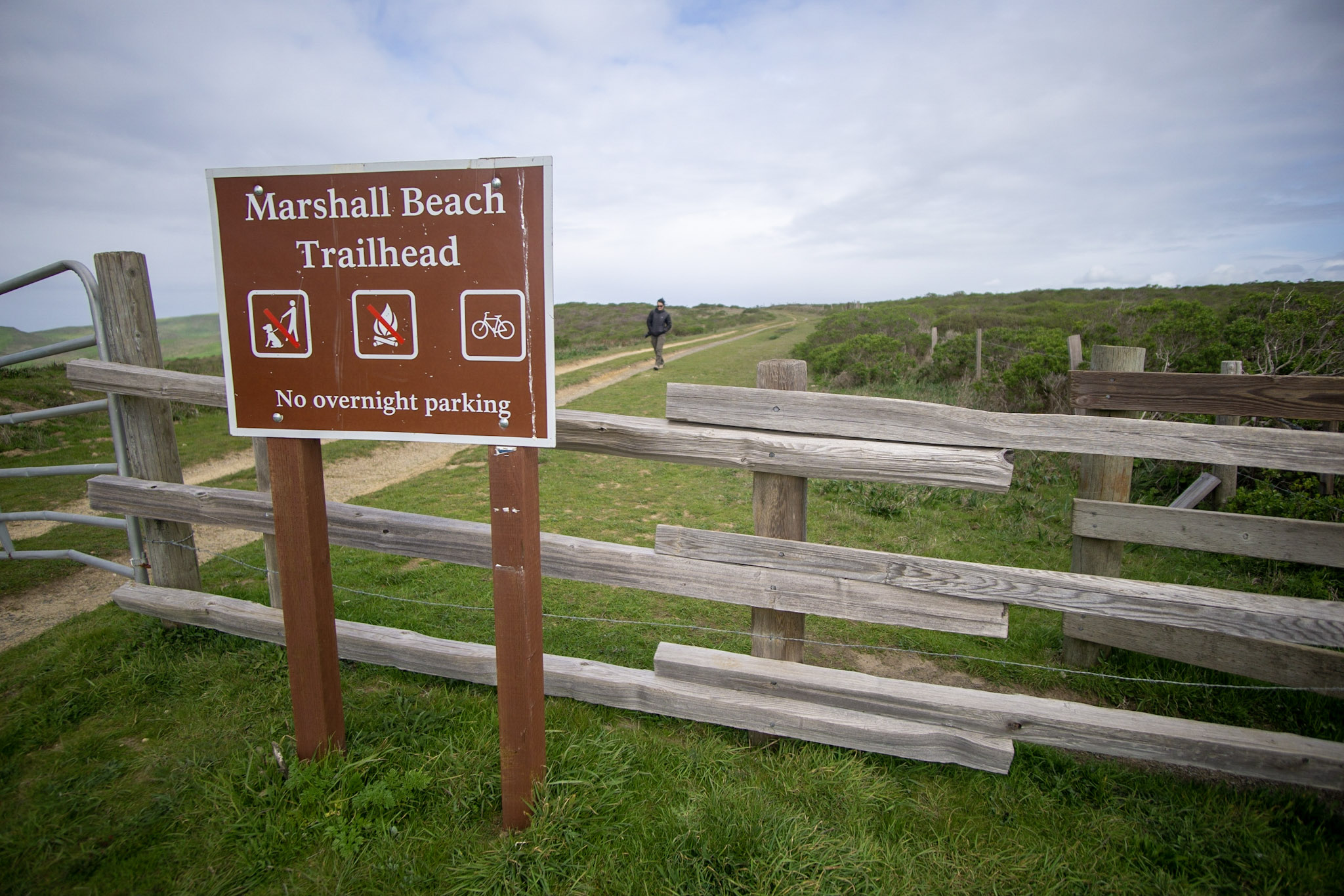
Marshall Beach is a 400-foot-long (366-meter-long) beach on the west side of Tomales Bay in the northern part of the national seashore. Most visitors to this beach arrive via water, i.e., by kayak, canoe, paddle board, small motorboat, etc. Visitors may also hike or ride their bicycles or horses to Marshall Beach via the 1.2-mile-long (1.9-kilometer-long) Marshall Beach Trail. The Marshall Beach Trailhead is reached by vehicle via L Ranch Road.
The Marshall Beach Trailhead is located at the north end of the unpaved L Ranch Road, which branches off of Pierce Point Road. The Marshall Beach Trail traverses 1.2 miles (1.9 km) as it descends ~350 feet (~105 meters) in elevation to Marshall Beach on the shore of Tomales Bay. This trailhead is approximately 25 minutes by car from the Bear Valley Visitor Center.
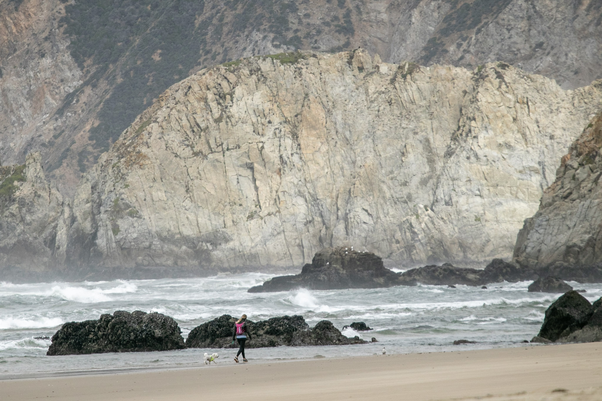
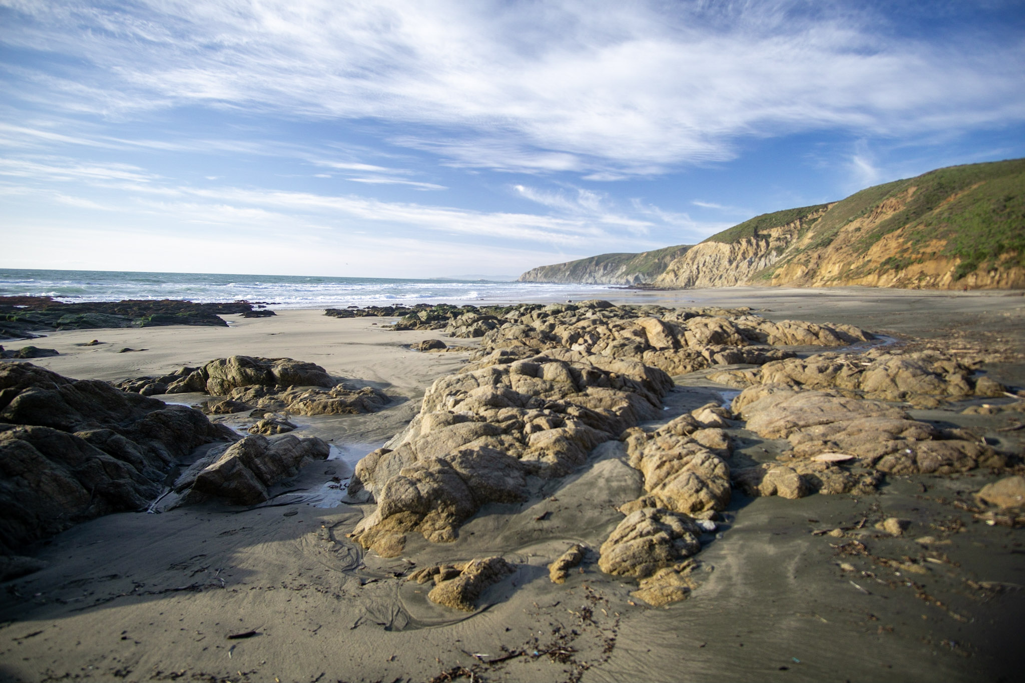
Wild and secluded, McClures Beach is a beautiful cove situated between two rocky headlands. Intense surf and interesting rock formations characterize the most northern ocean beach in Point Reyes. One may be tempted to venture through a gap at the south end to explore the adjacent beach, but use caution! Never turn your back to the ocean. Due to the frequently large surf, this is not a beach at which it is safe to play close to the water's edge, much less to go for a swim.
The McClures Beach Trailhead is located downhill and to the west of historic Pierce Ranch at the north end of Pierce Point Road. The McClures Beach Trail—which is mostly within the Phillip Burton Wilderness—offers a short, moderately steep hike down to an isolated and beautiful beach that is exposed to the rough Pacific Ocean surf. The trailhead parking lot approximately 35 minutes by car from the Bear Valley Visitor Center.
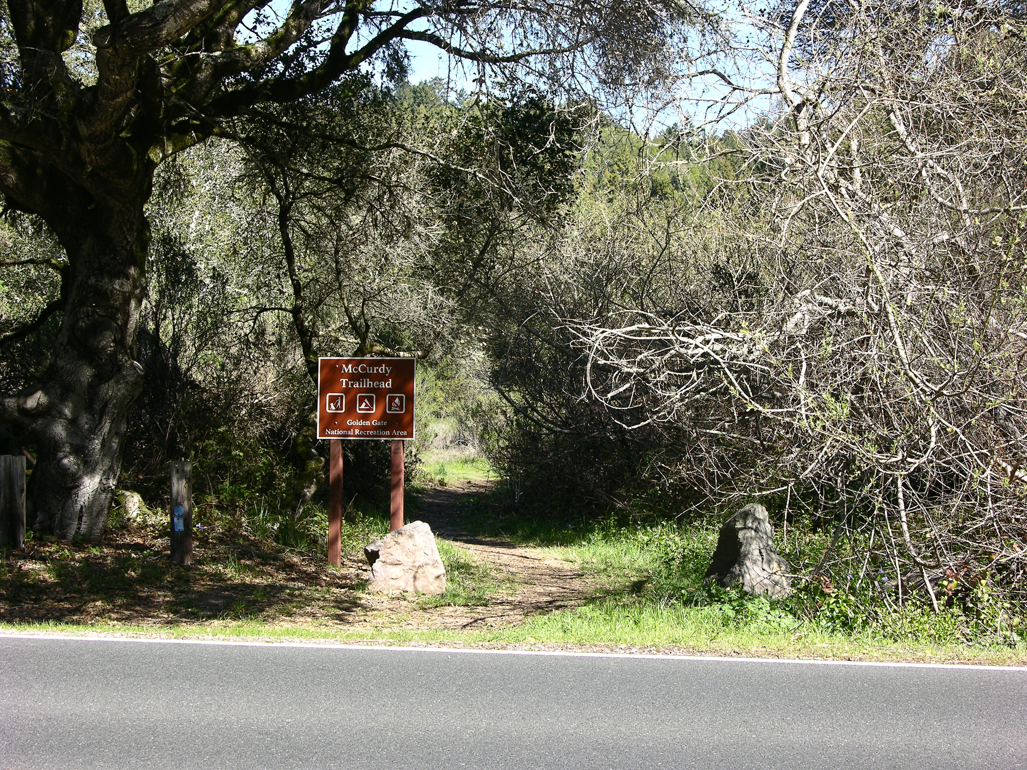
Park at the McCurdy Trailhead to hike a steep and overgrown old ranch/fire road that ascends 2 miles through chaparral and some woodlands to the Bolinas Ridge Trail. Pets, bicycles, and horses are permitted on the McCurdy Trail. The trailhead is located along Highway 1 (aka Shoreline Highway) 8.3 miles (13.3 km) south of Olema and approximately 20 minutes by car from the Bear Valley Visitor Center.
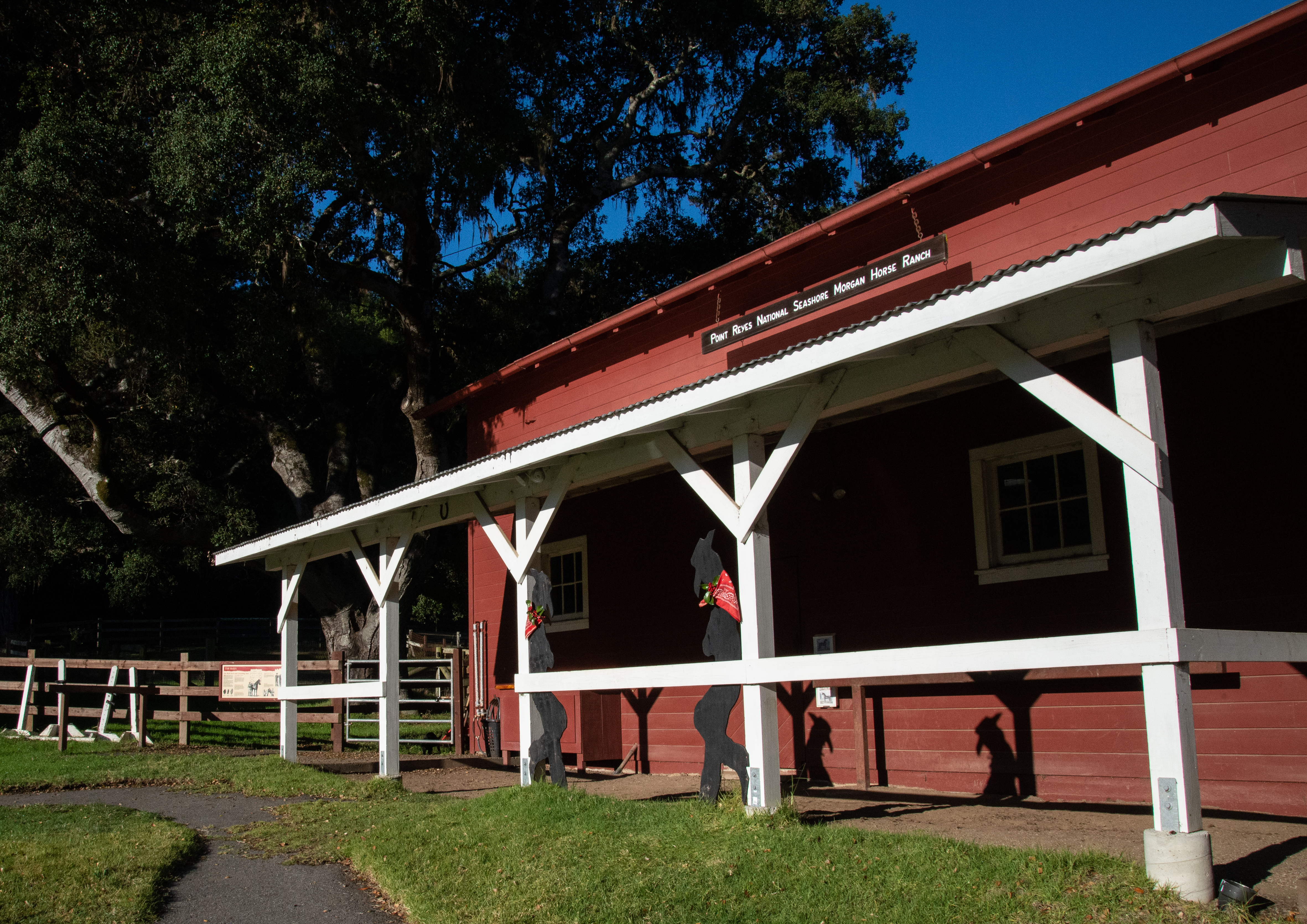
Meet Point Reyes National Seashore's Morgan horses and explore a historic ranch. This is a working ranch for horses used by National Park Rangers in wilderness areas and for backcountry patrols. It has trailside exhibits focusing on the characteristics, breeding, and history of the first American breed of horse. Self-guided exhibits, corrals, and demonstrations are a part of the ongoing interpretive program of the ranch. Allow 20–30 minutes to tour the Horse Ranch.
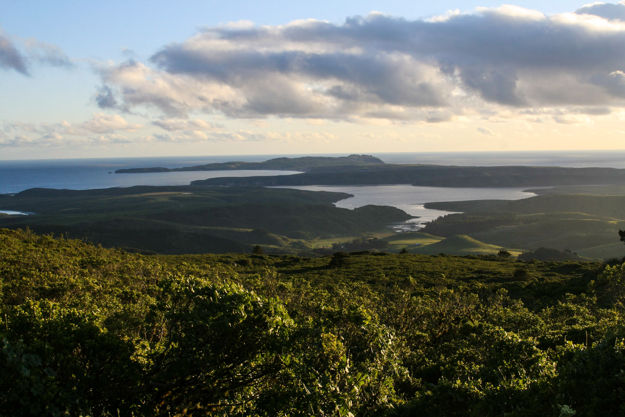
View much of the Point Reyes peninsula from Mount Vision (1,282 feet). Drive to the overlook on Mount Vision Road for stunning views of the seashore on clear days.
The Muddy Hollow Trailhead is the gateway to several often overlooked coastal hiking trails, from which you can enjoy ocean views and an occasional tule elk sighting! Many of the routes that depart from this trailhead are within the Phillip Burton Wilderness. The trailhead is located at the west end of Muddy Hollow Road, approximately 15 minutes by car from the Bear Valley Visitor Center.
Point Reyes Beach North (aka North Beach) is one of four locations at Point Reyes National Seashore to which one can drive to the edge of a beach. Point Reyes Beach stretches over 11 miles from Kehoe Beach to the Point Reyes Headlands with North Beach located at the mid-point. Never turn your back to the ocean. Due to the frequently large surf, this is not a beach at which it is safe to play close to the water's edge, much less to go for a swim. Leashed pets are permitted.
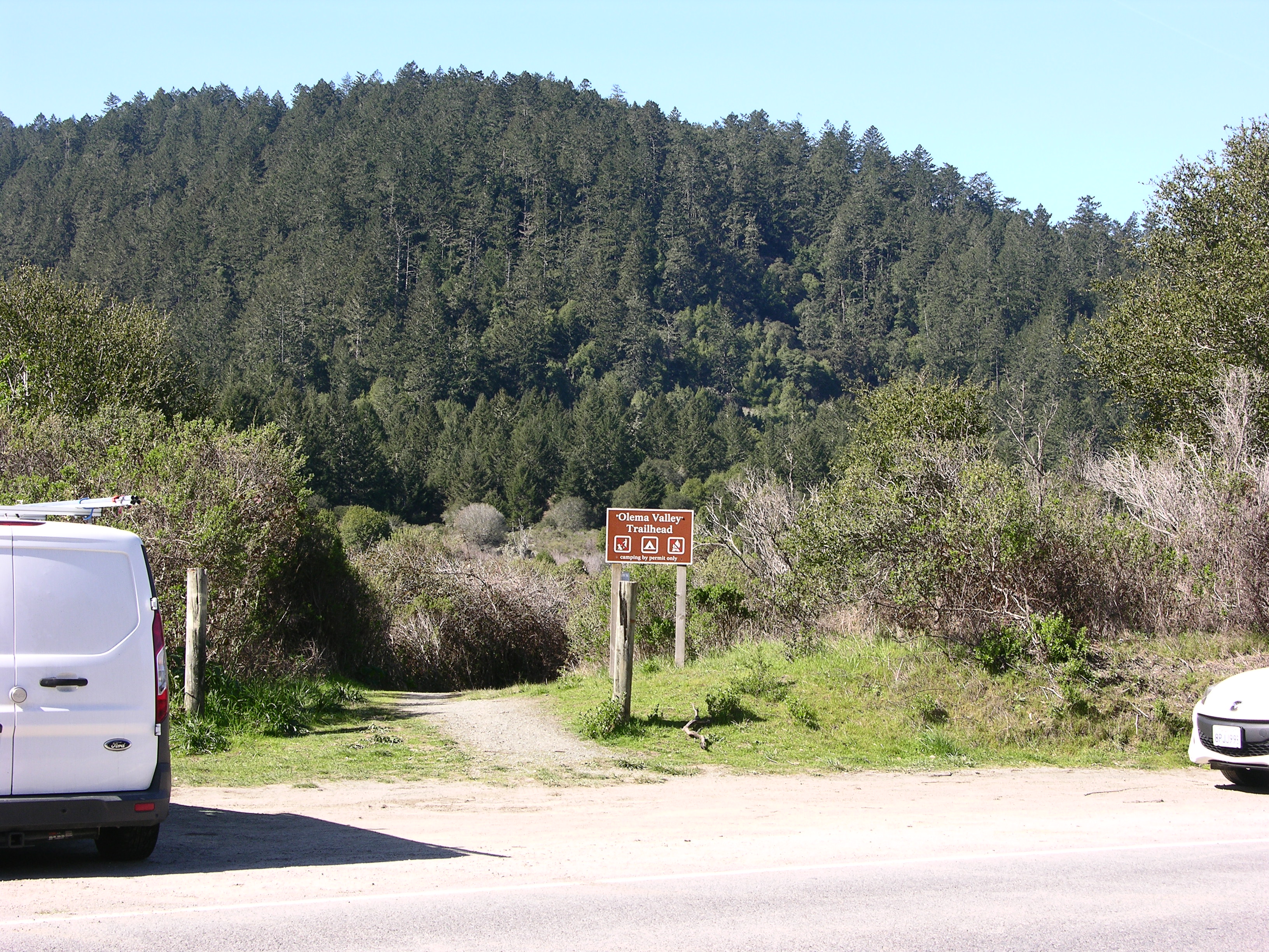
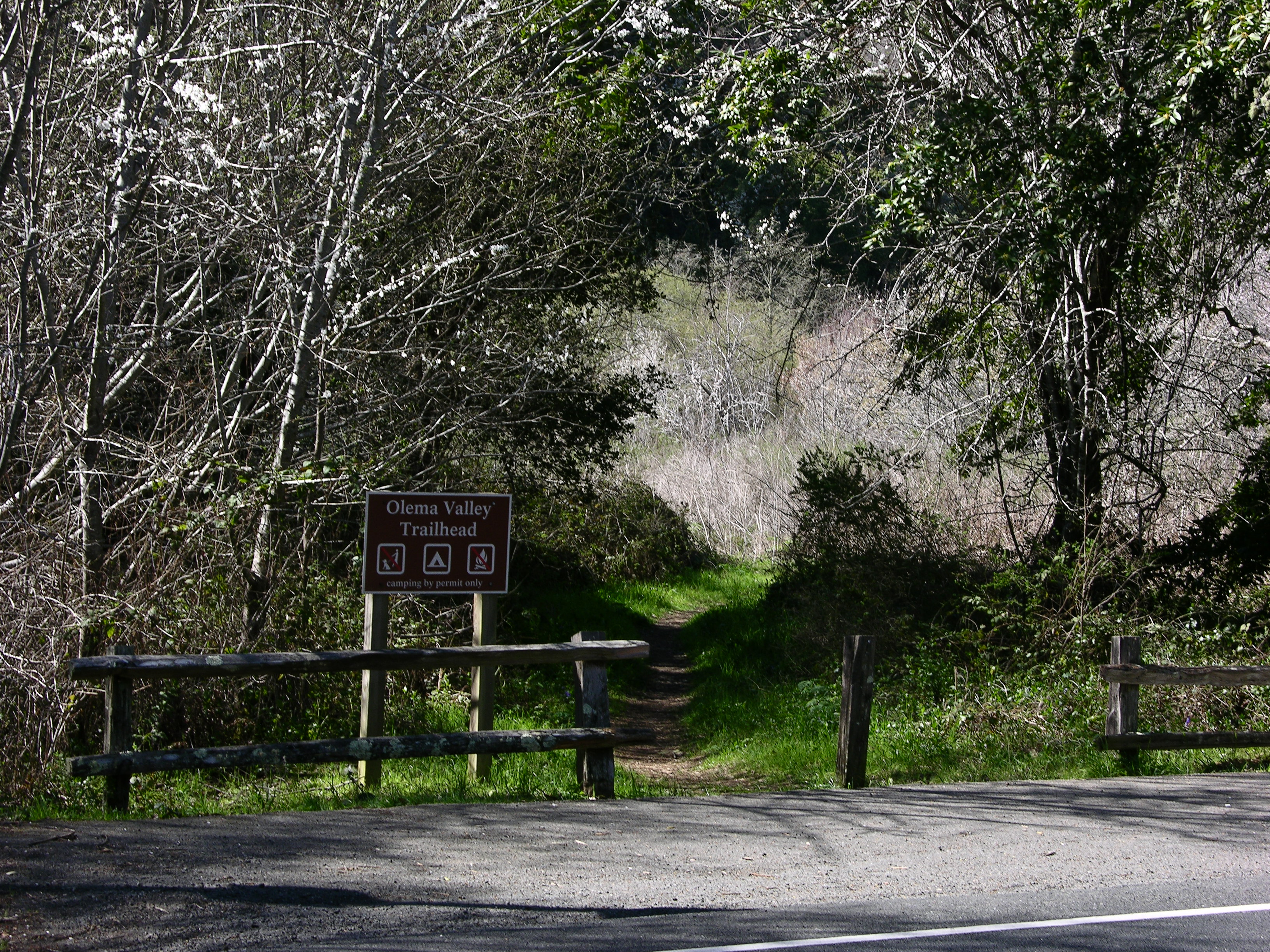
The Olema Valley (Hagmaier) Trailhead provides access to the middle section of the Olema Valley Trail, which connects to an extensive network of trails that pass through the Phillip Burton Wilderness. The trailhead is located along Highway 1 (aka Shoreline Highway) 6 miles (9.6 km) south of Olema and approximately 15 minutes by car from the Bear Valley Visitor Center.
The Olema Valley (South) Trailhead provides access from the southern end of Olema Valley to an extensive network of trails that pass through the Phillip Burton Wilderness. The trailhead is located along Highway 1 (aka Shoreline Highway) 8.3 miles (13.3 km) south of Olema, approximately 20 minutes by car from the Bear Valley Visitor Center.
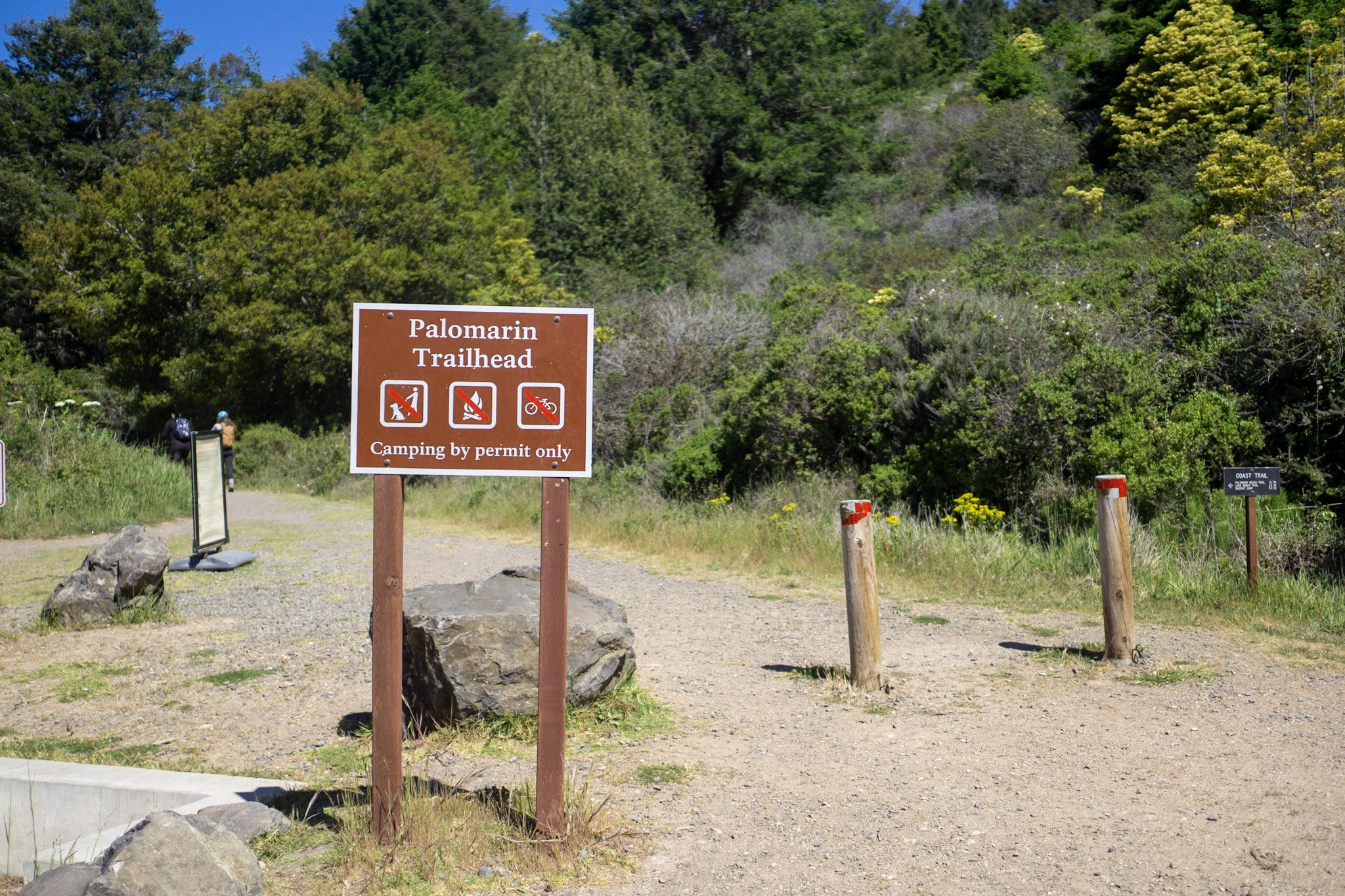
The Palomarin Trailhead is located at the southern end of Point Reyes National Seashore's extremely popular Coast Trail. It is located at the northwestern end of Mesa Road, approximately 5 miles (8 km) northwest of Bolinas and approximately 35 minutes by car from the Bear Valley Visitor Center.
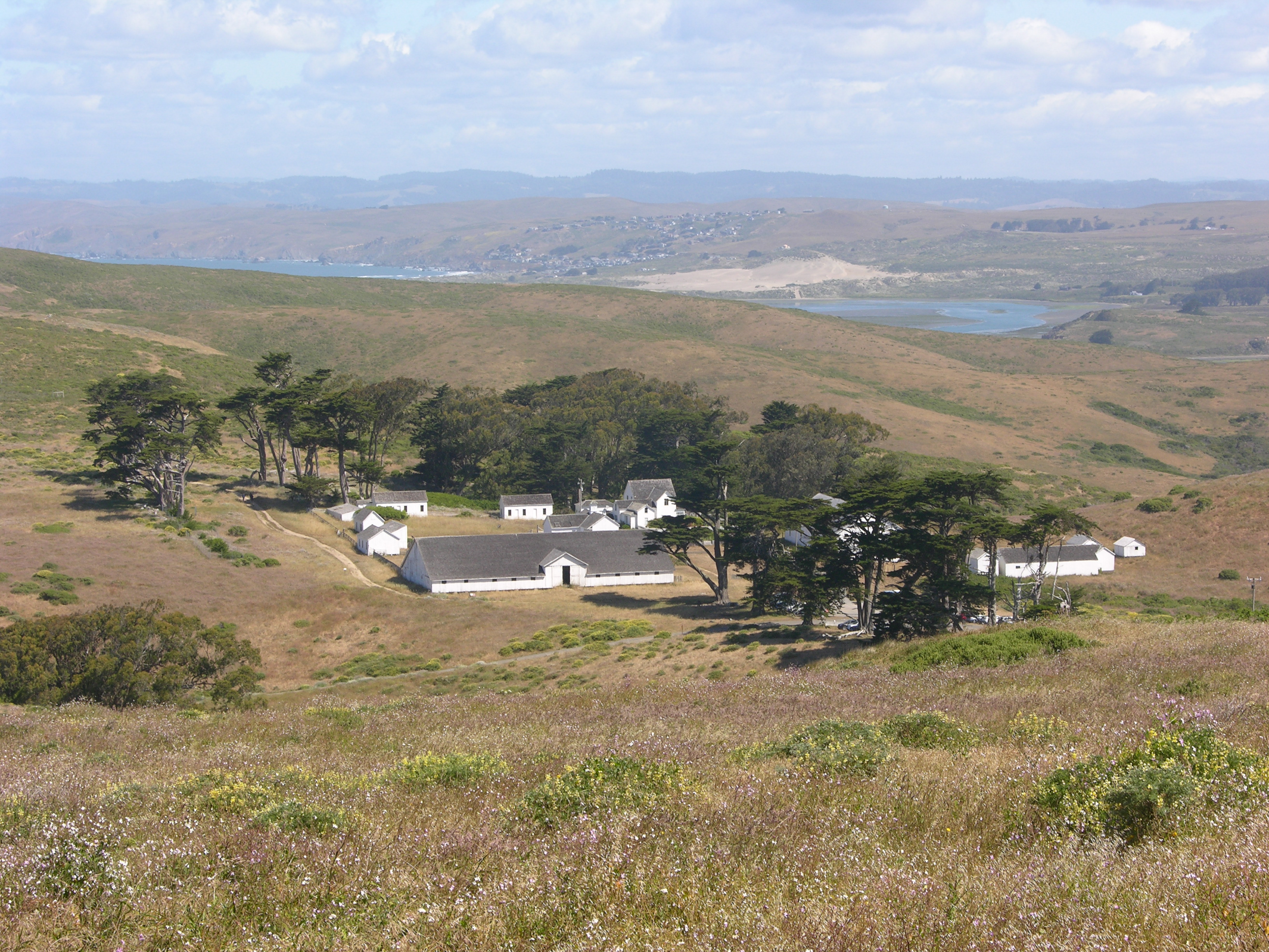
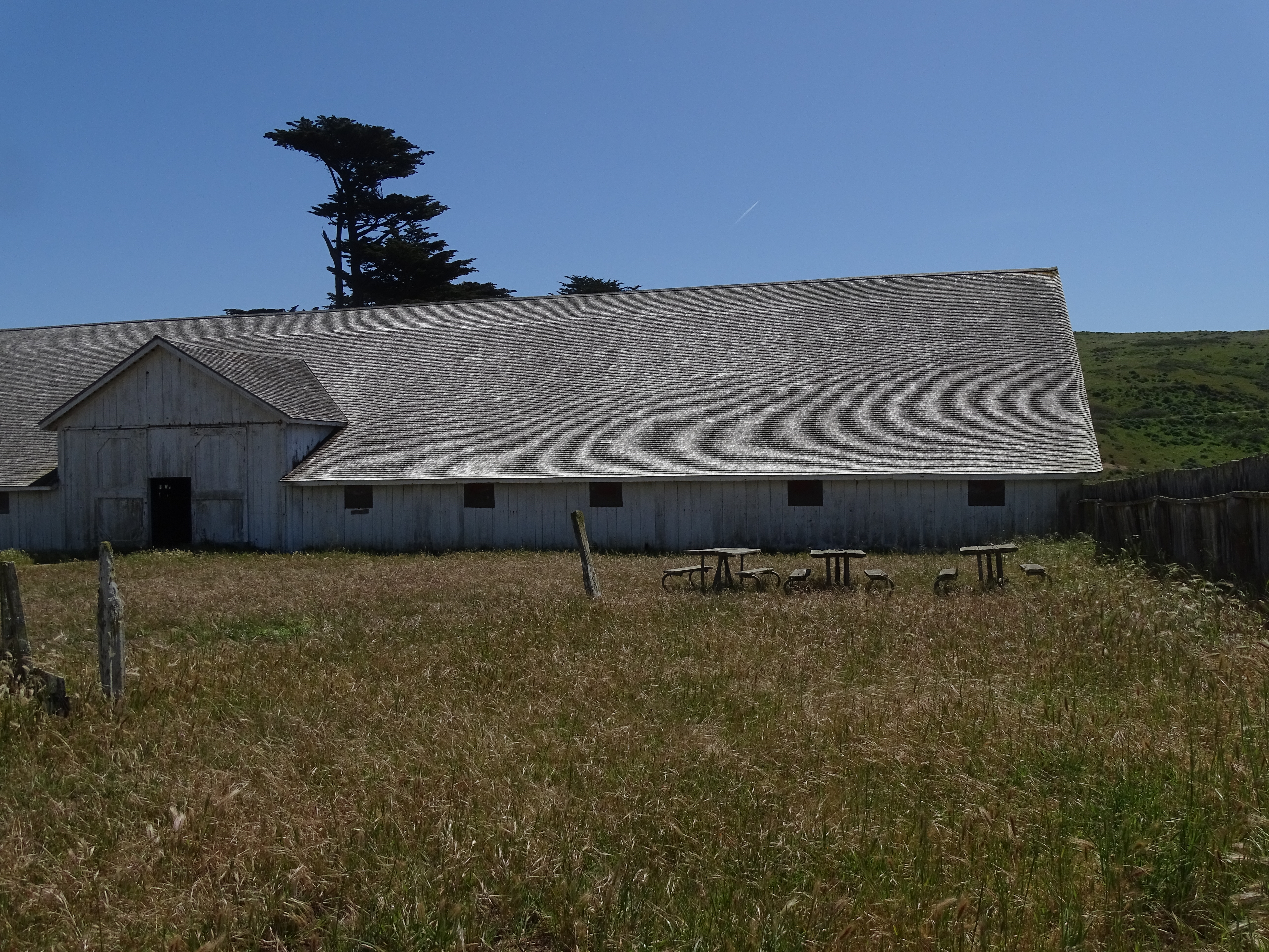
Pierce Ranch was the largest ranch in the Point Reyes Peninsula in the late 1800s. Ranch operations ceased in 1973, but it still stands as the best example of a west Marin dairy ranch from the 1800s. Visitors are welcome to walk along a short, self-guided path guides through the ranch complex and imagine what dairy farming was like at Point Reyes. Allow 20–30 minutes to tour the ranch and 70 minutes round trip to drive to and from the Bear Valley Visitor Center.
Four picnic tables are located adjacent to the milking barn at the historic Pierce Ranch within Point Reyes National Seashore. The Pierce Ranch is approximately 35 minutes by car from the Bear Valley Visitor Center.
The Point Reyes Hill Trailhead is located at the south end of the Mount Vision Road and the north end of the Inverness Ridge Trail. The Inverness Ridge Trail follows the ridge crest south to Limantour Road and intersects with the Bucklin, Drakes View, & Bayview trails, all of which lead into the Phillip Burton Wilderness. Mount Vision Road is a single-lane, two-way road with many sharp switchbacks; vehicles longer than 24 feet in length and/or pulling trailers are prohibited.
The Point Reyes Headlands jut 10 miles out to sea and pose a threat to ships traveling between San Francisco Bay and locations to the north. The historic Point Reyes Lighthouse was built in 1870 to warn mariners of this navigational hazard and served for 105 years. The Point Reyes Lighthouse was retired from service in 1975 shortly thereafter transferred from the the U.S. Coast Guard to the National Park Service for preservation.
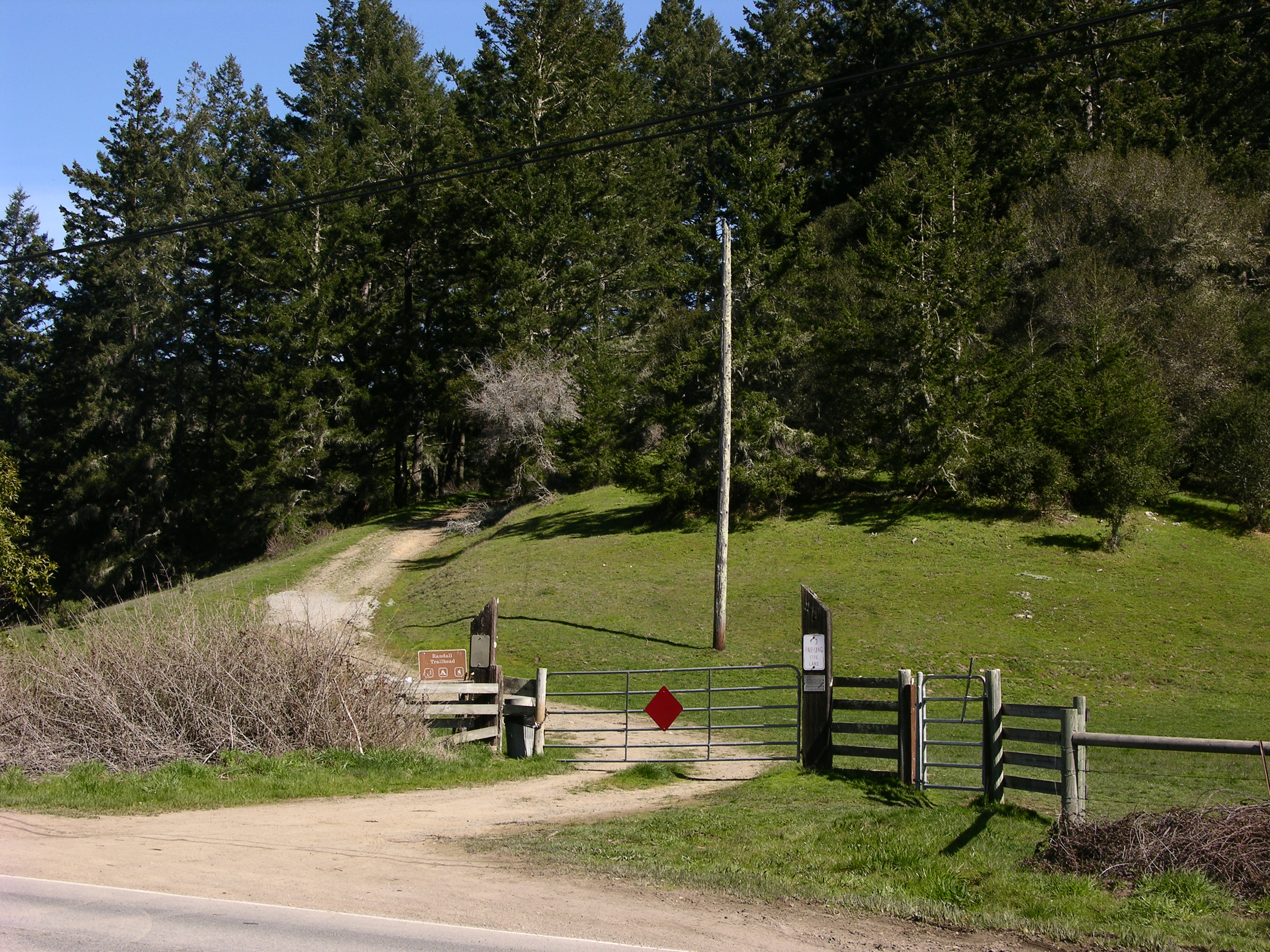
Park at the Randall Trailhead to hike a fairly steep old ranch/fire road that ascends 1.7 miles through Douglas fir and coast redwood forests to the Bolinas Ridge Trail. Pets, bicycles, and horses are permitted on the Randall Trail. The trailhead is located along Highway 1 (aka Shoreline Highway) 6 miles (9.6 km) south of Olema and approximately 15 minutes by car from the Bear Valley Visitor Center.