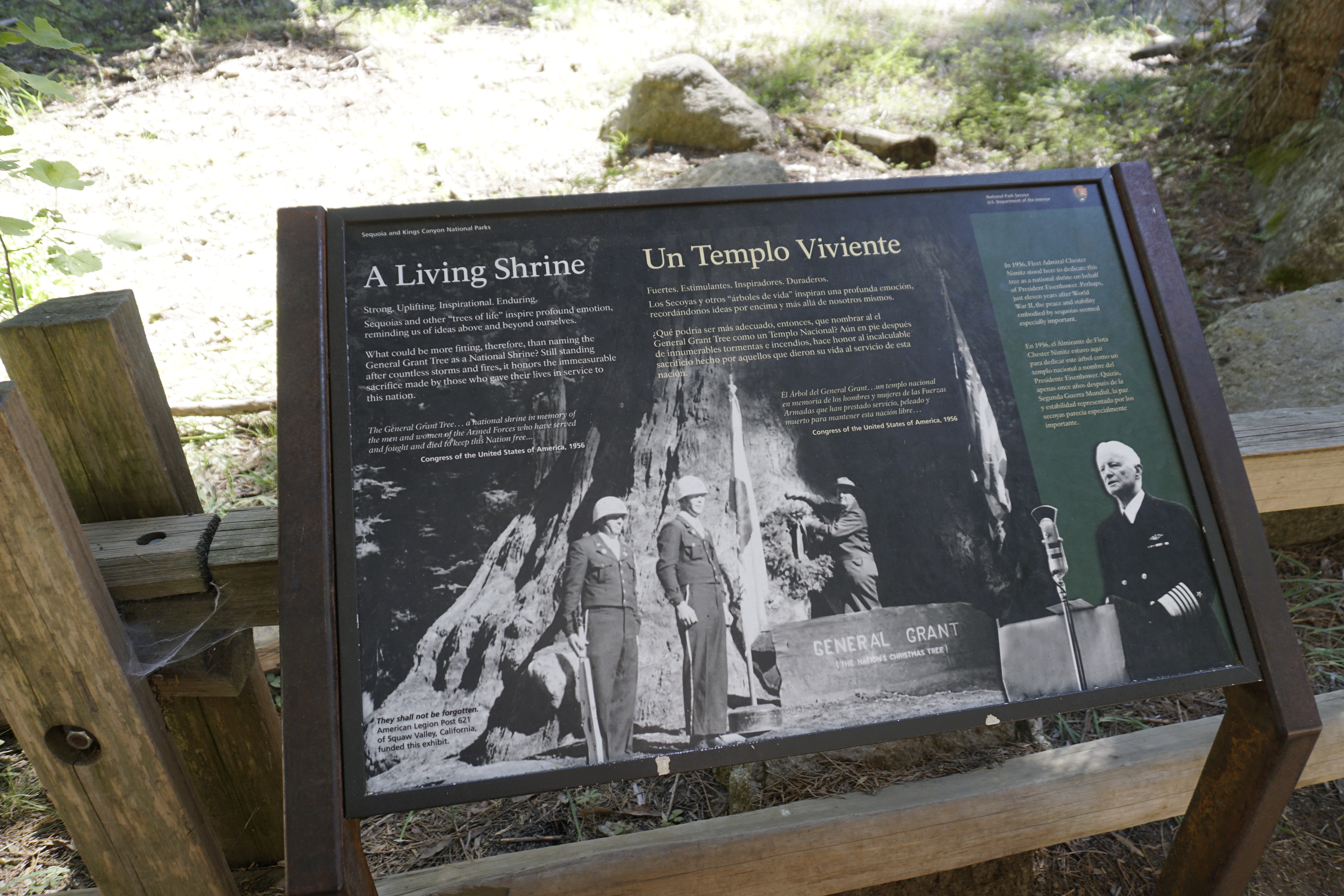
Some national parks exist to commemorate battles. No known battle took place here, yet this giant tree inspires us to consider the inner strength and endurance of this country and those who have fought for it. What do you feel about the unusual move of designating a tree as a national shrine?
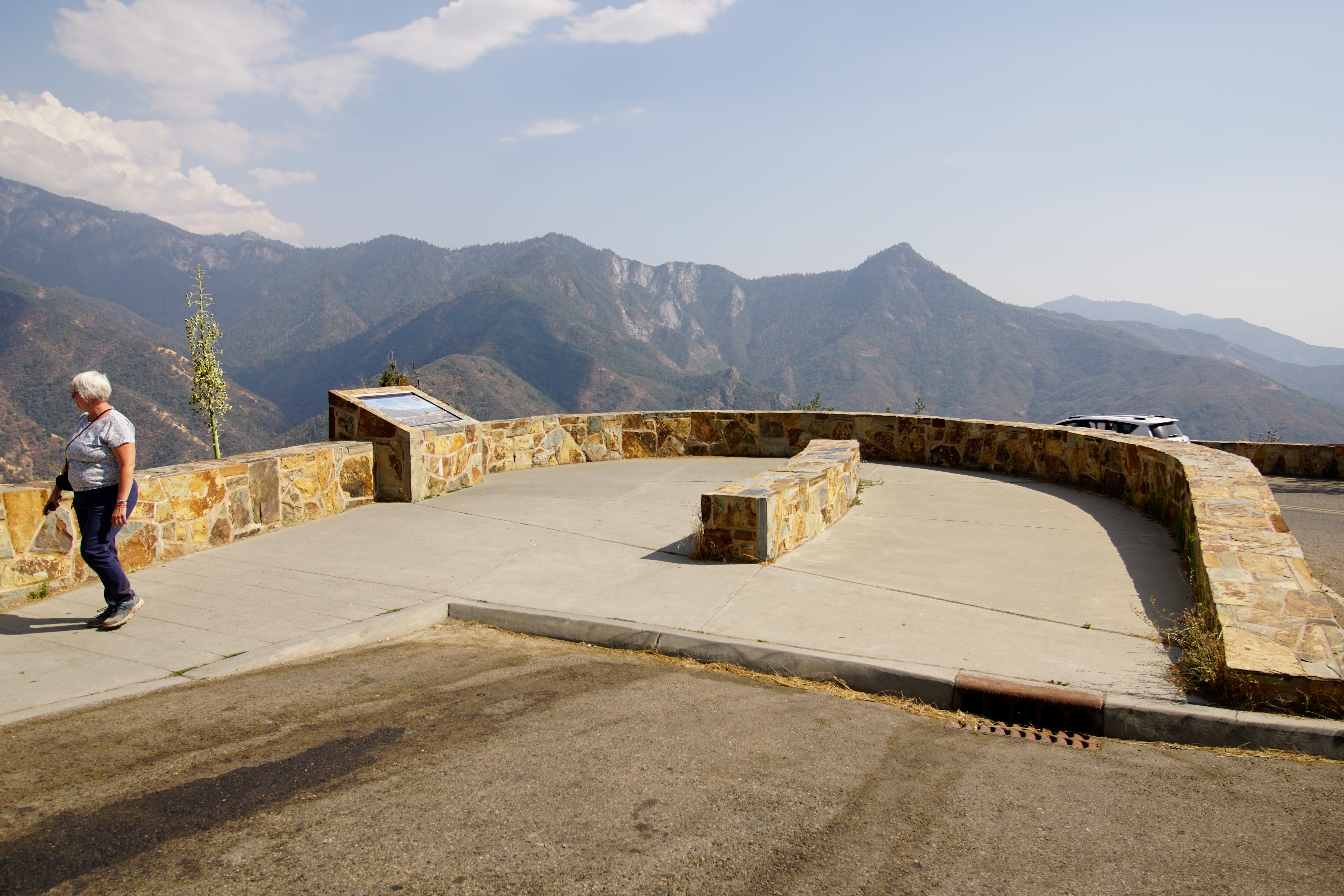
Located on the Generals Highway between Hospital Rock Picnic Area and the Giant Forest Museum, this viewpoint offers stunning views of Moro Rock and the steep elevation change from the foothills to granite peaks. The foothills are an often overlooked area of the park, but they are a vital and diverse landscape. During the cooler months, deer and bears often move downhill to find food. Reptiles, birds, and small mammals live there year round. It is not uncommon to spot foxes i
Visitors pay the entrance fee or use an interagency pass at the station. Entrances station staff provide a park newspaper and other orientation materials.
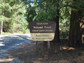
Please consult the USFS on facility availability- https://www.fs.usda.gov/recarea/sequoia/recarea/?recid=79580.Aspen Hollow Group Campground sits at an elevation of 5,300 feet within the Giant Sequoia National Monument, adjacent to Kings Canyon National Park. The campground is one mile from Hume Lake, an 87-acre man-made lake in the Kings River Watershed. The campground accommodates up to 100 people and has back-in spaces for 35 vehicles. Vault toilets, drinking water, laundr
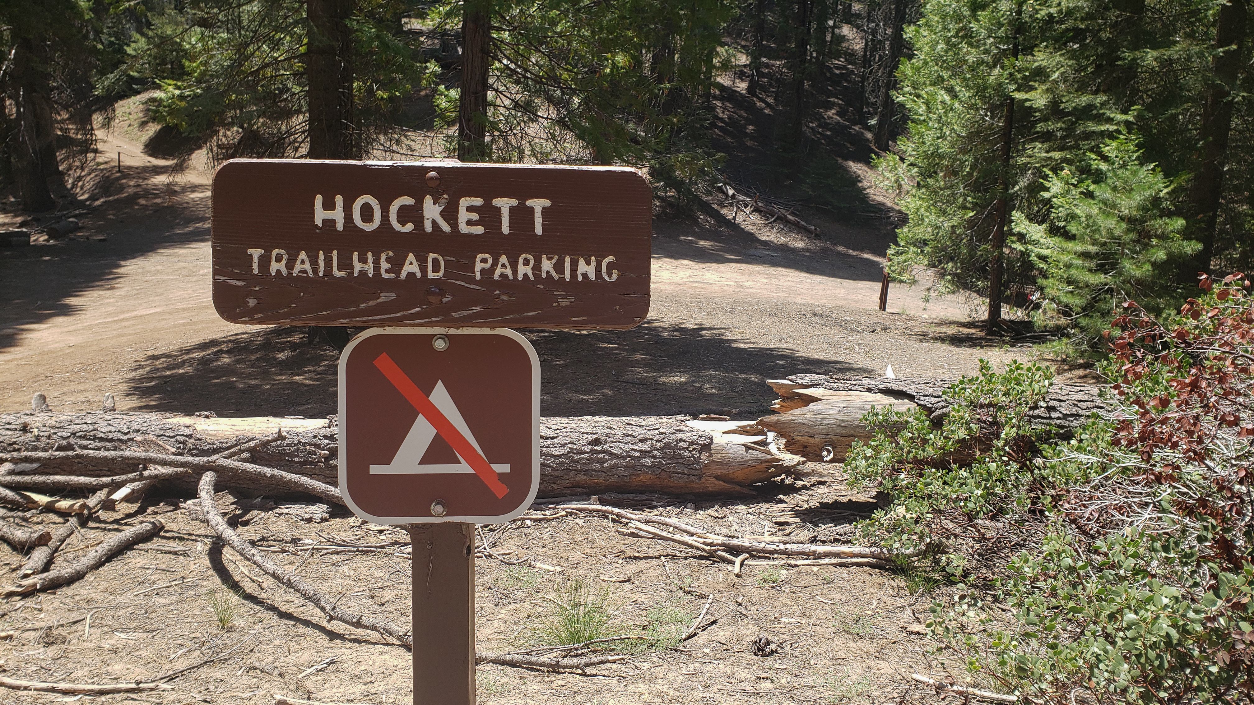
Atwell-Hockett Trail leads 10 miles one-way (20 miles round-trip) at a moderate slope through sequoia trees and up to Hockett Meadow. The first campsite along the trail is at 6 miles at Clover Creek. Other wilderness destinations include Evelyn Lake, Cahoon Rock, and the Golden Trout Wilderness, which is outside national park boundaries in Golden Trout Wilderness.
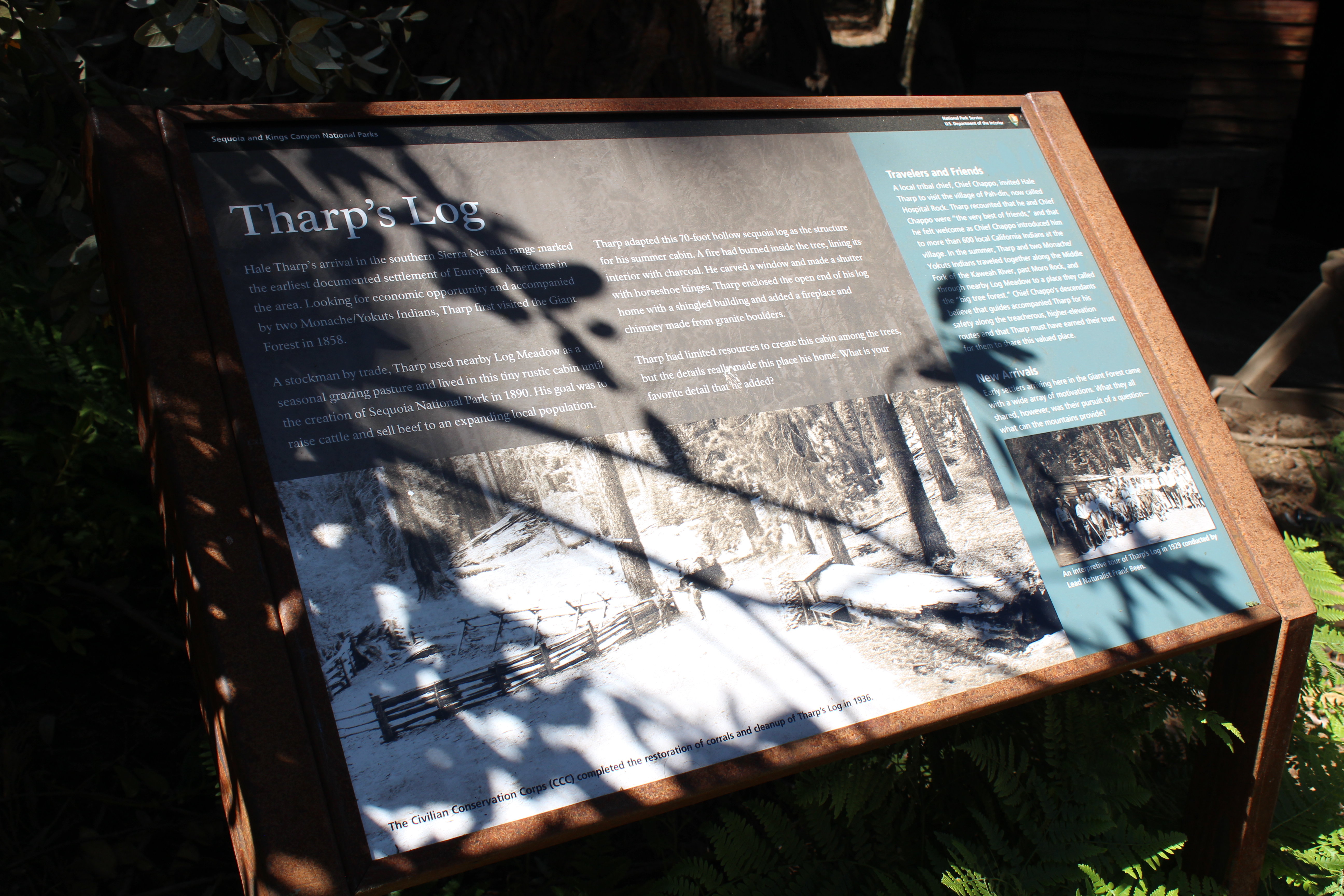
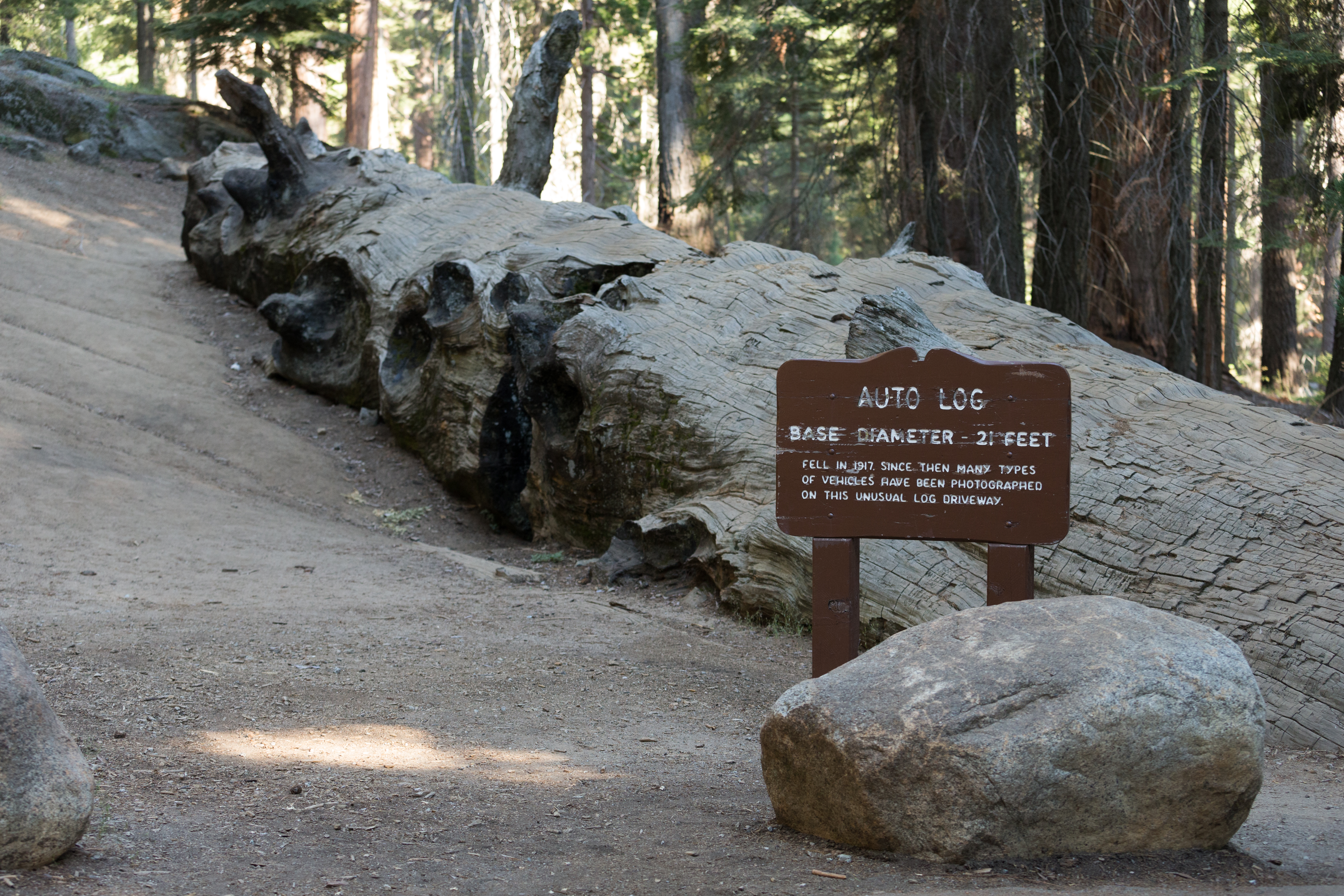
Once you could drive a car onto this fallen giant, but rot in the log put an end to the tradition. As you walk on it, consider these massive trees that dwarf modern vehicles and can support their weight. Be sure to read see the wayside exhibit here about the nearby Booker T. Washington and Col. Young trees, named for two giants in history.
A short walk from the Giant Forest Museum, Beetle Rock offers a view of the western edge of the park and the San Joaquin Valley below. While this view can be beautiful at sunset, you are also likely to witness the smog that people are surprised to find here. A wayside exhibit (to the right as you approach the rock) explains the source of pollution.
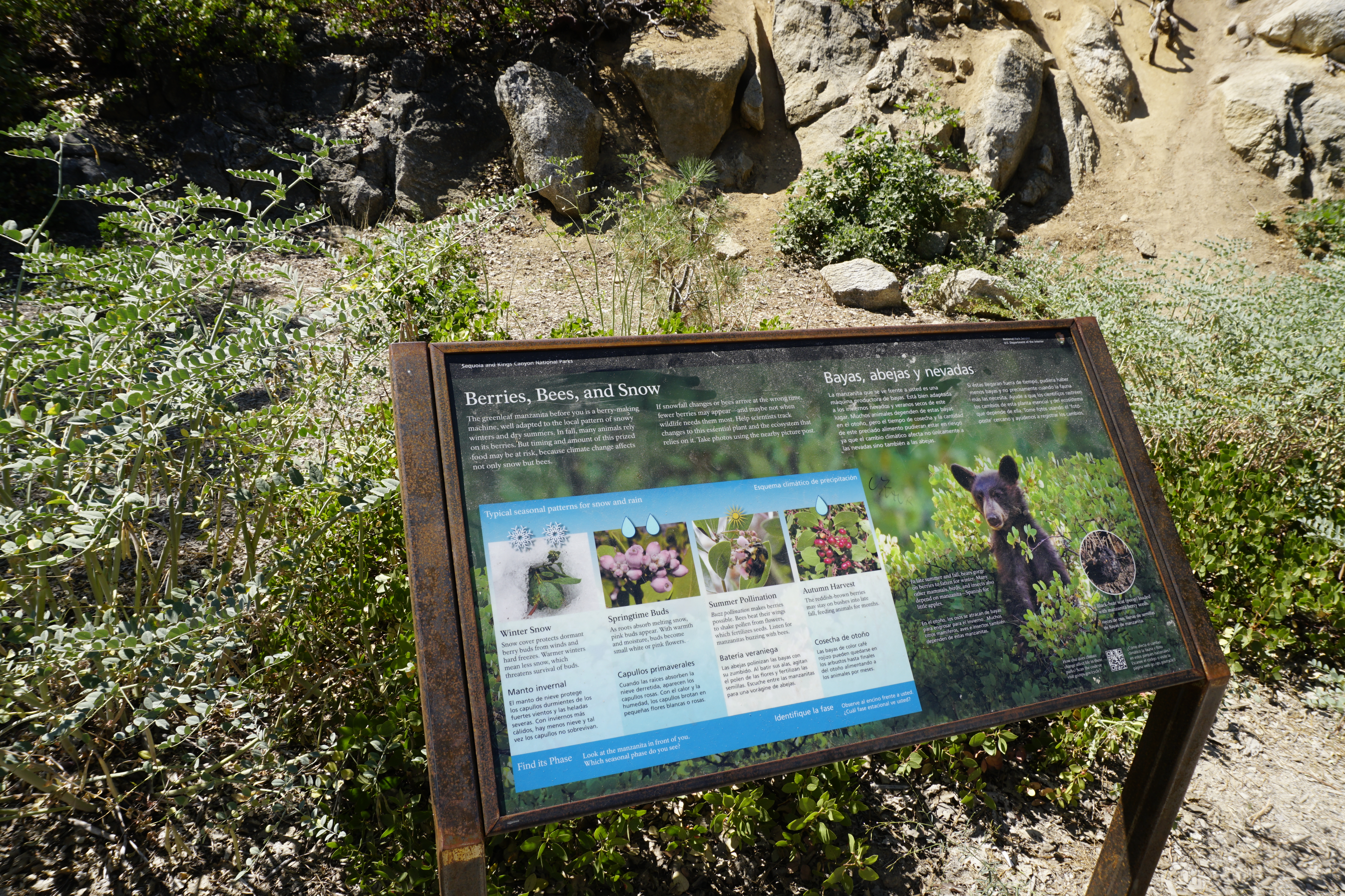
This wayside at the far end of the Big Stump Picnic Area gives insight into an important food plant here, the manzanita. How might climate change affect the bees and snow this shrub relies on? How might climate change affect the manzanita berries that other animals rely on?
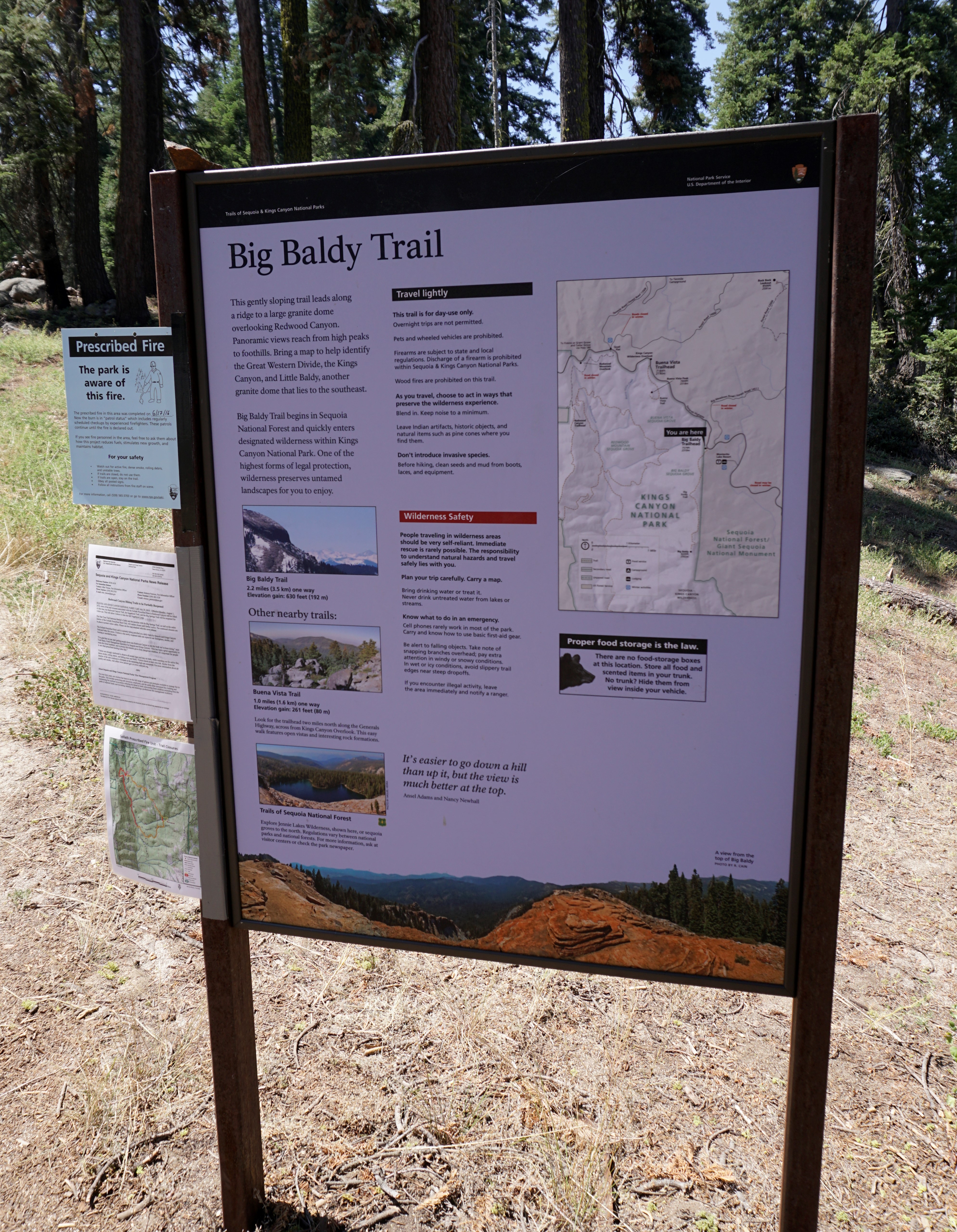
This trailhead orientation panel shows a map and images of the Big Baldy Trail area.<br /><br />The Big Baldy Trail leads 2.2 miles one-way (4.4 miles round-trip) at a gentle slope along a ridge toward panoramic views of Kings Canyon and the Great Western Divide. This trail is for day-use only; overnight camping is not allowed.
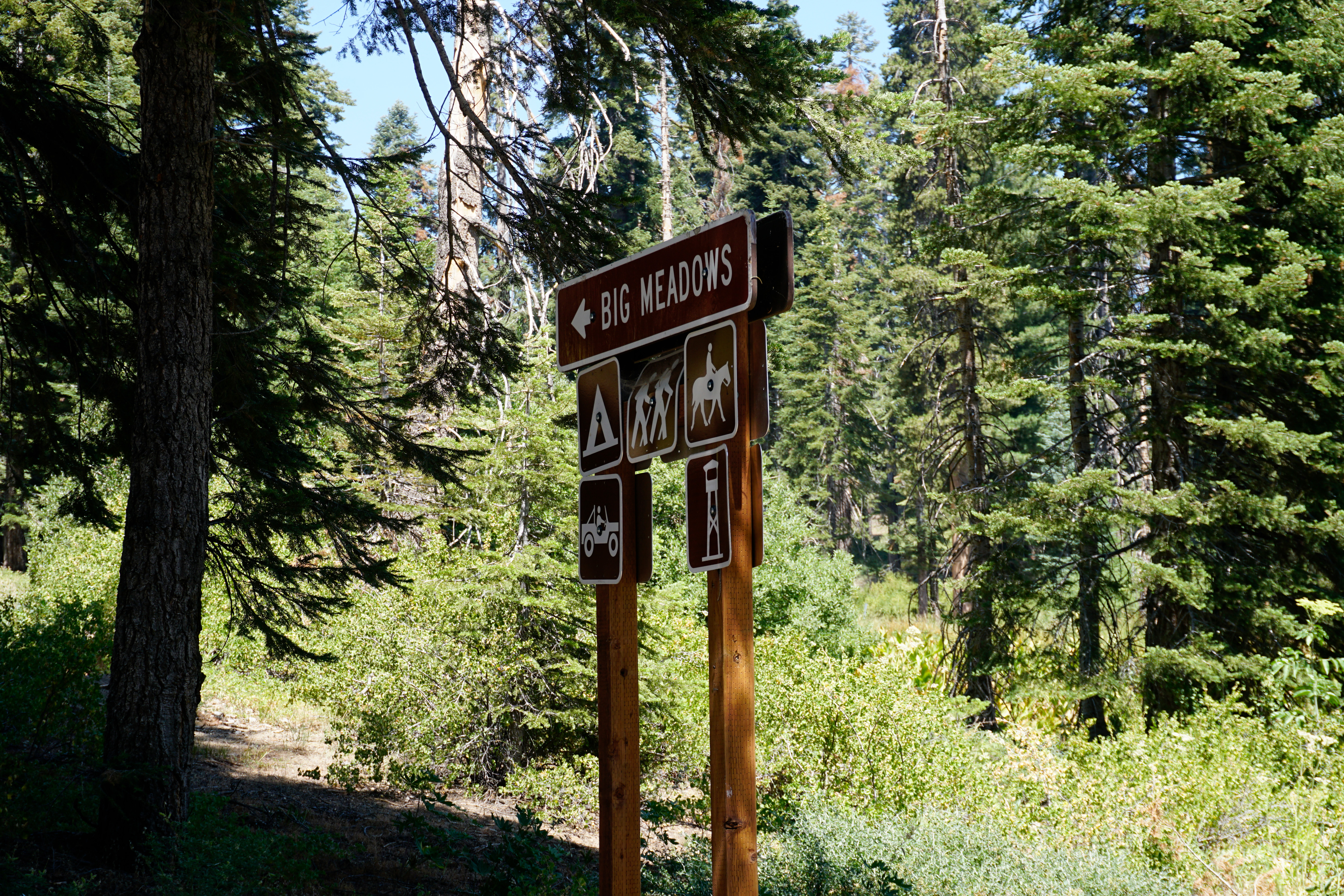
On Forest Service land between the park areas of Grant Grove and Lodgepole, this road accesses primitive campgrounds, the Big Meadows Pack Station, and Buck Rock Fire Lookout.<br /><br />This road can close, especially in the winter when conditions are snowy or muddy.
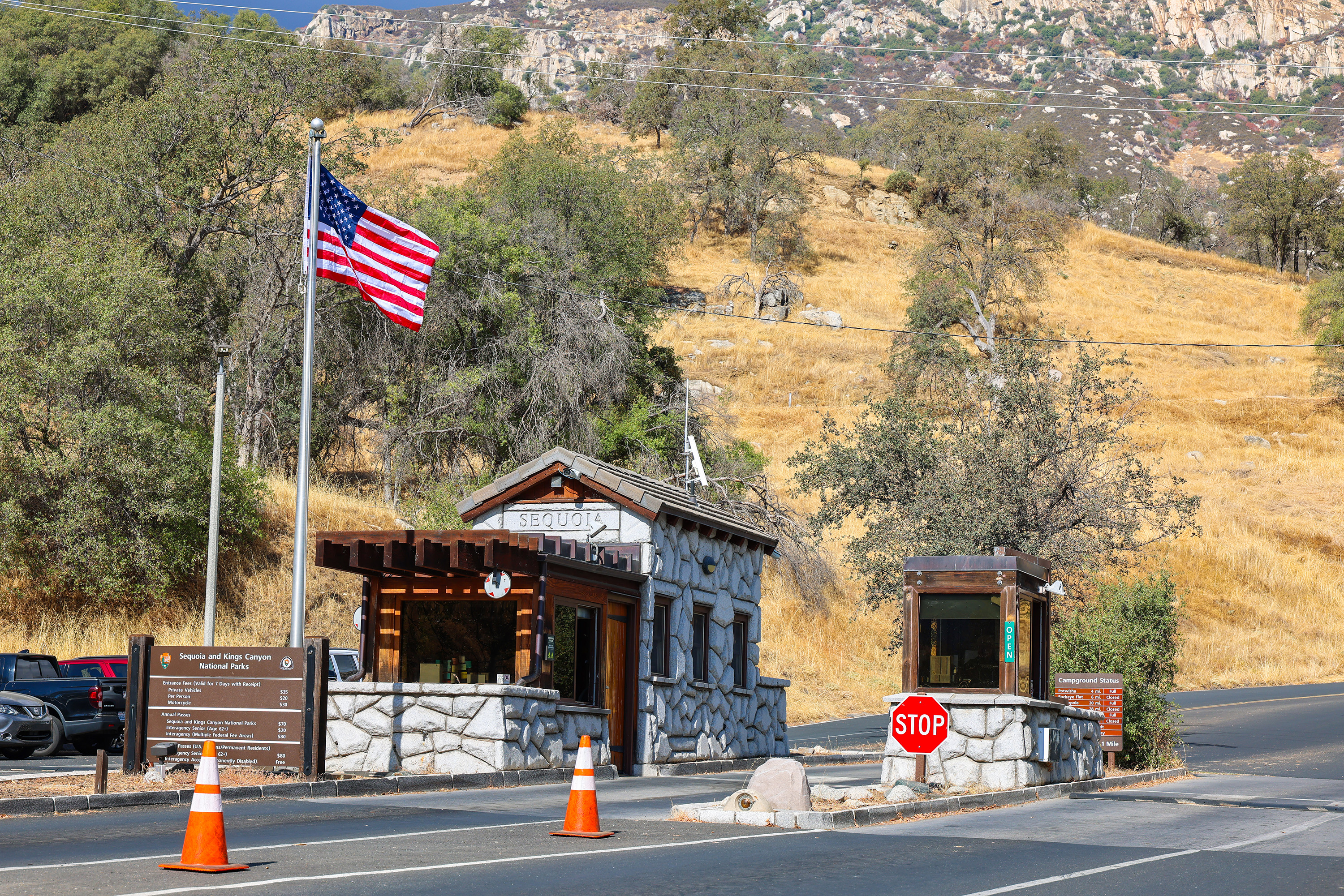
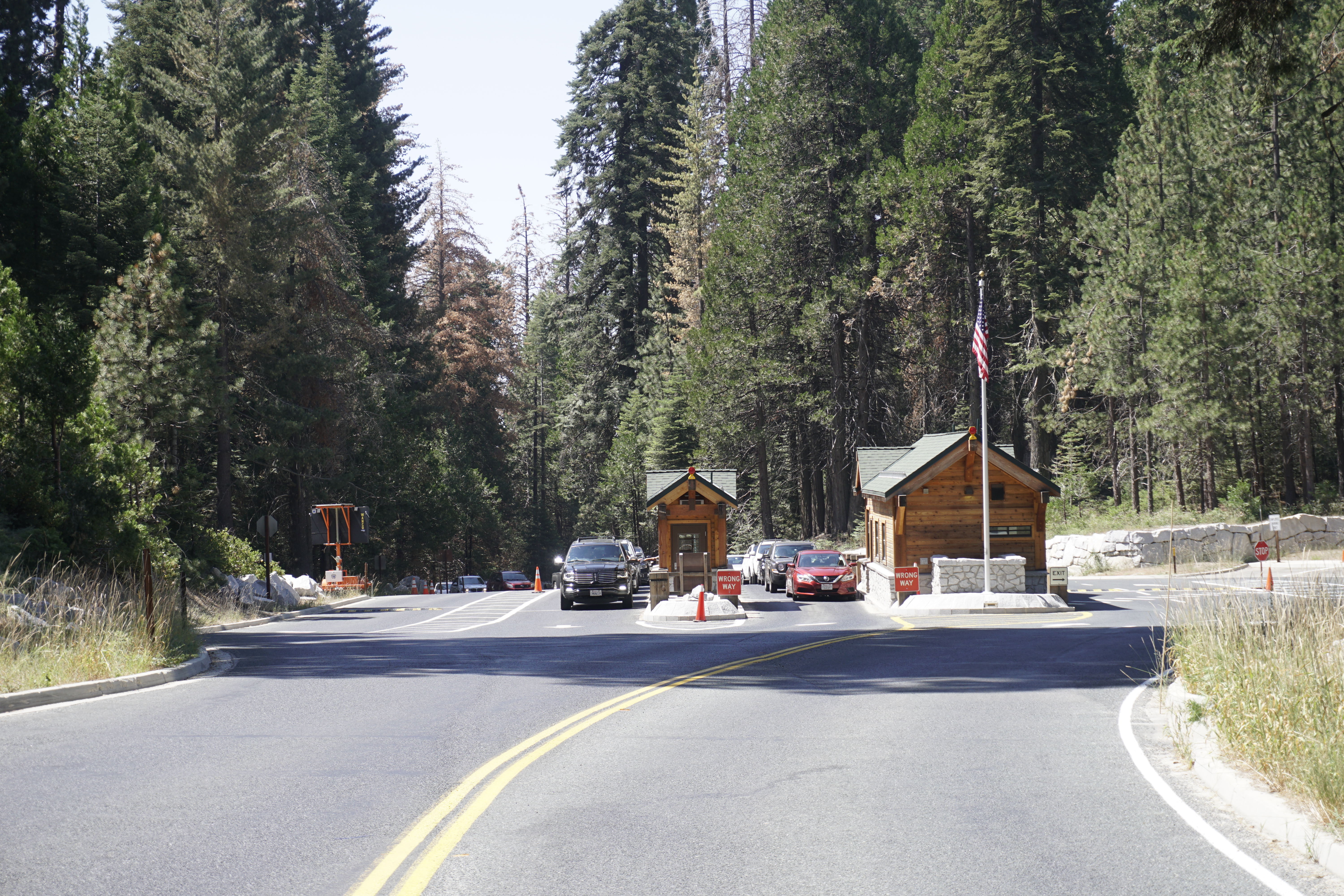
This entrance station is probably your first stop within the parks if you are coming from Fresno. On Highway 180, this is where you pay the entrance fee to Sequoia and Kings Canyon National Parks and the Hume Lake District of Sequoia National Forest.
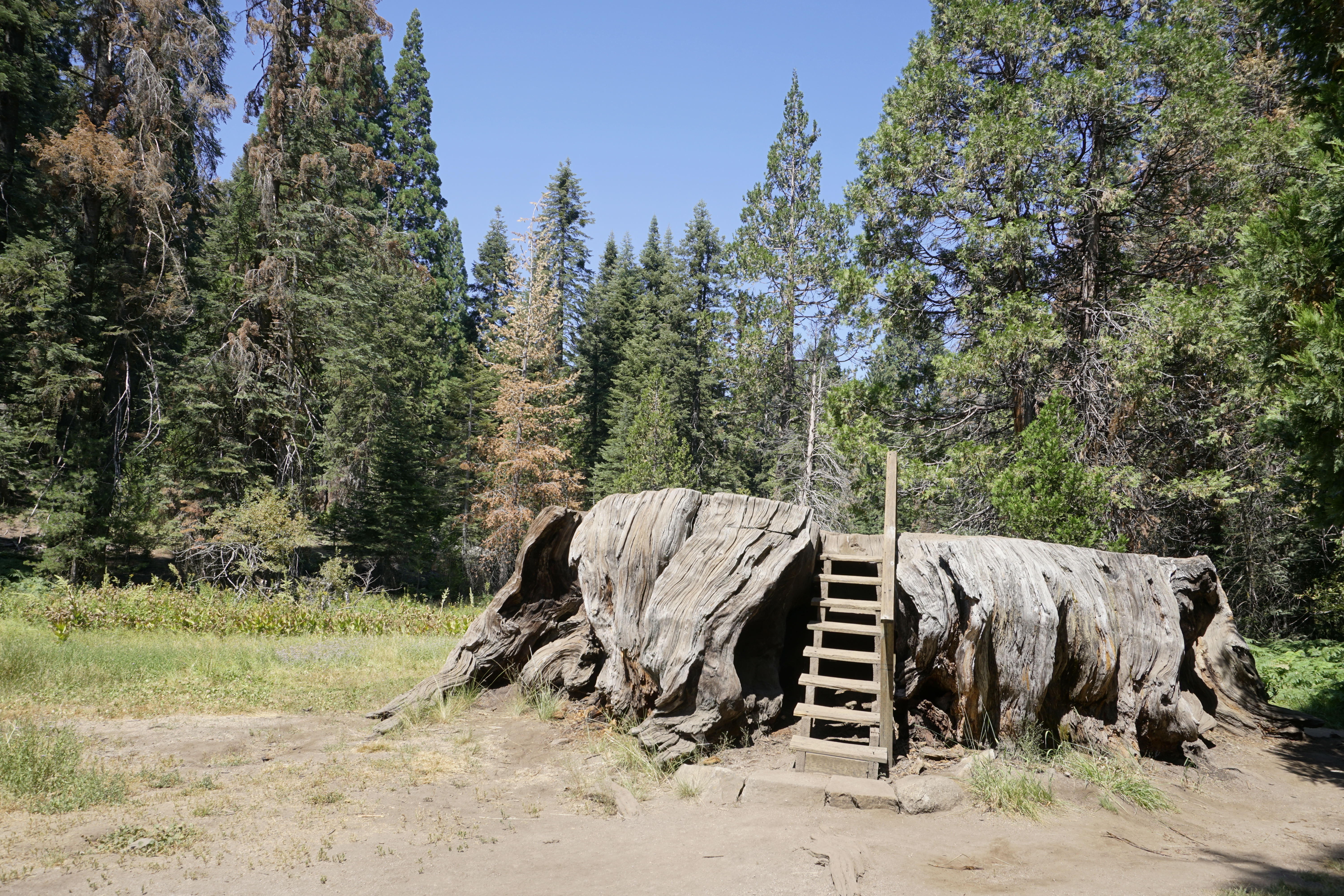
The first rest area after the park entrance station on Highway 180, makes this a perfect spot to get your bearings after the drive up from the San Joaquin Valley. It includes the trailhead for the Big Stump Trail, which leads to the Mark Twain Stump via a 1.5-mile (2.4 km) hike. A small staircase on the stump lets you climb onto it.
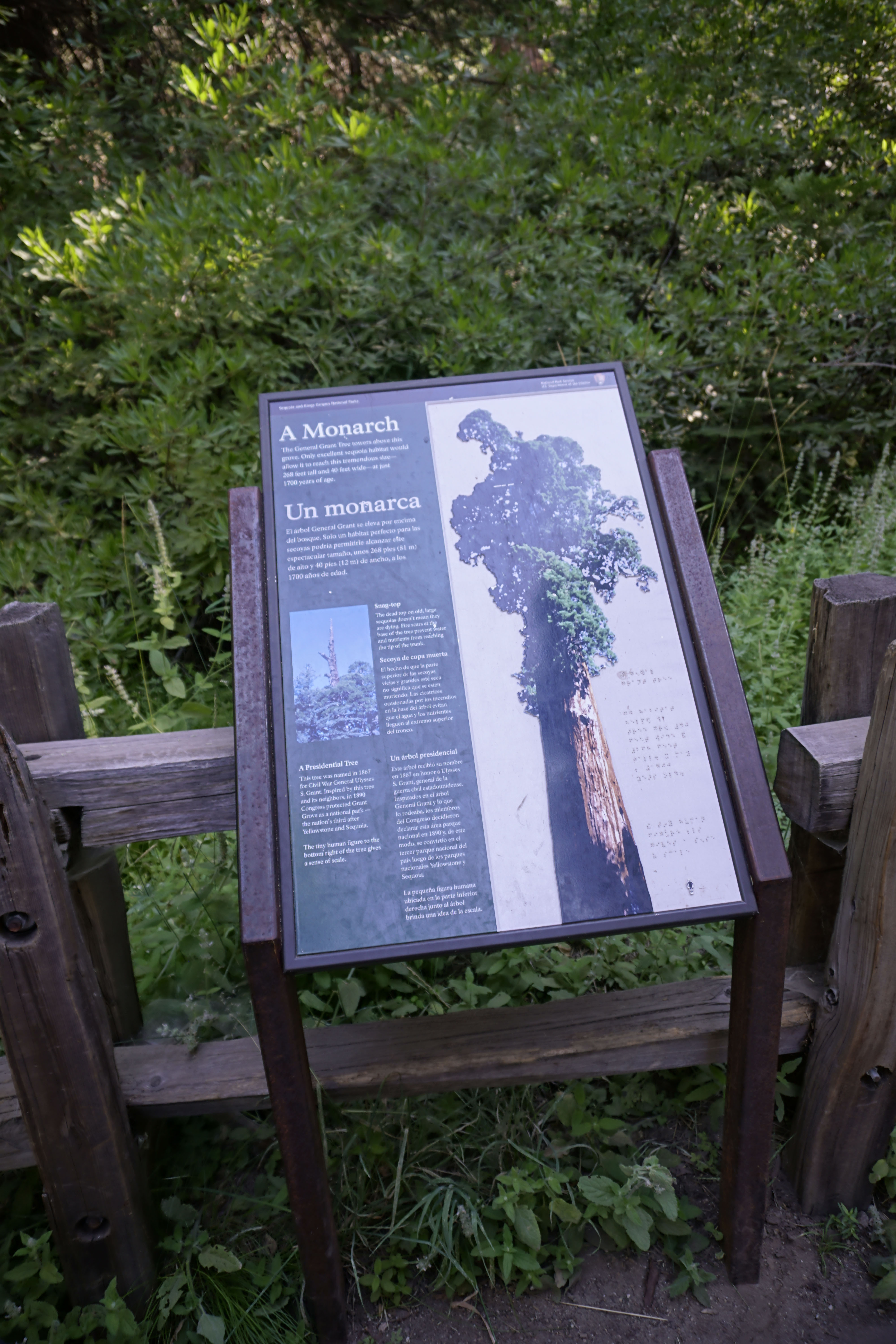
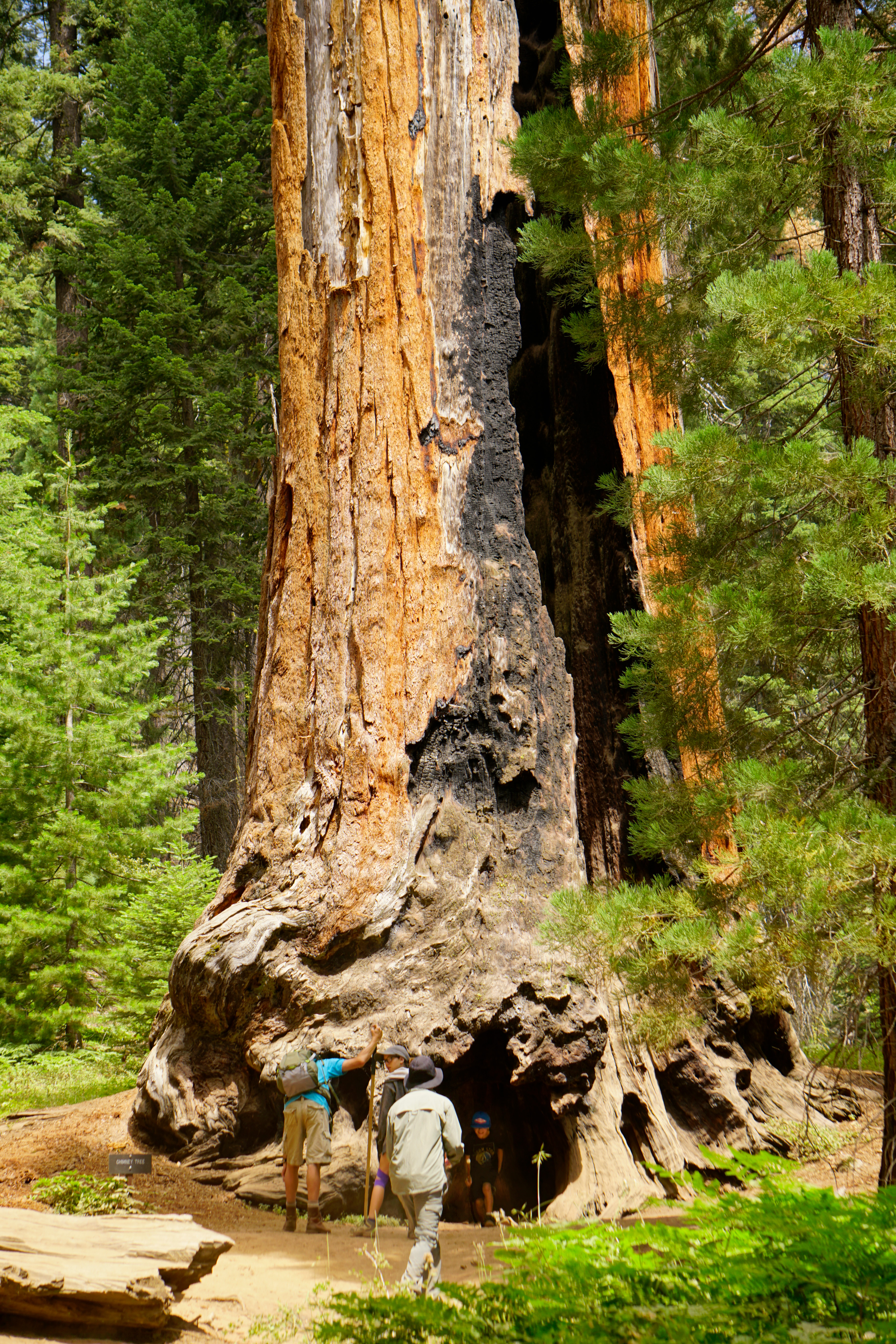
Known as the Mark Twain Tree, this Giant Sequoia reached 16 feet (4.8 meters) in diameter. Even after the national park was established, travel to the sequoia groves was difficult, and many people simply didn't believe trees could grow so large. In 1891, the Army cut down this sequoia so it could be displayed to astonished crowds in New York and London.
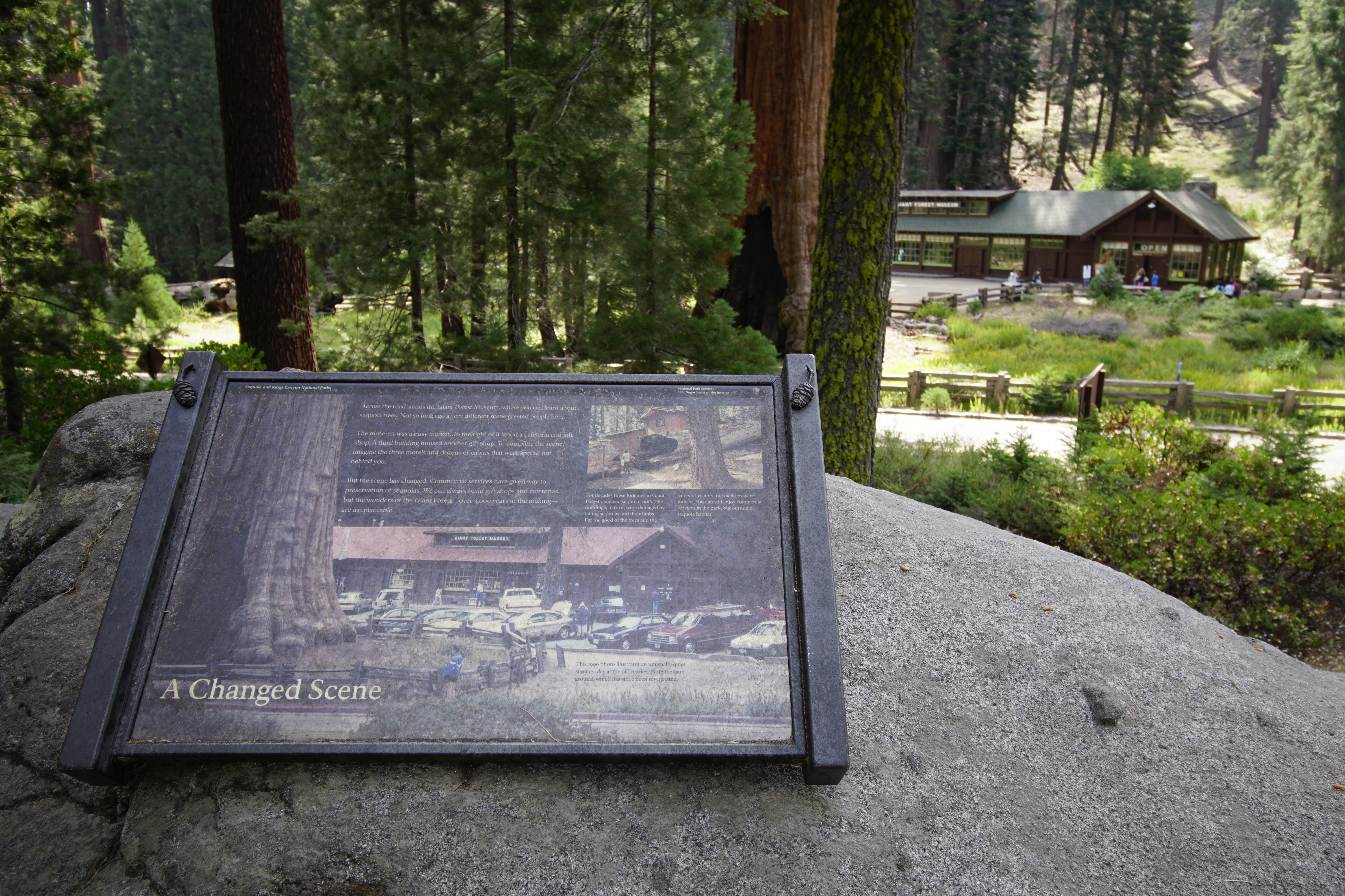
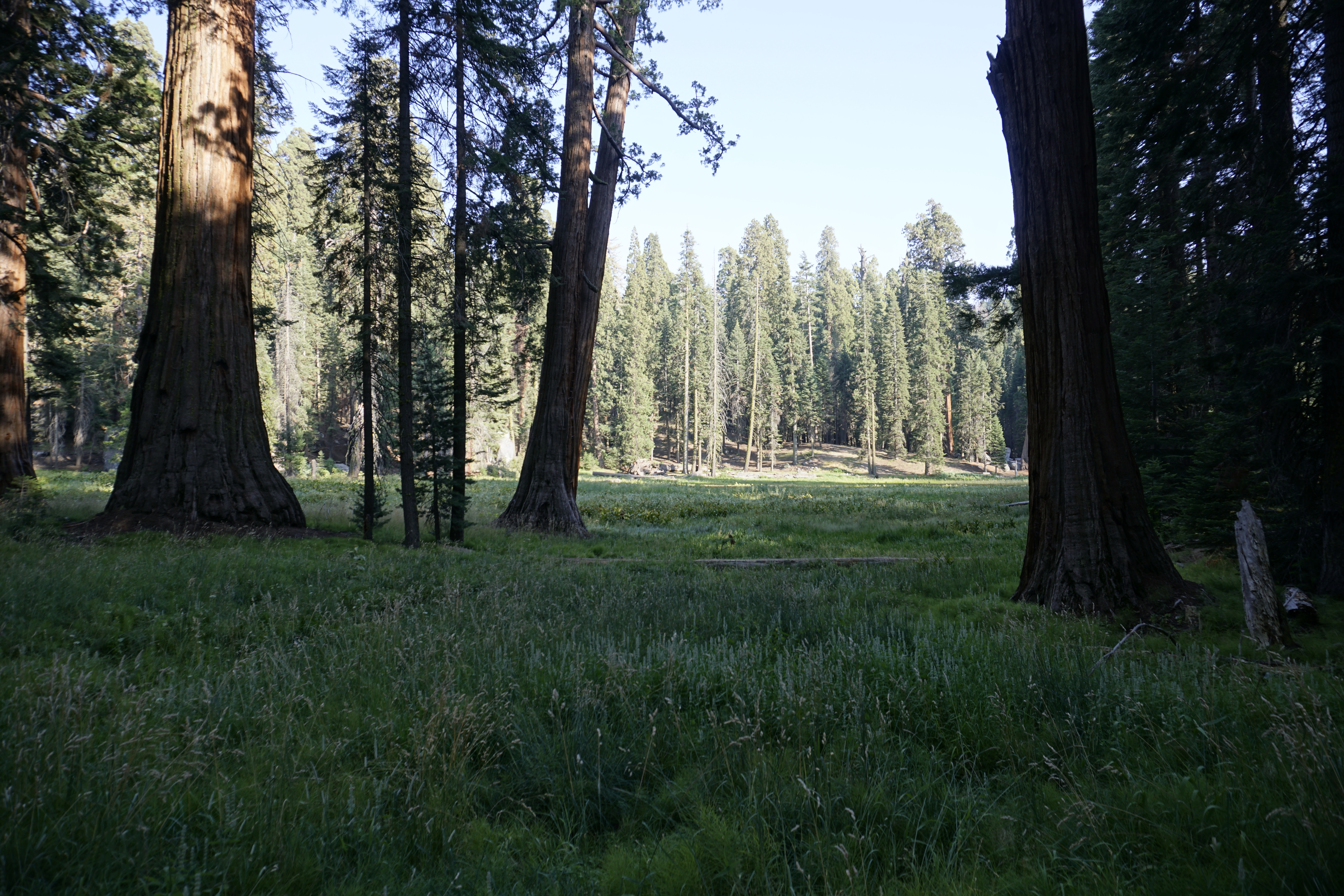
Big Trees Trail circles Round Meadow in a 0.7 mile loop. It is flat, paved, and has benches along the way. Informational displays offer insight into what you are experiencing. Watch for yellow-bellied marmots, bears, and other wildlife. After taking this trail, consider walking the Hazelwood Meadow Trail on the other side of the road; it leads through another part of the grove.
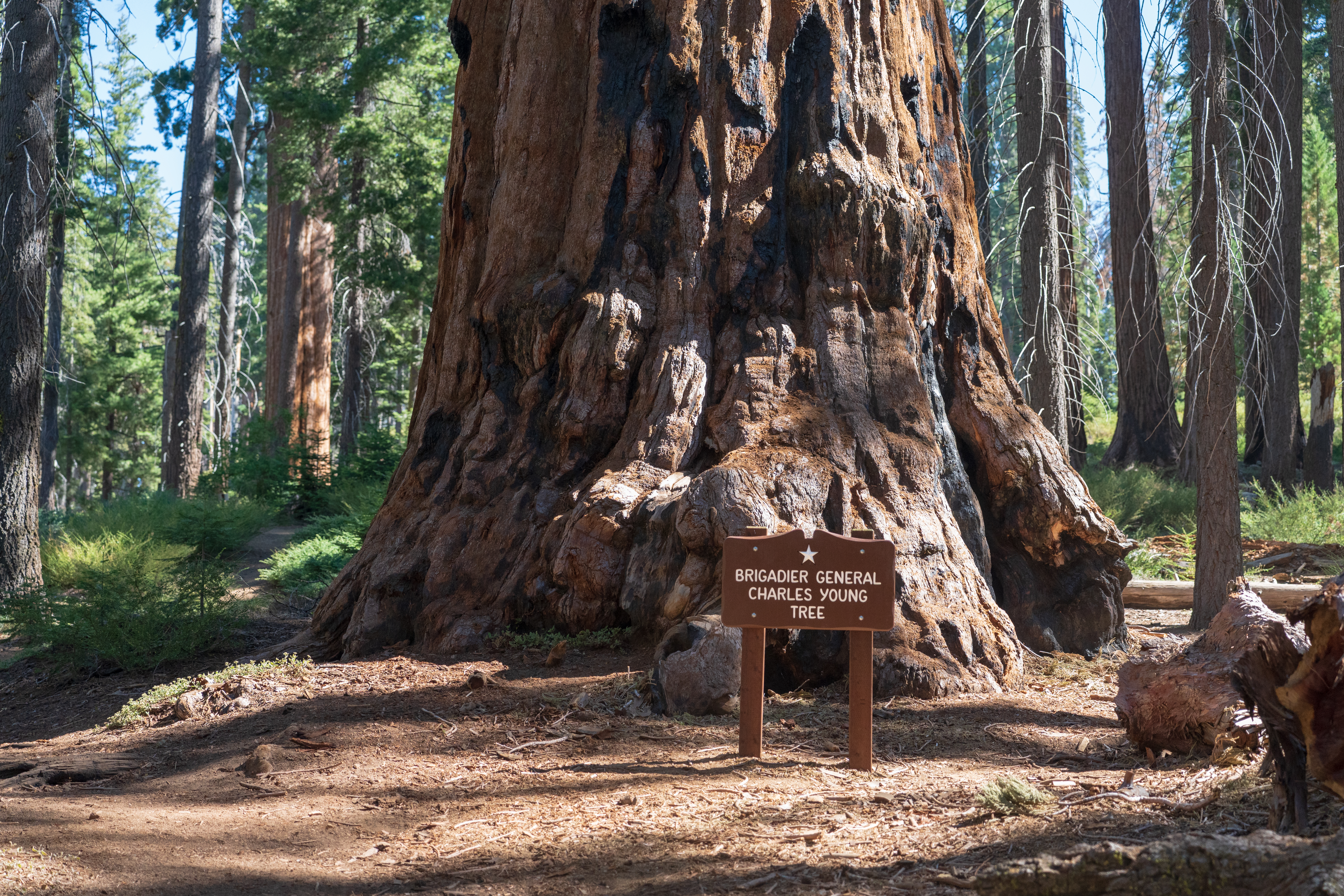
A giant sequoia dedicated to the memory of Booker T. Washington-a leader in the African-American community during the late 18th and early 19th centuries-stands before you.Colonel Charles Young-a commissioned officer in the US Army who served as the first superintendent of Sequoia National Park, dedicated this tree in honor of a man he deeply admired.
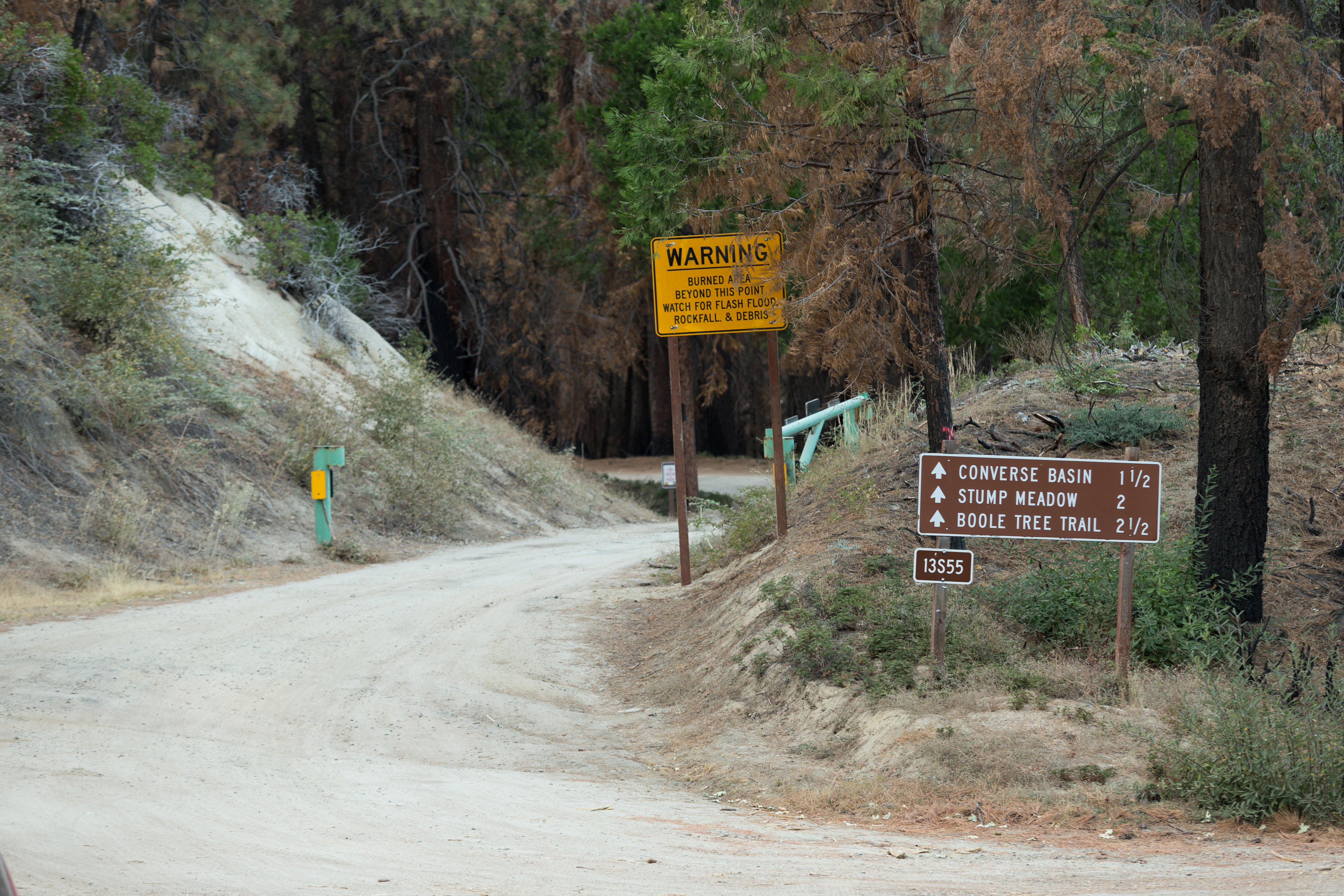
This 2.5-mile trail in the national forest outside the park leads to the magnificent Boole Tree, one of the few monarch sequoias spared by 19th-century logging. It also offers great views over and across the Kings River country. Take Highway 180 2.5 miles north of Grant Grove, and turn onto the dirt road. In about 2 miles, you pass through aptly named Stump Meadow, the remnants left by an 1800s logging operation.
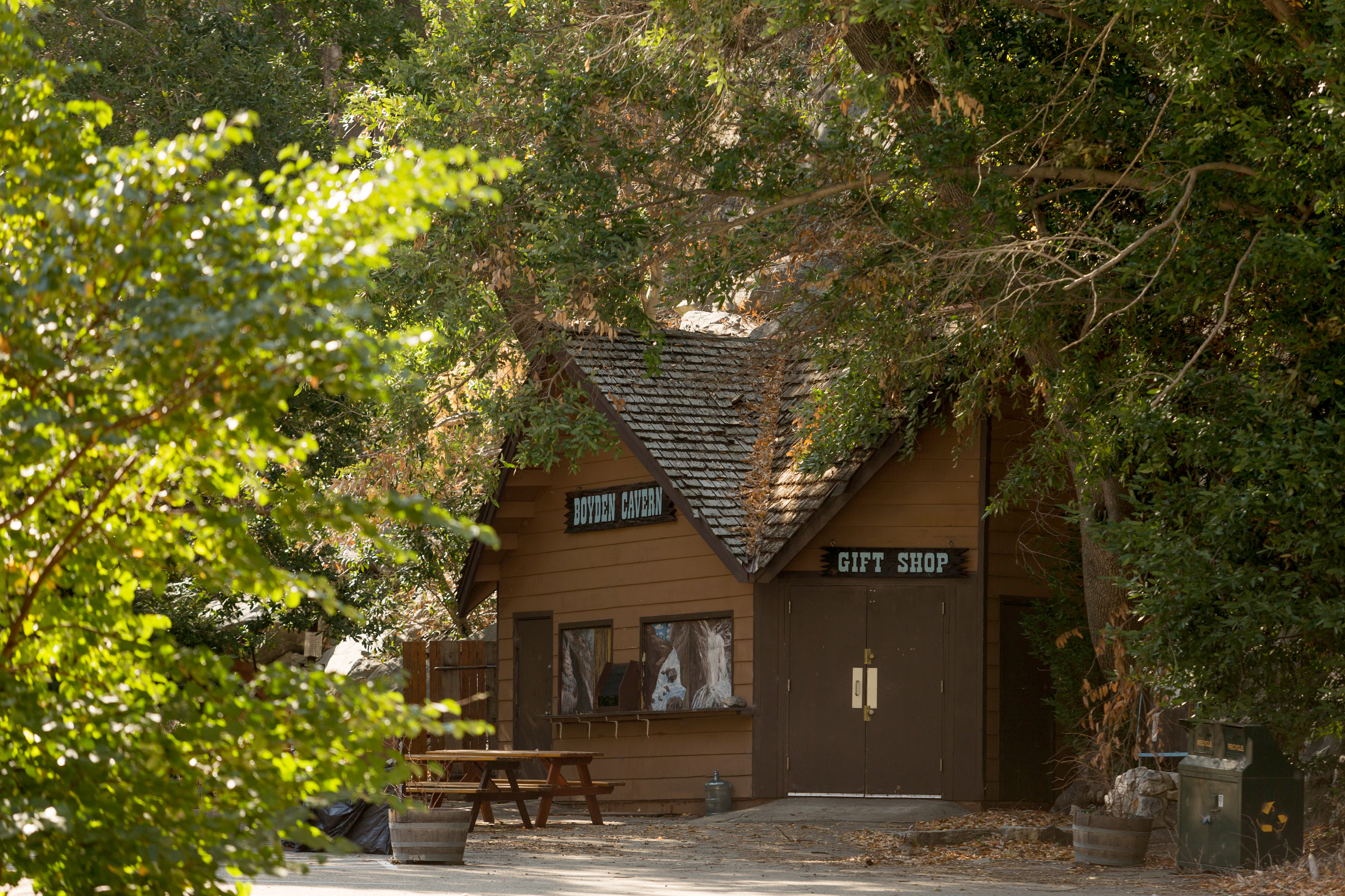
Take a guided, 50-minute walking tour through this cavern, located below the towering 2,000 foot marble walls of the Kings Gates. A short but very steep trail leads to the cave, traveling under and around rock formations. Tours are appropriate for all ages and are offered by a U.S. Forest Service partner, daily from 10 a.m. to 5 p.m. Tour operators recommend you wear hiking boots and a light jacket.
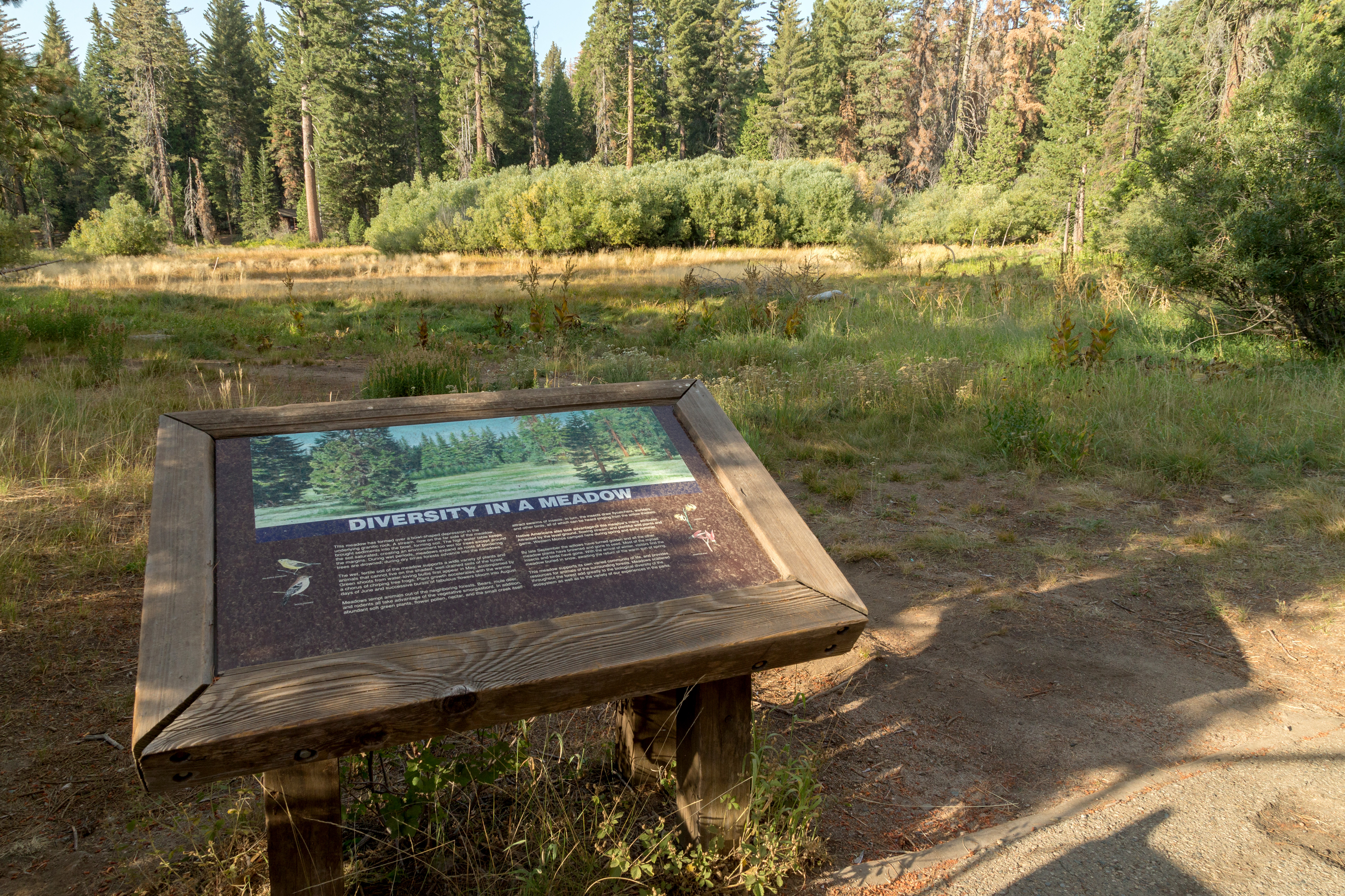
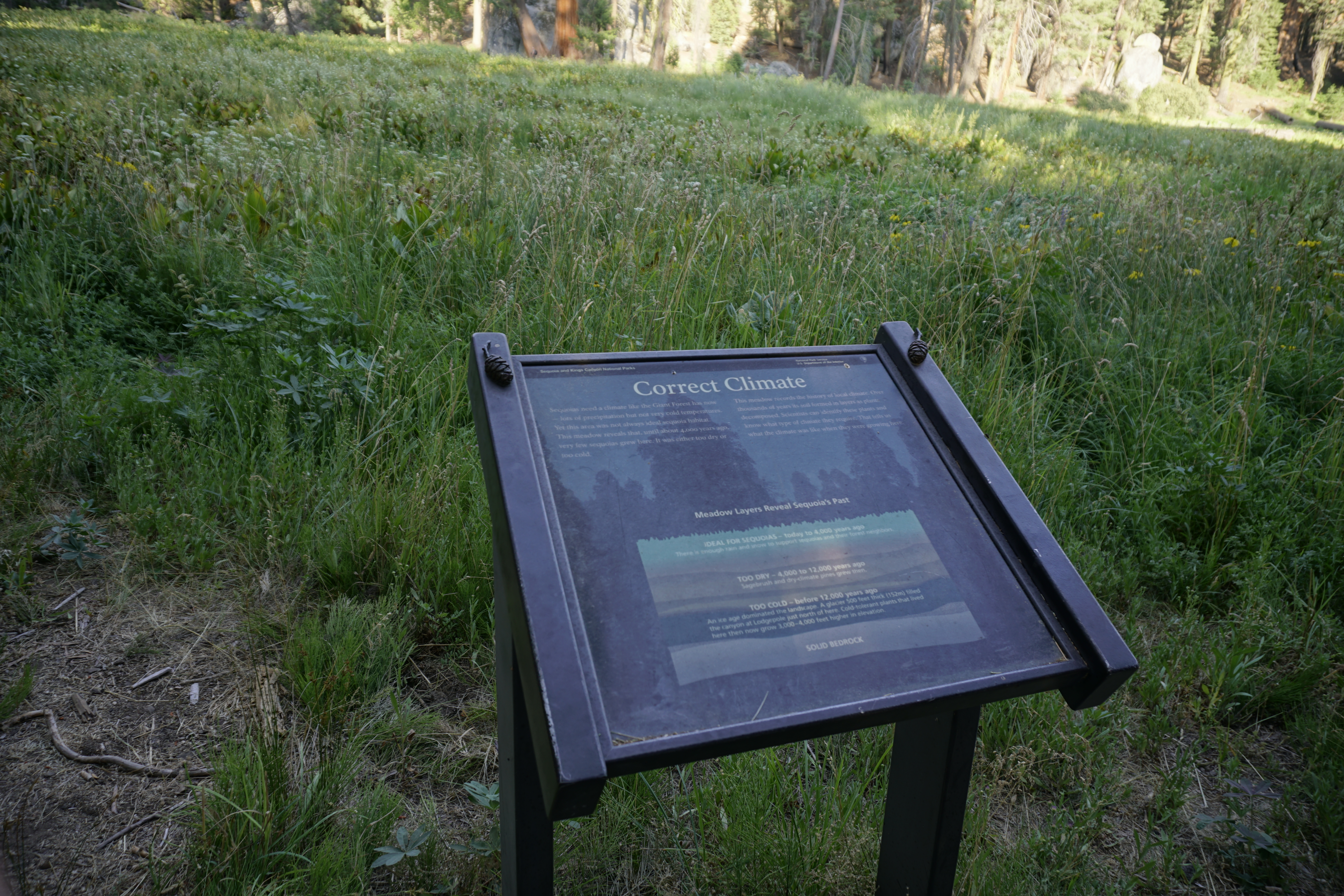
This soft, moist, open pocket of soil contrasts with the surrounding forest and granite bedrock near the ground's surface. Enjoy the sounds of birds and insects that rely on the meadow for food, lodging, and hiding places. Relatively uncommon here, meadows provide critical habitat to many species.
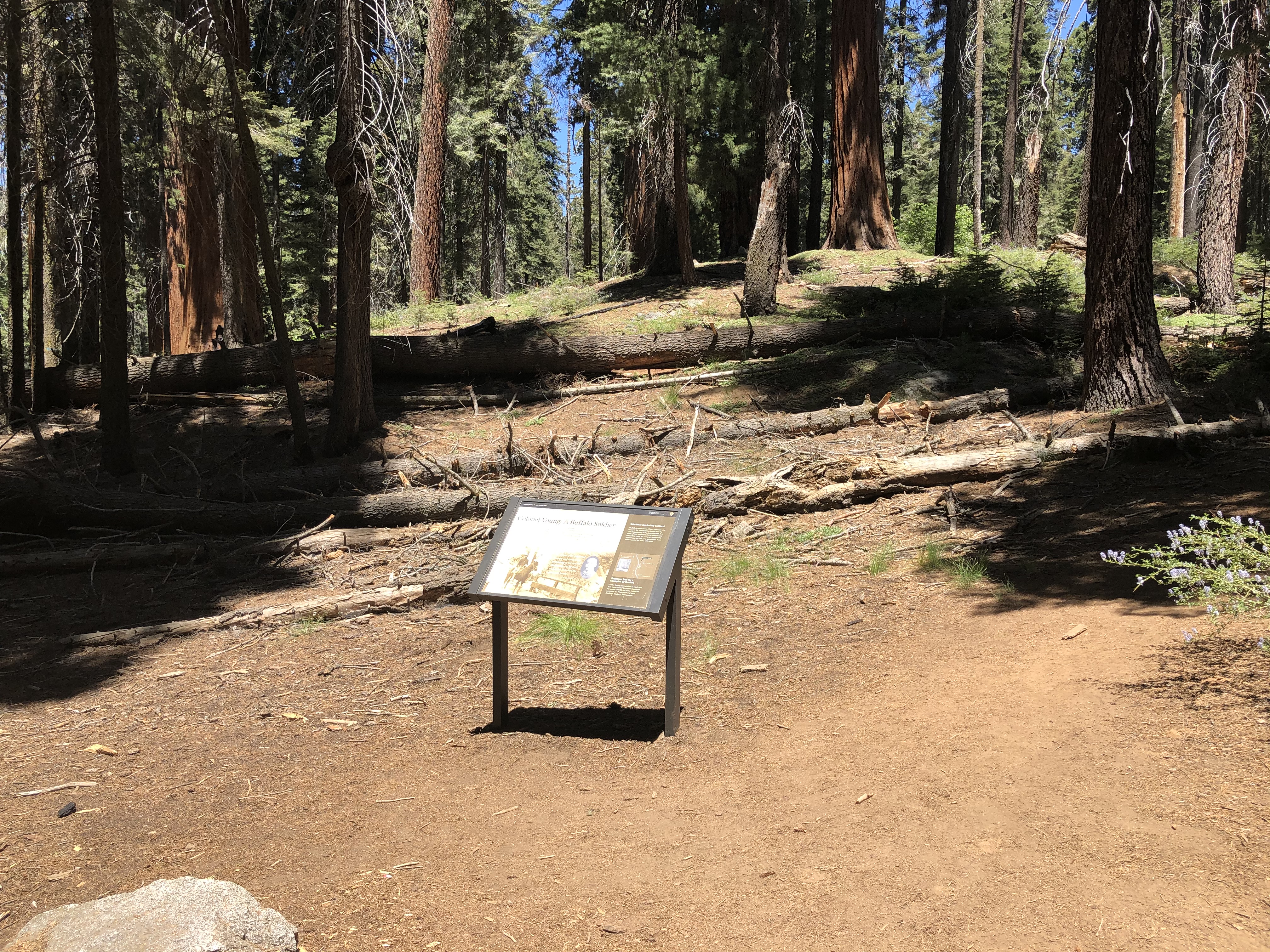
In the fall of 1903, the Buffalo Soldiers who oversaw these parks that year held an end-of-season picnic. A local resident who attended, Phil Winser, wrote the following about Captain Charles Young, the leader of this contingent and the first African American superintendent of any national park: "They wanted to name a tree for our captain but he refused, saying they could do so if they felt the same way, twenty years hence..." He chose instead to name a sequoia for educator B
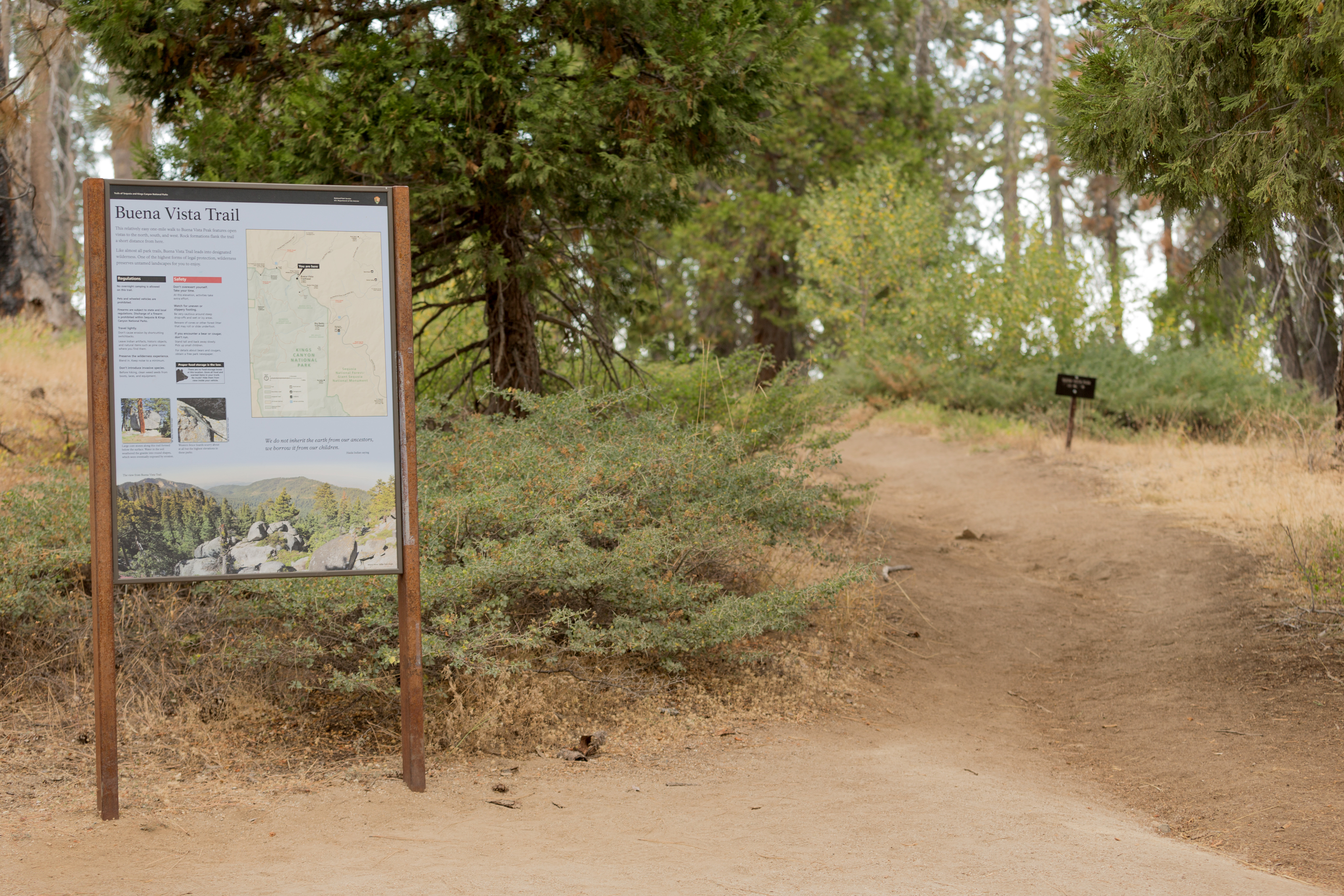
From here hike up to Buena Vista Peak and its 360-degree view of park, forest, and California's huge Central Valley. It's a two-mile round-trip hike, making it one of the most easily accessible peaks in the park. This uphill walk is fairly gentle.
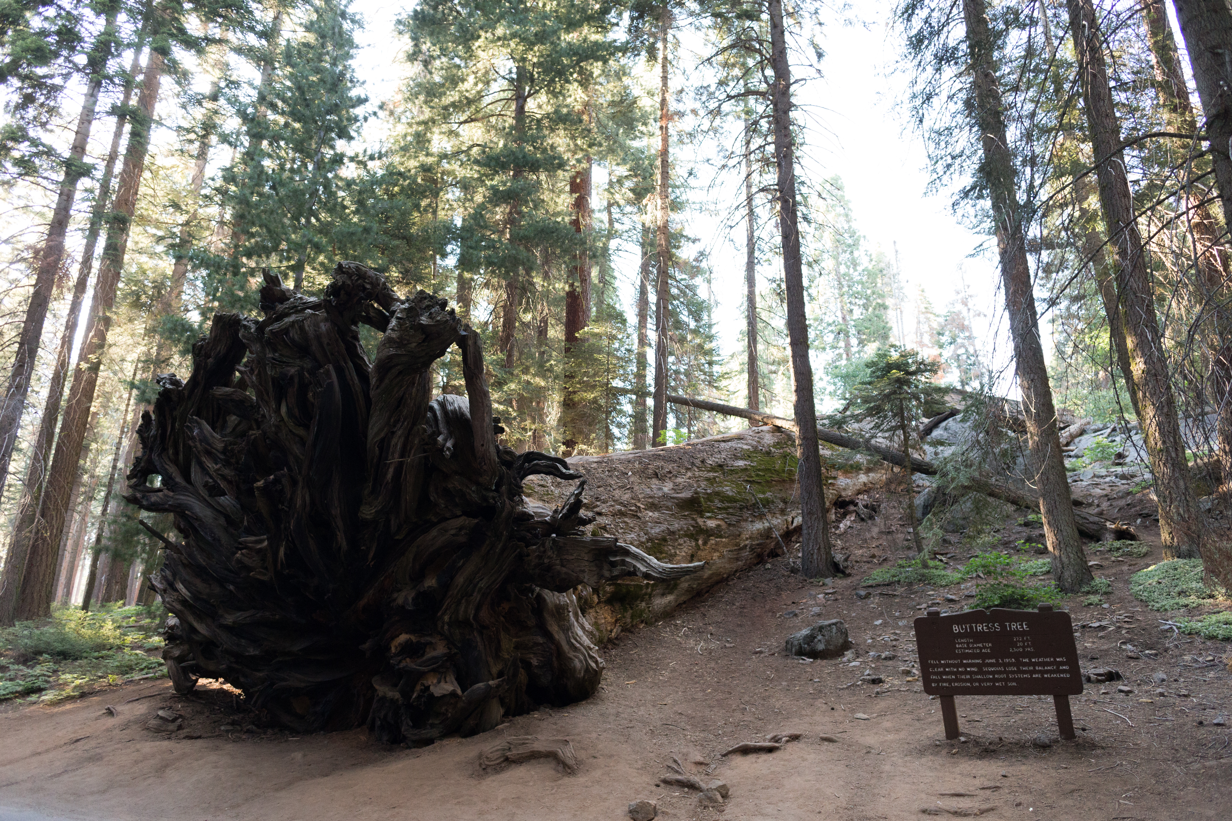
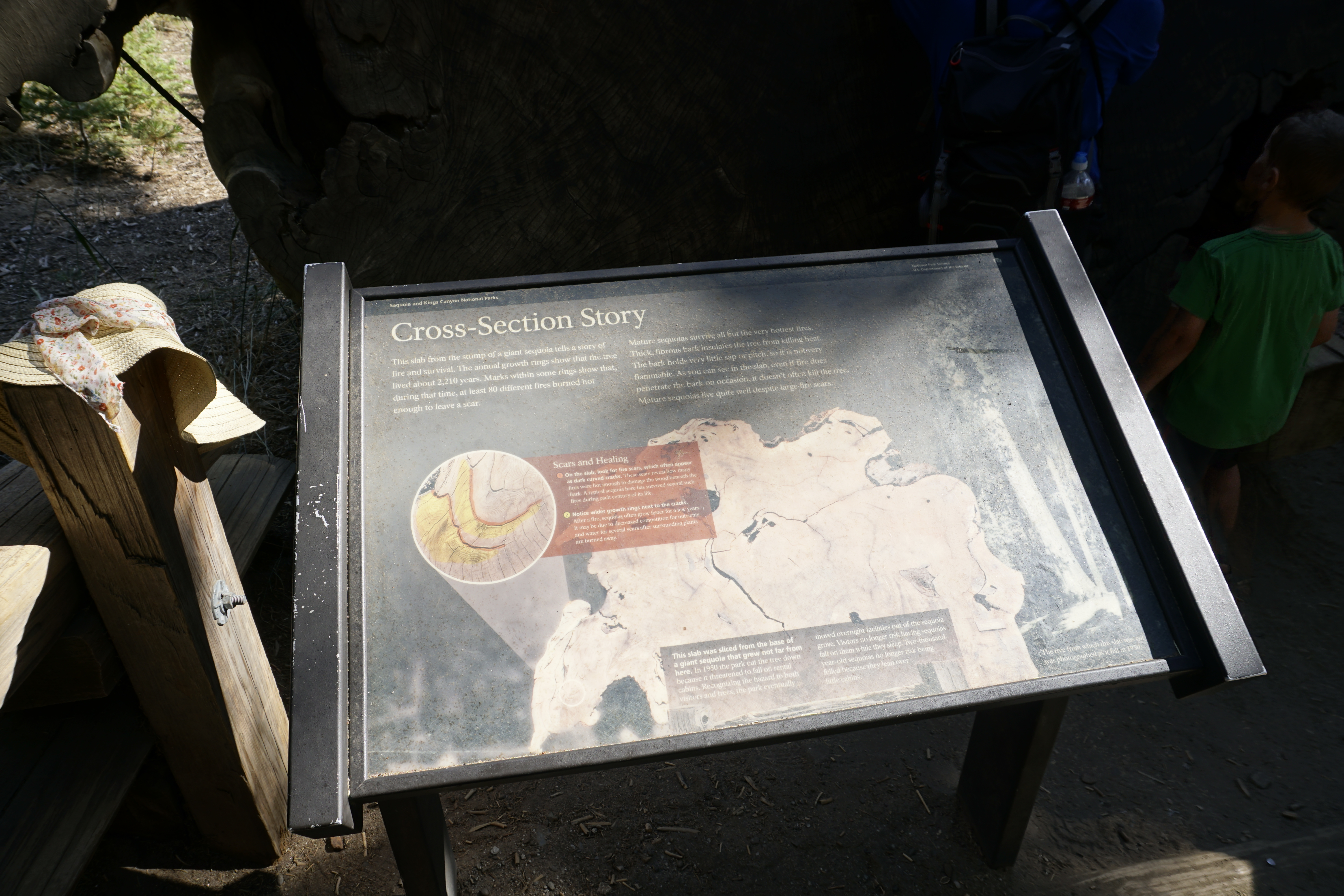
The Buttress Tree fell without warning on June 3, 1959. Its roots, like all sequoias, grew in a shallow, matted maze. Although sequoia roots can extend as much as 300 feet outwards, they rarely grow deeper than 12 feet. This leaves the trees vulnerable to erosion and changing soil conditions.
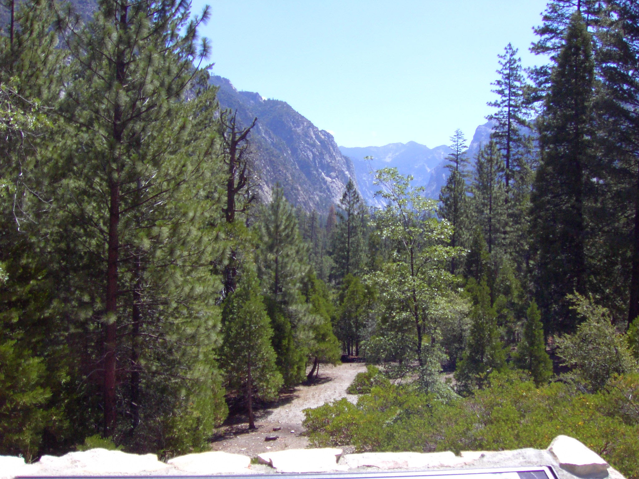
This pullout is located near Moraine Campground, along Highway 180 ( Kings Canyon Scenic Byway). It provides an excellent view east of the U-shaped, glacial canyon. The flat bottom of the canyon supports meadows and forests that could not be supported in the V-shaped, water-carved canyon further west. From here you can see canyon walls that were ground flat by the glacier, with scars where boulders trapped in the ice were dragged across the granite. John Muir, a proponent of
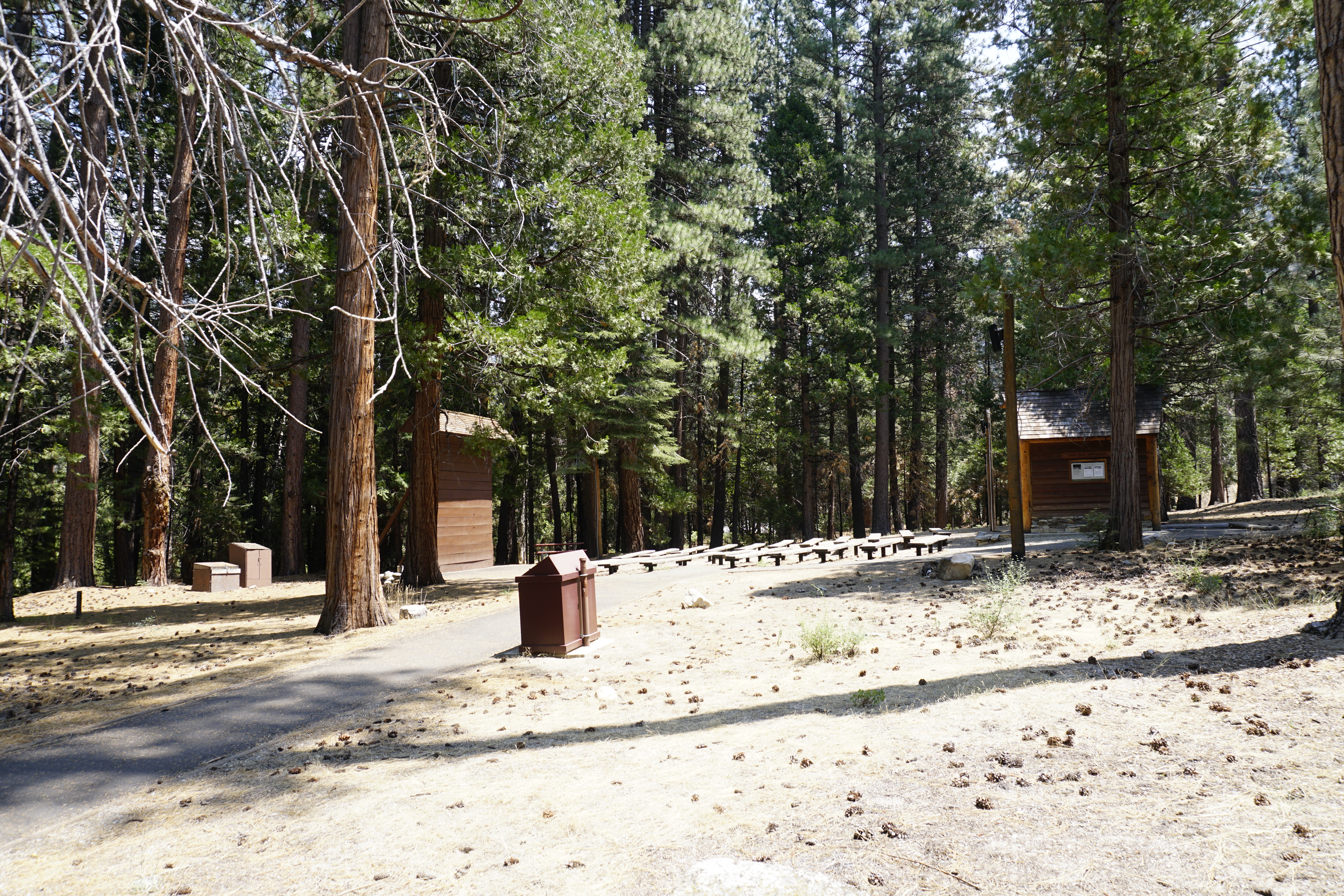
Join a ranger at this outdoor theater for programs on a wide variety of park topics. It is wheelchair accessible, and the visitor center has assistive-listening devices. Check local bulletin boards and the visitor center for schedules.
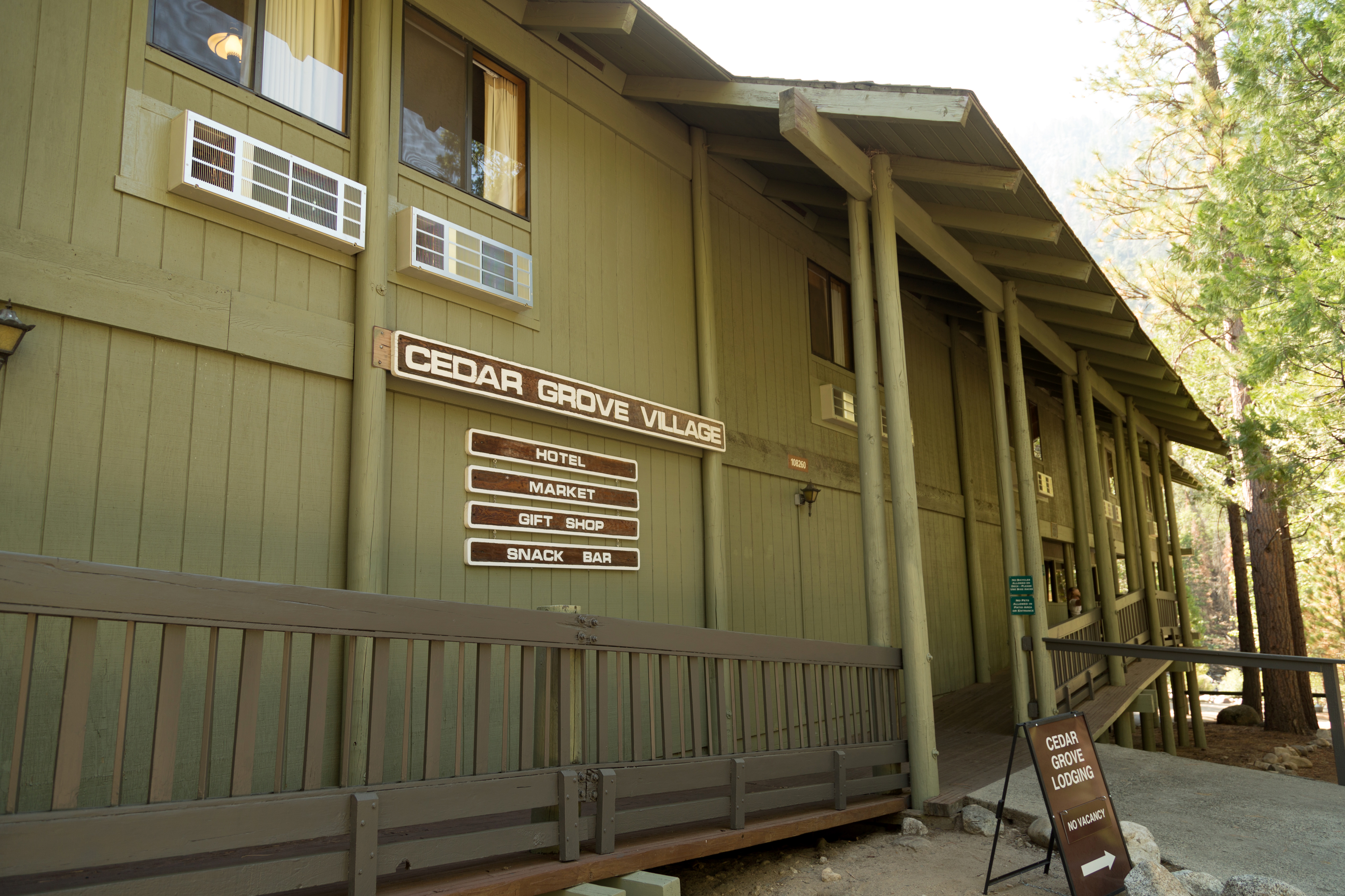
Cedar Grove Lodge is in Kings Canyon at an elevation of 4,600 feet (1402 m). Granite cliffs, the Kings River, and hiking trails are nearby. The lodge offers 21 hotel rooms, a counter-service restaurant, a market, and a gift shop. The lodge is also within walking distance of Cedar Grove's visitor center.<br /><br />Seasonally available. Please visit https://www.visitsequoia.com/ for more information.
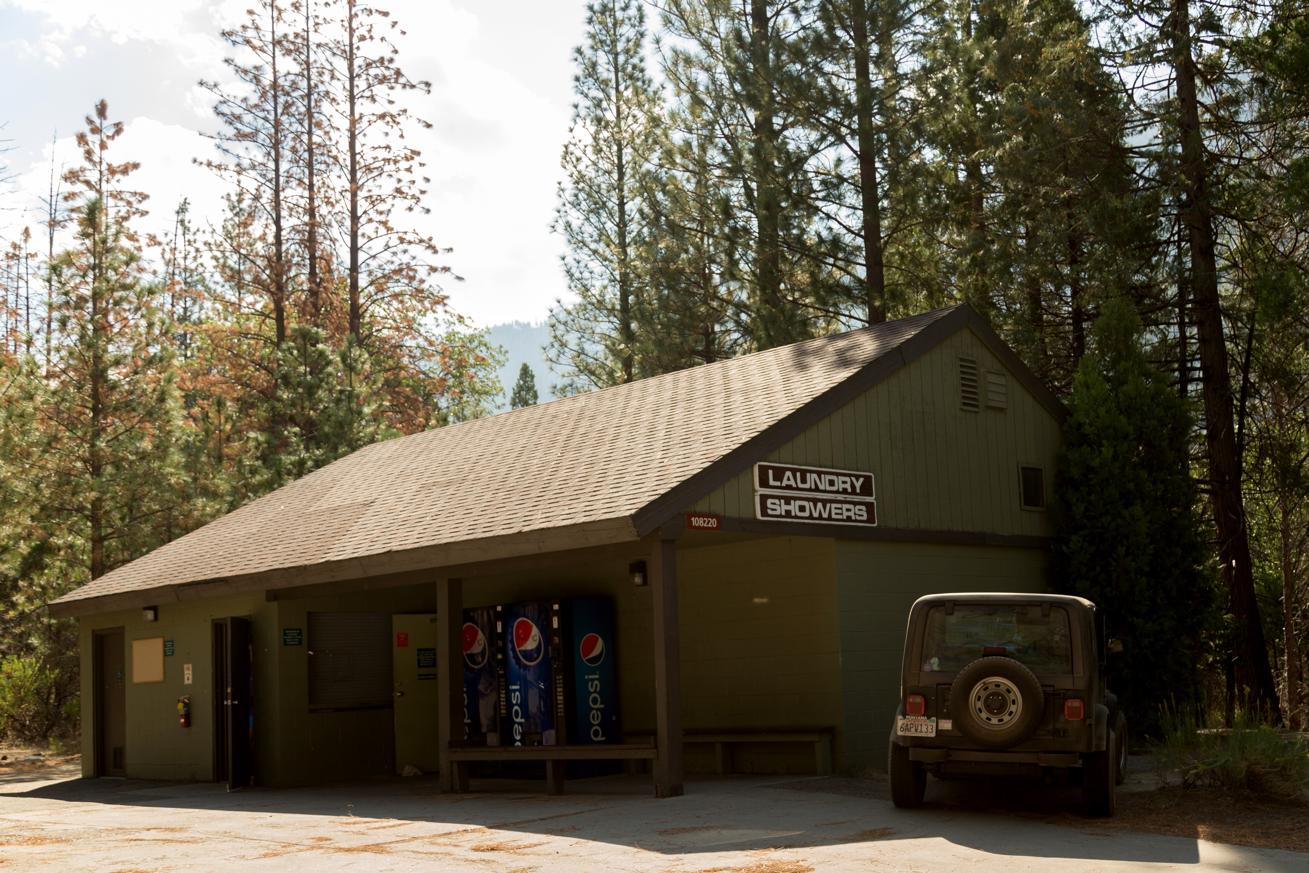
Due to COVID-19, this facility is closed until further notice.<br /><br />Coin-operated showers and laundry facilities are for lodge guests as well as campers, backpackers, and other travelers.
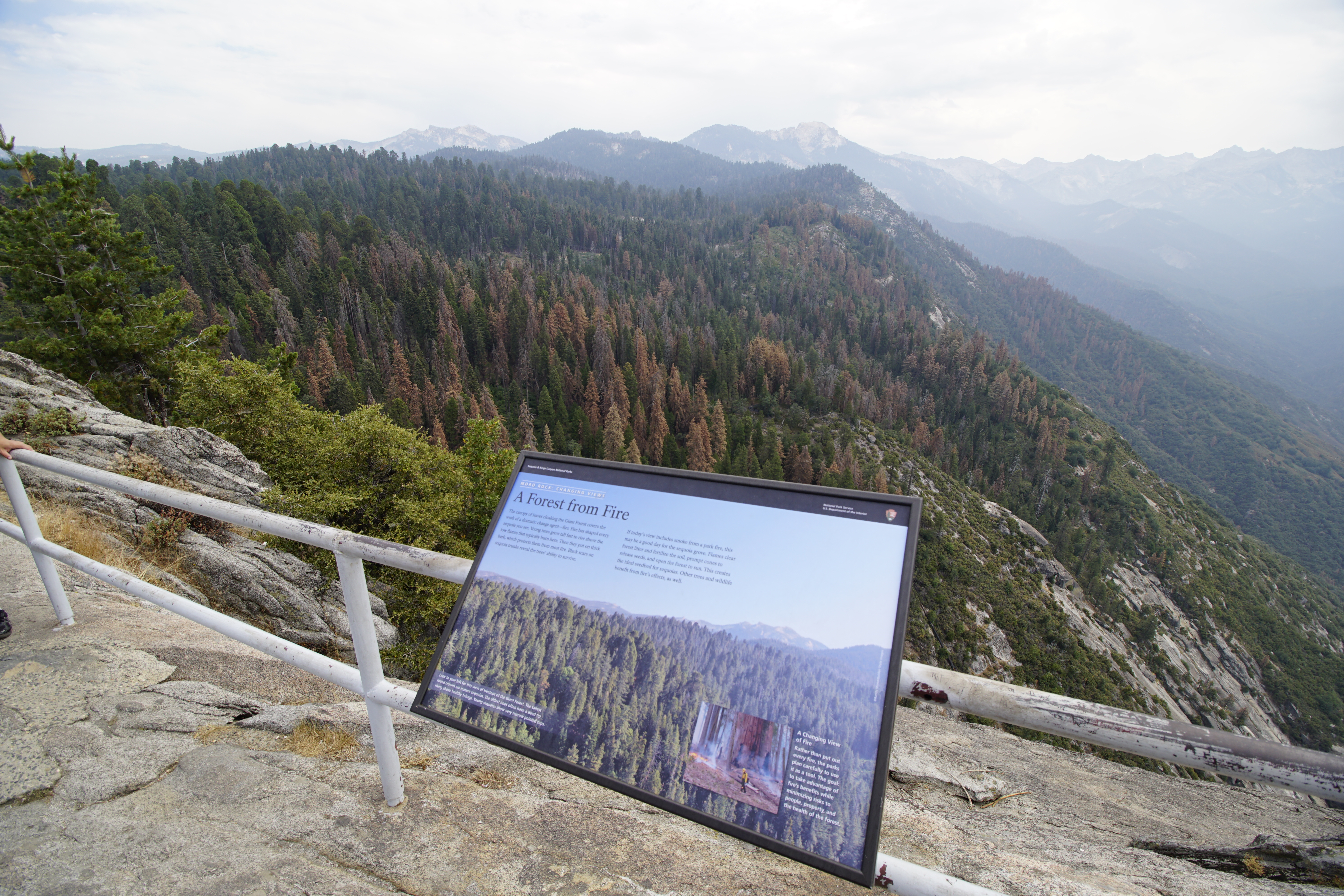
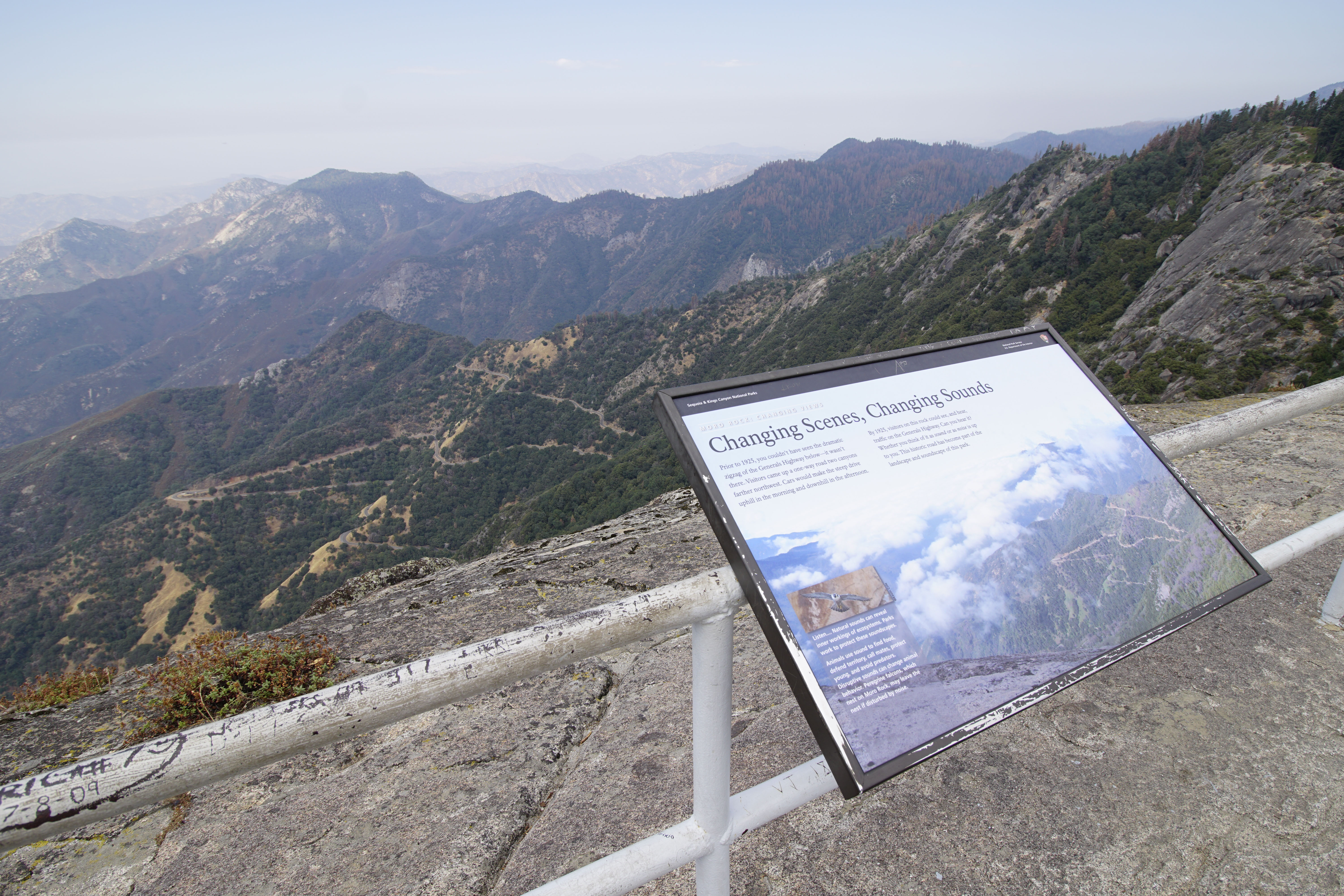
You may hear Peregrine falcons, birds that nest on this rock. A peregrine falcon's call sounds like "key, key, key, key". This wayside exhibit, titled "Moro Rock: Changing Views, Changing Scenes, Changing Sounds," discusses human-caused sounds and their effects on humans and wildlife.
This Forest Service area 3 miles (4.8 kilometer) north of Grant Grove is part of the Converse Basin sequoia grove. From Cherry Gap, you can take roads to the Chicago Stump.
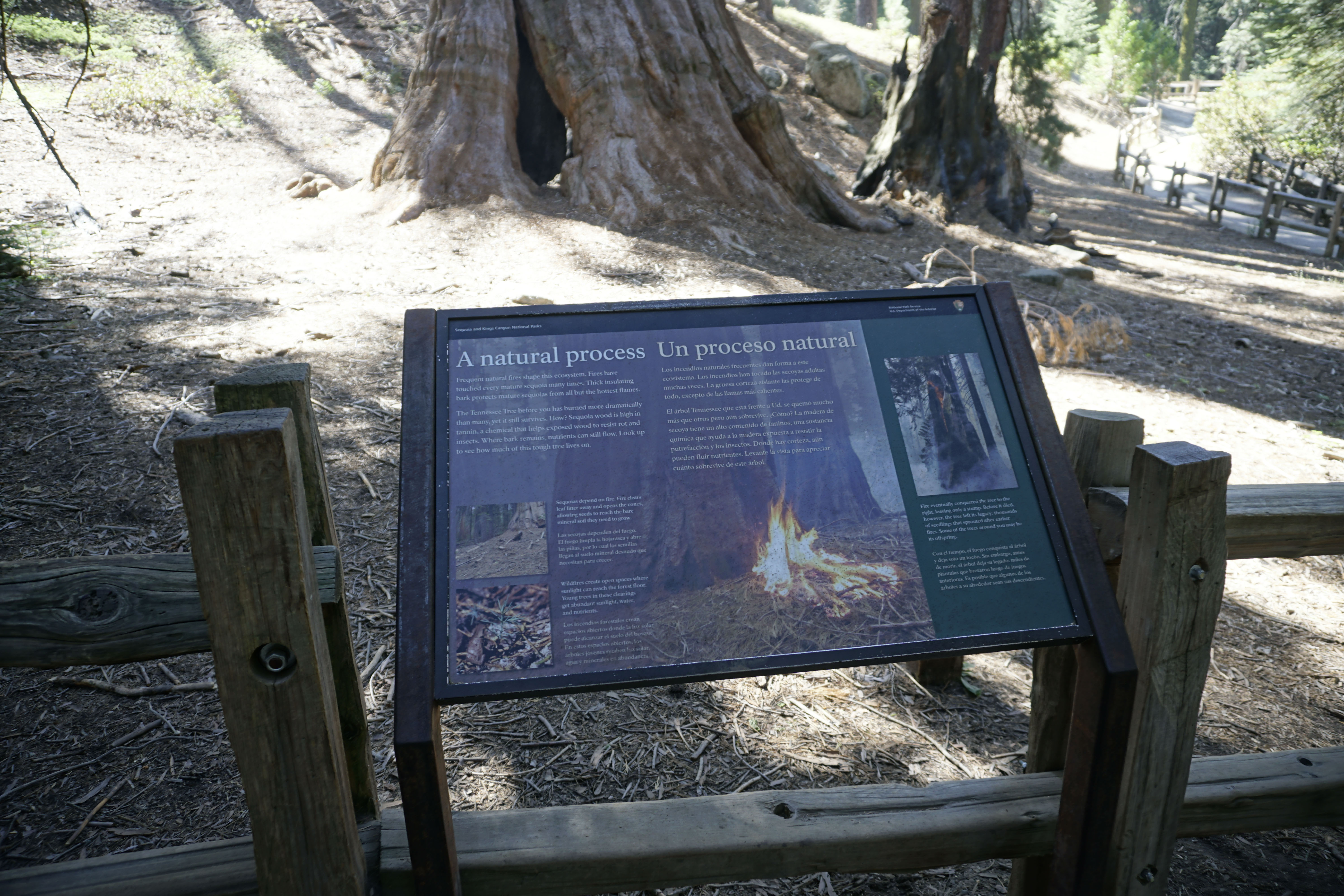
This sequoia burned in 1914. For over a century, the remaining trunk has slowly weathered but remains in remarkably good condition. What do you think it will look like in another hundred years?
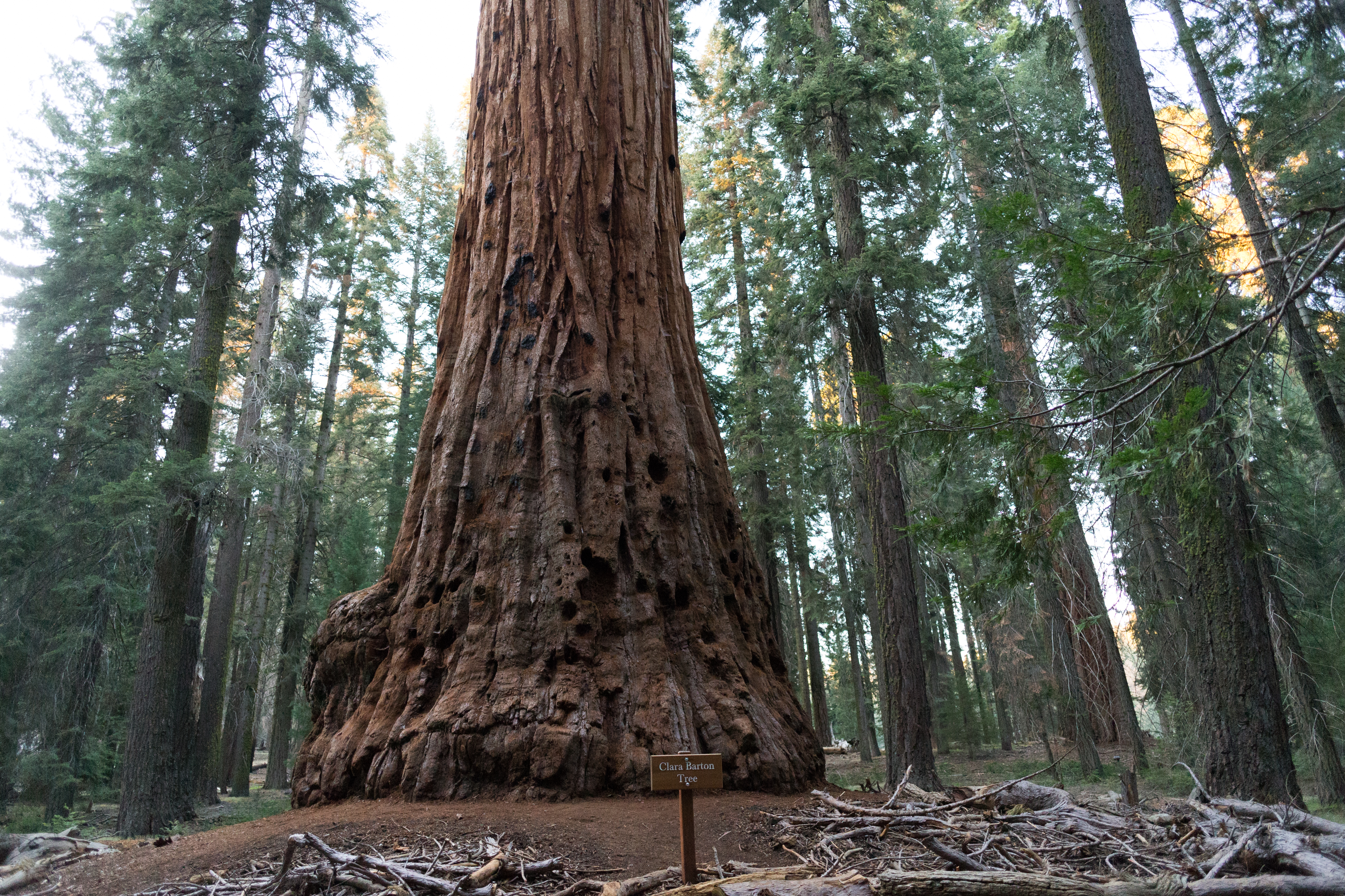
Trees throughout Sequoia and Kings Canyon National Parks are named for a variety of extraordinary people. The Clara Barton Tree, near the beginning of the Big Trees Trail, honors this Civil War nurse, a teacher, and patent clerk and the founder of the American Red Cross, who lived from 1821 to 1912. It is one of only two trees named for women. The other, the Susan B. Anthony Tree, can be seen from this trail if you know where to look. Clara Barton's contemporary, Susan B.
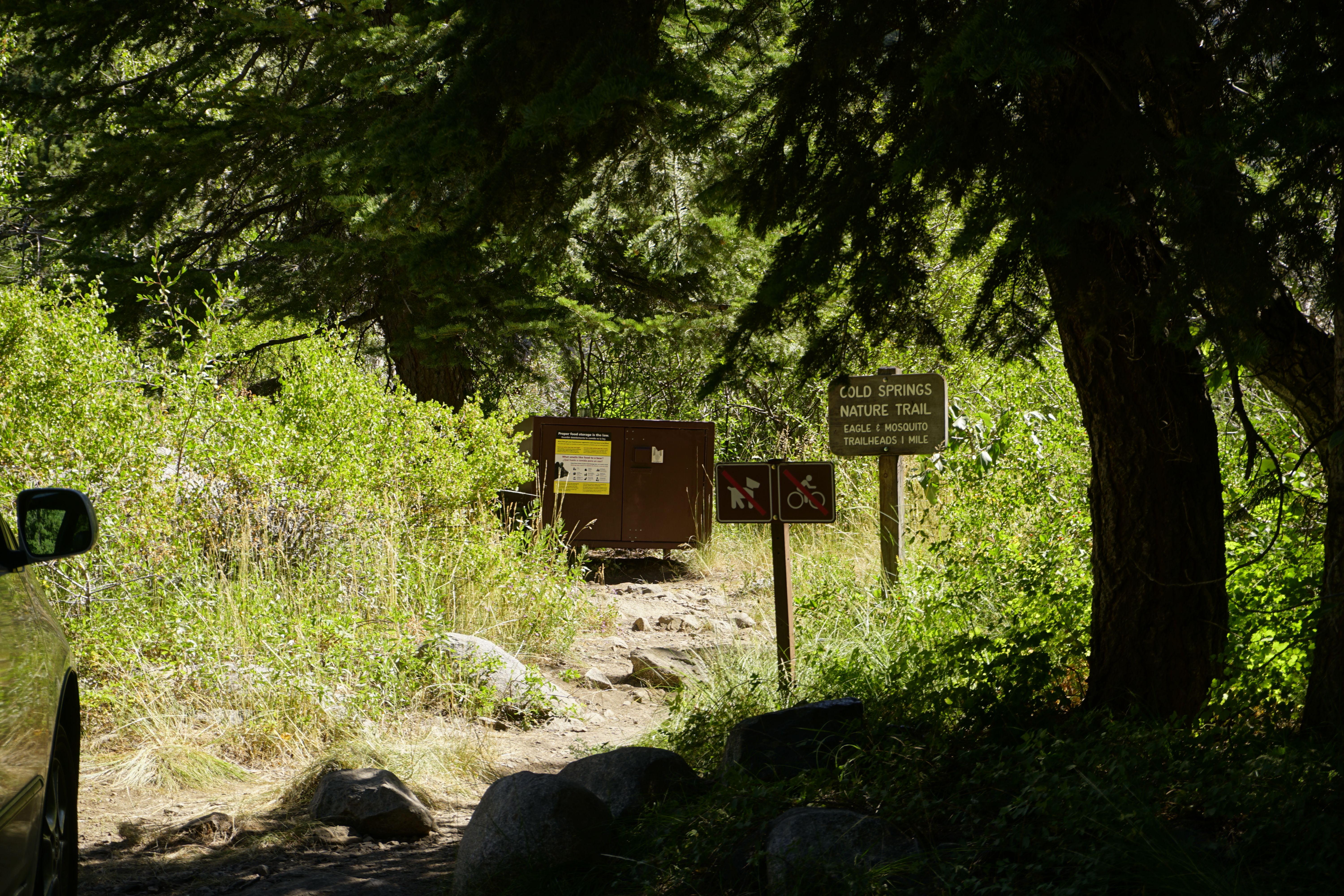
This trailhead orientation panel shows a map and images of Cold Springs Nature Trail.<br /><br />Cold Springs Nature Trail is 2.0 miles round-trip (3.2 kilometer) at an easy incline. It travels through meadows and aspen groves to the site of the former mining town of Beulah. The trail features interpretive panels, which give more information about your surroundings. This trail is for day-use only; overnight camping is available at the Cold Springs Campground.
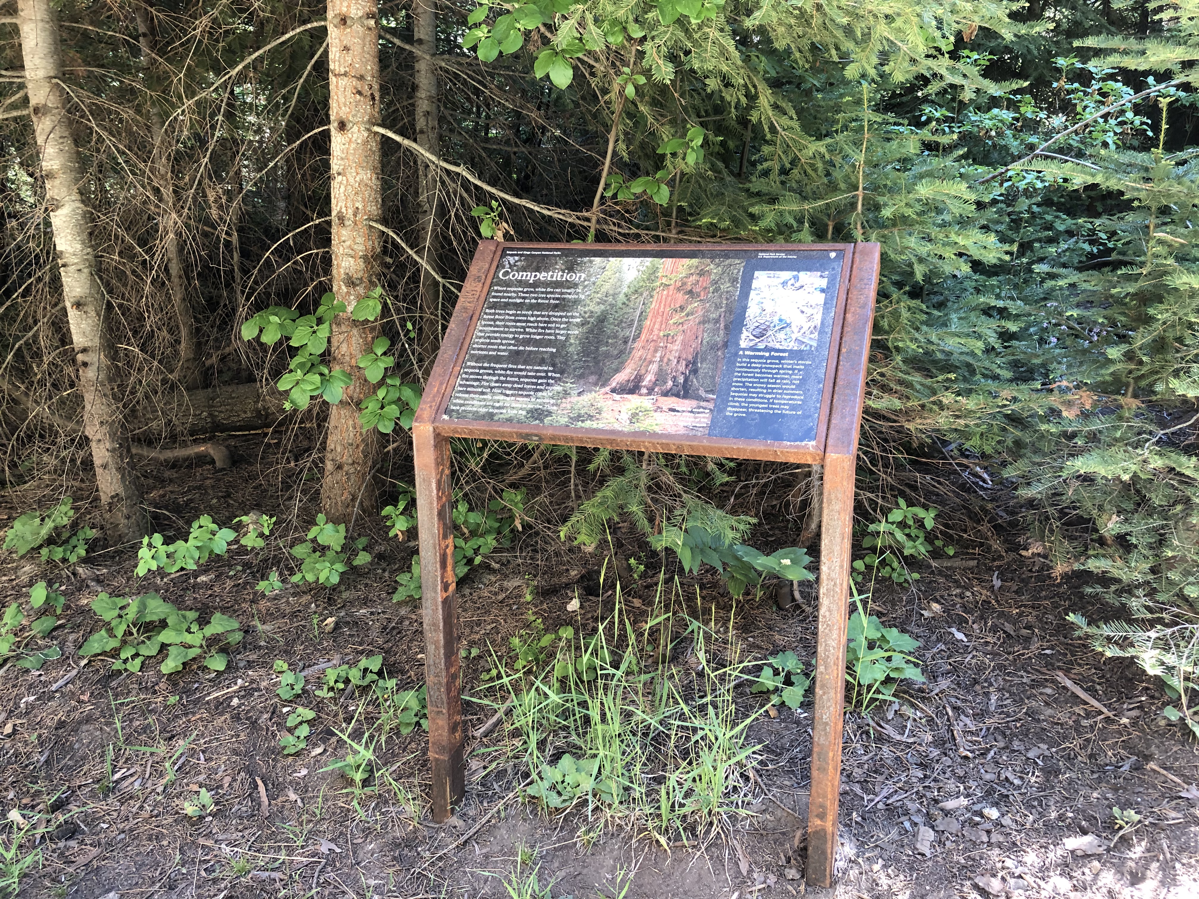
Sequoia groves grow within the larger conifer--or conebearing--forest. Their neighbors are as important, fascinating, and beautiful as sequoias -- just not as big!<br /><br />This wayside exhibit, titled "Community", shows four different types of conifer trees.
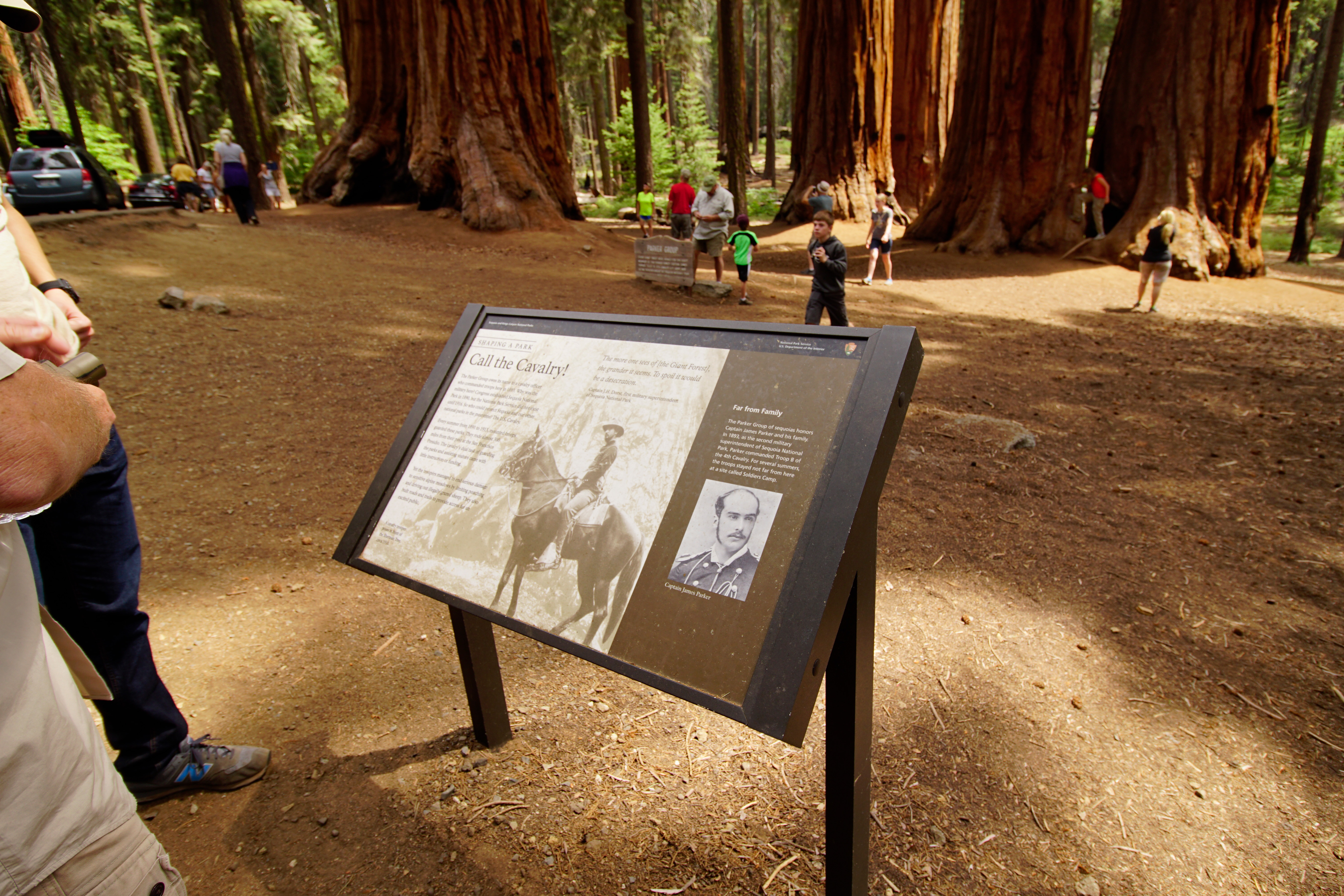
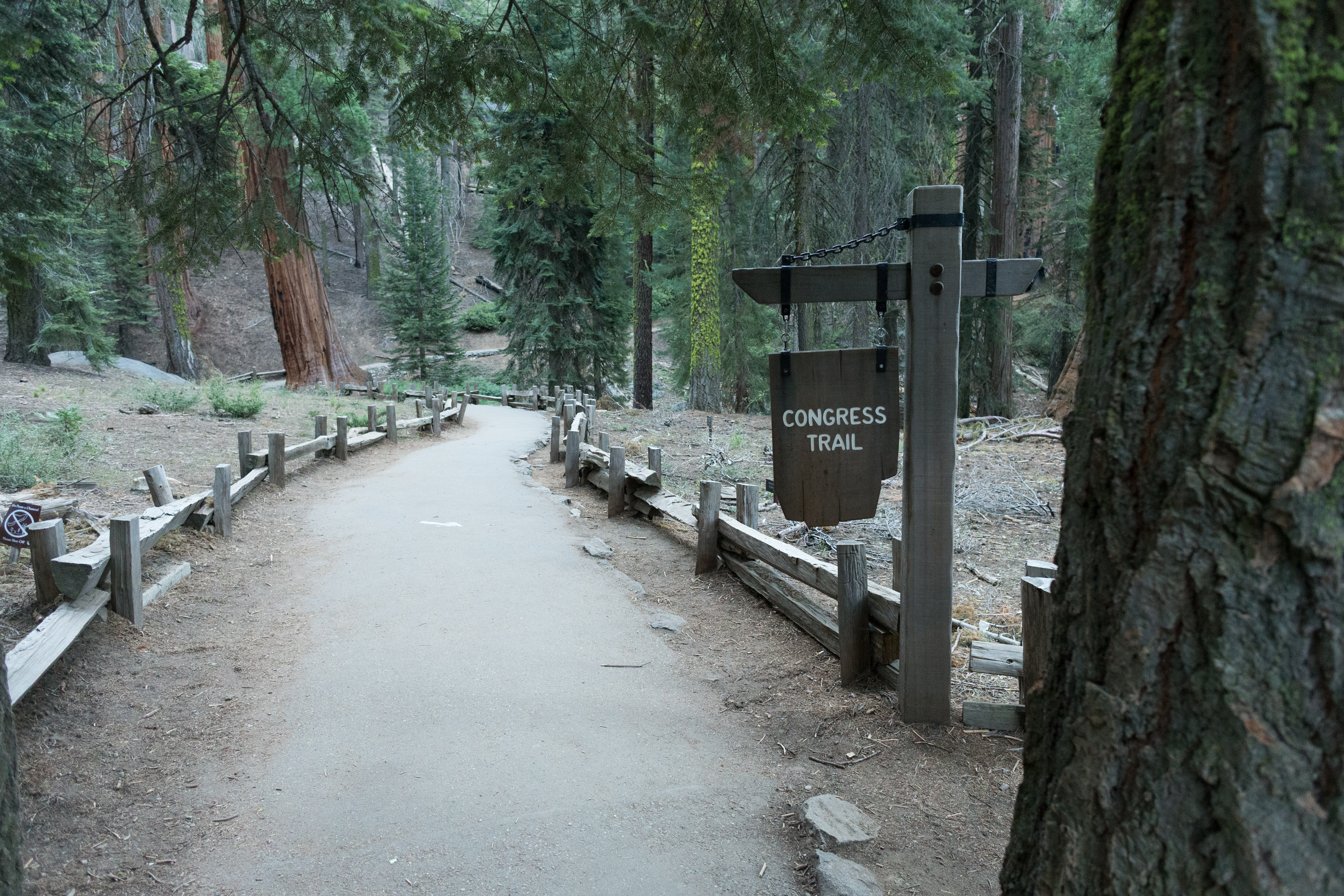
This trailhead orientation panel shows a map and images of the Congress Trail. Congress Trail is a 2.7 mile round-trip lollipop-shaped trail on a gentle, paved incline. It begins near the General Sherman Tree, the largest living tree on Earth. Along the path, you'll also see excellent examples of mature sequoias, including the House and Senate groups, and the President Tree.
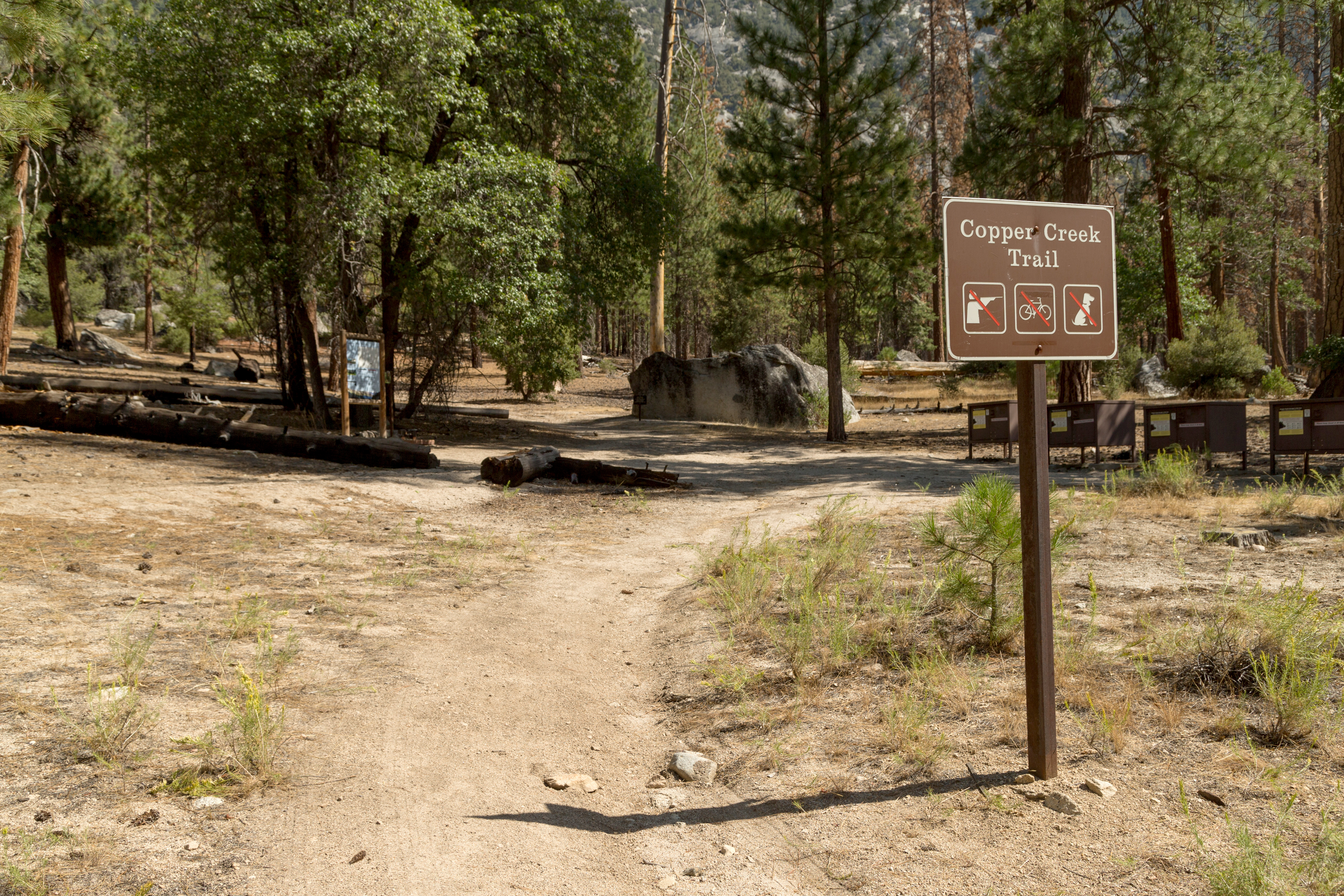
This trailhead orientation panel shows a map and images of the Copper Creek Trail area.Copper Creek Trail is 10 miles one-way (20 miles round-trip) at a difficult incline. The trail travels through several aspen forests and meadows, ending at Granite Lake, a stop that offers beautiful vistas of Mount Hutchings, Goat Mountain, and Comb Spur. The first campsite along the trail is at 4 miles at Lower Tent Meadow. This is a hot, steep climb, so you may want to plan your hiking fo
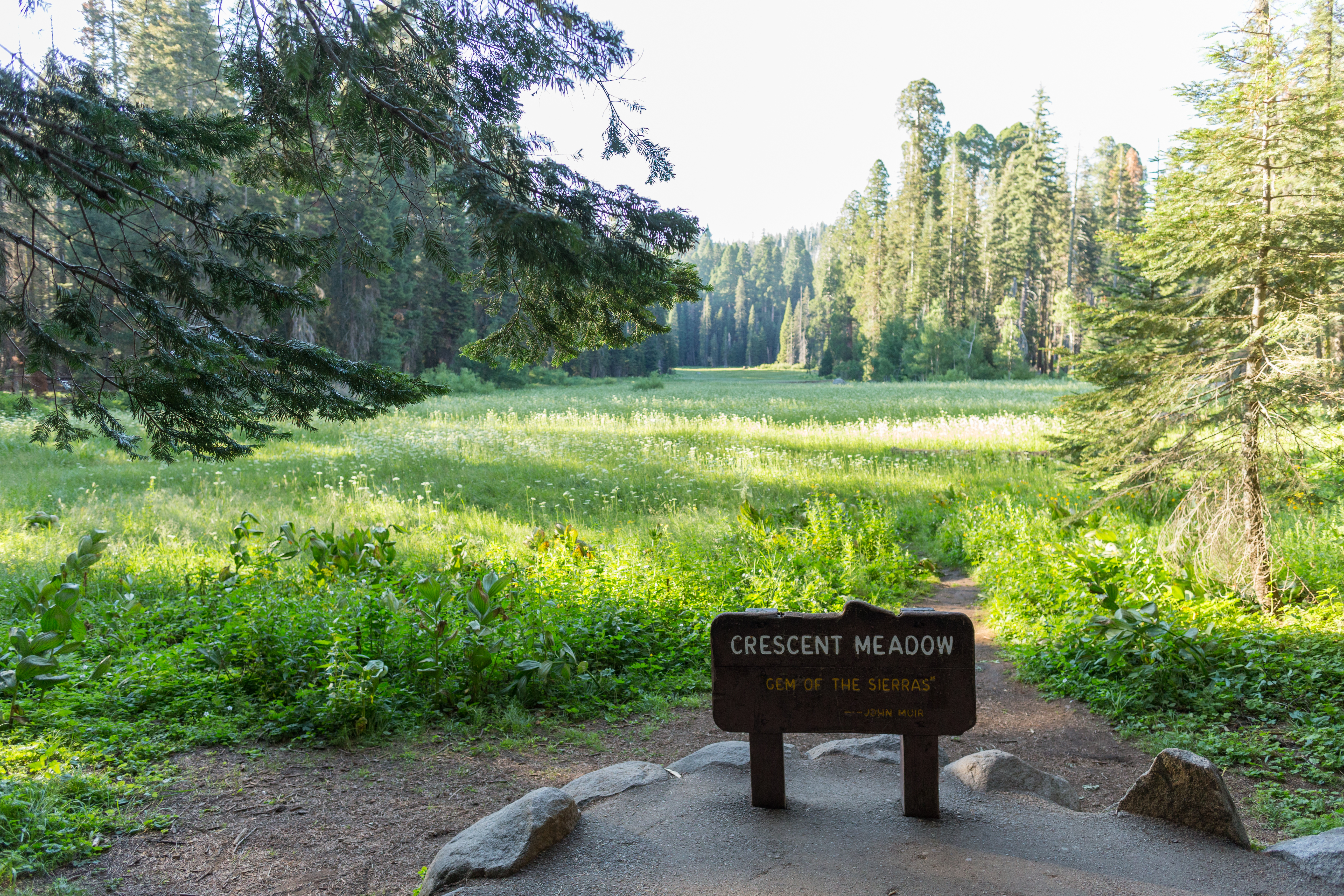
The Crescent Meadow Picnic Area is 2.6 miles from the Giant Forest Museum, near Moro Rock and several trailheads. The picnic area rests at the edge of a lush meadow.
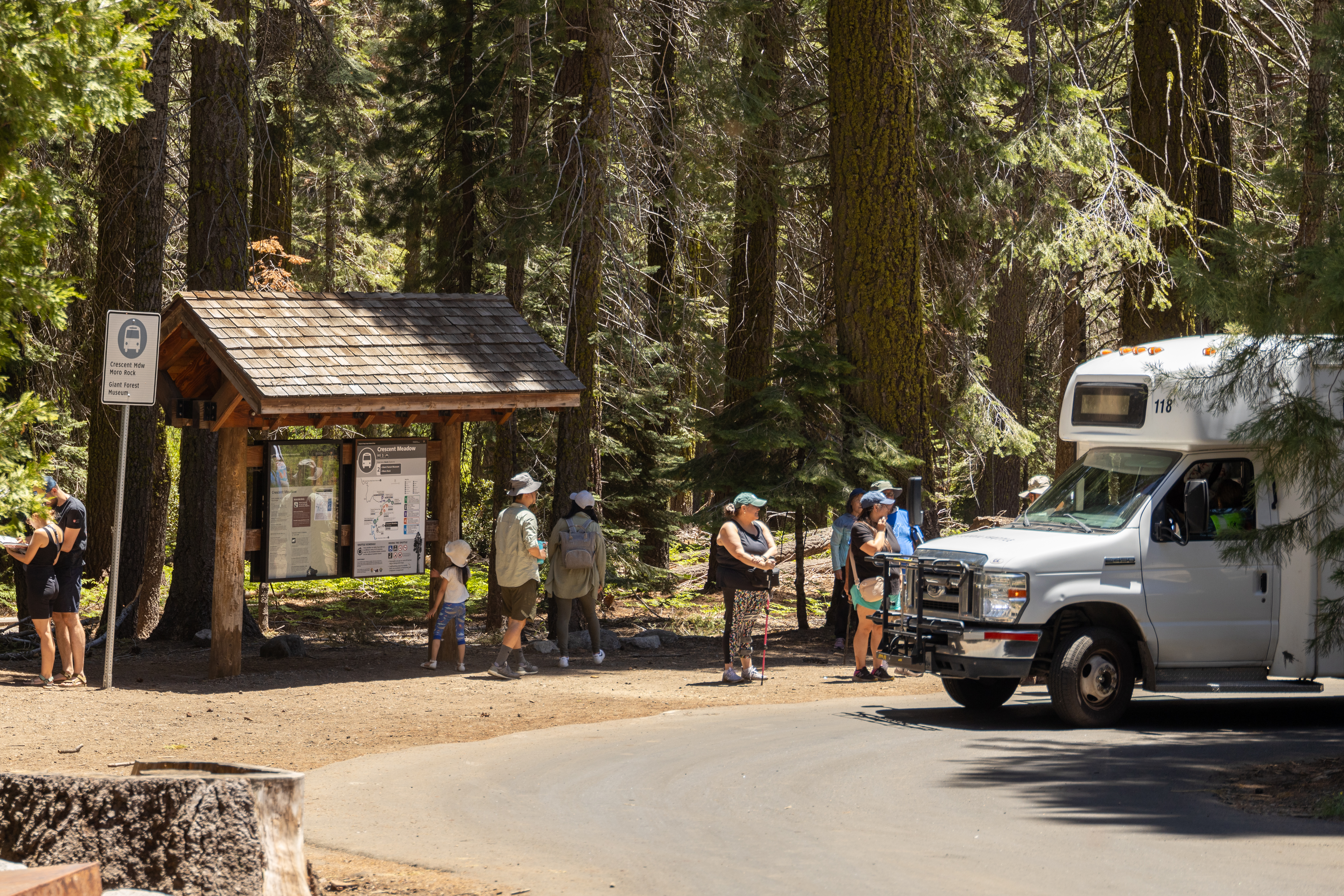
This Sequoia Shuttle stop is located at Crescent Meadow, one of the larger meadows in these parks and the starting point for several hikes. Sequoia Shuttles run from late May until early September. Riding the shuttle helps you avoid having to find parking, which can be limited. It also reduces air pollution within our parks. Shuttles within the park are free; round-trip shuttles from Visalia are $20, which includes the park entrance fee.