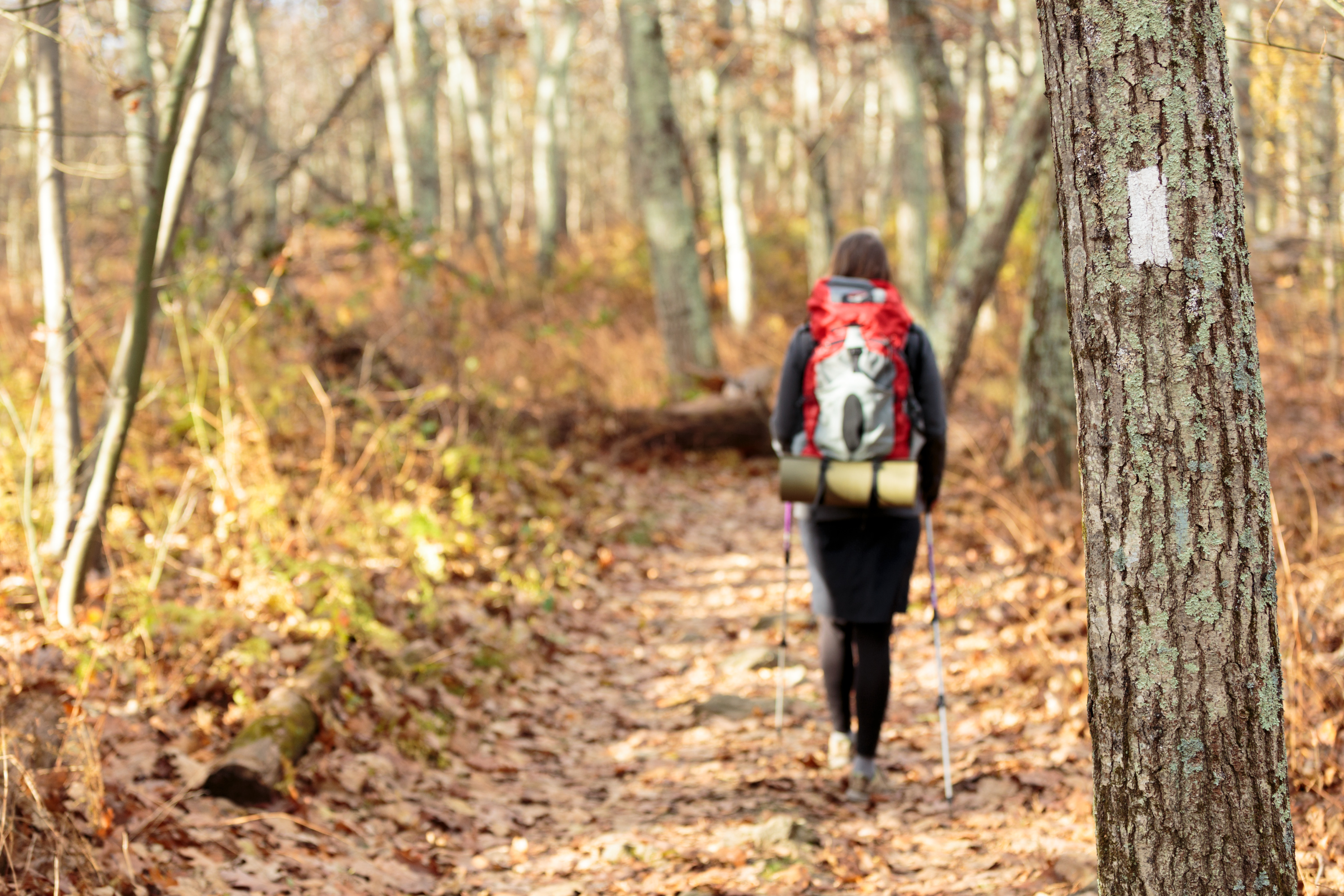
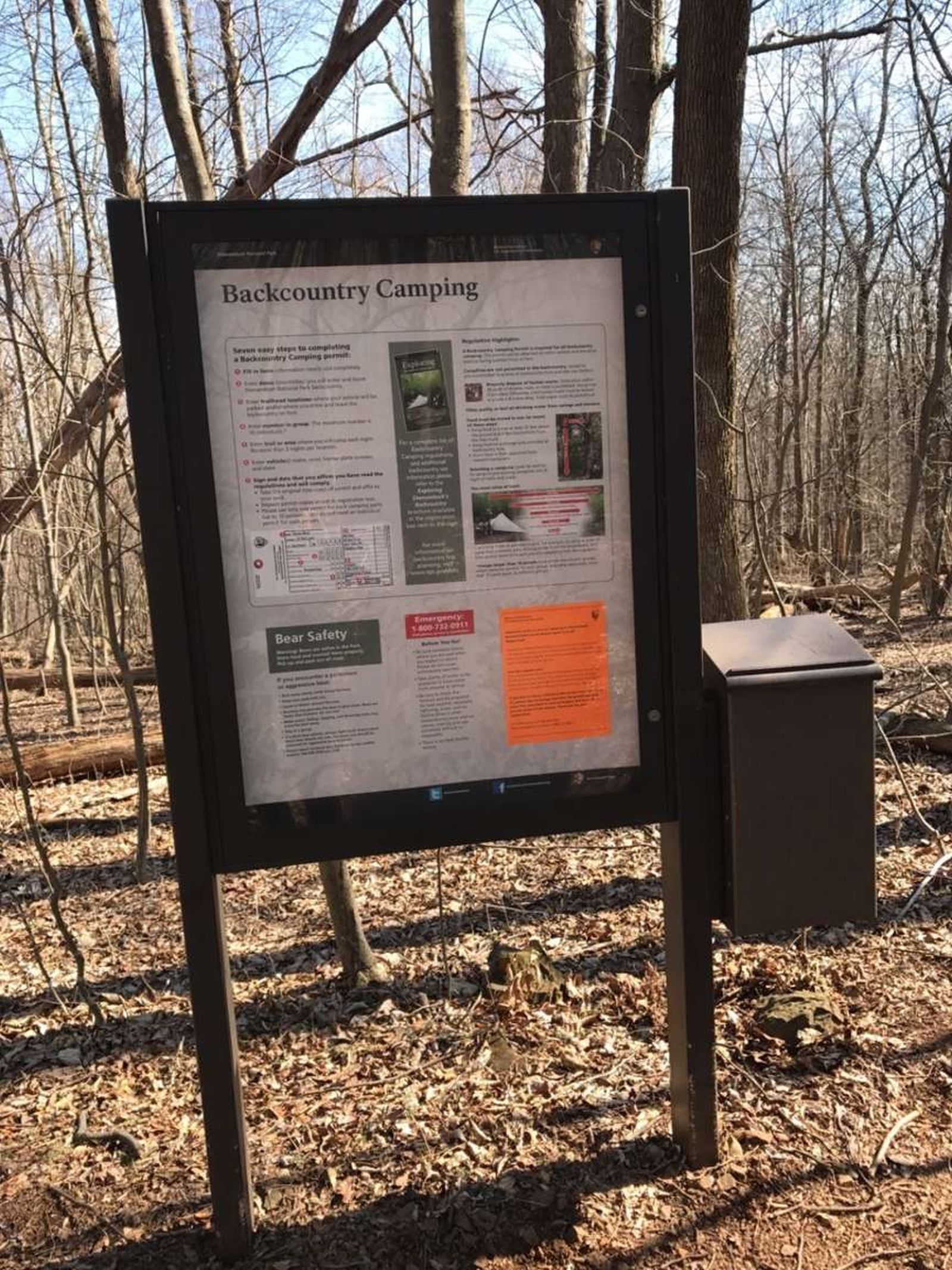
A free backcountry camping permit is required to camp in Shenandoah's backcountry. A permit can be filled out at this self-registration kiosk, located along the Appalachian Trail at the northern end of Shenandoah National Park. Note that this kiosk is not accessible by vehicle.
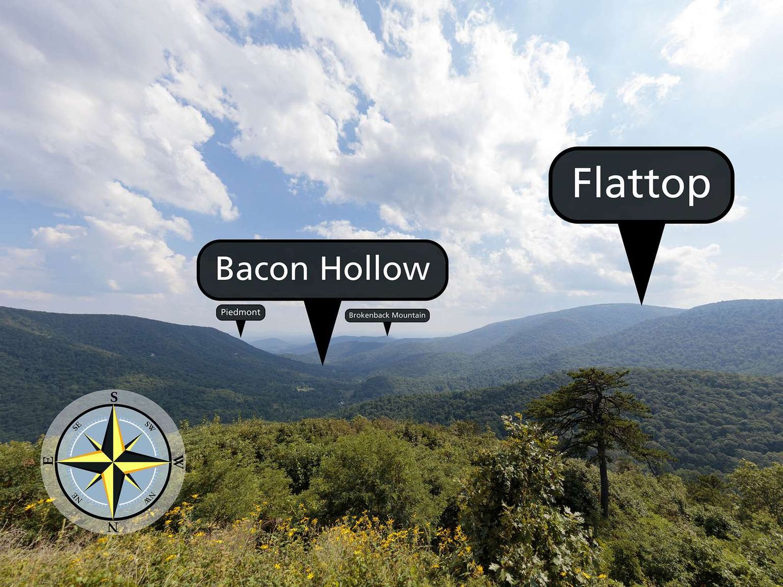
Facing south from an elevation of 2,455 ft (748 m), the view from Bacon Hollow Overlook stretches out over a broad hollow that descends to the Piedmont in the distance. The Piedmont is the central region of Virginia between the Blue Ridge Mountains and the Coastal Plains. Literally meaning foothills, the Piedmont region is known for its rolling hills and rural character.
Facing northwest from an elevation of 3,345 ft (1,019 m), the view from Baldface Mountain Overlook glimpses into the Shenandoah Valley below. You are atop a slope of Baldface Mountain. The peak is on the opposite side of the Skyline Drive to the northeast.
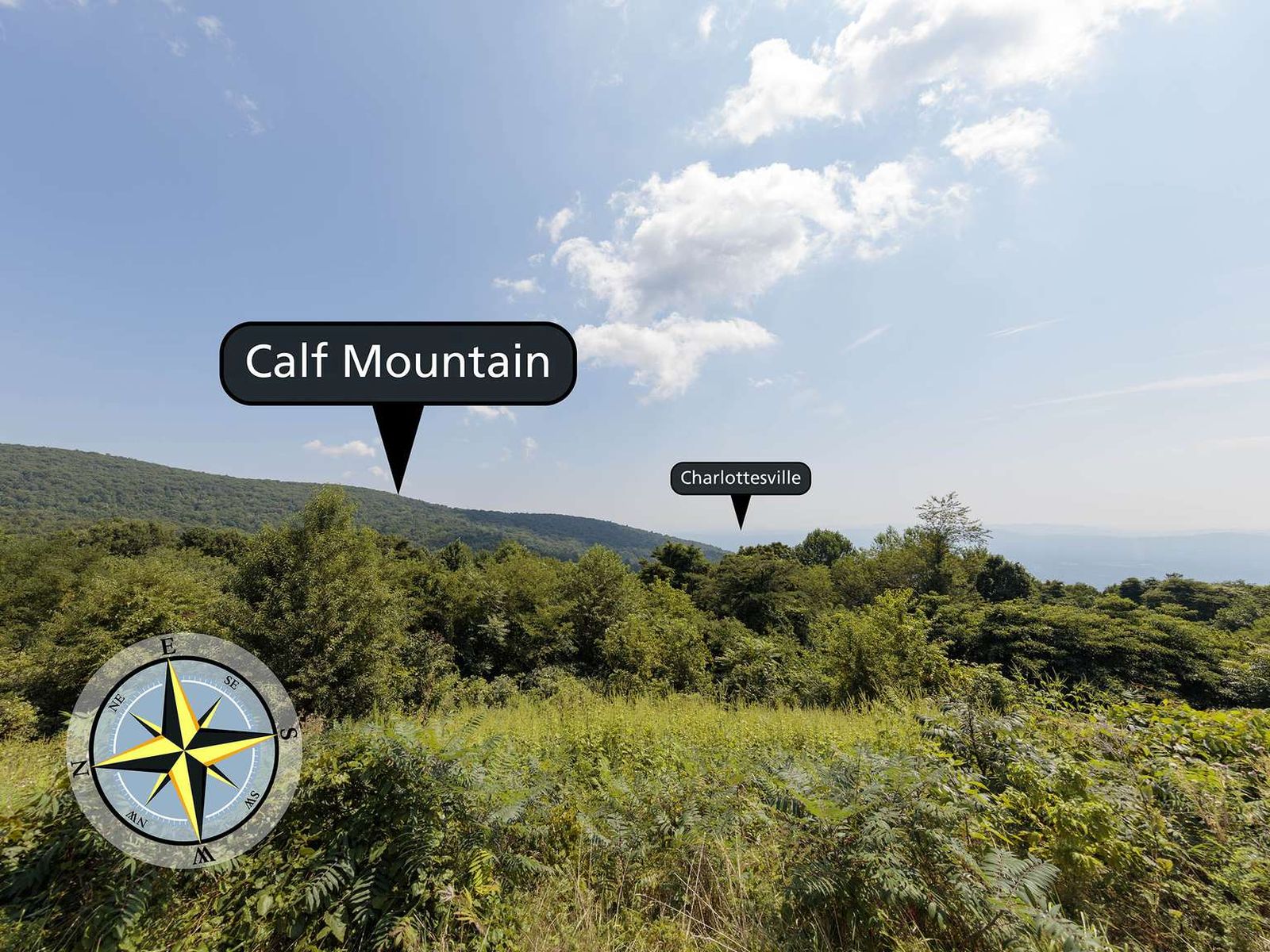
Facing east from an elevation of 2,495 ft (760 m), the view from Beagle Gap Overlook stretches outside of Shenandoah National Park to the Piedmont region of Virginia. Calf Mountain is the long ridge from the left descending down to the center of the view. If you travelled in a south-eastern direction the first urban center you would hit is the town of Charlottesville, Virginia.
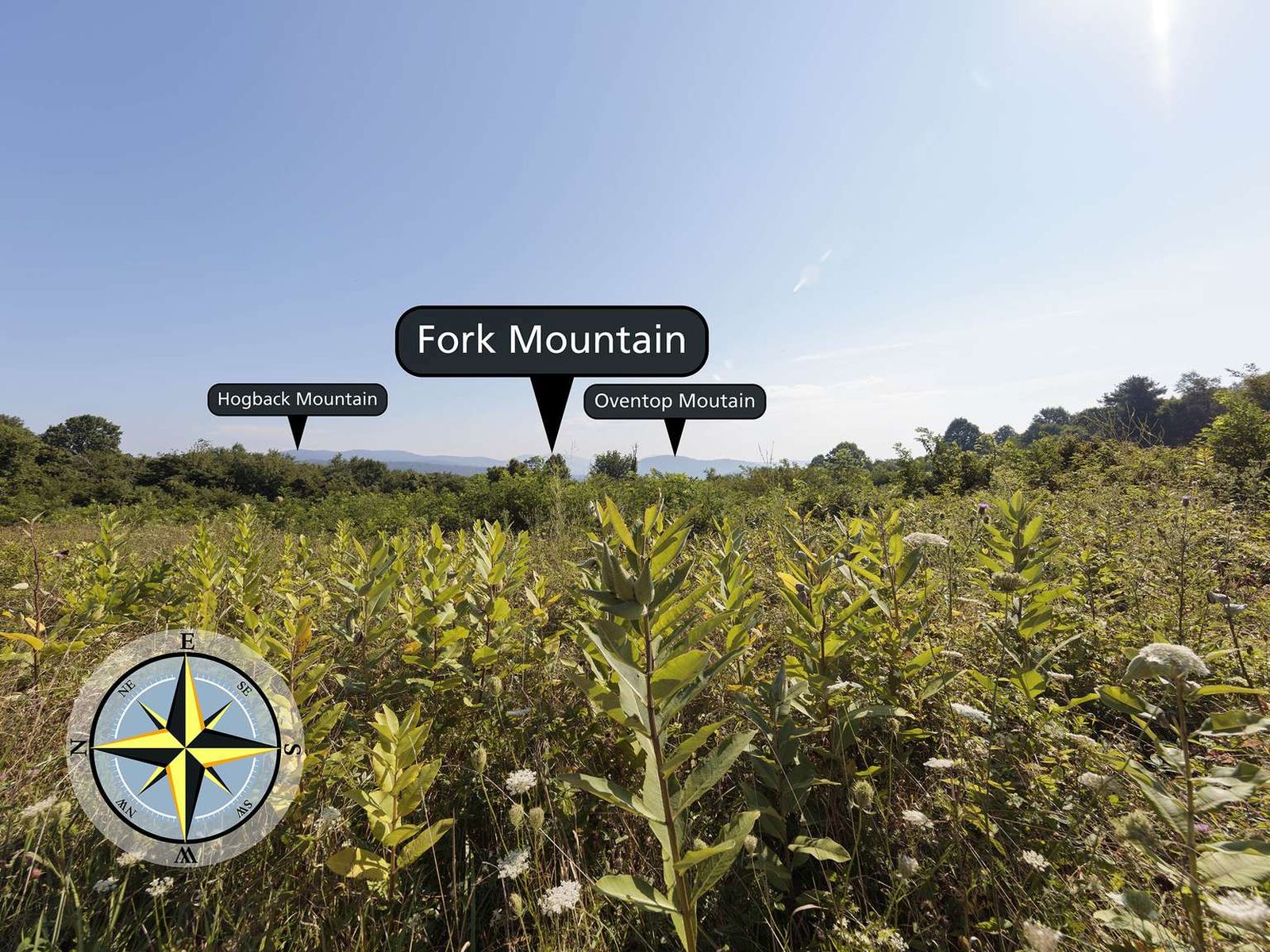
Beahms Gap sits at an elevation of 2,485 ft (757 m). During the early years of Shenandoah National Park, there was a 360 degree view from this location, created by clearing the land around Skyline Drive. Over time, trees have grown back and there is no view of the Shenandoah Valley from the Beahms Gap parking lot. If you cross the Skyline Drive on a clear day, you can see Hogback Mountain, Fork Mountain, and Oventop Mountain.
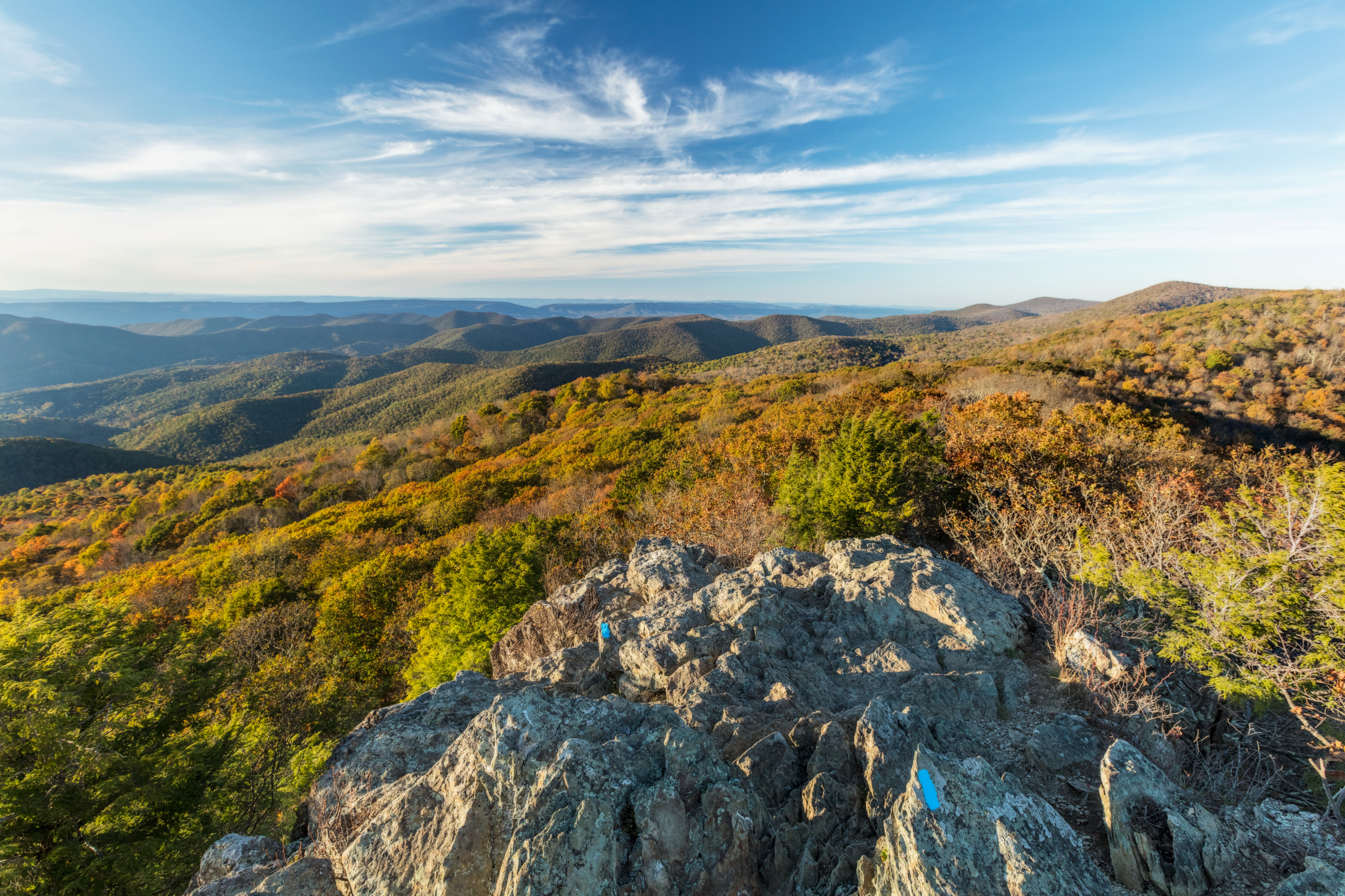
Bearfence Parking Area (mile 56.4) | Pets are not allowed on this hike. An exhilarating rock scramble leads to a magnificent 360-degree view of the Virginia Piedmont and Shenandoah Valley.
Bearfence Parking Area (mile 56.4) | Pets are not allowed on this hike. This route takes you to a 180-degree view of the Shenandoah Valley without a rock scramble.
Facing southwest from an elevation of 2,345 ft (714 m), the view from Beldor Hollow Overlook expands out to the Blue Ridge Mountains with Skyline Drive in the distance.
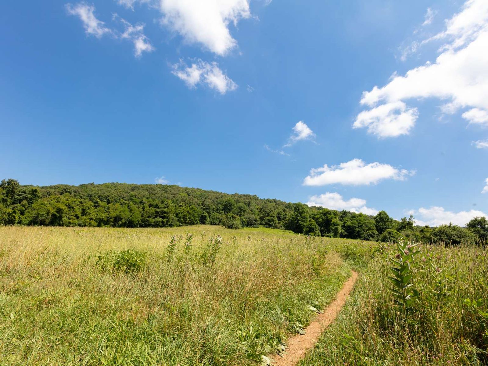
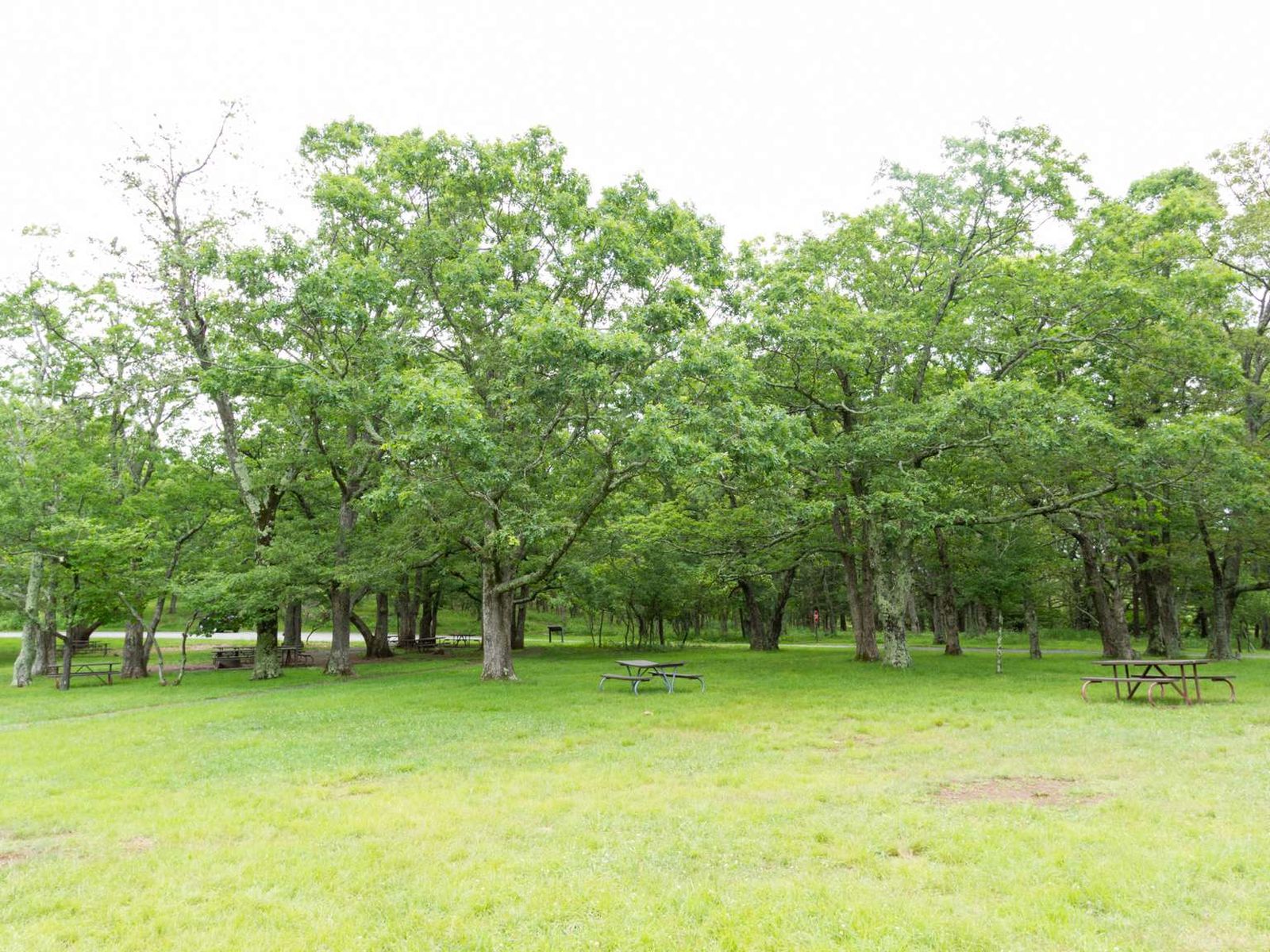
Skyline Drive (mile 51) | Perched on top of a mountain, this high-elevation meadow can come as a bit of a surprise after the miles of lush, green forests that make up most of Shenandoah National Park. A must-see for every visitor, stop by Big Meadows to explore the trails, grab a bite to eat, or talk to a Ranger at Byrd Visitor Center.
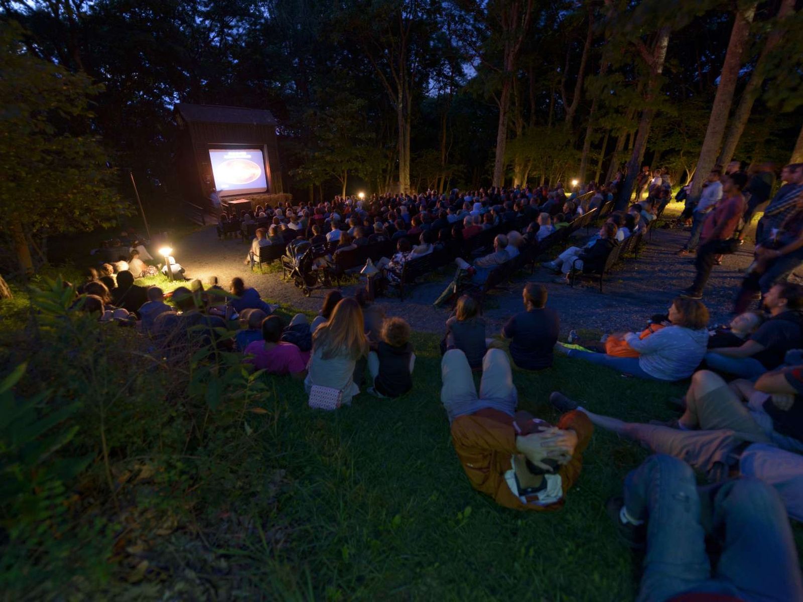
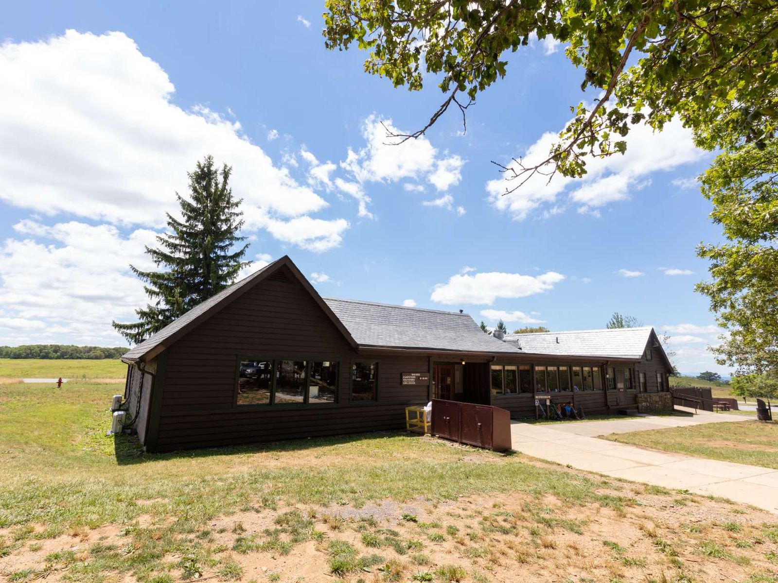
Nothing adds to the National Park experience quite like enjoying an evening ranger program at Big Meadows amphitheater! Come listen to a Park Ranger present a variety of topics that will help you to connect to Shenandoah on a deeper level.
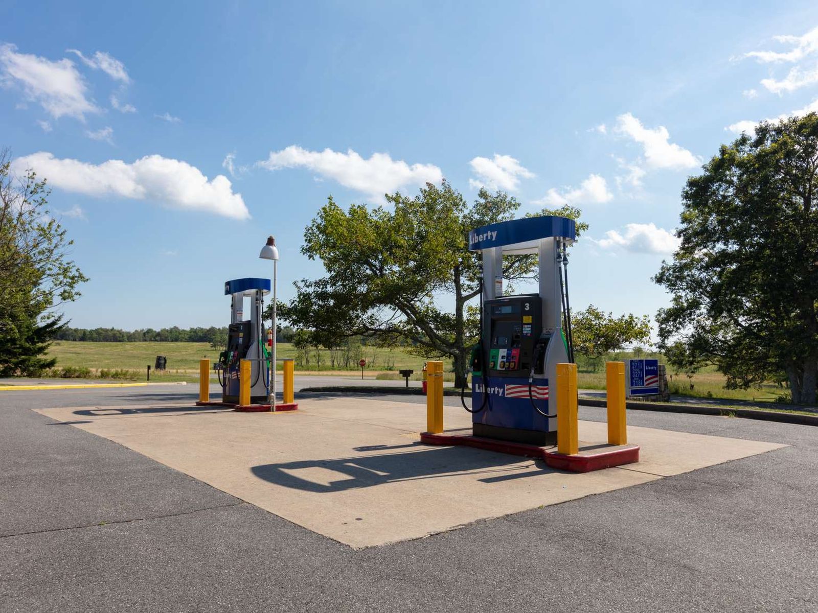
This refueling station is located next to the Big Meadows Wayside. It is the only gas station located within Shenandoah National Park, so be sure to plan accordingly!
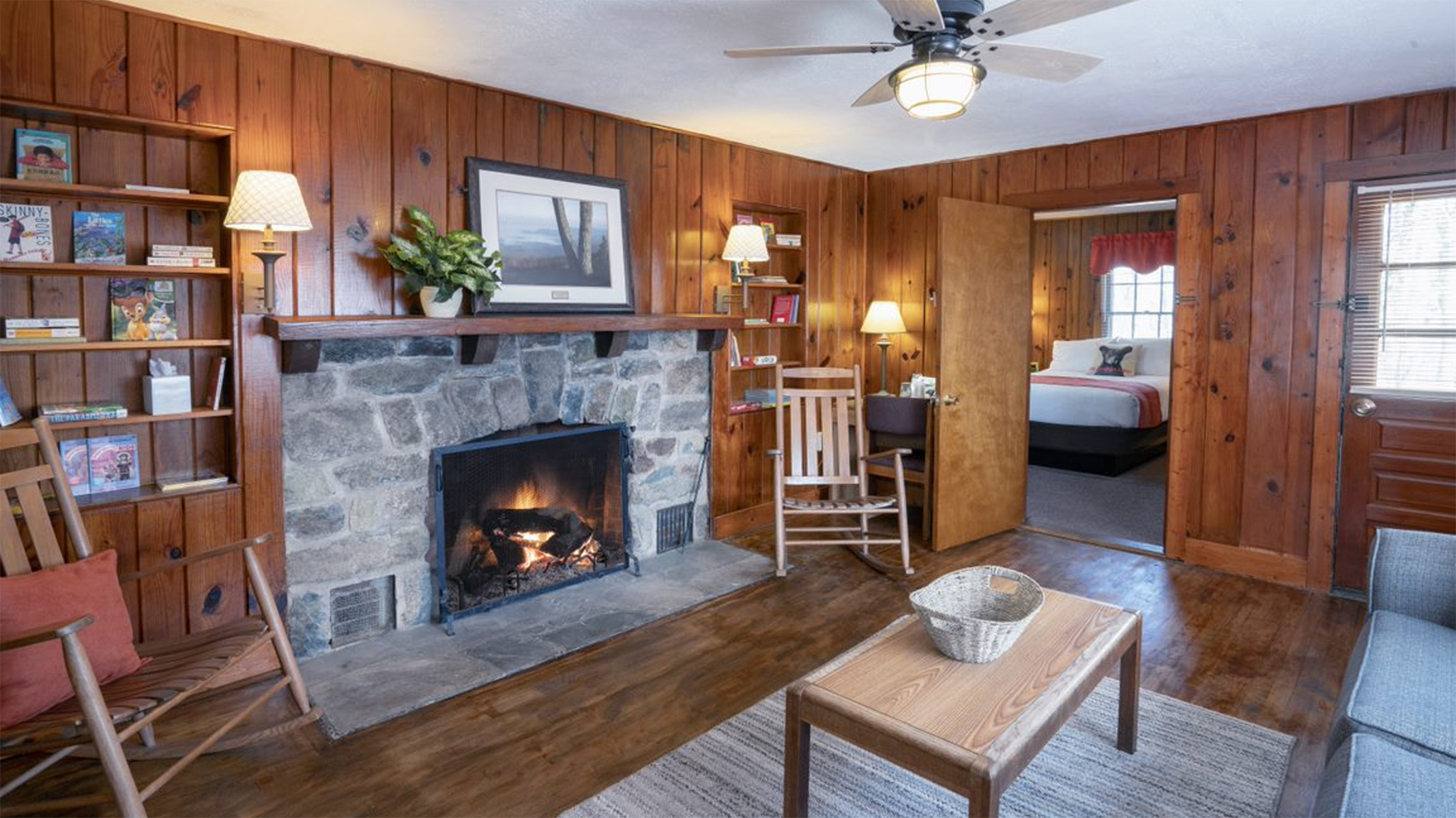
Big Meadows Lodge has accommodations ranging from main lodge rooms to detached small cabins, preferred and traditional rooms, suites, and pet friendly rooms - all located within walking distance of the main lodge building in the popular Big Meadows area. The Spottswood Dining Room, New Market Taproom, and Craft Shop are aso located in the main lodge building.
Big Meadows Wayside offers a varied menu of regional favorites available for carry-out or sit down dining. The Grab 'n Go kiosk inside offers sandwiches, salads, pastries, snacks and drinks to go. Groceries, gifts, and camping supplies are also available.
Facing northwest from an elevation of 2,860 ft (871 m), at Big Run Overlook you will look out toward the Shenandoah Valley below. Unfortunately, the view at this overlook is obstructed by overgrowth most of the year, making it difficult to see the mountains and valley beyond.
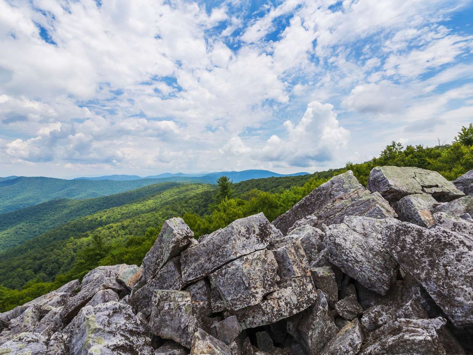
Blackrock Parking Area (mile 84.4) | A short hike to a viewpoint on top of a rocky talus slope with incredible views of the Shenandoah Valley, Massanutten Mountain, and beyond. This hike is also a designated TRACK Trail, featuring a self-guided brochure designed for kids.
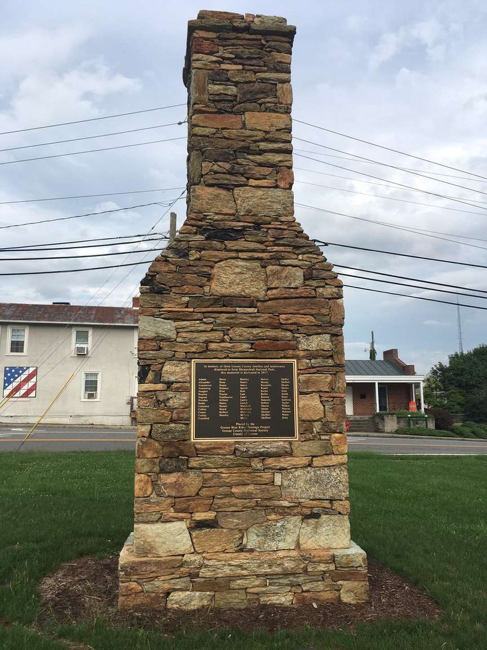
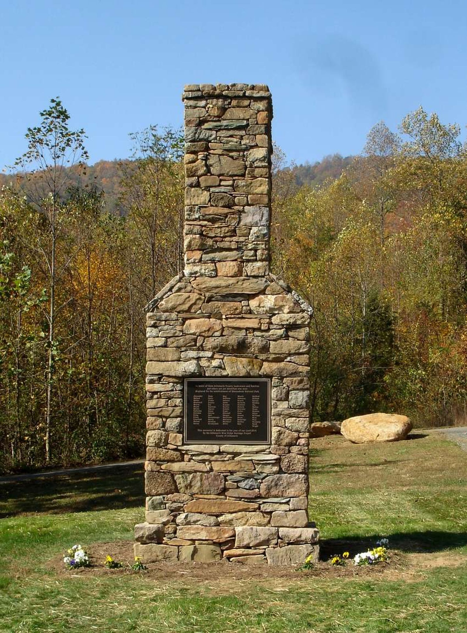
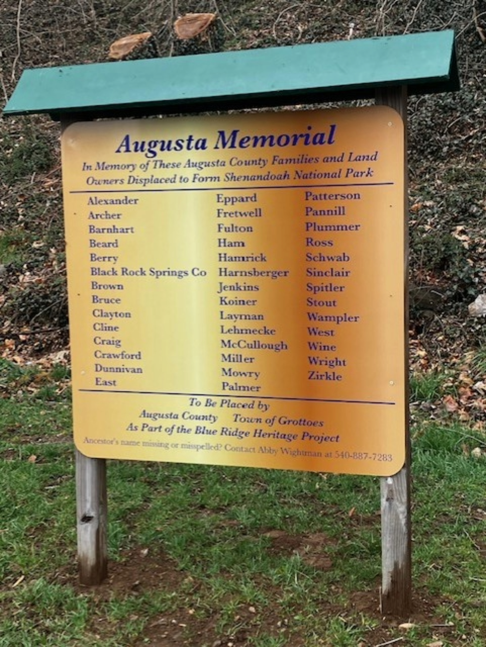
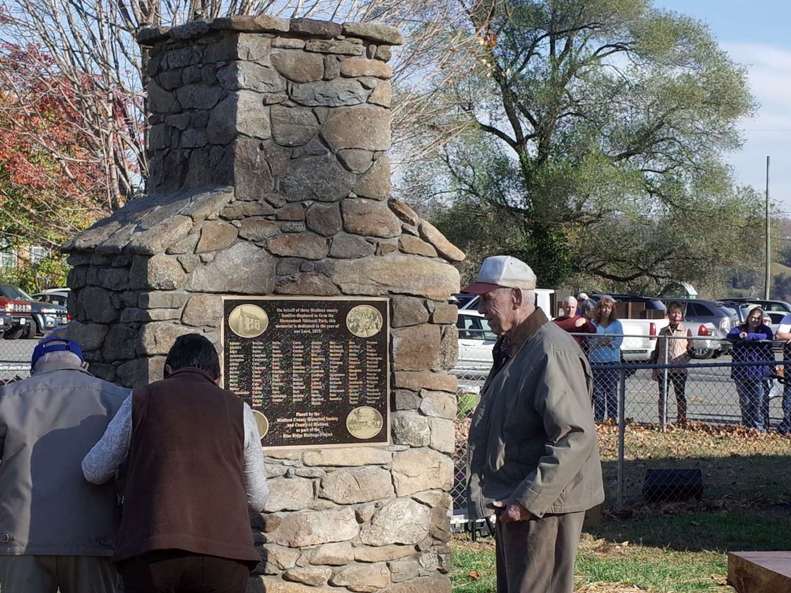
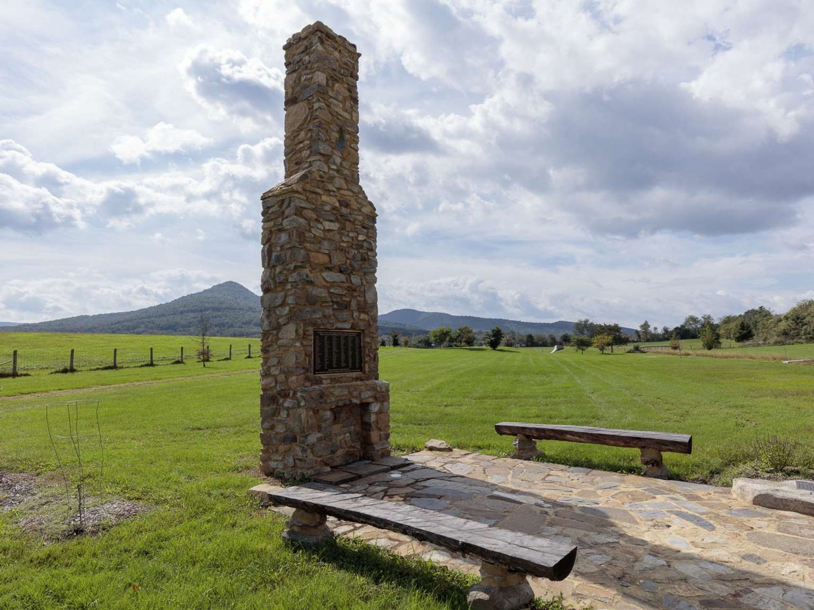
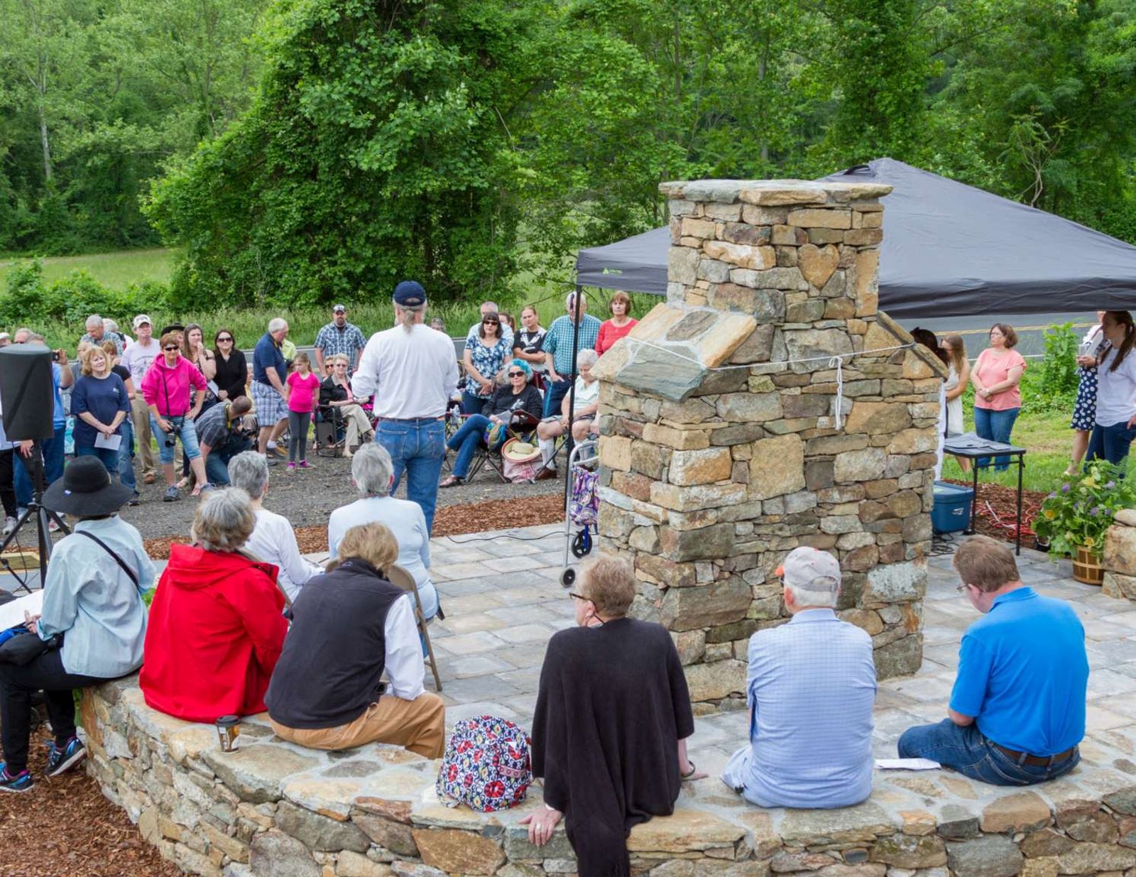
The Blue Ridge Heritage Project is a non-profit organization whose mission is to build monuments to honor the people who were displaced by the creation of Shenandoah National Park. Currently, six of the eight counties from which mountain residents were relocated have monuments: Madison, Page, Rockingham, Greene, Rappahannock, and Albemarle. Warren has a site selected and Augusta is in the planning stages. Most of the monument sites include exhibits about the families. We invi
The Blue Ridge Heritage Project is a non-profit organization whose mission is to build monuments to honor the people who were displaced by the creation of Shenandoah National Park. Currently, six of the eight counties from which mountain residents were relocated have monuments: Madison, Page, Rockingham, Greene, Rappahannock, and Albemarle. Warren has a site selected and Augusta is in the planning stages. Most of the monument sites include exhibits about the families. We invi
The Blue Ridge Heritage Project is a non-profit organization whose mission is to build monuments to honor the people who were displaced by the creation of Shenandoah National Park.
The Blue Ridge Heritage Project is a non-profit organization whose mission is to build monuments to honor the people who were displaced by the creation of Shenandoah National Park. Currently, six of the eight counties from which mountain residents were relocated have monuments: Madison, Page, Rockingham, Greene, Rappahannock, and Albemarle. Warren has a site selected and Augusta is in the planning stages. Most of the monument sites include exhibits about the families. We invi
The Blue Ridge Heritage Project is a non-profit organization whose mission is to build monuments to honor the people who were displaced by the creation of Shenandoah National Park. Currently, six of the eight counties from which mountain residents were relocated have monuments: Madison, Page, Rockingham, Greene, Rappahannock, and Albemarle. Warren has a site selected and Augusta is in the planning stages. Most of the monument sites include exhibits about the families. We invi
The Blue Ridge Heritage Project is a non-profit organization whose mission is to build monuments to honor the people who were displaced by the creation of Shenandoah National Park. Currently, six of the eight counties from which mountain residents were relocated have monuments: Madison, Page, Rockingham, Greene, Rappahannock, and Albemarle. Warren has a site selected and Augusta is in the planning stages. Most of the monument sites include exhibits about the families. We invi
The Blue Ridge Heritage Project is a non-profit organization whose mission is to build monuments to honor the people who were displaced by the creation of Shenandoah National Park. Currently, six of the eight counties from which mountain residents were relocated have monuments: Madison, Page, Rockingham, Greene, Rappahannock, and Albemarle. Warren has a site selected and Augusta is in the planning stages. Most of the monument sites include exhibits about the families. We invi
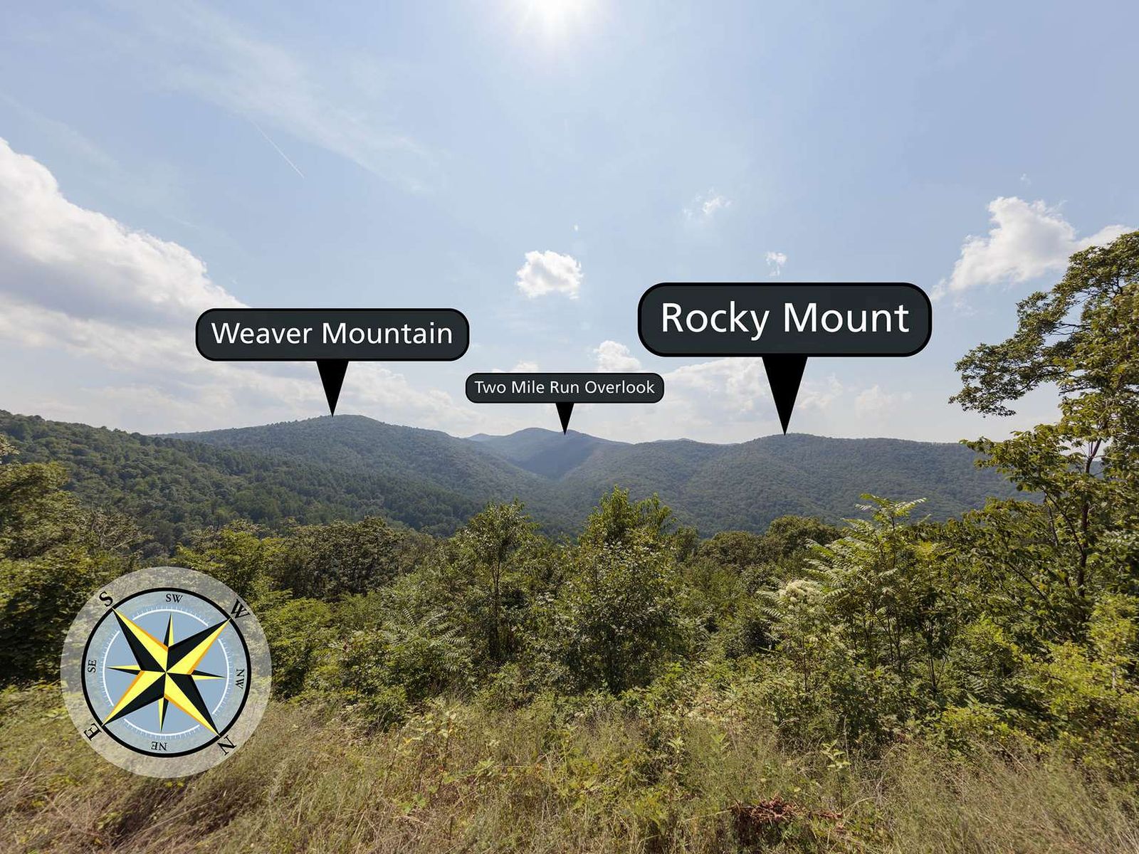
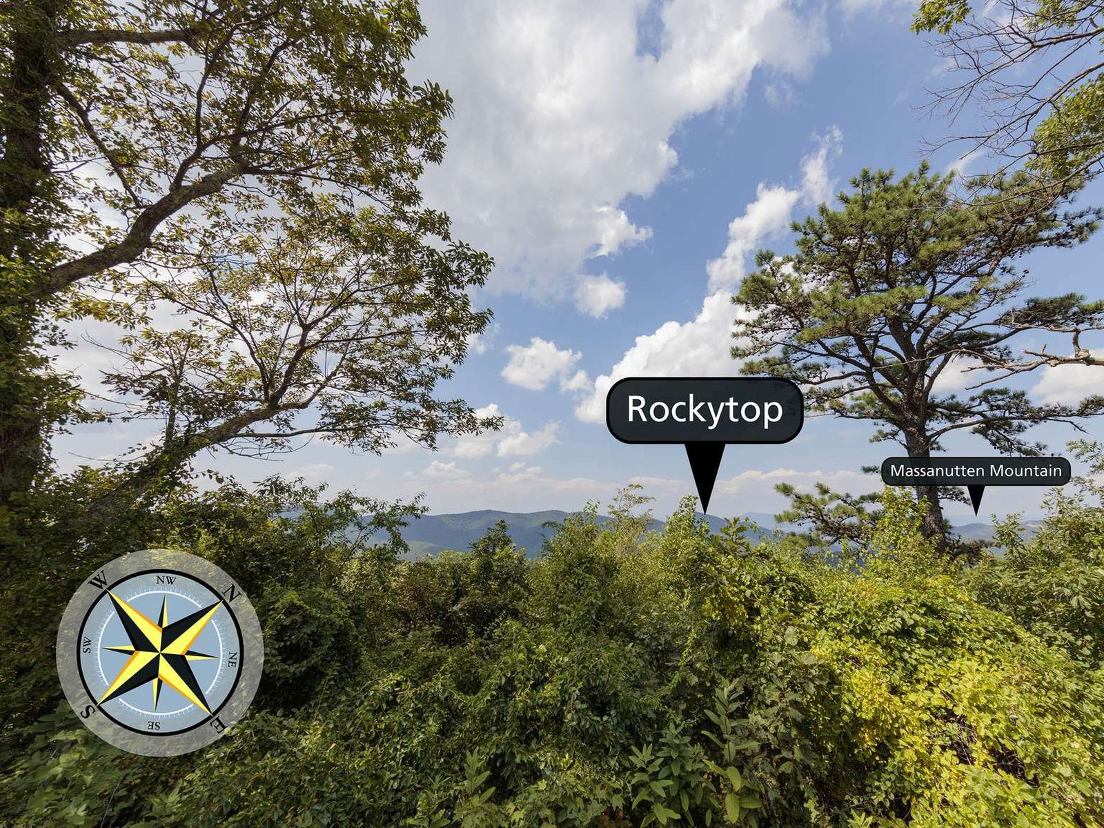
Brown Mountain Overlook sits at an elevation of 2,844 ft (866 m). This overlook is long, with views from north to south of Two Mile Ridge, Rocky Mount, Rockytop, Trayfoot Mountain, and the Shenandoah Valley.
Browns Gap Parking Area (mile 83) | This circuit hike leads you through designated Wilderness to Upper and Lower Doyles River Falls, as well as Jones Run Falls.
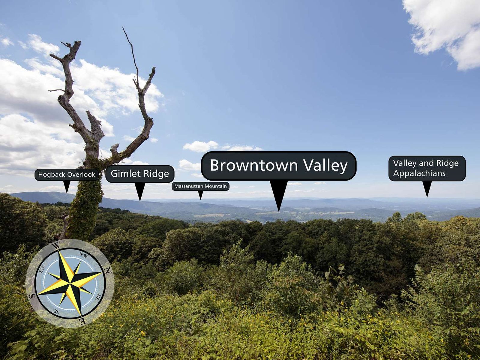
Looking west-northwest from an elevation of 2,890 ft (880 m), you will see the view of an historic community and surrounding hills from the Browntown Valley Overlook
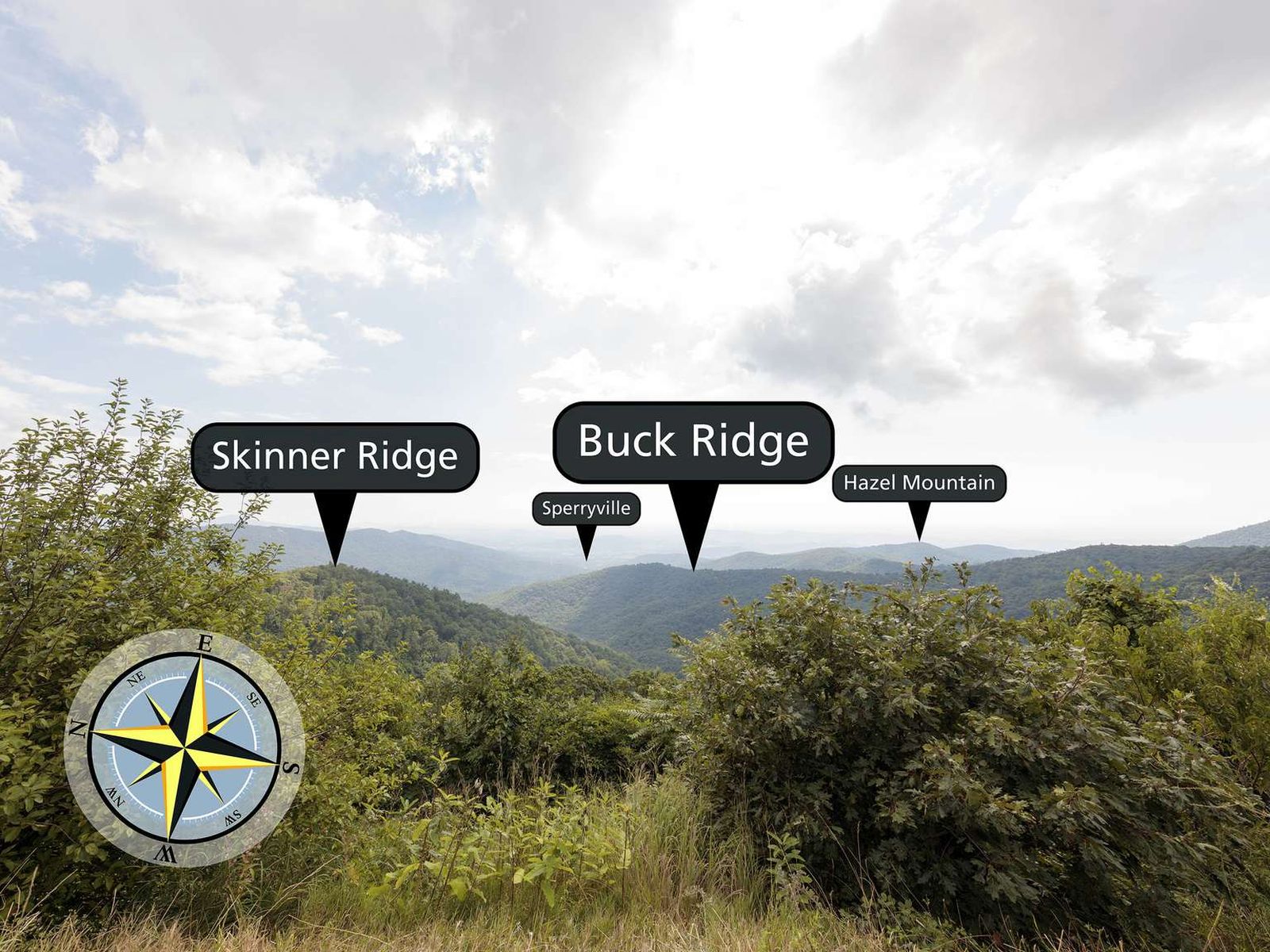
Stop at Buck Hollow Overlook, facing east-northeast from an elevation of 2,710 ft (826 m), and look out over the mountains! Skinner Ridge is visible towards the left, while Buck Ridge makes its way from the right toward the center of the view.
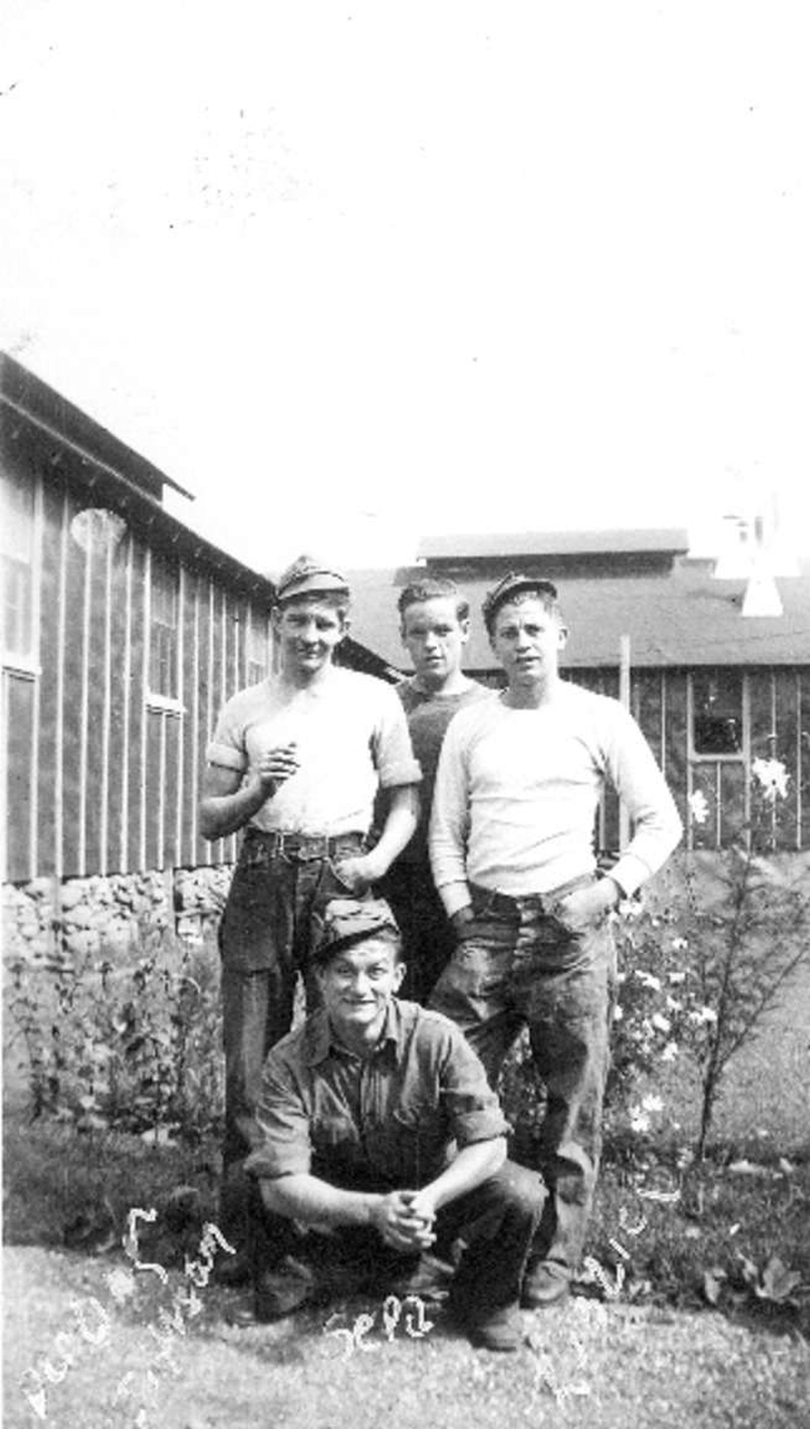
The enrollment period for the CCC was initially for six months, but an enrollee could re-enlist for up to a maximum of two years. Enrollees were required to take an oath, swearing to obey those in authority and follow all rules and regulations. Some of the boys adjusted more easily to a regimented life than others. Those who had come from rural backgrounds tended to have an easier time with the labor than those from more urban backgrounds. Others suffered from homesickness a
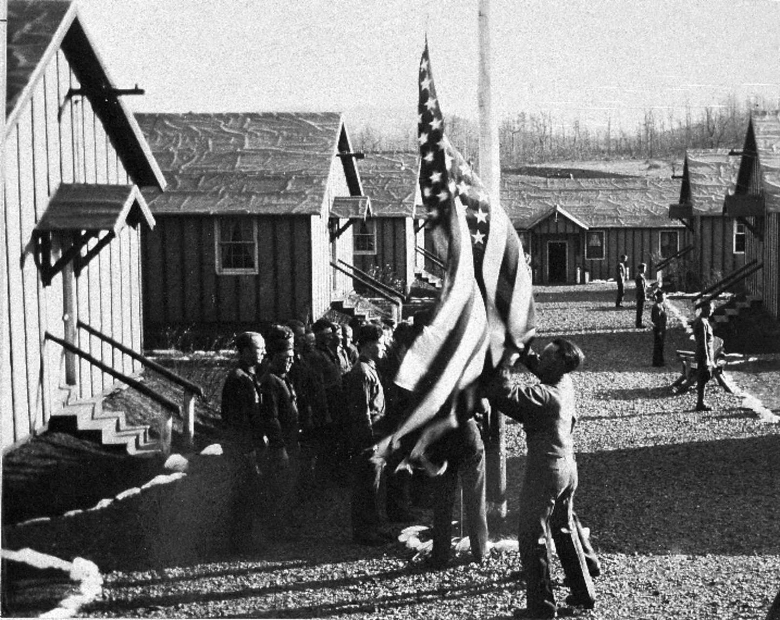
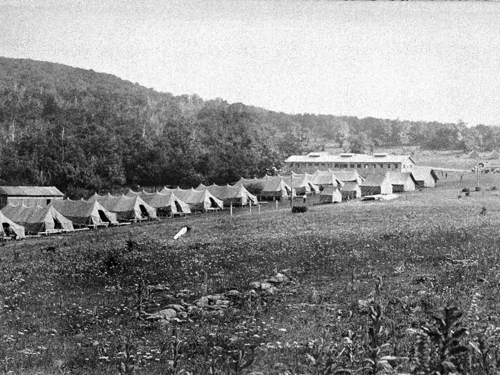
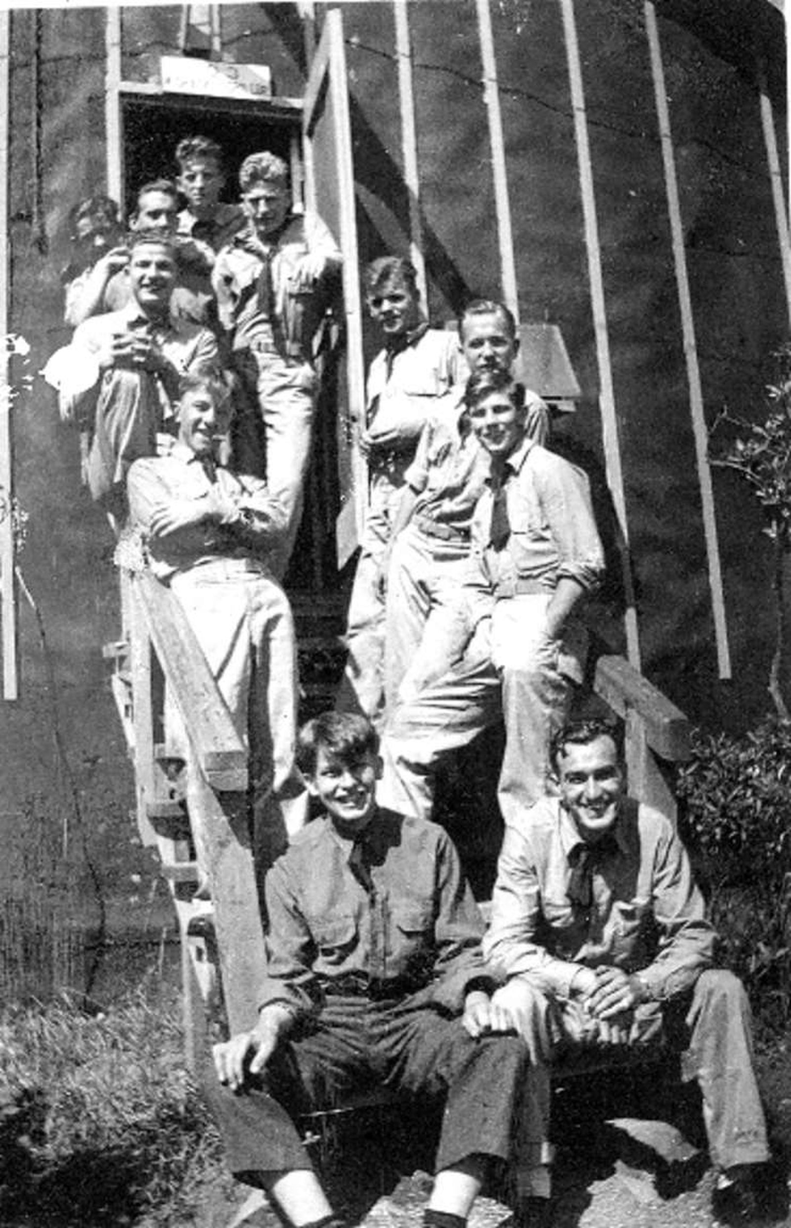
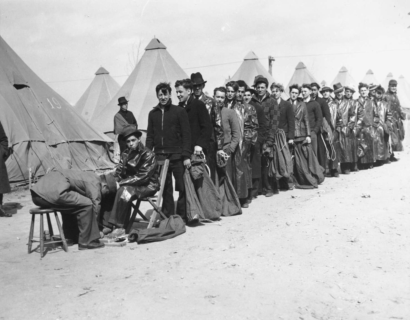
Given the speed with which the CCC was started, the first enrollees didn't arrive to finished camps in May of 1933 but rather, in the early months, they lived in surplus WWI tents. As the organization of the CCC evolved, more standardization was introduced into the building of the camps but almost all camps were built around a common open space or "Company Street."Shenandoah National Park had 10 different camps at various times throughout the nine years of the Civilian Conser
In the beginning, the official requirements for being a CCC enrollee were to be a man between the ages of 18-25, unmarried, and in need of assistance. (Although some older WWI veterans were also allowed to enroll.) Unofficially, some of the CCC boys lied about their ages to enter the Corps. CCC enrollees earned 30 dollars a month, a dollar a day, but $25 were automatically deducted and sent back home to their families, thus spreading the economic benefits of the program to th
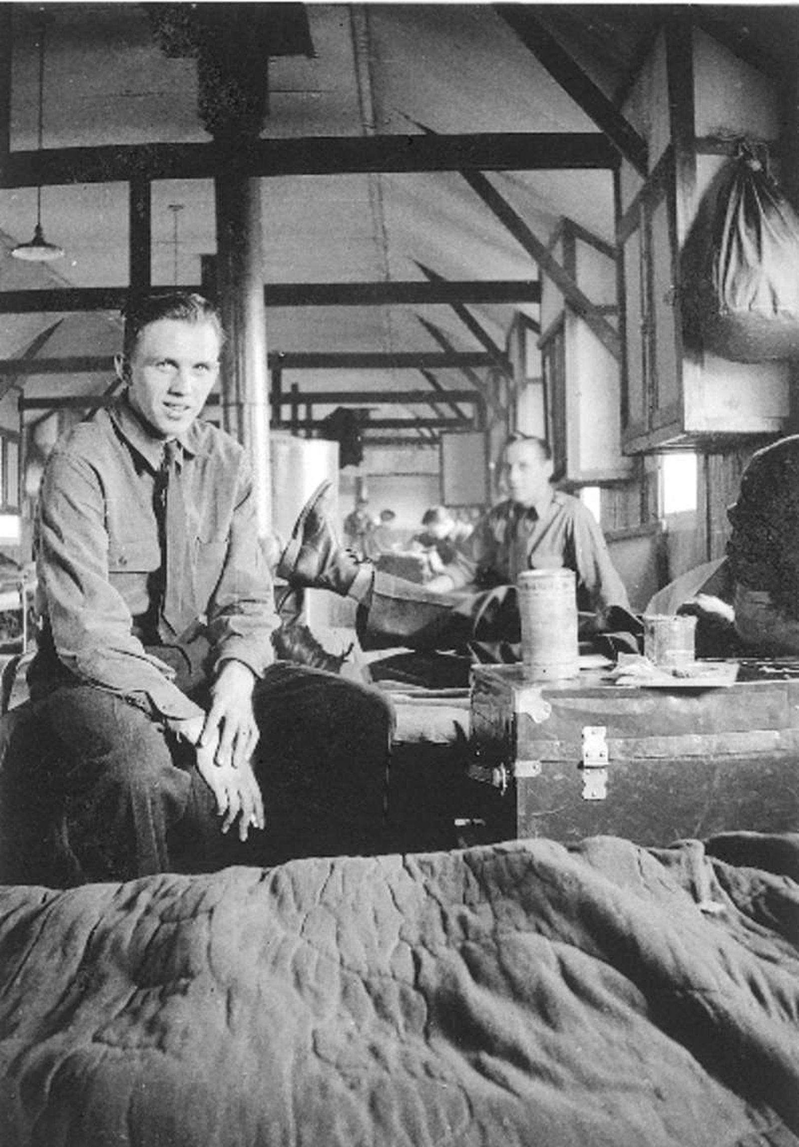
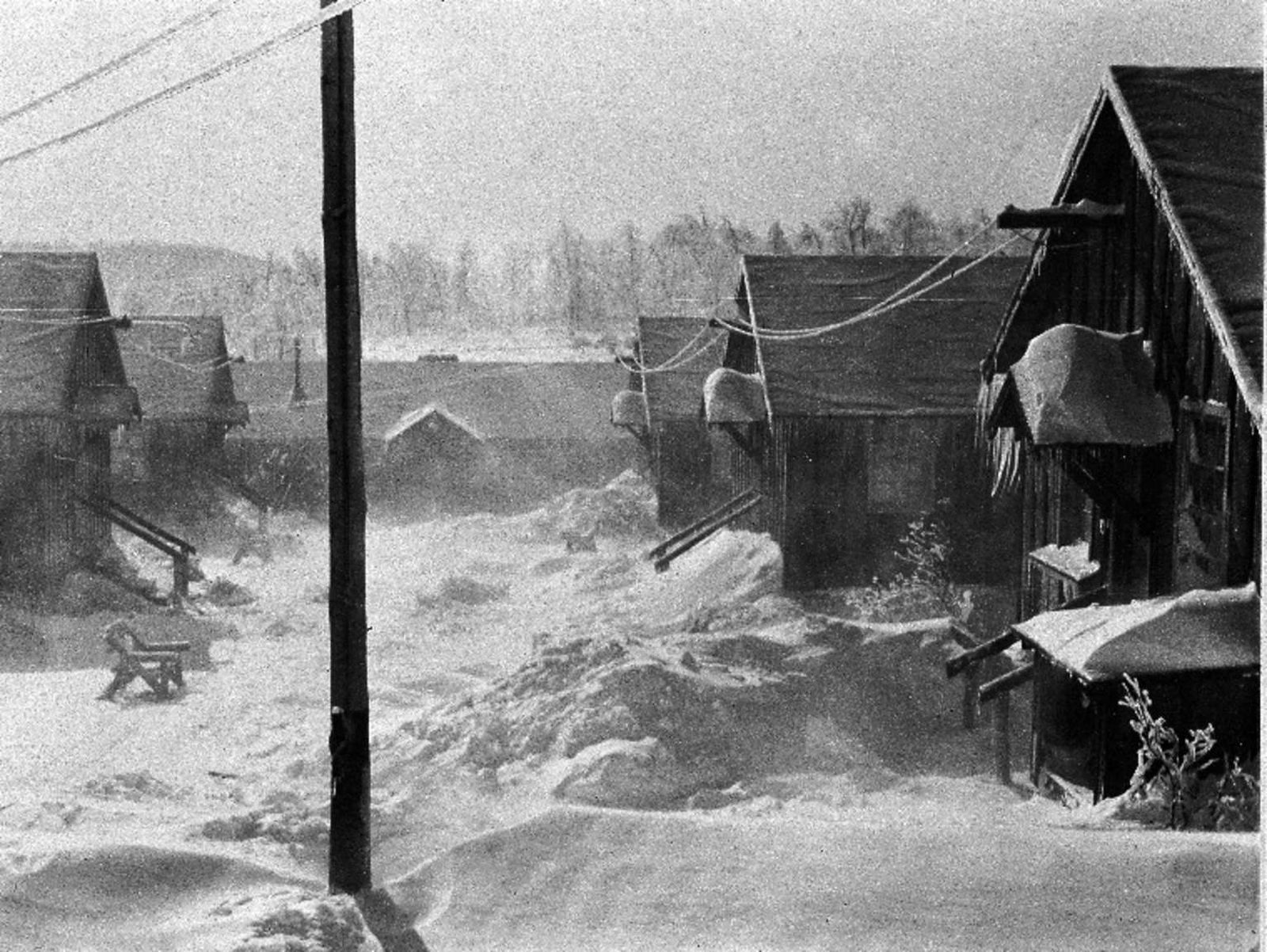
Winters would have been cold here on the mountain but there was no shortage of firewood to heat the stoves. When the CCC boys arrived at Shenandoah, they found a landscape that had been ravaged by the chestnut blight, a fungus that had been unintentionally imported from Asia and which had destroyed the American Chestnut. In the space of 30 years, the majestic trees which made up 25% of the forest ecosystem had died and left a "ghost forest" behind. It was a huge economic and
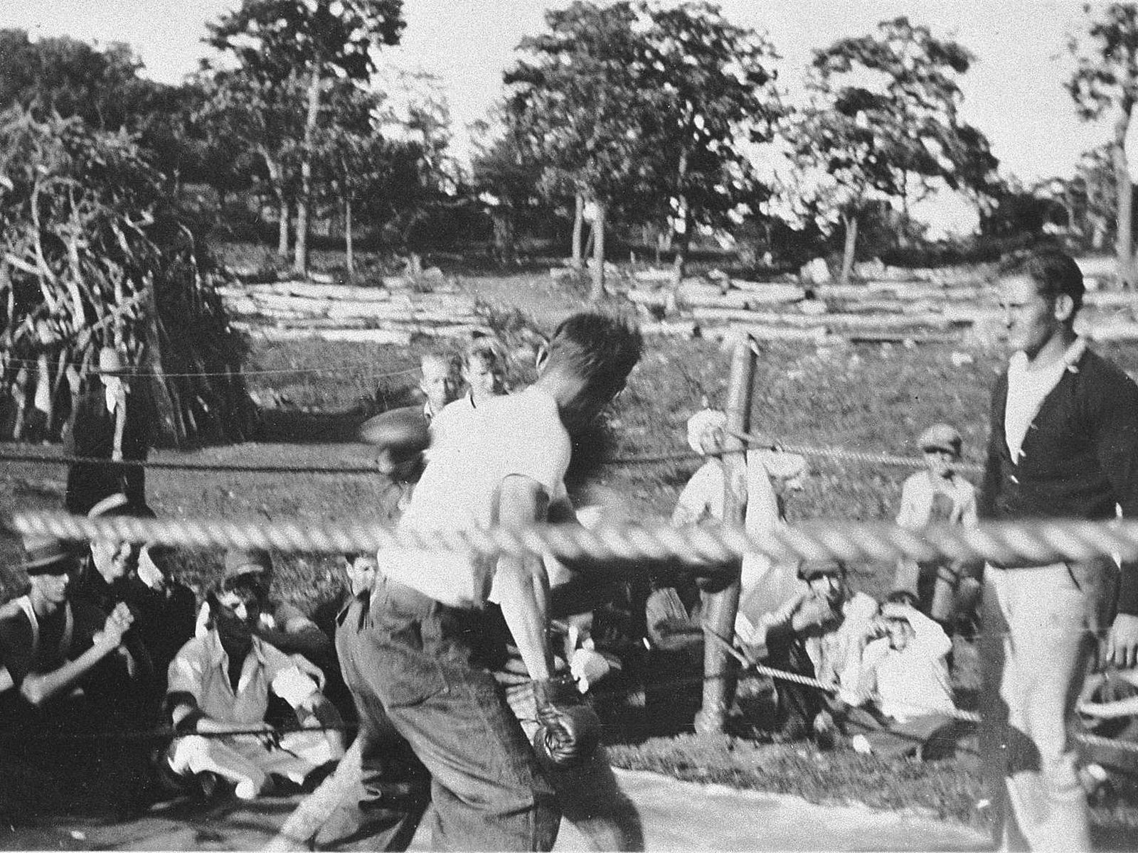
Living in close quarters, with little privacy, conflicts inevitably arose. As well as being fun, participating in competitive sports, including boxing, was one way of dealing with tensions as they arose.The boys came from varied backgrounds, rural and urban, and for many it was their first journey away from home. Being in the CCC exposed these young men to people completely different from themselves and gave them an opportunity to learn how to get along. Many an enrollee left
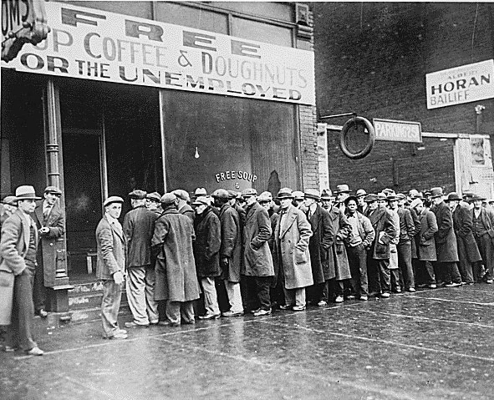
The year was 1933. The nation had been struggling for years with the effects of the Great Depression. Unemployment reached as high as 12 million people, equivalent to 25% of the eligible working population. People had lost their savings and livelihoods, bread lines were long and morale was low. Adding to the economic woes, the United States was also facing severe ecological issues. Drought conditions, poor farming practices and indiscriminate timber harvesting were contributi
The legacy of the CCC is vast and varied. The program affected change on both the personal and national levels. For the young men who came in with minimal or poor education, they learned how to properly read and write. Others learned the technical and construction skills that would serve them well in their later careers. Many saw parts of the country they had never seen before.
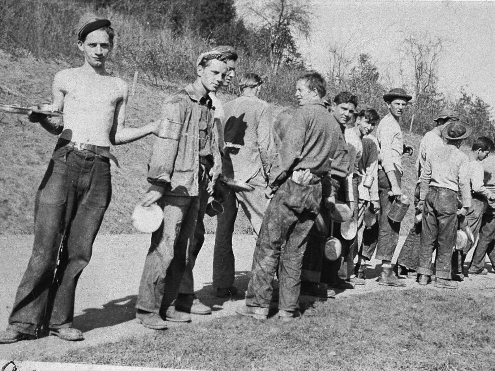
When setting up a camp, the mess hall was the typically the first building built. The idea behind the CCC was to put men to work, not machines, so they needed proper nutrition to fuel their various labors. <br />The food was basic, but plentiful, and having regular meals three times a day was a welcome change for most of the CCC boys who had been living off more meager rations during the Depression.
There were many agencies involved in getting the CCC men here: the Department of Labor recruited and enrolled the men, the Department of Interior (under which the National Park Service is administered) and Department of Agriculture provided the work projects and the War Department/Army ran the camps. Despite the many agencies involved, the CCC was up and running with incredible speed. From Roosevelt's initial meeting with his Cabinet regarding the CCC on March 9, 1933 to the
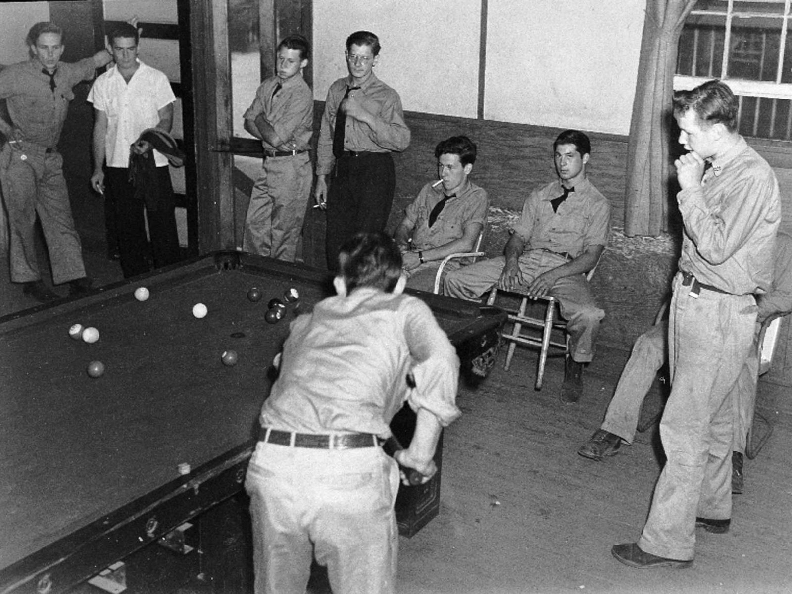
After a long, hard day of work, this building must have the place to come for a little relaxation. But the boys wouldn't just stay up on the mountain, even if their dances did sometimes attract hundreds of attendees. Needing a change of scene, they might go on Friday and Saturday nights down into the nearby towns to attend movies and the local dances.
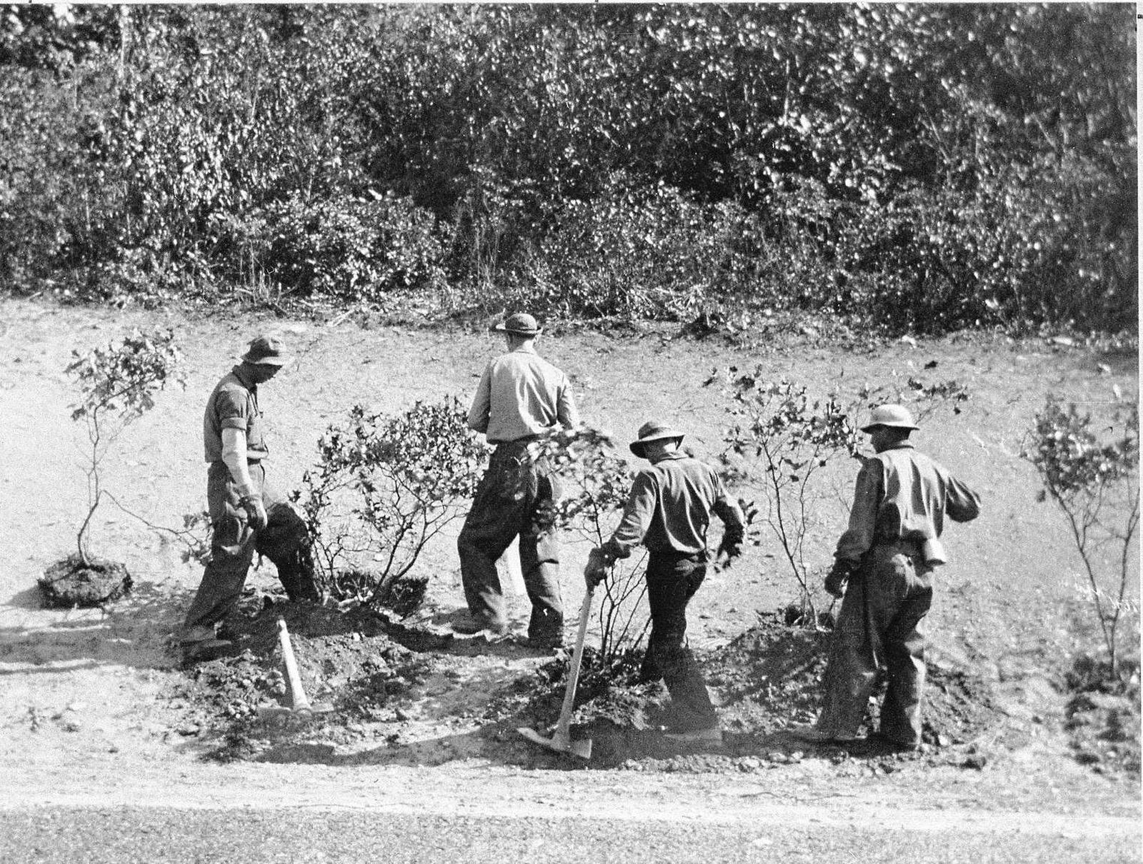
The building of Skyline Drive was a labor-intensive endeavor. Though the CCC did not engineer and build the road itself (that was done by the Bureau of Public Roads) they designed and created the overlooks as well as worked to control the erosion on the hillsides created from it's construction. Additionally, they planted hundreds of thousands of trees and plants, including mountain laurel, creating the beautiful "natural" landscaping we enjoy today as we take a drive along th
The CCC worked on every aspect of vegetation and reforestation management in the Park. They grew and planted new seedlings, cleared the understory of dead brush and trees, and moved shrubs and trees around from one area to another, particularly by picnic grounds, overlooks and other facilities. What might seem natural to us now is actually the product of extensive landscape manipulation.
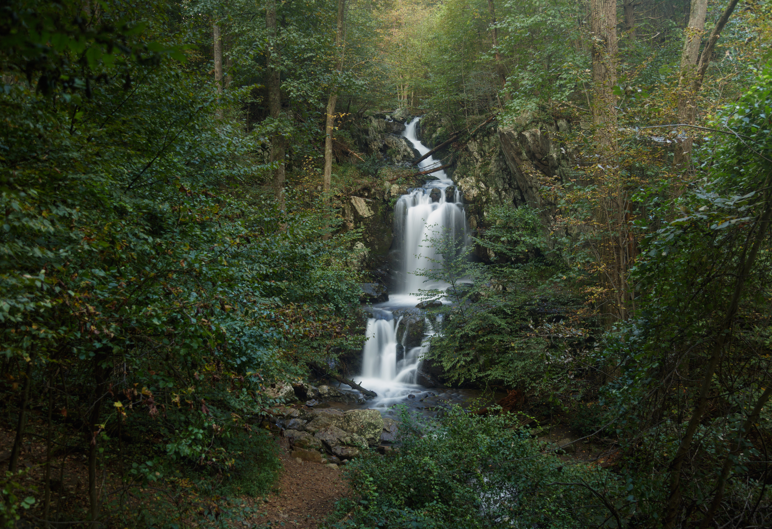
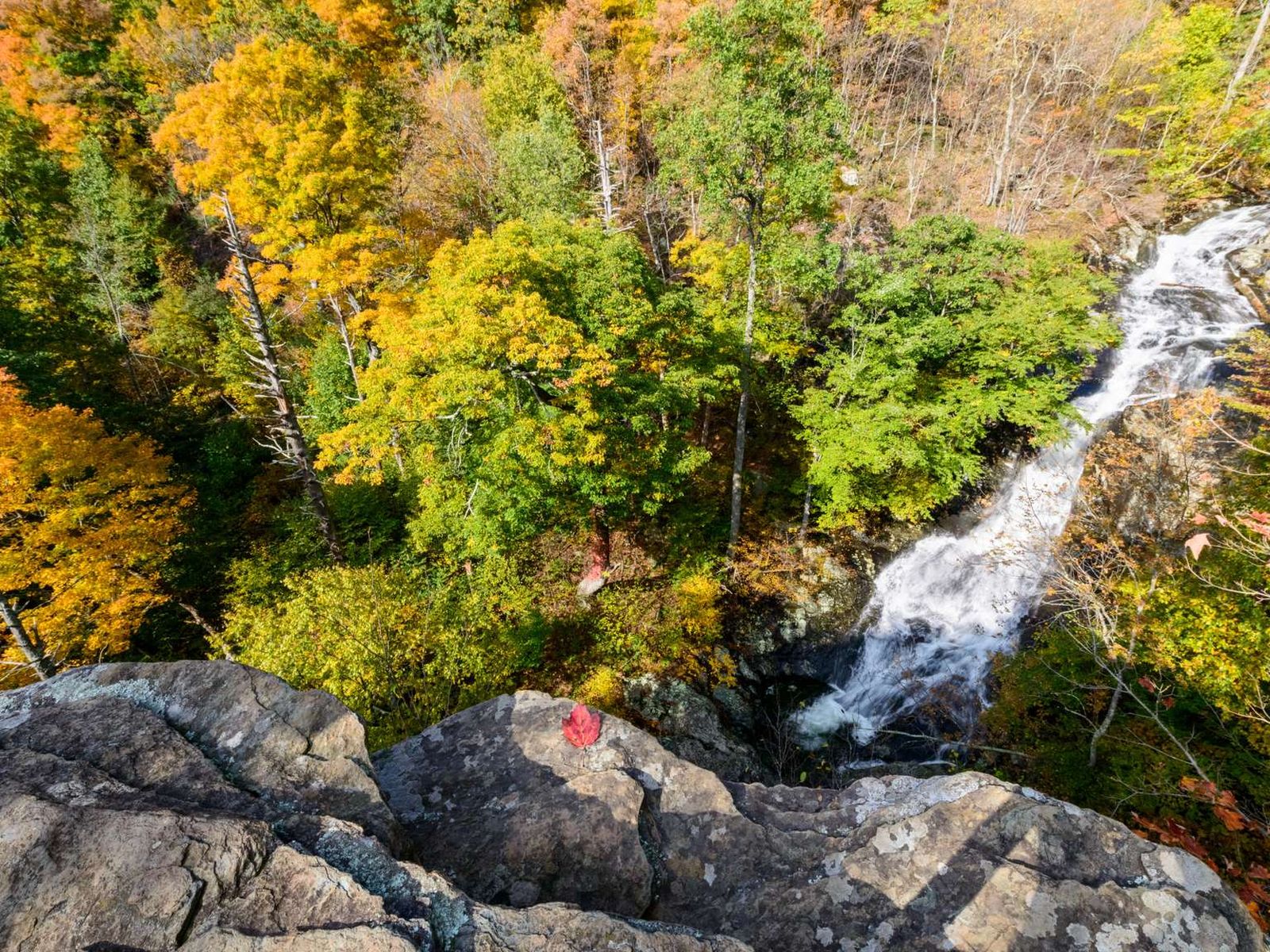
Hawksbill Gap Parking Area (mile 45.6) | This hike is very challenging, although those who do it are rewarded with exceptional cascades and waterfalls.
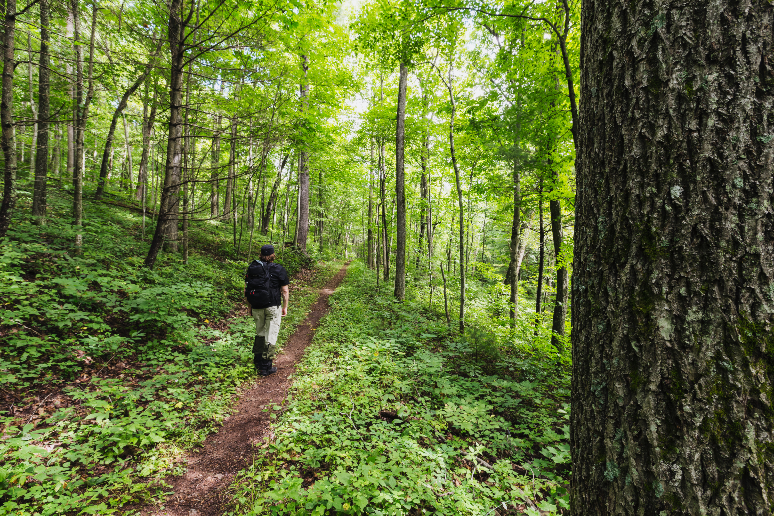
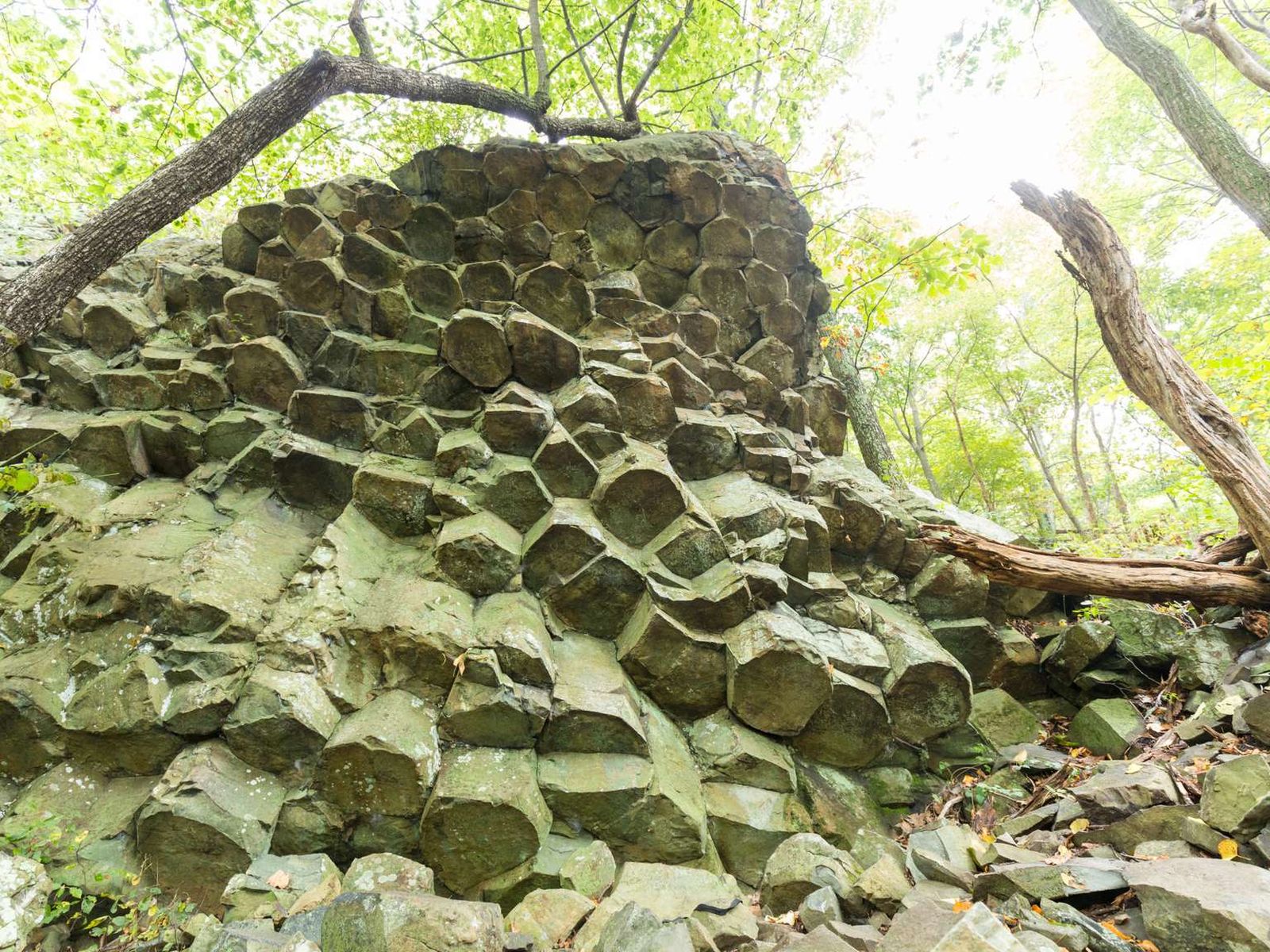
Compton Gap Parking Area (mile 10.4) | A hike through the forest along the Appalachian Trail to a western view and a great look at columnar jointing, an exciting geologic feature.
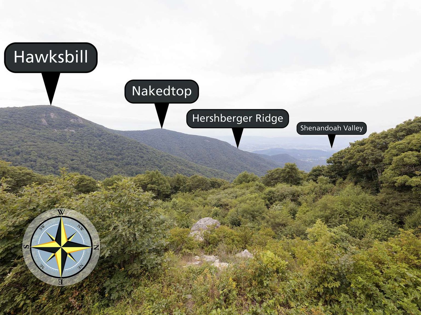
Facing west, with an elevation of 3,550 ft (1,082 m), Crescent Rock Overlook has some of the best views of Hawksbill Peak, the highest peak in Shenandoah, at 4,050 ft (1,234 m). An informational sign located at the overlook shares information about the establishment of Shenandoah National Park and the resettlement of former residents of the land.
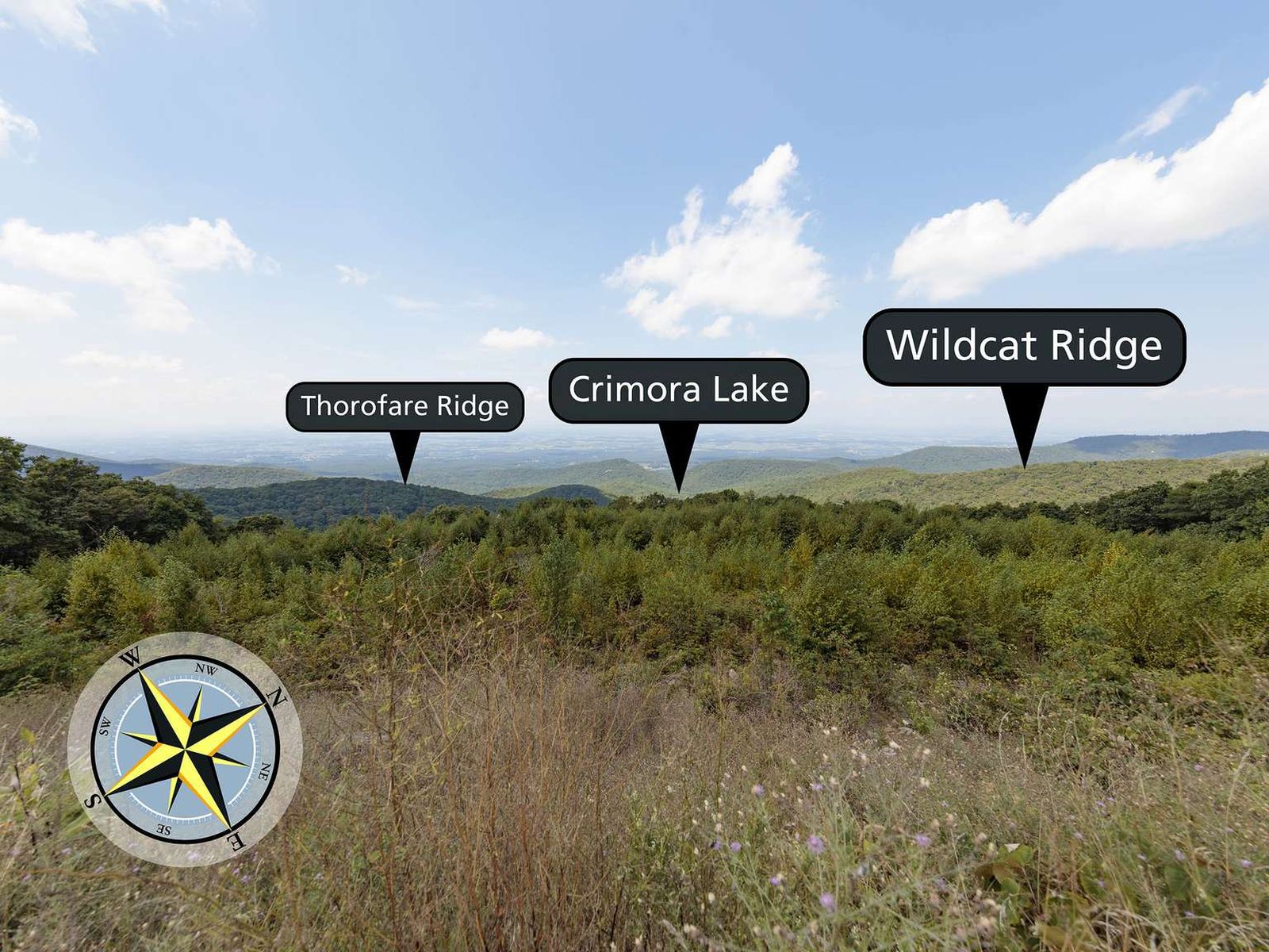
Facing northwest from an elevation of 2,985 ft (909 m), Crimora Lake Overlook is a good place to contemplate the industrial history of the Shenandoah Valley.
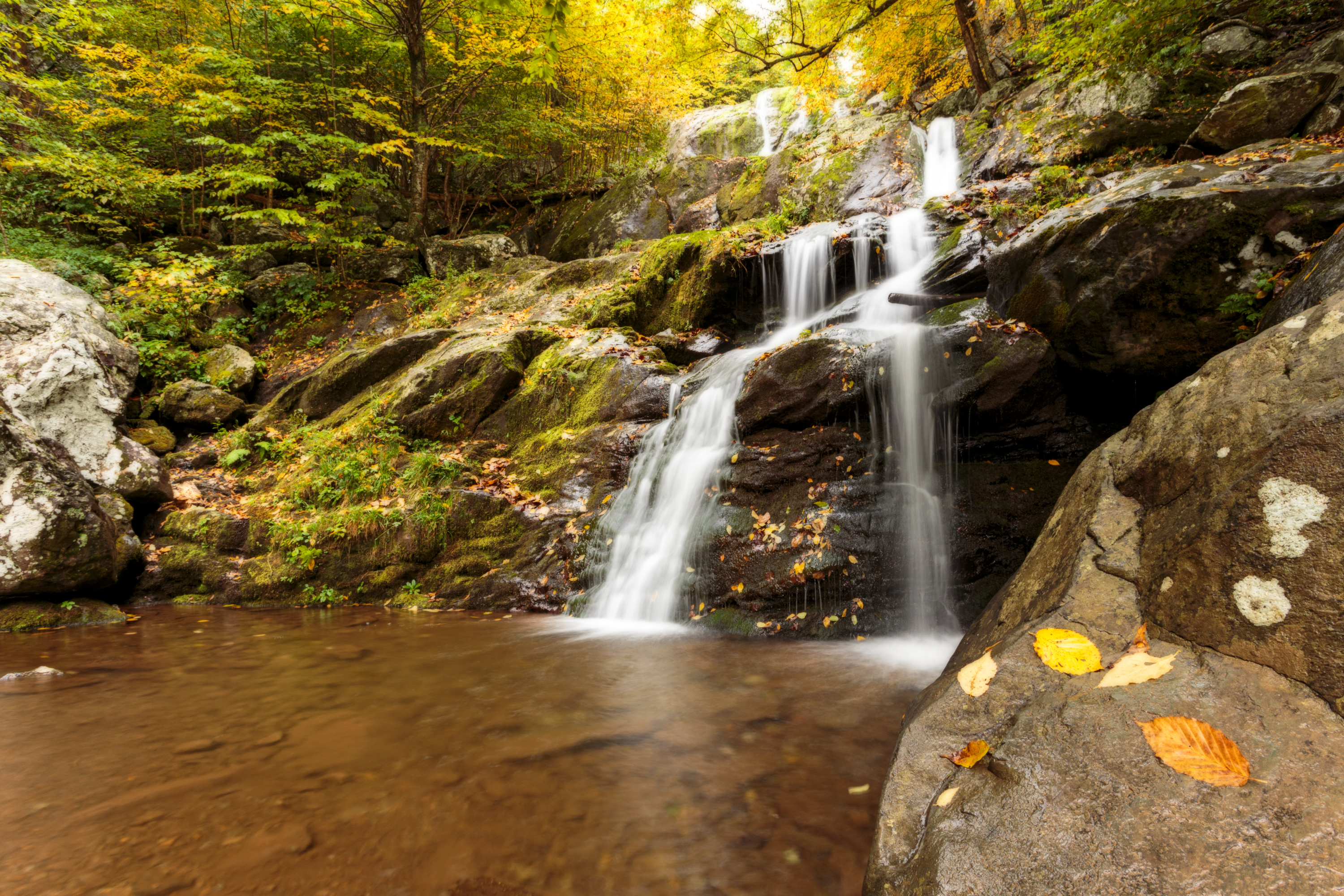
Dark Hollow Falls Parking Area (mile 50.7) | Pets are not allowed on this hike. This hike follows a stream to a beautiful waterfall, and is one of the Park’s most traveled trails. The trail is short, but very steep and rocky and the return hike is challenging!