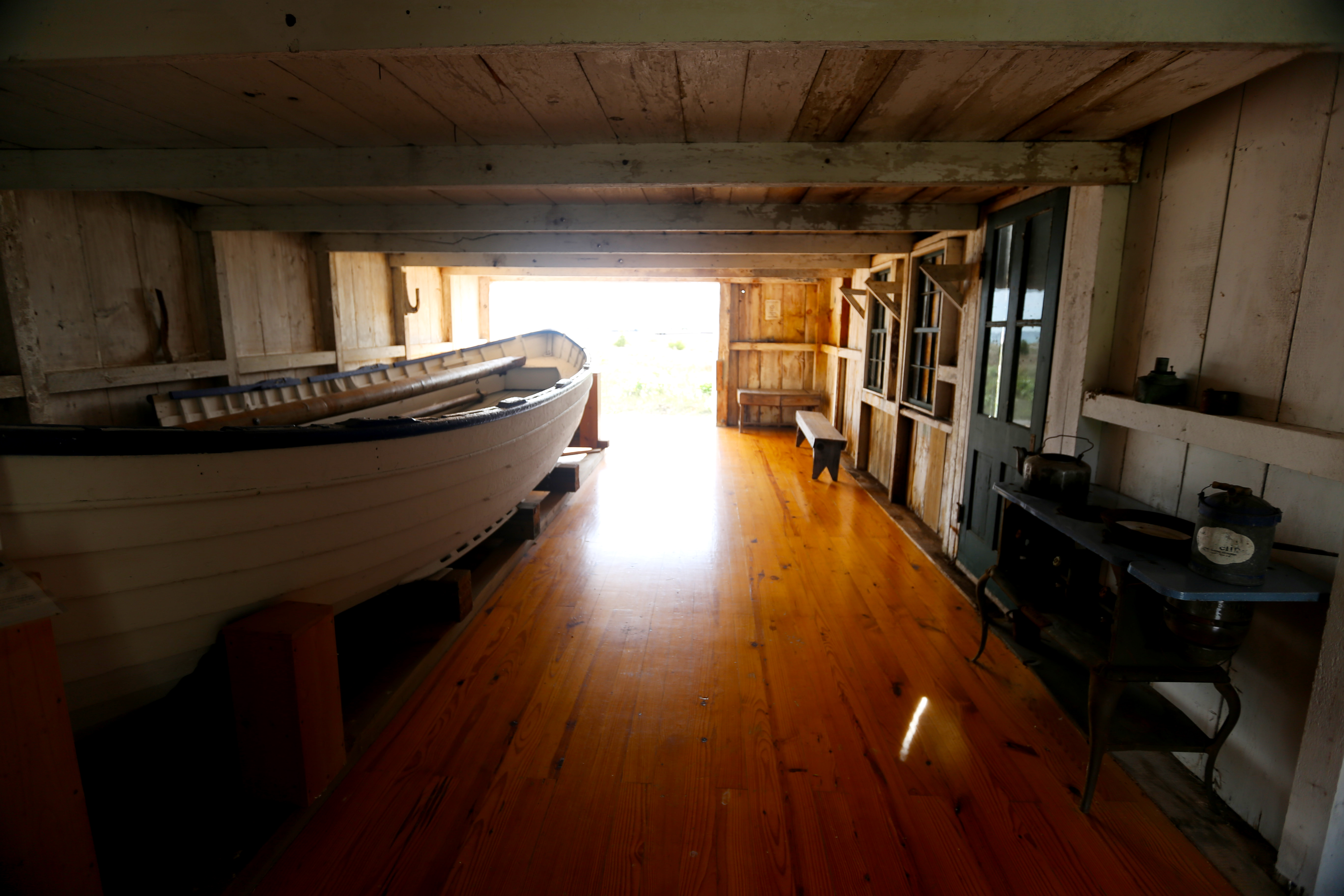
Constructed by the North Manitou Island crew in 1877, this structure is an open, one-story boat house with a clipped gable roof featuring decorative brackets and barge boards. The building was later renovated and used by the Manitou Island Association.
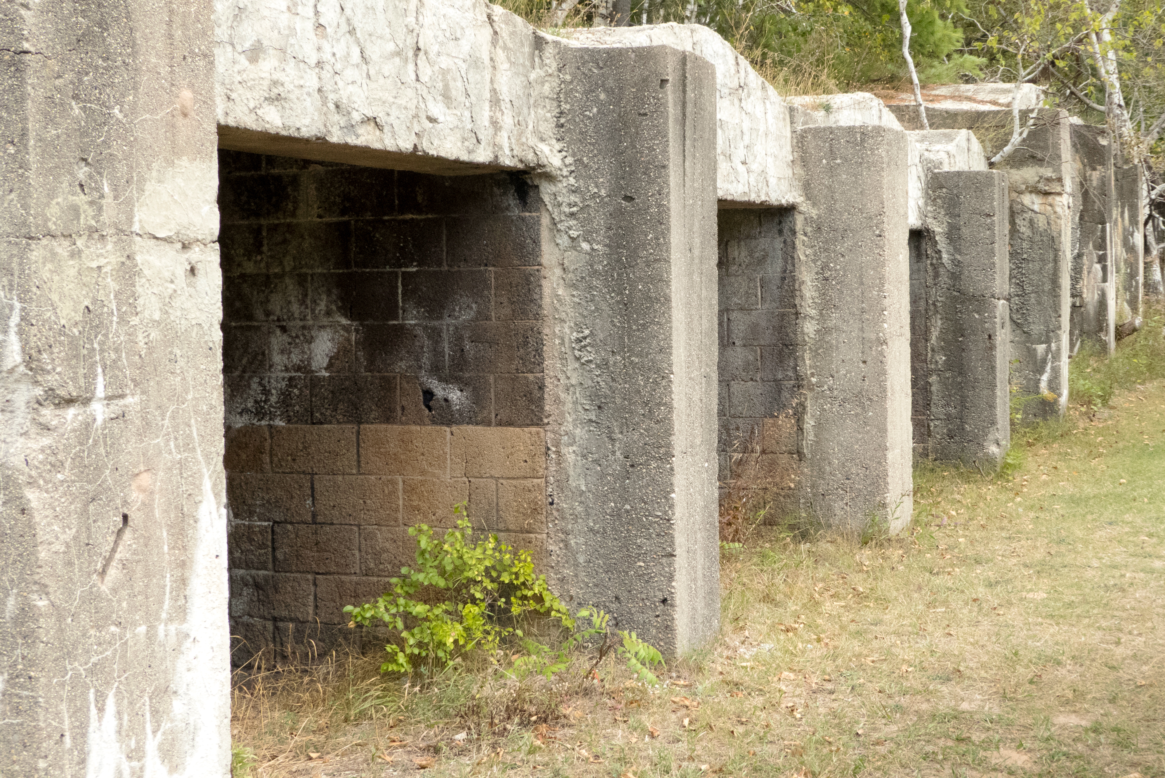
The first point of interest on this trail is a row of curious structures to the left of the trail. These concrete structures are charcoal kilns, and they were installed by lumberman Pierce Stocking who purchased the land in 1948 after the demise of Day Forest Estates. He used these kilns to convert the waste from his sawmill into charcoal. The loose, dusty, random-sized material was packed in bags for shipment to stores in much of Michigan for sale to campers and picnickers.
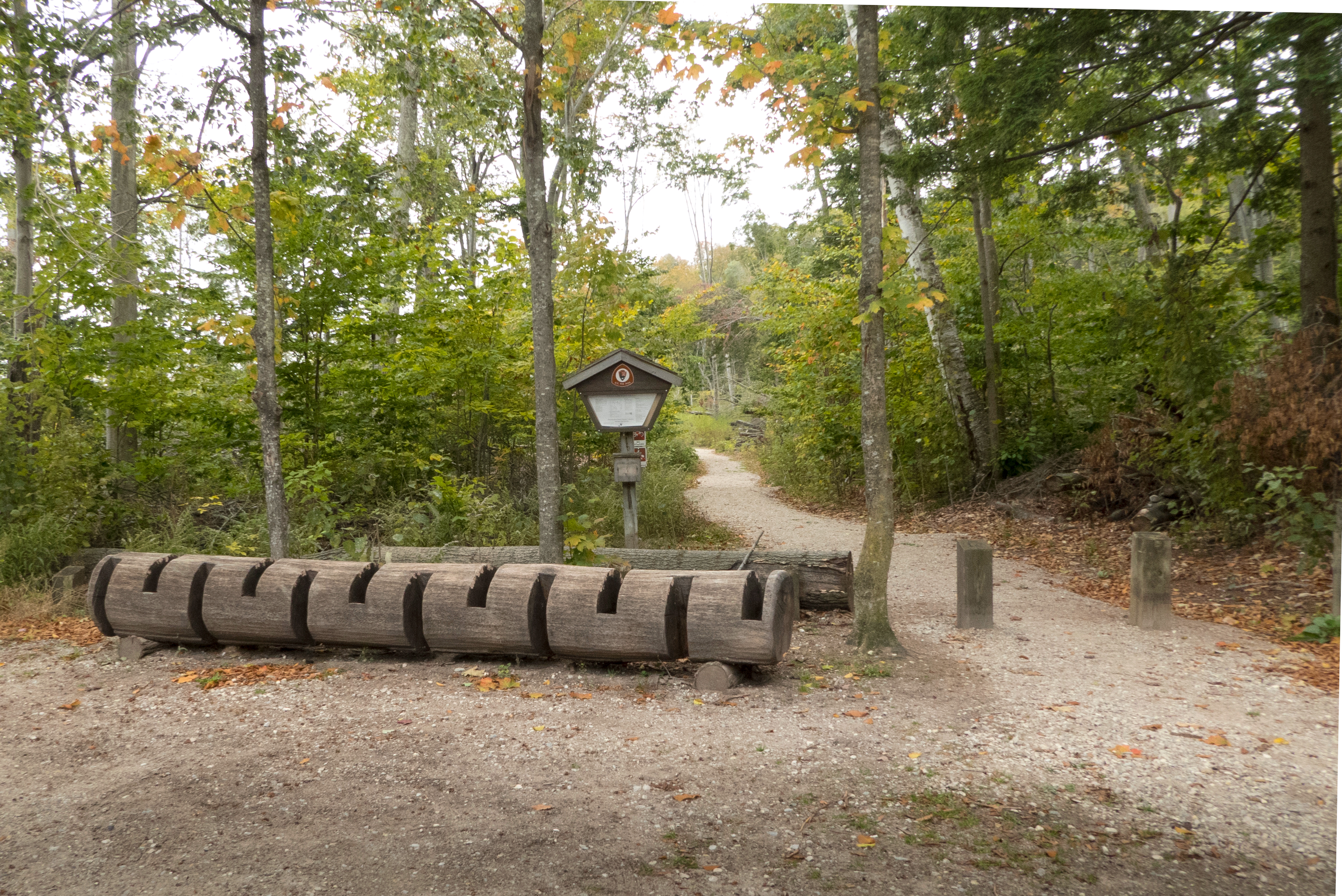
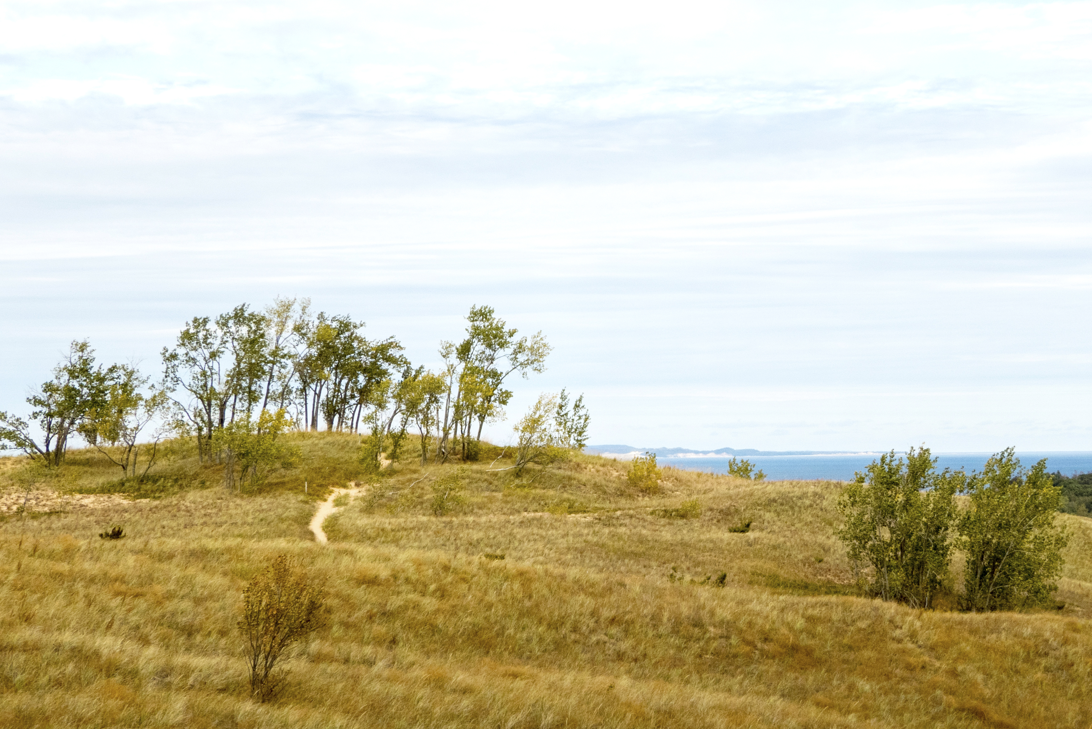
An often overlooked gem, Alligator Hill is nine miles of hiking trails looping through a hilly, leafy, alligator-shaped ridge with beautiful views of both Lake Michigan and Big Glen Lake. The three interconnected loops allow you to choose the hiking experience you want ranging from a shorter, easier hike leading to great views to a solid workout up and down the rolling hills and through the forest. They are also the only trails in the Lakeshore where horses are allowed.
An often overlooked gem, Alligator Hill is nine miles of hiking trails looping through a hilly, leafy, alligator-shaped ridge with beautiful views of both Lake Michigan and Big Glen Lake. The three interconnected loops allow you to choose the hiking experience you want ranging from a shorter, easier hike leading to great views to a solid workout up and down the rolling hills and through the forest. They are also the only trails in the Lakeshore where horses are allowed.
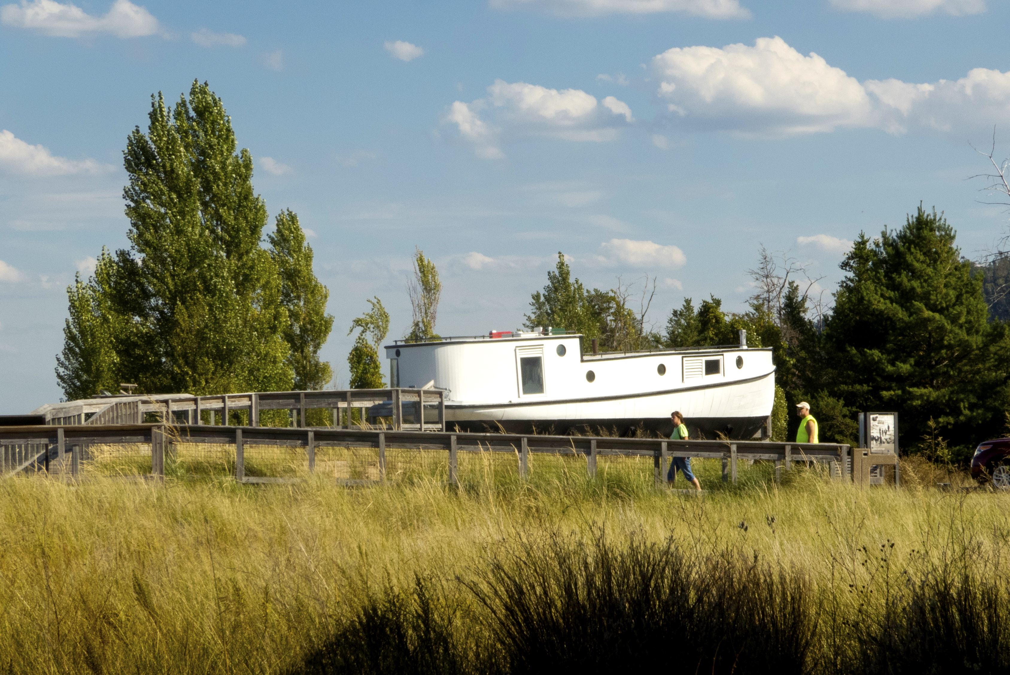
The seventy year-old fishing tug, Aloha, is a style of fishing boat used for gill net fishing. Fish tugs had closed decks and pilothouses amidships or near the stern were common.
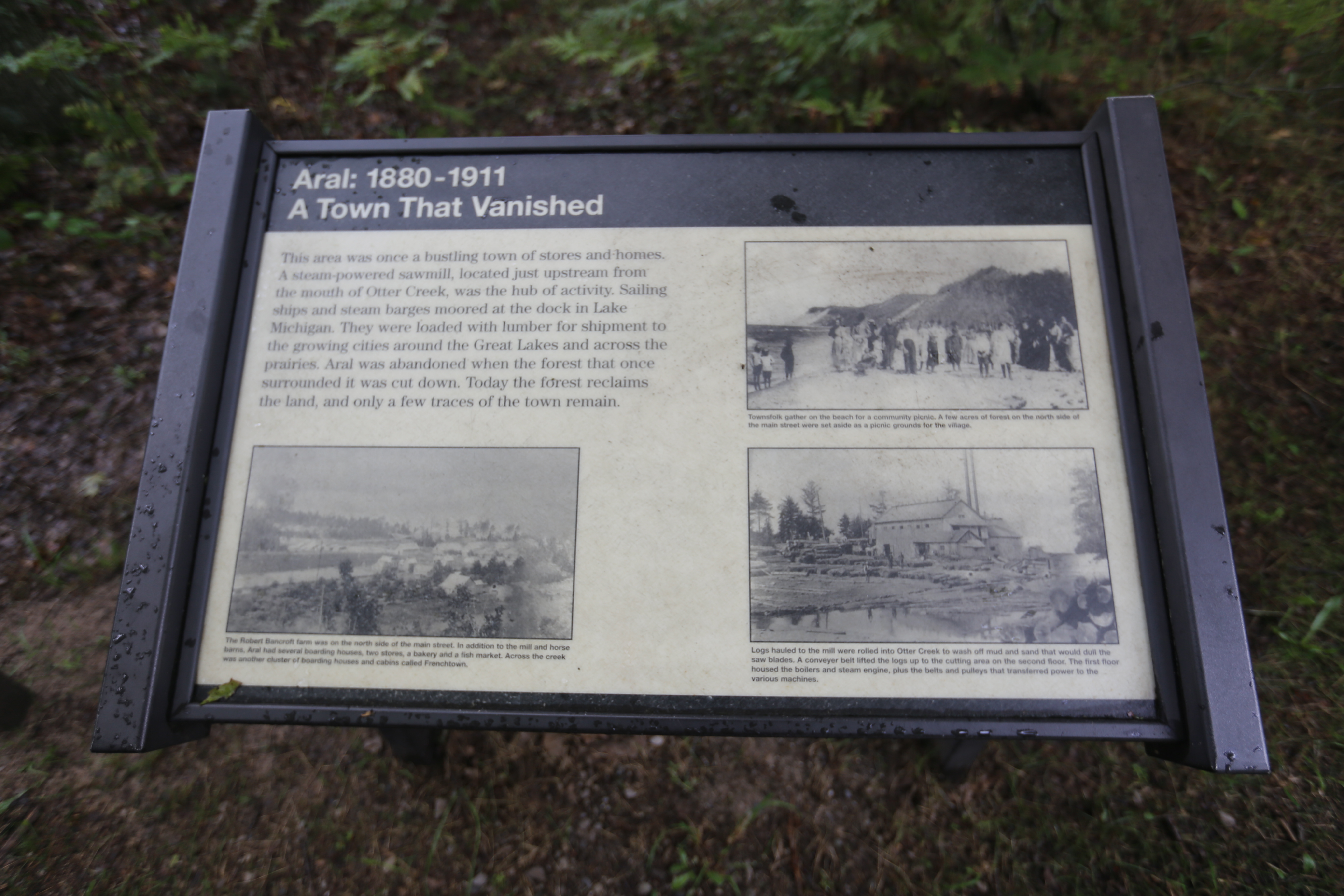
This area was once a bustling town of stores and homes. A steam-powered sawmill, located just upstream from the mouth of Otter Creek, was the hub of activity. Aral was abandoned when the forest that once surrounded it was cut down. Today the forest reclaims the land.
Of the island's 5,260 acres, over 65% is beach, sand dunes, or steep slopes unsuitable for agriculture, but the central part of the island, newly logged, was ripe for agriculture. The Becks arrived in the 1860s from Germany. Along with the Hutzlers and Haases, they contributed toward making the island a thriving agricultural community.
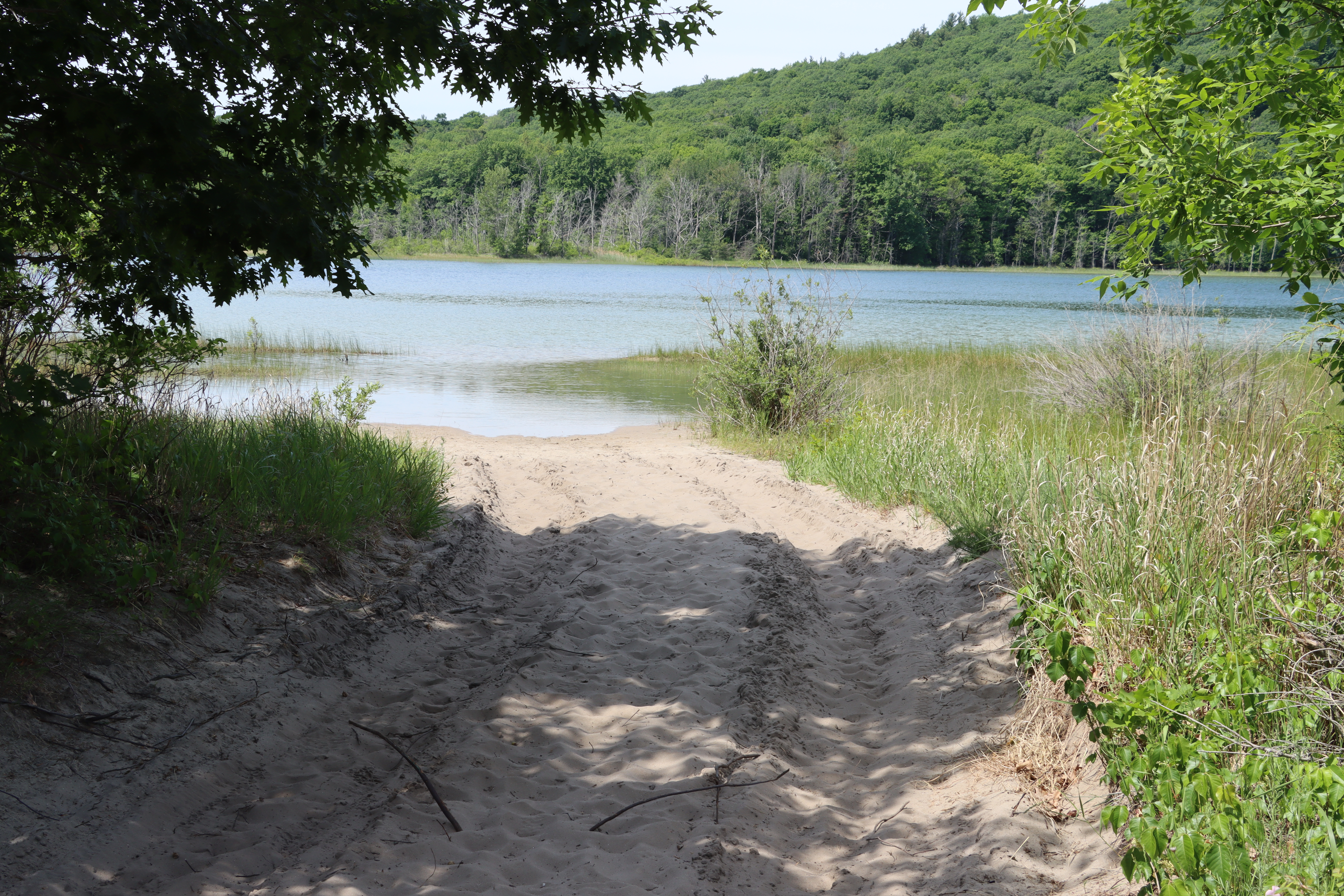
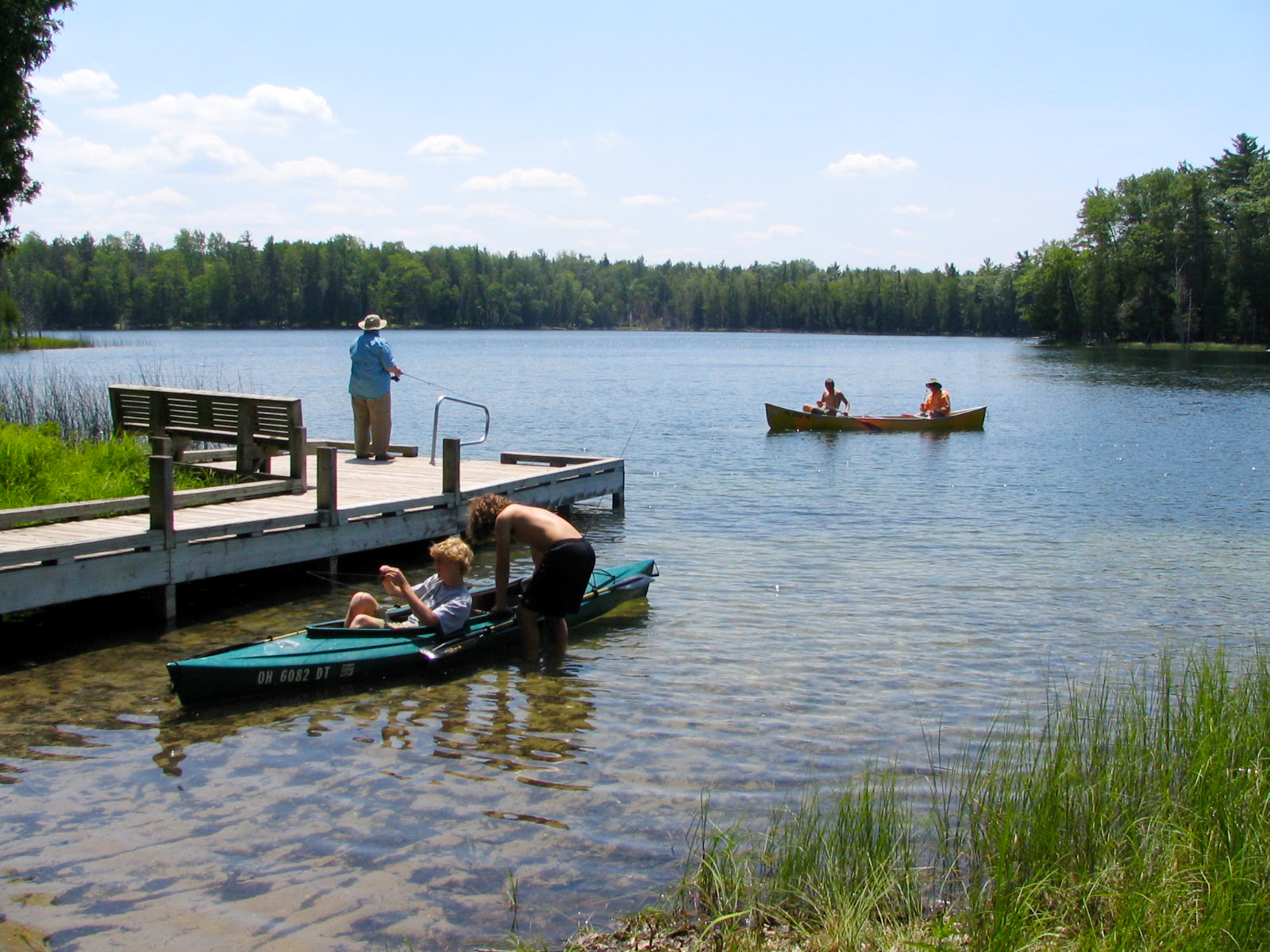
Bass Lake in the Platte Plains area is probably the best-known all-purpose lake in the park for hiking, canoeing, and fishing. Surrounded by aspen, white pine, and cedar, the calm lake is protected from the winds off Lake Michigan and is a great starter lake for teaching kids about fishing, hiking, or boating.
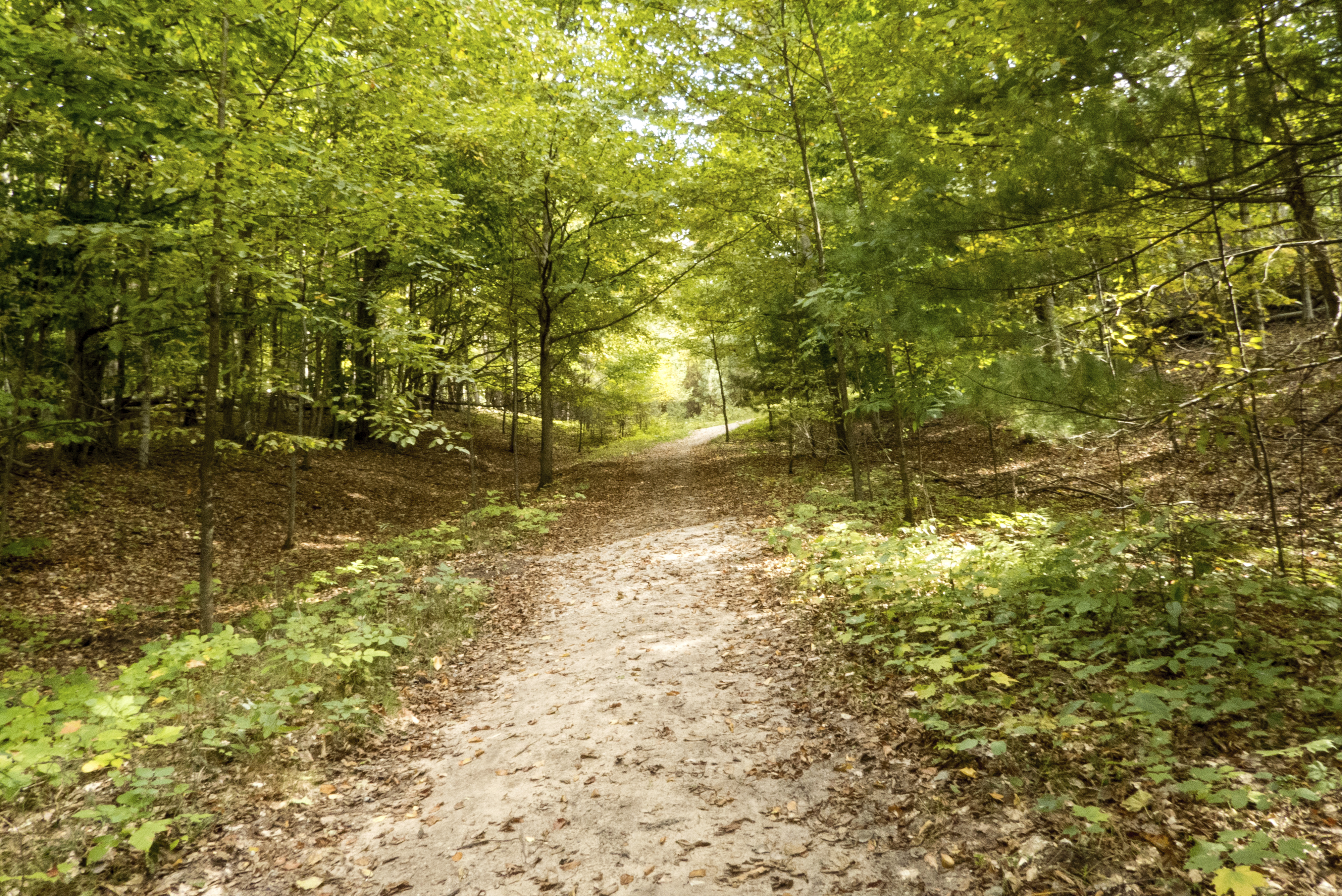
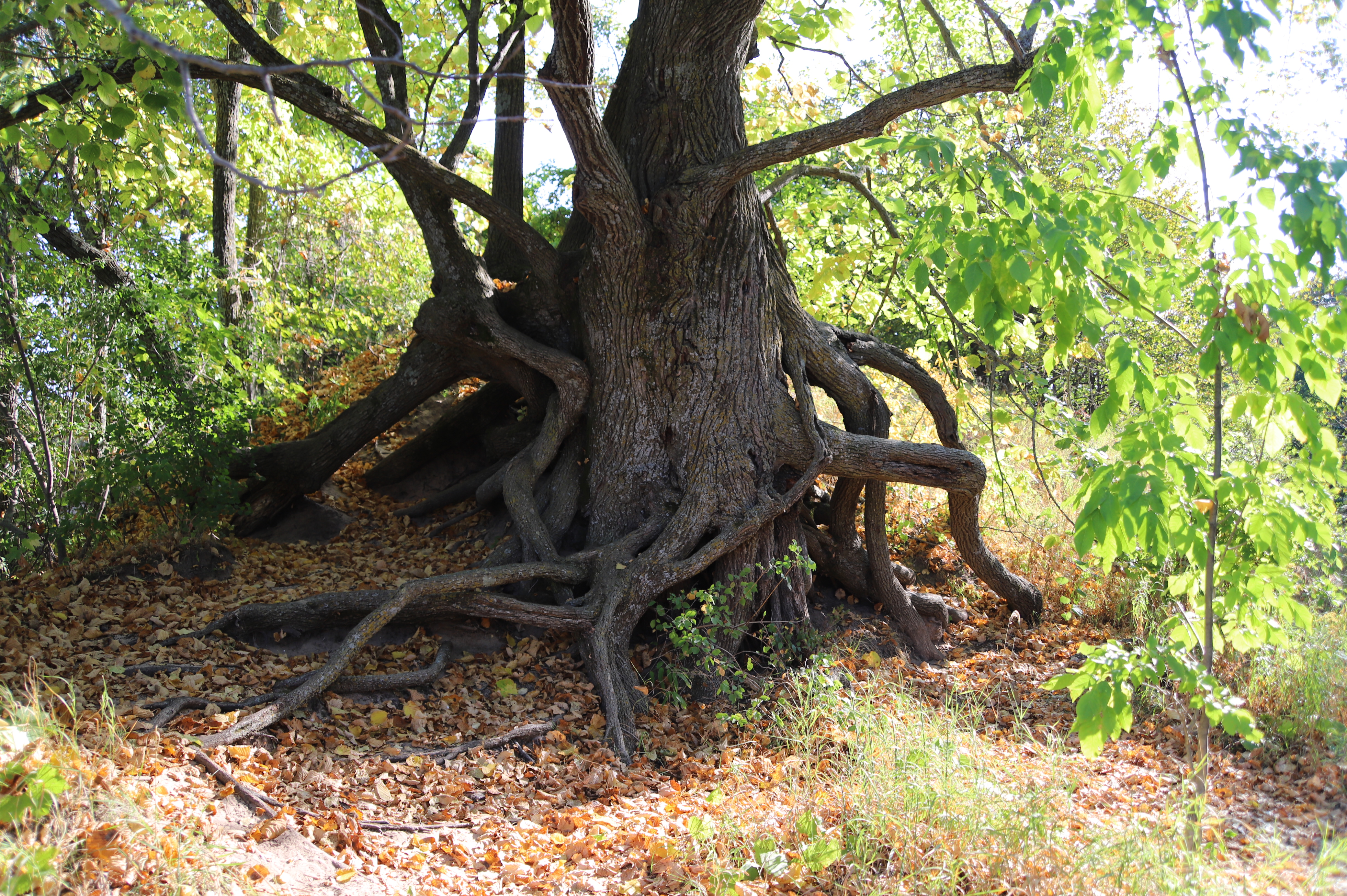
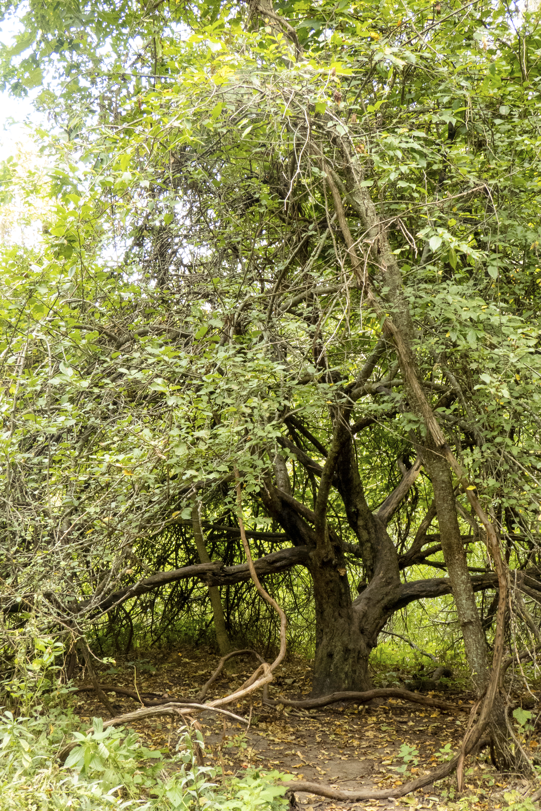
What a startling contrast we find between the open, sunny environment of the dunes and the lush, shady world of the beech-maple forest. Here plants must compete for the limited amount of sunlight. Shade-tolerance is the key to survival.
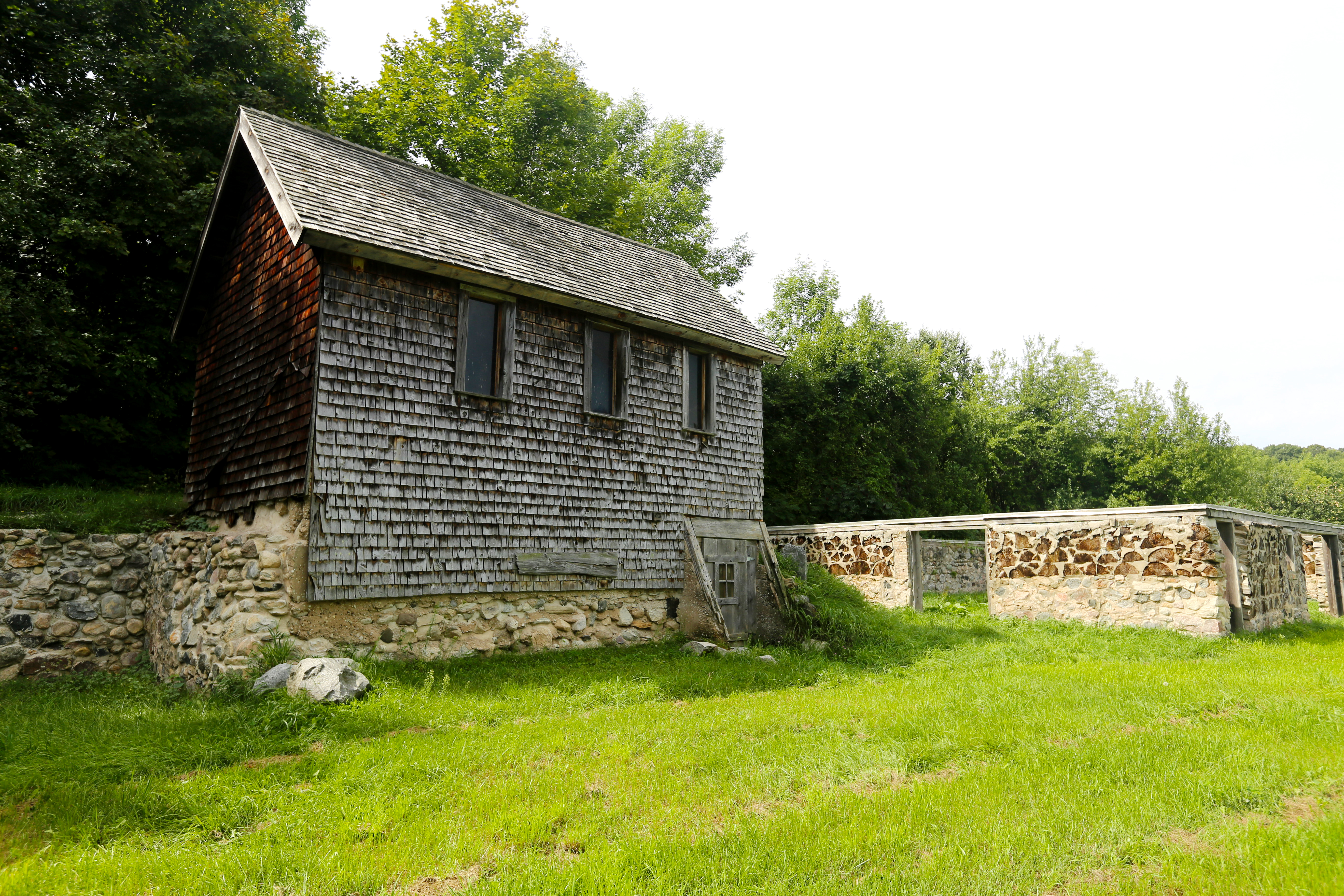
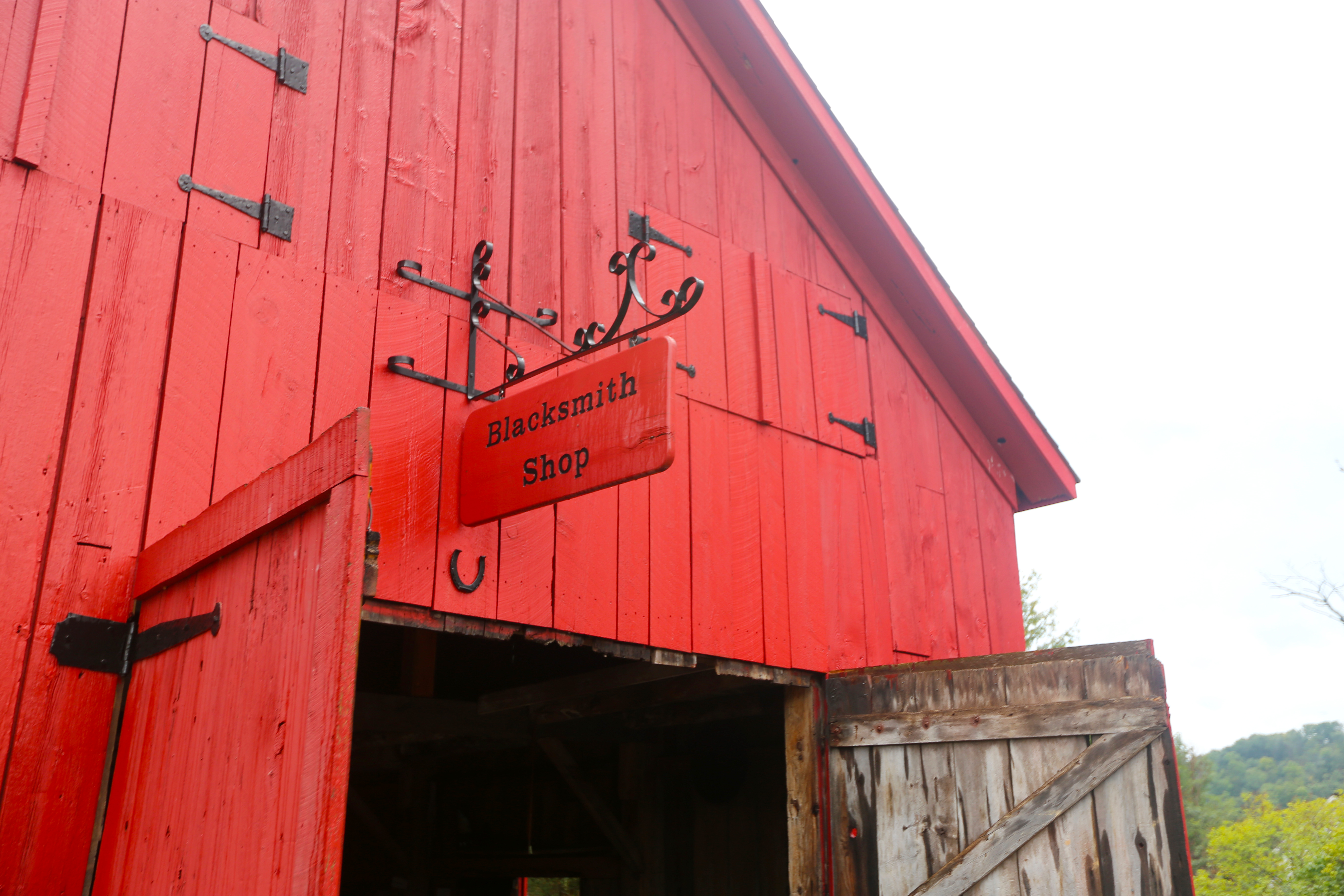
Built around 1867, the Blacksmith Shop was an indispensable component of the maritime village. Not only did the shop forge metal works, but it also served as the town's carpentry center. Nearly everyone in town had some need for the blacksmith's services, which included crafting and repairing oxen yolks, tools, and carriages, shoeing horses, and constructing pre-built homes, dining halls, and horse barns.
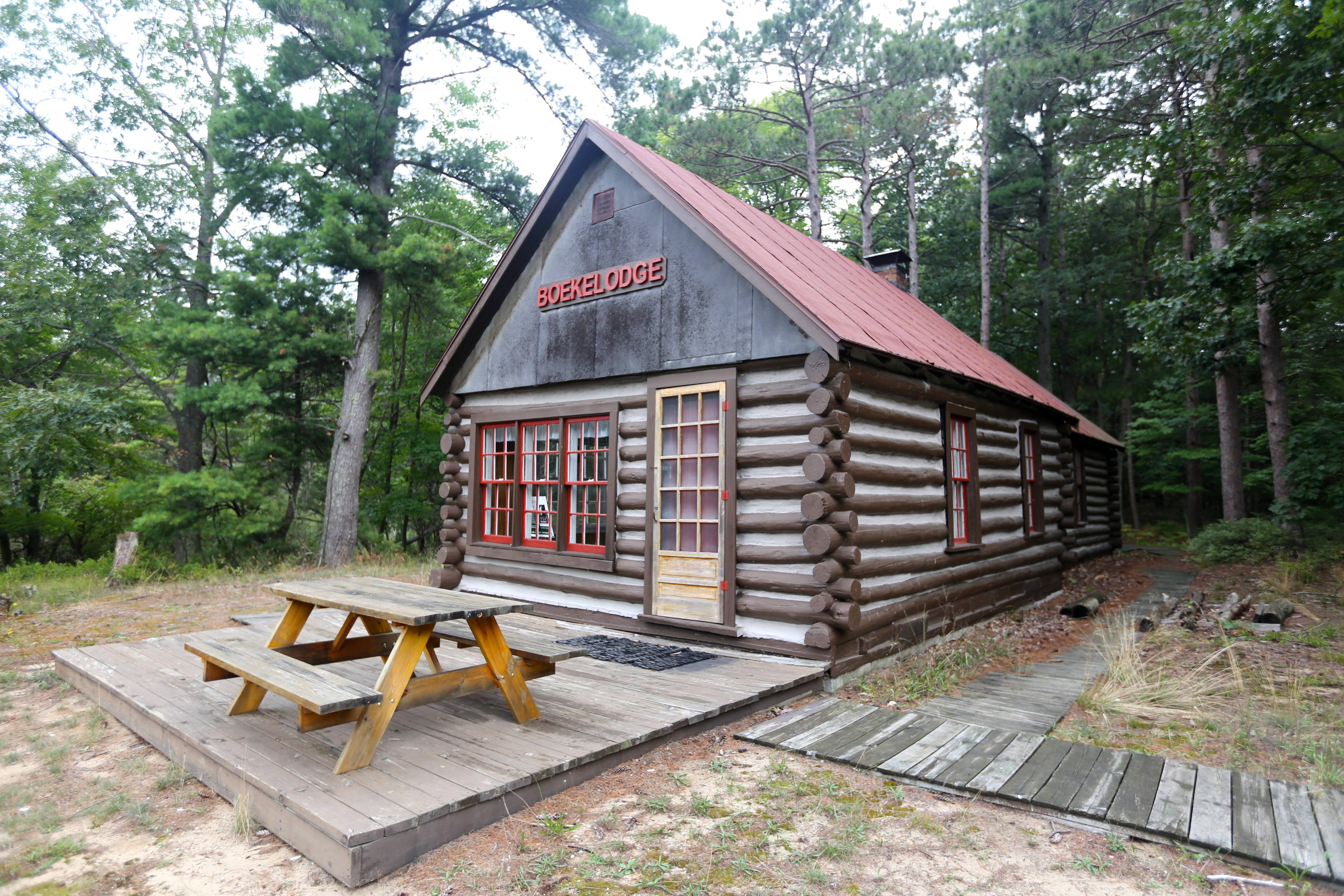
The Boekeloo lodge has been a landmark in Benzie County for over 70 years. Sitting along a cranberry bog, the quiet beauty of the pond and surrounding forest, and the reflection of the cabin on the still water invites visitors to sit right down and enjoy the setting. The building started as a homestead cabin eventually becoming a wilderness vacation spot. Walk around the lodge and peak in the windows to get a glimpse of vacation life in this little cabin in the woods.
Port Oneida's first non-native settlers, Carsten and Elizabeth Burfiend and their daughter Magdalena, settled this farm. The family originally lived in a log cabin. The Carsten Burfiend farm is on both sides of the Port Oneida Road. The house, garage, and other out-buildings are on the west side of the road on the bluff overlooking Lake Michigan. The foundation of the barn, silo, and milkhouse as well as the corn crib and machine shed are on the east side of the road.
Imagine how this land must have looked just after the glacier melted about 11,800 years ago. It was a landscape of sand and gravel stretching in every direction. No trees would have blocked your view.
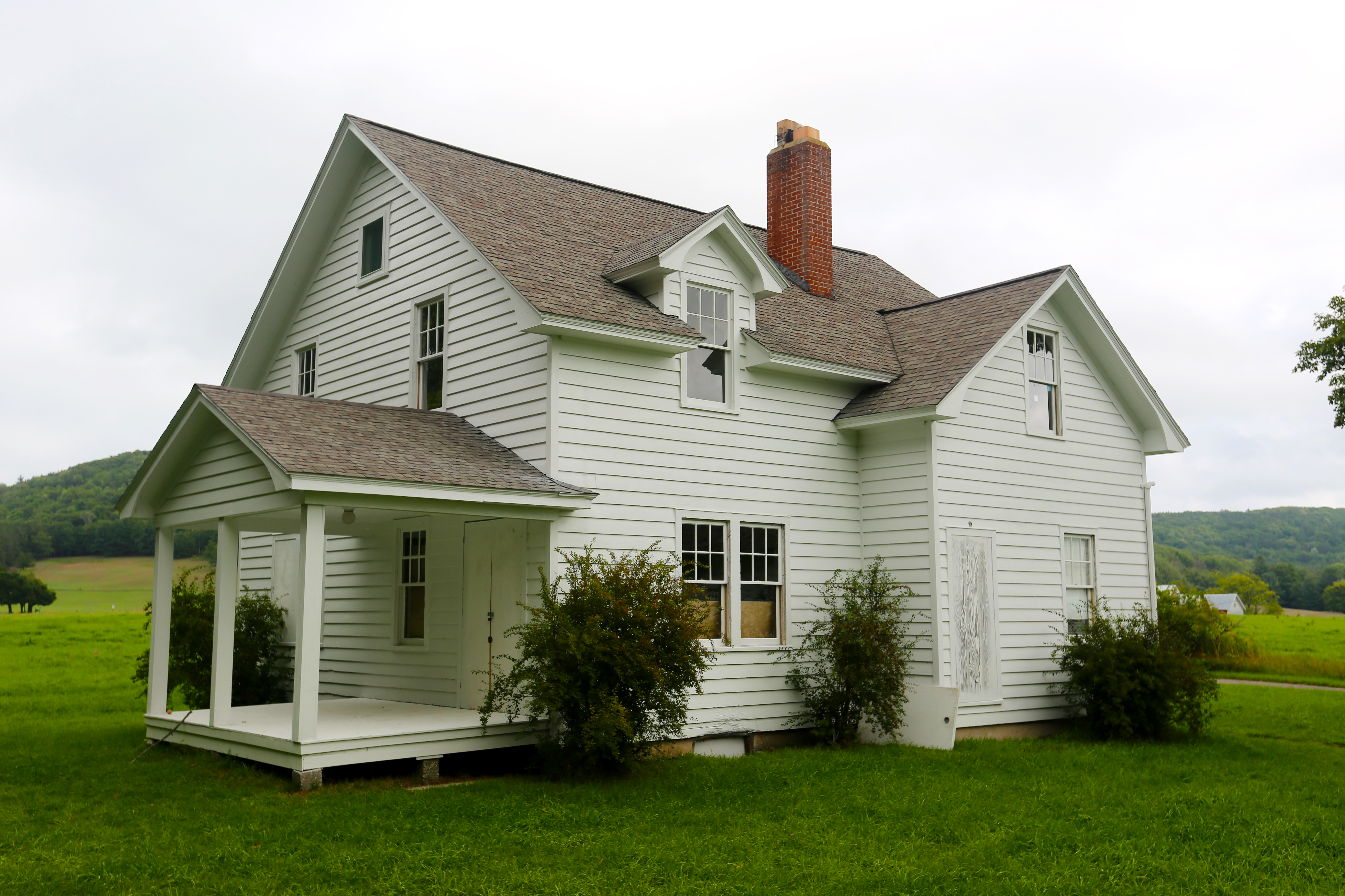
Charles and Hattie Olsen bought this land in 1915 from Frederick Dechow, who had first purchased it in 1857. The Olsen's farmhouse was built around 1918 and is the most modern. The house had the first indoor plumbing; water was pumped by hand into a tank in the attic to provide the pressure for the system. A dairy farm, it was the first to achieve Grade A dairy status in Port Oneida.
Considered a special treat within the lakeshore, the Treat Farm is one of the most underrated attractions. A hike through the woods along the old road leads to the fascinating old farmhouse and related buildings.
Want to really experience the dune plateau? The 1.5-mile Cottonwood Trail is a great place to get out of your car, loop through the perched dunes, and see the sublime scenery up close. The Cottonwood trail loops over unique dune landscapes and offers spectacular views over golden sand dunes of the azure sky, aquamarine Glen Lake, white D. H. Day barn, ultramarine blue Lake Michigan, and distant verdant green of the Manitou Islands.
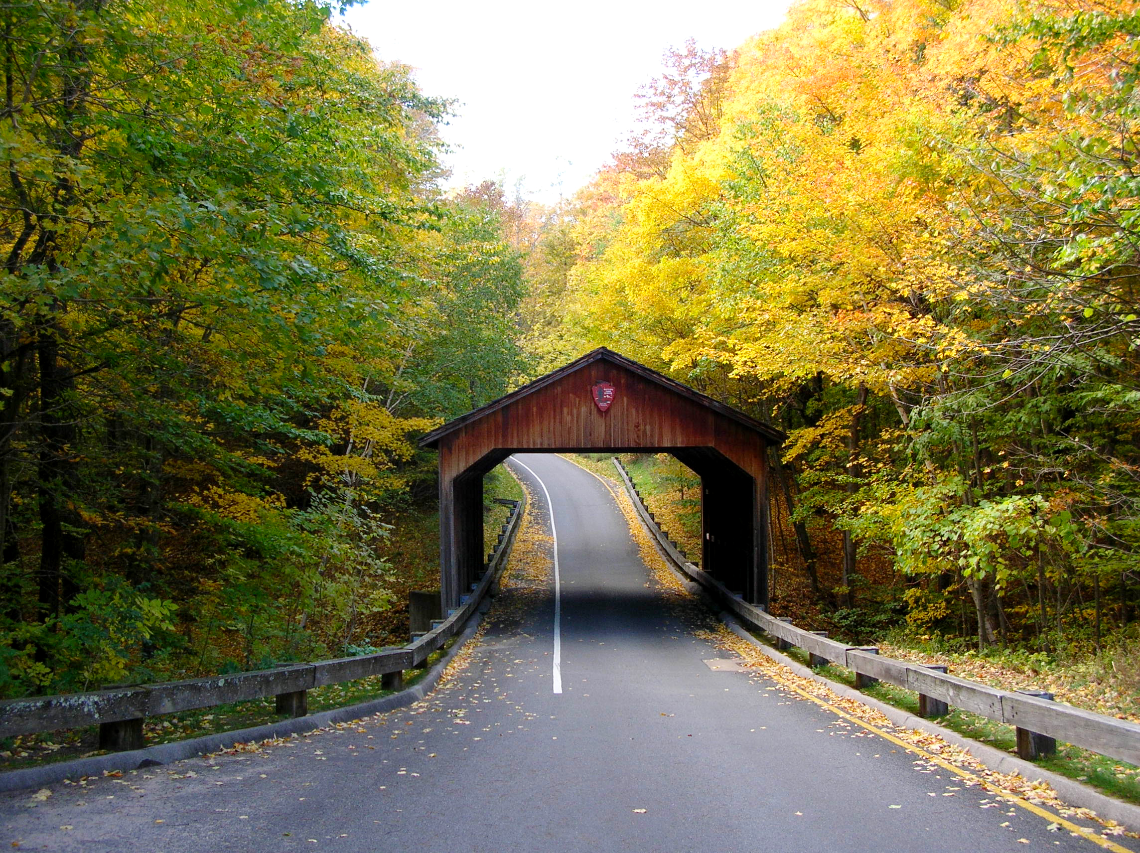
Have you ever seen a covered bridge with the National Park Service arrowhead on it? The original one, built by Mr. Pierce Stocking for his scenic drive, did not boast the symbol, of course. He just wanted to provide a picturesque detail for sightseers to stop and photograph.
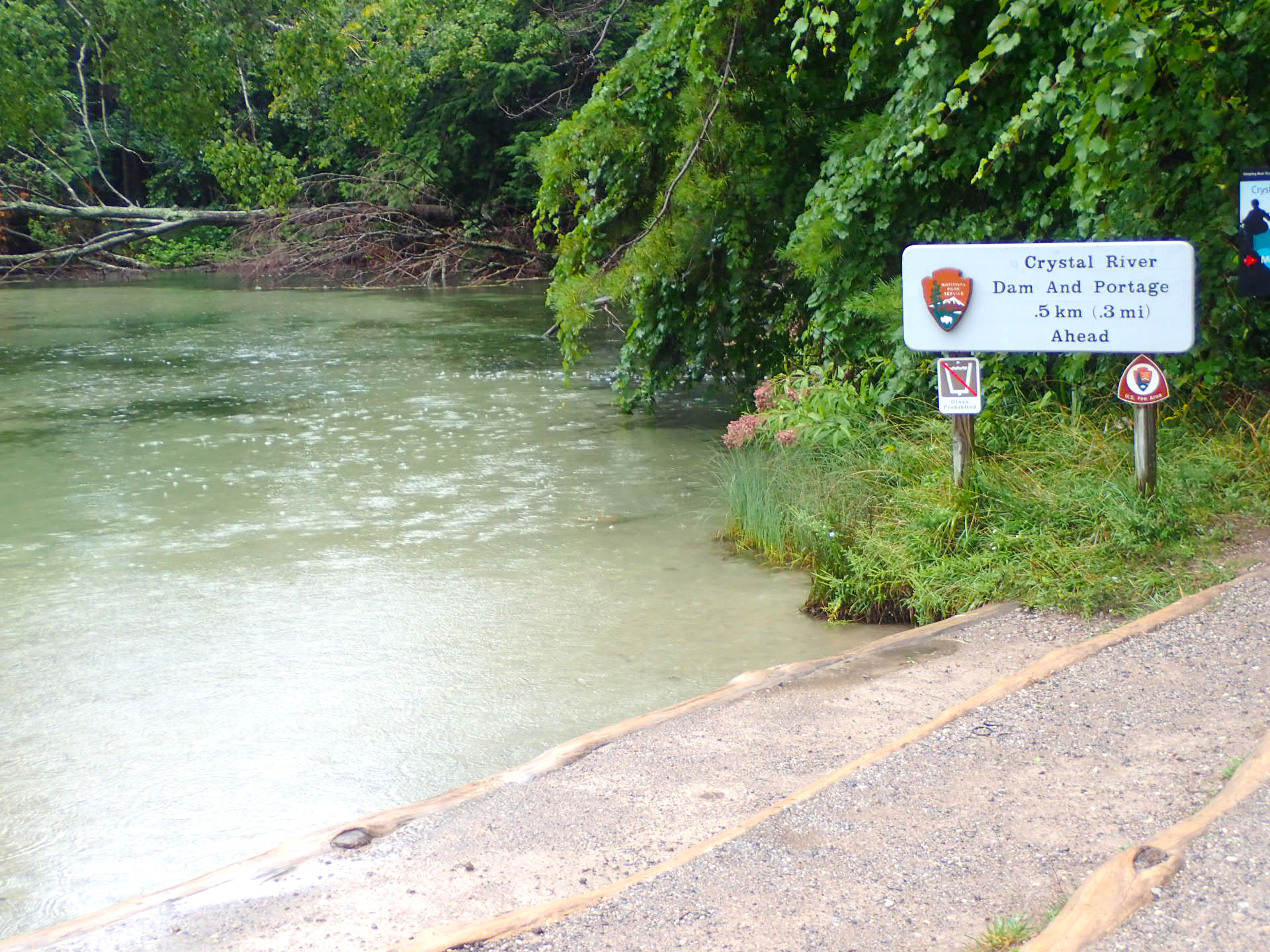
Ah, the beautiful Crystal River-gentle currents, meandering curves, water as clear as glass. The Crystal River winds from Glen Lake through sections of the Lakeshore into Lake Michigan just north of Glen Arbor. Shallow (water depth is rarely more than 1 foot) and with a sandy bottom, this river is ideal for families, beginning canoeists and kayakers. The river and surrounding wetlands provide interesting and valuable habitat to enjoy.
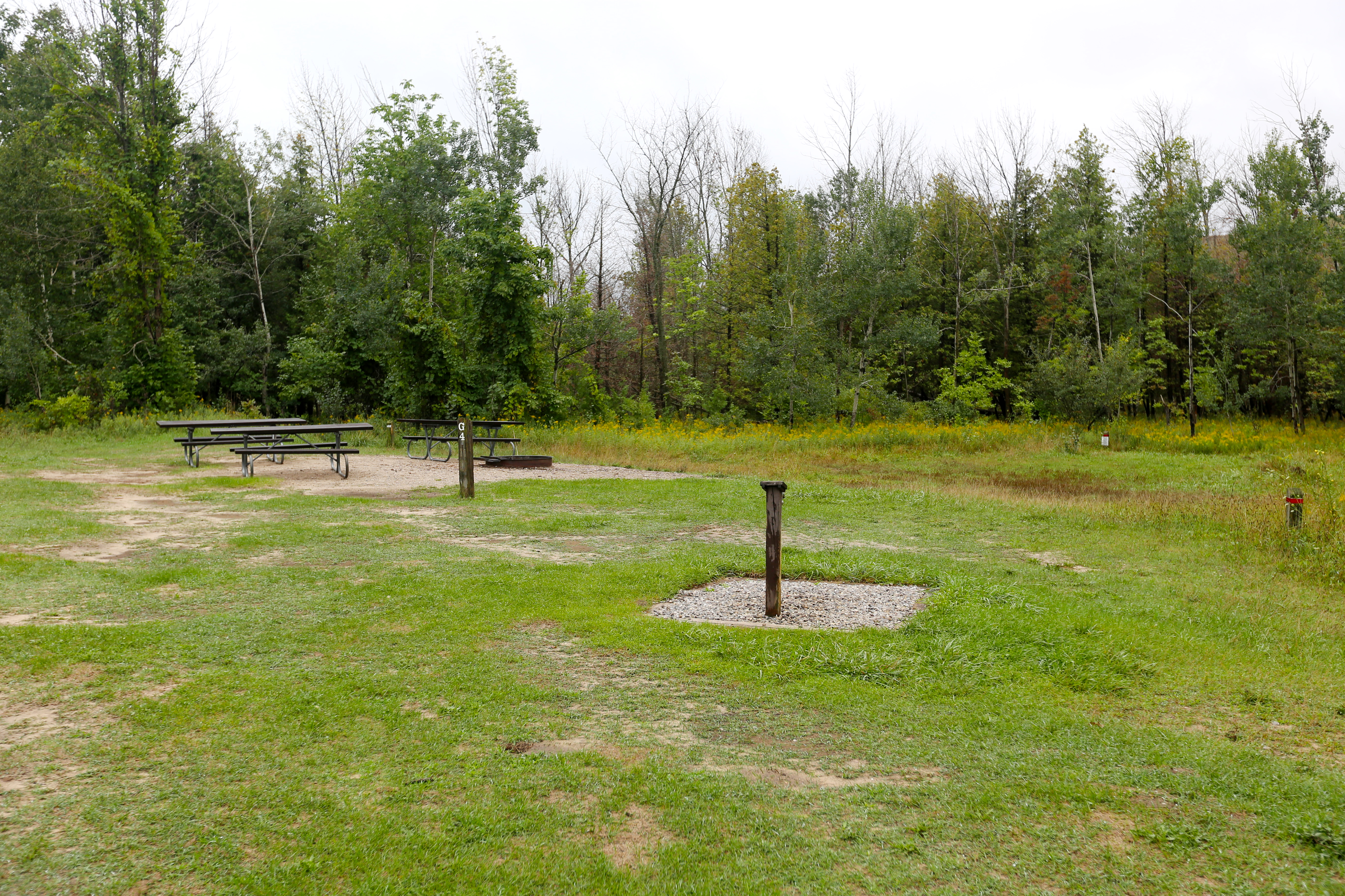
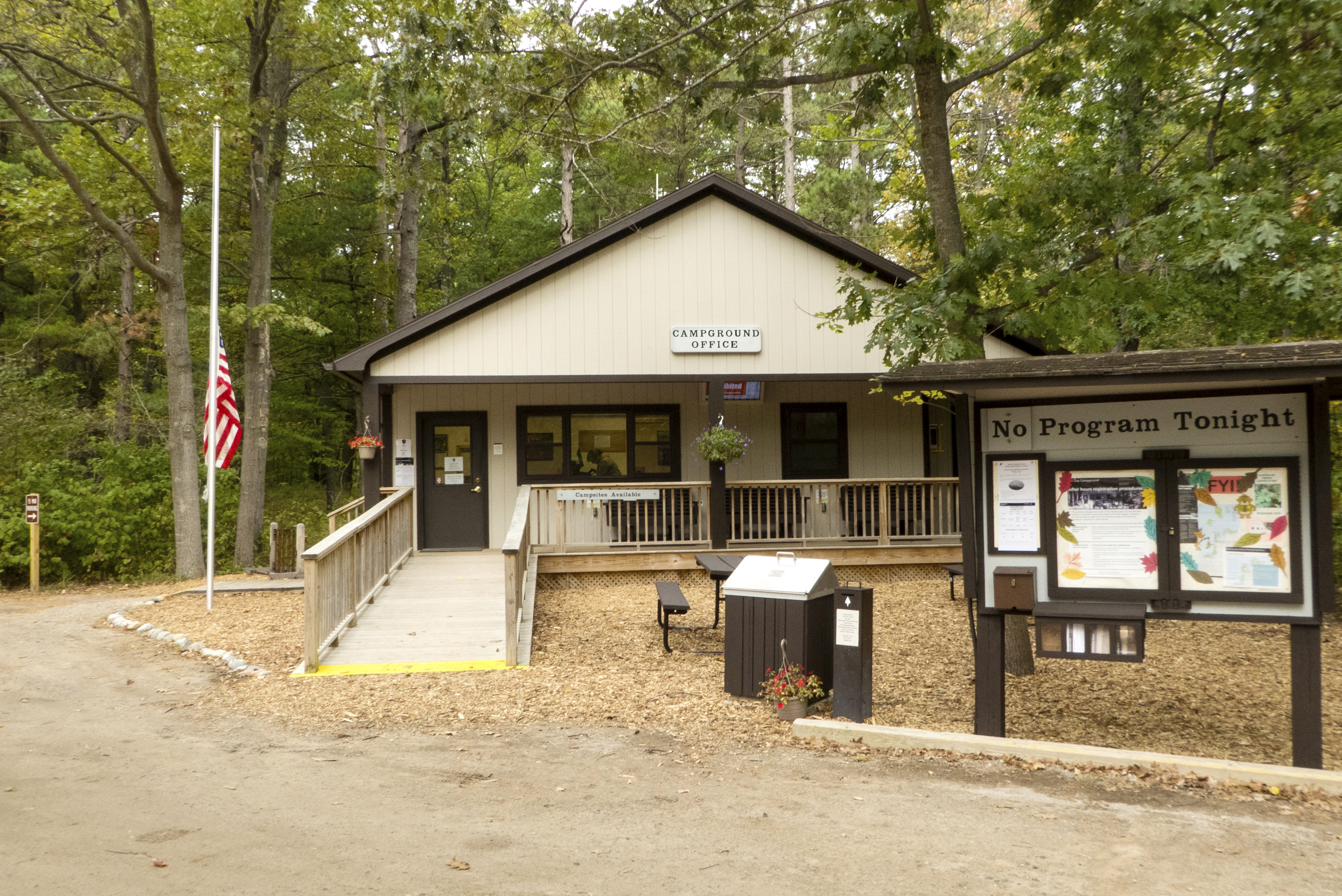
D.H. Day Group Campground is a tent-only facility located in the heart of Sleeping Bear Dunes National Lakeshore. This campground has four sites which accommodate groups of 7 to 25 people. The campground is open with sparse vegetation. Pets are NOT allowed in the campround. Picnic tables and campfire rings are provided at the campsites. The campground has drinking water during the reservation season, May 1 through Oct. 14. Pets and RVs are not allowed in group sites.
D.H. Day built this simple two-story frame house in Glen Haven in 1890 as a birthday present for his wife Eva, but she preferred the convenience of living above the general store she ran while raising a family, so Day employees and other family members lived in the house. According to Day's granddaughter, Pat (Day) Bennet, her father Bill Day had a garden straight back from the house by the apple tree.
Looking for a slightly more rugged camping experience? Check out the D.H. Day Campground. Beautifully wooded, peacefully quiet with well-maintained sites and a shimmering beach on Sleeping Bear Bay, D.H. Day provides an excellent setting for a calming family vacation. Located in the heart of Sleeping Bear Dunes, the campground is perfectly situated for exploring the area.
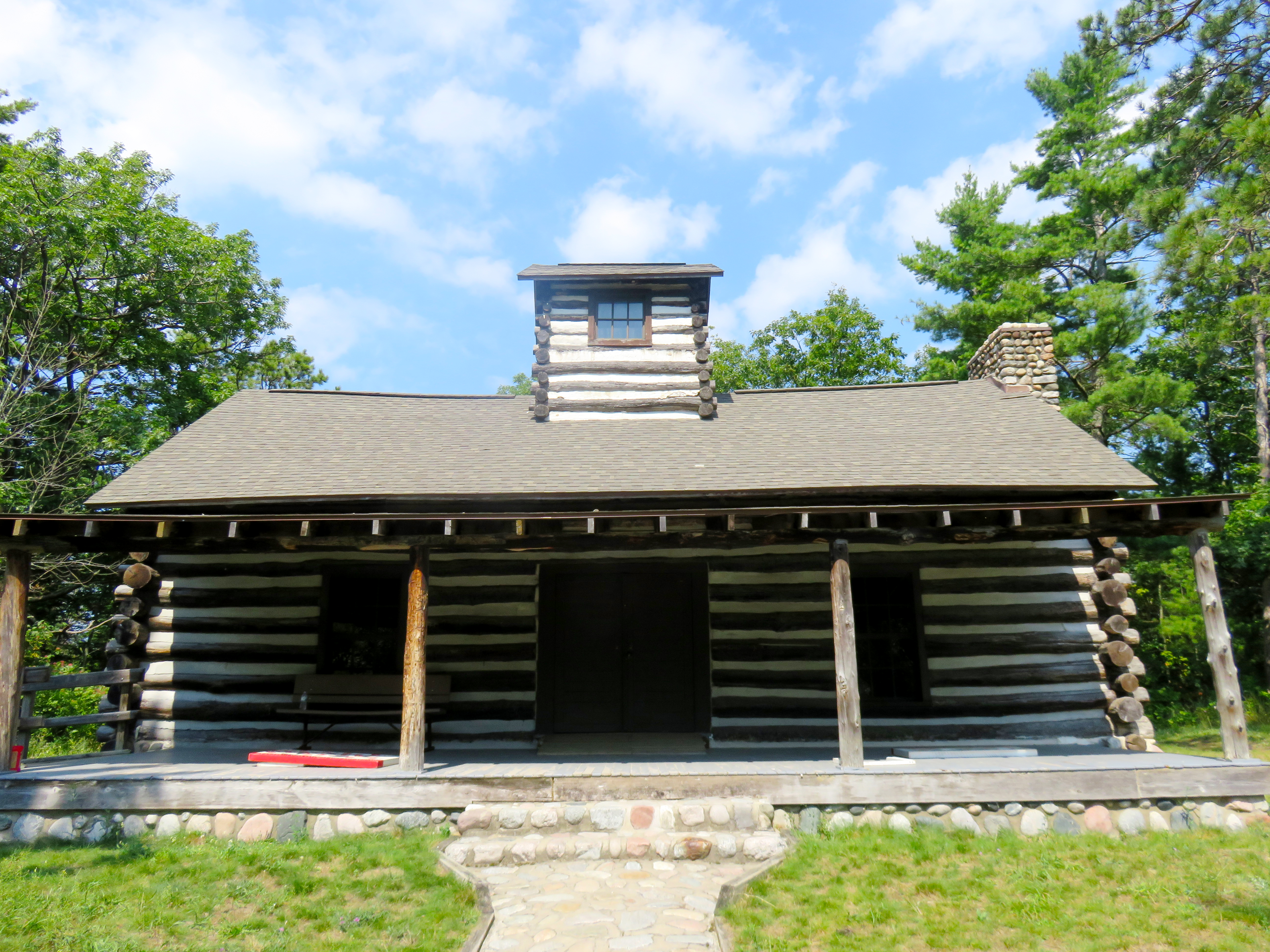
In November 1920, D.H. Day donated 32 acres of land on Glen Arbor Bay to the state for use as a state park. Day built a one room large log cabin 1923-24 on the park campgrounds as a space for events. It has a front and back porch. Today it is used for educational programs and other special events.
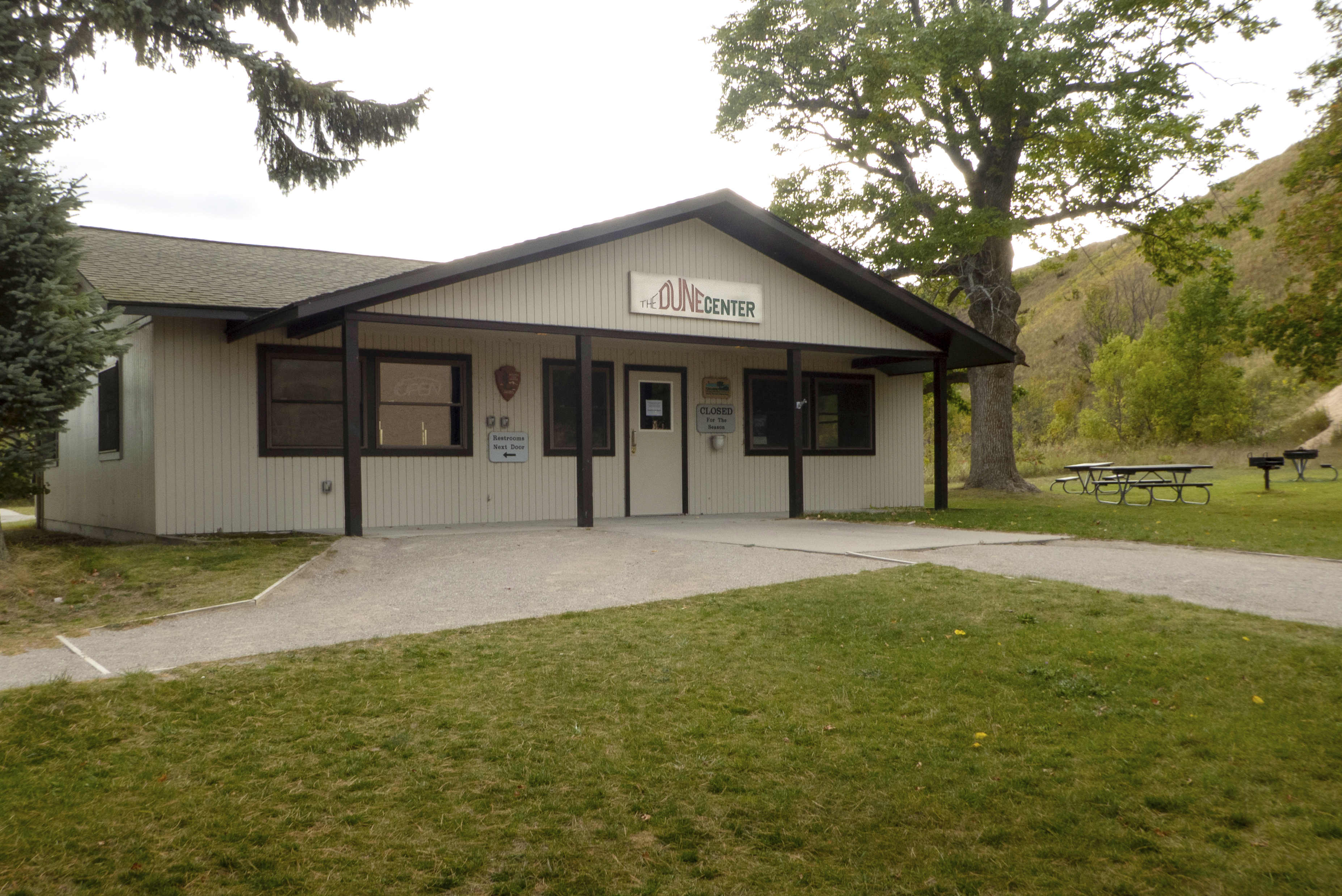
The Dune Center Bookstore is an America's National Parks sales area located at the base of the Dune Climb and features t-shirts, sweatshirts, hats, nature games, postcards, books, videos, and convenience items. Pets are NOT allowed at the Dune Center.
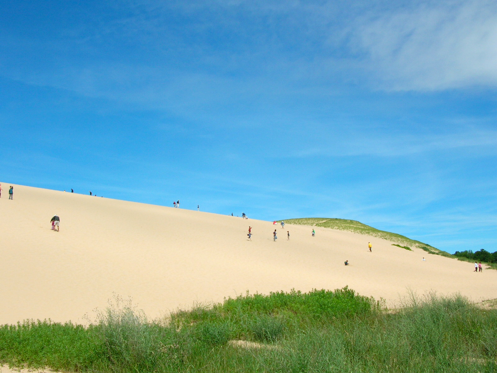
It's the most famous attraction at Sleeping Bear Dunes National Lakeshore and a Midwest rite of summer, loads of fun for the young and young at heart: a 284-foot-high wall of glistening white sand that tourists climb for fun-the Dune Climb. Climbing this dune takes at least 10 minutes and is a strenuous hike that will fill your shoes and pockets with sand, and take your breath away. If you get to the top of the first dune you will have a good view of Little Glen Lake.
To survive in the dunes is no easy task. Flora and fauna deal with strong sunlight, poor soils, and constant winds. The wind action alone can dry out plants, expose root systems, or even completely bury vegetation, including trees.The cottonwood is the only common tree of the dunes and is well adapted to the dune environment.
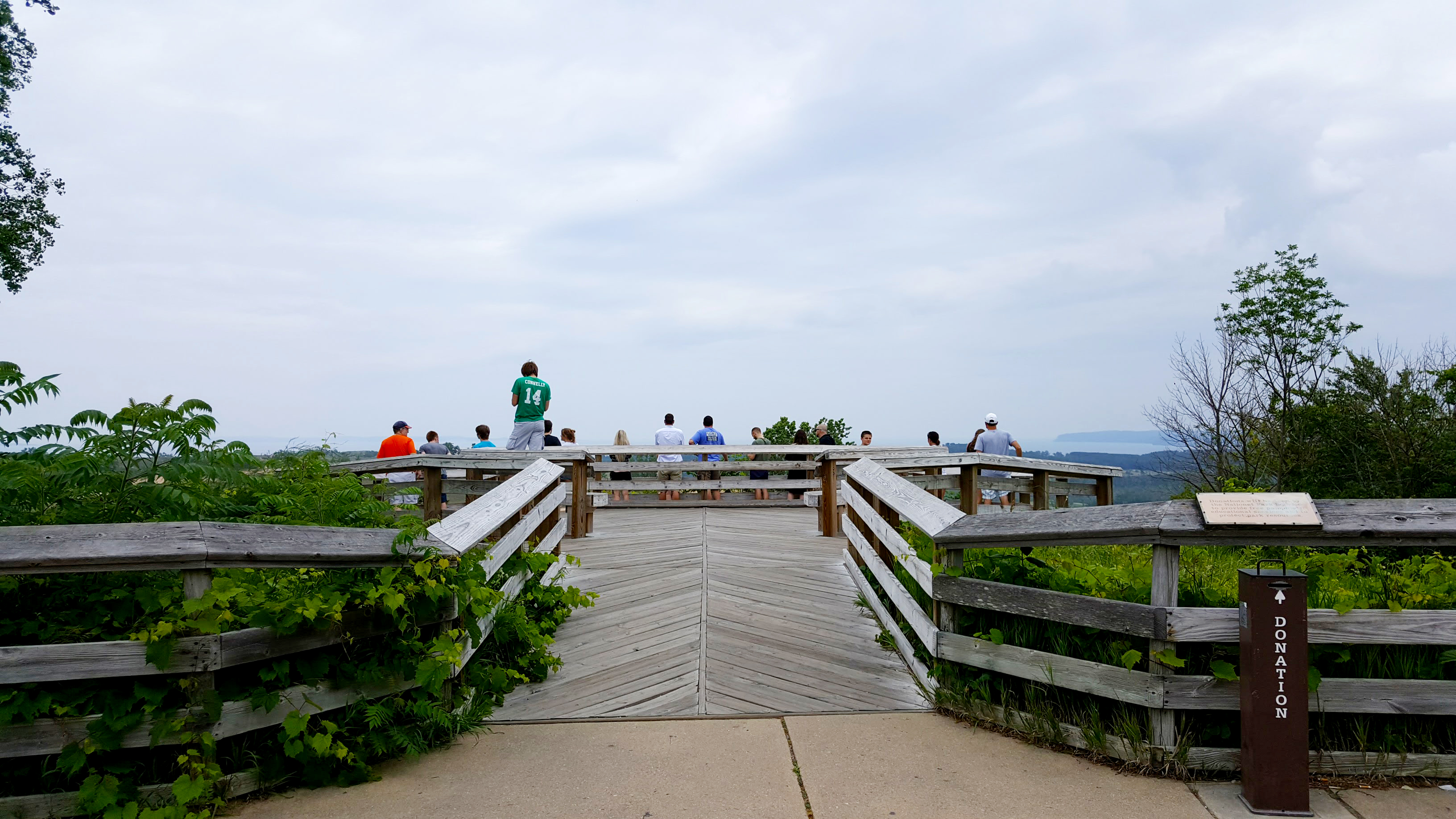
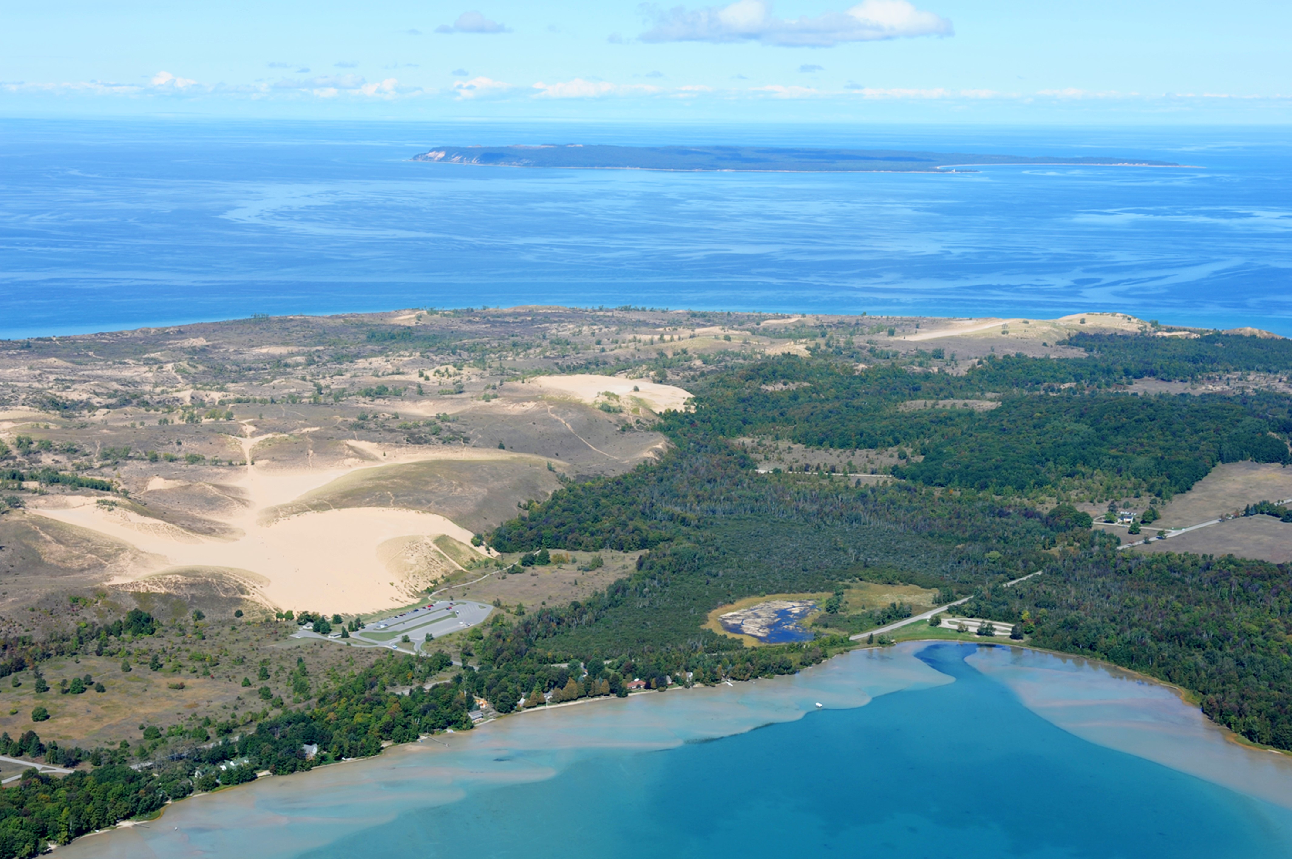
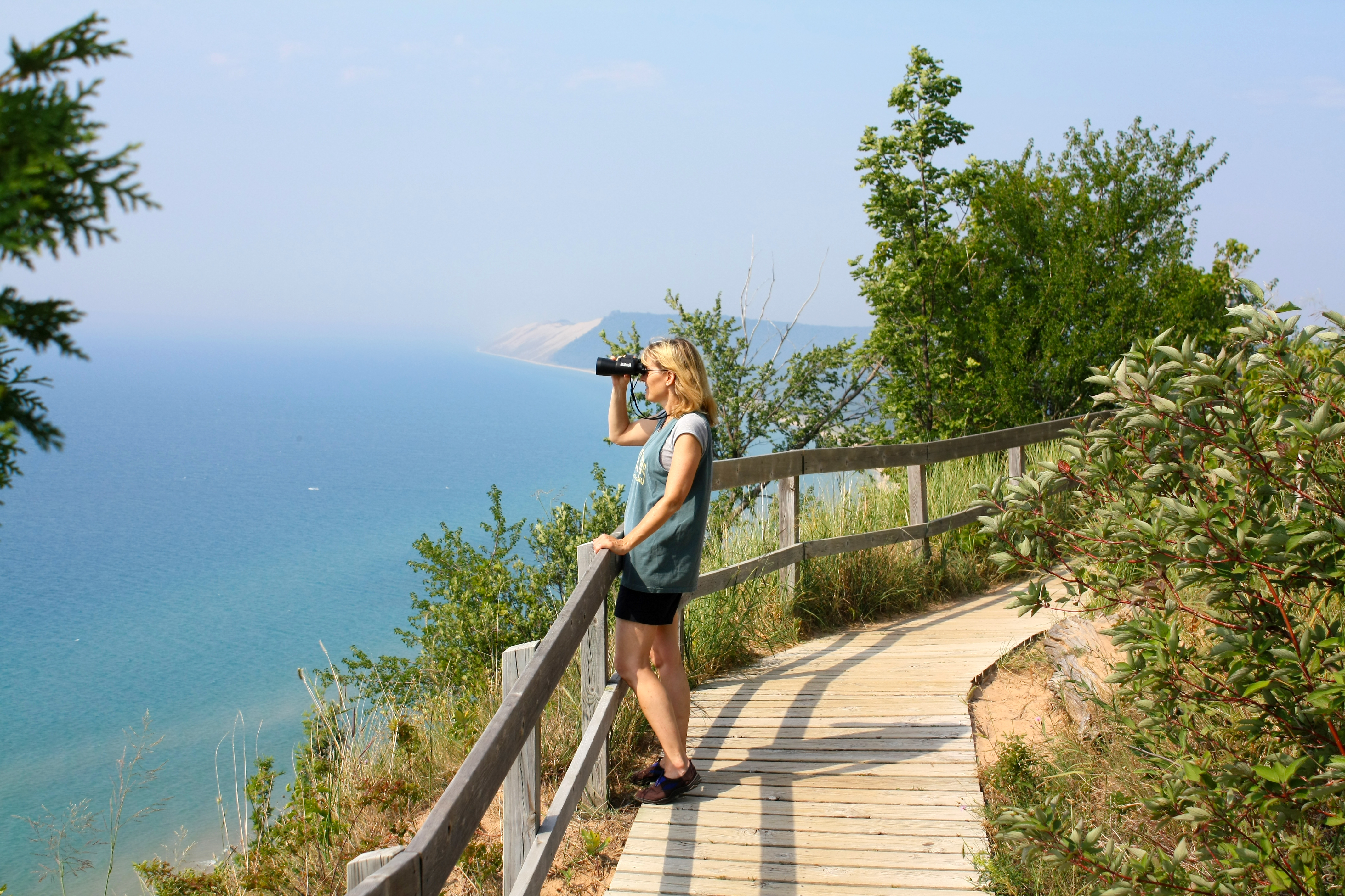
Wow! Standing in the middle of an approximately four square-mile area called the Sleeping Bear Dunes complex, the panoramic vista from the Dune Overlook includes Glen Lake and its surrounding rolling hills, the historic, privately owned D. H. Day farm with the huge white barn, the spectacular landscape of the Sleeping Bear Dunes, and a dramatic glimpse of Lake Michigan, Sleeping Bear Bay, Pyramid Point, the Manitou Passage, and both North and South Manitou Islands.
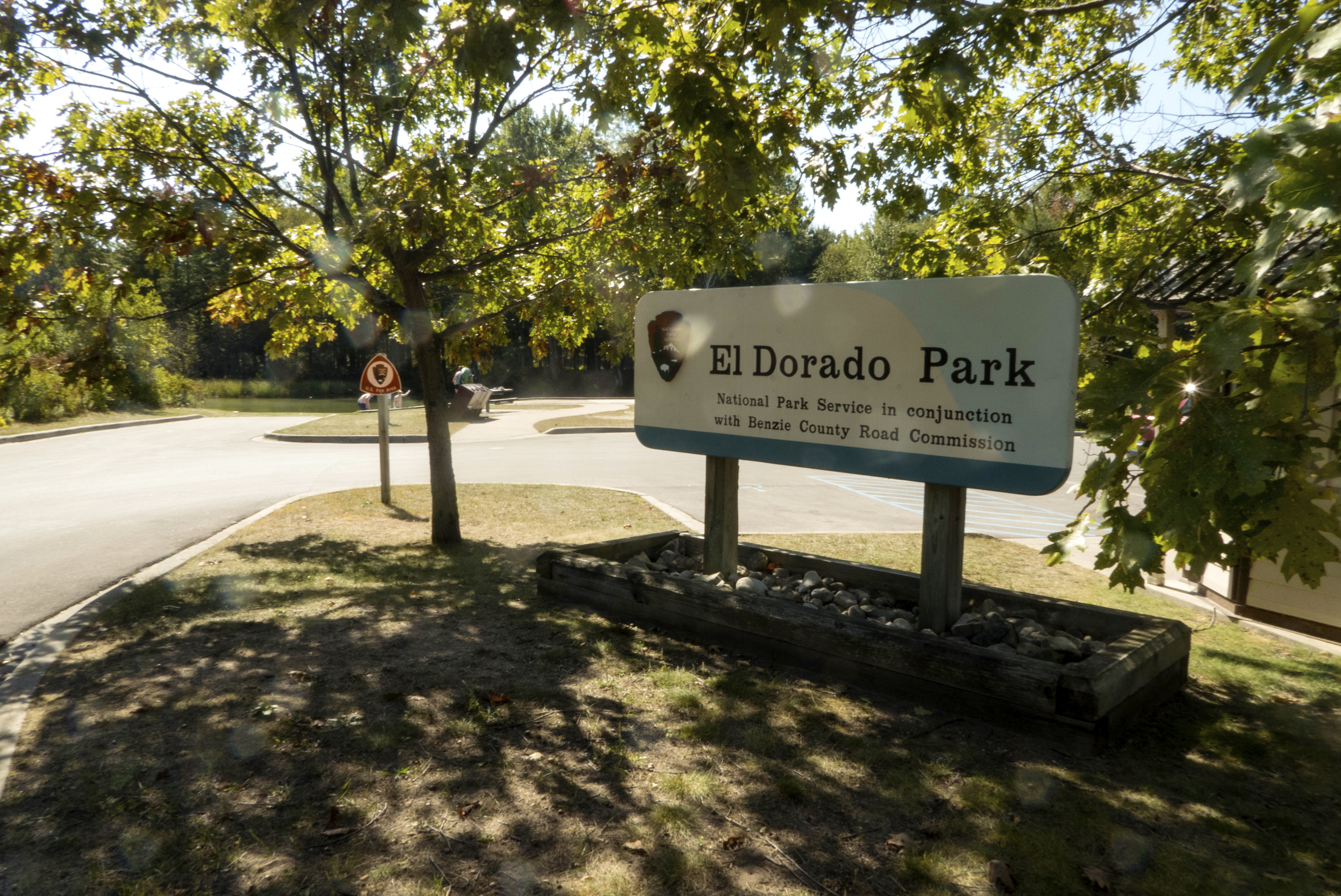
A great place to put in your tube or to take a break from your drift downstream, El Dorado Park is a mile from the mouth of the Platte River-about a half an hour float. The last landing before Platte Point, El Dorado offers picnic tables, a vault toilet, a launch site, and parking. Fish or watch the river from a deck overlook. Handicapped parking is available.
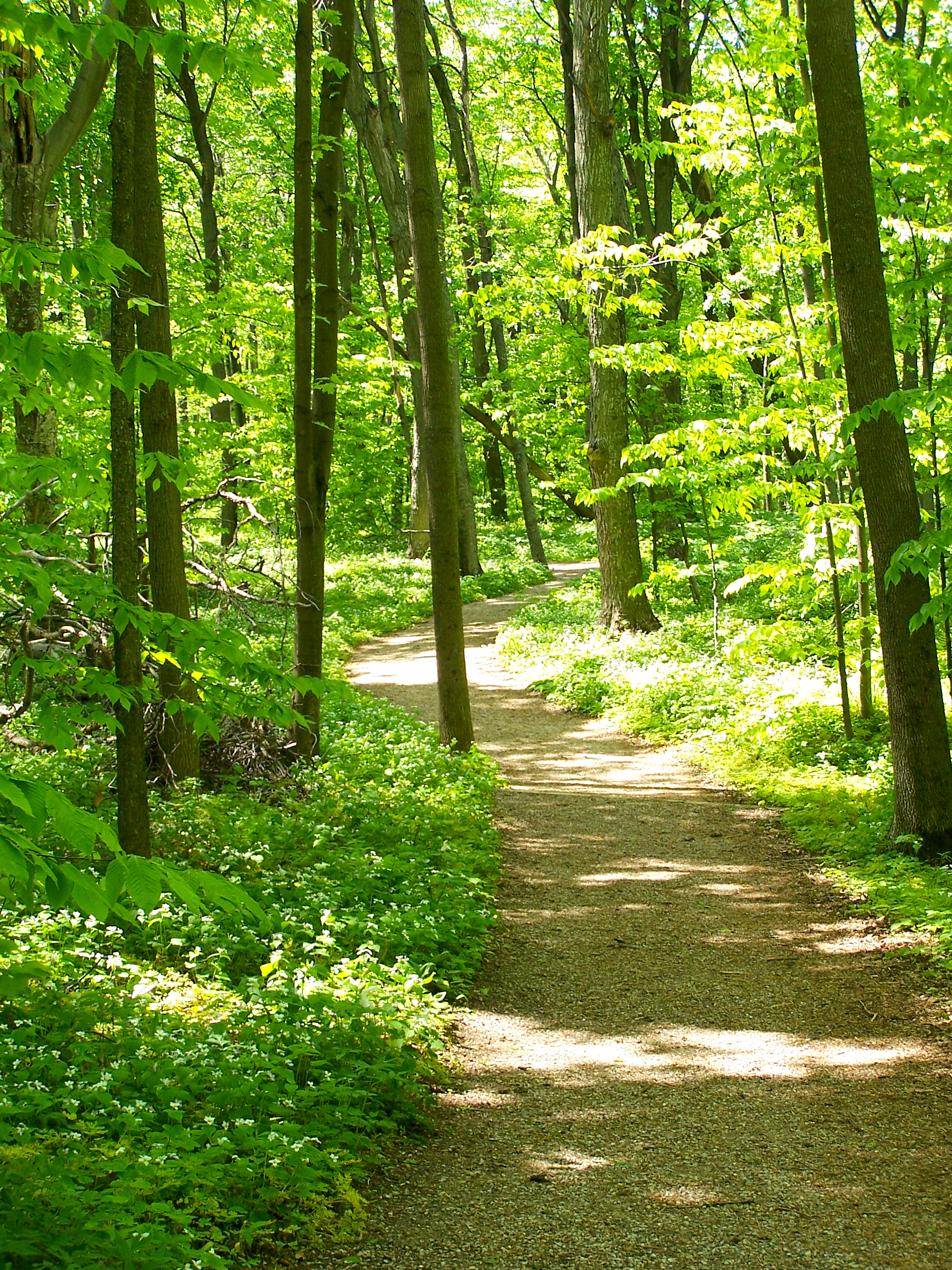
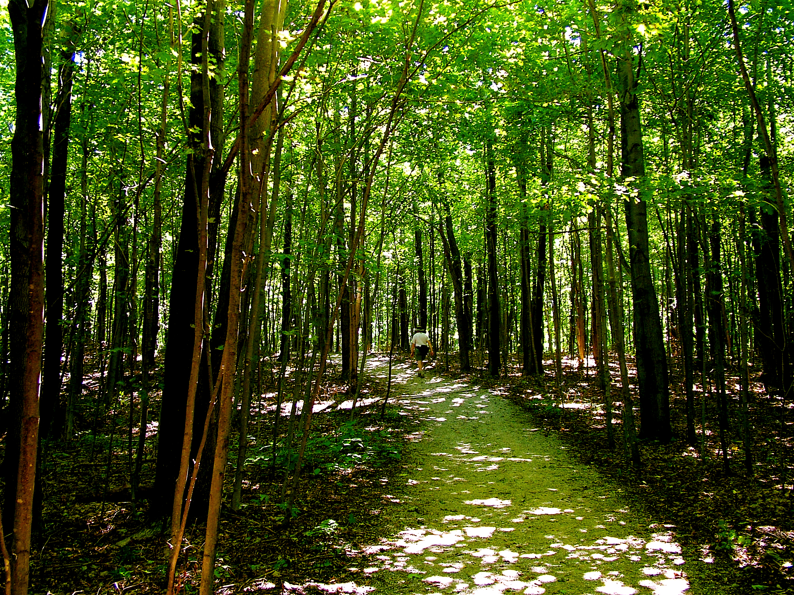
Breathtaking . . . water so clear and blue . . . bucket-list worthy . . . best view anywhere on the shoreline . . . amazing . . . incomparable sunset . . .picture-postcard sight. . . jaw-dropping . . . not like anything else in the Midwest.Interested? Then don't miss the Empire Bluff Trail. The 1.5-mile round-trip trail climbs through a beech-maple forest rife with wildflowers to a high, coastal bluff featuring the iconic double-dune view.
Stop and look around at post #3. This section of trail shows one of the most important types of Northern Hardwood forest in Michigan, the Beech-Maple forest. This forest consists of primarily sugar maple, red maple, and beech. Though, in disturbed areas where sunlight shines below the tree canopy, more sun-loving species, such as paper birch and quaking aspen are often found.
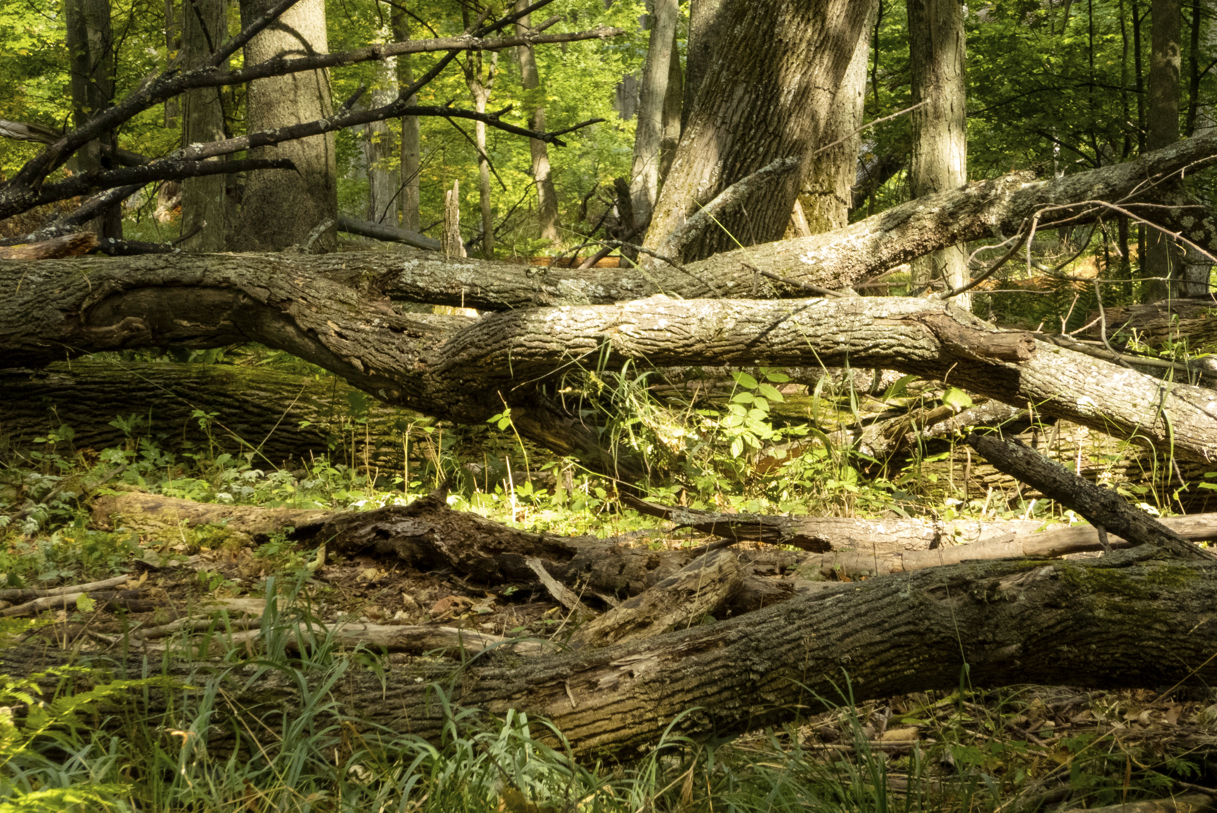
Near the post marked 5 and actually many locations along the trail, you can see various decomposing logs and fallen trees. Bacteria, lichen, fungus, moss, and seedlings take advantage of the nutrients, moisture, and sunlight made available to them by these fallen trees. Large trunks and limbs of which are often referred to as nurse logs. Why do you think that is?
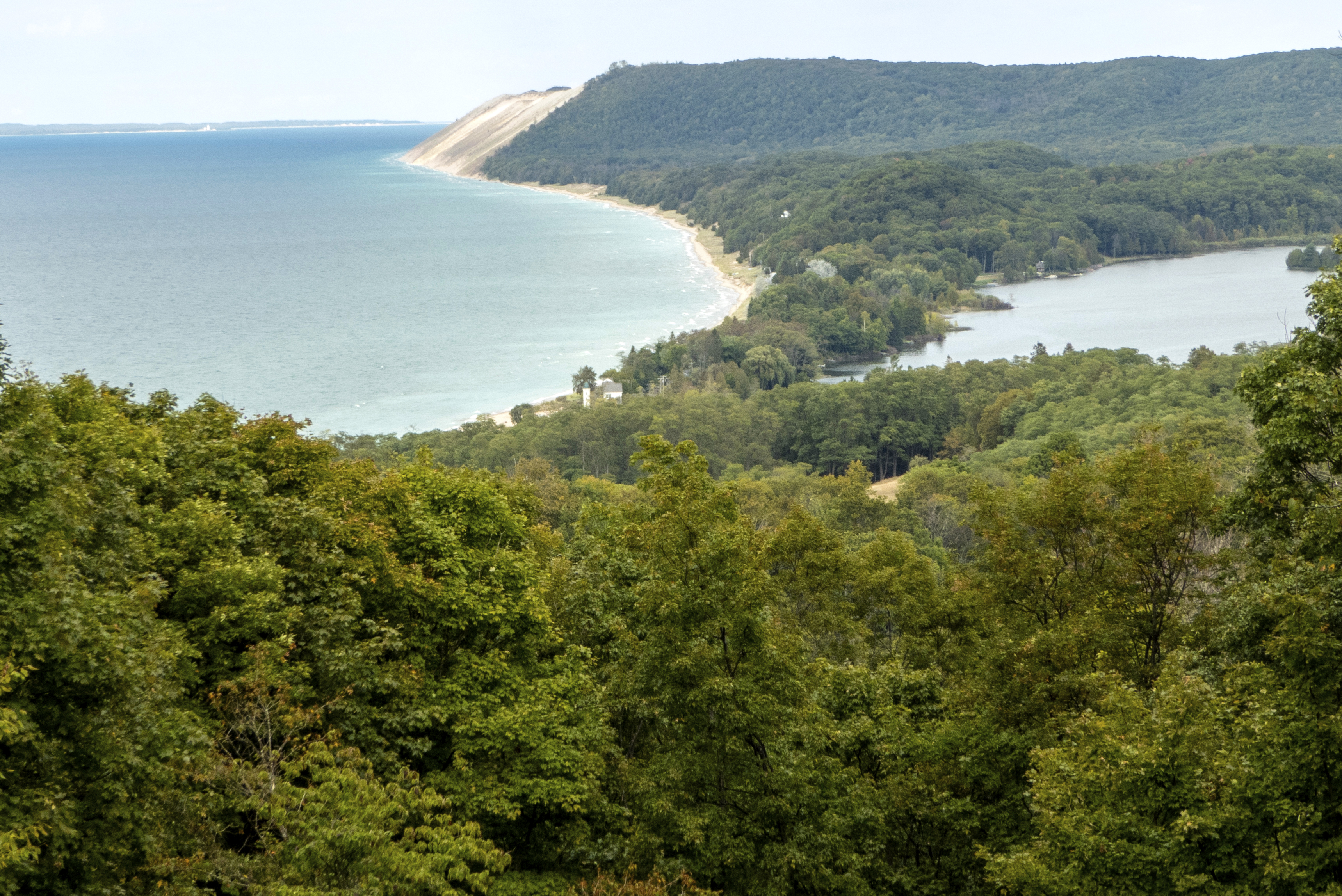
Here you go . . . the breathtaking part. At post 6, you are perched about 400 ft. above Lake Michigan on a perched dune (a dune made of several feet of sand on top of hundreds of feet of glacial moraine, geological debris, in this case from the last Ice Age). From here, weather permitting, you can see Point Betsie, South Manitou Island, the southern portion of the Sleeping Bear Dune plateau, a lot of Lake Michigan, Platte Bay, Platte River Point, Empire and South Bar Lake.
About .5 miles from the Empire Bluffs trailhead is a bench marking the South Bar Lake overlook. From here, you can take in the stunning view towards the north from which you can see South Bar Lake and the sweep of Lake Michigan's Platte Bay all the way to the Sleeping Bear Dune.
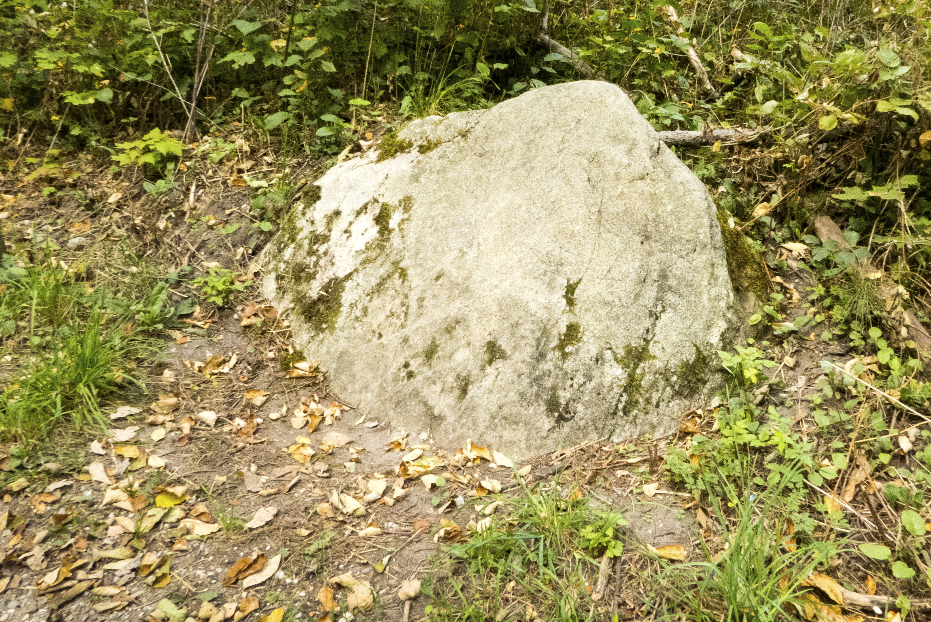
The hilly terrain and scattered boulders are evidence of glaciation. Only about 11,800 years ago, the last glacier melted from this area. As Glaciers move across the land, they pick up rock and soil, and as they melt, they deposit the debris irregularly to form hills and valleys. Glacially transported boulders located far from their point of origin, such as this one perhaps from Michigan's Upper Peninsula or Canada, are known as erractics, literally "travelers."
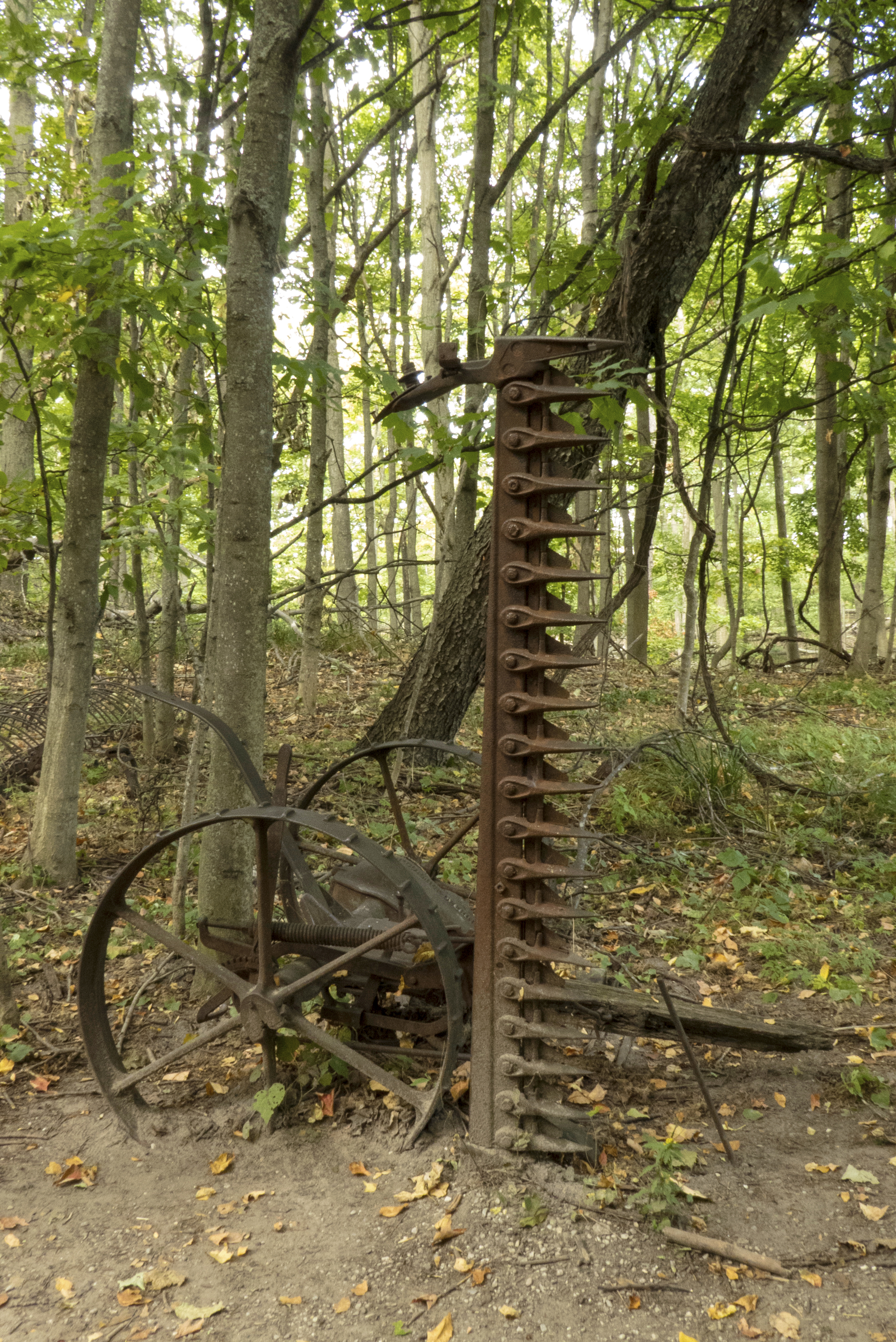
The glacial soils around Sleeping Bear are quite sandy and not very fertile for farming. However, certain crops, including hay, can be grown here successfully. From post #2, you can see a metal sculpture. Oh, but wait, that's actually a piece of rusted farm equipment from the time of the Great Depression.This McCormick Deering No. 7 mowing machine was manufactured between 1929 and 1940.
While the sandy tree-covered dunes of this region are not rich farmland, the temperature, drainage, growing season, and available soil nutrients in these somewhat humus-enriched "gray dunes" work well for many species of trees. In particular, the Grand Traverse region, known as the Cherry Capital, is well suited to growing various kinds of fruit trees. In about 1910, the Empire Lumber Company planted extensive orchards on the logged-over lands.
This dazzling beach, located at the mouth of Otter Creek, is an ideal place for the whole family. The creek gently empties into Lake Michigan. Kids enjoy wading upriver into the belly of the forest and letting the current drift them toward the lake. **Leashed pets are allowed to the right of Esch Road when facing the water. NO Pets are allowed to the left of Esch Road.**
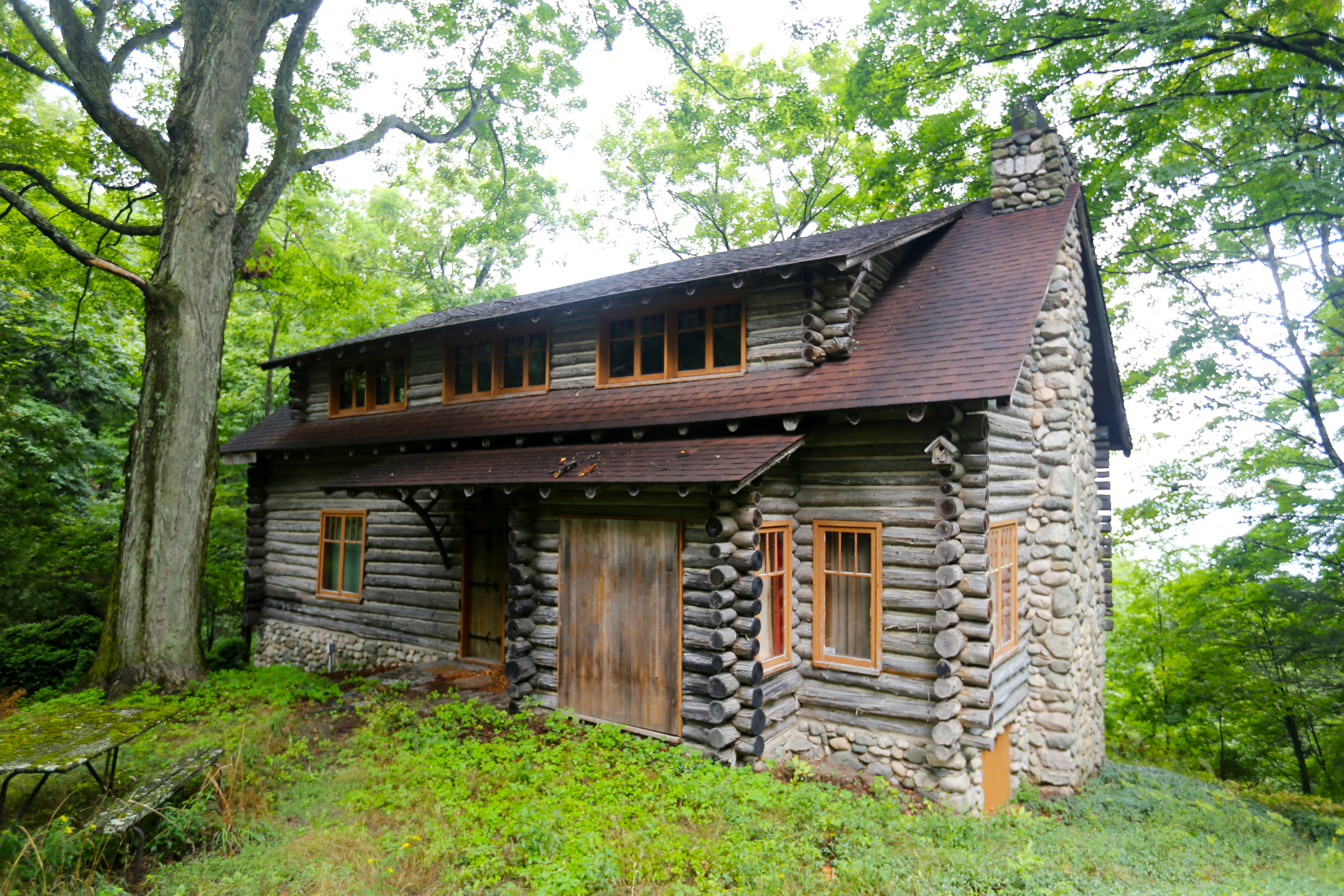
Mary Faust was a botany college student when she first fell in love with the views of the Glen Lakes and the Manitou Passage from the bluff with the log slide. Logs were skidded down this slide during the winter and taken to D.H. Day's lumbermill. Later, she and her husband, George, purchased the property from Glen Haven entrepreneur D.H. Day before hiring Chicago architect Frank Sohm, a student of Frank Lloyd Wright, to design their vacation home.
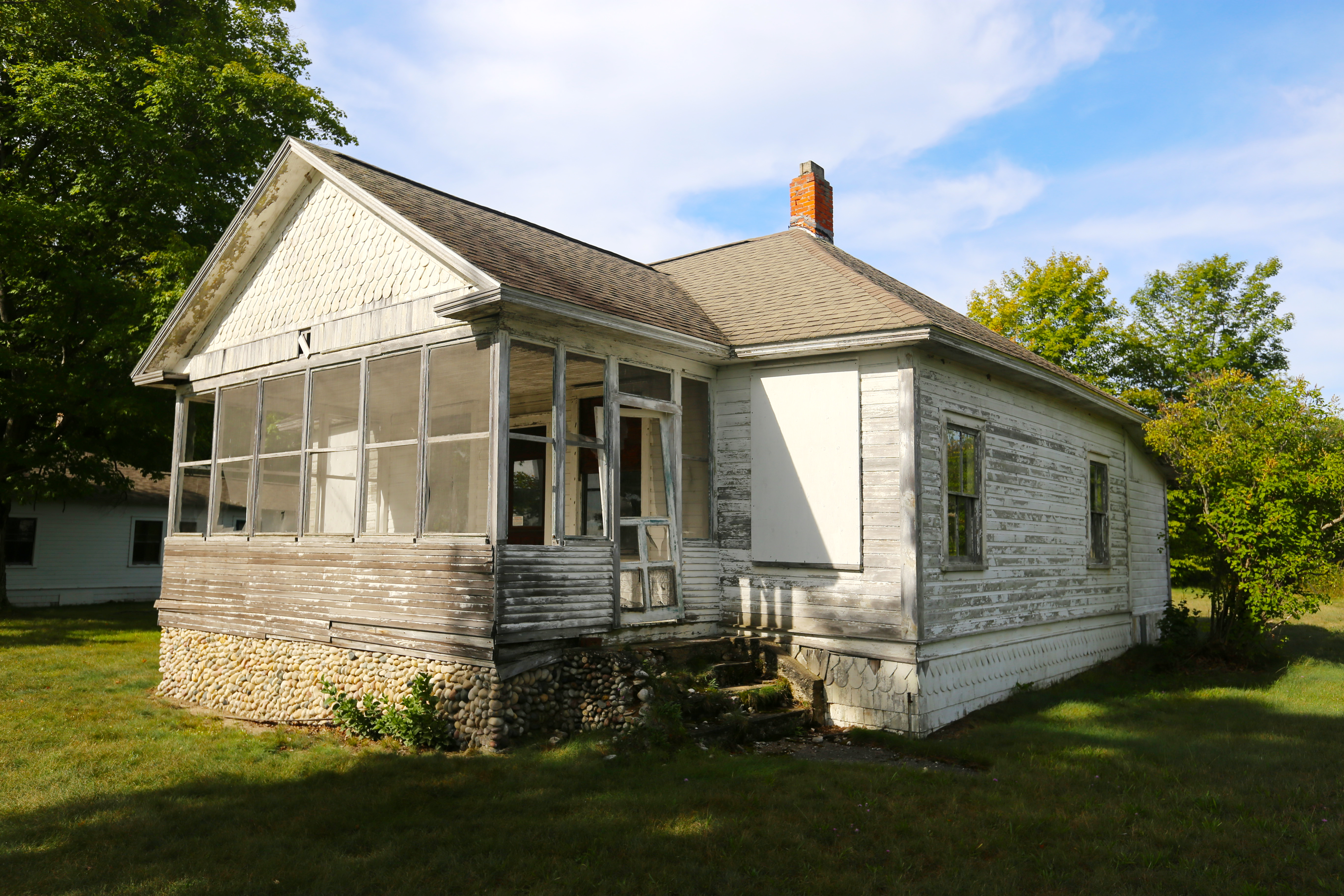
Descendants of the Howard Foote family--one of the original members of the Cottage Row summer colony--own the only cottage that is currently maintained and occupied. Howard Foote built his second Cottage Row house on this lot in 1901. Following the death of his wife, ownership of the property passed to Foote's children. The house was destroyed by fire in 1935. In its place, Foote's daughter, Shirley Foote Alford, erected a small house purchased as a kit from Sears & Roebuck.
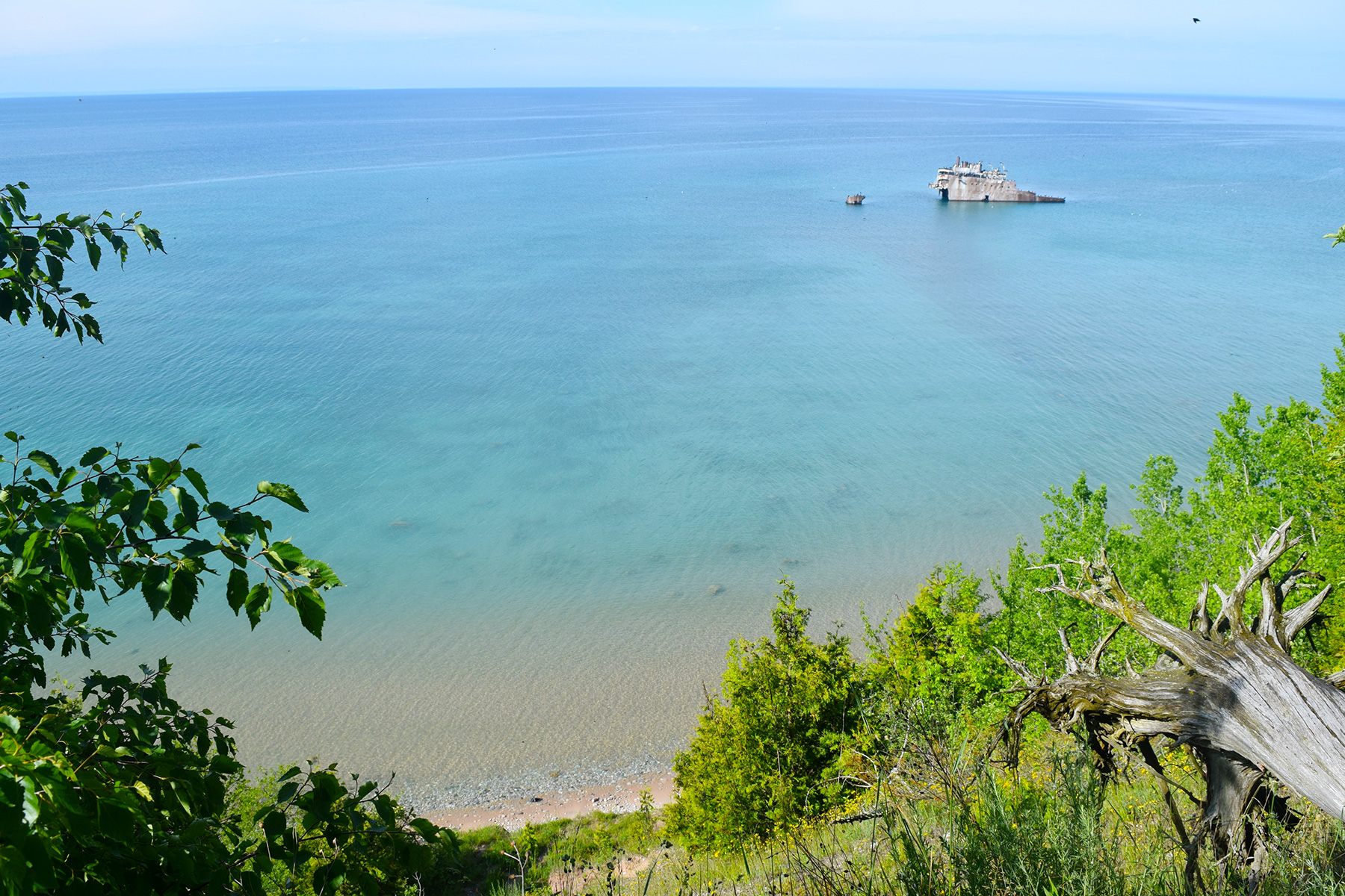
Resting about 300 yards off the southern coast of South Manitou Island is one of of Michigan's most visible shipwrecks, the Francisco Morazan.Gambling with late season Great Lakes weather, but wanting to make one last trip before winter, the Francisco Morazan left Chicago on November 27, 1960. The steel-hulled Liberian freighter was bound for Holland via the St. Lawrence Seaway loaded with 940-tons of general cargo.
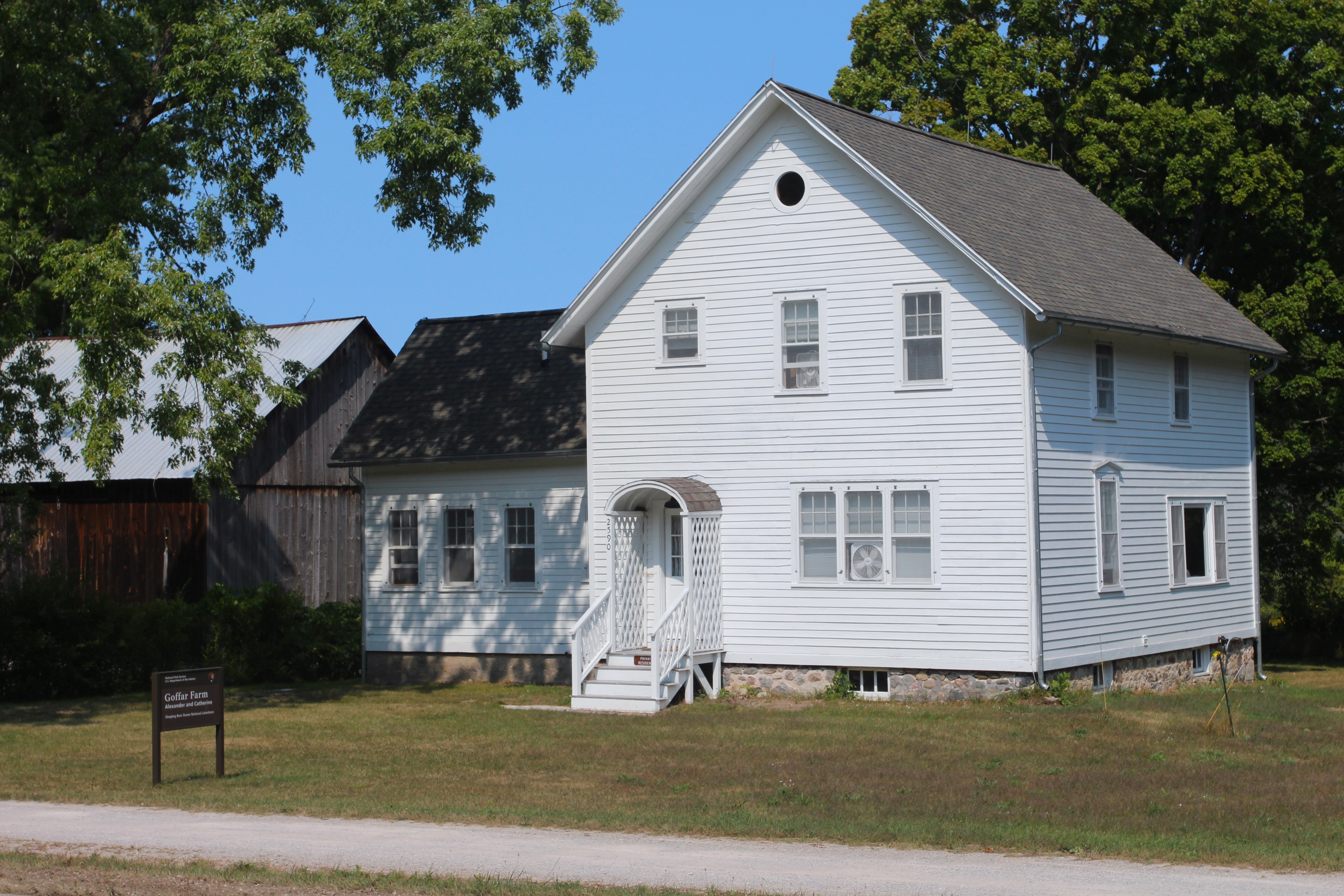
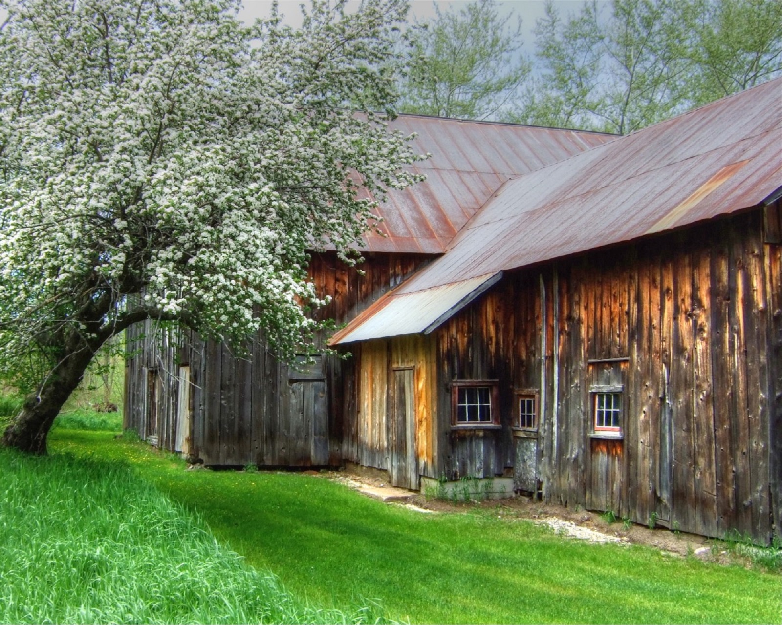
The Werner Farm is a 204-acre parcel of land was claimed by Fredrick and Margaretta Werner, who arrived from Germany on 18 September 1855. Their farm dates to the late 1850's or early 1860's and is the oldest maintained farm in the Port Oneida Historical District.