Be advised that the NPS has issued alerts for this park.
Select Park Rivers and Streams Closed to Fishing
Due to low flows and warm water temps, the following rivers/streams are closed to fishing: Madison River and tributaries; Firehole River and tributaries; Gibbon River and tributaries downstream of Norris Campground.
Vehicle Entrance Reservation Not Needed
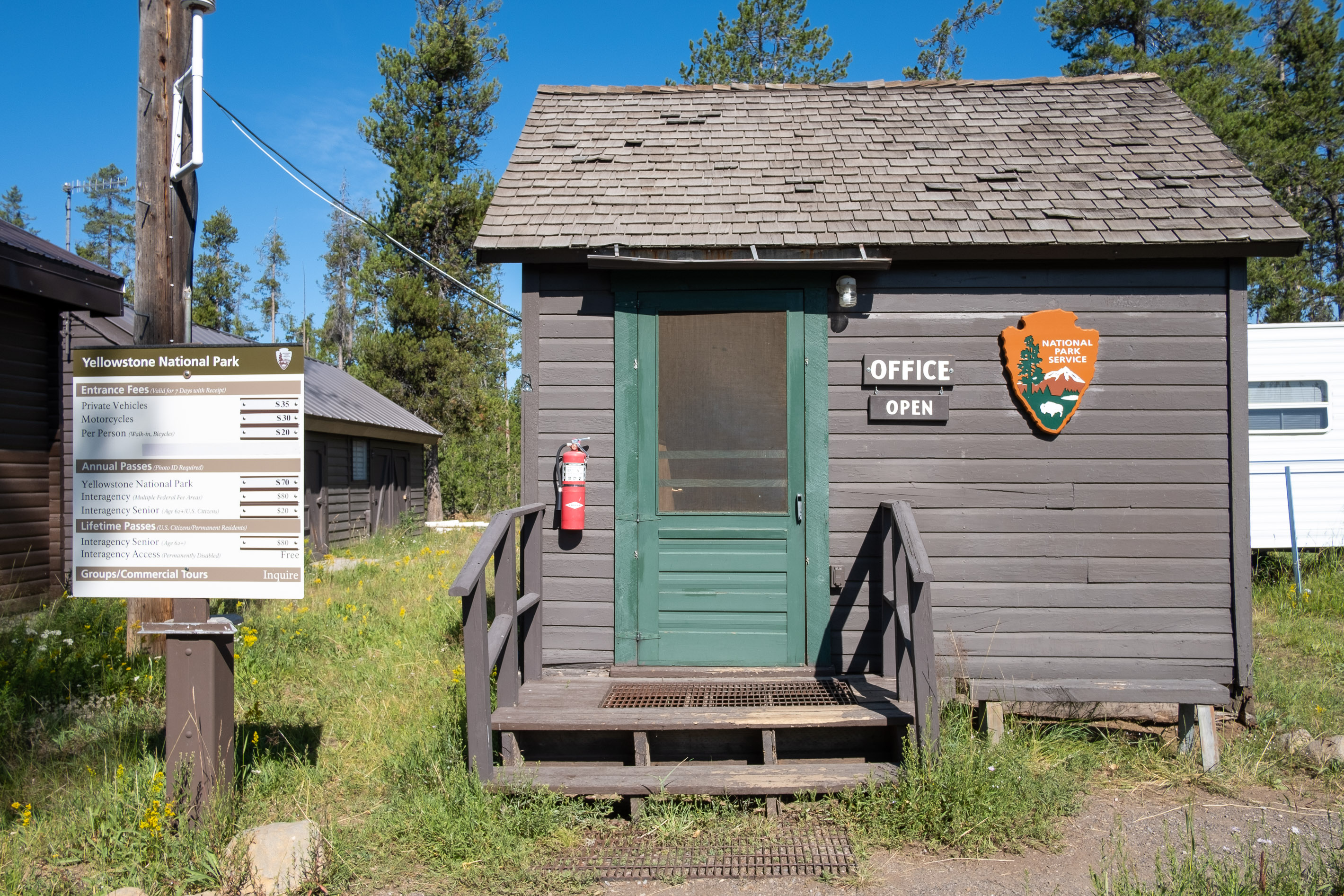
Although an entrance pass is required to enter Yellowstone National Park, vehicle reservations are not needed. You are encouraged to purchase an entrance pass before arriving, but you may also purchase passes at any entrance station upon arrival.
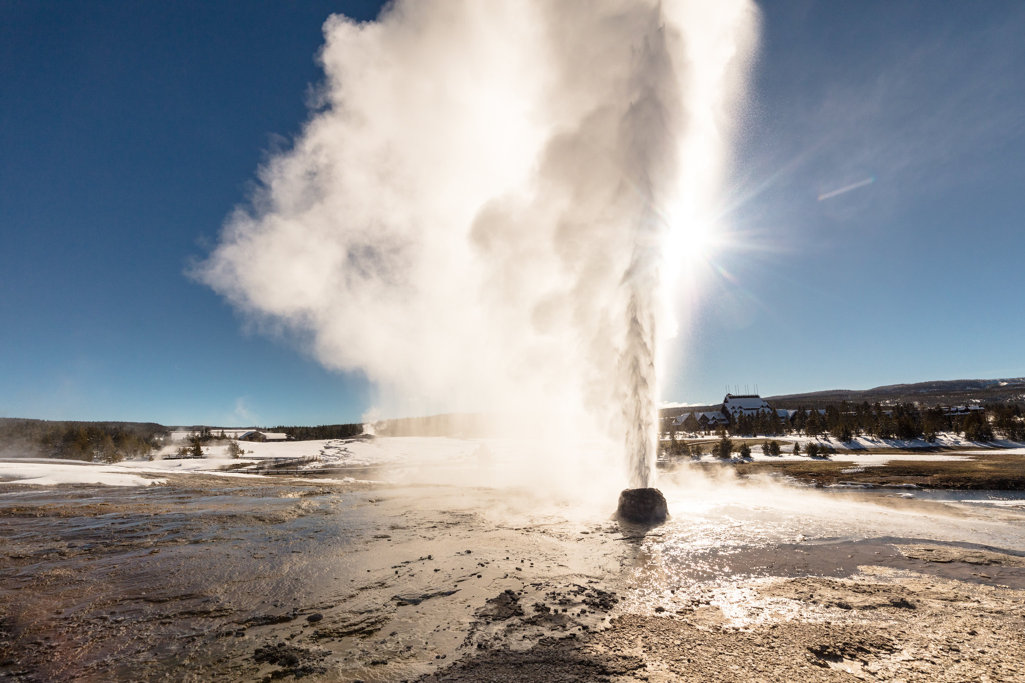
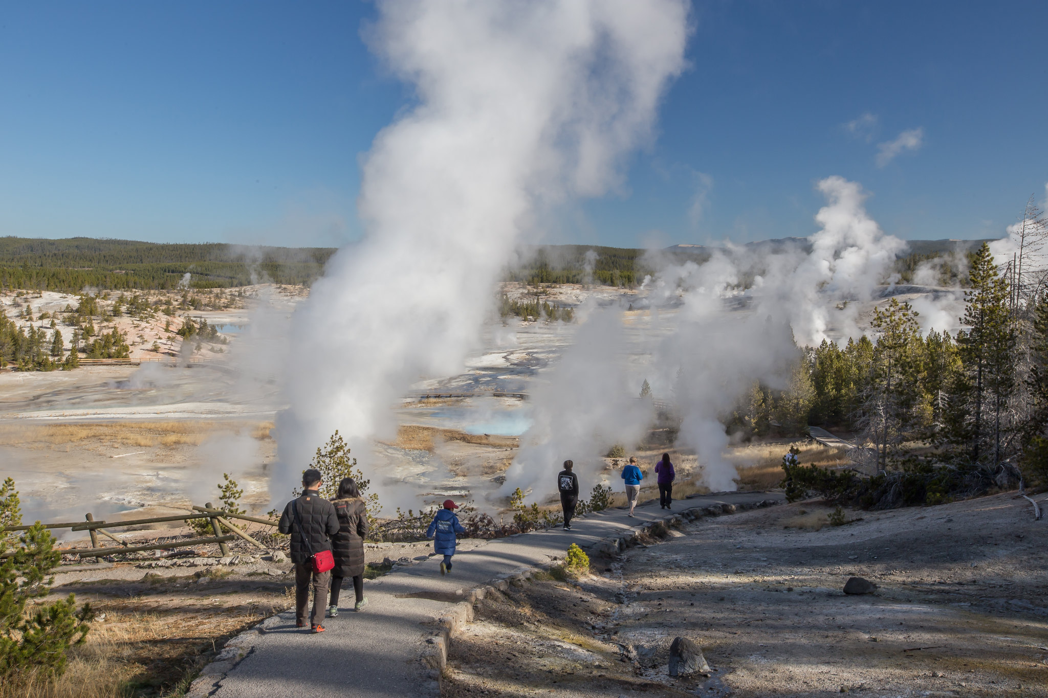
Biscuit Basin Closed Due to Hydrothermal Explosion
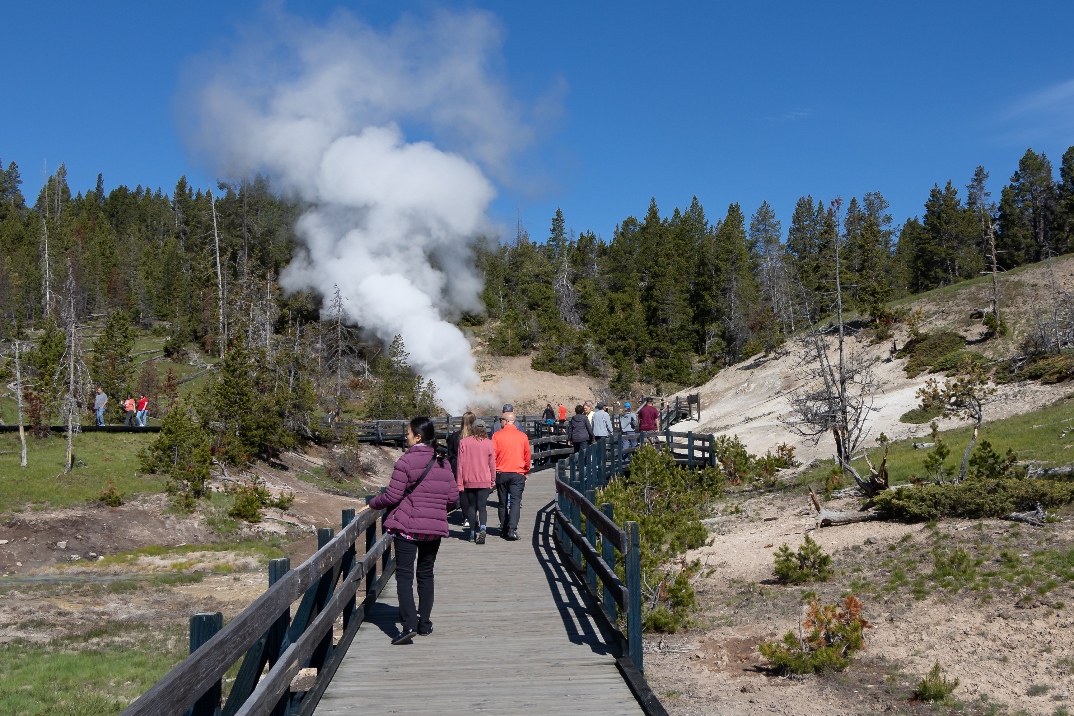
The parking lot, boardwalk, and Firehole River at Biscuit Basin, located north of Old Faithful, is closed to all travel until further notice due to the possibility of another event at the site of a hydrothermal explosion that occurred July 23, 2024.
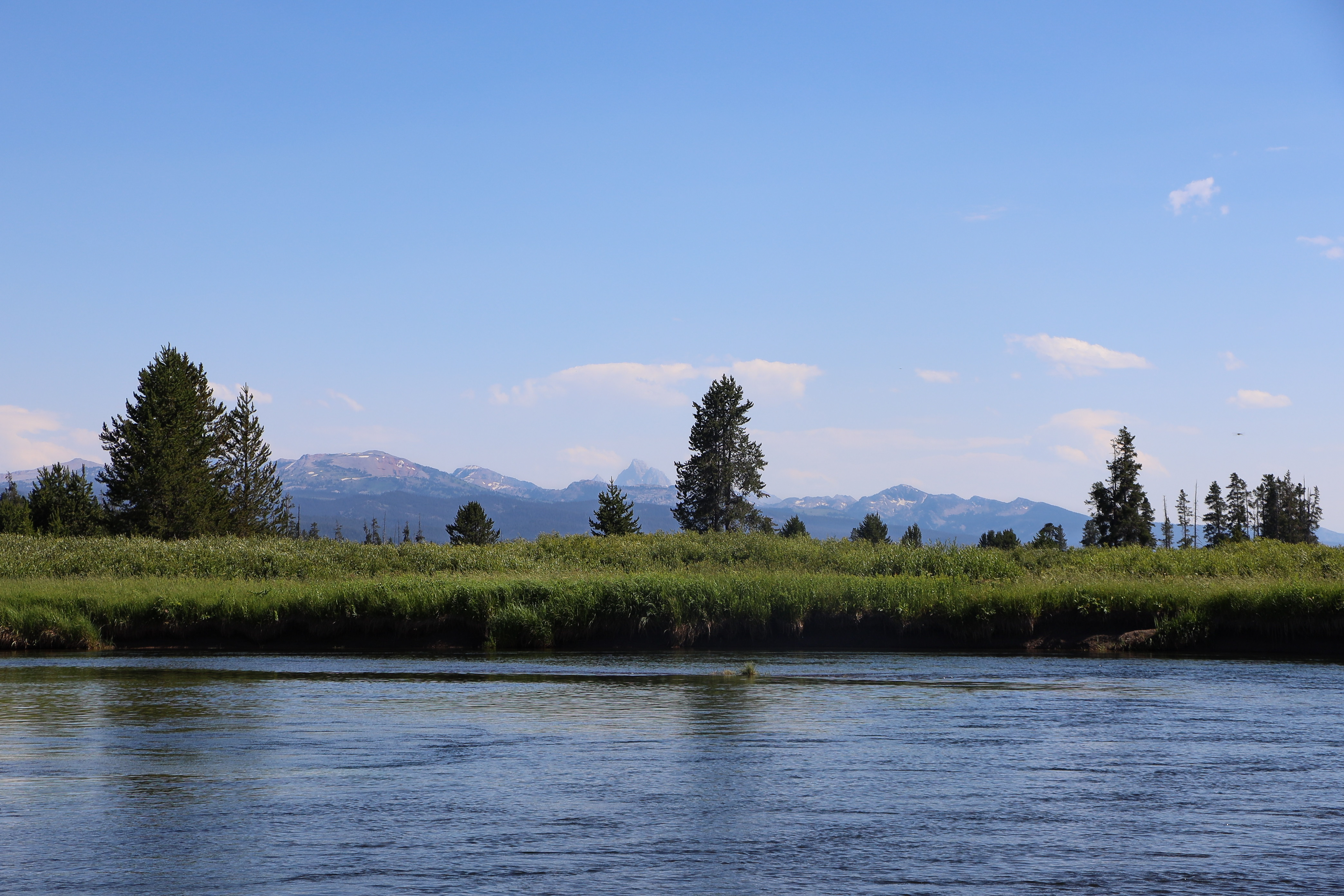
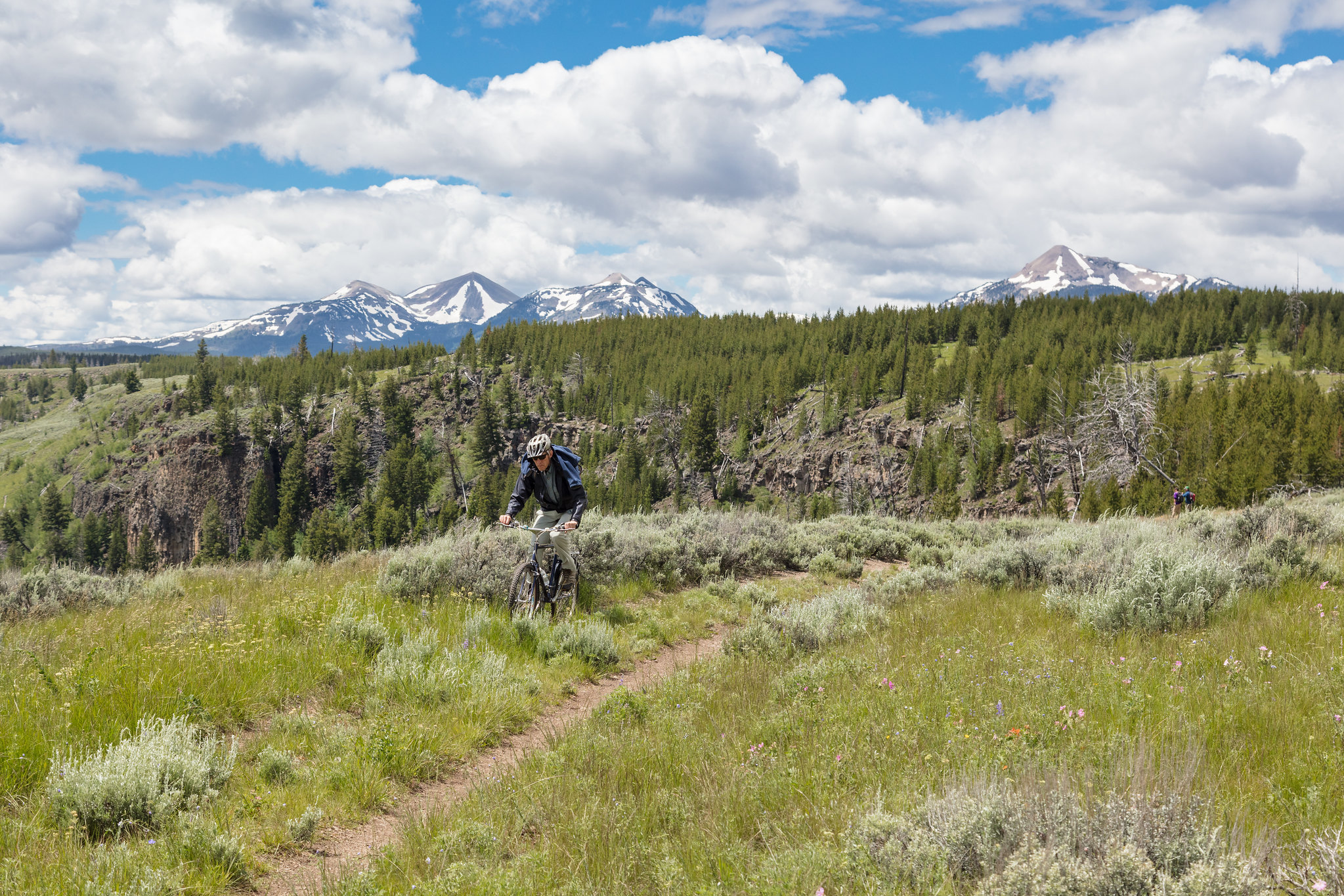
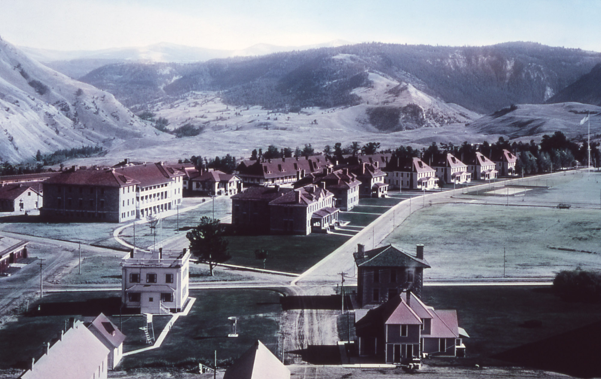
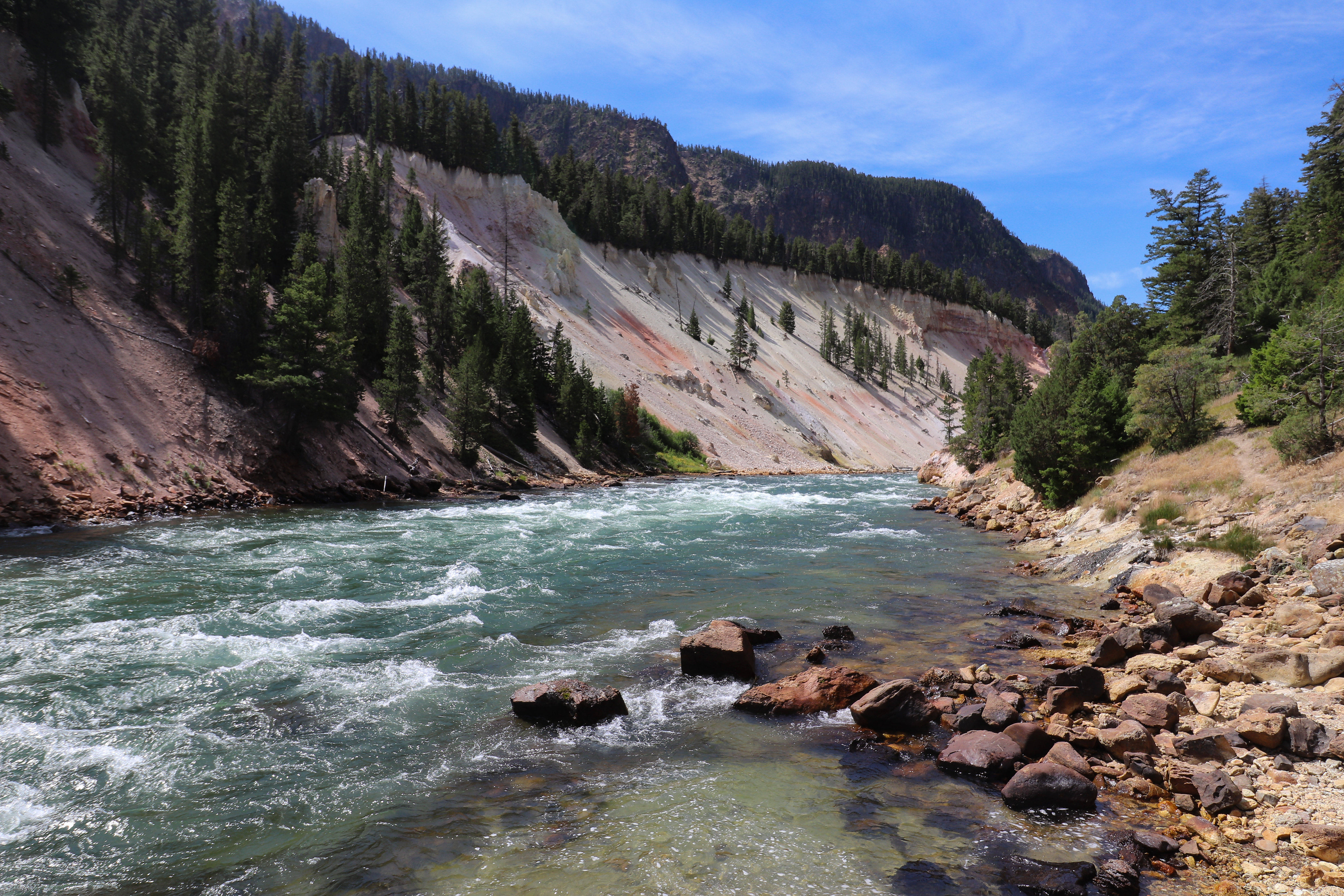
On March 1, 1872, Yellowstone became the first national park for all to enjoy the unique hydrothermal wonders. Today, millions of people come here each year to camp, hike, and enjoy the majesty of the park.
Unlimited entry for one vehicle and all passengers for seven consecutive days, beginning on the day of purchase. Vehicles must be private, non-commercial, and with a seating capacity of 15 or less.
Entrance - Non-commercial Groups
$20.00
Non-commercial group (e.g. church groups, scouts) traveling in a vehicle with a capacity of 16 or more people. Cost is per person. Unlimited entry for one vehicle and all passengers for seven consecutive days, beginning on the day of purchase.
Entrance - Motorcycle
$30.00
Entry for one driver and one passenger for seven consecutive days, beginning on the day of purchase.
Entrance - Snowmobile
$30.00
Entry for one driver and one passenger for seven consecutive days, beginning on the day of purchase.
Entrance - Per Person
$20.00
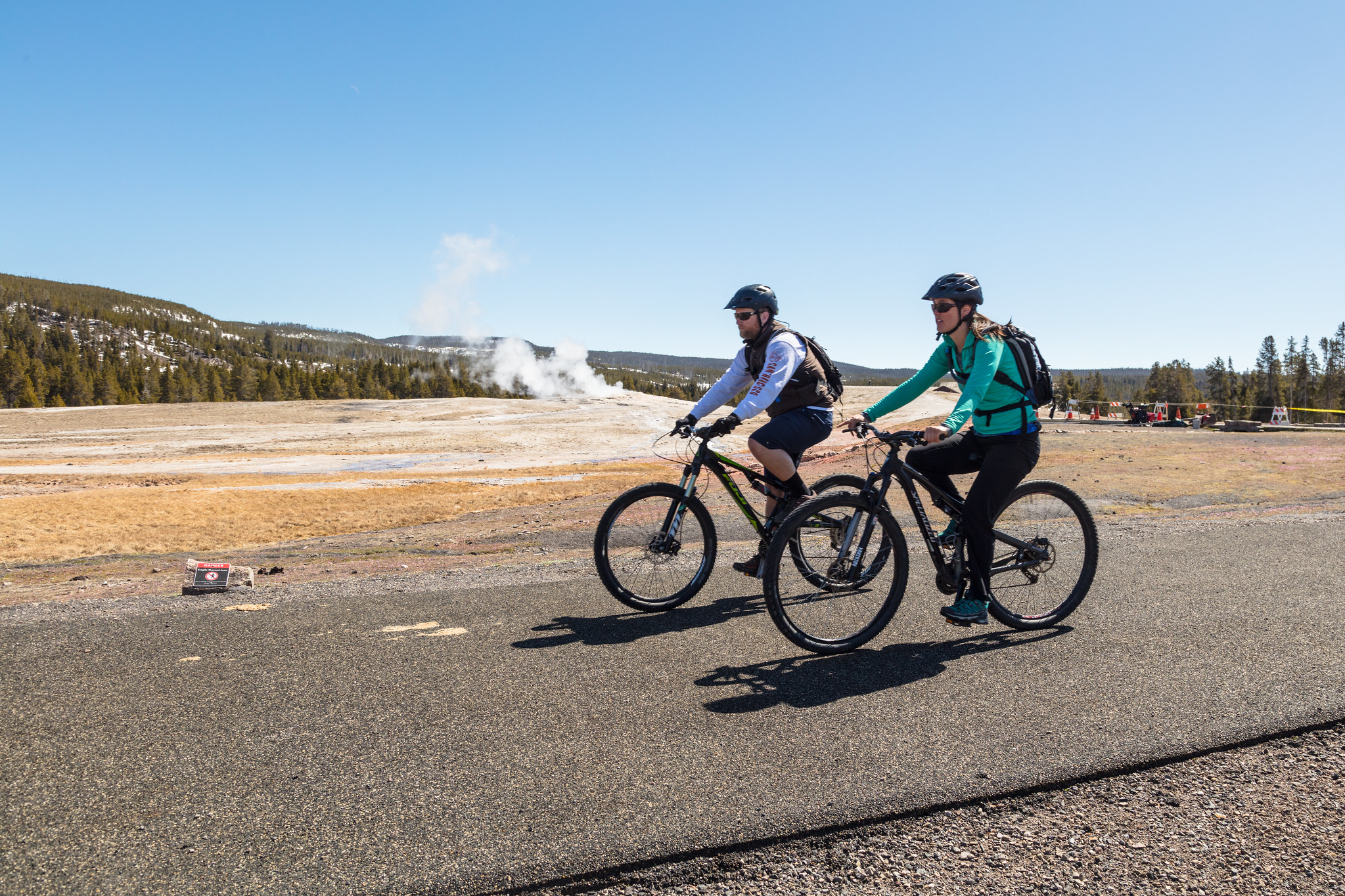
Entry for visitors on foot, bicycle, ski, etc., when 16 years of age or older.
Commercial Entrance - Sedan
$20.00
A commercial tour is defined as consisting of one or more persons traveling on an itinerary that has been packaged, priced, or sold for leisure or recreational purposes by an organization that realizes financial gain through the provision of the service. The cost is $25 + $20 per person. Pass is good for seven days as long as it's the same passenger group.
Commercial Entrance - Van
$125.00
Based upon the total capacity of a vehicle that can carry 7-15 passengers, regardless of the actual number of passengers. A commercial tour is defined as consisting of one or more persons traveling on an itinerary that has been packaged, priced, or sold for leisure or recreational purposes by an organization that realizes financial gain through the provision of the service. Pass is good for seven days as long as it's the same passenger group.
Commercial Entrance - Mini-bus
$200.00
Based upon the total capacity of a vehicle that can carry 16-25 passengers, regardless of the actual number of passengers. A commercial tour is defined as consisting of one or more persons traveling on an itinerary that has been packaged, priced, or sold for leisure or recreational purposes by an organization that realizes financial gain through the provision of the service. Pass is good for seven days as long as it's the same passenger group.
Commercial Entrance - Motor Coach
$300.00
Based upon the total capacity of a vehicle that can carry 26 or more passengers, regardless of the actual number of passengers. A commercial tour is defined as consisting of one or more persons traveling on an itinerary that has been packaged, priced, or sold for leisure or recreational purposes by an organization that realizes financial gain through the provision of the service. Pass is good for seven days as long as it's the same passenger group.
Yellowstone National Park Lodges provides reservations for in this campground. Call 307-344-7311 (307-344-5395 for TDD service) or select the "Reservations >" button to open their online reservation system.
Yellowstone National Park Lodges provides reservations for in this campground. Call 307-344-7311 (307-344-5395 for TDD service) or select the "Reservations >" button to open their online reservation system.
Yellowstone National Park Lodges provides reservations for in this campground. Call 307-344-7311 (307-344-5395 for TDD service) or select the "Reservations >" button to open their online reservation system.
Yellowstone National Park Lodges provides reservations for in this campground. Call 307-344-7311 (307-344-5395 for TDD service) or select the "Reservations >" button to open their online reservation system.
All sites are reservable on Recreation.gov. Eighty percent of sites are reservable six months in advance, while the remaining 20% of sites are available two weeks in advance.
Yellowstone National Park Lodges provides reservations for in this campground. Call 307-344-7311 (307-344-5395 for TDD service) or select the "Reservations >" button to open their online reservation system.
Sites are reservation-only from early April to mid-October and first-come, first-served from mid-October to late March on Recreation.gov. Individual campsites at this campground can be reserved up to six months in advance. Reservations open on a rolling basis, meaning you can book your site exactly six months before the date of your stay, as long as reservations are available for that time.
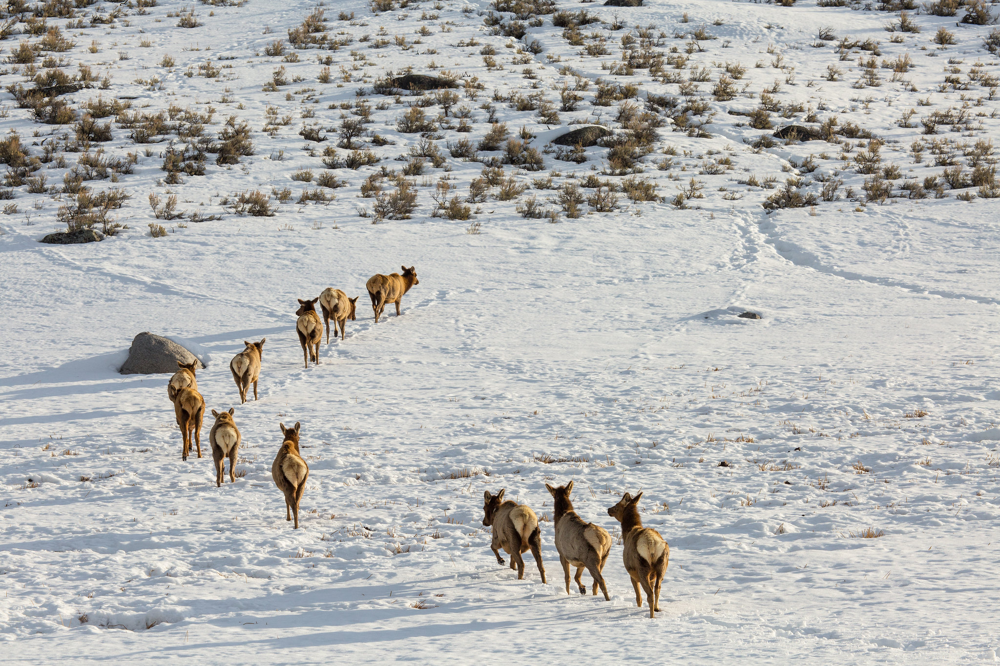
A Wildlife Paradise<br />263 words<br />There are 2 sections in this description.<br />Section 1 (143 words)<br />You are standing in front of a wayside exhibit entitled "A Wildlife Paradise." Featured on the panel is a large color photo of several large dark bison grazing in a grassy landscape. To the right of the photo on the panel's right side is a 4-ringed flipbook with a similar photo of grazing bison on its cover. This wayside stands alongside the expansive landscape overlooking the Yellowstone River. Text below the wayside title reads:<br /><br />"Yellowstone's vast northern range is home to an amazing array of mammals. This wildlife community is one of the largest and most diverse of any on Earth!<br /><br />"While visiting Yellowstone, you may see some of these animals. Remember, they are wild and free to roam--no one knows exactly where they will be.<br /><br />"View wildlife from your car or by using a powerful lens. Never approach a wild animal."<br /><br />Section 2 (102 words)<br /><br />Text below the book, which opens from right to left, reads: "Turn the pages to learn about some of Yellowstone's wildlife." Inside the book are color photos and short descriptions of the following animals: Elk (Cervus elaphus); Mule Deer (Odocoileus hemionus); Coyote (Canis latrans); Red Fox (Vulpes vulpes); Bighorn Sheep (Ovis canadensis); Pronghorn (Antilocapra americana); Grizzly Bear (Ursus arctos); Black Bear (Ursus americanus); Uinta Ground Squirrel (Spermophilus armatus); Yellow-bellied Marmot (Marmota flaviventris); and, on the book's back cover, Bison (Bison bison).<br /><br />A notation in the exhibit's bottom right corner reads: "This exhibit made possible by a generous grant from The Yellowstone Association."<br /><br />END OF MESSAGE
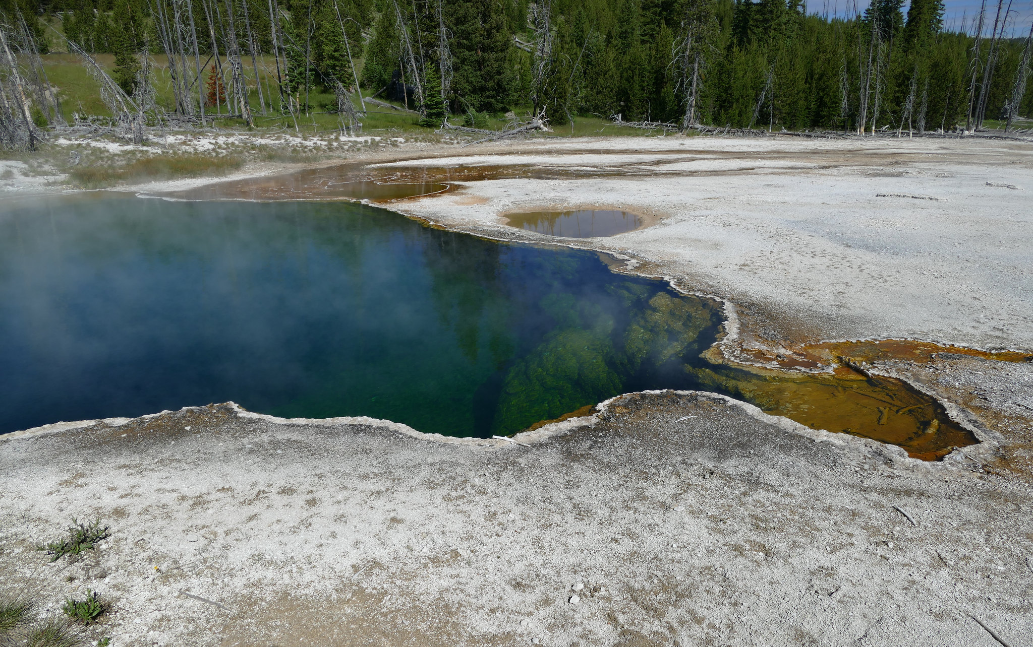
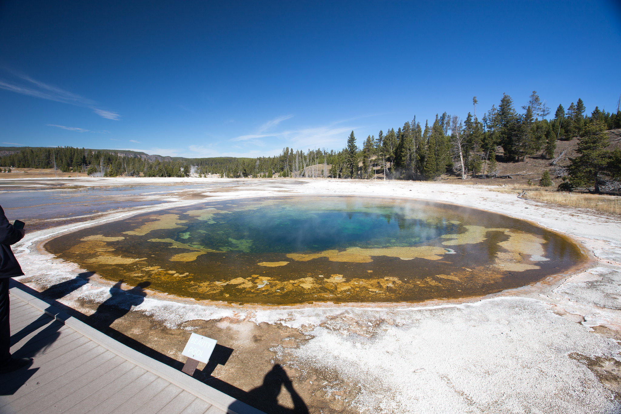
Artemisia Geyser is a large thermal pool in the Upper Geyser Basin.
Named for the color of the geyserite deposits around the feature that are a similar grey-green to sage bush, Artemisia Geyser is one of the largest pools in the park. The geyserite deposits form areas of almost terraced pools around the main pool.
This trailhead provides access to the upper end of the Upper Geyser Basin. Parking is available across the street in the Biscuit Basin parking lot. Use caution when crossing the road.
This trailhead starts at the eastern end of the Artist Point parking area. The trail leads to the popular Artist Point Overlook. East of the overlook where you can embark on the following trails:- Artist Point-Point Sublime Trail- Clear Lake-Ribbon Lake TrailThere is a large parking lot here, though it is often busy during the peak of the summer season. Vault toilets are located at the western end of the parking lot. Artist Point-Point Sublime Trail This 2.6-mile (4.2-km) the
A trailhead sign stands at the start of the trail. It reads:<br /><br />Backcountry Regulations. Permit required for fishing, boating, riding, and overnight camping. More information at the Center Backcountry Office: 307-344-2160.<br /><br />Hiking. Hike in groups of 3 or more; keep your group together. Tell someone where you are going and when you expect to return. Know your route, carry a map, and be able to navigate. Do not hike after dark. Stay on established trails; off-trail travel prohibited in thermal areas.<br /><br />Fishing and Boating. Aquatic Invasive Species (AIS) inspection required for all watercraft including boats, float tubes, and stand up paddle boards. Felt soles prohibited.<br /><br />Riding and Packing. Proof of negative Coggins test within last 12 months required.<br /><br />Food Storage and Camping. These regulations apply to ALL backcountry users. Sleep 100 yards (91 m) from your food storage and cooking areas. Do not leave food, trash, toiletries, backpacks, coolers, water bottles, or any potential attractant unattended. Store food in an approved bear resistant container or hang on a food pole 10 feet (3 m) above the ground and 4 feet (1 m) from sides. Carry a minimum of 35 feet (11 m) of rope. Campfires allowed only in designated campsites within established fire rings. Extinguish campfires completely before leaving site.<br /><br />Follow LEAVE NO TRACE travel and camping techniques. Enjoy the backcountry and help keep it clean for others to enjoy. Bury human waste and toilet tissue in a 6-8 inch (15-18 cm) deep "cat hole" at least 100 feet (30 m) from water and trails.<br /><br />River Crossings. Park waters are swift and cold. Swimming in park rivers is not recommended. River crossings are hazardous.<br /><br />Lightning Safety. During thunderstorms, descend to lower elevation, avoid open areas and isolated tall trees. Assume lightning position: feet together, crouch on foam pad or sit on pack, hands over ears.<br /><br />Regulations. Leave What You Find: Do not collect anything from the park. No Pets: No pets on trail. Obtain service animal regulations at backcountry offices. No Hunting: No hunting or discharge of firearms. No Motorized Vehicles: No motorized vehicles on trails. Wheeled Vehicles Restricted: No bicycles, strollers, or wheeled vehicles (except wheelchairs), except where specified.<br /><br />In an emergency, dial 9-1-1 or contact the nearest ranger station.<br /><br />Animals are Dangerous. Do not approach or feed any animal. Bison and elk have injured people. Stay 100 yards (91 m) from bears and wolves. Stay 25 yards (23 m) from all other animals.<br /><br />Be Prepared for a Bear Encounter. Grizzly and black bears inhabit all of Yellowstone National Park. Be Alert. Watch for signs of bear activity: scratches in trees, tracks, scat, or dig sites. Avoid dead animals. Make Noise. Avoid surprising a bear by calling out and clapping your hands at regular intervals to make your presence known. Carry Bear Spray. Carry bear spray and know how to use it. Keep it immediately available, not inside your pack. Hike in Groups. Travel in groups of 3 or more is recommended. Stay with your group at all times.<br /><br />What to do if you encounter a bear. Stay calm, do not run. Quietly detour or back away; stop if this seems to agitate the bear. Stay at least 100 yards (91 m) from bears. Do NOT feed bears or other animals.<br /><br />What to do if a bear charges you. Stand still, do not run. Stand your ground and use your bear spray. Spray when the bear is 60 feet (18 m) away or closer. If a bear charges, it may be a bluff charge.<br /><br />What to do if a bear makes contact. Drop to the ground; play dead. Lie face down and clasp your hands over the back of your neck; stay still and silent. Wait several minutes after the bear leaves before getting up and leaving the area.
This is a one-mile (1.6 km) trail that enters a partially burned lodgepole pine forest, then winds across a wet meadow on a boardwalk. This trail is a short loop. The hydrothermal area has colorful hot springs, mudpots, and small geysers. Watch out for flying mud. Stay on the trail and boardwalks. AccessibilityThe trail is relatively flat from the parking lot to the hydrothermal features. The trail is over bare ground. There is a mixture of boardwalks and bare ground trails
Artists Paintpots Trail 1,318 words There are 6 sections in this description. Section 1 (241 words) Standing at the entrance to the Artists’ Paintpots trail is a wayside exhibit entitled “Artists’ Paintpots,” which features a simple map drawing superimposed over a large color photo of the area. Artists’ Paintpots is located nearly 4 miles south of Norris Geyser Basin. Text below the title tells us: “This is a one-mile (1.6 kilometer) trail that enters a partially burned lodgepole pine forest, then winds across a wet meadow on a boardwalk. The hydrothermal area within the short loop at the end of the trail contains colorful hot springs, mudpots and small geysers. Caution for flying mud! “The lower portion of this hydrothermal area is wheelchair accessible. The upper trail to the mudpots is steep and rough. It is not recommended for visitors using wheelchairs. “Remember to stay on the trail and boardwalks.” A white arrow labeled with the words “You are here” indicates your position at the start of the trail, which is located at the end of a short road running southeast from Grand Loop Road. Further south and east from the trail entrance is a dotted line representing the wheelchair accessible boardwalk loop surrounding the “hydrothermal area.” It is also noted that Grand Loop Road leads to Norris to the north and Madison Junction to the south. A small color photo in the exhibit’s bottom left corner shows the various hydrothermal features along the trail--pools, mudpots, and geysers. A caption reads: “A colorful and other-worldly landscape.” Section 2 (252 words) You are standing in front of a wayside exhibit entitled “Change is the Only Constant.” Featured on the exhibit’s left side is a color photo of several thermal features including a steaming blue pool surrounded by white mineral deposits and evergreen trees. Text below the title reads: “Thermal features were here long before the constraints of barriers and boardwalks. They may be under your feet anywhere in any thermal basin and new ones are constantly breaking through the crust and changing while old ones are drying up or maybe only going dormant for a year, a decade, a century. They exist in their own time and place. “For visitors this means that we have to always be careful where we step. Keep a lookout for your own safety. A new hot spring may have erupted so recently that there has been no time to post warnings. “Always stay alert around thermal features.” A color drawing on the exhibit’s right side shows a bright fuchsia, or deep pinkish-purple, landscape striped with areas resembling black ribbons and yet other rounded areas colored neon blue and yellow with smaller sections of green, red, and white. A colored thermometer to the right of the drawing shows black and purple at the bottom of the thermometer at temperatures at 22.8 and 29 through 30.6 respectively. The center of the blue section above is labeled 52; green is 60.7; yellow is 69.5, and the red section ranges from 74 to 84.5. The thermometer’s white tip is labeled 97.8. Section 3 (159 words) You are standing in front of a wayside exhibit entitled “Blood Geyser,” which features a large color photo of a geyser nestled at the base of a hillside streaked with rust-colored rock. A low mound of water and a thin cloud of steam erupts from the geyser’s pool. Text below the title tells us: “While the name of this geyser evokes images of a gruesome event, the reality is much tamer. The high concentration of iron oxide in the water precipitates out, staining the surrounding rocks a rich red. It has been busily erupting since it was first recorded in 1882. This geyser can erupt up to 6 feet (1.8 meters) and discharges 150 gallons (567 liters) a minute.” More text in the exhibit’s bottom right corner reads: “Unusual Feature. Red flakes of iron oxide will precipitate from a sample of this water after only a few minutes. There are very few features in Yellowstone where this will happen.” Section 4 (137 words) You are standing in front of a wayside exhibit entitled “Inspiration in a Paintpot,” located at the top of the trail overlooking the hydrothermal basin containing Artists’ Paintpots. The exhibit features a painting of the panorama before you, where thermal features include many mudpots and colorful hot springs. Several patches of pine forest dot the landscape as well. Text below the title tells us: “Artists' Paintpots is a good place to let your mind absorb the smells, colors, and sounds that surround you. Feel the heat of the sun, the cool of the breeze, and the steam from a hot pool. Let your imagination run free with the shapes and colors, as you have before you.” A caption in the bottom right corner reads: “At Foot of Paint Pot Hill, John Henry Renshawe, topographer for 1883 expedition.” Section 5 (314 words) You are standing in front of a wayside exhibit entitled “From Soup to Stew.” Text below the title tells us: “The hydrothermal system at Artists’ Paintpots operates
Aurum Geyser 333 words There are 2 sections in this description. Section 1 (134 words) You are now facing Aurum Geyser, a small geyser pool with a low, flat-topped rim. A wayside located along the boardwalk overlooking the site is entitled “Aurum Geyser” and features a large color photo of the erupting geyser. Text below the title reads: “Aurum is Latin for "gold." The geyser was named for the color of iron oxide deposits lining the vent's rim. During eruptions, which occur every 2.5 to 5 hours, water and steam are ejected to heights often exceeding 20 feet.” Three “Fast Facts” highlighted with bullet points read: “Aurum Geyser is a cone-type geyser. “Eruptions last about a minute. “Prior to an earthquake in 1983 Aurum Geyser rarely erupted.” A smaller color photo with the caption “Crater of Aurum Geyser” shows the gold-colored rock lining the rim of Aurum’s circular vent. Section 2 (181 words) Below the smaller photo is more text entitled “Geyser Types”: “Geysers are hot springs that periodically erupt. Beyond this broad similarity, they can be grouped into two categories: cone geysers (Old Faithful is the most famous of this type) and fountain geysers like Sawmill or Grand geysers.” A color drawing on the exhibit’s right side shows the difference between the two geyser types. The blue water erupting from the cone geyser forms a higher tower than that rising from the fountain geyser. Text below the drawing tells us: “Fountain Geysers. The wide openings or vents of fountain geysers are often mistaken for hot springs. Water collects in the vent before and during eruptions, and erupting water and steam pass through the pool. “Cone Geysers. Cone geysers have narrow openings, or vents. Under pressure, this opening can act like a "nozzle," spouting a steady column of water. Over long periods of time, sinter (silica) builds around the vent opening creating the cone.” A notation in the exhibit’s bottom right corner reads: “This exhibit made possible by a grant from The Yellowstone Association.” END OF MESSAGE
This trailhead is located on the north side of the East Entrance Road and provides access to the following trail:- Avalanche Peak Trail Avalanche Peak Trail This trail is often snow-covered until early July. This strenuous, high elevation 4.4-mile (7.1-km) there-and-back trail is not recommended for people with heart and/or respiratory problems. Be aware of lightning above treeline. Even on warm summer days, bring rain gear, wool hats, and gloves. Burned trees may fall withou
A trailhead sign stands at the start of the trail. It reads: Backcountry Regulations. Permit required for fishing, boating, riding, and overnight camping. More information at the Center Backcountry Office: 307-344-2160. Hiking. Hike in groups of 3 or more; keep your group together. Tell someone where you are going and when you expect to return. Know your route, carry a map, and be able to navigate. Do not hike after dark. Stay on established trails; off-trail travel prohibited in thermal areas. Fishing and Boating. Aquatic Invasive Species (AIS) inspection required for all watercraft including boats, float tubes, and stand up paddle boards. Felt soles prohibited. Riding and Packing. Proof of negative Coggins test within last 12 months required. Food Storage and Camping. These regulations apply to ALL backcountry users. Sleep 100 yards (91 m) from your food storage and cooking areas. Do not leave food, trash, toiletries, backpacks, coolers, water bottles, or any potential attractant unattended. Store food in an approved bear resistant container or hang on a food pole 10 feet (3 m) above the ground and 4 feet (1 m) from sides. Carry a minimum of 35 feet (11 m) of rope. Campfires allowed only in designated campsites within established fire rings. Extinguish campfires completely before leaving site. Follow LEAVE NO TRACE travel and camping techniques. Enjoy the backcountry and help keep it clean for others to enjoy. Bury human waste and toilet tissue in a 6–8 inch (15–18 cm) deep “cat hole” at least 100 feet (30 m) from water and trails. River Crossings. Park waters are swift and cold. Swimming in park rivers is not recommended. River crossings are hazardous. Lightning Safety. During thunderstorms, descend to lower elevation, avoid open areas and isolated tall trees. Assume lightning position: feet together, crouch on foam pad or sit on pack, hands over ears. Regulations. Leave What You Find: Do not collect anything from the park. No Pets: No pets on trail. Obtain service animal regulations at backcountry offices. No Hunting: No hunting or discharge of firearms. No Motorized Vehicles: No motorized vehicles on trails. Wheeled Vehicles Restricted: No bicycles, strollers, or wheeled vehicles (except wheelchairs), except where specified. In an emergency, dial 9-1-1 or contact the nearest ranger station. Animals are Dangerous. Do not approach or feed any animal. Bison and elk have injured people. Stay 100 yards (91 m) from bears and wolves. Stay 25 yards (23 m) from all other animals. Be Prepared for a Bear Encounter. Grizzly and black bears inhabit all of Yellowstone National Park. Be Alert. Watch for signs of bear activity: scratches in trees, tracks, scat, or dig sites. Avoid dead animals. Make Noise. Avoid surprising a bear by calling out and clapping your hands at regular intervals to make your presence known. Carry Bear Spray. Carry bear spray and know how to use it. Keep it immediately available, not inside your pack. Hike in Groups. Travel in groups of 3 or more is recommended. Stay with your group at all times. What to do if you encounter a bear. Stay calm, do not run. Quietly detour or back away; stop if this seems to agitate the bear. Stay at least 100 yards (91 m) from bears. Do NOT feed bears or other animals. What to do if a bear charges you. Stand still, do not run. Stand your ground and use your bear spray. Spray when the bear is 60 feet (18 m) away or closer. If a bear charges, it may be a bluff charge. What to do if a bear makes contact. Drop to the ground; play dead. Lie face down and clasp your hands over the back of your neck; stay still and silent. Wait several minutes after the bear leaves before getting up and leaving the area.
Avoca Spring is a hydrothermal feature at Biscuit Basin.
Avoca Spring is a linear, elongated pool that continuously boils with built-up, solidified sinter above the water level. Some of the surrounding area with runoff water is home to orange-colored thermophiles.
Baby Daisy Geyser is a hydrothermal feature at Biscuit Basin.
Baby Daisy Geyser is a small orange pool with solidified sinter covering the surrounding area, forming a small rim around the pool and a runoff channel. The center of the pool drops into a deep vent.
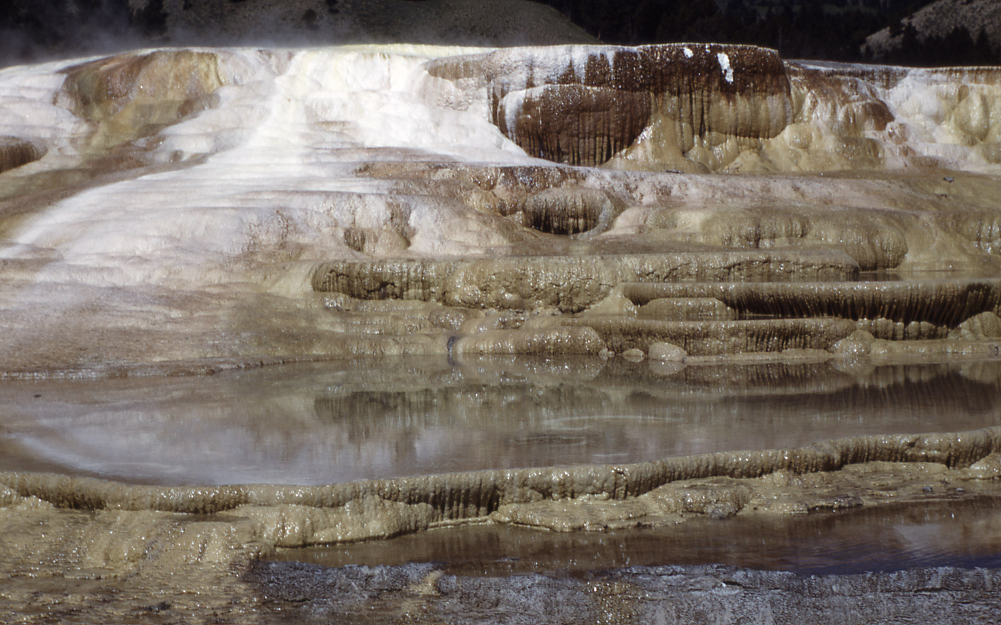
Back Basin<br />654 words<br />There are 4 sections in this description.<br />Section 1 (168 words)<br /><br />You are standing in front of a wayside panel entitled "Norris Geyser Basin." This geyser basin, which is located outside the northwest edge of Yellowstone Caldera, consists of three areas-Porcelain Basin, Back Basin, and One Hundred Springs Plain. Norris Geyser Basin is known as the hottest and most changeable thermal area in Yellowstone.<br /> <br />Below the title is a color photo providing a panoramic view of a wide landscape, or basin, dotted with thick stands of evergreen trees; towers of water or steam rise from various hydrothermal features scattered throughout this basin. Below the photo is the subtitle "Back Basin" and text that reads:<br /><br />"Tucked into the woods, Back Basin is full of surprising sites [sic], sounds, and smells-it is alive with heat and gases from the Yellowstone Volcano. <br /><br />"Geysers and hot springs frequently change here. They may be different from descriptions you have heard or read about or they may have changed since a previous visit-evidence that the volcano is very much alive below ground."<br /><br />Section 2 (234 words)<br /><br />On the panel's right side is a drawing of a map with Back Basin labeled in its center; the smaller Porcelain Basin lies to Back Basin's north, at the top of the map.<br /><br />A red dot with the words "You Are Here" indicates your position just north of Emerald Spring on the eastern periphery of Back Basin. You are standing at the entrance to a boardwalk that leads south to Steamboat Geyser and then Echinus Geyser at the bottom of the map; additional boardwalks and dirt or paved trails loop west and then north past other hydrothermal features including Cistern Spring, Arch Steam Vent, Puff ‘n Stuff Geyser, Black Hermit Caldron, Green Dragon Spring, Blue Mud Steam Vent, Yellow Funnel Spring, Porkchop Geyser, Pearl Geyser, Vixen Geyser, Veteran Geyser, Palpitator Spring, Fearless Geyser, Monarch Geyser and Minute Geyser.<br /><br />Located just northeast of you are the Norris Geyser Basin Museum and Bookstore. The elevation at the museum is labeled as 7,560 feet, or 2,304 meters. Directly to your east is a paved road with 3 parking areas; there are also 3 sets of restrooms. A red line leading north from the Norris Geyser Basin Museum into Porcelain Basin indicates "Stairs, steep grades, or uneven ground." A black line in the map's top right corner is labeled "Trail to Norris Campground and Museum of the National Park Ranger" with an arrow pointing northeast from the basins.<br /><br />Section 3 (115 words)<br /><br />At the bottom of the panel are two color photos. The photo on the left is labeled "Monarch Metamorphosis" and pictures a pale green geyser pool. A caption below the photo tells us: <br /><br />"Monarch Geyser can be quiet for years at a time. Eruptions reach as high as 200 feet, and hurl muddy water in all directions."<br /><br />The second photo is labeled "Echinus Transformations" and shows this geyser's yellowish-brown crater. The caption reads:<br /><br />"Echinus Geyser has sometimes been known for regular eruptions, but this beautiful geyser has also had many periods of irregular activity."<br /><br /><br />A notation in the sign's bottom right corner reads: "This exhibit made possible by a generous grant from The Yellowstone Association."<br /><br />Section 4 (111 words)<br />Standing near this wayside is a brown sign with white lettering; there is also one white arrow pointing left and another arrow pointing right. Text accompanying the left-facing arrow reads: "Back Basin, 1.6 miles (2.6 kilometers) loop, 1 mile (1.6 kilometers) loop. Steamboat Geyser, .25 mile." The arrow pointing right is labeled "Porcelain Basin, .6 mile (1 kilometer) loop."<br />A few feet to the right of the sign is a trail box, about 3 feet high, where you can obtain a pamphlet about the site by lifting the lid. A $1.00 donation is requested or return after use; money can be inserted in the slot on the front of the bin.<br /><br />END OF MESSAGE
The Bacon Rind trailhead is on the northwest side of Yellowstone near U.S. Highway 191. From this trailhead, you can embark on the following trail:- Bacon Rind Trail Bacon Rind Trail A strenuous 10.2-mile (16.4 km) there-and-back trail that climbs 2,400 feet (731 m) through forest (some burned in 2017) and meadow to high alpine meadows and views. CAUTION: Grizzly bears frequent this area. Backcountry RegulationsPermit required for fishing, boating, riding, and overnight cam
A trailhead sign stands at the start of the trail. It reads: Backcountry Regulations. Permit required for fishing, boating, riding, and overnight camping. More information at the Center Backcountry Office: 307-344-2160. Hiking. Hike in groups of 3 or more; keep your group together. Tell someone where you are going and when you expect to return. Know your route, carry a map, and be able to navigate. Do not hike after dark. Stay on established trails; off-trail travel prohibited in thermal areas. Fishing and Boating. Aquatic Invasive Species (AIS) inspection required for all watercraft including boats, float tubes, and stand up paddle boards. Felt soles prohibited. Riding and Packing. Proof of negative Coggins test within last 12 months required. Food Storage and Camping. These regulations apply to ALL backcountry users. Sleep 100 yards (91 m) from your food storage and cooking areas. Do not leave food, trash, toiletries, backpacks, coolers, water bottles, or any potential attractant unattended. Store food in an approved bear resistant container or hang on a food pole 10 feet (3 m) above the ground and 4 feet (1 m) from sides. Carry a minimum of 35 feet (11 m) of rope. Campfires allowed only in designated campsites within established fire rings. Extinguish campfires completely before leaving site. Follow LEAVE NO TRACE travel and camping techniques. Enjoy the backcountry and help keep it clean for others to enjoy. Bury human waste and toilet tissue in a 6–8 inch (15–18 cm) deep “cat hole” at least 100 feet (30 m) from water and trails. River Crossings. Park waters are swift and cold. Swimming in park rivers is not recommended. River crossings are hazardous. Lightning Safety. During thunderstorms, descend to lower elevation, avoid open areas and isolated tall trees. Assume lightning position: feet together, crouch on foam pad or sit on pack, hands over ears. Regulations. Leave What You Find: Do not collect anything from the park. No Pets: No pets on trail. Obtain service animal regulations at backcountry offices. No Hunting: No hunting or discharge of firearms. No Motorized Vehicles: No motorized vehicles on trails. Wheeled Vehicles Restricted: No bicycles, strollers, or wheeled vehicles (except wheelchairs), except where specified. In an emergency, dial 9-1-1 or contact the nearest ranger station. Animals are Dangerous. Do not approach or feed any animal. Bison and elk have injured people. Stay 100 yards (91 m) from bears and wolves. Stay 25 yards (23 m) from all other animals. Be Prepared for a Bear Encounter. Grizzly and black bears inhabit all of Yellowstone National Park. Be Alert. Watch for signs of bear activity: scratches in trees, tracks, scat, or dig sites. Avoid dead animals. Make Noise. Avoid surprising a bear by calling out and clapping your hands at regular intervals to make your presence known. Carry Bear Spray. Carry bear spray and know how to use it. Keep it immediately available, not inside your pack. Hike in Groups. Travel in groups of 3 or more is recommended. Stay with your group at all times. What to do if you encounter a bear. Stay calm, do not run. Quietly detour or back away; stop if this seems to agitate the bear. Stay at least 100 yards (91 m) from bears. Do NOT feed bears or other animals. What to do if a bear charges you. Stand still, do not run. Stand your ground and use your bear spray. Spray when the bear is 60 feet (18 m) away or closer. If a bear charges, it may be a bluff charge. What to do if a bear makes contact. Drop to the ground; play dead. Lie face down and clasp your hands over the back of your neck; stay still and silent. Wait several minutes after the bear leaves before getting up and leaving the area.
A large, quiet pool with steam rising from the surface. The shallow outer parts of the pool are filled with orange thermophiles that can thrive in the cooler waters.
This trailhead is located behind the Mammoth Hot Springs Hotel, next to the start of the Old Gardiner Road. From this trailhead, you can access the following trails:- Beaver Ponds Trail- Selpulchar Mountain TrailThere is no parking at the trailhead. However, there is parking available nearby around the visitor center, hotel, and other nearby facilities. Beaver Ponds Trail A 5-mile (8.3-km) loop trail that begins and ends in the developed area of Mammoth Hot Springs. This mode
A trailhead sign stands at the start of the trail. It reads: Backcountry Regulations. Permit required for fishing, boating, riding, and overnight camping. More information at the Center Backcountry Office: 307-344-2160. Hiking. Hike in groups of 3 or more; keep your group together. Tell someone where you are going and when you expect to return. Know your route, carry a map, and be able to navigate. Do not hike after dark. Stay on established trails; off-trail travel prohibited in thermal areas. Fishing and Boating. Aquatic Invasive Species (AIS) inspection required for all watercraft including boats, float tubes, and stand up paddle boards. Felt soles prohibited. Riding and Packing. Proof of negative Coggins test within last 12 months required. Food Storage and Camping. These regulations apply to ALL backcountry users. Sleep 100 yards (91 m) from your food storage and cooking areas. Do not leave food, trash, toiletries, backpacks, coolers, water bottles, or any potential attractant unattended. Store food in an approved bear resistant container or hang on a food pole 10 feet (3 m) above the ground and 4 feet (1 m) from sides. Carry a minimum of 35 feet (11 m) of rope. Campfires allowed only in designated campsites within established fire rings. Extinguish campfires completely before leaving site. Follow LEAVE NO TRACE travel and camping techniques. Enjoy the backcountry and help keep it clean for others to enjoy. Bury human waste and toilet tissue in a 6–8 inch (15–18 cm) deep “cat hole” at least 100 feet (30 m) from water and trails. River Crossings. Park waters are swift and cold. Swimming in park rivers is not recommended. River crossings are hazardous. Lightning Safety. During thunderstorms, descend to lower elevation, avoid open areas and isolated tall trees. Assume lightning position: feet together, crouch on foam pad or sit on pack, hands over ears. Regulations. Leave What You Find: Do not collect anything from the park. No Pets: No pets on trail. Obtain service animal regulations at backcountry offices. No Hunting: No hunting or discharge of firearms. No Motorized Vehicles: No motorized vehicles on trails. Wheeled Vehicles Restricted: No bicycles, strollers, or wheeled vehicles (except wheelchairs), except where specified. In an emergency, dial 9-1-1 or contact the nearest ranger station. Animals are Dangerous. Do not approach or feed any animal. Bison and elk have injured people. Stay 100 yards (91 m) from bears and wolves. Stay 25 yards (23 m) from all other animals. Be Prepared for a Bear Encounter. Grizzly and black bears inhabit all of Yellowstone National Park. Be Alert. Watch for signs of bear activity: scratches in trees, tracks, scat, or dig sites. Avoid dead animals. Make Noise. Avoid surprising a bear by calling out and clapping your hands at regular intervals to make your presence known. Carry Bear Spray. Carry bear spray and know how to use it. Keep it immediately available, not inside your pack. Hike in Groups. Travel in groups of 3 or more is recommended. Stay with your group at all times. What to do if you encounter a bear. Stay calm, do not run. Quietly detour or back away; stop if this seems to agitate the bear. Stay at least 100 yards (91 m) from bears. Do NOT feed bears or other animals. What to do if a bear charges you. Stand still, do not run. Stand your ground and use your bear spray. Spray when the bear is 60 feet (18 m) away or closer. If a bear charges, it may be a bluff charge. What to do if a bear makes contact. Drop to the ground; play dead. Lie face down and clasp your hands over the back of your neck; stay still and silent. Wait several minutes after the bear leaves before getting up and leaving the area.
This trailhead is located along the Cave Falls Road, just north of the southern park boundary. This trailhead provides access to the following trails:- Boundary Creek- Bechler River Cutoff Trail- Bechler River Trail- South Boundary Trail: Bechler Ranger Station-Grassy Lake- Robinson Creek Trail Boundary Creek Trail A moderate 17.2-mile (27.7-km) one-way trail that travels across relative flat lands, through forests and meadows, and past several waterfalls around the middle se
A trailhead sign stands at the start of the trail. It reads: Backcountry Regulations. Permit required for fishing, boating, riding, and overnight camping. More information at the Center Backcountry Office: 307-344-2160. Hiking. Hike in groups of 3 or more; keep your group together. Tell someone where you are going and when you expect to return. Know your route, carry a map, and be able to navigate. Do not hike after dark. Stay on established trails; off-trail travel prohibited in thermal areas. Fishing and Boating. Aquatic Invasive Species (AIS) inspection required for all watercraft including boats, float tubes, and stand up paddle boards. Felt soles prohibited. Riding and Packing. Proof of negative Coggins test within last 12 months required. Food Storage and Camping. These regulations apply to ALL backcountry users. Sleep 100 yards (91 m) from your food storage and cooking areas. Do not leave food, trash, toiletries, backpacks, coolers, water bottles, or any potential attractant unattended. Store food in an approved bear resistant container or hang on a food pole 10 feet (3 m) above the ground and 4 feet (1 m) from sides. Carry a minimum of 35 feet (11 m) of rope. Campfires allowed only in designated campsites within established fire rings. Extinguish campfires completely before leaving site. Follow LEAVE NO TRACE travel and camping techniques. Enjoy the backcountry and help keep it clean for others to enjoy. Bury human waste and toilet tissue in a 6–8 inch (15–18 cm) deep “cat hole” at least 100 feet (30 m) from water and trails. River Crossings. Park waters are swift and cold. Swimming in park rivers is not recommended. River crossings are hazardous. Lightning Safety. During thunderstorms, descend to lower elevation, avoid open areas and isolated tall trees. Assume lightning position: feet together, crouch on foam pad or sit on pack, hands over ears. Regulations. Leave What You Find: Do not collect anything from the park. No Pets: No pets on trail. Obtain service animal regulations at backcountry offices. No Hunting: No hunting or discharge of firearms. No Motorized Vehicles: No motorized vehicles on trails. Wheeled Vehicles Restricted: No bicycles, strollers, or wheeled vehicles (except wheelchairs), except where specified. In an emergency, dial 9-1-1 or contact the nearest ranger station. Animals are Dangerous. Do not approach or feed any animal. Bison and elk have injured people. Stay 100 yards (91 m) from bears and wolves. Stay 25 yards (23 m) from all other animals. Be Prepared for a Bear Encounter. Grizzly and black bears inhabit all of Yellowstone National Park. Be Alert. Watch for signs of bear activity: scratches in trees, tracks, scat, or dig sites. Avoid dead animals. Make Noise. Avoid surprising a bear by calling out and clapping your hands at regular intervals to make your presence known. Carry Bear Spray. Carry bear spray and know how to use it. Keep it immediately available, not inside your pack. Hike in Groups. Travel in groups of 3 or more is recommended. Stay with your group at all times. What to do if you encounter a bear. Stay calm, do not run. Quietly detour or back away; stop if this seems to agitate the bear. Stay at least 100 yards (91 m) from bears. Do NOT feed bears or other animals. What to do if a bear charges you. Stand still, do not run. Stand your ground and use your bear spray. Spray when the bear is 60 feet (18 m) away or closer. If a bear charges, it may be a bluff charge. What to do if a bear makes contact. Drop to the ground; play dead. Lie face down and clasp your hands over the back of your neck; stay still and silent. Wait several minutes after the bear leaves before getting up and leaving the area.
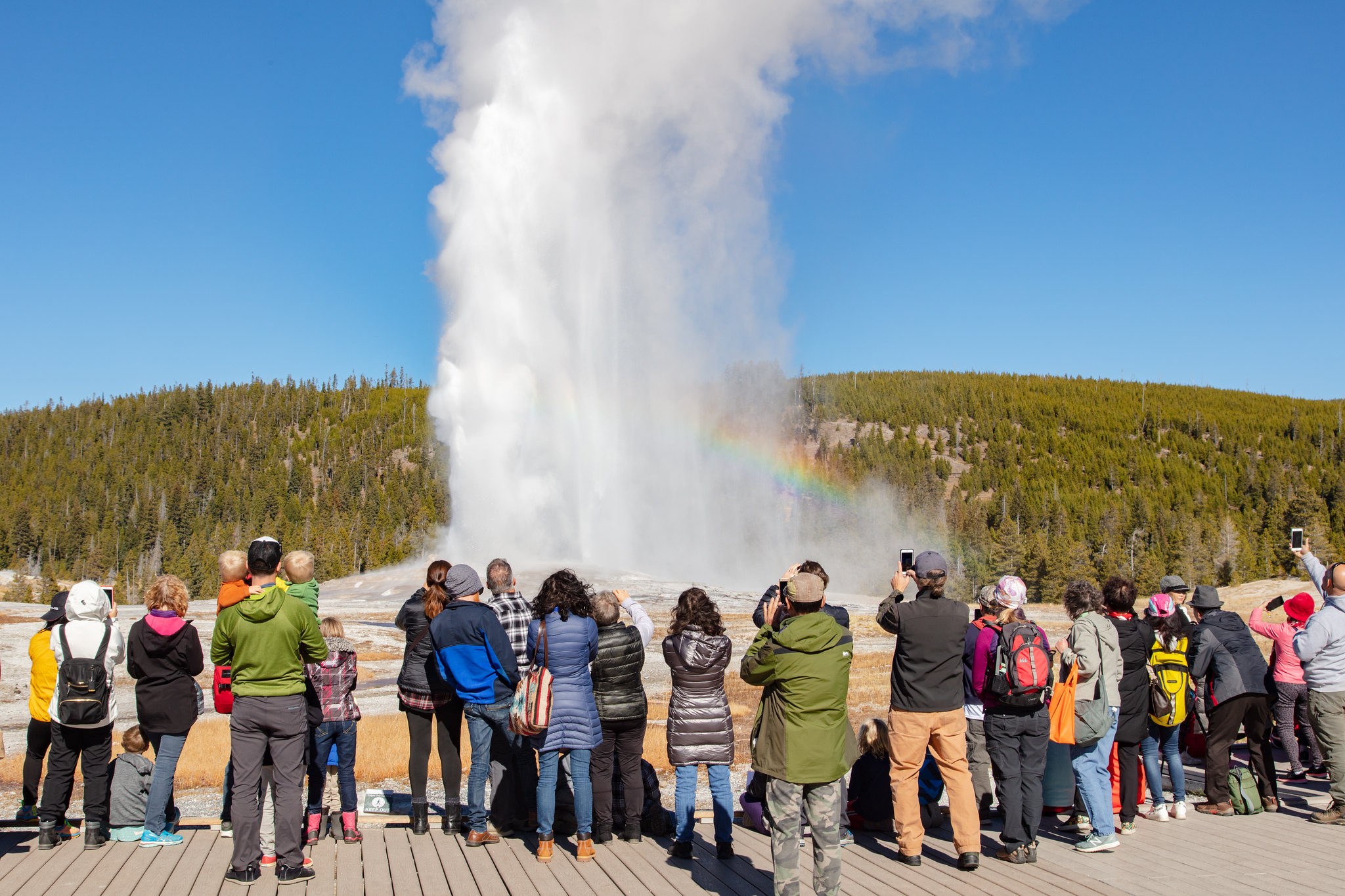
Beehive Geyser 457 words There are 2 sections in this description. Section 1 (154 words) You are now facing a wayside exhibit entitled “Beehive Geyser.” A large color photo on the exhibit’s left side shows a sky-high tower of water and mist erupting from this relatively small cone geyser. Also pictured is a colorful rainbow arcing upward and across the mist from the ground beside the geyser. Text below the title tells us: “This geyser, named for its 4-foot high cone, resembles an old fashioned beehive. Though its cone is modest by comparison to others in the Upper Geyser Basin, Beehive is one of the most powerful and impressive geysers in Yellowstone. The cone acts as a nozzle, directing a column of steam and water to heights of 200 feet.” Two “Fast Facts” highlighted with bullet points tell us more: “Typically, Beehive's activity is not predictable, but when eruptions cycles start, intervals between eruptions can range from 10 hours to 5 days. “An average eruption lasts approximately 5 minutes.” Section 2 (285 words) On the exhibit’s right side is a color drawing showing a cross-section of the feature’s underground structure. Text accompanied by an arrow pointing to the geyser’s narrow vent reads: “Water cools near the vent's surface. This cooler water "caps" the hotter water below. Eventually, superheated water (water heated above the boiling point by pressure) flashes to steam, expanding and lifting the water above the vent in an eruption.” Another arrow points to the wide cone layer, or sinter, on one side of the vent. Text tells us: “Silica is dissolved from volcanic rock (rhyolite) and precipitates as sinter, which forms the geyser cone.” To the left of the cone, the label “Beehive's indicator” indicates a thin blue line, or water channel, leading from the Earth’s surface deep into the ground alongside the base of the geyser. More text reads: “Side channels often release pressure within thermal systems. At times, they function as indicators of when a primary feature may erupt. Usually, Beehive's side channel is a reliable indicator that the geyser will erupt.” Text accompanying another arrow pointing to the vent’s thinnest point, several feet below the ground, reads: “Sinter is deposited on the walls and acts like a throttle in the vent by constricting water circulation and allowing pressure to build up.” Other labels include, from the bottom of the vent and moving upward, “Recharge of superheated (above boiling) water;” “Superheated water;” and “High pressure area caused by expanding water and steam.” A caption at the bottom of the drawing tells us: “Geysers are hot springs that erupt periodically. In Yellowstone National Park, all of the ingredients needed for geyser activity are present: heat, water, and underground rock hard enough to withstand intense pressures.” END OF MESSAGE
This more remote trailhead can be access by car and provides access to the following trail. The trailhead is at a steep pullout on the north side of the road at the east end of the reservoir.- Beula Lake Trail Beula Lake Trail This is a 5.2-mile (-km) there-and-back trail with a gentle climb at the start of the trail. Beula Lake covers about 107 acres (43 ha) and supports a population of Yellowstone cutthroat trout. If you are looking to fish here, remember to pick up a Yell
This trailhead is located at the small picnic area/winter warming hut just after thr turn-off from the Grand Loop Road. This trailhead provides access to these trails:- Bighorn Pass Trail- Bighorn Loop Ski Trail- Indian Creek Loop Ski Trail- Sheepeater Ski TrailParking is available near the vault toilets. Winter access is available via a snowcoach ride from the Mammoth Hot Springs Hotel. Bighorn Pass Trail A strenuous 19.4-mile (31.2 km) one-way trail with lot of open meadows
A trailhead sign stands at the start of the trail. It reads: Backcountry Regulations. Permit required for fishing, boating, riding, and overnight camping. More information at the Center Backcountry Office: 307-344-2160. Hiking. Hike in groups of 3 or more; keep your group together. Tell someone where you are going and when you expect to return. Know your route, carry a map, and be able to navigate. Do not hike after dark. Stay on established trails; off-trail travel prohibited in thermal areas. Fishing and Boating. Aquatic Invasive Species (AIS) inspection required for all watercraft including boats, float tubes, and stand up paddle boards. Felt soles prohibited. Riding and Packing. Proof of negative Coggins test within last 12 months required. Food Storage and Camping. These regulations apply to ALL backcountry users. Sleep 100 yards (91 m) from your food storage and cooking areas. Do not leave food, trash, toiletries, backpacks, coolers, water bottles, or any potential attractant unattended. Store food in an approved bear resistant container or hang on a food pole 10 feet (3 m) above the ground and 4 feet (1 m) from sides. Carry a minimum of 35 feet (11 m) of rope. Campfires allowed only in designated campsites within established fire rings. Extinguish campfires completely before leaving site. Follow LEAVE NO TRACE travel and camping techniques. Enjoy the backcountry and help keep it clean for others to enjoy. Bury human waste and toilet tissue in a 6–8 inch (15–18 cm) deep “cat hole” at least 100 feet (30 m) from water and trails. River Crossings. Park waters are swift and cold. Swimming in park rivers is not recommended. River crossings are hazardous. Lightning Safety. During thunderstorms, descend to lower elevation, avoid open areas and isolated tall trees. Assume lightning position: feet together, crouch on foam pad or sit on pack, hands over ears. Regulations. Leave What You Find: Do not collect anything from the park. No Pets: No pets on trail. Obtain service animal regulations at backcountry offices. No Hunting: No hunting or discharge of firearms. No Motorized Vehicles: No motorized vehicles on trails. Wheeled Vehicles Restricted: No bicycles, strollers, or wheeled vehicles (except wheelchairs), except where specified. In an emergency, dial 9-1-1 or contact the nearest ranger station. Animals are Dangerous. Do not approach or feed any animal. Bison and elk have injured people. Stay 100 yards (91 m) from bears and wolves. Stay 25 yards (23 m) from all other animals. Be Prepared for a Bear Encounter. Grizzly and black bears inhabit all of Yellowstone National Park. Be Alert. Watch for signs of bear activity: scratches in trees, tracks, scat, or dig sites. Avoid dead animals. Make Noise. Avoid surprising a bear by calling out and clapping your hands at regular intervals to make your presence known. Carry Bear Spray. Carry bear spray and know how to use it. Keep it immediately available, not inside your pack. Hike in Groups. Travel in groups of 3 or more is recommended. Stay with your group at all times. What to do if you encounter a bear. Stay calm, do not run. Quietly detour or back away; stop if this seems to agitate the bear. Stay at least 100 yards (91 m) from bears. Do NOT feed bears or other animals. What to do if a bear charges you. Stand still, do not run. Stand your ground and use your bear spray. Spray when the bear is 60 feet (18 m) away or closer. If a bear charges, it may be a bluff charge. What to do if a bear makes contact. Drop to the ground; play dead. Lie face down and clasp your hands over the back of your neck; stay still and silent. Wait several minutes after the bear leaves before getting up and leaving the area.
The Bighorn Pass trailhead is on the northwest side of Yellowstone near U.S. Highway 191. From this trailhead, you can embark on the following trail:- Bighorn Pass Trail Bighorn Pass Trail This trail can either be a there and back 21.2-mile (35 km) strenuous hike to the top of Bighorn Pass or a 19-mile (30 km) through hike ending at a different trailhead south of Mammoth Hot Springs. (Either plan on leaving a vehicle at one end or arrange a shuttle back to the trailhead.) Th
A trailhead sign stands at the start of the trail. It reads: Backcountry Regulations. Permit required for fishing, boating, riding, and overnight camping. More information at the Center Backcountry Office: 307-344-2160. Hiking. Hike in groups of 3 or more; keep your group together. Tell someone where you are going and when you expect to return. Know your route, carry a map, and be able to navigate. Do not hike after dark. Stay on established trails; off-trail travel prohibited in thermal areas. Fishing and Boating. Aquatic Invasive Species (AIS) inspection required for all watercraft including boats, float tubes, and stand up paddle boards. Felt soles prohibited. Riding and Packing. Proof of negative Coggins test within last 12 months required. Food Storage and Camping. These regulations apply to ALL backcountry users. Sleep 100 yards (91 m) from your food storage and cooking areas. Do not leave food, trash, toiletries, backpacks, coolers, water bottles, or any potential attractant unattended. Store food in an approved bear resistant container or hang on a food pole 10 feet (3 m) above the ground and 4 feet (1 m) from sides. Carry a minimum of 35 feet (11 m) of rope. Campfires allowed only in designated campsites within established fire rings. Extinguish campfires completely before leaving site. Follow LEAVE NO TRACE travel and camping techniques. Enjoy the backcountry and help keep it clean for others to enjoy. Bury human waste and toilet tissue in a 6–8 inch (15–18 cm) deep “cat hole” at least 100 feet (30 m) from water and trails. River Crossings. Park waters are swift and cold. Swimming in park rivers is not recommended. River crossings are hazardous. Lightning Safety. During thunderstorms, descend to lower elevation, avoid open areas and isolated tall trees. Assume lightning position: feet together, crouch on foam pad or sit on pack, hands over ears. Regulations. Leave What You Find: Do not collect anything from the park. No Pets: No pets on trail. Obtain service animal regulations at backcountry offices. No Hunting: No hunting or discharge of firearms. No Motorized Vehicles: No motorized vehicles on trails. Wheeled Vehicles Restricted: No bicycles, strollers, or wheeled vehicles (except wheelchairs), except where specified. In an emergency, dial 9-1-1 or contact the nearest ranger station. Animals are Dangerous. Do not approach or feed any animal. Bison and elk have injured people. Stay 100 yards (91 m) from bears and wolves. Stay 25 yards (23 m) from all other animals. Be Prepared for a Bear Encounter. Grizzly and black bears inhabit all of Yellowstone National Park. Be Alert. Watch for signs of bear activity: scratches in trees, tracks, scat, or dig sites. Avoid dead animals. Make Noise. Avoid surprising a bear by calling out and clapping your hands at regular intervals to make your presence known. Carry Bear Spray. Carry bear spray and know how to use it. Keep it immediately available, not inside your pack. Hike in Groups. Travel in groups of 3 or more is recommended. Stay with your group at all times. What to do if you encounter a bear. Stay calm, do not run. Quietly detour or back away; stop if this seems to agitate the bear. Stay at least 100 yards (91 m) from bears. Do NOT feed bears or other animals. What to do if a bear charges you. Stand still, do not run. Stand your ground and use your bear spray. Spray when the bear is 60 feet (18 m) away or closer. If a bear charges, it may be a bluff charge. What to do if a bear makes contact. Drop to the ground; play dead. Lie face down and clasp your hands over the back of your neck; stay still and silent. Wait several minutes after the bear leaves before getting up and leaving the area.
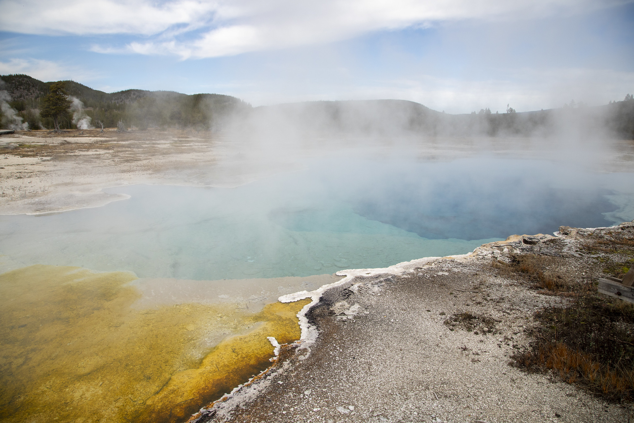
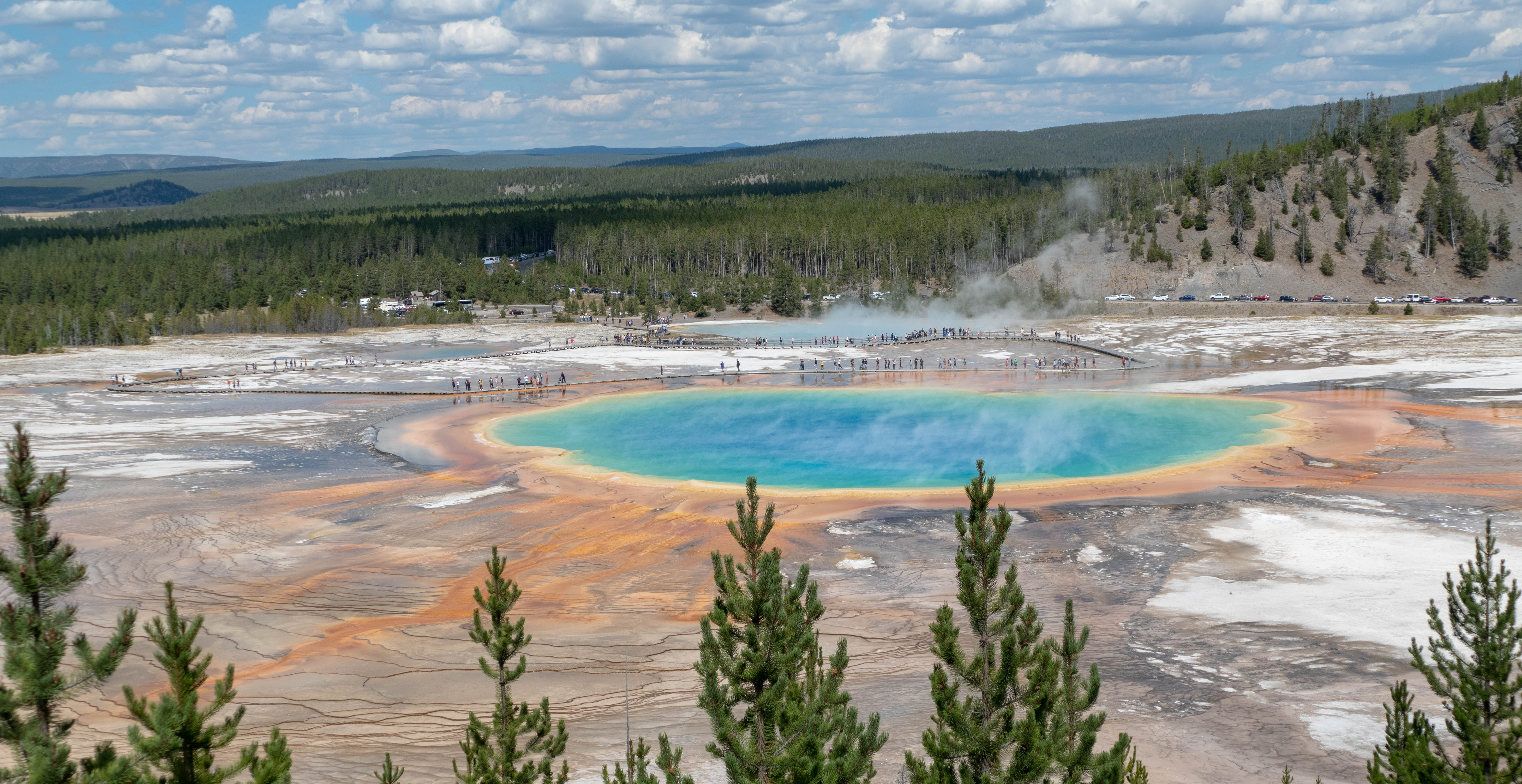
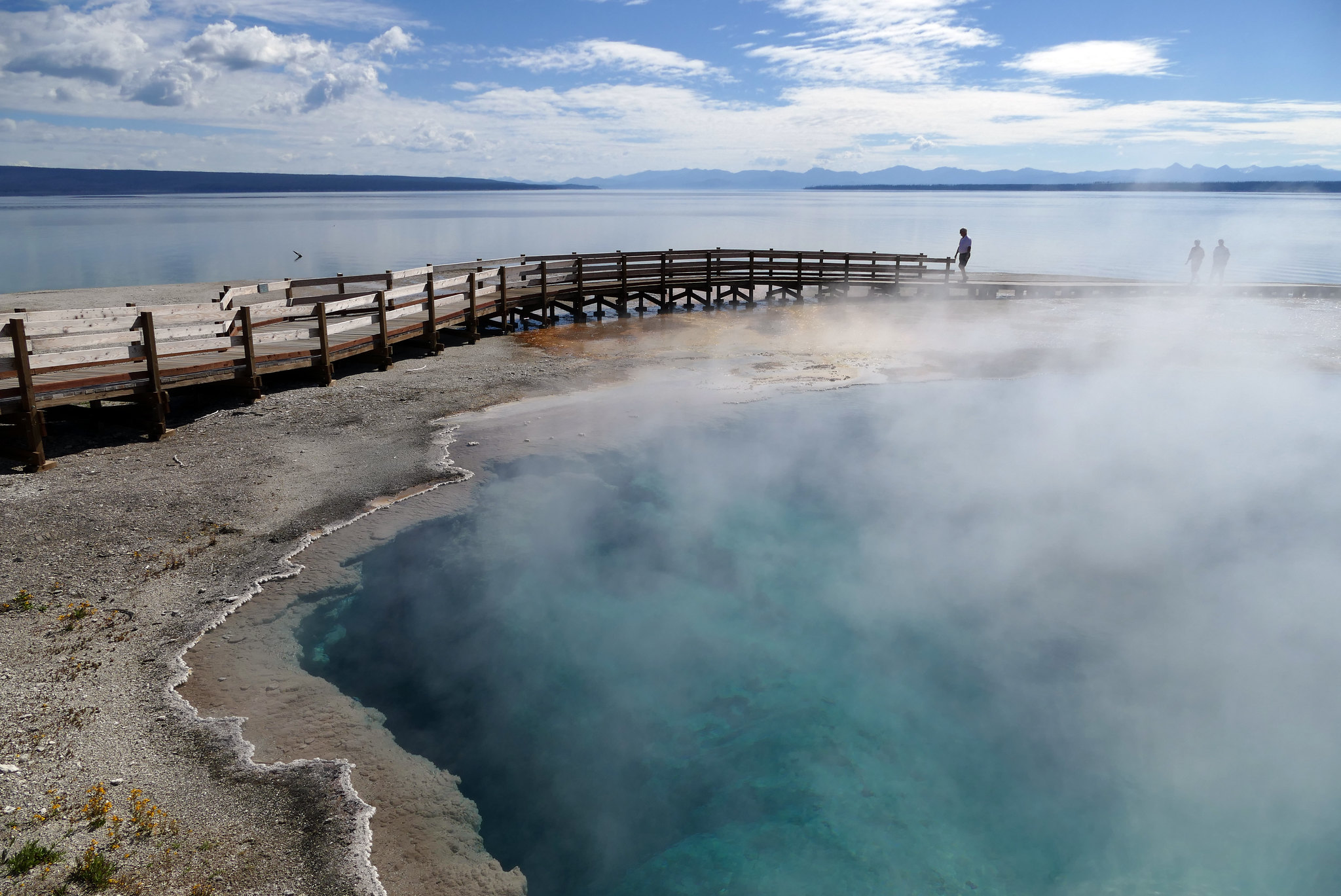
Biscuit Basin and Sapphire Pool 816 words There are 3 sections in this description. Section 1 (177 words) Biscuit Basin is part of Upper Geyser Basin and is located 3 miles north of Old Faithful. Here you will find several gem-colored hydrothermal features including Jewel Geyser, named for the shiny deep-blue sinter beads surrounding its vent; Rusty Geyser, named for the orange-red basin surrounding its funnel-shaped vent; Shell Spring, with its the pale gold crater; and the deep yellow Mustard Spring. Sapphire Pool, so named for its luminous deep blue water, is also located here. There is a 1/4-mile boardwalk trail that loops around Biscuit Basin. To get to the start of the loop, you must first cross a wood footbridge spanning the Firehole River. The bridge has railings on both sides; portions of the boardwalk itself have either no railings or a railing on one side only. There is also a bench on the side opposite the railing. Small signs remind us that it is “unlawful to throw objects into pools” and that the walkway--with a total distance of ½ miles--is open to foot traffic only. Bicycles and pets are not allowed. Section 2 (438 words) There are two wayside exhibits beside the paved trail leading from the main road to the bridge. The first wayside’s title--“Biscuit Basin”--is located below a large map filling the panel’s top third. Text below the title reads: “This thermal basin is particularly volatile, unpredictable. On August 17, 1959, an earthquake recorded at 7.5 on the Richter scale had its epicenter just a few miles to the northwest. “Four days later, Sapphire Pool began to erupt violently, blowing away the large rock biscuits around the crater. Biscuit Basin was named for those biscuit-shaped mineral formations.” To the right of this text is a color photo showing several thin, branchless trees dotting the barren landscape that surrounds a meandering stream of blue water. The trunks of the mostly gray trees are white at their base, as is the ground around them. A caption to the left of the photo tells us: “Other transformations occur here in slow motion. As you walk the 1/4 mile loop, notice how the shifting runoff pattern kills forests, creating "bobbysox" trunks saturated with silica.” The map above this text shows several winding trails, which are represented by dashed black lines. A white arrow labeled “You are Here” on the map’s far right side indicates your location at the entrance to the foot bridge crossing the Firehole River, which is represented by a blue line running north to south. Also on the map’s right side is a black line representing the road leading to Madison Junction to the north and Old Faithful to the south; this road crosses the Firehole River south of Biscuit Basin. Biscuit Basin trail loop is located west of the river and is part of the dashed line marked “Summit Lake Trail.” This trail continues west then veers southwest before ending on the panel’s left edge. Just above the map’s center, the Summit Lake Trail joins another trail loop--significantly larger and wider than the small Biscuit Basin loop--which winds to the north and west before looping back south and east. The top leg of this loop is labeled “Fairy Creek Trail.” Toward the top of the map, there is a scenic overlook located on Fairy Creek Trail. A thinner blue line labeled “Little Firehole River” runs from west to east across the map before ending at Firehole River. “Mystic Falls” is located on Little Firehole River toward the bottom of the larger trail loop. A notation at the bottom of the map reads: “From the boardwalk loop, longer trails climb out of Biscuit Basin and explore other features: Mystic Falls, Observation Point, Summit Lake, and Fairy Creek Trail.” Section 3 (179 words) The second wayside exhibit is entitled “Dangerous Ground.” At the bottom of the panel there is a black-and-white drawing of a boy--a camera strap slung over one shoulder--who is falling into a hot spring to the right of the boardwalk. Clouds of white steam rise around his sneaker-clad feet, and his ball cap appears to float above his head. Text at the top of the exhibit warns us: “In thermal areas the ground may be only a thin crust above boiling hot springs or scalding mud. There is no way to guess a safe path: new hazards can bubble up overnight, and some pools are acidic enough to burn through boots. More than a dozen people have been scalded to death and hundreds badly burned and scarred. “Leaving the boardwalk or trail, or taking pets beyond this point, is unlawful and potentially fatal. “Throwing objects into thermal features, collecting specimens, or defacing formations destroys what nature took centuries to build. Violators will be prosecuted.” The wayside exhibit text also appears below in French, German, Spanish, and Japanese. END OF MESSAGE
The Black Butte trailhead is on the northwest side of Yellowstone near US Highway 191. From this trailhead, you can embark on the following trail:- Black Butte Trail Black Butte Trail This is a strenuous 11.4-miles (18.3 km) there-and-back trail that climbs 3,100 feet (945 m) to the Sky Rim Trail and near Big Horn Peak. CAUTION: Grizzly bears frequent this area. Backcountry RegulationsPermit required for fishing, boating, riding, and overnight camping. More information at t
A trailhead sign stands at the start of the trail. It reads: Backcountry Regulations. Permit required for fishing, boating, riding, and overnight camping. More information at the Center Backcountry Office: 307-344-2160. Hiking. Hike in groups of 3 or more; keep your group together. Tell someone where you are going and when you expect to return. Know your route, carry a map, and be able to navigate. Do not hike after dark. Stay on established trails; off-trail travel prohibited in thermal areas. Fishing and Boating. Aquatic Invasive Species (AIS) inspection required for all watercraft including boats, float tubes, and stand up paddle boards. Felt soles prohibited. Riding and Packing. Proof of negative Coggins test within last 12 months required. Food Storage and Camping. These regulations apply to ALL backcountry users. Sleep 100 yards (91 m) from your food storage and cooking areas. Do not leave food, trash, toiletries, backpacks, coolers, water bottles, or any potential attractant unattended. Store food in an approved bear resistant container or hang on a food pole 10 feet (3 m) above the ground and 4 feet (1 m) from sides. Carry a minimum of 35 feet (11 m) of rope. Campfires allowed only in designated campsites within established fire rings. Extinguish campfires completely before leaving site. Follow LEAVE NO TRACE travel and camping techniques. Enjoy the backcountry and help keep it clean for others to enjoy. Bury human waste and toilet tissue in a 6–8 inch (15–18 cm) deep “cat hole” at least 100 feet (30 m) from water and trails. River Crossings. Park waters are swift and cold. Swimming in park rivers is not recommended. River crossings are hazardous. Lightning Safety. During thunderstorms, descend to lower elevation, avoid open areas and isolated tall trees. Assume lightning position: feet together, crouch on foam pad or sit on pack, hands over ears. Regulations. Leave What You Find: Do not collect anything from the park. No Pets: No pets on trail. Obtain service animal regulations at backcountry offices. No Hunting: No hunting or discharge of firearms. No Motorized Vehicles: No motorized vehicles on trails. Wheeled Vehicles Restricted: No bicycles, strollers, or wheeled vehicles (except wheelchairs), except where specified. In an emergency, dial 9-1-1 or contact the nearest ranger station. Animals are Dangerous. Do not approach or feed any animal. Bison and elk have injured people. Stay 100 yards (91 m) from bears and wolves. Stay 25 yards (23 m) from all other animals. Be Prepared for a Bear Encounter. Grizzly and black bears inhabit all of Yellowstone National Park. Be Alert. Watch for signs of bear activity: scratches in trees, tracks, scat, or dig sites. Avoid dead animals. Make Noise. Avoid surprising a bear by calling out and clapping your hands at regular intervals to make your presence known. Carry Bear Spray. Carry bear spray and know how to use it. Keep it immediately available, not inside your pack. Hike in Groups. Travel in groups of 3 or more is recommended. Stay with your group at all times. What to do if you encounter a bear. Stay calm, do not run. Quietly detour or back away; stop if this seems to agitate the bear. Stay at least 100 yards (91 m) from bears. Do NOT feed bears or other animals. What to do if a bear charges you. Stand still, do not run. Stand your ground and use your bear spray. Spray when the bear is 60 feet (18 m) away or closer. If a bear charges, it may be a bluff charge. What to do if a bear makes contact. Drop to the ground; play dead. Lie face down and clasp your hands over the back of your neck; stay still and silent. Wait several minutes after the bear leaves before getting up and leaving the area.
Black Diamond Pool is a hydrothermal feature at Biscuit Basin.
Black Diamond Pool is a large murky blue pool with water flowing into other pools nearby. Soft sinter and sparse vegetation surrounds the area of the pool. Outflow from the pool forms braided channels of orange and green thermophiles.
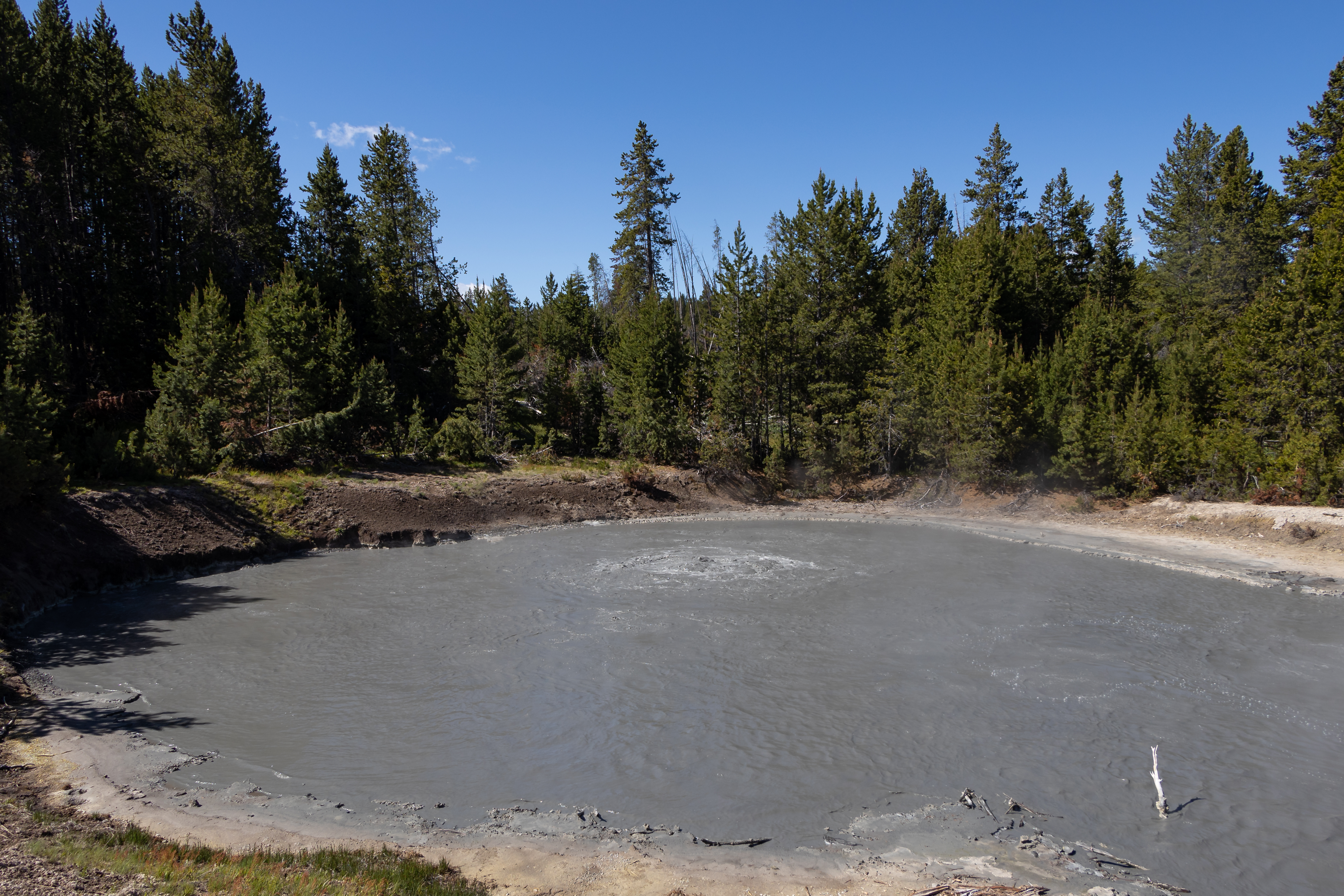
Black Dragon's Caldron<br />126 words<br />You are standing in front of a wayside exhibit overlooking a large oval mudpot. The wayside, entitled "Black Dragon's Caldron," is made entirely of wood and painted brown with text painted in white. Text below the title tells us:<br />"This mudpot roared into existence in 1948, blowing trees out by roots and forever changing this once quiet forested hillside. A park interpreter named the new feature for its resemblance to a darkly colored "demon of the backwoods." For several decades, it erupted in explosive 10- to 20-foot bursts of black mud. Over the years, it has moved 200 feet to the southeast and become relatively quiet. However as change is constant in Yellowstone, the black dragon may one day roar back to life."<br /><br />END OF MESSAGE
Black Opal Pool is a hydrothermal feature at Biscuit Basin.
Black Opal Pool is a large murky blue pool with water flowing into other pools nearby. Soft sinter and sparse vegetation surrounds the area of the pool. Edges of the pool have dark thermophile material and the outflow from the pool travels down a slight hill forms braided channels of orange and green thermophiles.
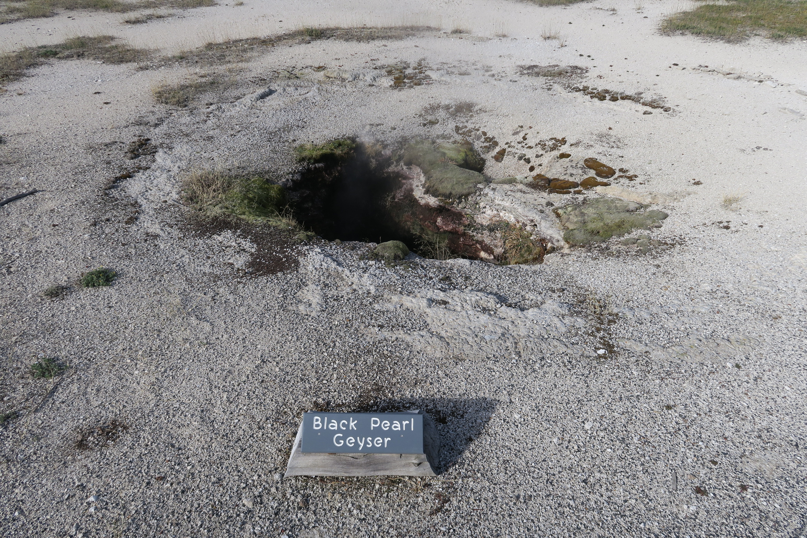
Black Pearl Geyser is a hydrothermal feature at Biscuit Basin.
While evidence for high water levels exist, Black Pearl Geyser appears to be a cavernous opening in the ground surface that is continuously steaming. Water inside the depression constantly boils. Moss-like vegetation surrounds the opening at the surface.
1 mile (1.6 km) walk to Black Sand Basin from Daisy Geyser or 1 mile (1.6 km) drive northwest of Old Faithful along the main road.Named for sand derived from black volcanic glass (obsidian), this basin features some of the most splendid hot springs in Yellowstone. Hydrothermal features here:- Emerald Pool- Rainbow Pool- Sunset Lake (actually a geyser, but its eruptions are infrequent and seldom noticed because of the heavy steam over the water)- Cliff Geyser, on the edge of I
Black Sand Basin 577 words There are 2 sections in this description. Section 1 (379 words) You are standing in front of a wayside exhibit entitled “Black Sand Basin,” which includes a large pictorial map of water features found in the surrounding area. Located toward the top of the map’s lower left quadrant, a yellow arrow labeled “You Are Here” indicates your position to the left of the short boardwalk that leads visitors through the site. Moving clockwise around the map from its bottom left corner--a paved road leading to a parking area located alongside the first two legs of the boardwalk; Cliff Geyser, located directly across from the parking lot; Emerald Pool, located toward the top of the map; Rainbow Pool, found to the right of Cliff Geyser; and blue Sunset Lake, located in the map’s lower right quadrant. Text below the map tells us: “Black obsidian (volcanic glass) "sand" gives this geyser basin its name. Oranges, greens, and other colors in and around the hot springs come from thermophiles (heat-loving microorganisms). While you walk the trail, watch for one of Cliff Geyser's frequent eruptions. The fully accessible trail is about 1/4 miles (0.4 kilometers) long.” A list of warnings and instructions highlighted with bullet points follows: “Leaving the boardwalk is dangerous and illegal. “Pets are not allowed. “Keep your children close to you at all times. “Do not smoke. “Do not bring food or beverages on the boardwalk.” Another list follows under the separate heading “Help preserve Yellowstone for the future:” “Features are fragile and some are thousands of years old. Do not touch. “Do not throw coins or other objects into any of the features. “Colorful mats contain millions of microorganisms--do not touch or otherwise disturb them.” Written in larger red letters at the bottom of the exhibit--“Stay on the Boardwalk.” To the right of this text is a smaller map with various features labeled in red. Starting at the map’s top left corner and moving clockwise down and across the map, these features include Mammoth Hot Springs, Tower-Roosevelt, Canyon Village, Fishing Bridge, Lake Village Bridge Bay, Grant Village, Old Faithful, Madison, and Norris. A yellow arrow located nearly a half of the way up on the map’s left side points to Midway Geyser Basin, located approximately equidistant from Madison to the north and Old Faithful to the south. Section 2 (180 words) A second wayside exhibit, entitled “Dangerous Ground,” stands to the right. At the bottom of the panel there is a black-and-white drawing of a boy--a camera strap slung over one shoulder--who is falling into a hot spring to the right of the boardwalk. Clouds of white steam rise around his sneaker-clad feet, and his ball cap appears to float above his head. Text at the top of the panel warns us: “In thermal areas the ground may be only a thin crust above boiling hot springs or scalding mud. There is no way to guess a safe path: new hazards can bubble up overnight, and some pools are acidic enough to burn through boots. More than a dozen people have been scalded to death and hundreds badly burned and scarred. “Leaving the boardwalk or trail, or taking pets beyond this point, is unlawful and potentially fatal. “Throwing objects into thermal features, collecting specimens, or defacing formations destroys what nature took centuries to build. Violators will be prosecuted.” The text also appears below in French, German, Spanish, and Japanese. END OF MESSAGE
Black Sand Pool is a large, blue pool sitting in a hillside depression with a narrow runoff channel that fans out once outside of the hillside tree line, forming braided channels of orange thermophiles.
This trailhead is located on the Grand Loop Road between Mammoth Hot Springs and Tower. From this trailhead, you can access the following trails:- Blacktail Deer Creek Trail- Blacktail Ponds Spur Trail- Rescue Creek Trail- Yellowstone River TrailParking at this trailhead can fill up quickly. There is additional parking nearby at the Blacktail Deer Creek Stock Trailhead. Blacktail Deer Creek Trail From the Blacktail Deer Creek trailhead it is moderate 11-mile (18-km) there-and
A trailhead sign stands at the start of the trail. It reads: Backcountry Regulations. Permit required for fishing, boating, riding, and overnight camping. More information at the Center Backcountry Office: 307-344-2160. Hiking. Hike in groups of 3 or more; keep your group together. Tell someone where you are going and when you expect to return. Know your route, carry a map, and be able to navigate. Do not hike after dark. Stay on established trails; off-trail travel prohibited in thermal areas. Fishing and Boating. Aquatic Invasive Species (AIS) inspection required for all watercraft including boats, float tubes, and stand up paddle boards. Felt soles prohibited. Riding and Packing. Proof of negative Coggins test within last 12 months required. Food Storage and Camping. These regulations apply to ALL backcountry users. Sleep 100 yards (91 m) from your food storage and cooking areas. Do not leave food, trash, toiletries, backpacks, coolers, water bottles, or any potential attractant unattended. Store food in an approved bear resistant container or hang on a food pole 10 feet (3 m) above the ground and 4 feet (1 m) from sides. Carry a minimum of 35 feet (11 m) of rope. Campfires allowed only in designated campsites within established fire rings. Extinguish campfires completely before leaving site. Follow LEAVE NO TRACE travel and camping techniques. Enjoy the backcountry and help keep it clean for others to enjoy. Bury human waste and toilet tissue in a 6–8 inch (15–18 cm) deep “cat hole” at least 100 feet (30 m) from water and trails. River Crossings. Park waters are swift and cold. Swimming in park rivers is not recommended. River crossings are hazardous. Lightning Safety. During thunderstorms, descend to lower elevation, avoid open areas and isolated tall trees. Assume lightning position: feet together, crouch on foam pad or sit on pack, hands over ears. Regulations. Leave What You Find: Do not collect anything from the park. No Pets: No pets on trail. Obtain service animal regulations at backcountry offices. No Hunting: No hunting or discharge of firearms. No Motorized Vehicles: No motorized vehicles on trails. Wheeled Vehicles Restricted: No bicycles, strollers, or wheeled vehicles (except wheelchairs), except where specified. In an emergency, dial 9-1-1 or contact the nearest ranger station. Animals are Dangerous. Do not approach or feed any animal. Bison and elk have injured people. Stay 100 yards (91 m) from bears and wolves. Stay 25 yards (23 m) from all other animals. Be Prepared for a Bear Encounter. Grizzly and black bears inhabit all of Yellowstone National Park. Be Alert. Watch for signs of bear activity: scratches in trees, tracks, scat, or dig sites. Avoid dead animals. Make Noise. Avoid surprising a bear by calling out and clapping your hands at regular intervals to make your presence known. Carry Bear Spray. Carry bear spray and know how to use it. Keep it immediately available, not inside your pack. Hike in Groups. Travel in groups of 3 or more is recommended. Stay with your group at all times. What to do if you encounter a bear. Stay calm, do not run. Quietly detour or back away; stop if this seems to agitate the bear. Stay at least 100 yards (91 m) from bears. Do NOT feed bears or other animals. What to do if a bear charges you. Stand still, do not run. Stand your ground and use your bear spray. Spray when the bear is 60 feet (18 m) away or closer. If a bear charges, it may be a bluff charge. What to do if a bear makes contact. Drop to the ground; play dead. Lie face down and clasp your hands over the back of your neck; stay still and silent. Wait several minutes after the bear leaves before getting up and leaving the area.
Blood Geyser has steady activity, perpetually spouting from a pool about 13x10 feet (4x3 m) in size. It is a distinct orange-red color with abundant sinter surrounding the pool. Grass grows around the perimeter. Blood Geyser is set in a hillside and has runoff channel to the north.
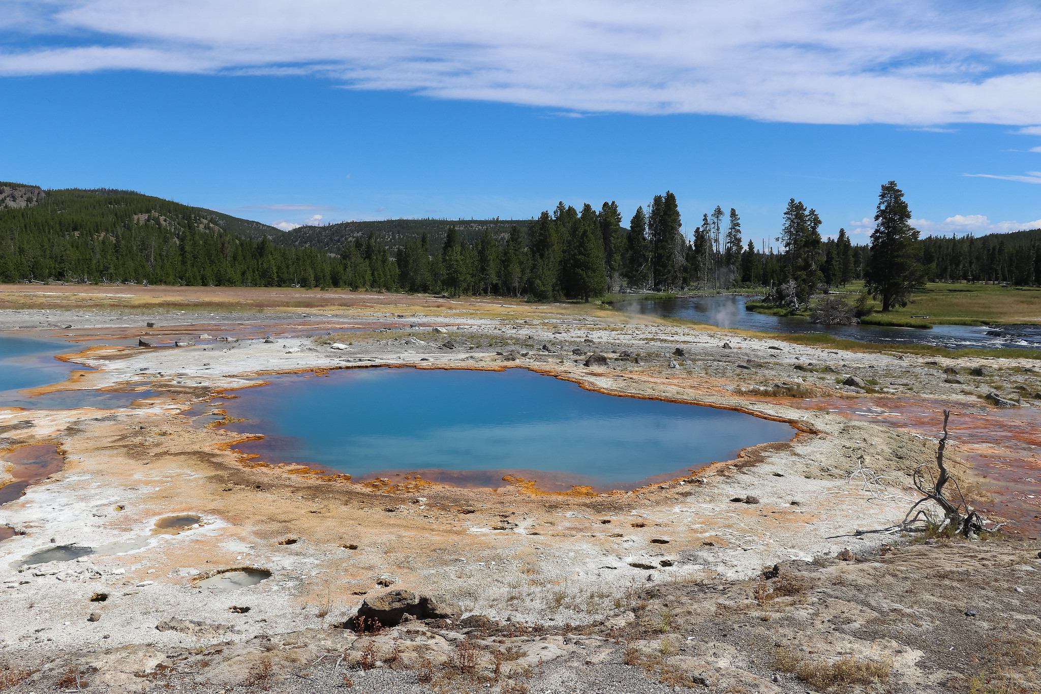
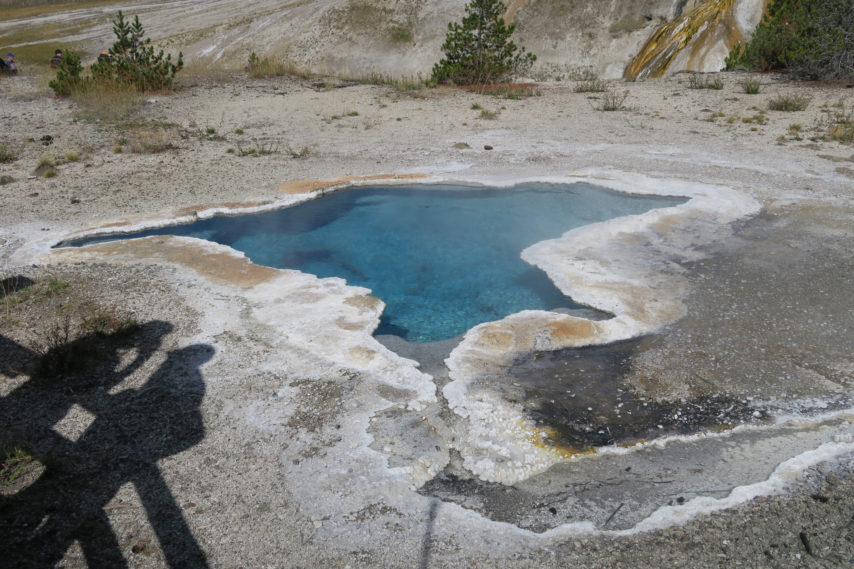
A clear, deep, blue hydrothermal pool in the Upper Geyser Basin
Blue Star Spring is a clear, deep, blue pool surrounded by a rim of solidified sinter that forms a shape that slightly resembles a star shape with linear 'arms' extending from the center of the pool.
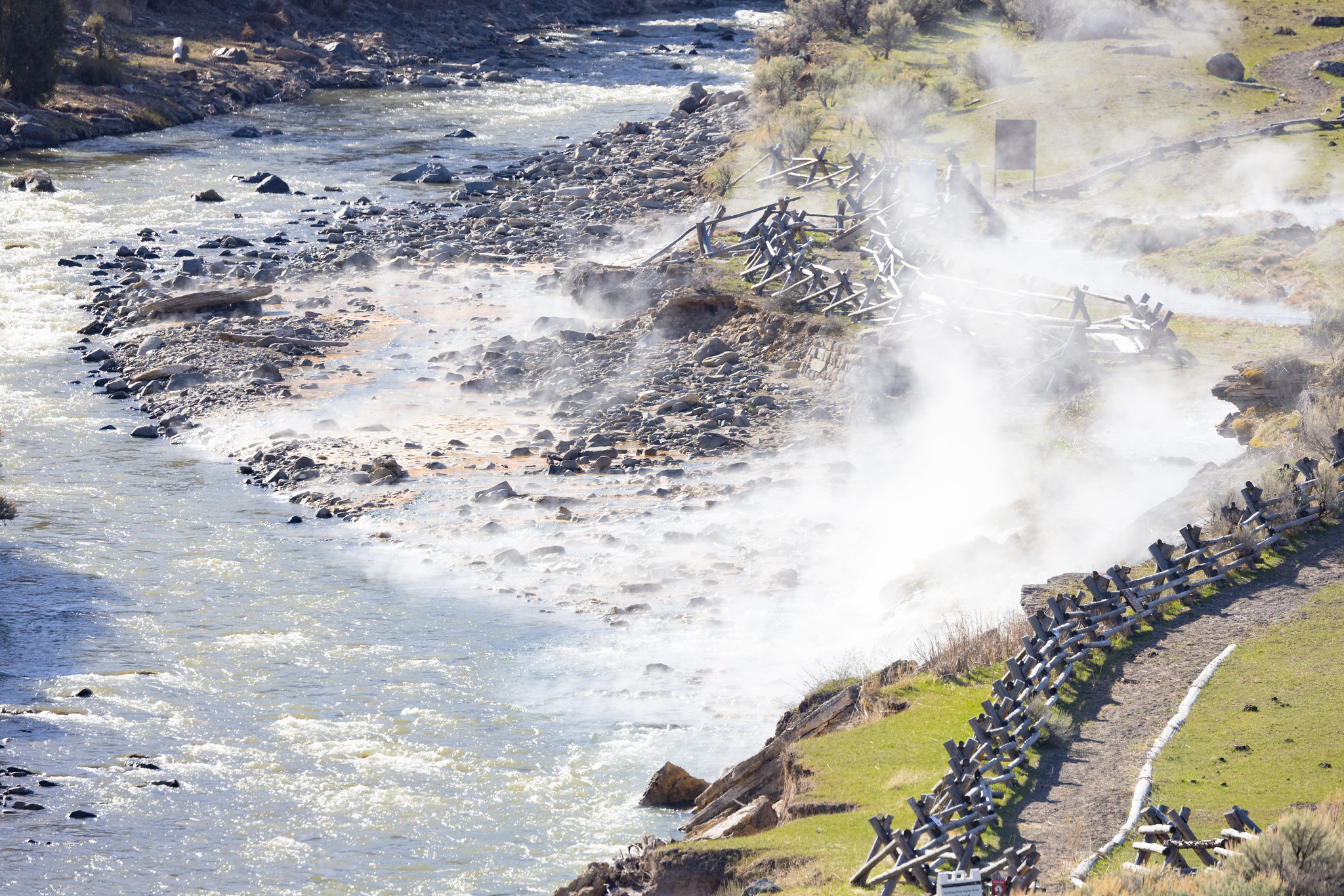
Boiling River<br />821 words<br /><br />There are 3 sections in this description.<br /> <br />Section 1 (368 words)<br />At the edge of a gravel parking lot, just beyond the wheelchair accessible parking bordered by a rough curb of protruding rocks and a signpost indicating no parking after 9 am and no camping, is a wayside exhibit kiosk. The heavy, round log posts of the sturdy kiosk are bound together by heavy metal straps. It is shaded by a gable roof.<br /><br />On the left side of the exhibit, the title "Boiling River" is painted in large white letters on the wood above a panel entitled "Boiling River Trail: Endangered Stream." Text below the title reads:<br />"This stretch of river runs warmer than most mountain streams. A half mile up the trail, underground discharge from Mammoth Hot Springs enters the current and creates a year-round climate for water birds, trout, and aquatic plants. Over the years, delicate travertine terraces have formed along the thermal channel.<br />"With as many as 200 visitors a day, Boiling River is threatened by popularity. Trail traffic has collapsed several terraces; soap has polluted the water and killed fish and grasses. Little can grow in the heavily-compacted ground.<br />"Regulations are designed to prevent further degradation of the area while allowing use. The trail is open dawn to dusk with the following regulations: no bicycles or other wheeled vehicles except wheelchairs are allowed; no pets; no food or drink; no camping; no nudity; no soap, including biodegradable. The thermal runoff channel is always closed to swimming or wading."<br />Below this text is a color photo of water tumbling over a series of terraces, or flat expanses, resembling wide stone steps. Also on the panel's right side is a map drawing with a blue line representing "Gardner River" running from top to bottom, or north to south. A dotted black line representing the "Boiling River Trail" runs alongside the right side of Gardner River starting at the bottom of the map until the map's center, where another trail branches off to follow "Boiling River" to the west and Dude Hill and Mammoth Campground to the northeast.<br />A black dot labeled "You Are Here" indicates your position near the beginning of the trail, just south of one of two parking areas at the bottom of the map.<br />Section 2 (130 words)<br />Note that a wood panel on the exhibit's right side provides the hours for water use and may also include laminated sheets listing various safety warnings. <br />A map of the Gardiner River shows the boiling river swim area with thermal channel closure and notes, "Swimming, wading, bathing, soaking or in any way entering objects in the Boiling River Thermal Channel prior to its confluence with the Gardner River is prohibited. 36 CFR Section 1.5 (a)(2)."<br />More text painted in large white letters on the panel reads:<br />"Regulations Prohibit:<br />"Food and Beverages<br />"Indecent Exposure<br />"Entering Boiling River<br />"Defacing Thermal Features<br />"Walking Off-Trail."<br />At the bottom of the panel, three icons with diagonal red lines running through them indicate that camping, pets, and bicycles are not allowed in this area.<br />Section 3 (214 words)<br />On the opposite side of the exhibit is another panel entitled "Perpetual Summer." A large color painting depicts three trout swimming around grass-like plants growing among the rocks and pebbles covering a riverbed. The fish are mostly tan with white bellies; white-ringed black speckles dot their upper bodies, fins, and heads. One fish is about to eat an insect. Text below the title reads:<br /> <br />"Ignore the calendar: this stretch of river creates its own season. In subzero weather summer-green grasses sway in the current, algae colonize pebbles, and waterfowl sometimes appear at the riverbend.<br /> <br />"The source is geothermal. Discharge from Mammoth Hot Springs percolates underground and enters the Gardner River upstream. In the tropical microclimate of plants and algae, insects feast and swarm near the surface, attracting ducks and dippers. Brown trout spawn here in December.<br /> <br />"Along rivers throughout the park, look for breaks in winter's pattern-islands of life in the ice-locked stillness."<br /> <br />In the panel's top right corner is a small color photo of a white and pale gray bird standing in shallow water. A caption below the photo reads:<br /> <br />"Here the dipper, or water ouzel, can been seen year-round. Dippers depend on open water: they feed on larvae and small fish by walking upstream underwater, using their wings for stability. Stay quiet and still, and dippers will remain nearby."<br /><br />Above this panel is a routed wood plaque acknowledging the Yellowstone Park Foundation for restoring the Boiling River trail in memory of Claire Elizabeth Suh, 2002.<br /><br />On the right side of this exhibit, another routed wooden sign says, "Swim only in Gardner River. Beware of river currents, they can be strong. In case of emergency, dial 9-1-1." <br /><br />Below this are the same three icons with diagonal red lines running through them indicating that camping, pets, and bicycles are not allowed in this area.<br /><br />END OF MESSAGE<br />...
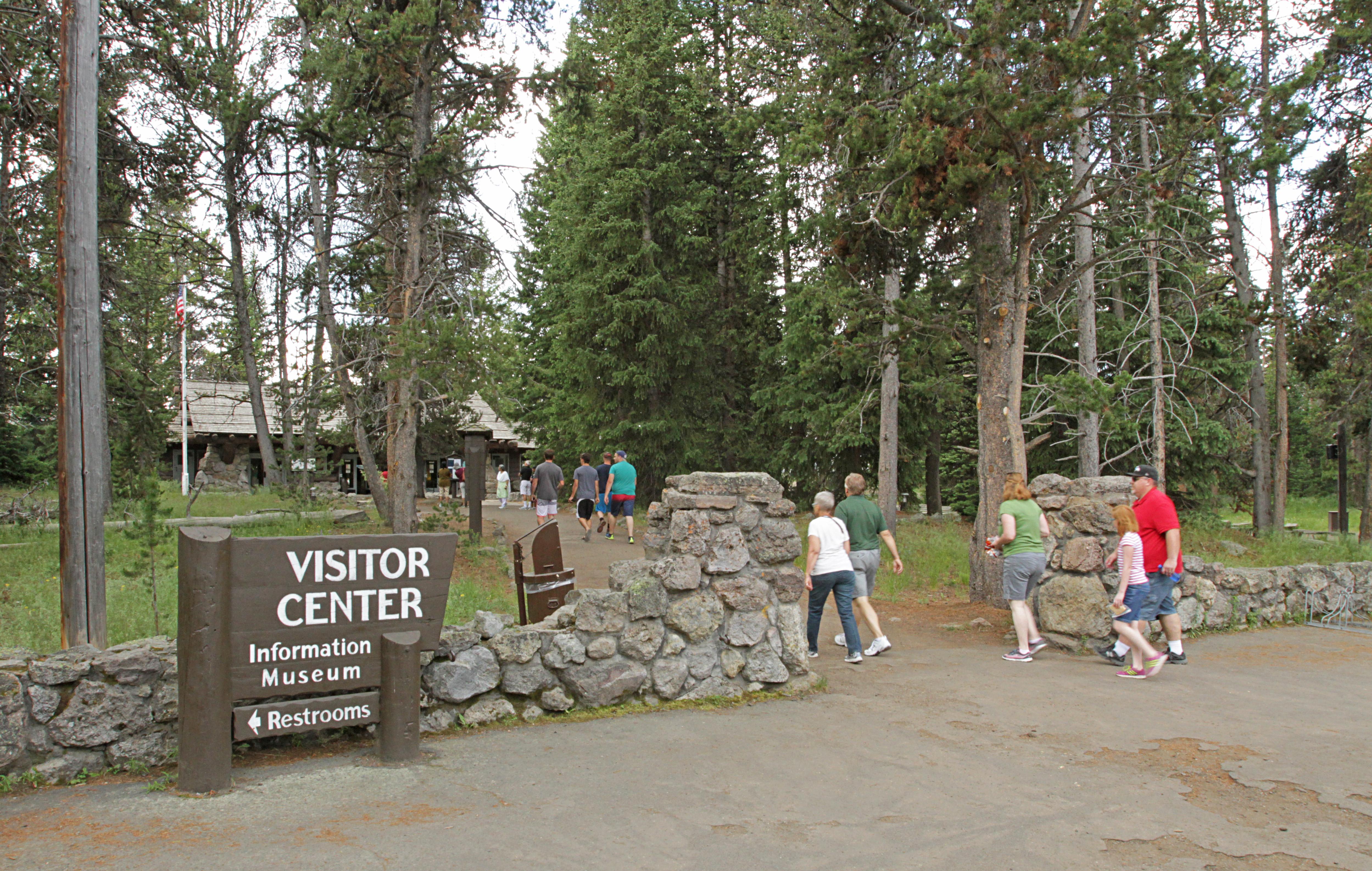
Here you can gather park information, orient yourself to the rest of the park (including road conditions, and campground and lodge availability), shop for souvenirs, explore exhibits to learn more about the wildlife and history of Yellowstone, join a ranger program, pick up a fishing permit (fees are payable by debit or credit card), or use the restrooms. This visitor center also has free Wi-Fi.
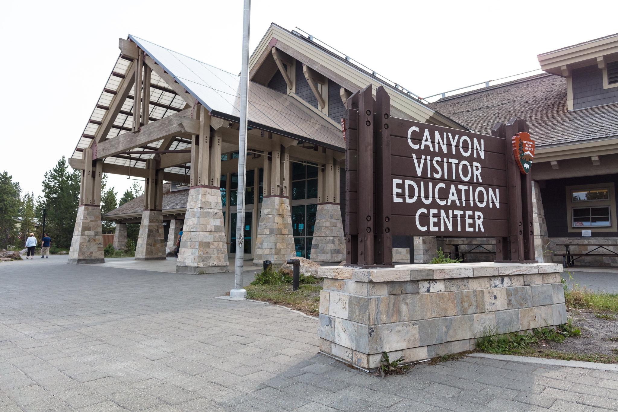
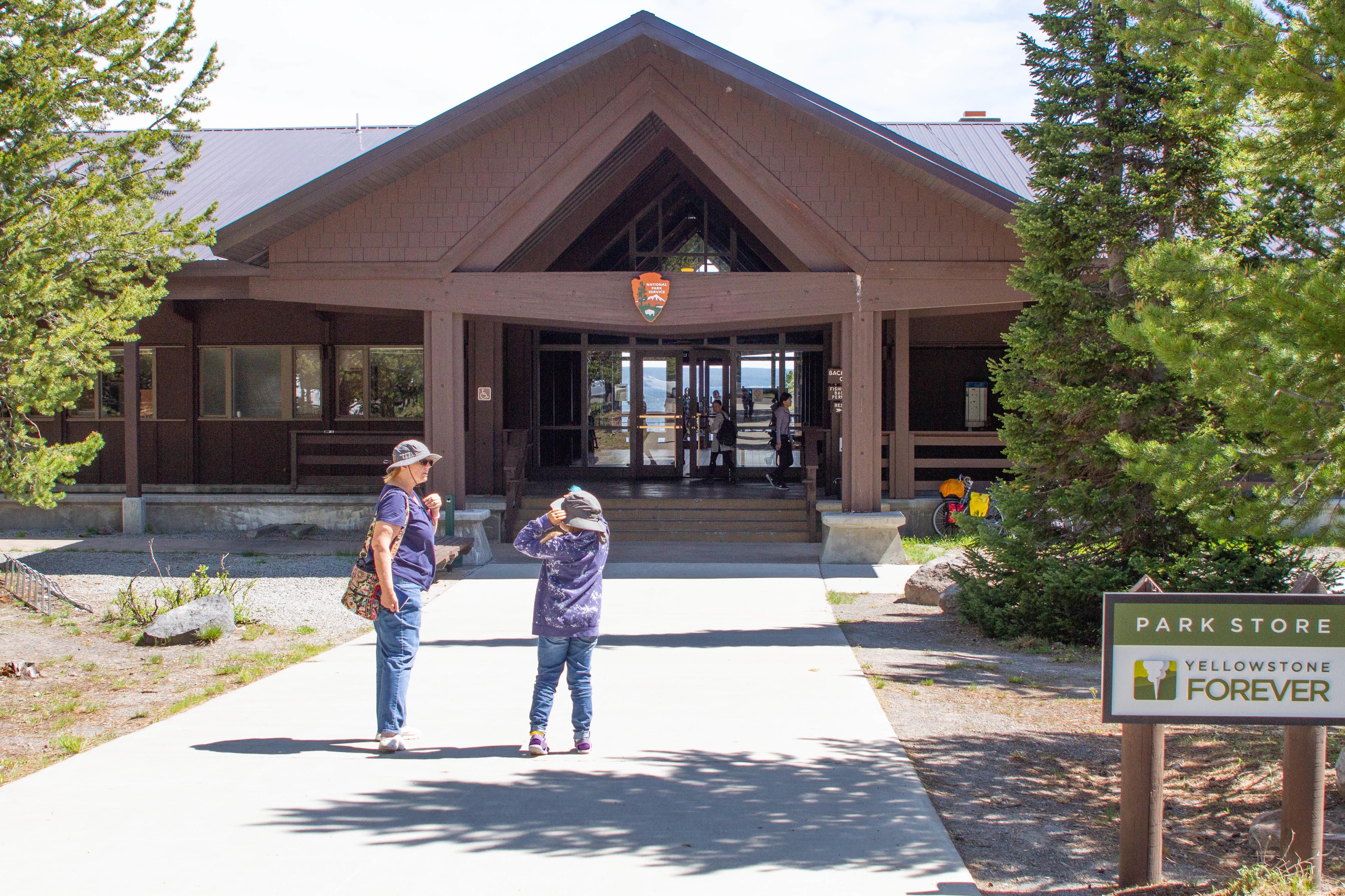
Stop by the Canyon Visitor Education Center to learn more about the geologic story of the area, including the Yellowstone volcano, and view a room-size relief map of Yellowstone. You can also get orientation information, pick up a fishing permit (fees are payable by debit or credit card), shop for a souvenir, find out what ranger programs are available, watch a 20-minute film, or use the restrooms. Restrooms are available 24 hours a day.
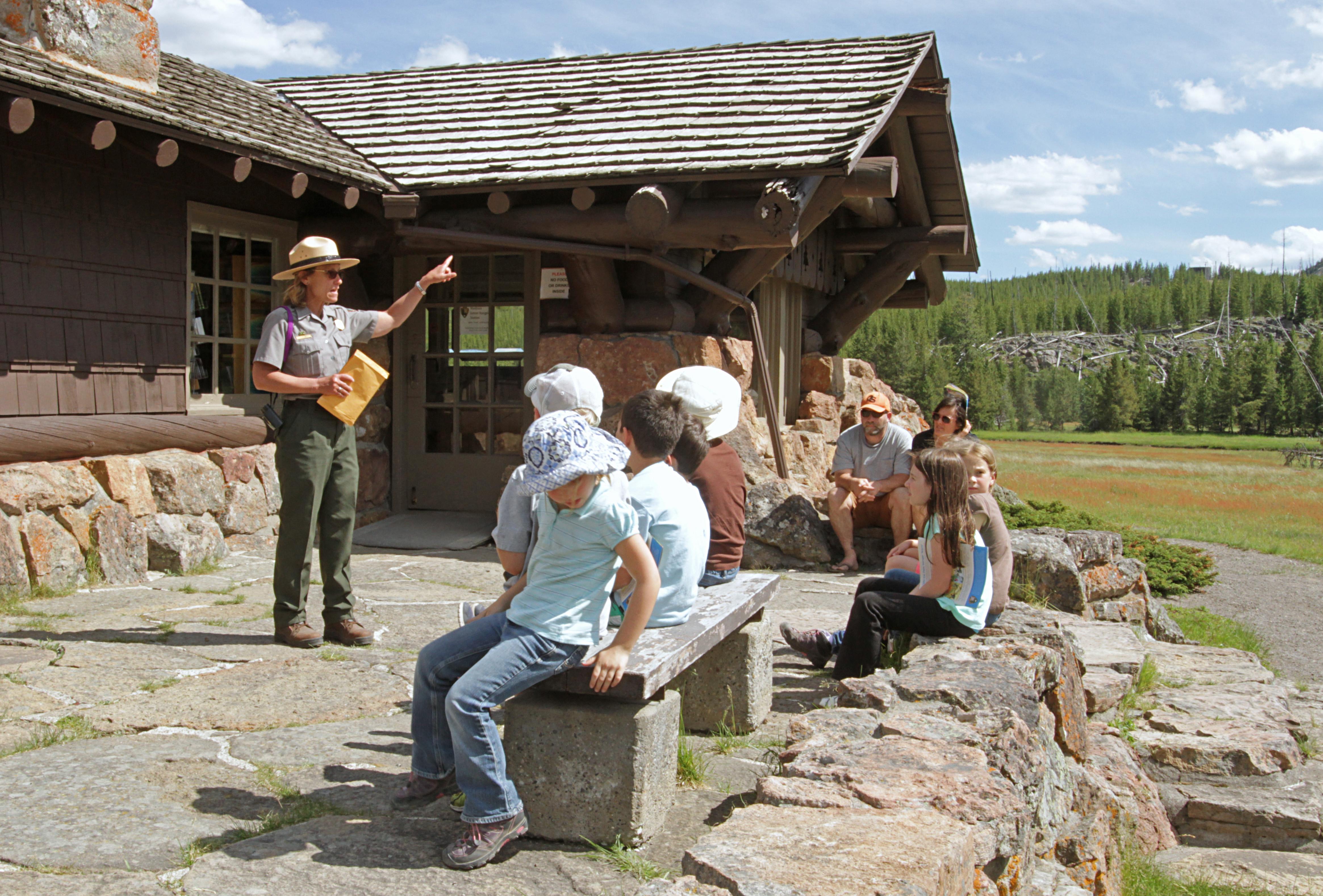
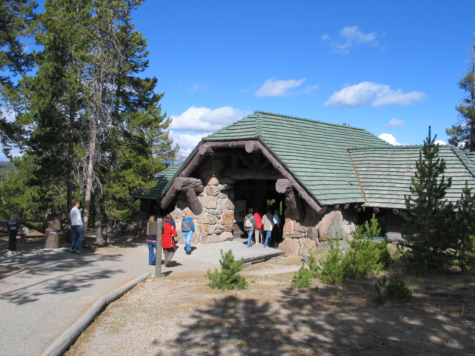
Fishing Bridge Visitor Center and Trailside Museum
The distinctive stone-and-log architecture of this old building—known as "parkitecture"—was one of several prototypes for park buildings around the country. Today, the visitor center and museum highlight the ecology of Yellowstone Lake, focusing on birds. Also stop by to visit with a ranger and find out when ranger programs are scheduled, buy a fishing permit (payable by debit or credit card), pick up a souvenir, or take in some truly stunning views of Yellowstone Lake and the surrounding mountains.
Fire plays an important, natural role in the ecosystems found in Yellowstone National Park and the surrounding region. Learn more about this and the fires of 1988 in the exhibit hall, gather park information and trip ideas, shop for souvenirs at the park store, join a ranger program, buy a fishing, boating, or backcountry camping permit (fees are payable by debit or credit card), or use the restrooms.
Located about halfway between Old Faithful and West Yellowstone, you can stop here for park information as visitors have been doing since 1930. The structure is an example of "parkitecture" or designing a building in a way that reflects the surrounding ecosystem. You can also shop for souvenirs in the park store, attend a ranger program, purchase a fishing permit (fees are payable by debit or credit card), or use the restrooms.
Once a US Army outpost built in 1908, this visitor center houses exhibits that celebrate the history of the park ranger profession. To enhance the story of the park ranger experience, this visitor center is staffed by volunteer retired rangers. The current structure replaced previous structures dating back to 1884.
Norris Geyser Basin Museum and Information Station
Situated on the ridge overlooking the Norris Geyser Basin, this historic building is staffed during the summer with rangers who provide park information and facilitate ranger programs. Visitors have been seeking information here since 1930 when the museum was built as a "trailside museum" to serve people traveling in their own automobiles without a guide. Restrooms are located in the parking lot.
Located near Old Faithful Geyser, this visitor center offers views of the geyser's eruption from the tall, windowed front of the visitor center. Additionally, you can gather park information, talk with a park ranger at the front desk, shop for souvenirs in the park store, delve into the natural wonders of Yellowstone in the exhibit hall, join a ranger program, or use the restrooms.
A small facility at the start of the West Thumb Geyser Basin boardwalks, where you can visit with a park ranger and gather park information, shop for souvenirs in the park store, or join a ranger program. The structure was built in 1925 and is an example of historic ranger-station architecture in Yellowstone.
West Yellowstone Visitor Information Center (Chamber of Commerce Desk)
Located in the town of West Yellowstone, Montana, there is a desk staffed by National Park Service rangers (summer and winters only). The building is open year-round and a second desk is staffed by the West Yellowstone Chamber of Commerce. Stop by to obtain backcountry and fishing permits, get park information or to use the restrooms.
West Yellowstone Visitor Information Center (NPS Desk)
Located in the town of West Yellowstone, Montana, there is a desk and backcountry office staffed by National Park Service rangers (summer and winters only). The building is open year-round and a second desk is staffed by the West Yellowstone Chamber of Commerce. Stop by to obtain backcountry and fishing permits (fees are payable by debit or credit card), to get park information, or to use the restrooms. Call 307-344-2876 for additional information.
Climb gradually through aspens and meadows, then descend through forests to sagebrush flats that lead to a footbridge across the Gardner River.
Lewis River Channel/Dogshead Trail
Hike through forest to the crystal-clear waters of the Lewis River Channel. Look for eagles and osprey fishing for trout in the shallow waters.
Fairy Falls Trail
Enjoy a hike to one of Yellowstone's most spectacular waterfalls.
Grand Prismatic Overlook Trail
Hike up to an overlook of Grand Prismatic Spring.
Cascade Lake Trail
Hike through open meadows to Cascade Lake where wildflowers abound and wildlife is often seen.
Snow Pass Ski Trail
The Snow Pass Ski Trail is a 4.2 mile (6.76 km), skier-tracked, one-way, easiest to most-difficult, ski that takes skiers through a steep heavily forested area to a semi-flat wide open area with views of Swan Lake Flats.
Specimen Ridge Day Hike Trail
Hike up to a ridge for magnificent views of Slough Creek Valley and the Absaroka Range.
Mud Volcano Trail
A loop trail leads you by turbulent pools of hot, muddy water; hillsides strewn with trees cooked by steam; strange odors; and a bizarre landscape—welcome to the Mud Volcano area.
Grebe Lake Trail
Hike along an old fire road through meadows and forest, some of which burned in 1988.
Watch Old Faithful Geyser Erupt
Old Faithful Geyser is the world's best known geyser. Its eruption intervals have varied from 40 to 126 minutes. Find out the eruption times of Old Faithful and other large geysers at the Old Faithful Visitor Education Center, following the @GeyserNPS twitter feed, or using the Geysers app.
Brink of the Lower Falls Trail
Descend to the brink of the Lower Falls on this steep trail to catch a glimpse of one of Yellowstone's greatest wonders.
Garnet Hill Trail
Follow a stagecoach route on a meadow journey around Garnet Hill. The full route cannot be hiked due to a trail washout refer to Backcountry Conditions report.
Pelican Valley Trail
Hike through forests, meadows, and a river valley—all of which are some of the best grizzly bear country in the lower 48 states.
Forces of the Northern Range Self-guided Trail
Follow this self-guided trail along a boardwalk that winds through the grassland of Yellowstone's northern range.
Riverside Ski Trail
The Riverside Ski Trail provides several easy options to ski along the Madison River and enjoy views of both the Gallatin and Madison mountain ranges.
Bannock Ski Trail
The Bannock Ski Trail is a 2 mile (3.2 km) easy ski that follows the old road bed that once used to supply the mining town of Cooke City, Montana.
Observation Point Loop Snowshoe Trail
The Observation Point Loop Snowshoe Trail is a 2.0 mile (3.2 km) snowshoe only trail that treats visitors to unobstructed views of the Upper Geyser Basin and the Firehole River.
Tower Fall Ski Trail
The Tower Fall Ski Trail is a 5.0 mile (8 km) round-trip easiest trail that allows skiers to enjoy canyon views of the Yellowstone River and Tower Fall.
Sheepeater Ski Trail
The Sheepeater Ski Trail is a skier-tracked, easy, one-way 5 mile (8 km) trail that provides scenic views of Swan Lake Flats.
Roller Coaster Ski Trail
The Roller Coaster Ski Trail is a more difficult 1.8 mile (2.9 km) roundtrip forested trail taking skiers on a rolling course with several steep drop-offs.
Old Canyon Bridge Ski Trail
The Old Canyon Bridge Ski Trail is a flat 1 mile (1.6 km) easiest ski that provides skiers a short but beautiful way to see the Yellowstone River in winter.
North Rim Ski Trail
The North Rim Ski Trail is a 3.0 (7.24 km), easiest to more difficult forested trail that takes skiers along the North Canyon Rim providing views into the Grand Canyon of the Yellowstone.
Mallard Lake Ski Trail
The Mallard Lake Ski Trail is a 6.8 mile (10.9 km) round-trip, skier-tracked, more difficult trail taking skiers on a steep climb to views of Mallard Lake.
Lost Lake Ski Trail
The Lost Lake Ski Trail is a 4 mile (6.4 km) easiest to more difficult one-way trail that takes skiers by Petrified Tree, Lost Lake, and Calcite Springs Overlook.
Fawn Pass Ski Trail
The Fawn Pass Ski Trail is an 11 mile (17.7 km), one-way, more difficult ski trail that provides skiers with wide open views of the Gallatin Range.
Fairy Falls Ski Trail
The Fairy Falls Ski Trail is a 10 mile (16 km) (with ski drop) skier-tracked, round-trip, easiest to more dificult ski that provides icy views of one of Yellowstone's most popular waterfalls.
Chittenden Loop Ski Trail
The Chittenden Loop Ski Trail is an easiest to more difficult 5.3 mile (8.3 km) loop providing views of Mount Washburn on clear days.
Canyon Rim Ski Trail
The Canyon Rim Ski Trail is a 4.5 mile (7.24 km), easiest to more difficult forested trail that takes skiers along the Canyon Rim providing views into the Grand Canyon of the Yellowstone.
Blacktail Plateau Ski Trail
The Blacktail Plateau Ski Trail is an easiest to more difficult 8 mile (12.8 km) one-way ski with two trailhead options. This trail travels open meadows and forests with great wildlife viewing opportunities in winter.
Barronette Ski Trail
The Barronette Trail is an easy 3.5 mile (5.6 km) one-way section of the Old Cooke City road and winds through conifer forest.
Riverside Bike Trail
Just inside the park's West Entrance, bicyclists can travel on the Riverside trail located just north of and paralleling the main Grand Loop Road. This trail gives access to a section of the Madison River. This is a fairly level trail and mountain bikes are recommended.
Old Lake Road Bike Trail
The old roadbed near the lakeshore between Lake Hotel and where the roadbed joins the main road south of Lake Junction (1 mile) has a great views of the Yellowstone Lake.
Old Faithful Lower General Store to Morning Glory Pool Bike Trail
The paved trail in front of Old Faithful Lodge runs all the way to Morning Glory Pool. Take this short, (2 mi. round-trip) fairly level, paved-path and make stops to see geysers.
Natural Bridge Bike Trail
The Natural Bridge bike trail is 2.5 mi (4km) round-trip ride and begins just south of the Bridge Bay marina off the Grand Loop Road.
Lone Star Geyser Bike Trail
The trailhead for Lone Star Geyser is east of Kepler Cascades pull-out, 3.5 miles (5.6 km) southeast of Old Faithful overpass on Grand Loop Road.
Abandoned Railroad Bed Bike Trail
An abandoned railroad bed located near the north entrance of Yellowstone makes a beautiful bike trail.
Bunsen Peak Loop Bike Trail
The Bunsen Peak Loop is a ten mi (16 km) bike trail that circles Bunsen Peak.
Norris Geyser Basin Trails
Norris Geyser Basin is one of the hottest and most acidic of Yellowstone’s hydrothermal areas. It is part of one of the world’s largest active volcanoes. Many hot springs and fumaroles here have temperatures above the boiling point (200ºF / 93ºC).
Grand Canyon of the Yellowstone
Look out across the Grand Canyon of the Yellowstone or take in the beauty of the Yellowstone River and its waterfalls.
Fountain Paint Pot Trail
Explore the four major types of hydrothermal features along this short, popular, boardwalk trail.
Explore the Fort Yellowstone Historic District
From 1886 to 1918, the US Army managed Yellowstone National Park. Starting in 1890, the US Army constructed Fort Yellowstone as a more permanent base of operations.
Yellowstone River Picnic Area Trail
Follow the rim of the Yellowstone River valley, enjoying views of bighorn sheep, the Narrows of the Yellowstone, Overhanging Cliff, and the towers of Tower Falls.
Yellowstone Lake Overlook Trail
Hike to a high mountain meadow for a commanding view of the West Thumb of Yellowstone Lake and the distant Absaroka Mountains.
Wraith Falls Trail
Cross sagebrush meadows, marshland, and mixed conifer forest to the base of Wraith Falls on Lupine Creek.
West Thumb Geyser Basin Trail
Stroll through a geyser basin of colorful hot springs and dormant lakeshore geysers situated on the scenic shores of Yellowstone Lake.
Trout Lake Trail
Enjoy a short hill climb through Douglas-fir forest to Trout Lake.
Storm Point Trail
Pass by Indian Pond and through a forest to the shores of Yellowstone Lake. Along the way, look for marmots in the rocky area near Storm Point.
Slough Creek Trail
Follow a historic wagon trail that heads toward the Absaroka-Beartooth Wilderness beyond Yellowstone.
Sepulcher Mountain Trail
Climb to the summit of Sepulcher Mountain while keeping an eye out for mountain goats, bighorn sheep, and moose along the way.
Seven Mile Hole Trail
Hike along the rim of the Grand Canyon of the Yellowstone, enjoy views of Silver Cord Cascade, and then descend to Seven Mile Hole.
Tours
Count: 10
Biscuit Basin
Named for the biscuit-shaped decorations that once were prominent around the edge of Sapphire Pool, Biscuit Basin is a wonderful, little thermal basin to explore via boardwalk just north of the Old Faithful developed area. CLOSED for 2024 due to hydrothermal explosion.
Black Sand Basin
A thermal area west of the Old Faithful developed area that has chromatic and opalescent hot springs and a geyser that frequently erupts right at the edge of the river flowing through the area.
ESCAPE to Yellowstone: Building Resilience
Everybody needs to escape sometimes—to take a break, to take a hike, or to take a nap! Yet in our ever-connected world, do you know how to recognize when it is time for a break? Do you need some help to build resilience to the pressures in your life? We invite you to ESCAPE to your national parks with your favorite friends and family members. This self-paced tour has stops along the multi-use path in the Upper Geyser Basin of Yellowstone that help build the resilience skill of self-awareness.
Fountain Paint Pot
Along this self-guided tour you will see various hydrothermal features that are expressions of Yellowstone's still active volcano. Within this geologic system, each type of thermal feature is represented. They can be grouped into two general categories—those with a great deal of water (hot springs and geysers) and those with limited water (mudpots and fumaroles). Despite their structural similarities, no two features are exactly alike.
Mud Volcano
Turbulent pools of hot, muddy water. Hillsides strewn with trees cooked by steam. Strange odors. A bizarre landscape. Welcome to the Mud Volcano area.
Northern Range Driving Tour
Embark on a journey through Yellowstone’s rich history, breathtaking landscapes, and fascinating geology with this self-guided driving tour. Discover stories of exploration, survival, and conservation, while learning about the park's iconic landmarks, unique wildlife, and the forces that shaped this extraordinary land. Perfect for visitors of all ages and interests, this tour connects you with Yellowstone’s past and present as you travel its scenic roads.
Old Faithful and the Upper Geyser Basin
Old Faithful Geyser is just one of many hydrothermal wonders to be experienced along this loop tour. Travel along a mixture of boardwalks and paved trails, though be aware there are some stairs or steep grades are along the way.
The Tukudika
This audio tour introduces you to the Tukudika Indians, a band or related bands of Mountain Shoshone whose teviwa (Shoshone for homeland) included the area that is now Yellowstone National Park. During the tour, you will learn about Tukudika lifeways. As you listen, imagine what Yellowstone might have been like before it became the world’s first national park. Reflect upon what the concepts of home and lifeways mean to you.
Upper Terrace Drive
Upper Terrace Drive is a 1.5-mile (2.4-km) loop around the Upper Terrace of the Mammoth Hot Springs of Yellowstone National Park. This drive is open to automobiles and pedestrians during the summer, while the rest of the year it can be walked, skied, and snowshoed.
West Thumb Geyser Basin
Explore this fascinating thermal area on the edge of Yellowstone Lake.