Explore the timeless rainforests and majestic coastal vistas. Discover the rich heritage of the native people. Unfold the dramatic stories of America's most famous explorers. The park encompasses sites along the Columbia River and the Pacific Coa...
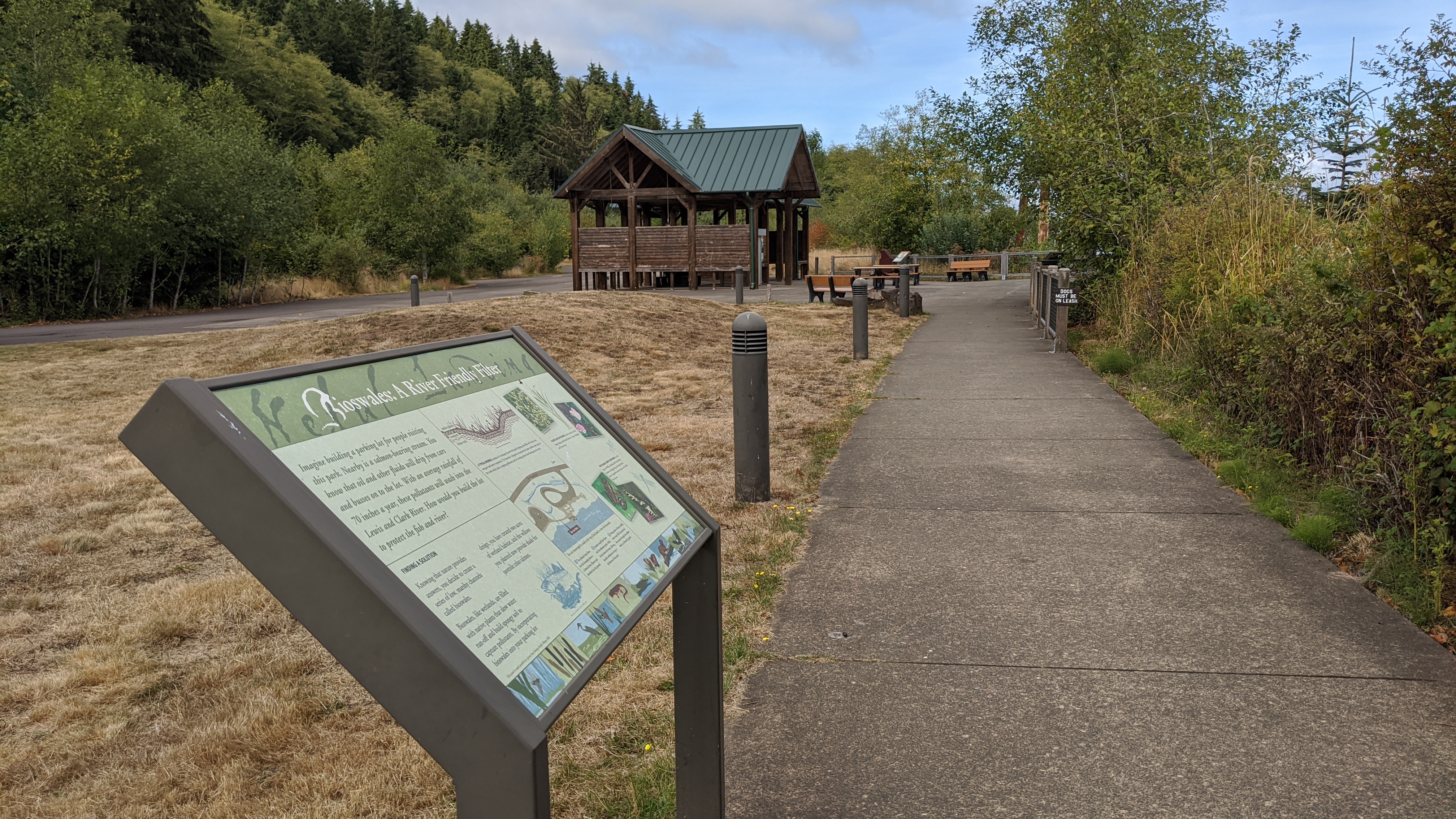
A rectangular sign sits on the edge of a grassy hill. Across the top of the sign is a green background with white text reading "Bioswales: A River Friendly Filter." Below the sign is divided into four sections. In the top left section green text reads: "Imagine building a parking lot for people visiting this park. Nearby is a salmon-bearing stream. You know that oil and other fluids will drip from cars and busses on to the lot. With an average rainfall of 70 inches a year, these pollutants will wash into the Lewis and Clark River. How would you build the lot to protect the fish and river?" The box below in the bottom left reads: "Finding a solution. Knowing that nature provides answers, you decide to create a series of low, marshy channels called bioswales. Bioswales, like wetlands, are filled with native plants that slow water run-off and build spongy soil to capture pollutants. By incorporating bioswales into your parking lot design, you have created two acres of wetland habitat, and the willows you planted now provide shade for juvenile coho salmon." beneath the text is a sketch picture of a coho salmon. The middle section of the sign has at the top a diagram of what a bioswale looks like, a dip in the land with plants growing on top labeled as native plants, below is a layer of dark rectangles labeled compost, and below that some thin lines labeled drain rocks. Below this diagram reads "A typical bioswale consists of drainage channel with gently sloping sides filled with drain rock, compost and native vegetation. The bioswale is designed to maximize the time unclean water stays in the swale which aids in trapping pollutants and silt, keeping them from flowing into the river." In the bottom of the middle panel is a map of Netul Landing, labeling the parking lots to the left, the bus shelter to the right, and where the bioswales are in relation to the different roads and the Lewis and Clark river. A large "1" labels the first bioswale near Fort Clatsop road, a large "2" labels where the bioswale leads to, a Sediment pond, and a large "3" labels the outflow of the sediment pond. Below is the legend that describes each number label as follows: "1. The polluted water flows into the bioswales where it is slowed down, filtered and absorbed into the ground." "2. Excessive runoff then flows into the sediment pond, which further slows the water, allowing harmful sediments to drop to the bottom of the pond." "3. During times of heavy rainfall, excess water fills the pond and then moves through the outflow, where it is filtered by gravel." The panel on the right side shows four photos, two are of plants with the first being Bulrush and the second of a blooming Nootka rose. The other two are of animals, the first of a frog on a leaf an the second of a butterfly on top of a flower. Text by the plant photos reads: "Plants that do the work include common cattails, slough sedge, small-fruited bulrush, Oregon crabapple and Nootka rose." Text by the animal photos reads: "This valuable habitat is now home to a wide range of wildlife, including Pacific chorus frogs, northern red-legged frogs, and tough skinned newts. Dragonflies and several species of butterfly visit the area."
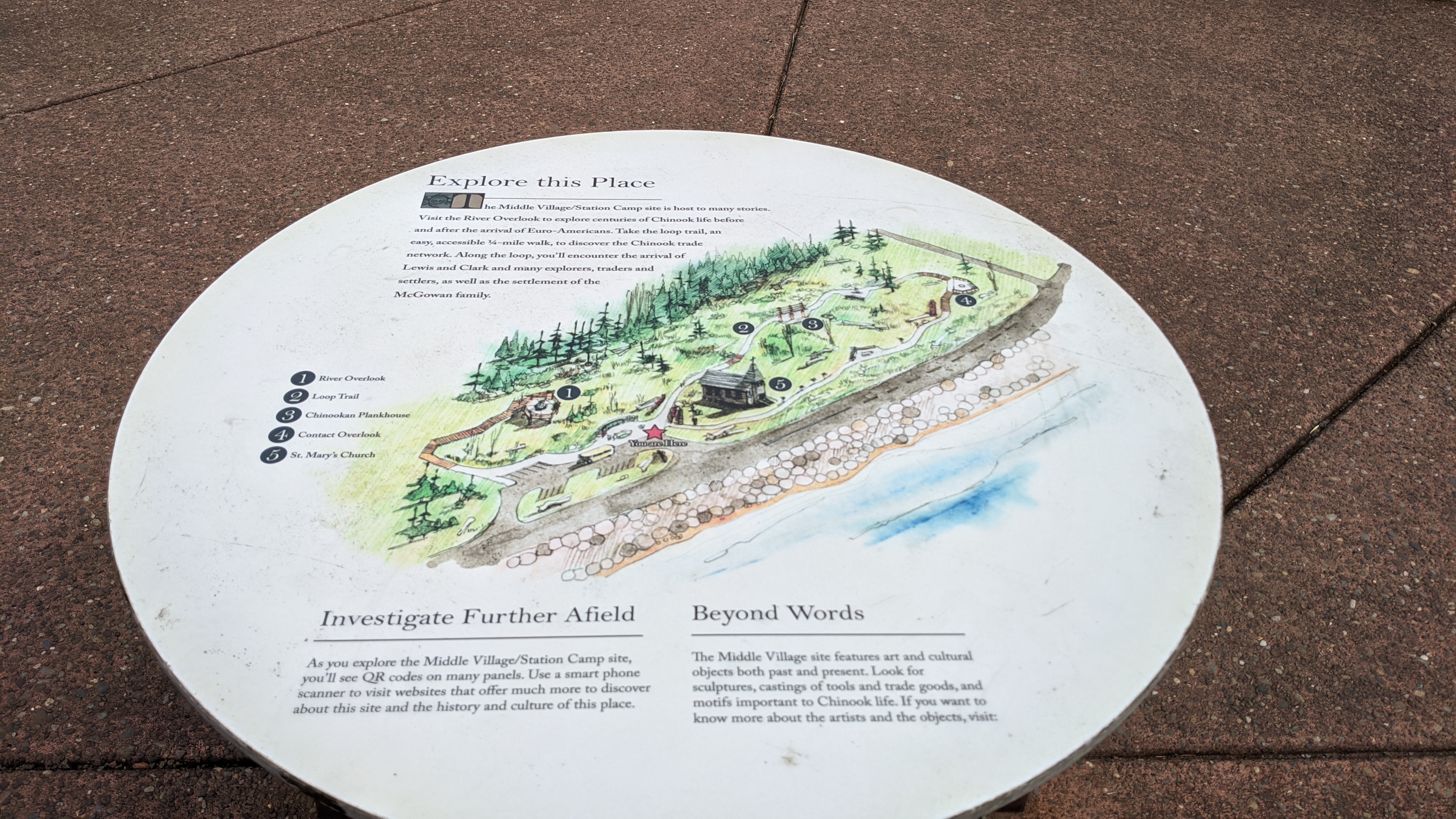
A short white circular sign sits in the middle of the sidewalk, on this sign is color sketch map of Middle Village with a legend naming locations and descriptions above and below the map. The introduction paragraph above the map reads in bold text: "Explore this Place. The Middle Village/Station Camp site is host to many stories. Visit the River Overlook to explore centuries of Chinook life before and after the arrival of Euro-Americans. Take the loop trail, an easy, accessible 1/4-mile walk, to discover the Chinook trade network. Along the loop, you'll encounter the arrival of Lewis and Clark and many explorers, traders and settlers, as well as the settlement of the McGowan Family." The map in the middle shows a red star where the sign is located at, labeled "You are here." To the top left of the map is labeled "1: River Overlook." Directly above where the sign is located on the loop trail is labeled "2: Loop Trail." Following the loop trail leads to "3: Chinookan Plankhouse", further down the loop is "4: Contact Overlook" and lastly near the depiction of a church is labeled "5: St. Mary's Church." Underneath the map are two paragraphs side by side. The left on reads "Investigate Further Afield: As you explore the Middle Village/Station Camp site, you'll see QR codes on many panels. Use a smart phone scanner to visit websites that offer much more to discover about this site and the history and culture of this place." (Editor's note: Refer to the main body for correction and the removal of QR codes) The right text area reads: "Beyond Words. The Middle Village site features art and cultural objects both past and present. Look for sculptures, castings of tools and trade goods, and motifs important to Chinook life. If you want to know about about the artists and the objects, visit:" the area with a URL would be is blank.
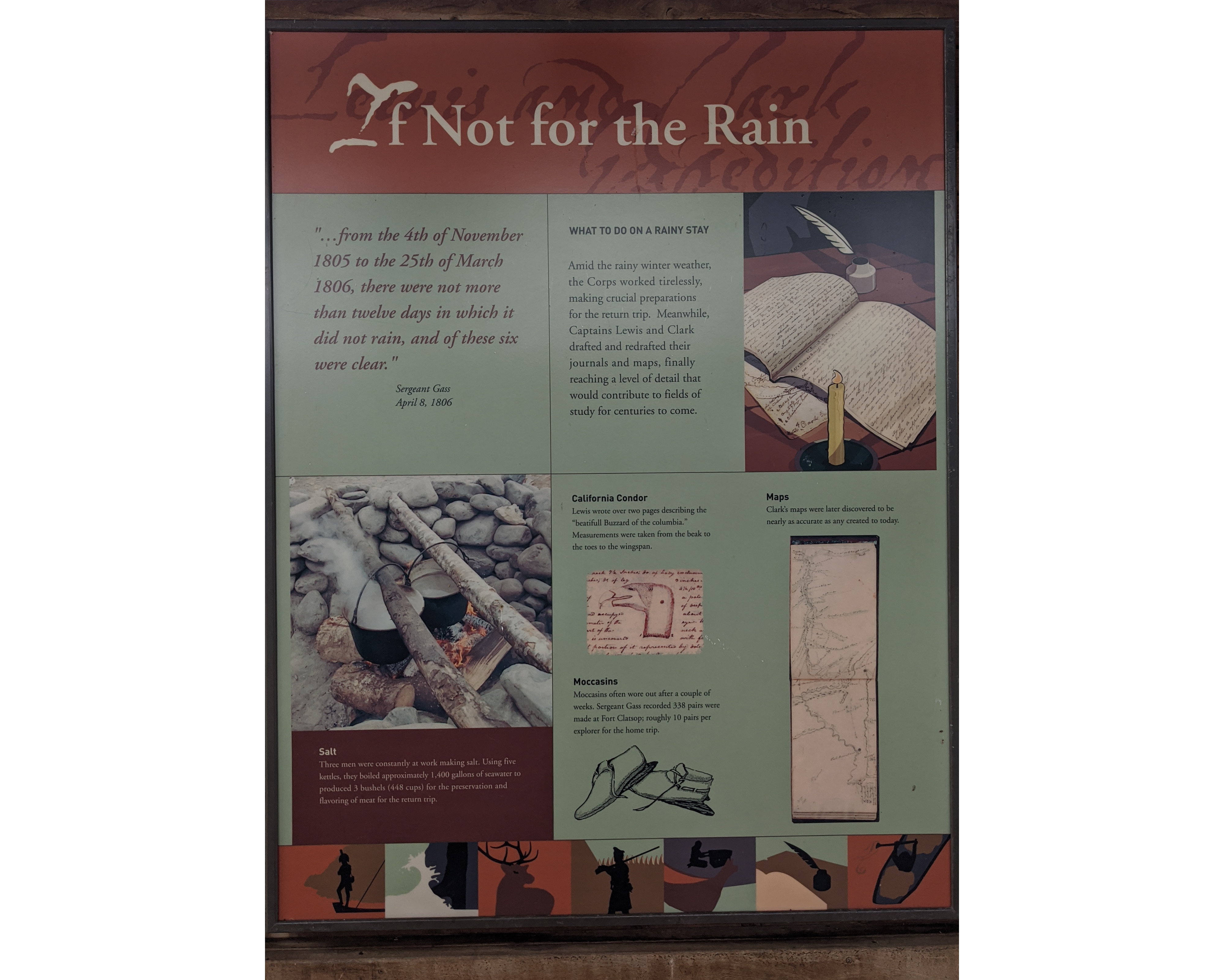
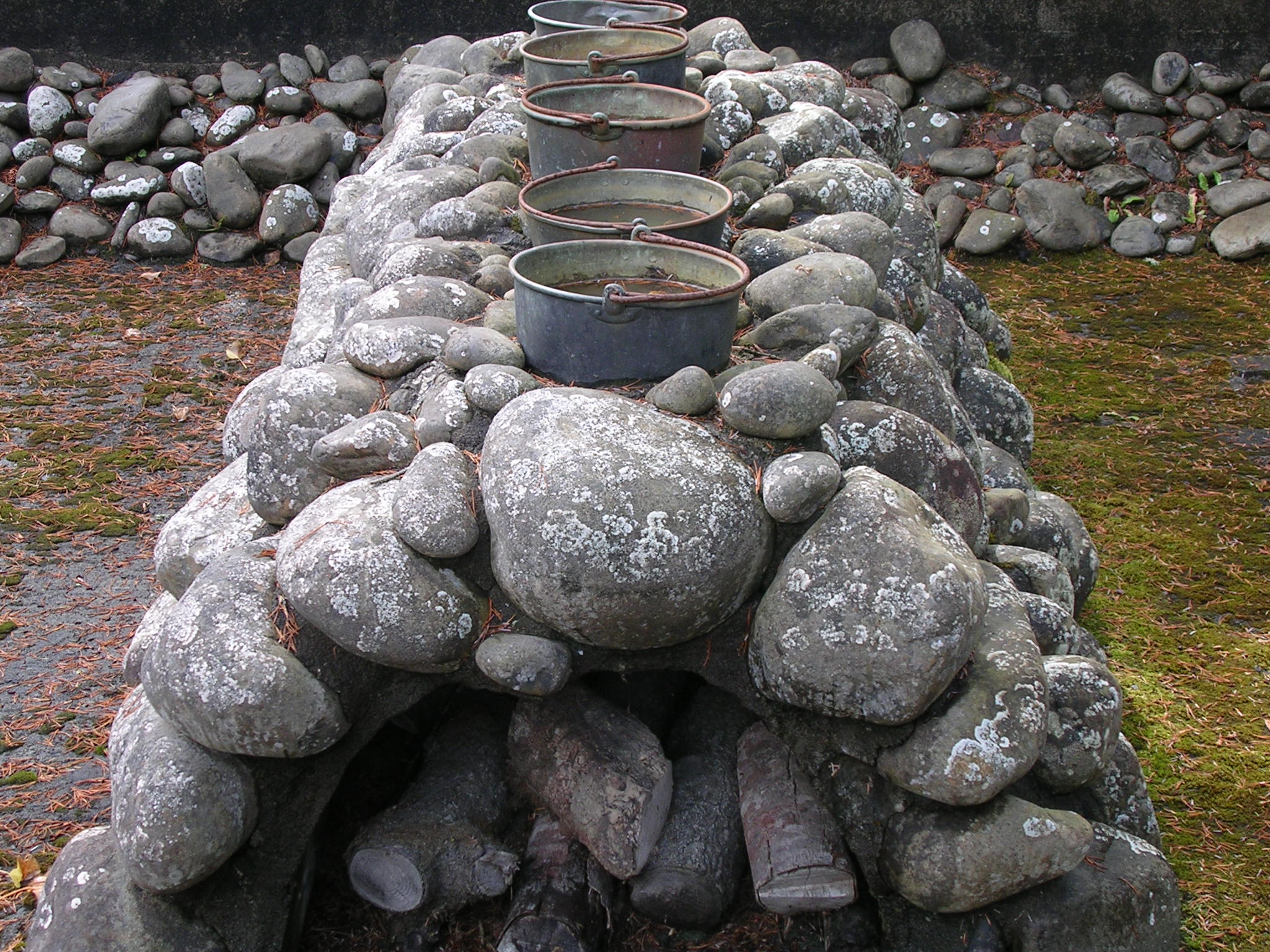
In bold white text at the top the title, If Not for the Rain, is backed by red and shaded text reading "Lewis and Clark Expedition." The sign is divided into four squares. In the top left a quote in red reads "...from the 4th of November 1805 to the 25th of March 1806, there were not more than twelve days in which it did not rain, and of these six were clear." Sergeant Gass April 8th, 1806. In the top left a cartoonized depiction of a candle, an open journal, and quill pen sit besides text to the left stating: What to do on a rainy stay. Amid the rainy winter weather, the Corps worked tirelessly, making crucial preparations for the return trip. Meanwhile, Captains Lewis and Clark drafted and redrafted their journals and maps, finally reaching a level of detail that would contribute to fields of studies for centuries to come. In the bottom left a photograph of two large pots, supported by wooden logs and stacked rocks above a fire, boil vigorously. Below it the title reads Salt. Three men were constantly at work making salt. Using five kettles, they boiled approximately 1,400 gallons of seawater to produce 3 bushels, 448 cups, for the preservation and flavoring of meat for the return trip. The bottom right square is divided into three sections. The top titled California Condor, Lewis wrote over two pages describing the "beautifull Buzzard of the columbia." Measurements were taken from the beak to the toes to the wingspan. A photo of Lewis journals depicting a sketch of the California Condor is below. Below this is titled Moccasins. Moccasins often wore out after a couple of weeks. Sergeant Gass recorded 338 pairs were made at Fort Clatsop; roughly 10 pairs per explorer for the home trip. Below this are a pair of moccasins pencil sketched. To the right the bold title Maps is above the text: Clark's maps were later discovered to be nearly as accurate as any created today. Below is a photograph of Clark's maps of the mouth of the Columbia river's coastline. At the bottom seven small stylized pictures depict silhouetted figures. The first is a military captain on the front of a boat, the second waves crashing against rocks, the third an elk, the fourth a soldier infront of the walls of a log fort, the fifth an person sealing a box with a high-prow canoe in front of them, the sixth a quill pen in an ink well, and the seventh a person paddling inside a canoe.
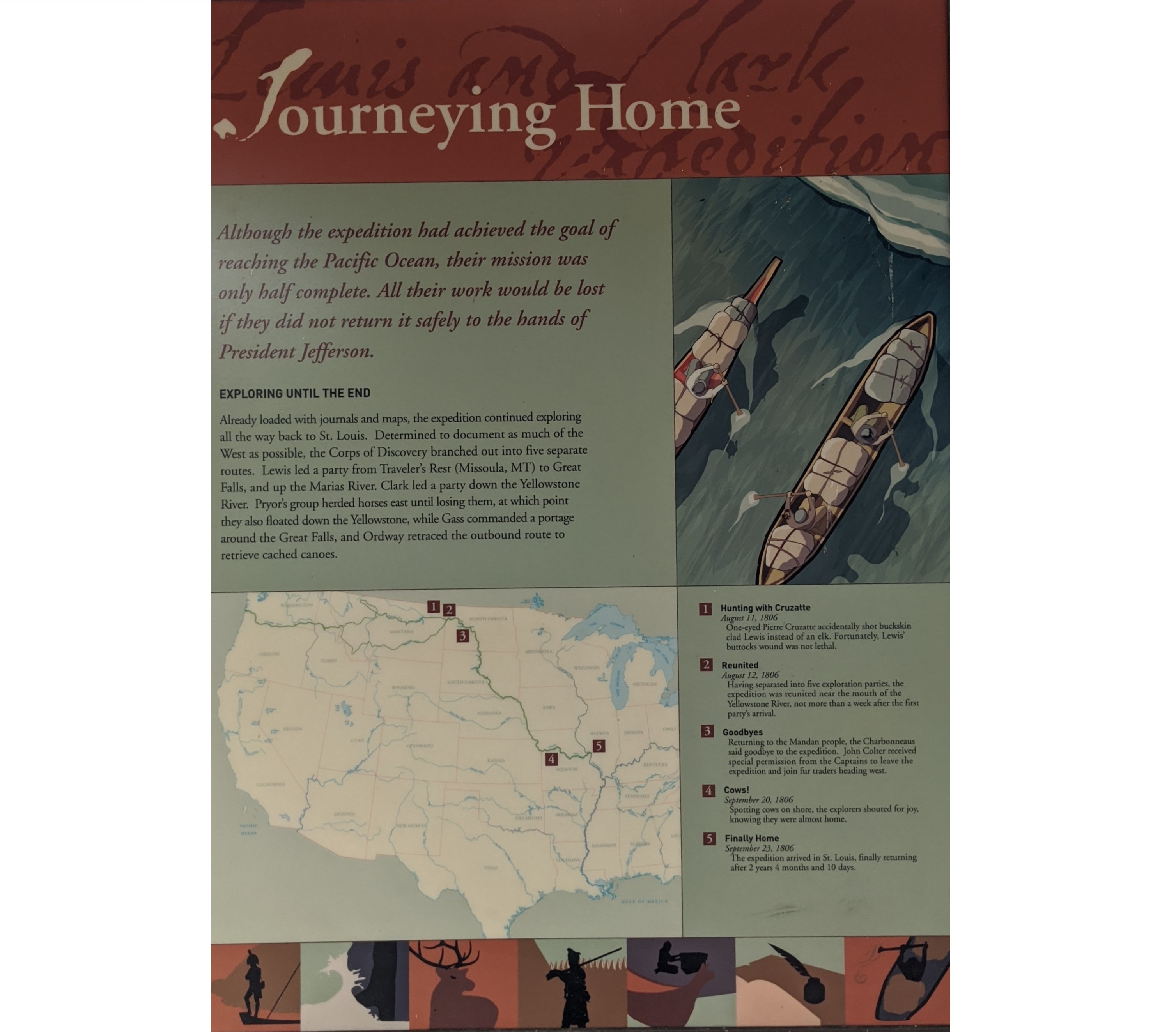
A sign at Netul Landing displaying significant events on the return trip back home on the Lewis and Clark expedition
On top of the wooden boards of the North Netul Picnic Shelter, the "Journeying Home" sign displays information about the return trip. The top of the sign has the title "Journeying Home" against a red-on-red text background reading "Lewis and Clark Expedition." Below the title the sign is divided into four square sections. The top left section reads: "Although the expedition had achieved the goal of reaching the Pacific Ocean, their mission was only half complete. All their work would be lost if they did not return it safely to the hands of President Jefferson." Subtitle: "Exploring until the end." "Already loaded with journals and maps, the expedition continued exploring all the way back to St. Louis. Determined to document as much of the West as possible, the Corps of Discovery branched out into five separate routes. Lewis lewd a party from Traveler's Rest (Missoula, MT) to Great Falls, and up the Marias River. Clark led a party down the Yellowstone River. Pryor's group herded horses east until losing them, at which point they also floated down the Yellowstone, while Gass commanded a portage around the Great Falls, and Ordway retraced the outbound route to retrieve cached canoes." The top right section as an artistic depiction of expedition members in canoes, paddling along a river. The bottom left section is a map of the United States showing the route the Lewis and Clark expedition took, from St. Louis to the mouth of the Columbia River. 5 sites are labelled, 1 through 5, where 1 is in Montana, 2 is in North Dakota, 3 is in North Dakota, 4 is in Missouri, and 5 is in Missouri. The bottom right section correlates to number 1 - 5 on the map. Number 1: Hunting with Cruzatte. August 11, 1806. One-eyed Pierre Cruzatte accidentally shot buckskin clad Lewis instead of an elk. Fortunately, Lewis' buttocks wound was not lethal. Number 2: Reunited. August 12, 1806. Having separated into give exploration parties, the expedition was reunited near the mouth of the Yellowstone River, not more than a week after the first party's arrival. Number 3: Goodbyes. Returning to the Mandan people, the Charbonneaus said goodbye to the expedition. John Colter received special permission from the Captains to leave the expedition and join fur traders heading west. Number 4: Cows! September 20, 1806. Spotting cows on shore, the explored shouted for joy, knowing they were almost home. Number 5: Finally Home. September 23, 1806. The expedition arrived in St. Louis, finally returning after 2 years 4 months and 10 days. Along the bottom of the sign there are artistic depictions of Captain Lewis on front of a pirogue, waves crashing against rocks, a bull elk, a soldier standing guard in front of Fort Clatsop, the Clatsop people using a bentwood box, a quill pen and inkwell, and soldiers paddling canoes in a river.
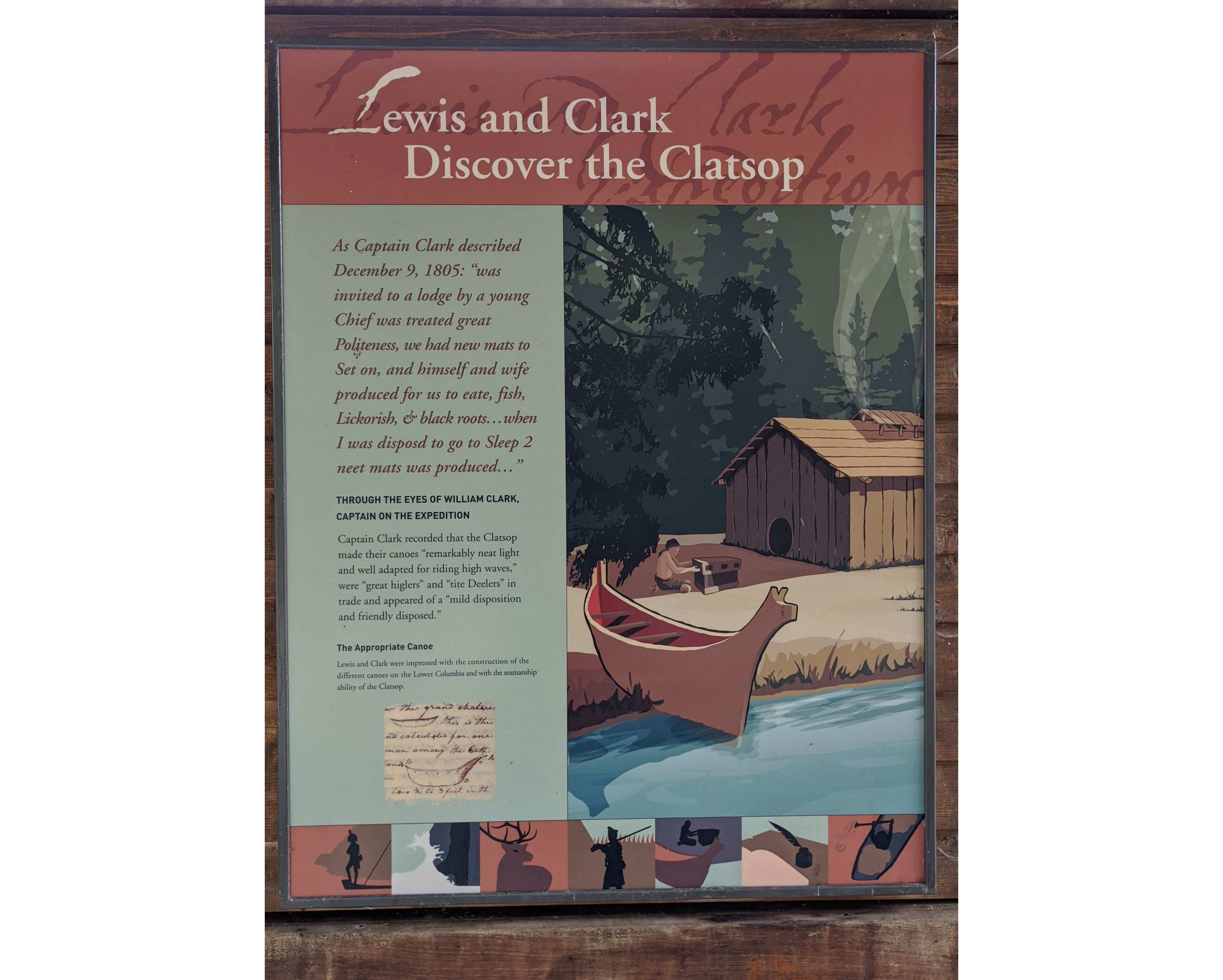
In bold white text at the top the title, Selecting a Winter Campsite, is backed by red and shaded text reading "Lewis and Clark Expedition." This sign is split down the middle into two sections. The left section is topped with a quote in bold red: As Captain Clark described December 9, 1805: "was invited to a lodge by a young Chief was treated great Politeness, we had new mats to Set on, and himself and wife produced for us to eate, fish, Lickorish, & black roots...when I was disposed to go to Sleep 2 meet mats was produced..." Beneath in bold black text, the title: Through the eyes of William Clark, captain of the expedition. Captain Clark recorded that the Clatsop made their canoes "remarkably neat light and well adapted for riding high waves," were "great higlers" and "Tite Deelers" in trade and appeared of a "mild disposition and friendly disposed." The final paragraph has for a title, in bold: The Appropriate Canoe. Underneath continues: Lewis and Clark were impressed with the construction of the different canoes on the Lower Columbia and with the seamanship ability of the Clatsop. Beneath is a photograph of the Lewis and Clark journals depicting their sketch of the canoes of the local people. The right section is an artistic depiction of a member of the Clatsop people outside a cedar plank longhouse while a high prow cedar canoe sits half in the water. At the bottom seven small stylized pictures depict silhouetted figures. The first is a military captain on the front of a boat, the second waves crashing against rocks, the third an elk, the fourth a soldier infront of the walls of a log fort, the fifth an person sealing a box with a high-prow canoe in front of them, the sixth a quill pen in an ink well, and the seventh a person paddling inside a canoe.
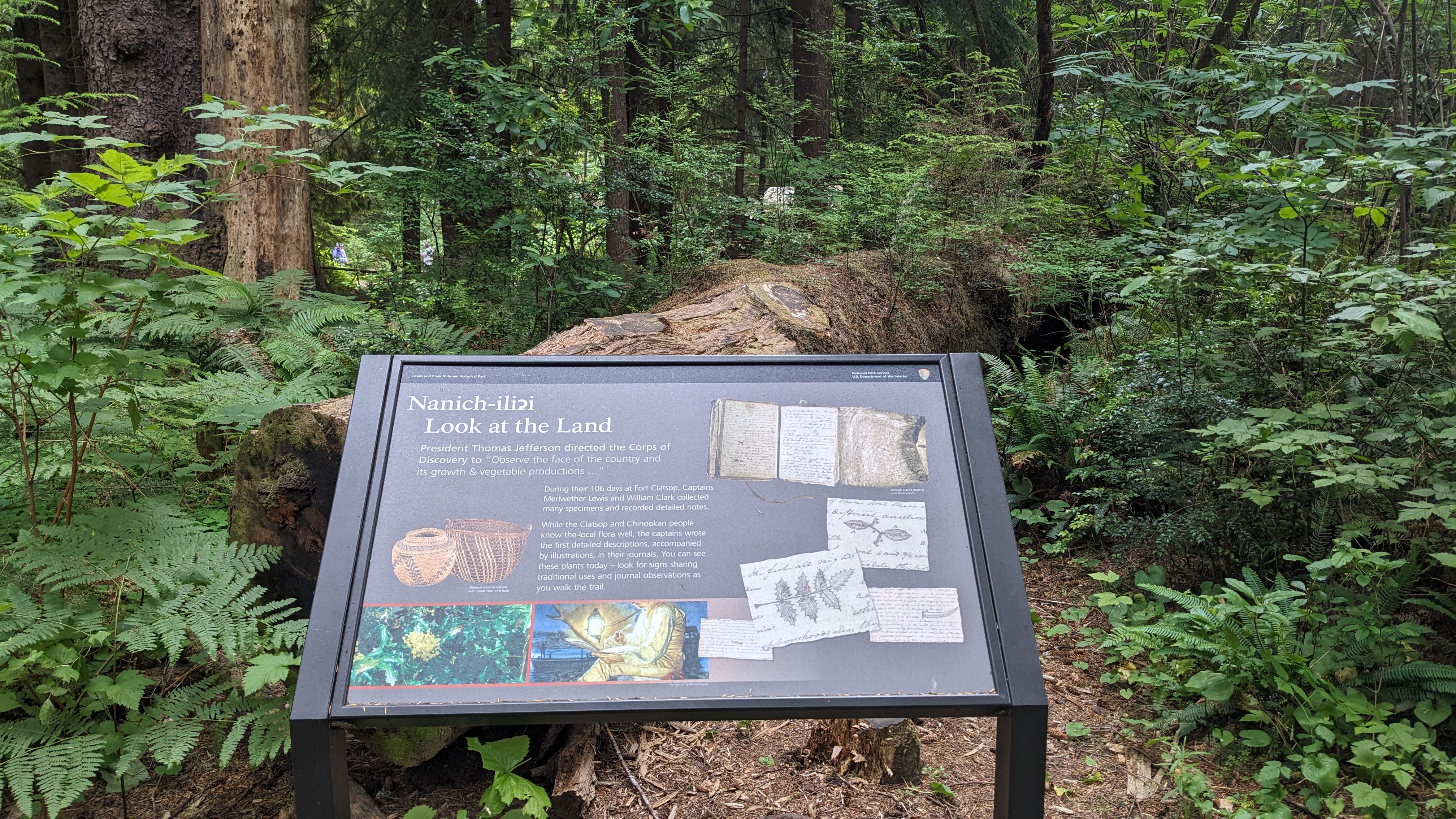
This sign stands in front of a large downed tree, a backdrop of the temperate rainforest helps to add context to this sign. Across the top the title Nanich-iliɂi, pronounced nan-eech-illi-he, and underneath is written Look at the Land. Beneath this the following is written: President Thomas Jefferson directed the Corps of Discovery to "Observe the face of the country and its growth & vegetable productions..." During their 106 days at Fort Clatsop, Captains Meriwether Lewis and William Clark collected many specimens and recorded detailed notes. While the Clatsop and Chinookan people know the local flora well, the captains wrote the first detailed descriptions, accompanied by illustrations, in their journals. You can see these plants today - look for signs sharing traditional uses and journal observations as you walk the trail. To the left of the writing are the pictures of two chinook baskets woven with vedar root and bark, the left basket is shaped like a storage pot, yellow-orange in hue with a black zig-zag pattern going through it. The basket on the right is large and open, with a repeating pattern of yellow-orange columns and black columns. On the top right of the sign is a photograph of William Clark's journal, showing his handwriting and its unfolded leather cover. Underneath are sketches of different plants made the expedition, one featuring Salal berry labelled with A's and B's to distinguish leaves from stem, and the other Oregon Grape. In the bottom left corner is a picture of the Oregon Grape flowering, and beside it a picture of the painting "The Journal" by Michael Haynes depicting an expedition member writing in their journal at night with the barge in the background.
The sign's title, "Out of the Woods" is presented on a red backing that reads "Netul Landing" in cursive font. The sign's top middle reads "The hills of Clatsop County were once covered with a system of logging railroads totaling about 700 miles. Logging trains carried billions of board feet of old-growth logs out of the woods." To the left is historical photograph of one of the mentioned logging trains, a steam engine with multiple logs being towed on flat-bed train cars behind it. Starting from the bottom left to the bottom right is a series of historical photos. The left most shows horses pulling a large log on a cart. A caption underneath is titled "Early Logging" with text "Logging, as an important industry, began in Clatsop County in the mid 1800s. early logging was done near rivers and streams. Teams of horses, mules or oxen pulled logs to the water to be rafted and floated to nearby mills." The next photo depicts a steam engine that powered transportation. Titled "Steam Donkey" with text reading "The introduction of the donkey, a steam engine used to power logging equipment, replaced the use of animals and enabled timber harvesting to take place in more remote areas." The third photo shows a logging train alongside a river with floating logs in it. The title below reads "Log Boom" and text following "The harvest logs were loaded onto rail cars and taken to log booms (sorting yards) along rivers. The fourth photo shows a large truck carrying a massive tree log on its back. The title below reads "Trucking" and text under reads "It is believed that when trucks started hauling logs to the Lewis and Clark Boom, sometime after 1941, the logging train era ended." The final photo depicts heavy machinery, cranes, and an oil tank lifting up logs to add to large piles. The title underneath reads "Crude Oil Fuel" and continues with "Crude oil was the fuel of choice for all logging machinery. The black, heavy oil was so thick that in order to pump it out of a barge, a steamboat would stand by and pump steam into the barge to warm the oil. The warmed oil would then be pumped to an 8,000 gallon tank once located on the hill behind you." Down the right side of the sign a photo of the Netul River is captioned: "This site, formerly known as the Lewis and Clark Boom, was also a locomotive refueling and storage station. The short wooden piling you see in front of you once supported a platform made of 12" by 12" timbers called a gridiron. Barges filled with crude oil were towed by steam boat up the Lewis and Clark River during high tide and then pushed onto the platform. The crude oil fueled locomotives and logging machinery which were crucial to the industry."
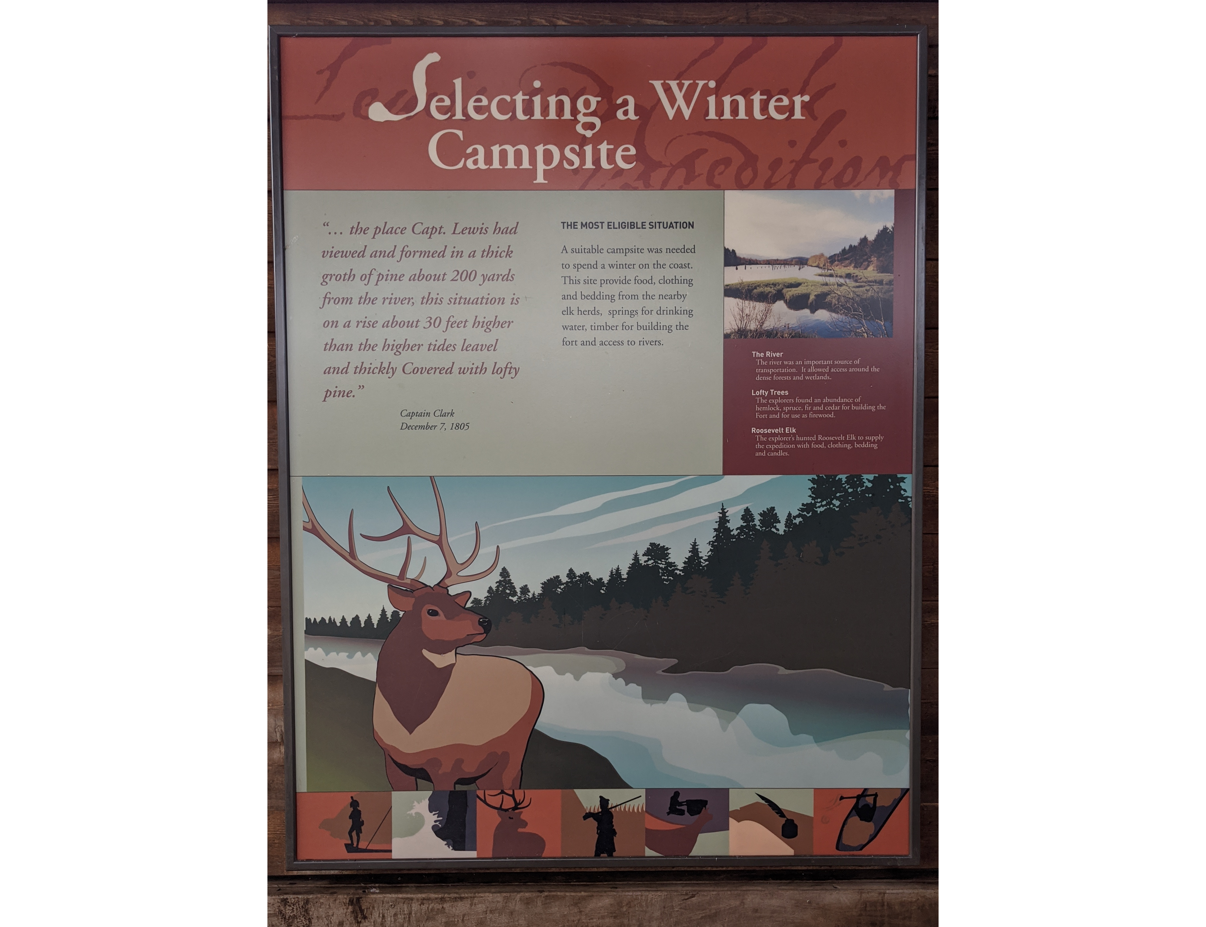
In bold white text at the top the title, Selecting a Winter Campsite, is backed by red and shaded text reading "Lewis and Clark Expedition." The sign is divided into three sections, a top left, top right, and bottom. The top left section is a light green, bold red text representing a quote from the journals, reading: "...the place Capt. Lewis had viewed and formed in a thick groth of pine about 200 yards from the river, this situation is on a rise about 30 feet higher than the higher tides leavel and thickly Covered with lofty pine." Captain Clark, December 7, 1805. To its right in black text: The most eligible situation. A suitable campsite was needed to spend a winter on the coast. This site provide food, clothing and bedding from the nearby elk herds, springs for drinking water, timber for building the fort and access to rivers. The top right panel displays a photograph of the Netul River, grass covered zig-zagging banks and leafless brush jutting out into the glass-like water of the river. Wooden pilings stick from the water in three lines. Underneath there is a column of three descriptions: The River. The river was an important source of transportation. It allowed access around the dense forests and wetlands. Lofty Trees. The explorers found an abundance of hemlock, spruce, fir and cedar for building the Fort and for use as firewood. Roosevelt Elk. The explorer's hunted Roosevelt Elk to supply the expedition with food, clothing, bedding, and candles. The bottom section displays a stylized elk, five points on their antlers, standing next to a blue river with tree covered hills in the distance. At the bottom seven small stylized pictures depict silhouetted figures. The first is a military captain on the front of a boat, the second waves crashing against rocks, the third an elk, the fourth a soldier infront of the walls of a log fort, the fifth an person sealing a box with a high-prow canoe in front of them, the sixth a quill pen in an ink well, and the seventh a person paddling inside a canoe.
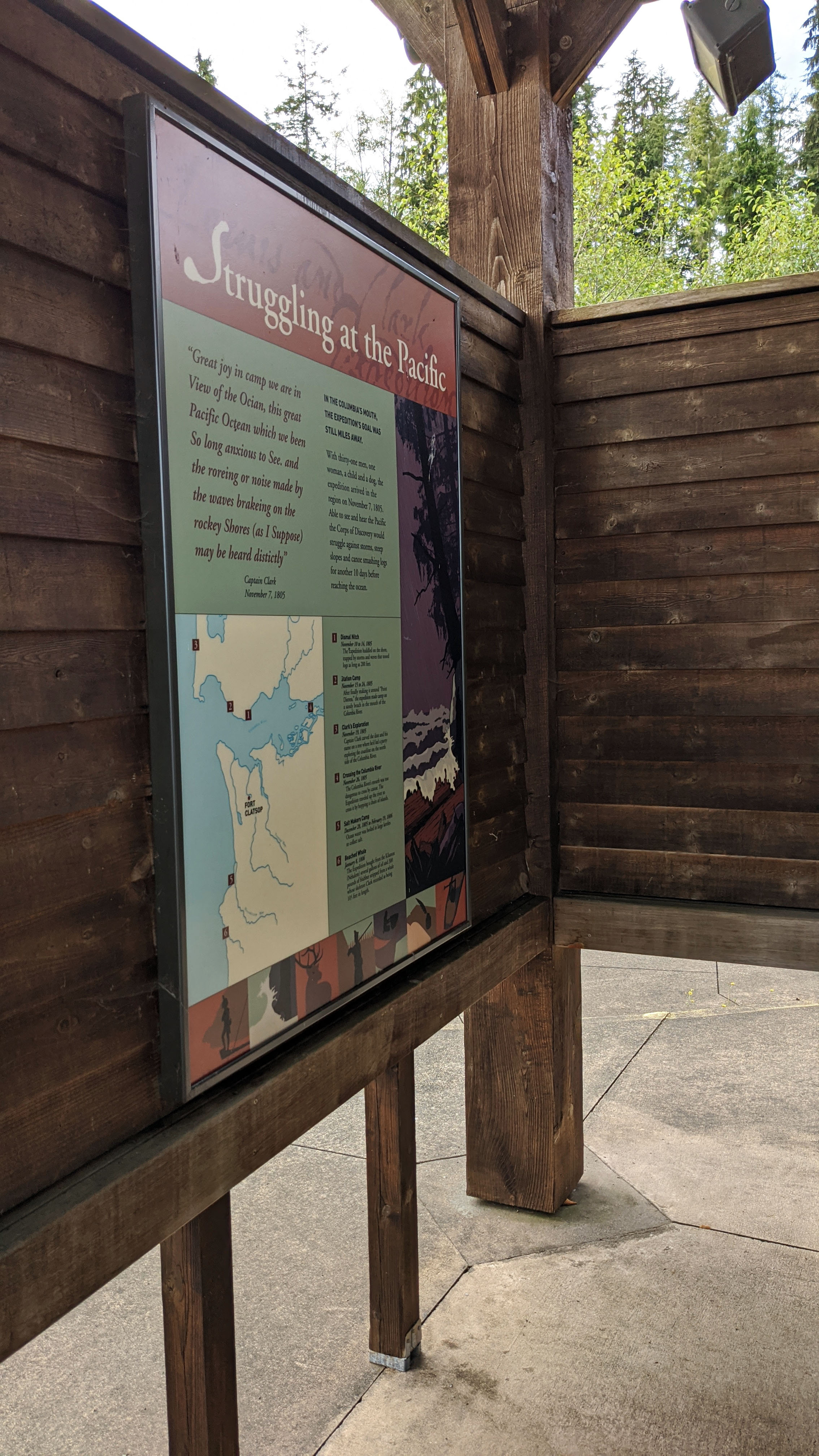
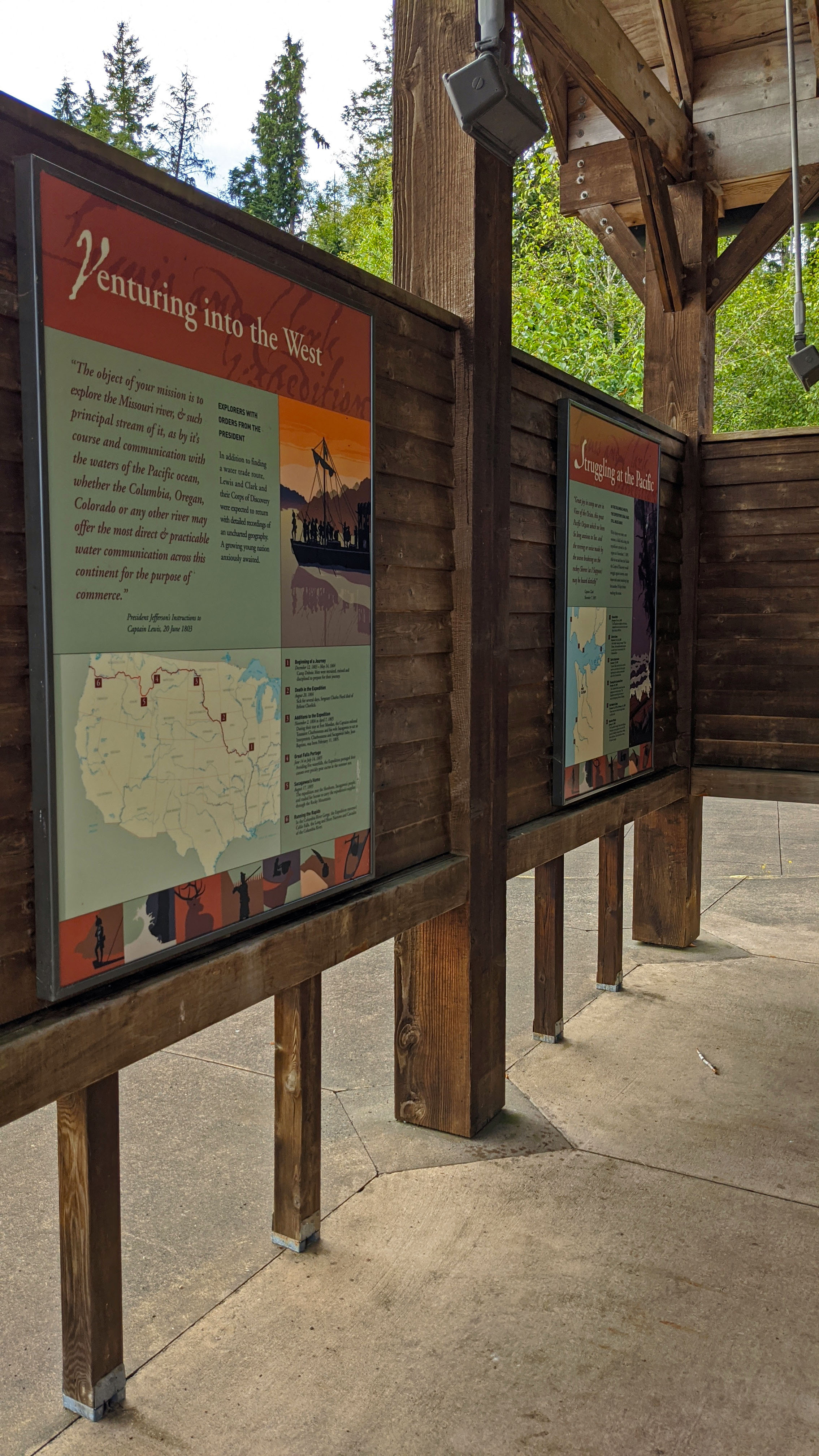
At the top of the large sign bold white text reads "Struggling at the Pacific" on a red background of shaded cursive reading "Lewis and Clark Expedition." The sign is divided into four sections, one larger rectangle at the top left, a map in the bottom left, a list of place descriptions to the right of the map, and a picture going down the right side of the sign. The top left section reads in bold red text: "Great joy in camp we are in View of the Ocian, this great Pacific Octean which we have been So long anxious to See, and the roreing or noise made by the waves brakeing on the rockey Shores (as I Suppose) may be heard Disticly" Captain Clark, November 7, 1805. To the right a paragraph in bold black text continues: In the COlumbia's mouth, the expedition's goal was still miles away. With thirty-one men, one woman, a child and a dog, the expedition arrived in the region on November 7, 1805. Able to see and hear the Pacific the Corps of Discovery would struggle against storms, steep slopes and canoe smashing logs for another 10 days before reaching the ocean. The map in the bottom left depicts the mouth of the Columbia river, Washington, and Oregon, with points one through five marked on it as well as a dot and text of where Fort Clatsop is located. To the right the five points are labeled. Point one: Dismal Nitch, November 10 to 14, 1805. The Expedition huddled on the shore trapped by storms and waves that turned logs as long as 200 feet. Point two: Station Camp, November 15 to 24, 1805. After finally making it around "Point Disappointment" the expedition made camp on a sandy beach in the mouth of the Columbia River. Point three: Clark's Exploration, November 19, 1805. Captain Clark carved the date and his name on a tree where he'd led a party exploring the coastline on the other side of the Columbia River. Point four: Crossing the Columbia River, November 26, 1805. The Columbia River's mouth was too dangerous to cross by canoe. The Expedition proceeded up the river to cross it by hopping a chain of islands. Point five: Salt Makers Camp, December 28, 1805 to February 13, 1806. Ocean water was boiled in large buckets to collect salt. Point six: Beached Whale. January 8, 1806. The Expedition bought from the Kilamix several gallons of oil and 300 pounds of blubber stripped from a whale whose skeleton Clark measured at being 105 feet in length. The picture that descends the right side of the sign depicts waves crashing into logs on a shoreline, twiggy tree silhouette hang over the rough scene of Dismal Nitch. At the bottom seven small stylized pictures depict silhouetted figures. The first is a military captain on the front of a boat, the second waves crashing against rocks, the third an elk, the fourth a soldier infront of the walls of a log fort, the fifth an person sealing a box with a high-prow canoe in front of them, the sixth a quill pen in an ink well, and the seventh a person paddling inside a canoe.
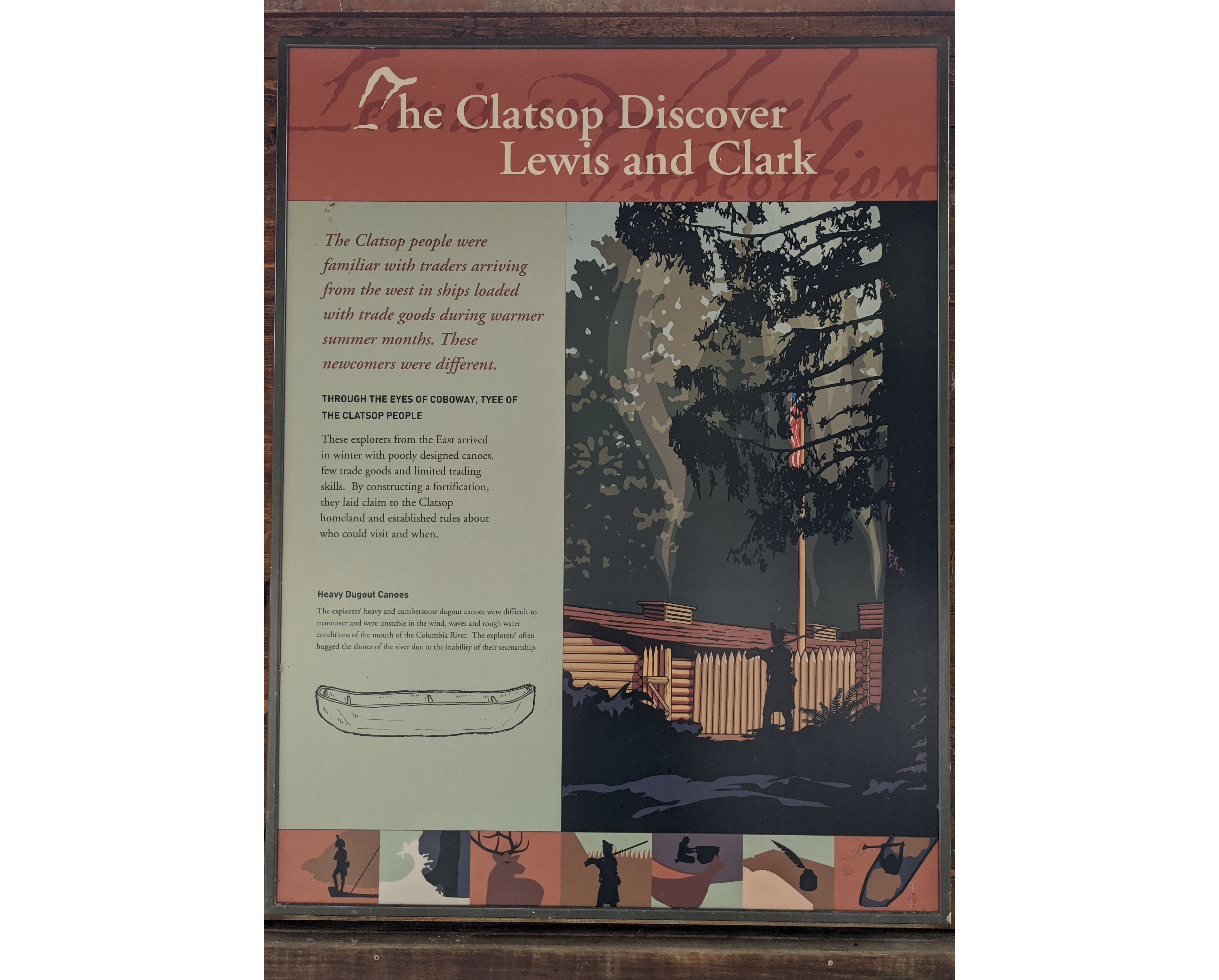
In bold white text at the top the title, The Clatsop Discover Lewis and Clark, is backed by red and shaded text reading "Lewis and Clark Expedition." The sign is divided into two sections, left and right. The left side is divided into three paragraphs. The top is in bold red text and reads: The Clatsop people were familiar with traders arriving from the west in ships loaded with trade goods during warmer summer months. These newcomers were different. Below in bold the title of the second paragraph: Through the eyes of Coboway, tyee of the Clatsop people. The text below: These explorers from the East arrived in winter with poorly designed canoes, few trade goods and limited trading skills. By constructing a fortification, they laid claim to the Clatsop homeland and established rules about who could visit and when. The final paragraph's title: Heavy Dugout Canoes. The text below: The explorers' heavy and cumbersome dugout canoes were difficult to maneuver and were unstable in the wind, waves and rough water conditions of the mouth of the Columbia River. The explorers' often hugged the shores of the river due to the inability of their seamanship. Below the paragraph is a sketch of a dugout canoe, a log carved into a canoe shape. The right side of the sign is a fully colored artistic depiction of Fort Clatsop, smoke rising from the chimneys with the american flag half hidden behind tree branches. The silhouette of a soldier on guard duty marches towards an open log gate with his flintlock gun on his shoulder. At the bottom seven small stylized pictures depict silhouetted figures. The first is a military captain on the front of a boat, the second waves crashing against rocks, the third an elk, the fourth a soldier infront of the walls of a log fort, the fifth an person sealing a box with a high-prow canoe in front of them, the sixth a quill pen in an ink well, and the seventh a person paddling inside a canoe.
In bold white text at the top the title, Venturing into the West, is backed by red and shaded text reading "Lewis and Clark Expedition." Separated into four separate square panels, the top left in red text is, in quotation marks, "The object of your mission is to explore the Missouri river, & such principal stream of it, as by its course and communication with the waters of the Pacific ocean, whether the Columbia, Oregan, Colorado or any other river may offer the most direct & practicable water communication across this continent for the purpose of commerce." Signed President Jefferson's Instructions to Captain Lewis, 20 June 1803. Besides this quote reads: Explorers with orders from the president. in addition to finding a water trade route, Lewis and Clark and their Corps of Discovery were expected to return with detailed recordings of an uncharted geography. A growing young nation anxiously awaited. In the top right panel a silhouette of a keelboat, sails raised, travels on a still-water river that shows the reflection of the keelboat and silohoutted members of the Corps of Discovery. Three on each side hold oars paddling the keelboat while others hold their muskets, a figure at the front of the keelboat wears a captain's hat. The orange sunset is above them. The bottom left panel is a map of the United States, a purple line tracks the route of the expedition with numbered points one through six. Point one is in Illinois, point two is in Iowa, point three is in North Dakota, point four is in Montana, point five is in Idaho, and point six is in Oregon. The bottom right panel lists each of the points from the map with details. Point one: Beginning of a Journey. December 12, 1803 to May 14, 1804. Camp Dubois; Men were recruited, trained and disciplined to prepare for their journey. Point two: Death in the Expedition. August 20, 1804. Sick for several days, Sergeant Charles Floyd died in Beliose Chorlick. Point three: Additions to the Expedition. November 2, 1804 to April 7, 1805. During their stay at Fort Mandan, the Captains enlisted Toussaint Charbonneau and his wife Sacagawea to act as Interpreters. Charbonneau and Sacagawea's baby, Jean Baptiste, was born February 11, 1805. Point four: Great Falls Portage. June 14 to July 14, 1805. Avoiding five waterfalls, the Expedition portaged their canoes over prickly pear cactus in the summer sun. Point five: Sacagawea's Home. August 17, 1805. The expedition met the Shoshone, Sacagawea's people, and traded for horses to carry the expeditions supplies through the Rocky Mountains. Point six: Running the Rapids. In the Columbia River Gorge, the Expedition traversed Celilo Falls, the Long and Short Narrows and Cascades of the Columbia. At the bottom seven small stylized pictures depict silhouetted figures. The first is a military captain on the front of a boat, the second waves crashing against rocks, the third an elk, the fourth a soldier infront of the walls of a log fort, the fifth an person sealing a box with a high-prow canoe in front of them, the sixth a quill pen in an ink well, and the seventh a person paddling inside a canoe.
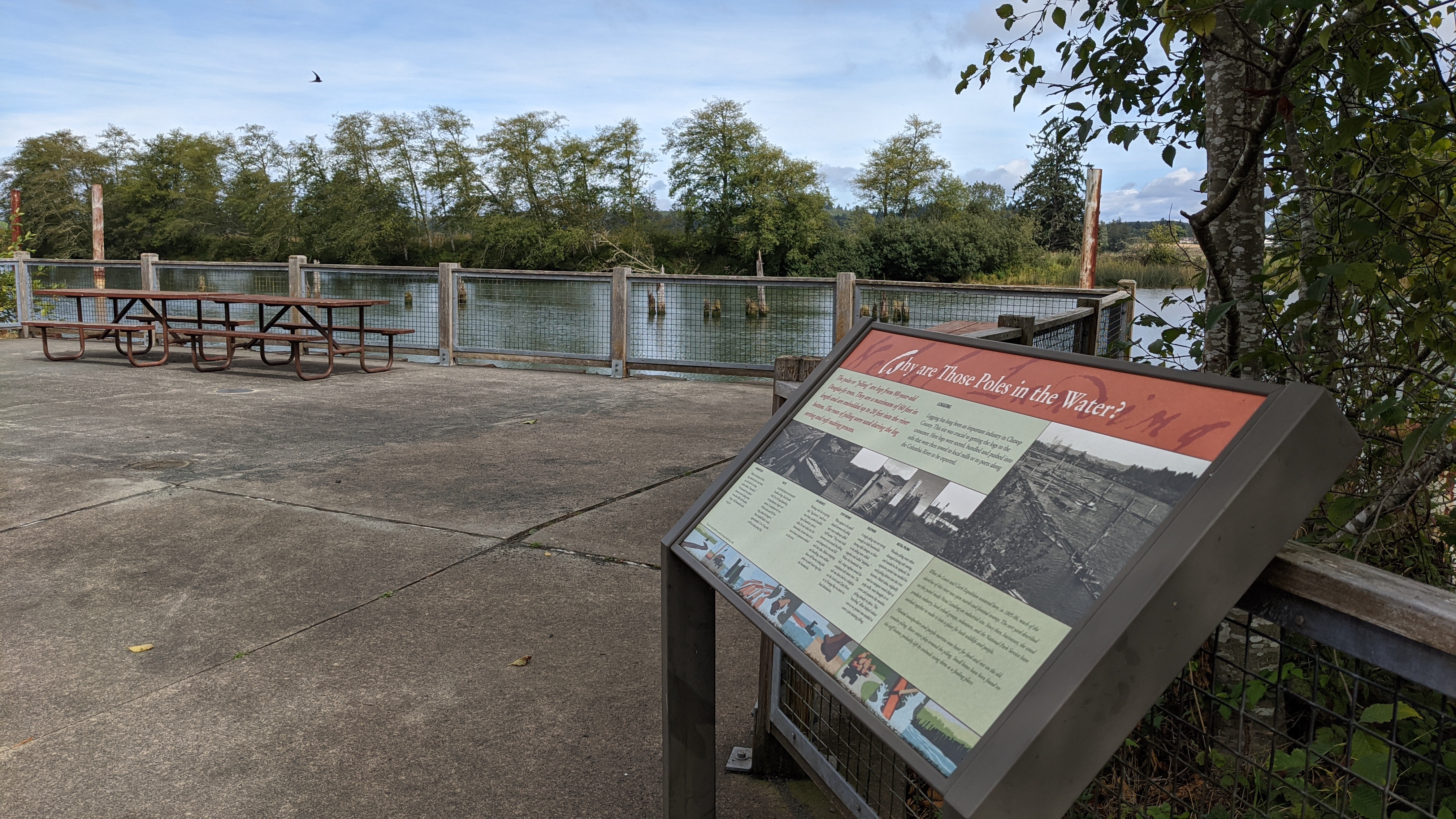
Located at Netul Landing, the "Why Are Those Poles in the Water?" sign tells about the logging industry in the region and why they put poles in the water.
Found on a concrete bulkhead, the sign overlooks the Netul River with many log poles coming out of the river. The sign is divided up into three sections. The top section of the sign is the title "Why are Those Poles in the Water?" Directly below is the largest section. The first paragraph reads: "The poles or 'piling' are logs from 80-year-old Douglas-fir trees. They are a maximum of 60 feet in length and are embedded up to 20 feet into the river bottom. The rows of piling were used during the log sorting and rafting making process." The second paragraph is titled: "Logging" and reads: " Logging has long been an important industry in Clatsop County. This site was crucial to getting the logs to the consumer. here logs were sorted, bundled, and pushed into rafts that were then towed to local mills or to ports along the Columbia River to be exported." Below the two paragraphs is a series of black and white photographs with captions. The first photograph is an aerial view of the river with many logs in the water to create boomsticks loosely spaced apart. The caption reads: "Boomsticks. Twelve to fourteen 64-foot logs chained end to end made up each side of a sorting pocket called a 'boomstick.' The boomstick was placed between rows of piling where it was then filled with bundles of logs. A full boomstick made a log raft." The second photograph is an aerial view with the logs much tighter together to form rafts. The caption reads: "Rafts. A raft held about one hundred bundles of logs. Each bundle held 24 to 36 logs depending on log diameter, length and species. A completed raft was 50 feet across and 820 feet long, about the length of three football fields! It took approximately 12 to 13 log rafts to fill an ocean-going ship." The third photograph shows a small boat with logs directly behind it. The caption reads: "Log Broncs. Working with the out-going tide, 'log broncs,' small one-man boats, pushed bundled logs of hemlock, spruce, alder, fir and cedar into the boomsticks. At one time six or seven bronc operators worked on the river." The fourth photograph shows the wooden poles in the water with wooden walkways floating between them. The caption reads: "Stiff Booms: What appear to be small islands between the piling were once walkways called 'stiff booms.' They were built between and around the piling and designed to rise and fall with the tides. Before strapping and bundling, crews walked these stiff booms using pike poles to push loose logs into the boomsticks." The fifth photograph is zoomed in on multiple poles cabled together to form one stronger mass. The caption reads: "Dolphins. A single piling was not strong enough to hold boomsticks during tidal changes, so three to six piling were cabled together and called 'dolphins.' When the boomstick was full, a large tugboat towed the completed raft down river. The raft was then tied to a dolphin on the Lewis and Clark River or in Youngs Bay to await its final destination." The last photograph is of poles in the water surrounded by a metal surface. The caption reads: "Metal Piling. Wooden piling were often damaged during raft towering and needed to be replaced. An expensive permit was needed for each piling driven into the river bottom. Metal tubes, originally used to transport wood chips at pulp mills, were brought in to cover and preserve the wooden piling already in place. This 'recycling' effort helped reduce cost as no permit was needed to cover a pre-existing piling." To the right of the series of photographs is the final section, one large black and white photograph of the Netul river showing a long bronc, boomsticks, and log rafts all in one scene. Underneath it a large paragraph reads: "When the Lewis and Clark Expedition wintered here, in 1805-06, much of the shoreline of this river was open marsh and forested swamp. The sort yard described on this panel made Netul Landing an industrial site. Since then, businesses, the wood products industry, local school groups, volunteers, and the National Park Service have worked together to make it into a place for both wildlife and people. Pileated woodpeckers and purple martins now hunt for food and rest on the old wooden piling. River otters play around the piling. Small bones have been found on the stiff booms; probably left by animals using them as a feeding place." Across the bottom of the sign are artistic depictions of the logging industry. One depicts a log bronc, one a log truck being loaded up, one the pilings, one a log raft, one boots walking on the shoreline, one a log truck driving off, one a long pole being used to grab a log in the water, and the final picture being of the Netul River itself.
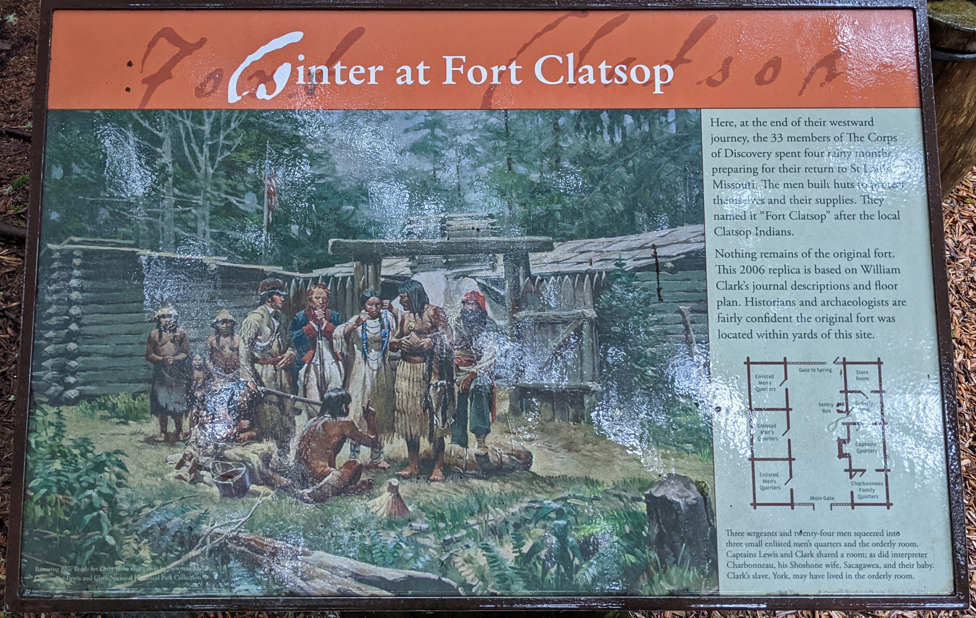
Across the top of this sign on a red background "Fort Clatsop" is written in stylized cursive. Below, the sign is split into two boxes. The left box is a print of a painting depicting Sacagawea, George Drouilliard, Lewis, and Clark standing outside the 50 foot wide, 15 foot tall, Fort Clatsop, with seven members of the Clatsop nation standing with them engaged in trading. Sacagawea holds a blue bead necklace out to one of the Clatsop nation members. On the right box is text and a diagram of the floorplans for Fort Clatsop. The text reads: "Here, at the end of their westward journey, the 33 members of The Corps of Discovery spent four rainy months preparing for their return to St. Louis Missouri. The men built huts to protect themselves and their supplies. They named it 'Fort Clatsop' after the local Clatsop Indians. Nothing remains of the original fort. This 2006 replica is based on William Clark's journal descriptions and floor plan. Historians and archaeologists are fairly confident the original fort was located within yards of this site." The floorplan diagram of Fort Clatsop is a brown square divided into three rectangles on the left side and four on the right side with the middle being empty ground. The top left, left middle, and bottom left rectangles are all labelled the Enlisted Men's Quarters. The top of the diagram has a small opening labelled as the Gate to Spring, and below it a small box listed as the Sentry Box. At the bottom of the diagram a large opening is listed as the Main Gate. The top right rectangle is the Store Room, below is the Orderly Room, beneath is the Captains' Quarters, and the bottom right rectangle is the Charbonneau Family Quarters. Beneath the diagram is a final paragraph: "Three sergeants and twenty-four men squeezed into three small enlisted men's quarters and the orderly room. Captains Lewis and Clark shared a room; as did interpreter Charbonneau, his Shoshone wife, Sacagawea, and their baby. Clark's slave, York, may have lived in the orderly room.
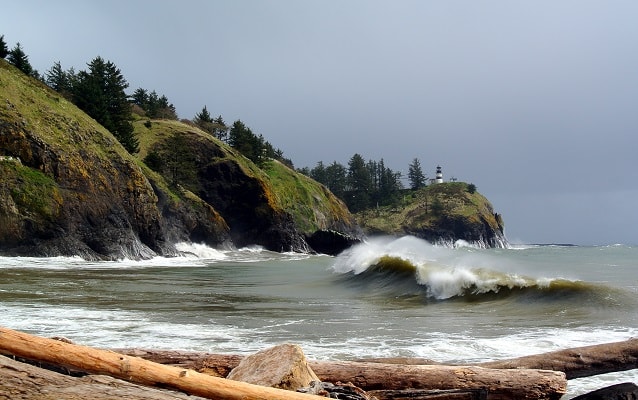
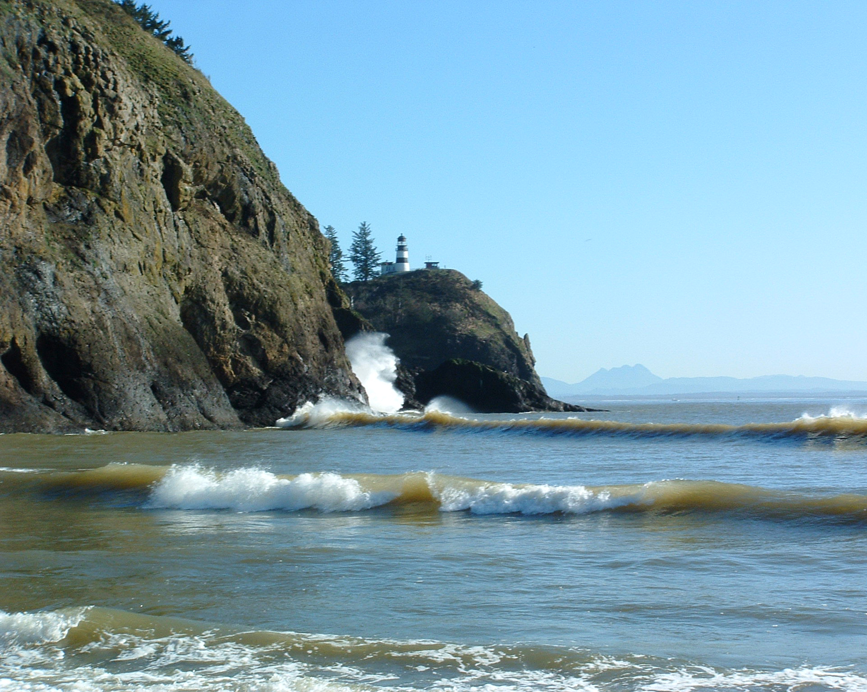
Cape Disappointment is a large headland forming the northern portion of the mouth of the Columbia River, as it opens to the Pacific Ocean. Most members of the Corps arrived here on November 15, 1805, where they first saw the Pacific Ocean. Clark camp near Chinook Point while Lewis scouted for a favorable site for a winter encampment.
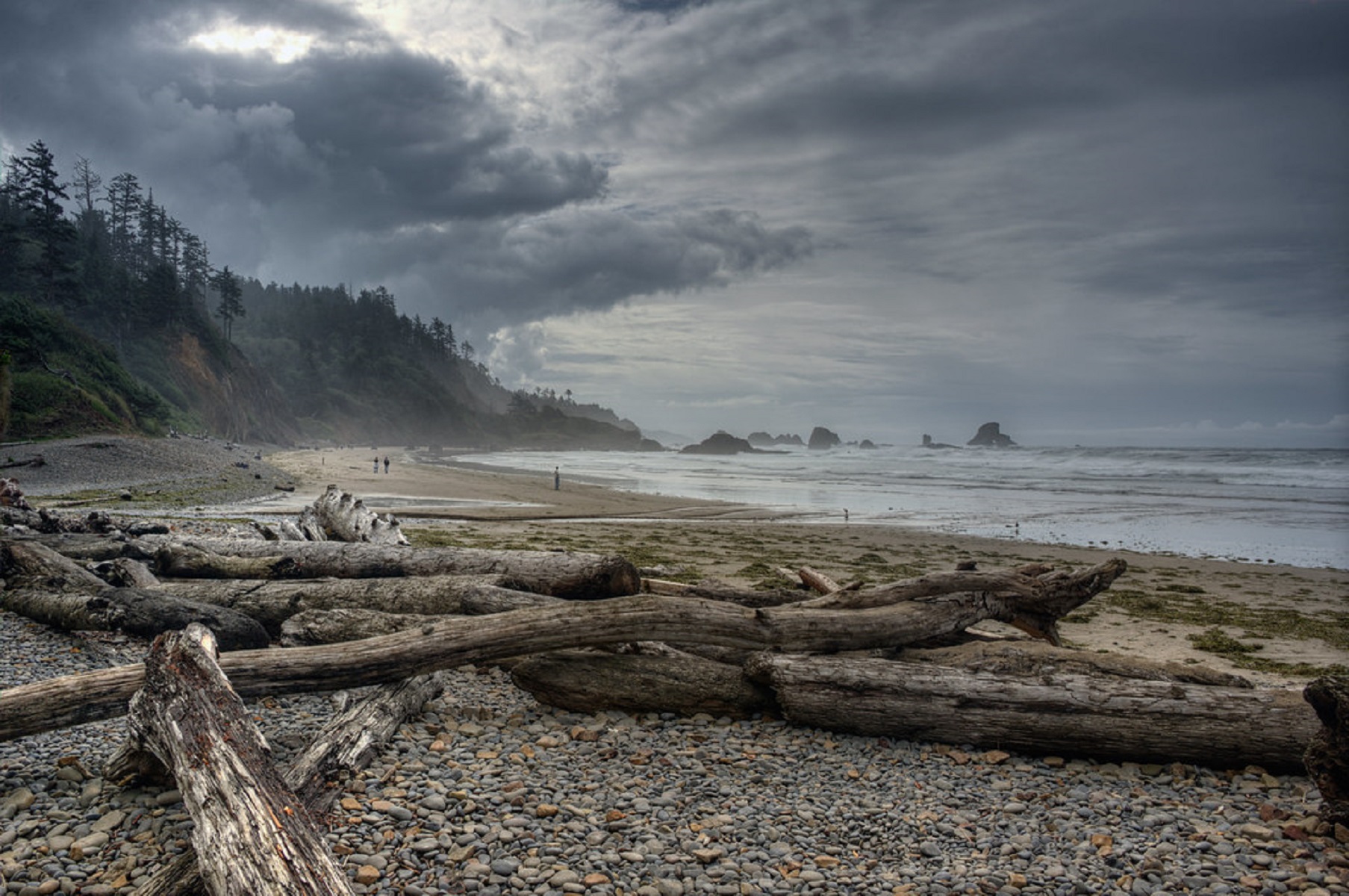
200 foot cliffs rise above dark breaking surf. They are a vibrant green, covered in plant life such as grasses and trees. The beach below is scattered with large rocks and driftwood. A white lighthouse stands on the top of the cliffs. The cape becomes very narrow before opening up into the larger bay.
Located in Ilwaco, Washington, Cape Disappointment State Park was named for Captain John Meares’ first failed attempt to find the Columbia River in 1788. Meriwether Lewis and William Clark would later conduct reconnaissance of this area during their stay at Station Camp from November 15 to November 24, 1805.
Cape Disappointment is a 2,023-acre camping park located on the Long Beach Peninsula. It is fronted by the Pacific Ocean and looks into the mouth of the Columbia River. The park has an interpretive center and museum. The North Head Lighthouse is also within the park. There are several trails that cross through coastal forests, wetlands, and dunes.
When Meriwether Lewis and William Clark reached the Pacific Ocean, they were in an area where Chinookan people controlled the extensive trade along the rivers, including trade from ocean-going European ships.
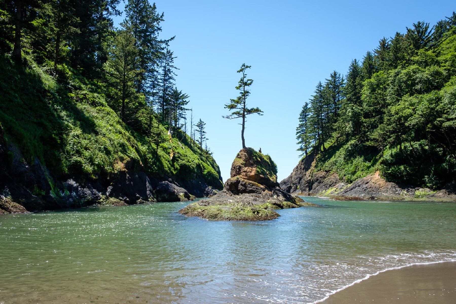
High cliffs overlook the ocean and the wide mouth of the Columbia River. Wind-shaped evergreen trees grow atop the cliffs.
iserable and soaked to the skin, the men under Meriwether Lewis and William Clark’s command had followed the shoreline of Shallow Bay (now called Grays Bay) for two days in an attempt to round modern day Point Ellice (Point Distress in the journals) before the bad weather and rough waters forced them to turn back.They backtracked to the location they dubbed “Dismal Nitch” (Hungry Harbor) where they were able to unload their canoes and make camp.
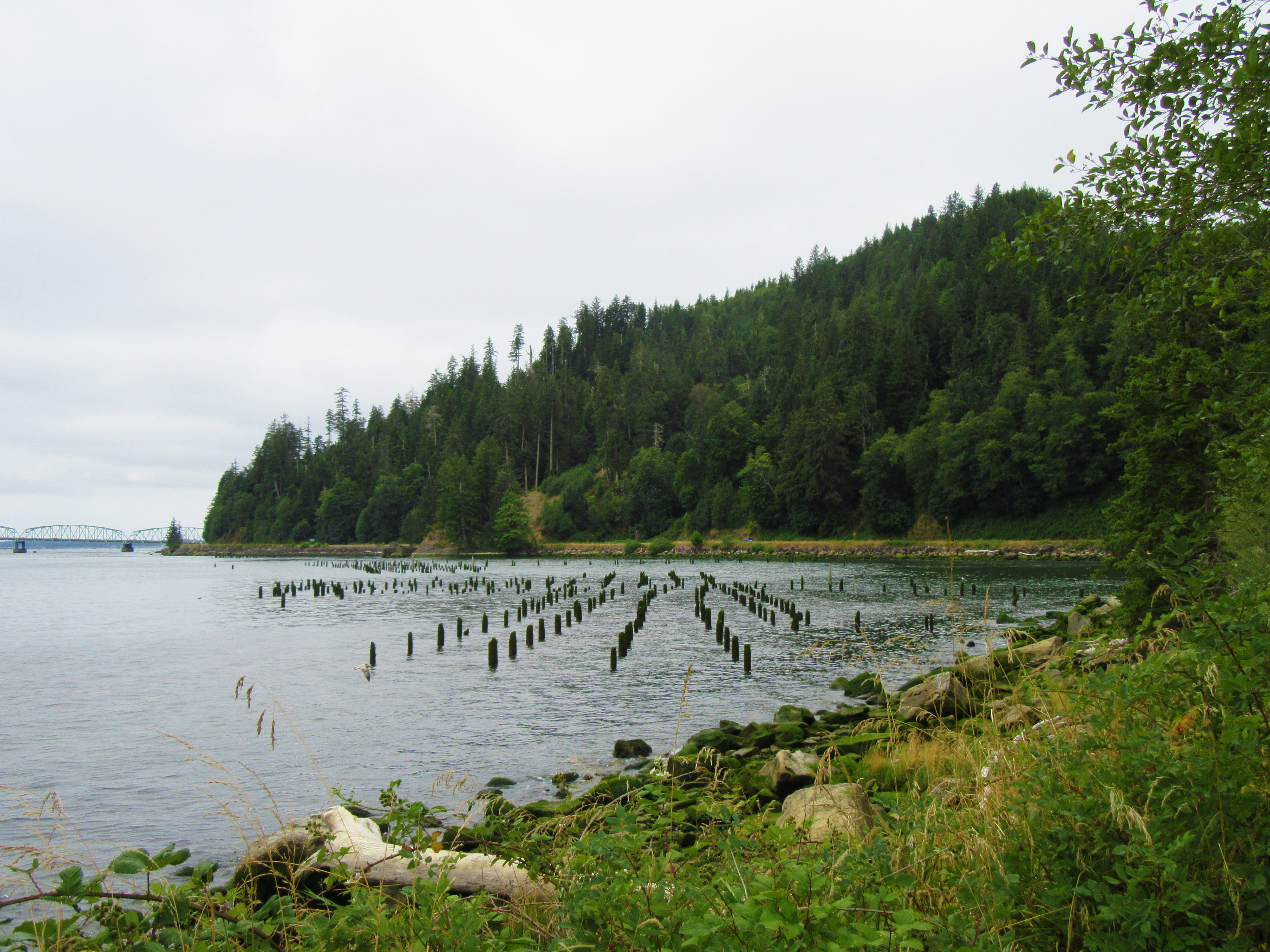
Wide river with wooden pilings sticking out of the water. Evergreen trees along the far shore with a large bridge in the far background.
Located an hour west of Portland, Oregon, the strand of shoreline now called Indian Beach was once home to several Tillamook villages. When passing through on January 8, 1806, William Clark’s guide pointed out these village to the explorer as they searched for a whale carcass that was said to have washed ashore nearby.
When you arrive at the park, the entrance road takes you through a dense Sitka spruce forest. As you drive further in, it opens on to a grassy bluff overlooking the Pacific Ocean. Large rock formations called sea stacks dot the shoreline against a backdrop of coastal mountains.
A garden with a small woodchip covered path that loops through the plants. It's located at Netul Landing, so you can see the river and boat launch from the garden, as well as two covered picnic areas that are nearby.
The Corps reached the Pacific Ocean over a year and a half after departing from Camp Wood, and settled in for the 1805-06 winter. They built Fort Clatsop, a reconstruction of which is found at its original site, located in Astoria, Oregon. The Corp's presence in this area strengthened the United States's claim to the Northwest. It also paved the way for the first American settlement--the Pacific Fur Company Post, established in 1811 by John Jacob Astor.
Clatsop leader Coboway was friendly and hospitable to the Lewis and Clark Expedition when they camped in Clatsop territory during the winter of 1805–1806.
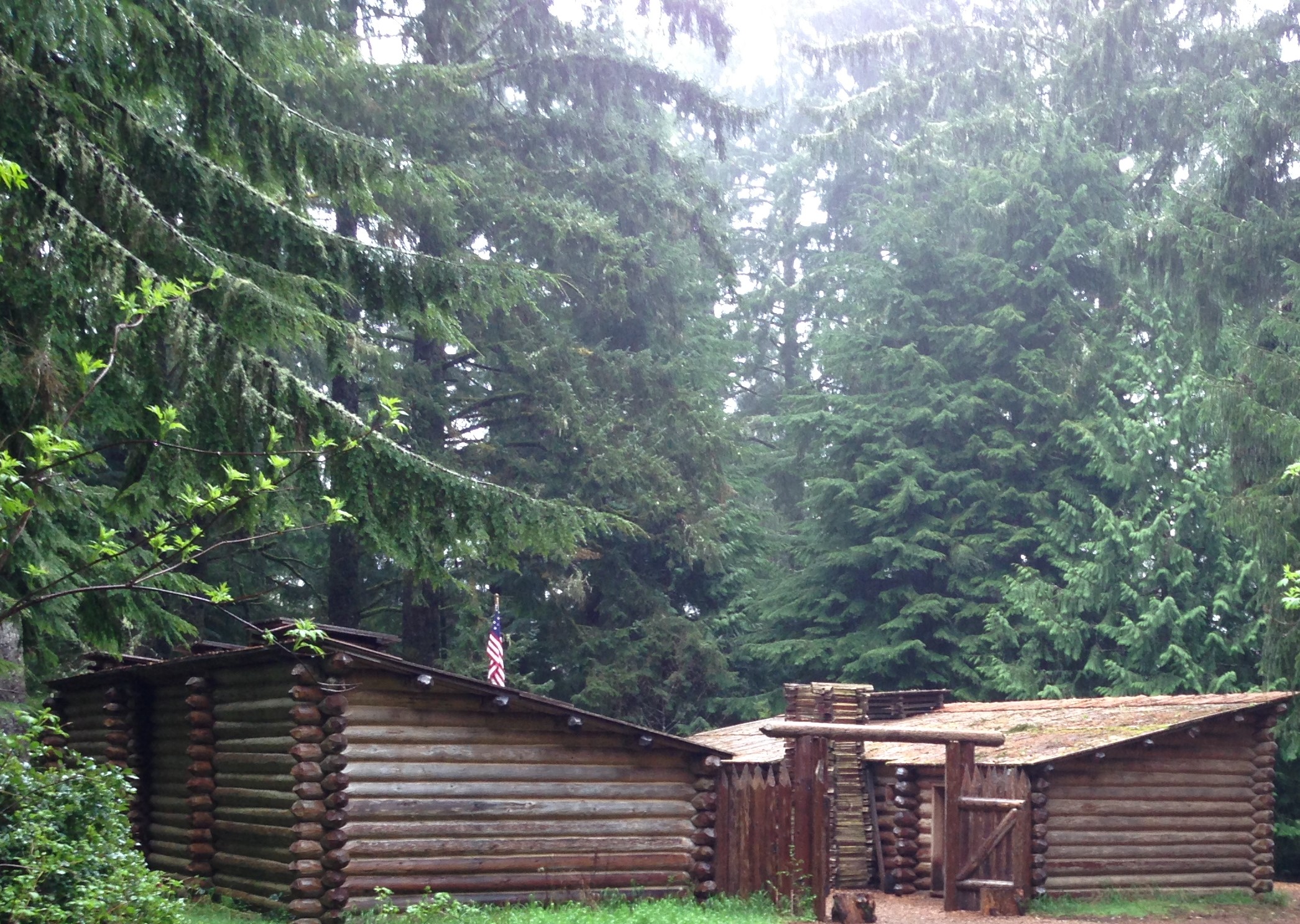
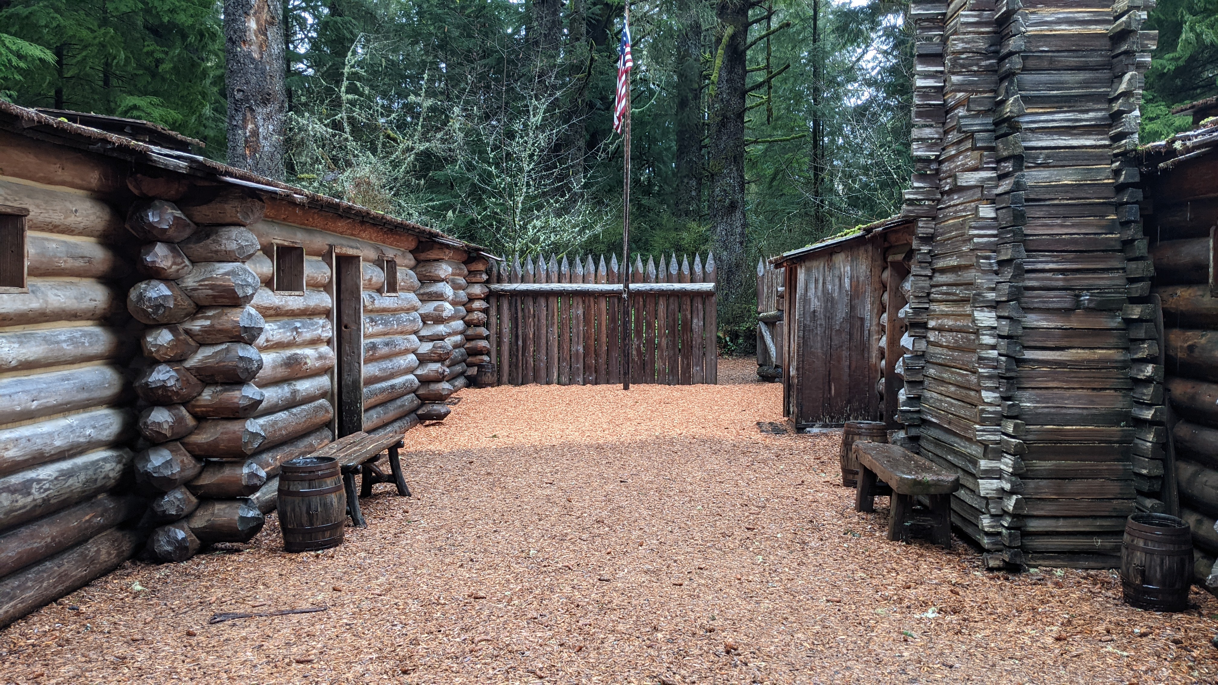
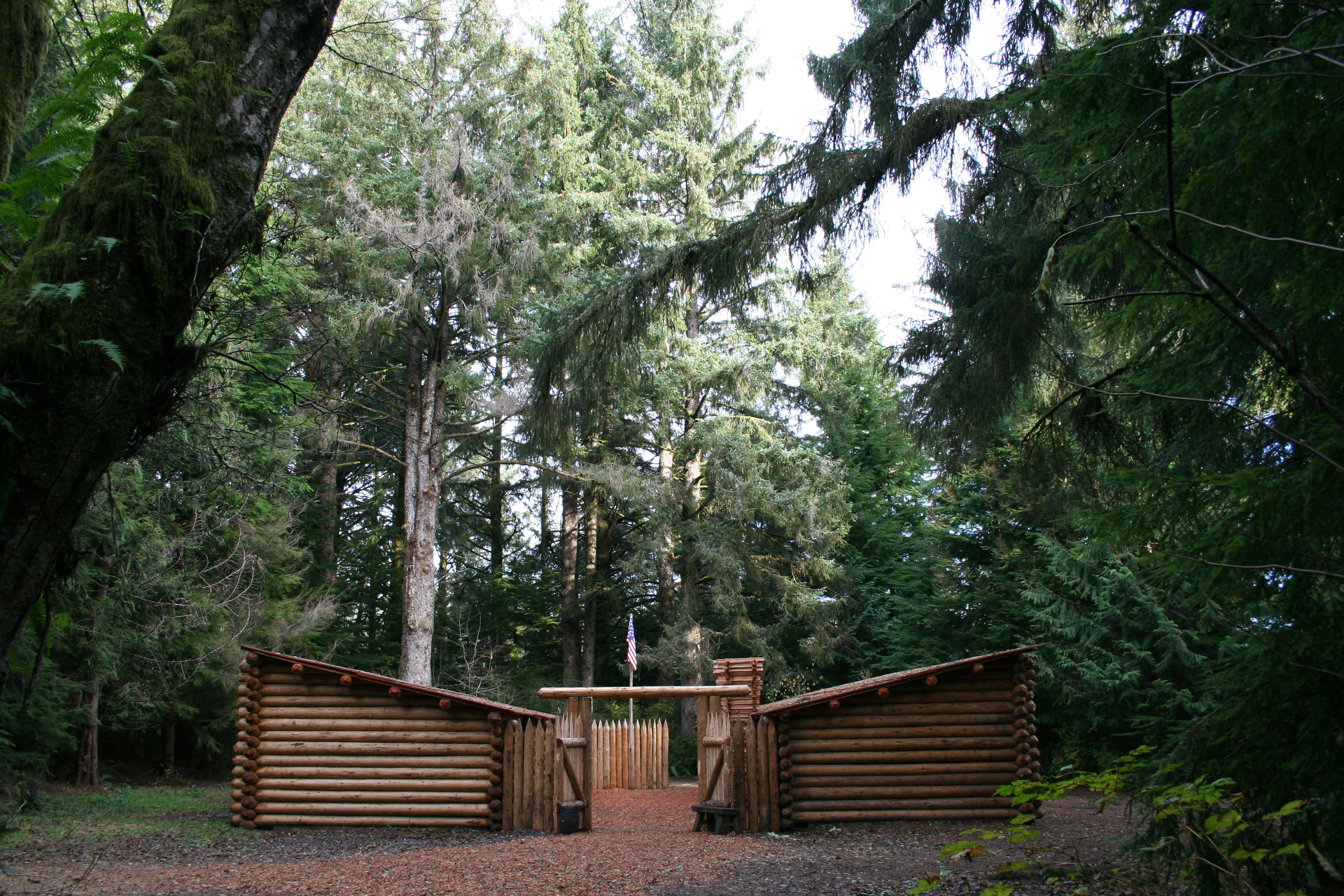
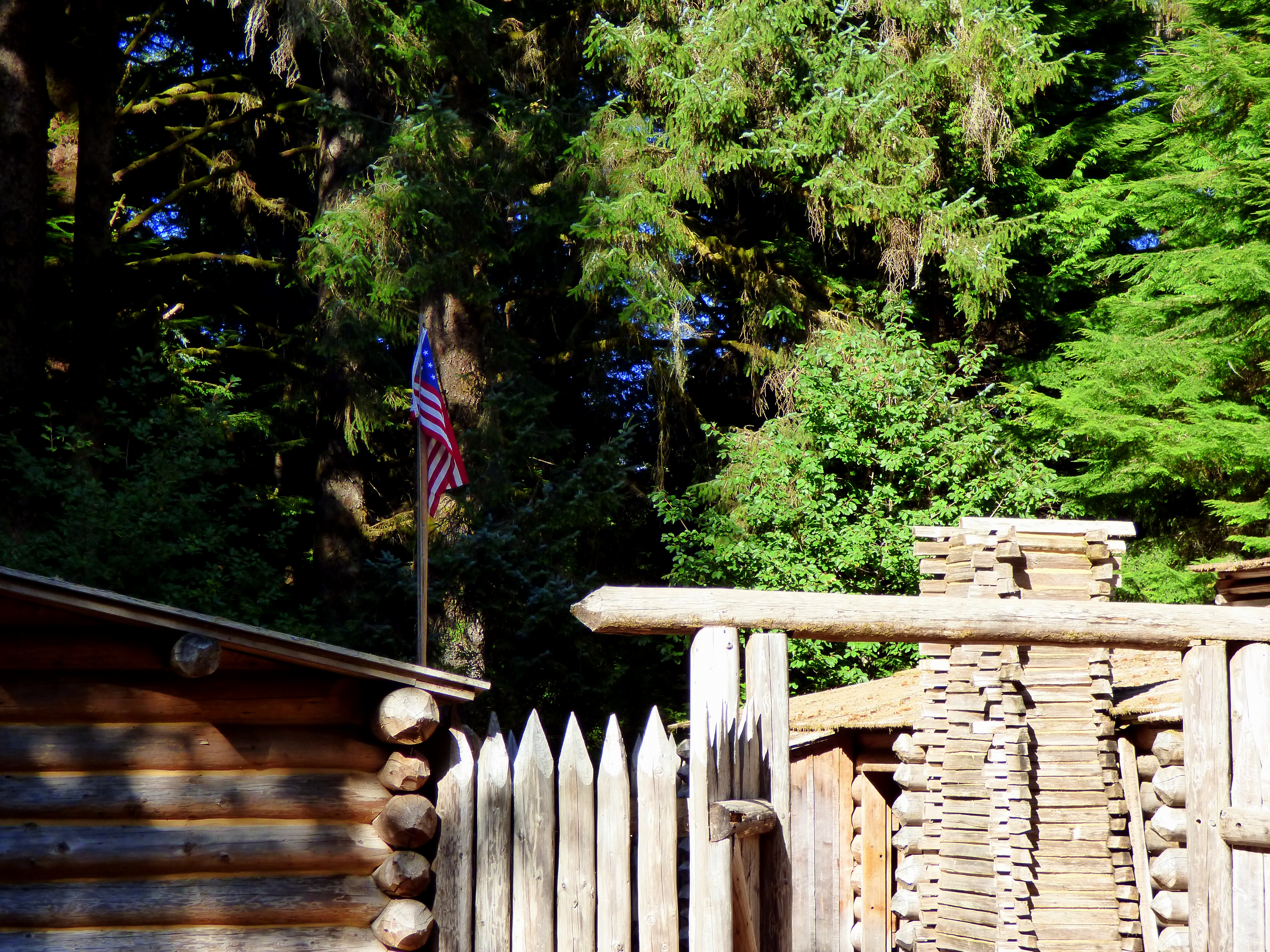
Reconstructed wooden fort in heavily wooded area. Down the hill from the fort is a creek.
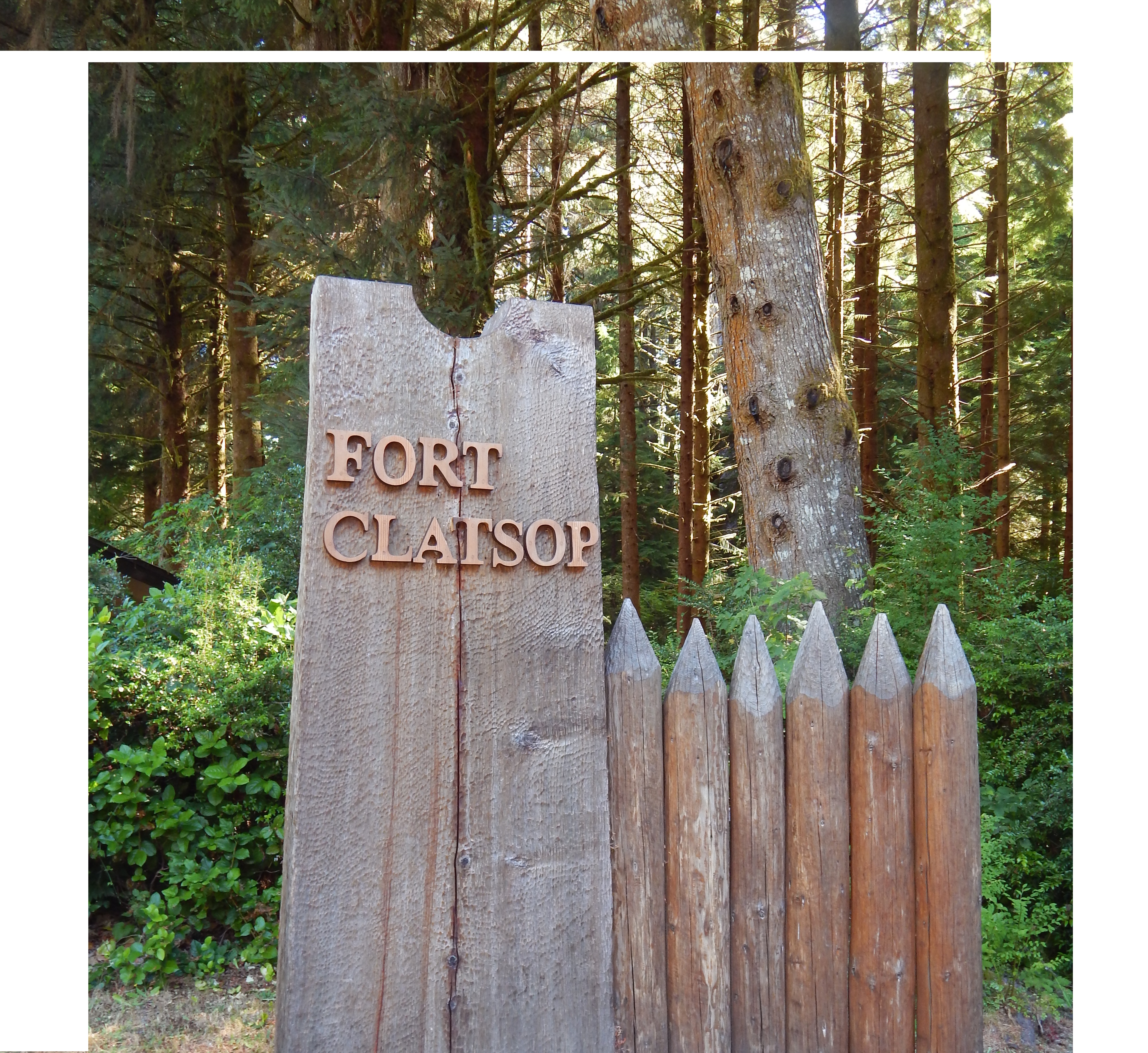
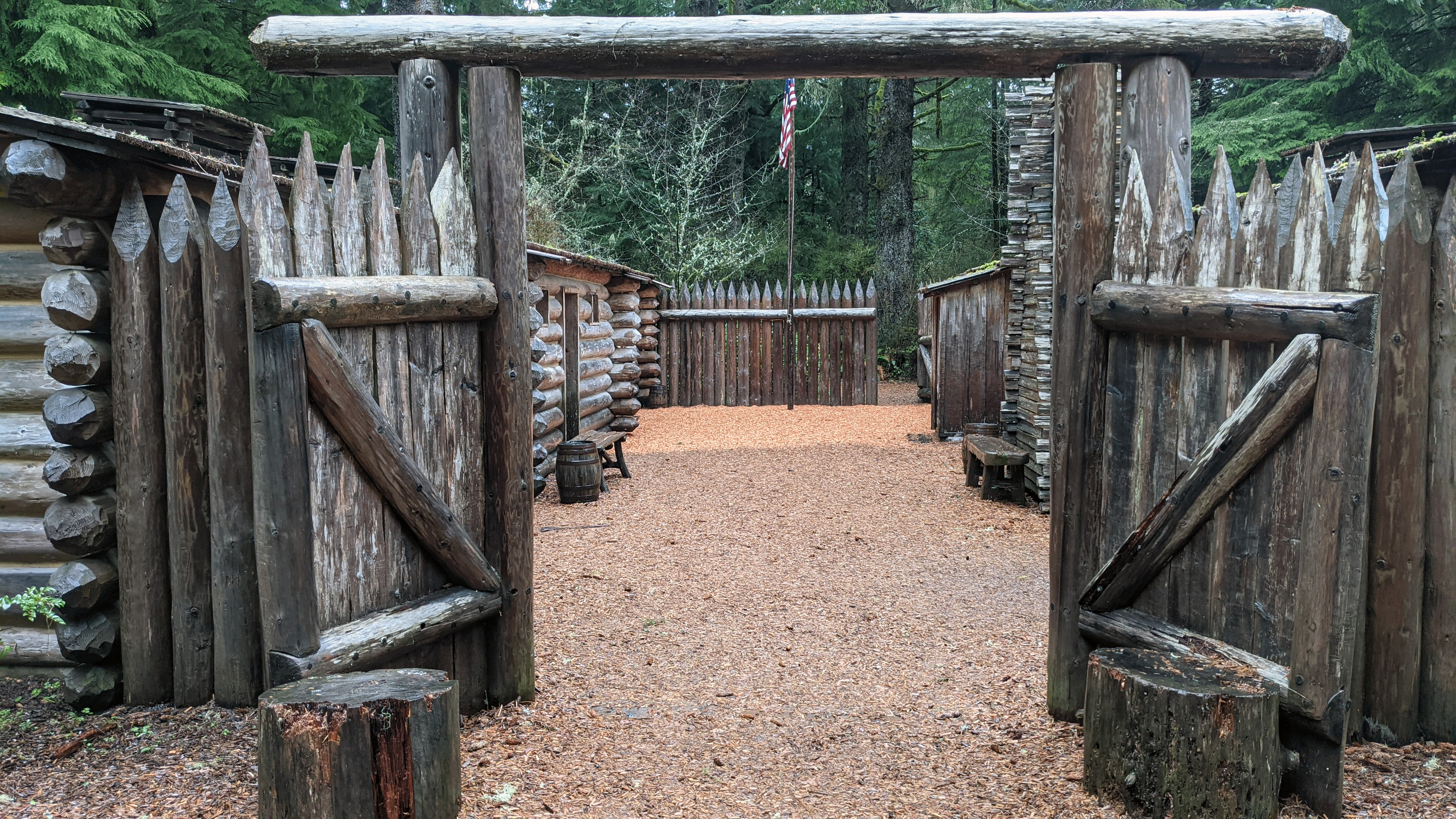
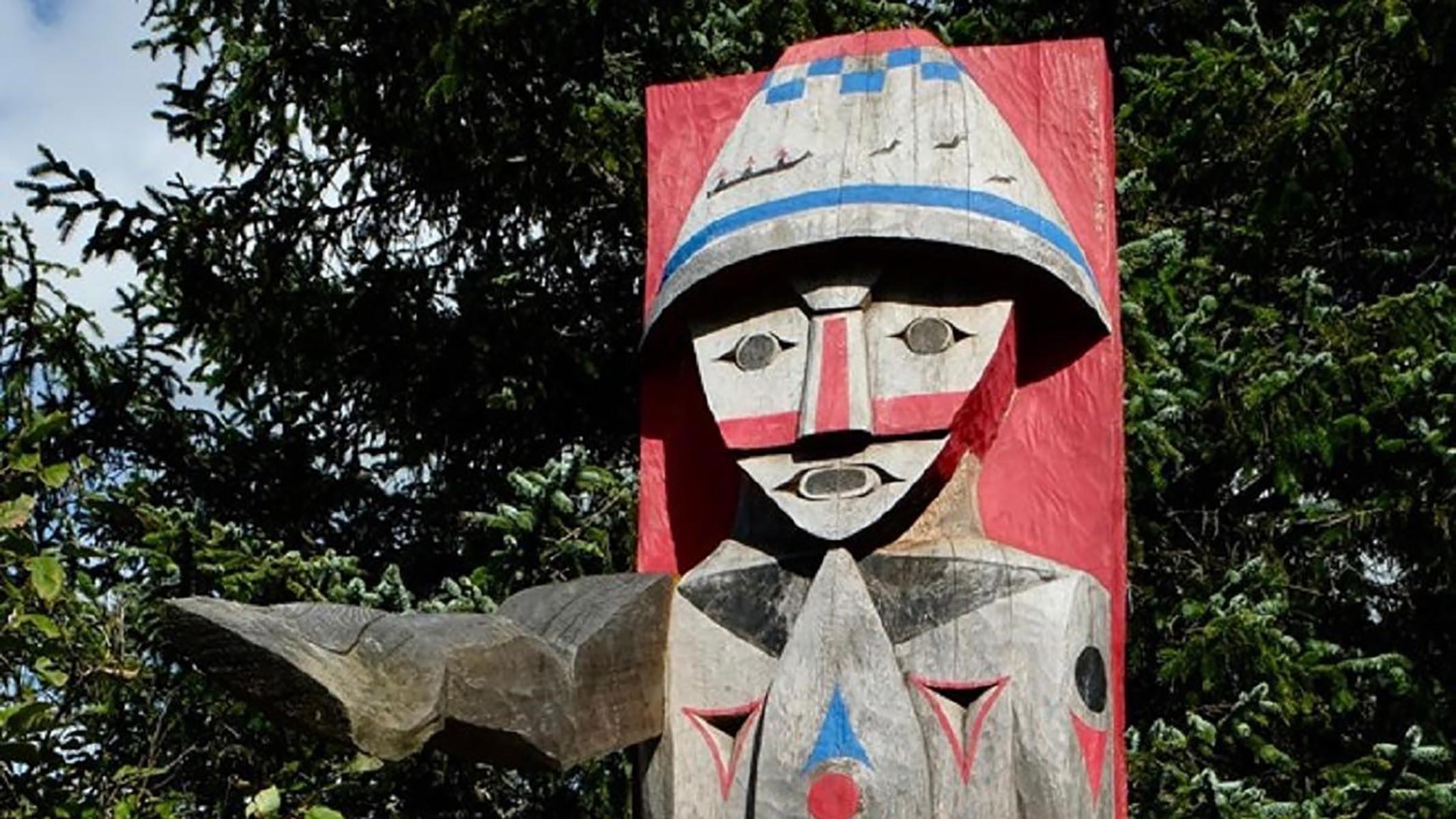
A approximately ten foot tall wooden sign with logs carved to reflect the walls of Fort Clatsop by it, across it carved into the wood reads 'Fort Clatsop.'
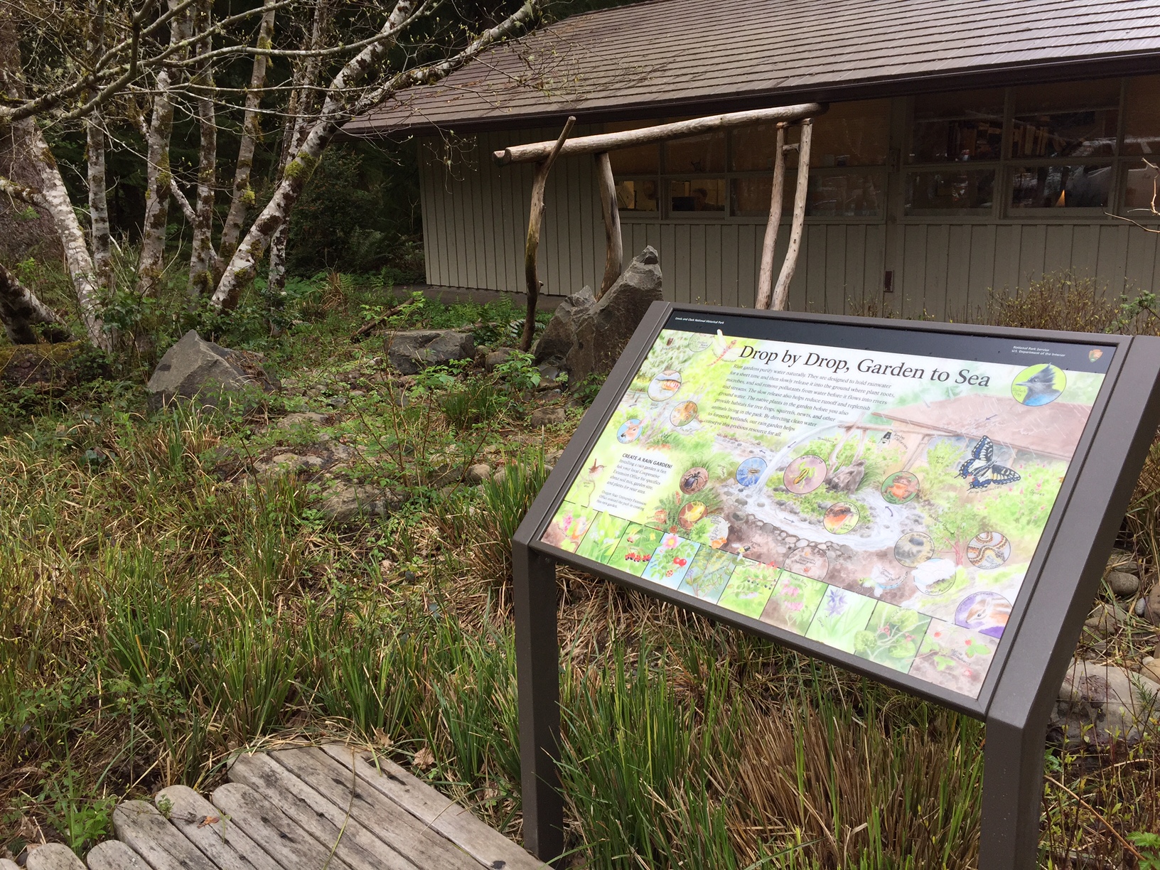
At the top of this 3-foot wide by 2-foot high wayside panel, a black band with “Lewis and Clark National Historical Park, National Park Service, U.S. Department of the Interior” in white letters. At the far right, the reddish-brown, green and white arrowhead logo of the National Park Service. Below this, the upper ¾ of the panel is filled with a watercolor illustration of the view of the rain garden and visitor center that is just beyond the panel. At the upper right, rain falls on the reddish-brown shingled roof of the tan wooden-sided visitor center. Rainwater flows from the roof’s gutter into a wooden trough supported at roof level by sections of tree trunks until it reaches the center of the illustration’s rain garden. There, the water spills into a stream circling through the garden and flowing off the illustration to the left. Rain gardens purify water naturally. They are designed to hold rainwater for a short time and then slowly release it into the ground where plant roots, microbes, and soil remove pollutants from water before it flows into rivers and streams. The slow release also helps reduce runoff and replenish ground water. The native plants in the garden before you also provide habitats for tree frogs, squirrels, newts, and other animals living in the park. By directing clean water to forested wetlands, our rain garden helps conserve this precious resource for all. In places, the stream is edged with stones, and the ground is brown dirt mostly filled with vegetation in many shades of green. Some of the plants have blossoms or berries in pink, red, black, white, yellow, and pale purple. Against the overall illustration of the garden, sometimes highlighted in black-bordered circles, are some of the plants and animals that appear in the garden. The bottom quarter of the panel features 10 small black-bordered sections with additional watercolor illustrations of plants. Mammals include Douglas squirrel; Black tailed deer; Chickaree, also known as Douglas squirrel, and Vagrant shrew. Birds include Bald eagle, Winter wren, and Stellar’s jay. Reptiles & Amphibians include Rough skinned newt, Pacific tree frog, and Northwestern garter snake. Fish are represented by Chum salmon. Invertebrates include Variegated meadowhawk dragonfly, Common green darner dragonfly, Anise swallowtail butterfly, Wolf spider, Bumble bee, Carpenter bee, Carabid beetle. and Banana slug. Lichens, mosses, and fungi include Oyster mushroom, Orange peel fungus, Pixie cup lichen, Old man’s beard lichen, and Oregon state moss: kindbergia oregano. Create A Rain Garden! Installing a rain garden is fun. Ask your local Cooperative Extension Office for specifics about soil mix, garden size, and plants for your area. Oregon State University Extension Office assisted the park in creating this rain garden
One of the most intact historic coastal defense sites in the United States, Fort Columbia is situated atop Chinook Point and was built between 1896 and 1903. It was finally de-commissioned in 1947. Today, this former military installation is a 618-acre state park that makes up part of the Lewis & Clark National and State Historical Park.
A two-lane paved road leads under a post-and-lintel style gate made of field stone and dark wood with a sign that reads "Fort Columbia State Park." Flowering shrubs and tall trees line the drive. Throughout the site, buildings and military fortifications, some dating back to the 1890s, are scattered.
Situated inside Fort Stevens State Park at the mouth of the Columbia River, Point Adams has served as an important landmark for centuries. When Europeans first arrived in the area, it was the site of a large Clatsop settlement, and William Clark noted eight large houses on the site when they sailed past in 1805. The name of the landmark itself was coined on May 18, 1792, when Captain Robert Gray, a merchant mariner, sailed into the mouth of the Columbia River.
Fort Stevens State Park is a 4,300-acre park located near Astoria, Oregon. It is situated along the Columbia River, and encompasses Point Adams and the original Civil War-era earthen fort, Fort Stevens. Upon arriving at the park entrance, the entry road is flanked on either side by lush trees and a brown wooden sign with white lettering saying, "Fort Steven State Park." The signs are set upon a brick base. Extending behind the signs are brick planters with flowering plants.
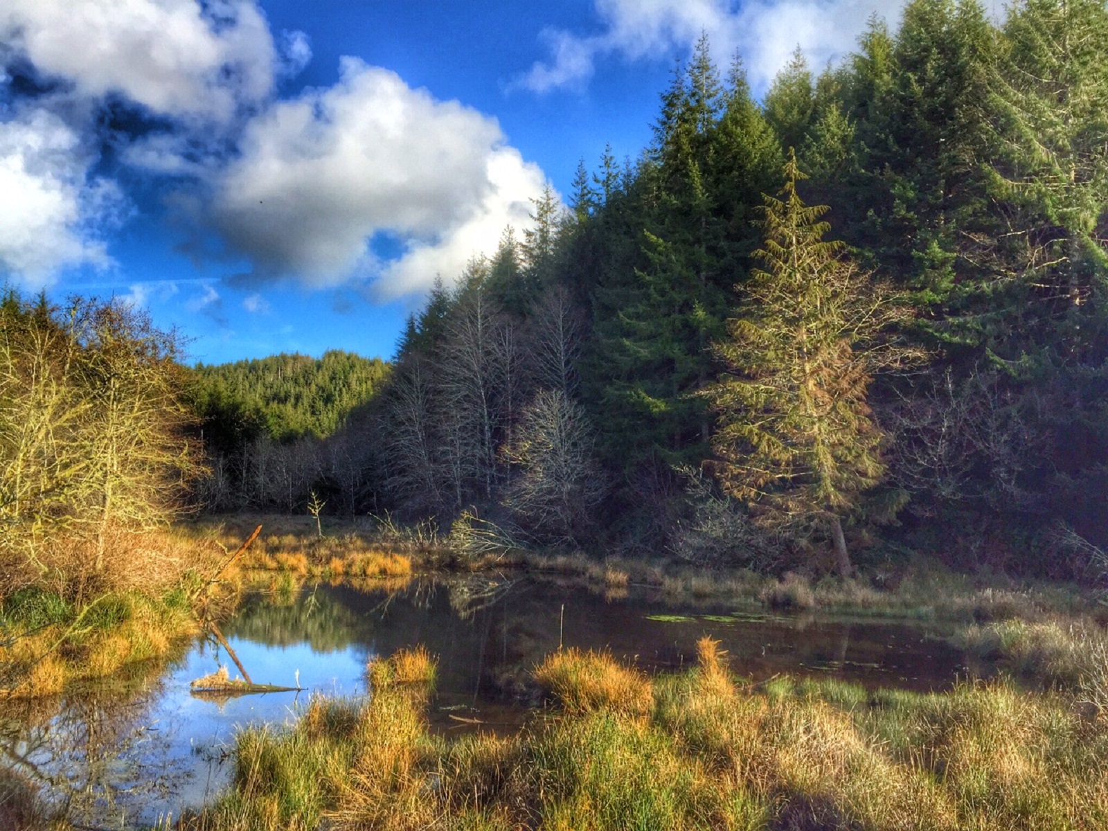
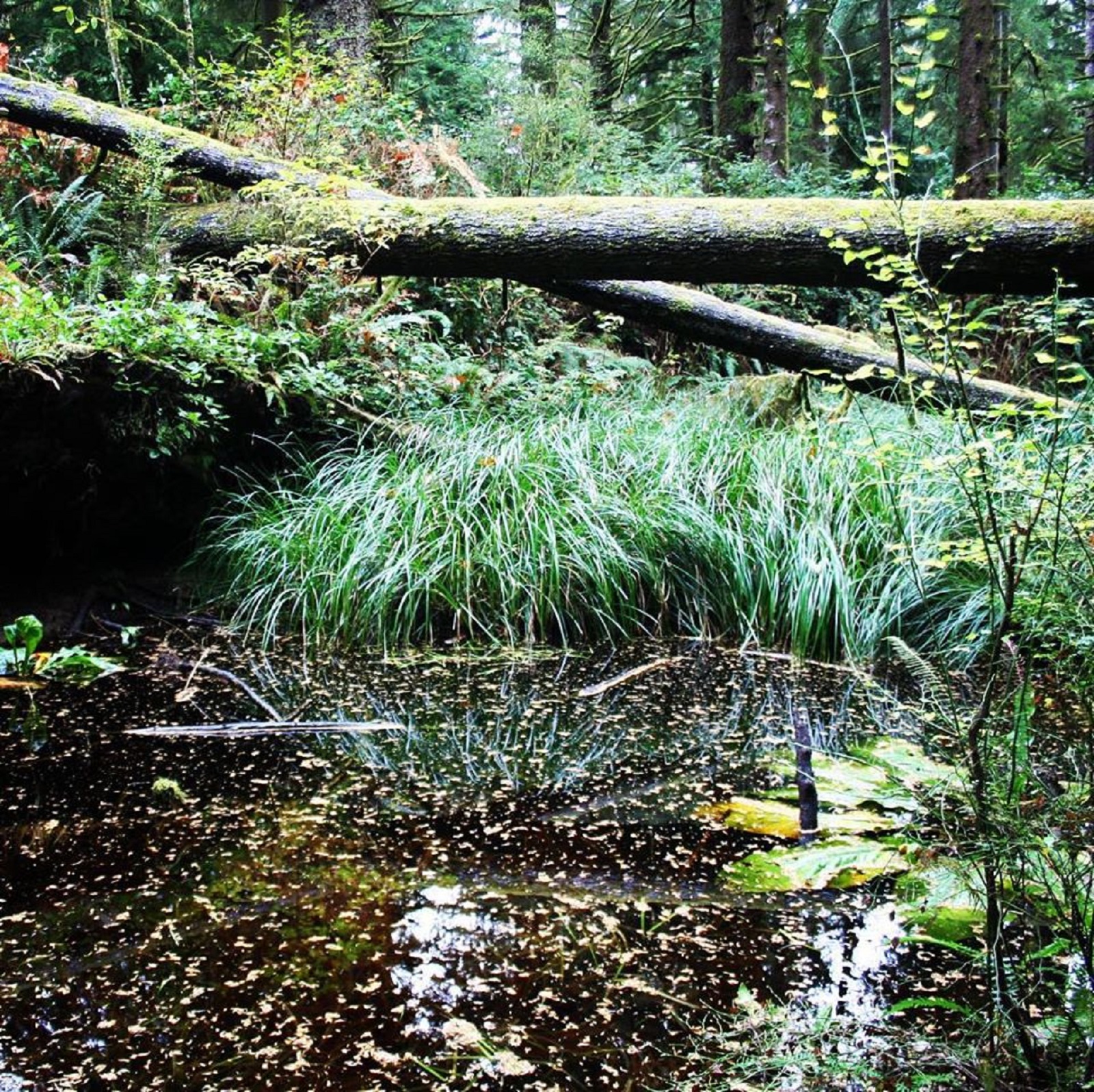
Surrounded by moderately dense woods, a wooden boardwalk takes you over the site of a possibly running stream. Ferns and trees grow in abundance around the water source, and berry shrubs fill in the gaps. The spring descends into a steep valley, spreading out and eventually connecting to the Lewis and Clark river. Leaning trees that threaten to fall if not for the trees they lean against block the view of the river from this location.
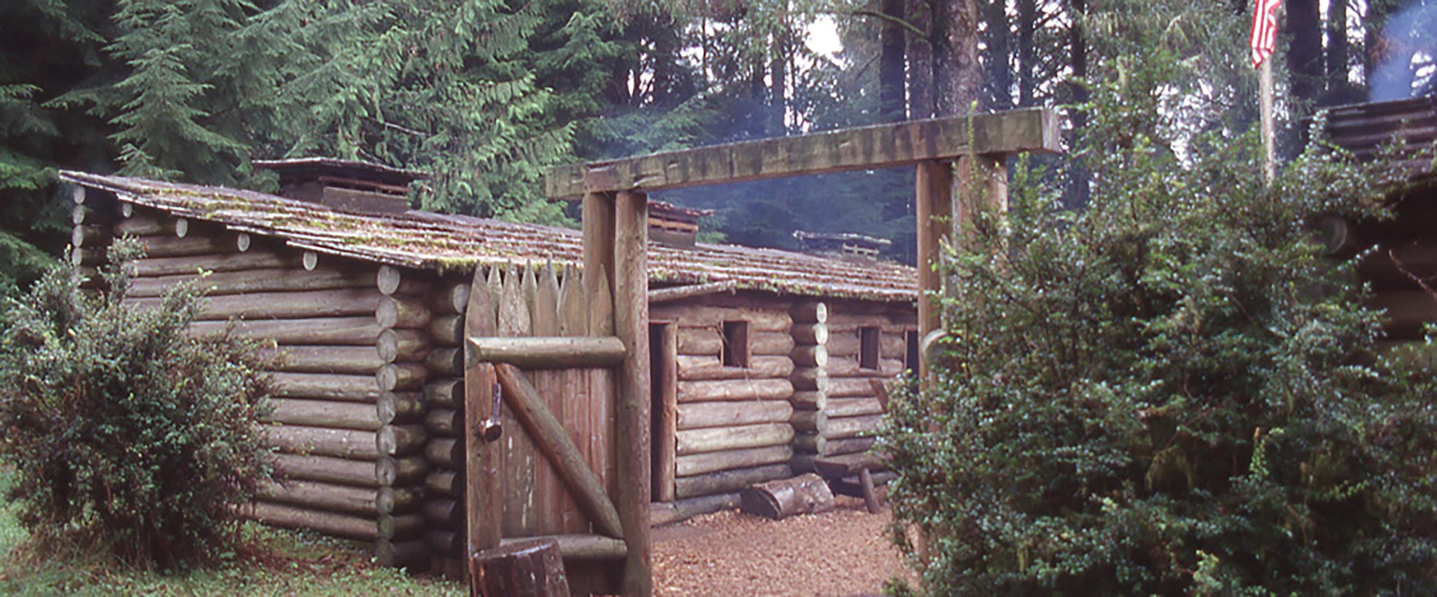
Standing approximately 13 feet tall, the gates of Fort Clatsop are made of wooden logs cut and fitted together to form two swinging doors. Pilings on either side have sharpened tips to form a protective wall.
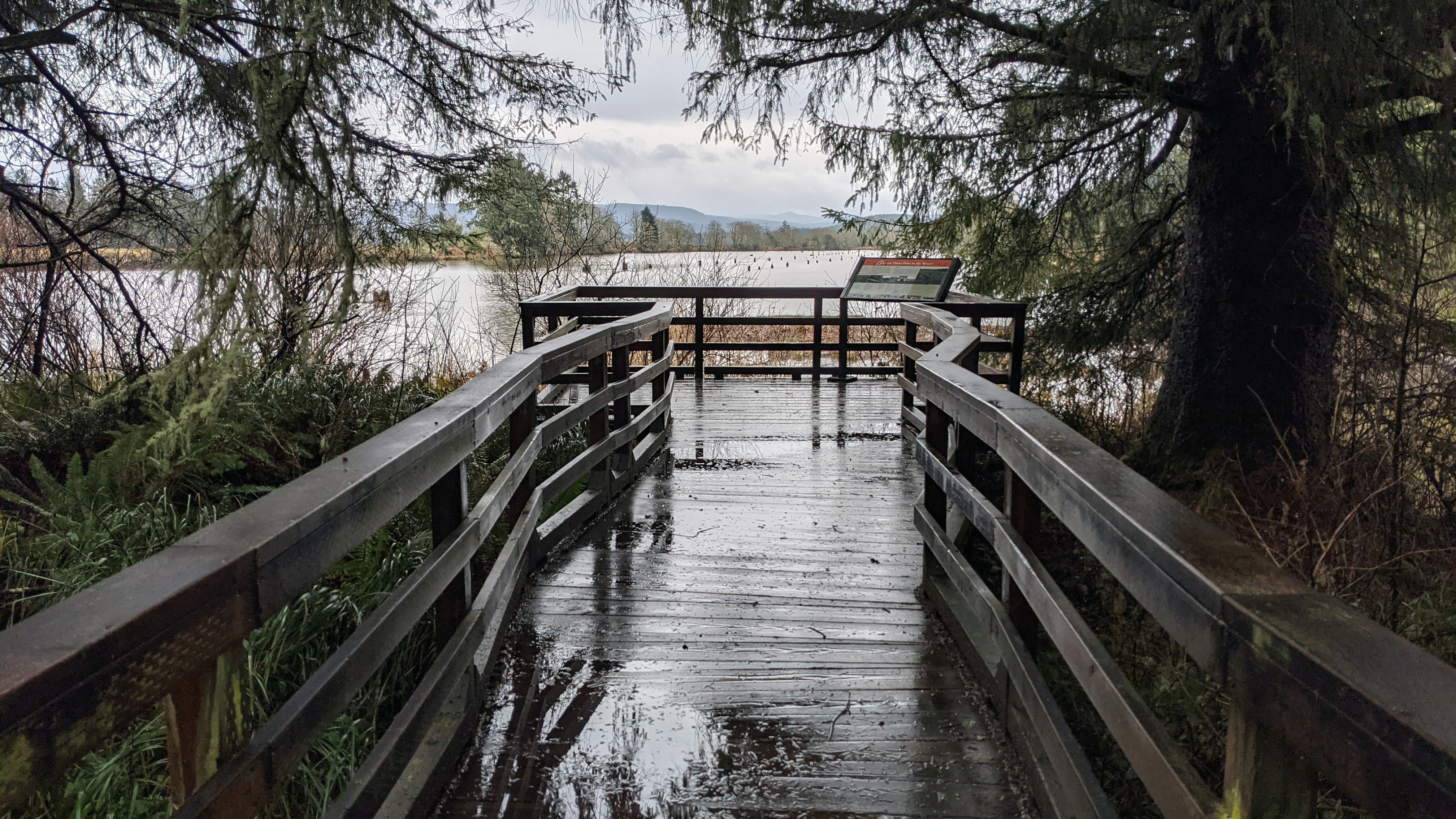
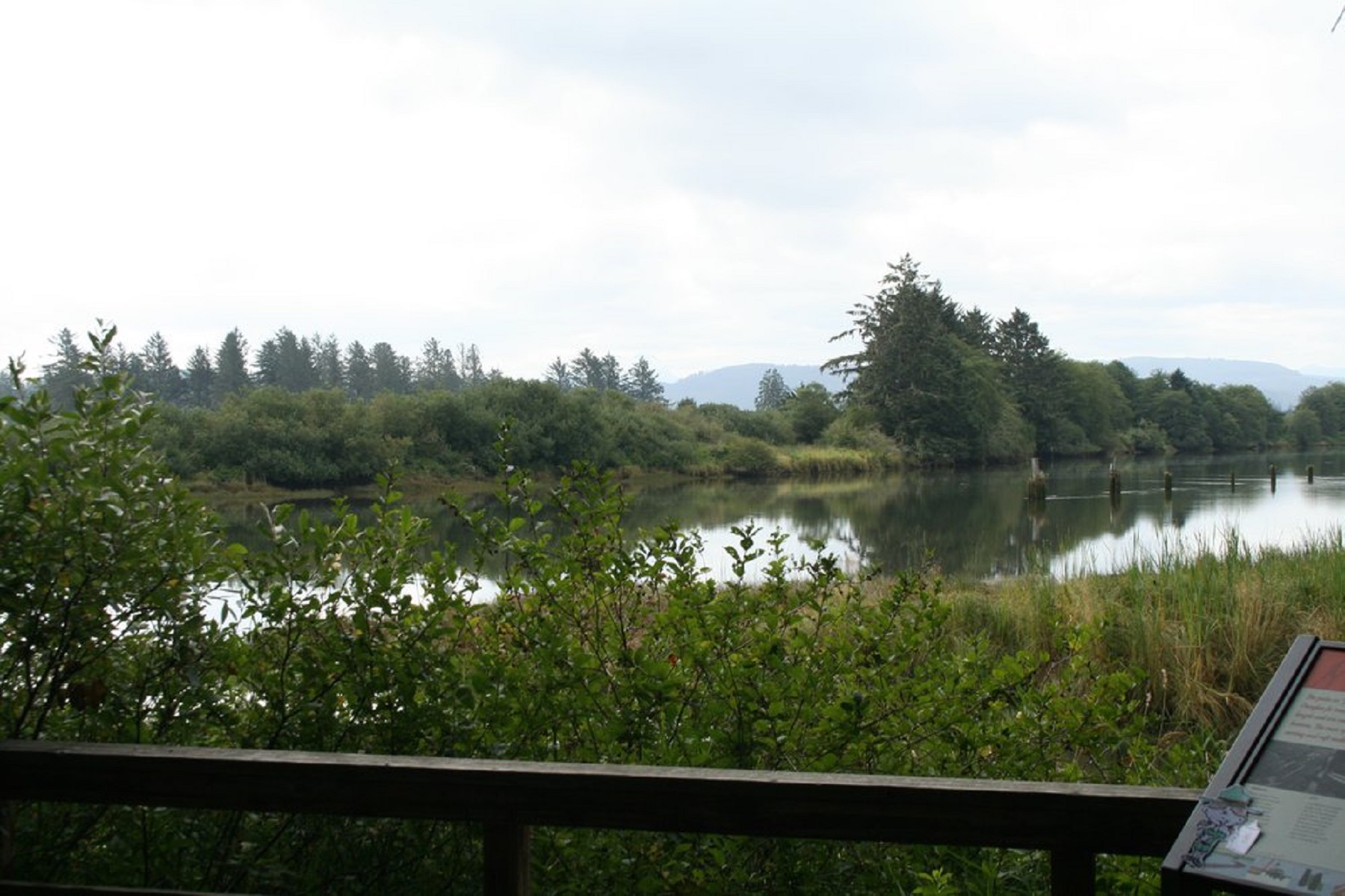
A wooden boardwalk leads out to the edge of the Lewis and Clark river which may be high or low in water depending on the tides. Poles protrude in set intervals from the middle of the river, the nearby sign explains why. The river on the side you stand is lined with trees, shrubs, and other plant life while the opposite bank has been terraformed into pasture and farm land.
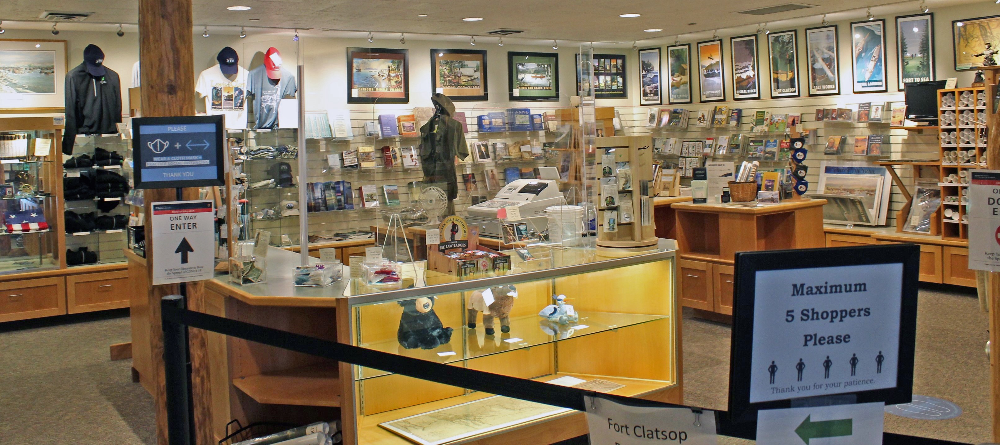
The bookstore, found to the left of the entrance to the exhibit hall if walking in from the front doors, is a small but well-stocked area of the Visitor Center. It features a middle island of tables where the staff stands behind the cash register. The walls are lined with various products ranging from t-shirts and hats to the dvds and plentiful books. Small tables have shifting displays of products upon them; books and art frequent the square tables. Support beams and walls of the book store entrance look similar to the logs of the Fort itself, invoking the sensation of being in historical shop.
Middle Village - Station Camp is a High Potential Historic Site on the Lewis and Clark National Historic Trail. After leaving Dismal Nitch on November 15, 1805, Clark “found a butifull Sand beech thro which runs a Small [stream] below the mouth of this Stream is a village of 36 houses uninhabited by anything except flees […] this I could plainly See would be the extent of our journey by water, as the waves were too high at any Stage for our Canoes to proceed any further down
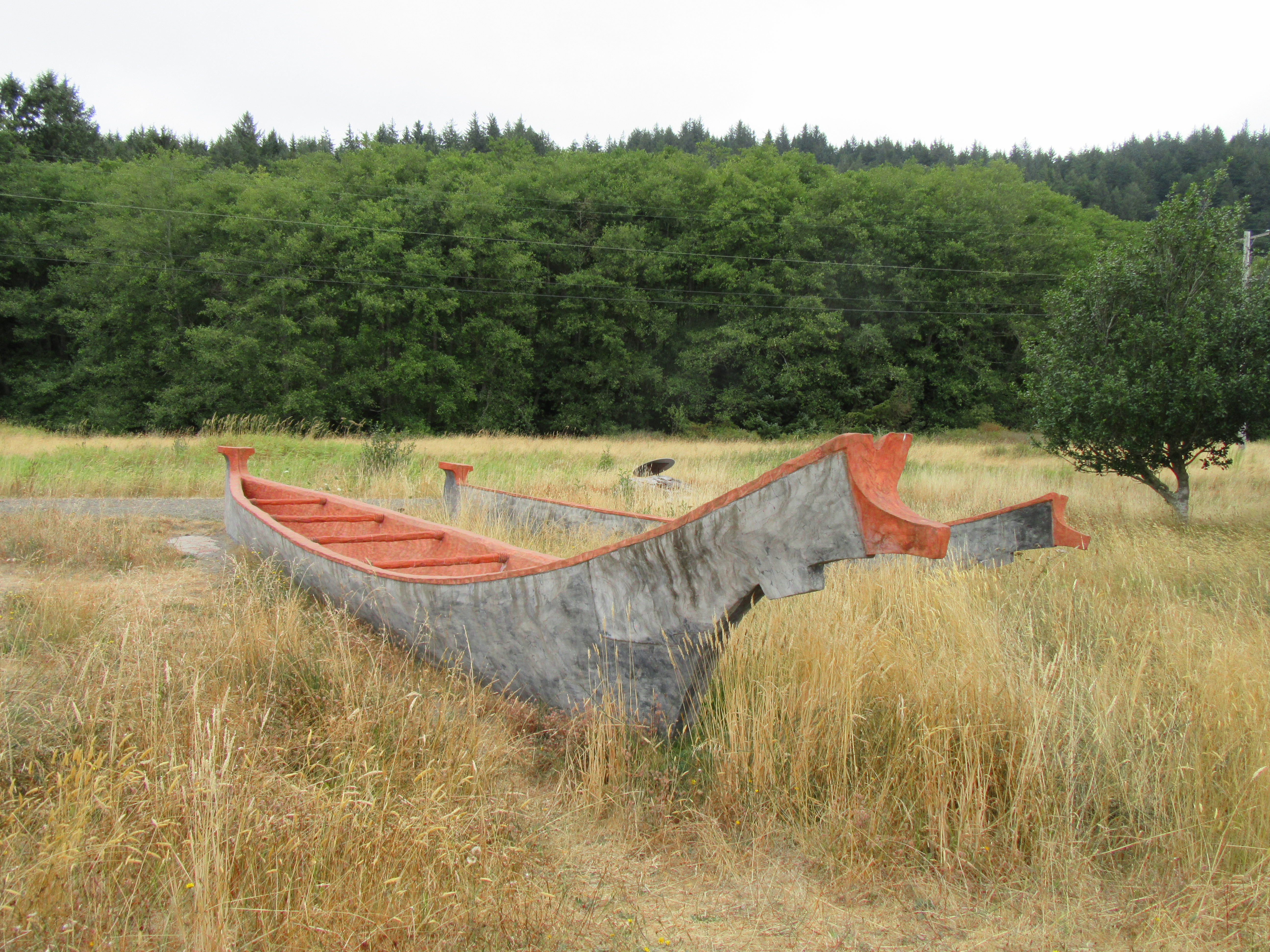
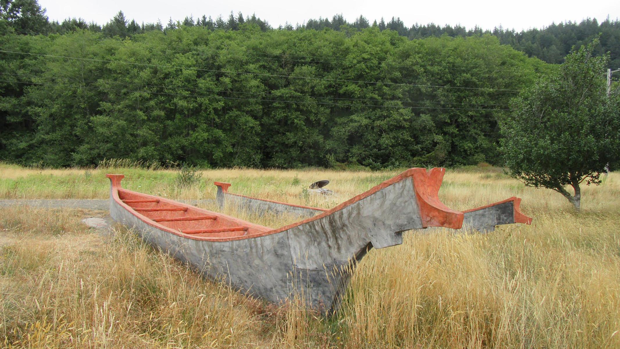
two carved wooden canoes with a field of golden prairie grasses.
"To honor Lewis and Clark's contributions to mapping, NOAA’s National Geodetic Survey (NGS) is installing a series of commemorative markers along the route that Lewis and Clark traveled, beginning in Monticello in Virginia and ending at Fort Clatsop in Oregon." - NOAA NGS
On a concrete pier found directly outside the North Netul Picnic Shelter is a small brass survey marker embedded in the concrete. On this marker it reads "Corps of Discovery II. Peace and Friendship. 200 years to the future" and depicts two shaking hands with crossed tomahawk and peace pipe above them.
In January 1806, a whale washed ashore near NeCus’, a Nehalem village. Everyone in the area was talking about it. William Clark and some of the crew went down to see what the fuss was all about.
Small, grassy park on a stream. Across the stream is another park, and uphill on the same side of the Creek is a local elementary school.
In 1805, Meriwether Lewis and William Clark, accompanied by their crew of explorers, paddled up a river that the local peoples called Netul, today called the Lewis and Clark River. On December 5, the expedition established their winter camp at a site on the riverbank that had been selected by Lewis.
Replicas of canoes like those used by Lewis and Clark and the native people are situated at the treelined shore of the Columbia River, marking the location where visitors may put their boats into the water. The trailhead to the Netul River Trail is also located here.
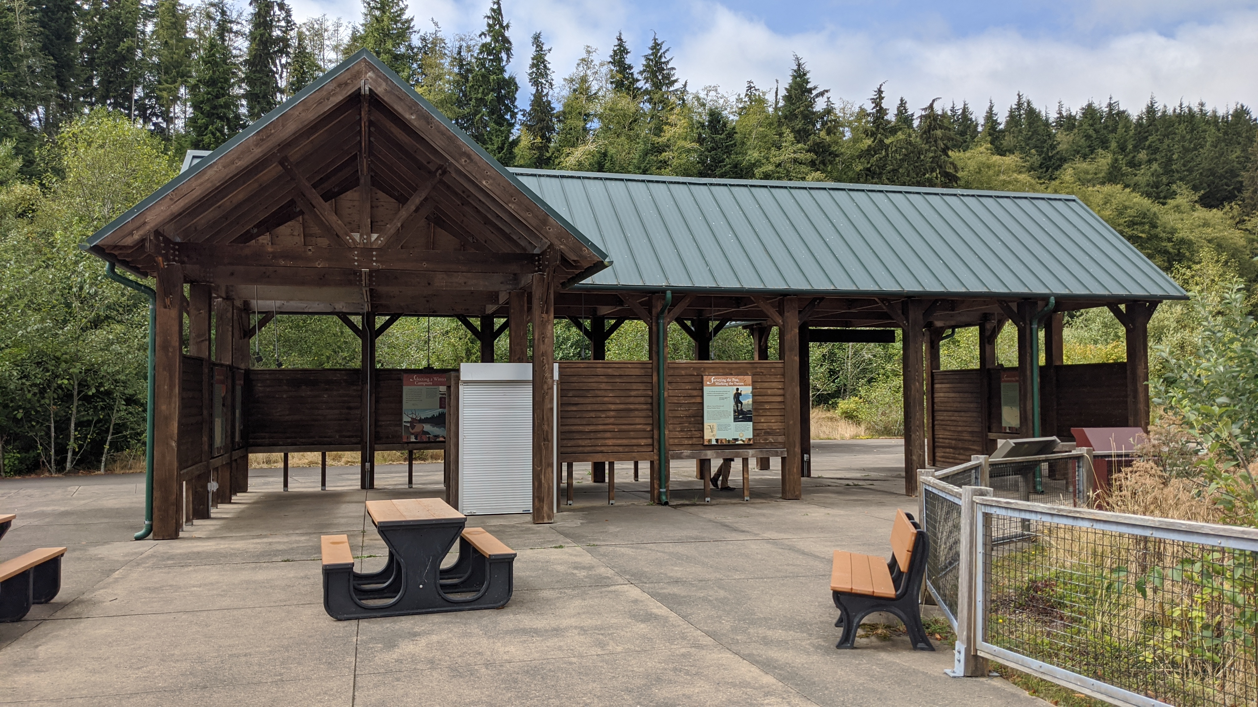
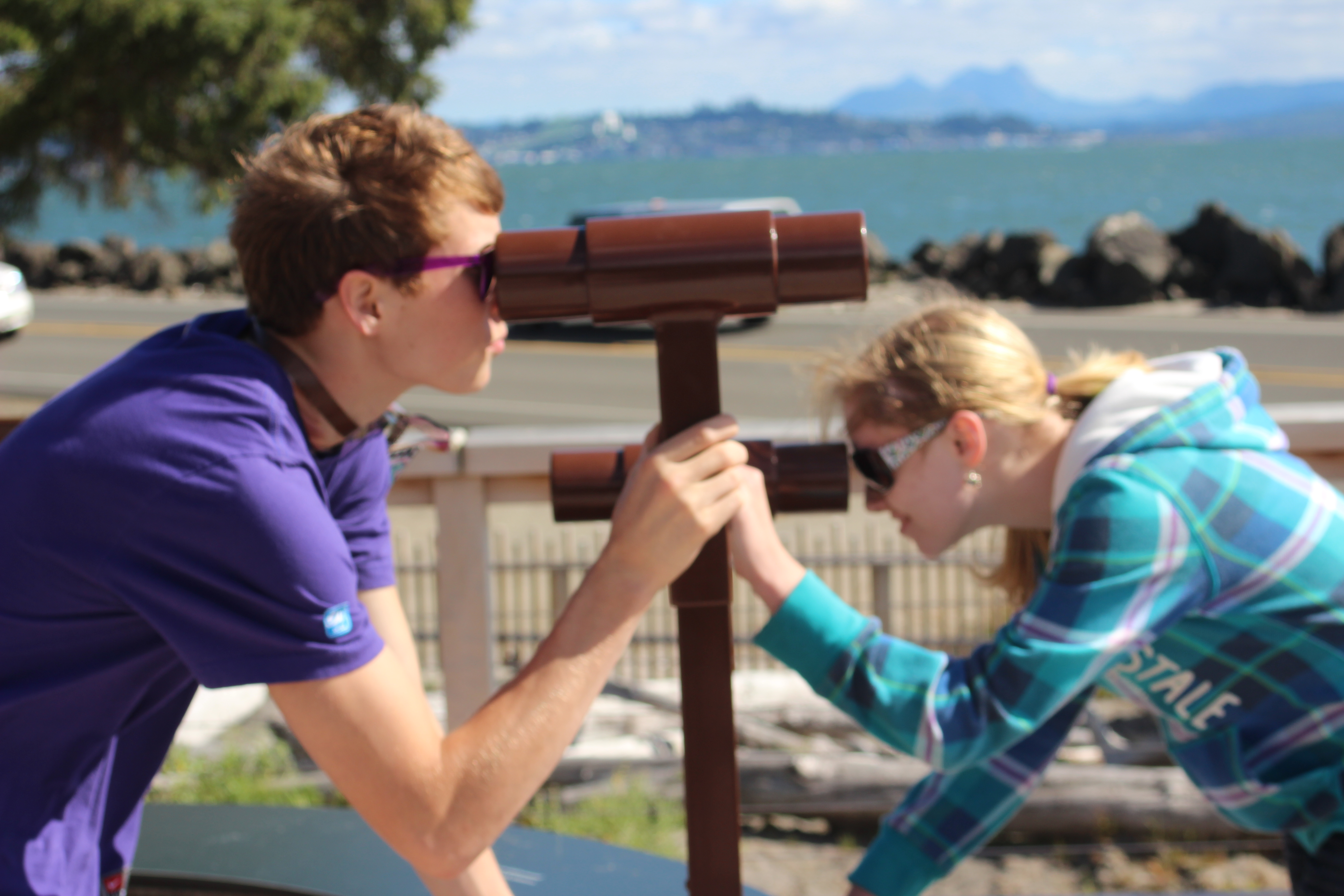
An L shaped open air structure sits upon concrete slabs that make up a bulkhead. The Netul River sits opposite of the entrance to the structure. The structure has wooden slats that make up the sides of it, allowing air to flow through the bottom and top while the middle is made of the slats. The middle slats are dotted with informative signs, each of which can be accessed through this app to read the contents to you. Above, the blue metal roof protects the shelter. Looking upwards while inside the shelter towards the roof will show many bird nests and, on occasion, a roosting bat.
Measuring 48 feet long by 20 feet wide, this middle area has the enlisted mens rooms on the left side and the higher ups rooms on the right side. At the back of the parade grounds a tall flagpole with a 15 star 15 stripe flag flying stands and behind that the water-gate. The back gate leads out on a trail into the woods.
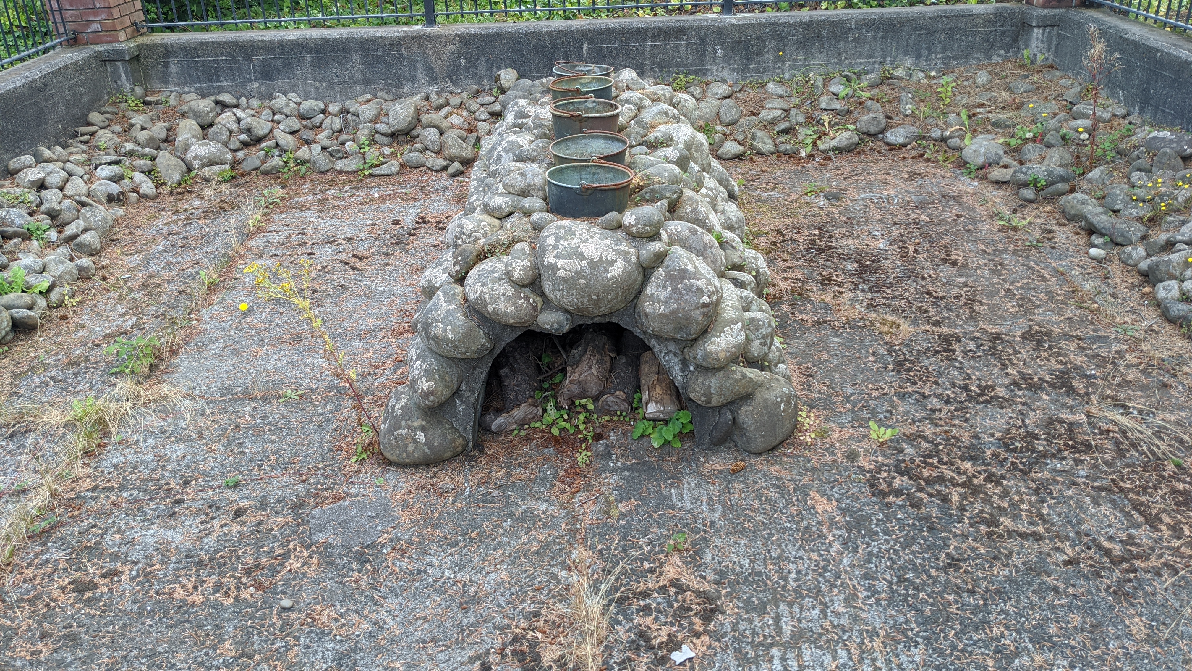
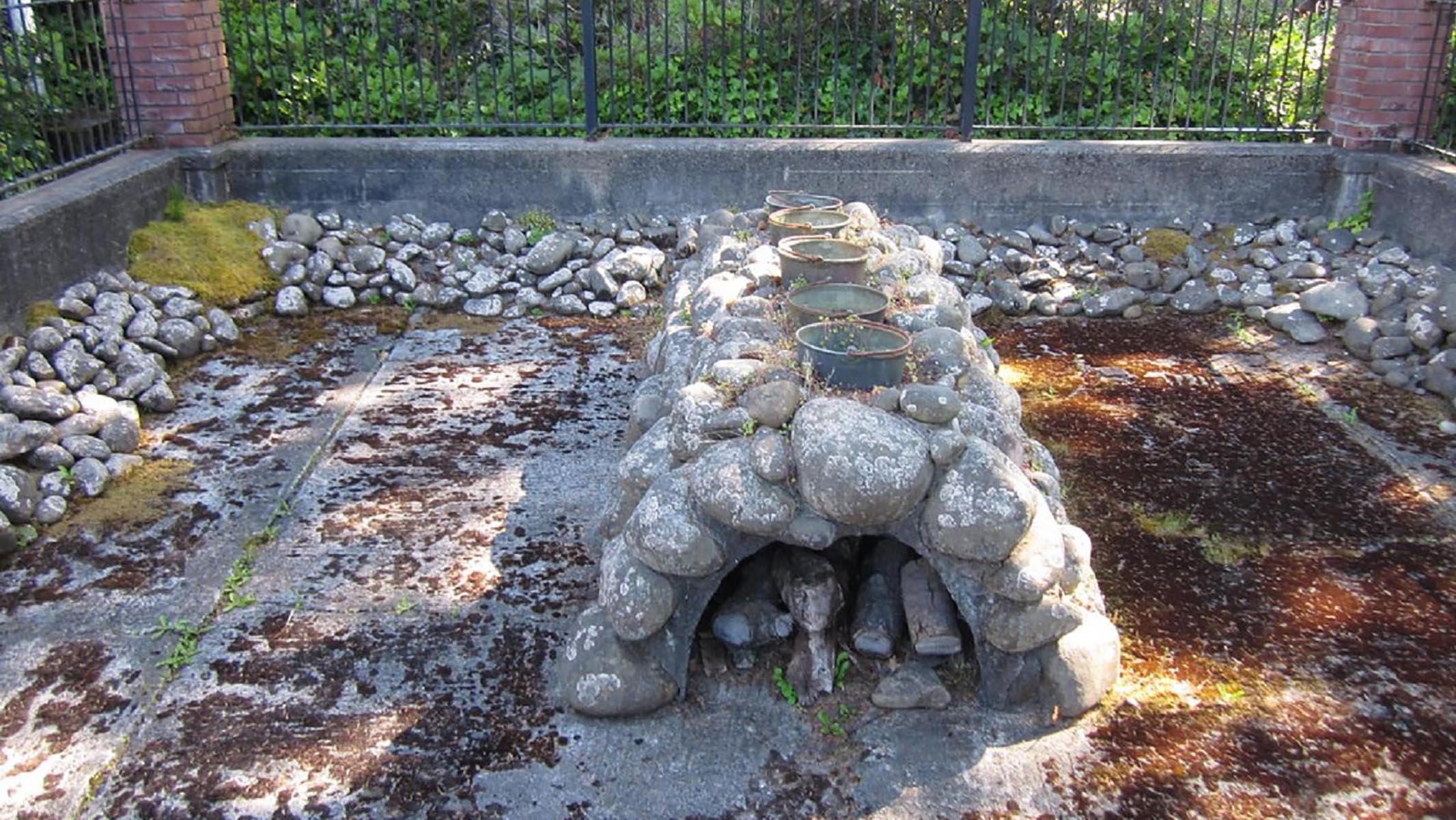
On the middle of a concrete slab, surrounded by raised concrete walls and a wrought iron fence, is a two foot tall arch of various sized round stones cobbled together with a one foot tall tunnel passing through the middle. In the tunnel dry cut firewood is stored while five kettles sit atop the salt cairn.
Several members of the Lewis and Clark Expedition spent the winter at a Clatsop-Nehalem Village near here, boiling ocean water to make salt for the return journey.
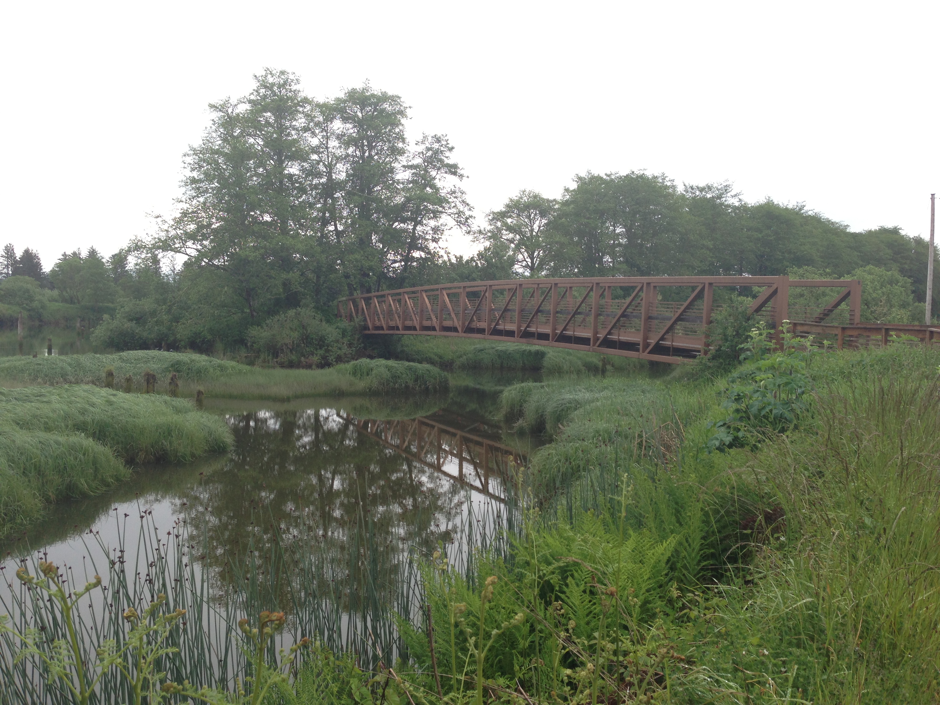
At approximately 50 feet long by 8 feet wide, the long brown metal bridge crosses over a body of water surrounded by grasses, plants, and occasionally birds, otters, and fish too. To the left of the bridge the Netul River flows, large wooden pilings dot the river. To the right of the bridge is a culvert and Fort Clatsop Road.
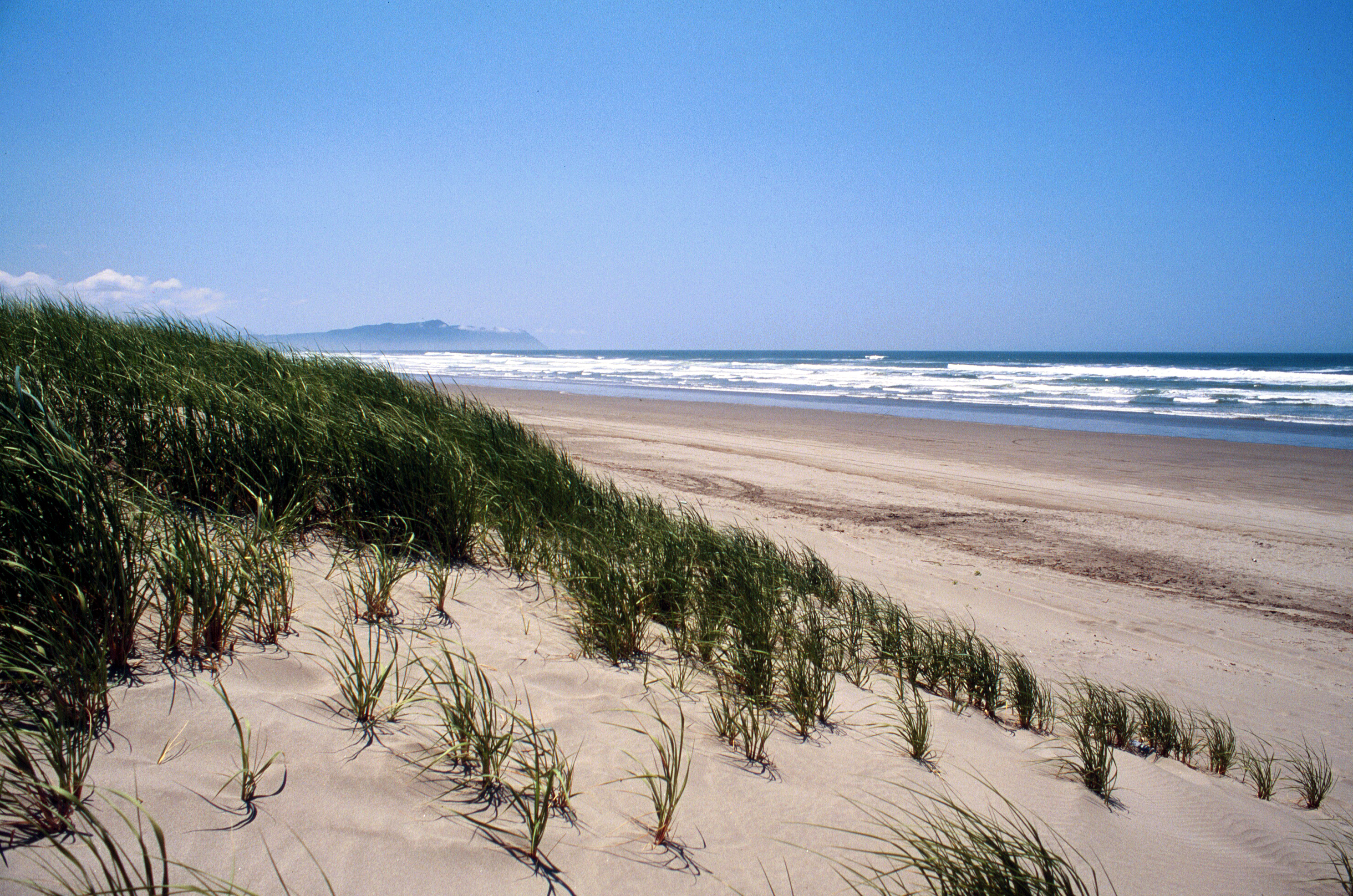
Sunset Beach State Recreation Site marks the west trailhead of the historic Fort-to-Sea Trail, which is a 6.5 mile route that recreates the experience of Lewis and Clark and the Corps of Discovery as they traveled between Fort Clatsop and the Pacific Ocean during the winter of 1805-6. Sunset Beach State Recreation Site is 120-acres, and provides visitors with direct access to the Pacific Ocean.
Constructed entirely of wooden logs with a cedar plank roof, the three enlisted men's rooms total a width of 50 feet and make up the left wall of Fort Clatsop. It is approximately fifteen feet tall at its highest with inward sloping roof tops. The back of each room has a firepit that leads to a wooden vent opening at the top of each fort room. Inside each room are 8 wooden bunkbeds, a wooden table, and a wooden loft at the top covered in boxes, skulls, and carrying crates. In the summer time regimental uniforms, tools, flintlock muskets, and more can be found. If you are curious to find out what is currently in the rooms, as they rotate seasonally, please ask a park ranger for assistance.
On December 28, 1805, the Lewis & Clark Expedition sent out a detachment of five men in search of a good place to make salt. The expedition, which had been wintering at Fort Clatsop, had run out and were in desperate need of more. Salt was important for meat preservation and thus for the crew’s survival on the trip back home. The rivers near the fort weren’t salty enough, and so better place had to be found.
Nestled between buildings on the Promenade, the salt works cairn sits inside a small stone courtyard surrounded by a brick and wrought iron fence. A plaque tells of the Lewis and Clark Expedition's time here at the site, and how Jenny Michel, born in 1816 and whose father remembered the white men, identified this site for the Oregon Historical Society in 1900, five years before her death.
Constructed entirely of wooden logs with a cedar plank roof, the four rooms total a width of 50 feet and make up the right wall of Fort Clatsop. It is approximately fifteen feet tall at its highest with inward sloping roof tops. The back of each room has a firepit that leads to a wooden vent opening at the top of each fort room, except the middle room which has a twenty-foot tall wooden chimney. Inside the family room a single large bed fills near half of the room space, a small wooden chair next to it. Other coats, a fur hide mattress, and a wool blanket may be present in the room on a seasonal basis. Inside the captains room two beds line the right-side of the room while a large table, two chairs, two desks, and a fireplace and mantle line the left side of the room. Seasonally the desks may be decorated with a map, quill pens, ink wells, furs, horns, antlers, plant presses, and more. The sergents room has two bunk beds, four beds in total, on the right side of the room and a small table in the back left with a single chair. The back room has a bottom layer of woodchips that support multiple wooden crates and barrels. Skulls, antlers, and leather hides rest on top of the barrels and crates or hang from wooden support beams. Large pots and kettles are scattered around the room. If you are curious to find out what is currently in the rooms, as they rotate seasonally, please ask a park ranger for assistance.
On November 24, 1805, members of the Lewis and Clark Expedition voted on where to spend the winter. The opinions of Sacagawea (an Indigenous woman) and York (a Black man enslaved by William Clark) were recorded along with those of the other crew members.
Flat, open area next to the river, with forested hills emerging immediately behind it. Wide expanse of river visible. There is a parking lot next to a wooden church, canoe sculptures, and interpretive trail.
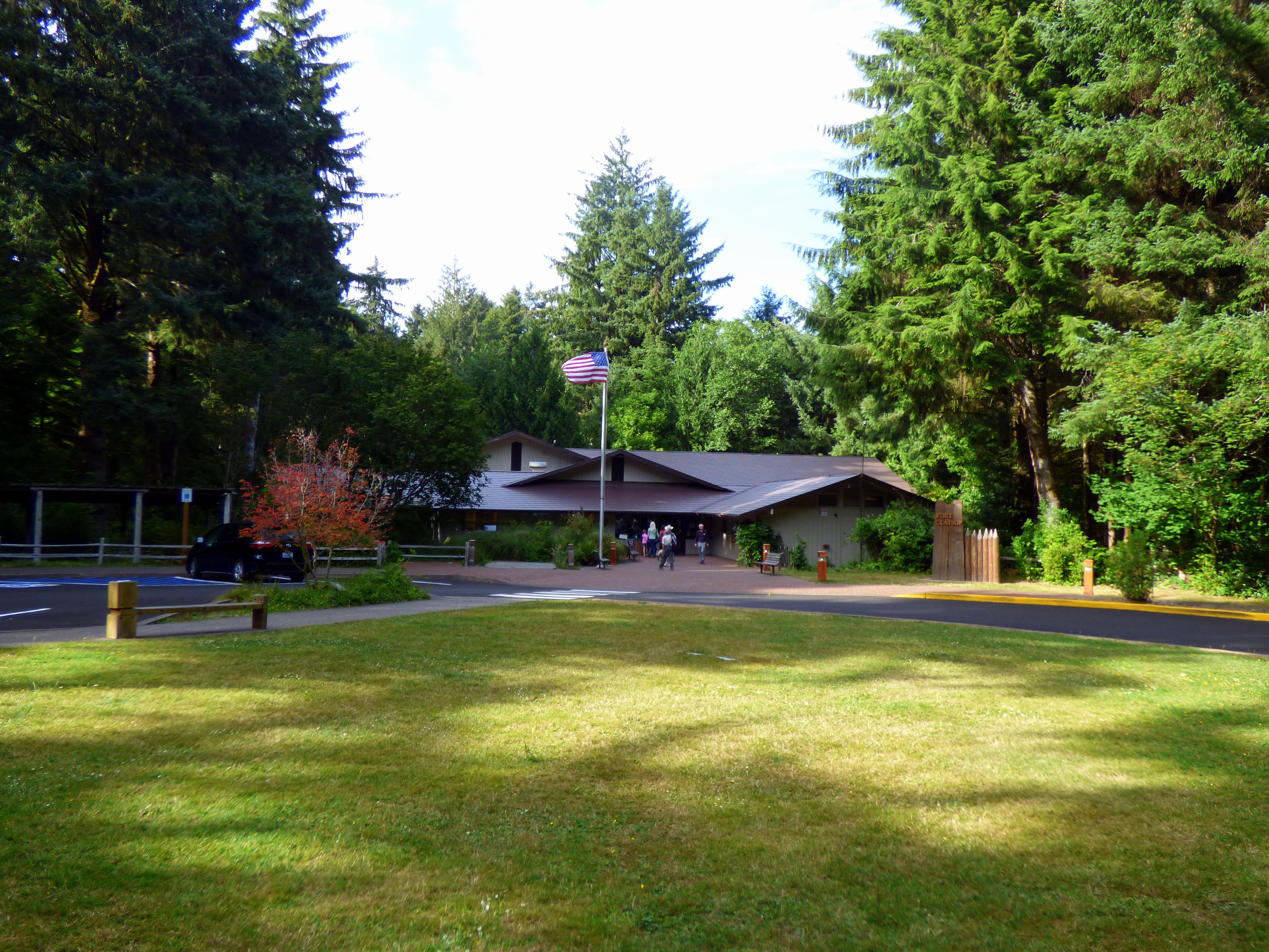
The Fort Clatsop Visitor Center is the first stopping spot for your visit to Fort Clatsop. The rangers inside are able to provide brochures and hiking trail maps of our site and the local area as well as take entrance fees or park passes. An exhibit hall detailing the Corps of Discoveries journey and the local Indigenous people can be found inside alongside a movie theater. The LCNHPA's Bookstore is found inside, offering a wide selection of historical books and gifts.
Embark on a voyage of discovery as you learn about the historical homelands of the Clatsop people, and the winter that Lewis and Clark spent in the area. This self-guided audio tour will take you to the must-see sights around Fort Clatsop, beginning at the visitor center and ending back in the parking lot.
South Slough Trail
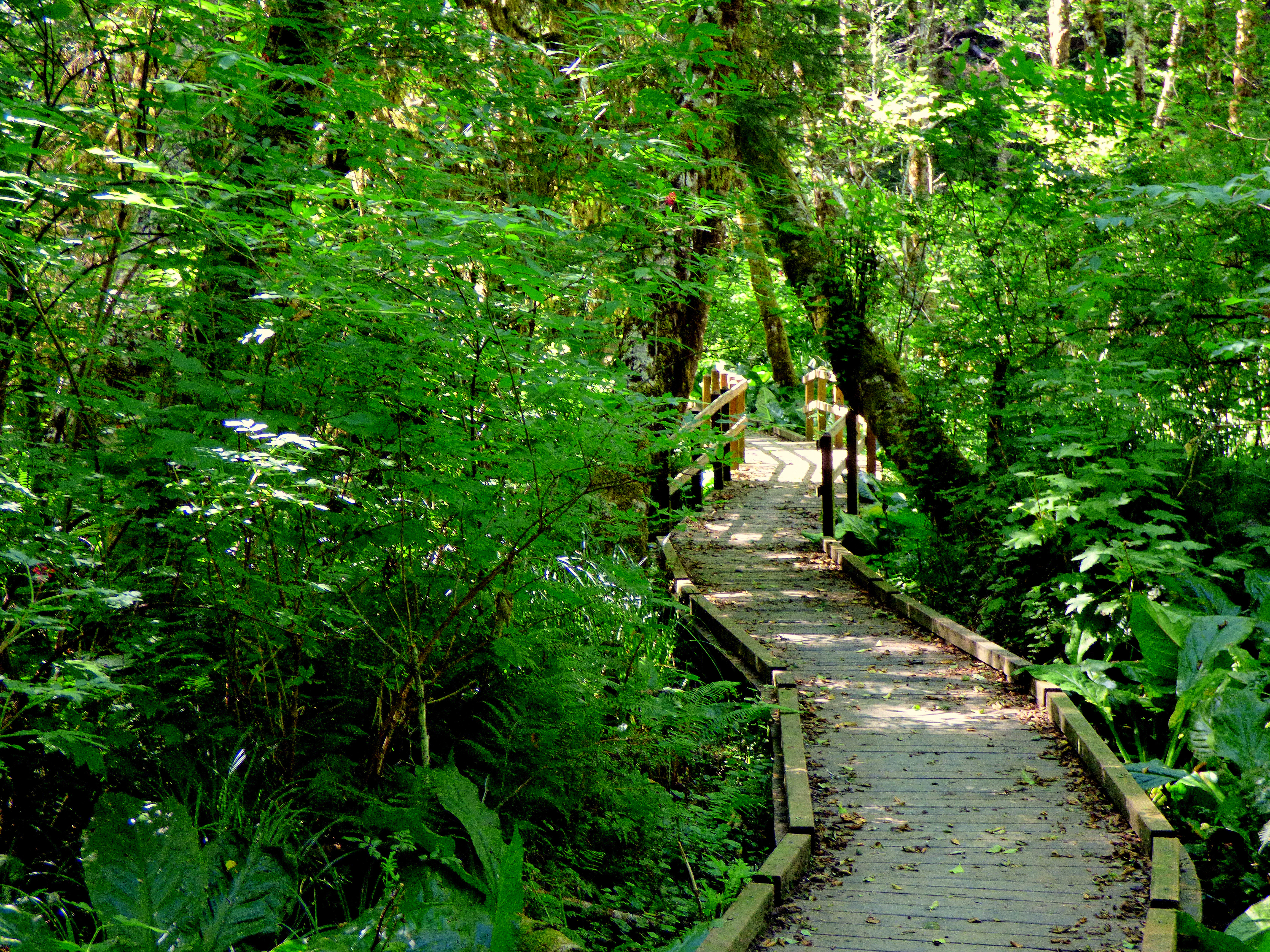
The South Slough Trail is a three mile loop that can be accessed from the Fort to Sea Trailhead or from near the North Netul Landing that features twist and turns and steep changes in elevation among large trees and a boardwalk over the Colewort Creek restoration area.
Kwis Kwis Trail
The Kwis Kwis Trail is a 3.6 miles one way trail that can be combined with the Fort to Sea to form loops. 2.7 miles - Fort to Sea west to 1st Kwis Kwis connector to Kwis Kwis to the Fort to Sea Trailhead. 5.3 miles - Fort to Sea west to 2nd Kwis Kwis connector (below Clatsop Ridge Overlook) to take Kwis Kwis to Trailhead. 6.5 miles - Fort to Sea west to Kwis Kwis Extension to Kwis Kwis to Trailhead. Kwis Kwis connectors and extensions will always be on the right.
Clay Pit Pond Trail
The Clay Pit Pond is a half mile loop primitive trail with access at the Fort Clatsop Visitor Center picnic area. It is a great trail for those looking for a short but dynamic hike. The trail features a vernal pond surrounded by skunk cabbage and sedges. There are steep steps and lots of trees growing close to the trail so watch out for roots and newts!
Netul River Trail
Take an easy approximately 1 mile stroll along the beautiful Netul River Trail. Watch for water birds, eagles and sometimes otters! Along the way you can learn about the history of logging and commerce along the Lewis and Clark River.
Fort to Sea Trail
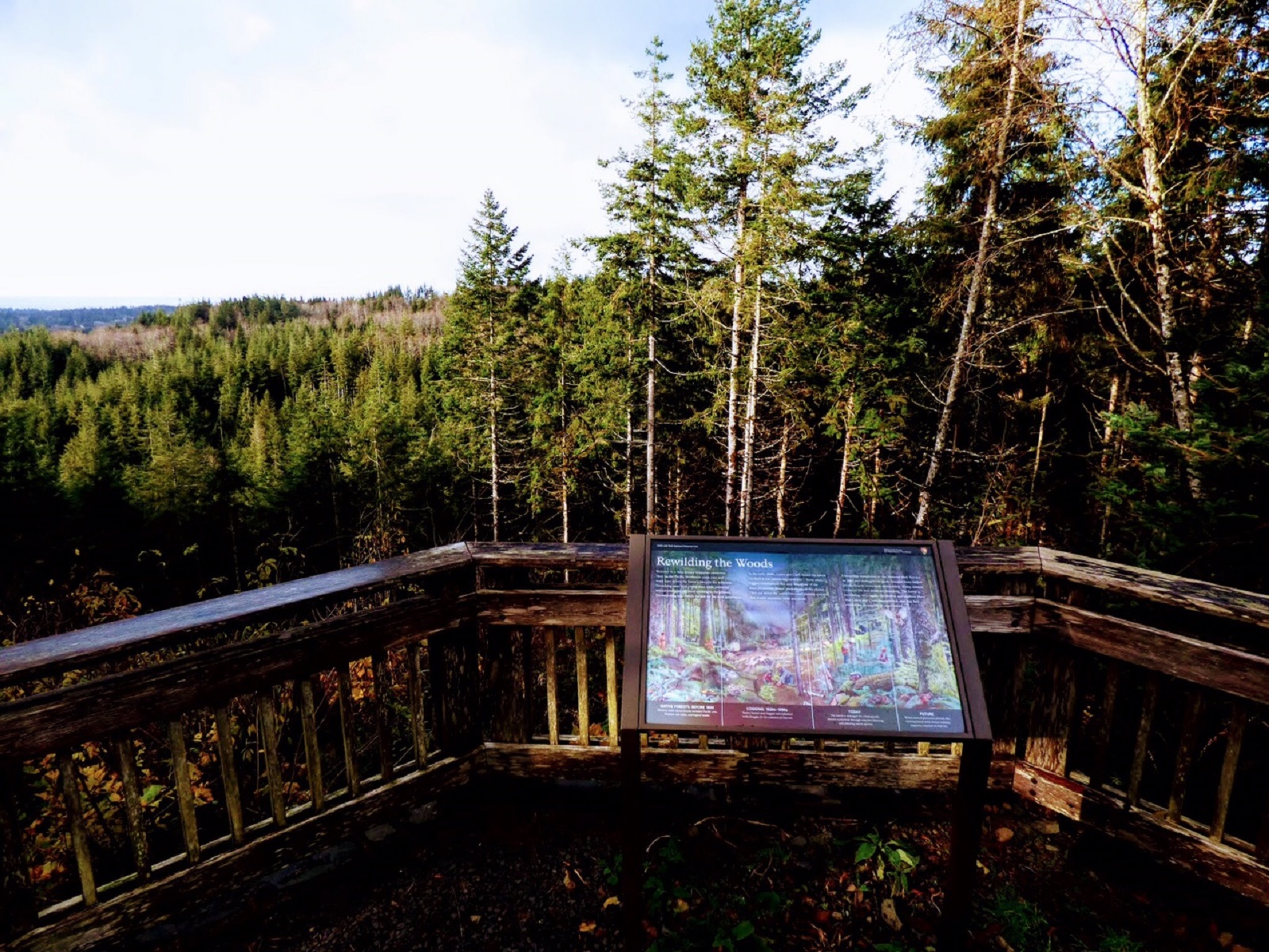
The Fort To Sea Trail starts at the Fort Clatsop Visitor Center then takes you up a gentle climb to the top of Clatsop Ridge, where on a clear day you can see to the Pacific Ocean. From there, descend through deep woods and reach wooded pasture dotted with small lakes. The wooded pasture leads to gentle dunes that lead you to the Sunset Beach/Fort to Sea Trail parking lot. From there, travel the 1-mile path to the beach.
Find a Salt Camp in Seaside
To make salt, the Corps had to find rocks to build a furnace, wood to burn, ocean water to boil, fresh water to drink and game animals. Nearby rivers weren't salty enough, but a site 15 miles southwest of Fort Clatsop proved perfect. What's more, there were homes of local Clatsop and Tillamook Indians nearby, local experts who could help the Corps members.
Continue South to Find a Whale
Wrapping around Tillamook Head, between Seaside and Cannon Beach, Ecola State Park stretches along 9 miles of coastline and offers outstanding sightseeing and recreation opportunities combined with a storied past. Though the scenic and hiking opportunities may be the main allure, the diversity of outdoor recreation including picnicking, tidepooling, surfing and wildlife observation make Ecola State park a destination year round.
See the Pacific at Cape Disappointment
It was at the base of Cape Disappointment that the Corps of Discovery achieved their principal mission of traveling across the continent to the Pacific Ocean. Eleven expedition members led by William Clark surveyed the area, fulfilling President Jefferson’s instructions to the expedition.
Experience History Come Alive at Fort Clatsop
Visit the replica fort and visitor center to learn more about the Lewis & Clark expedition and local native culture. If you visit during our Summer or Winter programs you may even get to talk to rangers in costumes and try your hand at 19th century tasks. Experience this incredible story in a tangible way when you lay down on a bed in the fort or take a walk along the Netul river.
Survey a Chinook Trade Village
Middle Village - Station Camp, has interpretive panels to inform visitors on the Chinook Indian Nation history, as well as telling the story of early contact, the Corps of Discovery, and the town of McGowan.
Stretch Your Legs at the Dismal Nitch Wayside
Start your Lewis & Clark journey where the Corps of Discovery did. Captain William Clark named the spot “that dismal little nitch.” For six stormy days, the group was trapped by fierce wind and high waves at the rocky shoreline. Today the spot boasts a beautiful view of the Columbia river, interpretive panels, and a short walking path.
Tours
Count: 3
Fort Clatsop Audio Tour
Embark on a voyage of discovery as you learn about the historical homelands of the Clatsop people, and the winter that Lewis and Clark spent in the area. This tour will take you to the must-see sights around Fort Clatsop, beginning at the visitor center and ending back in the parking lot.
Restoring Nature Audio Tour
History isn't the only focus of ours at Fort Clatsop, we also focus on taking care of the land and trying to help it regrow after events of the past. Luckily for us the Lewis and Clark journals tell us just what this land looked like back in the 1800's! This audio tour will take you to four stops on a 1.25 mile (one way) hike down the Netul River trail, starting from the Rain Garden at the Visitor Center and ending at Netul Landing.
The Complete Lewis and Clark Pacific Northwest Tour
Are you wanting to follow the Lewis and Clark trail chronologically through their time at the mouth of the Columbia River? Do you just want to know the main Lewis and Clark sites in the Pacific Northwest to visit? This is the FULL Lewis and Clark experience tour for your stay here in the Pacific Northwest! Sites on this tour are in chronological order from when the expedition first arrived here but you can visit them in any order. This tour features both State and National Parks. Fees apply.